Looking out my window at the dreary rain, I figure it’s a good time to chat about last week’s Wednesday hike. 1/7/2015. First I have to vow to remember the second “c” in “Pilchuck.” My first inversion day!
Trail along a talus slope just above the trees, inversion fog in the background
- Distance: 5.4 miles round trip
- Elevation: 2300ft gain, 5300 highest point
- Weather: 60’s(!) and sunny(!!!!!)
- Commute from Seattle: Just over an hour
- Did I Trip: Yes, faceplant into snow.
So, what’s an inversion day? I’m still not sure of the science behind it (read several articles but none sounded particularly strong) but what it results in is lower temperatures down low, and higher temperatures up high. Usually, the higher you go, the lower the temperature. What’s neat is that those low temperatures keep fog trapped at lower elevations. That means you can climb above it. Actually, here’s an amazing pic of the Grand Canyon on a rare inversion day. Pilchuk was a bit too far away from the lowlands to feel like I was touching it (Snoqualmie Peak probably would have been perfect) but it was still pretty amazing.
I left Seattle around 7:30 in the morning. It was cloudy in the city, and I couldn’t see the Space Needle from my breakfast window, so I picked a short easy hike. Big Four Ice Caves was the goal. 2 miles, flat, see some ice caves, minimal views besides the actual Big Four Mountain, good for a cloudy lazy day. But as I was driving down i5, I started going through some of the coolest patchy fog I’ve ever been in. Unfortunately my camera skills while driving are sub par (is that good or bad?) so I have no examples, but it went from 10 foot visibility to misty to fog illuminated pink by sunrise surrounding green trees to fog lit up whitish yellow once the sun had risen. And by the time I got to the Mountain Loop Highway, it was clear.
Okay, regroup. Can’t waste a clear day on a two mile hike. Gotta be at work by 2, it’s already 9, it’s an hour drive at least to get back. Game time decision: Mt. Pilchuck. If my car can make it. And I’ll haul ass, I swear. If not, I’ll turn around and do the ice caves, since it’s so short I’ll have plenty of time. And I took that right turn, and headed up to Mt. Pilchuck.
Good news: road was completely melted out. Some rough washouts that I’d definitely recommend high clearance vehicles for, but we made it. Bad news: I forgot my microspikes. The trail was supposed to be icy and snow covered at the top Cool. I had snowshoes in the trunk, so I lashed them to my backpack with a nasty dirty ace bandage that I got after my knee incident at Annette Lake a few months ago and got moving. I had just under three hours to make it up and down. Doesn’t sound too bad, until you consider 1) not having traction on ice and snow 2) post-holing in snow 3) I’m relatively out of shape (don’t say anything).

Fog covering the towns below looking towards the Sound
Ice was avoidable on most of the trail in the woods. Last time I was here, I was racing Emma, Emilie, and Andy to the top to beat sunset, which we were dying to see. We made it just in time, and I do think it was one of the best sunsets I had ever seen. We’ll see if I ever have a day to take a stroll up Pilchuck. I passed a few people who had microspikes (jealous) and briefly said hi before continuing up.

Glacier (center) Sloan (right)
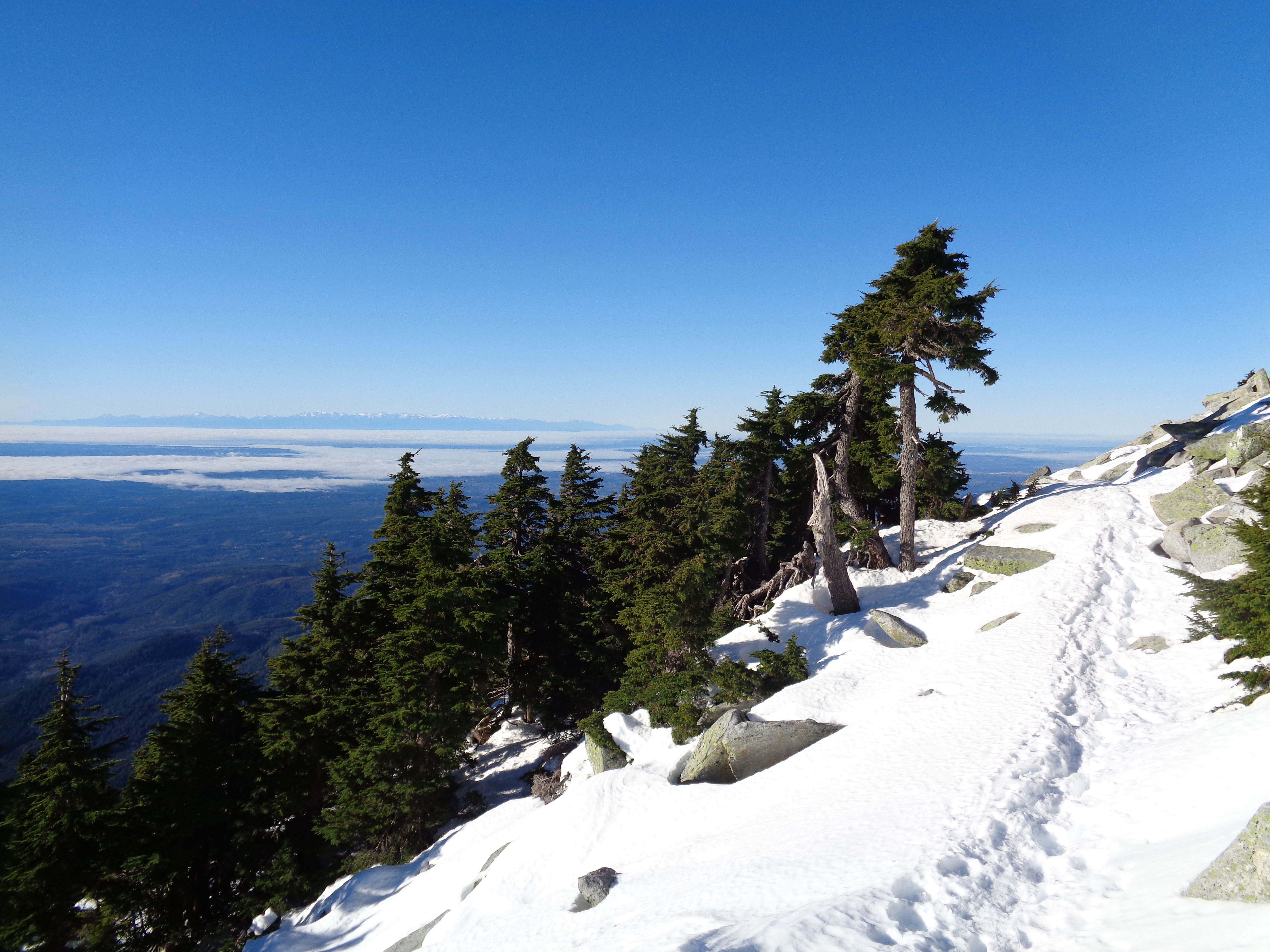
Once you hit the snow, peaks stark making their presence known through gaps in trees. Eventually you’re crossing some small talus fields and views take over. Looking back towards Seattle. Over the Puget Sound. The first time I hiked Pilchuck I looked at the sound, turned to Emilie, and said “Is that Lake Washington?!” By now I know at least a few. Glacier Peak, Baker, Shuksan, Twin Sisters, they’re all out. A surprisingly convenient viewpoint for so many peaks in the Cascades, so close to Seattle.

Left to right: Twin Sisters, Baker, Shuksan, Bacon; Whitehorse and three Fingers closer (Thanks Luke!)
I started post-holing around the time the views opened up. On a regular, slow-moseying day, it might not have been an issue. But I didn’t have time for maneuvering, so I strapped on the snowshoes and continued on my merry way. I passed a young couple in casual shoes taking a break, hoping they were close to the top. Not quite yet, my friends. Someone once told me “20 minutes!” around that point and it took me another hour. That was this past summer, with an over-stuffed 60L backpack. I was a bit faster now. I was recognizing landmarks, too.

Thin rock – taller than me and just a few inches thick
The weirdly skinny rock. The bamboo pole. The steps where Andy picked blueberries last time while Emma and Emilie and I jog-hiked to try and make sunset. And finally, the turn where you reach some boulders to scramble over in order to get to the summit. Which, turns out, is quite awkward in snowshoes. The two guys at the lookout heard me coming. Dragging my spikey snowshoes up the ladder and across the clear wooden lookout deck. Taking them off would take a few minutes I might not have if I wanted to safely get to work on time. It’s like wearing flippers on a pool deck, but more goofy and less fun. And louder. I looked down at these guys’ feet and what were they wearing? Vans. Freaking vans. And there I was in snowshoes. Hilarious contrast. Oh, and pouring sweat (don’t let that happen in winter folks), because for every 500 feet I gained in altitude it warmed up 10 degrees. I was down to base layers and even that was too much – I should have worn shorts and a t shirt.
Looking out over the Sound, Olympics on the left in the distance
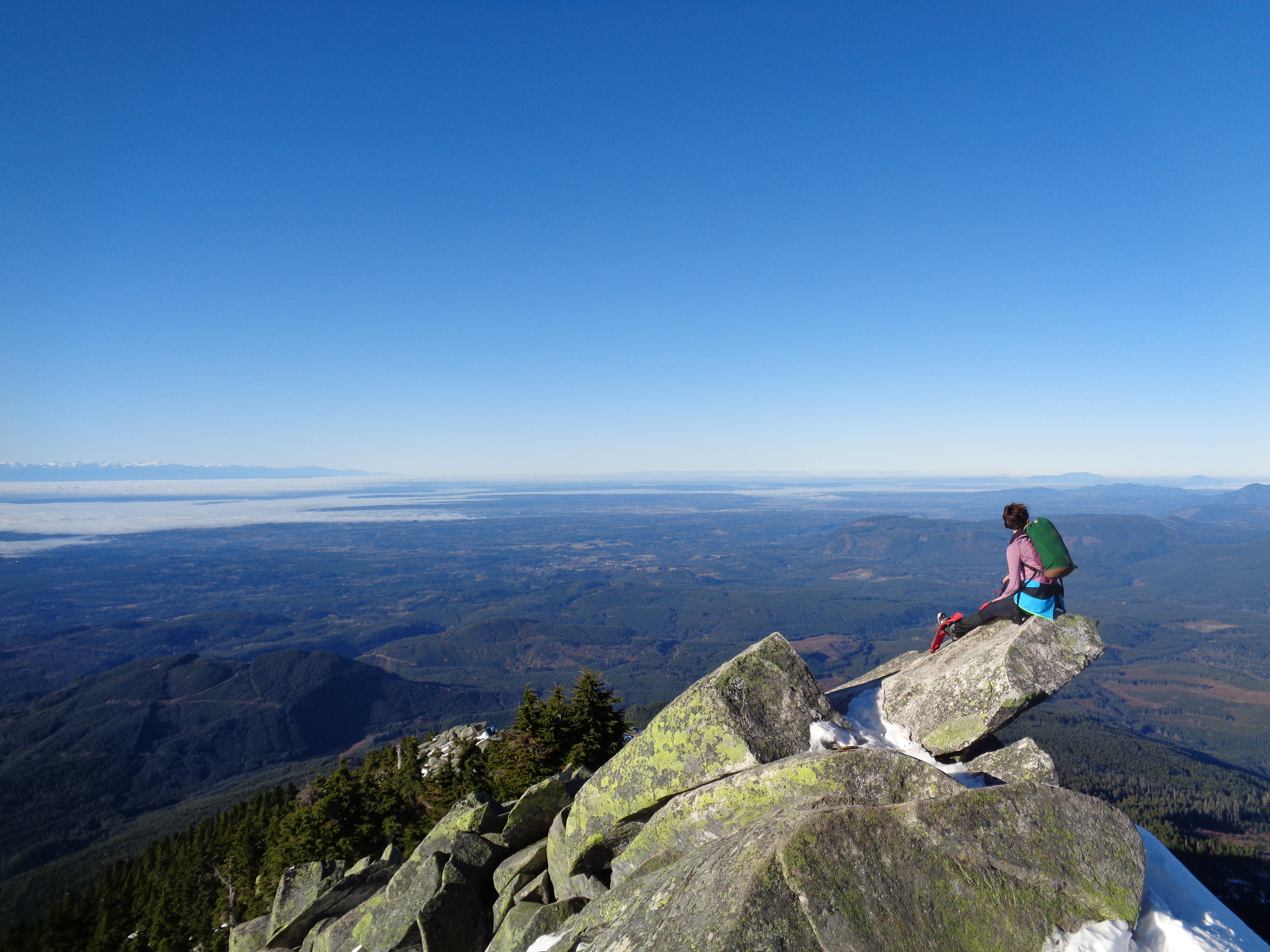
I clomped over to the side of the lookout that gazed over the Sound, and for once, that view was more stunning than the mountains behind me. Most of the snow had melted, and the peaks didn’t look as imposing as they usually do. But the fog over the Sound, Rainier peaking out over the clouds, the Olympics in the distance, those were breathtaking. I handed my camera to one of the Vans kids and asked if he could snap a quick picture, and he nailed it. I thanked him and turned around to head back down, after spending probably five minutes up there. Oh, I did take a quick trip in to the lookout – it has maps of the peaks in every direction, and I had to know what the hell was poking up next to Baker. It had never occurred to me that there was another significant mountain in that direction. Twin Sisters! The south twin is just over 7,000ft, the north is around 6600ft, and there are several glaciers on the northeast slopes. That’s another idea I’ve had to come to terms with living out here. The fact that there are glaciers even on lower peaks. I always assumed it was something reserved for enormously tall mountains, not something I’d have to consider hiking to Three Fingers or scrambling Mt. Stuart.
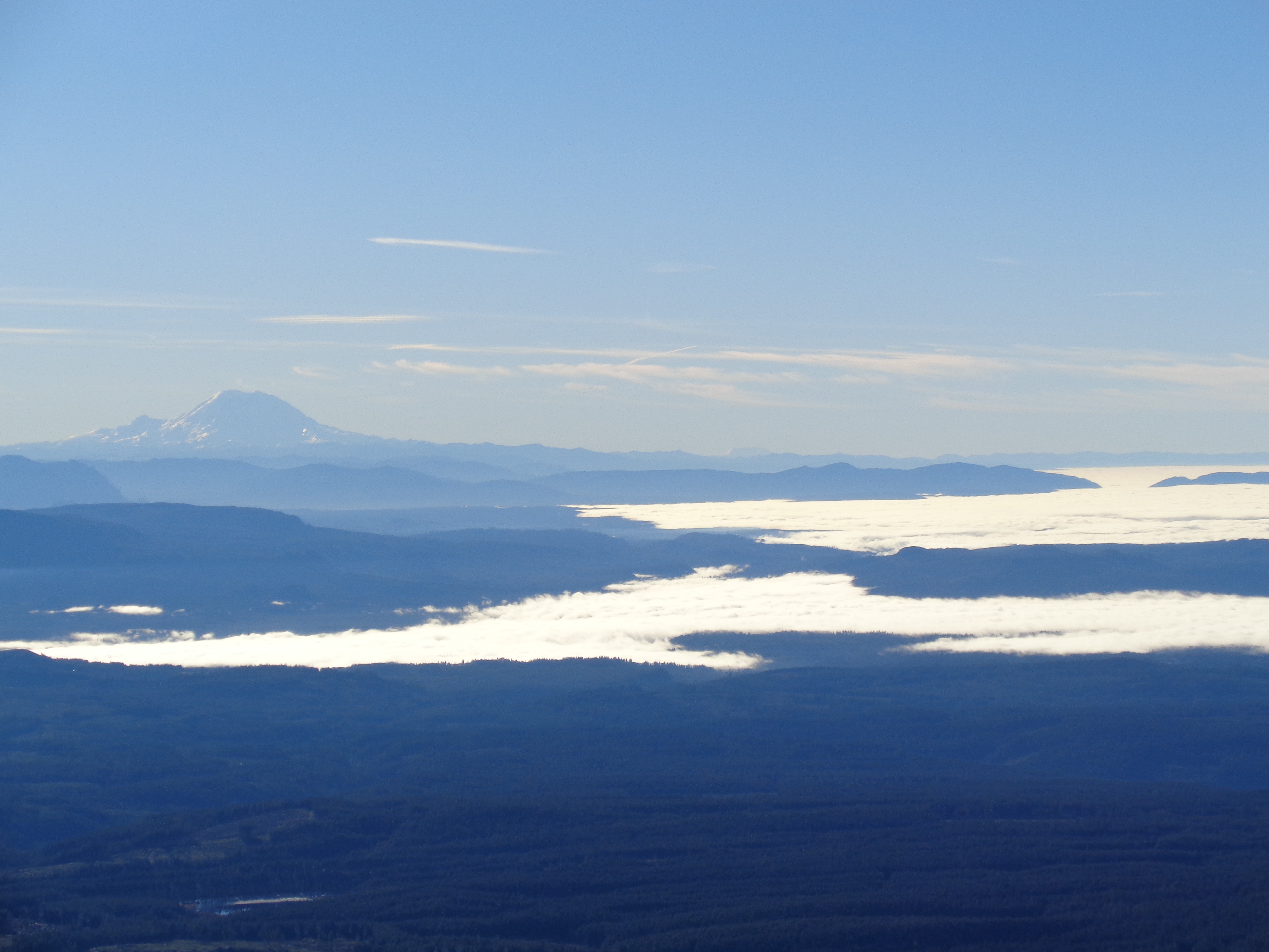
Rainier over the clouds
I also learned that going down a ladder in snowshoes is awkward and difficult. But after that eight foot ladder, I high-tailed it down. I ran into the same couple I passed on the way up (almost there, for real!) and then into the two ladies I had passed first, who told me it had been below freezing at the trailhead and was mid 60’s near the top! They confirmed that it was an inversion day. Fantastic. I kept up my quick pace, made it back to shallow snow, took off the snowshoes, face planted, carried on. Back through the woods. Finally ran into a group of guys on their way up – “how much longer to the parking lot?” I asked. “Eh, maybe… 10 minutes? You’re pretty close.” Holy shit. That meant it had not even been an hour since I was at the top. Thrilled (I won’t be late to work! If I don’t hit traffic…) I assumed they had miscalculated. A few steps later, I saw a familiar looking shaggy white dog: it was Merritt, from when I hiked Mt. Dickerman back in December! I stopped to say hi to her owner and wish him a good hike. Turned out the group of guys had been right: ten minutes later, I was at the parking lot. Made it down in just over an hour.
I tossed everything in the car and drove home. No traffic, just in time for work. Oh, and “work” was taking someone’s dog for an hour run. Dinner was extra delicious that night.

I think Bacon is the prominent peak right of Shuksan; the closer ones on the right are Whitehorse (on the left) and Three Fingers closest on the right. Always nice to take advantage of the winter inversions! Keep it up.
LikeLike