
Round Lake
Thoughts on keeping hikes secret? I had a big debate over it on the way back from this hike, which far surpassed my expectations. Yes, I like to share what I love, and I want to inspire everyone else out there to get out of the city and explore a bit. But at the same time, sometimes I come across a pristine, beautiful trail like this, and I’m not sure I want everyone to know. If everyone knows, that means more traffic, more trash, more dogs, more poop, more tents, and less of that remote, in-the-middle-of-nowhere feeling. But you know what? It was damn spectacular, so here it is. If you leave litter or poop or destroy the trail, I swear to god I will haunt your ass (after I passive-aggressively pack out everything you left and complain about it on my WTA trip report). But if you’re up for a challenging hike and are a professional leave-no-trace ninja hiker, put this one on your list. Hiked 5/28/2015.
- Distance: 11 miles round trip
- Elevation: 4300ft gain (5600ft highest point)
- Weather: 60’s and sunny
- Commute from Seattle: 2:30
- Did I Trip: Yes, on the way down, on the soft trail. Complacency is my fatal flaw

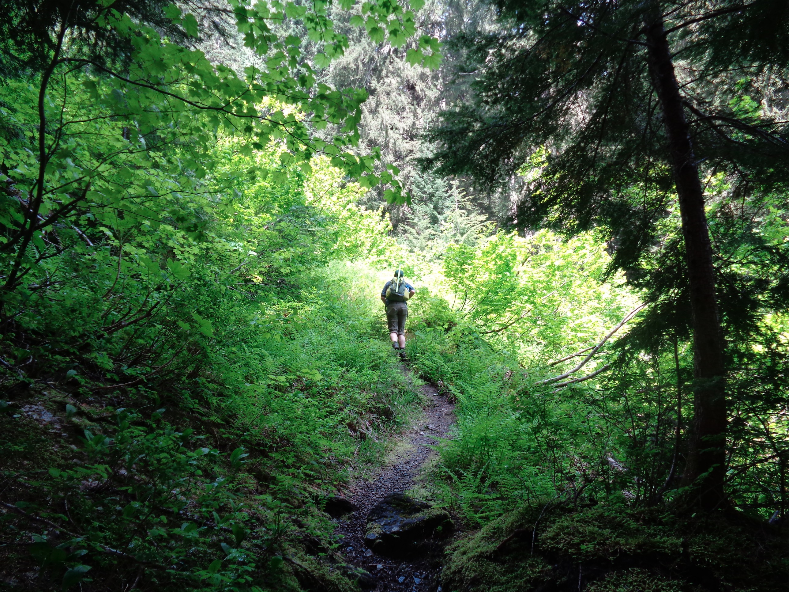
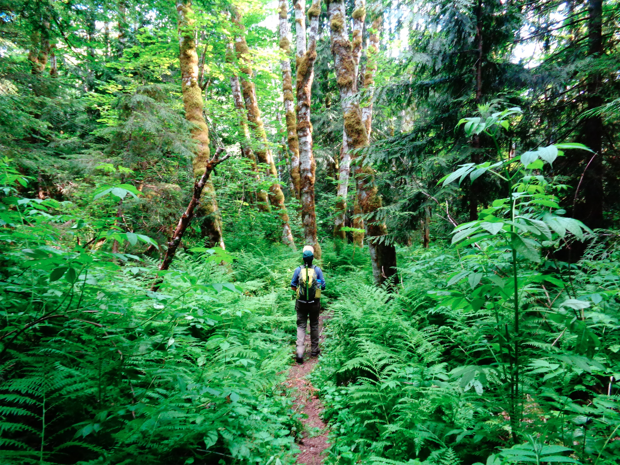
Starting off through green forest
First, I just want to say that I didn’t touch-up any of these photos. None. This is just how it looked. I usually don’t work with any photos I take unless there’s a glaring error. Maybe when I’m bored I’ll play around and see if I can make them look better. But for now, just think how amazing the scenery and colors were.
A few people had bailed on our hike, but we decided screw it, we’re going. I picked up Vernon and we made out way out to the Mountain Loop Highway, where we were either going to hike Vesper Peak (if weather was clear) or Round Lake (if weather wasn’t in our favor). Clouds were still low when we got to the turn-off for Vesper, so we kept right on driving. Little did I know I had forgotten directions to the Round Lake trailhead and had no GPS or phone service to load them, so I whipped out the huge National Geographic map and did some old-school navigation to FR-41, which took us to the trailhead (which we passed several times before finally finding it). So, secret trailhead for a secret trail. Perfect.

Patches of wildflowers
The drive to the trailhead had already been gorgeous, and the sun was peeking out. It looked like it might clear up after all! We started out, and quickly reached a registration box. With fresh papers. We were the first ones to sign it. First official hikers of the summer season, baby. Beyond the registration stand, the trail was narrow and overgrown with gorgeous, bright green undergrowth and wildflowers and moss. And spiderwebs. I made Vernon go first. He’s not afraid of them. He picked up an entire damn web with a spider in it and said “oh sorry buddy here you go” and placed the web on some leaves off the trail. I’m the opposite. I swing a stick in front of me destroying each and every web in my path because eff that. Spiders, whatever. But build a web in my space and it’s all over.
Entering a Disney movie
Guys, the hike was already breathtaking. I don’t think I’ve seen so much green in my life. After about half a mile, the trail starts switchbacking uphill through a more open forest (open is debatable – the canopy was still pretty thick). The trail, allegedly unmaintained, is flat and soft and the switchbacks are long and gradual for the most part. You can just barely make out some snowy peaks through the trees, which is just kindling for your appetite for views. I wasn’t sure how long the sun would last, so I was eager to get up onto the ridge.
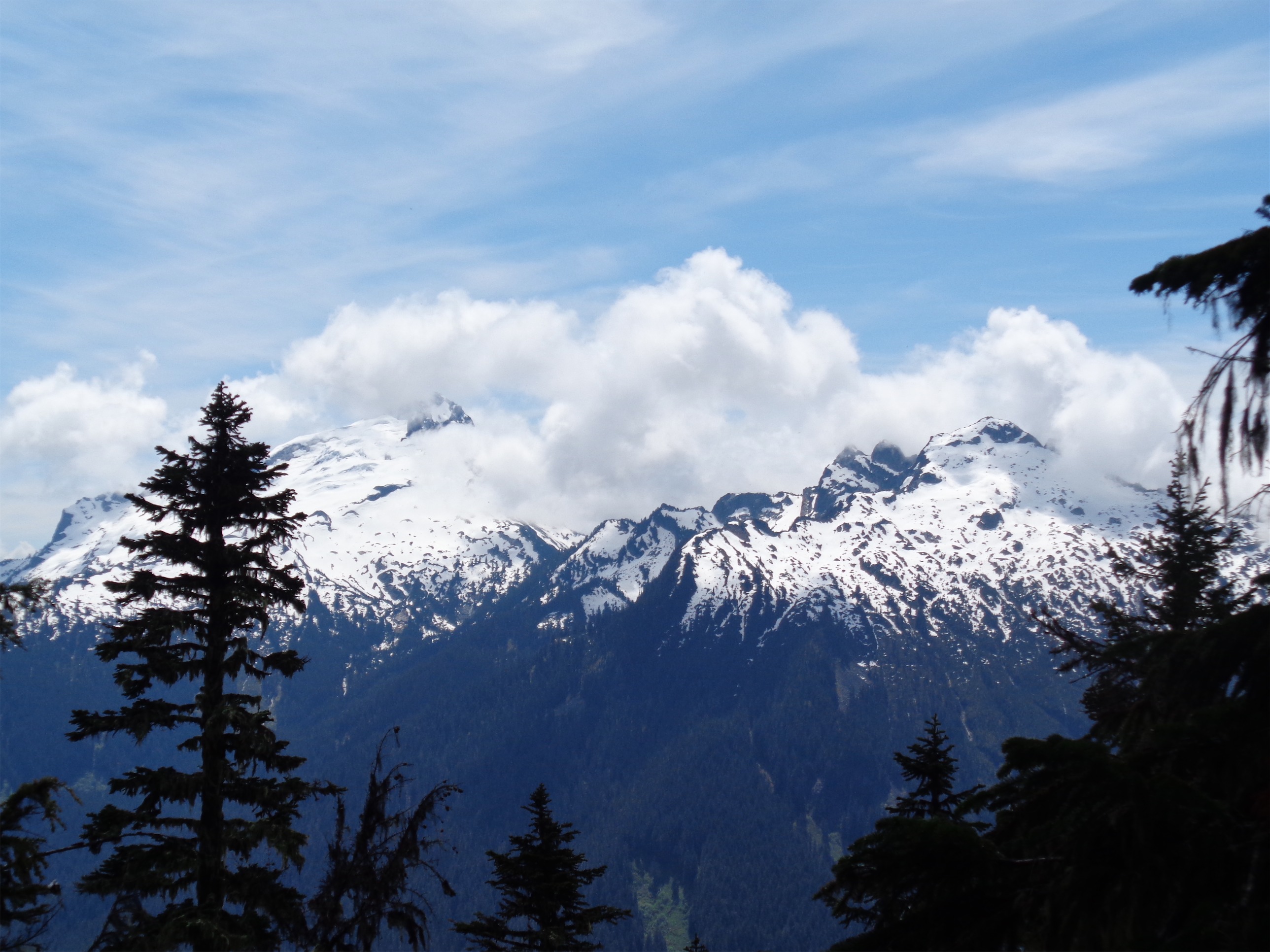
First glimpse of Sloan and Bedal from an avy chute
You cross a few avalanche chutes, full of overgrown bushes nearly hiding the trail and previews of the views to come. Some of the bushes are thorny, so be ready for some scrapes (I promise they’re well worth it) and fighting off branches. Entering the avalanche chutes is like walking into a Disney movie: from shady forest to glorious saturated green meadows. It’s like the Wizard of Oz, when everything is suddenly in color. That’s how it felt.
Bingley Gap comes up after about three miles. Supposedly there are views, but we didn’t see many. Clouds were still in and out, and the ridge is fairly forested. We followed the trail to the right, knowing the Lost Creek Ridge trail would take us to Round Lake.
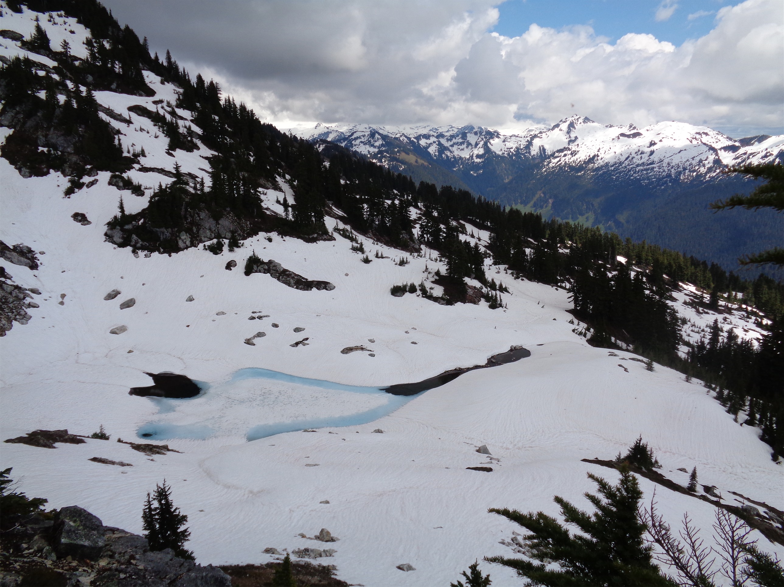
I love ridges. The more exposed, the better, but even forested ones are pretty cool. Trails looks amazing with sheer drops on either side. We were in the trees for a bit, until suddenly we came over a hump and I ran to the left since there was a clearing and I figured we could get views – surprise! Round freakin Lake!

Aptly named, it is quite round
The basin was still covered in snow, and you’ll probably want an ice axe if you’re heading to the lake. I’ve heard good things about Breccia Peak (keep that one secret too guys) and wanted to do some recon in the area to see how feasible it would be. Breccia is the peak on the right behind Round Lake in the picture above. With clouds parting and views opening up, I was eager to continue along the ridge, so that’s what we did. Bailed on the trail and stayed high.
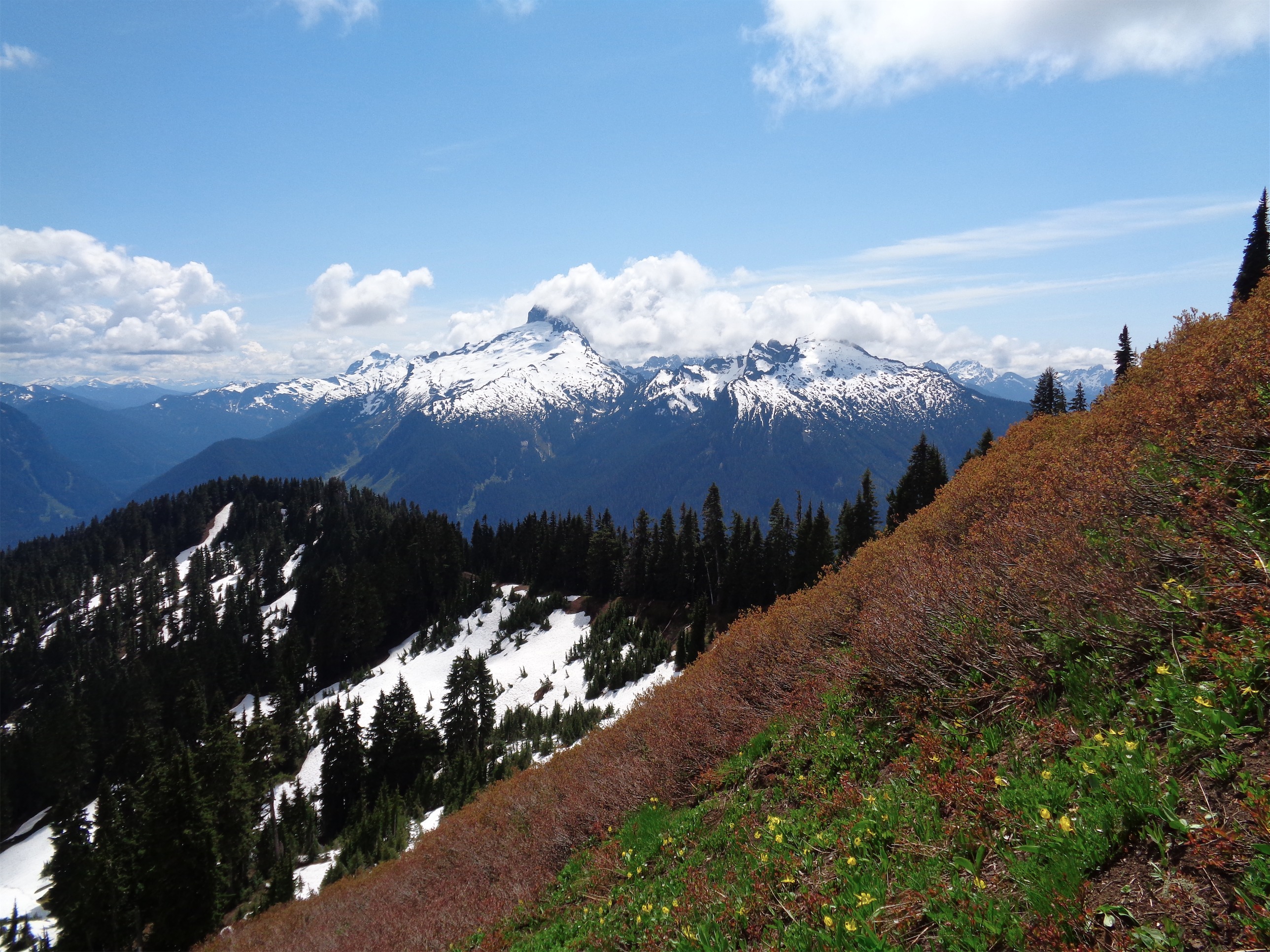
Sloan and Bedal beyond the off-trail slopes
We traversed a few very steep heather slopes, thankful for the ample veggie-belays that held us in place while we were drunk on the views. Sloan and Bedal are right in your face, with Glacier Peak ahead of you on a clear day (we could only see the base unfortunately) and Vesper, Sperry, Twin Peaks, and Big Four off in the distance behind you. Wildflowers were blooming, and I couldn’t believe how good rolling slopes with glacier lilies look with huge white snowy peaks in the backdrop.

Sperry and Vesper in the center (with a glacier!), Twin Peaks right in front of Big Four on the right
Off trail navigation skills are essential for this one. There were a few very old tracks, but with snow conditions so different from when the last people were there, we blazed out own trail. We crossed a few snowy slopes to get to Sunup Lake, and scrambled down to the shore to trek over to the base of Breccia and the unnamed peak next to it. The maps we had recommended heading up to a saddle slightly to the right of Sunup Lake and then wrapping around the back of the ridge to the true summit, but with so little snow on the peak, it looked faster and easier to go straight up the southwest ridge. Still steep, but the path up to the saddle on the map didn’t exactly look like a walk in the park either.

Coming down to Sunup Lake
Sunup Lake
Unfortunately, Vernon was silently suffering some leg cramps at this point, and we ended up turning around just past Sunup Lake. I wasn’t too keen on piggy-backing someone across all the steep slopes we had scaled to get here, and we weren’t about to practice our first aid skills. We scrambled back up to a small knoll along the ridge where we stopped for snacks. Vernon whipped out a foot-long sandwich and was about to take a huge bite when we heard the rumble of thunder across the lake, and I watched the hope and joy and excitement for his sandwich turn to a look of “oh, shit” as I threw my pack back on and said “Yeah that sounds like we should keep moving.” We dropped a little lower, and took a real break halfway across the veggie-belay slopes, where we could snack and look at clouds writhe over Sloan and Bedal. I have no idea how to make the movie a smaller size within WordPress, it always seems to blow them up and ruin the quality. Here’s a link to the youtube video. But check out the time lapse. I know, I know, I need a tripod. God dammit.

Brilliantly colored slopes
After an hour of relaxing on the sunny slope watching the clouds and peaks, we decided it was time to head back down. We couldn’t see the clouds behind Breccia, but they weren’t looking too fluffy or light. Going down always goes faster, and we marveled at how gorgeous the wildflower slopes were in the afternoon sunlight and how we couldn’t wait to be back, even though we were still there. We refilled water at a small stream along the trail, and like I said, it could have been a Disney movie. Or maybe I had died along the trail and this was heaven, I don’t know. Heaven wouldn’t have had thunder or clouds over Glacier Peak, though, and there would have been a five-star steak dinner at the top. With an ocean beach worked in there somehow.

One more pic of the trail
Back in the forest, wait for it – the trail was still amazing. This trail had everything. Small waterfalls, views, old forest, green underbrush, a lake, ridges, slopes covered in wildflowers, slopes covered in snow, ridiculous mountain views. How does no one go here?!

Trail to Sauk Falls
Before I forget, Strava map of our ridge explorations can be found here. Allegedly there’s a path up to Spring Mountain (west along the ridge) as well, but we looked for it on the way up and down and never found it. Maybe the map I had just shows where to navigate off trail. Since it was still light out (sunset at 8:55? The PNW is nuts) when we got back to the car, we made two quick stops at North Fork Sauk Falls and at Whitechuck Overlook. Yes, that’s right, we decided to just drive the entire Mountain Loop Highway. We had come in through Verlot, and left through Darrington. And it was totally worth it. And that extra bit meant we got to skip Seattle traffic. Hell. Yes.
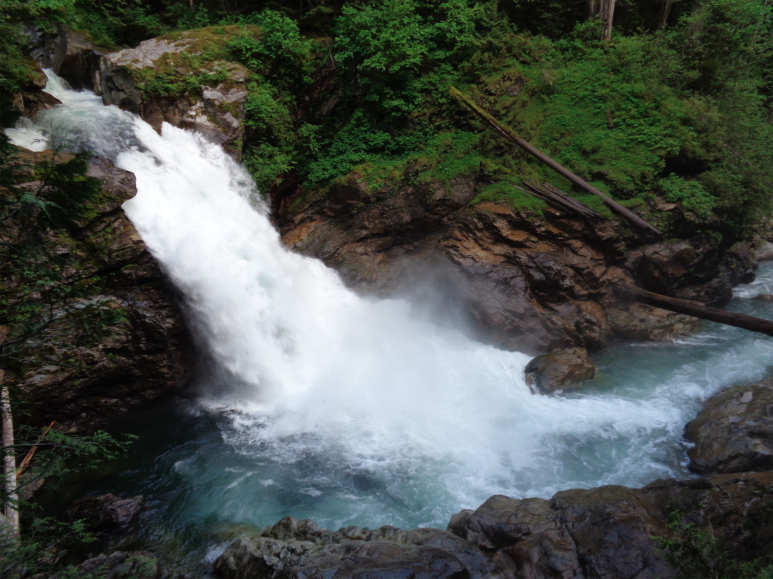
Sauk Falls
The falls were spectacular. Seriously, for a hike that’s less than half a mile, you might as well stop. The falls were not very tall, but had an unbelievable volume of water crashing over them. We bummed around the falls for a bit and tried to rescue an abandoned Pepsi can, but the wet mossy rocks proved too tricky for us. White Chuck overlook was neat as well, the mountain was mostly snow free and Vernon picked up some toilet paper and wrappers that someone had left on the ground. Those people are why I want Round Lake to stay secret.
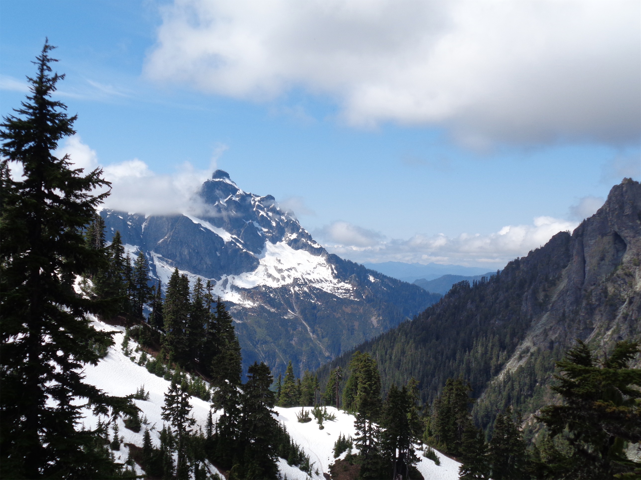
Mt. Pugh from the ridge above Round Lake
Here’s the other secret: the Lost Creek Ridge trail goes all the way to Lake Byrne, which is supposed to be one of the most gorgeous areas in Washington. It’s 24 miles round trip, I believe, with around 7000ft of elevation gain. It’s tough to find specific summaries and reports for it. So let’s keep traffic to a minimum, but if you need a short backpacking trip, Byrne is a great candidate. I know I’ll be back. Ideally twice: I want to run that ridge, and I want to spend a few days backpacking in the area. The best thing about living here is how easy it has been to discover new places. I was getting overconfident in my Cascades knowledge, and then this came along. A region I hadn’t touched, mountains I had never seen (Painted Peak, Black Peak, hell there’s a whole Painted Traverse) and that’s just barely scraping the edge of it. There are some pretty big chunks of untouched wilderness out there if you have the time to get there. I always need to remind myself that it’ll still be there in a month, or a year, or a decade. As eager and impatient as I am, I have a whole lifetime to get out there.
Admiring the green colors

Thank you for writing up this great report and story. We mapped the trail a few months ago but we’re missing the photos to this one. Would you be open to your photos being posted on this page, with attribution to your blog?
http://trailspotter.com/detail/round-lake
Thanks,
Roman
LikeLike
Absolutely, I’d be thrilled to contribute! Feel free to use whichever you like, credit to the blog is more than enough. I have originals as well if you’d like larger files.
LikeLike
I want to do the 24-mile. That’s a spectacular hike.
LikeLike