Whose beautiful Nemo tent is that
Turns out mountaineering gear is good for many things, like snow, cold weather, and the high winds that accompany sitting in the bed of a pickup truck on the highway. Okay, now between that and the title, you can probably already extrapolate exactly what happened. But assuming you’re here for pretty pictures and entertainment, you might as well read on.
- Distance: 24 miles, I think
- Elevation: I don’t want to know
- Weather: Mountain-forecast is a liar. Fog, fog, snow, and fog, and 30’s to 40’s
- Commute from Seattle: well that depends which trailhead you’re starting at. Fisher Chimneys is about 3 hours, Sulphide is about 2:30
- Did I Trip: I slow-motion sat once
- GPX file: haha, no, because then you’ll see how many tries it took us just to find the damn chimneys
I’m convinced that climbers keep this route description a little convoluted just to maintain the challenge, and keep us plebs out. I’ll see if I can maintain that while giving you a bit more to chew on.
We left Seattle at 6am on Saturday. I’m usually all about trailhead camping and early starts, but this seemed like it’d be a quick route, so why not be a little more casual? We had sunny blue skies pulling up to the trailhead, and Shuksan was snow covered and stunning with fresh snow. I haven’t been so excited for a climb in a long time. Fisher Chimneys had been a route I had wanted to try for months, and here was the chance!
Bonus pic: It totally looks like a bird. Seahawk Serac. (Go Pats!)
We set off on the trail, immediately hiking down into a valley full of fog. And… that would be the last time we saw the sun pretty much for days. With the exception of a few glimpses here and there.
Fall color starting along the Lake Ann trail
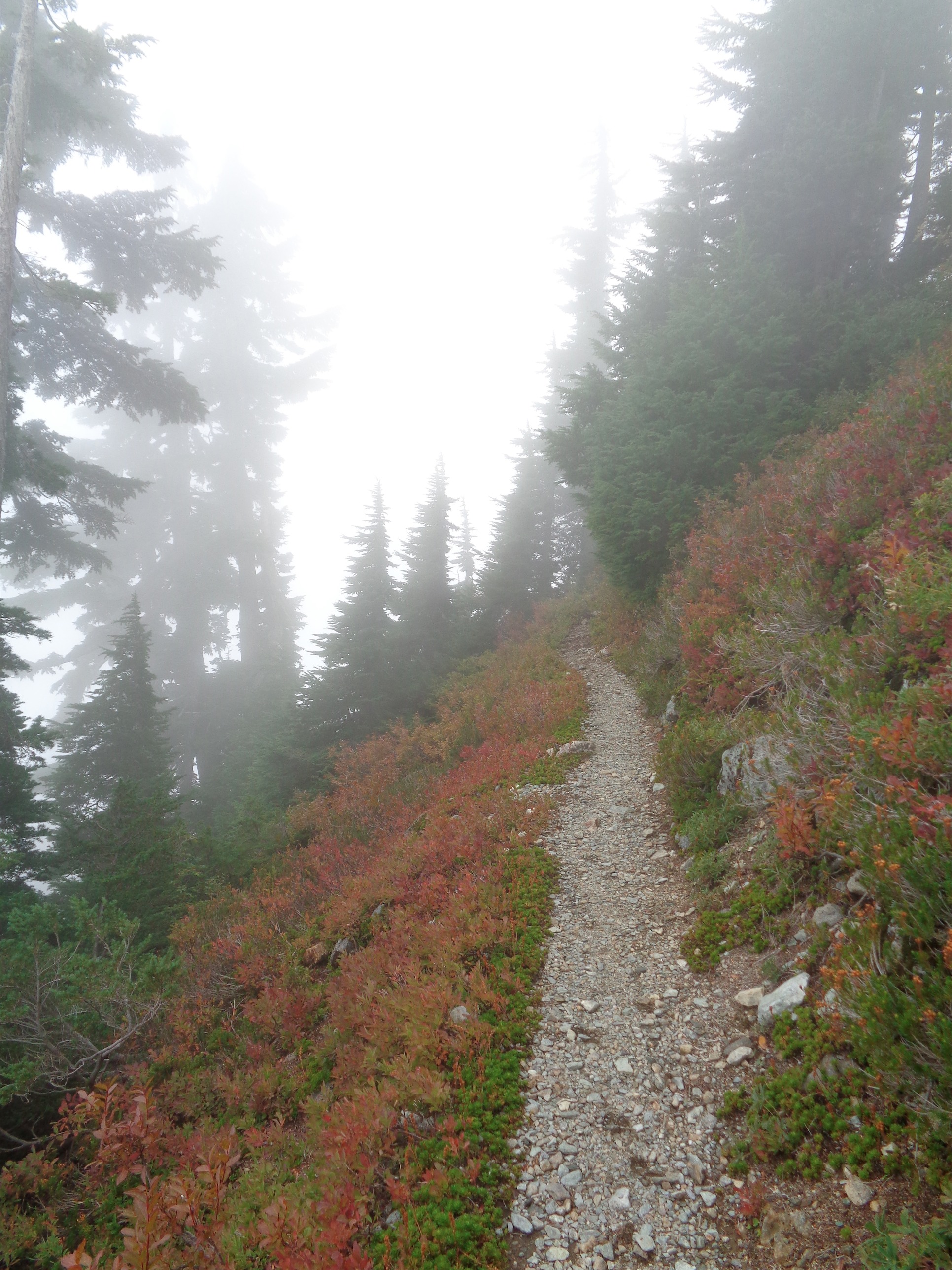
The trail to Lake Ann is very well maintained and easy to follow, though there are a few offshoots to other areas as well. We passed plenty of people on their way to and from the lake, everyone hoping we’d get above the fog. Fall color was just barely beginning to show, though we couldn’t see much of our surroundings due to the mist.
We chatted with a hiker who had been up the Fisher Chimneys route before, and I almost didn’t ask but finally caved. I had heard rumors of a composting toilet somewhere on the chimneys route: was it true? He laughed. “No, but it’s a great route for chuckadook.” I giggled. Chuckadook? Is that what it sounds like? “Yep, you find a nice flat rock, drop a dookie, pick it up, and use the rock to fling it as far as you can. Beats a blue bag!” I could have cried laughing. What was even better was the young girl with them (maybe 10) trying not to giggle, and the look of horror on who I can only assume was this man’s mother. We wished them a good hike and as they walked off I heard her go “TWO MINUTES AND THAT’S ALL IT TOOK FOR YOU TO TALK ABOUT POOP” “no no it’s okay they get it they’re climbers, it’s just a normal topic of conversation” and they faded into the distance while I tried to regain composure, still giggling about “chuckadook.”

Foggy Lake Ann from near the bottom of the Chimneys
We didn’t even know we had reached the lake until we were nearly past it, because you couldn’t see it through the fog. I hear it’s beautiful, I’ve seen pictures of Shuksan looming over it, and all we had was a wall of white. We took the boot path to the left, a much more well maintained trail than I thought. It turns out the trail goes all the way to the Lower Curtis Glacier. Which we didn’t realize, until it was too late.
Hint: The standard route departs from the trail several gullies before the Lower Curtis Glacier. We were socked in by fog, and finally decided to take a snack break and check a map to see if we could get our bearings. We heard a huge rumble in the background – what was that?! a plane? Rock fall? Who knows. We definitely need to gain elevation, and might have passed the turnoff/scramble that will lead us to the Chimneys… okay, so we need to backtrack. Whatever, goldfish and kind bars first.
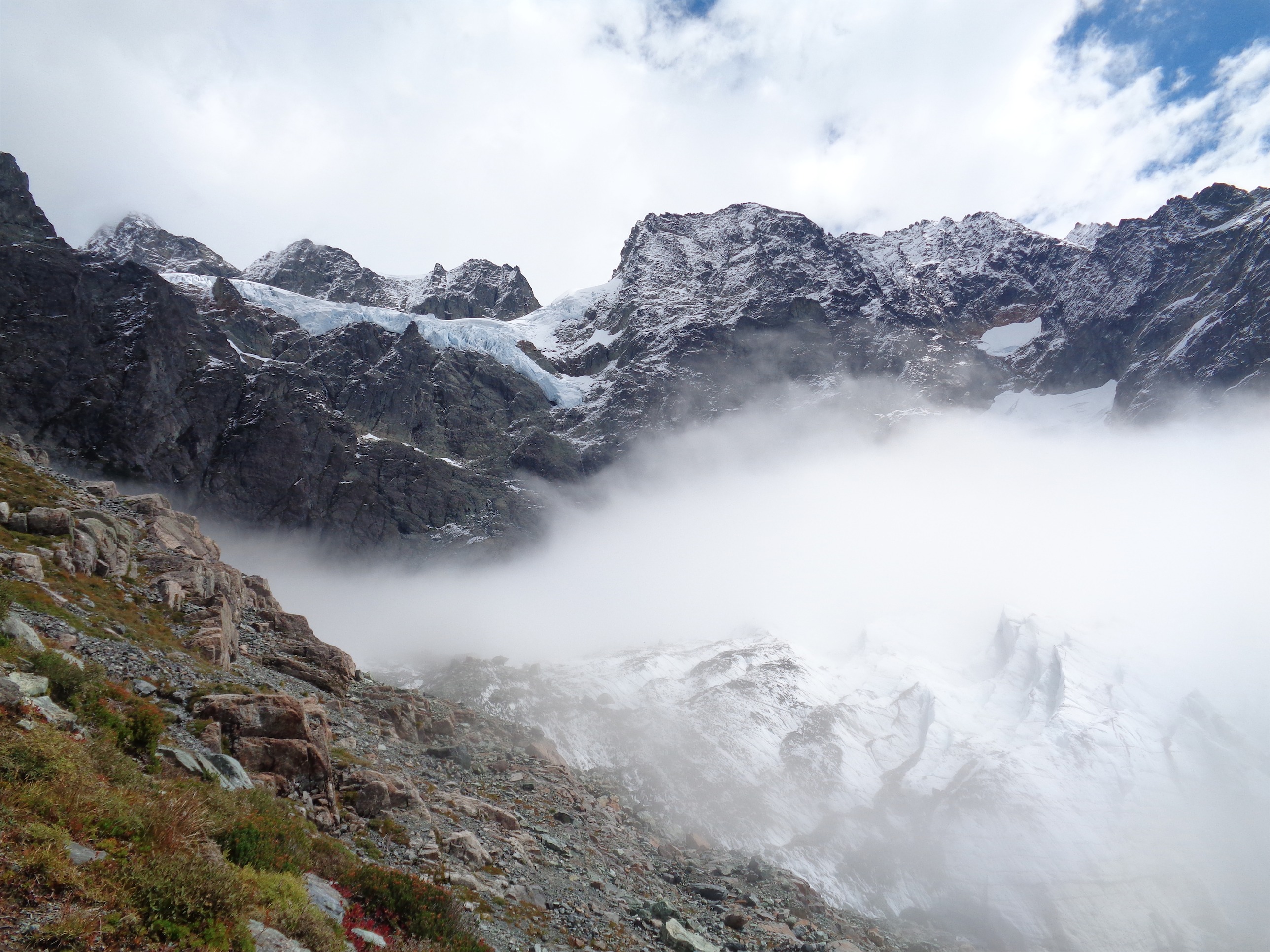
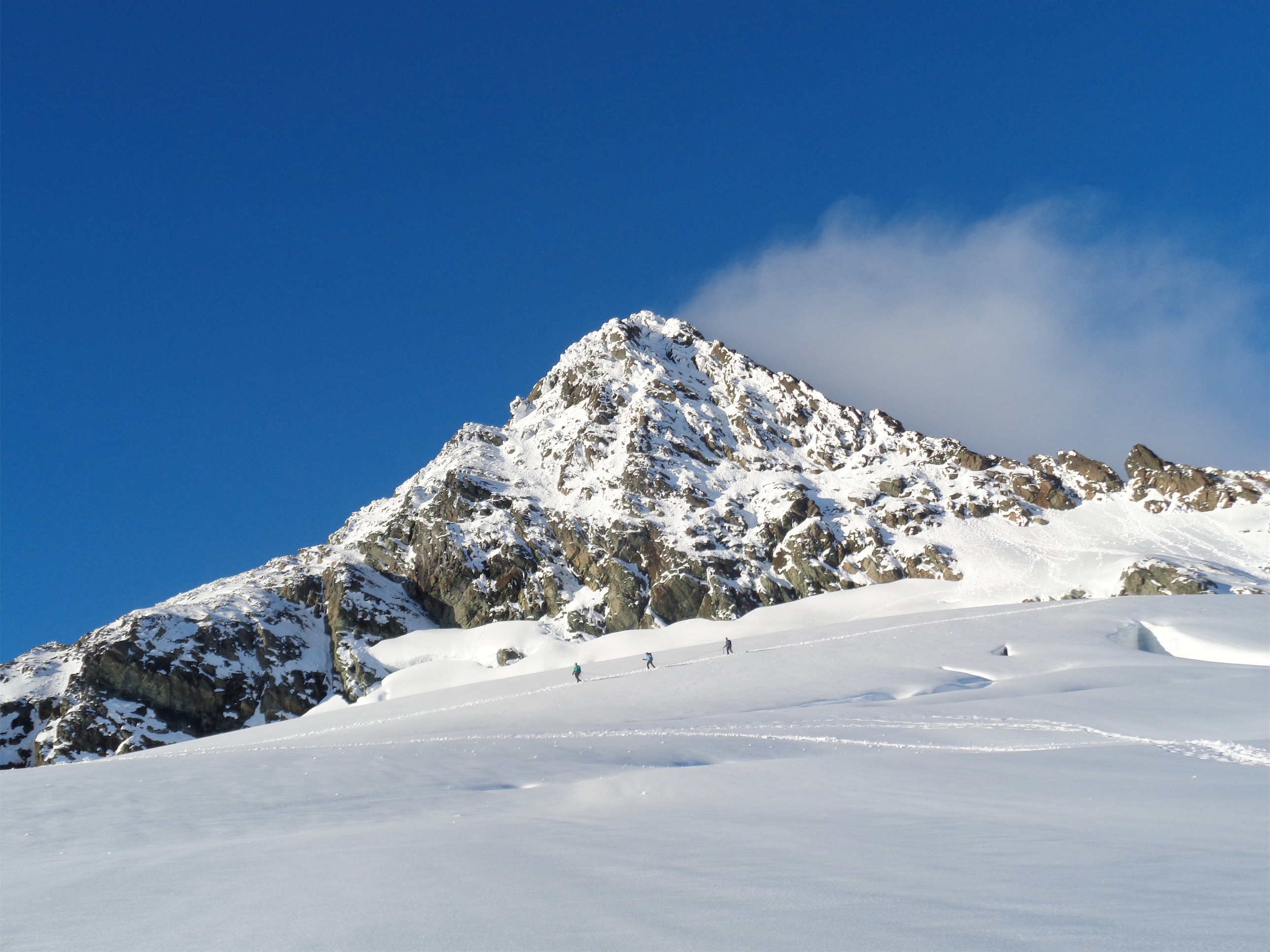
And the skies clear! Upper Curtis (where Hell’s Highway is) and Lower Curtis
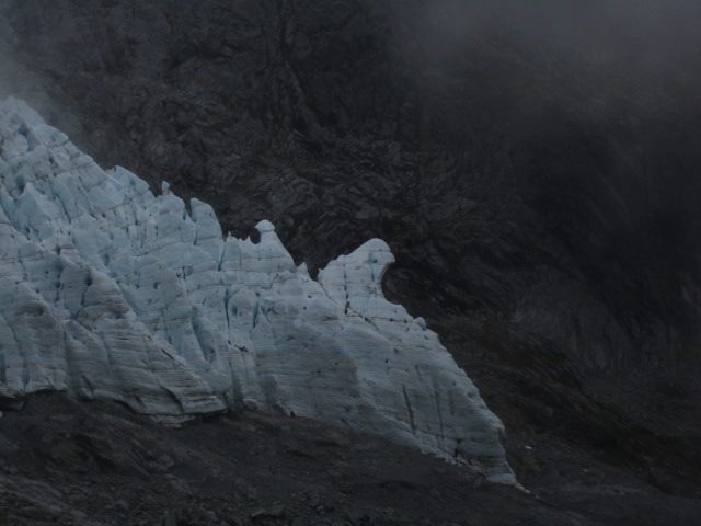
And suddenly I hear “WHOA! WHOA OH MY GOD OH MY GOD WHOAAAAA!” (double rainbow word for word with an equal level of enthusiasm) and I turn around to see the clouds clearing, and we’re sitting freaking 20 feet away from the Lower Curtis, which has a stark terminus full of jagged seracs all lined up, with hell’s highway and dramatic rocky peaks suspended above it. Hoooly shit. I nearly fell over. This is what it looks like. This is where we are, and we had no idea. That rumbling had been the freakin glacier! There was still a small pool of cloud hanging just over the glacier, but Shukan is a beautiful mountain. Nothing can compare.
Well, now it was certain we had overshot. So we backtracked to where the Fisher Chimneys trail turned off, which is clearly marked by cairns, I’m apparently just blind. This led us up to a stream, which we eventually concluded needed to be crossed, following by some vague scrambling that finally dumped us onto a boot path for a while. Thank goodness, because we were not doing so hot with navigation.
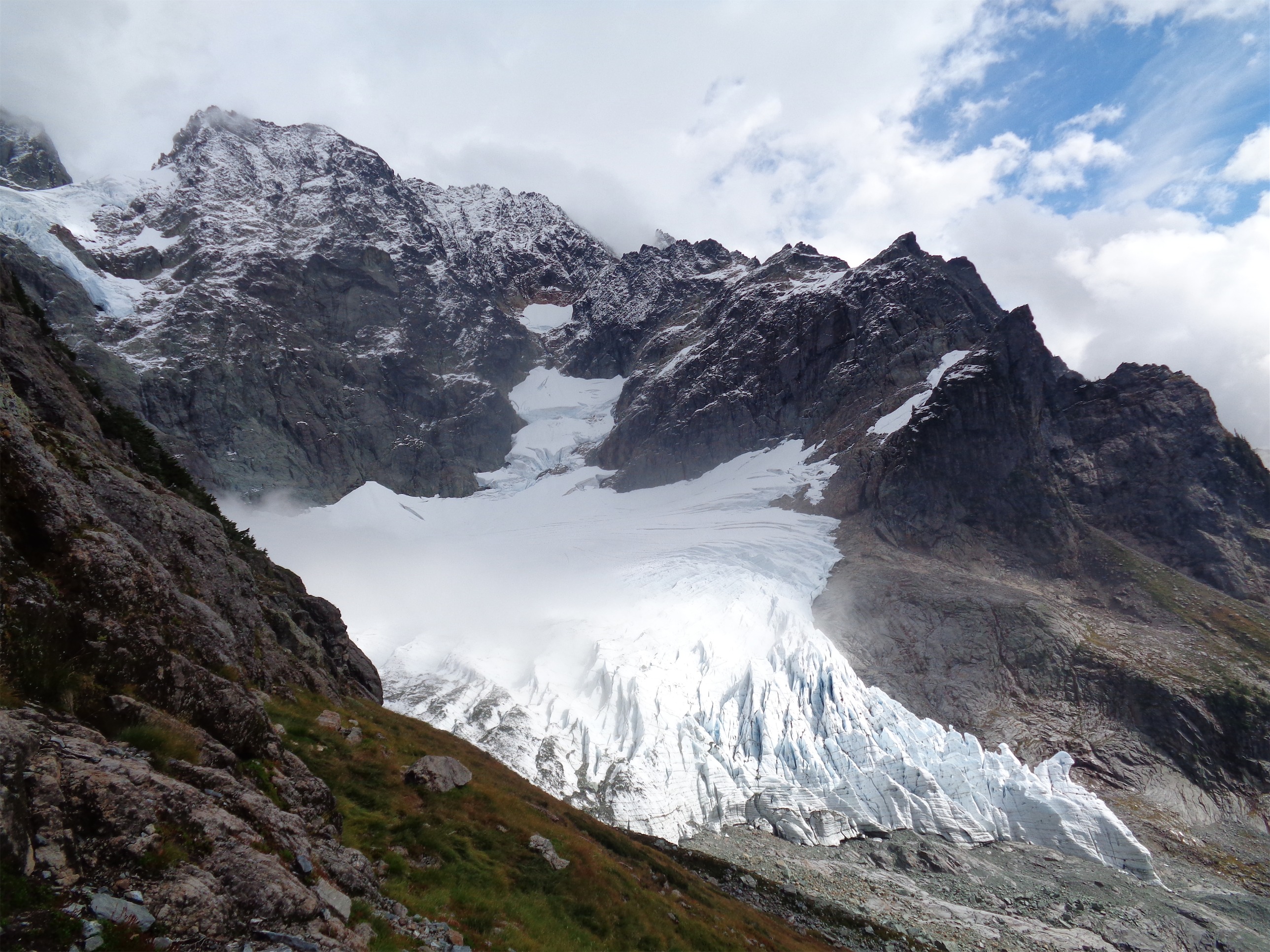
Bottom of Lower Curtis – those seracs!
For the next hour or so, everything went smoothly. We had trail, we had maps, we had cairns. Finally we reached the entrance to the chimneys. “It’s a really obvious gully” we were told. Well to whoever said that: you’re full of shit. We tested several different gullies before finally finding one that didn’t involve class 5 moves along mossy rocks, and we were off.
Guys, I love this shit. Almost as much as I love technical glacier travel. Fisher Chimneys was great because the few fourth class moves you encounter are like solving puzzles. There were several very exposed parts, so I would not attempt this one until you’re pretty comfortable on rock. We did belay Ben up one section, though I think it was all in his head because as soon as John had him on belay, he scaled the wall like it was nothing. Lucky for us, despite the clouds and occasional rain, the rocks were still pretty dry.

John during part of the scramble
We hit snow a few dozen vertical feet below the White Salmon Glacier, and upon cresting the ridge, I started to relax. The chimneys had gotten stressful towards the top since it turns out not everyone enjoys exposed scrambles as much as I do, and I was happy to get to terrain that everyone in the group knew well. We roped up and aimed for winnie’s slide, which we found like 15 minutes later. It’s close.
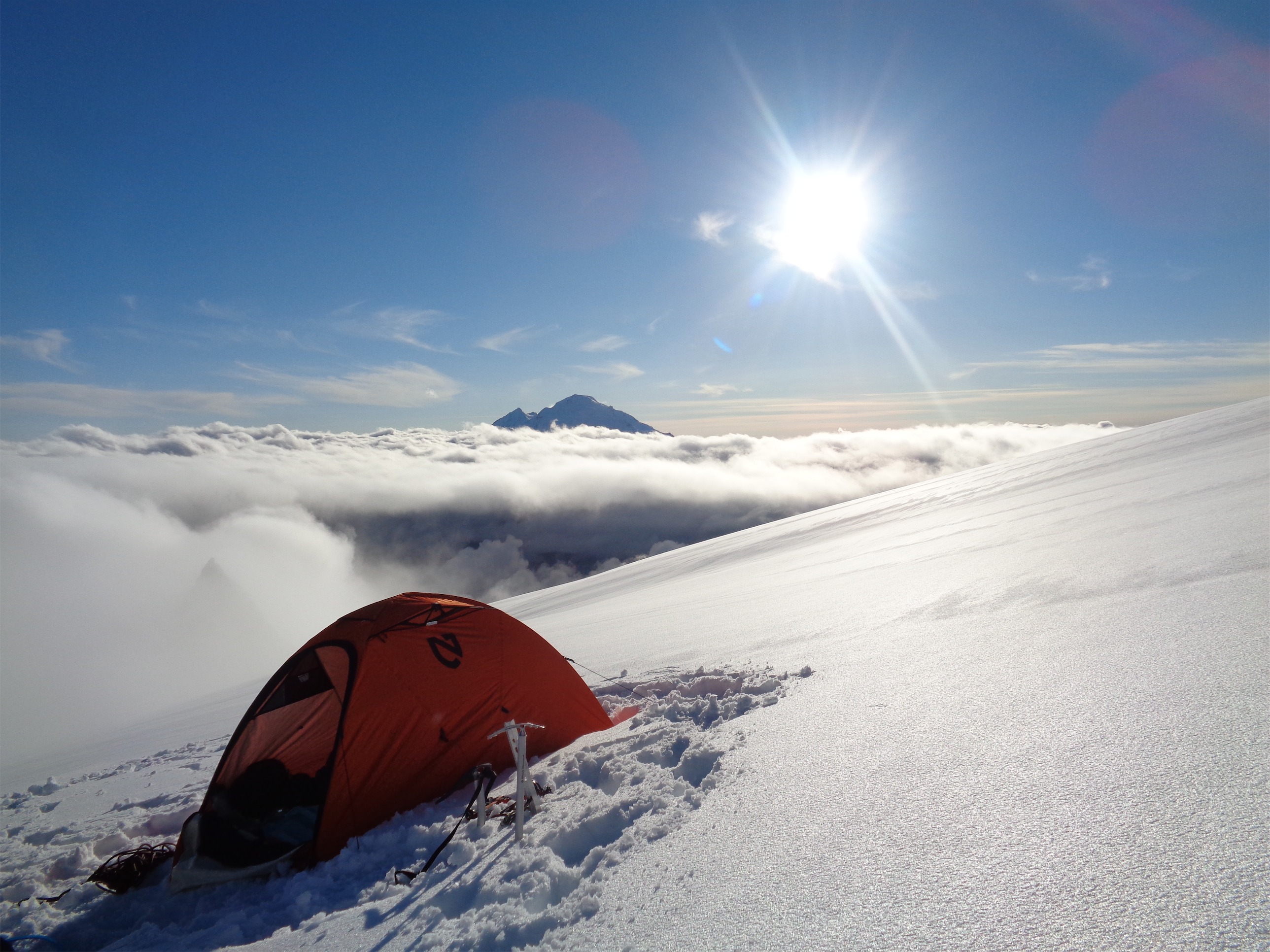
And we were just in time, because it was dark within 20 minutes. We were originally planning to camp higher, but this would do. We found two tent sites and set up. Clouds stayed where they were, and moments after I pitched my tent, it started to snow. We cooked in the vestibule, and I heated extra water so I could sleep with a warm water bottle.

Home sweet home (Winnie’s Slide on the left)
I spent the whole night freezing. I have no idea why, but I was so cold. Just not feeling it, I guess. I need a warmer sleeping bag, I know that. Mine’s rated to 15 degrees, but the “comfort” rating is 30 degrees. It wasn’t as bad as Shuksan back in August, though, because at least all of my belongings weren’t soaked through with water. Too cold to sleep, I more or less waited for morning. I figured I could nap during the day, since we knew conditions would be lousy and planned to lie low.
Morning came eventually, and I sat up when I heard John and Ben rustling around in their tent. I opened my door, and it was snowing real snowflakes, fat, white, cold snowflakes, like Christmas! I couldn’t help being thrilled, the first snow of the year always fills me with a childish joy, and this was real snow. We crossed our fingers and hoped for it to clear up, and spent the next six or so hours eating, napping, whatever kept us happy.
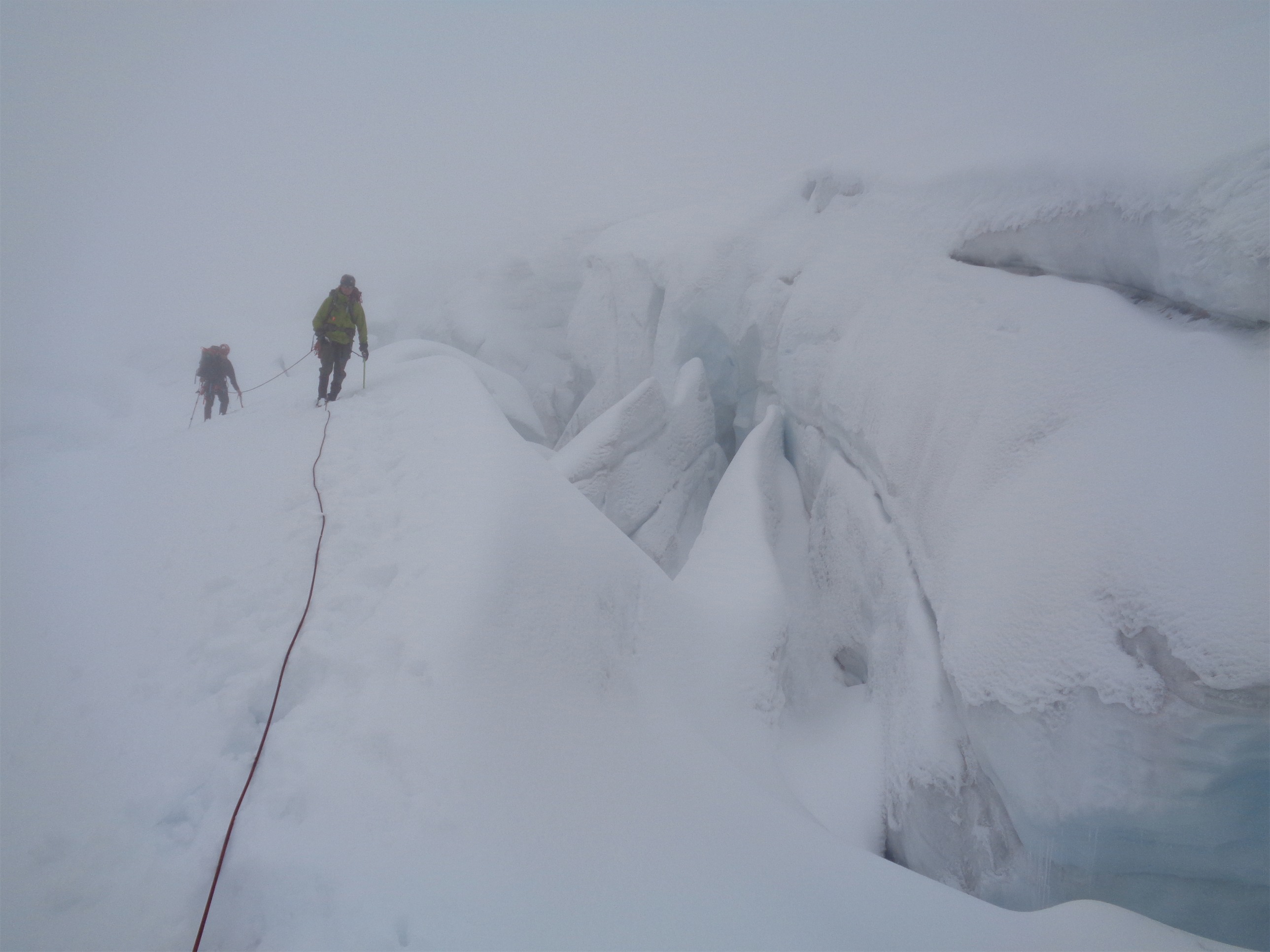
Crevasses and moderate visibility (not the worst we had all trip…)
Towards early afternoon, we figured this was about as good as it was going to get, and we packed up to move to a higher camp. Winnie’s slide was in better shape than we thought. Reports had said it was entirely exposed ice, but with the recent snow, we could kick steps, and the group before us had left nice tracks. The snow was pretty solid, though conditions wouldn’t stay that good for that long.
And it was a good thing we camped below the slide, because at the top were two tents from the other group! Unoccupied, so we figured they must have gone for the summit. We passed them and got onto hell’s highway along the upper curtis glacier, which was very, very heavily crevassed. Reminiscent of the DC route crevassed. Okay, maybe not that big, but bigger than we had dealt with on Coleman Deming, and bigger than Eldorado, and bigger than the Sulphide. We even had to set up protection across a crevasse with a dicey looking snow bridge that you had to climb down a bit to reach before traversing. John belayed me first with two ice screws as an anchor, I scampered across and set up a deadman’s on the other side due to lack of ice. The snow was basically concrete on the other side. Ben was next, and once he was across, I belayed John. We cleaned up our gear and got started again. We had known there was one tough crevasse to cross, and we figured that had to be it.
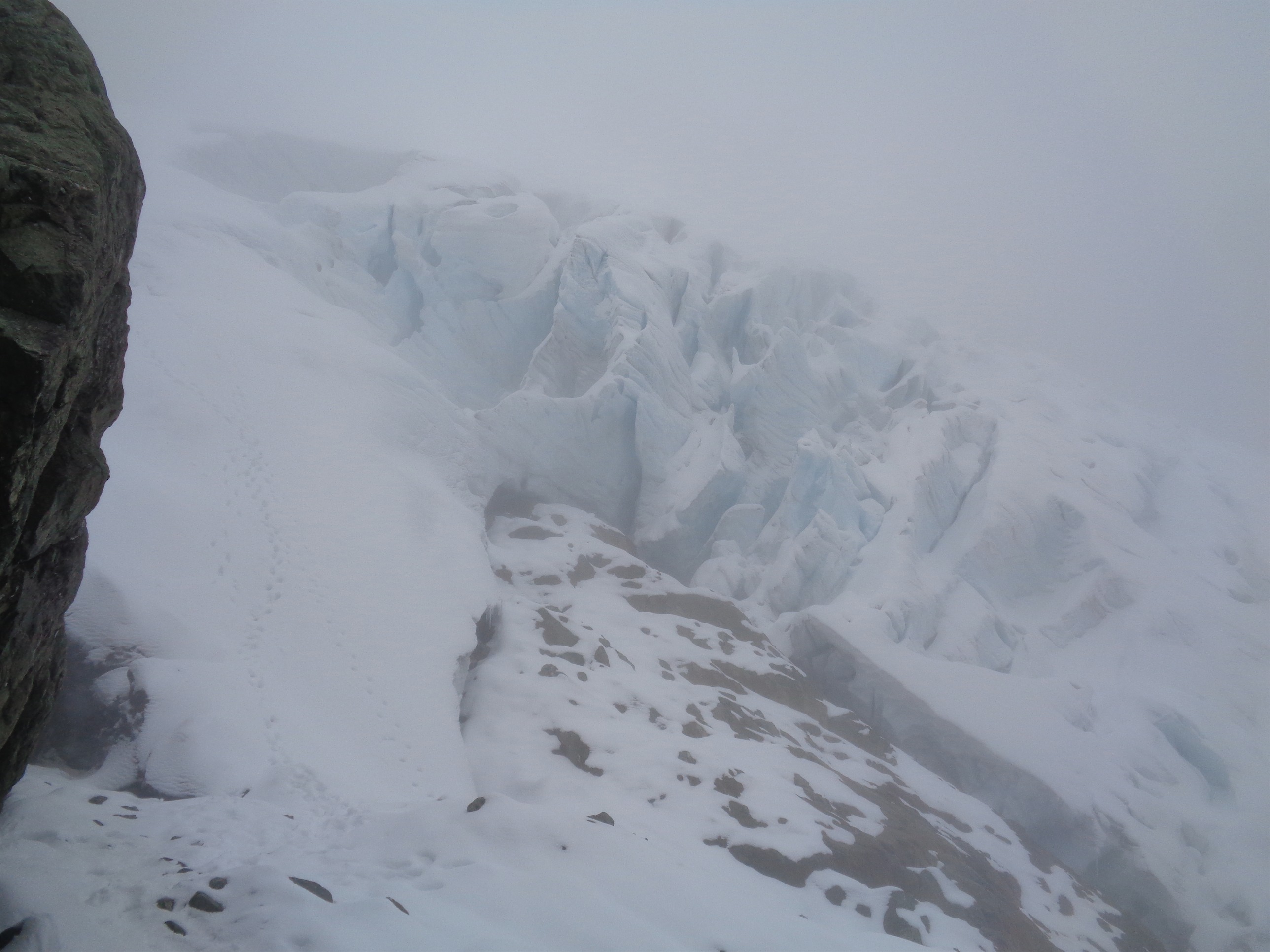
I bet it’d be stunning in clear weather
For once we were right, and the rest was clear sailing. Which is great, because it turns out crevasses are a lot harder to navigate when you can only see 15-20 feet in front of you. If we walk parallel to this one, will it end and we’ll be able to just go around it, or will it keep going until it meets a cliff or a bigger crevasse? You just don’t know. Fortunately, we made it to the base of the cliffs above the Upper Curtis, and we knew to hug those until we could hop up to meet the Sulphide, which came up quickly.
The ramp up to the Sulphide was a tough section. Very steep, and by now the snow had softened enough in the warmth that there was plenty of sloughing coming down towards us. We finally saw the other group on their way down. We moved over to the side below a small rocky outcropping to avoid the pinwheels they were triggering as well as any potential larger issues we probably didn’t want to voice. We’d move quickly. As they passed us, we asked how it was, and they seemed exhausted and unhappy. Rough, I assumed. Long day, summitting in those conditions from camp just above Winnie’s Slide.
Once they had passed and were around the corner below us, it was our turn to tackle the slope, and we needed to move fast. I headed straight up the shortest section. Suddenly there was snow tumbling towards me, not a slide, but some big chunks that had sloughed off the slope. I froze. Am I in the line of fire? Yes. Can those knock me off my feet? Yes. Shit. Can I move to the side? No. Okay great, duck. And that’s what I did. I hit the ground. Had I thought faster, I might have been able to get my pack over my head, but I haven’t gotten those reflexes boiled down to instinct yet. I threw my arms over my head after the first few large chunk hit my head (it was like getting hit with a watermelon at 20mph, my neck felt it for days) and stayed like that until I heard John yell 30 seconds later. I wiggled my arms and shoulders free and got the snow off my back and kicked aside the small wall of snow that had built up around my body. Fuck you, snow. And that’s one of the many reasons why we wear helmets. I’m just lucky it was sloughing and not an actual slide. Yikes. “Hint of avalanche.”
Towards the top, it got steep enough I was wishing I had used my ice tool rather than axe, not to mention that beneath the foot of unconsolidated snow was solid ice. But that was just a few feet, so some near-front-pointing with the crampons and good balance did the trick.
No, he isn’t crawling on the ground, it’s just that steep (photo credit to John)
Over the top, we could just barely make out the area where I had seen tents the last time I was on Shuksan. Except this time, there were two nice crevasses running through the flat area. Well, shit. I told Ben and John we’d keep moving until we found a relatively flat, safe area, and set up camp there. So we started heading up the Sulphide.
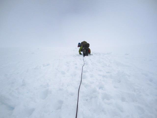
The fog got thicker. We did a fine job with the crevasses, which were far more prevalent than in mid August. The difference three weeks makes is amazing. The horizon started to blend everything together. Foggy sky was impossible to differentiate from snow, and I can see how people can get disoriented so easily. The crevasses were the only things keeping me in line. I pulled out the map, and it looked like there would be a flat ish spot up to our left. I pow-wowed with John, his GPS said the same thing. That’s what we’d aim for.
We finally got there. We knew where we were on the map, but had no idea how views would be. And we left the trusty blue shovel in the car, so leveling tent platforms was up to axes and crampons. I started scraping out a spot for myself, trampling it with my crampons like a dog walking in circles before it lies down. My tent is pretty small and all things considered we had found a pretty level spot, so it wasn’t a problem. I set up my tent, deadmanned the shit out of it (seriously, it was so well anchored it took me like half an hour to dig it all up the next morning) so if conditions deteriorated further, it was going to take some serious winds to toss me around. Yeah yeah yeah, I know it’s a true mountaineering tent. I’m scared of wind, if you can’t tell. Snow, whatever, rain, meh, fog, meh, wind…. as soon as it’s dark and windy, I’m gonna be on edge.
We heard voices above us, but couldn’t see anyone. I went to go pee. Guys, if I’m not back in ten minutes, come looking for me. Terrible way to go out. But ten feet from the tent, I was out of sight. Sweet. I got back, and got ready to cook. Suddenly I felt sun on my face, and looked up. I think John and Ben saw the look of wonder on my face. “John, turn around.”
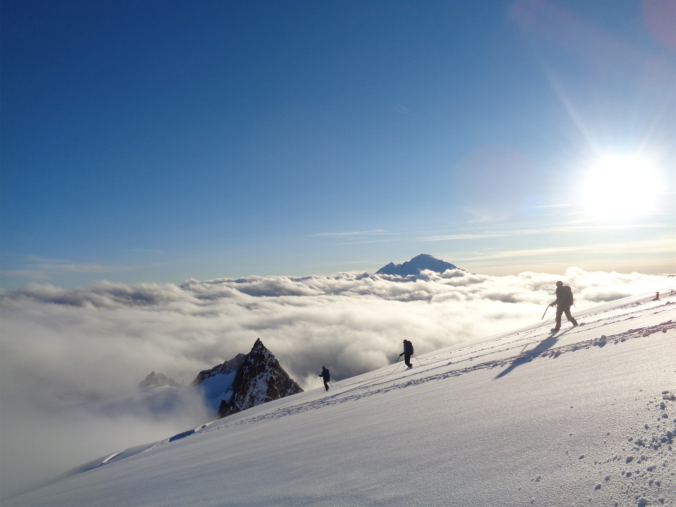
The summit pyramid was out, covered in fresh snow, the sky was blue for the first time since Friday morning (and that one glimpse of the glacier) and we could see a group of three descending! I took some sweet pics of them beneath the pyramid, and waited for them to get closer. As they passed our tent, I ran to talk to them (And mostly to ask for permission to get photos of them walking past). Because Baker was out, above the clouds, with the sun shining behind it! Koma freakin Kulshan, in all her glory.
Mountain Madness
The three climbers were two clients led by a Mountain Madness guide. They hadn’t summitted due to the central gully being a bowling alley of rock and ice. The group that had accompanied us up Fisher Chimneys had gotten stuck on the summit for hours, waiting for conditions to improve before descending. Brutal day. I chatted with the second climber, Maureen, who was an upbeat, bright person whose laugh cheered me up immediately. She was thrilled about the pictures, too, and I set myself up to snap a few more as they continued down. I think this resulted in the best picture I’ve taken in my life to date.
After they were out of sight, we made dinner and went to bed. The clouds moved back in maybe 15 minutes after we chatted with them, and we were back to whiteout. We set alarms for 3am, and figured we’d play it by ear. I slept like a baby. Warm, cozy, tired, content.
The best picture I have taken in my life
The alarm went off at 3am, and I almost didn’t even get up. I had… not a bad feeling, but a general reluctance. It was clear, stars were out, but I was uneasy. I didn’t care if we summitted. And I’m an impatient, hotheaded kid, too. I interpreted my lack of drive as a bad feeling. John was feeling the same way. We waited an hour to see if it stayed clear, and it did, but we decided to just not go. Soon enough, we were enclosed in our foggy bubble again.

I showered myself with frosh in the morning, inside and outside the tent
We got up around 8am, and after a BLELGFDKSDGKFK of frost in my face when I sat up into the wall of my tent, I was excited to see a 6 person rope approaching. That HAD to be Miyar Adventures. I knew Anthony and Sandeep were leading a group, and I know how they feel about 6 person rope teams. I sat back and patiently awaited. 1) I was excited to meet Sandeep, who I had talked to but never met, 2) I was happy to see Anthony again, and 3) at this point, it had been decided that not everyone was okay going down Fisher Chimneys given the conditions, and we were going down Sulphide. And that meant, we might need a ride back to town.
Sandeep was in the lead. “Are you with Miyar adventures?!” I shouted. He seemed surprised. “Yes!” “Sandeep!?” “Yes, how did you know?” “I’m Eve!” He laughed and we shook hands. We chatted about the route, I told him what the previous two groups had told us, and then I went to go say hi to Anthony. He saw me coming, and recognized me. Is it the orange jacket? It must be the bright orange jacket. We talked for a bit and finally I explained the situation and asked for a potential ride. The answer was yes. I had a feeling we’d beat them to the trailhead, but if we made it down around the same time (or if we were still trekking along the road when they drove past us), at least we’d have a backup ride. I felt a hundred times better knowing that.
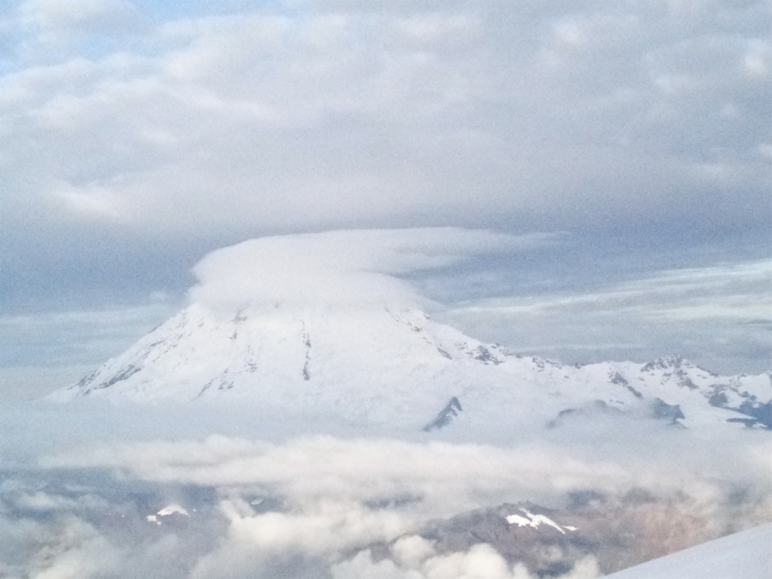
Pretty but not too happy with that windy lenticular
We packed up after the Miyar group carried on, and headed back down. I was excited for this, because it’d be a test of how well I could follow a route I had done once before, but in far lower visibility. We had tracks, but they branched off several times, and you never know when they’d dead end in a crevasse. Besides a few more sloughing slopes that we crossed quickly, it was smooth sailing. We made it off the glacier to the rocks with the tidepools I mentioned last time, and headed for the notch. It was a much easier downclimb than the chimneys would have been, I’ll give you that.

Hobo burrito wrapper note
Back at the trailhead, I snagged the pen from the hiker registry and left a quick note for Anthony on my burrito wrapper, which I tucked beneath the windshield wipers of a car I was 90% sure belonged to someone in his group. Oh, by the way, that burrito had refrozen, and on the second night I slept snuggled up to a cold ass brick of a burrito hoping to thaw it so I could have a delicious breakfast. The note said something along the lines of “we made it down, if you see some sad hikers on the road, that’s probably us!” and I left a P.S. about how much Happy Corn I had eaten. That shit’s delicious.
**If anyone on the Miyar team is reading this, I can’t thank you enough for being willing to give us rides. Even though we didn’t need them, the peace of mind it gave me was much, much appreciated.
Figured I’d capture my “eff this shit” moment
We hiked six miles to the Baker Lake road. Ben noticed I was limping a bit – I have no idea what happened, but some tendon in my knee was not happy with the forest road. I’ll never know. I was dreading it, though. I didn’t think anyone would pick us up. I didn’t think anyone would even pass, and highway 20 was another 22 miles away or something hideous like that. I was resigned to having to tell my coworkers that the reason I didn’t come to work was because I was sleeping on the side of the road like a hobo.
We reached Baker Lake Road, and I dropped my bag and sprawled out on the ground looking as pathetic as possible. Within seconds, a pick up truck pulled up, and after chatting, offered us a ride. Oh my god. It was happening. We’d at least make it to Sedro Wooley. We threw our packs in the bed of the truck and hopped in. Into the bed of the truck. I think I did that once, as a kid. Once.
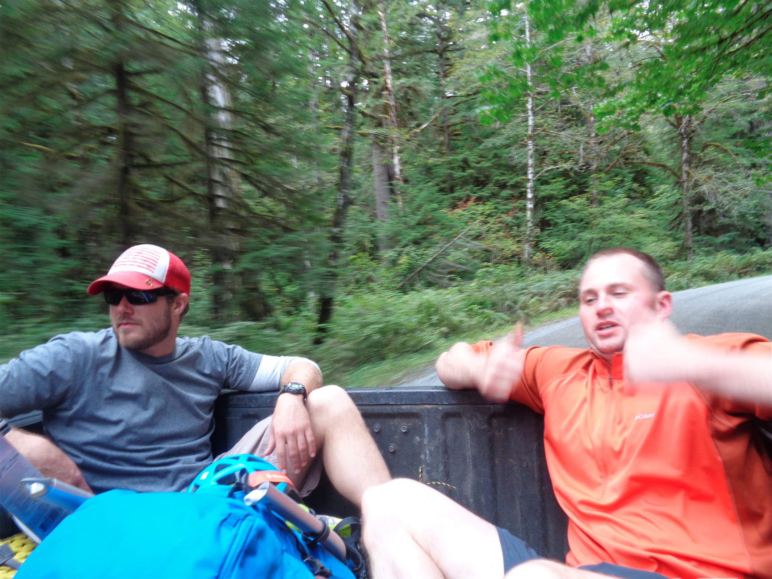
Like they’ve been doing it their entire lives
Let’s get something straight. I’m a hoity toity east coast city girl from a hoity toity rich bitch Massachusetts town where there’s a list of acceptable colleges to attend and most kids get brand new cars for their sweet 16 (I was not among those) and houses are judged by their manicured lawns and whether their owners rake in seven or eight figures a year or just a measly six. Hitchhiking was something from the 60’s, something that only bums did nowadays, or people who lived in rural bumfuck nowhere. And there I was, with my Weston-ass self plopped in the back of a pickup truck riding down a highway. And I loved it.
We got dropped off in Sedro Wooley, got sandwiches at Subway, and sat on the curb at a gas station with our gear while we ate. So I was three days of wilderness adventure with no shower, eating a foot long (6 inch sandwiches are for wimps) with a 40oz soda because AMERICA. Waiting for someone to offer us a ride. And eventually, along came another pickup truck with a man and a dog, and again we piled into the bed of the truck. I put on my puffy and my hard shell, John even put on his ski goggles. 60mph in a truck, no problem. We’re all geared up.
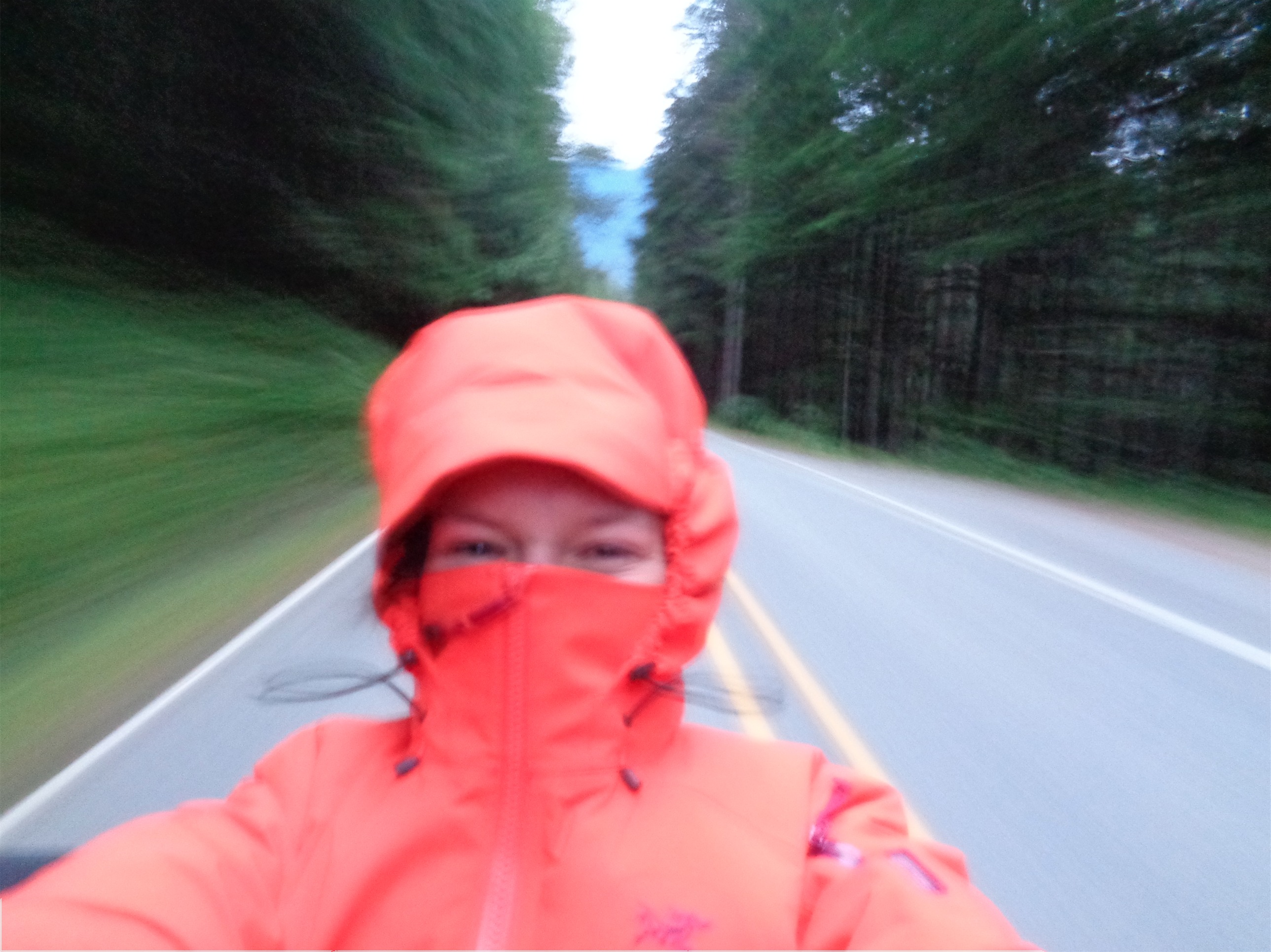
Hoity toity east coast bitch finally experiencing life (yours truly)
We finally made it back to to the Lake Ann trailhead, and I have never been so relieved in my life. The guy who picked us up was nice as can be, and lived in Acme, a tiny town between highway 20 and the Mt. Baker highway. We transferred gear to my car, thrilled to be back at the car before sunset, and took off towards Seattle.
And there you have it, folks. I hitchhiked. I put my tense, high maintenance city self aside and did it. And I swore to myself I’d pick up the next hitchhikers I see (subtext: if they look like normal people). Because as it turns out, it’s a fairly common thing to do, and normal people do it. The first two guys who picked us up had hitchhiked plenty before, and had no problem giving us a ride. The second one was the age-old-wisdom type who had picked up so many hitchhikers and had tons of stories.

Great adventure. It’s ridiculous how many weekends the weather has been iffy only have the rest of the week clear and sunny (thus my battles with Black Peak this summer). We just need to quit our jobs and climb our spots on Tuesdays I guess.
LikeLike
You know, bowling is a nice hobby. Floral arrangements, too. Sudoku. Needlepoint. But why do those things when instead you can get spend a ton of money to get crushed by an avalanche, fall into a crevasse or get murdered? Oh wait, I know – because if you do survive, then there is the payoff: you get to be cold and terrified for three days and also poop on a rock.
LikeLike
Pingback: Enchantments Ski Traverse | Have Tent, Will Travel
Pingback: Three Fingers via Bushwack & Meadow Mountain | Have Tent, Will Travel
Pingback: Shuksan via Fisher Chimneys | Have Tent, Will Travel