
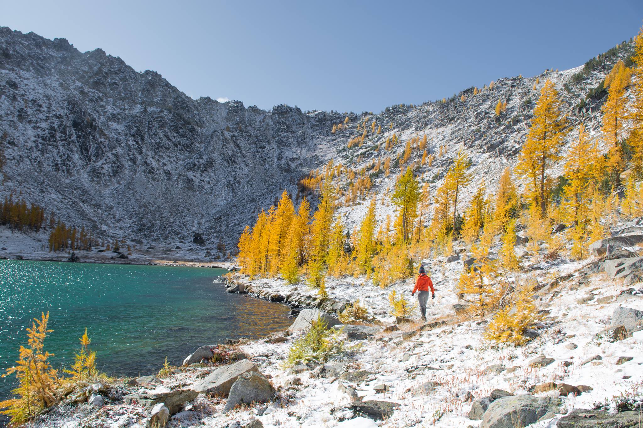
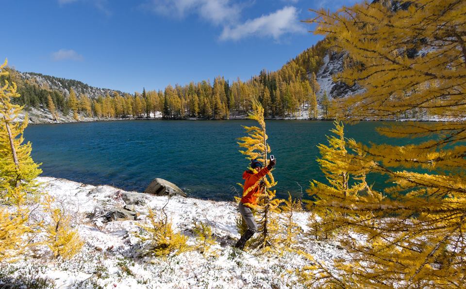
Me walking next to Sunrise Lake (photo credit Surafel)

Hug a larch (Photo by Surafel)
Most of my friends know how I feel about larches. Simply put, they are the best. The larches, not my friends.* They are the steak of the flora universe, the closest a plant can come to perfection. They are the only thing out here that rivals New England foliage. They are brilliantly yellow, and when set against bright blue skies and fresh white snow they are like candy for your eyes. It’s unreal. So once a year, I get admittedly manic about getting a sunny larch trip in, because these trees really have like a 2-week window (not even, 2 weeks only applies if you look at different areas) and one of those weekends I’m either busy or the weather is lousy and that means I only have one weekend of larches. I cannot emphasize how strongly I feel about this. I can climb any other weekend of the year but there is only one larch weekend. Getting a second larch weekend is like double cereal box prizes or a double-yolk egg or getting an extra bag of cheez-its cause the vending machine messed up. Except even better.

A more huggable larch (photo by Brad)
So sometimes, that means suffering through a miserable (or in this case mildly uncomfortable, more of an annoyance than anything else) day to get the good day. It happened at Snowy Lakes two years ago, it happened in the Enchantments last year (but I was sleeping in a car), and it happened again this year, though it was more like a half day this time.
- Distance: 23ish miles
- Elevation Gain: Net 5100ft but lots of up and down (highest point 8375)
- Weather: 20’s and windy and snowing, 40’s and sunny
- Commute from Seattle: 4:30… but worth it. Avoid rush hour.
- Did I Trip: Yes, 3 times, only one witnessed

What if there are no larches?!
We drove out late Friday night, leaving the Eastgate park n ride around 8 and getting to the trailhead just before midnight (yes!). I was going to be lazy and mooch off someone else’s tent because I didn’t want to unpack my pack but I sucked it up and put up my tent. Ugh. The forecast was for something like 55mph winds and precip up in the mountains, so I was happy to be camping low. We only got poured on for like 30 minutes. We woke up at 6am (I was the alarm – “ding ding ding ding it’s time for the morning!” because mine didn’t go off) and drove the rest of the way to the trailhead, where we started moving. This was it this was larch weekend!!
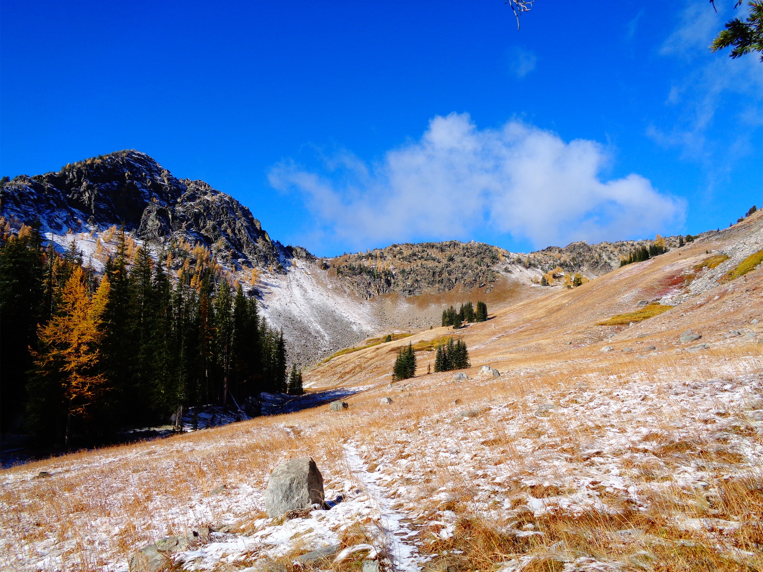
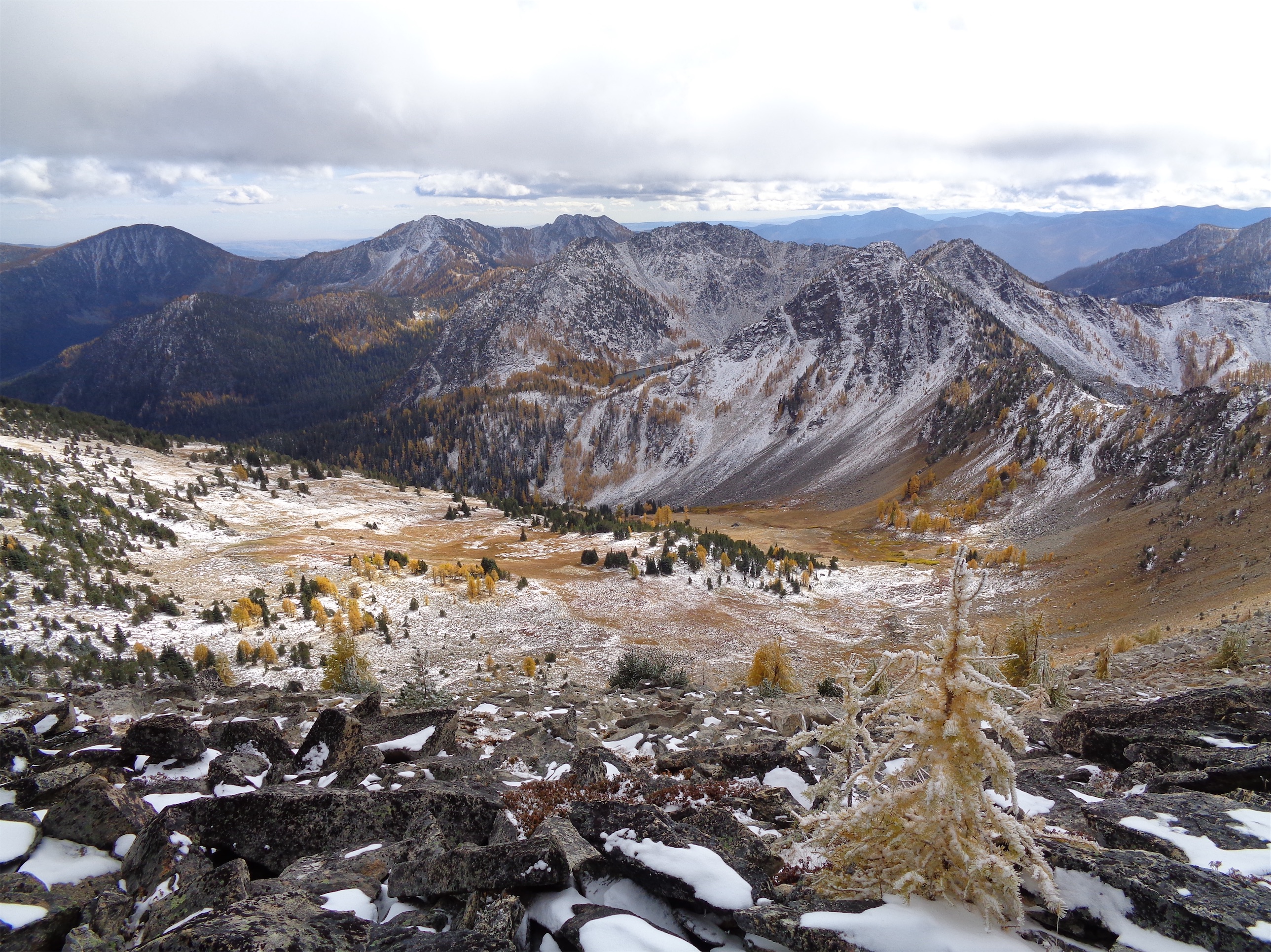
Lower Merchants’ Basin
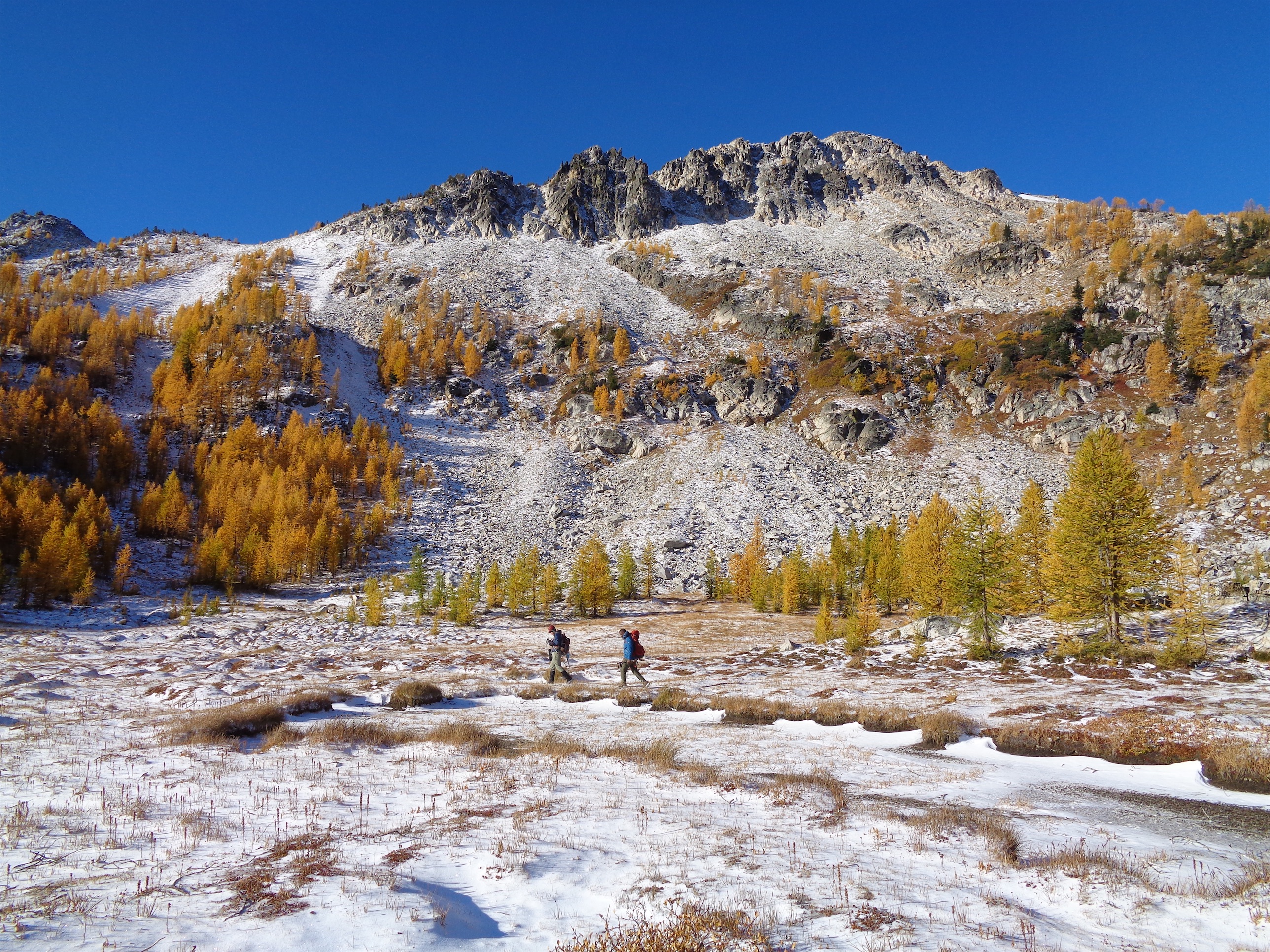
The trail is unbelievably well maintained. It’s open to dirtbikes, mountain bikes, horses, hikers, and it’s just in such great shape I couldn’t believe it. The first 5 miles were through the woods with only sneak peaks of mountains, and I started to panic that we wouldn’t see larches. What if they’re all still green?? I don’t see any through the trees and the brush that usually turns red in fall is green and only getting greener as we get higher!! Gah!! After a few hours of me raving about larches and ranting about possibly not seeing them, we finally broke out into Merchants Basin, where we originally planned on setting up camp. Eric had given us the go ahead to cruise to Sunrise Lake and meet him back at the basin, so we carried on to the lake, which is a short 2mi (round trip) detour from the basin.
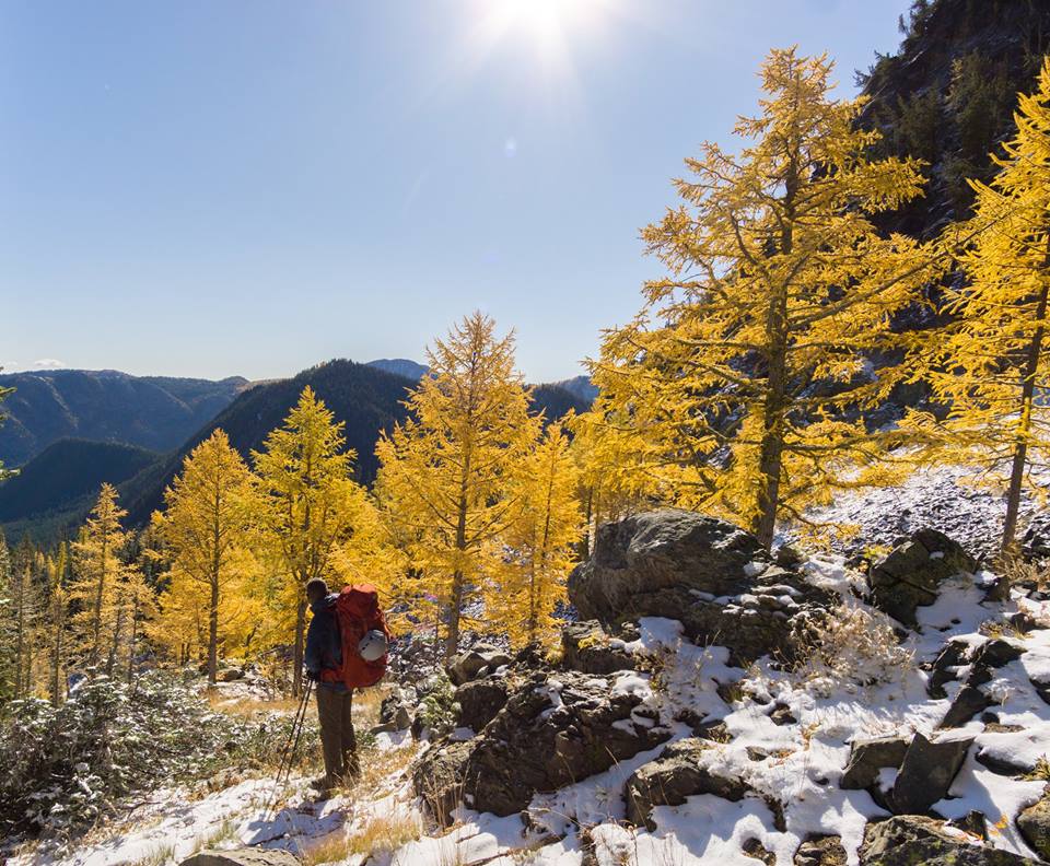
This is your frame! (Photo by Brad)
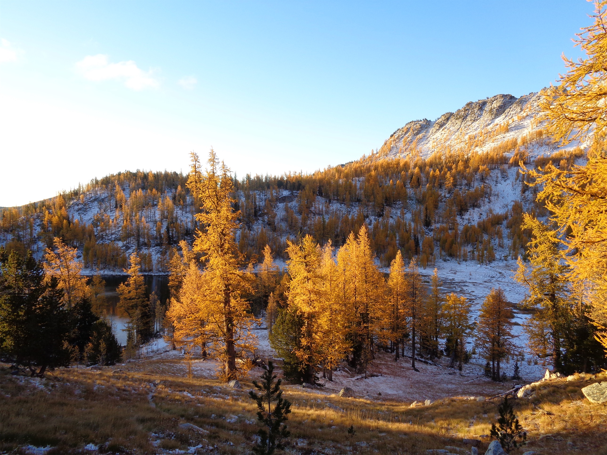
A half mile up the trail from Merchants Basin to Sunrise Lake, we were suddenly surrounded by gold. We hit a switchback and Surafel had the quote of the day. “This is it!! This is your frame! Guys take pictures of me.” He didn’t have his camera out yet so Brad and I started snapping pictures. Brad’s pics won. I can’t even put it into words. Walking through golden larches in fresh snow and bright sunshine is just surreal. This is me, every single time. I was so excited I tripped. “ONE!” Brad shouted. I had counted all of his trips on Glacier peak so now this is a thing. Surafel didn’t trip at all, that coordinated bastard.

Surafel by Sunrise Lake (photo by ME!!!)
Also, let’s make something clear right now. These guys are the two best photographers I know. Yeah yeah you’re all great and it’s hard to take a shitty photo when you’re in places like this but Surafel and Brad have ridiculously good eyes for colors and composure and angle and all the variables I don’t know. Surafel can make fog in trees look cool and Brad took a picture of the milky way in like 20 seconds when we did Glacier Peak which I thought was like a 5 hour process. And then there’s me with my point n shoot. Pointing and shooting. It’s like when the parents carve jack’o’lanterns but let the kid make a crappy one and praise the kid the whole time because the kid worked hard even though she had no idea what she was doing and the jack’o’lantern doesn’t even look like a face. I’m the kid.

Brad and Surafel above Sunrise Lake
With all of the larches, we knew we were getting close. “If I was a lake I’d be RIGHT…. HERE” the excitement in my voice rose as we rounded the corner to what was definitely a lake basin. And the colors were absurd. Bright yellow larches, bright blue water, bright white snow on the partially sunny, partially shaded ridge in the backdrop. Brad had the great idea to go to the ridge above the lake which was just a hike, so off we went. The trails just keep going and going, it’s hard to turn around. I hugged so many larches. When I got back someone asked me “did you go all white girl ‘i can’t even’ and hug everything” and I laughed. Actually…. yes. Yes I did. I even took a larch selfie, which is second only to starbucks coffee duck face selfies.
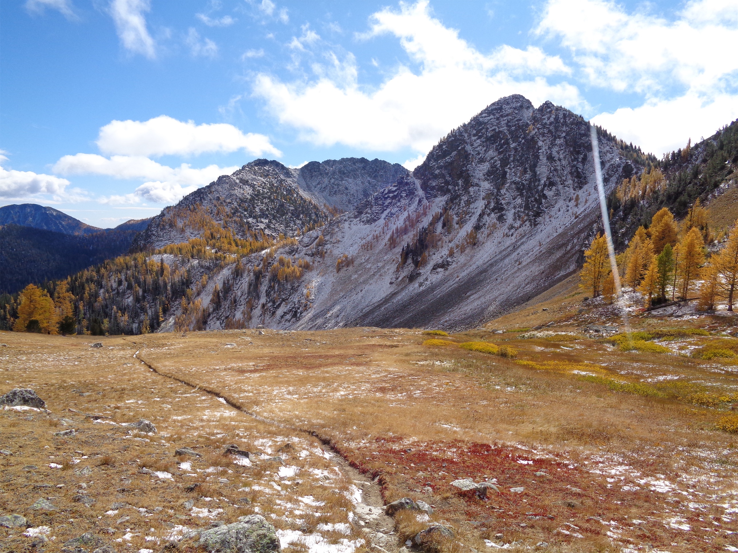
Upper Merchants’ Basin (Sunrise Lake in the basin over the ridge)
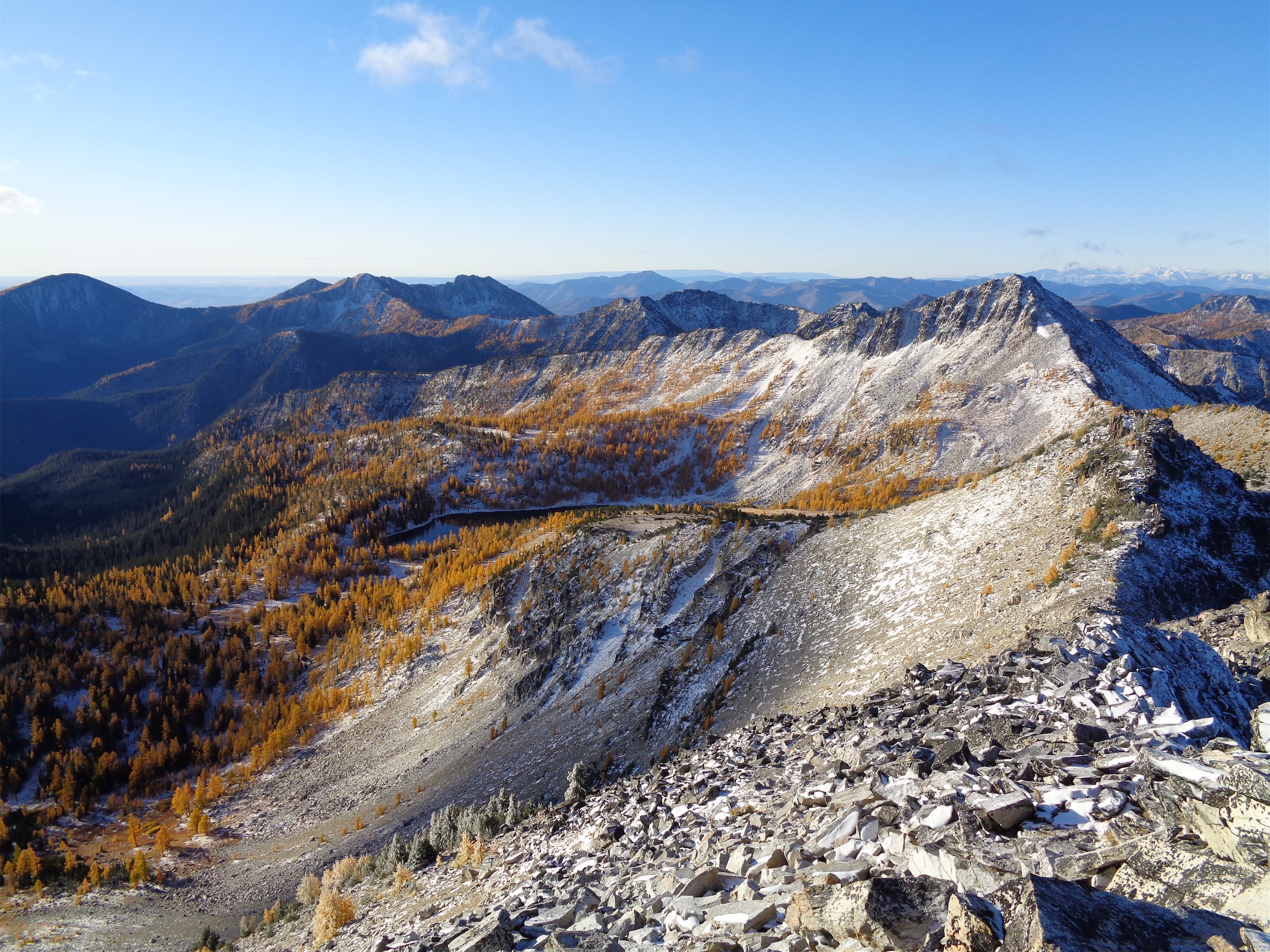
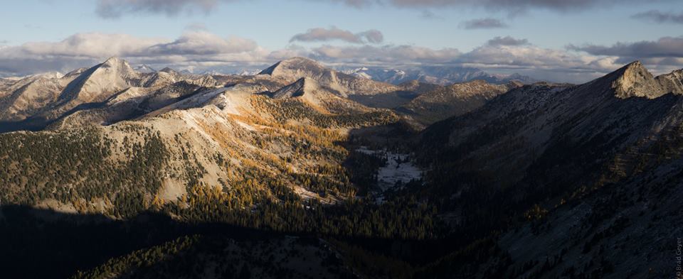
Finally on top of the ridge we had views of the other side, and I got to revisit the feeling of being entirely surrounded by mysterious mountains. What’s that one and how do I get up it? I am completely unfamiliar with this area. I’m used to being a peak dictionary and here I didn’t even have guesses at what the names were. There was a wall of weather beyond the second or third ridge that I hoped wouldn’t come our way but we all knew it would happen. It was freezing, so we snapped pics quickly and started to head down when we heard a “woo!” from the lake. It was Eric! He had decided to join us! We hurried down and met him where we had stashed our packs, making sure to stop every 50ft to take pictures and hug larches.
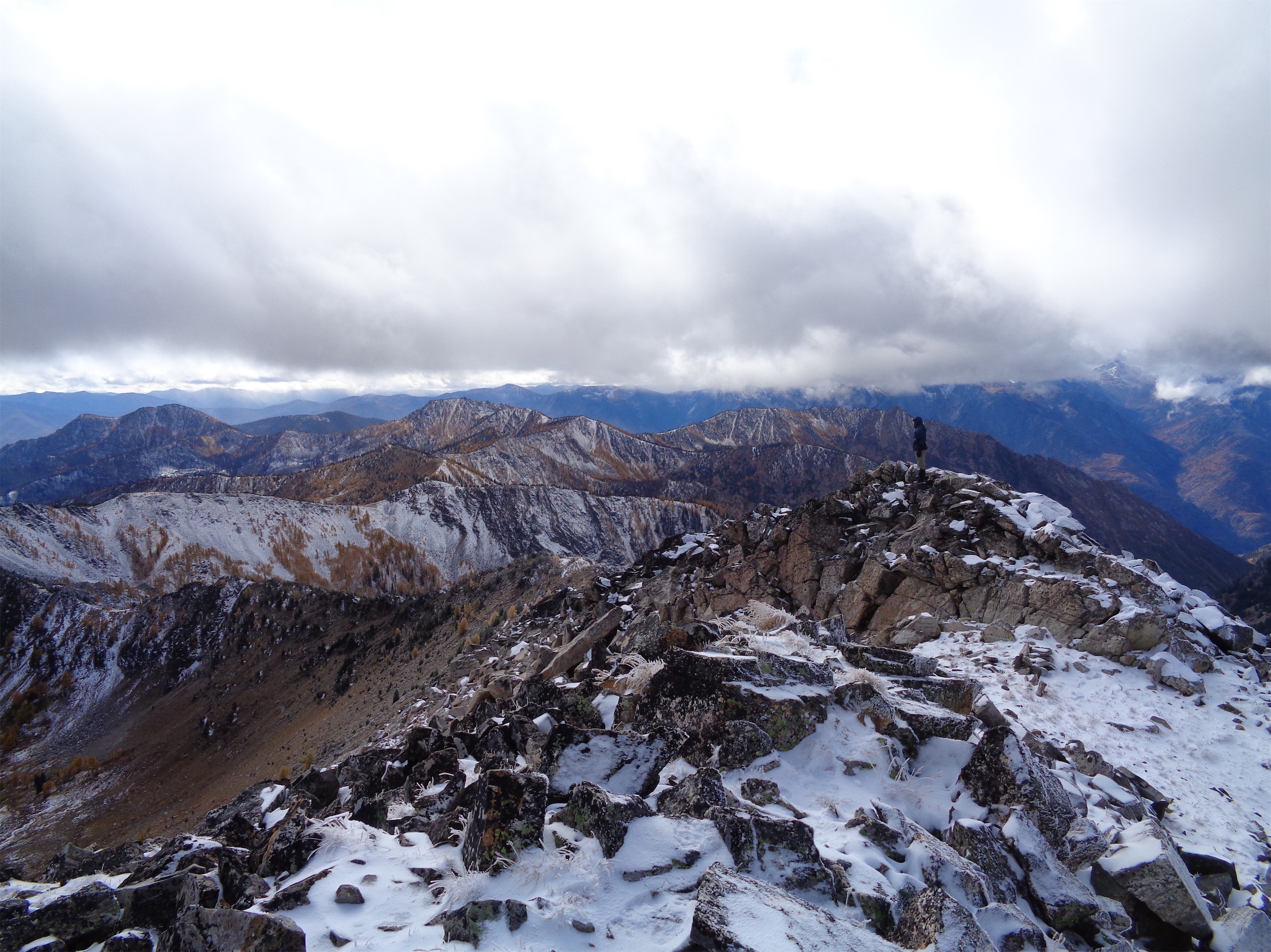
Heading up Switchback/Cooney Peak, Sunrise Lake in the back
We were back at Merchants Basin quickly, and decided to camp at Cooney Lake instead because a) more larches and b) we had soooo much time left in the day. And it was a better jumping off point for Martin, which I wanted to do because I like peaks. We headed up through the basin to the pass southeast of Switchback/Cooney Peak as the clouds moved in and the wind continued to gust, and took a quick detour to the summit. Apparently some Bulgers are walk ups. Who knew? It almost ruins the appeal but I guess I can suck it up in the name of larches.
Brad on one of the many summit bumps of Switchback/Cooney
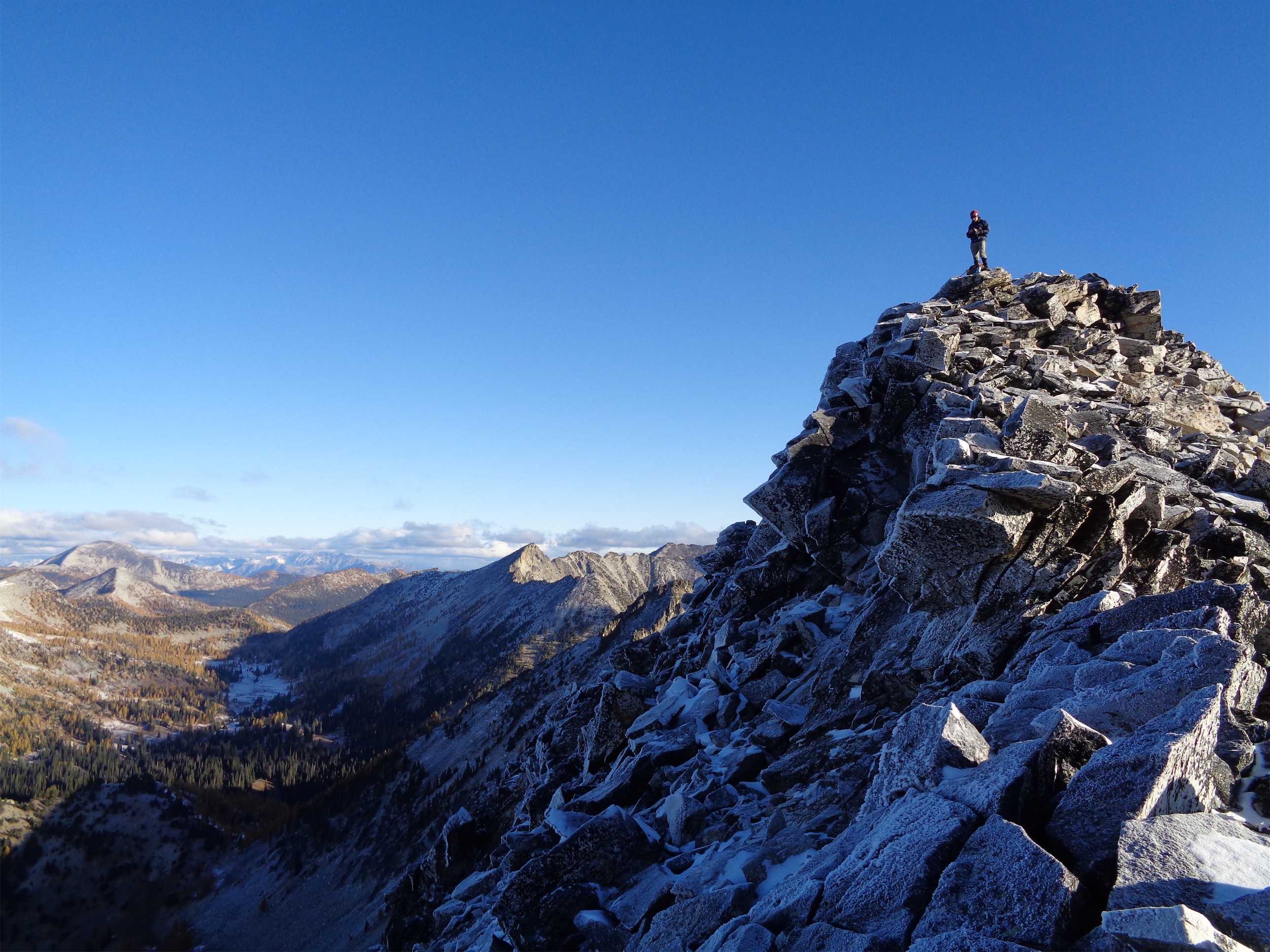
We followed a mountain bike trail to the ridge (Angel’s Staircase, which was not necessary, we actually overshot the summit) where we scrambled up the snowy talus to the summit. There was no survey marker, no summit register, and three solid bumps that could all have been the summit. “Do you think it’s the left or right one??” Brad looked back at me and laughed. “Both!” Better stand on all of them! We tagged each bump, I looked desperately for a summit register, and I finally gave up since my fingers were MIA and Brad had donned his overmitts meaning he wasn’t doing much better and we backtracked to the trail as nimbly as we could on snowy talus.
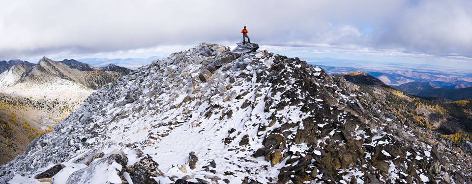
Me on top of Cooney/Switchback (photo by Brad)

Cooney Lake (photo by Brad)
On our way back to the pass we came across Eric, who had claimed he had no interest in Switchback but nonetheless was on his way to the summit(s). Eric is like a human summitpost. Or a walking caltopo of the entire state of WA. You name it he’s done it and he’ll know all of the secrets of the route. Cooney Peak was old news and yet here he was about to bag it again. We’ll see you at camp! We dropped down to Cooney Lake after chatting with a few mountain bikers (I’ll admit I was a little jealous) and started surveying campsites. Is this one big enough for four tents? Okay now everyone stand still until the wind gusts so we can see how well sheltered it is. We couldn’t feel fingers or toes and the gusts of wind were brutal. Re-adjusting to winter is always tough, summer makes you a wimp. We had originally planned on doing Martin Peak that day as well, but no one seemed in the mood, and it was in the clouds anyway, so meh. My motivation decreases exponentially as views decrease.
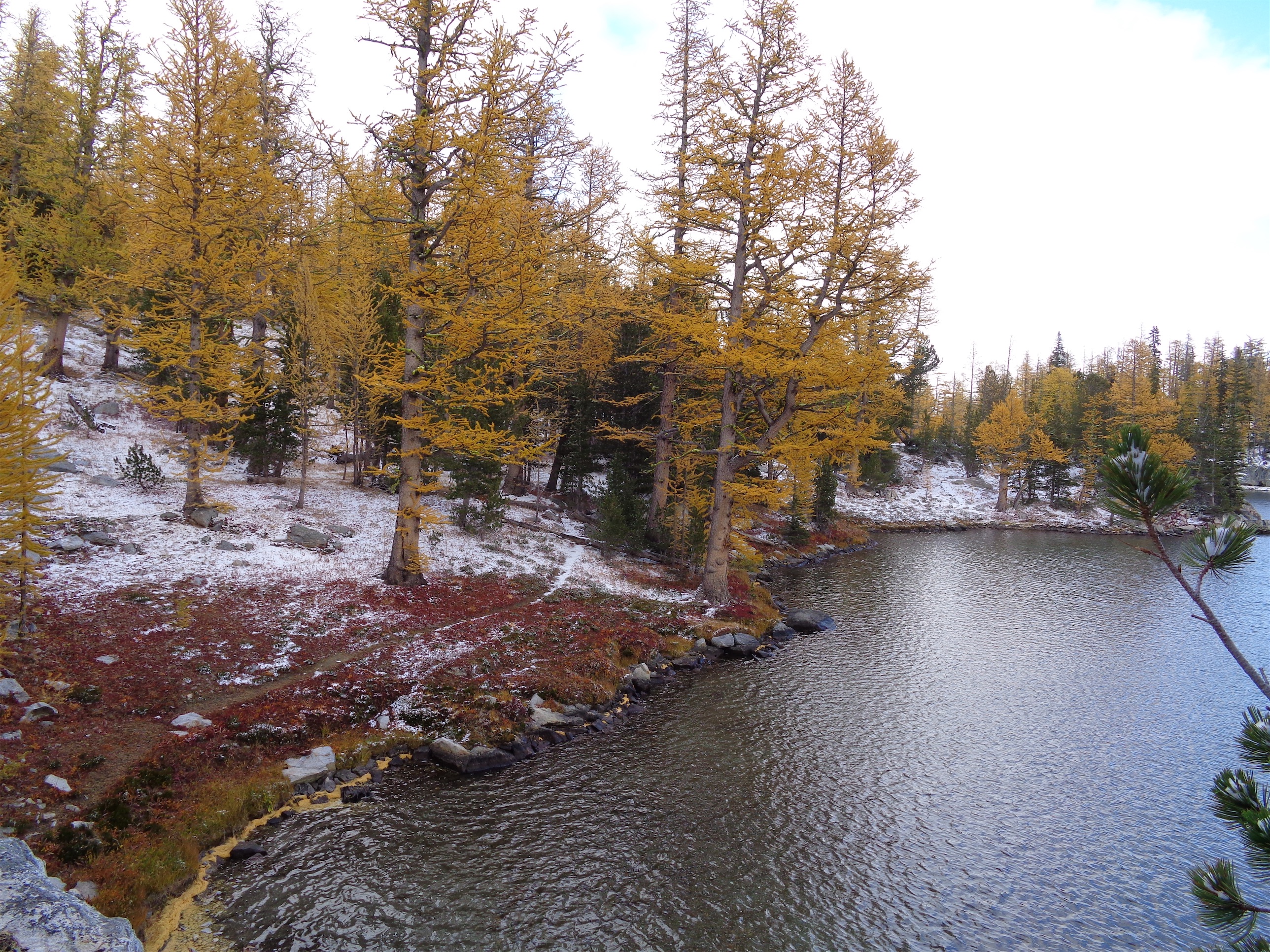
Fall foliage at Cooney Lake
We finally settled on a camp and pitched tents. I guyed the shit out of mine because I hate wind. I made a liter of earl grey tea and snuggled in my sleeping bag trying to get comfortable before venturing back out into the wind. Two mice and a chipmunk ran around a nearby tree, obviously scouting out my tent for their evening date with my snacks. Everyone was in their tents with doors unzipped just enough for faces to poke out. “I hope Eric just.. finds us” I said. I was resigned to doing laps around the lake to look for him. But immediately after I said that, we heard him shout! Yes!! Surafel shouted back and Eric made his way over to us. That could not have worked out better. And he didn’t see a register on Cooney Peak either, so I think there just isn’t a register. Someone bring one up!
Sunrise the following morning

Brad and Surafel coming up Martin, Cooney/Switchback Peak in the back
After a few hours of getting warm, the wind finally calmed down enough for Surafel to take a picture of larch reflections in the lake, which was the only thing that could coax Brad out from his tent. I followed, and we walked around to check out the rest of the lake. Some campers were having a bonfire nearby with a sweet dog who was in heaven in the snow and was a guaranteed space heater for whoever shared his tent. I like the idea of bonfires, but I also feel like a rotisserie chicken trying to get warm so in cold weather I’m not motivated enough to stick around. Clouds had settled on Cooney Peak, and naturally the wind picked back up immediately after we ventured outside, so I snuck back to my tent where I finally caved and put on long underwear. I avoided putting on the heavy bibs I had lugged all the way there. Gotta toughen up. Winter is here!

Brad nearly at the top of Martin
Dinner was quick. I reheated homemade sausage stew instead of bringing a dehydrated meal, which was a fantastic idea besides the fact that it makes the stove dirty. Brad had remembered gas and a stand and had forgotten the actual stove part of his stove (we aren’t going to let him live that down) so we all shared stoves. We went to bed fairly early given the lack of sun, views, warmth, meh. I did get to use my multicolored camp light that Kacie gave me a while ago, which rarely makes an appearance. I laughed flipping through colors just like she did when I first met her. I followed all of that up with a liter of hot chocolate, and finally went to sleep waiting for the aforementioned mice to ruthlessly ravage my tent.

Martin Lakes below, also a larch destination
Amazingly, they didn’t bother me. For once. Must have been too cold for small rodents, and they were all hiding in their burrows. Good. Perks of winter. I’ll leave some crumbs behind tomorrow as a thank you, sweet mice. I dozed in and out, never quite falling asleep despite my seldom-occuring tolerance of camping in the forest. My alarm failed to go off at 6am again (I must have dreamed that I reset it), so while Brad and Surafel thought I was being slow to get ready, I was actually just sleeping. Like that’s any better. I woke up to one of them walking around at 6:40ish with the sky lit up pink and purple and a huge moon over the saddle between Cooney and Martin. I made tea since Brad and Surafel seemed content taking pictures at the sunny lake. Yes, good weather!! I was glad we had saved Martin Peak for today.
Looking back at Cooney Lake and Switchback/Cooney Peak
Brad on top of Martin Peak
We started up to Martin around 7:30am and summitted in like 45 minutes. The larches by the lake were practically radiating liquid gold, and as the ground changed to dusted talus the views only got better. There wasn’t enough rime ice to be problematic, especially on the sunny side. We spent longer on the summit than we took getting to the summit. It’s another walk up (well, talus field), and damn the views were stunning. Larches in every direction. The clouds from Saturday had lifted and we could finally see all the topography to the west. There are so many incredibly mellow ridgelines here, it’s a trailrunner’s paradise. I can’t wait to go on a run out there. We somehow forgot to take a summit selfie despite my strong game the previous day.

Toilet!! (Photo by Brad)
We cruised back down to the lake where we went to the opposite side to get reflection photos (or in my case, pics of people taking pics) and then went to meet Eric and pack up camp. We had decided to take the Foggy Dew Ridge trail back to the road since Eric was seeking peaks he had not yet bagged, and that meant we’d hike a mile of road (small barf) back to the car instead of backtracking our original route so it was a more adventurous hike. From Cooney Lake we followed the Martin Lakes trail until it intersected with Foggy Dew Ridge. We actually missed the intersection and had to do some bushwacking (more like rock hopping) but we found it quickly. And on the way, we found a spectacular backcountry toilet by Cooney Lake, brand spankin’ new. It’s probably not as cool when the larches aren’t yellow and it doesn’t rival Eldorado or Boston Basin’s toilets but hey it’s quite pleasant.
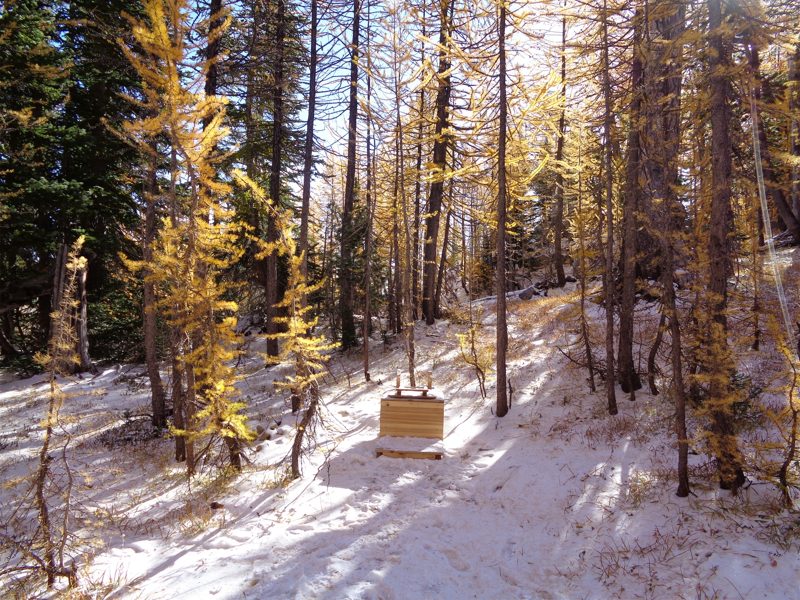
Braaaaand freakin’ new. Who wants to christen it?!
We found the most prominent high point on the ridge first, and picked our way up through white granite and black lichen and steep meadows. Naturally I topped out on what I thought was the highest point, only to turn to Eric. “Bad news…” He looked at me, not surprised at all. “Not the true high point?” “Nope. It’s like 500ft to the right.” Luckily it was easy terrain to go to the true high point, where the views of what we had climbed in the prior 24 hours were epic.
Photographers looking for photo ops at the end of Cooney Lake
The Foggy Dew Ridge trail does not match what’s on the map, more like it parallels the mapped trail a few hundred feet higher than the map claims. But it’s easy enough to follow thanks to mountain bike traffic. We went through rolling meadows, mellow larchey ridges, bright green mossy trees. The only bad part of this trip was how dusty the last few miles of this trail were. It would puff up all around you and god forbid you walk behind someone, it’s like driving on a forest road behind a truck spitting up rocks and obscuring your view with dust and then you breathe it all in and it sticks to you and you know you’ll look tan when you finish but it’s actually just dust. But it was totally worth it. Taking the ridge route back was far more interesting than retracing our route in, and rewarded us with some pretty sweet views.

Eric coming up to the most prominent point on Foggy Dew Ridge
We got back to the road around 4:30 and were back at the car by 5. Sweet!! We changed shoes and hopped in the car. We’re even going to be back in Seattle by a reasonable hour! And I was glad to have some daylight left – even if it feels like it means I haven’t utilized the day to its fullest potential, it meant I could see the drive down route 153, and for anyone who doesn’t know, I basically dream of getting property somewhere between Methow and Mazama on 153 or highway 20. Someday it’ll happen.
Selfie game on point (photo by Brad)
Awesome thanks to Eric for the location idea (I literally had only heard of Sunrise Lake, nothing else in this area) and Brad and Surafel for pulling it all together!! And for all of the insane pictures. I had never checked this part of the Cascades out before since it was such a long drive, but it was so worth it and I can’t wait to go back. It blows my mind that we have this type of beauty and it isn’t national park status. I even considered making the drive again this weekend just for a one day trip, but I think the larches are now past their peak. Larches are the best. Just gotta wait another 365 days for them to peak again in 2018, and maybe (definitely) I could be convinced to take a larch vacation.
One of the best photos of the trip. Awesome lighting. Photo by Brad.
Edit: Happy three year anniversary to the blog 🙂

Wow. It looks beautiful.
Especially the photos you took at Cooney lake are magical.
I also think it has been very nice to hike in such conditions.
Finally happy anniversary to your blog. 🙂
LikeLiked by 2 people
Liquid gold!
LikeLiked by 2 people
Larch weekend is the best weekend of the whole year! Glad you got to experience it!
LikeLiked by 1 person
Absolutely stunning photos. I love those larch trees!
LikeLiked by 1 person
I have one complaint. You didn’t post the photo of your actual selfie, of which you posted a photo of you TAKING the selfie. NOT COOL. Cough up the evidence, Brad!
Also. Larches ALSO make me as excited as a little girl on the first day of school. Yes, I was THAT girl.
Love itttTTttttttTTTTTT.
LikeLike
Stunning! Do you have GPX from the trip?
LikeLike
Let me know if this link works! I can share via google drive if not.
https://www.dropbox.com/s/4qc2g2a11xsz9dc/Cooney-Martin-Whole.gpx?dl=0
LikeLike
That’s perfect! You and your blog are both excellent.
LikeLike
Love your writing Eve, and great to meet you and get out with you all for this trip. Next year, even better larches await…
LikeLiked by 1 person
awesome report! the larchs in Carne Basin were still a little green last weekend, so I think this weekend will still be good! I wish I knew you, we could carpool.
LikeLike
How gorgeous. Glad you had an awesome time and didn’t let the clouds of dirt on a part of trail ruin it for you.
LikeLike
Pingback: Golden Lakes MTB | Have Tent, Will Travel