

Holy cow what a surprise. Davis had been low on my to do list for years, looked like a good workout but nothing very aspirational. WOW was I wrong. Nobody told me this is a wildflower paradise! I stumbled into a fairytale! And almost entirely by chance.
- Distance: 10mi
- Elevation gain: a nice clean 4000 (6400ft highest point)
- Weather: 60’s and everything
- Commute from Seattle: 2hrs eastbound, 3hrs westbound as i90 gets more crowded
- Did I Trip: no
I left Seattle very lazily around 7:30, maybe 8am. I stopped in Roslyn for bakery treats and a second earl grey tea. I wondered why I didn’t do more casual weekends staying in a small town and enjoying breakfast and doing day hikes in the area. My objective was Paddy Go Easy Pass, a more casual 6mi jaunt, an excuse to get out of the house. It was raining in Seattle, cloudy and raining all through the pass. Roslyn was sunny, but the mountains north looked socked in. I could see Davis fully, but every other ridge was socked in as I drove north on Salmon La Sac road.
I turned off the paved road onto the dirt road. Oh boy. I was still 30+min from the trailhead, and driving on the one road condition my car cannot handle (barring sheer ice). Washboard. Even in 4WD the tires spin, the car crabs, and I’m left steering into fishtails as if I were on sheer ice, except with shaking and rattling and a general feeling that the car is about to fall apart beneath my legs. Oh, and my fresh earl grey? Yeah that was immediately all over the center console. I nearly threw a fit. The Davis trailhead was the next trailhead I’d pass, and I pulled over and said eff it, I’m doing Davis. Not driving another 30min of this shit just to potentially be socked in anyway.
Ready to start a rampage with no plan (fortunately I did have a map, somehow) I stomped off towards the trailhead. You have to walk down a road more! You turn off the main road, head downhill, pull over in a small lot, then walk down the road further to a campsite where the trail starts. There is a sign so you won’t be completely lost. You cross the big river on a bridge, and then… heads up, you don’t see water again until you’re back at the bridge on your way down. Bring plenty.
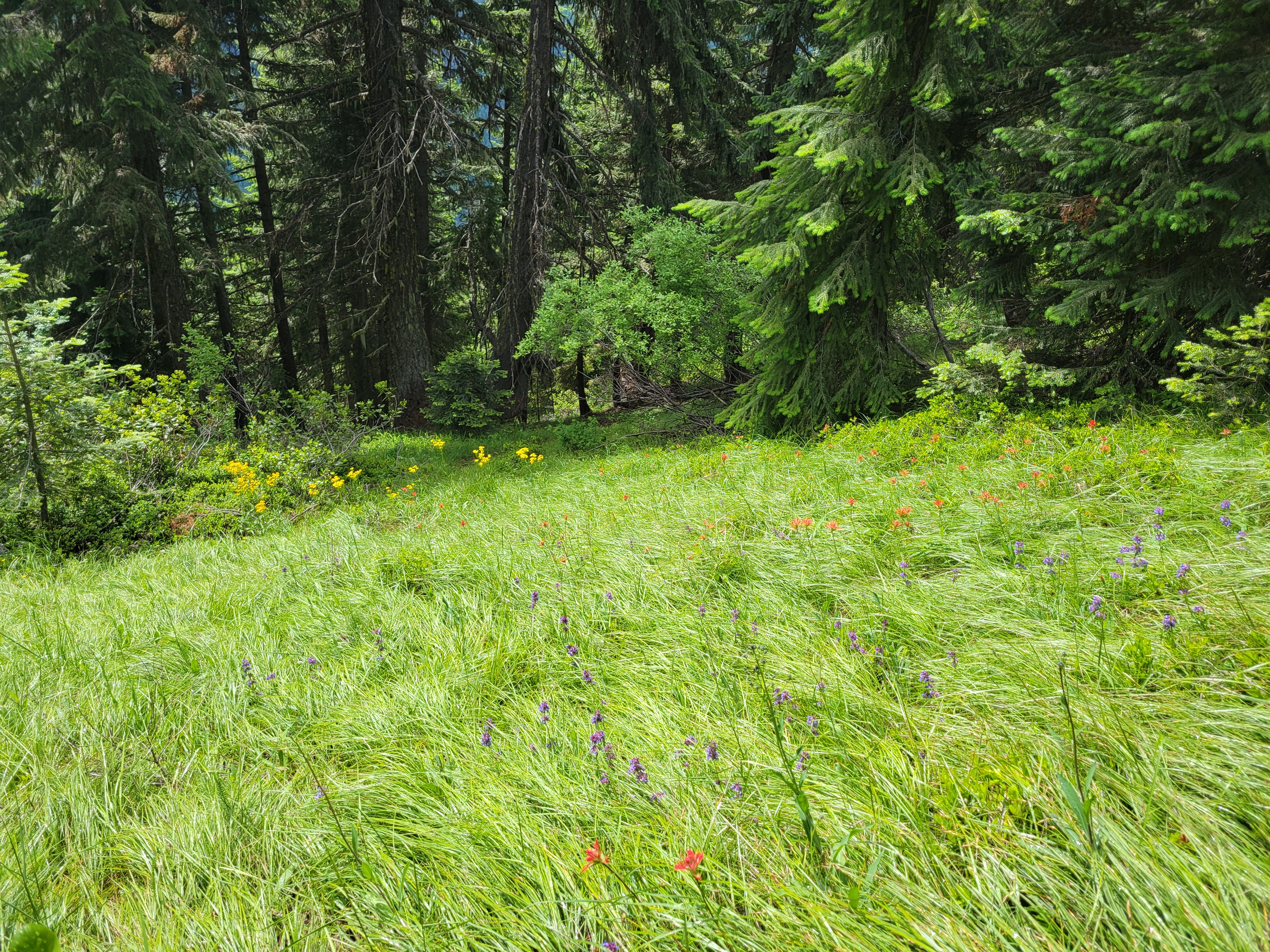
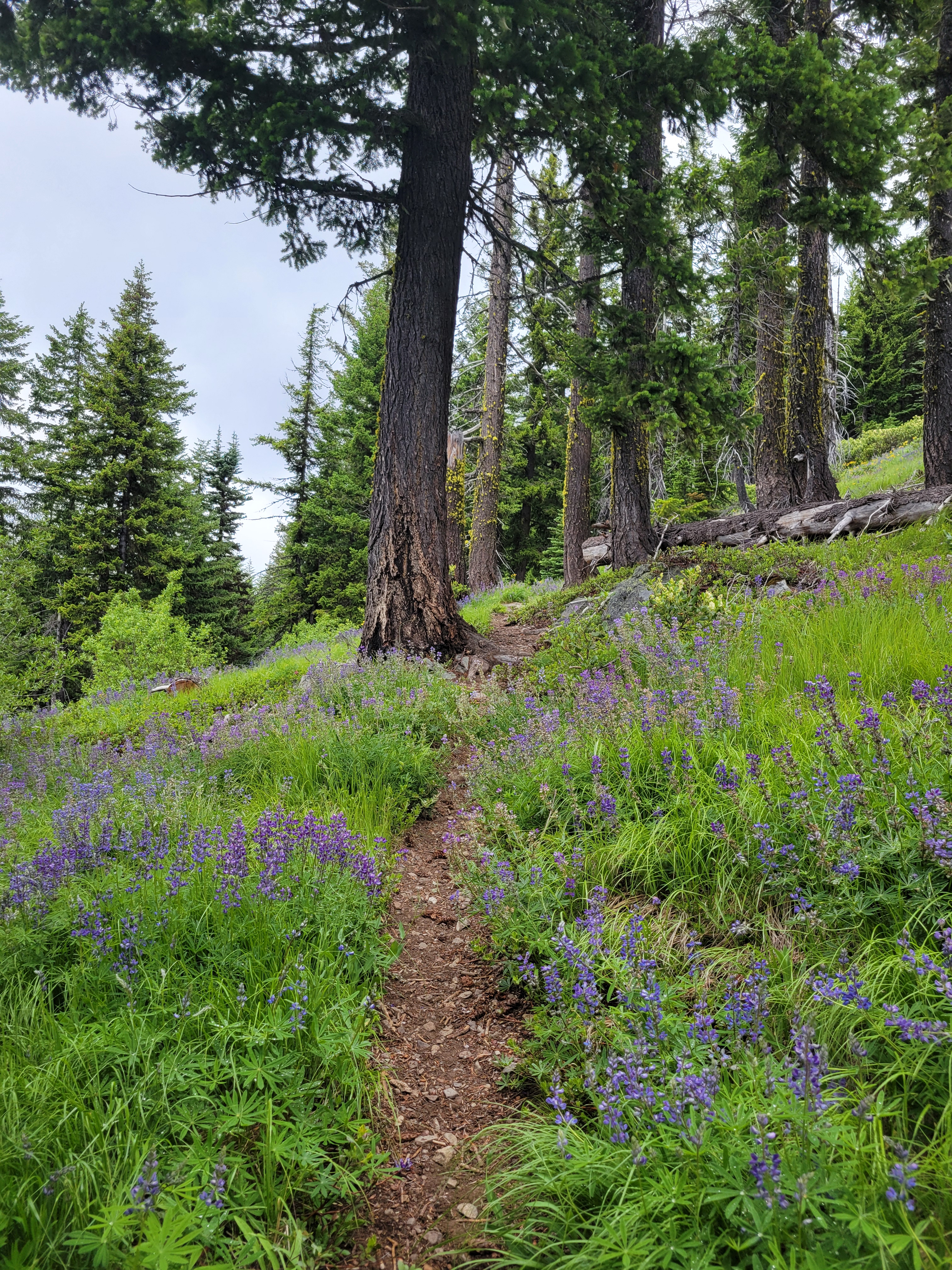
The trail is like 1000 short uphill switchbacks forever. My grouchiness dissipated as I had to focus on trucking uphill. However, the scenery changes every mile or so, keeping you interested. Open forest (I took no pics of that), then burn zone but with tall bushes, then BOOM DISNEY PRINCESS WILDFLOWERS I was bewildered! I had NO idea this was even a wildflower objective. I giggled at one switchback realizing it meant I’d get to go right back through an enormous field of flowers. I was in disbelief. A friend pointed out years ago that part of an awesome hike/climb/anything is being surprised by the scenery, and how that makes a 7/10 trail a 11/10 because you didn’t see it coming. This definitely fell into that.
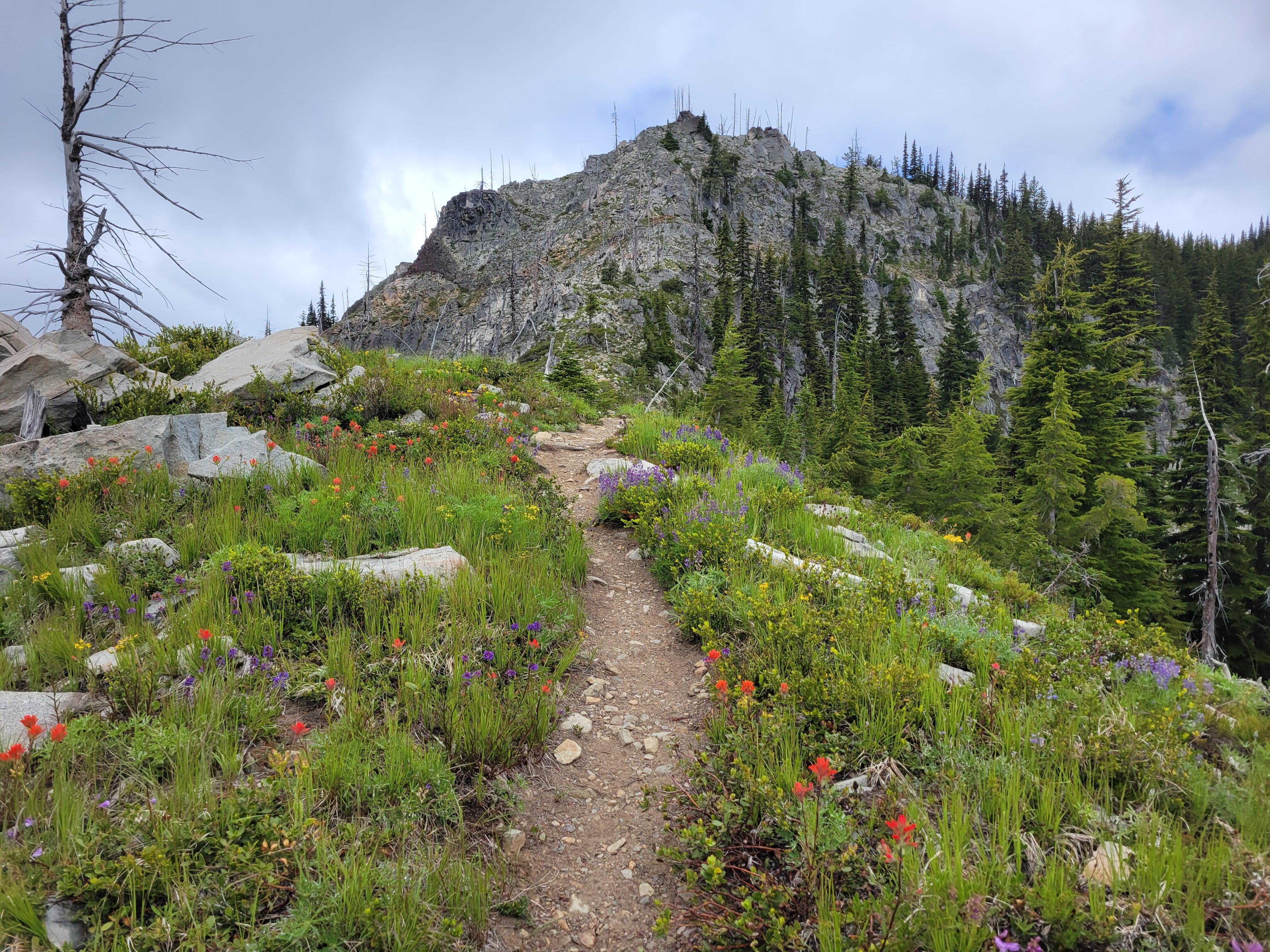
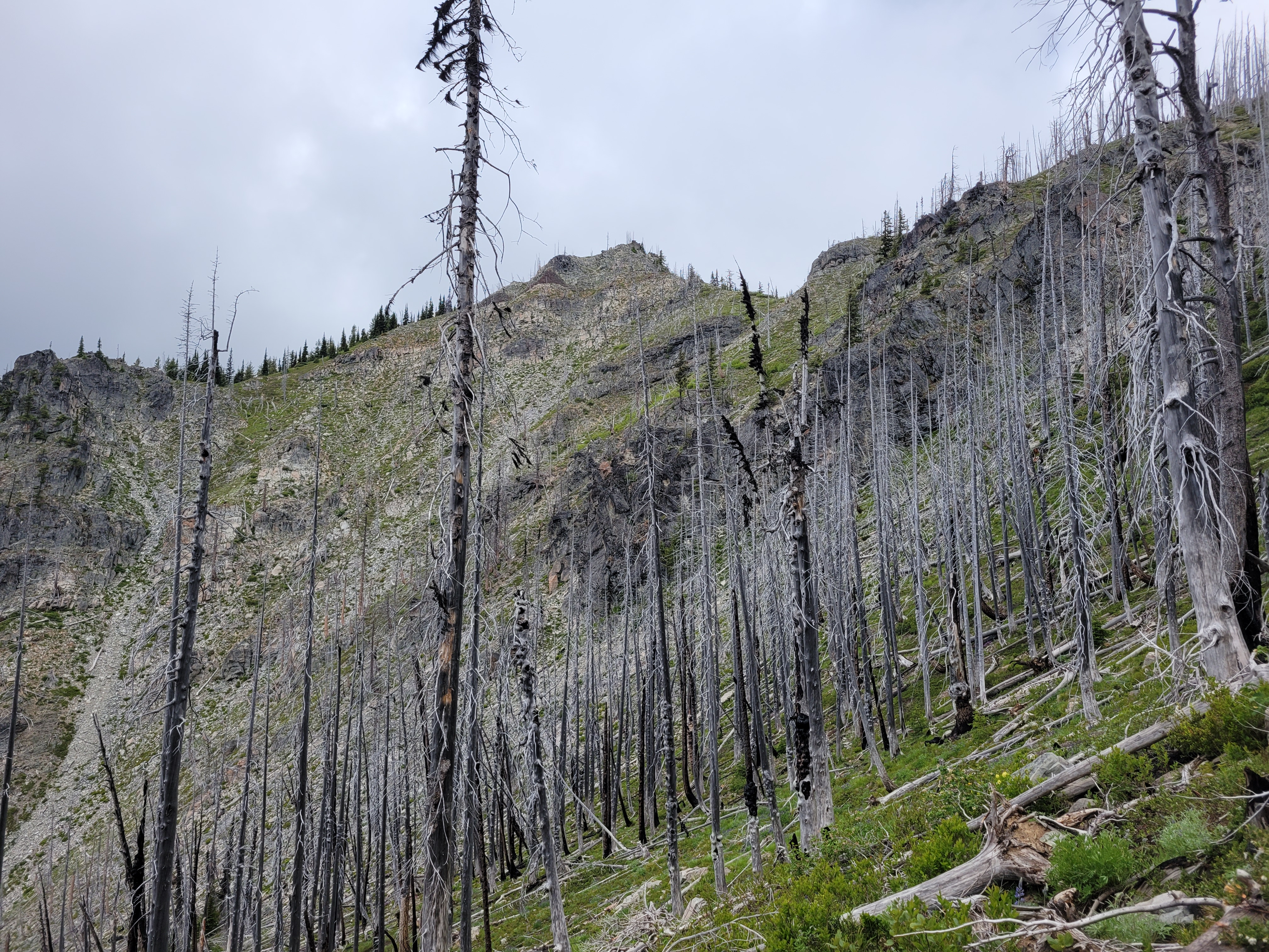
Forest and flowers eventually gave way to a more open recovering burn where not much regrowth has happened yet. A few baby lupines, not much else. But this section was followed by a rocky right with some short grasses and a smattering of more wildflowers!
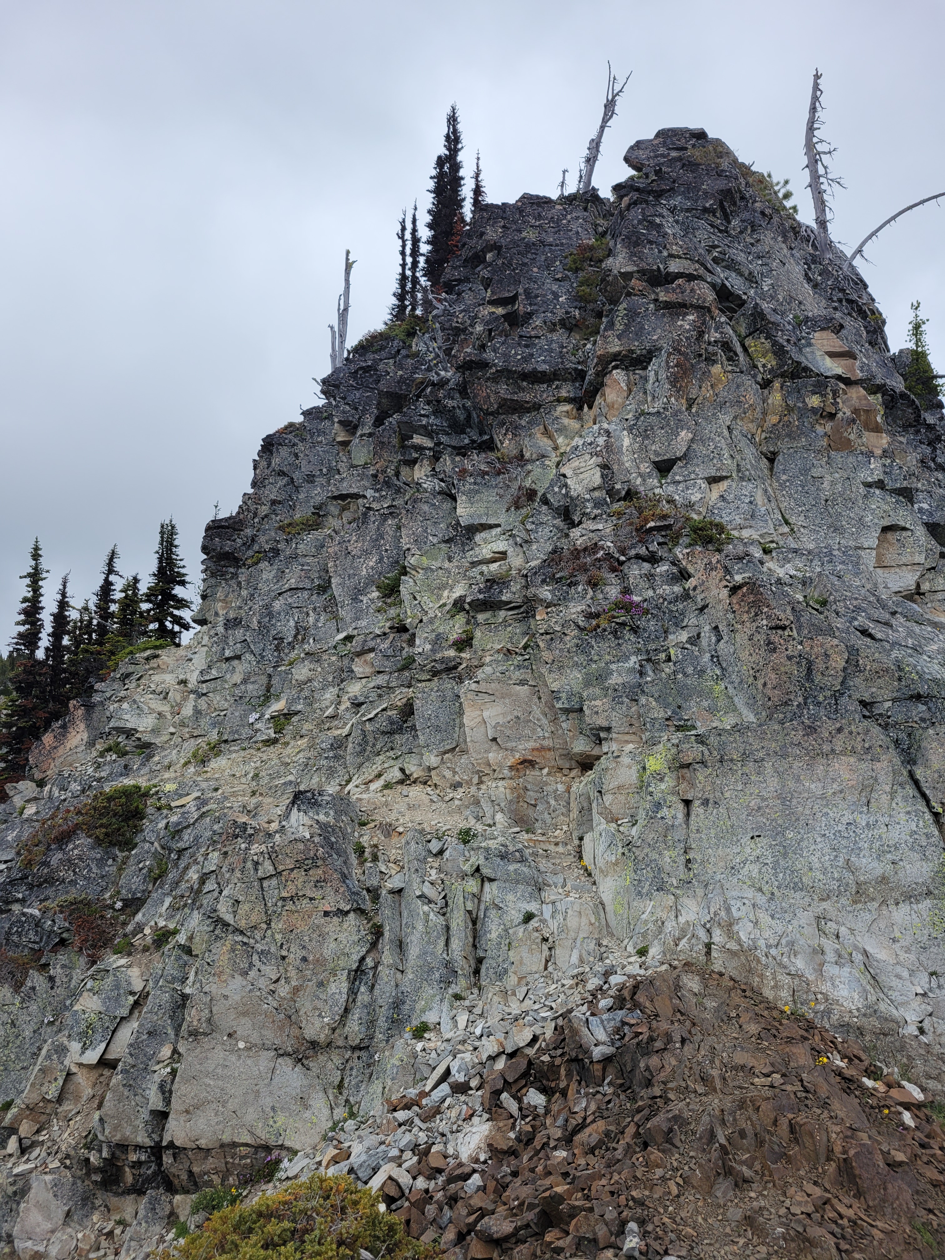
After a few minutes on the ridge, the trail drops down into the forest to the right. If you start heading up a steep rocky “trail” trying to maintain views you’re probably off route. There are branches blocking this trail, but I thought they might genuinely just be blow downs given it’s early season. Nope, they were intentional. Fortunately I figured this out before wasting too much time, refound the trail, and headed into the forest trying not to be too disappointed I was about to lose views. And I hate to say it – if I had not heard voices below me, I have no idea how long it’d have taken me to realize I was definitely off trail. The WTA descriptions clearly mentions this, I just… didn’t read it thoroughly.
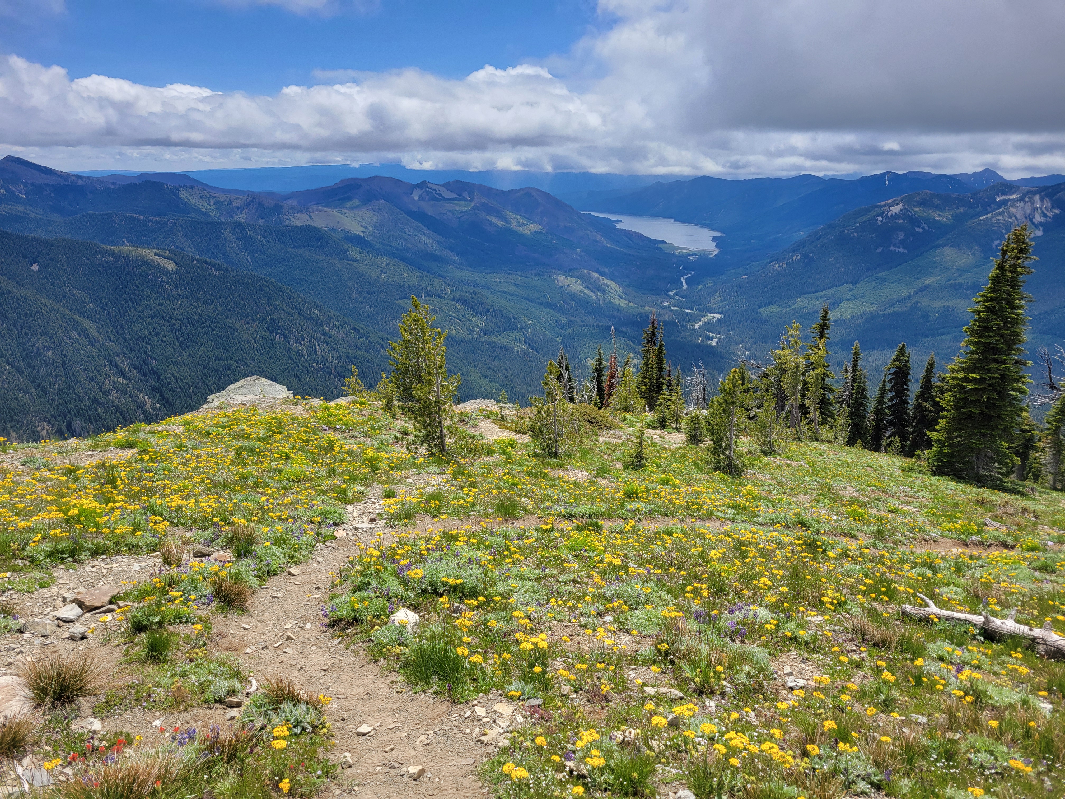
The forest basin section goes quickly, and soon enough you’re switchbacking up another knoll, breaking out at a lookout site ALSO ridden with wildflowers! Two women asked if I wanted them to take my picture, I said no thanks and plowed ahead before realizing wait I should offer to take their pic (of course they said yes). I explained I was just so in the zone I was not thinking socially. They laughed. “We’ve all been there.”

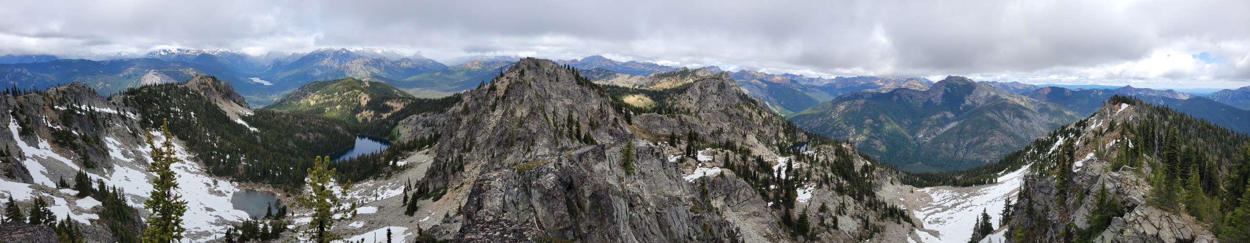
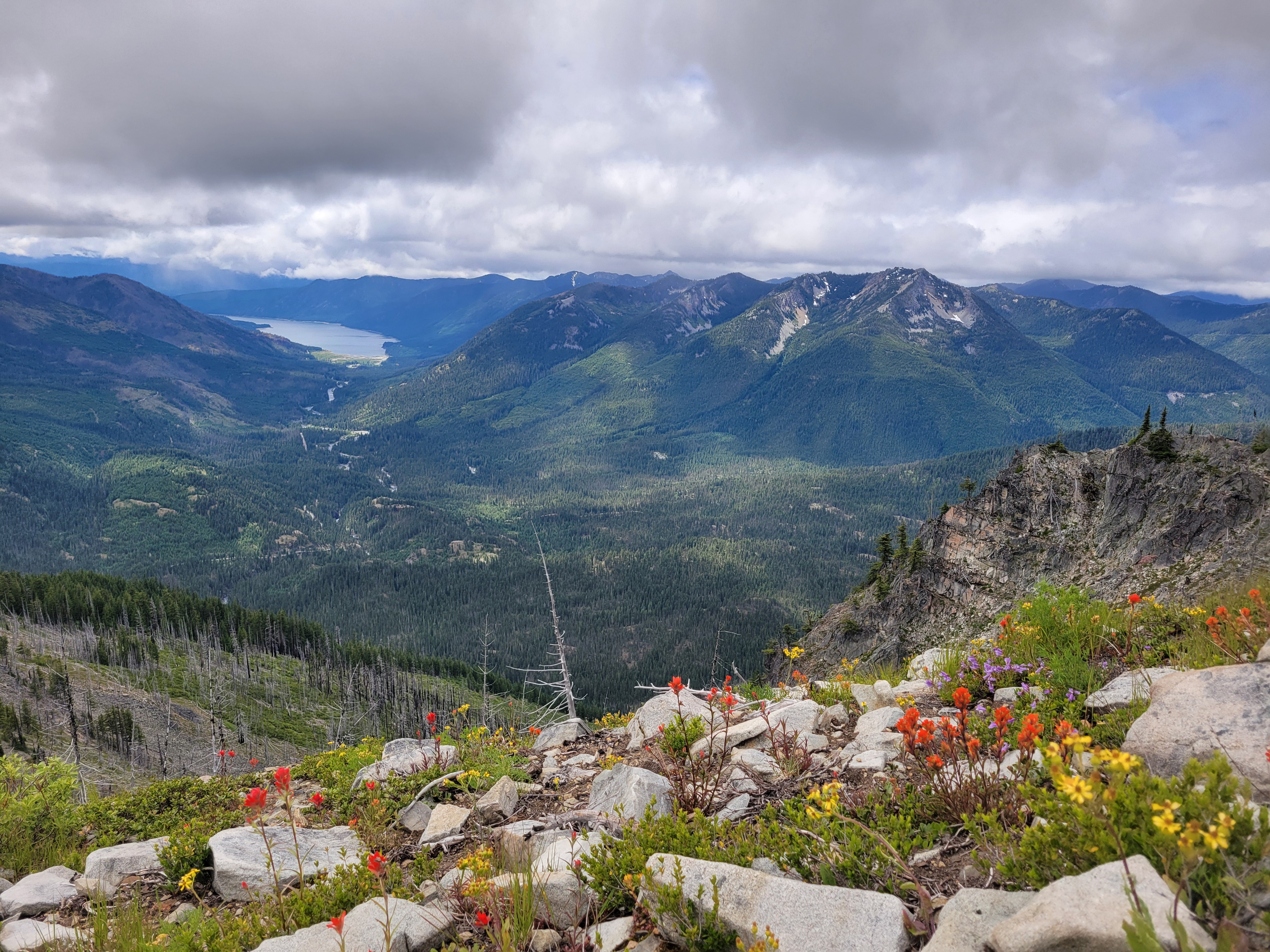
The last half mile to the true summit crawls along a ridge line with almost a scrambly feel. The actual summit probably has spectacular views on a clear day, but all the big peaks were shrouded in clouds. You finally get a view of some lakes. It is the Alpine Lakes Wilderness but 99.9% of this hike had NO LAKES. I had an amazing lemon jam pot, didn’t even know what that pastry was when I bought it but WOW is it delicious. Shout out to Red Bird Cafe.

The way down was uneventful. The wildflowers blew my mind all over again. I watched rain squalls threaten to come over but only got drizzled on once. It was really like Davis was in a patch of dry and occasionally blue sky, and everything in every direction was getting rain. It couldn’t be perfect though, I sat in dead stopped traffic on i90 for like 35min. WA’s highways can’t handle weekend traffic, i90 and 2 are both shitshows. I swore after this that for the rest of the summer I’d only do hikes north via i5 or highway 20, no more i90/highway 2. We’ll see how long that lasts.


Pingback: Huckleberry Mountain | Have Tent, Will Travel