
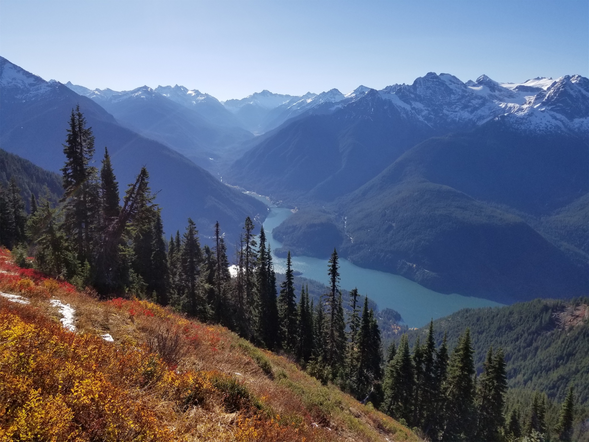
Looking across Diablo Lake, Colonial group on right
Obviously we had to take advantage of the sunny weather. Everyone had evening obligations (ugh, halloween weekend) so that meant a one day trip. Or two one day trips because I refuse to miss a sunny day in the mountains. As usual, Surafel agreed to meet at 5am like most crazy people, and his friend Nick joined us. I figured anyone who agreed to be up by 5am had to be cool, so we found ourselves at the Lynnwood transit center bright and early with no coffee (Starbucks wasn’t open), vagabonds asking for rides to Seattle (sorry, we’re going north, no, we don’t care if you’ll pay for gas, sure, call me an asshole) and a two hour drive ahead of us (depending on traffic).
- Distance: 10.5 miles
- Elevation: 4,870ft gain (5,985ft highest point)
- Weather: 50’s and sunny
- Commute from Seattle: 2:30 without traffic
- Did I Trip: I tripped twice, Surafel tripped ZERO TIMES, and Nick takes the cake with 3.5 (one was more of a short slip)

Old burn? Avalanche?
The drive went smoothly, we got gas station coffee and tea (Surafel somehow ended up paying for anything because Nick and I suck aren’t fast enough), and we started hiking just as the sun rose. Perfect timing, because we avoided needing headlamps. The “trailhead” is awkward, it’s just next to some tennis courts and storage/garage spaces in Diablo. The trail does not start near the sign, so we had to search a bit. We spent probably 10 minutes trying to find the start of the trail (that sneaky bastard), gave up and I pulled out the gps, and finally were on our way. With mountaineering gear, because I was under the impression there would be several feet of snow at the top.
Local riff raff
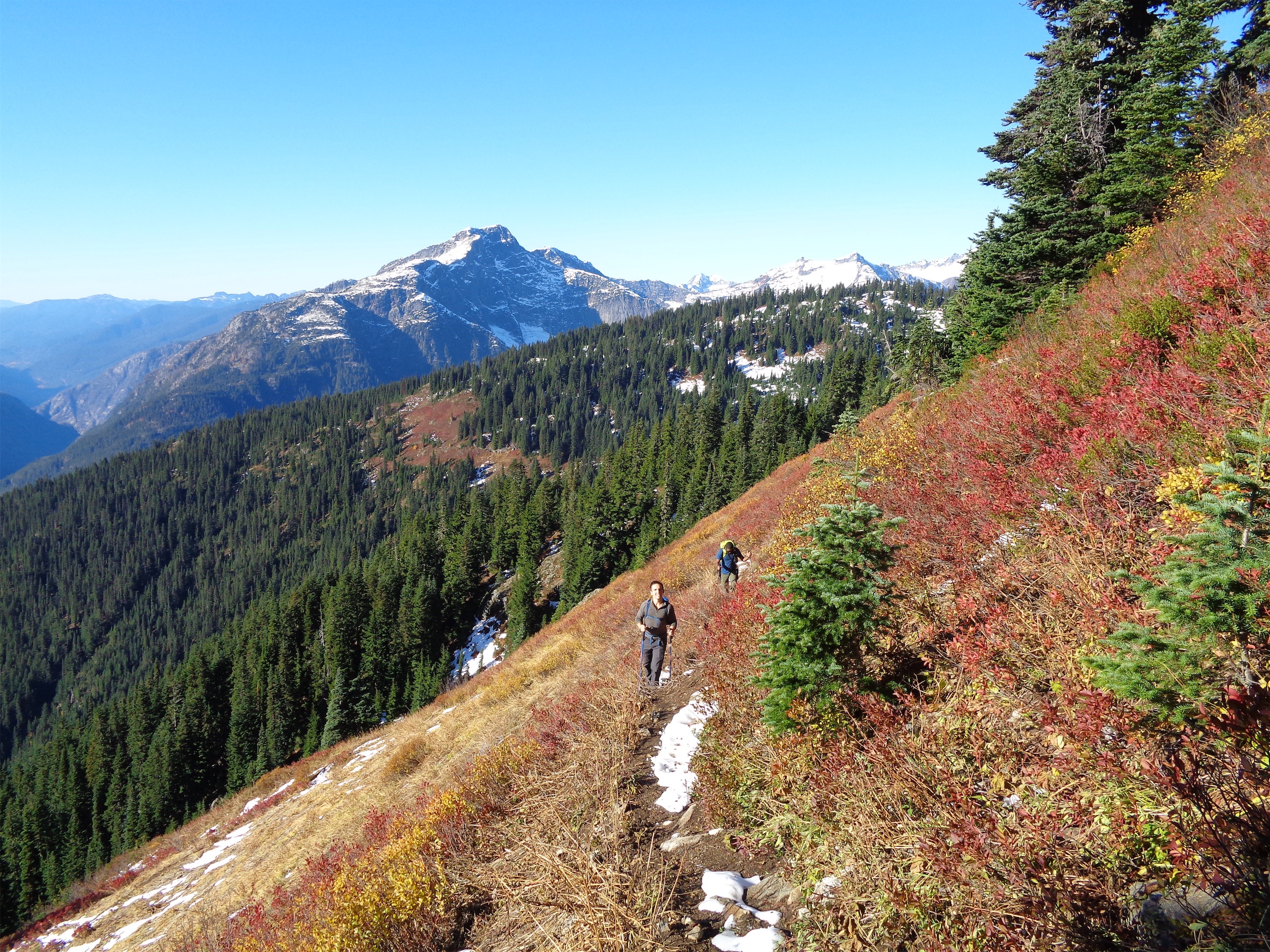
The trail goes up, and up, and then there’s a switchback and it goes up more, and some more, and another switchback, and more uphill. You get peek-a-boo views of the Colonial group, which looks spectacular with fresh snow. The trees had turned yellow, which was awesome, I had expected everything to just be dead by now. You break out into what looks like an old burn zone (if all the trees were bleached) but I can’t find anything on a burn besides maybe one on the north side of the peak. Maybe the trees area avvy debris, there were a few tree pileups that could have been from a long ago avalanche.
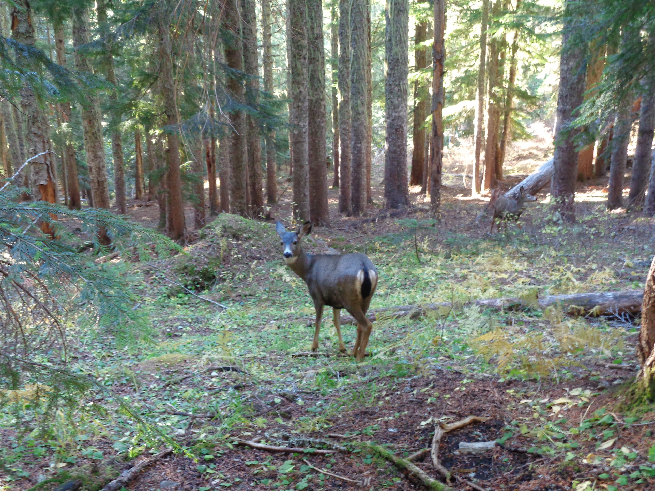
More wildlife
The national park boundary is around 4,200 ft, which was an important point because I thought we’d be taking the winter route. The winter route basically follows a ridge from the national park boundary up to Stettatle Ridge, and then follows Stettatle Ridge to the lookout if you so desire (but the ridge views I hear are just as good, if not better). But we got to the park boundary, and hadn’t even seen a snow patch. I looked like a fool with my axe and crampons. We had worn mountaineering boots expecting to be kicking steps up to the ridge and instead we were just beating up our feet on dirt trail. I had turned around just past the park boundary back in February 2015, thinking I was close to the ridge when in reality I was still hilariously far away.
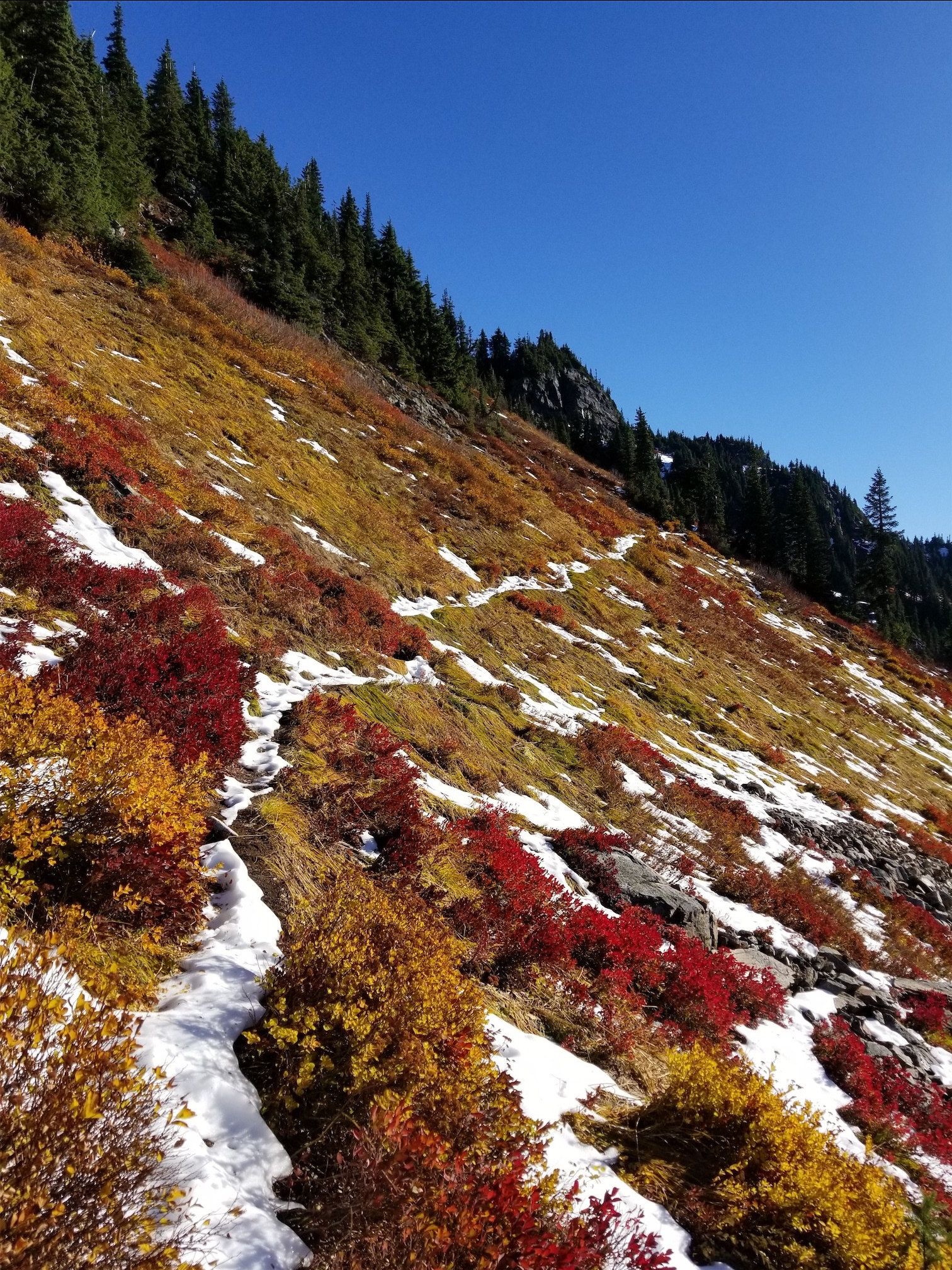
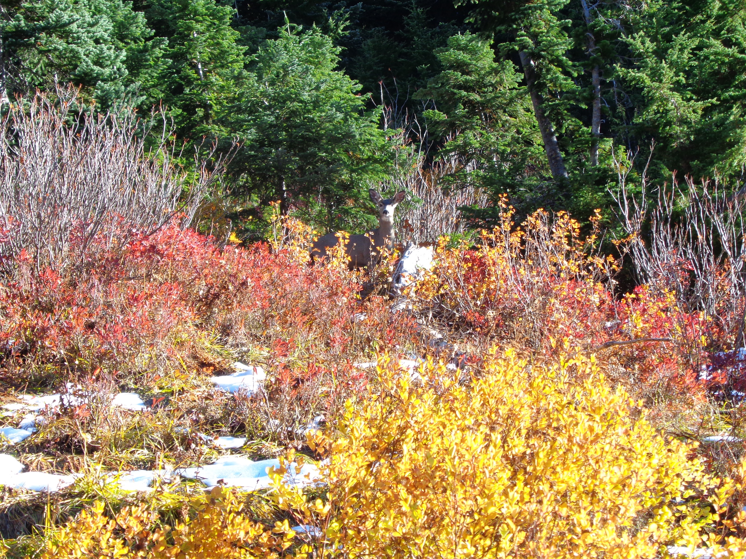
Fall foliage!
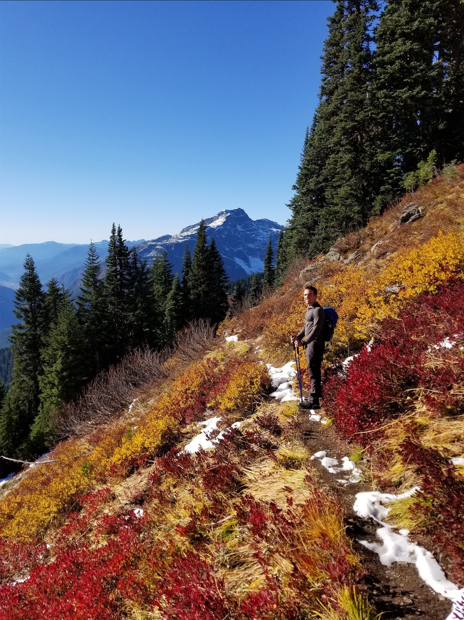
We met several deer just after the park boundary. It’s like they knew they were safe just inside the lines. I NEVER see wildlife. Ever. I couldn’t believe we were looking at deer. Around 4,800ft, we did finally run into snow. But it wasn’t enough to worry about changing the route, so we plowed on ahead. If anything, it made the fall foliage even more spectacular, and like I said I hadn’t been expecting any fall colors!! I was just thinking snow, and instead we got brilliant colors and no slogging! Our pace slowed dramatically as the cameras came out and the blueberry bushes got brighter. It was weird, if they were between the sun and you they looked bright red, but if the sun was behind you and the blueberry bushes were in front of you they were a more dull reddish brown. Funny how the light plays like that.
Nick and Surafel, Davis Peak in the back
We crested the ridge, where the snow was anywhere from 1-3ft deep thanks to snowdrifts. Okay, so we had some slogging. The trail was covered but you could see a hint of where it went. But the trail was about a foot deeper than the surrounding ground, like a rut cut into the mellow ridge by stampeding feet. So I did my best to kick steps next to the trail, with the occasional posthole where I stepped into the trail, or a tree well, or slipped off a rock. Oh, and did I mention the crust yet? You kick the step, and then slam your shin into the icy crust. Nothing I enjoy more than bruising my shins in the name of alpine views.

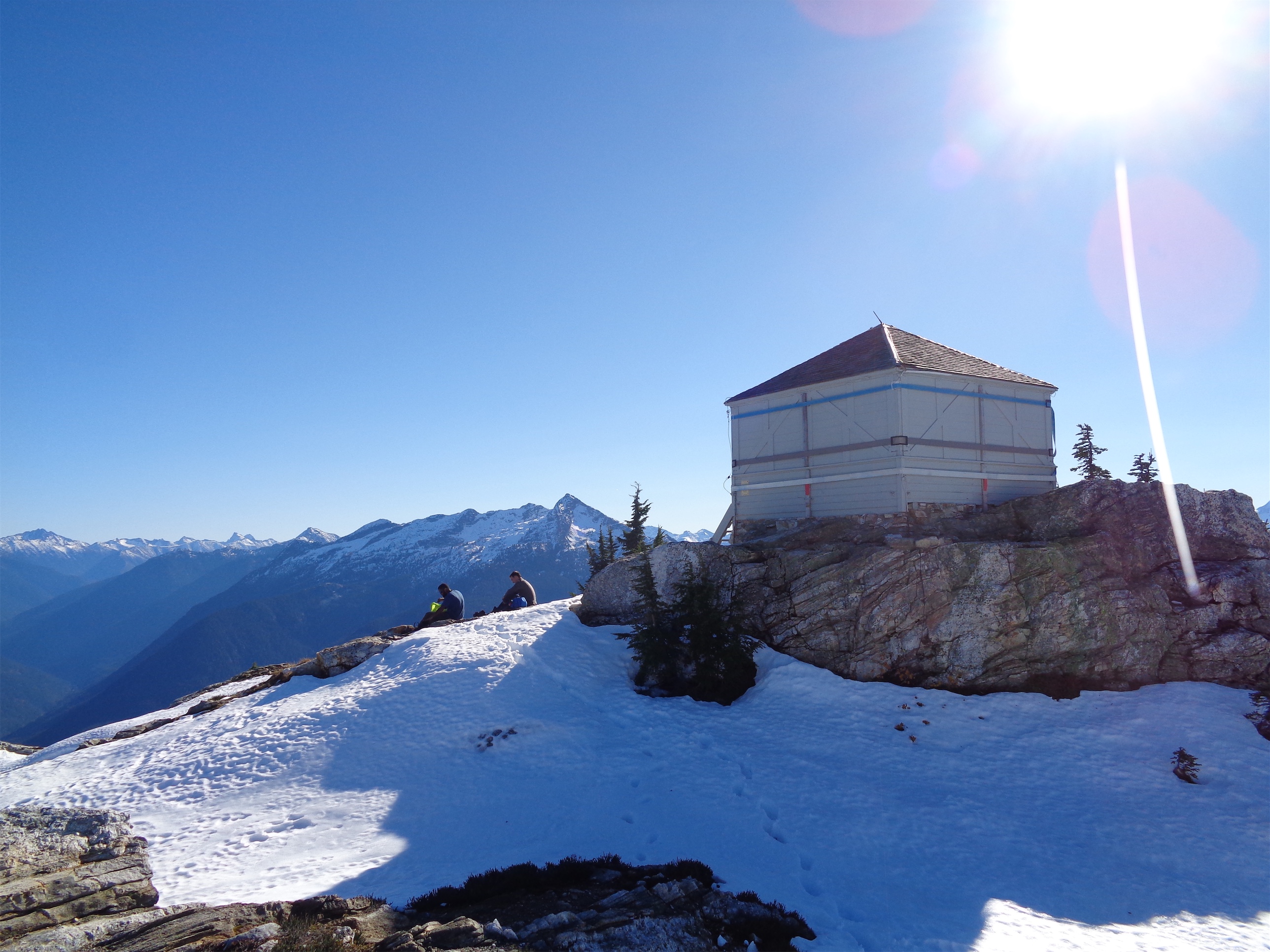
The lookout!
The lookout finally came into sight and we hustled up there and plopped down on a few sunny rocks to enjoy the views. The lookout was closed, which was expected but still a bummer since I want to see what’s inside of it! There’s so much history to those buildings. This was one of the first ones built in the area, put up by Glee Davis back in 1917. Davis is a big name, there’s a peak named after the family since they had one of the first homesteads along the Skagit River. They had originally settled next to the Cascade River (Cascade River Road!), where their property was destroyed in a flood. Lucinda Davis was actually the first woman to summit Sourdough, as well as Pyramid Peak across the valley. The Davis family ran a Roadhouse that sheltered mine workers, and set up one of the first water flumes along the Skagit to provide electricity. Sorry, nerd alert.
Can we just move in here

Hozomeen left, Jack right
I can also see why Jack Kerouac was obsessed with Hozomeen, it looks freaking rad from the south and the ridges around it are all mellow rolling ridges next to its jagged four summits. Desolation Angels was written while he stayed in Desolation Peak lookout, which stares right at Hozomeen, even more closely than Sourdough. There were low clouds over Ross Lake, and Jack Mountain and Ruby Mountain looked spectacular. We got a peak of the Pickets over Stetattle Ridge, taunting me as usual. Someday.

Surafel coming up the ridge, Davis, McMillan and Prophet in the back
We reluctantly packed up our bags to head down, until Nick practically shouted “oh, I forgot I brought this!!!” He whipped out a fucking DISPOSABLE CAMERA. Half full of mystery photos from days past, so he needed to use up the rest of it so he could get it all developed and figure out what the mystery photos were. Ahhh! He spun the wheel and charged the flash and snapped a pic. And spun the wheel again. Surafel had never seen a disposable camera so we taught him to use it and everyone had a chance to take a picture. Apparently now WalMart has same-day developing if you drop off your film. Dream big.
Nick on the way down
We ran into a few parties on the way down, and gave encouraging beta since between the three of us we had trampled a pretty damn good trail to the lookout. Nick wiped out in rare form as another party passed us (aka great audience). I had slipped near the lookout. Nick slid down a hill trying to avoid a tree. Surafel maintained his composure and grace. I stubbed my toe (I guess that’s like 0.2 trips). The last two miles of the trail felt like they took forever, redundant pounding beating up knees and feet and toes as you lose 3,000ft in elevation over two miles. I think it was more pleasant going up than coming down, though I suppose we brought a little of that upon ourselves by wearing mountaineering boots, which are like walking on wooden planks.
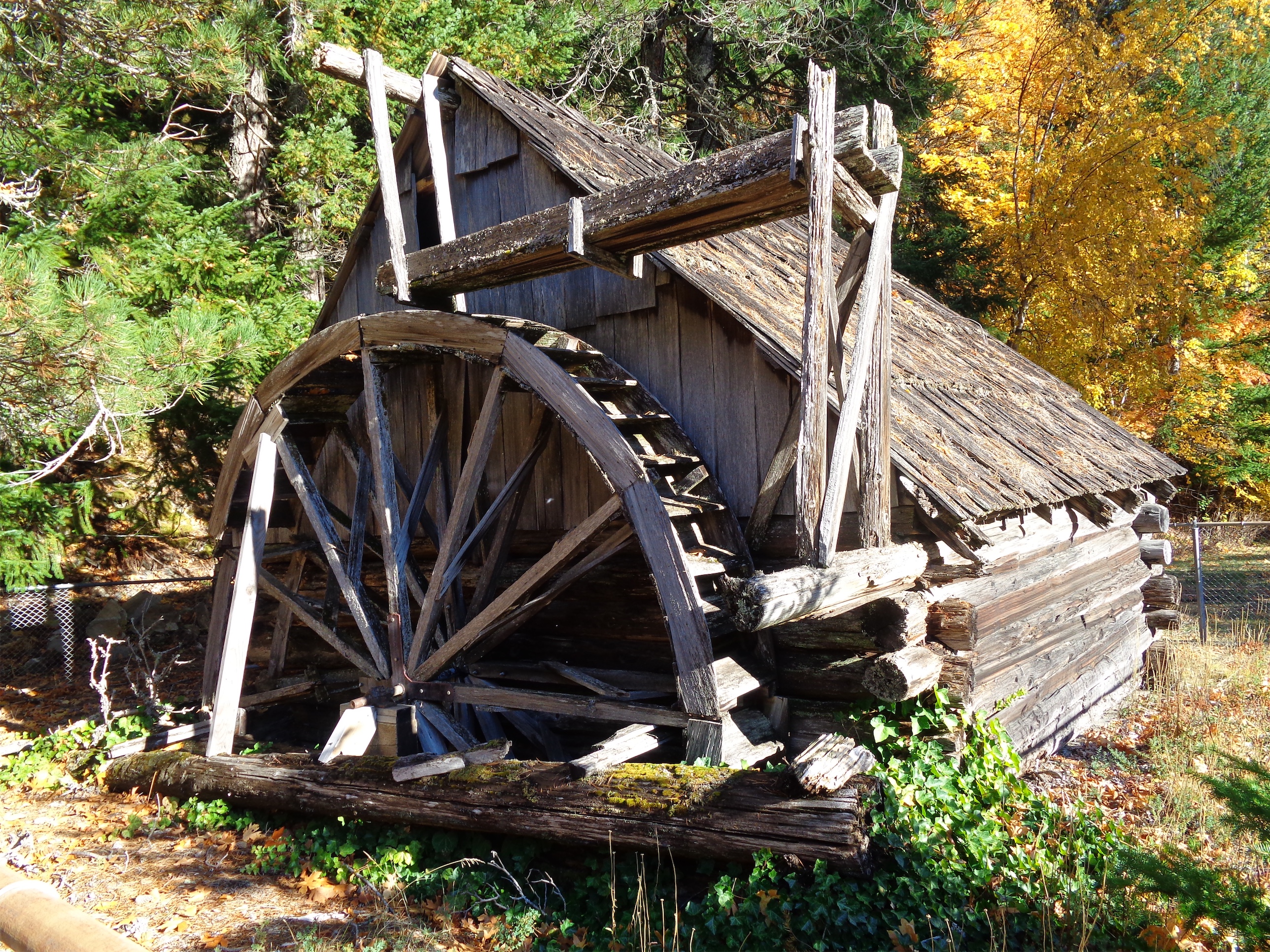
Replica of the Davis flume
Edit: Surafel’s review of the hike: “It was a beautiful day to be up in the mountains but my toes have some choice words to describe the descent.”

Pingback: Green Mountain Lookout | Have Tent, Will Travel