The itch to blog. It’s been rare lately, partially due to a combination of my job involving far more writing than it used to, and partially because content has been scarce. But it actually hasn’t been that scarce, I’m sitting on at least six reports from last year, I’m just so sick of computer screens and writing documents by the end of the day why would I go home and write more? But I forget that writing these is nothing like my work docs. I can swear. I can add pretty pictures. I can make fun of friends. I can reread them later when I am bored or want to pull up a cool photo. I have something like 12,000 photos on my phone and it’s getting bad. Blogging forces me to back them up somewhere and select only the best.

AND SO. Here’s a shortie. Today I hiked Hawkins Mountain. I say hiked, but that’s an understatement, there are plenty of places to get off trail, confuse game trails for the trail you want, fall off a cornice, fall down some rocks, or even get sucked into going down the wrong ridge. Or end up with a flat tire on your car, or a 34th dent from backing up into a rock (I did one of those two things). But there was nobody there, the views were spectacular, and the trail/route is interesting the entire time.
- Distance: 10mi round trip
- Elevation: 3,300ft gain (7,100ft highest point)
- Weather: 60’s and sunny
- Commute from Seattle: 2 hours
- Did I Trip: There were no witnesses…. but no, no I did not

I started later than I planned because the cat was out overnight. She finally rapped on the window at 7am and went straight to sleep like an unruly teen. I was out of there at 7:30 and at the trailhead by 9:45, moving by 10. The road to the trailhead is sketchy after the last intersection (~1/4 mile from the trailhead). Better to park there if you are in a sedan, or don’t want to deal with a parking area that fits 2 cars with barely enough room to turn with a deadly drop all along one side. I think it could fit 3 if everyone was there to coordinate.

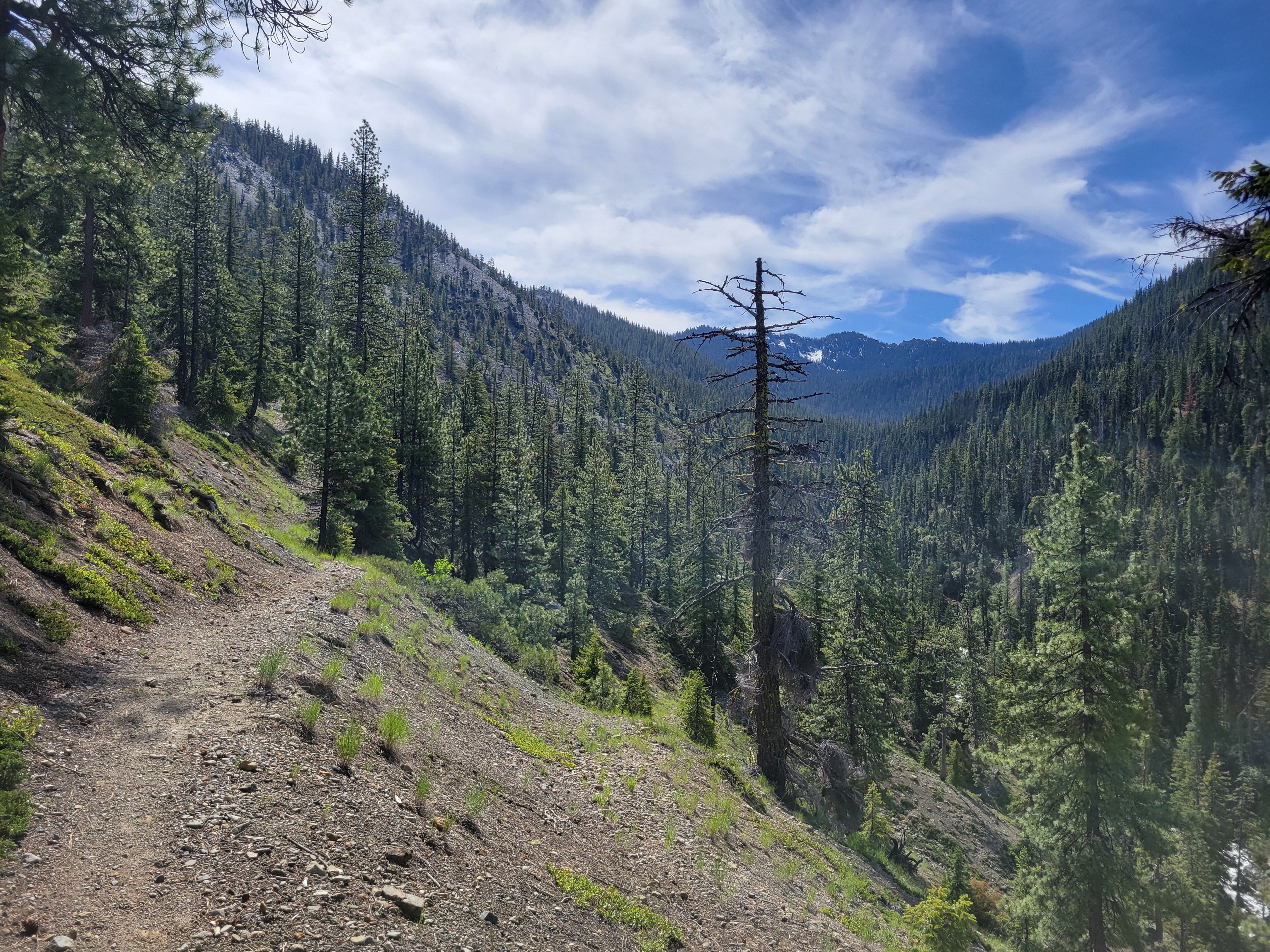
The trail at first is a bike trail that’s nice and clean and well graded. After about a third of a mile, you turn sharply left on a… bootpath at best. It switchbacks (switches back?) up to a ridge, wrapping around downed trees, intermingling with game trails. Some areas are easy to follow but it’s also easy to get off route if you aren’t paying attention, especially on the way down. It’s quite bipolar really, from areas with downed trees or rockslides and you have no idea where exactly it goes but you find it on the other side to stepping over a log only to find someone nicely built rock stairs on the other side to make the step smaller. Fortunately it’s all very open easy terrain, albeit steep. I was surprised at how many off grid (I assume) cabins were back there, including one on a knoll directly across from the trail. No idea how to get there, but wow what a spectacular location.
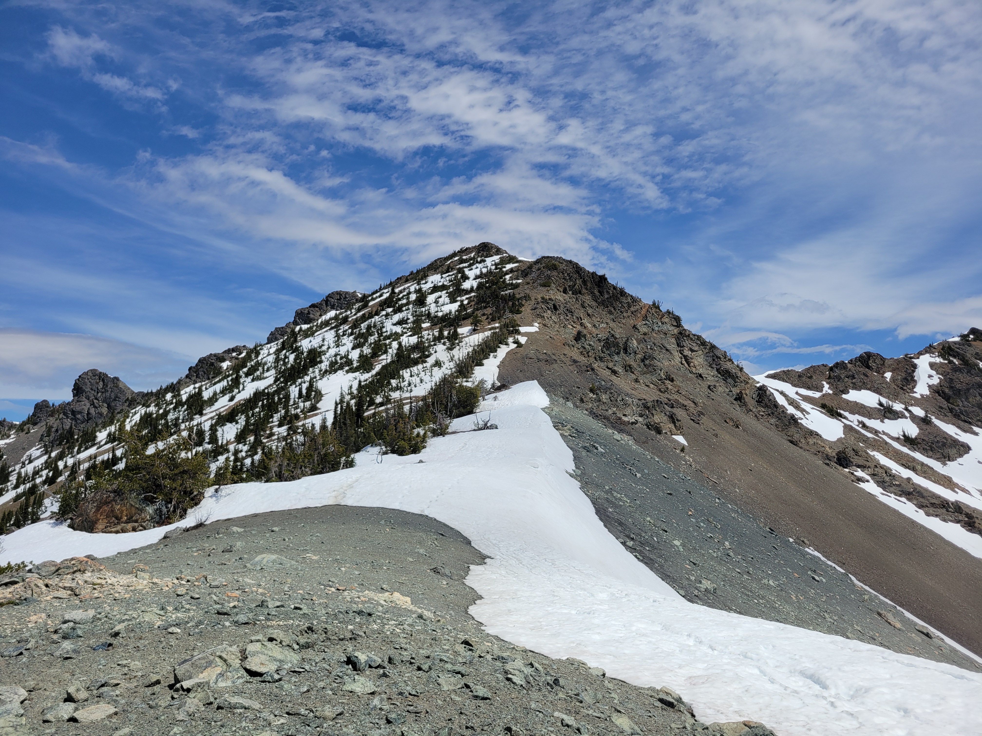
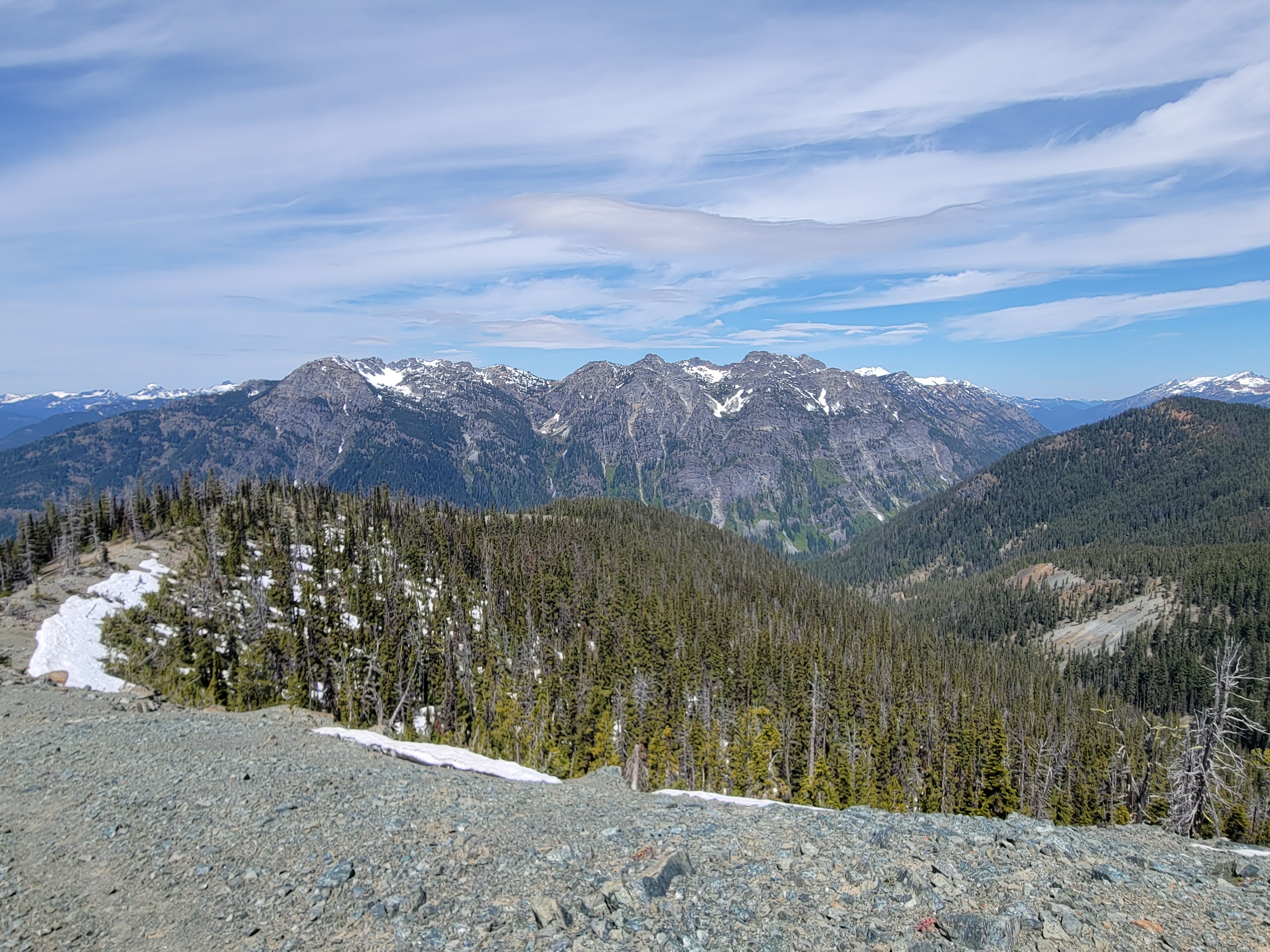
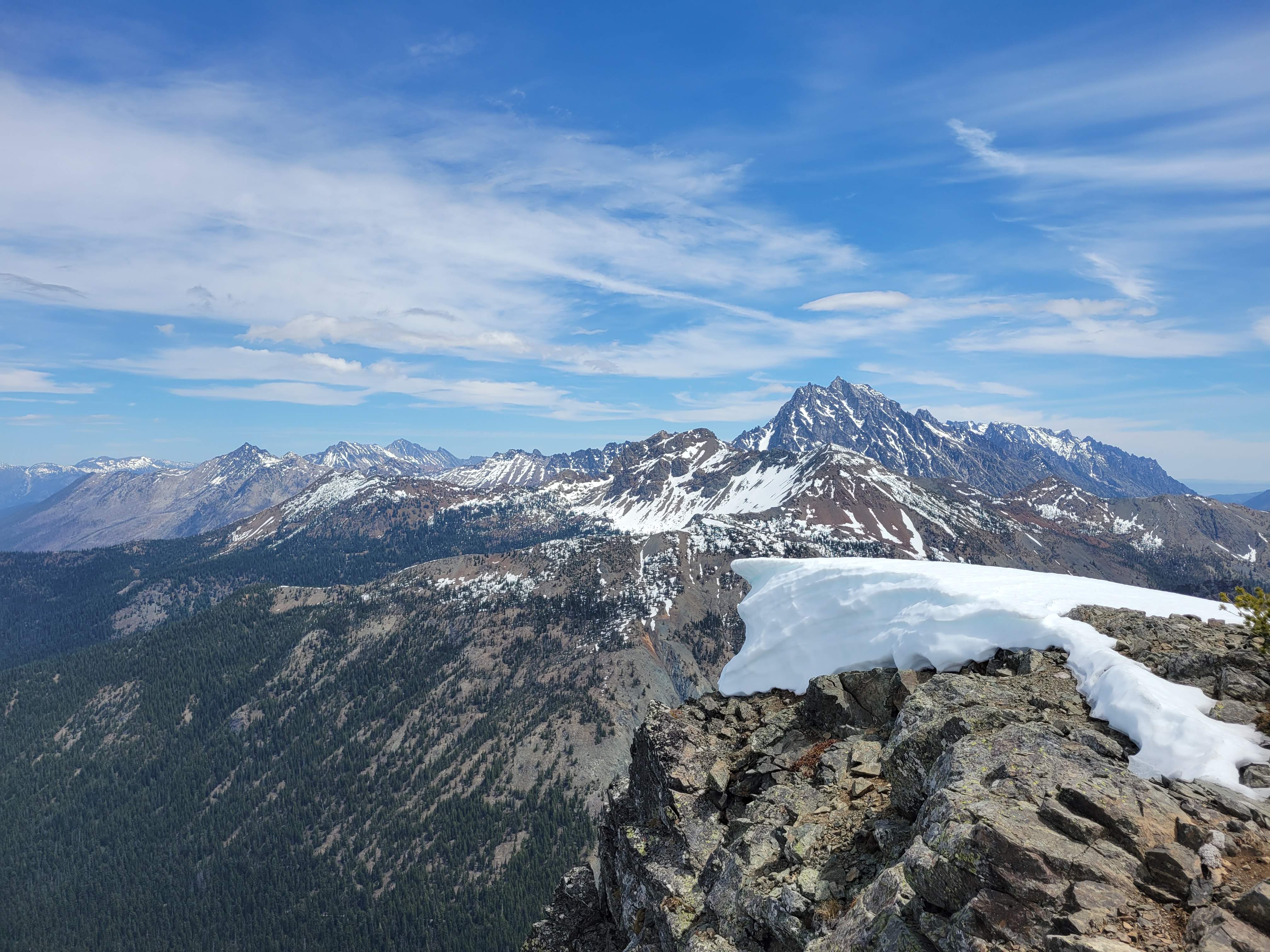
You eventually gain this rocky outcropping with a great view of Davis and the Goat peaks across the valley before the trail takes you further up to a legit ridge, where you follow the ridge for the remaining few miles. The trail comes and goes, but you’re following a ridge so no biggie. Most of the snow was melted out save for a few patches, but I could see the upper ridge developing massive cornices in winter, though I bet the area would be a phenomenal backcountry ski. I skirted as many snow patches as I could to the right before finally being forced left to gain the last ridge before the summit, where I scrambled mostly on rocks unless forced onto the snow. I didn’t come up here to be that solo hiker who was present for the one freak cornice breaking way far from the edge.
I was at the top just over 2hrs from the car, eyeing a pile of rocks suspiciously for the last final steps. You look like where I’d hide a summit register, if there were one here. There was! An old school brass one, too. I took a nice 20-30min break, crushed a surprisingly amazing scone from Alki bakery, and decided to pick my way back down.
As usual, going down was way easier and faster than up, except for when I stayed too far left and nearly descended the wrong right. I was plunge stepping down snowfields and soft easy scree thinking to myself wow I don’t remember so many untouched fields on the way up…. wait a minute. And looked to my right. At the ridge I was supposed to be on. Fortunately they hadn’t fully separated yet, so with some quick sidehilling I was back on track, but yikes. Hope the two women I saw an hour later didn’t follow those tracks.

There were 10,000 deer prints. I followed them most of the way to the top, in fact, that’s how consistent they were but didn’t see a single actual deer. The only wildlife I ran into was a ladybug, two grouse, and what appeared to be a weirdly fat lizard with a stumpy tail (still not sure about that one).
There were no water sources besides the snow, there was minimal shade, this is the time of year for this peak. Or late fall. It’s going to be reeeal hot and reeeal dry real soon.


Pingback: Davis Peak (Salmon La Sac) | Have Tent, Will Travel