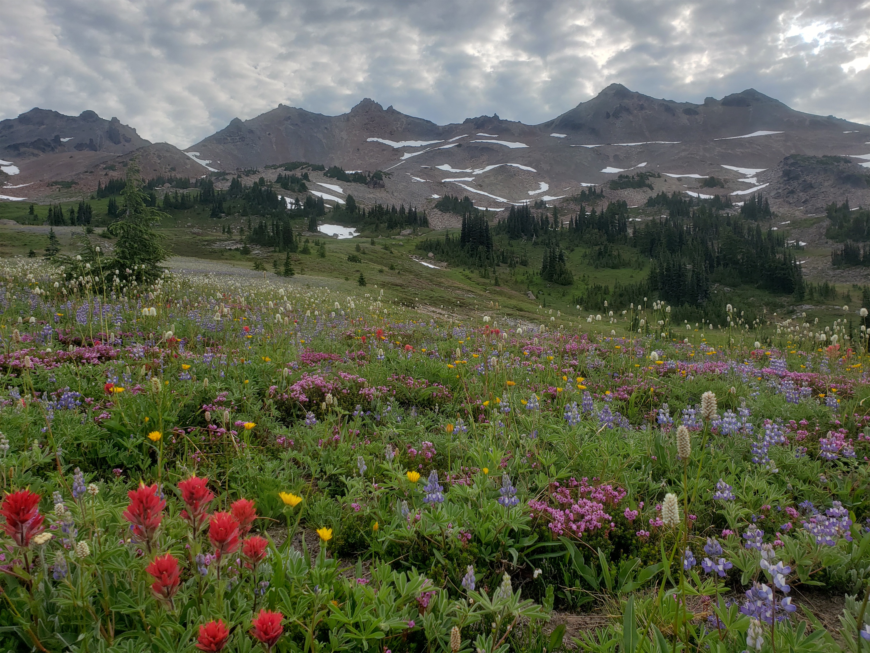
Adams over ridiculous meadows
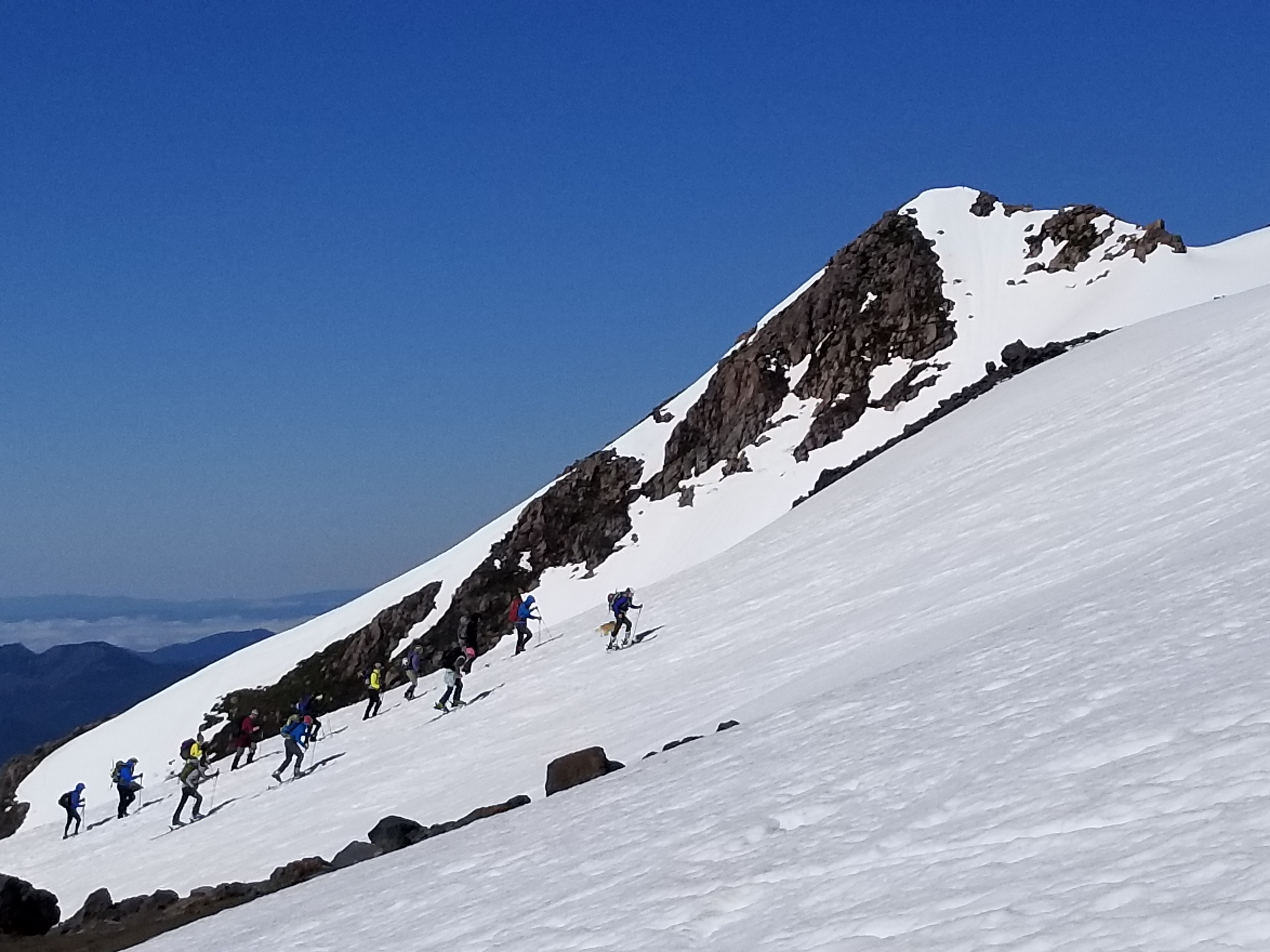
Part of the ridge we would traverse
The ridge over another meadow
It developed over several months. At first it was like oh sick there’s a pandemic, I’ll either come out of this 50lbs heavier or prison fit. Knowing myself, I was like it’ll totally be prison fit. Except then I felt weird about driving long distances to ski. I had trouble keeping the lifting routine while working from home. The motivation to do mountain stuff waned because of the pandemic, weirdness about travel, social shaming, shitty weather, and eventually because of my degrading fitness. Then I would feel bad for not getting out and being active which made me sit around even more. And then I’d feel worse thinking I lacked the discipline to get back to where I needed to be physically for cool trips since I wasn’t lifting as much or running as far and thus began the spiral. Lack of fitness -> fewer trips -> more lack of fitness. Oh boy. I don’t want to find rock bottom.

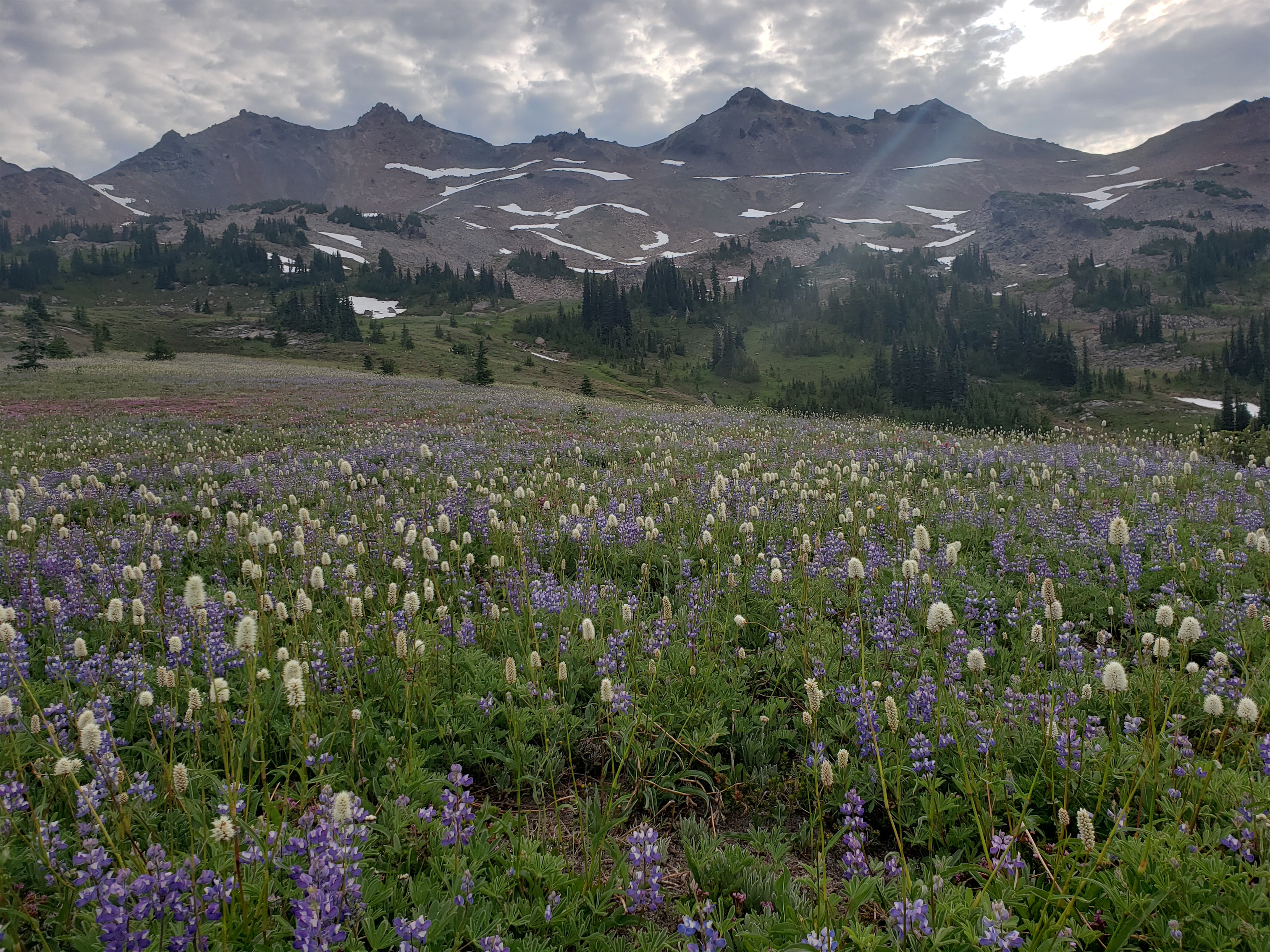
More meadows
Well about a month ago the weather finally turned and I thought okay, no more excuses, time to start chipping footholds in my self pity party pit so I can rally and get out of this. So I went to Chiwawa for Robert’s birthday. And then I went to Ragged View. And then I went to Ruby. And this weekend, we popped a sweet traverse of Goat Rocks, including tagging Old Snowy, Ives, and Gilbert, which took some mountaineering skills I hadn’t used all year. And these past few weeks are the most I’ve felt like myself in months. And they feel like the ramp up to my normal life, like I’m getting back to my normal glowy outgoing excitable (read: obsessive) self.
- Distance: 20mi
- Elevation: 6000ft gain, 8150 highest point (Gilbert)
- Weather: 60 and cloudy
- Commute from Seattle: 3:15 with no traffic
- Did I Trip: No just lots of skidding and crying inside

EVERY CORNER IS RIDICULOUS
We hiked in Friday night to camp about 4 miles up the trail where the Snowgrass Flats trail intersects the PCT Bypass. The hike in was uneventful, just darkness and spooky forest. There are two smaller camps just past the intersection on the left through a marsh. The main site was occupied. I didn’t sleep because of sticks cracking which obviously are bears, ghosts that have mass and can crack sticks, serial killers, wendigos, goats, goat men, or the thing from It Follows. I “awoke” at 6am only to find that not only had my food been undisturbed, I had dropped a shot block that not even the bugs had gotten to. That’s how far away the wildlife stayed.
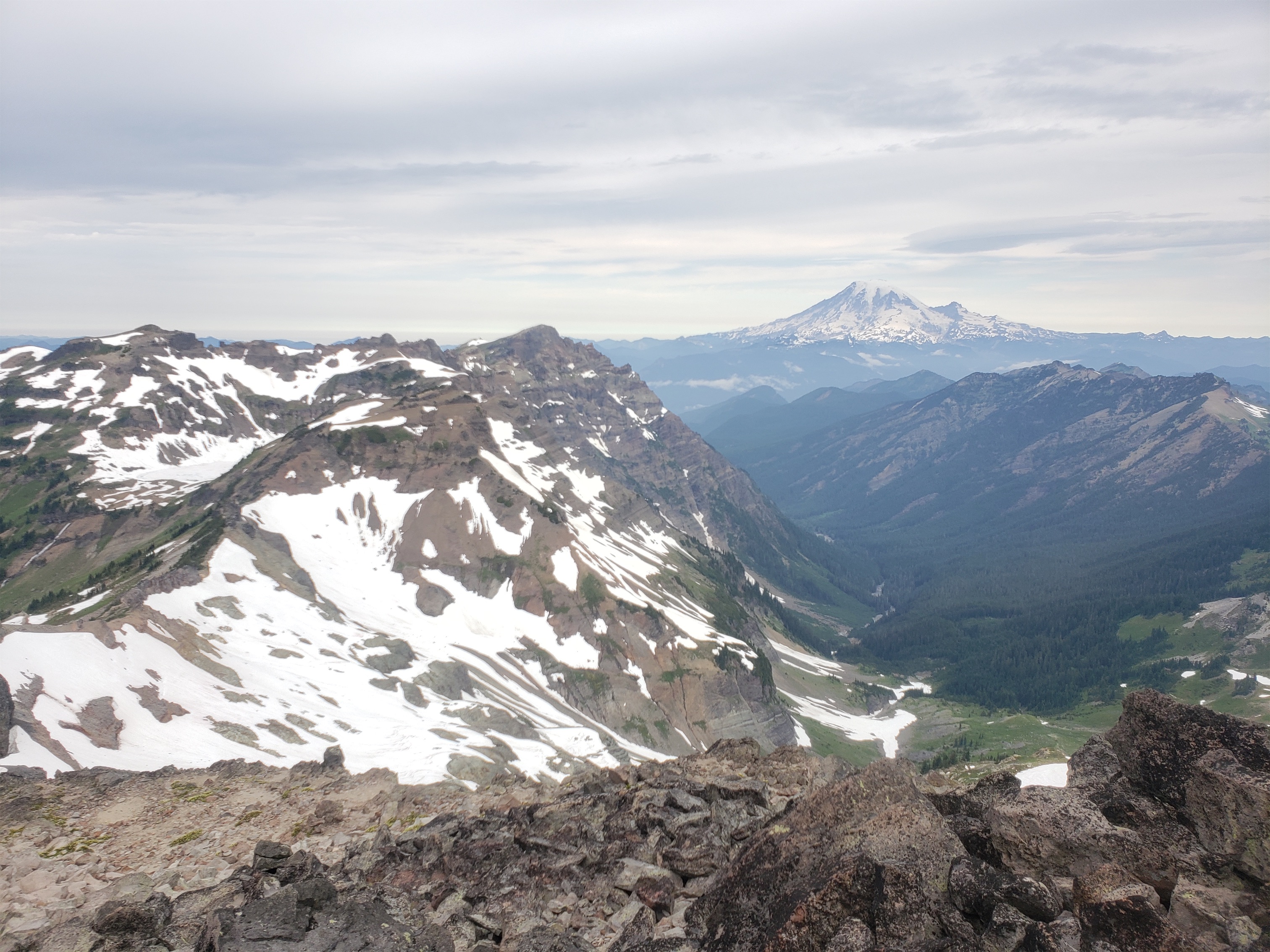
Looking at Goat Lake and Rainier
We got moving around 7:15am Saturday morning, surprised by cloud cover but happy that they were high clouds, and immediately walked into the most glorious carpet of wildflowers I have ever seen in my life. I could have cried. Adams was so close it looked far more majestic than I had ever considered it to be. Helens was its usual toilet-bowl-looking self, though less so from this angle, and even toilets look nice with flowers. And Rainier was hiding behind the main ridge, waiting for us to discover it.
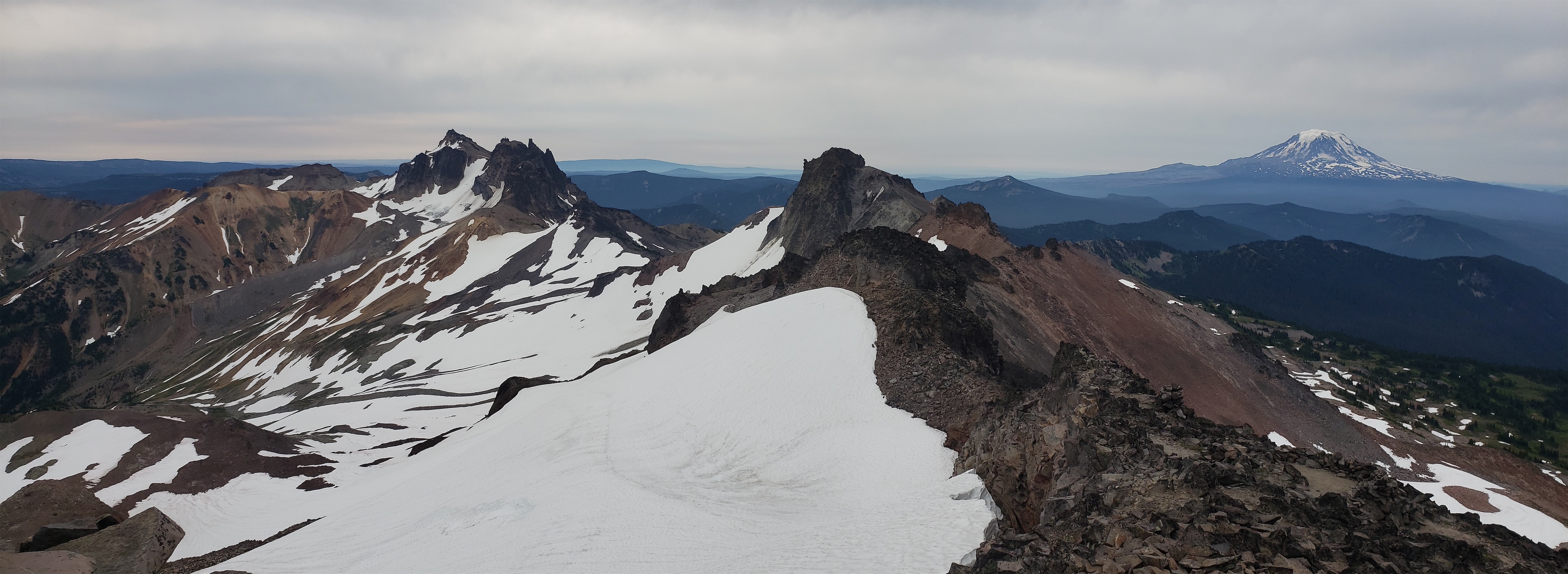
Pano of Gilvert, Goat Citadel/Little Horn/Big Horn, Ives, and Adams from Old Snowy
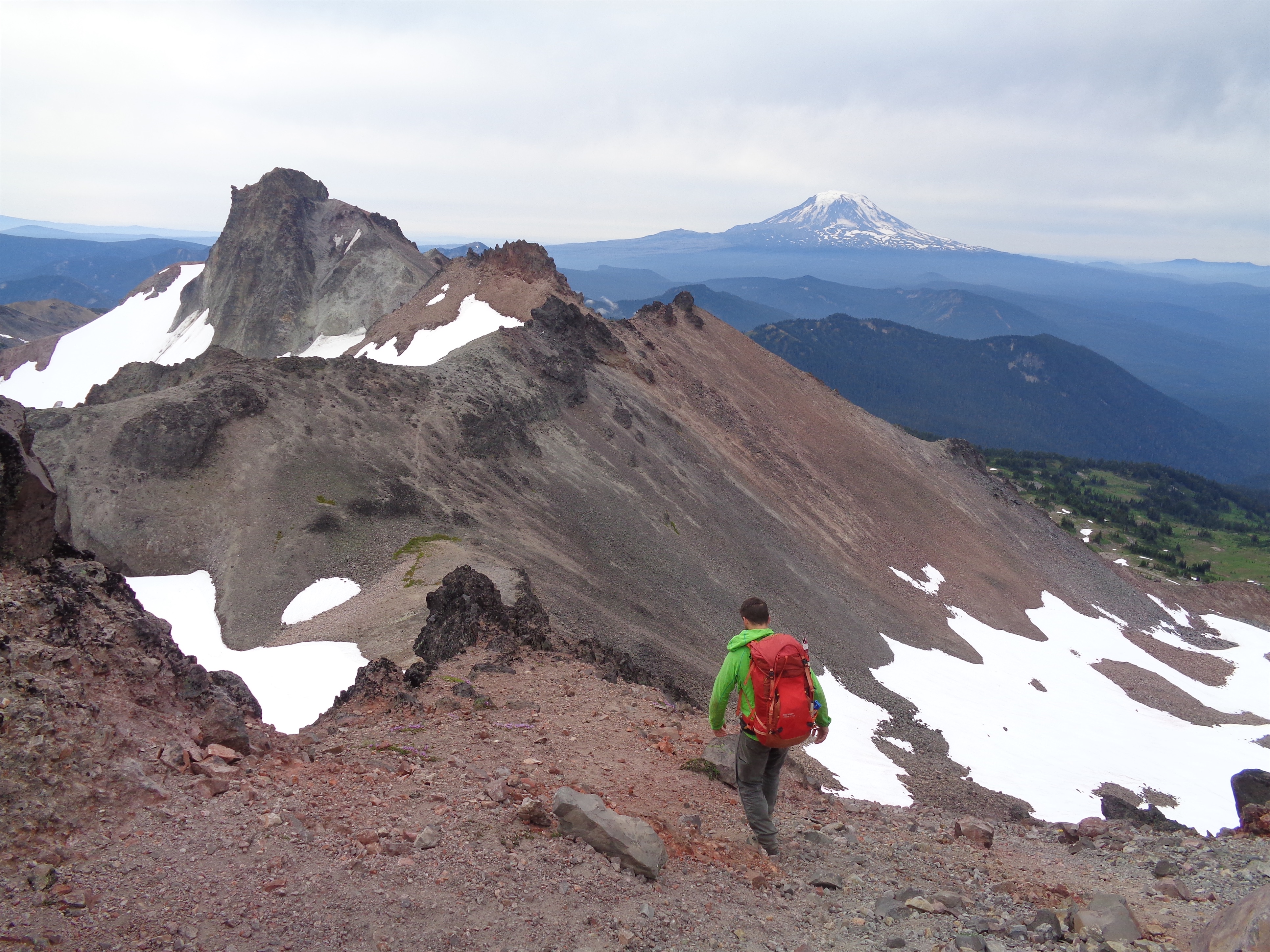
Dropping off Old Snowy
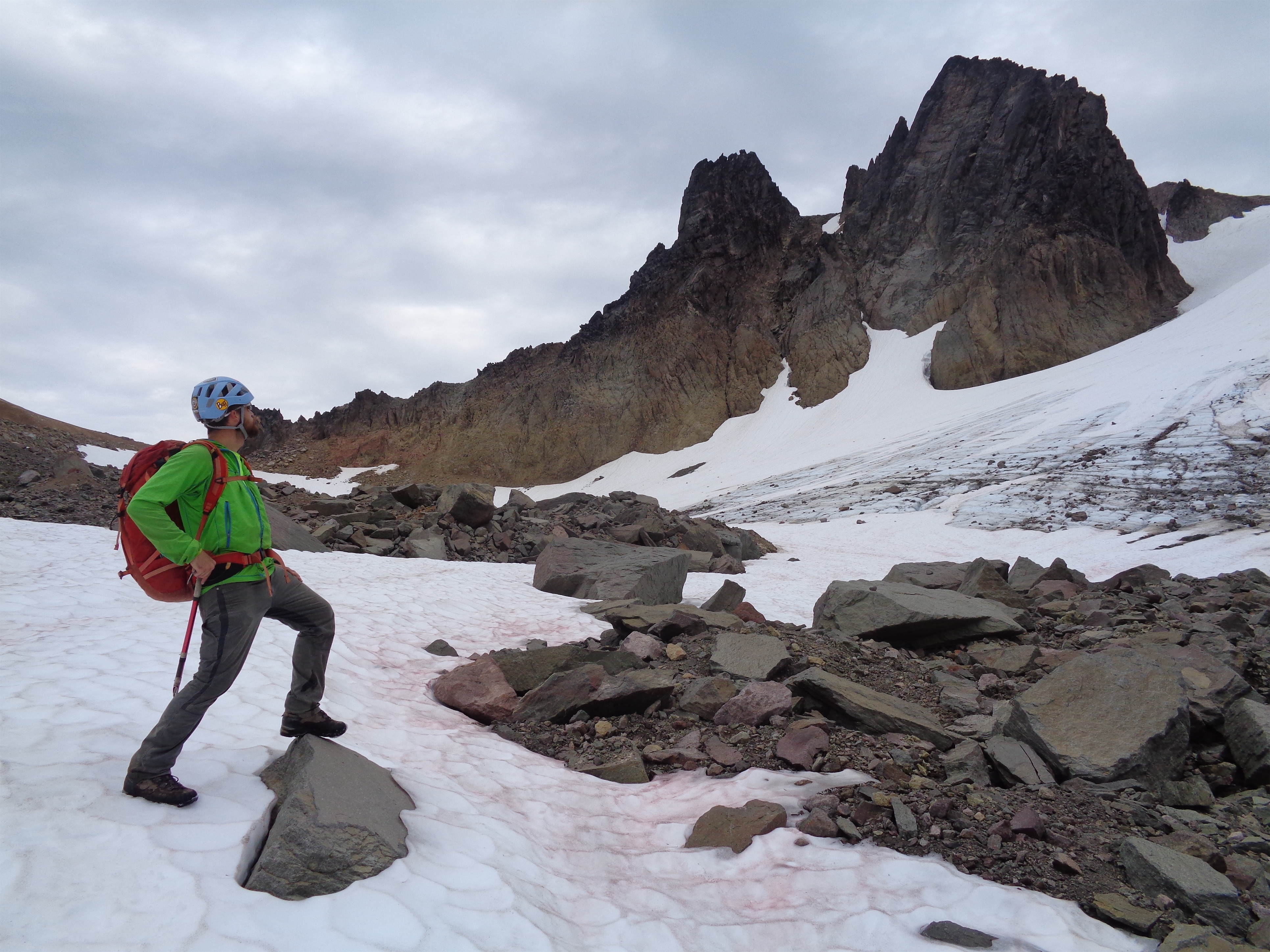
Dropping off Old Snowy towards Ives is easy. Getting to the first saddle is just a talus walk with some short 3rd class ish scrambling on the next knob. You pass a WICKED cool arch that I was worried we’d miss, but it’s right along the ridge and you’ll go right past it. Almost everything steep/sketchy on the ridge can be avoided by dropping slightly left or right. but we generally preferred the left side of the ridge. Everything is loose so don’t expect pleasantries.

Adams through the arch (PC Robert)
Just before the main saddle at Ives, we decided to drop into the moat above the McCall Glacier rather than traversing that finger of the McCall Glacier. The McCall used to span all the way across Old Snowy and Ives, but it looks patchier now, I am not sure the two halves are still connected. Or maybe one half is the Ives Glacier and the map is badly labeled.
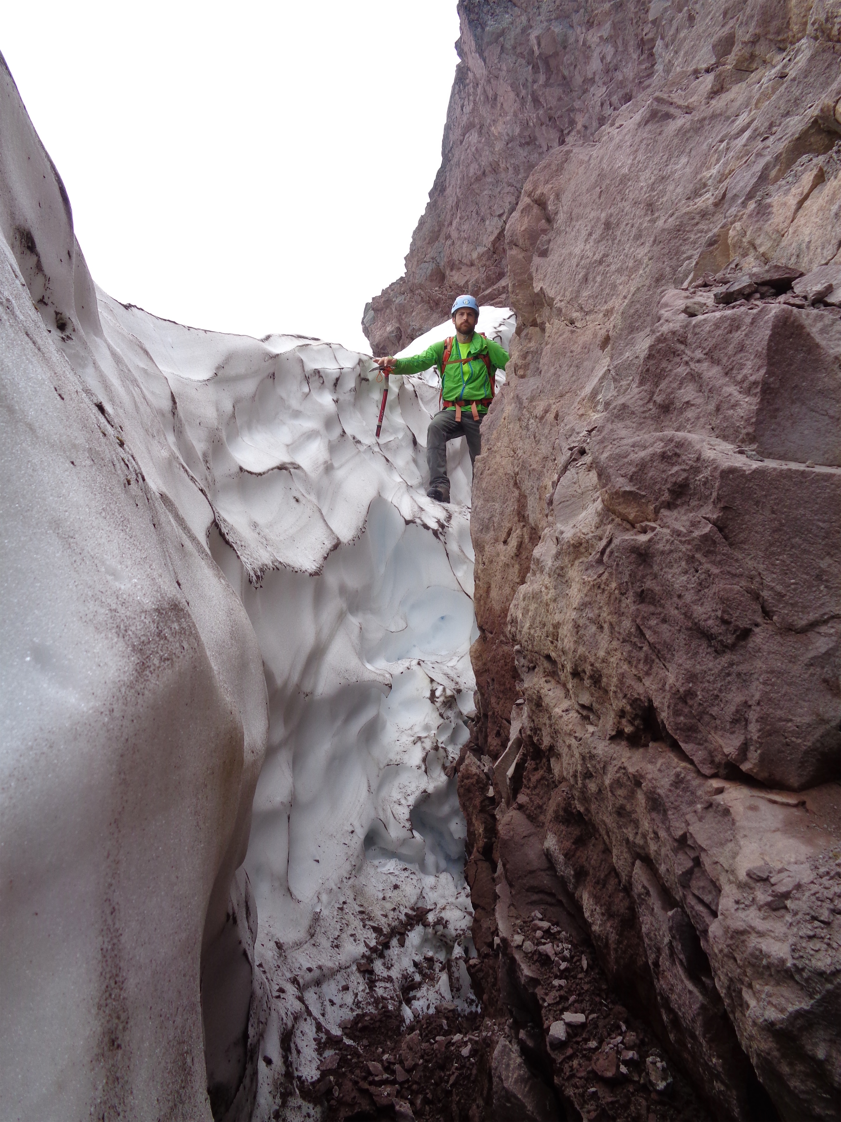
Moat
Anyway, had I read the beta thoroughly, I would have known that dropping onto the southwest side of the slope would have been an easy talus walk instead of 3rd-4th class scrambling. I prefer to stem between rocks and ice over exposed 4th class, so I squeezed my body into the bottom of the moat (which to be fair was also a 4th class downclimb to get into, so… I didn’t really win here) and stemmed out a few feet later. Robert scrambled above the moat just our of the picture frame and vertical-limit-ed his way onto the snow at the end of the scramble. Trust. Nothing. Assume every foothold and handhold will come loose. Assume all ledges are covered in kitty litter. Assume the mountain will dump rocks on you. Wear your damn helmets. We scrambled up another disgustingly loose col one at a time to gain the ridge again where I read the beta again and saw the line about going south to avoid moat/glacier entirely. Oops.

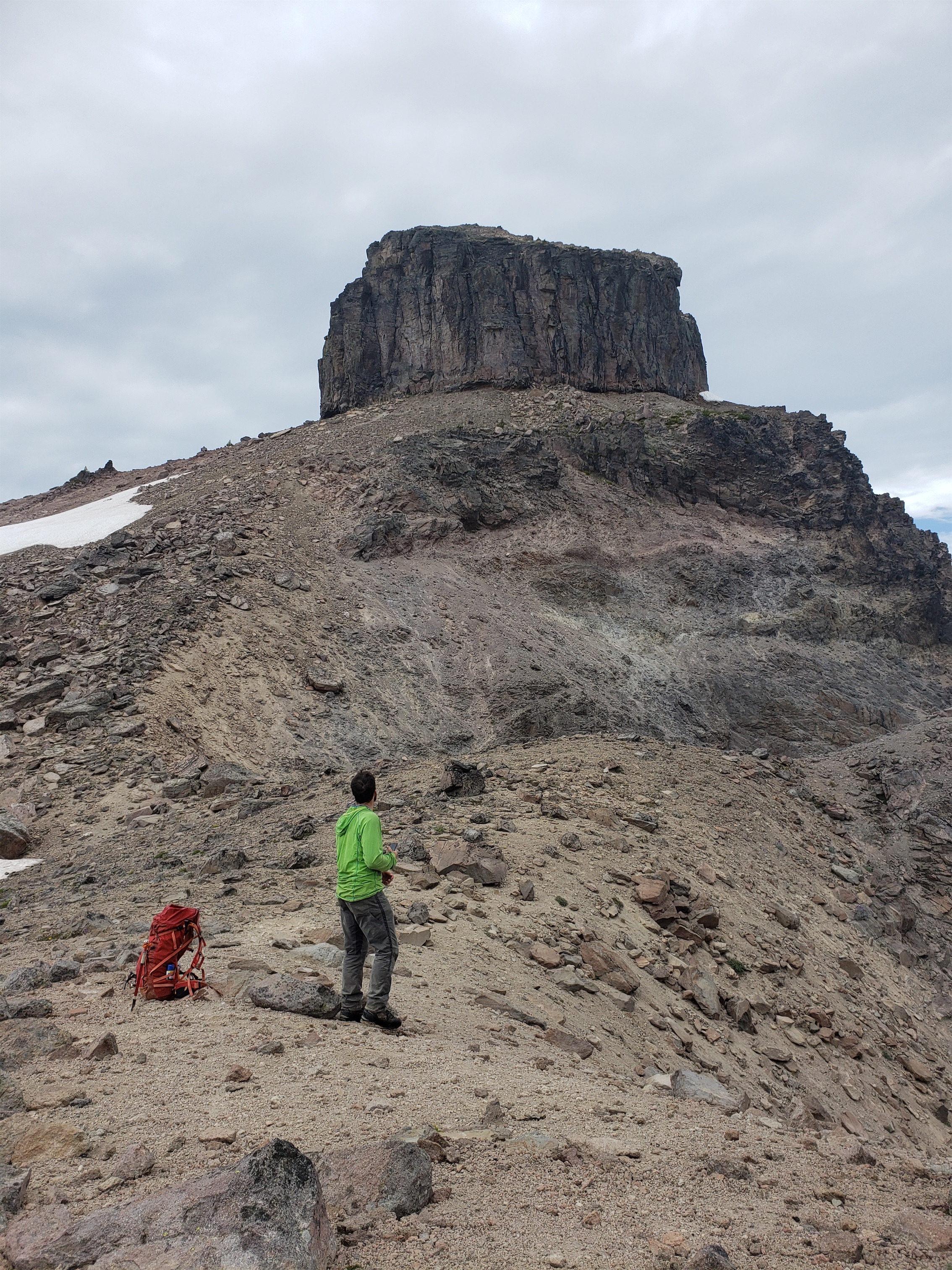
Dropping off of Ives
From there, it’s a quick walk up more loose scree to the summit. We dropped down to the next col, where we ran into the loveliest couple. We chatted with them for a bit about our route and their plans, and thought they corroborated the horror stories we had heard of the west route up Gilbert, we parted ways feeling wholesome and confident. Which is good, be cause we then lost even more elevation going down to the snowfields and glaciers on the northeast side to traverse below some cliff bands.

Goat path led to beautiful Tieton basin (PC Robert)
Ready for action
With renewed curiosity, we followed the goat. The next 20ft were the most comfortable walking we had done in hours. The miracle goat path led us around the last shoulder to a small moraine that we could walk up to the glacial basin below Little Horn, Big Horn, and Goat Citadel. I think it’s the remnants of the Tieton Glacier, which is in the Beckey Guide, but it’s receded a scary amount since his pic. We figured we could backtrack or bail up and over the col to the left onto the Conrad Glacier if we couldn’t get past the crevasses (we had no pro), but I was cautiously optimistic.
Above the glacier, under Goat Citadel
We cramponed up and crossed some mellow blue ice before the glacier steepened, and eventually were frenching up past a 20′ deep leg-breaker of a crevasse. The sides were solid, no caverns to deal with, just a 6ft wide gash across the glacier and we were lucky enough to find a snowbridge in the center. There were two smaller crevasses near the edges of the glacier that were easily avoided, but we had to do some zigzagging and hope for the best. Overall, it was very well snow covered with fairly obvious features, no concerns for the next few weeks. As long as you can remember how to walk you’ll be fine. It’ll probably get icy later in the season but we didn’t see any signs of anything more gnarly.
Towards the top we stepped across two very small crevasses (~1-2ft wide but covered) before clambering up (guess what) more loose rock to the saddle around 7800ft. The saddle is very mellow and was on our list of camp options, but it was only like 3pm! I thought it was going to take WAY longer to get to Gilbert. Maybe if we had actually gone up and over point whateverit’scalled, but even then we’d probably have saved time using Beckey’s route instead of winging it.

Summit pano from Gilbert

Shitty crossing with death runout
From there, it was a talus walk rising gently to the right to get to the base of the summit. We passed a cool window in the rock just below us, and pulled some 3rd class ish traversey moves just above that to contour above more nasty scree. Back to less nasty scree walking for a little longer, and finally straight up some weaknesses that were surprisingly solid and a combo boot path/a few more scramble moves to the summit. Far less scrambling than I had expected, honestly. The views over Conrad Lake were phenomenal, it looks like a very cool basin and the ridge next to it looked like a lite version of painted hills in Peru. And finally, a summit register!! Several parties had beaten us up Gilbert from the east route, which I hear is much more pleasant (but still gets the neat scramble at the end). We snapped pictures, had a snack, and headed back to the col, mildly anxious about the way down from Gilbert. We hadn’t heard anything positive about it.
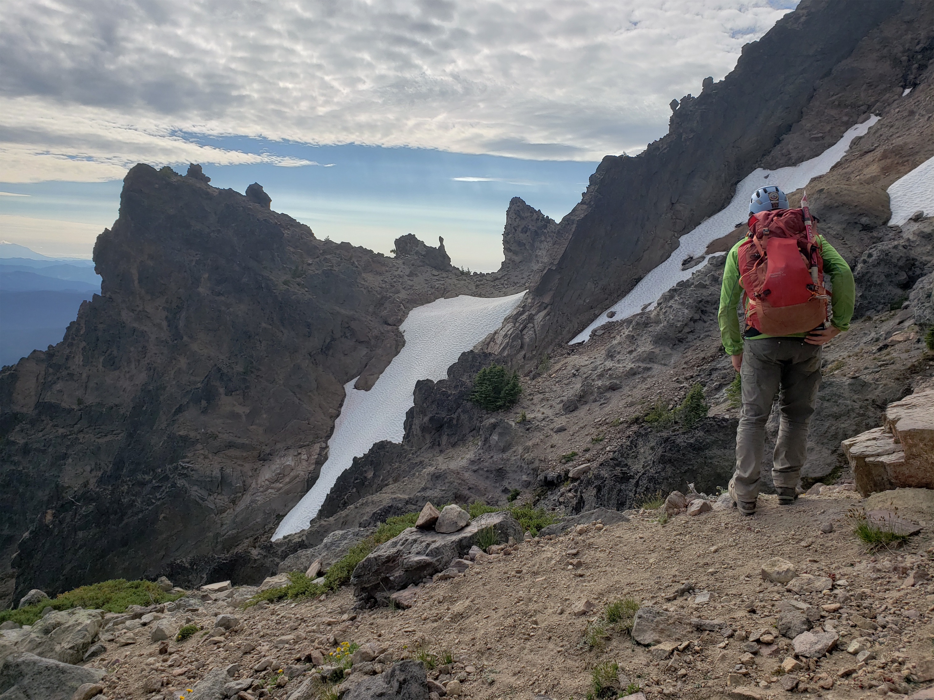
We traversed to the snow patch
The only beta we really had for the west route on Gilbert was to follow a vein of white sediment that traversed diagonally around 7500ft. The vein doesn’t continue all the way to the col, so we had to find the start of it. We dropped from the 7800ft col above the glacier to the 7600ft col roughly south, and started traversing, following goat paths and the occasional cairn. It was bad, but not terrible.

Cool conglomerate pillar
The route was not obvious at all. Every gully was a death funnel, and the scree was back to dirt (clay? rocks?) so solid you could barely edge into it yet mellow enough to be covered in pebbles. We aimed for high cols, trying to backtrack against the west route description we had from summitpost. Crossing one col above a steep snow finger we found the best rock we had been on all day. Super solid, amazingly juggy third class scramble to avoid crossing the snow patch. Finally some giggling and actually enjoyable movement! And renewed hope for the way down! We found the “white conglomerate pillar,” more of a boulder but there was nothing more pillar-like in sight so we figured this was it. That was about the halfway point.

FINALLY THE WAY OUT
And the second half (well, first half on the way up) was arguably even worse. Remember that rejuvenating rock that got us excited? Yeah that didn’t exist anywhere else. Super loose, no cairns, no obvious landmarks, no goat path, just rubble. Every step is calculated because you’re still moving above a tangle of death gullies (including waterfalls tumbling over cliffs at the base of some gullies) and that takes way more of a mental toll than I give it respect for. The white vein was hard to see from above, but we realized it had dropped ~50ft below us. Maybe that’s why everything was so loose. The white conglomerate is like a strip of glue in the crumbling mess of Gilbert. To quote a trip report, “I think we expedited the erosion in this area by 500 years just by walking on it.”
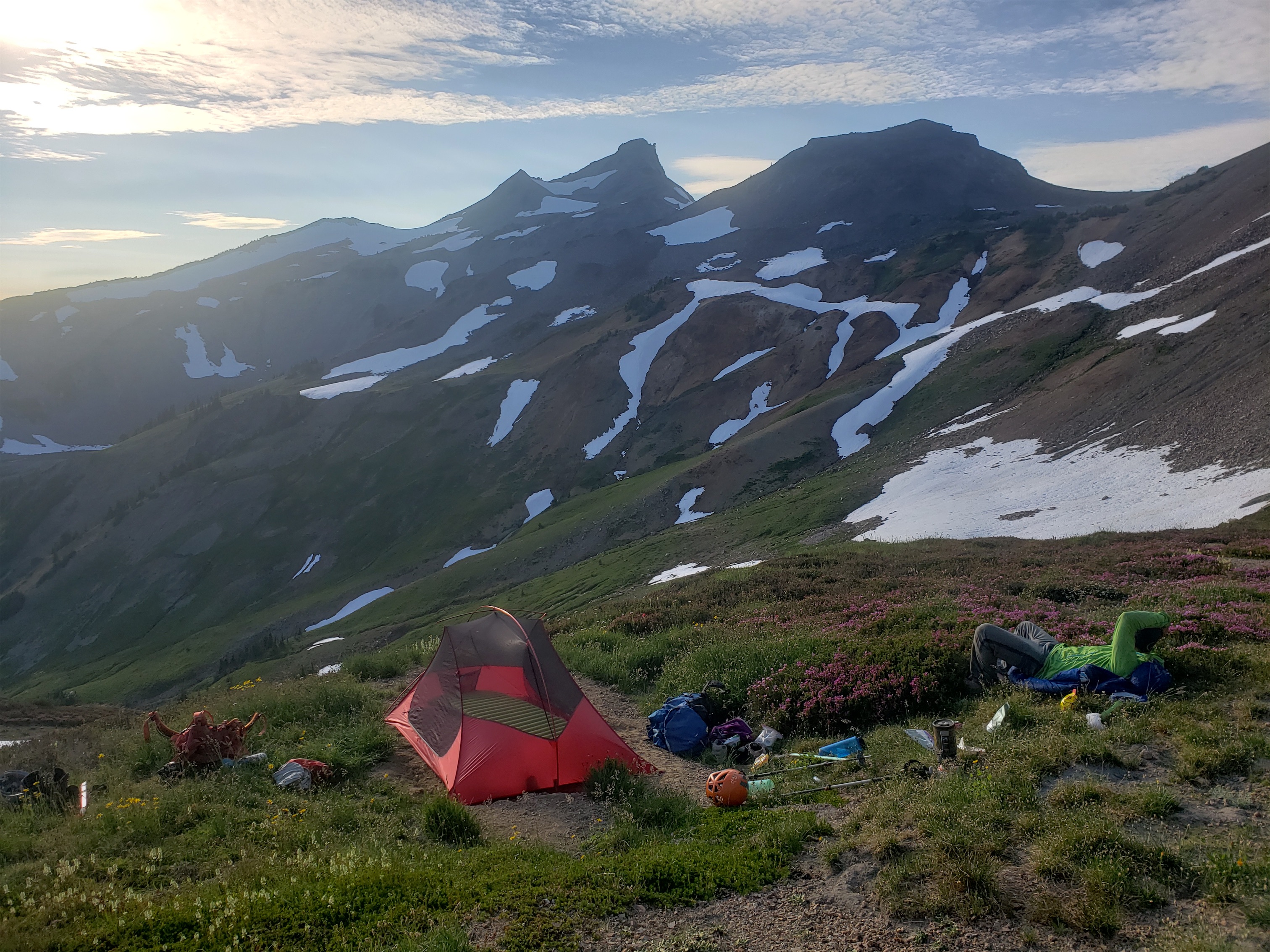
Lounging at camp admiring Old Snowy

Cute aster and paintbrush
Robert scrambled down a waterfall, I scrambled down some red shit next to it before hopping across back onto the white conglomerate. The white conglomerate is by FAR the most solid band of rock in this crumbling massif and I have to believe it’s gotta be better than the alternate high route given how loose everything else is. Almost reminiscent of the chicken heads on Outer Space. We followed the white band slightly further past the waterfall, and suddenly I heard Robert shout IT GOES! Ah, sudden relief. And confidence. I was so sick of having to balance carefully on every step and having half the rocks tumble down below me. We crossed one last steep snow patch and dropped onto a talus field below all of the gullies. Ahhhh, normal talus and scree! I’ve never been so happy for normal talus and scree!

Sunset layers
Waking up Sunday we started heading down Cispus Basin, dodging wildflowers and streams as we went. The sun hitting the wildflowers was insane. We had clouds all day Saturday, and the wildflowers were beautiful enough then, but lit up by the sun made them even more vibrant. Did I mention I underestimated the beauty of Goat Rocks? We took an extra ~1 mile detour to make sure we had drank in all the wildflowers we could possibly fit. It’s the same feeling when you have a drink and you’re wicked thirsty, except with your eyes. Suddenly the world looks oversaturated and ridiculous and yet it’s real!

Gilbert over Cispus Basin