- Distance: 11 miles round trip (~15 if you continue on to the lakes)
- Elevation: 2600ft gain in altitude, very gradual along the trail
- Weather: 40’s and cloudy at start, 60’s and sunny by the end
- Commute from Seattle: About an hour
- Did I trip: Yes, twice.
Ran September 27th, 2014. Started out on the chilly side, which was concerning. Not to mention I was completely unprepared. It didn’t occur to me that if it was 60 in Seattle, it could be 20 degrees colder in the mountains, so I showed up with just shorts and a tank top and my hydration pack, because who would ever need a sweater in 60’s? I left before sunrise, driving through patches of intense for on I90, but I got to watch the sun rise above the valley once I started running and it ended up being 60’s and sunny by the time I reached the top.
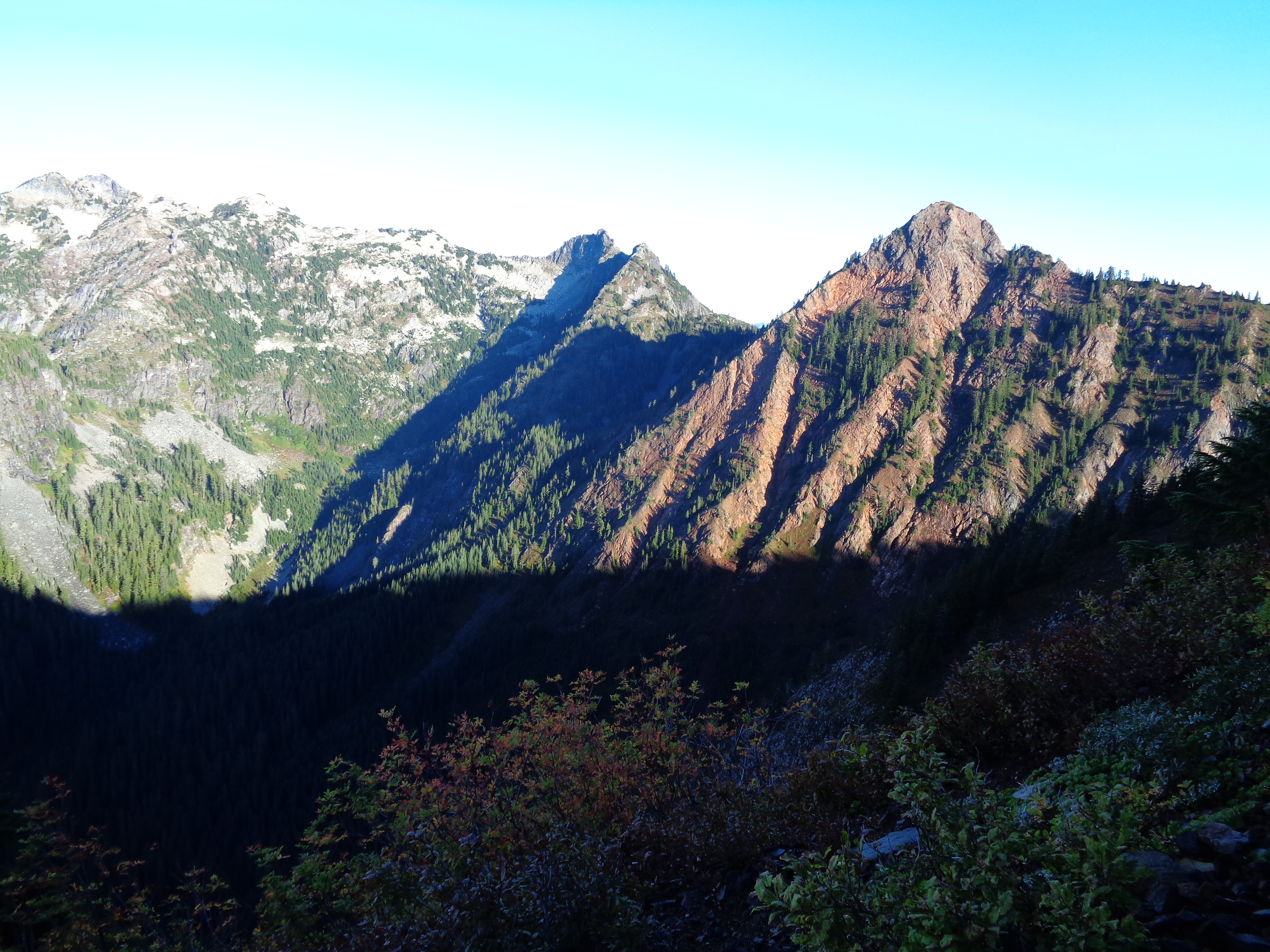
Sun lighting up Red Mountain
The first four miles are mostly through the forest, with occasional glimpses of the views to come. Elevation gain is very gradual, and the path is wide and mostly clear of rocks and roots, which means perfect for trail running! I’m out of shape (or lazy?) so I did hike some sections on the way up. The sun rises on the opposite side of the mountain, so you’ll be in the shade if you’re there early, but that means you get to see the sun light up Red Mountain.
Eventually, you pop out of the forest and run on a narrow trail on the side of the mountain. If you turn around and look behind you, Rainier will be peaking out on a clear day. I think I almost cried when I saw it, some weird combination of runner’s high and beauty and unexpectedness, I don’t know. No one was there to see it, which is good, because I also tripped and fell flat on my face like a champ.
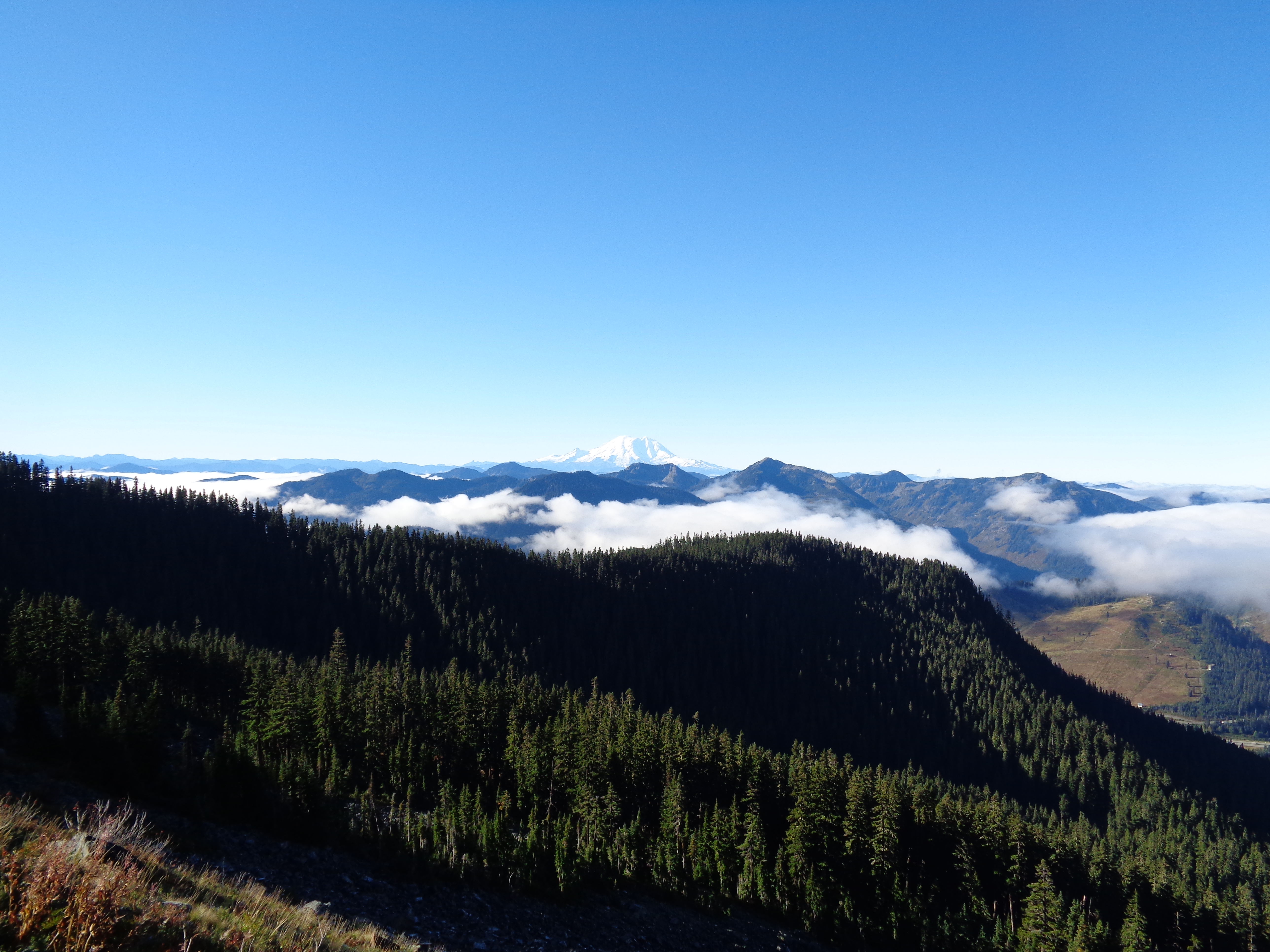
Rainier over the clouds
I had passed a few hikers on the way up, one of whom was a PCTA volunteer on his way to clear the trail towards the top. I offered to help, but he was aiming to chop up a fallen tree that was lying across the path. The log was almost two feet in diameter, so I figured I’d be better off helping cut back brush and move small rocks than trying to hone my lumberjack skills.
The “katwalk” itself is along the eastern side of the peak, meaning I got full sunlight. It made pictures tough to take, but it was gorgeous running along the ledge.
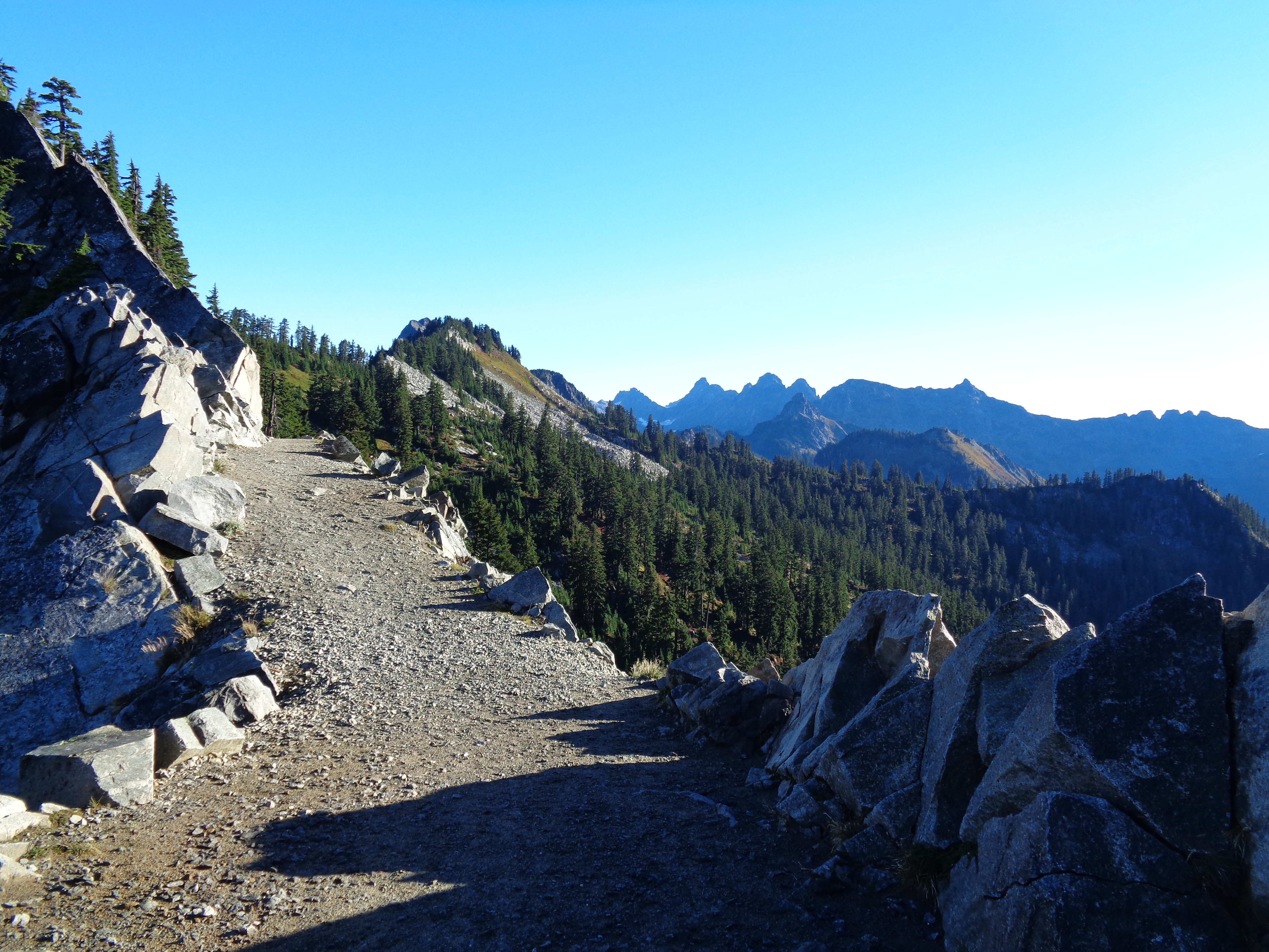
I turned around at the katwalk since I had to be back in Seattle, showered and ready for work by 3pm. The path continues another few miles, so if you’re up for a ~15 mile hike or run, by all means keep going to the lakes beyond the katwalk! I’d save this hike for a sunny day, I can’t imagine it’s that great in clouds or rain. You’re also stuck listening to the shitty serenade music of I90 for most of the hike until you cross over to the east side of the ridge, when suddenly it’s peaceful and sunlit, and I was lucky enough to have the katwalk all to myself since I was there so early. Here’s a bonus selfie.

10 second self timers exist for a reason.
On the way back down, I ran into probably 20 parties hiking up, including another trail runner. I only tripped in front of one pair of hikers, but the 7 year old made sure I knew he saw. Parking lot was completely full when I got back to the trailhead at 10:30am, so definitely show up early. It’s a favorite for a reason!

Aren’t you afraid to set off in the dark all by yourself? Do you have a headlamp?
LikeLike