Recommended to me for its fall foliage by one of my customers after I hiked Ingalls, I had to get this one out of the way before the snow hit (which happened yesterday!). I hadn’t been up to the Mountain Loop Highway since hiking Pilchuk with a few friends, so it was nice to get some fresh new views.Hiked 10/16/2014. The fall foliage was past its peak, and I was totally spoiled by the larches at Ingalls, but this was still beautiful. I’m slowly learning that I’m the peak-bagger type. Basins are nice, lakes are nice, but I really just want to be at the highest point possible.
- Distance: 9 miles (including the old road I think, or I could be a damn fast hiker)
- Elevation: 2840ft gain
- Weather: Sunny! 50’s, probably low 40’s at the top and bottom by the time I got down
- Commute from Seattle: 1:45, unless you get stuck in the parking lot that is I5 during rush hour
- Did I Trip: No, but to be fair I went down some rocks on my butt
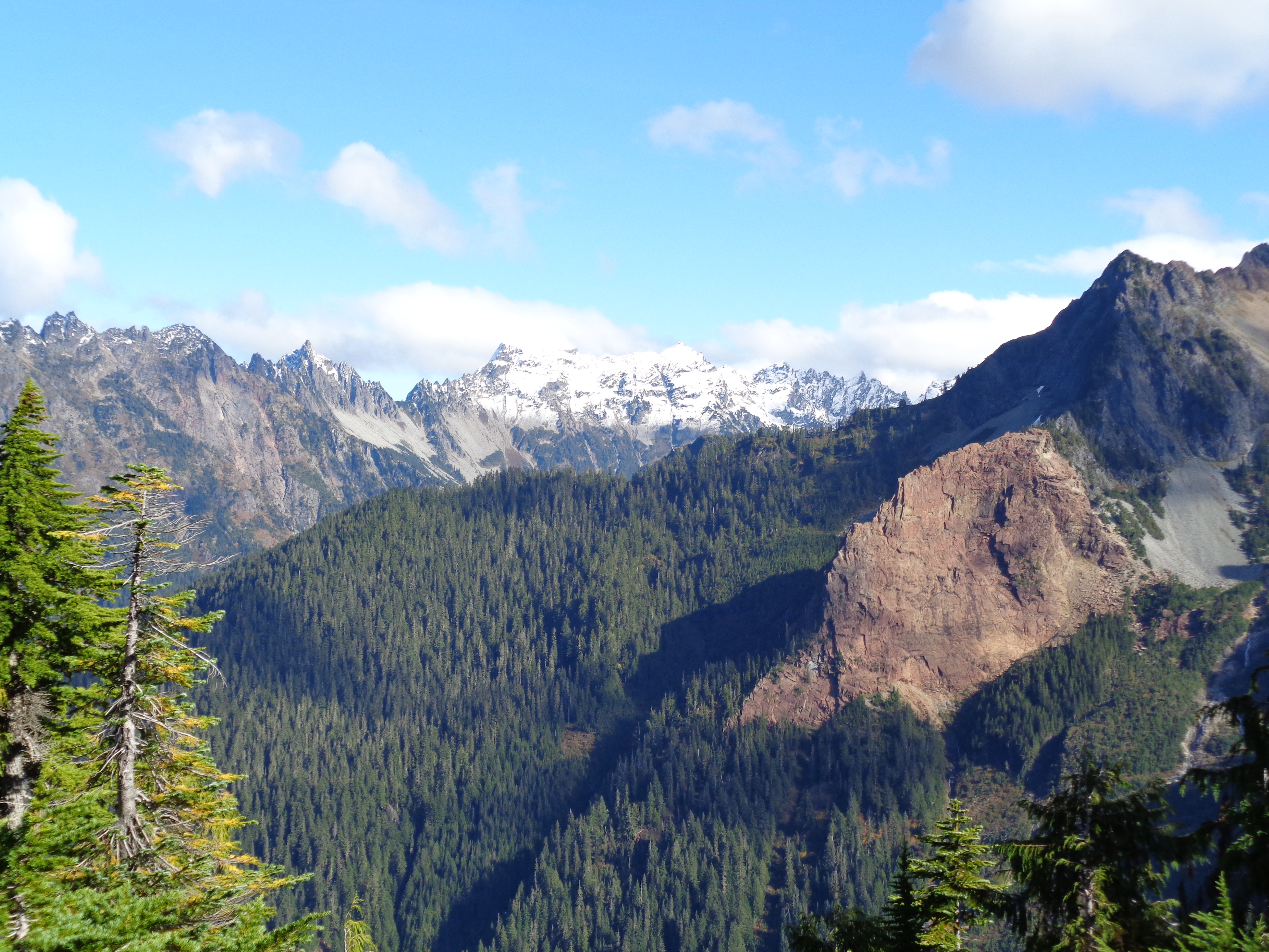 Even from the road, you get pretty good views of the Monte Cristo peaks. That pic is from higher up the trail, but the sneak peak on the road just whets your appetite for views. Someone had written “trail run!” in the registry towards the beginning of the trail and I got all excited to run it, but the last few miles are un runnable. If they ran this… damn. Lots of muddy patches, rivers running down the trail, slick rocks to scramble over, obstacles on the trail, things like that. I’m impressed if they were serious.
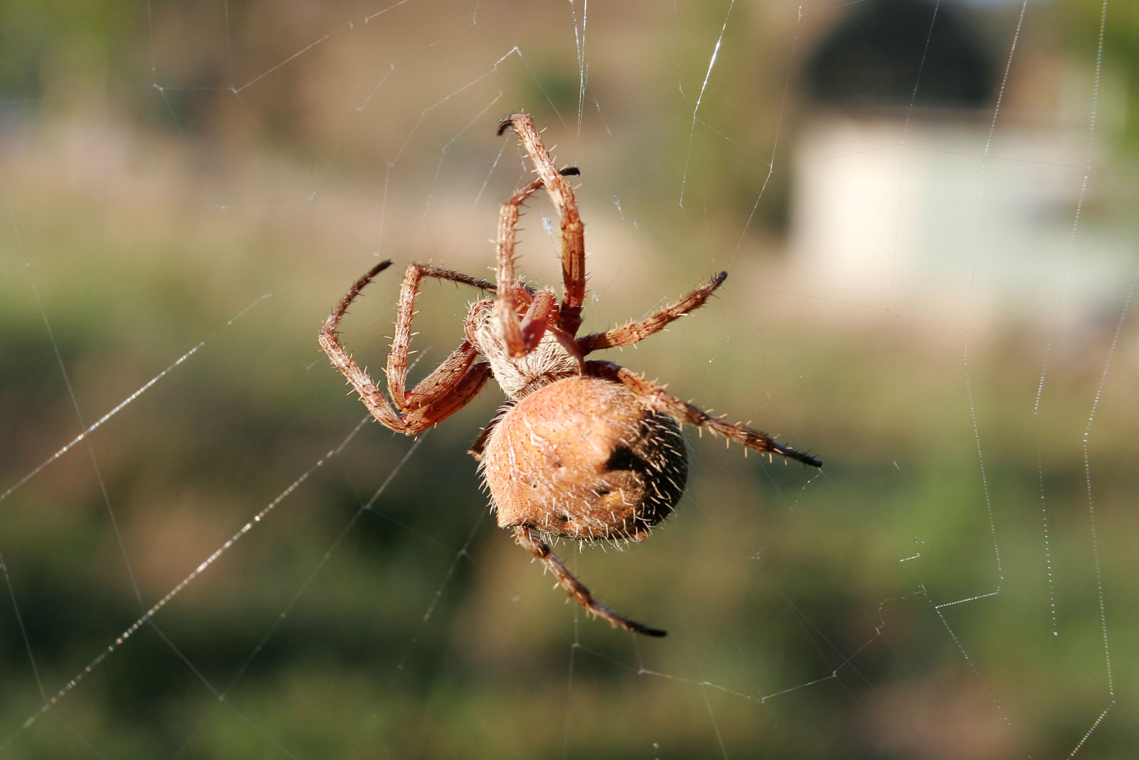
You actually have to park on the side of the highway, near the Barlow Pass trailhead, and hike about a mile down an old road (blocked off by a sign covered in bullet holes) to reach the old trailhead. I’m impatient, so I ran that part plus everything to Sauk River, which is about half a mile past the toilet at the old trailhead. Crossing Sauk River was an experience. I couldn’t figure out a good way to rock/log hop, but being a Polack I took off my shoes and socks, rolled up my pants, and waded across. From there, it starts gaining elevation steadily.  Oh, did I mention that October is apparently orb spider season? Yeah. Eeuuuuugh. Bastards made webs all over the trails. As one hiker put it, if you aren’t careful, you’ll wear them like jewelery. I should add that yes, I ran the first mile and a half, but I did so while waving a long stick ahead of me to destroy their sticky ass webs before they reached my face.
There are plenty of waterfalls along the way to distract you, some tougher to cross than others. I got absolutely soaked at one, but hey, I was committed. Bring waterproof shoes! I have never been so thankful for my goretex Wildhorses. When I first got seeded for them last year I was unimpressed, but they’ve been beyond useful out here. Turns out Chicago just doesn’t have the right terrain to use them. The mud, the streams running down the trail, everything was soaking wet. It’s nice knowing you can submerge your foot and not suffer from it afterwards. Speaking of which, I need a fresh pair. They’re looking pretty nasty right about now. Still waterproof after a year of use, though!
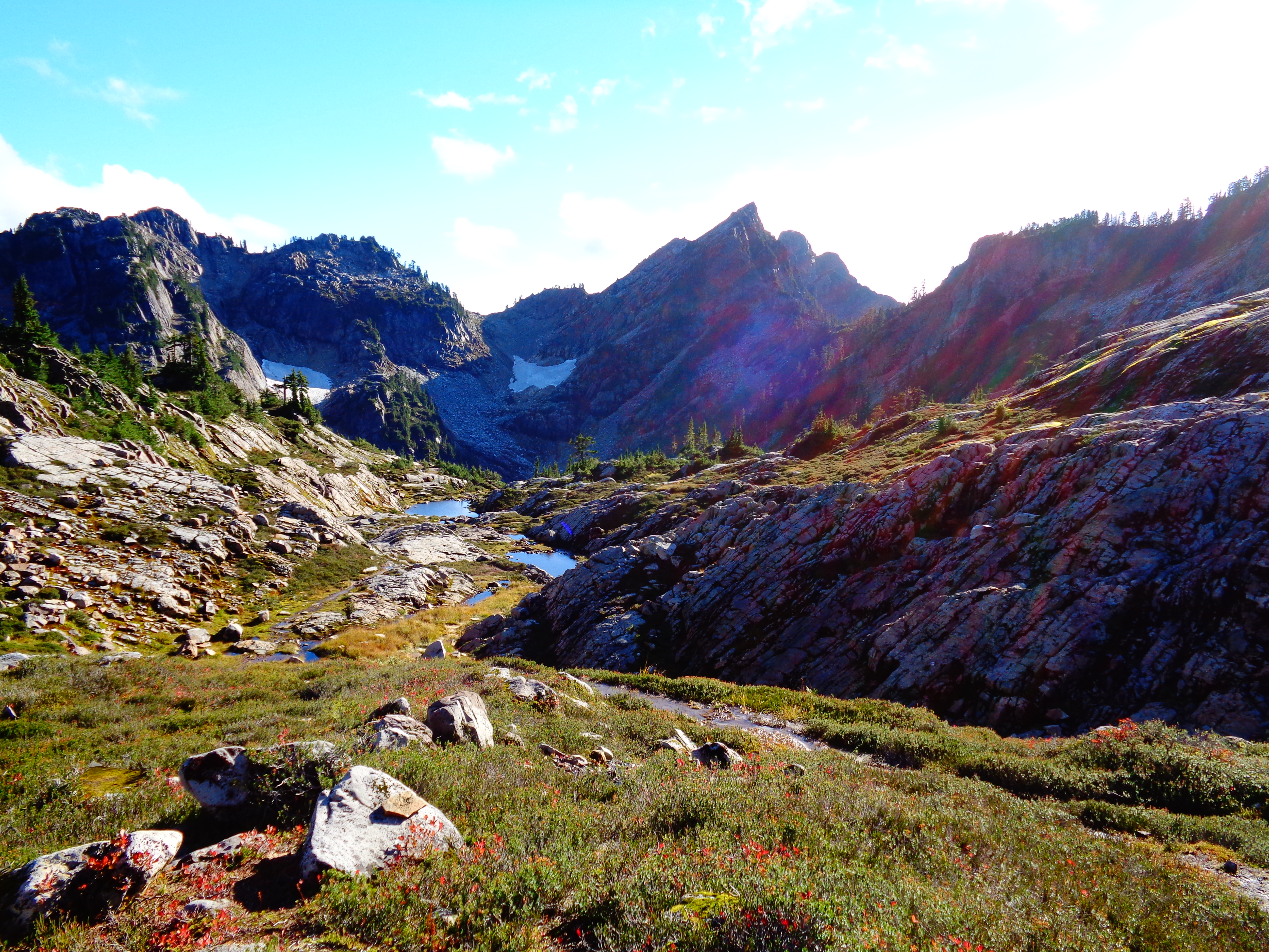 Coming into the basin was a surprise. I thought I was still another mile or so away since I wasn’t sure whether the trail’s distance included the old road or not. The basin was still covered in green, with huge rock outcroppings and small lakes (more like ponds) everywhere. Social trails leading everywhere. I have no idea if I found foggy lake or another lake before it or what since there were so many. I would have loved to scramble up to the ridge behind the basin, but it’s a class 2 scramble with a section that’s class 4 due to a washout(?) right now, not to mention I was alone and had to figure out just how stupid I wanted to be. So I stuck with the lower levels of the basin.
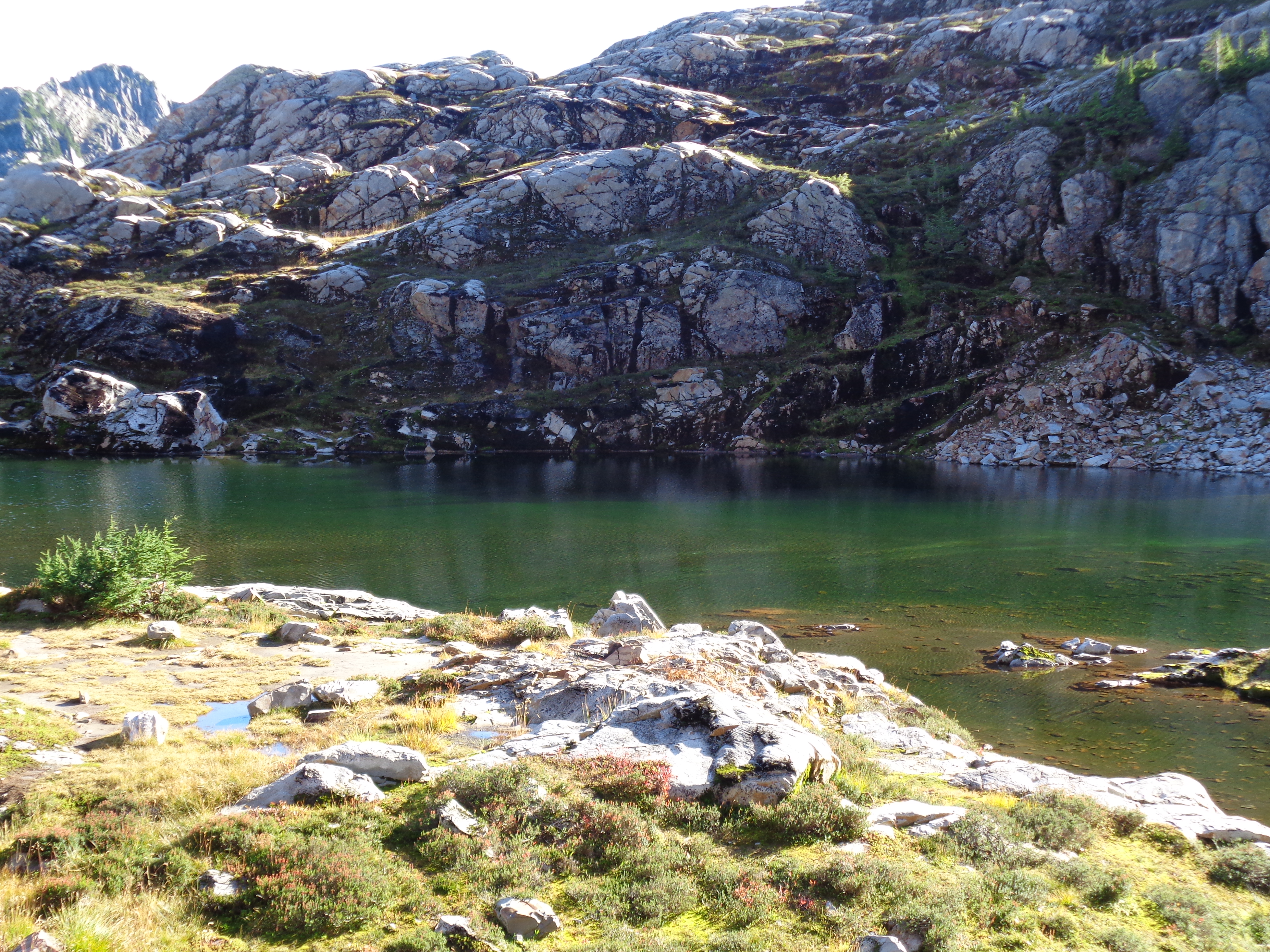
Here’s a pic of what I think is Foggy Lake. Small lake, surrounded by rocks and small plants. What’s crazy is that most of this basin is covered in snow all the way into late July. I was looking at pictures on wta.org and it looks like a completely different place. I’ll have to try it again next spring/early summer when I’ve got a little more avy experience.
Views were great, there were four snow capped peaks that I noticed. The only one I know for sure is the Monte Cristo bunch. There were two more to the left, one of which was mostly shrouded in clouds. Someone told me the one to the far left might be Sloan, but I don’t think so. No one I asked knew for sure. There was another one to the far right that you could only see if you were high up in the basin, so I imagine views from that ridge I couldn’t get to are amazing on a clear day.
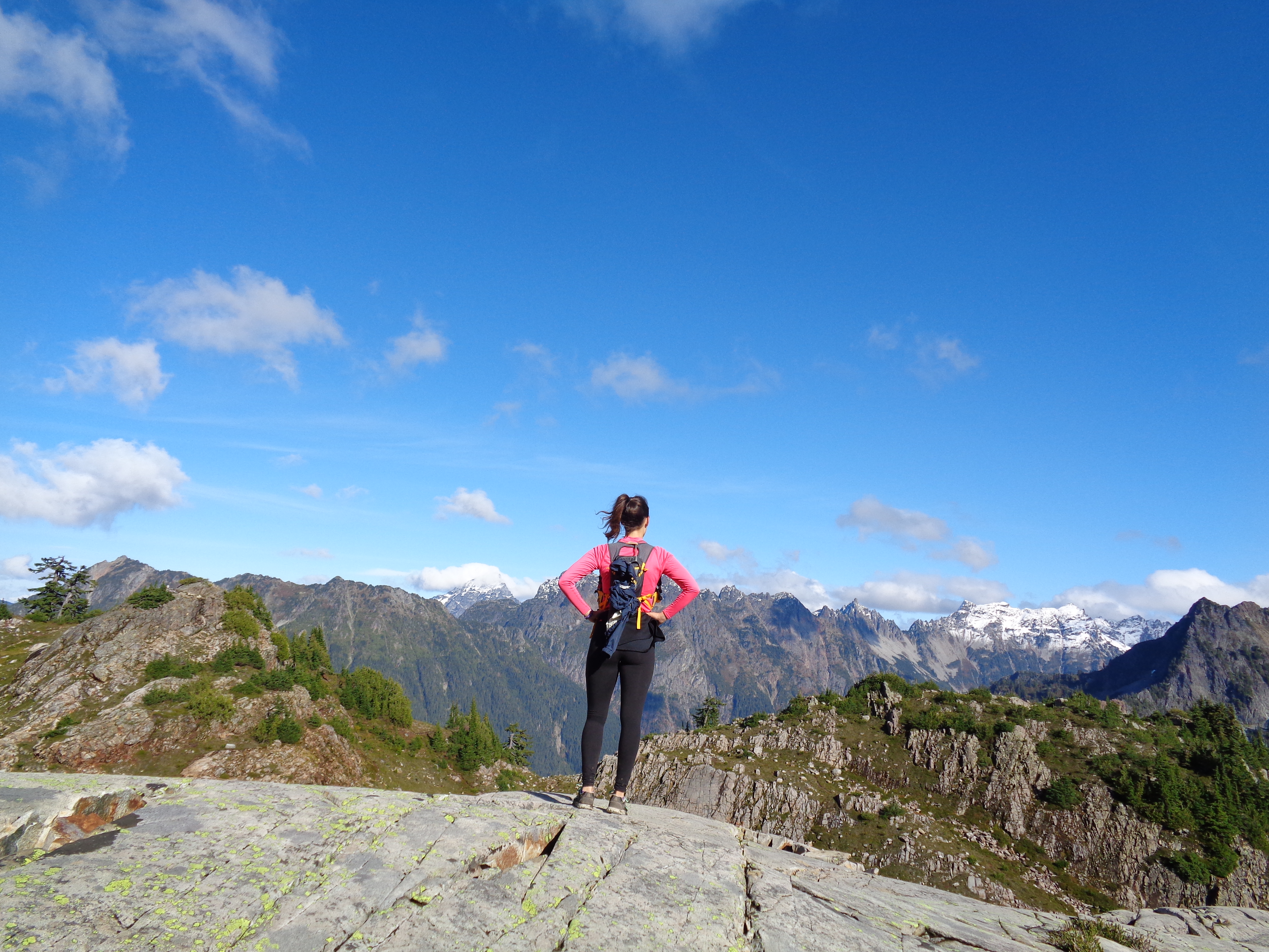 The best self-timer pic I could get. Monte Cristos to the right, cloud-shrouded peak just to my left. I’ve got a few panoramas as well, but I never really like how they turn out, so you’re stuck with normal pictures. For once I had around half an hour to explore the basin in order to be back down by sunset. I hopped around some rocks, took some pics, found two ladies walking a dog, explored some old snow fields, and looked for lakes. I was way above the two ladies, and followed their voices to get down from where I was. So basically, they were having a great time with their dog, and I was following them from a distance like a creepy mountain goat. The were the ones who called me out for wearing trail running shoes. To be fair, my shoes were Nikes so they look very unimpressive and not technical at all, but at least they were waterproof trail runners. Anyway, they were the ones who inspired me to grab a pair of real hiking boots, which I did yesterday at REI’s garage sale. For $5. As in “five dollars.” Even if it turns out they’re flawed, they were five dollars.
 Who made that cairn? That’s a sweet cairn with a sweet view. I tried building my own elsewhere in the basin but it didn’t work out as well. There might be some level of actual artistic talent involved. I’ll work on it. Anyway, the trail was a knee destroyer on the way down. Big steps, navigating those slippery rocks, decent amount of elevation lost in a short way down. When I got back to the Sauk River, I had caught up to another hiker, who had found a way across without wading. Guess I didn’t try hard enough the first time. But I followed his example (hands and feet across some logs and rocks) and it was easy enough. From there, it was just a matter of jogging through the surprisingly cold air back to my car. Glad to be back on flat ground for once. My knees weren’t prepared to deal with a full week of hiking.
In other news, it looks like rainy season has begun. The Olympics are covered in snow (I can see them from my apartment building) and word on the street is that Mt. Baker is supposed to get several feet of snow this weekend with snow levels dropping to around 4500ft. Mt. Baker actually holds the world record for most snow in one season, 95 feet exactly in the winter of 1998-1999. So it looks like any hikes that get even remotely high are about to have snow. I’ve got the goretex hiking boots, now I need some snowshoes and a good mountain winter education.

One last pic. Cute little stream coming out of a rock. Like a natural water fountain. No idea how that type of thing forms or how common it is, all I know is I’ve never seen one before. Maybe in a year when I’m more seasoned I’ll look back and laugh at some of the things I was excited about on my first few hikes.

Good entry. That little stream at the end looks like Manneken Pis.
LikeLike