I mean this was the worst hike I’ve done in years. I realize I barely hiked last year so that doesn’t say much, and most of the years prior to that at least had good views, but oh man this was WAY more of a grind than I expected. I was overdue for a crappy hike, something had to cancel out with how surprisingly awesome Davis was two weeks ago. Seriously I should have bailed like 2mi in to save myself the trouble but you know how far stubbornness can take you. And to boot, I had bailed on this trail way back in maybe 2016, with one of my weakest bail reasons: spiderwebs. I never should have come back.
- Distance: 13mi ALLEGEDLY. you can increase this by losing the trail 43598 times.
- Elevation gain: 5200ft, highest point 5860ft. you can increase this too if you are clever
- Weather: 70’s and sunny
- Commute from Seattle: 2hrs
- Did I Trip: no but like everything else went wrong
HOW IS IT ONLY 5,680FT TALL I don’T UNDERSTAND how it can take THAT MUCH EFFORT AND still be SO LOW. Ok so to get to the point.

The things I hated:
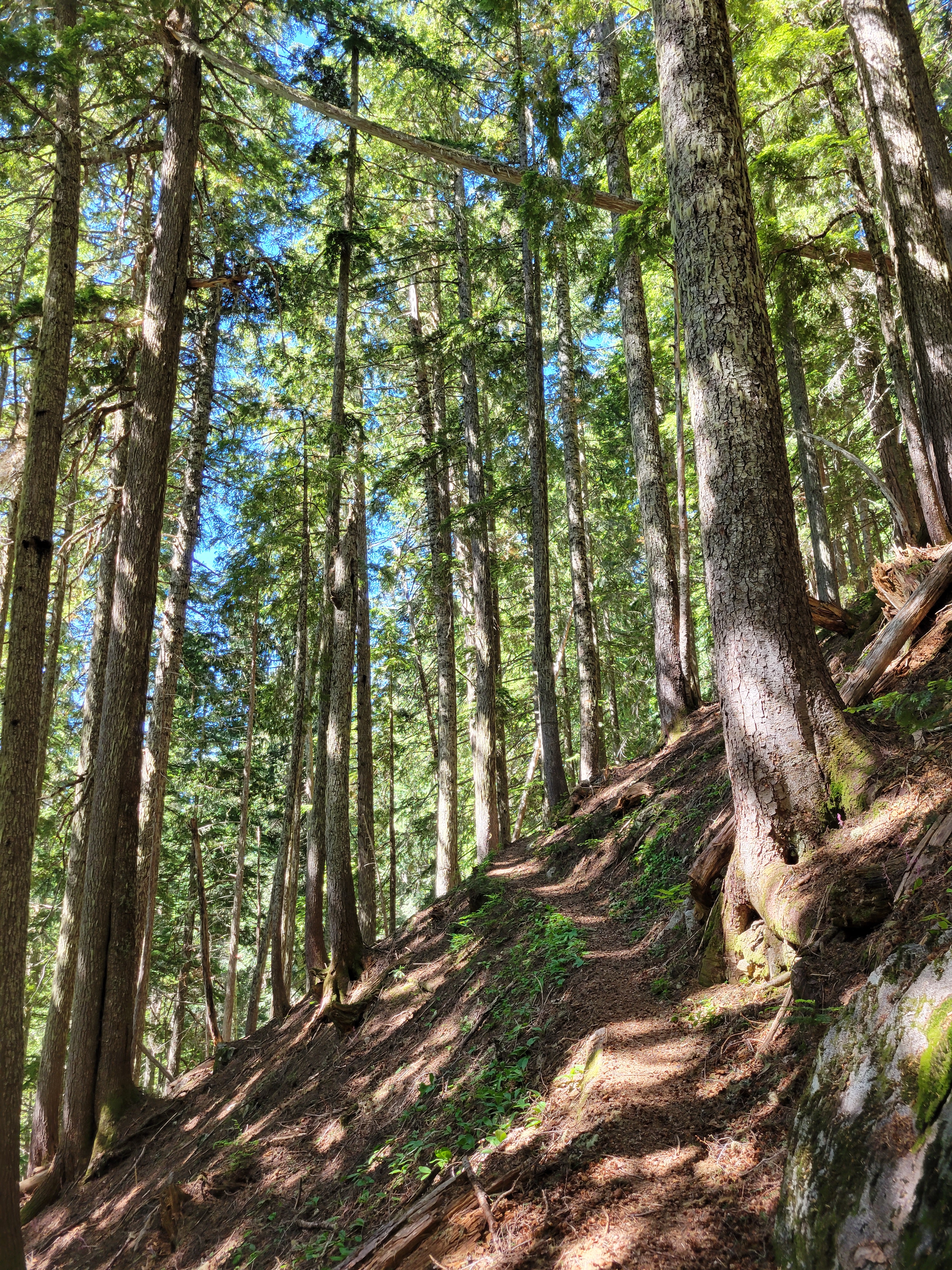
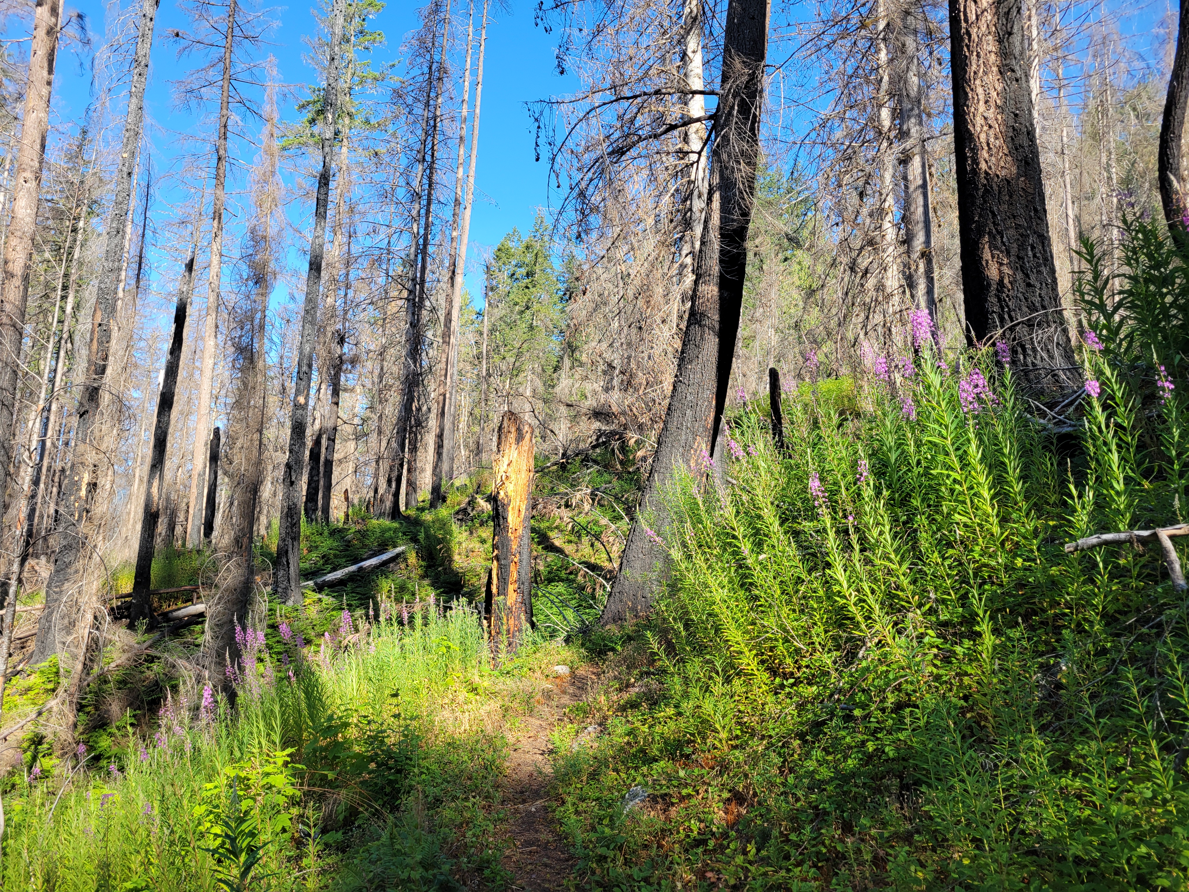
1) I forgot about the fire. Ok that’s my own fault. The first ~5mi through burn zone have had a LOT of impressive work done though and are actually not that bad in terms of burn fallout.
2) Swampy sections
3) Stinging nettle
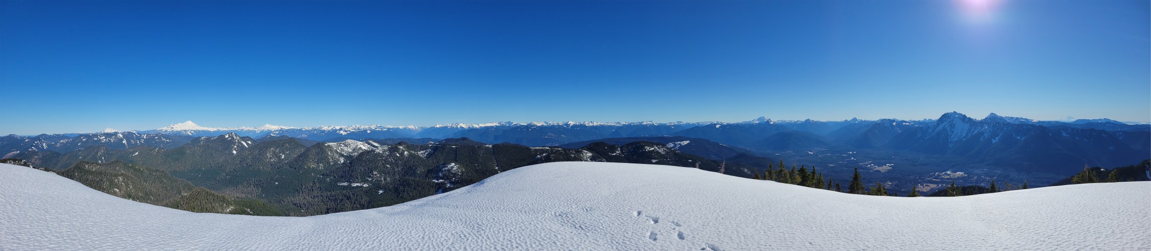
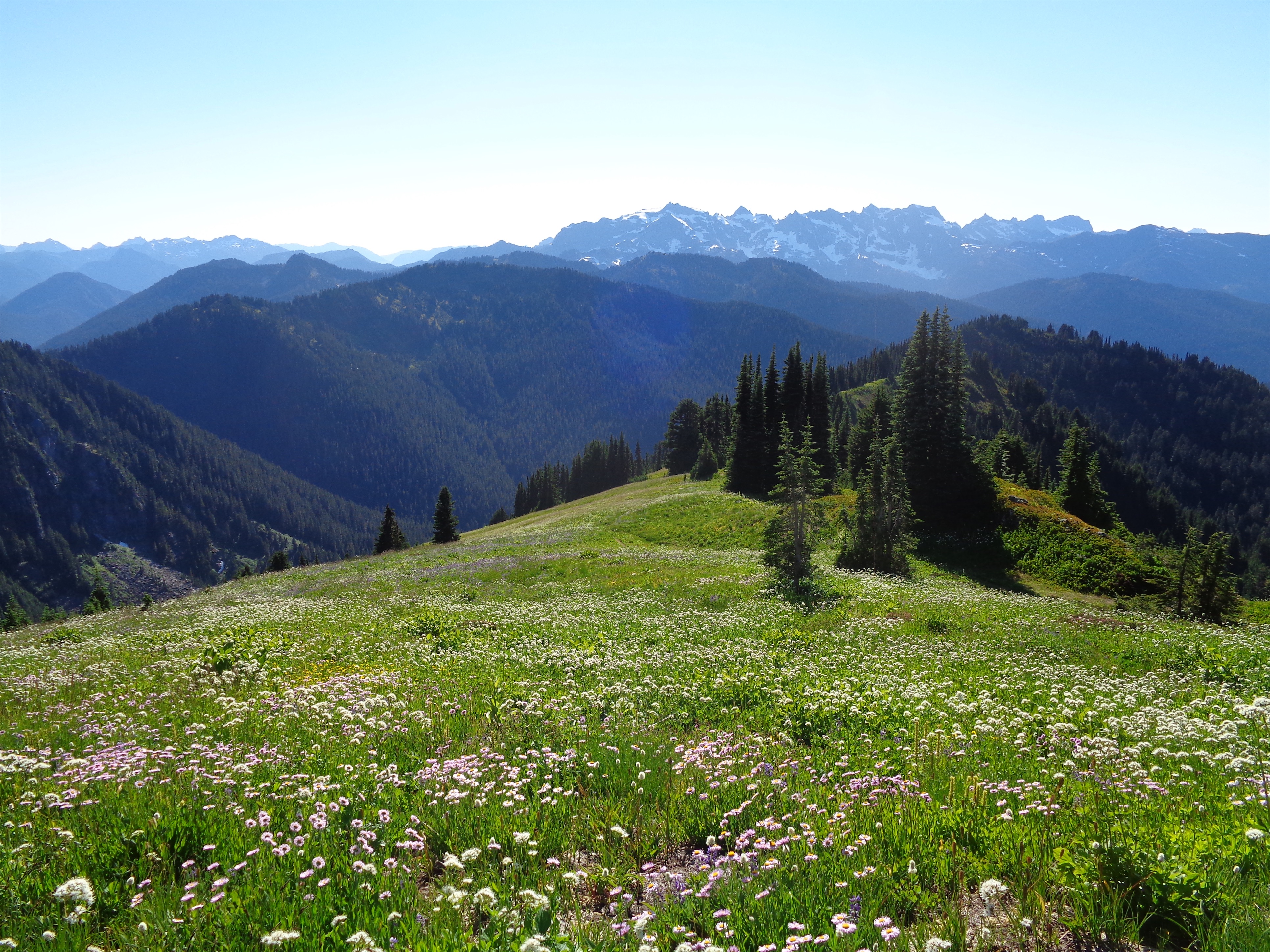
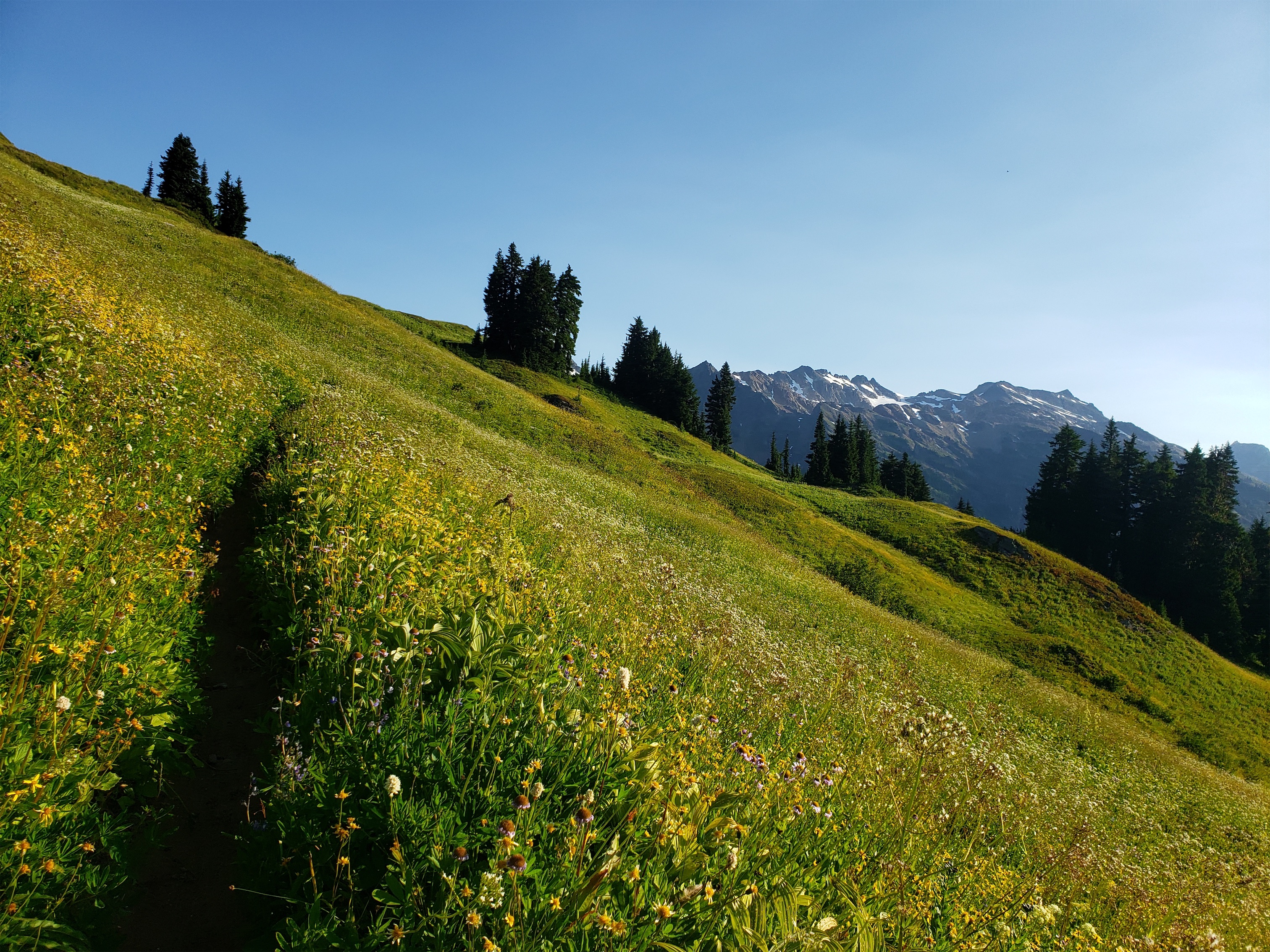
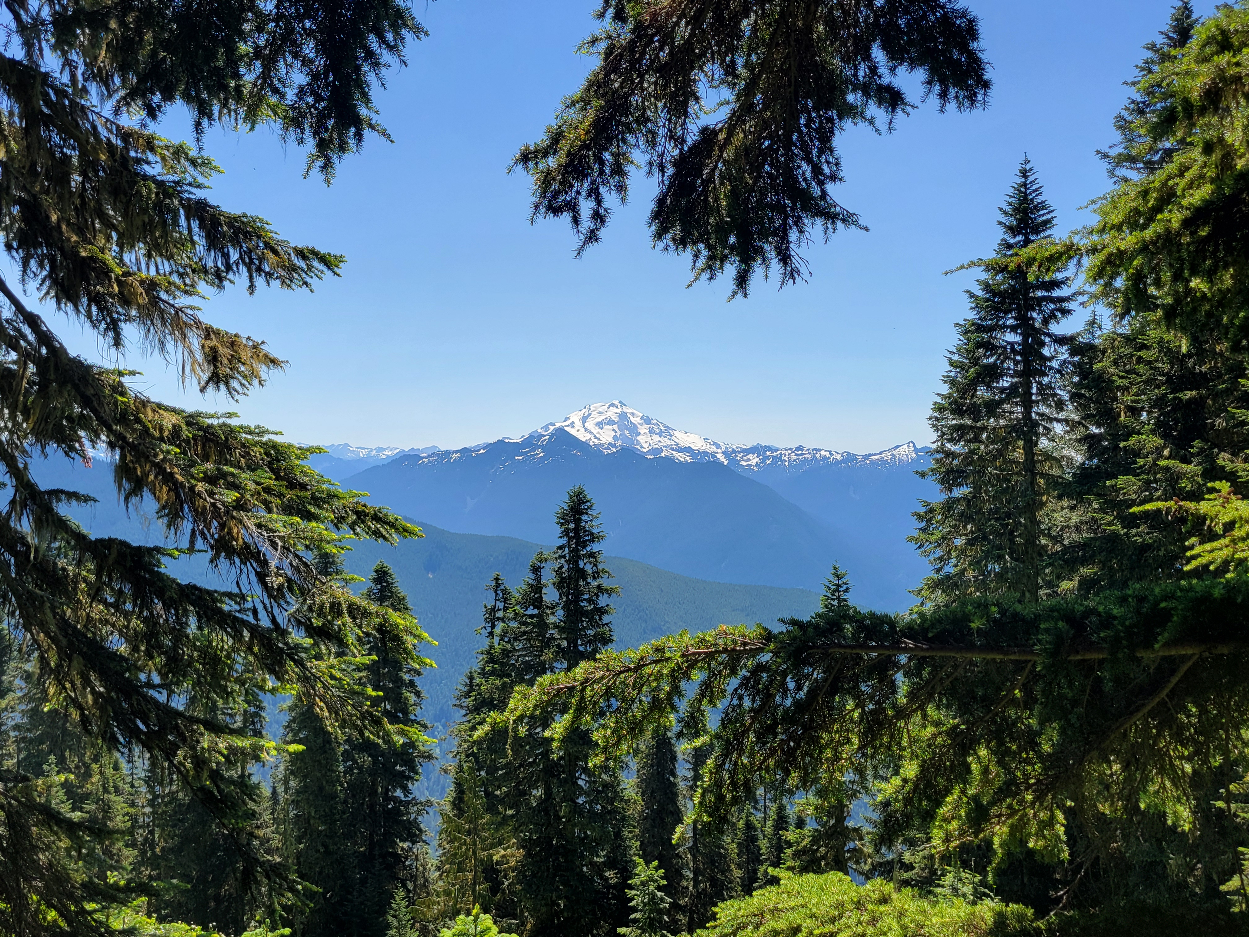
4) No open views until like the last half mile
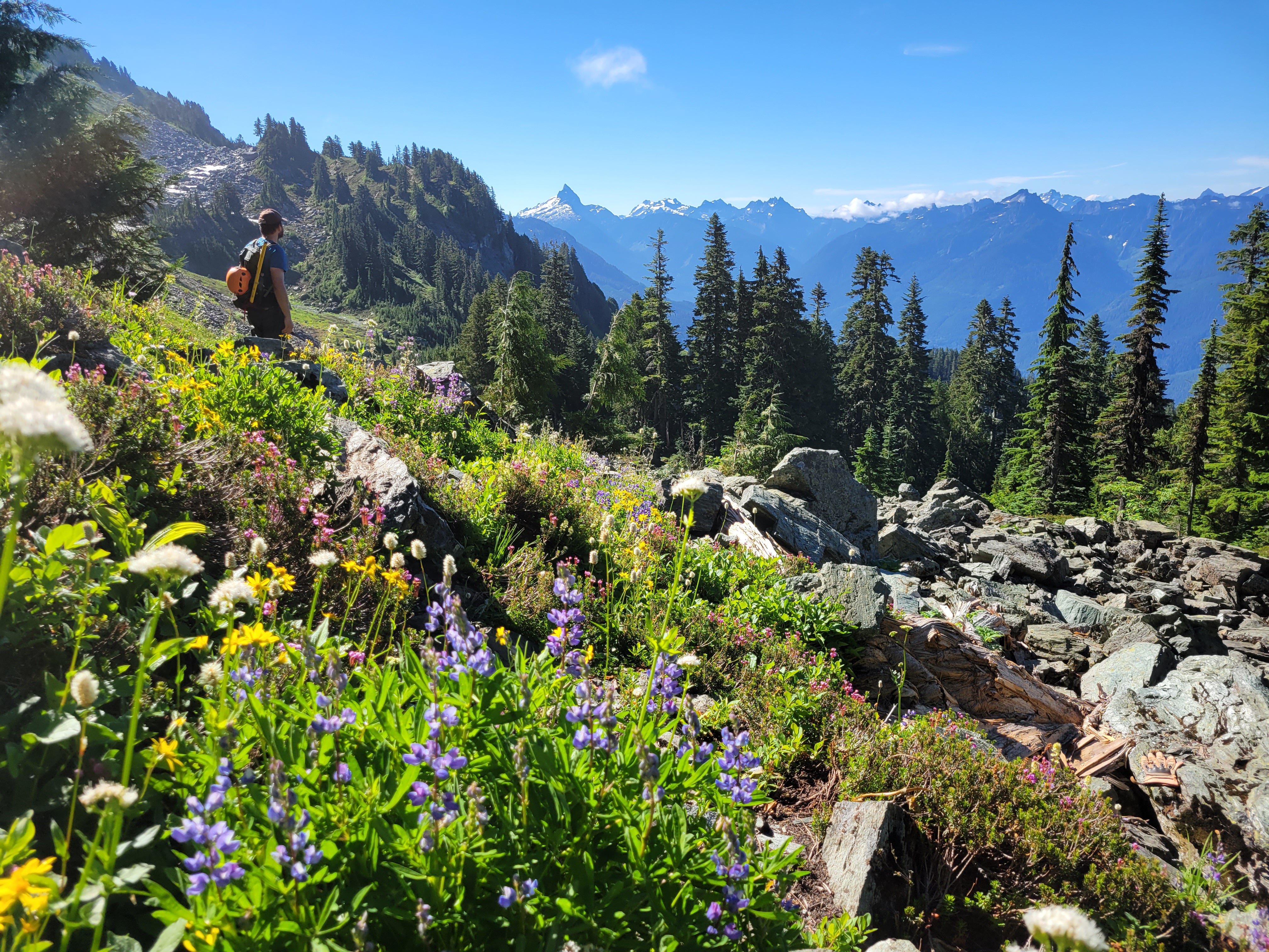
5) Minimal flowers
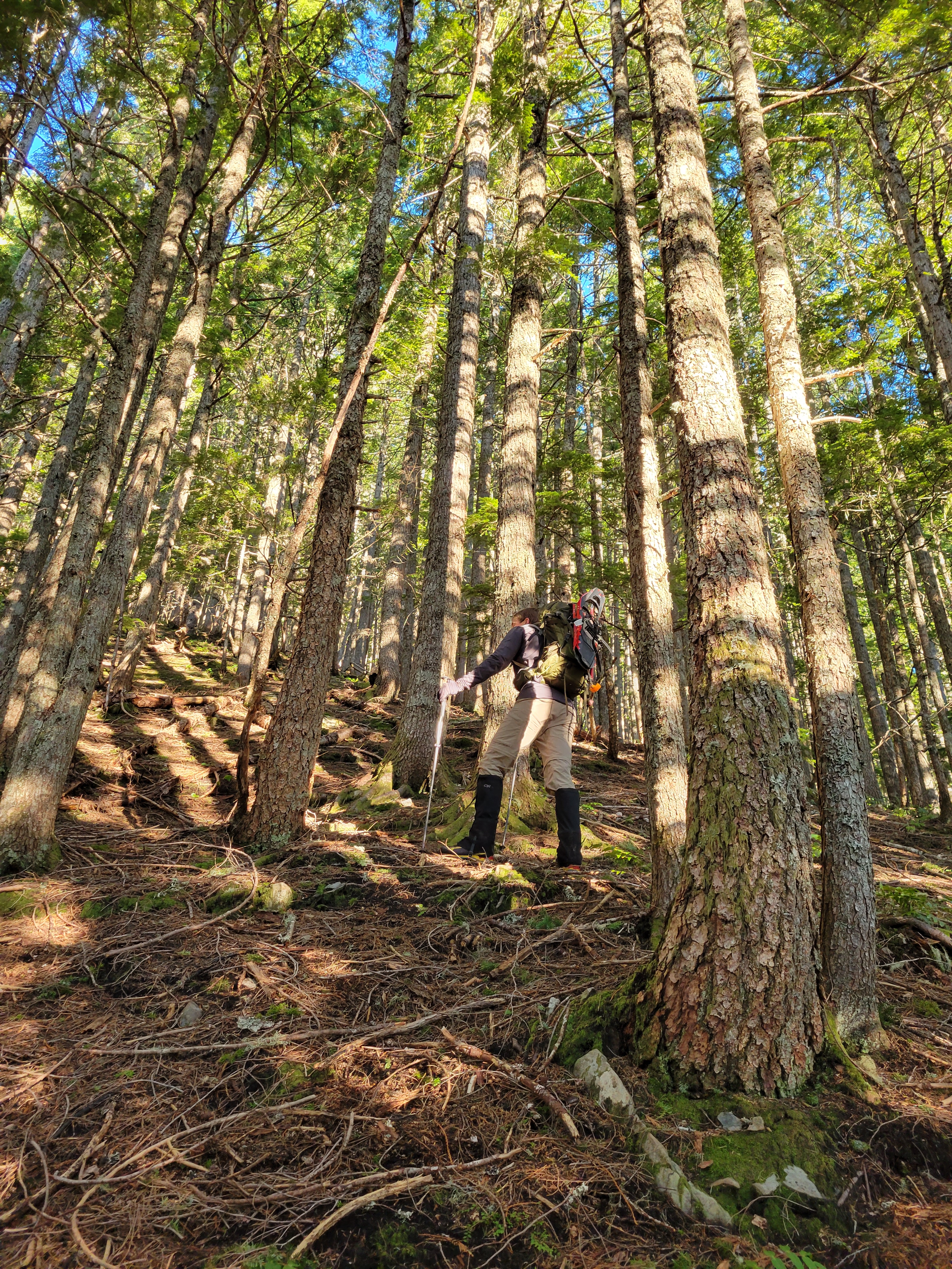
6) Past the burn zone, the trail is disconnected at best and nonexistent at worst. And the bushwhacking isn’t great. All waist high brush ready to shred your legs
7) I wore shorts (see points 3 and 6)
8) The longest switchbacks I have ever seen. I’m not on a bike just get me to the top come ON
9) Spiderwebs. The fire did not destroy their real estate, those fuckers
10) oh also i forgot maps of any kind
The good things:

1) Not kidding about the work done on the trail up to a point. The lower few miles were actually brushed (as in someone trimmed the brush on either side nice and short) I should have counted recently sawn logs (hewn?). Someone’s putting in some serious effort and I hope they continue to the top. I am convinced no trail ever existed between South Huckleberry and Actual Huckleberry. (edit: I’M NOT CRAZY)
2) Blackberries? The non invasive kind? They were small, but utterly delicious.
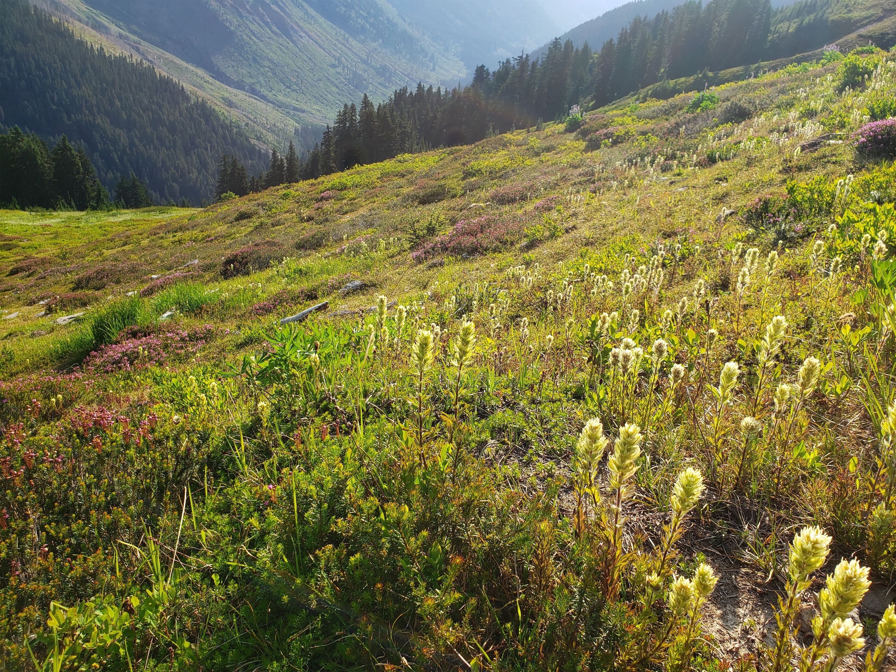
3) Burn zones are cool, and this one had a TON of variety and fascinating boundaries between severe burn and fresh green growth
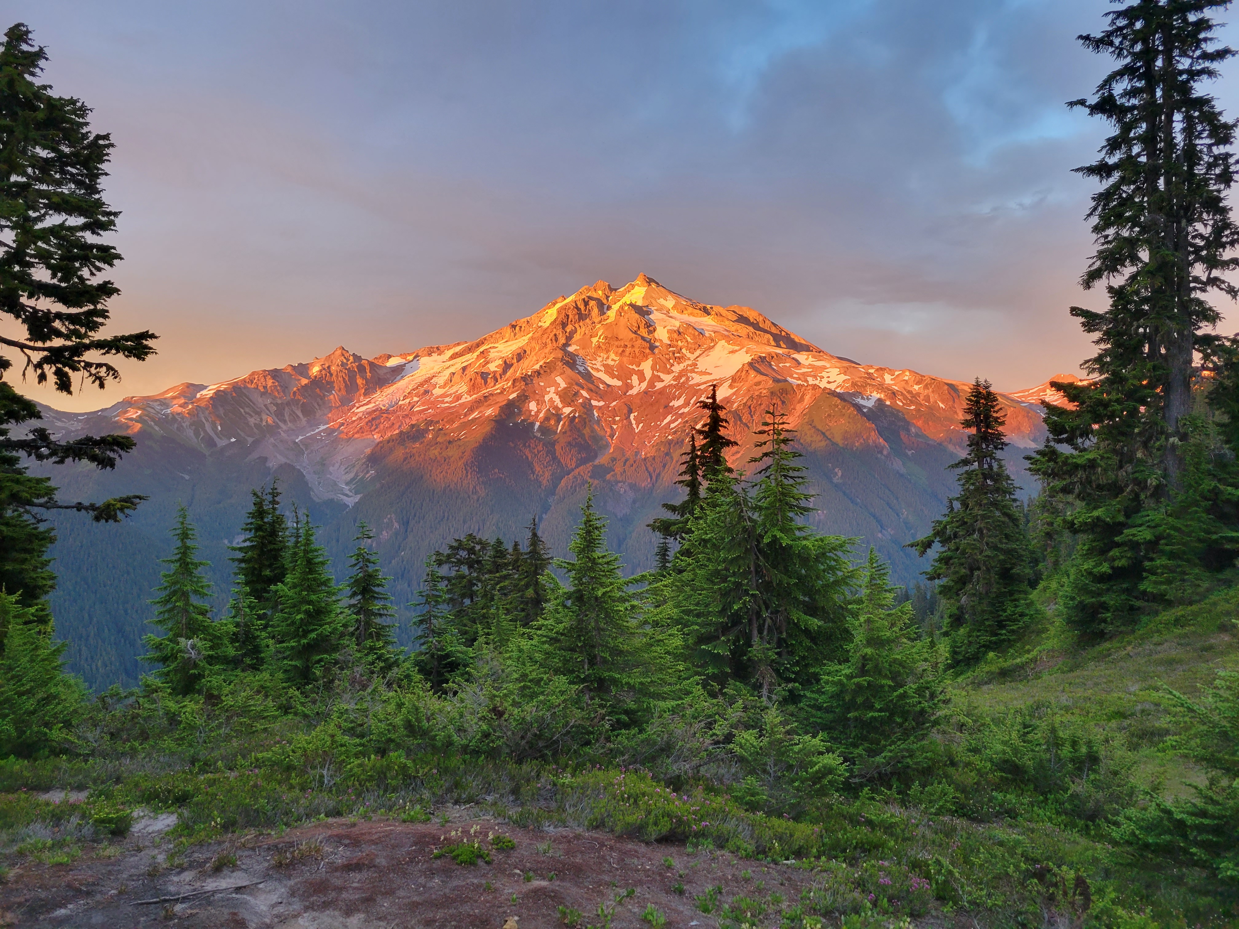
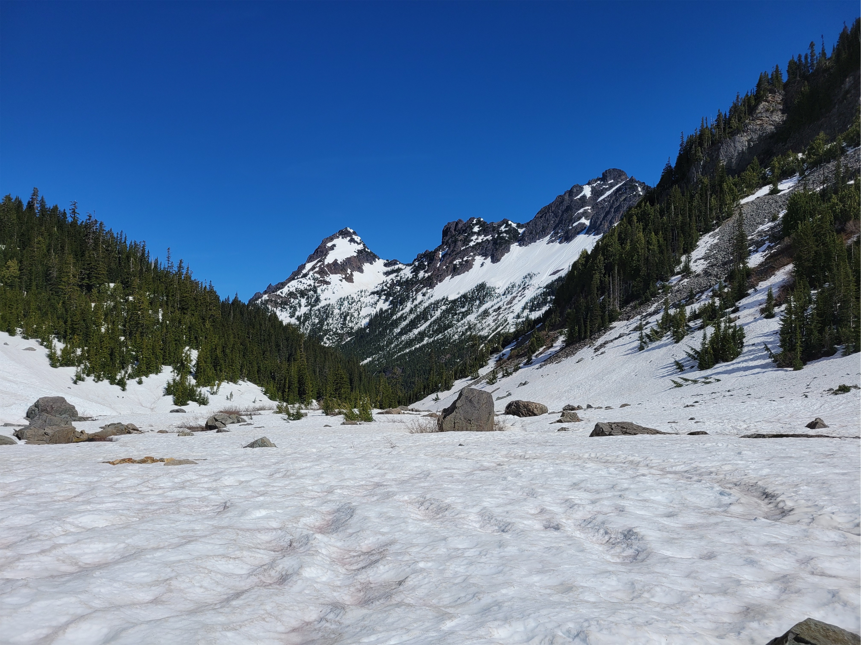
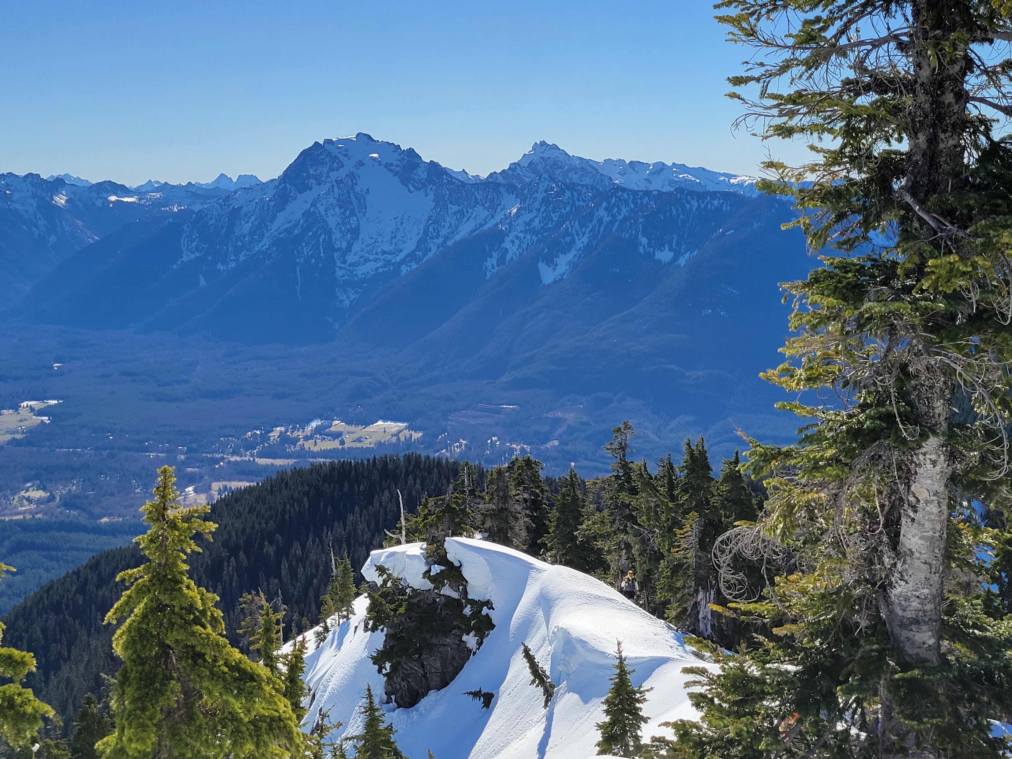
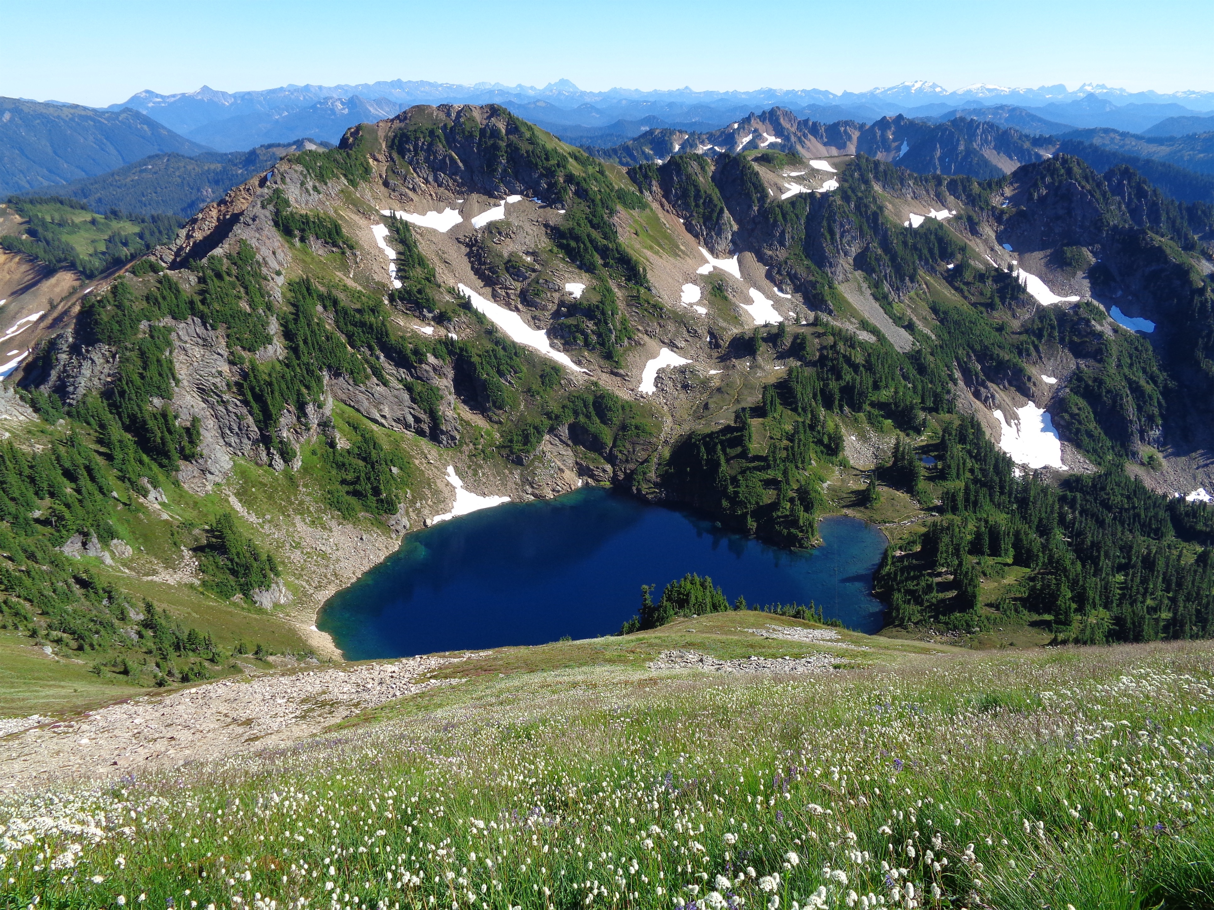
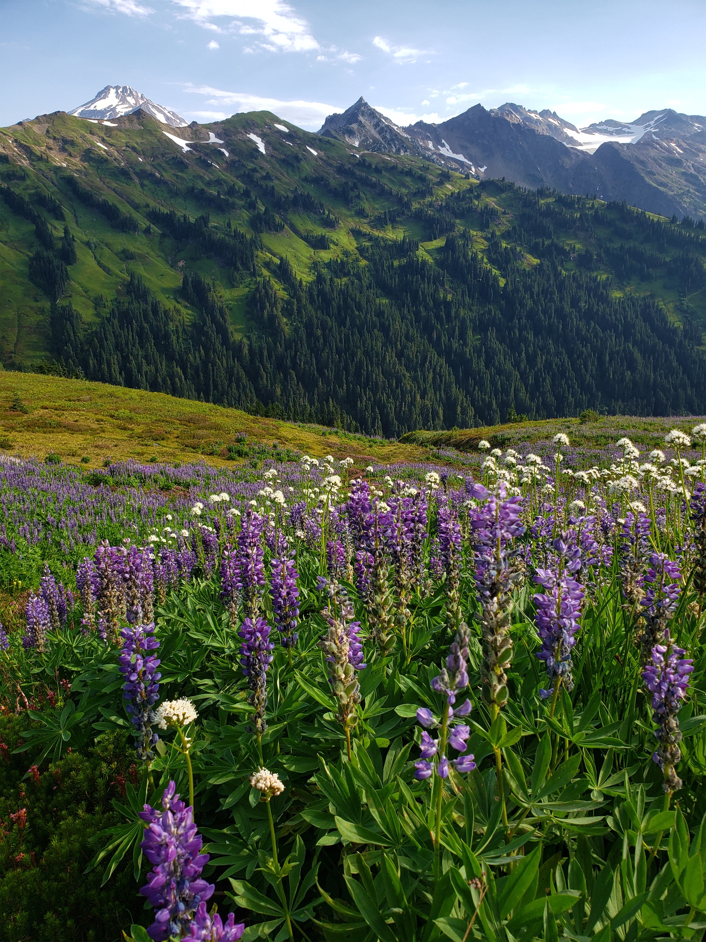
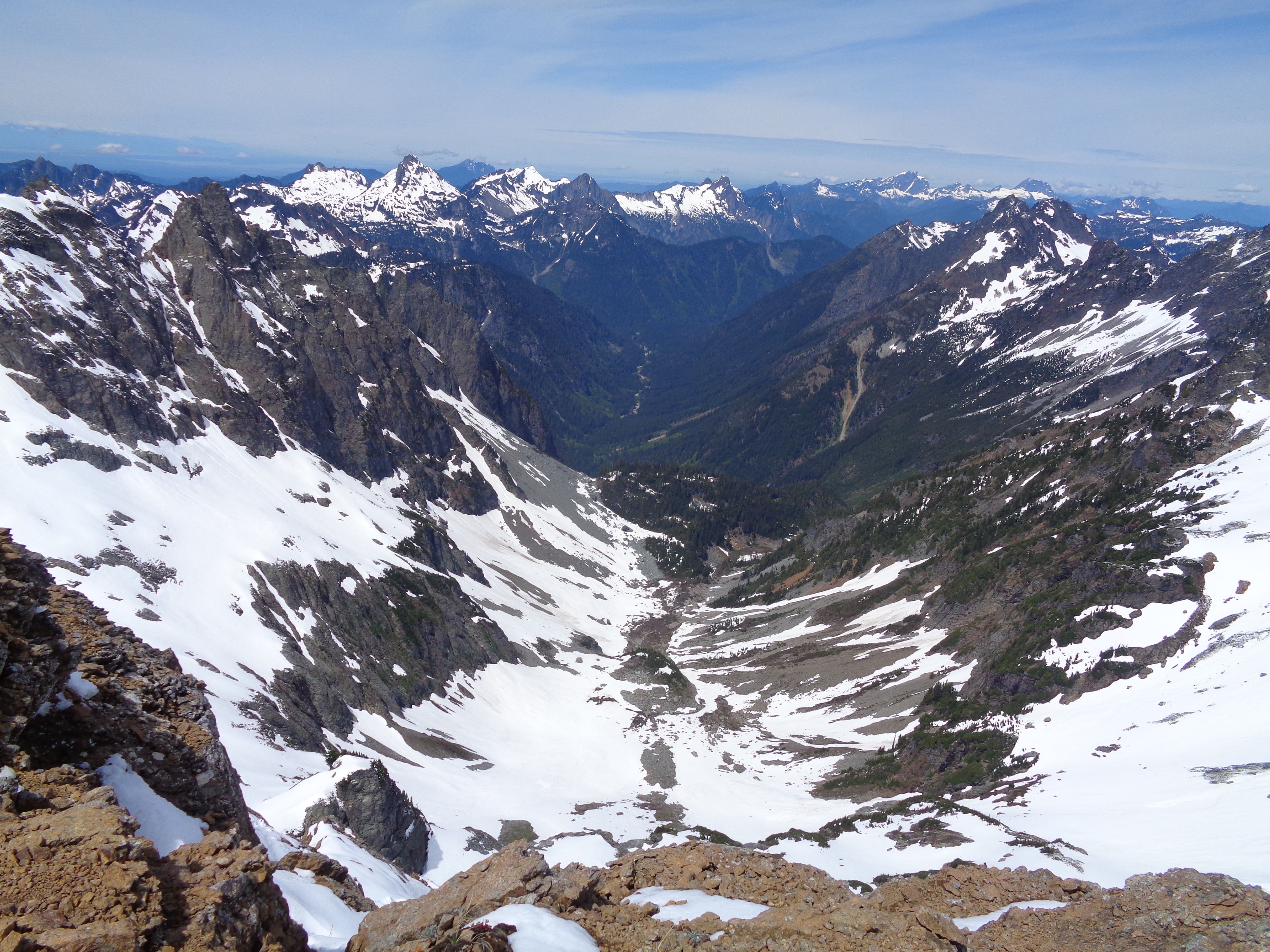
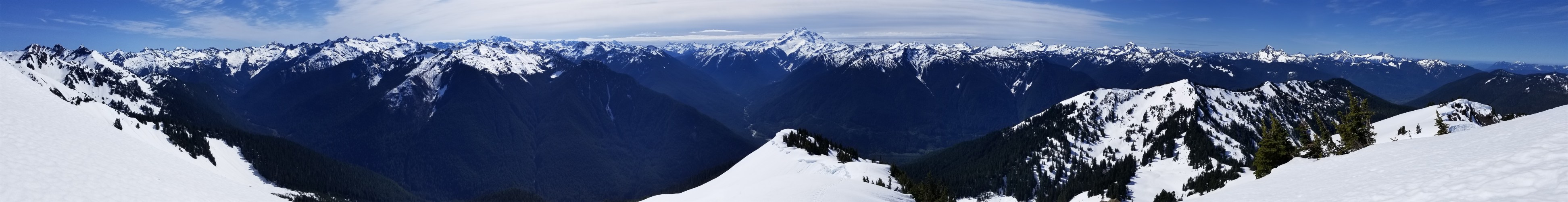
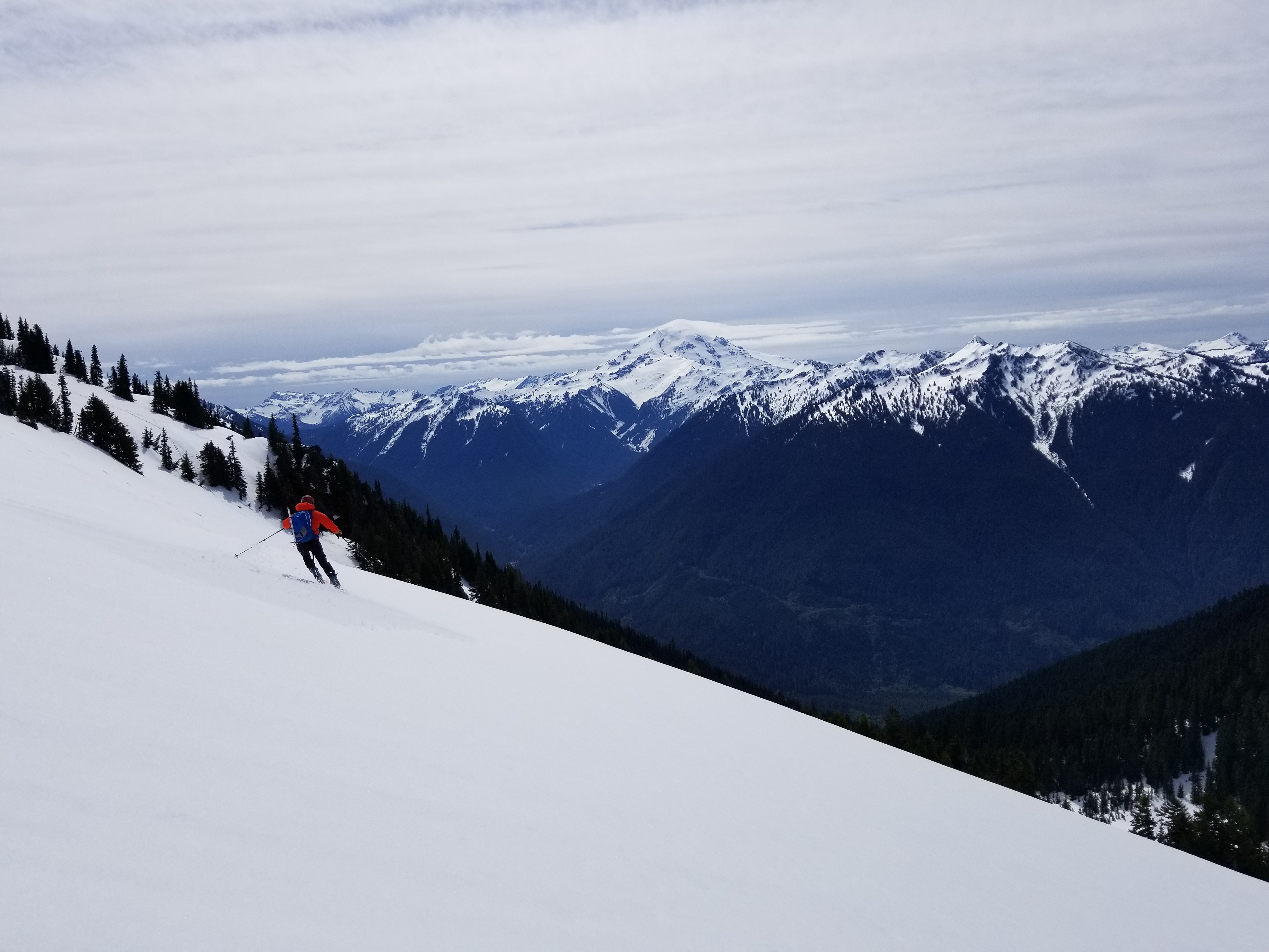
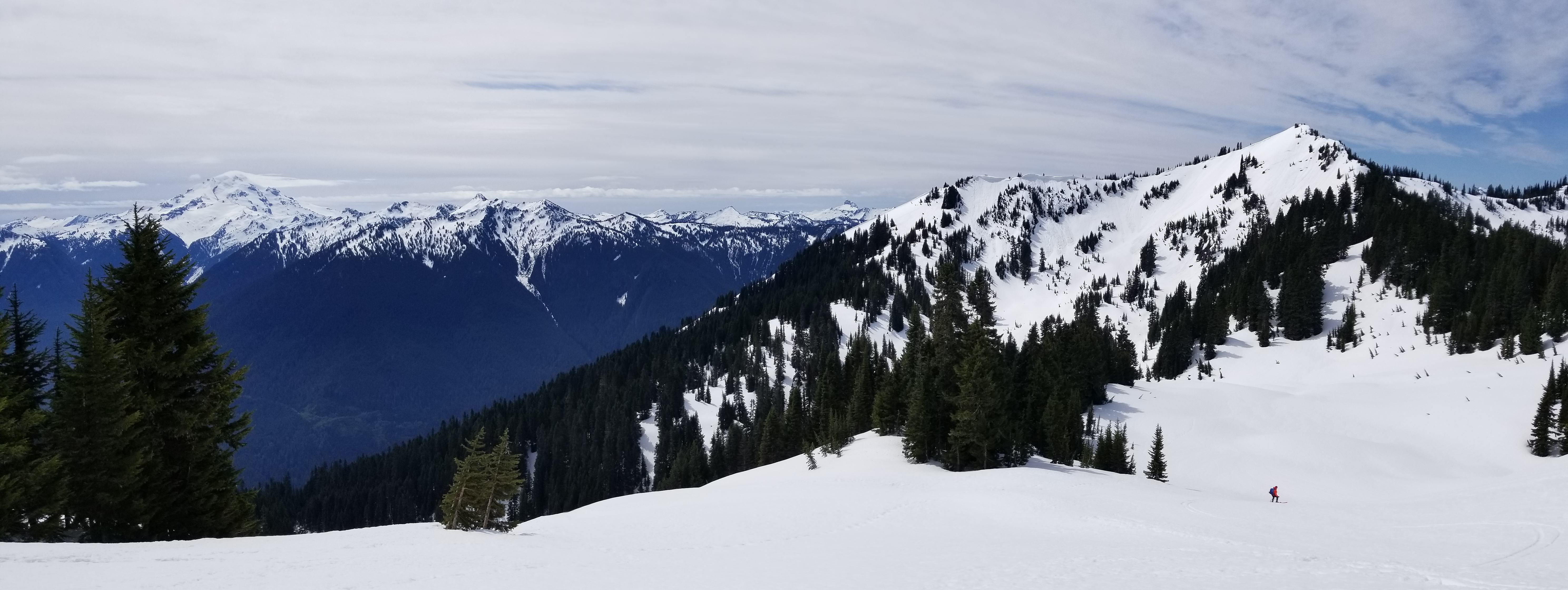
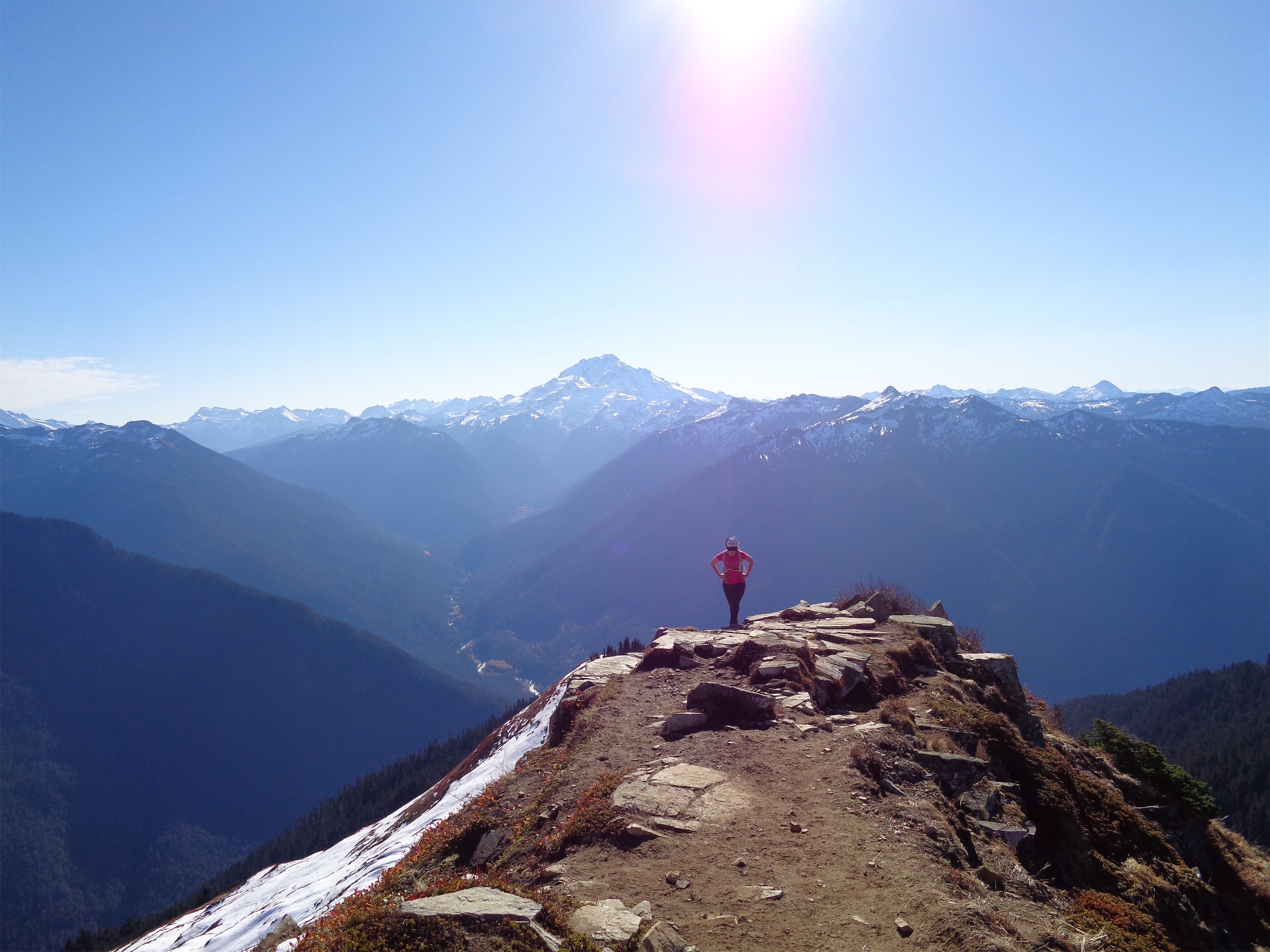
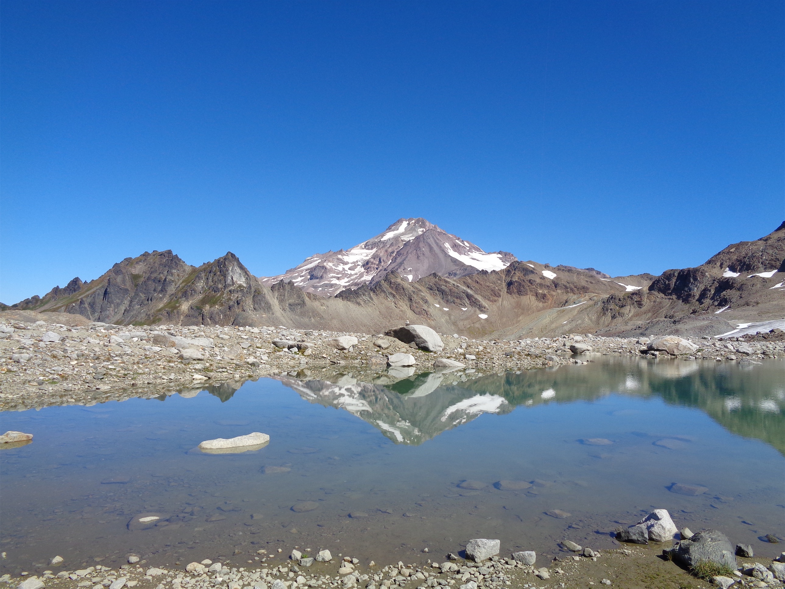
4) The few views up there are pretty good
5) Great workout
6) No people (WONDER WHY)
7) Alki bakery makes great scones and I had one (I almost put this on the bad list bc I ONLY had one, but let’s practice gratitude over my default state of gluttony)
8) The Suiattle River Road is in great shape and drives REAL nice right now

Aaaand now to the actual conditions. You enter the burn almost immediately. Stages of intensity (and how much has regrown) vary widely. I was thrilled to see that the trail had been brushed out and was way wider than the last time I had been (the fire helps with that too). Fewer cross-trail places for spiders to set up shop. OH WAIT. Where there’s a will, there’s a way. I fended the worst ones off with poles and a prior hiker had taken down a few for me. The prior hiker was a steady old guy who said it was great when I ran into him on his way down around 9:30am, which I took as encouraging at the time, before eventually realizing he must not have made it all the way to the top, or he has the gift of human flight.
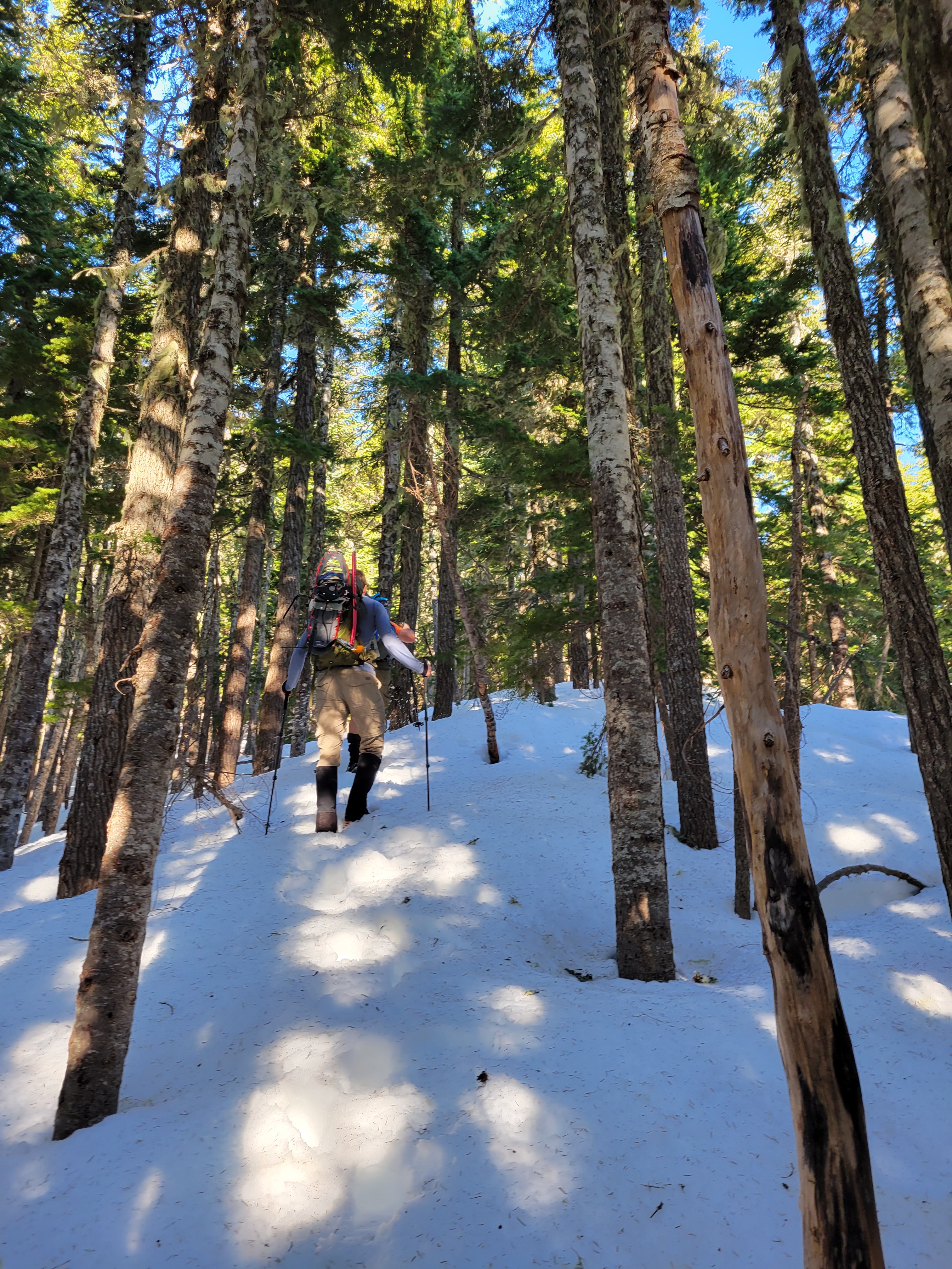
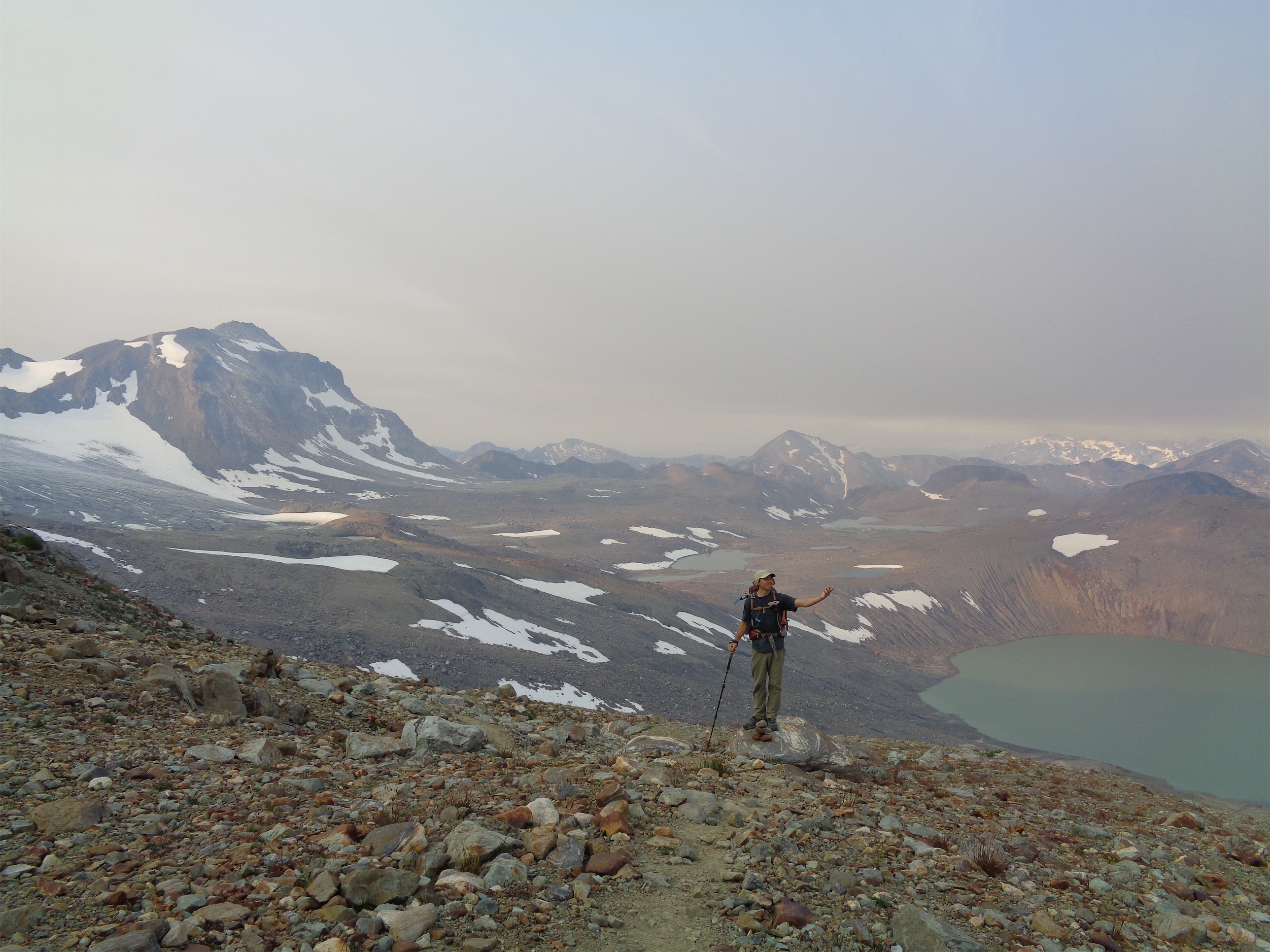
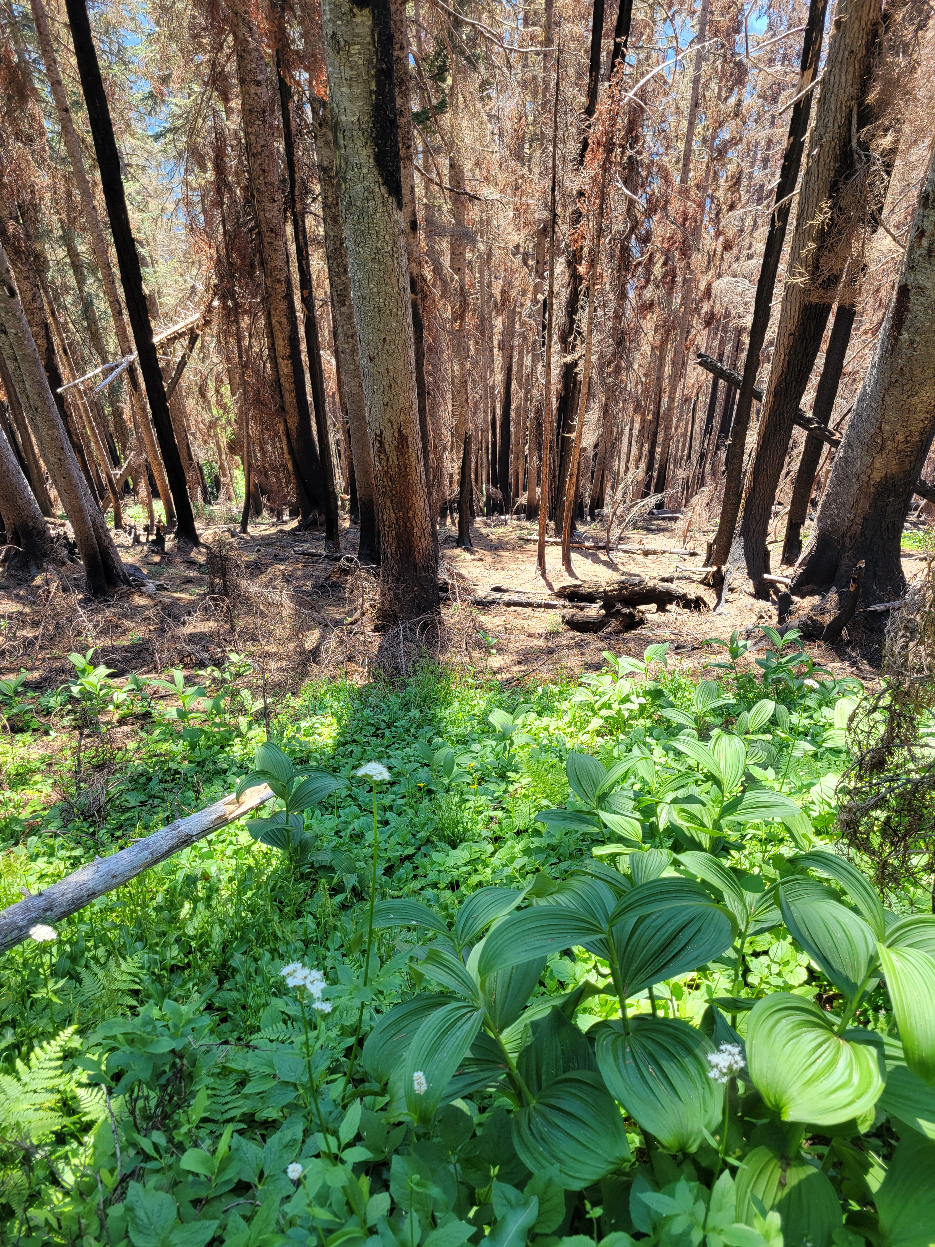
This was in the open forest burn zone. There were patches of fireweed, but most had not bloomed yet and was just green. There was also dark desolate feeling burn in the forest, a stark contrast to the fireweed/nettle/grasses combination. The easy moving was a relief. Every swampy step or brush with nettle or spiderwebs had me cursing GET ME BACK IN THE HARSH BURN ZONE. Since I did not have any maps, I had no idea how far in I was, and assumed I was way further than I actually was, so I persevered. The somewhat burned zones turned into a completely desolate burn zone around 5mi in after entering the GPW (needs a new sign). This is where the trail started to disappear. It survived most of the burn, but can be tricky to follow. Fortunately a tiny glimmer of cell service had come through and I had loaded two maps.
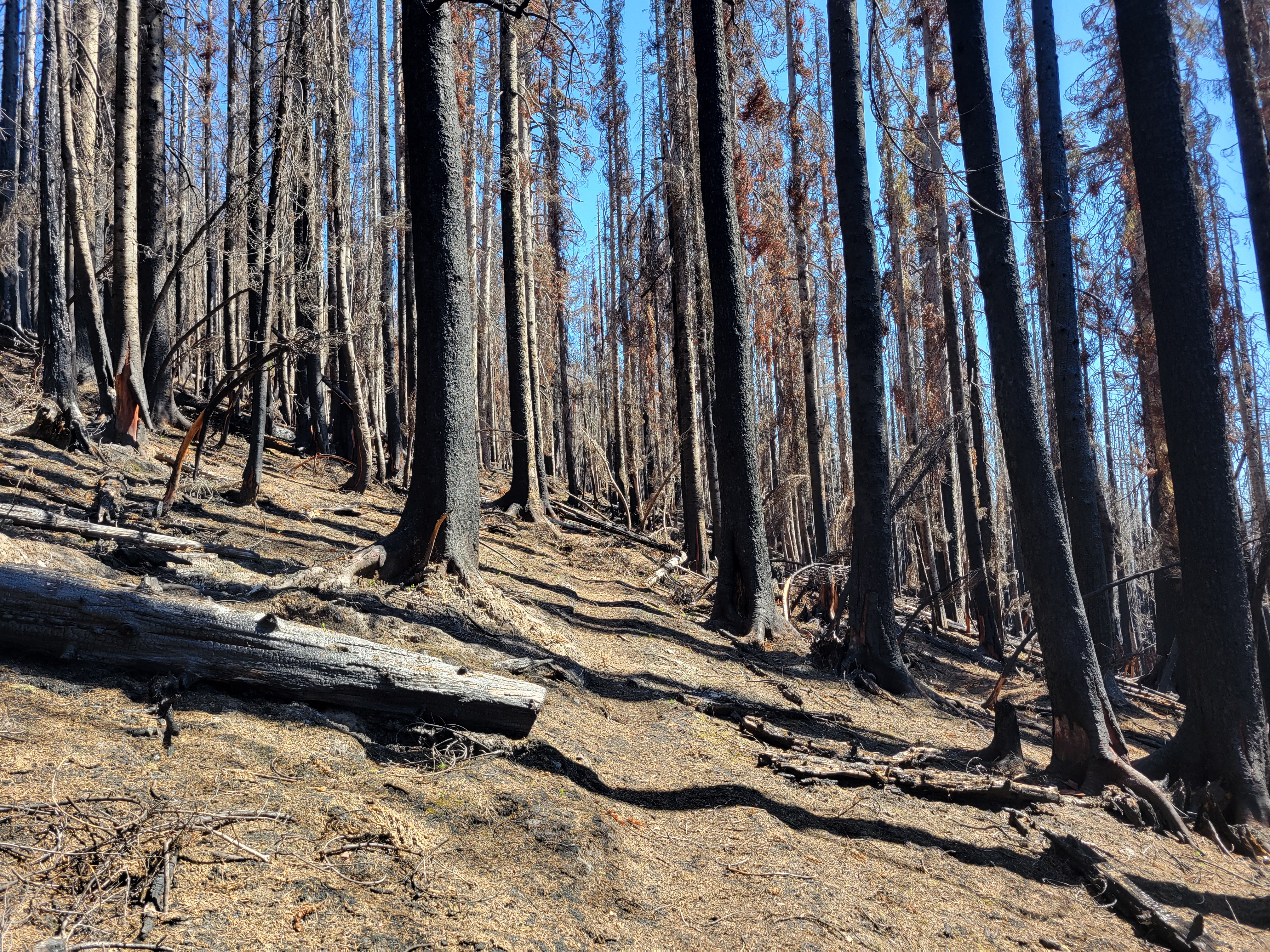
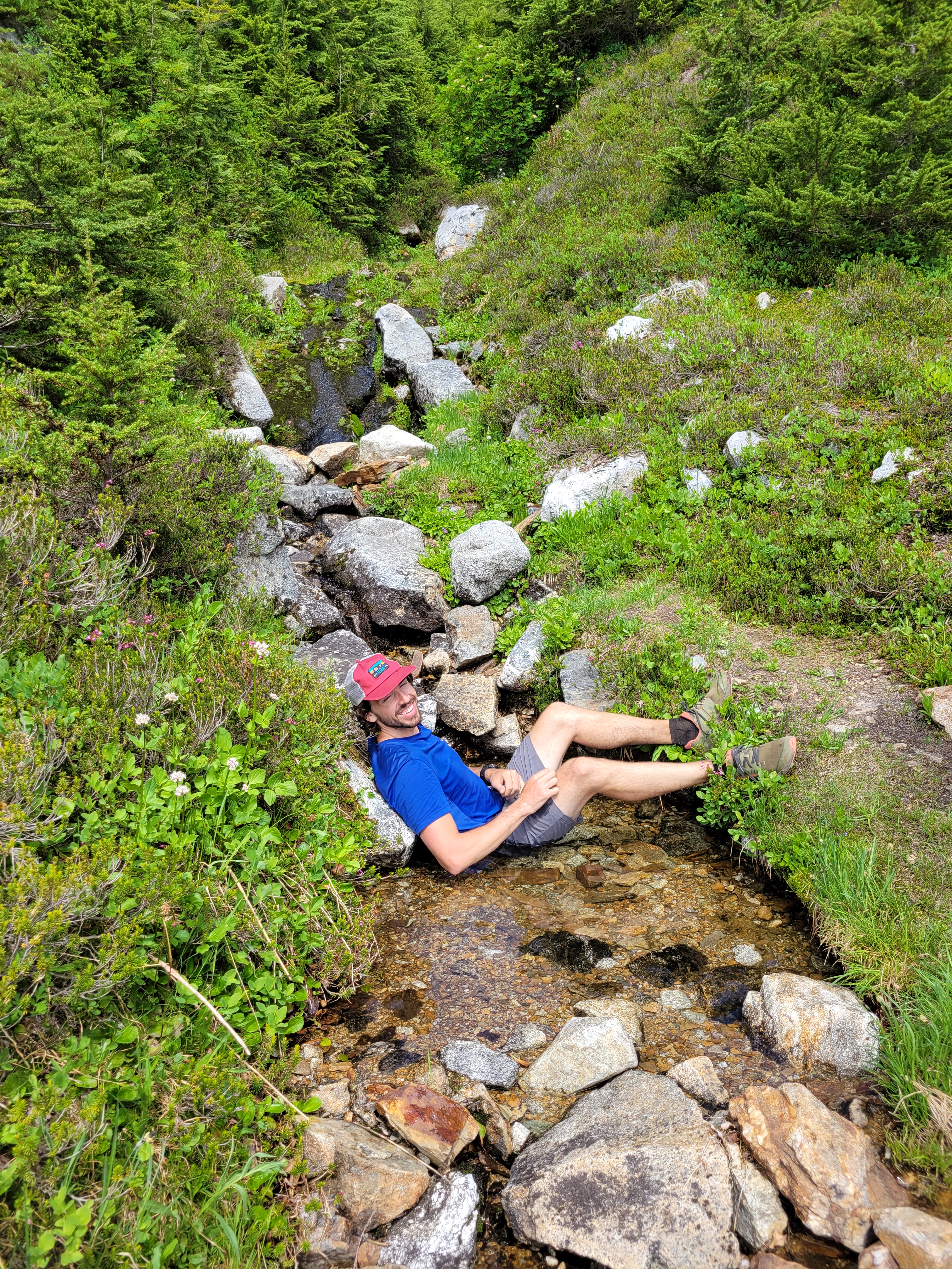
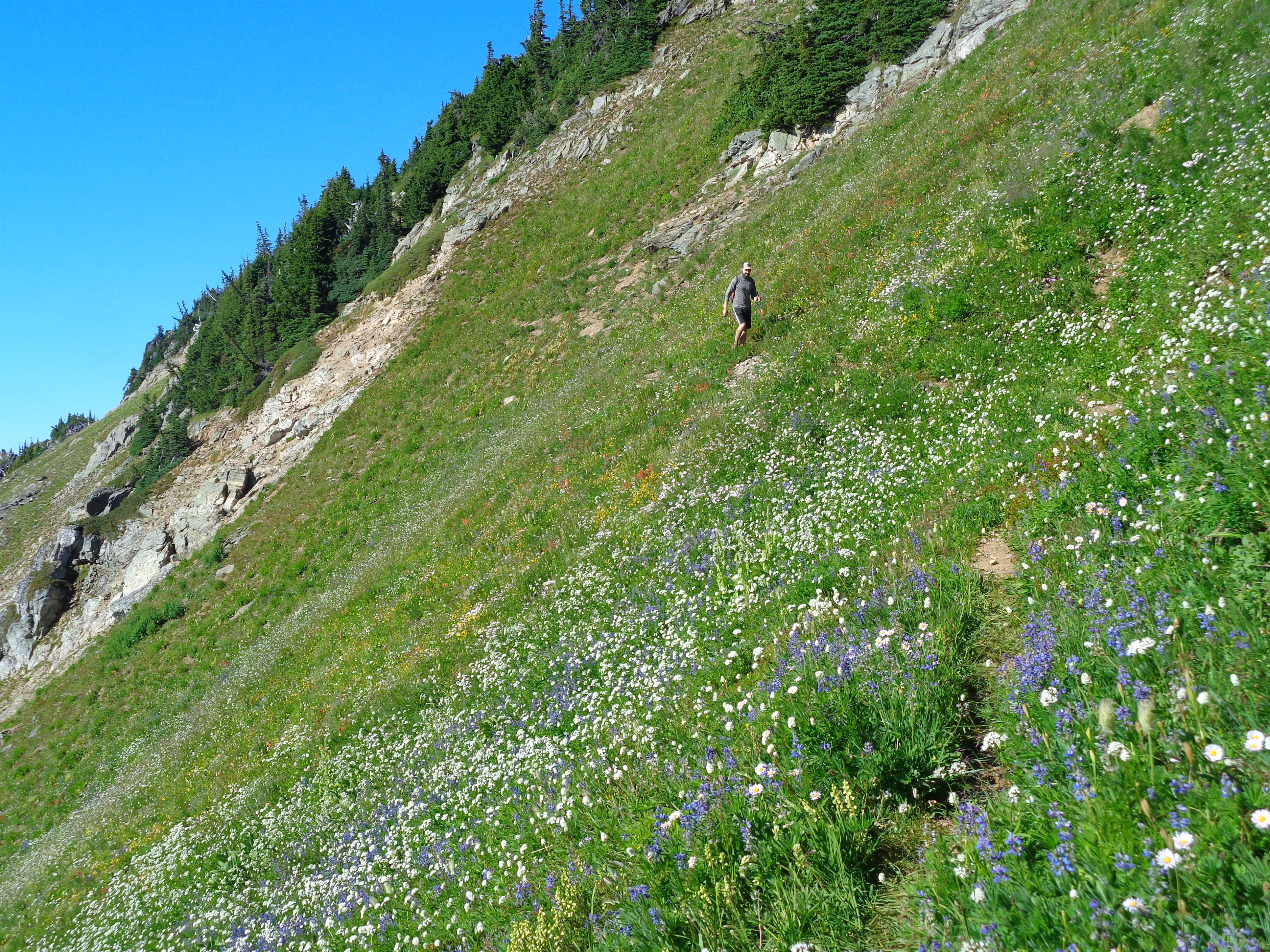
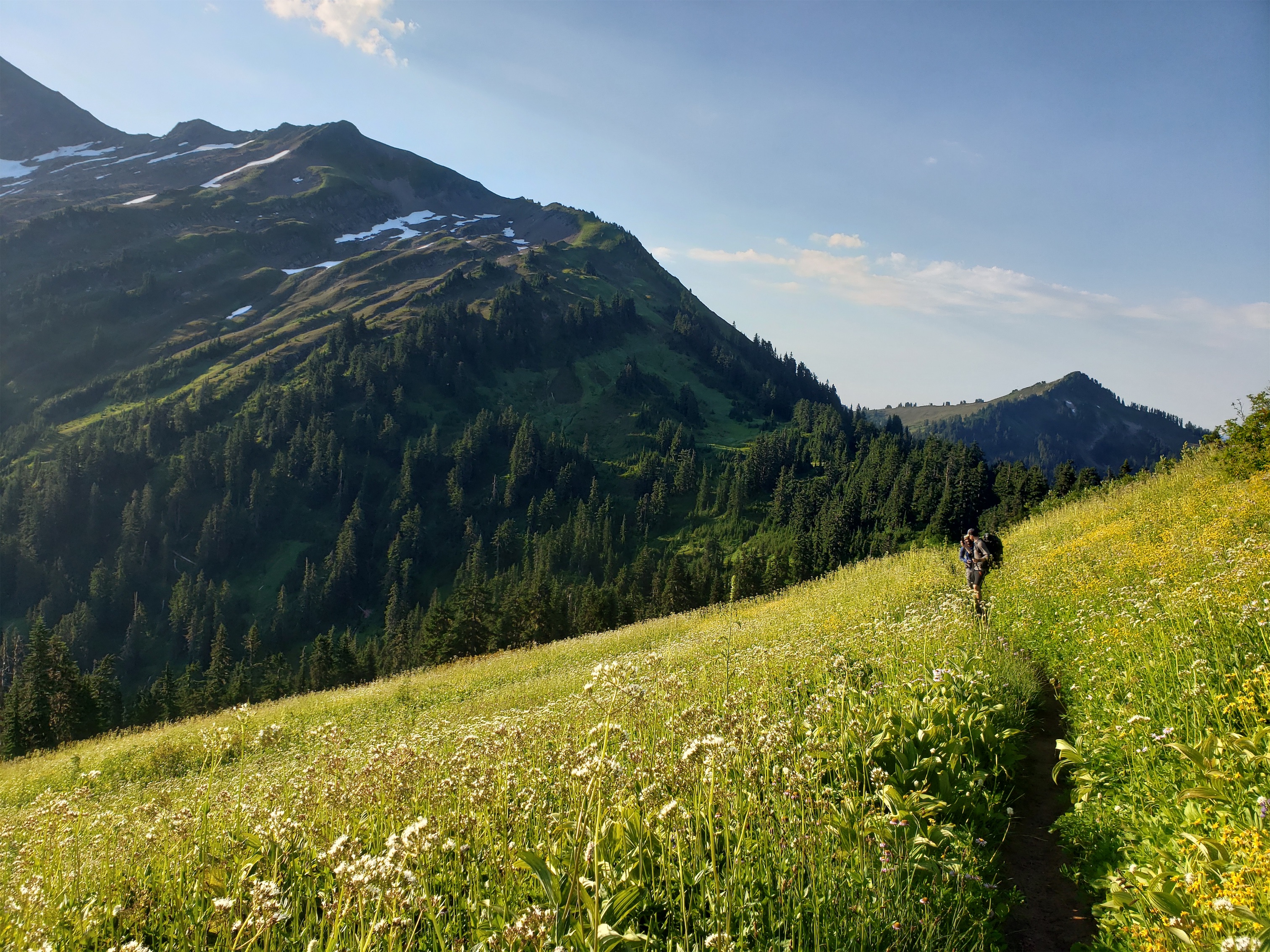
The next half mile is a crazy mix of desolate burn and thick green brush with zero gradient, just a 0-100 type swap within an inch of ground. The contrast is crazy. The trail is on a super steep slope and has been eroding, so you’re walking on some 6″ at BEST tread mostly under brush. I imagine this will be shoveled/widened/rebuilt in time once whoever is crushing the trail building down low gets to it. After this mildly tedious traversing you break into a meadow (with no flowers, add insult to injury) and probably promptly lose the trail. Welcome to the wilderness. The meadow is easy. Walk straight across and up the shoulder and you’ll recatch a section of trail along the edge of the trees above you. In another 100ft you’ll lose it. Drop some elevation to skirt obvious cliff bands. Maybe you’ll hit a flat meadow with a meandering stream, maybe you won’t. It’s a good landmark though. At the meadow start to re-gain elevation, you won’t find a trail anywhere so just look for the path of least resistance, which will be knee-to-thigh-high huckleberries (that don’t have berries yet). They aren’t bad, unless your legs are already covered in stinging nettle burns because your dumb ass wore shorts.
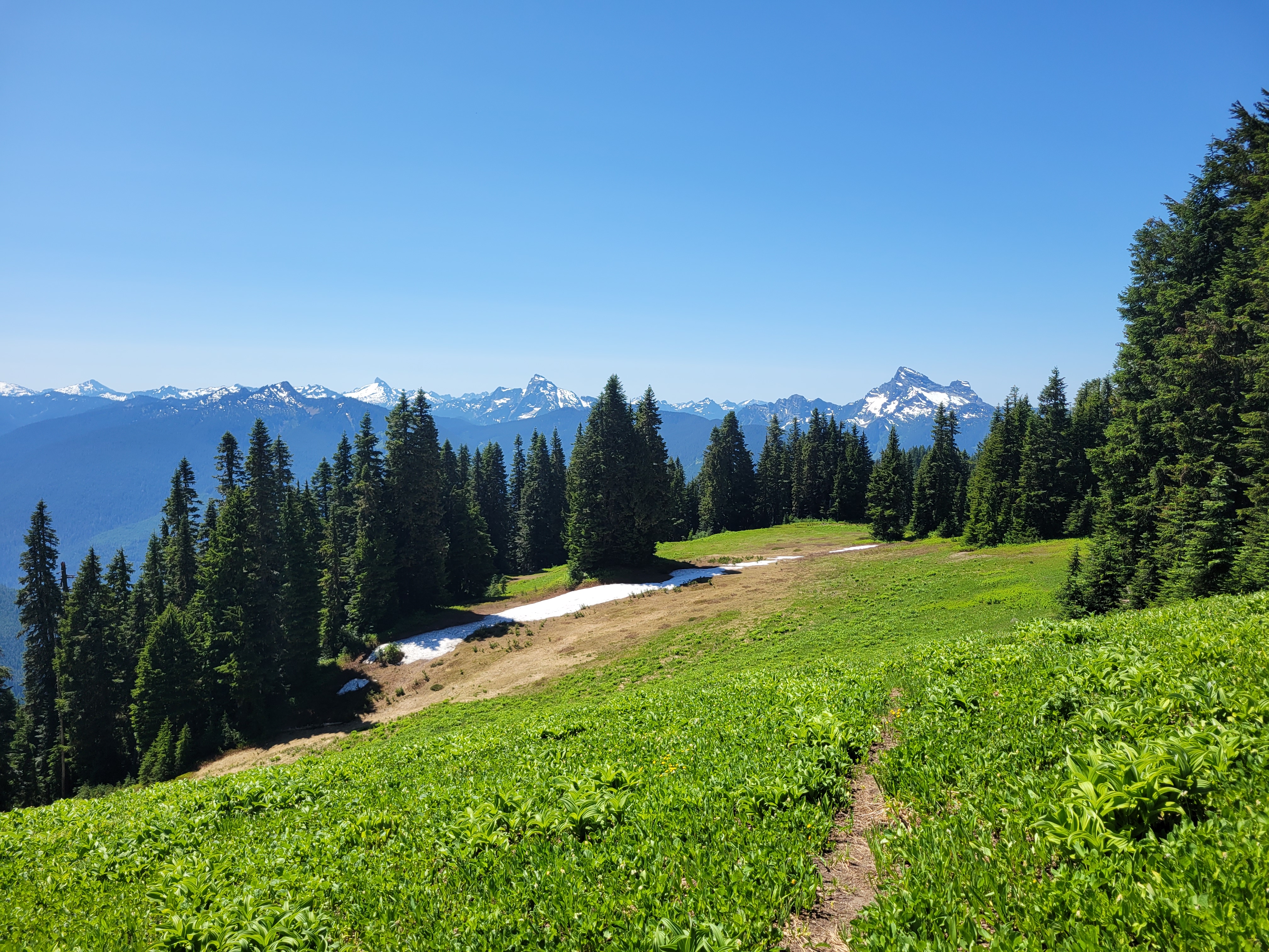

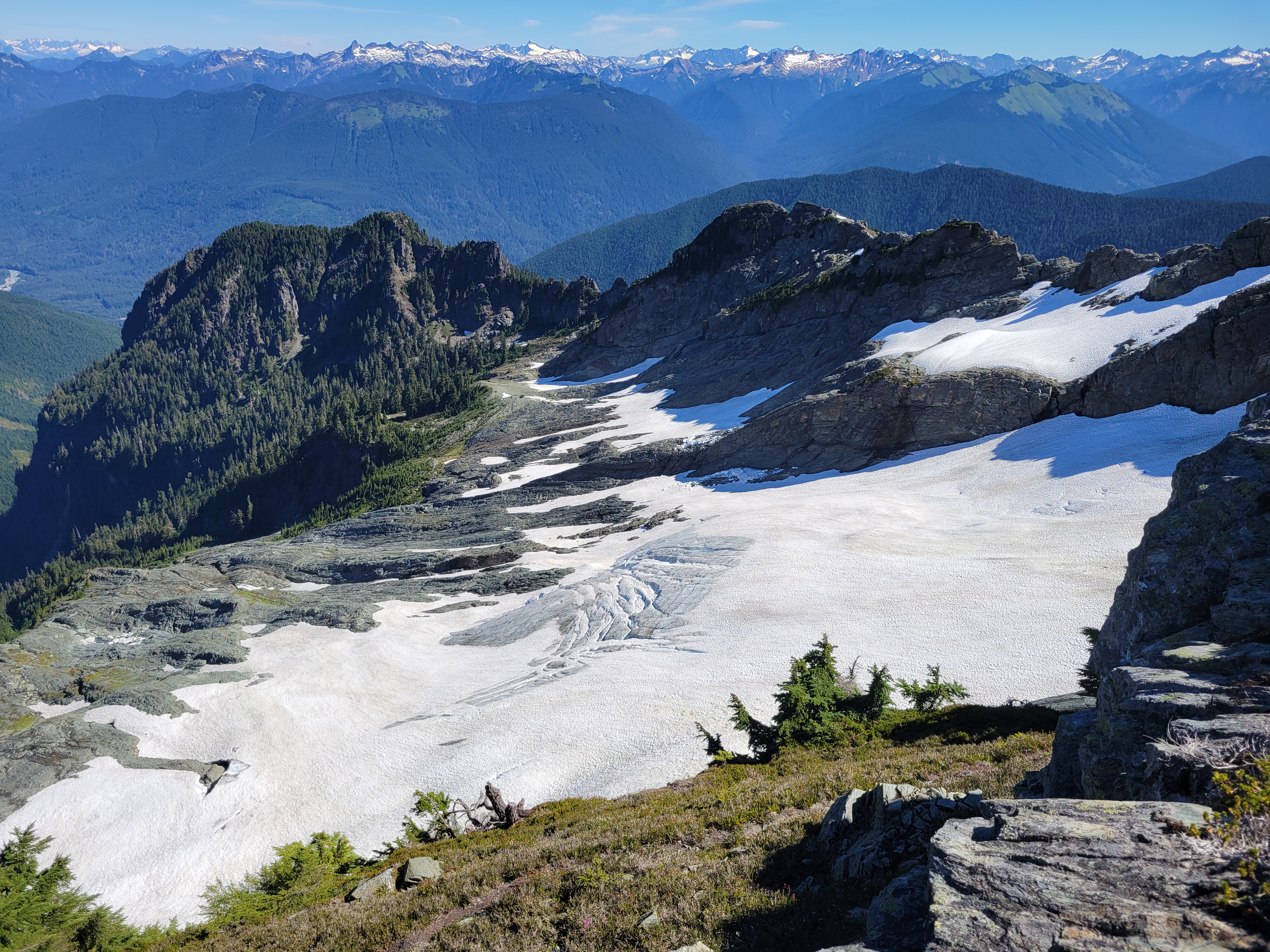
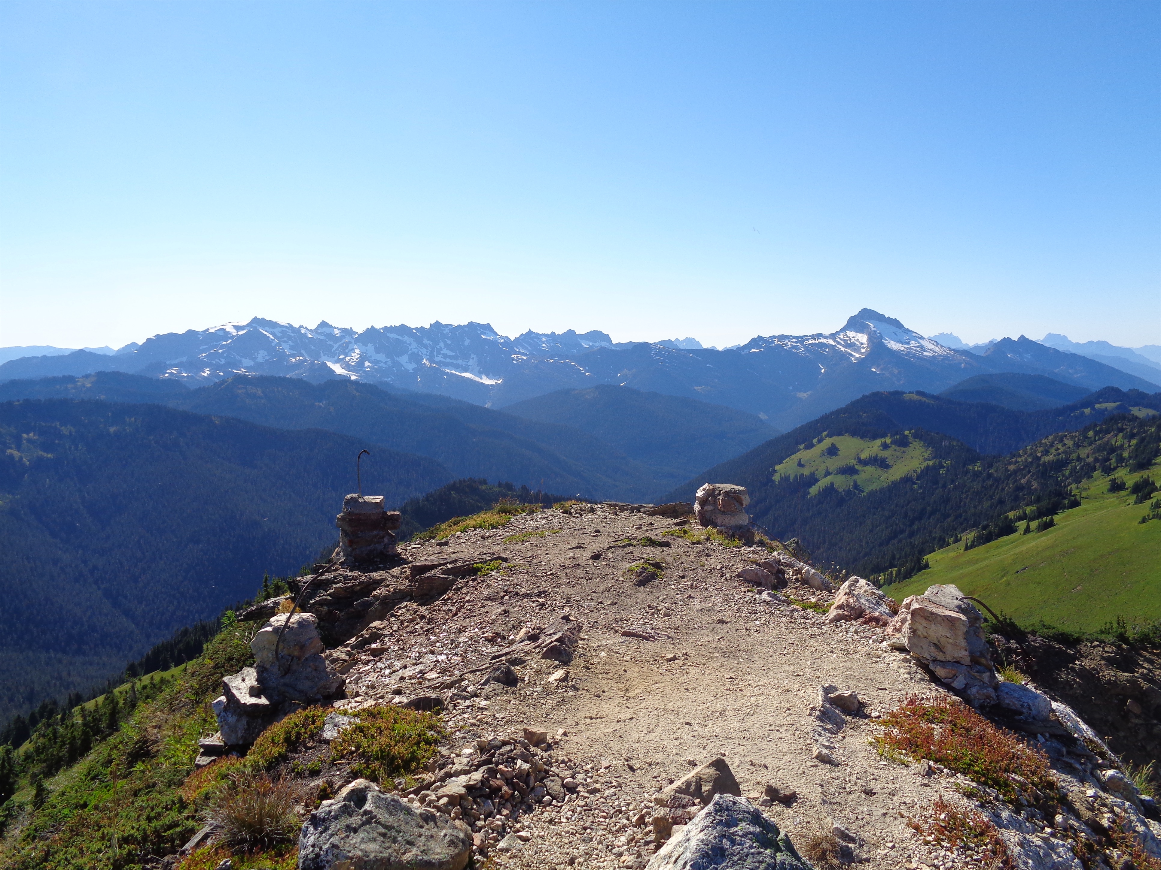
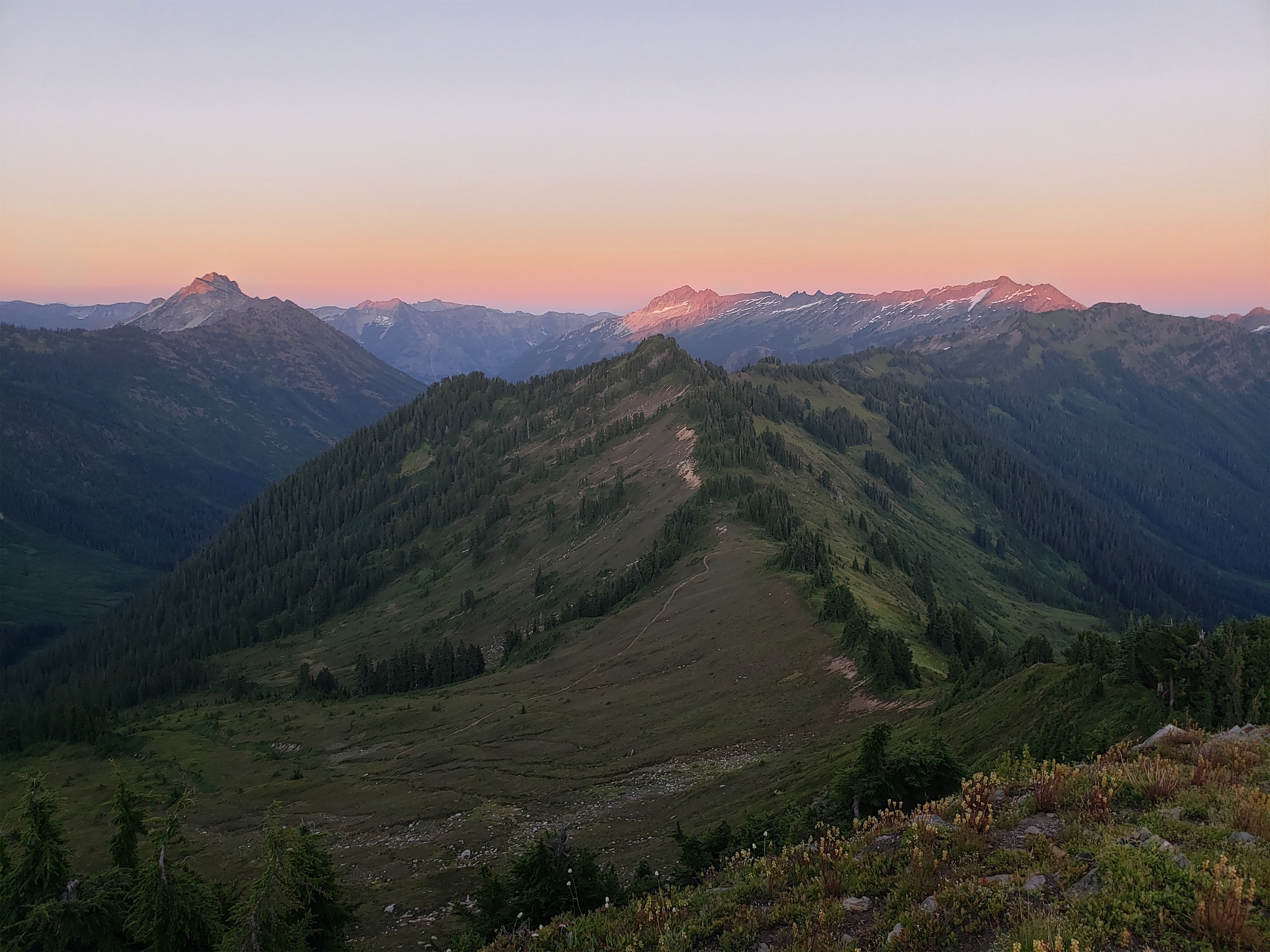
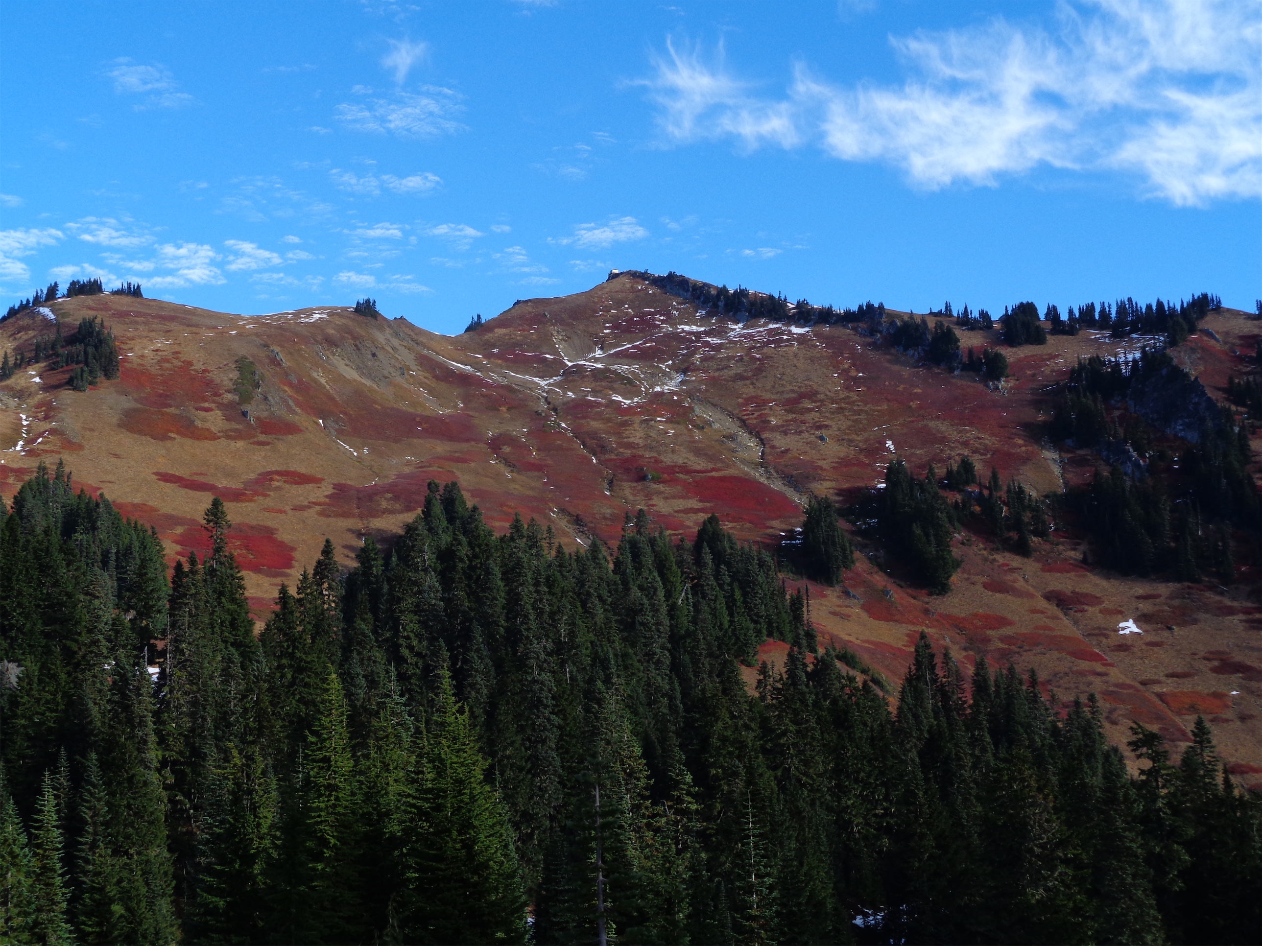
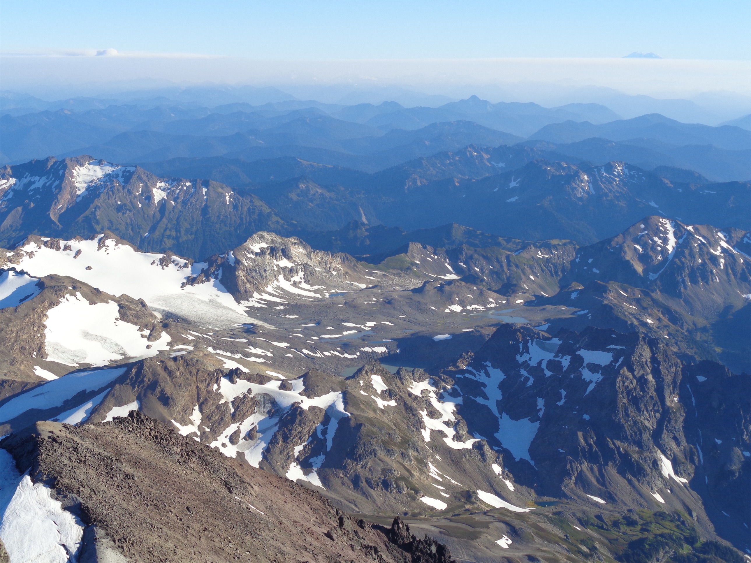
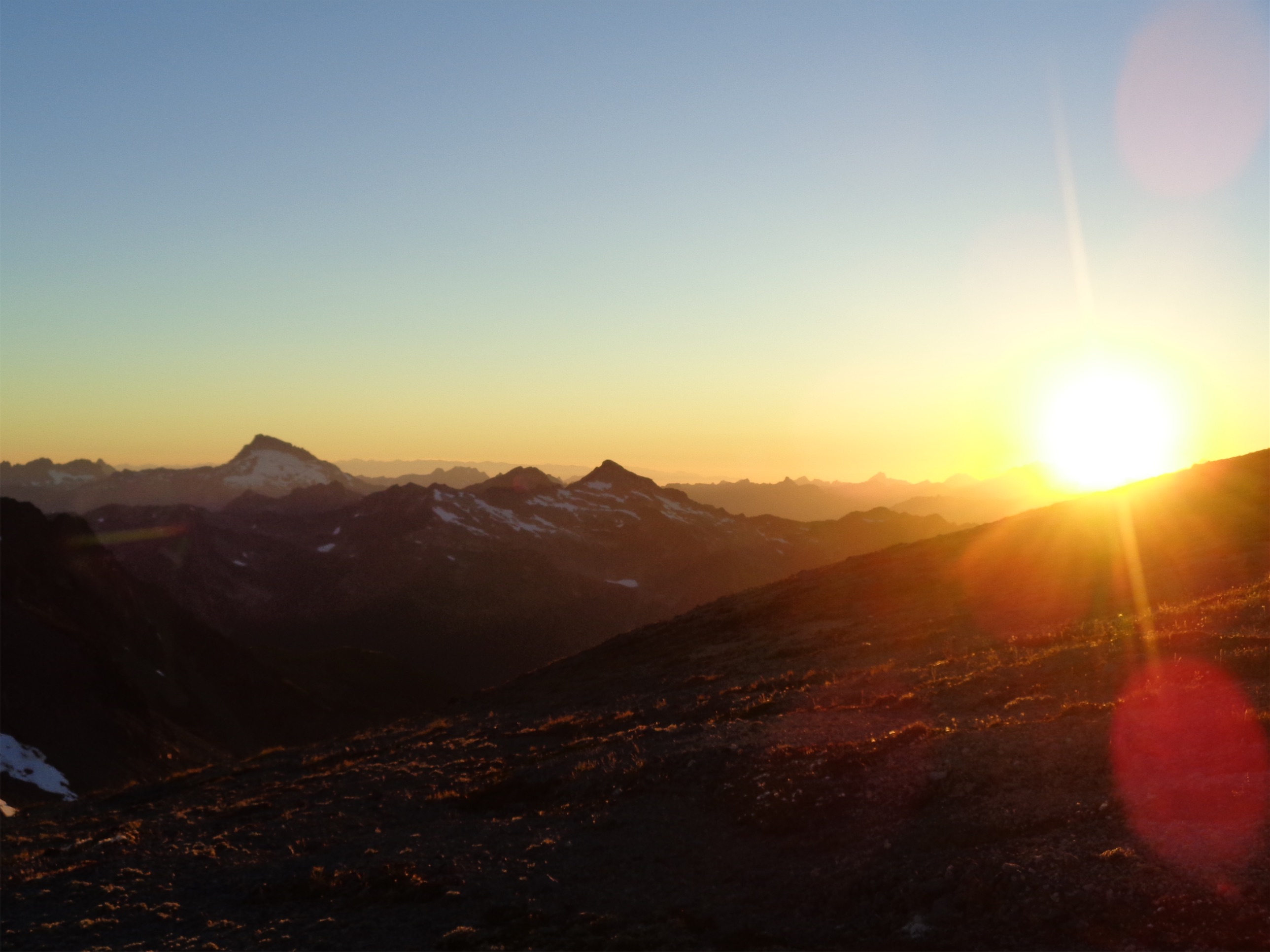
You’ll finally break out into another meadow, which you can walk straight up again, scouring for a trail but never finding anything besides short stretches that are probably just game trails and one suspicious short switchback just below the summit after hundreds of feet of nothing. Oh and the summit has trees. Great views to the north and west but the south is blocked. By trees. But there was a lookout tower there from 1935 until 1962, so someone could peer over the trees, maybe. It was burned down in 1962, not for any official reason, just people being mean. You can still see some lookout remains. The usual shattered glass and some metal wires.
At this point I was nearly 90min later than I expected to be, so I snapped pics, contemplated my life choices that I would have to relive again on the way down, and started off. In like 15min I was back just above the meadow with a stream, and I started to regain elevation. Except I gained it trending too far right. And ended up over some cliffs. I tried to scramble down, but it got too mossy and sketchy so I climbed back up. I thought I could go up and over this knoll, but 15min later I found myself cliffed out in three directions. Tucking my tail between my legs I lost the few hundred feet of elevation I had gained fighting through shrubs and dropped back to the meadow, relying on the map to show me the way. I thanked every landmark I remembered. Thank you, downed tree. Thank you, nice flower. Thank you, snow patch I rubbed all over my body. Thank you, stupid meadow with no flowers. Oh hi butterfly fluttering by.
I was so happy to get back to the burn zone where the trail was suddenly a miraculous highway I could cruise down, plowing through spiderwebs and nettle and shin deep mud. A deer even followed me for a while, freaking me out. Shouldn’t she be scared of me? I was so done with nature at that point I just yelled at her. JUST LET ME BACK TO MY CAR! I KNOW IT’S A NICE TRAIL I DON’T WANT TO GO OFF IT EITHER BUT YOU’RE NOT GONNA WIN THIS I am glad she seemed too dumb to charge me bc I’m sure I’d have found a way to be the first hiker killed in a deer attack in the history of hiking.
The last bit of trail to the car was the stupid cherry on top of a stupid day. It like swirls like a MTB trail rather than taking you to the car. I was dying.
I did just find out the trail is intended for horses. At least until the bushwhack? But that explains the absurd switchbacks. Ohhhh my god. Just go if you have a horse or donkey then you’re above the nettle and swamps and the horse will take care of spiderwebs.
That is all.

No wait one more thing. From an old drafted post that was never published about my first trip to Huckleberry :
“Well, this day was rock bottom. I was solo. I wanted elevation gain. I decided to go check out Huckleberry off Suiattle River road. I started hiking. I had forgotten poles. I ate a spiderweb. Cool, breakfast. And then another. And then a third. And then they were all over my face. And getting in my hair. And wrapping around my wrists. I started dry heaving with every one that touched me. I battled them with sticks, but you can’t actually hike 8 (did this used to be only 8mi? no way) miles waving sticks around, that’s ridiculous. And feeling the resistance against a 5′ long 1” thick stick means they’re legit webs. And finally, after a particularly thick, yellow, stick face level monstrosity that blew onto my face in the wind despite being wrecked with my branch small tree, I waved the white flag. Fuck you. I hope no bugs frequent this trail. I hope another braver, stronger, fearless hiker comes and ruins all of you. But in the meantime, I guess I’ll go hike Sauk Mountain, where I know the masses have already destroyed every web.