Maybe skip the prose and just look at the pics, my writing is rusty and rambly. I have had some other trips this year, like Japan for a week to ski, several backcountry trips in SLC, one in Seattle, but between April and now I was mostly open water swimming with a dash of surfing here and there. But here we are! Summer is over and we are back to landlocked activities.
TL;DR don’t panic, there will be larches every day. For us personas estadounidenses, it’s like the PCT, it’s pretty gradual, you really can’t get lost because everything is very well signed, camp at designated campsites, and you should learn to convert kilometers to miles.
Distance: 33ish miles
Elevation Gain: 6k total? Elevation gain is easier in meters
Weather: Mostly raining but I’ve forgotten about that at this point
Commute from Seattle: 10+hr drive or $$$ flight
Did I Trip: No but I dropped Brad’s hiking poles on the regular because they don’t have straps and apparently I never actually hold my trekking poles
Nearly everything went wrong leading up to this trip. We had permits for four days in September, so that was our only window. Now let’s see:
I had to move back to Seattle for work (don’t get me started) literally that week
Surafel’s now wife got laid off so he bailed
Brad twisted his ankle
I had cold/cough/etc. Miserable.
Flight to Calgary was USD$612 ONE WAY! ONE. WAY. !!!!
Weather called for rain for like 70% of the trip
Westjet had IT issues and couldn’t check anyone in at JFK for over half an hour
Plane was delayed 3hrs on the tarmac. Turns out for international flights you’re allowed 4hrs, with a 45min extension if “there’s a reasonable chance you take off soon,” so we weren’t turned around. But let me tell you I was rooting for them to let us off after 90min in that seat, trip be damned
How Surafel was able to still join us. I don’t know why he decided to wear Ethiopian wedding garb the whole time
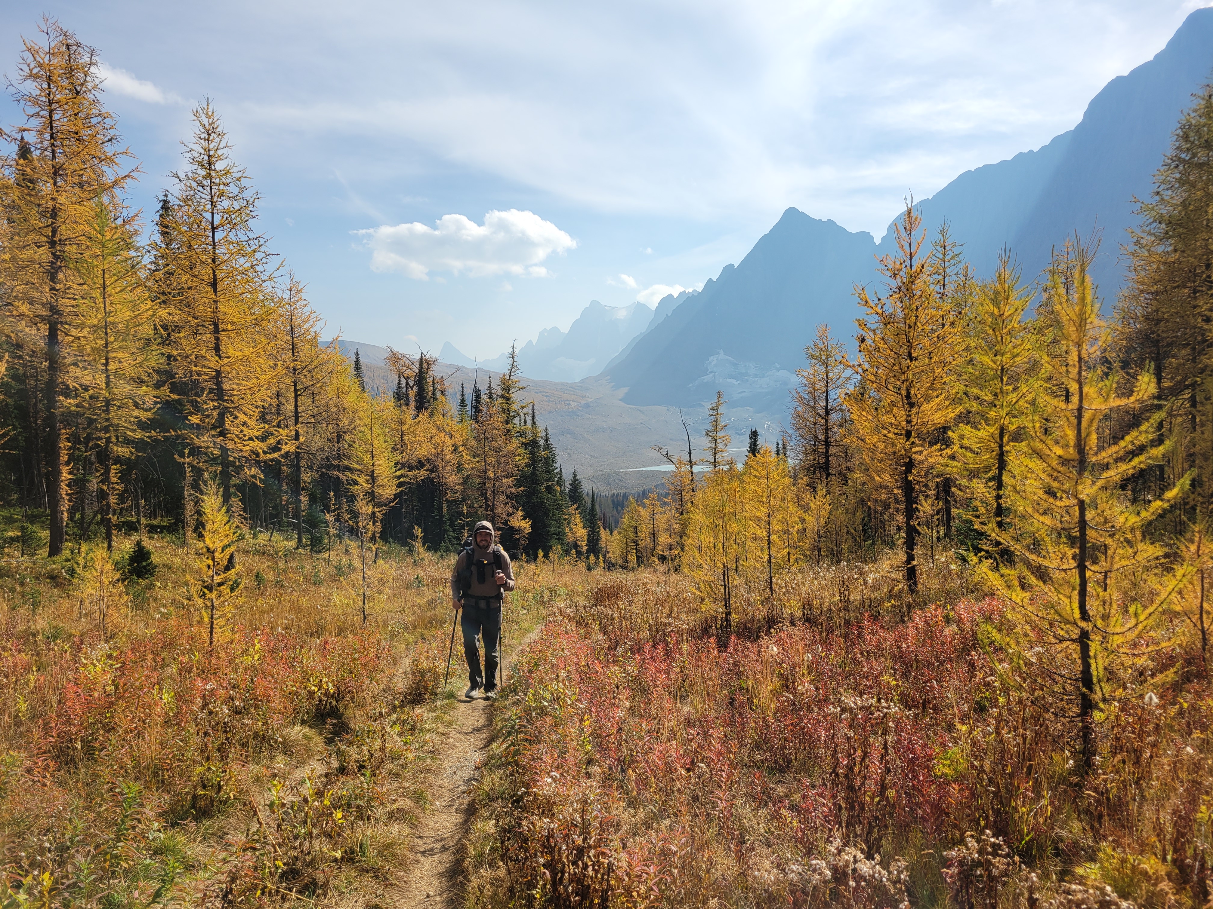
But my plane took off, I got to Calgary at 1am, “slept,” and slogged through the worst continental breakfast I’ve ever had (featuring maybe the best breakfast potatoes I’ve ever had?), neglected to consider Banff NP traffic or lines to get into the park, and then illegally parked to finally meet Brad at the hilariously overpriced IGA in Banff where I don’t want to know how much money I spent buying snacks for the four day trip. I forgot that some mountains are touristy, not stop-at-a-gas-station-and-find-a-remote-trailhead-where-your-car-might-be-burgled.
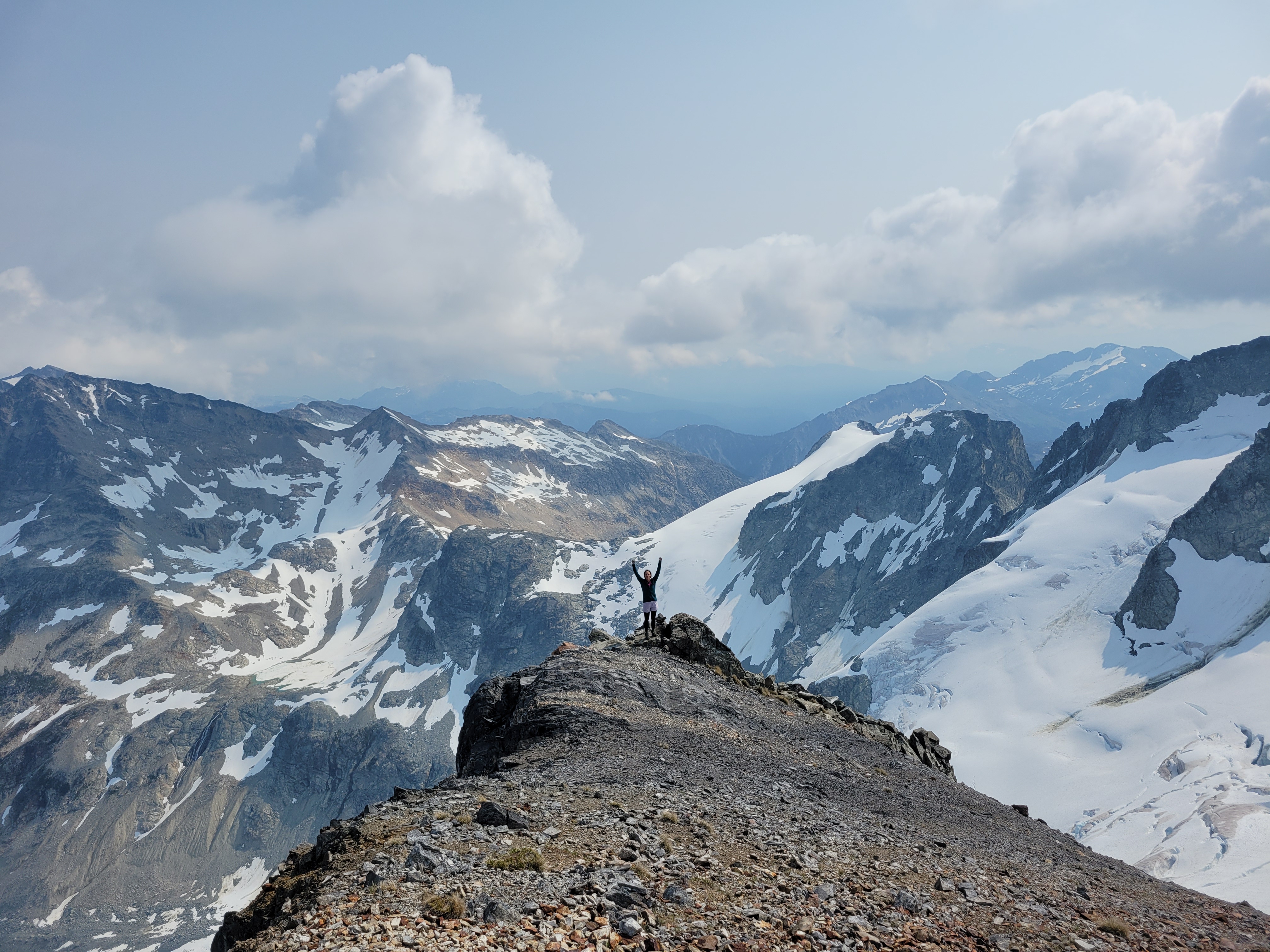
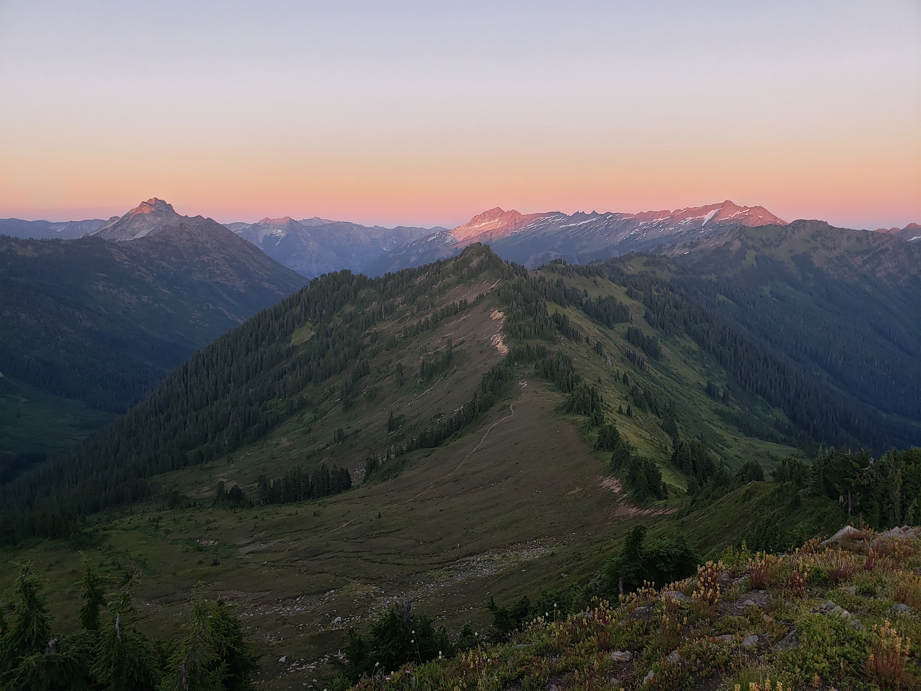
Our itinerary was amusing, booked under duress in January via Facebook Messenger after being let out of the virtual waiting room at 7am Pacific Time to take out shot at getting permits upon opening. I nearly booked the campsites in the wrong order (think A -> C -> B instead of ABC of CBA) but caught my error at the last minute. We couldn’t get the ever popular Floe Lake, so we settled for this:
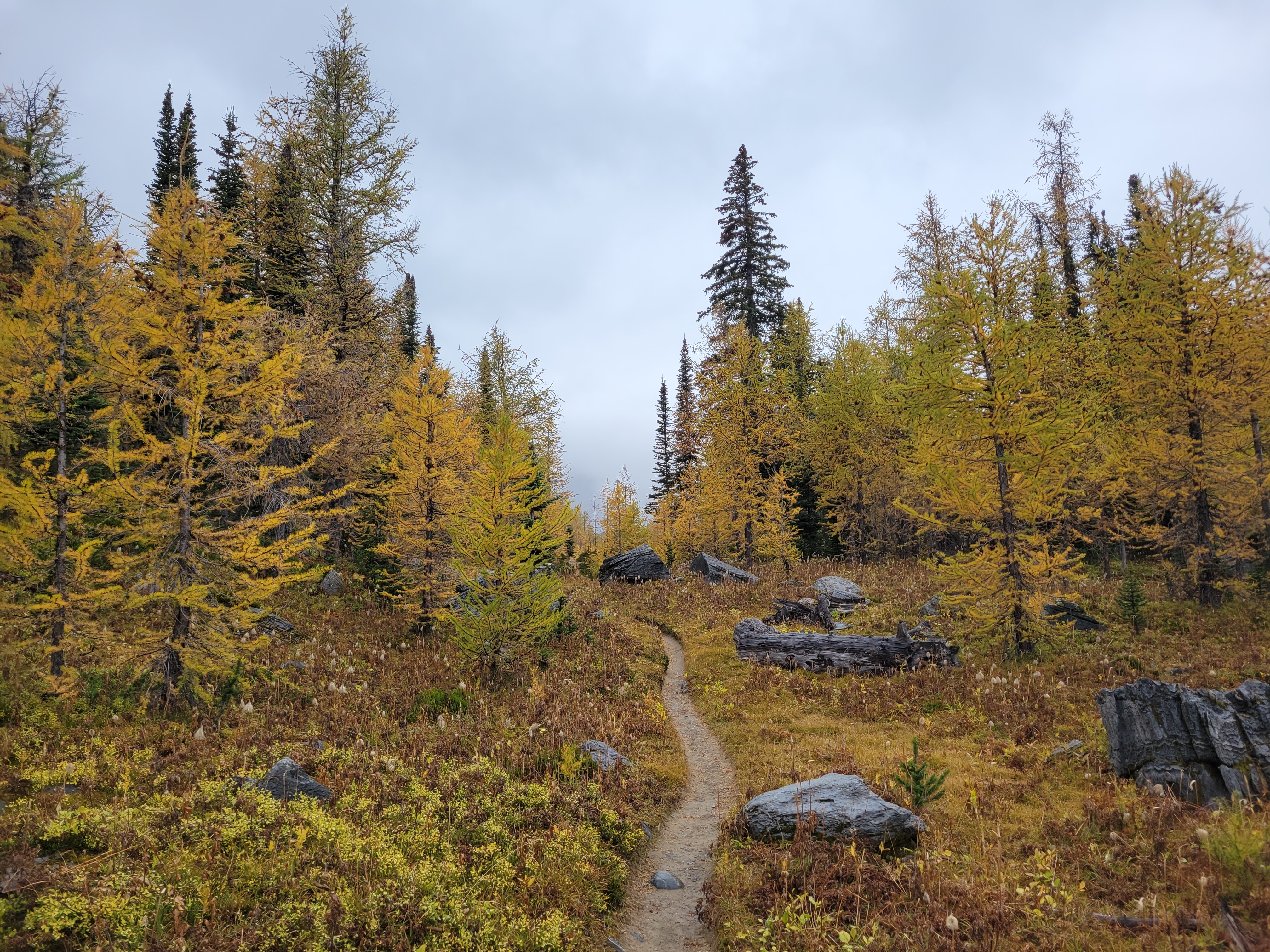
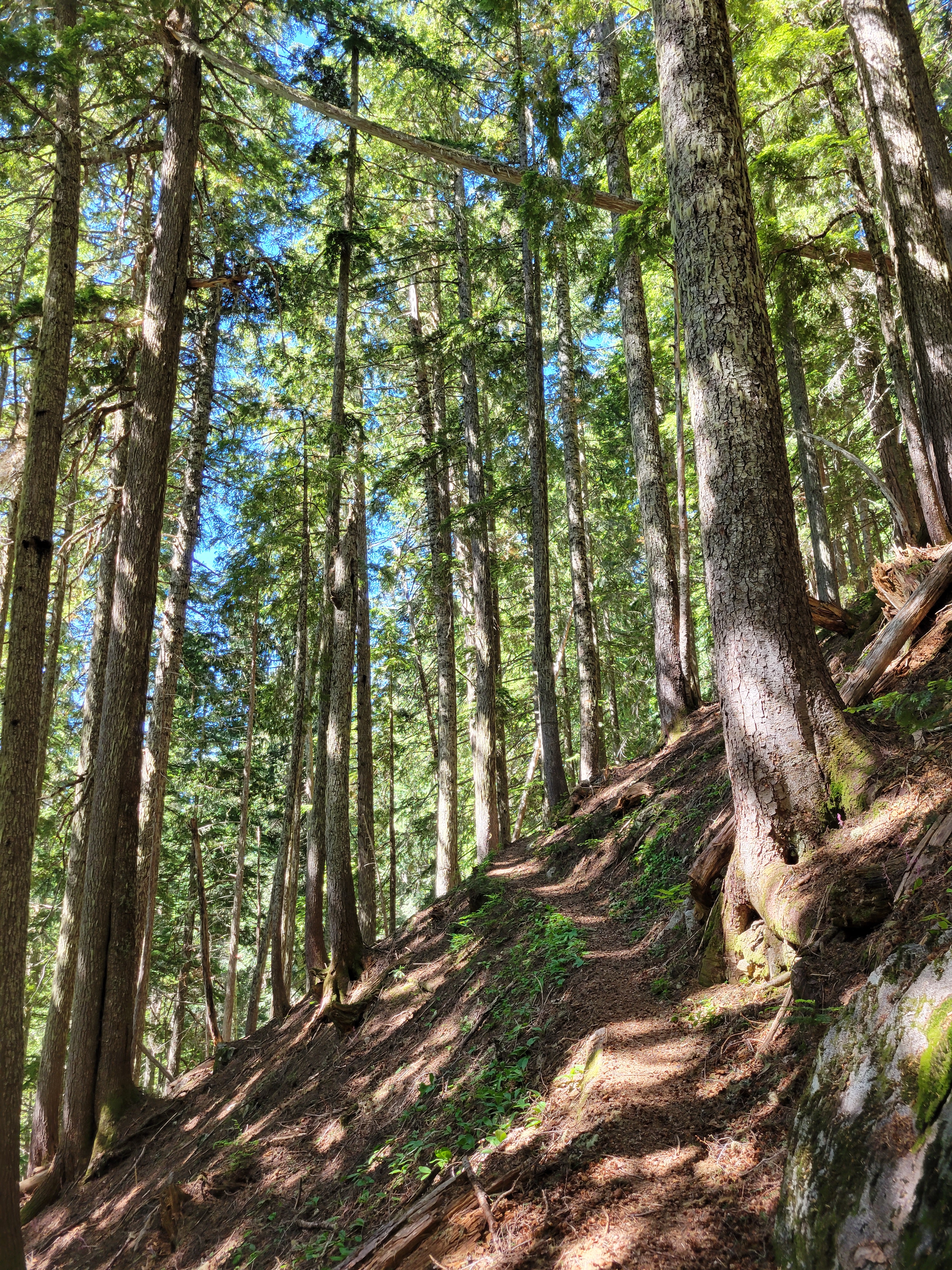
Most of the trail to Floe Lake
Day 1: 12 miles, Floe Lake trailhead to Numa Creek. 12mi. Partly cloudy in the morning, rain in the evening. Day 2: 4.5mi (hahahahaha) Numa Creek to Tumbling Creek. Rain in the morning, partly cloudy in the afternoon, rain in the evening. Also it did end up being just over 5mi somehow which felt more legit. Day 3: 8.5mi, the money day, Tumbling Creek to Helmet Falls. Rain in the morning, partly cloudy rest of day. Day 4: ~9mi, cry and leave and car shuttle from Paint Pot(s) to Floe Lake and cry more and get on a plane to Seattle forevermore. Weather doesn’t matter.
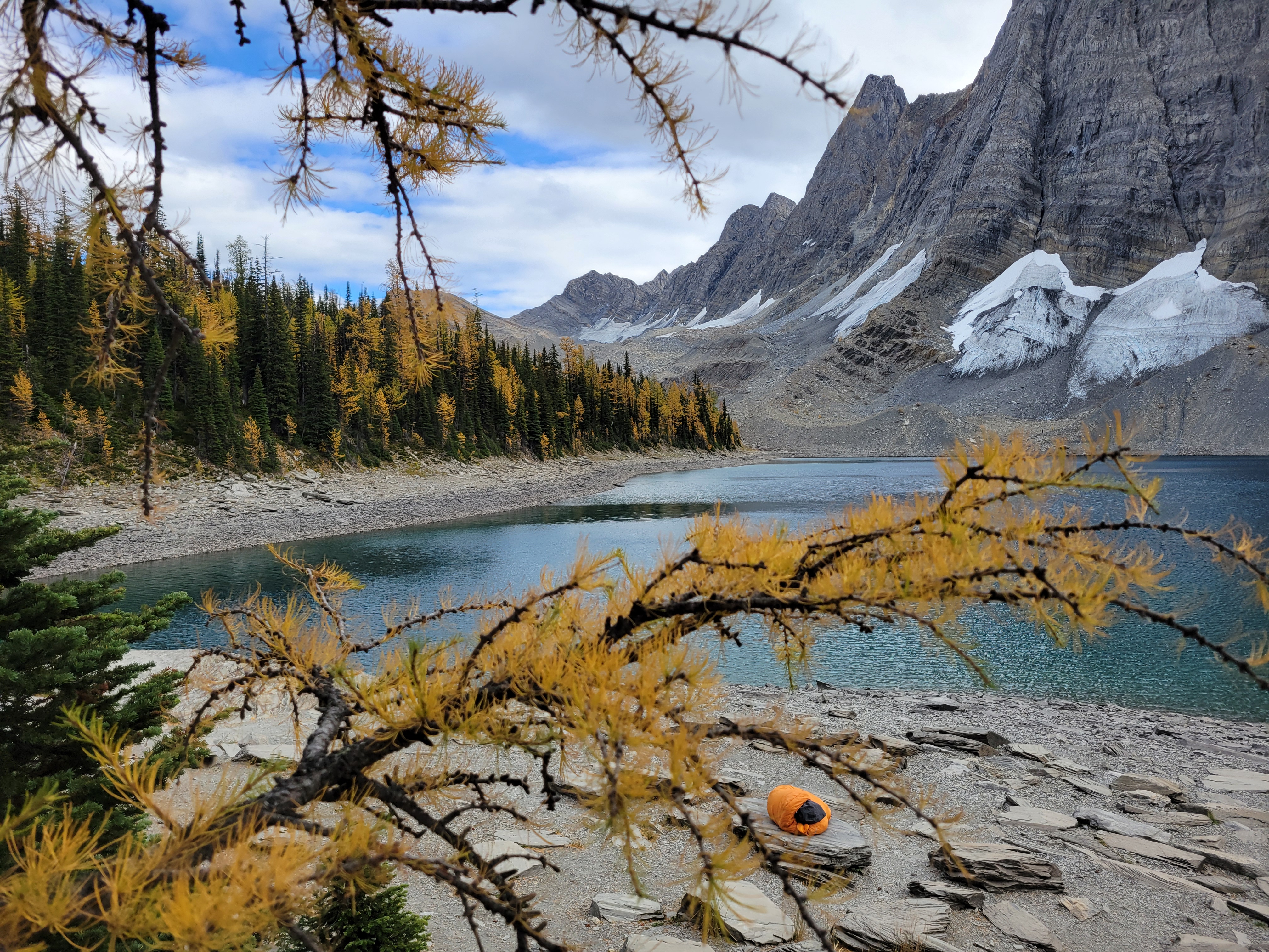
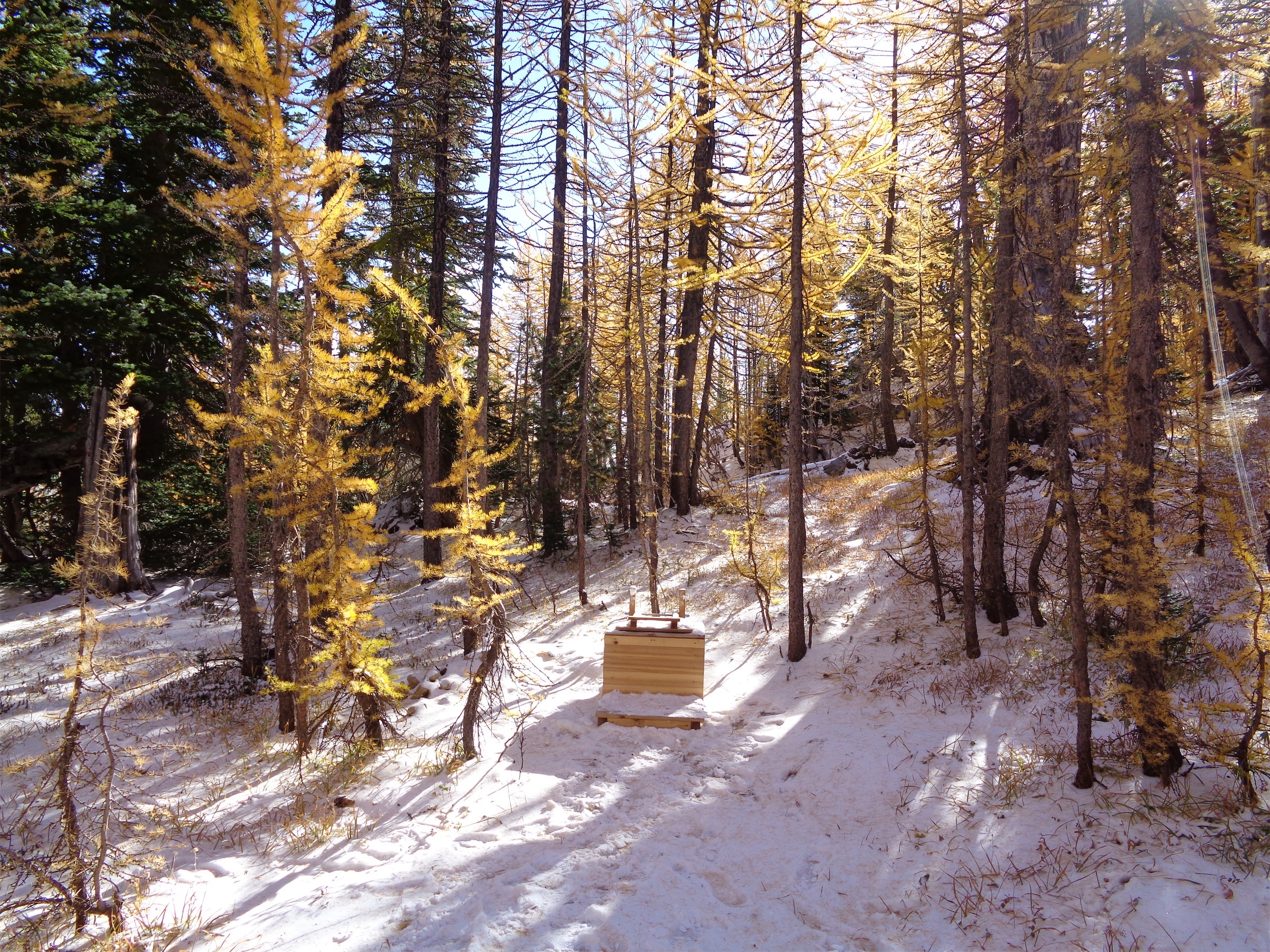
The only way to enjoy the views was to make your sleeping bag burrito portable
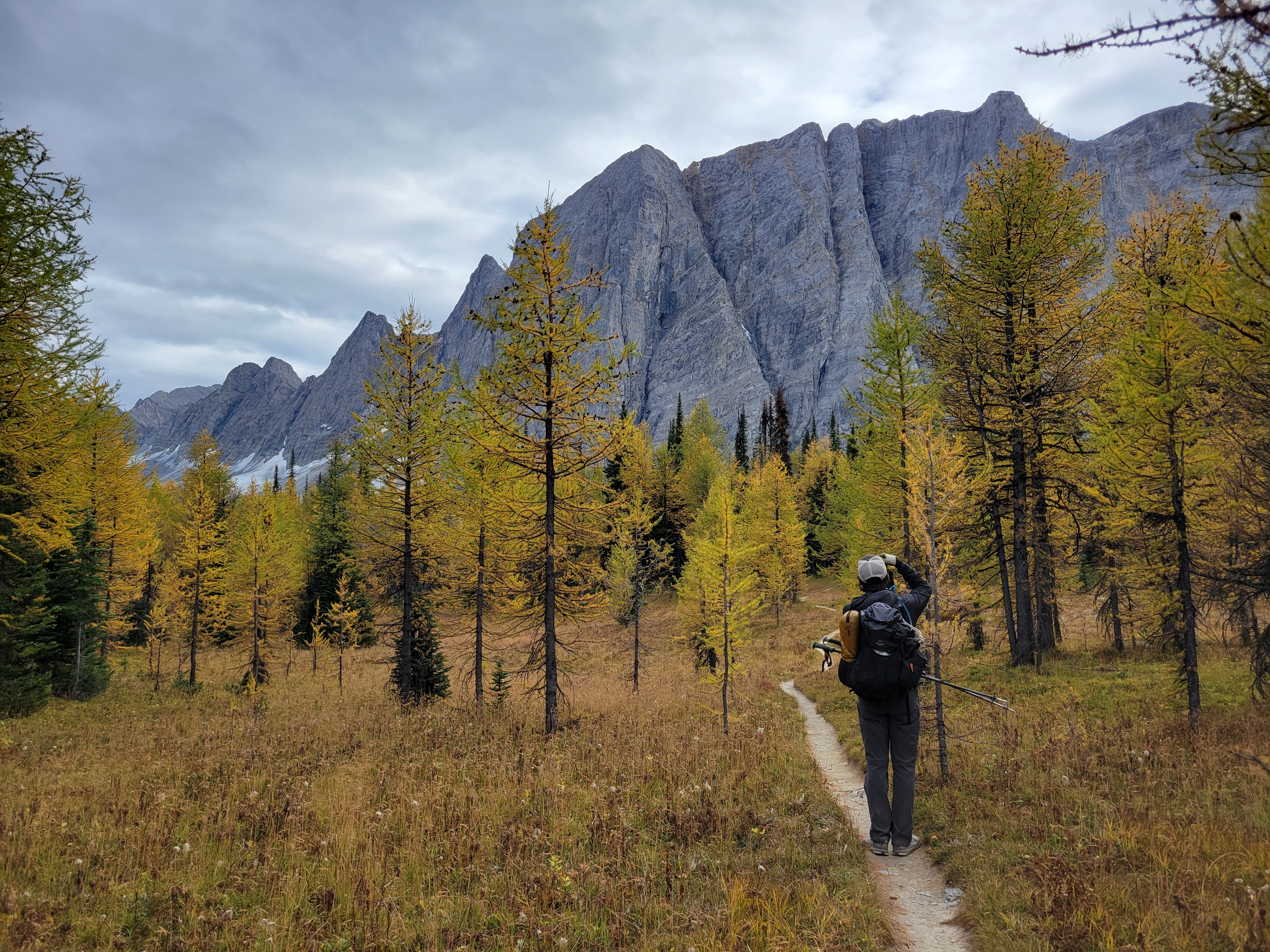
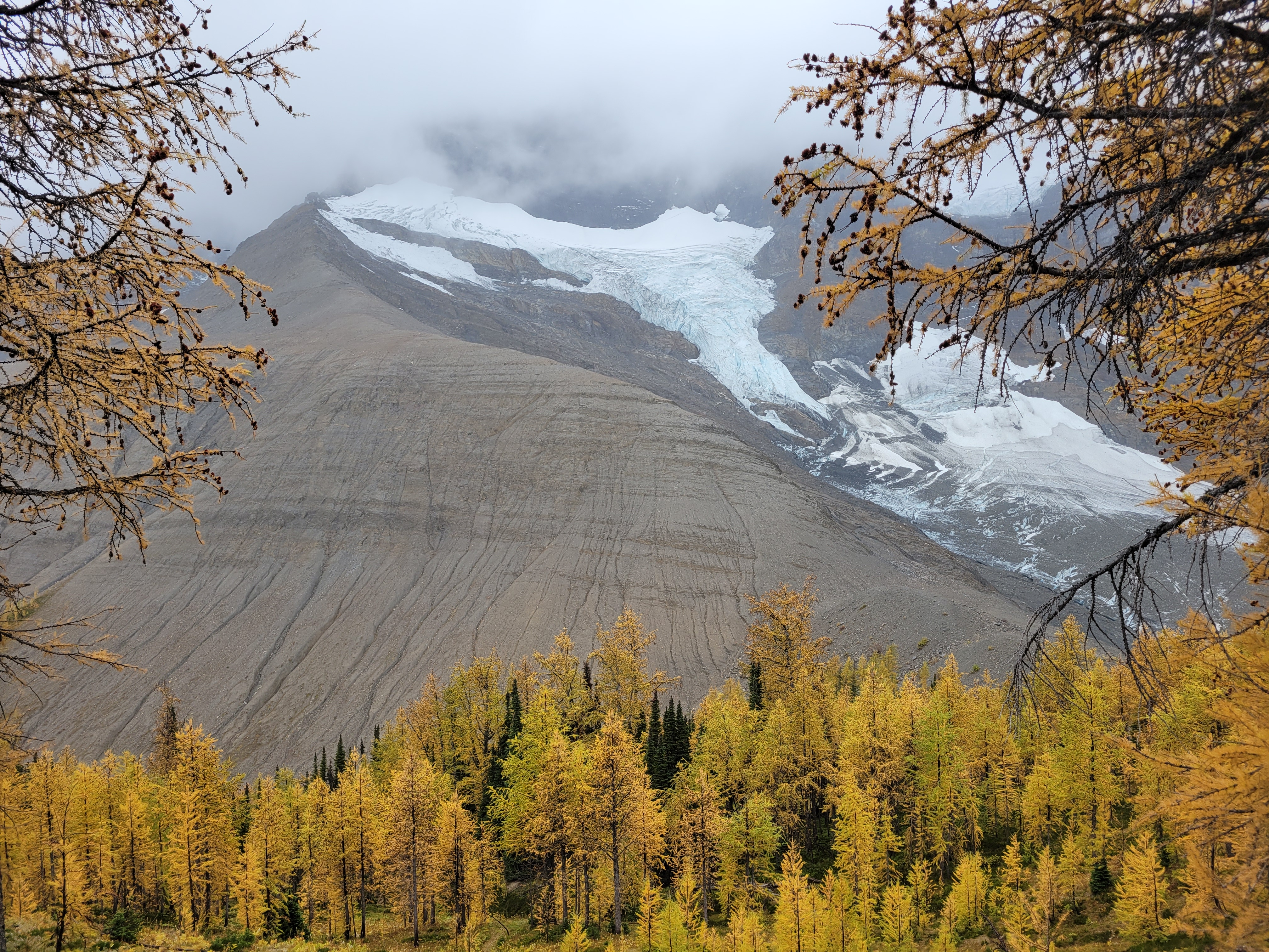
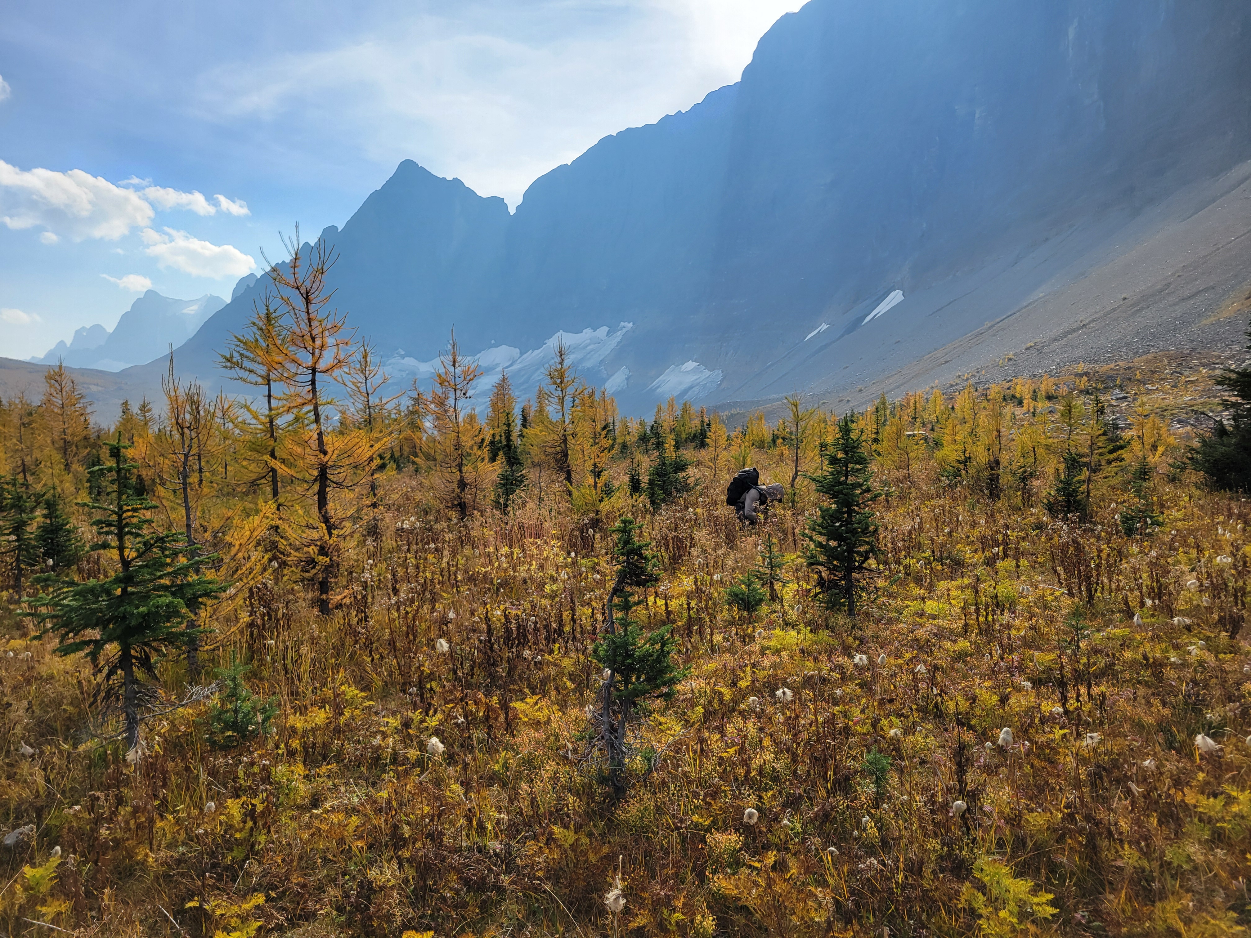
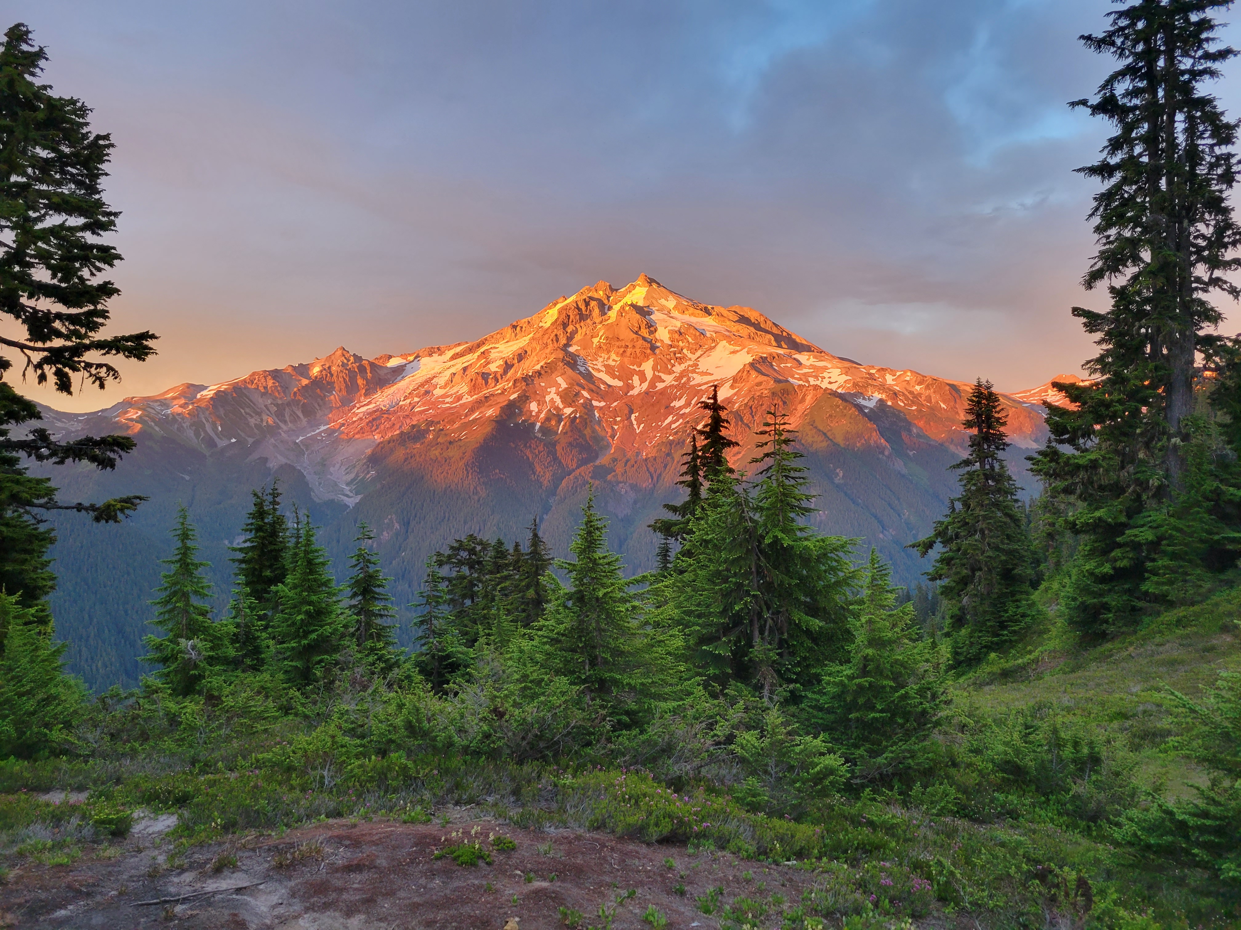
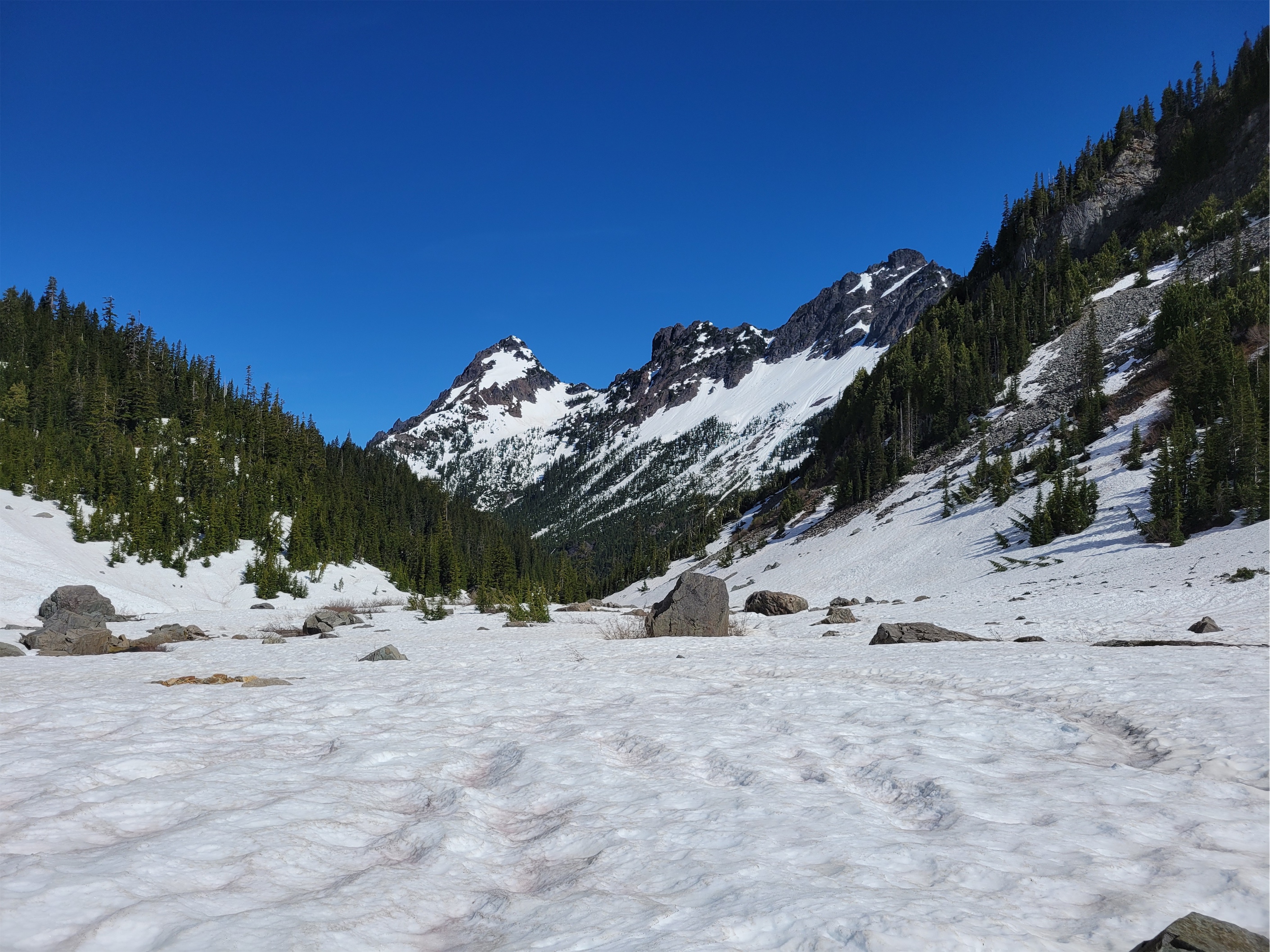
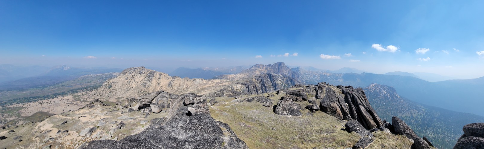
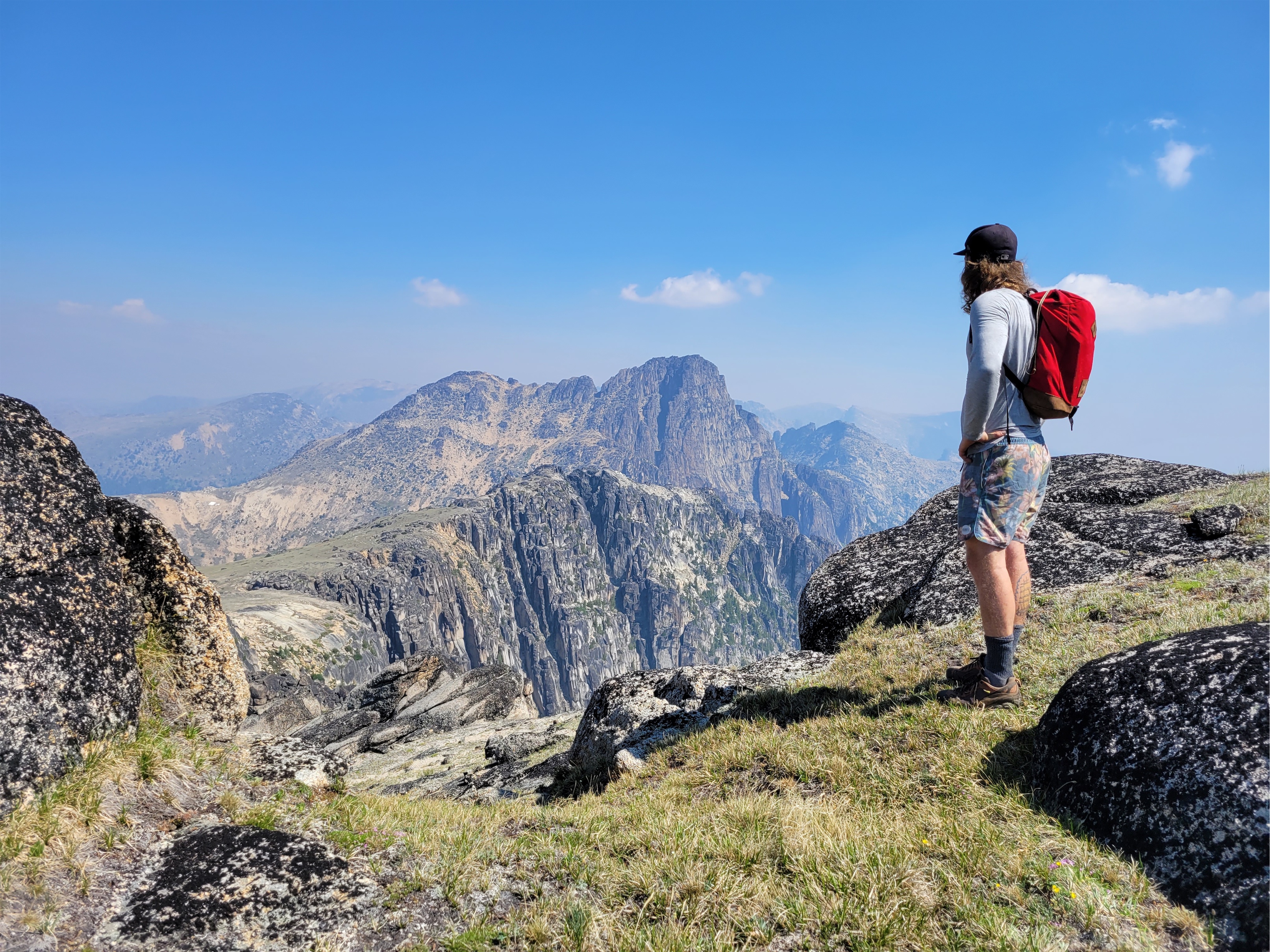
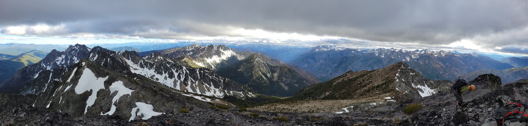
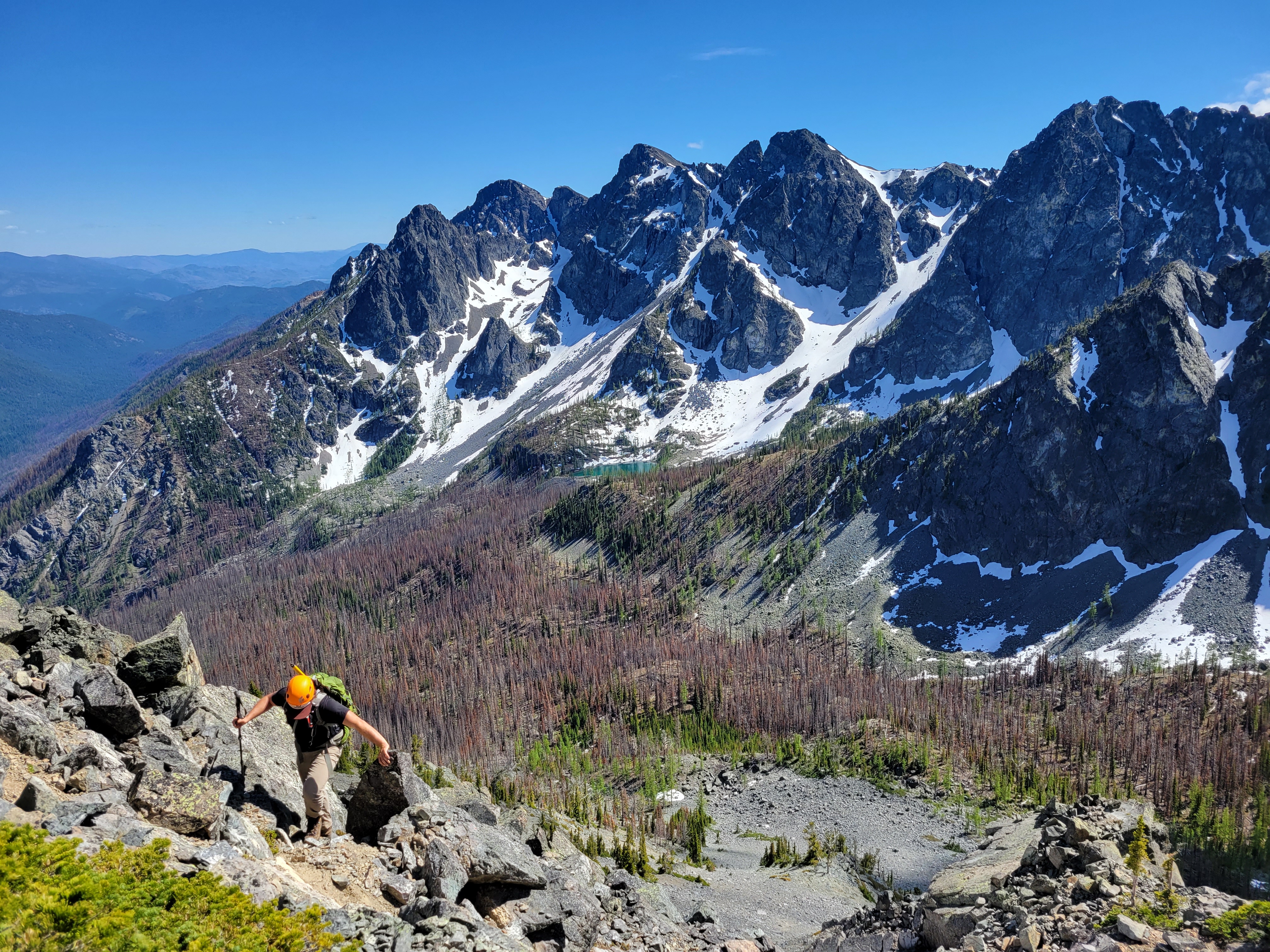
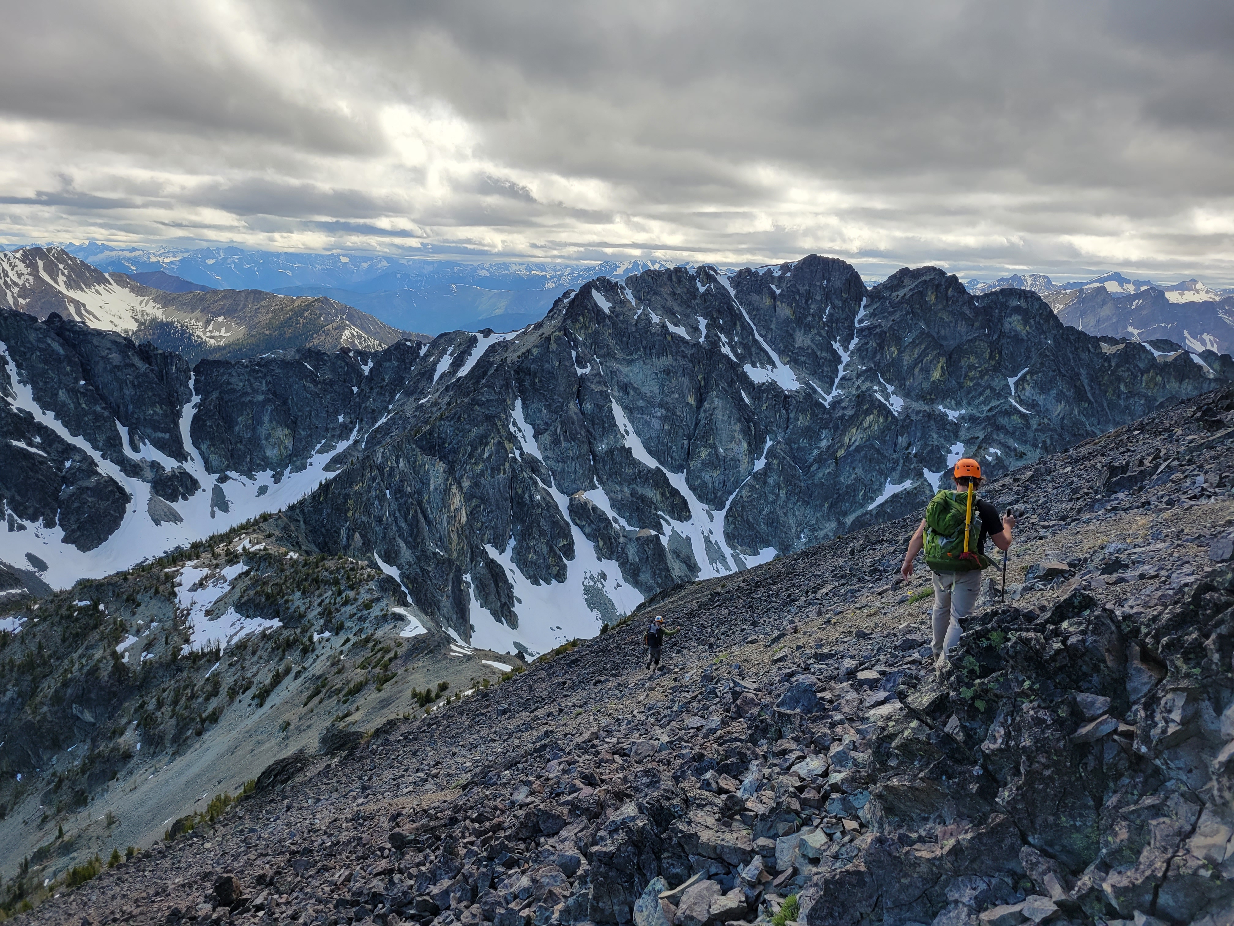
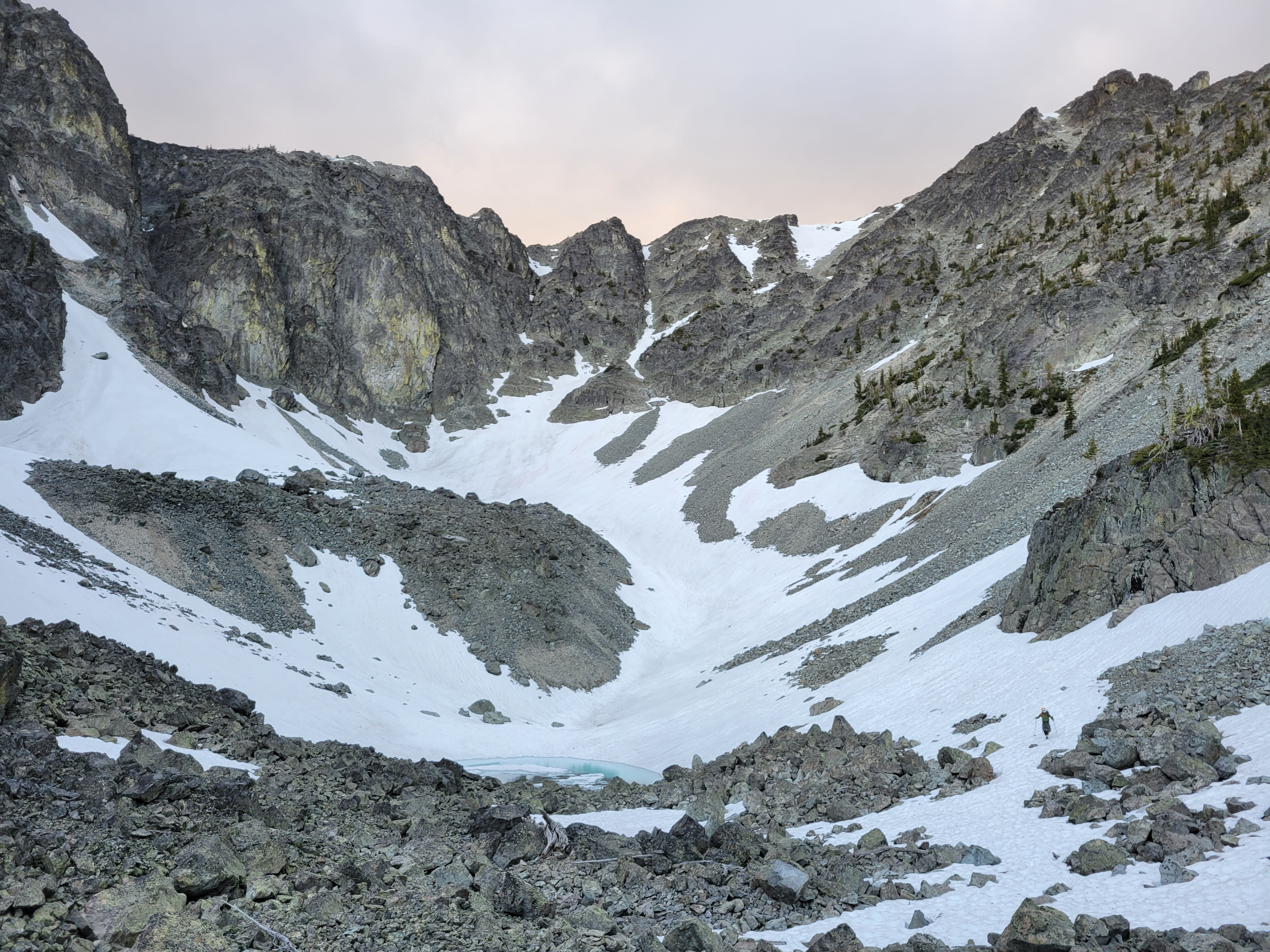
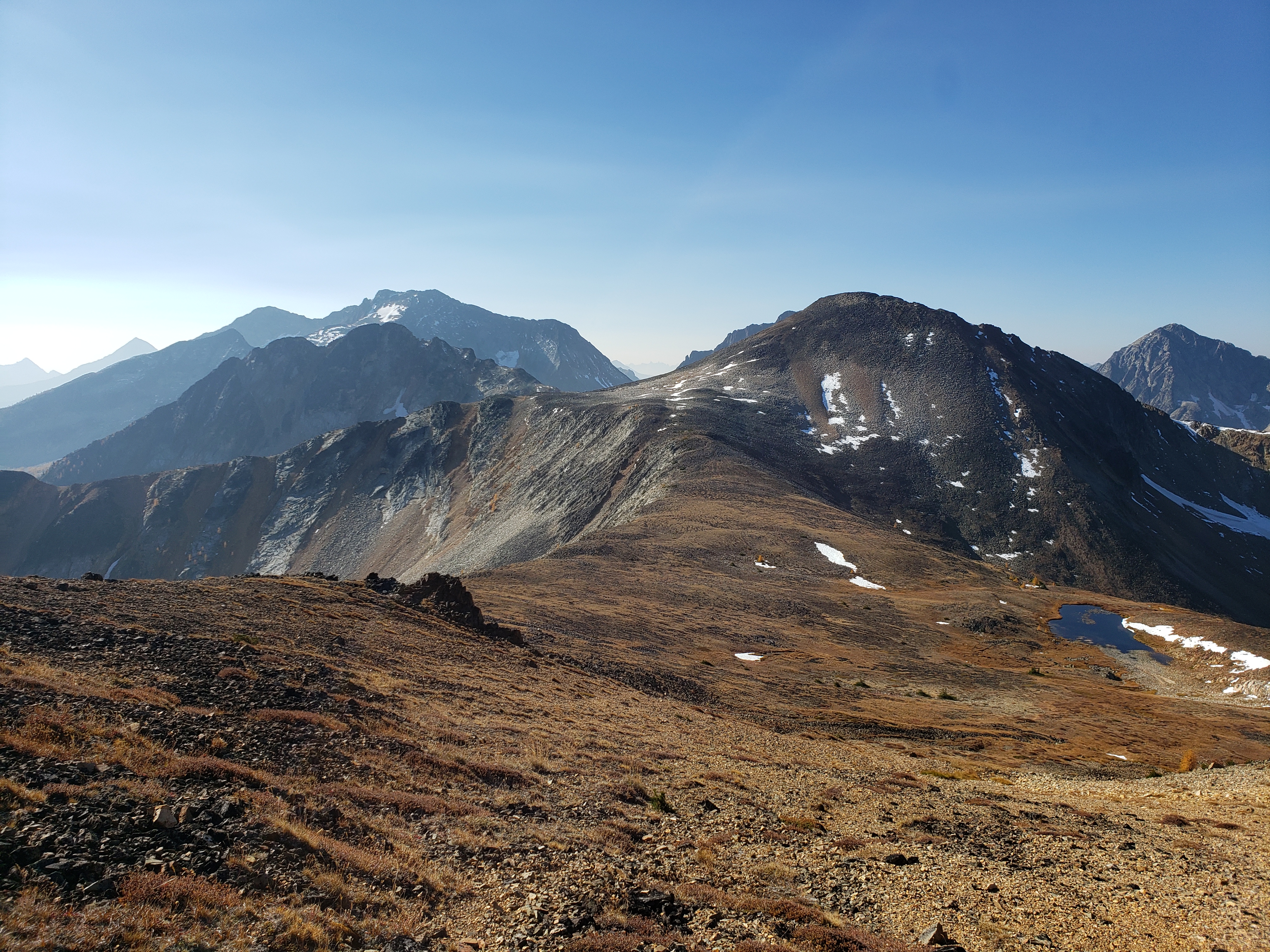
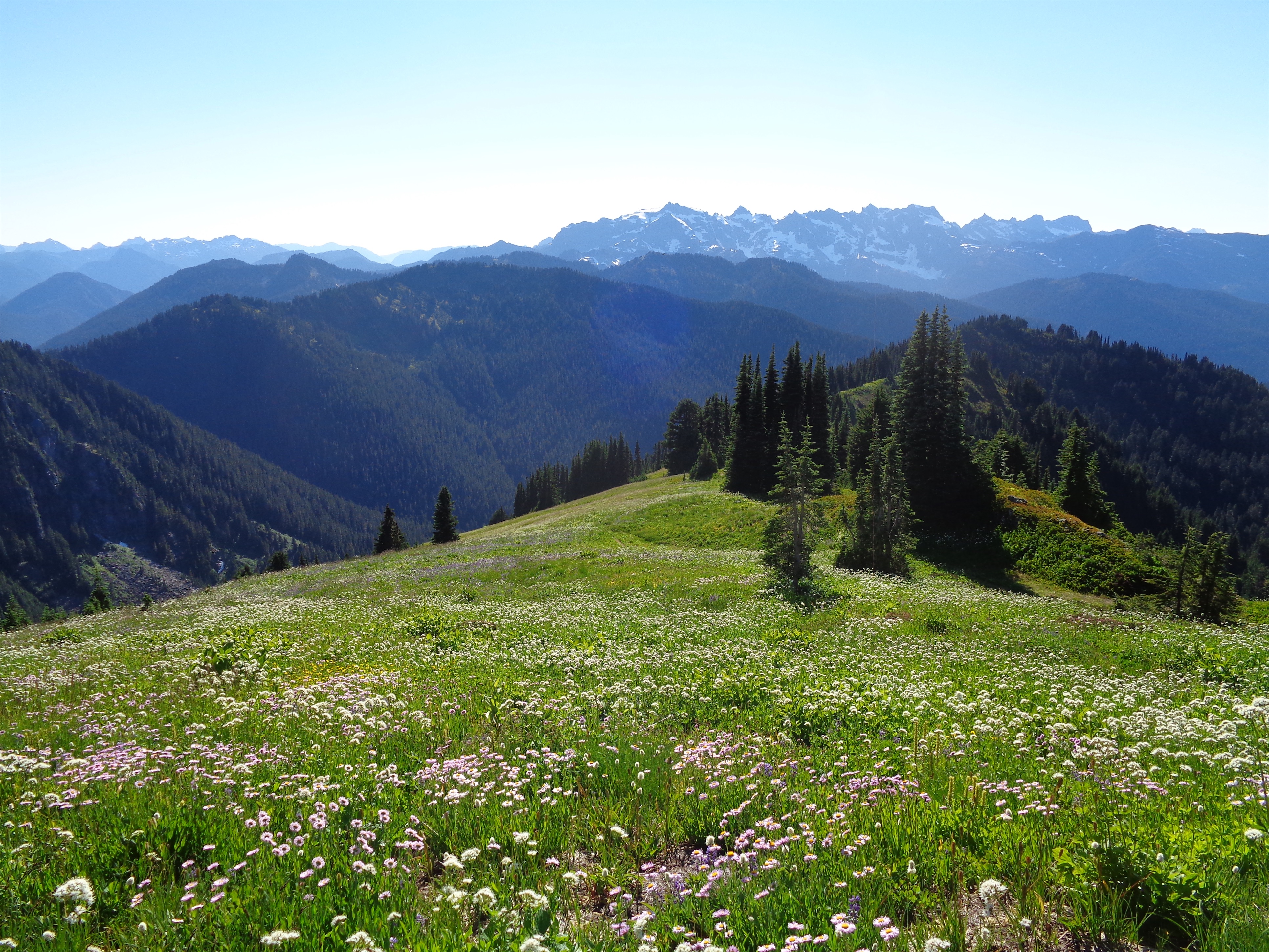
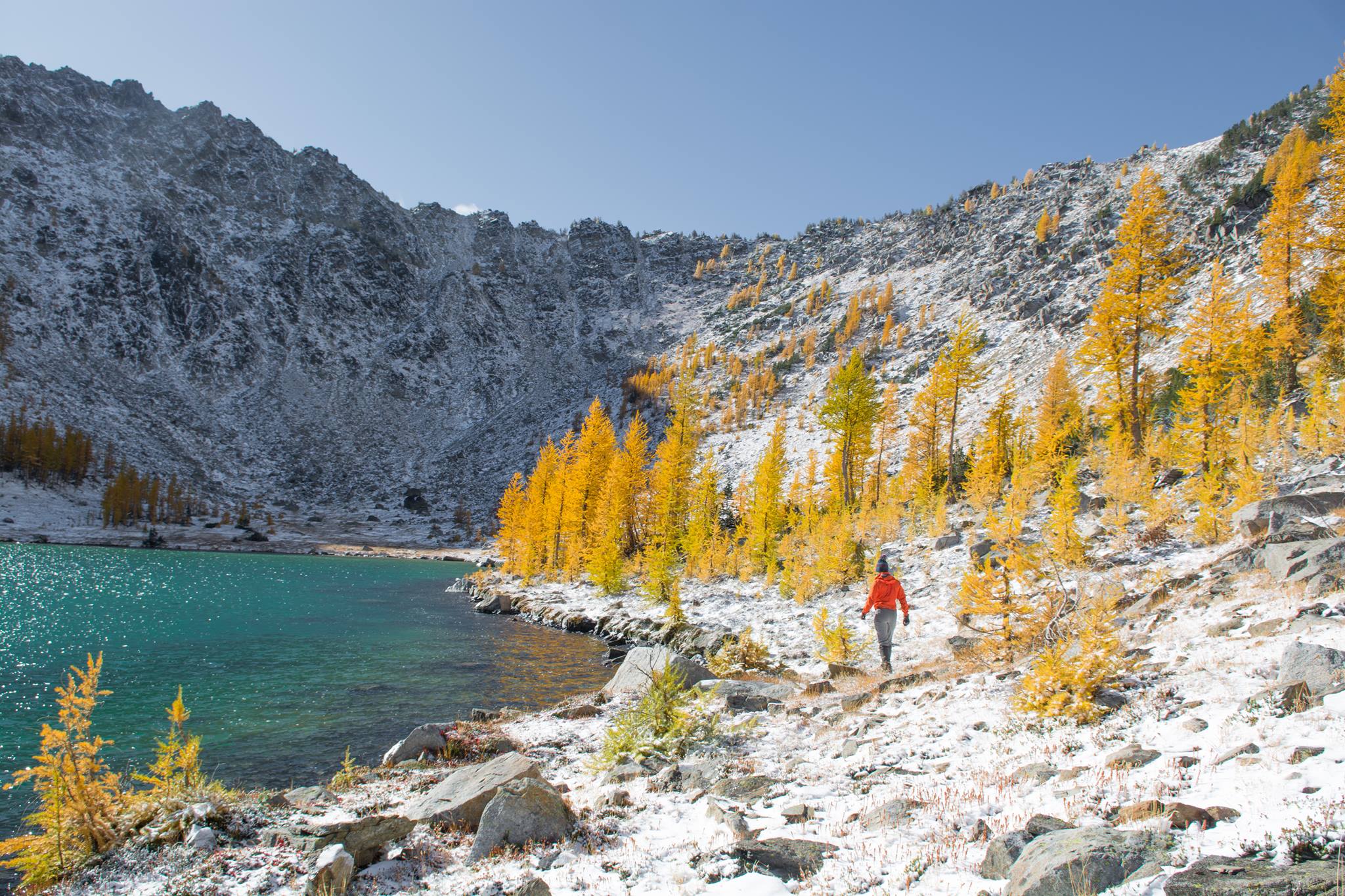
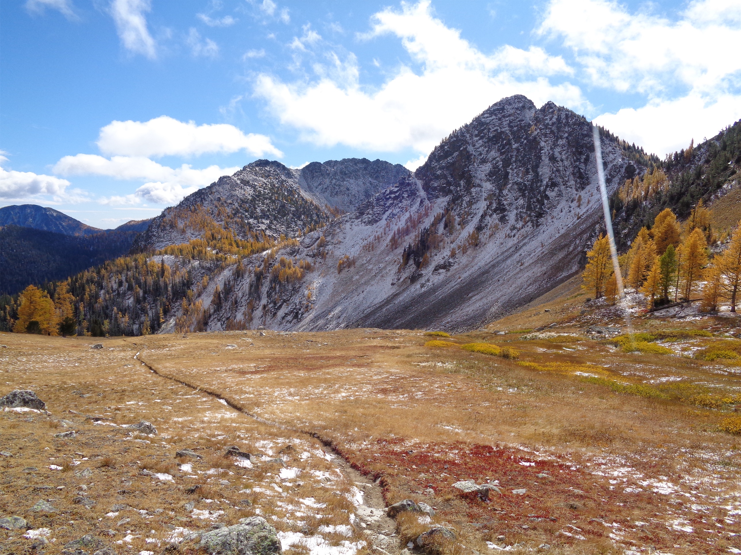
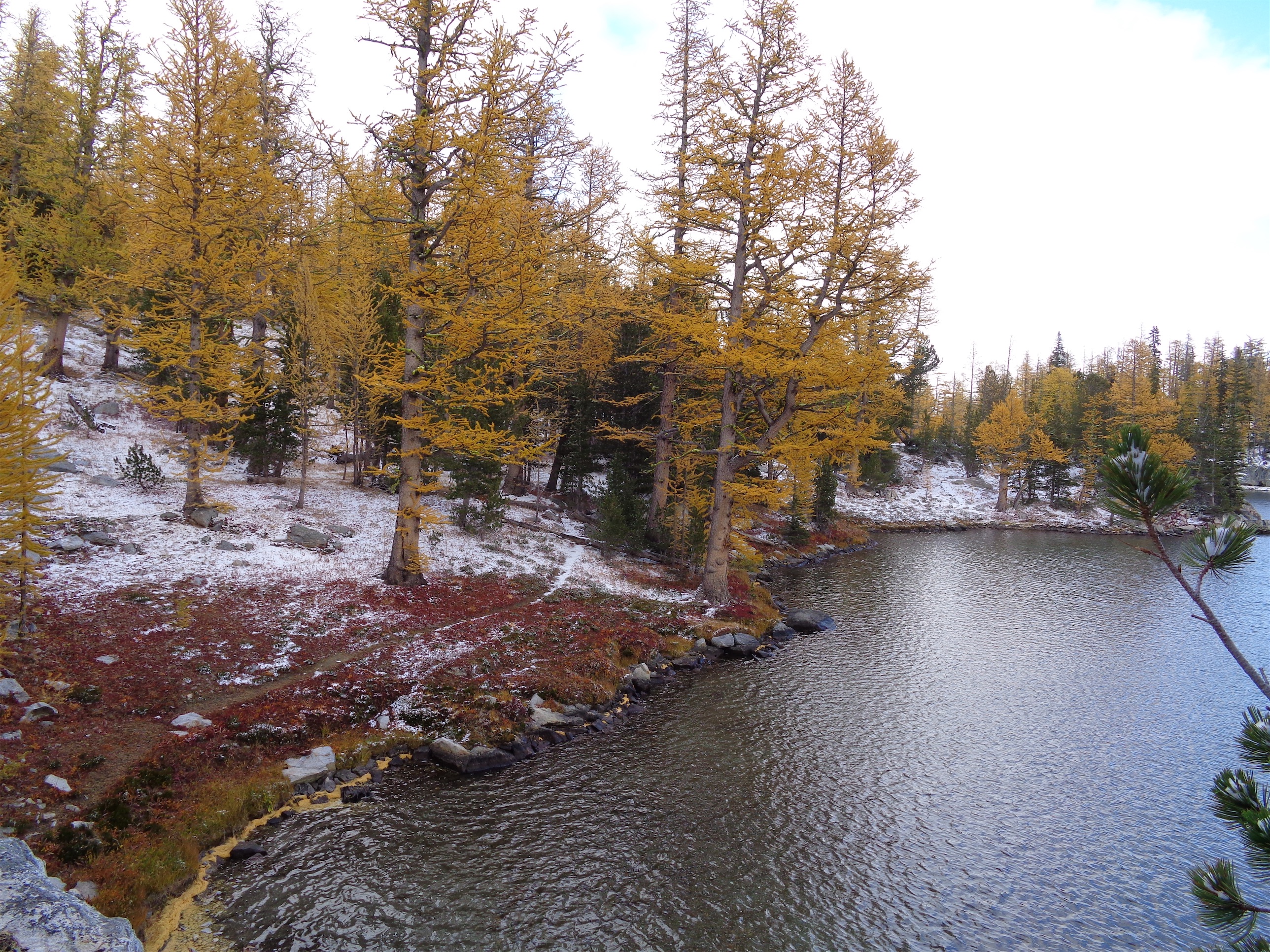
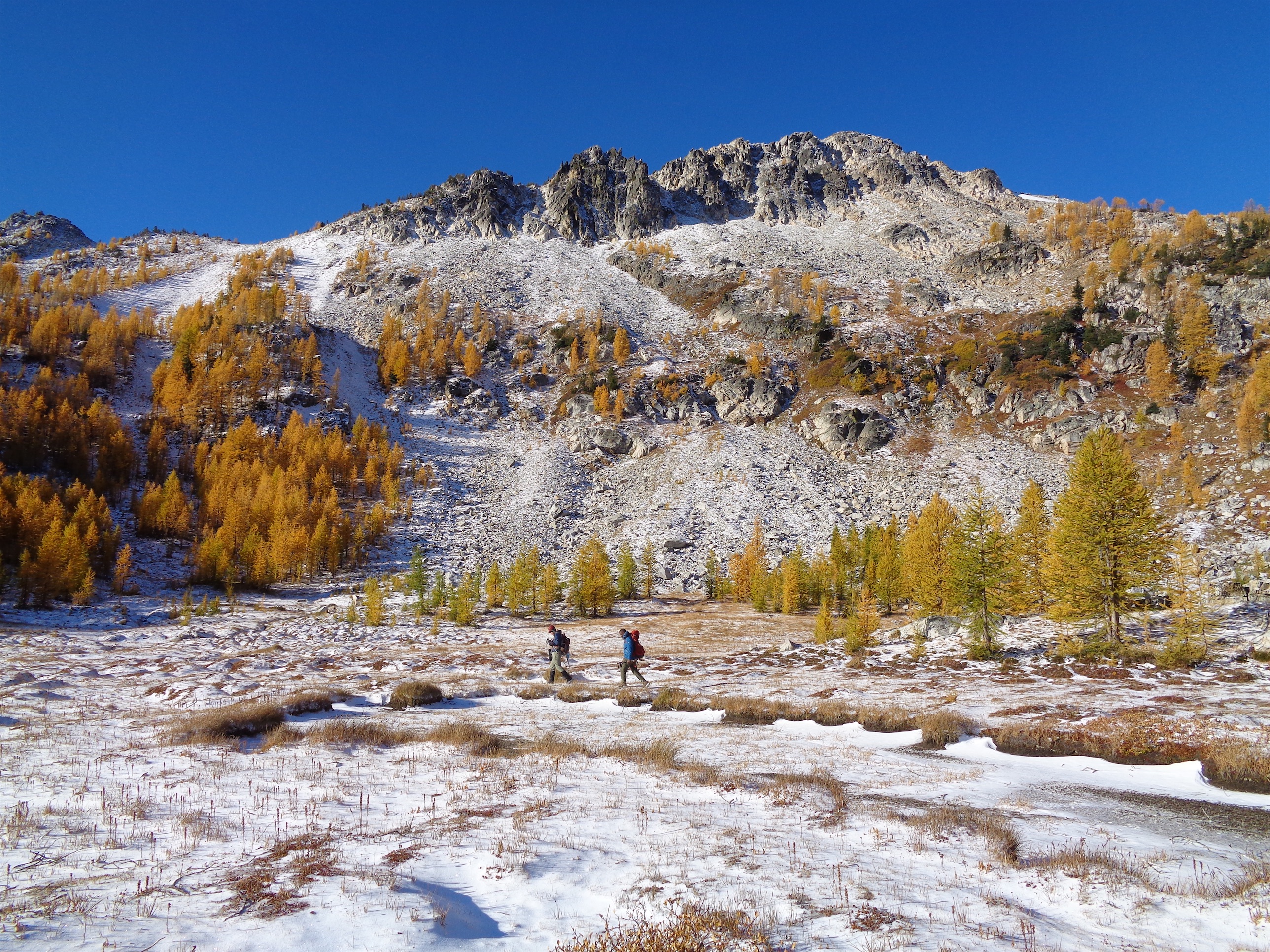
The hike up to Floe Lake was pleasant, a gradual gain for 6 miles through a wide open old burn zone. Most of the elevation gain was close to the lake. I looked up and said “that’s gotta be only like, 300ft” and Brad goes “yeah.. actually it’s like 300m, you’re only off by a factor of 3x.” Ah yes my uncalibrated city eyes complementing my tired city legs. Let’s just skip to the larches.
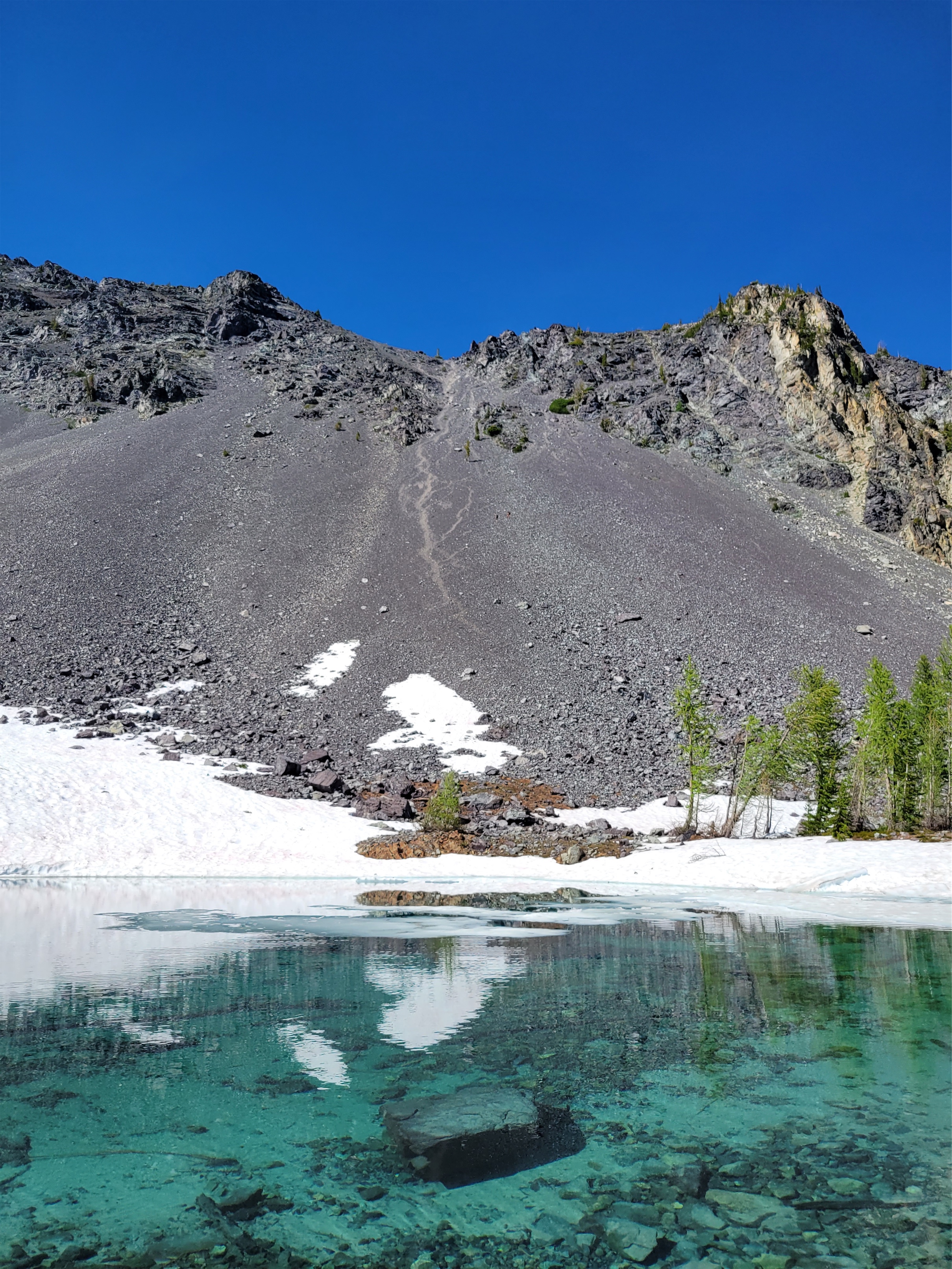
The lake itself was a mix of larches and evergreens, and by the time we got there it was cold, cloudy, and windy. There’s a warden’s cabin there (jealous). Unclear status of fish. We didn’t break for very long since it was cold and it was already 5pm and we wanted to get to the next camp 6mi away before dark. My legs were burning and I wanted to get the rest of the elevation out of the way. On to the larches! Larches, Legs, Lac Floe.
The larches got denser and denser as we climbed and suddenly we were on top of a wide open plateau with baby larches all around us and Floe Lake laid out below us beneath insane towering rock walls. This is where we started to realize maybe we were hiking the trail backwards because the views were always behind us. But anxious about getting to camp, and cold, we didn’t take much time to enjoy the views. Crazily enough, the elevation gain was pretty minimal, I think under 3kft for the whole day despite 12mi. But my city legs were tired.
Ridiculous color even with moody skiesFloe Lake below the first larch grove. You can HIKE (not climb!) those peaks from the other side. Insane
Bonus larches after the pass!
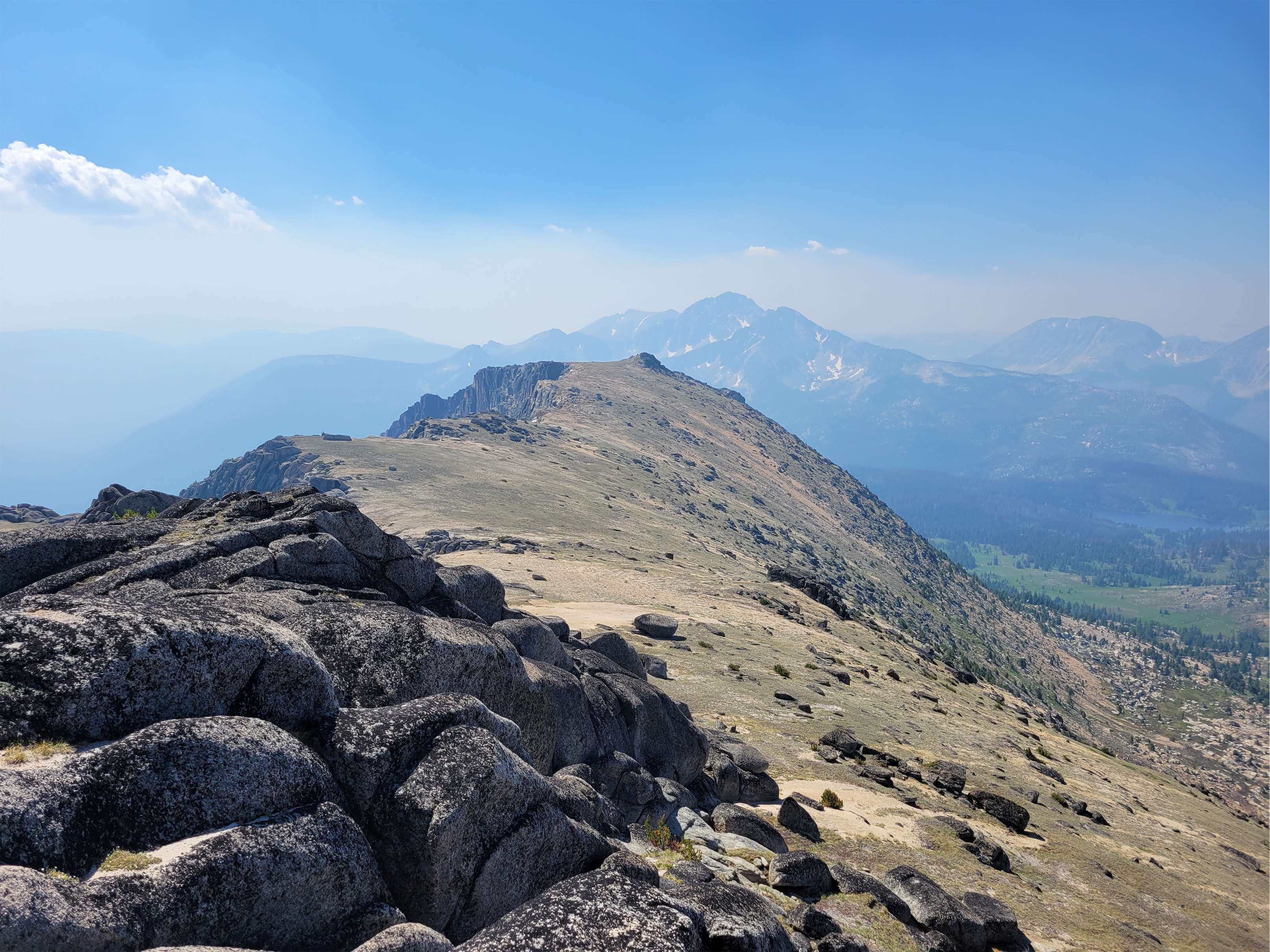
And we crested the pass and what did we see?! Was it more larches?? You bet your ass it was more larches. The trail snaked along the gravelly hillside (tease!) before turning straight into the next grove of larches. Trail optimized for larches.
Tease of blue sky but no sun. Doesn’t matter, found larch carpet
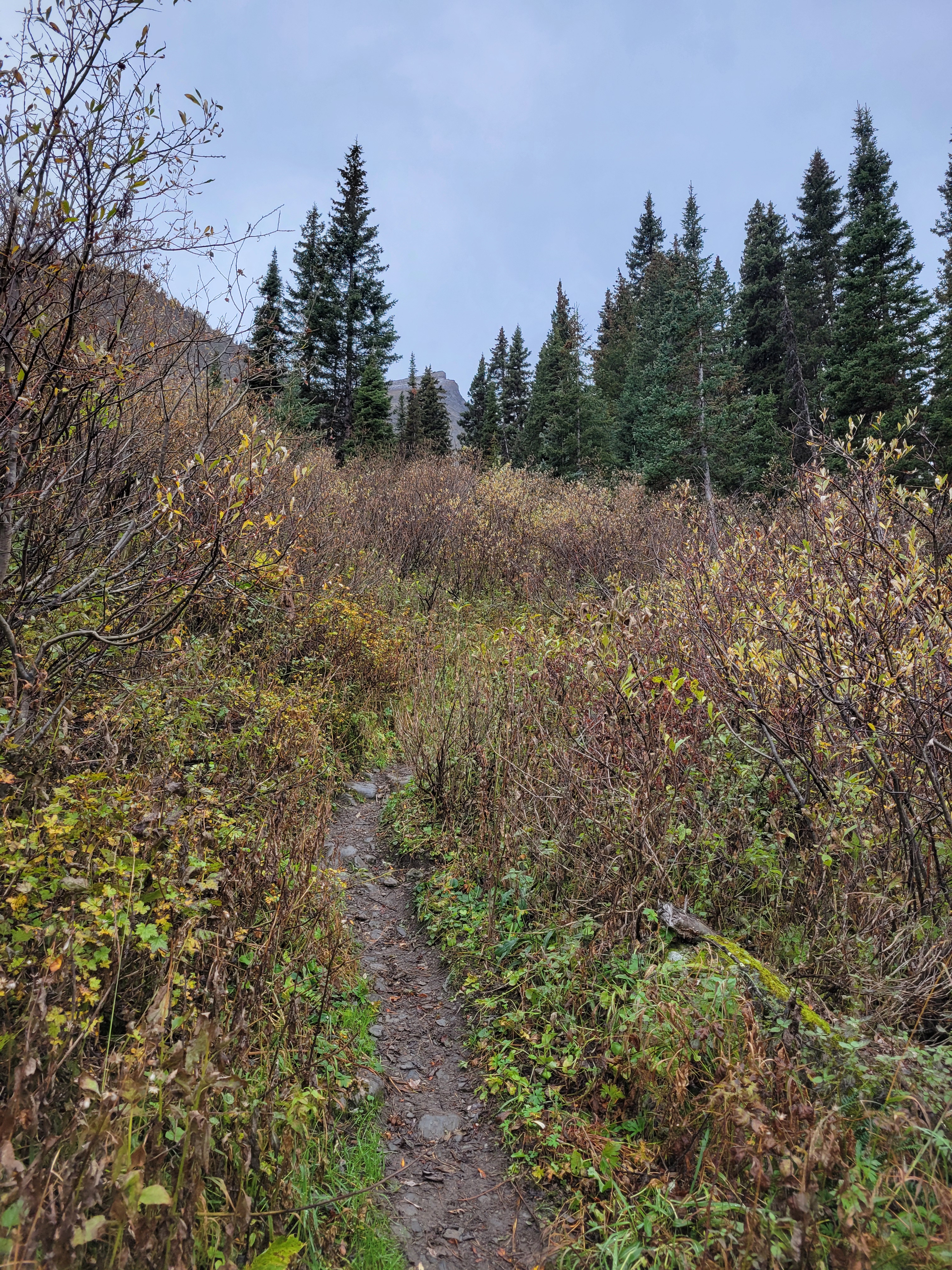
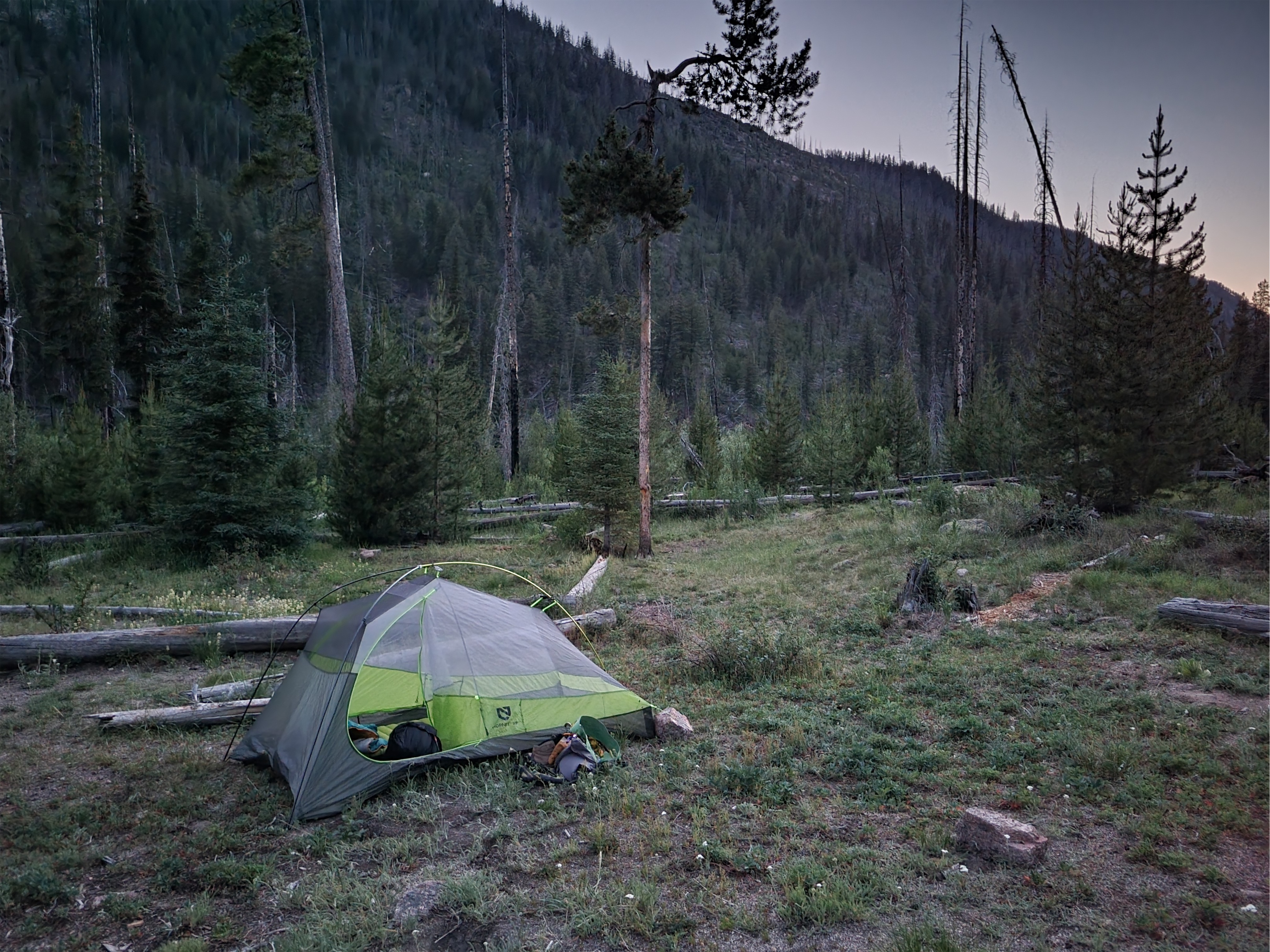
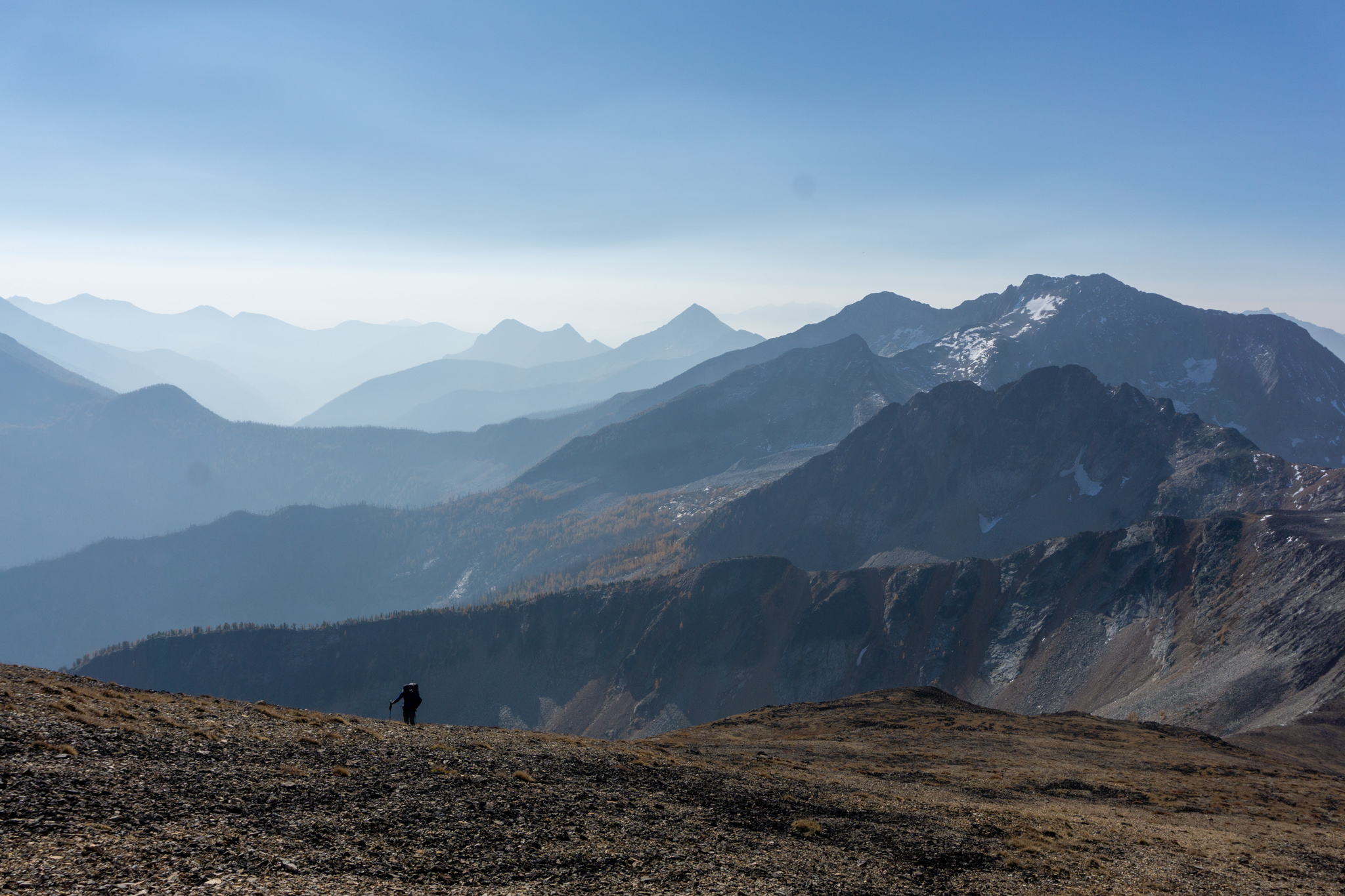
Once the larch grove was past us, losing that 3k elevation gain was kind of brutal. Switchbacks forever, and steep, and I had done a pretty good job of keeping my cardio up but nothing had prepared my legs for jarring downhill. But we saw a porcupine booty bobbing through the trees, I’ve only seen a porcupine once before. As it got darker outside I started bugging out about bears. Every switchback, every bend in the trail, every tree out of the corner of my eye, bears everywhere. Everybody had me psyched out. I felt like a dork carrying bear spray but everyone kept telling me ohhhh no the bears are the real deal there. I was guaranteed to run into a bear. But soon enough it finally flattened out, my legs relaxed, my brain relaxed, and we stumbled into camp. Far below treeline right next to a river. With no larches. And no views. Just trees and darkness and probably bears.
Uninspiring start to second day. This photo doesn’t even deserve to be here except to convey my disappointment
We set up camp pretty quickly and ate, finishing just before it got fully dark outside. Turns out every campsite has a designated camping spot and separate eating spot, complete with bear lockers. I just left my whole pack in there and crawled into my tent where I burrito-down in my sleeping bag and lay freezing and congested for the next 9 hours. At one point I stuck my head outside to blow my nose and was greeted with the first time I’ve seen the Milky Way in over a year. I lay with my head hanging out the door for a solid half hour marveling at every shooting star that passed. Crazy to go from counting planes in the sky to counting not just stars, but shooting stars in a span of 24hrs.
Ah yes if heaven were rainy this would be it
At 6am, it hadn’t started raining yet. I was optimistic. I started to get ready for the day. Contacts, change of clothes, oh you’ve gotta be kidding me is that rain? The rain had started. I went back to sleep. I finally got up around 8ish and had breakfast, paced around restlessly, gave up and sat beneath a tree that was thick enough to cast a dry spot for a few hours. Didn’t have a book or anything because luxuries aren’t part of my trip planning. I remarked to Brad that the pit toilet was phenomenal, could barely even smell it. “Or maybe you’re still sick.” Oh, yeah. Or that. Around noon we figured it wasn’t going to really clear up, we might as well move.
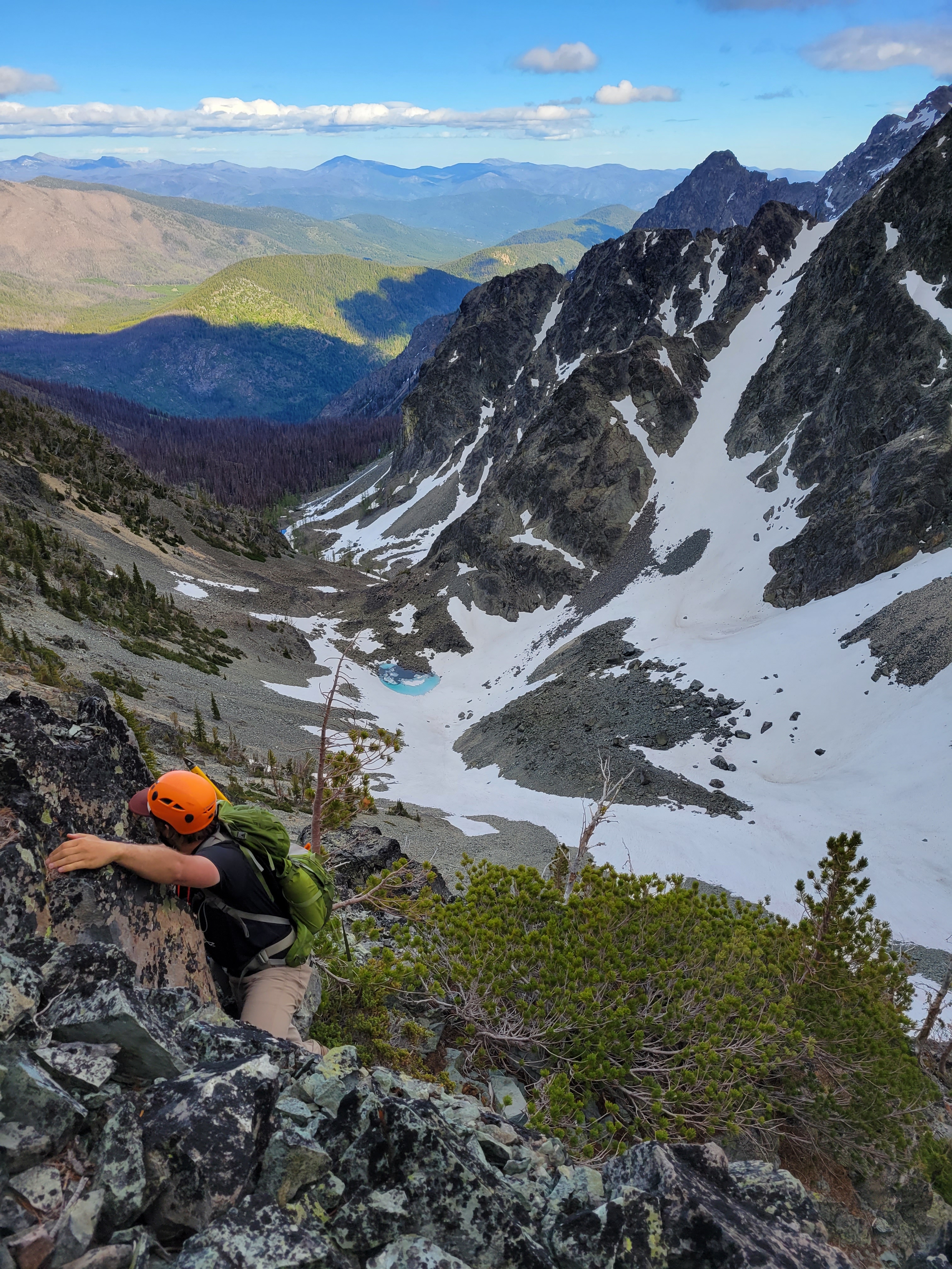
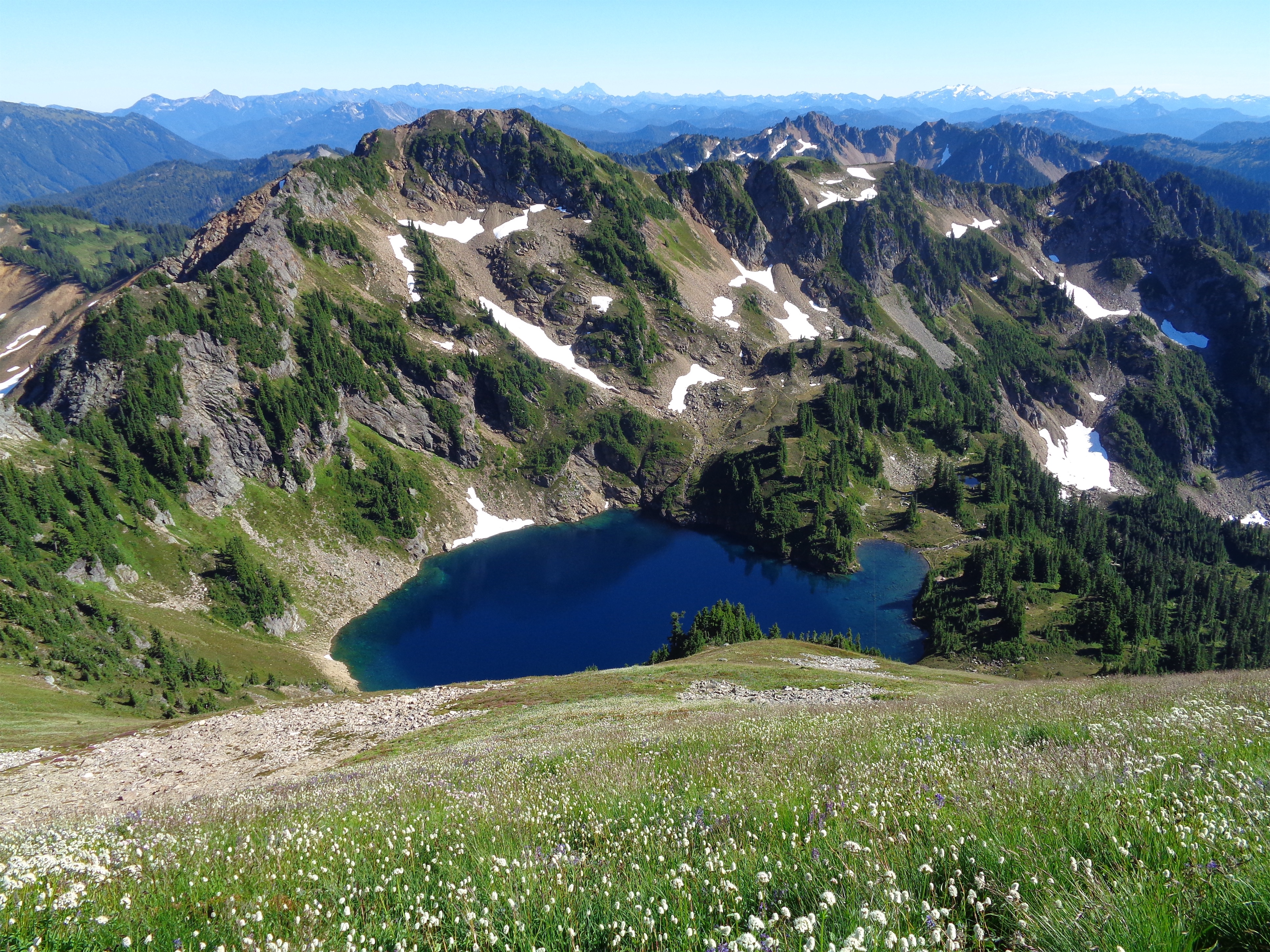
Crazy glacial moraine, lake out of frame
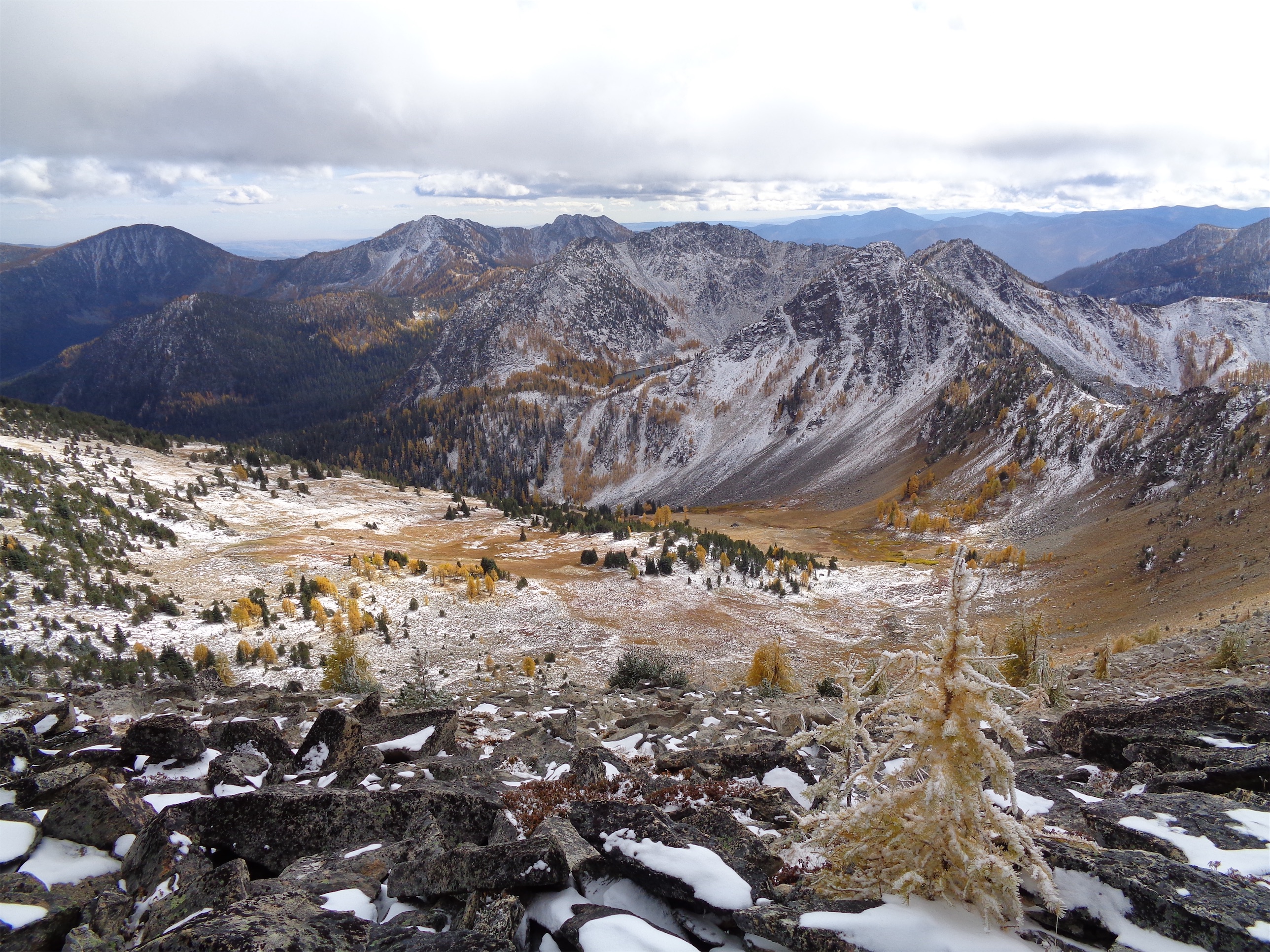
It had backed off to a drizzle. I strapped my soaking wet tent to the outside of my pack to spare everything on the inside and we took off. The first mile or two was stupid, generic slopes in the mist. And then we crested the next pass and hit larches and holy crap the glimpses we got were such teases. Toes of glaciers hanging down rock walls between larches! A huge moraine, with a lake I’d have demanded we hike to if it hadn’t been raining. The rolling slope to the east that we could have hiked up easily for better views, if we hadn’t been socked in by clouds. Oh man. But at least we only had to go four miles. Four miles of +2000ft and then -2000ft. Because of these below-treeline-only-campsites.
The Prince and his Throne
We got to camp around 3pm and did basically what we had done that morning, set up tents and sat in dry spots for as long as we could tolerate. 5pm was dinnertime, we huddled in a dry grove between trees. Nobody was using the official picnic tables, which were in clearings fully exposed to rain. I think I was in my sleeping bag by 6:30pm where I slept for 12 hours because there was nothing else to do in the rain and the cold and this was another campsite below tree line with no larches and no views and only trees and probably bears. I peeked my head out occasionally to see if clouds were moving. The one pro of camping below tree line is some of the trees are dense enough that they maintain dry spots so you can at least sit outside briefly. I barely survived the pit toilet. It smelled horrible. My head cold must finally be passing.
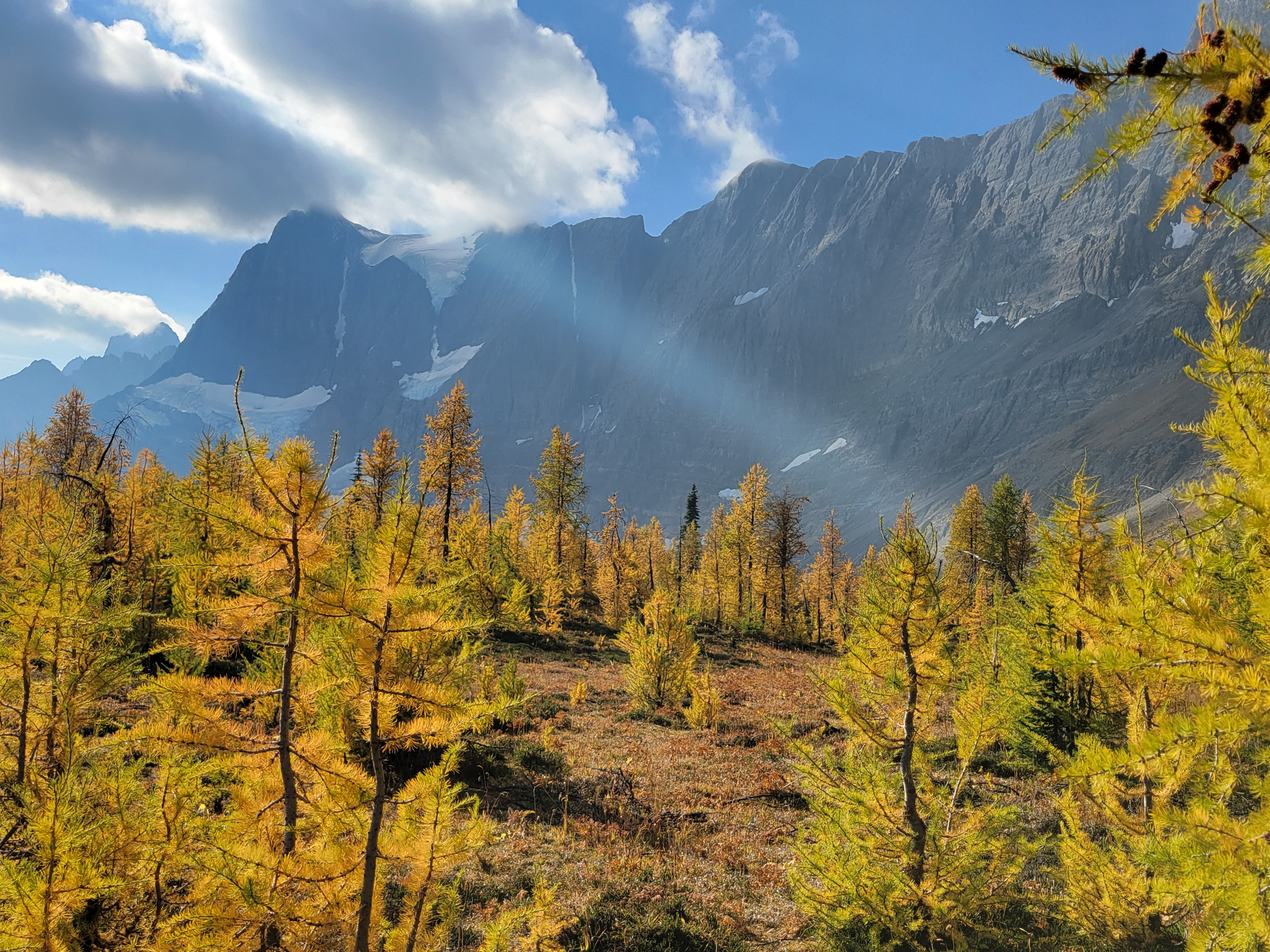
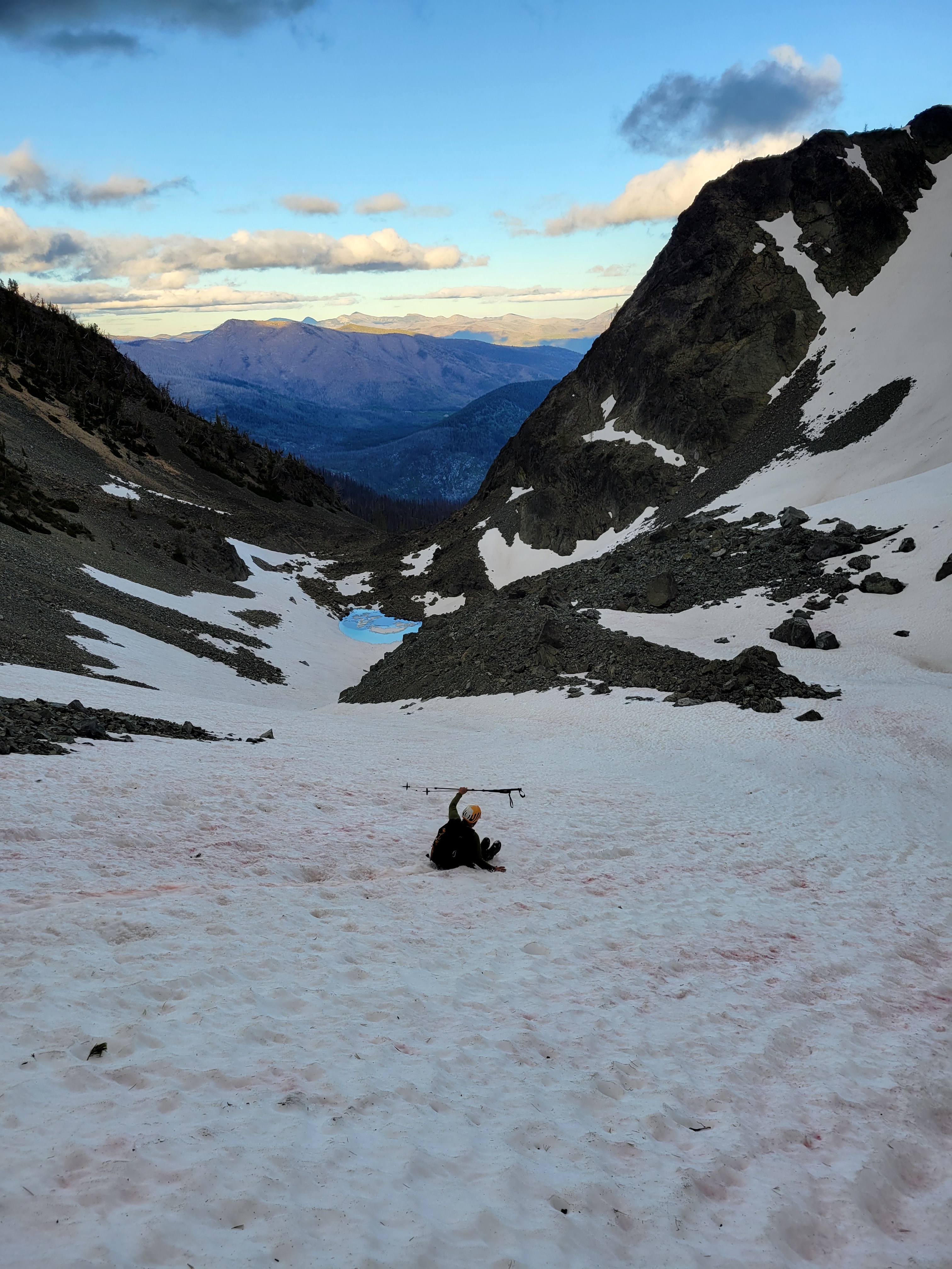
I woke up at 6am, truly believing in my deepest of hearts that it would. be. sunny. Narrator: it was not sunny. It’s amazing that you can believe so hard in something and have it not be true. Whatever. I guess free will doesn’t exist. Love isn’t real. Karma doesn’t actually come around. We’re helpless. Nothing matters. It started to dawn on me that the next day I’d be getting on a plane in soggy clothes with a pack full of soaking wet gear after four days in soaking wet weather that I busted my ASS to make happen. What can you do but laugh? We dined on stroop waffles heated over the steam from the water we boiled to drink, to various name-that-tunes: stroop, there it is. stroop, stroop ba doop, stroop ba doop. Like everything else, my existential crisis also doesn’t matter, not when faced with Costco snacks. We packed up once again and started off.
Great Jesus ray. That’s the father, the son, and the holy spirit telling me personally hey, we got some sun headed your way
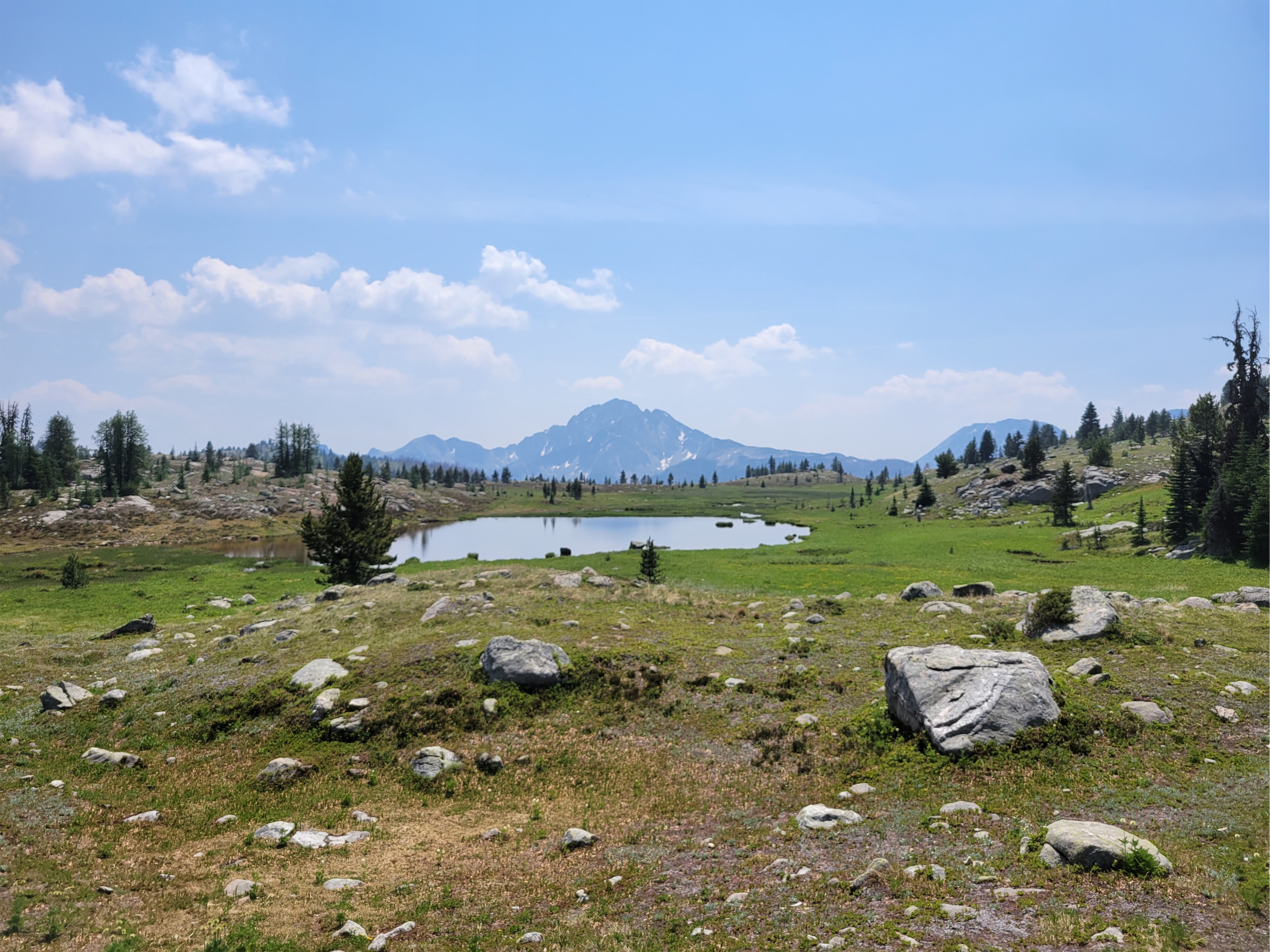
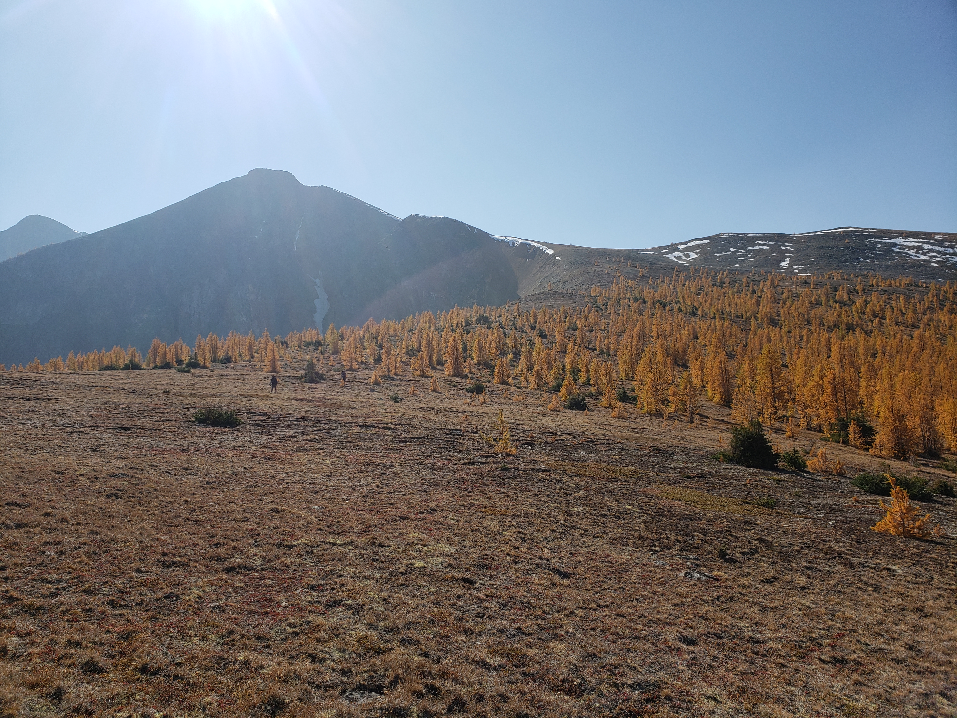
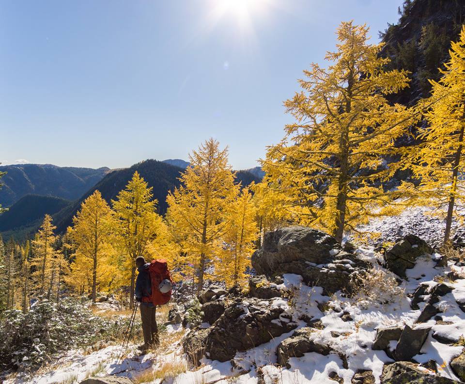
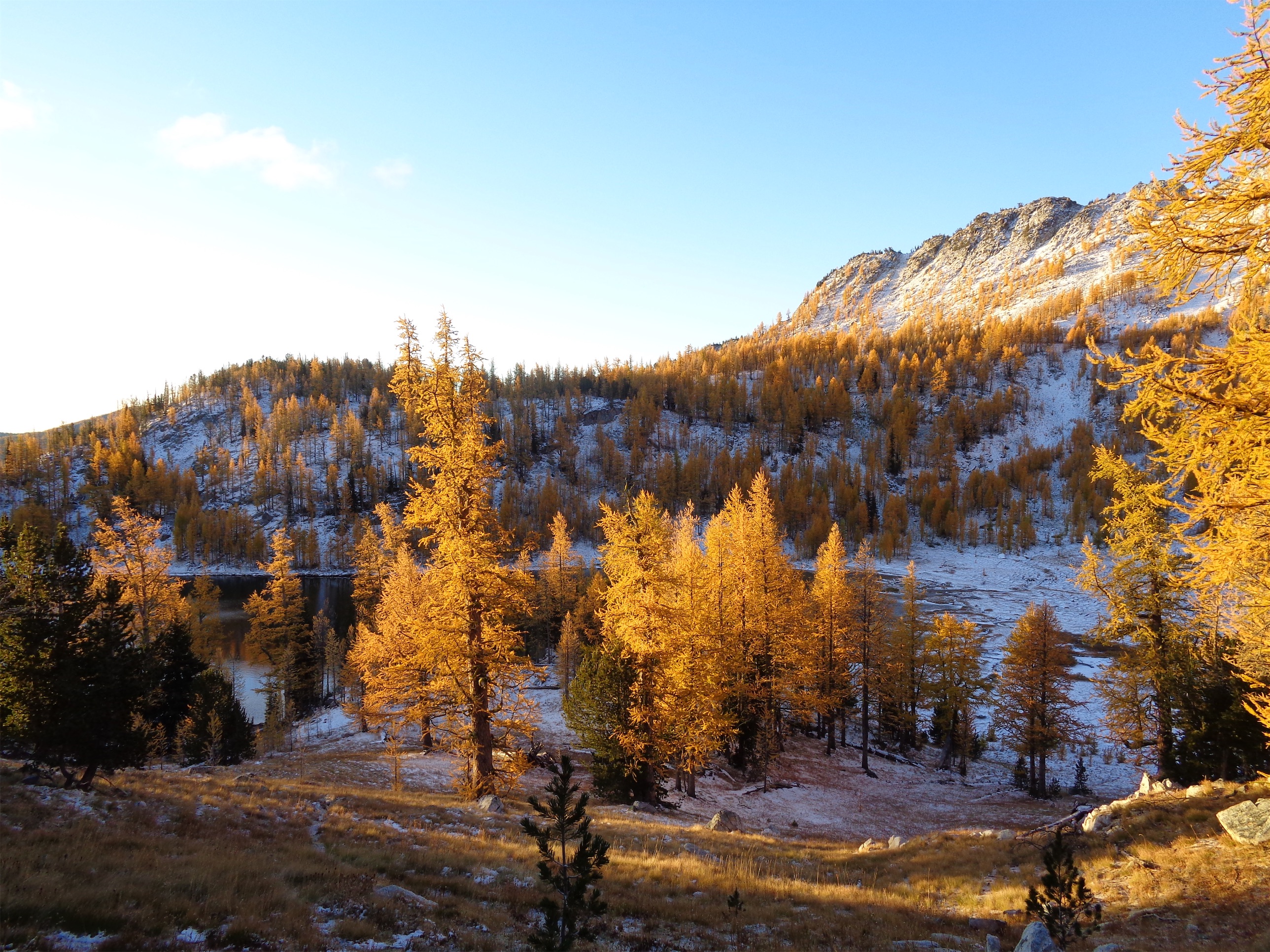
When we were close to the first pass, which was only a couple hundred feet of elevation gain from camp (phew) the sun started making moves. Suddenly the larches were backlit and we were in a cocoon of yellow and IT WAS FINALLY HAPPENING our pace slowed to like 1/10th of a mile per hour and we started basking. This was what we had been hoping for. A trail above 6000ft that just clung to the side of a valley covered in larches, maintained elevation rather than going up 2,000ft and then down 2,000ft, just a beautiful traverse on a warm sunny yellow day. There was another warden’s cabin up there too, which isn’t even fair. I always joked I wanted to retire and be a park ranger but maybe now I want to specifically be a Canadian park ranger if that’s where they’re patrolling.
Smokey giants
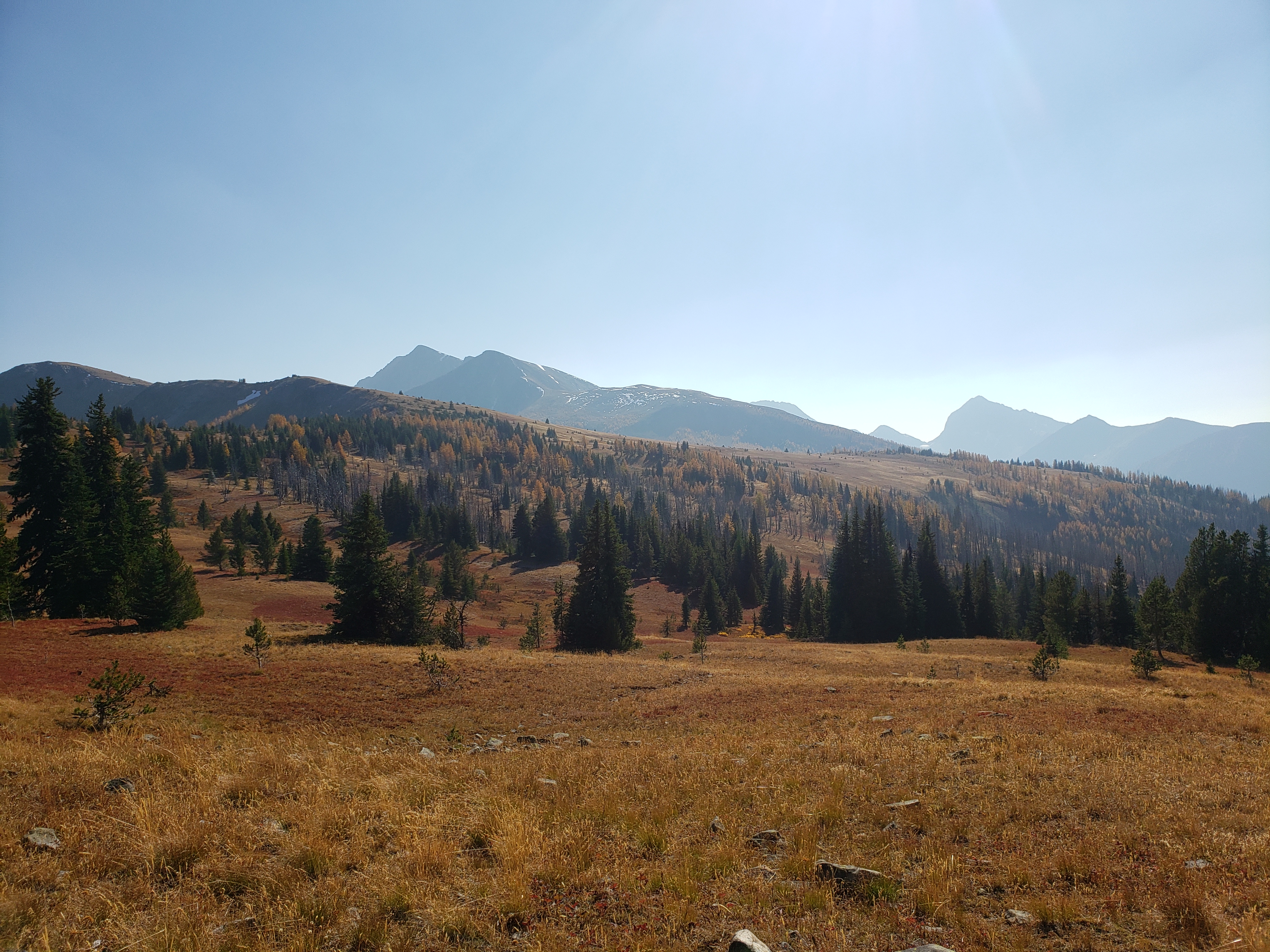
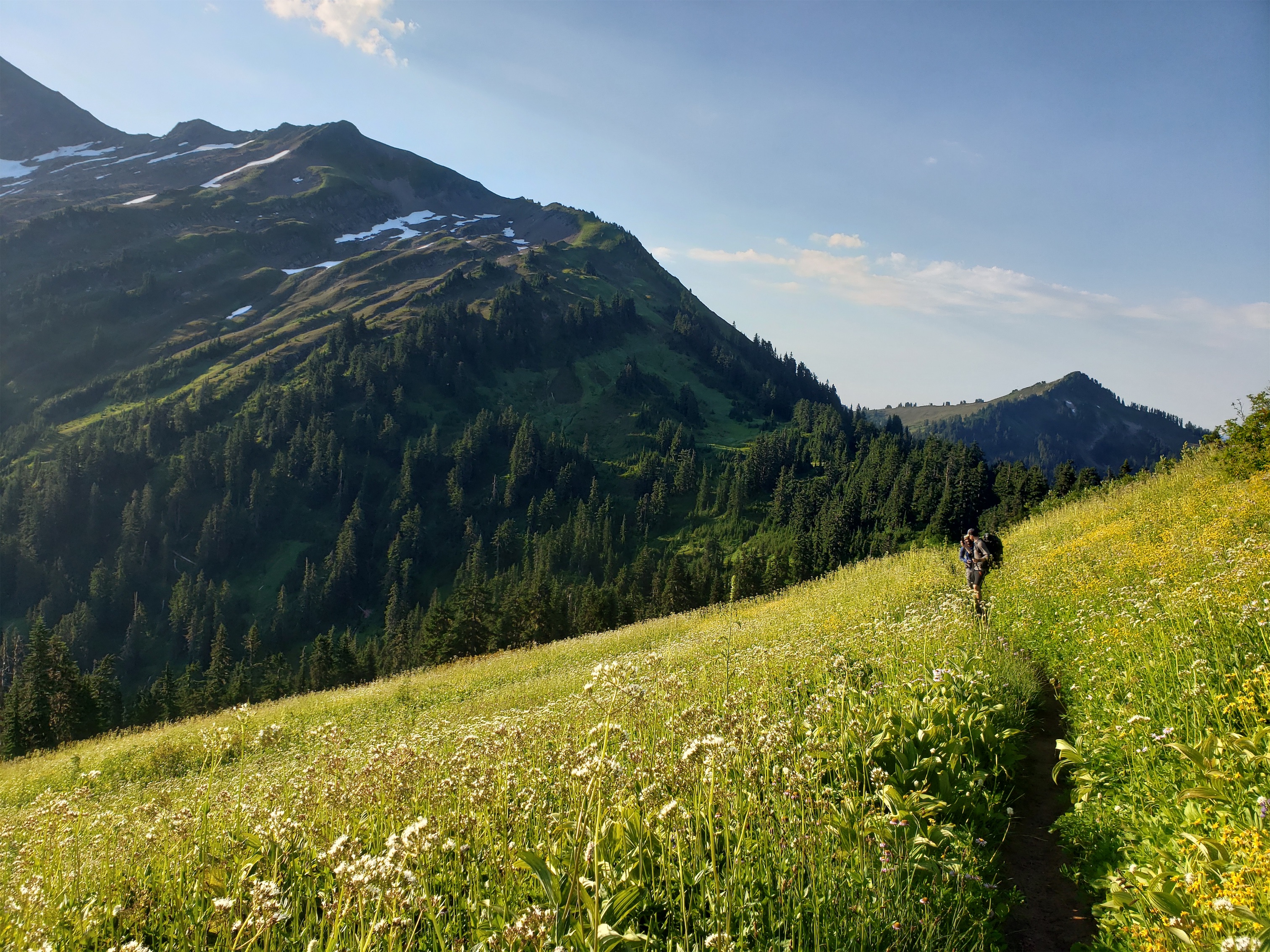
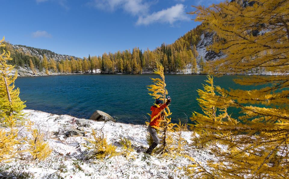
These peaks are absolutely giant. Totally different feel from the Cascades. We saw another moraine with a bright green lake behind it and looked at each other. Uhhh we need to go to this right? We need to go directly to this lake? We trotted off giggling through dense larches. Thank you, larches, for being so soft and not stubborn stiff evergreens that clothesline you when you try to rush through them. After some rambling we were able to get to the toe of the (very dirty) glacier and took a great lunch break in what felt like a foreign land. It’s truly like the rock walls of Moab meets North Cascades rock, with yellow aspen traded for yellow larches and the bonus of glaciers right next to you. Pictures will never do it justice, and I have to winder what this will look like in another 20 years of glacial recession and brush growth. It’s absolutely spectacular, will it be surrounded by trees in 50 years?
Straight from the toe of the glacier to feed future larches. Our cross country trail rejoined the real train in the largest to the left.
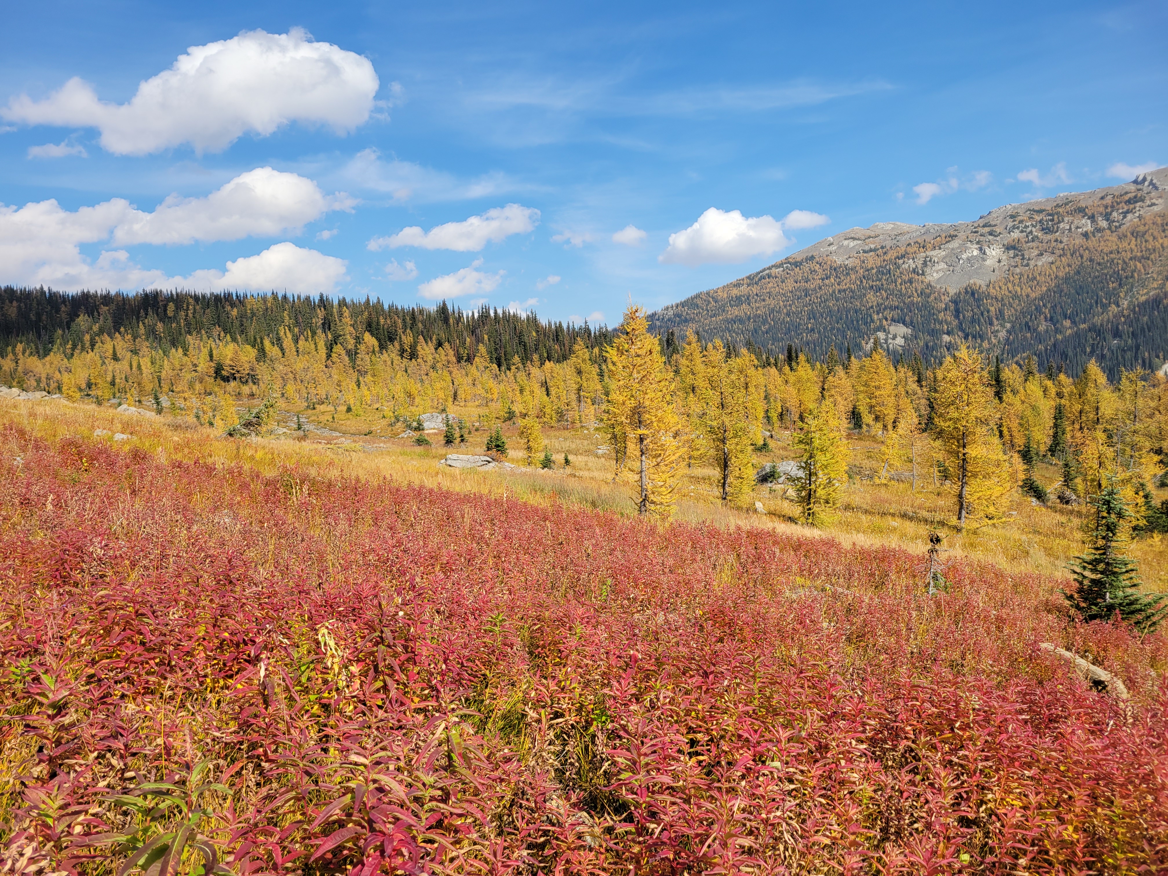
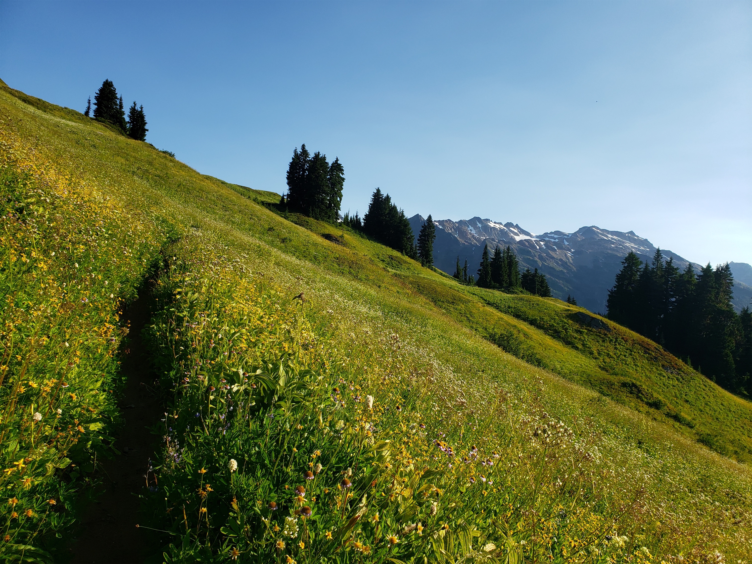
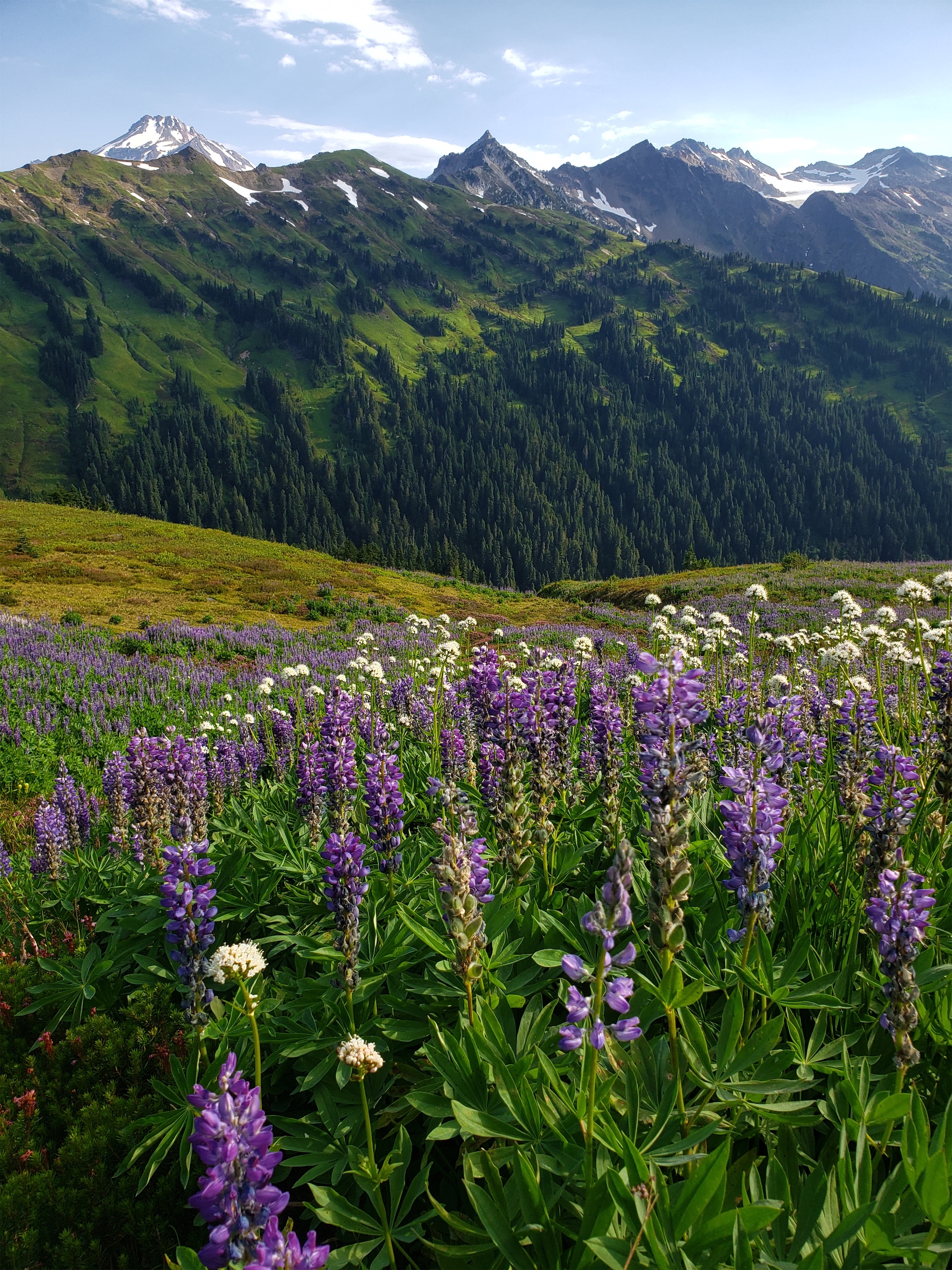
We took our sweet time from the lake up to the final pass. The land transitioned abruptly from glacial moraine to grassy meadow as if the moraine had been pushed onto the meadow just yesterday. The meadow travel was easy, small springs and bright red fireweed and yellow larches and blue skies. Brad has also developed a rare talent: the ability to sniff blueberries from miles away. I’d be walking a trail with seemingly no vegetation and I’d hear “wait. I smell them. blueberries.” and two minutes later “found them!!” and we’d have a small feast. Alpine super sniffer. I couldn’t believe there even were still blueberries.
I have never been so in love with fireweed
Brad working the super sniffer
It is insane to me that you can’t camp here. I get it, it impacts a fragile environment, and I would hate to see this place get overrun like some places in Washington, but oof the individualist and explorer in me is tortured knowing I can’t just do what I want up there (I mean… who’s there to find me?). This was easily one of the most beautiful places I’ve ever been and I want it to stay pristine, but I also want to see every inch, and doing that with a base camp several miles away and thousands of feet lower is tough. But in the meantime… kudos to you, Canada. OOOOO Caaaaa na daaaaa. If ooonly iii knnneeeeww moooore wooooords
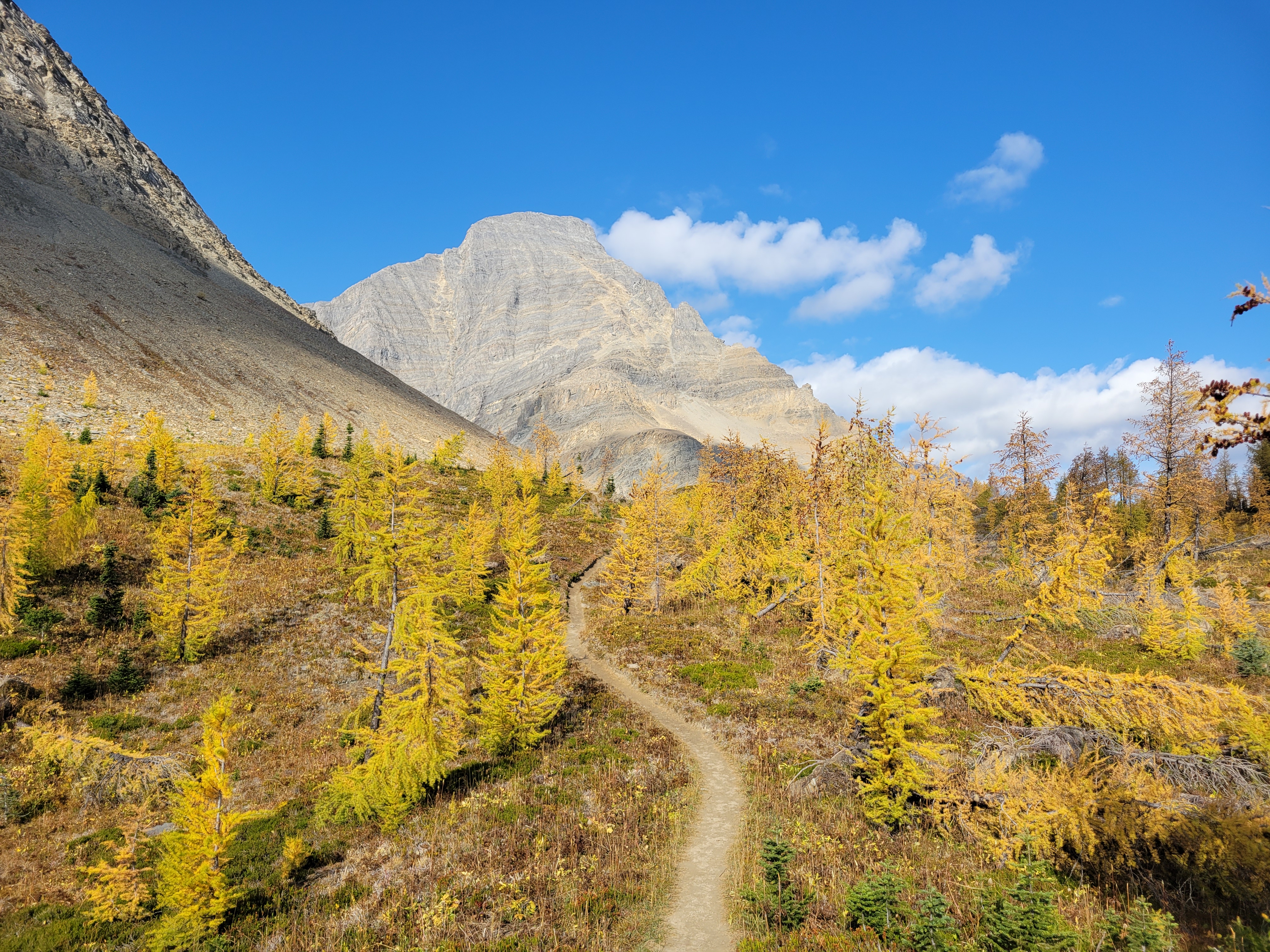
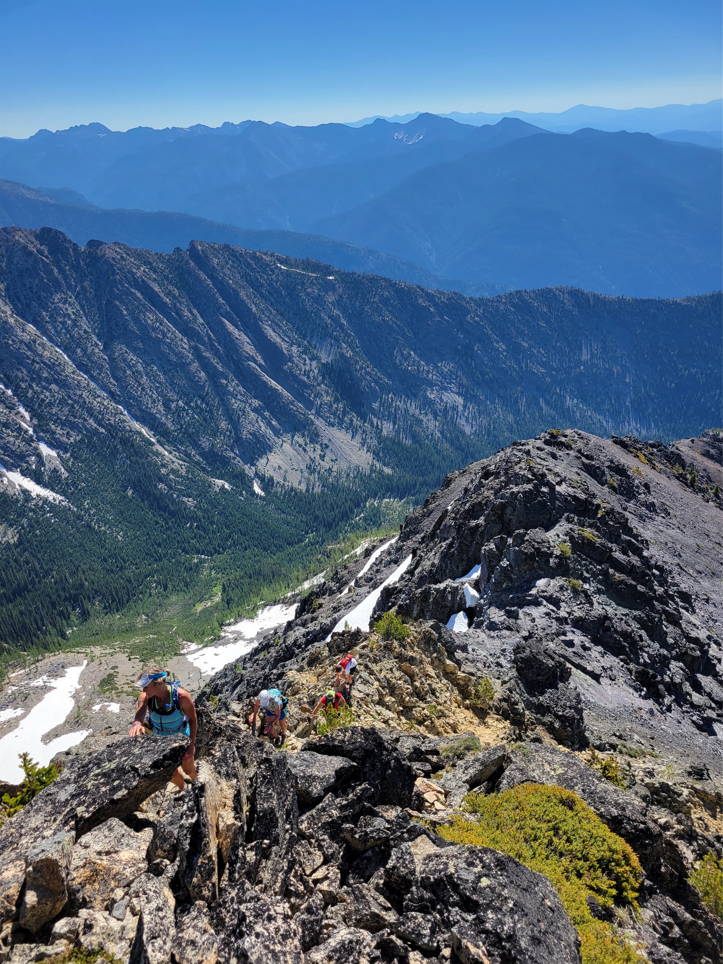
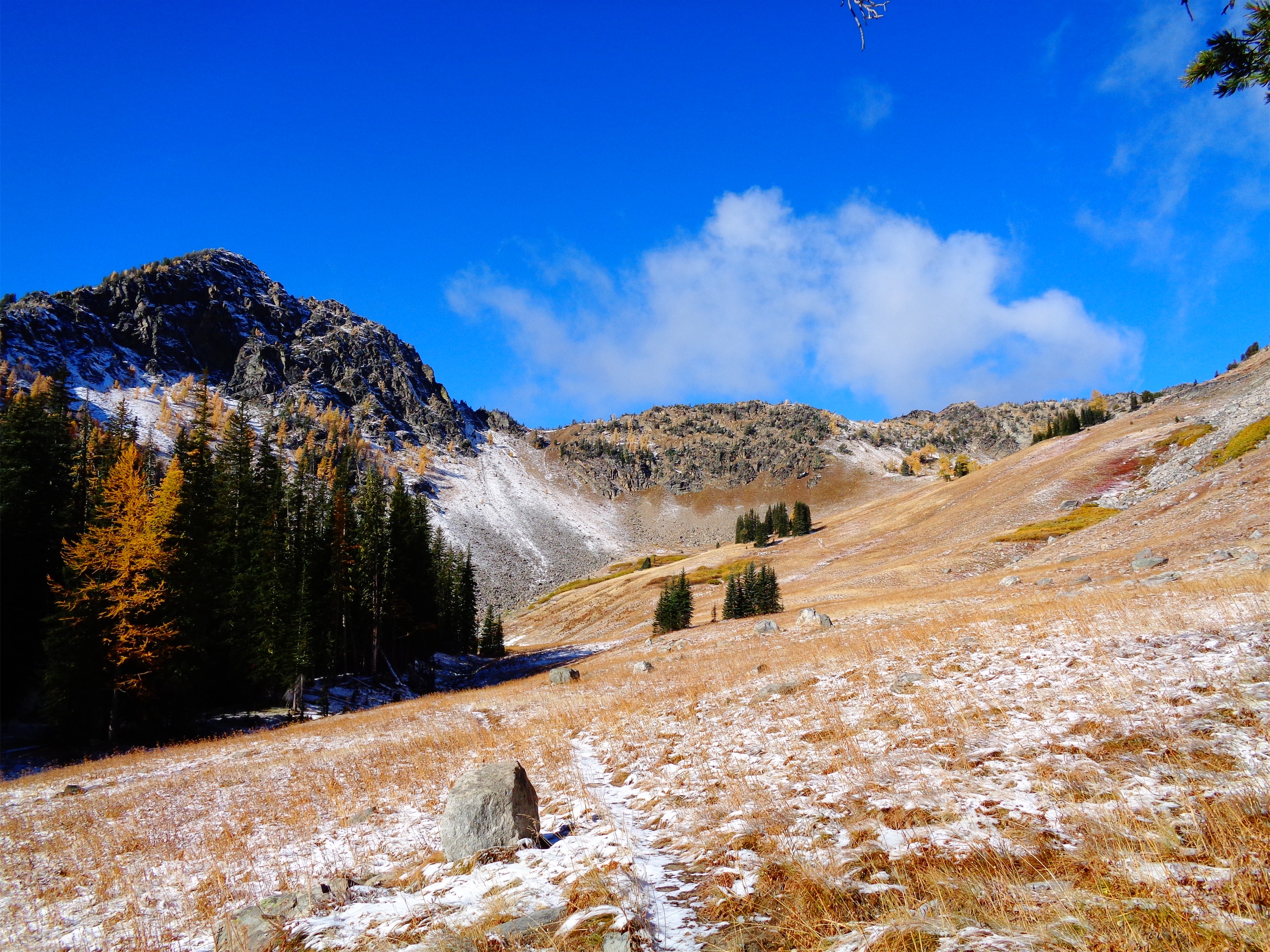
The gradual hill to the pass was hell on my trashed city legs, it went forever gaining one foot per minute or something stupid like that. It was smoky, you could smell it, but the views were still elite. I’m used to cramped steep valleys in the Cascades, not these huge broad ridges and wide open valleys with massive mountains on either side. I was almost depressed rolling into camp knowing that was our one day of glory. Helmet falls took me by surprise – it’s hundreds of feet long. Not just a cute little thing in the forest. But yes, the campsite was yet another campsite well below treeline next to a river with no views. Only bears.
1ft per minute to the pass I was dying in the most beautiful land
Naturally, the last day was perfectly sunny, but we were just hiking 9mi out gradually in the woods. Paint Pots was really only one pot and it wasn’t very painted but everything pales in comparison to brilliant yellow larches. Brad beta sprayed me with all of the nearby community centers I could shower at before getting on the plane, I made the mistake of checking email and slack while still being on PTO thinking I’d feel better if it did, and soon enough I was in dark rainy Seattle as if nothing had changed over the last 12 months.
This larch march powered by Costco Brookies
Bonus pics I couldn’t resist adding
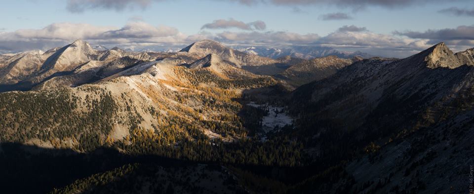
Somehow on top of the world but dwarfed at the same time. Valley 7,200ft~, peaks ~10,000ftGiants. Larch grove slowly moving inJust showing the trail in its absurdityThat awkward moment when you have 75 of the same image
In stark contrast to flowers, this is where we started our journey
Yep, you heard me. I finally left the country. I had done Watersprite Lake as a ski trip years ago (never wrote about it) and entered North Cascades National Park from BC years ago too, but this was my first summer endeavor, and let’s just say I can’t believe it took me 10 years being out here in the PNW to go venture across the border in the summer.
Bonus loo on the Singing Pass trail
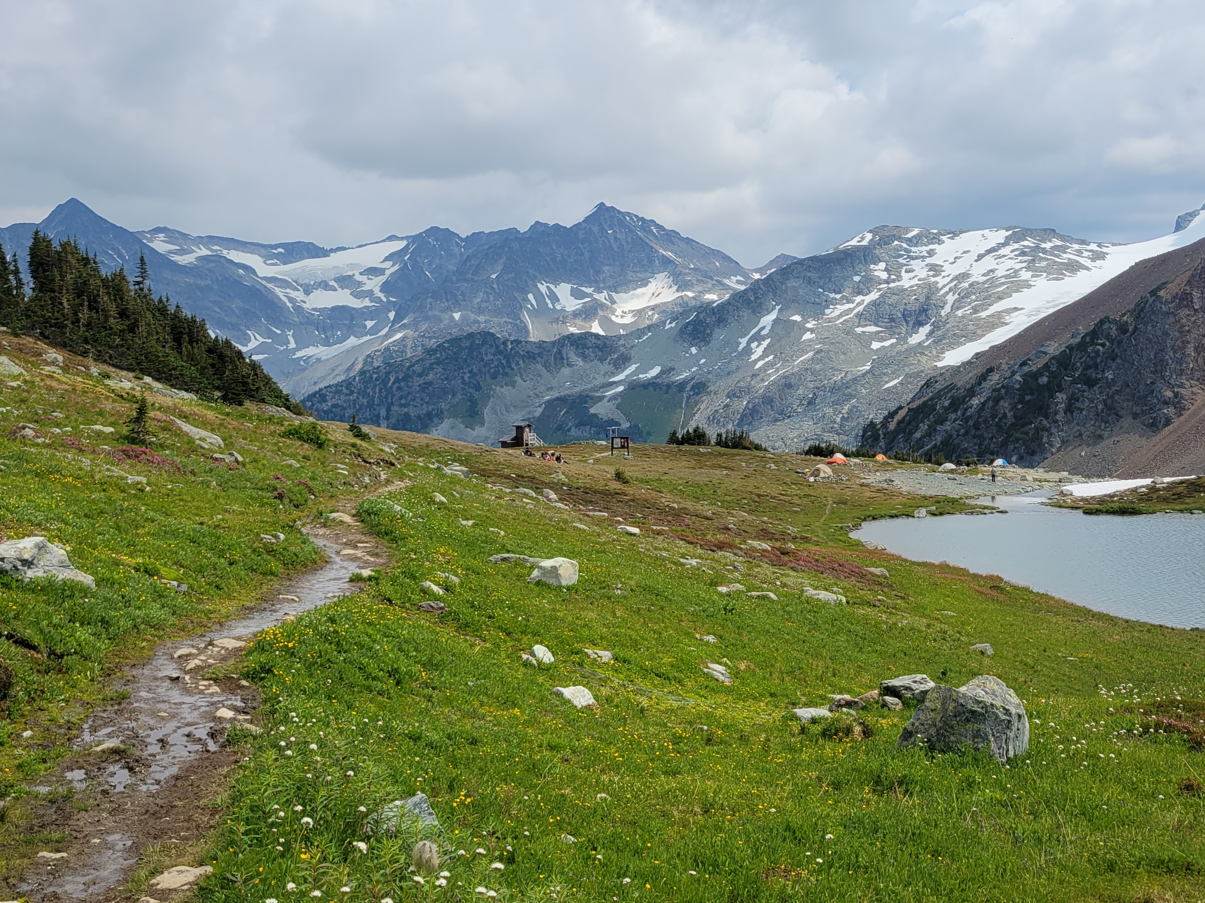
Let me set the scene. Sarah and I were wild-fired out of our original plan. We were driving back from a sunset hike the weekend prior, it was like 2 in the morning, every trip she proposes is something I’ve already done, I’m looking for novelty, and suddenly she says “well what about BC?” I’ve done practically nothing in BC. BC might as well stand for [I] Barely Care [because there’s so much to do in Washington] [and also the idea of an entire country of peaks is overwhelming so I avoid it because it causes anxiety]. She pulled up their national park website to see what camping permits existed. “Well, there’s…. one permit for Friday, and that’s the only permit in any park in BC until…. September.” “What’s it for?” “Russet Lake? Do you know it?” “Nope. Take it.” And then and there, she grabbed us the last remaining permit for campsites in BC all summer, and I guess we had plans. i5 was a dark desolate corridor save for two women cheering in a bright yellow SUV.
One of the few variations in the approach trail
I looked up Russet Lake on caltopo, and saw the dotted trail to Overlord Mountain. If a trail is on Caltopo that usually means it’s decently popular and well traveled. Trip reports for both Russet Lake and Overlord were underwhelming. Russet lake looked like it was just in a barren rocky basin, there was a hut right next to it which bothers me even though I know it’s amazing, and Overlord looked like a choss pile of a walk up, and there were no wildflowers to be seen. And the hike started at a ski resort. Whistler. Yuck. Spoiler: I was oh, so, so, so wrong.
Distance: 21mi including Overlord (something like that)
Elevation gain: 8500ft including overlord. 5500 for Russet lake if you do it backwards. Like 3500 if you do it as recommended.
Weather: 60’s and sunny
Commute from seattle: 5.5hrs? Oof.
Did I Trip: NO SIR
Attempting to capture layers of green
We rolled up to Whistler after one of the most casual starts I’ve ever had to any trip ever. Sarah was extremely patient with me during my hellacious work week when my socialization window was like 8:54-9:02pm, but I was 100% committed to taking Friday off and made it happen. Whistler was PACKED. Thumping music, mountain bikes everywhere, full face helmets on everyone, turns out it was CrankFest. We parked in a day lot and I paid for what I thought was 24hrs. I was jealous of anyone and everyone and felt like a dork with a backpack in the middle of the cool kids. We got in line for the gondola thinking we’d save ourselves mileage and elevation. $104??? For one trip up the gondola?! We laughed and started walking, looking for the Singing Pass trail. Yes, up through the mtb festival. It was signed, but I still felt SO out of place. Finally we were in the trees and not walking on an exposed road, though the “trail” was definitely still mostly a road. But that was nice because we could walk and talk easily. The trail gradually narrowed into a trail. We found a surprise outhouse maybe 3 miles in. We were perplexed by the zipline, thinking it was bikers, no, drones, no, zipline?! We walked below the peak-to-peak gondola. We admired the shades of green in the forest, and how perfectly graded the trail was, and how badly I wanted to be above treelike, and how boring this would be on the way out. At one point I realized why parking had been so cheap. It was free from 5pm to 8am. AKA I only paid for an hour, and would have to re-up in the morning, because it was a day lot, not an overnight lot. Well, shit. Worst case we pay the ticket I guess.
10/10 would be a bear here
Finally we hit wildflowers. And then more wildflowers. Heaven. Two hikers came down from the upper route (called Musical Bumps) that the gondola takes you to. “Are there more wildflowers that way?” we asked. “Eh, more like this” they shrugged. Well… they sound underwhelmed, but we’re stoked, so I guess we’re hiking out that way tomorrow. We carried on into subalpine, wildflowers and heather and massive glaciated peaks in the distance. Does everybody who has hiked this trail just suck at taking photos? Are you trying to keep it a secret? They must be trying to keep it a secret.
I mean come on
A short 2mi from the intersection with Musical Bumps and we stumbled upon one of the most dense paintbrush meadows I have ever seen in my life just before the lake. I mean the prior weekend was dense but I barely had time to frolic, this was just insane with bright yellow paintbrush that had yellow streaks and flowers of every color sprinkled in between. We dropped down to the lake knowing it was almost dark, and struggled to find a decent campsite. There’s a great one near the toilet but we missed it (and didn’t want to listen to people pooping all night). There’s a rack to hang bear bags, but we just buried our food in rocks in the boulder patch instead. Sarah asked “did you think we’d get here in daylight?” I laughed. “NOPE.” “Me neither. Funny we were both thinking that but neither of us said it out loud.” I was so happy with our timing. I had a scone for dinner and fell asleep pretty quickly, though I wouldn’t say I slept well.
Castle Towers over heather near sunset
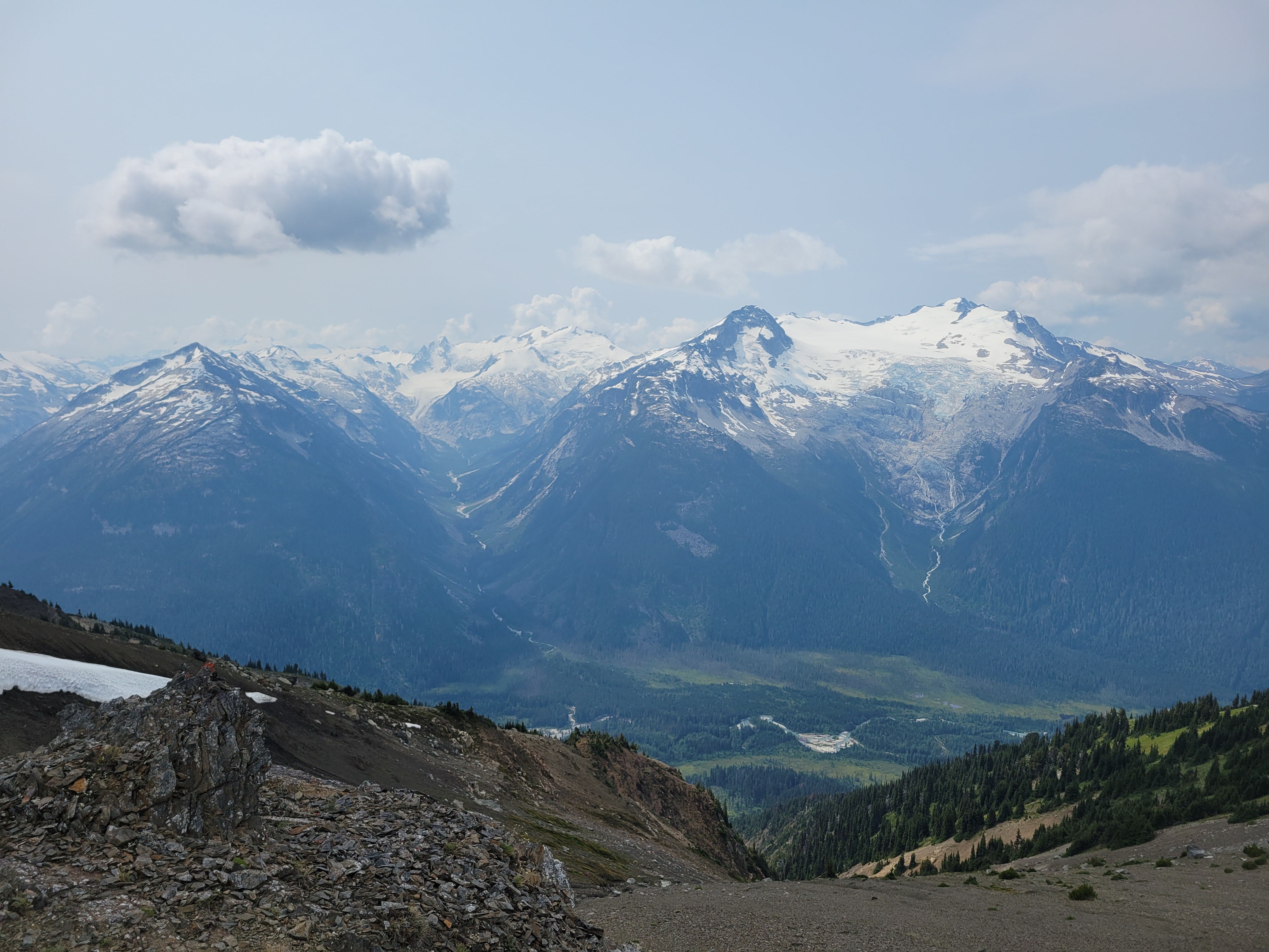
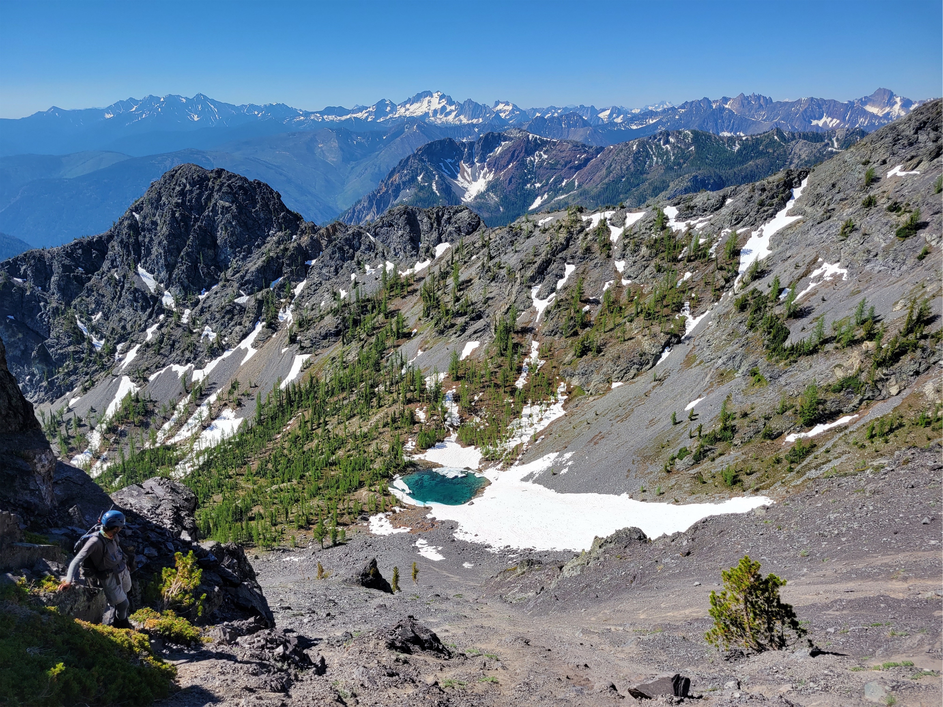
We were up around 7 the next morning, which is LATE for me (and even later for Sarah). Sarah had a leisurely breakfast and set up painting, I decided to “zip” up Overlord Mountain. Which I sorely underestimated. Prior trip reports said to expect 6-7hrs round trip from Russet Lake, but my famous last words were “it’s like 3.5k gain and 3mi, how long could it possibly take?” as I pranced off into the distance leaving Sarah to her art. I wasted time trying to traverse high rather than drop down to mellower terrain on the traverse from camp to Whirlwind’s ridge. I paid for the full day of parking with the shockingly strong cell service I had. When I saw the ridge to Whirlwind across a small valley I had an “oh shit, that’s where I’m going?” moment, but it comes up quickly and it’s not as steep as it looks. There’s also a trail nearly the entire way starting at the base of this ridge, which expedited things after my cross-country bumbling for the prior mile. There was a little tarn that I bet is beautiful when it’s melted out, and crystal clear streams gushing through the rocks off of the base of the glacier.
Woke up in (smokey) heaven
Castle Towers over the Cheakamus valley
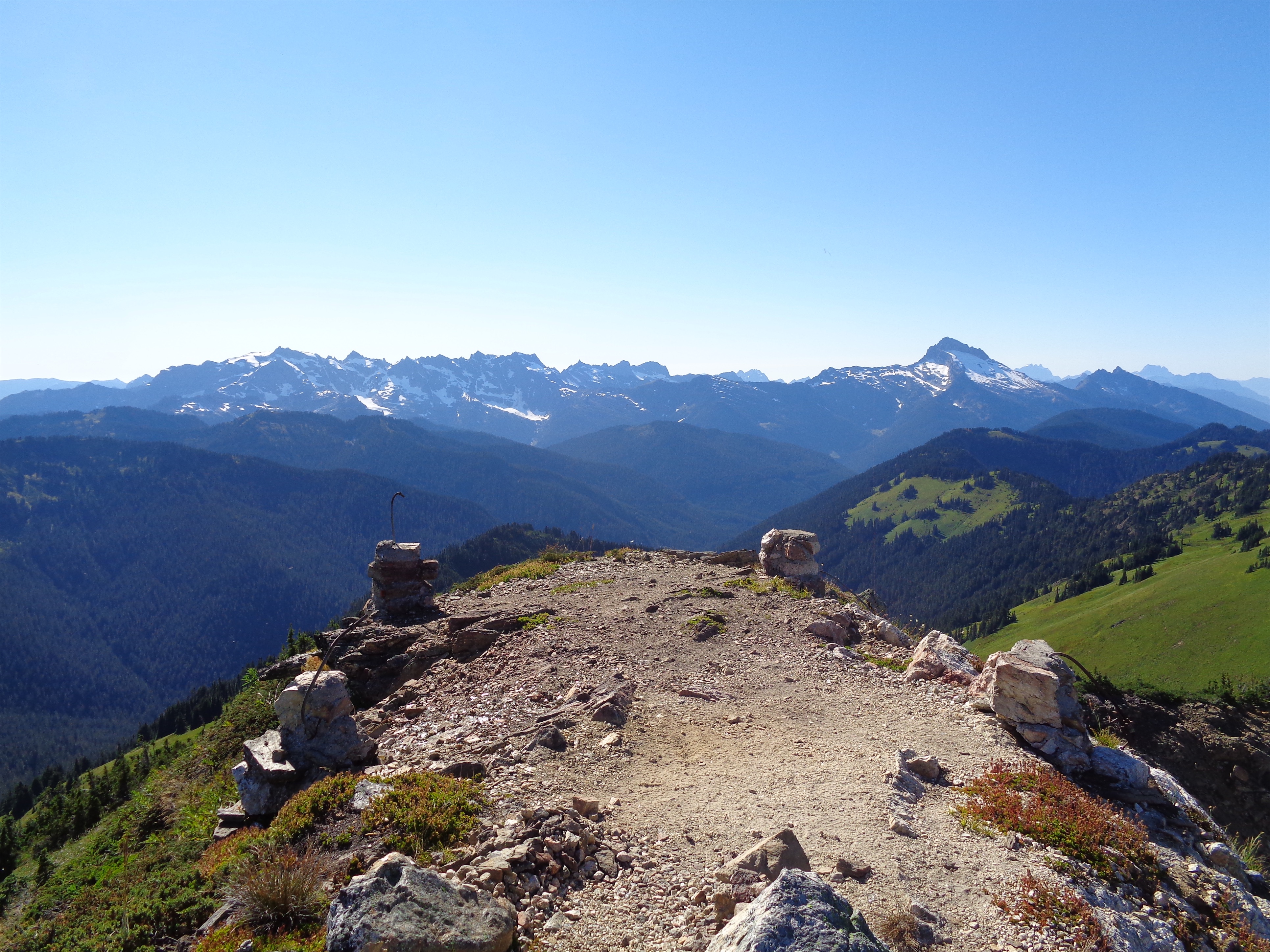
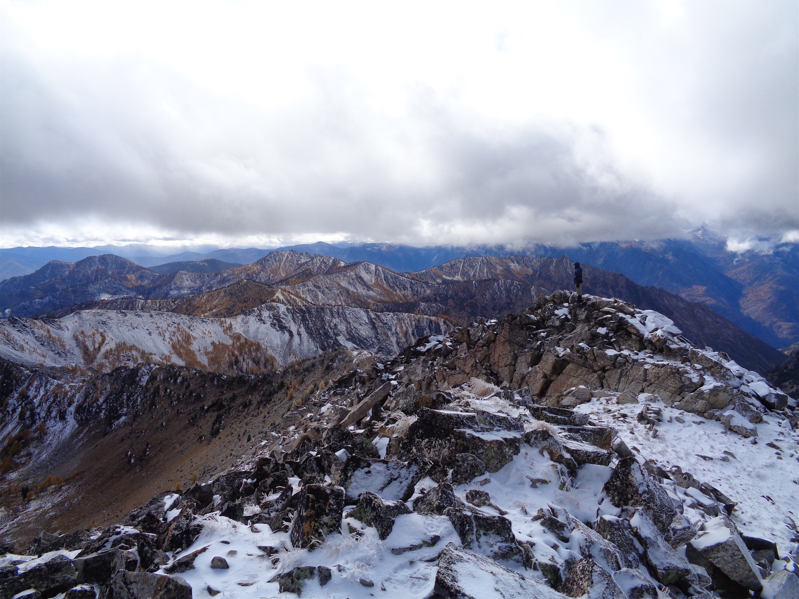
On top of the first ridge, peaks started growing in the distance as I gained elevation. I nearly broke out into the Canadian national anthem I was so astounded by the beauty. I was making slow but steady progress, less than 2mi to Overlord but I knew the last mile would be the trickiest terrain. Whirlwind was really just a long slog, I snapped a few pics at the top before dropping down to the first of two saddles between Whirlwind and Overlord. I was waiting for the 3rd class scramble sections. After the first saddle, I hiked up and over another knoll, knowing that Refuse peak (something like that) was between me and Overlord. Refuse pinnacle? I can’t be bothered to look it up. Either way, it was almost entirely class 2, I maybe had to use a hand to balance once. But the ridge is fun, with huge views in every direction. After Refuse Pinnacle, it’s a walk on this really cool shale that sounds like walking on glass, like tinkling music (tinkling sounds like pee but you know the sound I mean), and then a long slog of a talus field with some snow patches to the top. O Canada kept morphing into the US national anthem in my head, and honestly I can’t think of worse songs to have stuck in your head. There is a climber’s trail the entire way from Whirlwind to Overlord. It’s sparse in parts but if you are used to boot paths you’ll find it.
Looking up at Overlord (left) from Refuse Pinnacle
The summit was broad and welcoming, I had some quick snacks and chatted with two other climber who were ahead of me before quickly turning around to head back down knowing Sarah was waiting for me. I had taken just over 2hrs to the summit, and was hoping to be back in 3.5hrs total. The way down went quickly at first, until I was just past Refuse Pinnacle and saw all of the other parties on the way up. I stopped to chat with each one (uphill has right of way so… yeah) and reassure some folks who were worried about the scrambley part. Finally past the people, I realized how much of a delay that had been and texted Sarah that I wasn’t going to be back until 12:40 despite an ETA of 12. I desperately hoped I was underpromising/could overdeliver and be back way before that.
Looking down on the Overlord glacier from the top
Yours Truly for scale
If you zoom in there is a blue dot, that’s another party headed up (Overlord summit behind the knoll)
Halfway up the saddle I turned around and saw the other parties. One woman waved to me and whooped which made me so goofy happy. I was DRAGGING. Coming over the knoll and realizing there was another 300ft of gain to the top of Whirlwind was crushing. But once on top of Whirlwind it was soft enough I could start jogging, and I knocked out the remaining 2mi in around 30min, getting back to camp at 12:15ish right as Sarah texted something politely conveying “I’m bored, hurry up, I’m ready to leave.” I packed up my stuff as quickly as possible and we were off to the paintbrush meadow. 6-7hrs round trip from camp my ass. Good to know I can still knock that out. I question my fitness constantly these days (which most people who know me are probably rolling their eyes at).
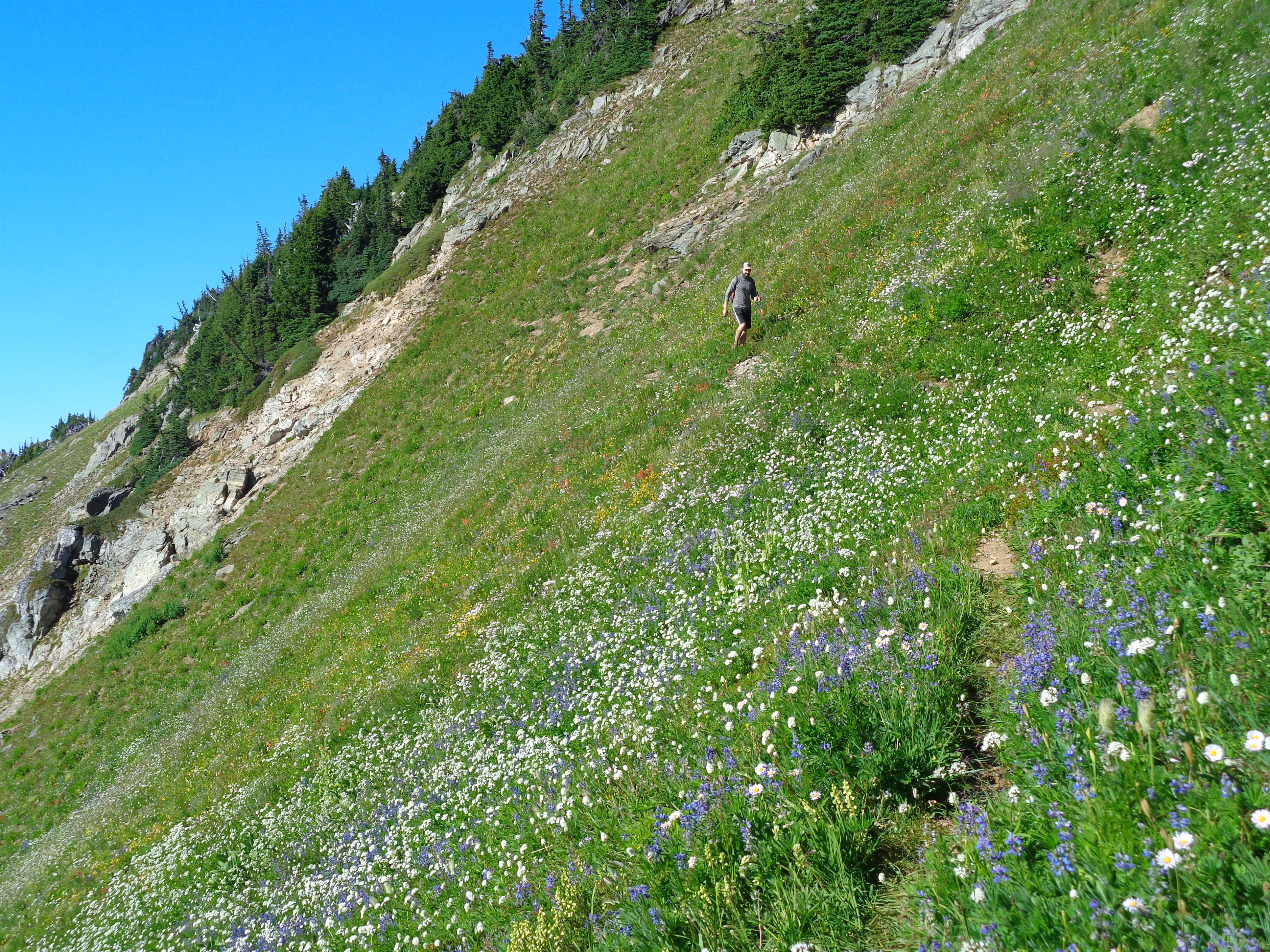
I cannot in good faith recommend going up Cowboy Ridge above Russet Lake where the meadow is because it is impossible to do without stepping on wildflowers. They are EVERYWHERE. There is no trail up there but the flowers are absolutely astounding, and I hear the lakes on the other end of the ridge are great for swimming, and the end of the ridge has a good view of the Overlord glacier. We did not have enough time to hike the full right, which is okay with me given the impact it’d have had on flowers 😦 Guilt quickly kicked in for me and we zipped back to the trail after just a few photos.
SARAH’S PAINTING omfg I freaked out when I Saw it. Will link to her site once it’s up. She did that at camp!!
Russet Lake camp
We retraced yesterday’s steps to the junction between Musical Bumps and the Singing Pass trail, and started up Musical Bumps. Let me be clear: we were doing this whole trip backwards. You’re supposed to take the gondola up to the top, then hike DOWN musical bumps to the lake, then hike DOWN the trail from Singing Pass back to Whistler. But we were banking on nobody checking for gondola passes because we’re cheap. And we were also banking on the gondola being open until 5.
The wildflowers continued to be absolutely phenomenal going though Musical Bumps. We are NOT fast hikers when flowers are involved. We probably looked like two off kilter toddlers chasing butterflies. I started collecting beta from passing hikers because we didn’t entirely know the way to the gondola, and my phone was dying, which meant no navigation soon. My legs were also DYING after knocking out Overlord and now this. Flat was fine, downhill was fine, uphill was tough. Getting the gondola was going to be tough at our speed. I made a joke to a passing hiker. “Yeah we’re trying to catch the last gondola out of here, gotta go!!” They lit up. “The gondola’s running until 8! There’s dinner at the restaurant so they’re keeping it open late!” Sarah and I burst out laughing. YEs!!!!! How was this working out so well in our favor? Spirits newly lifted knowing we could take our time, we plodded on through all of the gondola-carried tourists hiking with tiny day packs, envying their light loads (maybe that was just me).
It truly just kept going. Insane numbers of meadows.
Something something frosted tips
Even within ski resort boundaries the terrain is gorgeous. I wasn’t as annoyed by the lifts as I expected. That last mile to the gondola though was one of the slowest of my life. It just. Kept. Going. Every time I thought we had to have gone a half mile we hadn’t. I was soooo happy to finally get to the lodge. We popped into the bathroom, sought out concessions (specifically Diet Coke, which we did not succeed in finding), and got in line for the gondola. 5min later, we were in a gondola, high fiving because nobody had checked for a pass.
Three colors of heather in this one pic
Nearly back at the car, I said out loud “this HAS to result in a ticket right? I mean everything else has gone so perfectly… there’s definitely going to be a ticket on the windshield.” NO TICKET. We dropped our packs, chugged some diet cokes from the village, and headed back to Squamish to get ready for a day of dragging.
I cannot recommend Russet Lake enough, or Overlord behind it. Two extremely beautiful objectives, well maintained trails, incredibly accommodating campsites (the hut I think is $50 per night?). I am truly shocked I had never looked into any of this. I got exactly the novelty and adventure that I had been missing, with great company, and a trip that way surpassed expectations. Definitely hope to be spending more time in BC in the future.
Has anyone seen the movie Nope because that weird cloud is in like a dozen of my pictures from Overlord
“It’s just a backpacking trip” “we’re just camping at a lake” “it’ll be a piece of cake once we get to the ridge” “we’re not even climbing a peak how hard can it be?” Hard enough to shove your elitist climber attitude up your fat out of shape ass while you undulate along a beautiful stunning ridge for what feels like a decade of your life wondering if you actually died and are meant to meander this ridge for infinity. But if there was a twilight zone to be stuck in, this is probably up there in my top choices.
Distance: ~22 miles
Elevation gain: >10k (Brad: “I mean we might as well have just climbed Rainier”
Weather: 80’s and sunny
Commute from Seattle: 2.5hrs
Did I Trip: Briefly forgot how to walk and fell off the (forested) trail
goofballs in their natural habitat
I don’t remember much about this trip either, which is what you get for taking 6mo to write about it and not taking any notes during the trip. What I do remember:
I THINK we skipped Cinnabon at the pilot gas station, probably because Surafel cooked us breakfast like spoiled children. I do remember the hike to Bingley Gap taking what felt like ages, and thinking we’d break above treeline and it would mellow out after that. That’s false. Bingley Gap is very much still wooded and the elevation gain continues beyond it. “Mellows out” per WTA is a lie. You could argue it’s mellow relative to the switchbacks, but it’s very much up and down and not exactly running a high open ridge like you might hope. I had been saving this for a trail run someday, thank god I didn’t attempt that.
“Ridge trail” snaking below Sloan
Hardtack Lake and Glacier Peak peeking out
That said, Sloan and Bedal are STUNNERS. I have a hundred near duplicate photos of these two towering across the valley over meadows because they just continue to blow your mind every time you turn around. A group warned us that the last drinkable water was in about a quarter mile and there’d be nothing between there and the lakes, but we found that verifiably false; they must have higher standards for running water than we do.
Camp Lake with its ice float
Eventually you do gain the ridge, only to immediately drop down onto a long wandering bench (miles long) on the north side. The trail that drops down is like a mountain bike park trail where they fit in as many tight windy turns as possible into a small distance like a tapeworm of a trail so you get the biggest bang for your buck except I don’t want bang for my buck here I want efficiency. Finally it goes straight to the right, where you wrap around lose elevation and then gain elevation again and then lose it again and then gain it again until you’re cursing the OG trail builders for making this the way that it is.
You traverse above Hardtack Lake which looks like a great place to maybe be a tadpole, and then wrap around more shoulders and eventually arrive at Camp Lake, allegedly one of the coldest lakes in the Cascades, reinforced by the presence of icebergs. Never one to back down from a challenge, Brad starts getting ready to jump in, I can’t sit there doing nothing so I follow, and Surafel walks in up to his knees, shouts “I’m from AFRICA” and bails back to dry warm land while Brad and I see who gets brain freeze first. Like a whole new person, I pack up my stuff and climb the final elevation gain to “Little Siberia,” a stretch of beautiful subalpine with Glacier towering above you dwarfing all of the surrounding peaks. There were numbers spray painted on some of the rocks, never did figure out what they meant.
Leaving Little Siberia, Surafel standing out against Glacier Peak looking bare
Lake Byrne from above looking ABSURD
We got a great view of Lake Byrne below (omg it’s still that far away?!) and dropped down only to see the first campsite taken by people hiding in their tends to avoid the bugs. Very well we’ll take the second one. We dropped gear, jumped in the lake, Surafel started fishing but the fish were too smart and full of mosquitos (thank you fish). I found the remains of a pit toilet, RIP and thank you for your service. Brad and I hiked/schwacked to the pass on the southeast side of Lake Byrne to check out the Painted Traverse, which may legitimately have been easier than backtracking Lost Creek Ridge. I headed back to camp where I had a delicious dinner of cheesy pasta I assume and fell asleep at like 7, until Brad suddenly was like HEY GUYS GET UP SUNSET IS RIDIC and I clambered out of my tent to the most spectacular show of color on Glacier Peak I’ve ever seen. It was literally rainbow, I just about lost my mind. And then I went to bed and slept like a rock for the first time in probably months.
Worth getting out of bed for
We got moving early to beat the heat, knowing midday would be brutal and there weren’t really any lakes to jump in on the last half of the hike out (at least not without dropping a ton of elevation to Round Lake). I don’t remember much of the way back, so it probably was a sufferfest that wrecked my legs.
Oh wait no we did find a porcini that was past prime for eating, Sloan and Bedal were still amazing, Brad sat in the creek where we got water (this is why you filter your water folks), and then back in the forest proper I straight up slipped on some pine needles and fell like 15ft off trail. Surafel watched my leg swell up from a distance, I did a mini PAS on myself and decided nothing was broken so… let’s keep hiking I guess? With my new egg shin? Sucked so bad but functioned fine. I was quite happy to be back at the car and appreciate my brain dumping a few hours of suffering down switchbacks in a forest from my memory to make room for more fun things. And glad someone else drove so I didn’t have to.
For a total flop of a season in terms of my usual hobbies, this was a 10/10 trip and one of the highlights of my summer. It might have been the only overnight trip I did, actually. I can’t believe it didn’t get me back to writing immediately, but I do so much writing for my job I assume it just wasn’t feeling fun anymore, not to mention no free time. But the fact I remember more than a few bullet points obviously means it was GREAT.
Glacier Peak and the Painted Traverse from the pass Southeast of Lake Byrne. Not sure the lake has a name
Silvertip, Gothic, Del Campo, Vesper, and Sperry over the Monte Cristo valley
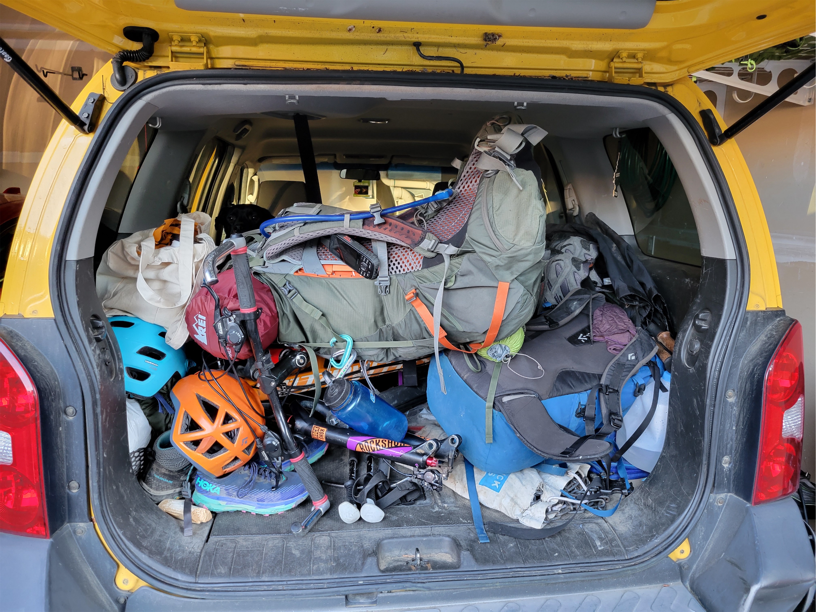
Two bikes, two packs, and a dog.. spot the dog
Usually the first trip of the season is a shitshow for me. Somehow this was magically avoided, despite not having been on a hike in TWO MONTHS(!!!) leading up to this. Shitty weather, a wedding out of town, covid from that wedding out of town, more shitty weather, this has been the lamest alpine spring I have ever had. But weather finally seemed to be making a turn for the better (depending on how you define “better” – a 90 degree heat wave is not everyone’s favorite) and I had Friday off and we were going to get after it. We chose Cadet Peak, a nontechnical peak outside of Monte Cristo. We settled on two days, because it’s beautiful and fun, and because the last time Sammy did Monte Cristo and back in a day he had to be carried out in a backpack.
Distance: 18mi round trip
Elevation: 5100ft gain, 7186ft highest point
Weather: 70’s and sunny
Commute from Seattle: 1:45 w/o traffic
Did I Trip: NO just some postholes
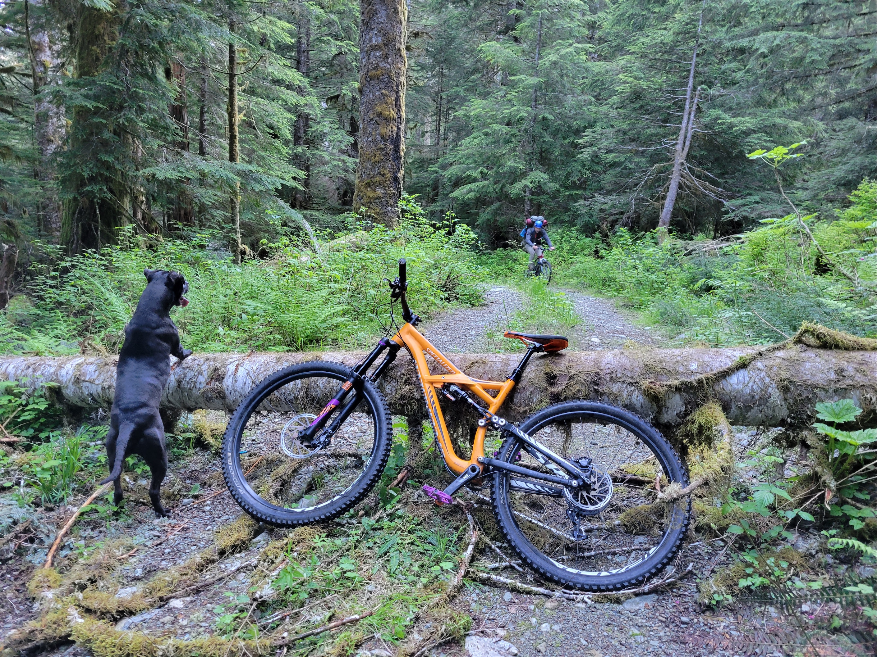
Sammy waiting excitedly
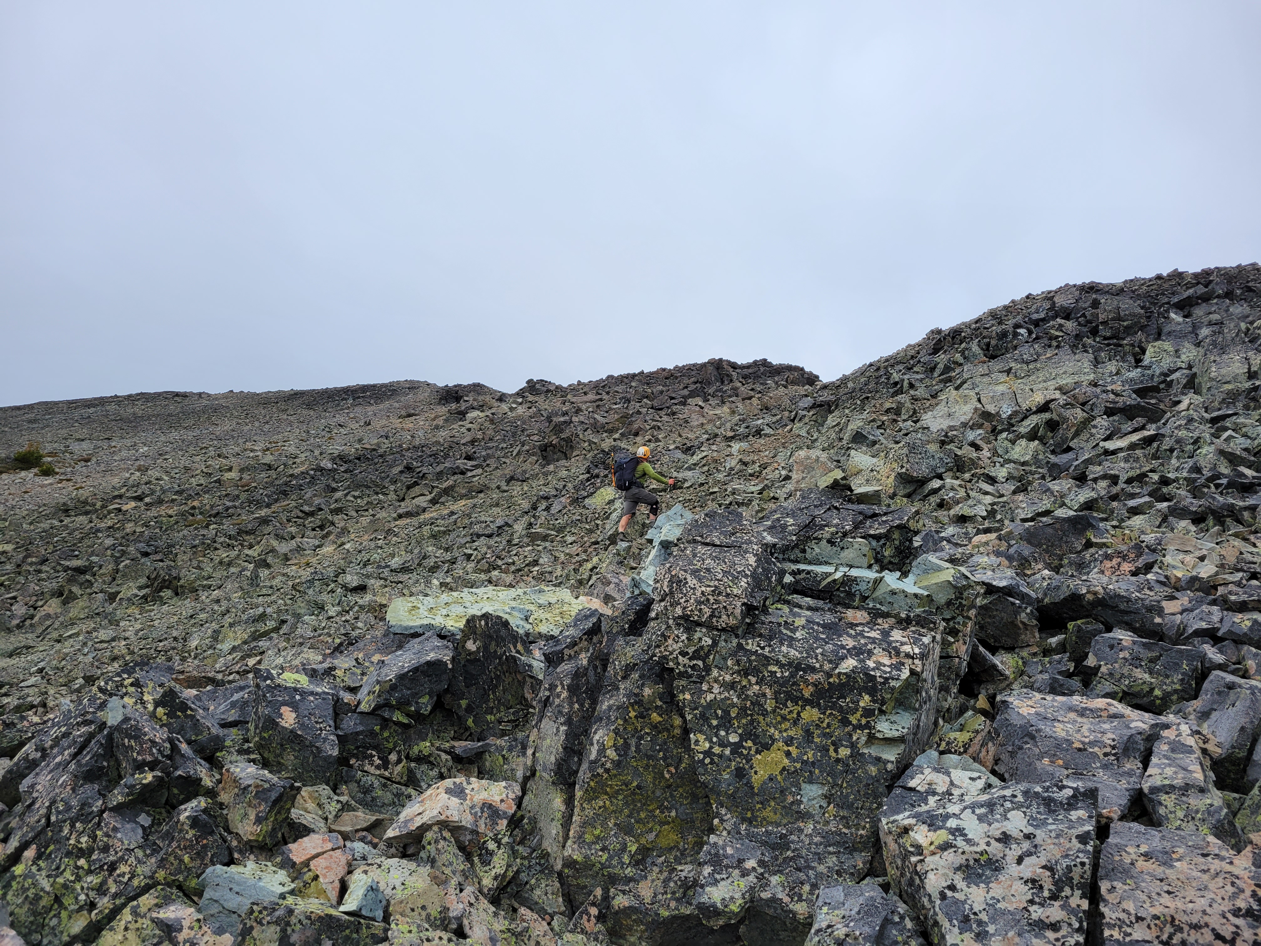
We got a leisurely start Friday morning from the parking pullout by the bypass road. For anyone who doesn’t know, the bypass road is a (usually) pleasant bike ride that avoids the trail and the river ford coming from the Gothic Basin trailhead, so we figured it’d be faster. Within a quarter mile we hit a massive tangle of blowdowns and I’d have catapulted my bike across the road in shock and frustration if I had the strength. Fortunately that was the worst of it
Monte Cristo once again
It was difficult to hit a rhythm thanks to the multiple blowdowns. PSA those black things sticking up in the road are plastic, you do not have to epicly (epically?) leap off a moving bike to avoid hitting them (I thought they were metal and bailed spectacularly). You will roll nicely over them. Also if you do have to leap off the bike it’s much harder with an overnight pack than just mountain biking tiger mountain.
The road wasn’t clear until it intersected with the official road to Monte Cristo, and then it finally felt like we were cruising. Sammy cakes was doing his best sprint to keep up with our bikes, chugging water at every stream crossing. We rolled into Monte Cristo, locked up our bikes, and started the hike up to Glacier Basin. The siding on those houses has to be restored, right? I mean my house doesn’t look that good and it’s in a city not remote snowy alpine wilderness. We passed a guy who had just done Cadet too. He warned us. “My tracks are everywhere. Just keep jogging left as you get close to the summit, you’ll see where I wandered, don’t follow my tracks!”
I’ll spare you the Monte Cristo history because I covered a lot in my last post here. Great to compare pics year to year too, mid June 2019 vs 2022. It’s such a fascinating area, and crazy to imagine what was there decades ago. Anyway, brief updates on the trail:
It’s still longer than you think
It’s still steeper than you think
The hand line is gone (that’s fine)
Snow starts around 4000-4500ft
It’s gorgeous
I didn’t see any spring mushrooms 😦
Glacier Creek on the way to Glacier Basin. Ida Pass I believe is the low point in the middle
Classic boulder in the basin partially covered
Sammy led the way, leaving us behind at every corner. Ida Pass in the pic above was the main route to get from mines around Monte Cristo to the Foggy Mine on the other side of that ridge by Goat Lake. Ida was allegedly a prostitute in Monte Cristo who was in high demand. She now has a pass and a lake named after her, and the lake has what looks like an unnamed, dying glacier above it. There is another glacier on the west face of Cadet that seems to be receding enough to create a lake (Cadet Lake?). Late summer/fall investigation required (edit: holy shit that’s pride basin!!!).
We finally put on gaitors when we hit snow, and let the postholing begin. We stayed south of the river but not always on the summer trail, just picking the path of least resistance through trees/boulder fields/avy debris. The famous boulder was half buried in avy debris. We made our way to Ray’s Knoll, the hill in the middle of the basin, and set up our tent on the very top. I had a full lunch, because snacking with invisalign SUCKS. You have to brush the liners and your teeth and floss after everything you eat, it’s extremely tedious and time consuming so I end up just not eating on climbs at all until I’m starving. Not a good practice.
We made a little nest with food and water for Sammy to hang out in while we climbed Cadet, and started on our way up. We kicked steps up to the base of a gully with a small waterfall. I didn’t believe it at first, I thought it would be better to go up through the brush and trees, but it turns out you just scramble up the gully to the base of the bigger waterfall and then cut left into the brush and snow. My adductor cramped up suddenly, and I couldn’t move my right leg. Then the left one started. I was torn between feeling embarrassed, annoyed, and puzzled. I’ve never had anything like this happen besides in the Moab trail marathon on a much more minor scale. I started willing them to shut the fuck up. Come on legs you can do this. And I’m going to keep powering through the spasms. Your choice whether to keep spasming or not I guess.
Sammy’s nest. Don’t give me that look
We gained the ridge, which usually has a trail but was entirely covered in snow. I sat down to dig fingers into my adductors and chug water and have another snack. The cramps were gone as suddenly as they had started. We kicked up more steps just left of the ridge after finally finding our new friend’s (very melted) tracks, and then continued following it up until we were solidly above tree line. The snow continuously got steeper and steeper and I wondered how I’d feel downclimbing this. I felt my adductors flare up again. “Don’t you DARE don’t even think about it” I muttered except I think it was loud enough Jon heard me. I was also surprised at how much I missed my whippet. At some point I seem to have become a skiier.
Coming up below the Wilman spires
Below the rocky headwall, we started cracking up. New friend wasn’t kidding, his tracks criss-crossed the entire face. I could only picture him walking up to each potential exit point. Does this go? No. Does this go? Mmmmm… no. Does this go? It could but it’s wet. Ok this will go. We picked a wet scramble straight up the headwall that wasn’t awful but wasn’t something I’d love to downclimb (though I think if we had scrambled further left it’d have been easier). It was mostly downsloping wet or mossy and muddy holds. Just kinda yucky. My legs seemed to like scrambling more than the repetitive snow climb at this point, because as soon as we were back on snow, my adductors both started spasming again. I literally dropped to my knees a couple times trying to pressure breath and come up with alternative swear words. Does that actually help or is it just mental? I have no idea. But I felt so ridiculously stupid. Come on legs. The worst part was the cramps held off if I was moving fast and consistently enough, and flared up if I straightened the leg (like, to take a rest step, or lean on my back leg while planting my forward leg aka how you go up stairs). Except I was too fucking tired to move fast! Don’t put me in this corner, legs you can’t tell me “well either jog up steep snow or suffer the cramps” that’s a lose lose you bastards. We finally got to the final rock scramble and I planted my ass on the summit ready for another feast.
Scouting the scramble
We were the second and third signatures for 2022 after our friend Mr. Slabby! That’s right, the summit register said Sam Slaby, which I hoped was some clever mountaineer pen name like Jon Gendarme or Brooke Bergschrund or Amber Arete (I couldn’t think of anything for Eve so i’m borrowing names thanks everyone for loaning). The views were tremendous. Maybe better than Monte Cristo, though I was disappointed we couldn’t see Goat Lake. Looks like you need to traverse to North Cadet for that, and we had a barking dog valiantly awaiting us in the valley below that we could hear from halfway up the climb, so no time for a traverse. At one point I asked if we should be worried, since the last time I was here there was ample evidence of bears and in my head poor Sammy cakes was fending off a bear. But that’s about as likely as a bear coming into my tent, which I’m also scared of, and which has also never happened.
Sloan you beautiful bastard
We agreed to try downclimbing the snow around skiier’s right/climber’s left of the rock headwall instead of scrambling down the way we came. Leaving the summit was a cool convex slope where it rolls over and you can’t see what anything looks like, you just know it drops off steeply. I wished I had skis. It was too firm to confidently plunge step, and soon enough we were face in downclimbing for what felt like ages. I couldn’t help but think about how much of the climb had been in no-fall zones. Steep snow? Piece of cake, just don’t fall, there’s a cliff down there. Getting onto the rock? Careful of the thin snow and moat, it’s a mini moat but it’ll hurt. Rock scramble? Fine, but.. don’t fall, cause you won’t stop.
Columbia looking like a monster (oh hey that’s how i captioned this in 2019 too)
Fortunately I got into a rhythm downclimbing almost immediately. Total flow state. The snow was soft and a lot of steps collapsed but it couldn’t ruin my medidative state. I looked down at one point and couldn’t see Jon, my mind went from “hmm well I guess i’m flattered he thinks I can handle myself and he doesn’t need to wait” to “wait but i like when people wait” to “well you can’t exactly take a break on steep snow easily” to “oh hey there he is!” as I rounded a corner only to discover he was waiting. We had avoided the rock headwall entirely. The face in downclimbing continued briefly before we could finally just plunge step, and then we were cruising. We set off a slow moving slush avalanche that ran a few hundred feet, should have ridden that down.
Gold flecks in the summit rocks. No idea what it is. Don’t tell me it’s gold.
We retraced our steps back to the waterfall scramble, crossed the river, and went back up Ray’s Knoll to find Sammy, who was so happy to see us. And we realized we had neighbors! I suddenly felt 100x worse about the barking. I already felt bad knowing Sammy was panicking or whatever dogs do (maybe it was “I need to bark or they’ll never come back, it has worked every time so far” vs “I’m scared/cold/bears”) and now I knew there were people around to hear it when they were just looking for alpine peace and quiet. They were super understanding though which alleviated some guilt. Live and learn.
What peak is this?? Pirate? Left of center. WHO ARE YOU
I demolished my dehydrated meal in maybe 1.3 minutes. I ate just about all the food I had to try and fend off cramps the following day. I “went to sleep” around i don’t know, 9pm? and “woke up” around 7-8am, so whoop says I got 10hrs of sleep but that’s bullshit because whoop doesn’t know about the wind. I was ready to fight the tent and the wind that morning. The wind picked up overnight and it was SO LOUD it didn’t feel like I slept at all. I’d wake up to the side of the tent slapping against my face or the poles flexing in the wind. Good news? It apparently distracted me from all of my other camping fears, like bears, and the thing from It Follows.
Around 8am I was ready to throw a fit. Something needs to change. Let’s pack up and leave because I’m going to freak out if I hear the rain fly flap one more time. “WE DON’T HAVE TO RUSH IT’S JUST THAT I NEED TO LEAVE NOW” you know when someone says you don’t have to rush but everything they do seems rushed? I was that person. Actually I think my default state of being is that person. We really don’t have to rush but I swear this tent needs to come down and as soon as it is down I’m ready to pack up because I have nowhere to sit besides on my pack and I layered stupidly and the wind is going right through my thin pants and I’m freezing. Fortunately it warmed up quickly and soon the wind was a nonissue and I could sit around comfortably. But that meant…
The carnage on the bypass road
…it was baking hot and we were in a solar oven of blue sky and summer solstice sunshine. The snow reflects everything right back at your face. Nosebleeds abound for me. We made quick work of the upper basin retracing our steps, then back down the steep slabby parts of the trail, and back to Monte Cristo where the crowds were beginning to form. I always wondered why Glacier Basin/Monte Cristo didn’t get more attention, turns out they get plenty and I had just never been there midday on a Saturday. I hopped across a river to share a bathroom space with a bear and some mosquitos, and then we got the bikes saddled up and ready to head out. We rode the brakes the whole time to make sure we kept pace with Sammy cakes who was doing totally fine just a bit slow and hot in the heat.
Someone’s pooped
Apparently the normal road was much nicer than the bypass thanks to the (lack) of downed trees. Oh well. If you’re going, just take the normal road. The bypass needs some really handy good samaritans to put in some manual labor and get those trees cleared. I was at least much more strong and agile getting over the final mess of blowdowns than on the way in. Could have yeeted the bike that morning.
Back at the car we split a surprise beer I had in the trunk and a bag of honey dijon potato chips that were the salty, crunchy, vinegery snack my body had needed all weekend. Holy shit. And then we stopped for burgers at Creekside Alehouse and Grill. HIGHLY RECOMMEND. The burger was great, I got the viking burger. Huuuge servings of tater tots and fries. Outdoor seating, dog friendly, really pleasant surprise.
This was an AWESOME welcome back to the alpine. Pretty happy with how it went given I had literally zero hikes for two months beforehand. In fact this whole weekend was insane. Bike to hike to steep snow and scramble and what did I do Sunday? Went out to Westport to surf. Where else can you get snow and surf in 24hrs? Only thing missing was skis! And maybe some technical rock 🙂
Remmel over a tarn deep in the Pasayten Wilderness
Start of the Chewuch River trail
It was Tuesday night. “Want to go to the Pasayten to climb Cathedral?” Yeah right, that’s a 20mi approach for a multipitch 5.9, I haven’t hiked more than like 7 miles in a day since.. who knows. Nevermind climbing 5.9. I ignored it and rolled over and went back to sleep.
Wednesday morning. 5am. I was awake. I mean, you don’t get this offer very often. I had sorta just assumed I’d never climb the peaks back there because they’re so far and when would I ever find partners/make time? That chasm jump randomly kept me up at night too. So maybe… maybe I should consider this. I could get 20mi in a day given enough time. I can follow most rock and I can prusik/aid up if necessary. “Hmm so five days… leaving tonight, back Monday morning?” Eric starts sending me routes on mountain project. He knew he had my attention. “Okay, well I can’t leave Weds, but I could leave Thursday afternoon, and take Friday/Monday off… and also, I’ve climbed twice this year, so you’d be leading all of it. Is that better or worse than the alternative?” “Gotcha!! Okay fuck yeah! I’m in! I’ll start packing!” I could feel the stoke coming through the phone. Shit. What the fuck did I just sign up for?
Camp in a meadow ~0.5mi past “Pocket Lake”
Distance: 42mi round trip
Elevation gain: 5600ft (including both Cathedral and Amphitheatre), highest point 8601ft
Weather: 80’s and sunny, some thunderstorms, dense bugs (the air had a higher % bug than % oxygen i think)
Commute from Seattle: 4.5 hours
Did I Trip: No!! How is that even possible
Best beta: Steph Abegg as usual, we relied on MP and I wish we had seen this beforehand (ALSO THEY SAW A PUFF MUSHROOM)
This will help me sleep at night (bear print a little bigger than my hand)
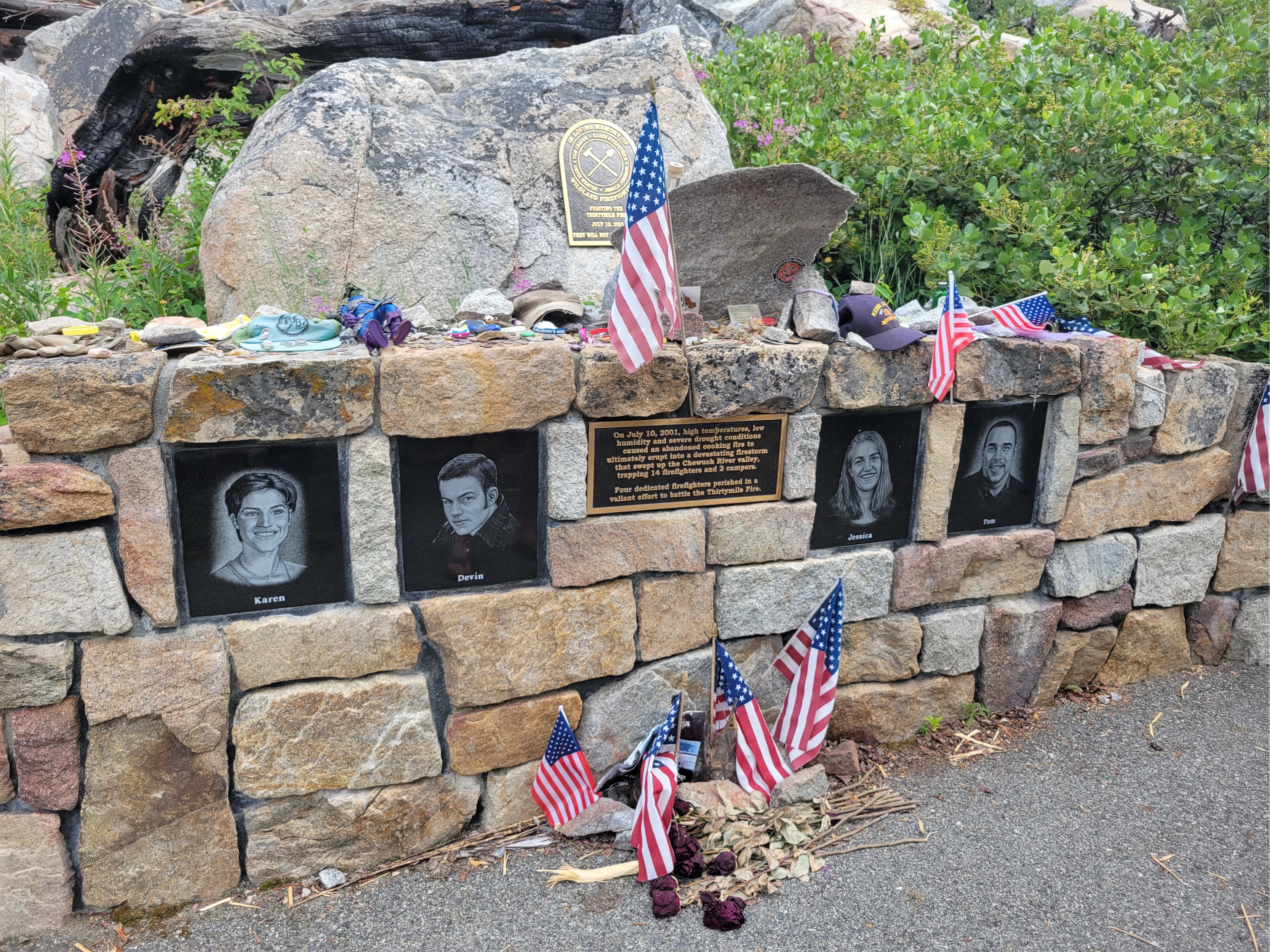
We left Seattle around 2pm on Thursday and got to the trailhead around 7. The road is in unbelievably good condition. We passed small stands with posters, like an interpretive trail sign, until we passed a memorial for four people and it all clicked. This was all part of a memorial for the four firefighters who had died in the Thirtymile Fire (a huge wildfire) in July of 2001. Our stoke dropped, tempered by the raw memorial. I proclaimed we’d be stopping at every sign on the way back to read each one.
You know how I love log crossings (I don’t.)
We started out immediately to see how many bonus miles we could knock out that night so we wouldn’t have to do a full 20 miles on Friday. Eric’s pack was 55lbs, mine clocked in at 45 (I swore it was heavier, I was wrong). I thought there would be campsites at Pocket Lake (spoiler alert: there were not) which was about 5 miles up the Chewuch River trail but Pocket Lake turned out to be a hint of a marsh more so than a lake. It’s okay, we can go further, bonus miles! Luckily, about a half mile beyond this alleged Pocket Lake, we found a wide open meadow right before the turnoff to the Fire Creek trail. That turnoff is also a great place to get water. but bring a filter, because there’s horse poop everywhere. Fortunately, Eric had considered this. I had not.
Partial burn & regrowth, nice flat trail
We pitched camp in the open meadow and had an uneventful night besides a mystery crash in the forest and some rock fall that apparently sent Eric running in his sleeping bag thinking we were right beneath the cliffs. We were up and moving by 5:30am, eager to knock out mileage and get to Upper Cathedral Lake before the heat of the day. And if we were there soon enough, maybe we could even get on one of the routes up Amphitheater Peak!
2017 burn and regrowth
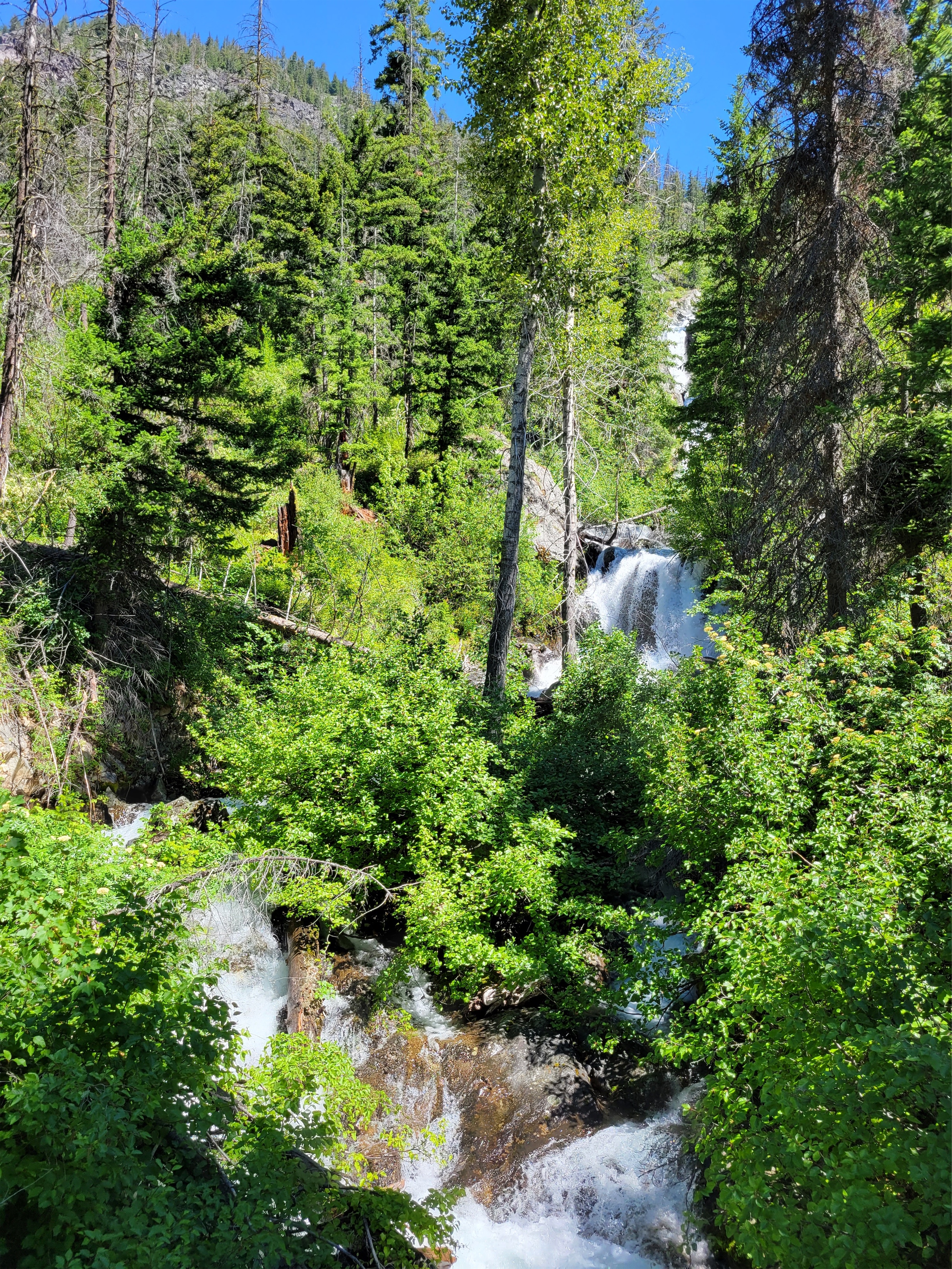
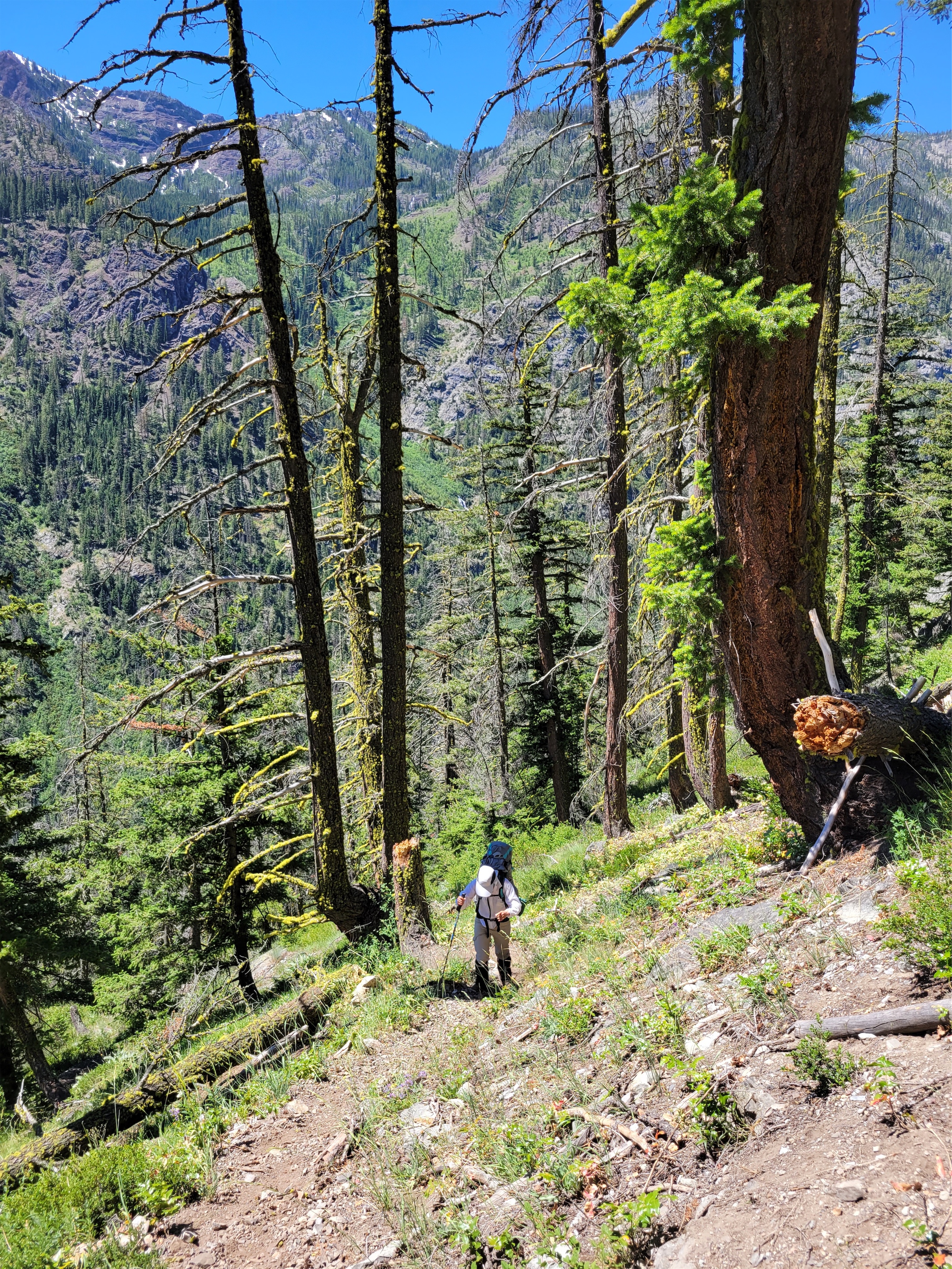
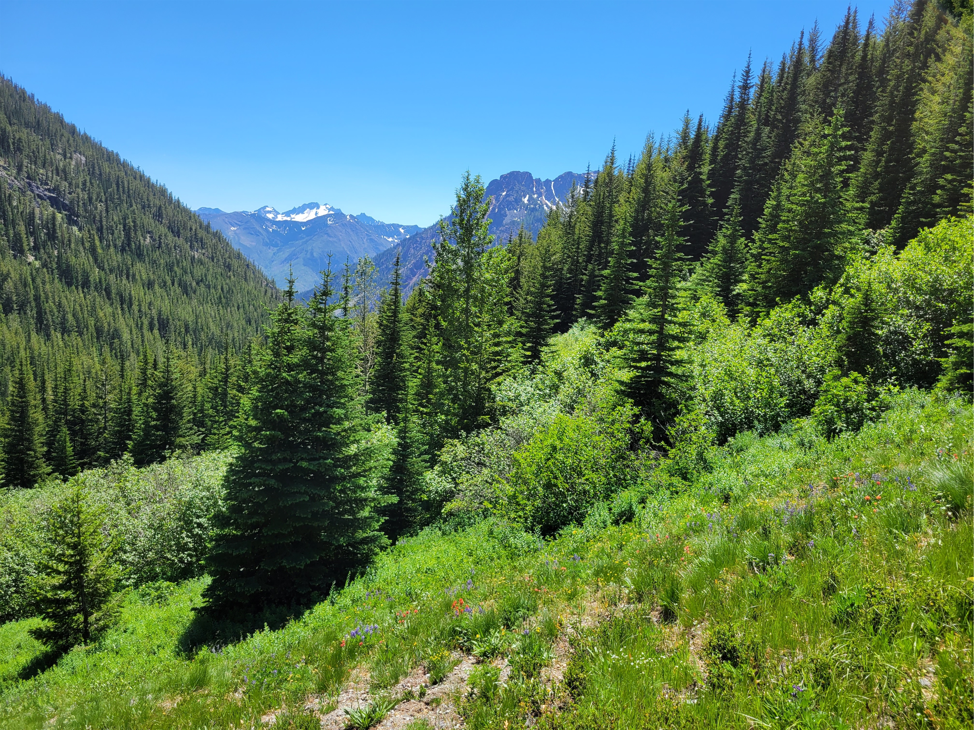
We plodded along a very evenly graded trail (yay, horses! Last time I was on a “horse trail” in the Pasayten it was a lie) through varying stages of recovering burn zone. Fires had swept various parts of this loop in 2001, 2003, and 2017 (same fire that roasted Shellrock Pass and almost Dot Lakes!). We had sketchy log crossings. We saw a grouse (or a pheasant, or something). We saw a bear print. We saw a moose with her calf! We saw glacial erratics miles away from any glaciers carried down these valleys eons ago. Wildflowers starting to break through as the forest recovered. And black toothpick trees with peakaboo views as far as the eye could see. Literally. For like 17 miles. I started out all “wow it’s beautiful” but started falling into “fuck there are so many miles.” “Oh thank god a water break.” “Oh dear lord no we’re going uphill.” “Oh no a downed log.” “Oh no another log.” “Oh no a cluster of logs.” “Oh no it’s a switchback.” I started chanting the sections we had left in our head. We were on a 3.9mi stretch. Then 1.2, 1.1., .6, home stretch. Then 1.1, .6, home stretch. Then 1.1, home stretch. And finally. HOME STRETCH.
Wildflowers in the 2017 regrowth
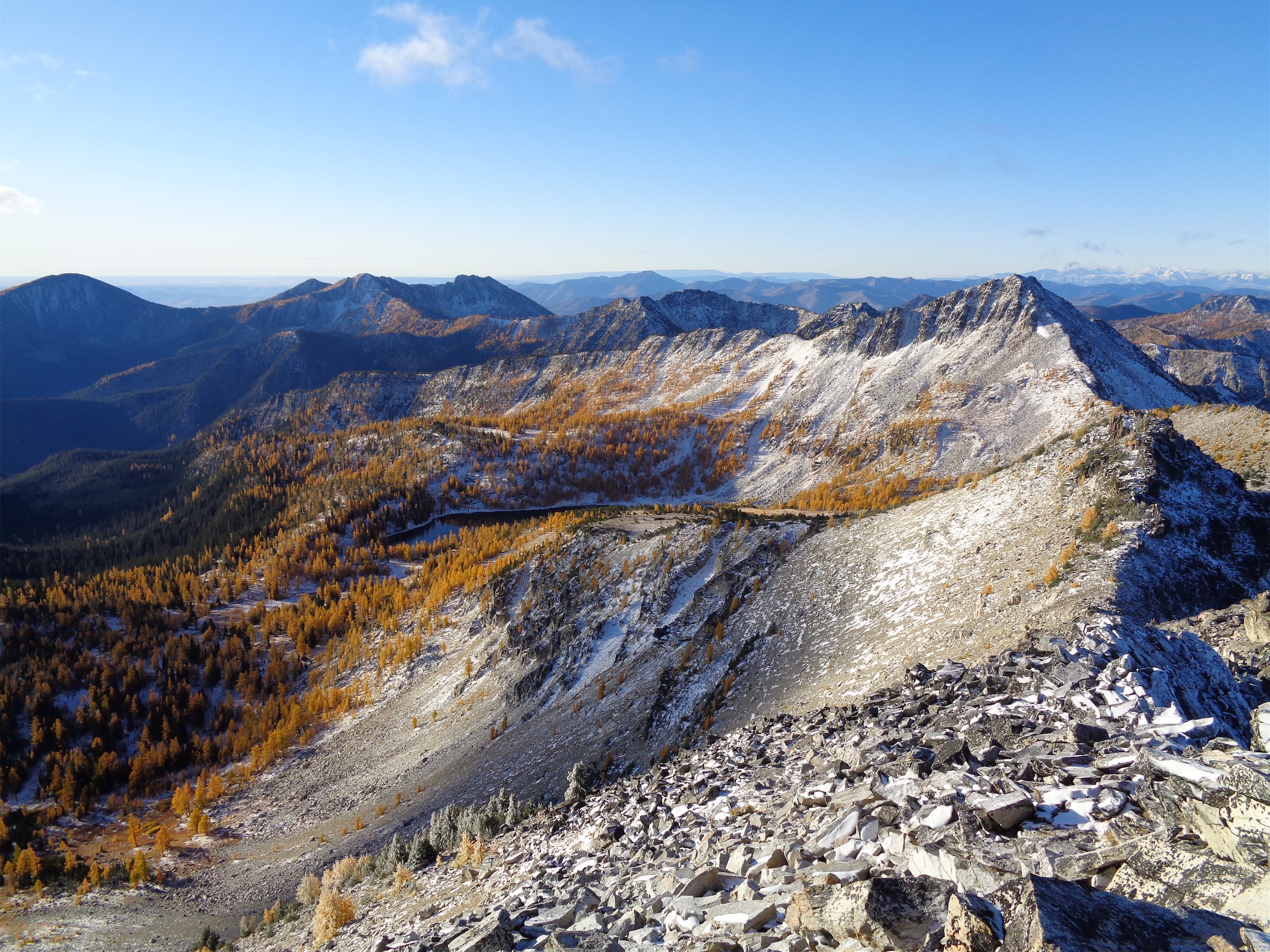
Right when I thought we were in the twilight zone making no progress through burn zone with increasing mosquitos and flies we broke out into open meadows and found ourselves in The Sound of Music. Remmel towered in the distance (it’s a walk up! A walk up!!) and grasses and cicadas and wildflowers and tarns sprawled as far as we could see. That’s Canada over there, eh? The jokes started. My aching feet were battling with my desire to take 1000 pictures. Do I want to walk to that tarn? Brain and heart say yes, body says you can go fuck yourself. We took the scenic route unknowingly, connecting with the Boundary Trail instead of following the cutoff that would have taken us directly below Amphitheatre and straight to Upper Cathedral Lake. A different type of bonus miles.
Amphitheatre Mountain! Saddle center, true summit on right.
We finally reached the lake around 1pm, and quickly found a campsite (somewhat determined by “I just put my stuff down, and cannot convince myself to pick it up again”). Eric spotted a party of two climbing Pilgrimage to Mecca across the lake, and scrambled over to the base of the route to say hi. I stayed at camp, napping, or something that required no movement of any kind. I was already mildly anxious about the rock climb and I planned to conserve energy so I’d be as fresh as possible the next day.
Outlet stream with Amphitheatre cliffs above
Around dinnertime, we realized Erik and Maria had been at the belay for the final pitch for… well, a few hours. Erik had climbed some but appeared to be back down. We were debating if we should be worried. Right as we were trying to figure out what was going on, Erik shouted “Hey Eric! FYI, having some arm cramps.. gonna give it 30min and attempt to climb through it!” Some back and forth started to figure out how bad the situation was. Do you have water? No! Do you have headlamps? Yes! What radio channel? Pitch 3! One more pitch to go! Base of pitch 4! No, what RADIO CHANNEL? Radio! Rockie Talkie 10!! We cracked up. Rockie talkie ten, got it. We were able to radio them, though they couldn’t respond to us. Our camp neighbors came over. “Hey, we heard your buddy yelling, sounds like he’s got some arm cramps and can’t place gear? We’re climbing that route tomorrow, if they rap off gear we can clean it and bring it all back.” Rock climbing is such an awesome community. They hung with us for a while discussing options in case this turned into a full blown situation, laughing and joking the whole time too. After about 45min, Erik gave the final pitch a good old fashioned college try, and topped out with all four of us cheering from the lake below. “Like watching our own action movie” our neighbor said. “Strong work guys and… we’ll meet you around the corner on the descent with water and some menthols.” Eric took off to go be support crew and I continued to play sloth hiding from mosquitos at camp. Fortunately they did come back through our campsite so I could cheer and celebrate.
Upper Cathedral Lake w/ Amphitheatre rock climbs (and a bug photobombing)
Peanut butter balls all melted 😦
We woke up around 5:30 and got moving around 6. I thought I slept like a rock but my Whoop recovery was 7% so apparently I was wrong. We hiked up and over Cathedral Pass, and left the first switchback to start heading up to the gulley. We did not find a climbers trail, but the gully and start of the route were easy enough to find based on pictures.
Things we brought:
4L of water
Nuun tablets
Inreach
Some cigarettes for Eric
Snacks
Headlamps
No bug spray
~10L of human blood in our bodies to offer to the mosquito guardians of Cathedral
Light layers (nothing waterproof)
Screenshots of beta
Just enough tape to cover our hands
STOKE FOR DAYS
Gully to get to the start of the route
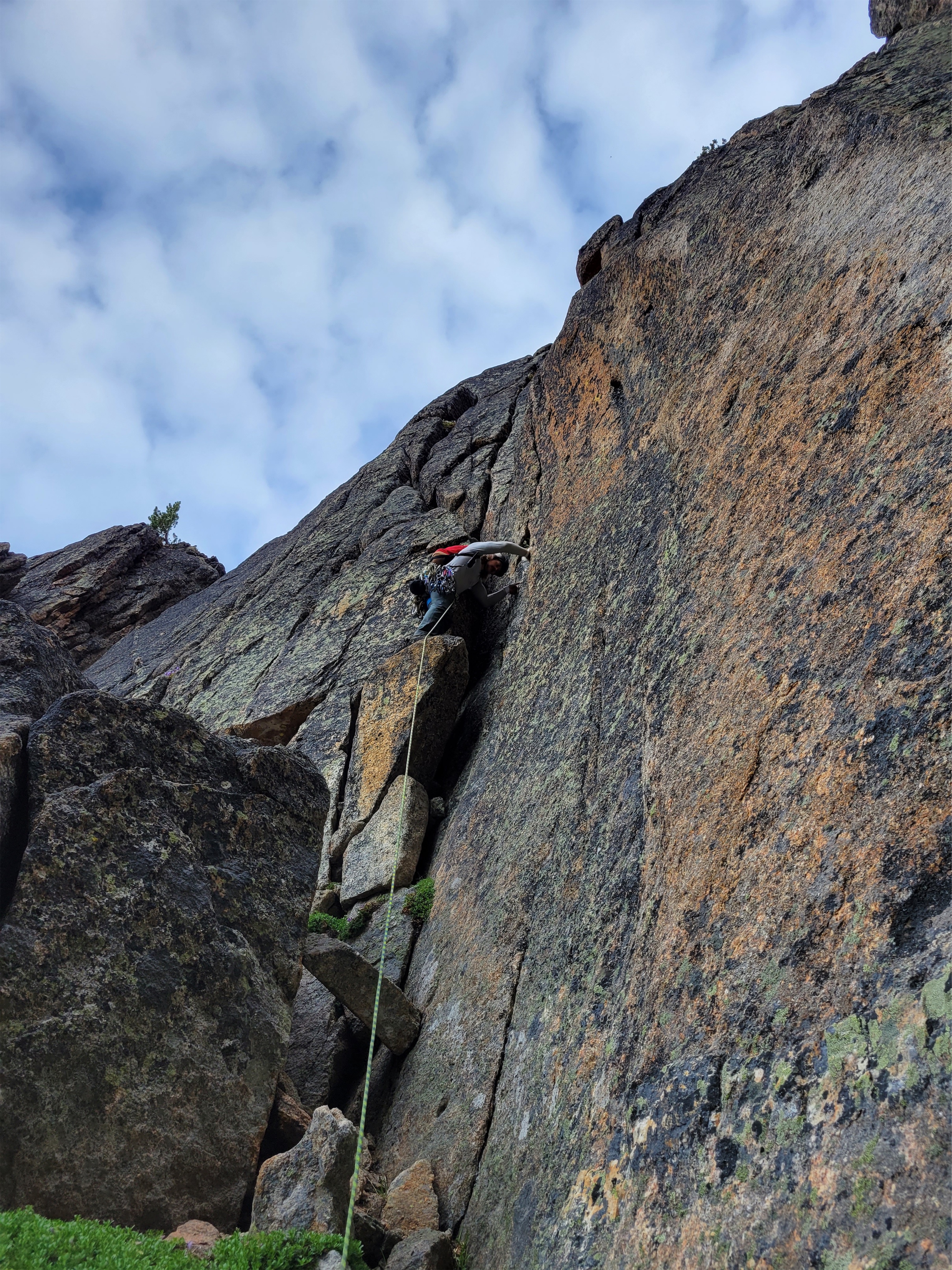
Oh, and we had swapped radio with Erik and Maria, so we could talk and they could reach us, but we couldn’t reach them. I still couldn’t believe we were there. Well, let’s get after it! Eric started up the first pitch a little after 7am. Our goal was to average 1 hour per pitch and be done by 5pm.
And we’re off!
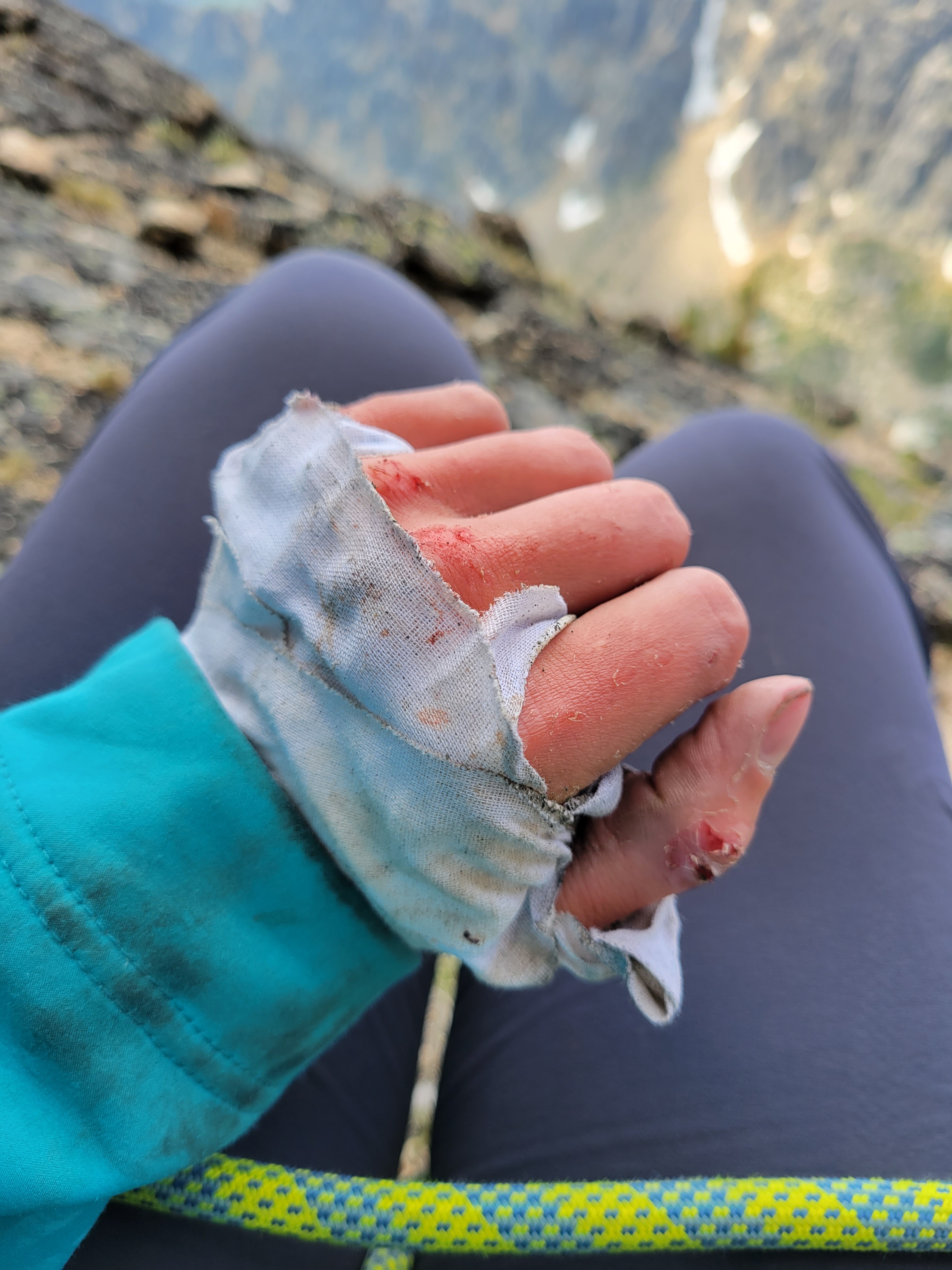
The first pitch was pretty straightforward. Thanks to mountain project, we chose the “nondescript easier cracks to the right” instead of the offwidth at the top, though by “grainy” I think they meant “the rock gets extremely loose and sandy” which is never fun. I spent some time hanging and battling to remove a red #1 cam which didn’t make the rest of the climb seem promising. My price was going up as bugs swarmed my head and my fingers got bloody fighting this crack. Would I pay… $25 to keep moving? $35? If it hit like $75 then I’d be leaving it there and buying Eric a new cam, but somewhere around $45 it finally came loose.
Wonderful chinmey on p2
Pitch 2 was phenomenal, the chimney was the perfect size for me, nothing required skin/blood sacrifices, and I was stoked the whole way though I do think we exited the chimney a little too early and also overshot the best belay ledge (it’s a super short pitch). Not much to see here, just a good old scoot your way up the chimney.
Skin and tape starting to fray
Pitch 3… well, the first words out of my mouth upon reaching the belay were “that was NOT 5.8.” I am not convinced we hit any of the features listed in the description, and I struggled HARD. I was discouraged, the pitch took well over an hour, if this is how the rest went we were going to be slow. Bugs had followed us yet again. I was wearing my thick soft shell to try and prevent severe blood loss.
Pitches 4 and 5 blend together in my mind. Both ended in a traverse on a huge sandy belay ledge, something about twin cracks, finger cracks, if a pitch didn’t have finger cracks on this route you’re probably off route. Both fine, definitely confidence boosters after pitch 3 where I had been reevaluating wtf I was doing on this route. Also, “cruxy mantle” in the description is accurate, there was a mantle and it was the type where I felt like I had just disobeyed the laws of physics using pressure so you have that to look forward to. Or maybe the bugs carried me as thanks for my bodily sacrifice.
Nice belay ledge looking back at Amphitheatre and Upper Cathedral Lake
Pitches 6 and 7 were kinda bummers. We didn’t find the 3rd-4th class terrain in pitch 6, or the “open book feature.” Everything was 5.6ish or higher. Steph Abegg was more realistic (“choose your 5.7 adventure”) so I wish I had read that a little more closely before the climb. Eric told me he had spilled an entire liter of water, he was getting arm cramps pulling up a 12lb 70m rope every pitch, I was getting tired, I sat at the belay stations which only exacerbated the tiredness. My snack was the crumbs of severely crushed cheese and crackers, not unlike the state of my energy and soul. Eric’s soul soon shattered too upon the realization that he had forgotten the lighter for his menthols. But it’s okay, we’re gonna dig deep and crush this crux. Look where we are. This is awesome. 5.9 finger cracks coming up. And the 10a finger crack that followed. What had I climbed this year? 5.6 and some top roped 5.8s? Yeah. This is like when my dad ran 7 miles one time and then decided to run a full marathon. No stop, it’s going to be great.
“What the fuck is an open book feature”
Eric started leading the 7th pitch, and a few drops of water hit my shoulder. Oh. Oh no. A few more drops. And then a rumble. That… that was thunder. Did Eric notice? I’m not going to say anything I think he’s focused enough on leading he doesn’t notice. Except the thunder got louder. And closer. And the rain drops continued, though not enough to really wet the rock. I got to Eric at the belay station. We laughed. Shit might be about to get weird.
Erik and Maria on Amphitheatre across from us (look closely on the false summit to the right)
We were in good spirits, the nihilistic “eff it, what can you do” kind determined to knock out the crux and get off this peak before we were caught in a Colorado style afternoon thunderstorm. Eric started up, game time decision whether he’d link the pitches or not. We ended up not linking them, for many reasons but the one I focused on was that I was about to be struggle city and wanted/needed a tight belay. Eric had walked me through aiding in case I needed it but I already knew I’d be doing my best to not be utilizing any gear because pride. And speed. Aid is slow. And now I had the added motivation of thunder. Fingers, let’s get ready to get fucked up.
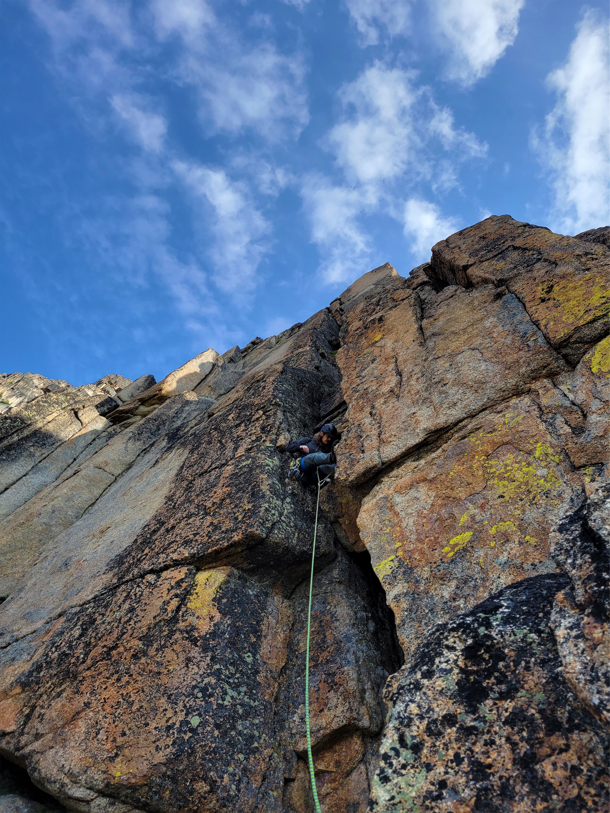
Starting up the money pitch
Getting off the ground of pitch 8 was the hardest move of the entire route in my opinion. Once off the ground, you can stem up the twin finger cracks and it’s actually a blast. I managed to find plenty of placements for my fingers everywhere I needed them. Didn’t have to aid with any gear. I’d link a few moves and then have Eric take, especially when I was cleaning gear. His placements were bomb and usually had good rests, I just was so wiped and climbing at the edge of my capabilities this year. But I was determined, and Eric knew it. And this rock is SHARP. It may not be comfortable, but everything sticks. Eric CRUSHED both of these leads. Eell, every lead, but these two were especially impressive. Cruxes, dehydration, onsighting, thunder, threatening rain, mosquitos, what more could you ask for? And he did both cleanly and confidently.
Almost at the belay
Eric was pulling up the rope on the 9th pitch getting ready to belay me when I heard RAINBOW! EVE!!!! RAINBOW!!! SHOULDIGETMYCAMERA think of the enthusiasm pouring from the double rainbow guy from 10 years ago, that was Eric, fanatically shouting some hundred feet above me. Way ahead of you!!! I shouted back, holding my camera precariously on a semi-mostly-hanging belay. There was an enormous rainbow across the valley to the east
Pitch 9 baby LFG!
It felt like we cruised up both crux pitches. I even got some super comfy ring locks on the 9th pitch! I was honestly surprised, it was very fun (albeit painful, my hands were shredded) climbing with finger placements exactly where you hope they’ll be. I think having thunder behind me kept me from getting in my head and helped me commit to every move, and every move I made I found exactly the holds I needed. I felt pretty good about my finger crack abilities by the end of the second pitch. Stoked to be at the final belay, Eric asked if I wanted to lead the last pitch. No. Thank you, but no.
Rainbow!!!
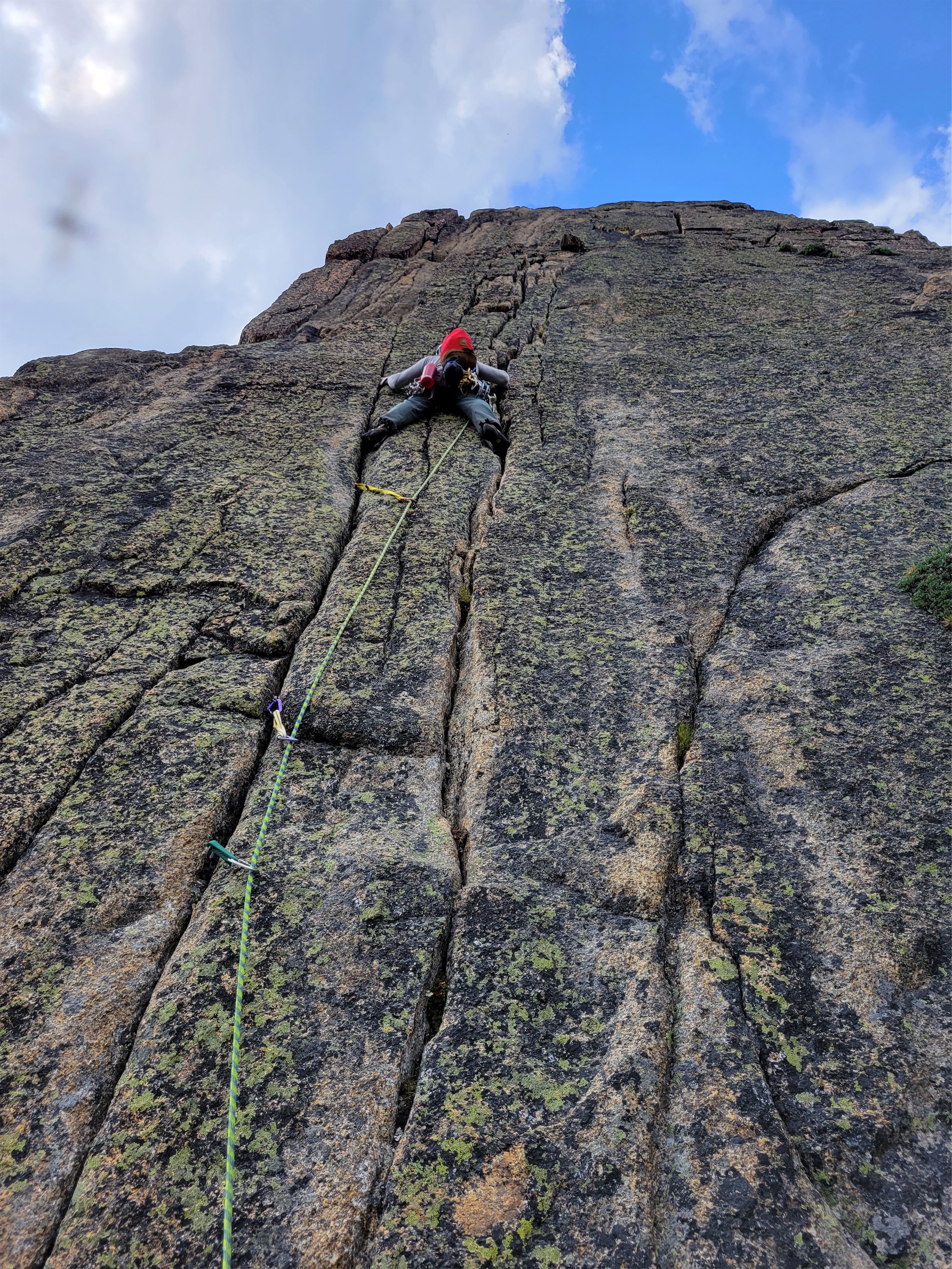
And so, Eric started up. As soon as he got out of view I heard him cursing. Something about a fucking hand crack this isn’t a hand crack is this a 5.8 hand crack no way is this 5.8 5.8 my ass and soon enough I heard “Eve, off belay!” and I laughed taking him off belay wondering what the heck this last pitch was about to be like. It was supposed to be a short 5.8 hand crack and then a scramble to the summit! But it was a weird off width/fist crack almost, and some shenanigans I don’t remember now, I was just happy to get to Eric and see that all we had left was a scramble. And the chasm jump. Ohhh boy.
Eric on the summit
We only spent a few minutes on the summit. It was around 4:30pm, we had at least surpassed our time goal. Didn’t find a register, wanted to get down before the storm came. Chugged the final quarter liter of water/nuun that we had between the two of us. I kept my rock shoes on for the chasm jump but took one look at it and said nope, get the rope. I did not come 99% of the way to be that fool who falls in a chasm carrying a rope or a climbing rack. We made a small anchor so I could downclimb and step over, except then I asked to be lowered instead. Once on the other side I switched shoes and suddenly Eric was next to me having leapt the chasm like everyone else I’ve talked to. I wasn’t even sure I could jump that on flat ground with how tired my legs were.
Woo! Now let’s GFTO before the skies break!
There was another spicy downclimb into a gully (like… a canyon) and then you traverse into a real gully (open fan of talus and scree and crap, traverse don’t climb the opposing wall in the canyon) and can just walk the rest of the way down. We saw two people on the trail below. Is that Erik and Maria? If they have water I might cry. I laughed. Their turn to bring us water and menthols! Erik met us first with like 3L of water (as Eric was chugging directly from a stream). I chugged some of Erik’s water without crying and soon enough we were back with Maria, who had a lighter! I fucking love the rock climbing community. Eric has good taste in people, I already trusted Maria/Erik would be cool but they surpassed expectations this weekend.
Not over yet
We all hiked back to camp and ate dinner together, resigned to the bugs. Eric had brought pudding cups (speaking of “light and fast”, Erik had 6 dehydrated meals because you never know what you’ll be in the mood for) and candles for the fourth of july, and even though it was technically the 3rd, Erik and Maria were headed out early the next morning so we decided to celebrate then and there. Awesome night with some really chill, fun people. Hope we get on another climb in the near future. We’ve already proven we won’t do the Seattle Freeze.
I slept rough that night, trapped in a sleeping bad with sore muscles that desperately needed stretching. We woke up to the smell of wildfire smoke and had a lazy morning. We packed up camp and deciding to walk up Amphitheatre on the way out. We stashed our packs in the shade at a mini switchback and just took one bag of snacks/water with us, not really knowing how Amphitheatre would go (we only had beta on the climbing routes) but I was pretty sure it was a walk up from this side. Given the view from below, I was SO SURE we were going to cliff out before the real summit, but we figured we’d give it a shot and bail in 2 hours if we somehow hadn’t summitted by then.
Amphitheatre’s rugged rock climbing faces (and our campsite by the lake!)
Eric probably telling a hilarious story at yard sale camp
We followed a very well maintained horse-friendly trail up to the saddle and then took off to the right following intermittent boot paths. Right where I thought we’d cliff out before the true summit actually turned out to just… be the summit! Must have been a weird angle from below, and it hadn’t even taken us an hour. We admired the views and Cathedral, and the wild number of unclimbed routes all around us. Amphitheatre has some very cool geology, it’s shaped like a capital T and the lower left side of the T is rolling meadows but every other side is hundreds of feet of vertical rock.
July 4th celebratory pudding!!
Amphitheatre had a summit register (like the cutest tiny PVC pipe) which we signed before downing some water and snacks. We knew we’d hit a stream on the way back to our packs, so figured best to drink as much as possible now. I actually felt peppy and rejuvenated, like 800ft of walking gain with no pack had revived my body. Back at our oversized packs, we loaded up and headed cross country to intersect with the trail, following the Denali rules of “walk separately” so you don’t trample the same place in the event that you are forced to walk on vegetation. We probably saved ourselves a mile or two by going this way instead of following the boundary trail, and we did find the shortcut turnoff that would have taken us directly to the upper lake that we ignored in favor of the scenic route on the way up.
Views of Cathedral while going up Amphitheatre
At first, it felt like we were flying back to the trailhead. The places we took breaks at on the way up came hilariously quickly (1.2, 1.1, .6, home stretch was suddenly “crap we’re done with all of the short stretches”) feeling like minutes instead of the eternity the approach had taken. But the sun got higher, and the bugs got denser and braver, and my body got weaker. We decided to aim for the horse camp just past where the trail splits to Tungsten or Chewuch/Remmel (or just before, if you’re on the way up). That would give us about 8 miles to hike the next day. Except when we were halfway there I was dragging. We a 3.9mi stretch, then 2.2, then another 2.2, something like that, didn’t matter because it all blended into “i’m going to FREAK OUT if we stand here too long because the bugs are starting to incite an instinctual flight response” and “if I take this pack off it may never go back on again.” We kept reminding ourselves these were bonus miles. We had all day Monday to do the rest, just wanted to see how far we could get on Sunday.
But, miracles happen. We started getting suspicious and mildly concerned when all of the logs/downed trees we had remembered were… missing. Were we on the right trail? Was I hallucinating? We finally ran into a party who said there was a WTA crew doing trail work on the full Cathedral Pass loop, meaning all of those downed logs we had battled on the way up were no longer there!! We didn’t have to skirt trees or stumble over twisted gnarled tree trunks or crawl beneath awkwardly low but not low enough logs. One may be a mild inconvenience, but 100 and you start to resent the existence of trees. The groups had also trampled and brushed out the trail, making it obvious and easy to walk. We joked about how we wanted to catch up to them to thank them but also never wanted to catch up to them because it would mean back to jumping fallen trees. We ran into them just after the turnoff to Remmel Lake I think, where they had set up camp in the buggiest section of trail possible. One of the guys did a casual 8mi trail run (he obviously forgot to take our 12lb rope with him) to scout the next section they’d be clearing while we slogged along wishing we were 24 and ripped. We persevered through the last section of downed trees, somehow didn’t fall off the bouncy skinny double logs across the river, and dropped our packs at camp.
Meadows below Amphitheatre, Remmel in the back
I set up my tent immediately, took off shoes and socks, and sat my shattered, depleted body straight in the river. It was wonderful. Like a bath for body and soul, 10/10 would sit again. My core temperature returned to normal, my feet were finally relieved of pressure, the heat rash all over my legs temporarily stopped burning and itching. I pumped some water with Eric’s pump (so exhausted it was so hard) and limped back to camp barefoot. I destroyed some mac n cheese with chicken, and went to lie on my sleeping bad. I could barely lift my arms, they were the heaviest I’ve ever felt them in my life. My shirt stank from sweat combined with dunks in the river. Everything was dirty. Thank god for spare clothing, I just wished I had a third shirt and more pants. I dozed on and off throughout the night, woken up by sore muscles every time I had to roll over. Using the sleeping bag like an open quilt helped a lot, but it was too warm for the weather and all the bugs were getting stuck in my tent fly causing a caucophony of whatever is the opposite of a lullaby.
Freshly sawn log. WE WEREN’T CRAZY
We woke up early again, and I think got moving around 6:30. We CRUSHED the last section, carried by rants and commiseration and survival instinct and desperation, counting each valley turn and dredging up landmarks from our memories of four days ago. The last maybe quarter mile to the car was brutal for me mentally, totally flat but the trail just kept going and then finally we were at the bridge that crossed tot he parking lot and bam we were back at my car. Which had a ticket, as expected. But it wasn’t really a ticket… just a notice to pay te $5 for a day pass! They’re way too nice, I was expecting to be donating $35 to the USFS for my forgetfulness.
An example of a mild inconvenience
I had Eric get the keys from the top of my pack so I could back up to the car and sit my pack down like a semi approaching a loading dock, except even slower and probably less coordinated. I chugged the leftover propel in the trunk of my car, changed into super low profile running shoes, fresh shirt, ahhh it felt wonderful. Time to stagger into the Mazama store for some salted baguettes.
But first, we stopped at the main memorial for the four firefighters. The fire had trapped 14 firefighters and 2 civilians, and there were several spots where these 16 folks grouped together. We read the memorial signs in reverse order which was tricky, but still fascinating, informative, and tragic. Highly recommend stopping at them on the way in and reading them in order (they’re all within a few short miles).
Memorial to the four firefighters
Surrounded by a quick moving wildfire (125 feet per second uphill = 85 miles per hour), six trapped firefighters deployed shelters on the scree and talus (field of small rocks), just as instructed in training. One decided his shelter would not hold and jumped in the river, another had no fire gloves and burned his hands badly trying to set up the shelter and then put out the flames that were already inside it. He bailed too and got in a van on the road (just feet from the river). Amazingly, the van sustained barely any burns, and those in the river survived. Unfortunately, the shelters couldn’t handle the sustained heat of the wildfire, the incident commander couldn’t get teams to the shelters because of the heat, and the four inside their shelters perished. And there we were, almost exactly 20 years later, watching the forest regrow while these people leave voids in their place.
Back in the car for good, we went straight to the Mazama general store, which has become a total overpriced hipster tourist market that stopped serving their dreamy breakfast burritos and only sells large containers of overpriced lotion to desperate sunburned/deet-lotion-burned climbers such as myself. My face had molted in the past 48hrs so I covered it in $18 cedar scented lotion you bougie bastards (okay, it smelled great). We got salted baguettes and sandwiches. I wish they made sandwiches ON the baguettes instead of whatever weird sliced bread they use. “Wait where did you get that?” Eric suddenly had a sandwich on a baguette. “Did you… did you migrate your sandwich onto the baguette?” “…yes. I knew what I wanted I wasn’t going to waste time with that dumb bread.” I cracked up. Expert move.
Stand 4, Part I
The drive back to Seattle was uneventful, besides possibly getting 28 miles to the gallon. I don’t trust it, but coming back from WA pass was the one time my car definitely got at least 26mpg, because we literally only had 2 gallons and somehow traveled ~52 miles (and then put 21 gallons into a 20 gallon tank). We were back in Seattle around 4ish, early enough I had an awkward few hours of lying on the couch making excuses to not unpack. I powered up the hill to Ha! to have mac n cheese with my roommate, because that mac n cheese brings LIFE to tattered muscles. I hadn’t had it in years, but I’ll be damned if I didn’t earn four nights of mac n cheese in a row. And this was a heck of a lot better than the variety of dehydrated mac n cheeses I had subsisted on for four days.
Stand 4, Part II
Easily the most memorable climb I’ve been on in a while. Awesome people, strong sense of climbing community, good company, and really just so much stoke. The whole crew and everyone we ran into were just so happy to be out there doing what we were doing despite the heat, the mosquitos, the physicality of it all. Couldn’t have asked for a better July 4th weekend, America is pretty freaking beautiful and I’m so thrilled we pulled this off.
Smit rounding one of the many humps along Robinson’s ridge, Silverstar dominating the skyline
Into the heat
What do you do on a weekend where the in town temps are supposed to be over 100 degrees? Well, you can suffer in the city fighting for “beach” parking with 800,000 other people, you can spend a buttload to airbnb a place on the coast, or you can drive a few hours, bust ass for a few more hours, and have an alpine tarn and maybe a scramble all to yourself. The coast was tempting, but my inner scrooge won me over and I decided to keep my money and head to the mountains. Also, did I mention the salted baguettes last time?
Distance: 14mi round trip
Elevation gain: ~6200ft (8731 highest point)
Weather: 90’s and sunny, seriously
Commute from Seattle: 4.5hrs
Did I trip: Actually…. no?
Can we sit in this all day instead
I met the group at 5:30am at a park n ride, we split gear into two cars, and headed out to Mazama. Despite me driving at the speed of a grandmother, we actually arrived at the trailhead at about the same time, and soon enough we were headed out into the bone dry sun baked sauna that is the Pasayten wilderness on a record heat weekend.
Tiered waterfall right before the turn off
We were all feeling the heat within a mile. There are two variations of dehydration, we’ll call it. One is the classic that everyone expects where you don’t drink enough water. The other is more sneaky. It’s possible to drink too much water, and lose so much salt through your sweat you get something called hyponatremia. Coming from an extra salty sweaty Bostonian family, I’m quite familiar with hyponatremia. We pop salt pills like candy in the Moab marathons, and I’ve started just pounding Mio (nuun doesn’t actually have that much salt) and cheesy crackers on any strenuous trip, and this was no exception. My main food source for this trip was two identical bbq pork bahn mis, followed by variations of Rob’s food (he is generous), followed by cheesy crackers.
Zhong shade-hopping the switchbacks
We stuck to a slow pace. The first 3 miles of trail are pretty flat, you only gain ~1k ft in elevation. Right after the bridge across Beauty Creek, there is a spot with air conditioning (a breeze off the waterfall) that was lovely for a break. You then hang a right onto another surprisingly well maintained trail, and you gain >1000ft right off the bat with a set of brutally sunny dry switchbacks. Zhong and Rob had the idea to shadow hop. Everyone cluster in the shadow of two lone pines. Okay, now GO GO GO through the sunny section!! Now make space in the shade for the last person to cram in!! Rest through the shade aaaaand SUN PATCH GOOO rinse and repeat for the next ~2 miles. I liked hearing Smit and Zhong giggling behind me. What’re you two giggling about back there?! I knew the going was getting tough when the chatting started to die off. I started cursing the Pasayten with its long valleys and dry air and constant sunshine. Put me back on the mildewy west side with the worms and the mushrooms.
Gaining elevation through wildflowers!
We finally crossed the braids of a large stream coming down from the tarn that would later be our campsite. We refilled water, submerged hats and shirts and bandanas, and had an extremely refreshing lunch break (bahn mi for the win). Just after that river crossing, you turn left straight uphill through a meadow. This was like mile 15 of the Moab marathon. Up and up and up with the sun beating down on you and no respite from the heat. Wildflowers were nice, and there were some points where you could dip your gear into the waterfall again and try to revive your shriveled raisin of a soul. That’s what finally made me put my sun hat on: not only is it good at blocking sun, you can dunk it in water and have a temporarily frigid head cover that brings your brain’s temperature back to Earth. Unfortunately, my SPF 50 sunscreen had separated into oil and something chunky, and didn’t seem to be working as expected. Zhong noticed how sunburned I was getting. I didn’t even notice until her mouth dropped seeing my face. “You’re sunburned!! So sunburned!” She turned to Rob “she’s a lobster!!!” and back to me “you need sunscreen!” and i took one look in the selfie camera and turned to Irma to beg for her stick of thick zinc sunscreen. Luckily she was happy to donate some to the lobster cause and I covered my whole face in what felt like wax paste. “It’s hard to get off…” she warned after my face was 70% covered. I laughed. Good. That’s apparently what I need. This was good, I already knew I was with a group who would take care of me.
Just before the tarn
The trail gets a little squirrely as you enter sparse forest (larches!! green june larches, dammit!), but it’ll reappear sporadically until you’re close enough to the tarn you just need to crest a small hill and you’re there. The tarn was gorgeous. And having shade, even dappled sunlight, was amazing. Clear blue water, small icebergs, breeze off the snow, I dropped my pack and immediately dunked my head/feet/shirt in. Basically everything without fully jumping in. It was incredible. We found campsites for all five of us(!) and spent the rest of the day rehydrating, planning for the next day, eating (Rob’s food, thanks Rob), and generally hanging out. Zhong and Irma had a bunch of book recommendations that sounded great. We wanted Zhong to read out loud to us from her book but she somehow distracted us enough to forget about it.
If you look closely you can see two people descending talus from the SE ridge!
I dozed to the sound of Smit and Irma chatting. I absolutely love falling asleep to people talking, I have no idea why but it’s how I’ve always been. Getting that treat in the alpine, I was extremely content. Unfortunately I had just brought my bivy, which is almost literally a body bag. I forgot how claustrophobic it is. I had to zip it all the way to keep the barrage of bugs out, and spent the next few hours after the others went to bed listening for signs of wildlife approaching and convincing myself that I wasn’t really in the forest given how few trees there were. I hate camping in the forest.
Sunrise over the tarn
We woke up at 4:30 to get a 5am start to attempt to beat the heat. The bugs were still there, and they were worse than the night before. We initiated a competition for who could get the picture with the most bugs. We headed up to the south ridge (climber’s left of the lake) which involved a loose talus walk and then an option between a 3rd-4th class scramble or some moderate snow. We divided and conquered, some taking the rock and some taking the snow. Once on the ridge, it was mostly a walk, following the path of least resistance, moving consistently to avoid the bugs. I had the weirdest craving for sake, which we had at camp the night before. “What is that peak?! Or that peak? And that one to the left?” “There’s an app for that you know” Rob said laughing. I got a new phone a few weeks ago and for two weekends in a row now had forgotten to download peakfinder, which shows you all the peaks. And I’m new to the Pasayten, I’m not used to seeing the Cascades from this vantage point.
My shadow on the scramble. Some took the snow. Both went nicely.
Robinson is deceptive. You get up on the ridge above the tarn either taking the S ridge or the SE ridge, and follow that around a cirque to a false summit (where S/SE ridges meet), and then traverse another ridge for like actually a mile before you’re on the summit. This is a combo of talus, side hilling, and a surprisingly fun 3rd class ish scramble. 4th class is generous, there were plenty of hand holds and huge ledges for feet. Some of the traversing we did was harder than the alleged crux moves here due to more exposure (in my opinion). But the team was rock solid, and no one had any trouble with the scramble moves. I’ve seen some crazy dramatic pics of the scramble, not sure if they were from a fish lens go pro or what but I’ll provide you with some more vanilla/”I can handle that” pics.
Count the bugs
We took a long break at the summit, topped off with summit sake that Rob had carried up!! My cravings weren’t all for naught! I think I wrote “I think I hate the Pasayten” (no no Pasayten I kid I love you) in the summit register because this was two weekends straight of sun and heat and loose talus. I was anxious to get down because of the incoming heat, so I was the party pooper who started to hustle everyone. Going down went more quickly, though. We backtracked to the false summit, and decided to take the southeast ridge down instead of the south ridge, so we basically traversed the whole cirque above the tarn. We ran into two other parties on their way up, all doing it as a day trip. The southeast ridge had more shenanigans (scrambling, navigation) than the south ridge, which had been a pretty straightforward walk. No bugs anymore, which was lovely. But I was dreading the scree field we’d have to take to get back to the tarn.
Traversing forever. Summit back left
The top ~100ft of the scree field have been scraped bare of actual scree, leaving behind hardpacked dirt/who-knows what, ball bearings, a sense of impending doom, and thoughts and prayers for those below you. Smit and I immediately kicked down a stream of small rocks, and traversed skiier’s left to wait for the party on their way up (both named James) to pass. Once they were past, we were free to skid as we pleased, and skid we did. As soon as the hard pack and ball bearings end, you can comfortably plunge step/rock-slide-surf your way down the face. We ignored the switchbacks and cruised back to camp in what felt like just a few minutes.
Rob doing his best to look like a rock on the crux scramble. Plenty of features, not so bad!
At the lake, Smit poured rocks out of his shoes and gaitors and we packed up camp and waited for the others to get down. I struck up a convo with a woman named Costanza, turned out we had a bunch of mutual friends. She was chilling at the lake while the Jameses went up Robinson. I was super glad to have good company, especially after a year of being starved of socialization. We headed out from camp around noon, resigned to the heat and the pounding of downhill hiking on the way out. We split into two groups on the way down and agreed to meet at the trailhead before heading out.
Summit pic! PC Zhong
The meadows went by super quickly, and we took a short break at the stream where we had lunch the prior day. Again, dunk shirts, dunk hats, get as much covered in cold sweet water as possible, and begin the ~2mi trek to the next stream, which was at the base of 1000ft of brutally dry sunny switchbacks. Oh, and upon reaching that river, we realized there was no good way down to it, so we took a 10min break in the air conditioning before continuing on. Luckily there is a small stream just a few minutes past the bridge, and we dunked our heads in that one proclaiming THE STREAM GIVETH LIFE because the relief felt from that cool water was simply incredible.
Smit ready to be on top of the world
Well fuck you too I didn’t want to bivvy here anyway
We were back at the trailhead just before 2:30, and went straight to the river near the parking lot to cool off. We set up a la croix fridge, changed into shorts and sandals, and started to chill waiting for the second group, which we figured were maybe an hour behind us, worst case. We decided if 5pm came around and they weren’t down we’d go back to look. Well, we waited. Around 4:20, one member from the second group came out. Where are the others? At 4:50, another came down the trail, having high-tailed it out from the bridge after an hour long break thinking the third had snuck ahead of them while they read a book slightly off trail during a break. Except their third wasn’t at the trailhead. She was still out there somewhere. And it was almost 5.
Party coming up the SE ridge
I changed back into pants. Alarm bells were ringing in my head. No one else had come down the trail either, and there were a good 7 others up there. 5 hours to go 6 miles is generous. If the rest of the group waited an hour and she was behind them then she’s at least an hour away, she might not even be back on the Robinson Creek trail yet. And where are the others? We know it’s almost 100 degrees out, 103 in the valley and the trailhead wasn’t that much further up in elevation. I paced for a bit and went over to Rob. We should go check. I’m sure she’s 10min up the trail and I’m overparanoid but we should go check. He jumped into action immediately when he realized what time it was. We packed like 6 litres of water and 4 la croix and some electrolytes and started up the trail. Rob did voice checks in case our teammate had fallen or wandered off trail in the heat. We passed James #1 from Costanza’s group jogging to the trailhead. Heat stroke, he said, your teammate has heat stroke and no way is she getting out of here on her own, it’s not good. 911 was already called, SAR is on the way.
Scrambly bit on the SE ridge
Rob and I started jogging too. My brain went into SAR EMT mode. There’s two people with her, she’s 2.5mi up the trail, she’s in the shade, they’ve been with her for about an hour by now, sounds like AOx3, hopefully they’re close to water, shit heat stroke isn’t gonna be solved in the field, there’s nowhere on the trail for an LZ but maybe a hoist, trail isn’t bad for a litter evac if the medics can bring up ice packs and IVs, where even IS the closest hospital?! And then we rounded the corner after the first bridge just after a mile in. And we saw our teammate. Walking! With Costanza and James #2! I was speechless, I threw my hands in the air in silent celebration and she returned the gesture. Holyshit. She came back.
Smit waiting for uphill climbers
We ran over to her and Costanza and James2 got us caught up on her progression and what had happened. “My angels!” she was calling them. “They are so nice! My guardian angels! They found me!” Costanza & the Jameses had found our teammate at exactly the right time. She was on a log in the shade, slowly shutting down because of the heat. They soaked her with dozens of bottles filled with water from the nearby stream, and in a crazy show of resiliency our teammate actually recovered enough to walk herself out. She was all bubbles and positivity and gratitude by the time we showed up. At one point leading the way down, I asked if my pace was okay. “Yes, it’s fine… actually a little faster would be fine too.” Okay miss who-needs-heat-exhaustion-anyway, we can go a little faster. And how would you feel about eating some watermelon? “That would be oh, dreamy!!”
River of bliss!!
The first medics with SAR caught up with us and trailed us on the way out to make sure everything went smoothly, and an ambulance was at the trailhead ready to do a check on vitals to make sure everything was stable and okay (everything looked good!). Rob broke out a celebratory watermelon that the others had hung in the river in a bag so it was ice cold and extra refreshing, and we debriefed on what had happened. It is always a difficult situation to talk about, but it’s a great example of how anything can happen in the mountains regardless of experience, and we need to be as prepared as possible.
Primary things we should have considered: 1. Splitting into two groups, especially on such an abnormally hot day, may have been a bad idea. While everyone in the group is strong and competent, heat, like altitude, can take down even the fittest people with no warning. 2. If you are in a committed group, stay together. Don’t get too far apart, wait if others are out of sight behind you, etc. 3. Know the signs of environmental issues like heat exhaustion and heat stroke (hypothermia in winter) in yourself and in others and how to prevent or treat the problem. We knew this weekend would be a scorcher, and it would have been helpful to do a quick group pow-wow on signs/symptoms/treatment before we started the trip. 4. We arguably should not have even waited until 5pm. 5hrs for 6 miles is very slow. Maybe we should have gone to look around 3:30 or 4. 5. Consider bringing two way radios if there is a chance you’re going to split up. I’ve done this on some hikes and never regretted it (plus radio nicknames are hilarious).
La Croix Beach/Fridge
We were very lucky that Costanza’s group found our teammate when they did and could identify what was happening and knew what to do. And even more lucky that our teammate had a miraculous rebound and was able to walk out. SAR was amazing, the medics were amazing, it’s always incredible seeing the unity and selflessness and support when something like this happens. The outdoors community really is tight knit. Naturally we all walked away with some level of guilt and anxiety and embarrassment, but also with a sense of wonder and gratitude. The best we can do is learn from it, respect and appreciate it, and try to help others do the same. And our hot (heh) teammate made a point I like too: she’s now an expert at recognizing the signs and symptoms, knows exactly what to do about it, and can even relate to the person going through it.
Overall, I can’t thank the group enough for a great weekend. Unexpected ending, but it was a crew of happy positive people with funny stories and a lot of determination and resolve and I’d be happy to camp with them again, this time with my own food and sunscreen. Maybe after I’ve read some of the books Zhong and Irma recommended. I have some catching up to do, I think it’s time to finally get a library card!
Rob making a sweet scramble step, arguably spicier than the “crux” ahead
More like Big Chossy amirite? No no it’s okay, I’ll show myself out. It’s an overused joke (original credit I believe goes to a well known climber Selena in our area), but it’s true. everything in and around the Pasayten seems to be crumbling piles of talus. I think I got spoiled my first few years of hiking and climbing in Washington. If I went off trail, I was prioritizing glaciers and skiing and rock over.. well, everything else. Turns out quite a few of the peaks here are walk ups, depending on how well you can walk up thousands of vertical feet of talus fields. So all of these need to be done in like May/June or else you gotta hone that ankle strength and bring your dork poles.
Distance: ~11mi round trip
Elevation gain: ~6200ft total, 8500ft highest point
Weather: Cloudy and 60’s, sunny and 70’s
Commute from Seattle: 4 hours
Did I Trip: Yes, immediately
The namesake mine itself
We decided to take two days to do the craggies, and why not? I hadn’t camped in months, weather looked amazing, it was a 4hr drive each way, let’s enjoy it. My car was behaving strangely so I hitched a ride with Rob (“Have you had the salted baguettes in Mazama?” “No….” “Well we’re stopping there on the way home if we have time” okay, you have piqued my interest), and we met Mike at the trailhead around 10:30am. It was 3.5 miles to camp at Copper Glance Lake and like I said I tripped immediately and banged up my knee clambering over a log. Good first impression, forgetting how to walk. I am also convinced the trail is deceptively steep (or I am deceptively out of shape). It switchbacks at the entrance to an old mine, I’m a chicken and didn’t walk in but it looked like you could explore quite a ways. Supposedly there is another entrance higher up the slope, but that one’s blocked, and mines are for ghosts and whatever was in The Descent anyway so I’ll keep my distance.
Copper Glance Lake
If you thought it was steep before the mine, it’s worse after. But views start opening up, and you can see peaks through the toothpicks of burned trees from a 2018 wildfire. The undergrowth is rebounding, super green, and it’s crazy to think just a few years ago this was forest with no peakaboo views. I also just found out that this is the same fre that burned east of Shellrock Pass in my Pasayten trip last year (pic example here). Crazy to see how different the areas look just a few months apart. The trail starts to traverse finally, but don’t get complacent just yet, because the blowdowns start to pile up. You’ll clamber over some, reroute around others, stand in front of some wondering where the trail continues afterwards. I can’t believe this hasn’t been brushed out yet given how short it is and how sweet the lake is. You cross the river, pass a mosquito pond, and (woo!) gain another like 150ft over an alleged cliff band, only to immediately lose the 150ft and continue dropping to Copper Glance Lake. We crossed this four times and every time lamented WHY DIDN’T THEY JUST CONTOUR?! I’m not convinced this cliff band exists. I think they could have contoured.
More talus
The lake actually blew my mind. I was NOT expecting a spectacular blue alpine lake with looming giants and larches waiting for the fall. I was surprised by the lack of campsites, but we found a big one directly across the lake from where the trail drops you, and we pitched our tents there. We even had a little stream running next to camp so we didn’t have to hike (all 20ft) to the lake! We decided to go for the peaks that day instead of waiting for the morning, so we packed our bags and got moving once again, back up and over the hump that definitely isn’t dodging a cliff band.
“is it higher” summit of Big Craggy
We left the main trail just after the mosquito lake (or just before, if you’re on your way up and not coming from the lake). We expected more of a boot path. Or at least, I did. But maybe whatever was there was destroyed in the fire, because there were barely hints here and there and those hints could have just been game trails. Over and around downed logs and charred remains of trees, kicking clusters of grasses spitting up dozens of mosquitoes, we finally broke out onto the talus field which was such a relief compared to still healing burn zone terrain. At least, at first.
Starting the traverse
The talus was stable enough, you could hop from rock to rock without too much movement. You literally just climb straight up the talus field, trending slightly left until you’re on the summit. We hit patches of scree that would slide downhill, switchbacked up slightly to avoid kicking rocks down on each other, and occasionally took scramble detours to avoid the tumbling talus. The scrambling was actually quite fun, nothing very exposed but some sections that were definitely 3rd class. Even on the scramble sections you could break off what would have been a nice handhold. We definitely each shouted “ROCK!!” multiple times as we accidentally trundled down some softball sized chunks, but none made serious contact and soon enough we were standing on the summit. Or sitting. I love sitting. I was wearing a bright blue soft shell from an old friend, Ann Nelson. I asked Rob if he remembered her so I could brag about the jacket. Mike had never met her, so I filled him in on the short version – bad ass hiker/climber who helped many of us get started as newbies, and unfortunately passed away in an accident two years ago. The soft shell is absurdly warm and while it’s a bit big on me it’s been one of my favorite layers when I think it’ll be cold up high.
Mike on a scrambley section
Rejuvenated and ready to start the traverse to West Craggy, we looked to the west and realized huh, that other bump looks taller than this one. What do we do? Well when in doubt, tag both, of course! We ran to the western summit only to look back at the eastern and immediately agree yeah, the first one looks taller. Alright, now let’s get the chossy sidehilling out of the way.
Forever talus on the final stretch of West Craggy
We started the traverse, first dropping down more talus (wow, shocker) and crossing over to the saddle between the two peaks. Where was all the heinous side hilling I had heard about? This wasn’t so bad! We had cruised to the saddle too, so how bad could the rest of the peak be? Ah, the naive confidence of someone lulled into a false sense of security. From the saddle, navigation got trickier. I thought you just followed the ridge to the summit, but you actually traverse onto the southeast face of West Craggy above the basin. This involved following a series of ledges, some third class scrambling, some more loose rocks, more ledges, and finally an obvious gully (very obvious, I promise, like a HUGE FAN of talus) to the ridge. We had been following a gpx track for a while, but eventually gave up trying to stick to it, and I was glad we did – aiming for that gully and following that to the top was definitely the right choice. Doesn’t even feel like a gully, more like a swath of low angle scree and I was sooo happy. We each took a separate rouet up it, some preferring snow, some preferring scrambling, and some preferring slogging up with felt like sand dunes. I turned to Mike. “Less than 500ft to go!” I don’t remember his exact words, but the gist was something like “thank fucking god.”
Friend 🙂
Once you have crested the ridge, it’s reminiscent of Mt. Baker, where you top out and then have to walk like half a mile on flat ground to gain like 13ft to reach the true summit. That’s how this is, except it’s not quite flat, and you’re still hopping on talus instead of walking across easy snow. Rob was ahead, and as we were approaching what I swore was the summit he just said “Oh no, another false summit! The real summit’s another half mile away!” I froze. I would say my heart dropped, but it was more like my heart asked my brain if it should drop and my brain said “hold please” and furiously scrolled through memories. The map. The topo map. Contour lines. The route. How West Craggy looked from afar. No, this had to be it. But I knew we had to traverse a ways, maybe I underestimated the number of bumps on the traverse. Rob started laughing. He must have seen time stop for me as I reevaluated everything I thought I knew. “It’s the summit!! I’m kidding!”
Scouting the way down (PC: Mike)
We caught up with Rob on top and we grabbed snacks, layers, and the summit register. Clouds had moved in and wind had picked up and it was getting COLD. Rob signed, handed it to me, I signed. I usually like to flip through pages and look for people I know, but these pages were tightly wound and I was worried I’d rip them, so I just handed it to Mike. He signed, and it split open to one page as he was finishing. “Hey, Ann Nelson!” He handed it back to me, and there was her note & signature from 3 years ago. 6,000ft of gain at age 60, not too shabby. My breath caught and I was overcome for a few seconds, but I took a deep breath and smiled as old grief turned to happiness thinking it was nice to say hi to her and Mike kinda just got to meet her too.
We started down since it was already 6:30ish and we didn’t exactly know the route down since we were doing a loop. Dropping down was straightforward at first, but we got to an impasse – either put on crampons/use ice axe to downclimb steep thin snow, or find another way. I learned later there was a “magic ramp” we definitely did not find. But we made it work. I was donning my crampons for the first time all day (carried em, might as well use em) when I heard Rob shout. “This goes! I mean, kinda!” Oookay, here we go. I took off my crampons and we followed Rob down what I’d probably call fourth class, but that may have been skewed by the looseness and the fact we were downclimbing. The larger rocks were super solid, but everything was covered in kitty litter/talus and Rob stood well out of the way at the bottom so we could kick down/clean anything we had to. At some point Mike started in with the baguettes. “Have you had the salted baguettes in Mazama? I need to get two so my neighbors can try one too.” Rob overheard. “Yes, the baguettes!!” Wtf, how have I not heard of these baguettes? Fuck I need a sandwich.
Rob at the basin below West Craggy. And nooooow I see the “magic ramp.”
SO happy to be on snow
Once on the mellow snow, we CRUISED for the next 45min or so. Coming down snow was the best feeling ever after hours of talus hopping and traversing and downclimbing. Finally we could just plunge step and boot ski and Rob fit in a few glissades (bumpy ones) and ah it was heaven until the postholing began. There are two small tarns up in that basin, barely starting to melt out and neon blue reflecting the sky with ice underneath. When the snow ran out we were back to hopping talus, until Rob found bits of a trail near the river. We lost it as we entered burn zone carnage as we got closer to the main trail, but soon enough we popped out right next to mosquito lake again (YES Rob YES you aimed PERFECTLY). Rob took a break and I asked permission to plow ahead. Permission granted. Mike and I approached the base of the steep gain between us and the lake to avoid the alleged cliffs. You ready for this? I’m ready for bed, that’s what I’m ready for. We trudged up it, driven probably by the odd combo of exhaustion and determination.
Mike and I cresting the tarn below West Craggy (PC Rob)
Back at camp I filled up on water and got the stove ready before sitting down. If I could pull it off at Dot Lakes I could pull it off here. Mike had a sandwich I side-eyed/envied and went to bed immediately, Rob and I split a beer and stayed up chatting while cooking dinner. Lucky to have good company at camp. As soon as I got in my tent, it started raining. I reluctantly pulled all my yard-saled gear in the tent and went back to sleep, constantly woken up by the wind. But my tent didn’t blow away with me in it and nothing got wet, and that’s about all you can ask for.
We woke up to perfectly blue skies and no wind on Sunday. We had a relaxed breakfast, and headed back to the trailhead. Going down was easy, but a bit of a knee banger. That trail feels longer than 3.5mi especially when you’re talking about baguettes for the 8th time. We were back at the car by 10:30 and eating salted baguettes in Mazama(!!!!) by noon.
My phone looks like it oversaturates things, but this is really how it looked. You could see fish darting underwater!
In case anyone was concerned, I did manage to singlehandedly finish the baguette before it went stale.
This was a freaking amazing weekend. Buckskin Ridge is a decent hike by itself, and it was anticlimactic compared to the other three days of this loop. We had been planning it basically since our larch trip last year, and it was finally time. Four days was not enough, there is so much to explore back there. That said… I have some regrets about this trip. Remember when I started this blog? You probably don’t, it’s been a while, it’s okay I barely remember either. Six years, in fact, since I was unemployed and pasting photos into word docs until my roommate told me I was being stupid and should start a blog. Six years since I said no, that’s dumb, I’m not a blogger, bloggers are stupid and besides, I have no idea what I’m talking about. Well. In those six years, I have learned… apparently nothing about the mountains, and WordPress just changed their layout so also nothing about blogging.
Anyway, on to my mistakes:
Food: It’s training weight, right? Backpacking is easier than climbing (uhh..). 1lb cheddar cheese. 1lb summer sausage. 12oz M&Ms. 12oz crackers. 10oz cashews. 3 dehydrated meals. 8oz chocolate covered espresso beans. 8oz cashews. 10oz sour patch. And more. But I forgot mio, so that saved some weight. Shoes: Oh shit, all my shoes are ripped. Better use these old ones! What size are they? Oh they’re from 2015 and were never labeled and you got them for free and never wore them? Yeah those will do. Clothing: It’s definitely going to be cold. Better pack expedition weight long underwear, two hats, down mittens, and a big summit puffy. Camping: Sweet, got my a 0 degree bag, a wool bag liner, and oh yeah bring the 4lb mountaineering tent. Cameras: 3, because I didn’t think I’d be good with the new one, so I also brought my trusty point n shoot. Oh and an extra heavy sock to use as a camera bag, because I didn’t have a camera bag.
Fred’s Lake, silly smoke
Spoilers: No, I can’t eat 10,000 calories a day, yes, I absolutely destroyed my feet within 5 miles, no, it wasn’t cold, it was like 70 and sunny the whole time, yes, I should have committed to one camera, and yes, I did immediately lose a camera lens.
Speaking of the weather, some trip stats for your pleasure:
Distance: 51mi
Elevation: 18k gain
Weather: 70 and sunny
Commute from Seattle: 4.5hrs
Did I Trip: Shockingly only once
We made it to the trailhead and got started around 10am. It was either cloudy or smoky or both. It felt like cheating because we were already at larches. We started to drop into the valley while I groaned that we weren’t “earning our larches” because we started so high. Oh, honey. If only I had realized my map was in 50m increments and gaining 5 contour lines meant 250m, not 50ft. “We can bag like, 5 peaks just between today and tomorrow!” Brad laughed. “I think you’re… underestimating the vastness of the Pasayten.”
Dropping to Lake Doris. This is where I’d put the sun if I had one
And regardless of the vastness, we had another problem immediately. I’m sure the valley was lovely but I don’t remember most of it. I had hotspots in my shoes within 3 miles. The trail was mostly a mild downhill, and the valley was far more humid and green than I expected for the east side, especially this time of year. Two miles later, I decided to suck it up and check out my feet and change socks. I avoid my problems because obviously if you don’t see the blisters then they aren’t really there, but with four days of this… I knew I was being irresponsible. So we took a quick break.
Too late, dummy. Already had four, mostly on the bottoms of toes (the second worst location). I switched toes, re-laced shoes, and we kept moving. My pack. Was. So. Heavy. Who wants cheese? Does anyone want cheese? I have two blocks of cheddar cheese if anyone wants some. What about some delicious summer sausage? No? Well fine, then you can just starve. Can you rezip my pack? I saw the look on Surafel’s face. The zipper had broken. Well, I have side straps, just wrap everything in the tent and someone walk behind me in case I start spilling all my pack contents. Good start. Maybe something heavy and unnecessary will fall out, like half of my food.
Lake bed below Rolo
Sick scramble bro!
The 1200ft gain to Fred’s Lake felt like forever. The smoke (clouds?) were getting thicker, and we were still in the trees. I was so busy looking at my feet that I missed the first larch. But finally we reached the lake, and damn had we re-earned the larches! We snapped some pics and climbed above the lake up to the pass, which was spectacularly beautiful. We debated dropping packs and scrambling Rolo, but I wasn’t feeling it. I was feeling putting shredded feet in a cold lake and watching Surafel fish. Luckily, the lake is only ~15 min past the pass, and soon enough we were standing next to a perfectly circular lake surrounded by larches.
We pitched camp, had some snacks, and Brad proposed the idea of Rolo again. It’s been a while, but I think he said something along the lines of “well, I’m going to do Rolo” and my brain/heart/spirit looked in the mirror and said fuck you, you’re not sitting here while Brad does Rolo, so I found myself on my feet once again with a lighter pack getting ready to leave camp while Surafel trotted towards the lake with his fishing pole singing “here, fishy fishy!!”
Views from Rolo
We made it back to the pass and headed off towards Rolo. It was only a mile and like 1500ft of gain, so not bad. The first part was a sidehill traverse, which brad hated, and I hated, but I hated it less than going up-and-over because it was the downhills that were brutalizing my already clobbered feet, whereas “flat” i could hobble nicely enough. And talus was the BEST, because it’s like steps if you step right. There is this SUPER cool “lake” at the base of Rolo, completely dried up but the lakebed is still there and it is surreal standing at the base of it. I imagine it’s still full early season, but dries up by the end of the summer, because I didn’t see any obvious groundwater source. We started walking up talus on the other side of the lakebed, and soon enough came to some third class scrambling.
You know what’s great for tender feet? Using hands instead of feet. I have never enjoyed scrambling so much in my life. And despite what we had heard, it was actually pretty solid, enjoyable scrambling. I’d say there was a single fourth class move the entire time, and it was juggy, so not a big deal. There are two cool catwalks where you walk across a huge (slightly tilted) slab with a HUGE drop on one side (>1000ft) and moderate on the other side, and views of some super cool geology, which is nice because the smoke was too thick to see any ridges or peaks around us. It got better as we got higher, but it didn’t get…. good.
Doris at sunrise
We signed the register, Brad took a leak to mark the summit as his and no one else’s, and we headed down. Sunset was spectacular, lighitng up this one patch of clouds bright pink, but I didn’t manage to catch it. We joked that maybe Surafel would have a fire and some fish ready for us back at camp. Long story short, after more tedious sidehilling we arrived back in camp minutes before we’d need headlamps, Brad checked the news at the pass and somehow kept secret the WHOLE TRIP that Trump had covid, and Surafel indeed had freshly cooked fish and a crackling fire ready for us. I did some blister surgery on my feet and went to sleep quite happy.
In the morning, we had a repeat of Rolo, except with Osceola. Brad has me figured out. “Well… I’m going to go do Osceola” and he starts packing his things. My brain: like HELL YOU ARE ok no wait wait for me let me pack my bag I’m coming braaad noooo waaait. Again, it was only like a mile with 1500ft of gain, maybe not even. I knew I’d regret sitting in camp. And before I knew it, I was hobbling up a second peak. This one was almost entirely a talus walk, with sweet camping spots along the ridge. The smoke was slightly better than the day before, but it still felt like I had exercise induced adult onset asthma. Brad made a comment saying something similar so I know it wasn’t just me. The smoke settles in your Iungs and they get all tight, and even a little burney at the bottoms if it’s really bad. think I left Brad at the top because I knew going downhill would be a painful affair and wanted the head start. He’d catch up. This becomes a theme for the weekend.
Smokey pano from Osceola’s summit
Dropping back to the valley
I think we got back to camp around 11 and left for Dot Lakes around noon. This seemed reasonable enough, we had another ~5 miles on trail to Shellrock Pass and another 2-3 miles cross country to Dot Lakes and no one needs 8 hours for 7 miles, that would be absurd. The first traverse to Shellrock Pass was underwhelming. Frustrating, even, because we were dropping elevation, getting glimpses through trees of how not close we were to the pass, and still losing elevation. At the valley bottom, the trail got a little squirrely. We found a mylar balloon. Should we carry this back? It is trash….. nah, too heavy. We left it where it lay. Did I mention I hadn’t taken a single pic with my fancy new camera yet?
The base of Shellrock Pass is a place of spectacular beauty in itself. Flat open meadows, peppered with larches and a beautiful shallow flat stream and views of Bulgers all around. It’s worth a night of camping, and I’d love to camp there if I go back for Carru and Lago. We lost the trail a few times until it started switchbacking up to the pass, and we started to marvel at Monument and Blackcap peaks. There’s so much to do in the Pasayten, and the approach to all of them is so long and tedious, it makes sense that everyone knocks these out all at once. I need some time to forget the trails to Shellrock. But it had finally gotten beautiful again, so we plodded along, up the yellow larch needle carpet trail with definitely more switchbacks than the map claimed until we were at the pass. I was toast. Emotionally, physically, mentally toast. But I knew we still had hours ahead of us. You know those situations where your body is only moving because you know you still have so much left? And if camp was only a half mile away, you’d be a whiny mess of a human being? That was me. The only thing holding me together was pride and knowing that I had a solid 4-5 more hours on my feet.
Base of Shellrock Pass, looking up as Osceola/Carru/Lago
Larch carpet!
We dropped down from the pass, traversing more talus and re-entering a a world of larches. Rejuvenation. Like quenching thirst again. And suddenly Surafel is running. And then Brad’s whooping. And I look up from my feet and realize we’re on a red carpet, surrounded by larches, with a freaking surprise lake right there!! “You can get a starburst shot!” Surafel shouted, and I fumbled around with my new camera for the first time before he came and solved my problem in about 30 seconds. That’s all it took to get a starburst shot! My first starburst!!! Pure. Joy. I’ve dreamed of this for years. No it’s not perfect but I’ll get better. After a frenzy of photos we remembered it was like 5pm, and we were still so far away from camp, and most of what we had ahead of us was cross country. Well, grab some blueberries for a snack and rally, time to get moving.
Blueberry carpet!
Beyond the surprise lake, we entered one of the most unique parts of the trip. A recent burn zone, so recent that there were still layers of ash on the ground, almost like walking through light mud. More elk (or deer?) prints than I’ve ever seen before. It was eerie, but also cool seeing tiny plants budding and traces of wildlife everywhere. We did lose the trail multiple times here (it wasn’t on a map either) but eventually found our way up to the ridge, where we dropped officially off trail (truly) to traverse to Dot Lakes.
Sunburst!
Surafel in the wild
Burn zone
The first part of the traverse was tough, we were first traversing through some nasty bushwhacking on steep slopes with fire damage and blowdowns and blah so we decided to lose elevation to where it was more flat. That was slightly better in that it was flat, but the brush was even more dense than it had been up high. We popped out onto a talus traverse (woo!) to the base of a gully (boooooo). Looking at this ridge from the first one we had just surmounted, I thought there was no way we’d get up it. It was astounding thinking there was an “easy” route to Dot Lakes, because it looked like a sheer cliff from where we were. But as we got closer, the weaknesses became more apparent, the gully appeared, and it looked like it would go. I think my brain has blocked most of this from my memory, but the gully was loose, and definitely felt harder than “second class.” It took an eternity to get up it. I assume I bitched profusely. We topped out just as it was time for headlamps, to a nice haiku:
eat a dick gully if downhill were a person i’d punch his dumb face
Dot Lakes DOUBLE SUNBURST
From here, it was a pitch black traverse to Dot Lakes. I popped some chocolate covered espresso beans that I had brought for use in times of desperation. They’re the final medicine before the hail mary emergency gu, which has like 140mg caffeine and I wasn’t willing to go that far. Good news: beans kicked in, barely any elevation gain, nice flat mostly open slopes, slabby rock for once was nice. Bad news: it’s dark, and it’s dusty, and I’m tired, and you can’t see larches in the dark unless they’re slapping your face. Brad led the way, and the route just kept going and going .We never had to divert around obstacles, it was amazing. We camped at the first flat area we found next to Lower Dot Lake, and it was all business. I prioritized boiling water and then setting up my tent and complaining that we were not, in fact, surrounded by larches. Surafel did tent first then water. Brad decided to start his campsite off with sneaky vomiting hopefully directed at the non-larches, which we didn’t know about until the next morning. I think he only told us because he was finally feeling better, and we were wondering why he had chili mac (or whatever questionable mountain house food) left over from the night before. Mmm, chili mac. I’m hungry.
Ptarmigan from the slopes of Dot
In the morning, we got to enjoy some of the views, if you ignore the anxiety about having to go 16 miles through who-knows-what sort of terrain. Dot Lakes were AMAZING and I wish we had more time there! There was no one else there, and the lakes have some of the densest larches I’ve seen. We climbed to upper Dot Lake and then followed a talus gully up to the ridge above Dot Lake, bagged Dot Peak (talus walk) and then Ptarmigan Peak (also a talus walk, but a very long talus walk). The views were incredible, and made us realize what we had been missing the first two days. Ptarmigan has a super sheer face on one side, and we traversed to Tatoosh Buttes keeping that cliff on our right. We dropped a little too low and ended up sidehilling around to Tatoosh Buttes while going up and over the rolling hills coming down from Ptarmigan would have been much, much better. For the others, at least. For once I was okay with sidehilling.
View from Dot Mountain
Tatoosh Buttes were also gorgeous, and would have warranted a campsite of their own if there had been any water source nearby. More rolling meadows, thick clusters of larches, perfectly blue sky. I kept getting head starts after breaks, knowing they’d both catch up to me momentarily. We traversed over to where the trail was, and even found a social trail to help us out. There was a lot of pack animal traffic, at least going off the tracks that we saw. I was stoked because Tatoosh Buttes meant we were almost halfway to our campsite. It was another 4 miles down from the buttes, 1 mile along the valley floor, and 2 miles to Buckskin Lake.
Looking at Dot on the way to Ptarmigan
Yeah.. that was physically. Mentally and emotionally, this was the longest stretch of the trip. The trail down Tatoosh Buttes doesn’t match the map anymore, and it just kept going, and going, and going. “4 more miles.” “Still 4 more miles.” 30min later: “..still 4 more miles? HOW?!” Endless dry burn zone switchbacks, sun (blessing and a curse), dusty, downhill forever, my achilles(es? plural?) were bruised, my toes were bruised, my blisters had their own blisters, and I was still carrying all that god damn cheese and summer sausage. I thought I was going to cry for at least a mile. Brad took a long break. Yes, head start!!! Go go go until he catches up! The valley floor looked so close yet never got closer. The trail didn’t match the map and went in the opposite direction of what I had hoped for (don’t worry, it switched back later). Brad caught up. I took a break on a log. “It’s only a quarter mile to the stream!” “Well, brb dying I’m breaking here.” Brad and Surafel kept going and I realized actually, it’s like… 100ft to the stream, if you trust the map. I caught up and flopped on the gravel bar in the middle of the river. I resisted putting my body in the water because I knew if I did I’d never start moving again. My feet only knew torture, if they learned anything else, they’d rebel.
Long slog up Ptarmigan, but tough to complain with those views!
Looking back at Ptamigan from Tatoosh Buttes
Across the river, we found signs saying the trail and river crossing we wanted was impassable. Or at least impassable for stock, dangerous for hikers. Well, shit. Didn’t think to research if or how the wildfires had changed the trails. We decided to give it a shot before trying the alternative, and I’m glad we did, because the crossing was a total nonissue. And I have no idea where else you cross that river, because it was like a chasm on either side of where we crossed, and the bridge had been washed out. But this is great. Valley floor, THREE MILES TO CAMP.
More Buttes
The valley floor was also cool, more burn zone with pencil sticks and regrowing underbrush. This was okay. I could handle this. We took a 5 minute break at the turnoff for Buckskin Ridge, and rallied. 2 MORE MILES. Breaks every hour or longer if you could stand it. I’d set a break time and then see how far past it I could get, unless either Surafel or Brad protested. I was fueled by summer sausage and pride and stubbornness and cheese and a desire to be lying on the ground and maybe a side of rage. And even better, the Buckskin Ridge trail was rated for livestock!! 7% grade, here we come!
I’m not crying are you crying
Oh my sweet soft flat valley floor
We maintained a 2mph pace to Buckskin Lake. I’m not sure how, because in my head we were going like 4 mph, and in reality I figured we were going like 1mph. It was a surprisingly catwalky trail, and we had great views of how far we had come over the past two days. Upon arriving at the lake (in the dark, again), every campsite was taken, except for a site like 50ft above the lake. Aka we’d have to walk downhill to get water any time we needed water. God. Dammit. Well, I just had to go 10mi the next day, so this would be fine. Everything’s fine. Also there were no larches. Is that fine? That doesn’t seem fine. I didn’t come all the way here for green trees. Stupid trees. I didn’t really sleep that night, my feet hurt too badly so I just grumbled and midnight-snacked and overanalyzed whether i was slowly sliding downhill while I stared at the stupid green trees that weren’t larches.
Buckskin Ridge trail
In the morning, we got moving after the rest of the campers. Buckskin Ridge honestly was an anticlimactic end to the trip. Not many larches, though Buckskin Pass did have some. From there, it was meh. And a stupidly constructed trail. Flat, flat, flat traversing, traversing, sidehilling, traversing, lose 800ft of elevation in 1/4 a mile while hobbling and cursing the bastards who constructed this. Traverse valley bottom, climb up to another pass. Why. Couldn’t. We. Just. Traverse. All the way to the pass! AHH!! Trail for livestock, my ass. Stupid Pasayten, being all vast and beautiful and wild. But there were some surprisingly beautiful patches of red and yellow fall foliage, especially winding through the forest (Buckskin “Ridge”), and a beautiful side trip to a lake that was just off the main trail! We wouldn’t have gone, except we ran into another group, and one member of that group had apparently been talking about the lake for the past 48hrs, so… we had to go. And I have to admit, the trail system back here (besides the aforementioned extra stupid 1/4 mile) is incredibly well constructed.
We were back at the car by 3pm. The final traverse went forever. I ended up jogging some parts because it would get me to the car faster, and weirdly gave my feet a break from the blisters/bruises they had developed walking. Desperation delirium had set in. No breaks no food no shenanigans only completion. Brad laid in a river before the final 150ft gain to the car, I had my eyes on the prize and was fantasizing about laying on the road with my feet up on the rocks in flip flops and never touching these boots ever again. My brain decided I couldn’t have both, so I continued on to that last uphill and did exactly what I had been dreaming about for hours.
Lake on the way to Buckskin Pass
Lessons learned:
No new boots on overnight trips. Except easy ones.
Pasayten is not easy. In fact, it’s quite vast. And rocky.
I know you like cheese a lot, but do you really like it THAT much? actually yes, but I can sacrifice the sausage
Yes, you need band aids and moleskin and advil, always.
The road isn’t that bad, unless you’re on the side of the car with the steep drop. Put your buff over your eyes.
Don’t bring a filter because you’ll be too lazy/impatient to use it anyway
Get a camera bag for your camera, a sock is not an acceptable replacement.
Holy crap, what a trip. Dot lakes and the peaks above were some of the most beautiful terrain I’ve seen, and the larches were astounding. The wildfire last year seemed to stop JUST short of Dot Lakes, and I’m so glad it did. I wonder what that traverse looks like in the light. The Pasayten have SO much to offer, and I will absolutely go back there someday. I always thought to save it for larch season, but I think it would justify some earlier trips, too. Maybe via plane, so I can be dropped off with a surplus of various boots.
Three things are certain: death, taxes, and larch marches the first weekend of October.
Brad and Surafel through meadows with the Monte Cristos and Sloan in the back
Log crossing
This trip went from like 5/10 to -2/10 to 3/10 to 10/10 all in one day. From mild apathy to frustration to resignation to rallying to defeat and then to sheer bliss. Seriously if I could make this post with entirely Brad and Surafel’s photos maybe I’d get some of the beauty across. The wildflowers are some of the best I’ve ever seen. The ridge is one of the dumbest I’ve ever seen. The lake is one of the bluest I have ever seen. What am I talking about? The Pilot Ridge/White Pass Loop. Yes, in that order. Because who needs beta.
Trail up to Pilot Ridge
It started with somewhat apathetic feelings towards our original trip choice, which was in North Cascades National Park. I was unaware of the permitting difficulties, and naively/obliviously/stupidly decided we could get to the Marblemount ranger station at 8am, which I thought was when they opened. There was one highlight, which was stopping at the pilot gas station off exit 208, which has a cinnabon. I swear, you can eat the air. I got the “conservative” option of four mini buns… don’t do it. Just go all in and get the real whole bun. I had so many regrets. Four mini buns isn’t enough and the centers aren’t enough and the frosting isn’t enough and you’ll be left wanting. Like I was. While I waited for NCNP permits. Like a sheep.
The ridge… going up
So, 8am is not when the ranger station opened. They opened at 7. And the entire world beat us. And they were only on group #47 or something and we were group #100 (B00, technically, as in BOO HOO you fucking slackers should have camped here). And it was 8:15. And a lone ranger was working his way slowly through the line with the work ethic and stoic determination of a clydesdale. And I didn’t have enough cinnamon buns. We walked around the parking lot. We explored the helo landing. We found a greenhouse and some plants and some tarps. We found a cool sign with shapes and types of clouds and how they affect wildfires. We read it. We bitched. We moaned. We deliberated. We commiserated. And finally, we bailed. It had been over an hour and they were on…. wait for it…. #72!
Things more organized than the NCNP permitting system:
The DMV
My Closet
Charles de Gaulle Airport
The toilet paper supply chain in march
Five kittens in an 800sqft house
Me at Home Depot’s “can you save this plant” “YOU BET YOUR ASS I’M GONNA TRY” sale
FINALLY something is HAPPENING
We got in the car. No cell service, okay, brainstorm trips we vaguely know enough about to pull off regardless. Or areas that might already be loaded on our offline maps. Pasayten? Too far, too late. Robinson? Too far, too late. Lake Byrne? Ehhh I have the peakbagging hunger. Lime Ridge? Needs more beta (sorry, sometimes you want some). White Pass/Pilot Ridge? Oooh, well that has nice wildflowers, and it is that time of year… but fuck those switchbacks up to white pass. Only if we go in the opposite direction so we descend those instead. Also, have I ever really backpacked before? Let’s do it.
And so we found ourselves parking a quarter mile from the north fork sauk trail, because everyone and their mom had beaten us to that too. It was like 11am at this point and I was out of fucks to give and my personal space bubble is like 2 meters wide now and I hate people and there were SO. MANY. CARS. Okay, beta break:
Distance: 29mi (32 incl Johnson & Kodak)
Elevation gain: 9000ft net or something
Weather: 80’s and sunny
Commute from Seattle: 2:30 without traffic, 5 if you stop at the ranger station like dopes
Did I Trip: I stubbed my toes twice?
Sloan & meadows
We started up the trail. My stomach rebelled immediately and I destroyed a half pound of ham and 3oz of cheese within the first mile with bugs swarming around my face because priorities. Luckily this time we had bug spray that wasn’t lemon eucalyptus and actually seemed to keep some bugs away. The log crossing was mildly concerning with my low blood sugar shakey legs but that was pathetically hilarious. And then we started endless uphill through the forest.
Fast forward to the stream below the top of the ridge. Everyone warned us to top off because there was no water for the next 4 miles. So we did, to be safe. While being inundated with barrages of mosquitoes. And we didn’t really run into water again until Blue Lake itself, besides a questionable tarn a half mile before the lake. This is also where we started to get suspicious that maybe we chose the wrong direction, because everyone else was coming down from the ridge, not going up towards it. Hmmm.
Adorable little asters
And then we got to the ridge. Which was still in the trees. And was still gaining elevation??? What kind of a ridge is this?! Up and down and up and down and TREES EVERYWHERE but don’t stop because the bugs will get you! We got peeks of Sloan and the Monte Cristos, and I defied the bugs to snap a photo worried I’d never see the peaks again. What if this whole stupid ridge is treed until white pass and I was wasting like 18 miles of my life and a pint of blood? I wrote a haiku. I don’t remember it, because Brad immediately one-upped it with a superior haiku.
Permitting’s a bitch
Who needs permits anyway
It is very hot
And I worked on a limerick:
We all know bad things come in threes
Like the route being covered with trees
No glaciers in sight
The heat has such might
Can I borrow your bug spray, oh please?
Maybe the most aster I have ever seen
We slogged for another hour or so, and finally… FINALLY…. we stumbled into some of the best wildflower meadows I had seen. Many flowers were past their prime, but the grasses and the hints of color and the Monte Cristos and Sloan behind were finally in full view and it was hilarious I was ever worried I wouldn’t see them again. Finally the trail was traversing, we were taking photos, we found blueberries!! Ripe blueberries! “BLOOBS!” we started shouting. “BLOOBIES!” We were stuffing our faces, which in reality means we are like 4 berries because they are wildly inconvenient to pick. “Where are they” Surafel asked and we said “To your left!” He took one look at the berries by his ankles and said “too low.” And kept walking.
More beautiful meadows on the way up Johnson
Blue Lake. I mean, it really is quite blue
Eventually we came to the intersection of the Pilot Ridge/Blue Lake trail and the Johnson Mountain trail. Brad and I took the offshoot for Johnson Mountain, because… I brought a bag, for my peaks, my peakbag for peakbagging, and I needed to put a peak in my peakbag. Also, the wildflowers were getting better and better as elevation increased (higher elevation flowers bloom later). Okay, now THESE were the best meadows I had seen. Purple aster everywhere!! I used to think purple aster were dumb and basic because they’re like mini daisies but they’re actually my favorite flower now, so past Eve needs to get over herself. She had no taste.
The trail up Johnson was a cool, almost catwalk like trail in places, with amazing views of Blue Lake (not to be confused with the dozen other Blue Lakes in Washington), and topped out at an old lookout site! We had no idea! The site was at the end of a ridge pointing STRAIGHT at the Monte Cristo range. It was absurd. It is such a bummer the lookout is gone because that would have been a VERY cool place to stay. There’s almost no history about the lookout, just a description of what style it was and what years it was there (30’s-50’s, basically). It was an L-4 style, which is a 3 story staircase and then the lookout on the fourth story. So you would think that L-5 would be one story higher, and L-6 would be another story higher than L-5, but that’s not how it works. L-5 is two stories, because obviously that naming system makes sense.
Old lookout site on Johnson
Brad on the way down
We cruised down (did we? I stopped to take pics and stuff snow in my water bottles and take more pics and pee on a bees nest and wait just a few more pics) to Blue Lake to meet Surafel. It wasn’t really down, it was down and then a soul crushing 50ft of elevation gain to get to the lake. For the record, the PCT-roundabout adds 4 miles of travel compared to the Blue Lake “high route” that we took. Brad jumped in the water, I put my heat-rashy legs in, we rehydrated and looked for fish and admired the views. It’s a beautiful area. But unfortunately, we had to drag ourselves away. We wanted to cover a little more ground Saturday so we wouldn’t die literally or figuratively in Sunday’s 90 degree heat. Surafel took off while Brad and I finished up water and left us with a radio so we could communicate despite being separate. “Bobcat, come in bobcat, testing radio 123.” “Yes Hello Kitty we hear you loud and clear, over.” I could hear Surafel laughing. “Hello Kitty?? Seriously?” “Uhh.. we’ll work on it.”
Leaving the lake
“Aaron Carter? Come in Aaron Carter this is Jonas Brothers we are on the move!” We slogged up the high route from the lake and met Surafel in the shade at the pass (no water). “Boxers, this is Briefs, we are almost at the pass.” “Bobcat, it is pretty nice up here…” “Is there a breeze!?” “Well, not THAT nice” we were ROASTING. Then we dropped down some loose crappy scree and finally started the traverse to Dishpan Gap (no water). Dishpan was an underwhelming peak with like 207′ of prominence so we passed and started looking for campsites. Criteria: A view. Preferably South. We had enough water still from Blue Lake that we prioritized views over running water.
We were like goldilocks. Yeah the ground is nice, buuuut… those trees mean no stars. Yeahhhh that one looks north but… the milky way is gonna be south. Yeah that has a trickle of muddy water sorta buuut… views? Yeah, that’s large but…. there’s probably a better one further along. Oh this one’s perfect!! “These are occupied.” Well shit. Onward!
Looking out over Meander Meadows
We finally found a great site on the shoulder of Kodak (no water). “Looks like some kind of…. ridge… trail” Brad said, like Craig Robinson realizing they were in some kind of…. Hot Tub Time Machine [intent stare]. We dropped packs and I started up the ridge to make sure there wasn’t a better campsite like 15ft away. I took the radio. “Bobcat, Brad just grabbed his camera and is running after you. Literally. Literally running.” I laughed. Brad wasn’t gonna miss out on sunset ridge shots.
Last light on Saul, David, and Jonathon
And that kind of ridge trail took us to the top of Kodak Peak, where two other hikers were enjoying dinner with the company of mosquitoes, flies, and now my sweaty self and Brad. They were pleasant company though, and Brad and I snapped a few frantic pics while pointing out every peak on the horizon. Sunset lit up the paintbrush like CRAZY. And we made it back to camp just before headlamps were necessary. Surafel broke out some cookies, claiming he had “half a ziploc” which I assumed meant “4 +/- 2 cookies” but it meant “2 dozen cookies.” Thank you, cookie monster. It almost made up for my cinnabon letdown.
Looking south towards Rainier
After dinner, I started to doze off. Shortly after, Brad and Surafel woke up for astrophotography, and I reluctantly turned on my headlamp only to discover two massive spiders on my sleeping bag. I hate. The woods. I had a hard time sleeping due to dehydration and cotton mouth and headaches and my 30 degree bag somehow being too warm, but I saw a ton of shooting stars, so I had that going for me, which was nice. I was relieved when the sun rose, and we snapped more photos before starting on what we expected would be a long dry hot sweaty thirsty death march back to the car slowly turning into dehydrated shriveled human raisins (which Brad pointed out is redundant, you pick either dehydrated grape or raisin you can’t have both).
WAKE UP TIME FOR THE DAAAAY
Wrong again (about water, Brad was right about dehydrated raisins). We found water within a half mile of leaving camp, which is great because between the three of us we had like 0.6L, and we had been told there were “only questionable tarns along the ridge.” Besides that, the first 2 ish miles were meh, we grumbled about losing elevation and more trees and spiderwebs and no views and those questionable tarns were more mosquito than tarn and then once again my ungrateful entitled ass was spat into a beautiful meadow of peak wildflowers. Our pace slowed to a crawl as the pictures started again. The rolling slopes of Indian Head and the ridge off of White Peak are unbelievable. The lupine was in full bloom. WHITE. PAINTBRUSH. EVERYWHERE. I thought it was rare, and here it was in droves! The purple aster were healthy! Ahhhhh I didn’t even know where to look.
Morning meadows & rolling hills
Happy donkey
With great meadow comes great.. bees?
Until suddenly we saw a donkey!! An alpine ass, coined by Brad. Its owner was very friendly and we got to pet it (well they did, I don’t know what to do with livestock/wildlife bc I’m awkward and don’t know what’s appropriate/expected/acceptable/encouraged can you tell I was overanalyzing?) and we peppered him with questions about care. How far can he get in a day? 12 miles, he’s 30 years old so not too far anymore! What about water? They’re desert animals, don’t need much! What about food?? Oats! They usually camped away from people so donkey could roam, and it seemed like the donkey was basically a big dog with a great spoiled life. Tell anyone looking to buy a horse that they should get a donkey instead. I was sold. Horses freak me out. But the donkey was smaller and cuter and his ears looked so incredibly soft and big and I wanted so badly to touch them. It’s so rare nowadays to see horse/donkey packers out on the trail, really neat to run into one. We finally parted ways so we could continue our attempt to beat the heat and have snacks surrounded by rainbow flowers at white pass before heading down. And I wrote a limerick to atone for my prior lack of respect for this circuit. Brad helped with the last line.
Lupine at PEAK
Oh god I was wrong as can be
The meadows just fill me with glee
These flowers for miles
Bring laughter and smiles
[I was stumped, until I heard some cursing behind me]
And Brad just got stung by a bee.
Brad’s ankle started swelling up, but not to a point of concern, so we stopped at White Pass and had a big snack. Surafel put his camera away. We knew what we were in for. Like one mile of traversing, and 3 miles of brutal downhill switchbacks, and 5 miles of monotonous (albeit pretty, I guess) forested trail.
White paintbrush!
That’s pretty much how it went. The switchbacks are truly mind numbing. Not countable like cascade pass, more of a “buckle down and space out until you trip over the log next to the clearing next to the river.” The Mackinaw shelter had collapsed since the last time I was here, and I think all the debris had even been removed, because we saw no trace of it. We took a break at the big bridge over a stream about 3.5 miles from the trailhead, reveling in the abundance of water and cool breeze. About 2 miles from the trailhead I realized my fantasies all weekend about going to Cascadia Farms couldn’t happen, because we were in Darrington, not the national park. And then Burger Barn was closed. So… we stopped at Arby’s. Questionable. Should have just gotten more cinnamon buns.
Looking towards White Pass
It’s Wednesday and the heat rash hasn’t gone away, but I’ll trade that for the ridiculous flowers we got for like 18 of the 32 miles we did. And the other 14 were worth the suffering. Good company, sweet donkey, seemingly-oversaturated real world views, feeling like you’re in the middle of nowhere… yeah, it hit the spot. Also, I think I need a cinnamon bun.
Me walking next to Sunrise Lake (photo credit Surafel)
Hug a larch (Photo by Surafel)
Most of my friends know how I feel about larches. Simply put, they are the best. The larches, not my friends.* They are the steak of the flora universe, the closest a plant can come to perfection. They are the only thing out here that rivals New England foliage. They are brilliantly yellow, and when set against bright blue skies and fresh white snow they are like candy for your eyes. It’s unreal. So once a year, I get admittedly manic about getting a sunny larch trip in, because these trees really have like a 2-week window (not even, 2 weeks only applies if you look at different areas) and one of those weekends I’m either busy or the weather is lousy and that means I only have one weekend of larches. I cannot emphasize how strongly I feel about this. I can climb any other weekend of the year but there is only one larch weekend. Getting a second larch weekend is like double cereal box prizes or a double-yolk egg or getting an extra bag of cheez-its cause the vending machine messed up. Except even better.
A more huggable larch (photo by Brad)
So sometimes, that means suffering through a miserable (or in this case mildly uncomfortable, more of an annoyance than anything else) day to get the good day. It happened at Snowy Lakes two years ago, it happened in the Enchantments last year (but I was sleeping in a car), and it happened again this year, though it was more like a half day this time.
Distance: 23ish miles
Elevation Gain: Net 5100ft but lots of up and down (highest point 8375)
Weather: 20’s and windy and snowing, 40’s and sunny
Commute from Seattle: 4:30… but worth it. Avoid rush hour.
Did I Trip: Yes, 3 times, only one witnessed
What if there are no larches?!
We drove out late Friday night, leaving the Eastgate park n ride around 8 and getting to the trailhead just before midnight (yes!). I was going to be lazy and mooch off someone else’s tent because I didn’t want to unpack my pack but I sucked it up and put up my tent. Ugh. The forecast was for something like 55mph winds and precip up in the mountains, so I was happy to be camping low. We only got poured on for like 30 minutes. We woke up at 6am (I was the alarm – “ding ding ding ding it’s time for the morning!” because mine didn’t go off) and drove the rest of the way to the trailhead, where we started moving. This was it this was larch weekend!!
Lower Merchants’ Basin
The trail is unbelievably well maintained. It’s open to dirtbikes, mountain bikes, horses, hikers, and it’s just in such great shape I couldn’t believe it. The first 5 miles were through the woods with only sneak peaks of mountains, and I started to panic that we wouldn’t see larches. What if they’re all still green?? I don’t see any through the trees and the brush that usually turns red in fall is green and only getting greener as we get higher!! Gah!! After a few hours of me raving about larches and ranting about possibly not seeing them, we finally broke out into Merchants Basin, where we originally planned on setting up camp. Eric had given us the go ahead to cruise to Sunrise Lake and meet him back at the basin, so we carried on to the lake, which is a short 2mi (round trip) detour from the basin.
This is your frame! (Photo by Brad)
A half mile up the trail from Merchants Basin to Sunrise Lake, we were suddenly surrounded by gold. We hit a switchback and Surafel had the quote of the day. “This is it!! This is your frame! Guys take pictures of me.” He didn’t have his camera out yet so Brad and I started snapping pictures. Brad’s pics won. I can’t even put it into words. Walking through golden larches in fresh snow and bright sunshine is just surreal. This is me, every single time. I was so excited I tripped. “ONE!” Brad shouted. I had counted all of his trips on Glacier peak so now this is a thing. Surafel didn’t trip at all, that coordinated bastard.
Surafel by Sunrise Lake (photo by ME!!!)
Also, let’s make something clear right now. These guys are the two best photographers I know. Yeah yeah you’re all great and it’s hard to take a shitty photo when you’re in places like this but Surafel and Brad have ridiculously good eyes for colors and composure and angle and all the variables I don’t know. Surafel can make fog in trees look cool and Brad took a picture of the milky way in like 20 seconds when we did Glacier Peak which I thought was like a 5 hour process. And then there’s me with my point n shoot. Pointing and shooting. It’s like when the parents carve jack’o’lanterns but let the kid make a crappy one and praise the kid the whole time because the kid worked hard even though she had no idea what she was doing and the jack’o’lantern doesn’t even look like a face. I’m the kid.
Brad and Surafel above Sunrise Lake
With all of the larches, we knew we were getting close. “If I was a lake I’d be RIGHT…. HERE” the excitement in my voice rose as we rounded the corner to what was definitely a lake basin. And the colors were absurd. Bright yellow larches, bright blue water, bright white snow on the partially sunny, partially shaded ridge in the backdrop. Brad had the great idea to go to the ridge above the lake which was just a hike, so off we went. The trails just keep going and going, it’s hard to turn around. I hugged so many larches. When I got back someone asked me “did you go all white girl ‘i can’t even’ and hug everything” and I laughed. Actually…. yes. Yes I did. I even took a larch selfie, which is second only to starbucks coffee duck face selfies.
Upper Merchants’ Basin (Sunrise Lake in the basin over the ridge)
Finally on top of the ridge we had views of the other side, and I got to revisit the feeling of being entirely surrounded by mysterious mountains. What’s that one and how do I get up it? I am completely unfamiliar with this area. I’m used to being a peak dictionary and here I didn’t even have guesses at what the names were. There was a wall of weather beyond the second or third ridge that I hoped wouldn’t come our way but we all knew it would happen. It was freezing, so we snapped pics quickly and started to head down when we heard a “woo!” from the lake. It was Eric! He had decided to join us! We hurried down and met him where we had stashed our packs, making sure to stop every 50ft to take pictures and hug larches.
Heading up Switchback/Cooney Peak, Sunrise Lake in the back
We were back at Merchants Basin quickly, and decided to camp at Cooney Lake instead because a) more larches and b) we had soooo much time left in the day. And it was a better jumping off point for Martin, which I wanted to do because I like peaks. We headed up through the basin to the pass southeast of Switchback/Cooney Peak as the clouds moved in and the wind continued to gust, and took a quick detour to the summit. Apparently some Bulgers are walk ups. Who knew? It almost ruins the appeal but I guess I can suck it up in the name of larches.
Brad on one of the many summit bumps of Switchback/Cooney
We followed a mountain bike trail to the ridge (Angel’s Staircase, which was not necessary, we actually overshot the summit) where we scrambled up the snowy talus to the summit. There was no survey marker, no summit register, and three solid bumps that could all have been the summit. “Do you think it’s the left or right one??” Brad looked back at me and laughed. “Both!” Better stand on all of them! We tagged each bump, I looked desperately for a summit register, and I finally gave up since my fingers were MIA and Brad had donned his overmitts meaning he wasn’t doing much better and we backtracked to the trail as nimbly as we could on snowy talus.
Me on top of Cooney/Switchback (photo by Brad)
Cooney Lake (photo by Brad)
On our way back to the pass we came across Eric, who had claimed he had no interest in Switchback but nonetheless was on his way to the summit(s). Eric is like a human summitpost. Or a walking caltopo of the entire state of WA. You name it he’s done it and he’ll know all of the secrets of the route. Cooney Peak was old news and yet here he was about to bag it again. We’ll see you at camp! We dropped down to Cooney Lake after chatting with a few mountain bikers (I’ll admit I was a little jealous) and started surveying campsites. Is this one big enough for four tents? Okay now everyone stand still until the wind gusts so we can see how well sheltered it is. We couldn’t feel fingers or toes and the gusts of wind were brutal. Re-adjusting to winter is always tough, summer makes you a wimp. We had originally planned on doing Martin Peak that day as well, but no one seemed in the mood, and it was in the clouds anyway, so meh. My motivation decreases exponentially as views decrease.
Fall foliage at Cooney Lake
We finally settled on a camp and pitched tents. I guyed the shit out of mine because I hate wind. I made a liter of earl grey tea and snuggled in my sleeping bag trying to get comfortable before venturing back out into the wind. Two mice and a chipmunk ran around a nearby tree, obviously scouting out my tent for their evening date with my snacks. Everyone was in their tents with doors unzipped just enough for faces to poke out. “I hope Eric just.. finds us” I said. I was resigned to doing laps around the lake to look for him. But immediately after I said that, we heard him shout! Yes!! Surafel shouted back and Eric made his way over to us. That could not have worked out better. And he didn’t see a register on Cooney Peak either, so I think there just isn’t a register. Someone bring one up!
Sunrise the following morning
Brad and Surafel coming up Martin, Cooney/Switchback Peak in the back
After a few hours of getting warm, the wind finally calmed down enough for Surafel to take a picture of larch reflections in the lake, which was the only thing that could coax Brad out from his tent. I followed, and we walked around to check out the rest of the lake. Some campers were having a bonfire nearby with a sweet dog who was in heaven in the snow and was a guaranteed space heater for whoever shared his tent. I like the idea of bonfires, but I also feel like a rotisserie chicken trying to get warm so in cold weather I’m not motivated enough to stick around. Clouds had settled on Cooney Peak, and naturally the wind picked back up immediately after we ventured outside, so I snuck back to my tent where I finally caved and put on long underwear. I avoided putting on the heavy bibs I had lugged all the way there. Gotta toughen up. Winter is here!
Brad nearly at the top of Martin
Dinner was quick. I reheated homemade sausage stew instead of bringing a dehydrated meal, which was a fantastic idea besides the fact that it makes the stove dirty. Brad had remembered gas and a stand and had forgotten the actual stove part of his stove (we aren’t going to let him live that down) so we all shared stoves. We went to bed fairly early given the lack of sun, views, warmth, meh. I did get to use my multicolored camp light that Kacie gave me a while ago, which rarely makes an appearance. I laughed flipping through colors just like she did when I first met her. I followed all of that up with a liter of hot chocolate, and finally went to sleep waiting for the aforementioned mice to ruthlessly ravage my tent.
Martin Lakes below, also a larch destination
Amazingly, they didn’t bother me. For once. Must have been too cold for small rodents, and they were all hiding in their burrows. Good. Perks of winter. I’ll leave some crumbs behind tomorrow as a thank you, sweet mice. I dozed in and out, never quite falling asleep despite my seldom-occuring tolerance of camping in the forest. My alarm failed to go off at 6am again (I must have dreamed that I reset it), so while Brad and Surafel thought I was being slow to get ready, I was actually just sleeping. Like that’s any better. I woke up to one of them walking around at 6:40ish with the sky lit up pink and purple and a huge moon over the saddle between Cooney and Martin. I made tea since Brad and Surafel seemed content taking pictures at the sunny lake. Yes, good weather!! I was glad we had saved Martin Peak for today.
Looking back at Cooney Lake and Switchback/Cooney Peak
Brad on top of Martin Peak
We started up to Martin around 7:30am and summitted in like 45 minutes. The larches by the lake were practically radiating liquid gold, and as the ground changed to dusted talus the views only got better. There wasn’t enough rime ice to be problematic, especially on the sunny side. We spent longer on the summit than we took getting to the summit. It’s another walk up (well, talus field), and damn the views were stunning. Larches in every direction. The clouds from Saturday had lifted and we could finally see all the topography to the west. There are so many incredibly mellow ridgelines here, it’s a trailrunner’s paradise. I can’t wait to go on a run out there. We somehow forgot to take a summit selfie despite my strong game the previous day.
Toilet!! (Photo by Brad)
We cruised back down to the lake where we went to the opposite side to get reflection photos (or in my case, pics of people taking pics) and then went to meet Eric and pack up camp. We had decided to take the Foggy Dew Ridge trail back to the road since Eric was seeking peaks he had not yet bagged, and that meant we’d hike a mile of road (small barf) back to the car instead of backtracking our original route so it was a more adventurous hike. From Cooney Lake we followed the Martin Lakes trail until it intersected with Foggy Dew Ridge. We actually missed the intersection and had to do some bushwacking (more like rock hopping) but we found it quickly. And on the way, we found a spectacular backcountry toilet by Cooney Lake, brand spankin’ new. It’s probably not as cool when the larches aren’t yellow and it doesn’t rival Eldorado or Boston Basin’s toilets but hey it’s quite pleasant.
Braaaaand freakin’ new. Who wants to christen it?!
We found the most prominent high point on the ridge first, and picked our way up through white granite and black lichen and steep meadows. Naturally I topped out on what I thought was the highest point, only to turn to Eric. “Bad news…” He looked at me, not surprised at all. “Not the true high point?” “Nope. It’s like 500ft to the right.” Luckily it was easy terrain to go to the true high point, where the views of what we had climbed in the prior 24 hours were epic.
Photographers looking for photo ops at the end of Cooney Lake
The Foggy Dew Ridge trail does not match what’s on the map, more like it parallels the mapped trail a few hundred feet higher than the map claims. But it’s easy enough to follow thanks to mountain bike traffic. We went through rolling meadows, mellow larchey ridges, bright green mossy trees. The only bad part of this trip was how dusty the last few miles of this trail were. It would puff up all around you and god forbid you walk behind someone, it’s like driving on a forest road behind a truck spitting up rocks and obscuring your view with dust and then you breathe it all in and it sticks to you and you know you’ll look tan when you finish but it’s actually just dust. But it was totally worth it. Taking the ridge route back was far more interesting than retracing our route in, and rewarded us with some pretty sweet views.
Eric coming up to the most prominent point on Foggy Dew Ridge
We got back to the road around 4:30 and were back at the car by 5. Sweet!! We changed shoes and hopped in the car. We’re even going to be back in Seattle by a reasonable hour! And I was glad to have some daylight left – even if it feels like it means I haven’t utilized the day to its fullest potential, it meant I could see the drive down route 153, and for anyone who doesn’t know, I basically dream of getting property somewhere between Methow and Mazama on 153 or highway 20. Someday it’ll happen.
We stopped at Arby’s where I got a Meat Mountain which is literally 1.5oz of every meat that they offer in a bowl (or on a sandwich) with swiss and cheddar cheeses. Are you drooling? You should be drooling. It was amazing. I snuggled in my sleeping bag in the back seat of the car while Brad (MVP for driving) took us home.
Selfie game on point (photo by Brad)
Awesome thanks to Eric for the location idea (I literally had only heard of Sunrise Lake, nothing else in this area) and Brad and Surafel for pulling it all together!! And for all of the insane pictures. I had never checked this part of the Cascades out before since it was such a long drive, but it was so worth it and I can’t wait to go back. It blows my mind that we have this type of beauty and it isn’t national park status. I even considered making the drive again this weekend just for a one day trip, but I think the larches are now past their peak. Larches are the best. Just gotta wait another 365 days for them to peak again in 2018, and maybe (definitely) I could be convinced to take a larch vacation.
*ok, my friends are okay too.
One of the best photos of the trip. Awesome lighting. Photo by Brad.