
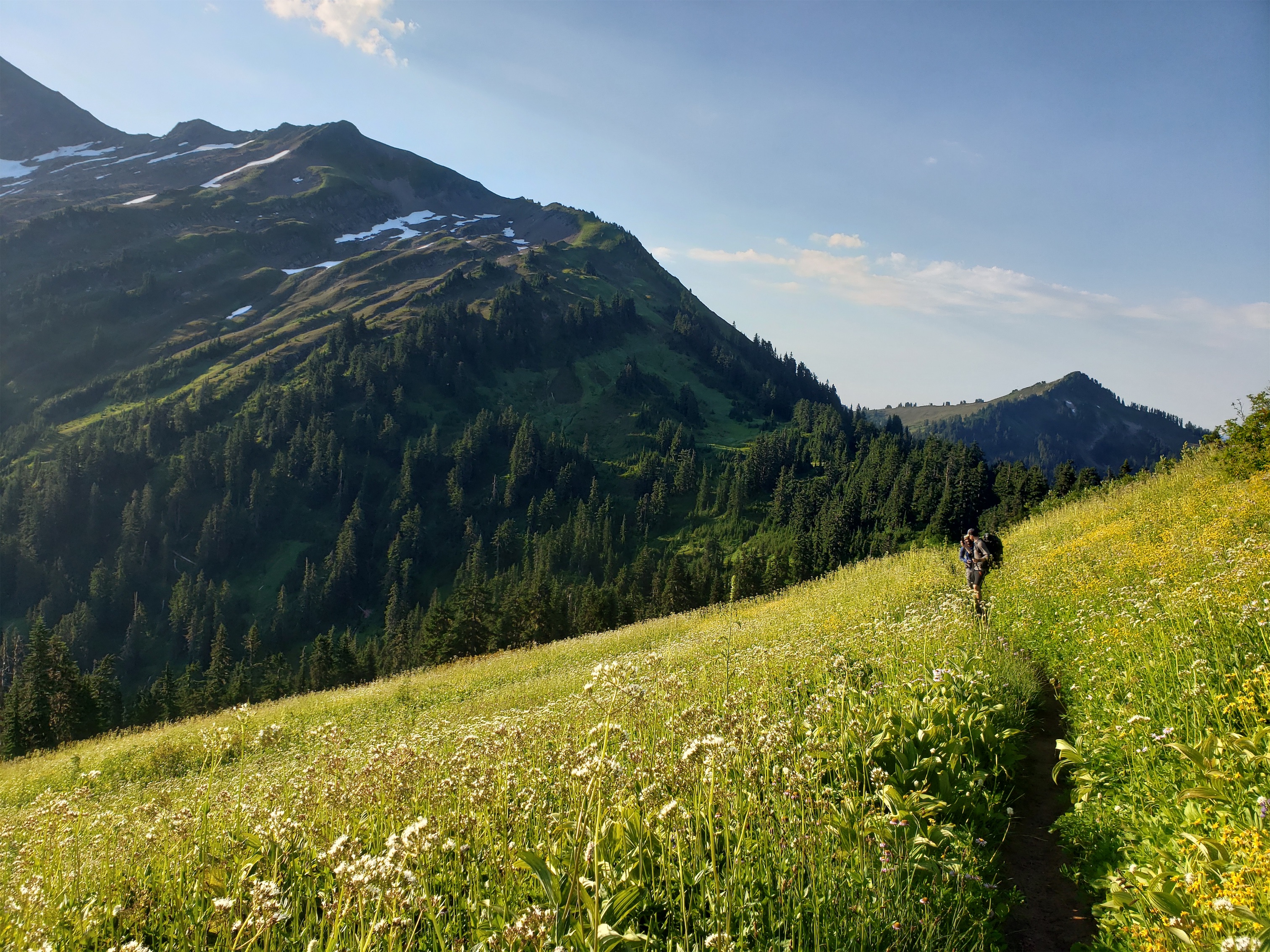
Brad and Surafel through meadows with the Monte Cristos and Sloan in the back

Log crossing
This trip went from like 5/10 to -2/10 to 3/10 to 10/10 all in one day. From mild apathy to frustration to resignation to rallying to defeat and then to sheer bliss. Seriously if I could make this post with entirely Brad and Surafel’s photos maybe I’d get some of the beauty across. The wildflowers are some of the best I’ve ever seen. The ridge is one of the dumbest I’ve ever seen. The lake is one of the bluest I have ever seen. What am I talking about? The Pilot Ridge/White Pass Loop. Yes, in that order. Because who needs beta.
Trail up to Pilot Ridge
It started with somewhat apathetic feelings towards our original trip choice, which was in North Cascades National Park. I was unaware of the permitting difficulties, and naively/obliviously/stupidly decided we could get to the Marblemount ranger station at 8am, which I thought was when they opened. There was one highlight, which was stopping at the pilot gas station off exit 208, which has a cinnabon. I swear, you can eat the air. I got the “conservative” option of four mini buns… don’t do it. Just go all in and get the real whole bun. I had so many regrets. Four mini buns isn’t enough and the centers aren’t enough and the frosting isn’t enough and you’ll be left wanting. Like I was. While I waited for NCNP permits. Like a sheep.

The ridge… going up
So, 8am is not when the ranger station opened. They opened at 7. And the entire world beat us. And they were only on group #47 or something and we were group #100 (B00, technically, as in BOO HOO you fucking slackers should have camped here). And it was 8:15. And a lone ranger was working his way slowly through the line with the work ethic and stoic determination of a clydesdale. And I didn’t have enough cinnamon buns. We walked around the parking lot. We explored the helo landing. We found a greenhouse and some plants and some tarps. We found a cool sign with shapes and types of clouds and how they affect wildfires. We read it. We bitched. We moaned. We deliberated. We commiserated. And finally, we bailed. It had been over an hour and they were on…. wait for it…. #72!
Things more organized than the NCNP permitting system:
- The DMV
- My Closet
- Charles de Gaulle Airport
- The toilet paper supply chain in march
- Five kittens in an 800sqft house
- Me at Home Depot’s “can you save this plant” “YOU BET YOUR ASS I’M GONNA TRY” sale

FINALLY something is HAPPENING
We got in the car. No cell service, okay, brainstorm trips we vaguely know enough about to pull off regardless. Or areas that might already be loaded on our offline maps. Pasayten? Too far, too late. Robinson? Too far, too late. Lake Byrne? Ehhh I have the peakbagging hunger. Lime Ridge? Needs more beta (sorry, sometimes you want some). White Pass/Pilot Ridge? Oooh, well that has nice wildflowers, and it is that time of year… but fuck those switchbacks up to white pass. Only if we go in the opposite direction so we descend those instead. Also, have I ever really backpacked before? Let’s do it.
And so we found ourselves parking a quarter mile from the north fork sauk trail, because everyone and their mom had beaten us to that too. It was like 11am at this point and I was out of fucks to give and my personal space bubble is like 2 meters wide now and I hate people and there were SO. MANY. CARS. Okay, beta break:
- Distance: 29mi (32 incl Johnson & Kodak)
- Elevation gain: 9000ft net or something
- Weather: 80’s and sunny
- Commute from Seattle: 2:30 without traffic, 5 if you stop at the ranger station like dopes
- Did I Trip: I stubbed my toes twice?

Sloan & meadows
We started up the trail. My stomach rebelled immediately and I destroyed a half pound of ham and 3oz of cheese within the first mile with bugs swarming around my face because priorities. Luckily this time we had bug spray that wasn’t lemon eucalyptus and actually seemed to keep some bugs away. The log crossing was mildly concerning with my low blood sugar shakey legs but that was pathetically hilarious. And then we started endless uphill through the forest.
Fast forward to the stream below the top of the ridge. Everyone warned us to top off because there was no water for the next 4 miles. So we did, to be safe. While being inundated with barrages of mosquitoes. And we didn’t really run into water again until Blue Lake itself, besides a questionable tarn a half mile before the lake. This is also where we started to get suspicious that maybe we chose the wrong direction, because everyone else was coming down from the ridge, not going up towards it. Hmmm.

Adorable little asters
And then we got to the ridge. Which was still in the trees. And was still gaining elevation??? What kind of a ridge is this?! Up and down and up and down and TREES EVERYWHERE but don’t stop because the bugs will get you! We got peeks of Sloan and the Monte Cristos, and I defied the bugs to snap a photo worried I’d never see the peaks again. What if this whole stupid ridge is treed until white pass and I was wasting like 18 miles of my life and a pint of blood? I wrote a haiku. I don’t remember it, because Brad immediately one-upped it with a superior haiku.
Permitting’s a bitch
Who needs permits anyway
It is very hot
And I worked on a limerick:
We all know bad things come in threes
Like the route being covered with trees
No glaciers in sight
The heat has such might
Can I borrow your bug spray, oh please?
Maybe the most aster I have ever seen
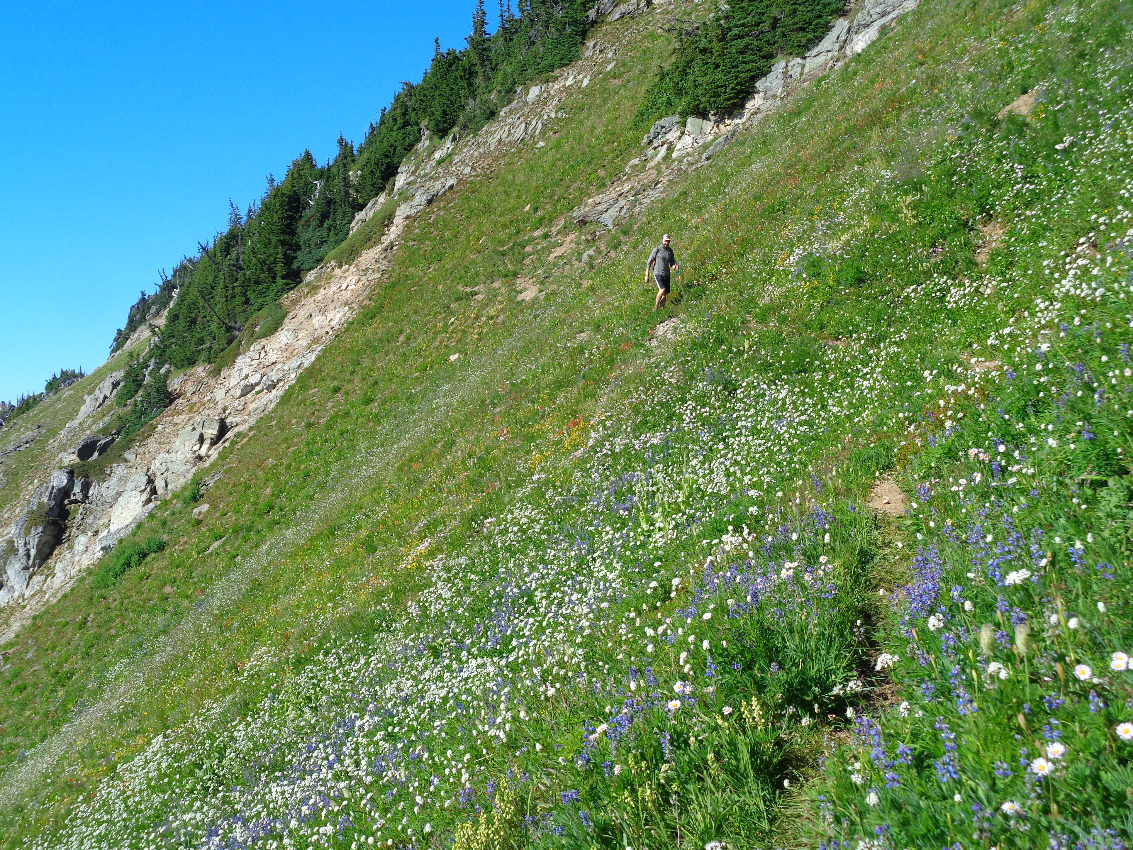
We slogged for another hour or so, and finally… FINALLY…. we stumbled into some of the best wildflower meadows I had seen. Many flowers were past their prime, but the grasses and the hints of color and the Monte Cristos and Sloan behind were finally in full view and it was hilarious I was ever worried I wouldn’t see them again. Finally the trail was traversing, we were taking photos, we found blueberries!! Ripe blueberries! “BLOOBS!” we started shouting. “BLOOBIES!” We were stuffing our faces, which in reality means we are like 4 berries because they are wildly inconvenient to pick. “Where are they” Surafel asked and we said “To your left!” He took one look at the berries by his ankles and said “too low.” And kept walking.

More beautiful meadows on the way up Johnson
Blue Lake. I mean, it really is quite blue
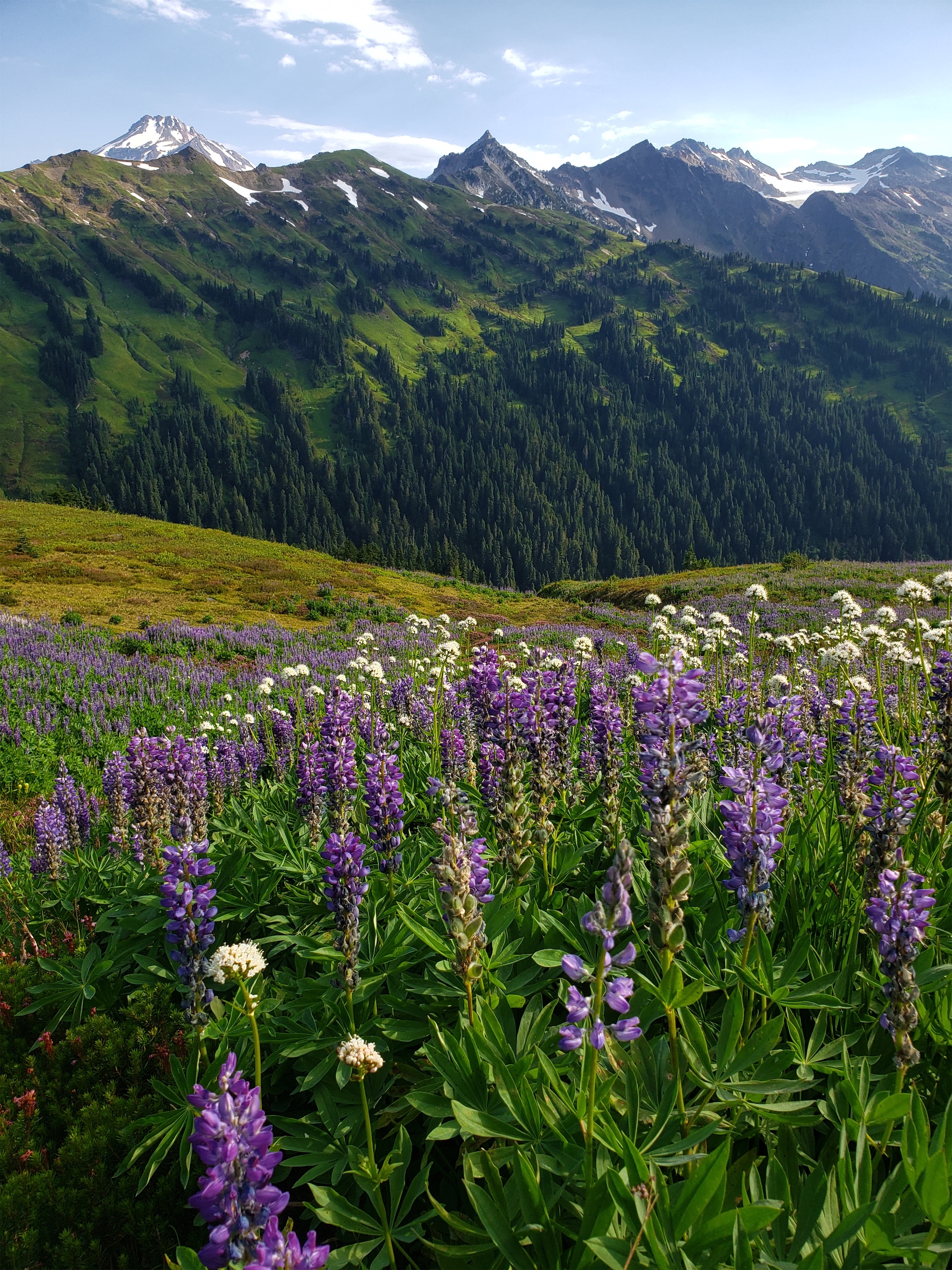
Eventually we came to the intersection of the Pilot Ridge/Blue Lake trail and the Johnson Mountain trail. Brad and I took the offshoot for Johnson Mountain, because… I brought a bag, for my peaks, my peakbag for peakbagging, and I needed to put a peak in my peakbag. Also, the wildflowers were getting better and better as elevation increased (higher elevation flowers bloom later). Okay, now THESE were the best meadows I had seen. Purple aster everywhere!! I used to think purple aster were dumb and basic because they’re like mini daisies but they’re actually my favorite flower now, so past Eve needs to get over herself. She had no taste.
The trail up Johnson was a cool, almost catwalk like trail in places, with amazing views of Blue Lake (not to be confused with the dozen other Blue Lakes in Washington), and topped out at an old lookout site! We had no idea! The site was at the end of a ridge pointing STRAIGHT at the Monte Cristo range. It was absurd. It is such a bummer the lookout is gone because that would have been a VERY cool place to stay. There’s almost no history about the lookout, just a description of what style it was and what years it was there (30’s-50’s, basically). It was an L-4 style, which is a 3 story staircase and then the lookout on the fourth story. So you would think that L-5 would be one story higher, and L-6 would be another story higher than L-5, but that’s not how it works. L-5 is two stories, because obviously that naming system makes sense.
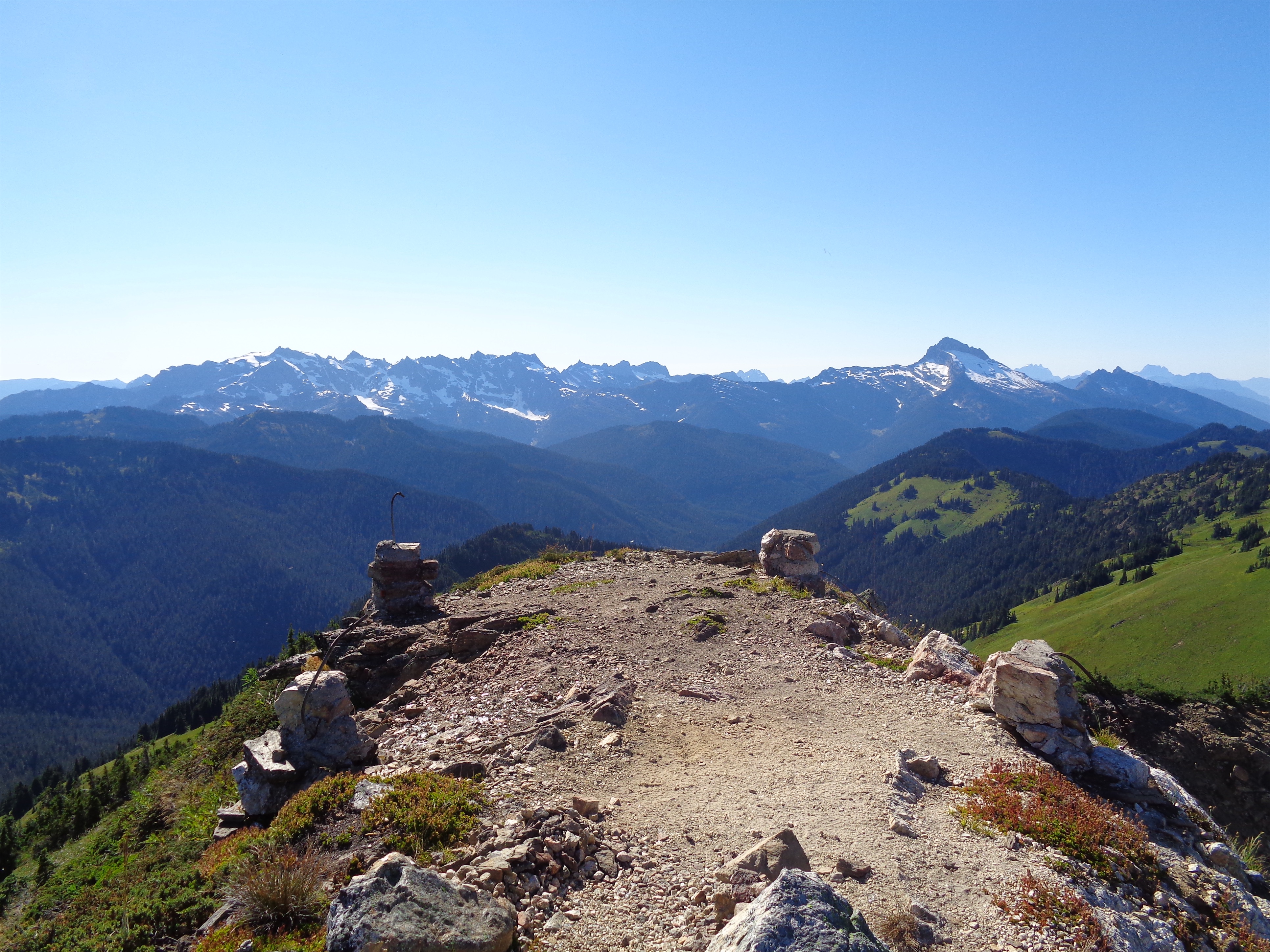
Old lookout site on Johnson
Brad on the way down
We cruised down (did we? I stopped to take pics and stuff snow in my water bottles and take more pics and pee on a bees nest and wait just a few more pics) to Blue Lake to meet Surafel. It wasn’t really down, it was down and then a soul crushing 50ft of elevation gain to get to the lake. For the record, the PCT-roundabout adds 4 miles of travel compared to the Blue Lake “high route” that we took. Brad jumped in the water, I put my heat-rashy legs in, we rehydrated and looked for fish and admired the views. It’s a beautiful area. But unfortunately, we had to drag ourselves away. We wanted to cover a little more ground Saturday so we wouldn’t die literally or figuratively in Sunday’s 90 degree heat. Surafel took off while Brad and I finished up water and left us with a radio so we could communicate despite being separate. “Bobcat, come in bobcat, testing radio 123.” “Yes Hello Kitty we hear you loud and clear, over.” I could hear Surafel laughing. “Hello Kitty?? Seriously?” “Uhh.. we’ll work on it.”

Leaving the lake
“Aaron Carter? Come in Aaron Carter this is Jonas Brothers we are on the move!” We slogged up the high route from the lake and met Surafel in the shade at the pass (no water). “Boxers, this is Briefs, we are almost at the pass.” “Bobcat, it is pretty nice up here…” “Is there a breeze!?” “Well, not THAT nice” we were ROASTING. Then we dropped down some loose crappy scree and finally started the traverse to Dishpan Gap (no water). Dishpan was an underwhelming peak with like 207′ of prominence so we passed and started looking for campsites. Criteria: A view. Preferably South. We had enough water still from Blue Lake that we prioritized views over running water.
We were like goldilocks. Yeah the ground is nice, buuuut… those trees mean no stars. Yeahhhh that one looks north but… the milky way is gonna be south. Yeah that has a trickle of muddy water sorta buuut… views? Yeah, that’s large but…. there’s probably a better one further along. Oh this one’s perfect!! “These are occupied.” Well shit. Onward!

Looking out over Meander Meadows
We finally found a great site on the shoulder of Kodak (no water). “Looks like some kind of…. ridge… trail” Brad said, like Craig Robinson realizing they were in some kind of…. Hot Tub Time Machine [intent stare]. We dropped packs and I started up the ridge to make sure there wasn’t a better campsite like 15ft away. I took the radio. “Bobcat, Brad just grabbed his camera and is running after you. Literally. Literally running.” I laughed. Brad wasn’t gonna miss out on sunset ridge shots.
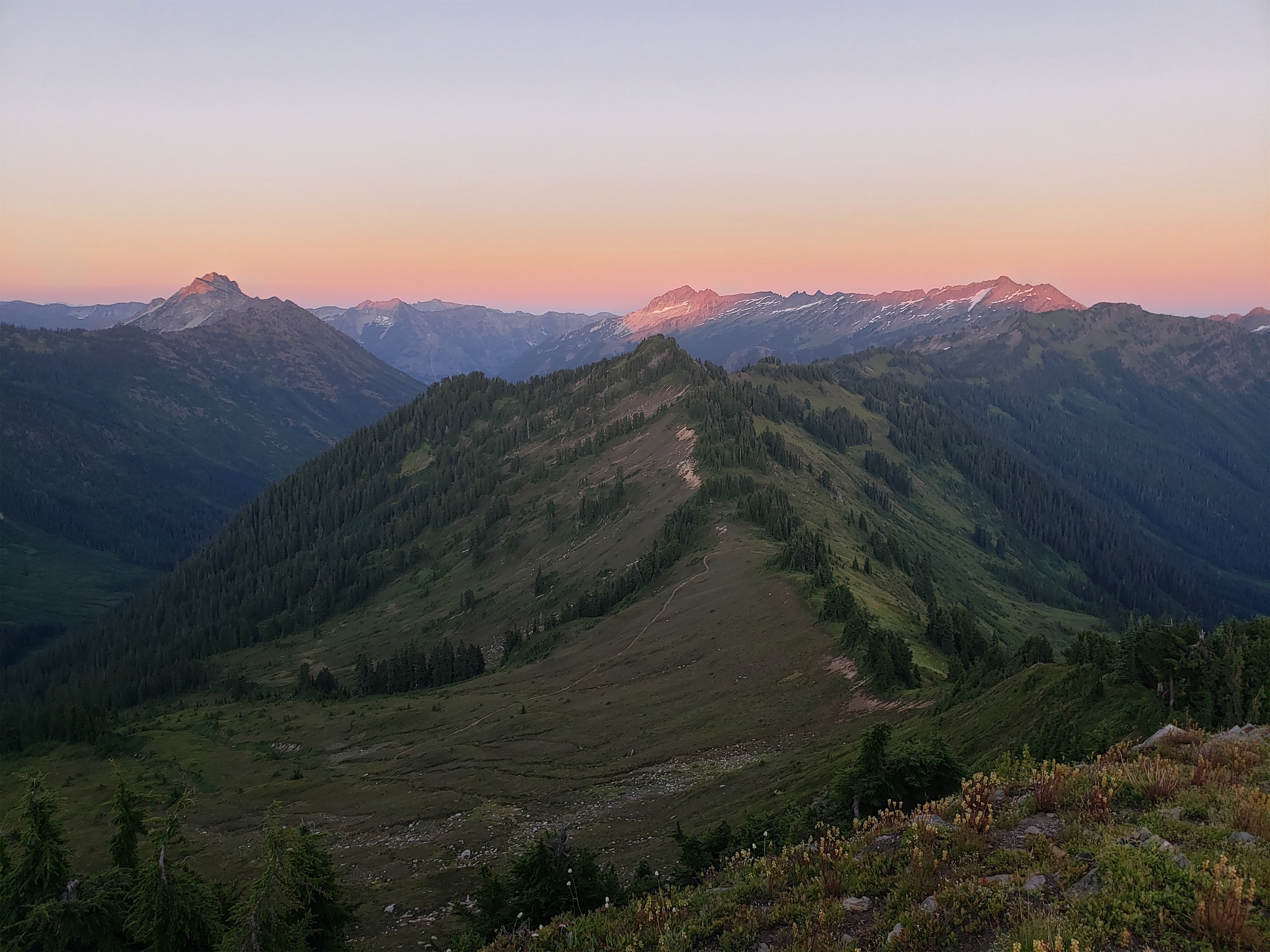
Last light on Saul, David, and Jonathon
And that kind of ridge trail took us to the top of Kodak Peak, where two other hikers were enjoying dinner with the company of mosquitoes, flies, and now my sweaty self and Brad. They were pleasant company though, and Brad and I snapped a few frantic pics while pointing out every peak on the horizon. Sunset lit up the paintbrush like CRAZY. And we made it back to camp just before headlamps were necessary. Surafel broke out some cookies, claiming he had “half a ziploc” which I assumed meant “4 +/- 2 cookies” but it meant “2 dozen cookies.” Thank you, cookie monster. It almost made up for my cinnabon letdown.

Looking south towards Rainier
After dinner, I started to doze off. Shortly after, Brad and Surafel woke up for astrophotography, and I reluctantly turned on my headlamp only to discover two massive spiders on my sleeping bag. I hate. The woods. I had a hard time sleeping due to dehydration and cotton mouth and headaches and my 30 degree bag somehow being too warm, but I saw a ton of shooting stars, so I had that going for me, which was nice. I was relieved when the sun rose, and we snapped more photos before starting on what we expected would be a long dry hot sweaty thirsty death march back to the car slowly turning into dehydrated shriveled human raisins (which Brad pointed out is redundant, you pick either dehydrated grape or raisin you can’t have both).

WAKE UP TIME FOR THE DAAAAY
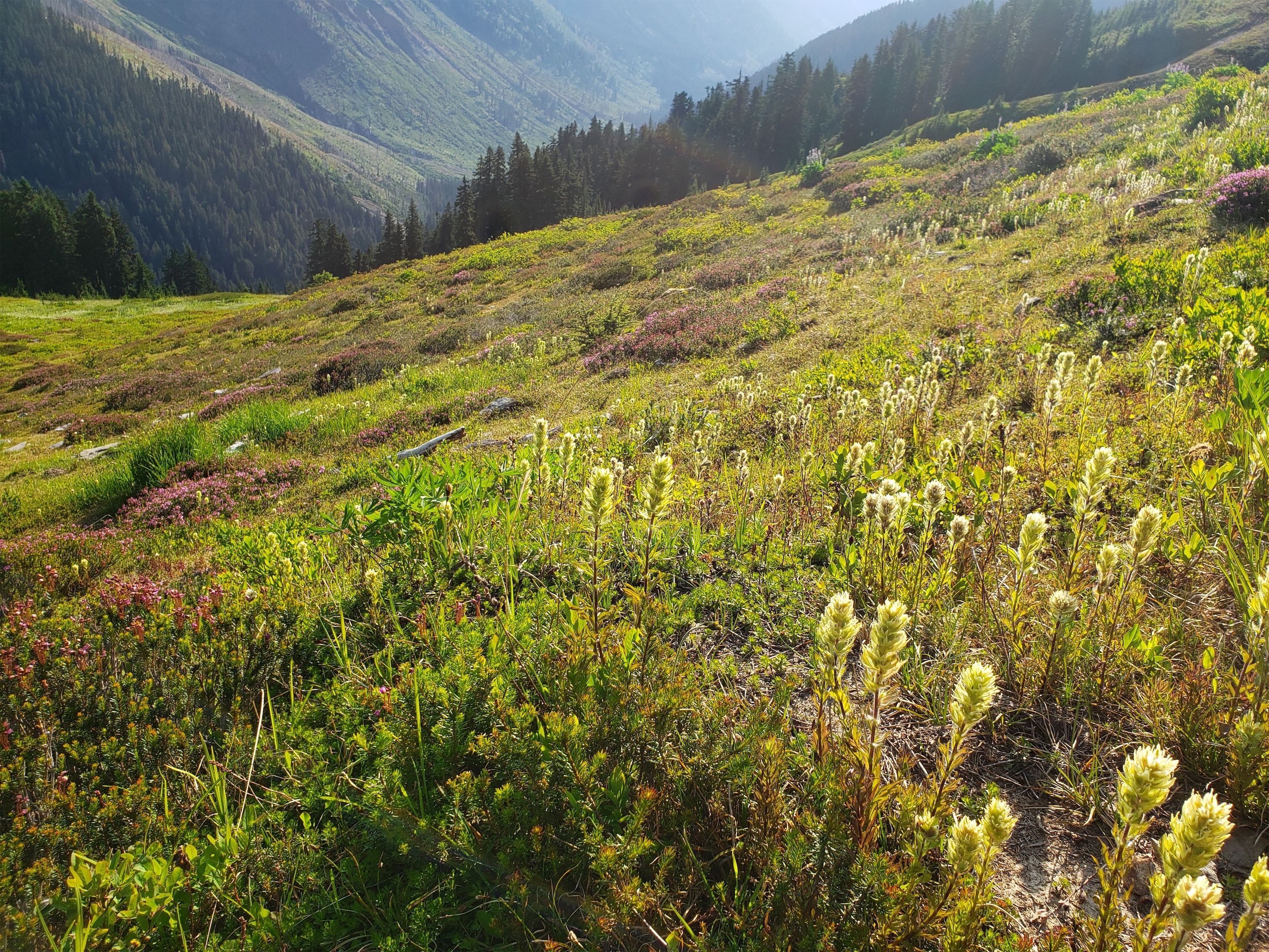
Wrong again (about water, Brad was right about dehydrated raisins). We found water within a half mile of leaving camp, which is great because between the three of us we had like 0.6L, and we had been told there were “only questionable tarns along the ridge.” Besides that, the first 2 ish miles were meh, we grumbled about losing elevation and more trees and spiderwebs and no views and those questionable tarns were more mosquito than tarn and then once again my ungrateful entitled ass was spat into a beautiful meadow of peak wildflowers. Our pace slowed to a crawl as the pictures started again. The rolling slopes of Indian Head and the ridge off of White Peak are unbelievable. The lupine was in full bloom. WHITE. PAINTBRUSH. EVERYWHERE. I thought it was rare, and here it was in droves! The purple aster were healthy! Ahhhhh I didn’t even know where to look.
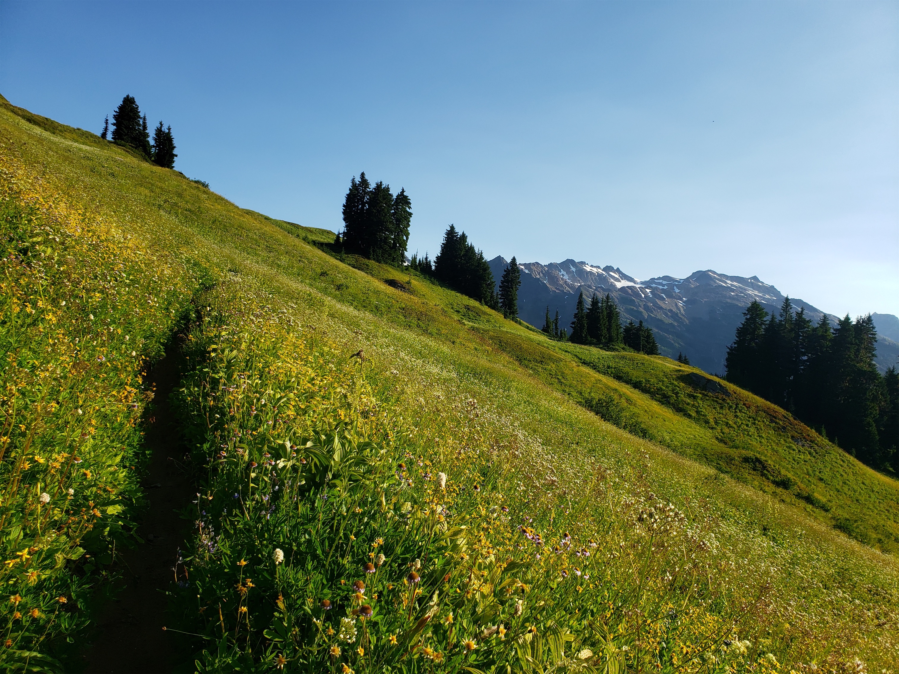
Morning meadows & rolling hills

Happy donkey
With great meadow comes great.. bees?
Until suddenly we saw a donkey!! An alpine ass, coined by Brad. Its owner was very friendly and we got to pet it (well they did, I don’t know what to do with livestock/wildlife bc I’m awkward and don’t know what’s appropriate/expected/acceptable/encouraged can you tell I was overanalyzing?) and we peppered him with questions about care. How far can he get in a day? 12 miles, he’s 30 years old so not too far anymore! What about water? They’re desert animals, don’t need much! What about food?? Oats! They usually camped away from people so donkey could roam, and it seemed like the donkey was basically a big dog with a great spoiled life. Tell anyone looking to buy a horse that they should get a donkey instead. I was sold. Horses freak me out. But the donkey was smaller and cuter and his ears looked so incredibly soft and big and I wanted so badly to touch them. It’s so rare nowadays to see horse/donkey packers out on the trail, really neat to run into one. We finally parted ways so we could continue our attempt to beat the heat and have snacks surrounded by rainbow flowers at white pass before heading down. And I wrote a limerick to atone for my prior lack of respect for this circuit. Brad helped with the last line.
Lupine at PEAK
Oh god I was wrong as can be
The meadows just fill me with glee
These flowers for miles
Bring laughter and smiles
[I was stumped, until I heard some cursing behind me]
And Brad just got stung by a bee.
Brad’s ankle started swelling up, but not to a point of concern, so we stopped at White Pass and had a big snack. Surafel put his camera away. We knew what we were in for. Like one mile of traversing, and 3 miles of brutal downhill switchbacks, and 5 miles of monotonous (albeit pretty, I guess) forested trail.
White paintbrush!
That’s pretty much how it went. The switchbacks are truly mind numbing. Not countable like cascade pass, more of a “buckle down and space out until you trip over the log next to the clearing next to the river.” The Mackinaw shelter had collapsed since the last time I was here, and I think all the debris had even been removed, because we saw no trace of it. We took a break at the big bridge over a stream about 3.5 miles from the trailhead, reveling in the abundance of water and cool breeze. About 2 miles from the trailhead I realized my fantasies all weekend about going to Cascadia Farms couldn’t happen, because we were in Darrington, not the national park. And then Burger Barn was closed. So… we stopped at Arby’s. Questionable. Should have just gotten more cinnamon buns.

Looking towards White Pass
It’s Wednesday and the heat rash hasn’t gone away, but I’ll trade that for the ridiculous flowers we got for like 18 of the 32 miles we did. And the other 14 were worth the suffering. Good company, sweet donkey, seemingly-oversaturated real world views, feeling like you’re in the middle of nowhere… yeah, it hit the spot. Also, I think I need a cinnamon bun.

Pingback: Golden Lakes MTB | Have Tent, Will Travel