

This was a freaking amazing weekend. Buckskin Ridge is a decent hike by itself, and it was anticlimactic compared to the other three days of this loop. We had been planning it basically since our larch trip last year, and it was finally time. Four days was not enough, there is so much to explore back there. That said… I have some regrets about this trip. Remember when I started this blog? You probably don’t, it’s been a while, it’s okay I barely remember either. Six years, in fact, since I was unemployed and pasting photos into word docs until my roommate told me I was being stupid and should start a blog. Six years since I said no, that’s dumb, I’m not a blogger, bloggers are stupid and besides, I have no idea what I’m talking about. Well. In those six years, I have learned… apparently nothing about the mountains, and WordPress just changed their layout so also nothing about blogging.
Anyway, on to my mistakes:
Food: It’s training weight, right? Backpacking is easier than climbing (uhh..). 1lb cheddar cheese. 1lb summer sausage. 12oz M&Ms. 12oz crackers. 10oz cashews. 3 dehydrated meals. 8oz chocolate covered espresso beans. 8oz cashews. 10oz sour patch. And more. But I forgot mio, so that saved some weight.
Shoes: Oh shit, all my shoes are ripped. Better use these old ones! What size are they? Oh they’re from 2015 and were never labeled and you got them for free and never wore them? Yeah those will do.
Clothing: It’s definitely going to be cold. Better pack expedition weight long underwear, two hats, down mittens, and a big summit puffy.
Camping: Sweet, got my a 0 degree bag, a wool bag liner, and oh yeah bring the 4lb mountaineering tent.
Cameras: 3, because I didn’t think I’d be good with the new one, so I also brought my trusty point n shoot. Oh and an extra heavy sock to use as a camera bag, because I didn’t have a camera bag.

Spoilers: No, I can’t eat 10,000 calories a day, yes, I absolutely destroyed my feet within 5 miles, no, it wasn’t cold, it was like 70 and sunny the whole time, yes, I should have committed to one camera, and yes, I did immediately lose a camera lens.
Speaking of the weather, some trip stats for your pleasure:
- Distance: 51mi
- Elevation: 18k gain
- Weather: 70 and sunny
- Commute from Seattle: 4.5hrs
- Did I Trip: Shockingly only once
We made it to the trailhead and got started around 10am. It was either cloudy or smoky or both. It felt like cheating because we were already at larches. We started to drop into the valley while I groaned that we weren’t “earning our larches” because we started so high. Oh, honey. If only I had realized my map was in 50m increments and gaining 5 contour lines meant 250m, not 50ft. “We can bag like, 5 peaks just between today and tomorrow!” Brad laughed. “I think you’re… underestimating the vastness of the Pasayten.”
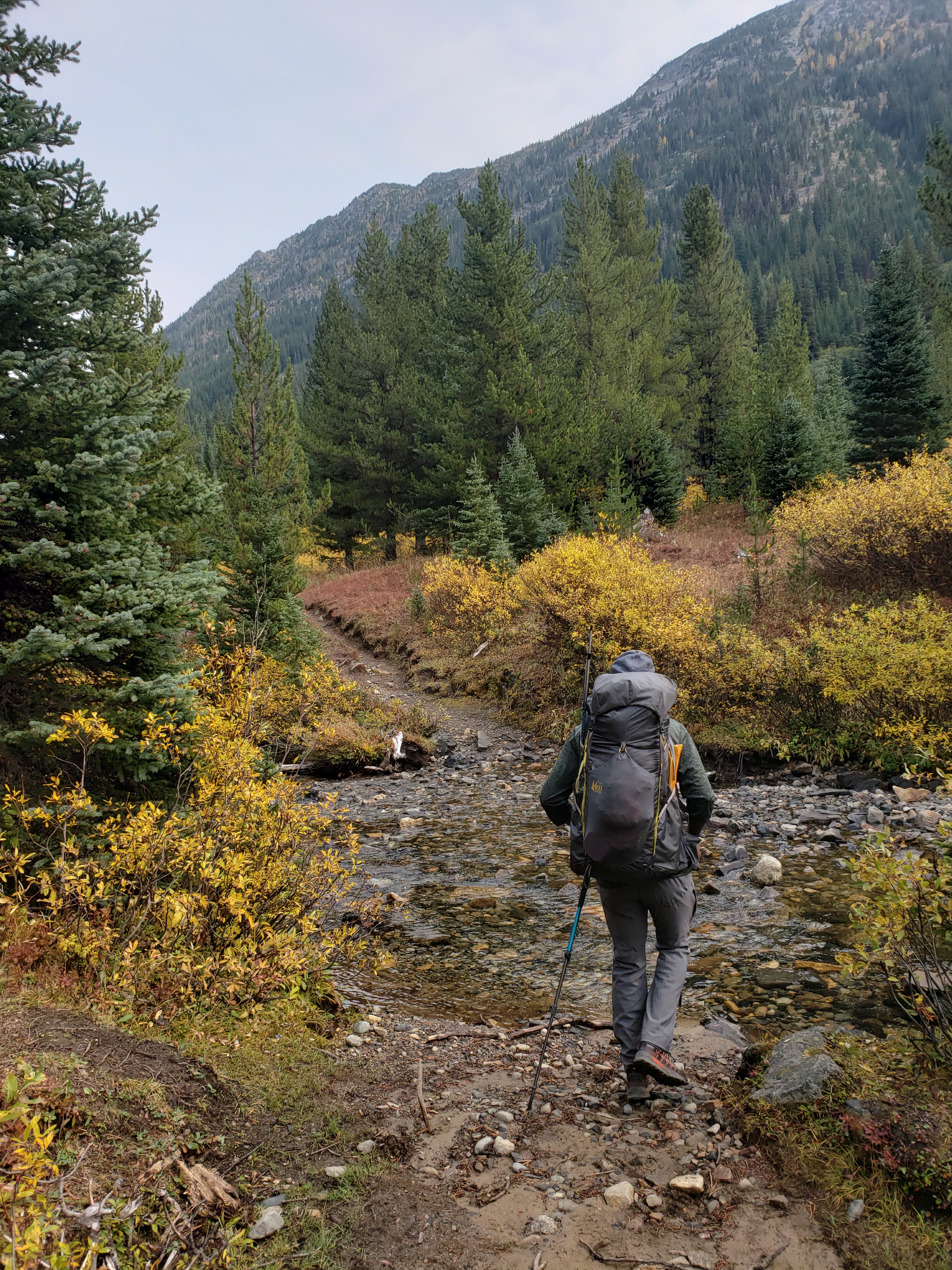
And regardless of the vastness, we had another problem immediately. I’m sure the valley was lovely but I don’t remember most of it. I had hotspots in my shoes within 3 miles. The trail was mostly a mild downhill, and the valley was far more humid and green than I expected for the east side, especially this time of year. Two miles later, I decided to suck it up and check out my feet and change socks. I avoid my problems because obviously if you don’t see the blisters then they aren’t really there, but with four days of this… I knew I was being irresponsible. So we took a quick break.
Too late, dummy. Already had four, mostly on the bottoms of toes (the second worst location). I switched toes, re-laced shoes, and we kept moving. My pack. Was. So. Heavy. Who wants cheese? Does anyone want cheese? I have two blocks of cheddar cheese if anyone wants some. What about some delicious summer sausage? No? Well fine, then you can just starve. Can you rezip my pack? I saw the look on Surafel’s face. The zipper had broken. Well, I have side straps, just wrap everything in the tent and someone walk behind me in case I start spilling all my pack contents. Good start. Maybe something heavy and unnecessary will fall out, like half of my food.

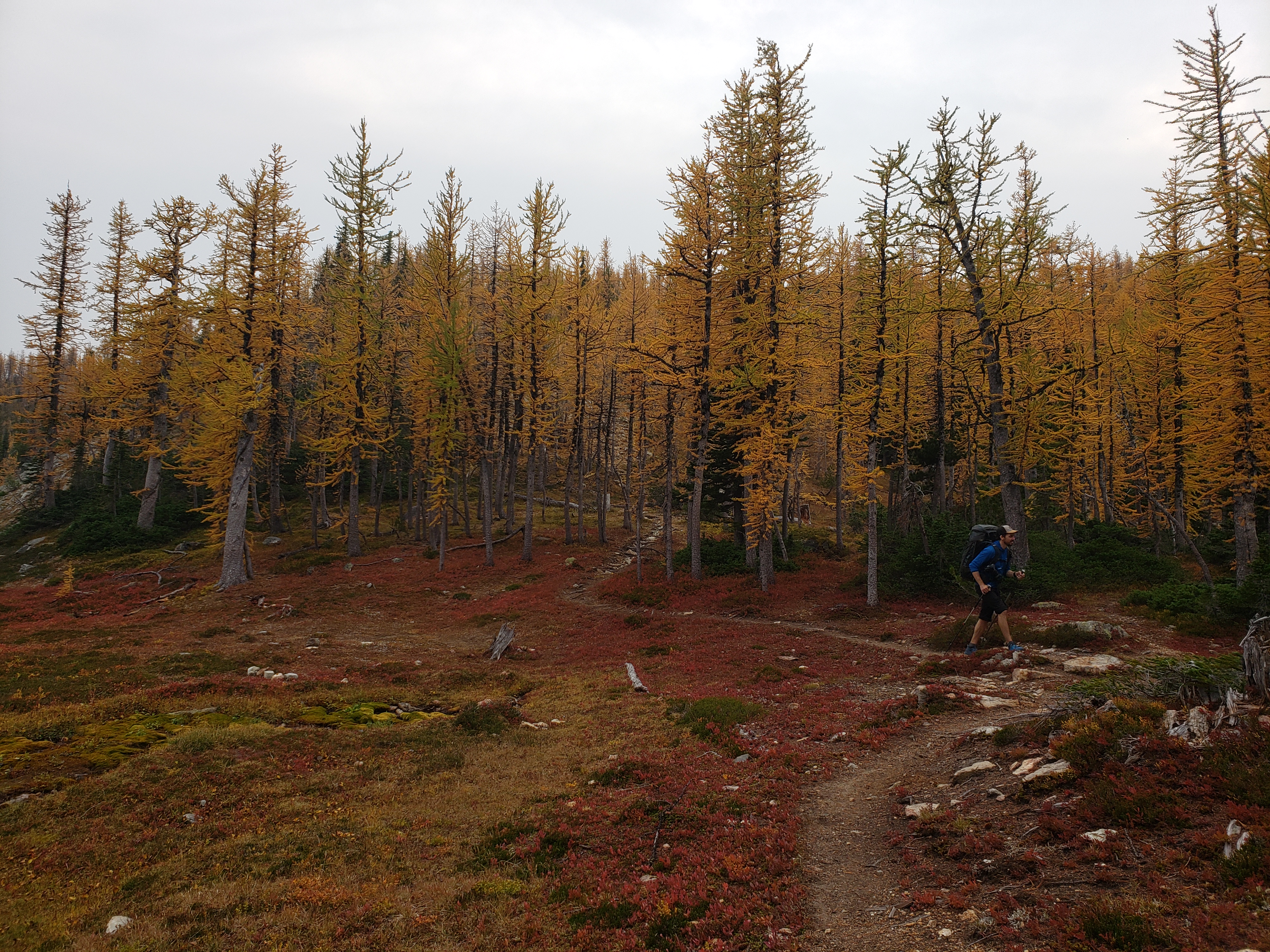
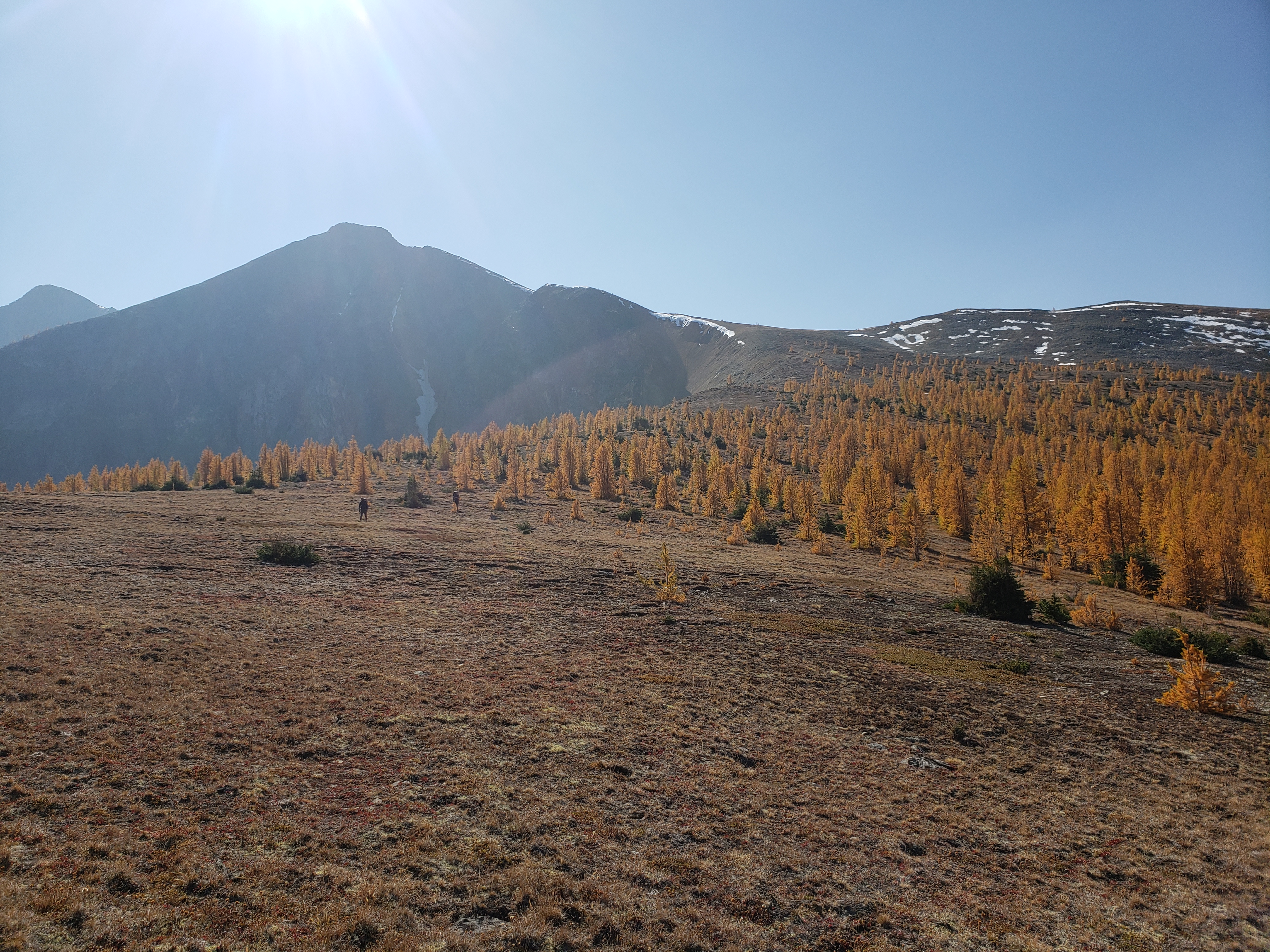
The 1200ft gain to Fred’s Lake felt like forever. The smoke (clouds?) were getting thicker, and we were still in the trees. I was so busy looking at my feet that I missed the first larch. But finally we reached the lake, and damn had we re-earned the larches! We snapped some pics and climbed above the lake up to the pass, which was spectacularly beautiful. We debated dropping packs and scrambling Rolo, but I wasn’t feeling it. I was feeling putting shredded feet in a cold lake and watching Surafel fish. Luckily, the lake is only ~15 min past the pass, and soon enough we were standing next to a perfectly circular lake surrounded by larches.
We pitched camp, had some snacks, and Brad proposed the idea of Rolo again. It’s been a while, but I think he said something along the lines of “well, I’m going to do Rolo” and my brain/heart/spirit looked in the mirror and said fuck you, you’re not sitting here while Brad does Rolo, so I found myself on my feet once again with a lighter pack getting ready to leave camp while Surafel trotted towards the lake with his fishing pole singing “here, fishy fishy!!”
We made it back to the pass and headed off towards Rolo. It was only a mile and like 1500ft of gain, so not bad. The first part was a sidehill traverse, which brad hated, and I hated, but I hated it less than going up-and-over because it was the downhills that were brutalizing my already clobbered feet, whereas “flat” i could hobble nicely enough. And talus was the BEST, because it’s like steps if you step right. There is this SUPER cool “lake” at the base of Rolo, completely dried up but the lakebed is still there and it is surreal standing at the base of it. I imagine it’s still full early season, but dries up by the end of the summer, because I didn’t see any obvious groundwater source. We started walking up talus on the other side of the lakebed, and soon enough came to some third class scrambling.
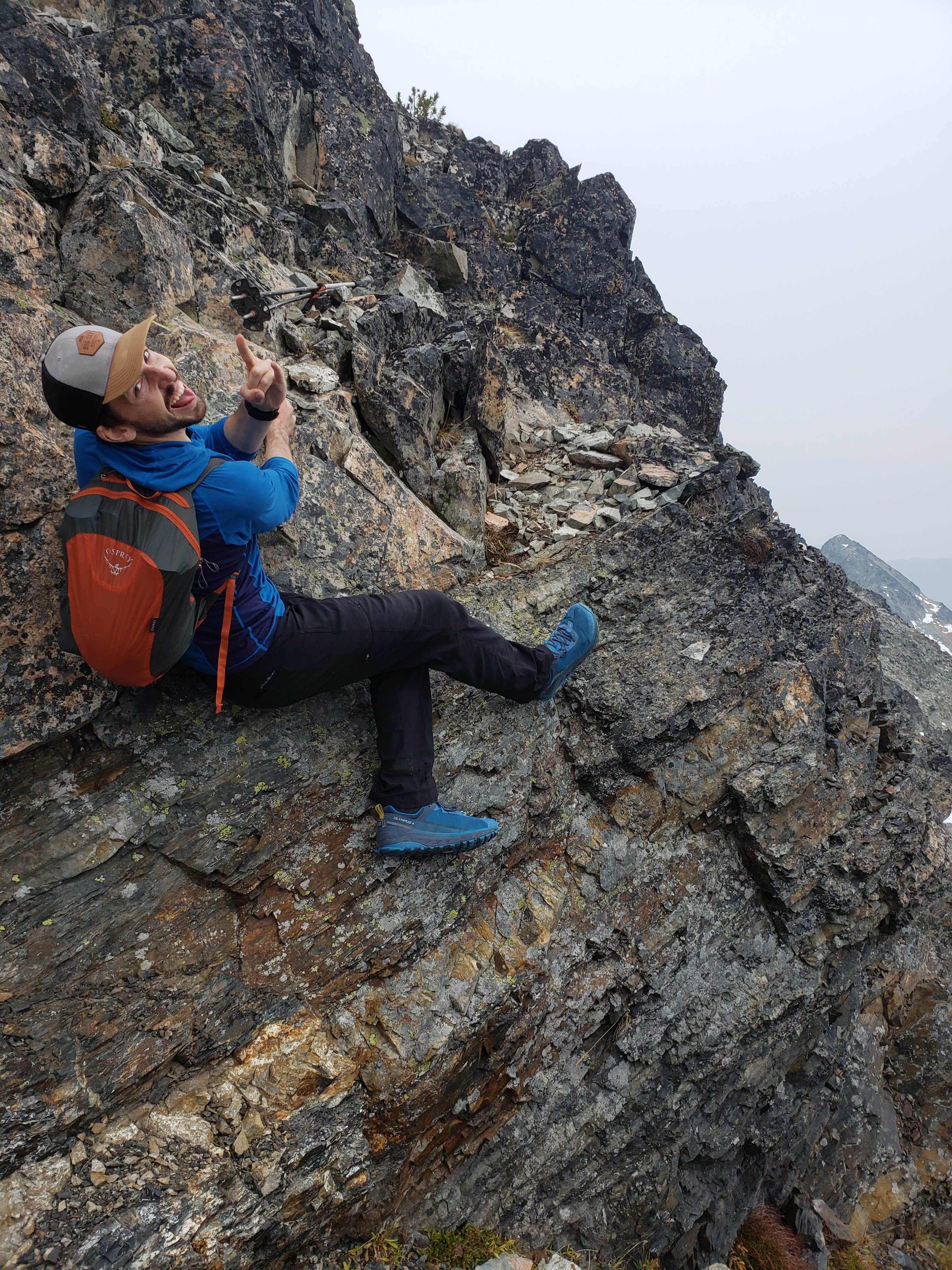
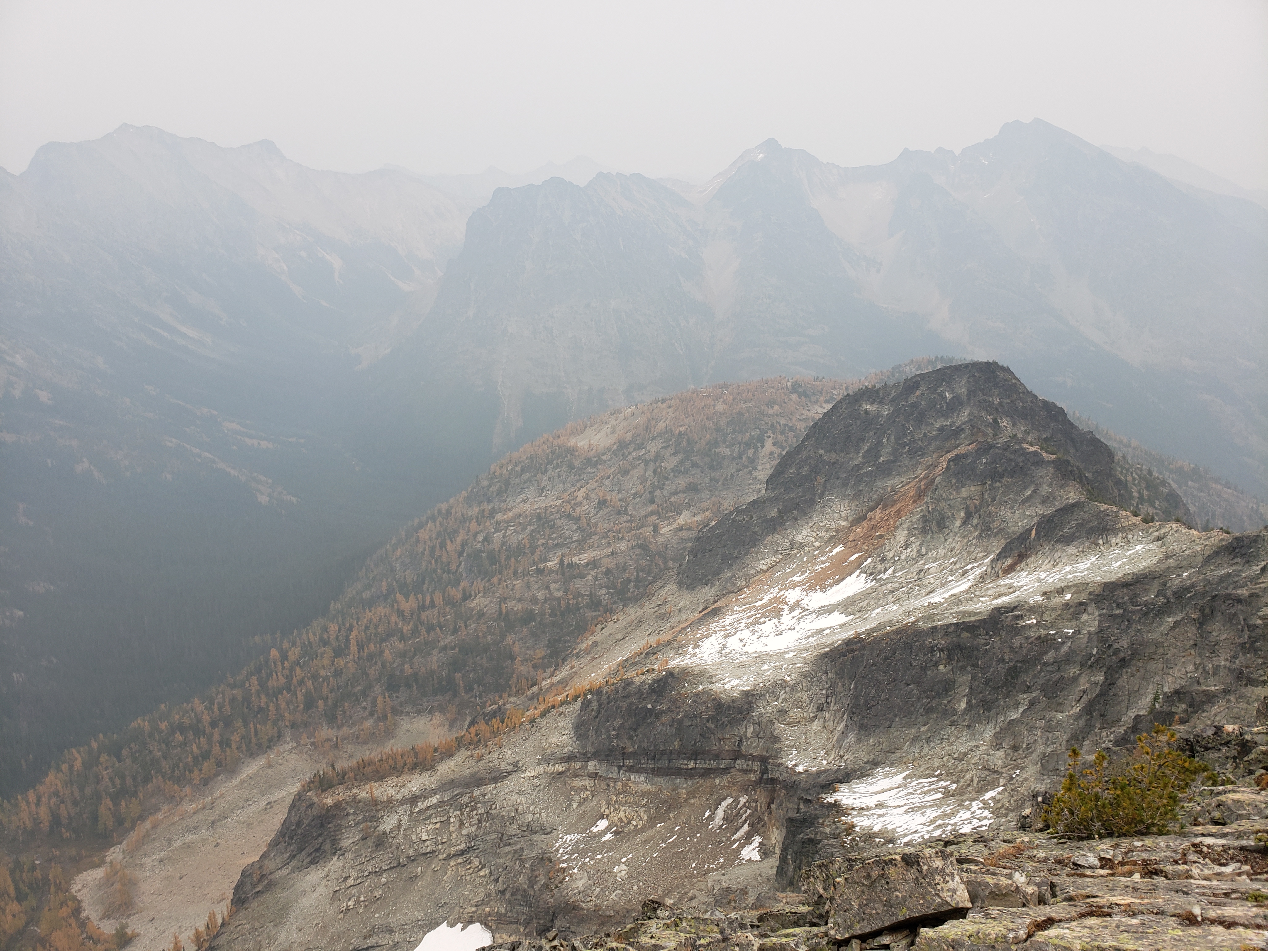
You know what’s great for tender feet? Using hands instead of feet. I have never enjoyed scrambling so much in my life. And despite what we had heard, it was actually pretty solid, enjoyable scrambling. I’d say there was a single fourth class move the entire time, and it was juggy, so not a big deal. There are two cool catwalks where you walk across a huge (slightly tilted) slab with a HUGE drop on one side (>1000ft) and moderate on the other side, and views of some super cool geology, which is nice because the smoke was too thick to see any ridges or peaks around us. It got better as we got higher, but it didn’t get…. good.

We signed the register, Brad took a leak to mark the summit as his and no one else’s, and we headed down. Sunset was spectacular, lighitng up this one patch of clouds bright pink, but I didn’t manage to catch it. We joked that maybe Surafel would have a fire and some fish ready for us back at camp. Long story short, after more tedious sidehilling we arrived back in camp minutes before we’d need headlamps, Brad checked the news at the pass and somehow kept secret the WHOLE TRIP that Trump had covid, and Surafel indeed had freshly cooked fish and a crackling fire ready for us. I did some blister surgery on my feet and went to sleep quite happy.
In the morning, we had a repeat of Rolo, except with Osceola. Brad has me figured out. “Well… I’m going to go do Osceola” and he starts packing his things. My brain: like HELL YOU ARE ok no wait wait for me let me pack my bag I’m coming braaad noooo waaait. Again, it was only like a mile with 1500ft of gain, maybe not even. I knew I’d regret sitting in camp. And before I knew it, I was hobbling up a second peak. This one was almost entirely a talus walk, with sweet camping spots along the ridge. The smoke was slightly better than the day before, but it still felt like I had exercise induced adult onset asthma. Brad made a comment saying something similar so I know it wasn’t just me. The smoke settles in your Iungs and they get all tight, and even a little burney at the bottoms if it’s really bad. think I left Brad at the top because I knew going downhill would be a painful affair and wanted the head start. He’d catch up. This becomes a theme for the weekend.
I think we got back to camp around 11 and left for Dot Lakes around noon. This seemed reasonable enough, we had another ~5 miles on trail to Shellrock Pass and another 2-3 miles cross country to Dot Lakes and no one needs 8 hours for 7 miles, that would be absurd. The first traverse to Shellrock Pass was underwhelming. Frustrating, even, because we were dropping elevation, getting glimpses through trees of how not close we were to the pass, and still losing elevation. At the valley bottom, the trail got a little squirrely. We found a mylar balloon. Should we carry this back? It is trash….. nah, too heavy. We left it where it lay. Did I mention I hadn’t taken a single pic with my fancy new camera yet?
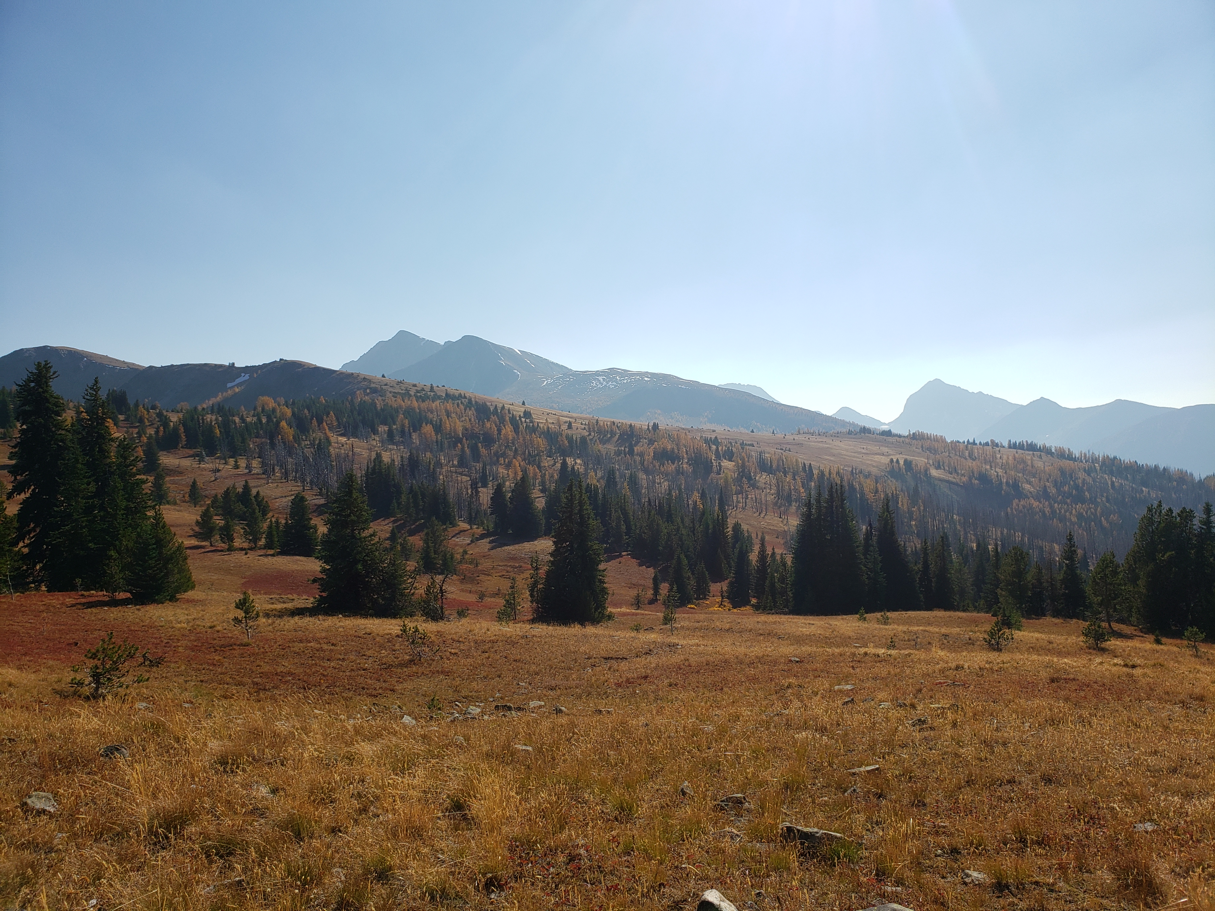
The base of Shellrock Pass is a place of spectacular beauty in itself. Flat open meadows, peppered with larches and a beautiful shallow flat stream and views of Bulgers all around. It’s worth a night of camping, and I’d love to camp there if I go back for Carru and Lago. We lost the trail a few times until it started switchbacking up to the pass, and we started to marvel at Monument and Blackcap peaks. There’s so much to do in the Pasayten, and the approach to all of them is so long and tedious, it makes sense that everyone knocks these out all at once. I need some time to forget the trails to Shellrock. But it had finally gotten beautiful again, so we plodded along, up the yellow larch needle carpet trail with definitely more switchbacks than the map claimed until we were at the pass. I was toast. Emotionally, physically, mentally toast. But I knew we still had hours ahead of us. You know those situations where your body is only moving because you know you still have so much left? And if camp was only a half mile away, you’d be a whiny mess of a human being? That was me. The only thing holding me together was pride and knowing that I had a solid 4-5 more hours on my feet.


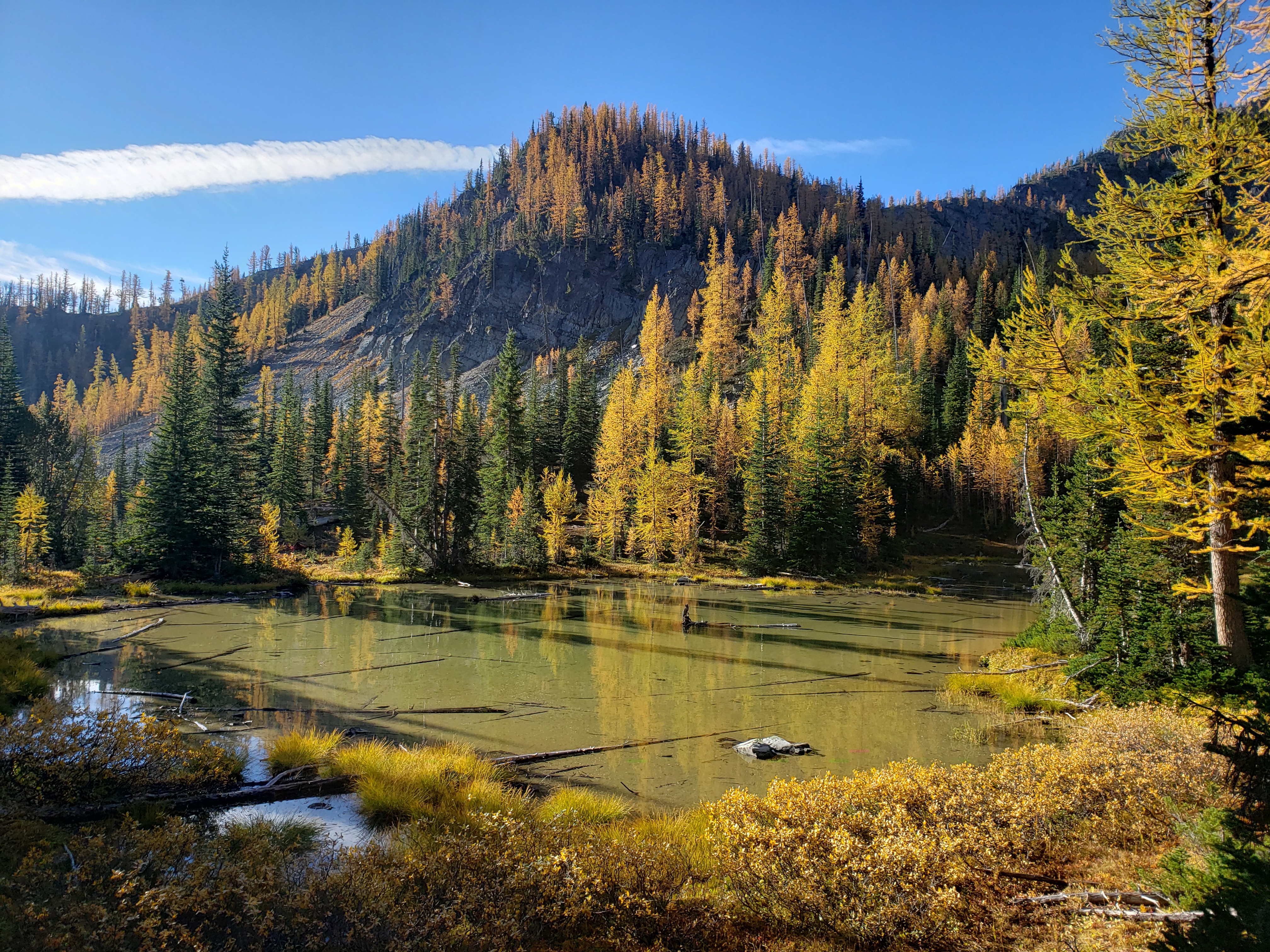
We dropped down from the pass, traversing more talus and re-entering a a world of larches. Rejuvenation. Like quenching thirst again. And suddenly Surafel is running. And then Brad’s whooping. And I look up from my feet and realize we’re on a red carpet, surrounded by larches, with a freaking surprise lake right there!! “You can get a starburst shot!” Surafel shouted, and I fumbled around with my new camera for the first time before he came and solved my problem in about 30 seconds. That’s all it took to get a starburst shot! My first starburst!!! Pure. Joy. I’ve dreamed of this for years. No it’s not perfect but I’ll get better. After a frenzy of photos we remembered it was like 5pm, and we were still so far away from camp, and most of what we had ahead of us was cross country. Well, grab some blueberries for a snack and rally, time to get moving.

Beyond the surprise lake, we entered one of the most unique parts of the trip. A recent burn zone, so recent that there were still layers of ash on the ground, almost like walking through light mud. More elk (or deer?) prints than I’ve ever seen before. It was eerie, but also cool seeing tiny plants budding and traces of wildlife everywhere. We did lose the trail multiple times here (it wasn’t on a map either) but eventually found our way up to the ridge, where we dropped officially off trail (truly) to traverse to Dot Lakes.


The first part of the traverse was tough, we were first traversing through some nasty bushwhacking on steep slopes with fire damage and blowdowns and blah so we decided to lose elevation to where it was more flat. That was slightly better in that it was flat, but the brush was even more dense than it had been up high. We popped out onto a talus traverse (woo!) to the base of a gully (boooooo). Looking at this ridge from the first one we had just surmounted, I thought there was no way we’d get up it. It was astounding thinking there was an “easy” route to Dot Lakes, because it looked like a sheer cliff from where we were. But as we got closer, the weaknesses became more apparent, the gully appeared, and it looked like it would go. I think my brain has blocked most of this from my memory, but the gully was loose, and definitely felt harder than “second class.” It took an eternity to get up it. I assume I bitched profusely. We topped out just as it was time for headlamps, to a nice haiku:
eat a dick gully
if downhill were a person
i’d punch his dumb face

From here, it was a pitch black traverse to Dot Lakes. I popped some chocolate covered espresso beans that I had brought for use in times of desperation. They’re the final medicine before the hail mary emergency gu, which has like 140mg caffeine and I wasn’t willing to go that far. Good news: beans kicked in, barely any elevation gain, nice flat mostly open slopes, slabby rock for once was nice. Bad news: it’s dark, and it’s dusty, and I’m tired, and you can’t see larches in the dark unless they’re slapping your face. Brad led the way, and the route just kept going and going .We never had to divert around obstacles, it was amazing. We camped at the first flat area we found next to Lower Dot Lake, and it was all business. I prioritized boiling water and then setting up my tent and complaining that we were not, in fact, surrounded by larches. Surafel did tent first then water. Brad decided to start his campsite off with sneaky vomiting hopefully directed at the non-larches, which we didn’t know about until the next morning. I think he only told us because he was finally feeling better, and we were wondering why he had chili mac (or whatever questionable mountain house food) left over from the night before. Mmm, chili mac. I’m hungry.

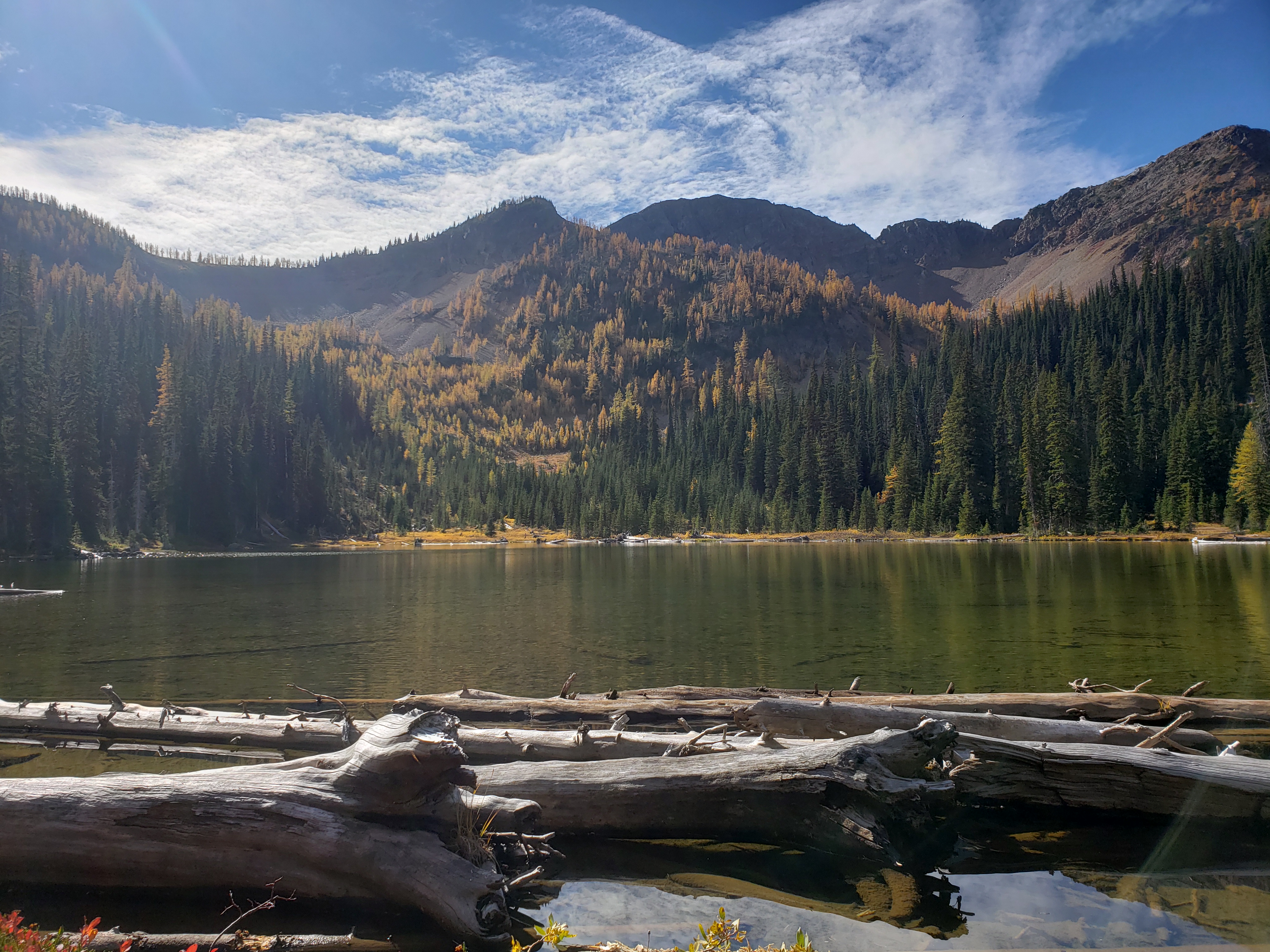
In the morning, we got to enjoy some of the views, if you ignore the anxiety about having to go 16 miles through who-knows-what sort of terrain. Dot Lakes were AMAZING and I wish we had more time there! There was no one else there, and the lakes have some of the densest larches I’ve seen. We climbed to upper Dot Lake and then followed a talus gully up to the ridge above Dot Lake, bagged Dot Peak (talus walk) and then Ptarmigan Peak (also a talus walk, but a very long talus walk). The views were incredible, and made us realize what we had been missing the first two days. Ptarmigan has a super sheer face on one side, and we traversed to Tatoosh Buttes keeping that cliff on our right. We dropped a little too low and ended up sidehilling around to Tatoosh Buttes while going up and over the rolling hills coming down from Ptarmigan would have been much, much better. For the others, at least. For once I was okay with sidehilling.

Tatoosh Buttes were also gorgeous, and would have warranted a campsite of their own if there had been any water source nearby. More rolling meadows, thick clusters of larches, perfectly blue sky. I kept getting head starts after breaks, knowing they’d both catch up to me momentarily. We traversed over to where the trail was, and even found a social trail to help us out. There was a lot of pack animal traffic, at least going off the tracks that we saw. I was stoked because Tatoosh Buttes meant we were almost halfway to our campsite. It was another 4 miles down from the buttes, 1 mile along the valley floor, and 2 miles to Buckskin Lake.
Yeah.. that was physically. Mentally and emotionally, this was the longest stretch of the trip. The trail down Tatoosh Buttes doesn’t match the map anymore, and it just kept going, and going, and going. “4 more miles.” “Still 4 more miles.” 30min later: “..still 4 more miles? HOW?!” Endless dry burn zone switchbacks, sun (blessing and a curse), dusty, downhill forever, my achilles(es? plural?) were bruised, my toes were bruised, my blisters had their own blisters, and I was still carrying all that god damn cheese and summer sausage. I thought I was going to cry for at least a mile. Brad took a long break. Yes, head start!!! Go go go until he catches up! The valley floor looked so close yet never got closer. The trail didn’t match the map and went in the opposite direction of what I had hoped for (don’t worry, it switched back later). Brad caught up. I took a break on a log. “It’s only a quarter mile to the stream!” “Well, brb dying I’m breaking here.” Brad and Surafel kept going and I realized actually, it’s like… 100ft to the stream, if you trust the map. I caught up and flopped on the gravel bar in the middle of the river. I resisted putting my body in the water because I knew if I did I’d never start moving again. My feet only knew torture, if they learned anything else, they’d rebel.
Across the river, we found signs saying the trail and river crossing we wanted was impassable. Or at least impassable for stock, dangerous for hikers. Well, shit. Didn’t think to research if or how the wildfires had changed the trails. We decided to give it a shot before trying the alternative, and I’m glad we did, because the crossing was a total nonissue. And I have no idea where else you cross that river, because it was like a chasm on either side of where we crossed, and the bridge had been washed out. But this is great. Valley floor, THREE MILES TO CAMP.
The valley floor was also cool, more burn zone with pencil sticks and regrowing underbrush. This was okay. I could handle this. We took a 5 minute break at the turnoff for Buckskin Ridge, and rallied. 2 MORE MILES. Breaks every hour or longer if you could stand it. I’d set a break time and then see how far past it I could get, unless either Surafel or Brad protested. I was fueled by summer sausage and pride and stubbornness and cheese and a desire to be lying on the ground and maybe a side of rage. And even better, the Buckskin Ridge trail was rated for livestock!! 7% grade, here we come!


We maintained a 2mph pace to Buckskin Lake. I’m not sure how, because in my head we were going like 4 mph, and in reality I figured we were going like 1mph. It was a surprisingly catwalky trail, and we had great views of how far we had come over the past two days. Upon arriving at the lake (in the dark, again), every campsite was taken, except for a site like 50ft above the lake. Aka we’d have to walk downhill to get water any time we needed water. God. Dammit. Well, I just had to go 10mi the next day, so this would be fine. Everything’s fine. Also there were no larches. Is that fine? That doesn’t seem fine. I didn’t come all the way here for green trees. Stupid trees. I didn’t really sleep that night, my feet hurt too badly so I just grumbled and midnight-snacked and overanalyzed whether i was slowly sliding downhill while I stared at the stupid green trees that weren’t larches.

In the morning, we got moving after the rest of the campers. Buckskin Ridge honestly was an anticlimactic end to the trip. Not many larches, though Buckskin Pass did have some. From there, it was meh. And a stupidly constructed trail. Flat, flat, flat traversing, traversing, sidehilling, traversing, lose 800ft of elevation in 1/4 a mile while hobbling and cursing the bastards who constructed this. Traverse valley bottom, climb up to another pass. Why. Couldn’t. We. Just. Traverse. All the way to the pass! AHH!! Trail for livestock, my ass. Stupid Pasayten, being all vast and beautiful and wild. But there were some surprisingly beautiful patches of red and yellow fall foliage, especially winding through the forest (Buckskin “Ridge”), and a beautiful side trip to a lake that was just off the main trail! We wouldn’t have gone, except we ran into another group, and one member of that group had apparently been talking about the lake for the past 48hrs, so… we had to go. And I have to admit, the trail system back here (besides the aforementioned extra stupid 1/4 mile) is incredibly well constructed.
We were back at the car by 3pm. The final traverse went forever. I ended up jogging some parts because it would get me to the car faster, and weirdly gave my feet a break from the blisters/bruises they had developed walking. Desperation delirium had set in. No breaks no food no shenanigans only completion. Brad laid in a river before the final 150ft gain to the car, I had my eyes on the prize and was fantasizing about laying on the road with my feet up on the rocks in flip flops and never touching these boots ever again. My brain decided I couldn’t have both, so I continued on to that last uphill and did exactly what I had been dreaming about for hours.
Lessons learned:
- No new boots on overnight trips. Except easy ones.
- Pasayten is not easy. In fact, it’s quite vast. And rocky.
- I know you like cheese a lot, but do you really like it THAT much? actually yes, but I can sacrifice the sausage
- Yes, you need band aids and moleskin and advil, always.
- The road isn’t that bad, unless you’re on the side of the car with the steep drop. Put your buff over your eyes.
- Don’t bring a filter because you’ll be too lazy/impatient to use it anyway
- Get a camera bag for your camera, a sock is not an acceptable replacement.
Holy crap, what a trip. Dot lakes and the peaks above were some of the most beautiful terrain I’ve seen, and the larches were astounding. The wildfire last year seemed to stop JUST short of Dot Lakes, and I’m so glad it did. I wonder what that traverse looks like in the light. The Pasayten have SO much to offer, and I will absolutely go back there someday. I always thought to save it for larch season, but I think it would justify some earlier trips, too. Maybe via plane, so I can be dropped off with a surplus of various boots.
Three things are certain: death, taxes, and larch marches the first weekend of October.

Really nice post with beautiful photos from your hike! All lake photos look great, but Silver Lake and Fred’s Lake look very special.
Thanks for sharing
LikeLiked by 1 person
Wow, I’m exhausted. Great post!
LikeLiked by 1 person
Pingback: Big Craggy & West Craggy | Have Tent, Will Travel
Pingback: Cathedral SE Buttress & Amphitheatre Mountain | Have Tent, Will Travel