

More like Big Chossy amirite? No no it’s okay, I’ll show myself out. It’s an overused joke (original credit I believe goes to a well known climber Selena in our area), but it’s true. everything in and around the Pasayten seems to be crumbling piles of talus. I think I got spoiled my first few years of hiking and climbing in Washington. If I went off trail, I was prioritizing glaciers and skiing and rock over.. well, everything else. Turns out quite a few of the peaks here are walk ups, depending on how well you can walk up thousands of vertical feet of talus fields. So all of these need to be done in like May/June or else you gotta hone that ankle strength and bring your dork poles.
- Distance: ~11mi round trip
- Elevation gain: ~6200ft total, 8500ft highest point
- Weather: Cloudy and 60’s, sunny and 70’s
- Commute from Seattle: 4 hours
- Did I Trip: Yes, immediately
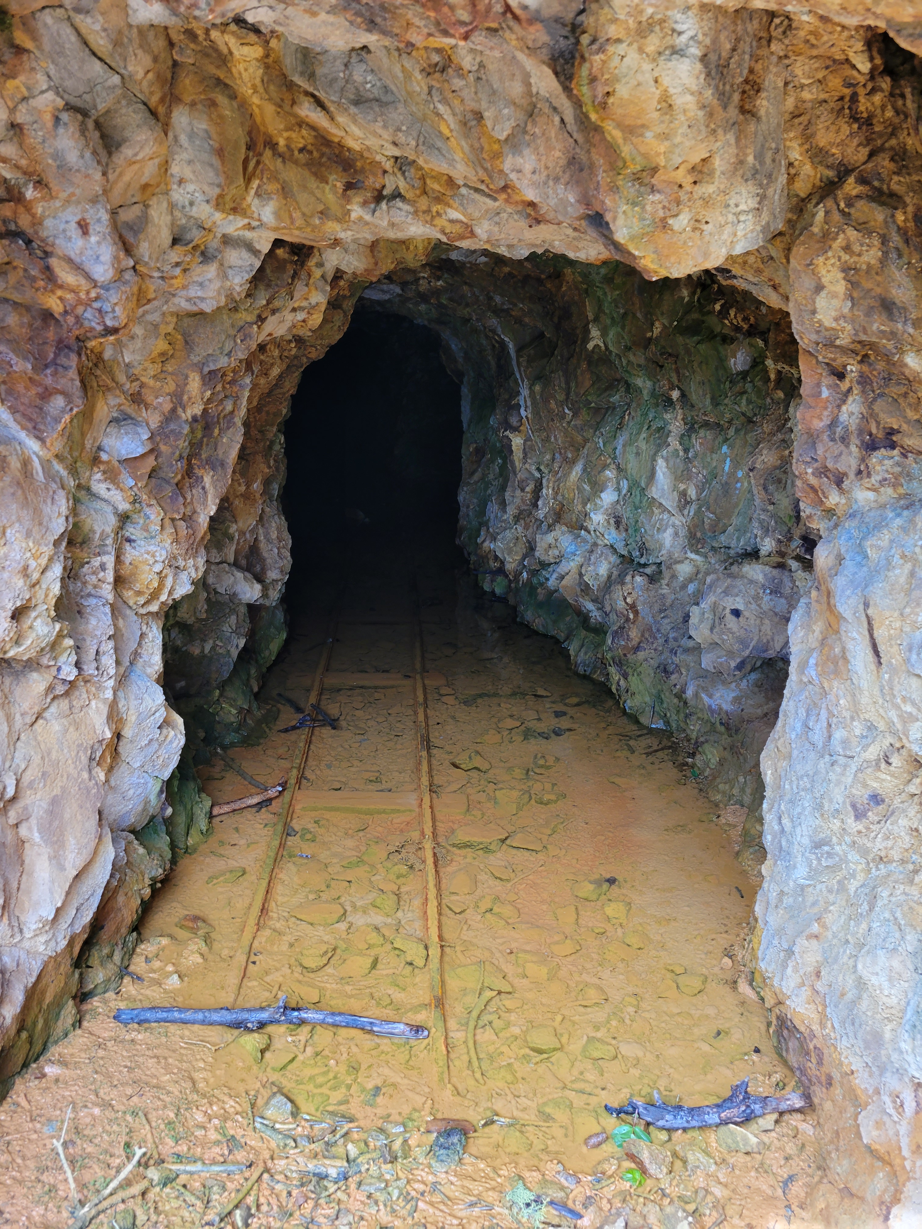
We decided to take two days to do the craggies, and why not? I hadn’t camped in months, weather looked amazing, it was a 4hr drive each way, let’s enjoy it. My car was behaving strangely so I hitched a ride with Rob (“Have you had the salted baguettes in Mazama?” “No….” “Well we’re stopping there on the way home if we have time” okay, you have piqued my interest), and we met Mike at the trailhead around 10:30am. It was 3.5 miles to camp at Copper Glance Lake and like I said I tripped immediately and banged up my knee clambering over a log. Good first impression, forgetting how to walk. I am also convinced the trail is deceptively steep (or I am deceptively out of shape). It switchbacks at the entrance to an old mine, I’m a chicken and didn’t walk in but it looked like you could explore quite a ways. Supposedly there is another entrance higher up the slope, but that one’s blocked, and mines are for ghosts and whatever was in The Descent anyway so I’ll keep my distance.

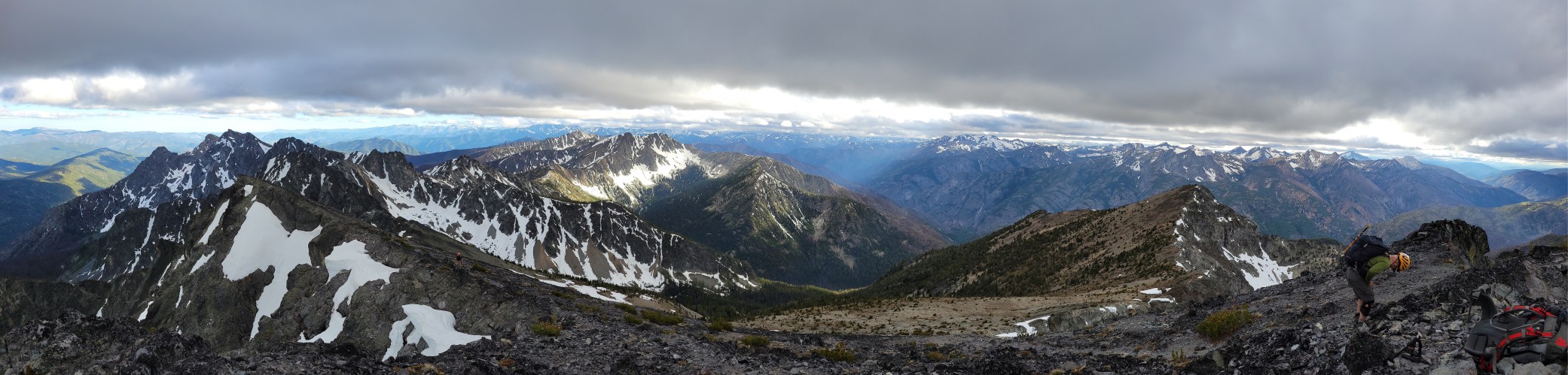
If you thought it was steep before the mine, it’s worse after. But views start opening up, and you can see peaks through the toothpicks of burned trees from a 2018 wildfire. The undergrowth is rebounding, super green, and it’s crazy to think just a few years ago this was forest with no peakaboo views. I also just found out that this is the same fre that burned east of Shellrock Pass in my Pasayten trip last year (pic example here). Crazy to see how different the areas look just a few months apart. The trail starts to traverse finally, but don’t get complacent just yet, because the blowdowns start to pile up. You’ll clamber over some, reroute around others, stand in front of some wondering where the trail continues afterwards. I can’t believe this hasn’t been brushed out yet given how short it is and how sweet the lake is. You cross the river, pass a mosquito pond, and (woo!) gain another like 150ft over an alleged cliff band, only to immediately lose the 150ft and continue dropping to Copper Glance Lake. We crossed this four times and every time lamented WHY DIDN’T THEY JUST CONTOUR?! I’m not convinced this cliff band exists. I think they could have contoured.
The lake actually blew my mind. I was NOT expecting a spectacular blue alpine lake with looming giants and larches waiting for the fall. I was surprised by the lack of campsites, but we found a big one directly across the lake from where the trail drops you, and we pitched our tents there. We even had a little stream running next to camp so we didn’t have to hike (all 20ft) to the lake! We decided to go for the peaks that day instead of waiting for the morning, so we packed our bags and got moving once again, back up and over the hump that definitely isn’t dodging a cliff band.
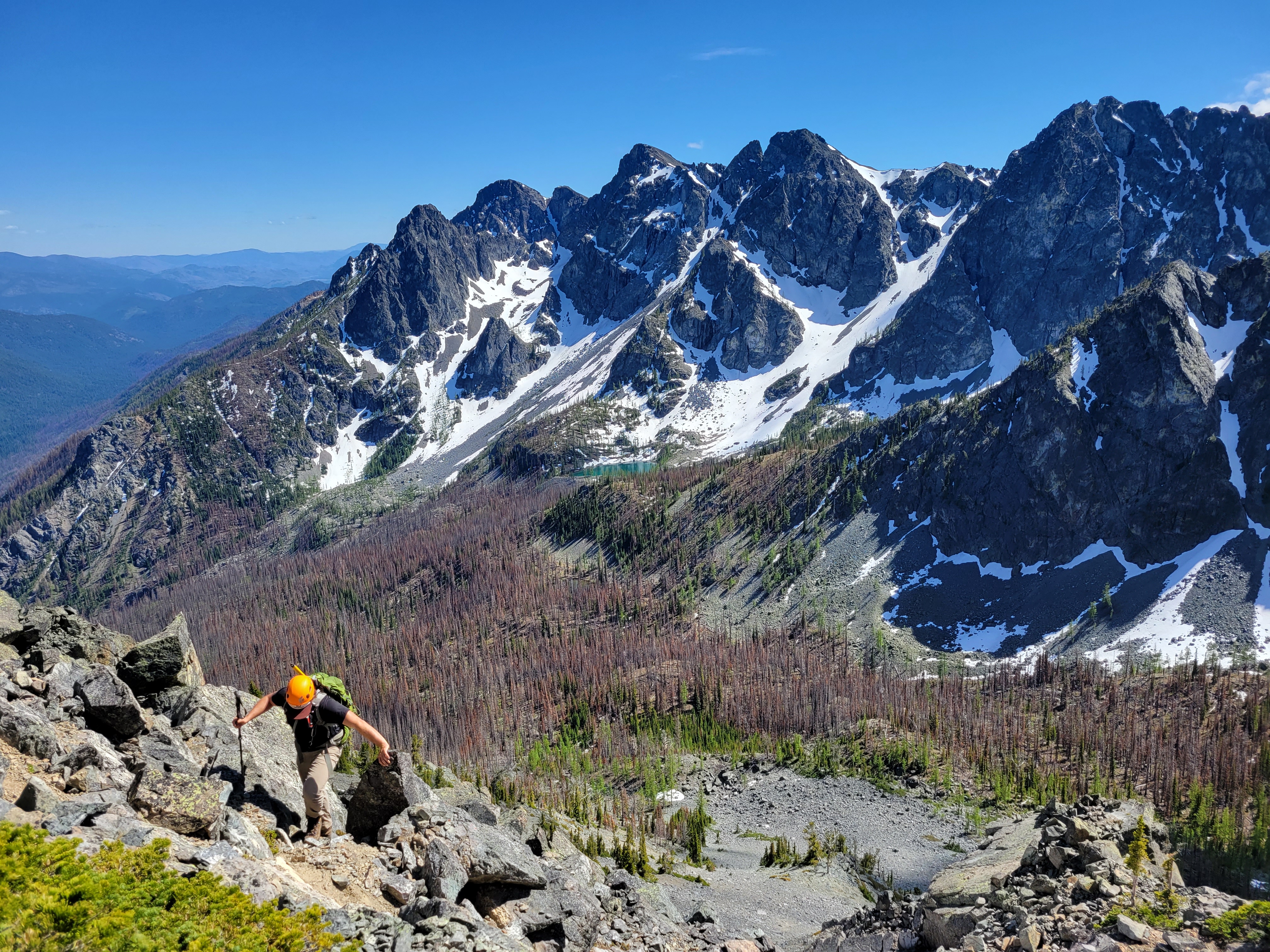
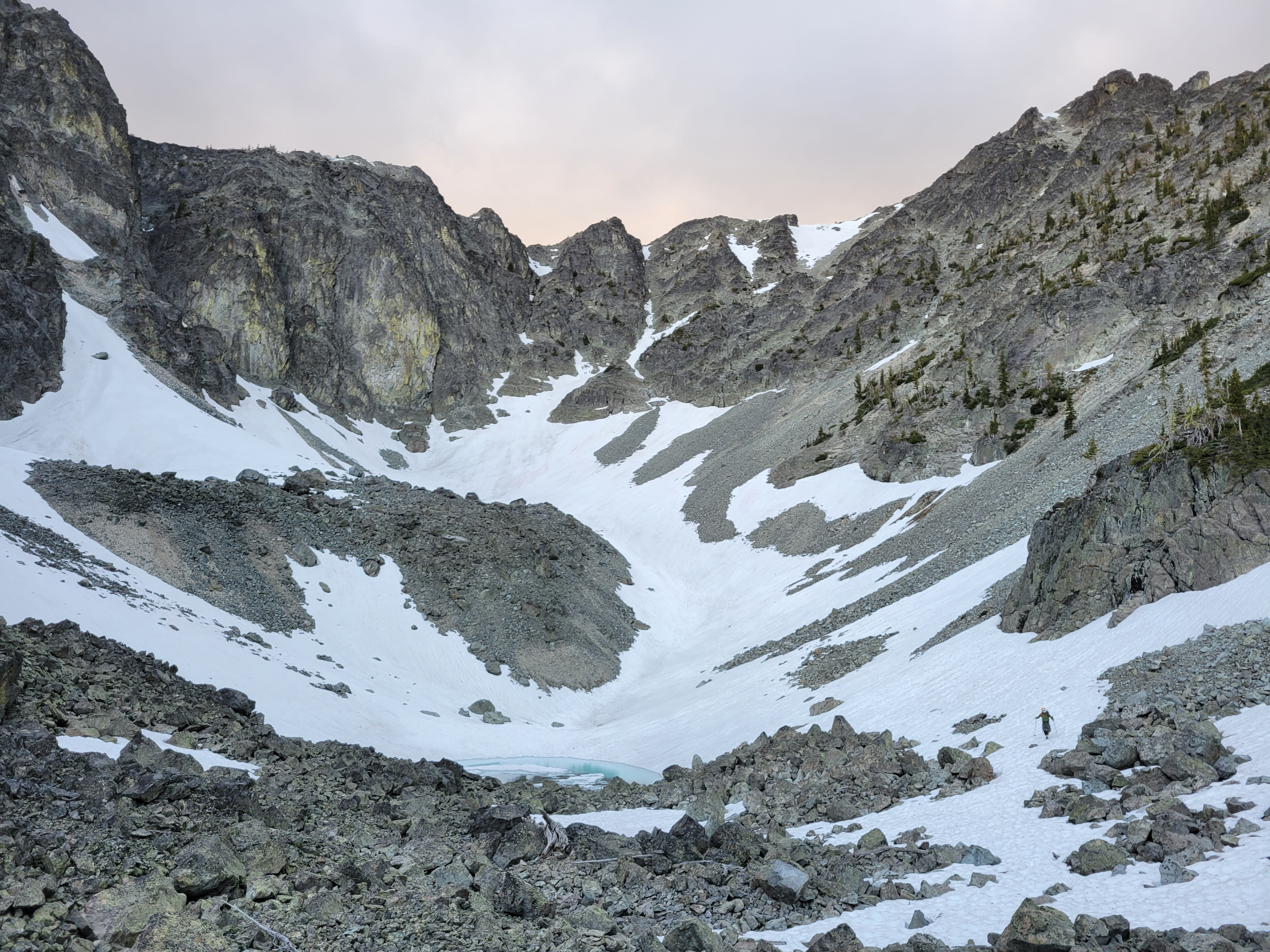
We left the main trail just after the mosquito lake (or just before, if you’re on your way up and not coming from the lake). We expected more of a boot path. Or at least, I did. But maybe whatever was there was destroyed in the fire, because there were barely hints here and there and those hints could have just been game trails. Over and around downed logs and charred remains of trees, kicking clusters of grasses spitting up dozens of mosquitoes, we finally broke out onto the talus field which was such a relief compared to still healing burn zone terrain. At least, at first.
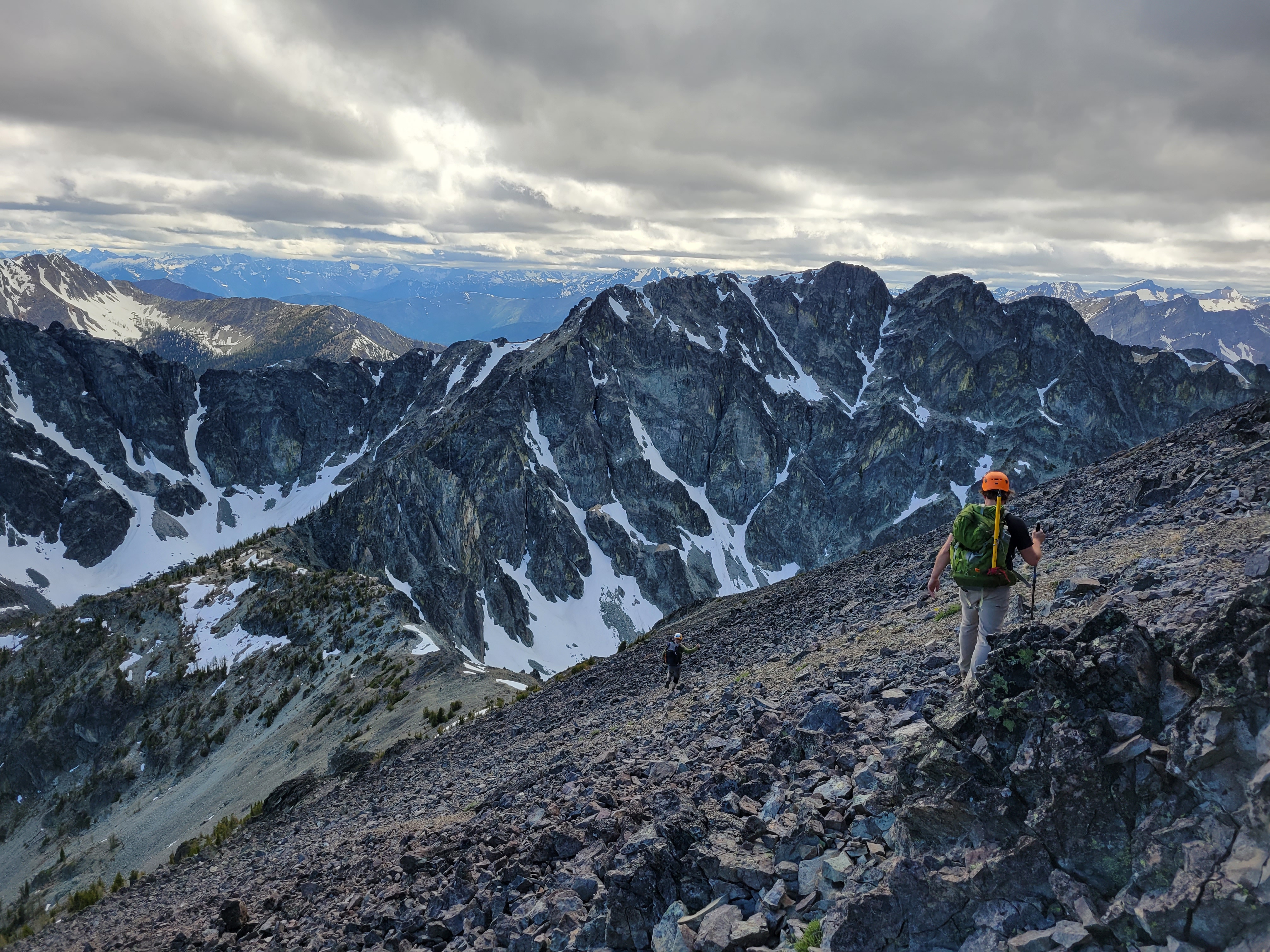
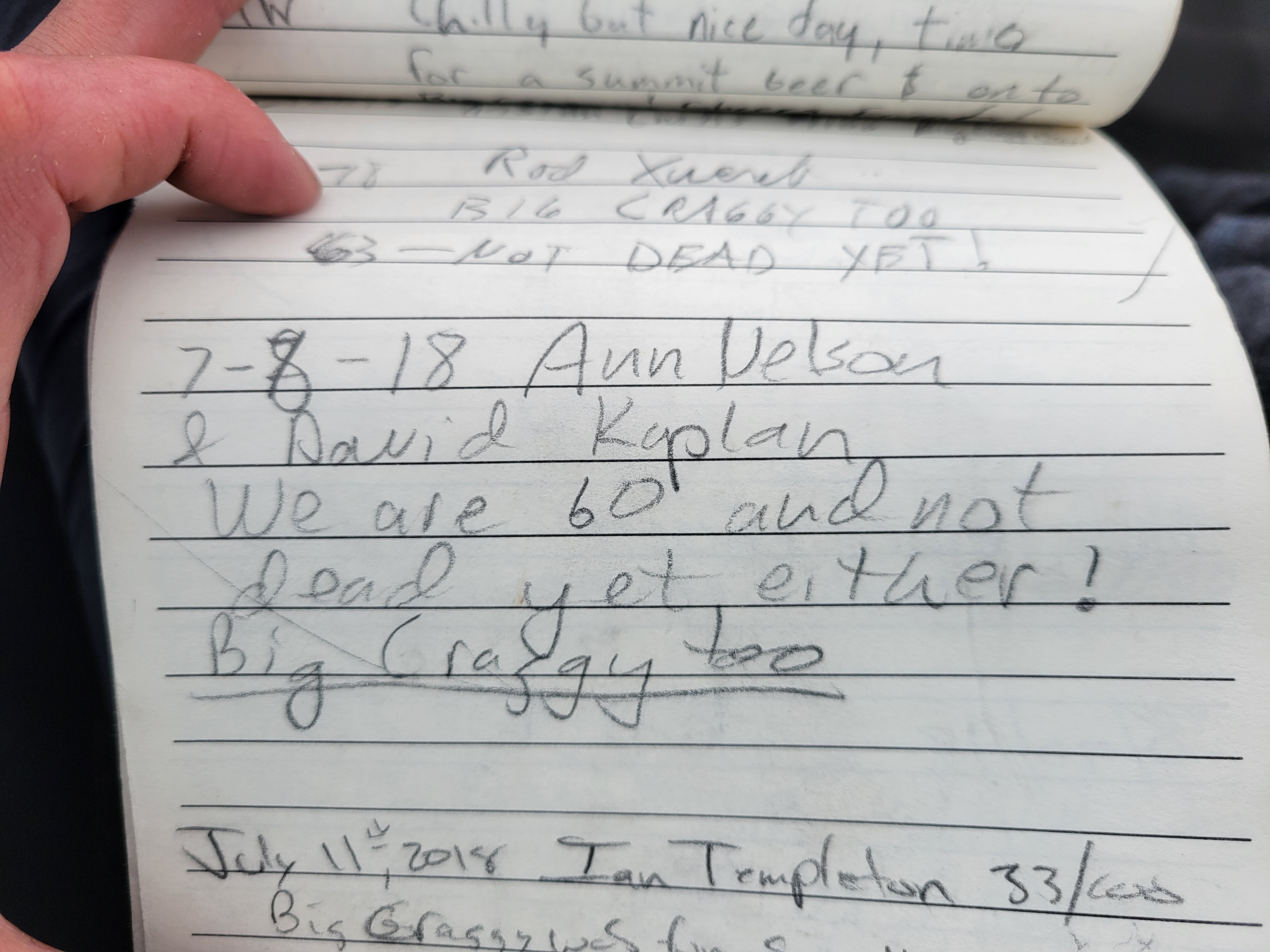
The talus was stable enough, you could hop from rock to rock without too much movement. You literally just climb straight up the talus field, trending slightly left until you’re on the summit. We hit patches of scree that would slide downhill, switchbacked up slightly to avoid kicking rocks down on each other, and occasionally took scramble detours to avoid the tumbling talus. The scrambling was actually quite fun, nothing very exposed but some sections that were definitely 3rd class. Even on the scramble sections you could break off what would have been a nice handhold. We definitely each shouted “ROCK!!” multiple times as we accidentally trundled down some softball sized chunks, but none made serious contact and soon enough we were standing on the summit. Or sitting. I love sitting. I was wearing a bright blue soft shell from an old friend, Ann Nelson. I asked Rob if he remembered her so I could brag about the jacket. Mike had never met her, so I filled him in on the short version – bad ass hiker/climber who helped many of us get started as newbies, and unfortunately passed away in an accident two years ago. The soft shell is absurdly warm and while it’s a bit big on me it’s been one of my favorite layers when I think it’ll be cold up high.
Rejuvenated and ready to start the traverse to West Craggy, we looked to the west and realized huh, that other bump looks taller than this one. What do we do? Well when in doubt, tag both, of course! We ran to the western summit only to look back at the eastern and immediately agree yeah, the first one looks taller. Alright, now let’s get the chossy sidehilling out of the way.
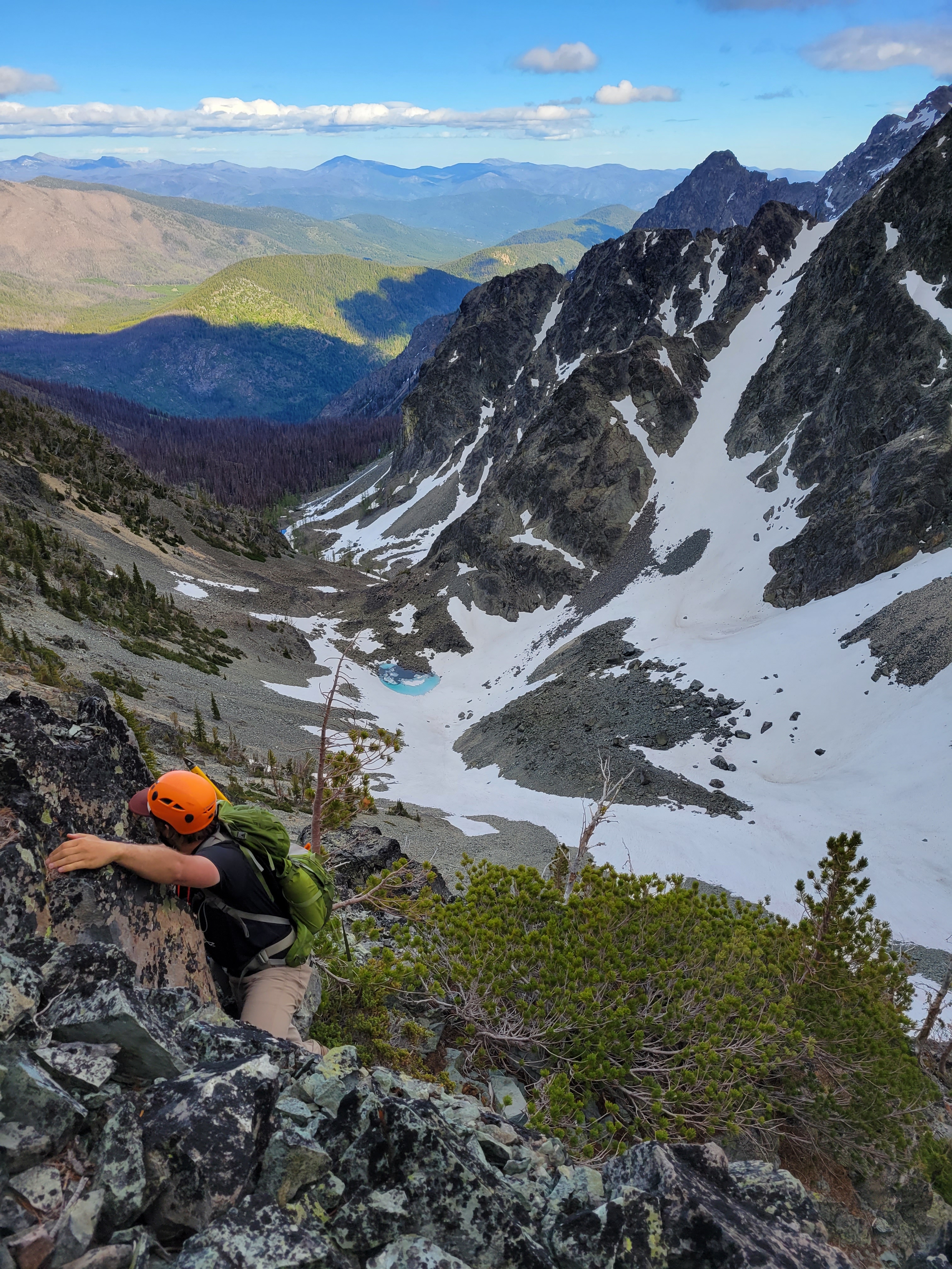
We started the traverse, first dropping down more talus (wow, shocker) and crossing over to the saddle between the two peaks. Where was all the heinous side hilling I had heard about? This wasn’t so bad! We had cruised to the saddle too, so how bad could the rest of the peak be? Ah, the naive confidence of someone lulled into a false sense of security. From the saddle, navigation got trickier. I thought you just followed the ridge to the summit, but you actually traverse onto the southeast face of West Craggy above the basin. This involved following a series of ledges, some third class scrambling, some more loose rocks, more ledges, and finally an obvious gully (very obvious, I promise, like a HUGE FAN of talus) to the ridge. We had been following a gpx track for a while, but eventually gave up trying to stick to it, and I was glad we did – aiming for that gully and following that to the top was definitely the right choice. Doesn’t even feel like a gully, more like a swath of low angle scree and I was sooo happy. We each took a separate rouet up it, some preferring snow, some preferring scrambling, and some preferring slogging up with felt like sand dunes. I turned to Mike. “Less than 500ft to go!” I don’t remember his exact words, but the gist was something like “thank fucking god.”
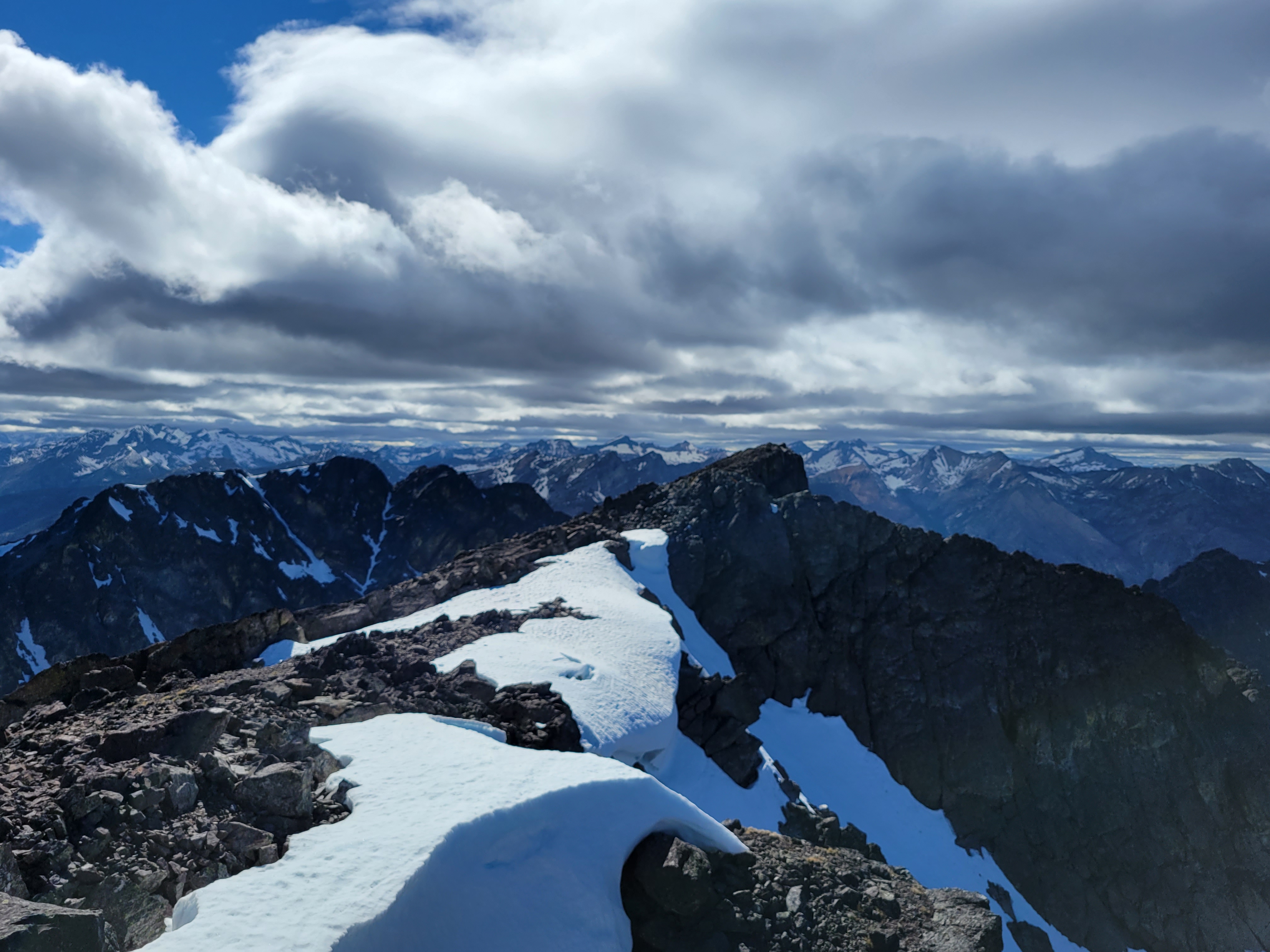
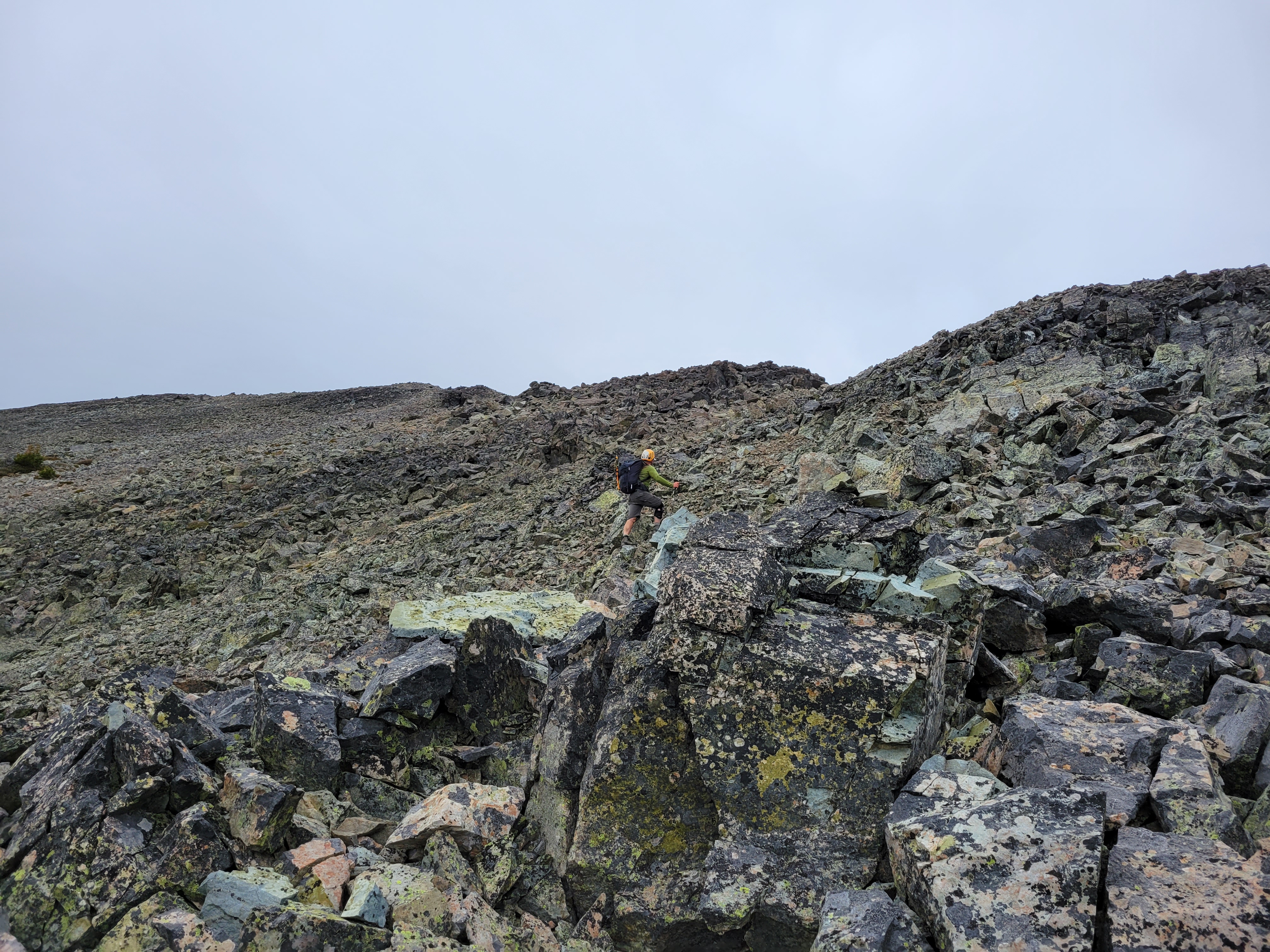
Once you have crested the ridge, it’s reminiscent of Mt. Baker, where you top out and then have to walk like half a mile on flat ground to gain like 13ft to reach the true summit. That’s how this is, except it’s not quite flat, and you’re still hopping on talus instead of walking across easy snow. Rob was ahead, and as we were approaching what I swore was the summit he just said “Oh no, another false summit! The real summit’s another half mile away!” I froze. I would say my heart dropped, but it was more like my heart asked my brain if it should drop and my brain said “hold please” and furiously scrolled through memories. The map. The topo map. Contour lines. The route. How West Craggy looked from afar. No, this had to be it. But I knew we had to traverse a ways, maybe I underestimated the number of bumps on the traverse. Rob started laughing. He must have seen time stop for me as I reevaluated everything I thought I knew. “It’s the summit!! I’m kidding!”

We caught up with Rob on top and we grabbed snacks, layers, and the summit register. Clouds had moved in and wind had picked up and it was getting COLD. Rob signed, handed it to me, I signed. I usually like to flip through pages and look for people I know, but these pages were tightly wound and I was worried I’d rip them, so I just handed it to Mike. He signed, and it split open to one page as he was finishing. “Hey, Ann Nelson!” He handed it back to me, and there was her note & signature from 3 years ago. 6,000ft of gain at age 60, not too shabby. My breath caught and I was overcome for a few seconds, but I took a deep breath and smiled as old grief turned to happiness thinking it was nice to say hi to her and Mike kinda just got to meet her too.
We started down since it was already 6:30ish and we didn’t exactly know the route down since we were doing a loop. Dropping down was straightforward at first, but we got to an impasse – either put on crampons/use ice axe to downclimb steep thin snow, or find another way. I learned later there was a “magic ramp” we definitely did not find. But we made it work. I was donning my crampons for the first time all day (carried em, might as well use em) when I heard Rob shout. “This goes! I mean, kinda!” Oookay, here we go. I took off my crampons and we followed Rob down what I’d probably call fourth class, but that may have been skewed by the looseness and the fact we were downclimbing. The larger rocks were super solid, but everything was covered in kitty litter/talus and Rob stood well out of the way at the bottom so we could kick down/clean anything we had to. At some point Mike started in with the baguettes. “Have you had the salted baguettes in Mazama? I need to get two so my neighbors can try one too.” Rob overheard. “Yes, the baguettes!!” Wtf, how have I not heard of these baguettes? Fuck I need a sandwich.
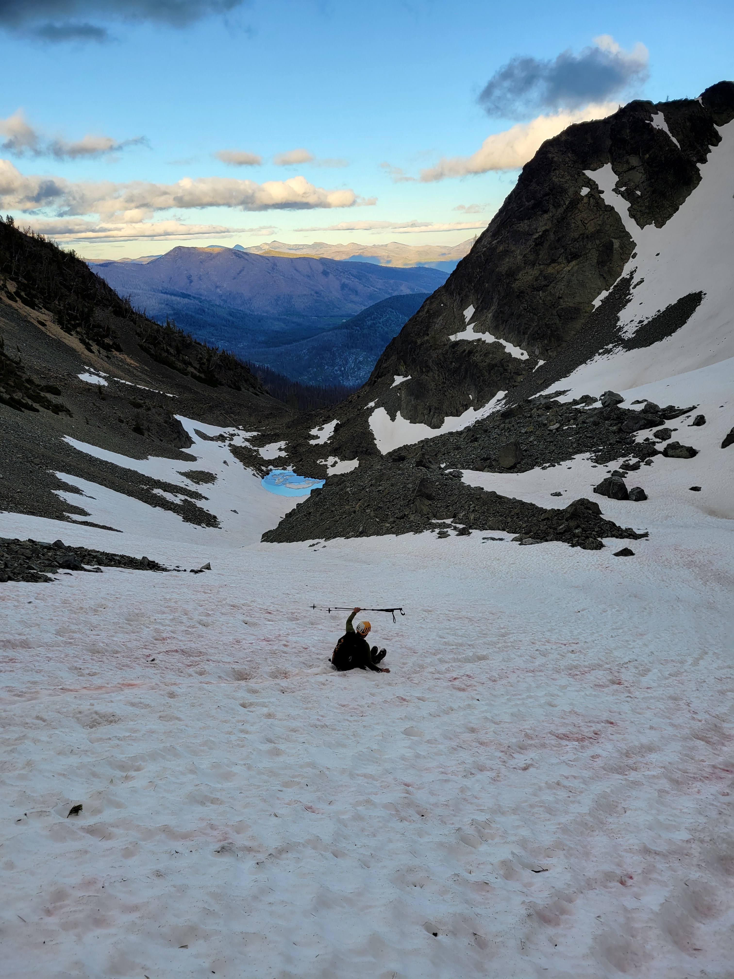
Once on the mellow snow, we CRUISED for the next 45min or so. Coming down snow was the best feeling ever after hours of talus hopping and traversing and downclimbing. Finally we could just plunge step and boot ski and Rob fit in a few glissades (bumpy ones) and ah it was heaven until the postholing began. There are two small tarns up in that basin, barely starting to melt out and neon blue reflecting the sky with ice underneath. When the snow ran out we were back to hopping talus, until Rob found bits of a trail near the river. We lost it as we entered burn zone carnage as we got closer to the main trail, but soon enough we popped out right next to mosquito lake again (YES Rob YES you aimed PERFECTLY). Rob took a break and I asked permission to plow ahead. Permission granted. Mike and I approached the base of the steep gain between us and the lake to avoid the alleged cliffs. You ready for this? I’m ready for bed, that’s what I’m ready for. We trudged up it, driven probably by the odd combo of exhaustion and determination.

Back at camp I filled up on water and got the stove ready before sitting down. If I could pull it off at Dot Lakes I could pull it off here. Mike had a sandwich I side-eyed/envied and went to bed immediately, Rob and I split a beer and stayed up chatting while cooking dinner. Lucky to have good company at camp. As soon as I got in my tent, it started raining. I reluctantly pulled all my yard-saled gear in the tent and went back to sleep, constantly woken up by the wind. But my tent didn’t blow away with me in it and nothing got wet, and that’s about all you can ask for.
We woke up to perfectly blue skies and no wind on Sunday. We had a relaxed breakfast, and headed back to the trailhead. Going down was easy, but a bit of a knee banger. That trail feels longer than 3.5mi especially when you’re talking about baguettes for the 8th time. We were back at the car by 10:30 and eating salted baguettes in Mazama(!!!!) by noon.

In case anyone was concerned, I did manage to singlehandedly finish the baguette before it went stale.

Love that last photo!
LikeLike