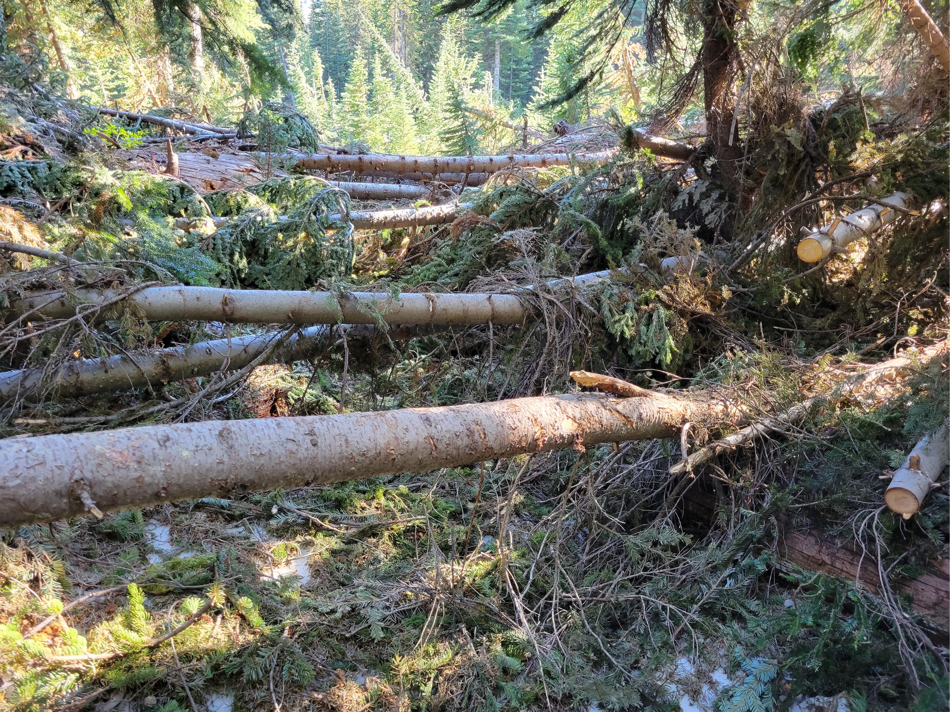
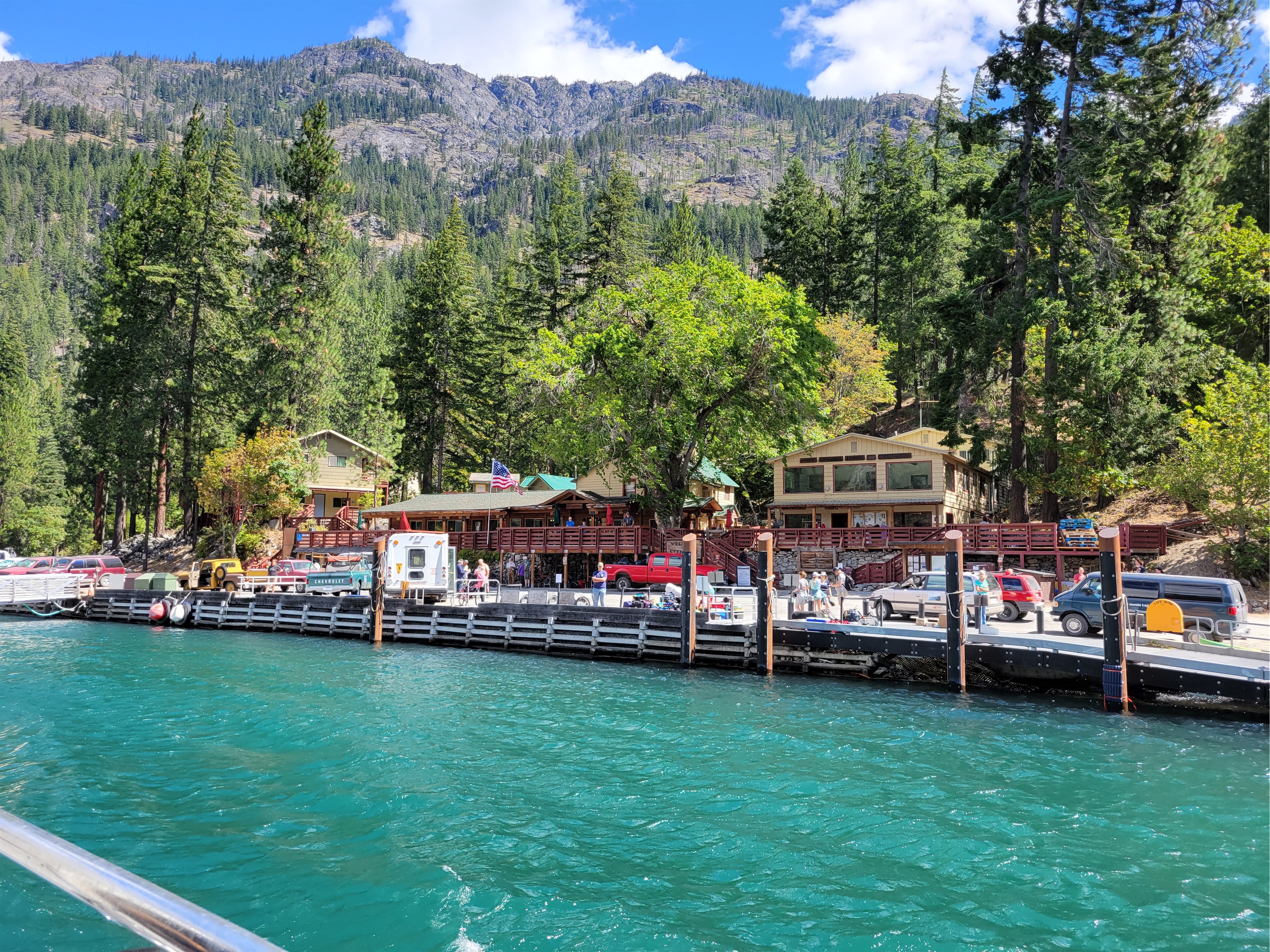
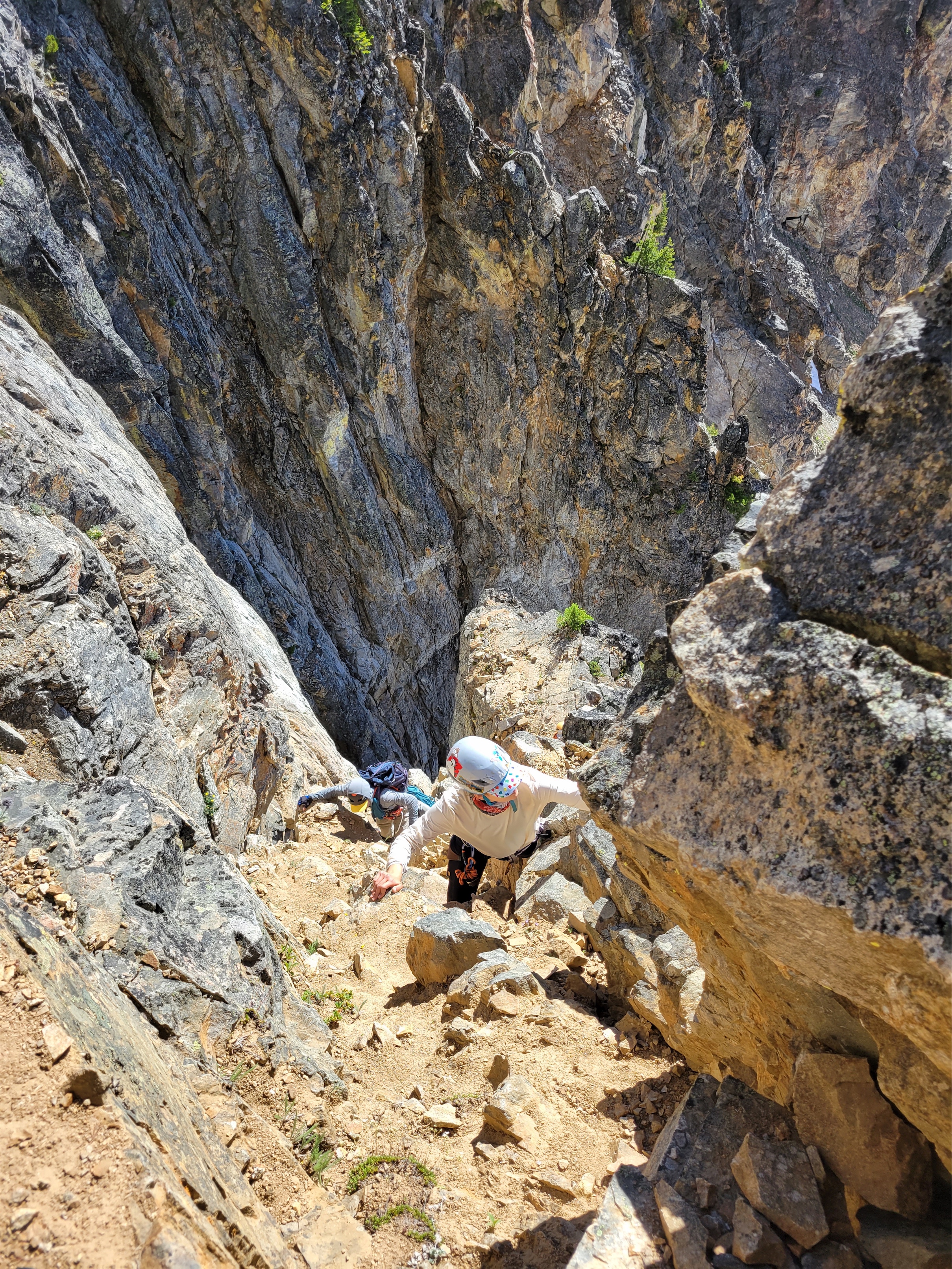
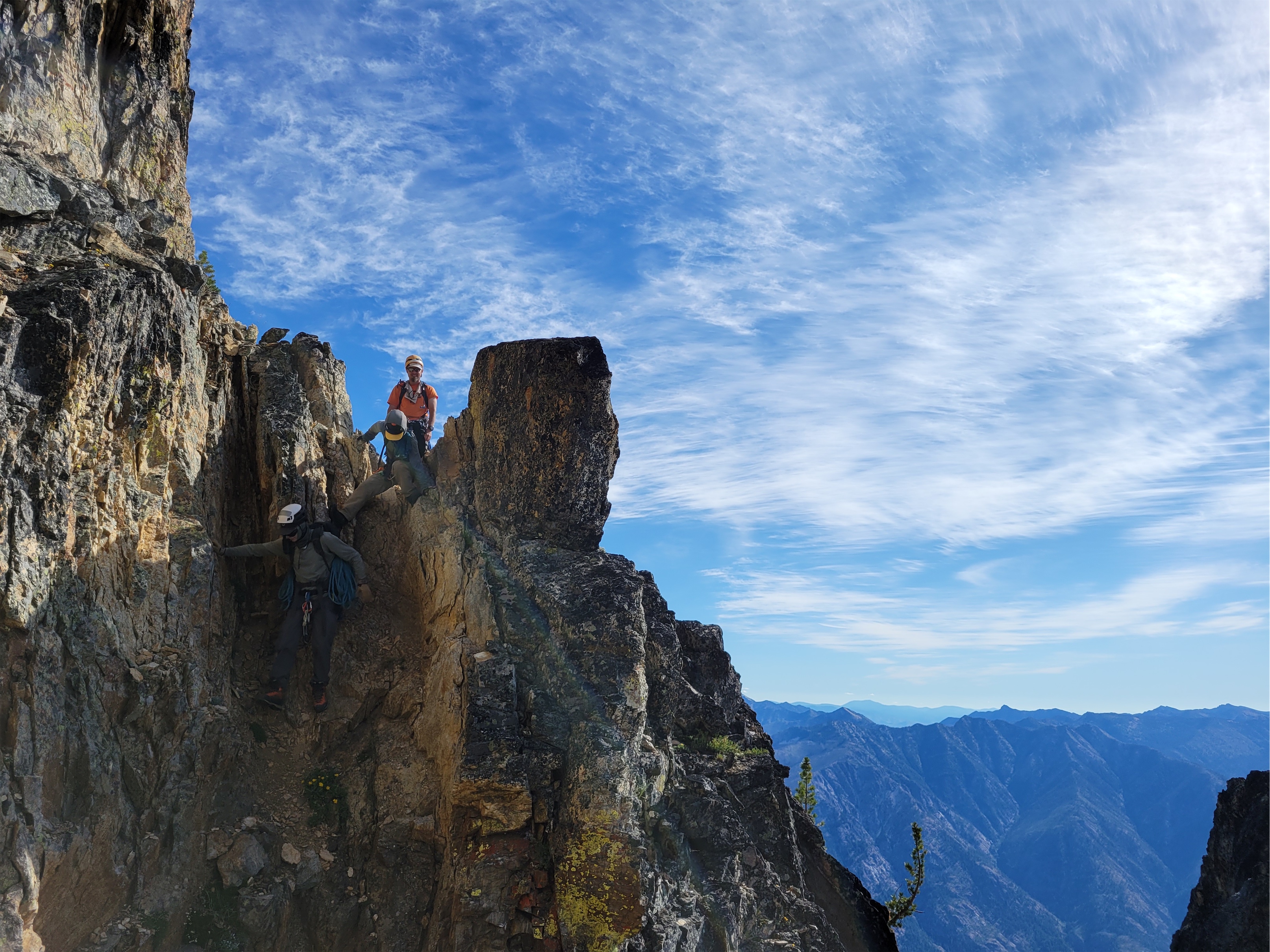
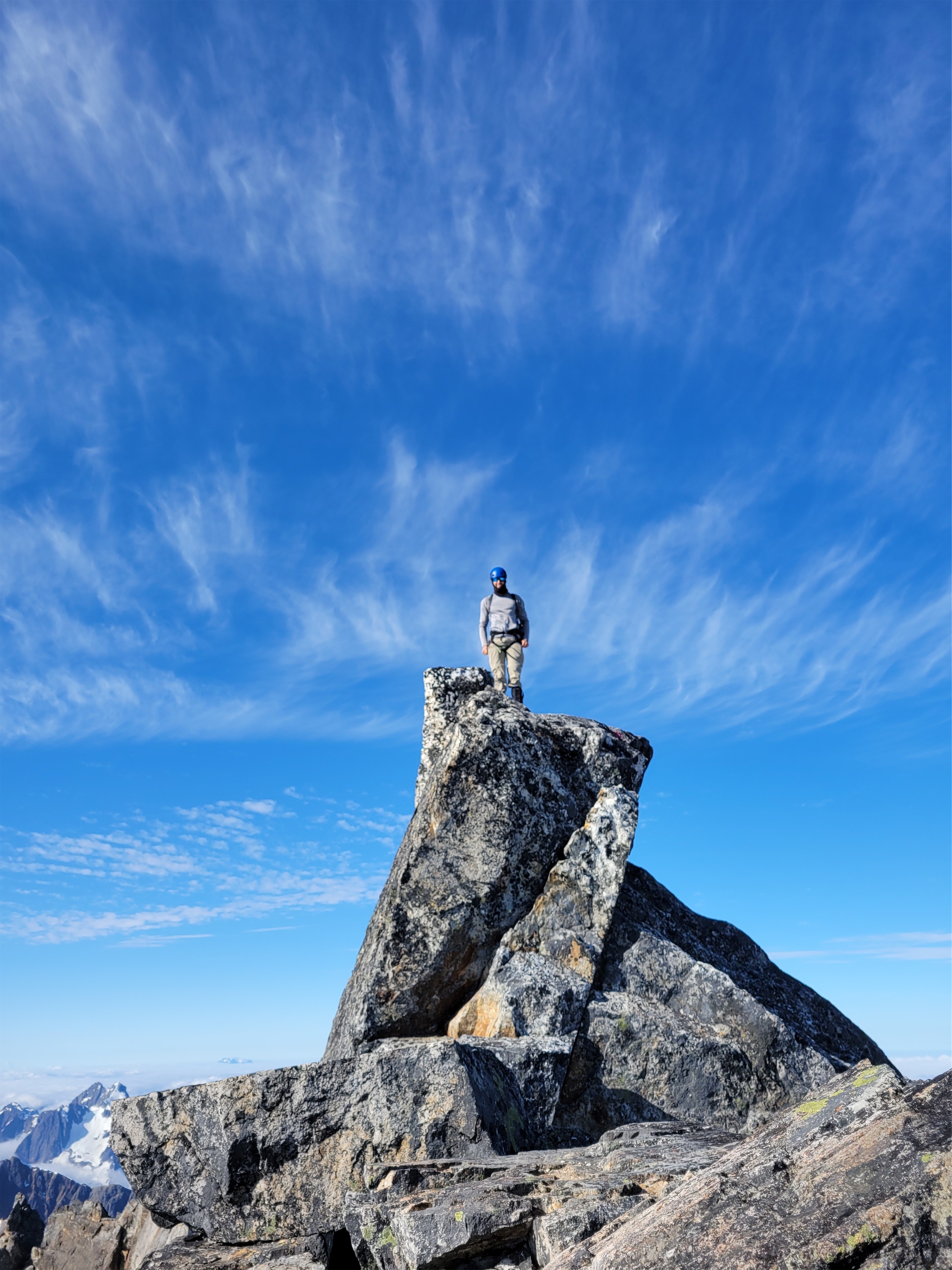
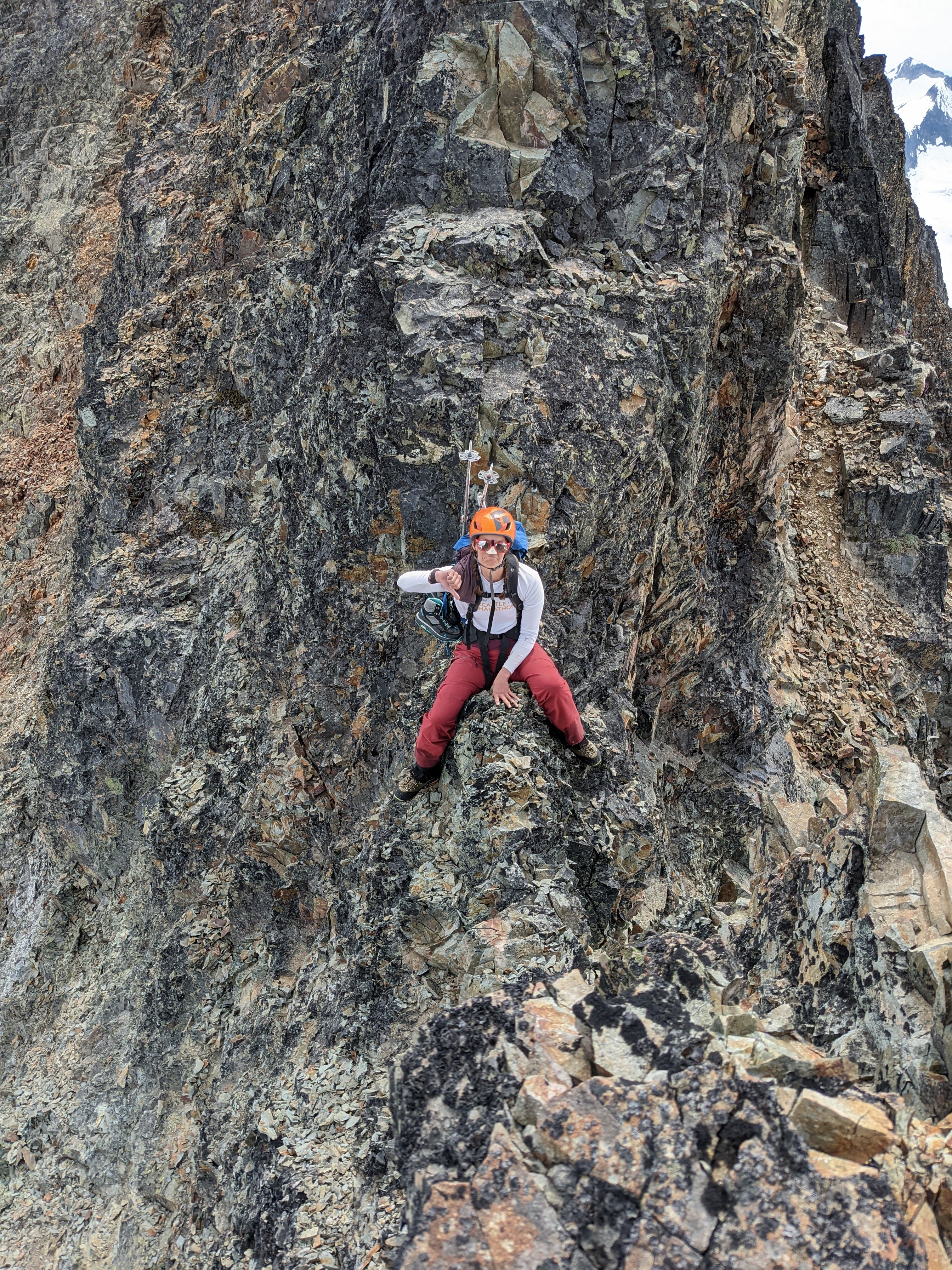
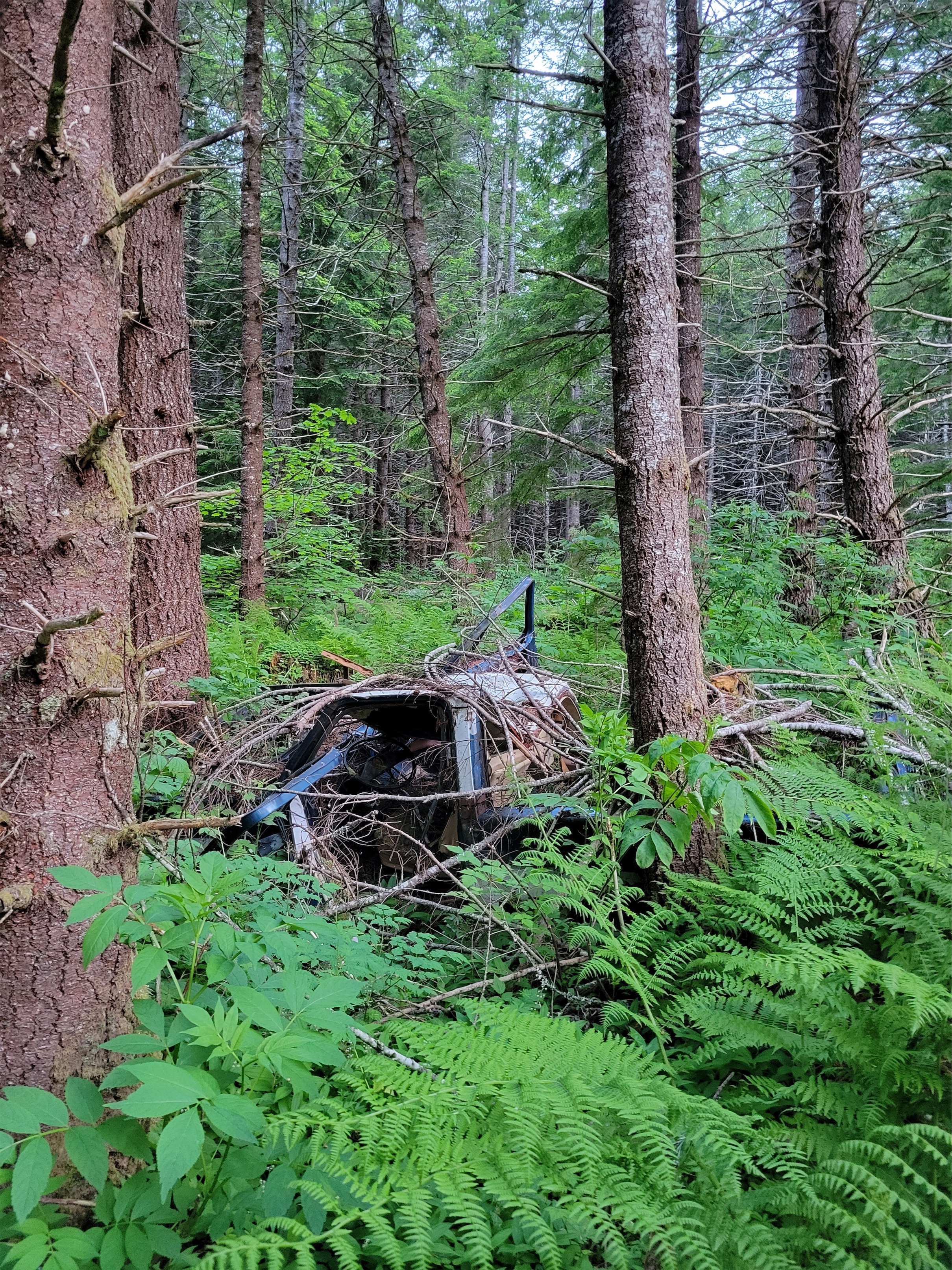
In stark contrast to flowers, this is where we started our journey
Yep, you heard me. I finally left the country. I had done Watersprite Lake as a ski trip years ago (never wrote about it) and entered North Cascades National Park from BC years ago too, but this was my first summer endeavor, and let’s just say I can’t believe it took me 10 years being out here in the PNW to go venture across the border in the summer.
Bonus loo on the Singing Pass trail
Let me set the scene. Sarah and I were wild-fired out of our original plan. We were driving back from a sunset hike the weekend prior, it was like 2 in the morning, every trip she proposes is something I’ve already done, I’m looking for novelty, and suddenly she says “well what about BC?” I’ve done practically nothing in BC. BC might as well stand for [I] Barely Care [because there’s so much to do in Washington] [and also the idea of an entire country of peaks is overwhelming so I avoid it because it causes anxiety]. She pulled up their national park website to see what camping permits existed. “Well, there’s…. one permit for Friday, and that’s the only permit in any park in BC until…. September.” “What’s it for?” “Russet Lake? Do you know it?” “Nope. Take it.” And then and there, she grabbed us the last remaining permit for campsites in BC all summer, and I guess we had plans. i5 was a dark desolate corridor save for two women cheering in a bright yellow SUV.
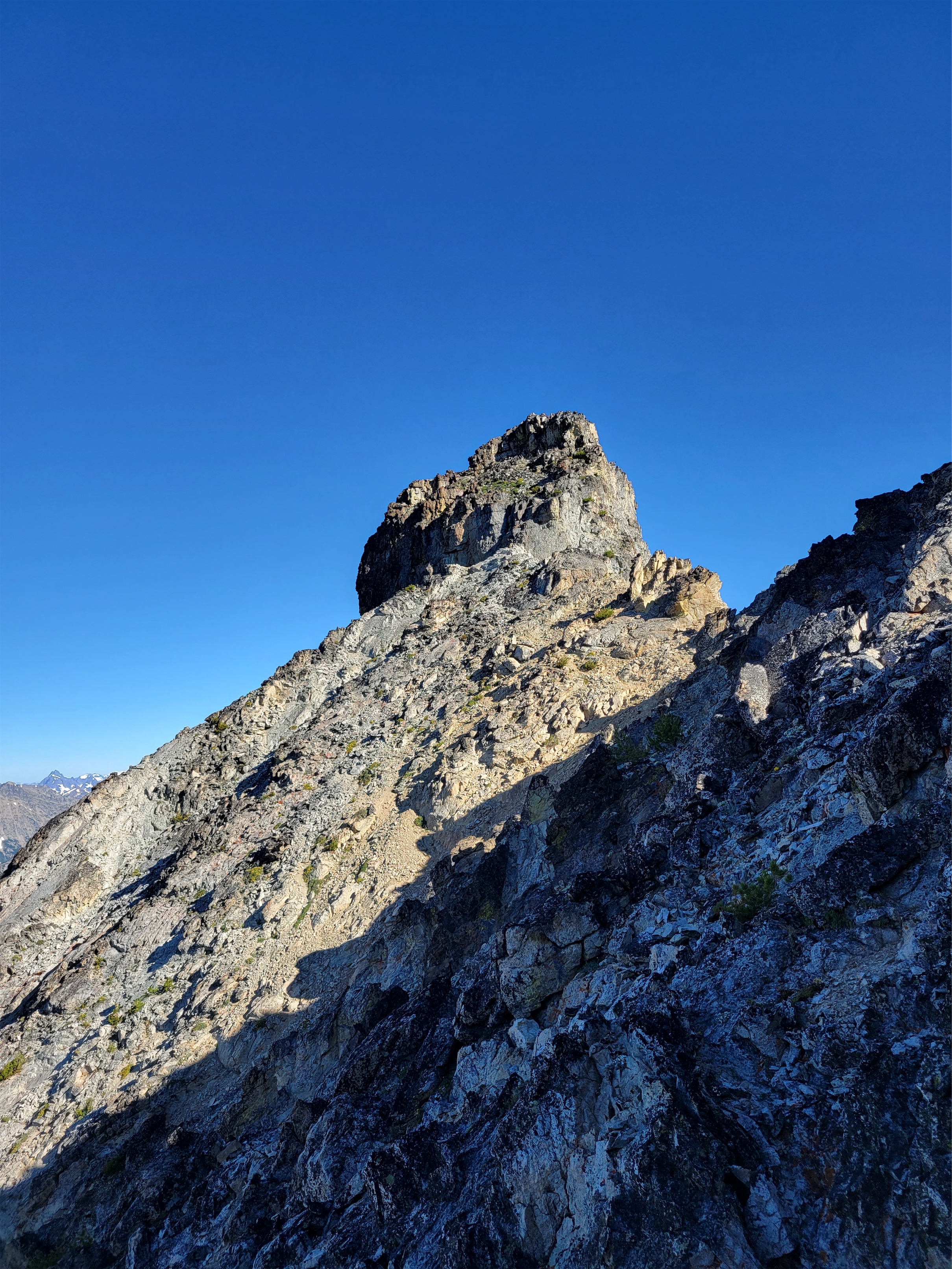
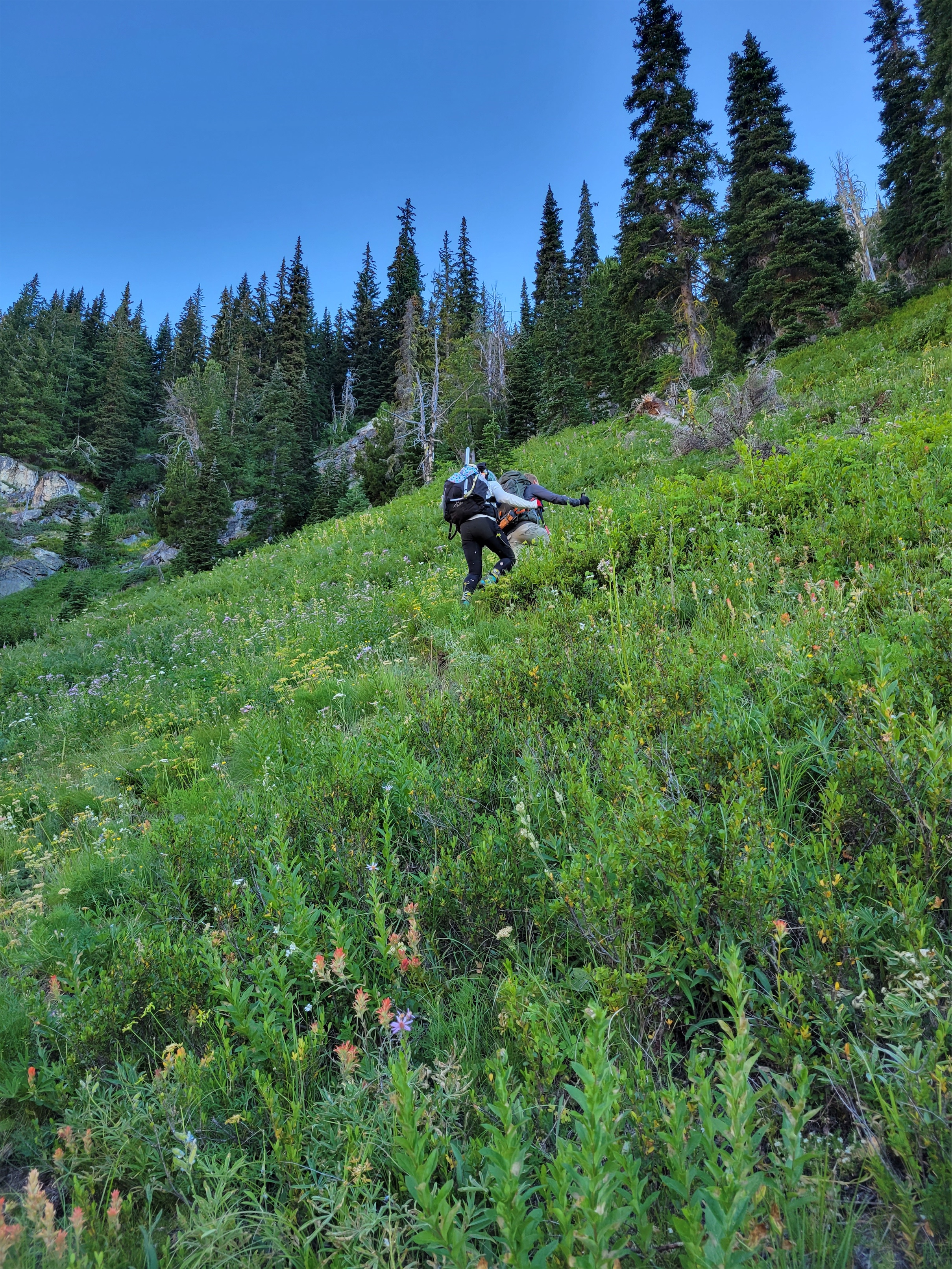
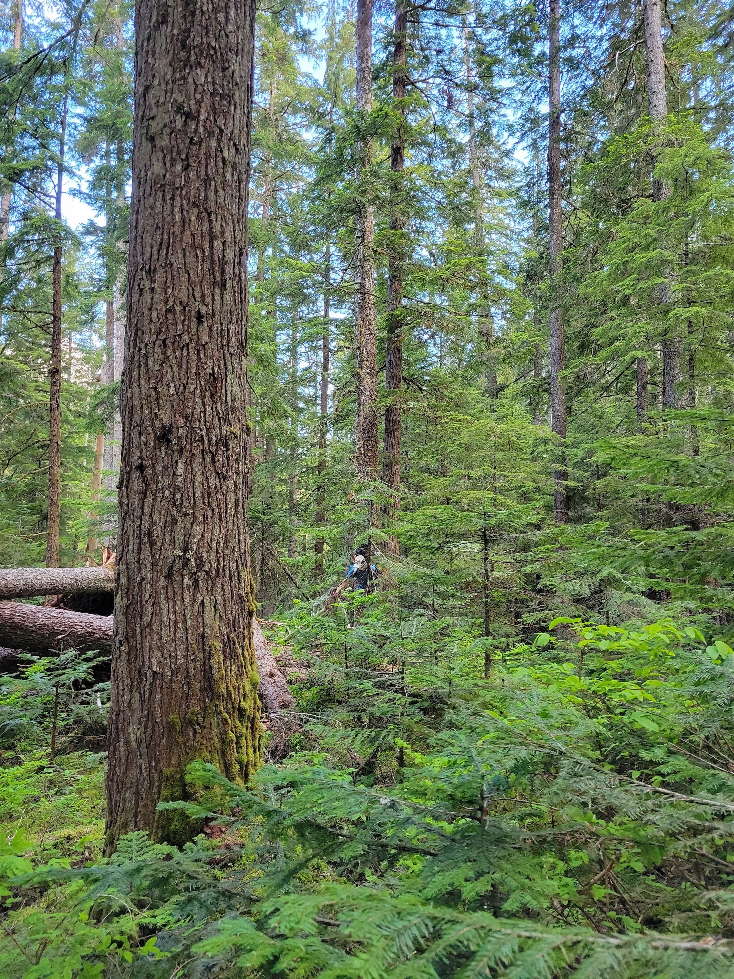
One of the few variations in the approach trail
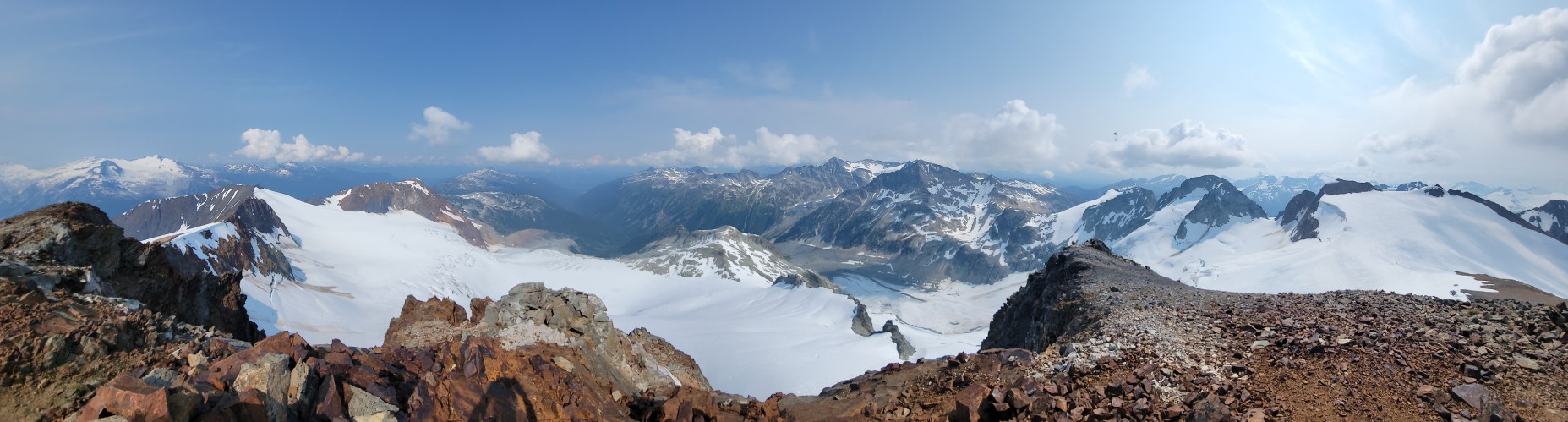
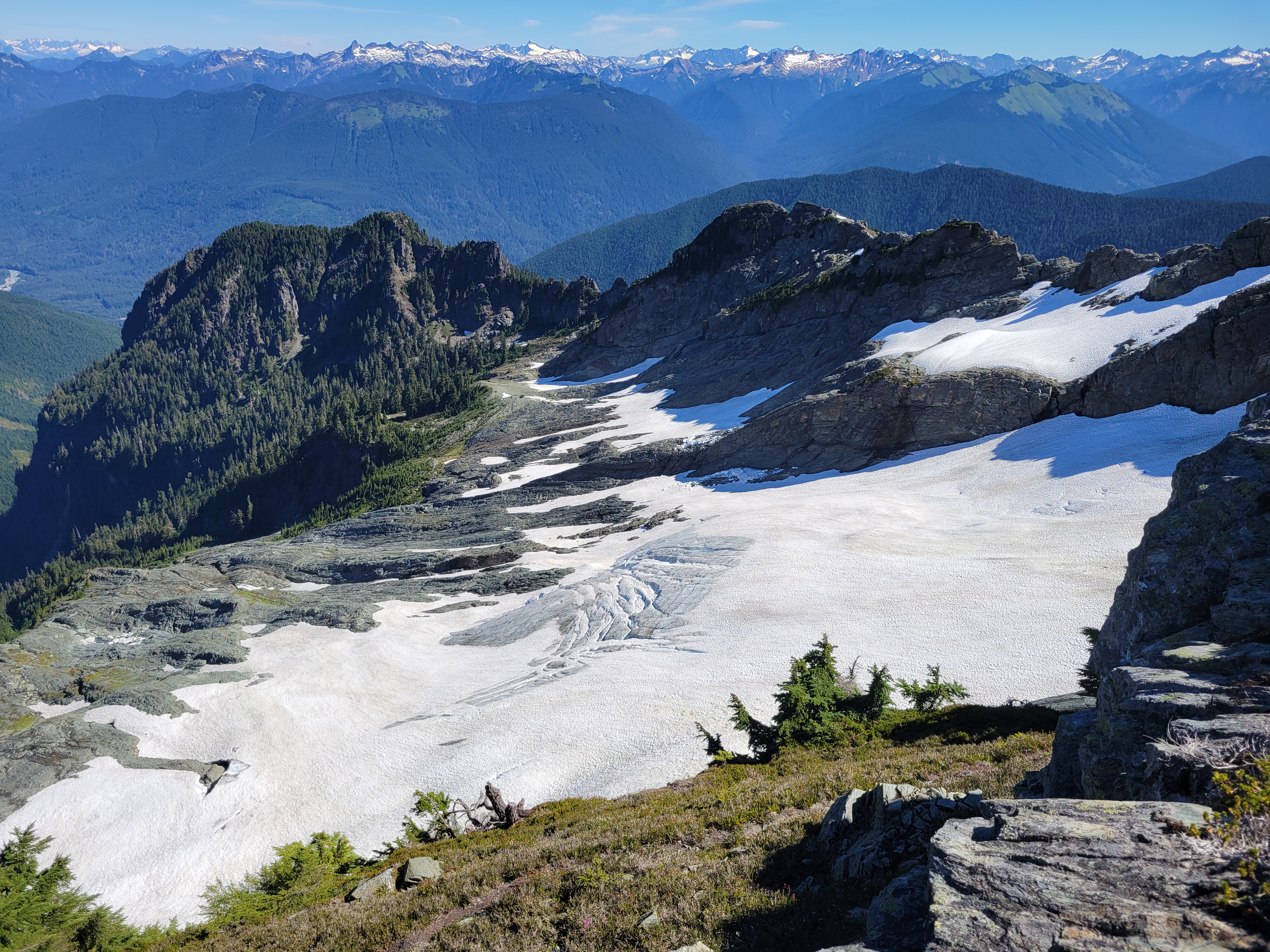
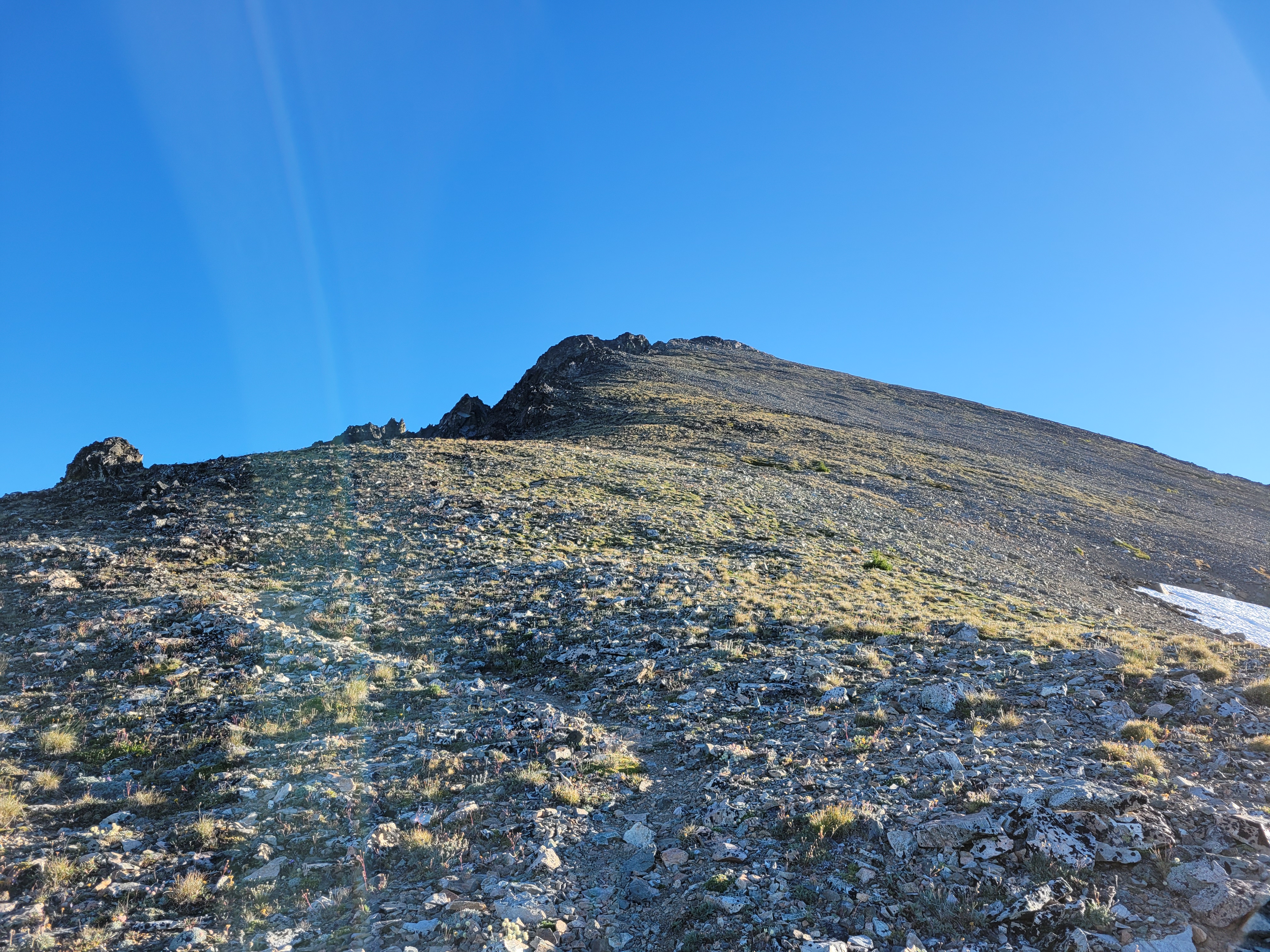
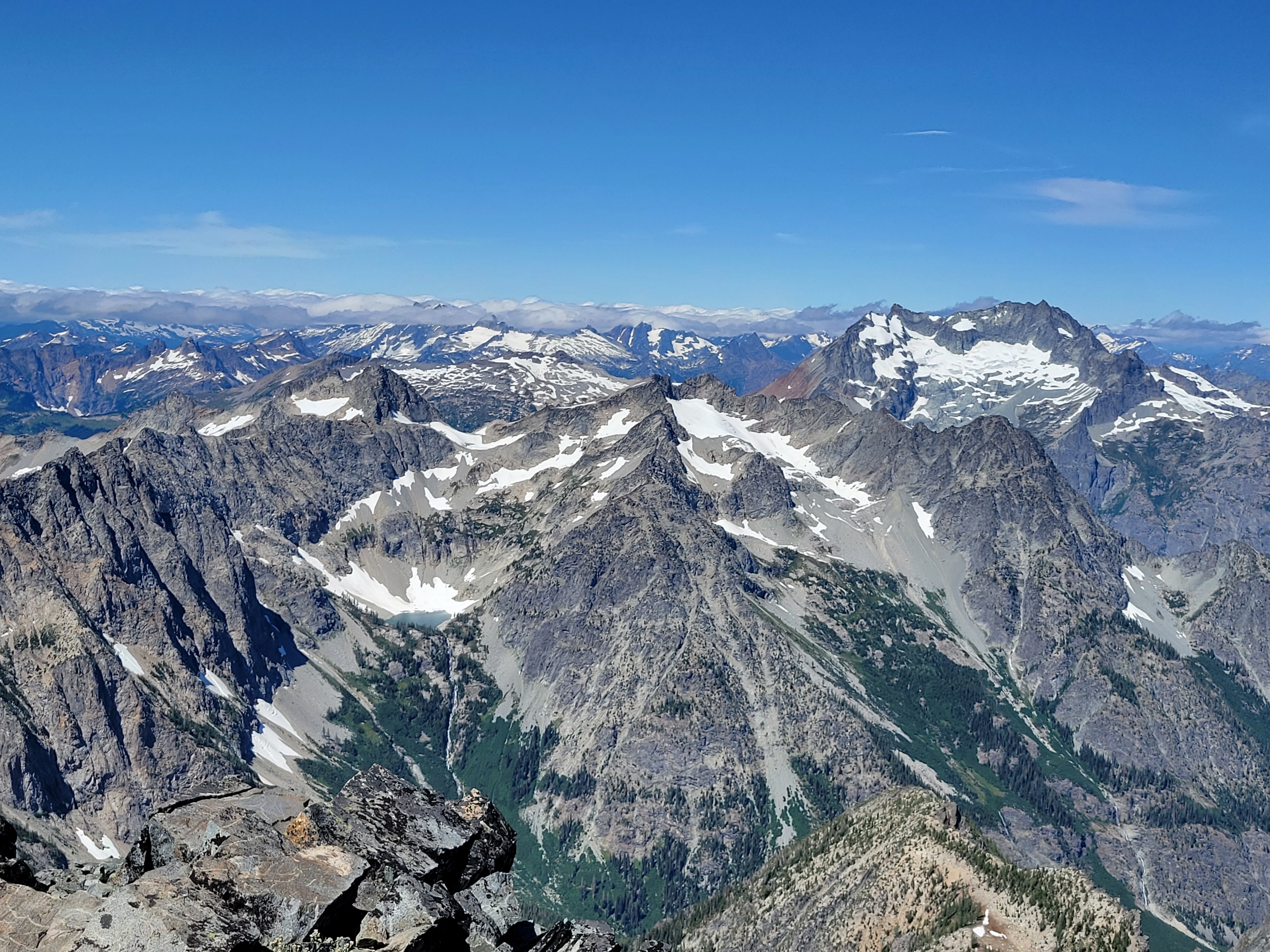
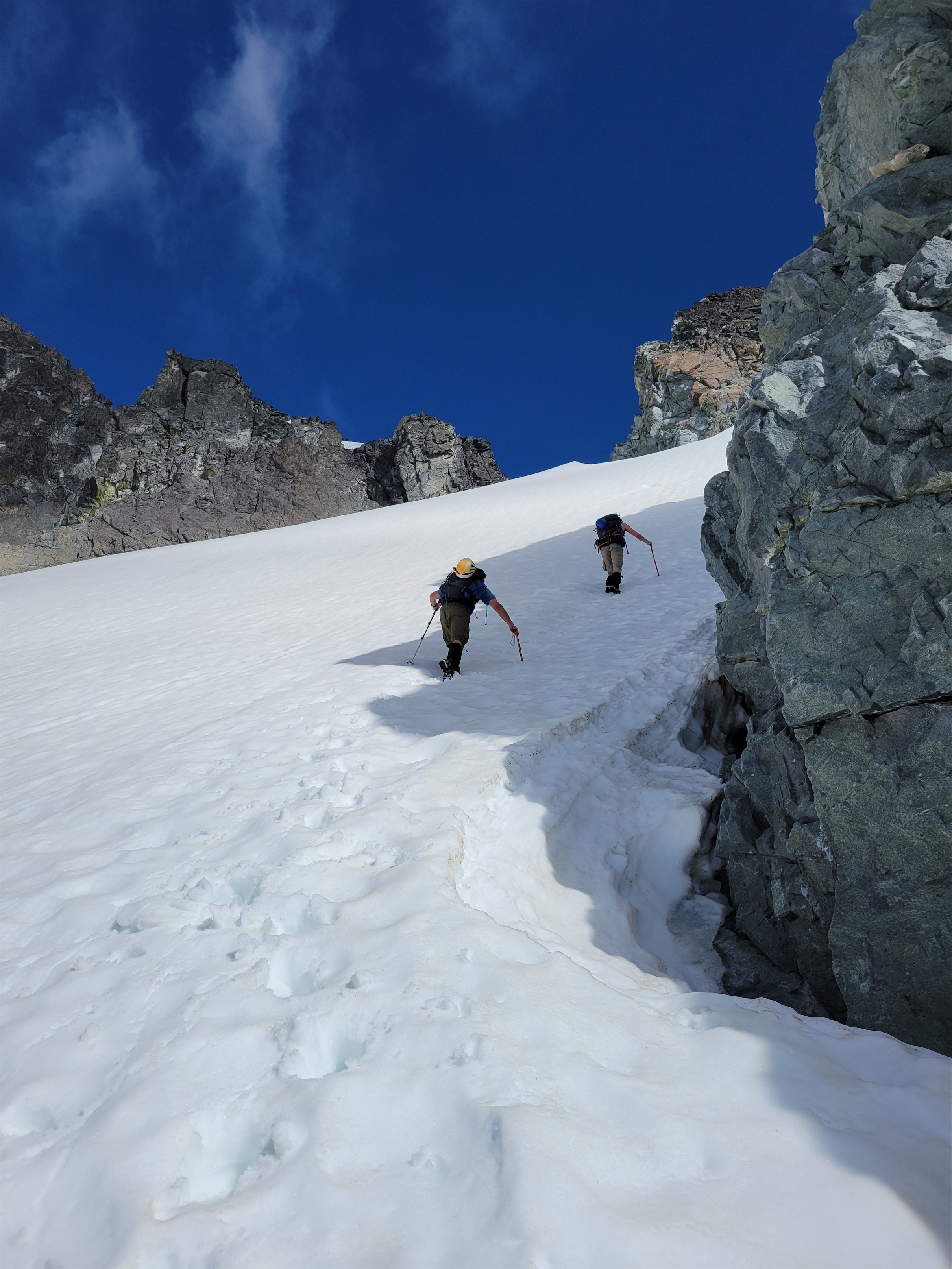
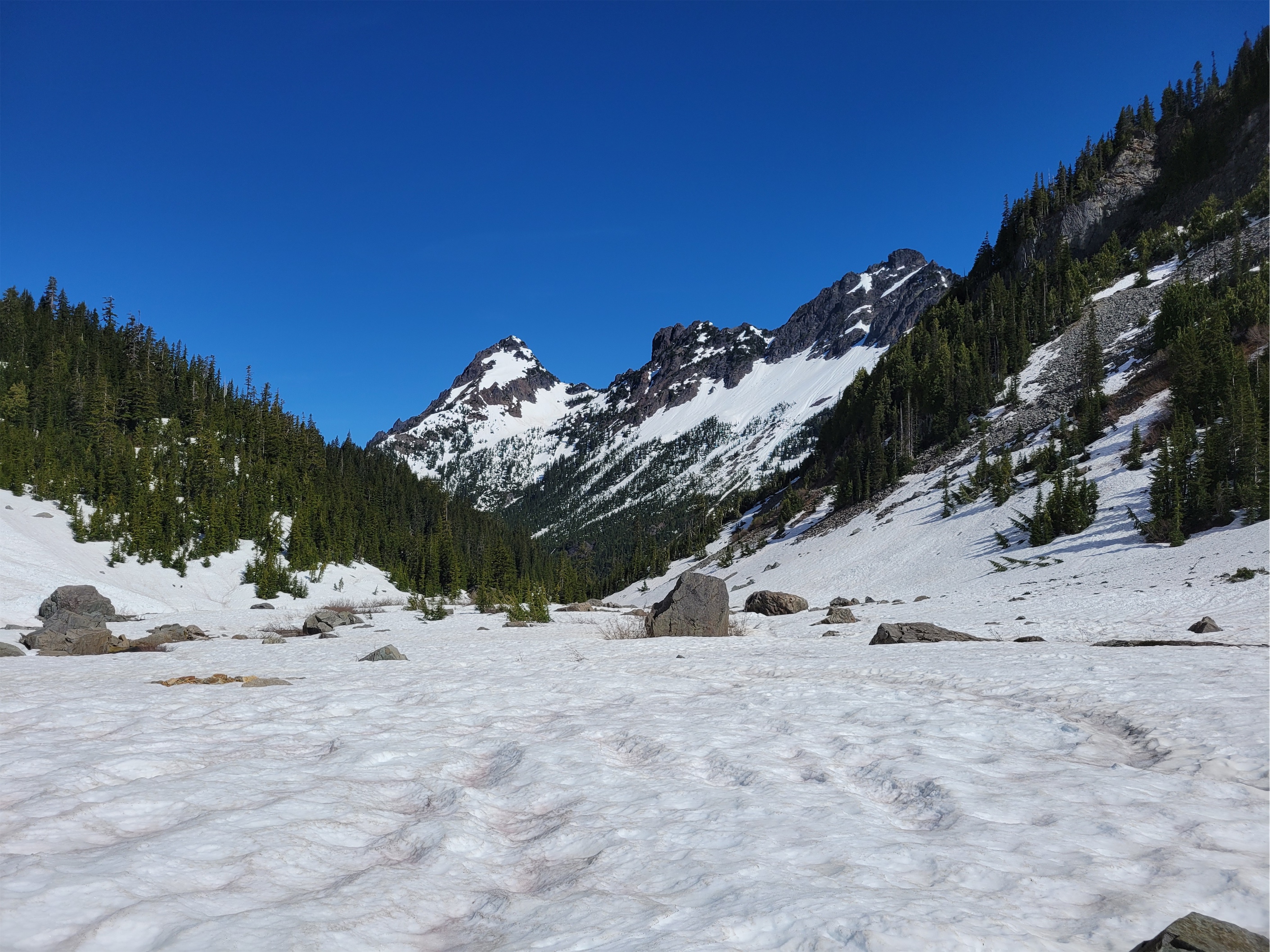
I looked up Russet Lake on caltopo, and saw the dotted trail to Overlord Mountain. If a trail is on Caltopo that usually means it’s decently popular and well traveled. Trip reports for both Russet Lake and Overlord were underwhelming. Russet lake looked like it was just in a barren rocky basin, there was a hut right next to it which bothers me even though I know it’s amazing, and Overlord looked like a choss pile of a walk up, and there were no wildflowers to be seen. And the hike started at a ski resort. Whistler. Yuck. Spoiler: I was oh, so, so, so wrong.
Distance: 21mi including Overlord (something like that)
Elevation gain: 8500ft including overlord. 5500 for Russet lake if you do it backwards. Like 3500 if you do it as recommended.
Weather: 60’s and sunny
Commute from seattle: 5.5hrs? Oof.
Did I Trip: NO SIR
Attempting to capture layers of green
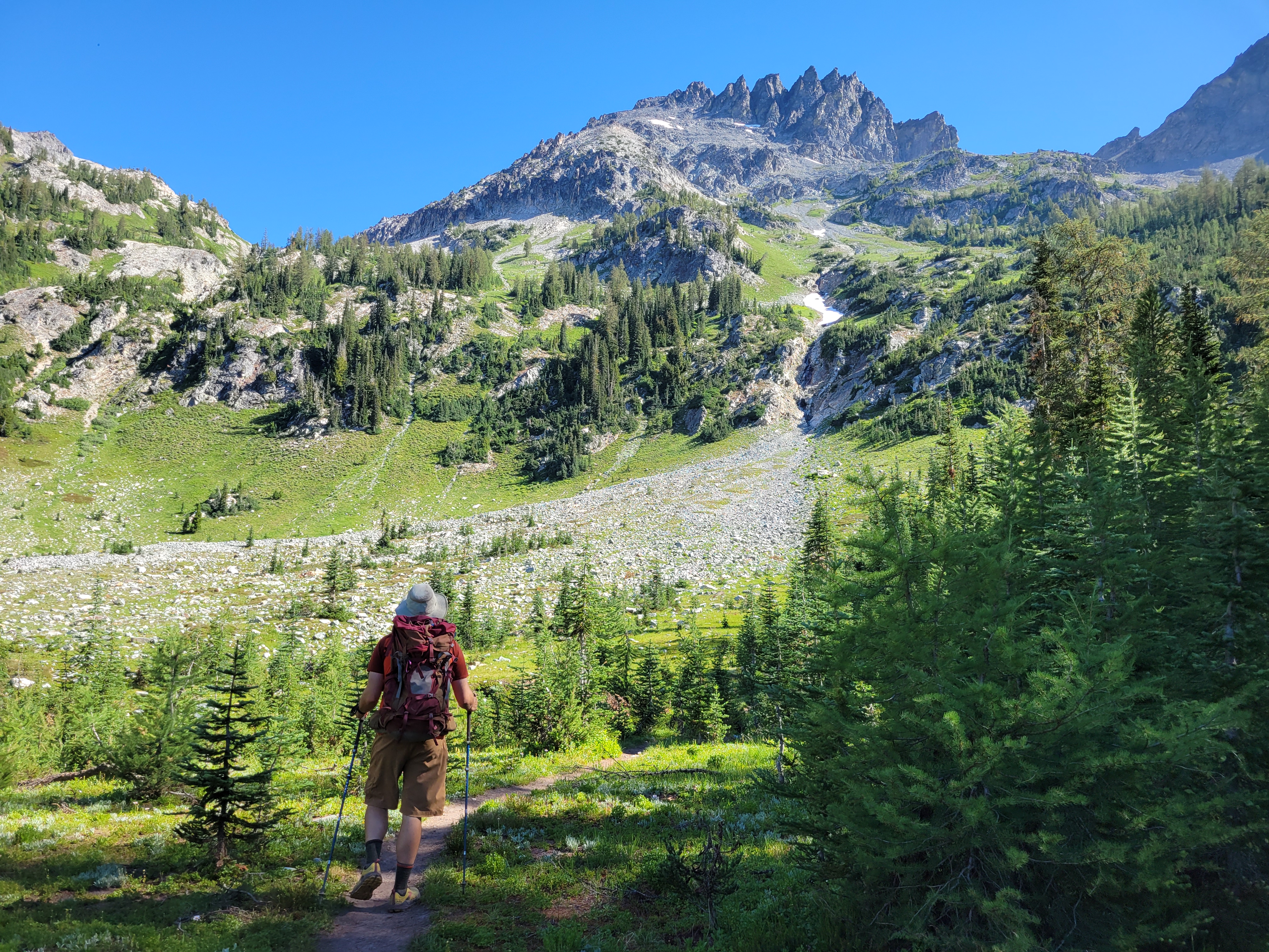
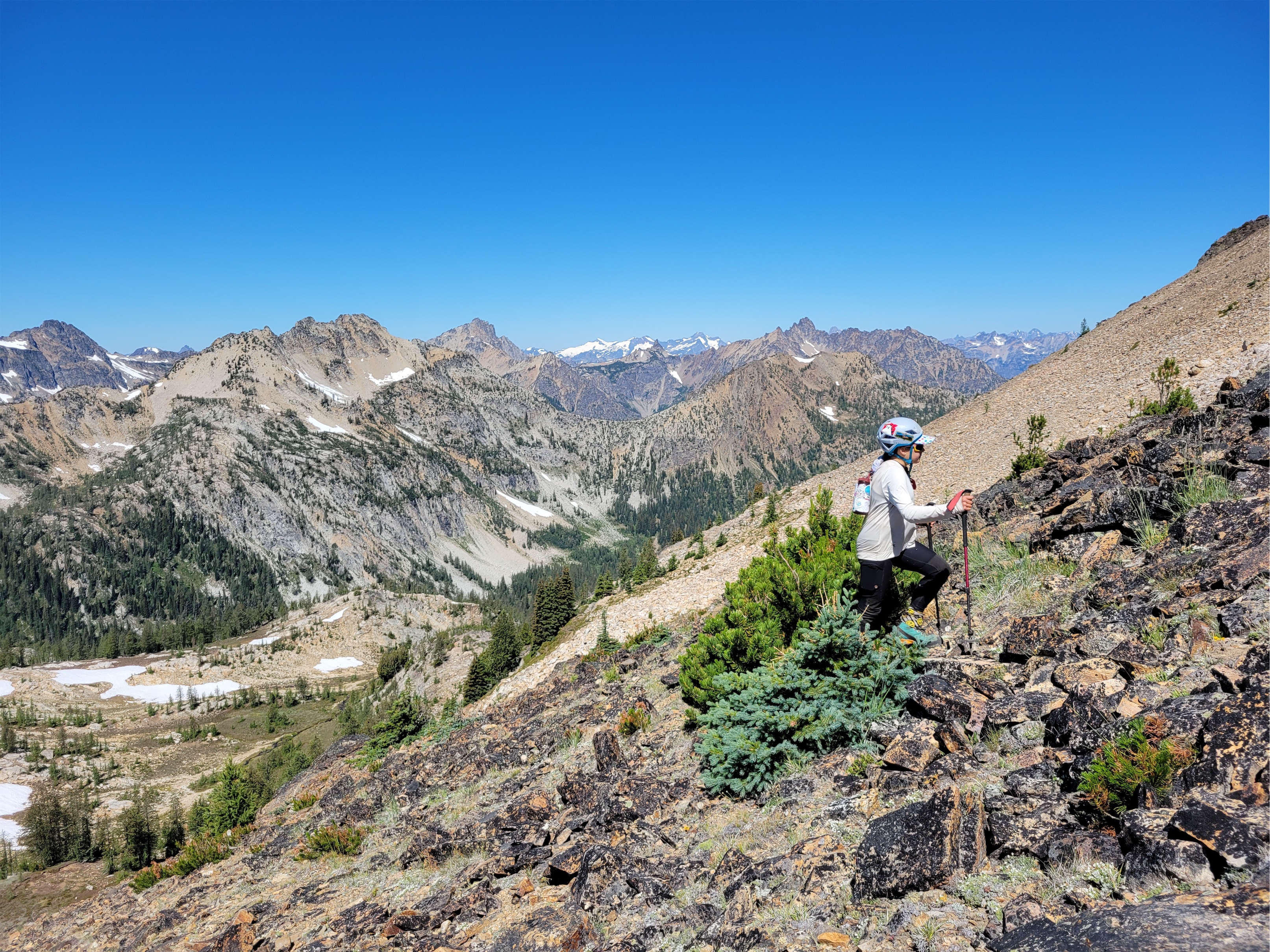
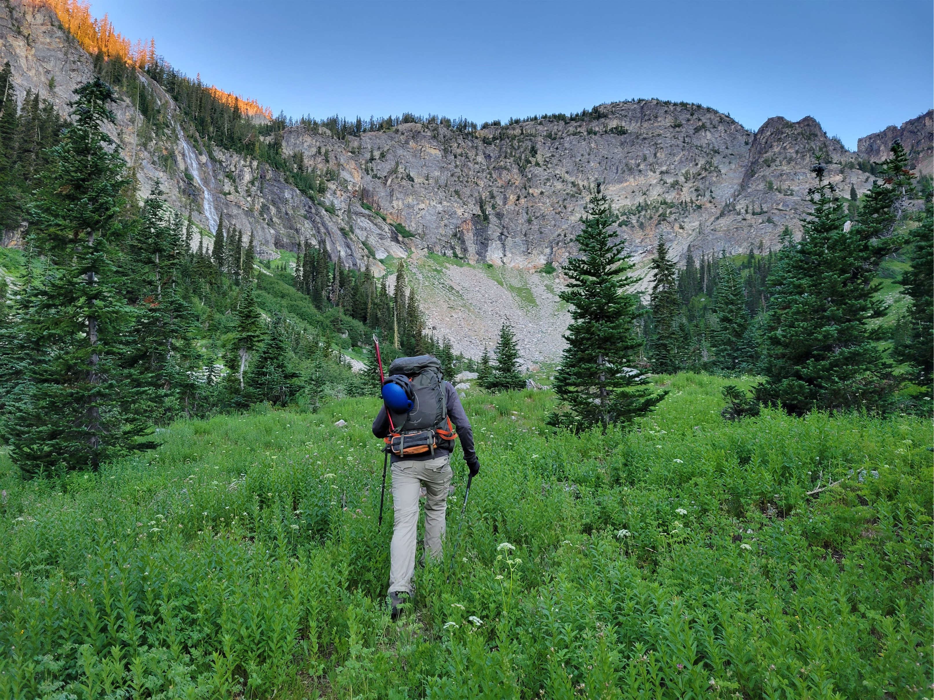
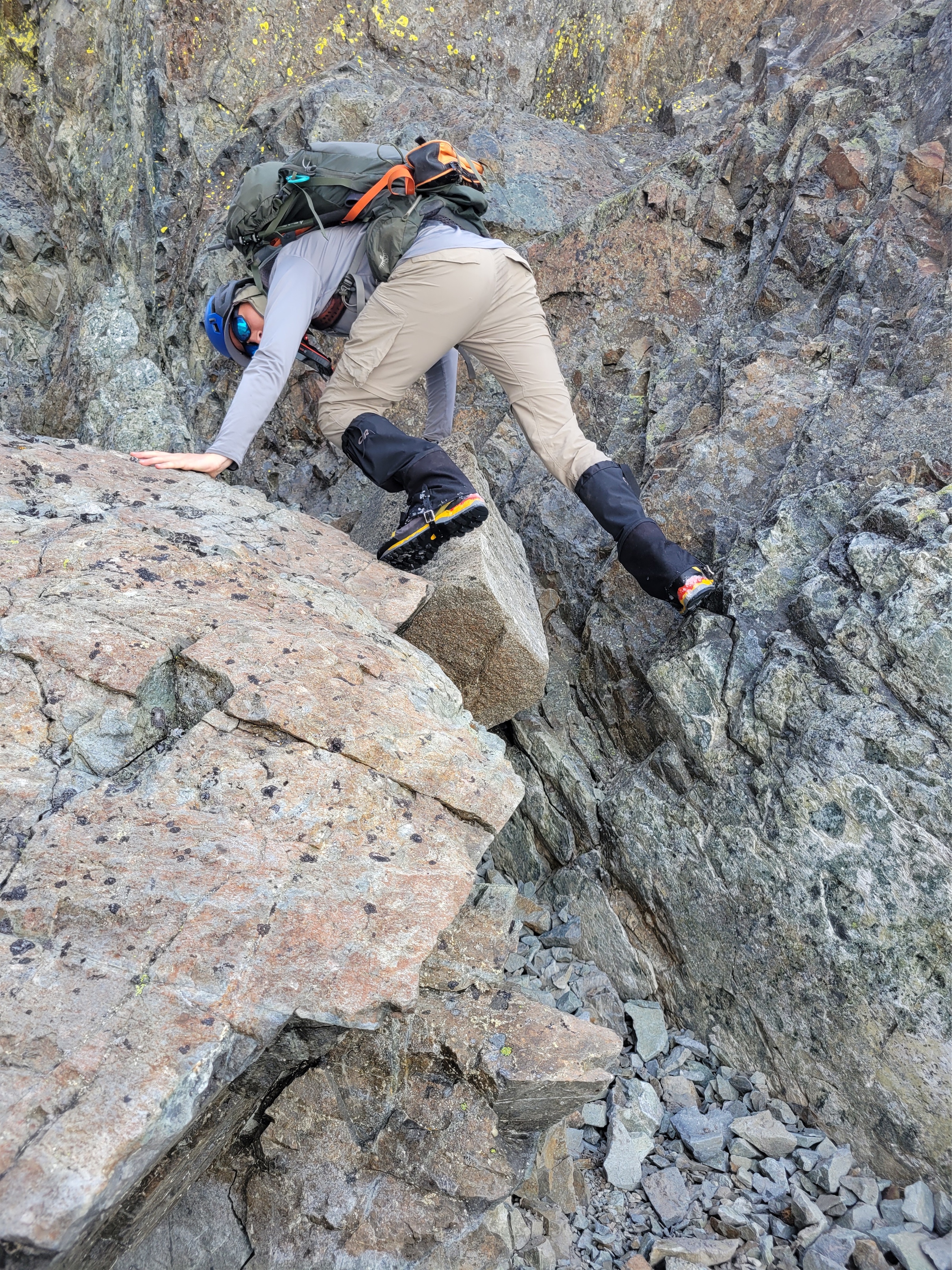
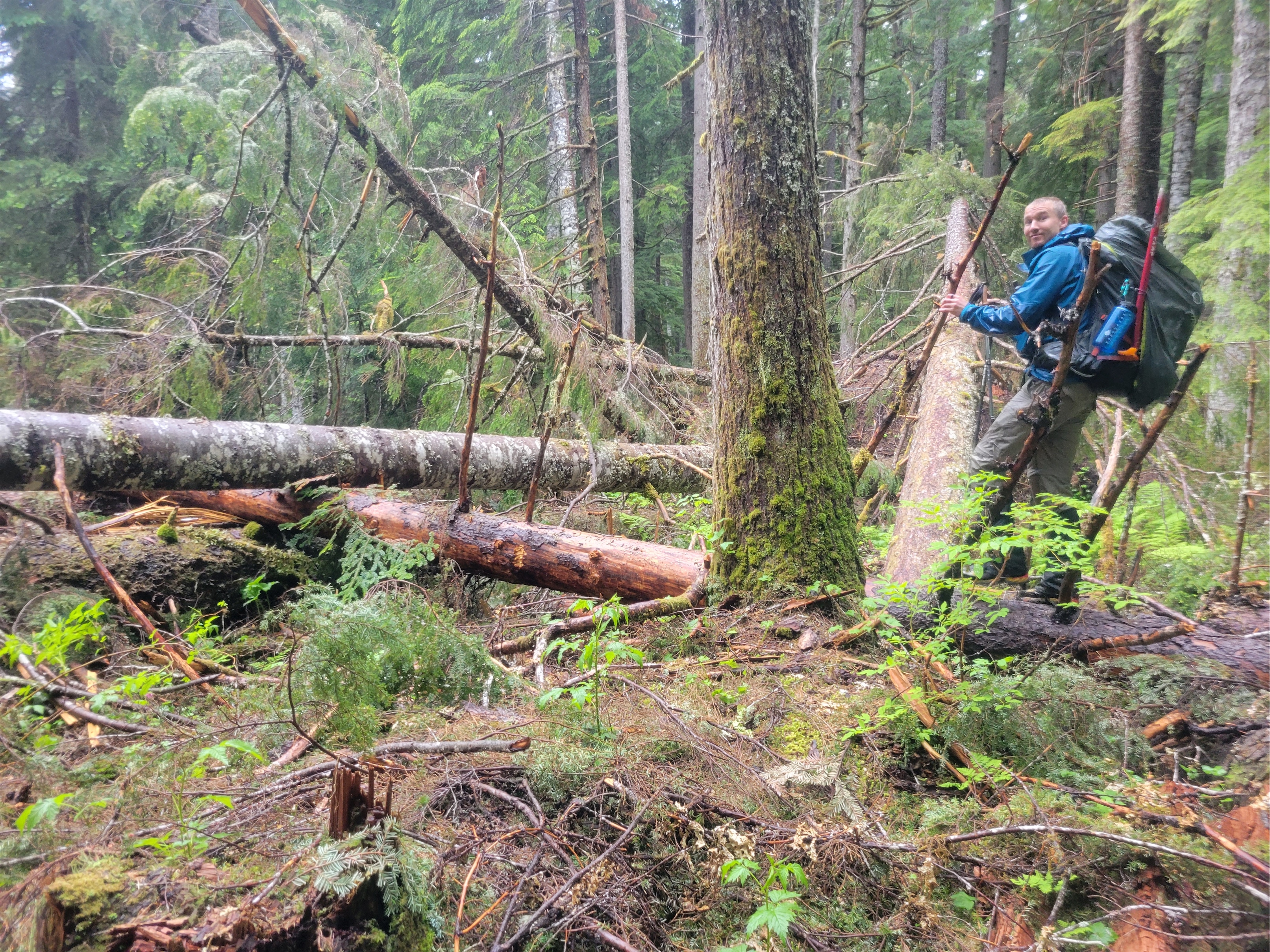
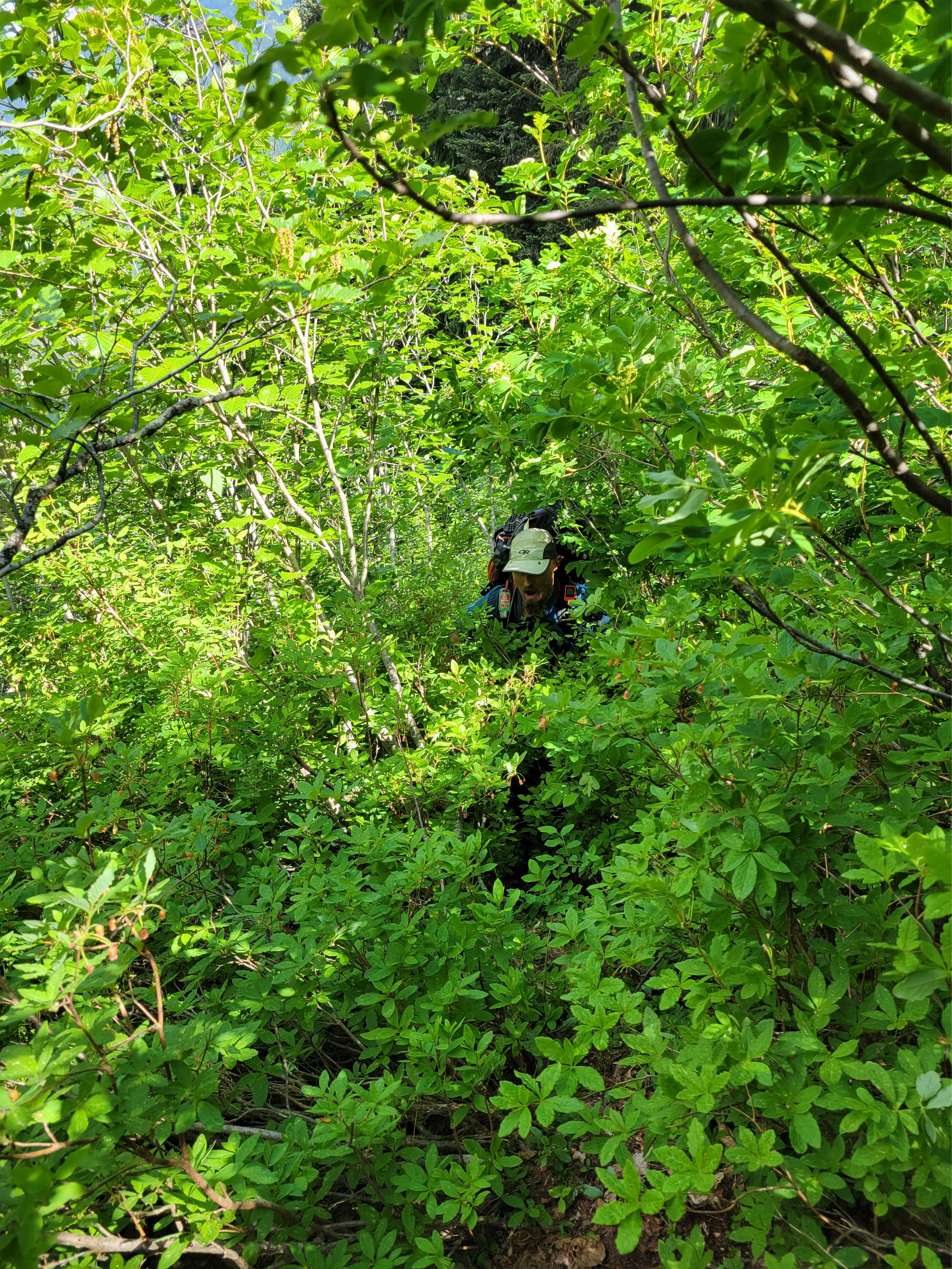
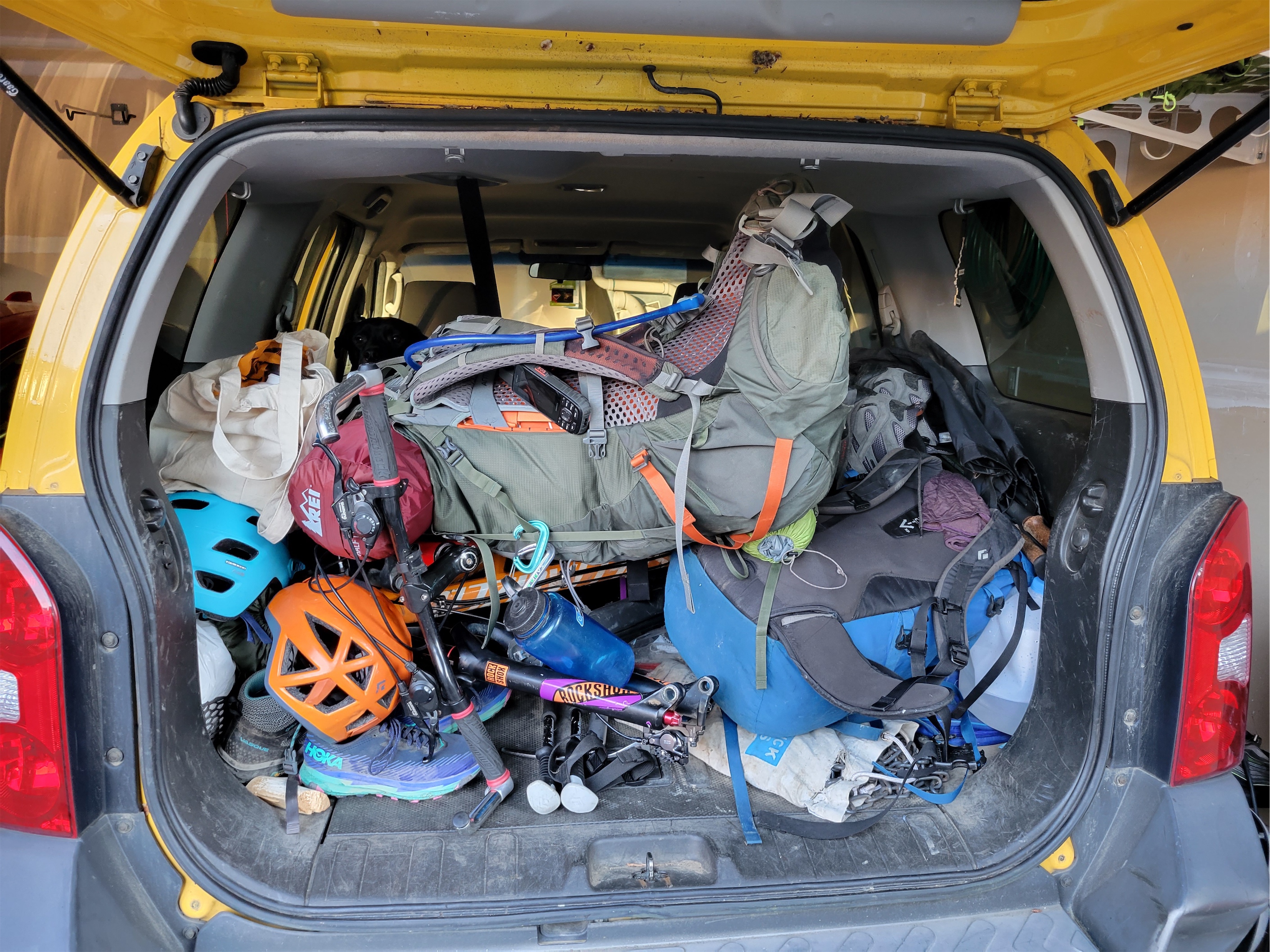
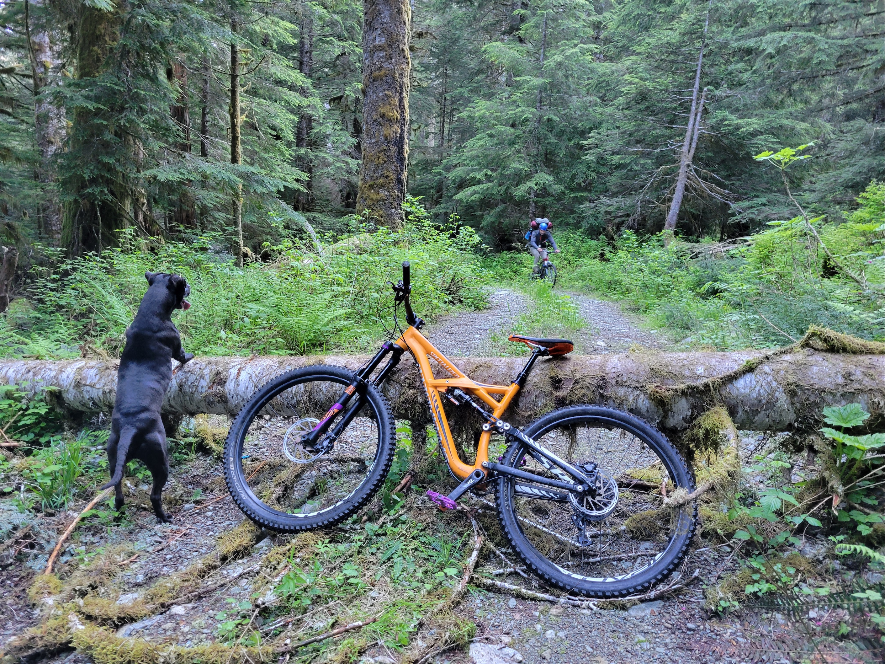
We rolled up to Whistler after one of the most casual starts I’ve ever had to any trip ever. Sarah was extremely patient with me during my hellacious work week when my socialization window was like 8:54-9:02pm, but I was 100% committed to taking Friday off and made it happen. Whistler was PACKED. Thumping music, mountain bikes everywhere, full face helmets on everyone, turns out it was CrankFest. We parked in a day lot and I paid for what I thought was 24hrs. I was jealous of anyone and everyone and felt like a dork with a backpack in the middle of the cool kids. We got in line for the gondola thinking we’d save ourselves mileage and elevation. $104??? For one trip up the gondola?! We laughed and started walking, looking for the Singing Pass trail. Yes, up through the mtb festival. It was signed, but I still felt SO out of place. Finally we were in the trees and not walking on an exposed road, though the “trail” was definitely still mostly a road. But that was nice because we could walk and talk easily. The trail gradually narrowed into a trail. We found a surprise outhouse maybe 3 miles in. We were perplexed by the zipline, thinking it was bikers, no, drones, no, zipline?! We walked below the peak-to-peak gondola. We admired the shades of green in the forest, and how perfectly graded the trail was, and how badly I wanted to be above treelike, and how boring this would be on the way out. At one point I realized why parking had been so cheap. It was free from 5pm to 8am. AKA I only paid for an hour, and would have to re-up in the morning, because it was a day lot, not an overnight lot. Well, shit. Worst case we pay the ticket I guess.
10/10 would be a bear here
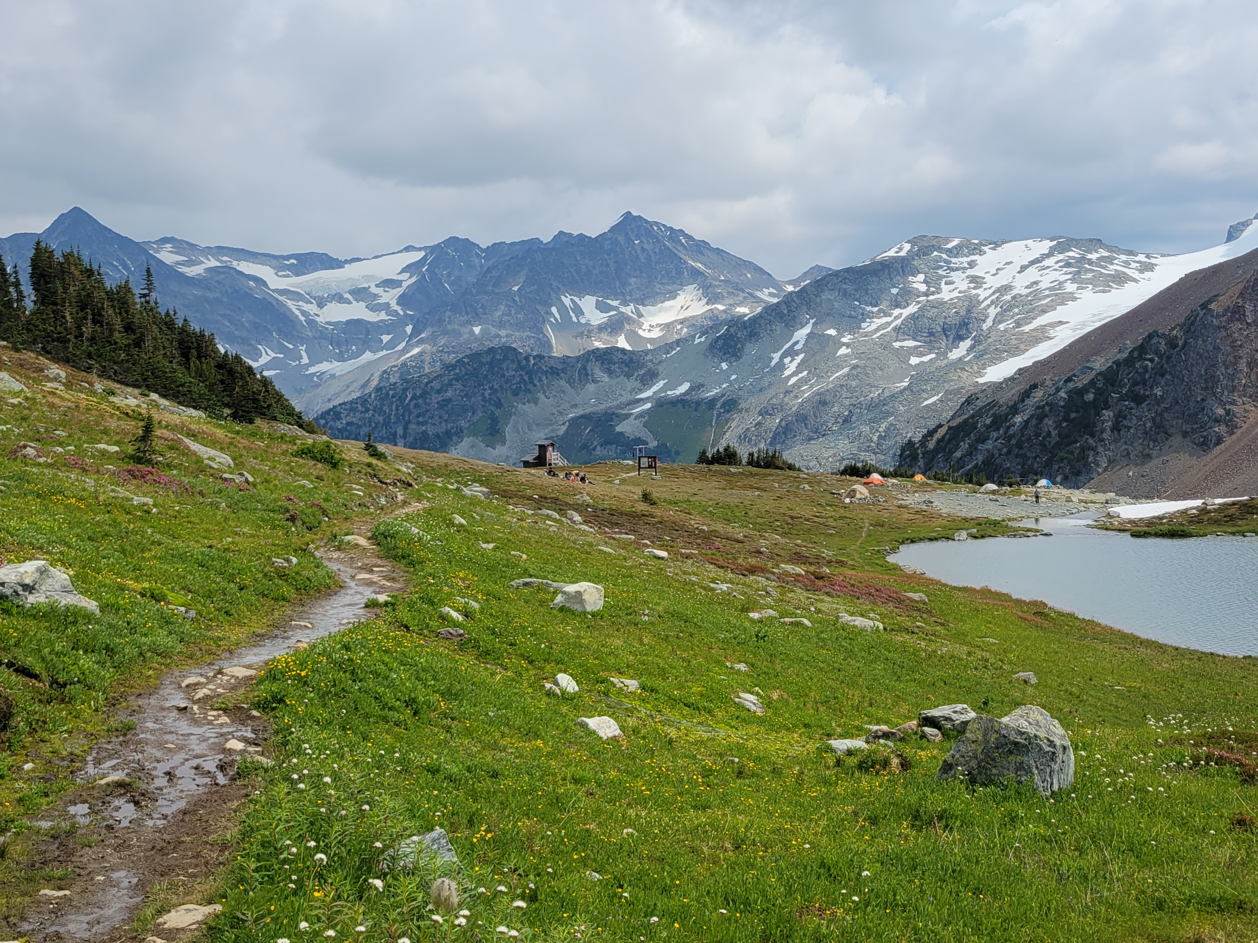
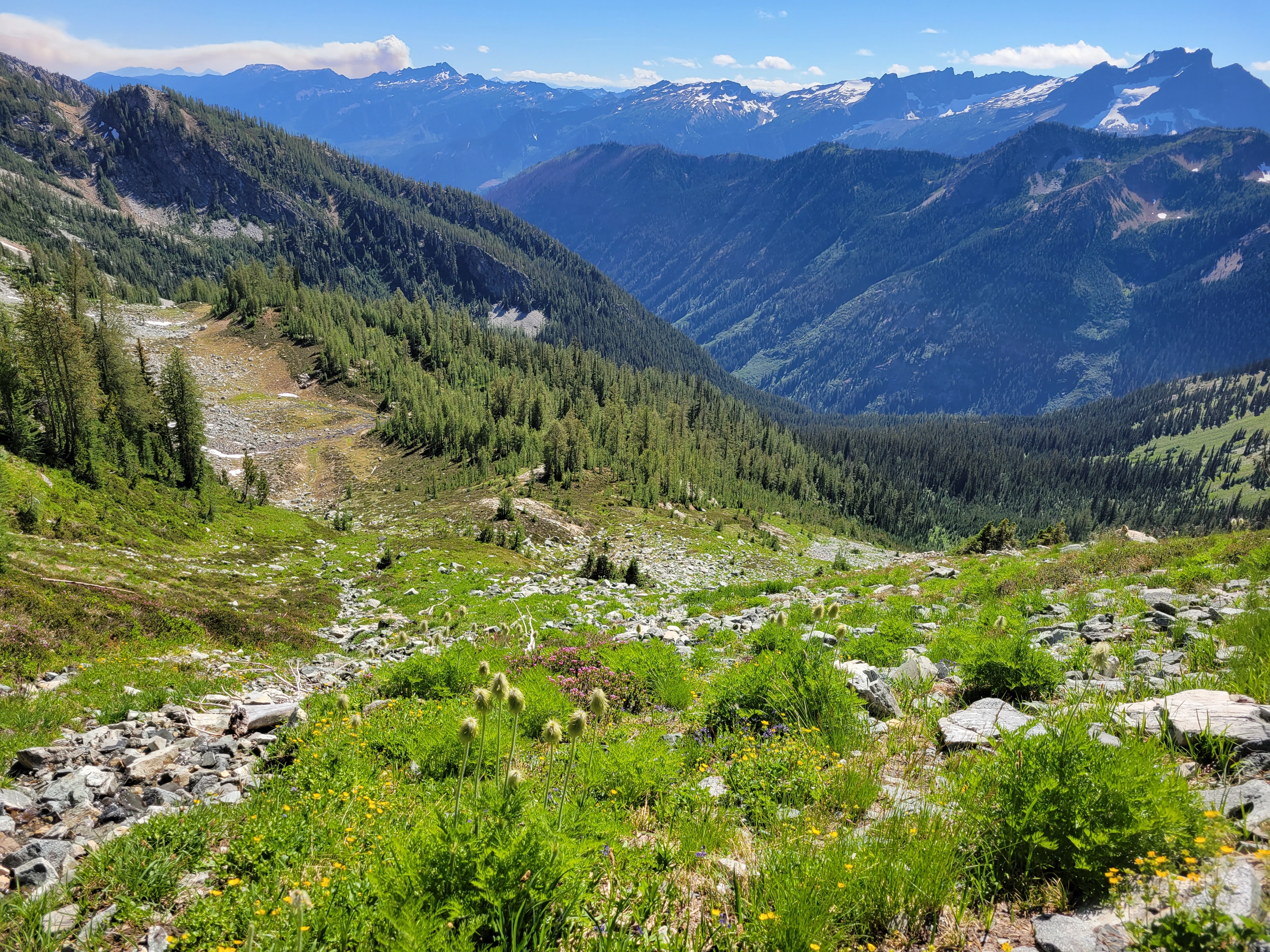
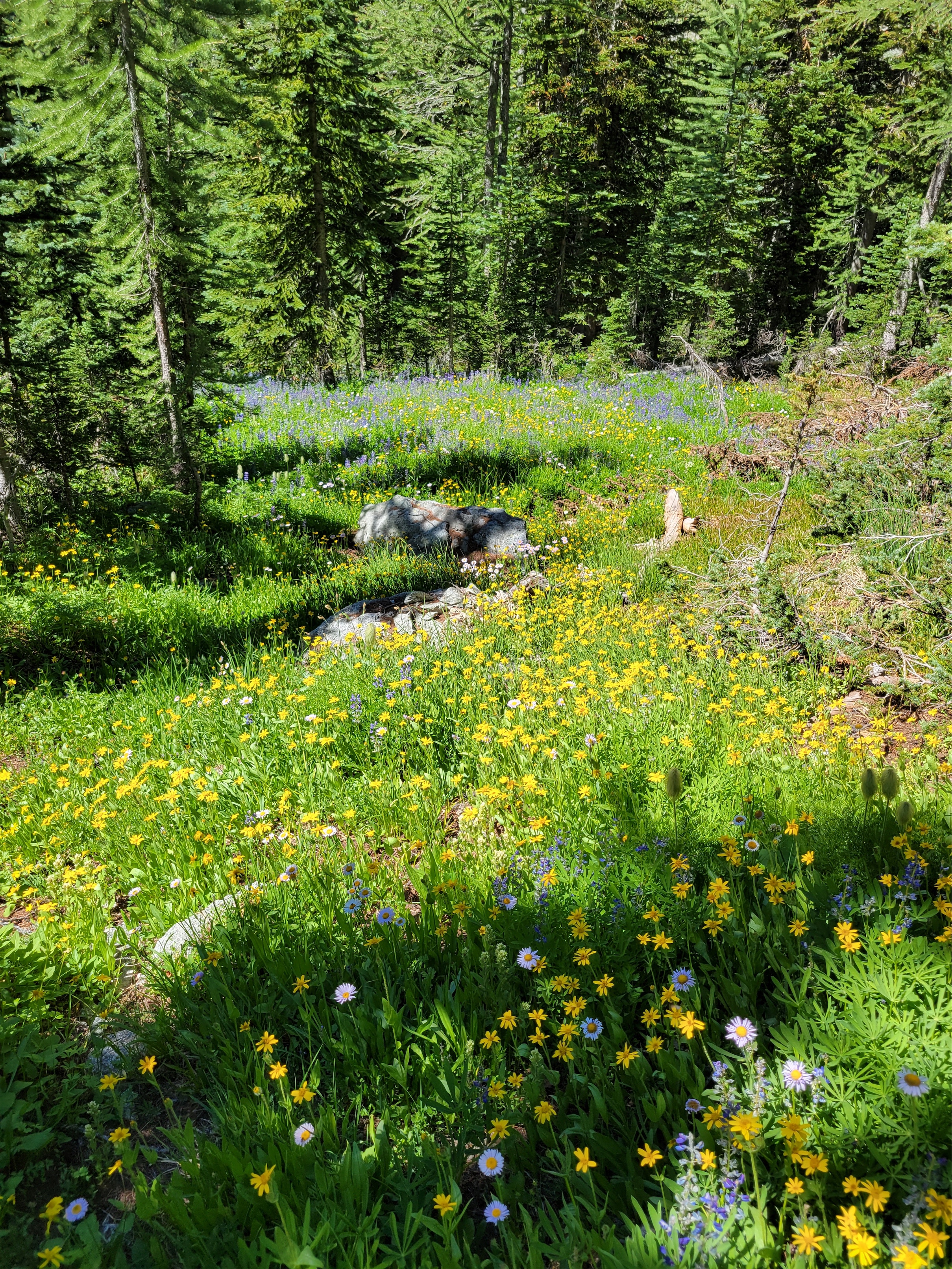
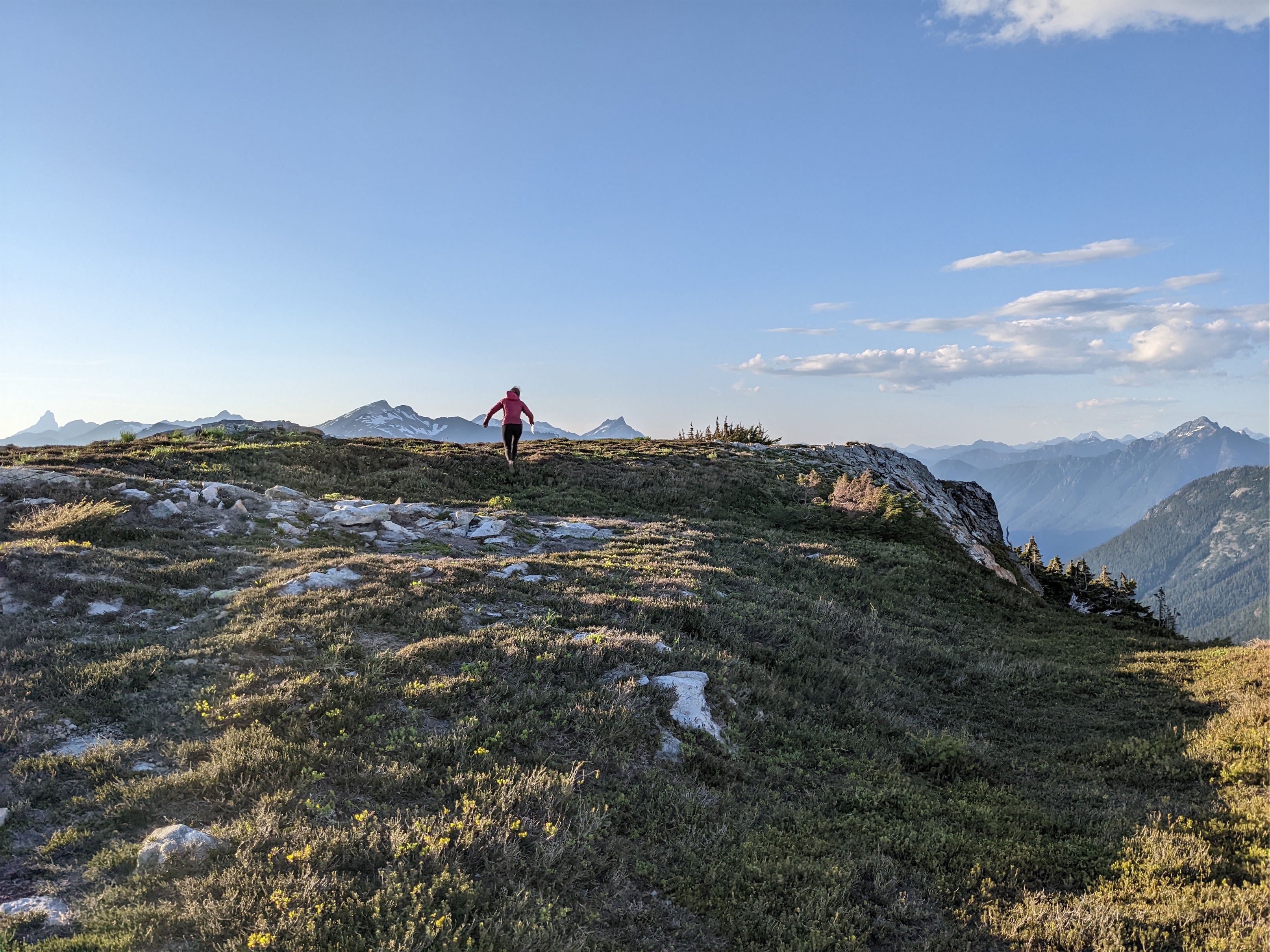
Finally we hit wildflowers. And then more wildflowers. Heaven. Two hikers came down from the upper route (called Musical Bumps) that the gondola takes you to. “Are there more wildflowers that way?” we asked. “Eh, more like this” they shrugged. Well… they sound underwhelmed, but we’re stoked, so I guess we’re hiking out that way tomorrow. We carried on into subalpine, wildflowers and heather and massive glaciated peaks in the distance. Does everybody who has hiked this trail just suck at taking photos? Are you trying to keep it a secret? They must be trying to keep it a secret.
I mean come on
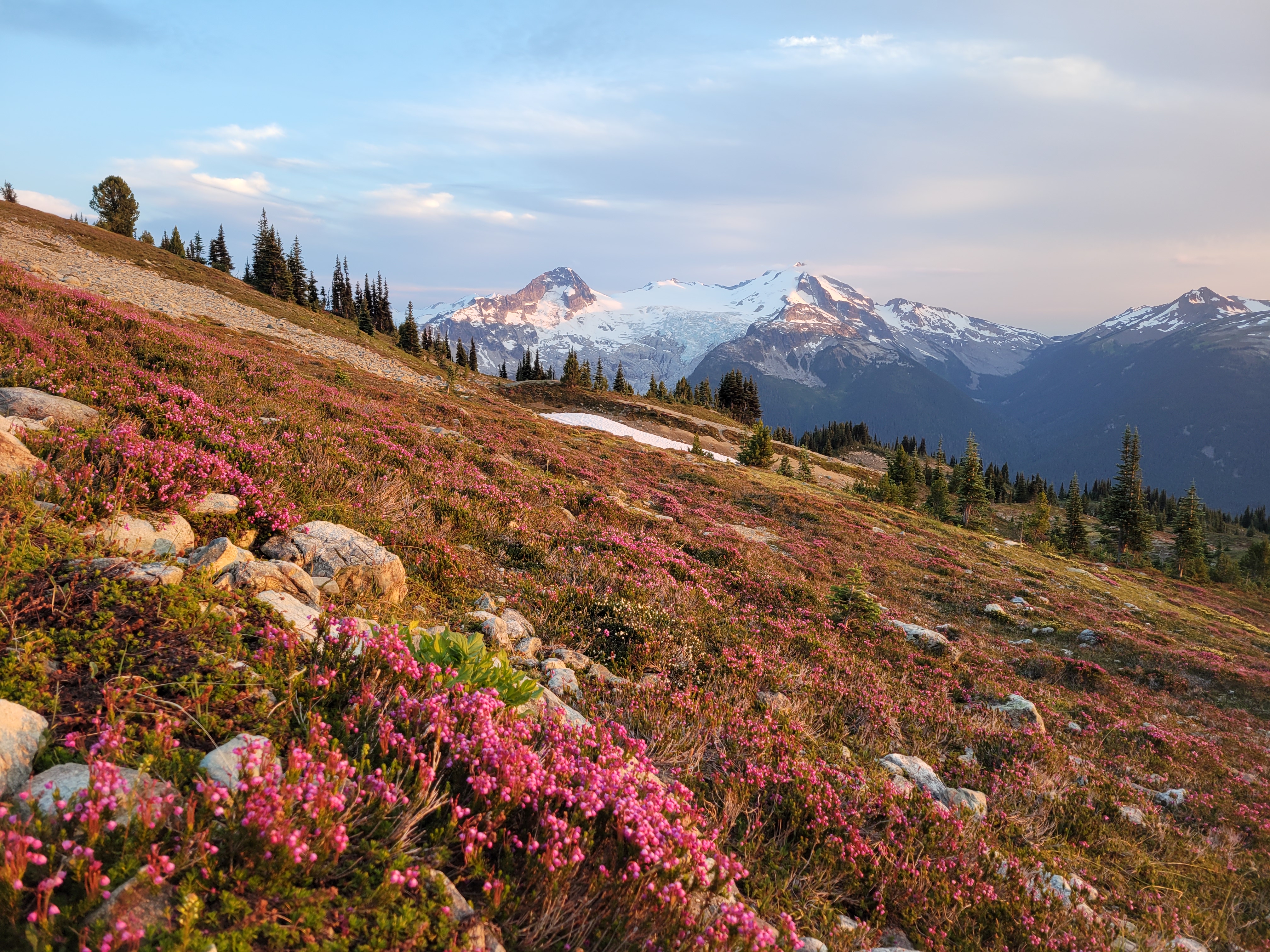
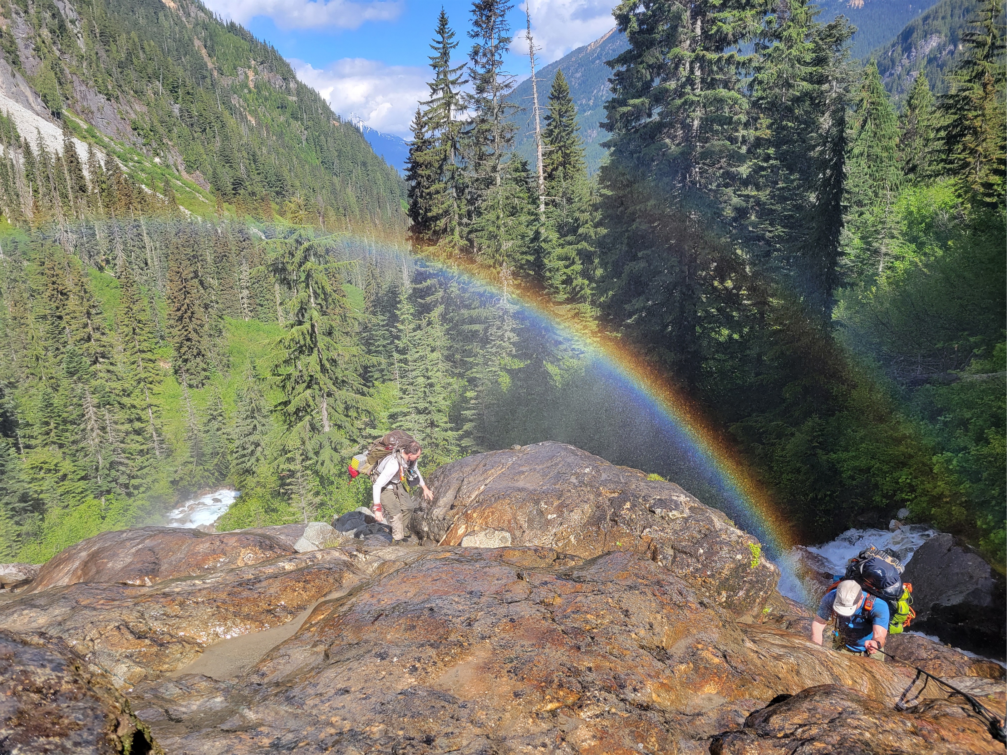
A short 2mi from the intersection with Musical Bumps and we stumbled upon one of the most dense paintbrush meadows I have ever seen in my life just before the lake. I mean the prior weekend was dense but I barely had time to frolic, this was just insane with bright yellow paintbrush that had yellow streaks and flowers of every color sprinkled in between. We dropped down to the lake knowing it was almost dark, and struggled to find a decent campsite. There’s a great one near the toilet but we missed it (and didn’t want to listen to people pooping all night). There’s a rack to hang bear bags, but we just buried our food in rocks in the boulder patch instead. Sarah asked “did you think we’d get here in daylight?” I laughed. “NOPE.” “Me neither. Funny we were both thinking that but neither of us said it out loud.” I was so happy with our timing. I had a scone for dinner and fell asleep pretty quickly, though I wouldn’t say I slept well.
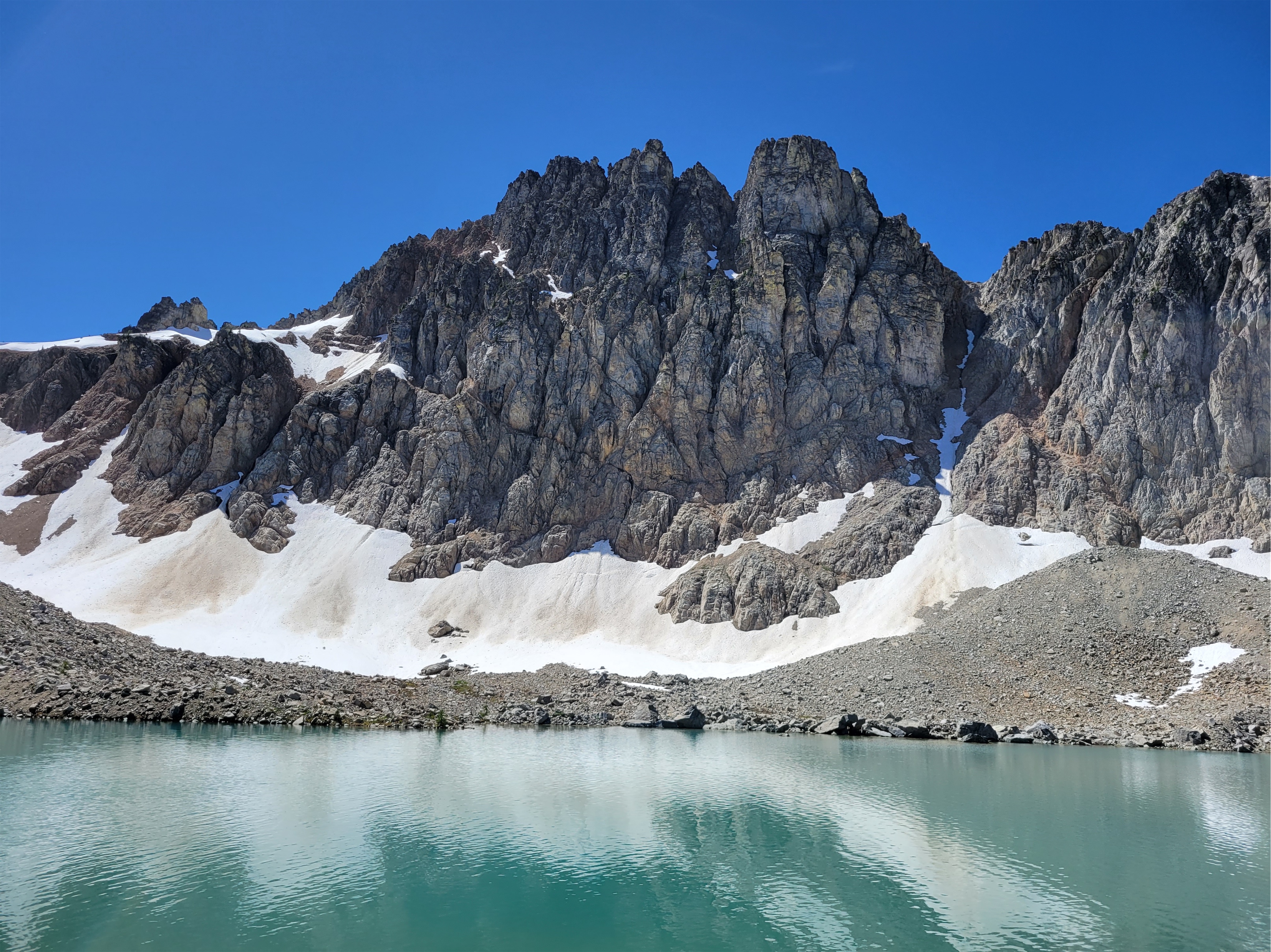
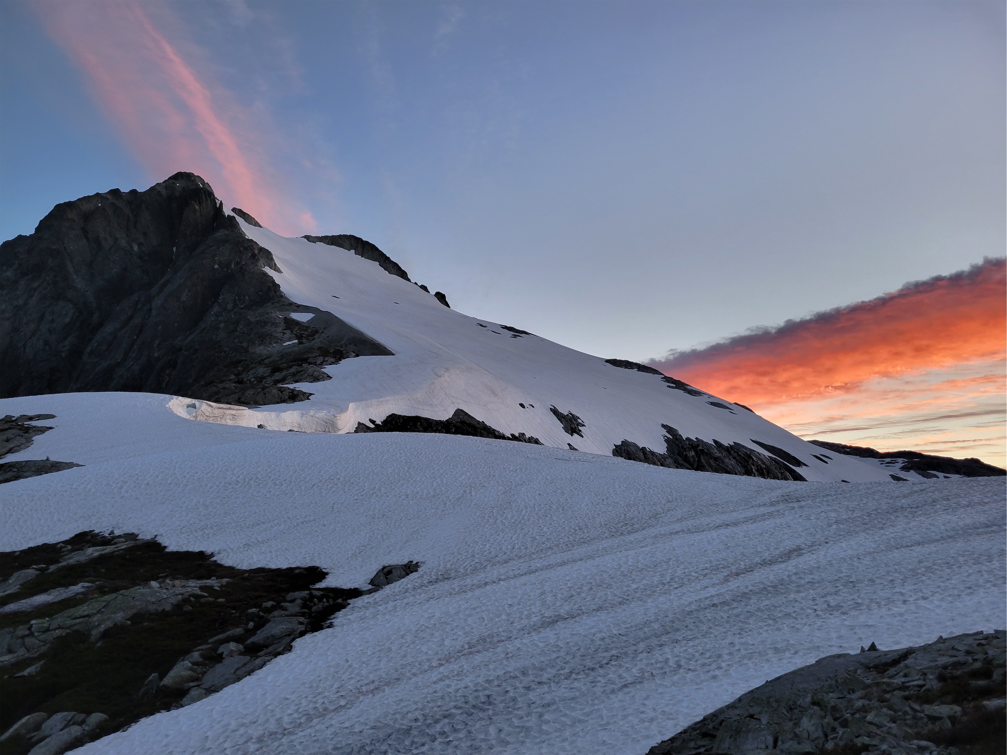
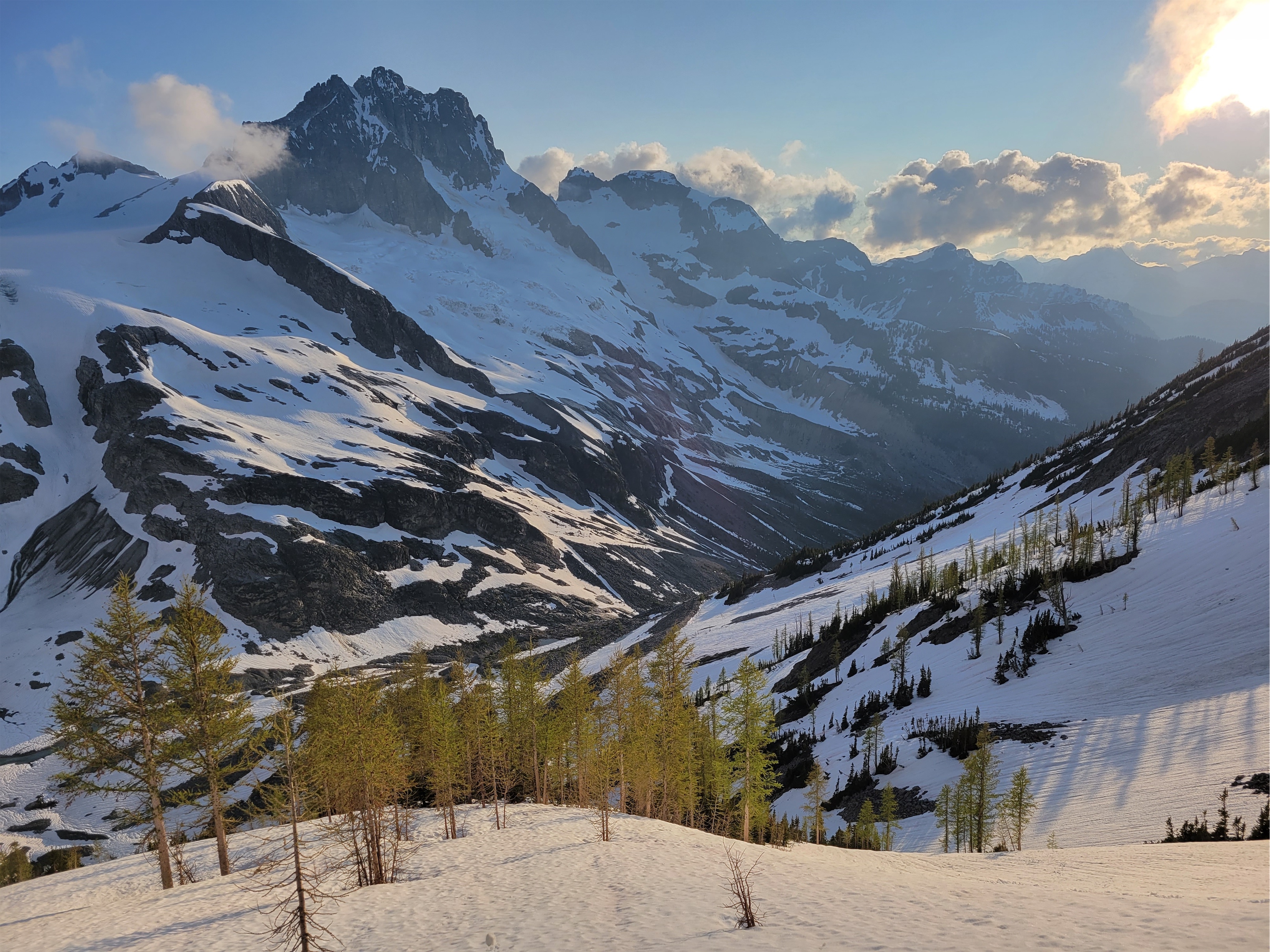
Castle Towers over heather near sunset
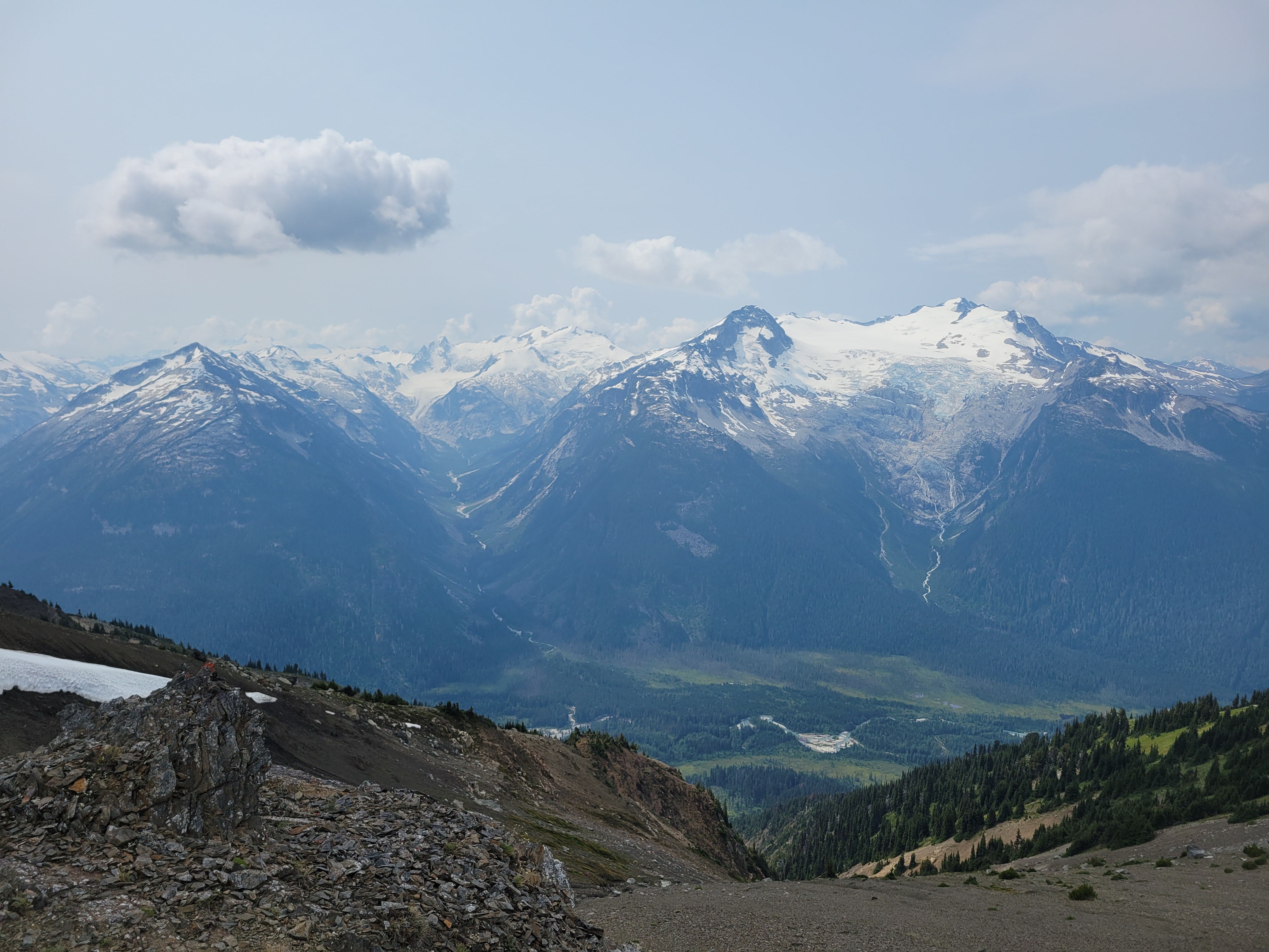
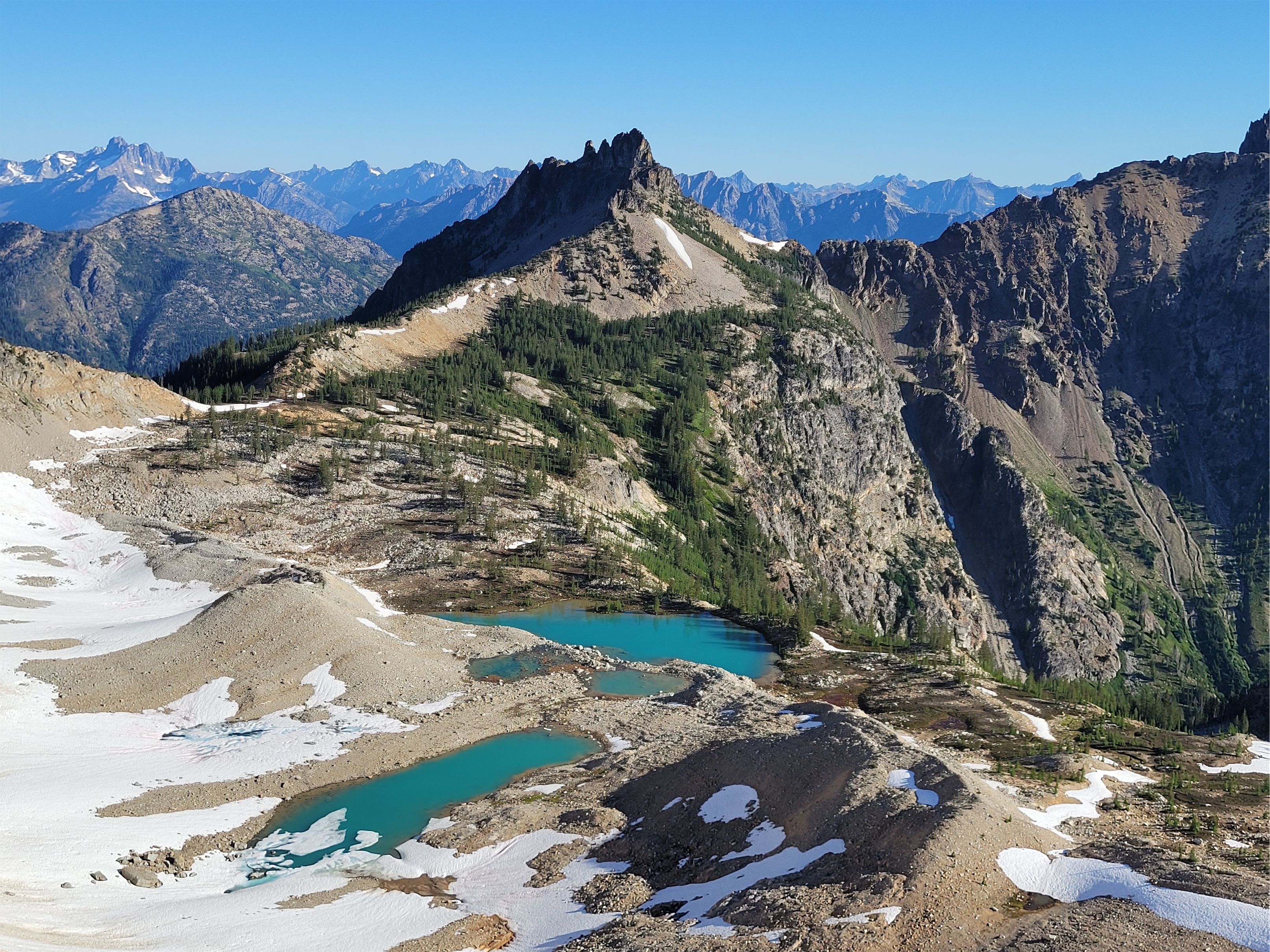
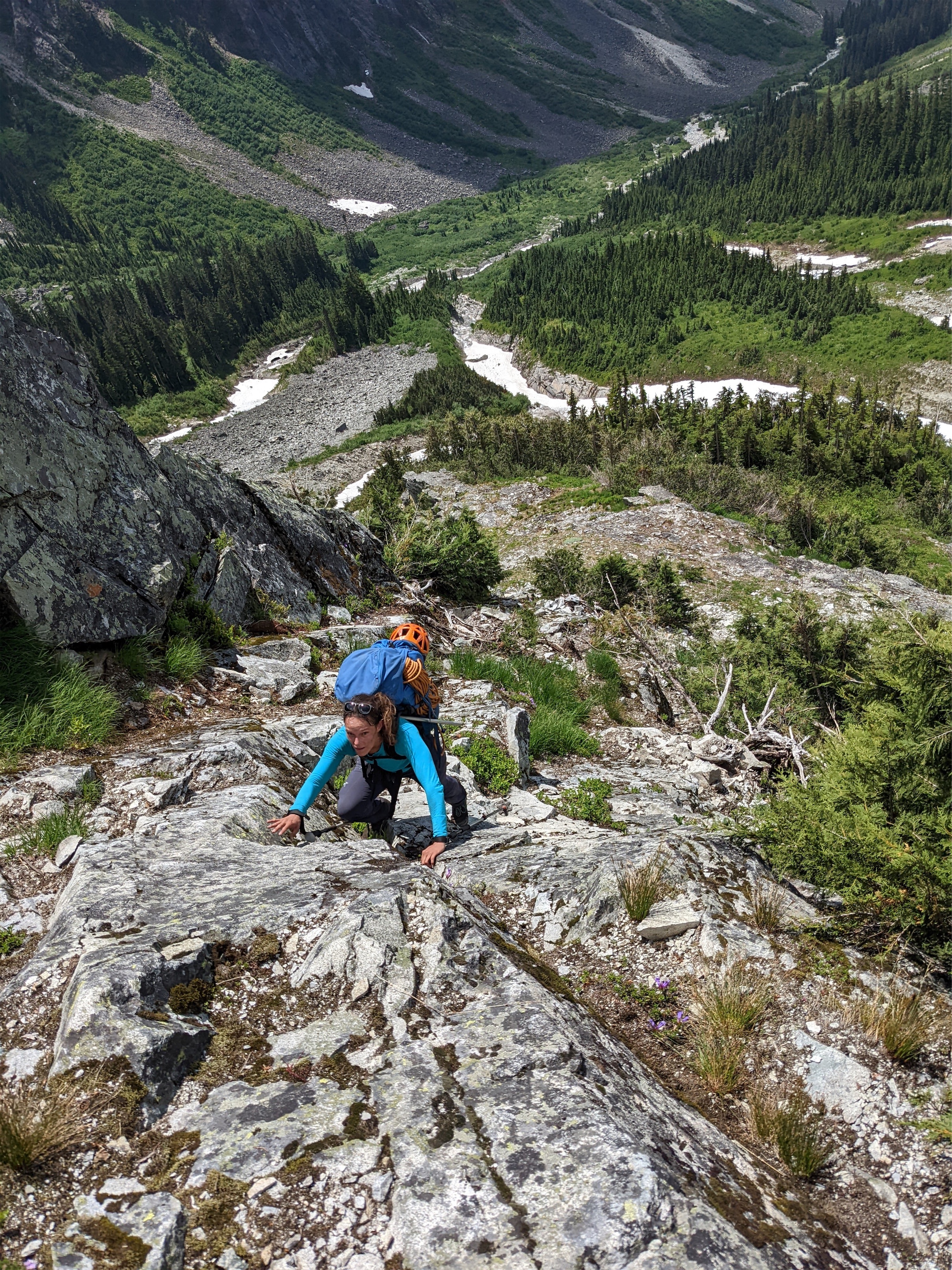
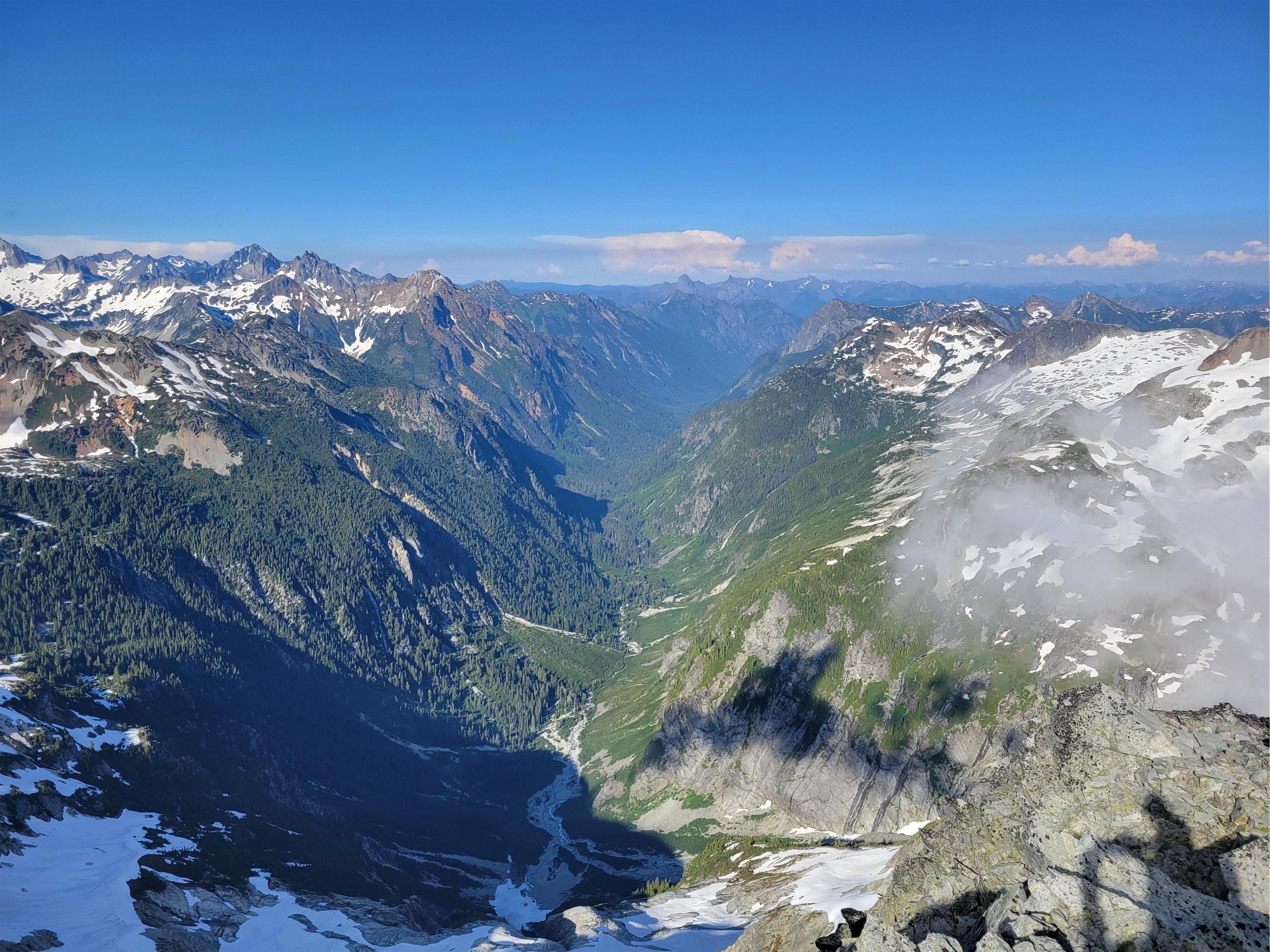
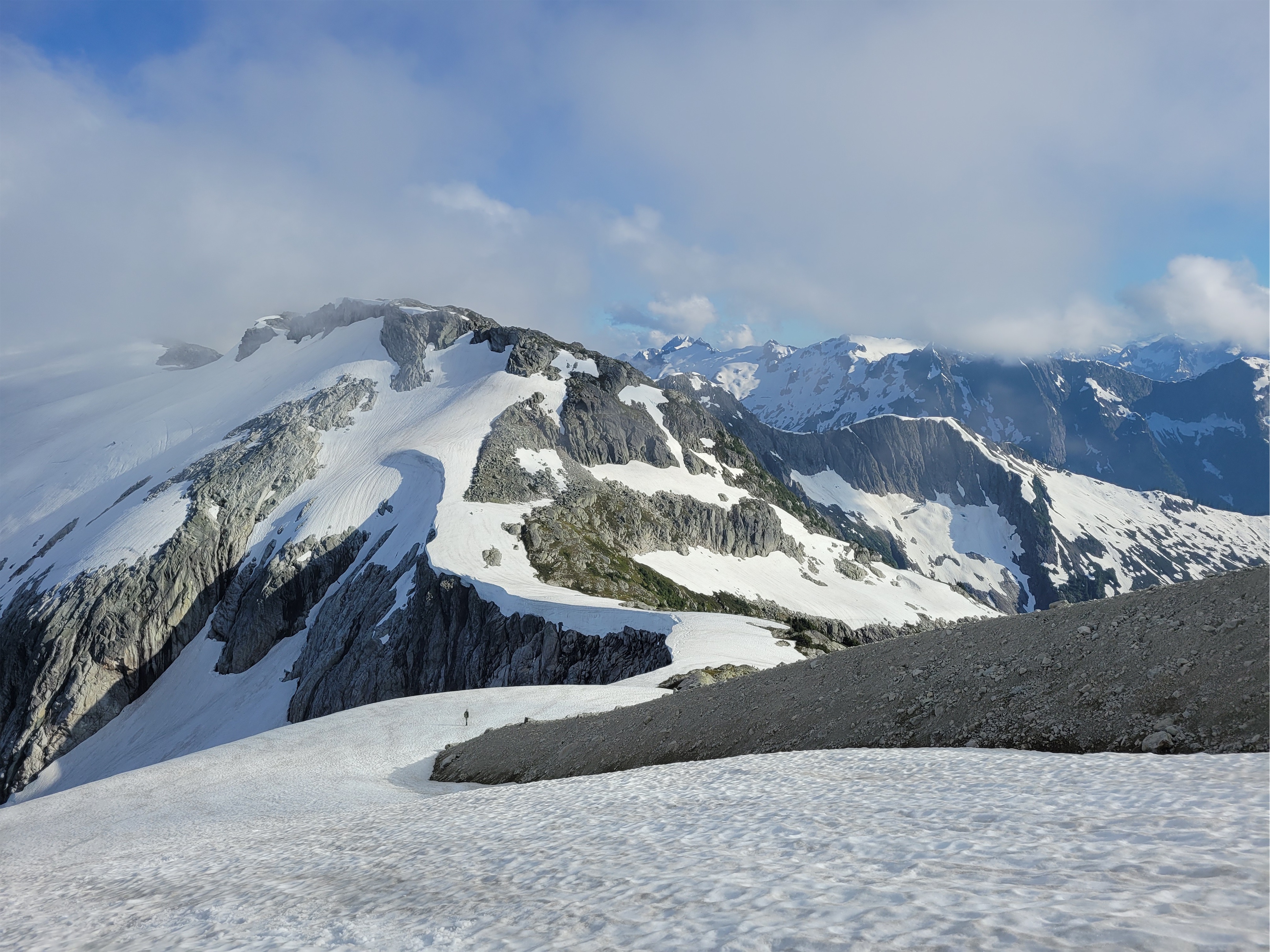
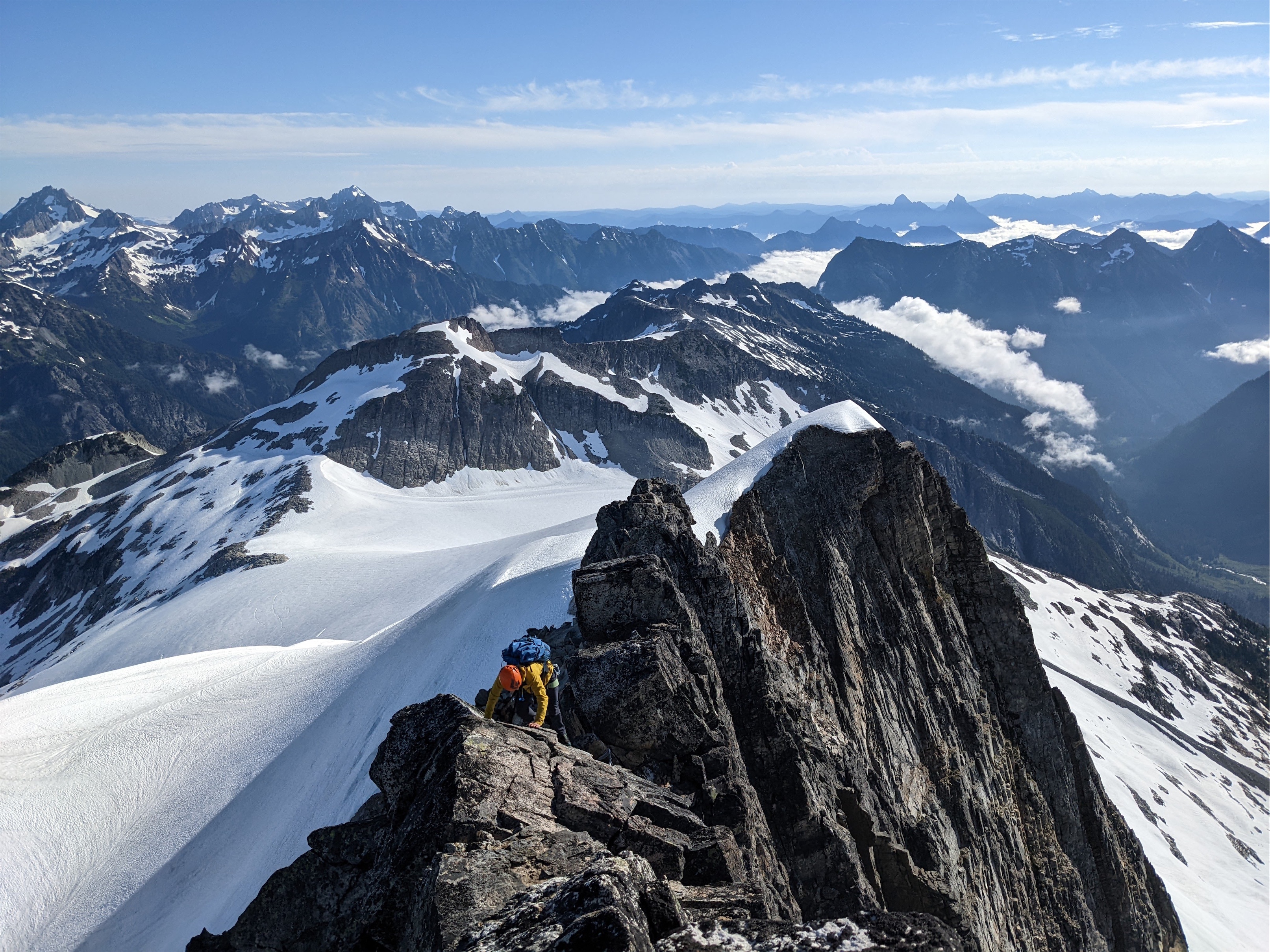
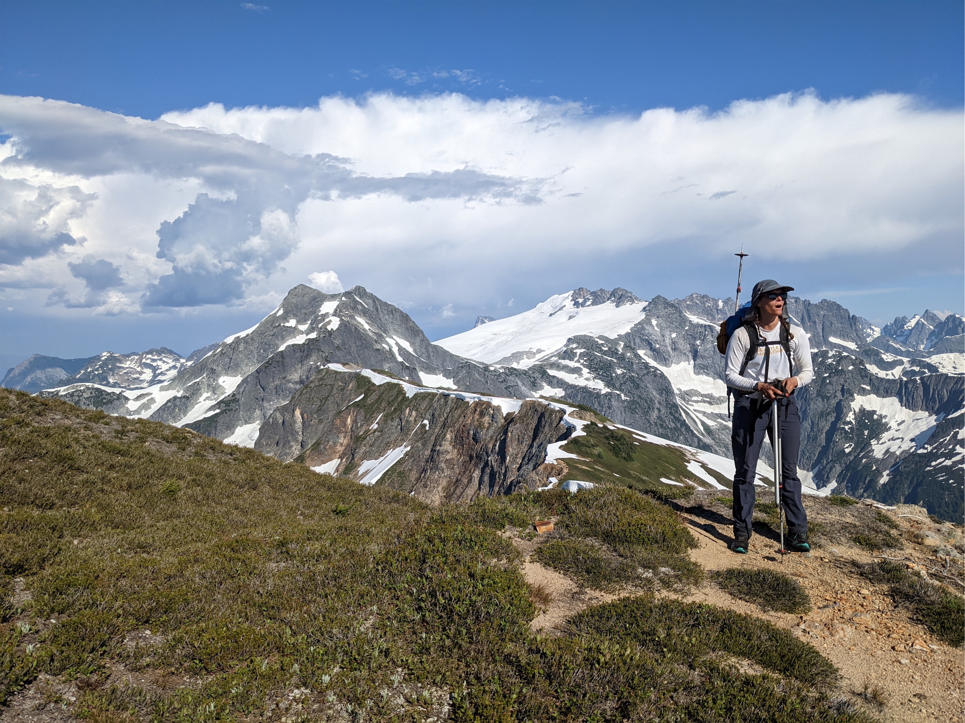
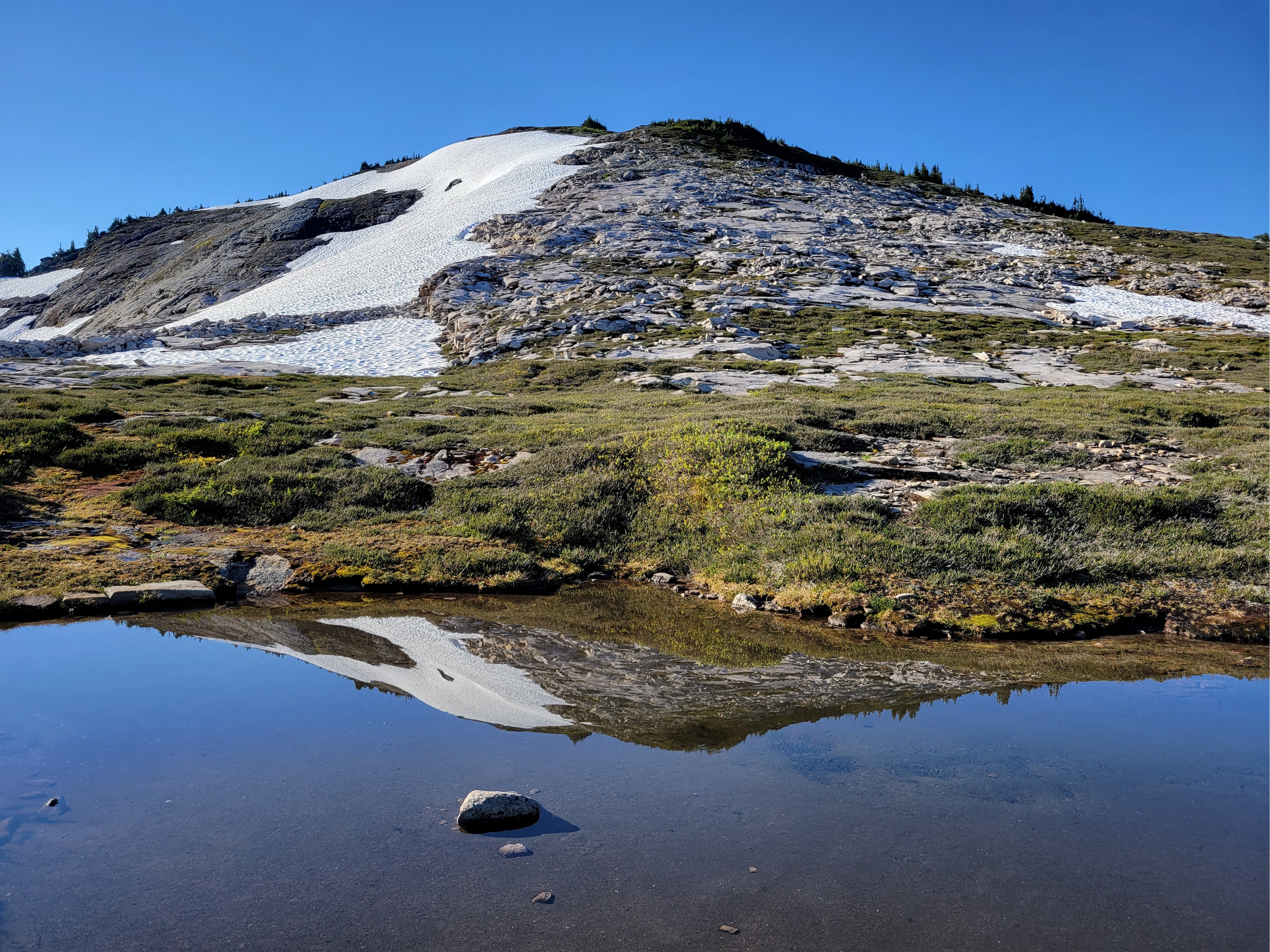
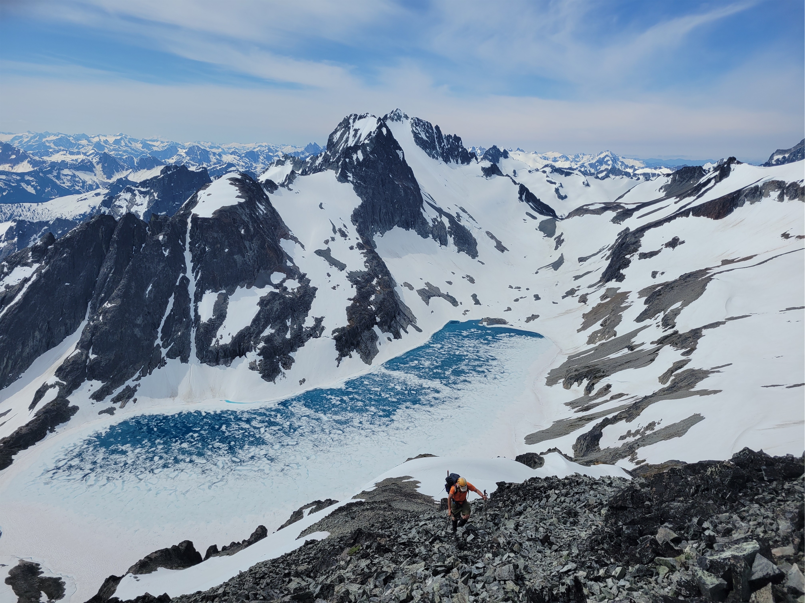
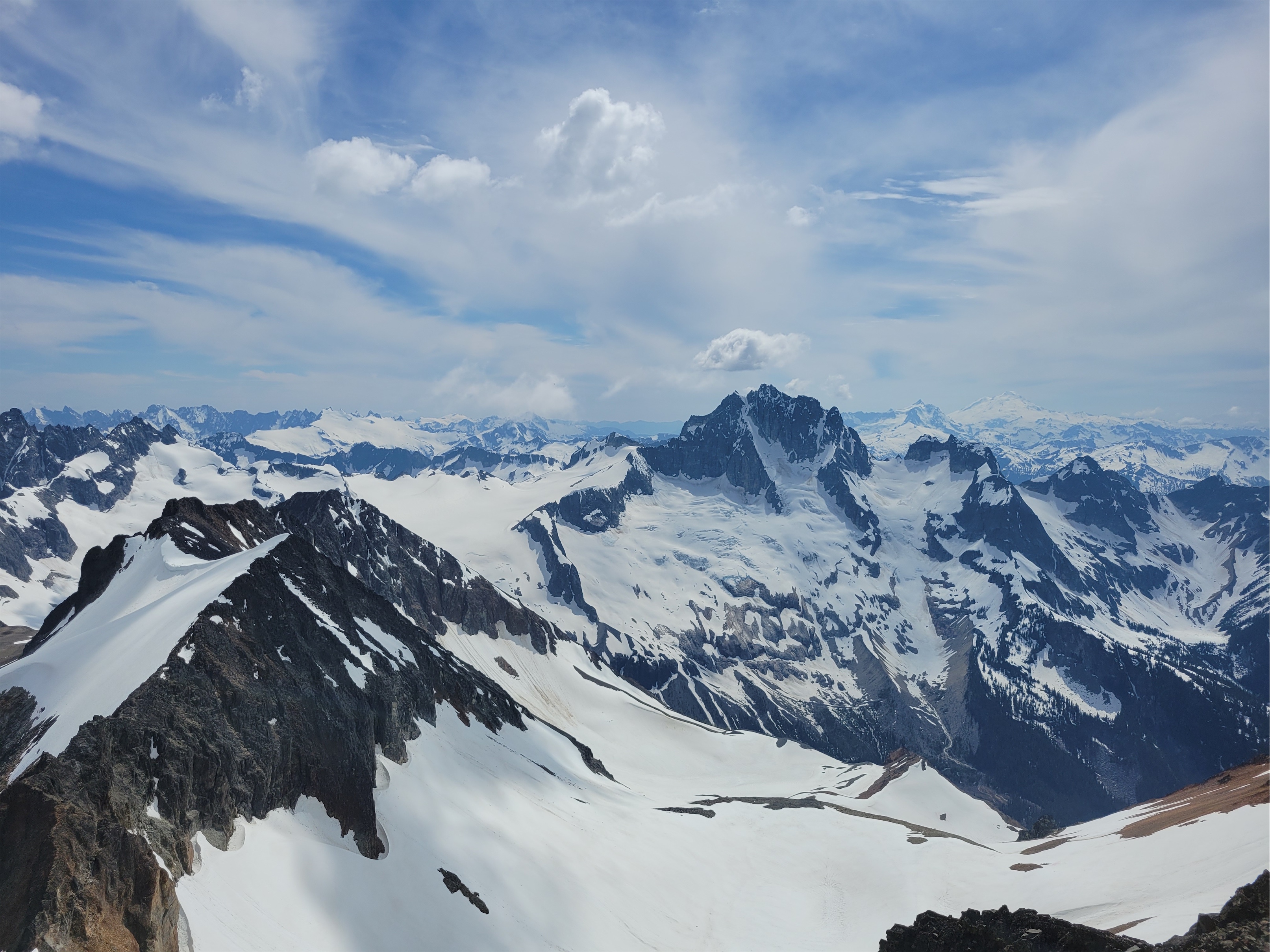
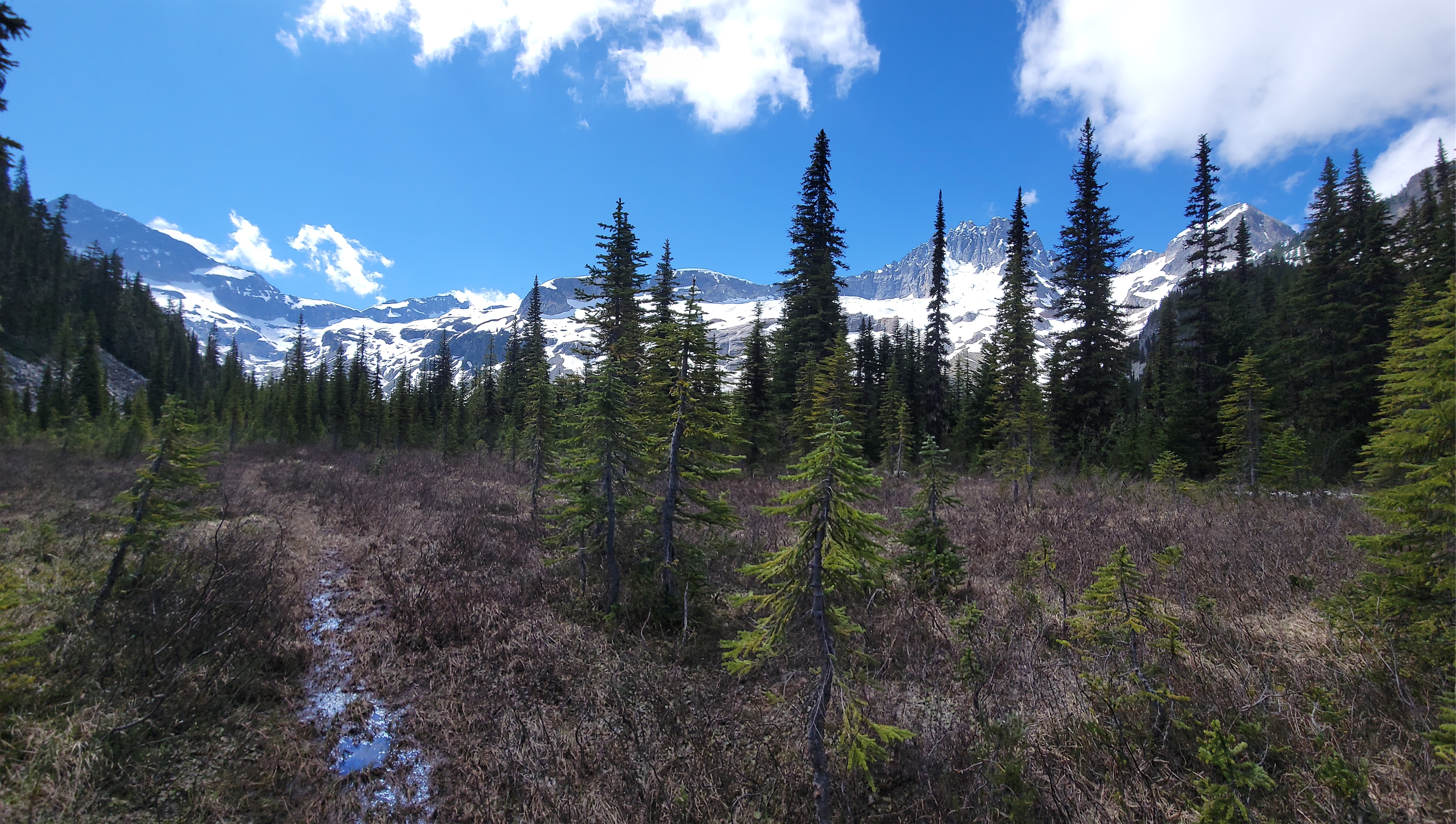
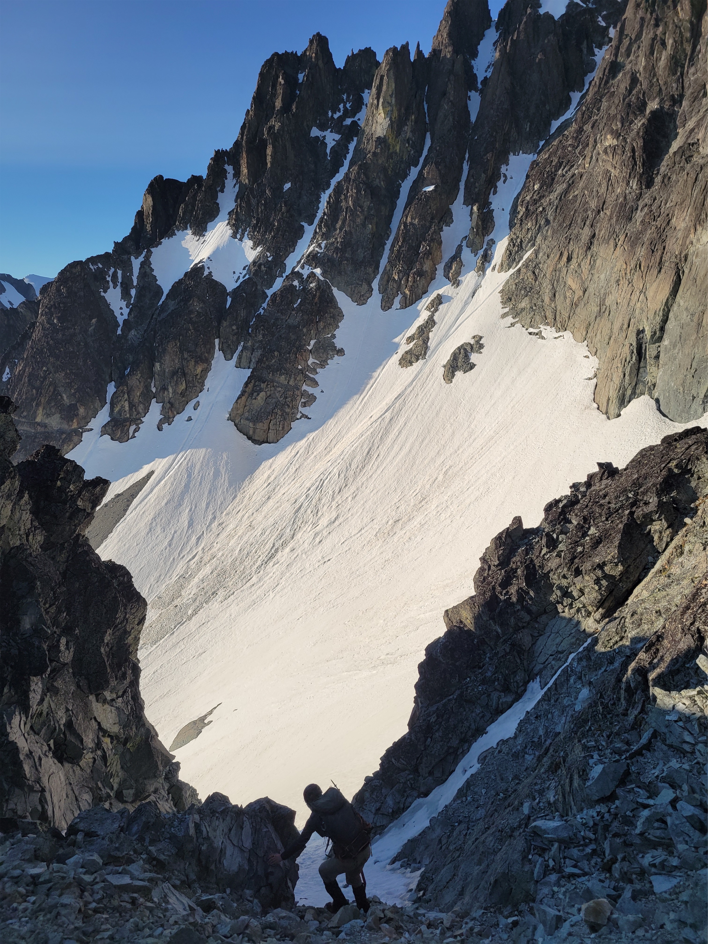
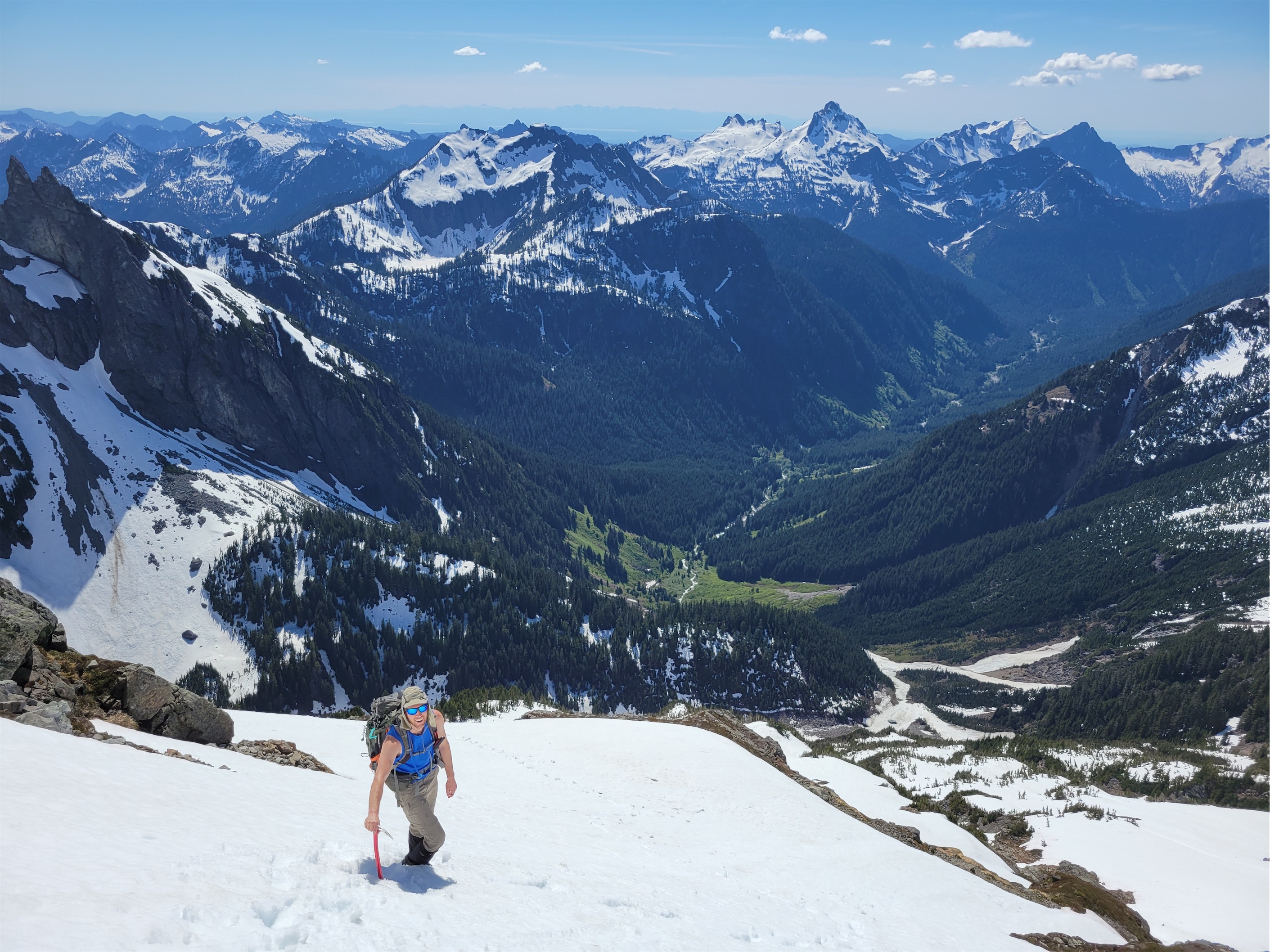
We were up around 7 the next morning, which is LATE for me (and even later for Sarah). Sarah had a leisurely breakfast and set up painting, I decided to “zip” up Overlord Mountain. Which I sorely underestimated. Prior trip reports said to expect 6-7hrs round trip from Russet Lake, but my famous last words were “it’s like 3.5k gain and 3mi, how long could it possibly take?” as I pranced off into the distance leaving Sarah to her art. I wasted time trying to traverse high rather than drop down to mellower terrain on the traverse from camp to Whirlwind’s ridge. I paid for the full day of parking with the shockingly strong cell service I had. When I saw the ridge to Whirlwind across a small valley I had an “oh shit, that’s where I’m going?” moment, but it comes up quickly and it’s not as steep as it looks. There’s also a trail nearly the entire way starting at the base of this ridge, which expedited things after my cross-country bumbling for the prior mile. There was a little tarn that I bet is beautiful when it’s melted out, and crystal clear streams gushing through the rocks off of the base of the glacier.
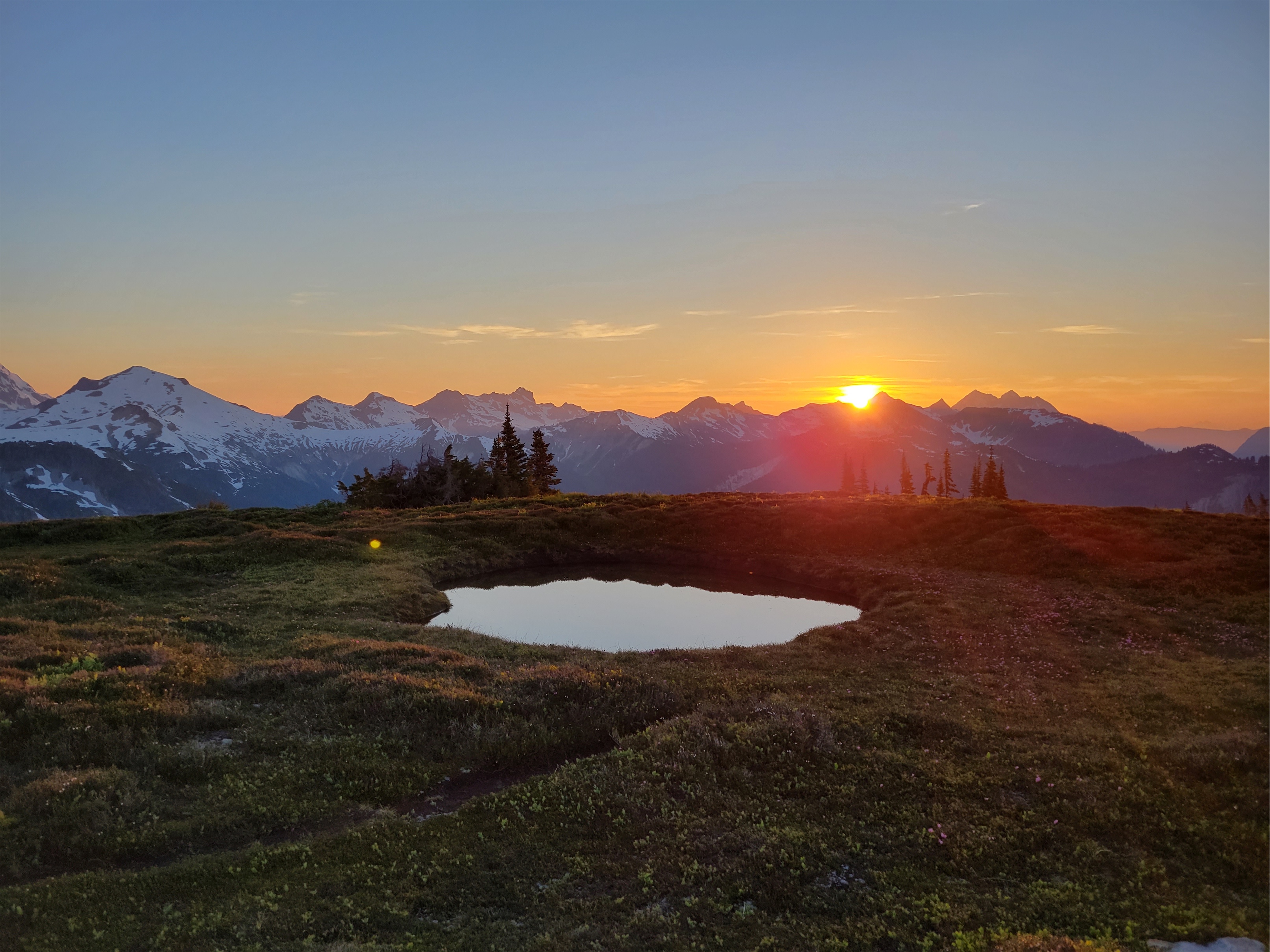
Woke up in (smokey) heaven
Castle Towers over the Cheakamus valley
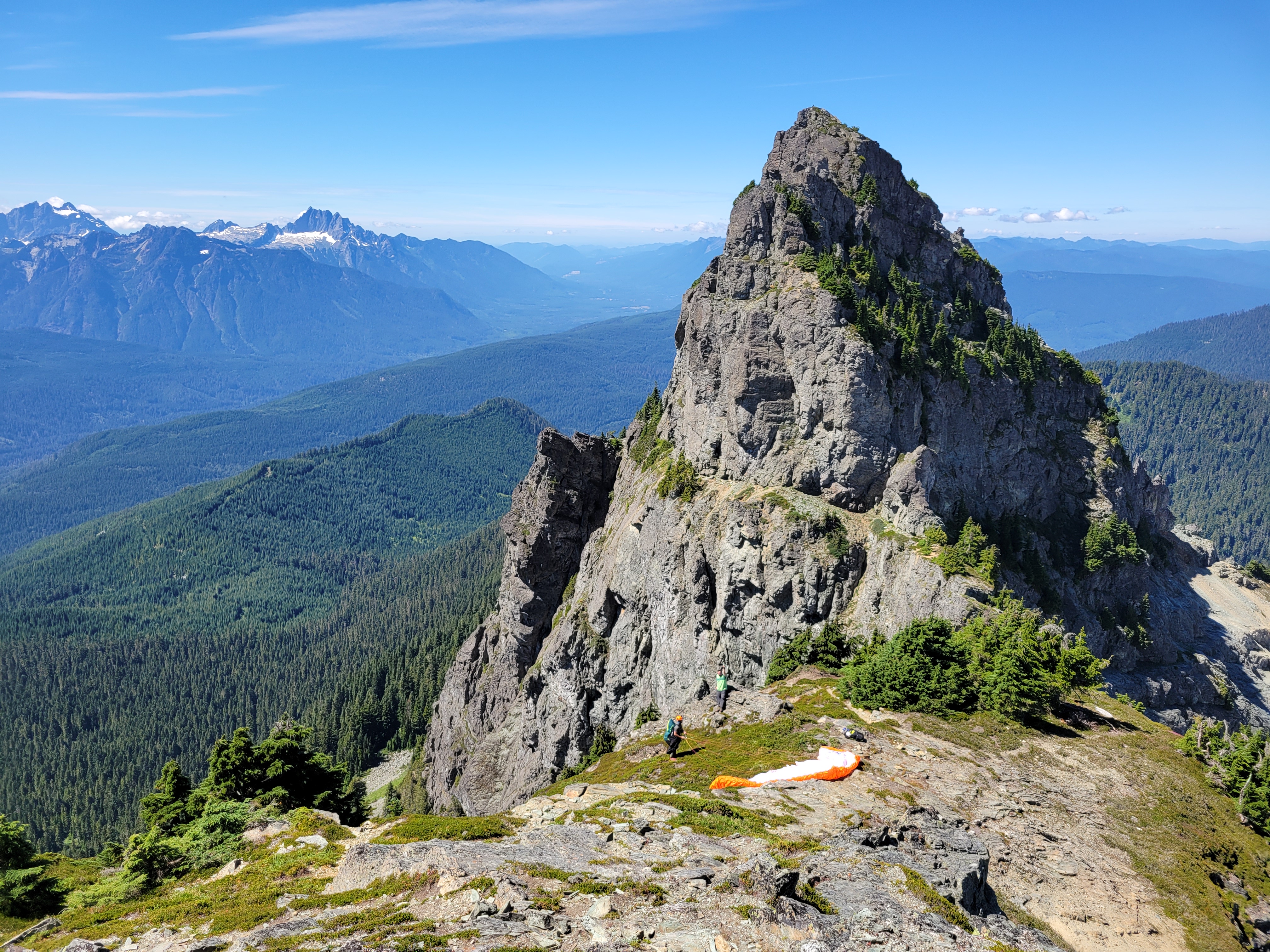
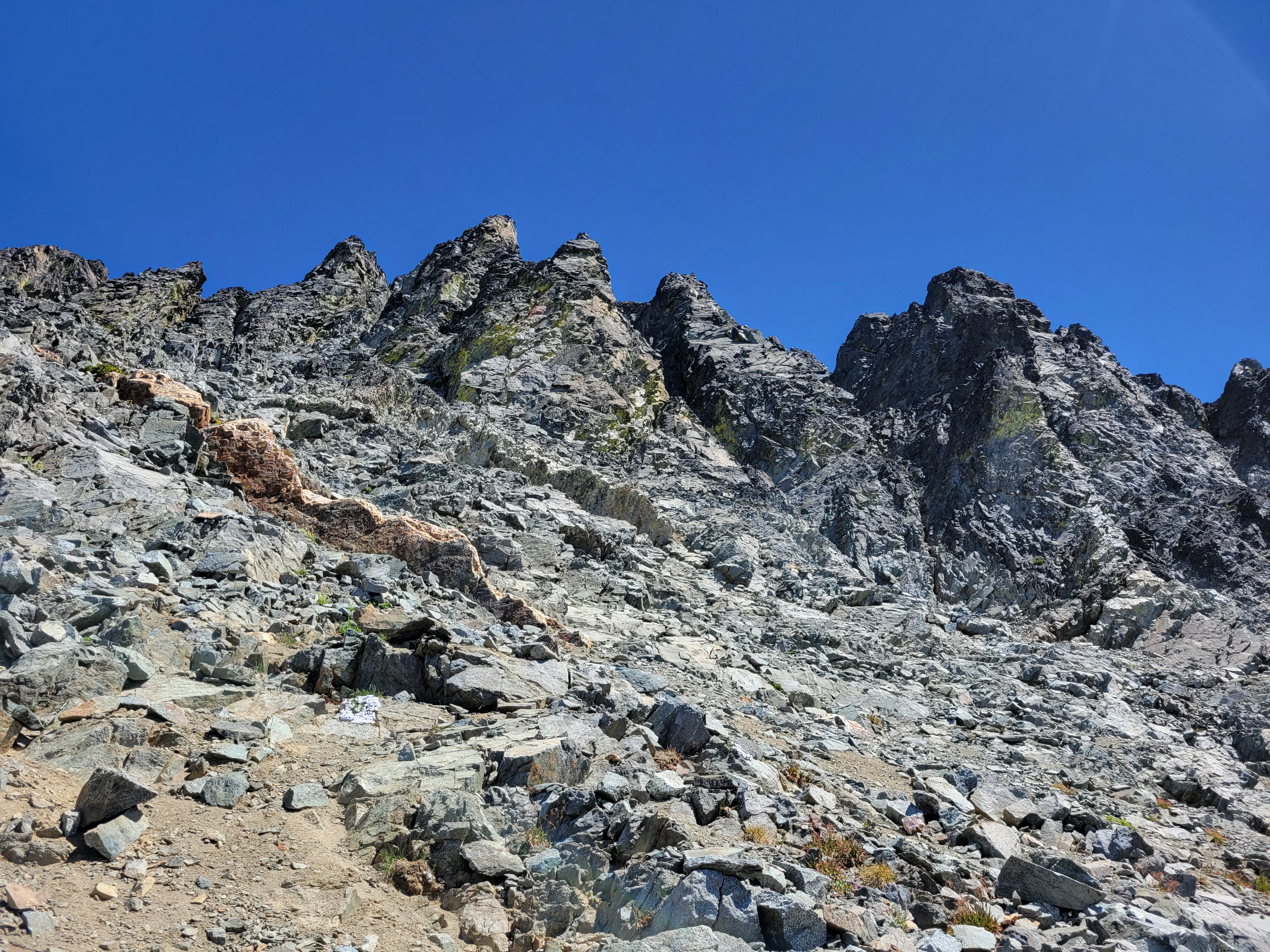
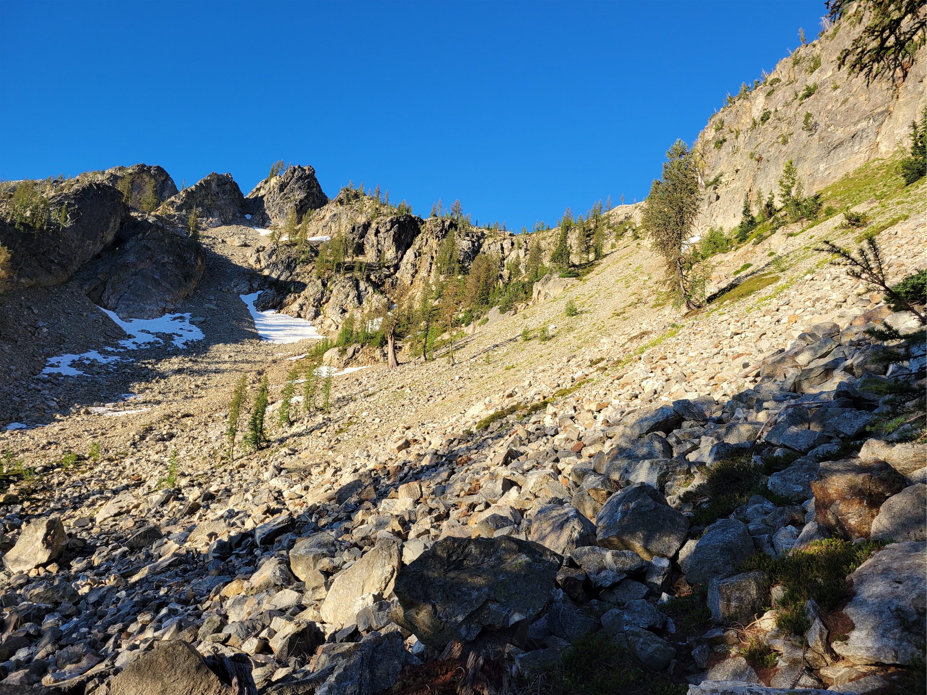
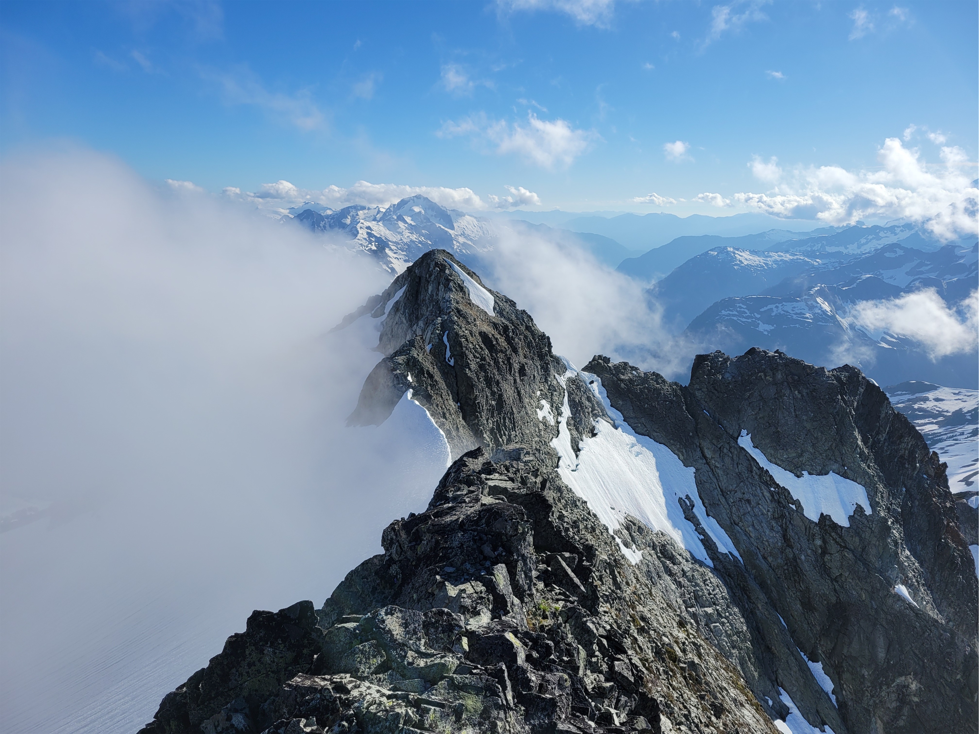
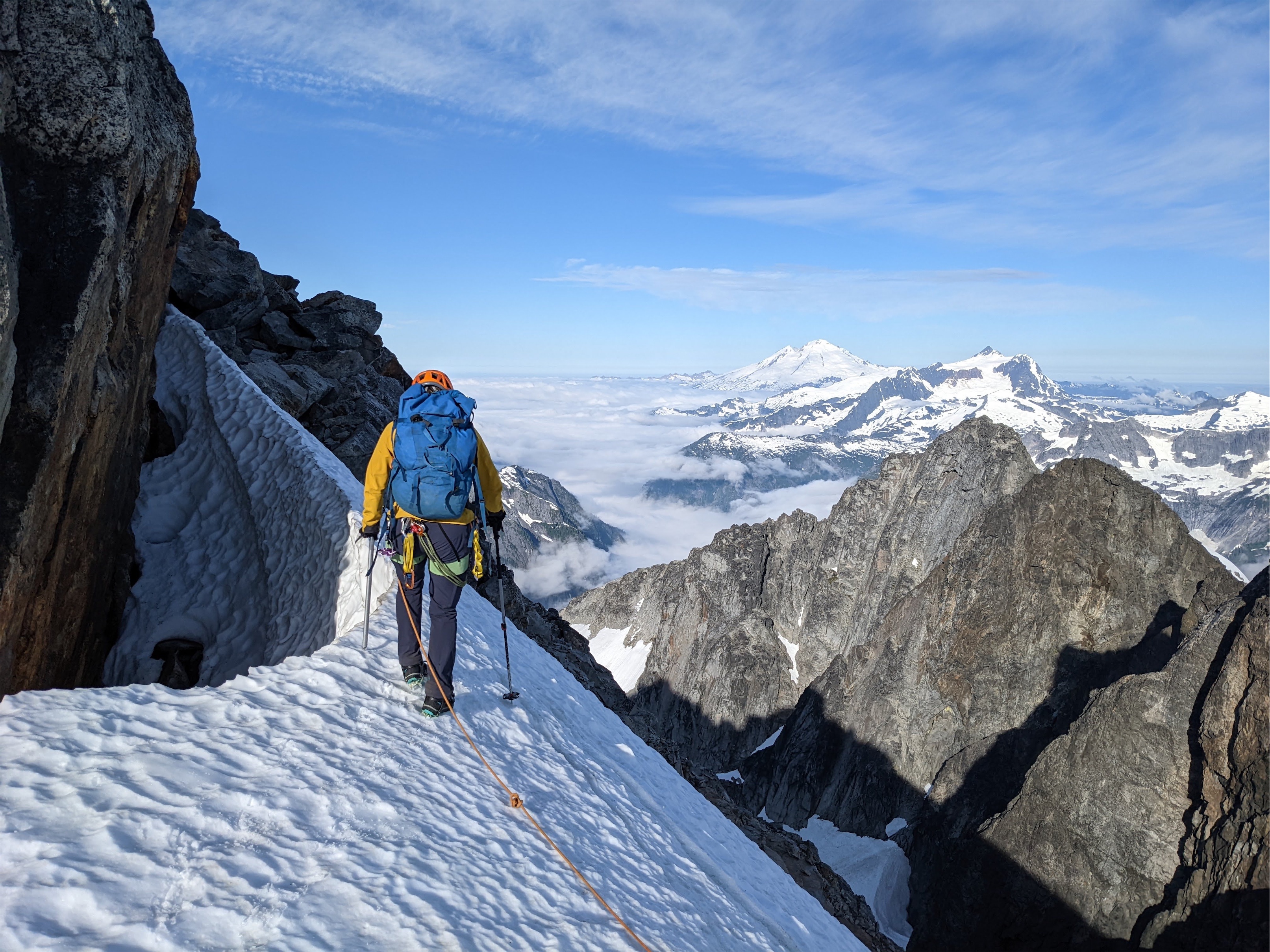
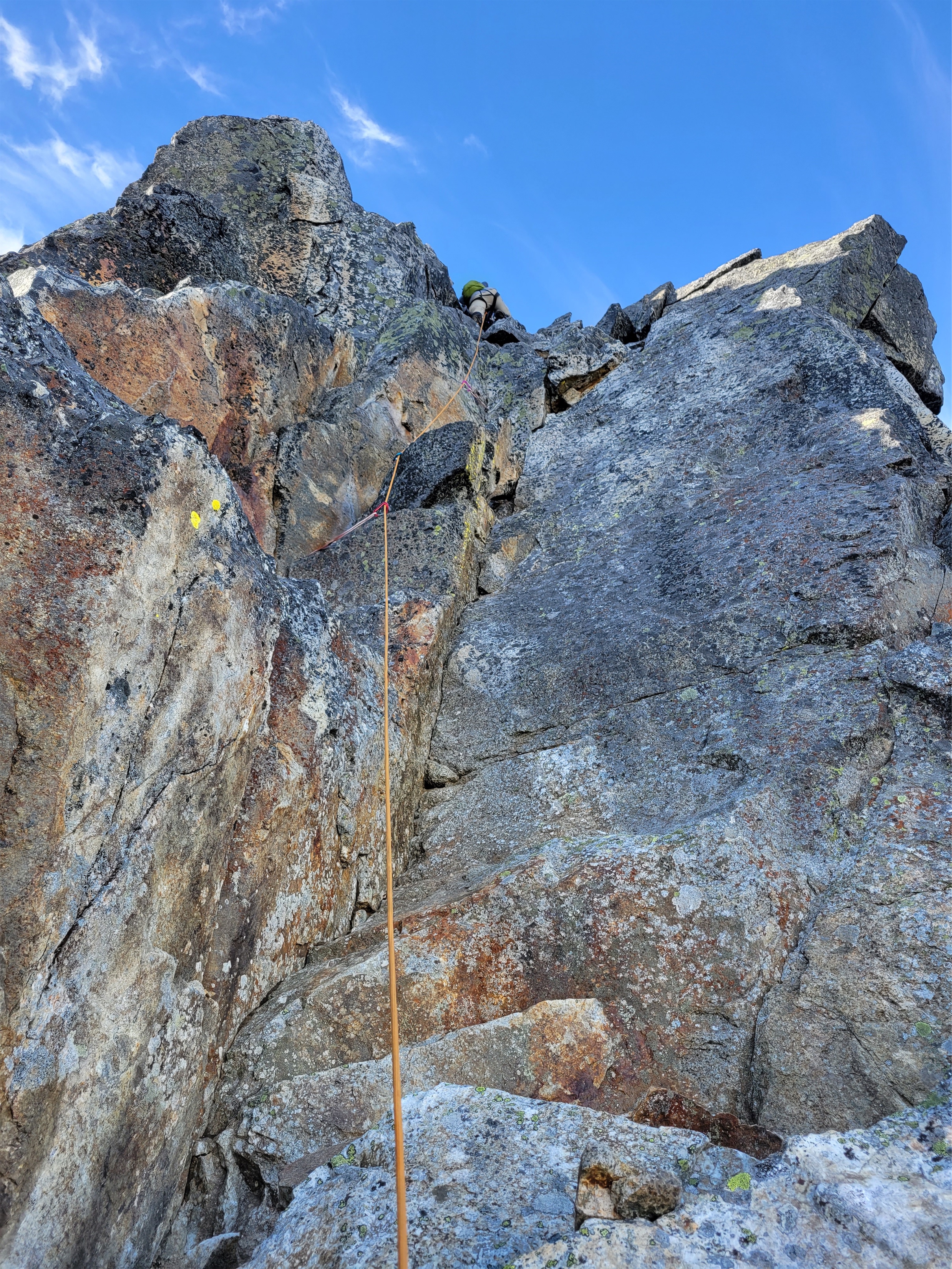
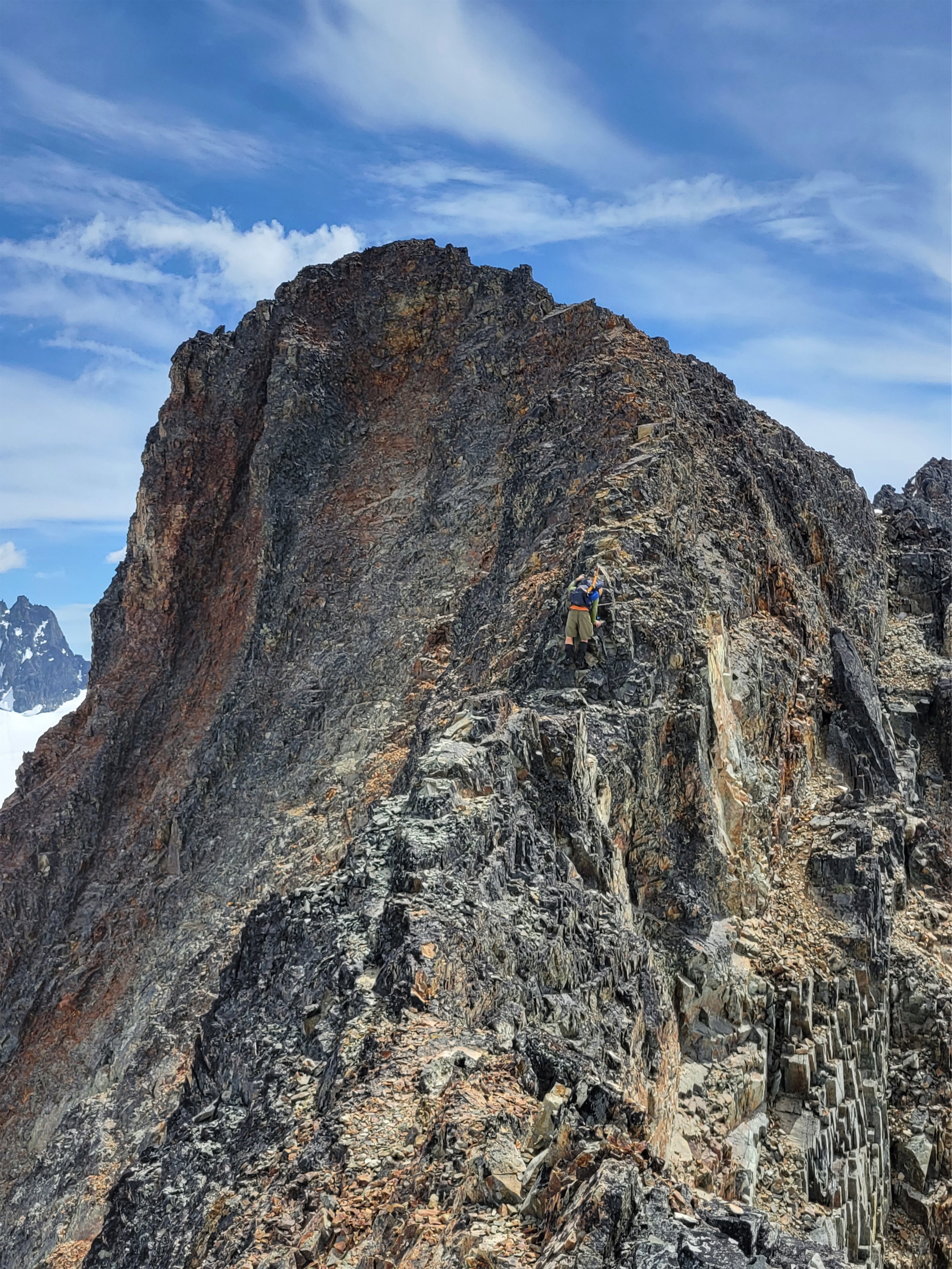
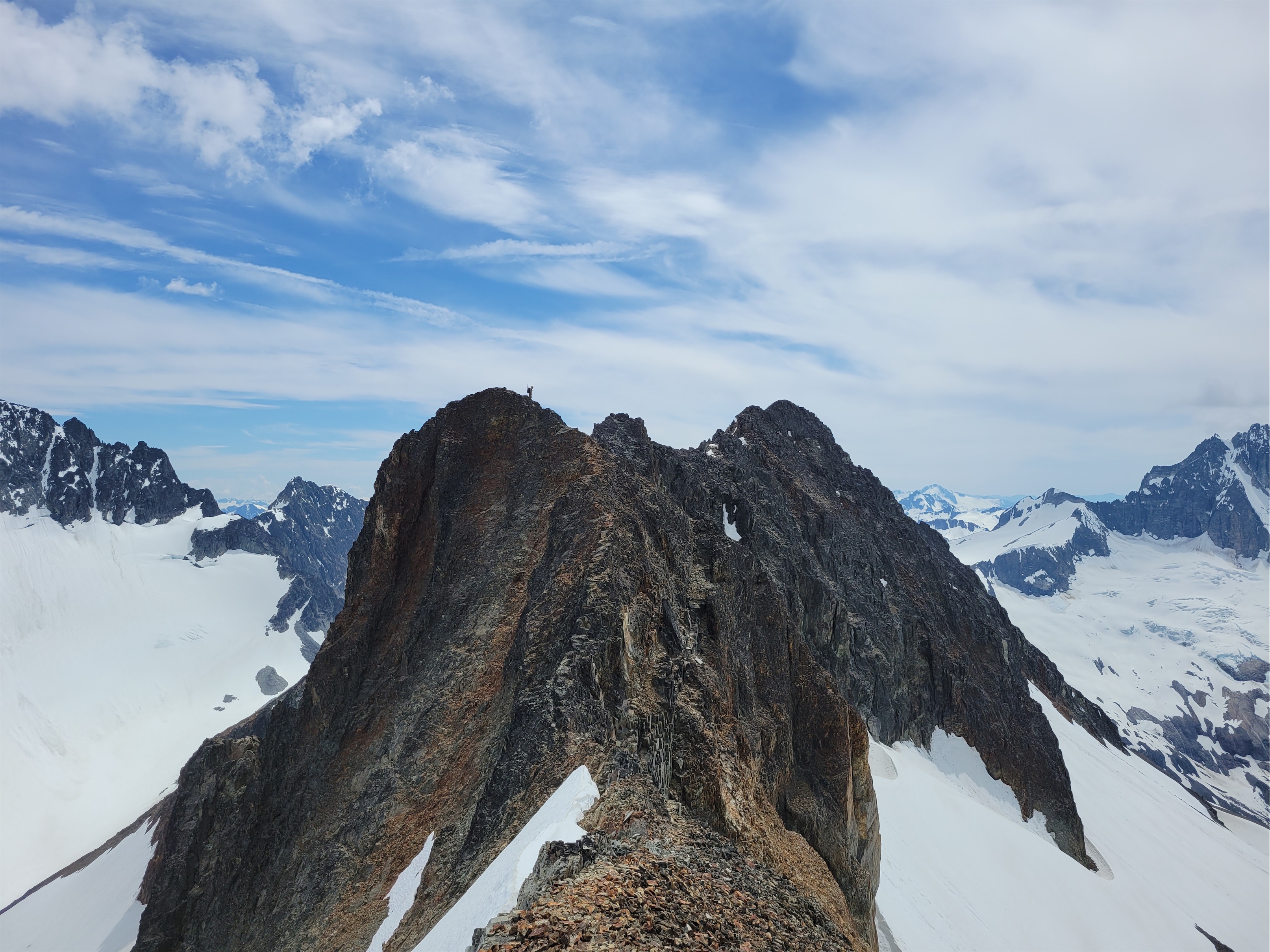
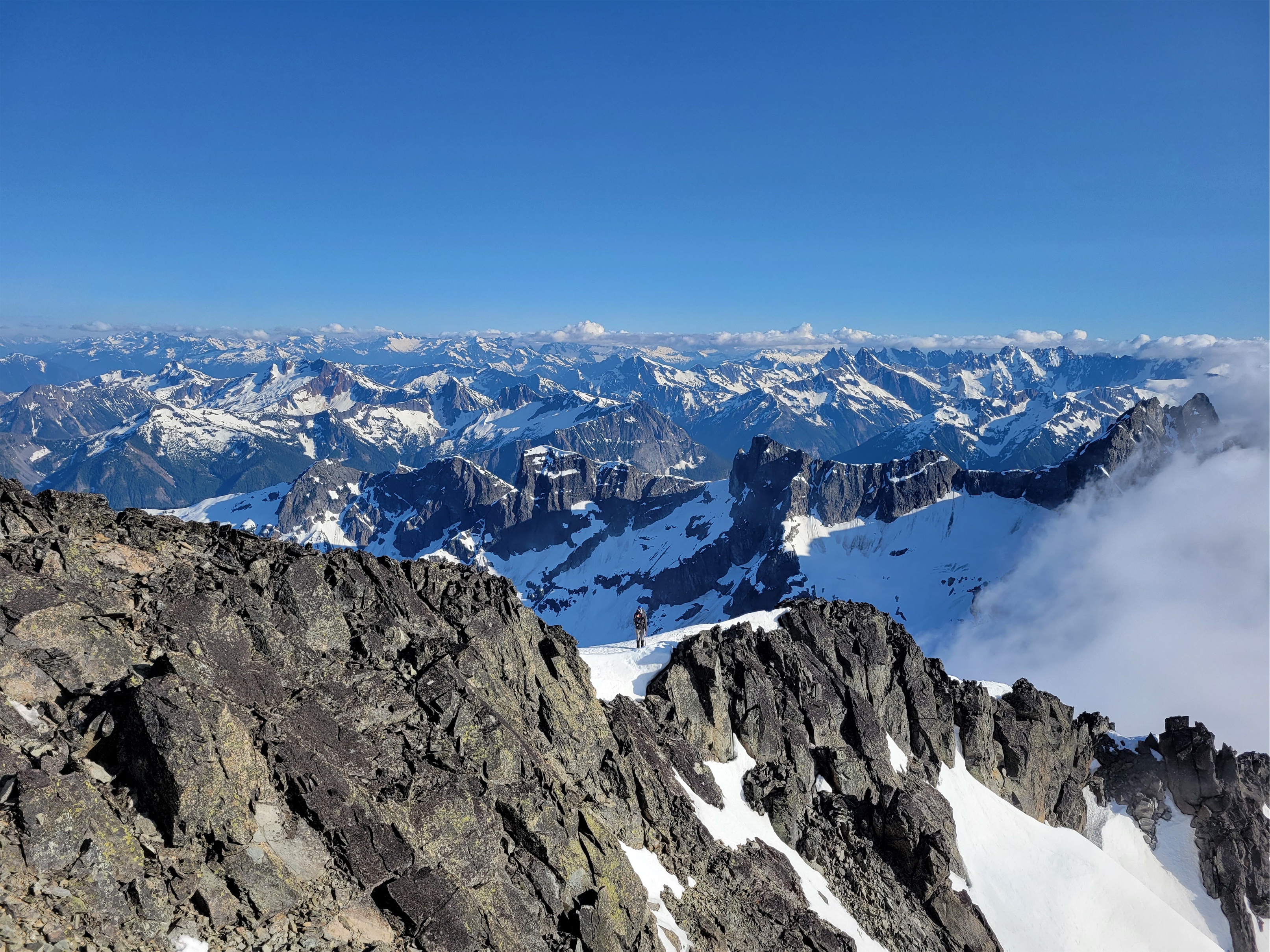
On top of the first ridge, peaks started growing in the distance as I gained elevation. I nearly broke out into the Canadian national anthem I was so astounded by the beauty. I was making slow but steady progress, less than 2mi to Overlord but I knew the last mile would be the trickiest terrain. Whirlwind was really just a long slog, I snapped a few pics at the top before dropping down to the first of two saddles between Whirlwind and Overlord. I was waiting for the 3rd class scramble sections. After the first saddle, I hiked up and over another knoll, knowing that Refuse peak (something like that) was between me and Overlord. Refuse pinnacle? I can’t be bothered to look it up. Either way, it was almost entirely class 2, I maybe had to use a hand to balance once. But the ridge is fun, with huge views in every direction. After Refuse Pinnacle, it’s a walk on this really cool shale that sounds like walking on glass, like tinkling music (tinkling sounds like pee but you know the sound I mean), and then a long slog of a talus field with some snow patches to the top. O Canada kept morphing into the US national anthem in my head, and honestly I can’t think of worse songs to have stuck in your head. There is a climber’s trail the entire way from Whirlwind to Overlord. It’s sparse in parts but if you are used to boot paths you’ll find it.
Looking up at Overlord (left) from Refuse Pinnacle
The summit was broad and welcoming, I had some quick snacks and chatted with two other climber who were ahead of me before quickly turning around to head back down knowing Sarah was waiting for me. I had taken just over 2hrs to the summit, and was hoping to be back in 3.5hrs total. The way down went quickly at first, until I was just past Refuse Pinnacle and saw all of the other parties on the way up. I stopped to chat with each one (uphill has right of way so… yeah) and reassure some folks who were worried about the scrambley part. Finally past the people, I realized how much of a delay that had been and texted Sarah that I wasn’t going to be back until 12:40 despite an ETA of 12. I desperately hoped I was underpromising/could overdeliver and be back way before that.
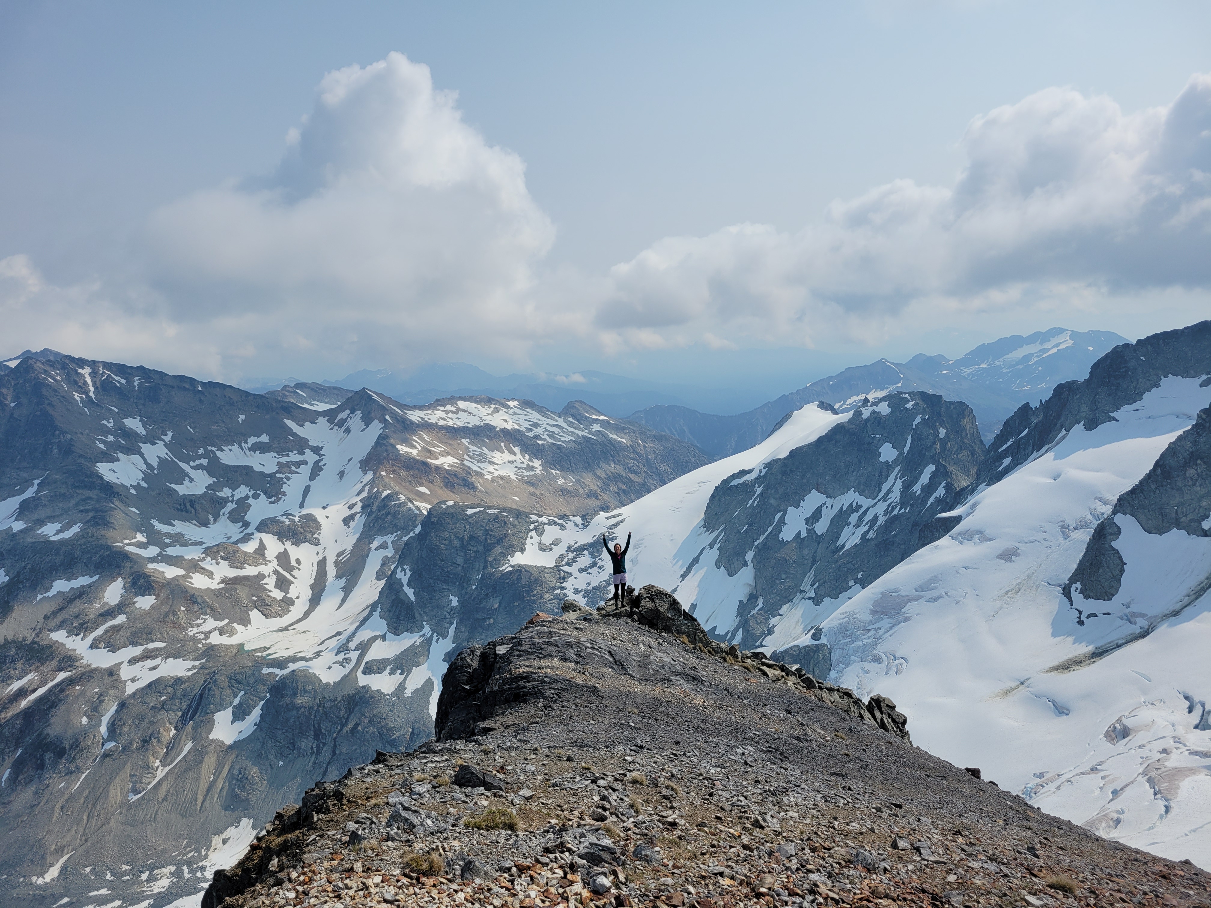
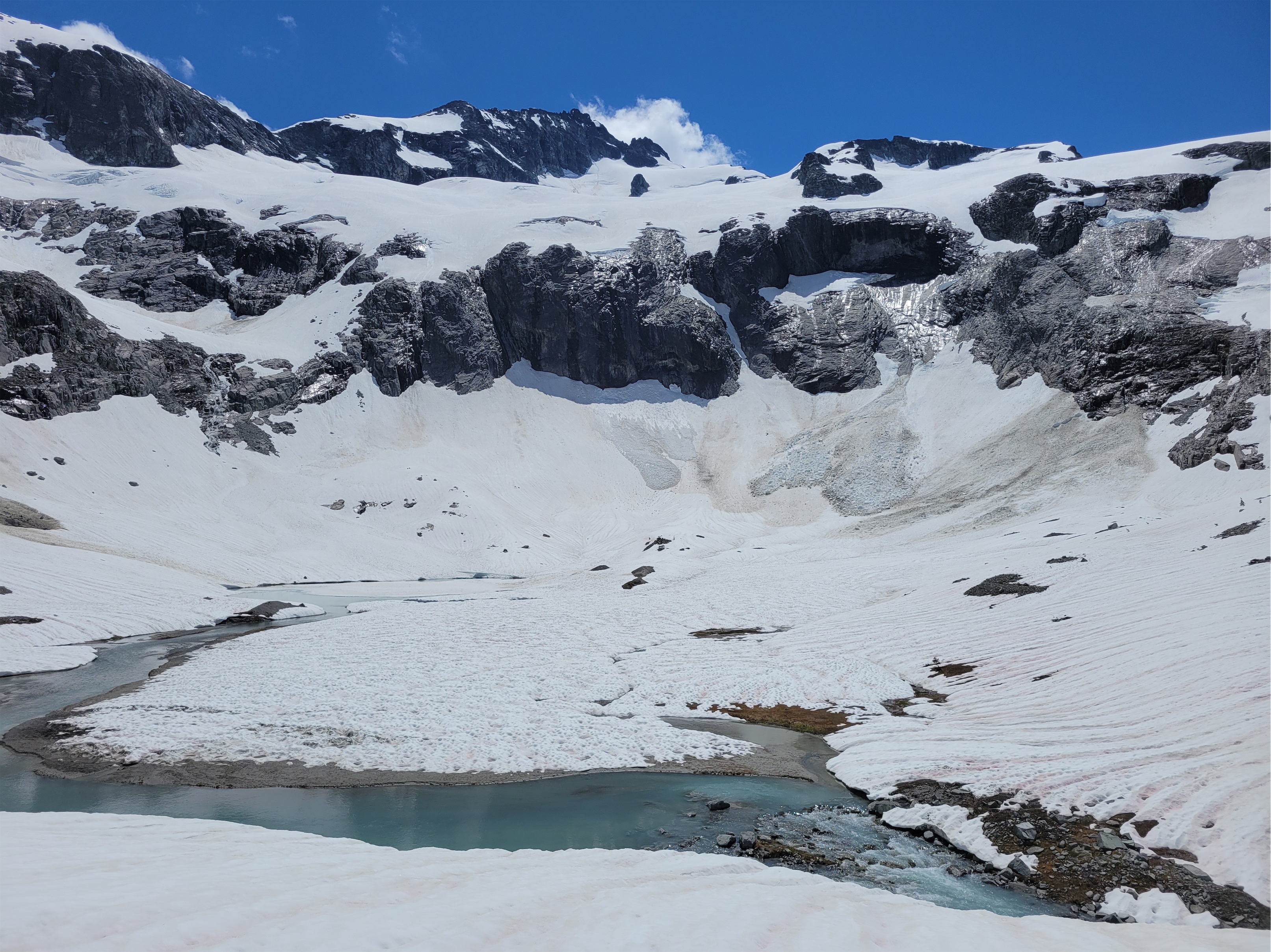
Looking down on the Overlord glacier from the top
Yours Truly for scale
If you zoom in there is a blue dot, that’s another party headed up (Overlord summit behind the knoll)
Halfway up the saddle I turned around and saw the other parties. One woman waved to me and whooped which made me so goofy happy. I was DRAGGING. Coming over the knoll and realizing there was another 300ft of gain to the top of Whirlwind was crushing. But once on top of Whirlwind it was soft enough I could start jogging, and I knocked out the remaining 2mi in around 30min, getting back to camp at 12:15ish right as Sarah texted something politely conveying “I’m bored, hurry up, I’m ready to leave.” I packed up my stuff as quickly as possible and we were off to the paintbrush meadow. 6-7hrs round trip from camp my ass. Good to know I can still knock that out. I question my fitness constantly these days (which most people who know me are probably rolling their eyes at).
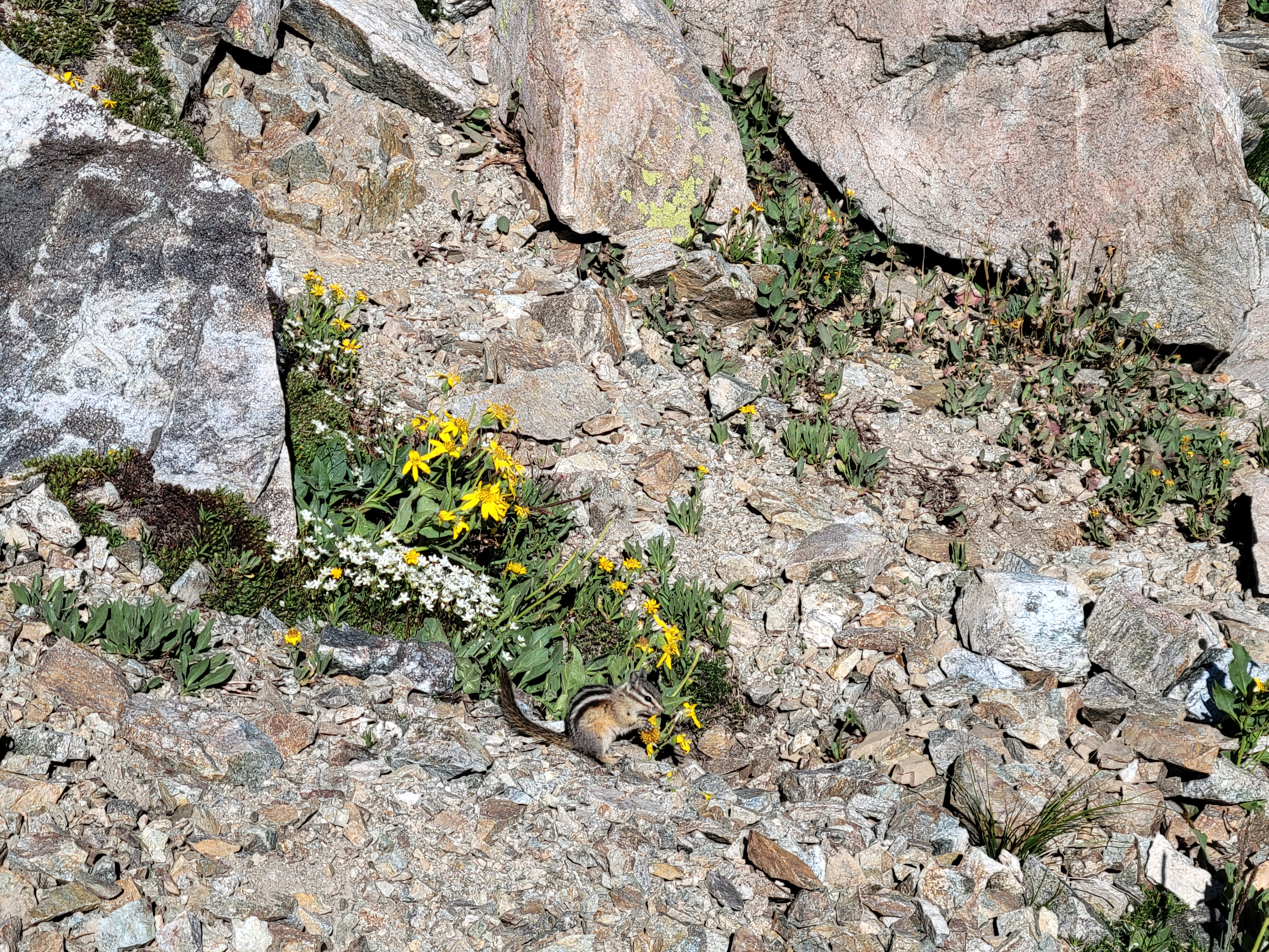
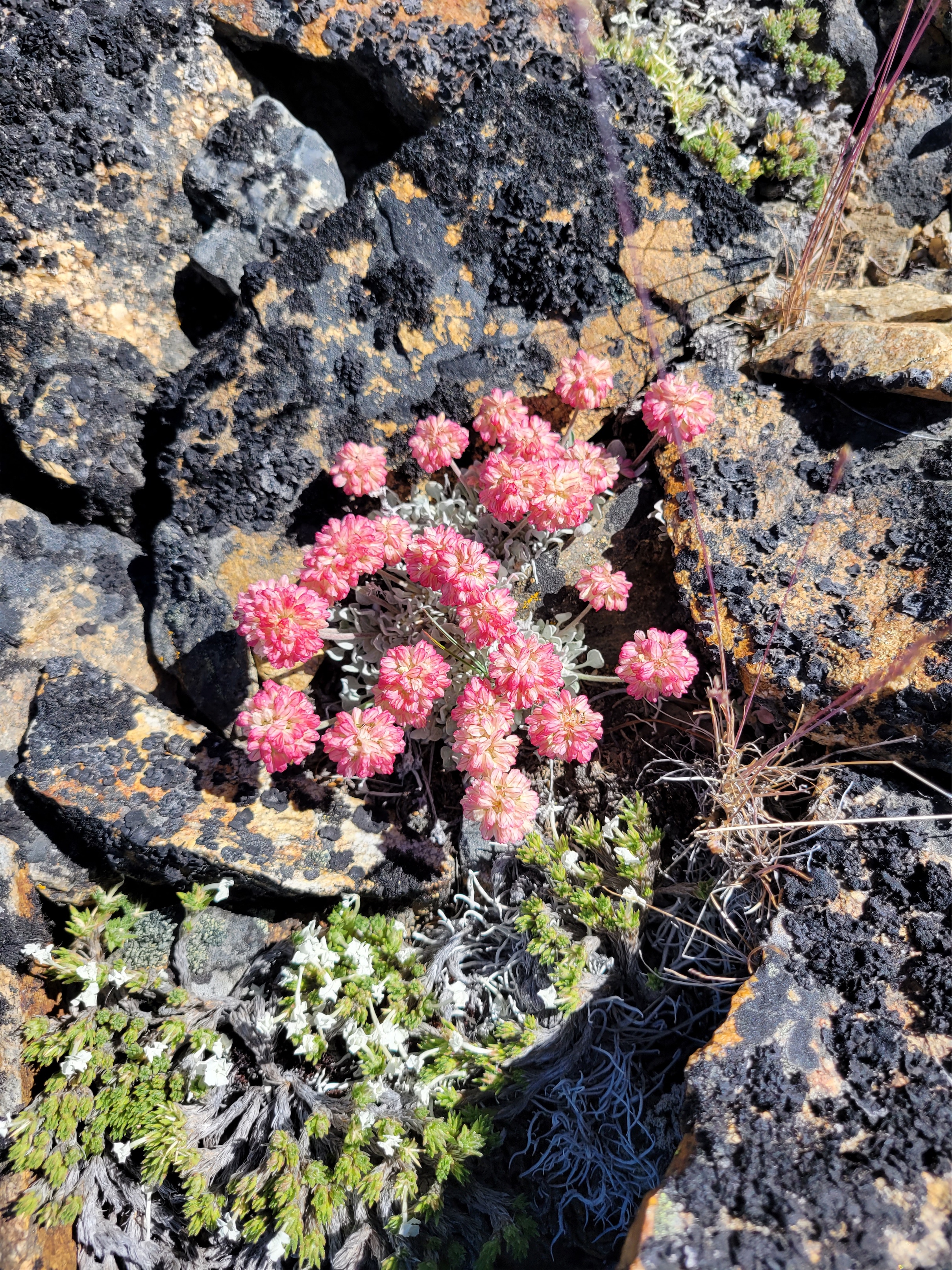
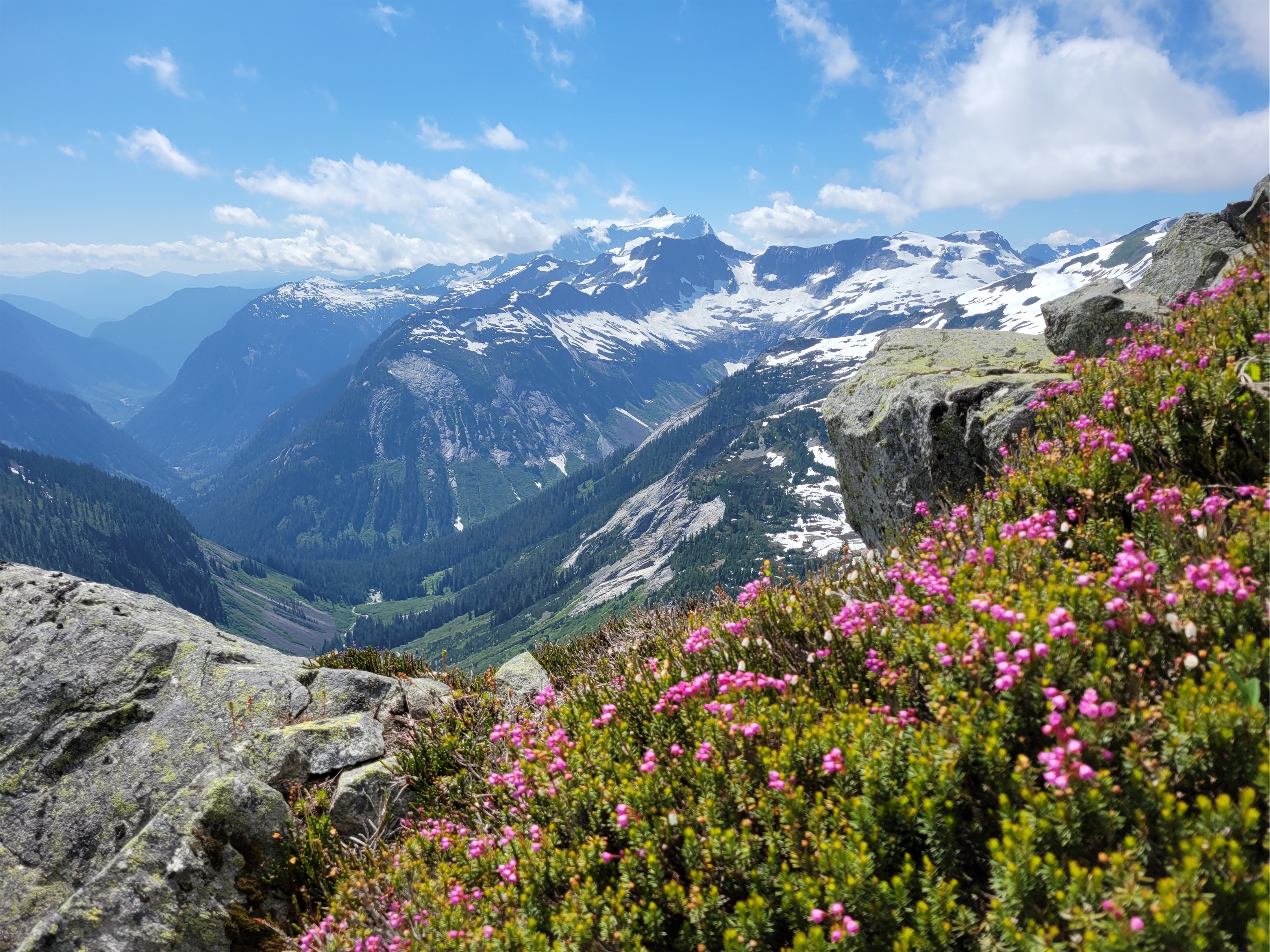
I cannot in good faith recommend going up Cowboy Ridge above Russet Lake where the meadow is because it is impossible to do without stepping on wildflowers. They are EVERYWHERE. There is no trail up there but the flowers are absolutely astounding, and I hear the lakes on the other end of the ridge are great for swimming, and the end of the ridge has a good view of the Overlord glacier. We did not have enough time to hike the full right, which is okay with me given the impact it’d have had on flowers 😦 Guilt quickly kicked in for me and we zipped back to the trail after just a few photos.
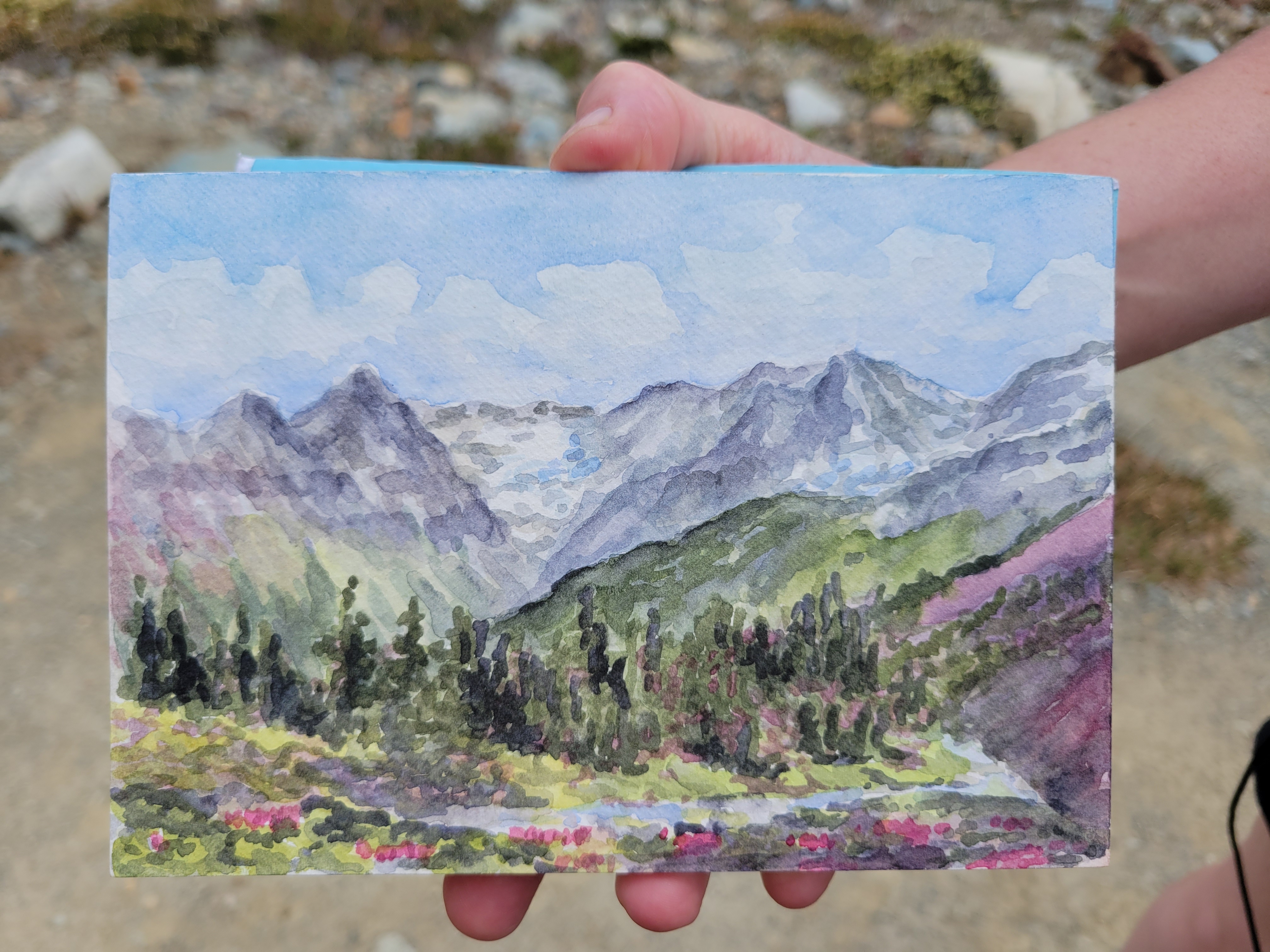
SARAH’S PAINTING omfg I freaked out when I Saw it. Will link to her site once it’s up. She did that at camp!!
Russet Lake camp
We retraced yesterday’s steps to the junction between Musical Bumps and the Singing Pass trail, and started up Musical Bumps. Let me be clear: we were doing this whole trip backwards. You’re supposed to take the gondola up to the top, then hike DOWN musical bumps to the lake, then hike DOWN the trail from Singing Pass back to Whistler. But we were banking on nobody checking for gondola passes because we’re cheap. And we were also banking on the gondola being open until 5.
The wildflowers continued to be absolutely phenomenal going though Musical Bumps. We are NOT fast hikers when flowers are involved. We probably looked like two off kilter toddlers chasing butterflies. I started collecting beta from passing hikers because we didn’t entirely know the way to the gondola, and my phone was dying, which meant no navigation soon. My legs were also DYING after knocking out Overlord and now this. Flat was fine, downhill was fine, uphill was tough. Getting the gondola was going to be tough at our speed. I made a joke to a passing hiker. “Yeah we’re trying to catch the last gondola out of here, gotta go!!” They lit up. “The gondola’s running until 8! There’s dinner at the restaurant so they’re keeping it open late!” Sarah and I burst out laughing. YEs!!!!! How was this working out so well in our favor? Spirits newly lifted knowing we could take our time, we plodded on through all of the gondola-carried tourists hiking with tiny day packs, envying their light loads (maybe that was just me).
It truly just kept going. Insane numbers of meadows.
Something something frosted tips
Even within ski resort boundaries the terrain is gorgeous. I wasn’t as annoyed by the lifts as I expected. That last mile to the gondola though was one of the slowest of my life. It just. Kept. Going. Every time I thought we had to have gone a half mile we hadn’t. I was soooo happy to finally get to the lodge. We popped into the bathroom, sought out concessions (specifically Diet Coke, which we did not succeed in finding), and got in line for the gondola. 5min later, we were in a gondola, high fiving because nobody had checked for a pass.
Three colors of heather in this one pic
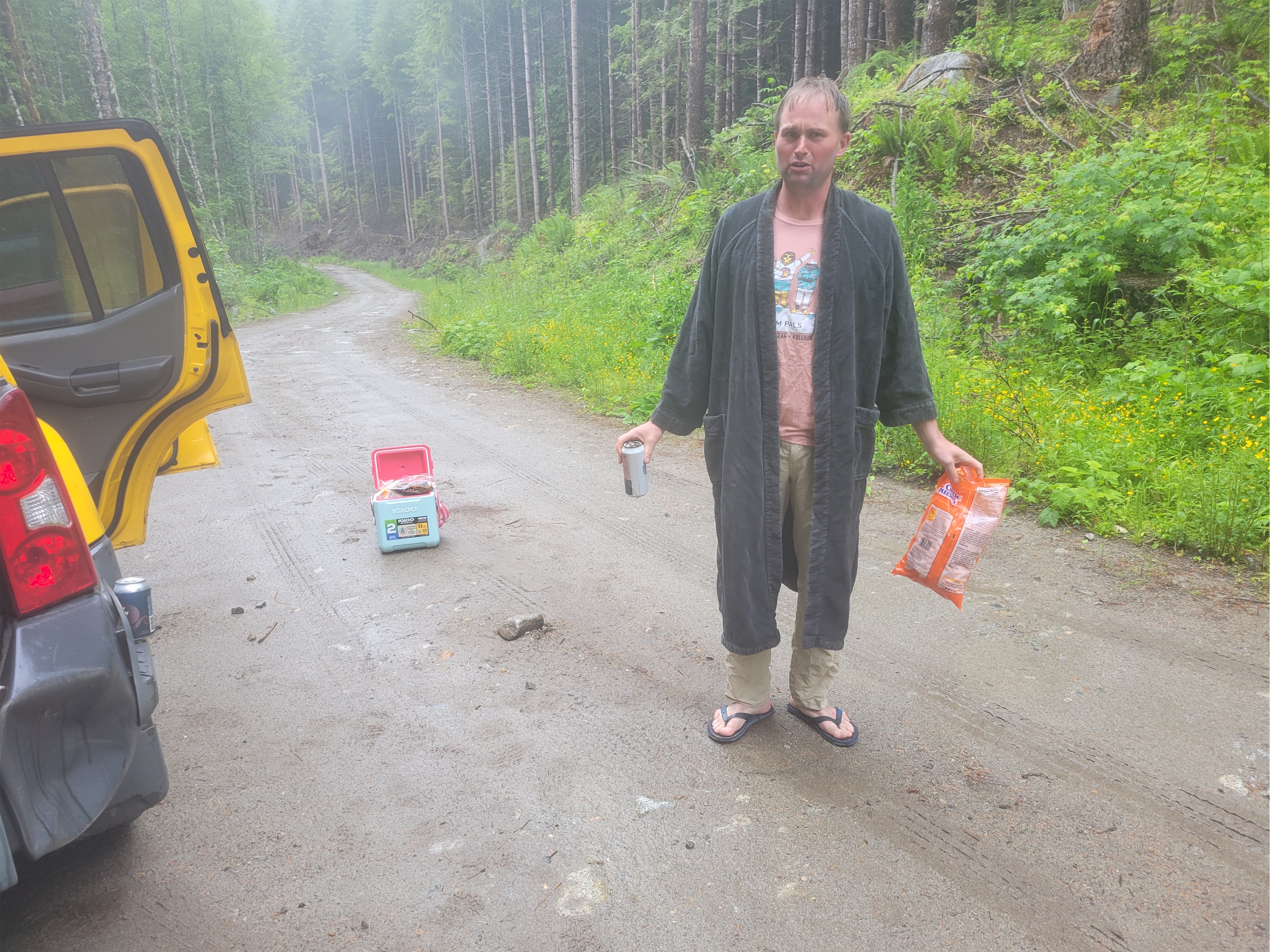
Nearly back at the car, I said out loud “this HAS to result in a ticket right? I mean everything else has gone so perfectly… there’s definitely going to be a ticket on the windshield.” NO TICKET. We dropped our packs, chugged some diet cokes from the village, and headed back to Squamish to get ready for a day of dragging.
I cannot recommend Russet Lake enough, or Overlord behind it. Two extremely beautiful objectives, well maintained trails, incredibly accommodating campsites (the hut I think is $50 per night?). I am truly shocked I had never looked into any of this. I got exactly the novelty and adventure that I had been missing, with great company, and a trip that way surpassed expectations. Definitely hope to be spending more time in BC in the future.
Has anyone seen the movie Nope because that weird cloud is in like a dozen of my pictures from Overlord
First flight off Whitehorse! What a freaking treat!
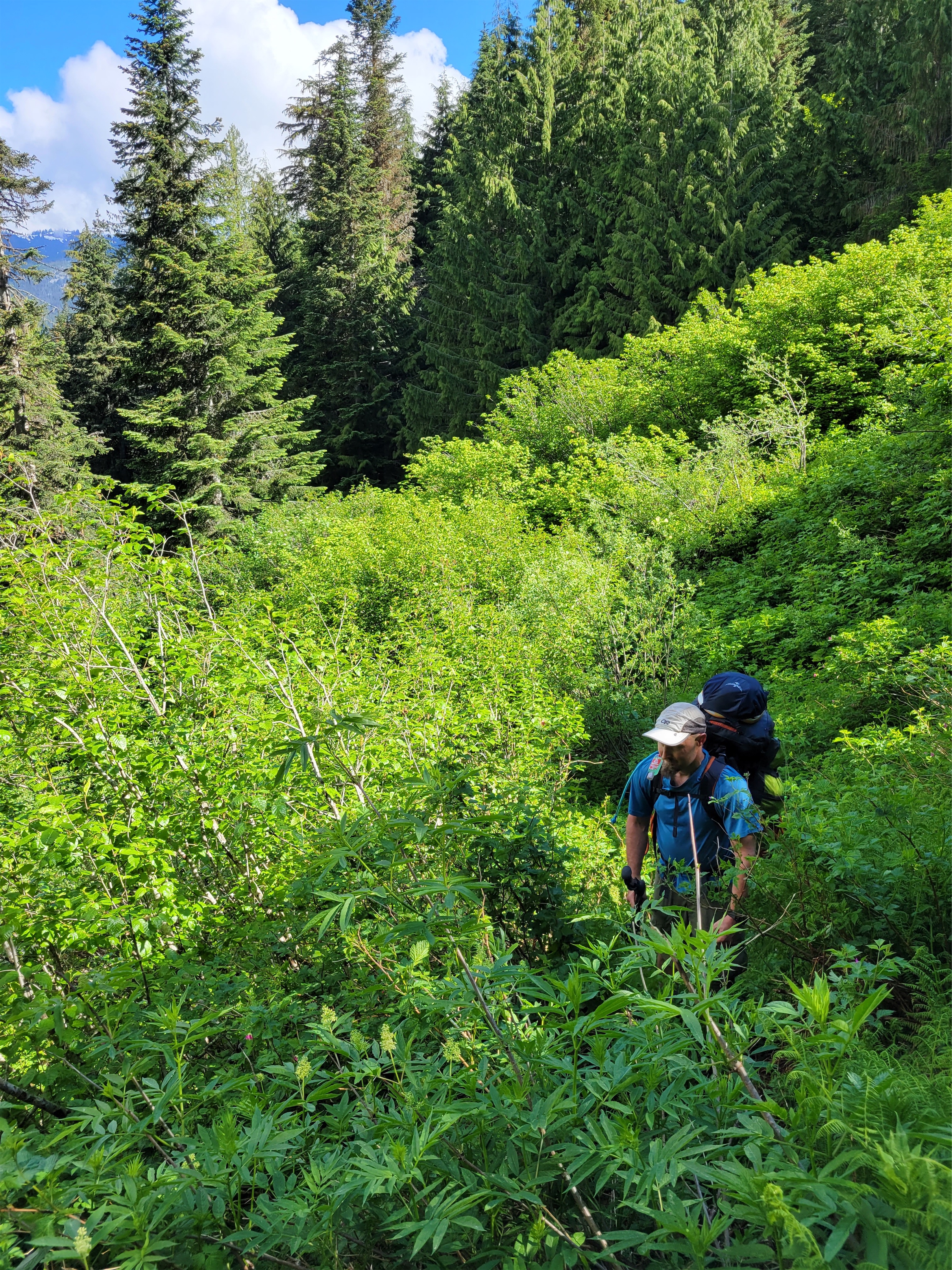
Brush brush brush
I had been stalling on committing to weekend plans until Thursday night when I got a 10pm text from Andrew telling me to drop what I was doing and join him and Stephen for Maude and Seven Fingered Jack. I also saw a post from Mike on FB saying he was considering Whitechuck Sunday. Mike’s great. And here’s the bonus. I had Mike’s cooler and box fan from a party weeks earlier that he was kind enough to leave behind since he left while there were still people here. Dude. Can I join for Whitechuck, and I’ll bring your stuff too? Heck yes!!
Distance: 4mi Elevation gain: 2100ft (6,989 highest point) Weather: 70’s and sunny Commute from Seattle: 2:30 Did I Trip: Almost ate it right below the summit but no one saw
Open forested ridge
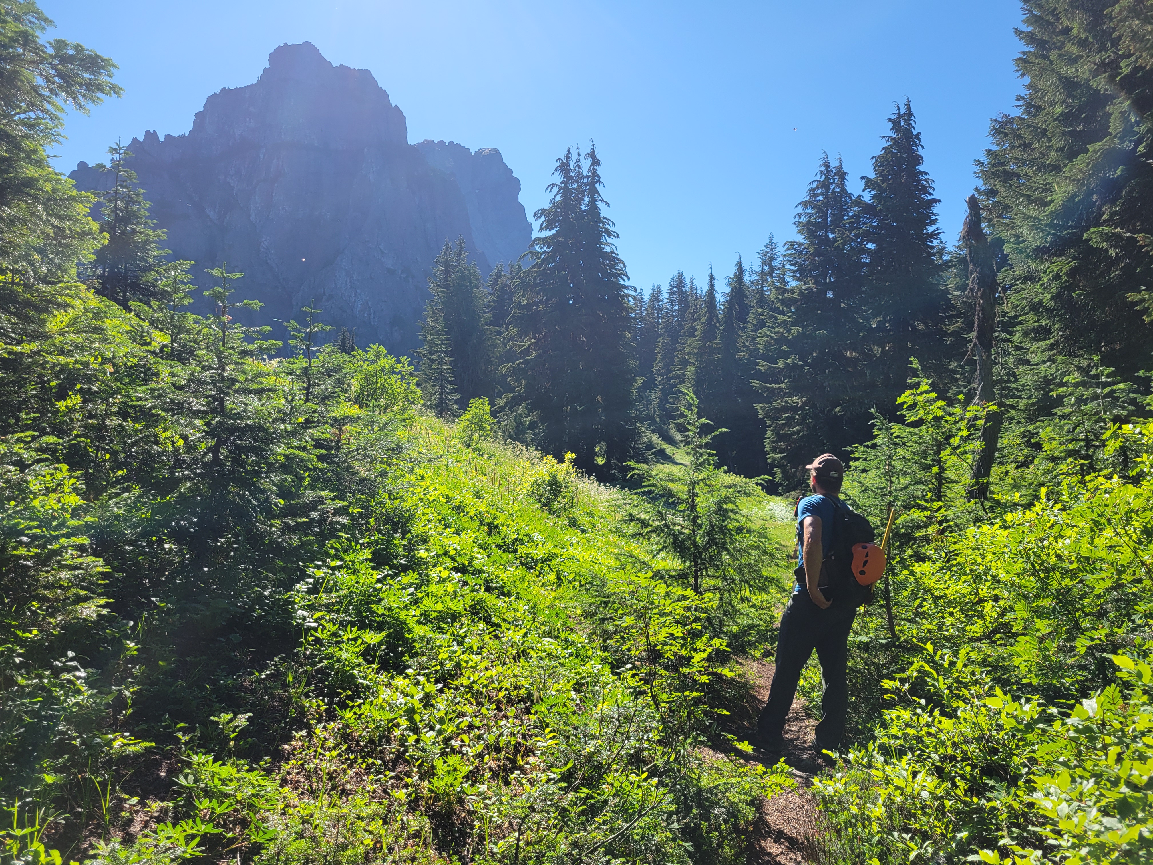
Whitechuck had been on my list FOR YEARS but it’s such a short hike I was always reluctant to drive longer than the hike would take. And I had heard so many polarizing things about these “white slabs” from people that I wasn’t sure I wanted to go solo. Being the opportunistic hiking parter I am, Mike doing Whitechuck was the perfect incentive to go. We met up around 7:30am, aiming for the trailhead at 9am so we wouldn’t have to swim through dewey brush, which the trail is famous for. Around 7 I messaged Mike, voice-to-text while driving. Shit. Mike. I’m so sorry. I forgot the fan and cooler. I know I know I had one job, I’ll drop them off in North Bend I swear. I was kicking myself. This is like when I forgot to return Alexis’s power washer like actually four times until finally she said I’m coming to your house to get it. I wasn’t letting that happen again.*
False summit of Whitechuck
The road to the trailhead was in GREAT shape. There was one steep section to go up and down that may give some 2wd cars hesitation, but none of the rutted potholed hell we had envisioned. And the views are phenomenal on the drive! Holy crap! It’s going on my list of places to camp if I’m ever injured.
Wildflowers above treeline
The trailhead is notorious for smashed windows and car break ins. A car pulled up behind us and we started wondering. Suddenly Mike laughed. I don’t want to stereotype but… it’s a Subaru I don’t think they’re going to smash our windows. He scattered some junk in the front seat to make it look as unattractive as possible and we started hiking.
The trail stays left near the wall here. These are not the slabs on route! Bt they do go.
The trail first goes through brush, then open forest, then meadows. Bite size pieces of tons of different terrain. We were perplexed by the peaks to the North of us, it’s a perspective I’ve never had of the Cascades. We eventually figured out that Mount Chaval looks awesome from this angle. I whined about my sore legs from the prior day. This would be a good hike to get blood pumping, that’s for sure.
Suddenly beyond the meadow there’s a rock wall in front of you. And that’s not even the true peak. The trail wraps around the hillside south of it, taking you through wildflowers to a steep, dusty, rubbly trail where we caught up with some of the folks who owned one of the other cars at the trailhead. We passed them and immediately got off route scrambling up some slabs that we were sure had to be the slabby section until we found a trail through the heather above. Also those slabs were black not white. Ok, not at the infamous slabs yet.
Heather trail running along the shoulder
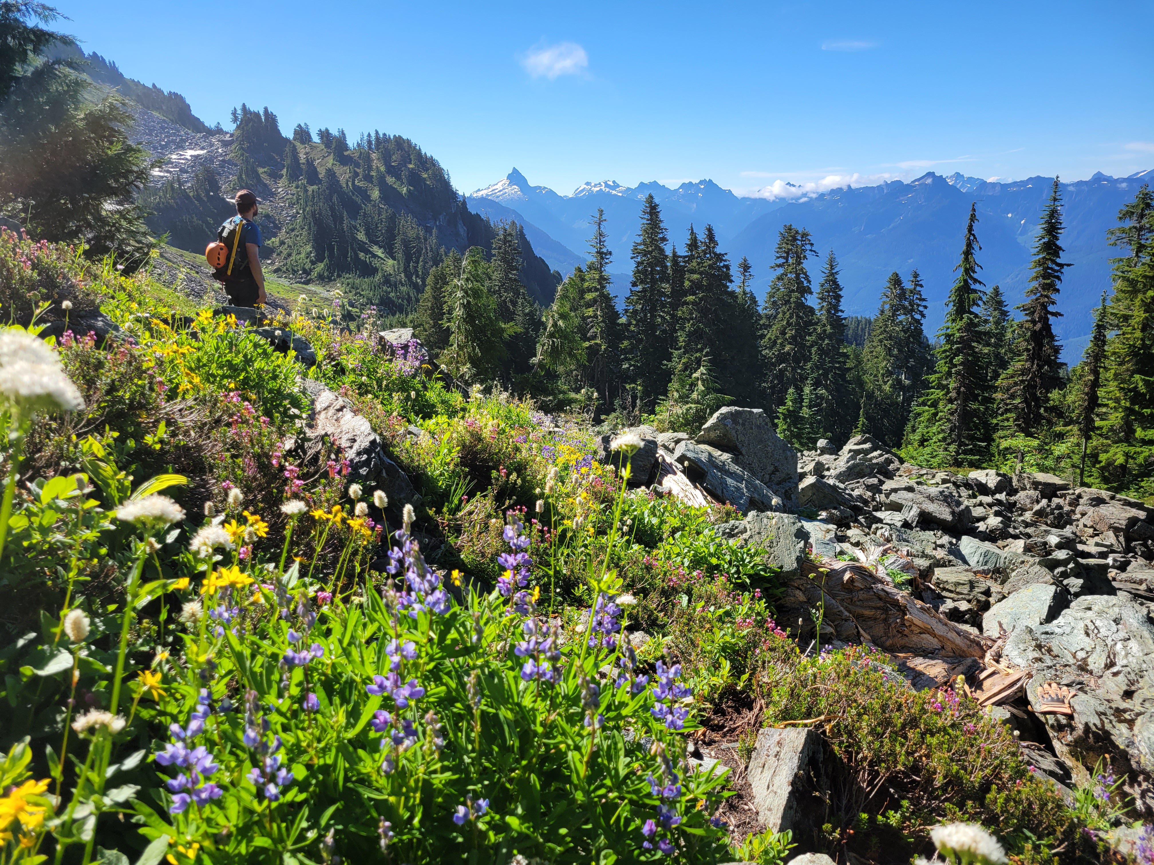
At multiple points, the heather trail diverged into two which both met up later. We avoided scrambling the ridge proper though I hear it is enjoyably spicy and stuck to the trail on the south slopes of the mountain, following the narrow tread through wildflowers and rocky outcroppings with insane views. It’s a classic Mountain Loop trail, reminiscent of the upper slopes of Pugh or Sloan. We must have taken a thousand pictures between the two of us, me clocking in around 250 and Mike accounting for the other 750.
We finally came across some awkward sloping white slabs covered in kitty litter. Okay, THESE must be the slabs. They certainly were negatively sloped, with no way around them. It was really only a few steps but it is definitely awkward. Beyond that, it was more trail to the notch, which had the most legitimate scramble move on the whole hike in my opinion. From there it was a short walk to the summit, where you are standing at the confluence of two enormous river valleys looking at ridges and ridges of peaks in every direction. The position of this peak is absolutely insane. The day prior I had sworn that the Chiwawa area/Entiats were my favorite part of the cascades. But now I was thinking no, it’s the Mountain Loops.
Dead/dying glacier on Whitechuck’s north face
The group next to us had three huge joints. I laughed. No way could I smoke that and then descend that mountain. Well I mean you all know my last weed experience. Behind us, a dog or maybe two made the scramble move at the notch. I couldn’t even watch because I didn’t trust that the pup was going to stick the landing but of course he was fine. And the final group.. well that’s where things got interesting. They were paragliders!
We descended from the summit, staging a few photos. marveling at views. There is a wealth of logging history here and you can see it on the slopes, the marks of old roads and the borders of where the forest had been logged and then regrown. Back at the saddle, the two paragliders were suiting up. We sat down to have a snack, and eventually the topic came up… what if we just waited to see what they did? Do you… do you want to just hang out and see what happens? We weren’t in a rush. Mike messaged his girlfriend to explain why his inReach wasn’t moving, and we chilled out. The paragliders, Chandler and Kevin, were discussing wind cycles, direction, laying out the glider in different spots to find the best angle on ground that wouldn’t snag the strings. The strings are absolutely tiny, like less than a millimeter thick, and there are seemingly hundreds of them. The whole system seems extremely fragile, yet it can carry you through the air for miles if you plan it right.
Narrow boot path on top of the world. You can tell that whole slope left of center was logged.
THESE are the slabs everyone talks about
We ended up waiting and watching for over an hour. I wondered if we were being rude by watching, but it was fascinating. When’s the last time you watched something with childlike wonder? The risk analysis and decision making was beyond anything I’ve seen with my low grade rock climbing. I learned that wind comes in cycles, like how surf comes in swells. You feel a breeze pick up and then die down, that’ll happen a few times and then there’s a bigger lull between cycles. The breeze would just tease the glider, ruffling the cells a tiny bit but not lifting it. When the breeze was finally strong enough that the glider first fluttered my heart fluttered with it. And after endless tries laying out the glider differently, it lifted up a few feet, Chandler pulled the strings taught and got it ~10ft in the air, and he said I’M GOING FOR IT and in a split second ran and jumped off the edge of the mountain. We jumped up and whooped and cheered. First flight off Whitechuck ever! Unbelievable.
Glacier Peak over Thornton Lake
That left Kevin, who put Mike and I to work after a few unsuccessful tries at catching the breeze. We helped lay out the glider, tried holding it up to catch the air, clearing small rocks and heather twigs that were snagging the strings. I felt like a kid helping an adult delegating simple tasks but the kid’s just so excited to be useful it doesn’t matter as long as they’re doing something. Omg, I’m touching a glider. A parachute. Look at these strings. Look at how insanely light this fabric is. Look how the cells eat the air.
After maybe an hour of trying, the wind started to shift and come from the opposite direction. After the sheer joy the instant Chandler took off, it was tough feeling the wind slip away as Kevin tried to catch a gust. He finally decided to call it and packed up while we headed down, thanking us for the chatting and the help. Back at the car we gave some blueberry muffins that Nicole had baked to the woman picking up Kevin (I can’t explain how good the muffins were, they were the best blueberry muffins I have EVER had) and headed back to town. Driving through Darrington we saw Chandler laying his chute out in a field and honked, he waved though I have no idea if he actually recognized us or not. We never actually talked to him, just Kevin after he had taken off. We were just so stoked still on having had the chance to watch them take flight and see how the entire operation worked.
The scramble above the notch
My half day trip had turned into a full day, but I have no doubt that was a once in a lifetime experience. Totally unexpected, filled my insatiable curiosity, and I was glad Mike was down to just chill and see what happened too. Turned out Kevin had some FAs on ice routes in the area I had read years ago when I had more ambitious climbing dreams, and had switched to paragliding as his climbing slowed down. Still getting after it and chasing adventure, just with a different sport. My future probably isn’t paragliding, but I am sure I and most of the climbers I know will have similar pivots someday. And never say never… once upon a time I swore I’d never rock climb and here we are. I swore I’d never blog and you’re reading it. I’m not sure what’s next but I’m not going to rule anything out.
*I did successfully return their cooler and fan the following weekend. Just so you all know. But there might be a risk of loaning me things if you don’t live within a mile of me.
Thursday night around 10pm I get a message from Alejandro. “I don’t know what you’re doing this weekend but you should probably cancel it and come do Seven Fingered Jack with me and Stephen.” Uh… actually… hold my beer, gonna I cancel my plans. Jk I didn’t have any plans, for once. See you tomorrow afternoon! I hadn’t done SFJ or Maude before, and it was an area I had wanted to go to for ages! I just never tried to rally people to go because I assumed everyone I knew had already done them, so I’d wait for an opportunity to do them solo, except I lack motivation for solo trips more often than not. I like company, and now I’d have GREAT company. Alejandro and Stephen might be two of the funniest people I know, and their sarcasm and wit is just perfect for enduro-suffering sports like backpacking, scrambling, and mountaineering.
Huge tree over the Leroy Basin trail
Distance: I don’t know. 5mi approach, maybe 3mi for both peaks.
Elevation gain: Saturday was ~6k, Friday was.. something less than that
Weather: 60’s and sunny
Commute from Seattle: Well it was SUPPOSED to be 3hrs
Did I Trip: No but both my climbing partners did
The crux of the trip was the drive. It took almost 6 hours to get from Seattle to the trailhead, despite leaving at 12:30. Midday. To beat traffic. Highway 2 had multiple accidents that had shut down both directions of travel. Alejandro, Stephen, and I texted sporadically when we passed bits of cell service. Alejandro left around noon. I left around 12:30. Stephen… well he left West Seattle Island at a reasonable time, got lost in the Bellevue REI for an unreasonable time, and then went through a space time warp while we wondered if we should order him a milkshake at the 59er diner or not. “By the way Eve, you should probably just do Maude while we sleep.” “I figured.” My circadian rhythms are offset from Alejandro and Stephen’s by like 6 hours. I’m in bed at 9pm. I wake up at 5am. One time Stephen replied to a message at like 8:30am on a Saturday and I wondered if I should be worried.
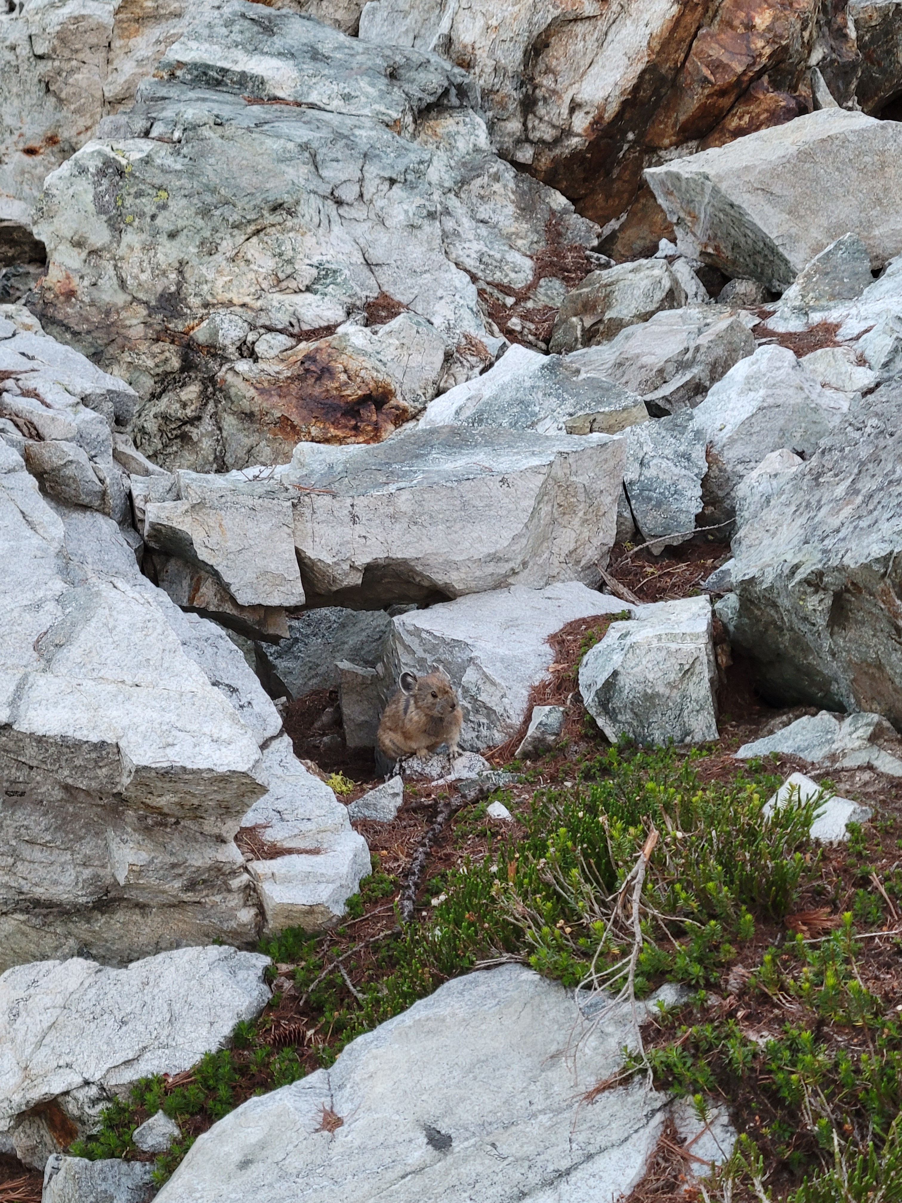
First pika I’ve seen all summer!
Quick side note: The 59er Diner, before I forget, is totally worth a stop. The diner burned down in a fire in 2016 and reopened in I think 2018 with the same old vibe they used to have. Great milkshakes, good burgers, don’t get the onion rings though they taste more like pancakes than onion rings. Curly fries were also great but I have yet to face a bad curly fry.
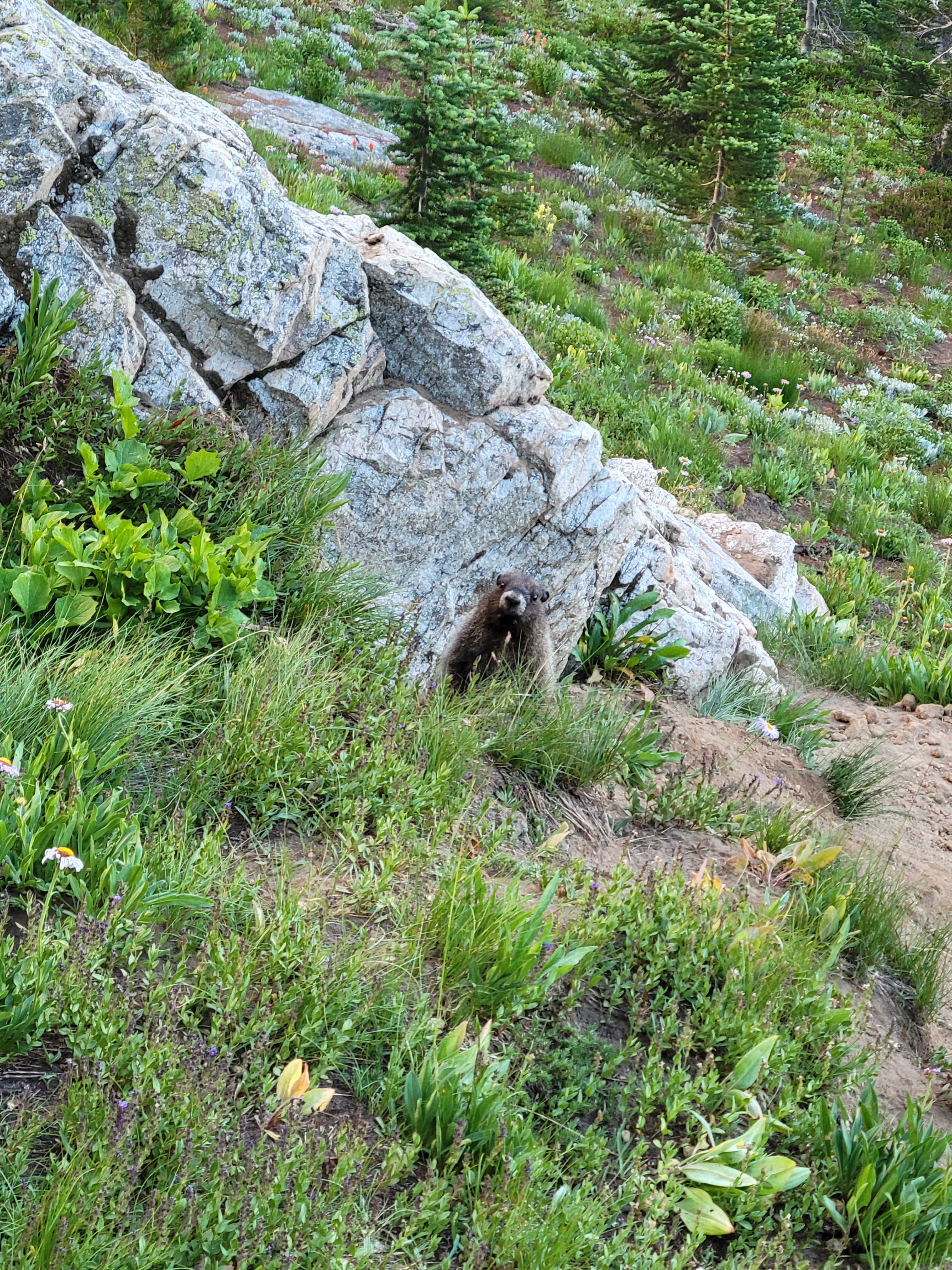
Marmot shocked I exist
Stephen made it in time for a milkshake, and we drove the final 70ish minutes to the trailhead. Stephen immediately bashed his head on the trunk door, drawing blood. Good start. We started hiking around 6:30 or 7, and I was hoping to be at camp by dark. It should have been an easy approach, 3mi on flat trail and then about 2mi on steep “unmaintained” trail to Leroy Basin where we’d spend the night. We loaded up on bug spray, and the first 3mi of trail were SO nice, especially after the brush bashes I had had the past few weekends. I hadn’t seen Alejandro and Stephen in months and was so stoked to catch up. “Oh, Eve” Stephen said. “Alejandro and I were thinking you should just climb Maude tomorrow morning while we sleep.” I laughed. We had independently all reached the same conclusion. Sounds good to me.
Clouds evaporating over Maude
The chatter dried up around the turnoff to Leroy Basin. “Unmaintained” is a stretch, because there has definitely been vigilante maintenance. But vigilante maintenance can’t clear the huge tree that fell whose root ball ripped up the path below it, or widen the trail where it’s overgrown with stiff tree branches. But at least there was a trail, which was an improvement over the freaking Bird Creek Bushwhack. But I swear you think you’re about to crest a knoll and get views and no, the trail goes left into the trees. Another knoll to crest, almost there, and no, the trail goes left into the trees. And again, and again.
Looking back at first light on Seven Fingered Jack
“Turns out mountain biking is not the only exercise you need” Stephen lamented after a year of swearing mountain biking is the only exercise you need. “It flattens out ahead” I told Stephen, by which I meant “caltopo doesn’t have it shaded so it’s at least less than… 27 degrees.” Yeah we never found flat. Until we were at the campsite. “That trail is penance for whatever you did in your past life.” Some dummies were camping with a bonfire next to us but don’t worry they didn’t burn the forest down. Alejandro was still nowhere to be seen, and it was officially dark. Our campsite was right next to the trail, so we figured he’d walk up eventually. Soon enough we saw his headlamp. He dropped his pack on the ground. “Those campsites down low… those campsites were like sexy sirens on rocks.”
Neat subalpine terrain
I went to bed and Alejandro and Stephen crossed the entirety of Leroy Basin on a 30min one way trip to get freshly flowing water from the opposite side of the meadow rather than the stream like 200ft up the trail from us. Only the finest, freshest, cleanest of water for them. I went to sleep, had weird anxiety dreams about sleeping over a hole and trying to cover the hole with dental floss to hold up my torso (idk), and woke up at 4:30 to go for Maude. And hit snooze. Like 6 times. I finally got moving around 6am.
Wildflowers in front of Maude’s summit
The trail traverses up and east for seemingly forever. The larches are underwhelming, I was relieved I hadn’t saved this for larch season. You finally get above treeline into sparse wildflowers and sandy choss, and up to a saddle south of Maude where you head almost directly north through slopes of snow or talus depending on the season. The snow was icy, spikes would have been nice, but I didn’t bring any so… step carefully. Icy Lakes looked GORGEOUS. Really want to camp there someday. South Spectacle Butte looked far more imposing than I had ever imagined. There are so many more peaks to be bagged in this area (and larches!). And I saw more small wildlife than I had seen all summer!
Final grassy slopes to the top
The final stretch to the summit was brutally windy and freezing cold despite being mid August. I was driven only by stubbornness and a flock of small birds flying in circles tweeting around me like Snow White except grouchier. To add disappointment to discomfort, there was no register on the summit, so I ate my PB&J sandwich and quickly turned around wearing every layer I had. I made quick time back to the saddle where a chipmunk threw pebbles at me and I was happy to duck out of the wind, thanks to the ridge in the way. I was back at camp around 9:30, and ready to go 15min later. Alejandro and Stephen were still having breakfast. “We thought you’d want like, a break, or something.” I was mostly basing my timing around highway 2 traffic. I either needed to be back on i5 by 1pm, or not until 8pm. So.. ok, I’ll aim for 8pm. Let me know when you’re ready.
It’s a chipmunk eating a flower!!! My heart!
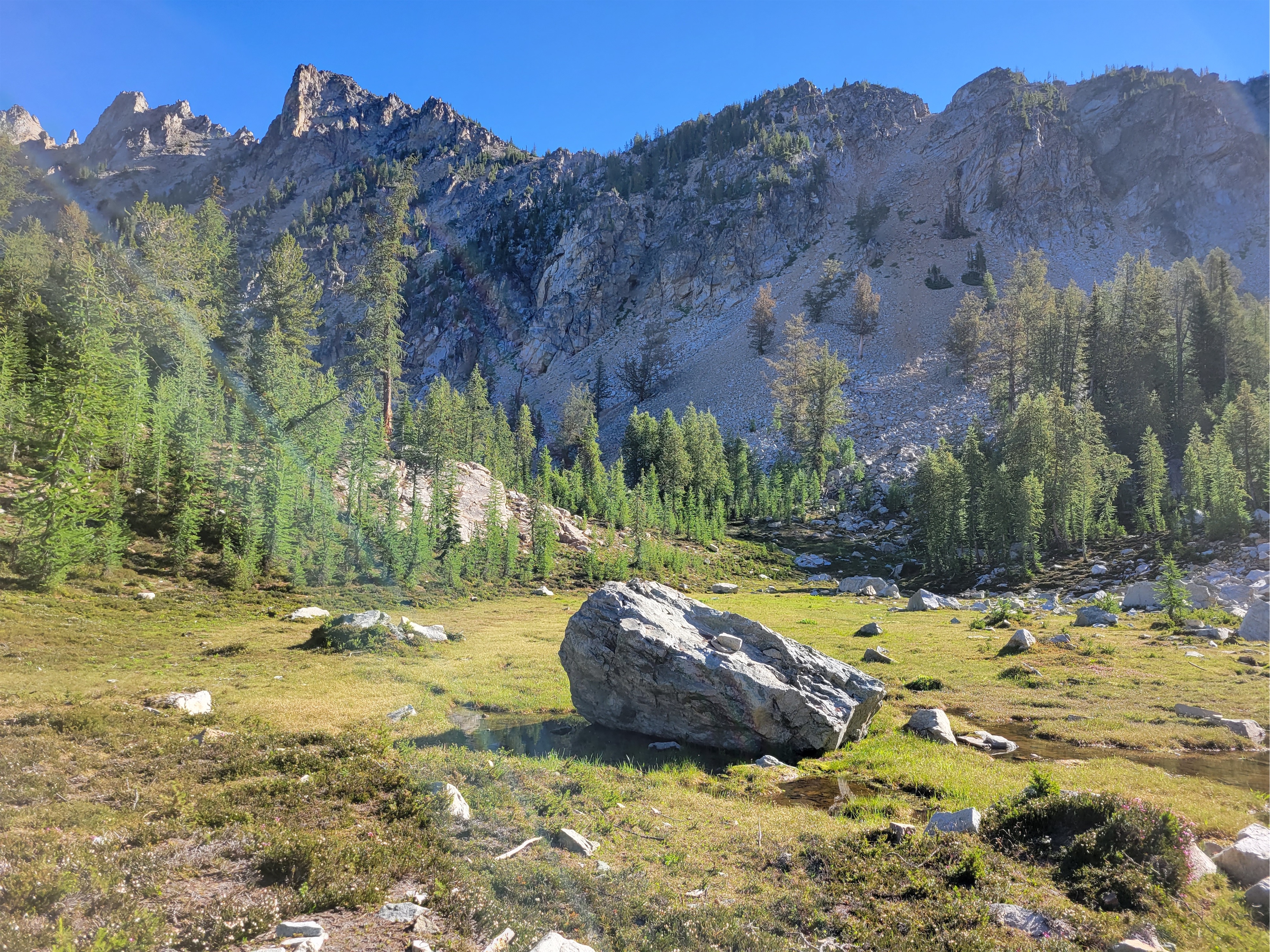
We started up to Seven Fingered Jack around 10:30. It looks very cool from Leroy Basin. The trail is an obvious, well traveled left turn off the trail that heads towards Maude. You quickly gain elevation into an upper basin, this one chock full of larches. THIS is where you want to come in larch season. There were some campsites tucked away on a larchy knoll to our left, teasing me for a return a decade from now. We schlepped up grassy slopes to the left, then ascended a loose rocky talus field to a short little gully on the right that took us up through a break in the ridge system where there were some hints of a trail. The trail was more like heather steps, which we followed up to a second basin, with bits of pumice,* lingering snow patches, and a crazy neat mushroom boulder.
On the way to SFJ!
From the rocky basin, you take a talus fan up to your left that traverses below some sheer rock walls. Put on a helmet, this is where it gets loose. And stays loose. All the way to the top. It was a neverending slope of talus. Part of me is still up there side slipping around wobbly rocks. But the views just got better and better. Alejandro turned around after getting sick of the loose shit at the top of that narrow talus fan. I couldn’t blame him at all, and it didn’t get better from there. From there it’s a long time sidehilling on talus or kitty litter on sloped rock. Stephen and I continued, choosing our own paths up through the rocks. He went high in search of 3rd-4th class scrambling on more secure rocks, I stayed low taking my changes surfing uphill on scree. I occasionally turned around to see him poke his head above the rocks and then disappear again. We finally curved to the right again to gain “a ridge” (not a ridge, despite what the topo map says) and made it up the final (also extremely loose) gulley to the summit, where we texted sappy things to our SOs back in town and I crushed a second PB&J sandwich. Fortunately we both had downloaded GPX tracks, because I swear every gully looked the same to me on the way down and I would have been in for a lot of trial and error without them.
The basin no one tells you about
I was losing my mind going down the endless talus again. I am sure Stephen was too. At once point he said “I’m playing that game of -” [my brain autofilled the rest: “gambling whether a rock will hold my weight or not”] but his thought was cut short by the sound of falling talus and crumbling rocks and I turned around to see Stephen tumble head over toe, a literal full somersault like something out of a cartoon. My brain froze, paused at the first step of the “do I panic” flow chart. His fall concluded and he jumped up right away. I shouted something like “Stephen! Holy shit! All in one piece? Sit down and take inventory” though he had already found a place to sit and was almost doing the Atlas Thinking pose. We waited a few minutes for adrenaline to subside. “Ok, scratch here, deeper scratch there, got a band aid for this one… man, my elbow hurts.” “How bad? How’s your range of motion?” “Motion is okay and.. well I’ve broken it twice before so I think I’d know if it was broken.”
SO MANY LARCHES
Context: Months prior, our friend broke his ankle on a mountain bike ride, only for Stephen to announce and everyone to agree “yeah you’d totally know if it was broken.” To be fair, I did a brief patient assessment and also didn’t find any signs of a break, but my mistake was not firmly palping the ankle bone itself! Fast forward 48hrs, our friend’s ankle was definitely broken, and I’ll never miss a cracked ankle bone again because the shame of missing it still hasn’t subsided.
Followed this talus fan center of frame, curved right beyond the dark center outcropping
So, in response, I laughed. Of course that’s your answer. But hopefully you’re right. We got moving again. “This is my trip for scrapes” he sighed. “Starting at the car.”
Stephen marks our exit ramp
We made decent time getting back down to Alejandro back at camp. Stephen insisted on hiking down climber’s left, meaning I couldn’t get a dope photo of him in his bright orange shirt among the greenery. We watched the wildfire by Lake Wenatchee grow in size, or at least the cloud it was creating became huge throughout the day. Stephen and Alejandro were spending Saturday night at camp too, while I was headed out, but I took another break back at the tents before leaving. No rush now that I had to wait out the Stevens Pass traffic thanks to that stupid traffic light everyone knows sucks.
Camouflaged bug
I was jealous they had another day there and also sad to leave such hilarious company behind. The slog back to the car was going to feel long. The Leroy Basin trail went by quickly, but the 3mi of flat trail.. oh boy. I swear I had been hiking the flat section only for 2+ hours when I decided that it had somehow extended to 7 miles. Or I had died on SFJ and this was purgatory, forever hiking a forest trail that looks the same for ever and ever. Time warped in my brain. Was this a contest with the universe? Was I in some simulation loop and the only way to break out of it would be to check the map and that would snap things back to reality? Or was checking the map considered defeat, my poor human psyche collapsing under the weight of infinite flat redundant hiking? I was determined not to check. Maybe those thoughts broke the spiral, I don’t know. I finally saw a landmark near the beginning of the trail and knew I was close. I broke out of the trees into the parking lot at 6:15pm, less than 2hrs from when I left camp. The time warp was entirely in my brain.
Stephen coming across loose scree
A few miles down the dirt road, I came across a very out of place character standing on the side of the forest road waving me down. Soaking wet. Small day pack. Top hat in hand. Uhh, okay. Situations that ran through my mind:
More flowers
1. Ghost. Because who is dripping wet out here? It doesn’t add up. It’s a sunny beautiful dry day. Maybe you aren’t real.
2. Scam. You’ve all heard those horror stories about people who pretend to be dead in the road or like they need to hitchhike somewhere and then their buddies emerge from the trees to do whatever terrible things to you
3. Hitchhiker from another trailhead?? But the only loop that could conceivably connect my trailhead with the next one down the road is absurdly long and why is he soaking wet?!
Mushroom rock!
I rolled down my window and said something extremely not smooth, like “…what are you doing here?” Poor guy was still in good spirits and calm and collected. “Well i got lost, but I knew there was a road here, so I just aimed for this. How far is the Little Giant Pass trailhead from here? Is this the right direction?” “You got lost…from Little Giant Pass? How long ago?” “yeah.. well, what time is it?” “7pm almost” “Then about 4 hours ago, but not entirely sure, I dropped my phone in the river. And my map.” “Well, hop in, happy to give you a lift to the trailhead, save you 20min of walking.” “No don’t worry about it, I’m soaking wet.”
This guy had been bushwhacking down from the Little Giant Pass trail, forded the freaking river at the bottom of the valley, and then shwacked back up the opposite hillside to find the road. I do that shit voluntarily and it sucks, I can’t imagine it being involuntary. “Does this car look like it was built for luxury? It’ll survive some water. Plus it sounds like you have a good story.” I dropped him at his car a few minutes later, only to be passed on the highway by him an hour later because I drive like a grandma.
Now what do I need to do to get more last minute invites on Stephen & Alejandro’s trips? 🙂
*can confirm, pumice floats. At least for a while until it’s all waterlogged, then it sinks.
Image dump of the rest of the pics since narrative got ahead of everything I wanted to share. The views really are just absurd.
Really neat red dyke of rock on SFJ
Stephen coming up SFJ below Glacier Peak
Dumbbell and Greenwood over a lake, Bonanza back right
Northeast face of Maude
One of the Lake Wenatchee wildfires growing
White paintbrush in front of Glacier, Fortress, Chiwawa
Floofs, secret larch basin, wildfire, and Buck Mountain top right
Jon descending Flora with South Spectacle, Maude, and Copper in the bck
Devore creek trail between Bird Creek camp and Tenmile Pass
On to days 4 and 5! Here’s the trip header with links to the other reports. Felt like too much for one post so I’m breaking it into bite sized chunks because you know I’m a storyteller.
Day 1:Drive to Field’s Point Landing, express ferry to Stehekin, hike to Bird Creek Bivvy. ~10mi, 5000ft gain, 5hrs. Day 2:Bird Creek Bivvy to Tupshin summit and back. ~3mi, 3300ft gain, 10hrs. Day 3: Bird Creek Bivvy to Devore summit, Bird Lakes, and back, then move camp to Bird Creek. ~7mi, 3500ft gain, ~13hrs Day 4 (this post): Pack up Bird Creek camp, stash ovenight gear at turnoff for Flora, Flora summit and back to Devore Creek, move camp to Ten Mile Pass. 13mi, 7800ft gain, ~12hrs Day 5 (this post): Ten Mile Pass to Holden, ferry back to Field’s Point Landing. ~7mi, 200ft gain, ~2.5
PLOWING AHEAD with sparknotes:
This is the bushwhack but it closely resembles some sections of trail
Flora is a walk, a really long walk
Consider doing Flora during larch season if you’re into views, wow
Tenmile Pass from the Devore Creek side is 85% cruiser 15% blowdowns
Tenmile Pass to Holden is… decidedly not cruiser. 100+ blowdowns. PARKOUR
There is no water at Tenmile Pass, but there is water if you’re willing to hike ~5min down the trail towards Holden
The first mini basin
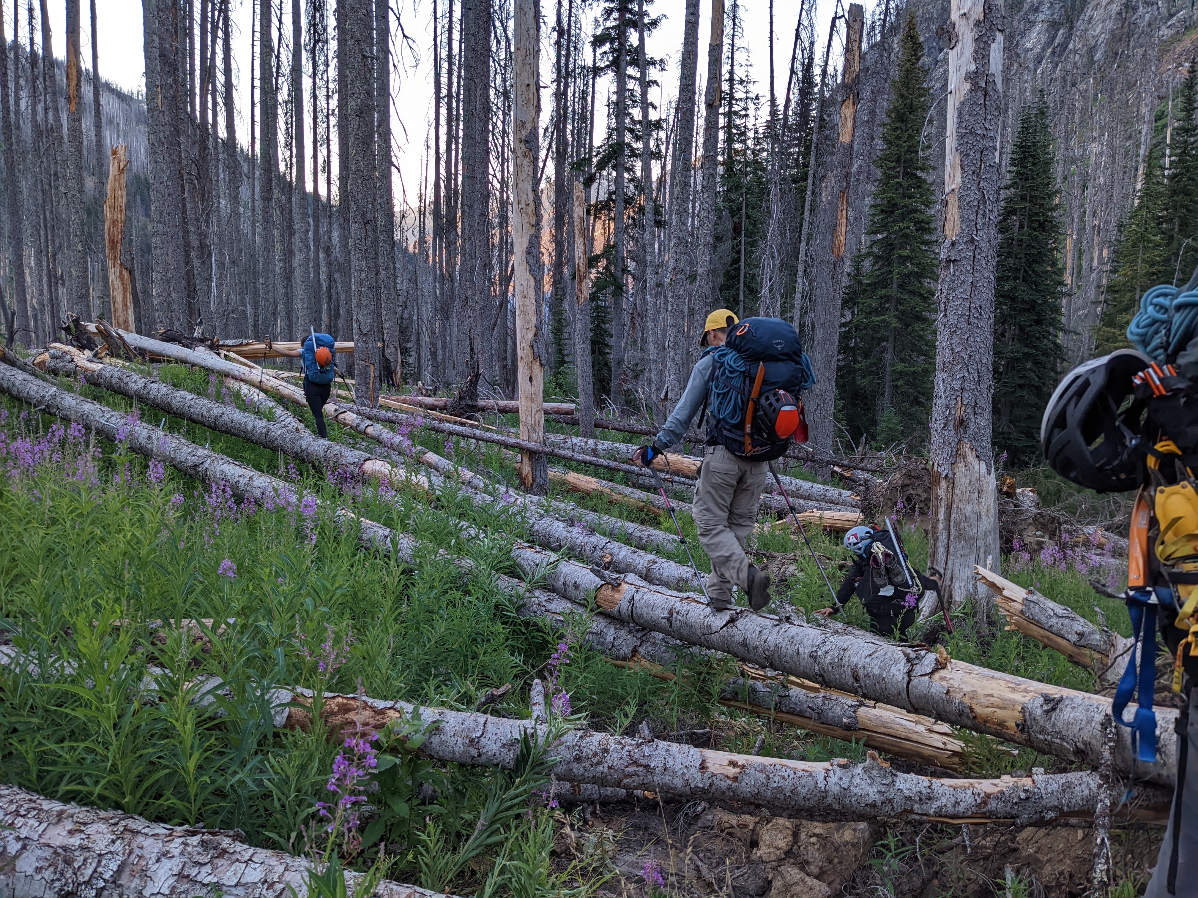
This was going to be a big day. There were a lot of unknowns ahead of us and we just had to trust things were going to work out and that moving slow and steady would eventually get us to where we needed to be. Most people who climb Flora do it from Bird Creek camp as an out and back, but we wanted to carry up and over Tenmile Pass and exit via Holden instead of hiking all the way back down the Devore Creek Trail to the Stehekin River trail, backtracking those stupid 3 miles to the shuttle, and taking the shuttle to the ferry. So our goal was to pack up camp, stash gear at the turnoff for Flora, climb Flora, repack our overnight packs, and hump all of our gear up to Tenmile Pass. Through trails that may or may not have received maintenance yet this year in the worst year of blowdowns/deadfall in recent memory. We had heard reports of 250+ blowdowns, 450+ blowdowns, and two brave volunteers going out to battle the brush a few days before we’d be there. Who knew how far they’d gotten.
Meadowy basin below the Enigma saddle. Talus gully approach out of frame to the right
Working our way up to the saddle
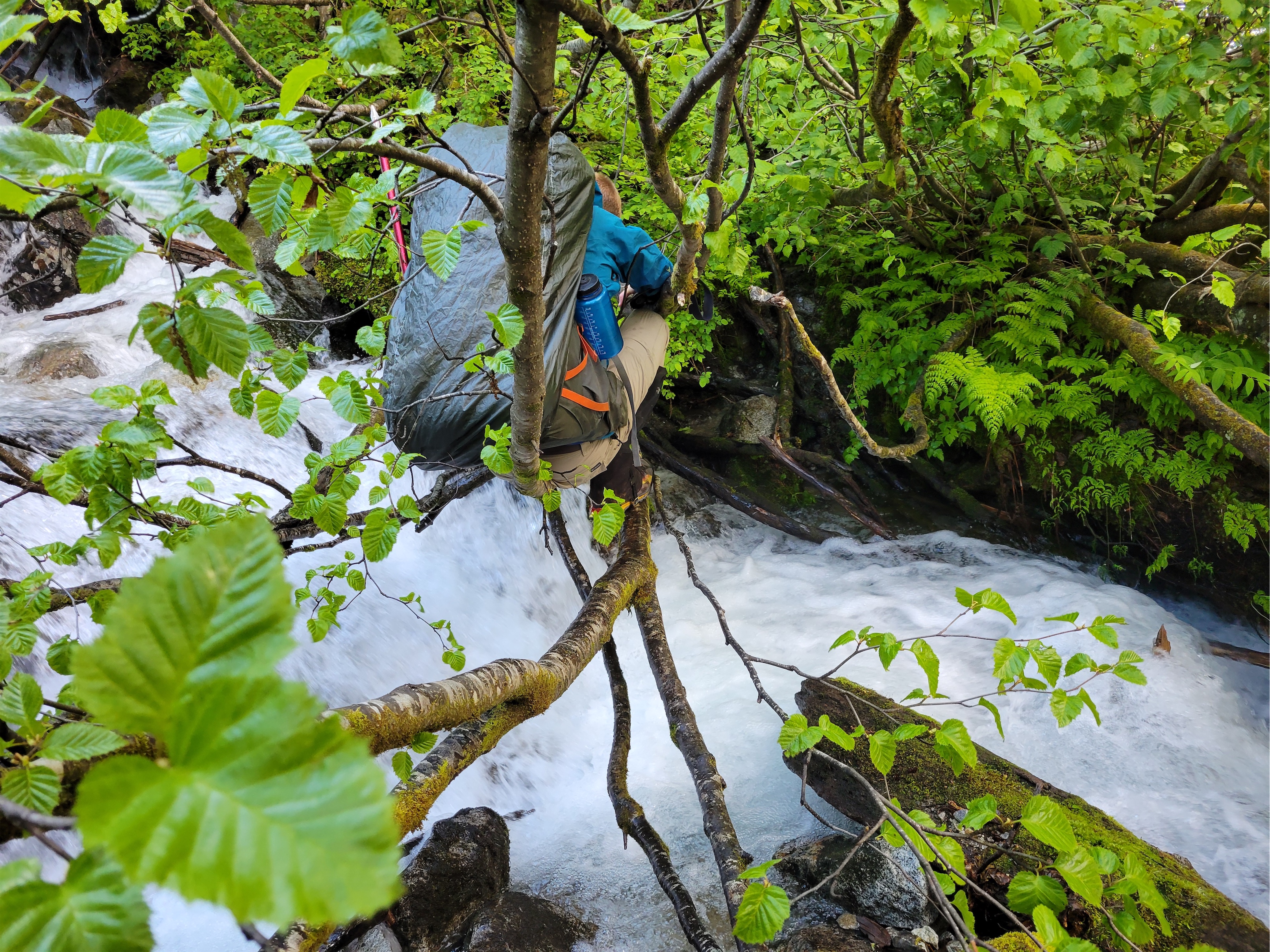
We were moving by 5:30am with no idea what to expect. The volunteer crew seemed to have stopped at Bird Creek Camp, because we immediately started running into blowdowns, but nothing awful. We were able to refind the trail fairly quickly and I don’t think they made us much slower than 2mi/hr. Soon enough we were at the flat ish spot to cross Devore Creek and start the bushwhack up to Flora. We emptied our packs of overnight gear, tied up spare food, and shared horror stories of people stealing cached/stashed gear. Taking food to eat. Taking snowshoes thinking they were lost/forgotten. Straight up stealing nice gear because why not? Fortunately we were SO far out there I couldn’t imagine anyone would take extra overnight gear to hump out 8 miles over blowdowns and ferries. I tied my food in some leggings (still don’t have a bear bag… shh) and tied those to a tree. Usually I use my sleeping bag stuff sack, but it was holding my sleeping bag, so I had to get creative.
Flowers are a good distraction
We crossed Devore Creek easily on some logs and began the bushwhack, aiming for the saddle south of Enigma Peak. It wasn’t as bad as the bushwhack up to Bird Creek high camp, but it wasn’t exactly open forest. Lots of spiderwebs, neck/head high blueberries and teenage pine trees. 50/50 hip high brush and annoying blowdown pickup sticks. We got a streak of like five walkable logs connected to each other and I announced it was the gift that kept on giving, letting us walk high above the brush. “We’re logging some serious elevation gain on these” “Ooh make sure to put that in the bLOG” the tree puns carried me for a hundred vertical feet. We broke out into a small treed basin with running water and cute flowers and took a short break. I kept thinking we were about to be above treeline and it just never came. The sun was lighting up the trees, the ground was getting flatter, but the trees continued. Until finally, we found a beautiful meadow (part marsh) around 7200ft, and finally, FINALLY we were in the alpine Stupid east side with their stupid high tree line. Our next break was brief as the bugs wreaked havoc on our bodies.
Flora from the saddle… so far away
Beyond the marsh, we continued up an increasingly steep and unstable talus slope to an obvious saddle to climber’s left, starting out with large solid boulders and progressing into classic softball/football sized rocks ready to tumble around your feet any minute. I had the Grocery Outlet jingle stuck in my head, which sucked, because it’s literally four words long. Gro-cer-y Ouuut. Leeeet. Bar-gain Maaaar-ket. I asked the group what songs you could get stuck in someone’s head just by saying a few words. Examples are:
– Bye bye bye – Shout (options) – The final countdown – What is Love – Take on me – Stop (hammertime? collaborate and listen? In the name of love? Too many options) – 867-5309 (no one knows the other lyrics though)
We came down the juggy ramp on the left
This and pockets of wildflowers carried me up to the Enigma-Riddle(?) saddle, where we had maybe the most annoying part of the day: dropping like 800ft of elevation to the meadows below on steep, also loose dirt and scree. Fortunately the loose stuff only comprised like 200ft of that, and the rest was on heather through larches until we got to the ridiculously beautiful Castle Creek surrounded by wildflowers and larches and I just couldn’t believe no one comes up here to camp in larch season. I know, I know, lugging all your overnight shit up there is unpleasant, but this had to be one of the most larchy spots I have ever seen in my life. Numerous and DENSE. We picked our way through them until we gained the rib that would take us up to a final basin below Flora. The rib was step (you can traverse further north to make it less steep) but we found game trails here and there to help, and finally got above trees once again.
Castle Creek valley being ridiculous
The final stretch to Flora’s summit was a talus walk. Also annoying, but easy, and the views were amazing. I really underestimated the scenery on Flora. Adorable patches of wildflowers, rock ranging from red to black to white, views of Lake Chelan and Domke Lake to Maude to Tupshin and Devore, glaciers may be missing but it’s a very cool viewpoint. At the summit we found some metal wire scraps, no idea what those are from. “I thought they might be holding the place together” a climbing acquaintance commented on Facebook a few days later. We did the normal summit routine again, I finally finished my cheez its and cheddar cheese, and we made quick work getting back to the first basin and then to Castle Creek.
Up and up and up talus forever
Getting back up to the saddle south of Enigma was about as painful as expected. Baking in the hot sun, dust kicked up by someone in front of you just sticks to your face, sometimes you take a step up and your foot just slides down to where it used to be. But we found the ramp we had used on the way down, took another quick break at the saddle, and soon enough we were back at beautiful bug marsh meadow where our break was equally brief because the bugs were somehow worse than they had been that morning. We got back onto the topic of music because my head had been liked a jukebox all day. Do you ever think about song lyrics like a decade later and realize how terrible they are? The song in question was Smack That by Akon. Smack that, out on the floor, smack that, til you get sore, smack that – wait, what?! til you get sore!? Akon, get out of my vanilla life, I’m trying to enjoy the scenery.
I don’t know what these are but they are my new favorite
My brain glazed over for the bushwhack down. It actually went decently, or maybe I was in a trance and just didn’t process anything we did. We were back at our overnight gear around 4pm and moving towards Tenmile pass by 4:30. Amelia and I started moving slowly thinking the others would catch up on the trail. We ran into a section of avy debris which was surprising. The slide must have been HUGE. Trees all down across the trail in the same direction, snow still frozen solid underneath them. Someone had cut all the branches off the logs which was very much appreciated. We went around both sections and refound the trail, wondering where the boys were until we heard their voices on the other side of the avy debris.
Talus talus talus
Crossing Devore Creek is your last convenient chance to get water before Tenmile Pass. We skipped it and grabbed water off a switchback, but that took 20ft of schwhacking to get to. I grabbed one of Jon’s spare nalgenes to fill up. I only need like 1-1.5L of water to get through a night but everyone else seemed super thirsty, so I figured carrying 3.5L meant others could use mine. And it was a good call, because it was all consumed by the next morning. Tim I think carried 5 freaking liters up to the pass! Tim’s tiny but that’s why he’s the gecko. Sticks to any slope angle and moves so freaking fast you look up and you’re like I saw him out of the corner of my eye but where’d he go?!
Lake Chelan and Domke Lake in a sea of peaks feat. Bug in upper left
Is there cryptobiotic soil up here? Because that’s what this reminded me of
The trail from Devore Creek Crossing to Tenmile Pass was blowdown free. You don’t see the pass until you’re right below it. I saw Jon on switchbacks above me and was determined to catch him. I pushed the pace for a few switchbacks before remembering he’s a fucking machine and I had no chance. Cresting Tenmile Pass, there were no clear established campsites, but there was a huge open clearing with minimal vegetation where we felt okay pitching tents given the circumstances. There are supposedly campsites a mile below the pass, but we never found them. Tim was next to arrive at the pass. “Are we camping here?!” he asked. “Yes, if that’s okay!” His face stretched into a huge smile and he threw his arms up. “THANK YOU!!!” I just started laughing. “I’m old and happy!” was one of my favorites from Tim.
Aster, Lupine, and something yellow
We set up tents, everyone checked on each other to make sure we had enough water and food and see if anyone needed help with tents or cooking. Everyone. Was. Wiped. I think we had the full spectrum of emotions between the six of us, from “don’t talk to me i’m exhausted” to “i’m pissed i’m exhausted” to “i’m happy but also exhausted” to “i’m relieved and exhausted” to just “i’m stoked to be here and exhausted.” Amelia trotted to my tent and dumped a bunch of electrolyte mixes in front of me. “I’m sick of my energy gels what food do you have that you’ll trade for these?” We bartered some stroop waffles and chia seed mixes for electrolytes. I think Andrew was on day 2 of his mashed potato diet. Tim had leftover vegan noodles he couldn’t convince anyone to eat. “Andrew, I can carry the rope tomorrow morning” I offered. “No! That’s CHEATING!” Hahaha! “You can’t carry the rope into Holden after not carrying it the past few days!” I had been carrying the trad rack (3lbs vs 7lbs for the rope) since he took the rope from me when I was dying Thursday night. Well. Fair point. Enjoy carrying the rope another day then!
Paintbrush in the Castle Creek valley
We made do with the water that we had, and the next morning we found water a five minute walk from the pass, maybe not even. So if you camp up there, there IS running water, you just have to look for it a bit. Not sure if it was a spring or snow, but there wasn’t much snow that we saw, so I’m thinking it’s a natural spring. There was also a LOT of wildlife up there. We were clearly encroaching on a deer’s favorite spot, he came around and snorted and clomped and sniffed out all of our gear. I had hazy dreams of a dear shredding my sleeping-bag-stuff-sack-turned-food-bag. Oh, and you’ll be camping on like 2″ of ash, so be careful what you touch and where you dig. Your tent’s going to be duuuusty.
Avy debris on the Devore Creek trail
We got moving at 5am to make sure we got to Holden in time for the 10:45am shuttle to the ferry. This was the stretch of trail we thought would have the worst blowdowns. The tenmile trail drops into the valley and connects to the Company Creek trail officially, but there’s also a connector trail to the Tenmile Falls trail out of Holden. It’s not on most maps for some reason. It does receive annual maintenance according to the rangers, but.. not much. The first ~2 miles down from the pass were cruiser: beautiful trail, beautiful switchbacks, beautiful burn zone scenery.
Gecko speeding over logs
And then we hit the junction with the Company Creek trail and the connector to Holden. And it turned into miles of parkour. Over logs. Under logs. Around logs. We crawled. We jumped. We scrambled. Amazingly, a volunteer crew had trimmed branches off all of the logs, which is an INSANE amount of work given what we saw. Hilariously, Jon had ripped his pants about an inch at some point, and with every log shenanigan, the rip grew longer, and longer, and longer until he had a 16″ rip from waistband to where the pants zipped off into shorts. RIP his pants (get it). But eventually, there’s a view to skiier’s left of a huge waterfall coming down from Tenmile Pass, and finally, FINALLY we started seeing fresh sawdust. Boom. We were where the volunteers had ended. Deer prints abounded. Guess we aren’t the only beings who appreciate a beautifully cleared trail. From there, it was a long but quick cruise to Tenmile Falls (pretty, but underwhelming after everything we had seen) and down into Holden Village.
Holden Village was more welcoming than the last time I was there, but THERE WAS STILL NO ICE CREAM. I don’t understand the economics of this. The tourists all have to leave at 10:45am to catch the ferry. Why. Does the ice cream. Not open. Until 1pm. That’s so stupid. Are you just making money off your volunteers? That’s cruel. Milk the tourists, guys, come on. TAKE MY MONEY. Getting breakfast was an event too, because breakfast ends at 8:30 but the Hiker Haus and Registration (necessary for any hikers to get access to buildings, like the building that has breakfast) don’t open until 9am. ONCE AGAIN. HOLDEN. DO YOU WANT. MY MONEY. OR NOT.
Tenmile Pass connector (PC: Amelia)
We split into two groups, I found someone willing to sneak us oatmeal but the others found someone who actually worked Registration and was willing to get us registered in time for breakfast. Breakfast was $10 for mostly oatmeal and toast and canned fruit. And apples! I ran over to Andrew, who was still wearing his headlamp despite being indoors at 8:30am. Andrew they have apples!!! You’ve been talking about them for days! I made toast and loaded it up with cream cheese. Except a few minutes later the cream cheese was melting and sliding down the bread… because it was actually butter. I had just taken like a half cup of whipped butter and everyone just watched and never said anything. In their defense, I still ate all of it. After adding salt, because it was unsalted. $10 for toast with unsalted butter. Holden. Come. On. No eggs no cheese no protein and NO ICE CREAM.
More fun on the Tenmile Pass connector (PC: Jon)
Holden had one redeeming factor for a nerd like me: the library. We couldn’t go in it last year, but it was open this year. Amelia and I darted inside. One of my favorite children’s books was front and center – Officer Buckle and Gloria! An adorable story about a policeman and his dog educating their community on safety. We read that and then started picking up reference books, reading about mining history, local native art, newspaper clippings from the early 1900’s, reading random trivia to each other from whatever we were reading. A guy who found a ton of gold by Mt. Stuart, only to have it buried literally that night in an earthquake. Two guys who escaped the Wellington avalanche that killled nearly 100 people back in 1910. Origins of lake and peak names from native languages. Pictures of miners 1500ft underground before the mines were shut down. Enough to easily keep me entertained for the hours we had to kill until the shuttle arrived.
I mean really in ~2yrs there will be no trees left to fall
The shuttle took us to Lucerne (where the ferry picks you up/drops you off for Holden) where we had over an hour to relax and swim before the ferry arrived. We all jumped into the fucking freezing water, which was amazing. The forecast had said 109 degrees but it certainly didn’t feel that hot. Either way, jumping in a cold clear lake after five days of layering sweat/sunscreen/bug spray felt phenomenal.
The best book
On the ferry, we ran into Matt and Anita, who had just hiked from Cascade Pass to Stehekin, and picked us up some surprise bakery treats from the Stehekin Bakery! Jon ran into an old college friend, and we chatted with Selena, Max, and Steven Song (his amazing blog here) who had just done Bonanza, Martin, and Copper out of Holden too. Small world. Party on the Monday morning ferry. We whooped at a jet skiier who was cris-crossing the ferry’s wake getting air cresting every wave. Looked like a total blast.
Brave chipmunk digging for his peach pit. Like the squirrel in Ice Age. No packs were harmed.
I can see why no one through hikes Stehekin to Holden or vice versa via Tenmile Pass and Devore Creek. Even aside from the 150 blowdowns in like a two mile stretch, the Tenmile Pass trail only has views thanks for the forest fire, and the Devore Creek trail doesn’t have much in terms of views at all. It seems to primarily be an access point for the three Bulgers we had climbed and not much more. But i’m a nerd, and it’s cool to get a glimpse of these less frequented trails, and it makes me appreciate that they’re still being maintained, even if minimal. Seems more and more trails get abandoned every year, and it’s not like we’re gaining new trails. Always makes me wonder how a certain trail comes into existence and what its use case was when it was first built. Recreation? Hunting? Transportation? Mining? Logging? I have no idea why Devore Creek or Tenmile Pass trails exist.
This was an incredible multiday trip with a really great group. Thursday solidified it, I can be a mess with that group and they’ll come together to support me. Hopefully me floundering like that is a rare occasion, but it’s really amazing being able to trust a crew like that. Good company, great views, awesome experience. There are still some peaks in that area I need to get but I think it’ll be a while before I feel like revisiting some of those bushwhacks.
On to day 3! Here’s the trip header with links to the other reports. Felt like too much for one post so I’m breaking it into bite sized chunks because you know I’m a storyteller.
Day 1:Drive to Field’s Point Landing, express ferry to Stehekin, hike to Bird Creek Bivvy. ~10mi, 5000ft gain, 5hrs. Day 2:Bird Creek Bivvy to Tupshin summit and back. ~3mi, 3300ft gain, 10hrs. Day 3 (this post): Bird Creek Bivvy to Devore summit, Bird Lakes, and back, then move camp to Bird Creek. ~7mi, 3500ft gain, ~13hrs Day 4:Pack up Bird Creek camp, stash ovenight gear at turnoff for Flora, Flora summit and back to Devore Creek, move camp to Ten Mile Pass. 13mi, 7800ft gain, ~12hrs Day 5:Ten Mile Pass to Holden, ferry back to Field’s Point Landing. ~7mi, 200ft gain, ~2.5
Finally in open meadows. Gully around the corner immediately left
Here we go with day 3. Sparknotes:
Ignore the GPX tracks on peakbagger, go back up the brushy slopes to Tupshin and sidehill to the valley to cross the creek. Trust me. 1000x better.
The gully isn’t nearly as bad as it looks from Tupshin
Bird Lakes are worth the detour
The 4th class rap is essential and summit rap is preferred, but make sure the person off rappel is also clear of the gulley before you set up your rap
Camp to camp: ~11hrs (5am to 9:30am summit, long break at Bird Lakes, 4pm back at camp), then moved camp to 4200ft Devore/Bird Creek junction arriving around 6pm
In the minor basin between meadows and Bird Lakes
We woke up a bit earlier this day, knowing it would be longer. We were originally aiming for two peaks this day, Devore plus a bonus, but unfortunately things weren’t lining up the way we needed them to.
Purple Aster being all cute
Oh boy. Ignore the GPX tracks you probably pulled off peakbagger for this one. We followed them and cut straight up the gut of the valley and it was a mess of annoying slide alder and thick brush. I’d recommend what we did on the way down: follow your track up Tupshin for a hundred vertical feet until you’re in manageable brush/blueberry bushes, and then sidehill connecting animal trails (hopefully they’re still there) until you’re in the meadow below the gully to Devore. The creek crossing is easy, and the gully is a heather and talus staircase.
Cresting the moraine, White Goat and Tupshin in the background
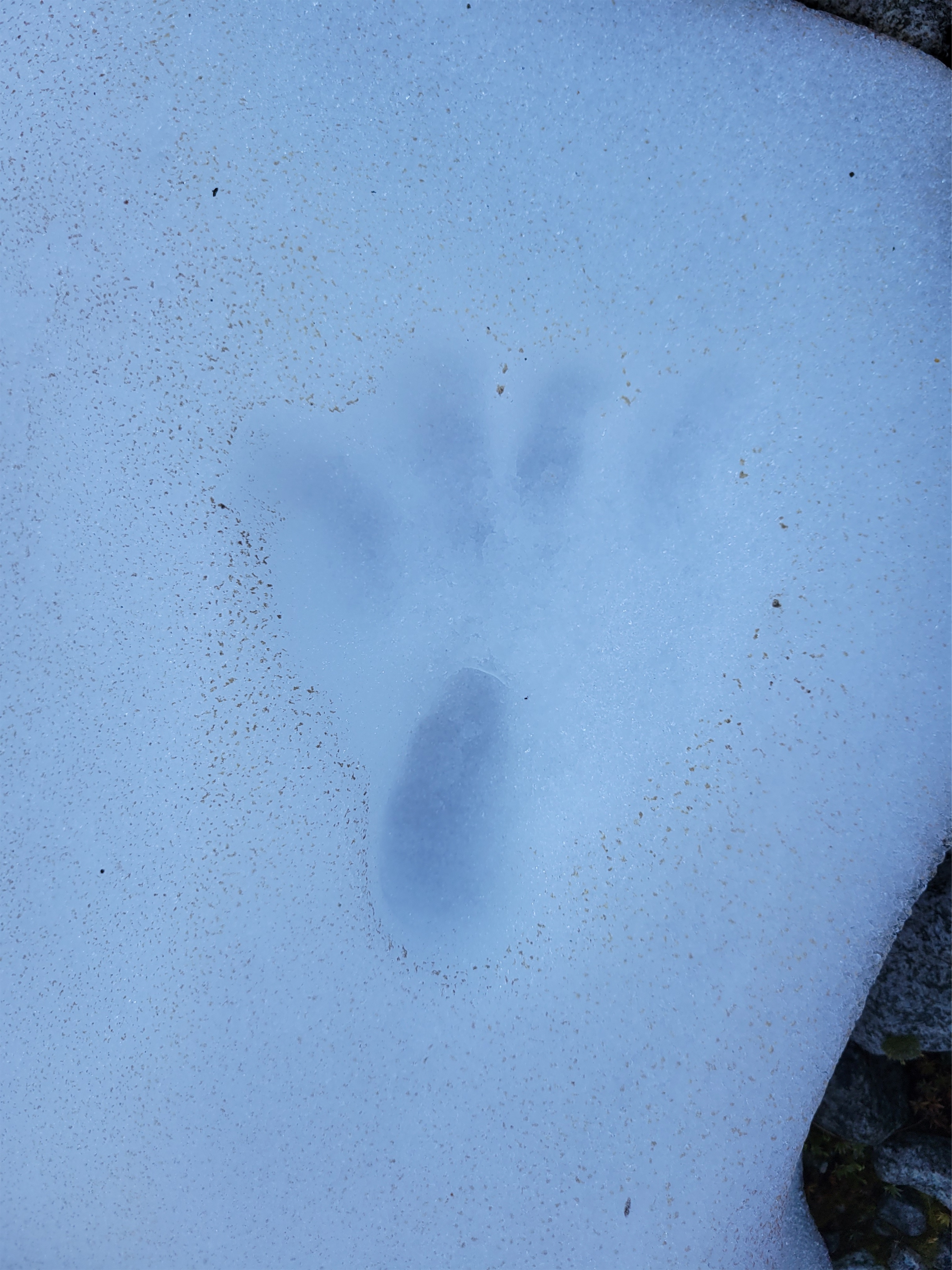
The gully drops you off at.. oh, a second gully. A fake minor basin of larches (beautiful) and loose talus, scree, and dirt (not beautiful) to gain the real Bird Lakes basin (SPECTACULARLY BEAUTIFUL). Wildflowers were sprinkled among the scree which made it more tolerable. Gaining the moraine above Bird Lakes Basin was sad because I was so excited to the see the lakes, but turns out they’re a slight side trip to the northwest. Suddenly I heard “BEAR! BIG BEAR!” and I picked my head up with wide eyes scanning the basin. “WHERE” “here!! Look!” My eyes darted, my heart raced. Wait. They’re pointing to our feet. Tracks. Not a live bear. Relax. But damn the tracks were huge!
We put on crampons and booted up the snow to the far east ridge, following a sandy boot path up the mellow ridge to some steep snow below the Bottles. At the cool col next to the bottles we packed up the snow gear and dropped down the first of a loooong stretch of steep slopes with everything from solid scrambleable rock to kitty litter covered ledges to unstable talus and scree.
B-B-B-BEAR My hand is way off the ground sorry I screwed up perspective
The going through this section was tedious. We divided and conquered, trying to stay out of each others’ line of fall in case someone knocked down rocks. We had figured out by now who in the group was most prone to kicking things loose: Andrew. I kicked something down and we all shouted ROOOOOCK followed by Andrew slightly more quietly “it wasn’t me!” only minutes later to hear ROOOOOCK followed by Andrew “Okay that one was me!” This section felt like choose your own adventure, we traversed until a minor ridge we could follow almost up to the main ridge, where we sidehilled more on the west side until the unavoidable 4th class step.
Headed up to the col, Bottles on the left
Now 4th class is interesting. Sometimes it means just “extremely exposed 3rd class.” I like Jon’s definition, which is “I can get up it just fine but don’t love downclimbing it.” And sometimes I swear it means “5th class but there’s no pro so we’re going to call it 4th class.” This honestly felt like the third option. there were big ledges for feet but it was vertical and exposed. Some of us scrambled it and then tossed down a rope to the others since there’s a conveniently located rap station at the top.
White Goat above Bird Lakes
Lots of this for a while
From the top of that rappel, we traversed almost straight to the left (same elevation) to an extremely exposed 3rd class (4th?) move. There may be a better move higher up, not sure. Someone knocked a rock loose and we all looked at each other waiting for it to hit the ground below. We finally heard it strike. Yikes, that’s a lot of time to think about falling if you slip here. I evicted the thought from my mind and made the move. It was extremely awkward, at least for my reach/flexibility/height. Had to trust there was a hand hold there, couldn’t reach both holds at once. From there, another traverse left to the base of the obvious gully (actually obvious! basically a short boot path right to it) and a quick scramble up the gully to the top. The gully isn’t technically hard, but just like the rest of these crumbling choss piles it’s full of softball to microwave sized rocks just waiting to hurtle down on your friends below you, so I tried to be as dainty with my foot placements as possible.
The summit routine was the usual, admire views, snap pictures, look for summit register (no register!), shit no one brought whiskey wait no that’s fine packs are already heavy enough. Okay okay we have a lot to get done today, time to get moving. Jon led the first rap down and hustled to set up the second rap down the unavoidable 4th class step. Two others went, and I heard someone at the bottom shout “wait, where did you guys go? GUYS?!” and I rapped down next only to find no one at the bottom. Someone above kicked rocks down the gully on me, unsurprisingly given the condition of the gully. A football size rock bounced off the calf I was relying on to push the rest of me under a slight overhang on the wall. I was pissed. If I had legitimately been injured by the rockfall, no one would have been there to see it and help.
Ladies coming up the ridge (PC: Jon), Wy’North and Martin in the background
Looking up at the 4th class step and false summit
Unfortunately I let my adrenaline get the better of me and did exactly the same thing to the person behind me, leaving them behind as I angrily went around the corner trying to work off my frustration. Stupid and hypocritical of me, but fortunately those behind me were fine, no more rock fall.
Me on the 4th class step (PC: Jon)
The rap down the 4th class step went smoothly, and we made quick work of the traversey descent and climb back to Cool Col and then to Bird Lakes. Tim decided to skip our bonus peak and head back to camp, so we parted ways just before the lakes. At the lakes, we stopped for water, and I realized it was 12:30. I pulled Jon aside. Here’s what I’m worried about.
Amelia on the 3rd class wraparound
1. Bonus peak is 2 pitches of technical rock. For a party of 2, a good rule of thumb is 1 hour per pitch. So 1 hour to the base of the climb, 2 hours to the summit, 1 hour to rap down, 1 hour back to the lakes, 2 hours back to camp. 7 hours total, then we needed to move camp down 1000ft.
2. We had 5 people. That meant we could pretty much guarantee it would take more than one hour per pitch.
3. We had a really big day with Flora the next day.
Jon in the summit gully
We called the others over to discuss. Do we want to go for it but not get to lower camp until well after dark, or did we want to make it a comfortable day and be at camp around dinnertime? Everyone agreed on the latter. 2016-2018 me would have gone for it but 2022 me is so much lazier. This was a really hard decision though, because the bonus peak was the whole reason I was there. I’ve been admiring it from afar for like seven years. But I’ve had a good streak of goal peaks this summer, it’s okay to let one go. Just need to convince someone to do that approach again with me in a few years.
I spy Andrew on the 3rd class wraparound (taken from the notch below the 4th class)
We hung out at Bird Lakes for over an hour. We hiked an infinity loop around the two lakes, found a few campsites, and sat in the shade having snacks and hydrating. It’s such an unbelievable area. I simultaneously can’t believe no one camps here (it’s gorgeous pristine wilderness with a lake unlike most you’ll ever see) and also completely understand why (getting overnight gear up there would be a BITCH unless you’re bivvying). It’d be a DREAM to get up there in larch season.
We headed back to camp around 1:30pm, shouting to Tim we were coming for him. Much of the scree slope was plunge steppable, but the lower gully (heather and talus) was a bit of a knee banger. Towards the base of the gully we realized we could avoid all the brush by sidehilling through the meadow until we intersected with our Tupshin descent path, which at its worst had some downed logs and blueberries, a walk in the park compared to the bushwhack up the middle of the valley that morning. We followed game trails that had been recently used by something big. I thanked the bear and deer for making such great trails and hoped we didn’t run into whatever had clearly trampled the plants recently. The game trail carried us perfectly back to our Tupshin descent track, and we rolled into camp to Tim’s laughs. “I followed game trails over here instead of coming back through the brush!” he announced. It wasn’t a bear or a deer that had trampled the brush recently, it was the gecko!
Tupshin over Bird Lakes
The cost of getting up there
We packed up camp and headed down the bushwhack. We ignored GPX tracks again, following our noses down the path of least resistance, and it was bad but not as bad as the way up. “Is this better because we’re finding a better route, or because I’m in a better mental place?” I asked. Behind me I heard Jon mention we had dropped ~100ft of elevation. “We’ve only lost 100ft of elevation? That’s fucked up” Andrew said with an almost perplexed voice. I cracked up. Okay, yeah, it’s still shitty.
Tim always smiling even through 3rd class trees
We found the trail, recently brushed out and cleared by the volunteers we had met! They strategically left a log down across the river to make it easier to cross, but camp I swear was larger than it had been two days prior. They must have cleared some deadfall out of camp too. The general consensus has been that the downed tree situation this year is far worse than prior years. I was insanely thankful the volunteers had beat us to most of the trail so we didn’t have to parkour our way through hundreds of dead trees.
We debated trying to camp further up the trail, but since there was no guarantee that campsites existed, we decided to play it safe and stay where we were. We managed to fit five tents into the camp thanks to some gardening work by Tim, who found out he had lost his utensils at some point and quickly improvised chopsticks with his tent stakes. I was in the tent by 7pm just listening to the others talk including a hilarious mini rant by Andrew about the Fred Meyer experience at 7pm and how there’s always only one checker-outer available despite all the customers trying to get like two weeks worth of groceries at one time. Jon quickly agreed. I’m not sure what came of it, because I definitely drifted off to sleep mid conversation.
Rob on the summit of Tupshin with Devore, Martin, and Bonanza in the background
I’m still figuring out how to write about multi day trips. One post per day? One post with all of the days? That’s a long ass read. Thinking what I’ll try is one post per day but with a header that covers all of the days. So, header first.
Stehekin arrival!
Day 1 (this post): Drive to Field’s Point Landing, express ferry to Stehekin, hike to Bird Creek Bivvy. ~10mi, 5000ft gain, 5hrs. Day 2 (this post): Bird Creek Bivvy to Tupshin summit and back. ~3mi, 3300ft gain, 10hrs. Day 3: Bird Creek Bivvy to Devore summit, Bird Lakes, and back, then move camp to Bird Creek. ~7mi, 3500ft gain, ~13hrs Day 4:Pack up Bird Creek camp, stash ovenight gear at turnoff for Flora, Flora summit and back to Devore Creek, move camp to Ten Mile Pass. 13mi, 7800ft gain, ~12hrs Day 5: Ten Mile Pass to Holden, ferry back to Field’s Point Landing. ~7mi, 200ft gain, ~2.5
Okay, starting with days 1 and 2. Sparknotes:
Express ferry that dropped us off
Bring bug spray
Devore Creek trail is brushy, but mostly free of blowdowns up to Tenmile Pass
The bushwhack to Bird Creek Bivvy is surprisingly brutal. No open forest until within ~100 vertical feet of the bivvy. Just lots of brush and blowdowns.
There is a huge campsite still in the trees around 5400ft with easy running water. We never found the 5800ft meadowy campsite Summitpost suggested. Maybe if you’re prepped for a very small bivvy you’ll find something.
Route to base of Tupshin climb is straightforward
We only belayed one pitch (see pic). Rock shoes totally unnecessary/almost detrimental.
Rappels were essential, wouldn’t have wanted double rope rap due to loose rock
Rock is extremely loose, including spontaneous rockfall. Wear helmets, climb close together or stay out of each others’ line of fall
We had a party of 6. Smaller parties could definitely descend faster.
The bushwhack up to camp
A LOT of planning and deliberation went into this trip. Huge shoutout to Ranger Dana at the Chelan ranger station who will never see this but provided a ton of beta regarding blowdowns, including the count (250+ downed trees) and volunteer schedules for people doing trail maintenance. She even took notes and called me back with the trail conditions. Super personal interaction. The blowdown count was scary. The volunteers, however, would be a day ahead of us. Fingers crossed they could get some work done before we had to drag out slow and heavy 5d overnight packs through there.
As much as I love this area, the fact that it’s like 10 hours of transportation to get there drives me insane. I woke up feeling a little nauseous and having zero appetite, which sucks when you’re about to start a long trip. I figured it’d wear of after I got some food in me. We left around 5:30am, stopped at the Sultan Bakery because why not have a bakery head to head, and got to Field’s Point in time for the ferry which dropped us in Stehekin around noon, where we waited an hour for the shuttle to Harlequin Bridge. We killed time looking around the visitor center, the restaurant, talking with the park rangers, and flipping through old books until the shuttle arrived. Make sure you clarify with the shuttle driver that you’re stopping at Harlequin bridge and not High Bridge. The shuttle stops at the bakery where I grabbed a quiche and a sandwich and wolfed down the quiche thinking you weren’t allowed to eat on the shuttle (you can, it’s almost like they want tourists to buy a lot at the bakery, who’d have guessed). “Do you think the bakery has apples?” Andrew asked excitedly. They did not.
More bushwhack
The shuttle dropped us off by Harlequin bridge, where my pack fell open. I picked up what I could and re packed, we polished off our bakery snacks, and started walking. Within a mile we were stopping to load up on bug spray, holy CRAP they were bad down low. The Stehekin River Trail basically takes you back along the 3mi to the edge of Lake Chelan, so that feels like a waste, but short of a) a river ford b) sweet talking someone with a boat c) float plane you’re going to have to schlep your asses to Harlequin Bridge and 3mi back along the river to get to the main event: the Devore Creek trail.
The Devore Creek trail starts out with a million switchbacks. I’m not sure how many, because my body decided to shut down around switchback number 3. The queasiness I had been feeling since waking dialed up to 11/10, and I got the sweats/burps/drools/everything that happens before you puke, except my body refused to fucking puke. I spent a few switchbacks fighting off dry heaves. I finally told everyone what was going on, embarrassed and worried because it was only day 1. They let me set the pace which I appreciated so I didn’t get left behind to pass out in a puddle of vomit on a dusty cliff. My body didn’t want food, water, electrolytes, nothing.
I have some theories about why.
It was Thursday. I had a party the prior Friday, up until 2am, food drinks shenanigans you know the drill. I hadn’t slept a full night of sleep since then.
I had been living off the leftover food from that party, because catering is expensive and I’ll be damned if the leftovers are going to waste. But by day 5, they’re a little… soggy and questionable. You are what you eat, I was a five day old soggy Turkish beyti which felt pretty accurate
I had been working ~12hr days since it was a 3d week and we’re in the middle of annual planning and I have self imposed guilt
Aaand brush
The trail flattened out eventually and got a little overgrown. There is like one switchback in several miles next to the river, we took a break there and I plopped on the ground and took out my water bottle to try and choke down some fluids. You know after you puke how you get that few minutes of clarity and freshness and relief? I was dying for that, but the moment never came. And when I put my water bottle back, my zipper burst. I almost cried. I just wanted to be home in bed. Rob made a valiant effort to fix it with pliers, but to no avail. I draped the rope over the now bulging side and tightened the side strap. Jon literally helped me lift my pack because I was too weak to pick it up. I wanted to vomit, crawl in a hole, and go to sleep. But instead I plodded along, determined to at least get to camp even if I had to sit out the climbs. My mind wandered. I debated what would be worse if shit really hit the fan. Being sick out in the woods for a few days, or being sick in a helicopter being airlifted out? I doubt they let you puke out the door, so… I guess given the option I’d see if I could wait it out in the woods. At least you don’t have to blue bag your shit here. You can poop anywhere. Whenever, wherever! Cue Shakira.
Endless slopes of flowers
At the Bird Creek intersection, we caught up to the trail crew taking care of some of the blowdown activity! We thanked them profusely and got some estimates of the rest of the trail. They said 450+ blowdowns… uh oh. But they had already cleared a lot, and we would be above them for two days, so I was cautiously optimistic. We decided to push up to the higher elevation campsite to set ourselves up for success in the coming days. Andrew being a saint took the rope for me and Jon again helped me get my freaking pack on. I don’t think I had spoken more than three sentences in the past few hours. All I knew is I was getting to that camp and shutting down as soon as possible. But the group was good comic relief. Someone was complaining about the weight of their 5 day pack and how much more stuff they had to bring. “I brought an extra pair of underwear for once!” Tim announced. “I’m rearranging your name from TIM to TMI” Rob chirped back.
Traversing to the basin below Tupshin
The bushwhack from Devore Creek/Bird Creek camp up to the 5400ft campsite was brutal. Summitpost says open forest, but due to disease, many trees have fallen over, and brush is growing in with a vengeance. We had no shortage of shenanigans. Slide alder bitch slaps, uphill trips over downed logs, balance beam walks, spiderwebs galore, Tim even took a 5ft fall off a lot but landed softly in trees not even really hitting the ground. My reynaud’s kicked in despite it being relatively warm, despite everyone wearing tank tops and t shirts I couldn’t feel any of my fingers. I put on gloves but I only had liners, no insulated gloves. Just gotta get to camp and you can figure it out from there. After a few minutes, Jon joked we had 10 feet of elevation down. 990ft to go. Cue 99 bottles of beer on the wall, 99 bottles of beer, take one down, pass it around, 99 bottles of beer on the wall. Wait. 98 bottles now. 98 bottles of beer on the wall, 98 bottles of beer… [don’t make me add a youtube link for that]
Amelia on the scramble
The group got separated around beer #57, and I went into mama duck panic mode. Especially on bushwhacks I hate when people are out of earshot. If one of us snaps an ankle I don’t want to waste an hour waiting for the rest of the group to realize someone’s missing and have to find them. We finally regrouped though, and found this amazing, huge campsite at 5400ft that we had no idea existed. I was expecting small bivvy spots in a meadow, but stumbling upon this was like stumbling upon an oasis in the desert. Here’s where we’re staying, home sweet home for the next two days. 99 bottles of beer on the wall, 99 bottles of beer… shit wait how am I back at 99 bottles?!
Amelia crushing it higher up
We set up tents and I crawled straight into bed. The thought of eating made the nausea worse but Andrew had a chicken soup packet I managed to eat, figuring even just broth would be better than nothing. I soon found out I had also forgotten my toothbrush, toothpaste, and floss. Jesus. I joked about being a hot mess before this trip, but I wasn’t serious! What the heck was wrong with me?! Amazingly Andrew had an extra toothbrush too that is now my toothbrush. “6am start, everyone?” “Sounds attractive to me!” Tim shouted. That’s how we say yes now. “I’ll have time to poop!” he added a few minutes later. Tim ALWAYS wakes up like 90min early so he can have coffee and do a full morning routine while the rest of us sleep. I was so relieved to be with such a good group of people while being a puddle of mush.
We woke up and got moving at 6am as promised. I didn’t feel good but I didn’t feel terrible, so I figured I’d give it a shot and see what happened. We started up through hip height blueberry brush (no berries) and soon broke out into fields of wildflowers and dust. I was definitely dragging, but if they were okay with the pace, I had a chance at making it. 800ft above camp the boys in the group all scattered for bathroom breaks while Amelia and I sat there laughing. An hour after that, I had my own announcement – guess who has an appetite?! I crushed two stroopwaffles, stoked that food tasted good again. We started hiking again and I heard the whoooof of a grouse taking flight (loud and ungraceful) followed by gasps and jumps from Jon and Amelia who had startled the grouse to begin with.
Short downclimb
We picked our way up to a mellow ridge, dropped a little over 100ft onto talus fields, and traversed over to a talus basin under Tupshin, where we found a snow finger leading to the obvious ramp (it’s actually obvious, for once). “Traverse, traverse!” I sang. “Cha Cha Slide??” Haha, yes!! You got it! Rob kicked a staircase for us across the snow and we stashed gear below the ramp. We scrambled up the ramp, staying right and low around a corner to a dusty exposed scramble that got us to the top fo the second “pitch.” We scrambled the next two “pitches” until we came to the base of the scrambley flake with a chimney above it. Jon and I each led the pitch with two climbers on the rope behind us since the pitch was just under 30m. Not super tricky, but a fun little lead. Probably scramble-able for most confident climbers.
Jon leading the technical pitch
From the top of the technical pitch, it’s a short but extremely loose, scrappy scramble to the top. We topped out around 10am, 4 hours after leaving camp. We admired the views, shared summit chocolate, and realized we all forgot (or neglected) to bring whiskey. We knew rappels would take forever with six people, so we didn’t linger for very long.
Amelia following the 5.fun pitch
Rappels were as expected with a big group. Patience is key. We leapfrogged with three ropes so all things considered we were moving efficiently for a group of six. We had some spontaneous rockfall come down on us just above the first rap station which was freaky, but no one got dinged. We did have a communication mixup that resulted in me and Jon carrying all three ropes at the base of the raps, but not for very long, Andrew scuttled back up to help as soon as we figured out what was going on. The snow was much softer on the way down which I appreciated, and soon enough we were cruising back to camp through larches and flowers. We stopped on the ridge briefly to stare at Devore, all 6 of us with our jaws open wondering uhh.. how’s that gonna go? It looked crazy intimidating from where we were standing.
Headed back to camp
We were back at camp around 4. It was great having the late afternoon and evening to wash up in the creek, make dinner, and relax. I was so relieved to be feeling normal again, albeit a little drained and not exactly strong but hopefully that was a calorie problem given the low intake the prior day. Tim I’m pretty sure took a full on bath in one of the reeks and came back in long underwear head to toe. Jon laughed. “You’re me! You’re long john!” Tim’s been calling Jon “Long Jon” for as long as I have known them. I dozed off to Andrew explaining the variety of instant mashed potatoes he brought as extra calories and Rob saying Taco Bell is the only place you can still get gas for under $1.
Alpine daisy in front of Shuksan, Icy, and the arm of Mineral Peak
Obligatory pic of Ruth on the way to Hannegan Pass
I have wanted Challenger since like… 2015, probably. I don’t remember where I first saw it or heard of it. Over the following few years, bureaucracy, lack of PTO while I was contracting, grief, lack of fitness, lack of interested partners, a million things became reasons to push it off every summer. In fact I think I’m having an existential crisis right now because two peaks I’ve been looking at but was never able to find partners for (Triumph the week before and now Challenger) have come to fruition in the past two weeks and it reminds me why I don’t like setting goals. Because what do you do once you reach them?! Most people feel pride and accomplishment and I just feel like now there’s a hole, an empty space where there used to be a dream. And if I could do it, was it really that ambitious of a dream to begin with?
Anyway, saving the existential crisis for later, let’s get to some stats. Jon’s Garmin died the last day so these are estimates but they seem in line with other reports.
Waterslides on the way to Copper Creek
Distance: 44mi
Elevation gain: 18k total, LOTS of up and down wow
Weather: 70’s and sunny
Commute from Seattle: ~2:45 without traffic
Did I Trip: No legit ones actually but that’s probably because I crawled for like 30% of the trip and you can’t trip when you’re crawling
We got a late start on Thursday after dropping Sammy at boarding and picking up permits at the ranger station. “Are you aware of the situation up there?” My mind flashed to caution tape and helicopters and serial killers and ancient graveyards and rabid bears and massive trail damage due to suspiciously localized earthquakes. “The… the snowpack?” I said as I stared blankly at the ranger. “Yeah, we know it’s way snowier than usual.” He hyped up stories of people swimming through waist deep snow. Maybe postholing, but no one’s swimming through snow that deep this year. We were just out last weekend. We’ll be fine. We got our permits and went on our merry way wondering what the heck “the situation” would be like.
Lush trail to Copper Creek
The Hannegan Pass trailhead was not too full, we were able to park nice and close to the washout. I actually love this trail. Well sort of. It’s HUGE bang for your buck in terms of effort to views, the only catch is that I’ve never experienced a trail SO DRY despite having SO MANY WATERFALLS running across it. There are streams like every fifth of a mile and yet you feel like you are mummifying in a desert for the majority of your hike. We slogged the 4 miles up to the pass in the sun and took a leisurely break, chatting with some hikers coming down from Easy Ridge (only 6hrs from Easy Ridge to Hannegan Pass, which was a good sign for us) and seeing a familiar face come up from the far side of the pass. The ranger who gave us our permits for Triumph the prior week! He had told us he’d be opening the Copper Ridge lookout but I figured no chance would we run into him. He independently brought up how dry and sunny this trail is. We laughed and shared some trip conditions and stoke before he went to head home and we went further out into the wild.
Minor shenanigans
We finished out the 3.5mi to Copper Creek Camp around 3pm. Some of the creeks in the Chilliwack valley are like waterslides, carving their way through slick smooth rock instead of the rocky rivers we’re used to hopping across. Super cool features. The trail also loses a deceptively large amount of elevation. I don’t know what it is, I don’t want to know what it is, I just remember thinking shit, this is downhill ALL THE WAY TO CAMP AND WE HAVE TO COME ALL THE WAY BACK UP IT ON SUNDAY but that’s a problem for future me.
River crossing that was at least 8x scarier in my head than it looks
Copper Creek camp was, for lack of better words, lovely. Downright pleasant. I don’t think I’ve ever had such a chill day (which was funny, knowing what was about to come). We hung out at camp, found the two pit toilets, carb loaded, I think I even took a nap. There were no bugs, just warm dappled afternoon sunlight through the trees. Even the bears stayed away from my extremely accessible food. ONE COMPLAINT: People left toilet paper all ove the ground! Some mere feet from the toilet! Is the toilet too camouflaged? Do you have something against pit toilets? Omg people. Take care of our outdoors, come on. At least bury it.
Brushy trail to Easy Ridge
We got moving around 5:30am knowing we had a long day ahead of us. John shook out the tent, which always makes me think “shake shake shake” which turns into shake your booty. So the next few hours would be full of me repeating that chorus. There is supposedly a trail to the river ford, we didn’t find it. We did find a log that I strongly disliked but still crossed thanks to stubbornness and a burning desire to not take my shoes off so early in the day. But I swore I would not be taking that log on the way back. We found the Easy Ridge trail quickly, and I’d say it was easy to follow for maybe 85% of the time. I did manage to get us off trail where we ended up cutting a switchback, but we re-found it quickly thanks to gpx tracks (Jon’s being surprisingly more accurate than my AlpineQuest app, which had yet to let me down, more on that later). We crested the ridge around 8am, but that didn’t mean much, because the ridge goes on forever. And the bugs were bad. Really bad. I had a sweet potato baby food. My new Invisalign strategy is liquid calories thanks to two recommendations I got last week. The sweet potato wasn’t as bad as it sounds I was ready to gag but it mostly tasted like fruits. Instant sugar, let’s go.
Easy Ridge trail improving higher up
It was an easy walk past tarns and mellow slab highways and meadows to the false summit of Easy Peak, where I looked at the real Easy Peak and said ah shit, that doesn’t look so easy. We took a brunch break to crush some calories and when we stood up I said something like “well, let’s get to a point where that snow and scramble doesn’t look so intimidating.” Except that point never came, because we ended up scrambling some wet slabs up to a patch of steep snow that we ascended without ice axes or crampons. That snow led to a crumbling mess of a peak where we topped out 30ft later. And that’s where the good stuff started.
Easy Ridge is gorgeous, and the second half past Easy Peak is like 100x better tahn the first half. Only problem is there are fewer tarns (that could also be a pro depending on your feelings about views and mosquitoes). We were half in clouds, half in sun. I suddenly saw something sprinting away from us: BEAR! He was hauling ass down the snow while we stood there dumbfounded.
False summit of Easy Peak
We dropped off the ridge to the south and started the long downward traverse to the Imperfect Impasse (or the Perfect Impasse? it’s not an impasse because you can pass it so Perfect Impasse seems wrong but I think that’s what it was originally called). It’s this miraculous canyon ripping down Whatcom’s ridge that has exactly one sketchy section you can scramble through. Except we had one problem. We didn’t really get any beta for the Impasse, because everyone had said they usually get skunked so you should just ignore it and drop 2000ft of elevation to go around the bottom where the canyon opens up onto normal talus slopes. The first wobbly piece of talus cued surfin safari, which finally replaced shake shake shake.
Well. I beg to differ. Try to find the impasse. Holy shit.
Whatcom overlooks Easy Ridge
We dropped down through some brush (there IS a better way where you can follow talus the whole way) and some wet slabs before popping out at the base of the Impasse. Believe me I made that sound way faster and more pleasant than it was. But we weren’t mentally and emotionally wrecked yet, that part came later. We crossed below the canyon on snow, hearing the running water below us and having no idea how thick the snow bridge was. But suddenly we saw bear prints. Well I mean if it held a bear… it can probably hold us? Walk carefully. We scrambled up the other side of the canyon on vegetated slopes and suddenly I hear HEEEY BEAR! from Jon ahead of me. I pop my head over the hill and see Jon standing across from a bear at a stream. Holy shit. The bear lumbered away while Jon shouted HEY and then turned around to see me ready to bail back the way we had came. We pushed forward with Jon shouting “hey bear” and me talking to the bear like the Guardian of the Alpine. “Hiii bear we’ll just be here for a few minutes sorry” “Please let us through real quick we’ll be gone soon” “Ok but you could have worn a better trail here this one is kinda shitty you can do better than that” “Ok Mr. Bear we’re going uphill now thanks for letting us use your traaail!” Very kind of him.
Dropping into the clouds
We gained a brushy ridge. I definitely read a trip report that said “just pick your way up the basin and avoid all the brush” and instead our GPX track went… straight into the brush. We started cursing its owner, who said he had uploaded the down route because his up route was so bad. Did he upload the wrong route? Who goes through this?! WHO DOES THIS? I swear we were doing like 5.7 rated tree climbing. We saw a gully to the right. Why doesn’t anyone take the gully?! Must be a reason. Back to the trees. We found a water bottle, so some other dumbasses had gone this way. My pole strapped to my pack kept getting caught on branches. Loops of the rope kept getting caught on branches. I can’t believe I didn’t rip or break anything muscling through those trees. My sunglasses miraculously did not get slapped off my face. We saw the gully again. This is BULLSHIT I started cursing under my breath. I was getting belligerent. Manhandling trees. Jon burst out from the trees and saw the gully a third time. THIS IS RETARDED!!!! I followed in quick succession WHO CHOSE THIS WHY DID WE LISTEN WHY ARE WE HERE I was just relieved he was raging with me.
The mystical Impasse is up in that canyon somewhere
We continued upwards to slabby rock. This must be the section people rappel. Surfin Safari was placed with “now walk it out walk it out” on loop because that’s how I feel on slab. Run it out. So next time you’re in the alpine admiring views just think somewhere is someone on a slab vibing “it’s on once again, patron once again, I threw my hair back, then I froze like the wind, west side WALK IT OUT” oh hey look a rap sling. Jon got onto the arete proper. I stayed on the lower slabs, which felt like the last pitch of Ragged Edge on Vesper except there were no views and no cute flowers and no pro. Jon’s arete seemed downright pleasant with nice features and sticky rock. Another rap sling at the top (I think for two 15m raps vs one 30m rap). We took another break. “I hate slabs” I announced. “No you don’t, you do them all the time.” Touche, sir. I was tired and pissed from the trees and frayed from the scramble. There’s no way the impasse is worse than this. I pounded another baby food. We kept moving. 20ft higher was a way better break spot with way better views. I hate when I do that. “Perfect Pass better be PERFECT” Jon announced. You’re damn right it better be perfect.
5.5 tree climbing (PC: Jon)
I thought we had to be above the worst of it, no way would we run into anything that could compete with the trees. We carried up through patches of snow to the base of what I called the headwall, where we left the snow and headed for waterfall slabs instead. I have never scrambled so much wet rock in my life. Wet, mossy, slick rock. But I guess that’s better than 5.7 trees? We tried to find spots with sizeable footholds at least. At this point I was driven by sheer determination and stubbornness. We’re getting. To. The. God. Damn. Pass. Jon made it to the pass first, scrambling up a final blocky vegetated waterfall. He immediately started scouting campsites. Meanwhile I was below and behind him doing what can only be described as literally crawling up the rocks standing up only when I was on mostly flat ground. I dropped my pack at the first campsite Jon had found, partially because it was a beautiful, well protected spot but also because it was the first campsite he found. Upon further investigation, it was definitely the best campsite, so the pack could stay where it lay. There were a multitude of streams coming off the snowpacks, huge cornices that I imagine were absolutely wild in winter. I am surprised more people don’t come up here to ski.
4th class slabs don’t think just keep moving (PC: Jon)
I glanced at my phone and realized it was actually only like 3pm. We had taken about 8.5-9 hours from Copper Creek to Perfect Pass with much room for improvement on routefinding between Easy Pass and Perfect Pass, even though we ignored the Impasse and lost/regained the 2kft of elevation. I wanted to do Whatcom, but it was socked in by clouds above us. I figured I wasn’t coming all the way back out here just for Whatcom. “Ok, if the clouds clear, Whatcom at 4:30? Shouldn’t be more than 90min round trip from here.” “Deal.” Sweet. I went back to my nap.
Yay mossy slabs
Whatcom was a quick side trip. We slogged up some moderate snow (I found a ski strap just uphill of Perfect Pass, possibly from JT’s team months prior which would be hilarious) to a surprisingly pleasant, fun ridge scramble. After the knife edges we had on Triumph and Custer, this was a piece of cake. Clouds unfortunately moved in over Challenger as we ascended Whatcom, blocking out views to the south and east, but that made the ridge look more dramatic. We didn’t find a summit register, just snapped some pics and headed back down. “Would you have carried one up here if you knew?” Jon asked laughing. “Ugh… at home I’d have said yes, now I don’t know.” I put crampons on for the descent because I don’t trust my feet in trail runners on snow at all unless I can get a good 2″ deep heel print, which wasn’t happening. Jon is like the king of plunge stepping and disappeared into the fog below me, and soon enough we were cooking dinner back at the tent.
Approaching the ridge scramble
I was apprehensive about the clouds. Given our streak the past few weeks… shitty spring, left the Chilliwacks a day early, Triumph cleared miraculously but we were socked in the rest of the time, Bacon I bailed for a dozen reasons but one of the reasons was lack of views… I was going to be really discouraged if we ended up socked in by clouds on Challenger. They weren’t supposed to be here today, it was supposed to be mostly sunny! And I guess it was, minus the peaks we were on. And the Pickets do tend to frustrate you by deciding to shroud themselves in clouds and mystery as soon as you arrive. But the forecast was for sun. Just sun. Please mother nature pleeeeease give me one sunny day! I hung my food 5ft from the tent ready to fight off any bear that wanted it and went to sleep. The tent was flapping enough that I put in headphones and was relieved to have music to block out the wind, which I had forgotten on the past few trips. Fingers crossed for a clear morning. I woke up around 1 or 2 am to the sound of silence, no wind, no tent flapping loudly. A sigh of relief, and back to sleep.
Little Beaver Valley from Whatcom
Tapto and Middle Lakes with Redoubt, the Moxes, Spickard, Rahm, and Custer in the background
Looking back down the N Ridge of Whatcom
Tiny dot Jon getting closer to Perfect Pass
What we woke up to on Saturday
Whatcom at sunrise
We woke up to an inversion, a spectacular sunrise, and a mostly cloud free sky (besides the streaks that lit up with sunrise). We got moving quickly, each carrying coils with friction knots between us in the case of a crevasse fall. You really, really don’t want to fall on a two person rope. I mean you never want to fall, but a 2p rope makes any sort of arrest and rescue extremely difficult, if not impossible. I think people overestimate their abilities on two person ropes (myself included) and underestimate the difficulty of a real two person rescue. A friend once set up a z haul for me in a crevasse (practice), and was only above to get about two feet of space in his system meaning a TON of mini hauls and resets. I’ve had to arrest single partners multiple times on slopes with good runouts (vs crevasses) and even then, the moment their weight hits you is terrifying and strenuous. I am basically of the mindset that if something happens on a 2p rope, you’re probably fucked, but like Nirmal Purja said in 14 Peaks, usually when you think you’re fucked, you’re actually only like 50% fucked. So I’ll take my chances on a 2p rope vs unroped travel.
All smiles on the Challenger Glacier
We head up the side of the col until we could see mellow snow (vs cornices and lips), and started the long traverse. And boy is it LONG. We crossed one rock arm with a cute mossy stream running through it, and from there it was all snow, just avoiding crevasses here and there. We were moving quickly by glacier travel standards. The glacier was well covered (I don’t like “filled in” because crevasses don’t fill in, they just get covered) and we had great line of sight which made navigation easy. The two cloud strips relieved us of some sunshine while still providing ample views, and soon enough we were on the ridge heading up the mini hogsback towards a saddle between the summit and a low point east of the summit.
Crevasses on the Challenger Glacier
The bergshrund still had a huge snowbridge, but I could see how it would be entirely impassable later in the season. In fact, just a week later this crazy picture of an extremely narrow bridge was posted on Facebook, the comparison is sobering. I wish I had better pictures for comparison. The bridge was 10+ft across and 3+ft thick when we crossed it, and the pic on fb shows a very narrow piece that won’t last much longer. A good example of how quickly conditions can change and how you can never be positive what’s underneath you. That bridge could have been hollow underneath and we just happened to see a 3ft thick piece from the angle we were at, who knows.
Neat rock feature under Challenger’s sub summits
The spookiest part for us was right above the bergschrund. We switched back to climber’s left up a steep slope above the bergshrund, and I was kicking steps when we heard a WHUMPF and the entire snowpack moved and a tiny half inch crack opened up directly below our feet. We froze. “WHOA did you hear that holy shit” I was scared to kick another step for fear the whole slope would give way. But when nothing had happened in 10 seconds, we hauled ass up to the ridge (only ~20ft away). Our best guess is that it was a glide crack or something similar to a slumping cornice given we were on presumably unsupported snowpack above the bergshrund. I did not take the time to try to dig and see if it went down to ice vs rock, but believe me I wish I could 1) see what it looks like now and 2) go back and set up a safe way to analyze what’s beneath it. I texted Forrest (long time avy instructor and very experirnced climber) as soon as I was home to debrief. That’s the best we can do, try to learn from what we experienced. Maybe we got lucky this time. Glide cracks don’t tend to get triggered by human weight, but a slumping lip could.
Nearing the bergschrund crossing
Seconds before the whumpf and the shooting crack (PC: Jon)
I dropped into the moat near here. Baker and Shuksan HELLO (PC: Jon)
Jon leading the rock pitch
We followed another mini snow arete to the rock. I jumped into a moat because I like being snugly between rock and ice while Jon stayed on the snow slope until it petered out. At that point, we stashed snow gear and it was an easy scramble to the “5.5-5.7” rock pitch. The beta I read said “5.5-5.7 depending on how long your arms are” which suggested that some nice jug would be just out of my reach leaving me with shitty slabs, but I have fairly average arms and there was no shortage of jugs or mantles. We didn’t even use the 3 pieces of gear we had brought. There was a piton, another piton, a third piton, a fixed cam, and a fourth piton, and boom you’re at the top of the pitch. Jon led it in his freaking Merrel Moabs and I followed in some Vasque basically-trail-runner-but-with-ankle-high-tops. It was fine. Definitely not 5.7. We stashed the rope there and scrambled to the summit including another cool alpine sidewalk with some exposure. There is a rap anchor on the summit, so I think some people stay roped up for the top out too.
Jon on the summit!
Summit views are ridiculous. The entire northern Pickets cirque is just breathtaking. Eiley Wiley Ridge looks beautiful. Luna seems standalone, almost not part of the Pickets ridge, but with two beautiful lakes below a face that rarely gets climbed above a valley that rarely gets visited. Fury’s NW Buttress looks insane, both the approach and the buttress itself. Like it literally might be easier to approach via Challenger than bushwhacking with the bugs in that valley, yikes. As usual I was eager to get down, so I went to start setting up the rappel while Jon enjoyed the summit views for a few more minutes. The rap was fine with a 30m rope, and soon enough we were back on the glacier where we followed intermittent tracks (surprised how quickly ours had melted/blended back in with the snow) back to camp. At one point I was moaning about dehydration. “Well have you been drinking from your camelback?” Jon asked. “….no…” I replied sheepishly. I kept forgetting it was there. 20 minutes of me monologuing later, Jon said “hey, you do realize I’m 20ft behind you on a rope and you’re facing away from me? I have no idea what you’re saying.” Oh, right. Glacier travel. Damn.
Me on the final scramble (PC: Jon)
Luna far left, Luna Lake and cirque, N Buttress of E Fury just right of center. Used to be a dream route, not sure it’ll ever happen now.
Beautiful headwaters of the Baker River
At camp, holy shit – people! We ran into Ryan Stoddard and an old acquaintance Westy that I hadn’t seen or talked to in several years! Small world. They were just as surprised as us to see others. They carried on towards the summit. Jon remarked about their small packs. I said yeah.. knowing Westy, they’re probably doing one push. When we got back to cell service, yep, sure as heck they had done it in one push. Absolutely insane. Those day packs must have been nice.
Hiding from the sun in our cool hats (figurative and literal) beneath the lone boulder
We packed up camp and tried to find the impasse on the way down. Having no beta on that side made it seem mostly impossible, so we gave up after 20-30 minutes of scouting and went back down the way we came. We downclimbed the top of the slabby arete the way Jon had ascended, and then rapped the second half. Or, I rapped and Jon used the rope as a hand line. My rope management in precarious positions is quite nifty. I was relieved to be below the slabs. Now all we had left was the 5.7 trees, which we quickly found and ignored in favor of the grassy gully to skiier’s left. Which went almost to the bottom! We were forced into trees for maybe the last 15-20ft, but MUCH better than what we fought on the way up. From there, we followed the bear’s trail back over a small river, down to the bottom of the impasse canyon, and over to some talus where we regained what felt like infinite elevation back to snowfields while being absolutely cooked by the sun. I have never been so sweaty in my life. The snowfields looked so short and doable. “It’s right there Eve!!” Jon said pointing at Easy Ridge. Right there. And probably like 2 hours away.
“It’s right there”
We alternated between heather and snowfields, dunking sun hats in every river we found, splashing faces, chugging water. Jon dropped his sunglasses somewhere but we knew we had no chance of finding them, fortunately I had spares… bright pink spares. He looked great. Actually he looks better in them than I do. At the ridge our spirits lifted knowing we just had short ups and downs and ridiculous alpine views. I could hear thunder in the distance which was starting to concern me, but that was a problem for future me. Jon didn’t hear anything. The last crux for me was the far side of Easy Peak, where I knew we’d have to drop down that shitty loose rock and then steep snow again. I refused to let my brain turn off until we were past it. I immediately trundled like 5 big rocks down to the valley below. Jon went far skier’s right and I stayed left so we could both kick down whatever was necessary without concern. At the top of the snow, I put on crampons and he stuck with boots, fortunately the snow was more mellow than I had remembered it. He waited for me at the bottom while I calculated every step, too tired to trust my feet enough to plunge step given the lack of purchase I was getting. I just didn’t have the strength left to really force a good heel cup and 40whatever lbs on my back wasn’t enough to make it happen naturally. It was extremely tedious.
Early lupine, it’ll be a real show in a week or two
We ran into two climbers going to put up a new route on the west side of the Pickets. Intrigued but not wanting to press too much, I just asked if they’d post a report if they were successful. Answer: yes, and here it is!! They had a great trip doing a new route on Spectre, a seldom visited peak WAY the fuck out there. Probably in the running for most remote point in the lower 48.
We overshot our goal campsite by some lovely tarns, quickly realized it, turned around, and hiked the longest 0.1 mile I have ever hiked in my life before dropping packs and setting up camp. Finally Jon heard the thunder too, I confirmed I wasn’t losing my mind, and we looked over to see a massive storm cell to the east. I have no idea where it really was, but Challenger was about 5mi away and still in the sunlight, so hopefully it stays over there. It continued moving due south, leaving us with sunny blue skies and an interesting slow motion show.
Ridiculous!!! I can’t believe more people don’t backpack here!
We filled up on water, enjoyed out last dehydrated meal, jumped in a frozen tarn, took a thousand sunset pics over the less frozen/more buggy tarn, and then dove into the tent to hide from the bugs. The bugs. Were. Everywhere. And lower on Easy Ridge was even worse. Yeah tarns are gorgeous, but they spawn mosquitos. You can’t win them all, you know?
Just a dork being wowed by the scenery (PC: Jon) The pole and the hat omg
We got moving around 8am the next morning and had an uneventful trip out. Whatever had been in my head transitioned to Down as we lost elevation. In addition to losing elevation, I also lost the Easy Ridge trail on the switchbacks again, same as one of our gpx tracks did which was amusing. My phone had a +/- accuracy of 20ft, which is not really helpful when you are trying to find a sometimes barely visible trail. Jon’s inreach kept turning off every two minutes due to what he later figured out was a corrupted memory card. Jon with balls of steel took the log to cross the river again, I rapped the riverbank and forded it because fuck no my life flashed in front of my eyes on the way up no way am I doing this log downsloping even if the ratio of foot size to log diameter is better for me than for him. Yes, the rap would have been unnecessary if I had scouted like 50ft downstream, but I didn’t, I just wanted to keep up with this crazy guy who has no fear and far superior balance to my own. Perks of river ford: freezing water feels absolutely incredible on cold tired feet and calves covered in a burning heat rash. Upon our return to the main trail, we immediately found the trail to the river we had missed with freshly cut logs. And then we found fresh drainage ditches. And then more freshly cut logs. And then… the team clearing the trail!! Woohoo! We showered them with gratitude and praise. Turns out in the park you can use chainsaws unlike in the wilderness areas (and I guess park trumps the fact it’s all Stephen Mathers wilderness?) where you can only use hand tools.
Sunset on Whatcom
Tarn/Mosquito heaven at sunset
Probably running off to find a bathroom
I knew the return to Hannegan Pass would be tough. When we broke out into the sun like a half mile from the pass I was ready to get roasted. At the pass we took a long break, Jon hiding from sunshine and people deep in the trees to recharge and me plopping down with the crowds to chat everyone up so I could recharge. But first I dropped my pack and grabbed a nalgene. I had one thing on my mind. “Snowcone” I whispered as I grabbed it and then i shouted SNOWCONE as I ran to the snow to stuff my water bottle with snow and flavored mio. 10/10 prime alpine dessert.
I’m striking out on synonyms for brutal. The hike from Hannegan Pass to the car was absolutely.. heinous? Savage? BRUTAL! How can a trail with so many streams be so incredibly dry?! It was BAKING in the sun. So hot, so dry, I got mad that the streams were all so low to the ground (OBVIOUSLY) and weren’t like waist level waterfalls next to the trail that i could easily touch without squatting or bending over. We ran into a friend I haven’t seen in years, Jennifer, and we did a quick greeting before Jon and I hustled onwards because we were in survival mode. I told him all about her ridiculous garden and flowers and wedding pictures and mushroom foraging. I’m surprised he didn’t tell me to stop talking. I did it myself when I was convinced we were near the end of the trail. I predicted 800ft or 300 steps to get to the parking lot. It was 291 steps. That’s the closest I’ve ever been in my life to having my guess match reality, even when I have line of sight to where I’m going. Sheer coincidence but I was so stoked.
Easy Peak false summit reflection
BIG Bolete I didn’t want to carry 9+ miles
We split a beer at the car because I couldn’t handle a full one. I was so dehydrated and hadn’t left any water at the car. Rookie mistake. Jon fortunately had some he shared. We changed into fresh clothes and beat the rush at North Fork Brewery on highway 9. We parked, stumbled in (literally, in my case), got bar seating. I almost burst into tears when the bartender said “hi” because it knew we were about to be taken care of and fed (because we were giving them money, but still).
[fat bastard] get in my belly
We ordered a large artichoke dip, a calzone, and a hoagie. Next time I’ll just get two large artichoke dips. It’s fucking DELICIOUS. It arrived and we though shit that’s way too big and 10min later it was gone. I added extra romano cheese to all of my servings. I couldn’t believe I ate the whole sandwich too but I did. Fabulous. 10/10. The servers were swamped. There was a 90min wait for takeout! The manager came out to the bar at one point and said “I disconnected the phones for you guys so you don’t have to answer.” That’s good management right there. Being the boundary for his employees. But they kept on top of it in good spirits and I tipped excessively. Get there before 4:30 if you can, it’ll be a mobscene after then.
It has been a long time since I had a trip that strenuous. I have a five day coming up this weekend and I’m hoping it’s a breeze compared to that because wow. Challenger is one of the easier, more accessible and popular Picket peaks and damn it is still a committing trip. Spectacular scenery though, and worth the effort a thousand times over. But next time, I’m looking for the imperfect impasse, even though I think I’ll hate it (lots of slabby negative holds with exposure). Or I’ll go in via Big Beaver and Eiley Wiley ridge for traverse purposes (plus that ridge has some cool lakes). What a ridiculous area. I wish I had more free time. And maybe also a helicopter.
We woke up around 5:30 or 6am and got moving around 6:30. We expected a shorter day than the prior day, but given the two peaks took Steph Abegg 8hrs, we figured probably a nice round 12hrs for us. I forgot how freaking fast she was. Scale it down for us plebs.
Distance: I have no idea 😦
Elevation: ~5000ft gain
Weather: 50’s and sunny changing to cloudy
Commute from Seattle: 3.5hrs depending on the border crossing
Did I Trip: Actually, I may not have tripped this entire day… miracles happen
3. We took the far right 3rd class ramp to get through the rock band on Rahm. Loose but mostly covered in snow and not too bad.
4. Custer’s south ridge is WILD on so many levels, both good and bad. Don’t panic, it goes, and the exposure is done after the lowest point. The alternative is losing like 700ft of elevation to drop into the basin southwest of Custer and boot to the top.
Looking at the traverse to Rahm and its rock band
We got moving around 6:30am, headed up to the col between Silver Lake and Lake Ouzel once again. Snow was already soft enough that we didn’t need crampons. This time, we went all the way to the top of the col, where we found melted out talus and took a breakfast and bathroom break in the sun. I marveled at the sky. We knew the forecast called for storms, but that’s so hard to imagine when you have a clear blue sky. I also ate my last pb&j disaster rollup. It was very sad. They were delicious. The worst part of delicious things is when they are gone.
Mellow traverse
From the col, we immediately crossed a steep snow traverse. I wore actual mountaineering boots this day instead of hiking shoes, and I was glad I did. The traverse quickly mellowed out, and the rest of the way over to the rock band on Rahm was actually uneventful. There were a few streams of running water, but for the most part, we were just walking a very tame snow slope hiding miles of talus from us. Feathery clouds moved in, usually a sign of rain in the next 24-48hrs. And so it begins. At least I wouldn’t get sunburned?
Chockstone in the goat free gully
At the rock band below Rahm, we took the far right gully, which is 3rd class. The other gully options had goats above them, unceremoniously kicking down rocks i can only assume were meant to mock us. In the goat free gully, we just had to hop over a chockstone (three people, one chockstoke, three variations of moves!) and it was moderate snow to the top of the gully. Above the gully, it was moderate snow to talus, and then a talus walk that felt like it took forever until we were on the summit. We deliberated which summit was the true summit before deciding you know what, the east summit is marked on the map and has the summit register, so let’s call it this one. Rob took out the summit chocolate(!) and we had a short celebration before facing a decision.
We were originally looking at the ridge traverse between Rahm and Custer, but we had three possibilities talk us down: 1. The ridge was a terrible mix of knife edge rock and melted cornices (where the cornice is somehow hanging on despite being almost entirely melted) 2. Custer looked terrible from Rahm. Terrible. 3. It would really suck to be on that ridge in any sort of storm 4. You can’t bail once you’re on the ridge besides retracing your steps.
Rob on the final steps below Rahm’s summit. Finally a shirt that stands out against the rock!
Water break
And so, we decided to retrace our steps back to the mellow snow slopes, backtrack almost all the way to the Silver Lake col, and then climb Custer via the south ridge. Downclimbing the gully was easy and we took a break to fill up water bottles in the waterfall running down it (this might make it less enjoyable as a gully option later in summer). The traverse went quickly too, I was hoping to get a before and after pic of Silver Lake’s melting status so I kept turning around to take pics hoping one would match the morning picture I had gotten. And soon enough, we were rounding the corner of a talus rib and ascending snow slopes up to Custer’s south ridge.
Looking at Custer.. yuck
I was dying, again. I was stopping like every 10 steps to wipe sweat off of my face. Where did the clouds go. Please come back. And the wind. Please, just a light breeze. Thank god for Jon breaking trail up ahead, probably wondering why we were dragging behind him. Believe me if I could tie a bungee cord to that man and get a ride up in a sled I’d do it and he probably wouldn’t even notice. He was standing on the rock ridge gazing at Custer when Rob and I finally huffed and puffed our way to the saddle.
Rob coming down the ridge. Pics don’t do the exposure justice
We looked up at Custer. Um, that still… that still looks terrible. My GPS says we only have like 300ft to the top but that looks like Martin which was 1000ft of tedious choss gully after tedious choss gully. It’s even the same color. Well, let’s get started I guess. “This goes for sure right? Because it looks… questionable…” “Well, I have a gpx track and they made it” “Hmm my route is different… do you have any idea what the ridge is like?” “Nope” “So you’re just assuming we can handle whatever they did” “Yep, it’s part of the adventure! “Have you considered that some of us are wimps on occasion and like to be reassured that we can handle the adventure?” [paraphrased] “No” “Well… it always gets clearer when you get closer right? So hopefully we’ll see the route when we get there…”
Rob reevaluating choices on the far side of the ridge
The scramble gets worse before it gets better. It gets looser, and knifier, and finally you’re downclimbing a third class ridge with WILD exposure on both sides and did I mention the ridge feels like it’s about to crumble beneath your feet? I swung over an outcropping and I can’t believe the whole thing didn’t burst below me. I hesitated before the last downclimbing step. It was loose. I watched Jon get through it smoothly but watching doesn’t make it better. I looked back at Rob. “I don’t know guys…” I was on the fence. Jon was already across. Rob was going to turn back. Too much objective hazard. I so didn’t want to be the tiebreaker here, but I also really dislike when parties split up. We’ve had some bad outcomes when parties split up. I looked back at Jon. I could see a boot path behind him. I would feel silly if I bailed because of 10 feet of loose ridge scramble. Hey Jon. Are you stoked? If you’re stoked, I’m stoked. He was stoked.
Positive attitude and stubbornness ftw
I made the last few downclimbing moves. I au-cheval-ed the lowest point expecting the dragging of my ass to lower the notch another 6″ thanks to crumbling. Shout out to Helly Hansen bibs for not getting shredded by the sharp rock that was shredding my fingers and palms and confidence. I hopped over one more small horn and officially was on the other side. The ridge flattened out. No more exposure. I looked back at Rob. I shouted to ask him to message us from Ben’s inreach when he was back at camp, so we’d know he was safe. Rob shouted back. “How was it?!”
“Not as bad as it looks! The exposure is over quickly!” Rob was considering turning around again and coming up with us. I looked at Jon. Heck yes. There’s a chance. Rob was scrambling down towards the notch again. I’ve said it here before, he’s a way more nimble scrambler than I am, so if I can do something, he can do it. I shouted exactly that back to him. We could always go down the snow/scree route and lose and regain that 800ft of elevation. And a minute later, Rob was through the crux, standing right next to us. YES. All three of us let’s do this.
From there, you might as well swim breaststroke up through the rocks to get to the top. I think we once again all took different routes, more with the goal of not showering rocks on each other than anything else. I grumbled crawling up talus about as gracefully as a komodo dragon laughing as Jon Danceswithtalus aka chossboss led the way with the grace of Jesus walking on water. But soon enough we were on the summit sitting in a pile of ladybugs marveling at the lack of summit register. I’d have carried one up here if I knew! I munched on the last of my mike & ikes. I think I had a margarita shot block from Jon. It was the best shot block I’ve ever had. I chugged water. I didn’t want to ask if there was a third summit chocolate, no way did Rob bring enough for multiple summits. Except then he took out summit chocolate!! Aahahaha yes!
Redoubt with Shuksan and Baker in the background from the summit of Custer
Ah yes avoiding a talus glissade
We scouted out the basin snow/scree route back, but eventually decided we didn’t want to deal with the elevation loss especially given that we couldn’t see the couloir we’d have to climb up. And again, that storm. Quicker to take the south ridge back and hope the mountain gods smiled upon us. And they did. We made quick work getting back to the ridge, scrambled it very efficiently, and soon enough we were leapfrogging glissades back down to the traverse to the Silver Lake col. I turned back to Rob. What did you think of that scramble? would you say it was.. dangerous? What zone would we be in if you had to call it a zone? Trying to get him to start singing Danger Zone as he had on so many prior trips. I was unsuccessful, but Jon said something about “are you down” so I instead had “baby are you down down down down down doooowowowown” by Jay Sean in my head for the next 16hrs.
We had one break on the way because some dummy made an amateur, glissade 101 mistake. I had carried my hiking shoes in case my mountaineering boots made my feet bleed after a while. They needed to stay dry for the hike out the next day. You know what doesn’t keep boots dry? Letting them drag behind you on a glissade so they get stuffed chock full of snow. AMATEUR HOUR! I stood up at the end of the glissade as the light bulb hit me. Oh NO! I poured all the snow out and stuffed them deep in my pack hoping I was quick enough the snow didn’t melt at all and soak them. We’ll find out at camp. Rob turned his ice axe into an air guitar and started ripping the Final Countdown before we glissaded back into camp from the lakes saddle.
Finishing up the knife edge ridge on the way back
We were back at camp around 6pm, just in time to meet the neighbors coming down from Redoubt and the Moxes. They were not the owners of the gloeves I had picked up on the trail. “Did you see our T shirt though?” “Yes but we left it at your campsite!” “Oh, the one where we camped on elk poop? Yeah that was a low moment…” we laughed, and they continued on to their 4800ft camp above the waterfall. We had plenty of time to lounge in the sun, dry out wet clothes/pants/some idiot’s boots, and enjoy the evening. Or so we thought. We finished up dinner and clouds started closing in fast. And then the first few droplets hit. And the rolls of thunder crept in the distance. I wrapped up my yard sale and got in the tent so I wouldn’t be scrambling when the skies opened up. It was gradual, but around 8pm, the rain started. And it never stopped. “Should we put our food in bear bags?” “I… I think i’ll take my chances in the tent.” I don’t have a bear bag, I just put food in my sleeping bag stuff sack and put it somewhere out of the way. And honestly, if a bear comes to my tent in a thunderstorm to get my food… well assuming I make it out alive, that’s a great story.
More scrambling
I didn’t sleep well that night. Rain on a tent is loud, and I always worry something is getting wet. Amazingly, all of our things stayed dry. The tent stayed securely staked. There weren’t even pools of water on the ground, it must have been super absorbent. Rob was less fortunate, he was up at 1am re staking his tent in the pouring rain. We woke up around 6 and just waited, listening to the rain. Around 7:30 I voiced my concerns. I don’t want to pack up in the pouring rain… but I also don’t think it will stop pouring rain. Jon shouted to Rob. Rob, want to leave around 8:30?! “Sounds good!” I shouted to Ben. “Ben, can you be ready to leave by 8:30!?” I saw an arm flail out the tent door and suddenly Ben was standing outside in head to toe goretex. He was READY.
We started packing. Jon brilliantly packed the tent up from beneath the rain fly so the rain fly was the last thing to come down! And amazingly… the rain stopped. Here’s our window!! Let’s get moving! I crammed my last pb&j sandwich into my mouth. In case anyone is wondering, if you leave one half buried in snow a la Canadian Fridge, the part of the bread in the snow gets crunchy, as if it’s toasted but less delicious. In case anyone else is traveling with a variety of pb&j sandwiches.
Radio tower on the shoulder of Custer just over the lake saddle. HAM radio? something else? Certainly not cell service
It took us similarly long to get back to the 4800ft camp at the top of the waterfalls. The river was SO swollen compared to Friday, and crossings were more perplexing than they were on the way in. Streams we could hop across suddenly required planning, or different crossings entirely. Remember how I said Custer was a heap of shit? Well in the early 2000’s, there was a massive rock and ice slide off Custer (LITERALLY CRUMBLING) that obliterated the trail from the waterfall top elk poop camp to Lake Ouzel. The slide alder was awful in the late 90’s, improved with the rock slide, and now it’s regrowing with a vengeance, so you get no trail and bonus talus and slide alder with a grudge. THAT’S why that last mile to Lake Ouzel is so brutal.
As we got closer to the main falls, it turned almost scary. From exciting and invigorating to holy shit, this is a monster. Going down the steep dirt and talus was a knee banger, and I learned a new term for what I’ve always called “the alpine butt-scoot.” When you scoot down something on your butt. The new term is better. It’s an ass belay.
Sometimes even goretex can’t help you
We popped out on the waterfall slabs, where I ass belayed my way to the top of the hand lines rather than sidehill while fighting through alder. I couldn’t stop laughing. We’re in torrential downpour, now trying to downclimb a waterfall, and I’m sliding down a slab on my butt like a kid on a waterslide. I hopped up to cross a boulder to the first hand line. The wind nearly knocked me over. I stopped and held my stance to wait for the wind to stop. Oh, wait, I’m in a waterfall, it’s not going to stop, Okay, MOVE!
Going down the hand lines was easier than going up in my opinion. Crossing the slide alder bridge was similar. I think I was a lot better at balancing by the end of this trip. Log walks were highways, not the scary-can-I-balance challenge they usually are. I was getting very good at crawling with a pack on. Thank god I wasn’t carrying skis. Below the falls we actually stayed on trail for hours. HOURS! We barely lost it until the last mile or so from the border, where once again we went into the Twilight Zone of deadfall and logging debris. We kept doing our best to find the trail. We wanted to see the obelisk! I don’t even know if it’s still there! Or where it is 😦 “Screw you guys I’m cutting to the road!” Ben ditched us to just bushwhack the like 100m from the trail to the logging road we had walked initially. We continued for another 10-15min before I said guys.. I think I’m with Ben here. We don’t even know if the obelisk is up here. And there’s SO much deadfall we haven’t seen the trail in ages. And we, too, cut straight back to the road, where we followed Ben’s prints back to the car.
Jon marvels at the lovely trail
I love seeing my bright car from a distance and knowing I’m almost back. We changed into entirely dry clothes and piled our sopping wet gear into the trunk. I was worried the car would smell like wet feet on the way home but somehow we kept it contained. Some folks ahead of us had put logs and rocks in one of the deeper culverts, which was a nice touch. I was getting skilled at not scraping the back mud flaps. Back at Ben’s car, I jump out of my car only to see Ben standing in a bathrobe with a cooler of beer and a bad of off brand cheese doodles. I cracked up. It’s like something out of the Big Lebowski. Don’t worry, we crushed the beer and cheese doodles, eventually sitting in the car because it was so freaking cold and wet outside.
How I plan on finishing every climb now
Heading back to the US, we stopped for burgers, had zero wait at the border crossing, got gas for UNDER $5 THAT’S RIGHT THE PRICE PER GALLON STARTED WITH A 4 at the skagit casino, and I was home spreading wet gear out in the basement by 10pm. A bummer that we couldn’t stay another day as originally intended, but all things considered, the trip was a huge success, and the hike out wasn’t as miserable as I expected, and I don’t think I got cavities from wearing invisalign in the wilderness with questionable dental hygiene for 3 days straight. To be determined.
Awesome trip, awesome group, FAR surpassed my expectations. I mean I thought these peaks were popular because they’re on the Bulger list. I thought they’d mostly be walk ups. Instead I got a totally wild, remote area, more scrambling than I anticipated, snow so good I wished I had carried skis on that whole damn approach, and a supportive encouraging stoked team. Totally worth the overnight storm and the hike out in the rain. And thanks for letting me be proud of my car 🙂
A few before and after pics of the river conditions:
Cute and bubbly and bright on Friday, swollen and rude on Sunday
Much more annoying to cross on the way out
Tougher comp but the waterfall was like thunder on Friday vs a cat 4 hurricane on Sunday
Holy crap, where do I even start. Spickard has been on my radar since I met Sam in 2015 and we dreamed about lugging skis/splitboard up there for a wild backcountry trip. Correct, I did not own nor know how to ski at that point, but I had big dreams. Sam, I’m so sorry I did this without you but you’ve been 2500mi away for like 6 years. To everyone else, I have a loyalist streak with climbing, if you talk about a peak for long enough with someone you need explicit permission to go do it without them. So consider this my public apology.
Jon got permits for the Chilliwacks Thursday morning, so here was my chance. I did not bring skis, thank god because wow this area wildly surpassed every expectation that I had for it in terms of beauty, difficulty, remoteness. Even my literal hunger and quality of sleep and output of pee surpassed expectations. I thought the peaks were mostly walk ups minus a scramble step here or there, I thought the approach via Ouzel Lake was on a trail, I thought when people said “4×4 required” they were just being babies about driving, I didn’t consider that a waterfall would be more reminiscent of an east coast hurricane than of a shower.
If you see this, you started at the old trailhead which is a mistake
Let’s get those summary bullet points out of the way first:
Distance: 8mi to camp, no idea what mileage up and down Spickard
Elevation: 7000ft gain total, 8,979ft highest point
Weather: 50’s and sunny
Commute from Seattle: 3:30 depending on traffic and border crossing and your forest road driving preference. Took us just over 7 hours.
Did I Trip: Yes, tripped/slipped/postholed/stumbled, you name it, I did it. Never a full on wipeout.
Time splits:
TH to camp at Lake Ouzel: 8hrs
Lake Ouzel to Spickard summit: 3.5hrs
Spickard summit back to camp: 1.5hrs
Sparknotes version/TL;DR for the lazy:
1. If you have 4×4 and high clearance (>10″ clearance) you can literally drive to within a couple hundred feet of the border swath. DO NOT drive to the traditional trailhead. Take the left fork just before the trailhead and drive to your favorite pullout near the border/depot creek trail before you start bushwhacking. Make no mistake, you will be bushwhacking.
How can you clear cut here?! But thanks for the views
2. The start of the trail, as far as we could tell, is almost entirely destroyed by recent logging and the 2021 winter storm(s). Obliterated. You’ll pick it up after maybe an hour of bushwhacking and catching glimpses of the trail, and it gets better from there. But the beginning is a mystery. Just drive to the border and take the path of least resistance down to Depot Creek and you’ll intersect the trail at some point. We couldn’t even follow the trail on the way back. The fresh downfall on the trail smells wonderful at least.
The “trail”
3. The trail gets better once in open forest, and is actually pretty smooth. It’s easy to follow, especially around and after the waterfall crossing. “Better” is relative though, you still can’t see your feet a lot of the time.
4. There is a spare rope tied to a tree below the waterfall scramble for when the current ones need to be replaced.
More trail
5. Once you are at the camp above the waterfalls where it flattens out, it’s just over a mile to Lake Ouzel, but for us it was another hour of awkward postholing, talus hopping, slide alder, and creek crossings. When you hit slide alder, just drop to the river bed and rock hop.
6. It is ~8mi from the start to camp total, 7mi if you plan your drive right, as long as 10mi if you park before the culverts. We took 8hrs to go those 8 miles. On the way out, we found the trail more consistently and only took 6hrs.
7. Spickard climb itself is straightforward, especially with snow. Multiple route options/variations.
Omg, THE ACTUAL TRAIL
8. Someone out there did it c2c in 19h right before us (via the north face, which is in great shape) and I wish we had their fitness and wisdom and packs.
Okay, so now let’s get to details. First, we were supposed to be gone Thursday night through Monday. Unfortunately, the forecast progressively got worse and worse until finally it was calling for 100% rain Sunday and Monday, with totals coming close to two INCHES of rain (20″ of snow, which would have me STOKED in February) with thunder likely. So we figured we’d be cutting the trip short, but we were still going to go and take advantage of what we got. Rob was cautiously optimistic about weather, I was like dude I’m not even bringing 4 days of food anymore because no way do Sunday/Monday turn out half decent. I’ll tough it out if I’m wrong.
Trail
Right, so back to that 3.5hr drive that turned into >7hrs. It took me 90min to get from Fremont/Ballard to the Ash Way park n ride thanks to a massive accident that I just barely missed. We got on our way nearly two hours later than planned. We miraculously found gas for $5.15/gallon(!) near Sumas. The border crossing only had a single lane open so the “5min wait” reported by the gov’t was a lie. Then we got a scenic tour of southern Abbotsford farmland, converting km/hr to mph and passing many tractors which, with my car’s acceleration and 1000lbs of passengers and gear, is no small feat with oncoming traffic. We joked about what was to come on the forest road. Jon’s car is too new and pretty for a shitty road. Rob’s is too low clearance, and also has no air conditioning. My car has many problems (it literally would not be legal to drive in my home state of Massachusetts), but AC is not one of them. Rob laughed. “I got 99 problems but my AC ain’t one.”
How we all feel
I’ve seen people say “4×4/high clearance required” a hundred times over the years I’ve lived out here, and this is the first road I’ve seen truly require it. Nevermind the potholes, yeah they’re annoying but any car will be fine. But if you want to drive to the start of the route, per Ben, you want truck parts, not car parts. About 3mi from the border, the road has a dozen 18-24″ deep culverts dug for drainage that even cracked one of my cheap mud flaps (a rite of passage in the xterra world), plus some extremely rocky sections. I dread the day I have a car nice enough to worry about brush and branches on the side of the road scraping the paint.
We scouted a ways up the road and eventually turned around knowing Ben’s car wouldn’t make it. We parked at the fork just before where the culverts started. How far out was Ben? Has anyone heard from him? Did he even get across the border? We were debating what to do if he never showed. Except suddenly we heard squealing tires and here comes Ben!! Five minutes behind us, not even! We trailhead camped right there to spare his car the horrors and went to sleep almost immediately.
Gracefully getting to the waterfall island
We woke up at 4am, I had a champion breakfast of PB&J, and we all hopped in my car to get as far as we could go, stopping before some deeper culverts to inspect before passing. It’s a blast to drive though. Enough to be exciting but not scary as someone who doesn’t do any legit offroading. By the end of this trip though I was GREAT at angling appropriately across the culverts despite having 4 people and probably 200+ lbs of gear in the trunk between packs and car camping goodies. My car is not built for comfort, I was worried all of us were going to get carsick, but no one puked. Good start.
Blasted at the base of the waterfall slabs
We passed a fork in the road and stayed right, parking at the old trailhead about 400ft past that fork. Rob said “I think you can drive all the way to the border!” and I laughed thinking he was joking. Narrator: he was not joking. The no longer present “trail” took us immediately up through a clear cut to the left branch of the road we had just been on. The beginning of the trail is literally a forest road now. Dammit. With more culverts, but all similar to what my car had already gone through. Could have saved ourselves another mile or so of walking. It’s also insane this area was logged. Imagine someone logging Cascade Pass in Washington. That’s how it felt. Crazy views of snowy glaciated peaks, and… clear cut.
SOAKED and this is only one branch of the waterfalls!
We walked the road until we realized the trail had dropped south of us at some point and was already across the USA/Canada border (we were still north of it). We saw zero indication of anything leaving the road at any point, so we dropped straight off the road and bushwhacked down to Depot Creek to start looking for the trail. We had multiple gpx routes from others as well as an old trail map, but it was still extremely slow going. We were consistently going through head high brush, fresh blowdowns, finding weird ways to cross creeks.
As far as I have found, no work has been done on this trail since some vigilante maintenance in 2010. The leading theory based entirely on gossip is that gov’t funded trail maintenance stopped here after 9/11 in 2001, logic being that the US didn’t want to encourage unregulated border crossings. That means 20 years of no serious maintenance, plus a significant amount of logging that seems to have happened straight across the beginning of the trail. I dreamed of a day where we’d have little portable things that could shoot out lasers capable of cutting anything so I could slash my way through underbrush and blowdowns and realized I had dreamed up a light saber. I was torn from my daydreams when I heard Jon shout “AAHHHHH!” while crossing a log, expecting to see him in the stream below it. “My pizza!!!” His pocket had ripped on a branch and two slices of pizza had fallen into the creek. He snagged it and ate it immediately. Can’t be losing calories like that up here.
Rob and Ben below the waterfall’s double rainbow. Un freaking REAL
Aaand back to brush
We finally heard the roar of Depot Creek Falls just after passing a small campsite with a fire pit, and caught glimpses of the falls through the trees. The “trail” led us through slide alder and brush so thick you don’t have enough hands to push it out of the way to see your feet. We came upon a tangle of 3 slide alder branches drooping across a stream. “Are you sure this is.. where we cross..” I couldn’t believe it, but it’s not like I could see any better options. We less than elegantly crossed the slide alder, and found ourselves on an island in the middle of a waterfall. We hiked up a stream for about 15-20ft before seeing the open slabs with hand lines to climber’s left. This is roughly where the spare rope is, hanging coiled nicely on a tree branch to climber’s right on the trail in the middle of waterfall. This will make sense when you’re there, I promise. Picturing the first people to find routes like this just blows my mind. How long did it take to stumble upon the perfect 2″ alder branch across the creek?
Relentlessly steep trail.. but it is a trail
The hand lines are OLD but held solidly. I gave them a few good yanks knowing I was about to be relying 80% on them. I don’t know how these would be doable when soaking wet without the hand lines. PUT ON YOUR GORETEX. I wasn’t going to until Jon mentioned putting his phone somewhere safe and waterproof and then I was like ehh okayyy you’re right… and oh boy, was he right. You get absolutely blasted by freezing water, I can’t believe my contacts stayed in my eyes. I couldn’t feel my hands. You can’t hear anyone, just the thundering of the waterfall. It’s >900ft tall, and absolutely massive. The biggest waterfall I’ve seen in my life, and we were part of it. I swear it was a spiritual experience, I was buzzing with humility and endorphins and awe all at the same time. Invigorating is the most accurate word. I honestly cannot believe this trail is unmaintained with such a ridiculous payoff, even just to see the falls. It has to be one of the best falls in Washington. I hope there’s aerial footage of it somewhere.
After the hand lines, we scrambled left up some slabs/vegetation until we found where the trail cut back into the brush. From here we followed the extremely overgrown trail until we broke out into a talus field followed by a steep dirt trail (all easy to follow/obvious). I found a peanut butter cup from a prior party (I did not eat it, I learned my lesson). We finally crested the top of this ‘headwall’ and found ourselves at a campsite in a beautiful meadow with ridiculous views of Redoubt. Someone had clearly camped here, and it looked like they had camped on some elk poop… and forgotten a t shirt on a tree. Tough go, guys.
Finally! Views! 1.2mi to camp! Let’s roll! How does no one take pics of this approach?!
Not pictured: All the slide alder we gave up on before deciding to hop through the river
We had ~1.2mi left to Lake Ouzel. Jon and I were stoked, we’d be at camp in like 30 minutes!! Heck yes! I ran out into the meadow to snap pics, impatient and eager to get to camp. We cut left and stayed mostly left of the leftmost stream (this will also make sense when you’re there), following the path of least resistance. Occasionally there are cairns to help on stretches of talus. Jon did a fantastic job keeping us on track, always finding the trail within a few steps even when we realized we were off.
At one point, the slide alder blows too much and it’s better to just drop to the river bed and rock hop. After the 30th branch to slap my face since the meadows, I checked my phone. It’s been an hour and we’ve gone like.. 0.6 miles. That’s hilarious. That was the moment we dropped down to the river bed and chose talus over slide alder, and then waited for Rob and Ben to figure it out. They were right behind us in the brush, until they weren’t. We couldn’t see anything. At what point do we get worried? Crap, I SO didn’t want to backtrack through that shit. “Ahh wait those bushes just shook” “YEAH YOU SAW THAT that has to be them the wind wouldn’t move that cluster of branches like that it’s not strong enough” “YES i see the leaves rustling they’ll pop out any second now” “Heck yeah there’s Rob!”
Redoubt and Mad Eagle over the Depot Creek valley
From there it was a relatively easy talus hop to get to Lake Ouzel, where we found huge melted out campsites with running water! After Glacier Basin and Cadet Peak last weekend, we thought we’d be camping on snow given this lake is higher and further north than where we were, but we got lucky! We pitched tents and took a looong break. I’m using Invisalign to straighten my teeth, and oh boy is it a process in the mountains. They get disgusting if you don’t brush them and your teeth after eating, which means I basically have infrequent huge meals rather than ongoing quick snacks, which SUCKS for climbing. But long break meant I could crush more pb&j and do my whole dental hygiene routine, thank god. My pb&j rollups had turned into a jelly disaster, but were sill 10/10 delicious. I will try making mini pb&j burritos next time to see if that keeps the jelly contained.
Depot Creek leaving Lake Ouzel
Around 2:45pm, we started up Spickard, knowing we only had ~24hrs of good weather left. We had wanted to go for Redoubt, but took way too long getting to camp, so Spickard it was. We figured that made the most sense anyway. Given we only had 1.5 days for climbs, made sense to bag Spickard/Rahm/Custer and save Redoubt/Mox spires for the next trip.
Moderate snow to the south col of Spickard
The standard route starts by heading up to the gentle col between Silver Lake and Lake Ouzel. But you make almost a 90 degree turn to head right/south towards a taller, narrower col on the south ridge of Spickard. This is very straightforward with good visibility, and the snow slopes are moderate but very manageable and with good runouts. My legs were starting to get tired. Rob and Jon took turns breaking trail, which was great because breaking trail is HARD and I was happy to have a (mostly) pre kicked staircase. Ben was bringing up the rear, aka everyone got the best pics of him while I only have pictures of Rob and Jon’s butts.
Ben traversing to Spickard’s south face from the col
“Dark chocolate!!” someone shouted ahead of me. No way, the other party our new neighbors were up here too and dropped more chocolate? I started calling them the Chocolatiers in my head. I, too, am a chocolate afficionado. We have so much in common. Maybe they’ll want some of the 11oz of m&ms I’m carrying. I can’t wait to ask if their peanut butter cup was actually an edible. I got to the dark chocolate. It was goat poop. You jerks. You knew it was poop. They laughed. There are no chocolatiers up here. Only me and goats and poop and weirdos who don’t want to share my m&ms.*
Jon looking like another rock tower on the steep snow traverse (can be avoided)
At the col, we could decide whether to scramble the ridge or take snow slopes. We chose snow slopes. We dropped down towards Perry Creek (someone came up from this side, I am dying to know who so I can pick their brain, we saw their tracks!) and then traversed over to Spickard’s south face where we went straight up snow. My friend’s son had attempted the Perry Creek approach a week prior but took 6hrs to go a single mile due to the terrain. Apparently NCNP rangers cleared a significant amount of the Little Beaver Creek trail only days later, which must be what these mystery tracks enjoyed. Unfortunately for us, clouds and fog started rolling over the ridge, with the summit in and out of the cloud. Of course. Of course that’s how this is going to go.
We gained the south ridge about a hundred feet below the summit, where we had a short but exposed steep snow traverse and then a 3rd class scramble move to make on loose rock. The steep snow traverse can be avoided by going left on rock and taking a much shorter steep snow climb (not traverse) to the ridge, but I didn’t realize that on the way up.
After the snow traverse I gazed at the scramble. I was officially wiped. My whole body was tired. I didn’t want a no fall zone. My pack was heavy my arms were heavy and looking at Jon and Rob making the move I thought ohhh no. There was a moat on the west side of the ridge I considered scrambling up, but it cliffed out, so the only choice was the ledges Jon had found. And then summit fever kicked in. I didn’t come this far to turn around just because I didn’t want to use my whole body to do something. And then I heard “it goes!” from Jon up above. Okay Eve get over yourself we’re fucking going. It’s like I forgot that climbing can be hard. You can’t just walk up everything. Of course it’s hard. If it wasn’t hard, it wouldn’t be half as fun or rewarding.
Jon waiting for us on the ridge
Scrambling (PC Jon)
The scramble move wasn’t bad at all. Loose hand holds sure, but huge feet, and I think watching people do it is worse than actually doing it. My brain is definitely my limiting factor (maybe that’s healthy?). It actually reminded me I like scrambling (this will be a repeated theme this weekend). From there it was a quick walk to the summit, where clouds had moved in just in time to obscure all views to the west and north. THANKS SPICKARD. We didn’t get much of a glimpse at Silver Lake or at the traverse we’d be doing between Rahm and Custer the following day.
Me on the downclimb (PC Ben) See how much better you look in bright colors
We snapped photos, had summit chocolate (thanks Rob!), and marveled at the mystery tracks coming straight up the north face. They seemed far too close together and perfect to be human (we had been destroying each others’ tracks all day) but what the heck else would be up there? Goats? A wolverine?! Wishful thinking. Had to be goats. The summit register had no names in it for all of 2022. We hadn’t seen anyone unless we miraculously barely missed them. We were totally stumped. Well as of today, Peakbagger now has a report from two siblings who did Spickard in A DAY (19hrs car to car) via the north face, so there you go. They went right by us at some point. Totally insane. Found them via social media (wow) and they didn’t find the border obelisk either. I’m now wondering if the obelisk still exists or if it’s under 6ft of deadfall from logging.
ICE WORMS!
Ben offered me a caffeinated shot block, I devoured another pb&j roll and we started back down. I thought I had carried a ridiculous number of layers, but I ended up wearing every single one I was so cold. Luckily, going down went very quickly with perfect plunge stepping and glissading. We avoided the steep snow traverse by staying along the ridge for an extra 50ft and downclimbing straight down (less awkward than a traverse).
The caffeine kicked in, even if it was placebo (bc I think a single shot block only has like 15mg). I felt great. My legs felt great, endorphins were running high, we were on our way back to camp, look where we are! And there were ice worms! Ice worms are super cool little guys that can only live on glaciers. This particular species stretches from Alaska down to Oregon. Even when a glacier is fully covered by snow, the ice worms will stop within a few meters of the toe of the glacier. Us humans can’t tell when the glacier starts and ends when it’s under 10ft of snow, but they can. Their anti-freeze proteins that prevent them from freezing solid at freezing temperatures are a hot source of research too. They’ve even been used to help map the retreat of the Cordilleran ice sheet, which is how they spread south ages ago. And if/when glaciers die, the ice worms will too.
Rock Rob scrambling down as clouds spill over. Someone tell my crew they need to wear brighter gear
I’m sure my teammates were ready to punt me off the ridge hearing about ice worms for 20 minutes but it kept me occupied on the way down. My other favorite topic: why do you all only own grey, blue, brown, or black clothing? How am I supposed to get dope photos of you when you all look like rocks? Every one of my pics is like I spy or where’s waldo, alpine edition.
Jon dressed like a rock going down the south col
We followed our footsteps back around to the col where I was happy to find that the shady snow was also soft enough for plunge stepping and glissading! I had my whole routine planned out: Get to camp. Drop pack. Start stove with water that was left from climb. Refill water bottles while stove is boiling. Shoes/socks off. Lay everything out to dry in the sun, because of course back at camp, the sun was out and Spickard’s summit was back in view. Crushed my dehydrated meal and some m&ms and curl up in my sleeping bag. It didn’t go perfectly, but my yard sale was mostly effective and I was in bed quickly. “6am start tomorrow? What do you think?” “6am sounds good. If you said 3am I was going to bail and stay at camp.” I laughed. Sweet. 6am it is.
Silvertip, Gothic, Del Campo, Vesper, and Sperry over the Monte Cristo valley
Two bikes, two packs, and a dog.. spot the dog
Usually the first trip of the season is a shitshow for me. Somehow this was magically avoided, despite not having been on a hike in TWO MONTHS(!!!) leading up to this. Shitty weather, a wedding out of town, covid from that wedding out of town, more shitty weather, this has been the lamest alpine spring I have ever had. But weather finally seemed to be making a turn for the better (depending on how you define “better” – a 90 degree heat wave is not everyone’s favorite) and I had Friday off and we were going to get after it. We chose Cadet Peak, a nontechnical peak outside of Monte Cristo. We settled on two days, because it’s beautiful and fun, and because the last time Sammy did Monte Cristo and back in a day he had to be carried out in a backpack.
Distance: 18mi round trip
Elevation: 5100ft gain, 7186ft highest point
Weather: 70’s and sunny
Commute from Seattle: 1:45 w/o traffic
Did I Trip: NO just some postholes
Sammy waiting excitedly
We got a leisurely start Friday morning from the parking pullout by the bypass road. For anyone who doesn’t know, the bypass road is a (usually) pleasant bike ride that avoids the trail and the river ford coming from the Gothic Basin trailhead, so we figured it’d be faster. Within a quarter mile we hit a massive tangle of blowdowns and I’d have catapulted my bike across the road in shock and frustration if I had the strength. Fortunately that was the worst of it
Monte Cristo once again
It was difficult to hit a rhythm thanks to the multiple blowdowns. PSA those black things sticking up in the road are plastic, you do not have to epicly (epically?) leap off a moving bike to avoid hitting them (I thought they were metal and bailed spectacularly). You will roll nicely over them. Also if you do have to leap off the bike it’s much harder with an overnight pack than just mountain biking tiger mountain.
The road wasn’t clear until it intersected with the official road to Monte Cristo, and then it finally felt like we were cruising. Sammy cakes was doing his best sprint to keep up with our bikes, chugging water at every stream crossing. We rolled into Monte Cristo, locked up our bikes, and started the hike up to Glacier Basin. The siding on those houses has to be restored, right? I mean my house doesn’t look that good and it’s in a city not remote snowy alpine wilderness. We passed a guy who had just done Cadet too. He warned us. “My tracks are everywhere. Just keep jogging left as you get close to the summit, you’ll see where I wandered, don’t follow my tracks!”
I’ll spare you the Monte Cristo history because I covered a lot in my last post here. Great to compare pics year to year too, mid June 2019 vs 2022. It’s such a fascinating area, and crazy to imagine what was there decades ago. Anyway, brief updates on the trail:
It’s still longer than you think
It’s still steeper than you think
The hand line is gone (that’s fine)
Snow starts around 4000-4500ft
It’s gorgeous
I didn’t see any spring mushrooms 😦
Glacier Creek on the way to Glacier Basin. Ida Pass I believe is the low point in the middle
Classic boulder in the basin partially covered
Sammy led the way, leaving us behind at every corner. Ida Pass in the pic above was the main route to get from mines around Monte Cristo to the Foggy Mine on the other side of that ridge by Goat Lake. Ida was allegedly a prostitute in Monte Cristo who was in high demand. She now has a pass and a lake named after her, and the lake has what looks like an unnamed, dying glacier above it. There is another glacier on the west face of Cadet that seems to be receding enough to create a lake (Cadet Lake?). Late summer/fall investigation required (edit: holy shit that’s pride basin!!!).
We finally put on gaitors when we hit snow, and let the postholing begin. We stayed south of the river but not always on the summer trail, just picking the path of least resistance through trees/boulder fields/avy debris. The famous boulder was half buried in avy debris. We made our way to Ray’s Knoll, the hill in the middle of the basin, and set up our tent on the very top. I had a full lunch, because snacking with invisalign SUCKS. You have to brush the liners and your teeth and floss after everything you eat, it’s extremely tedious and time consuming so I end up just not eating on climbs at all until I’m starving. Not a good practice.
We made a little nest with food and water for Sammy to hang out in while we climbed Cadet, and started on our way up. We kicked steps up to the base of a gully with a small waterfall. I didn’t believe it at first, I thought it would be better to go up through the brush and trees, but it turns out you just scramble up the gully to the base of the bigger waterfall and then cut left into the brush and snow. My adductor cramped up suddenly, and I couldn’t move my right leg. Then the left one started. I was torn between feeling embarrassed, annoyed, and puzzled. I’ve never had anything like this happen besides in the Moab trail marathon on a much more minor scale. I started willing them to shut the fuck up. Come on legs you can do this. And I’m going to keep powering through the spasms. Your choice whether to keep spasming or not I guess.
Sammy’s nest. Don’t give me that look
We gained the ridge, which usually has a trail but was entirely covered in snow. I sat down to dig fingers into my adductors and chug water and have another snack. The cramps were gone as suddenly as they had started. We kicked up more steps just left of the ridge after finally finding our new friend’s (very melted) tracks, and then continued following it up until we were solidly above tree line. The snow continuously got steeper and steeper and I wondered how I’d feel downclimbing this. I felt my adductors flare up again. “Don’t you DARE don’t even think about it” I muttered except I think it was loud enough Jon heard me. I was also surprised at how much I missed my whippet. At some point I seem to have become a skiier.
Coming up below the Wilman spires
Below the rocky headwall, we started cracking up. New friend wasn’t kidding, his tracks criss-crossed the entire face. I could only picture him walking up to each potential exit point. Does this go? No. Does this go? Mmmmm… no. Does this go? It could but it’s wet. Ok this will go. We picked a wet scramble straight up the headwall that wasn’t awful but wasn’t something I’d love to downclimb (though I think if we had scrambled further left it’d have been easier). It was mostly downsloping wet or mossy and muddy holds. Just kinda yucky. My legs seemed to like scrambling more than the repetitive snow climb at this point, because as soon as we were back on snow, my adductors both started spasming again. I literally dropped to my knees a couple times trying to pressure breath and come up with alternative swear words. Does that actually help or is it just mental? I have no idea. But I felt so ridiculously stupid. Come on legs. The worst part was the cramps held off if I was moving fast and consistently enough, and flared up if I straightened the leg (like, to take a rest step, or lean on my back leg while planting my forward leg aka how you go up stairs). Except I was too fucking tired to move fast! Don’t put me in this corner, legs you can’t tell me “well either jog up steep snow or suffer the cramps” that’s a lose lose you bastards. We finally got to the final rock scramble and I planted my ass on the summit ready for another feast.
Scouting the scramble
We were the second and third signatures for 2022 after our friend Mr. Slabby! That’s right, the summit register said Sam Slaby, which I hoped was some clever mountaineer pen name like Jon Gendarme or Brooke Bergschrund or Amber Arete (I couldn’t think of anything for Eve so i’m borrowing names thanks everyone for loaning). The views were tremendous. Maybe better than Monte Cristo, though I was disappointed we couldn’t see Goat Lake. Looks like you need to traverse to North Cadet for that, and we had a barking dog valiantly awaiting us in the valley below that we could hear from halfway up the climb, so no time for a traverse. At one point I asked if we should be worried, since the last time I was here there was ample evidence of bears and in my head poor Sammy cakes was fending off a bear. But that’s about as likely as a bear coming into my tent, which I’m also scared of, and which has also never happened.
Sloan you beautiful bastard
We agreed to try downclimbing the snow around skiier’s right/climber’s left of the rock headwall instead of scrambling down the way we came. Leaving the summit was a cool convex slope where it rolls over and you can’t see what anything looks like, you just know it drops off steeply. I wished I had skis. It was too firm to confidently plunge step, and soon enough we were face in downclimbing for what felt like ages. I couldn’t help but think about how much of the climb had been in no-fall zones. Steep snow? Piece of cake, just don’t fall, there’s a cliff down there. Getting onto the rock? Careful of the thin snow and moat, it’s a mini moat but it’ll hurt. Rock scramble? Fine, but.. don’t fall, cause you won’t stop.
Columbia looking like a monster (oh hey that’s how i captioned this in 2019 too)
Fortunately I got into a rhythm downclimbing almost immediately. Total flow state. The snow was soft and a lot of steps collapsed but it couldn’t ruin my medidative state. I looked down at one point and couldn’t see Jon, my mind went from “hmm well I guess i’m flattered he thinks I can handle myself and he doesn’t need to wait” to “wait but i like when people wait” to “well you can’t exactly take a break on steep snow easily” to “oh hey there he is!” as I rounded a corner only to discover he was waiting. We had avoided the rock headwall entirely. The face in downclimbing continued briefly before we could finally just plunge step, and then we were cruising. We set off a slow moving slush avalanche that ran a few hundred feet, should have ridden that down.
Gold flecks in the summit rocks. No idea what it is. Don’t tell me it’s gold.
We retraced our steps back to the waterfall scramble, crossed the river, and went back up Ray’s Knoll to find Sammy, who was so happy to see us. And we realized we had neighbors! I suddenly felt 100x worse about the barking. I already felt bad knowing Sammy was panicking or whatever dogs do (maybe it was “I need to bark or they’ll never come back, it has worked every time so far” vs “I’m scared/cold/bears”) and now I knew there were people around to hear it when they were just looking for alpine peace and quiet. They were super understanding though which alleviated some guilt. Live and learn.
What peak is this?? Pirate? Left of center. WHO ARE YOU
I demolished my dehydrated meal in maybe 1.3 minutes. I ate just about all the food I had to try and fend off cramps the following day. I “went to sleep” around i don’t know, 9pm? and “woke up” around 7-8am, so whoop says I got 10hrs of sleep but that’s bullshit because whoop doesn’t know about the wind. I was ready to fight the tent and the wind that morning. The wind picked up overnight and it was SO LOUD it didn’t feel like I slept at all. I’d wake up to the side of the tent slapping against my face or the poles flexing in the wind. Good news? It apparently distracted me from all of my other camping fears, like bears, and the thing from It Follows.
Around 8am I was ready to throw a fit. Something needs to change. Let’s pack up and leave because I’m going to freak out if I hear the rain fly flap one more time. “WE DON’T HAVE TO RUSH IT’S JUST THAT I NEED TO LEAVE NOW” you know when someone says you don’t have to rush but everything they do seems rushed? I was that person. Actually I think my default state of being is that person. We really don’t have to rush but I swear this tent needs to come down and as soon as it is down I’m ready to pack up because I have nowhere to sit besides on my pack and I layered stupidly and the wind is going right through my thin pants and I’m freezing. Fortunately it warmed up quickly and soon the wind was a nonissue and I could sit around comfortably. But that meant…
The carnage on the bypass road
…it was baking hot and we were in a solar oven of blue sky and summer solstice sunshine. The snow reflects everything right back at your face. Nosebleeds abound for me. We made quick work of the upper basin retracing our steps, then back down the steep slabby parts of the trail, and back to Monte Cristo where the crowds were beginning to form. I always wondered why Glacier Basin/Monte Cristo didn’t get more attention, turns out they get plenty and I had just never been there midday on a Saturday. I hopped across a river to share a bathroom space with a bear and some mosquitos, and then we got the bikes saddled up and ready to head out. We rode the brakes the whole time to make sure we kept pace with Sammy cakes who was doing totally fine just a bit slow and hot in the heat.
Someone’s pooped
Apparently the normal road was much nicer than the bypass thanks to the (lack) of downed trees. Oh well. If you’re going, just take the normal road. The bypass needs some really handy good samaritans to put in some manual labor and get those trees cleared. I was at least much more strong and agile getting over the final mess of blowdowns than on the way in. Could have yeeted the bike that morning.
Back at the car we split a surprise beer I had in the trunk and a bag of honey dijon potato chips that were the salty, crunchy, vinegery snack my body had needed all weekend. Holy shit. And then we stopped for burgers at Creekside Alehouse and Grill. HIGHLY RECOMMEND. The burger was great, I got the viking burger. Huuuge servings of tater tots and fries. Outdoor seating, dog friendly, really pleasant surprise.
This was an AWESOME welcome back to the alpine. Pretty happy with how it went given I had literally zero hikes for two months beforehand. In fact this whole weekend was insane. Bike to hike to steep snow and scramble and what did I do Sunday? Went out to Westport to surf. Where else can you get snow and surf in 24hrs? Only thing missing was skis! And maybe some technical rock 🙂