


On to day 3! Here’s the trip header with links to the other reports. Felt like too much for one post so I’m breaking it into bite sized chunks because you know I’m a storyteller.
Day 1: Drive to Field’s Point Landing, express ferry to Stehekin, hike to Bird Creek Bivvy. ~10mi, 5000ft gain, 5hrs.
Day 2: Bird Creek Bivvy to Tupshin summit and back. ~3mi, 3300ft gain, 10hrs.
Day 3 (this post): Bird Creek Bivvy to Devore summit, Bird Lakes, and back, then move camp to Bird Creek. ~7mi, 3500ft gain, ~13hrs
Day 4: Pack up Bird Creek camp, stash ovenight gear at turnoff for Flora, Flora summit and back to Devore Creek, move camp to Ten Mile Pass. 13mi, 7800ft gain, ~12hrs
Day 5: Ten Mile Pass to Holden, ferry back to Field’s Point Landing. ~7mi, 200ft gain, ~2.5
Here we go with day 3. Sparknotes:
- Ignore the GPX tracks on peakbagger, go back up the brushy slopes to Tupshin and sidehill to the valley to cross the creek. Trust me. 1000x better.
- The gully isn’t nearly as bad as it looks from Tupshin
- Bird Lakes are worth the detour
- The 4th class rap is essential and summit rap is preferred, but make sure the person off rappel is also clear of the gulley before you set up your rap
- Camp to camp: ~11hrs (5am to 9:30am summit, long break at Bird Lakes, 4pm back at camp), then moved camp to 4200ft Devore/Bird Creek junction arriving around 6pm
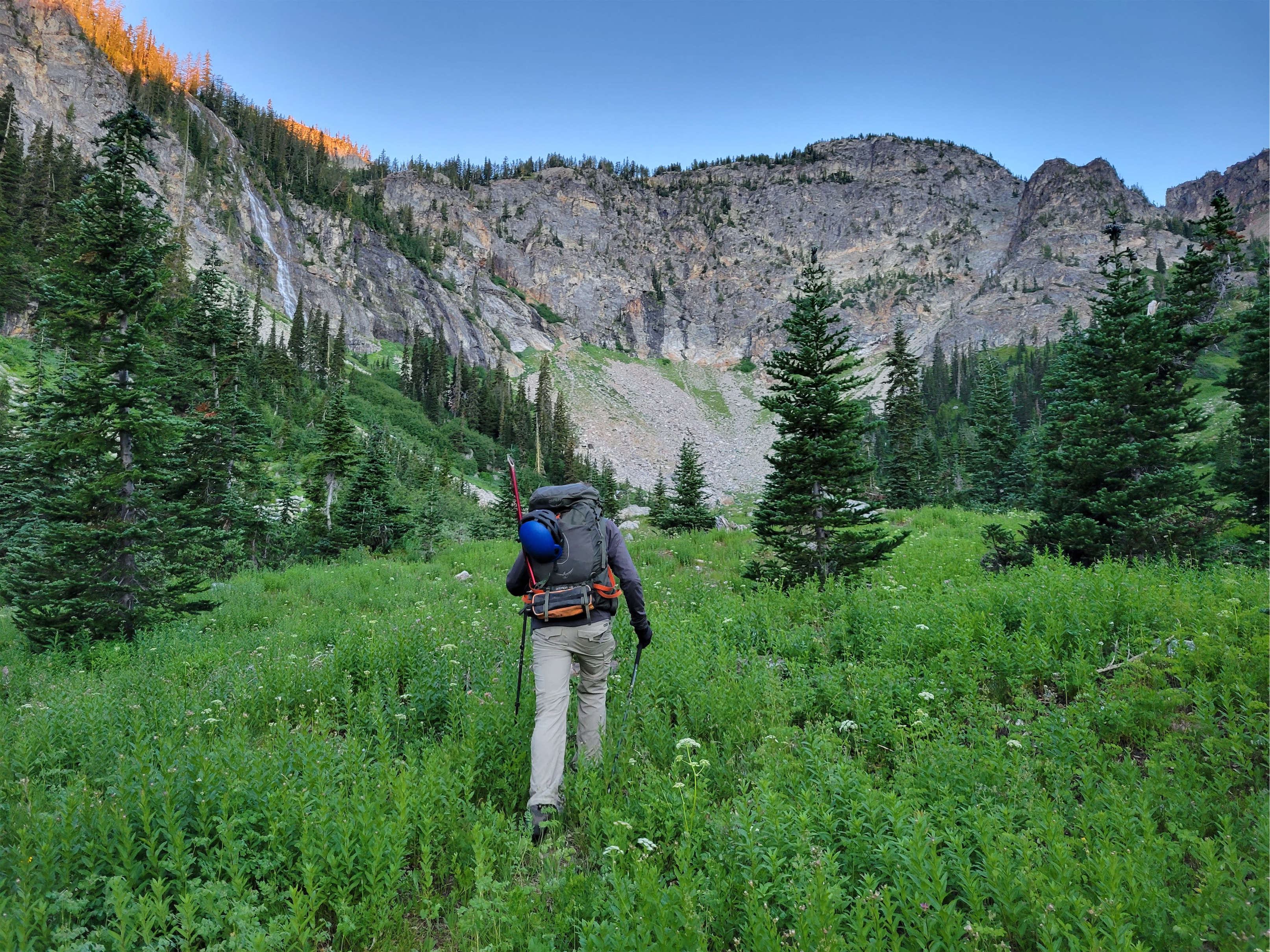
We woke up a bit earlier this day, knowing it would be longer. We were originally aiming for two peaks this day, Devore plus a bonus, but unfortunately things weren’t lining up the way we needed them to.

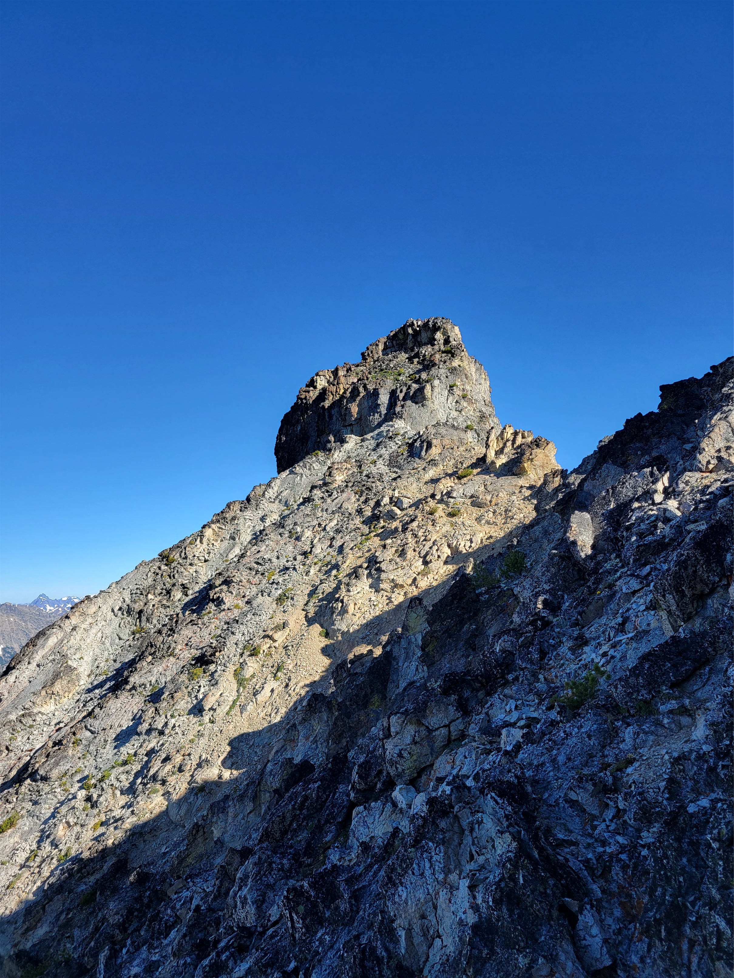
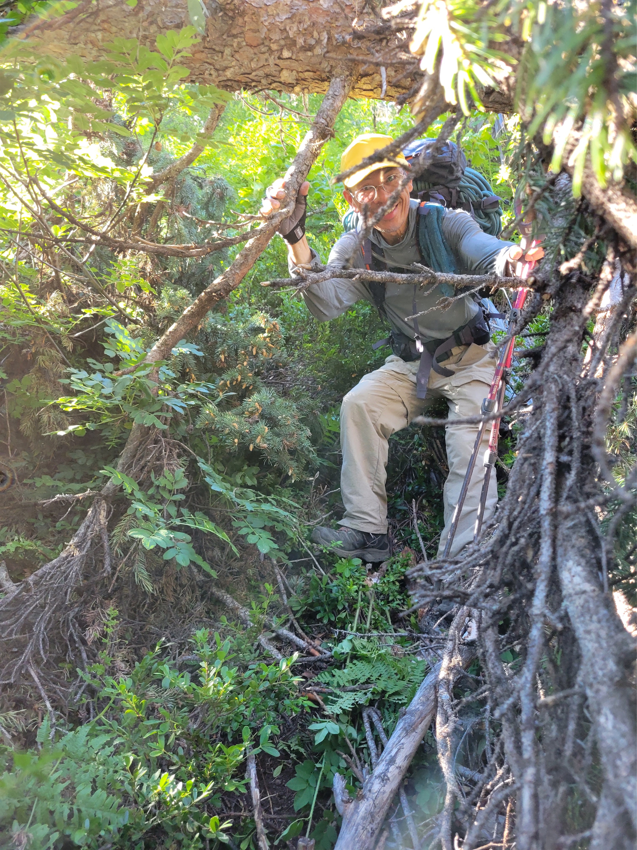
Oh boy. Ignore the GPX tracks you probably pulled off peakbagger for this one. We followed them and cut straight up the gut of the valley and it was a mess of annoying slide alder and thick brush. I’d recommend what we did on the way down: follow your track up Tupshin for a hundred vertical feet until you’re in manageable brush/blueberry bushes, and then sidehill connecting animal trails (hopefully they’re still there) until you’re in the meadow below the gully to Devore. The creek crossing is easy, and the gully is a heather and talus staircase.

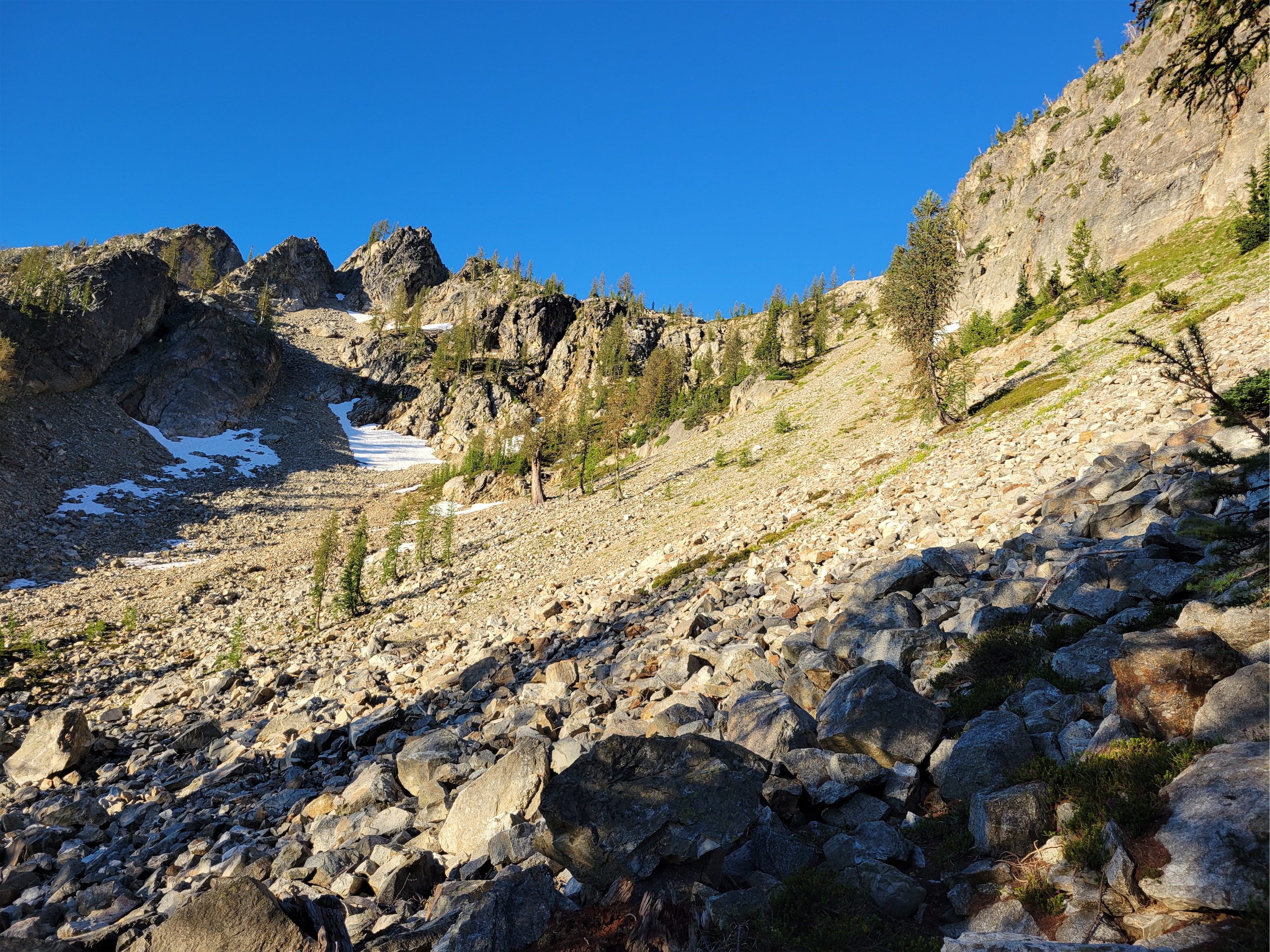
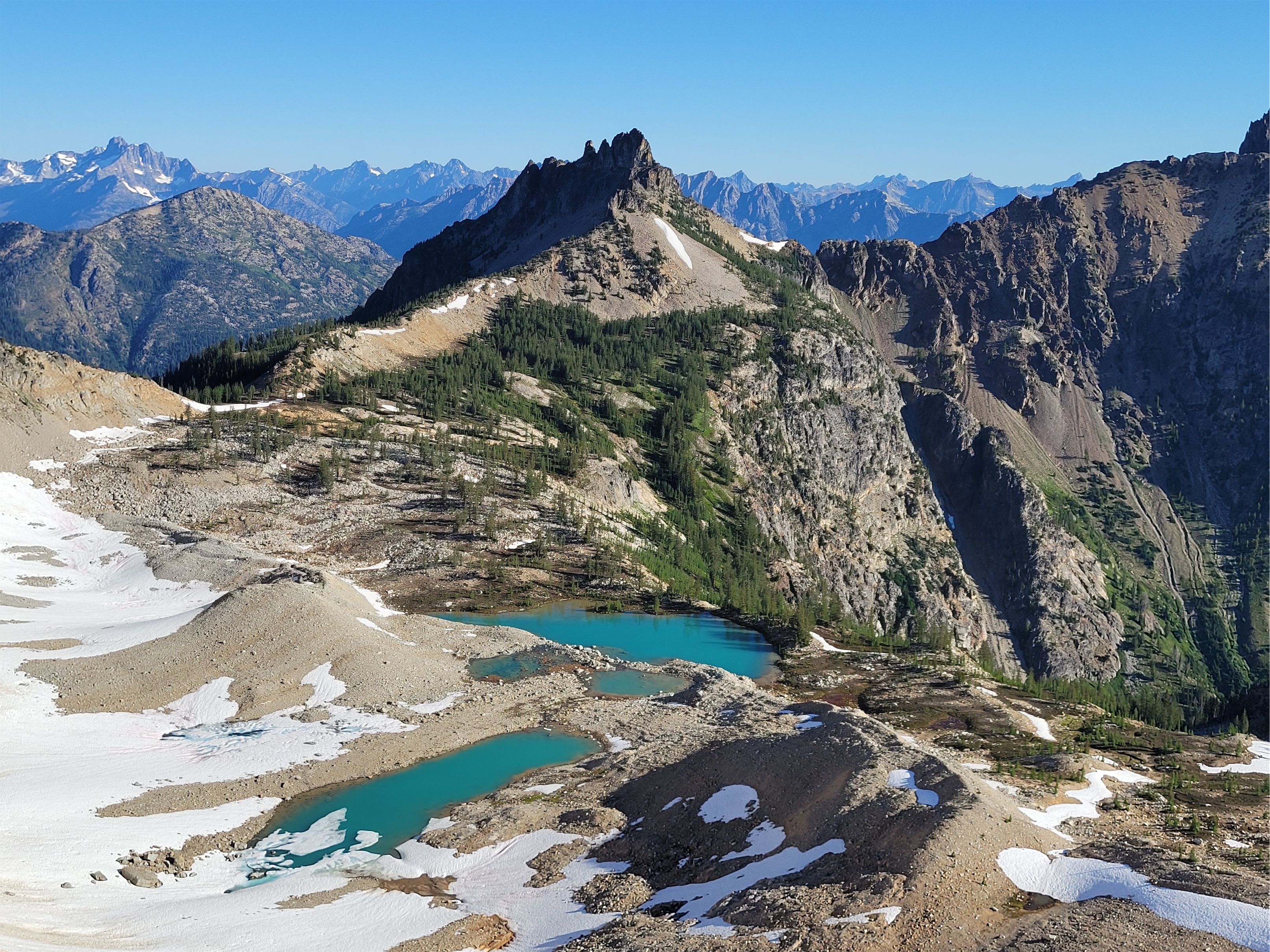
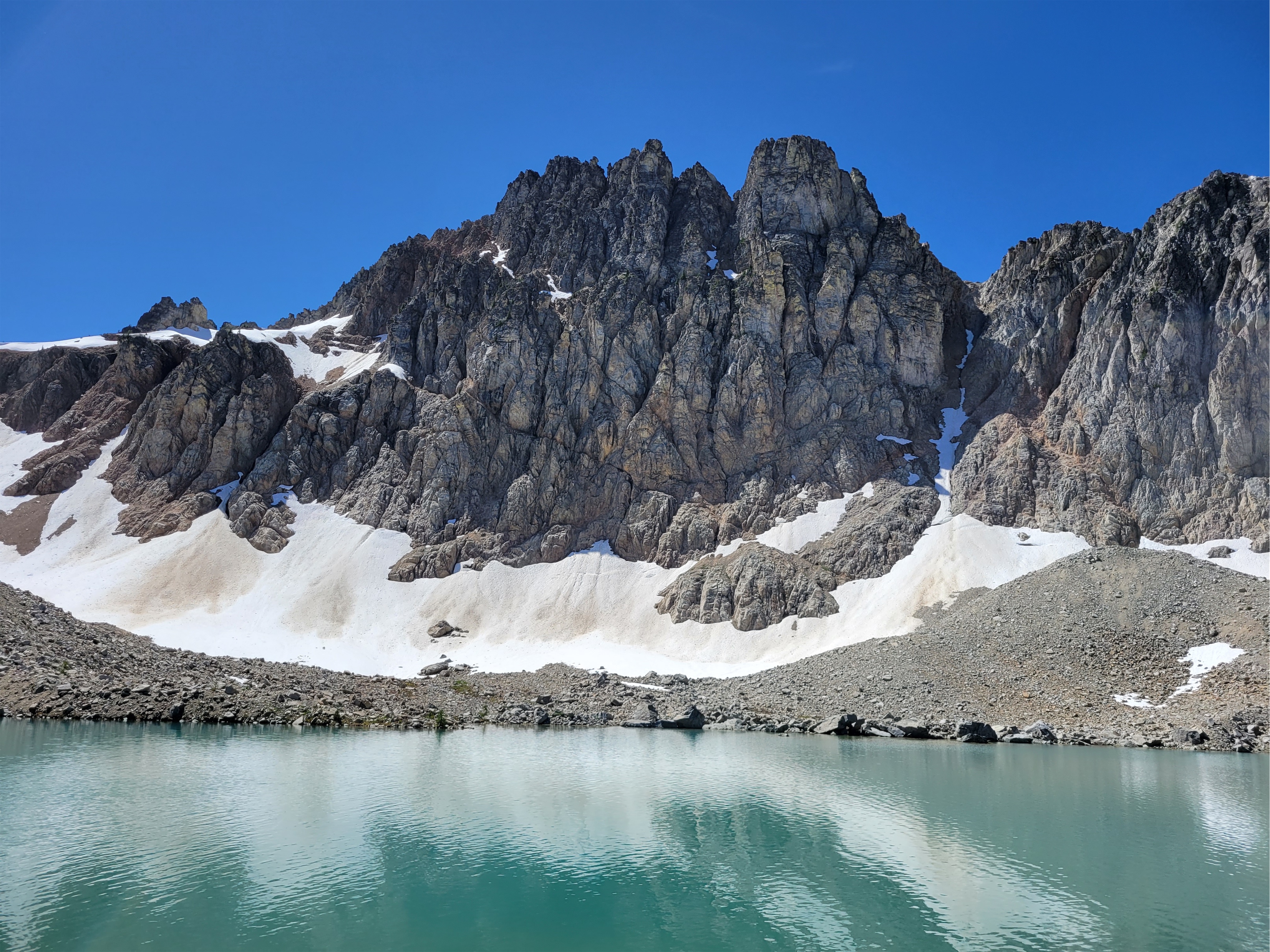
The gully drops you off at.. oh, a second gully. A fake minor basin of larches (beautiful) and loose talus, scree, and dirt (not beautiful) to gain the real Bird Lakes basin (SPECTACULARLY BEAUTIFUL). Wildflowers were sprinkled among the scree which made it more tolerable. Gaining the moraine above Bird Lakes Basin was sad because I was so excited to the see the lakes, but turns out they’re a slight side trip to the northwest. Suddenly I heard “BEAR! BIG BEAR!” and I picked my head up with wide eyes scanning the basin. “WHERE” “here!! Look!” My eyes darted, my heart raced. Wait. They’re pointing to our feet. Tracks. Not a live bear. Relax. But damn the tracks were huge!
We put on crampons and booted up the snow to the far east ridge, following a sandy boot path up the mellow ridge to some steep snow below the Bottles. At the cool col next to the bottles we packed up the snow gear and dropped down the first of a loooong stretch of steep slopes with everything from solid scrambleable rock to kitty litter covered ledges to unstable talus and scree.

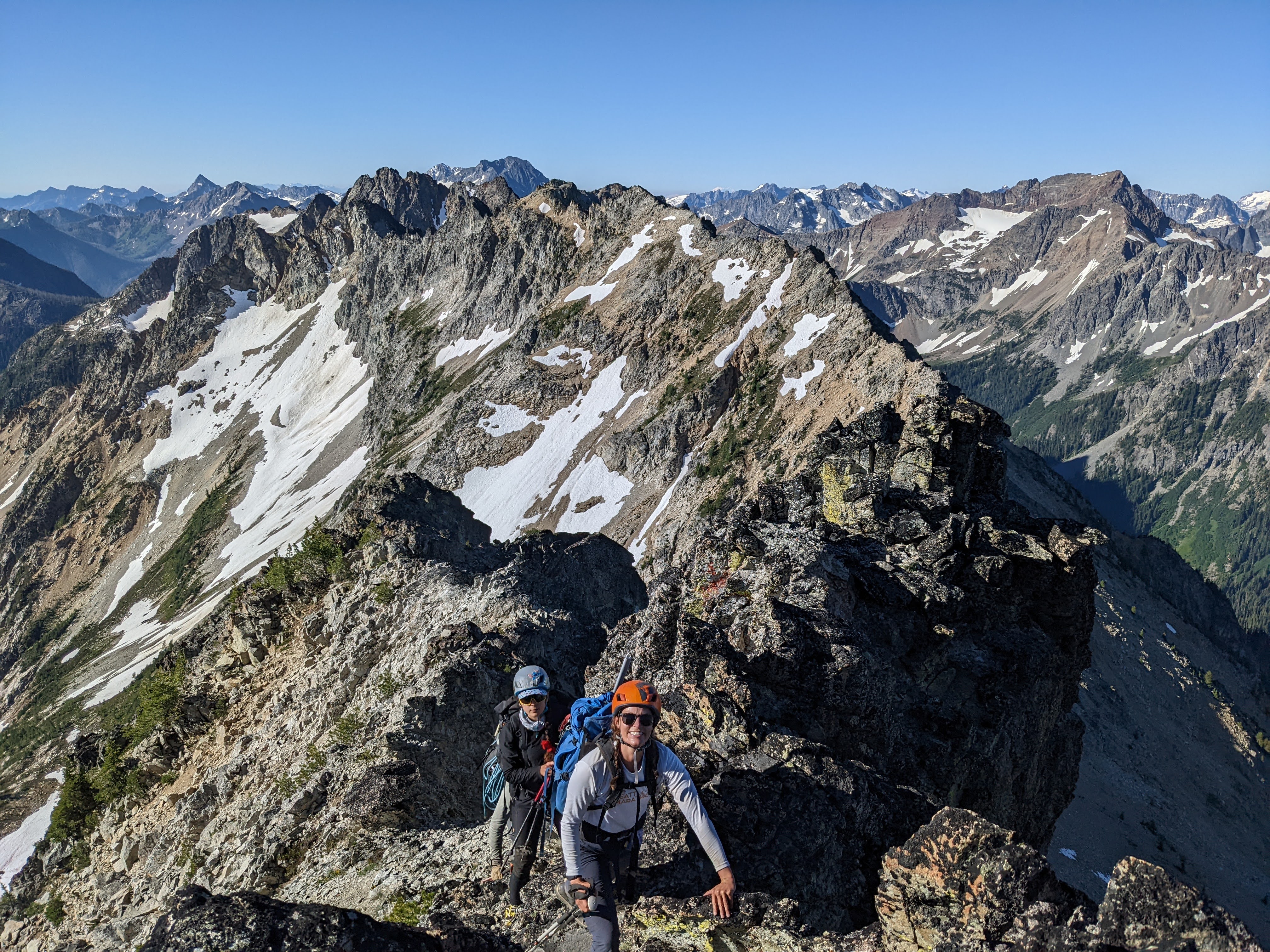
The going through this section was tedious. We divided and conquered, trying to stay out of each others’ line of fall in case someone knocked down rocks. We had figured out by now who in the group was most prone to kicking things loose: Andrew. I kicked something down and we all shouted ROOOOOCK followed by Andrew slightly more quietly “it wasn’t me!” only minutes later to hear ROOOOOCK followed by Andrew “Okay that one was me!” This section felt like choose your own adventure, we traversed until a minor ridge we could follow almost up to the main ridge, where we sidehilled more on the west side until the unavoidable 4th class step.

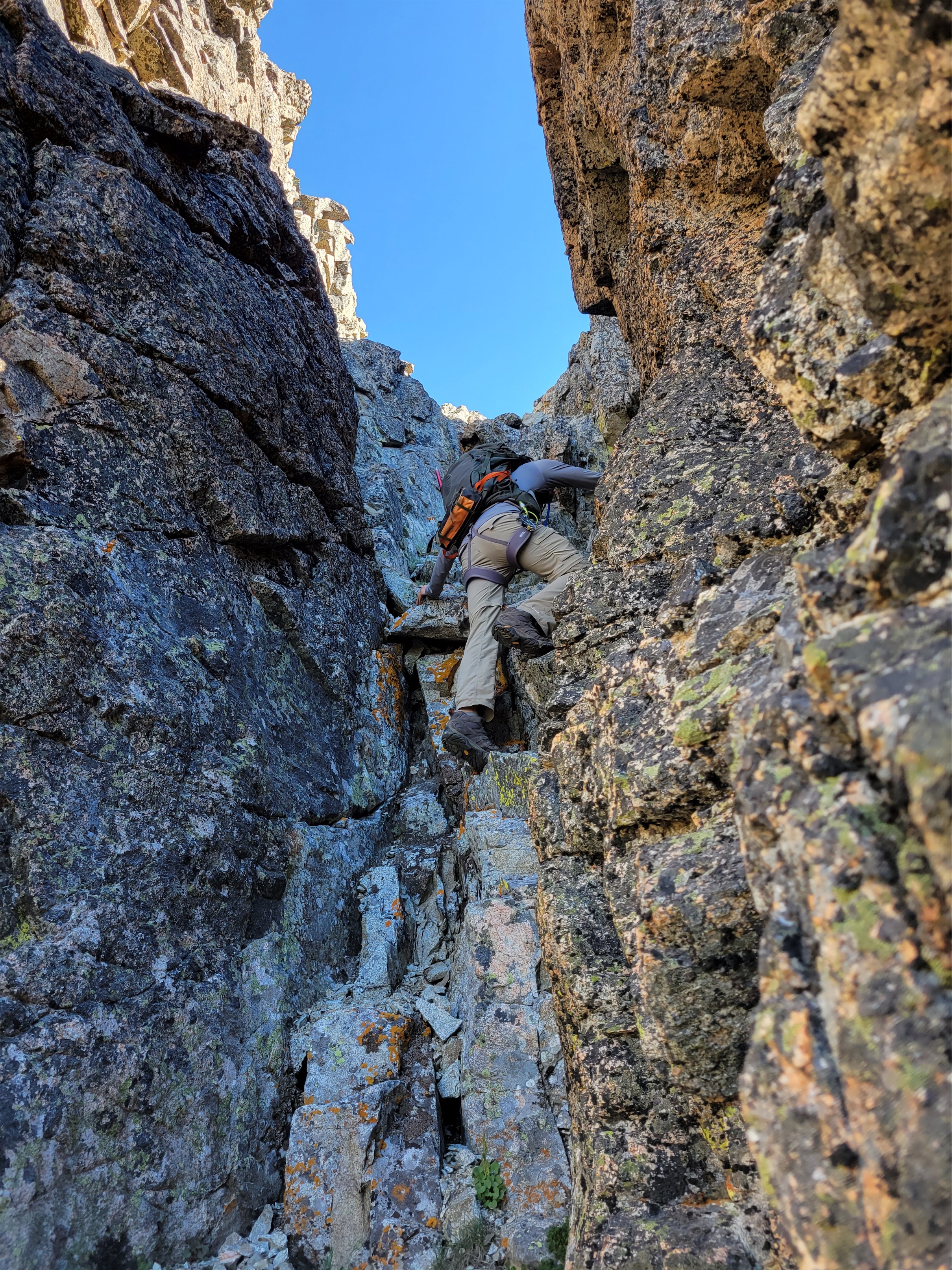
Now 4th class is interesting. Sometimes it means just “extremely exposed 3rd class.” I like Jon’s definition, which is “I can get up it just fine but don’t love downclimbing it.” And sometimes I swear it means “5th class but there’s no pro so we’re going to call it 4th class.” This honestly felt like the third option. there were big ledges for feet but it was vertical and exposed. Some of us scrambled it and then tossed down a rope to the others since there’s a conveniently located rap station at the top.

From the top of that rappel, we traversed almost straight to the left (same elevation) to an extremely exposed 3rd class (4th?) move. There may be a better move higher up, not sure. Someone knocked a rock loose and we all looked at each other waiting for it to hit the ground below. We finally heard it strike. Yikes, that’s a lot of time to think about falling if you slip here. I evicted the thought from my mind and made the move. It was extremely awkward, at least for my reach/flexibility/height. Had to trust there was a hand hold there, couldn’t reach both holds at once. From there, another traverse left to the base of the obvious gully (actually obvious! basically a short boot path right to it) and a quick scramble up the gully to the top. The gully isn’t technically hard, but just like the rest of these crumbling choss piles it’s full of softball to microwave sized rocks just waiting to hurtle down on your friends below you, so I tried to be as dainty with my foot placements as possible.
The summit routine was the usual, admire views, snap pictures, look for summit register (no register!), shit no one brought whiskey wait no that’s fine packs are already heavy enough. Okay okay we have a lot to get done today, time to get moving. Jon led the first rap down and hustled to set up the second rap down the unavoidable 4th class step. Two others went, and I heard someone at the bottom shout “wait, where did you guys go? GUYS?!” and I rapped down next only to find no one at the bottom. Someone above kicked rocks down the gully on me, unsurprisingly given the condition of the gully. A football size rock bounced off the calf I was relying on to push the rest of me under a slight overhang on the wall. I was pissed. If I had legitimately been injured by the rockfall, no one would have been there to see it and help.
Unfortunately I let my adrenaline get the better of me and did exactly the same thing to the person behind me, leaving them behind as I angrily went around the corner trying to work off my frustration. Stupid and hypocritical of me, but fortunately those behind me were fine, no more rock fall.

The rap down the 4th class step went smoothly, and we made quick work of the traversey descent and climb back to Cool Col and then to Bird Lakes. Tim decided to skip our bonus peak and head back to camp, so we parted ways just before the lakes. At the lakes, we stopped for water, and I realized it was 12:30. I pulled Jon aside. Here’s what I’m worried about.

1. Bonus peak is 2 pitches of technical rock. For a party of 2, a good rule of thumb is 1 hour per pitch. So 1 hour to the base of the climb, 2 hours to the summit, 1 hour to rap down, 1 hour back to the lakes, 2 hours back to camp. 7 hours total, then we needed to move camp down 1000ft.
2. We had 5 people. That meant we could pretty much guarantee it would take more than one hour per pitch.
3. We had a really big day with Flora the next day.
We called the others over to discuss. Do we want to go for it but not get to lower camp until well after dark, or did we want to make it a comfortable day and be at camp around dinnertime? Everyone agreed on the latter. 2016-2018 me would have gone for it but 2022 me is so much lazier. This was a really hard decision though, because the bonus peak was the whole reason I was there. I’ve been admiring it from afar for like seven years. But I’ve had a good streak of goal peaks this summer, it’s okay to let one go. Just need to convince someone to do that approach again with me in a few years.

We hung out at Bird Lakes for over an hour. We hiked an infinity loop around the two lakes, found a few campsites, and sat in the shade having snacks and hydrating. It’s such an unbelievable area. I simultaneously can’t believe no one camps here (it’s gorgeous pristine wilderness with a lake unlike most you’ll ever see) and also completely understand why (getting overnight gear up there would be a BITCH unless you’re bivvying). It’d be a DREAM to get up there in larch season.
We headed back to camp around 1:30pm, shouting to Tim we were coming for him. Much of the scree slope was plunge steppable, but the lower gully (heather and talus) was a bit of a knee banger. Towards the base of the gully we realized we could avoid all the brush by sidehilling through the meadow until we intersected with our Tupshin descent path, which at its worst had some downed logs and blueberries, a walk in the park compared to the bushwhack up the middle of the valley that morning. We followed game trails that had been recently used by something big. I thanked the bear and deer for making such great trails and hoped we didn’t run into whatever had clearly trampled the plants recently. The game trail carried us perfectly back to our Tupshin descent track, and we rolled into camp to Tim’s laughs. “I followed game trails over here instead of coming back through the brush!” he announced. It wasn’t a bear or a deer that had trampled the brush recently, it was the gecko!


We packed up camp and headed down the bushwhack. We ignored GPX tracks again, following our noses down the path of least resistance, and it was bad but not as bad as the way up. “Is this better because we’re finding a better route, or because I’m in a better mental place?” I asked. Behind me I heard Jon mention we had dropped ~100ft of elevation. “We’ve only lost 100ft of elevation? That’s fucked up” Andrew said with an almost perplexed voice. I cracked up. Okay, yeah, it’s still shitty.
We found the trail, recently brushed out and cleared by the volunteers we had met! They strategically left a log down across the river to make it easier to cross, but camp I swear was larger than it had been two days prior. They must have cleared some deadfall out of camp too. The general consensus has been that the downed tree situation this year is far worse than prior years. I was insanely thankful the volunteers had beat us to most of the trail so we didn’t have to parkour our way through hundreds of dead trees.
We debated trying to camp further up the trail, but since there was no guarantee that campsites existed, we decided to play it safe and stay where we were. We managed to fit five tents into the camp thanks to some gardening work by Tim, who found out he had lost his utensils at some point and quickly improvised chopsticks with his tent stakes. I was in the tent by 7pm just listening to the others talk including a hilarious mini rant by Andrew about the Fred Meyer experience at 7pm and how there’s always only one checker-outer available despite all the customers trying to get like two weeks worth of groceries at one time. Jon quickly agreed. I’m not sure what came of it, because I definitely drifted off to sleep mid conversation.
Links to Days 1 & 2 (approach & Tupshin) here and Days 4 & 5 (Flora and exit) here.


Pingback: Stehekin Slam: Approach & Tupshin | Have Tent, Will Travel
Pingback: Stehekin Slam: Flora & Exit via Tenmile Pass | Have Tent, Will Travel