


Holy crap, where do I even start. Spickard has been on my radar since I met Sam in 2015 and we dreamed about lugging skis/splitboard up there for a wild backcountry trip. Correct, I did not own nor know how to ski at that point, but I had big dreams. Sam, I’m so sorry I did this without you but you’ve been 2500mi away for like 6 years. To everyone else, I have a loyalist streak with climbing, if you talk about a peak for long enough with someone you need explicit permission to go do it without them. So consider this my public apology.
Jon got permits for the Chilliwacks Thursday morning, so here was my chance. I did not bring skis, thank god because wow this area wildly surpassed every expectation that I had for it in terms of beauty, difficulty, remoteness. Even my literal hunger and quality of sleep and output of pee surpassed expectations. I thought the peaks were mostly walk ups minus a scramble step here or there, I thought the approach via Ouzel Lake was on a trail, I thought when people said “4×4 required” they were just being babies about driving, I didn’t consider that a waterfall would be more reminiscent of an east coast hurricane than of a shower.
Let’s get those summary bullet points out of the way first:
- Distance: 8mi to camp, no idea what mileage up and down Spickard
- Elevation: 7000ft gain total, 8,979ft highest point
- Weather: 50’s and sunny
- Commute from Seattle: 3:30 depending on traffic and border crossing and your forest road driving preference. Took us just over 7 hours.
- Did I Trip: Yes, tripped/slipped/postholed/stumbled, you name it, I did it. Never a full on wipeout.
Time splits: - TH to camp at Lake Ouzel: 8hrs
- Lake Ouzel to Spickard summit: 3.5hrs
- Spickard summit back to camp: 1.5hrs
Sparknotes version/TL;DR for the lazy:
1. If you have 4×4 and high clearance (>10″ clearance) you can literally drive to within a couple hundred feet of the border swath. DO NOT drive to the traditional trailhead. Take the left fork just before the trailhead and drive to your favorite pullout near the border/depot creek trail before you start bushwhacking. Make no mistake, you will be bushwhacking.

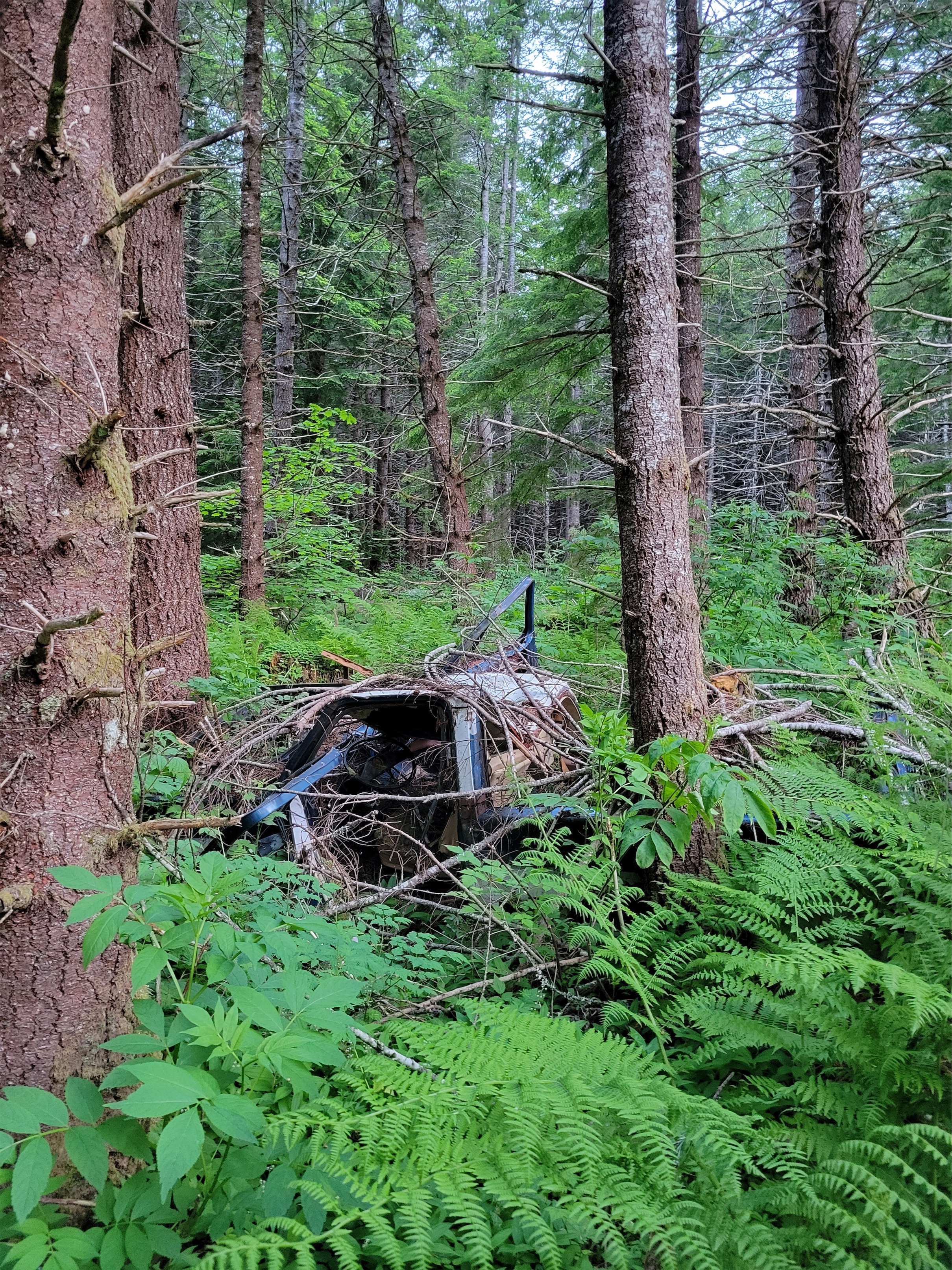
2. The start of the trail, as far as we could tell, is almost entirely destroyed by recent logging and the 2021 winter storm(s). Obliterated. You’ll pick it up after maybe an hour of bushwhacking and catching glimpses of the trail, and it gets better from there. But the beginning is a mystery. Just drive to the border and take the path of least resistance down to Depot Creek and you’ll intersect the trail at some point. We couldn’t even follow the trail on the way back. The fresh downfall on the trail smells wonderful at least.
3. The trail gets better once in open forest, and is actually pretty smooth. It’s easy to follow, especially around and after the waterfall crossing. “Better” is relative though, you still can’t see your feet a lot of the time.
4. There is a spare rope tied to a tree below the waterfall scramble for when the current ones need to be replaced.

5. Once you are at the camp above the waterfalls where it flattens out, it’s just over a mile to Lake Ouzel, but for us it was another hour of awkward postholing, talus hopping, slide alder, and creek crossings. When you hit slide alder, just drop to the river bed and rock hop.
6. It is ~8mi from the start to camp total, 7mi if you plan your drive right, as long as 10mi if you park before the culverts. We took 8hrs to go those 8 miles. On the way out, we found the trail more consistently and only took 6hrs.
7. Spickard climb itself is straightforward, especially with snow. Multiple route options/variations.

8. Someone out there did it c2c in 19h right before us (via the north face, which is in great shape) and I wish we had their fitness and wisdom and packs.
Okay, so now let’s get to details. First, we were supposed to be gone Thursday night through Monday. Unfortunately, the forecast progressively got worse and worse until finally it was calling for 100% rain Sunday and Monday, with totals coming close to two INCHES of rain (20″ of snow, which would have me STOKED in February) with thunder likely. So we figured we’d be cutting the trip short, but we were still going to go and take advantage of what we got. Rob was cautiously optimistic about weather, I was like dude I’m not even bringing 4 days of food anymore because no way do Sunday/Monday turn out half decent. I’ll tough it out if I’m wrong.
Right, so back to that 3.5hr drive that turned into >7hrs. It took me 90min to get from Fremont/Ballard to the Ash Way park n ride thanks to a massive accident that I just barely missed. We got on our way nearly two hours later than planned. We miraculously found gas for $5.15/gallon(!) near Sumas. The border crossing only had a single lane open so the “5min wait” reported by the gov’t was a lie. Then we got a scenic tour of southern Abbotsford farmland, converting km/hr to mph and passing many tractors which, with my car’s acceleration and 1000lbs of passengers and gear, is no small feat with oncoming traffic. We joked about what was to come on the forest road. Jon’s car is too new and pretty for a shitty road. Rob’s is too low clearance, and also has no air conditioning. My car has many problems (it literally would not be legal to drive in my home state of Massachusetts), but AC is not one of them. Rob laughed. “I got 99 problems but my AC ain’t one.”

I’ve seen people say “4×4/high clearance required” a hundred times over the years I’ve lived out here, and this is the first road I’ve seen truly require it. Nevermind the potholes, yeah they’re annoying but any car will be fine. But if you want to drive to the start of the route, per Ben, you want truck parts, not car parts. About 3mi from the border, the road has a dozen 18-24″ deep culverts dug for drainage that even cracked one of my cheap mud flaps (a rite of passage in the xterra world), plus some extremely rocky sections. I dread the day I have a car nice enough to worry about brush and branches on the side of the road scraping the paint.
We scouted a ways up the road and eventually turned around knowing Ben’s car wouldn’t make it. We parked at the fork just before where the culverts started. How far out was Ben? Has anyone heard from him? Did he even get across the border? We were debating what to do if he never showed. Except suddenly we heard squealing tires and here comes Ben!! Five minutes behind us, not even! We trailhead camped right there to spare his car the horrors and went to sleep almost immediately.
We woke up at 4am, I had a champion breakfast of PB&J, and we all hopped in my car to get as far as we could go, stopping before some deeper culverts to inspect before passing. It’s a blast to drive though. Enough to be exciting but not scary as someone who doesn’t do any legit offroading. By the end of this trip though I was GREAT at angling appropriately across the culverts despite having 4 people and probably 200+ lbs of gear in the trunk between packs and car camping goodies. My car is not built for comfort, I was worried all of us were going to get carsick, but no one puked. Good start.

We passed a fork in the road and stayed right, parking at the old trailhead about 400ft past that fork. Rob said “I think you can drive all the way to the border!” and I laughed thinking he was joking. Narrator: he was not joking. The no longer present “trail” took us immediately up through a clear cut to the left branch of the road we had just been on. The beginning of the trail is literally a forest road now. Dammit. With more culverts, but all similar to what my car had already gone through. Could have saved ourselves another mile or so of walking. It’s also insane this area was logged. Imagine someone logging Cascade Pass in Washington. That’s how it felt. Crazy views of snowy glaciated peaks, and… clear cut.

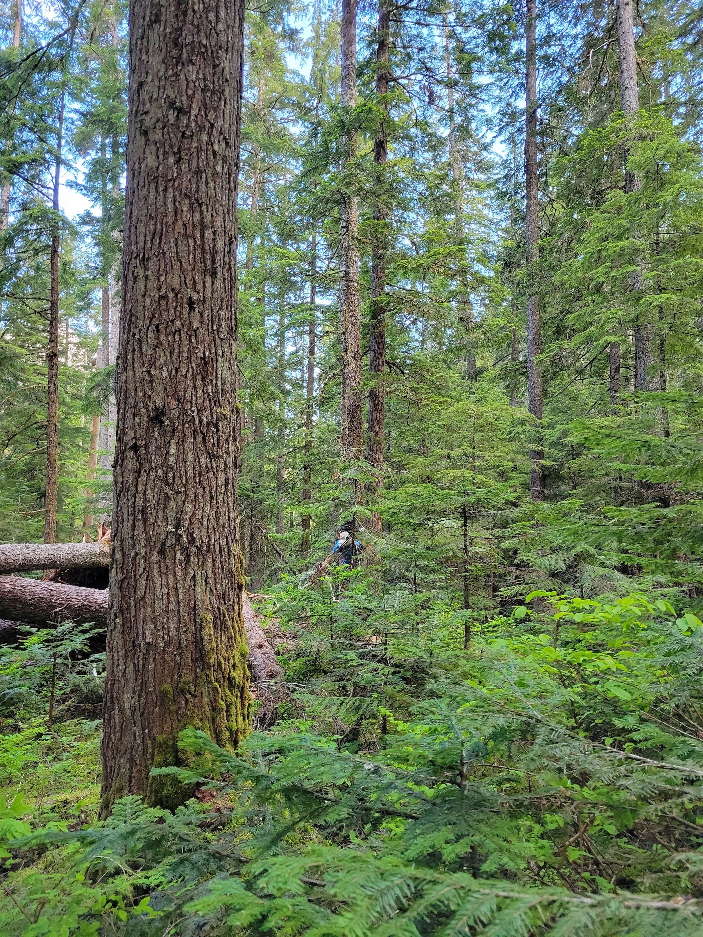
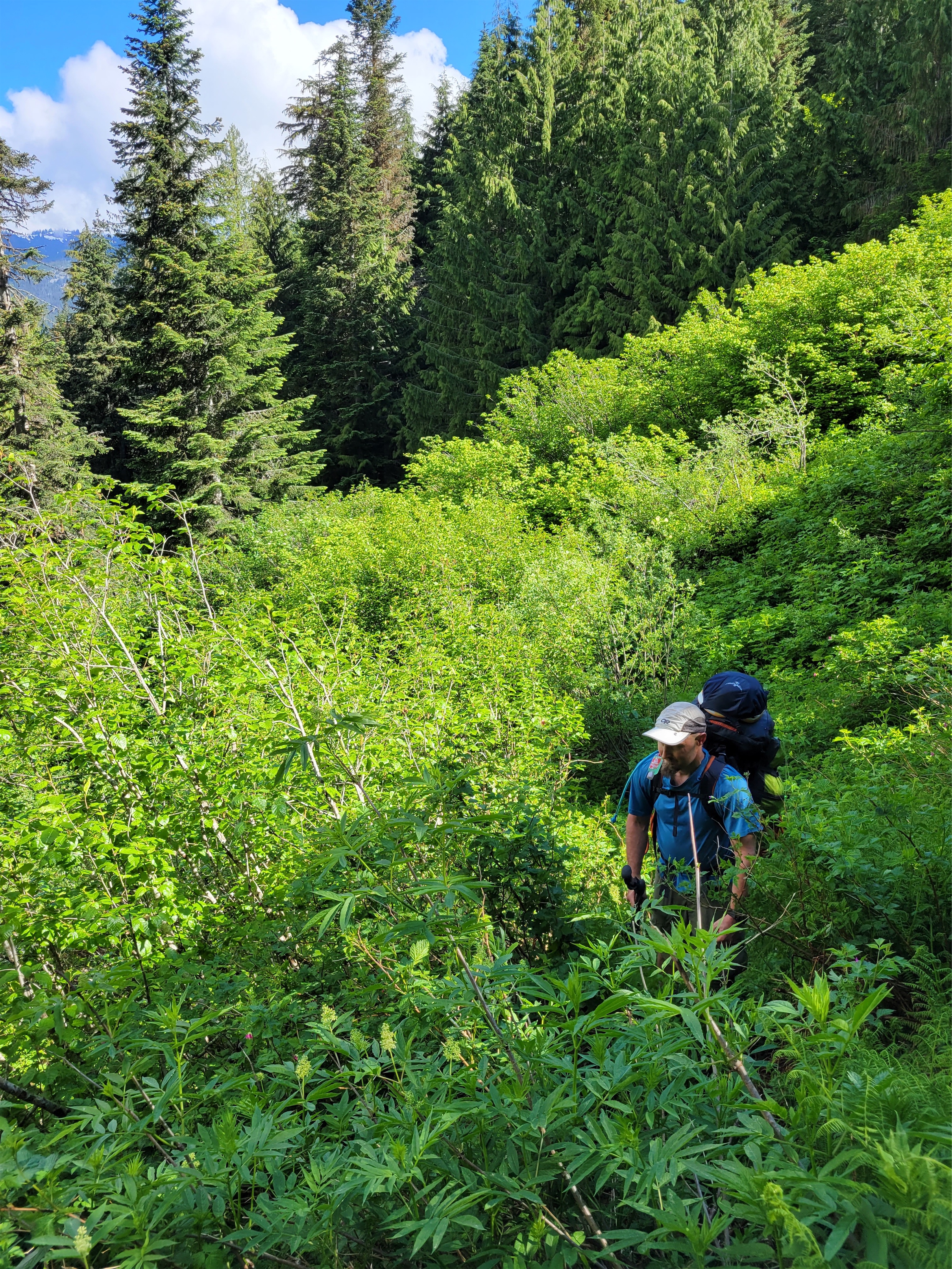
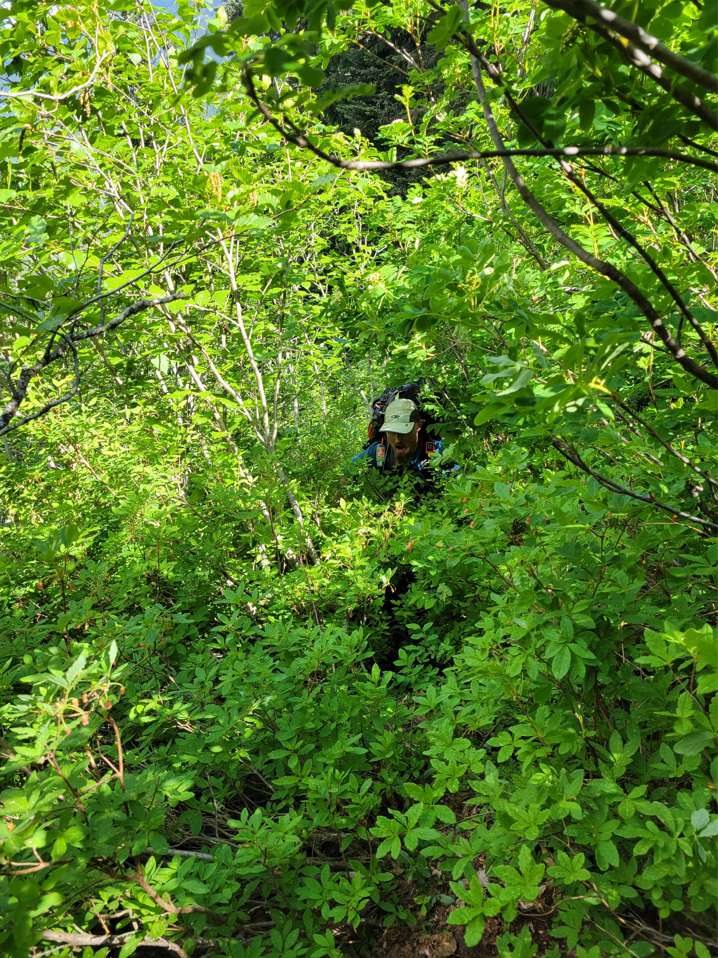
We walked the road until we realized the trail had dropped south of us at some point and was already across the USA/Canada border (we were still north of it). We saw zero indication of anything leaving the road at any point, so we dropped straight off the road and bushwhacked down to Depot Creek to start looking for the trail. We had multiple gpx routes from others as well as an old trail map, but it was still extremely slow going. We were consistently going through head high brush, fresh blowdowns, finding weird ways to cross creeks.
As far as I have found, no work has been done on this trail since some vigilante maintenance in 2010. The leading theory based entirely on gossip is that gov’t funded trail maintenance stopped here after 9/11 in 2001, logic being that the US didn’t want to encourage unregulated border crossings. That means 20 years of no serious maintenance, plus a significant amount of logging that seems to have happened straight across the beginning of the trail. I dreamed of a day where we’d have little portable things that could shoot out lasers capable of cutting anything so I could slash my way through underbrush and blowdowns and realized I had dreamed up a light saber. I was torn from my daydreams when I heard Jon shout “AAHHHHH!” while crossing a log, expecting to see him in the stream below it. “My pizza!!!” His pocket had ripped on a branch and two slices of pizza had fallen into the creek. He snagged it and ate it immediately. Can’t be losing calories like that up here.
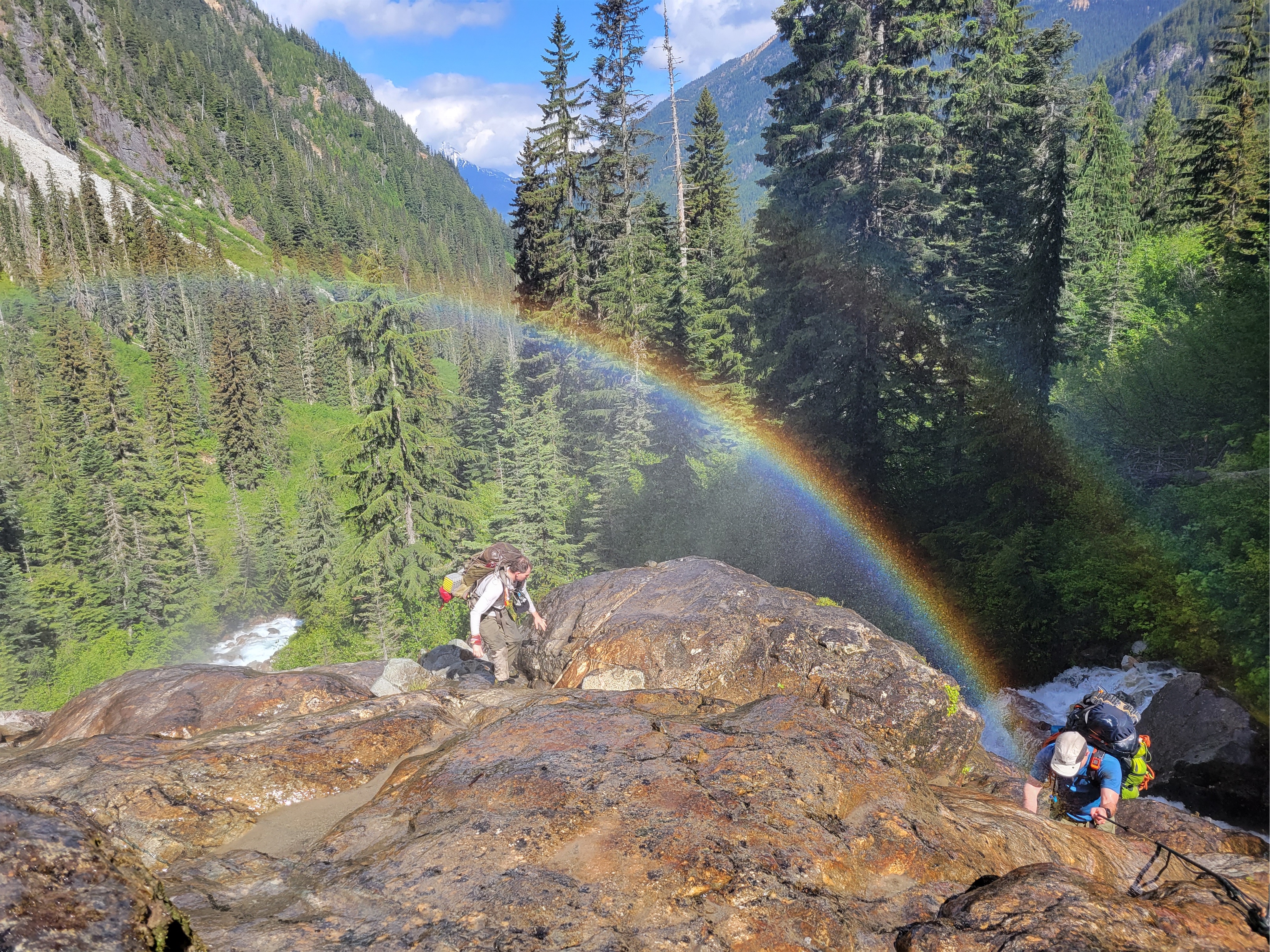
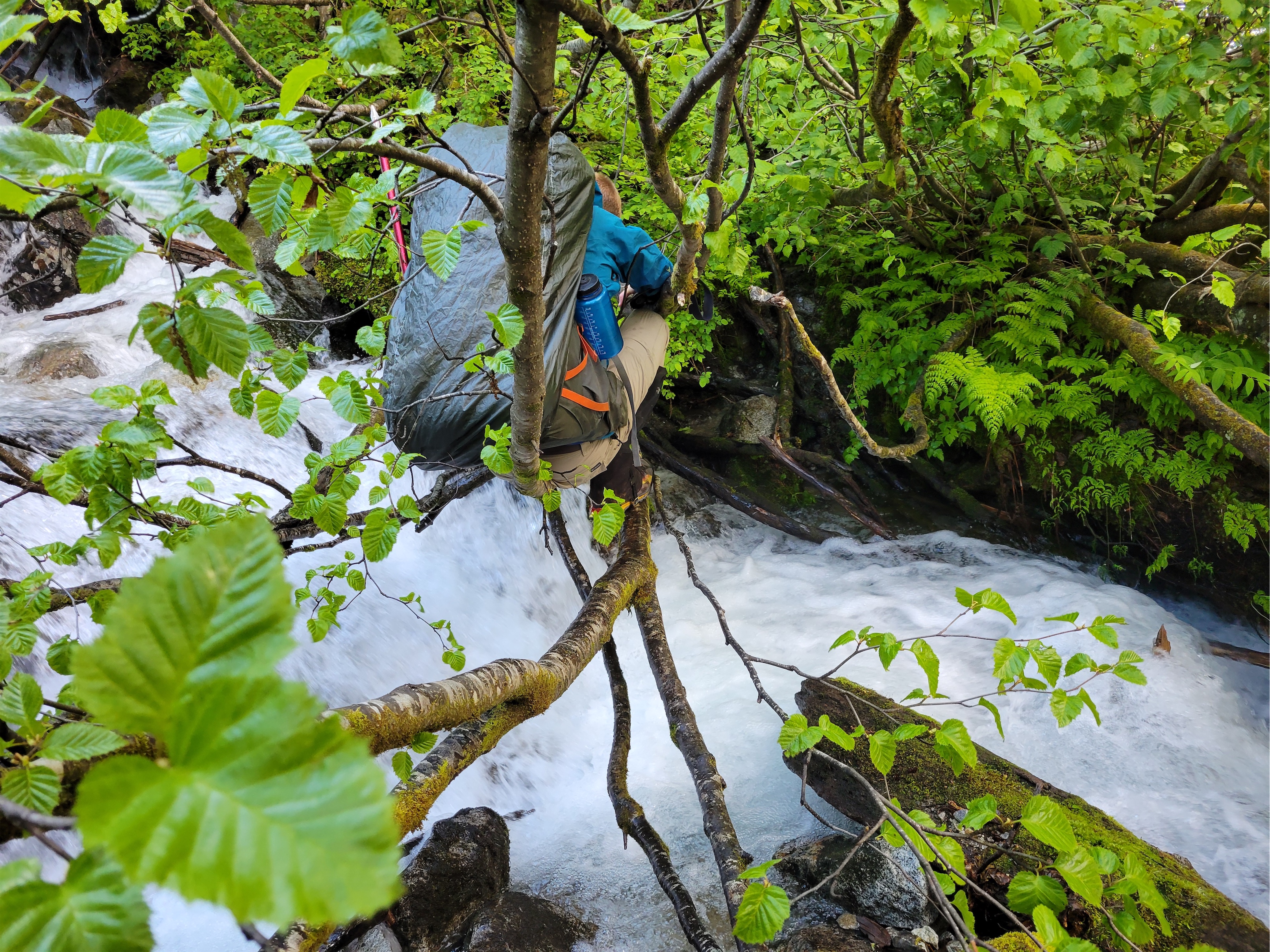
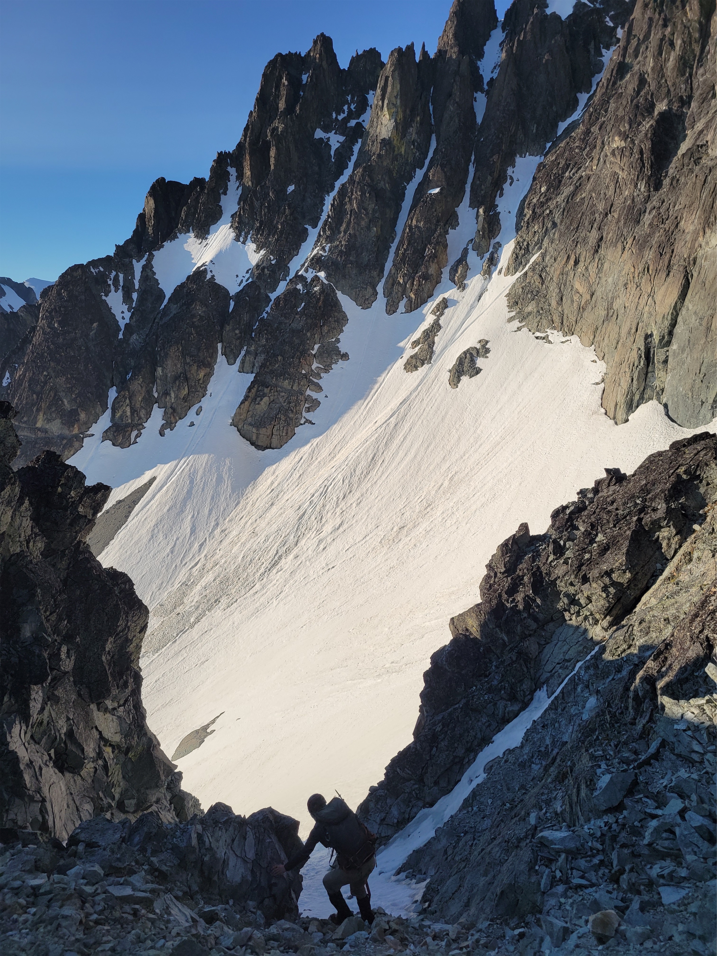
We finally heard the roar of Depot Creek Falls just after passing a small campsite with a fire pit, and caught glimpses of the falls through the trees. The “trail” led us through slide alder and brush so thick you don’t have enough hands to push it out of the way to see your feet. We came upon a tangle of 3 slide alder branches drooping across a stream. “Are you sure this is.. where we cross..” I couldn’t believe it, but it’s not like I could see any better options. We less than elegantly crossed the slide alder, and found ourselves on an island in the middle of a waterfall. We hiked up a stream for about 15-20ft before seeing the open slabs with hand lines to climber’s left. This is roughly where the spare rope is, hanging coiled nicely on a tree branch to climber’s right on the trail in the middle of waterfall. This will make sense when you’re there, I promise. Picturing the first people to find routes like this just blows my mind. How long did it take to stumble upon the perfect 2″ alder branch across the creek?

The hand lines are OLD but held solidly. I gave them a few good yanks knowing I was about to be relying 80% on them. I don’t know how these would be doable when soaking wet without the hand lines. PUT ON YOUR GORETEX. I wasn’t going to until Jon mentioned putting his phone somewhere safe and waterproof and then I was like ehh okayyy you’re right… and oh boy, was he right. You get absolutely blasted by freezing water, I can’t believe my contacts stayed in my eyes. I couldn’t feel my hands. You can’t hear anyone, just the thundering of the waterfall. It’s >900ft tall, and absolutely massive. The biggest waterfall I’ve seen in my life, and we were part of it. I swear it was a spiritual experience, I was buzzing with humility and endorphins and awe all at the same time. Invigorating is the most accurate word. I honestly cannot believe this trail is unmaintained with such a ridiculous payoff, even just to see the falls. It has to be one of the best falls in Washington. I hope there’s aerial footage of it somewhere.
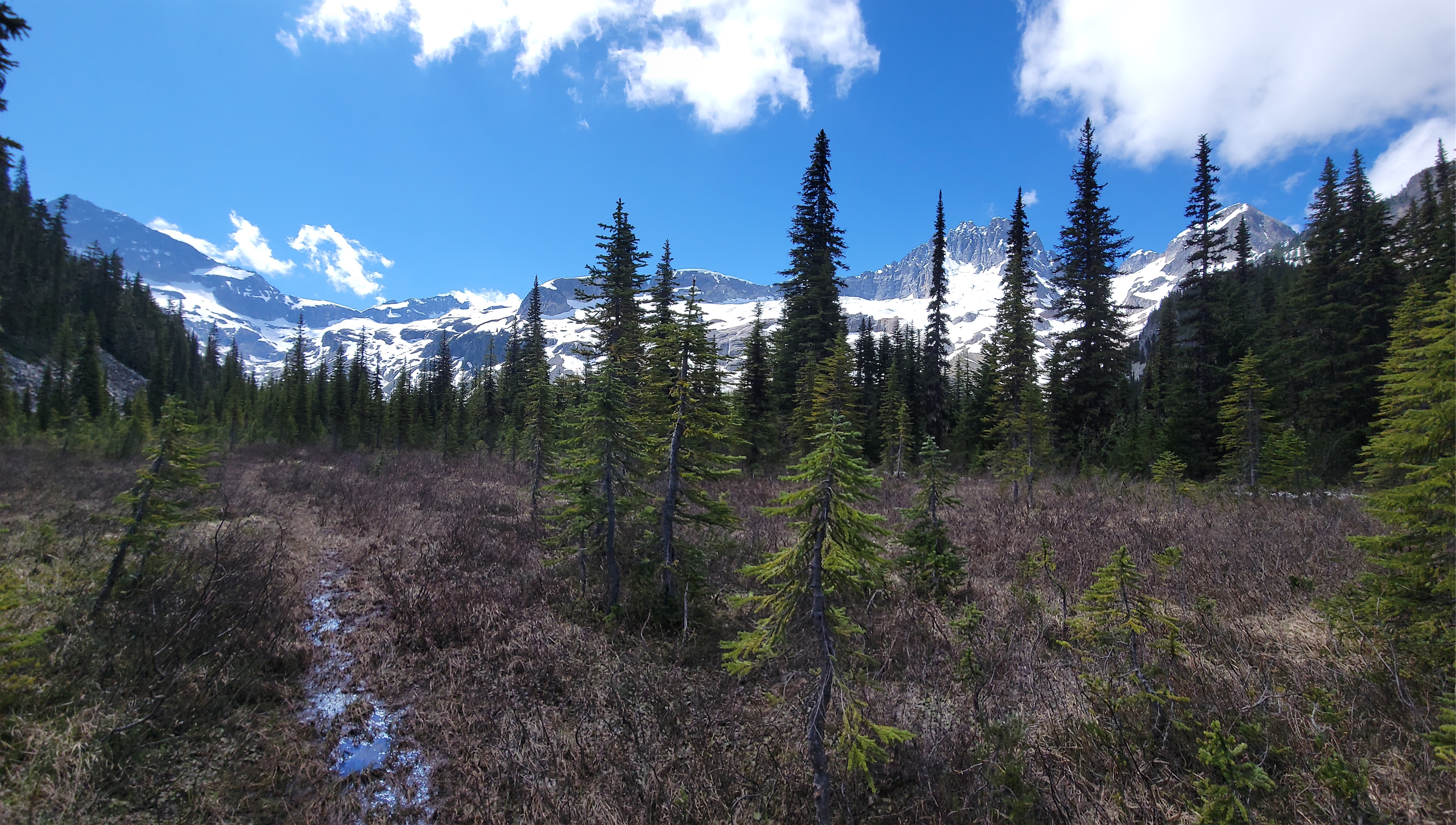
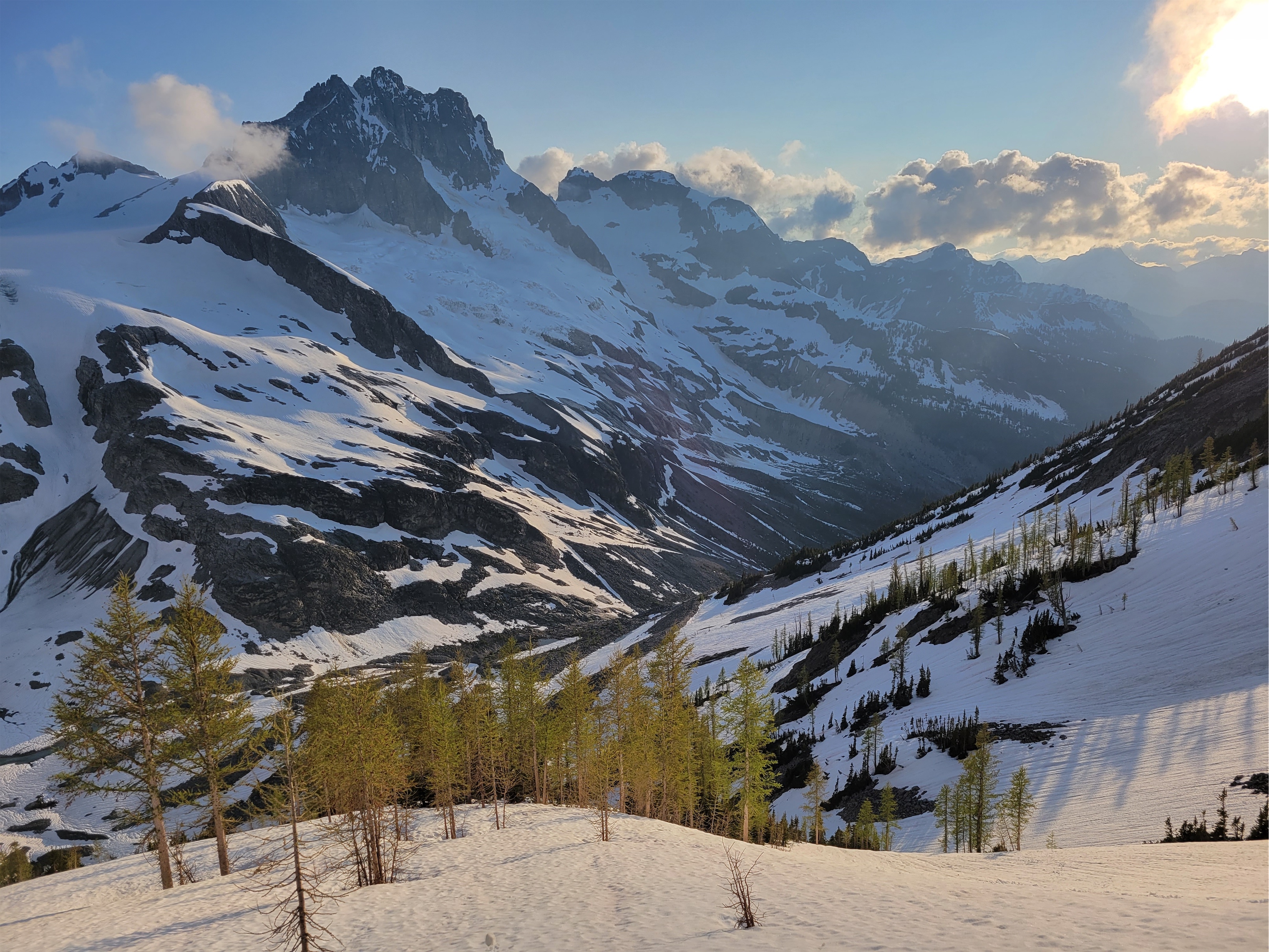
After the hand lines, we scrambled left up some slabs/vegetation until we found where the trail cut back into the brush. From here we followed the extremely overgrown trail until we broke out into a talus field followed by a steep dirt trail (all easy to follow/obvious). I found a peanut butter cup from a prior party (I did not eat it, I learned my lesson). We finally crested the top of this ‘headwall’ and found ourselves at a campsite in a beautiful meadow with ridiculous views of Redoubt. Someone had clearly camped here, and it looked like they had camped on some elk poop… and forgotten a t shirt on a tree. Tough go, guys.

We had ~1.2mi left to Lake Ouzel. Jon and I were stoked, we’d be at camp in like 30 minutes!! Heck yes! I ran out into the meadow to snap pics, impatient and eager to get to camp. We cut left and stayed mostly left of the leftmost stream (this will also make sense when you’re there), following the path of least resistance. Occasionally there are cairns to help on stretches of talus. Jon did a fantastic job keeping us on track, always finding the trail within a few steps even when we realized we were off.
At one point, the slide alder blows too much and it’s better to just drop to the river bed and rock hop. After the 30th branch to slap my face since the meadows, I checked my phone. It’s been an hour and we’ve gone like.. 0.6 miles. That’s hilarious. That was the moment we dropped down to the river bed and chose talus over slide alder, and then waited for Rob and Ben to figure it out. They were right behind us in the brush, until they weren’t. We couldn’t see anything. At what point do we get worried? Crap, I SO didn’t want to backtrack through that shit. “Ahh wait those bushes just shook” “YEAH YOU SAW THAT that has to be them the wind wouldn’t move that cluster of branches like that it’s not strong enough” “YES i see the leaves rustling they’ll pop out any second now” “Heck yeah there’s Rob!”

From there it was a relatively easy talus hop to get to Lake Ouzel, where we found huge melted out campsites with running water! After Glacier Basin and Cadet Peak last weekend, we thought we’d be camping on snow given this lake is higher and further north than where we were, but we got lucky! We pitched tents and took a looong break. I’m using Invisalign to straighten my teeth, and oh boy is it a process in the mountains. They get disgusting if you don’t brush them and your teeth after eating, which means I basically have infrequent huge meals rather than ongoing quick snacks, which SUCKS for climbing. But long break meant I could crush more pb&j and do my whole dental hygiene routine, thank god. My pb&j rollups had turned into a jelly disaster, but were sill 10/10 delicious. I will try making mini pb&j burritos next time to see if that keeps the jelly contained.
Around 2:45pm, we started up Spickard, knowing we only had ~24hrs of good weather left. We had wanted to go for Redoubt, but took way too long getting to camp, so Spickard it was. We figured that made the most sense anyway. Given we only had 1.5 days for climbs, made sense to bag Spickard/Rahm/Custer and save Redoubt/Mox spires for the next trip.
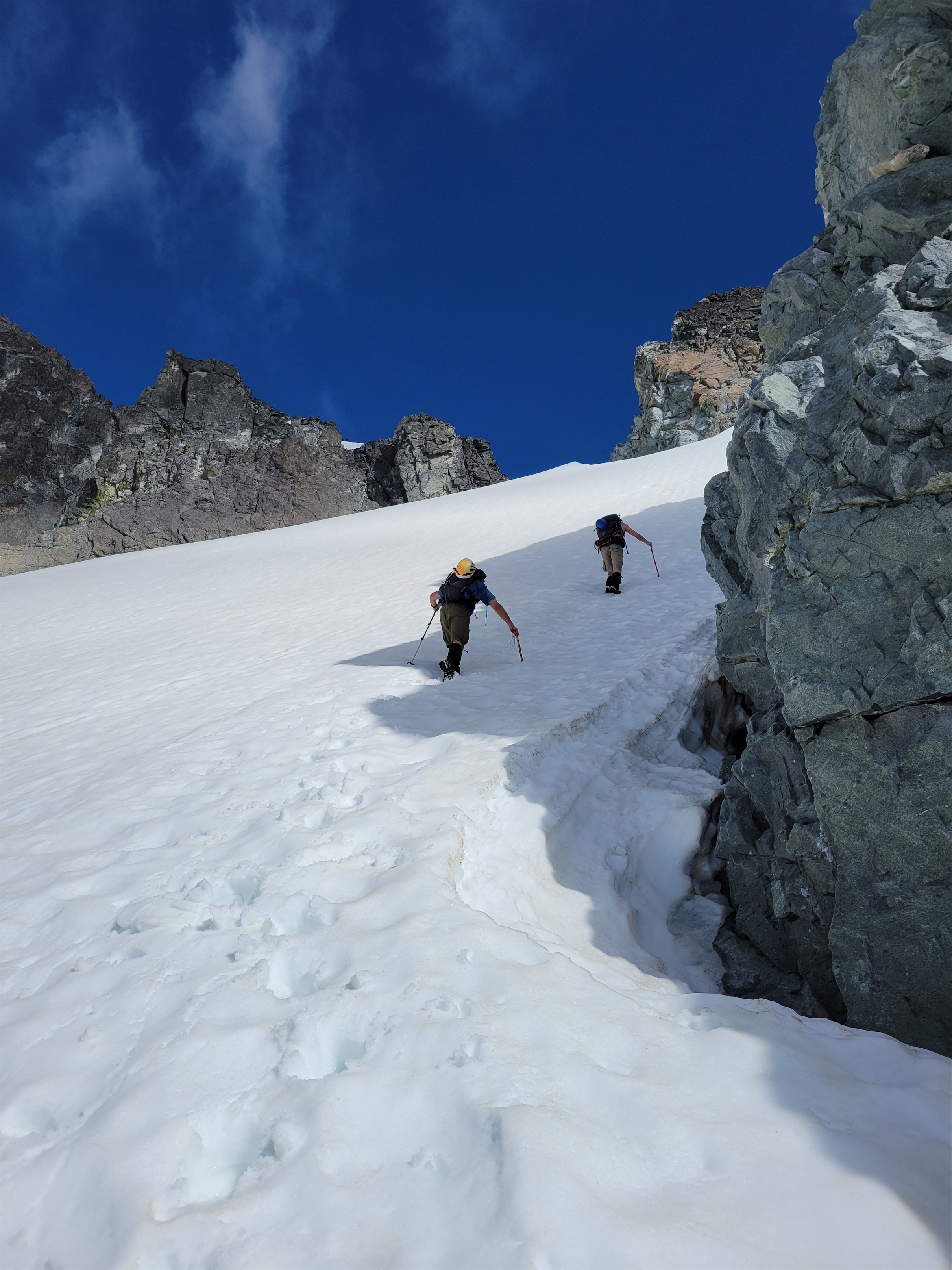
The standard route starts by heading up to the gentle col between Silver Lake and Lake Ouzel. But you make almost a 90 degree turn to head right/south towards a taller, narrower col on the south ridge of Spickard. This is very straightforward with good visibility, and the snow slopes are moderate but very manageable and with good runouts. My legs were starting to get tired. Rob and Jon took turns breaking trail, which was great because breaking trail is HARD and I was happy to have a (mostly) pre kicked staircase. Ben was bringing up the rear, aka everyone got the best pics of him while I only have pictures of Rob and Jon’s butts.

“Dark chocolate!!” someone shouted ahead of me. No way, the other party our new neighbors were up here too and dropped more chocolate? I started calling them the Chocolatiers in my head. I, too, am a chocolate afficionado. We have so much in common. Maybe they’ll want some of the 11oz of m&ms I’m carrying. I can’t wait to ask if their peanut butter cup was actually an edible. I got to the dark chocolate. It was goat poop. You jerks. You knew it was poop. They laughed. There are no chocolatiers up here. Only me and goats and poop and weirdos who don’t want to share my m&ms.*

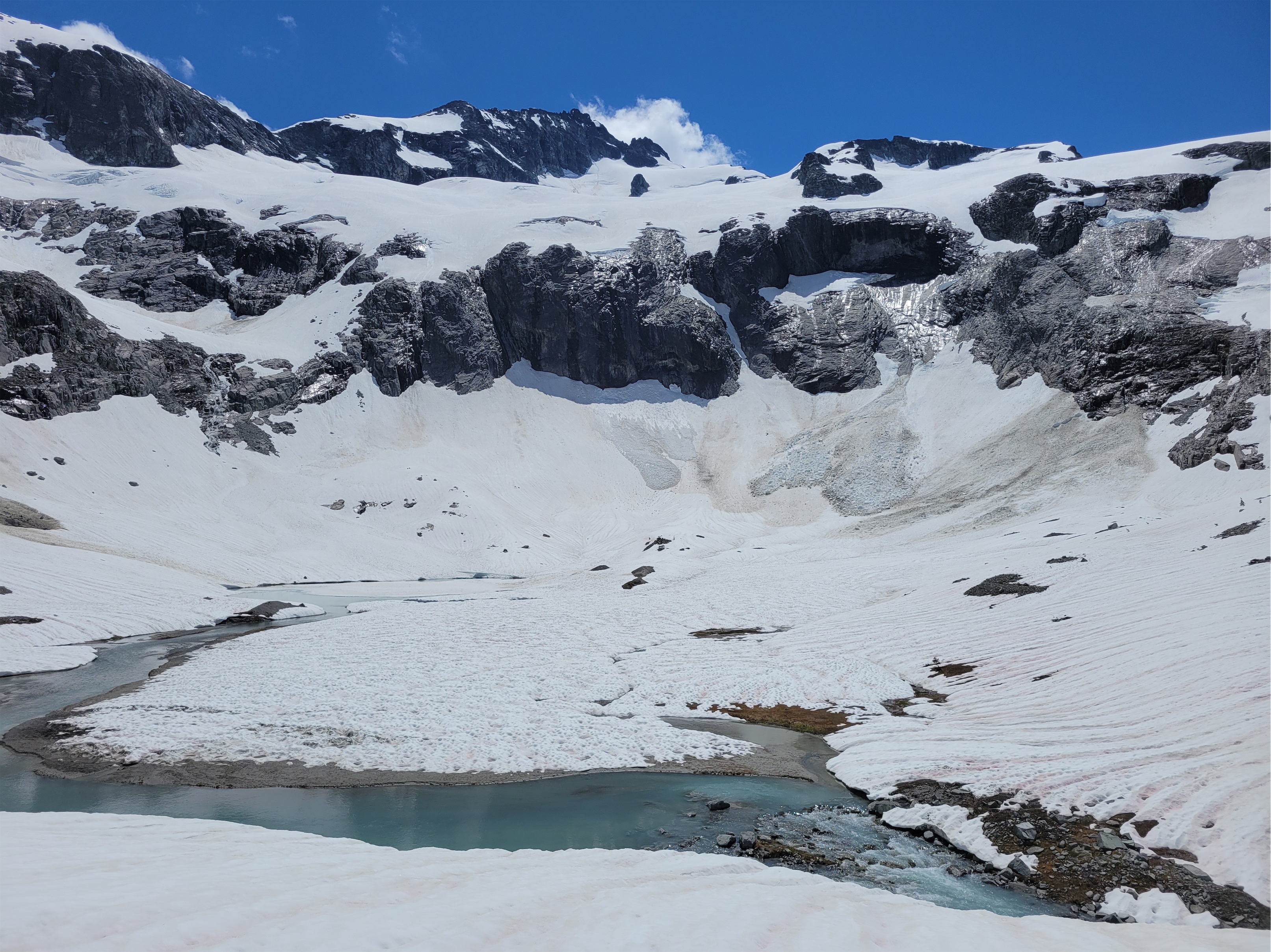
At the col, we could decide whether to scramble the ridge or take snow slopes. We chose snow slopes. We dropped down towards Perry Creek (someone came up from this side, I am dying to know who so I can pick their brain, we saw their tracks!) and then traversed over to Spickard’s south face where we went straight up snow. My friend’s son had attempted the Perry Creek approach a week prior but took 6hrs to go a single mile due to the terrain. Apparently NCNP rangers cleared a significant amount of the Little Beaver Creek trail only days later, which must be what these mystery tracks enjoyed. Unfortunately for us, clouds and fog started rolling over the ridge, with the summit in and out of the cloud. Of course. Of course that’s how this is going to go.
We gained the south ridge about a hundred feet below the summit, where we had a short but exposed steep snow traverse and then a 3rd class scramble move to make on loose rock. The steep snow traverse can be avoided by going left on rock and taking a much shorter steep snow climb (not traverse) to the ridge, but I didn’t realize that on the way up.
After the snow traverse I gazed at the scramble. I was officially wiped. My whole body was tired. I didn’t want a no fall zone. My pack was heavy my arms were heavy and looking at Jon and Rob making the move I thought ohhh no. There was a moat on the west side of the ridge I considered scrambling up, but it cliffed out, so the only choice was the ledges Jon had found. And then summit fever kicked in. I didn’t come this far to turn around just because I didn’t want to use my whole body to do something. And then I heard “it goes!” from Jon up above. Okay Eve get over yourself we’re fucking going. It’s like I forgot that climbing can be hard. You can’t just walk up everything. Of course it’s hard. If it wasn’t hard, it wouldn’t be half as fun or rewarding.
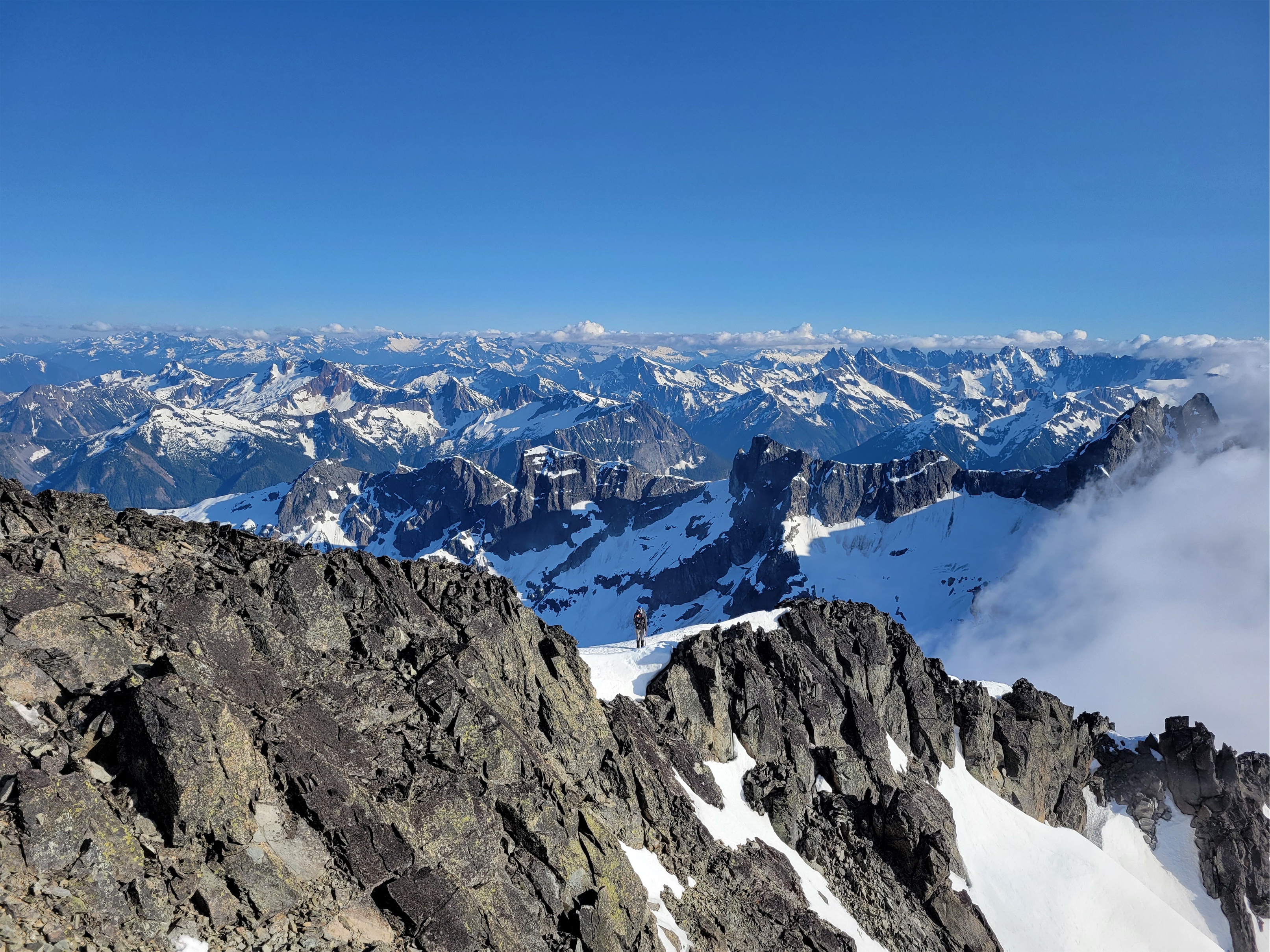

The scramble move wasn’t bad at all. Loose hand holds sure, but huge feet, and I think watching people do it is worse than actually doing it. My brain is definitely my limiting factor (maybe that’s healthy?). It actually reminded me I like scrambling (this will be a repeated theme this weekend). From there it was a quick walk to the summit, where clouds had moved in just in time to obscure all views to the west and north. THANKS SPICKARD. We didn’t get much of a glimpse at Silver Lake or at the traverse we’d be doing between Rahm and Custer the following day.

We snapped photos, had summit chocolate (thanks Rob!), and marveled at the mystery tracks coming straight up the north face. They seemed far too close together and perfect to be human (we had been destroying each others’ tracks all day) but what the heck else would be up there? Goats? A wolverine?! Wishful thinking. Had to be goats. The summit register had no names in it for all of 2022. We hadn’t seen anyone unless we miraculously barely missed them. We were totally stumped. Well as of today, Peakbagger now has a report from two siblings who did Spickard in A DAY (19hrs car to car) via the north face, so there you go. They went right by us at some point. Totally insane. Found them via social media (wow) and they didn’t find the border obelisk either. I’m now wondering if the obelisk still exists or if it’s under 6ft of deadfall from logging.

Ben offered me a caffeinated shot block, I devoured another pb&j roll and we started back down. I thought I had carried a ridiculous number of layers, but I ended up wearing every single one I was so cold. Luckily, going down went very quickly with perfect plunge stepping and glissading. We avoided the steep snow traverse by staying along the ridge for an extra 50ft and downclimbing straight down (less awkward than a traverse).
The caffeine kicked in, even if it was placebo (bc I think a single shot block only has like 15mg). I felt great. My legs felt great, endorphins were running high, we were on our way back to camp, look where we are! And there were ice worms! Ice worms are super cool little guys that can only live on glaciers. This particular species stretches from Alaska down to Oregon. Even when a glacier is fully covered by snow, the ice worms will stop within a few meters of the toe of the glacier. Us humans can’t tell when the glacier starts and ends when it’s under 10ft of snow, but they can. Their anti-freeze proteins that prevent them from freezing solid at freezing temperatures are a hot source of research too. They’ve even been used to help map the retreat of the Cordilleran ice sheet, which is how they spread south ages ago. And if/when glaciers die, the ice worms will too.

I’m sure my teammates were ready to punt me off the ridge hearing about ice worms for 20 minutes but it kept me occupied on the way down. My other favorite topic: why do you all only own grey, blue, brown, or black clothing? How am I supposed to get dope photos of you when you all look like rocks? Every one of my pics is like I spy or where’s waldo, alpine edition.
We followed our footsteps back around to the col where I was happy to find that the shady snow was also soft enough for plunge stepping and glissading! I had my whole routine planned out: Get to camp. Drop pack. Start stove with water that was left from climb. Refill water bottles while stove is boiling. Shoes/socks off. Lay everything out to dry in the sun, because of course back at camp, the sun was out and Spickard’s summit was back in view. Crushed my dehydrated meal and some m&ms and curl up in my sleeping bag. It didn’t go perfectly, but my yard sale was mostly effective and I was in bed quickly. “6am start tomorrow? What do you think?” “6am sounds good. If you said 3am I was going to bail and stay at camp.” I laughed. Sweet. 6am it is.
*This is actually a very acceptable trait in anyone you hang out with because it means you can always eat their share of chocolate


Nice write up and awesome pictures – they do a good job of capturing the atmosphere! I was one of the two who did it the day before you guys. We shared many of the same sentiments as you guys (not being able to see our feet on the vastly overgrown trail, that ‘is this really the stream crossing??’ segment, the surprisingly slow going to Ouzel lake from above the falls etc.). It definitely is a unique experience.
For us, the worst part of doing it in one day meant starting at midnight, with the darkness making it quite a challenge to find the ‘trail’ before the falls. I think we spent about 75% of our time there bushwhacking! Anyone thinking of doing the same, I recommend a very good headlamp.
LikeLike
Pingback: Chilliwacks Day 2: Rahm & Custer | Have Tent, Will Travel