

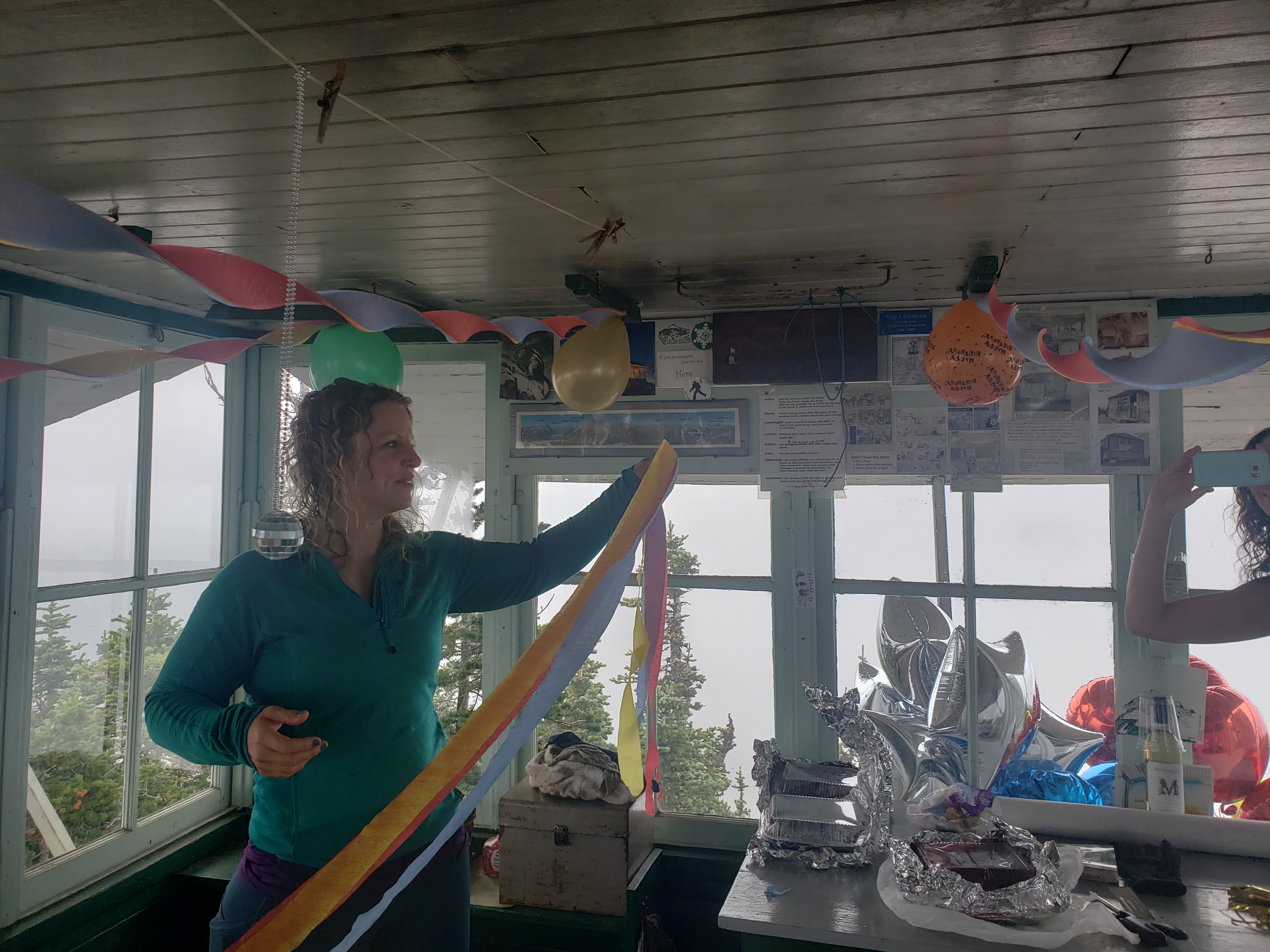
I have wanted Challenger since like… 2015, probably. I don’t remember where I first saw it or heard of it. Over the following few years, bureaucracy, lack of PTO while I was contracting, grief, lack of fitness, lack of interested partners, a million things became reasons to push it off every summer. In fact I think I’m having an existential crisis right now because two peaks I’ve been looking at but was never able to find partners for (Triumph the week before and now Challenger) have come to fruition in the past two weeks and it reminds me why I don’t like setting goals. Because what do you do once you reach them?! Most people feel pride and accomplishment and I just feel like now there’s a hole, an empty space where there used to be a dream. And if I could do it, was it really that ambitious of a dream to begin with?
Anyway, saving the existential crisis for later, let’s get to some stats. Jon’s Garmin died the last day so these are estimates but they seem in line with other reports.

- Distance: 44mi
- Elevation gain: 18k total, LOTS of up and down wow
- Weather: 70’s and sunny
- Commute from Seattle: ~2:45 without traffic
- Did I Trip: No legit ones actually but that’s probably because I crawled for like 30% of the trip and you can’t trip when you’re crawling
- Great beta from OneHikeAWeek as usual
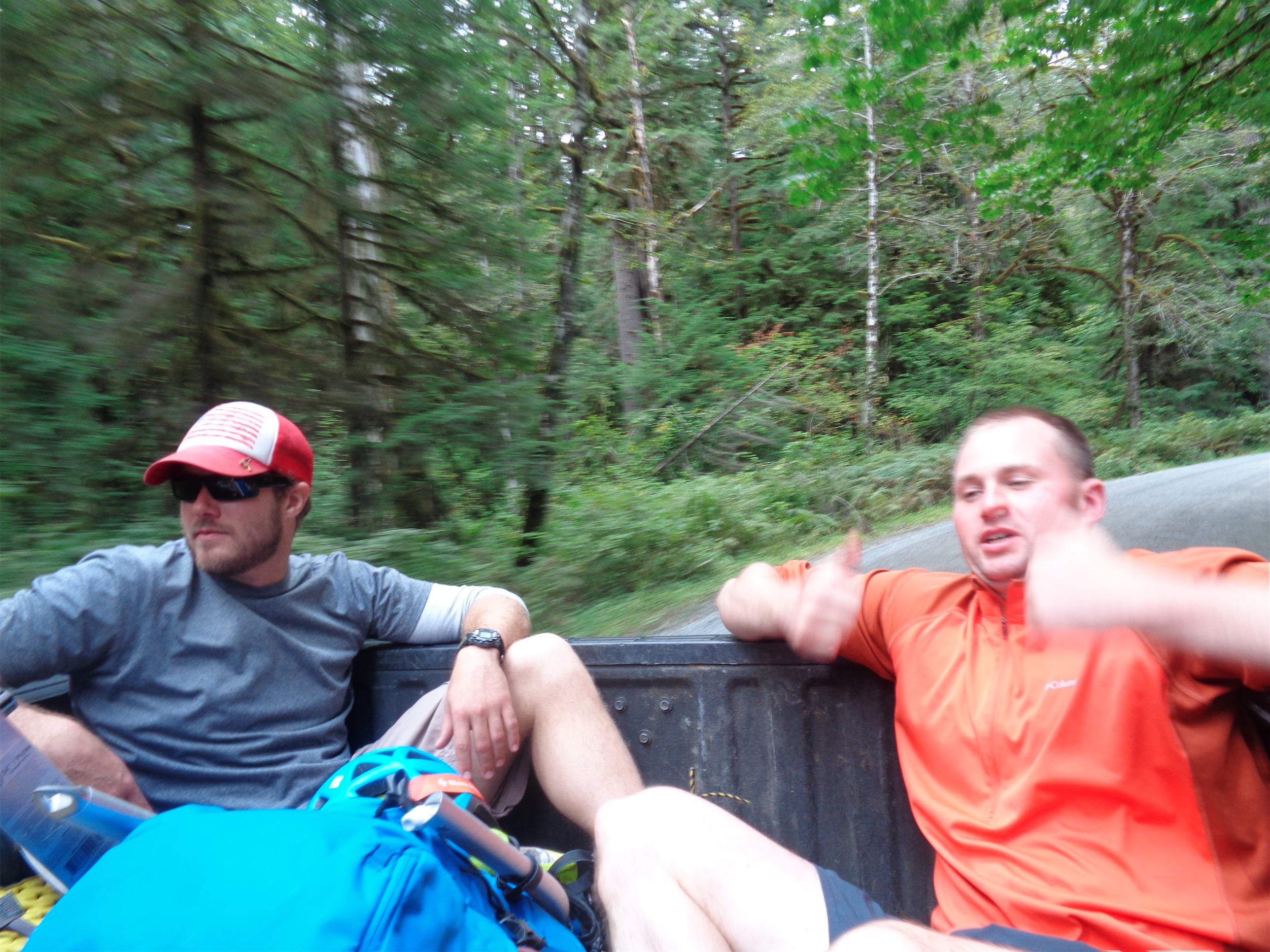
We got a late start on Thursday after dropping Sammy at boarding and picking up permits at the ranger station. “Are you aware of the situation up there?” My mind flashed to caution tape and helicopters and serial killers and ancient graveyards and rabid bears and massive trail damage due to suspiciously localized earthquakes. “The… the snowpack?” I said as I stared blankly at the ranger. “Yeah, we know it’s way snowier than usual.” He hyped up stories of people swimming through waist deep snow. Maybe postholing, but no one’s swimming through snow that deep this year. We were just out last weekend. We’ll be fine. We got our permits and went on our merry way wondering what the heck “the situation” would be like.

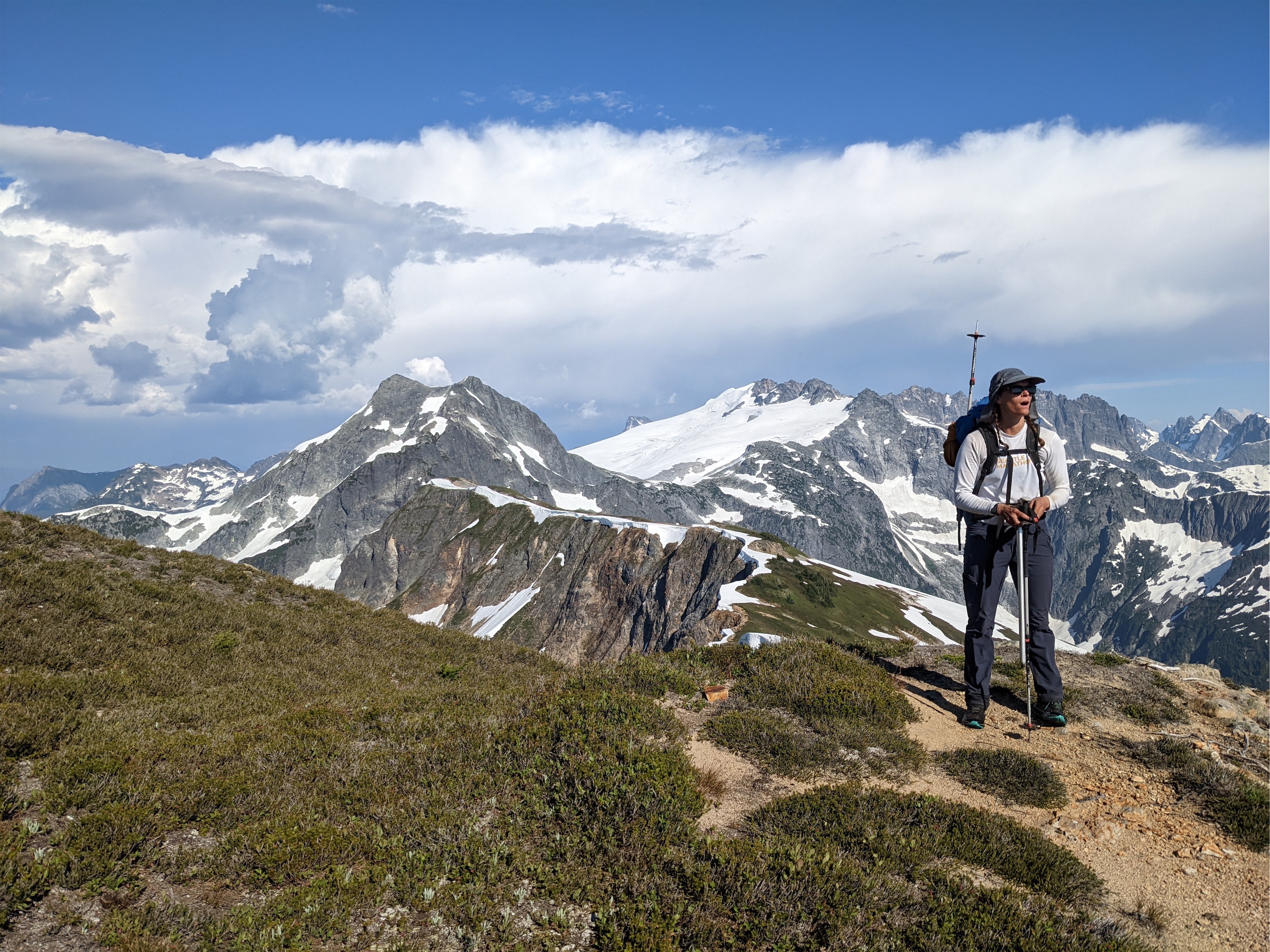
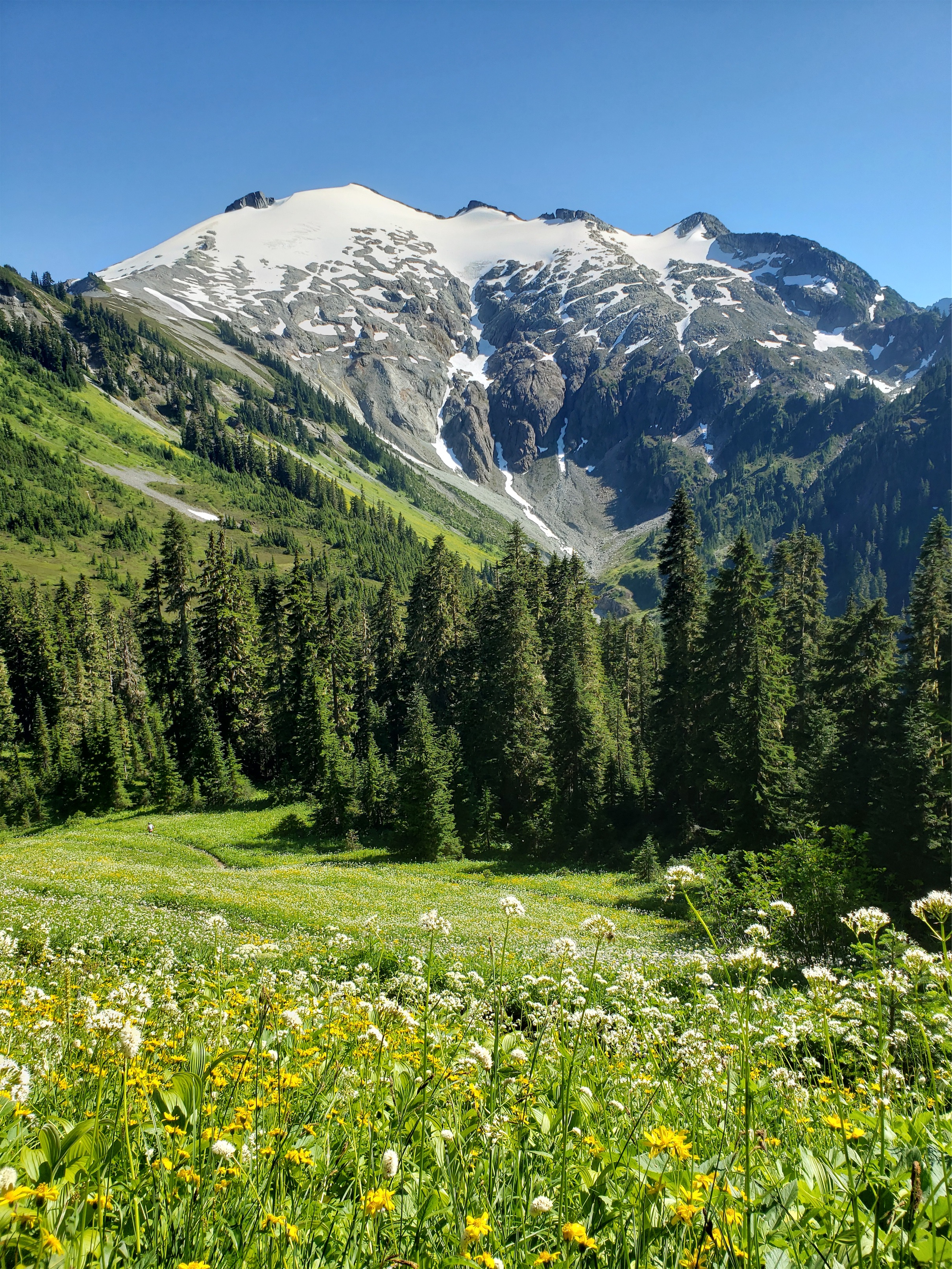
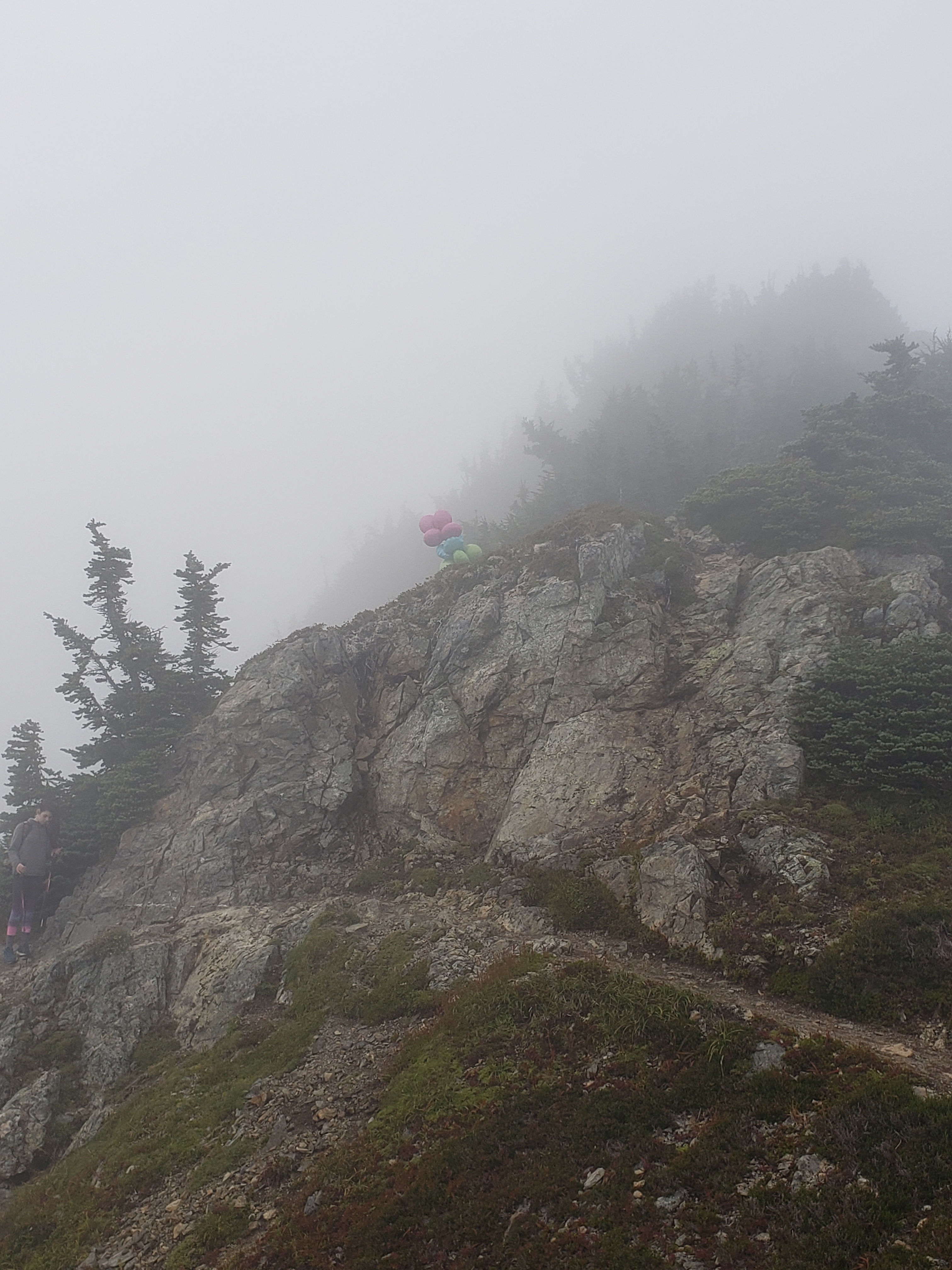
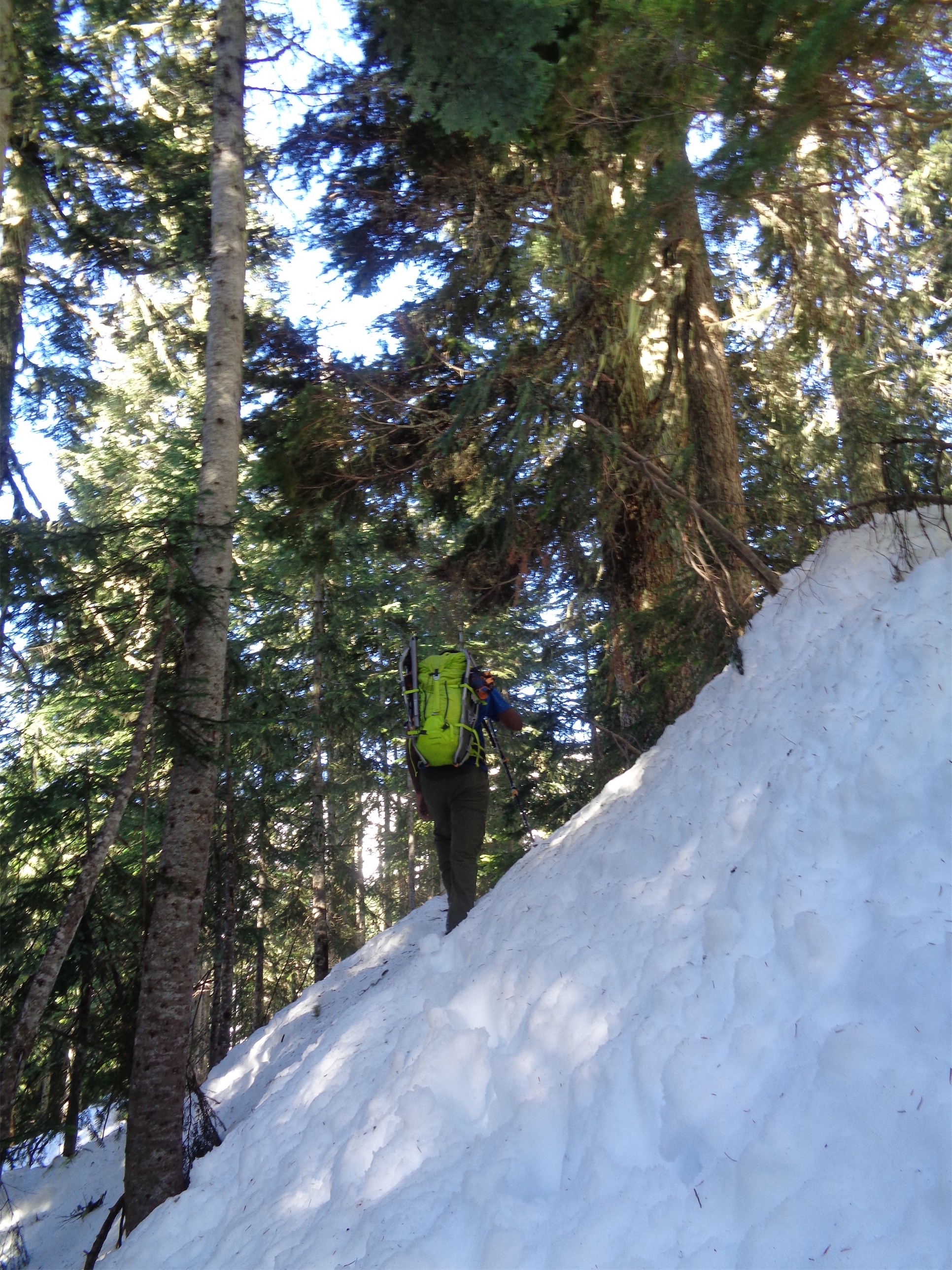
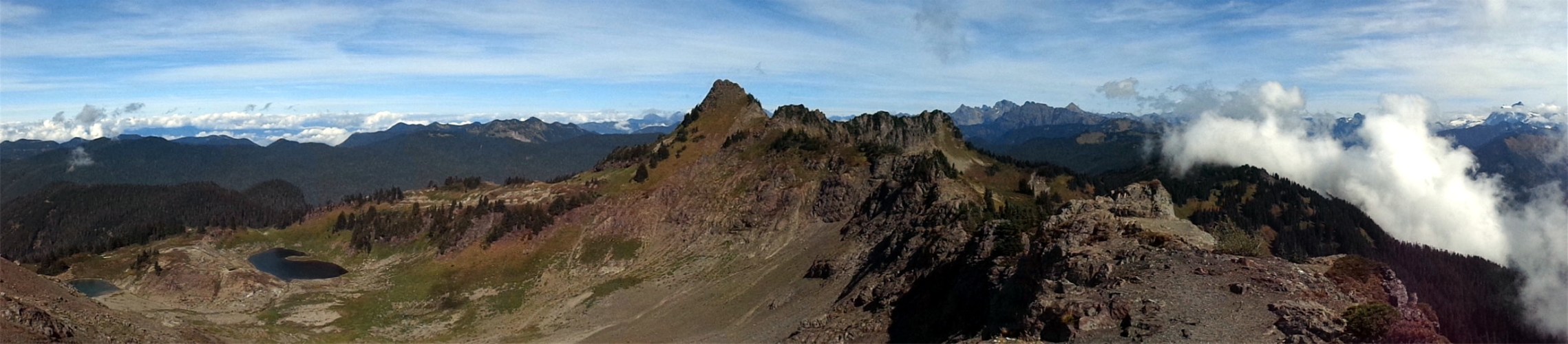
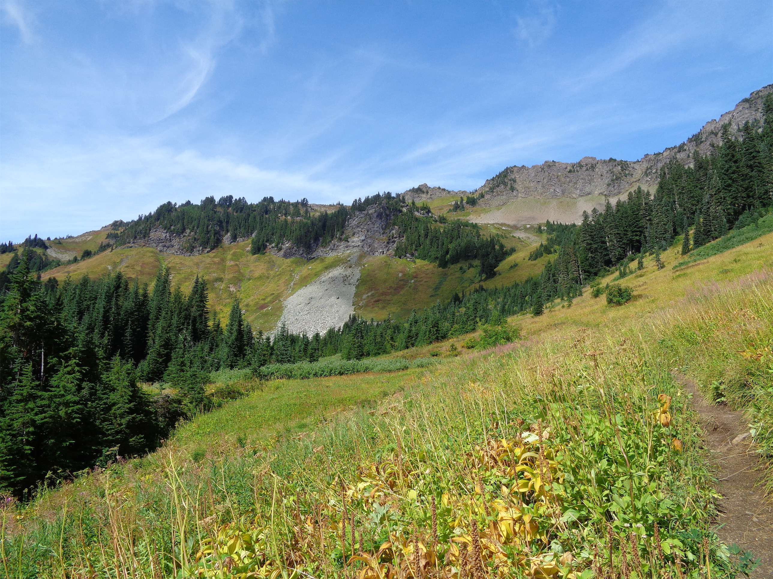
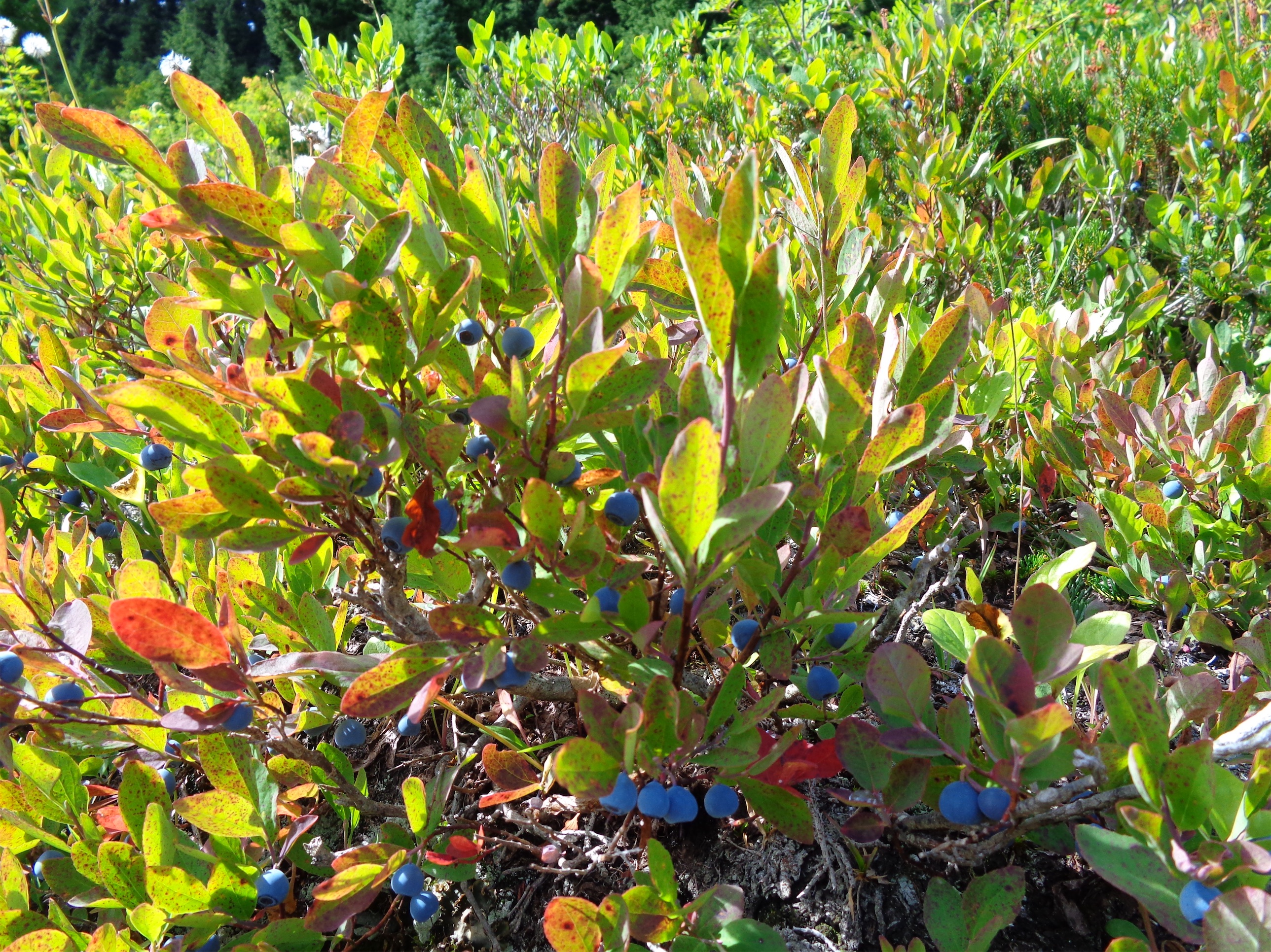
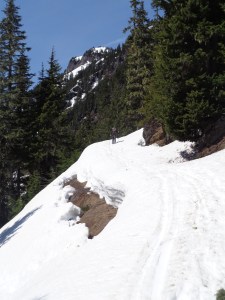
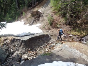
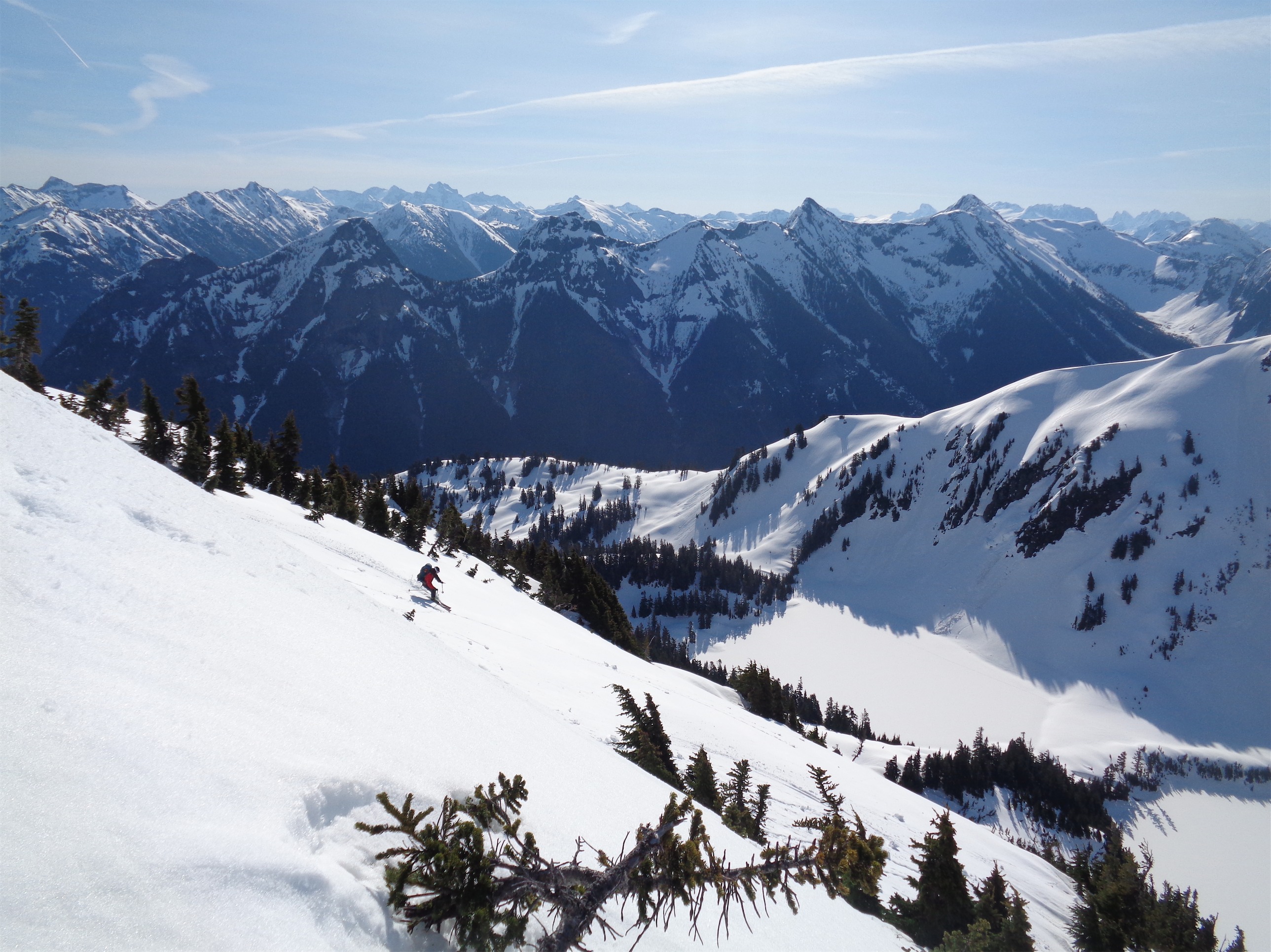
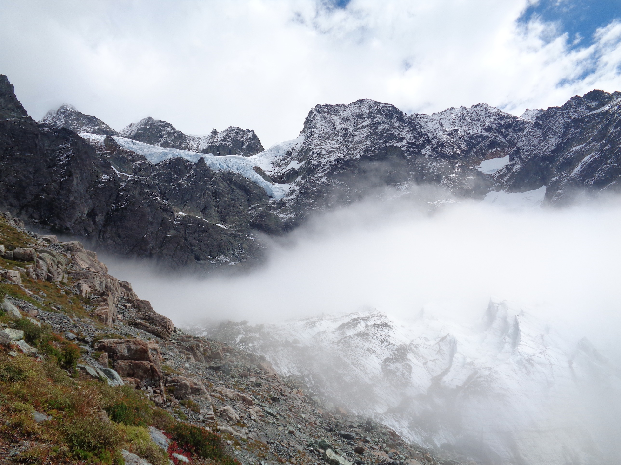
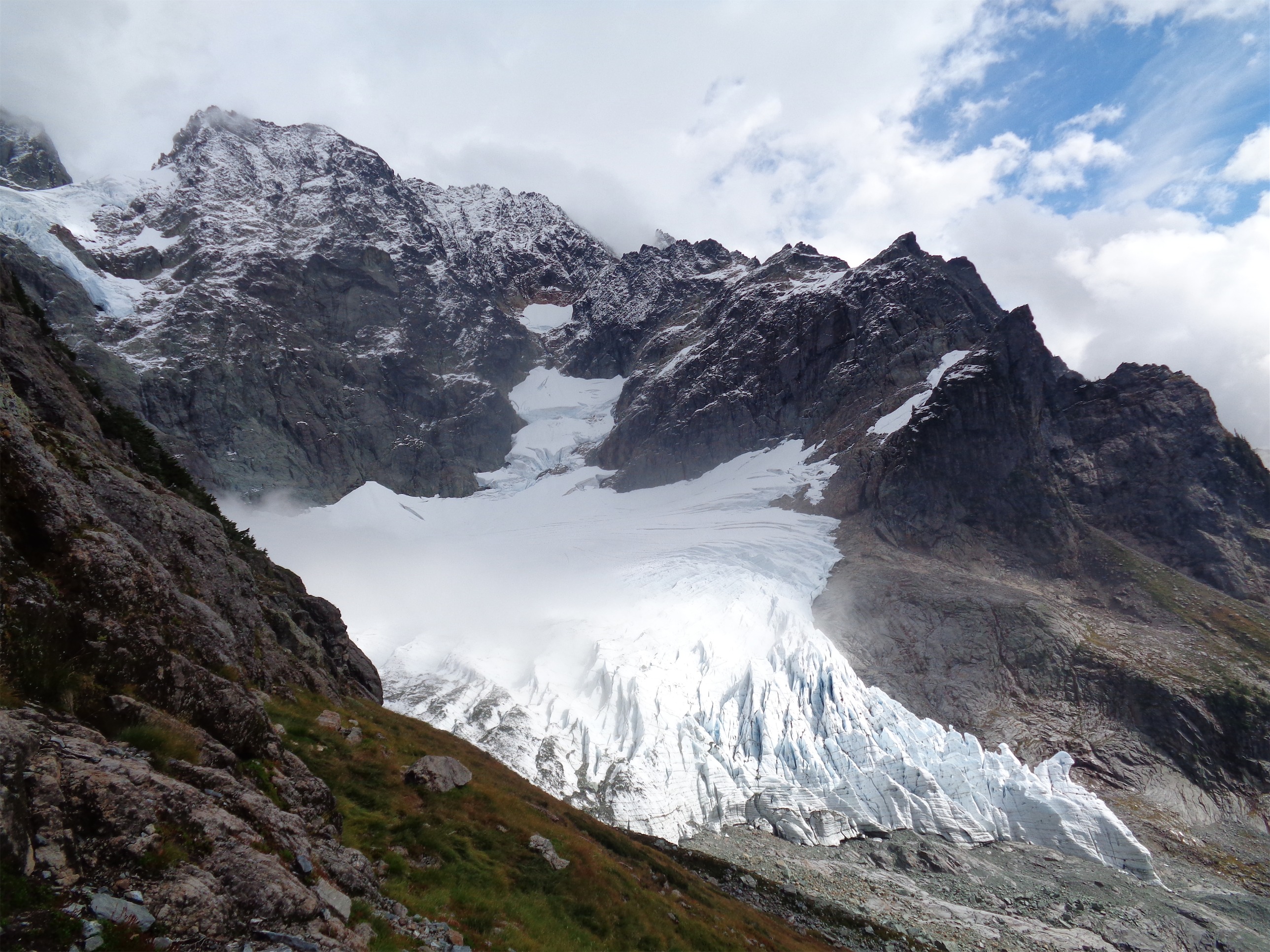
The Hannegan Pass trailhead was not too full, we were able to park nice and close to the washout. I actually love this trail. Well sort of. It’s HUGE bang for your buck in terms of effort to views, the only catch is that I’ve never experienced a trail SO DRY despite having SO MANY WATERFALLS running across it. There are streams like every fifth of a mile and yet you feel like you are mummifying in a desert for the majority of your hike. We slogged the 4 miles up to the pass in the sun and took a leisurely break, chatting with some hikers coming down from Easy Ridge (only 6hrs from Easy Ridge to Hannegan Pass, which was a good sign for us) and seeing a familiar face come up from the far side of the pass. The ranger who gave us our permits for Triumph the prior week! He had told us he’d be opening the Copper Ridge lookout but I figured no chance would we run into him. He independently brought up how dry and sunny this trail is. We laughed and shared some trip conditions and stoke before he went to head home and we went further out into the wild.

We finished out the 3.5mi to Copper Creek Camp around 3pm. Some of the creeks in the Chilliwack valley are like waterslides, carving their way through slick smooth rock instead of the rocky rivers we’re used to hopping across. Super cool features. The trail also loses a deceptively large amount of elevation. I don’t know what it is, I don’t want to know what it is, I just remember thinking shit, this is downhill ALL THE WAY TO CAMP AND WE HAVE TO COME ALL THE WAY BACK UP IT ON SUNDAY but that’s a problem for future me.

Copper Creek camp was, for lack of better words, lovely. Downright pleasant. I don’t think I’ve ever had such a chill day (which was funny, knowing what was about to come). We hung out at camp, found the two pit toilets, carb loaded, I think I even took a nap. There were no bugs, just warm dappled afternoon sunlight through the trees. Even the bears stayed away from my extremely accessible food. ONE COMPLAINT: People left toilet paper all ove the ground! Some mere feet from the toilet! Is the toilet too camouflaged? Do you have something against pit toilets? Omg people. Take care of our outdoors, come on. At least bury it.

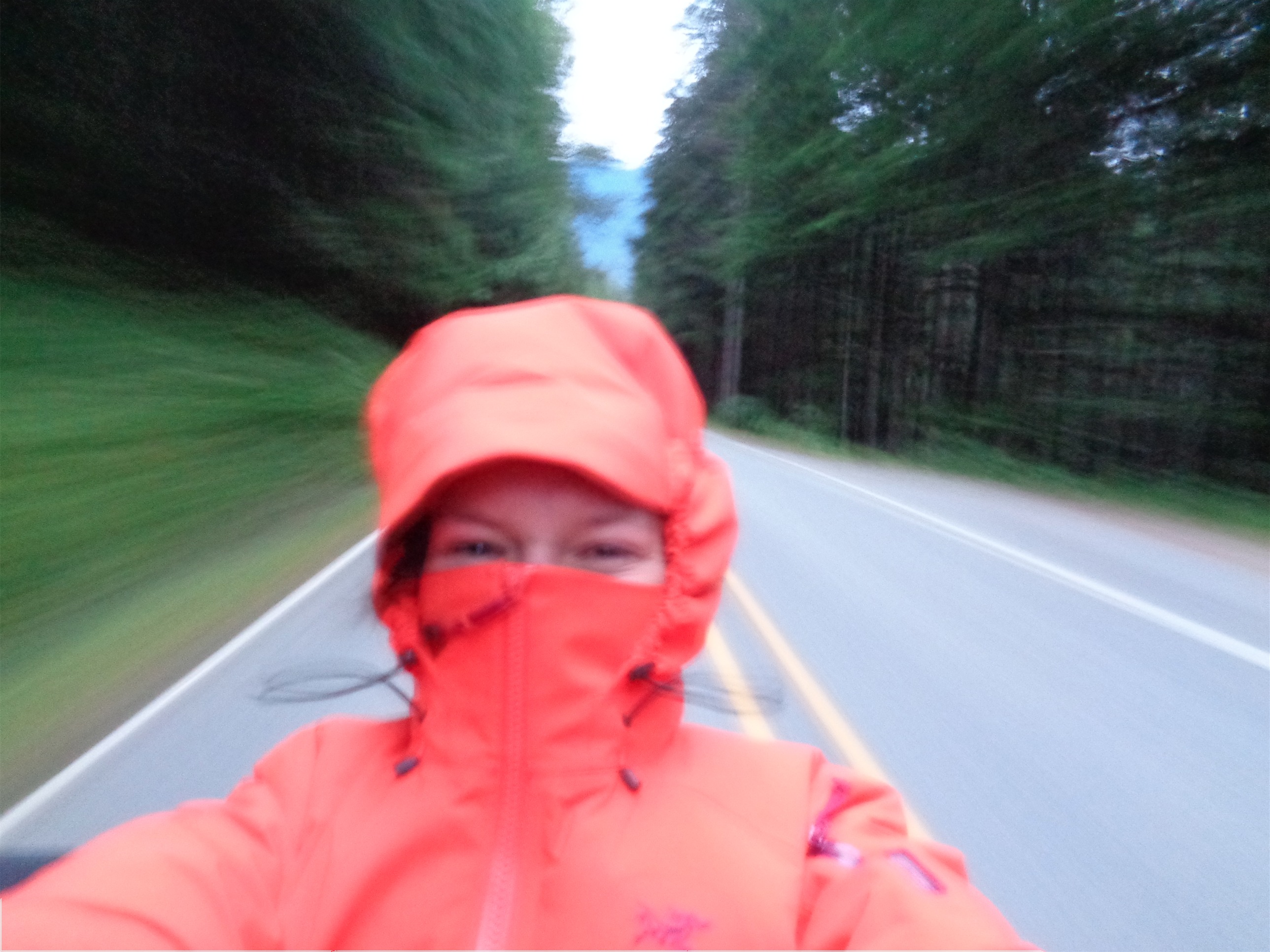
We got moving around 5:30am knowing we had a long day ahead of us. John shook out the tent, which always makes me think “shake shake shake” which turns into shake your booty. So the next few hours would be full of me repeating that chorus. There is supposedly a trail to the river ford, we didn’t find it. We did find a log that I strongly disliked but still crossed thanks to stubbornness and a burning desire to not take my shoes off so early in the day. But I swore I would not be taking that log on the way back. We found the Easy Ridge trail quickly, and I’d say it was easy to follow for maybe 85% of the time. I did manage to get us off trail where we ended up cutting a switchback, but we re-found it quickly thanks to gpx tracks (Jon’s being surprisingly more accurate than my AlpineQuest app, which had yet to let me down, more on that later). We crested the ridge around 8am, but that didn’t mean much, because the ridge goes on forever. And the bugs were bad. Really bad. I had a sweet potato baby food. My new Invisalign strategy is liquid calories thanks to two recommendations I got last week. The sweet potato wasn’t as bad as it sounds I was ready to gag but it mostly tasted like fruits. Instant sugar, let’s go.

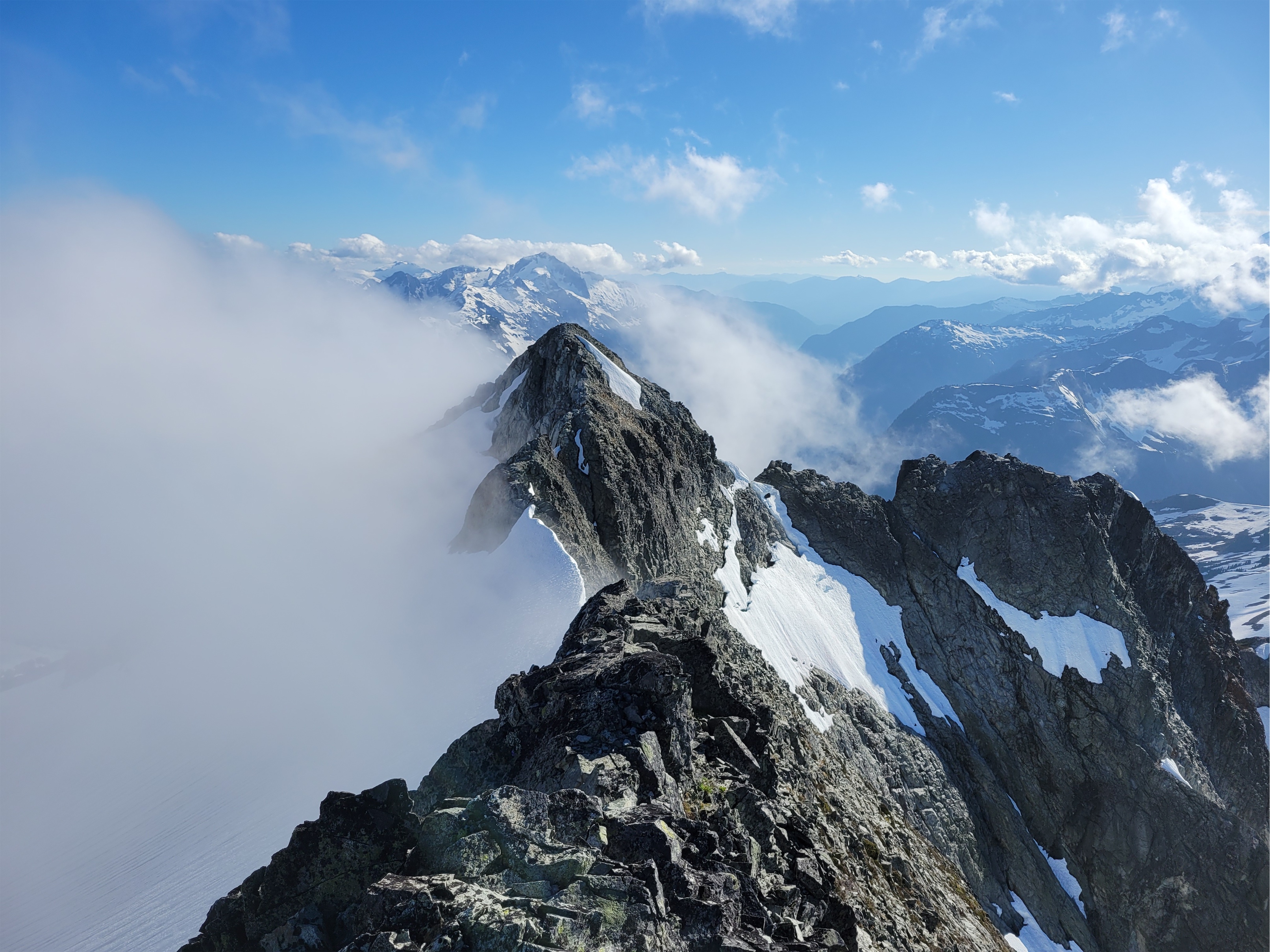
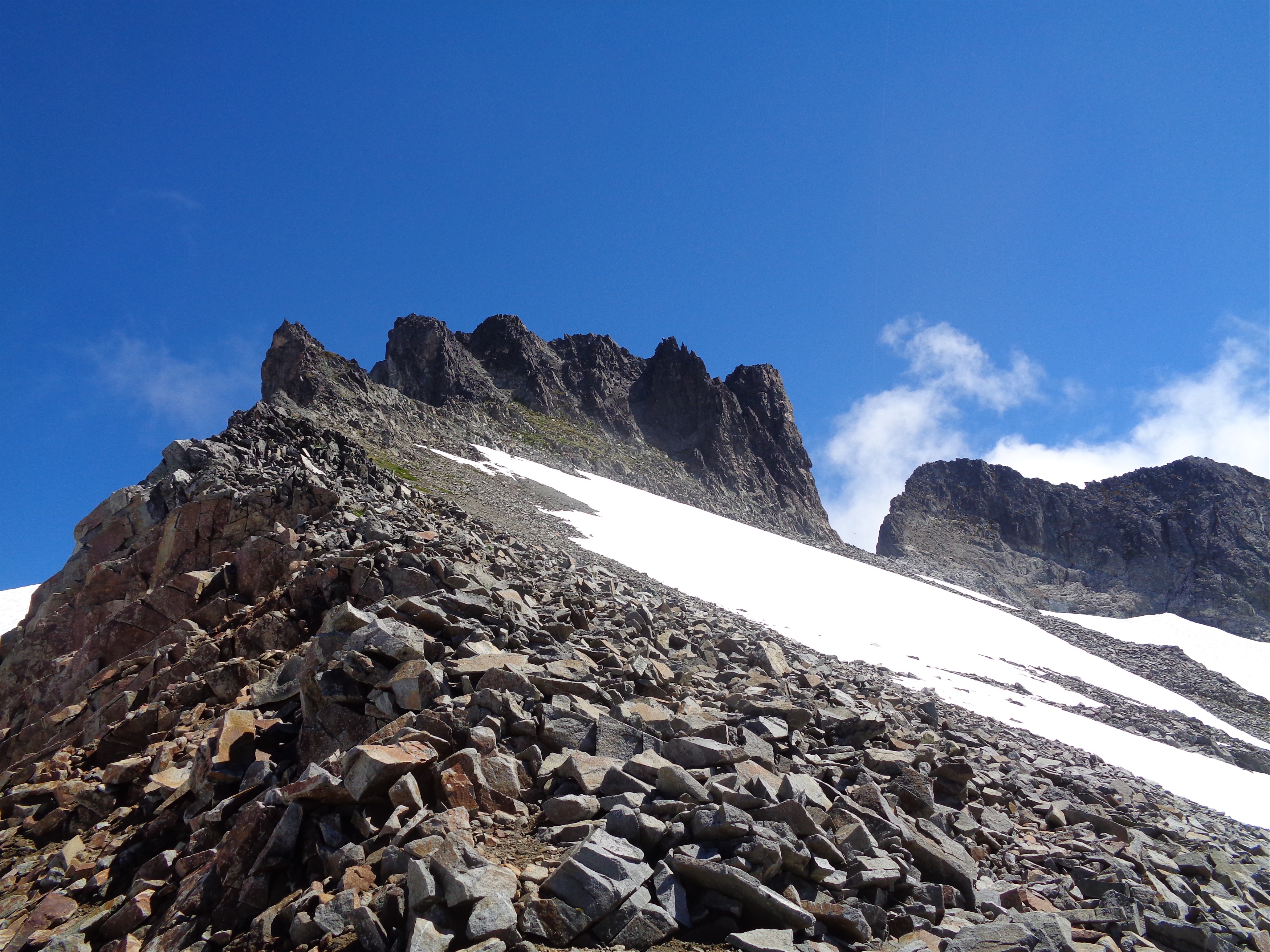
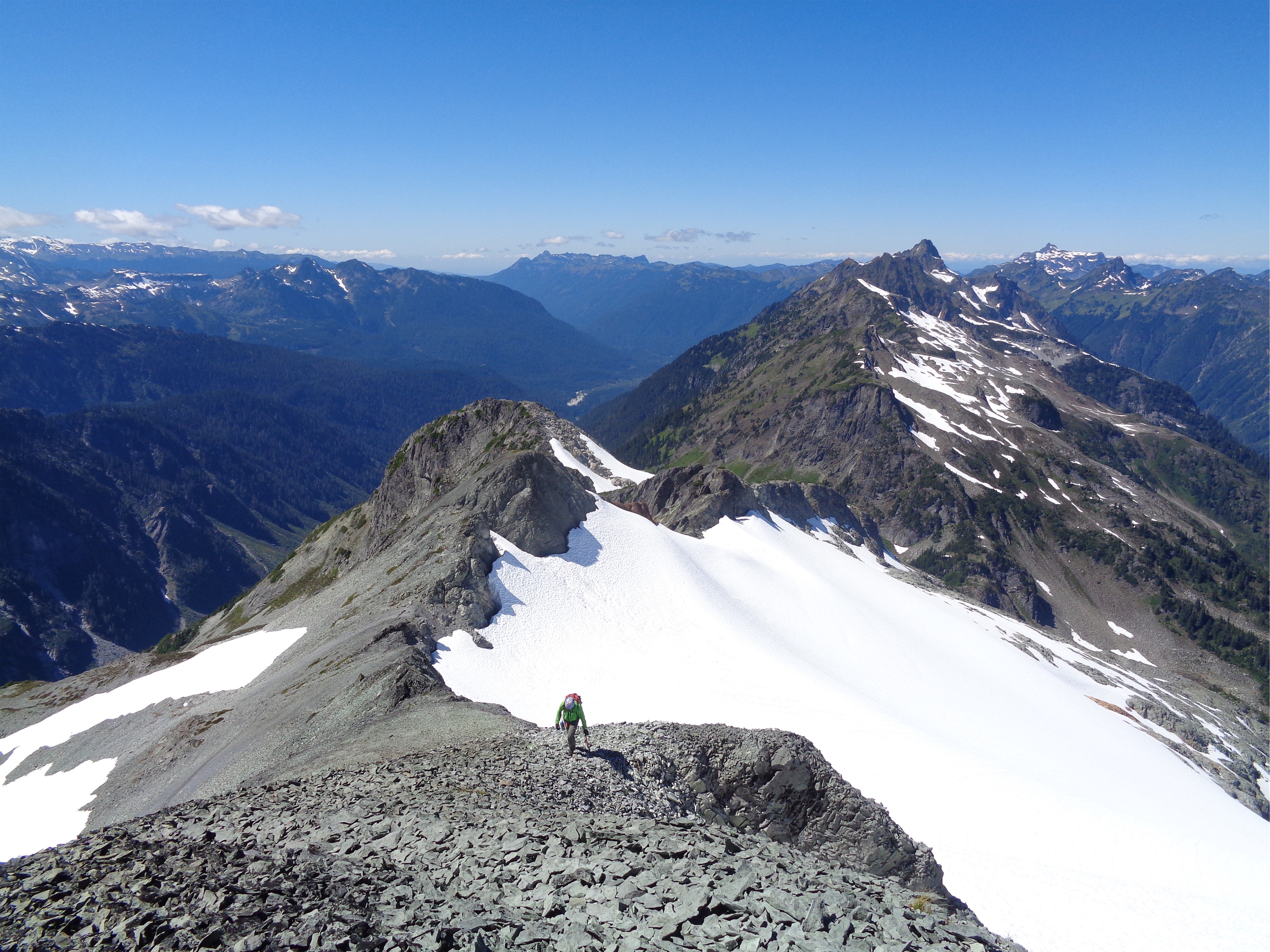
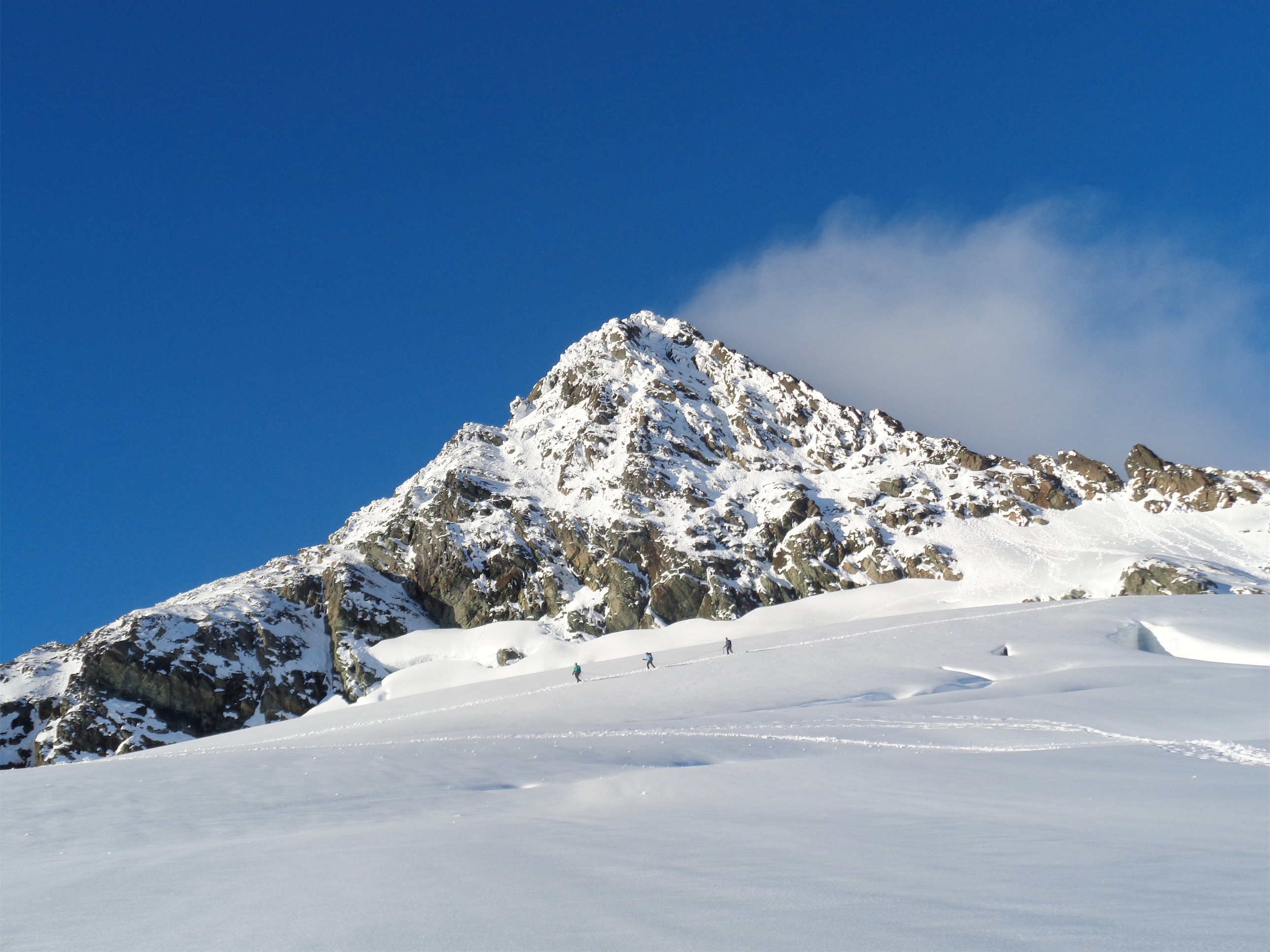
It was an easy walk past tarns and mellow slab highways and meadows to the false summit of Easy Peak, where I looked at the real Easy Peak and said ah shit, that doesn’t look so easy. We took a brunch break to crush some calories and when we stood up I said something like “well, let’s get to a point where that snow and scramble doesn’t look so intimidating.” Except that point never came, because we ended up scrambling some wet slabs up to a patch of steep snow that we ascended without ice axes or crampons. That snow led to a crumbling mess of a peak where we topped out 30ft later. And that’s where the good stuff started.
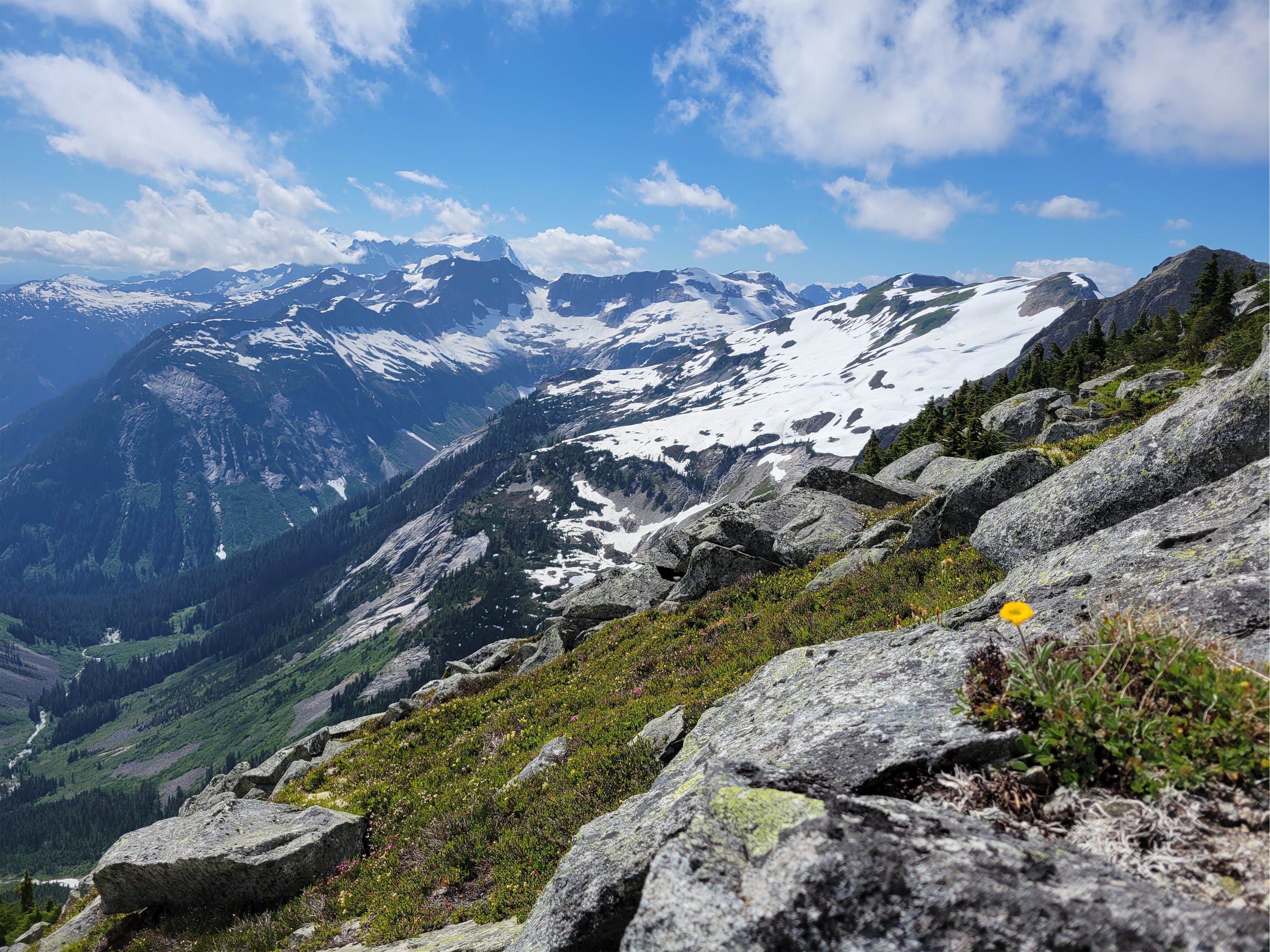
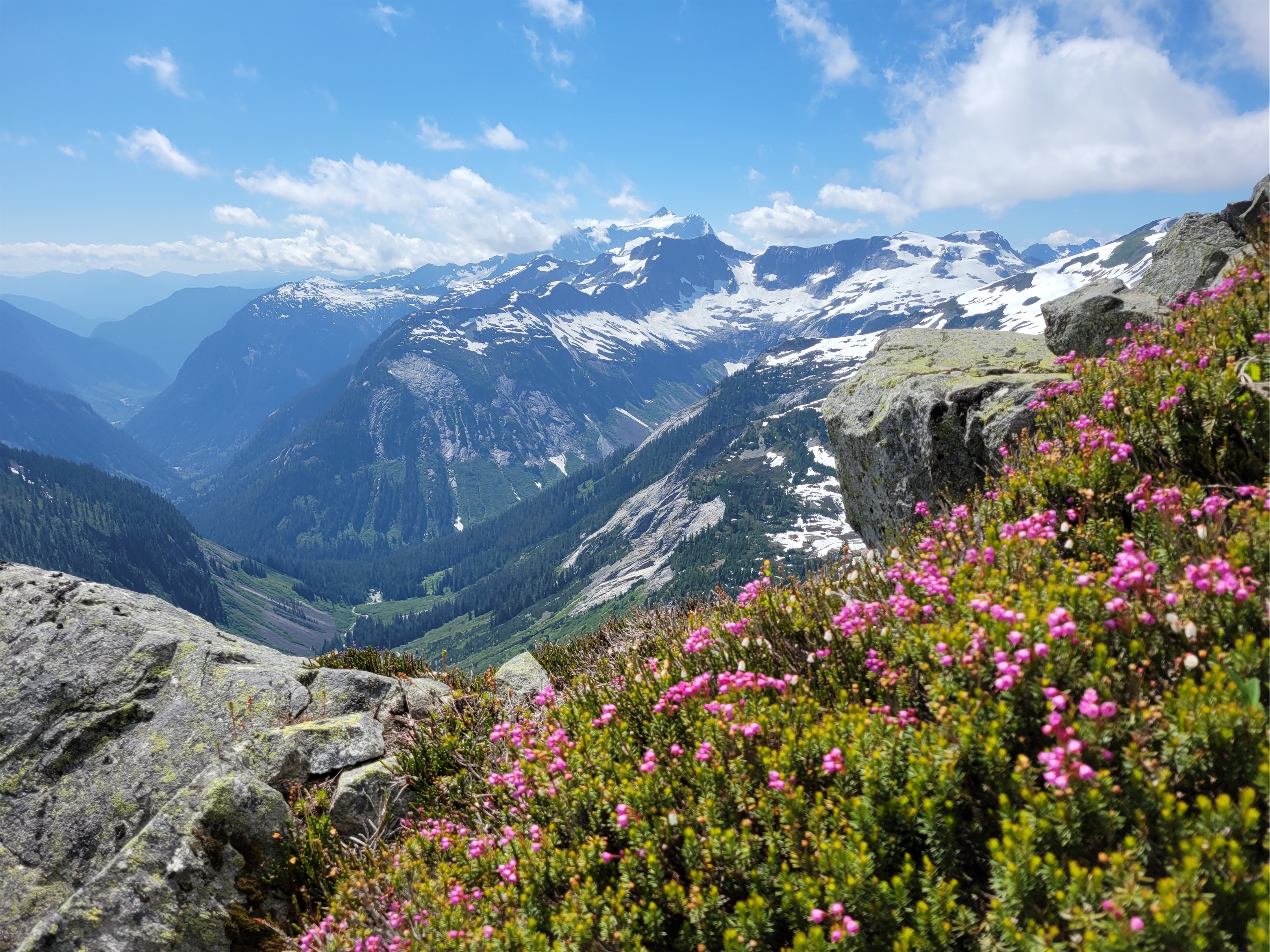
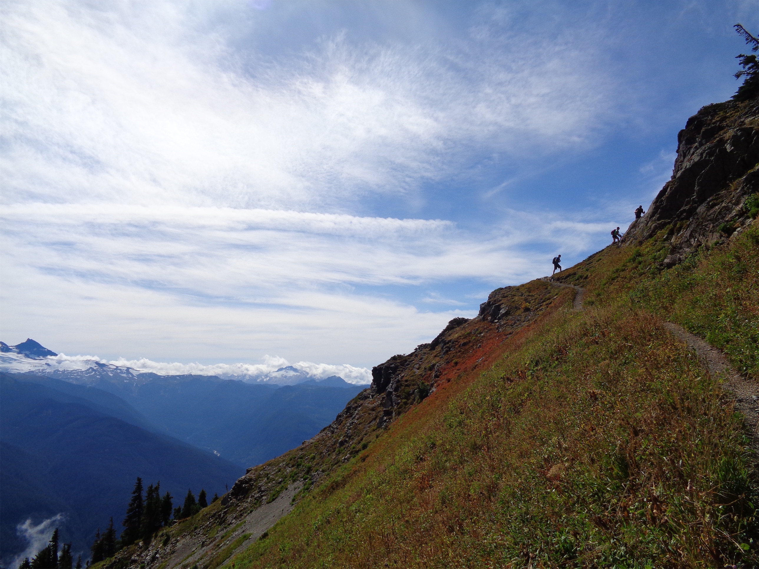
Easy Ridge is gorgeous, and the second half past Easy Peak is like 100x better tahn the first half. Only problem is there are fewer tarns (that could also be a pro depending on your feelings about views and mosquitoes). We were half in clouds, half in sun. I suddenly saw something sprinting away from us: BEAR! He was hauling ass down the snow while we stood there dumbfounded.

We dropped off the ridge to the south and started the long downward traverse to the Imperfect Impasse (or the Perfect Impasse? it’s not an impasse because you can pass it so Perfect Impasse seems wrong but I think that’s what it was originally called). It’s this miraculous canyon ripping down Whatcom’s ridge that has exactly one sketchy section you can scramble through. Except we had one problem. We didn’t really get any beta for the Impasse, because everyone had said they usually get skunked so you should just ignore it and drop 2000ft of elevation to go around the bottom where the canyon opens up onto normal talus slopes. The first wobbly piece of talus cued surfin safari, which finally replaced shake shake shake.
Well. I beg to differ. Try to find the impasse. Holy shit.

We dropped down through some brush (there IS a better way where you can follow talus the whole way) and some wet slabs before popping out at the base of the Impasse. Believe me I made that sound way faster and more pleasant than it was. But we weren’t mentally and emotionally wrecked yet, that part came later. We crossed below the canyon on snow, hearing the running water below us and having no idea how thick the snow bridge was. But suddenly we saw bear prints. Well I mean if it held a bear… it can probably hold us? Walk carefully. We scrambled up the other side of the canyon on vegetated slopes and suddenly I hear HEEEY BEAR! from Jon ahead of me. I pop my head over the hill and see Jon standing across from a bear at a stream. Holy shit. The bear lumbered away while Jon shouted HEY and then turned around to see me ready to bail back the way we had came. We pushed forward with Jon shouting “hey bear” and me talking to the bear like the Guardian of the Alpine. “Hiii bear we’ll just be here for a few minutes sorry” “Please let us through real quick we’ll be gone soon” “Ok but you could have worn a better trail here this one is kinda shitty you can do better than that” “Ok Mr. Bear we’re going uphill now thanks for letting us use your traaail!” Very kind of him.
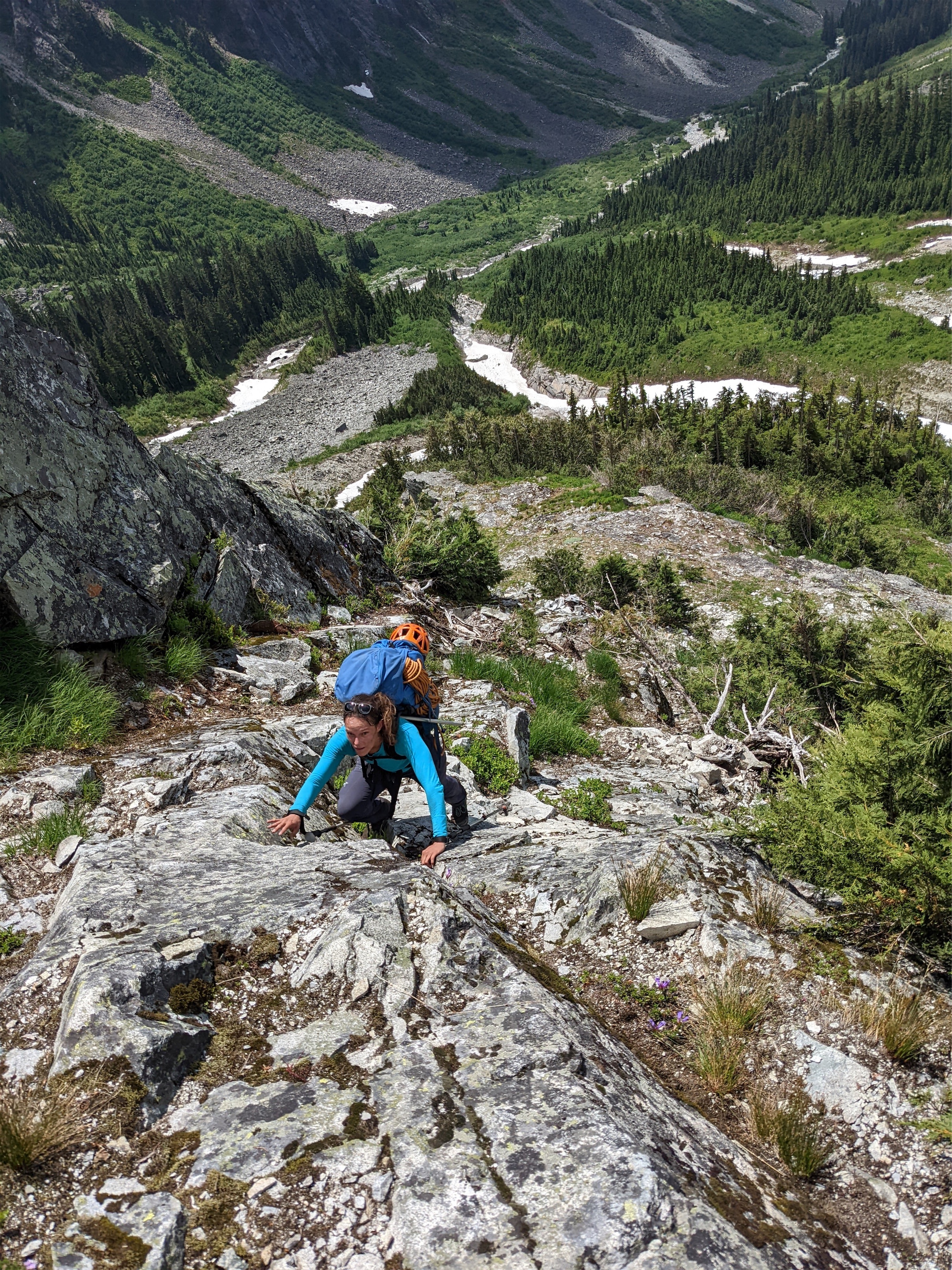
We gained a brushy ridge. I definitely read a trip report that said “just pick your way up the basin and avoid all the brush” and instead our GPX track went… straight into the brush. We started cursing its owner, who said he had uploaded the down route because his up route was so bad. Did he upload the wrong route? Who goes through this?! WHO DOES THIS? I swear we were doing like 5.7 rated tree climbing. We saw a gully to the right. Why doesn’t anyone take the gully?! Must be a reason. Back to the trees. We found a water bottle, so some other dumbasses had gone this way. My pole strapped to my pack kept getting caught on branches. Loops of the rope kept getting caught on branches. I can’t believe I didn’t rip or break anything muscling through those trees. My sunglasses miraculously did not get slapped off my face. We saw the gully again. This is BULLSHIT I started cursing under my breath. I was getting belligerent. Manhandling trees. Jon burst out from the trees and saw the gully a third time. THIS IS RETARDED!!!! I followed in quick succession WHO CHOSE THIS WHY DID WE LISTEN WHY ARE WE HERE I was just relieved he was raging with me.

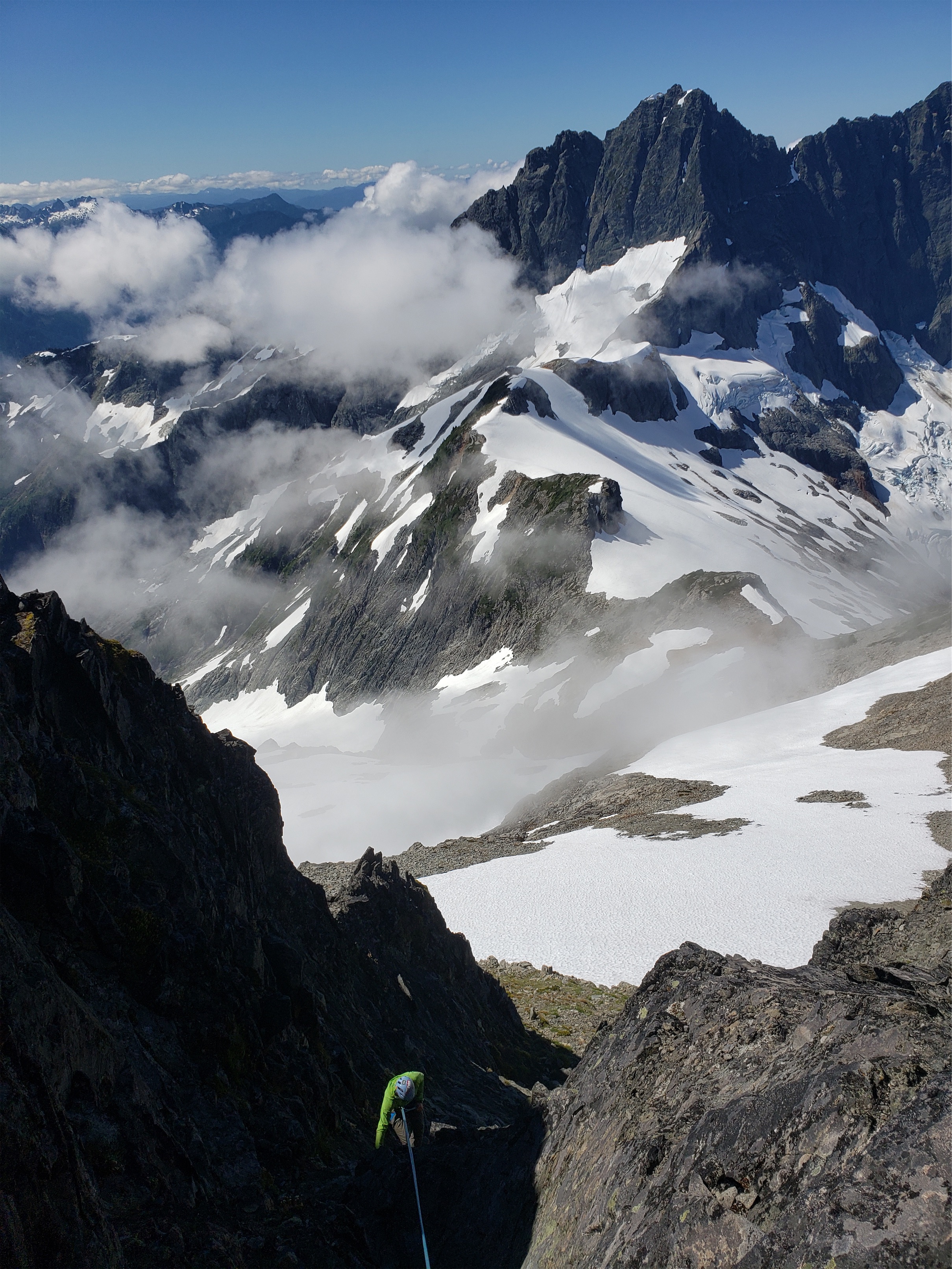
We continued upwards to slabby rock. This must be the section people rappel. Surfin Safari was placed with “now walk it out walk it out” on loop because that’s how I feel on slab. Run it out. So next time you’re in the alpine admiring views just think somewhere is someone on a slab vibing “it’s on once again, patron once again, I threw my hair back, then I froze like the wind, west side WALK IT OUT” oh hey look a rap sling. Jon got onto the arete proper. I stayed on the lower slabs, which felt like the last pitch of Ragged Edge on Vesper except there were no views and no cute flowers and no pro. Jon’s arete seemed downright pleasant with nice features and sticky rock. Another rap sling at the top (I think for two 15m raps vs one 30m rap). We took another break. “I hate slabs” I announced. “No you don’t, you do them all the time.” Touche, sir. I was tired and pissed from the trees and frayed from the scramble. There’s no way the impasse is worse than this. I pounded another baby food. We kept moving. 20ft higher was a way better break spot with way better views. I hate when I do that. “Perfect Pass better be PERFECT” Jon announced. You’re damn right it better be perfect.

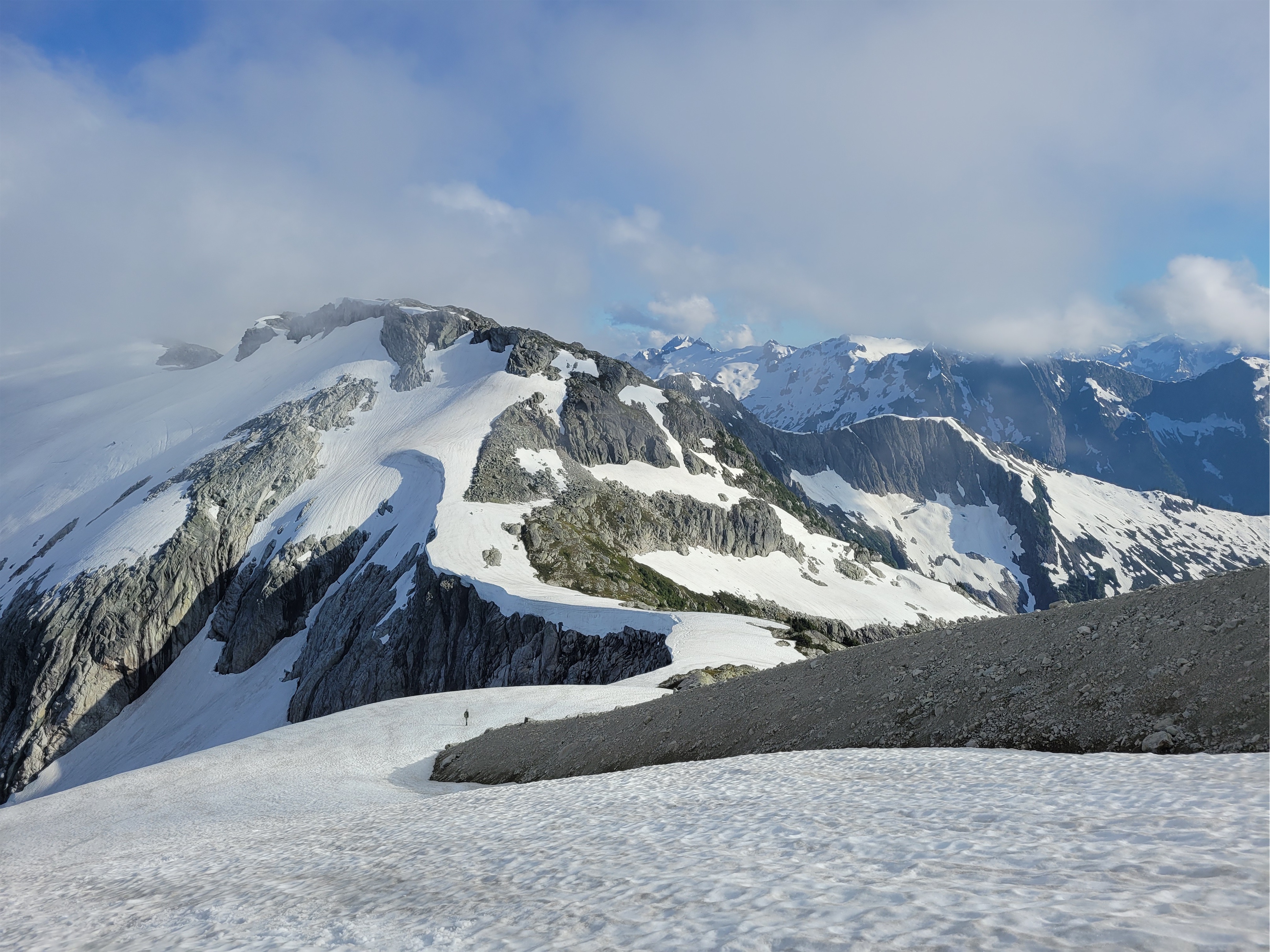
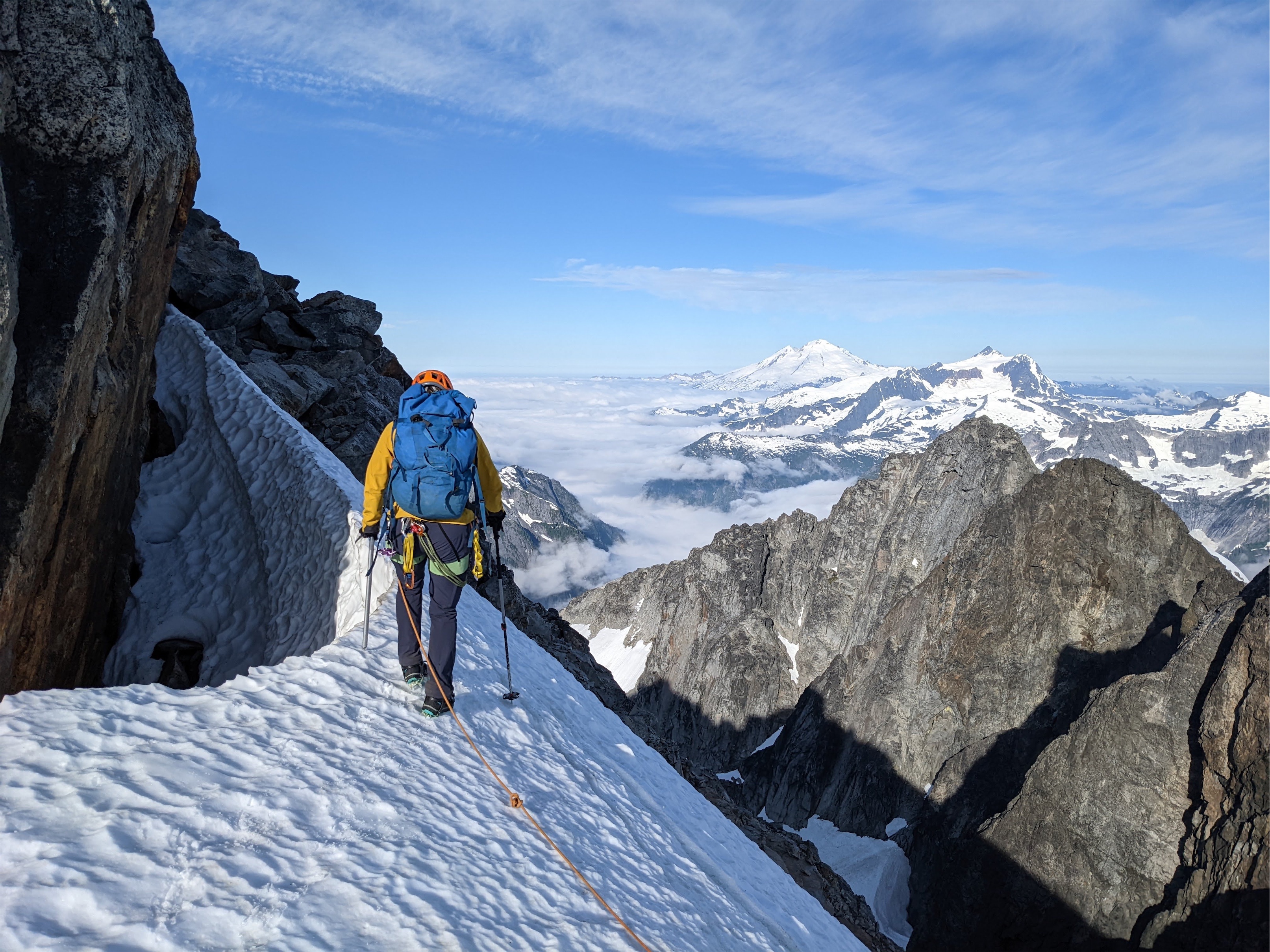
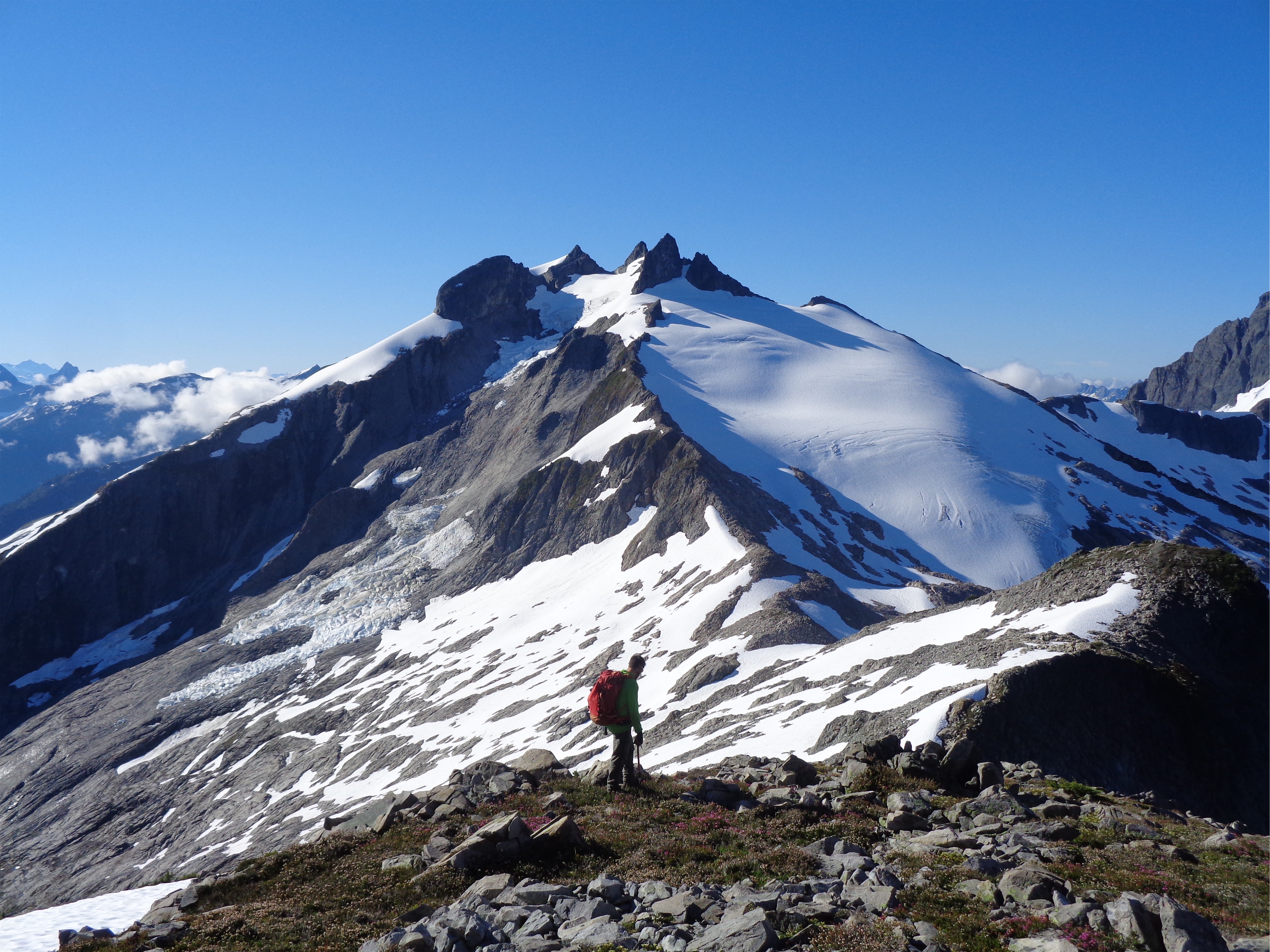
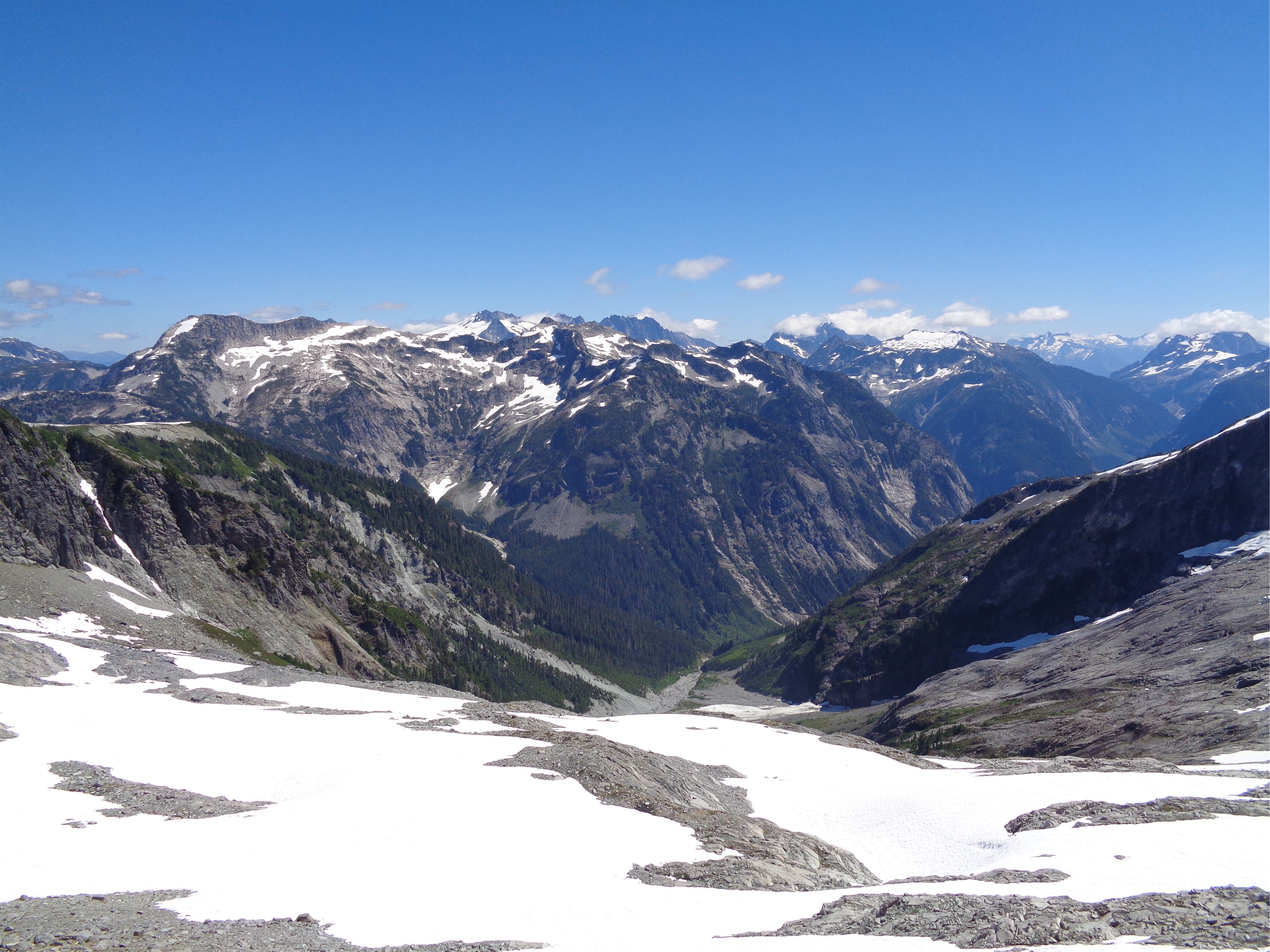
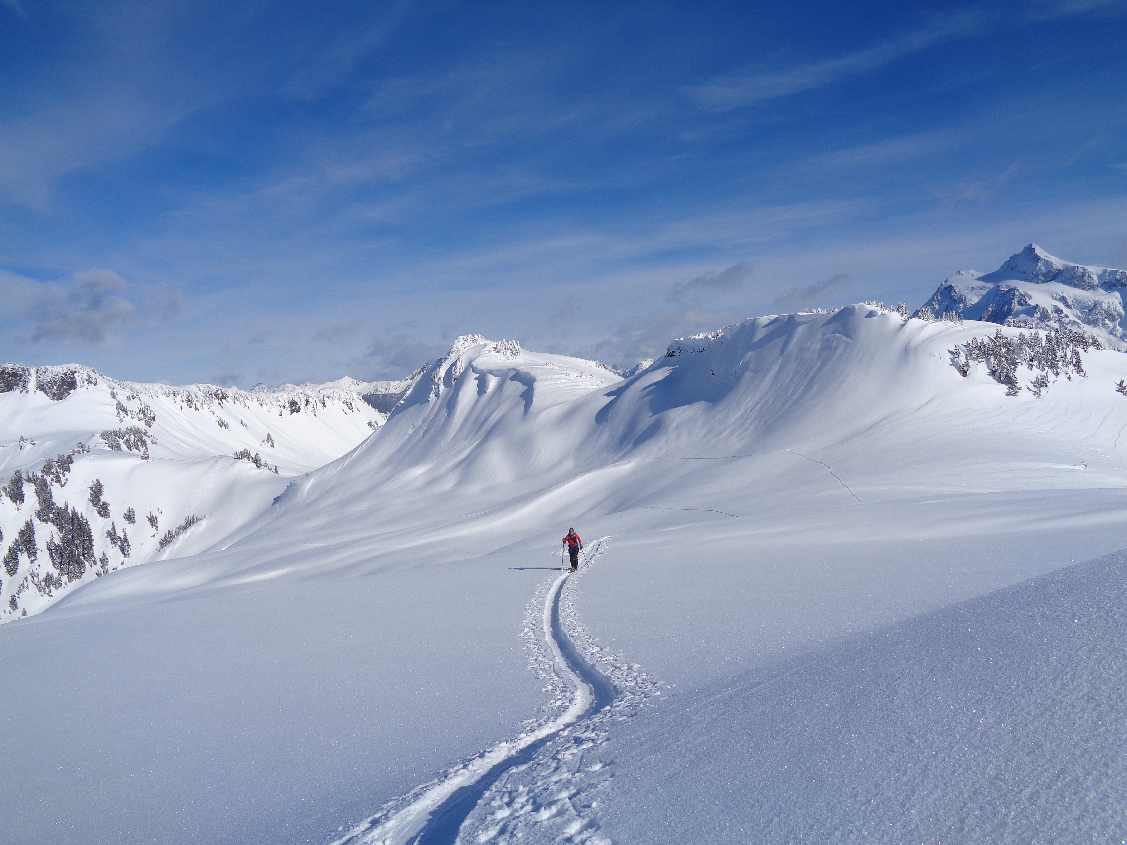
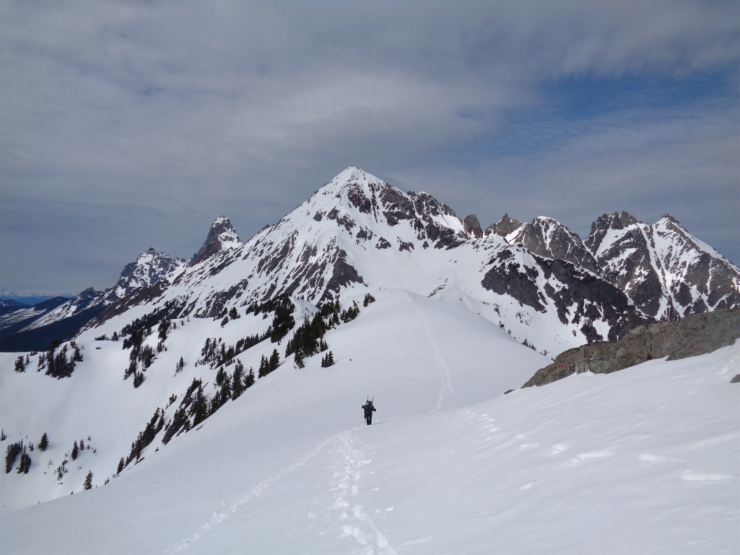
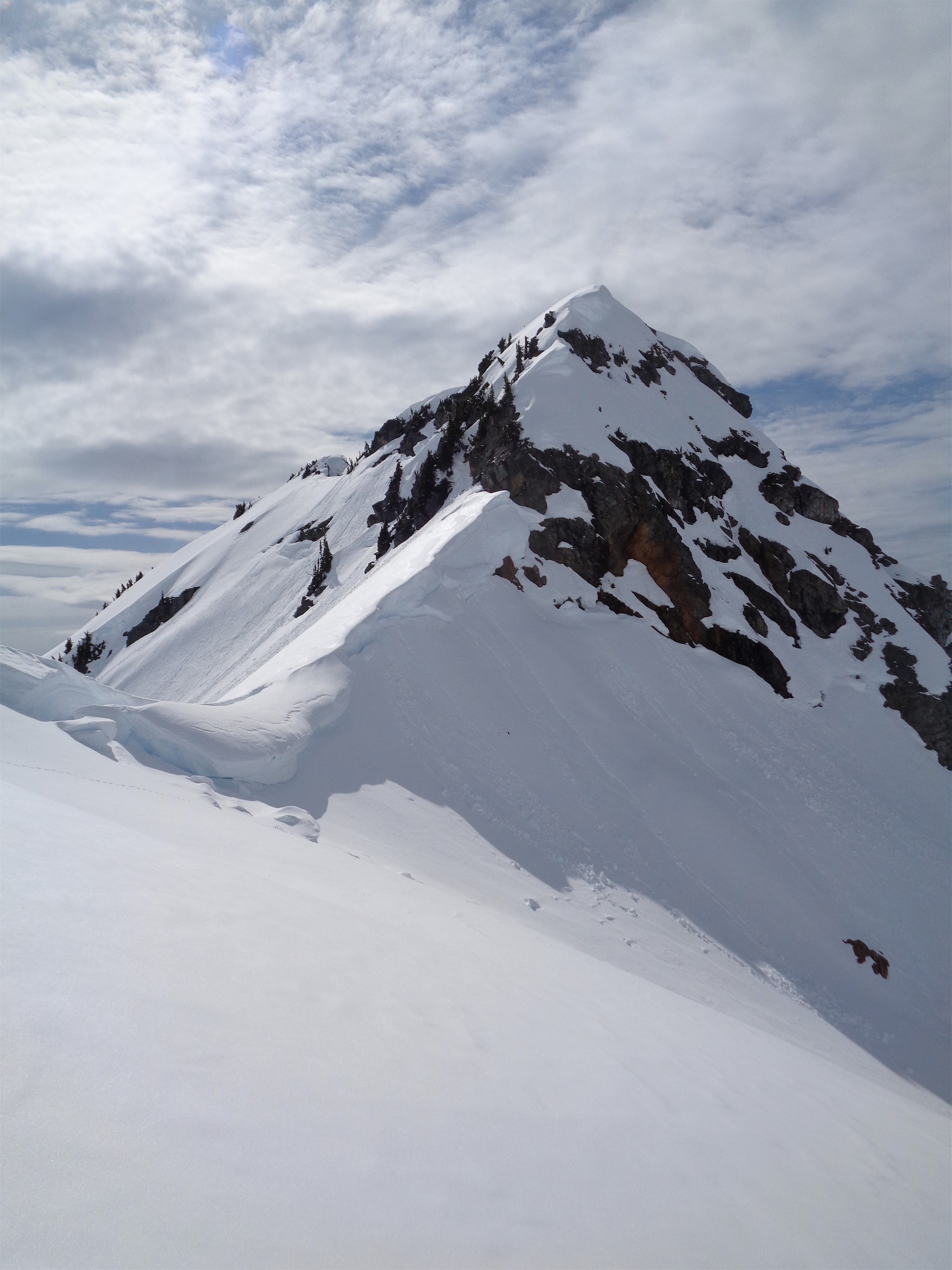
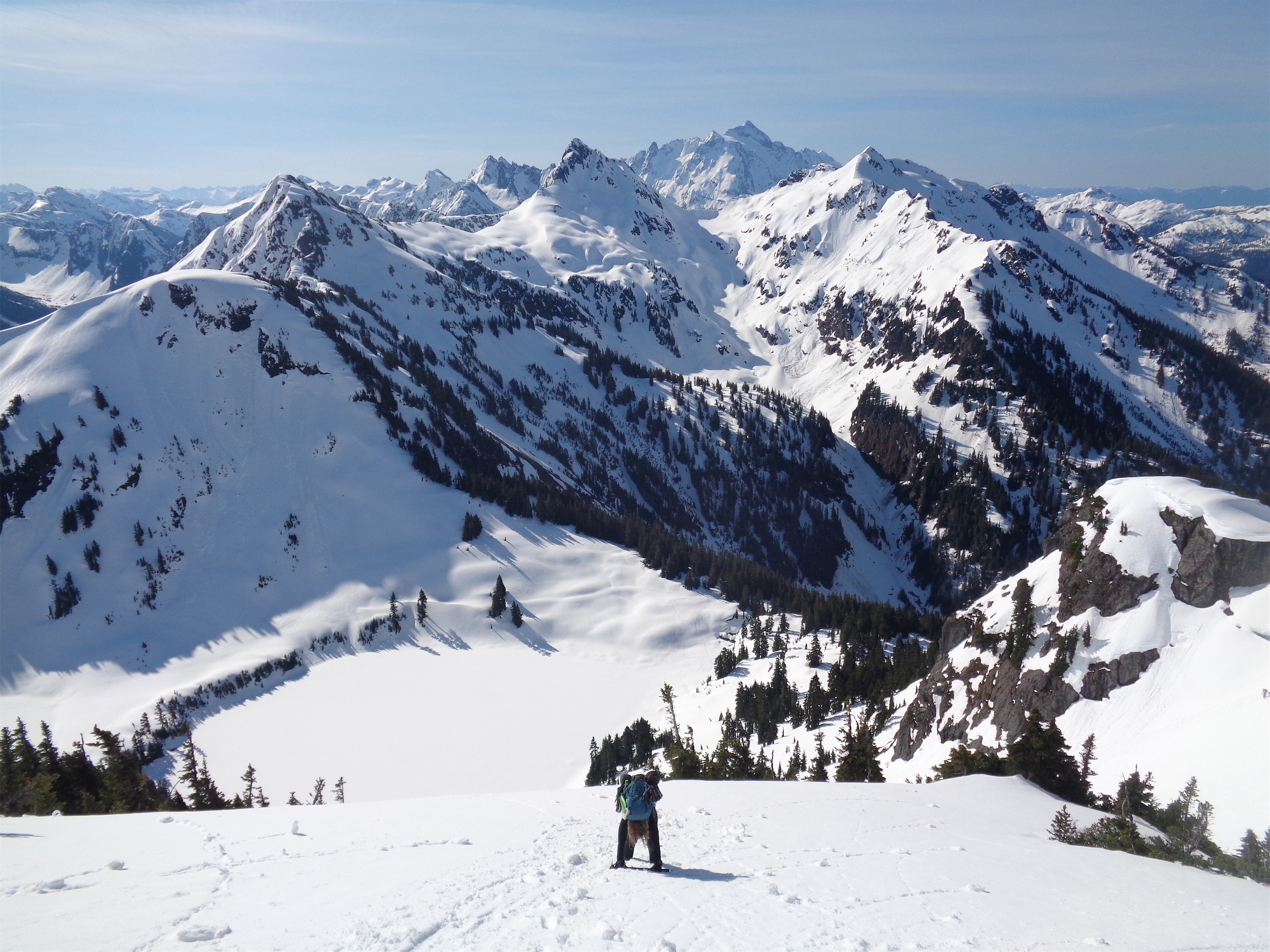
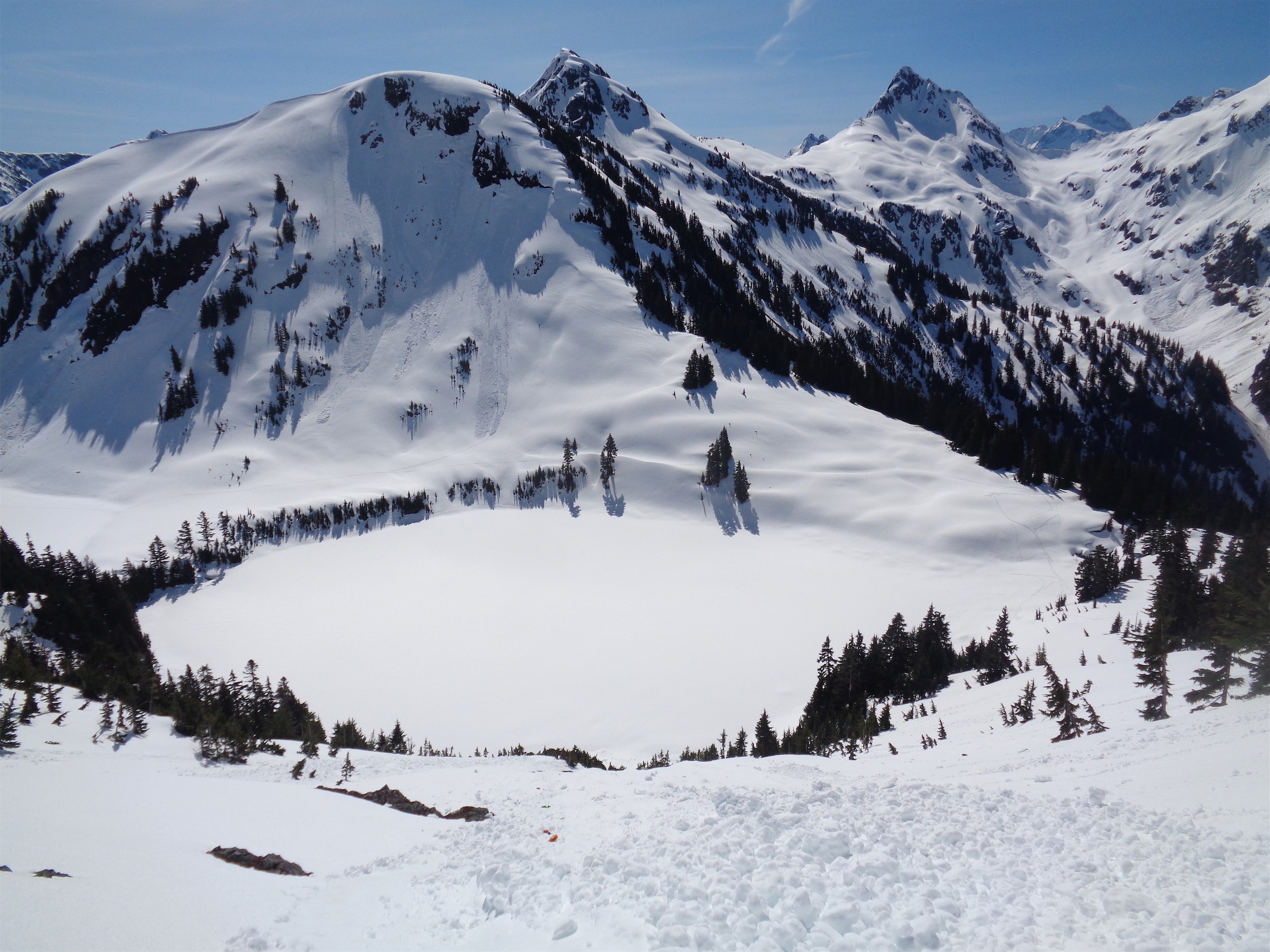
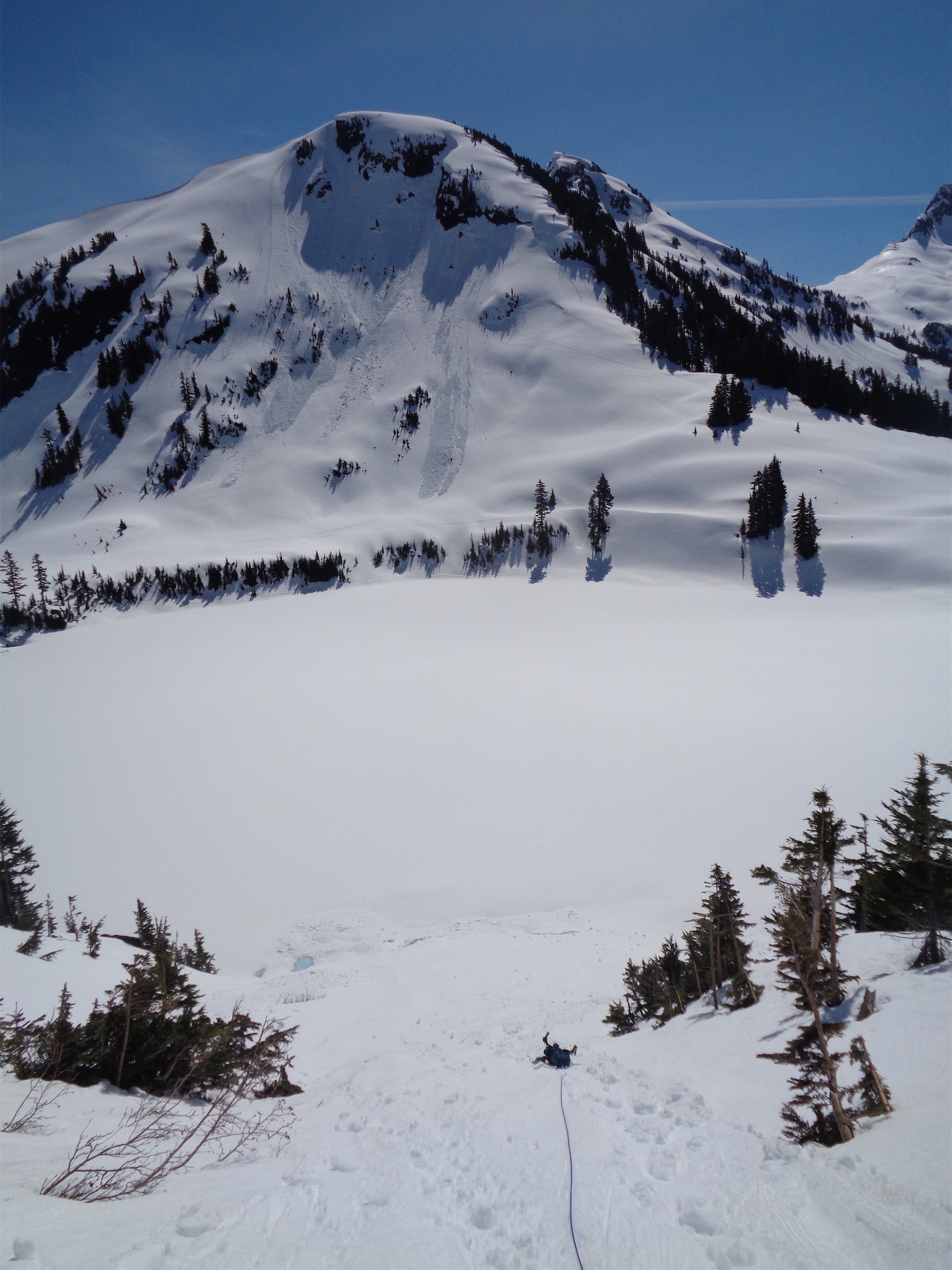
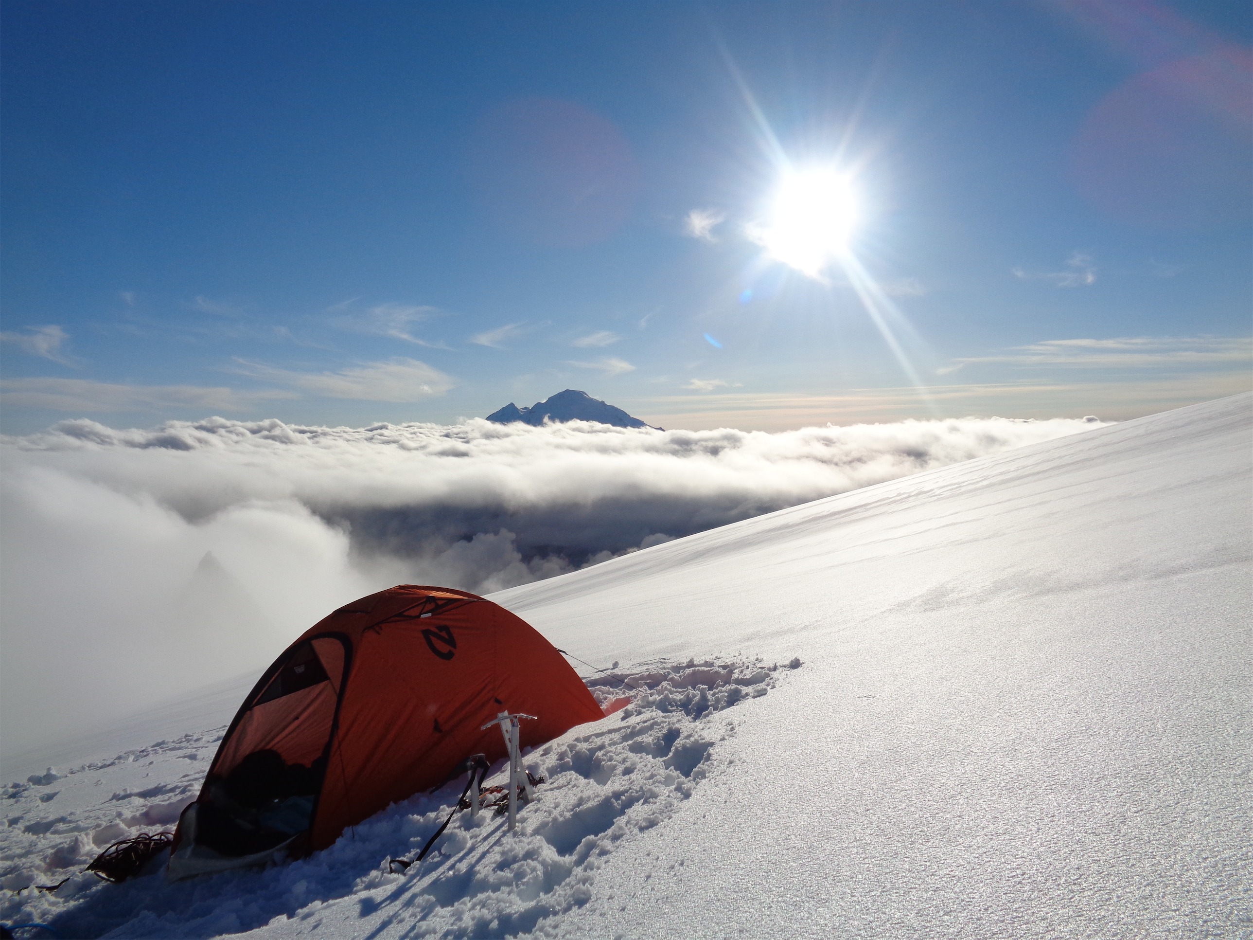
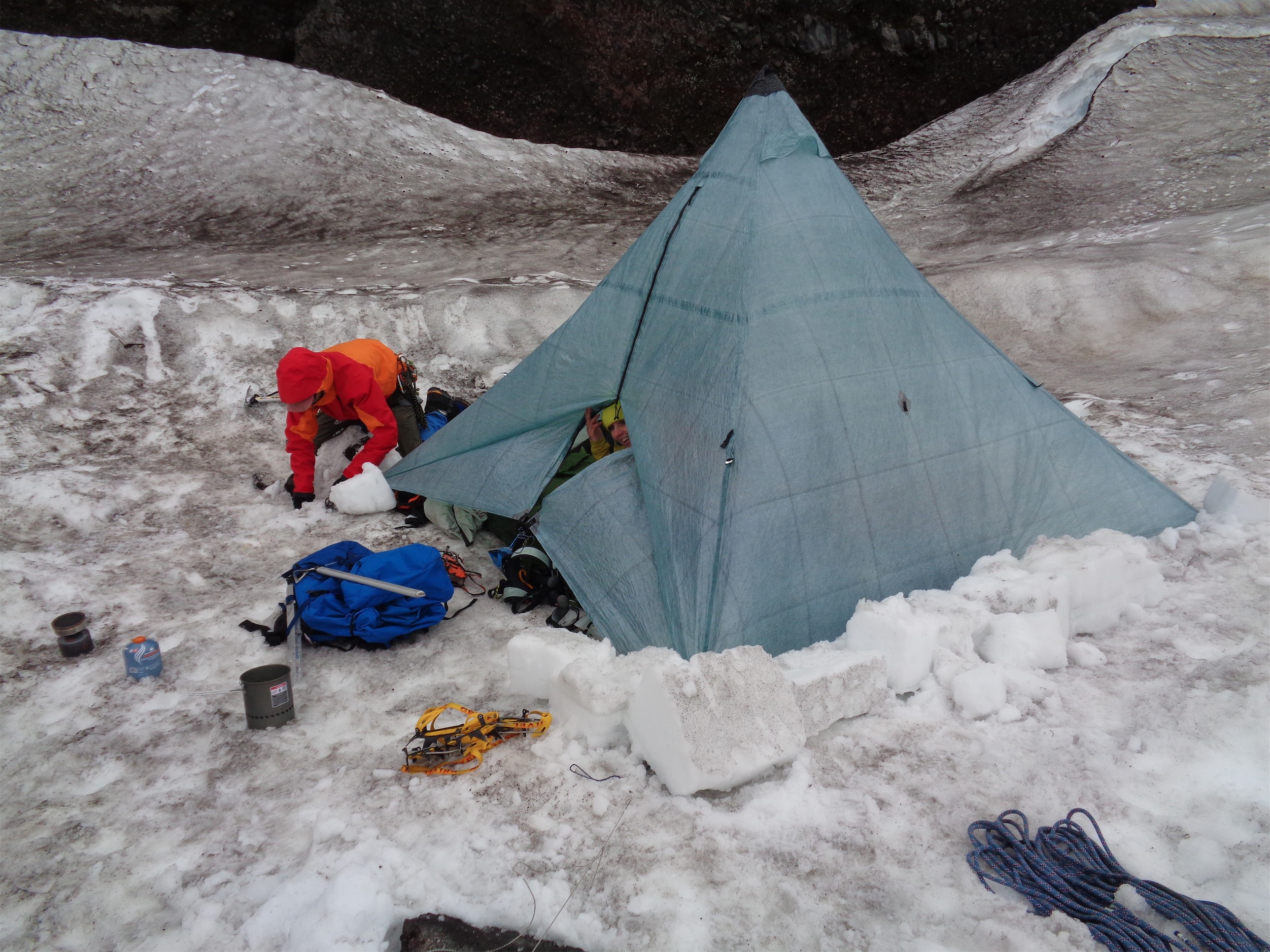
I thought we had to be above the worst of it, no way would we run into anything that could compete with the trees. We carried up through patches of snow to the base of what I called the headwall, where we left the snow and headed for waterfall slabs instead. I have never scrambled so much wet rock in my life. Wet, mossy, slick rock. But I guess that’s better than 5.7 trees? We tried to find spots with sizeable footholds at least. At this point I was driven by sheer determination and stubbornness. We’re getting. To. The. God. Damn. Pass. Jon made it to the pass first, scrambling up a final blocky vegetated waterfall. He immediately started scouting campsites. Meanwhile I was below and behind him doing what can only be described as literally crawling up the rocks standing up only when I was on mostly flat ground. I dropped my pack at the first campsite Jon had found, partially because it was a beautiful, well protected spot but also because it was the first campsite he found. Upon further investigation, it was definitely the best campsite, so the pack could stay where it lay. There were a multitude of streams coming off the snowpacks, huge cornices that I imagine were absolutely wild in winter. I am surprised more people don’t come up here to ski.
I glanced at my phone and realized it was actually only like 3pm. We had taken about 8.5-9 hours from Copper Creek to Perfect Pass with much room for improvement on routefinding between Easy Pass and Perfect Pass, even though we ignored the Impasse and lost/regained the 2kft of elevation. I wanted to do Whatcom, but it was socked in by clouds above us. I figured I wasn’t coming all the way back out here just for Whatcom. “Ok, if the clouds clear, Whatcom at 4:30? Shouldn’t be more than 90min round trip from here.” “Deal.” Sweet. I went back to my nap.

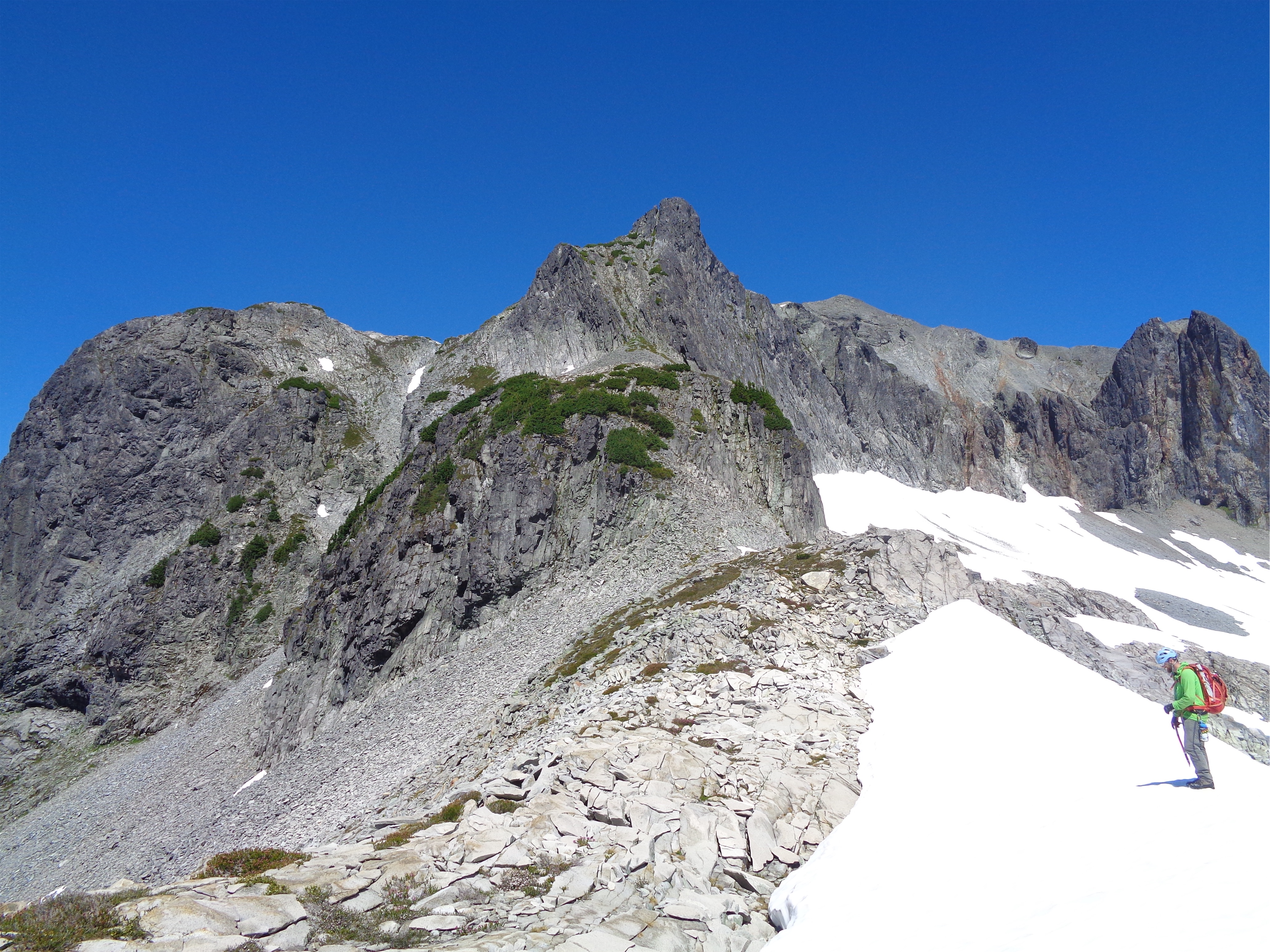
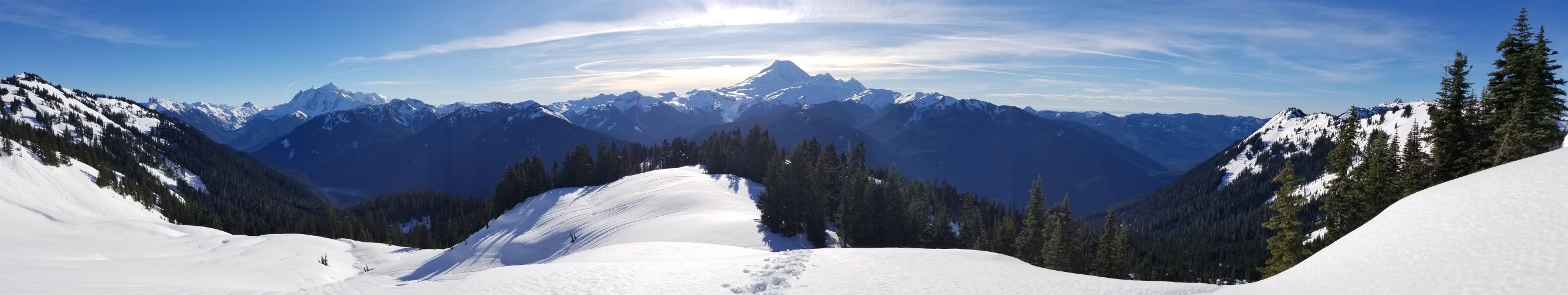
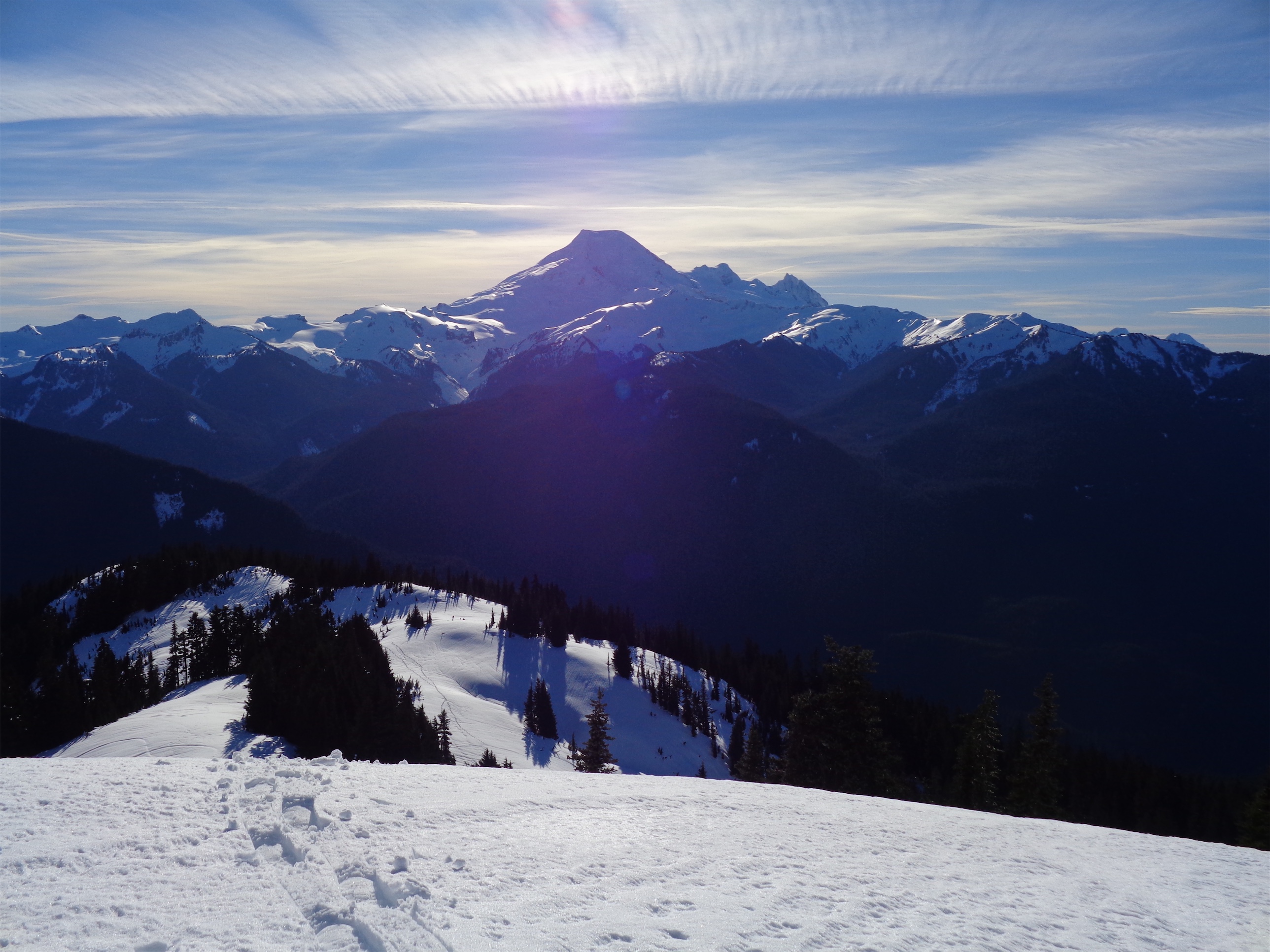
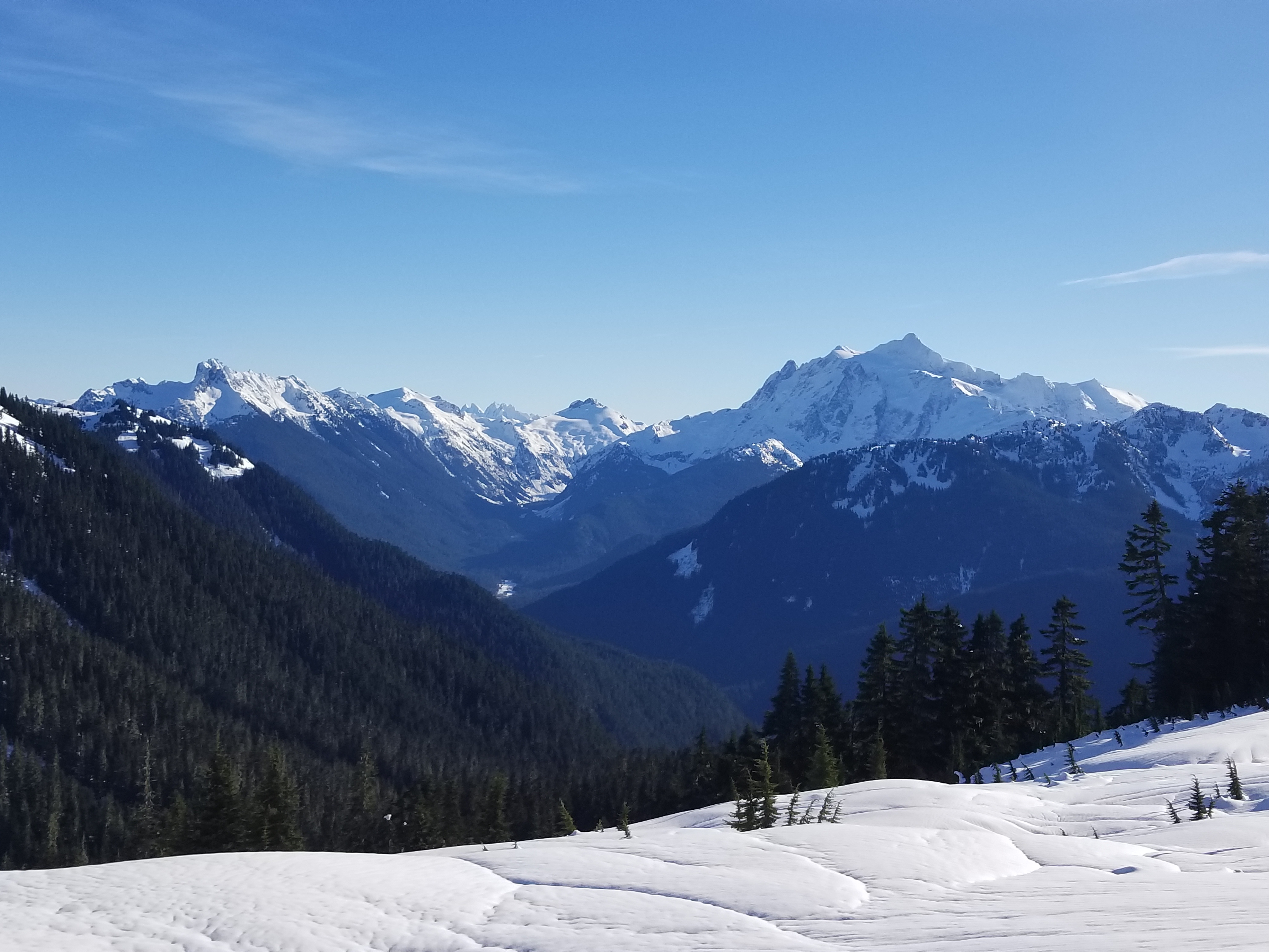
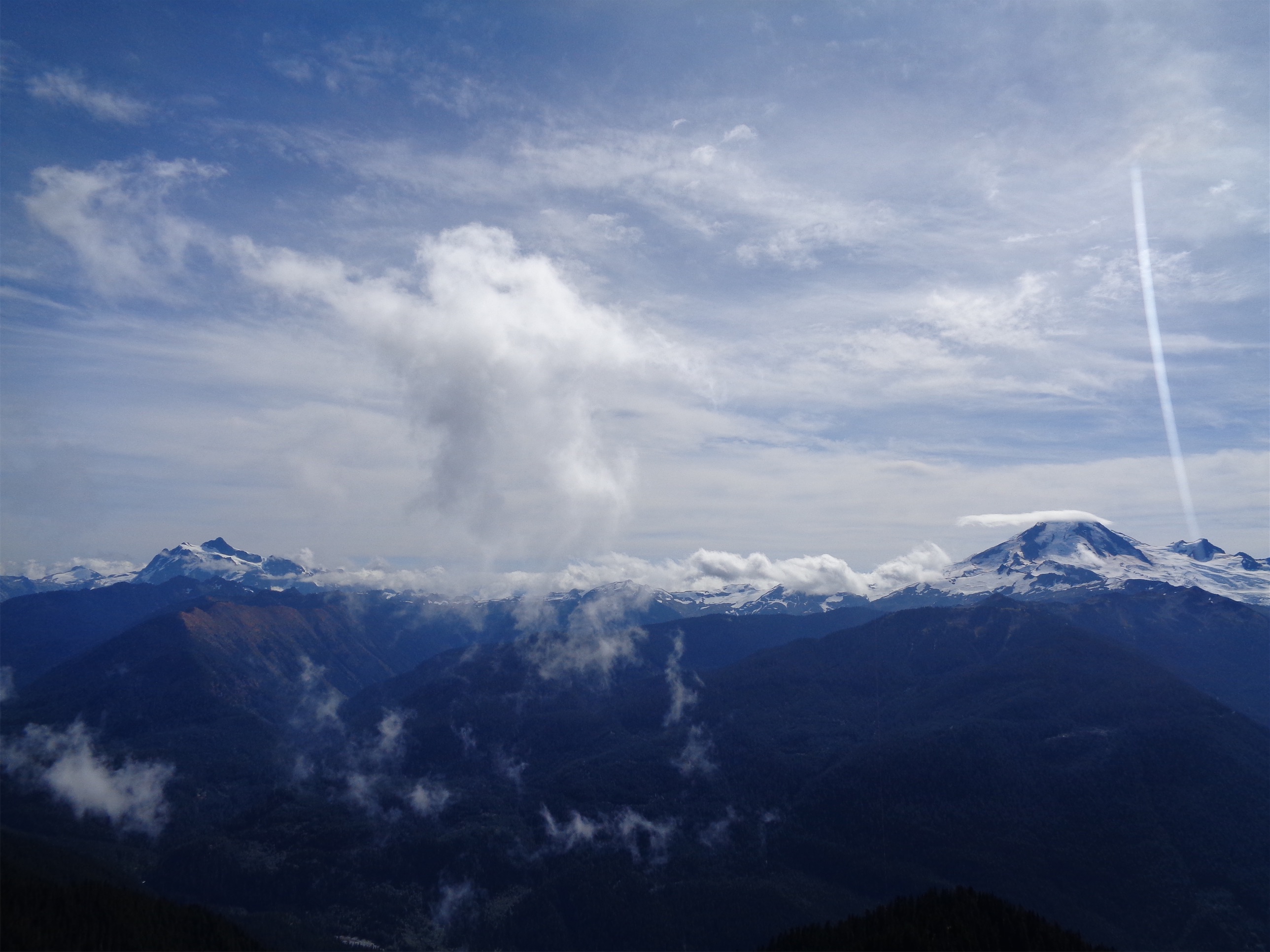
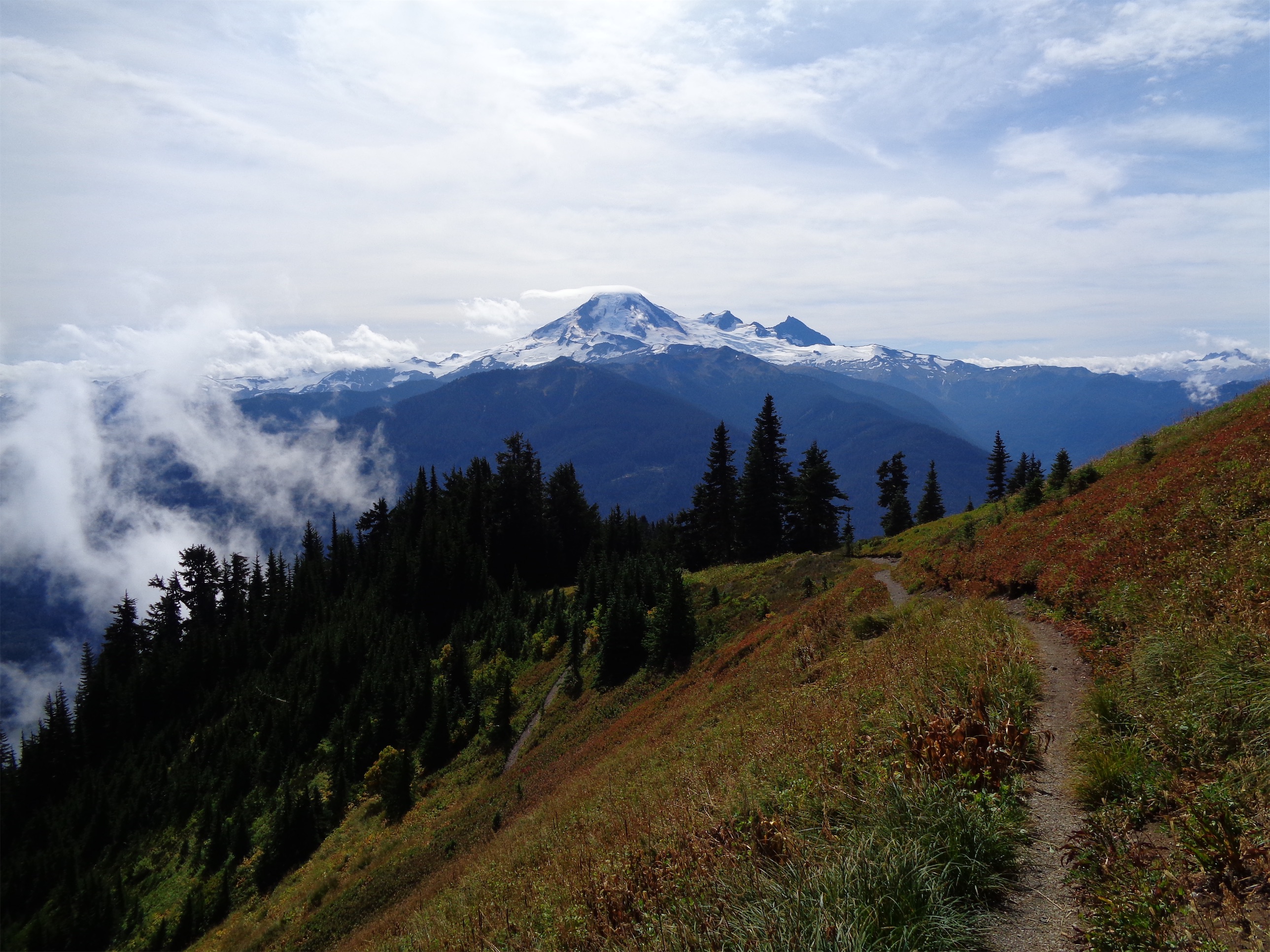
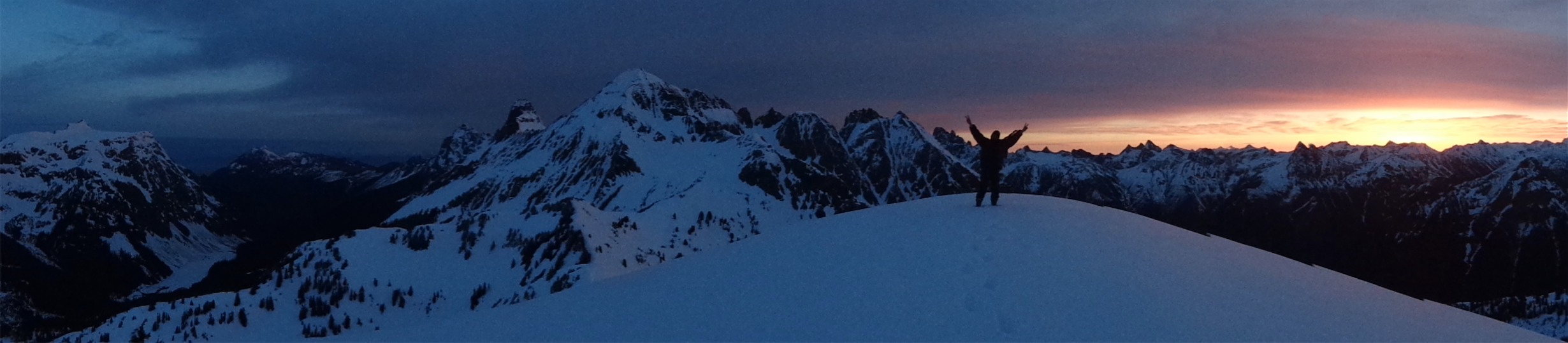
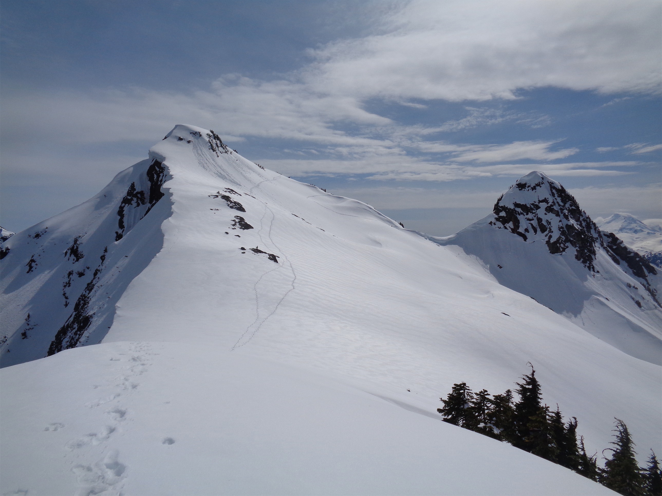
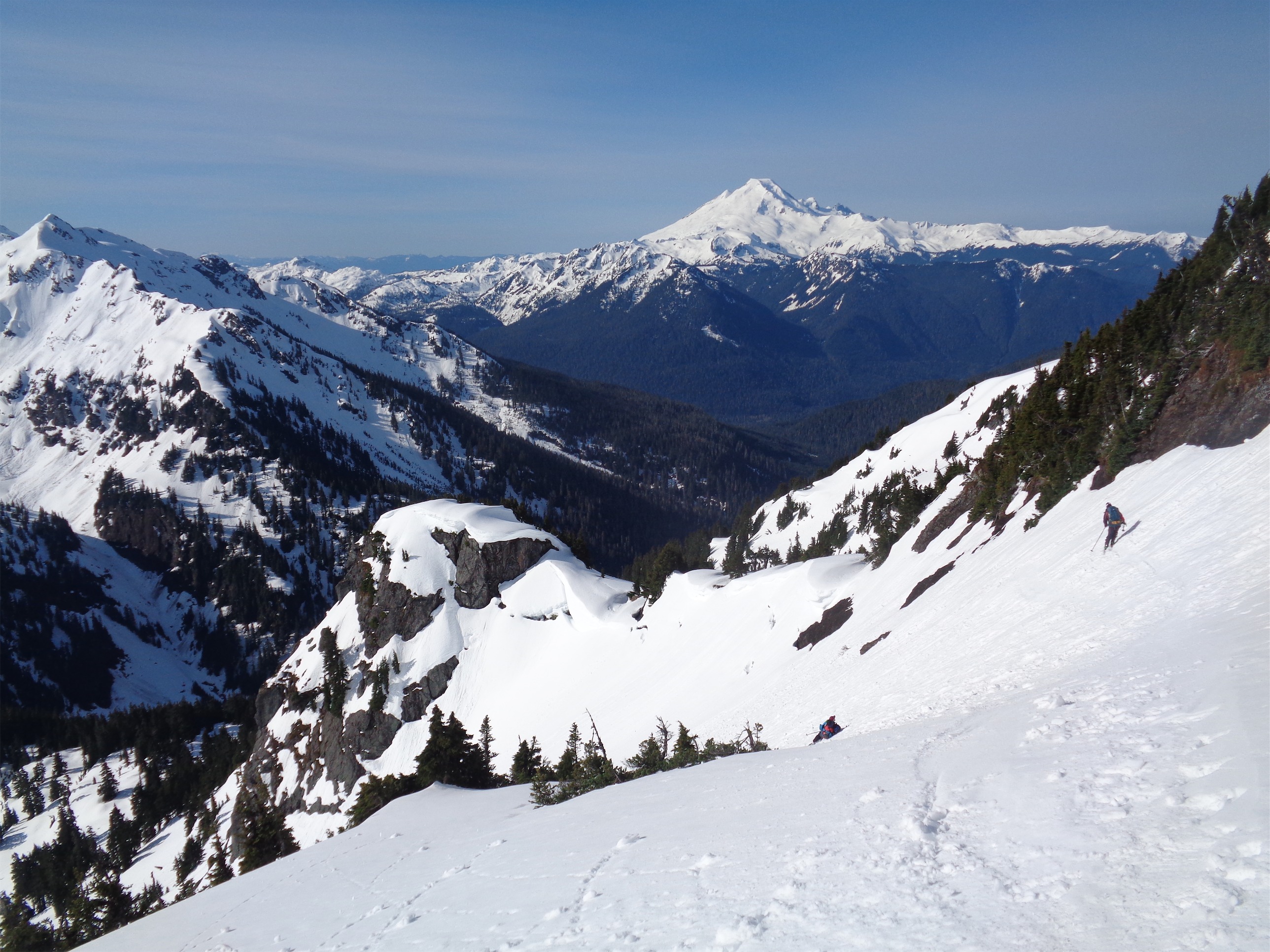
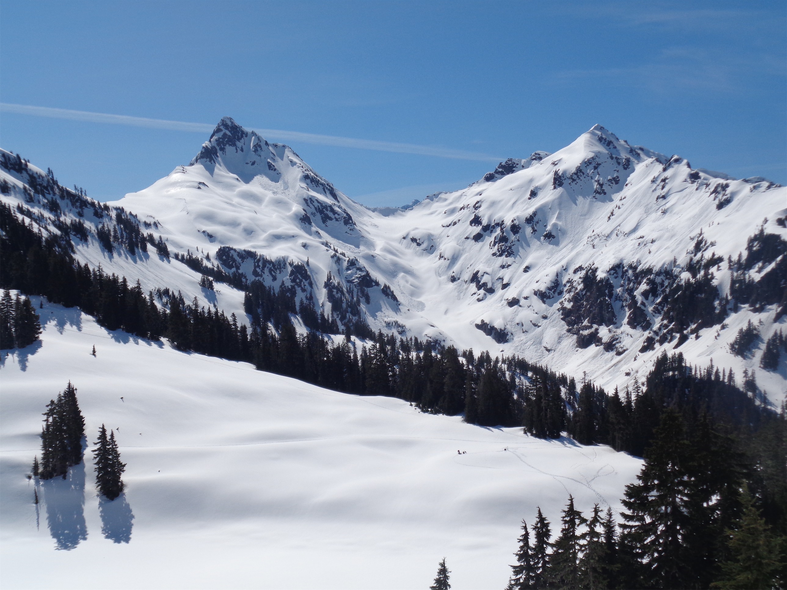
Whatcom was a quick side trip. We slogged up some moderate snow (I found a ski strap just uphill of Perfect Pass, possibly from JT’s team months prior which would be hilarious) to a surprisingly pleasant, fun ridge scramble. After the knife edges we had on Triumph and Custer, this was a piece of cake. Clouds unfortunately moved in over Challenger as we ascended Whatcom, blocking out views to the south and east, but that made the ridge look more dramatic. We didn’t find a summit register, just snapped some pics and headed back down. “Would you have carried one up here if you knew?” Jon asked laughing. “Ugh… at home I’d have said yes, now I don’t know.” I put crampons on for the descent because I don’t trust my feet in trail runners on snow at all unless I can get a good 2″ deep heel print, which wasn’t happening. Jon is like the king of plunge stepping and disappeared into the fog below me, and soon enough we were cooking dinner back at the tent.

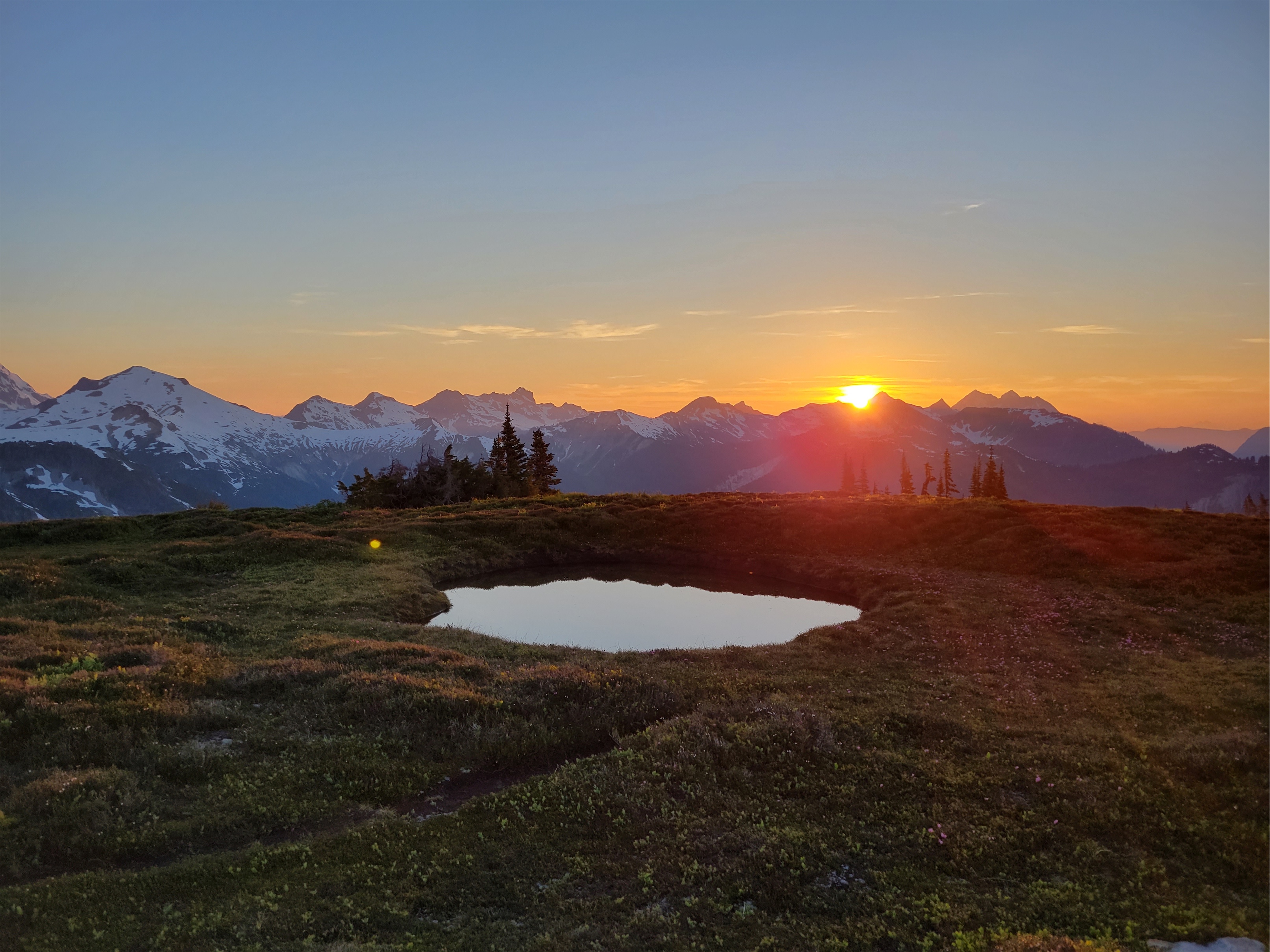
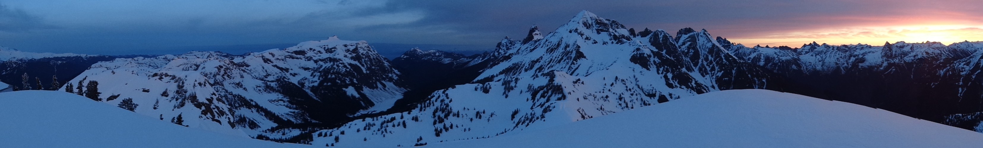
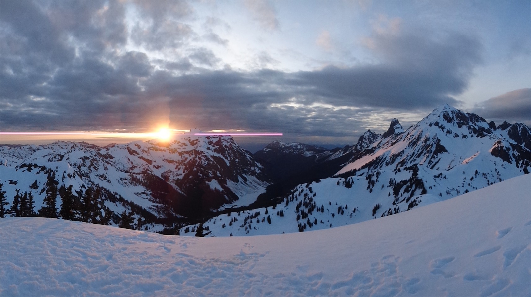
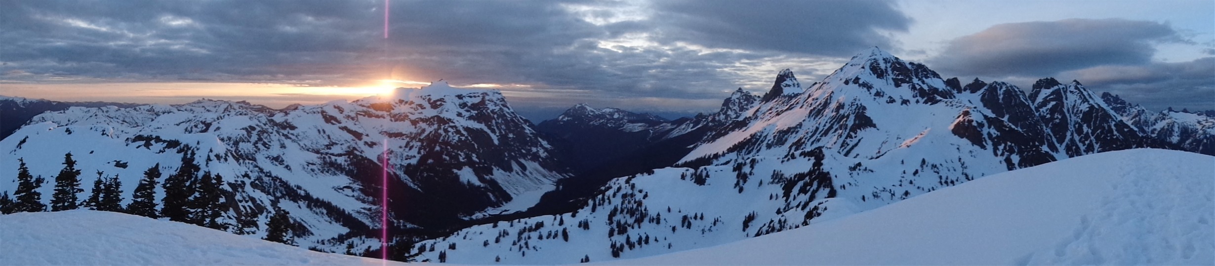
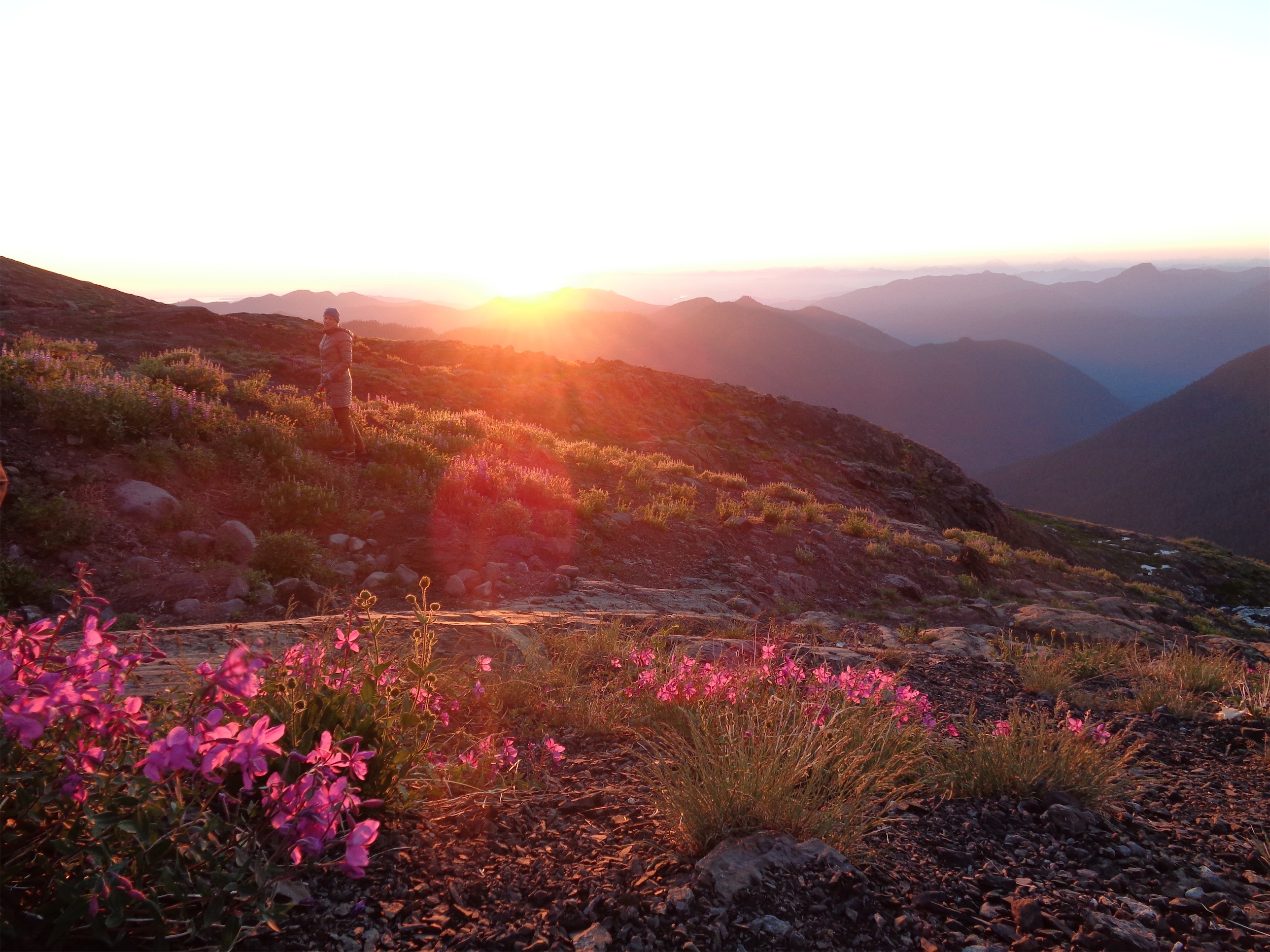
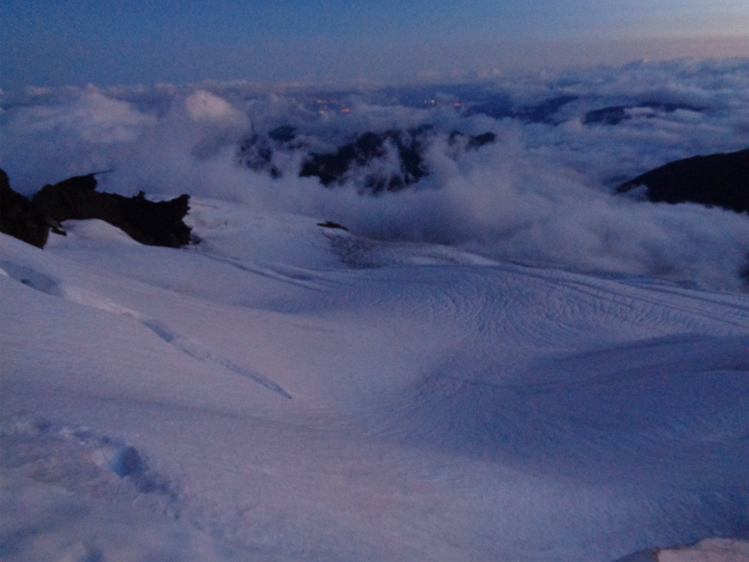
I was apprehensive about the clouds. Given our streak the past few weeks… shitty spring, left the Chilliwacks a day early, Triumph cleared miraculously but we were socked in the rest of the time, Bacon I bailed for a dozen reasons but one of the reasons was lack of views… I was going to be really discouraged if we ended up socked in by clouds on Challenger. They weren’t supposed to be here today, it was supposed to be mostly sunny! And I guess it was, minus the peaks we were on. And the Pickets do tend to frustrate you by deciding to shroud themselves in clouds and mystery as soon as you arrive. But the forecast was for sun. Just sun. Please mother nature pleeeeease give me one sunny day! I hung my food 5ft from the tent ready to fight off any bear that wanted it and went to sleep. The tent was flapping enough that I put in headphones and was relieved to have music to block out the wind, which I had forgotten on the past few trips. Fingers crossed for a clear morning. I woke up around 1 or 2 am to the sound of silence, no wind, no tent flapping loudly. A sigh of relief, and back to sleep.


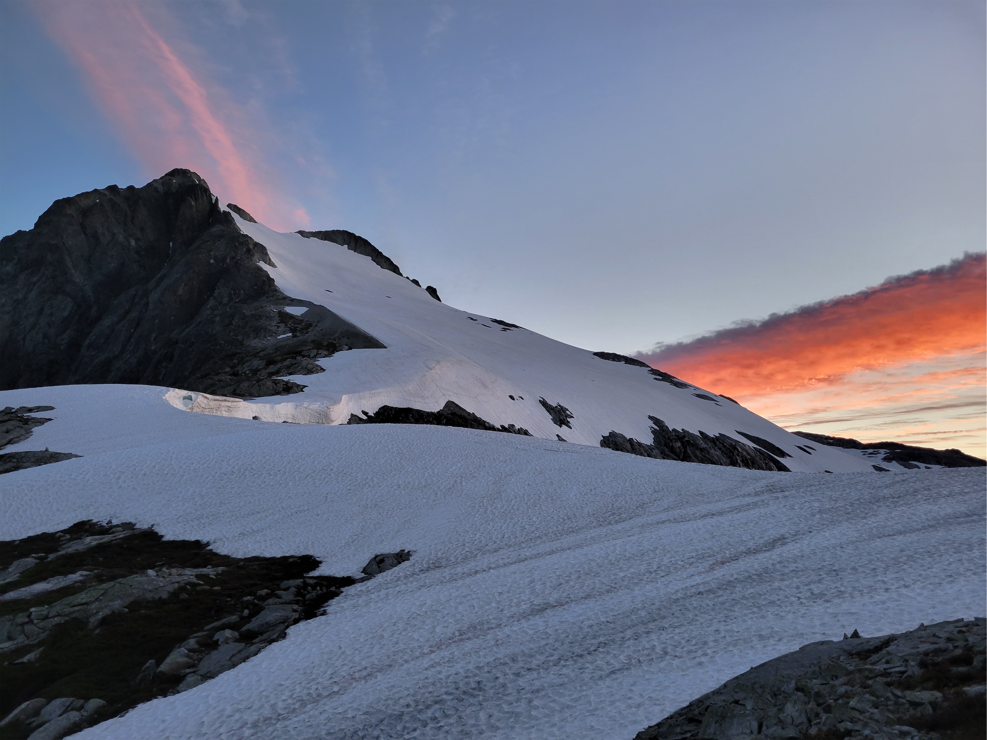
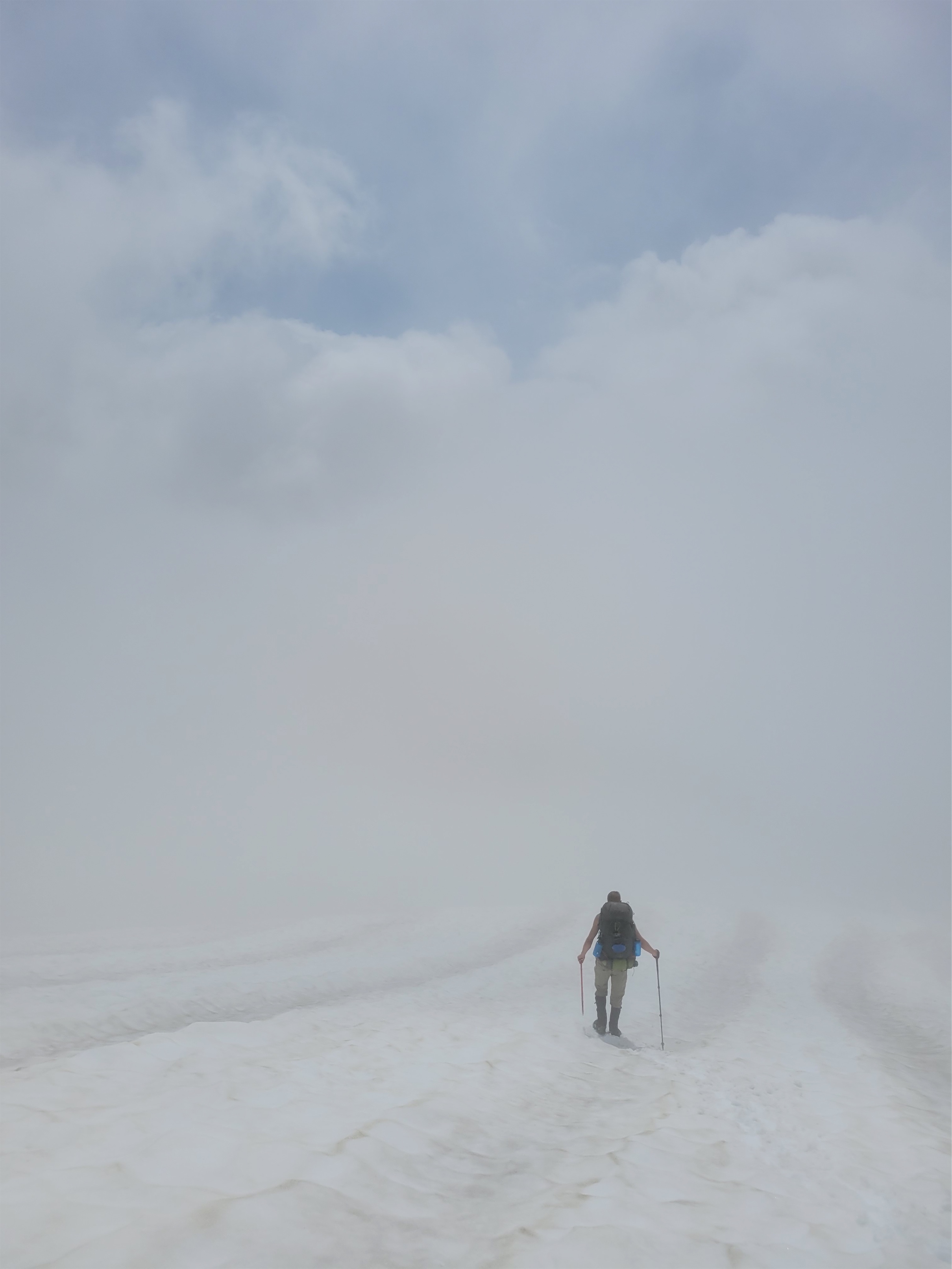
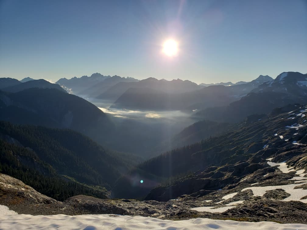
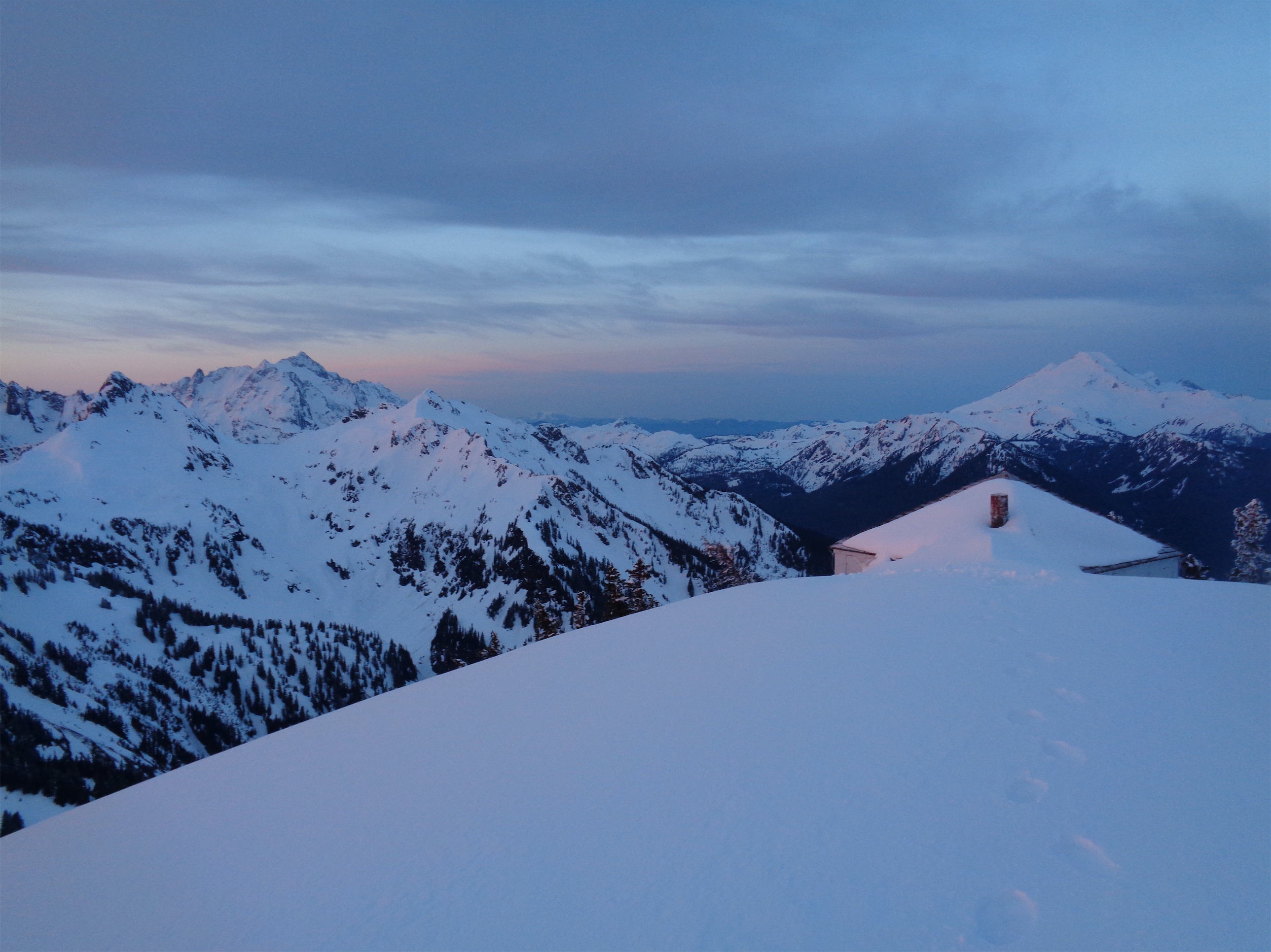
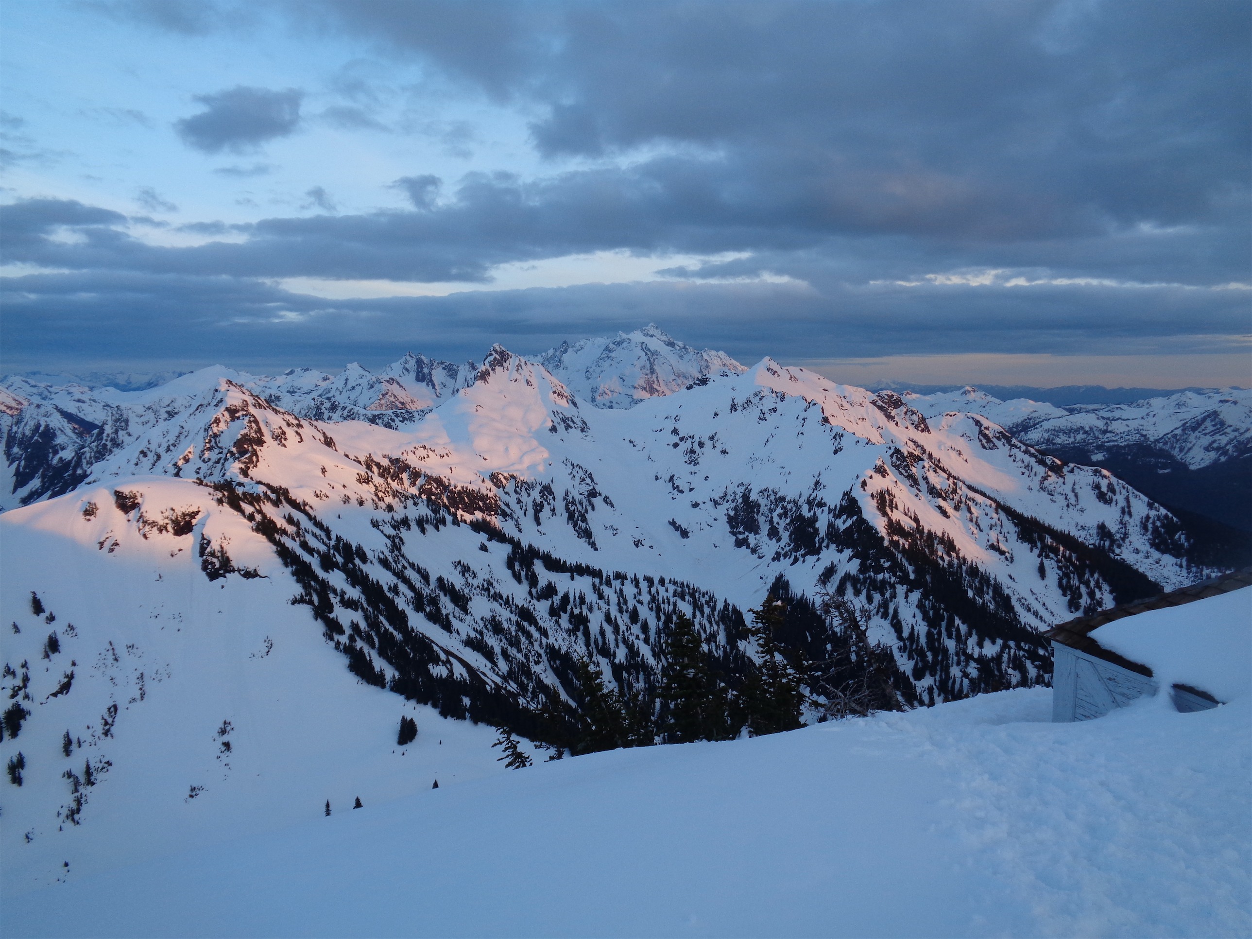
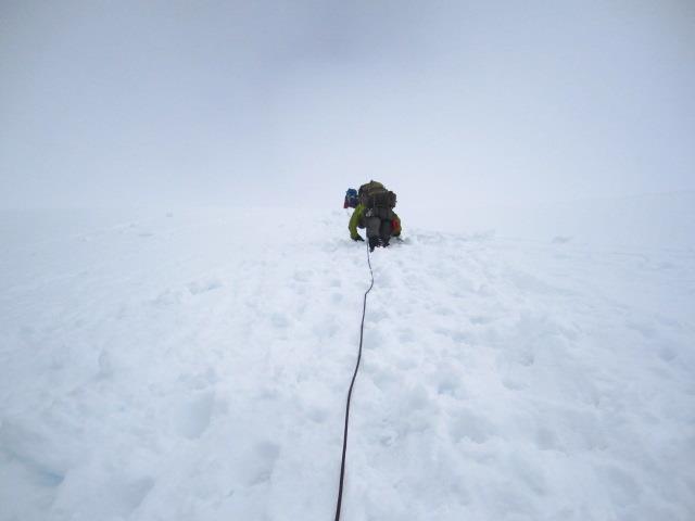
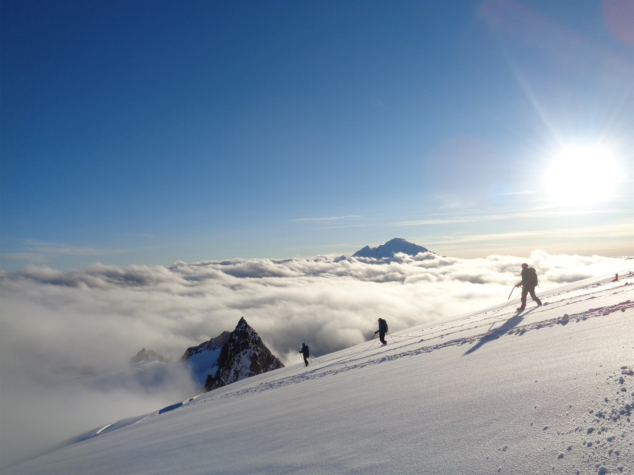
We woke up to an inversion, a spectacular sunrise, and a mostly cloud free sky (besides the streaks that lit up with sunrise). We got moving quickly, each carrying coils with friction knots between us in the case of a crevasse fall. You really, really don’t want to fall on a two person rope. I mean you never want to fall, but a 2p rope makes any sort of arrest and rescue extremely difficult, if not impossible. I think people overestimate their abilities on two person ropes (myself included) and underestimate the difficulty of a real two person rescue. A friend once set up a z haul for me in a crevasse (practice), and was only above to get about two feet of space in his system meaning a TON of mini hauls and resets. I’ve had to arrest single partners multiple times on slopes with good runouts (vs crevasses) and even then, the moment their weight hits you is terrifying and strenuous. I am basically of the mindset that if something happens on a 2p rope, you’re probably fucked, but like Nirmal Purja said in 14 Peaks, usually when you think you’re fucked, you’re actually only like 50% fucked. So I’ll take my chances on a 2p rope vs unroped travel.

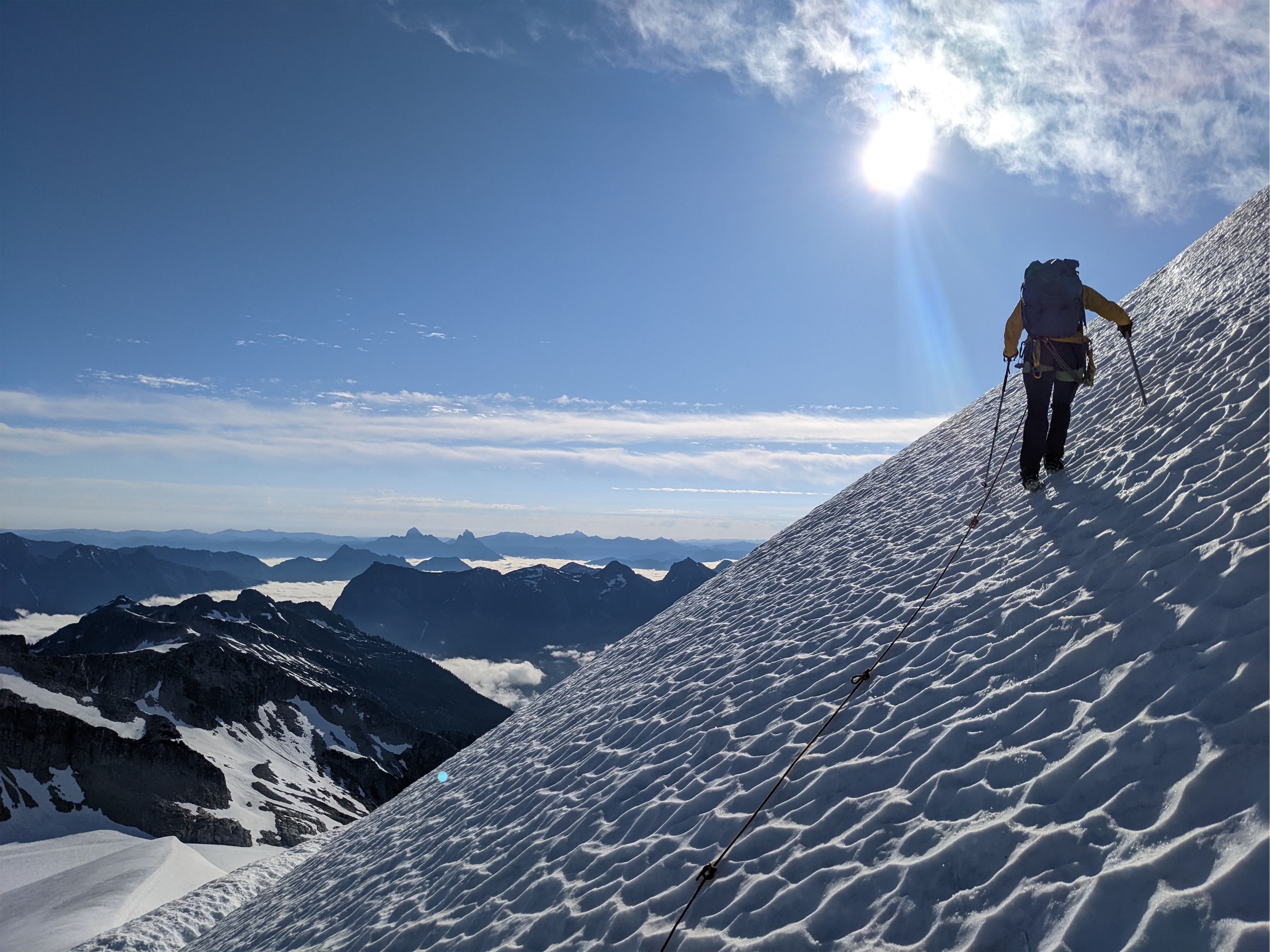
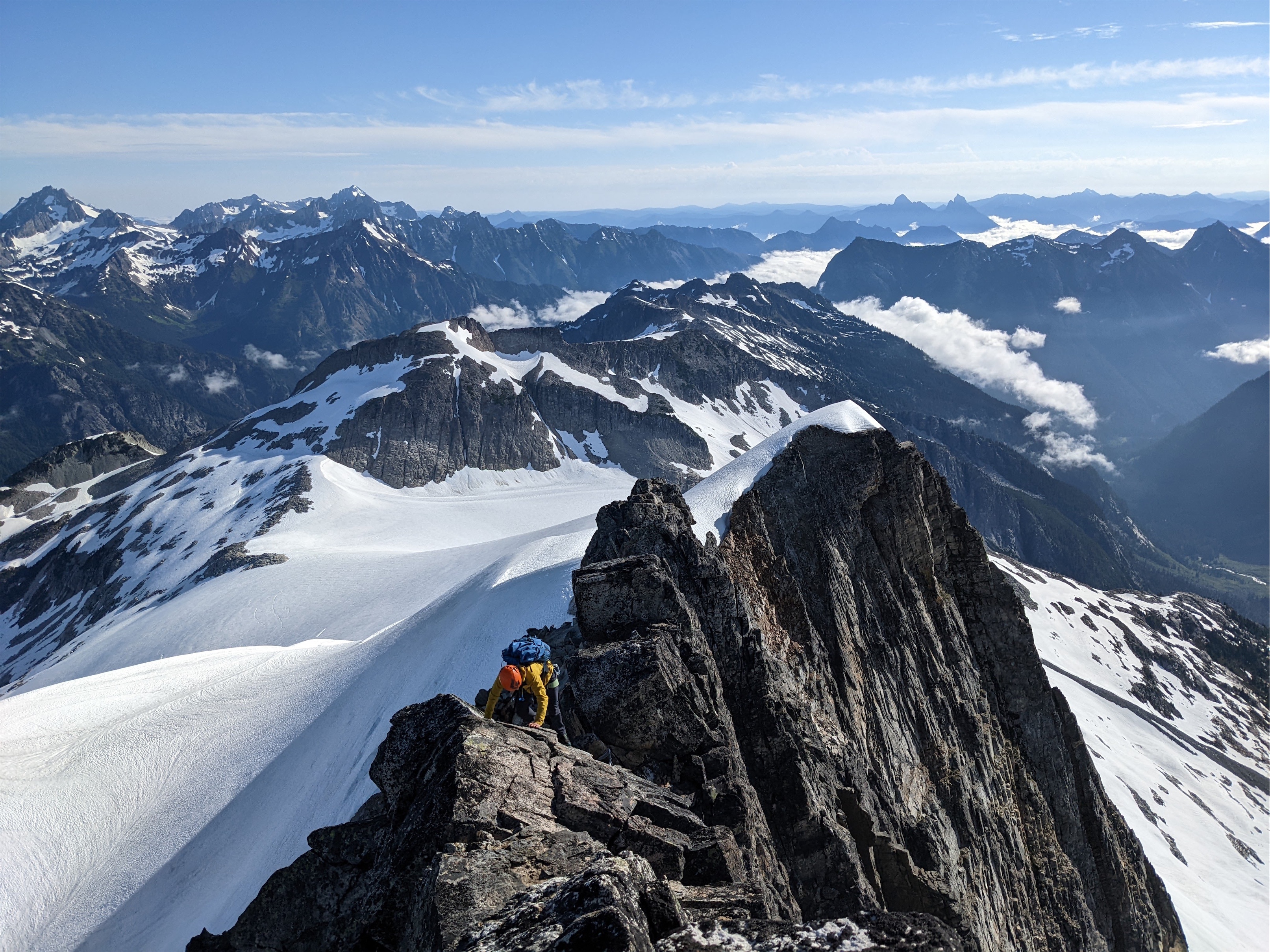
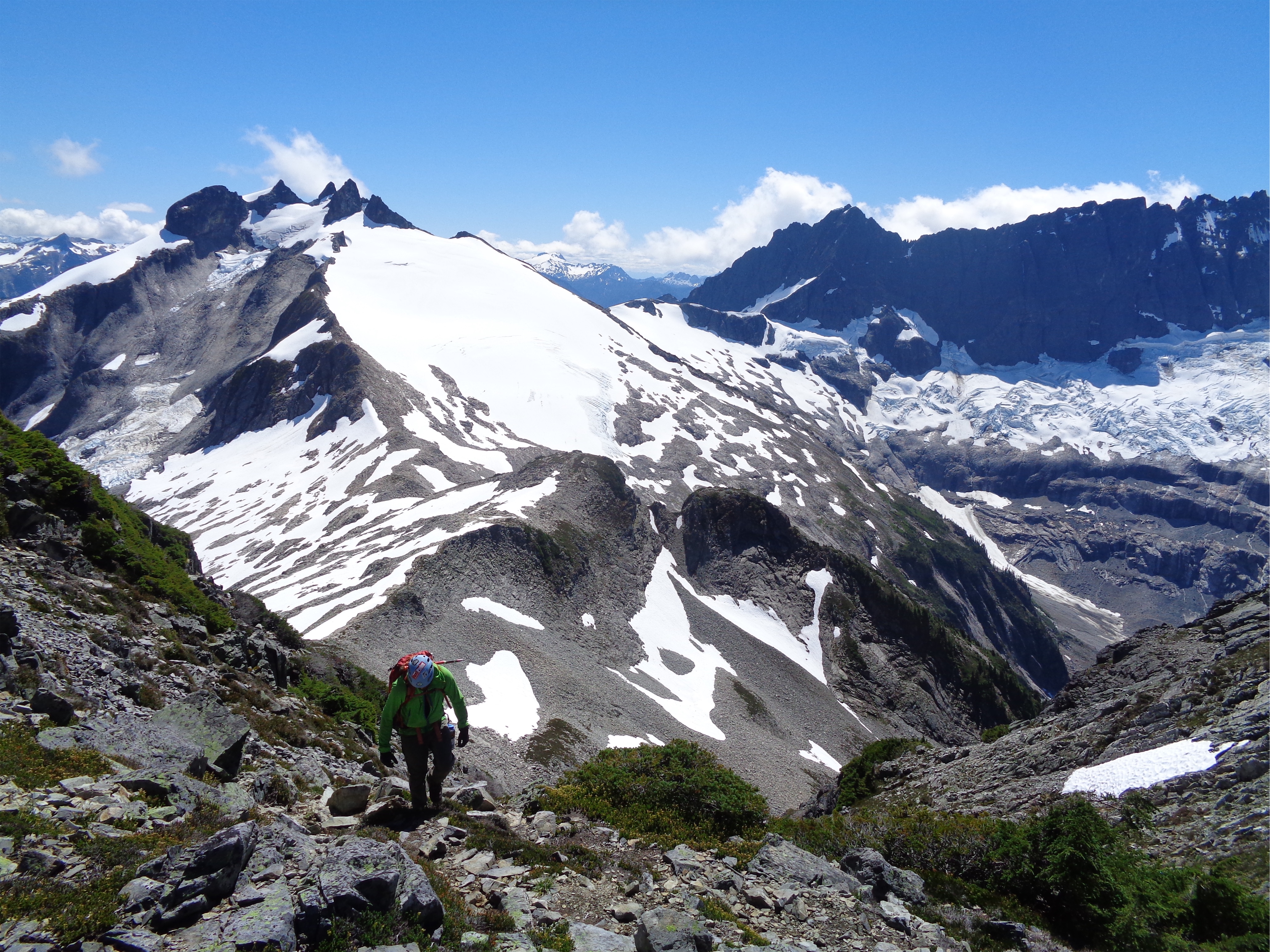
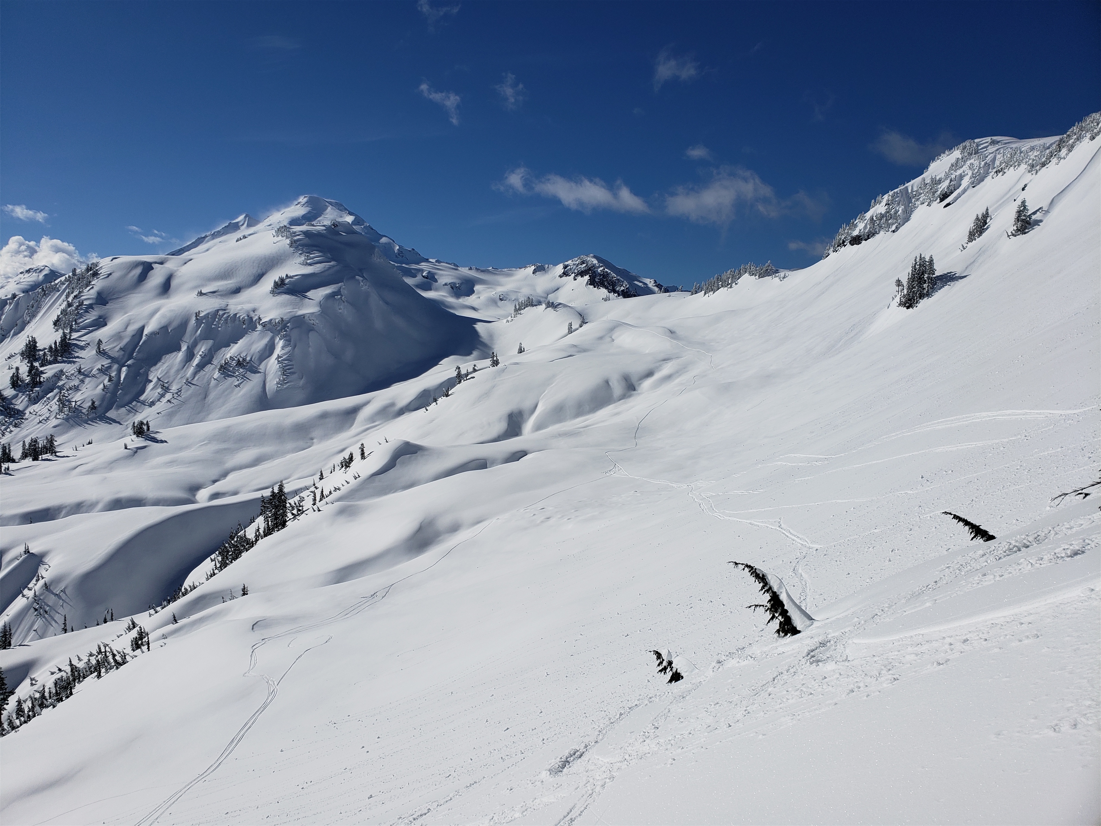
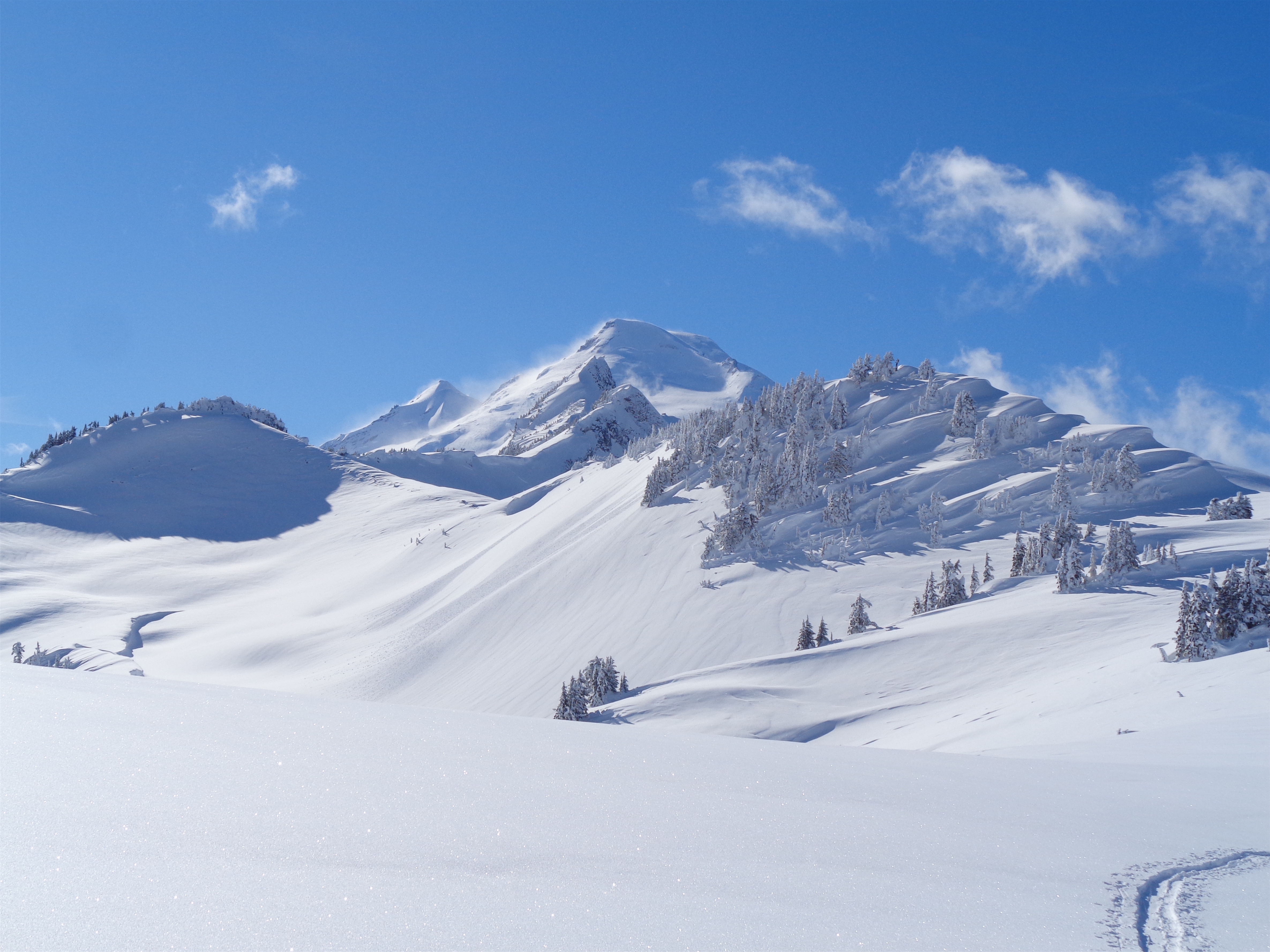
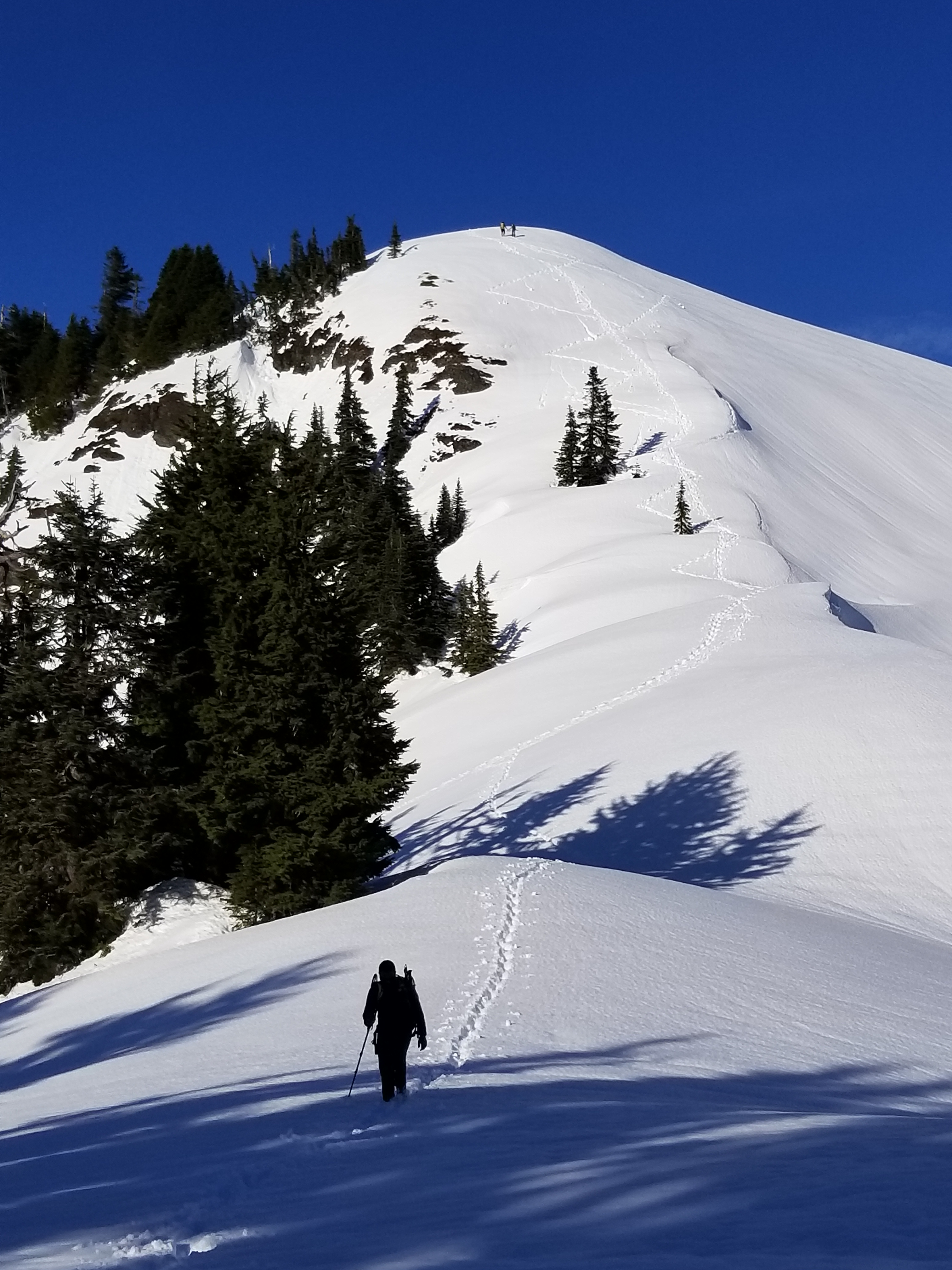
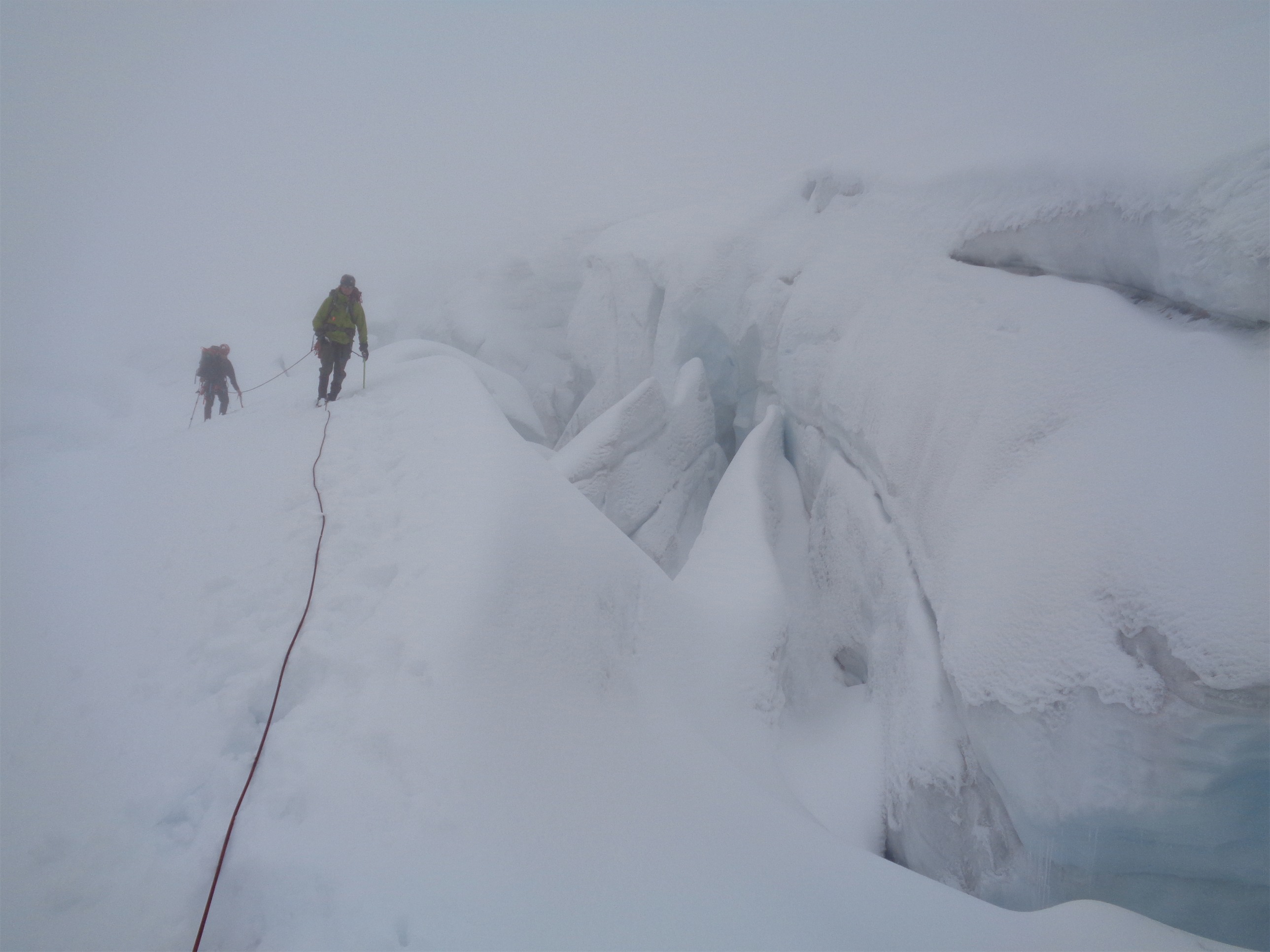
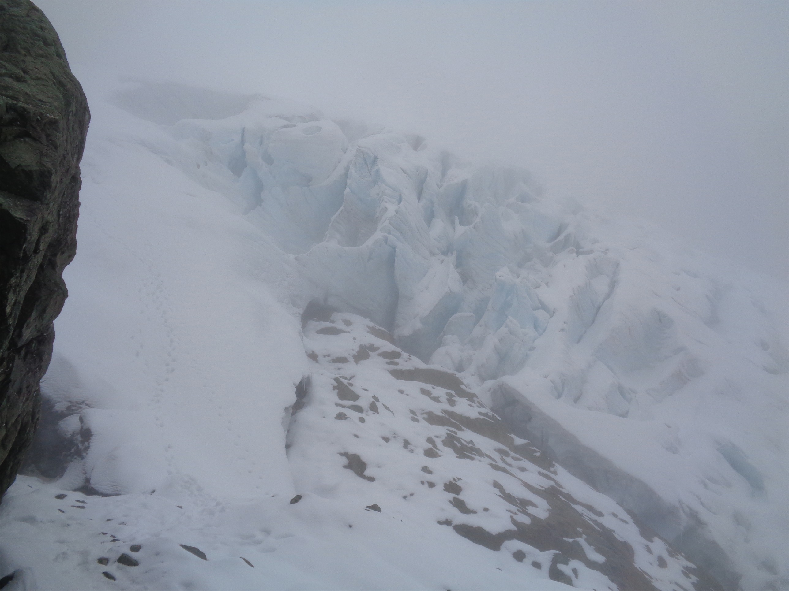
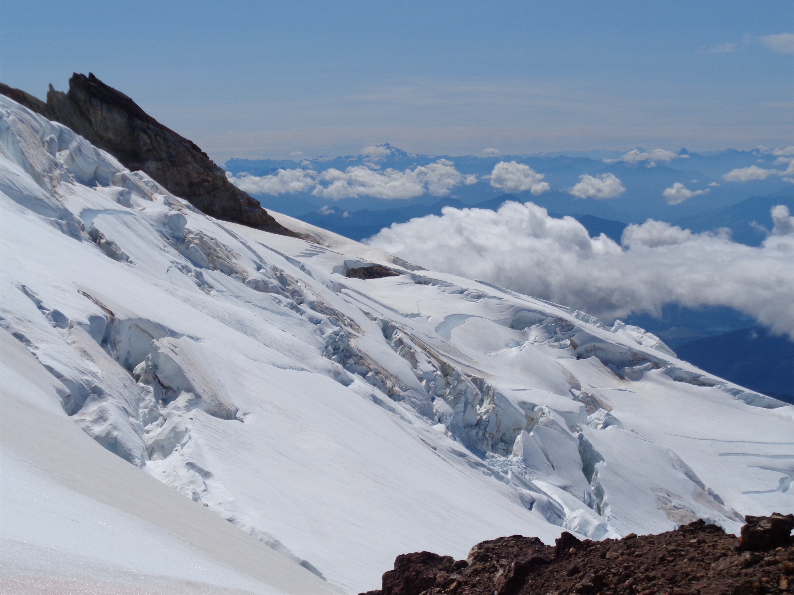
We head up the side of the col until we could see mellow snow (vs cornices and lips), and started the long traverse. And boy is it LONG. We crossed one rock arm with a cute mossy stream running through it, and from there it was all snow, just avoiding crevasses here and there. We were moving quickly by glacier travel standards. The glacier was well covered (I don’t like “filled in” because crevasses don’t fill in, they just get covered) and we had great line of sight which made navigation easy. The two cloud strips relieved us of some sunshine while still providing ample views, and soon enough we were on the ridge heading up the mini hogsback towards a saddle between the summit and a low point east of the summit.

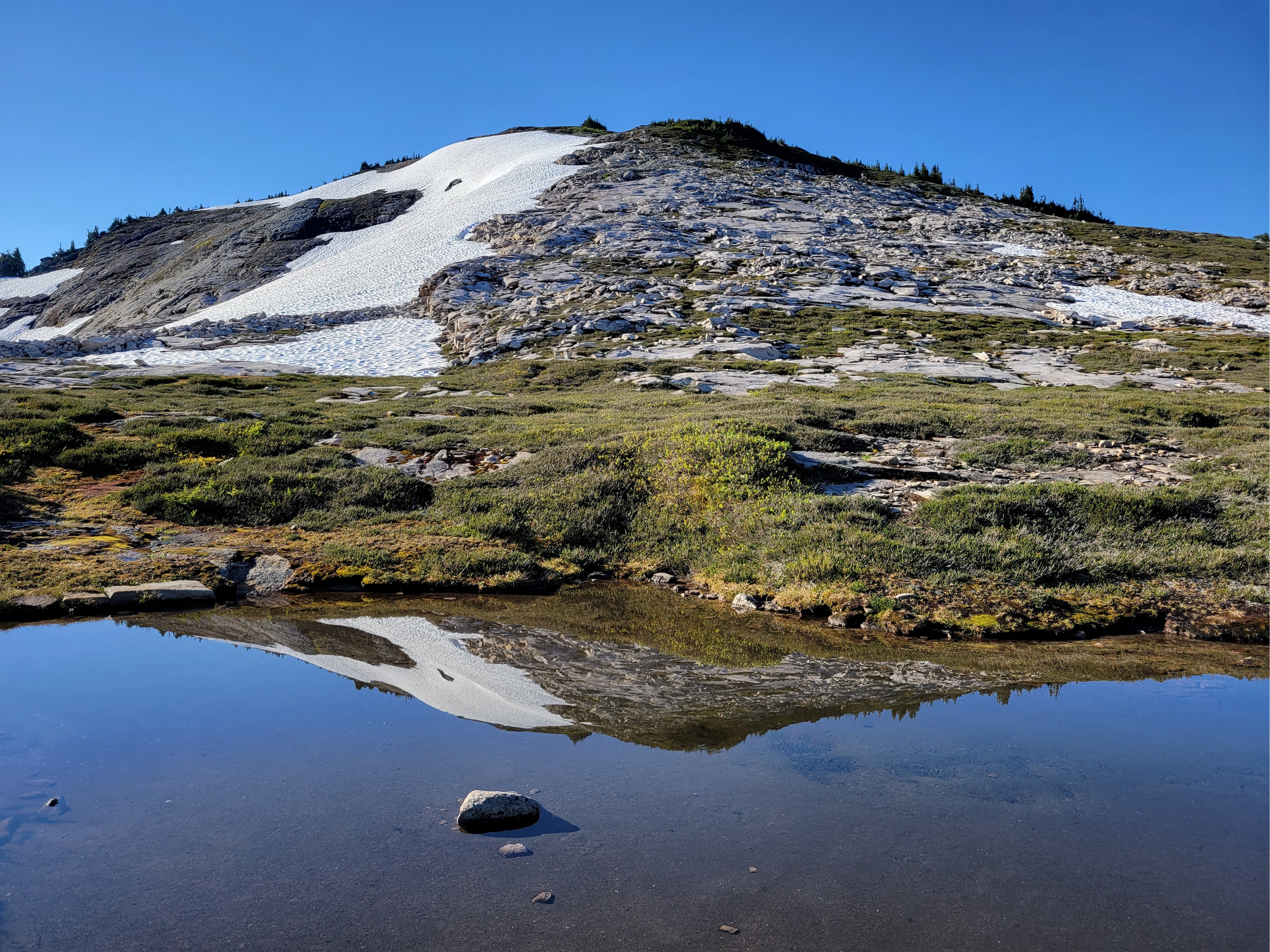
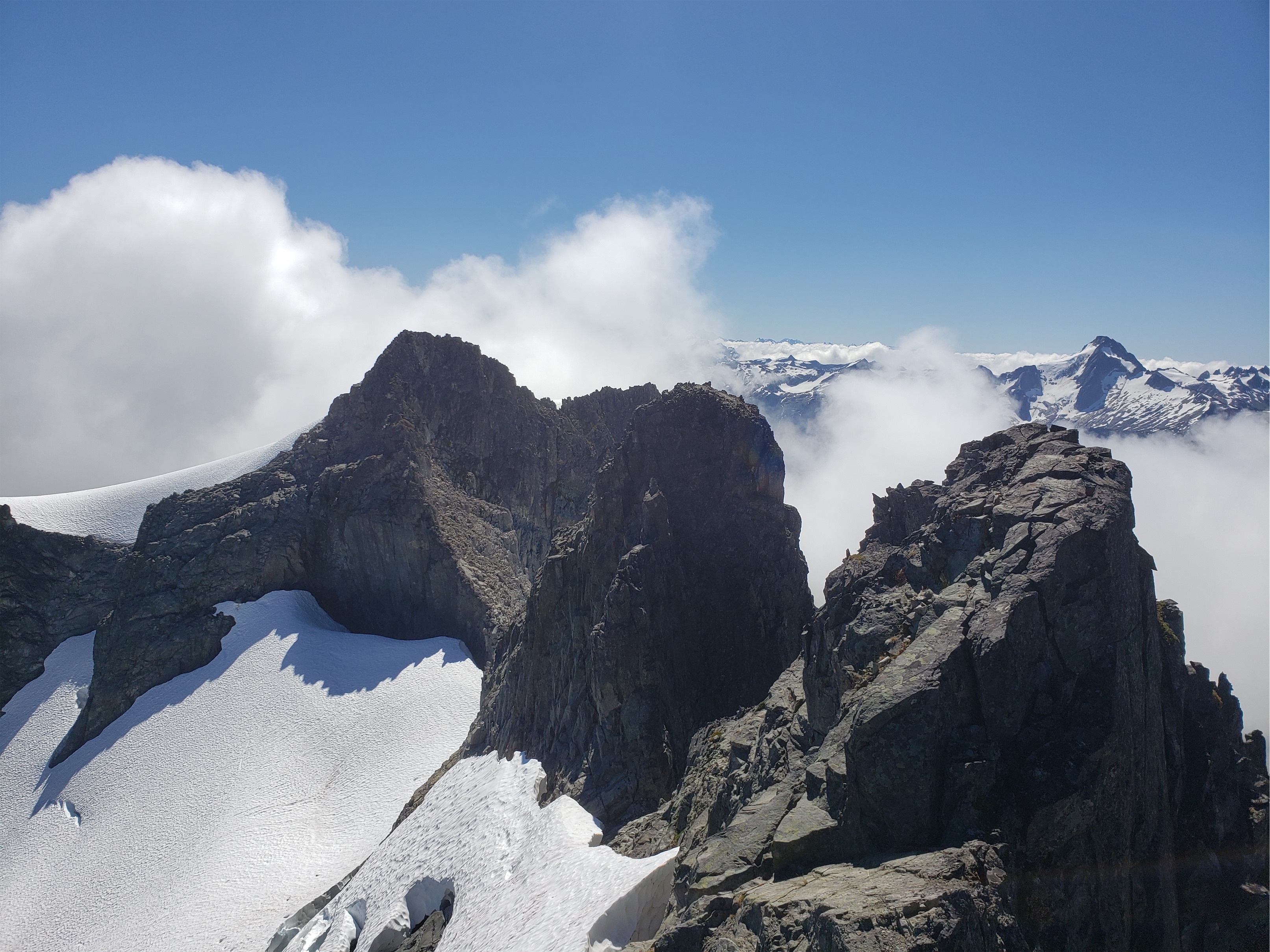
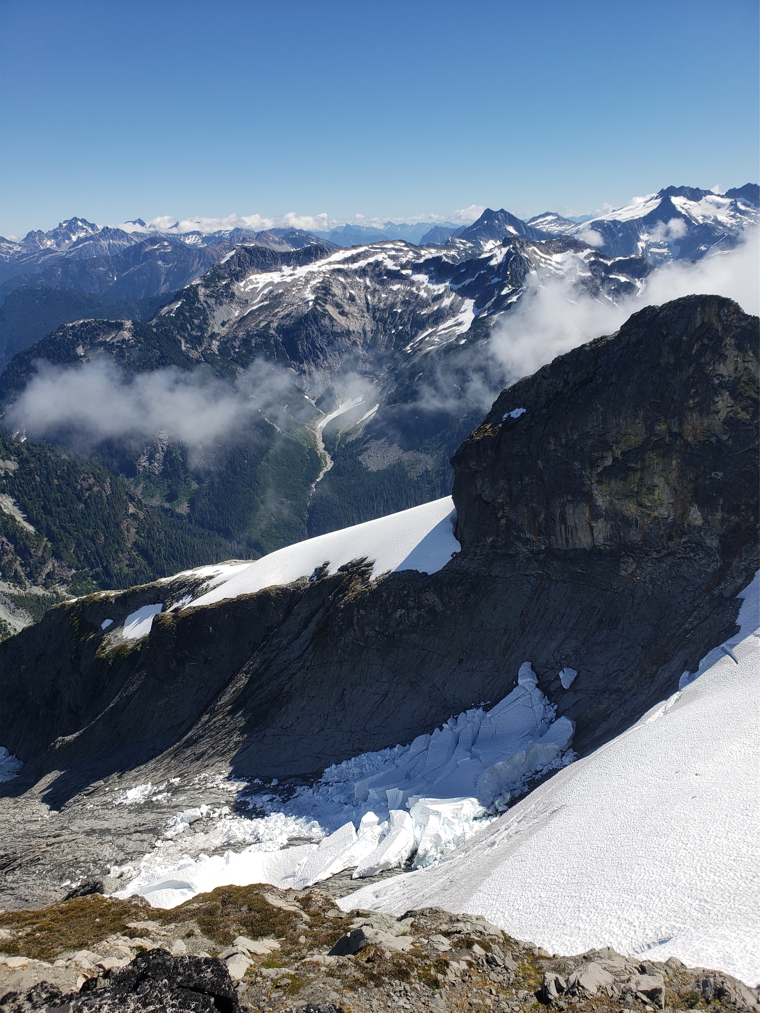
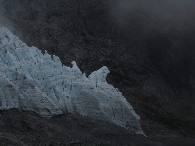
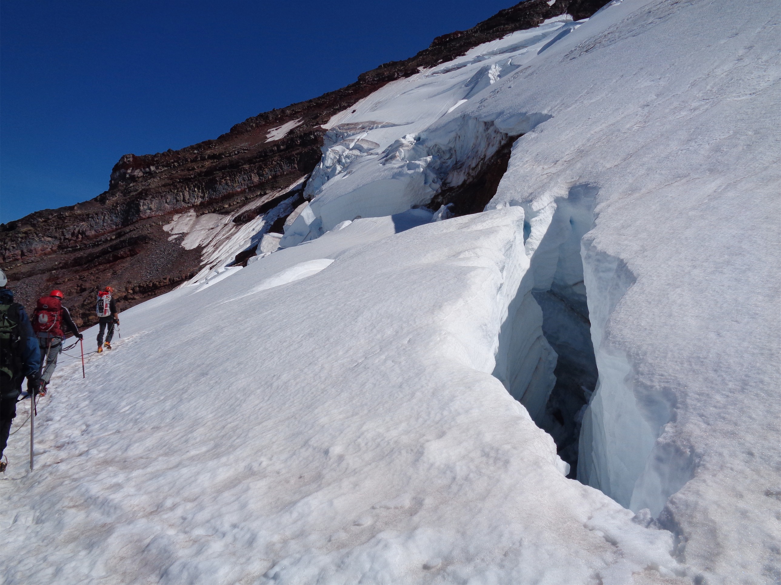
The bergshrund still had a huge snowbridge, but I could see how it would be entirely impassable later in the season. In fact, just a week later this crazy picture of an extremely narrow bridge was posted on Facebook, the comparison is sobering. I wish I had better pictures for comparison. The bridge was 10+ft across and 3+ft thick when we crossed it, and the pic on fb shows a very narrow piece that won’t last much longer. A good example of how quickly conditions can change and how you can never be positive what’s underneath you. That bridge could have been hollow underneath and we just happened to see a 3ft thick piece from the angle we were at, who knows.

The spookiest part for us was right above the bergschrund. We switched back to climber’s left up a steep slope above the bergshrund, and I was kicking steps when we heard a WHUMPF and the entire snowpack moved and a tiny half inch crack opened up directly below our feet. We froze. “WHOA did you hear that holy shit” I was scared to kick another step for fear the whole slope would give way. But when nothing had happened in 10 seconds, we hauled ass up to the ridge (only ~20ft away). Our best guess is that it was a glide crack or something similar to a slumping cornice given we were on presumably unsupported snowpack above the bergshrund. I did not take the time to try to dig and see if it went down to ice vs rock, but believe me I wish I could 1) see what it looks like now and 2) go back and set up a safe way to analyze what’s beneath it. I texted Forrest (long time avy instructor and very experirnced climber) as soon as I was home to debrief. That’s the best we can do, try to learn from what we experienced. Maybe we got lucky this time. Glide cracks don’t tend to get triggered by human weight, but a slumping lip could.

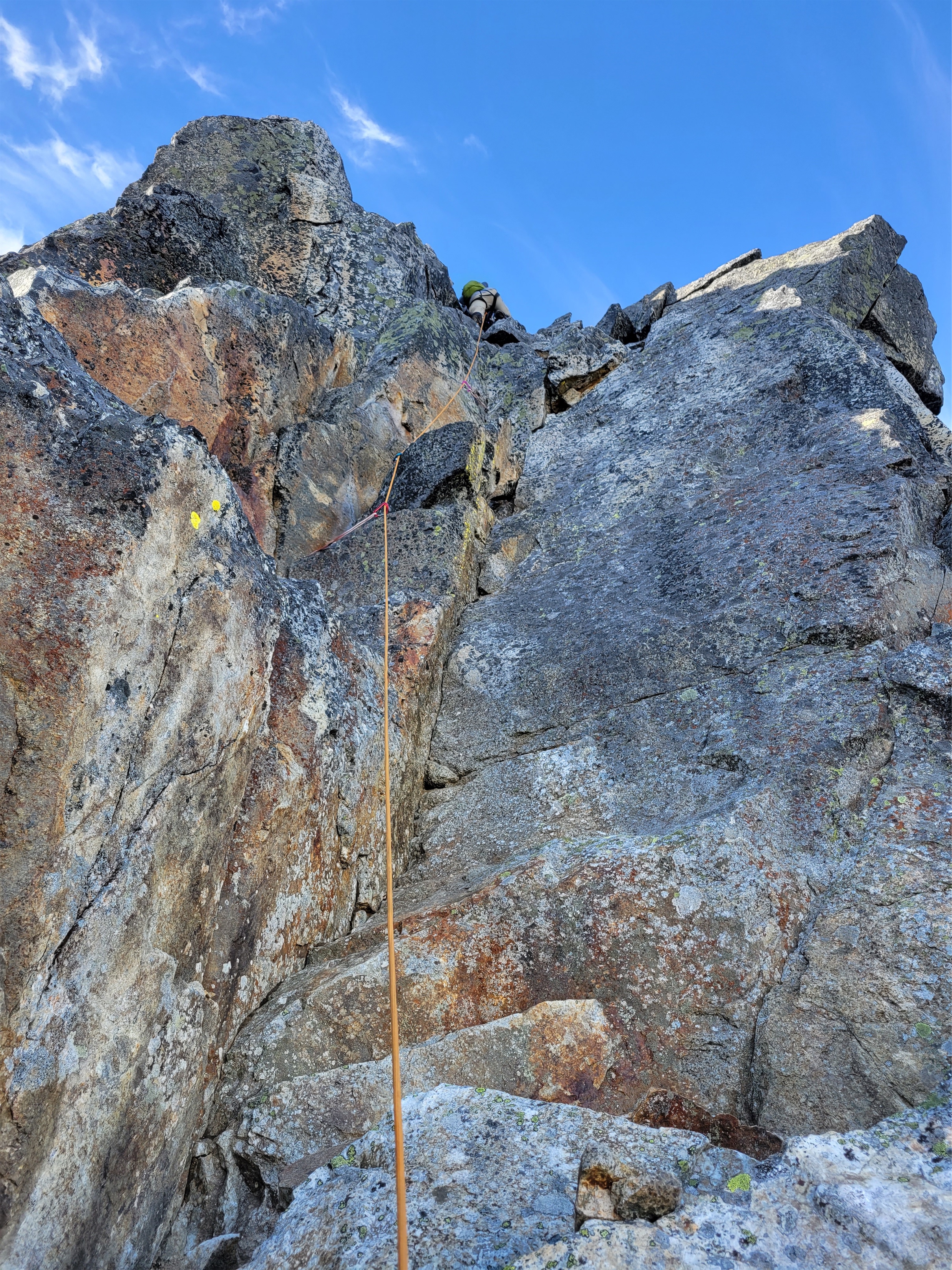
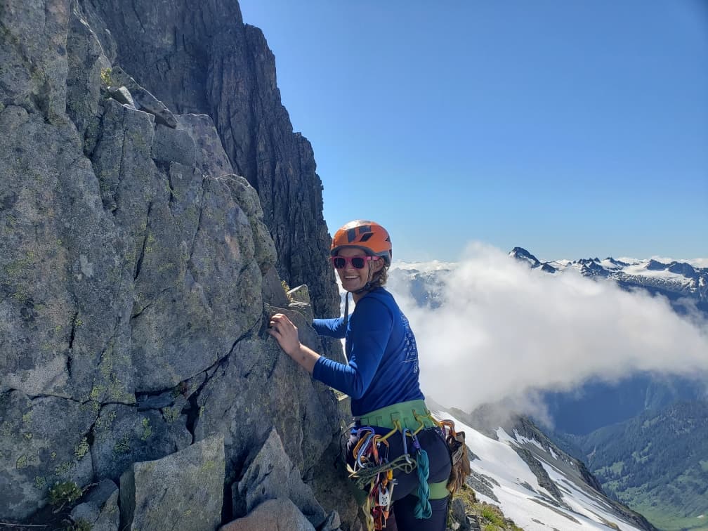
We followed another mini snow arete to the rock. I jumped into a moat because I like being snugly between rock and ice while Jon stayed on the snow slope until it petered out. At that point, we stashed snow gear and it was an easy scramble to the “5.5-5.7” rock pitch. The beta I read said “5.5-5.7 depending on how long your arms are” which suggested that some nice jug would be just out of my reach leaving me with shitty slabs, but I have fairly average arms and there was no shortage of jugs or mantles. We didn’t even use the 3 pieces of gear we had brought. There was a piton, another piton, a third piton, a fixed cam, and a fourth piton, and boom you’re at the top of the pitch. Jon led it in his freaking Merrel Moabs and I followed in some Vasque basically-trail-runner-but-with-ankle-high-tops. It was fine. Definitely not 5.7. We stashed the rope there and scrambled to the summit including another cool alpine sidewalk with some exposure. There is a rap anchor on the summit, so I think some people stay roped up for the top out too.
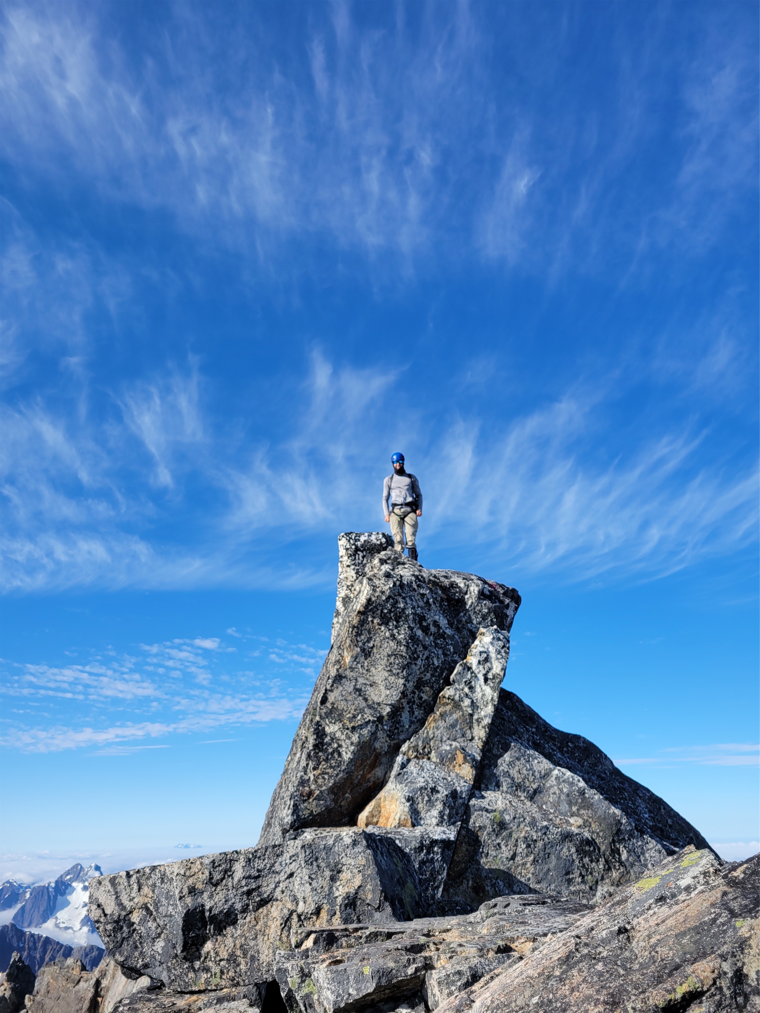
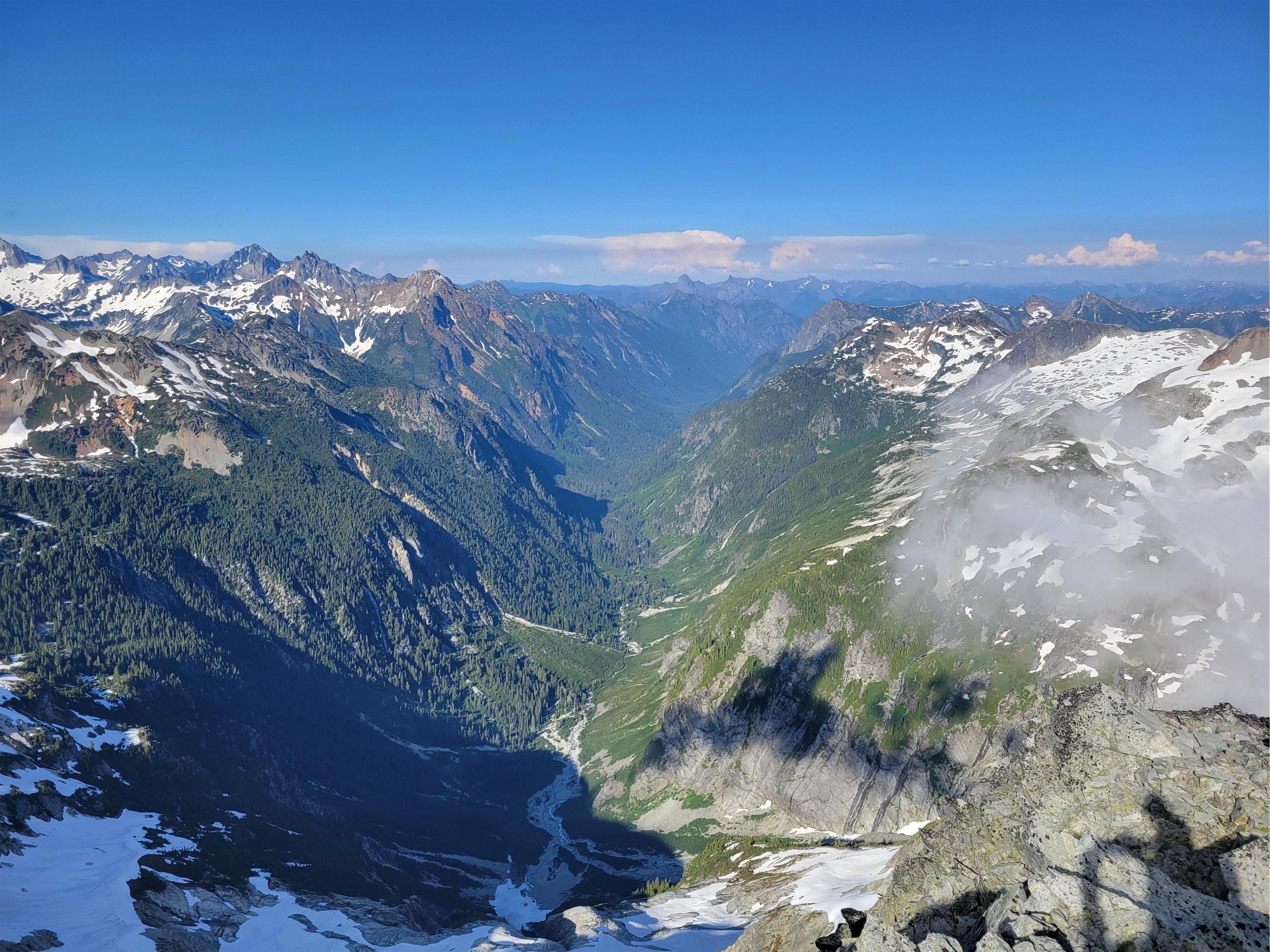
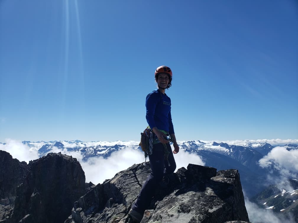
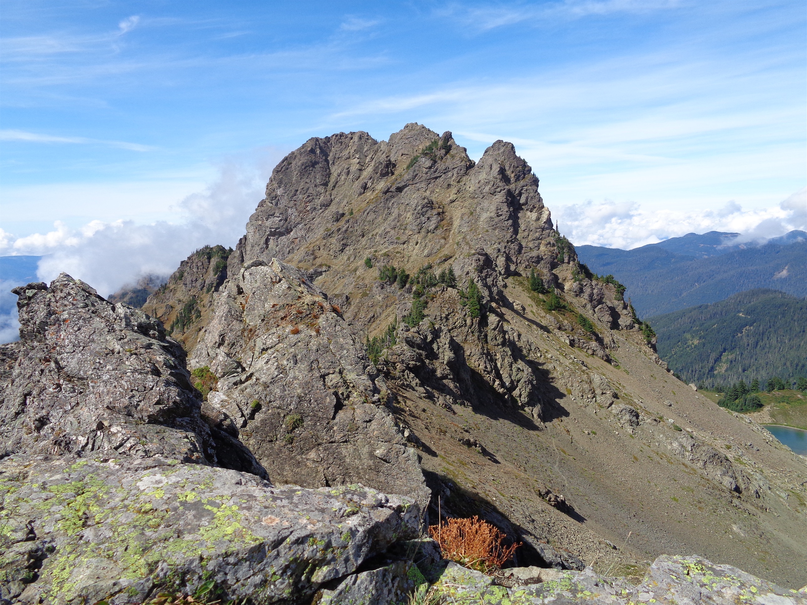
Summit views are ridiculous. The entire northern Pickets cirque is just breathtaking. Eiley Wiley Ridge looks beautiful. Luna seems standalone, almost not part of the Pickets ridge, but with two beautiful lakes below a face that rarely gets climbed above a valley that rarely gets visited. Fury’s NW Buttress looks insane, both the approach and the buttress itself. Like it literally might be easier to approach via Challenger than bushwhacking with the bugs in that valley, yikes. As usual I was eager to get down, so I went to start setting up the rappel while Jon enjoyed the summit views for a few more minutes. The rap was fine with a 30m rope, and soon enough we were back on the glacier where we followed intermittent tracks (surprised how quickly ours had melted/blended back in with the snow) back to camp. At one point I was moaning about dehydration. “Well have you been drinking from your camelback?” Jon asked. “….no…” I replied sheepishly. I kept forgetting it was there. 20 minutes of me monologuing later, Jon said “hey, you do realize I’m 20ft behind you on a rope and you’re facing away from me? I have no idea what you’re saying.” Oh, right. Glacier travel. Damn.


At camp, holy shit – people! We ran into Ryan Stoddard and an old acquaintance Westy that I hadn’t seen or talked to in several years! Small world. They were just as surprised as us to see others. They carried on towards the summit. Jon remarked about their small packs. I said yeah.. knowing Westy, they’re probably doing one push. When we got back to cell service, yep, sure as heck they had done it in one push. Absolutely insane. Those day packs must have been nice.

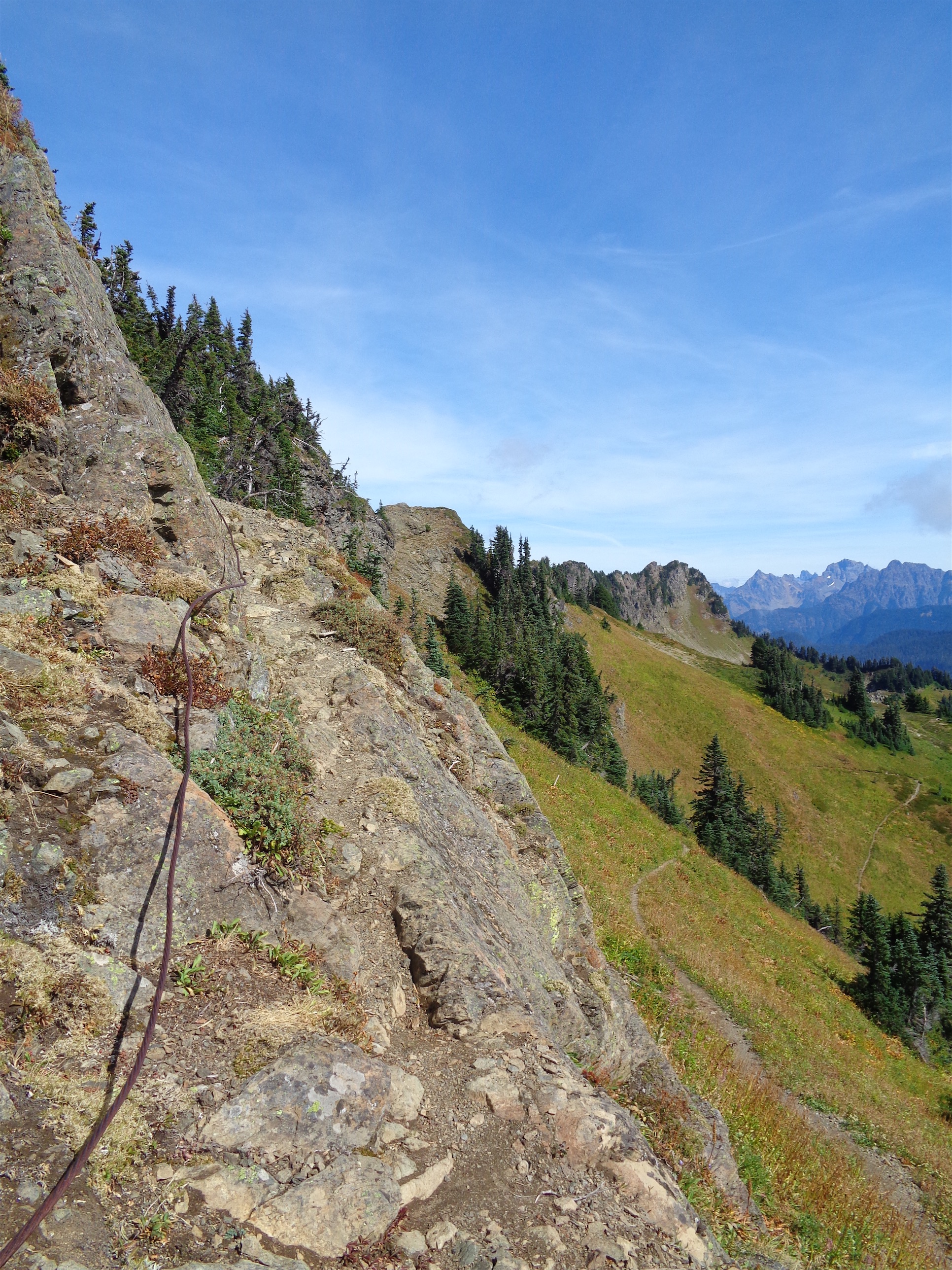
We packed up camp and tried to find the impasse on the way down. Having no beta on that side made it seem mostly impossible, so we gave up after 20-30 minutes of scouting and went back down the way we came. We downclimbed the top of the slabby arete the way Jon had ascended, and then rapped the second half. Or, I rapped and Jon used the rope as a hand line. My rope management in precarious positions is quite nifty. I was relieved to be below the slabs. Now all we had left was the 5.7 trees, which we quickly found and ignored in favor of the grassy gully to skiier’s left. Which went almost to the bottom! We were forced into trees for maybe the last 15-20ft, but MUCH better than what we fought on the way up. From there, we followed the bear’s trail back over a small river, down to the bottom of the impasse canyon, and over to some talus where we regained what felt like infinite elevation back to snowfields while being absolutely cooked by the sun. I have never been so sweaty in my life. The snowfields looked so short and doable. “It’s right there Eve!!” Jon said pointing at Easy Ridge. Right there. And probably like 2 hours away.

We alternated between heather and snowfields, dunking sun hats in every river we found, splashing faces, chugging water. Jon dropped his sunglasses somewhere but we knew we had no chance of finding them, fortunately I had spares… bright pink spares. He looked great. Actually he looks better in them than I do. At the ridge our spirits lifted knowing we just had short ups and downs and ridiculous alpine views. I could hear thunder in the distance which was starting to concern me, but that was a problem for future me. Jon didn’t hear anything. The last crux for me was the far side of Easy Peak, where I knew we’d have to drop down that shitty loose rock and then steep snow again. I refused to let my brain turn off until we were past it. I immediately trundled like 5 big rocks down to the valley below. Jon went far skier’s right and I stayed left so we could both kick down whatever was necessary without concern. At the top of the snow, I put on crampons and he stuck with boots, fortunately the snow was more mellow than I had remembered it. He waited for me at the bottom while I calculated every step, too tired to trust my feet enough to plunge step given the lack of purchase I was getting. I just didn’t have the strength left to really force a good heel cup and 40whatever lbs on my back wasn’t enough to make it happen naturally. It was extremely tedious.

We ran into two climbers going to put up a new route on the west side of the Pickets. Intrigued but not wanting to press too much, I just asked if they’d post a report if they were successful. Answer: yes, and here it is!! They had a great trip doing a new route on Spectre, a seldom visited peak WAY the fuck out there. Probably in the running for most remote point in the lower 48.
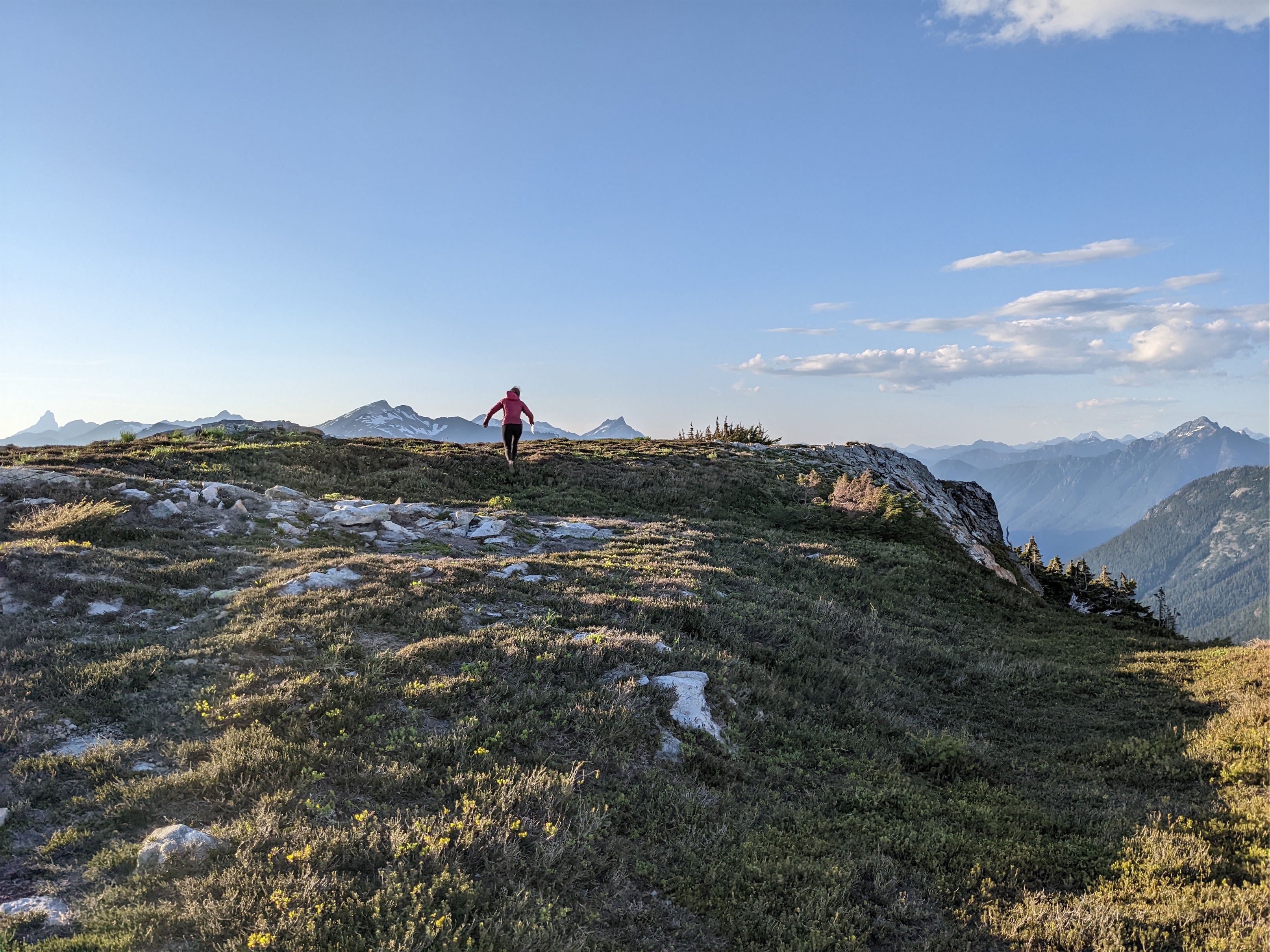
We overshot our goal campsite by some lovely tarns, quickly realized it, turned around, and hiked the longest 0.1 mile I have ever hiked in my life before dropping packs and setting up camp. Finally Jon heard the thunder too, I confirmed I wasn’t losing my mind, and we looked over to see a massive storm cell to the east. I have no idea where it really was, but Challenger was about 5mi away and still in the sunlight, so hopefully it stays over there. It continued moving due south, leaving us with sunny blue skies and an interesting slow motion show.

We filled up on water, enjoyed out last dehydrated meal, jumped in a frozen tarn, took a thousand sunset pics over the less frozen/more buggy tarn, and then dove into the tent to hide from the bugs. The bugs. Were. Everywhere. And lower on Easy Ridge was even worse. Yeah tarns are gorgeous, but they spawn mosquitos. You can’t win them all, you know?
We got moving around 8am the next morning and had an uneventful trip out. Whatever had been in my head transitioned to Down as we lost elevation. In addition to losing elevation, I also lost the Easy Ridge trail on the switchbacks again, same as one of our gpx tracks did which was amusing. My phone had a +/- accuracy of 20ft, which is not really helpful when you are trying to find a sometimes barely visible trail. Jon’s inreach kept turning off every two minutes due to what he later figured out was a corrupted memory card. Jon with balls of steel took the log to cross the river again, I rapped the riverbank and forded it because fuck no my life flashed in front of my eyes on the way up no way am I doing this log downsloping even if the ratio of foot size to log diameter is better for me than for him. Yes, the rap would have been unnecessary if I had scouted like 50ft downstream, but I didn’t, I just wanted to keep up with this crazy guy who has no fear and far superior balance to my own. Perks of river ford: freezing water feels absolutely incredible on cold tired feet and calves covered in a burning heat rash. Upon our return to the main trail, we immediately found the trail to the river we had missed with freshly cut logs. And then we found fresh drainage ditches. And then more freshly cut logs. And then… the team clearing the trail!! Woohoo! We showered them with gratitude and praise. Turns out in the park you can use chainsaws unlike in the wilderness areas (and I guess park trumps the fact it’s all Stephen Mathers wilderness?) where you can only use hand tools.

I knew the return to Hannegan Pass would be tough. When we broke out into the sun like a half mile from the pass I was ready to get roasted. At the pass we took a long break, Jon hiding from sunshine and people deep in the trees to recharge and me plopping down with the crowds to chat everyone up so I could recharge. But first I dropped my pack and grabbed a nalgene. I had one thing on my mind. “Snowcone” I whispered as I grabbed it and then i shouted SNOWCONE as I ran to the snow to stuff my water bottle with snow and flavored mio. 10/10 prime alpine dessert.
I’m striking out on synonyms for brutal. The hike from Hannegan Pass to the car was absolutely.. heinous? Savage? BRUTAL! How can a trail with so many streams be so incredibly dry?! It was BAKING in the sun. So hot, so dry, I got mad that the streams were all so low to the ground (OBVIOUSLY) and weren’t like waist level waterfalls next to the trail that i could easily touch without squatting or bending over. We ran into a friend I haven’t seen in years, Jennifer, and we did a quick greeting before Jon and I hustled onwards because we were in survival mode. I told him all about her ridiculous garden and flowers and wedding pictures and mushroom foraging. I’m surprised he didn’t tell me to stop talking. I did it myself when I was convinced we were near the end of the trail. I predicted 800ft or 300 steps to get to the parking lot. It was 291 steps. That’s the closest I’ve ever been in my life to having my guess match reality, even when I have line of sight to where I’m going. Sheer coincidence but I was so stoked.

We split a beer at the car because I couldn’t handle a full one. I was so dehydrated and hadn’t left any water at the car. Rookie mistake. Jon fortunately had some he shared. We changed into fresh clothes and beat the rush at North Fork Brewery on highway 9. We parked, stumbled in (literally, in my case), got bar seating. I almost burst into tears when the bartender said “hi” because it knew we were about to be taken care of and fed (because we were giving them money, but still).

We ordered a large artichoke dip, a calzone, and a hoagie. Next time I’ll just get two large artichoke dips. It’s fucking DELICIOUS. It arrived and we though shit that’s way too big and 10min later it was gone. I added extra romano cheese to all of my servings. I couldn’t believe I ate the whole sandwich too but I did. Fabulous. 10/10. The servers were swamped. There was a 90min wait for takeout! The manager came out to the bar at one point and said “I disconnected the phones for you guys so you don’t have to answer.” That’s good management right there. Being the boundary for his employees. But they kept on top of it in good spirits and I tipped excessively. Get there before 4:30 if you can, it’ll be a mobscene after then.
It has been a long time since I had a trip that strenuous. I have a five day coming up this weekend and I’m hoping it’s a breeze compared to that because wow. Challenger is one of the easier, more accessible and popular Picket peaks and damn it is still a committing trip. Spectacular scenery though, and worth the effort a thousand times over. But next time, I’m looking for the imperfect impasse, even though I think I’ll hate it (lots of slabby negative holds with exposure). Or I’ll go in via Big Beaver and Eiley Wiley ridge for traverse purposes (plus that ridge has some cool lakes). What a ridiculous area. I wish I had more free time. And maybe also a helicopter.


