
Robert looking at Icy. Spillway Glacier on the left being sad, Icy Glacier looking good.
Gotta go up & over Ruth
We figured we’d do a 1.5d trip, trailhead camping or hiking in a bit on Saturday night and doing the real deal Sunday. Weather was iffy on Saturday, so this ended up being the right choice. We tossed a few ideas around and settled on the Ruth-Icy traverse, given we could hike in to a bunch of options for campsites and have a lot of flexibility to play our timeline/availability by ear. This ended up vastly surpassing my expectations honestly, bringing us across two mellow glaciers, lots of off trail travel and navigation, a fourth class scramble, a sweet rappel, totally remote feeling alpine terrain, and third class dehydration to top it all off.
- Distance:16mi round trip
- Elevation gain: ~8k ft (7100ft highest point)
- Weather: 80’s… and sunny
- Commute from Seattle: 3hrs
- Did I Trip: No but Robert had two good talus stumbles
Morning mist and shadows (PC Robert)
We got to the trailhead around 7pm on Saturday, and made it to Hannegan Pass right at dusk. There is NO RUNNING WATER past the signed Hannegan camp so be prepared! There were some rowdy folks at that first signed site, so we kept hiking. There was a medium site off the trail to the left (within sight of the trail) that we called Plan B, but I thought there would be more near the meadows at the actual pass, and I was right. There’s a huge site at the pass itself (occupied) but if you continue along the path to Ruth, there are two more off to the right (social trails) and a third beautiful one with phenomenal views at the meadows just before the steep treed section. Not knowing what was ahead, we settled for one of the forested sites off to the right of the start of the trail to Ruth. I am grateful for our quiet and welcoming neighbors, who pointed out the site to us and said totally fine for us to stay there. I hope we weren’t an intrusion. I think every time I’ve been up here I’ve sworn that I’ll camp on top of Ruth, or at least along the ridge. Or bring skis. But there I was, breaking all my promises.

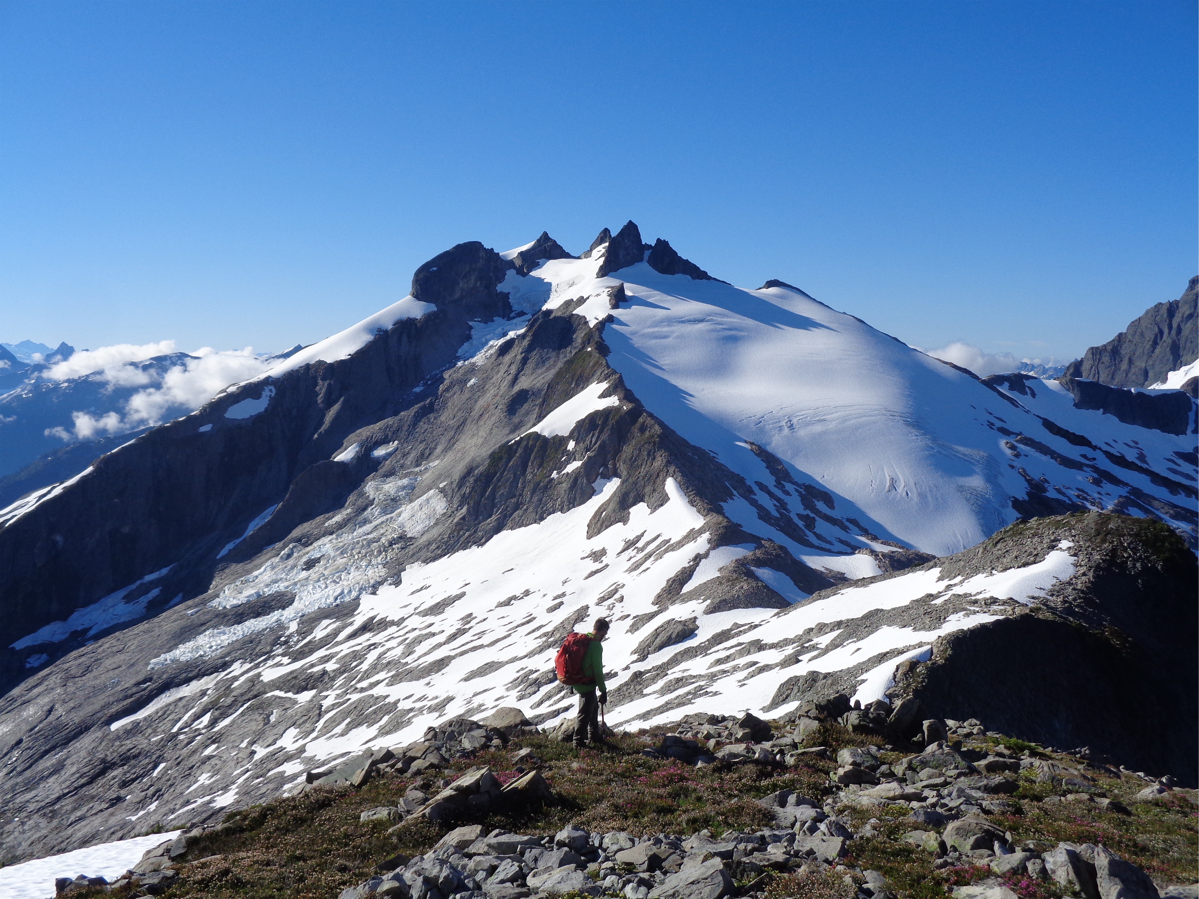
First good look at our first climb: Ruth
Everything was socked in by clouds and the night was chillier than expected given the dampness in the air. I figured we could still at least tag Ruth in the mist and see if we got above clouds, but I wouldn’t want to do the traverse to Icy without good visibility (plus what’s the point? I’m there for views!). I could feel my enthusiasm about climbing starting to pique again. Over the past few years there have been several points where I’d be looking for excuses to bail on climbs, fighting burnout, yet here I was thinking eh, even if it’s misty we can still try for Ruth and see what happens. Part of this might have been that I had been to Ruth before (five years ago!! FIVE YEARS! Have I been here that long?!), so while I knew what insanity I’d be missing in terms of views, I at least had seen them before. But I think the other part is having had so much time off from climbing. I remember a friend mentioning that once climbing felt like a chore, it was time to take a break. I knew what that meant on a superficial level, but this past spring was the first time I truly took a break, and it has actually turned out to be incredibly refreshing.

The rock gets closer faster when half your travel is on rock not snow
We woke up to a soaked-through “rain fly,” and I assumed it was still misty outside. Demoralized but desperate to pee, I showered myself with rain-fly water crawling out of the tent, only to see clear skies! Woohoo! We’re in business!
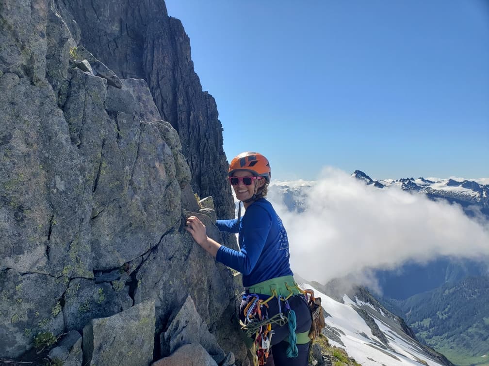
We skipped tea/coffee (well Robert drank a canned cold brew) because it was chilly and we wanted to start moving. We followed social trails back to the main trail, and started up the 3rd-class-trees section (added bonus: muddy and slick) before skirting east around the peak on the ridge to Ruth, coldbrew in hand.

Ruth Creek valley from Ruth
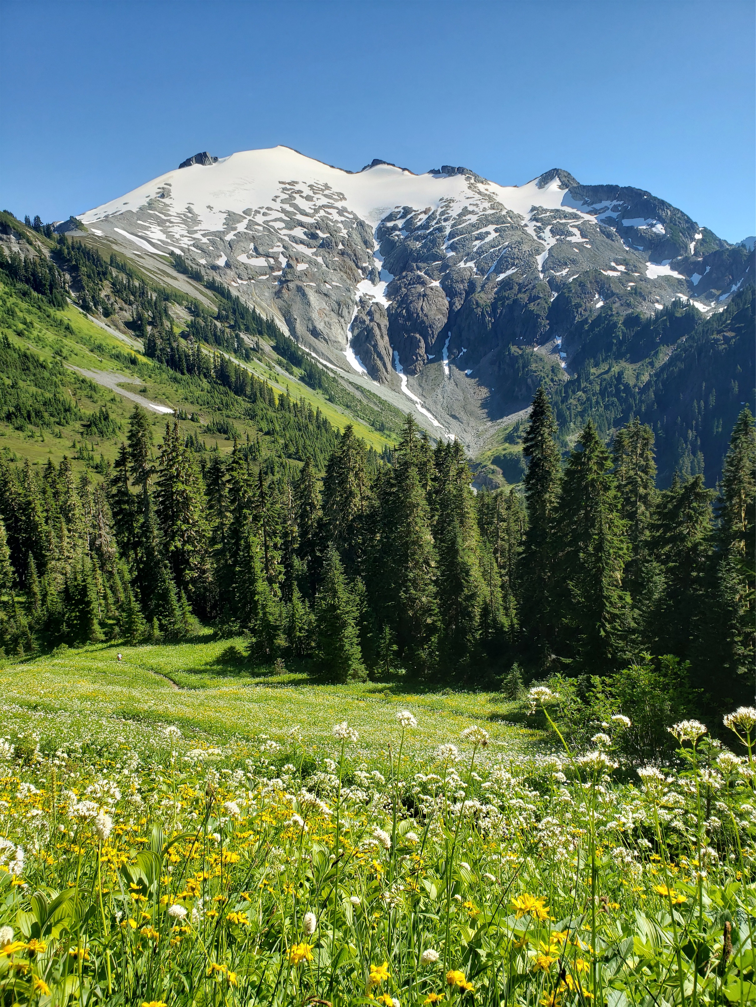
Last time I did this it was snow covered, I had never been here with flowering meadows! The traverse toward Ruth’s ridge on the backside of that small peak was even better than I remembered, heather meadows looking at a glaciated peak in the early morning sun and feeling like you’re somewhere in the middle of the Swiss Alps when in reality you’re like five miles from your bright yellow gas guzzling SUV. We followed the trail along the ridge, hopping across talus until we could traverse to the lowest snow finger, where we finally got on the glacier. Snow was a nice break from talus. That became a theme of the trip. Sick of talus? Here’s snow. Sick of snow? Have some talus!

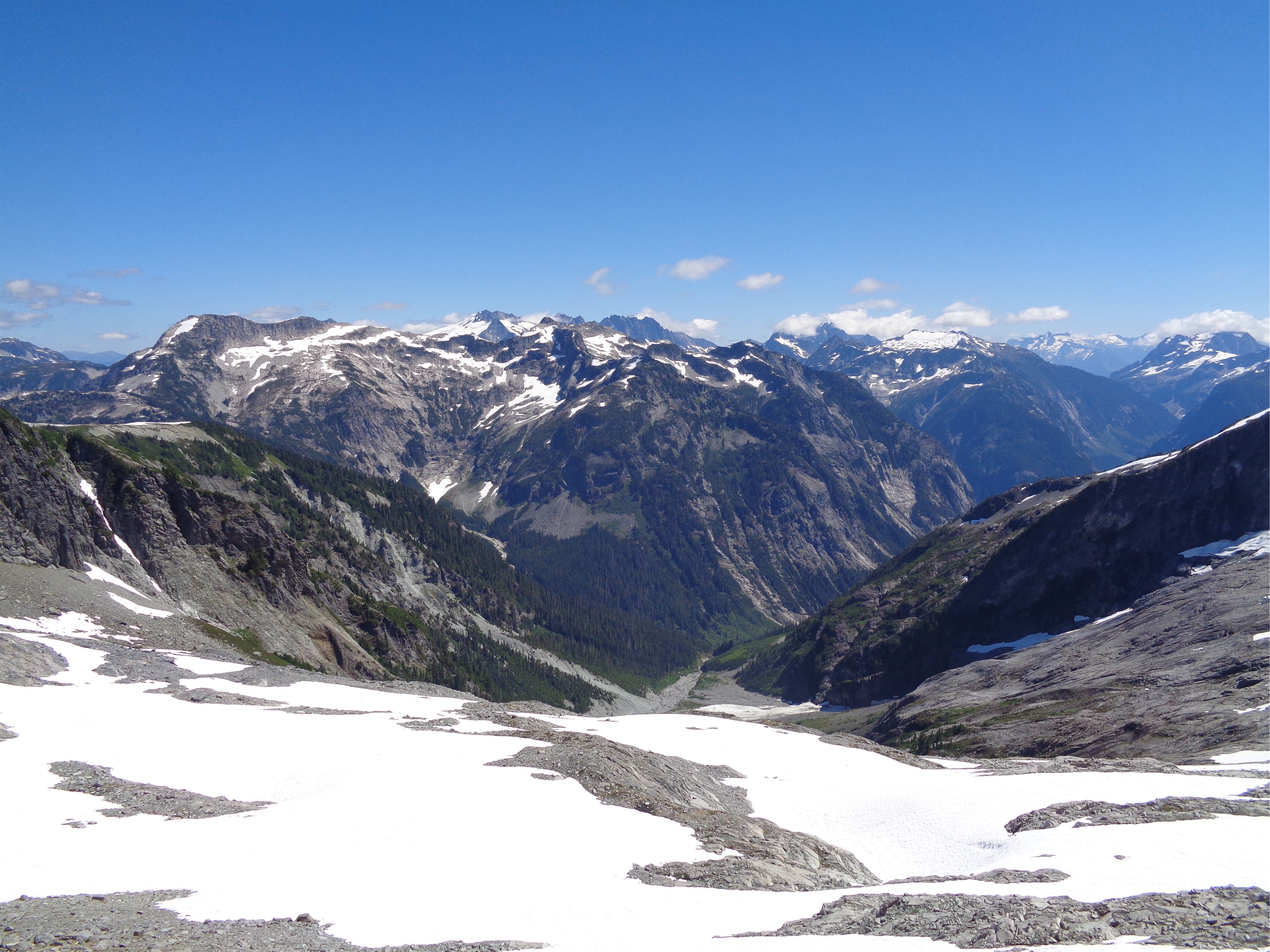
Nooksack Cirque! Seahpo Peak, Jagged Ridge, Nooksack Tower, Shuksan, Baker peaks out (heh)

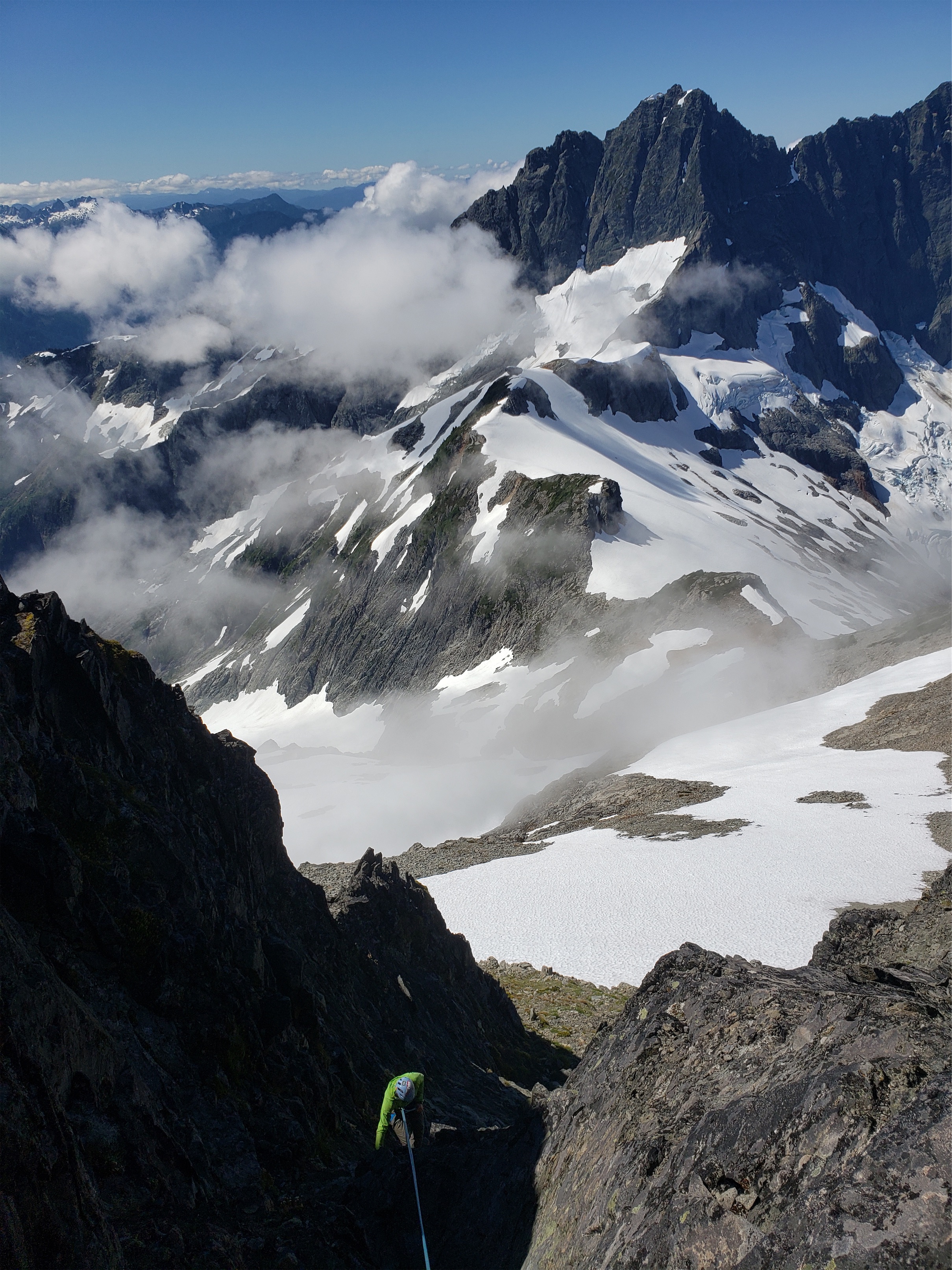
Above the death gully
We brought glacier gear, but did not use it. The glacier on Ruth was still very well covered with no depressions or texture changes on the route we were taking. That said, an old friend from my REI days broke his back falling off route and bouncing off a lip and into a crevasse doing this traverse, so please make an informed decision. No matter how safe your route on a glacier appears, there is absolutely still the risk that something goes wrong.
Okay disclaimer aside, we made pretty good time to the summit of Ruth, where we had an “oh, shit, that’s far away” moment looking at Icy. The route isn’t quite line of sight because of how steep it is, lots of slopes are convex and have those weird rollovers where you don’t know if it goes or not. The glacier looked steeper from far away. We knew we had to wrap around the backside of Icy, not climb what was in front of us. The trip reports I had read took 14hrs from camp between Ruth and Icy (aka further along the route where we were), but they were large groups with newbies, and I thought we could move faster than them.
Robert wasn’t feeling it, but couldn’t think of a logical reason why. We’re big believers in gut feelings, but we couldn’t even think of a worst case scenario for the next leg (dropping down talus fields that were impossible to fall down, too mellow for rock fall, and some mostly flat snow fields where you’d just butt plant if you slipped). Between the conceived lack of risk and my gut being quiet (stoked, even) we decided to continue through the next section and see what happened.

Starting up the Icy Glacier

Robert on the col, Blum in the back
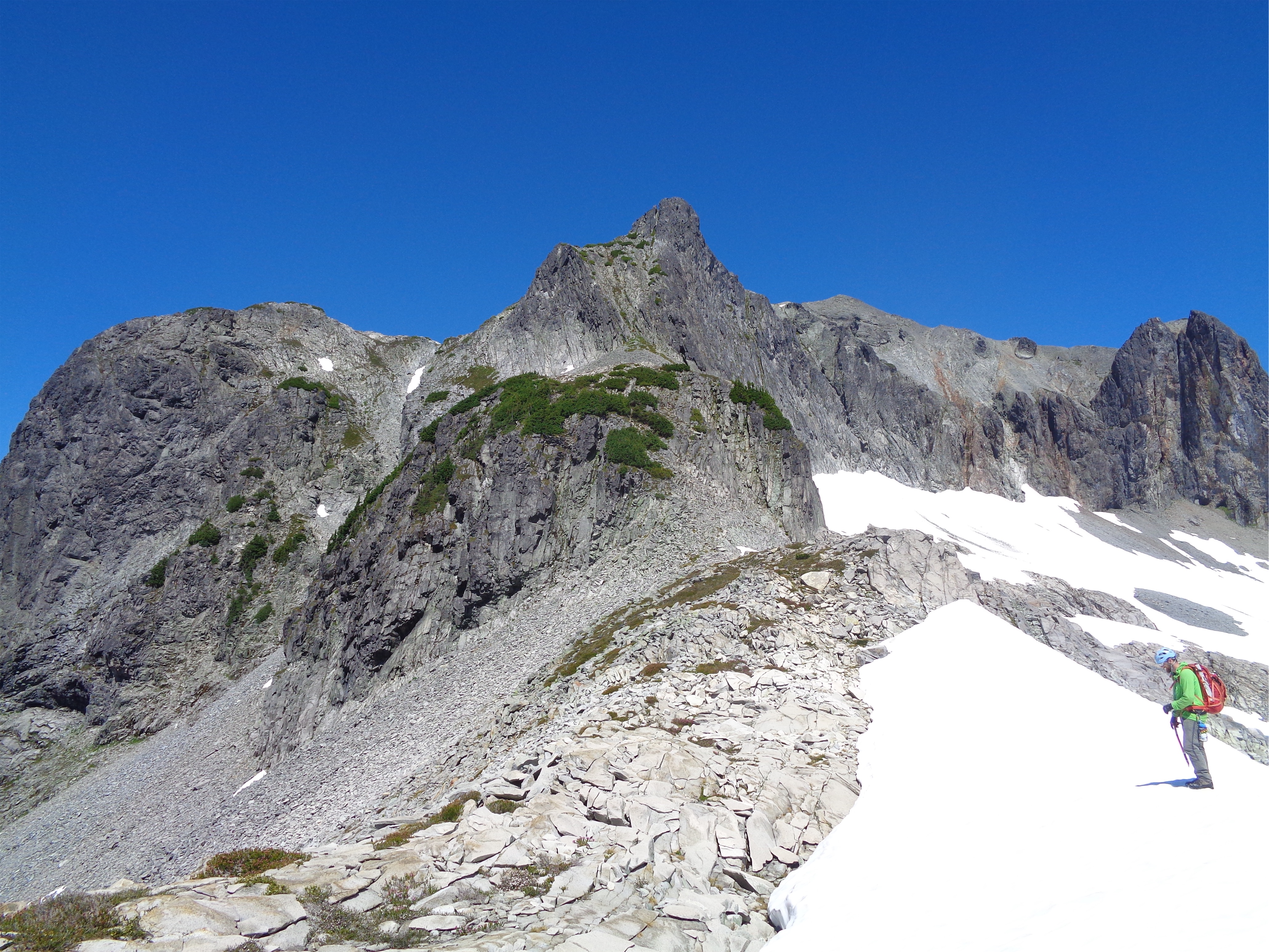
We looked for the trail down the ridge of Ruth, and it actually took us a while to find it. Don’t overthink it. Just drop off the true summit of Ruth (not the one with the benchmark) and start heading off the summit towards Sefrit/Nooksack Ridge and you’ll find the trail. It’s much less annoying than trying to cross slippery sliding talus. Then start traversing talus and snowfields to a saddle around 6,600ft, with a small knoll (and campsite) with stellar views of the Nooksack Cirque. Hopefully you aren’t sick of it already. If you are, I’d like a word.
We took the light left-ish gully
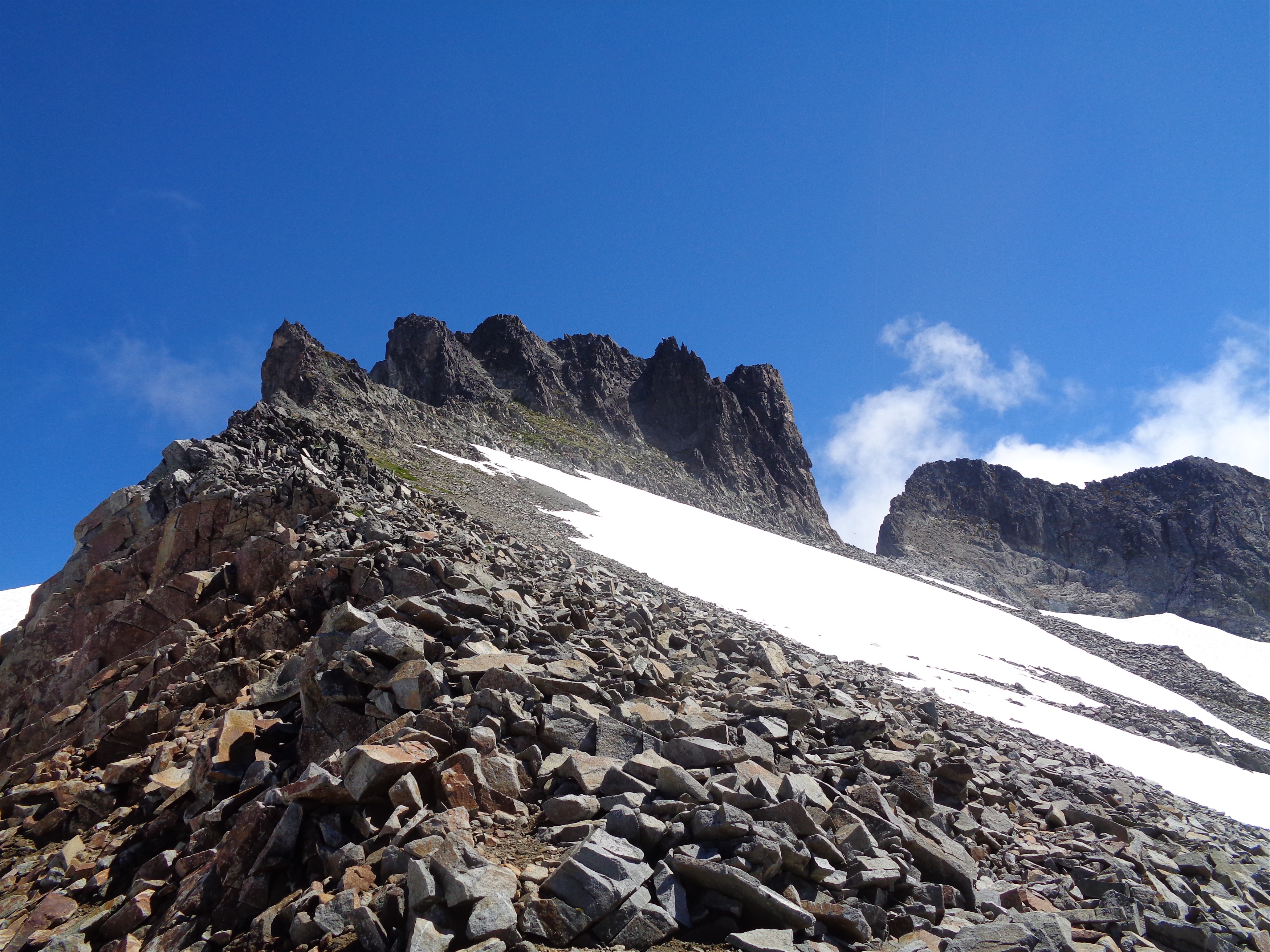
From there, you have two options. The death gully, which supposedly isn’t as bad as it looks but I mean… it looks… like a death gully. And I think you have to regain some elevation once you’re out of it. The other option is the supposedly-cairned heather slopes to the left of the gully. We didn’t find any cairns marking it, but again, don’t overthink it. Basically everything goes, and you can pick your way down game trails, heather steps, and the occasional 2nd to maybe 3rd class scramble move to a field of talus above a small patch of trees. At that patch of trees, again, don’t overthink it. You will find a boot path winding through the trees (more like shrubs) downhill towards the ridge, and with a few feed of 2nd class scrambling (maybe 1 or 2 unexposed/super safe 3rd class moves you’ll find yourself walking talus along the ridge to the Icy glacier. Surprisingly, it was similar to last weekend – we just took every piece of the route on section at a time, and things just kept going smoothly.
Halfway up the scramble (PC Robert)
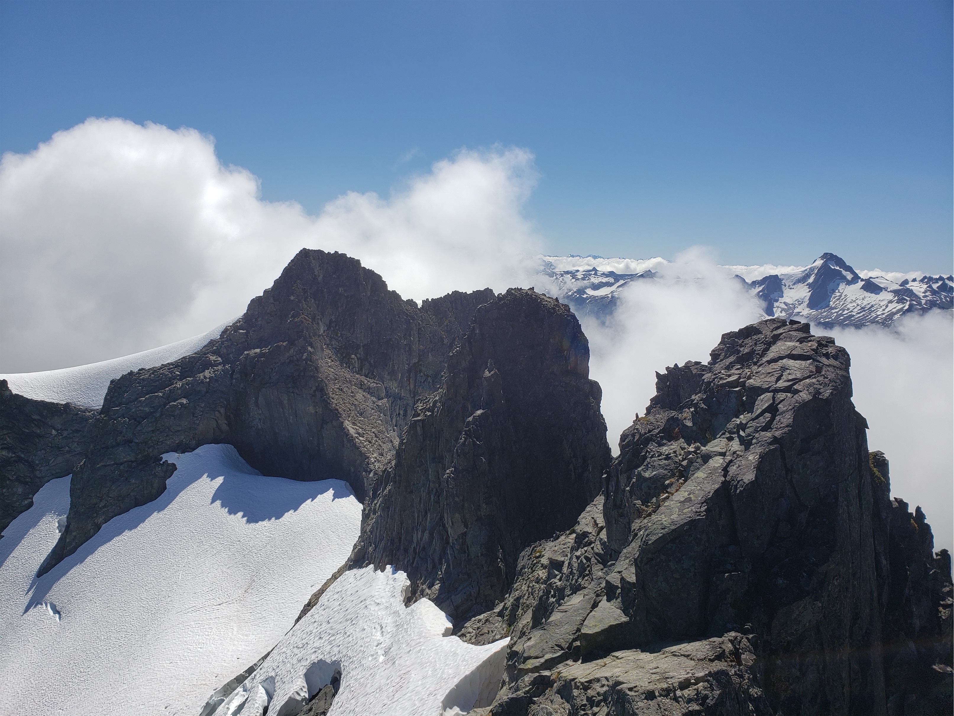
The ridge is a beautiful mellow walk with astounding views in every direction. We looked behind us at what we had come down and marveled at it. If we hadn’t just come down it, we wouldn’t think it goes. It looks totally steep and shitty.the geology along the ridge was also pretty cool, you could see scrapes in the rocks from glacial activity, huge boulders that had just split into multiple pieces. The talus overall was surprisingly solid, and soon enough we were at the Icy Glacier.

Almost at the notch (PC Robert)
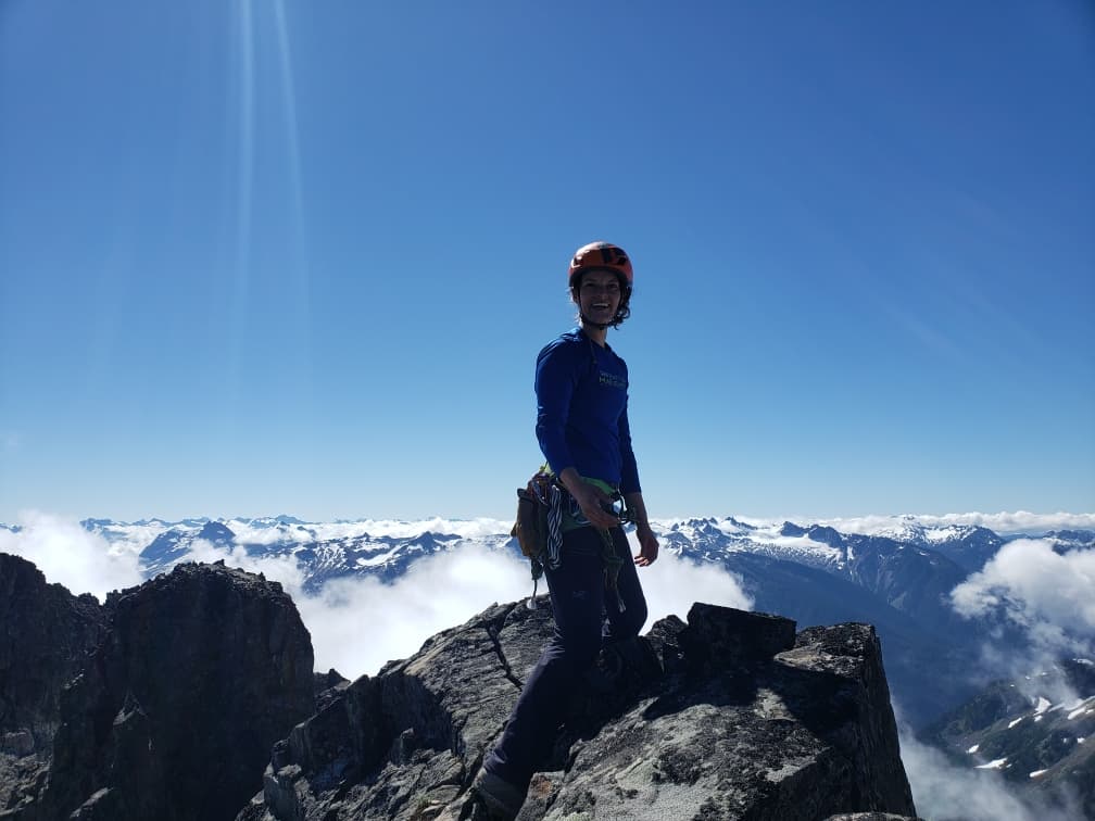
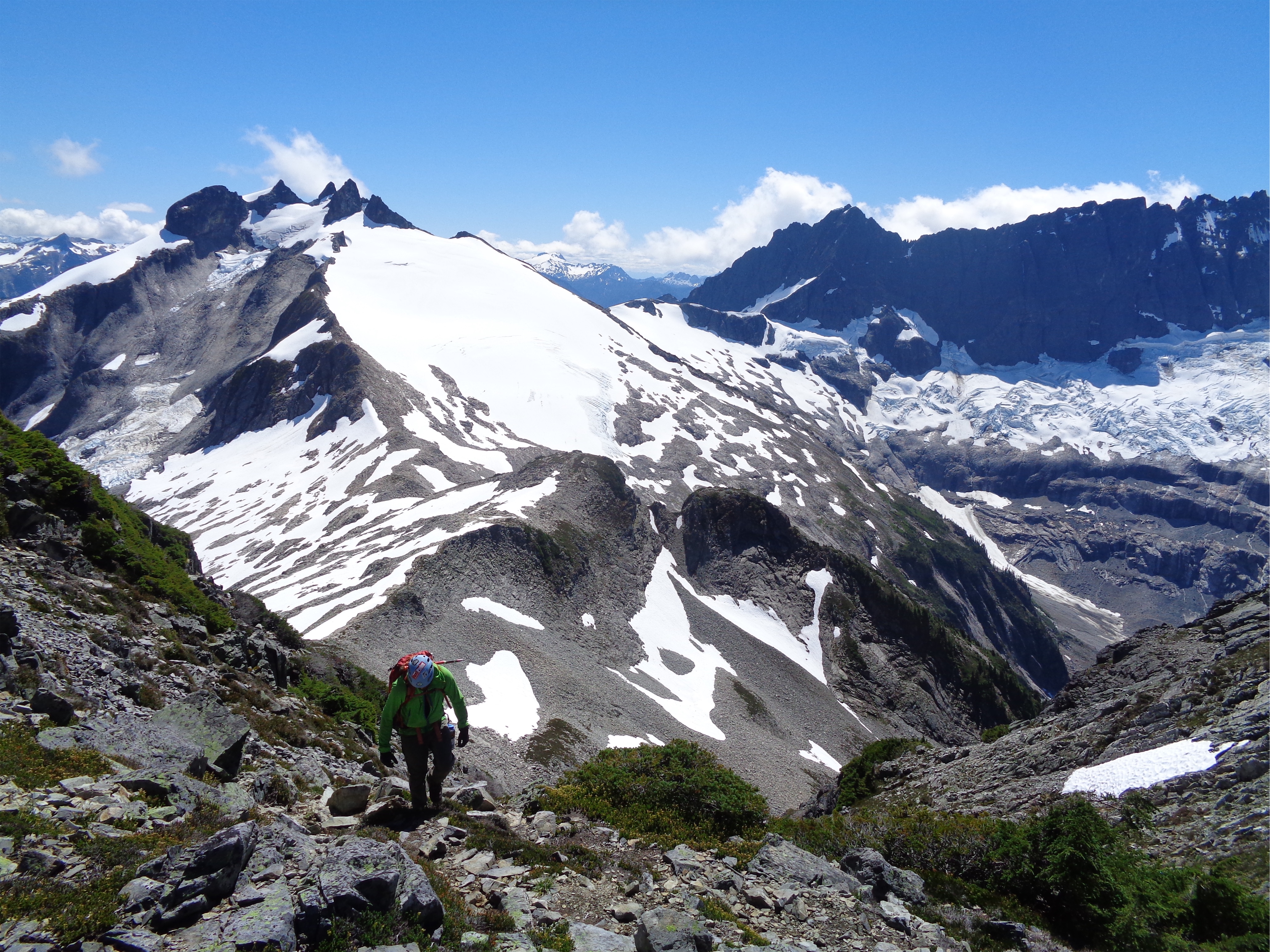
The Icy glacier was also surprisingly mellow and well covered, and we were up at the col to corkscrew around the peak in about an hour. We took a long break here, stuffing water bottles with snow and ditching our gear to do the scramble as light as possible. We hiked up talus to the obvious left hand light colored gully, and the scramble was fairly quick too. I had read everything from “2nd class” to “4th class but feels like 5th.” Robert took the left side, I took the right side. The right side was definitely 4th class in that it had plenty of solid jugs and ledges, but required hands and had some decent exposure that I wouldn’t have been stoked to downclimb. And it felt like climbing! We made it to the rap station and I headed to the east peak, having heard that was the true summit. THAT had some wildly exposed 4th class moves (and a sidewalk style slab that you can just walk across even though your brain is screaming CROUCH!!!!!), but again, mostly super solid rock and giant jugs ( which happens my favorite trivia team name in response to my friend’s team “big crimpin”).
Another false summit! Someone’s happy (PC Robert) so we’ll pretend it’s real

Looking back at Ruth
To my dismay, there was no summit register. But the trip reports and the map said the east side summit was the tallest. I looked back at the westernmost tower. Shit, is that taller?? It looks like it might be taller. We scrambled back to the notch (like 15ft) and up the west tower. Still no register. And now the far eastern tower looked taller. Well, shit. All of the beta and maps led us here, and the western peaks are the ones marked on the map. Maybe someone took it down to be replaced. Or maybe we didn’t look hard enough on the eastern peak. But I do like summit registers, and I had heard that Icy had one, so maybe… it was the FAR eastern peak that was true. I finally found validation an hour ago stumbling upon trailcatjim’s site, which confirmed that the SE peak across the saddle from the Icy Peak labeled on maps is actually 11ft higher than the labeled peak. God dammit. Why is the popular peak the false summit?! Well, we got in two short super exposed cool ridge scrambles, which was refreshing. Reminiscent of Luna Peak where the moves are solid but wildly exposed, except way shorter. And I guess now I have another excuse to come back and fulfill that promise of camping up high.
Pretty sure that cracked one is the true summit. Did a fine fist-crack-alpine-whale to get up that, which is were sour patch watermelon were spilled sacrificed
One really cool feature was the Spillway Glacier, or lack thereof. Back in 2008, this entire face was filled with a very cool partially hanging glacier, heavily crevassed, plunging hundreds of feed to the cirque below. Now, there is a small chunk of still active glacier towards the top, some scattered chunks of ice several feet below it, and a middle chunk of recently-calved glacier, just waiting to be melted in the sun. A stark example of recession, and regardless of what you believe in terms of climate change, it’s still disappointing to see something so beautiful slowly disappearing. Even just compared to 2015 you can see recession – there were way more chunks down low in 2015, and the calving section up high was still partially connected. Which brought us to another topic, that requires a philosopher. If this glacier melts out entirely, and the next ice age begins and a glacier starts to form again, is it still the Spillway Glacier? If a ship is on show in a museum and all of the parts are eventually replaced, is it still the same ship? The Ship of Theseus, the Glacier of Eve.

2008 (PC Crest Pictures), 2015 (me), 2020. Wow! More 2008 pics on trailcatjim’s site.
Robert raps down
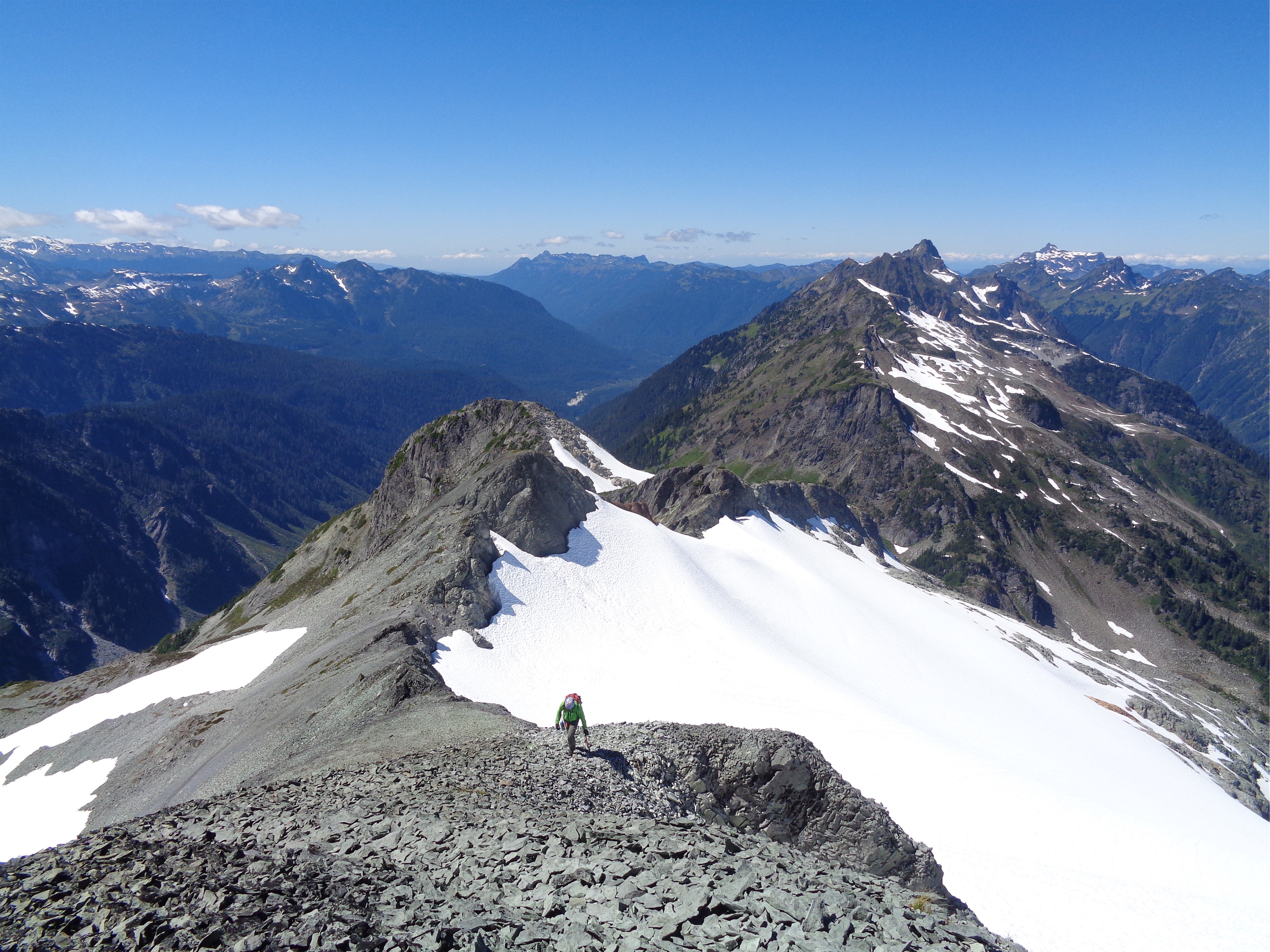
Okay, back to reality. At this point I had accidentally scattered sour patch watermelons all over the summit notch and had almost dropped the $30 of cord I had brought, so it was time to get my hot mess ass off this peak before more calories and dollars were sacrificed to the mountain gods. We rapped the gully which was much better than downclimbing (60m rope was perfect) and quickly got back to the saddle where we took another long break trying to suck water from snow. We put crampons back on and plunge stepped down the Icy fairly quickly, getting back to the ridge in something crazy like 30 minutes. We dropped a little low on the east side of the ridge this time, less convenient because there was no bootpath but it’s all just talus and snowfields so still fairly easy travel. No snowfields had significant running water sources, unfortunately. Stupid ridges. Draining all the water off the sides.

Robert at the base of the gully
We knew the climb back up Ruth would be brutal. It’s 2,000ft of elevation gain to get back on top of Ruth. We laughed at how vertical the route looked again. But as we got closer, the texture appeared. Okay, here’s the mini third class scramble. Okay, patch of trees with a bootpath. Okay, talus slope. Okay, heather ledges and the occasional super sticky granite scramble (not exposed) and boom, back at the first saddle! Okay, now shittier talus and snowfields. We looked up at a saddle south of Ruth. It sure looked like it would go. But then what I thought was Ruth looked spicy from that side. We stuck with the original route, but are pretty sure you could just drop off the false summit of Ruth across talus straight to the snowfield near the saddle, and save yourself like 400ft of talus traversing.
Looking at the route back up Ruth… does it go?
Still hadn’t found running water. Didn’t want to melt snow. We both had pounding headaches at this point and were eating snowballs of mio, which were like the best snow cones I had ever had. We stuffed a nalgene with slush and shook it up with mio, and I tried to drink some only to have all the ice slam into my face. But it was a good idea at the time.we put crampons back on (arguably not necessary, but we decided boot skiing a glacier seemed irresponsible) and plunge stepped our way back down Ruth. We saw only one person on his way up to camp on Ruth’s summit. There were prints from other summitters, but they were long gone by then (even though it was only like 2:30pm). We made a really shitty loose traverse from the glacier to the ridge crest, and from there we started to realize the ups-and-downs of the route.
Pass Creek drainage from the saddle
Yeah, we knew Ruth to Icy involved a huge amount of gain and loss. But coming back from Ruth, the trail along the ridge went up after the saddle. And a rising traverse across a slope. And then down though 3rd class trees, where I got bitch slapped by a small pine leaving a present in my eye and I didn’t have enough bodily fluids left in my to cry it out. And then up to our campsite and the Hannegan Pass trail. While Robert packed the tent, I melted the snow left in our water bottles, and we drank the best slightly-warm mio I’ve ever had.
Above the tree patch, below the scramble
Heading down from the pass, we basically booked it to the car. I was of the opinion that we had no need to rush besides aching feet and a desire to be sedentary with drinks in front of us, but Robert was antsy, so okay, we’ll cruise it. At the first stream crossing from the pass we filled up a nalgene and took turns chugging. Ah, nectar of the gods, it was so delicious.
It was like 90 degrees in the valley. Every patch of sun-exposed plants was radiating heat at me and between the dehydration and the sunburned face I have never been so happy and enamored with shady forested sections. Sefrit was demoralizing, I remembered scouting routes on the way up yet we hadn’t even reached the valley across from its gulleys yet. Crap that means we still have like over an hour. Finally we saw the granite slabs above the trailhead and I knew we were close. Back at the car by 5:30, making it about 6hrs back from the summit of Icy, and just under 12hrs of moving. Not too shabby for two very out of practice climbers!
Almost back on top of Ruth!
This was a surprisingly spectacular traverse. I had seen trip reports but people either took crappy photos or the pictures just didn’t do it justice. It felt far more alpine than I expected, and the scramble (albeit short) was actually quite fun. Honestly, one of the spires of Icy Peak east of the main saddle almost looked higher than where we were, but that’s got to be a trick since the map and gps both had the west towers being taller.. I need to get one of those handheld triangulator things that can measure elevation of nearby peaks.
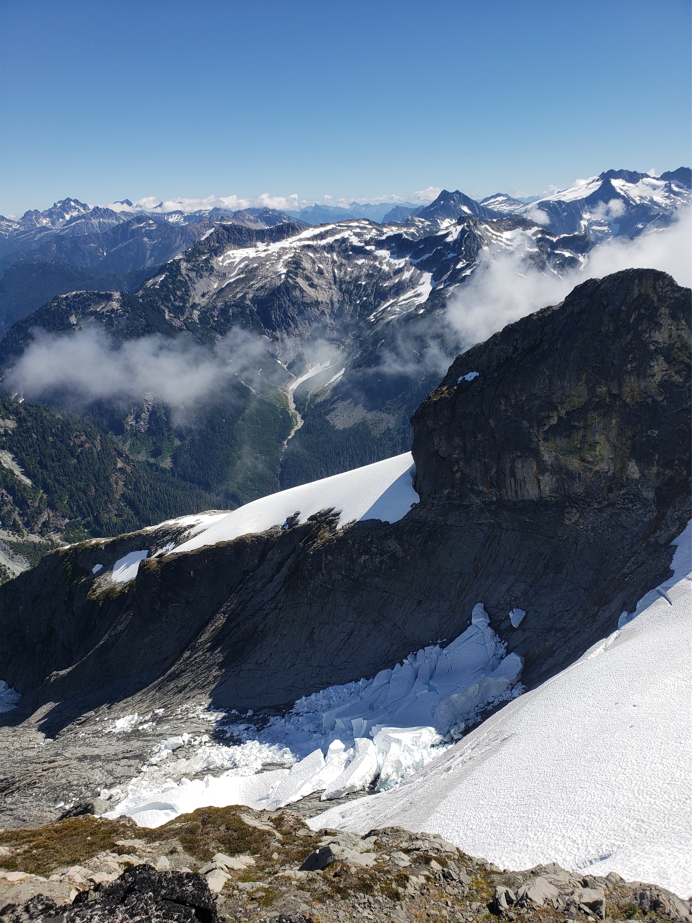
One more of the calved pieces of the Spillway. The top part is still thick.
If I did this again, I’d camp on that shoulder just west of Ruth. The view of Shuksan is insane and while you do have to hump overnight gear all the way up there, it would be worth it just for the sunrise. The whole cirque lights up pink (we got a glimpse of it leaving camp). My goal is to still be doing these things (but more slowly) in 30, 35 years. Maybe by then the Stillway Glacier will be gone and I’ll be marveling at the recession of the Ruth or Icy or Nooksack glaciers instead.
Additional note: There were dozens of beehive along the road! I couldn’t believe it when we drove past, I don’t think they were here last year. I think I’d have remembered. Not sure who is funding them or why they are there or what they are doing, but I hope they’re loving the wildflowers and helping them spread and bloom!
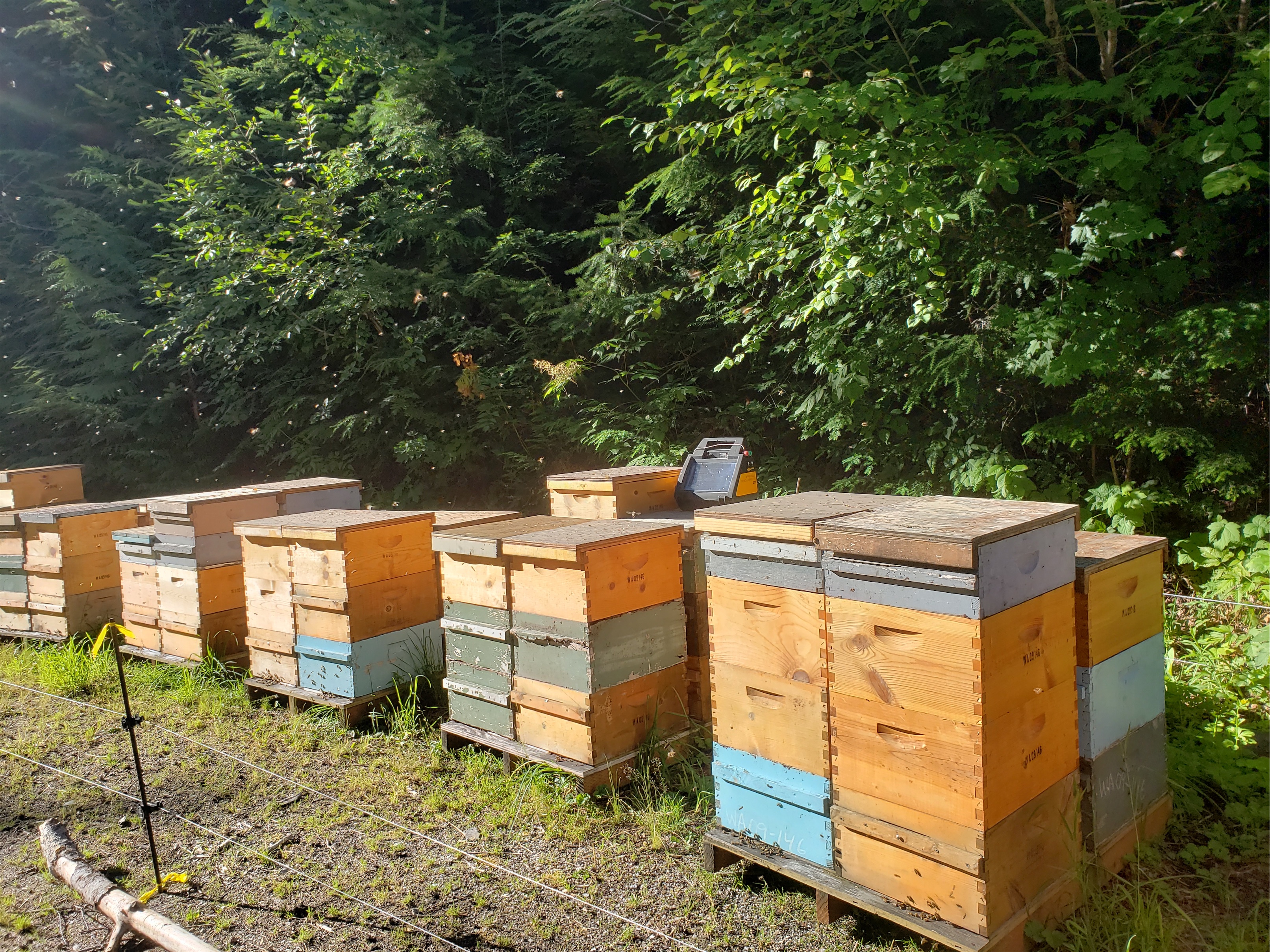
Beehives! I want to learn more!
