Last time I hiked Round Mountain was like a 2/10 on a scale of 1-10. We were socked in by clouds with no views, I forgot my favorite snacks, and I got dumped a few hours later at a park n ride after overeating mediocre chicken alfredo on the way home. Something about my crass language and favorite phrase “god dammit” cued the guy I was dating at the time into realizing maybe I wasn’t very religious, despite my very biblical name. I laugh now because obviously he was totally right, but at the time it took me a while to remember my life was awesome. Fortunately, two coworkers had also been dumped that week, so we took turns moaning and groaning and hogging the one bathroom in the office in case someone was about to cry. We even went to a cage fighting match between humans and computers which was a hilariously Seattle experience I will never forget. Complete with body slams and chair hits. Somehow, I didn’t meet any new dating material there.
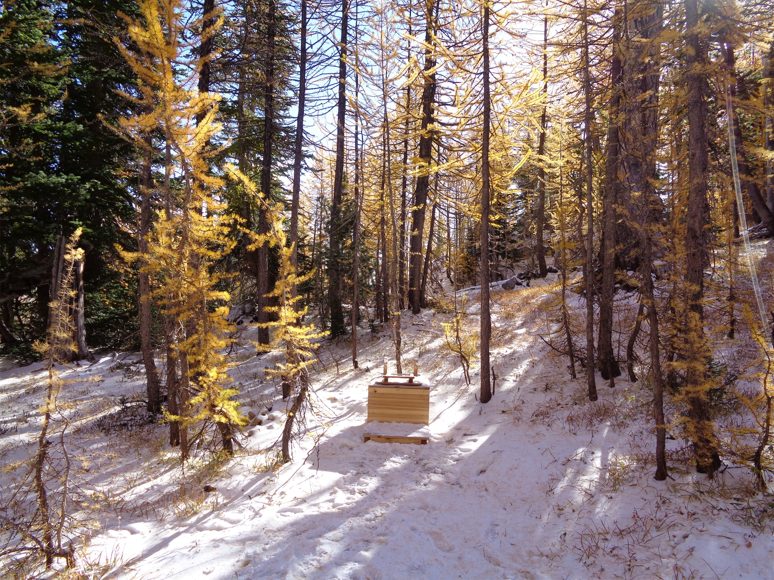
Snow makes it easier on the calves
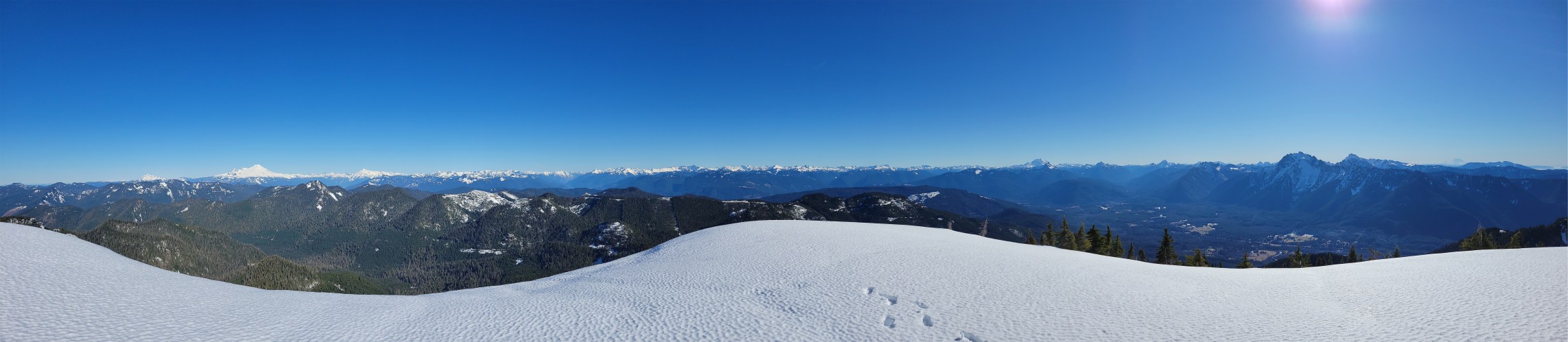
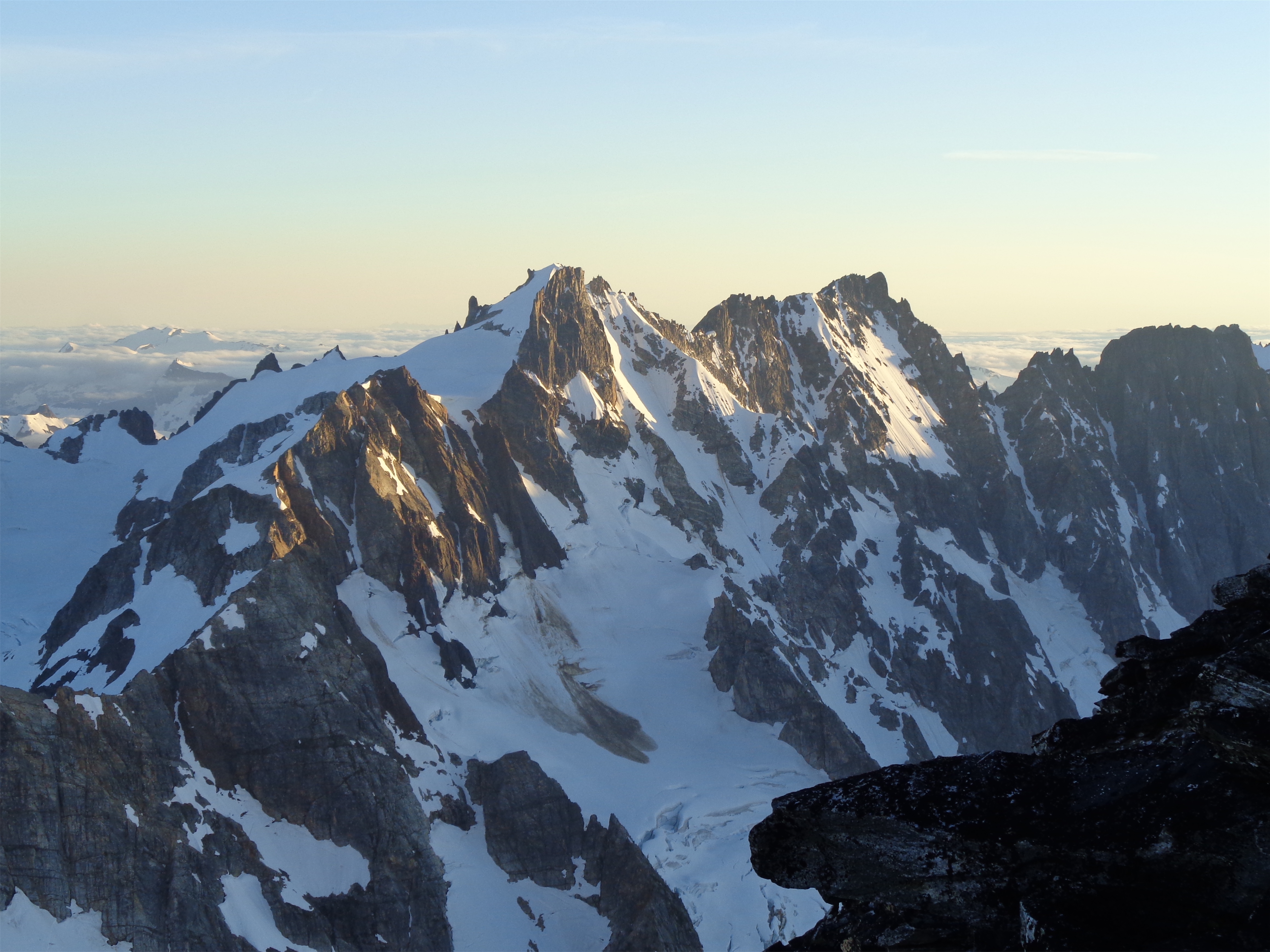
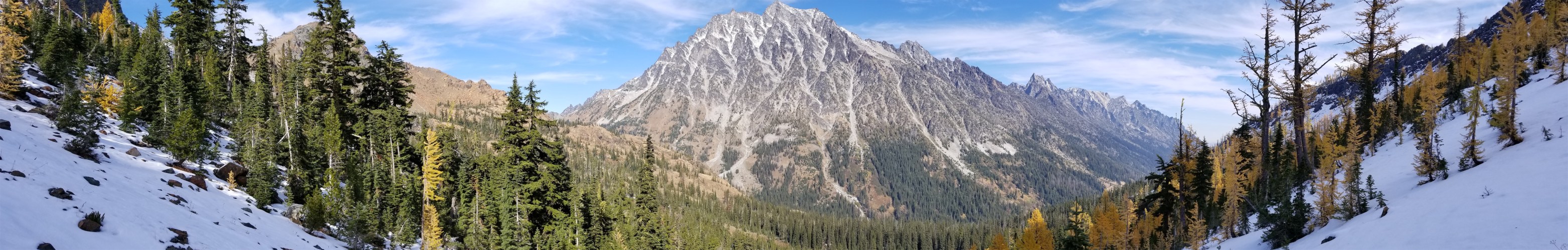
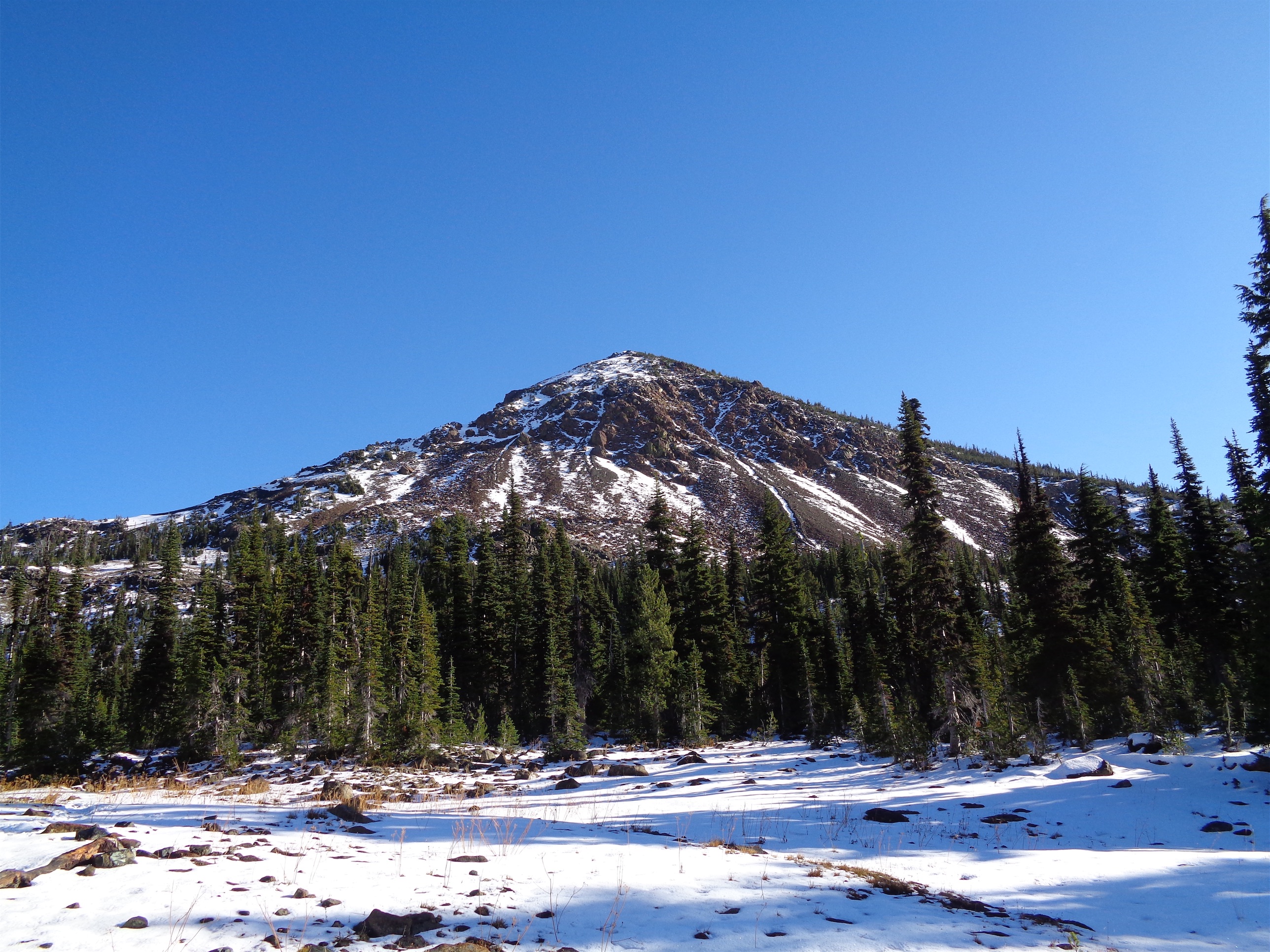
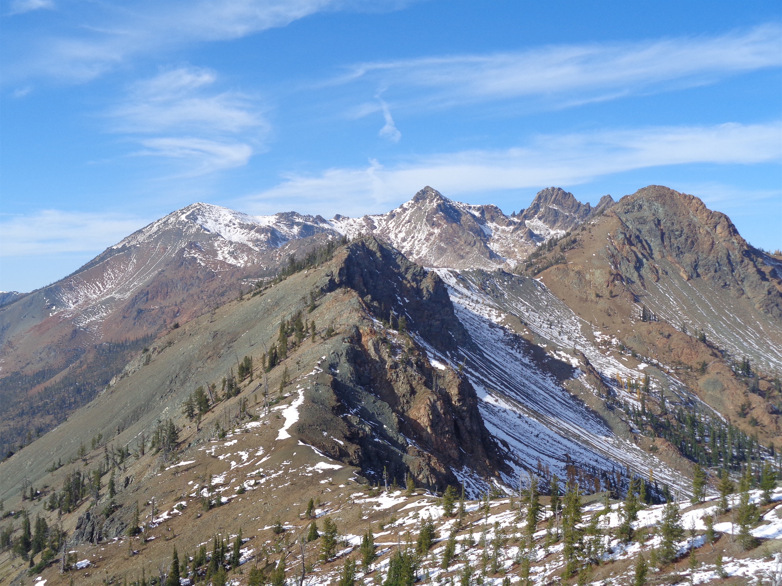
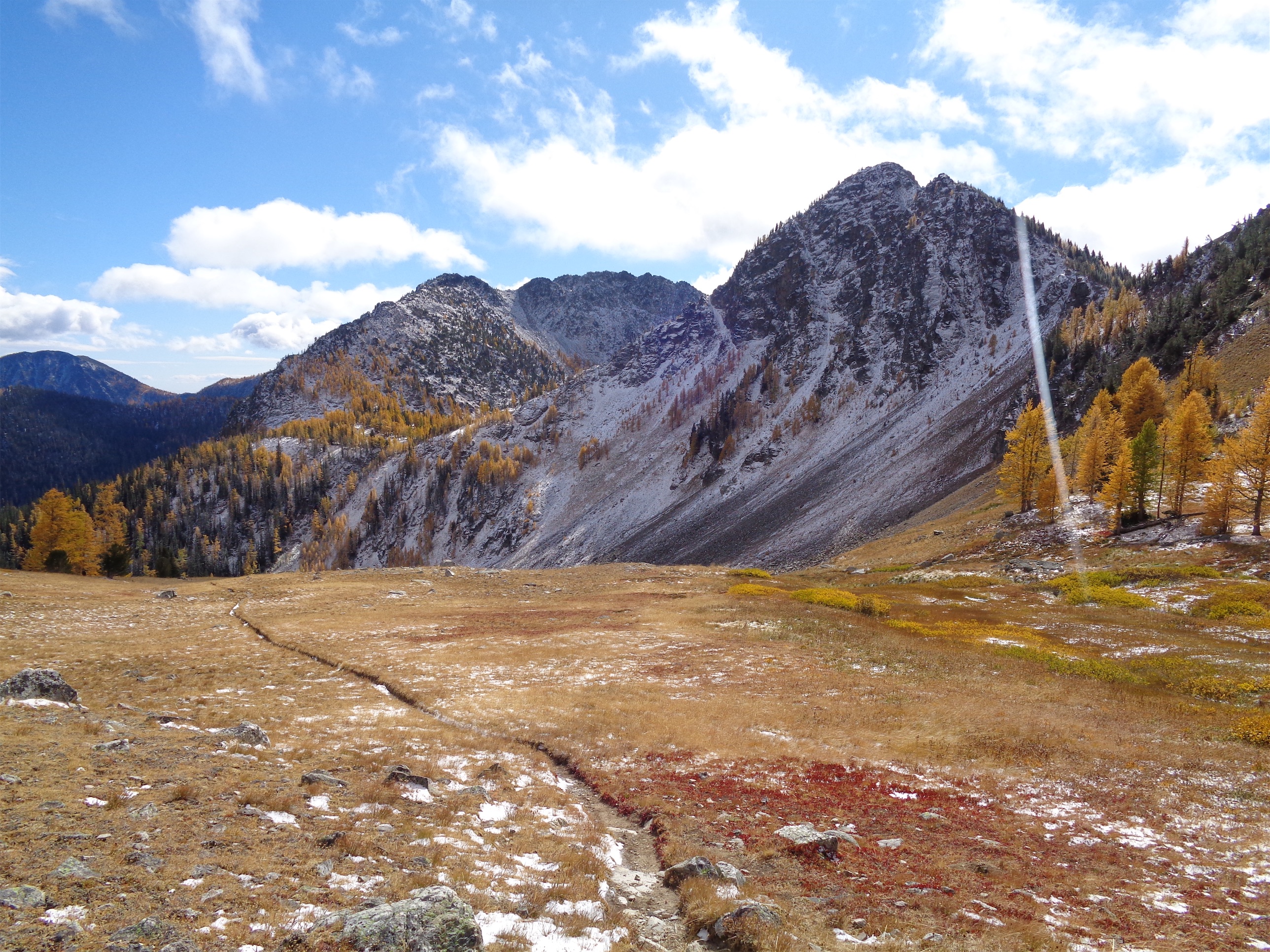
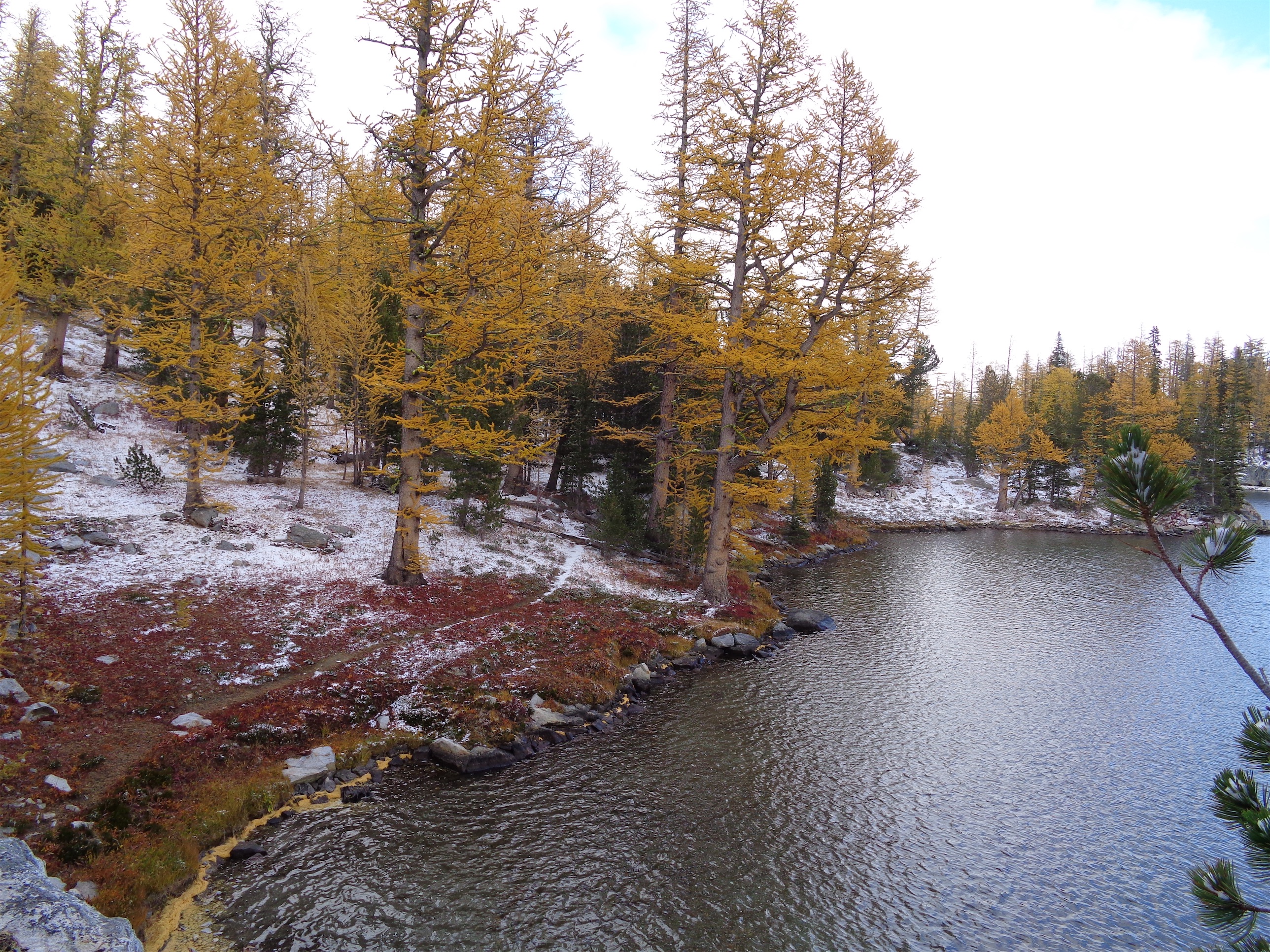
So when Rob mentioned he was putting together a crew for Round Mountain, naturally I wanted a redo. Round Mountain is known for its prominence, it’s the 8th most prominent peak in WA with almost 4800ft of prominence despite only being 5300ft tall. Prominence = views. It rises up straight from the valley floor outside of Darrington, with phenomenal views of Whitehorse to the south and the entire cascade range to the west and north. You’re in a fishbowl of peaks. It’s generally quite safe on high avy days thanks to the entire route being forested and along a ridge. The forecast called for clear skies, views, and suckers I’m single there’s NO ONE to dump me at the bottom. Let’s do this.
Distance: ~6mi (slightly under)
Elevation: ~4100ft net, 5320 highest point (you lose some elevation that you have to regain on the way back)
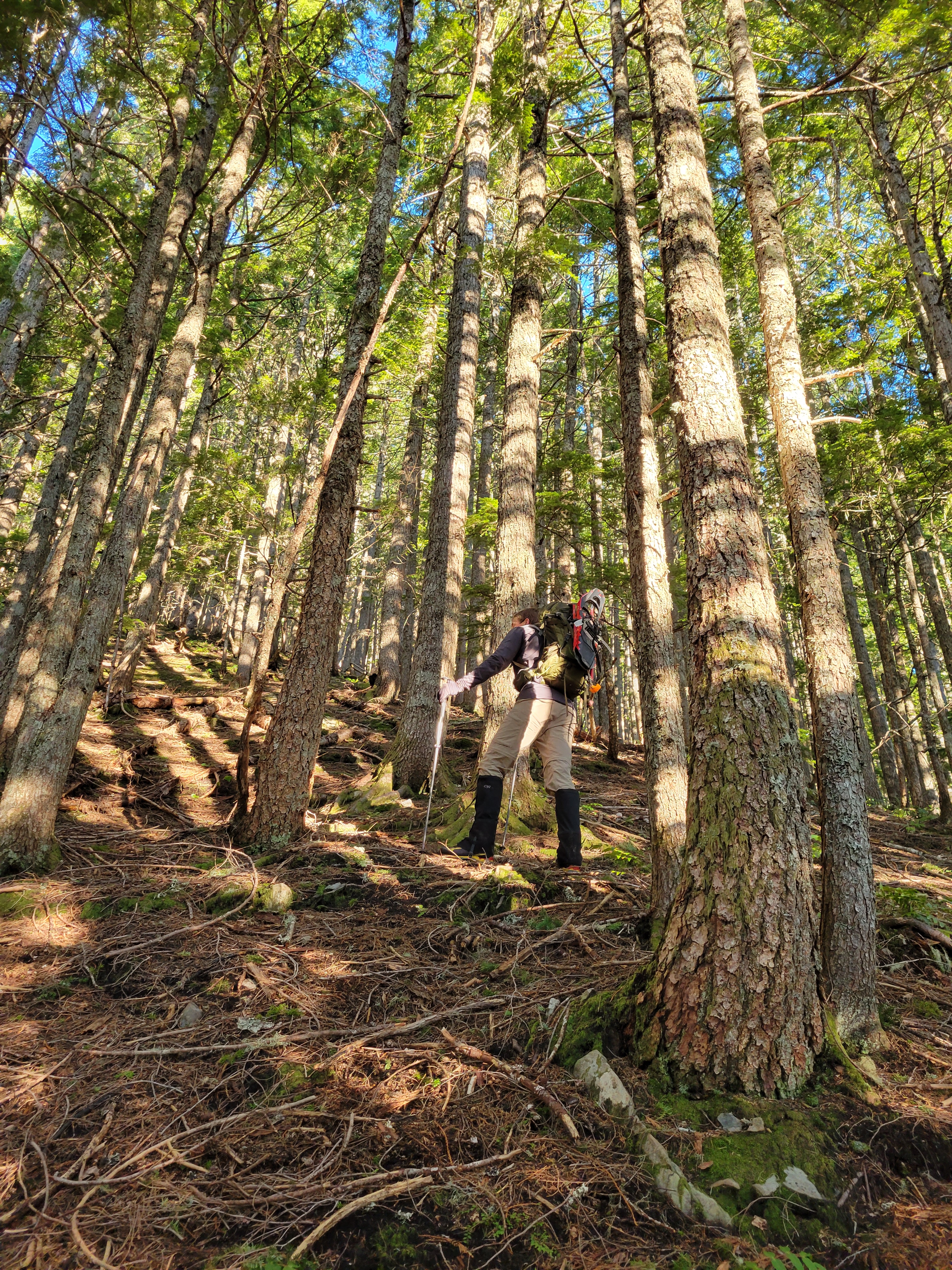
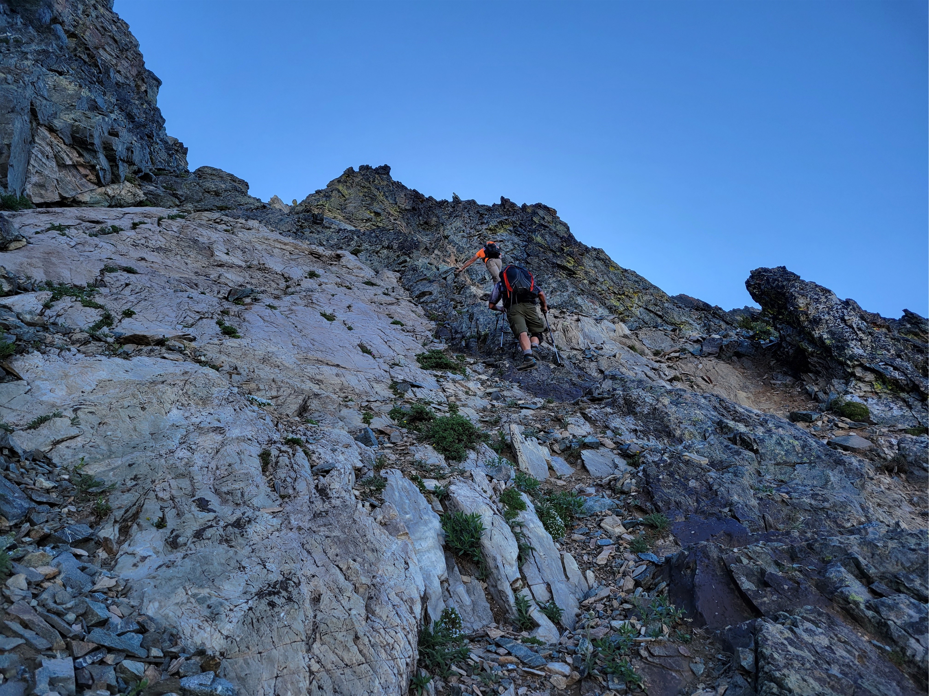
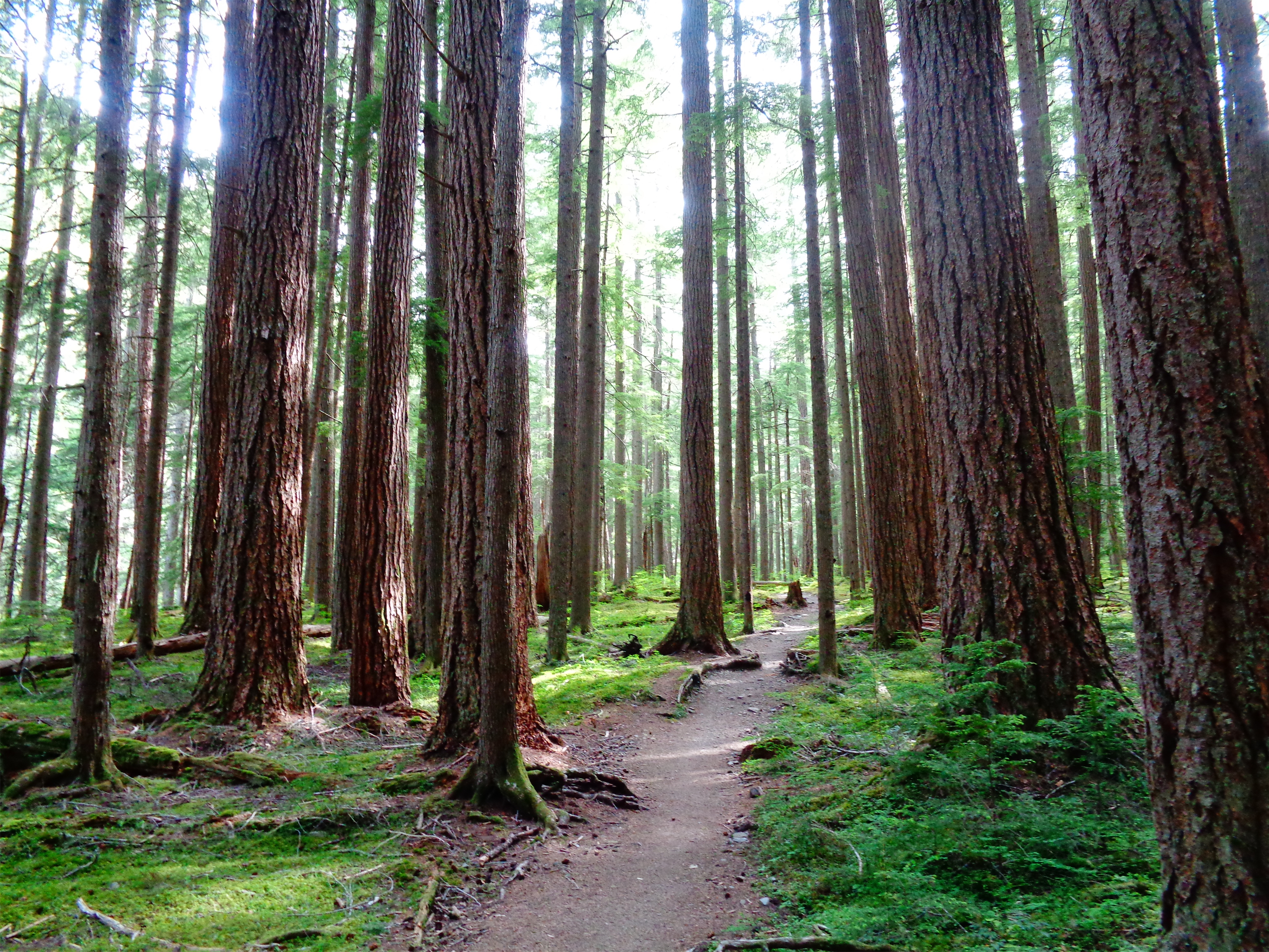
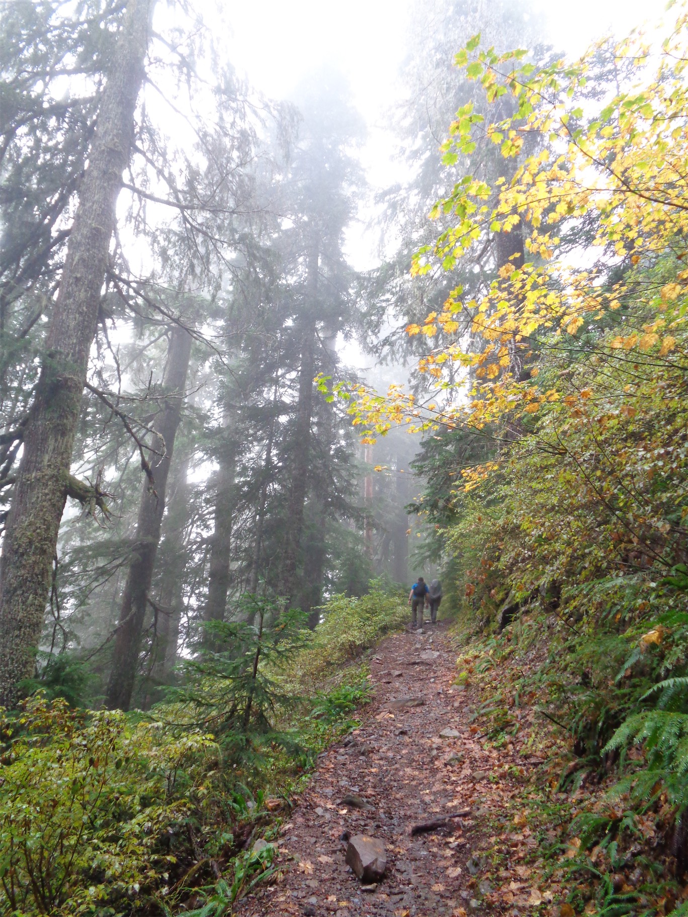
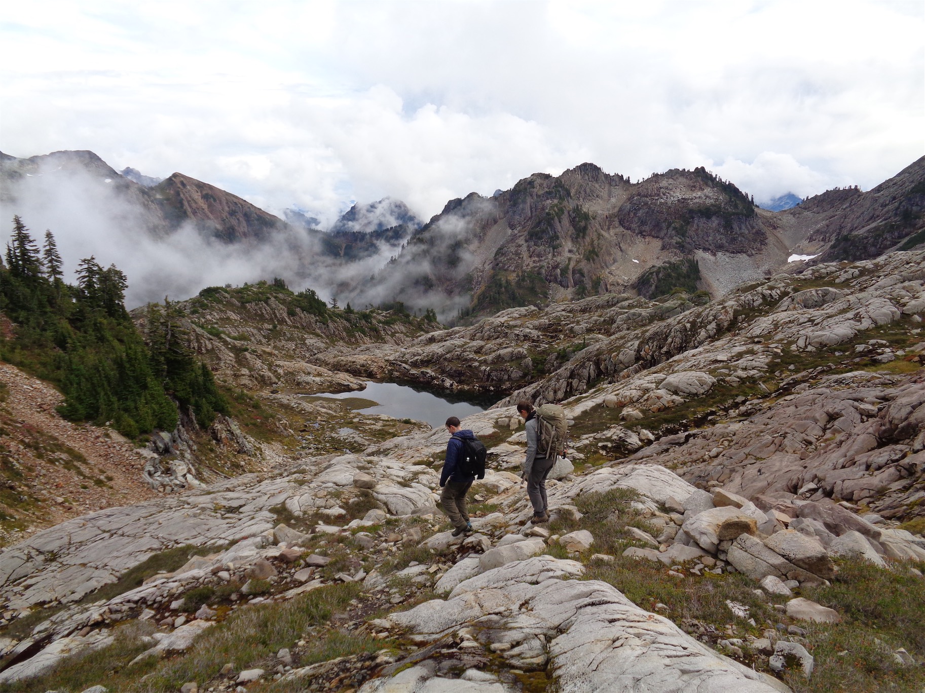
We decided to be on the trail by 8am. I am turning into a Seattlite who shows up 5-10min late to everything, so Rob told me 5:40 when he wanted to meet at 5:30 (it worked). We stopped at the pilot gas station and I’ll have you know I didn’t buy a cinnamon bun. We got to the trailhead around 7:15, I had enough time to crush a banana before Daniel showed up and we were plodding down the forest road around 7:40. You know how there’s the saying “be bold, start cold” because you know you’ll warm up once you start moving? Round Mountain is more like be bold, just start naked. You walk a forest road for a while and then cut straight into the forest uphill, and within 200 vertical feet of the road you’ll be sweating profusely and LET ME TELL YOU there is no end in sight until the summit. It felt like spring despite being February. Warm, sunny, and I stupidly wore expedition weight wool base layers because I don’t know follow seasonal transitions.
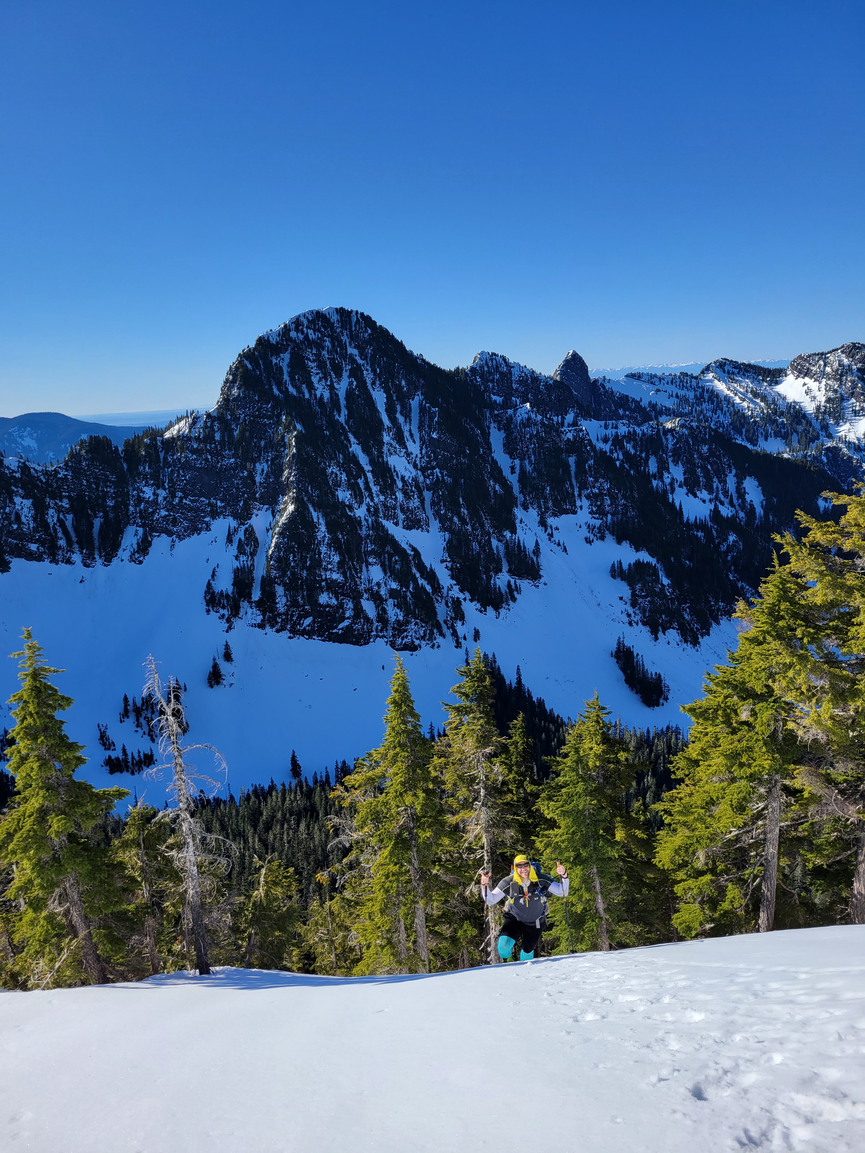
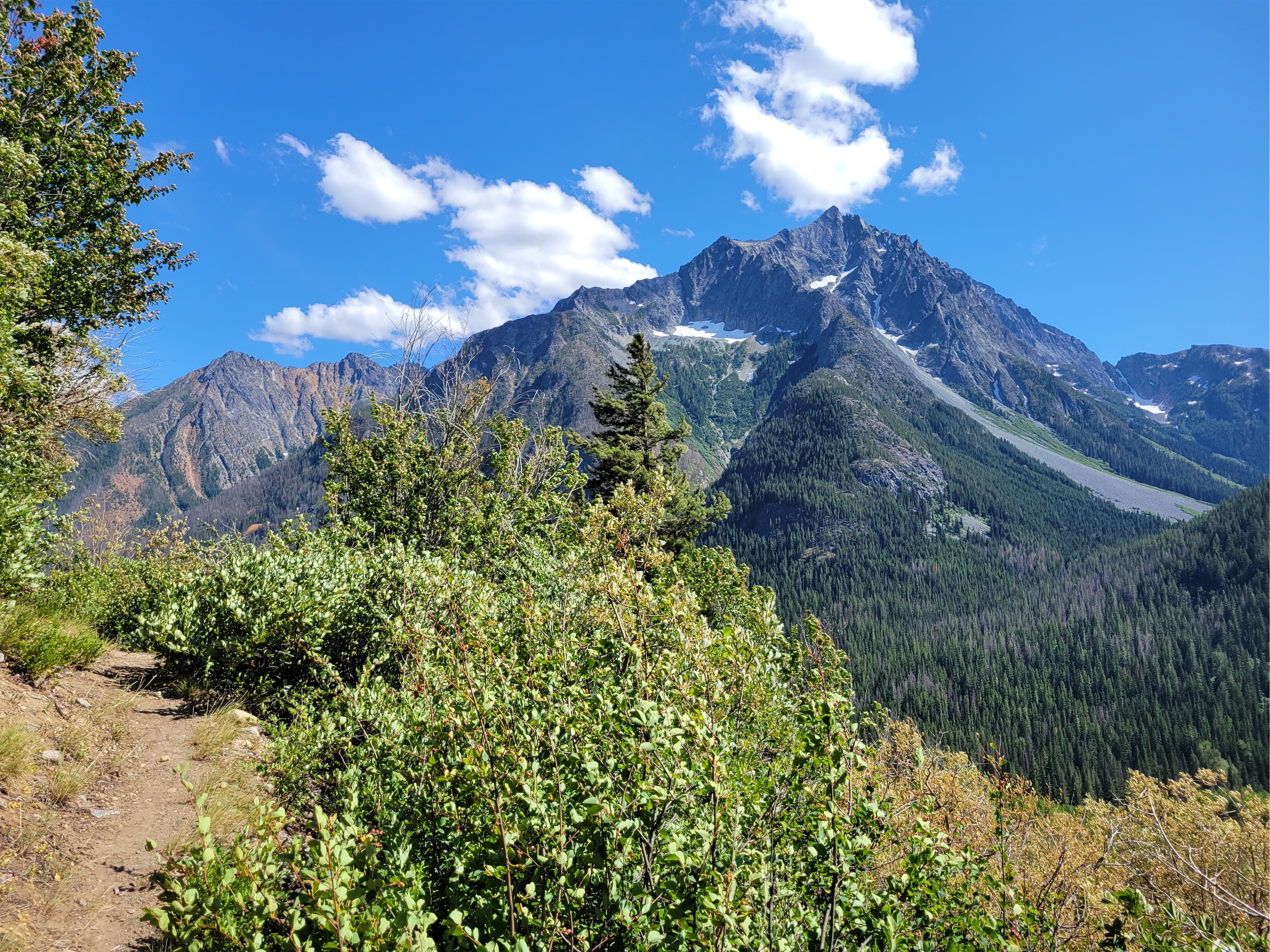
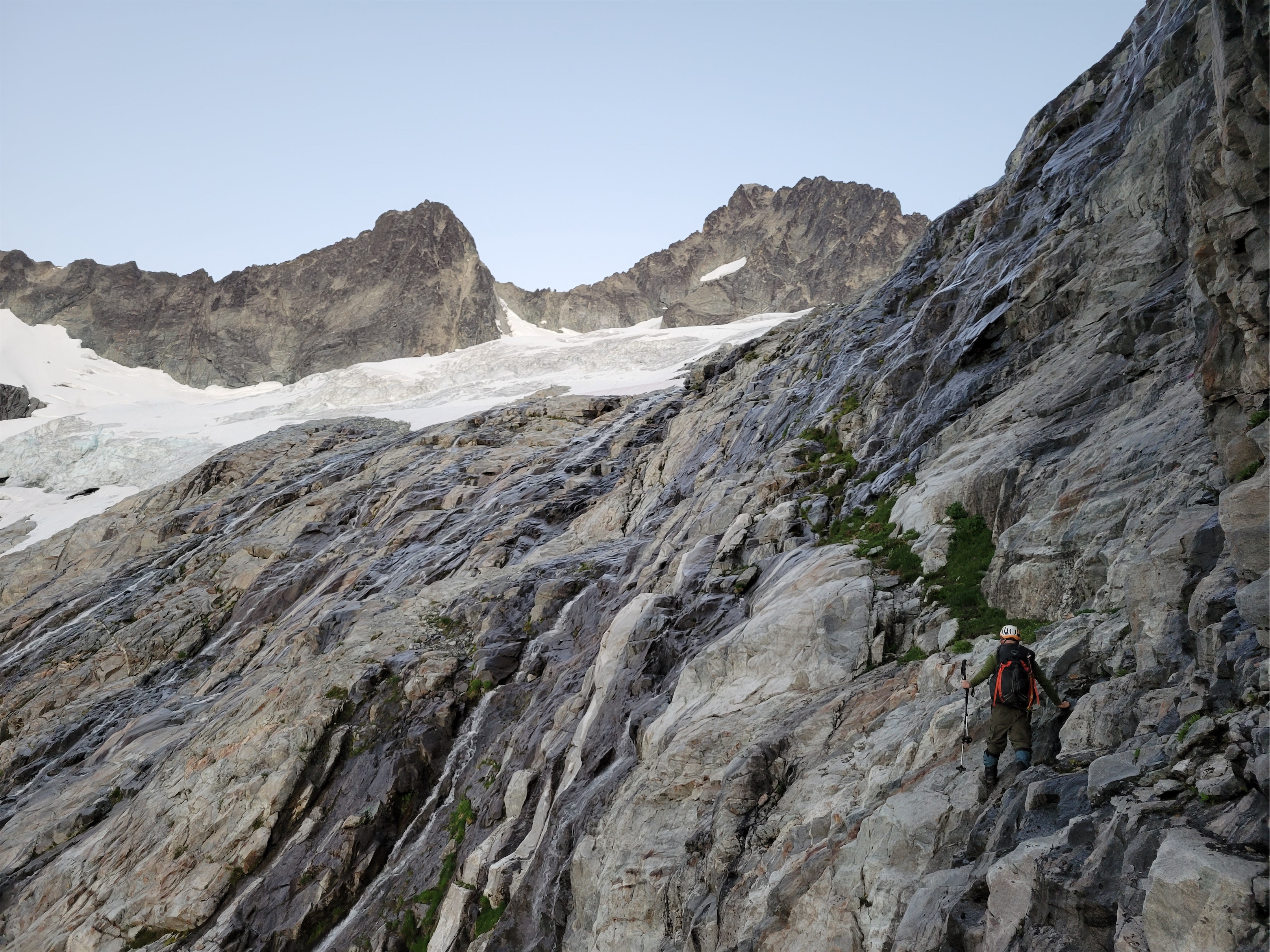
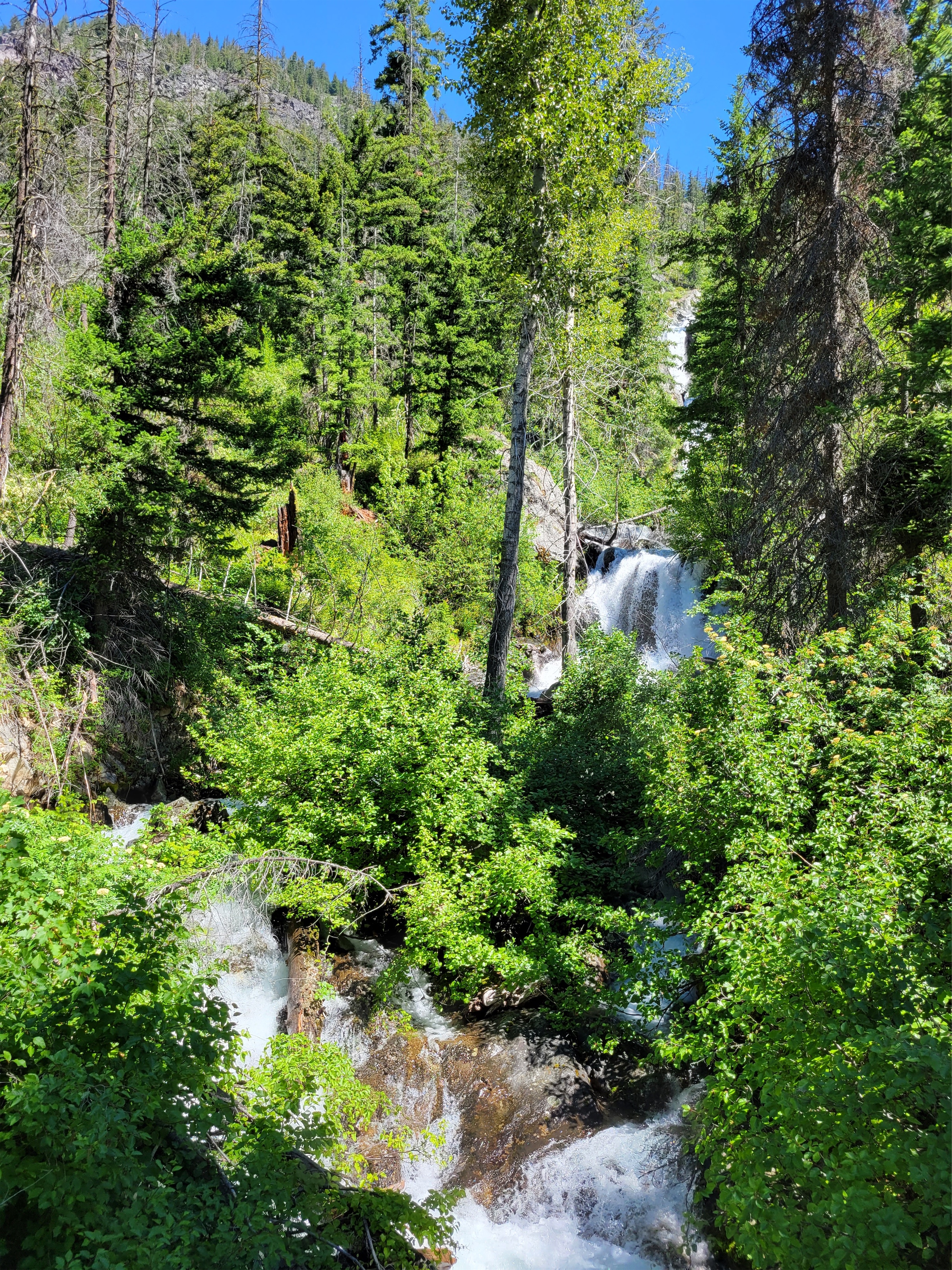
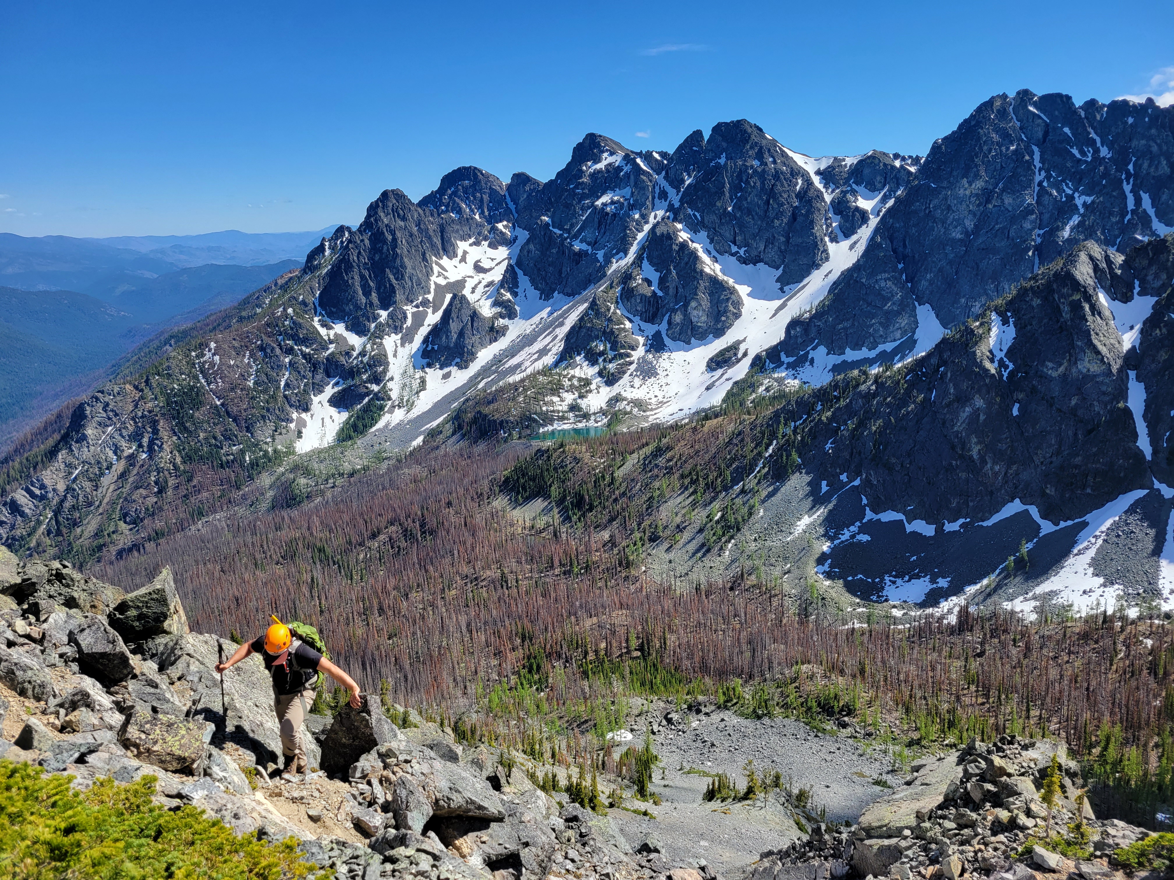
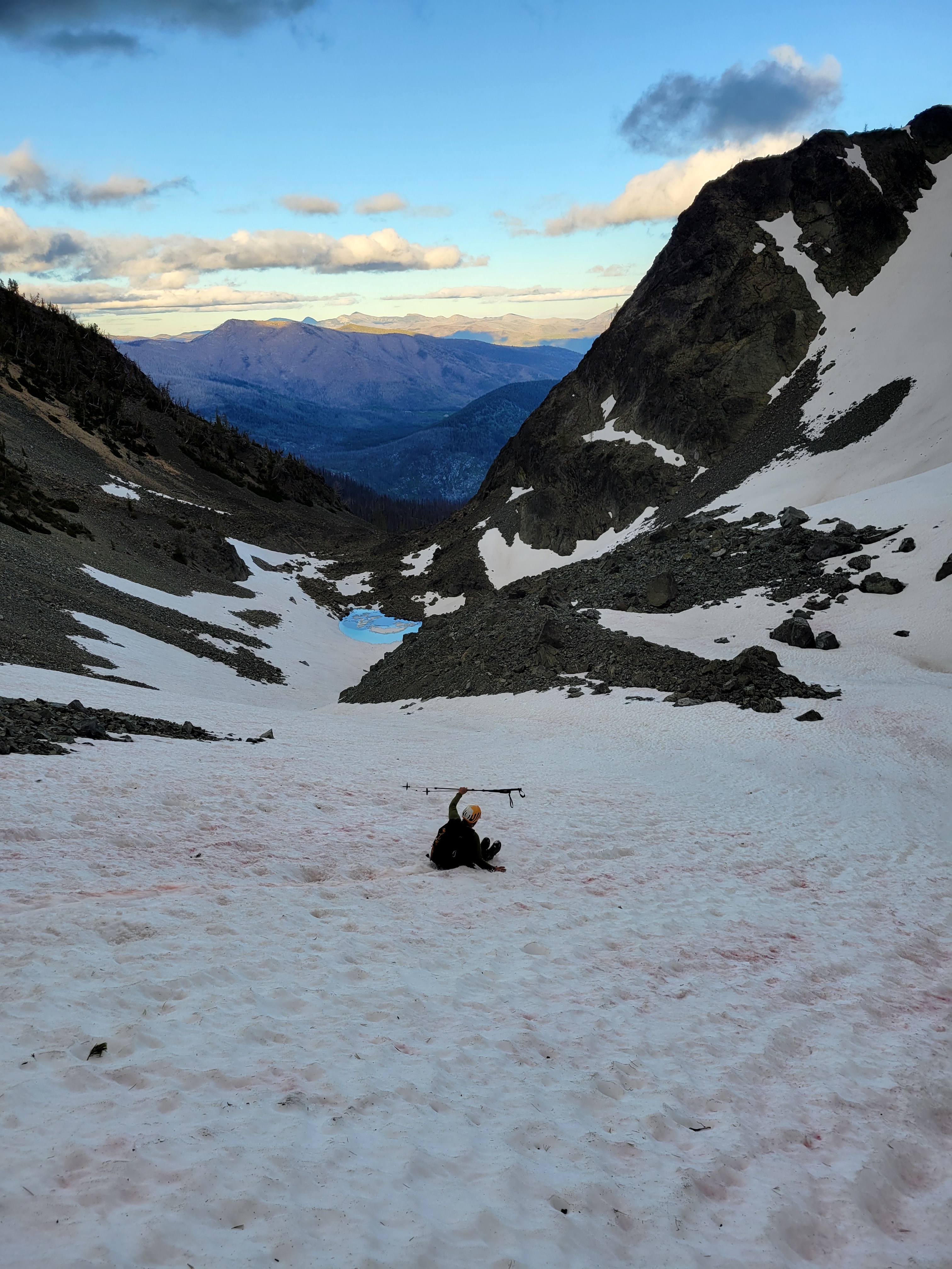
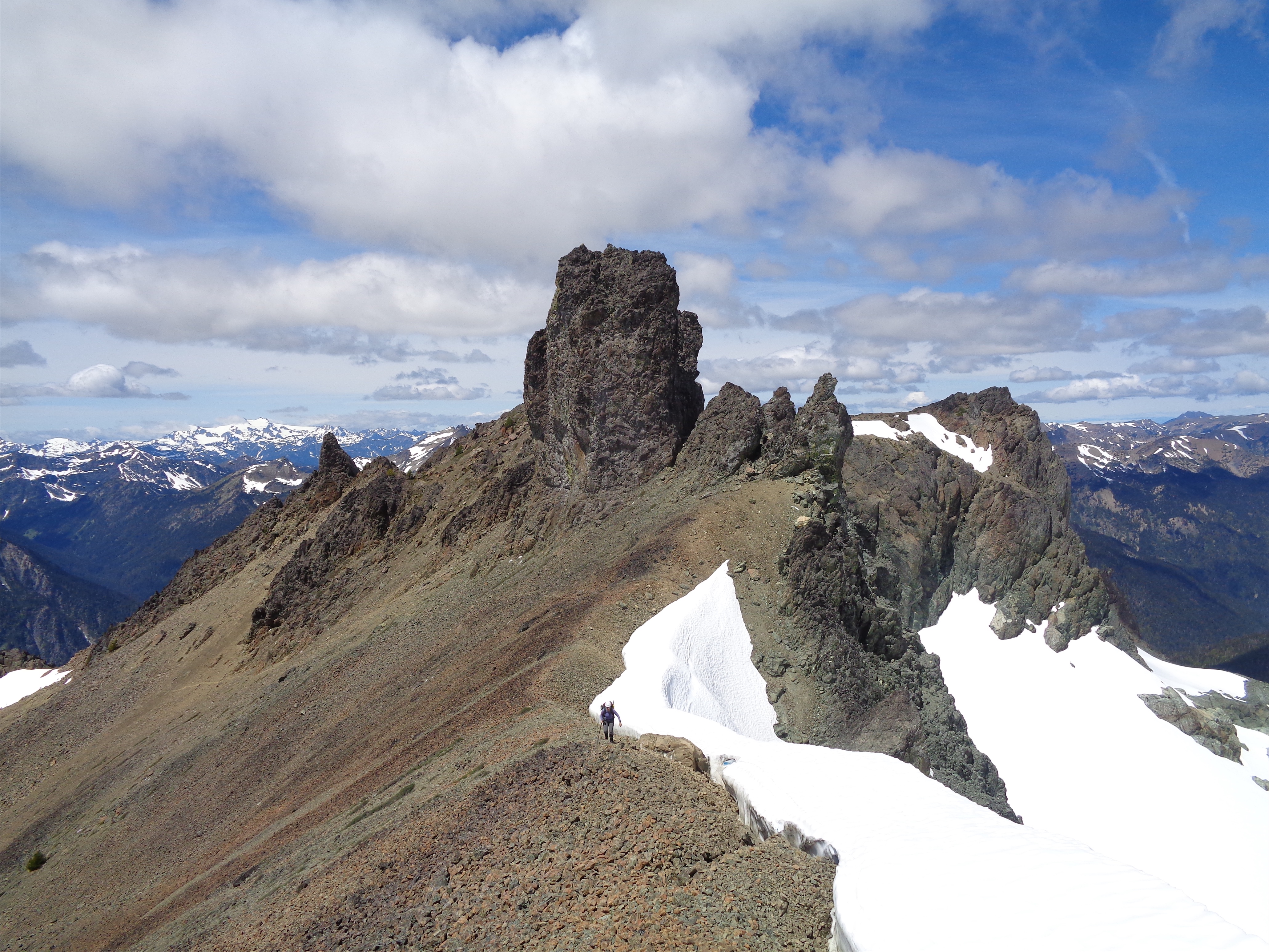
Breaking above the trees! Whitehorse in the back
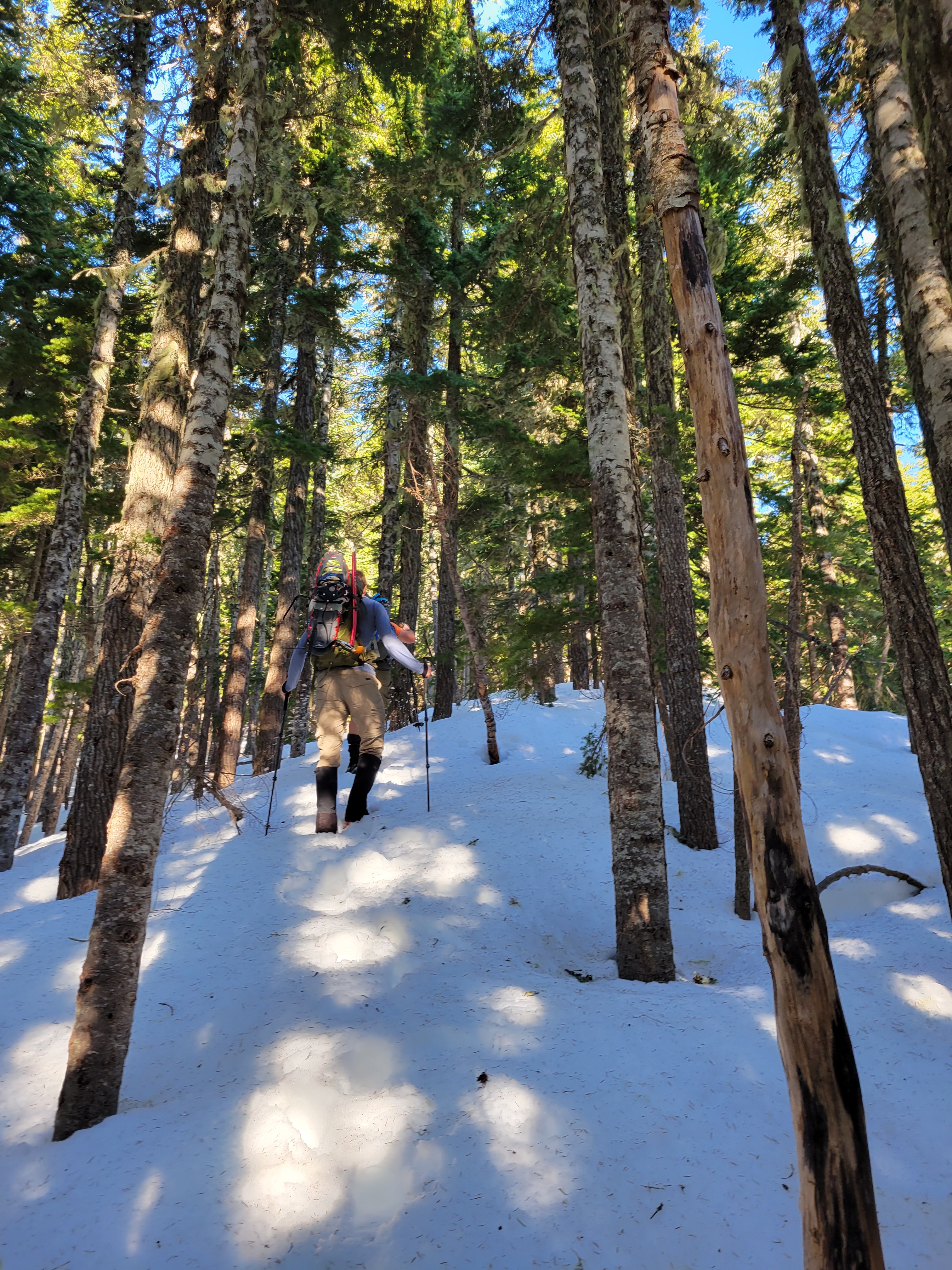
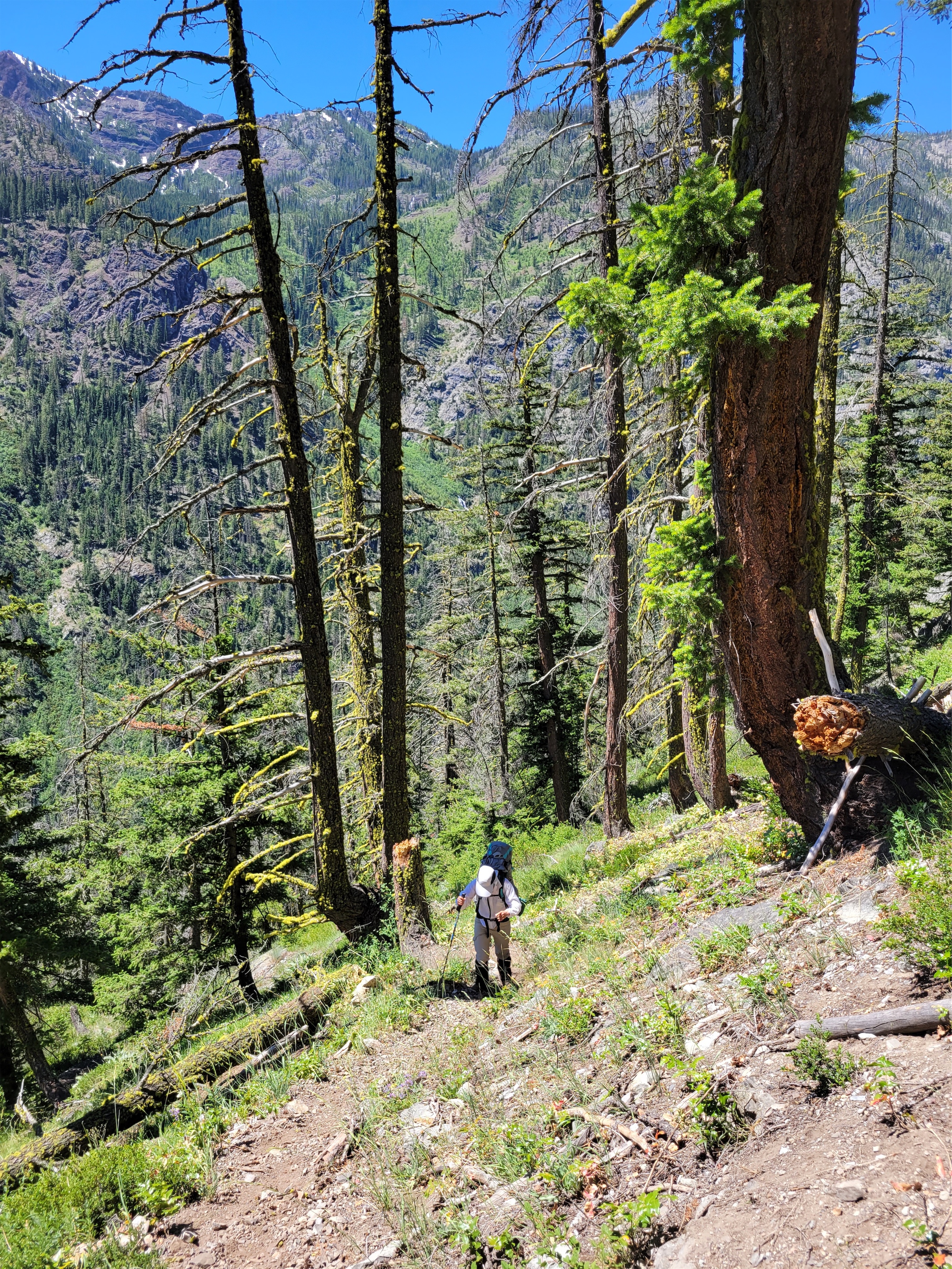
We went up and up, picking our own paths through the steep woods. The terrain is very open with no bushwhacking at all, surprising for the north cascades. I looove sunlight through the forests here. I don’t think we even hit snow until around 3500ft. We were carrying snowshoes that we never put on. There was some unavoidable postholing, but such is life, it’s not a real snow adventure without some postholing. Rob broke trail, finding each and every hole for us. Every time I turned around Daniel was right behind me absolutely beaming with smiles. We talked through summer goals and lists to pursue and it was like getting the mental gears moving again, until I remembered I suck at goal setting. I just wake up on a Thursday and see where weather is good and try to find last minute free people. I don’t have a list, or a goal, or anything. I guess I have a list called “the selfish ten” that are peaks I will bail on anyone and anything for but even with that I’m being hypocritical because I have a few friends climbing a peak on that list the same weekend another friend has a wedding… and I’m going to the wedding.
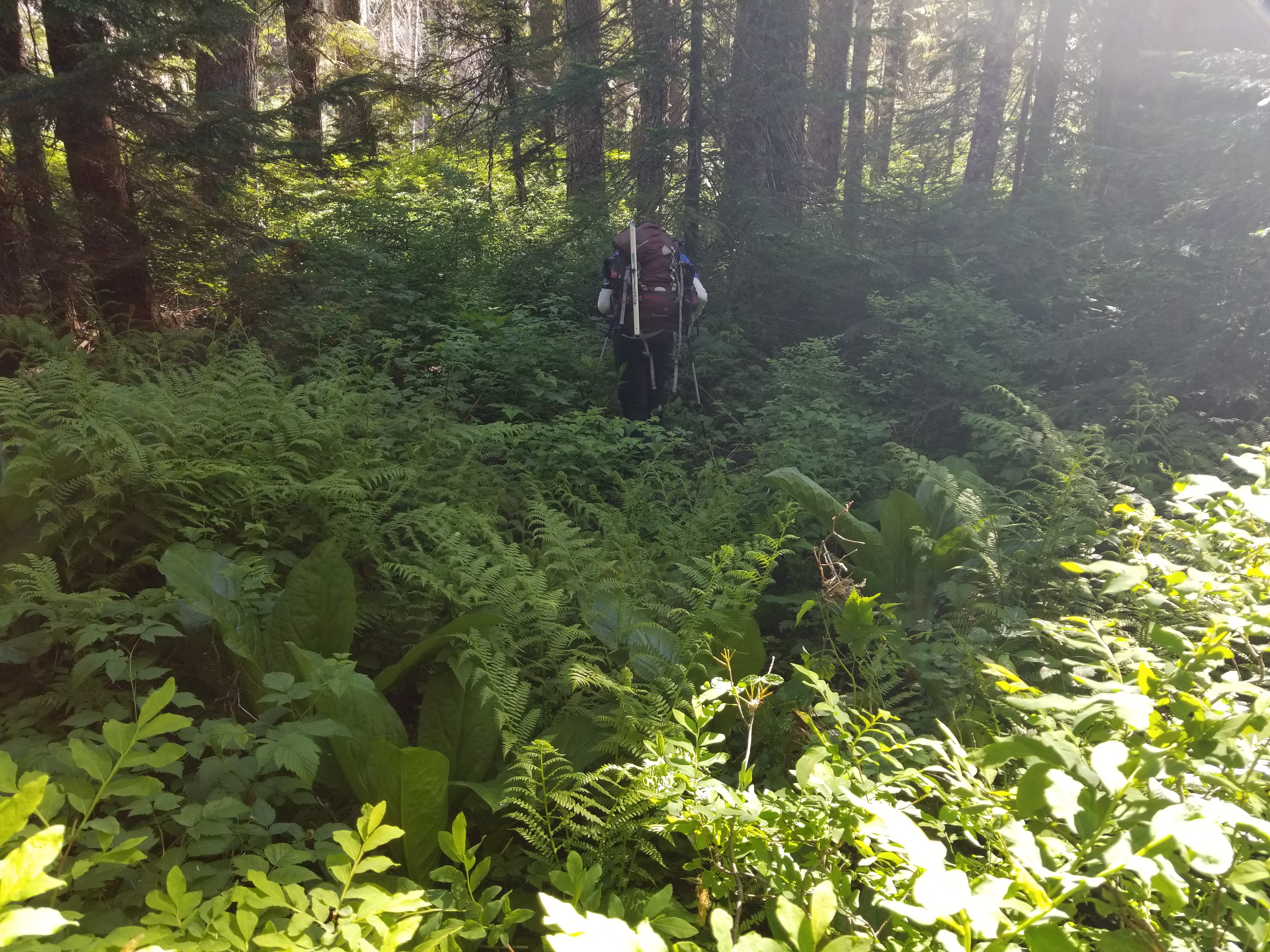
Closest thing we had to bushwhacking
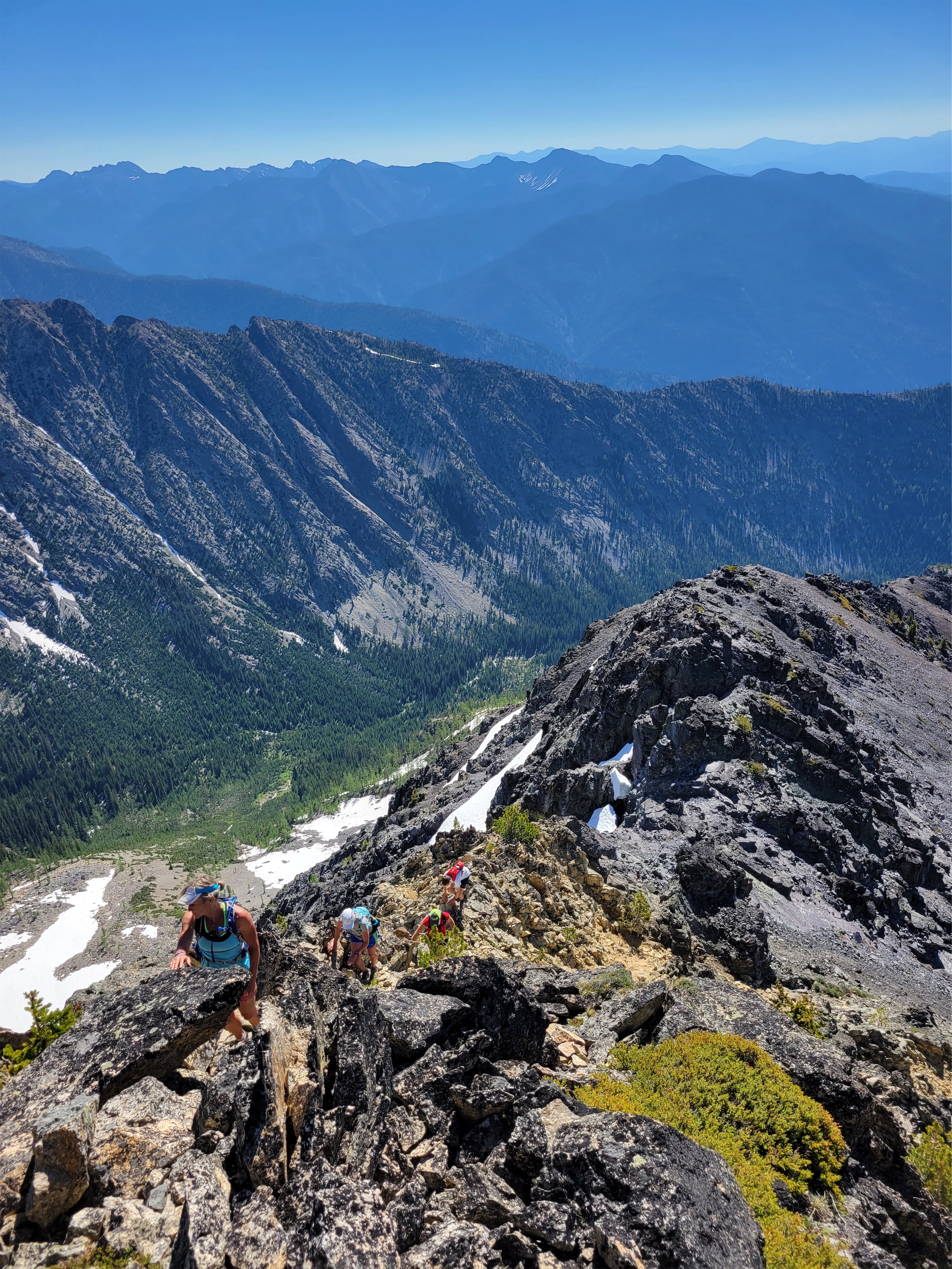
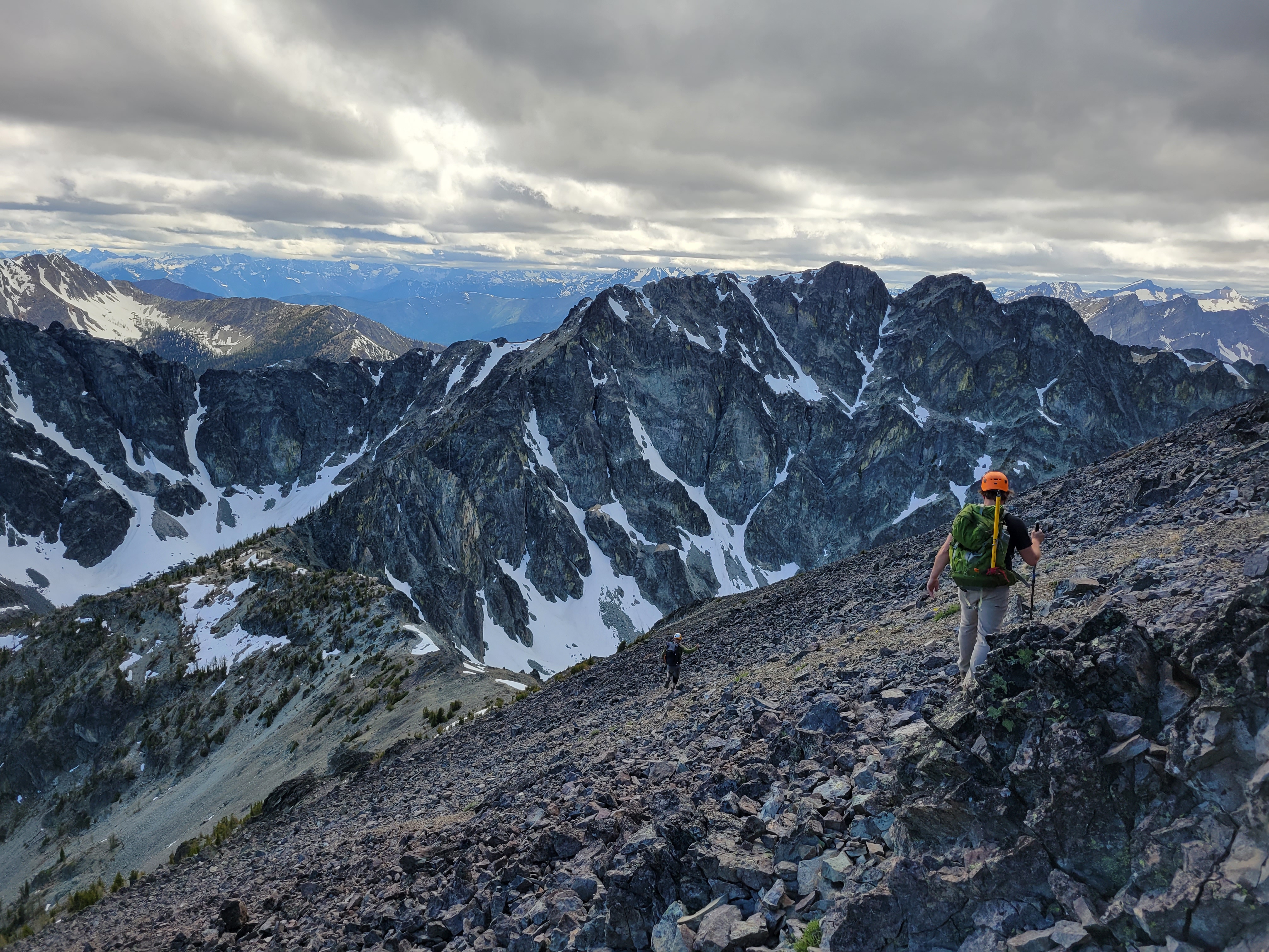
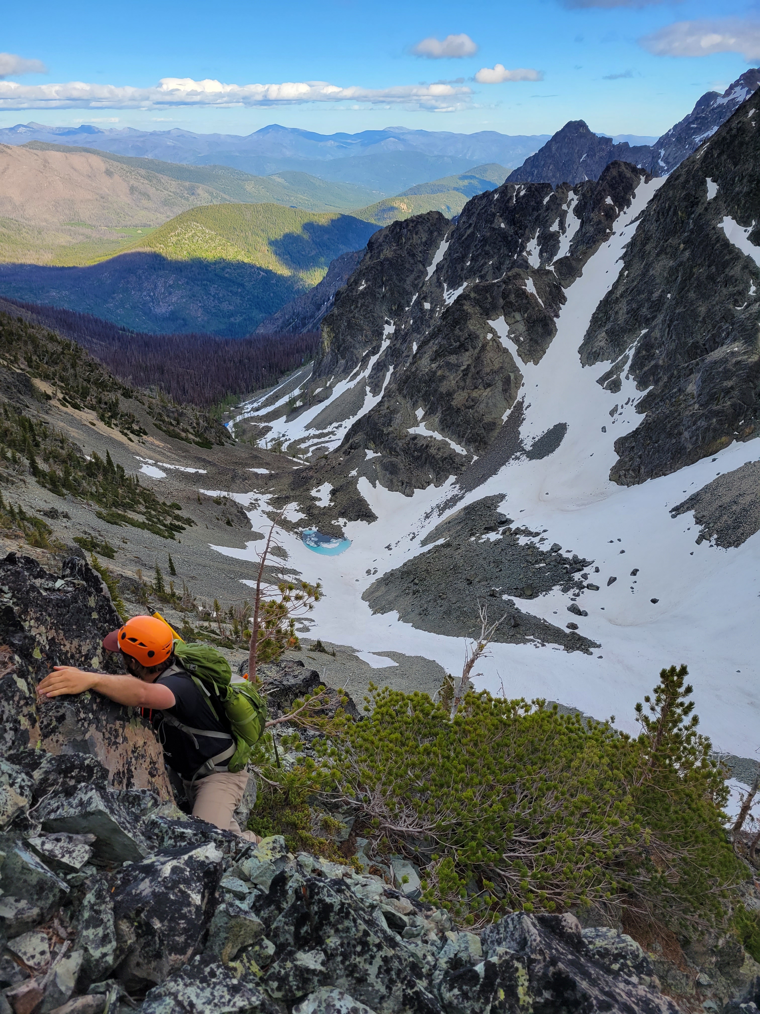
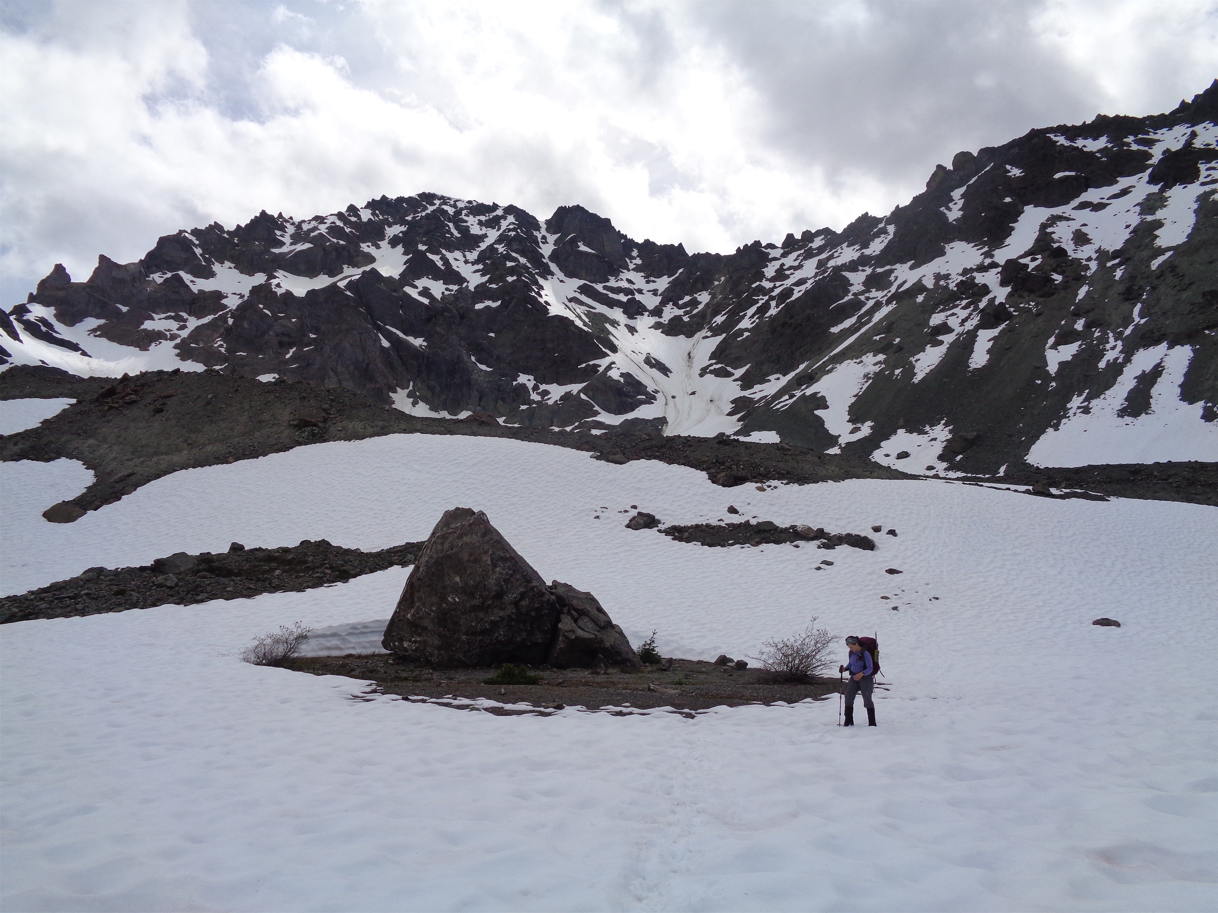
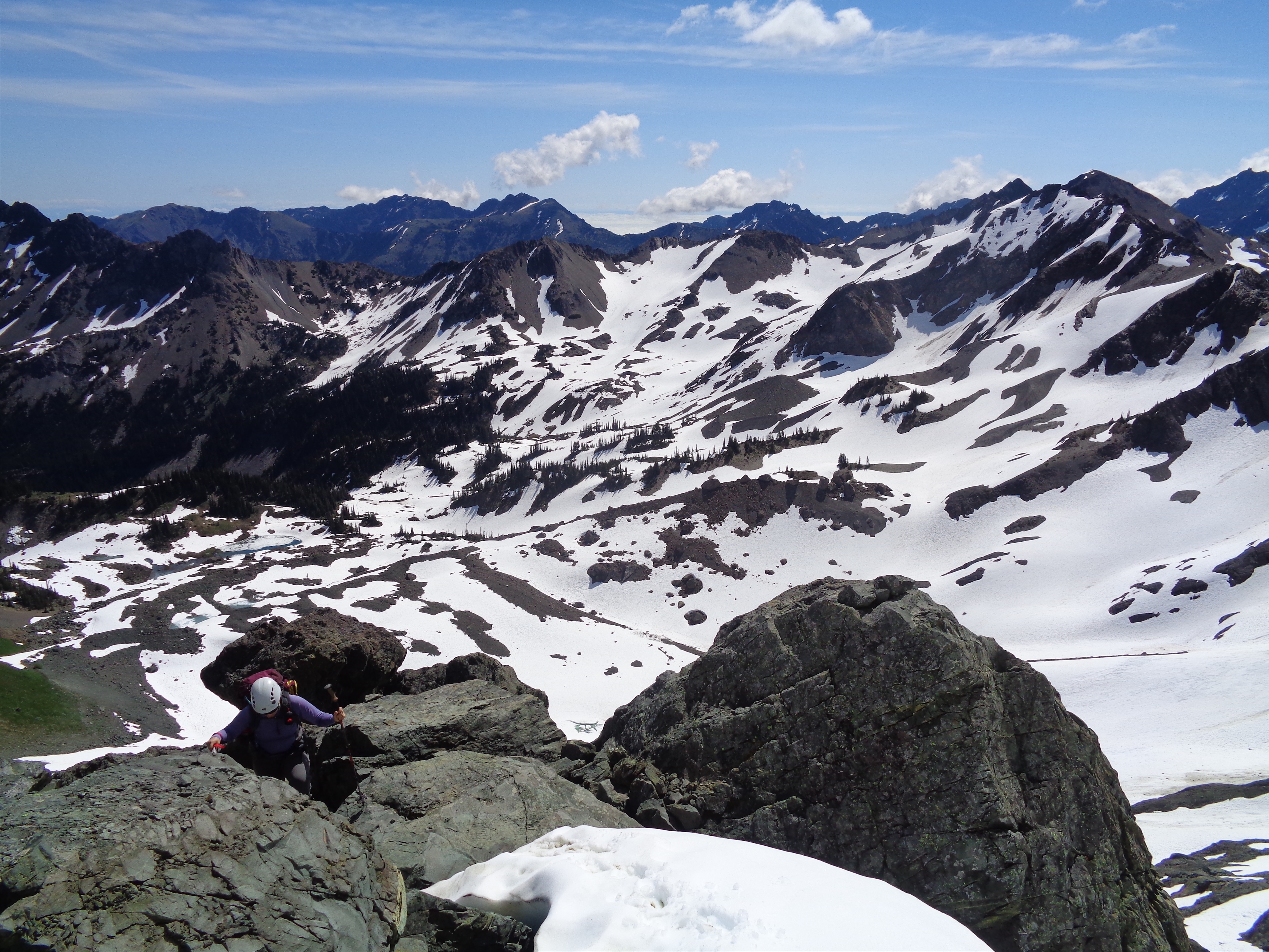
We finally crested the knoll where you gain the last ridge to the summit. I say “finally” but really it went by surprisingly quickly! Good conversation with new people always helps, and I think we were moving at a decent clip. I can only speak for myself but I was hilariously overpacked for this balmy pseudo spring day. Two summit puffies, snowshoes, avy gear, great way to get in shape?
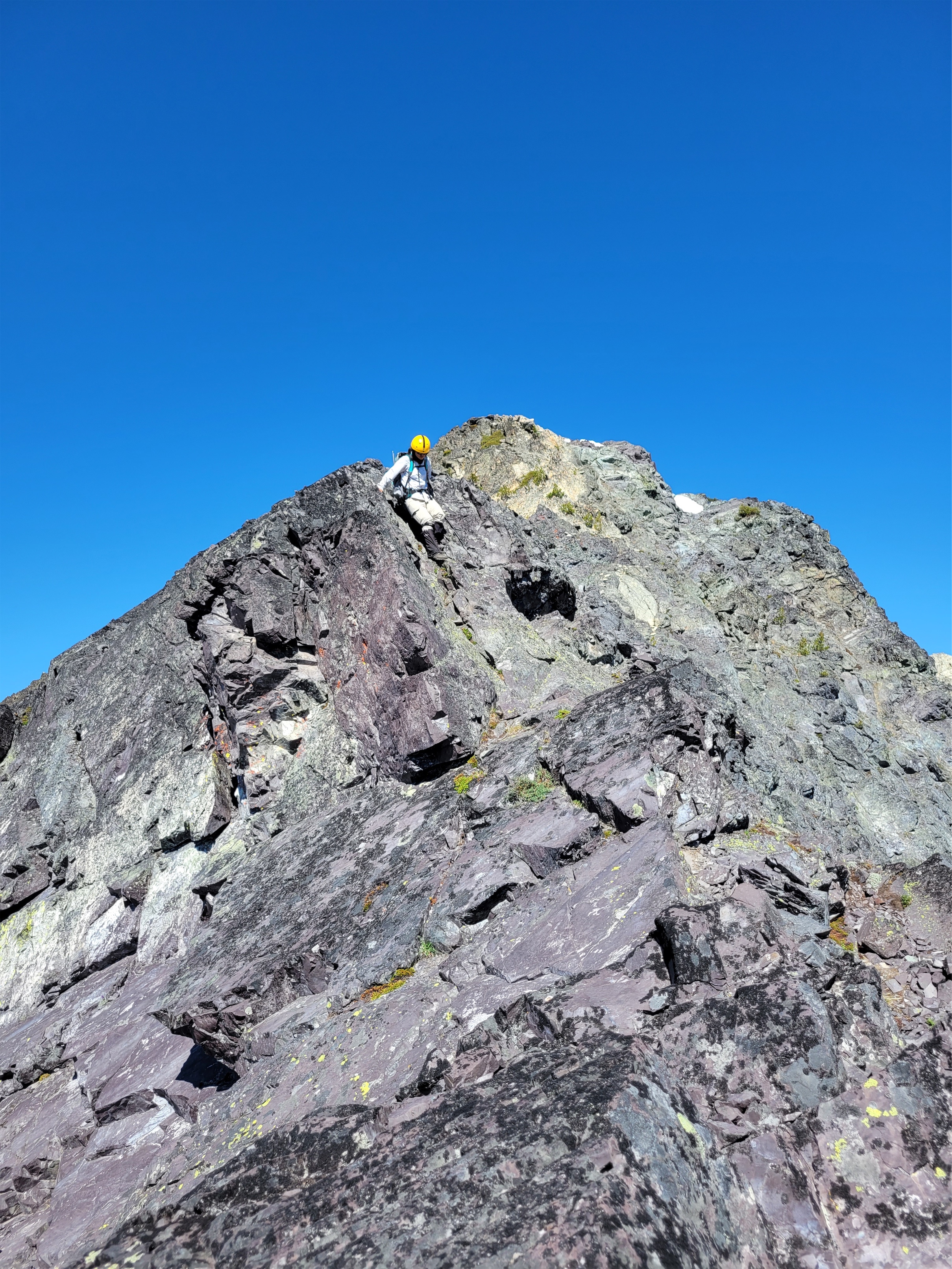
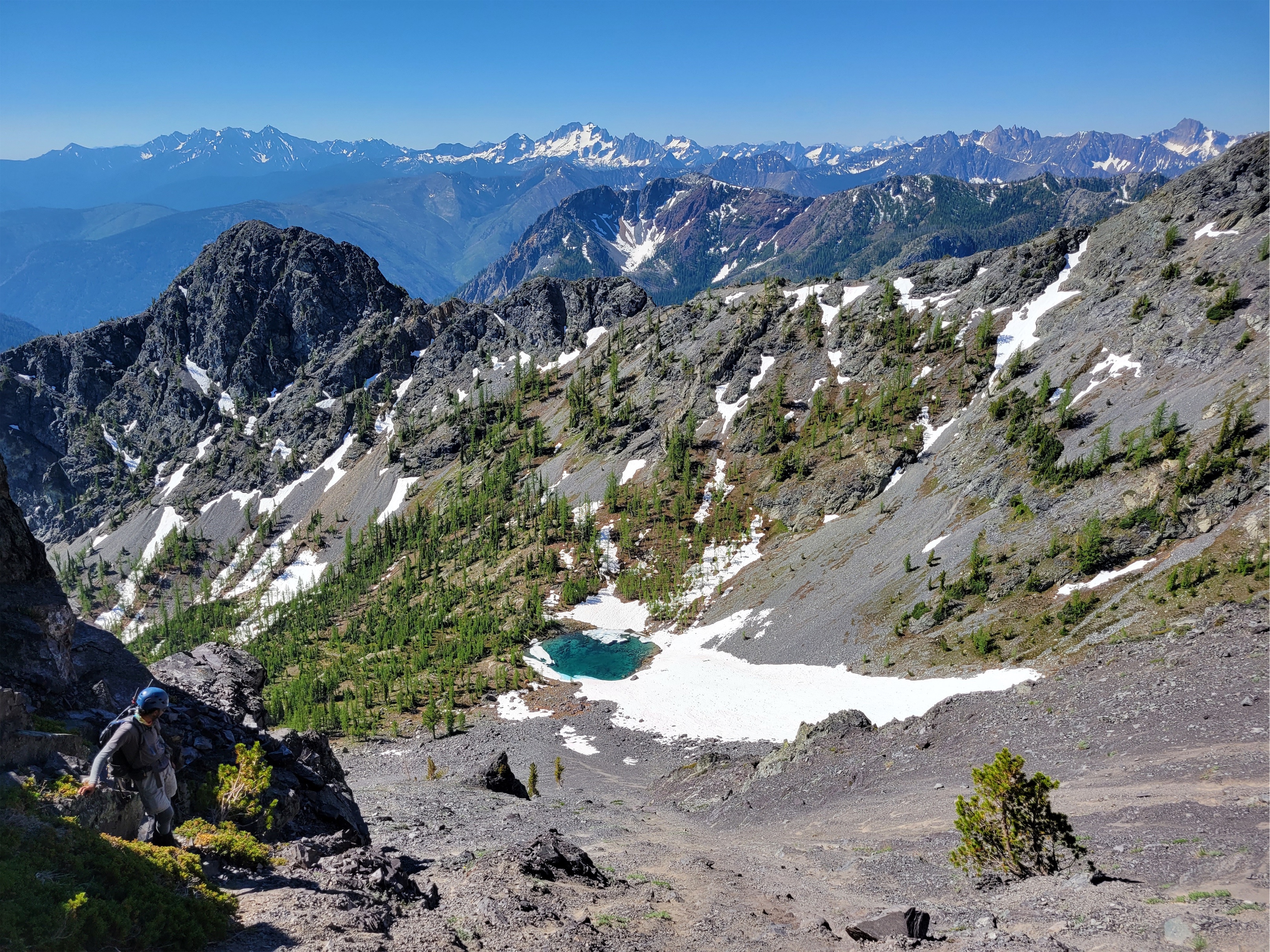
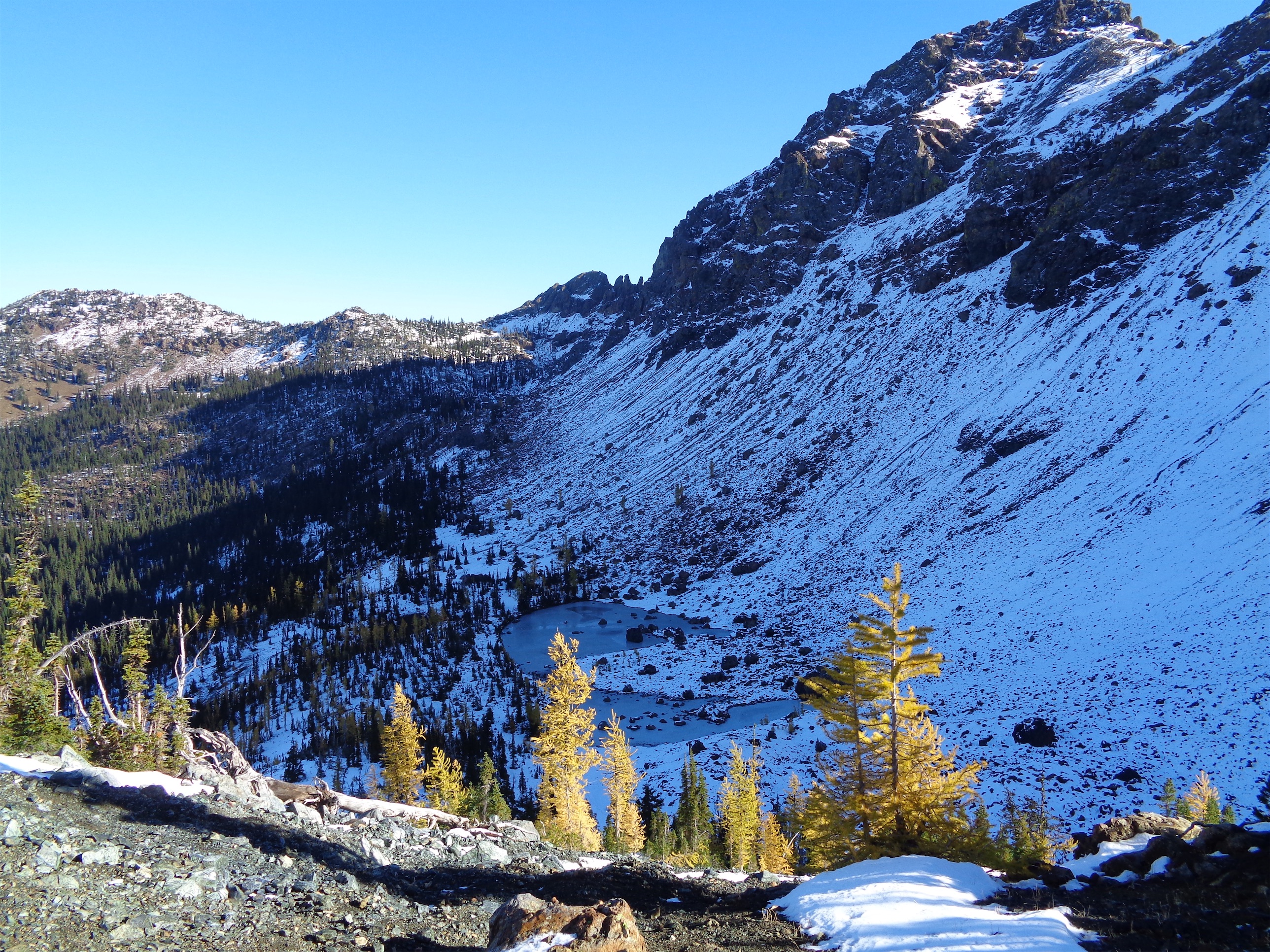
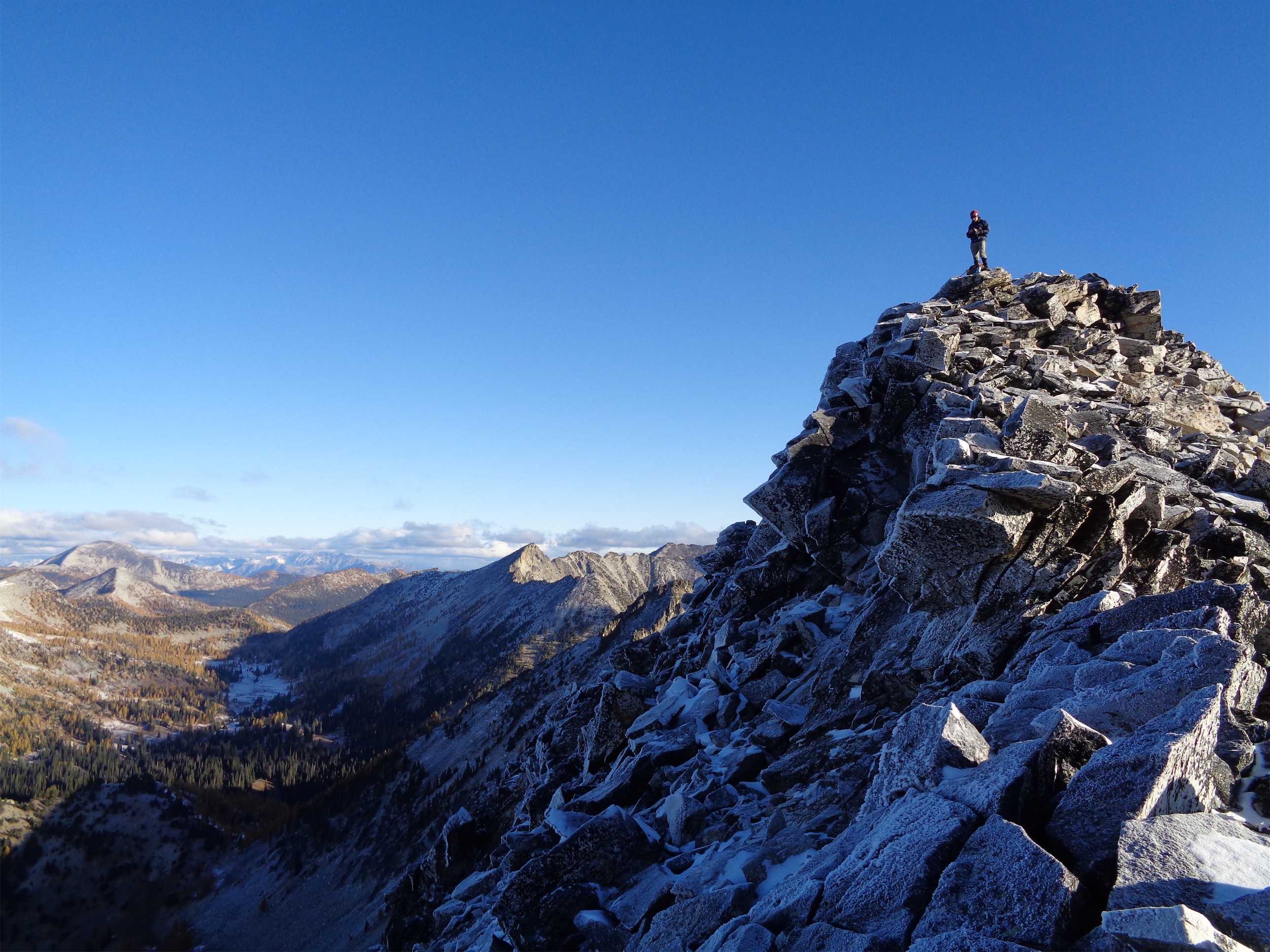
Go up and over the knoll! Sidehilling around it would be miserable. It looks like you can’t walk off the far end of the knoll but you can (well, maybe not in snowshoes). Getting to the saddle took longer than expected, but finally we were climbing up again, and into the sun this time. Don’t be fooled, you still have a ways to go here. There were old boot prints we followed and we started to leapfrog a pair of two others that had caught up to us. At this point Jon started to lead, and I swear everyone in front of him and from prior days was also >6ft tall because I started having to kick extra steps in between their ginormous strides. I stashed one pole by a patch of trees where the prior party had stashed some gear and continued up with an ice axe.
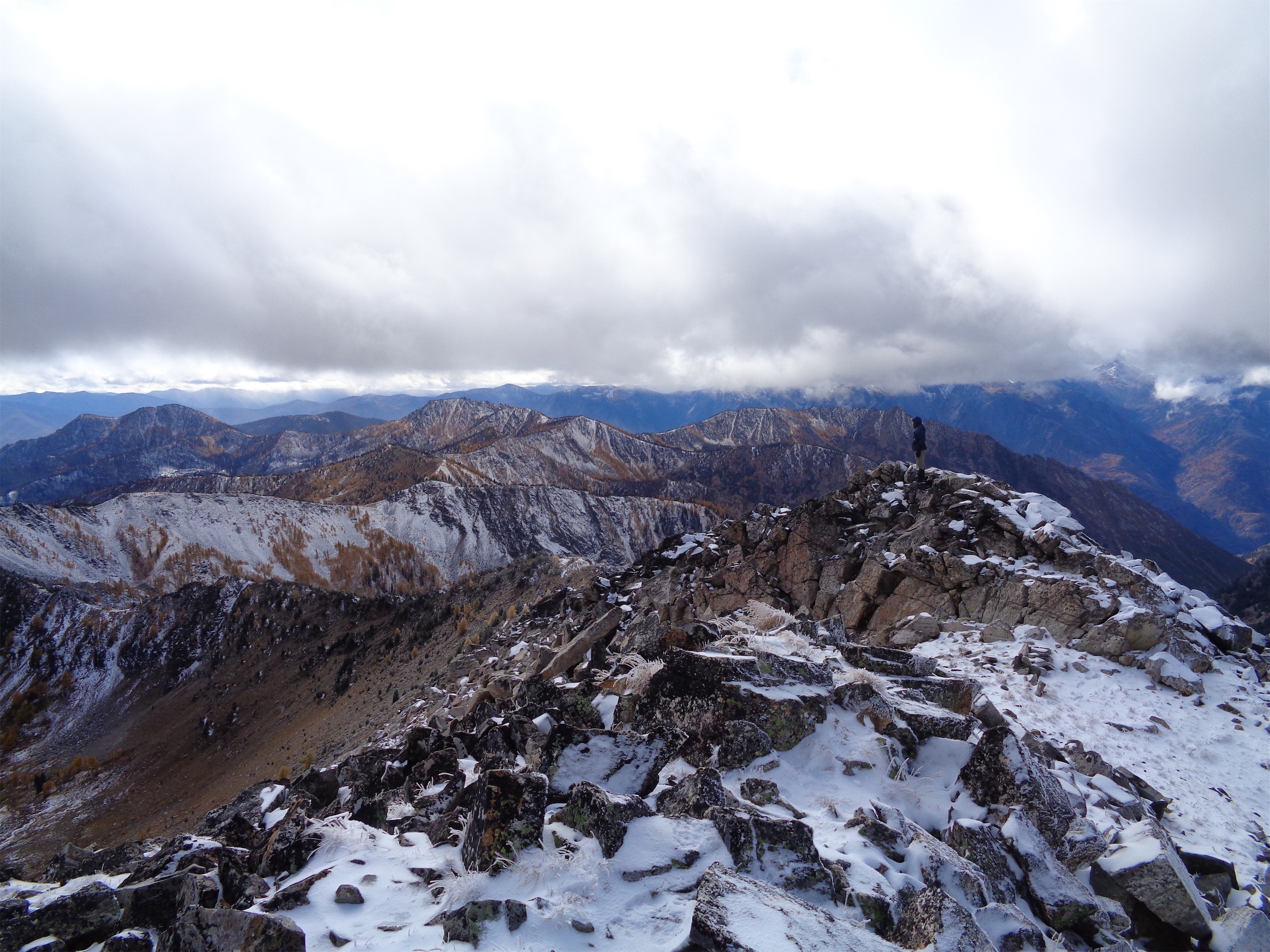
Tough to complain up here!
It’s crazy how different conditions change the experience. The first time I did Round Mountain snowshoes were essential and I still remember swimming uphill through powder. This time we got to kick steps, the snow was mostly solid, there was exposed rock for a scramble-y move or two.
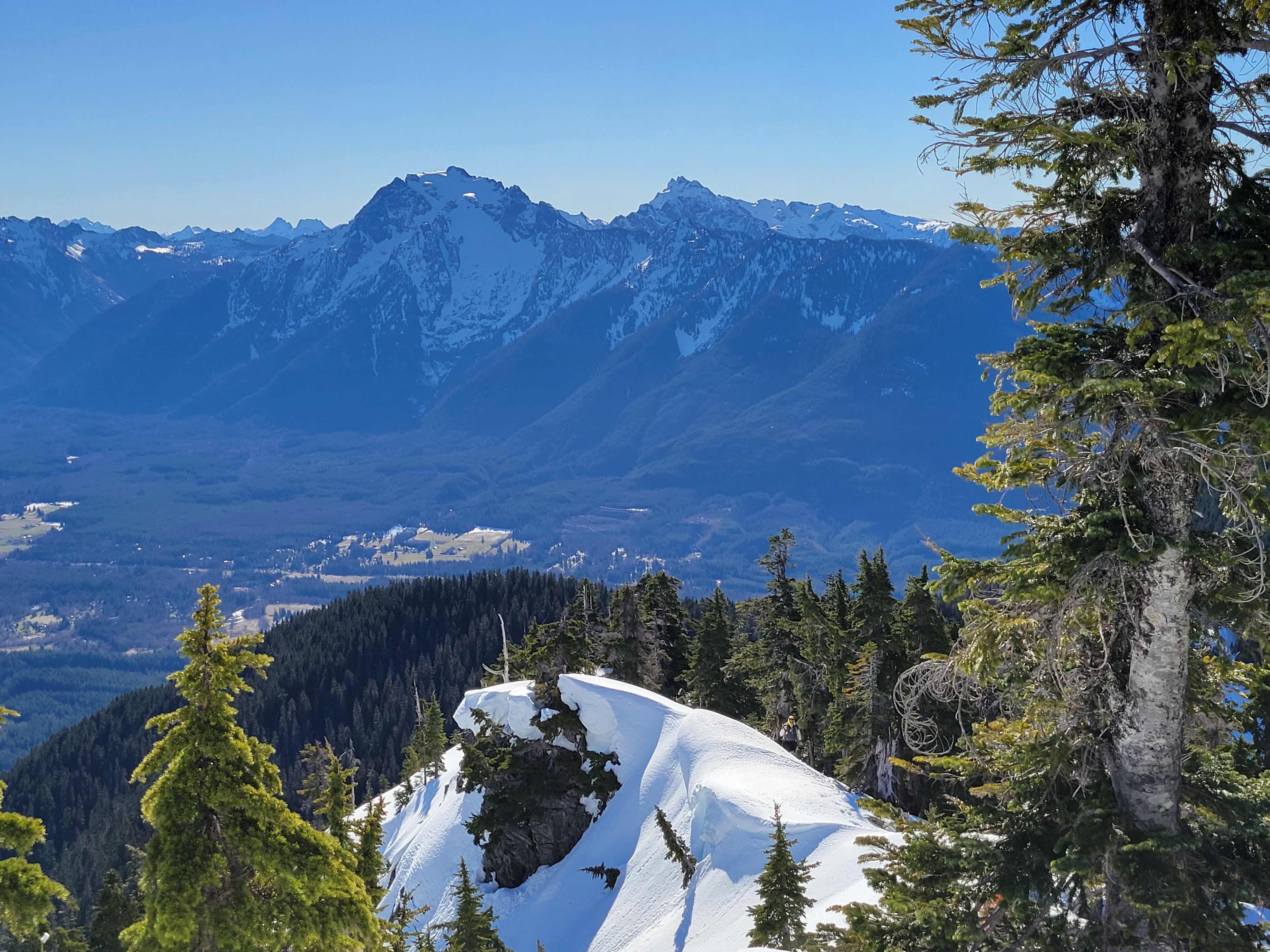
Daniel and his contagious smile under Higgins
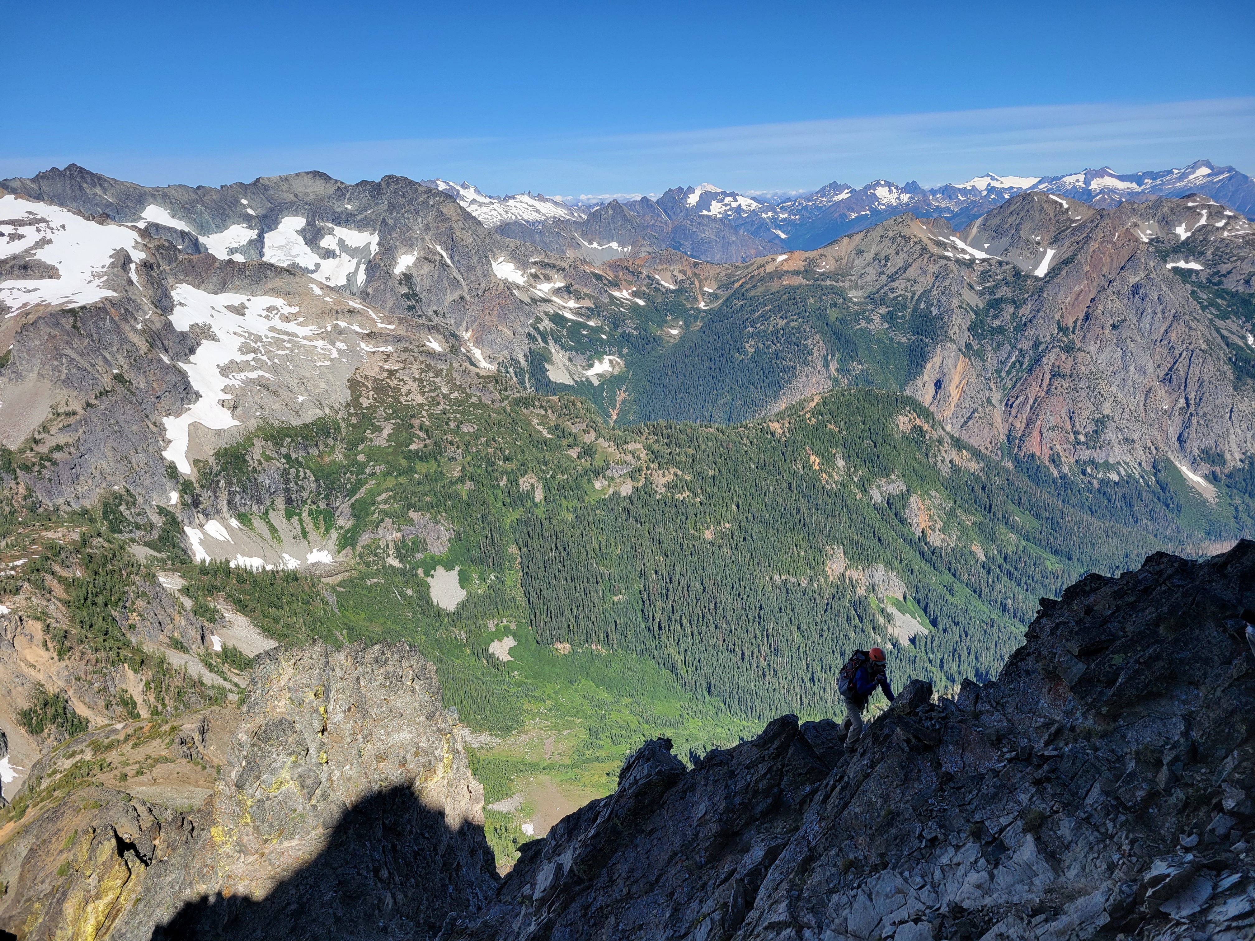
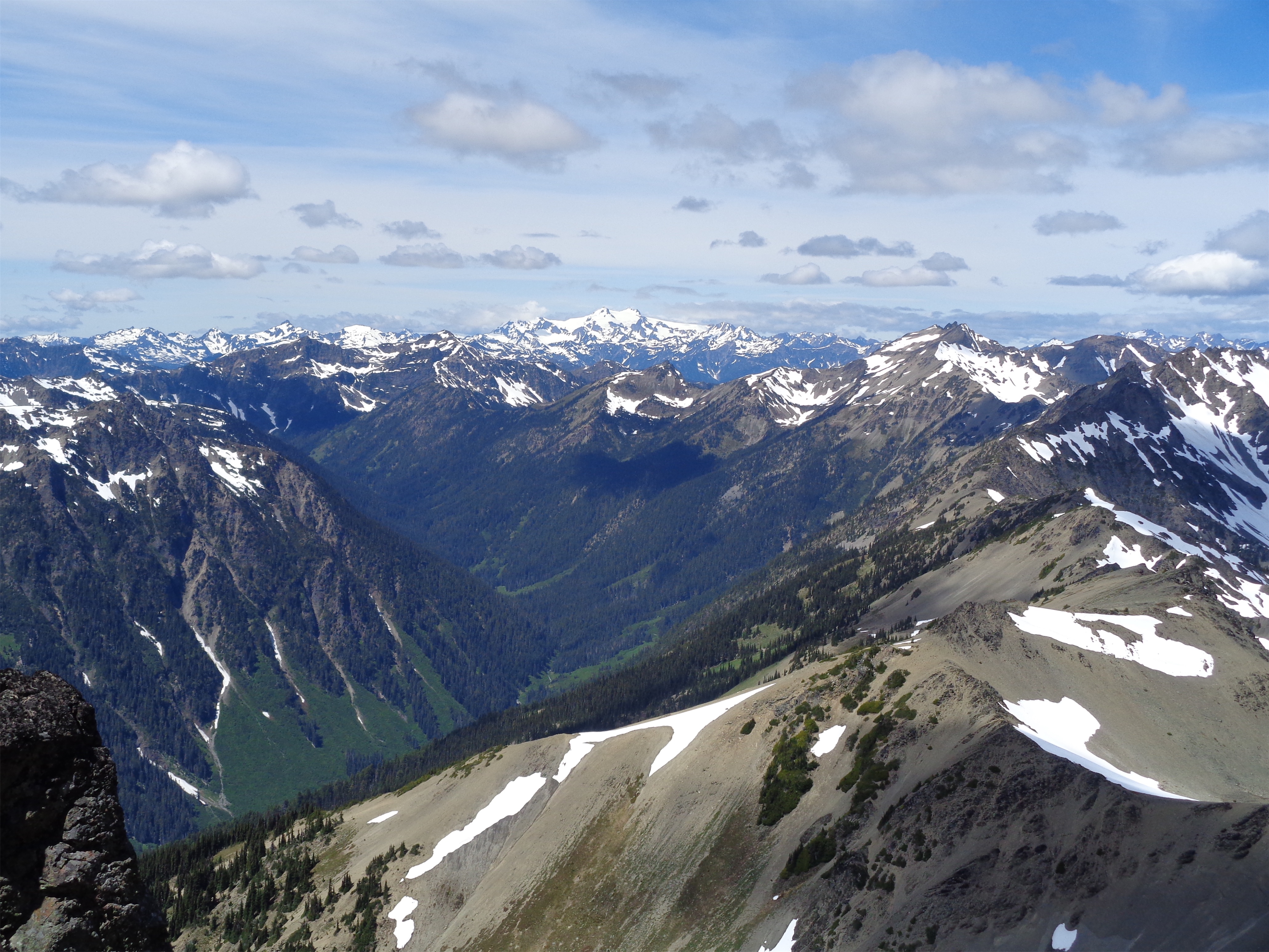
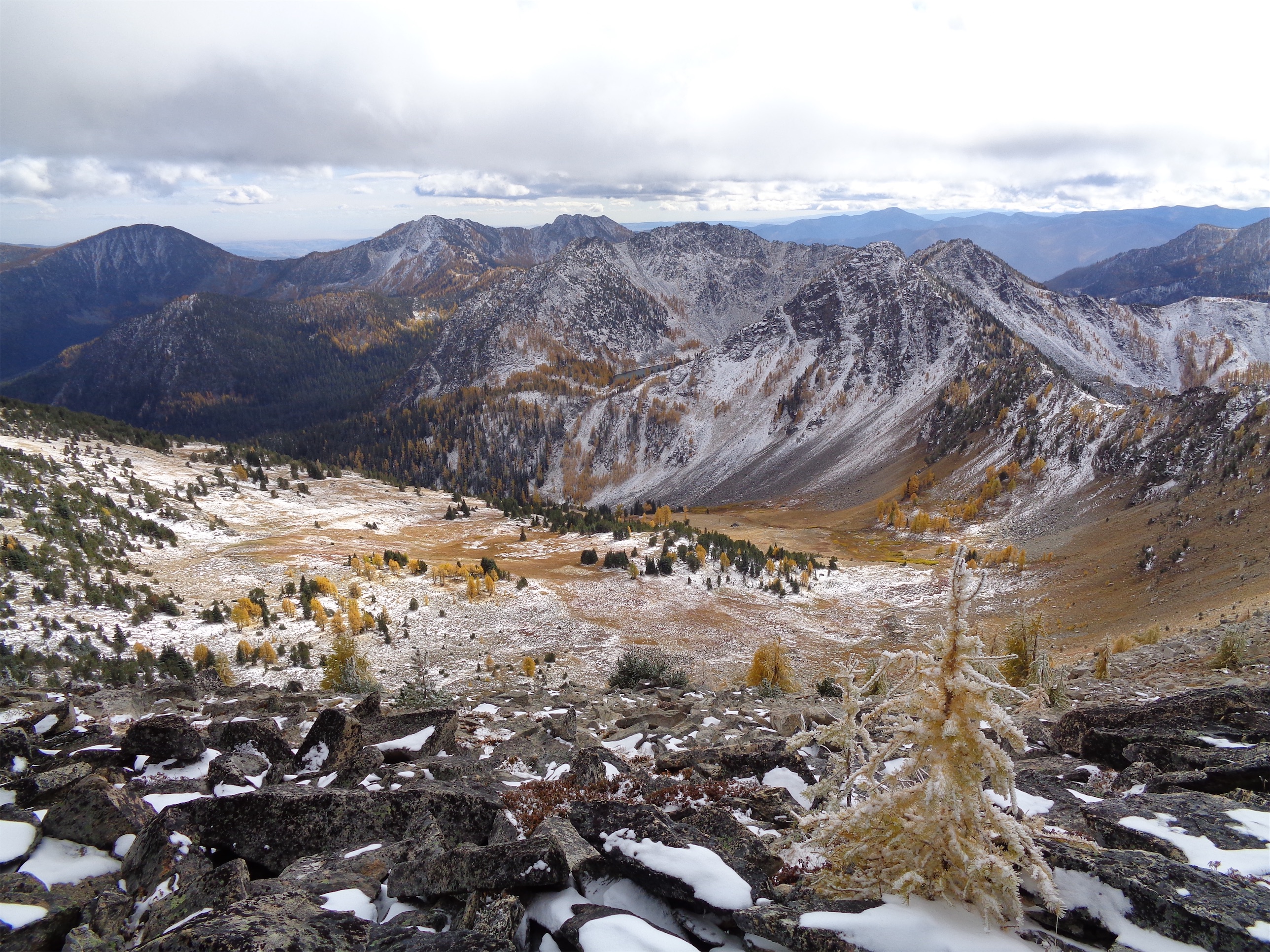
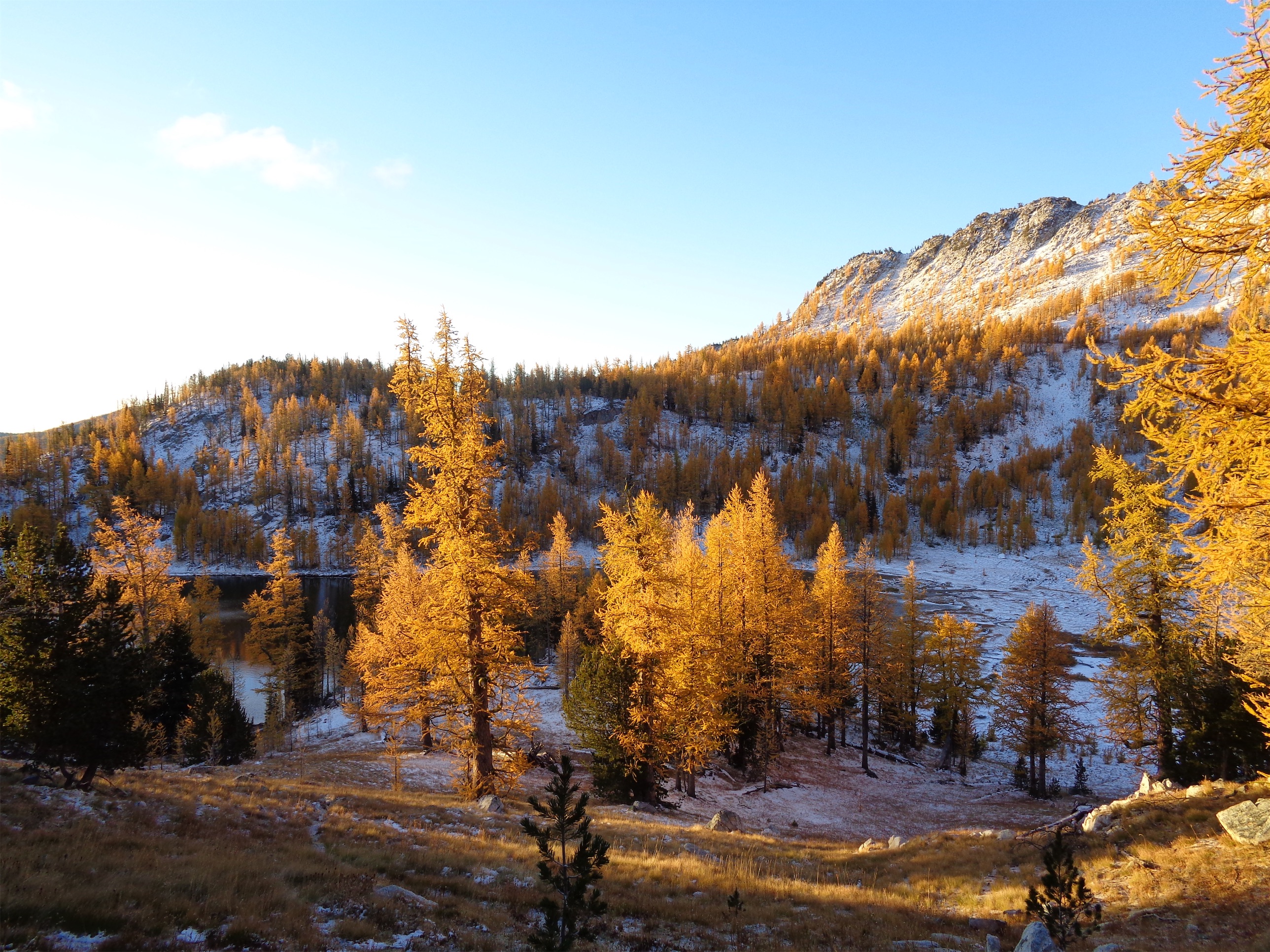
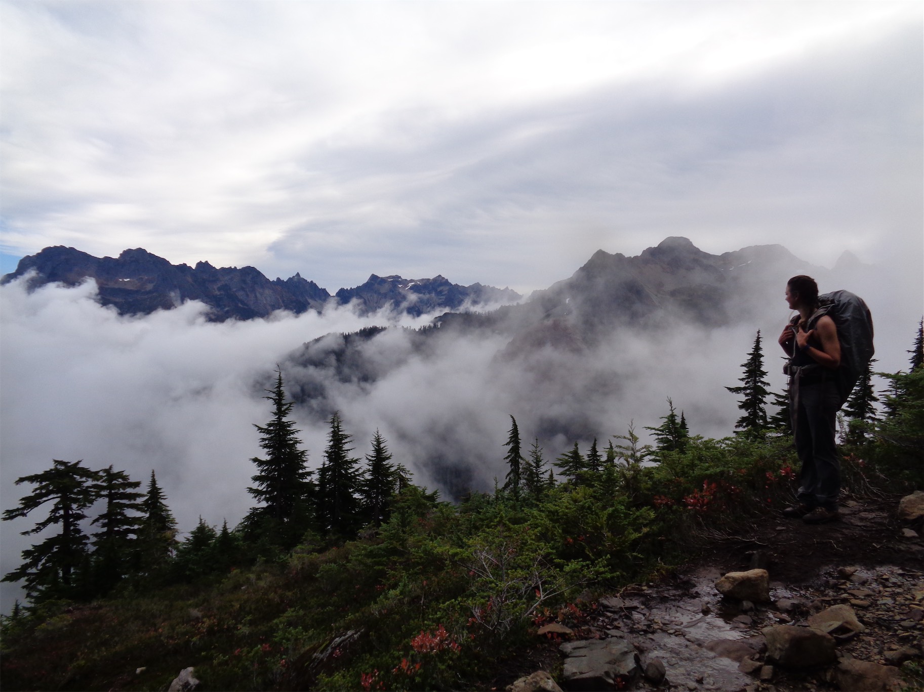
The views were ridiculous. I could tell by how tall Higgins seemed that we were nowhere near the summit of Round yet. Higgins and its entire ridge looks SO cool from Round Mountain, it’s extremely steep and jagged and from the highway side it has these incredible diagonal striations like a little piece of Glacier National Park or Banff. The views were almost enough to distract me from the fact I was fucking starving.
CAR VISOR for summit seating, who knew how versatile they were?!
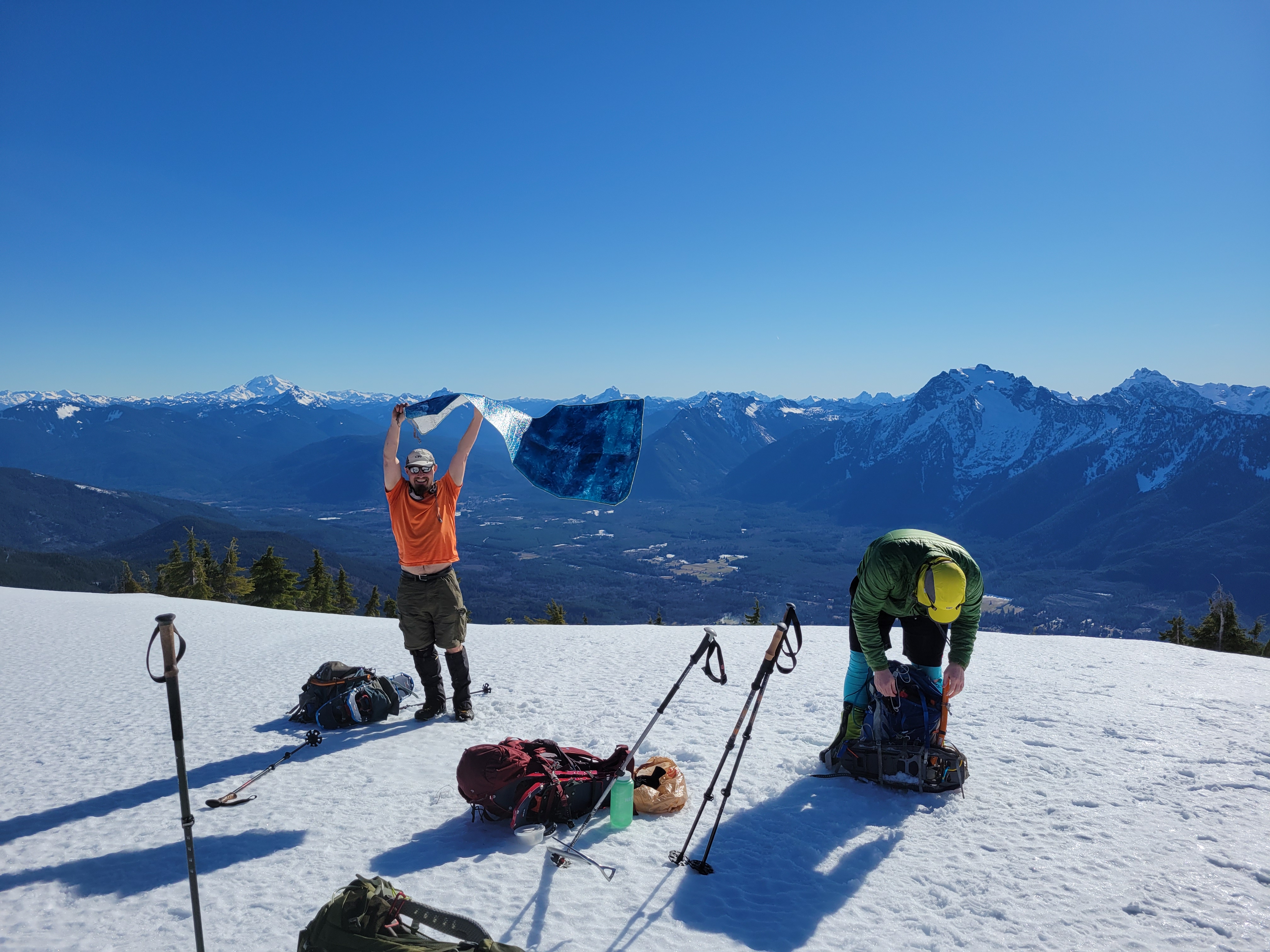
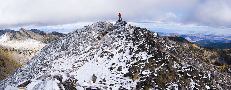
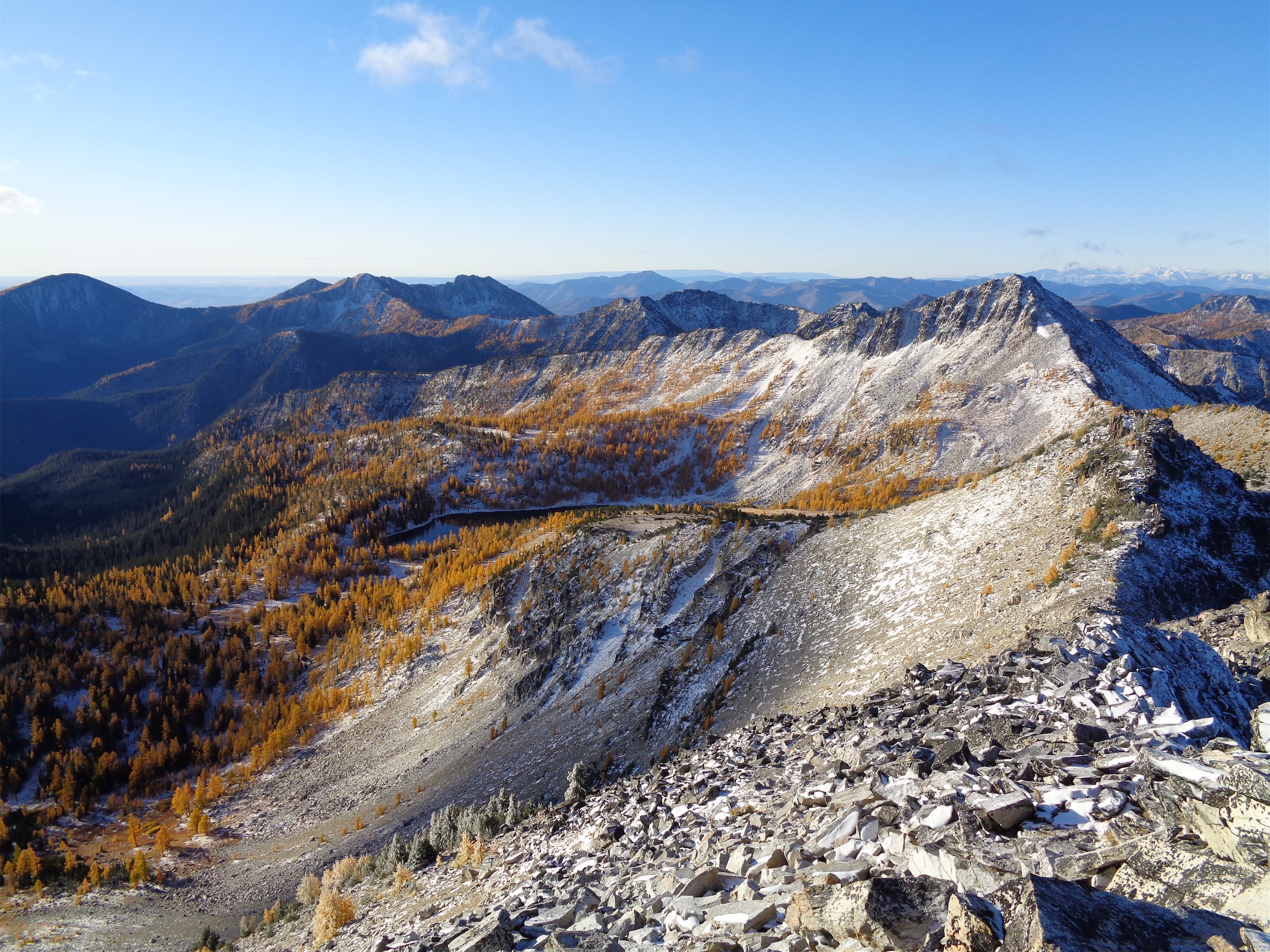
The summit is aptly named. At least in winter, it is quite round. Huge plateau with plenty of space and views in every single direction. I didn’t even know which way to face for a panorama. Even the Olympics were visible. Rob whipped out his car windshield visor as a sit pad which had us cracking up. Daniel asked if we wanted spicy mango candy or chocolate covered espresso beans. Rob asked if anyone wanted chocolate or whiskey. I don’t remember what Jon had to offer, but it was definitely better than my snacks – anyone want, uh, soft boiled eggs, or lentils? A resounding no.
*edit: Jon had maybe some Hawaiian pizza to offer, unless he had already eaten the 8 slices he carried up the mountain
Whatever guys, I devoured my snacks. I just started Invisalign, and I wildly underestimated how much of a pain in the ass it would be with my lifestyle. I have a single crowded tooth that you can’t even see when I’m smiling, but after two years of starting at my own face on Zoom I can’t un-see it every time I talk or laugh. But. You can’t eat ANYTHING with them in! And if you take them out to eat, you have to brush them AND your teeth AND floss before they go back in. So I ate like a full meal on top of Round Mountain, and then had a little dental hygiene clinic. No pocket snacks, no quick bites, just one big committing break and I guess that’s how the rest of my climbs will be until I’m done with the liners. My best idea so far is cutting shot blocks into small pieces and taking them with water like sugar pills but I like to ENJOY my food.
I have no idea who these people are but it’s a great pic and I hope they are doing well
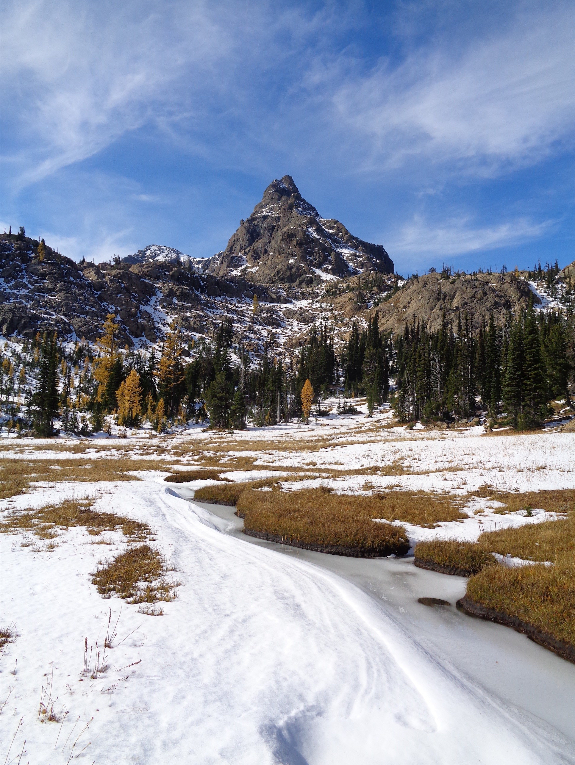
The toothy looking one is called Skadulgwas.. my interest is piqued (get it)
The way down went by so quickly. Rob started singing songs that only require one line to get stuck in your head. Like “it’s the fiiinal cooountdooown.” I had more examples but now that’s already in my head and I can’t remember anything else. I was worried I’d overshoot where I had stashed my pole since it was no longer obvious with all the gear the other party had stashed, but we found it. We glissaded a 12ft stretch, and another 12ft stretch. Downclimbed some of the rockier parts. Snapped 1000 more pictures. Wove our way back up the almost knifey yet forested ridge to the knoll, and from there we knew it was the home stretch, but a misleading one. It’s. SO. Steep. And just so sustained. It’s honestly better with snow. Without snow, you’re trying to creep down this slippery mossy dirty slope, hoping your feet will stick to something. It’s extremely tedious. I think the part just below the knoll was the worst, and it gets less steep as you get closer to the forest road. Going down doesn’t feel much faster than going up because of how tedious it is. At least it’s soft so it’s not a total knee banger.
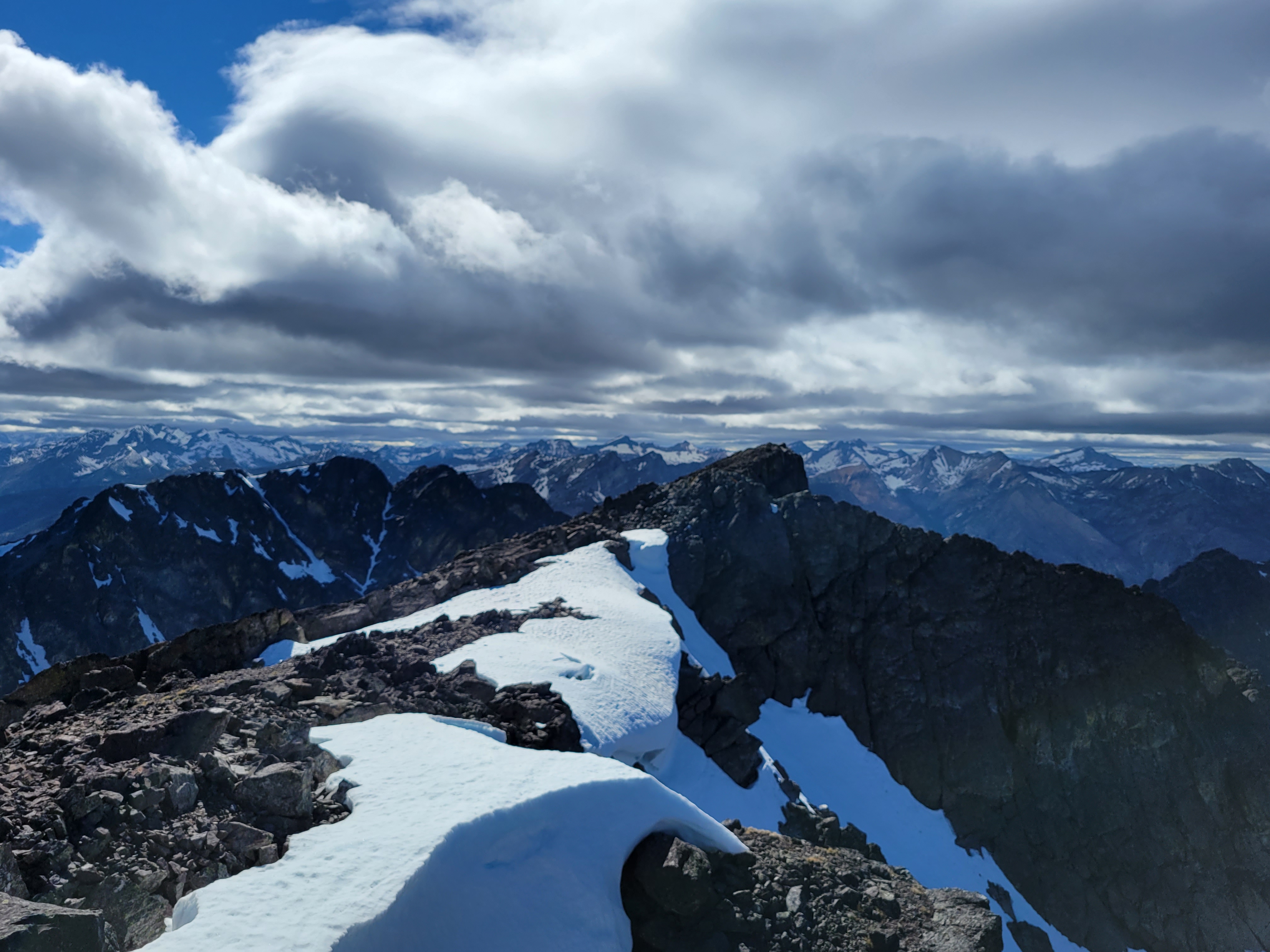
Baker and Shuksan from the summit
We were back down by 3pm, making it somewhere around 7hrs round trip with a very long summit break. Our moving time was just under 6hrs. We stopped by the Rhodes River Ranch in Oso for lunch/dinner (dunch?). It’s open again, and it’s just a very cool location with great food. You can watch horses in a ring below the restaurant seating, the burgers are delicious. And they give you chocolates with your receipts, so don’t put your invisalign back on until after you’ve paid 🙂
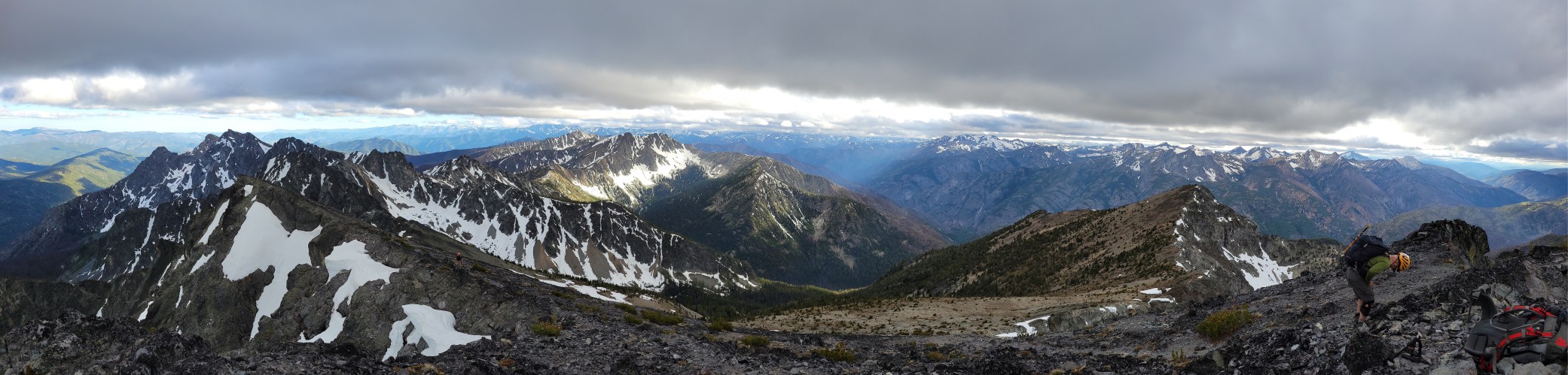
Great day with a great group, still can’t believe we got so lucky with weather in freaking February. Hope we get on some more adventures and I HIGHLY recommend Round Mountain to anyone looking for a lesser known peak with a fairly safe winter route and really just phenomenal views. I think it’s being discovered though, we ran into multiple other parties up there. It certainly deserves it. Can’t say it’s worth lugging skis up there (I considered it) but I’m sure someone’s tried it…
The reputation of this peak is both hilarious and accurate. It’s a chossy heap of shit. Martin will erode into nothing millions of years before the rest of the cascades. A single small quake will send it crumbling into the valley while Bonanza looms 1000ft taller, unscathed. A climbing party will remove the wrong fist-sized rock from their scramble route, and half the mountain will collapse. It’s alpine Jenga.
There’s a route in there somewhere
Okay, now that I’ve set your expectations extra low, here’s why it’s still worth doing: I swear, that between most of those gullies trying to skid you off into the future, there are some lines of decent rock, and it’s not unmanageable. At least on the way up. It’s not the west side of Gilbert with the miracle streak of conglomerate and death runout everywhere else, it’s more forgiving than that. The fact that we got 5 people up and down without incident speaks for itself.
Distance: 2mi from camp to summit (okay obviously my math sucks because gpx track had us at 25 miles for the whole holden/bonanza/martin/holden trip)
Elevation Gain: 2,100ft gain to summit (8,511ft highest point)
Weather: 70’s and sunny
Commute from Seattle: 8hrs bc ferry
Did I Trip: Technically no, but plenty of other mechanical stumbles
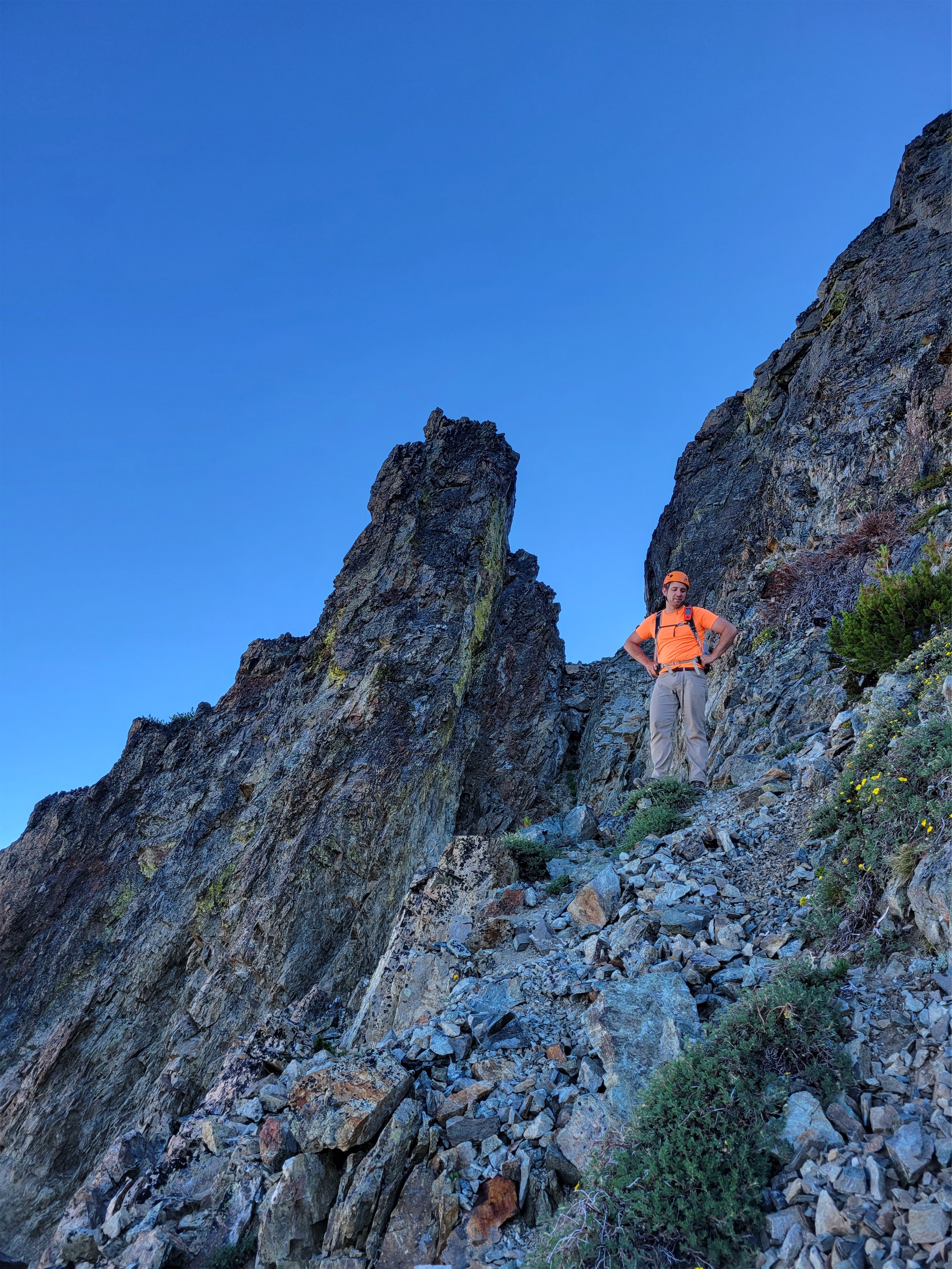
We left camp at 6:15am, ready for a more casual day than Bonanza the day prior. We followed a vague bootpath on and off up and over two small humps until we were at the saddle just west of Martin. We traversed a tiny bit east before finding a gully to head up. There were multiple options. I’m still not sure which is the “correct” one. They all had 3rd class ish steps towards the beginning, none were 100% walk up. And honestly, the 3rd class ish steps were the most solid parts. Because the walk up sections were previews of what was to come. Extremely loose dinner plate talus and steep awkward sidehilling. If you managed to go straight up you’d randomly slide back a few steps.
“Alright now that’s enough of that”
We crested the west ridge after fighting ungracefully through some stubby trees, and were able to walk maybe 1000 horizontal feet before traversing east again around 7,500ft. The view of Bonanza is spectacular, you can really see just how large the Mary Green glacier is and how daunting the summit looks from afar. Crazy to think there’s a manageable way up that.
From here, it’s a project of scrambling over ridges and aretes and connecting shitty gullies when they become really too shitty to climb. If the gully is seriously bad, there is probably a ridge or some cleaner line you’re missing, or it’s time to traverse to the next gully. Treat it like a scavenger hunt, it’ll go. If you are lucky, you’ll see a cairn, but there’s only like 5 on the entire mountain and if you build one, it’ll probably fall over in five minutes anyway. Climbing Martin is like a 12 step program, but it’s OGAT: one gully at a time.
Finding veins of solid rock
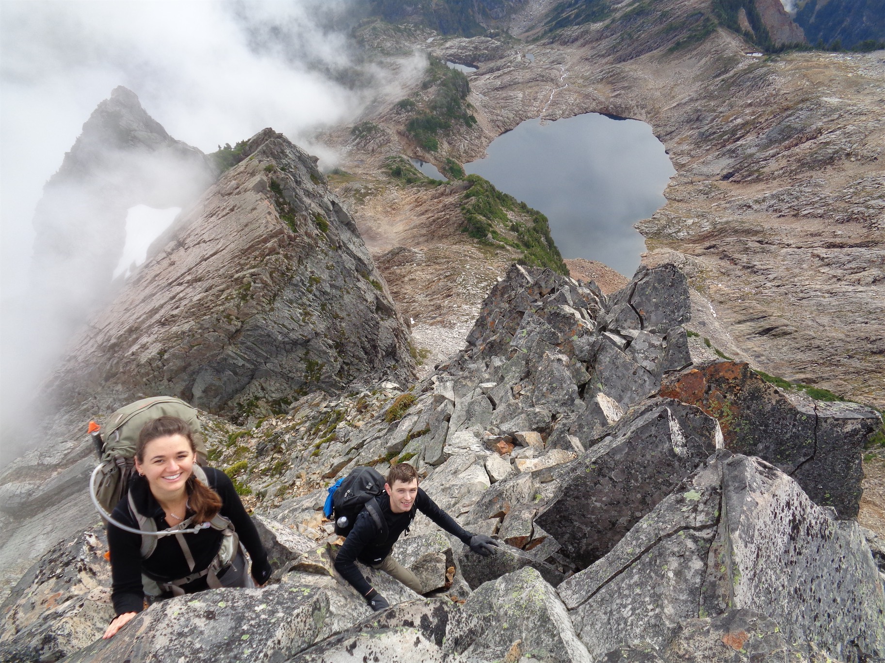
When truly on the ridge (or even the aretes between gullies), the scrambling was solid. When in gullies, it was loose and tedious and sometimes just nasty, but more often than not we found clean lines on the way up. But sometimes things would look solid, and then break off if you tugged or knocked on them even slightly. Some blocks that looked embedded you could actually remove and then put back exactly where they came from, like 3d puzzle pieces. Totally bizarre.
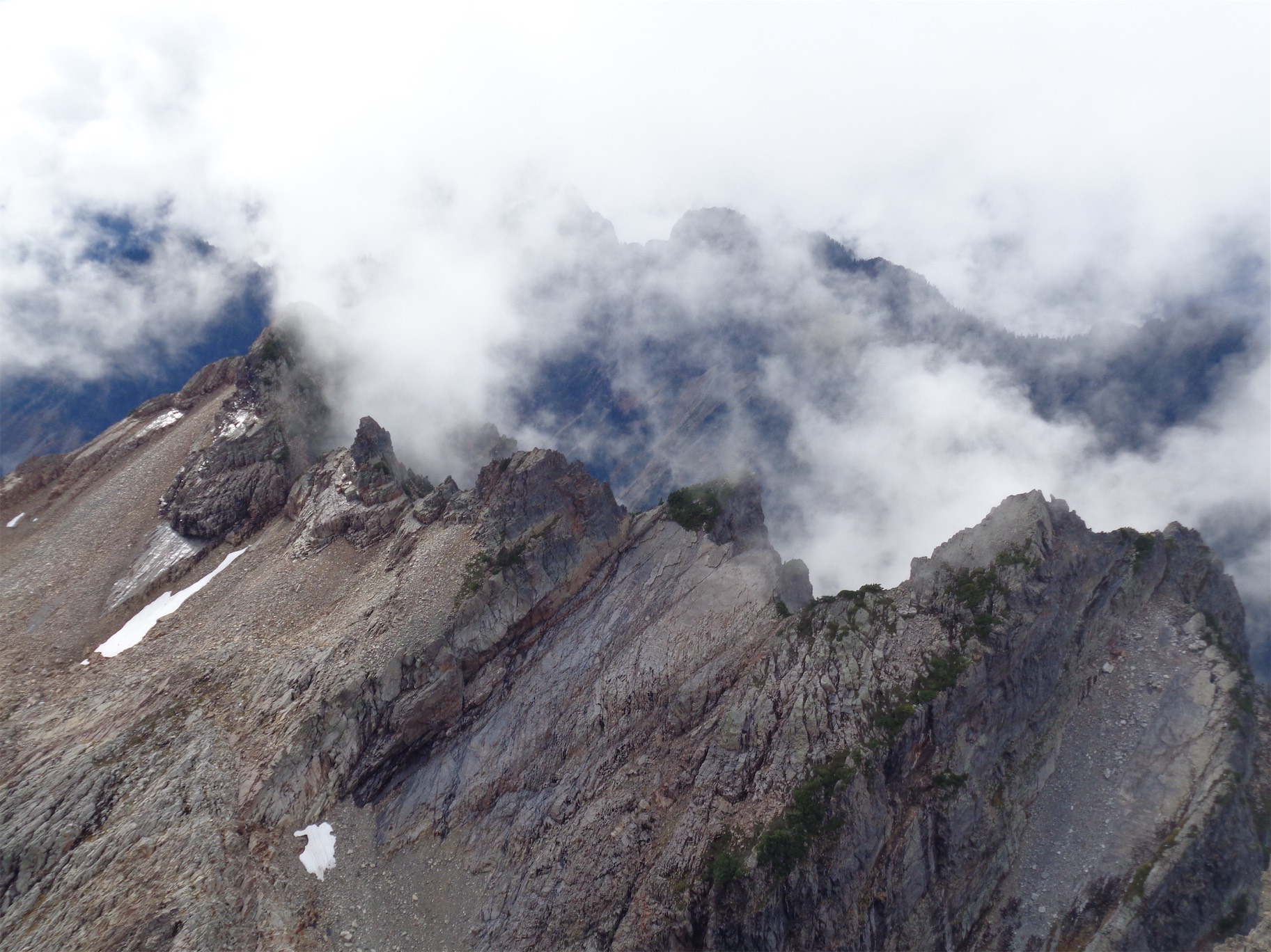
There was one section where I realized we were on exposed, thin ledges that just felt like they’d crumble at any point. No jugs, nothing solid. It was probably the fastest I scrambled all trip, and the only section on the way up where I had an “oh, whoa” moment. The rock was red, then white, and then we were above it, and I noticed rap tat right at the top which was great because I knew I wouldn’t be stoked on downclimbing that. Turns out we had overshot the “first crux” per summitpost, which is just to climber’s left of the white and red gully. But it wasn’t so bad, at least on the way up. And above that gully, we found solid clean rock on the ridge (exposed, but fun), and then it was back to crossing yet another gully.
The red/white gully. Rob is on the airy narrow ledge section, Mike’s just below it.
Solid ridge scrambling
The second crux went smoothly on the way up. It was exposed, but had solid rock compared to the rest of the peak, and a few very fun moves. Beyond that, nothing dramatic between there and the summit. I’m sure Rob was singing the final countdown. You know what else distracts from shitty choss? That diarrhea song (you know, “diarrhea [fart] [fart]”), which SOMEONE started singing as talus and scree and debris crumbled below our boots, a fitting theme for Martin’s quality of rock.
The summit is big, and we took a looooong break with snacks and naps and pics. My favorite signature in the summit register was Dick Hertz (ha) with the SKt (Slowest Known Time instead of FKT, fastest known time) with 80hrs round trip from Holden and 2 bivvies. We’ll never know their real name, or what actually happened, but it sure gave me a laugh. I bet it’s some animal who did this in like 7hrs from Holden and just has a good sense of humor.
Summit shot!
I was anxious about the downclimb as usual, but I had bomb ass shoes and the way up had been fine and I was confident in the group to help me through whatever might get in my head. I made sure I was neither first nor last. It means someone’s below me if I need someone to talk me through some moves, and someone’s above me to distract me if I just need to recalibrate my brain. Put more simply: I won’t be left alone! Turns out I enjoy climbing a LOT more when in a crew. Rob being the mountain goat he is downclimbed first. I followed. The crux was a great combination of fun and electric. I grabbed pics I didn’t think to get on the way up (probably too busy studying moves/getting hyped). We kicked tons of rocks down on the way back to the white slabby gully, including one where we might as well have glissaded talus. We went one at a time, very slowly, and eventually stopped even shouting rock because there was no avoiding it and everyone knew.
Downclimbing a crux
A rocky outcropping splits the white/red gully (skiier’s left) from a grassy gully (skiier’s right) that looked doable. We gazed down each side of the outcropping. We scoped out the grassy gully. I did my usual I’d prefer to rappel, but if you downclimb, I’ll follow.. except no one wanted to downclimb. And we had carried the rope all the way up here (by we I mean Alex thanks Alex) so why not put it to use? We set up one of the most beautiful rappels I’ve seen (scenerywise, though I assure you our rope management was impeccable as well) and rapped as far down as we could get. “Take a picture of me rapping, for my dating profile.” Damn straight!
Rob was the first one on rappel, and he cleaned the rap for us, pulling pieces of loose rock and flakes off of the rock wall. One of the flakes was HUGE. It had been a while and we were starting to wonder if he was okay when we heard a huge crack followed by rockfall followed by Rob explaining what was going on. And when I rapped down, I could see the huge scar left behind the flake that he had pulled off. Great call, would NOT have wanted that coming down on any of us.
Mike admires the views by the crux
At the base of the rap we kicked more rocks down traversing to skiier’s right to get out of the line of fire from any other debris the rap might pull down, and then it was back to awkward sidehilling, ball bearings on solid rock, stringing more gullies together and tagging the ridgeline between gullies. The five cairns helped, plus some recognizable rocks. Once we were back on the mellow end of the ridge, we cruised to the very end and took the last gully on skiier’s left to get back down to the saddle. This went fine, but still had a 3rd class ish move towards the bottom. Not a problem, I just expected a walk up gully at that point and we never found one.
Beautiful spot for a rappel. Ridiculous really
Me on a downclimb section*
Getting up and over those two humps back to the saddle above Holden Lake was tough. I was low on water, Mike and I hauled ass back with the others somewhere behind us. My inner juke box was alternating still between the diarrhea song and you are my sunshine, two wildly different tunes. Back at camp, I boiled water to chug before collapsing on my sleeping bag in my tent. I love sitting. Full crew was back at camp by 4pm.
Much better as a rap
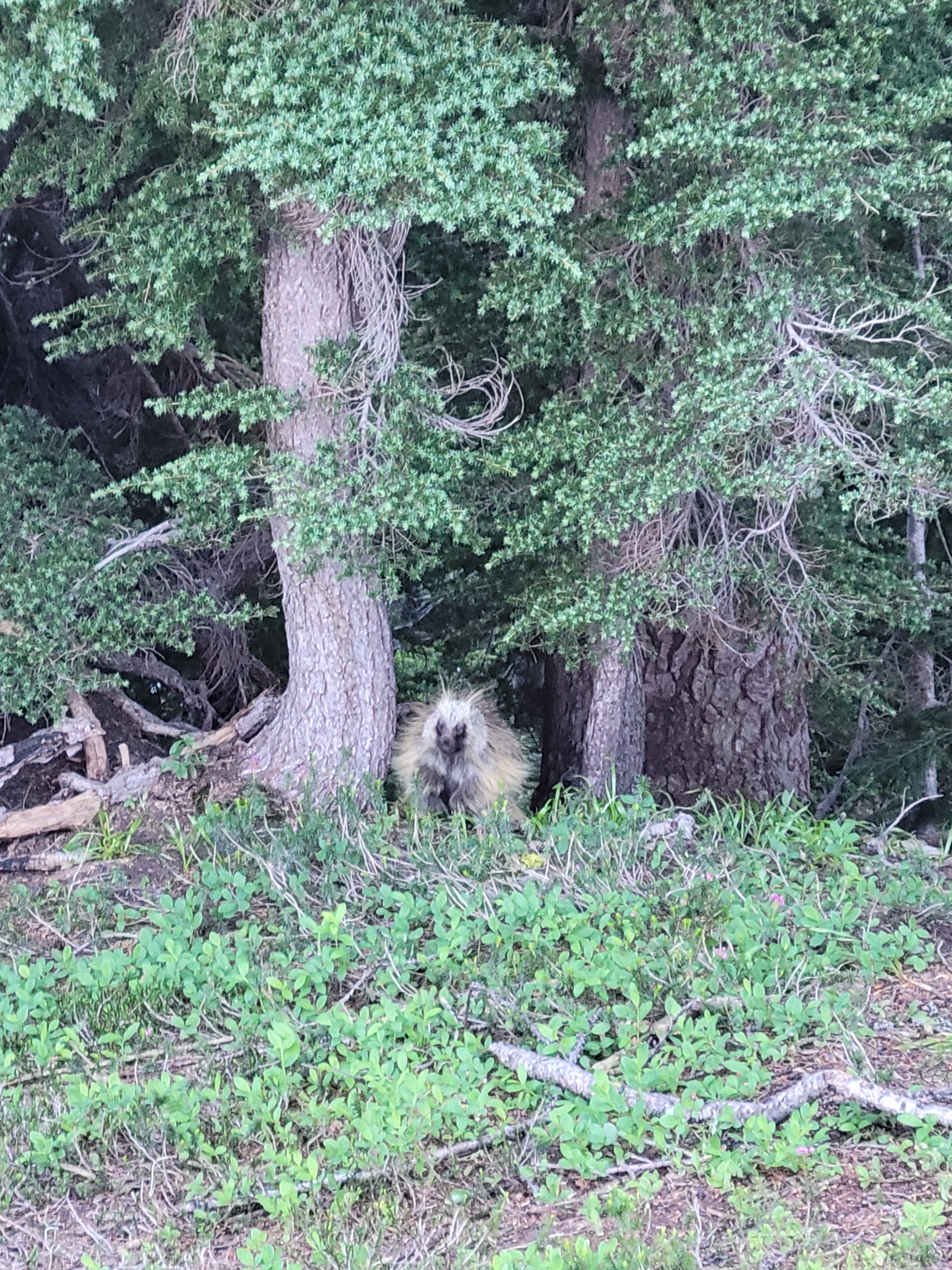
Maybe an hour later, there was a sudden commotion around the bathroom area, and we saw a porcupine! I’ve never seen one before! We all gathered around, he didn’t seem to care one bit that he was being watched. The new neighbors joined us for a watch party (they just got back down from Bonanza). Some hiked down to the river for fresh water and a shower, I boiled snow for my final variation on mac n cheese and chugged more mio, content that we only had to hike back to Holden the next day. I groaned as I lay down in my tent. Someone laughed, I think it was Tim. “You know what that sound is? That’s the sound of a 70 year old. Or a climber.”
In the middle of the night, I was woken up by sniffling outside. I always thought I could just kick/punch an animal through my tent if it sniffed too close, but I didn’t want to blindly smack a porcupine, right? So I sat there panicking. I’m so blind without glasses/contacts in. I debated between fight or flight. What does flight even mean when you’re in a tent? It kept sniffling. Mike’s light in the tent next to me turned on. Okay, he knows too. Reinforcements. I unzipped the door and peeked outside. Oh wait, that’s right, I’m fucking blind. Well whatever it was took off, and sounded like it tripped over one of the tent lines. I shone my light around a bit more but didn’t see anything. Must have been a deer.**
Mike on the west ridge in front of Bonanza
The hike back to Holden was quick, about 2.5 hours. Including Mike and I thinking one of our party members was missing on the far side of Holden Lake. We literally jogged back there to find him, shouting his name, and it turned out he had at some point passed us and was ahead of us on the trail back to Holden! We passed another party on the trail that mentioned him and said he was totally okay, confirming what everyone else had thought. Oops.
REAL LIVE PORCUPINE
PSA: there is no $1 ice cream at Holden in the morning, don’t get your hopes up. We kicked around the bus stop until the bus showed up, munching on whatever snacks we had left, wandering the center of the village where we were allowed. It was our driver’s first time driving the bus in a year, and it was an old school manual transmission school bus that had to go through these crazy gravel mountain road switchbacks with no protection. She crushed it though, while I panicked in the seat and didn’t look out the window. Apparently my heart rate was so high that my Whoop picked it up as a bona fide cardio activity for 30min! I can’t be positive, but the time of the activity line up with the pics I took, so… yikes.
Back at Lucerne landing, we unloaded our gear and immediately jumped in the lake. BLISS. Sheer bliss. It was cold and refreshing and clear and amazing. We sunned on the dock until the ferry got close and I figured I shouldn’t be lying around in my underwear as a boat of presumably very polite proper religious tourists rolled up. But yuck, putting on climbing pants was gross. At least I had a fresh shirt.
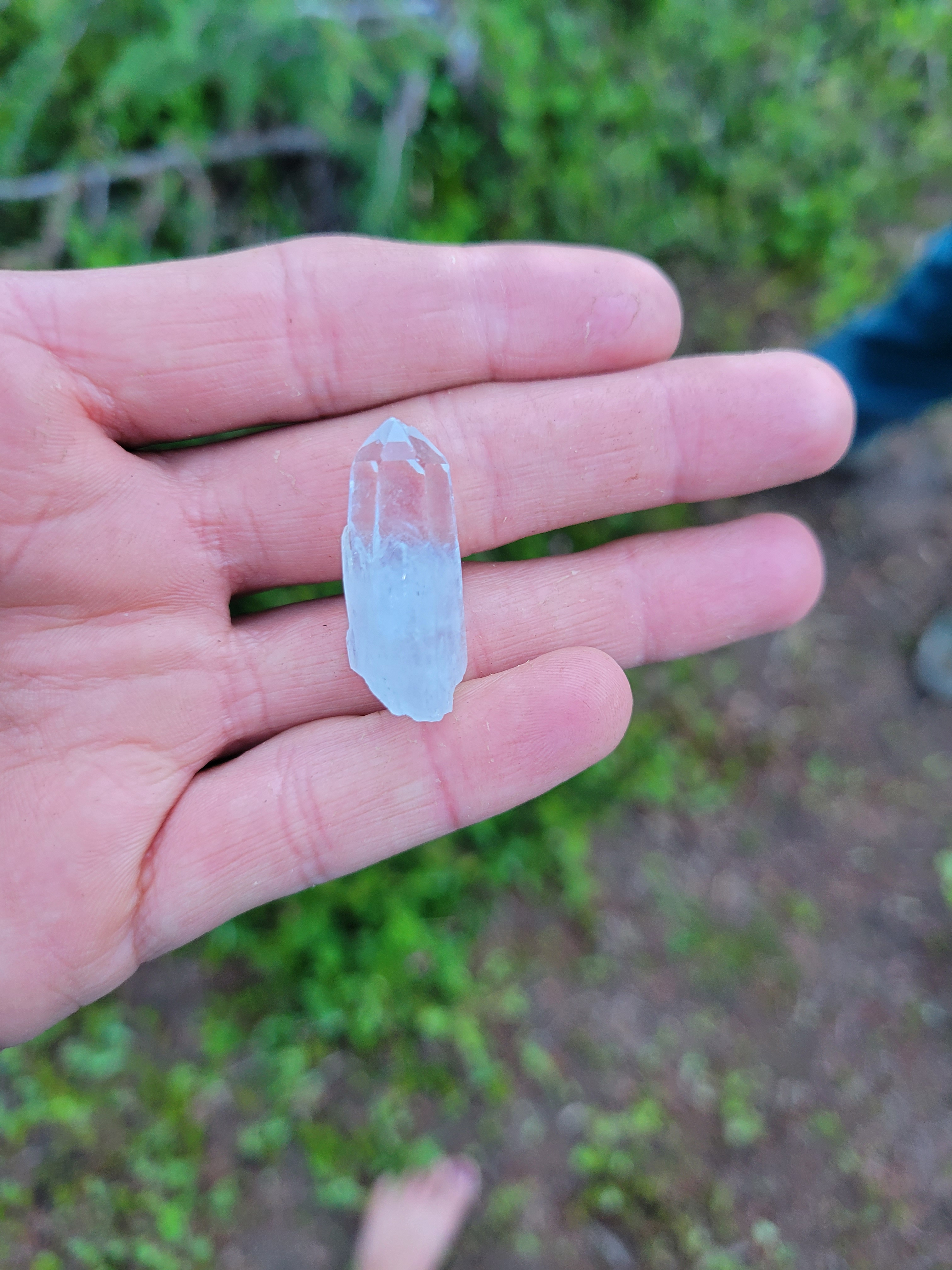
Rock our neighbors found on Bonanza, way cooler than the quartz I found
The ferry ride back was uneventful besides a cool waterfall we pulled up to. The views were still spectacular, though I wish I could have had my overheated beaten body towed behind the boat on a rope so I could just sit in the ice water (I know that’s not as pleasant as i made it sound, I’d be more like a drowning rock being skipped than a pleasantly dragged passenger).
The other highlight of the day? Besides jumping in the lake? Mike’s girlfriend meeting us at the North Bend Park n Ride with pizza and HOMEMADE MINT BROWNIES. I don’t know how she did them, but holy shit, that was the most delicious return to civilization I’ve ever had. The pizza even became a joke on the ride home. Shroedinger’s pizza. Was it happening? Was it not happening? Dare I even ask? Don’t let those hopes get up. I expected nothing. And boom. Pizza and brownies. I’ve only met her once and I felt like Doug in Up. “I just met you but I LOVE you.”
Chilling at thte Holden bus stop
I drove home, unleashed a forest of pine needles in the bathroom, threw all my clothes in the washing machine and threw away all the trash I had accumulated. I had found socks and a shirt on Martin, I almost had a full Martin outfit. My bed was almost too soft compared to the past few nights on the ground, and I was not looking forward to being back to work the next morning. I liked my alternate alpine life better.
Once again, super strong team, great collaboration and communication, and I seriously hope I get to go on some big trips with them again. At some point on this trip multiple people were rapidfire giving advice to someone. “Put your hand in” “no put it here” “no take it out” “okay put your foot in” and whoever we were talking to finally said “okay but when do i do the hokey pokey and turn myself around?” which of course triggered full group laughter. I’m very lucky to be included with this crew!
Our humble abodes below Bonanza
*those dents in my helmet aren’t all from Martin **a person definitely tripped over those tent lines at some point too but I don’t remember who. Oops
Bonanza and the Mary Greene Glacier from Martin Peak
Adventure car
The most reassuring trip report about Bonanza you’ve ever read. Yeah you read that right. Maybe the planets aligned, but I think a lot of the nerve fraying reports for Bonanza are overhyped. And I’m a WIMP. I mean seriously. Talk to me while we’re face-in downclimbing, it can be about anything but someone needs to be talking to me so I can’t get in my head. Same if I’m making an airy move on a rock climb. So I went into this climb with expectations of exposure, spice, and whatever a noun for “heinous” would be, and came away swearing I’d write the most reassuring trip report ever.
Lady of the Lake
That’s not to say it was easy. The waterfall slabs are spooky in the afternoon. The snow can be steep. The scramble is exposed and arguably 4th-5th class at the very top. Lots of transitions. It’s a long day. But this has got to be up there with Fisher Chimneys as one of the most enjoyable moderate routes I’ve done in Washington. Here we go.
Distance: 5mi to camp, maybe 2 from camp to summit?
Elevation: 3,000ft gain from Holden to camp, 3,100ft gain camp to summit (9,511ft highest point)
Weather: 70’s and sunny
Commute from Seattle: Like… 8hrs because you have to take the ferry
1. It’s not as bad as it sounds. Or as bad as the pictures look. But it’s not easy. 1.5. The bushwhack near the lake is gone because some saint came through with a pair of loppers, and a saw, and a dream 2. Bring multiple pairs of shoes for approach/glacier/scramble. Scrambling in mountaineering boots blows. Very happy I had scrambling shoes. Mike brought enough shoes for our whole party. 3. Do Martin, because you aren’t going to want to come back just for that crumbling mess 4. Plan on rappelling the waterfalls in the afternoon but power to you if you find a down-climbable route 5. The ice cream place in Holden isn’t open in the mornings so you won’t get ice cream on the last day don’t get your hopes up
Holden Lake
FRESHLY. BRUSHED. TRAIL.
Bonanza is the highest non-volcanic peak in Washington, and the 26th most prominent in the state. It’s known for throwing a moderate level of everything at you – off trail navigation, bushwhacking, glacier travel, scrambling. Many of the trip reports I read spent time talking about the difficulty and not so much the tremendous scenery that flanks every section of this climb. And these pictures do NOT do it justice. At this point I like to think I do a good job capturing scenery, and I tried to give a taste of every section of this climb, but this was truly just one of the most incredible places I’ve ever been.
We piled into my car at the North Bend Park n Ride and met the rest of the crew at Field’s Point Landing Friday morning. I missed exit 85 on i90 as usual, and had to turn around like 6 miles later at the next exit. Near Blewett Pass we stopped for a bathroom break and got to see my car peel out doing 0-60 in like 2 minutes given the extra 1000lbs of passengers and gear (without that, I only need like… 48 seconds). And finally, my stomach dropped out of my body as I realized what I had left at home: the cheese. I had a whole bag of pretzels, and no cheese. Four days, no cheese. This was going to be horrific.
Copper over Holden Lake
We had the slow ferry on the way there, which took about two hours from Field’s Point to Holden. It has snacks! I got some pretzels and hummus, and cheese sticks. We passed smaller boats, kayakers, even paddleboarders on our way up Lake Chelan. At the Holden landing, we promptly got into the wrong bus (villagers only), were shamefully ushered off the bus, and finally seated in our own van. In 2015, the Wolverine Creek Fire evacuated Holden just before cutting off road access entirely, so much of the 17mi drive from ferry to village is in a burn zone. I’ve heard great things about the village and maybe this is to blame on covid, but we were totally ignored. Nothing was open, couldn’t find anyone to check in with at the ranger station, no one would answer my questions. I thought I was just being a dick/doing the horns effect thing feeling out of place knowing it’s a religious village* and I’m not very religious and then someone walked by singing hymns. Maybe I am actually just that out of place. I love people and had so many questions about the history of Holden but jeez no one wanted to talk. We finally started hiking the road that would eventually turn into the Holden Lake trail around 2:50pm.
Waterfalls all around
The trail is very easy to follow. Spectacularly green, wildflowers blooming, Copper Mountain rising above the valley. It took longer than anticipated to get to the lake, maybe heavy packs, maybe late start and sluggish after being on boats/in busses all day, I don’t know. My mind was wandering, from the Kraken logo to Homestarrunner/Trogdor to the song about burninating the peasants. Some other hikers thought we were bears. Maybe there was a bear. Either way this trail kept going FOR EVER. It took us a little over two hours to the to the lake (the song stuck didn’t help) and we arrived around 5pm. Sunset wasn’t until ~9pm ish so we had plenty of time. I spied a fifth of whiskey in Rob’s pack… that bodes well, I think.
Waterfall slabs in the morning. Follow the grass, then traverse straight left to center pic, then up just left of the waterfall that starts center frame.
We took a long break at the lake before following a path counterclockwise to the far side of the lake, where we were able to follow cairns AND CLEARED BRUSH up the gulley to camp. That’s right. Someone came in with a bona fide saw and chopped up that slide alder. There was basically a trail the entire way to camp. And following it up next to the stream was glorious. Waterfalls cascading down the face of Bonanza above us like Shangri La, wildflowers and Copper Mountain and Holden Lake behind us as we gained elevation. Spectacular beauty in every direction. I was like a black hole of sweat soaking in what the world has to offer.
The first part is the worst (though dry)
We reached camp at the saddle around 7pm, roughly an hour and a half after leaving out break on the south side of the lake. It was steep, but thanks to the brushed path and plenty of cairns, we never had trouble with navigation. at least, Mike and I didn’t. The others went through some twilight zone shit and had a bit of a brush bash, but found the path eventually. We pitched tents in an obvious flat spot at the saddle with a big snow patch for water. I stuck mine in the middle so anything coming to get us would have to go through everyone else first. Mike and I split a bear bag, partially because I forgot a rope to hang anything with, and partially because if anyone saw me try to throw a rock over a tree limb 30ft in the air they’d laugh and then evict me from the climbing party.
Good morning to you too
There is a better camp a bit higher up towards Martin, but we weren’t sure about the water situation, so we stayed where we were. It was also just as fast to hike back to the river to fill up on water as it was to boil it (and the melted snow always had surprise pine needles), so it was nice to have reasonable river access. Also, river showers. I crushed my first dehydrated meal. I called my menu “variations on mac n cheese” since the meals were things like chicken alfredo, creamy pesto chicken, mac n cheese, mac n cheese primavera… you get the gist. And you know what? They were all GREAT. We agreed on a 3:30am wakeup. Ugh. Alpine starts.
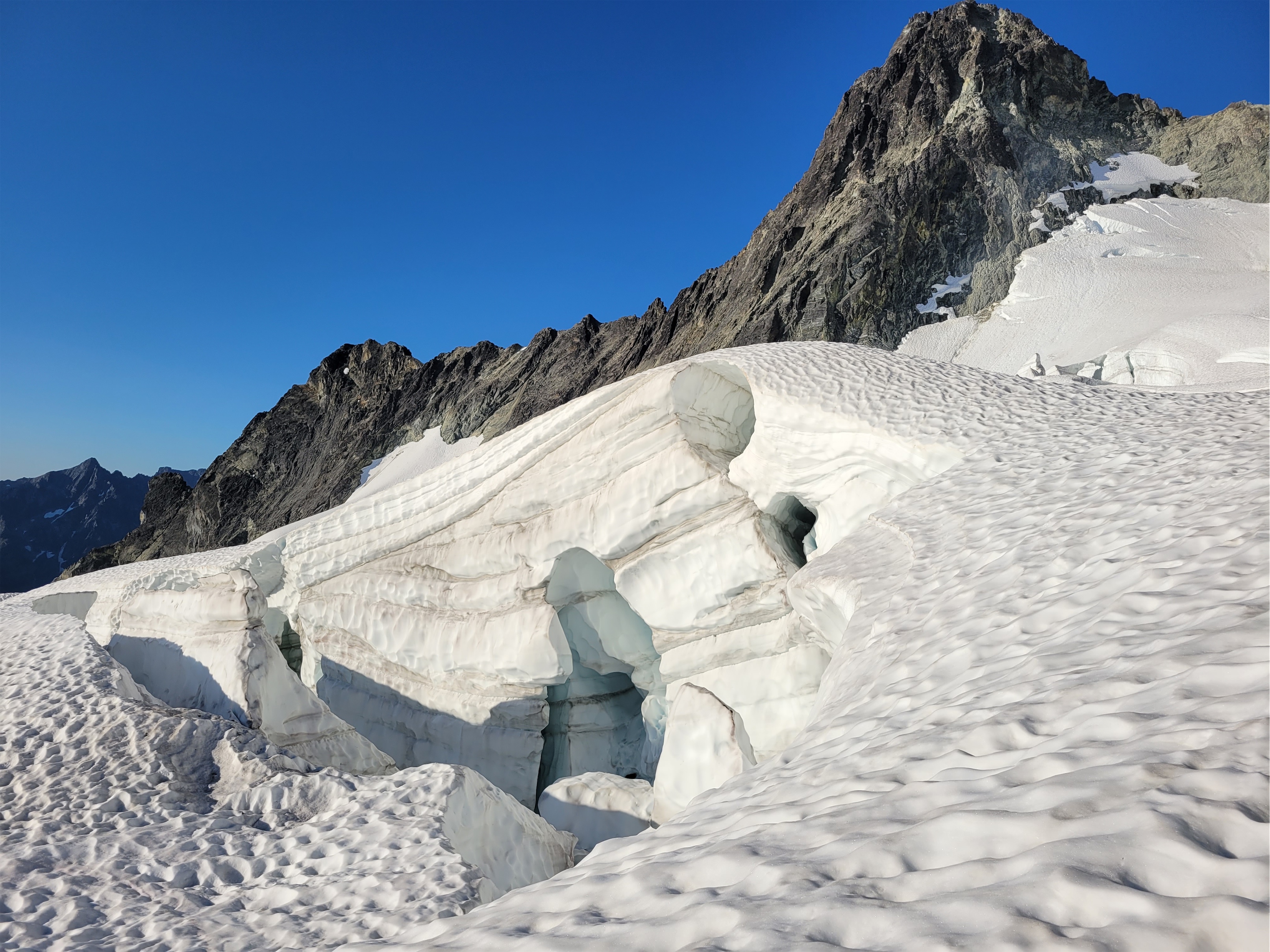
Obligatory crevasse pic
I woke up to everyone rustling, and we were moving by 4:30am, hiking up the ridge towards Bonanza. I immediately forgot socks and turned back to run down to camp to grab them, knowing I’d regret it if not. I had two pairs of shoes, traditional mountaineering boots for the glacier travel and light trail shoes for the scramble. I honestly considered just bringing rock shoes for the scramble given what I had heard about it, but left them at home after getting these hiking shoes. But whatever makes you most comfortable. You want to summit safely and as comfortably as possible. That’s why Mike had four pairs of shoes. If chances of success were correlated with pairs of shoes we were in great shape.
Rope management in heaven
From camp, this climb has three distinct sections, each with their own challenges. Waterfall slabs, then glacier, then scramble. We reached the waterfall slabs around 5am. We were able to fairly easily pick a way up these without getting too wet (see photos above for details). We unintentionally followed the last two pages of the PDF and the “alternate route” on Andrew Leader’s trip report, both in the beta spray towards the top of this post. Both were in the back of my mind, but it felt like a natural path we never consulted anything during the scramble. Gaining the grass at first was probably the worst part, maybe the final move over the top waterfall was a close second because it was wet (but juggy). I wished I had worn my scramble shoes for this section, mountaineering boots on (wet) slab are yucky. But we were quickly transitioning to crampons by 5:45am, and I was stoked to be on top of the world as the sun rose.
Okay this makes it loook a little spicy
We had two rope teams of 3 headed up the glacier, which is SO much bigger than it looks. We were able to cut straight through the center rather than hugging rock on the right and then traversing across the top of the glacier, but I don’t think it saved us that much time. Cooler crevasse views though. I spent the whole time telling everyone who would listen that I would rappel down the scramble section, for sure. I’m a sandbagger. Underpromise, overdeliver. Twice I thought the glacier route wasn’t going to go. We had to cross a sagging snow bridge across a decent crevasse that looked nasty from afar but ended up being totally solid, and then there was a decent moat between the glacier and the rock ridge that turned out to have a snow finger that was solid, but THIN. The glacier took us about two hours with plenty of stops for crevasse pictures.
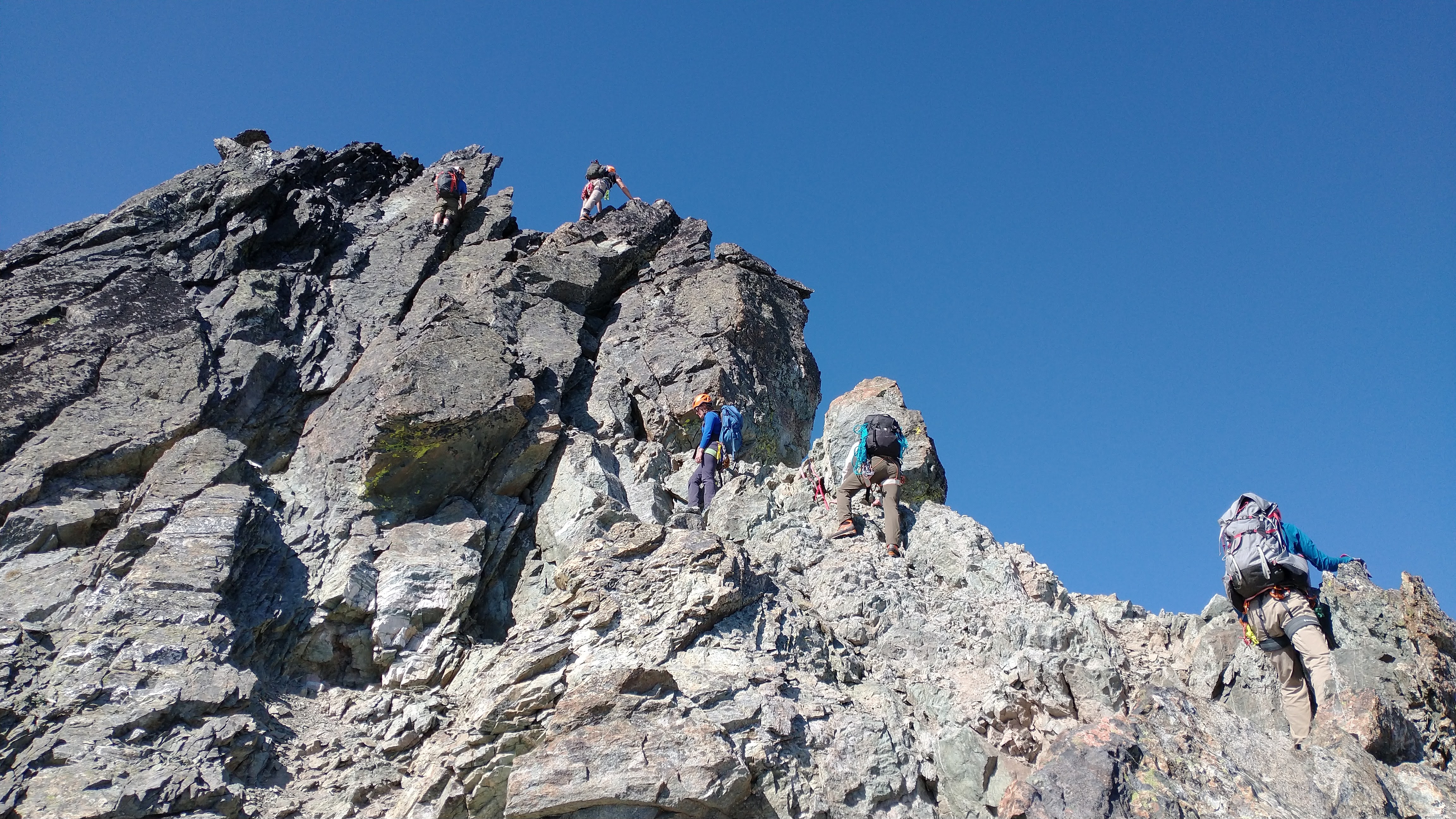
On the rock ridge, we coiled ropes, switched to whatever our preferred shoes were (was Mike on pair #3? #4? Did he leave some at camp? Different shoe on each foot?), and started picking our way uphill. Here I was anxious again, having read tons of trip reports about negative holds and downward sloping slabs and kitty litter and exposure. But we found there were decent ledges almost everywhere. If there wasn’t one right in front of you, it was one move away, never sustained spiciness. I entered my own 3ft world, each of us choosing our own adventure, solving the scramble puzzle move by move with that little flare of confidence and accomplishment with every movement. I followed fresh red rap tat most of the way up, jumping point to point like a bizarre pinball game, my reminders of “I’m going to rap this” becoming fewer and further between as I realized the scramble was… totally manageable. The group generally stayed close, though we each took slightly different routes. This was to optimize rock fall. Slightly different routes meant no one directly below you (hopefully), and staying close meant if a rock did get knocked loose, it couldn’t pick up too much speed before connecting with someone. It was also clearly the path of least resistance, and it just kept going smoothly. And hey, if we wanted to rappel down, the entire rap route was brand spanking new so at least we had that going for us.
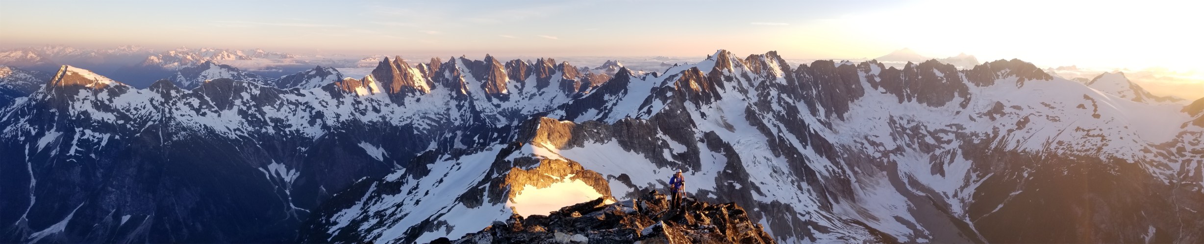
Album cover on the ridge (taken by… not me)
The final ridge to the top is technically difficult starting just above where we are in the above photo. I’d honestly say we made some low 5th class moves there, but they all had extremely solid holds, and some were these nice juggy holds and a fantastic hand crack that I found in this chimney-like feature that just felt super comfy. I was very happy I was fresh off climbing Cathedral Buttress, because I felt much stronger and more secure than I had expected. I pulled myself up onto a shark fin and did a few au cheval moves before the final talus walk, and soon enough we were doing cheers with whiskey at the top. You know who HAD brought cheese? Rob. Smoked. MFing. Gouda. So in classic fashion (this seems to be turning into a trend), I probably ate more of Rob’s snacks than my own.
Final talus walk to the summit
Summit shot!
We took a long break but I was (as usual) anxious about getting down. Sorry I’m (secretly? hopefully?) neurotic. I wanted to rappel at least the top section. We set up a rappel, I went first, Rob downclimbed (he’s part mountain goat), the other 4 followed the rappel. It took astonishingly long to have five people rap, and that idea was immediately vetoed for the rest of the scramble. Patience is not my strong suit. So we began to pick our way downhill. I was in the middle, which is good for me. I’m a wimp but I’ll follow just about anything. Shit I’ll DO just about anything if I’m properly distracted. There were a few moves I asked Rob to talk me through, which means there was some 4th class on the way up because that’s about where I start paying attention to downclimbing and have to face in.. He started explaining the rock features and where I could put my feet and I laughed – it doesn’t even have to be downclimbing beta, it just needs to distract me from thinking about whatever we’re doing so I go with the flow and stay in that flow state instead of overanalyzing. I’ll start coming up with prompt questions for next time. What’s the best meal you’ve ever had. Favorite peak you’ve climbed. Would you rather fight a coyote or an eagle. Are there more doors in the world, or wheels. What song only needs one line to get stuck in your head. No wait maybe not that one, that’s risky. Rob had already gone from Danger Zone to Final Countdown and I’m sure there would be another song rotation in 30min.
Downclimbing begins
Having confidence in the people around you is HUGE on a peak like this. Knowing Rob (mountain goat) and Tim (gecko, can stick to anything) were SO nimble and would find a reasonable way up and down did wonders for my own mentality and brought me back the joy of climbing that I had occasionally been missing in prior years. A team on an adventure, working together, same goals, same destinations. People to follow and chase or lead, no pressure either way, we’d find a way for everyone to get up. Conversation partners to keep mind off tired feet, exposure, getting too far ahead of yourself. Knowing I could ask anyone to talk to me and they’d start chatting to distract me while I downclimbed. Hearing Tim crack himself up in the distance. Looking at him and Alex edging on nothing. Finding the route of least resistance through the 19,428 options in front of us.
Variations on downclimbing (less fun than mac n cheese, also not taken by me)
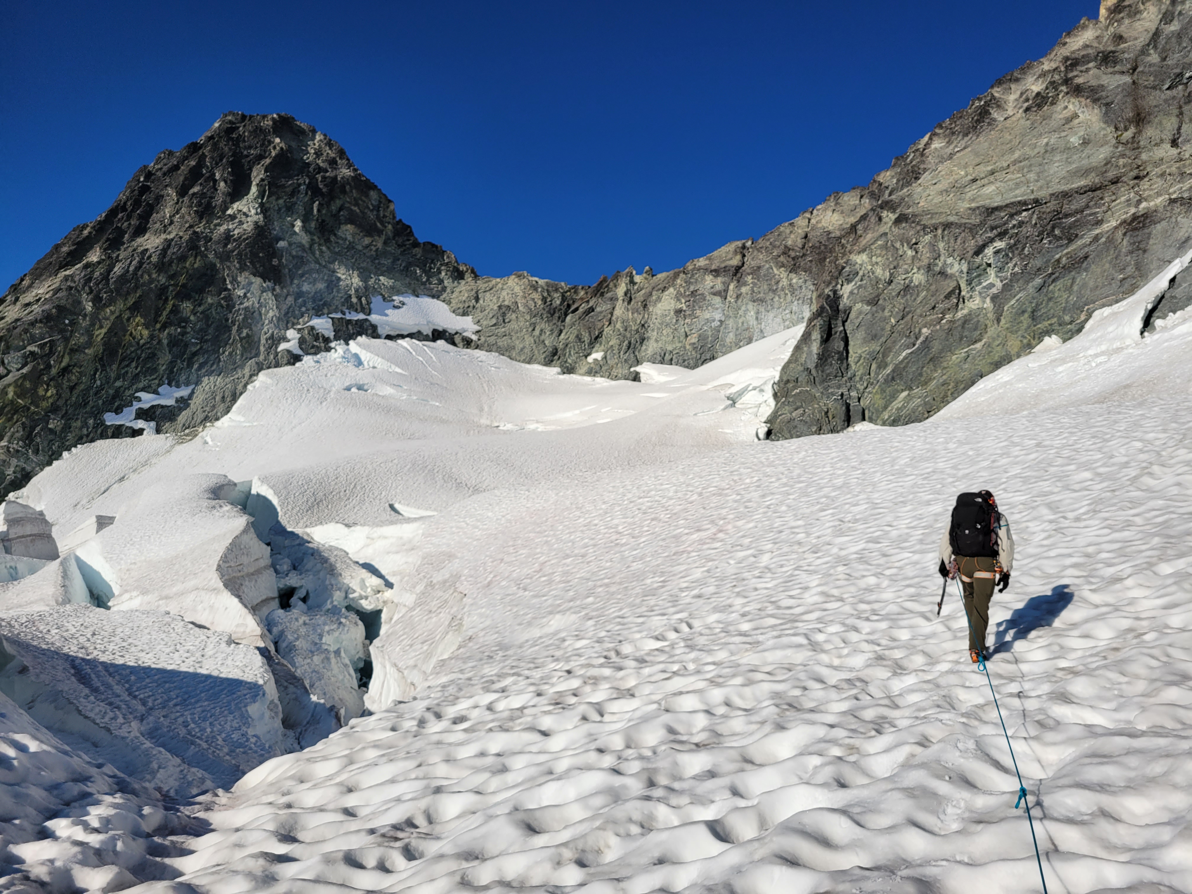
Transitioning back to the glacier was interesting. We did not trust the snow finger we had stepped off of since it was thin and very mushy in the afternoon sun with a nonzero chance of us plunging straight through and 20ft down into a moat. That’s not how I want to go out, so we set up a belay system to belay each person down into the moat, and then a separate belay off a picket on the glacier as they climbed out of the moat on the other side since the glacier wouldn’t be a great place to fall either. Slow going, but in a zero fall zone, it was the safest option. It honestly wasn’t that bad, the double belays might have been overkill. But walking down the glacier went quickly.
Waiting for our second team
Next up: the waterfall slabs. I started scouting out where to downclimb. I kept striking out. Holy CRAP they were wetter than they had been in the morning. Maybe we should rap? Maybe I’m being a chicken? I’m probably being a chicken. Rapping would be sooo slow. Okay you guys go first. If you can do it I’ll suck it up and follow. Except then everyone else took a peak over the edge and the consensus was uhh.. yeah… we can rap this. We tied the two ropes together for a full 60m rap (one rope would have been fine but we weren’t sure) and did two rappels to the base of the waterfall slabs, finishing below where we had started that morning. Again with the fresh rap stations. It’s really insane how much bigger the waterfalls were. You expect some extra runoff with sun and afternoon heat, but the difference was surprising. From where the raps landed us, it was a talus traverse back to the ridge, and a walk back to camp, where my variations on mac n cheese awaited me.
Yeahhh we rapped that and then another one (not my pic)
We all crashed back at camp. Actually I think some of the guys went to the river for water and showers while I boiled snow with pine needles because I could not be bothered to walk down there. I could barely make it to the bear bag Mike had hung. I LOVED my dehydrated meal. Peak Refuel guys, I’m never switching brands again. I also swore I’d chug a jet boil of mio before falling asleep and I did exactly that. I changed into fresh base layers and I think I was asleep before my head hit my pillow. Figurative pillow. It was probably just some clothes in a lump.
The next morning, we woke up around 5:30am to climb Martin right next door. More of that to come in a separate post!
Additional pics:
Glacier Peak from the summit
Holden mine remediation very visible in the valley right of center.**
More of the scramble. You will find edges I promise (though I’m not sure what Alex is standing on)
Soaking in the views
Descending the glacier
Ascending the glacier that morning
*Bonus info re: Holden because it has a fascinating history, paraphrased from here. In the late 1800’s, a prospector discovered ore outside of Holden. His last name was Holden. Go figure. He never got enough funding to mine anything, but in the 1930’s, a future generation figured it out and built a copper mine. Like the aptly named Copper Peak towering over Holden. Go figure.
The mining era came to an end in the late 1950’s, and the mine closed down. Having been built on now protected USFS land, much of the village was burned down to be reclaimed by wilderness. There were still no major access roads, no industry besides the old mine, no sizeable logging operations now that they were surrounded on three sides by wilderness. And so the village sat mostly unused.
At least, until some seemingly random guy in Alaska decided he wanted to buy the village. The asking price was $100k (about $1M today, not bad for A WHOLE VILLAGE IN THE MOUNTAINS). He didn’t have $100k lying around, but he kept asking, and several years later he was a student at the Lutheran Bible Institute in Seattle when he has the lightbulb moment: would they donate it to LBI?
Yes, actually, and then he had to tell LBI what he just orchestrated. They accepted after a visit (duh, it’s GORGEOUS), and with some donations and funding from larger Lutheran groups, were able to restore what was left of Holden and built it out into a full village getaway. It honestly felt like a summer camp when we were there. The only way in or out is by air or by ferry and their sponsored buses from ferry to village (~17mi), the vehicles are all ancient manual transmission vehicles that probably only get refreshed when necessary (buses included), the ferry brings mail and food and supplies and volunteers. One volunteer had to leave on our ferry due to a medical issue that couldn’t be treated at camp, they volunteered there for a week every ear going back decades. It is a really close knit community in a really special place with incredible surroundings.
Oh, and huge scoops of ice cream for $1 that are never available when hikers need them.
**The mine remediation happened from 2011-2016. Holden Village (and the mine) are surrounded by federally designated wildernesses, and the mining practices in the mid 1900’s were not the cleanest. The river especially rushing right through the old mining grounds mean lots of iron leeching into the water. As of 2017, there would be a 5 year testing period to see if more work needed to be done, and I have no idea where it stands now but with a scar like that I’m curious how long it’ll take for the wilderness to reclaim that mine.
Smit rounding one of the many humps along Robinson’s ridge, Silverstar dominating the skyline
Into the heat
What do you do on a weekend where the in town temps are supposed to be over 100 degrees? Well, you can suffer in the city fighting for “beach” parking with 800,000 other people, you can spend a buttload to airbnb a place on the coast, or you can drive a few hours, bust ass for a few more hours, and have an alpine tarn and maybe a scramble all to yourself. The coast was tempting, but my inner scrooge won me over and I decided to keep my money and head to the mountains. Also, did I mention the salted baguettes last time?
Distance: 14mi round trip
Elevation gain: ~6200ft (8731 highest point)
Weather: 90’s and sunny, seriously
Commute from Seattle: 4.5hrs
Did I trip: Actually…. no?
Can we sit in this all day instead
I met the group at 5:30am at a park n ride, we split gear into two cars, and headed out to Mazama. Despite me driving at the speed of a grandmother, we actually arrived at the trailhead at about the same time, and soon enough we were headed out into the bone dry sun baked sauna that is the Pasayten wilderness on a record heat weekend.
Tiered waterfall right before the turn off
We were all feeling the heat within a mile. There are two variations of dehydration, we’ll call it. One is the classic that everyone expects where you don’t drink enough water. The other is more sneaky. It’s possible to drink too much water, and lose so much salt through your sweat you get something called hyponatremia. Coming from an extra salty sweaty Bostonian family, I’m quite familiar with hyponatremia. We pop salt pills like candy in the Moab marathons, and I’ve started just pounding Mio (nuun doesn’t actually have that much salt) and cheesy crackers on any strenuous trip, and this was no exception. My main food source for this trip was two identical bbq pork bahn mis, followed by variations of Rob’s food (he is generous), followed by cheesy crackers.
Zhong shade-hopping the switchbacks
We stuck to a slow pace. The first 3 miles of trail are pretty flat, you only gain ~1k ft in elevation. Right after the bridge across Beauty Creek, there is a spot with air conditioning (a breeze off the waterfall) that was lovely for a break. You then hang a right onto another surprisingly well maintained trail, and you gain >1000ft right off the bat with a set of brutally sunny dry switchbacks. Zhong and Rob had the idea to shadow hop. Everyone cluster in the shadow of two lone pines. Okay, now GO GO GO through the sunny section!! Now make space in the shade for the last person to cram in!! Rest through the shade aaaaand SUN PATCH GOOO rinse and repeat for the next ~2 miles. I liked hearing Smit and Zhong giggling behind me. What’re you two giggling about back there?! I knew the going was getting tough when the chatting started to die off. I started cursing the Pasayten with its long valleys and dry air and constant sunshine. Put me back on the mildewy west side with the worms and the mushrooms.
Gaining elevation through wildflowers!
We finally crossed the braids of a large stream coming down from the tarn that would later be our campsite. We refilled water, submerged hats and shirts and bandanas, and had an extremely refreshing lunch break (bahn mi for the win). Just after that river crossing, you turn left straight uphill through a meadow. This was like mile 15 of the Moab marathon. Up and up and up with the sun beating down on you and no respite from the heat. Wildflowers were nice, and there were some points where you could dip your gear into the waterfall again and try to revive your shriveled raisin of a soul. That’s what finally made me put my sun hat on: not only is it good at blocking sun, you can dunk it in water and have a temporarily frigid head cover that brings your brain’s temperature back to Earth. Unfortunately, my SPF 50 sunscreen had separated into oil and something chunky, and didn’t seem to be working as expected. Zhong noticed how sunburned I was getting. I didn’t even notice until her mouth dropped seeing my face. “You’re sunburned!! So sunburned!” She turned to Rob “she’s a lobster!!!” and back to me “you need sunscreen!” and i took one look in the selfie camera and turned to Irma to beg for her stick of thick zinc sunscreen. Luckily she was happy to donate some to the lobster cause and I covered my whole face in what felt like wax paste. “It’s hard to get off…” she warned after my face was 70% covered. I laughed. Good. That’s apparently what I need. This was good, I already knew I was with a group who would take care of me.
Just before the tarn
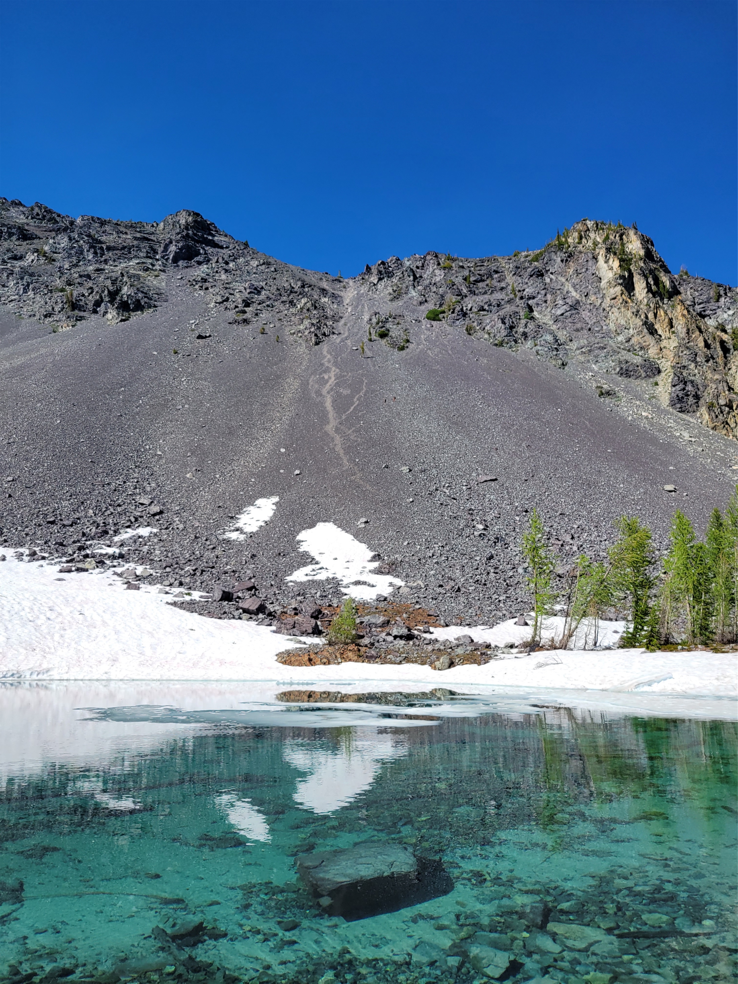
The trail gets a little squirrely as you enter sparse forest (larches!! green june larches, dammit!), but it’ll reappear sporadically until you’re close enough to the tarn you just need to crest a small hill and you’re there. The tarn was gorgeous. And having shade, even dappled sunlight, was amazing. Clear blue water, small icebergs, breeze off the snow, I dropped my pack and immediately dunked my head/feet/shirt in. Basically everything without fully jumping in. It was incredible. We found campsites for all five of us(!) and spent the rest of the day rehydrating, planning for the next day, eating (Rob’s food, thanks Rob), and generally hanging out. Zhong and Irma had a bunch of book recommendations that sounded great. We wanted Zhong to read out loud to us from her book but she somehow distracted us enough to forget about it.
If you look closely you can see two people descending talus from the SE ridge!
I dozed to the sound of Smit and Irma chatting. I absolutely love falling asleep to people talking, I have no idea why but it’s how I’ve always been. Getting that treat in the alpine, I was extremely content. Unfortunately I had just brought my bivy, which is almost literally a body bag. I forgot how claustrophobic it is. I had to zip it all the way to keep the barrage of bugs out, and spent the next few hours after the others went to bed listening for signs of wildlife approaching and convincing myself that I wasn’t really in the forest given how few trees there were. I hate camping in the forest.
Sunrise over the tarn
We woke up at 4:30 to get a 5am start to attempt to beat the heat. The bugs were still there, and they were worse than the night before. We initiated a competition for who could get the picture with the most bugs. We headed up to the south ridge (climber’s left of the lake) which involved a loose talus walk and then an option between a 3rd-4th class scramble or some moderate snow. We divided and conquered, some taking the rock and some taking the snow. Once on the ridge, it was mostly a walk, following the path of least resistance, moving consistently to avoid the bugs. I had the weirdest craving for sake, which we had at camp the night before. “What is that peak?! Or that peak? And that one to the left?” “There’s an app for that you know” Rob said laughing. I got a new phone a few weeks ago and for two weekends in a row now had forgotten to download peakfinder, which shows you all the peaks. And I’m new to the Pasayten, I’m not used to seeing the Cascades from this vantage point.
My shadow on the scramble. Some took the snow. Both went nicely.
Robinson is deceptive. You get up on the ridge above the tarn either taking the S ridge or the SE ridge, and follow that around a cirque to a false summit (where S/SE ridges meet), and then traverse another ridge for like actually a mile before you’re on the summit. This is a combo of talus, side hilling, and a surprisingly fun 3rd class ish scramble. 4th class is generous, there were plenty of hand holds and huge ledges for feet. Some of the traversing we did was harder than the alleged crux moves here due to more exposure (in my opinion). But the team was rock solid, and no one had any trouble with the scramble moves. I’ve seen some crazy dramatic pics of the scramble, not sure if they were from a fish lens go pro or what but I’ll provide you with some more vanilla/”I can handle that” pics.
Count the bugs
We took a long break at the summit, topped off with summit sake that Rob had carried up!! My cravings weren’t all for naught! I think I wrote “I think I hate the Pasayten” (no no Pasayten I kid I love you) in the summit register because this was two weekends straight of sun and heat and loose talus. I was anxious to get down because of the incoming heat, so I was the party pooper who started to hustle everyone. Going down went more quickly, though. We backtracked to the false summit, and decided to take the southeast ridge down instead of the south ridge, so we basically traversed the whole cirque above the tarn. We ran into two other parties on their way up, all doing it as a day trip. The southeast ridge had more shenanigans (scrambling, navigation) than the south ridge, which had been a pretty straightforward walk. No bugs anymore, which was lovely. But I was dreading the scree field we’d have to take to get back to the tarn.
Traversing forever. Summit back left
The top ~100ft of the scree field have been scraped bare of actual scree, leaving behind hardpacked dirt/who-knows what, ball bearings, a sense of impending doom, and thoughts and prayers for those below you. Smit and I immediately kicked down a stream of small rocks, and traversed skiier’s left to wait for the party on their way up (both named James) to pass. Once they were past, we were free to skid as we pleased, and skid we did. As soon as the hard pack and ball bearings end, you can comfortably plunge step/rock-slide-surf your way down the face. We ignored the switchbacks and cruised back to camp in what felt like just a few minutes.
Rob doing his best to look like a rock on the crux scramble. Plenty of features, not so bad!
At the lake, Smit poured rocks out of his shoes and gaitors and we packed up camp and waited for the others to get down. I struck up a convo with a woman named Costanza, turned out we had a bunch of mutual friends. She was chilling at the lake while the Jameses went up Robinson. I was super glad to have good company, especially after a year of being starved of socialization. We headed out from camp around noon, resigned to the heat and the pounding of downhill hiking on the way out. We split into two groups on the way down and agreed to meet at the trailhead before heading out.
Summit pic! PC Zhong
The meadows went by super quickly, and we took a short break at the stream where we had lunch the prior day. Again, dunk shirts, dunk hats, get as much covered in cold sweet water as possible, and begin the ~2mi trek to the next stream, which was at the base of 1000ft of brutally dry sunny switchbacks. Oh, and upon reaching that river, we realized there was no good way down to it, so we took a 10min break in the air conditioning before continuing on. Luckily there is a small stream just a few minutes past the bridge, and we dunked our heads in that one proclaiming THE STREAM GIVETH LIFE because the relief felt from that cool water was simply incredible.
Smit ready to be on top of the world
Well fuck you too I didn’t want to bivvy here anyway
We were back at the trailhead just before 2:30, and went straight to the river near the parking lot to cool off. We set up a la croix fridge, changed into shorts and sandals, and started to chill waiting for the second group, which we figured were maybe an hour behind us, worst case. We decided if 5pm came around and they weren’t down we’d go back to look. Well, we waited. Around 4:20, one member from the second group came out. Where are the others? At 4:50, another came down the trail, having high-tailed it out from the bridge after an hour long break thinking the third had snuck ahead of them while they read a book slightly off trail during a break. Except their third wasn’t at the trailhead. She was still out there somewhere. And it was almost 5.
Party coming up the SE ridge
I changed back into pants. Alarm bells were ringing in my head. No one else had come down the trail either, and there were a good 7 others up there. 5 hours to go 6 miles is generous. If the rest of the group waited an hour and she was behind them then she’s at least an hour away, she might not even be back on the Robinson Creek trail yet. And where are the others? We know it’s almost 100 degrees out, 103 in the valley and the trailhead wasn’t that much further up in elevation. I paced for a bit and went over to Rob. We should go check. I’m sure she’s 10min up the trail and I’m overparanoid but we should go check. He jumped into action immediately when he realized what time it was. We packed like 6 litres of water and 4 la croix and some electrolytes and started up the trail. Rob did voice checks in case our teammate had fallen or wandered off trail in the heat. We passed James #1 from Costanza’s group jogging to the trailhead. Heat stroke, he said, your teammate has heat stroke and no way is she getting out of here on her own, it’s not good. 911 was already called, SAR is on the way.
Scrambly bit on the SE ridge
Rob and I started jogging too. My brain went into SAR EMT mode. There’s two people with her, she’s 2.5mi up the trail, she’s in the shade, they’ve been with her for about an hour by now, sounds like AOx3, hopefully they’re close to water, shit heat stroke isn’t gonna be solved in the field, there’s nowhere on the trail for an LZ but maybe a hoist, trail isn’t bad for a litter evac if the medics can bring up ice packs and IVs, where even IS the closest hospital?! And then we rounded the corner after the first bridge just after a mile in. And we saw our teammate. Walking! With Costanza and James #2! I was speechless, I threw my hands in the air in silent celebration and she returned the gesture. Holyshit. She came back.
Smit waiting for uphill climbers
We ran over to her and Costanza and James2 got us caught up on her progression and what had happened. “My angels!” she was calling them. “They are so nice! My guardian angels! They found me!” Costanza & the Jameses had found our teammate at exactly the right time. She was on a log in the shade, slowly shutting down because of the heat. They soaked her with dozens of bottles filled with water from the nearby stream, and in a crazy show of resiliency our teammate actually recovered enough to walk herself out. She was all bubbles and positivity and gratitude by the time we showed up. At one point leading the way down, I asked if my pace was okay. “Yes, it’s fine… actually a little faster would be fine too.” Okay miss who-needs-heat-exhaustion-anyway, we can go a little faster. And how would you feel about eating some watermelon? “That would be oh, dreamy!!”
River of bliss!!
The first medics with SAR caught up with us and trailed us on the way out to make sure everything went smoothly, and an ambulance was at the trailhead ready to do a check on vitals to make sure everything was stable and okay (everything looked good!). Rob broke out a celebratory watermelon that the others had hung in the river in a bag so it was ice cold and extra refreshing, and we debriefed on what had happened. It is always a difficult situation to talk about, but it’s a great example of how anything can happen in the mountains regardless of experience, and we need to be as prepared as possible.
Primary things we should have considered: 1. Splitting into two groups, especially on such an abnormally hot day, may have been a bad idea. While everyone in the group is strong and competent, heat, like altitude, can take down even the fittest people with no warning. 2. If you are in a committed group, stay together. Don’t get too far apart, wait if others are out of sight behind you, etc. 3. Know the signs of environmental issues like heat exhaustion and heat stroke (hypothermia in winter) in yourself and in others and how to prevent or treat the problem. We knew this weekend would be a scorcher, and it would have been helpful to do a quick group pow-wow on signs/symptoms/treatment before we started the trip. 4. We arguably should not have even waited until 5pm. 5hrs for 6 miles is very slow. Maybe we should have gone to look around 3:30 or 4. 5. Consider bringing two way radios if there is a chance you’re going to split up. I’ve done this on some hikes and never regretted it (plus radio nicknames are hilarious).
La Croix Beach/Fridge
We were very lucky that Costanza’s group found our teammate when they did and could identify what was happening and knew what to do. And even more lucky that our teammate had a miraculous rebound and was able to walk out. SAR was amazing, the medics were amazing, it’s always incredible seeing the unity and selflessness and support when something like this happens. The outdoors community really is tight knit. Naturally we all walked away with some level of guilt and anxiety and embarrassment, but also with a sense of wonder and gratitude. The best we can do is learn from it, respect and appreciate it, and try to help others do the same. And our hot (heh) teammate made a point I like too: she’s now an expert at recognizing the signs and symptoms, knows exactly what to do about it, and can even relate to the person going through it.
Overall, I can’t thank the group enough for a great weekend. Unexpected ending, but it was a crew of happy positive people with funny stories and a lot of determination and resolve and I’d be happy to camp with them again, this time with my own food and sunscreen. Maybe after I’ve read some of the books Zhong and Irma recommended. I have some catching up to do, I think it’s time to finally get a library card!
Rob making a sweet scramble step, arguably spicier than the “crux” ahead
More like Big Chossy amirite? No no it’s okay, I’ll show myself out. It’s an overused joke (original credit I believe goes to a well known climber Selena in our area), but it’s true. everything in and around the Pasayten seems to be crumbling piles of talus. I think I got spoiled my first few years of hiking and climbing in Washington. If I went off trail, I was prioritizing glaciers and skiing and rock over.. well, everything else. Turns out quite a few of the peaks here are walk ups, depending on how well you can walk up thousands of vertical feet of talus fields. So all of these need to be done in like May/June or else you gotta hone that ankle strength and bring your dork poles.
Distance: ~11mi round trip
Elevation gain: ~6200ft total, 8500ft highest point
Weather: Cloudy and 60’s, sunny and 70’s
Commute from Seattle: 4 hours
Did I Trip: Yes, immediately
The namesake mine itself
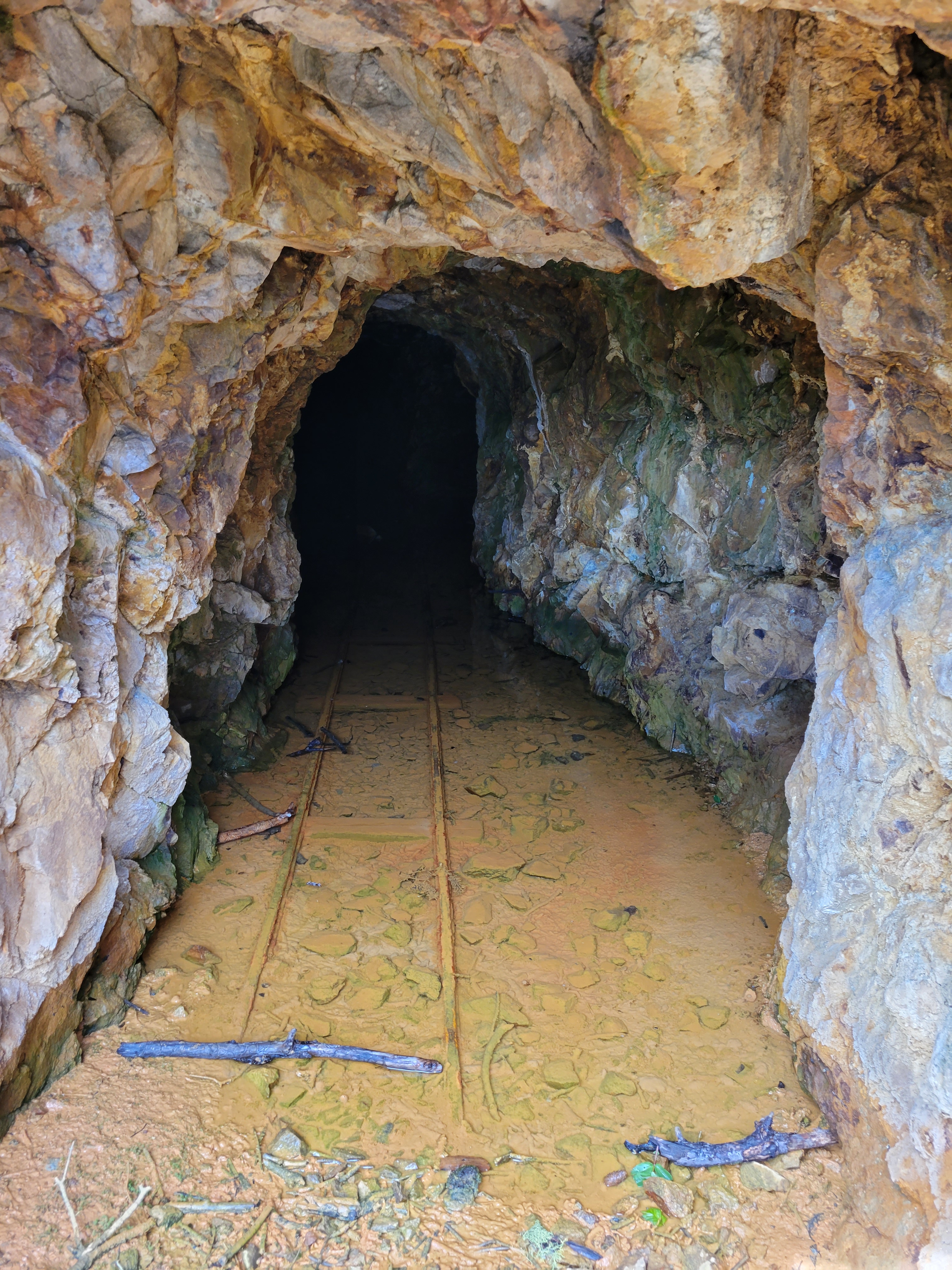
We decided to take two days to do the craggies, and why not? I hadn’t camped in months, weather looked amazing, it was a 4hr drive each way, let’s enjoy it. My car was behaving strangely so I hitched a ride with Rob (“Have you had the salted baguettes in Mazama?” “No….” “Well we’re stopping there on the way home if we have time” okay, you have piqued my interest), and we met Mike at the trailhead around 10:30am. It was 3.5 miles to camp at Copper Glance Lake and like I said I tripped immediately and banged up my knee clambering over a log. Good first impression, forgetting how to walk. I am also convinced the trail is deceptively steep (or I am deceptively out of shape). It switchbacks at the entrance to an old mine, I’m a chicken and didn’t walk in but it looked like you could explore quite a ways. Supposedly there is another entrance higher up the slope, but that one’s blocked, and mines are for ghosts and whatever was in The Descent anyway so I’ll keep my distance.
Copper Glance Lake
If you thought it was steep before the mine, it’s worse after. But views start opening up, and you can see peaks through the toothpicks of burned trees from a 2018 wildfire. The undergrowth is rebounding, super green, and it’s crazy to think just a few years ago this was forest with no peakaboo views. I also just found out that this is the same fre that burned east of Shellrock Pass in my Pasayten trip last year (pic example here). Crazy to see how different the areas look just a few months apart. The trail starts to traverse finally, but don’t get complacent just yet, because the blowdowns start to pile up. You’ll clamber over some, reroute around others, stand in front of some wondering where the trail continues afterwards. I can’t believe this hasn’t been brushed out yet given how short it is and how sweet the lake is. You cross the river, pass a mosquito pond, and (woo!) gain another like 150ft over an alleged cliff band, only to immediately lose the 150ft and continue dropping to Copper Glance Lake. We crossed this four times and every time lamented WHY DIDN’T THEY JUST CONTOUR?! I’m not convinced this cliff band exists. I think they could have contoured.
More talus
The lake actually blew my mind. I was NOT expecting a spectacular blue alpine lake with looming giants and larches waiting for the fall. I was surprised by the lack of campsites, but we found a big one directly across the lake from where the trail drops you, and we pitched our tents there. We even had a little stream running next to camp so we didn’t have to hike (all 20ft) to the lake! We decided to go for the peaks that day instead of waiting for the morning, so we packed our bags and got moving once again, back up and over the hump that definitely isn’t dodging a cliff band.
“is it higher” summit of Big Craggy
We left the main trail just after the mosquito lake (or just before, if you’re on your way up and not coming from the lake). We expected more of a boot path. Or at least, I did. But maybe whatever was there was destroyed in the fire, because there were barely hints here and there and those hints could have just been game trails. Over and around downed logs and charred remains of trees, kicking clusters of grasses spitting up dozens of mosquitoes, we finally broke out onto the talus field which was such a relief compared to still healing burn zone terrain. At least, at first.
Starting the traverse
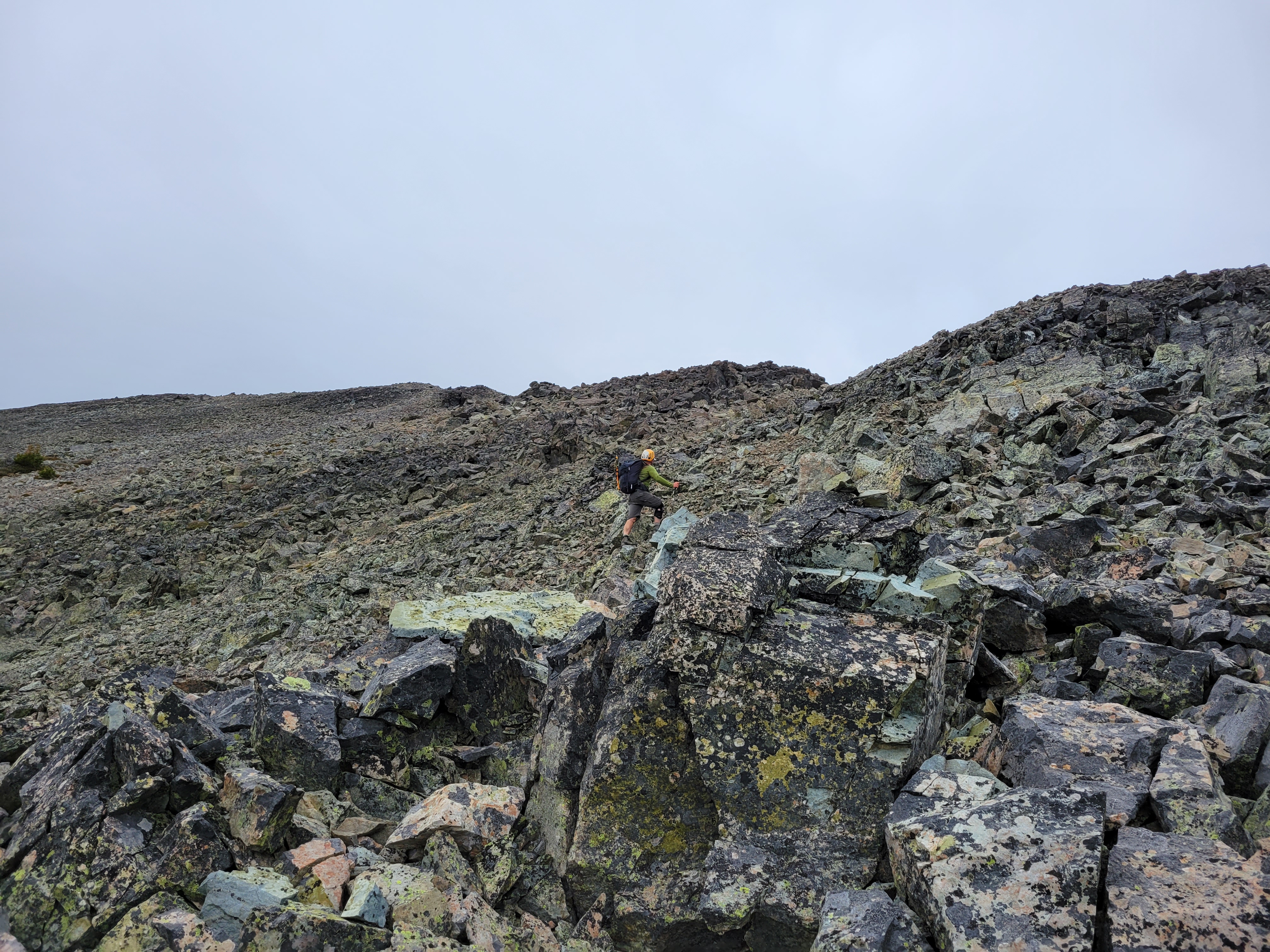
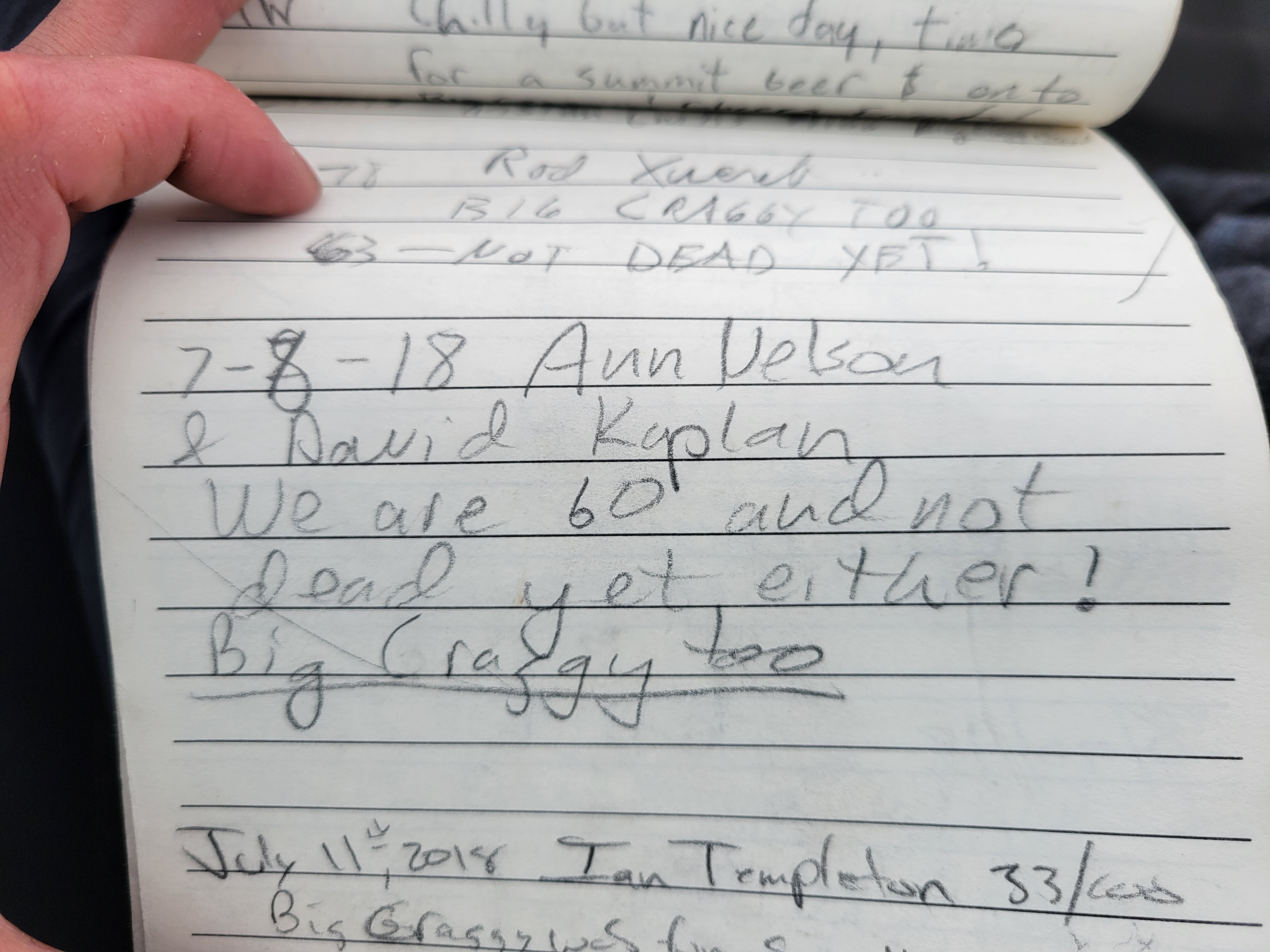
The talus was stable enough, you could hop from rock to rock without too much movement. You literally just climb straight up the talus field, trending slightly left until you’re on the summit. We hit patches of scree that would slide downhill, switchbacked up slightly to avoid kicking rocks down on each other, and occasionally took scramble detours to avoid the tumbling talus. The scrambling was actually quite fun, nothing very exposed but some sections that were definitely 3rd class. Even on the scramble sections you could break off what would have been a nice handhold. We definitely each shouted “ROCK!!” multiple times as we accidentally trundled down some softball sized chunks, but none made serious contact and soon enough we were standing on the summit. Or sitting. I love sitting. I was wearing a bright blue soft shell from an old friend, Ann Nelson. I asked Rob if he remembered her so I could brag about the jacket. Mike had never met her, so I filled him in on the short version – bad ass hiker/climber who helped many of us get started as newbies, and unfortunately passed away in an accident two years ago. The soft shell is absurdly warm and while it’s a bit big on me it’s been one of my favorite layers when I think it’ll be cold up high.
Mike on a scrambley section
Rejuvenated and ready to start the traverse to West Craggy, we looked to the west and realized huh, that other bump looks taller than this one. What do we do? Well when in doubt, tag both, of course! We ran to the western summit only to look back at the eastern and immediately agree yeah, the first one looks taller. Alright, now let’s get the chossy sidehilling out of the way.
Forever talus on the final stretch of West Craggy
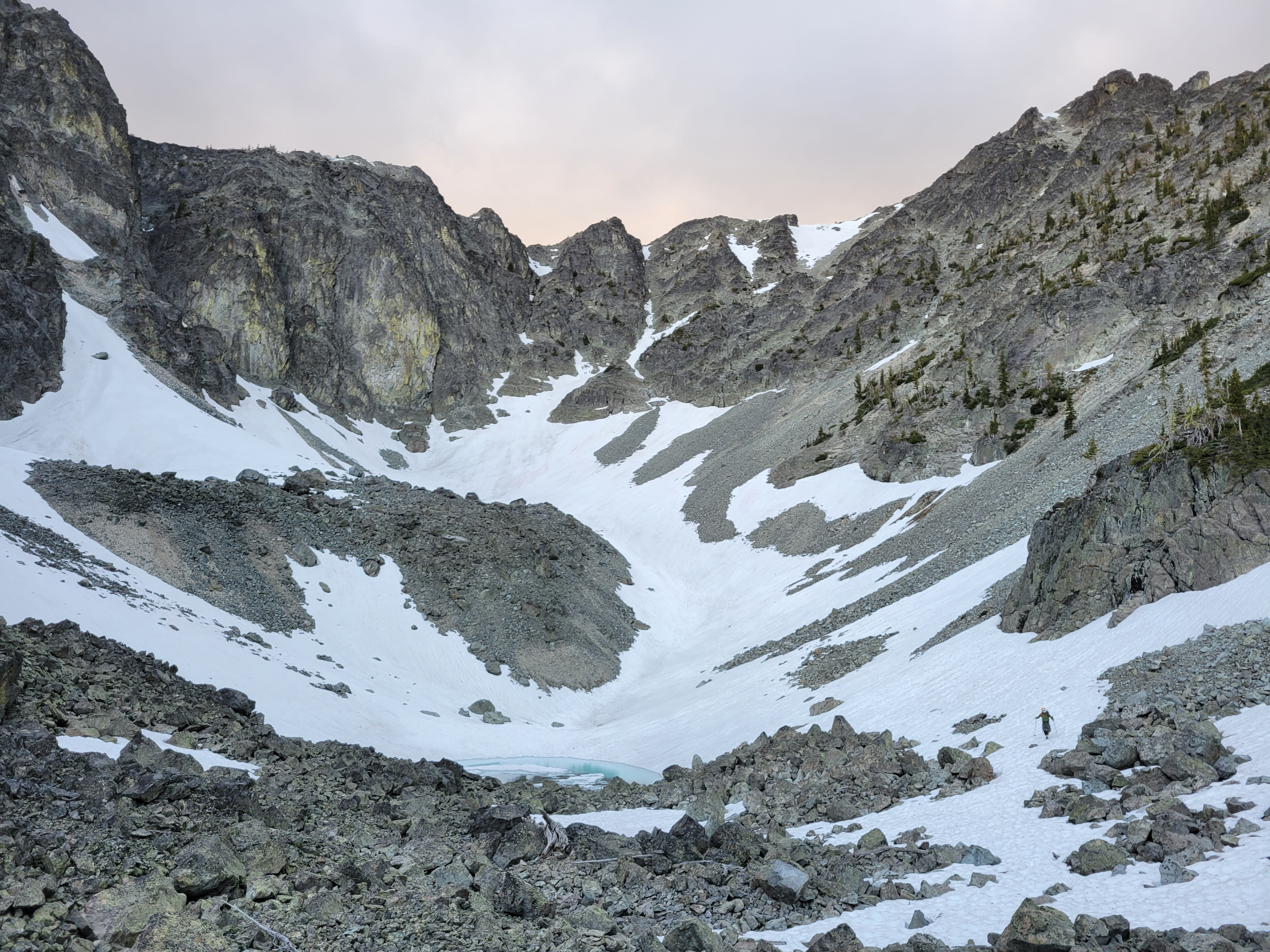
We started the traverse, first dropping down more talus (wow, shocker) and crossing over to the saddle between the two peaks. Where was all the heinous side hilling I had heard about? This wasn’t so bad! We had cruised to the saddle too, so how bad could the rest of the peak be? Ah, the naive confidence of someone lulled into a false sense of security. From the saddle, navigation got trickier. I thought you just followed the ridge to the summit, but you actually traverse onto the southeast face of West Craggy above the basin. This involved following a series of ledges, some third class scrambling, some more loose rocks, more ledges, and finally an obvious gully (very obvious, I promise, like a HUGE FAN of talus) to the ridge. We had been following a gpx track for a while, but eventually gave up trying to stick to it, and I was glad we did – aiming for that gully and following that to the top was definitely the right choice. Doesn’t even feel like a gully, more like a swath of low angle scree and I was sooo happy. We each took a separate rouet up it, some preferring snow, some preferring scrambling, and some preferring slogging up with felt like sand dunes. I turned to Mike. “Less than 500ft to go!” I don’t remember his exact words, but the gist was something like “thank fucking god.”
Friend 🙂
Once you have crested the ridge, it’s reminiscent of Mt. Baker, where you top out and then have to walk like half a mile on flat ground to gain like 13ft to reach the true summit. That’s how this is, except it’s not quite flat, and you’re still hopping on talus instead of walking across easy snow. Rob was ahead, and as we were approaching what I swore was the summit he just said “Oh no, another false summit! The real summit’s another half mile away!” I froze. I would say my heart dropped, but it was more like my heart asked my brain if it should drop and my brain said “hold please” and furiously scrolled through memories. The map. The topo map. Contour lines. The route. How West Craggy looked from afar. No, this had to be it. But I knew we had to traverse a ways, maybe I underestimated the number of bumps on the traverse. Rob started laughing. He must have seen time stop for me as I reevaluated everything I thought I knew. “It’s the summit!! I’m kidding!”
Scouting the way down (PC: Mike)
We caught up with Rob on top and we grabbed snacks, layers, and the summit register. Clouds had moved in and wind had picked up and it was getting COLD. Rob signed, handed it to me, I signed. I usually like to flip through pages and look for people I know, but these pages were tightly wound and I was worried I’d rip them, so I just handed it to Mike. He signed, and it split open to one page as he was finishing. “Hey, Ann Nelson!” He handed it back to me, and there was her note & signature from 3 years ago. 6,000ft of gain at age 60, not too shabby. My breath caught and I was overcome for a few seconds, but I took a deep breath and smiled as old grief turned to happiness thinking it was nice to say hi to her and Mike kinda just got to meet her too.
We started down since it was already 6:30ish and we didn’t exactly know the route down since we were doing a loop. Dropping down was straightforward at first, but we got to an impasse – either put on crampons/use ice axe to downclimb steep thin snow, or find another way. I learned later there was a “magic ramp” we definitely did not find. But we made it work. I was donning my crampons for the first time all day (carried em, might as well use em) when I heard Rob shout. “This goes! I mean, kinda!” Oookay, here we go. I took off my crampons and we followed Rob down what I’d probably call fourth class, but that may have been skewed by the looseness and the fact we were downclimbing. The larger rocks were super solid, but everything was covered in kitty litter/talus and Rob stood well out of the way at the bottom so we could kick down/clean anything we had to. At some point Mike started in with the baguettes. “Have you had the salted baguettes in Mazama? I need to get two so my neighbors can try one too.” Rob overheard. “Yes, the baguettes!!” Wtf, how have I not heard of these baguettes? Fuck I need a sandwich.
Rob at the basin below West Craggy. And nooooow I see the “magic ramp.”
SO happy to be on snow
Once on the mellow snow, we CRUISED for the next 45min or so. Coming down snow was the best feeling ever after hours of talus hopping and traversing and downclimbing. Finally we could just plunge step and boot ski and Rob fit in a few glissades (bumpy ones) and ah it was heaven until the postholing began. There are two small tarns up in that basin, barely starting to melt out and neon blue reflecting the sky with ice underneath. When the snow ran out we were back to hopping talus, until Rob found bits of a trail near the river. We lost it as we entered burn zone carnage as we got closer to the main trail, but soon enough we popped out right next to mosquito lake again (YES Rob YES you aimed PERFECTLY). Rob took a break and I asked permission to plow ahead. Permission granted. Mike and I approached the base of the steep gain between us and the lake to avoid the alleged cliffs. You ready for this? I’m ready for bed, that’s what I’m ready for. We trudged up it, driven probably by the odd combo of exhaustion and determination.
Mike and I cresting the tarn below West Craggy (PC Rob)
Back at camp I filled up on water and got the stove ready before sitting down. If I could pull it off at Dot Lakes I could pull it off here. Mike had a sandwich I side-eyed/envied and went to bed immediately, Rob and I split a beer and stayed up chatting while cooking dinner. Lucky to have good company at camp. As soon as I got in my tent, it started raining. I reluctantly pulled all my yard-saled gear in the tent and went back to sleep, constantly woken up by the wind. But my tent didn’t blow away with me in it and nothing got wet, and that’s about all you can ask for.
We woke up to perfectly blue skies and no wind on Sunday. We had a relaxed breakfast, and headed back to the trailhead. Going down was easy, but a bit of a knee banger. That trail feels longer than 3.5mi especially when you’re talking about baguettes for the 8th time. We were back at the car by 10:30 and eating salted baguettes in Mazama(!!!!) by noon.
My phone looks like it oversaturates things, but this is really how it looked. You could see fish darting underwater!
In case anyone was concerned, I did manage to singlehandedly finish the baguette before it went stale.
Anita coming around a glacier boulder, Deception on the right
Wildlife by Royal Lake
Hooooly crap, this was a good one. You know sometimes everything just falls into place last minute and your mildly half-assed plans actually work out? That’s what this was. Like 24 hours in advance Anita mentioned she was going to Royal Basin, which I had always wanted to do as a trail run. And some dude had done Mt. Deception earlier that week, so I knew it was in decent shape. And that would be a cool day trip too. Maybe I could run up early in the morning, meet her, and climb Deception? She was stoked when I suggested it, and I decided I’d head up late Sunday night after Marmot Pass/Buckhorn and camp with them so we could get an early start. “What are you wearing?” she asked. “Some yuppie lululemon outfit” I responded. My climbing pants have a 6″ hole in the butt [insert asshole joke]. “No, I mean for boots!” Oh, duh. A real gear question.
Distance: 20mi ish
Elevation: 5500ft (also ish, highest point 7,788ft)
Weather: 50’s and partly cloudy
Commute from Seattle: 2:30 without traffic or ferry delays (ha!)
Did I Trip: No, I’ve gotten very good at walking
Flat beautiful trail to Royal Basin
Mt. Deception is the second highest point in the Olympics, which I didn’t know until we were done climbing it. It is one of the largest piles of chossy shit I have ever had the pleasure of touching, and it was mostly covered in snow when we did it. I have strong feelings about this. I would not have enjoyed it if it hadn’t been snow covered. But snow meant some steep snow, some 3rd class scrambling, and a more mountaineery-feeling experience than had we struggled up a one-step-up-slide-half-step-back-god-damn-scree climb.
Anyway, let’s not get ahead of ourselves here. I had driven from the Marmot Pass trailhead to the Royal Basin trailhead and was rallying to knock out another 8 miles and meet Anita and Zee at their campsite. I assumed the trail would be flat soft dirt, easy cruising. I had also assumed that the Marmot Pass trail was one mile down the road from the Royal Basin trail.
Royal Lake with mist in the morning
I was wrong on both counts. There is a Marmot Pass trail close to the Royal Basin trail, but it is not the trail I had taken to get to Marmot Pass. And as for the Royal Basin Trail once I did get there, well… the first two miles were nice soft flat easy cruising, and particularly beautiful in the dappled afternoon sunlight. But after that it’s rocky, uphill, sometimes overgrown, there are mosquitos, devil’s club, spiderwebs to fight through (you know how I feel about that – spiders fine, webs nooooo), and a surprising amount of elevation gain, though usually gradual. And carrying an overnight pack still isn’t pleasant, especially when you did a 13mi hike right before it, and I was not too enthused every time I rounded a corner only to see more uphill, or opened up the map only to see I was somehow only 500ft closer than the last time I checked. Views finally started to open up and I got glimpses of Deception. Shit, I’m going up that? It’s sooooo far.
This used to be a lake! Heading to the Upper Basin
But I was making good time, and soon enough I heard two hikers. And one voice sounded familiar. Same accent, same tone, a guy dragging behind her… that’s gotta be Anita. I jogged up to Zee and said hi, just as Anita turned around and saw me. And we had a nice running hugging reunion, we hadn’t seen each other in months and holy shit I was so happy to have company for the last mile of the hike so it wasn’t me vs. my mind for another half an hour. And it guaranteed I would find their campsite and not be walking up to random tents in the dark “are YOU Anita?” “are YOUUUU Anita?” “Is ANITA in there?” and blinding everyone with headlamps while I stumbled around exhausted about to give up (which may have happened before).
Upper Royal Basin
We found a great campsite just northeast of the lake. I crashed in my bivvy almost immediately (after panicking at two things: the recently updated forecast, which showed overnight showers – not great for a non-waterproof bivvy and down sleeping bag and the bear poop like 15ft away and I was between the poop and Anita’s tent, aka I’d be the first bear burrito that evening should the bears decide we smelled delicious). Eventually it didn’t matter because I was unconscious by like 8:30pm and if it did rain, I didn’t even notice.
We got moving around 8am. There is the alpine start (the offensively wee hours of the morn), the Anita start (mid hours of the morn but as late as possible), and the bonfire start (>11am). So 8 wasn’t ideal knowing we’d be slow, but I figured if we moved steadily we’d be fine. And it was partially on me and the fact it took me 20 freaking minutes to find the stupid pit toilets. Zee turned around on the way to the upper basin, and Anita and I continued. The basin is spectacular, almost like Enchantments lite. I can see why the permits are so competitive. That’s another thing, I got SO lucky. Anita had been fighting for permits for years, and here I am mooching off her hard work. And the main attraction over the basin is Deception towering over some small glacier tarns below a dying glacier. At the base of the slopes, we decided to take a rising traverse rather than risk the rockfall on the more direct route, so we started kicking steps uphill. And so it would be for the next few hours.
Anita on the way up
There were a few scree sections (“ugh, should I remove my crampons?” “Nope, back on snow in 50ft!”) a few loose third class scramble sections (“can i take my crampons off?” “No, back on snow in 20 ft!”) some steep snow (PERFECT conditions for bucket steps and a nicely plunged ice axe) some moats (there’s no way for them to not be awkward, would it help if we took off our crampons?) and a little more kitty litter scrambling (“can I take off my-” “no”) and we finally topped out at the col, marked with a stick to help differentiate from the myriad of other similar cols.
Here’s where the route was longer than expected. We dropped down some talus (loose, because this mountain is a crumbling POS, we’ve been over this) onto another dying glacier and traversed to the back ridge, where “can I take off my crampons” was finally answered with a resounding “YES!” and we rejoiced in the feeling of boot sole on rock instead of scraping metal. We traversed to a third ridge, which was a perfectly straight talus walk on top of the world followed by a short step of near vertical snow and a final talus walk (i’m so done with talus by this point) to the summit, where we sang and hollered and waved at Zee and marveled at the views. It truly was incredible. Long day of uphill, but high reward with the gorgeous scenery up there.
Pieces of steep snow
But we had to descend all of the shit we had come up. Getting back off the upper talus section was easy. Crossing the glacier on the north side was easy. Getting back up to the stick-marked col was easy. Then we had the only tricky part to contend with: downclimbing a few sections of pretty steep snow. Maybe 50 degrees. Face in, kick steps downclimbing. I kicked enormous steps for Anita, and luckily some cloud cover meant the snow wasn’t total slush. We actually made surprisingly good time, and these are the parts of climbs that are so singular, so focused, that everything else goes away. I had lingering stress from my old job and nerves around starting a new one, nerves around fitness after working weekends for so long, none of that matters when you’re on terrain like this.
Some 3rd class scramble
We even skirted most of the 3rd class scramble, with one awkward 4th class step either on a thin downward sloping slab or to hop across a moat back onto snow (pick your poison, I do think Anita’s route across the moat was better but I thought it looked sketchy from up high). From there, we cruised plunge stepping down moderate snow the entire way back to the basin after a short scree field! It was amazing! We found yaktrax prints at the bottom, I said I hope that’s Zee. Despite turning around earlier, it turned out he had rethought (almost went with “rethunk”) his decision, and gave it another shot. And I’m glad he did, the upper basin was phenomenal. We soon found goat hoof prints perfectly inside of the yak trax. They continued for maybe a mile, until we eventually found Zee, hiding in a patch of bushes from the goat that had been stalking him for literal hours. He did get an incredible picture when the goat got too close for comfort.
Mr. Billy Goat (credit Zee!)
Coming across the north face
We made it back to camp around 4. Zee went to get water (THANK YOU! I was so tired I did not want to do camp chores) while Anita and I changed our shoes and laid around a groaned. When Zee hadn’t returned for 20 minutes, we started wondering what was up. Should we be worried? Is he taking a nap? Maybe we should go look. And then we saw Mr. Billy Goat walk across the trail again, slowly, starting at us. “Zee, the goat is back!” Anita shouted. And then we hear Zee’s deep grumbly voice. “…I know.” We burst out laughing. He couldn’t get away. It’s okay, Mr. Goat will be extradited to the Cascades any day now if he hasn’t been helo-dropped there already.
Anita coming along the final ridge
I hung out until 5, and then packed up my bags to start the slog back to the car. Anita gave me a brownie for the way out (THANK YOU! For feeding me! Everyone fed me this weekend!) and I started on my way, where I was immediately blocked by Mr. Goat. God. Dammit. I tossed a rock and whined. I just wanna go hooooome mr goat pleeeease let me pass! He eventually ambled over to the side of the trail and I darted past. Anita made a bet that I’d be back at the car by 7:30. I thought 8. But she had given me a goal, and I made it back at exactly 7:30. Even took a selfie to prove it.
One last push to the top! Mystery in the background
Huuuuuge thanks to Anita and Zee for adding me to their Olympics permit at the last minute, and to Ranger Scott for all of the phone calls trying to get my name on there (and my payment). Seriously amazing trip, and another data point that the Olympics are far more beautiful than I ever give them credit for. And I was the perfect amount of wrecked when I woke up back in Seattle on Tuesday. Just in time for a shit ton of programming homework that I had procrastinated on. Woohoo!
P.S. This would be a sweet trail run (maybe minus the chossy shit, like we discussed above. Wait for snow).
Olympus way in the distance, the highest point in the Olympics
Brad hikes beneath Fury and the northern Pickets. It’s hideous, I know.
Local riff raff
I. Hate. Log. Crossings. We can start with that. Ask me how many log crossings were on this trip. Actually don’t because I’ve probably blocked half of them from memory. I need to get a balance beam for my basement so I can work on my fear of log crossings. But this trip was good practice, and we did a lot of close-to-the-ground-log-walking during the bushwhack, and my confidence in log crossings grew over the course of 36hrs despite being stuck with Brad “Fearlessly Dances Across Logs” Geyer. He’d cruise across the log while I stood there having the “Okay can I do this maybe ugh should I no do I want to I don’t really want to but ah fuck you can’t just stand here ok GO” internal debate/pep talk. Oh, and on the way back I didn’t care about wet feet and said fuck the logs and waded anyway. Oh wait, that was most of the trip. “When life gives you lemons… say fuck the lemons and bail.” The frigid waters numbed my poor brutalized feet, which was a blessing in its own way.
So, I present to you: Luna Peak. I have a list that I call “The Selfish Ten.” It is ten peaks that I will bail on anyone and anything in order to complete. I’m sorta breaking that rule because I swore to JT I wouldn’t touch certain ones until he’s back, but besides those exceptions, the list stands. And Luna was on it. Doesn’t matter who, doesn’t matter when, it’s happening. And here was the opportunity. Cassie had pitched the idea months prior, and I said hell yes. Assuming weather is good. Because I’m fairweather all of a sudden.
Distance: ~32mi round trip* (I estimated 26mi… not even close)
Elevation gain: 6,700ft gain (8,311 highest point)
Weather: 50’s and sunny
Commute from Seattle: 2.5hrs to the boat, 15-20min hike to boat, 10min boat ride
Did I Trip: I had a full body posthole but that was the worst of it. Didn’t even fall off a log.
That… is the trail
We got the boat at 8am, which was the earliest they’d take us. In fact I think the driver (boater? Can you call him a captain if it’s a small motorboat?) was still asleep when we arrived at the dock around 7:45. By 8:30, we were hopping off the boat at the Big Beaver Trailhead, ready to start the first 10 miles towards Luna. The easy 10 miles.
By “easy,” I mean mostly flat. And mostly shady, and it was mostly cloudy anyway, and there aren’t twists and turns and there’s only one switchback in the entire 10 miles. To 39 Mile Camp it was beautifully maintained. Beyond that, we ran into one section where the creek became the trail (that took us a while to figure out), multiple sections with huge blowdowns (some had bootpaths around them, most were up and over), and if I’m really being a princess, some creeks that had to be waded but who am I to complain, I had way worse conditions coming up. Oh, and mosquitoes constantly threatening to bite your face and through your shirt and through your pants (I kept my goretex on try to eat that you dumb shits) and let me tell you the only thing that can make a log crossing more miserable is having mosquitos and biting flies swarming your face because the number of swatting motions you make is directly correlated with your likeliness to fall off of the log and into the river.
Who needs a knee anyway?
We made it to Luna Camp spurred by Cassie’s proud bargain hunting stories and outlet-store-gear-flipping dreams and the hour that it took me to understand what a packraft is (it’s cool and I want one). Just past Luna Camp, we took a 90 degree turn off the trail and headed at the log jam at 48.8395, -121.2090. This was like a mile closer to Luna camp than the log jams we had tried last year, which had all been underwater the first time. At first I thought it was the one, but there’s no WAY this huge one was ever underwater. There is another log jam at 48.8451, -121.2164 that we were told about on the way down that is closer to where Access Creek meets Big Beaver, saving you some schwacking, but let’s be real if you didn’t like schwacking you wouldn’t be here. Anyway, our crossing was a massive log jam that even I wasn’t scared of. Eve “Slowly and Timidly Tiptoes Along Logs” Jakubowski. There are logs 2ft across and the skinny ones are usually doubled up so you can still spread out (I like to be well grounded, okay? My legs are lazy unreliable bastards). And from there, it was a hundred feet of devil’s club dueling followed by varying log walks, fern clumps, skunk cabbage swamp hops, and pine needles getting stuck in my bun and sticking to my neck and we were at Access Creek, which is not very problematic if you’re already resigned to wading. If your feet are still dry, then I bid thee good luck.
Big ol’ Luna log jam
Are we having fun yet?
We started up on the north side of Access Creek. Near the creek was brushy and miserable, above the creek was mostly open forest with a few patches of annoying brush. Oh, spiderwebs abound. Just give up and let them dangle off of your face and live your worst nightmare with resignation and disgust. Just catch the occasional spider cause some are still hanging out in the webs. Cassie and Kyle announced they were going to bail around 2,800ft. Cassie had a “tweaked knee” that turned out to be a freaking torn MCL. That she tore on flat trail. Not on a log, not on the bushwhack, but on the beautifully flat trail. Cassie “Can’t Walk On A Flat Trail” Cassidy. So I’ve hiked with Cassie for like a net 8hrs and already know she’s a freaking bad ass who will always understate every injury. I’m sure her hike out was lovely with 1.7 knees.
How about now?!
My stoke went from like 9/10 to 0/10 real quick after that. I was enjoying the company, I was excited to share the summit, I had just met Cassie and Kyle, and now my only motivation was purely selfish and that’s not the right reason to climb a peak. Yeah it was on my selfish ten list, but I’ve calmed down a lot since I first started climbing and I don’t like summit fever/selfishness to be the only reason I keep going. I strongly deliberated turning back with them, but I knew Brad wanted the summit so I used that as my “non-selfish” excuse to keep going. I gave Cassie a look. “Don’t you dare argue with me.” She waggled her finger. “I CAN SEE YOU’RE ABOUT TO ARGUE WITH ME. NO. YOU GUYS ARE GOING.” I laughed. Shouldn’t have any guilt about continuing on here.
FINALLY a view of Luna! Don’t worry, you still need to wrap around another face of the peak
We tried crossing Access Creek at 3,000ft as suggested by a recent trip report but bailed back to the north side shortly because slide alder is the worst (and yay wading!). Standards were getting lower, we were getting lazier. We never quite found the bootpath, so we weren’t very fast but it wasn’t 100% miserable. I wasn’t as defeated as when I was lost on the way down from Snowfield, or coming down the Bachelor Creek drainage after the Ptarmigan Traverse. We crossed back to the south side at the usual 3,700ft, not really bothering to find a log crossing because like I said wading had become the norm. We popped out on some boulder fields that alternated with short, not-too-terrible stretches of slide alder, and as we finally reached the basin we saw two climbers on their way down. And I knew one of them!!
Brad coming up the couloir to the shoulder
Running into Ilia brought my stoke from like 2/10 up to like a 7. Perfect timing, I was so thrilled to run into someone I knew out in the middle of nowhere in one of the most remote ranges in the lower 48. But he brought up some concerns. It was already almost 5pm, and it had taken him and his buddy 6 hours from where we were to the summit. 2hrs to the SE shoulder of Luna, 2hrs to Luna Col, 2hrs to the true summit. Great. That would have us summitting at 11pm, which I didn’t want. We’d have to nap and immediately start heading out to make the 5pm boat if it took us 15hrs to summit. Well, we had a rough timeline, and we knew we had to beat it if we wanted to top out before sunset. Time to get moving.
Brad just after gaining the shoulder, Elephant Butte and the southern Pickets in the back
Luna Col up and left just out of frame
Ilia and Devin continued down as we went up. We swapped approach shoes for mountaineering boots and put on crampons for the gully which was surprisingly firm for the afternoon. It took us roughly 1:45 to the SE shoulder. At one point I wondered if this was irresponsible, but figured we’d see what happened. The question I ask myself dates back to John, my first climbing partner. “What would I do if I was alone?” I wasn’t sure. I figured I’d top out at the shoulder and make the call there if I was alone, so I kept moving. At the shoulder I was slightly below Ilia’s predicted time, so I shouted at Brad that we had to move faster and started out towards the snow field, cruising along heather slopes until I realized my ankles were bleeding. I had left my low socks on thinking my leggings would be enough to save my ankles from chafing, but I’m an idiot. I switched into different socks and caught back up. We followed Ilia’s tracks, our newly proclaimed spirit guide, and I knew we’d make it.
Fury watches over camp
Looking up at the false summit
At Luna Col, I just about lost my mind. Getting to the ridge is my favorite part of every climb, usually even better than the summit. Seeing the views on the other side, finally having the world open up beneath you after all the effort you’ve put in, it’s just spectacular. I checked the clock. ~1:15 from shoulder to col. I turned to Brad. “Dude, I think we have a shot.”
I kept moving and found a party of three already set up at a bivvy site, luckily they pointed to another patch just below them that we claimed as our own. We dropped our overnight gear and started up towards the summit at 8pm. It’s just a talus walk for 1000ft to the false summit with the views getting bigger and bigger until you’re on the false summit looking at the oddly diagonal true summit, wondering why the hell so few people come here and how no one has made a trail and sweet baby jesus how much traffic would this get if there WAS a trail? I take it all back, no one blaze anything. We heard the party back at camp whooping and whooped right back. Call and response in the mountains. The best.
Brad approaching the false summit, southern Pickets in the background
Looking at the true summit from the false summit
I told Brad to go first on the scramble. I don’t like exposure, but if someone goes ahead of me then I space out and end up in my own 3ft world and everything’s fine. And the ridge didn’t look bad at all. And we were on top of the world and it was sunset and there was an inversion layer to the north and if I didn’t have pictures I wouldn’t even believe this had all happened. When we got to the true summit we found the world’s tiniest summit register.
Like a sidewalk to heaven!
While Brad signed the register, I FaceTimed JT. What a freaking world. Enough 4G to do a quick video chat with someone in Afghanistan, that’s so wild. The connection wasn’t great so I couldn’t tell what he could actually see, but we were standing on the summit of a wicked remote peak with a spectacular sunset looking right at Fury which JT and I have tried and bailed on (long story) and can’t wait to get on again. I signed the register myself and we headed back down the ridge, me going first this time because I wanted Brad to get a picture of me with my Bruins flag.
Gotta stay busy in the offseason somehow! Photo credit Brad (@hellomynameisbrad)
Brad on the way down, southern Pickets and Fury in the back
I had left the flag in my climbing accessories bin for some reason, and decided Friday night “yeah, why not” as I was packing. We were freezing cold and eager to get down so we didn’t set up the picture perfectly (I didn’t want to make Brad wait for me to get back to the false summit while he stayed on the true summit which would have been the perfect shot) but it came out okay. We walked back down the talus and took a gully down the north side of the ridge to a snowfield that we could walk across almost all the way back to camp, way faster than trying to talus hop.
The last of sunset over a sea of clouds
We made it back to camp just before true dark. The snow we had put in the pot had melted (yes!!!) so it was quick to boil and we had our meals and went to sleep. Brad forgot his sleeping pad, so I gave him some shit and went to bed only to realize an hour later that my sleeping pad had a leak, and wouldn’t stay inflated. So we had a few hours of fake sleep. Pseudonaps. Brad got up at like 2am to take pictures which I half slept through and probably wouldn’t have remembered at all if he hadn’t asked the next day.
First light on the southern Pickets
The dumbest bird in the world woke me up. I had heard it the prior night and thought the other party was making animal noises, or a marmot was being tortured. I still have no idea what this bird was (I’ve listened to more bird calls in the past 30 minutes than in my life to date) but it’s the most effective, obnoxious alarm ever. It was already getting light (yay summer!) and we strapped on crampons, grabbed ice axes, and started across the snowfield. My ankle started bleeding quickly due to another separate ankle issue despite my thick socks, but whatever. I need new boots but I’m sooo lazy and sooo cheap so I sucked it up minus the silent crying and figured I’d bitch about it later. Crampons are amazing on steep wet heather, but sidehilling is still miserable. Back at the shoulder we found the couloir to be softer than the prior night, which made for a fairly easy descent though I couldn’t truly plunge step it so I had to go for the awkward hobble side step. I alternated between that and glissade-to-self-arrest to speed it up.
Fury, you magnificent bastard!
Small bear print?
Back in Access Creek Basin we switched back into trail runners. Oh my ankles were so happy. My feet not so much but at least it was slight progress. We followed a similar trail back to 3,700ft where we crossed to the north side of Access Creek again. You can see where the forest starts and the slide alder ends on the north side while you’re talus hopping on the south side, and that’s where you want to aim for the crossing. Yeah, you’ll have to fight through some slide alder to get there.
On the way down we stayed higher above the creek, and actually found parts of the boot path! Or maybe it WAS the boot path. In which case the boot path is more of a sporadic suggestion, a “hey go this way for 15ft it might be nice” until it disappears and you curse the North Cascades for being so lush and healthy and green and dense. We were back in the land of bugs, and the mosquitoes and flies started to swarm. We saw the occasional blaze but I swear they only marked the obviously trodden sections of bootpath, not the “ok do we cross this marsh or do we push through the alder or do we go up and over that log” sections where you really could use them. But soon enough we were at the mouth of Access Creek which we waded (surpise!) and suffered the half mile schwack back to the huge log jam.
Waist high skunk cabbage
Getting back to the trail was a great feeling, until 20 minutes later when I realized that despite being well graded and mostly maintained, the exfil was going to be a tedious affair. My body was wrecked, my tendinitis was in full force, the flies flying around my head were like a lei crown except of bugs that kept getting stuck in my hair. It got hotter and more humid every minute as the sun rose and the trail got drier and drier as we got close to the exit. Brad sat down towards the end and I was like dude you’ll catch up (we had been booking it) but I gotta hobble to get moving again. So I started hobbling, borderline delirious, nearly out of water but too impatient and desperate to stop and eventually I resorted to the old, trusty”count-your-steps” until I reached the dock. Where I immediately threw my shirt in the water and wrapped it around my head like a du rag.
Reaching the lake was like finding Jesus. I could have cried and crawled to the water and laid my head in the shallows and curled up in the fetal position until my body temperature returned to normal but I pretended like everything was fine. I took off my shoes and put my abused feet in the lake and eventually Brad caught up followed by the whooping 3p party and we all jumped in the lake. It was freaking heaven. We hopped on their boat since we had gotten back early, which even meant we got a partial refund!
Finally cooling off my overheating & dehydrated body
Oh, but when the boat docks, you still need to hike like a mile to the car. Uphill. All of it. One of the guys did it in flip flops. I had gotten a second wind after lake jump, nap, and boat ride, and felt pretty okay. Turned out I knew one of the guys through SMR. Small world, two other parties on Luna and I am lucky enough to know someone in each. Running into no one is nice, but running into people you know purely by chance all the way out there is pretty damn incredible.
Everyone says the Pickets won’t let you off easy. And they haven’t. Cassie paid her dues via MCL, I paid mine via near mental breakdown last year (just after a close friend passed in a climbing accident, I lacked the mental fortitude for this no matter how badly I wanted it). Brad’s gotten off easy (lucky bastard). But the Pickets aren’t going to give themselves up for no work. It may not be a technical climb, but Luna is strenuous, and the bushwhack no matter how “non bushwhacky” if you find the “bootpath” is still a tedious affair, especially with no views to reward yourself. Only mosquitos and humidity and branches to bitch slap you.
Well, my Selfish Ten list is down to 8 (the other one I’ve knocked off is the Torment Forbidden Traverse). I’m not sure if I’m going to let myself backfill the spots I’ve opened. It has to be something seriously appealing in order to make that list. No you don’t get to know what the rest of them are. I suppose if I find another route I haven’t heard of, or one that I can’t climb yet but may be good enough for in a few years, then I’d reopen the list. But for now, two down, eight to go. And damn, was Luna worth it. Even with all the mosquitoes and slide alder and devil’s club and dehydration and flies and those mother. Effing. Log. Crossings.
Actual Beta:
Bring approach shoes and maybe even spare socks.
Bring bug spray.
Be willing to wade.
The log crossings are 48.8395, -121.2090 (huge logs, but ~0.5 mile bushwack to get to Access Creek) or 48.8451, -121.2164 (smaller logs but right where Access Creek meets Big Beaver)
The gully to the SE shoulder of Luna is the middle gully. There’s a narrow steep one on the right, a slightly wider slightly less steep one in the middle, and a broad mellow one on the left. Go middle. You won’t see all three until you’re already partially up the slope above the basin.
Tons of running water on the traverse this time of year. Only snow at Luna Col and higher, though this may change as it melts more.
The scramble really isn’t that bad. Exposed yes, but lots of ledges for feet and jugs for hands on the exposed parts. And you can drop to the south side and traverse for 50ft or so on an easy ramp (like a walking traverse not even scrambling) though it’s a 3rd-4th class move to get back up on the ridge. Or you can au cheval most of it! Yeah baby!
Luna Col is gorgeous. Camp at Luna Col.
*suckers, that doesn’t include the ~2mi round trip walk from the car to the dock. Ha!
A.K.A. “How To Avoid The Crowd at Lake Ingalls.” Well, sort of. We’ll get there. Sometimes it’s easy to forget that I moved out here for trail running, since I basically didn’t run at all this year or last year (sorta due to injury). The year before that was hit and miss. Well, I don’t want to jinx it, but the injury hasn’t been as nagging as it has been the past three years, and I’m taking advantage of it. So with all of the sun this weekend and only one day to play, I figured I should get my trail running ass back in gear.
Beautiful rolling trail to Lake Ann
I didn’t want to do the Enchantments again since I did it with Cooper last year around this time, and I don’t like repeats even if they’re awesome. And the Enchantments would be crowded. “But doesn’t Ingalls also mean crowds?!” you exclaim. Yes, but you can make a loop that avoids everyone and is still mostly on trail, which was another requirement because I am lazy. I didn’t want to deal with breaking trail or navigating cross country blah blah blah I just wanted to space out and run. So I strung together a loop in the Teanaways with a little inspiration from Jessica Kelly’s blog.
As usual, not much went as planned. The second leg took me far longer than expected due to snow, as did the fifth leg. This all meant I bailed on my original plan, which had been 20+ miles. And of course when I was back at the car by early afternoon it occurred to me I probably should have just done the full loop anyway, but I guess it’s good to play it safe. Oh well, more for next time. Run 10/15/2017!
Distance: 12mi
Elevation gain: ~5,000ft if you count the ups and downs (7,382 highest point)
Weather: 20’s and sunny to 40’s and sunny
Commute from Seattle: 2:30 (it’s shorter in my head)
Did I trip slip: Slip count, ~6; posthole count, ~20 million
Doesn’t look too snowy from here!
I got to the trailhead around 9am after being stuck behind pilot cars in every lane of i90. They’re painting the white stripes on the highway, which apparently requires closing 2-3 lanes and having trucks drive 5mph in the 1-2 “open” lanes. After much whining and bitching, I finally reached the trailhead and took off towards Lake Ann, eager to get moving. And also freezing cold. I had a puffy, a windbreaker, and a wool base layer. And fleece lined Sugoi wind resistant leggings from my winter Chicago running days. I haven’t worn them in probably two years. And mesh trail runners, armed with microspikes. No gaitors.
The start of the trail was pleasant. It’s a mellow trail without much elevation gain, and quite runnable. Snow and ice were patchy, and I didn’t have a need for the spikes until later in the morning. The trail became snow covered around the turn off from the Esmerelda Basin trail, and I started following footprints. I checked the GPS periodically, because can you really trust footprints? But they looked like they were from the prior day, and they were only in one direction, so they had to go somewhere.
Lake Ann beneath Ingalls Peak
The footprints dropped me off at the pass above the lake a bit further west than the actual trail, but a nice path of postholes led me to the correct saddle, where I met the most wholesome family ever. Two parents with their two kids. One kid was so proud of how they had broken trail in the snow all the way to the lake to camp the prior night, but then he “almost died of hypothermia because the wind was so bad in the morning!!!” The kids were having a blast despite the frigid temperatures and howling wind. They had camped at the lake the previous night, and no other parties had made it to the lake. So I guess I’ve discovered my parenting goals. I don’t know many kids who would be thrilled to break trail in snow all that way.
Deceptively deep snowdrifts
I turned right and carried on my way up the ridge towards Fortune Peak, unsure of what conditions I’d run into. I’d say I was awkwardly like one week too late and one week too early. A week prior it would have been a talus walk up. A week from now it’ll be a snowy walkup. But I got snowdrifts, and barely covered talus, and fresh tree and rock wells. Yuck. I found a bootpath that took me in and out of snowdrifts, which I started to go well out of my way to avoid. Thigh deep powder with a crust on top is not enjoyable. This meant some steep sidehilling and some steep snow (kicking steps in trail runners gets old on the toes) and some third class scrambling once I couldn’t feel my toes anymore and desperately wanted to avoid snow as much as possible. Also, my gloves were not waterproof, so my fingers were MIA after like three snowdrifts.
Ingalls Peak and Stuart from Fortune
And the wind kept howling. Every time I hit that ridge it was like being blown over. So would I rather stay on the shady icy side, or the sunny windy side? Shit, I don’t care, they both suck ass. I debated bailing but I didn’t really want to go back because I’d be at the car at like 10am and that’s a waste of the day. So I plowed on and I finally topped out after postholing into talus for what felt like forever. I yelled at the wind to just give me a second so I could take a picture with my numb fingers (it didn’t listen) and high tailed it down the Ingalls side of the peak as quickly as possible, which meant more postholing but I was out of shits to give, I needed to start moving. Yes, my brain wanted to go do South Ingalls Peak, but I had done zero research and my body would be dropping f bombs if it could yell at my brain.
Stuart above Lake Ingalls
I worked my way down to the basin, where the snow changed from crust over powder to slush. So now the postholes are wet and sloppy instead of “pull your leg up quickly and you won’t notice the snow” and I finally put on microspikes hoping they’d grip the mud under the snow if not the snow itself. It worked, they did. I stuck to rock as much as I could to avoid the surprises hidden beneath the snow, and finally was back on trail, where somehow no one noticed me appear out of nowhere.
Finally, back to running! I cruised through larches to the lake (maybe a half mile from where I hit the trail) and scrambled to the opposite side, which also took longer than expected because of the half melted snow and ice covering the scrambles. I had one nice wipeout in front of the entire state of Washington (because that’s how many people were at Lake Ingalls), who were admiring both the views of Stuart and of my arms flailing as I slipped down a sloping rock.
Larches! You can almost hear my feet crunching in snow
I merged with the Ingalls Way trail, which was tougher to find in the snow than expected (needless to say the snow slowed things down a lot). I found a sweet basin with a gnarly view of Ingalls that I’ve never seen before, so I took a break to snap a quick pic. The Ingalls Way trail is a beautiful mellow trail (my section was mostly downhill, too!) that runs for I think 17 miles if you follow the entire thing, but I jumped off at the Longs Pass junction. I had originally been planning on going further and bagging Iron peak and maybe Teanaway/Gene’s Peak, something I had done years ago, and connecting back to the road via the Iron Peak trail. But after all of the snow up high, I a) was not sure how much time it would take and b) did not want to get myself stuck breaking trail/navigating with zero hint of trail and I figured it was more likely that Longs Pass had seen traffic than the backside of Iron Peak.
The view of Ingalls Peak no one sees
Well, turned out Longs Pass hadn’t seen much traffic either. The trail was promptly covered in snow and every rivulet running down the side of the valley looked like it could be the trail. I started taking out the GPS every few minutes to make sure I was on track. Footprints appeared out of nowhere and stayed consistent until I finally broke above the trees, where they mysteriously disappeared again (not so mysterious, probably covered by windblown snow) but it didn’t matter because it was line of sight from there. Back to kicking steps. In knee deep snow this time. In my mesh shoes. With numb stumps for feet. On a snow slope that warranted an ice axe and would be avvy terrain real soon (I was banking on no glide avalanches because the dirt was talus). Just go fast, there’s not much you can do about it now. Roughly in order, I would have liked company (breaking trail alone blows), waterproof boots (my feet were MIA), waterproof gloves (my fingers… yeesh), and poles or an ice axe. Instead I had none of the above, so I wrapped myself in my surly eff-this-noise attitude and scowled at how beautiful the views were, as if they were mocking my grumpiness. And Stuart, that sly fox.
Looking back at Fortune Peak and the Ingalls group from above Longs Pass
I topped out and greeted a few folks who had watched my sufferfest. I headed southeast to bag a few high points along the ridge and enjoy the views one last time before cruising back down the Longs Pass trail, which was a phenomenal feeling. The trail is on and off an old road. I’m not sure how long ago the road was in action, but you can still see sections of it even when the trail leaves it. The trail is perfectly sloped for downhill cruising, all soft dirt and slush (kept the microspikes on until the car) and most people go to Lake Ingalls, so it’s pretty quiet until you merge with the Ingalls trail just a bit from the trailhead. I only got a few glares from parties I was passing, most people were happy and one person had even run into the guy I met on the way up Fortune Peak. He had asked if anyone had run into me! It’s a good feeling knowing others remember you and are watching out. You hope there are slim chances anything goes wrong, but you never know. So there I was, soaking in vitamin D and endorphins and knowing a random hiker had my back and I couldn’t wipe the smile off my face. I forgot I liked trail running. It’s good to be back.
Except that now it’s winter and the best trails have to wait until July. Shit.
Me walking next to Sunrise Lake (photo credit Surafel)
Hug a larch (Photo by Surafel)
Most of my friends know how I feel about larches. Simply put, they are the best. The larches, not my friends.* They are the steak of the flora universe, the closest a plant can come to perfection. They are the only thing out here that rivals New England foliage. They are brilliantly yellow, and when set against bright blue skies and fresh white snow they are like candy for your eyes. It’s unreal. So once a year, I get admittedly manic about getting a sunny larch trip in, because these trees really have like a 2-week window (not even, 2 weeks only applies if you look at different areas) and one of those weekends I’m either busy or the weather is lousy and that means I only have one weekend of larches. I cannot emphasize how strongly I feel about this. I can climb any other weekend of the year but there is only one larch weekend. Getting a second larch weekend is like double cereal box prizes or a double-yolk egg or getting an extra bag of cheez-its cause the vending machine messed up. Except even better.
A more huggable larch (photo by Brad)
So sometimes, that means suffering through a miserable (or in this case mildly uncomfortable, more of an annoyance than anything else) day to get the good day. It happened at Snowy Lakes two years ago, it happened in the Enchantments last year (but I was sleeping in a car), and it happened again this year, though it was more like a half day this time.
Distance: 23ish miles
Elevation Gain: Net 5100ft but lots of up and down (highest point 8375)
Weather: 20’s and windy and snowing, 40’s and sunny
Commute from Seattle: 4:30… but worth it. Avoid rush hour.
Did I Trip: Yes, 3 times, only one witnessed
What if there are no larches?!
We drove out late Friday night, leaving the Eastgate park n ride around 8 and getting to the trailhead just before midnight (yes!). I was going to be lazy and mooch off someone else’s tent because I didn’t want to unpack my pack but I sucked it up and put up my tent. Ugh. The forecast was for something like 55mph winds and precip up in the mountains, so I was happy to be camping low. We only got poured on for like 30 minutes. We woke up at 6am (I was the alarm – “ding ding ding ding it’s time for the morning!” because mine didn’t go off) and drove the rest of the way to the trailhead, where we started moving. This was it this was larch weekend!!
Lower Merchants’ Basin
The trail is unbelievably well maintained. It’s open to dirtbikes, mountain bikes, horses, hikers, and it’s just in such great shape I couldn’t believe it. The first 5 miles were through the woods with only sneak peaks of mountains, and I started to panic that we wouldn’t see larches. What if they’re all still green?? I don’t see any through the trees and the brush that usually turns red in fall is green and only getting greener as we get higher!! Gah!! After a few hours of me raving about larches and ranting about possibly not seeing them, we finally broke out into Merchants Basin, where we originally planned on setting up camp. Eric had given us the go ahead to cruise to Sunrise Lake and meet him back at the basin, so we carried on to the lake, which is a short 2mi (round trip) detour from the basin.
This is your frame! (Photo by Brad)
A half mile up the trail from Merchants Basin to Sunrise Lake, we were suddenly surrounded by gold. We hit a switchback and Surafel had the quote of the day. “This is it!! This is your frame! Guys take pictures of me.” He didn’t have his camera out yet so Brad and I started snapping pictures. Brad’s pics won. I can’t even put it into words. Walking through golden larches in fresh snow and bright sunshine is just surreal. This is me, every single time. I was so excited I tripped. “ONE!” Brad shouted. I had counted all of his trips on Glacier peak so now this is a thing. Surafel didn’t trip at all, that coordinated bastard.
Surafel by Sunrise Lake (photo by ME!!!)
Also, let’s make something clear right now. These guys are the two best photographers I know. Yeah yeah you’re all great and it’s hard to take a shitty photo when you’re in places like this but Surafel and Brad have ridiculously good eyes for colors and composure and angle and all the variables I don’t know. Surafel can make fog in trees look cool and Brad took a picture of the milky way in like 20 seconds when we did Glacier Peak which I thought was like a 5 hour process. And then there’s me with my point n shoot. Pointing and shooting. It’s like when the parents carve jack’o’lanterns but let the kid make a crappy one and praise the kid the whole time because the kid worked hard even though she had no idea what she was doing and the jack’o’lantern doesn’t even look like a face. I’m the kid.
Brad and Surafel above Sunrise Lake
With all of the larches, we knew we were getting close. “If I was a lake I’d be RIGHT…. HERE” the excitement in my voice rose as we rounded the corner to what was definitely a lake basin. And the colors were absurd. Bright yellow larches, bright blue water, bright white snow on the partially sunny, partially shaded ridge in the backdrop. Brad had the great idea to go to the ridge above the lake which was just a hike, so off we went. The trails just keep going and going, it’s hard to turn around. I hugged so many larches. When I got back someone asked me “did you go all white girl ‘i can’t even’ and hug everything” and I laughed. Actually…. yes. Yes I did. I even took a larch selfie, which is second only to starbucks coffee duck face selfies.
Upper Merchants’ Basin (Sunrise Lake in the basin over the ridge)
Finally on top of the ridge we had views of the other side, and I got to revisit the feeling of being entirely surrounded by mysterious mountains. What’s that one and how do I get up it? I am completely unfamiliar with this area. I’m used to being a peak dictionary and here I didn’t even have guesses at what the names were. There was a wall of weather beyond the second or third ridge that I hoped wouldn’t come our way but we all knew it would happen. It was freezing, so we snapped pics quickly and started to head down when we heard a “woo!” from the lake. It was Eric! He had decided to join us! We hurried down and met him where we had stashed our packs, making sure to stop every 50ft to take pictures and hug larches.
Heading up Switchback/Cooney Peak, Sunrise Lake in the back
We were back at Merchants Basin quickly, and decided to camp at Cooney Lake instead because a) more larches and b) we had soooo much time left in the day. And it was a better jumping off point for Martin, which I wanted to do because I like peaks. We headed up through the basin to the pass southeast of Switchback/Cooney Peak as the clouds moved in and the wind continued to gust, and took a quick detour to the summit. Apparently some Bulgers are walk ups. Who knew? It almost ruins the appeal but I guess I can suck it up in the name of larches.
Brad on one of the many summit bumps of Switchback/Cooney
We followed a mountain bike trail to the ridge (Angel’s Staircase, which was not necessary, we actually overshot the summit) where we scrambled up the snowy talus to the summit. There was no survey marker, no summit register, and three solid bumps that could all have been the summit. “Do you think it’s the left or right one??” Brad looked back at me and laughed. “Both!” Better stand on all of them! We tagged each bump, I looked desperately for a summit register, and I finally gave up since my fingers were MIA and Brad had donned his overmitts meaning he wasn’t doing much better and we backtracked to the trail as nimbly as we could on snowy talus.
Me on top of Cooney/Switchback (photo by Brad)
Cooney Lake (photo by Brad)
On our way back to the pass we came across Eric, who had claimed he had no interest in Switchback but nonetheless was on his way to the summit(s). Eric is like a human summitpost. Or a walking caltopo of the entire state of WA. You name it he’s done it and he’ll know all of the secrets of the route. Cooney Peak was old news and yet here he was about to bag it again. We’ll see you at camp! We dropped down to Cooney Lake after chatting with a few mountain bikers (I’ll admit I was a little jealous) and started surveying campsites. Is this one big enough for four tents? Okay now everyone stand still until the wind gusts so we can see how well sheltered it is. We couldn’t feel fingers or toes and the gusts of wind were brutal. Re-adjusting to winter is always tough, summer makes you a wimp. We had originally planned on doing Martin Peak that day as well, but no one seemed in the mood, and it was in the clouds anyway, so meh. My motivation decreases exponentially as views decrease.
Fall foliage at Cooney Lake
We finally settled on a camp and pitched tents. I guyed the shit out of mine because I hate wind. I made a liter of earl grey tea and snuggled in my sleeping bag trying to get comfortable before venturing back out into the wind. Two mice and a chipmunk ran around a nearby tree, obviously scouting out my tent for their evening date with my snacks. Everyone was in their tents with doors unzipped just enough for faces to poke out. “I hope Eric just.. finds us” I said. I was resigned to doing laps around the lake to look for him. But immediately after I said that, we heard him shout! Yes!! Surafel shouted back and Eric made his way over to us. That could not have worked out better. And he didn’t see a register on Cooney Peak either, so I think there just isn’t a register. Someone bring one up!
Sunrise the following morning
Brad and Surafel coming up Martin, Cooney/Switchback Peak in the back
After a few hours of getting warm, the wind finally calmed down enough for Surafel to take a picture of larch reflections in the lake, which was the only thing that could coax Brad out from his tent. I followed, and we walked around to check out the rest of the lake. Some campers were having a bonfire nearby with a sweet dog who was in heaven in the snow and was a guaranteed space heater for whoever shared his tent. I like the idea of bonfires, but I also feel like a rotisserie chicken trying to get warm so in cold weather I’m not motivated enough to stick around. Clouds had settled on Cooney Peak, and naturally the wind picked back up immediately after we ventured outside, so I snuck back to my tent where I finally caved and put on long underwear. I avoided putting on the heavy bibs I had lugged all the way there. Gotta toughen up. Winter is here!
Brad nearly at the top of Martin
Dinner was quick. I reheated homemade sausage stew instead of bringing a dehydrated meal, which was a fantastic idea besides the fact that it makes the stove dirty. Brad had remembered gas and a stand and had forgotten the actual stove part of his stove (we aren’t going to let him live that down) so we all shared stoves. We went to bed fairly early given the lack of sun, views, warmth, meh. I did get to use my multicolored camp light that Kacie gave me a while ago, which rarely makes an appearance. I laughed flipping through colors just like she did when I first met her. I followed all of that up with a liter of hot chocolate, and finally went to sleep waiting for the aforementioned mice to ruthlessly ravage my tent.
Martin Lakes below, also a larch destination
Amazingly, they didn’t bother me. For once. Must have been too cold for small rodents, and they were all hiding in their burrows. Good. Perks of winter. I’ll leave some crumbs behind tomorrow as a thank you, sweet mice. I dozed in and out, never quite falling asleep despite my seldom-occuring tolerance of camping in the forest. My alarm failed to go off at 6am again (I must have dreamed that I reset it), so while Brad and Surafel thought I was being slow to get ready, I was actually just sleeping. Like that’s any better. I woke up to one of them walking around at 6:40ish with the sky lit up pink and purple and a huge moon over the saddle between Cooney and Martin. I made tea since Brad and Surafel seemed content taking pictures at the sunny lake. Yes, good weather!! I was glad we had saved Martin Peak for today.
Looking back at Cooney Lake and Switchback/Cooney Peak
Brad on top of Martin Peak
We started up to Martin around 7:30am and summitted in like 45 minutes. The larches by the lake were practically radiating liquid gold, and as the ground changed to dusted talus the views only got better. There wasn’t enough rime ice to be problematic, especially on the sunny side. We spent longer on the summit than we took getting to the summit. It’s another walk up (well, talus field), and damn the views were stunning. Larches in every direction. The clouds from Saturday had lifted and we could finally see all the topography to the west. There are so many incredibly mellow ridgelines here, it’s a trailrunner’s paradise. I can’t wait to go on a run out there. We somehow forgot to take a summit selfie despite my strong game the previous day.
Toilet!! (Photo by Brad)
We cruised back down to the lake where we went to the opposite side to get reflection photos (or in my case, pics of people taking pics) and then went to meet Eric and pack up camp. We had decided to take the Foggy Dew Ridge trail back to the road since Eric was seeking peaks he had not yet bagged, and that meant we’d hike a mile of road (small barf) back to the car instead of backtracking our original route so it was a more adventurous hike. From Cooney Lake we followed the Martin Lakes trail until it intersected with Foggy Dew Ridge. We actually missed the intersection and had to do some bushwacking (more like rock hopping) but we found it quickly. And on the way, we found a spectacular backcountry toilet by Cooney Lake, brand spankin’ new. It’s probably not as cool when the larches aren’t yellow and it doesn’t rival Eldorado or Boston Basin’s toilets but hey it’s quite pleasant.
Braaaaand freakin’ new. Who wants to christen it?!
We found the most prominent high point on the ridge first, and picked our way up through white granite and black lichen and steep meadows. Naturally I topped out on what I thought was the highest point, only to turn to Eric. “Bad news…” He looked at me, not surprised at all. “Not the true high point?” “Nope. It’s like 500ft to the right.” Luckily it was easy terrain to go to the true high point, where the views of what we had climbed in the prior 24 hours were epic.
Photographers looking for photo ops at the end of Cooney Lake
The Foggy Dew Ridge trail does not match what’s on the map, more like it parallels the mapped trail a few hundred feet higher than the map claims. But it’s easy enough to follow thanks to mountain bike traffic. We went through rolling meadows, mellow larchey ridges, bright green mossy trees. The only bad part of this trip was how dusty the last few miles of this trail were. It would puff up all around you and god forbid you walk behind someone, it’s like driving on a forest road behind a truck spitting up rocks and obscuring your view with dust and then you breathe it all in and it sticks to you and you know you’ll look tan when you finish but it’s actually just dust. But it was totally worth it. Taking the ridge route back was far more interesting than retracing our route in, and rewarded us with some pretty sweet views.
Eric coming up to the most prominent point on Foggy Dew Ridge
We got back to the road around 4:30 and were back at the car by 5. Sweet!! We changed shoes and hopped in the car. We’re even going to be back in Seattle by a reasonable hour! And I was glad to have some daylight left – even if it feels like it means I haven’t utilized the day to its fullest potential, it meant I could see the drive down route 153, and for anyone who doesn’t know, I basically dream of getting property somewhere between Methow and Mazama on 153 or highway 20. Someday it’ll happen.
We stopped at Arby’s where I got a Meat Mountain which is literally 1.5oz of every meat that they offer in a bowl (or on a sandwich) with swiss and cheddar cheeses. Are you drooling? You should be drooling. It was amazing. I snuggled in my sleeping bag in the back seat of the car while Brad (MVP for driving) took us home.
Selfie game on point (photo by Brad)
Awesome thanks to Eric for the location idea (I literally had only heard of Sunrise Lake, nothing else in this area) and Brad and Surafel for pulling it all together!! And for all of the insane pictures. I had never checked this part of the Cascades out before since it was such a long drive, but it was so worth it and I can’t wait to go back. It blows my mind that we have this type of beauty and it isn’t national park status. I even considered making the drive again this weekend just for a one day trip, but I think the larches are now past their peak. Larches are the best. Just gotta wait another 365 days for them to peak again in 2018, and maybe (definitely) I could be convinced to take a larch vacation.
*ok, my friends are okay too.
One of the best photos of the trip. Awesome lighting. Photo by Brad.
You know what sounds like a good idea? Going up to Del Campo the day after a long run, with a shitty forecast, and two friends who are in the 99th percentile when it comes to fitness. “But Eve, you hike so fast!” Shut up. My knees hurt. My ankles hurt. I have shin splints, or strained calves, or maybe just absurdly shitty circulation that gets stuck in the meat of my calves until I’m 4 miles in and sheer blood pressure has won the swelling battle and everything’s flowing again. Often my feet straight up fall asleep and it’s like walking on stumps, but that’s more when I’m running than hiking. We haven’t figured it out yet. Point is, I have issues with my calves, and those issues have been rearing their lovely heads lately.
Distance: ~13 miles
Elevation: 4300ft gain, 6600ft highest point
Weather: 50’s and rainy
Commute from Seattle: 2 hours without traffic (not bad!)
Did I Trip: No but Haley slipped like seven times
The trail was okay
But I am easily guilt tripped, and between not having had many hikes lately and the fact I had bailed on Haley on Saturday, I couldn’t bail a SECOND time, a day later. So I said fuck it, I was in, under the condition that I got to set the pace for the first few miles because I knew I’d be slow and moderately miserable. Oh, and they put up with my moaning. “It’s definitely going to rain.” “The rock is going to be too slick to scramble.” “We’re just gonna be socked in by clouds.” “Let’s meet at 7 not 6.” “It might clear up around 2, if we start too early we’ll just never have views.” Grumpy Cat in all her glory. No, caffeine doesn’t help.
My calf forecast was accurate. The first mile to Gothic Basin (just below Del Campo) is along an old road that used to go to a mining town. That mile felt great! It was like a stretch! Hooray! But we were still socked in by clouds. And it was gross. And then it started going uphill, and my legs started whining. Whatever, they’ll loosen up eventually. At least at this point, even if the calves are on fire, I know they’ll be game in ~3-4 miles. It always happens that way.
The forest wasn’t exciting, which didn’t help. No distractions. Just an incline, and fog, with the trees dripping water on us. I had made the terrible mistake of wearing my heaviest Smartwool baselayers head to toe, only to step out of the car and into ~65 degree humid weather. And the rivers were overflowing, no rocks to hop without getting wet. In fact the entire bottom half of the trail was a river. Bring your waterproof boots. The largest crossing (towards the beginning of the hike, right after leaving the old road) can be avoided using a large log just upstream, the rest just required some extra thought and a willingness to potentially get wet. Poles help. I love my trekking poles.
Finally getting some views!
Eventually our conversation deteriorated into juicy gossip, which fueled us all the way to the basin while JT threw Snickers bars at us because we could not have been more girly. Well we could have worn all pink, but instead we were decked out in various shades of gray and black, fitting for my mood. And then I tried to bail at the basin. It was cloudy, Del Campo looked far away, my calves had loosened up and nothing was sore but everything felt like lead. Meh, I don’t need this one. I’ll take a nap. Maybe I’ll take that Snickers we kept giving back too. I’m not me when I’m hungry.
JT and Haley weren’t having it. Haley told me to shut up. JT laughed and said no you’re going to the top. I rolled my eyes and briefly considered arguing, only to immediately conclude there was no way I could win this one. Okay you assholes, grumpy cat is coming. I downed some flavor blasted goldfish and kept walking.
Gothic Peak above Foggy Lake
We headed to the right of Foggy Lake, skirting the shore. You know what’s hilarious? The first time I did Gothic Basin, I didn’t find Foggy Lake. I found a smaller tarn, called it a day, and left. I didn’t know there was a huge lake up there. But there is, and it’s gorgeous, and Del Campo actually is not too far from it at all. We realized that skirting the lake put us a tad too far southwest of the trail, and scrambled up a short schwacky hillside where we connected with a pretty clear bootpath. I started to perk up.
Scrambling to the left of the gully
The bootpath took us up to the talus field, where we could easily follow cairns to the top. You head directly up the talus field to a very obvious gulley. Instead of following the talus gulley, though, you stay to the left (otherwise you’ll cliff out) and scramble some nice juggy stair-like rocks instead. There’s got to be a word for that type of rock. Like tons of mini ledges ready for feet and hands to stick. Okay, I guess it was kind of fun.
Almost at the summit, Foggy Lake below (this makes it look more exposed than it is)
When you hit the ridge, you head up and left, following the path of least resistance.There was not much exposure, and I honestly did not think any moves exceeded class 3, and even that is a generously tough rating. This cracks me up, because I had been unreasonably intimidated by Del Campo. When I first moved here, I was told Del Campo was low 5th class, easy to get off route and cliff out, and generally very difficult. That stuck with me, until finally I barfed it up as a suggestion when JT asked what we should do on Sunday. I had envisioned a thousand feet of class 3-4 rock, like the Shuksan summit pyramid, except longer, and more exposed, and with tougher route finding, and a higher probability of cliffing out.
BRB FREEING TOM BRADY
Well, it was none of those things. It’s relatively short, with an obvious route, to the point where we were 10ft below the summit and I announced “there’s no way this is the summit” because it was so underwhelming compared to my hyped up imagined version. Well, it was the summit! Woo! And we chilled there for easily two hours, snacking and reading the summit register, and watching the clouds roll in and out of the valleys and peaks around us. I found names I recognized in the register, and a plee to FREE TOM BRADY from last Sunday. To whom it may concern, he has since been freed, in an absolute crushing of the Browns, which happened while I sat upon Del Campo barely pretending to be a fan.
Clouds against Gothic Peak
Clouds looked like they were officially about to roll in, so we started down. Downclimbing was quick and easy, and we found the boot path all the way back to the basin. We dropped down to Foggy Lake to take our last alpine dip of the season (it’s getting a little chilly for alpine lakes) as the sun came out for a few minutes. The basin is gorgeous, we passed a few very nice campsites and it would be a phenomenal place to camp someday. But I will say, Del Campo looks a lot better covered in snow.
Back down the talus field
One last look at the basin
The way back out was uneventful. Rivers were definitely lower than they had been on the way up, which was convenient. I was surprised to see such a big difference just over the span of a day. Del Campo is definitely worth doing – while I think the views from Vesper and Pugh are still my favorite off Mountain Loop, the scramble at the top of Del Campo was fun, and camping in the basin would be lovely.
Also, the “permanent snowfield” mentioned on Summitpost no longer exists. It was not permanent. We carried ice axes (“highly recommended” on Summitpost) only to see a 6’x4′ patch of snow. I guess that’s what’s left of the permanent snowfield. Thank you, global warming!