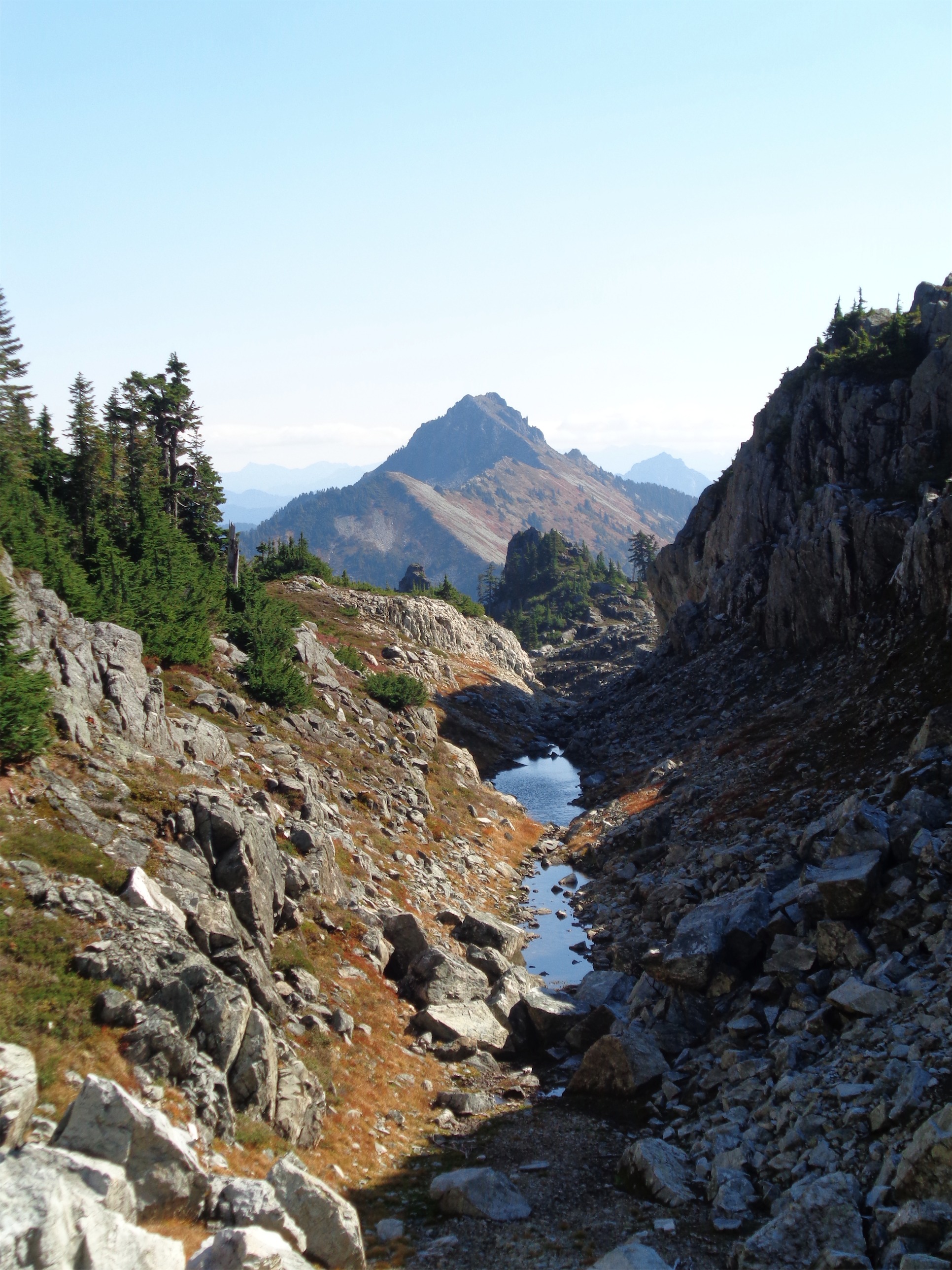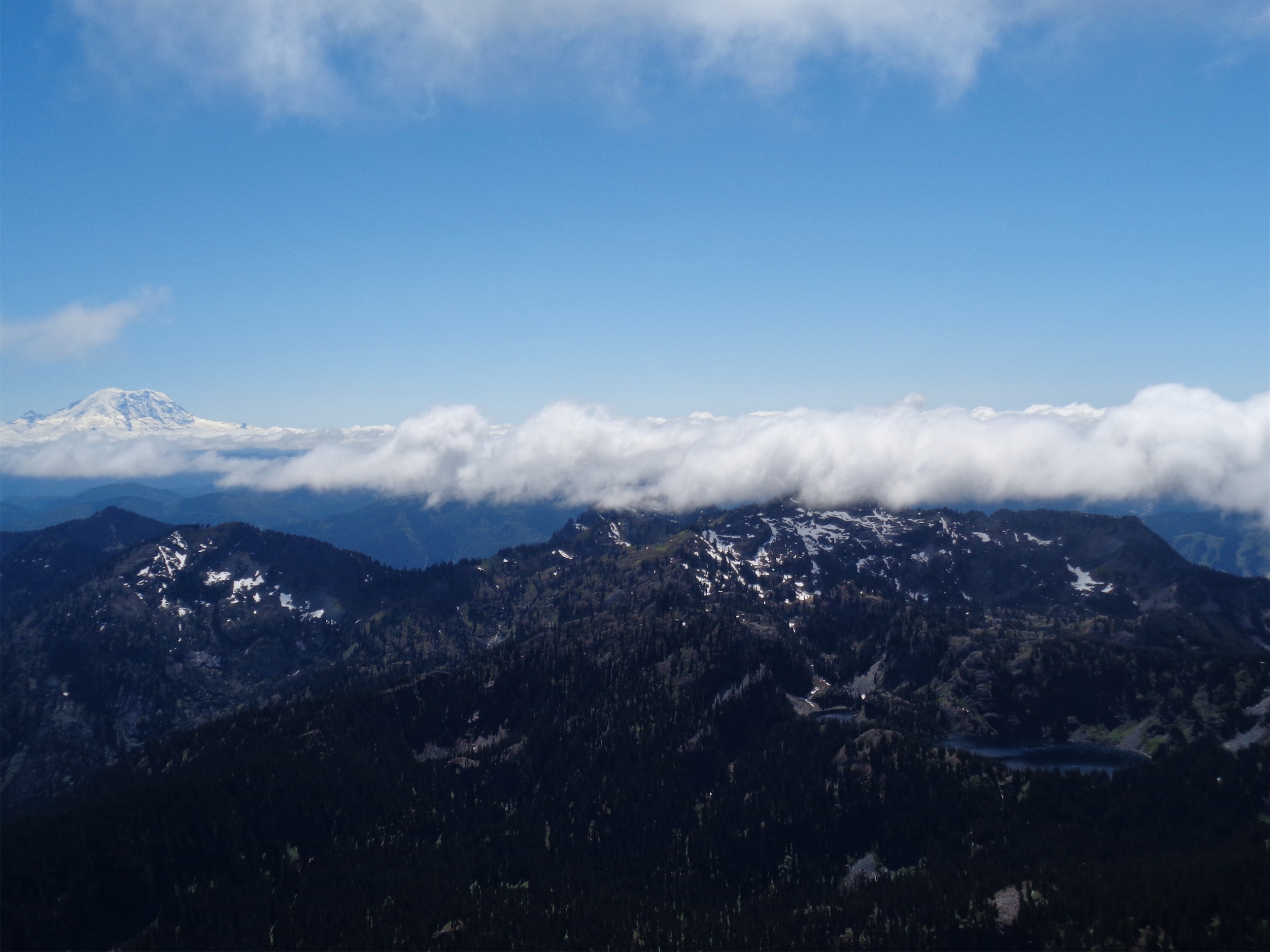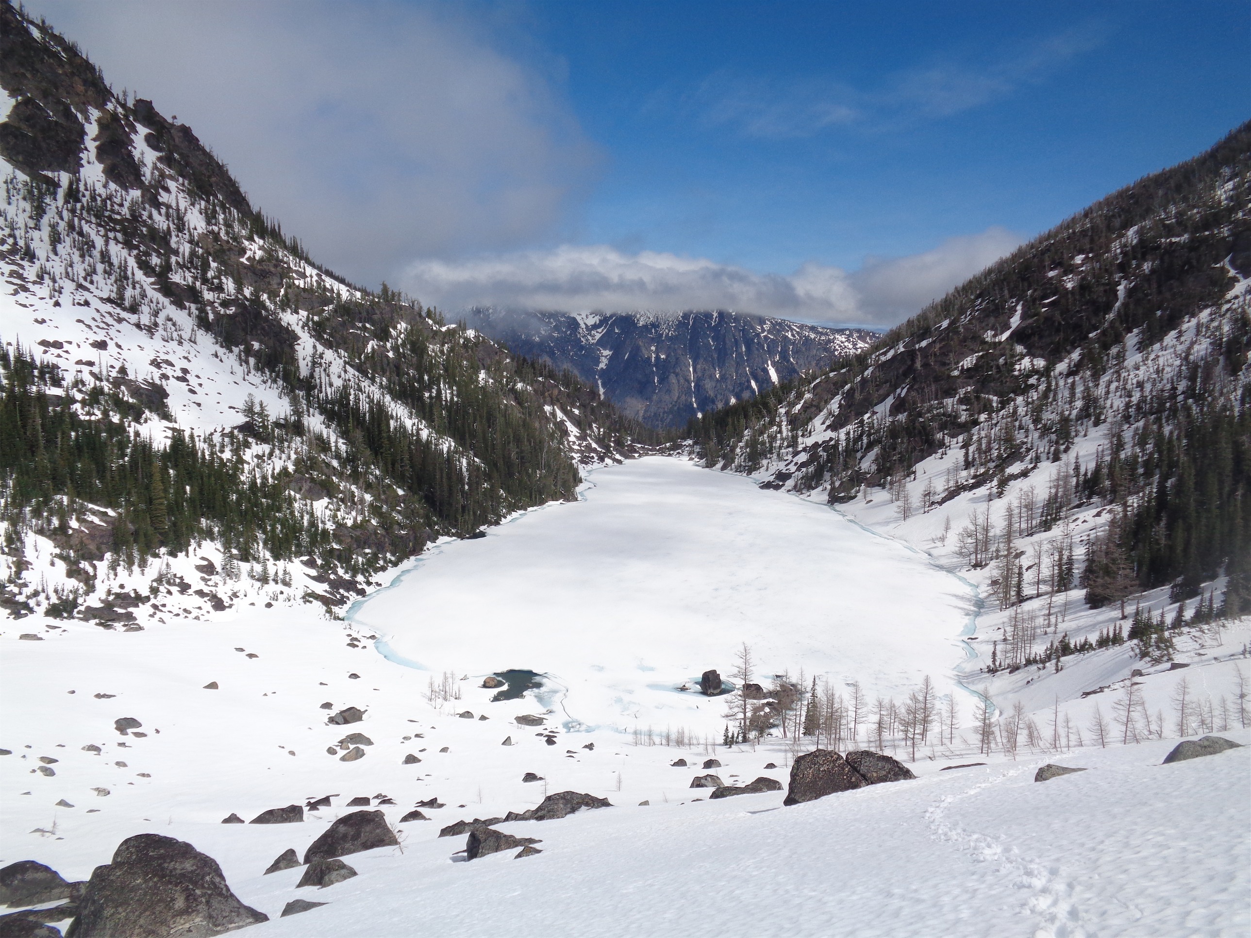
Looking back at Lake Victoria
- Distance: 9 miles round trip (varies based on whether you’re a route finding idiot at the time)
- Elevation: 6500ft gain, baby! Buns and thighs!
- Weather: 30’s and snowing and windy, 40’s and foggy, 50’s and sunny
- Commute from Seattle: 2:30 with no traffic
- Did I Trip: To the point where I had to self arrest, so yes, yes I did. It’s been a while since I didn’t trip on an outing. I’m getting uncoordinated. Maybe don’t rope up with me.
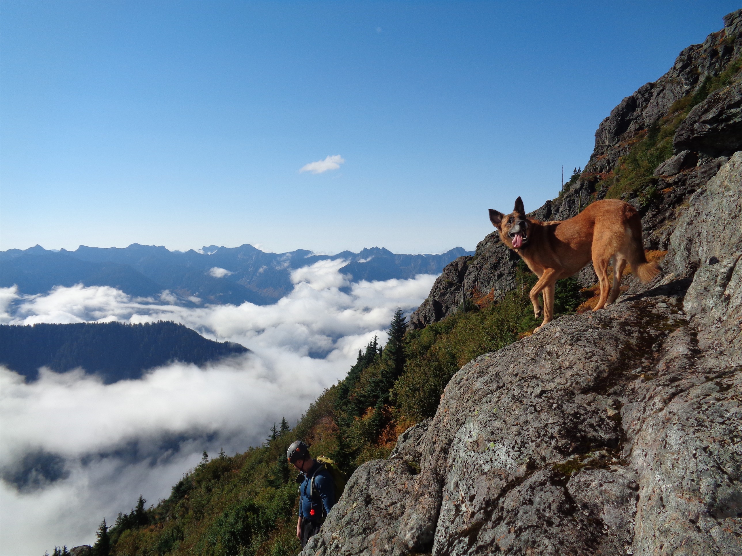
Don’t worry it gets cloudier
I mean, the route sounded awesome. Private property, bushwack, unmaintained/abandoned trail to a lake most people haven’t heard of, with a backdoor route up Cashmere. Awesome.
I got to Leavenworth around 8, and I stopped at Safeway, where I found a cheese I had not seen since moving here from Boston: Cabot’s!! It puts Tillamook to shame. I bought 3lbs of it (Seriously sharp cheddar and habanero cheddar) and some crackers and met Sam, who was napping at a nearby park n ride. Simon was still an hour out, so I cleared my back seat and followed Sam’s lead. Naptime.
Simon showed up around 10, and we headed to the trailhead. We were planning to start up Friday night, but what… what it…. we just… didn’t? I timidly posed the idea. Sam laughed. “I had been asking myself ‘why do we choose to do this?’ earlier tonight.” We agreed to sleep and get started around 5am.
I woke up at 4am. We all did, and telepathically agreed to not get up. I was in the middle of the best night of sleep I had had in well over a week and I was getting my extra hour.
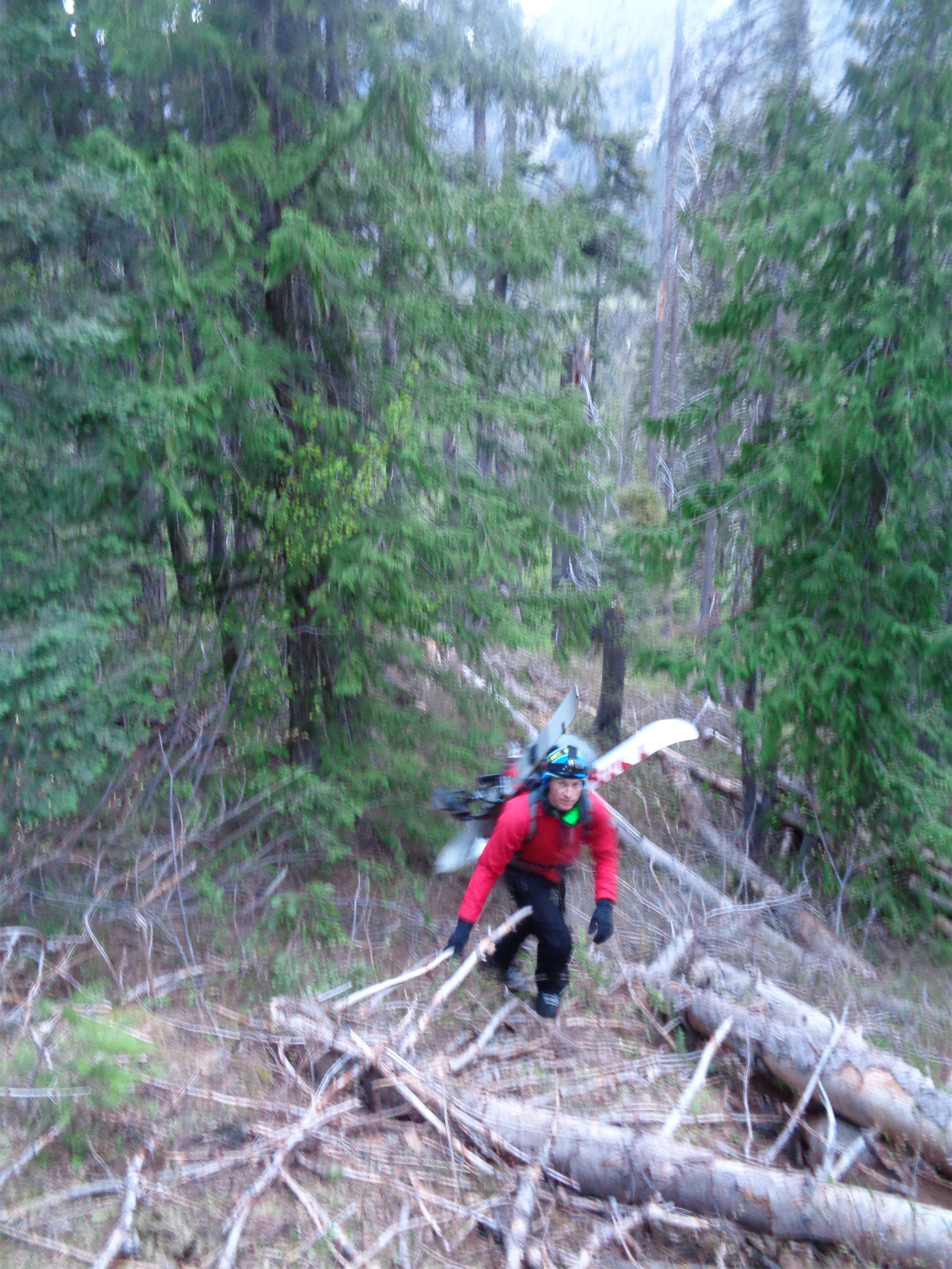
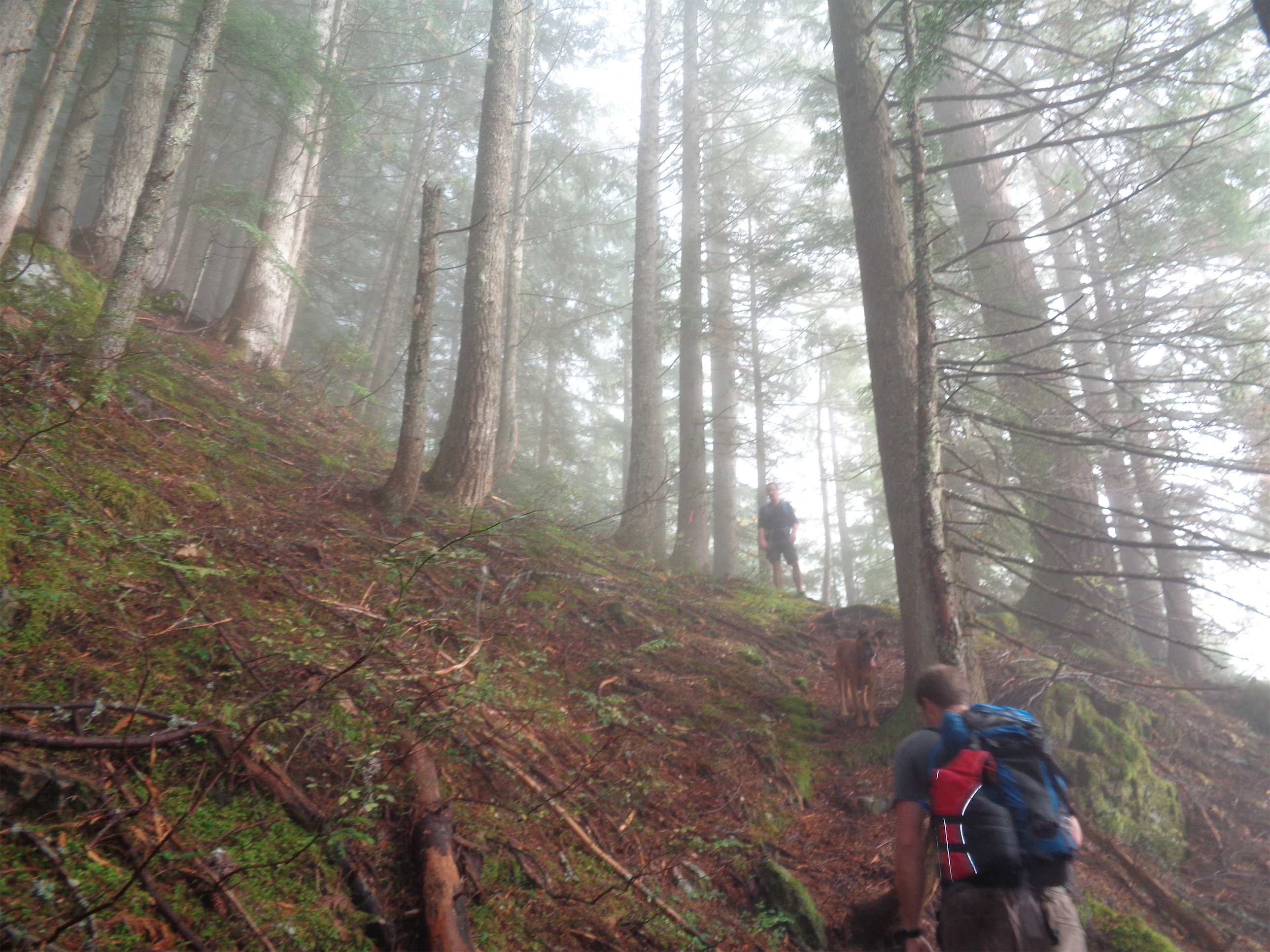
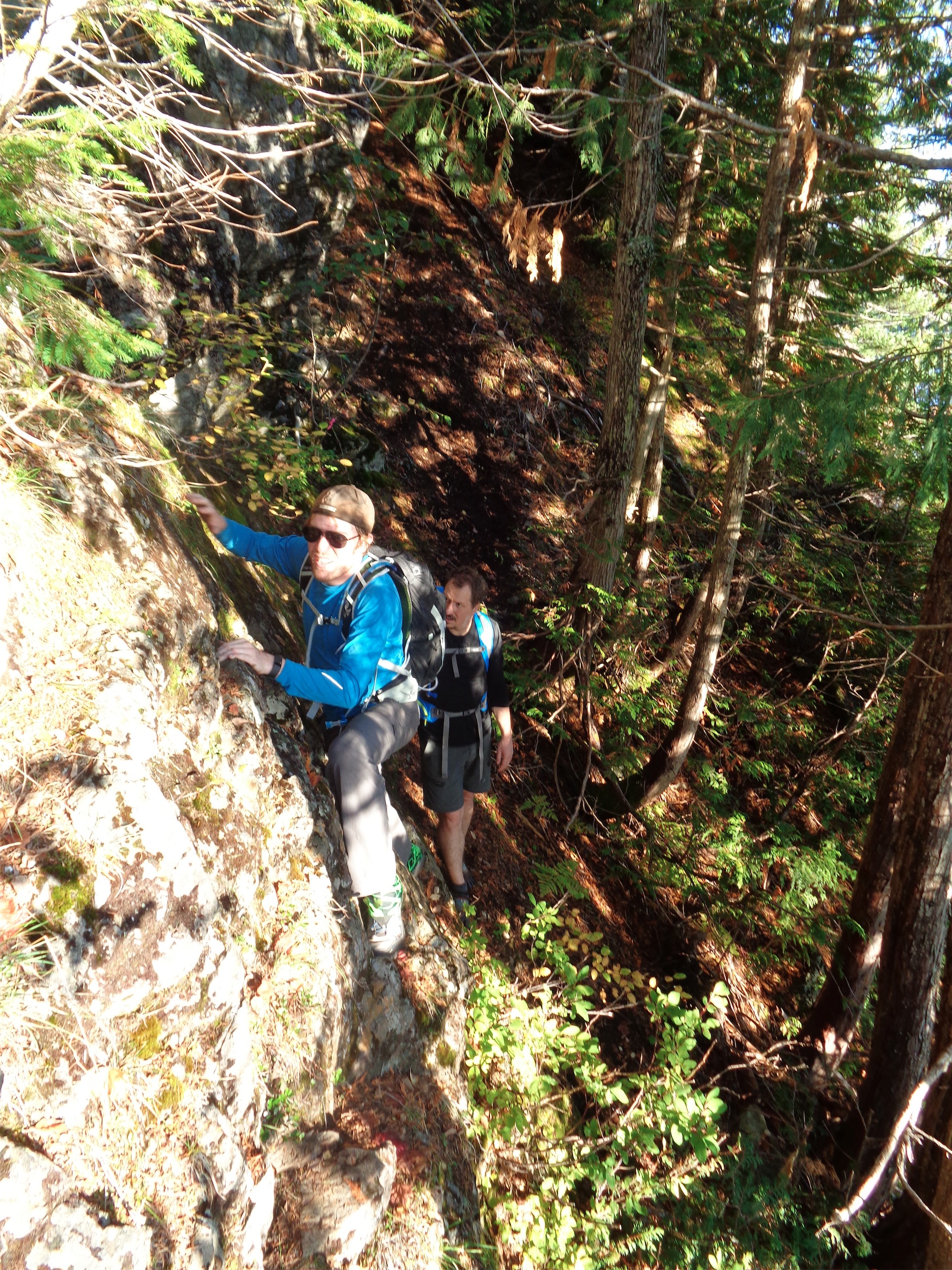
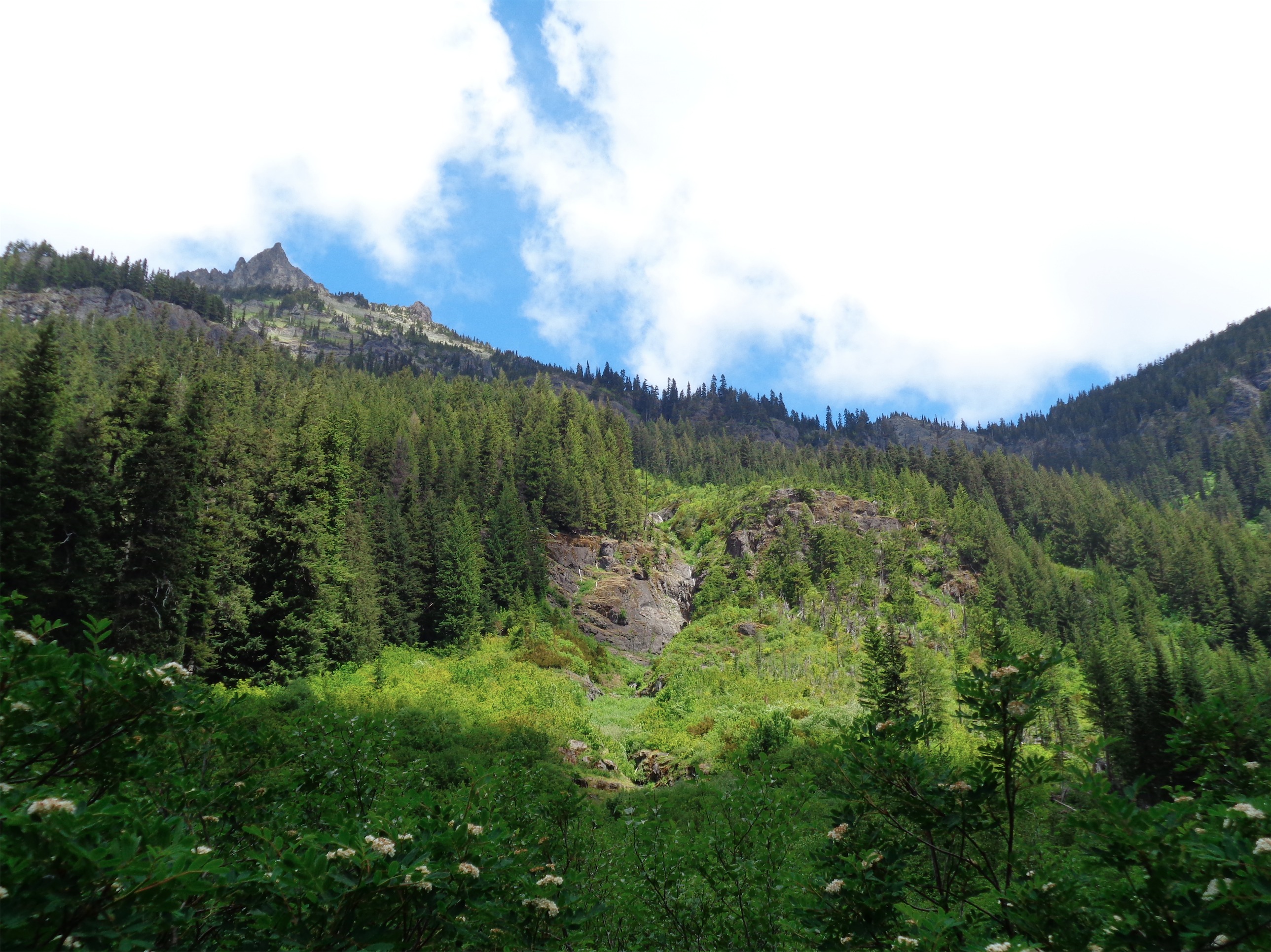
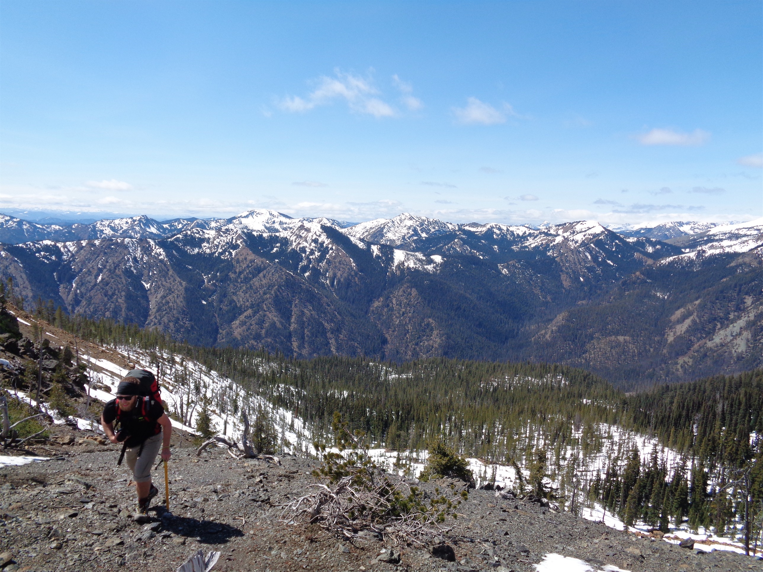
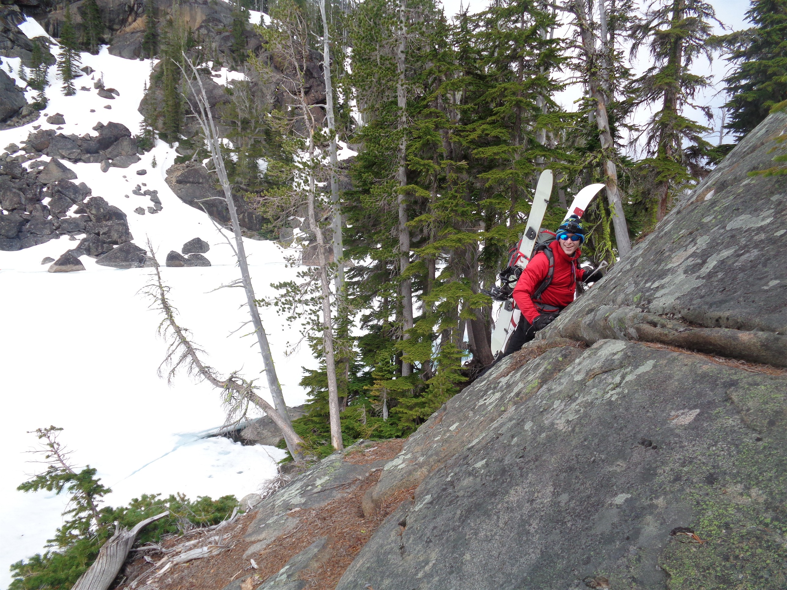
Starting up through steep forest
At 5am I dragged my well rested ass out of my sleeping bag, packed up camp, loaded the cars, and started moving. With our day packs. Day packs!! What is a day pack?! It’s a pack that’s light, and doesn’t include a tent or sleeping bag or sleeping pad or liner or dehydrated meal or stove… and it is fantastic.
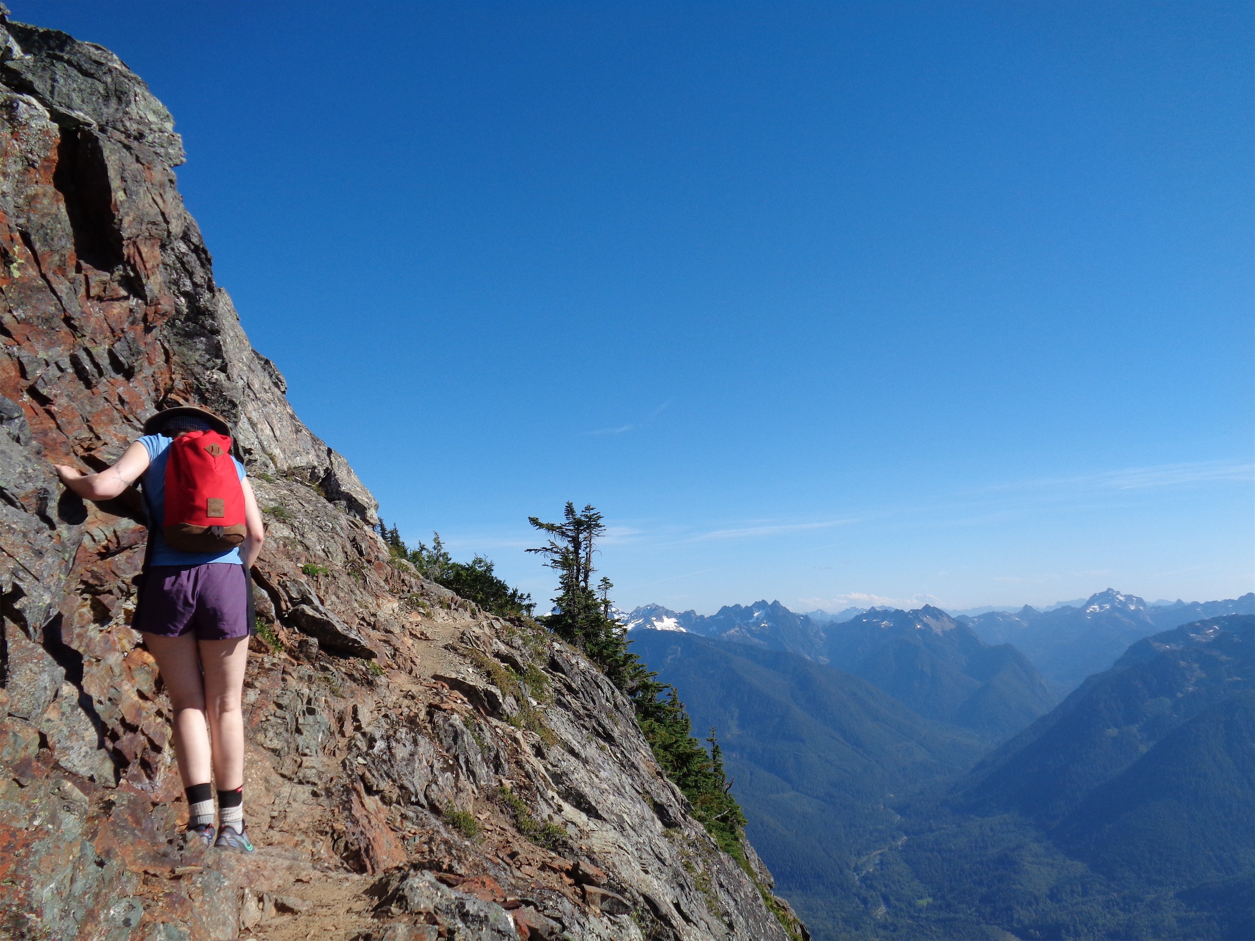
We trespassed immediately onto private property (part of the fun?), and walked down the road (driveway?) until we saw a blaze off in the forest. Sweet, time to head up. I had a compass bearing, but it wasn’t necessary. Just go up until you break into the burn zone, and then go up more.
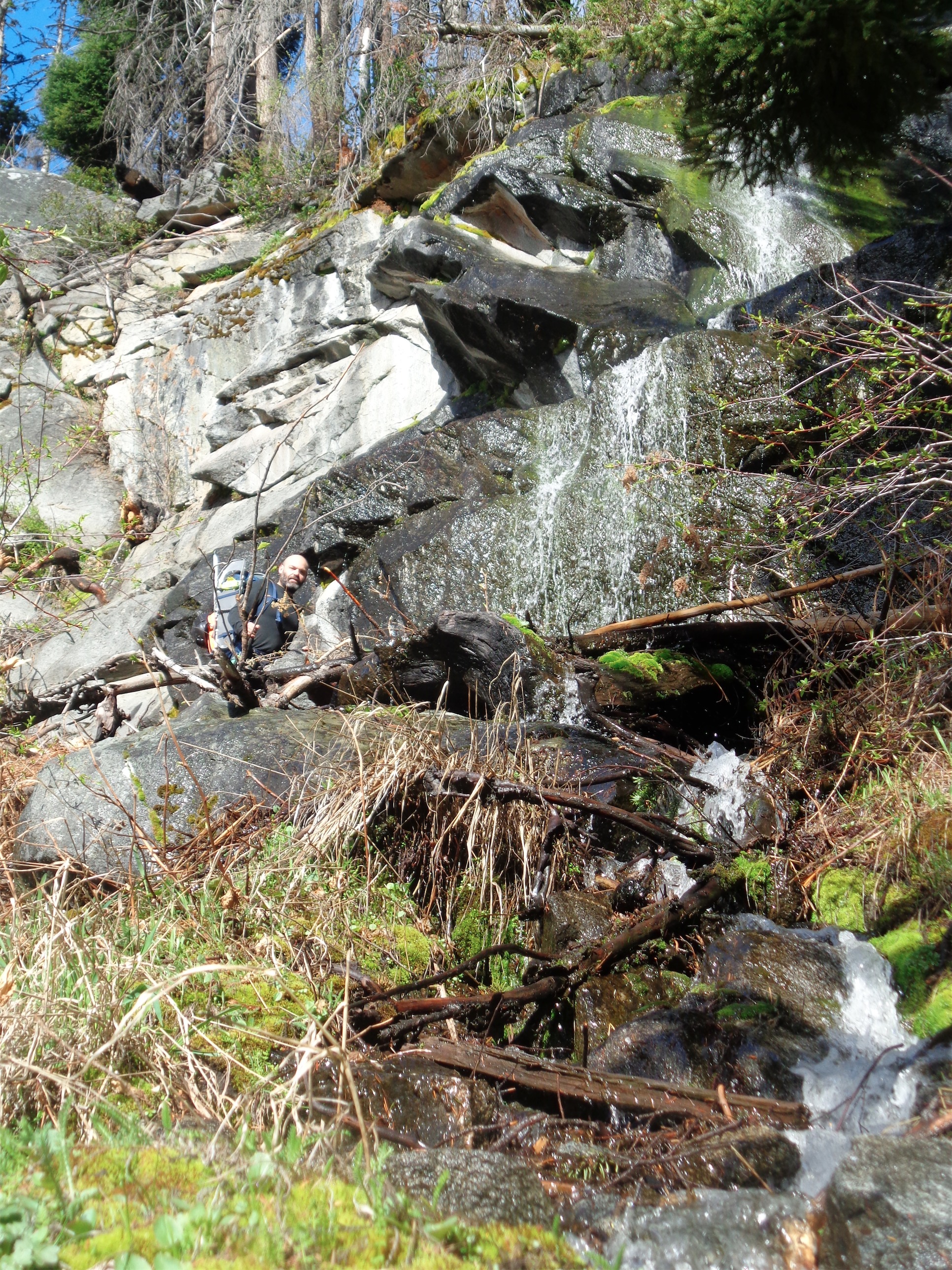
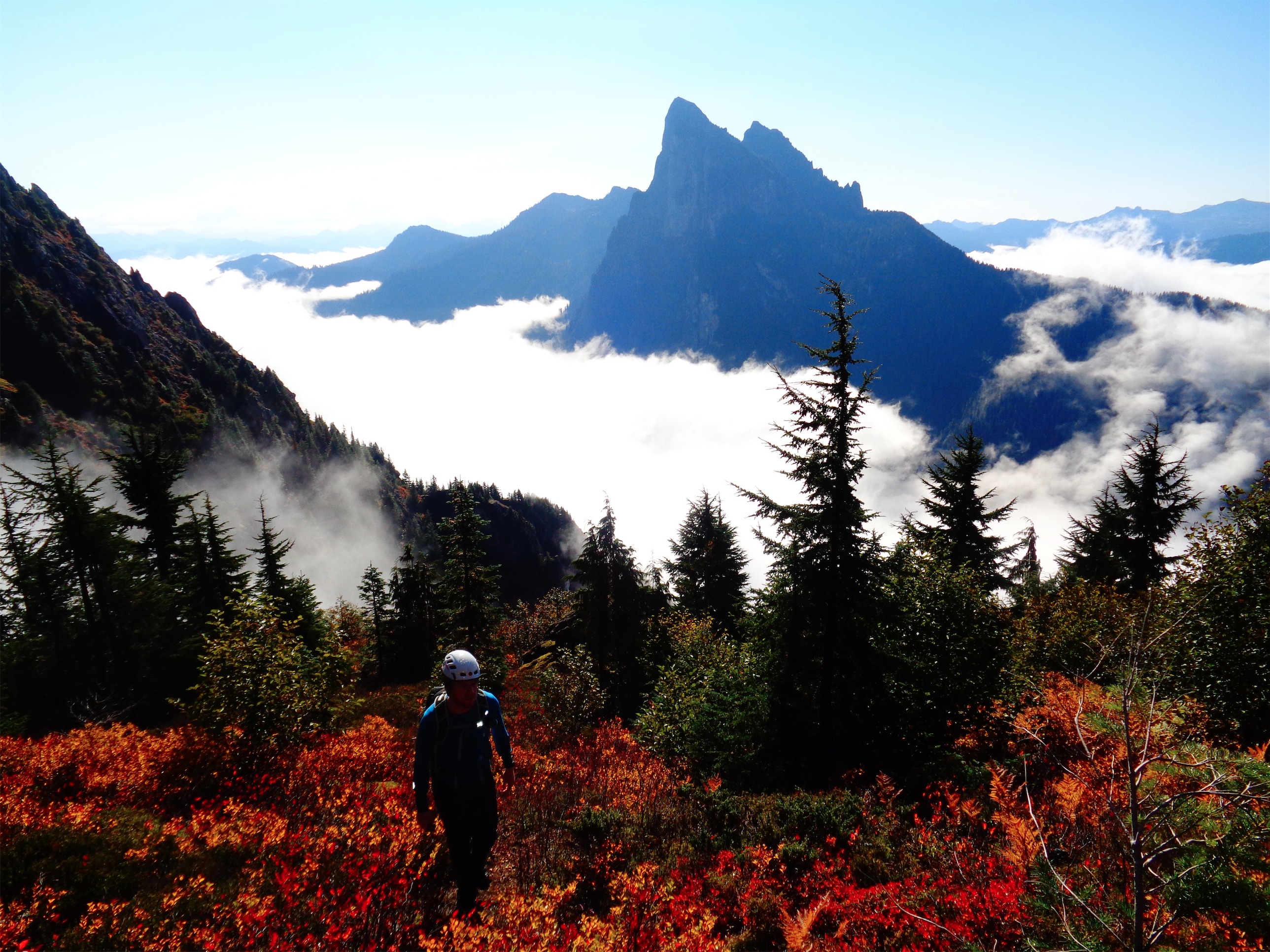
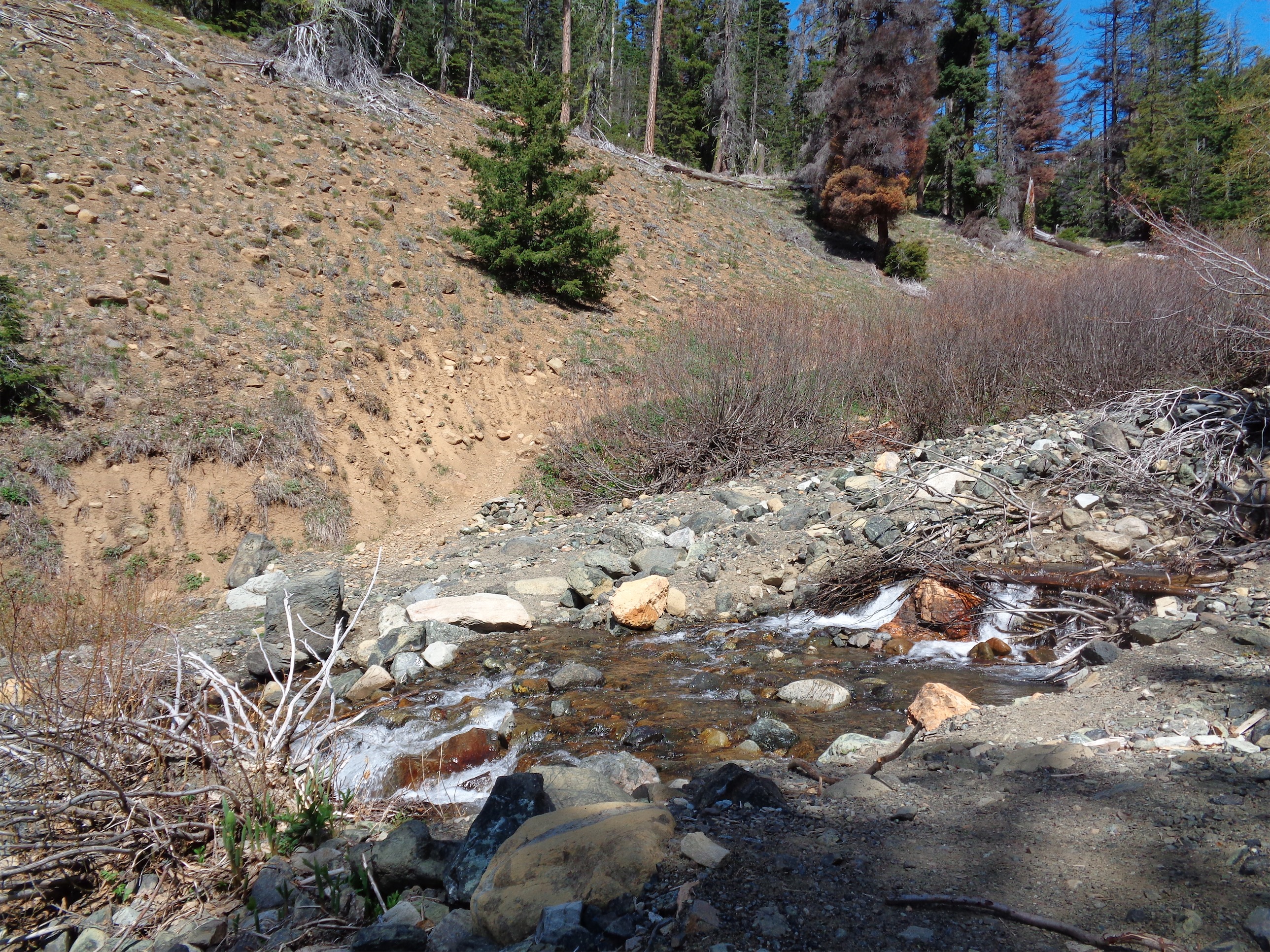
At least it was a scenic detour
We made a slight mistake as I was not checking the actual trail map at all, only the mediocre GPS app I was testing, which did not have a map of the route on it. Our biggest issue was that you should keep going up until around 5100ft, but we headed left far lower than that, because I thought the drainage we were supposed to follow was far more east than it actually was. This meant some exciting creek crossings, steep snow, no shortage of devils’ club, and an abundance of elevation gain that was was more of a pain in the ass than it would have been had we stayed in the burn zone, which was a nice walk up. Also, there’s a nice series of blazes starting around 4500ft in the burn zone, which will help you find the route very quickly. We did not have that luxury.
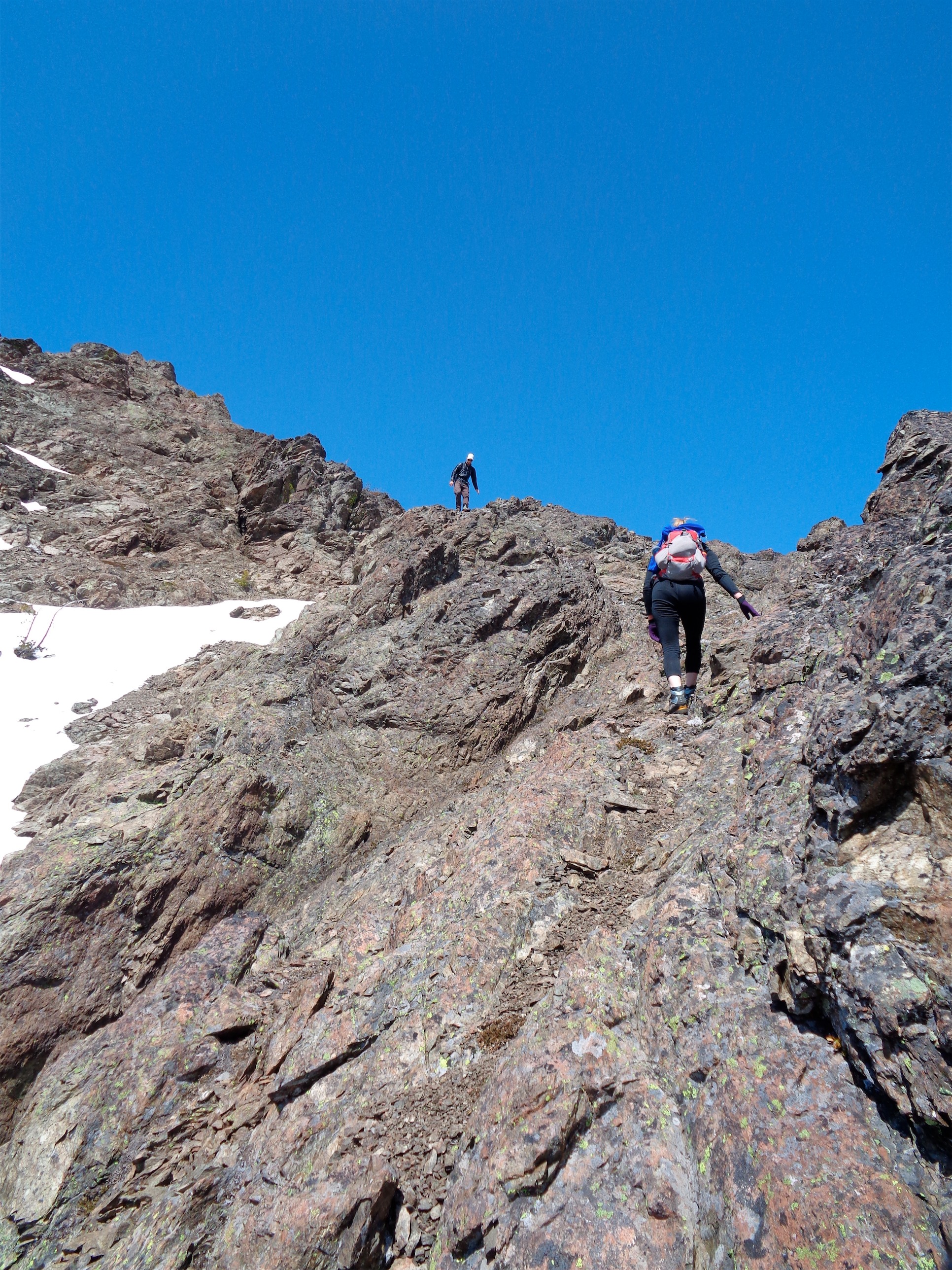
Fun scramble near the lake
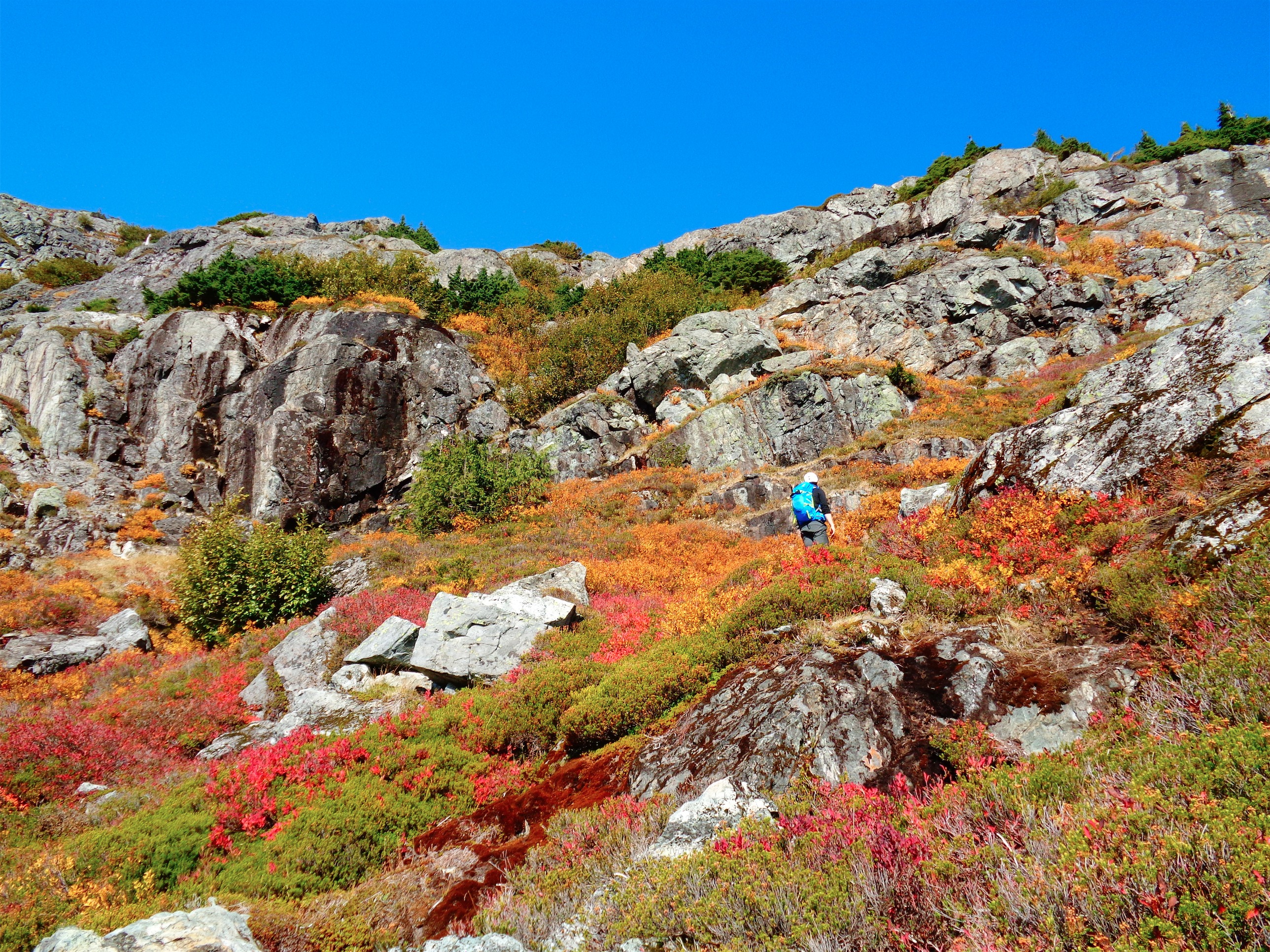
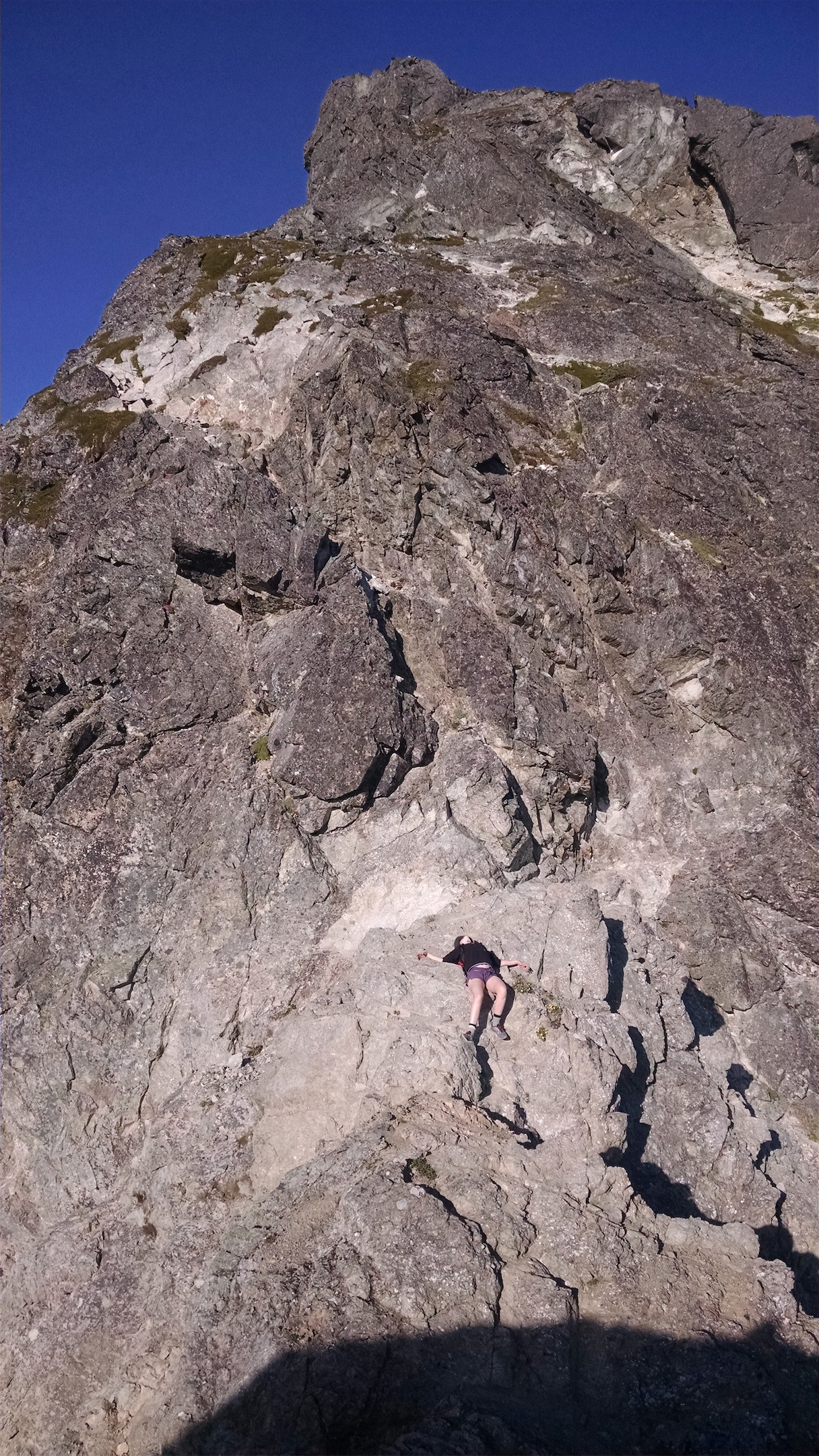
After a few facefulls of thorny plants, some steep snowy bushwacking, and bitching on my part (I don’t like stopping, I didn’t want to be in photos, I had some frustrations to take out and they wouldn’t be beaten by taking my time and relaxing, I’m not that type) we finally got to the lake. Clouds were roiling above Cashmere, so I made sure to lower my expectations. To the ground.

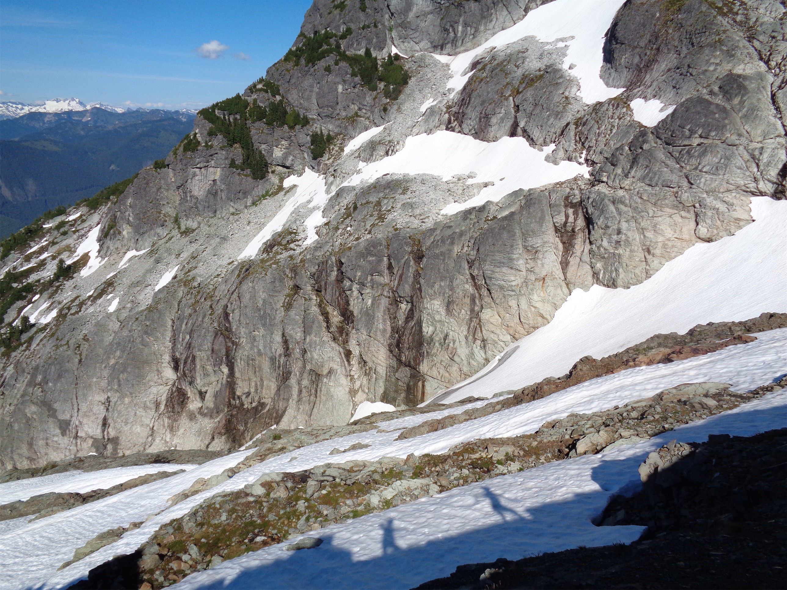
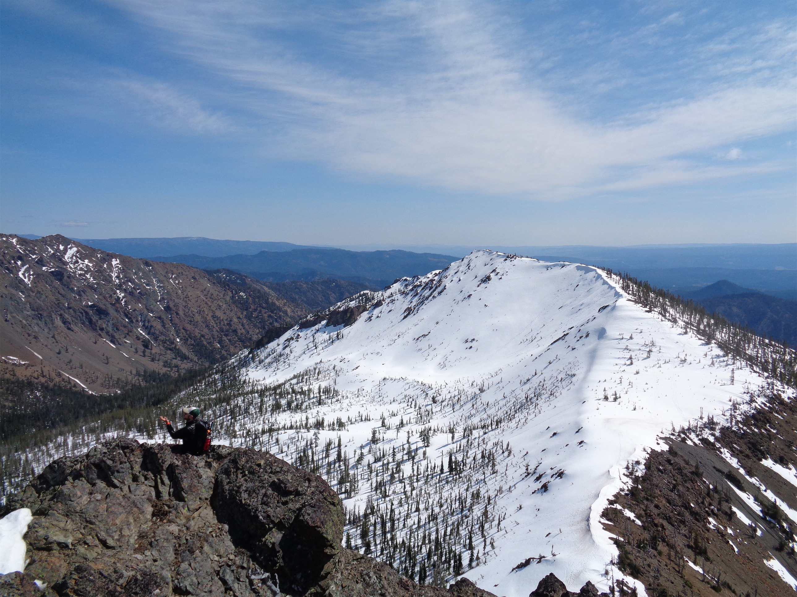
Heading around Lake Victoria, Cashmere being elusive in the clouds
We started heading around the lake, as it was too melted out to cross directly. Honestly I think we were a week or two too late to get the real experience here, since the snow had melted 2,000ft up over the past ~10 days (~5200ft we hit consistent snow). It’s usually a ski trip, but I didn’t bring the skis. I knew Sam would be booting it since he hates his skins, so I figured we’d all take turns breaking trail, and I was into this whole “day pack” idea.

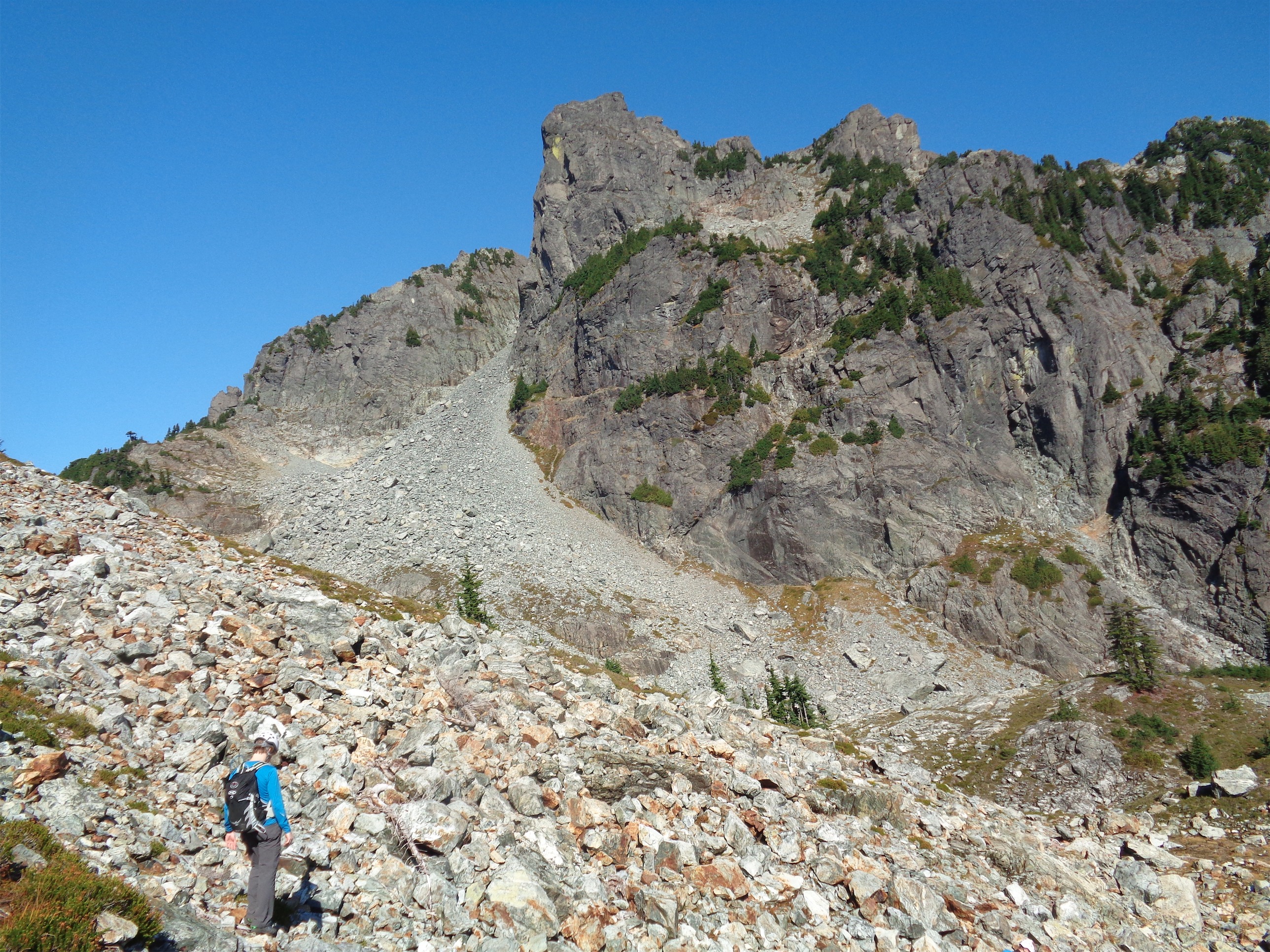
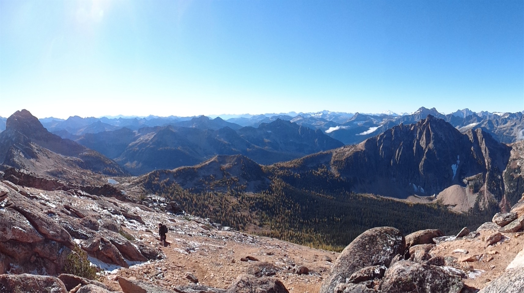
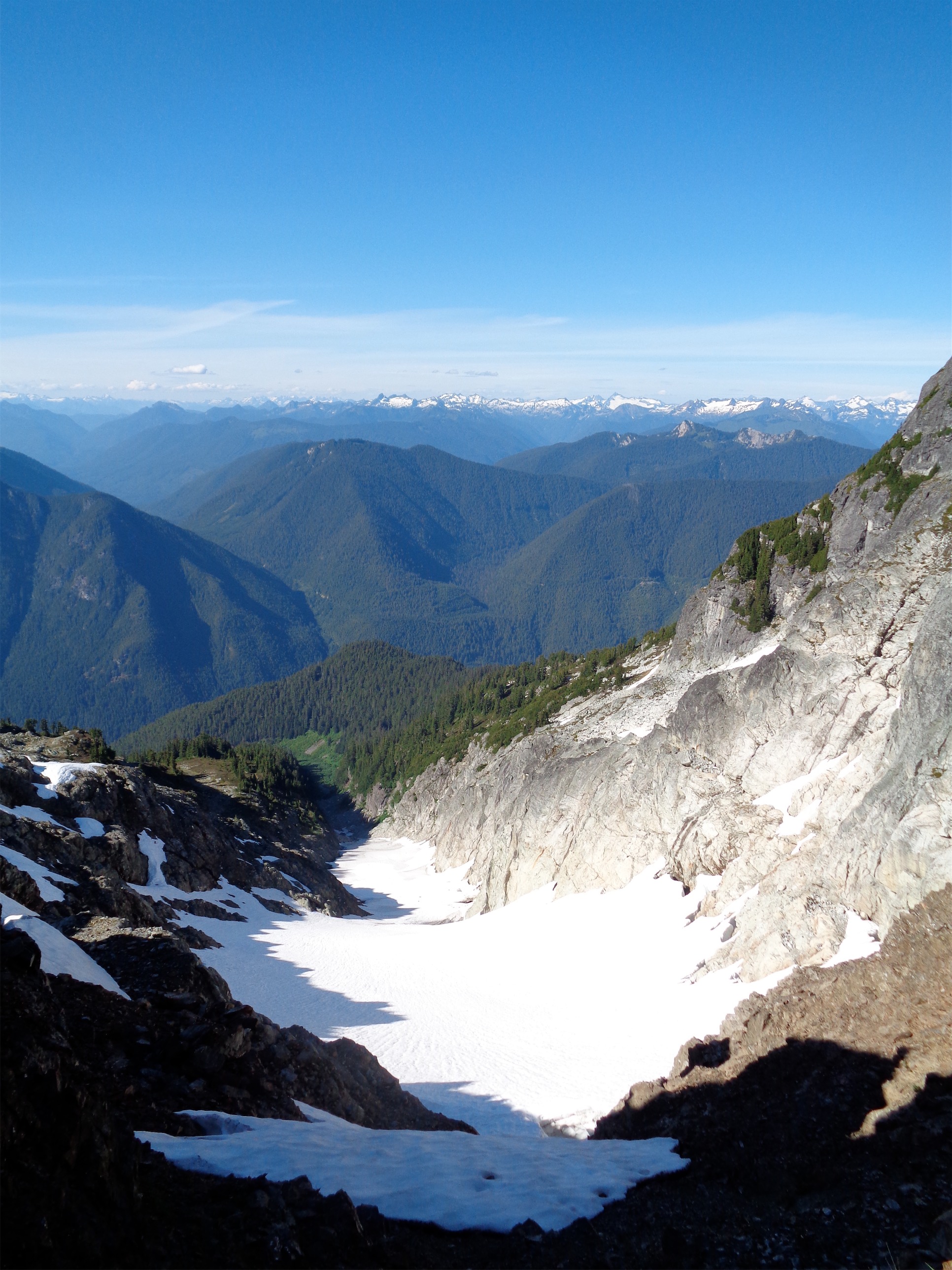
About to start up the gully above Lake Victoria
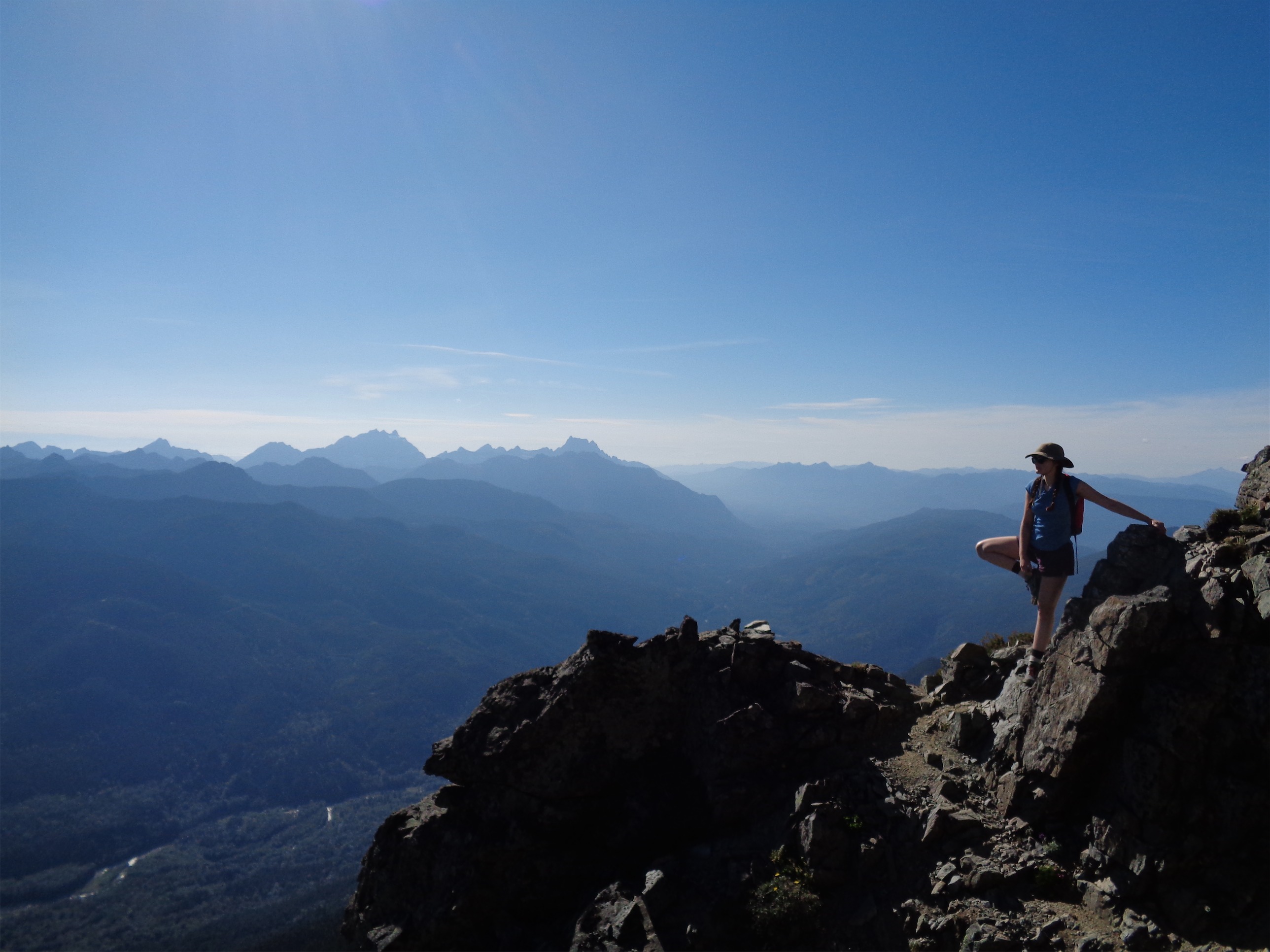
Simon decided to chill at the lake instead of head up to the summit. Sorry Simon, with a grand finale like you had back at the trailhead I couldn’t leave you out of the post! With most people I’d be concerned, or turn around with them, but Simon is extremely capable and I knew that for him to draw the line, something had to be bugging him (he was coming back from an injury, too, so better to play it safe). Being as self sufficient as he is, I knew he’d be fine getting down on his own. So we carried on, agreeing to meet back at the trailhead.

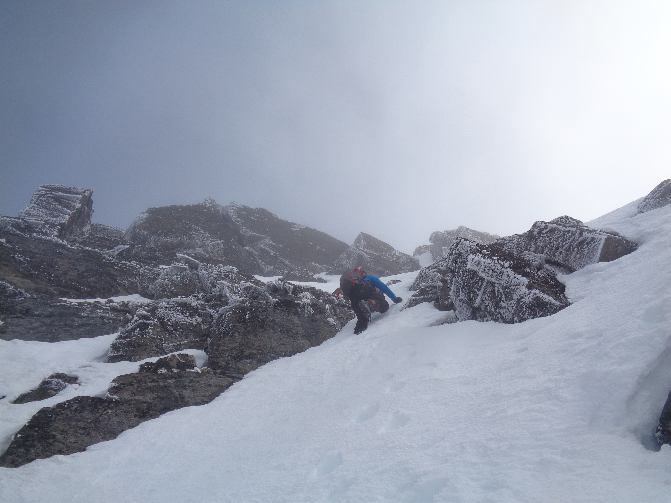
Kicking steps up the gully
Sam and I got to the base of the gully and took a quick break for snacks and sunscreen. It wasn’t actually that steep, maybe 45 degrees at the most. We made fairly quick work of it, except 3/4 of the way up Sam demanded a sandwich break. Okay, let’s do it, I’m hungry too. He devoured a sandwich and I sat down and cut the cheese (stop laughing) to eat with crackers, and we carried on.

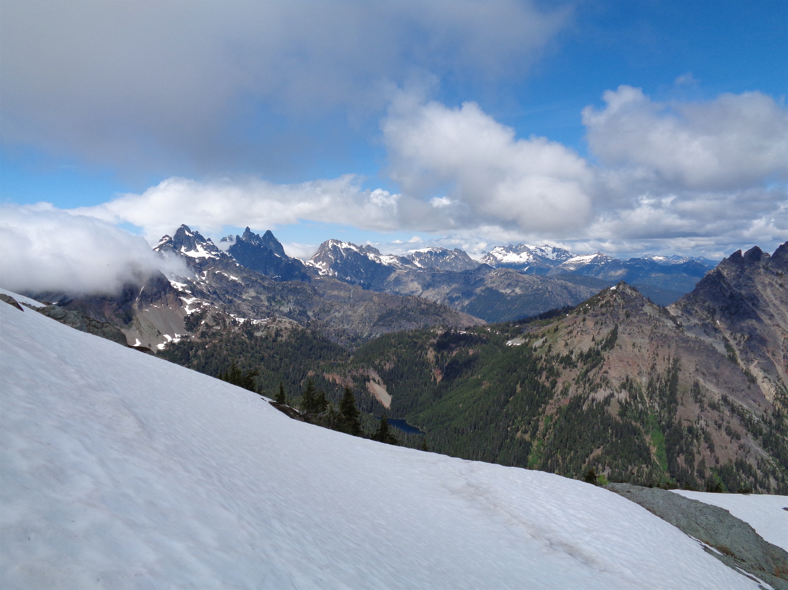
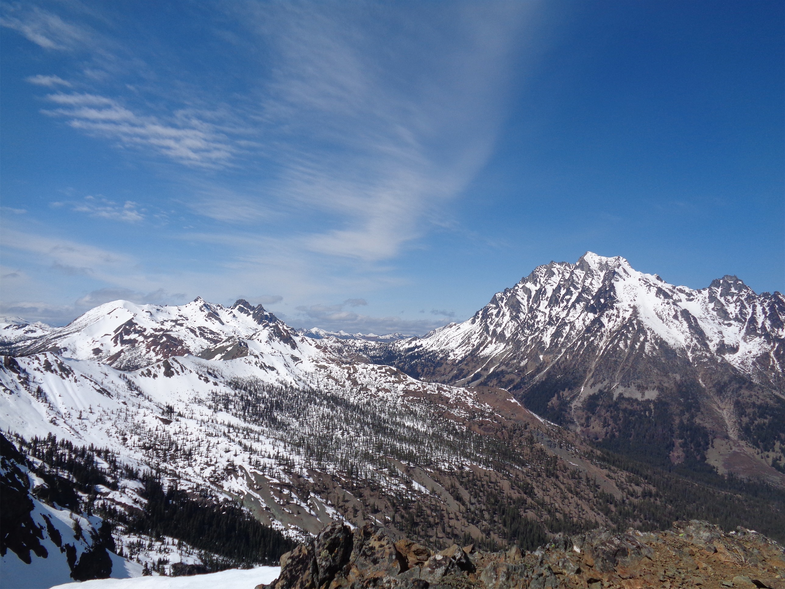
On more mellow ground in the basin, sun almost breaking through
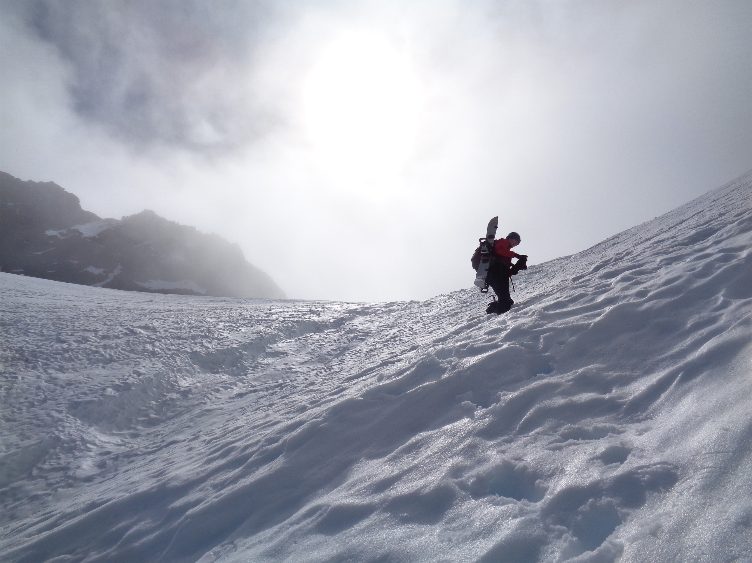
Soon enough we were in the clouds. We kept hoping they would clear, and occasionally they’d blow past for a split second, but never enough to have views or even see where we were going. We got one glimpse of the true summit for maybe ten seconds, and made a beeline for it. It took us probably another 20-30 minutes from that glimpse to get close to it. I had a hard time breaking through the icy crust, so I strapped on my crampons (in the steepest, most awkward spot I have ever had to put on crampons) figuring I’d front point the rest of the way up. Some very steep snow (steeper than the gully), a few scramble moves, and some rock-ice blends that made me appreciate my few days of dry-tooling and briefly made me wish I had brought tools rather than the axe. I was shocked that any ice was still up there.
Final push!

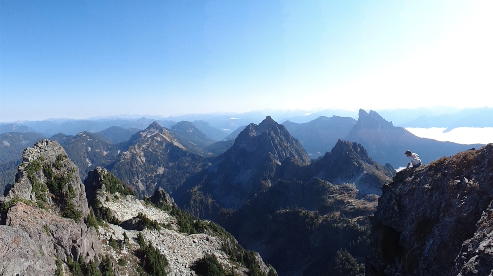
Summit?!
Sam popped up to the summit while I negotiated a different route, trying to follow a steep snow finger between rocks rather than his scramble. Wouldn’t it be funny if we were at the wrong summit? I heard Sam go “uhhh.. crap.” The clouds lightened, and we saw… the real summit. 50ft to the east, and maybe 15 feet higher than us. At one point I was trying to stop swearing (in general, in life) but this was just comical. God. Dammit. All that effort, whiteout conditions, only to suddenly realize we were sitting on the wrong damn rock.

The real summit (back right). Crap.
I couldn’t help but laugh. I wasn’t going over there, are you kidding? No views, I was cold, it was windy, we’d have to downclimb and climb back up again, and 99% of our time above the gully had been completely socked in by clouds. It just wouldn’t be worth it. Maybe we’d have ended up on the third summit ish rock, there were a few that all looked similar in the clouds. We’ll make a revenge trip someday. Sam demolished a pop tart, and we scrambled down a separate route back to steep snow where we painstakingly downclimbed backwards, more or less trust-falling into our previous steps, some of which had punched deep through the crust. Sam finally put his snowboard to use, stopping every 100ft or so to make sure we kept each other within sight. Low visibility can be problematic.

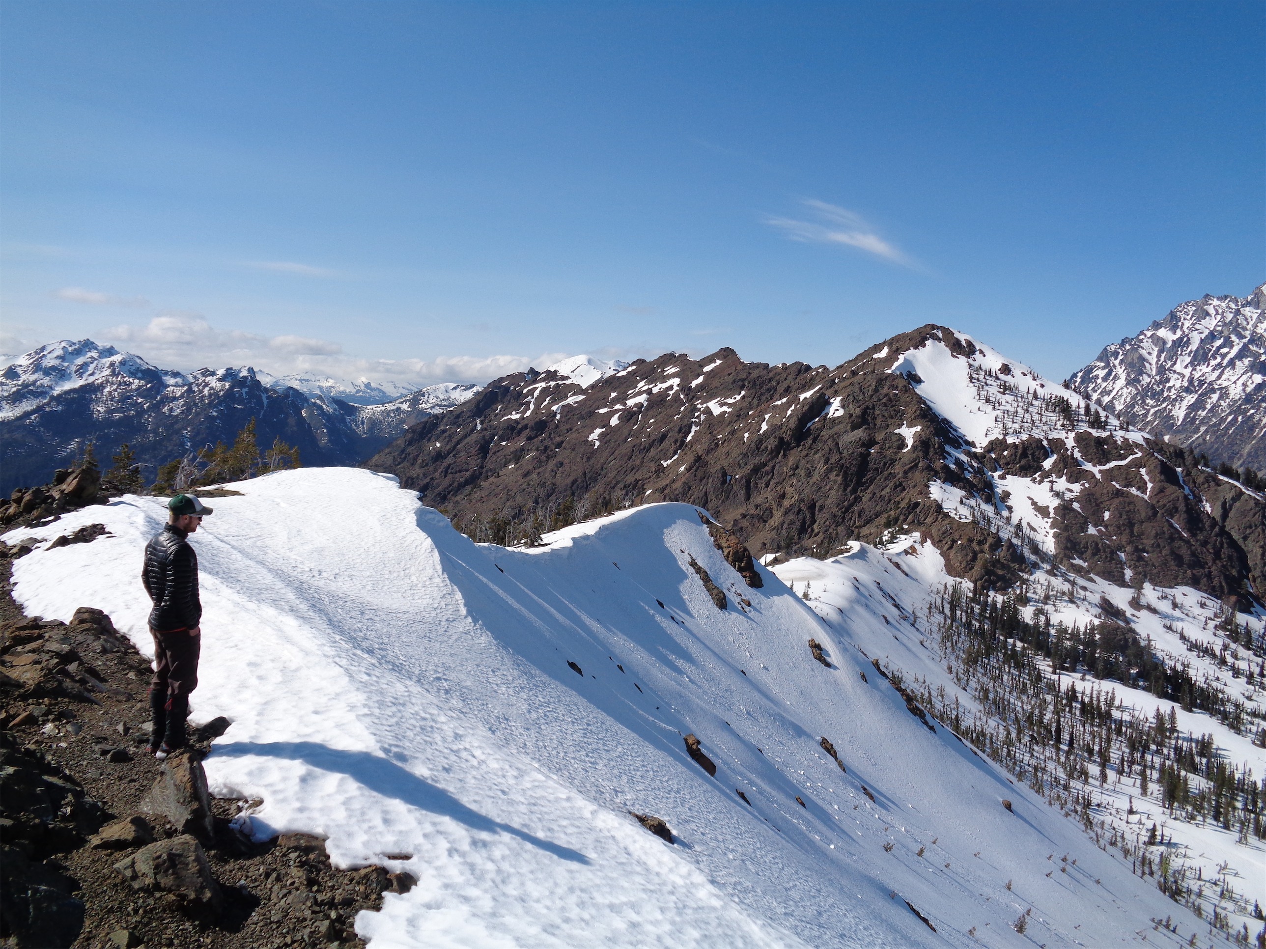
Visibility getting better on the way down (that’s Sam snowboarding)
Going down the gully I did have to do an easy self arrest after the snow changed from powder (easy to plunge step) to ice (I went for my plunge step and just wiped out) and guys, I have one tip here. Wear gloves, sleeves and pants when you’re on anything that might require self arrest. I had sleeves and pants, but my hands were torn to shit by the ice, and it hurt. Your brain doesn’t care until a few minutes later, when you’re like “why are my hands burning” and look down to see bits of gravel and ice and scrapes and who knows what was in that avvy debris all in your skin. Gross.

Five blazes. Actually six, but the wind blew one out of frame
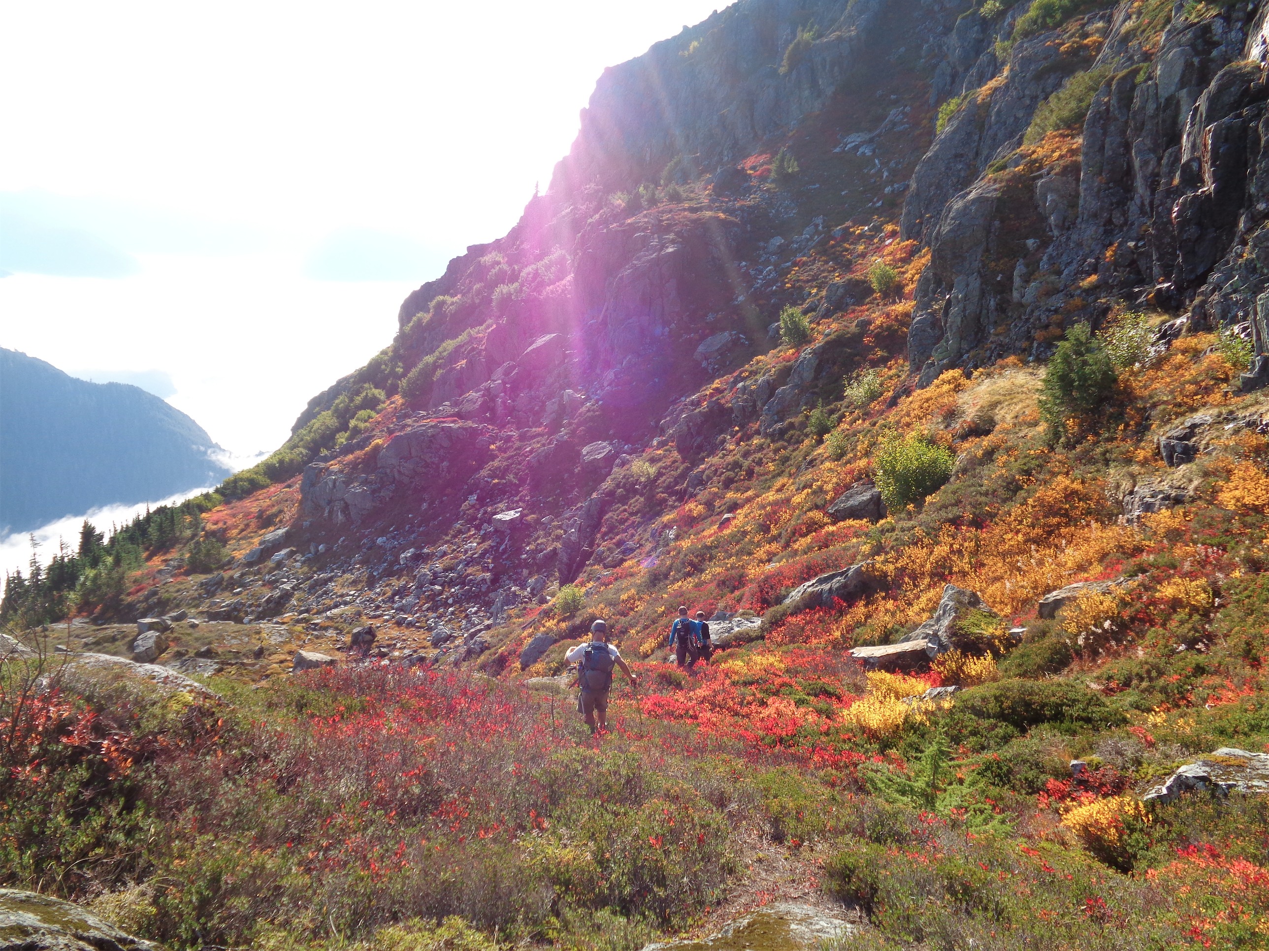
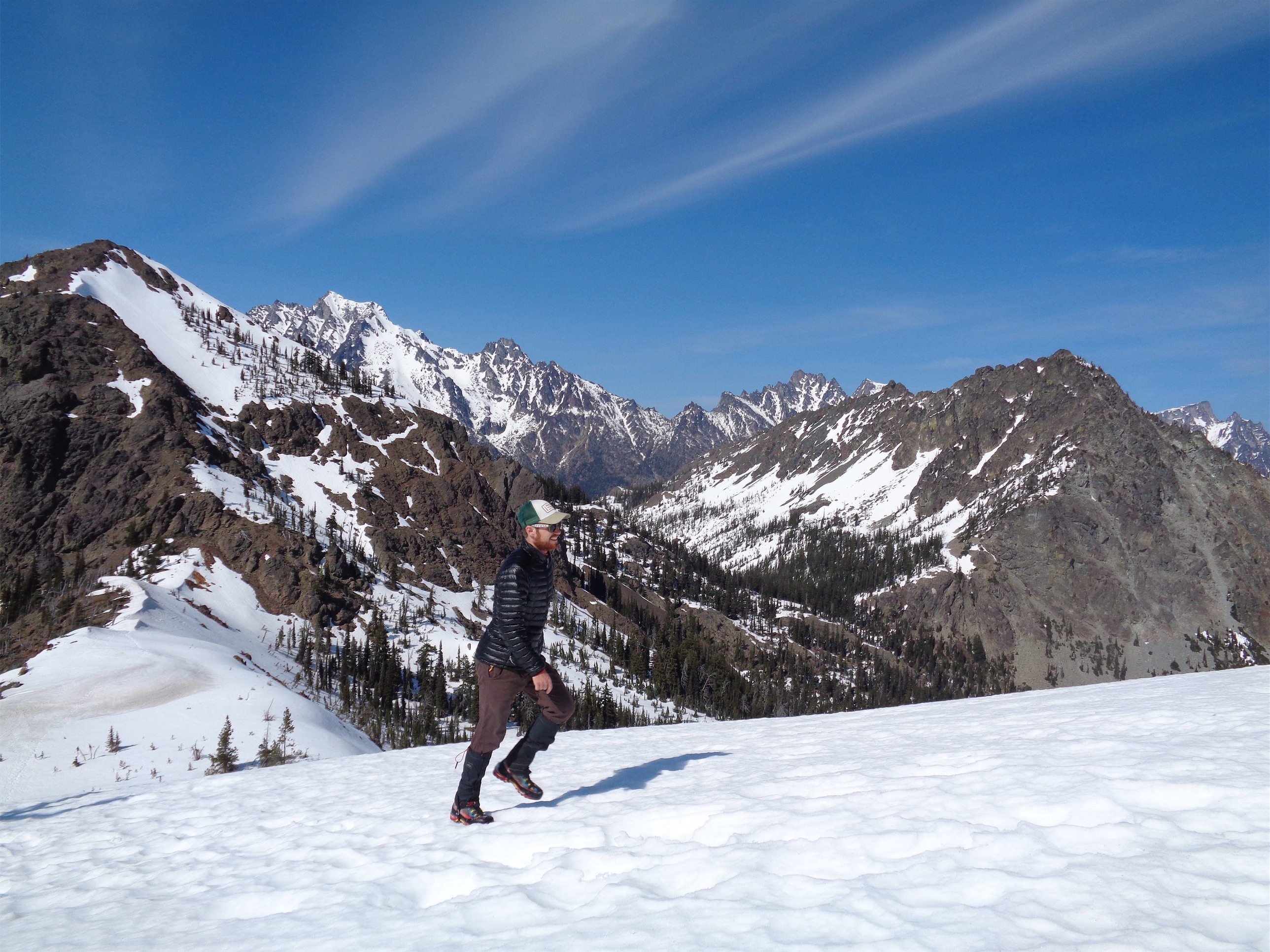
As usual, going down went faster than going up. We got snowed on, rained on, sunned on, and luckily found the regular route back down quite easily thanks to Simon’s footprints (thanks for breaking all that trail!) and the 8000 blazes that mark the route assuming you find it at the top of the burn zone. It’s pretty funny that we missed it by that much. I got a picture with six blazes in it at one point, and Simon had old-school cut blazes into a few trees in case we missed any of the hot pink flags. Sam’s colorblind, which made finding blazes hilarious (but not as hilarious as watching him try to follow routes at SBP).

Where Simon (I’m convinced) fell through, with an Eve shaped hole right above
We’re pretty awesome, and got down in far less time than it took us to get up. We false-summitted after about 8.5-9 hours (we spent a LOT of time in the whiteout deliberating over where we were and where we should go, not to mention our off route expedition on the way up) and were back down in 4. There was one amusing spot where I am pretty sure Simon fell through a snow bridge, because I saw a huge hole in the middle of a very thin snow bridge over a small brook and thought ‘oh, I’ll just walk next to it’ only to immediately punch through neck deep myself, laughing at my stupidity. Eventually we left snow cover, and after heading down through the burn zone we found an old logging road and some squirrely trails that got us back to the private road much faster, though we had to fight off thick ass slide alder to find the nice route. I heard dogs barking at one point, and started having paranoid thoughts about “the most dangerous game,” what if the owners of that house are avid hunters and send the dogs out thinking there’s a deer or cougar nearby? I wanted to be down by dark, and I remember several times where I was tangled in alder fighting my way through (why did I have this stupid shovel sticking off my pack!? At least it isn’t skis) imagining how miserable it’d be to be doing that, in the dark, wondering if we were about to be confronted by drooling growling dogs and angry property owners. Also, I was convinced the skin was sloughing off the bottom of my feet. I wore my like D-Team socks (A team is Darn Tough baby) and it just wasn’t working out.

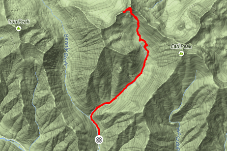
Map (thanks to Summitpost & Wenatcheeoutdoors.org)
I couldn’t believe it when we hit the road. Awesomely fast. There were fresh tire tracks, but we didn’t see anyone. They must be used to the occasional climbers using their road and schwacking through their forest. We hiked back across the bridge where Simon was loyally waiting with hot chocolate ready for us, fretting about how we had never chosen a “call search and rescue” time for him to take action. He had settled on midnight – knowing our speed and experience and having done half of the route, he logically concluded that if we weren’t back by midnight, something had gone very wrong. Yes, I’d agree. We’d have to had seriously screwed up to be up there that late.

One more pic of Sam being bad ass
I opened my trunk door. It stayed open. For anyone who’s been in my car lately, the door wouldn’t stay up and I’d prop it open with a trekking pole. I looked at Simon. “Did you do this, or is it just working?!?” He had replaced the pistons in the door of my car, which I had (stupidly) left unlocked. Holy shit! A working trunk door, and hot chocolate, and shoes that didn’t have my shitty socks, and German food, and I tried schnitzel for the first time, and the lemonade that Sam had mentioned halfway up the climb that had been on my mind for hours… wait, I was in a great mood. What is this? I hadn’t bitched about anything in hours! I hadn’t whined or moped (well, besides lamenting the clouds and lack of sun, cmon Cashmere) or been snarky or rude or irritable. And it wasn’t even sunny. But I guess there’s something refreshing about 6500ft of gain in 4.5 miles, with steep snow and ice and bushwacking and bear prints and deer prints and a false summit because it wouldn’t be climbing without the occasional oops, right?

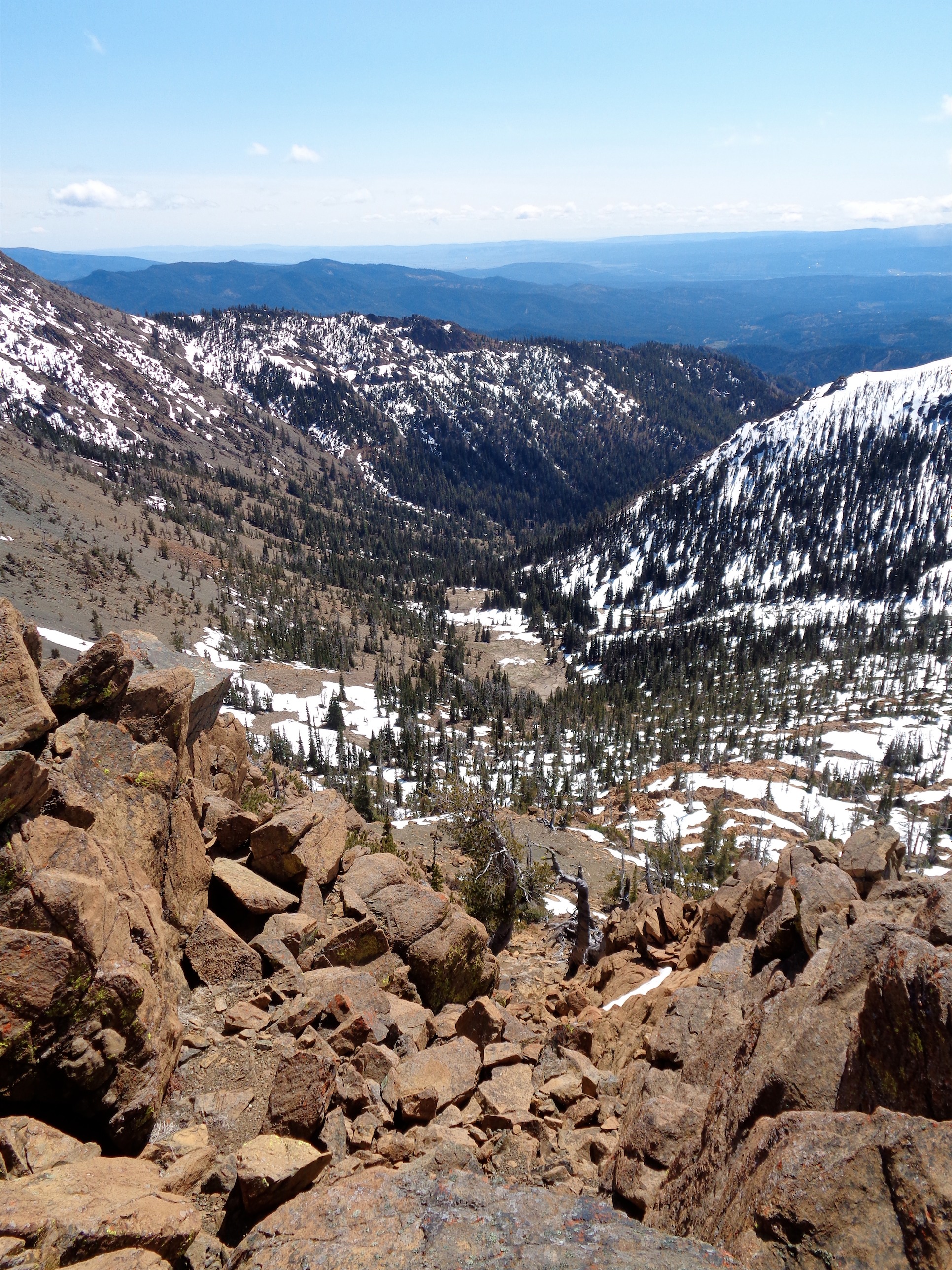
Nearing the top of the gully
In hindsight, that was one of the most awesome trips I’ve had in a while. Even if it was cloudy with mediocre conditions, it pushed it physically, technically (kudos to Sam, because I do not know many people who would have kept going without protection once it got steep, rocky, and icy but Sam basically doesn’t have a comfort zone, everything is fair game), and it’s pretty cool to look back and realize that we did that so casually, with no rush, no alpine start, no after-dark return. And almost zero planning, though I at least had a picture of a map on my half charged phone. So I had like, 6/10 essentials. Don’t follow my example. Prepare more, and don’t be a bitch. Yours truly, Proud Owner of a Healthy Trunk Door.*
*Car, or ass? You decide.