

Glacier lillies in bloom
Good god I have been lazy. Usually writing these is a fun side activity, but I’ve been wiped the past few days. This hike is from almost a week ago. My first solo hike in a while, the forecast was rainy (crap) so I took off yet again to the land of fun and sun (yay!) on the other side of the cascades. Solo scamper up Bean Peak, here I come! Hiked 4/29/2015. Yes, that’s the day before my last post about Rachel Lake and Rampart Ridge. So many people were asking about that area that I
- Distance: 6.5 miles round trip
- Elevation: 3000ft gain (I think this is off), 6743ft highest point
- Weather: 40’s and sunny
- Commute from Seattle: 2:30 without traffic
- Did I Trip: No but I fell in a creek

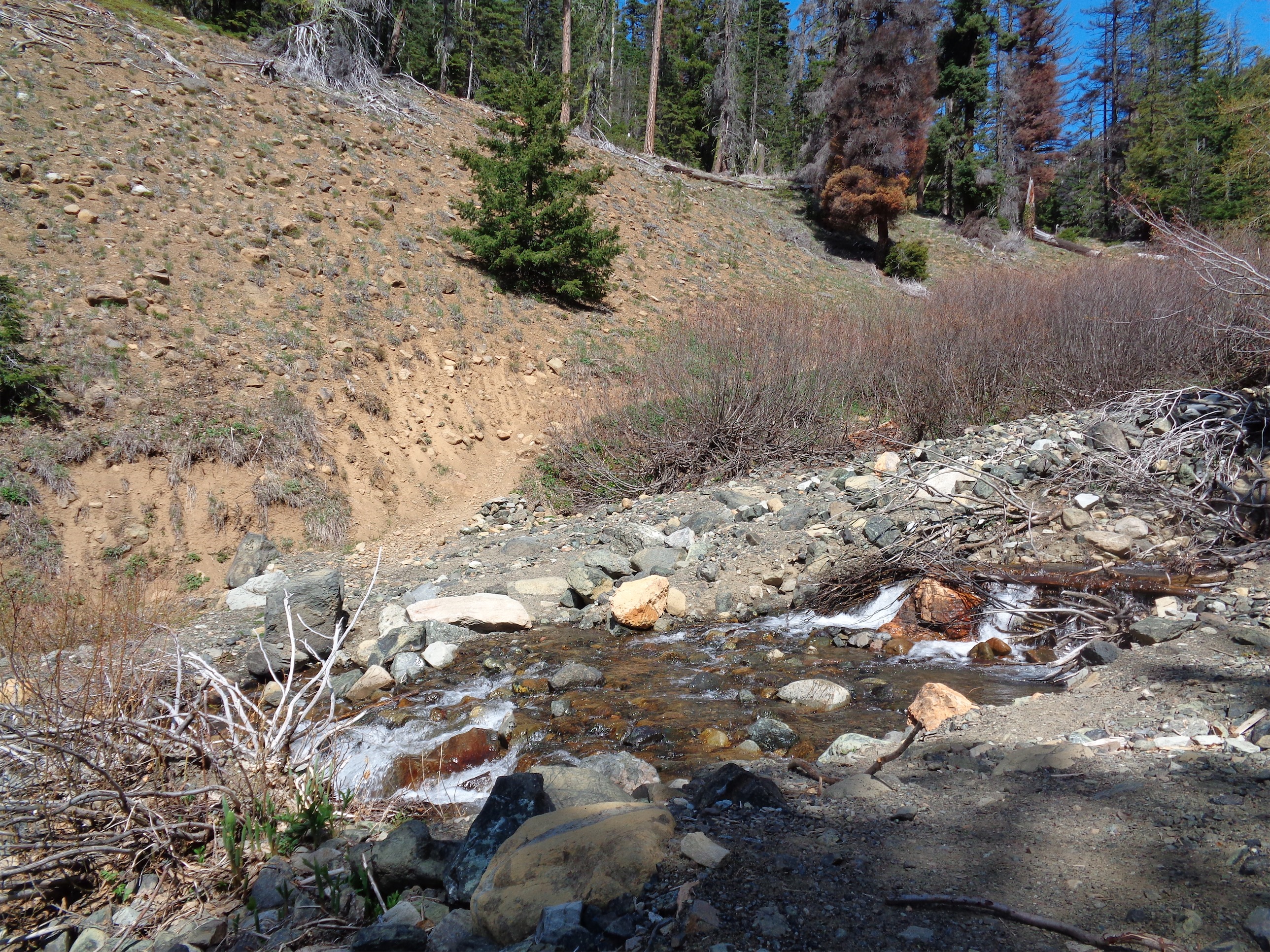
Trail next to Bean Creek
I got started earlyish in the morning. I hate sitting in traffic, so if I can sneak out at 6:30 or 7am and beat the Seattlites (who seem to wake up late compared to where I come from) then I’ll do it. I like to hit the highway, throw on some trance music, and enjoy cruising through the mountains. That’s how this went. Snoqualmie Pass was rainy, and when I crossed over into the sun, there was an enormous freaking rainbow in my rearview mirror. Even the road to the trailhead had been smoothed over! No potholes until the last mile, which turns off the main Teanaway road, that was rougher. I got to the trailhead around 9am, and took off.

Anyone know the name?
The first half mile of the trail is along an old road that leads to the Beverley campground. It’s marked with pink tape in case you somehow manage to lose a trail that’s six feet wide. When you come to an intersection between the “Beverley Turnpike” and the Bean Creek trail, take the Bean Creek trail. The trail follows alongside the creek, with glacier lilles and some other flower I haven’t figured out yet blooming all along the sides of the path. You listen to nothing but the river and birds chirping, a great break from the city.
Don’t underestimate it. Alternatively, don’t be clumsy.
You can see Earl up ahead to the right for most of the hike, but Bean doesn’t come into view until you’re towards the end of the creek. There will be a few peaks that look important, but they turn out to just be shoulders of Judy. The first creek crossing looks easy but don’t be fooled. I dropped a pole and it nearly got swept away. And on the way back, I stepped on a rock that wasn’t as firm as I thought, and it rolled and dumped me into the water. I’m graceful.

Wonder how long it’ll be there
Keep following the creek until you cross it one last time and face a fork in the trail: the right takes you up switchbacks to Earl, and the left, temporarily labeled “Bean Creek Basin Trail” will take you to the basin, which you can follow up to Bean Peak.

Cairn leading you across the basin (Judi’s on the left, Bean on the right)
The trail was almost completely snow free until the basin, which had patches of snow here and there. If you look carefully, there are cairns leading you across the meadow, and a small boot path (lightly traveled trail in this case, not prints in snow) appeared on the other side. I followed this until it disappeared beneath patchy snow and rocky scrambles, and started to make my own adventure.

Looking west along the ridge to Judi’s
There was a small outcropping of rock above me, which I figured couldn’t possibly be Bean Peak. So I continued to traverse west across the slope, aiming for a huge, rocky snowy peak that looked imposing enough. I didn’t want to cross too many avalanche slopes, so I mostly snuck along rocks and gained a low point on the ridge. I did take out the ice axe for a few small snow fields, but they could have been skirted. Microspikes were completely unnecessary. Again, one of those gaining-the-ridge moments where suddenly you see everything below you, Ingalls on the left and Stuart to McClellan in front of you.
I turned around, and wait a minute – that rocky outcropping was huge. Shit. Was that Bean Peak? I found a flat (ish) rock along the ridge and whipped out my map. Yup. That was Bean, and I had been aiming for Not Bean Peak. God dammit. Okay, backtrack. I scrambled down a bit and went back across the snow slopes, and then climbed back up towards Bean from the west. I wasn’t sure what to expect since most approaches I had read were from the other direction, but it was very doable, though a bit steep and exposed at parts. The way back down on the east side was much easier.

The Stuart range from Bean Peak

Sneaky register! Yes!
I dropped my bag behind me and took a quick snack break at the summit to admire the views of the Stuart range as usual. I still wasn’t 100% convinced that I was on Bean. If only there were a summit register or a plaque or something. I turned around to grab water from my bag and look! A PVC pipe! That can only mean one thing. Summit register! I unscrewed it and the notebook was frozen solid. I lay it in the sun to dry, but of course it just got soggy. I tried etching my name in pencil, but I don’t think it stuck. My original goal of Not Bean Peak was actually Judi’s Peak.

Looking east down the ridge to Earl, Navaho on the far left
The clouds to the west were a little menacing without the rainbows of earlier, and they were creeping east. It wasn’t even noon, so I glanced over at Earl and debated walking the ridge to bag a second peak for the day. Given the clouds (and the fact that the wind had just changed direction and picked up) I decided against it. Going down was much quicker than going up, and I made it back to the basin in no time. Past the junction between the basin trail and the Earl trail, I ran into two happy hikers in shorts and sneakers with nothing. “Where does this trail go?!” I looked them up and down and suggested the basin, since they didn’t look like they’d be down to climb snow and rocks to bag some peaks. The basin is a worthy destination in itself. In fact, there are several peak loops you can do if you want to bag up to 9 peaks in a single trip, and the basin might be a good place to camp before starting. Here’s a map for five of them, and the others are Earl, Mary, Judy, and Bill, though you might have to get creative for some. Oh, and maybe run the easy parts if you’re aiming for a high number.
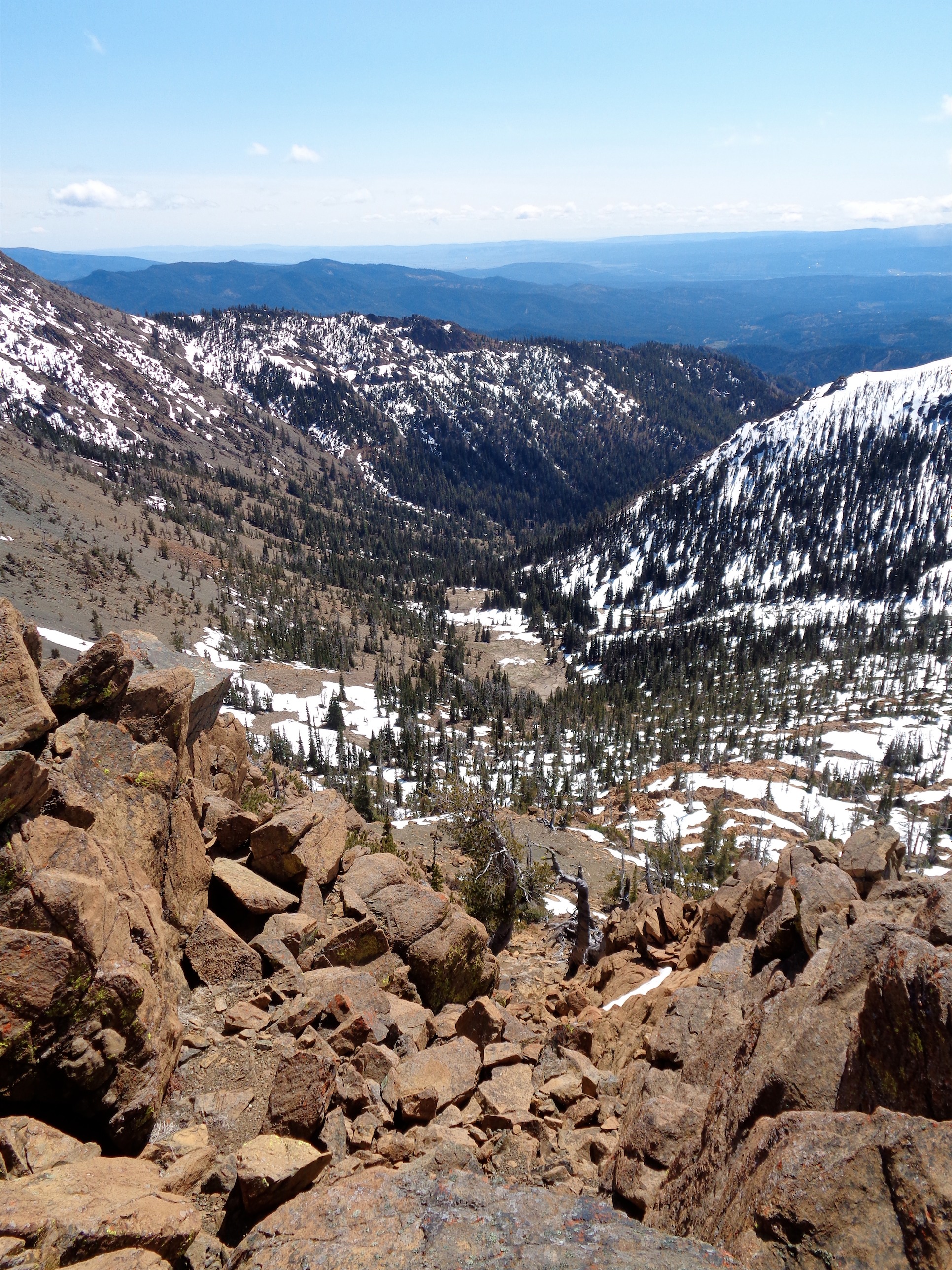
Looking down a scramble at the valley below
Getting back to the trailhead, I still had over 5 hours of daylight, so I thought I’d drive a bit further and check out Red Top Lookout. This peak had foiled me and a few buddies back in December. We wanted to go sleep somewhere under the stars on the east side for a meteor shower, and Red Top Lookout seemed like a good choice. Short hike, high elevation, we just forgot one thing: just because it hadn’t snowed in a week didn’t mean that there wouldn’t be ice. In fact, the entire road was beneath several inches of ice. I got as far as I could in my Accord and waited for my friend in her pickup truck, assuming she’d be able to get farther. Turned out her truck was rear wheel drive. Even worse for ice. We had to backtrack to find where she got stuck, and help push her truck all the way back down the forest road. Oh, I should mention it was about 1am.

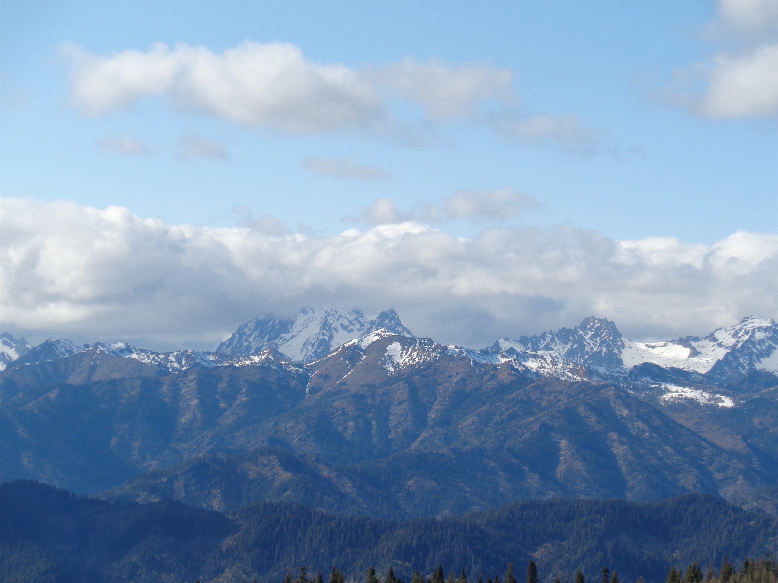
Cloudy Stuart range from Red Top Lookout
So seeing the road in daylight was quite a change. If either of our cars had slid off the road that night, we’d have been toast. Luckily the road is now completely melted out. Still rough in places, but passable by any car that’s willing to take their time. You can see the lookout pretty much from the parking lot, so you know it’ll be a short hike. I got to the top within a few minutes and damn was it windy. The hike to the lookout is less than a mile round trip if you skip the agate beds. It was so windy that I wanted to just be done with it, so I took the short route. Of course the lookout was locked as well, but the views were spectacular. I could look back and see the Stuart range now in clouds, and the peaks I had been near in the shade. I chose a good time to leave. I’ll go back to Red Top to check out the geology in the area, since it sounds pretty rich (albeit a little picked-over by now, according to WTA).
Zoomed in pic of Stuart
The Bean Peak hike has it all. Creeks, wildflowers, waterfalls, snow, scrambles, views. Here’s my Strava map, you can see where I overshot Bean Peak and ended up on the ridge between Bean and Judi’s. Because of that, the mileage and elevation are slightly less than Strava says. You know when you have those days where you actually realize you’ve made progress towards something you’re learning? This was one of those days. Six months ago I’d never go off trail, or find my own way up to a peak, or scramble anything solo, nevermind a class 3 (okay, mostly class 2) area I had never done before. I didn’t even think twice about all of it until I was on my way home. It’s a good feeling.
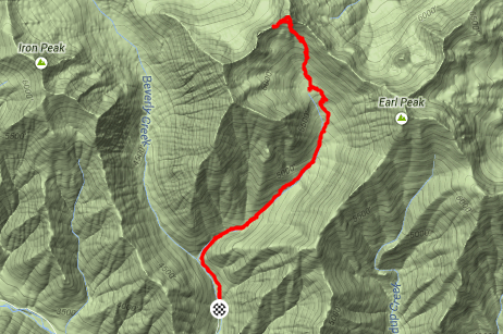
Strava Map of Bean Peak

You should open a Seattle branch of Strava.
LikeLike
Pingback: Earl and Bean Peaks | Have Tent, Will Travel