

View northwest from the summit
After a slow start to Thursday, I figured I didn’t have enough time to tackle a brand new peak, so I went somewhere I was already pretty familiar with: Hibox Mountain. I hadn’t done it before, but the first half of the trail is the Rachel Lake/Alta Mountain trail, which was one of my first hikes out here and a personal favorite. I had seen the small spur that leads to Hibox last time, but had no idea what it was. Hiked 6/4/2015, this was my chance for an answer!
- Distance: 7.7 miles round trip
- Elevation: 3960ft gain, 6547 highest point
- Commute from Seattle: about 1:20 without traffic
- Weather: 70’s and sunny with a ridge-cloud-scare
- Did I Trip: Yes but the plethora of veggie belays saved me
Forecast was “partly sunny,” and driving through Snoqualmie Pass I was expecting worse. Thick clouds everywhere, some drizzle, pretty mediocre. I decided to take my chances with Hibox instead of going all the way to Earl, since I didn’t feel like driving another hour. The road to the trailhead has recently been graded, and was much better than the last time I was there. Not a single pothole, you can cruise along at 30mph spouting dust and dirt behind you if you so desire.
Getting to the trailhead, I had the first casualty of the day. Actually the only casualty besides pride and disappointment (to be discussed later). The first casualty was my god. Damn. Shoelaces. Which ripped. And I didn’t have extras. Shoelaces, that is. I had three other pairs of hiking shoes, so I grabbed my La Sportiva Synthesis and threw those on instead. Shortly after my brief minute of stomping around and throwing shoes and laces on the ground and swearing, two people came up and asked me where the trailhead was. Ha! No, I can’t laugh, the first time I did Alta I couldn’t find the trail either. It’s across the gravel road from the parking lot. I directed them to it, packed up the rest of my things, signed in at the trail register, shook my head and grumbled about my boots, and started to put one foot in front of the other.
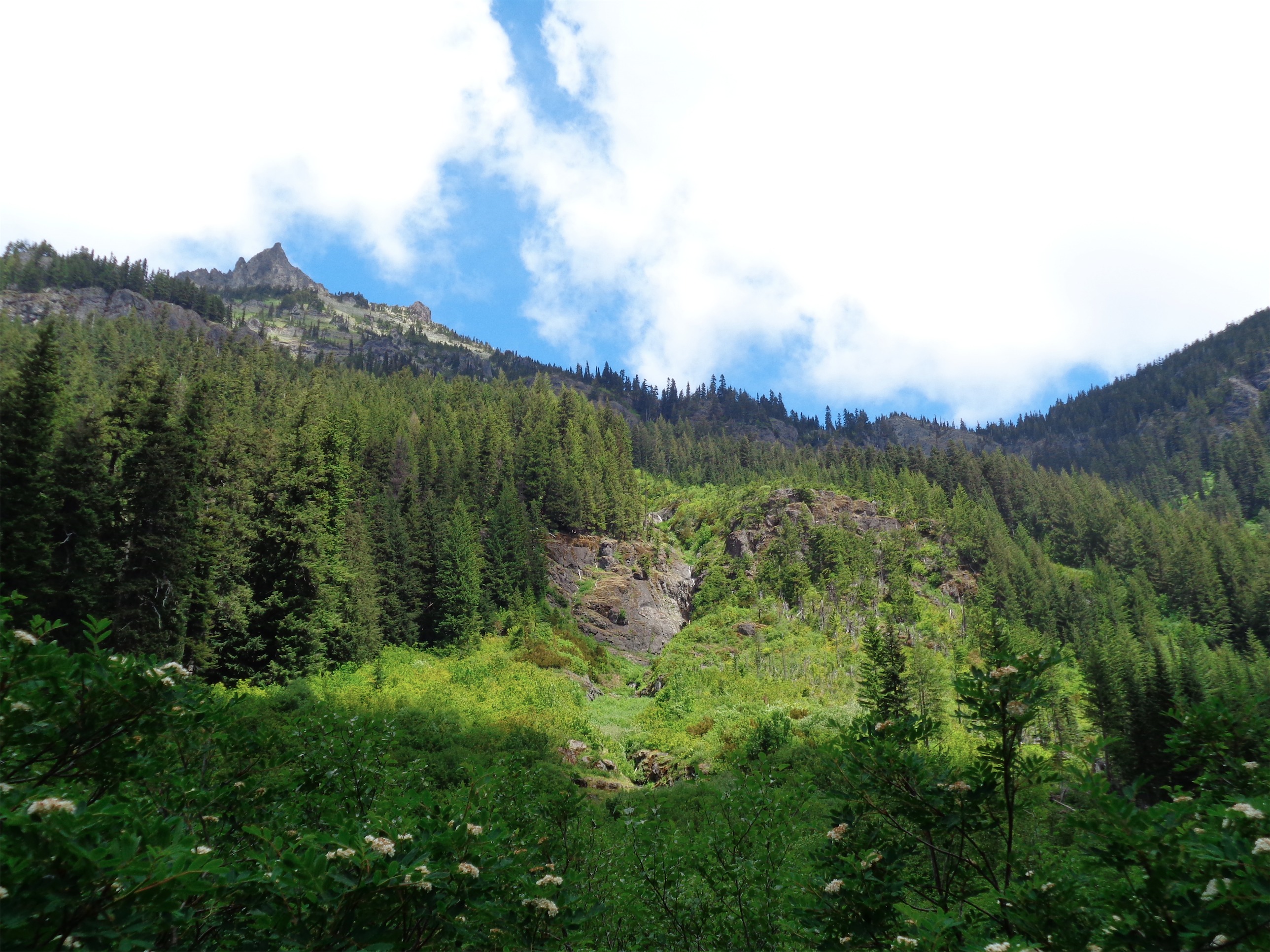
Hibox above the meadow
The first 2.3 miles of the trail are flat and very well groomed. This is why it’s a favorite trail run. The turn to Hibox is about 2.3 miles in, after you pass through the second big meadow with great views of Hibox above you looking nice and pointy and intimidating. I had heard the trail was doable, but this was another “okay, one step at a time and we’ll see what happens” hike. No one saw me leave the Rachel Lake trail. I snuck off to the sneaky Hibox trail.
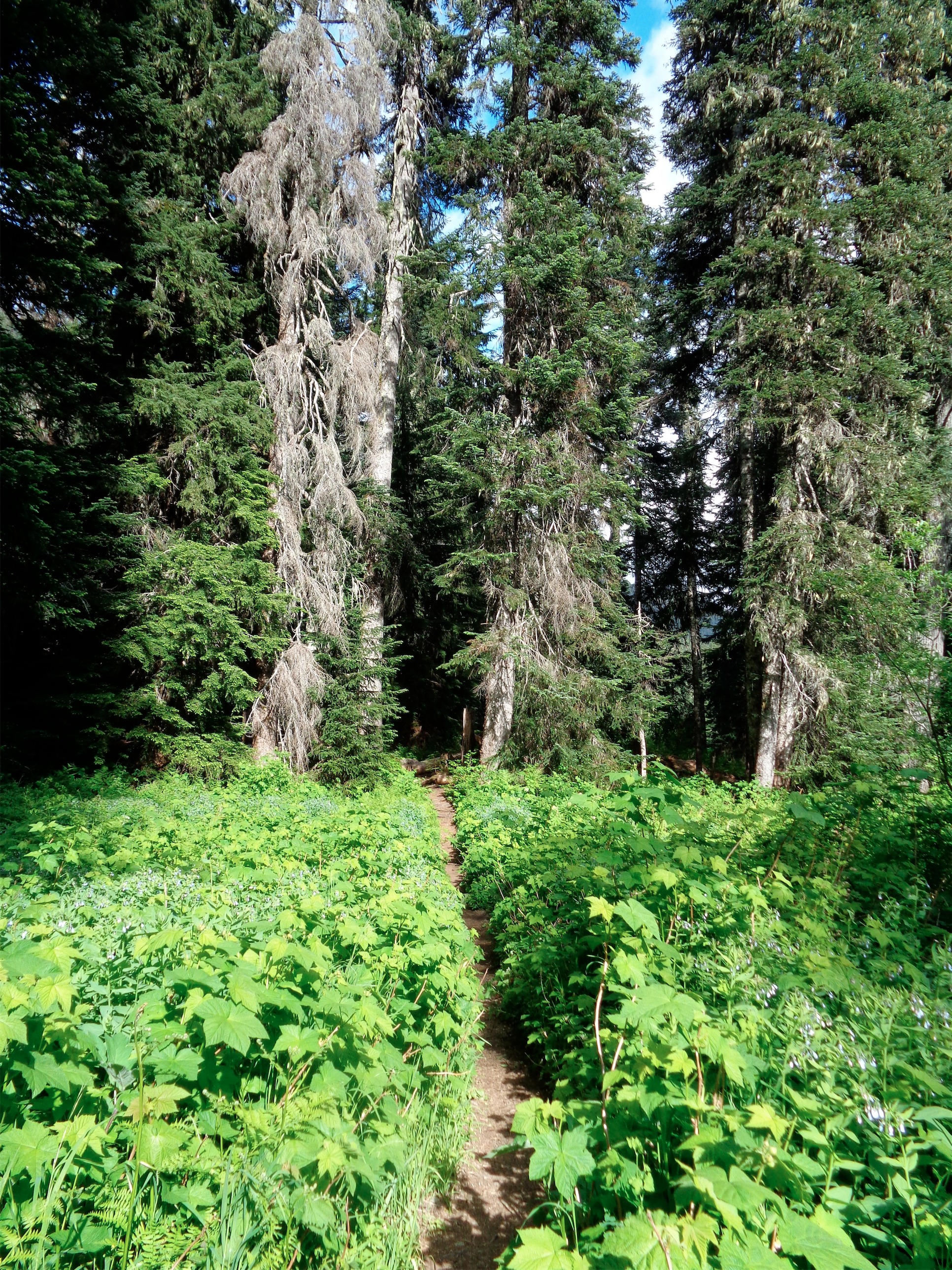
In my head, I’ve divided the Hibox trail into three parts once you leave the Rachel Lake path. The first third is through forest. Steep, full of roots, it’s not really a trail. Even “bootpath” is a generous label. Lots of blowdowns, lots of veggie belays, lots of fighting branches and leaves and spiderwebs and ants only to pop out 15ft later with the “trail” somehow still in front of you. It’s a test of picking which logs have been stepped on the most and following those. There are a few clearings to cross and the trail attempts a few switchbacks, but overall it’s you vs the woods.

Rampart Ridge beyond the wildflowers
The middle third is meadows and some light scrambling. And meadows mean views and wildflowers! Rainier is finally creeping above the clouds in the distance, and Rachel Lake was sparkling in the sun. The clouds spilling over Rampart Ridge looked very neat, and I had a few brief moments of “FOMO” thinking about how awesome the ridge to Alta must be with one side in clouds and one side in sunny blue skies. I imagined it’d be like the ridge back at Mt. Townsend in January, just without snow (so not that cool, but close). But I focused on my own trail. Alta later, Hibox now.
And I mean, I can’t complain. The wildflowers were gorgeous. What’s that? You want me to climb up these slopes and rocks covered in yellow and red and pink and purple? Yeah I can do that. The trail through the meadow is very vague, but most of the social paths meet eventually, and just make sure you’re heading north, not quite towards the rocky summit. You’ll cut that way later.
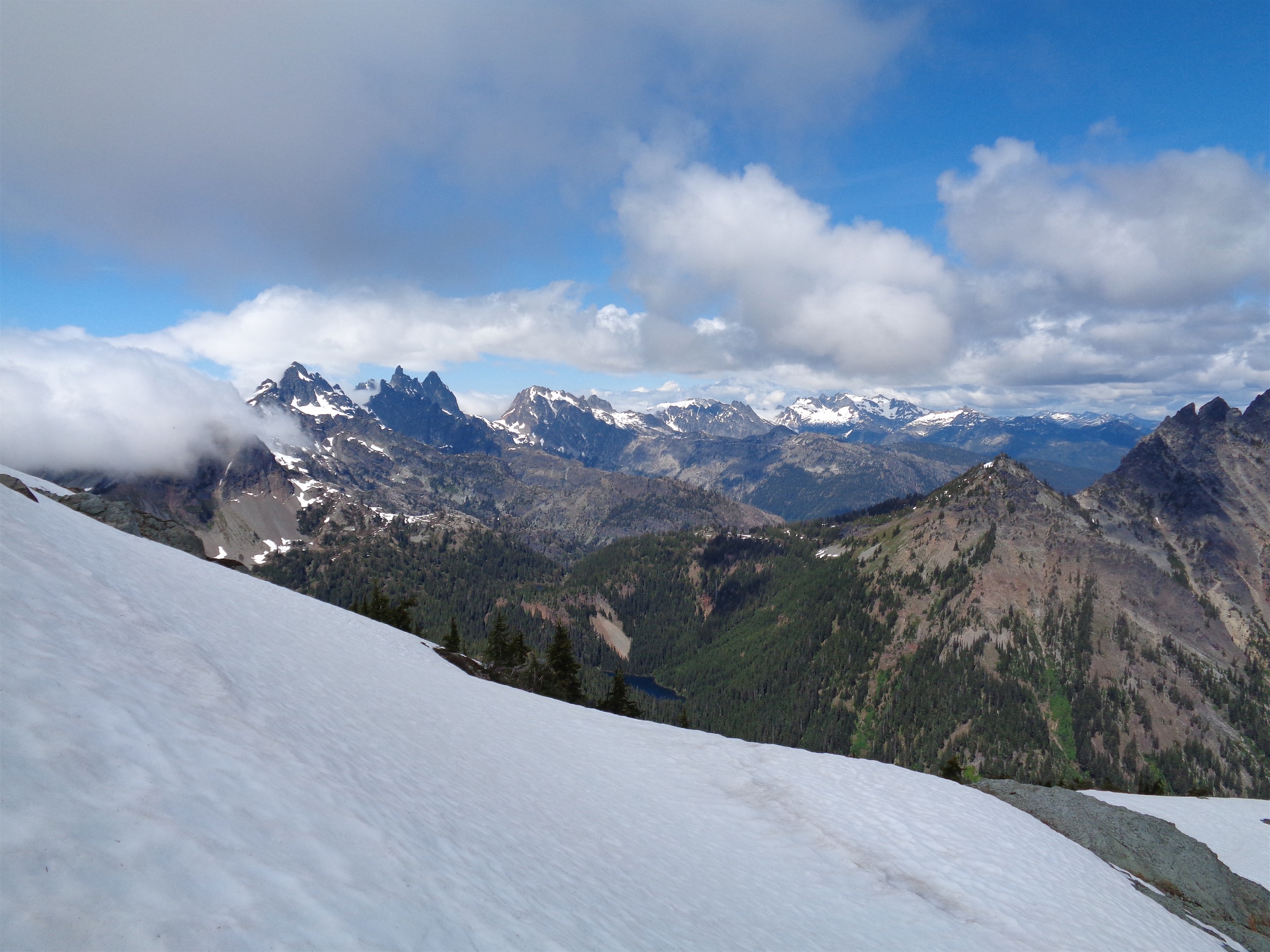
Lemah and Chimney Rock (and maybe Bear’s Breast?)
The third part of the trail is rocky talus fields and a third class scramble. The talus fields have almost no trail – a few cairns, but one led me to the wrong side of the peak according to the map and I had to backtrack. Essentially, you want to aim for the right of the scramble, so gain the ridge east of the peak before starting up the boulders. As usual, you have one of those “whoa…” moments where you get to the saddle and soak in the views below you on the other side that you had no idea existed until you got there. The best feeling. And in this case, that meant Lemah, Chimney Rock, Summit Chief, ugh. One of my favorite ranges. A little more remote, and very rocky and alpine looking. Spiky and snowy and damn do I need to find buddies to come climb those peaks.

Clouds over Alta coming towards Hibox
There’s a 15ft tall chimney to get past, though it looked like you could skirt to the left of it if you aren’t a fan of up-and-over. From there, just follow the ridge to the summit. It’s definitely class three, but not as much exposure as I thought, and not as long as I thought either. Only the very last part is a scramble. I couldn’t find a summit register but I’ll settle for a USGS plaque, I guess.
The coolest thing about this hike was the clouds. Rampart Ridge and Alta had holding off the clouds all day, and now they were moving down along the ridge towards me. I could see them roiling and they hesitated around Nobox (a less prominent peak between Alta and Hibox) but the clouds on the right kept streaming east. At least, I thought they were, until I watched the time lapse! They were just writhing and roiling, not actually moving. That’s pretty cool to think about, though. I was so convinced they had covered another peak by the time I left. Time lapse of clouds over the Chimney group, which I refuse to embed because I still can’t figure out how to make it not automatically take up the entire width of this column.

Goat!
Finally I saw a bunch of mist rise from beneath me, and got a bit spooked as the clouds were finally overcoming Nobox, my last line of defense. I didn’t want to downclimb in thick fog, so I wrapped everything up and scrambled down damn fast. I took another break just below the talus field, since the rest would be easy navigation. And of course, the clouds never got me. They stopped just short of Hibox, and I bet I missed a damn good show up there, too! Regrets. I kept looking behind me to see if the peak was finally covered and it never happened. Interestinly, the summitpost page mentions that Box Ridge seems to keep the lousy weather on the west side “boxed out,” and keeps it from slipping onto the east side of the Cascades. This was a pretty good example of that.
Going down honestly wasn’t much faster than going up. Back through veggie belays, wishing I had stiffer, higher boots (damn LACES! Eff!) and scraping ankles and calves all along underbrush. Oh, are fire ants a thing in Washington? An ant got stuck in my pants and I didn’t realize it until it had bitten my ass several times. Yeah, you can laugh. I laughed a little, after I cried. I kid, I didn’t cry. I just swore a few more times. Something about the woods makes me more crass.
Section of the Rachel Lake trail
I was a little bummed to be back in the forest. If I had more time, I’d have tried to bag Alta too, with a quick dip in Rachel Lake. Or, you know, if I could teleport. Or if I had worn my trail runners. But alas, it was already 5pm, meaning I’d be back at the trailhead around 6, meaning I’d avoid Seattle traffic! Yes!
No one saw me come back from the Hibox trail either. I was hoping there’d be someone nearby, to exclaim “whoa! Where’d you come from!?” and I could be the ghost hiker who came out of the woods in the middle of nowhere. I actually didn’t pass anyone besides a girl taking her dog for a quick walk closer to the trailhead. There were tons of bugs in the fields and cottonwood seeds (I think? those cottony clusters that float everywhere that aren’t dandelion seeds come on I know what dandelions look like) hovering in the air, and they had settled on the surface of the river I had taken so many pictures of last time. The pussywillows were all leafy now instead of having their fuzzy pieces, but it’s pretty cool knowing what they are.
Hibox was a totally cool hike. Hibox Strava Map, and I have GPX files as well if you’re interested. It was tricker than Alta and I believe 400ft taller, and (okay, I haven’t been to Alta’s true summit just yet) I believe it has a better angle of my favorite sneaky ridgeline. I’ve been eyeing Three Queens, which has similar views, so we’ll see how feasible that is in the near future. But Hibox had views and scrambles and bushwacking and a little minor route finding, all while convincing myself I was on a secret trail. Pretty solid for a relatively close, afternoon hike!
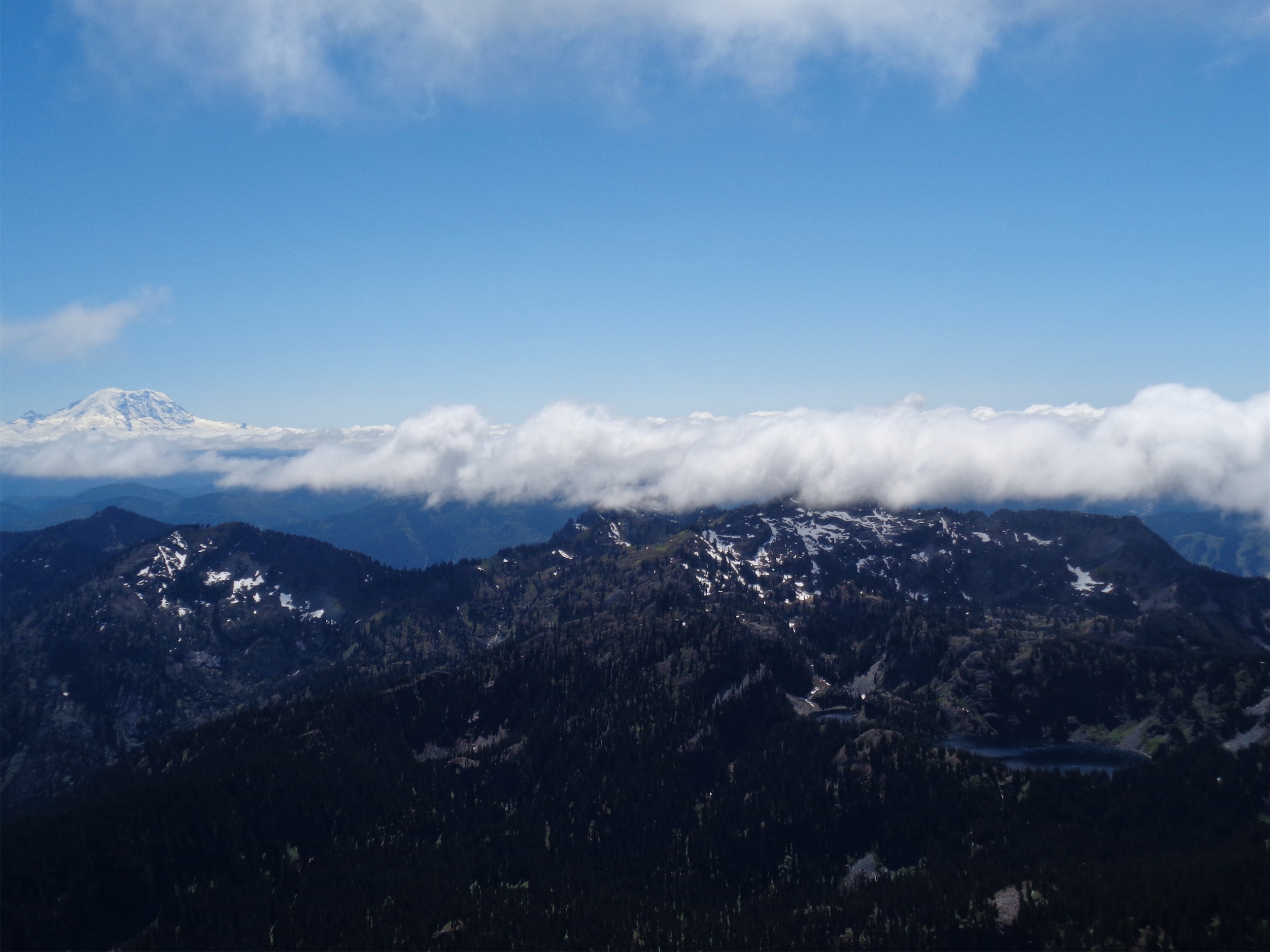
Rainier poking above the clouds

Pingback: Spring Training | Have Tent, Will Travel