
The three musketeers!
- Distance: no idea. 9 miles? 7 miles? Short for how long it takes.
- Elevation: ~4000ft gain, 6210ft highest point
- Weather: foggy until we got above the clouds, and then 40’s-50’s and sunny!
- Commute from Seattle: 90 minutes
- Did I Trip: I was going to count everyone’s slips/trips/wipeouts on the way down but I forgot to keep track! But yes. And we had two twisted ankles, some muddy butts, and a very tired dog.
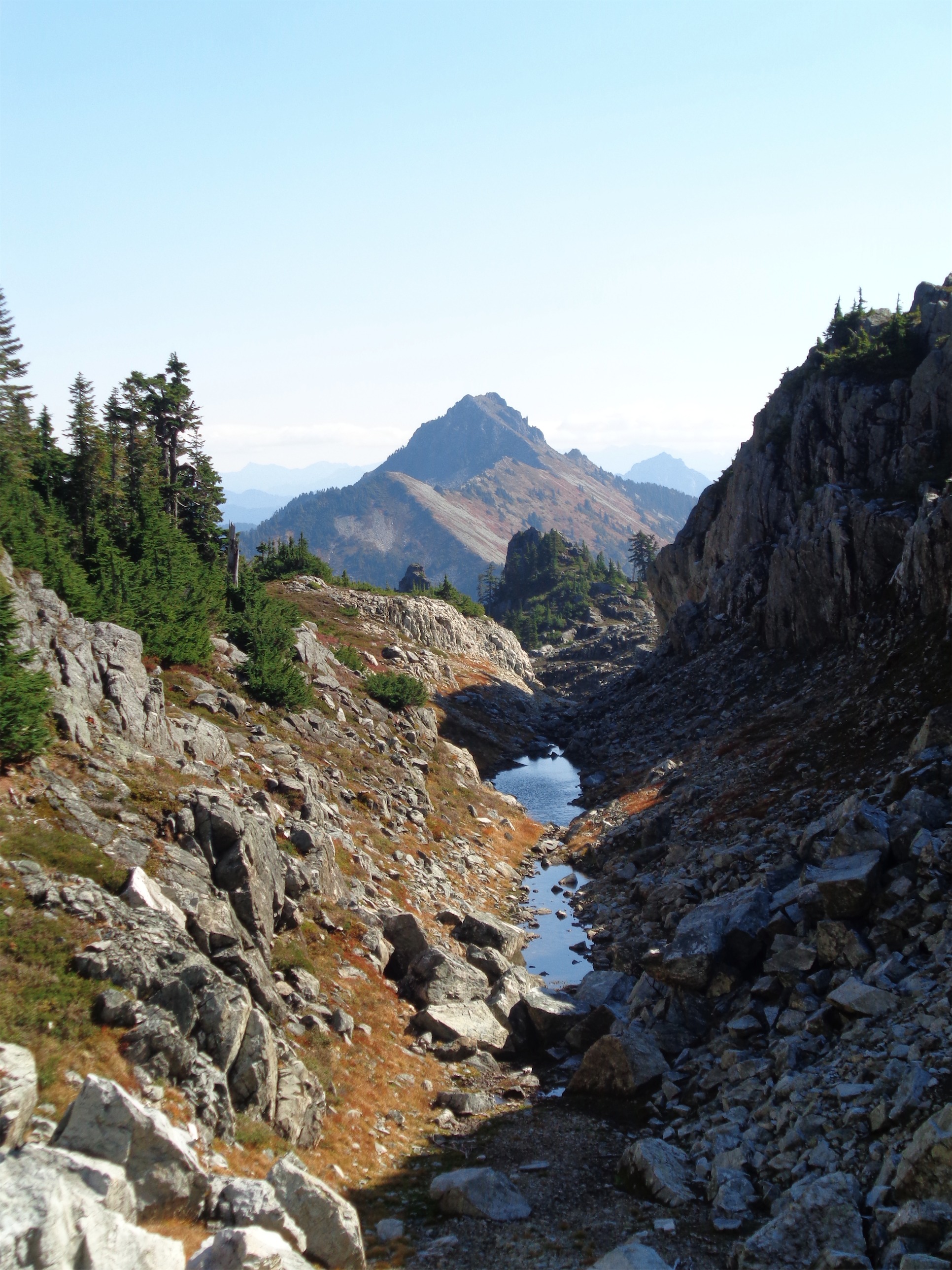
Tarns in front of Townsend
Now I’m writing this three weeks late (and posting four weeks late) because I’m busy lazy, so we’ll see how much I remember. We drove out in pouring rain. Halfway there, sitting in traffic (on Rt 2!) in the dark dreary wet weather I realized I didn’t even care, I was just happy to be getting out. We were listening to Reel Big Fish, who can’t be happy listening to that? We even stopped on the way to get steak and veggies for a campfire meal. I’ve never really cooked over a campfire before besides sausages and stuffed mushrooms and other wrap-it-in-tin-foil-and-go, so this was new.
We pulled up to the trailhead, still in pouring rain. I set up my tent and layered up for the weather, and we started grabbing big rocks to set up the fire. With some small miracles (and a starter log, or two) we had enough of a fire going to heat up food, and John cut up the steak while I handled veggies. I eventually admitted I had never made a shishkabob when John had to assist with the peppers. The only instructions were “make them a good size so they don’t fall off the skewer” which I apparently could not handle. For you other newbies, that means like ~1″ in diameter.
Post-shishkabobs, it was bedtime. Another rainy night in a tent built for snow, though at least I remembered to open the vents this time. We had alarms set for 5am, and soon enough, we woke up to… more pouring rain. The general consensus was that we’d keep sleeping, so I rolled back into my sleeping bag burrito after peeking out the door.
Ripley looking damn good on one of the first scramble sections
We got up for real around 7, and made hot chocolate and coffee. After about an hour, the mist started to brighten, and then clear, and we got a glimpse of blue sky. We had originally resigned ourselves to doing Barclay Lake or Mt. Baring, but… you know what? Eff it, let’s try for Gunn. Might as well. Summitpost said it might take around 9 hours, and we had 9 hours. We all had headlamps and were content coming back after dark if necessary, assuming we had good blazes. Sweet.
The trail is back down the road, maybe a tenth of a mile from the Barclay Lake trailhead. There’s a small dirt road that leads to a campground, and it’s right before the campground that you’ll find the trail heading off to the right. When we were there, it was nicely blazed with hot pink blazes. Rob had brought orange tape for us to use, though we didn’t need it in many places.
Up and up and up
The trail goes maybe 150ft through a forest before you cross the stream, which was easy enough with plenty of logs and stones to hop across. I imagine when the water’s higher, it’s a bit more tricky. Once on the other side, the trail continues along what might have been a logging road at one point. I couldn’t tell besides the flat grade, but when someone pointed it out, I could totally see how it might be possible.
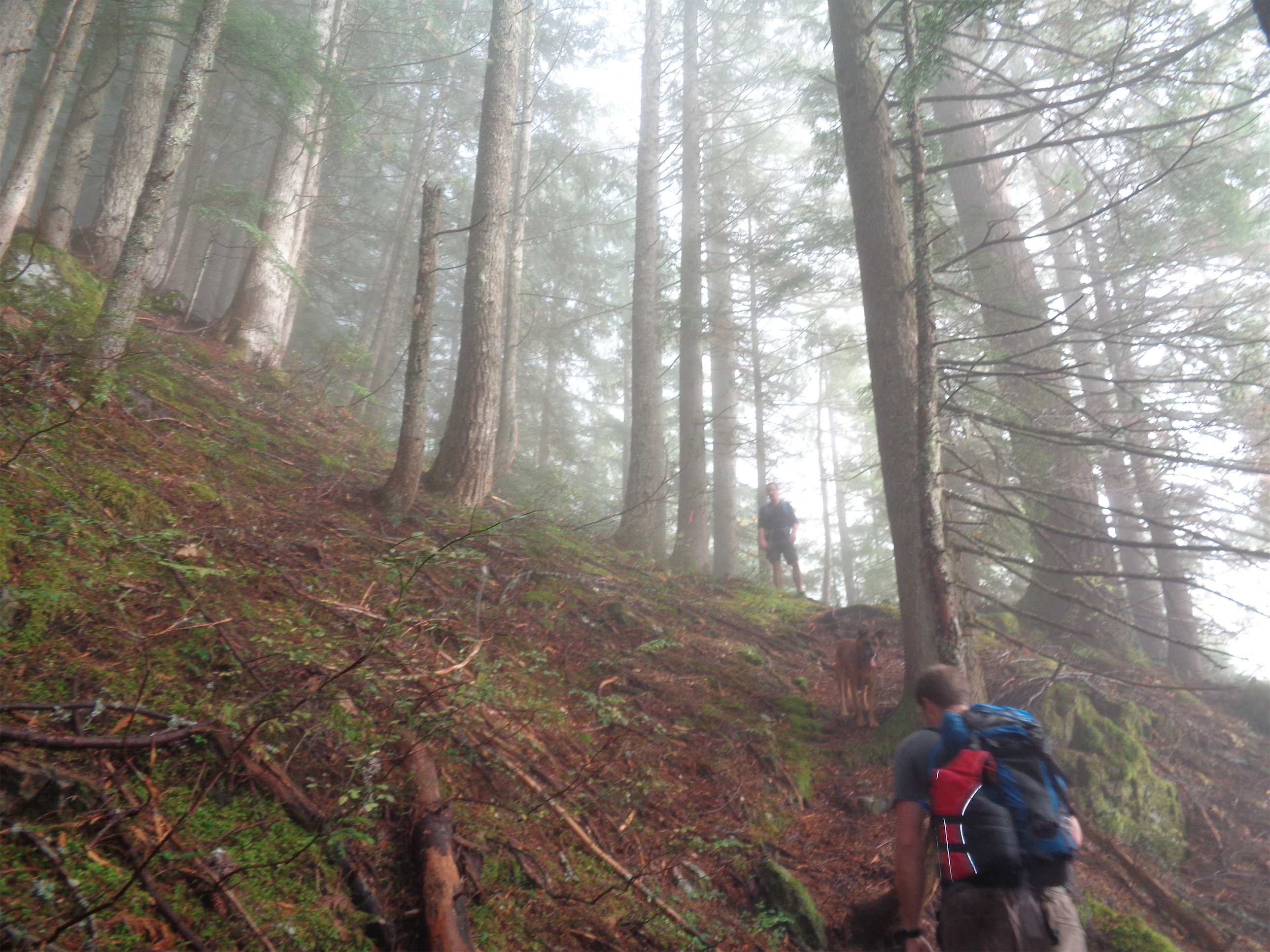
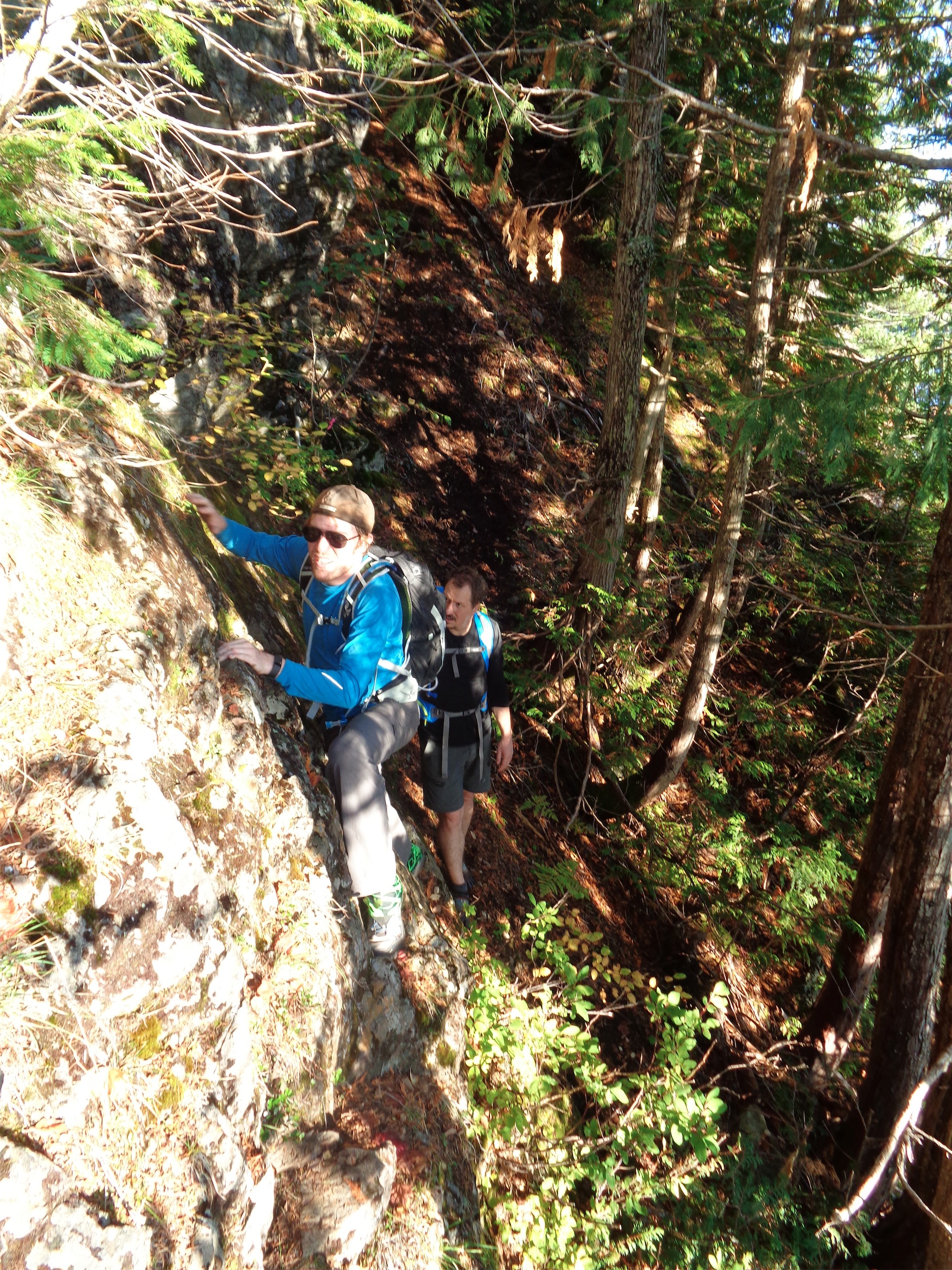
Don’t get complacent. The trail starts to go up, up, and up after a quarter mile on the flat forest-reclaimed road. It was reminiscent of the Eldorado approach, except I wasn’t carrying 50lbs. Just lots of roots, steep sections, and eventually, something I forgot existed: scrambles in the woods! After pushing aside plenty of tree branches along the bootpath and constantly being showered by water, we reached a rocky cliff, at which point you turn right and pretty much hug the rock for a while.
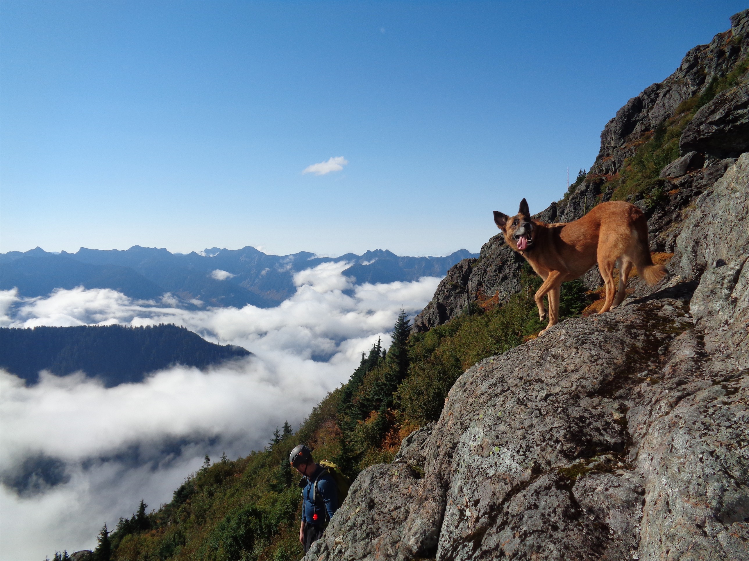
I always associate scrambles with open views and exposed rock. But there are some that are surrounded by trees, moss, roots, all those foresty things. We had Ripley (John’s dog) with us, and he had brought her life jacket (it has a handle on the back) in case we had to do a doggie belay and carry her up some sections. The first scramble was just a very short “traverse” to stay on the path, covered in moss and dripping with water because of the previous night. A few minutes after this, we reached a section that is probably a beautiful waterfall on occasion, but was pretty dried up this time of year. Cross that and immediately scramble up to the left and back into the trees. Yeah, this hike makes you work for those views.
Finally getting above the trees and brush, Baring in the background
Eventually the trees shrink into bushes and brush, and it feels like you’re making progress. But the brush isn’t much better. It’s thicker, harder to push out of the way, and does a damn good job of obscuring the path. And since it was all still wet… it all rains down every time you squeeze between bushes. But thanks to those blazes and the fact that much of it was trampled, there were few spots were we had to guess. I honestly expected it to be much more of a bushwhack than it was, but I think this late in the season, enough feet have been up there that it’s a little more well traveled.
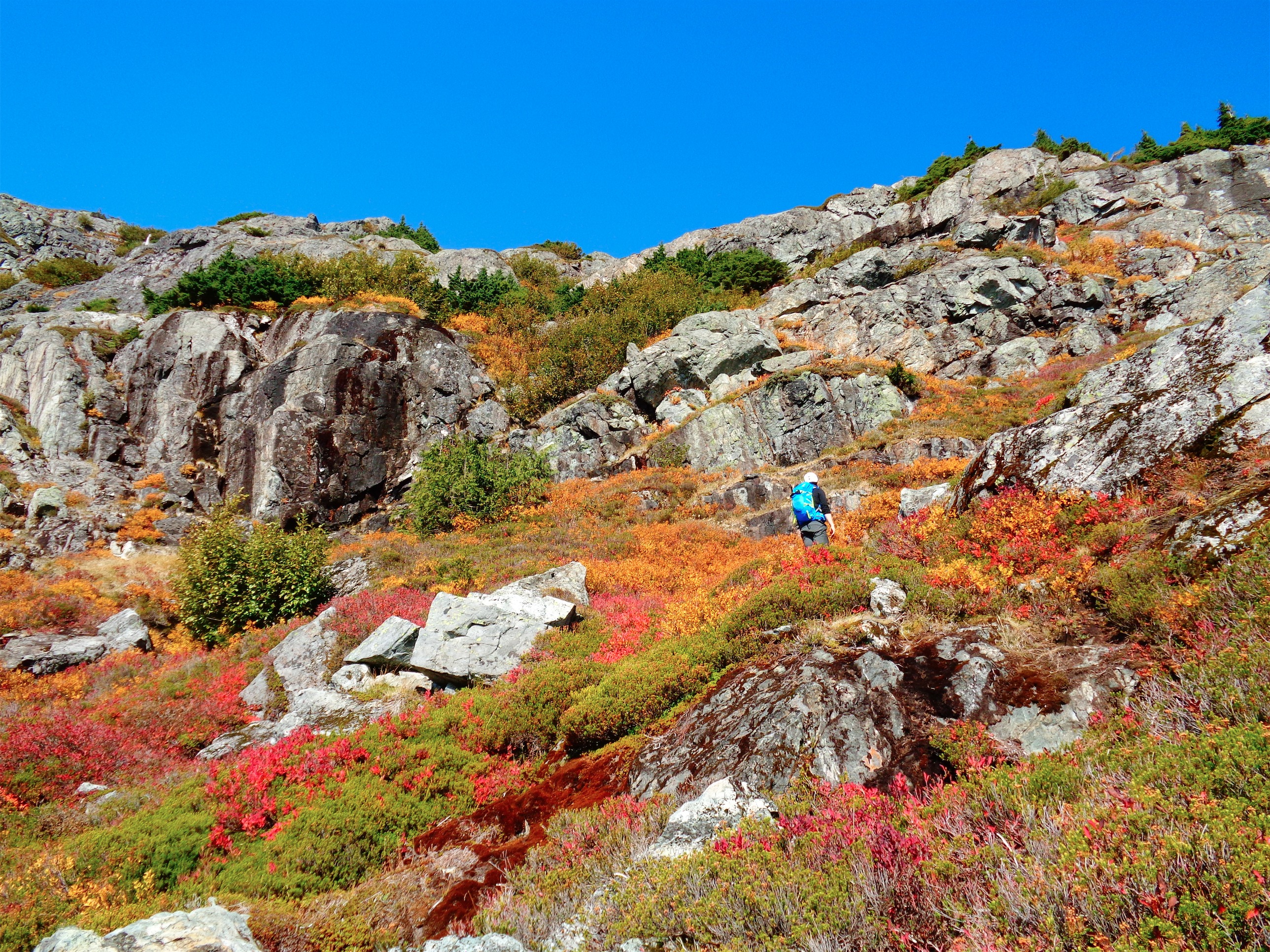
I mean there was some fall foliage
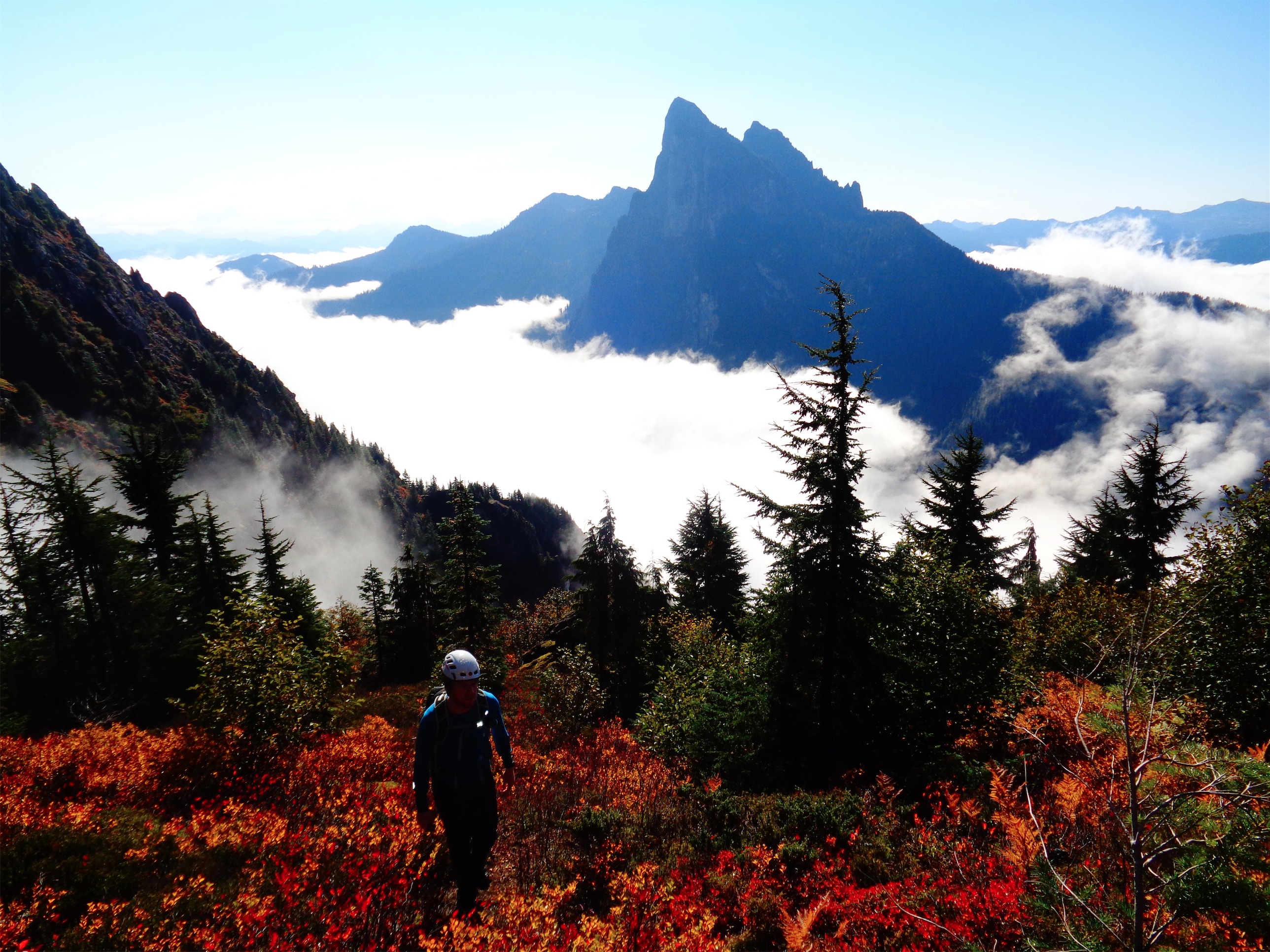
Despite it being early October, there was only one section with real fall foliage, but damn was it vibrant. Finally we were out of trees, out of tall bushes, and surrounded by low colored, blazing heather and blueberry bushes and some scrubby plants I don’t recognize. I stood around snapping pictures constantly, and since Baring was in full view standing over the clouds I couldn’t stop. I had NO idea that there were pics so dramatic so close to Seattle. I thought most of the hikes within an hour or an hour and a half were more “rolling hill” style, with rounded tops, below the tree line, things like that. Not the sharp, dark rock we were looking at here. It felt so much more remote than I had expected.

Looking back at everyone approaching the talus field, Townsend and Merchant in the background
There was a bit of a bootpath through the fall foliage. We reached a saddle between Tailgunner and Peak 5760 (which I admittedly might be confusing with Point 5760), just east of Tailgunner and just south of a small valley with a few tarns near the base of Peak 5760. We dropped down almost to the tarns but rather than take a pleasant dip we hung left towards the talus field. The route to Gunn Peak is effectively straight across the talus field to the highest clump of vegetation right below a prominent rocky outcropping on the south face of the peak.
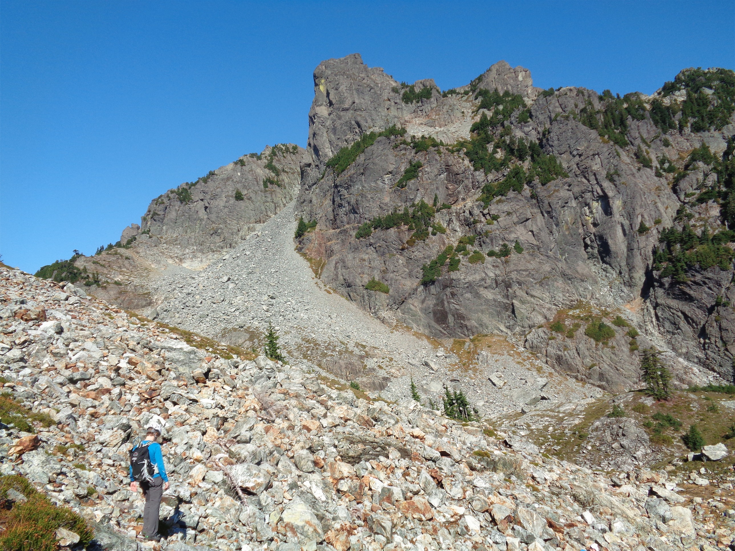
Aim for that highest slanted strip of trees below the rocky outcropping in center frame

Rob on the 3rd class scramble
We each chose our own way across that, and rejoined below the cliff band, which is where the real scrambling starts. Ripley had been a champ so far, but the 3rd class scramble was a bit too much for a dog. Ben, Vazul, and Evan agreed to hang with Ripley and take her over to Tailgunner while Rob led John and I up Gunn. We agreed to meet back at our lunch spot on the ridge between Tailgunner and Peak 5760.
Rob scaled the scramble with ease, and I waited below for him to clear the loose sections. When he was out of sight and well beyond the trees, I went up. I will say that some people (such as Rob) are very graceful scramblers. I am not usually among those. But there was nothing too hard, and I was up and in the trees soon enough, trying to find Rob. I had been making fun of him for putting up blazes for the entire hike, and now I didn’t know where he was. Ooh look! A blaze, just beyond the trees! Yes, aim for that, he must have put it there!
Nope, just a leaf. God dammit. But I was back out on another talus slope above the trees, and saw Rob up ahead of me scouting out the path. I figured we should wait for the others, so we decided he’d scramble a little further to figure out where we were headed and I’d wait to see who else joined.

John on the way back across the catwalk
After 10 or so minutes of waiting, the two of us were ready to continue when we saw John pop out of the trees below us. Sweet! We waited for him to catch up. You keep to the base of the cliff, negotiating talus until a gully opens up on your left side. Follow the gully, path of least resistance, and cross a notch when you reach the ridge. On the north side is where you’ll encounter the catwalk. It’s not Kendall Katwalk, it’s much narrower with a harrowing drop of 1000+ feet. Don’t fall. Follow that ridge, and soon enough, you’re on Gunn Peak! Which, despite being only 6200ft tall, is #29 on the most prominent peaks of Washington list with over 3651ft of prominence. Wow.
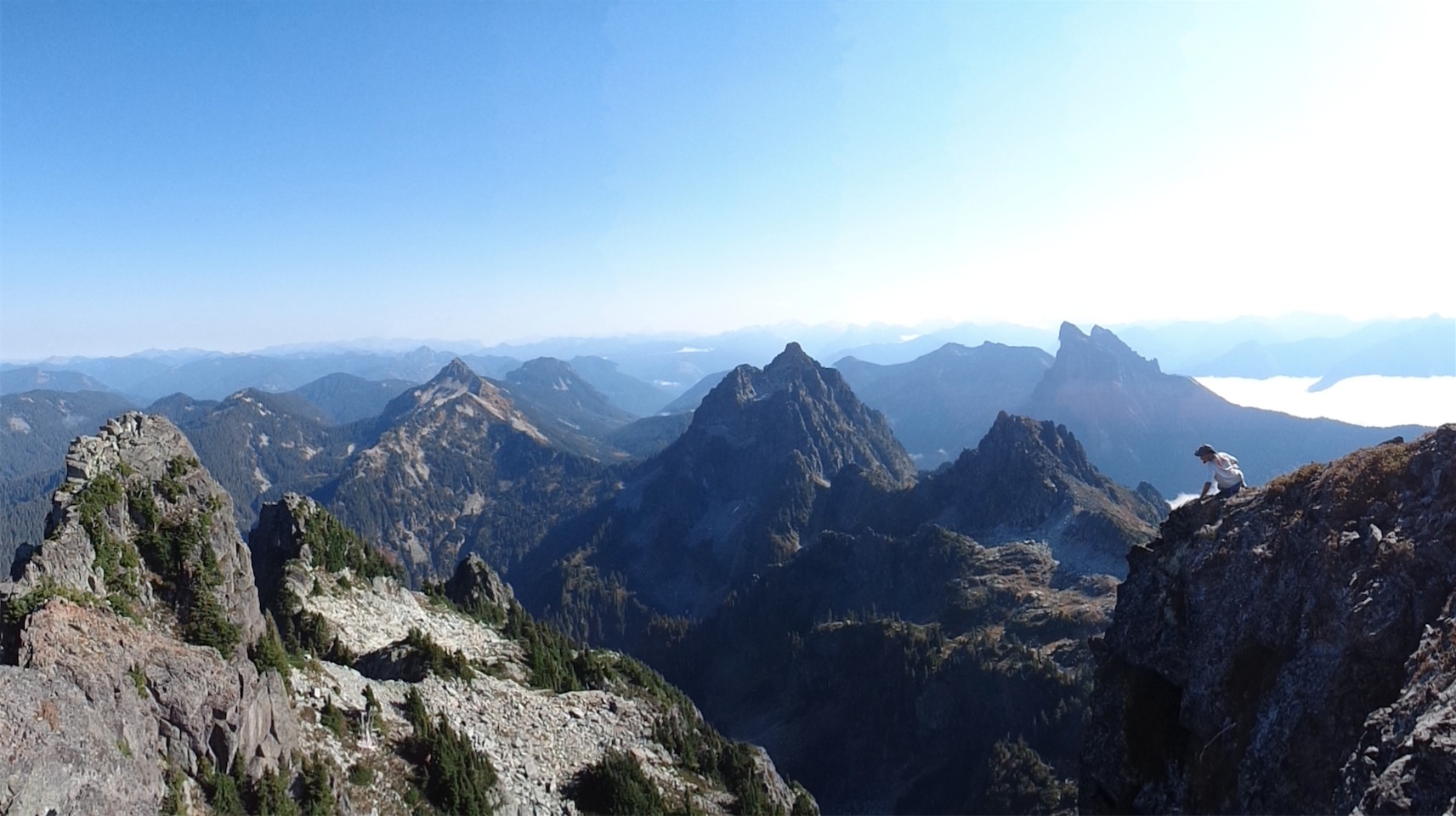
Rob soaking in the views: Townsend, Merchant, and Baring all visible
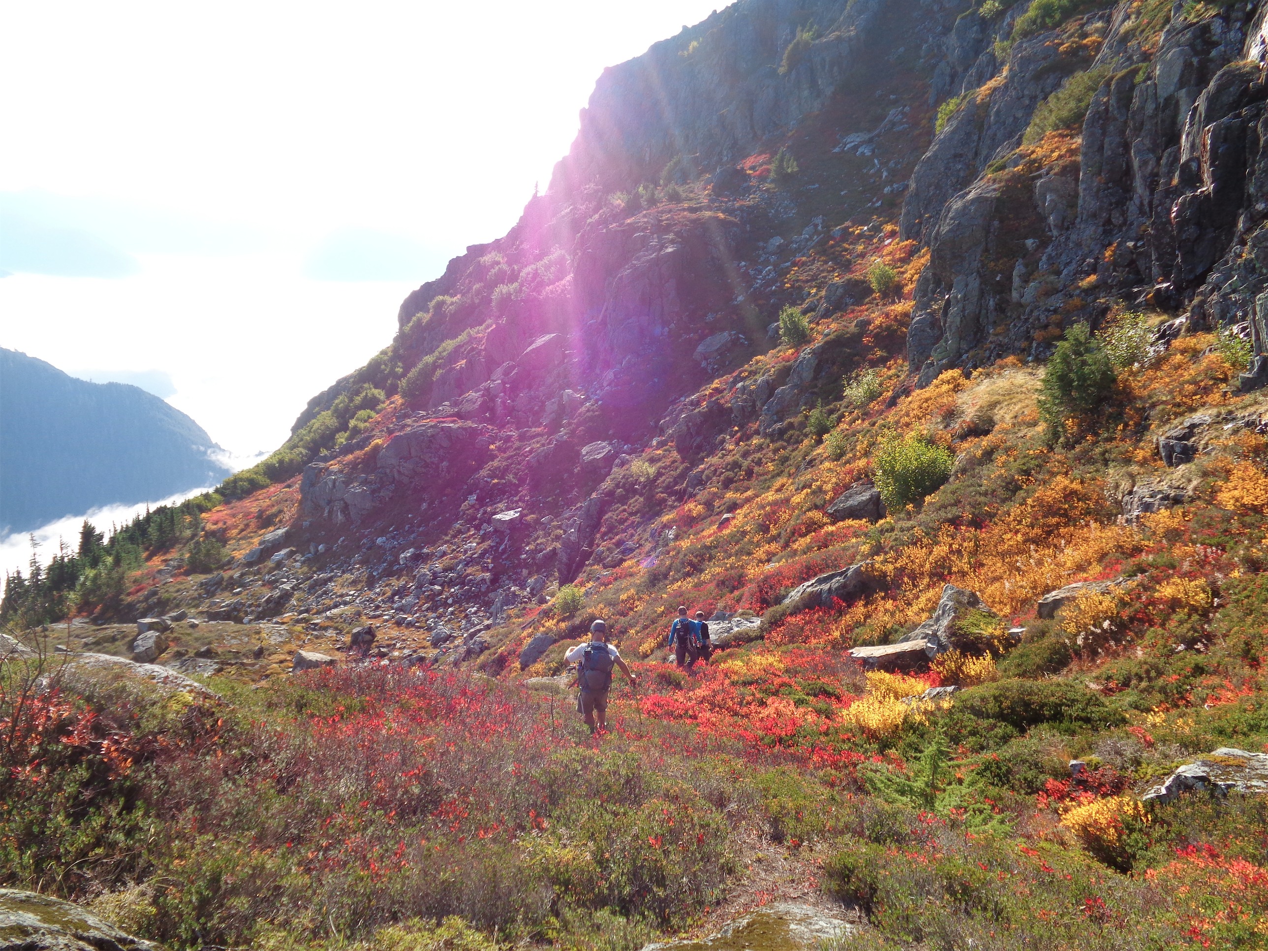
Back through the fall foliage, even more vibrant in the late afternoon sun
Just as we sidled up to the clearing, we saw the other three coming back down. Perfect timing! We had spent quite a while on the summit, and I thought the rest of the group would be waiting for us. We met up and took a quick break before heading back down. I thought the way down went faster than the way up, but I’m a bad judge of time. Vazul and Evan and I were flying, and I got into a nice steady downhill rhythm. We stopped occasionally to wait for the others. At one point we were convinced they were lost near the sometimes-it’s-a-waterfall crossing, between someone yelling to ask where we were, general shouting, and the warnings (“ROCK!!!”) and what sounded like mini rockslides everywhere. We sat on the steep trail and waited for them to successfully make it over to us, where we were solidly back in the trees on dirt trail with no scrambling left.
Evan on one of the foresty scrambles
In my head, I was comparing it to Eldorado, which had a bitch of an approach. Going down from Gunn, that’s what I was expecting. But the forested section was much shorter than Eldorado, and I was thrilled when we were on the flat what-once-might-have-been-a-road section. Poor Ripley was exhausted, but had kept up with us the whole time! Every time we stopped on the way down she sat on the ground and tucked her paws beneath her. But she didn’t seem to want to admit it, because she still looked damn happy.
We had been hearing gunshots for a while, and as we got closer to the river, we realized we were pretty close to the shots. I was unnerved, but didn’t think much of it. I think I’ve already mentioned I grew up in east coast cities, dealing with gunshots in deep, dense woods is not among my talents. Ben and John started yelling from the back, and Evan, Vazul and I looked at each other and said holy shit, we didn’t even think of that. Duh. Make lots of noise. The shots stopped, and John and Ben kept yelling periodically just to make sure. Within 15 minutes, we had crossed the river and popped out near the campsite, and apparently surprised the shit out of a few guys doing target practice, aiming across the river. Right where we were. But they had heard us, and had stopped, and I learned rule #1 of being close to gunshots while bushwhacking: make it clear you’re a person.

The best time of day for the woods
