I should have written this while the adrenaline was still pumping and my body felt great but alas, here we are a week later with a splint I can’t take seriously, a wrist that has hot pokers shooting from my elbow to palm, and a drugstore of painkillers i’m avoiding taking out of sheer stubbornness. An iron will is the only thing standing between me and buying the rest of the ice cream at the corner store and eating it until I have become an ice cream cone myself. Fortunately ambien is not in my drugstore selection or I’m sure I’d come around at 3am mixing a bathtub of ice creams.

- Distance: Well… ~29 miles. 19 on a bike, 4 pushing/trying to bike, 6 running, 6 hiking. “Wow, weird combo” yeah well. read on.
- Elevation gain: ~6k gain. 4500 on a bike 2500 hiking.
- Weather: 50’s and sunny!
- Distance from Seattle: 5hrs w/ the i90 construction
- Did I Trip: technically no… over the handlebars of a bike isn’t tripping right? It’s flying.
I finally left Seattle around 6pm. I had a pretty mediocre week but I was stoked to get out with Matt and Anita for an awesome bike followed by awesome campsite. I messaged Brooke and Amber at 8pm sitting in dead stopped traffic on i90. Why can’t one thing go right. I can’t even complain about the traffic because someone probably died to make it this bad. Oh wait, it’s construction. I can bitch. I stopped to fill my gas guzzling climate destroying mountain polluting SUV for the second time. The fuel gauge has been broken for years, I rely on the odometer, which has been fine except these new gas pumps are so sensitive and turn off so easily I never know if it actually filled up or not. Last week I had to fill my tank in 1gal increments up to 13gal, cursing the fuel pump for thinking it was full. Don’t lie to me.

Matt and Anita caught up to me on the forest road. I let them go since their headlights were blinding me and I could see my car’s shadow. This isn’t unusual, my headlights suck. Except when I parked, Anita said “you know a headlight is out, right?” No. No I did not. I pitched my tent next to my car and crawled into my sleeping bag, ready to have a weekend where the only focus was adventuring with whatever you could carry.

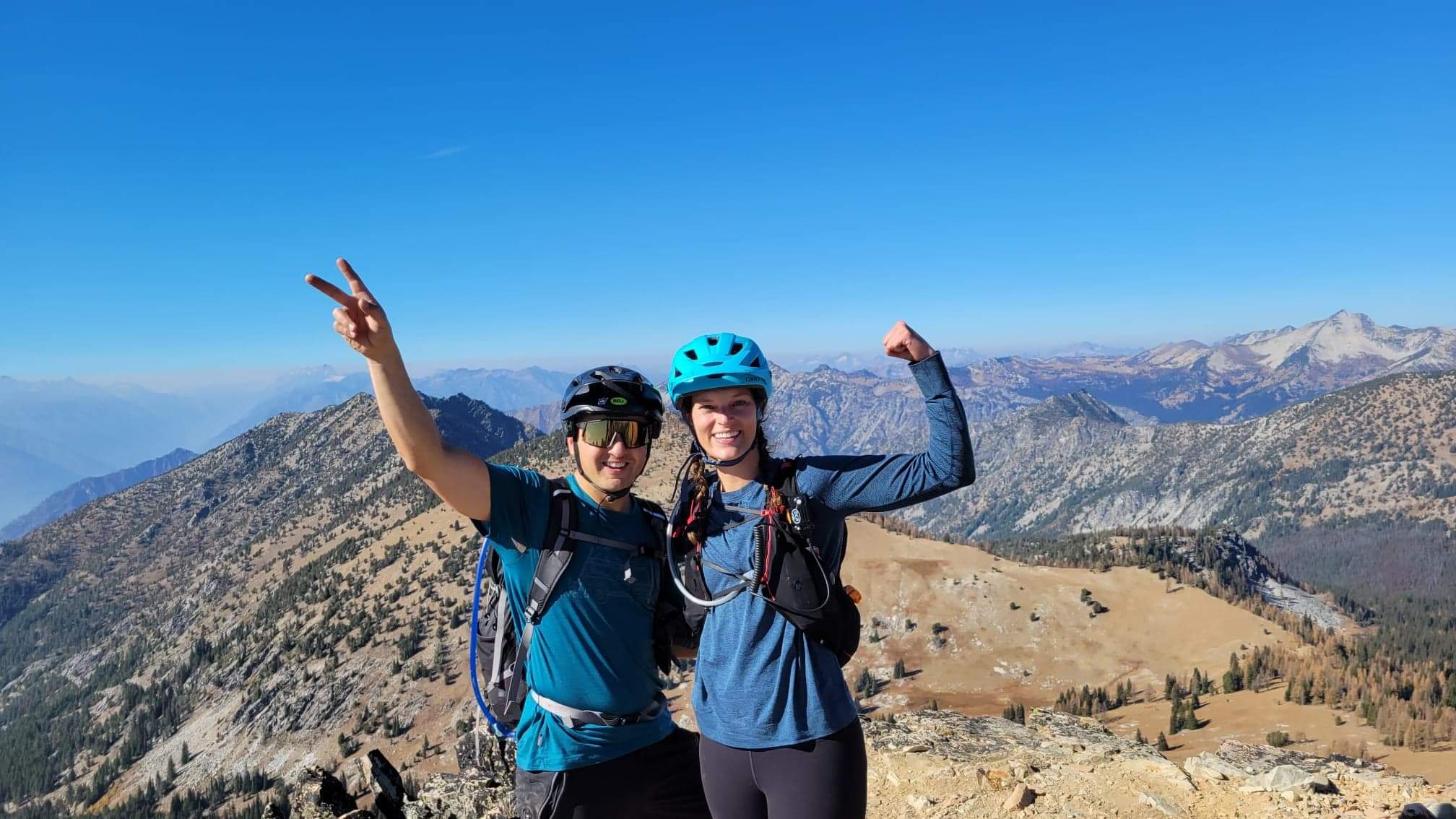
Saturday morning we got moving around 8am. The plan was for Matt and I to bike while Anita hiked to the lake with all of their overnight gear, we’d meet her at the lake, I’d bike back to the car and swap bike for backpacking gear and hike back up to the lake. “Don’t feel obligated!!” Anita said. “Totally fine if you end up wanting to crash at the car or head home.” “Anita,” I said with 100% confidence, “the only thing that would stop me from camping with you guys is if I literally got injured on the bike ride.” We laughed, and Matt and I took off.

The trail at first is smooth and mild besides one rocky section. But immediately I felt like crap! Usually I’m so good at climbing but I was walking mild uphills. I felt like I was slipping off my bike seat, and my freaking lats were getting tired hanging onto the handlebars. I figured it was because I lifted the other day, maybe it was just DOMS and it’d clear up after a bit. My legs felt strong, just like I was biking through mud. For once I felt better on the downhills than the uphills! You do get a few stretches of super fun downhill after you take a left fork in the trail (twice). I finally pulled over and told Matt about the weird seat. Does this look off to you? He laughed. Yes, Eve, it’s like entirely leaning backwards, how long have you been biking like that?! He fixed it in like 30 seconds so it was pointing slightly downward towards the front of the bike. So now I know how it’s supposed to be. I sat down and WOW. It was comfortable, supportive, and I was actually over the pedals. I’m not sure it’s ever been that comfortable. Felt like a million bucks. Alright. This loop is happening!

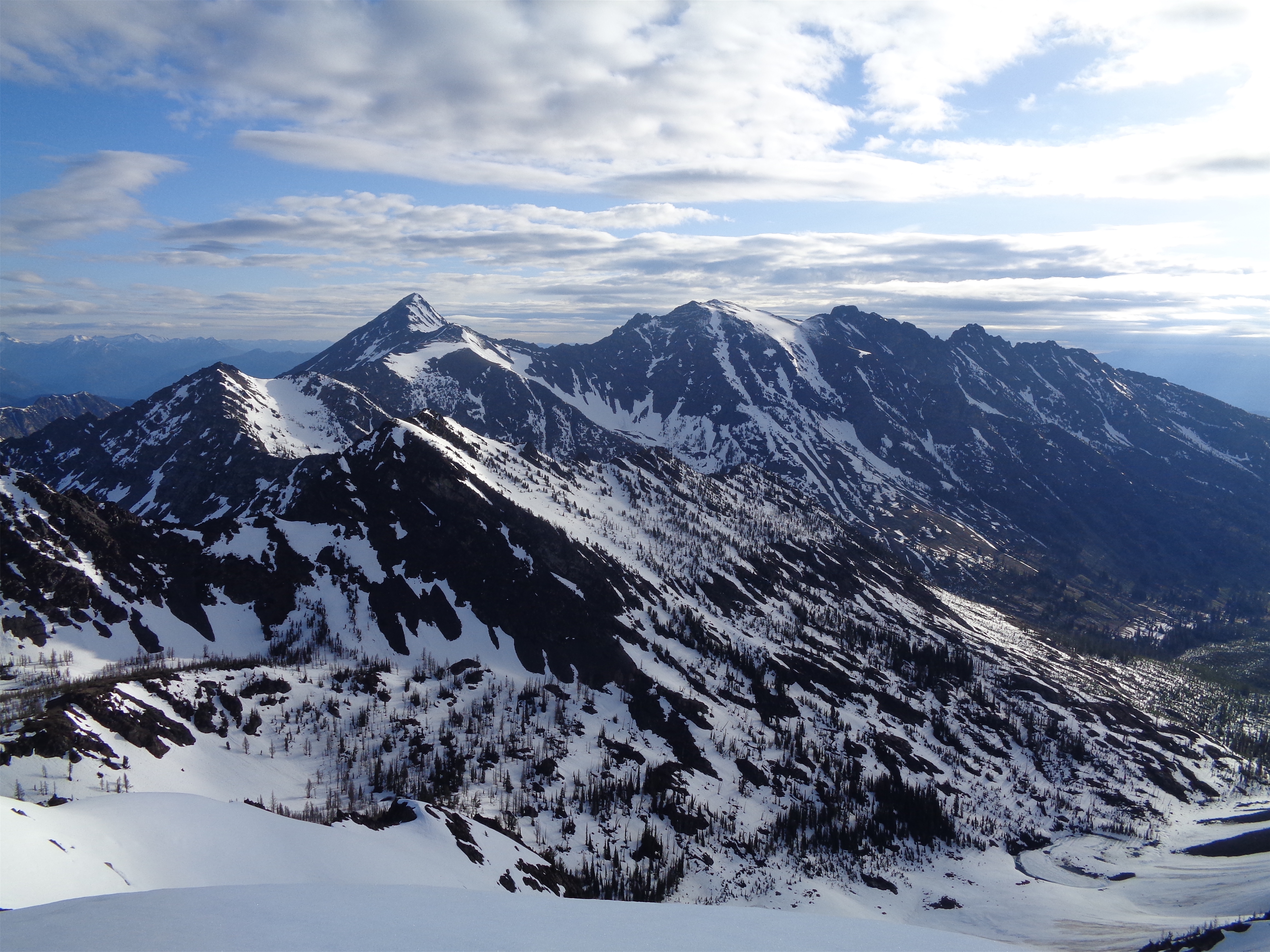
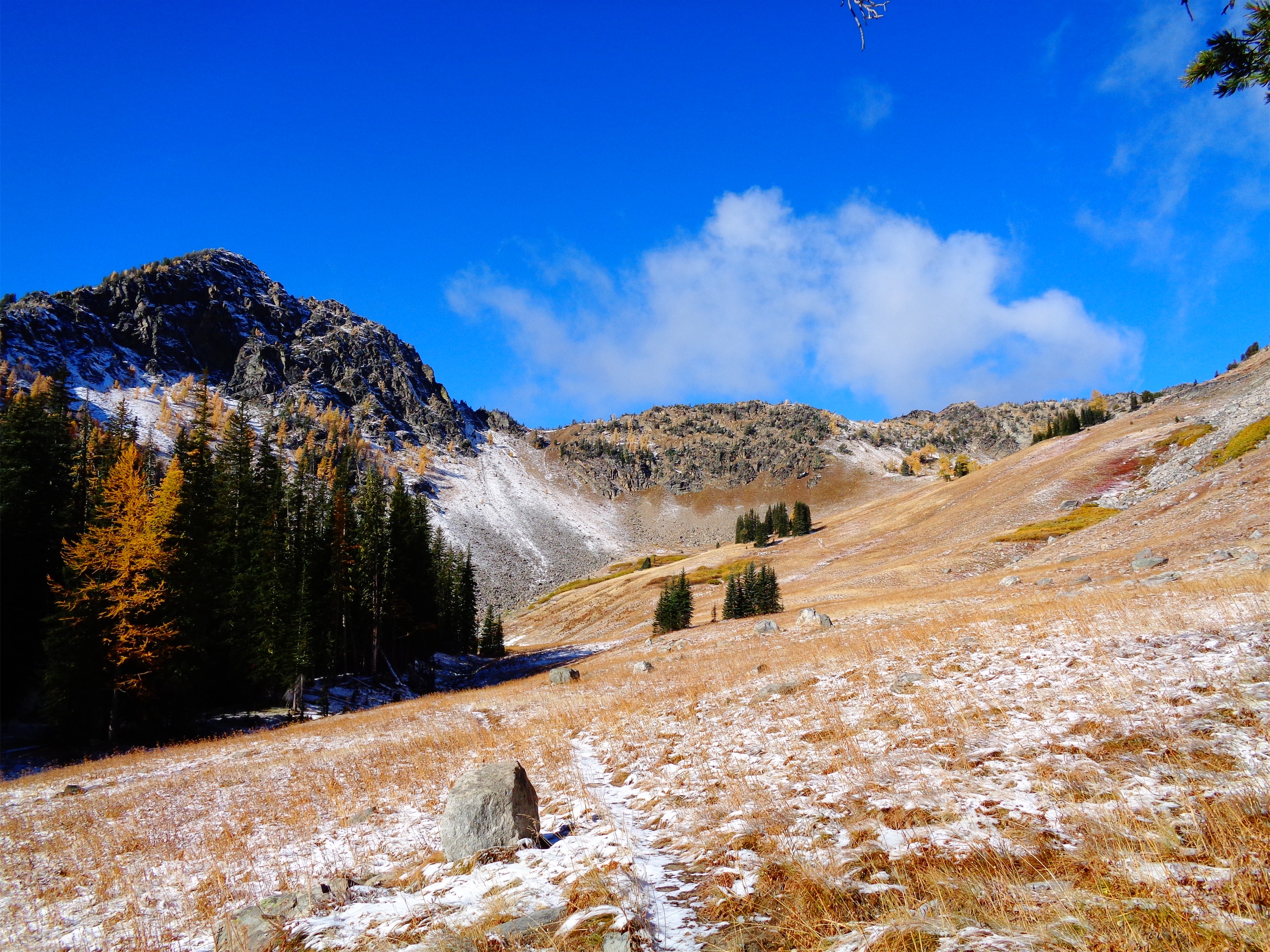
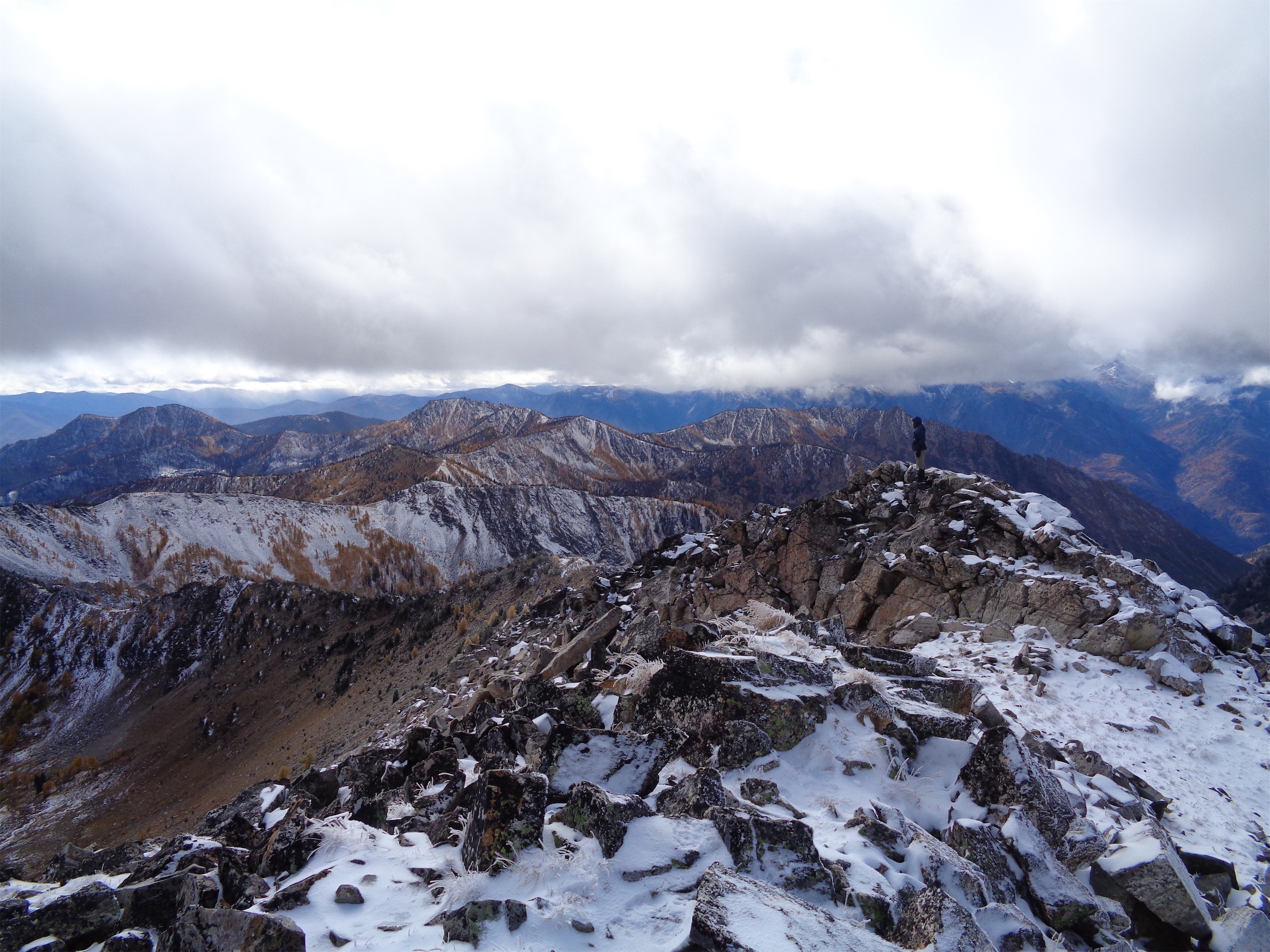
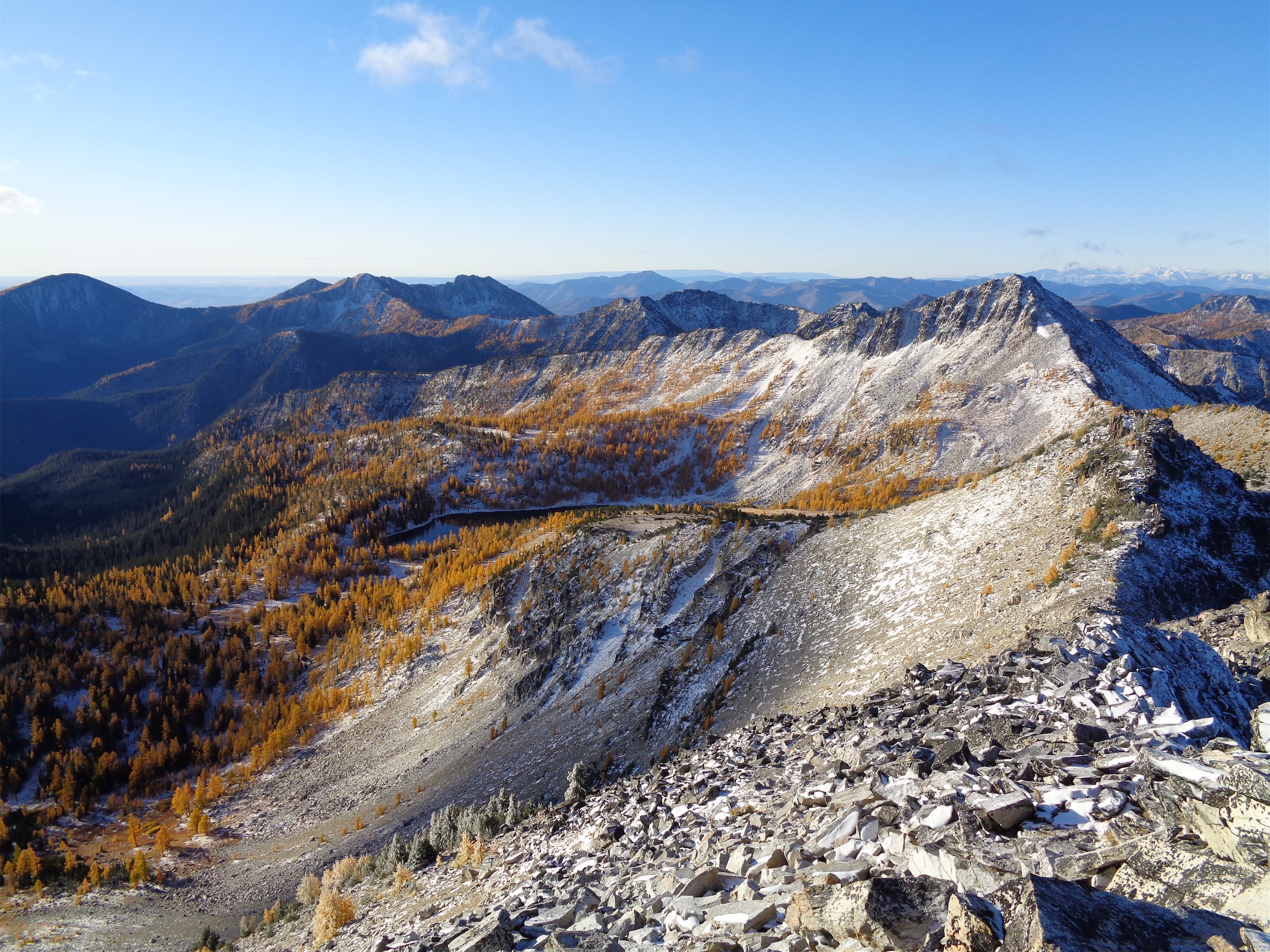
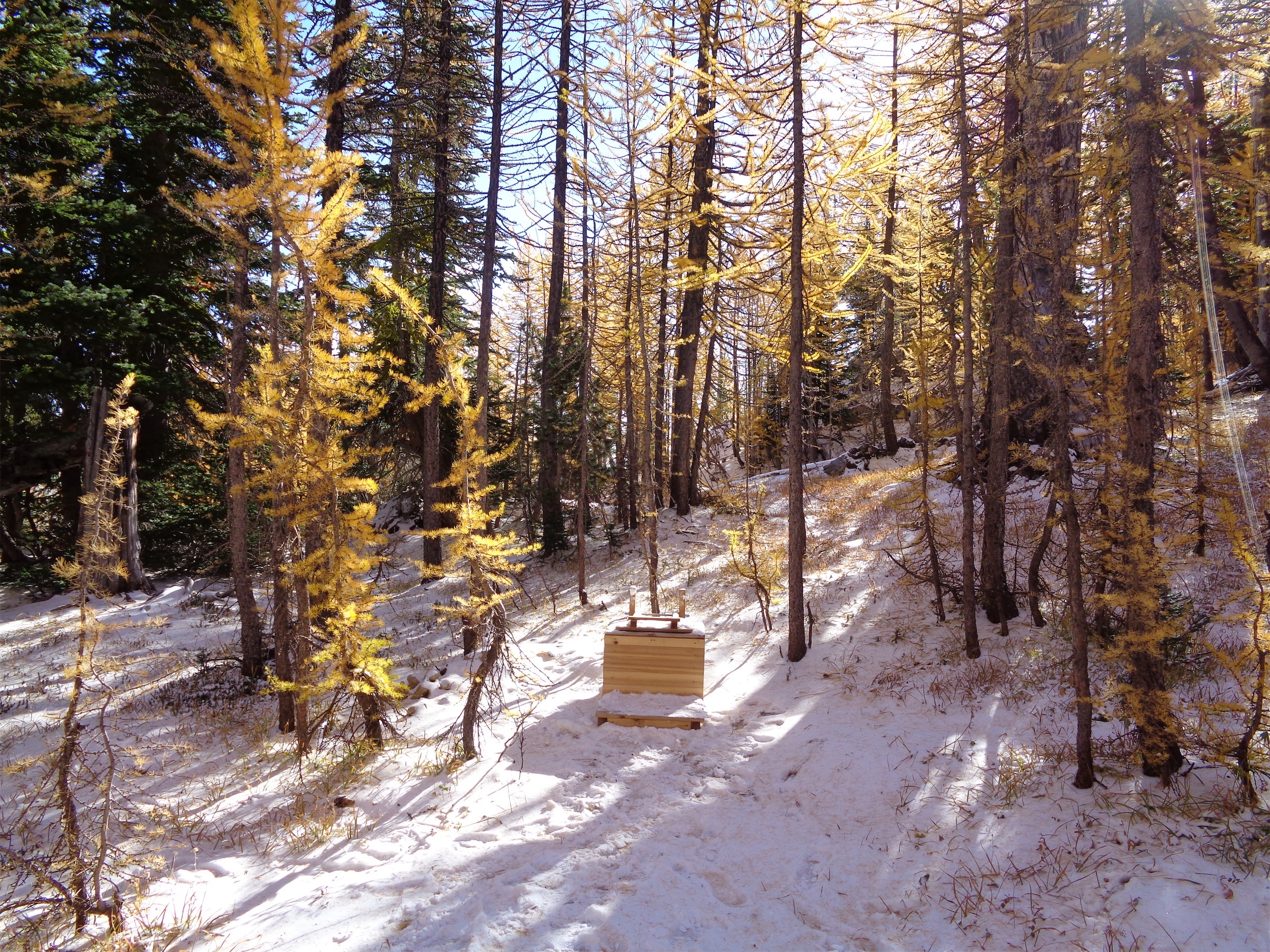
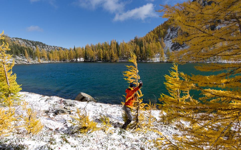
Cooney Lakes larches were past prime but still spectacular. Last time I had been there was frigid, this time it felt like summer. Views started opening up, pace slowed as I wanted more and more pics. We took a break at the lake, I had a pb&j. We knew the unrideable hike a bike was coming up. I swear, that hike a bike above Cooney Lakes felt like one of the hardest things I had ever done. I was dying. I laughed when Stephen said on a scramble back in August that he was rescinding his theory that mountain biking was the only exercise you need, but maybe he just wasn’t doing the right kind of bike trips. This would cover anything. I remember announcing “this is where I need to hear Anita cursing from the wilderness in the distance” as I lifted/tactfully hucked my bike over a bona fide scramble move. It’s steep, you’re pushing a 30lb bike, it’s sandy and rocky and slippery and you have to pay attention to where you’re walking and where the bike wheels are going, and… oh, my rear wheel had loosened so it wasn’t rolling. Mechanical issue #2. Again, Matt fixes it momentarily. I’m learning, slowly but surely. If rear wheel is stuck, check the axle before checking the brakes. I also now know how to remove the brake calipers(?), though if there was a problem I don’t think I’d know what to do about it.
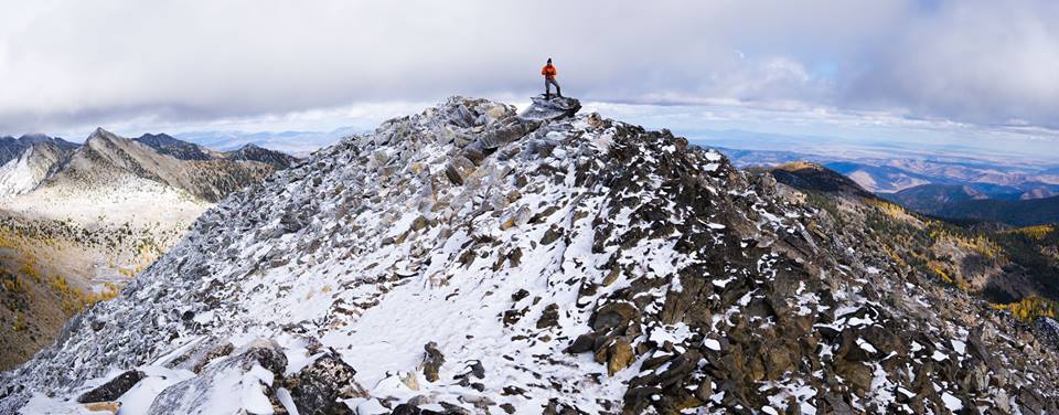
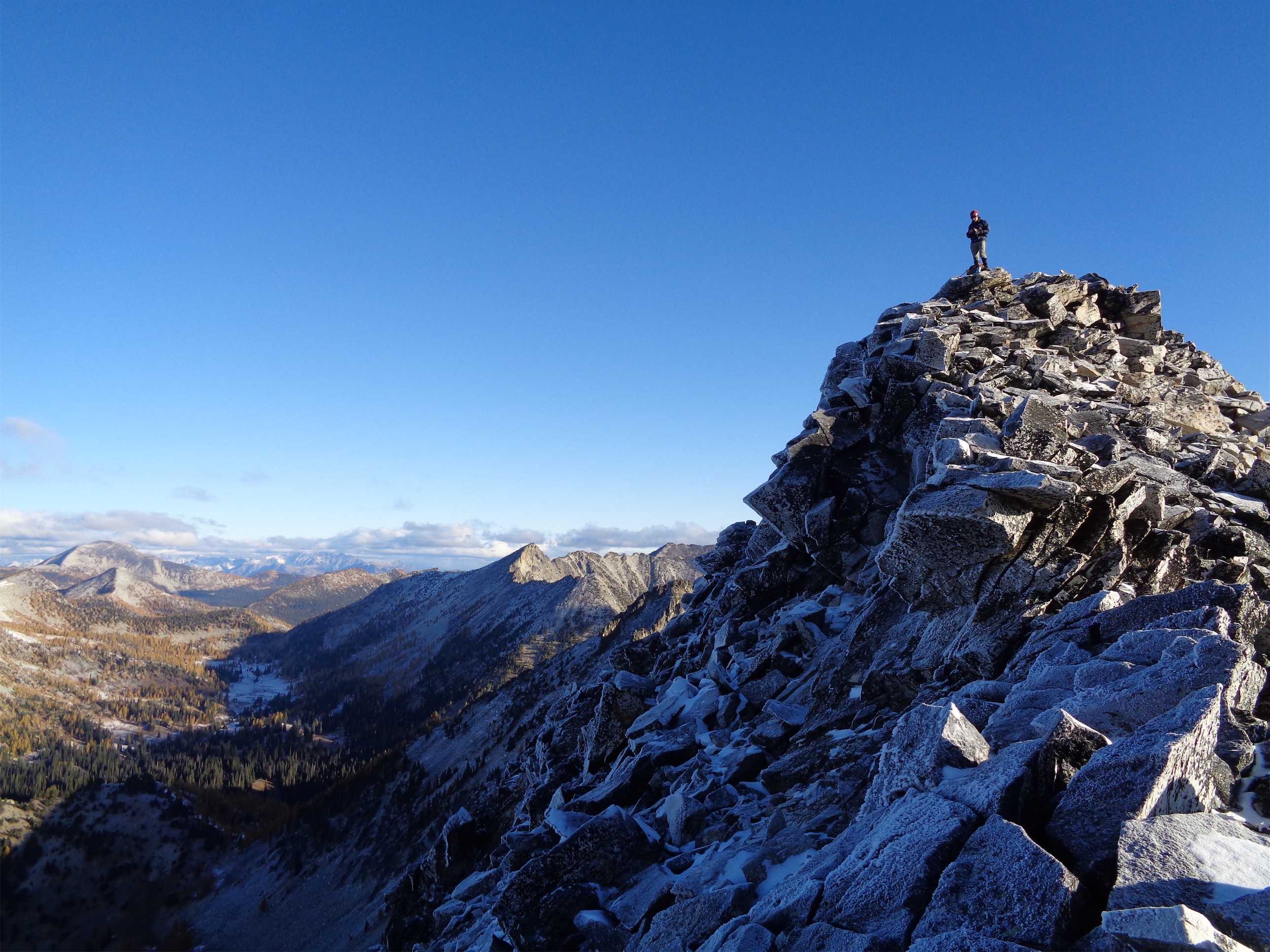
We finally got to the top of the saddle above Cooney Lakes. Oh my god. It legitimately occurred to me that was worse than anything I did on Challenger but I think I was being a little dramatic. “Do you think we’ll want to do this again, or is this a one and done?” Matt asked. I laughed. I had just been wondering that. We’ll find out after the downhill sections. I think it’ll be a statute-of-limitations type thing where I’ll want to do it again but not for like 7 years.

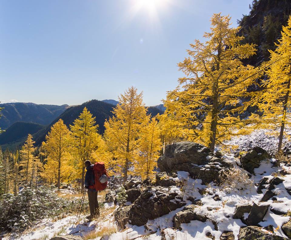
We rode a small section to get to Angel’s Staircase, took a break to snap photos, joked around with another group of bikers (hard to ignore a story when you overhear “I’m a man who shits himself a lot, so I just wanted to offer support and advice”), and started down. This was the part I was most anxious about but I figured if I took it slow I’d be fine. I had to walk some switchbacks, but I rode most of the straightaways, and Matt showed me how to “pivot” on tight switchbacks – put your inside foot on the ground and you can swing your bike around way more easily than getting on and off. I managed a few, albeit slowly, but still better than the alternative! I thought the exposure would freak me out but I actually felt fine, and got another tip from Matt – keep your exposure-side foot down, and you’re more likely to wipe out into the hillside vs falling down the exposed slope. I was feeling pretty solid.

The problem with downhill was the third mechanical issue. My dropper post, fully down for the downhill, would randomly shoot up like an ejection seat going over significant bumps. Not a problem on the uphill because my weight was often on it, but downhill, yikes. I had to randomly stop to put it back down, and I think I had an advantage here being female. We drained some air out of it (can do that with just a rock, I learned). Matt put a pebble on the seat and pressed the release lever, launching the rock several feet into the air to roaring laughter from the bikers around us. We settled on having it slightly less than full so I’d have to physically pull it up to adjust it, but that’s fine since the uphills and downhills are pretty committing/slow transitions are fine here, no need to be constantly putting it up and down.


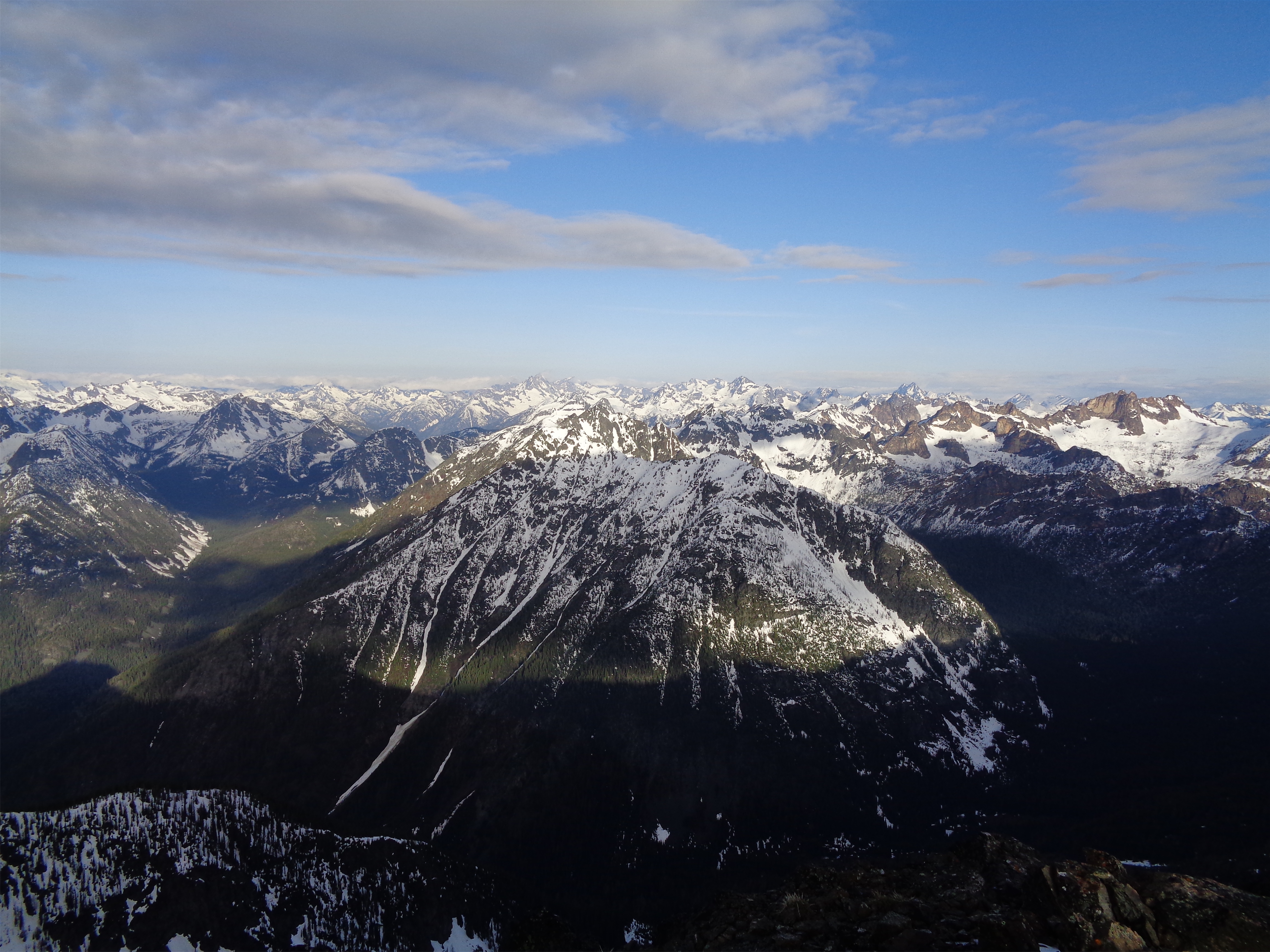
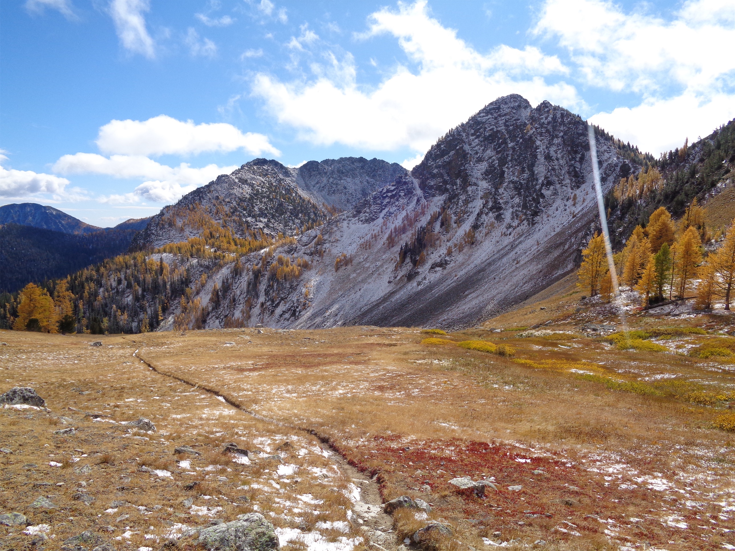
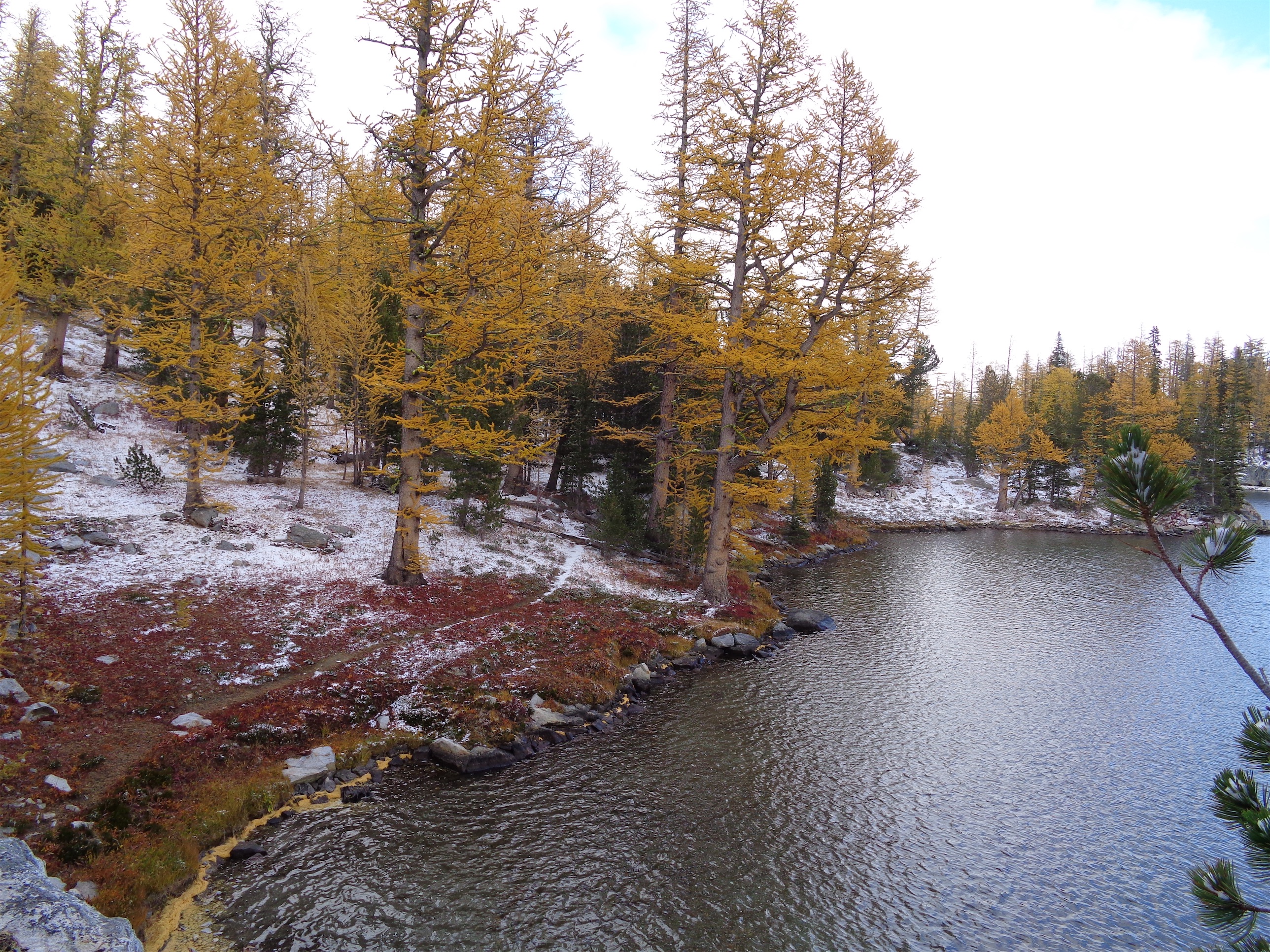
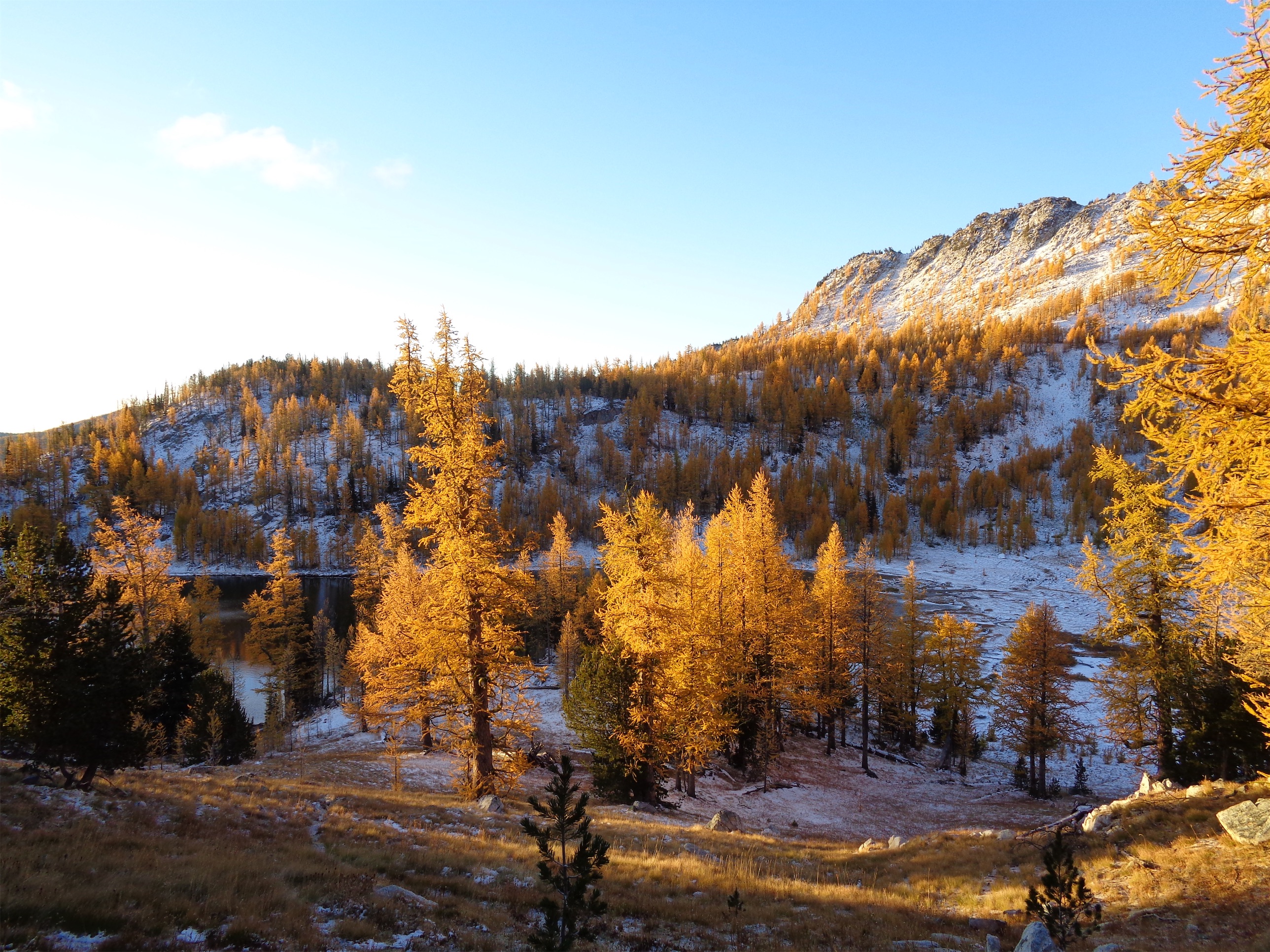
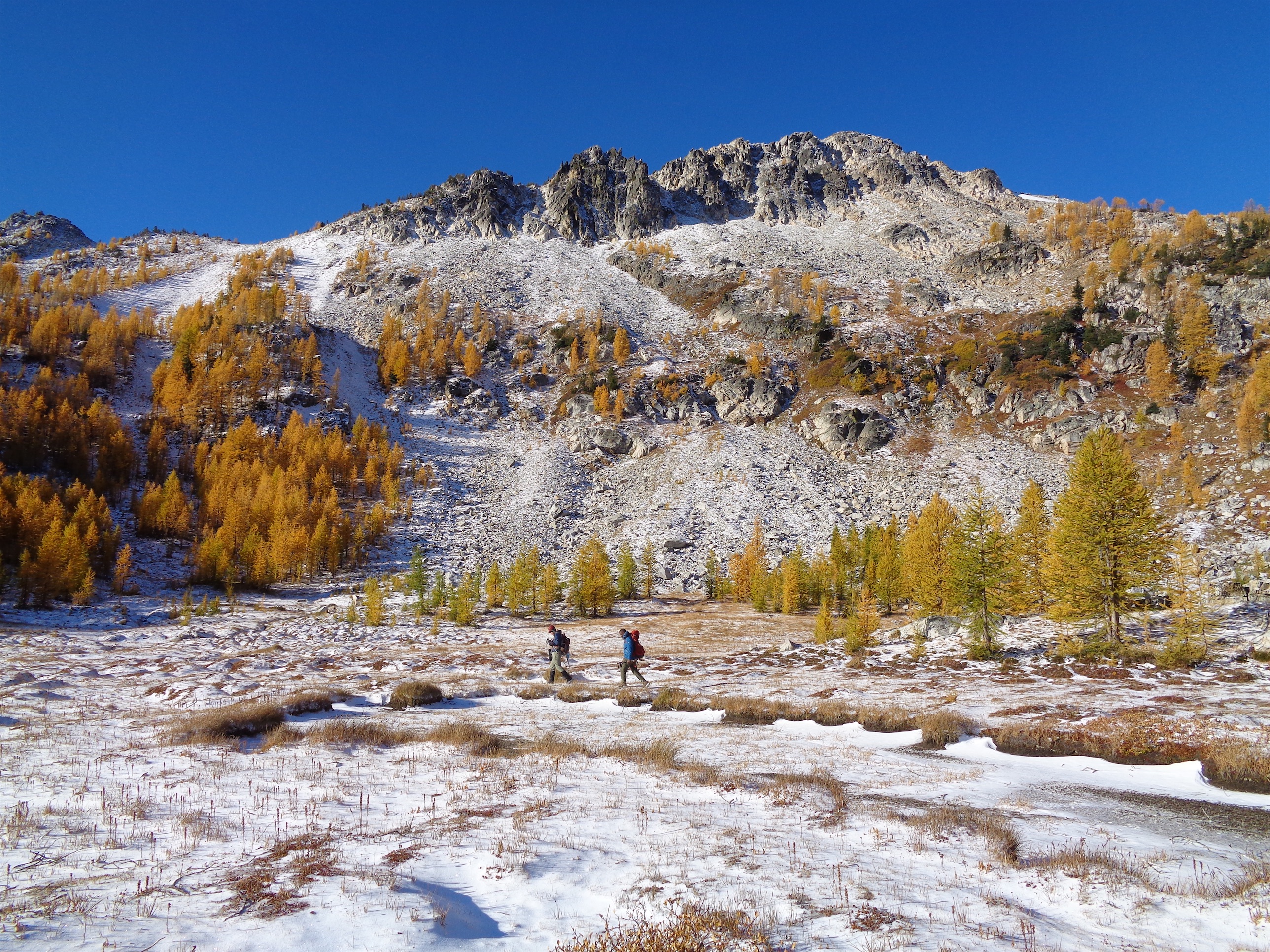
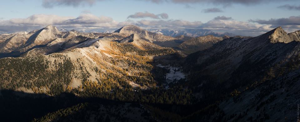
The two miles between Angel’s Staircase and the turnoff to Boiling Lake were incredible. Almost flowy trail (some rock gardens and logs/roots), astounding views, you feel like you’re in the middle of nowhere. We stopped to take pics and noticed a silent man and donkey enjoying the afternoon sun and views. Where have I seen that before? I pulled off trail and asked if they were up around White Pass in August 2020. It’s entirely possible, do we look familiar? I laughed. Yes. Daryl and Lou, the ~30yo donkey. Lou butted his head into me looking for snacks. Sorry buddy, I don’t have anything worth sharing. But you’re so soft.

We carried on, cruising along the mellow trail through stands of larches and pine and meadows, my confidence building with everything I rolled over. I stopped to walk rock gardens, but small drops were fine. Even drops in quick succession. The bike was becoming an extension of my body, I was getting used to having my weight back to keep the front wheel up going over small steps boom boom boom until suddenly something pitched me forward right before a drop. I saw the handlebars slow-mo passing under my body before the front wheel even hit the ground. The only thought I remember is “hmm, not a good sign” and suddenly i was in a pile on the ground tangled up with my bike in dappled sunlight, flooded with adrenaline. Step 1: took inventory in a split second. Head not hit, nothing was horrifically wrong but holy shit my wrist. I grabbed the radio and called Matt. “Man down. Help.”

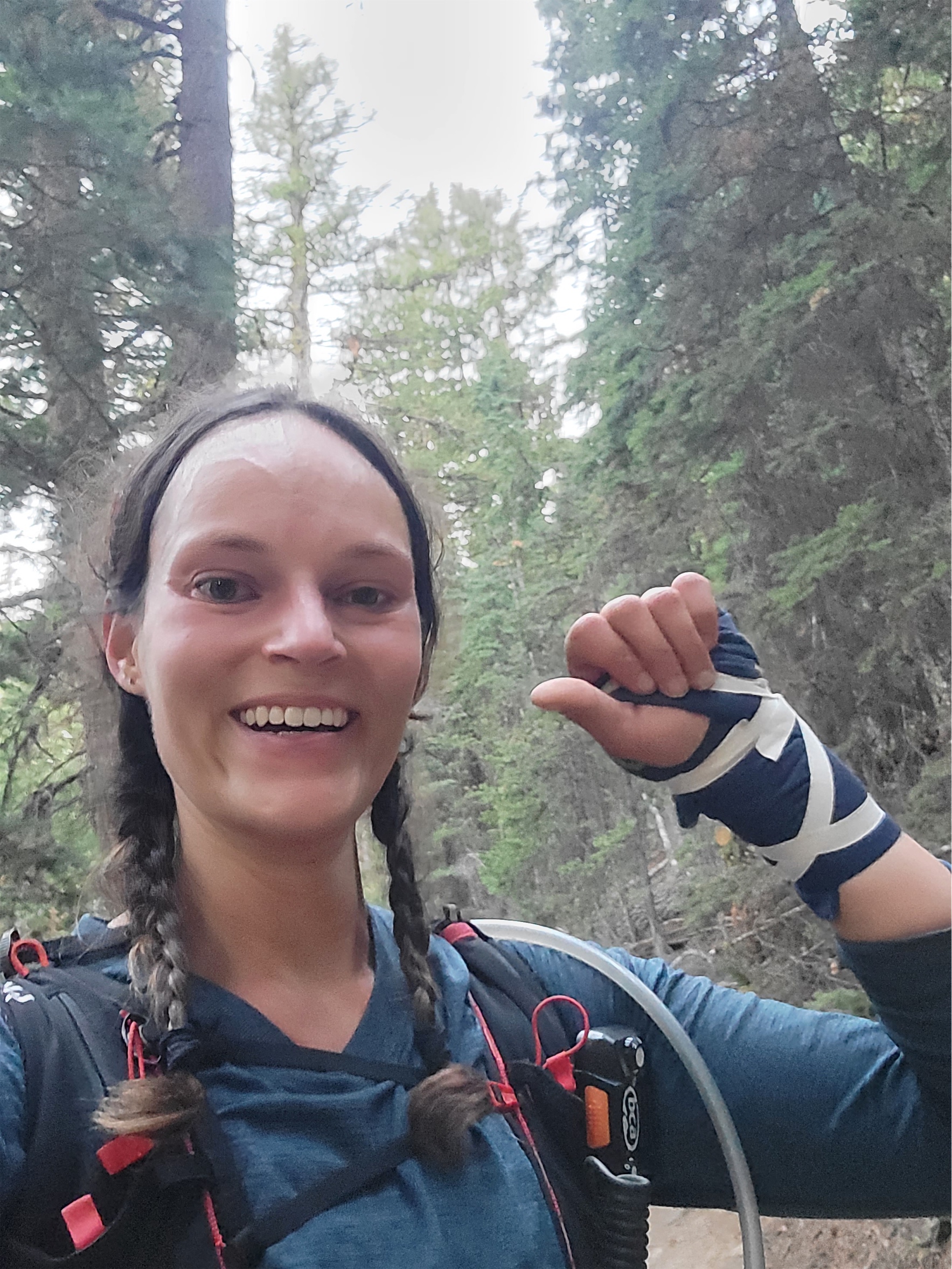
Matt radioed back immediately/ “You okay? Need me to come back?” “I think I’m okay, but not sure. Yes come up.” Step 2, get heart rate under control, don’t throw up. Slightly more in depth physical, breathing is fine, head is fine, everything still moves, no significant deformations/bleeding. Bike fine too. Left wrist is bad. Hip and shin are enough to complain about but very much overshadowed by the wrist. Palp everything. Legs definitely okay besides soon to be big bruises and bloody cuts. Wrist… unclear. Point tenderness, immediate swelling, no crepitus. But fuck it hurts. And it’s so… weak? Like it wouldn’t respond normally to commands to move. My fingers could all move. Barely, but enough I was confident that tendons were intact. Must be a bad sprain.
I got up, picked up the bike, and started walking towards Matt. Walk it off. Great, legs were gonna be fine, we’ll see if the wrist pain wears off. “I think I would know if it was broken” I said, before realizing I had heard that line twice this summer and both times the bones in question were broken. I was mildly embarrassed and disappointed. The easiest section of the day. I got complacent and moved too fast, wasn’t ready for that last drop. Still not entirely sure what happened. Lost momentum abruptly, got thrown forward, and couldn’t correct quickly enough going over the last drop. Dammit, that’s like a half cup of water that’s going to inflammation and not hydration! Let’s just push bikes to Boiling Lake and figure it out from there. I told Matt to ride (of course) and I’d catch up but he was content to walk.

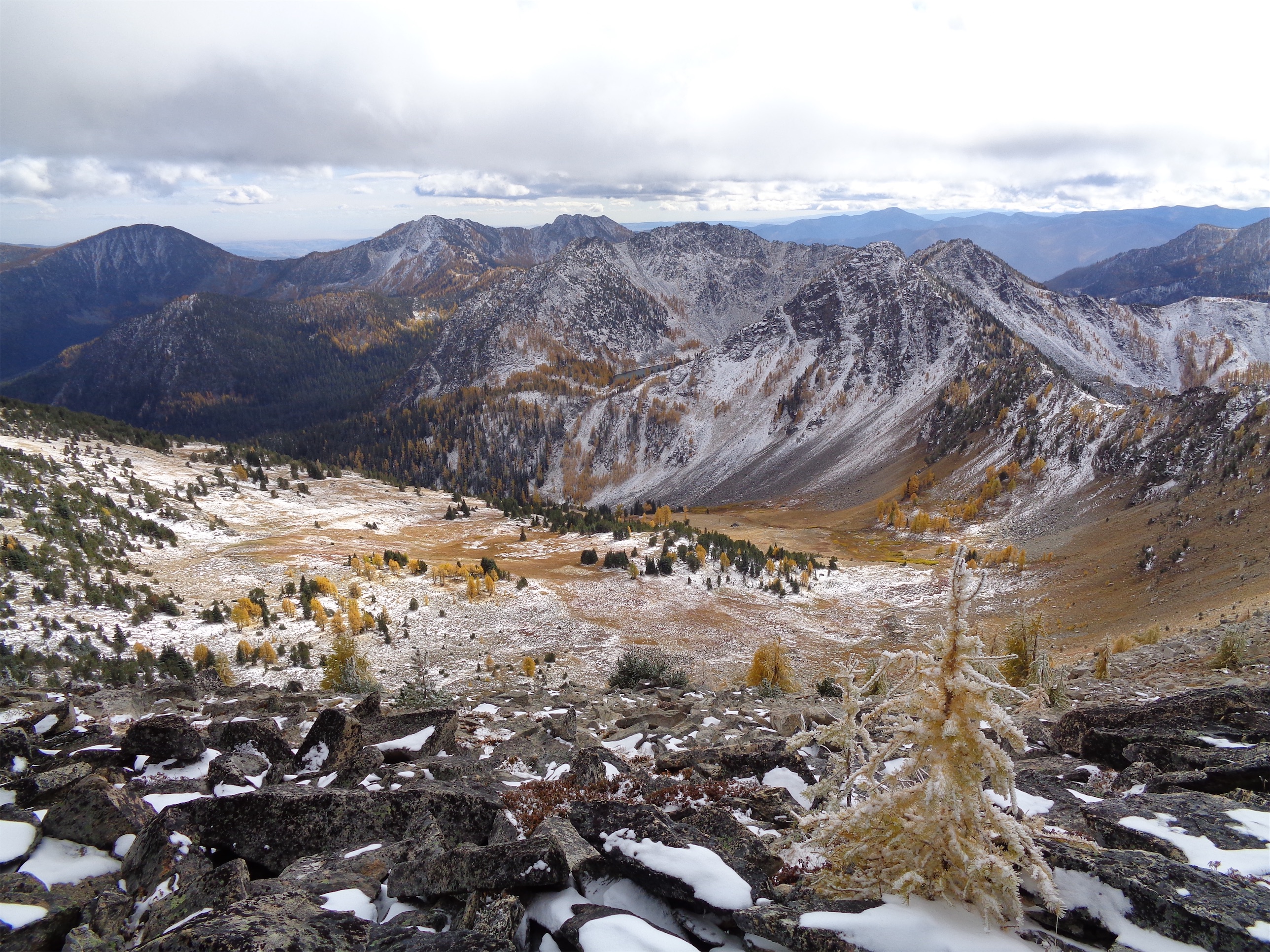
At the lake, we ran into the other group of bikers, and two named Victor and I think Jeff helped me filter water. I couldn’t even get the bladder out of my pack, nevermind open it up or pump water. I checked CSMs (circulation/sensation/motion) in my left hand, Matt grabbed tape and some fabric, and wrapped it. I was shouting as he wrapped it because it hurt so badly and he asked if it should be looser and I said no!! We need to get out of here, it needs all the support it can get! Keep going! We got it nice and tight and taped it up to hold it in place. Pretty solid for a backcountry bandage. No change to CSMs. Perfect. I took a single Advil. Matt had stronger things too I think but I wanted to start with what I knew. “I have some.. oxycodone if you want that?” one of the other bikers asked. We cracked up. That might be overkill. I do actually have to get back to the car. “Not to be a debbie downer but that wrist is gonna hurt a lot more tomorrow, heads up.” I knew he was right. Ugh. Oh, did I mention all of this is happening in one of the most beautiful locations in Washington? Boiling lake is ridiculous.
Up next was the second section of hike a bike, fortunately less steep than the climb above Cooney Lakes. Beautiful switchbacks. Matt had to help me clip my running pack because I had lost all fine motor control (swelling, not because of the bandage). He helped me lift the bike over a few larger rocks, but I soon figured out I could lift the frame with my right arm easily enough. “Hey Eve!!” I heard from several switchbacks above. It was the bikers who had helped with the water. “Do you have lights?!” I laughed. “Yes!! We do!” So insanely good of them to check in on us. They were camping at the trailhead too, and invited me to join them if I didn’t hike back up to camp so I wouldn’t be sitting at the car alone and injured. They were so freaking funny it was a tempting backup plan.

On the ridge above Boiling Lake we got in touch with Anita via the radios and told her we were on our way, but I was potentially injured. We had tossed around some ideas, I could stay with Anita while Matt went to the cars to get my camping stuff and came back, I could take the bike out and car camp and head out in the morning, I could get my own stuff and meet them back at the lake.
I tried to ride coming down from the pass, but everything I rolled over that wasn’t smooth soft dirt sent fire up my left arm. I couldn’t grip or control the handlebars with my left arm. Matt rode slowly while I biked clear patches and walked the rest. “Get a pic of me biking” I asked Matt, thinking so if it’s broken I have proof that I tried. “Remember when we said this might be a one and done? Or a 10yr trip? I think we’re going to have to come back sooner as a revenge trip.” We stashed the bikes at the turn off to Upper Eagle Lake, and found Anita at a glorious campsite next to the lake. I figured I wasn’t driving back to Seattle that night, so I might as well camp and enjoy the scenery. And I so didn’t want to deal with the bike, getting it out would be slow. I decided on the third option. I’d run back to the car, grab camping gear, and hike back up.
We told her the story, had a quick snack, and I went on my way. It was 5:25 and I wanted to be back at camp by 10. I figured 90min to run to the car and then 3 hours to hike back to the campsite. Well, thanks to a well maintained trail with mild downhill the entire way and heaps of adrenaline and cortisol, I was at the car in under an hour packing up my overnight gear and my legs felt AWESOME. I was FLYING. I was originally going to do a trail run Sunday or climb Bigelow, but those were out of the picture so I took minimal gear back up to camp with me. I asked four hikers with headlamps if they had spare batteries in case mine died (I didn’t) and within ten seconds there were four outstretched hands with batteries in front of me. I swear these hobbies have the most supportive, helpful people out there. Zero judgement, just yes please how can I help and be safe out there! I was overflowing with gratitude.

The stars were out in full force. I lived a lifetime in the 3mi traverse to the lake after the last huge switchbacks. At Upper Eagle Lake I stumbled through three or four campsites before finding Anita’s, perched on a rocky knoll with the best views. She and Matt were half asleep, but not too sleepy to immediately try to help. “Do you need help with your tent? Water? I’ll get up!!” No no, I think I’m fine, I got it. Miraculously, Anita sleeps with a splint for her left wrist. She handed it to me. Something along the lines of “I’ll be fine one night, you need this more than I do.” Taking one for the team! I lost and re found the splint four times while setting up all my gear but finally put it on. I flopped into my sleeping bag, wet from sweat and freezing, hoping my clothes would dry from body heat. After 15min it was apparently that was not happening. I changed in the frigid air with my bum wrist. I think the worst article of clothing for an arm injury is a sports bra. It’s amazing I didn’t break my wrist in a second place trying to get the damn thing off.
I woke up in the morning to a beautiful sunrise lighting the cirque up pink. I made my way to the campsite toilet, realizing I hadn’t gone to the bathroom in something like 16 hours. Body must have shut down all nonessential functions for a bit. I had a huge breakfast even though I wasn’t hungry. But then Anita gave me a vanilla scone that was the most delicious thing I’ve ever had. Sugar. My body wanted straight sugar.
We started packing up. Anita helped me pack my sleeping bag, which I couldn’t do 😦 And then she made a life saving offer. I figured I’d just hike out with her and push my bike while Matt rode down. But what if Matt took the heavy overnight pack, she wore the day pack he rode with Saturday, and she rode my bike out? I’m a bit bigger than she is so my bike might be too big, but there was a chance this could work, and holy crap I didn’t want to push the bike if I didn’t have to. And I really didn’t want to ride out of there. The trail from the lake was the easiest section of the ride by far with plenty of smooth dirt sections, but with an overnight pack and how badly the tiniest rocks hurt the prior day I had no doubt it would have sucked for me. My wrist at this point was visibly swollen from knuckle to halfway up my forearm. But here was Anita, getting excited to bike!! Heck yes! Take it! And the more you enjoy it the better I’ll feel too! Just tell me it’s amazing and I’d have loved it when we get down.
We hiked back to the stashed bikes, Anita took my helmet and hopped on my bike. I hiked ahead of them to get a head start and snap a few pics of Anita. Of course they caught up to me within minutes and it was off to the races! I ran/hiked the way out, running the soft sections that didn’t feel too high impact. I just wanted to be the fuck out of there at that point. I wasn’t enjoying the journey anymore.


I popped out at the TH to Anita and Matt tailgating at the car with a camping chair and a beer ready for me! Waiting to make sure I was alive. “It was amazing, you’d have loved it!!!” I love taking a few minutes to chill at the car after a great trip, and this was perfect. I added some cheese to my crackers and cheese, had another pb&j, and half a beer. I had been fantasizing about a Subway sandwich (chicken bacon ranch w pepperjack and chipotle mayo on the cheesy italian bread) for like an hour at this point but knew I had to get back to Seattle. Matt and Anita helped get my crap into my car. I drove slow on the way out, turning sucked with my bum wrist. It’s not strong enough to hold the wheel in place, nevermind turn it, which means I need to get creative with the shifting/turning pattern while driving my manual car. Luckily highway driving was easy. City streets and tight turns were peppered with shouts and groans and strings of curses.
I started voice-to-texting people once I was back in cell service. Tell my family, tell my boyfriend, Brooke and Amber, Brad and Surafel, message a group of besties to look up what urgent cares did x rays and were open past 8 so I could try to get an appointment that night, are there ERs where you can wait outside or somewhere else so you don’t sit in a room of dying people feeling bad for taking up resources with your tiny injury? I struck out on all counts. I got home and called my neighbor. Hey Jeff, I think I broke my wrist, if you have five minutes can you help me get my bike out of the car? Everyone was so insanely helpful. I showered, made a grilled cheese (always tempted to say grill myself a cheese thank you archer), and decided it could wait til the morning. I swear if someone took my vitals in that moment they’d probably think I was dying anyway so might as well eat, hydrate, and rest, and then figure it out.

I got x rays at 9am at urgent care. “What made you come in today vs Saturday or yesterday?” they asked. “Well… I was pretty far away, got back late last night.” I replied, not wanting to explain everything. “The radiologist will call later today with results.” Cool, I can wait. Five minutes later she came back in. “Actually, it’s pretty clearly broken. We’re out of splints but here’s an ace bandage and a referral to an ortho.” I went on my merry way and called like 40 orthos who were booked out for weeks until remembering OPA Ortho, who had helped with my sprained knee/potential tear years ago. An ortho way too good for my routine fracture could see me in two days. Sick. The rest is soon-to-be-history. I mean if there was a limb to hurt it’s my nondominant wrist, and if there was a time to do it, it’s right now when the weather is changing to crappy but it’s not ski season yet.

Things I will miss: climbing, gym climbing, surfing, lifting, swimming.
Things I think I can still do: hike, run, ski, lift with good limbs, and maybe I’ll go find a stationary cycle.
Daily things that suck: chopping food, typing, driving, washing hair, opening tupperware, opening jars, turning doorknobs, scrubbing Invisalign, sleeping, petting cats and dogs, putting on socks and pants, zipping jackets.
Things I’m grateful for: Matt and Anita for being awesome company and keeping up the good spirits, Matt being willing to take newbies out on adventures and being super chill with injuries, Anita for miraculously having a left wrist splint and riding my bike out and helping me pack, people who are excited to help in case of emergency, super wholesome hiking/biking communities, Andy and Esther for selling me a tv ASAP and moving furniture I can’t move myself, a family who naturally gives me 50/50 sympathy and sass, coworkers who understand putting health before work. And an ortho who can probably build a better wrist than I was born with if it comes to that. And the same coworker I frantically texted for my messed up knee years ago has had the same fracture… so he was, once again, a phenomenal resource!