
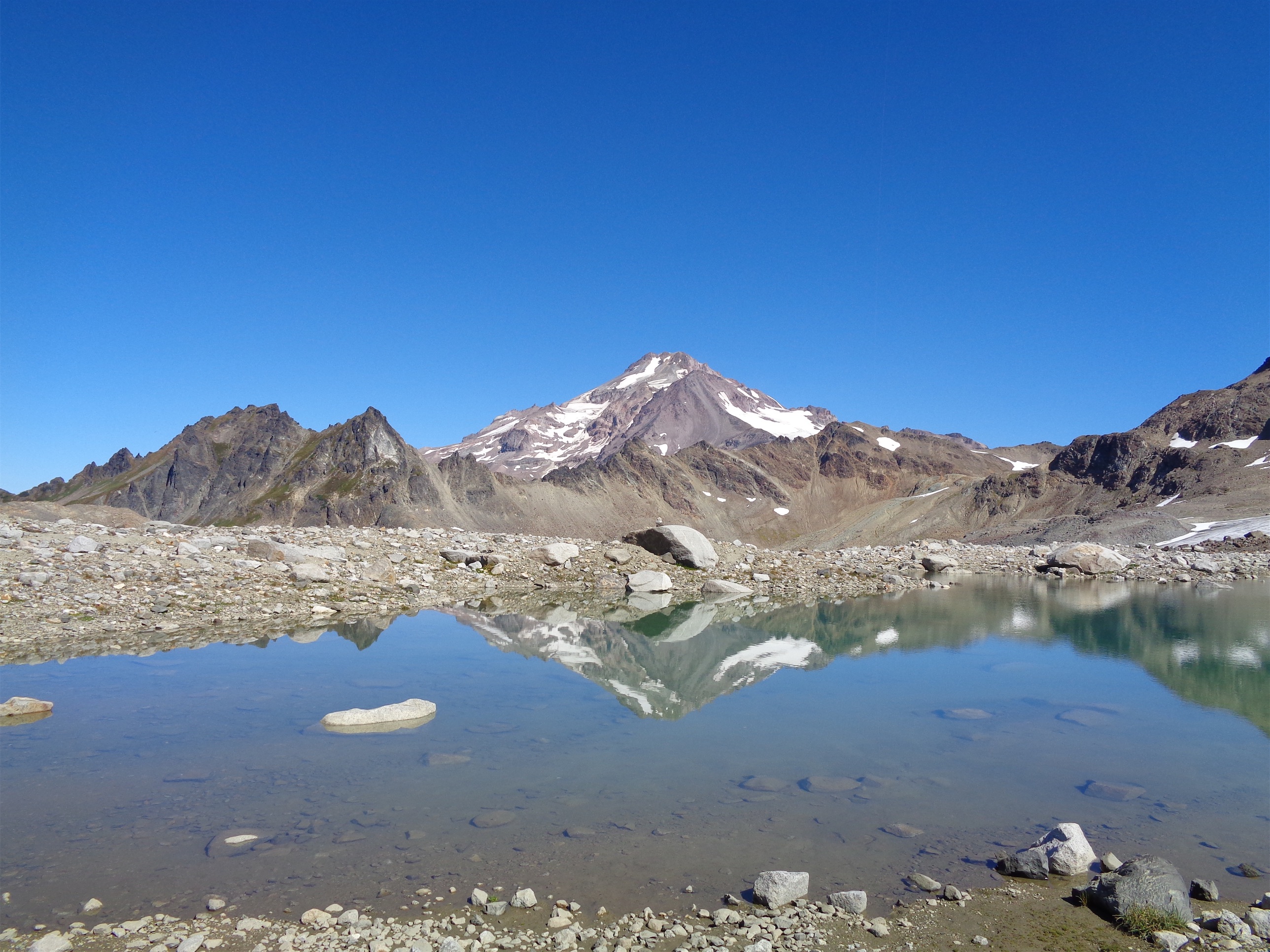
Glacier Peak over a White Chuck tarn (Eve Tarn)
It might have been nice as a three day trip, but who has that kind of time? Two days it was. And it ended up being possibly the most casual two assault on Glacier Peak ever known to man. So chill, awesome relaxed group, exactly the type of trip I was hoping for. And as usual, I have too many pictures for the words here. Hiked/Climbed 8/25-8/27.
- Distance: 36ish miles
- Elevation: 8200ft net gain (10,541ft highest point)
- Weather: 60’s-80’s and sunny
- Commute from Seattle: 2:30 unless you get trapped in the black hole that is Everett
- Did I Trip: 7 times for an average of one trip every 5.14 miles
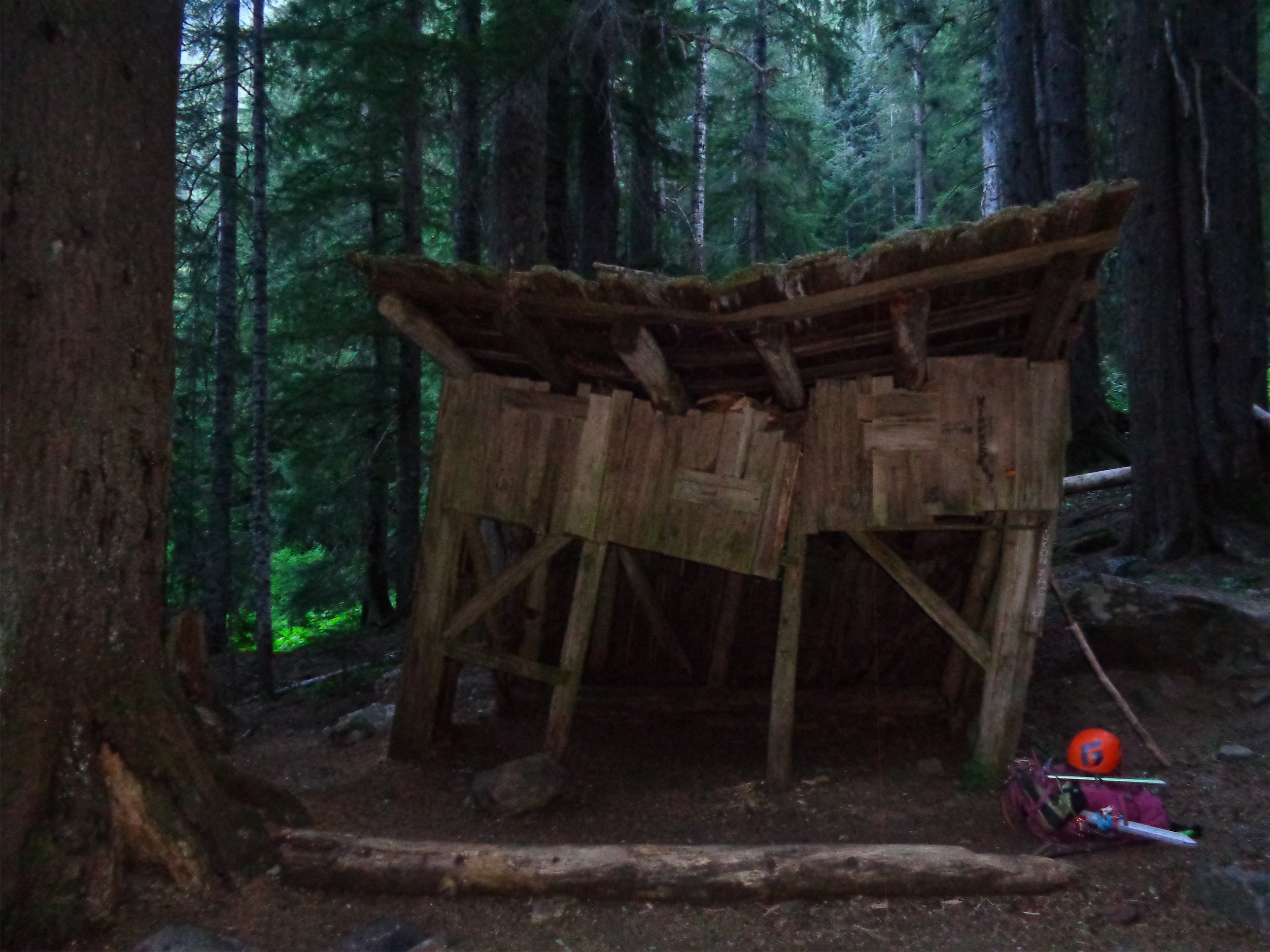
Mackinaw Shelter
John had to drive up from basically Portland, so even though our goal was to meet in Darrington at 6pm we finally all arrived at 7pm, finished packing (and changing in my case) and finally hit the trail a little after 8:30pm. It was already dark, so I put fresh batteries in my headlamp and we took off at what I considered a blistering pace. I kept my mouth shut for like an hour before finally asking to slow down. I didn’t want to a) burn myself out immediately b) set unrealistic expectations for the next two days and c) walk fast because I’m lazy. Also, all of my water spilled in the car so I had no water until the first gross little trickle of a stream where I might as well have been licking a mud puddle. Shit. But slowing that first section down resulted in the chillest 42 hour trip ever.

Indian Head peeking over White Pass campsites
Long story short, we made it to the Mackinaw shelter in a little under 2 hours, missing out on some enormous old growth trees, leaves the side of my body, and dozens of feet of hanging moss. I had been excited for the shelter, until we saw it in the dark. “Well that’s fucking creepy.” “….we should check it out.” “Okay, you go first.” Everyone else fell asleep while I began a several hour long faceoff with a mouse (or a ghost, but pretty sure it was a mouse). I had like 15 bags of cheez-its that crackled every time the mouse got to them. Hang up your food, guys. Bears don’t give a shit but mice are fucking ruthless. They will eat all your food, shit in the food bags, and tear up your belongings. Okay, it only got into my crispy M&Ms, but that’s because I did a great job of defending my 10 square feet. I hate the forest. And wildlife.

North lobe of White Chuck Glacier used to end here (Eve Lake), Sloan back right
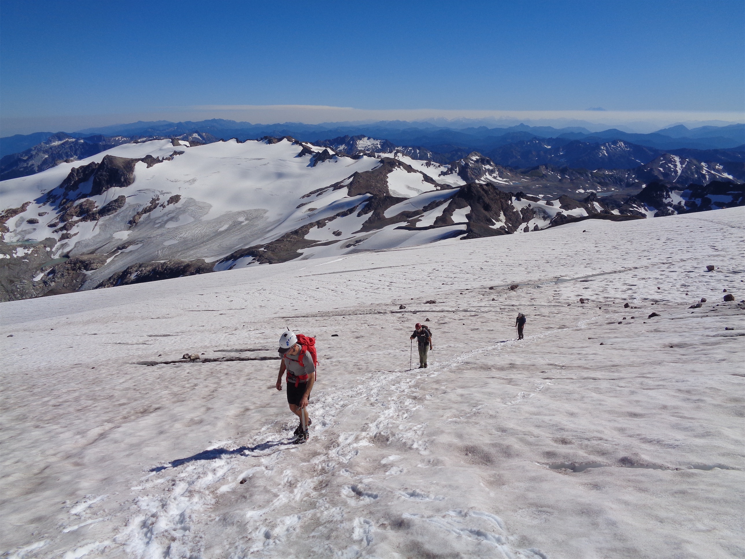
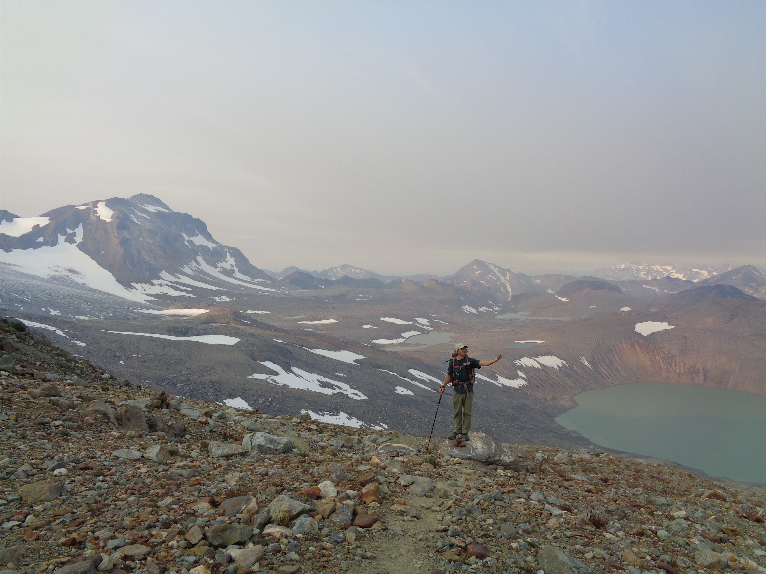
We got moving a little after 7 Saturday morning. Yay sleeping in! I was very happy to be going up the 2.7 miles of switchbacks in the shade before the sun hit, because they were dry (the only water source is a few feet off the end of one switchback) and mostly open. And steep. They went by surprisingly quickly though, and soon enough we were on a lovely eastward traverse with plenty of small streams and blueberries everywhere. The peak I climbed last weekend, Sloan, dominates the horizon behind you, Indian Head Peak starts to peek above the rolling green meadows of the White Pass campsites. As you round the corner above the campgrounds, Foam Creek comes into view, cascading into White River which has got to be one of the prettiest valley views I’ve had out here. And somehow no one got a picture of it. Occasionally I’m tempted to do sections of the PCT, but I’d have to take 3x as long so I could bag all the peaks off to the side. You can see the White River Glacier hanging to the northeast, which has created three new lakes as of late on the south side of Kololo peaks. We crossed a low point between White Peak and Kololo peaks. Earlier in the season you can cross immediately east of White Mountain, in summer the trail traverses over second skyline ridge before one final climb to a saddle where you finally drop down into an alien basin. I mean, you could hit the saddle immediately east, but why not stay on the trail? Amazingly, there is a genuine trail (not bootpath – an actual well kept trail) all the way to this point. And the saddle we went over had a campsite for those who are interested. Oh, and it’s like your first glimpse of Glacier Peak. Cue the “oh shit, that’s so far away” panic.
North and south lobes of the White Chuck on the left over the basin they used to cover (taken from the north)

Car sized boulders with Dane Lake Eve Lake in the background
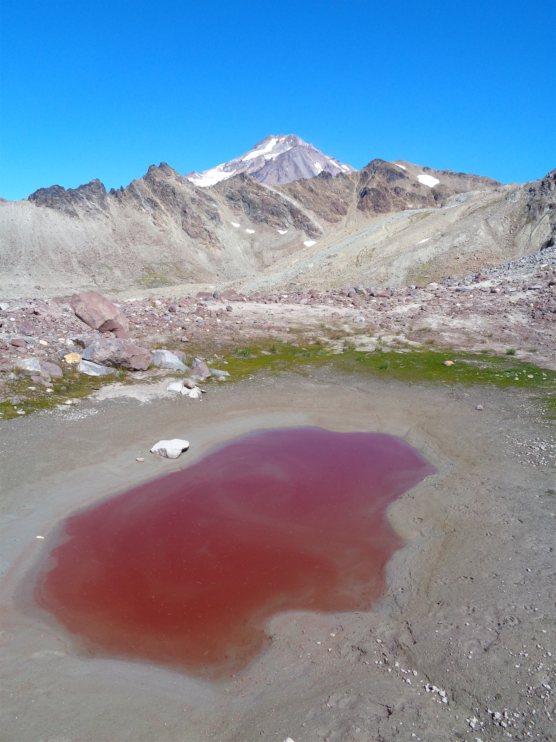
The basin is wild. It used to be completely covered by the White Chuck Glacier (I know, you’d think that glacier would be on White Chuck Peak, but I’ve already complained about how people suck at naming glaciers). Brad did point out that the White Chuck Cinder Cone, a simple small volcano, is just west of the glacier, so maybe that has something to do with it (though they do not touch), or the White Chuck River that begins at the White Chuck Glacier and flows west (so they just ran out of names and slapped White Chuck on the coolest peak along the river). The White Chuck Glacier has been retreating from 1850 to 1930, retreating quickly from 1930 to 1960, and retreating wicked fast from 1960 to now (wicked fast is the fastest glacier speed obviously). Prior to 1955, the glacier was one awesome ice sheet. By 1955 it had three sections, and now it has 1.2 (I don’t want to call the northern ice patch a true glacier, and neither does wikipedia). In August of 2017, not a single part of our traverse touched the White Chuck Glacier, despite it still being marked as such on most maps, and the directions for this route say “cross the White Chuck Glacier.” Now it’s just a basin of tarns and lakes of varying colors draining the lifeblood of the glacier. This makes crossing a pain in the ass (walking on snow/glacier is easy going, walking through volcanic talus and sand is tedious), but it also feels like you’re on Mars, especially if there’s wildfire smoke everywhere.

From Death of a Glacier: this is a pic of White Chuck taken from the west. Left shows the White Chuck in 1988 and right shows it in 2005. Already in 1988 the northern lobe was receding quickly (wicked fast, if you will). In 2005 you had a small patch of ice above the lake and by that upper left ridge, today you only have the piece by the upper left ridge. Glacier Gap is just above the north lobe in the left picture.
John Pond Eve Pond (wild color!)
We filled up on water several times here since we were baking in the sun and streams from the glacier were abundant. Hey maybe we’ll even camp down here and swim if we’re fast. There were ample bivvy sites in the basin, and campsites if you’re willing to move some rocks around. We swapped nerdy glacier ideas. I mentioned I wanted to explore the basin if we had time, and would take a hundred pics and laughed knowing I was the only one who gave a shit about dying glaciers. Except then Brad turned around. “…I printed a map of the whole basin.” Fuck yes, glacier nerds. Bring on the pics.

Glacier Peak from the ridge above Glacier Gap
Mellow Gerdine glacier, Kololo peaks in the back. You can also see Jolly Mountain Fire haze
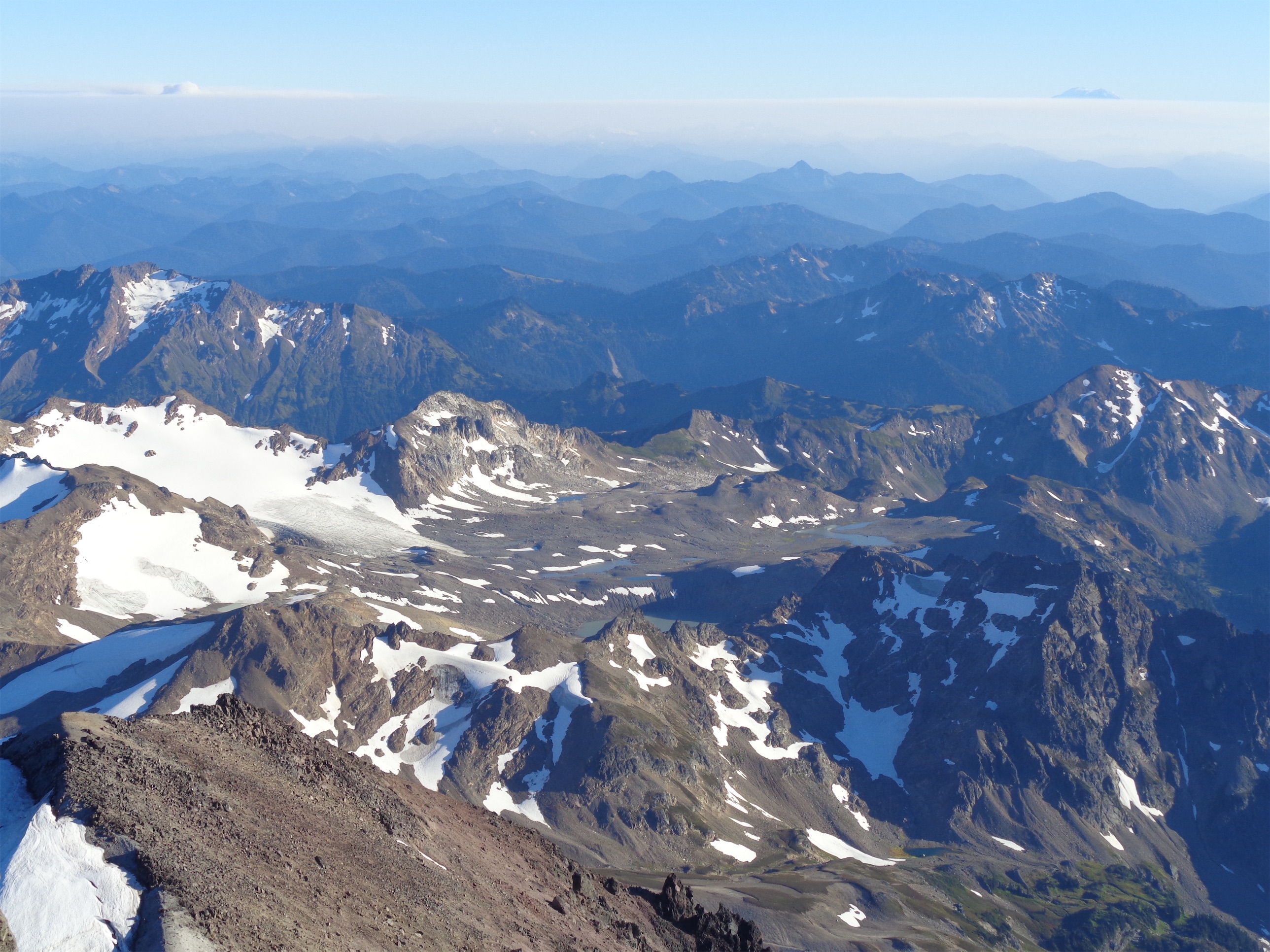
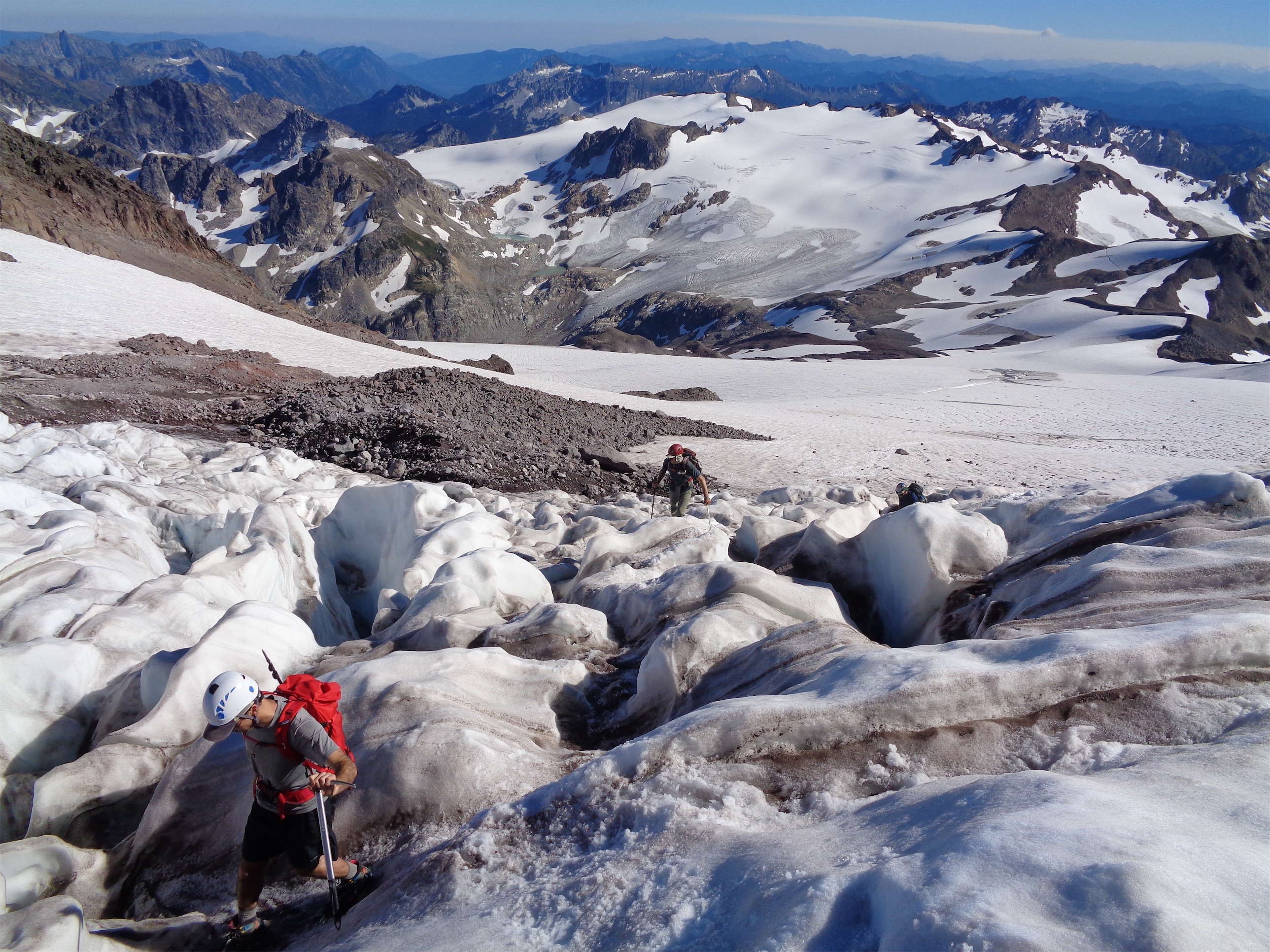
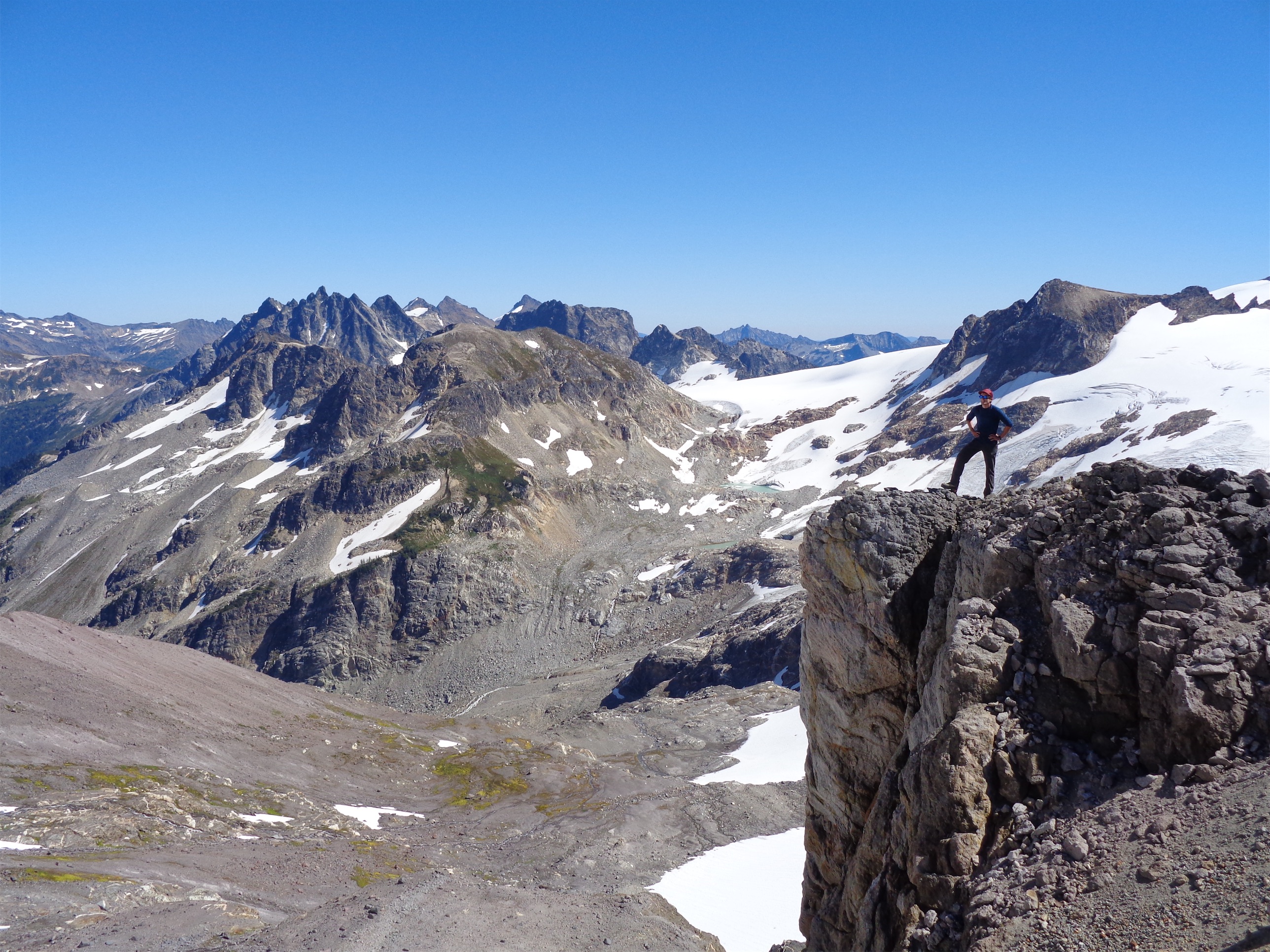
From Glacier Gap you head up to another saddle just north of camp, drop down across a small snowfield, and then follow the ridge of Glacier Peak up to the Gerdine glacier. There’s basically a trail again. It’s a 15 foot scramble to drop onto the Gerdine glacier, and then you gain around 1500ft on the glaciers. As of now, you climb up to the base of Disappointment Peak, where we crossed zero crevasse. Here you can rope up if you’d like, head east crossing some gnarly rock fall territory (one group saw a car sized boulder fall… yikes) until you can gain elevation again. You’ll walk over some exposed glacial ice (also wildly cool) that looks tough from below, but as you get closed it’s like the ice equivalent of rolling slabs or a talus field. This is where you gain the Cool glacier, which I think is rope worthy. Swing back left around Disappointment Peak, over one legit snowbridge and a few crevasse hops, and you hit the final ridge of Glacier Peak. Honestly, we did not rope up for this stretch because it looked mellow from below and we had heard as much, and the rockfall danger is very obvious. So I figured speed would mean more than rope.

Guys, it’s still a glacier!
And arguably it did, since just as we finished the Gerdine glacier rock fall crossing a car size boulder came tumbling down and came to a rest 5 feet from where we had been standing 15 minutes prior. And the group ahead of us said they had seen an even bigger one tumble across the path. If we had roped up, we might have been standing right there. But I gotta say when you hit the Cool Glacier (after the exposed ice) there were a few crevasses that made me wonder why the hell no one had roped up. At that point, there was no good place to pull over and do so, so I carried on until the ridge, telling the voice in the back of my head reminding me I was dumb I know I know, it seemed like a good idea at the time! Famous last words. But please don’t get complacent or fall victim to the “oh everyone else is doing it.” It’s a real glacier, and one of those snowbridges might not be around for much longer. The exposed glacial ice section doesn’t make a significant difference, it’s only 20ish feet long, and if you slip you’ll just fall into a pothole and get wet and be grumpy. But the crevasses above it do matter, and when someone punches through that bridge I think is right on route I hope they’re on a rope. I’m sure the other groups all fell victim to the same “oh everyone else says it’s fine and it looks fine” only to realize duh, you’re on a glacier you idiot, when it was just a little too late.
Exposed glacial ice

Our shadows along the ridge
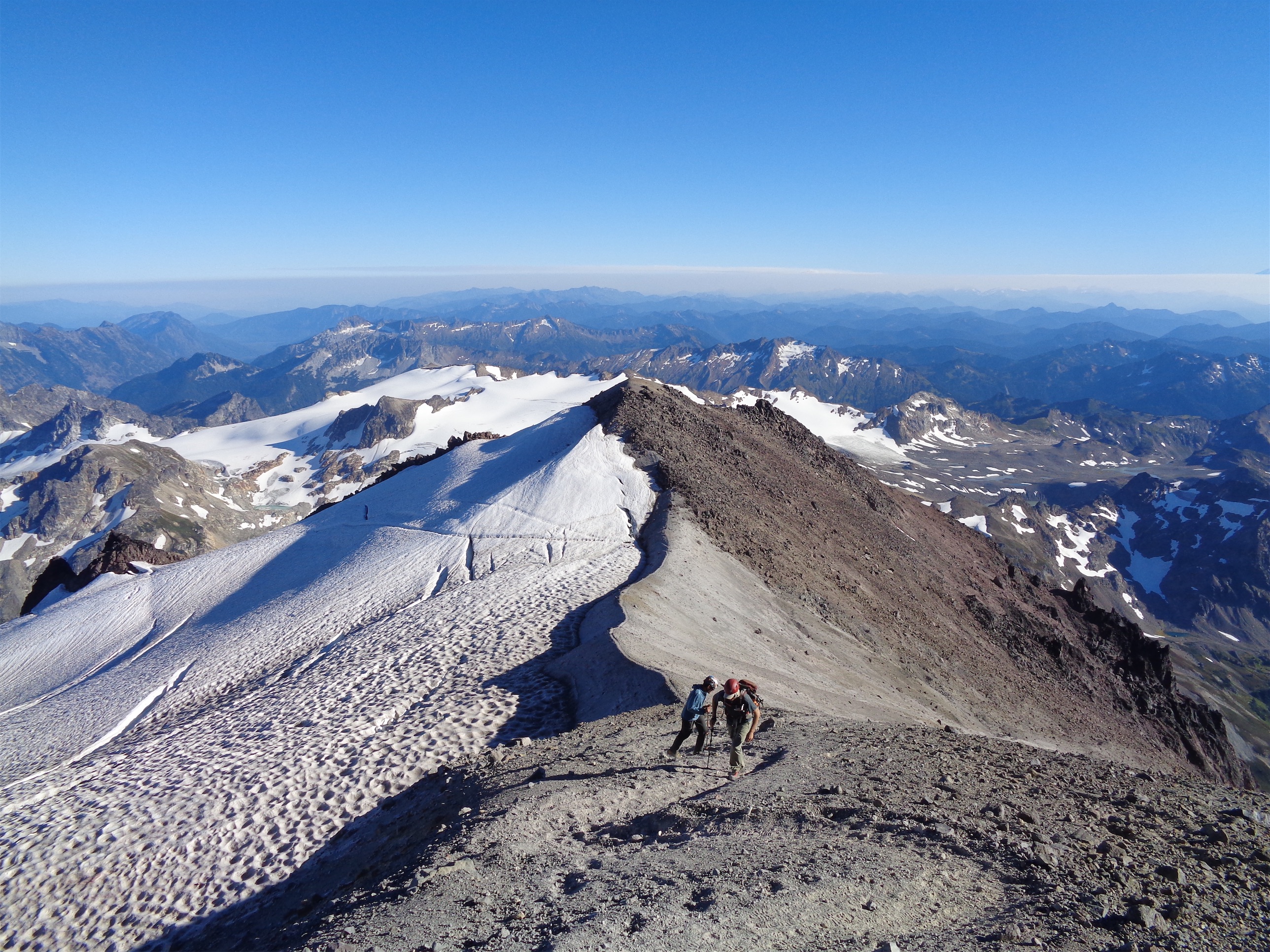
Stash your rope and glacier gear at the ridge. Maybe save the helmets. We did, no one else did, but I like my skull the way it is, and a good friend recently got stitches after being hit in the head on a stretch I probably wouldn’t have worn a helmet on either (separate climb). This ridge is like hiking a sand dune. Save your bitching for the last few steps because many of them will be one step up, half a step back, rinse and repeat. Towards the top of the sandy shit you get loose rock, there’s a light trail but just about anything will go. There’s a short snow field to cross but the bootpath is so beat it’s like a staircase, and far better than the scree shit. Just when you hit your “fuck this shit” point looking at the last 50ft of scree, you reach the summit saddle, and the true summit is to your left, on the west side. We met a two person party who carried a tiny dog to the top(!), and swapped photos with them. There are a few bivvy sites on the summit if you are so inclined. Brad and Dane lounged around, I snapped more pics, and quickly shooed them back down because I was cold and wanted to be back before dark. Yeah I could have put on a jacket. Shut up.
Coming up the final ridge

Sunset along the ridge
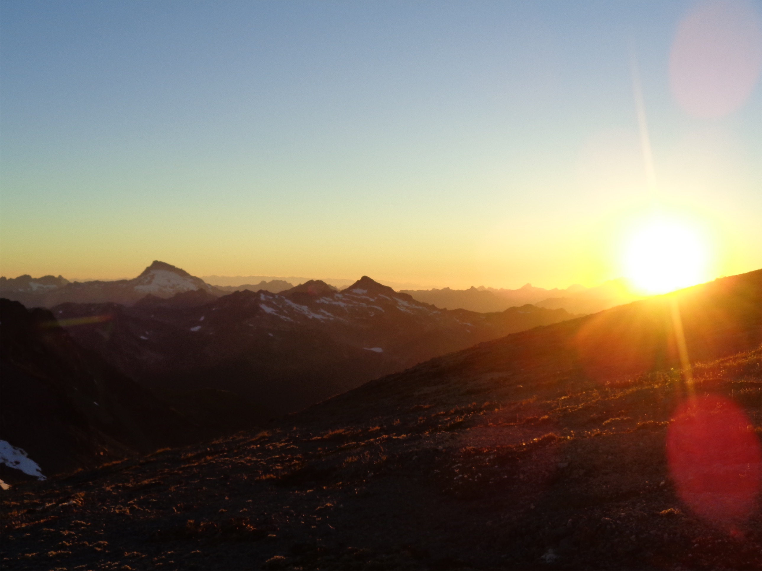
What took us over an hour to go up took us literally 20 minutes to go down (summit to glacier). It had taken us just under 4 hours total from camp to summit (including a long break since Dane ran into a friend soloing the peak), and we were back at camp in about two hours. Plunge stepping down scree was phenomenal, we cruised down the glaciers (decided not to rope up, figured we knew the conditions and wanted to save time – still on the fence about that choice), saved an abandoned camp light that we later returned to the girl who lost it, and regained the ridge back to camp where we were treated to one of the best sunsets I’ve ever had in the Cascades. Since so much of the final climb is a mellow ridge walk, it was easy to meander and get distracted and enjoy the views, savoring the feeling of being done with the climb and walking on top of the world surrounded by peaks in every direction.

Goodnight Glacier
Sunset! Sloan on the left
Wildfire smoke had been moving in for a while, so the entire sky was bright red. Kololo peaks and Tenpeak and Clark were all reflecting the sun, and Sloan and the Monte Cristos looked ridiculous. We floated over sparse grasses and dusty trail back to a stream where we filled up water for the last time since Glacier Gap has no easy water source (you can melt snow, but you have to walk to it and that’s hard). At first I complained because I didn’t want to lose elevation or go out of our way, but I knew the team was right and I’d be happier not melting snow for water. And it was like 50ft out of the way, not an issue. And it ended up being awesome, because the snowfield we crossed to get to the stream was covered in mother fucking ice worms!!! Here’s a snazzy Seattle Times article on them too. They’re pretty neat.
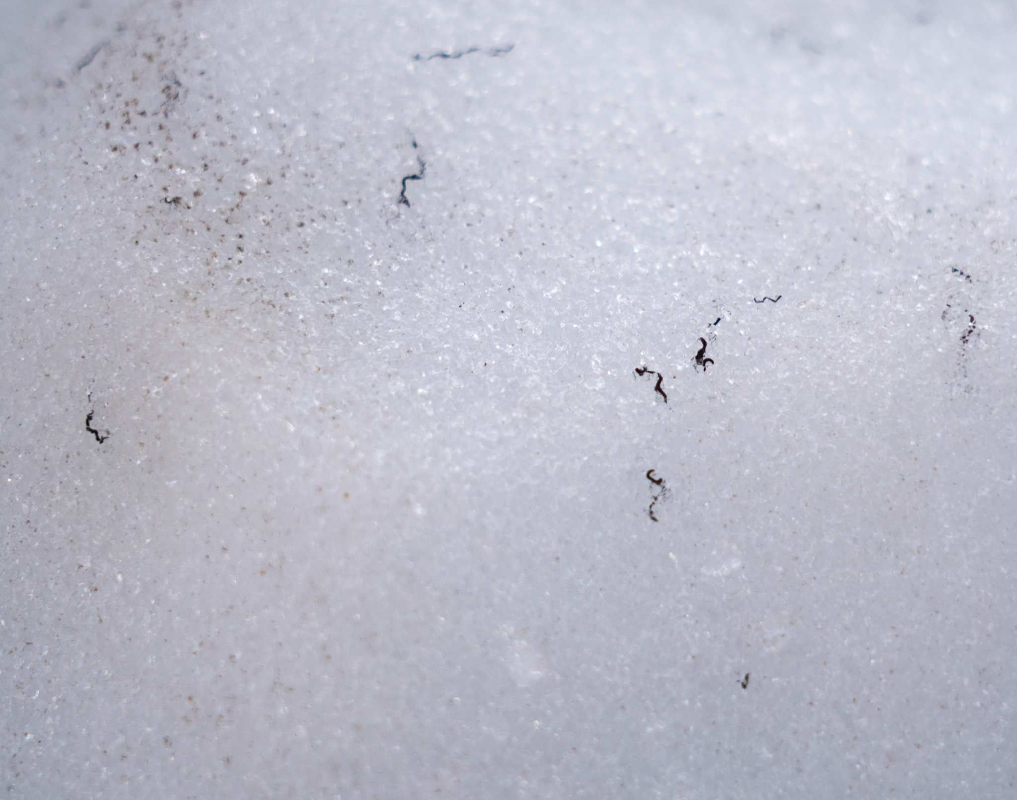
Ice worms! (Thanks for the pic Brad)
Yeah, did you even know those existed? I thought they might have been a myth. We couldn’t figure out what they were, and I was like holy shit they might be ice worms, I think I’ve read that those are real. Someone reached down and poked one, and it moved! So we all started poking them, and they all moved, and here we were stomping across all of them, destroyers of worlds, thrashers of delicate ecosystems. They only come out at dusk and dawn, and they literally melt if they’re over 41 degrees Fahrenheit (aka in the palm of your hand). And scientists aren’t sure how they move through the ice – do they release some sort of antifreeze, or move through tiny gaps we can’t see? If they liquify in heat but stay in one place, can they revive once they’ve been cooled again? Could their physiology help us with organ transplants (keeping organs frozen but alive), or drugs preventing frostbite, or even freaking weight loss?* They’re specific to Alaska and the Pacific Northwest, and it’s pretty neat we had a chance to see them. They don’t look like much and it’s a bit weird to think you’re walking on hundreds of worms (they’re like tiny threads, each 1.5″ long and super thin) but I’ll just add it to the list of otherworldly, alien like things we passed on this trip.

Last light on Tenpeak and one of the Kololo peaks(?)
So we filled our water (stream was so low we could only fill bladders and would pour into nalgenes) and trekked back to camp just as it got dark. A group we had passed on the way up had been keeping an eye out for us, which I always appreciate. We were met at our campsite by more mice (bring back the glaciers dammit) and a deflated sleeping pad (mine). Ah, shit. Of course this happened. I had been talking about how going to sleep at an alpine campsite after an awesome day is my favorite part of camping, and now I’m going to be sleeping on a pack and a rope. Luckily Dane (MVP) had repair tape (I NEVER carry repair tape) and I managed to turn the fast leak into a slow leak. Dane looked so cozy in his sleeping bag, and announced his watch said we had done 48,000 steps that day and something like 510 flights of stairs. Let’s just continue to bask in our satisfaction.

Smoke moving in Sunday morning
We devoured dinners. Brad had his own homemade dehydrated meal, Dane and John ate two dehydrated meals apiece. We admired the Milky Way and saw several shooting stars and I said how with infinite space aka infinite possibilities there’s something on another planet on a mountain looking up thinking the same things we are. Dane pointed out that even though there’s life out there it’s so far away that it’s a moot point to all of us. Brad snapped some effortless night pics, which blew my mind because I thought night pics meant like hours of planning. That’s the last thing I remember so I must have fallen asleep shortly after, only to wake up to the resident mouse terrorizing my pack. I took out my contacts, shook the mouse out of my pack, and went back to sleep. 15 minutes later that fucker was on my head. I shot upright and flung it away. Did I though? Or did it just fall into my bivvy? I froze, listening for the sound of a rodent running around my sleeping bag. No, it’s quiet, I’m safe. Well hopefully I flung it far enough it never comes back because I am done with this shit.
Mars! Back across the basin

John ready to pole-vault the river, Glacier disappearing in smoke
I woke up around 3am to re-inflate my poor sleeping pad, and then officially woke up at 6:30 and sat up half an hour later. The mouse had given Dane a hard time too so at least it wasn’t just me. Wildfire smoke was officially closing in, and there were tendrils of it wrapping over Kololo and Tenpeak. We started moving around 8am, and the sun felt weak. It smelled like grilling. On the bright side, this made White Chuck Basin look even more like Mars, and meant we were only 70% baked by the sun not 100%. We knew it was supposed to be a hot day and I was happy to have the cold breeze coming off the ice with a sickly sun. We had a looong day ahead of us though it turned out to be far shorter than I expected.

Dying glacier
We took two hours back to White Pass, where the haze had settled into a blatant layer. Dane whipped out cheese and sausage he had been carrying the whole time, and passed it around while we all sat there drooling because sausage and cheese is the best thing in the backcountry ever. The traverse back to the switchbacks smelled like blueberry pie because of all the berries, and bugs that sounded like cicadas buzzed in the August heat. When I picture summer this is what I think of. We sporadically filled up water and then hit the only part of the climb that I would call true suffering: going down those god damn 2.7 miles of switchbacks. In the sun. With no water. Oh my god. I felt bad for everyone going uphill. And it felt SO much longer than it had on the way up. I ended up going into survival mode and hustling and not talking until I got to the shelter in the shade. Whew. Luckily they were minutes behind me. Brad was so in the zone he didn’t even realize we were at the shelter. I lay down on the trail and put my feet up on a log and savored the feeling. 5.5 miles left of easy rolling trail.

Brad’s awesome pic of the Milky Way
Dane being bad ass
Except every mild uphill killed me. My feet hurt and I had hives all over my legs (or heat rash, could be either, I’m obviously allergic to fun). And I was out of water. I filled up at the large stream with the bridge across it even though it meant losing and regaining a whole 10 feet of elevation. I asked Dane what the temperature was. I guessed 85 degrees, mostly whining and exaggerating because I was suffocating through every sunny brushy section of trail. His response? “It’s…85 degrees.” Barf, nailed it. We passed a sign for Sloan Creek Road and the PCT, and Dane said that sign was 2 miles in. I could have sworn we had passed the sign only 10 minutes ago and I cursed. That meant we were still so far away. I resigned myself to another 45 minutes of walking (because if you set the bar low, you’ll never be disappointed). Except five minutes later John said he smelled the pit toilet. I laughed and said ha, I wish. And then suddenly we came around a corner and I saw the trail register!! Yes!!! And it wasn’t even 3pm! We were back so early! That means burgers!! I’m never back early enough for Burger Barn!

Brad Lake Eve Lake below White Peak and Red Peak
We dropped packs at the car, savored the pit toilet (especially Brad, who ran the last mile as the pit toilet called his name), changed into sandals, and sat. I love sitting. Dane has fantastic taste in music and we drove back down the road with the windows down listening to tunes and I gotta say I had a 10/10 moment. Satisfied, exhausted, thinking back to that sunset, it was amazing. What these guys didn’t know is that this was my first trip with completely new people this summer, and I didn’t know how it would go mentally after everything that happened in the spring. Grief can be physical, and you never know when it’s going to smack you in the face. But the answer is it went great. It was possibly the first trip I had where I felt back in the groove. There were emotions but they weren’t overwhelming and they didn’t manifest physically and it was easy to admire our surroundings and just relax. I’m sure it’ll still be up and down but it was great to have another trip that reminds me why I like climbing and why I do what I do.

Old growth forest
We covered like four different ecosystems on this trip. Old growth forest with enormous trees, rolling alpine meadows and ridges, extraterrestrial exposed glacier basins, and finally a massive peak with cascading glaciers (though who knows how long they’ll last). Glacier Peak has a neat summit, sure, but the cool thing about it is everything you cross on the way there. Once I started looking at it as a backpacking trip instead of a climb, it became a worthy objective, and far surpassed my expectations. So huge thanks to Dane for tossing out the idea, and John for braving the drive from Portland (barf) and Brad for geeking out about glaciers with me. And then extra to Dane for saving my sleeping pad. Awesome team, awesome weekend, so glad it happened.

Summit shot!
*one of these makes more money than the others

Very nice report! Thanks for sharing and I look forward to your next adventure
LikeLike
Did it a few weeks earlier. Spot on! Spot on!
LikeLike
Pingback: Primus & Austera Ski | Have Tent, Will Travel