

Heading down from the summit
Wow this is from a while ago. A month, in fact. I got my ass handed to me on a silver platter by work, followed by two three day weekends, and this got abandoned on the back burner in favor of reports from Rainier and Olympus. But I can’t pass up one of my favorite hikes. I had attempted this peak last year but turned around due to my friend’s severe leg cramps. But with how gorgeous the area was, I knew I’d be coming back, and finally had the opportunity for a revenge trip. Hiked 6/19/2016.
- Distance: 13 miles round trip
- Elevation: 5100ft gain (6487 highest point)
- Weather: 50’s and cloudy, 60’s and sunny (shit, I just realized weather is like a spoiler for the whole blog post)
- Commute from Seattle: 2:30 without traffic
- Did I Trip: Everyone did!!! I didn’t see Angie wipe out but it was pretty good. Dru tripped enough for all of us. Surafel had one good one, Chelsea had one, and someone fell off a log while trying to cross it by straddling it, which was the highlight of the wipeouts.
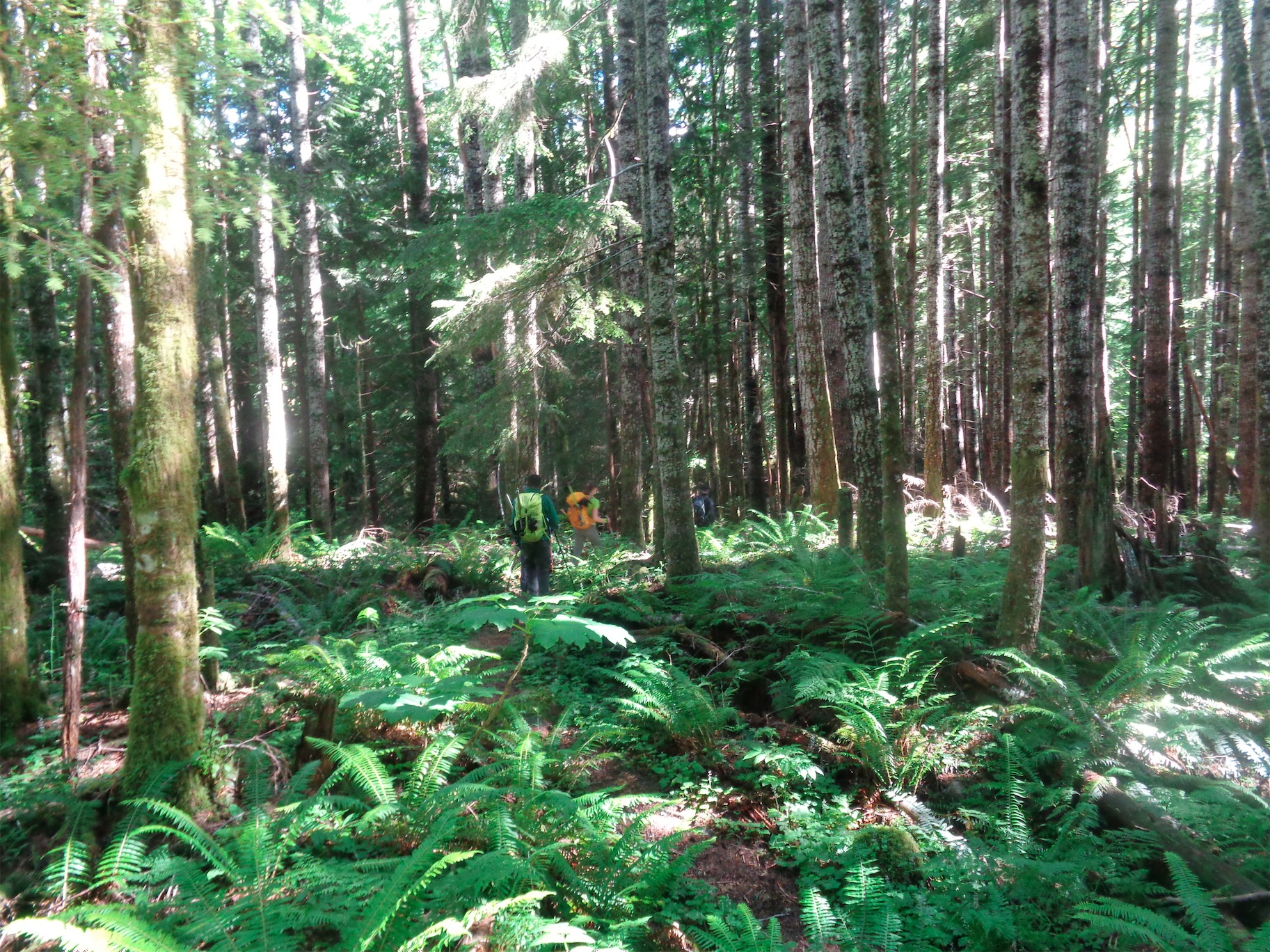
Ferns on the forest floor
“Partly Sunny.” See it, on the left? Hint of sun.
The forecast was for something like “partly sunny” on NOAA and “some clouds” on MF. “Some clouds” is anything from completely cloudy or socked in by fog to a few nice puffy clouds on the horizon. “Partly sunny” on NOAA usually means “Psych, just clouds, suckers!” So I wasn’t going to get my hopes up, but I mean.. they were kind of up.
We met in the Lynnwood Park n Ride at 5am. I was late, as usual. Guys I swear once upon a time I was a chronically early person, to the point where I’d awkwardly drive in circles or walk to Starbucks to kill time. I don’t know what changed. But I was late, and luckily I have good friends who waited and did not give me shit. In fact Dru had an extra coffee and Surafel had gotten tea. Stop being so nice guys. Chelsea and Angie, step up your game.

Green trail
We all piled into the xterra (like a family road trip, I was already laughing) and drove off into sunrise. Oh wait, the sun rose at like 4am because it’s June. We drove off into what looked like midday. The mountains were still in clouds, but they looked like the type that might blow over. We reached the trailhead, I immediately started down the wrong trail just like I did last year, and everyone else saved my ass and we found the correct trail. Don’t take the boot path in front of your car when you park. Go like 10 feet further down the road and the real trail is very obvious with a register and everything. The bootpath by your car is from idiots like me and people who have to pee.
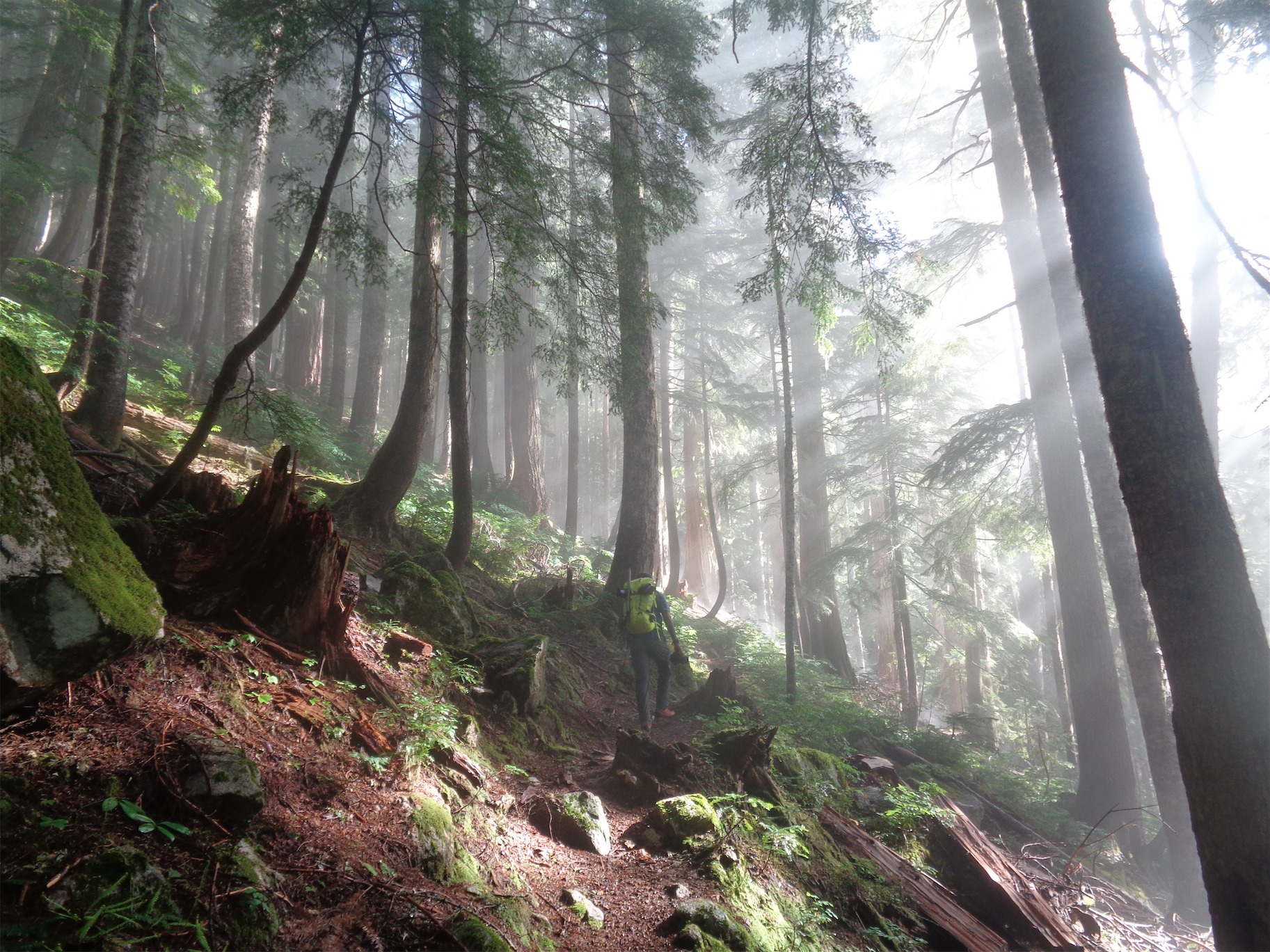
Surafel admiring the sunlight streaming through trees
The first two miles of the trail are through forest. Green forest with beautiful mist and sunlight spilling through the tall trees, and people who like to stop and ooh and ahhh at everything. Except Angie, who will never be impressed by anything.
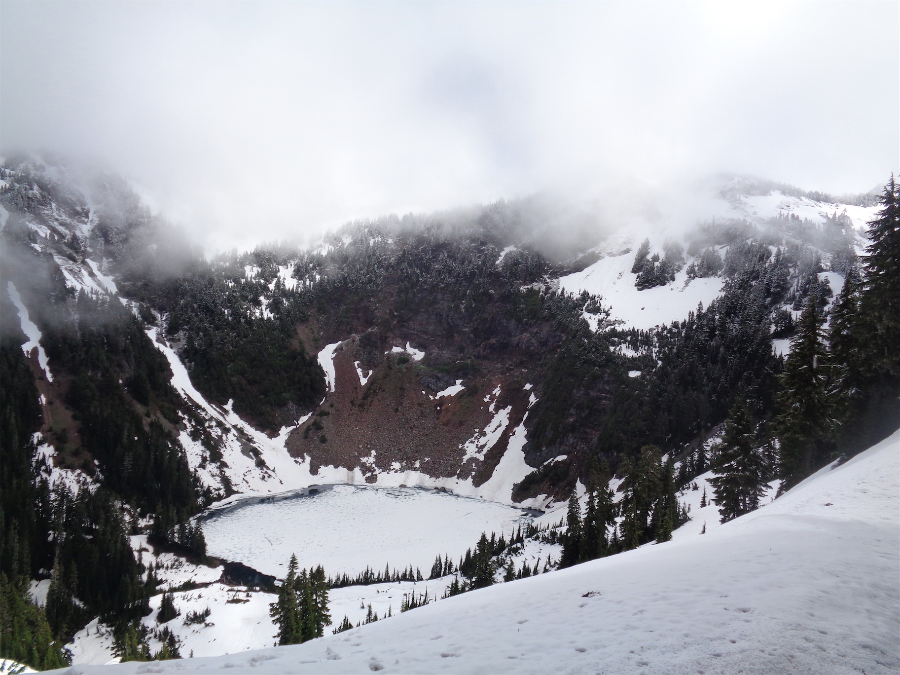
Round Lake
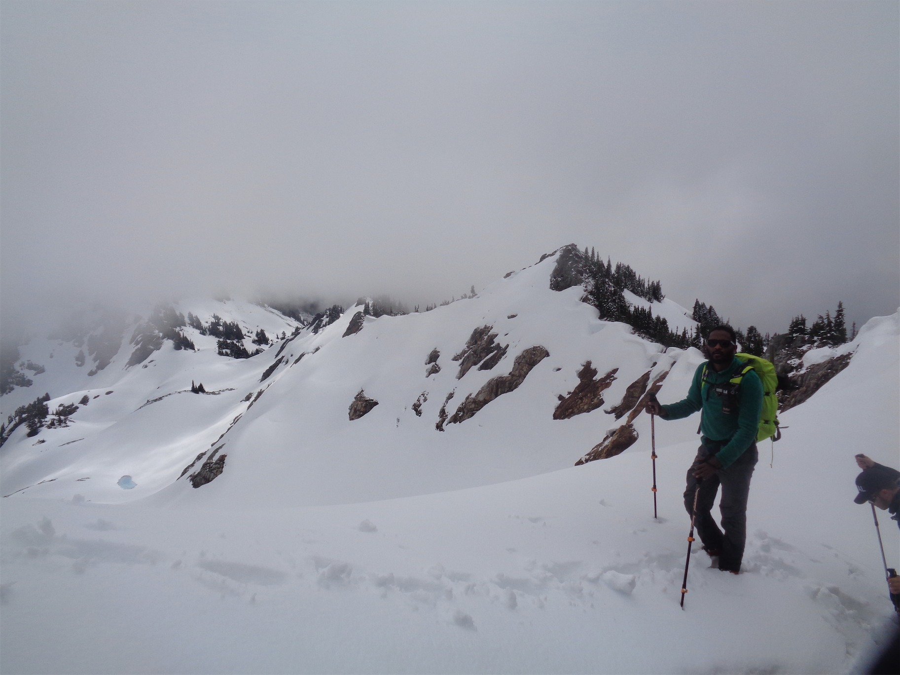
After 3.25 miles you reach Bingley Gap (HA guys this explains a lot I thought Bingley Gap was 2.4 miles in), where you turn right and follow a ridge to a beautiful vista above Round Lake. We reached the ridge and were continuously in and out of clouds, and eventually hit snow right where you get the views of Round Lake. I was going crazy, having been there last year I knew exactly what views were being obscured by the clouds, and no one else had any idea.
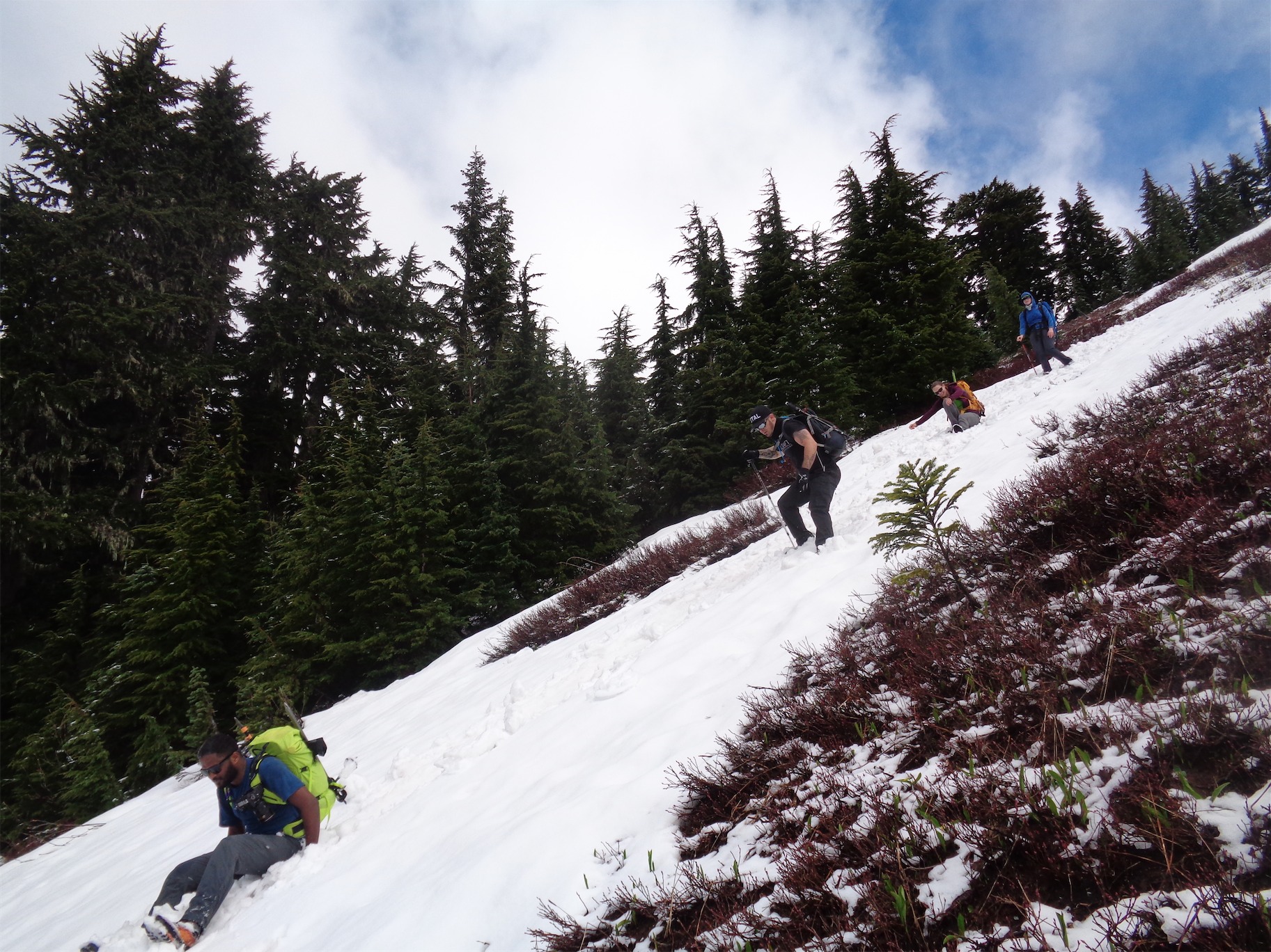
Various stages of walking, falling, and glissading
We followed the route I took last year, which is not the best, but it works, and after a short stint of near-bushwacking through steep trees (I laughed because I’ve dragged Chelsea through much worse) I didn’t want to take any chances with an unknown route. I knew my route from last year would take us along the crest of the ridge to a 3rd class scramble above Sunup Lake, where we could drop down and gain the slope to Breccia.
Well, the 3rd class scramble was wet and mossy this time around. Crap. Everyone got down, slowly but surely, and we debated between taking the steeper more direct route, or the mellower, longer route. There was fresh snow and some sloughing, not enough that I was worried about avalanches this time of year but enough that you might get hit in the face with some pinwheels. And we chose, as usual, the steep direct route.
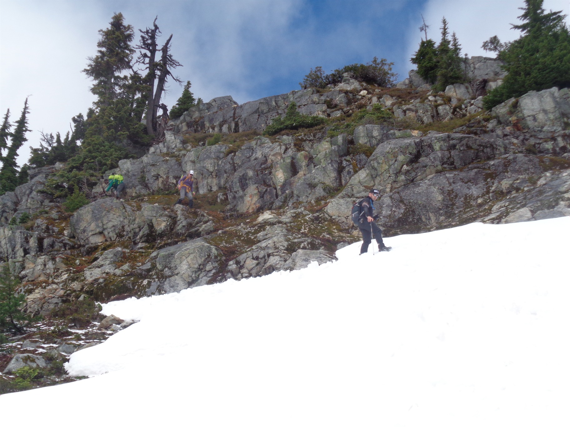
At the bottom of the scramble
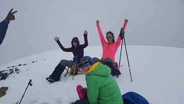
Summit photo! (Photo Credit Dru)
We took turns kicking steps up the slope, navigating through patches of steep heather covered in three inches of snow (the worst conditions for heather) and packed snowfields (a relief). Dru was fueled by F bombs, not enjoying the slippery heather. But with every F bomb he got stronger, and I laughed harder, and eventually we were on the final ridge, which was all snow! Woohoo!

Here it comes!
Except we were in the clouds. Like IN the clouds. Completely socked in. Just as we got to the summit. Because how else would it happen? We plopped down on our packs and had snacks, sharing chocolate and sour patch watermelon and combos. Well I ate most of the combos. What are combos, you ask? If you walk into a gas station and ask ‘What’s the least healthy thing I can put into my body in this gas station,’ Combos are your answer.

Glacier Peak
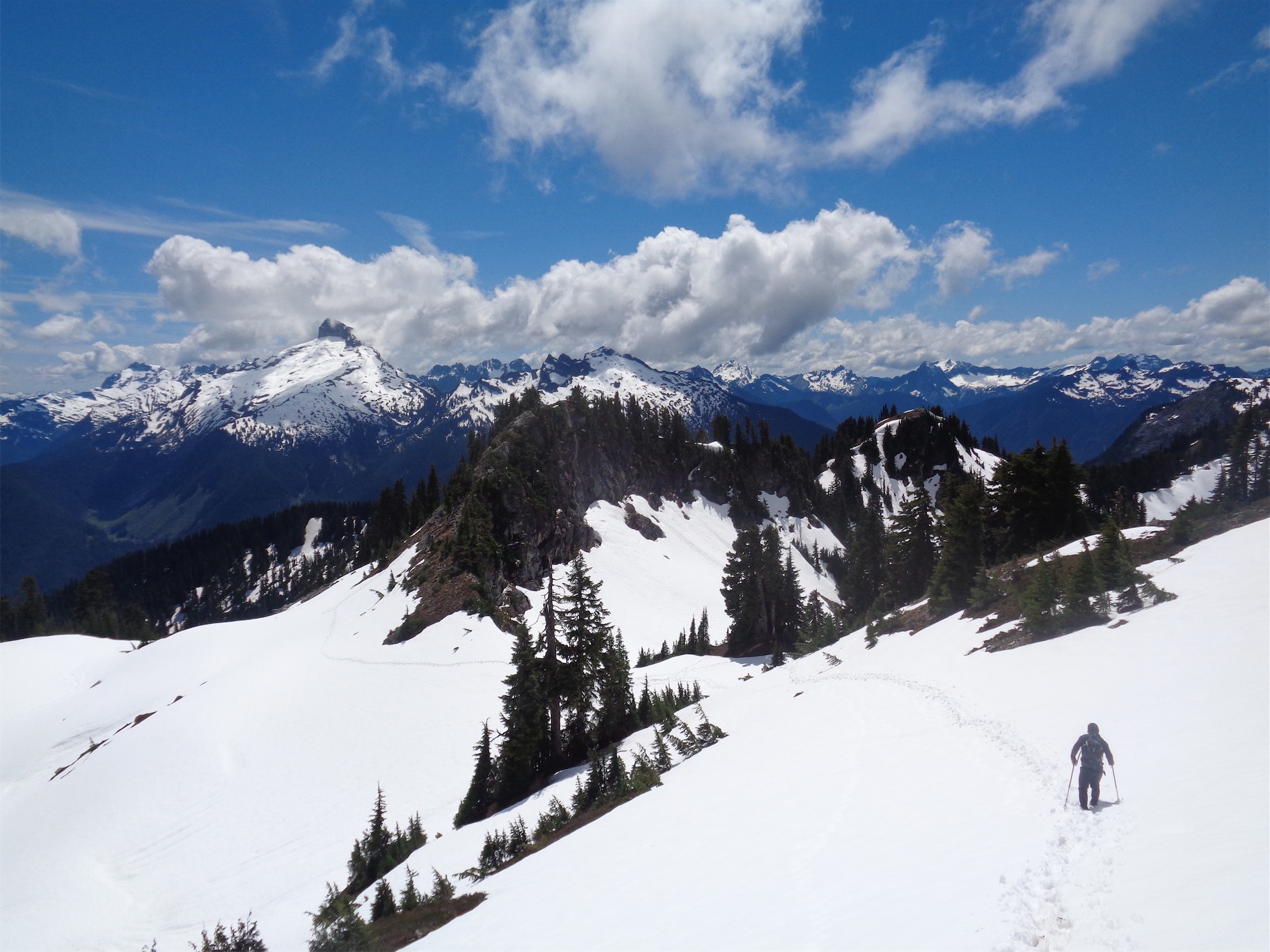
After 45 minutes with no cloud improvement, we finally decided to head down. “It’s going to clear up as soon as we’re back down,” someone said. I started singing. “I CAN FEEL IT COOOOMING IN THE AIIR” and they were right, within five minutes we reached the bottom of the summit ridge and bam! Sunshine! And the clouds were moving! We all started to freak out. We snapped pictures. Surafel got some awesome pics of Sloan shrouded in clouds. There was one big ass, slow moving cloud covering Glacier Peak. It would peek out, just the tip, and then disappear again. Surafel started taking a time lapse. 20 minutes later, the cloud had crept slightly left. Surafel’s arm was probably tired from holding the camera in the air with no tripod. Hurry up, clouds, we got shit to do.
Sloan and Bedal, Dru for scale
We named peaks, the group favorite being Ointment Peak. That’s a terrible name for a peak. Or Mt. Pugh, an actual peak which some of us thought was pronounced “pug.” Mt. Pug. Also a terrible name for a peak. We eventually gave up on Glacier Peak and headed back to Sunup Lake to rejoin the Lost Creek Ridge trail. The scramble back up to the ridge crest was much easier (though involved fighting through some trees), and the race back to dry trail went quickly, as plunge-stepping down snow usually does. Plus it’s great when you have line of sight and can see the best route back from up high and not waste time fighting analysis paralysis – “This way? Will it cliff out? How does the topo look? Am I pushing anyone’s comfort zone? Fuck I just dumped water all over myself pushing past these bushes. Are they having fun? What if they aren’t having fun?! Shit, I still haven’t picked. Up and left or straight and traverse?!?” Yeah, on the way down you (ideally) know where you’re going.

Glacier Peak peeking over the edge of Sunup Lake

Heading home, dwarfed by mountains
Back along the ridge, we turned around to marvel at Glacier Peak, which was finally completely clear with no clouds. There it was, the day was complete. We made it to the top, socked in by clouds, and we left fully satisfied with incredible views, pictures, and a solid two hours of consistent giggling. Back on dry trail, we made good time through the trees down the countless switchbacks (but actually we should have counted) and eventually popped out at the car. The consensus was Mexican food. We piled back into the car, rolled the windows down to air everything our, and within an hour we were devouring burritos and strawberry (raspberry?) lemonade.

One last pic of North Cascades greenery

Some of the photos don’t pop up when you click on them (like the summit photo of you and a not-entirely-triumphant-looking Angie).
LikeLike
Pingback: Spring Training | Have Tent, Will Travel