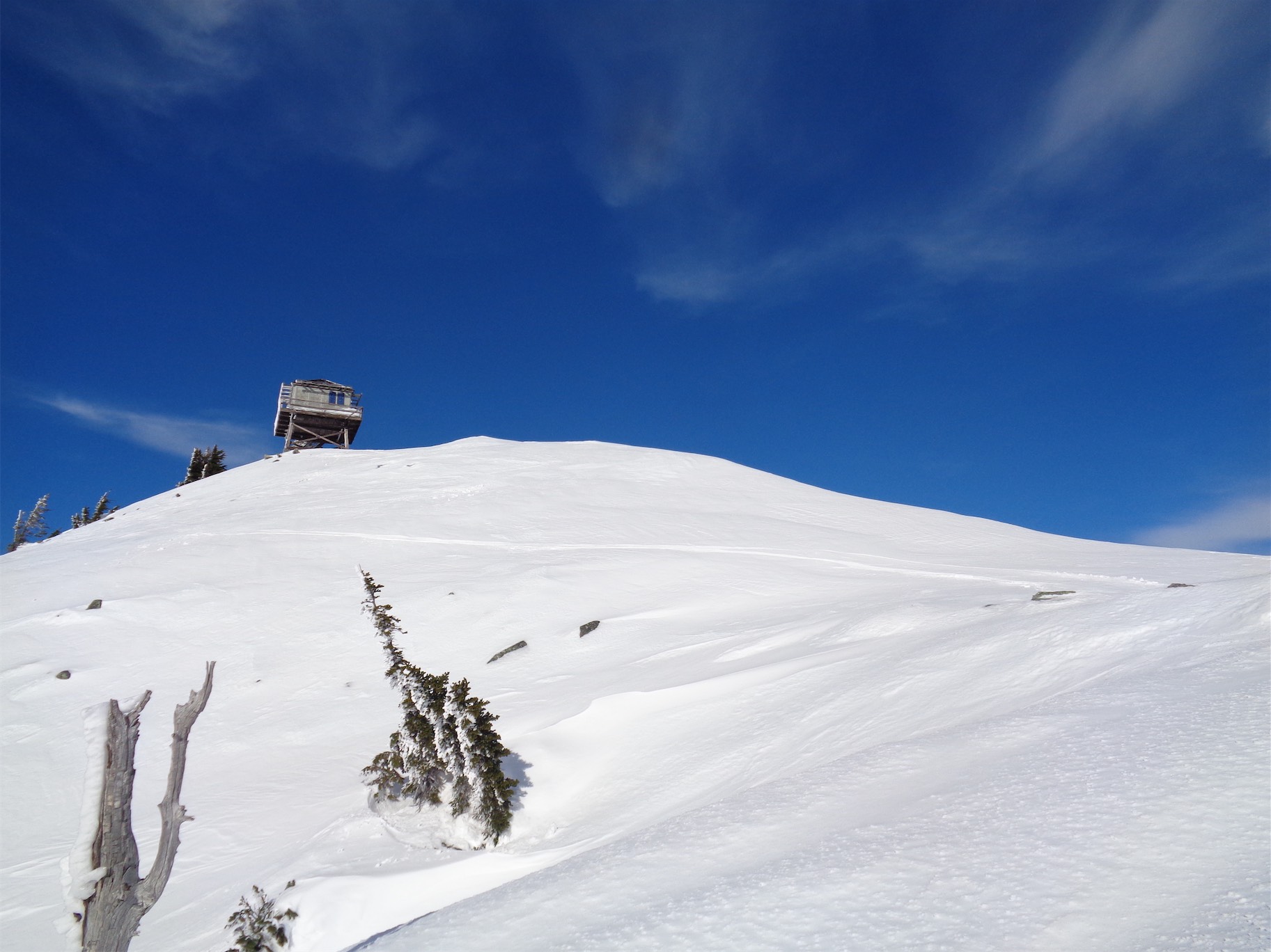
The lookout!
“Should I hike Granite Mountain?” you ask? I’m going to go with a resounding “no,” unless you like postholing and slogging through massive amounts of powder and have decided you need a good workout. Or if you have an AT setup, you can skip all of the suffering and just have a freaking blast, besides the stream crossings on the snowshoe-trampled trail. But hey, gotta get in shape for spring climbing, right? I nearly bailed since I had heard miserable stories about the ice crust with a few inches of fresh snow the day before, and Aaron didn’t have snowshoes or skis so we’d just be booting. And the only thing worse than struggling through several feet of powder is struggling through several feet of powder with a two inch thick layer of ice on top that you may or may not break through every time you take a step. But spring is quickly approaching, and I can’t sit on my ass on a sunny Sunday, so bring it on, Granite. Hiked 1/12/2017.
- Distance: ~5 miles round trip
- Elevation: 3800ft gain (5633ft highest point)
- Weather: 30-40’s and sunny
- Commute from Seattle: 55 minutes without traffic
- Did I Trip: the real question is “how many steps did I take without tripping” because the ratio of tripping to walking was very high
First of all, here is a map. The red line is roughly your route from where the standard trail first meets the gulley. Don’t follow the green line. If you’re a solid skiier and comfortable in avvy territory, it did look like a great ski all the way down the gulley to the tees. This was taken from a discussion on nwhikers.net.
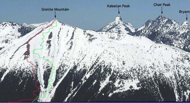
Red is your route

How most of the lower hike went (calf to knee ish)
Well I was originally hoping to do Pratt Mountain, a popular winter snowshoe that happens to share a trailhead with Granite Mountain. But we got to the trailhead and there was a group of 12 mountaineers that had just started, followed by a group of 12 folks from the Outdoor Adventurer’s meetup group. Shit. Okay so we’re not doing Pratt. Well I think I know a route up Granite that’ll avoid avvy territory, want to give it a shot? Aaron was down. He looked at it from the highway and laughed. “You chose this?!” thinking it’d be a few hours of quick easy hiking. Psych!
The first of several avvy gullies on Granite. Be wary.
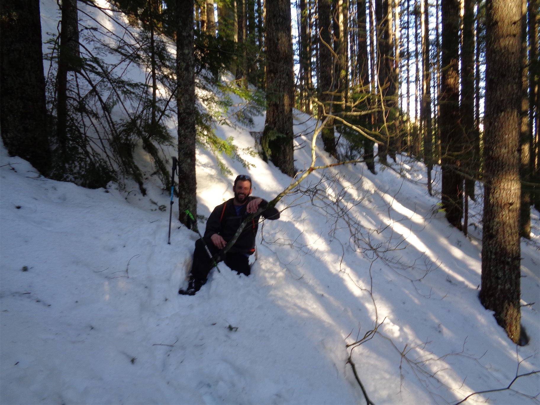
As usual we had maybe 7 essentials between the two of us. Aaron didn’t bring traction. Okay, take my microspikes, I can use crampons. He didn’t have an axe either. Or poles. Okay take my extra pole. I didn’t have waterproof pants, and would look ridiculous wearing full on crampons on the trail, so I stuck it out in boots. And my avy beacon was broken. Great. 1=0 when it comes to beacons, so we knew we’d have to be conservative.

The view as we broke out of the trees!
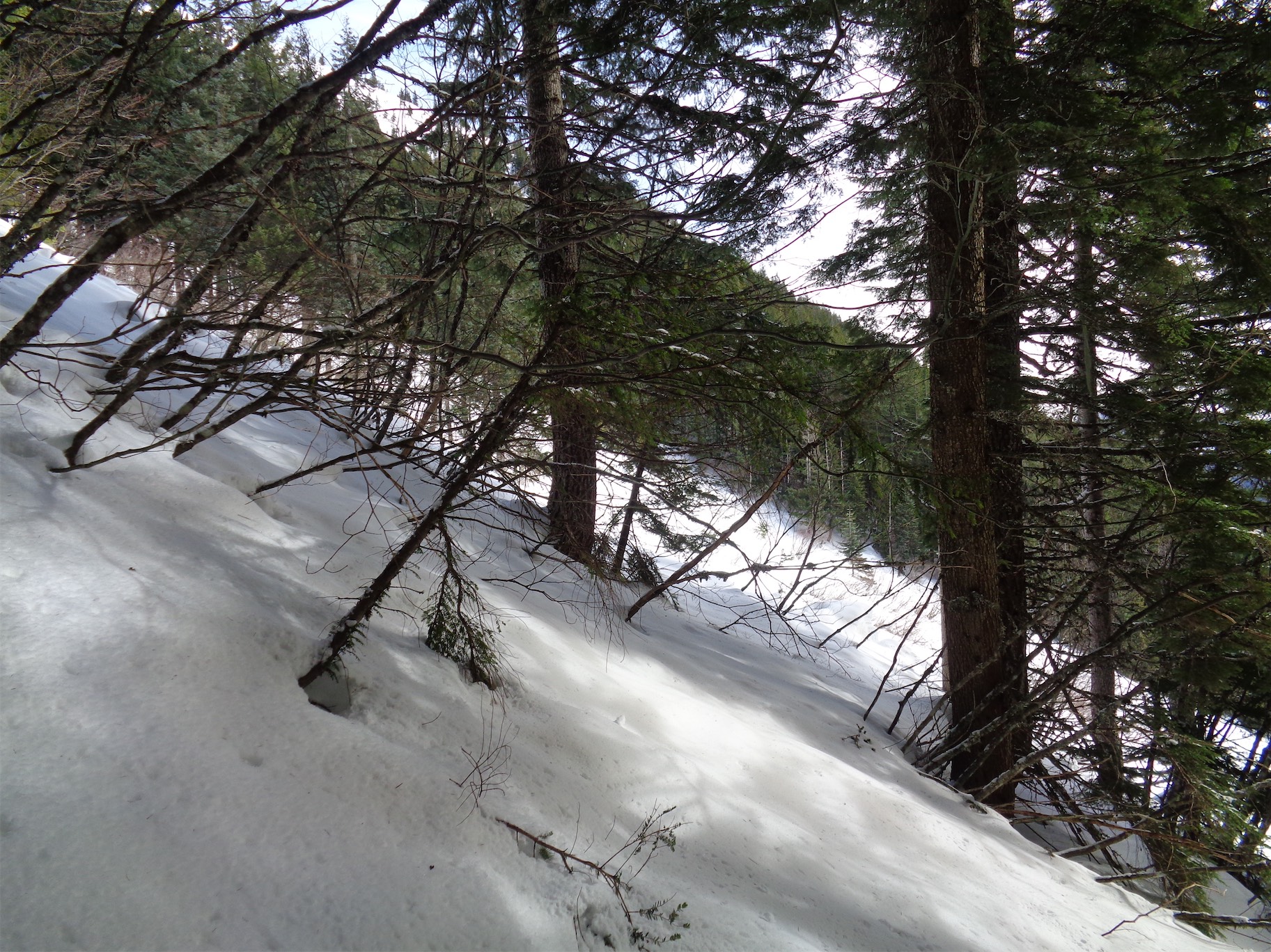
The snowshoe trail continued a little bit further until the gully. Well we sure as shit weren’t going across the avalanche gully, so I have no idea where the tracks went. I don’t think they knew the winter route and we never came across them higher up, so I’m guessing they turned back. We started heading directly up through the trees, paralleling the gully well to our right. Upon stepping off the snowshoe tracks, we were met with knee deep powder with an ice crust exactly as predicted. Ohhhh boy.

McClellan Butte is the pointy one
We were losing hope after maybe 90 minutes of this shit. I knew what I was getting into, I had specifically chosen a snow slog knowing I had to get in shape and needed hours of breaking trail. I don’t think Aaron realized what he had signed up for. Either way, repetitive stomping in powder with no views and no excitement gets old very quickly. We decided to head to the edge of the gully to see how far away the ridge looked.

It wouldn’t be bad if you had crampons
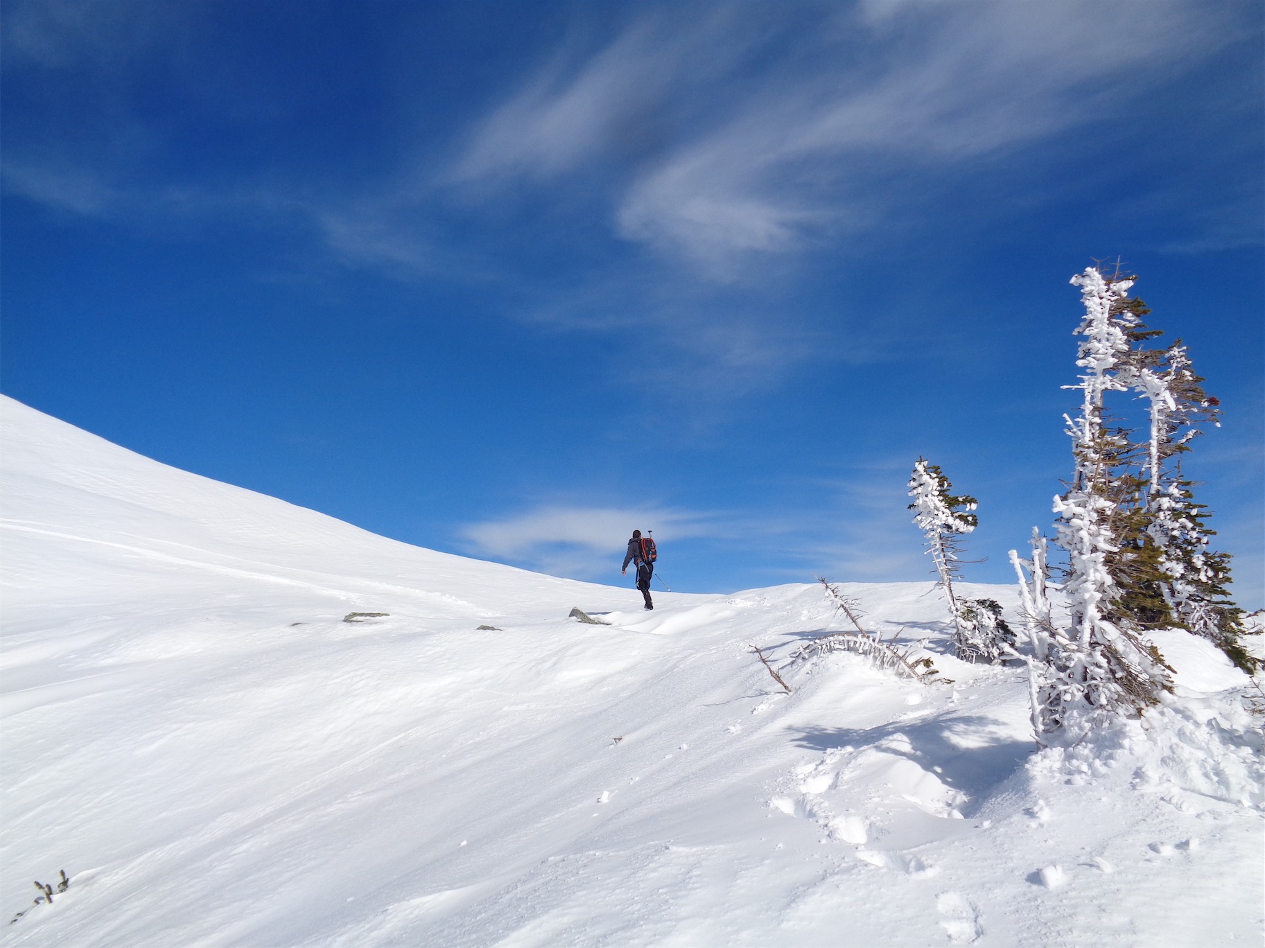
As usual, we broke out of the trees, team morale spiked with the sun and excitement and views, and we took a quick break and kept moving. From the trees it’s a short jaunt to the exposed rocks, which you follow to the true “wind scoured ridge.” Stay on the rocks and you are free from peril (probably, no guarantees). We hopped up on icy rock after icy rock, occasionally requiring hands and at times just booting it through snow or slippery heather. The snow was a fresh inch or two on top of ice which made it tricky, especially for Aaron who was down to one microspike. Where was the other one?! We had no idea. He had noticed he was down to one when we were still in the forest, but it wasn’t an issue until now. It must have popped off in one of the eight million postholes we endured on the way up. Oh well, we’ll find it on the way down.

Neat sky behind a tree

Obligatory Rainier shot
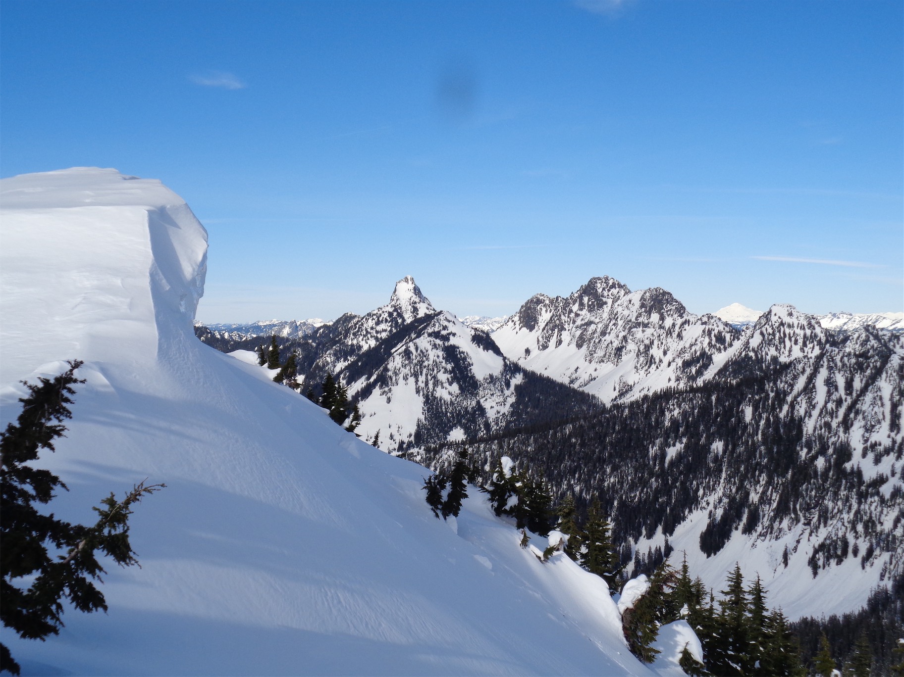
Crampons and an ice axe were very helpful. One microspike was not. So Aaron stuck to the rocks and softer snow while I booted up whatever I felt like booting up. I finally looked up and saw the lookout. Holy shit, it’s right there!!! We’re going to make it! I had still been having doubts thanks to the topo map. But now it was within sight, and it really WAS close. Eventually we crested the ridge below the lookout, and reveled in our views of Kaleetan, Chair, and Bryant.

Kaleetan, Chair ,Glacier (snowy peak in back), and Bryant. Who knew!?
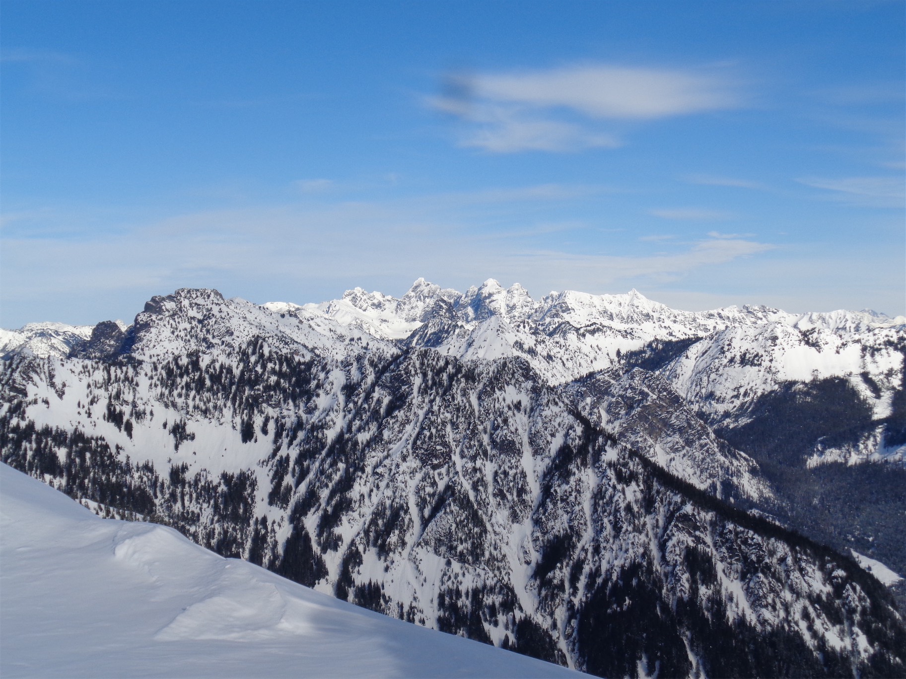
Chickamin, Lemah, Summit Chief
The views were awesome. I had no idea, the only other time I had been on Granite we were socked in by fog. Everything looks better with a dusting of snow, but the views to the north and east were epic regardless. It was tough to head back down knowing it was one of my few weekends in the mountains, but I wanted to be back at a reasonable hour. Luckily, going down went faster than going up, though we had to play it safe with Aaron’s single microspike. I gave him an extra pole so I could walk down with a pole and an ice axe and he’d have two poles, which helped a bit. Self arresting with poles is spicy. But the slopes were mellow for the most part, until we made a decision that is a great example of “what not to do.”
Nice cornice
We descended too far on the wind scoured ridge instead of following the rocks east to the trees we had come up through. We could have kept going straight down, but then we’d have had to navigate a bit instead of following the (surprisingly efficient) route we had taken up. And I’m lazy. So instead, we chose to cross the definition of an avalanche slope, facing the south, on a sunny day, on a notoriously avalachey mountain. While the snow seemed fairly consolidated besides the few inches on top of the ice crust, and we hadn’t seen any serious red flags for an avalanche, it was still unnerving. Did I mention that the previous day in SAR we had been looking at pictures of bodies buried in avalanches on Granite? Yeah, it was on my mind. Welp, one at a time, move quickly, and don’t trip. Let’s get this over with.

Heading back to the lookout

Glissading down
Spoiler alert, we were fine. But you never know. .01% chance something goes wrong, 99.99% chance of a horrible outcome if something does go wrong. That’s how a lot of mountaineering is. Sorry mom. Next time I’ll go back up and over instead of across. But it was quick. From there on out we were back on the rock, and soon enough we were in the trees were we glissaded down our tracks (destroying every beautiful staircase we had made on the way up so you all have to break your own trail, suckers) which flew by if you ignore my immediately numb ass. We were almost back to the snowshoe tracks when I saw something curled up in the bottom of a posthole. Could it be?!
A close call with a double posthole
I started laughing. “I found the microspike!!!” We couldn’t believe it. Just saved ourselves $70! We stashed them and continued down to the snowshoe tracks, which were a relief after all of the postholing and frigid glissading. Somehow the snowshoe trail was way longer than we remembered. My legs were still fresh, though that suddenly deteriorated when we hit the parking lot.
Crossing the last saddle before rising to the lookout

Don’t make me nervous!
LikeLike