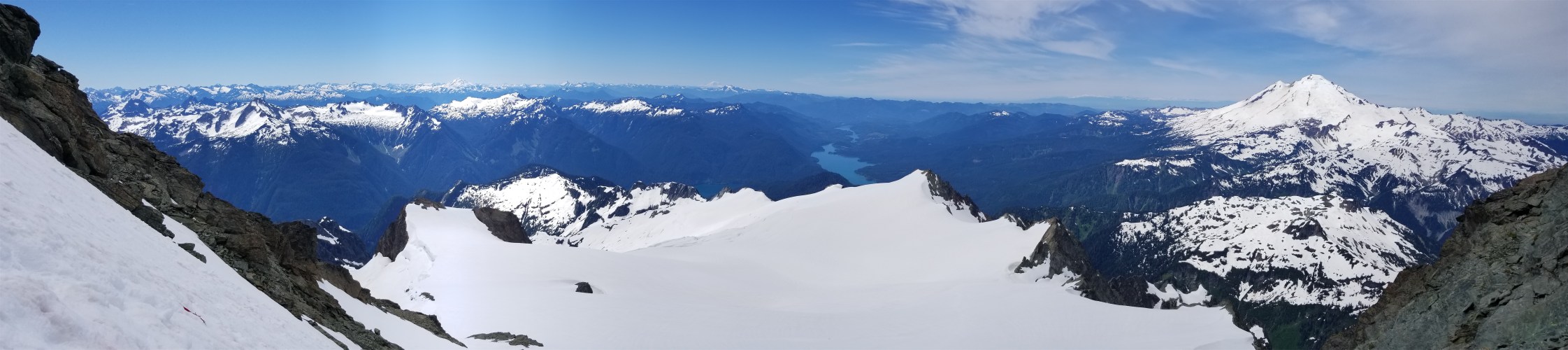

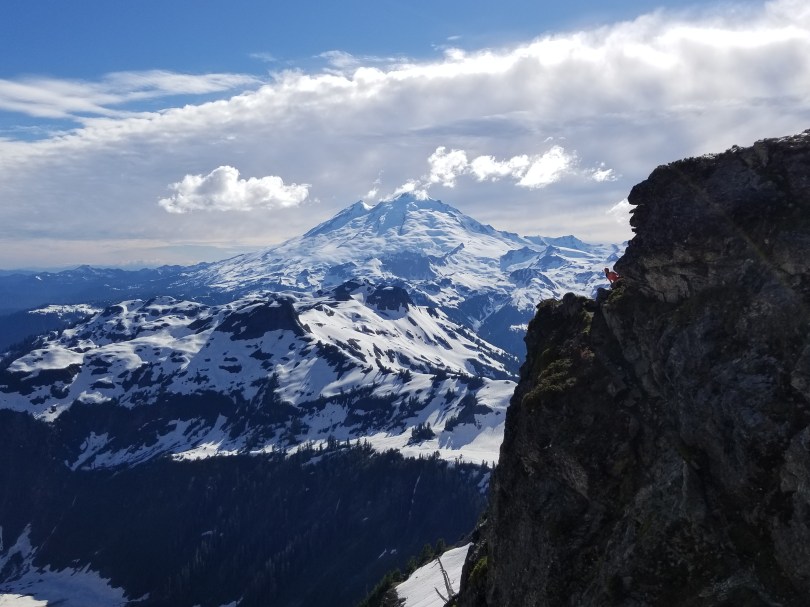
God I love this mountain. Baker in the distance.

Clouds part enough to see Baker Lake
By now you’re probably all heard me rave about the route. Fisher Chimneys is one of the best alpine routes in the state. My sample size may be small, but I swear it’s just the gift that keeps on giving. A pleasant hike through a lush (too lush) valley to a small alpine lake oddly situated on Shuksan Arm to a scramble-catwalk-scramble to steep snow to glaciers to another fantastic scramble, this route has everything. So when I had the opportunity to lead a rope on a few trips with Peaks of Life, naturally I called dibs on the best route.
- Distance: 12mi
- Elevation Gain: 6,200ft gain (9,131 highest point) but you lose elevation from the trailhead immediately so it’s technically a bit more than that
- Weather: 40’s and rainy, 50’s and sunny
- Commute from Seattle: 3hrs
- Did I Trip: No but the others made up for my alpine grace
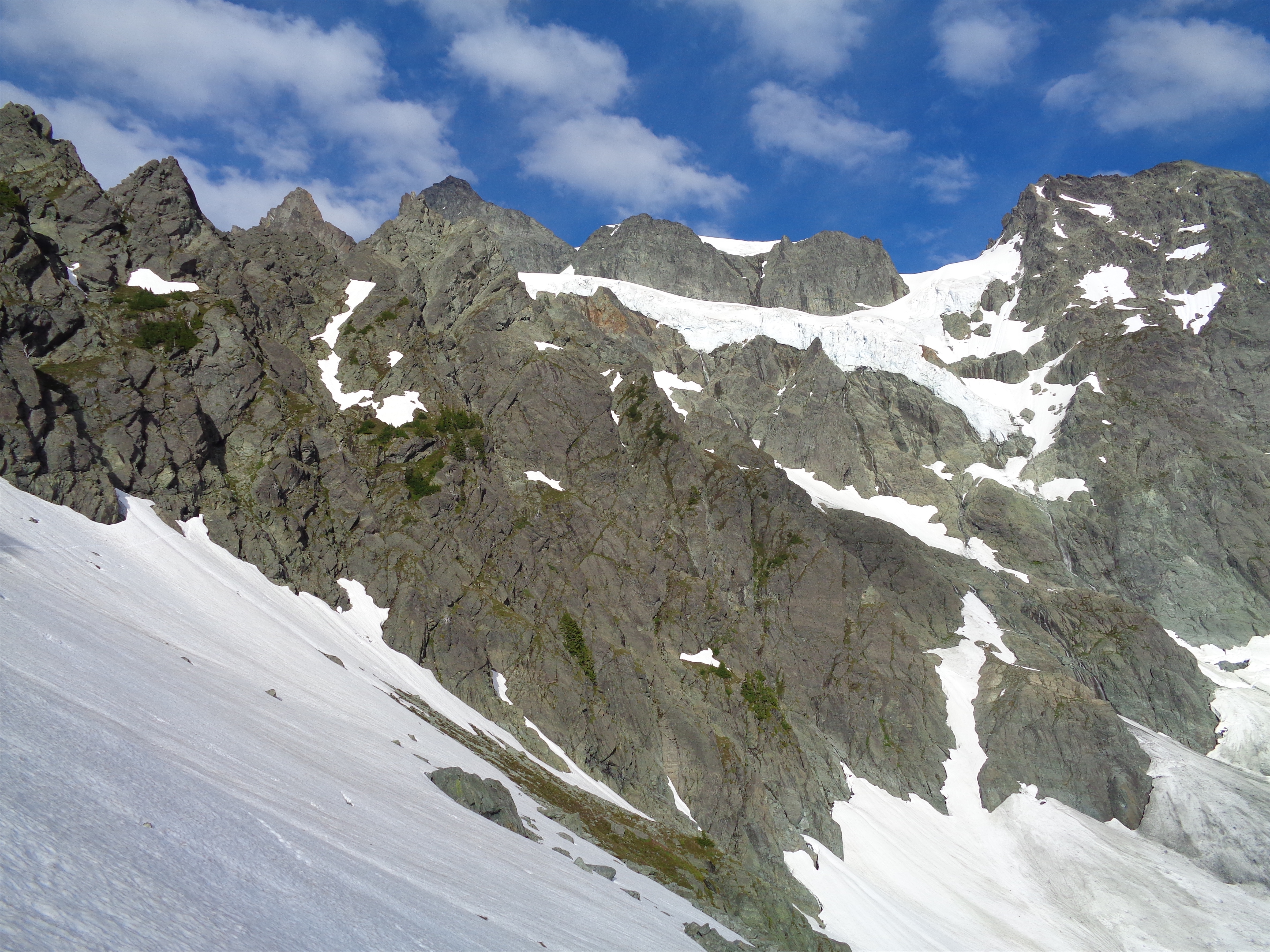
Beta pic. Chimneys on the left (they wrap out of sight), Upper Curtis is the downward sloping glacier, Hell’s highway is the clear notch on the right.
Let’s talk about the route real quick first. Many of the sections on this route are labeled incorrectly on the USGS map. And caltopo. Interestingly, the GAIA app seems to have it right. Here’s a link to a caltopo route of Fisher Chimneys (the northern route, the southern one is Sulphide) with labeled sections. Winnie’s Slide is southwest, you hit it right after a short walk along the White Salmon glacier after topping out of the chimneys. The Hourglass (not labeled) is the first snow ramp up to the first dip just southwest of the summit pyramid, it will not be continuous snow besides early season. Hell’s Highway is the obvious ramp that connects to the Sulphide at the south end of the Upper Curtis. Okay, now that we have the map cleared up, let’s talk route conditions and get to the pictures which is why 90% of us are here.

Very cool swirly rocks
We grabbed permits at 8am on Saturday, snagging the second to last spot and being told there were 17 others on the route. Oh god. I hate people. I knew the route was popular but we had it all to ourselves last time so I didn’t expect to actually see that many people. We were at the trailhead and moving around 9:30, with no views in any direction besides ping pong ball whiteout and the occasionally raindrops. As expected. Shuksan doesn’t love me like I love her.

Foreboding traverse to the chimneys
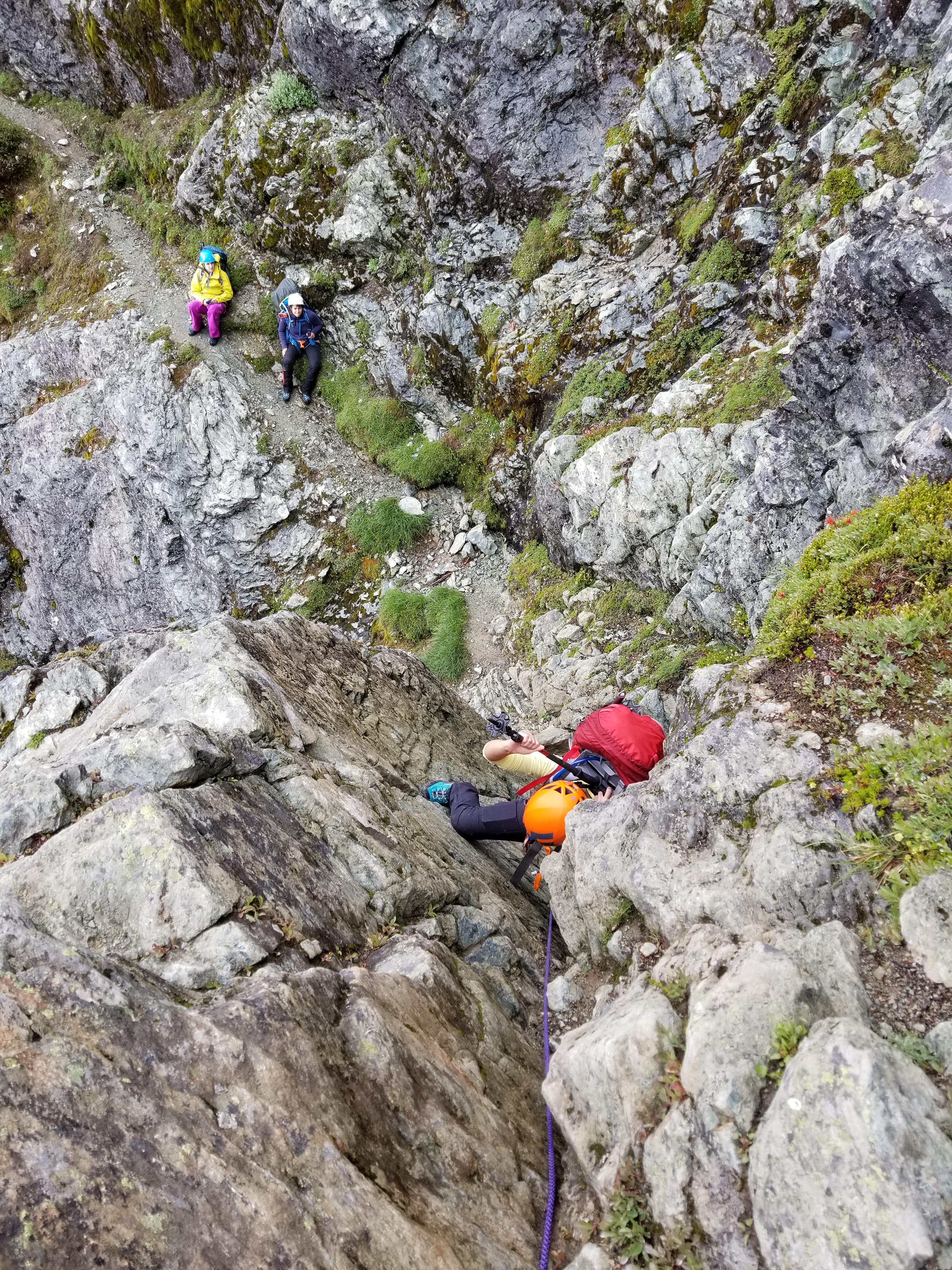
Shortly after that two guys from SMR passed us (Hi Jim and Matt! Fancy seeing you here) and we yo-yoed with them for a bit while each crew had to figure out trickier spots. They passed us for good on the first scramble section, which was a soaking wet mostly waterfall ~15ft section of 4th class. I scrambled up after allowing most of the waterfall to flow straight up my goretex sleeve and announced I had found the first rap station (a few steps of the Chimneys are rappable on the way down). Jim looked up at me and jokingly asked for a belay. I laughed and then realized wait, actually people on my team might want a belay. I shouted down to Forrest and the answer was affirmative. Okay, hang tight guys, let me get set up. Jim and Matt cruised past us as we began our first “technical” piece of the climb.

At the base of a fun little snow finger
Beyond that you scramble up past the rap station and are back on alpine bootpath for ten minutes before hitting the talus field (conveniently covered in snow) that leads to the actual start of the chimneys. We stared across the traverse at the foggy chimneys, in and out of the clouds. Artemiza told Forrest to do something about it. We sat there in suspense while Forrest drew a huge breath in, and fell over laughing as he let out a huge fart noise. Yeah, that’ll help.
When this traverse is melted out, I believe there is a small bivvy site halfway across. The orange arrow pointing out the best chimney was buried in snow (or gone). Last time I was up here we wasted probably 30 minutes looking for a good entrance and trying various chimneys that got too spicy, until we realized there was literally a bright orange spray painted arrow pointing to an easy corner. I will never know how we missed it despite searching so hard.
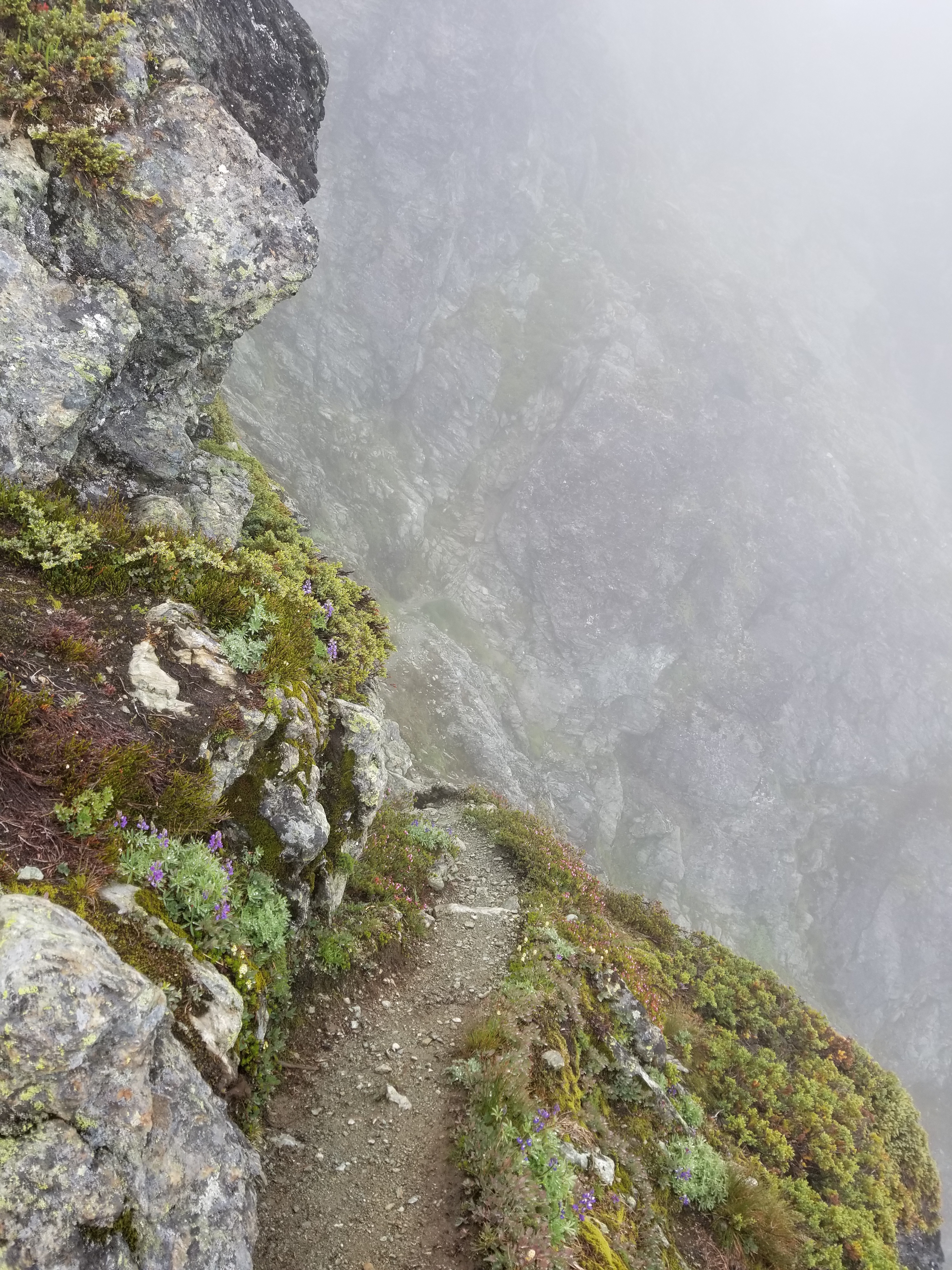
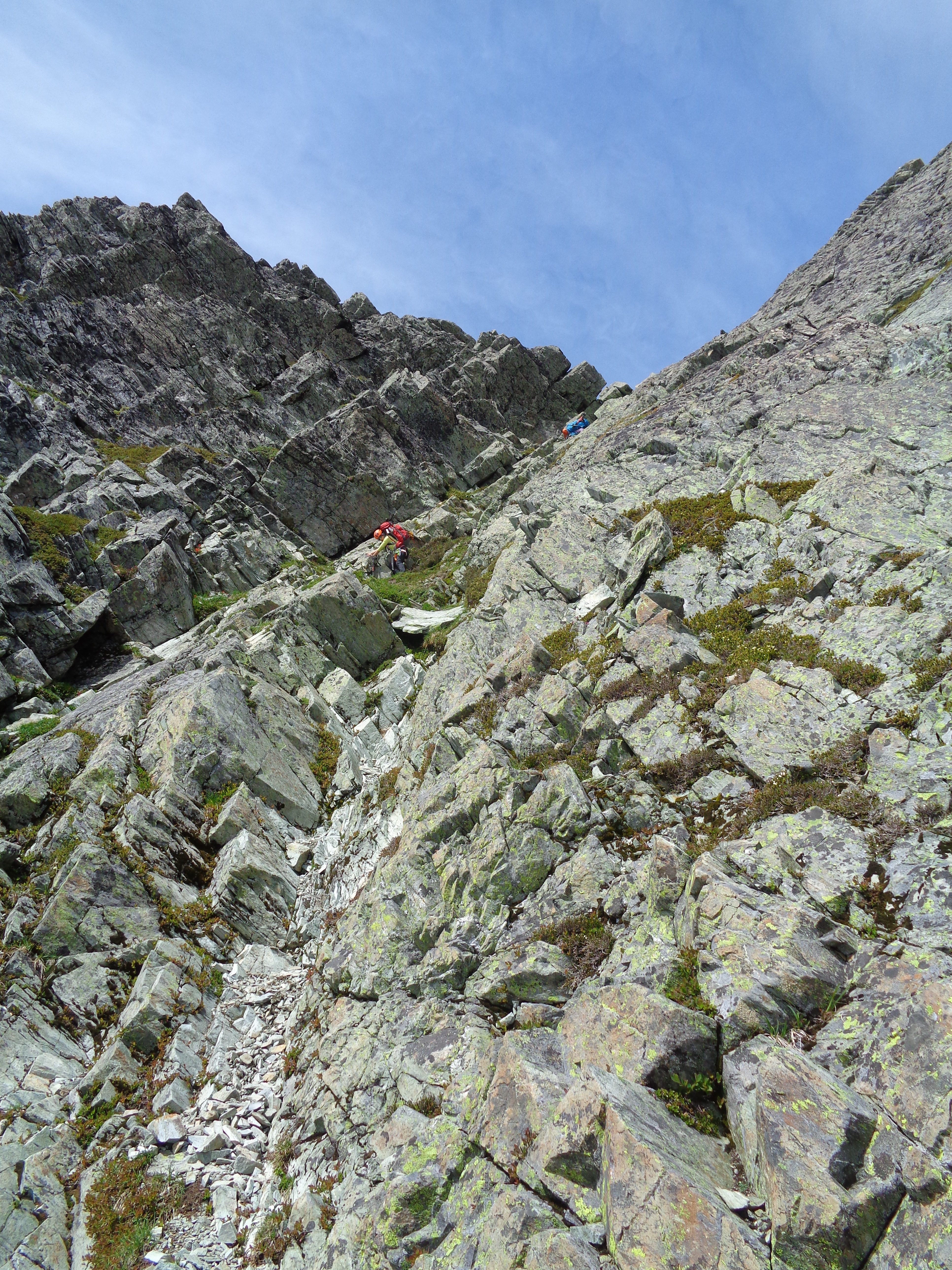
Alpine catwalk
We walked up a tenuous snow finger (it’s just walking) and hopped onto the rock and yeah baby let the scrambling begin. We scrambled most of it, besides the fourth class steps. Knowing I had done it before with an even larger overnight pack was good for my confidence this time around. I knew less back then, and naivete = confidence (and overpacking). You can even tell by reading my first post about the route. “Not everyone likes exposed scrambles as much as me” omg past Eve shut up. And I used to be even less patient than I am now. Now I’m more patient and my appreciation for exposed scrambles wanes every day.

One of the “walls”
But honestly, even the two “walls” (they’re well known) have great feet on the right side, and mountaineering boots can edge on the tiniest things. There is rap tat in pretty good shape at the top of every fourth class section, so it was quick and easy to set up a guide belay with the 30m rope at the top of each. And between each scramble step is a surprisingly well worn tiny trail winding around alpine catwalks thousands of feet above the Lower Curtis, reminiscent of the Corkscrew Route on Sloan, one of the only other places I’ve seen with a trail like this.
Belaying up the wall
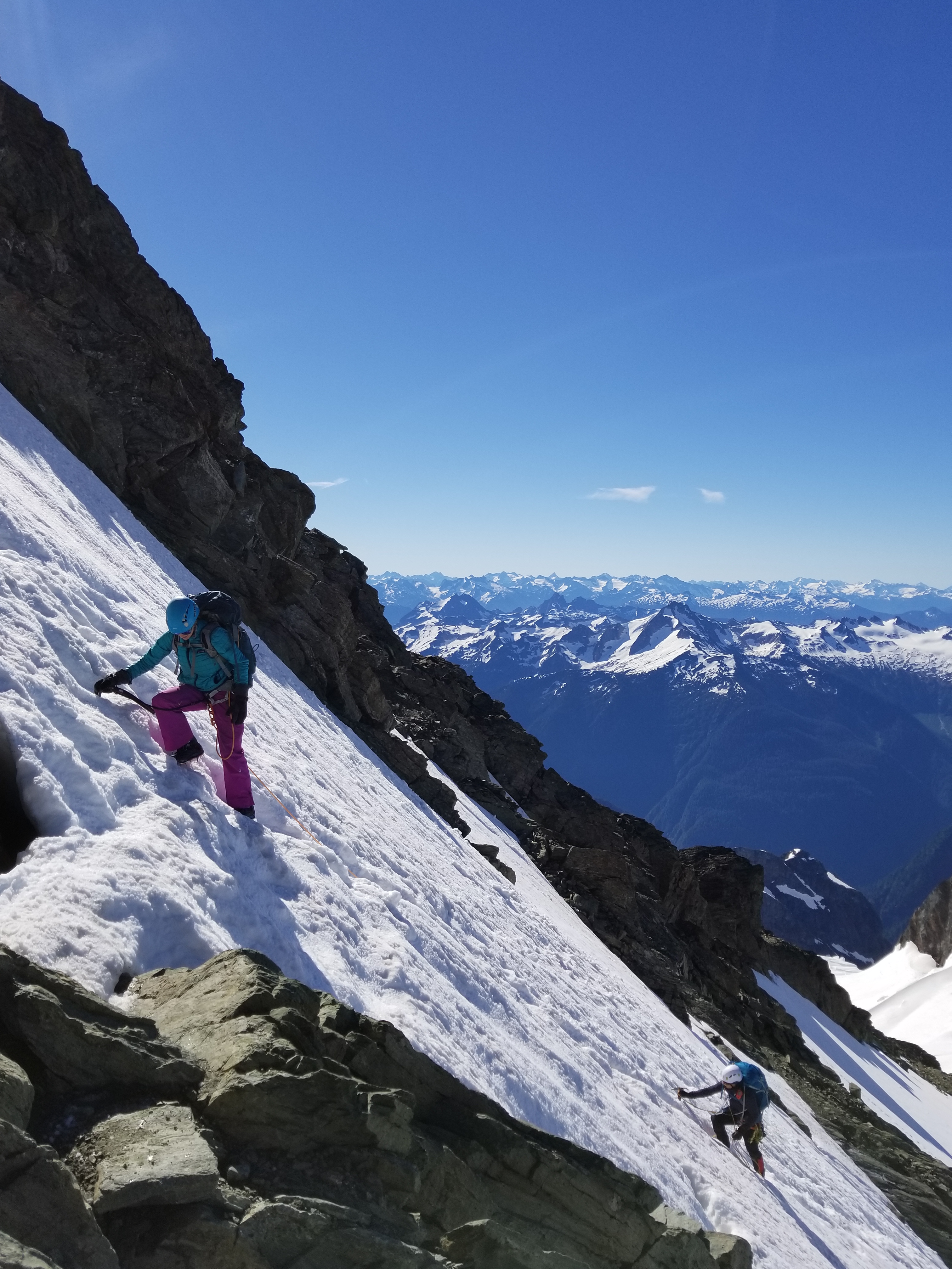
The second to last stretch of the chimneys was steep snow or an awkward wet slabby moat/snow stem if you prefer that. I was happy to have my steel crampons, because I am a lazy POS who hates transitioning, and I’d just leave them on for half of the rocky sections. A 60m rope will get you to the base of the snow slope in two rappels on the way down, more detail on that later. The final stretch of the chimneys was melted out with some third class moves to keep the spice alive, and we topped out next to a super cool dual-color patch of phlox. We dropped onto the White Salmon glacier and hoofed it to camp at the base of Winnie’s Slide, which is about 5 minutes past the top of the chimneys. Or 30 minutes if the clouds are FINALLY clearing and you can FINALLY see blue sky and oh my GOD LOOK at the clouds coming over the ridge and all five of you are standing there jaws on the ground snapping pictures in every direction.

Dual colored phlox!
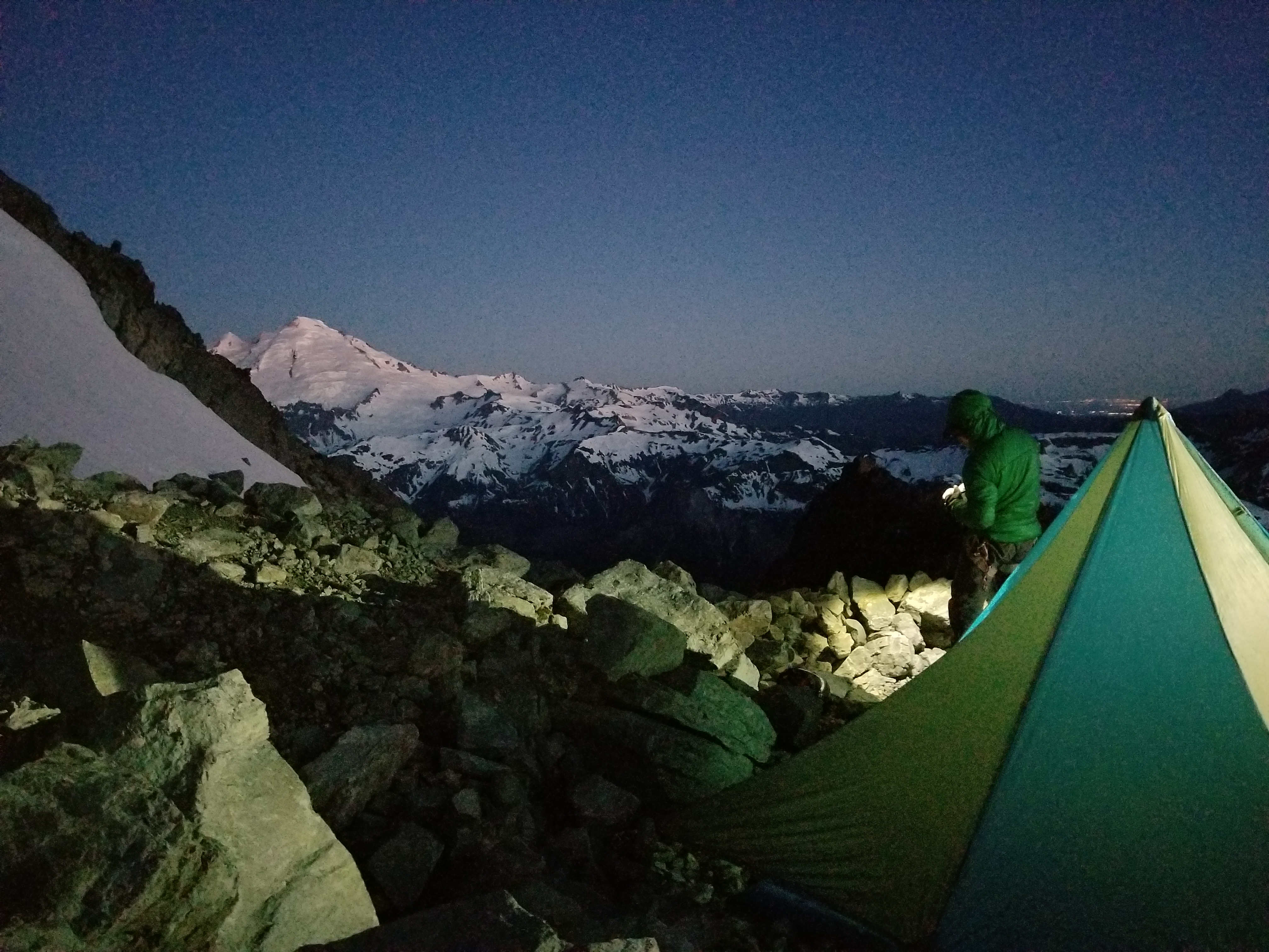
At camp we found three nicely melted campsites. I got the three stoves going while everyone else set up tents. I left the bladders for last because nalgenes can handle boiling water (sorry bladder folks). I destroyed my meal and went to lie on my slowly-leaking sleeping pad, well aware of my soon-to-be fate yet helpless to do anything about it. I looked EVERYWHERE for that leak the prior night and found NOTHING. Makes it easier to get up for alpine starts though when you’re sleeping on pointy gravel. Oh my god I don’t even care I love alpine bedtime so much.

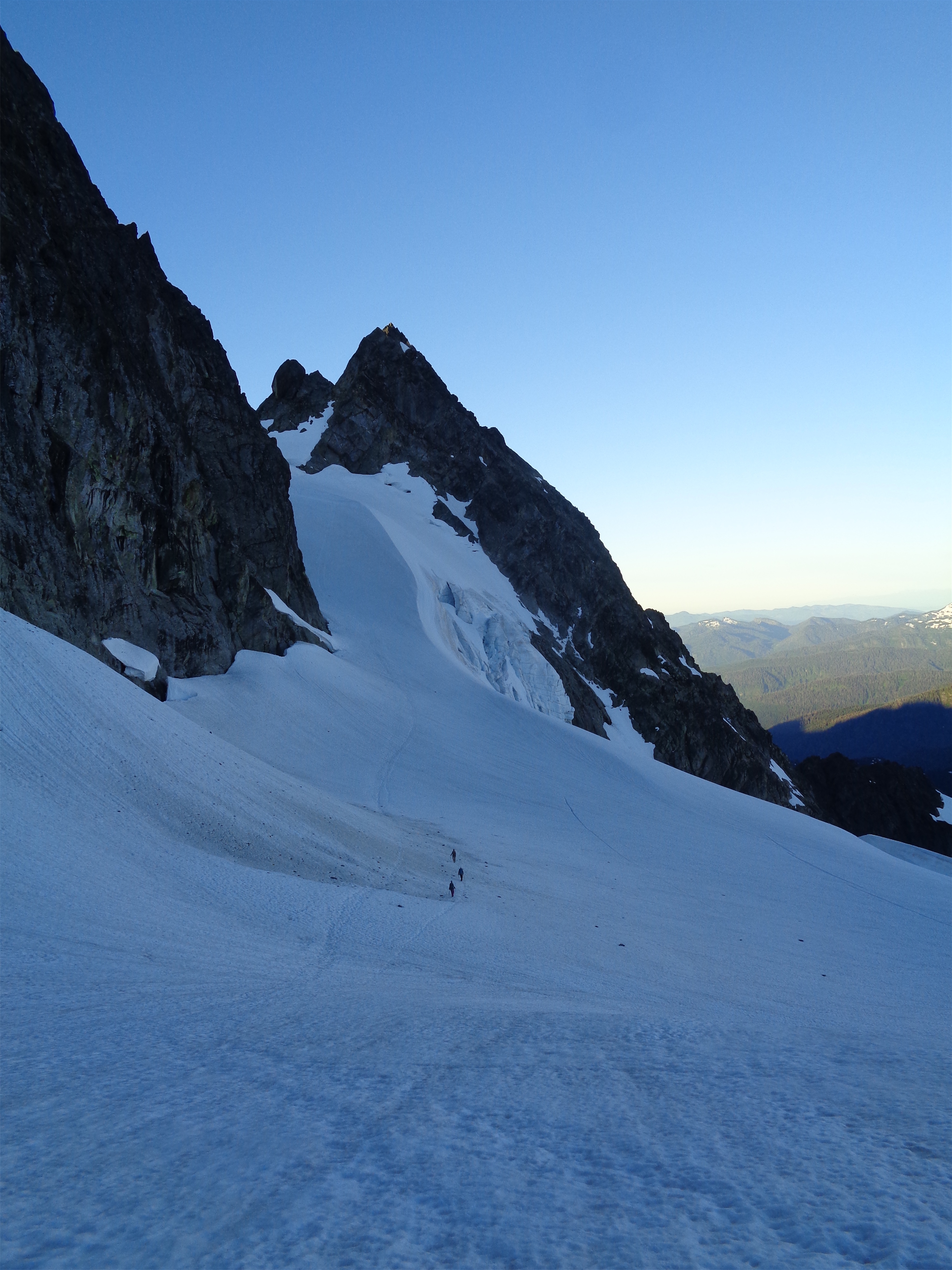
Coming up the White Salmon to camp
We got up around 3:30 expecting to be moving around 4, but were slower getting everything together than expected. Winnie’s slide was straightforward thanks to the staircase that had been kicked in it the prior day and bomb ass snow for crampons. There were two tents on snow at the top of the slide that we trekked past as we started up the Upper Curtis Glacier, where we topped out just below the hourglass and waited for Forrest’s team to make wardrobe adjustments as we watched from above. Once they caught up we began the downward traverse to Hell’s Highway, which is usually a cruise except that Amber and I faced the same issue: repeated intermittent untying of shoelaces. Double knots are no match for La Sportiva’s slippery laces, paired with grommets that I need to plier shut so the laces stop popping out. Two people, four boots, multiple stops.
Wakey wakey everyone!
This section was also WILDLY different from 2015. 2015 was a drought year, with no snowpack and hot weather and the glaciers were very open by the time I went (September). We had multiple sketchy crevasse crossings (including my first in-real-life-placing-snow-pro), some snow bridge collapses, and more questionable falls than I ever hope to experience again. And no views to make up for any of it. I spent like 4hrs in my tent on youtube. This year, everything was completely covered with solid snow. It’s crazy knowing what you’re walking across, yet there are no signs besides snow texture and curvature. And views in every single direction. What a route.

Amber on the Upper Curtis as the sun hits Baker, tents at the top of Winnie’s slide. UGH it’s so PRETTY

Up to the top of Upper Curtis, Hell’s Highway center
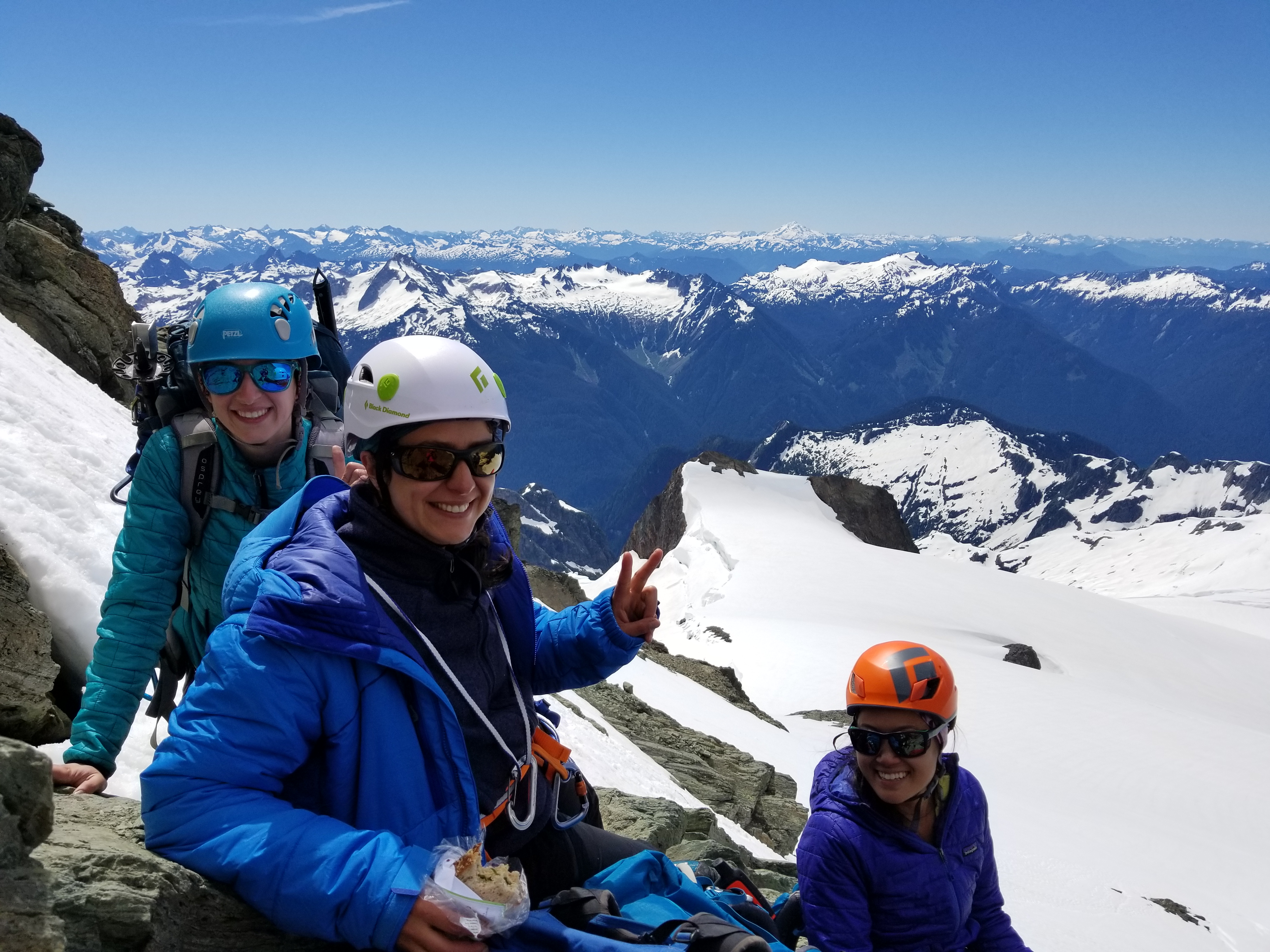
Hell’s Highway was in good shape, with a shortcut going up right next to a hogsback type feature. Steep, and with less of a staircase this time, but still bulletproof snow. Forrest hammered in a picket for a mental safety running belay at the top. We took a short break as we met the Sulphide glacier (I was finally warm enough to de-layer) before starting the walk to the summit pyramid.
Approaching Hell’s Highway
We made it maybe 60ft up the scramble before realizing we needed to turn around. We had waited far too long for the rock fall party, and it was looking like we’d have to pitch out the summit pyramid, which was going to be too slow to have us out at a reasonable hour. As a three day trip, maybe we could have swung it, but as a two day trip, you need to be able to just scramble the top. But hey, it was a beautiful day with fantastic views already and the best part of the route was behind us (because it’s the chimneys and also alpine bedtime). So we walked back to Hell’s Highway, glissaded down (or in my case, tossed crampons, glissaded, arrested next to crampons that I had thrown like someone with T-Rex arms, threw them again, rinse and repeat), and started the trek back to camp. Back up the Upper Curtis, down to Winnie’s Slide, face in downclimbing to get back down the slide (Forrest is FAST), and a far too leisurely pack of camp.
Finishing the snow ramp below the summit
In the chimneys, Forrest and I leapfrogged rappels. We started with a rap off to skiier’s left of the snow slope, and I sat atop my perch and made sure to give people shit for how to not rap and how to definitely rap on snow. Forrest went first and rapped right past the best rap station halfway down the snow and instead made use of what was probably a bail anchor from a previous party, but it worked. And it was better than dismounting a rap several feet off the ground in 5th class scramble terrain (the rap station wasn’t truly en route) in a snow moat, which was the alternative. Two 30m raps got us to the base of the snow where we could continue the scramble, and from there the rap stations were the obvious ones at the top of each fourth class move. Two “walls” (I thought there was only one infamous “wall” but there are two), one section I didn’t remember belaying up but we rapped down, and the waterfall. The raps were interspersed with what I like to call the alpine butt scoot, some easy downclimbing, and some outrageous catwalk trails that FINALLY had views! I finally got to see what the route looked like when you can see more than 10ft in front of you! And instead of rapping onto a nice flat section of snow, we went back for the snow finger, which is really just a matter of walking but walking is scary when the volume beneath you is 20% snow and 80% air. Trust those feet, stand up straight, and walk like you own the world! Which you basically do, because you’re on top of it.
good sandwiches make everyone happy
Various states of scrambling
And finally we were back on standard trail. I was pleasantly surprised at how much of a trail it was, it was genuinely a trail with a North Cascades National Park Boundary market (hah! Now we can poop anywhere!) and not just a schwacky bootpath. And the VIEWS. Baker, Baker Lake, Shuksan (the Curtis glaciers and the multiple pyramids are just stunning) and there were wildflowers blooming everywhere! This route was way better in July than in September. Have I mentioned yet that Shuksan is the best? Shuksan is the best.
Amber peaks her head out as the catwalk wraps around a corner. Baker… you beautiful bastard

Traversing back to Lake Ann
We finished up the trail in the dark and were back at the cars at 10:30 exactly. Okay, 10:31 maybe. We chugged the water in the car, I took shots of Mio, and we started driving. Until we saw Forrest on the side of the road. Oh shit. Did they break down. I pulled over and rolled down the window. “Do you want to…. go to the first McDonald’s we see on the way home?” Everyone laughed. And shouted yes. Who doesn’t like 1am burgers in Bellingham? Forrest’s car won that – they went to Bellingham, I took i9 south and went to Mt. Vernon, and our McDonalds, despite being en route instead of slightly out of the way, HAD A CLOSED LOBBY. We had to do drive through. Crushing.

On our way home!
This is still one of my favorite alpine routes out here. I loved it in 2015 socked in by clouds, and I love it even more with clear weather and views. The scenery is seriously just jaw dropping and you get such a good mix of hiking, glacier travel, steep snow, and scrambling. I know I’ve said it before, I love Shuksan and Shuksan does not return the sentiment. I’ve never had a perfectly clear trip. I’ve had several bail trips. I’ve slogged through whiteout to end up with spectacular summit days (and an inversion day). And it’s just so freaking pretty. And it has such a wide range of routes. Sulphide is one of the biggest bang for your buck routes in the Cascades. Fisher Chimneys is the best moderate alpine route around here. The North Face is a fantastic steep snow route. The Price Glacier is a premier ice climb in the lower 48 (I’ll get there someday). Just such a versatile peak, and the fact I’m always socked in by clouds for the first half of every trip just maintains the mystique. Shuksan’s such a tease. But I’ll keep going back for more.

More than a summit!

Love your storytelling, Eve! One day I’ll make a try for Shuksan.
LikeLike