

Photographer things

Tell me why you are here.
I don’t even know where to start. I’ve been sitting at home for 5 months, have seen like a net five people since February, and you all know my life revolves around activity and socialization so you can imagine the puddle I have become. Finally the planets aligned and Surafel, Brad, and I were all free on the same weekend. We had two options for trips, and given the new moon and the Neowise comet, we figured we’d pick the one with the best view so they could work on the astrophotography skills while I slept. We chose Ragged View, except approaching on an abandoned trail (my favorite) and bushwhacking up the Cabinet Creek drainage. Short, but oh so sweet.
- Distance: 10 miles
- Elevation: 3500ish ft
- Weather: 70’s and sunny
- Commute from Seattle: ~3hrs, 3:15 if your friend oversleeps
- Did I Trip: Yes but I never truly ate it

Up and up!
I felt like a kid going back to summer camp about to see friends after a year apart and go on an adventure. I was stupid excited. Like fidgeting days before the trip. I even offered to drive. We met at the park n ride at 6am. Well, Brad and I met. Surafel, who lives 5min away and is usually first, was nowhere to be found. At 6:13 we got a message. “Shit shit. On my way.” Okay, so someone just rolled out of bed. He made it to the park n ride by 6:27, pretty quick for someone who had just woken up. And soon enough, we were piled into my yellow bumblebee of a car and on our way.
Okay, it wasn’t ALL open
We pulled off Highway 20 just before Cabinet Creek. We walked up and down the patch of trees, looking for a good way in, and finally just pushed through them. We started alongside the stream but headed uphill thanks to the only route beta we had. We immediately ran into some beans. Brad stepped right over them, because bottles of beans are a common feature of natural forested landscapes. Whose beans are these? Why are they here? How did they prioritize their beans? Are there more beans hidden here that we should know about? Did I just blow someone’s bean stash secret? We’ll never know.
Trail!
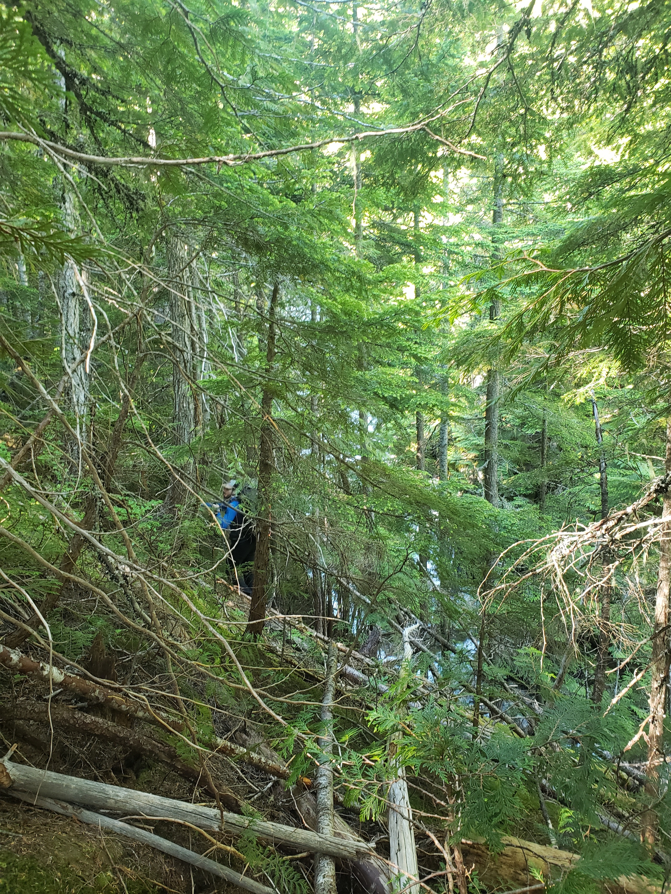
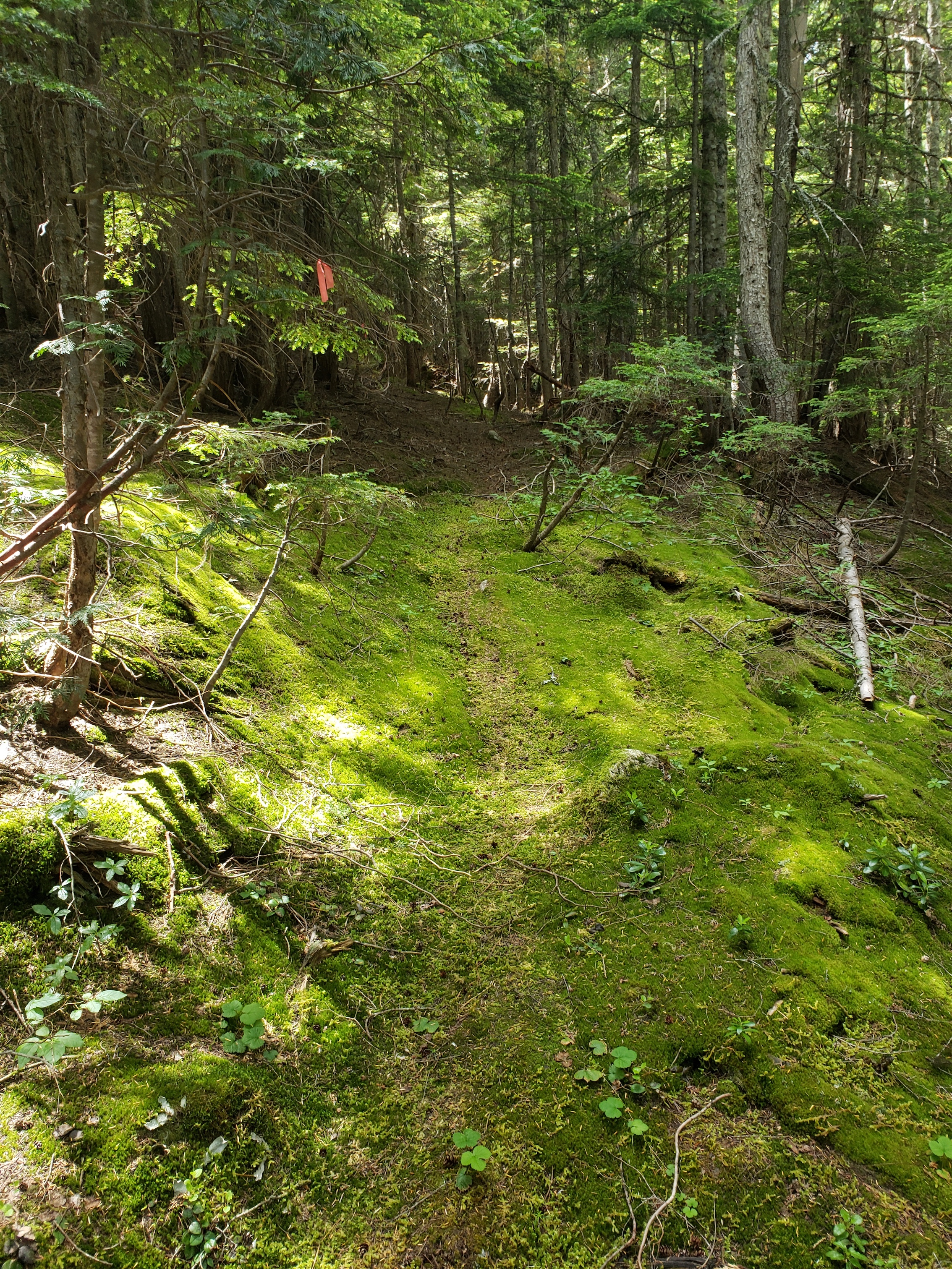
We continued up steep but mostly open forest, and eventually ran into (woo!) a trail! The trail has been abandoned for over 30 years, but the tread is pretty obvious for 80% of the way, and luckily this mysterious CP had flagged most of it! Turns out the trail was built in the late 1920’s and appeared on maps prior to 1960, so possibly abandoned for even longer than that. Why was it built? And why was it sequentially abandoned? That was looong before the highway existed, which makes it even more fascinating. I don’t know of any mining or logging history in that drainage, maybe it was recreational.
Our pace tripled as we cruised to the river, following pink flags and soft dirt tread. Close to the river, we encountered another oddity. A garbage barrel, crunched in half and stuffed in a tree. Brad went to inspect it and found nothing. We forded the river, mostly shin deep, and quickly found another barrel. We knocked it with a trekking pole, seemed hollow. What goes in barrels besides various lifestages of petroleum and people? WHY ARE THESE HERE? Did you need more storage for your forest beans?!? I don’t like forests and I don’t like mysteries and these murder barrels were mysteries in the forest.
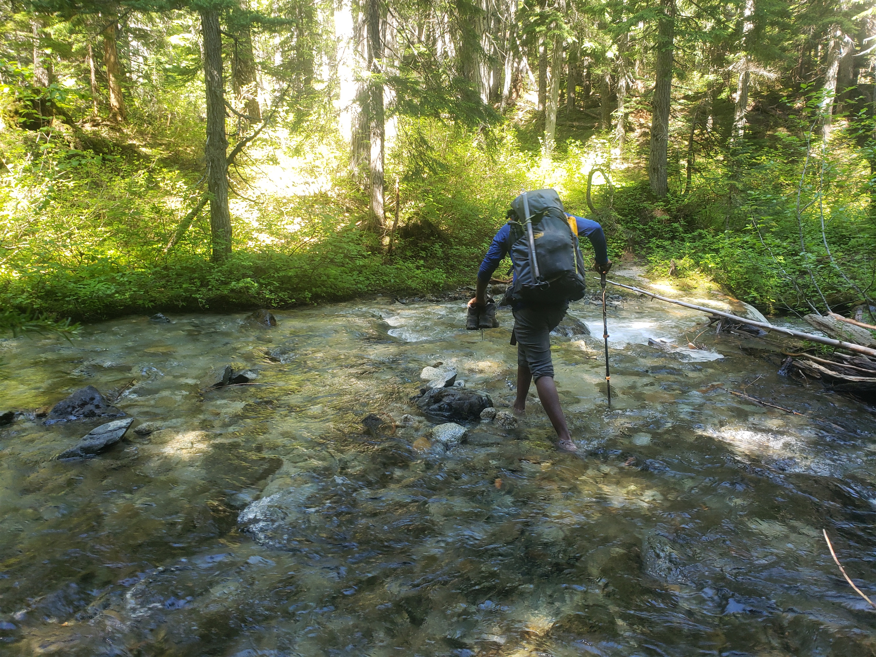
Fording the river
OH, and there was no hint of a trail to be seen whatsoever. We had been warned, the trip report we had said to not bother to find anything. So we just started following the path of least resistance, spitting out leaves and moss and pollen and spiderwebs as we went. Our pace slowed a little, but honestly wasn’t bad all things considered. We came to the junction of the north and south forks of Cabinet Creek, more of a braid of a dozen creeks than a crossing of two rivers. We hopped over to the furthest south, and followed that until the meadow, where some sexy pine trees graced us with more pollen and we helped them all copulate.

Murder Barrels
The meadow still had some gnarly avy debris. We checked the map. Okay, the trip report says cross the stream here and go up through steep forest to the left of the stream. But the right is so much more mellow… my opinion is that trip reports exist for a reason. Someone somewhere (well probably there) fucked up decades ago and that’s why the only beta we have says go left. But…. right is mellow, and we know better than everyone obviously, so we went right.
Straight into class 3 trees. Class 4? I’m not sure. I straight climbed a tree at one point. It was like swimming uphill through evergreen veggie belays. We finally broke out into a small creek, which we followed to another small clearing, and from there it was easy access to the lake. But that might have been the slowest like 400 vertical feet of my life to date. I don’t even have a picture because all of my hands were busy dragging my fat quarantine ass over short stubborn spruce trees. I smelled a hint of alcohol and fruits wafting on the air, convinced I was hallucinating I tore my pack apart and found a completely empty bottle of hand sanitizer. It was full when I started the trip.

Highways
We skirted the lake on the west side too (also a mediocre choice), and explored the swampy meadow behind it. The lake and meadow were underwhelming until you were several hundred feet above them, and then they were actually pretty cool. We started up the central talus field, where it’s choose-your-own-adventure to the right. The bottom half of the talus was an easy hop. The we headed for a brown gully to the right of a cool cave. I went to check out the cave. Don’t, it’s not worth it, there are no hula hoops and the heather is steep so going back down and/or sideways blows. I crossed over to the gully, which Brad had started up. I decided that fourth class downsloping kitty litter ledges were not my jam, and followed Surafel traversing to a lower part of the ridge. Traversing steep heather is not that much better than sloping kitty litter ledges. As soon as I left the gully I heard a bunch of small rock fall and turned back to make fun of Brad when I saw a toaster-size block come tumbling by. He knew I was out of the way, but wowww was I glad to be out of that gully.
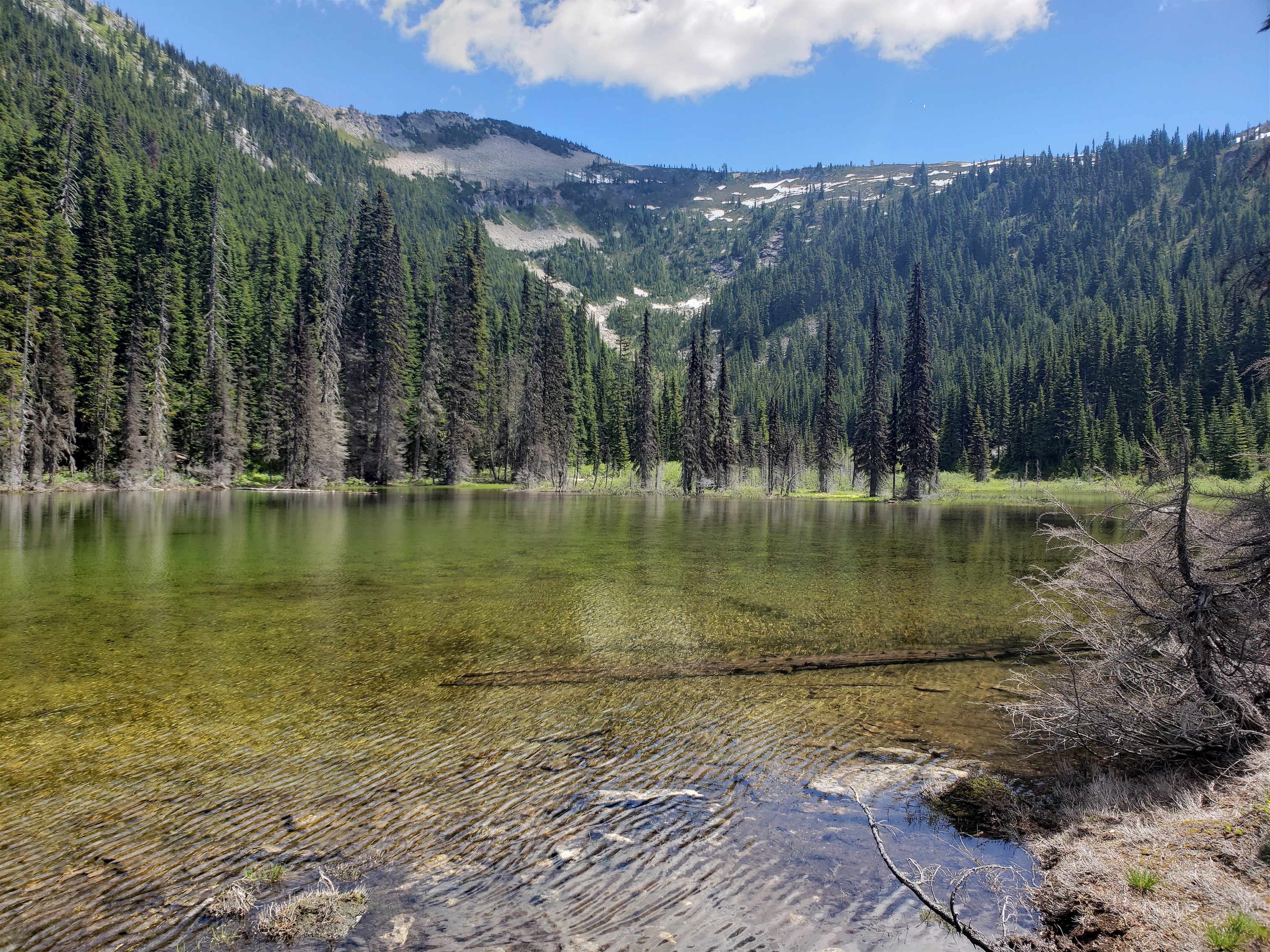
The lake. I was whelmed
We crested the ridge and I immediately turned left to find Brad. And then I turned back to see where Surafel was. And then I saw the views and started running back and forth. Ahhhh!! Ragged Ridge! It’s so beautiful. So freaking beautiful. We dropped our bags where we thought we’d camp and headed up to Ragged View for prime views and more frantic exploring. We eventually figured we’d go back to set up camp and come back up for sunset, or milky way photos. We decided to find a better campsite, more dirt and less heather, so we lazily walked our gear down the ridge a bit. Dropped it there, and walked to explore the rest o the ridge, where we found an even better campsite. Third time’s a charm, right? We went back and got our stuff again.

Gaining elevation
We had more ambitious plans, but as soon as we were on the ridge they pretty much just melted away. Surafel chilled in his camp chair, which was way more useful than the bonus gear Brad and I had carried (ice axes, crampons… Brad even carried freaking mountaineering boots!). We cooked dinner (except Surafel, who brought a huge tupperware of pasta & beef), fought off mosquitos with lemon eucalyptus (hot take: it is useless) and chilled for hours until it was time for sunset pics, where I get to be jealous because my phone and camera can’t handle the colors/light contrast of sunset pics. Or maybe it just needs post processing and I expect too much of a camera, I don’t know. I got cold and went to sleep and woke up occasionally to them taking night sky photos and the panic associated with a mosquito buzzing somewhere near your face but you aren’t sure where. The Neowise comet was clearly visible, and I think this might have been the most stars I’ve ever seen in my life. Usually there is only one cluster in the sky that is the Milky Way, but here it stretched all the way across the sky. It looked like a fake image, it was magnificent and exactly what I needed after months of quarantine.

Heading up to Ragged View, Mesachie Pass lower left. Cub, Mesachie, Katsuk, Kimtah, Cosho from left to right.

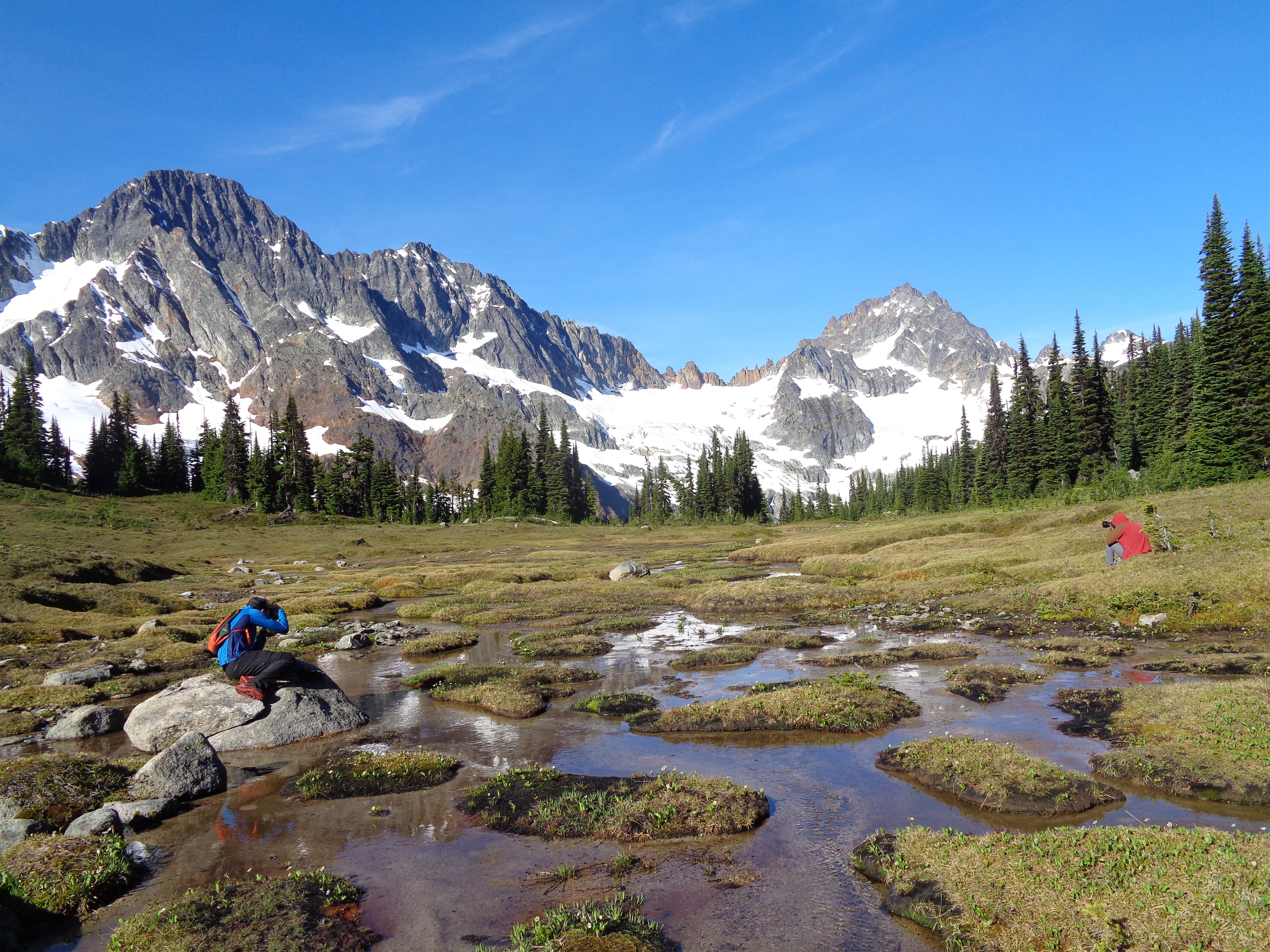
Kitling Lake
In the morning we dropped down to the meadows, which were also stunningly gorgeous. More mosquitos for sure, but a really cool web of springs and creeks flowing into Kitling Lake below. the glacier recession was noticeable, which was very cool. We had a moment appreciating the silence, until we heard… a drone? It flew right over us. We stood there with our jaws on the floor. Seriously?? I’m torn, is this really cool or really annoying? Where are the people flying it? It came back over us and hovered for a bit before flying into the trees. “We should have mooned it.” Shit guys, why didn’t we think of that 10 minutes ago?! The only conclusion I can draw is that the person who stashed the beans and filled the murder barrels is now tracking us with a drone to see if we’re coming back towards them or not. Better be on the lookout when we go back through those barrels. And they’ll find us because they have a drone and we’re loud and smell like hand sanitizer exploded in someone’s pack. Dibs middle.
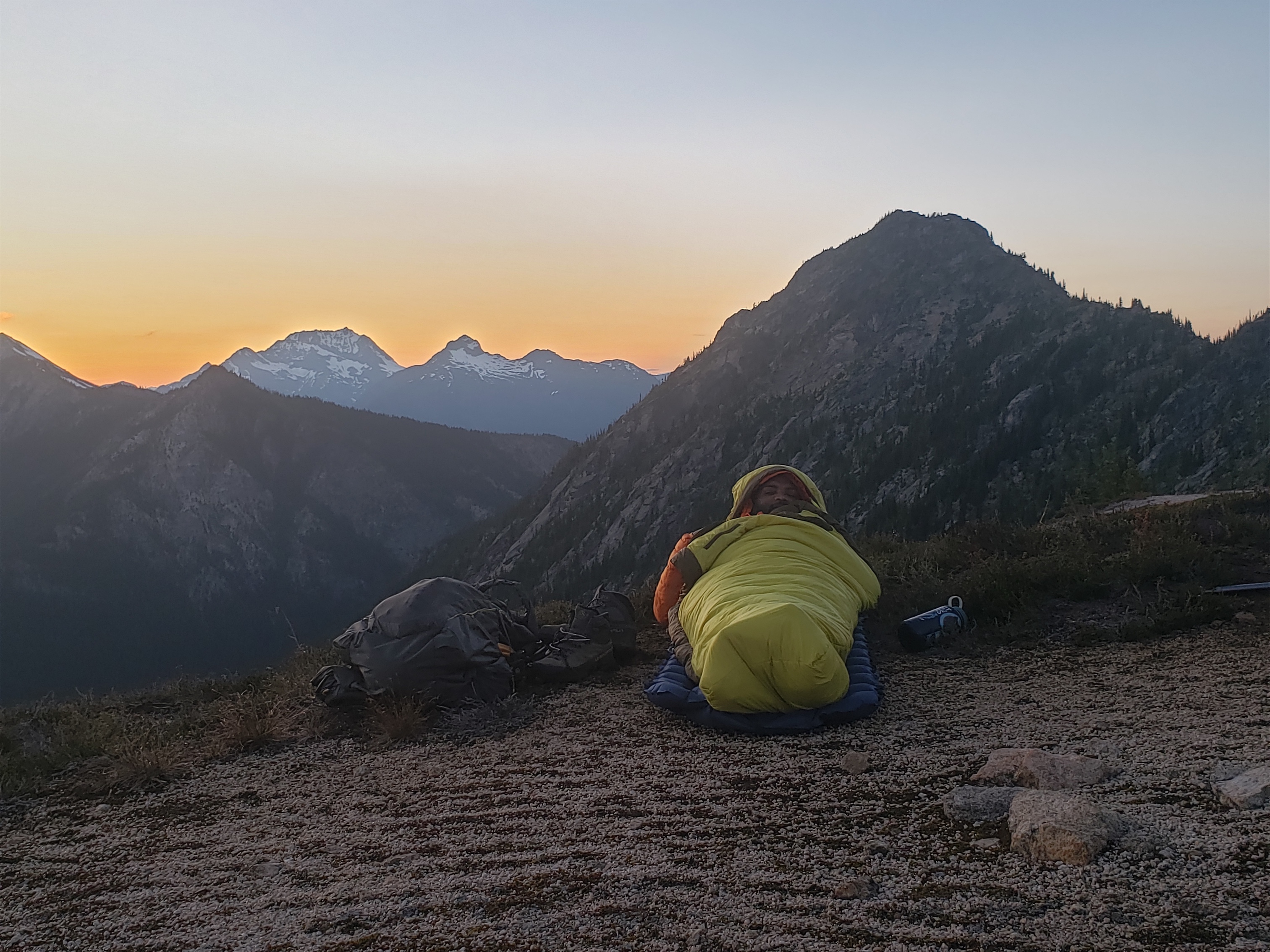
Surafel looking cozy
We trekked back to the ridge and packed our bags. I wasn’t excited to go down some of the stuff we had come up. We took a more roundabout way, entering the bowl on the low end of the ridge and traversing over to the talus rather than going down Brad’s gully by the cave. A much more pleasant route than going straight up and then sidehilling. Talus hopping is tedious but better on my ankles, so that part was decent enough.

Heading down to the meadows
At the lake we went around the east side this time (skiier’s right if leaving the bowl) which was wide open easy travelling forest. And then we went down on the opposite side of the waterfall from where we had come up, which was amazingly open (but steep) until the last like 50 vertical feet. We popped back out in the meadow, and from there it was just a matter of pushing through more licentious trees, path of least resistance with the creek on our right, cross the junction again, more bushwhacking with the creek on our right, murder barrels #4 and #3, cool mushy swamp spot, murder barrel #2, and then fording the river past murder barrel #1 and we were back on the freshly flagged trail.
More photographer things

One of many cute streams
We followed the trail all the way back to the highway, where it dumped us out like 20ft beyond where we had given up looking for an entrance. Oh, if only we had read the WTA reports for Cabinet Creek. For anyone looking, the trail entrance is behind some piles of dirt about 100ft past the Cabinet Creek sign. Not even.
We stopped at Burger Barn on the way back for some amazing burgers and milkshakes. I feel bad for Cascade Farms with the berries and ice cream because the road closure is probably screwing up their business on top of everything else going on 😦 Hopefully they hang in there. I’ll definitely visit when everything reopens, and probably accidentally before the road reopens given my uncanny ability to drive past bright orange detour signs.
Amazing trip with great company and to a spot where we didn’t see a single other human being for two whole days. Despite the crowds out there with the pandemic right now, it’s still possible to find an escape if you try hard enough. And there are so many unexplored areas back there that used to be accessible. Gabriel Peak and the Mebee/Beebe ridge stood out since the Cabinet Creek trail used to take folks up to the headwaters just below those. I always wonder why they were abandoned and how long they’ll take to truly fade. It is fascinating that the first 1.5mi of the trail is still so obvious, but across the creek, it disappears. I wonder what it was like 30+ years ago when it was still in use. And what the hell were those barrels for? And who is stashing beans off highway 20?!?

Dreams. PC Brad
p.s. Link to Brad’s trip report and more ridiculous photos here.

Wow! What a great trip report and what a lovely location.
Your photos also are really nice.
LikeLike
Thank you for the beta and amusing write up! We checked this place out over the weekend and it was stunning up there, couldn’t have done it without you.
LikeLike