

“Why do you think it’s called Anaconda Peak?” “Because.. my anaconda don’t want none unless you got buns, hun?” Rob couldn’t finish the sentence without laughing and I cracked up. It’s true, you need some serious buns to do this peak, especially on snowshoes, which are second only to crawling on your hands and knees as a self-propelled mode of transportation. Snowshoeing. Is. So. Hard.
I joined Rob’s trip up Anaconda at the last minute. It was organized by Tim, who is like a gecko on snowshoes and can fly up any slope of any angle at an inhuman rate of travel and he’s turned the corner or crested the knoll before you see where he went. More on that later. We met at the gas station in Granite Falls and caravan-ed to the trailhead, which we almost missed by two miles, but finally found before we got started. It’s just past the “red bridge” which is more like a pink bridge nowadays.
- Distance: 7.5mi
- Elevation gain: 3700ft
- Weather: 40’s and rainy/sunny (classic)
- Commute from Seattle: ~1:30
- Did I Trip: Yes, many snowshoe slides and a stumble or two, maybe a faceplant

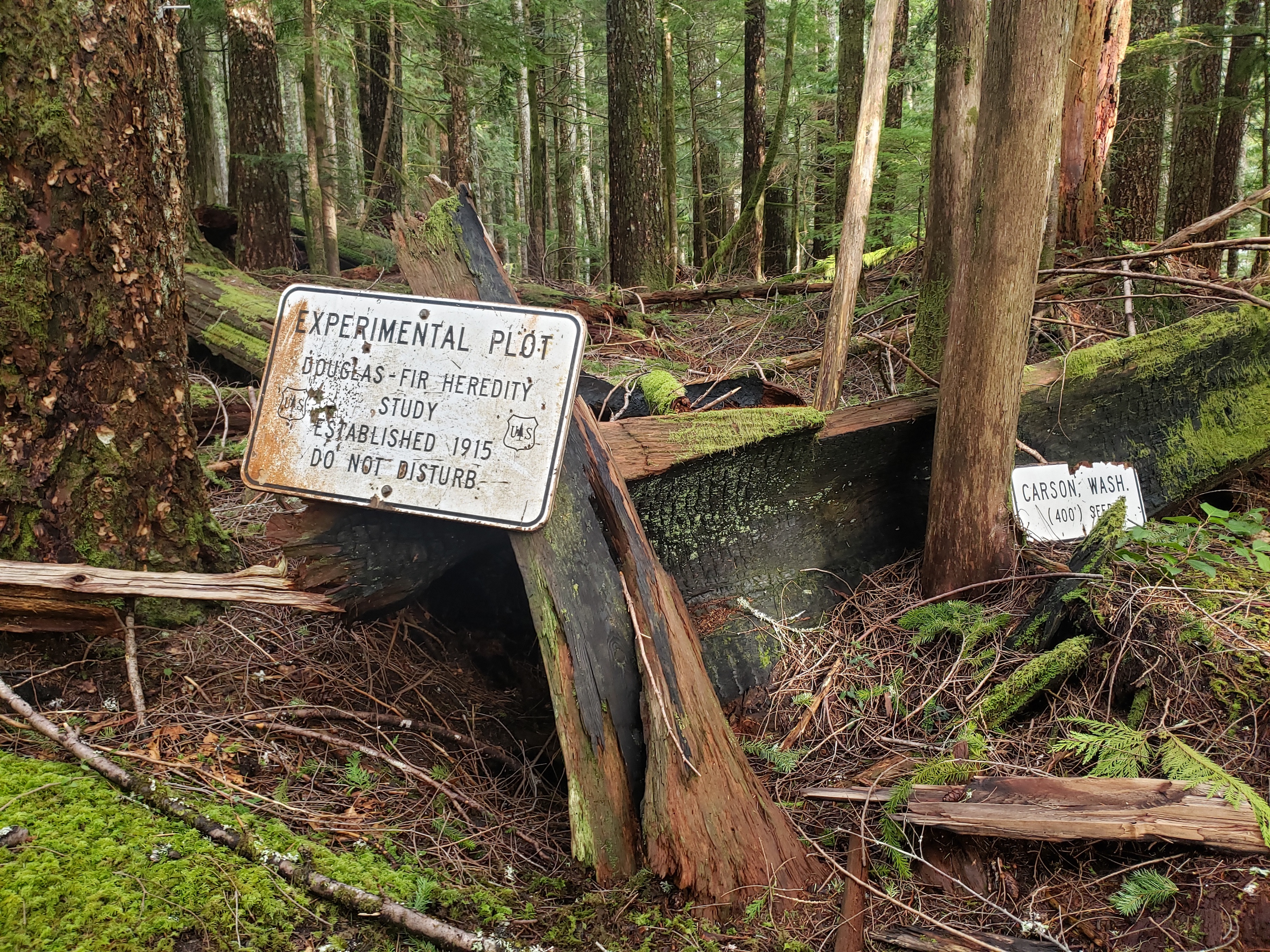
We started up the Marten Creek trail, which begins on an old road that we suspected was from logging times given the second growth forest, but actually provided access to mines further up the valley by Granite Pass. The trail was wide and well graded, but must have been a bitch of a logging road (mining road?) because it was STEEP. But mossy, and beautiful, and protecting us from some of the rain that was coming down. We found a cool sign explaining that the lower section was actually an experimentation zone, like what Amber and I had seen at Little Mashel Falls a few weeks ago. After some surprisingly extensive Googling and checking coordinates of sites listed in random long term doug fir studies, I finally landed on the Stillaguamish test site (thanks to this PDF), which is where we were despite the sign saying CARSON WASH which misled me for a solid 10 minutes. It was seeded in 1915 (okay, that sign was accurate) along with four other test sites. Each site had multiple varieties of douglas fir, and the goal was to measure survival rates, health, and how well different varieties of doug fir could adjust to different environments. At this site, in 15 years, the douglas firs had grown to about 5.2m already, and by 2013 they were 36.0m tall. Only 15% had survived, which was the lowest survival rate of the five test sites but second tallest in height and the largest in diameter, partially due the Stillaguamish site’s lower elevation & warmer weather. After a hundred years of being studied, the researchers also confirmed some common sense: survival rates of seeds are better if they stay in similar climates to the parent trees.
Enough on douglas firs. About a quarter mile after the trail starts to head north and finally flattens out, you’ll notice you are fairly close to the creek (~200 horizontal ft maybe). This is where you cross the creek at a point of your choosing (the crossing we chose… I mean, it worked) and start heading uphill. Creek crossings in winter are always interesting, and Rob broke a great trail across some logs that did the job well enough. Just beyond the river we strapped on the torture devices known as snowshoes, and started to head uphill. Tim put it best. You ever want to diet? Forget it, just go on a few snowshoes and before you know it you’ll be running marathons like no one’s business.

Rob and Tim took turns breaking trail, which was totally fine with me and Trang and I assume Alex, who was recovering from a broken ankle but still decided to bring extra water as training weight. I asked what was the biggest trip he’d done so far, and the answer was “this one.” Just a casual jaunt up 3700ft of powder in snowshoes. I have happy unbroken ankles and they weren’t stoked on the day. But I spent this winter becoming soft between accutane and sedentary-ness, like a humanoid soft serve ice cream with asthma and a propensity to burn in the sun. A creme brulee, perhaps.
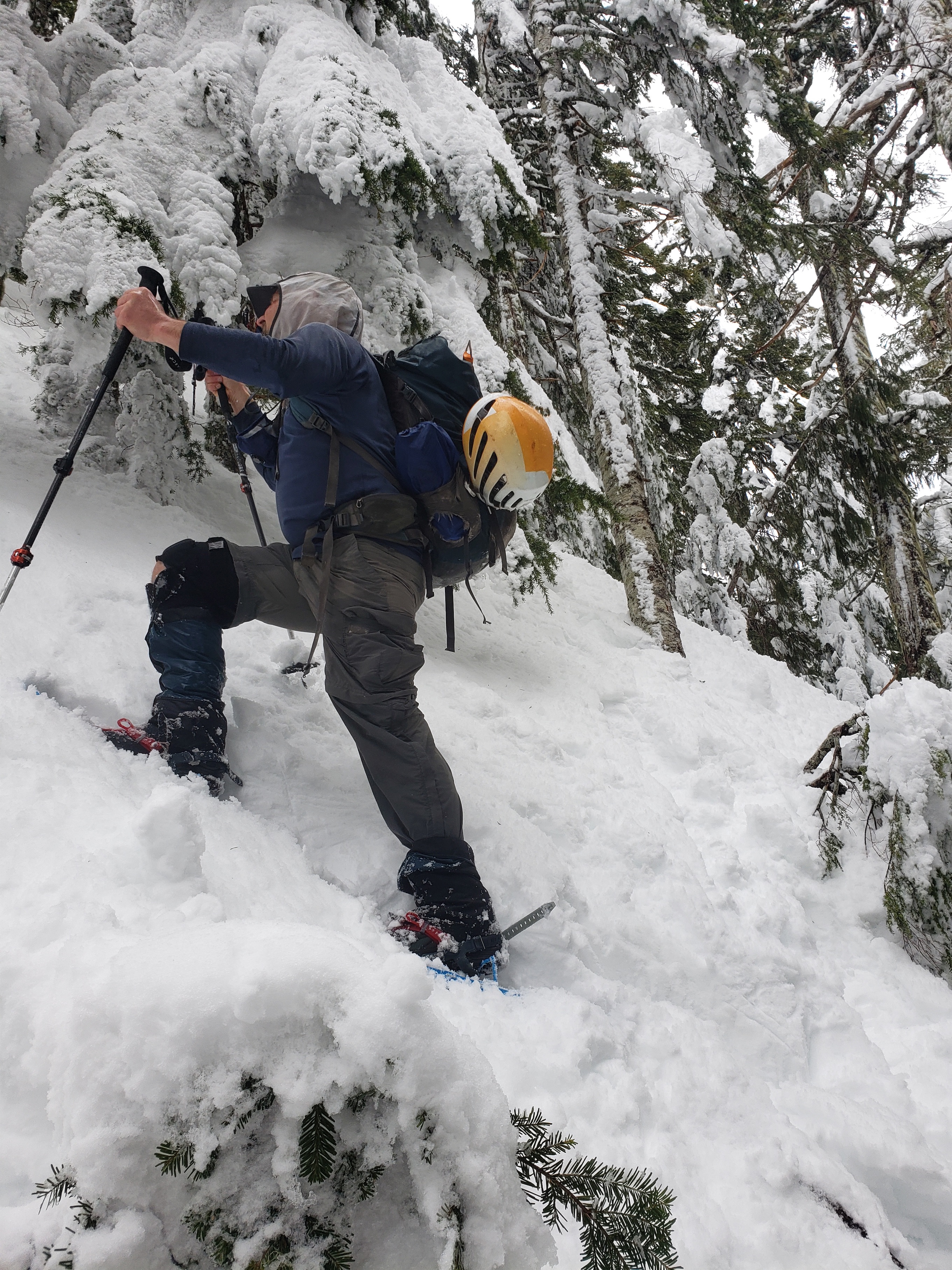
The first uphill section was steep but not threateningly steep, and soon enough we were on a forest road running along a ridge. We carried on to the end of the road, and headed uphill due northwest towards the south ridge of Anaconda. This was also steep, but still manageable until we got to the point we had to start making switchbacks. And when this happens, the first person basically kicks a one-snowshoe-wide trail, and the second person has to try to widen it, and maybe by the time the fourth person comes along you have a small sidewalk. Or all the steps blow out and you have misery, depends on the snow. We had a bit of both, but the ridiculously huge trees with fresh snow and patches of blue sky kept us motivated. Oh, and you couldn’t stand in one place for too long, or you risked getting smacked by a tree bomb, which is chunks of melting snow falling from the trees. That’s the real reason to bring helmets!

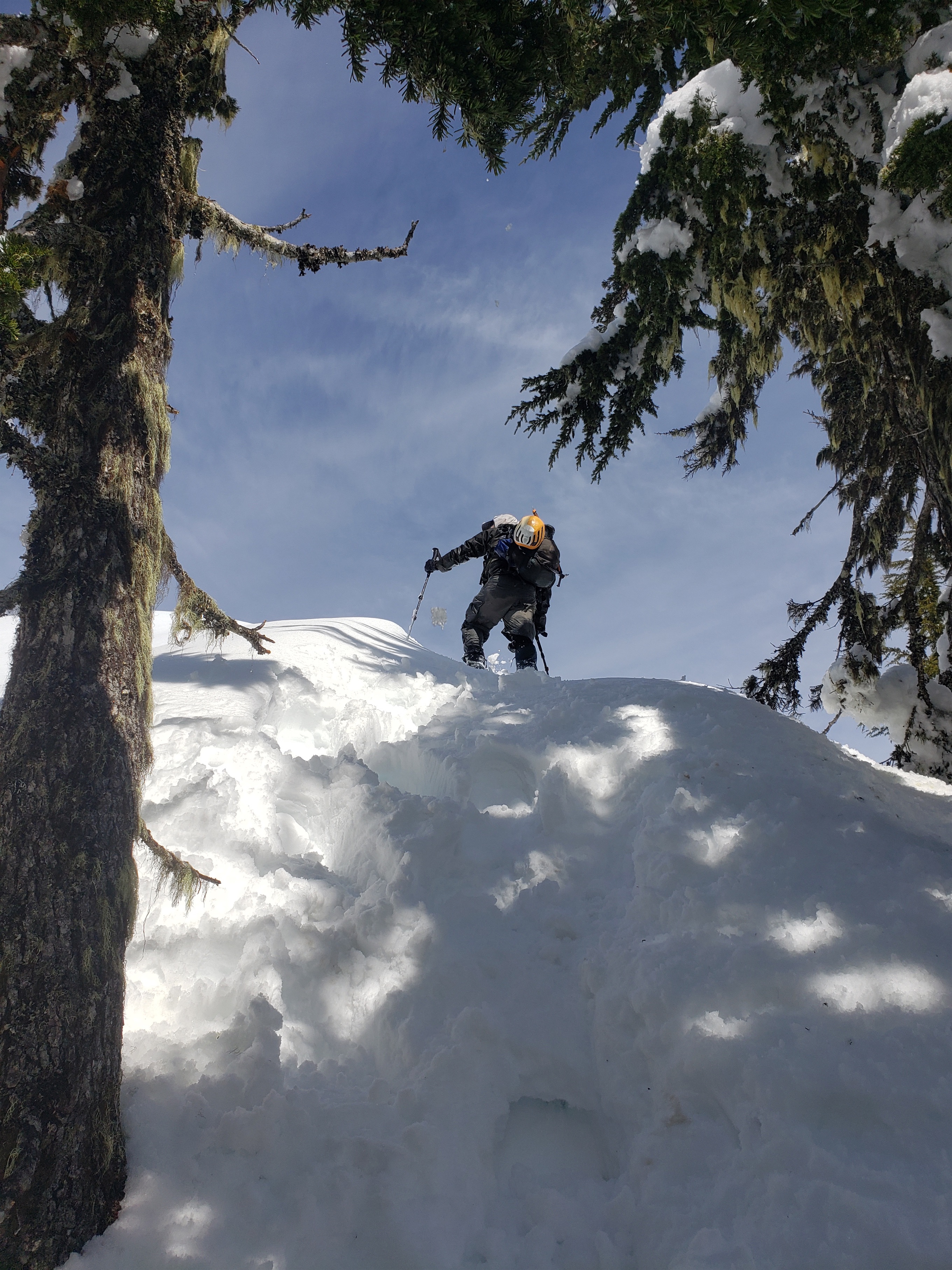
The final stretch of the south ridge was surprisingly steep, I definitely underestimated it. I expected a walk in the park, I got a mountaineering adventure, ice axe included. I think my favorite thing about Tim was the boundless energy and positivity the entire trip. I’d see one of his gecko prints sideways on a mound of vertical snow, laugh, and hear him whooping 100ft ahead of me. He and Rob were also both great at checking in on everyone. “Do you want some goldfish?” “Who needs a snack?” “Don’t forget to drink water!” “Do you want some goldfish now?” “What about now?” “Goldfish, anyone?”
We took a break just below the summit where we had a hard time breaking trail up some very steep snow between tight trees, and Trang decided to wait. Tim and Trang were prepared and she had layers, a radio, snacks, the works. She whipped out a beautiful purple goretex layer I immediately complimented and she and Tim started laughing – she wanted to return it because of the color!! No, it’s the best shade of purple ever! It was hard to tell from my gear for once, but I LOVE bright colors.
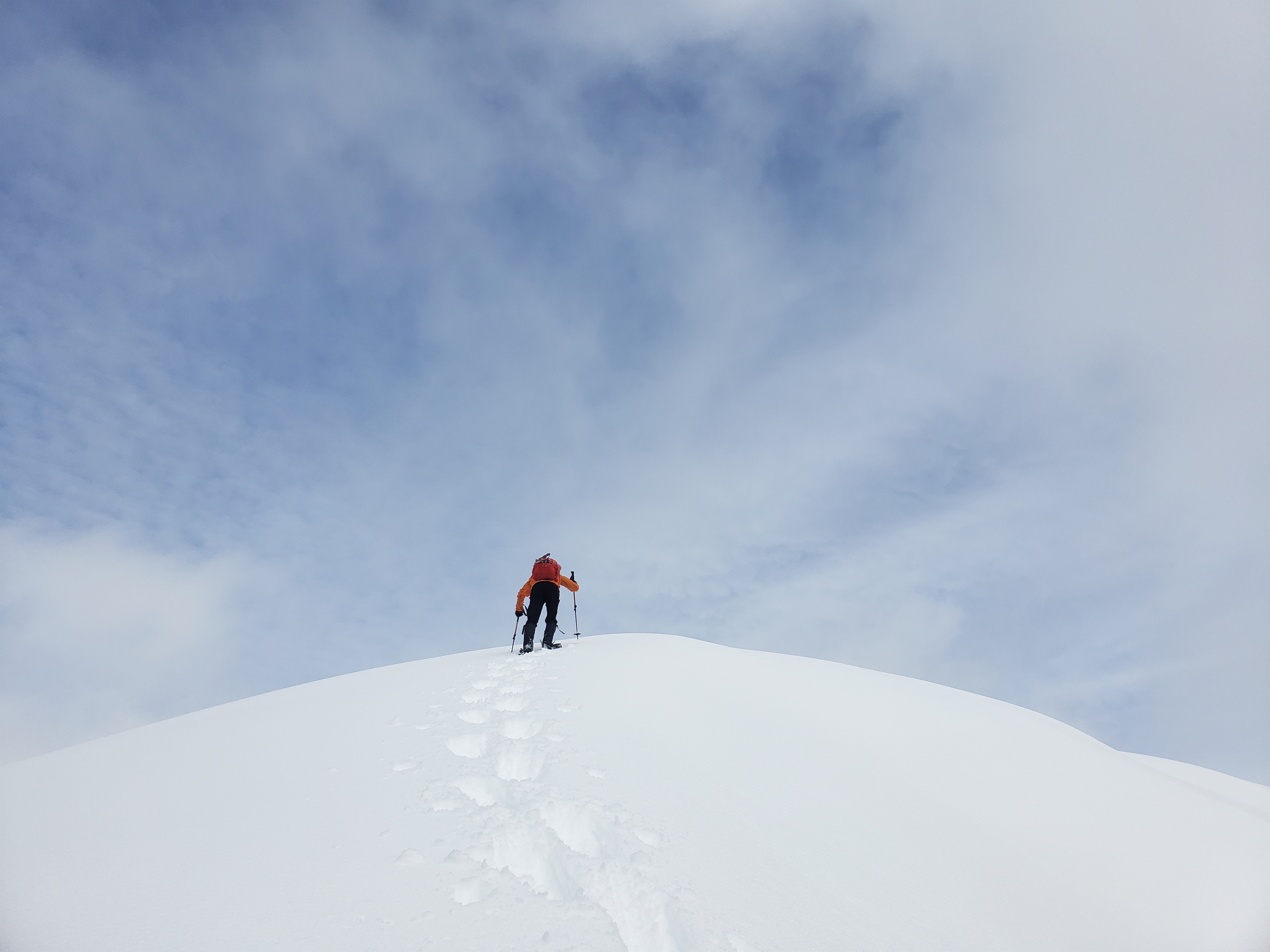
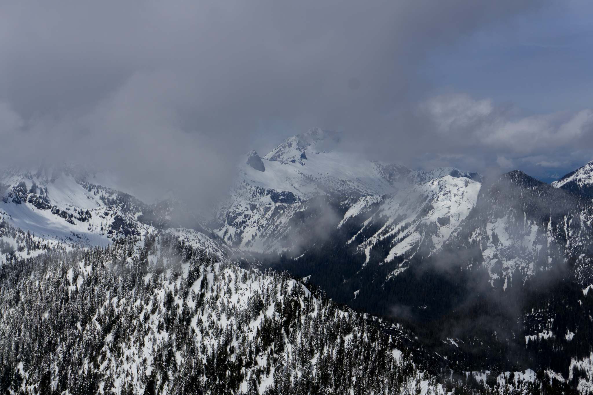
We were at the summit… maybe 15 minutes later, and Rob had the idea to save the final ridge traverse for Tim to lead since he had organized the trip. On the summit, we had sneak peeks of the surrounding peaks. Tim made sure to radio Trang so he could trash talk a bit so she knew what she was missing, at least for the 3 minutes of views we had before being back inside a ping pong ball. I think Anaconda is like Oakes lite, where you suffer through forest until the very end where you get spectacular views, except we couldn’t entirely tell thanks to the clouds. I also learned that having a great camera doesn’t mean you take great photos (literally ALL FLOPS, they are all terrible, and you will see none of them) and sometimes carrying four jackets IS useful (we were SOAKED from rain/snowbombs on the way up and a dry midlayer was amazing). And finally, Tim accepted Rob’s offer of goldfish.
We didn’t want to make Trang wait too long, so we headed down after a quick bite and some group selfies. The way down went faster than the way up besides several transitions between boots and snowshoes, and me snagging my “radio antenna” on everything. “You didn’t collapse your trekking pole all the way!” I laughed but pouted at the same time. “Because they’re ski poles 😦 This is as collapsed as they go!” I always have a pole sticking up like two feet above my head. Luckily, we glissaded much of the way down, which makes me short enough I’m not hitting branches with my antenna. At one point Trang asked how you stop sliding going downhill on snowshoes. I don’t think you ever do, you either learn to use it to your advantage or you get resigned to it. Either way you stop fighting it.

Back at the river, we found a MUCH better crossing than what we used on the way up. I was still in snowshoes and used them to dance across some rocks. Rob got his feet wet. Tim pretended to be a diva and Alex had no ankle so we (Rob gets most of the credit, actually) started laying out more and more rocks to build a crossing, and by the time Tim crossed last it was a bona fide rock bridge while we laughed on the other side. From there we had a few soul sucking postholes getting back up to the trail (I refused to put the snowshoes back on, we were so close!), and then it was clear sailing back to the cars. The sun had come out and we had beautiful afternoon light shining through the trees.

The cherry on top? We got back to the base of the trail a few minutes before the others and Rob goes “I’m going to get the watermelon set up so it’s ready when they get down.” WATERMELON?! Oh my god, it’s March and all I wanted suddenly was watermelon. It was some of the best watermelon I’ve ever had, such a perfectly timed snack. Rob carried it over to the other three and we munched watermelon marveling at the clear sunny weather and how it had turned into such a pleasant day.
This was one of the most refreshing hikes I’ve had in a long time. I hadn’t seen Rob in over a year and hadn’t met the others yet, but I told Rob back at the cars that it was a really good group of people and I hope I can join them on future adventures. Just a really good group dynamic with happy people who are just thrilled to be on their feet outside, and I don’t know about anyone else, but it’s been a tough winter for me. Not as many trips as usual, not as much skiing as usual, way less social than usual. It felt so damn good to reconnect with people and get outside, even if it required… snowshoes.
