Holy cow what a surprise. Davis had been low on my to do list for years, looked like a good workout but nothing very aspirational. WOW was I wrong. Nobody told me this is a wildflower paradise! I stumbled into a fairytale! And almost entirely by chance.
Distance: 10mi
Elevation gain: a nice clean 4000 (6400ft highest point)
Weather: 60’s and everything
Commute from Seattle: 2hrs eastbound, 3hrs westbound as i90 gets more crowded
Did I Trip: no
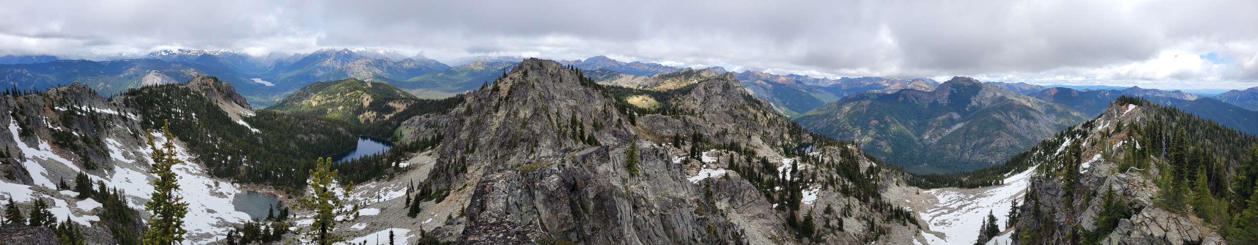
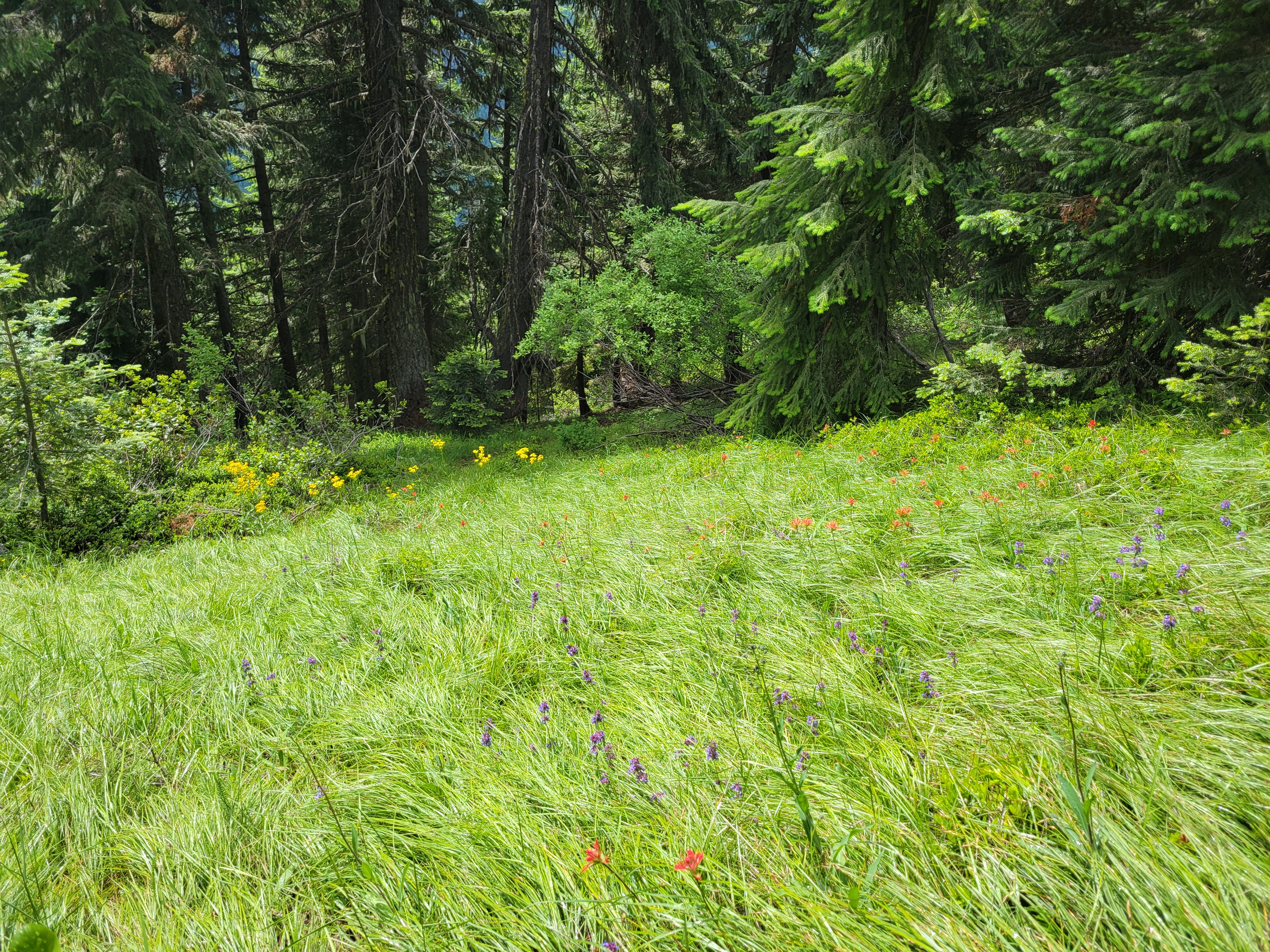
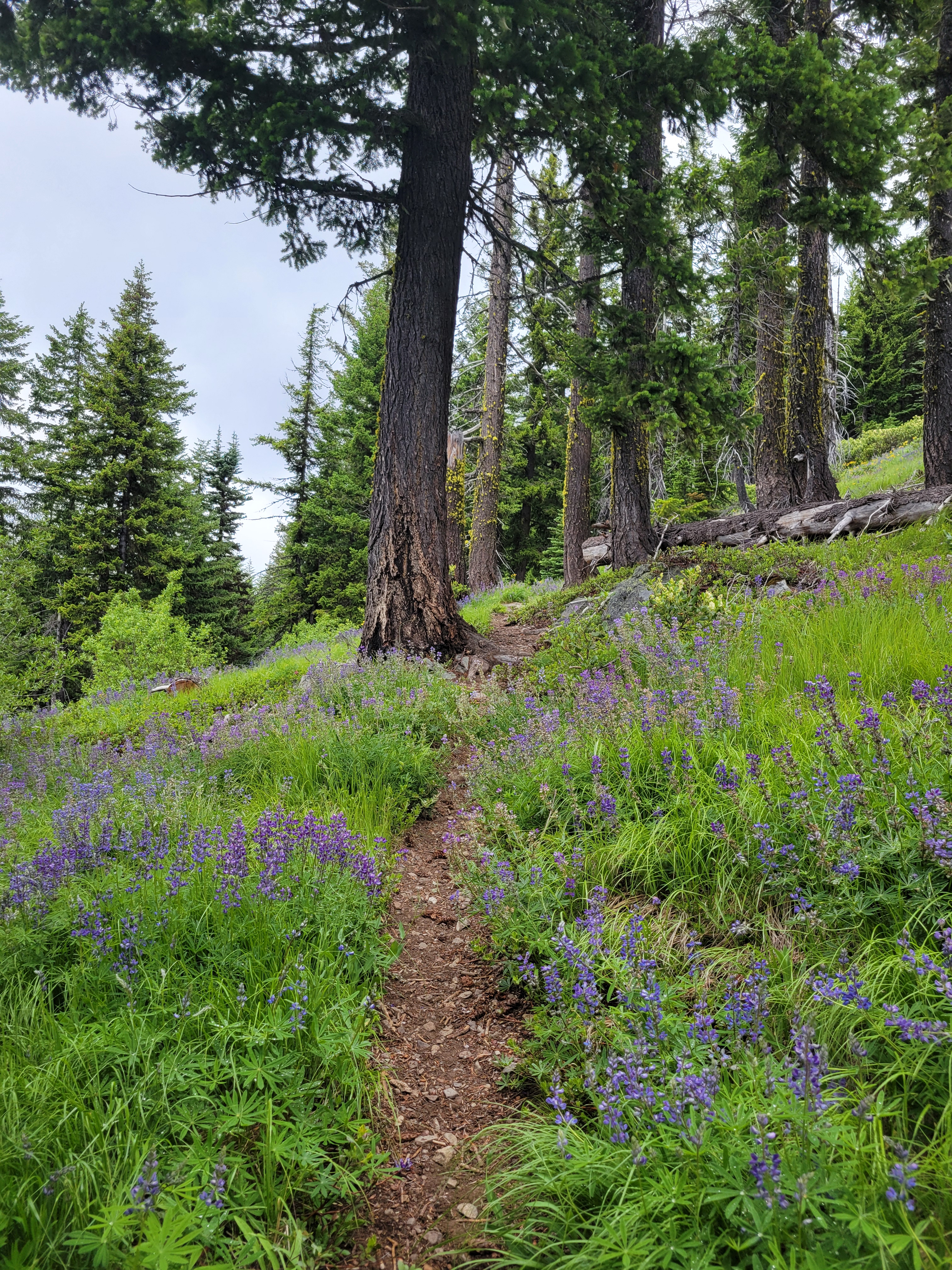
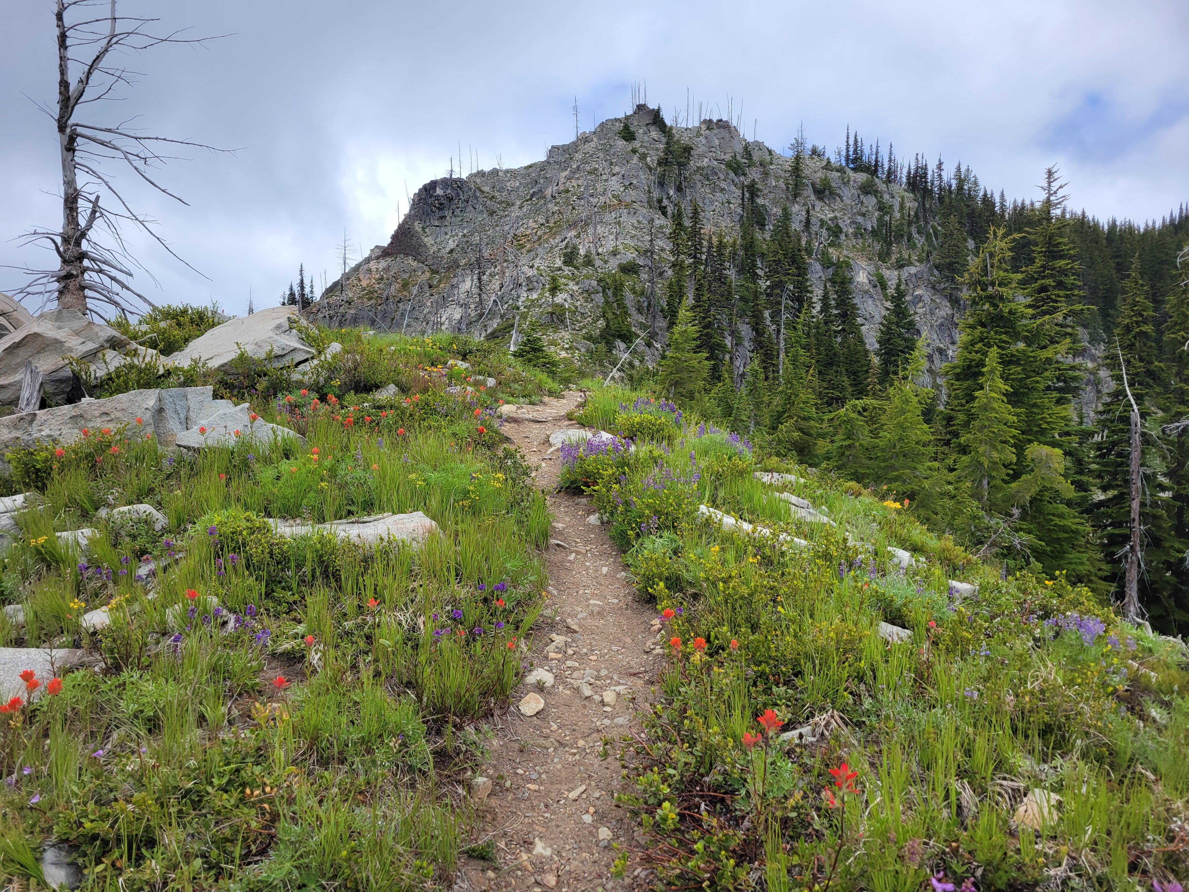
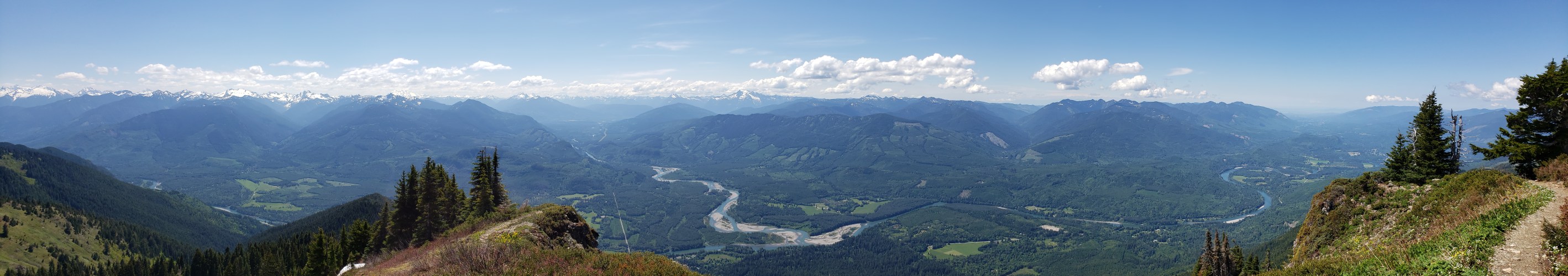
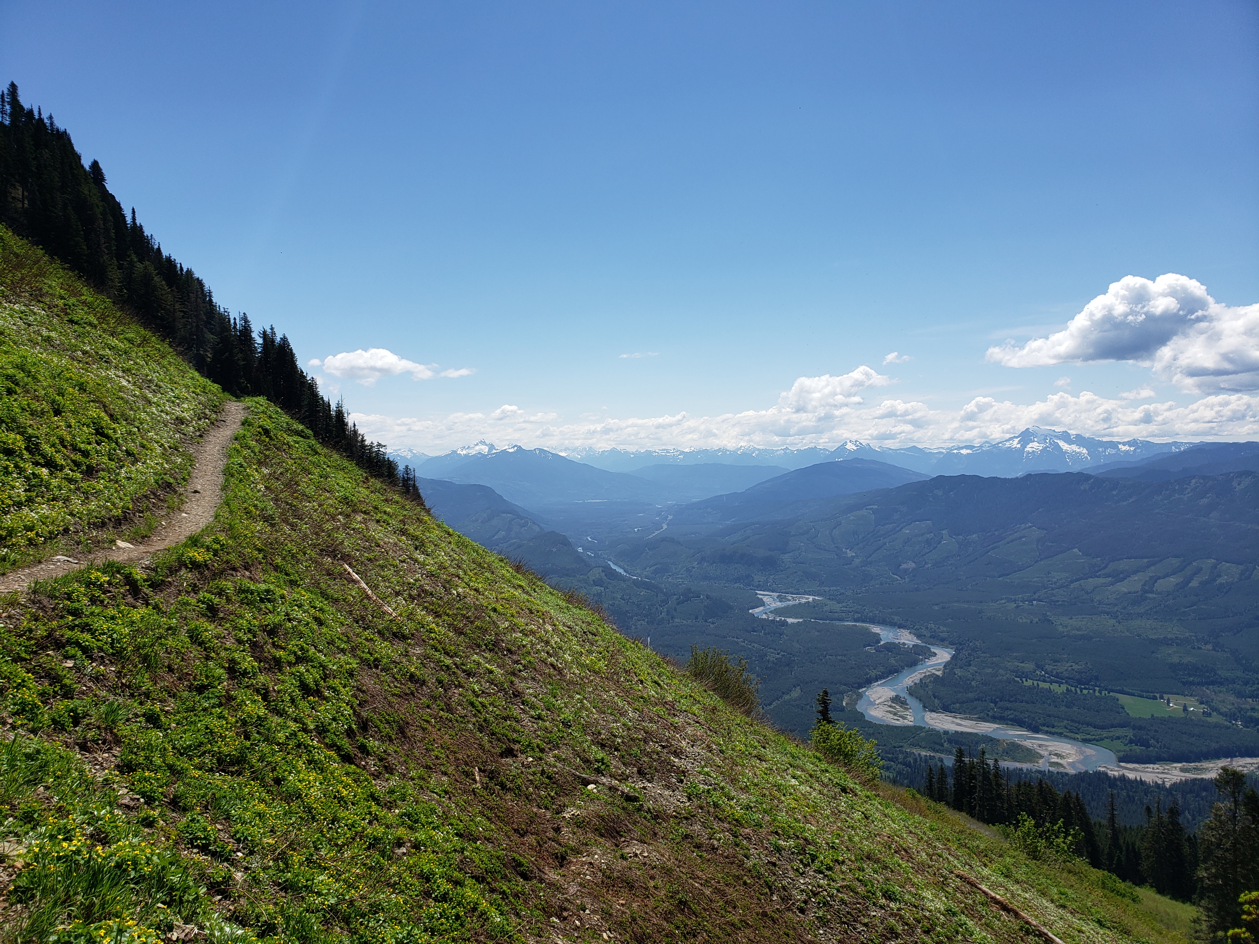
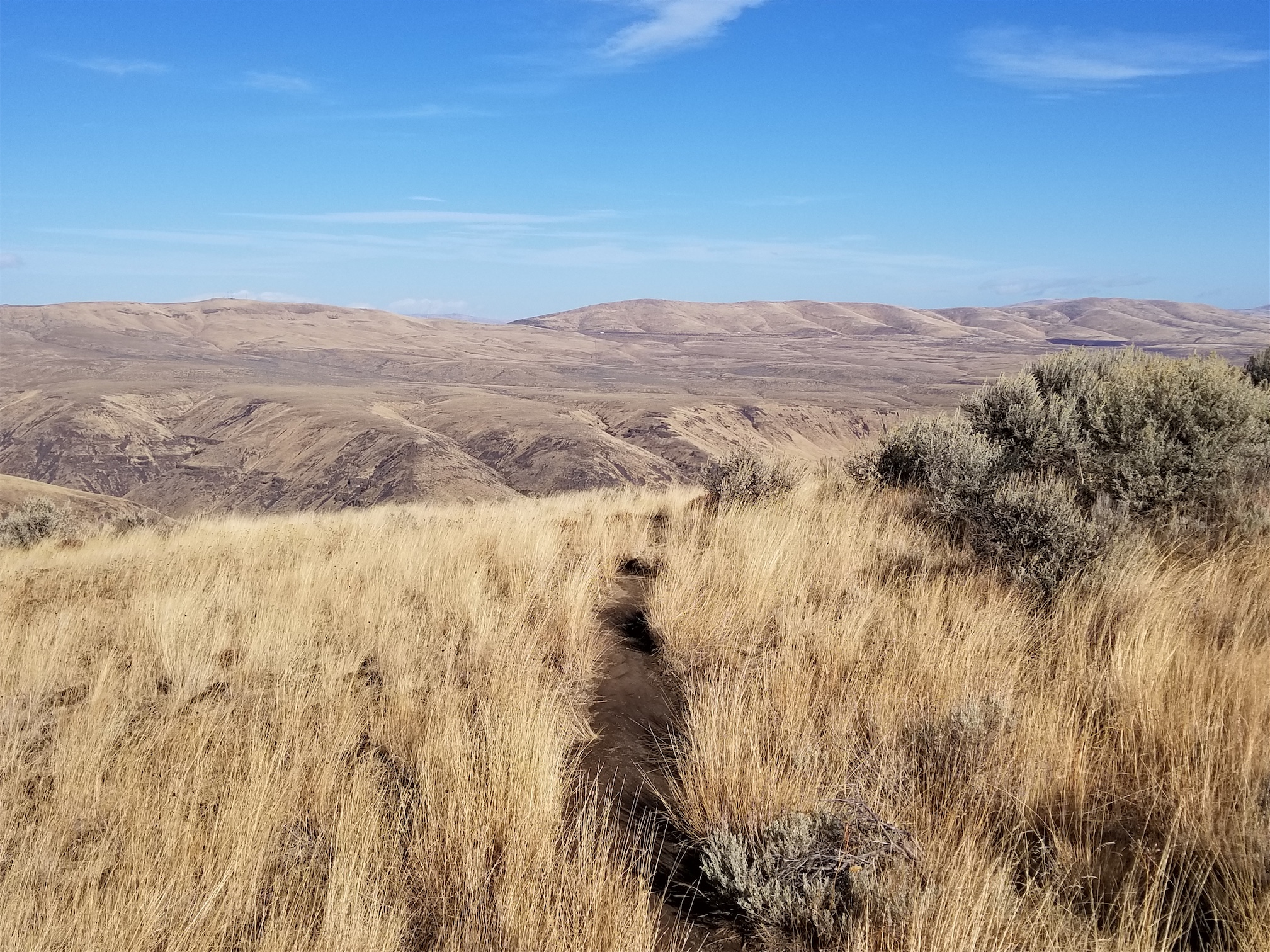
Ocean of grasses and wildflowers
I left Seattle very lazily around 7:30, maybe 8am. I stopped in Roslyn for bakery treats and a second earl grey tea. I wondered why I didn’t do more casual weekends staying in a small town and enjoying breakfast and doing day hikes in the area. My objective was Paddy Go Easy Pass, a more casual 6mi jaunt, an excuse to get out of the house. It was raining in Seattle, cloudy and raining all through the pass. Roslyn was sunny, but the mountains north looked socked in. I could see Davis fully, but every other ridge was socked in as I drove north on Salmon La Sac road.
Oh we’re getting serious now
I turned off the paved road onto the dirt road. Oh boy. I was still 30+min from the trailhead, and driving on the one road condition my car cannot handle (barring sheer ice). Washboard. Even in 4WD the tires spin, the car crabs, and I’m left steering into fishtails as if I were on sheer ice, except with shaking and rattling and a general feeling that the car is about to fall apart beneath my legs. Oh, and my fresh earl grey? Yeah that was immediately all over the center console. I nearly threw a fit. The Davis trailhead was the next trailhead I’d pass, and I pulled over and said eff it, I’m doing Davis. Not driving another 30min of this shit just to potentially be socked in anyway.
Ready to start a rampage with no plan (fortunately I did have a map, somehow) I stomped off towards the trailhead. You have to walk down a road more! You turn off the main road, head downhill, pull over in a small lot, then walk down the road further to a campsite where the trail starts. There is a sign so you won’t be completely lost. You cross the big river on a bridge, and then… heads up, you don’t see water again until you’re back at the bridge on your way down. Bring plenty.
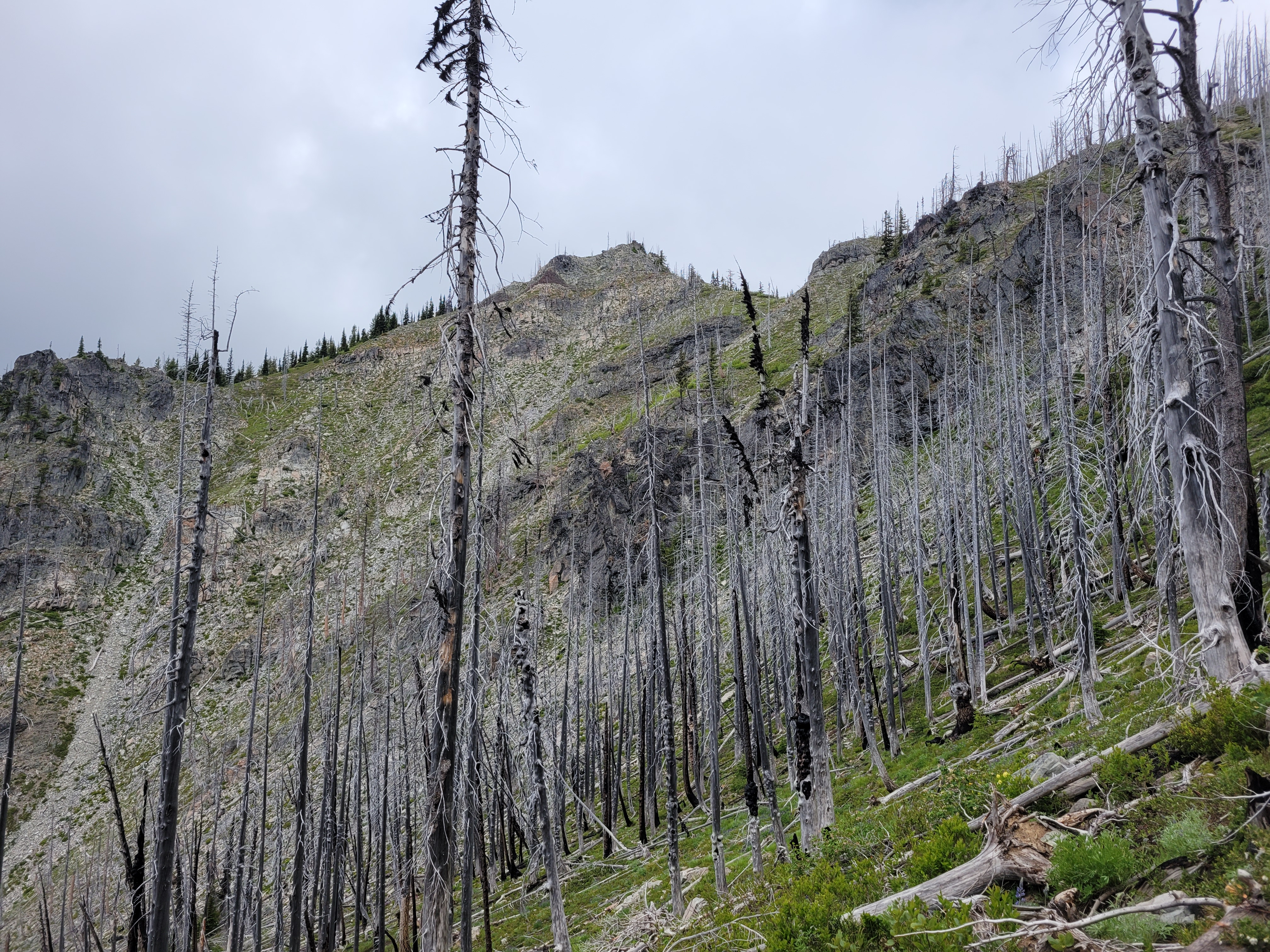
Wildflowers haven’t regrown much here yet
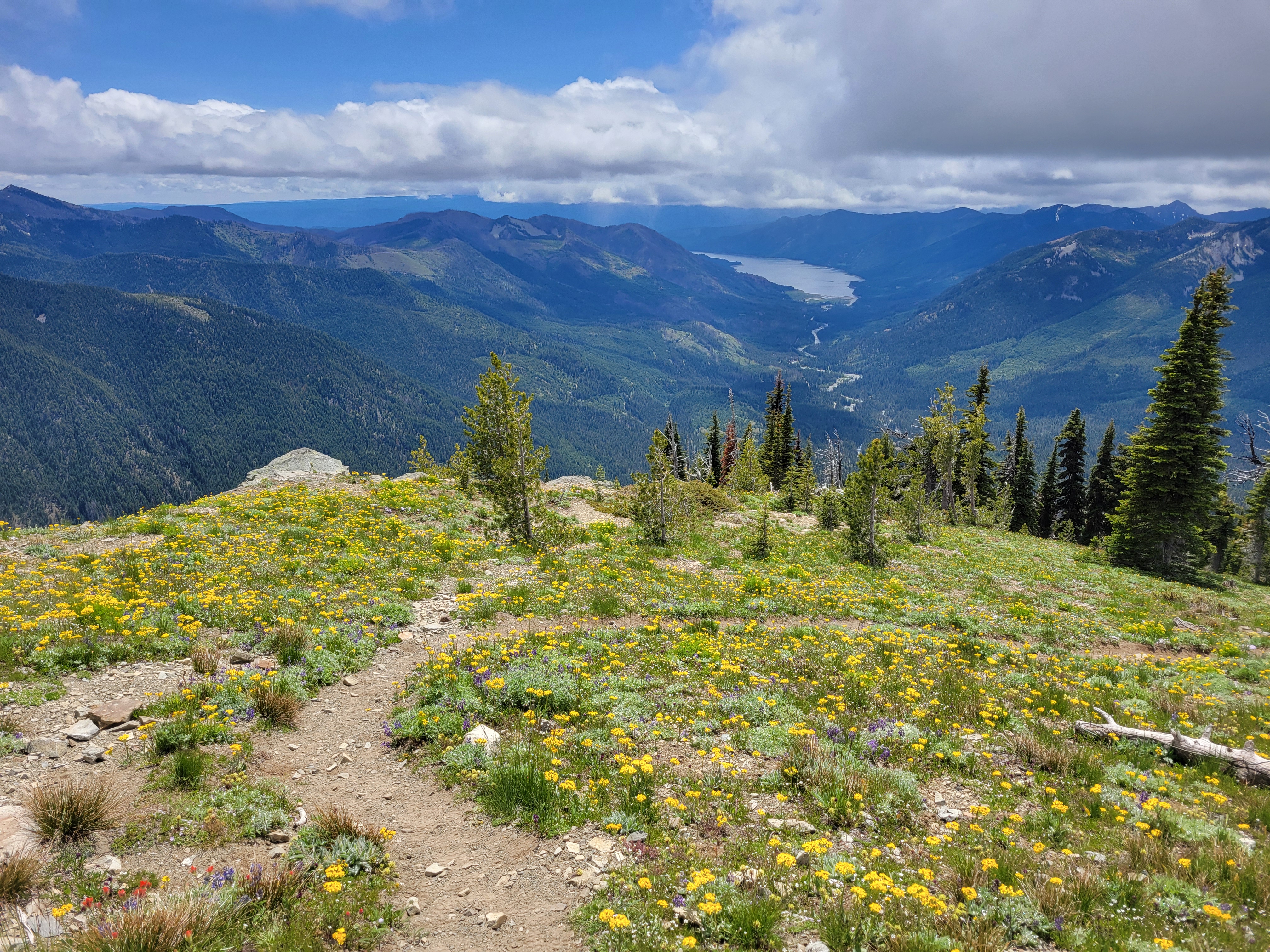
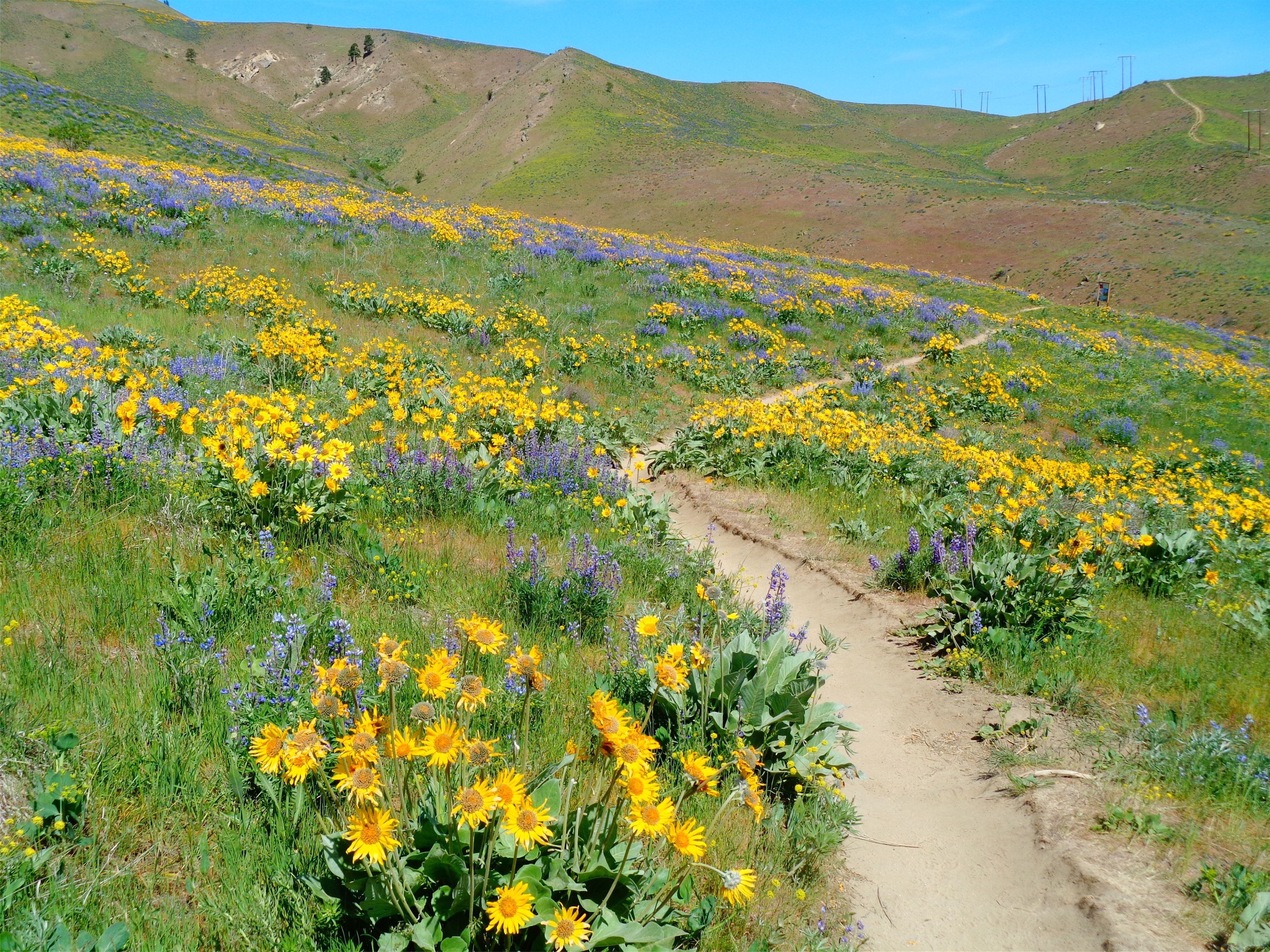
The trail is like 1000 short uphill switchbacks forever. My grouchiness dissipated as I had to focus on trucking uphill. However, the scenery changes every mile or so, keeping you interested. Open forest (I took no pics of that), then burn zone but with tall bushes, then BOOM DISNEY PRINCESS WILDFLOWERS I was bewildered! I had NO idea this was even a wildflower objective. I giggled at one switchback realizing it meant I’d get to go right back through an enormous field of flowers. I was in disbelief. A friend pointed out years ago that part of an awesome hike/climb/anything is being surprised by the scenery, and how that makes a 7/10 trail a 11/10 because you didn’t see it coming. This definitely fell into that.
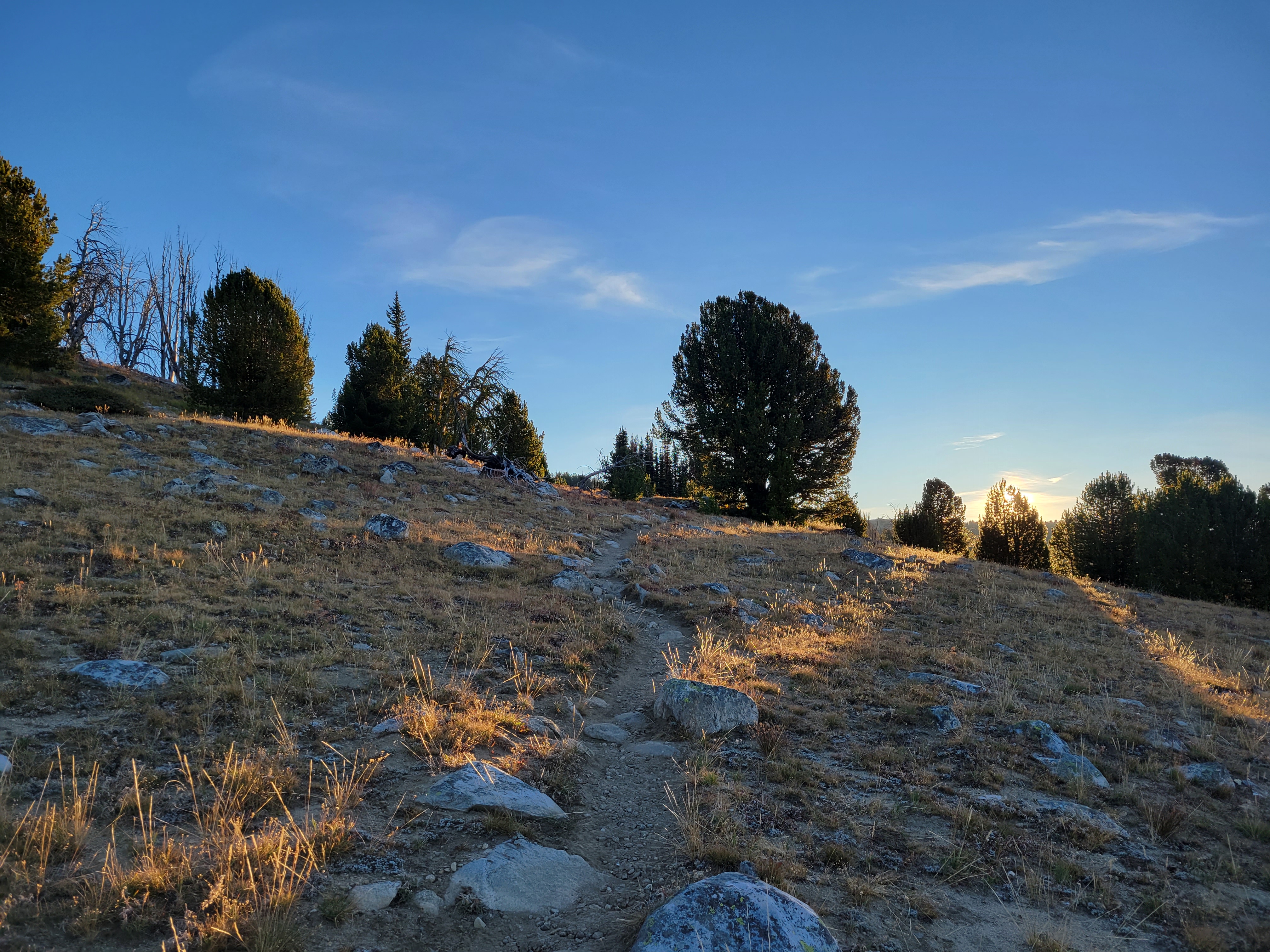
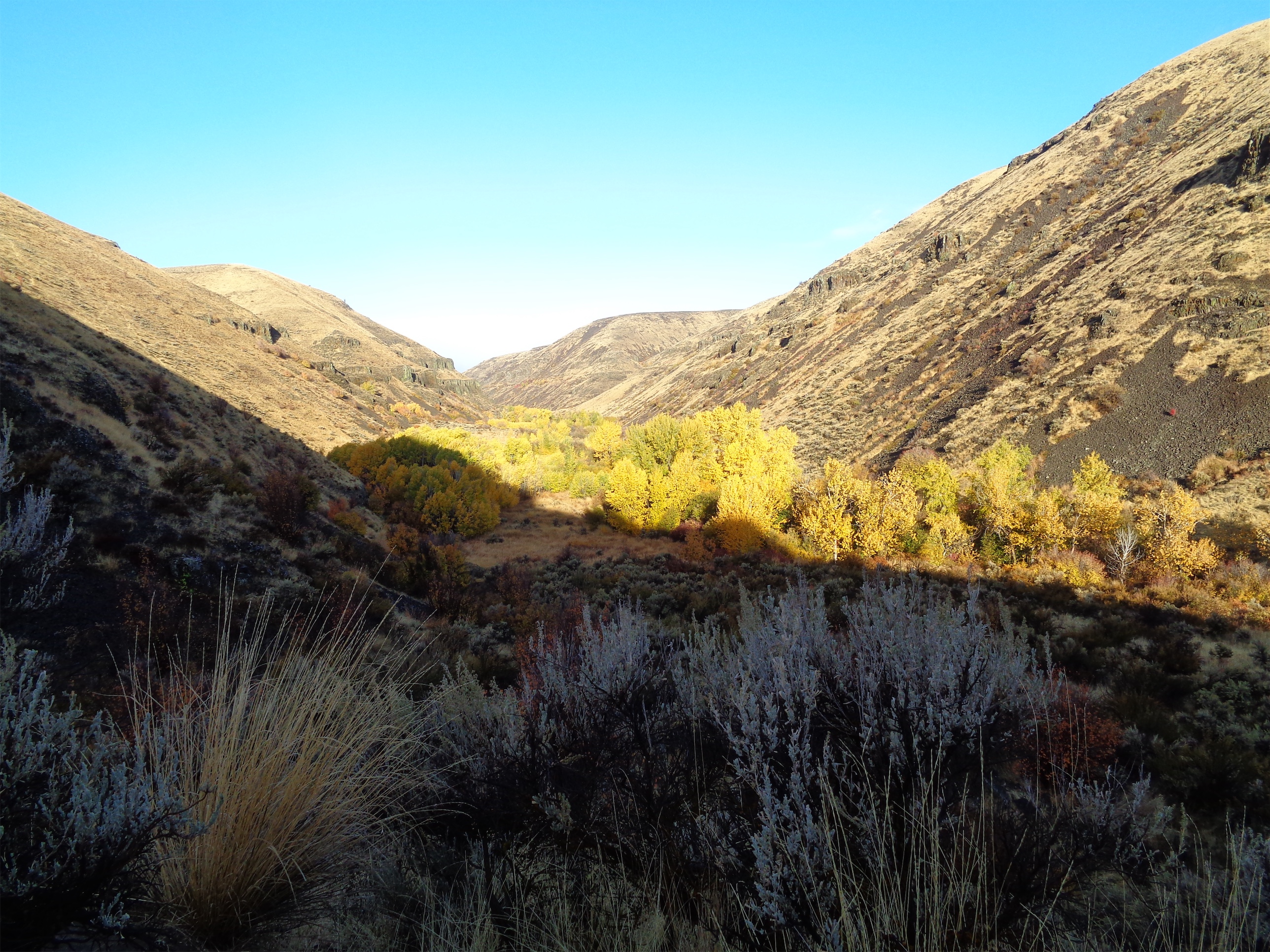
Burn transitions to flowery rocky ridge
Forest and flowers eventually gave way to a more open recovering burn where not much regrowth has happened yet. A few baby lupines, not much else. But this section was followed by a rocky right with some short grasses and a smattering of more wildflowers!
After a few minutes on the ridge, the trail drops down into the forest to the right. If you start heading up a steep rocky “trail” trying to maintain views you’re probably off route. There are branches blocking this trail, but I thought they might genuinely just be blow downs given it’s early season. Nope, they were intentional. Fortunately I figured this out before wasting too much time, refound the trail, and headed into the forest trying not to be too disappointed I was about to lose views. And I hate to say it – if I had not heard voices below me, I have no idea how long it’d have taken me to realize I was definitely off trail. The WTA descriptions clearly mentions this, I just… didn’t read it thoroughly.
If you get this view, turn around because you missed a turn
The forest basin section goes quickly, and soon enough you’re switchbacking up another knoll, breaking out at a lookout site ALSO ridden with wildflowers! Two women asked if I wanted them to take my picture, I said no thanks and plowed ahead before realizing wait I should offer to take their pic (of course they said yes). I explained I was just so in the zone I was not thinking socially. They laughed. “We’ve all been there.”
More awesome meadows next to the lookout site
You could bivvy at the lookout site
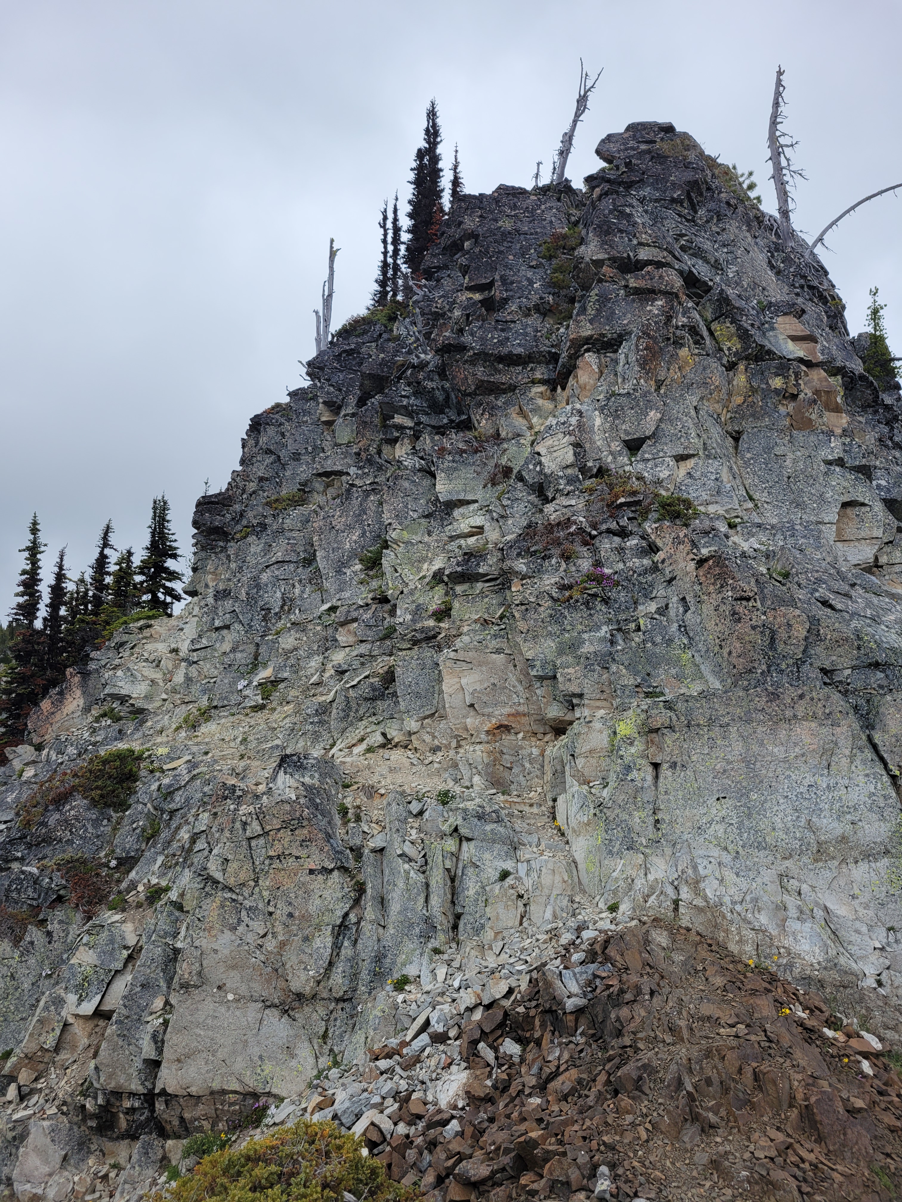
Trail to the true summit follows the left ramp
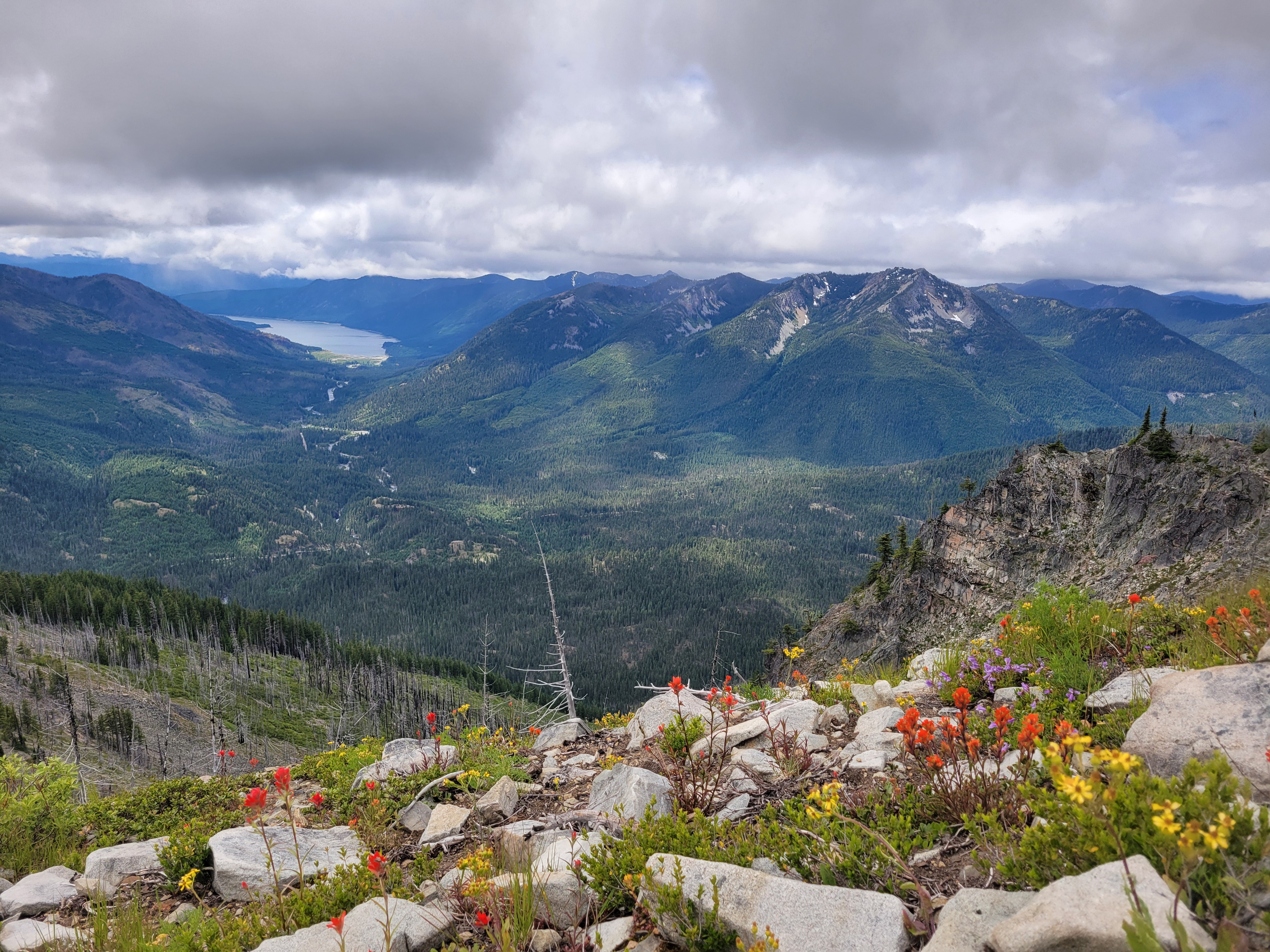
The last half mile to the true summit crawls along a ridge line with almost a scrambly feel. The actual summit probably has spectacular views on a clear day, but all the big peaks were shrouded in clouds. You finally get a view of some lakes. It is the Alpine Lakes Wilderness but 99.9% of this hike had NO LAKES. I had an amazing lemon jam pot, didn’t even know what that pastry was when I bought it but WOW is it delicious. Shout out to Red Bird Cafe.
Oh theeeere are the lakes. And where the views should be.
The way down was uneventful. The wildflowers blew my mind all over again. I watched rain squalls threaten to come over but only got drizzled on once. It was really like Davis was in a patch of dry and occasionally blue sky, and everything in every direction was getting rain. It couldn’t be perfect though, I sat in dead stopped traffic on i90 for like 35min. WA’s highways can’t handle weekend traffic, i90 and 2 are both shitshows. I swore after this that for the rest of the summer I’d only do hikes north via i5 or highway 20, no more i90/highway 2. We’ll see how long that lasts.
Wildflowers with Hawkins in the background, where I just was earlier this month!
After Courtney (haven’t written about it yet), Eric and I deliberated where to go. I had my eye on Slate Peak and Tatie/Grasshopper pass, but Eric was hoping to go out to the Tiffany Peak area. Tiffany actually was on my radar for some reason, we were already more than halfway there, and I had a willing and enthusiastic passenger, so… might as well make the drive now! Plus Eric had waited for me while I did Courtney, it was only fair to go get after his objective the next day. Eric is an incredibly quick conversationalist too. If there was someone to have in the car for a 5-6hr drive, it’s him. It is fascinating to converse with him, we could zoom though a thousand subjects without any gaps, catching up on the years that had gone past, the peaks flashing by the window, the wildfire smoke going up in the distance, the Mariners craziest moments over the past 30 years, Eric’s brain vs GoogleMaps (Eric won).
We made it to the Tiffany trailhead around 6pm or so, and hung out chatting about obscure Cascades objectives and swapping stories until it was too cold to sit comfortably outside. I called dibs on the book we had been passing back and forth, set up my tent, and Eric set up in the car. Something hoofed trotted by my tent. I had pangs of anxiety that it was a cow and I was about to be surrounded in my tent by grunting grazing cattle, but fortunately, whatever it was, it was solo. Once my heart rate dropped back to normal and I didn’t hear any clopping hooves I managed to fade into sleep. I like cows on my plate, not sniffing my tent.
Some needles still lingering
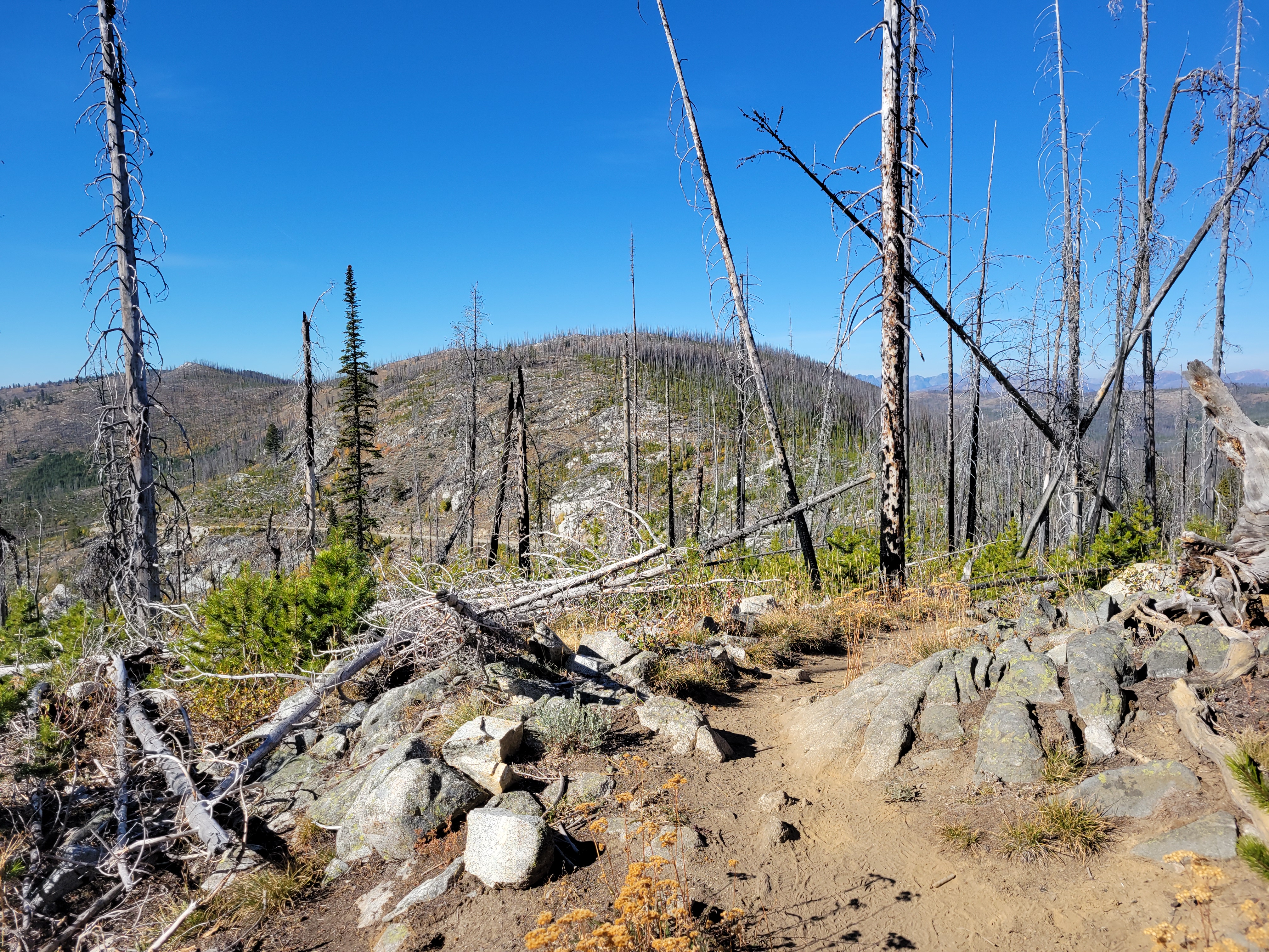
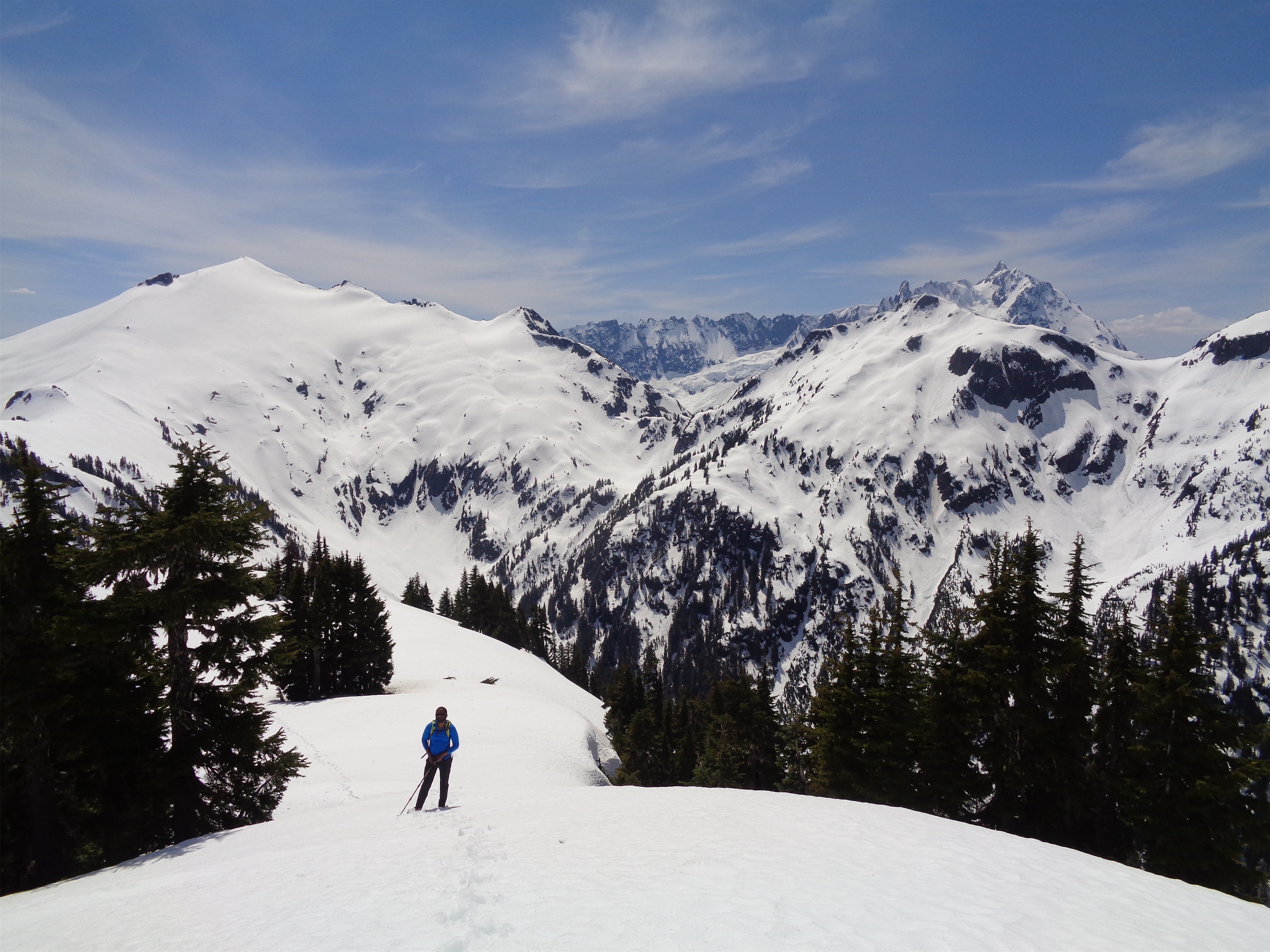
I was up around 6:30 and got my running stuff together. The skies were much less smoky than the prior day, thank god. My legs were tight and sore, but I hadn’t come out here to hang out, so I figured I could at least hike Tiffany. I told Eric as much. “You might beat me back to the car in that case,” he warned. I figured I had a book, food to cook, it was a beautiful day, I’d be fine. Eric had started the book the prior day while waiting for me. “Whoever gets back first gets to read the book!!” I wished Eric luck on his adventure across the road (the peak northeast of Spur Peak, Peak 6970) and started hiking up the Freezeout Ridge trail. Eric is an OG peakbagger and was aiming to climb 1,000 unique peaks, and had already done Tiffany and Clark. He was also dealing with deteriorating health due to a degenerative lung disease called pulmonary hypertension among other things, and was choosing simpler objectives, like this numbered peak that only gained ~500ft elevation off the road.
You’re starting at almost 7,000ft already, and pretty much above treeline. The area had burned decades ago, but the trail was clear, and I was crossing grassy fields within no time. The sun lit up the few larches that I could see, past prime but still yellow! The turn off to Tiffany Peak came up in about 1.5 miles and I quickly started up it, my legs complaining the whole time. It was reminiscent of the top of Maude actually, or Amphitheater. Broad grassy slopes, that ancient empty Pasayten feel. Finally I was at the top, looking down a sheer rock face drop down to Tiffany Lakes and munching on my pb&j.
Wall of smoke covering views
The lakes were surrounded by larches! I tagged both ends of the summit to snap photos. What a pleasant surprise! The larch groves had been burned in the fire decades ago, larch carnage everywhere. But those that remained were perfectly lit up in the sun. Across Whistler Pass from me was a beautifully dense slope of larches, so rather than backtrack, I jogged down the southeast side of the peak, stumbling across a trail that faintly, very faintly switchbacked from the pass up to Tiffany’s summit like some untouched high country adventure. What a treat. For a top peak by prominence this seems to get surprisingly few boots.
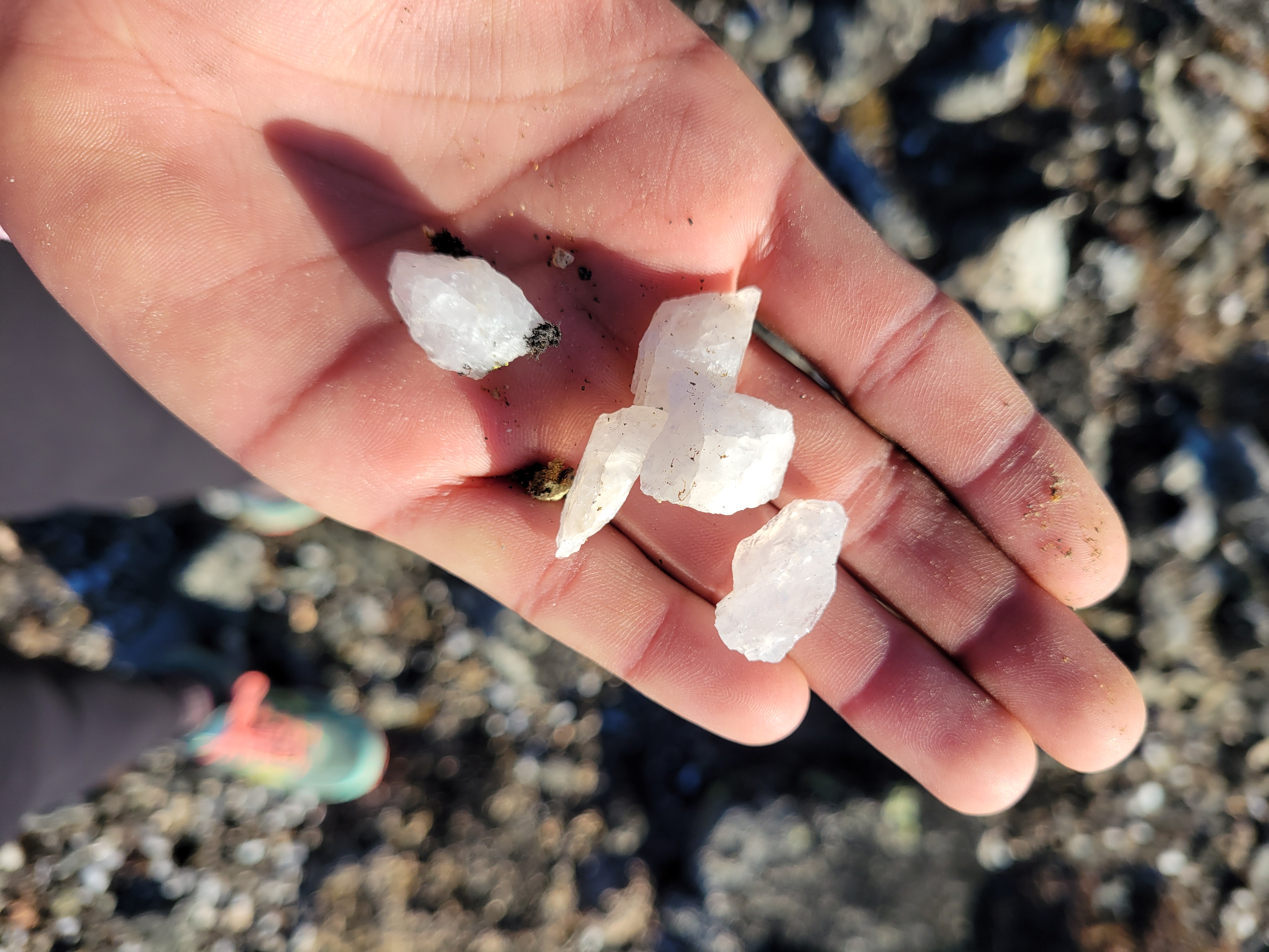
At Whistler Pass, I savored feeling like I had this whole plane of existence to myself, found the trail that would run past Clark, and jumped on that. Faint at first, it grew more and more defined as I went south. I couldn’t resist running. I headed off trail to get a good look at the larches, and noticed something sparkling at my feet. I was entirely surrounded by quartz crystals. This was a childhood dream. Magical. Who ends up standing on a pile of crystals? In front of larches? They were everywhere! I scuffed around for 30 seconds but didn’t find any perfect/clear pieces, and decided I should be on my way so Eric isn’t waiting for too long.
Upper Tiffany Lake
Lower Tiffany Lake
Clark Peak has a very clear saddle just to its northwest, I left the trail right below that and started hiking uphill. I aimed for the saddle and then followed the ridge to the summit. Or what I thought was the summit. I don’t know, there are like 2-3 bumps that all look similar so I just tagged all of them with some fun 10-15ft scrambles. Besides that, it was underwhelming. No larches over here though, they were all back on Tiffany. I ate my second peanut butter & jelly sandwich and figured I’d go check out Tiffany Lakes.
I dropped back to the trail, nearly overshooting it because it was so faint where I crossed it. Back to Whistler Pass, where I could see a barely worn trail heading down the ridge east of Tiffany. This became more defined as soon as it started to traverse the slope, and about halfway down I left the trail to hike up to the ridge. The larches here were insane, huge and still bring yellow. But the lakes looked soooo far away, and it was already 11ish, and I had planned on being back by noon, though I hadn’t communicated that to Eric. I knew he’d be fine waiting for me but I just really don’t like making people wait. Feels like I’m inconveniencing them even if they swear I’m not. Between that and feeling too lazy to go to the lakes, I turned around.
Faint, ancient-feeling trail
Crystals!!!
I cruised back to the trailhead, running most of the way. The air was clear and sweet, the grass lit up in the sun, scattered larches around the fields, and views of the northern Cascades beasts across the way. Tiffany has over 2,000ft of prominence, which (with no trees in the way) means astounding views. I could see the wall of wildfire smoke in the distance, obscuring half of the Cascades but far enough away my lungs didn’t notice it. I finally ran into another person maybe a mile from the trailhead. Amazing to have a trail like that all to yourself for 99% of the trip.
Back at the car, Eric was nowhere to be found. The book hadn’t been moved. I cooked some ramen to have for lunch and sat back reading in the sun. No sign of Eric for an hour, an hour and a half, two hours. Around 1:30 I started to get worried. I can see half the peak he’s climbing from here and it’s empty and silent, I should be able to hear or see him coming down. I decided at 2pm I’d start looking, first by driving down the road to see if he was coming down another side of the peak. If no luck doing that, I’d return to the trailhead, drop the car, and try to follow his tracks as best I could.
Larch carnage
Around 1:50, a car pulled up with Eric in the passenger seat. I jumped up from my seat. “Holy shit!! Eric! What happened?” Eric was all smiles and gratitude getting out of the car, thanking the driver who picked him up. He turned to me. “I way overdid it. Pushed myself way too far. Stupid, so stupid.” “Hey, you made it back to the car! What do you need, water? food?” Eric sat while I helped pack his stuff. Like I would discover a week later with my broken wrist, stuffing sleeping bags into stuff sacks is a surprisingly strenuous, involved activity. “I dropped straight down to the road because backtracking the way I came would have been impossible given all the blowdowns. I was too exhausted. And even then, when I got to the road I couldn’t walk 40 steps without taking a break. If he hadn’t driven by it would have taken me probably an hour to walk the half mile to the car.” Jesus. “And it was uphill!” “Yeah, I’m really lucky he came by, and was willing to give me a chance. I probably looked like a crazy person asking for a ride out here.”
Vast views despite the smoke
“How long would you have given me before calling SAR?” he asked. “Most people… most people I give to sundown or even the next morning depending on who it is. You? At this stage? Maybe 3 hours. You’re on a short leash.” We had a good laugh and got back in the car, planning to stop every hour or so so Eric could shake out his legs. “Well did you get the peak?” I asked. “You must have if you dropped down to the road way over there.” “I’m not sure, let me take a look. I was on top of something up there at least.”
As we were driving away, Eric looked out the window, pulled out his map, and chuckled. “Heh, that’s definitely where I was. Yeah I guess I did make it, huh.” He sounded pleasantly surprised, and pleased. 33 peaks to go to 1,000.
Eric would never make it to the 1,000th unique peak, or even the 968th peak. He passed away four days later at a UW hospital. Primary cause of death: pulmonary hypertension. I didn’t ask if anyone was with him because I was and am scared to hear the answer. His hydroflask is sitting on my countertop because I have analysis paralysis over what to do with it. I had a terrible feeling the day after I dropped him off, wondering how much time he had left, worrying about who would tell us if something happened to him, thinking maybe I should tell him to list me as an emergency contact since I live three blocks away. I figured it was part of processing how I felt knowing that a friend had a terminal illness and seeing the effects in person. I was just jumping to worst case scenarios and I’d leave it up to him, he had years left right I mean heck he just went on a bushwhack even if it was a short one. And life expectancy for his condition had jumped from 1-3yrs to 7-10yrs recently. Had I researched further, I’d have read that what I saw Sunday was textbook Stage 4, and Eric had probably been doing his best to remain upbeat and not let me notice how much he was struggling.
Larch madness
Eric’s Peak
I emailed him 15 minutes after he died thanking him for the company, the recommendation for Tiffany and Clark, the quality conversation, offered to drop off the book for him to finish now that I was done with it. For me, it was one of those extremely rejuvenating trips where everything comes naturally and seems to just click into place. Simple and liberating. But he never saw my thank you. He got the last word, he had sent me a big thank you on Sunday night (“and can i swing by to get my milk jug and water bottle back?”) and I took four days to respond because I was scatter-brained back in civilization. And it wasn’t for nearly three weeks that we noticed it wasn’t just me. Ed messaged. “Have you heard from Eric recently, Eve?” No… and he left mid conversation. That’s not like him. No social media activity. No one had heard from Eric in three weeks. I tried to sleep that night but my gut knew something was wrong. The next day I walked to his apartment a few blocks away and met his neighbor and landlord who immediately recognized my description of him, shared the news, and got me in touch with his family. I’m left with a water bottle, memories, and some amount of solace knowing he topped it all off with a peak on a surprisingly summery October day way out in the Pasayten nowhere.
It’s the people that matter (PC: Khuyen)
When I first moved to Seattle, I met a woman at a run club the day after I arrived. I ran into her a week later on a solo jog around Discovery Park, and we ended up running an hour together as she showed me around the trails. She was moving out of state the next day. “What really IS a friend?” I remember her asking. “I mean, we’re running together, but we’ve only met once and we’ll probably never meet again, does this count?” I think about that a lot, I use “friend” where many people would use “acquaintance” or even just “someone I met once.” I built a community out here from scratch. My friends span from 25yos living with their parents to people celebrating their senior discounts at Denny’s to people who are now dead. So I don’t know how to define “friend,” and my community may be non traditional. But it’s a heck of a community. These connections between people are what matters. And it sucks when one of those connections is snuffed out.
Eric’s memorial was a few days ago, bare bones but it came together last minute and was very cathartic. Friends from different decades and phases of his life, different jobs, different climbing goals. Crazy seeing how many people he mentored, even when he couldn’t keep up physically anymore. I can only speak for myself but the hours afterwards were the most at peace I had felt in a long time. Sometimes you don’t realize how much you’re treading water until you have the space to reflect.
Sage Hills, the best wildflowers I think I’ve ever seen
The view skiing from Castle
Three months ago, I stumbled upon a Reddit headline that just said “half-assed is better than no ass at all.” Funny, because about two weeks prior I had come to the same conclusion. My work life balance was in the toilet, I was unhappy with my team, my team’s direction, my daily duties, and mostly the fact I had to be available to monitor shit on weekends. I was not important enough to the company to be full time and yet I was important enough to manage this test day in day out. And yes, it’s only ~two hours of work on Saturday, but an hour in the morning and an hour in the evening means any overnight climbing trip is shot. I have always been very good about drawing lines between work and personal life, and somehow everything I had always worked to fight against was suddenly happening and I was just sitting there and taking it.
Sage Hills. It’s like quenching thirst.
And then after a day doing the Table Mountain Circumnav, I decided that you know what, a half day trip was better than nothing. Maybe I didn’t get my winter Rainier ascent, Chiwaukums traverse, Baker ski. Maybe I wouldn’t be fit enough to leave town to do a last minute ultramarathon for my birthday like last year. Maybe I wouldn’t get to trailhead camp Friday nights and do long day trips from 3am to 10pm and stay in lookouts and ski in the middle of nowhere two days in a row but that doesn’t mean I should spend the entire weekend in town ignoring everything I love to do. And so, the short trips started.
Here’s where I got lucky. I actually had a few friends in similar situations. They could only get out one day a weekend. Or they wanted to just go to the ski resort. Or they were new to backcountry skiing and just wanted a couple hours playing around on their new setups. The Rainier National Park gates helped me out too, they don’t open until 9 so if I found someone to go to Paradise or the Tatoosh then suddenly we didn’t have to leave until 7am anyway because it was pointless to leave earlier. And I started a streak of half day trips.
Near the top of Sauk Mtn with Sauk Lake below
Let’s be straight, it’s not better yet. I’m nowhere near the fitness level I was last year. I was doing job applications from 5am-7am instead of the gym, I had late nights at the office, I had nights where I was too drained by 7pm to want to do anything beyond shower and sleep by the time I get home. My coworkers are all impressed when I run commute to the office and I sit there bitterly thinking this isn’t how I want it to be, this is a sorry excuse for the reason I live in Seattle, everyone has forgotten who I am and what I do and why I get out of bed in the morning (hint: it’s not my job) because I’ve turned into a work slave instead of a free willed human being. Yeah, a lot of this is self inflicted because I take pride in being good at my job and I don’t want to tell everyone to go fuck themselves and do my thing on weekends regardless. And it’s a downward spiral. The less you climb, the worse shape you’re in, the less you can do, the harder everything is, the less you want to do, and getting the ramp-up started from square one is brutally humbling.
But as it turns out, there are actually some pretty decent half day trips out there.
Brad ready to ski at Hurricane Ridge
1) Hurricane Ridge. Wow, this place is beautiful, and you drive right up to it and can walk as far (or not far) as you wish. And you get the ferry experience. It’s like the Paradise/Artist Point of the Olympics. They also have an adorable mini ski resort. This was a series of unfortunate events for Amber, who froze a binding that Brad expertly repaired with a random sling I had, wiped out many times, and booted all the way back to the car only to break a boot buckle while taking her boots off in the parking lot. Brutal. If I wrote a full post about this, it’d be called the Misadventures of Amber Yun.
Calvin gets some air below Castle
2) Castle Peak (ish). This is a great ski!! Short approach mostly along a road, but the Castle-Pinnacle Saddle is just a really fun, mellow ski run. Like maybe 3 miles round trip. Perfect for anyone new to backcountry skiing. I did this two days straight because it was fluffy and amazing and the gate doesn’t open until 9 so hypothetically if you have to work from 6-7am it’s not a problem. And you can do multiple laps without too much effort, especially if your friends wipe out multiple times on the way down and you have time to sneak another one in while they remember how to ski. I might not have earned that blue cheese steak at Copper Creek Inn with just this, but you bet your ass I’m still gonna eat it.
Big Greider Lake
3) Greider Lakes. 8 miles, runnable for the first few miles, power hike the rest (or run if your’e more ambitious than me). The larger of the lakes is beautiful. Even Spada lakes (the reservoir for a lot of Snohomish county) is a beautiful shade of green with the snowy backdrop of Vesper looming above. Lots of great campsites (with toilets!) for an easy overnight. You do have to drive through a bunch of shooting ranges, which still makes me feel weird. The road was just long enough that I started to doubt whether I had the right directions.
Very beginning of the Sauk Mtn trail
4) Sauk Mtn. 4 miles round trip for some fantastic views and steep switchbacks. It’s not quite melted out yet, most parties turned around at a short but steep snow traverse. I brought an ice axe and crampons because I was originally going to do Huckleberry Mountain, but bailed because I was lazy and there were too many spiderwebs. I thought I’d look like a total tool with mountaineering gear, but it actually came in handy. I made it to one of the ridgeline bumps, don’t think it was the old lookout site though.
Amber basically being a disney princess
5) Sage Hills. Holy crap. This is like a whole ass with the effort of a half ass, assuming you’re okay with a 3hr drive for 3-9 miles of hiking depending on how far you want to go (the wildflowers start immediately). Best wildflowers I have seen maybe in my life. And it’s basically in someone’s back yard. It’s a system of multi-recreation trails outside of Wenatchee, I literally parked next to someone’s driveway and had my mind blown for the next two hours of vibrant yellows and purples. This might get its own post eventually because the flowers are INSANE and it was like sitting in a disney movie. It’s like larch season. Chugging cold water when you’re hot and thirsty. Blankets and tea after a day of skiing. Oversaturated colors after a greyscale Seattle winter. You get it.
Surafel on the ridge to Hannegan
6) Hannegan Pass/Peak (okay fine this might get its own post when I make time). We had both already done Ruth, so we decided to go for Hannegan, and also that way I didn’t have to pass all of the skiiers and cry with jealousy (spoiler alert, we ran into them anyway. waahhh). ~8-10 miles, still lots of snow when we were there and I definitely should have brought skis.
And eventually I realized that half day trips are still pretty jaw-dropping. Especially on a sunny day, any hike is better than sitting in the city. Especially when you have people to join. Especially when you feel like you’re going crazy and don’t know what to think about anything anymore. I used to joke that the overnight trips kept me sane, and at this point I think there’s actually some truth to that. Something needs to remind me that I’m more than just my job, and the Cascades have provided that, so long as I can get to them.
So these might not have been the full ass trips I wanted, but they kept the hunger and excitement alive, and gave me something to still look forward to every weekend. I’ve also planted a garden (well, my visiting family did most of the work but I’ve been watering it), rediscovered my passion for cooking, read more books in the past 4 months than in the prior year, went kayaking on Lake Union, visited San Francisco, and the cilantro I planted is thigh high and I can’t eat it fast enough. And the Bruins are playing in the Stanley Cup Finals, which actually takes priority over almost everything else. Brooke, Forrest, Amber and I joked that everyone was domesticating. Forrest insisted it wasn’t domesticating, it’s more like renaissancing. This has been my late 20’s Renaissance. God forbid I should have a balance between mountains and housekeeping.
This weekend, I’m about to head out on my first mini overnight in months. The only other two I’ve had were a 12hr camp on Granite (which was technically overnight albeit straightforward) and that fateful ski trip where I ate a piece of candy that I found on the ground and it didn’t go so well (and the work issue over those days solidified the fact that yes, someone did have to monitor what we were doing, and my small act of rebellion was in vain). Wish me luck, guys, feels like I need to relearn how to camp and climb. At least I remember how to belay. I think.
I wanted a lazy overnight trip because I had barely unpacked or organized anything after moving into my new house on Wednesday. Luckily Brad was willing to wait an extra morning to have company, so I got to spend Friday night and Saturday morning making my house look habitable and we took off around noon on Saturday after I even managed to knock out a St. Helens blog post. How’s that for a productive morning?!
Distance: ~11 miles (13 because we went up and down twice)
Elevation: 5,000ft gain, 8,321ft highest point
Weather: 40’s and rainy, 60’s and sunny
Commute from Seattle: don’t look 4:41 with no traffic
Did I Trip: Nope!! Slipped on skins a bit in slush but no faceplants thank you very much
Indian paintbrush and… a yellow wildflower!
We got started from the trailhead around 5:30pm, taking advantage of the long summer day to get up to camp. We were planning on camping on the ridge, but the approach took longer than we thought. Or we left later than we thought. Or (my excuse) the drive was way longer than I thought. And when we got to the trailhead, the road was blocked off with caution tape. Shit. We looked at each other and said fuck it and ducked underneath it. Falling trees be damned. We hoped they were just talking about the trees near the parking lot and campground.
Abernathy in the clouds above Scatter Lake
We started booting it up the trail, skis strapped to packs. The trail was low grade, pleasant, winding through green forest with intermittent sunshine and drizzle. Wildflowers were out! You could smell the pine needles in the air. We started to panic. Where the hell was the snow? We thought it was a 3 mile approach to the lake and it had been almost two hours. Shit. A) we’re still not at the lake and B) Where. Is. The. Snow. What if there is no snow?! The guy before us in the trail register said his destination was “snow!” but he never confirmed whether he found it or not! Oh god.
Switching to boots (Photo by Brad)
Skinning up as the skies clear
Luckily we ran into patchy snow and consistent snow soon after (~5,500ft). We continued to boot it because I’m too lazy (stubborn?) to transition and the snow was perfectly consolidated for booting. You finally break into sparse trees, but wait! There’s another like 600ft to the lake, and you have to make it a rising traverse from left to right or you’ll cliff out. It went on forever. Probably because the sun was setting, the approach was a solid mile longer than we thought, we were carrying skis because of my stubbornness, and you know when your’e so close yet so far? It was like that.
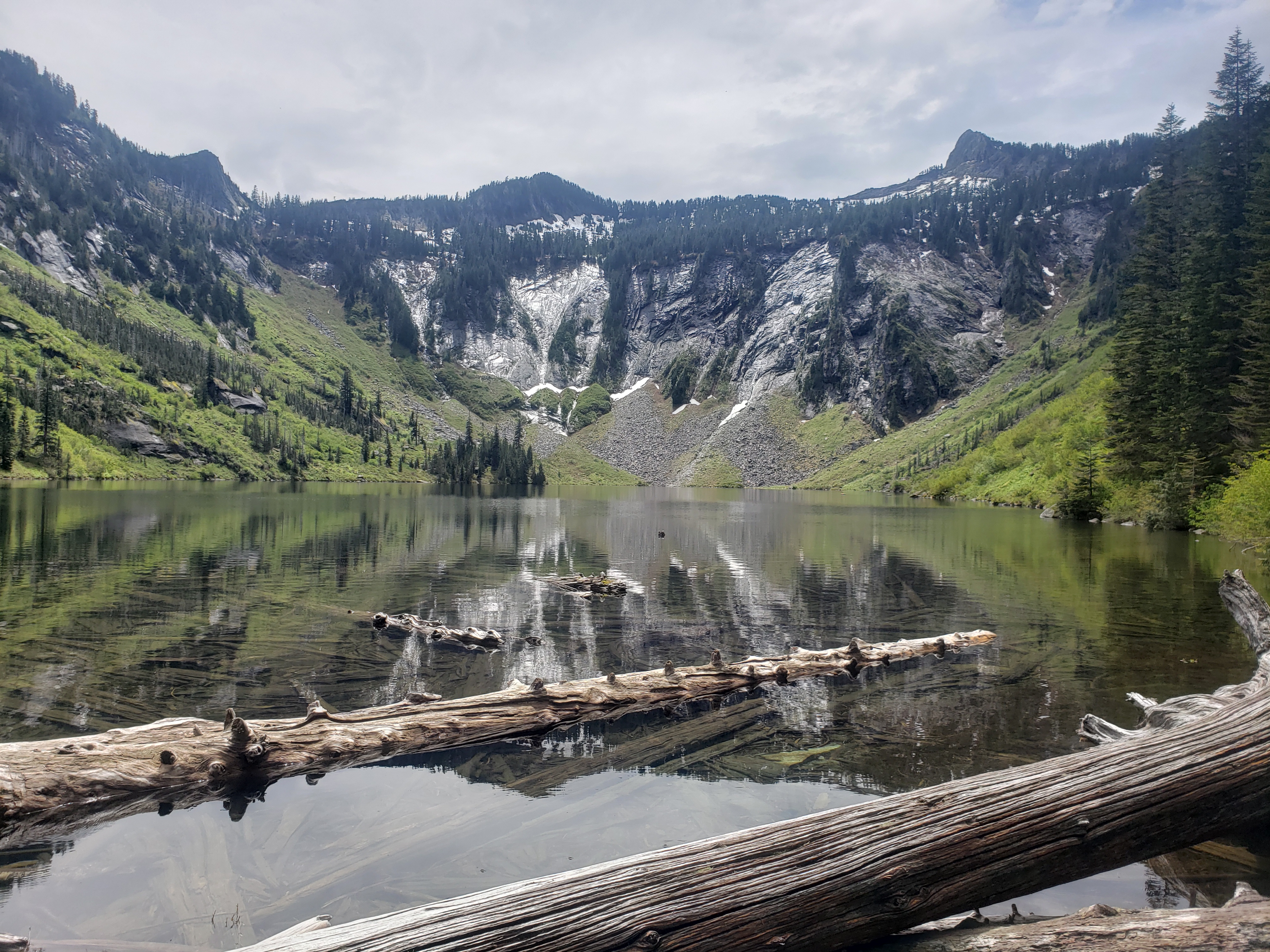
We finally got up to the lake just at twilight. The top of the peak was in clouds and we booted out to a rock patch on the other side of the lake to have a better starting point. I popped up my tent while Brad set up his bivy. I enjoyed a hot meal of chicken chili, first dehydrated meal of the year I think! I’ve barely camped! I boiled some water so I’d have a hot nalgene, and went to sleep. And slept like a baby. At least, once everything dried. The first hour was a little damp from the drizzle.
Standing there with his stupid ski crampons
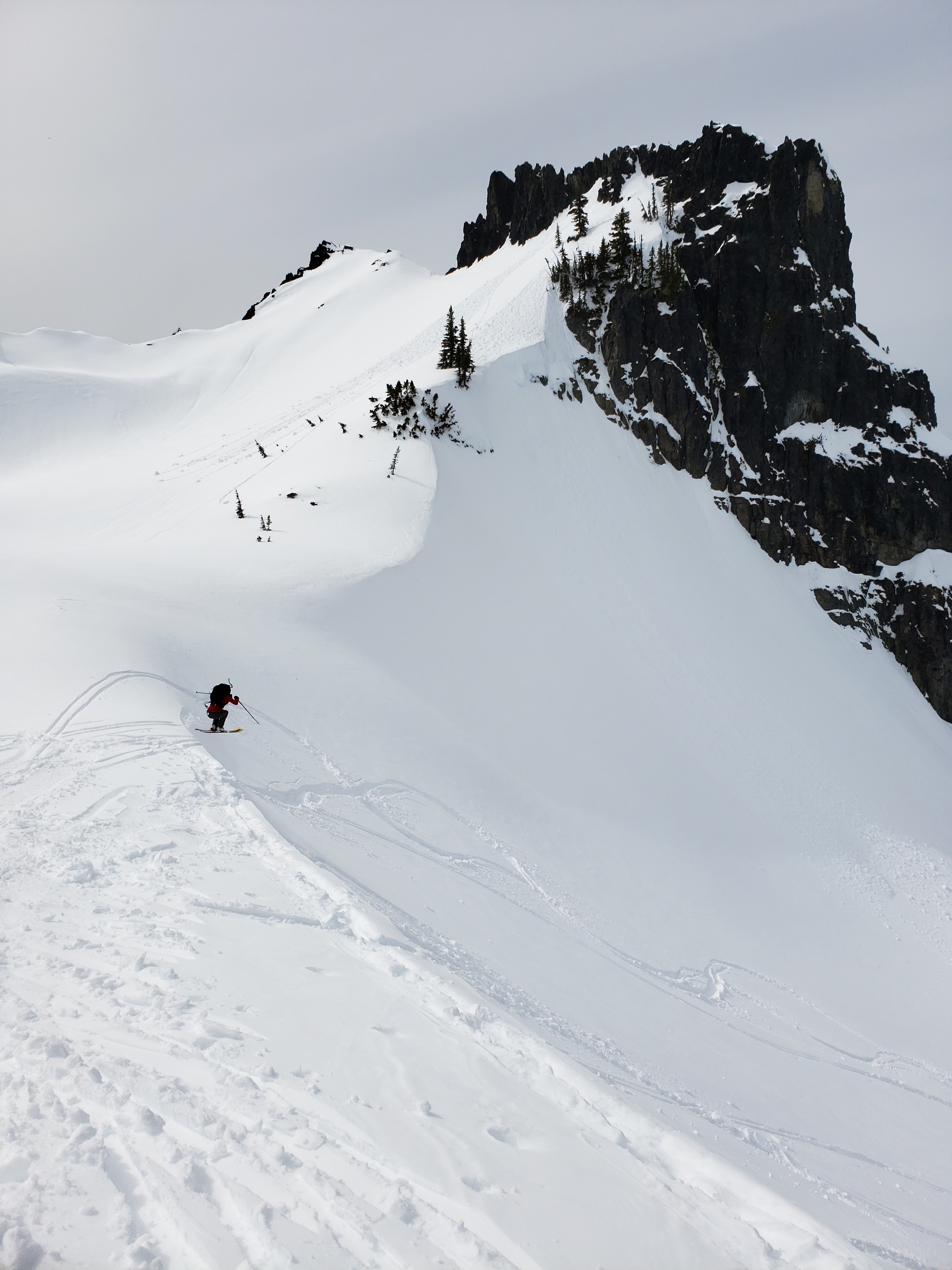
My first alarm went off at 3:30, but the peak was still socked in by clouds and it was drizzling yet again so I turned it off and went back to sleep. The second alarm was at 4:30, and I dozed for 15 minutes before asking Brad if he wanted to give it a shot anyway. We started up just after 5, and holy crap it was the right choice. The clouds lifted and cleared as we got higher, and by the time we summitted it was blue skies and views! It’s a very straightforward snow walk up to the top from the lake. I stopped skinning halfway up because I was getting weirdly anxious skinning on crust and felt better in boots. Brad amazed me with his skinning confidence on the ice until I realized he had been wearing freaking ski crampons the whole time. Dammit Brad.
Horsheshoe cloud around Reynolds
We walked the “ridge” to the summit and savored the views for probably an hour. Scanned all the names in the summit register to see who we recognized, snapped pictures in every direction, mocked my friends with pictures because I had Alpine Verizon cell service, took some naps… gotta kill time until the crust turns to corn. We finally got impatient and I decided I’d just boot it down if it was still crusty. Ugh. So not stoked. So Brad switched to skis as I booted down the ridge.
Except by the bottom of the ridge, the crust was getting softer. And 100ft below that, it was feeling a little corny. And Brad shouted back up to me. It only gets better!! I stopped and clicked into my skis. Bring on the corn baby!
Skiing mellow corn (photo by Brad)
Seas of peaks
The ski back to camp was phenomenal. Hero corn (with a few patches of crust here and there) which makes you feel like an amazing skiier. And straight down the line of fall, at least for the most part. We were back at camp within minutes. We packed a little bit, had some snacks, and realized it wasn’t even 10am. Do you… what if we… we should go up again. Maybe just to the rocks below the ridge. It would be a waste to get back to the trailhead at like 11am. And so I skinned all the way up this time, breaking trail through slush (Brad’s crust crampon trail was too steep). I had second-summit-fever and wanted to ski off the top this time. I waited for Brad for a bit but didn’t see him, though I did meet the only other person in the area who was headed for the Northeast couloir of Abernathy, a dope ski that I’ll shred in my dreams but never in real life. He had been hoping to ski down that side and then hit up Gardner and North Gardener, never did hear if he was successful. They’re melting out fast.
Woo!
I finally just switched to downhill mode and took off to find Brad. I made my first turn and immediately set off a small slab avalanche that went right out from under my feet along with a shit ton of sloughing, which ran for a few hundred feet down a gully that was not part of the standard route, thank god. The slab was barely 8′ across so I ski cut the rest of the slope to send whatever else was left on its way and headed back down the way I came up. Spring skiing! After mildly shitting myself I skiied the lowest angle terrain back to Brad, who was just above the only other section I was concerned about. I told him what had happened and that we were doing this one in shifts. I skiied down to a tree patch that was out of the way if he set anything off. No more slab, but plenty of large sloughing rollerballs to ski through. I waved him down and we skiied the next section separately until we were on mellow terrain, where we cruised back to camp once again.
Back at camp
This time we decided to officially head down, since it probably wasn’t going to get much better up there. 2,000ft of turns isn’t too shabby for one morning.
We skiied more on the way down. I switched to downhill mode for the traverse down from the lake but left the skins on thinking we’d have flatter skinning ahead. Brad started down in walk mode. I passed him. Brad switched to downhill mode and took skins off. Brad passed me. I lost a skin and had to trek back up to get it. I put the skin back on my ski (why, Eve?!) and went back into walk mode. I practiced my telemark turns and grumbled about everything steeper than 20 degrees. We ran out of snow pretty quickly though, and switched back to booting it. Oh god. My feet. The hotspots were fine when moving, but getting moving after stopping for a few seconds was brutal. Oh, and Brad lost a ski strap. And then I broke a buckle on his pack. But hiking a few miles of what was basically summer trail with heat and sunshine and wildflowers… damn if it isn’t beautiful.
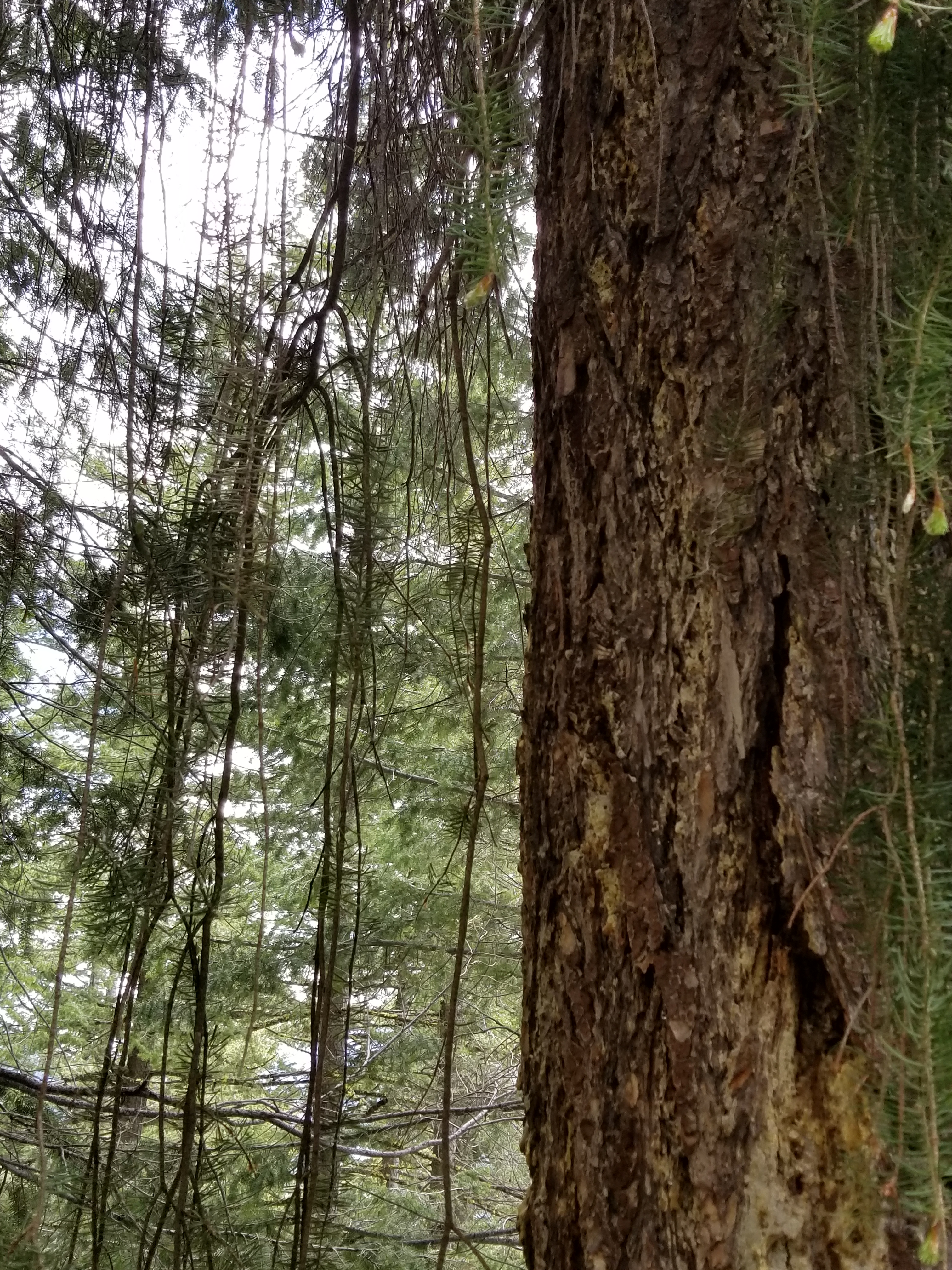
What is this tree?
I’m stumped (ha) by the tree on the left. I stopped dead in my tracks because it’s like a weeping willow, except it’s a conifer. It has pine needles. Those aren’t broken dropping branches, they just grow like that. I don’t know anything about the flora out here and I’m super curious what this is because I don’t think I’ve seen anything like it. Between this and the wildflowers and the dappled sunlight and the soon-to-be-stifling heat, it felt like July. It was hard to believe that we had just been making turns on several feet of consistent snow and that it was only mid May. Shoulder season is the best.
We popped back out at the trailhead around 1pm and went straight to Winthrop for burgers and cold beer. Ahhhh. And we enjoyed them at Old Schoolhouse Brewery, which is right on the river. I’m getting my Mazama cabin someday, just you wait. Maybe in 30 years after I’ve paid off this house. 2048. I’ll have a jumping off point for everything in the northeastern Cascades, the one corner I barely touch. Imagine coming from a sweet peak like this back to your log cabin by the river on a sunny day, it’s not even fair. Spectacular area out there, and just as wild as the west side.
2 people, 4 knees, 3 MCLs. This trek was deemed Operation DUSTAFUBK, short for Drive Until Sunny and Try to Avoid Fucking Up Brad’s Knee. The B is silent. Brad tore his MCL skiing a few weeks ago, but was going too stir crazy to care, so we found ourselves at the Eastgate Park n Ride at 6am on Saturday. Originally Surafel was joining us, but we received a 3am message that he was in the ER, and no, this would not be like last time where he got an IV and joined us a few hours later, good as ever.
Distance: ~9 miles for Yakima Skyline to Gracie’s point and back, 3 miles for Umtanum Falls
Elevation gain: ~2700 between the two hikes
Weather: 60’s and sunny
Commute from Seattle: 2:45 with no traffic
Did I Trip: On Yakima Skyline, no. But Umtanum Falls made up for my graceful past few months with 1.67*10^198 trips, slips, skateboard slides, wipeouts, and assplants.
Another hiking party ahead of us
We started driving. I made Brad drive because I’m an asshole my car either has a gas leak, or is a liar and the broken gas gauge is making the check engine light turn on.* The car was packed for just about every mountain activity, we pulled up a few options and figured we’d drive until the weather was acceptable. The pass was 48 and rainy. Ew. Keep driving. Cle Elum was fake sunny where the weather says sunny but actually it’s overcast and hazy. Keep driving. Wait, stop at the only gas station with no snacks in the entirety of Cle Elum first and use the slowest gas pump known to man. Okay, now stop at a gas station with snacks and a faster gas pump. Okay now keep driving. No snow left? Okay, so I guess we’ll just hike. To Yakima!
Brad with Yakima in the background
The last time I hiked out by Yakima I was amazed at the sun and the air smelling like sage and the rolling yellow hills. Well, the sage is all dead, so that sucks, but the sky was still blue and the hills were still rolling and yellow and it was around 60 degrees, so it basically felt like May. We chose Yakima Ridge, a mellow hike that is host to a 50k race in early spring, and wow I can see why.
The trail gains elevation slowly but steadily up to the “summit” about two miles in, where you can drop down behind the ridge to continue on to Gracie’s Point. The trail splits around 3 miles in and you can either follow it to a 4×4 road (supposedly, didn’t look like much of a road to us) that wraps a bit west and tours the grassy knolls, or you can stay right which keeps you closer to the ridge. Instead of heading straight up Gracie’s Point the trail wraps around to the north side before following a series of fence poles to the top, where we took a long break to destroy some Wisconsin cheese curds and summer sausage and (in my case) excessive amounts of peanut butter.
Looking behind us
We had taken the 4×4 road up, so we took the ridge trail back. Rainier and Adams looked incredible when we started hiking, but Adams was slowly swallowed by low clouds rising to meet a growing lenticular, and Rainier was gradually engulfed in dark mist and an angry wall of weather. Sweet, keep reaffirming that we made the right choice. We took a short break at the car to enjoy the sun, and decided what the hell, we’d keep driving to check out one of our other hike ideas.
Dead sage
Our other hike idea appeared to be on private property. The gate was covered in maps and a sign for Discover passes and a sign reminding everyone to close the gate behind them, but it also had a sign that said “no public access.” So we kept driving. We found a dirt road that I realized would bring us all the way around Umtanum Ridge and back to the north end of Yakima Canyon road, so we took it! And halfway down that road, we found a perfect 2 mile round trip hike to Umtanum Falls. Great idea!!
Wildlife!! (Photo credit Brad)
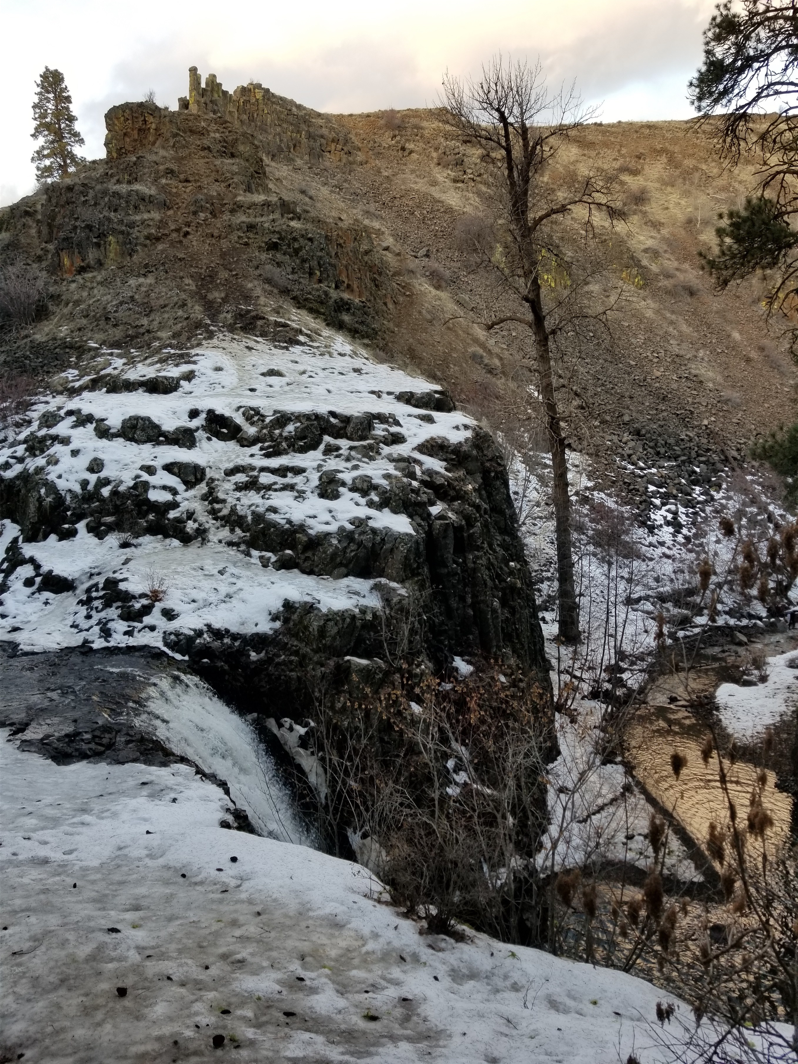
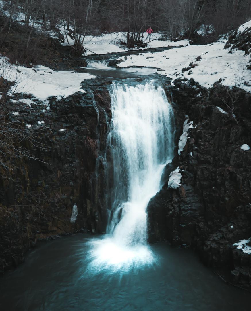
Well, the hike was completely iced over, and yours truly had only brought sneakers and mountaineering boots. And I left the boots in the car. So I was in my 2012 running shoes, which it turns out are mediocre at best on ice. So we slipped and slided all along the trail, finding game trails and social trails higher on the slopes to avoid the icy ground next to the river. Longest. Mile. Ever. Luckily everyone else was a dumbass like me and only had sneakers, so I fit right in. We made it to the falls, Brad went around to face the waterfall and I waited at the top. I had expected it to be a hike where you walk up to the bottom of the falls and are staring right at it, but you’re actually at the top looking down on it, with the option of scrambling down to the base. I stood, wiped out while standing, and waited for disasters to happen while Brad and two other hikers checked out the view facing the falls. I think SAR has ruined my invincibility.
My view of Umtanum Falls
We made it back to the car well before dark without any further wipeouts (I think, if I remember correctly) and finished our rogue lap around Umtanum Ridge. The drive back over the pass was still a gross 48 degrees and pouring rain. I saw I think two people on the Snoqualmie slopes. Props to you guys. I cannot imagine this has been a good year for the ski resorts.
Brad’s view of the falls (photo credit Brad)
So I have slowly been expanding my list of sunny places, and Yakima Skyline is an easy hike even for wobbly knees if you need an escape. I hear the wildflowers in spring are fantastic too, though we aren’t quite there yet. I’ll have to check our Selah Butte when those flowers finally spring up, though – it’s across the canyon from Yakima Skyline, so instead of staring at those freaking cell towers the whole time you’re under the cell towers and can pretend they don’t exist.
*Check engine light has since turned off so… problem solved? If you ignore your problems they go away right?
After last week’s shortcut, I figured I’d take another shot at a long run, so I messaged a few steady trail runners for suggestions out east knowing the weather everywhere (even in the Teanaways!) was going to be brutal. Yakima looked sunny, and Stuke had a phenomenal suggestion that was a 27ish mile out-and-back taking the Umtanum Ridge Crest trail to the Umtanum Ridge Road, which runs the length of the ridge and despite being a road is more like a wide trail. I thought I had thrown this plan out the window when SMR got busy on Saturday, but after being turned around without even setting foot on the trail, my long run was back in action. Ran 10/22/2017.
That is a perfectly good burrito
I got to the trailhead around 8:30 and stepped out of the car into wonderful sunshine and what might be the most delicious air I have ever smelled in my life. Everything was covered in dew from that had just stopped, and the entire canyon was full of sage bushes. Sunshine with the smell of fresh rain mixed with tons of sage, I gotta give Yakima a little more credit. It was freaking gorgeous. You know when you start an activity and your entire body just says yeah, this is where I should be right now? It was one of those mornings. I packed my bag with way more food than I ended up needing and started off.
Distance: 27.6 miles
Elevation: 2,400ft net gain (3,480 highest point, and around 6k gain on rolling hills)
Weather: 50’s and a mix of clouds and sun
Commute from Seattle: 2:40 unless everyone crashes in the rain (RAIN) on i90
Dammit Saucony. Maybe #runmostplaces not #runanywhere
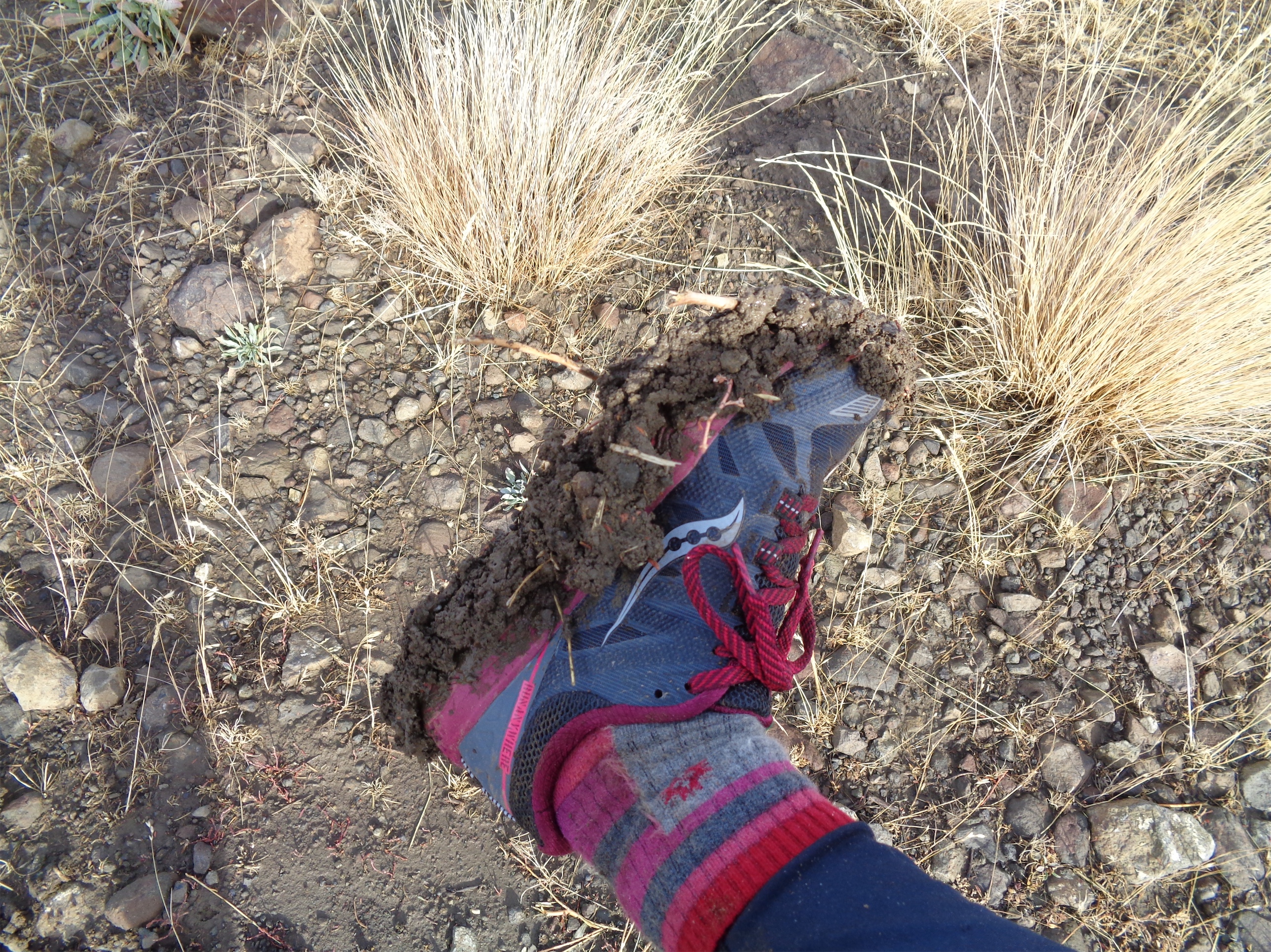
The first 2.5 miles gain the 2,400ft of elevation, so needless to say I hiked those.There was no one else in sight. The trail briefly follows Umtanum Creek (you need to duck under some train tracks, or go over but I’m lazy so I went under) before hanging left and starting up through quaking aspen and sagebrush and tall grasses towards the ridge. It was quite muddy, and I found the only flaw in my running shoes that I have encountered so far. With this clay-ish-mud mix, the lugs on my shoes just got caked with mud until I was basically hiking on mud pancakes, slipping all over the place. I’d stop periodically to scrape off the bottoms and delicately tiptoe up the trail.
The last half mile to the top is very steep, and I was less than stoked doing it without shoes that had good mud traction (and poles) but soon enough I topped out at the ridge road. Stuke’s description was accurate. Rolling hills, and a road that’s more like a wide trail than a road. Sweet! I started jogging.
Totally different topography compared to western Washington
There were two things I had only briefly considered before starting up the trail, because I don’t know much about either group. First was hunters. I had my neon pink hard shell, which is close enough to safety orange that I figured I had that base covered, and hopefully if I was being an idiot someone would tell me. Second was 4×4 teams (who I think were usually also hunting), who I hoped would be okay with me hopping off the road so they could pass, and again tell me if I was doing something stupid. Here’s the confession: I’m basically scared of random 4×4 drivers, and definitely scared of random hunters. Neither of those activities were part of my life, they’re totally foreign to me, and they’re intimidating, and I’m just a hot pink helpless nerd going for a jog.
Almost at the ridge (not)
So the first two trucks that drove past me freaked me out. And the first hunters I passed freaked me out. But I was pleasantly surprised by everyone I ran into! The hunters were all amicable (one team on foot just laughed and said “good for you!” as I jogged past) and several trucks stopped to ask how far I was going and to flag them down if I needed anything. Everyone was totally fine about sharing the road, in fact I might even go so far as to say that they were more pleasant than a lot of the hikers I encounter on trails, who don’t hear or see you coming, don’t move out of the way, and glare or silently stare ahead when you ask if you can pass.
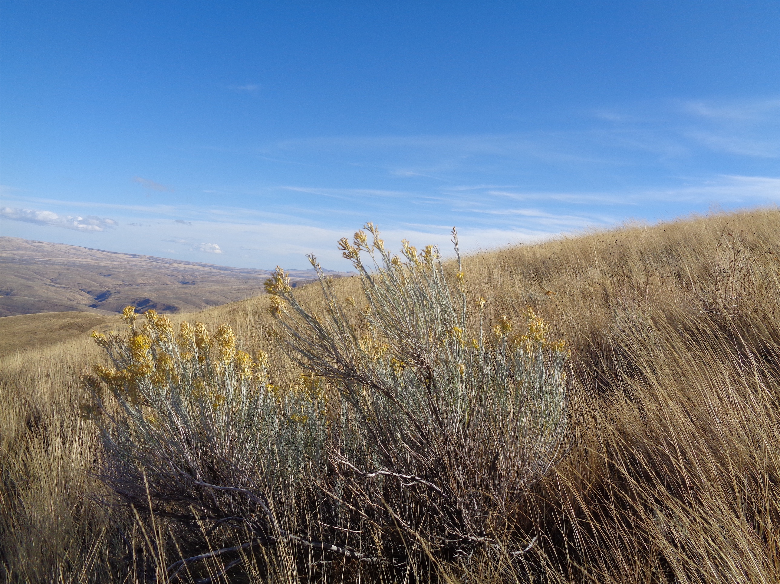
Rolling hills!
So you pretty much start at the high point. This was great as I started my jog, because woohoo downhill! I hiked most of the uphills unless they were very slight. Supposedly you can see the Stuart range from the top of the ridge, but all I got were clouds. Oh, and the wind, which occasionally ripped by just to spite me. The road switches between beautiful gravel, nice dirt, and terrible rocks and mud, so you get a nice combo of footwork and space-out-cruising. I fell victim to “summit fever” – not a summit, but around mile 11 I was like okay, I’ll turn around at that high point. And then I was there, and it was 11.5 miles, and I thought no you didn’t drive 2.5 hours just to turn around at 11.5 miles, go for 13. And then I hit 13 and thought okay, that high point (I was going downhill and didn’t want to start my return trip with immediate uphill). And then I could see the road intersection that was the turnaround point from that knoll, and I didn’t come that far just to turn around 300 yards short of the end. So I tagged the intersection and began the long slog back.
The nicest section of road ever
I didn’t let myself check mileage again until around 19.8 miles. I wanted to be sure I had less than 10 miles left next time I looked (mental games) so I waited forever. The rolling hills were kind to me though, I ran more uphills than I had on the way out and felt pretty good. The final uphill to the trail turnoff was brutal, but not as brutal as the ensuing descent, losing 1,000ft+ per mile, destroying my knees and quads and hips while I counted my steps to distract myself from everything else because I was even tired of the sage at this point.
Trail leading off into the distance
I jogged across the bridge (surprisingly bouncy) and popped into the parking lot, pretty thrilled with how the day had gone. I had only eaten around 6 tablespoons of peanut butter, and felt fantastic the entire time. I had the perfect amount of water, my new shoes had felt great, and I didn’t have any weird aches or pains. I didn’t even know that was possible. I hopped into my car, mentally on tope of the world, and drove straight into a wall of traffic on i90 because people forget how to drive in the rain. Shit.
Oh, and I found a Hot Pocket that I had lost in my car back in summer of 2015. You read that right. Over 2 years later. Turns out there’s a void beneath the fabric on the floor below my drivers’ seat. I can only imagine the decay had spawned a mold-based life form, because the only reason I found it was because there was this odd crackling noise going on and I was panicking that there was a mouse in my car while driving on the highway. No, just a hot pocket that came to life. I was hoping I had mentioned it in the trip report but I didn’t. But for two years I’ve been assuming that there was a glitch in the matrix that resulted in the loss of some high quality sustenance.
With a high wind warning and a potential 15″-17″ of snow over the weekend (according to NOAA), we figured the backcountry was out of the question. Don’t get me wrong, I love some good snow, but I’ve hit a point where I’m not going to spend two days in the wet unless it’s going to have a huge payoff. And I had to work at my office sample sale Saturday morning, so I couldn’t escape until around 2pm anyway. That should be my excuse, instead of admitting I’ve turned fairweather.
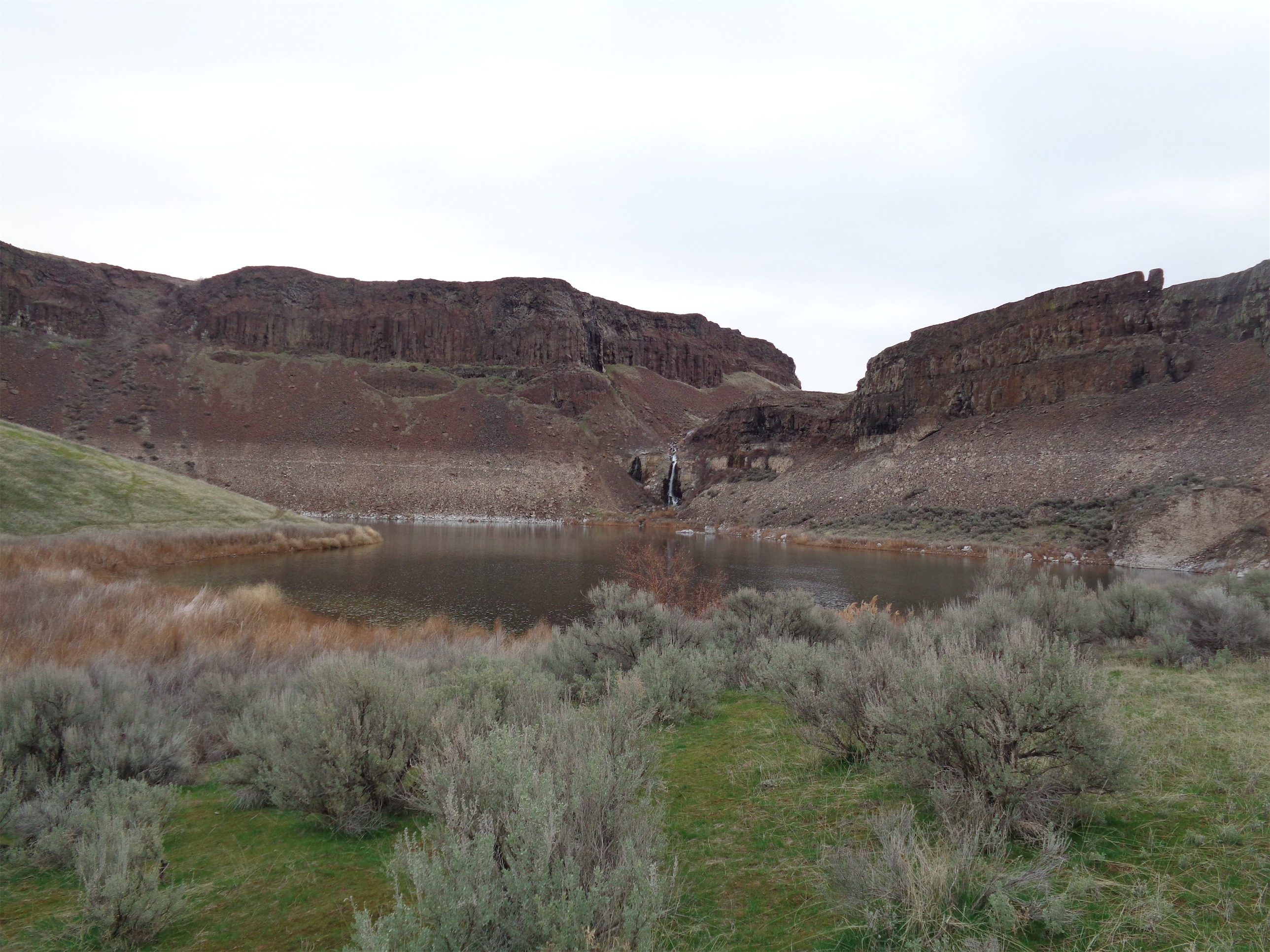
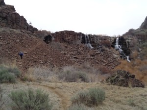
Luckily for me, Sam had just gotten a new camera and had been going stir crazy trying to find places to get some night photography for the past week, and he suggested Ancient Lakes. I had never been out there, it’s a long drive, not a technical hike or climb, and I’m lazy unless we can do something awesome. But this weekend, after months of said aforementioned stir crazy, it meant sun, stars, and a whole new section of Washington I had never touched before. I drove through it, once. Literally once. Anyway, here are the Ancient Lakes, several small bowls of chemical-contaminated farm runoff water in some eastern canyons, hiked 3/12/2016. Don’t drink the water!
Optional Distance: 12 miles round trip if you do the full loop (we did not)
Real Distance: 1 mile. No, we probably went like 1.5 miles out, but it’s like a playground for adults. As much or as little as you choose.
Elevation gain: ~900ft for the loop, we probably had similar since we did some scrambling
Weather: 40’s and sunny, 40’s and cloudy
Did I Trip: No but Sam slipped on a rock. Count it!
Rolling hills and canyon walls
I took off from Seattle at 2pm on the dot and drove around 3 hours through dead stopped traffic (who closes all four lines on a highway?!), open freeway, sun, rain, wind, snow, and best of all, HAIL. Large marble sized hail. As in the bigger-than-average marbles. Cars were pulling over because once there’s an inch or two of big marbles on the highway, you can’t go 75mph anymore and your windshield might break and did I mention they’re rolling all over the ground while it’s sunny at the same time and why wouldn’t you pull over to gawk at that?! No rainbow, though. I laughed after the brief hailstorm was over (it lasted maybe 5 minutes) because I wondered what I hadn’t driven through yet, and the answer was “a tornado.” Okay, let’s save that for next time.
I did get to play my favorite what-do-you-do-when-you’re-in-the-middle-of-nowhere-in-the-car game, called “scan every radio station and see what the options are.” Past Cle Elum, you have various styles of preaching, an abundance of country music, two pop stations, three Latino stations, and station 100.3 which I can only assume makes all of its money by playing “Sweet Dreams” by Eurythmics, on loop, 24/7.
Sam starting off in the meadow
Finding Quincy, WA was easy. Finding the trailhead was not. I mean it would have been if we had looked at WTA directions, but we did not. I was using my TomTom and Sam was using GoogleMaps, and we both ended up on private roads in the middle of some sort of orchard (separate private roads, might I add). After a few too many “NO TRESPASSING” and “PRIVATE PROPERTY, NEW OWNERSHIP” and “CAMERAS FILMING” signs I decided this could not possibly be where the “public fishing area” was. I eventually found Sam just outside the orchard and we managed to find the trailhead. Follow WTA’s instructions, guys. Seriously.
Another meadow at dusk
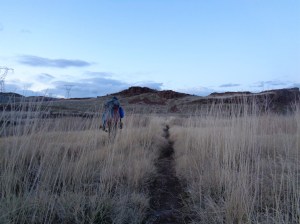
The trailhead said things like “no overnight parking” and “no overnight camping.” We said things like “ha!” and started hiking. I forgot how light an overnight pack is when you don’t also have a rope and ice screws and crampons and ice tools and all that junk. Just a meal, water, tent, layers… very pleasant. The sun had set, and we had some evening glow remaining, so I snapped the few pictures I could as we hiked down into the canyon. There were several other parties there, and we eventually scrambled up the opposite side of the canyon to a spot overlooking everyone. There was an awesome rocky outcropping that I hoped would look awesome with stars above it, and a little notch in a cliff across the way with the same idea.
We pitched tents on soft grass (SO much more comfortable than camping on snow and ice), made a small campfire, boiled water for dinner, and ran around taking pics and time lapses with the camera. Or, I ate while Sam took pictures. I forgot to bring an eating utensil and dumped boiling chicken vindaloo all over my face trying to eat it out of the bag. Some things you just never learn.
Feeding the campfire by our tents (photo credit: Sam)
It was a warm night, but windy, and clouds were in and out. The wind made things a bit complicated. We couldn’t get any good pictures of the notch (okay, maybe the pic above) because the vantage point was too exposed and the wind would blow the tripod just enough to blur things. But Sam got some great ones of our tents, that rocky outcropping, and the number of stars is just incredible. That camera is coming everywhere. I’ll sleep while Sam does the hard work.
Another lake below the canyon walls
I went to sleep in my cozy sleeping bag with my cozy liner which I haven’t talked much about but I can’t believe I ever camped without a sleeping bag liner. Seriously, if you have room for luxury, get a sleeping bag liner. It’s soft, it’s cozy, if you’re a little wet it wicks away the moisture and I swear you dry off more quickly than when you’re right up against sleeping bag material. I adore it. And supposedly (not convinced) it adds a bit of warmth to your bag. I’m cold all the time, so I’m not sure about that one.
We woke up to full cloud cover. Well, Sam woke up. He told me it was cloudy and I whined about it and dozed for another hour. We had set the clocks ahead okay?! I get my extra hour, this is a casual trip, I don’t need no alpine start. Sam went and scrambled around the area while I kept sleeping. Eventually I got up and we packed up and left. I snapped a few pics on the way out to make sure the trip was adequately documented. All the other groups were making eggs and bacon and fancy things for breakfast and I had leftover twix bites and toasted ritz chips in my car. Don’t get me wrong both of those are delicious, but I mean…. you can do better.
Sam following the trail past waterfalls
We made it back to the cars, with no tickets for overnight parking or our abject lack of Discovery passes (apparently required for this trailhead). Sweet. We hit the road, dreading the conditions at Snoqualmie. I stopped in Cle Elum for a steak (which I later overcooked – [expletives]) and gas, and interestingly, while it was snowing heavily in Cle Elum, there wasn’t much to worry about at Snoqualmie. The i90 bridge was worse, ugh. Big waves and wind and shaking, weird stuff. I made it back to Seattle, only to find out that minutes later they closed both the i90 bridge and the 520 bridge due to high winds and big waves.
So that’s that. A solid what, 18 hour escape? 24 hours if you include the drive in both directions? Not too shabby! And it feels like an entirely different part of America. Like I was in the middle of a road trip out in Arizona or northern Colorado. A much needed change of scenery.