
What I thought was 8 miles round trip for some reason ended up being somewhere between 16 and 22 miles depending on what map/tracking device you listen to. Strava said 19, 22 if I had gone all the way to the Teneriffe parking lot and back. But regardless, this is a great trail to miraculously disappear from crowds and surround yourself with greenery only an hour away from the big city, and it’s extremely runnable. Well, besides the middle of the trail. But we’ll get to that.
- Distance: 16-19mi
- Elevation gain: 700ish ft at least from the lower trailhead to the upper trailhead
- Weather: 50’s and sunny
- Commute from Seattle: 64 minutes, unless you miss the exit and have to drive an additional 7mi east before you can turn around
- Did I Trip: No
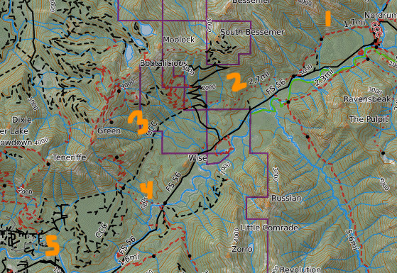
The CCC trail is broken into two sections, upper and lower. It should be broken into three sections, but you can’t really access that third point as a trailhead, so I guess I get it. But I’m going to call it upper, middle, and lower. Middle is technically part of lower.
Upper CCC: The section east of the paved road pullout and west of the middle fork parking lot/campground. “1” on the map. I parked at the middle fork parking lot, unmarked in the upper right corner of the map. There is also parking where the CCC meets the road between sections “1” & “2.”
Middle (part of lower) CCC: The section west of the paved road pullout but east of Bessemer forest road. “2” on the map. Bessemer road is the obvious road between “2” & “3.” Also known as the Blowout Creek trailhead, though you will be parking on Middle Fork road as Bessemer road is gated.
Lower (also part of lower) CCC: The section west of Bessemer forest road and east of the Teneriffe parking lot. “3” on the map. Sitka Spruce trail is “4” and Teneriffe/Lower CCC parking is “5.”

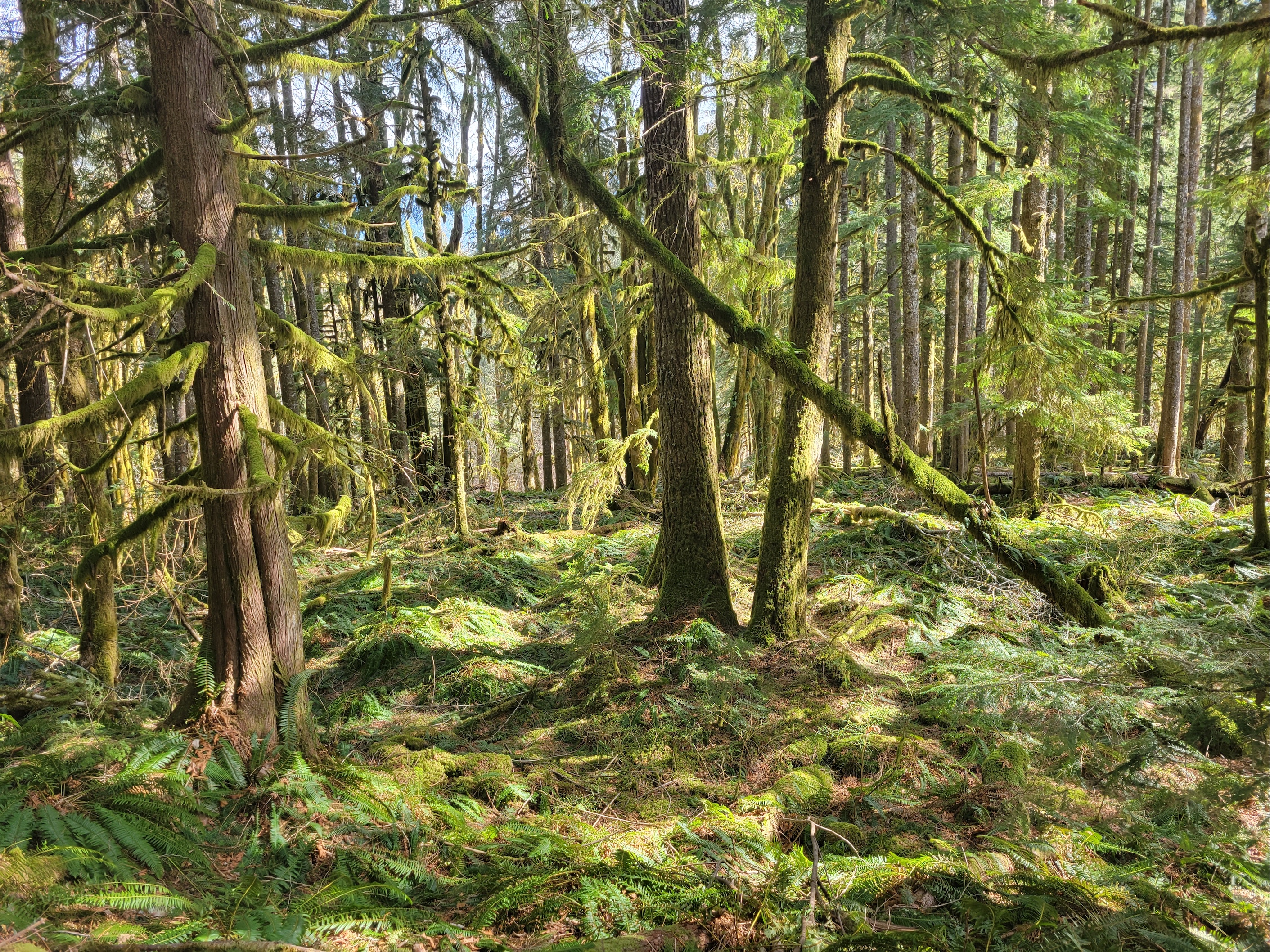
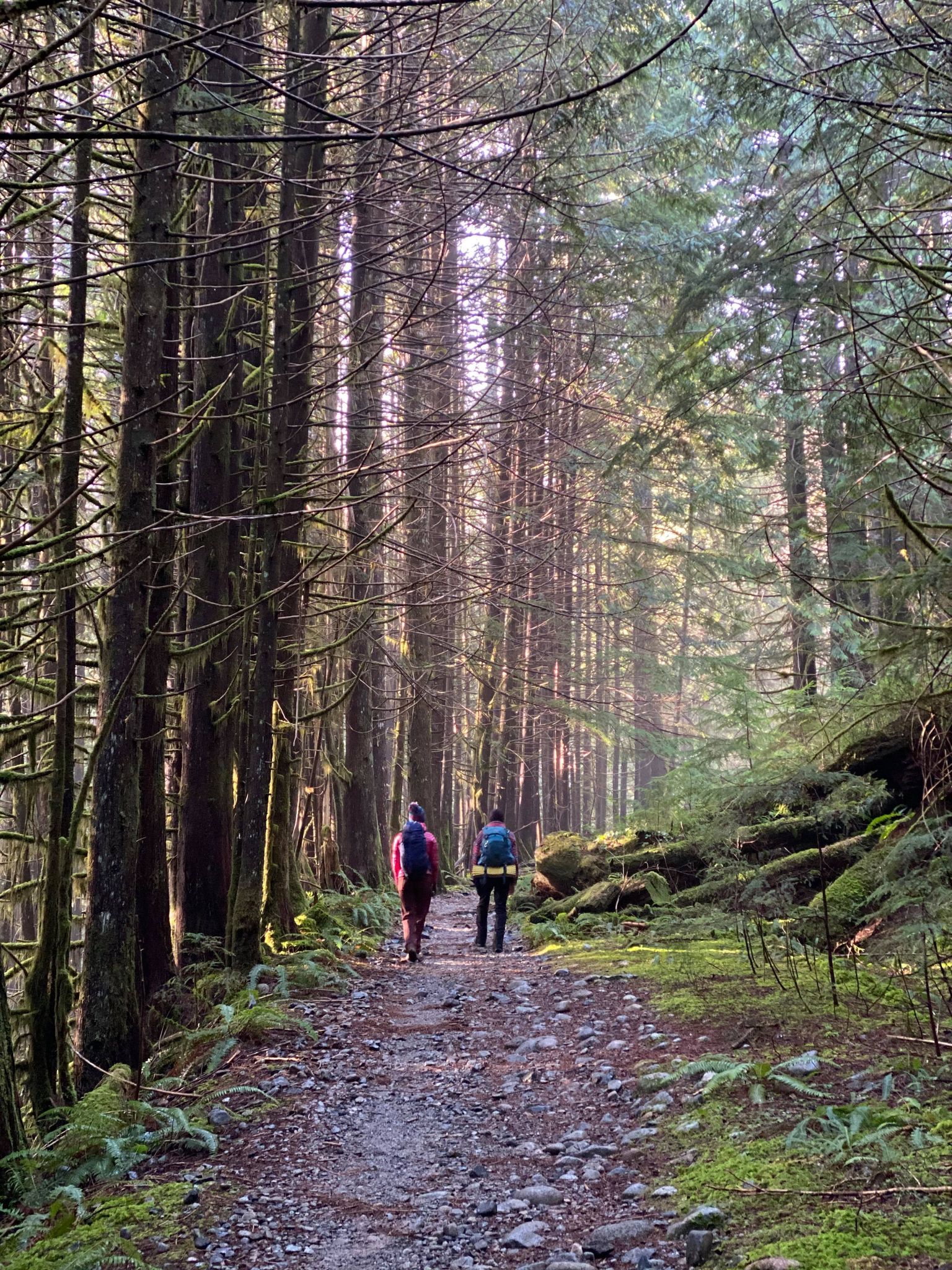
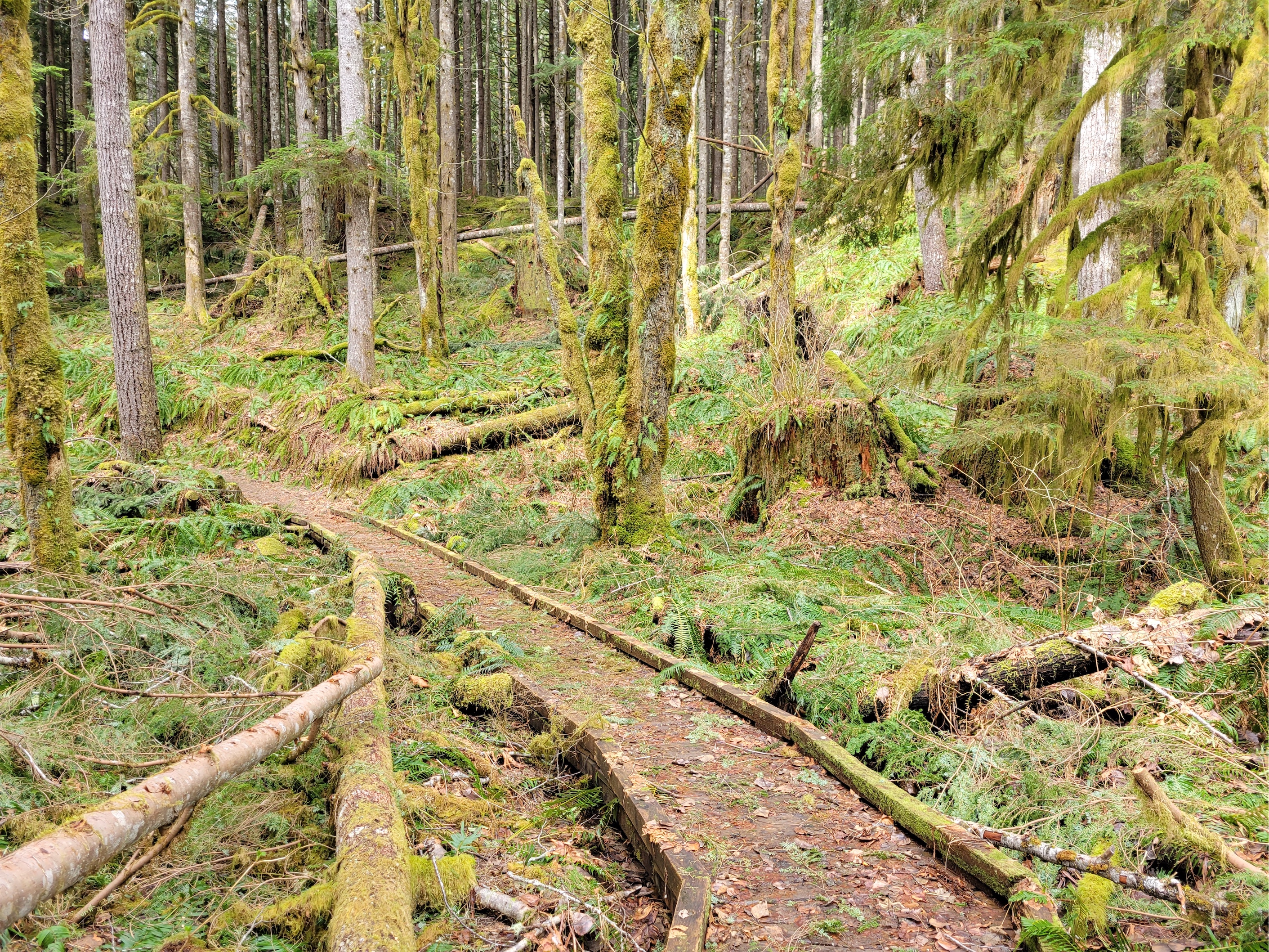
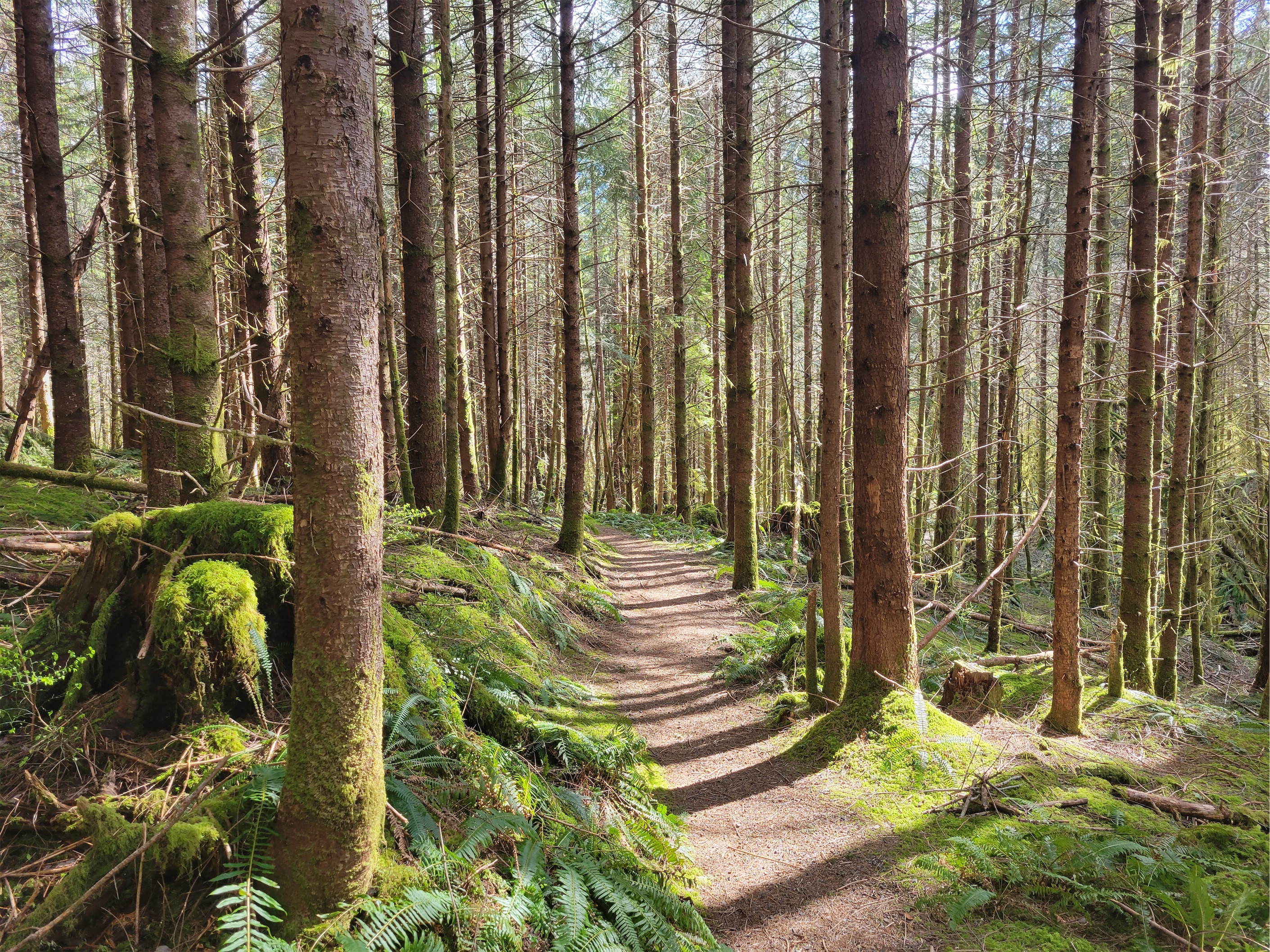
The upper CCC honestly is the highlight. Wow. I parked at the middle fork parking lot and walked across the street to start the trail, passing the middle fork campground. It is insanely green, and was freshly brushed out by a work party! Credit where credit is due, sounds like it was the Backcountry Horsemen who are incredible trail stewards of many trail in the area and tend to fly under the radar compared to organizations like WTA and the Washington Climbers’ Coalition. EDIT: This was spearheaded by Backcountry Horsemen, but included volunteers from WTA, DNR, King County Parks, and the Forest Service! Work took over two days and an estimated 150 logs were cleared. Holy cow.
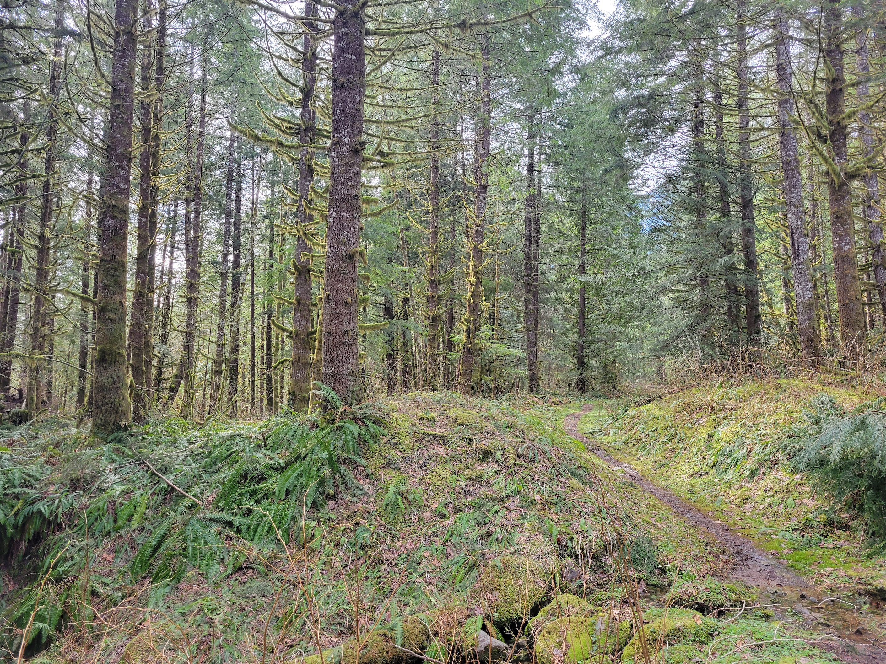
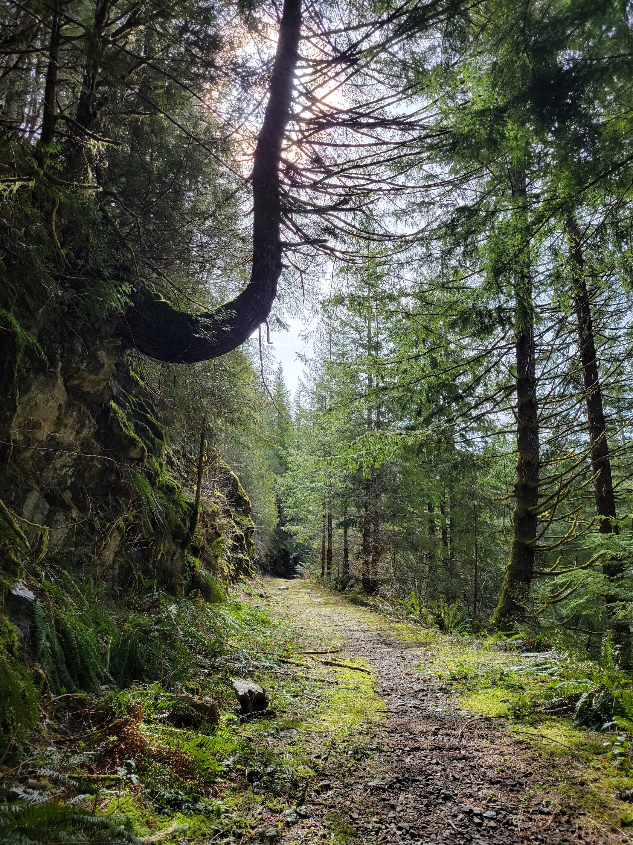
You could smell the fresh cut logs and see sawdust everywhere, and looking at the sides of the trail you could see the debris they had worked to clear. Seriously impressive efforts. The only things I cleared were spiderwebs, with my face. Past the campground you turn onto an old forest road, which is less green and more rocky, and I thought “oh shit, what if everyone’s photos are just from the first half mile, and the rest is like this?” Don’t worry, the rocky road quickly turns back into green carpets and hanging moss. It’s SO GREEN. I felt healthier just being there.

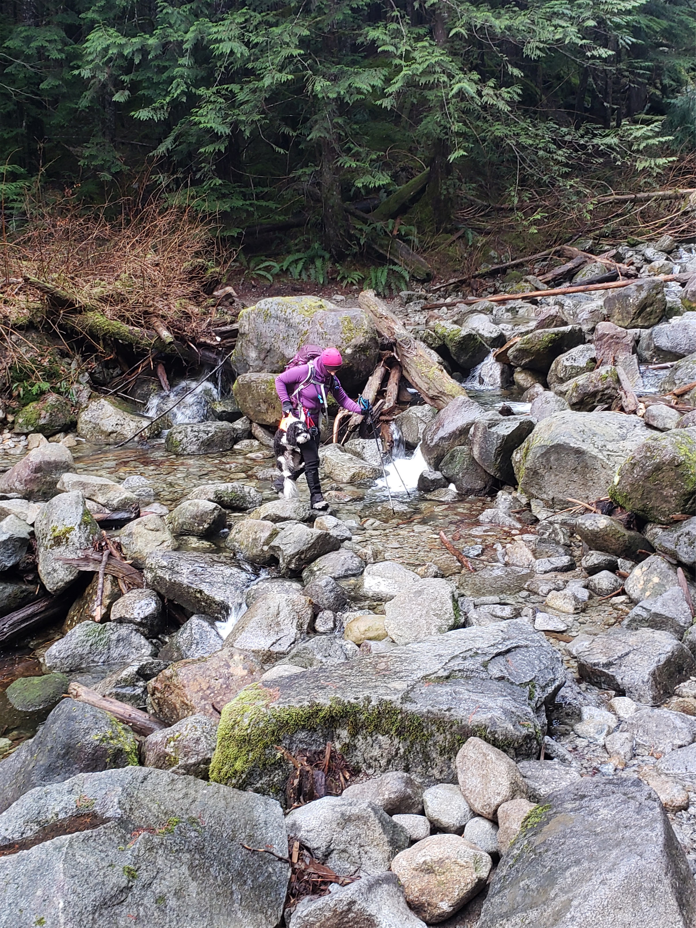
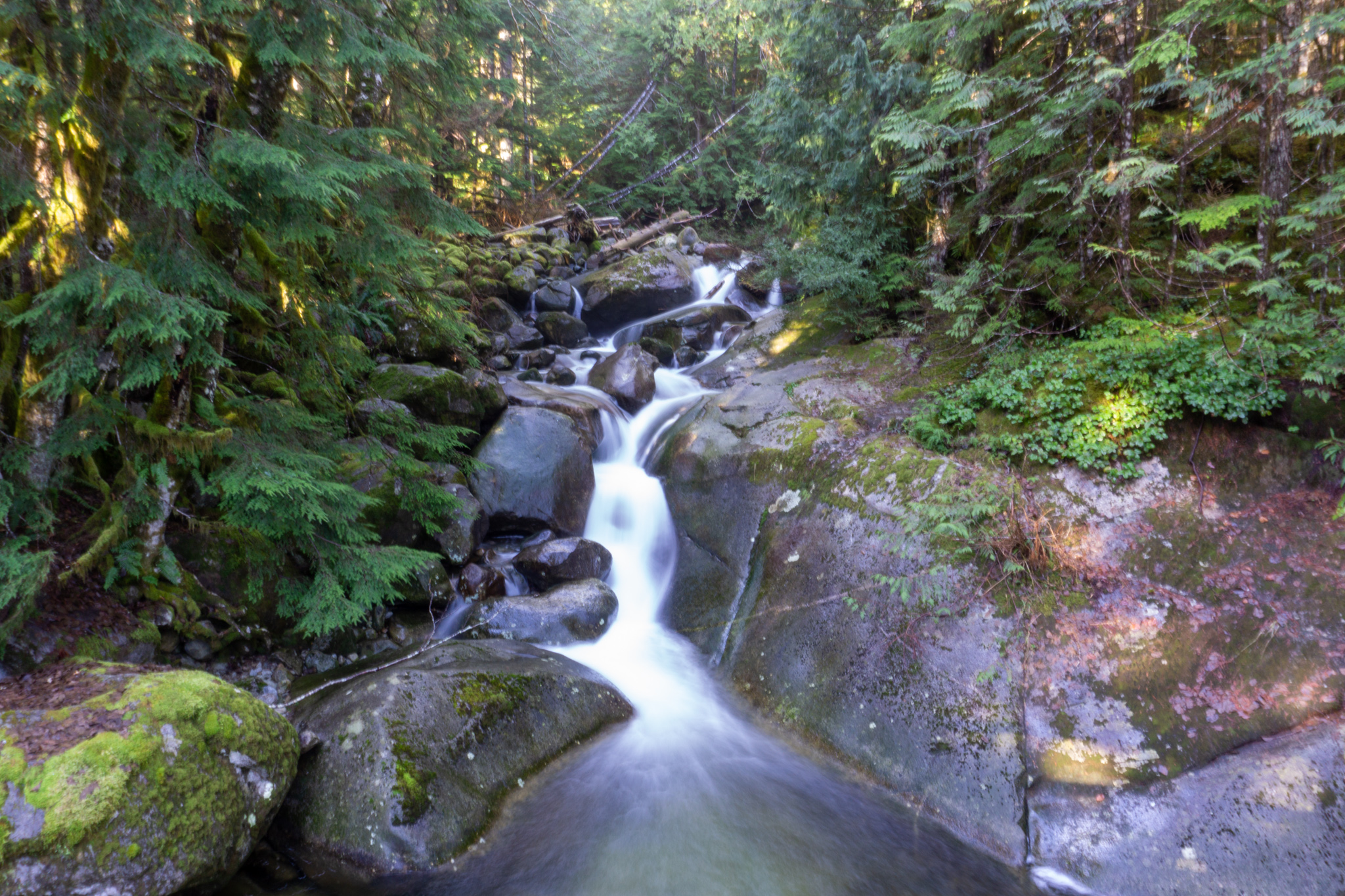
The trail weaves through the second growth forest, crossing the occasional stream. There are multiple bridges (one had a tree fall through it!) though the two largest creeks nearly got my feet wet on the return trip. The open creek (views, wide, talus/rocks in the water) had walking sticks stashed on either side for unstable hikers without poles or runners with tired legs to borrow. But the second creek (in forest, narrow, trees/downed logs everywhere) was a no go, I hiked a few feet upstream to an easier crossing and then found my way back to the trail to carry on. If you have waterproof boots or aren’t being a princess you’ll be fine.
A few minutes beyond that creek, you pop out onto the paved road you drove to get to the trailhead. Okay there’s a gravel section right there, technically. Take a right and follow the road for maybe 300ft before the CCC trail picks up north of the road again.
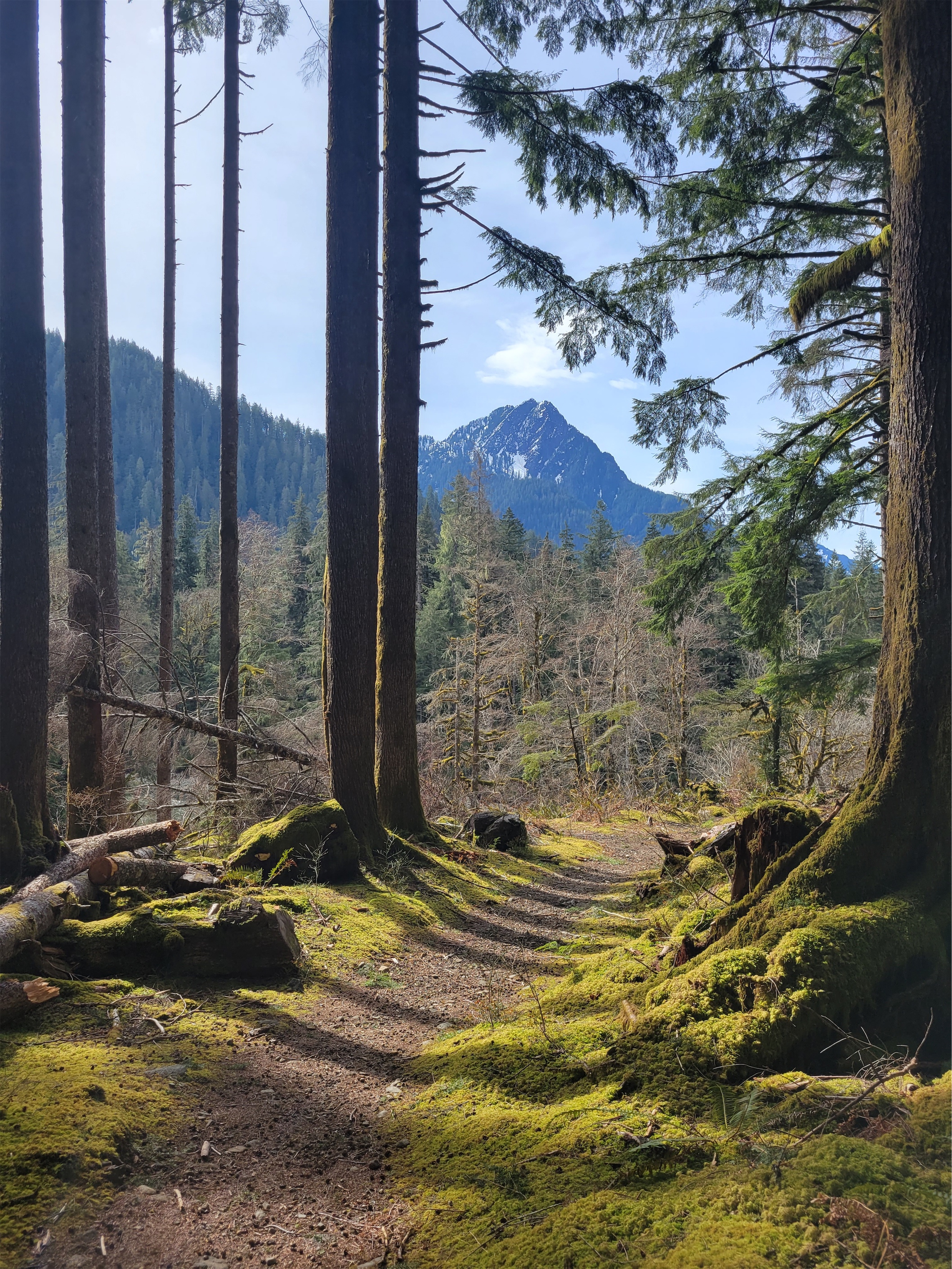
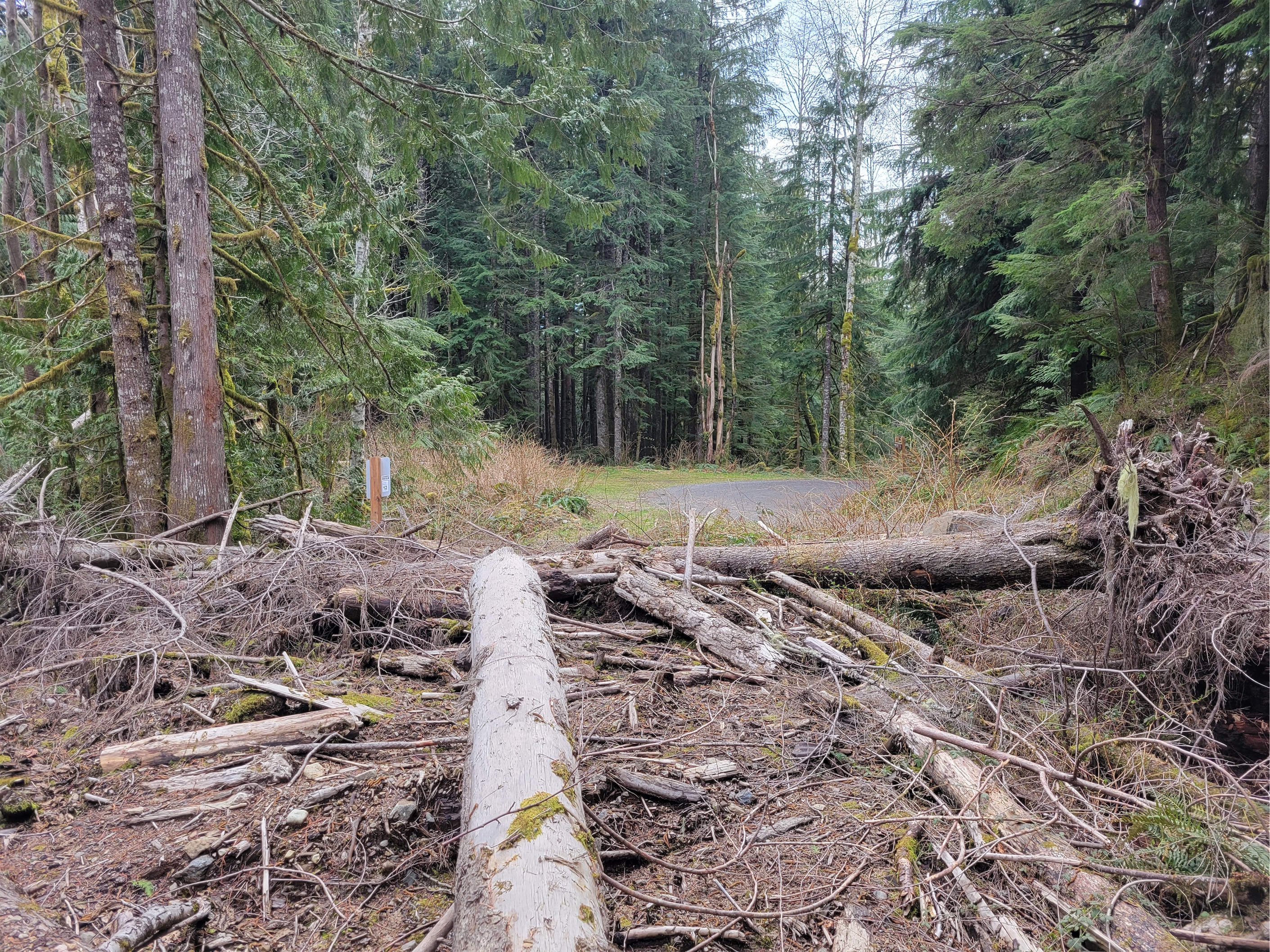
This is the middle CCC section, technically part of the lower, but it was characterized by blowdowns and stream crossings and VIEWS! I was so surprised! I expected only forest and mossy ground, but this section of the CCC actually gets up above the valley floor and gives you peakaboo views (get it) of the Pulpit, Preacher, Russian Butte, and the Pratt River valley. It’s also much more obviously an old forest road than the upper section, for better or for worse. The road seems to have been cut straight through small cliffs at some point, there must have been blasting involved. Glad the efforts were preserved for me to enjoy 90 years later. “Enjoy” being loose here, because I swear every 200ft there was a tree or seven across the old road for me to maneuver under/over/around/through.

Just before connecting with the Bessemer road, there’s what you might call a washout. A creek has eroded its way through the trail, with a huge canyon above and below. But the trail finds this miraculous flat ish spot to cross, followed by a series of blowdowns entirely obscuring the trail besides an old sign you can see poking up. But keep going forward/perpendicular to the stream, and you’ll pop our onto the well maintained but presumably gated forest road.
Left on the forest road this time, and in 1000 (horizontal, please) ft you will see the CCC trail continue for its last stretch. This time it’s marked by a sign saying “Putting America to Work: Project funded by the American Recovery and Reinvestment Act,” a tribute to the 1930’s Civilian Conservation Corps (CCC) from which the trail derives its name. They originally built a road spanning 9 miles from the foothills to where North Bend Timber Company had put in rail infrastructure for their lumber operations. This area was extensively mined and even more extensively logged for decades, there’s some crazy (and spooky) history in this valley.
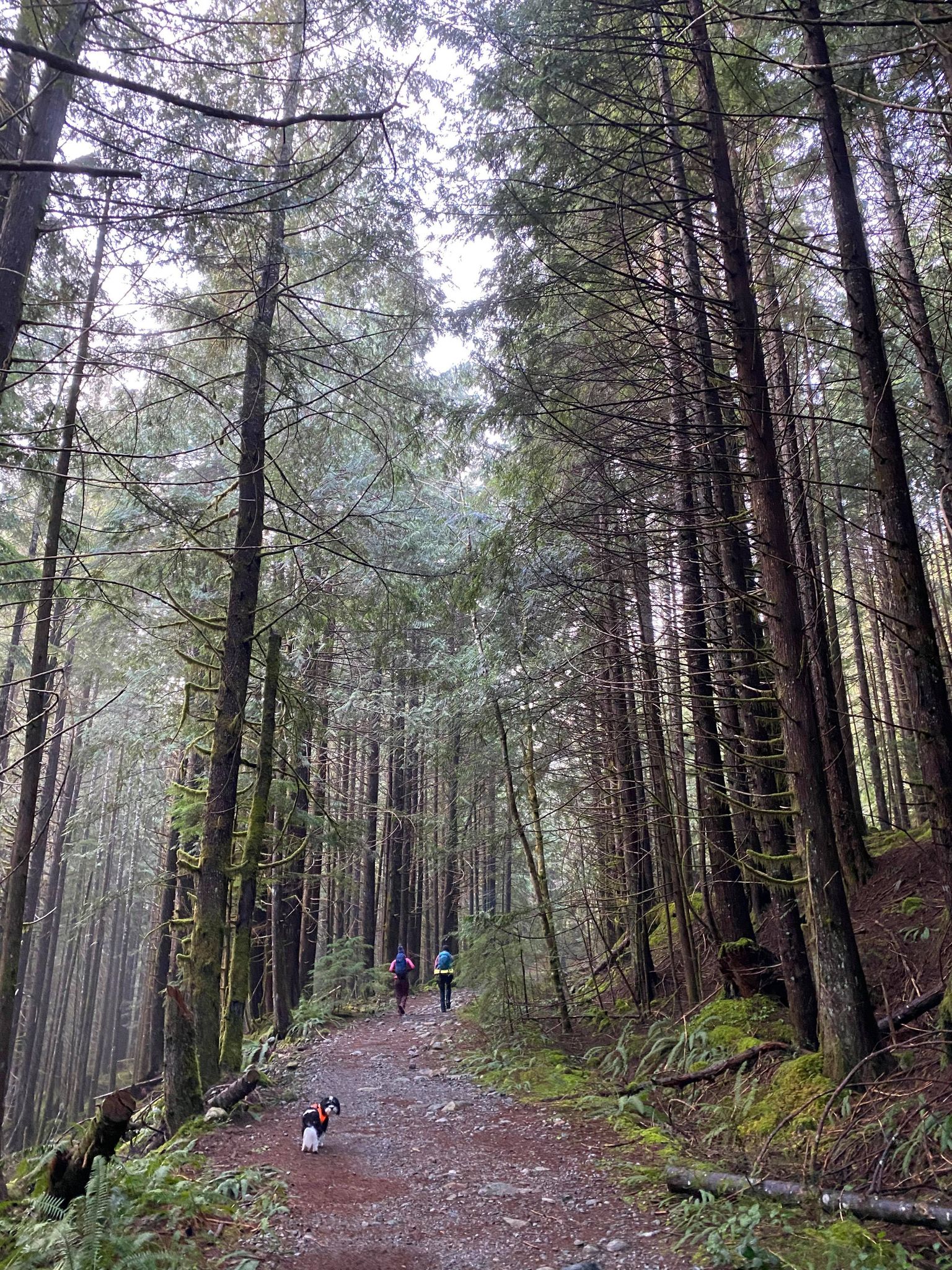
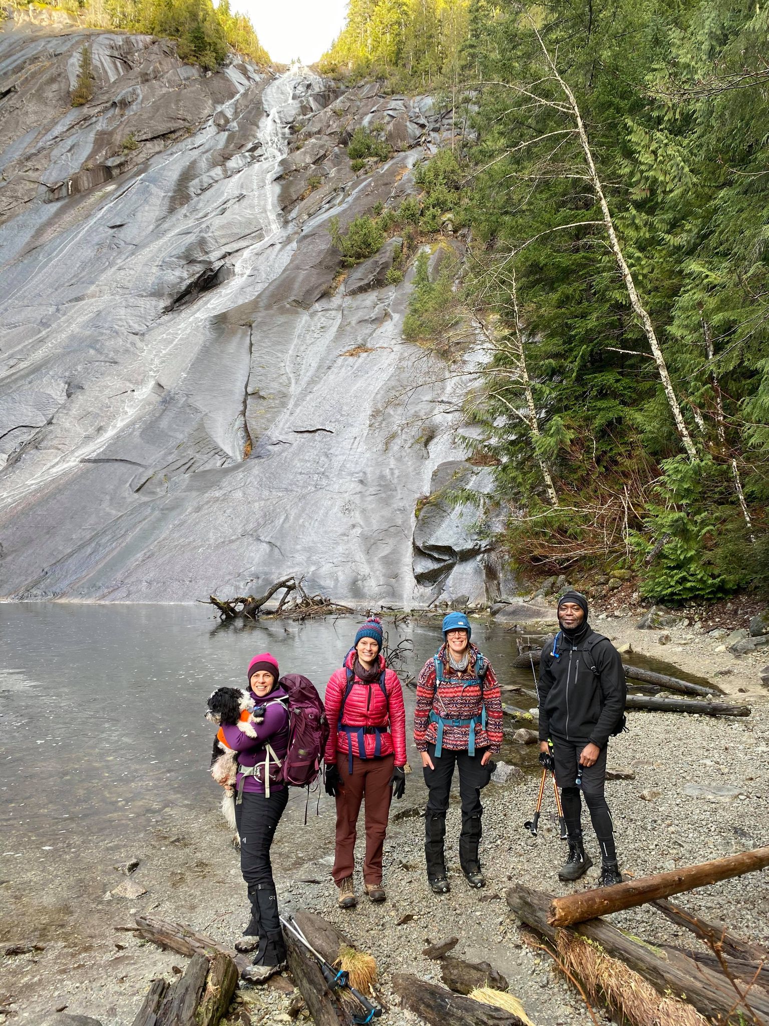
I passed some mountain bikers on the road, maybe trying to bike as far as they could before booting the rest of the way up Moolock or Bootalicious peaks. When I reached the switchback where the CCC continues, I looked at the river and thought ah crap, another unprotected crossing. But wait! There’s a cut log to the right, set up as a foot bridge. Crossed that, and I was on my way through the last section of trail. This was a terrible time to realize my Discover Pass was obscuring my America the Beautiful pass on my windshield, which was the pass I needed to show. Luckily I had like 12 miles to mentally prep for the ticket I’d probably receive.


More surprise views! Less moss, more brush. I don’t think this would be very enjoyable once the brush has budded/leafed/grown in a few months. But for now it’s still pleasant, minus the occasional trail runner hurdle (low downed trees), small stream crossing, and mud pit. I finally saw some people for the first time in what felt like ages. At this point I was determined to make it to the end. I refilled my water at a random stream with no treatment. Nonzero chance I have giardia now but my dumb ass only brought half a liter thinking I’d only be running 8 miles.

I hit the last forest road, and deemed that my turnaround point. Turns out that’s not truly the end. It’s gated, so you have to park another 1.5ish miles away at the Teneriffe trailhead, or ignore the residential signs and park at the gate. I should have asked the hikers that started there. Better yet, you park at the Granite Creek trailhead on the middle fork road, and short cut up to the CCC via the Sitka Spruce trail. It’s barely marked on caltopo, but very visible from the CCC trail. The Sitka Spruce trail starts on the other side of Middle Fork Snoqualmie River from the Granite Creek trail (like keep walking the road across the river after parking at Granite Creek, trail will be on the left). Probably much more enjoyable and green than walking an abandoned forest road to the “start” of the Lower CCC.

Here, I started Strava, because I had no clue what mileage was like. I started jogging back towards the car. The first stretch went so quickly. Turned out I had been running uphill for a lot of that, maybe that’s why I had felt so crappy. I remembered a few landmarks, this creek, that creek, this view. And then I reached Bessemer road, and realized I had no more landmarks besides a washout and multiple memorable downed logs. From Bessemer road to the middle CCC, it’s actually not that straightforward even though there’s only 10ft of downed logs. There is no obvious entrance point from the road to the trail/washout, just a wall of brush. But I found the old sign again and there’s very visible flagging across the creek, and from there it was easy to connect the two points and be back on my way.
Until I hit the next blowdown 150ft later. It’s impossible to get into a rhythm. But if you need to work on your mid run hip mobility or agility, boy do I have the trail for you. After a mind numbing few miles, I ran into a guy who bailed at the first downed tree, and reaffirmed his decision as soon as he asked if it ever got better. No, no it did not, for several miles. You made the right choice. I wish I had recommended he take a short stroll up the upper CCC since he had parked on the middle fork road separating upper & middle, by my definitions.

I was happy to be back at the upper CCC trail, knowing I just had two spunky creek crossings followed by who knows how many miles of ridiculous mostly flat greenery between me and the car. And oh boy was I excited to be almost back at the car. I passed two mountain bikers (yes, it’s a shared trail!) and was jealous of their mode of transportation. But mostly I was drunk on endorphins and exhaustion and afternoon sun spilling through the trees. Many friends have heard me talk about how much I love dappled sunlight in our forests here. This was that, on steroids.
Back at the car, I forced myself to stretch for like 7min before joining the congo line of cars. Life pro tip: don’t stop for gas at exit 34. There will be lines, there will be dildos who leave their cars at the gas islands while they get snacks or pee or who knows what EVEN WHEN THE PUMP ISN’T EVEN IN THE CAR and little did they know some nerd who just ran for literally hours and hasn’t eaten was ready to march into the store and rip them a new one. Instead I drove across the street, where prices were the same and car owners were being responsible.
All in all, spectacular run, especially when it’s confirmed free of downed trees. Judging by the debris, Backcountry Horsement put a LOT of work into this yesterday! I don’t even think it’d have been a viable run if not for them. We are seriously spoiled by all of the volunteer organizations that contribute to our trails. And good news: miraculously, no parking ticket, despite the pass not being visible from the front!