Finally, my first day off in a week! Took long enough. I’ve been essentially working overtime, so this was a much needed break. Well, I didn’t actually have the day off. I had to work at 6. But 6pm… that’s more than enough time for a solid hike. What would it be? Partly cloudy forecast, but fresh snow from the night. Didn’t want to drive too far, or do anything too ambitious. So no route finding, nothing too steep, no trailblazing, minimal exposure given conditions… how about Beckler Peak? It’s been a popular one lately, so I figured there’d be a solid trail and I’d be able to do it quickly. And it looked mostly forested, so I wouldn’t have to pay attention to snow conditions. I was wrong, but we’ll get to that in a few paragraphs.

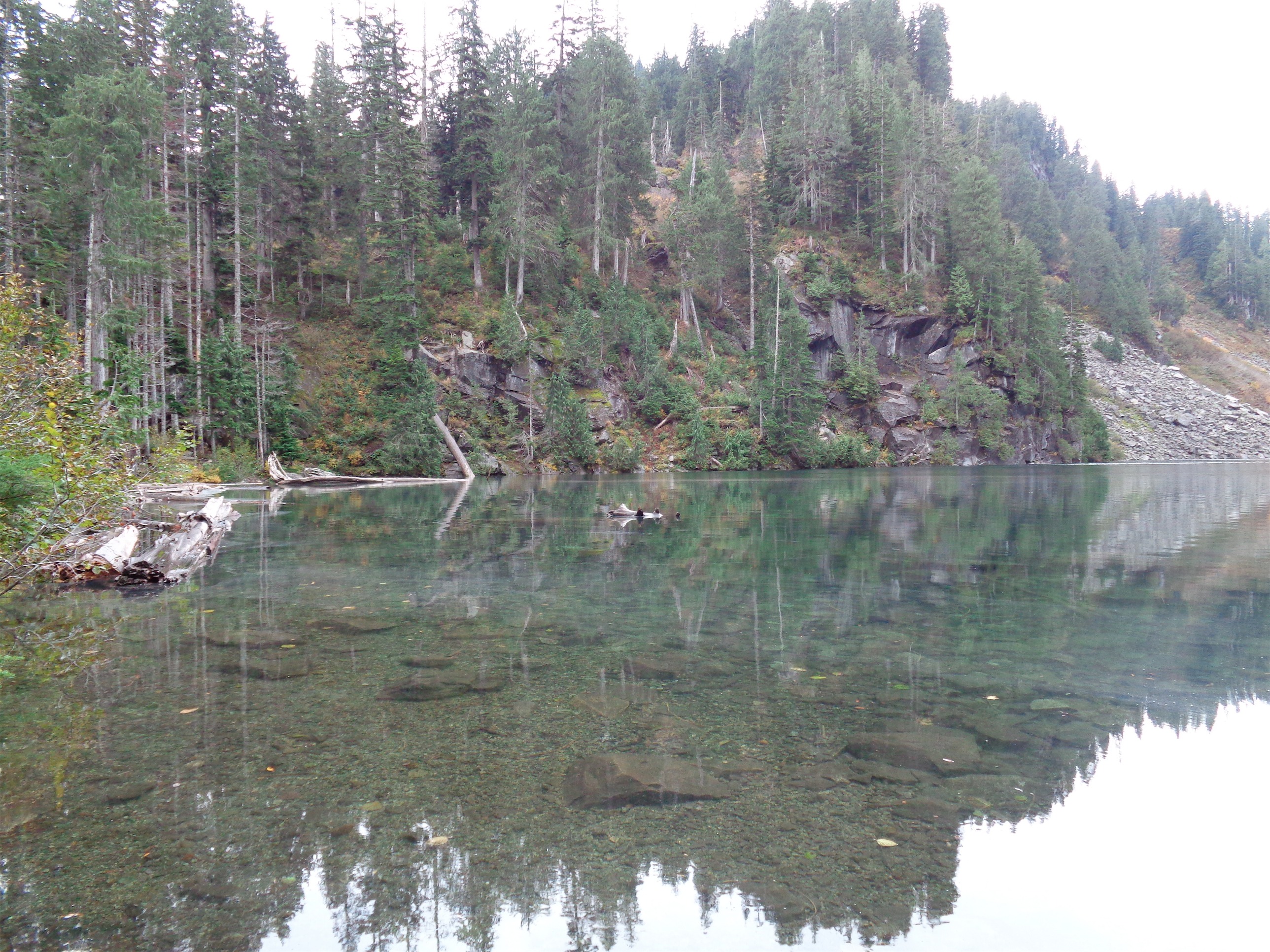
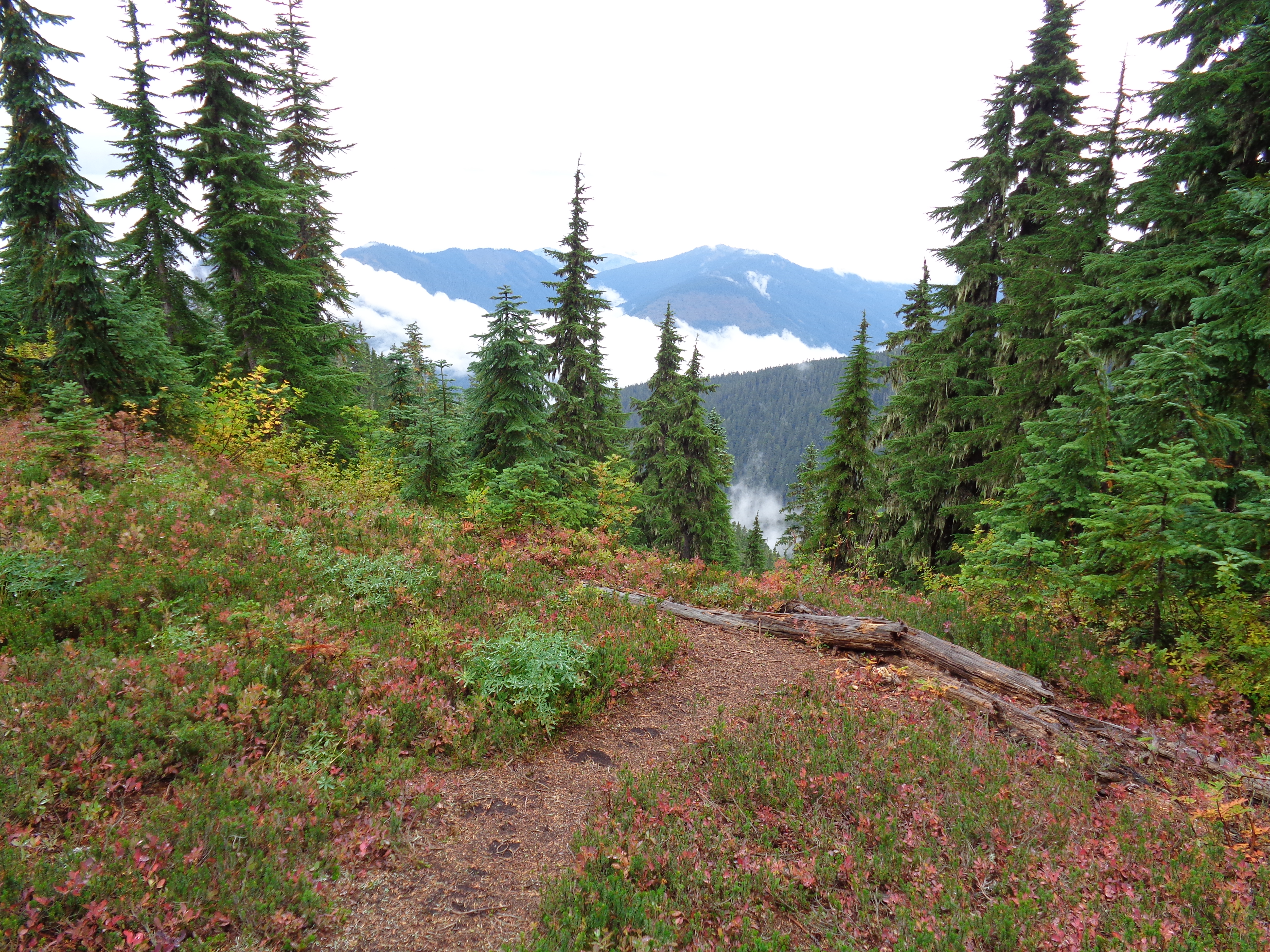
Views just before entering the forest
- Distance: 7.4 miles (Strava had it at a solid 8 miles though)
- Elevation: 2260ft gain, 5060 highest point
- Weather: 40’s and snowing, occasional breaks in clouds
- Commute from Seattle: 2 hours
- Did I Trip: No but I slipped on some hidden boulders if that counts. And slid 8 feet. The tracks are there. Clear as day.
I woke up and had already procrastinated. I took my time having tea, and farting around online, and eating peanut butter from the jar. It was too late to do anything longer than 8 miles, and that was assuming I’d haul ass during my hike. Okay, fine, Beckler Peak it is. This had been on my radar for a while, but I never got around to it. I tend to save my off days for longer hikes, so this half-day was the perfect chance.
This is only the beginning
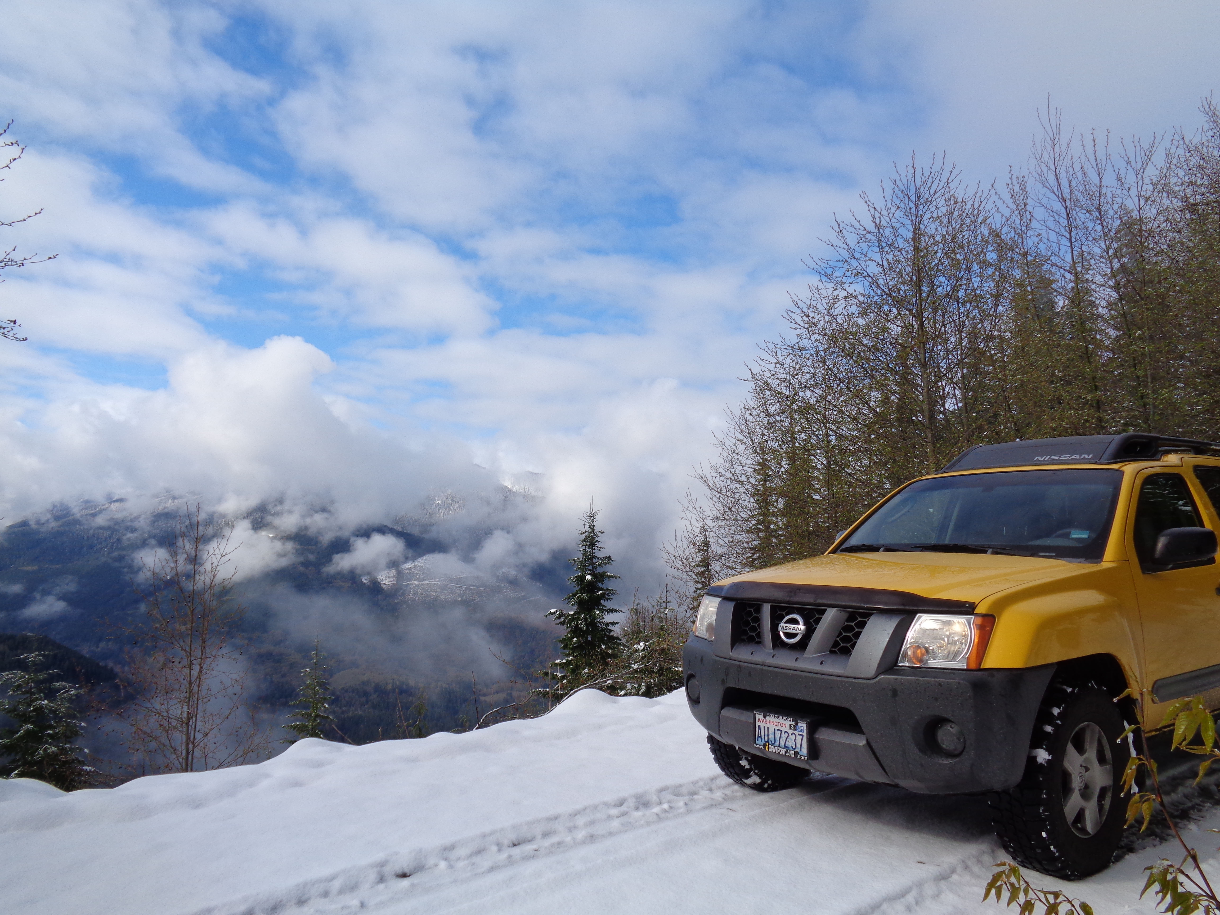
The drive was uneventful, until the forest road. Muddy at first, and I got to put those mud tires to use. Awesome. the mud turned to snow, and I got to take my first four wheel drive car in snow. And let me just say something real quick. Four wheel drive is amazing. After years of two wheel drive in snow, wow. Inches of snow on a steep narrow dirt road were not a concern, somehow. Don’t worry, views opened for a split second on a flat section and I got a picture. Yellow looks pretty good backed by fresh snow.
I was unsurprisingly the only car at the trailhead. My bag was already packed, so I hopped out and started off. The first part of the hike is down an old logging road.

Even logging roads look nice in snow
I had heard complaints, but it looked pretty nice covered in snow. There were a few vague footsteps to follow, but they turned around maybe 3/4 of a mile in, along with the snowshoe prints that were barely visible.
Speaking of snowshoes. Of all the hikes I’ve done this winter, this would have been a great one to have them. What started as a few inches of snow grew steadily deeper as I gained elevation. Most of the hike is in a forest, so no real avalanche concerns (a few mini slopes, like the one that created the perfect pinwheel), but that doesn’t mean the snow is shallow.

Perfect pinwheel
You enter dense forest around two miles in (after what seems like two logging roads, not one), and you begin to switchback up the slope. Here, the snow was probably around 10″ deep, and counting. There was a sneaky patch of blue sky behind me, the bastard. It never quite came over me. Just hovered in the distance. It disappeared after about half an hour, and it began to snow. By now I was trekking through maybe 15″ of snow closer to the ridge, and I was eyeing the clock to make sure I turned around in time to make it back for work. Sound familiar?

You can see the old trail at points
I broke out onto the ridge, and hit snow that was 18″ deep. Just enough to cover my knees. It’s exhausting. I think pride kept me going. It was my first (fake) day off in a week, I hadn’t been hiking in seven days. Plus I had technically never solo-trail-broken before, and this was a good opportunity to safely see what it was like. The trail is simple to follow even when completely buried, and there was no point where I was worried about navigation. I didn’t come this far and wade through knee deep snow just to turn around 10 minutes from the top. Or so I thought.
10 minutes passed. Okay, another 10 minutes, then I’ll turn around. Nope. Okay, five more. Still no. But it looks like there’s only a few more vertical feet and then I’m there, so one more push. What about work!? You have to teach a class! Eh, the way down will be faster. I finally realized I was staring at the summit, a pile of snow covered rocks. At least, I realized they were rocks when I postholed and slipped on a mossy boulder and lost the 8ft of elevation I had just gained. Dammit. I threw on my heavy duty gloves, and figuring no one would see me (and therefore no one would ever know) I knocked enough snow down to kick solid steps and essentially scrambled to the top.

View from the peak (classic Beckler pic)
I was lucky enough to have a few seconds of clarity! The clouds parted just long enough for me to see that cool square rock along the next ridge. They closed back in quickly, and I figured I’d just start back down. I turned around, and saw a little red figure on a branch. What? I walked closer, and realized it was a plastic horse from the last person who posted a trip report on wta.org, and it had been there for four days! It survived all of the fresh snow, and clung to its tiny branch.
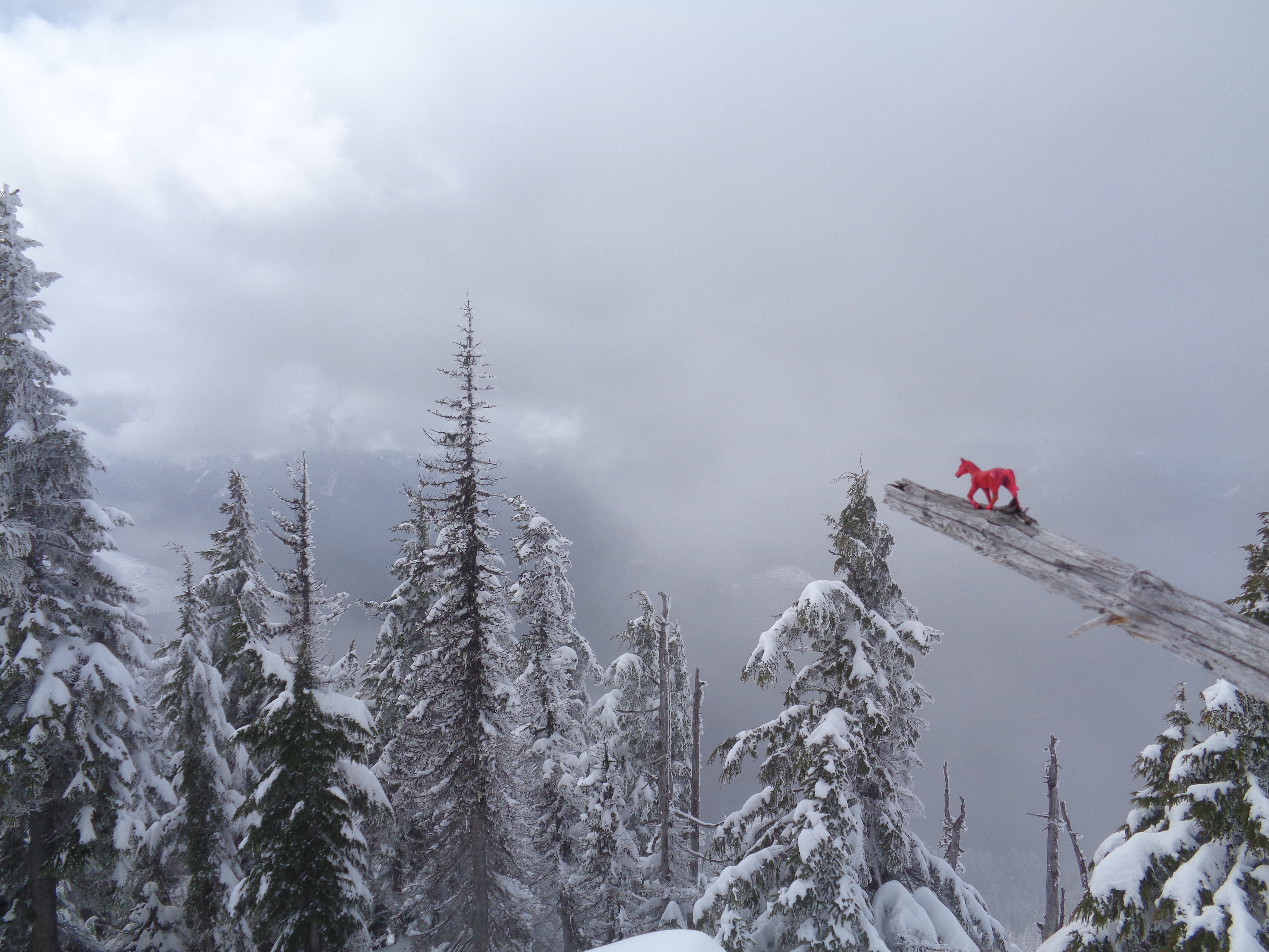
Trusty steed!
The way down went far more quickly than the way up. Naturally it got sunny as I left, which usually I’d complain about, but I was pretty satisfied with the hike. First person to do a hike covered in fresh snow. Was it a pain in the ass? Yes. Was it tiring? Yes. Did I hobble on my ridiculously tight calves this morning, a day later? Also yes. But it was worth it.
The funny thing is, I bet most of the snow will be melted by this weekend. The temperatures are well above freezing, even overnight. The fact I would have appreciated snowshoes will be null, because this was a rare condition for a hike this winter, especially one so low in elevation. But that makes it a bit more fun.
On the way out, I ran into a guy in a Toyota pickup at the trailhead. Thank god he made it to the trailhead before I started driving away, because that road is narrow and there aren’t many good areas to pass others, especially two people in trucks on a snowy, slushy gravel road at that. But between the two of us, we had at least left pretty nice ruts for future cars, and again, I bet the snow on the road will be gone within a day or two.
I forgot how nice Route 2 can be. After spending so much time up north (Mountain Loop, Baker highway) I had started to lump route 2 in with i90, but there are a lot of good hikes up there. I’ll have to check out a couple more. Perfect for half days!