Little Mashel Falls

Conveniently located stranger for scale at the middle falls
Most of the trail

“Little” obviously has to do with the river, because these falls are anything but little. But the trail… the trail is… weird. It looks like there are multiple different ways of accessing the falls, two via a Weyerhauser road and a third from above(?), which we explored a bit but bailed because it was pointless for us. We started at the coordinates provided by WTA starting at Pack Forest, more specifically the Charles L. Pack Experimental Forest. Sounds more exciting than it is, it’s just a significant piece of land with multiple drainages, significant enough rivers and flora/fauna to use as a playground to land management. Fortunately, we get to use this as our recreational playground, too! Unfortunately, WTA’s description was either entirely inaccurate, incredibly unhelpful, or yours truly is incapable of urban navigation (most likely).

  • Distance: 7mi (all falls plus a slight exploratory detour)
  • Elevation gain: 500ft
  • Weather: 50’s and cloudy
  • Commute from Seattle: 1:30
  • Did I Trip: No! Neither did Amber, though her muddy clothes suggested otherwise
Backyard

We pulled up to the Park Forest gate at the coordinates from WTA. Well, sort of, the gate was closed like a quarter mile before the WTA coordinates. There was a couple who parked next to us and asked if they were in the right place, to which I confidently replied “yes!” and they asked where to go and I said “beyond that gate, and follow the road until eventually there’s a trail!”

Another backyard

Within 5 minutes of walking, we found ourselves at some sort of… camp? Office retreat? I have no idea. Cabins and parking and we continued to follow the road until we came to a sign: TURN AROUND! Ah crap, is it closed for some reason? We got closer. “Mashel Falls is not this way. Go back to the sign and turn right.” Oh. Okay. That’s cool I just immediately got us nearly headed off in completely the wrong direction. We would have been wandering a maze of forest roads with no waterfalls. We went back to the sign, which turned out to have a trailhead style billboard with a map saying “Little Mashel Falls Reroute” which made me feel a little better. And a bright red paper saying “LITTLE MASHEL FALLS ——->” which made me feel less better. So, that drives the theory that WTA’s directions are out of date.

A third backyard

We walked across a field (new red sign “falls —>”) went left/counterclockwise around a pond (another sign “falls —–>”), and popped out onto a Weyerhauser road (signed), which we followed for what felt like forever (with more signs). Our new friends knew this route, and had just been following us hoping for something shorter and faster. We unfortunately soon left our new friends behind as they took a break, though we got the advice “you’ll cross a bridge and then the trail will be right there!” which kept us from doubting ourselves too much as we passed backyard after backyard after backyard and no signs and more backyards. Infinite backyards. Twilight zone levels of gravel road and backyards.

We eventually came on a small waterfall between backyards. “Is this it?” I asked. Did I drive all the way here for a small waterfall mostly covered in brush off of a gravel road? “We haven’t crossed a bridge yet, so let’s keep going? And given the signs… it’s probably signed?” And the WTA description definitely mentioned a trail eventually. And there was supposedly 500ft of elevation gain somewhere in there. So we kept walking. “This feels like the Burke Gilman.” My expectations were getting lower and lower. I hoped Amber wasn’t disappointed. Still a change of scenery, a break from Seattle, a walk with good company, and finally… was that a sign?! A trail sign!? Just before a bridge? YES! And we turned onto a real trail!

“…is this the falls” (no)

The real trail was 70% mud, and we had neglected to consider that you gain all of the elevation in the half mile to the falls. It’s slippery, and surprisingly steep, but it finally felt like we were in the wilderness and not on a logging road paralleling a highway.

Amber admiring the thinner middle fall

START WITH THE UPPER FALLS. Because they were the most anticlimactic/least climactic. Stay on the main trail until you come to a junction with a small creek running to the right of the trail, and head left. Most of these were signed. The falls were pretty big, and in summer they might be cooler because you can log hop or wade the river to get a closer view. We didn’t want to negotiate a very slippery wet 12″ diameter barkless log to reach the island with the (maybe/probably superior view) so we settled for obstructed viewing.

The middle falls are the best. SUPER slippery, lots of mud and wet rock, but they funneled most of the water into one central fall (unlike the upper fall, which had many routes) and it was POWERFUL. You could see the mist blowing through the air and feel it thundering. Next to it was a slimmer lace-like fall, looking all dainty and delicate next to the main event. We hiked down laughing with excitement, along with two other equally stoked women. After the upper falls, the middle falls were so close and so awesome. I had brought my new camera, ready to practice waterfall pics, and triumphantly took it out only to turn it on and see “battery exhausted.” I was going to practice with my new tripod, but I guess.. not anymore. Not Today! I snuck out two pics before it died all the way. No time to change settings or reframe. Rookie mistake. I was hoping to get a pic of the more delicate falls out of frame too.

The larger side of middle Little Mashell Falls
Young growth can be lush!

You can also walk behind the middle falls! There was so much water flow that we couldn’t get all the way behind the main fall, but we could sneak around the daintier fall and get pretty darn close. Amber (smart woman) put on her rain coat so she wouldn’t get soaked, I just risked it. The temperature must have dropped 10 degrees when we got close to the water. Apparently in summer the fall is only like four feet and you can go all the way behind it and even dunk your head/body into it, but that would have been insane with today’s volume. We figured this had to be the best part, there was no way the lower falls would be this good.

Slippery!

Surprise! The lower falls were pretty damn good too. We met two happy dogs, I thought Amber wiped out because she was covered in mud somehow (she didn’t wipe out… “I wish I had wiped out, because then I’d have an explanation for all of the mud”), I managed to sneak two more pics on my trying-to-die camera before we headed back uphill to the main trail. That’s the only downside – the side trails to the falls (besides the upper) were downhill, so you had to regain elevation to get back. Oh, and did I mention the slipperiness? It’s actually pretty impressive neither of us totally ate it at some point. Or lost a boot to a sucker-hole of mud.

I’m honestly surprised there weren’t more people here. Multiple access points, huge beautiful falls, only 500ft of elevation gain, 90 minutes from Seattle, dog friendly, where was everyone? It’s so accessible and quite beautiful and green despite being young growth, at least once you’re done walking past everyone’s backyards. And perfect for a rainy winter day. Or if you figure out the alternate route. In which case let me know because maybe I’ll go back with a fully charged, very much alive camera to actually frame some long exposure shots!

Lower Little Mashel Falls

Tis the Season…

20171231_145152

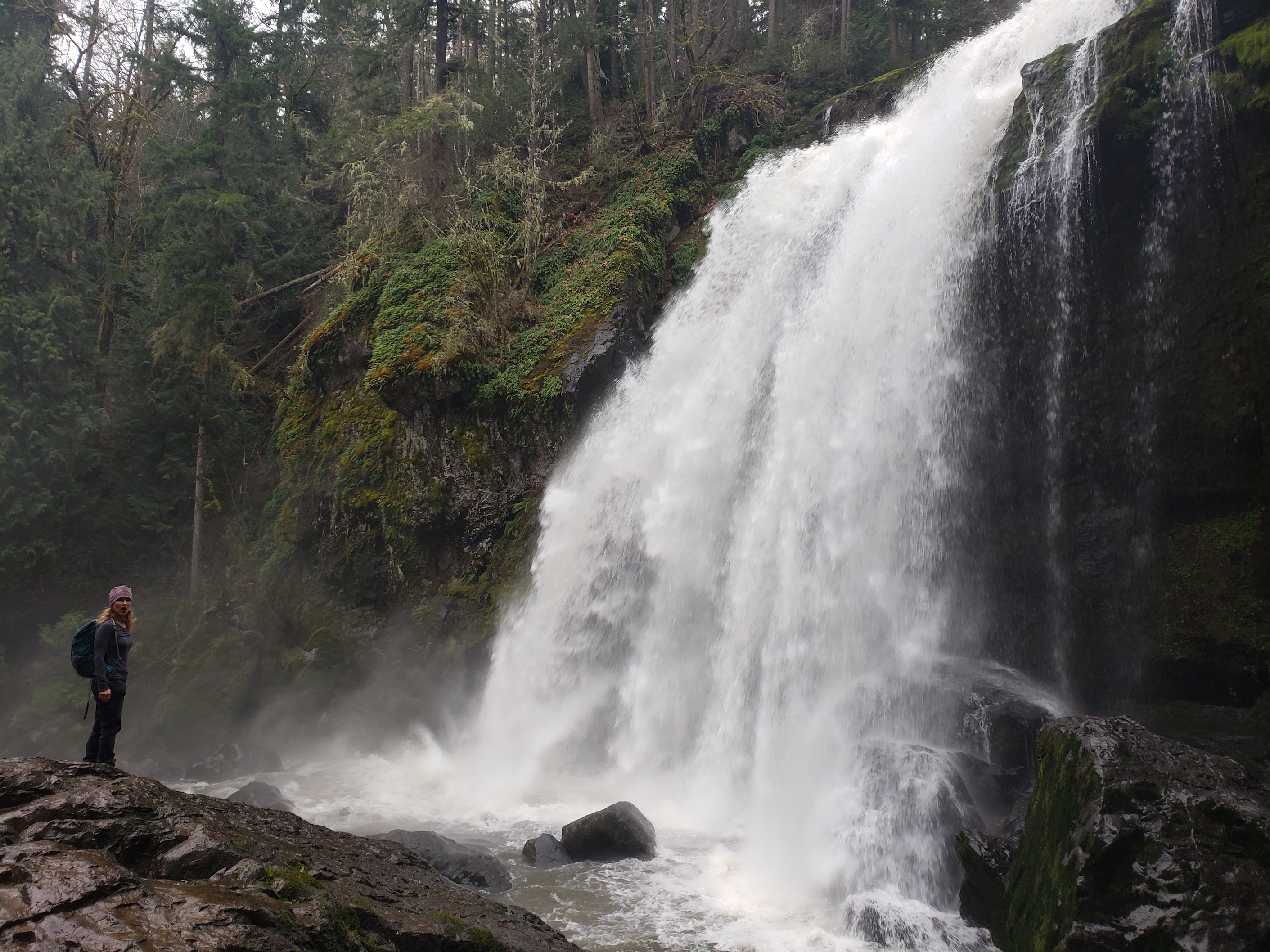
I mean… how is this a Plan C?

20171217_120627

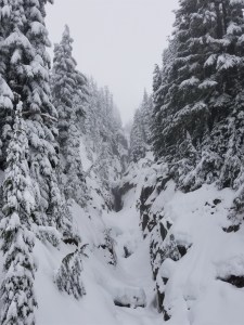
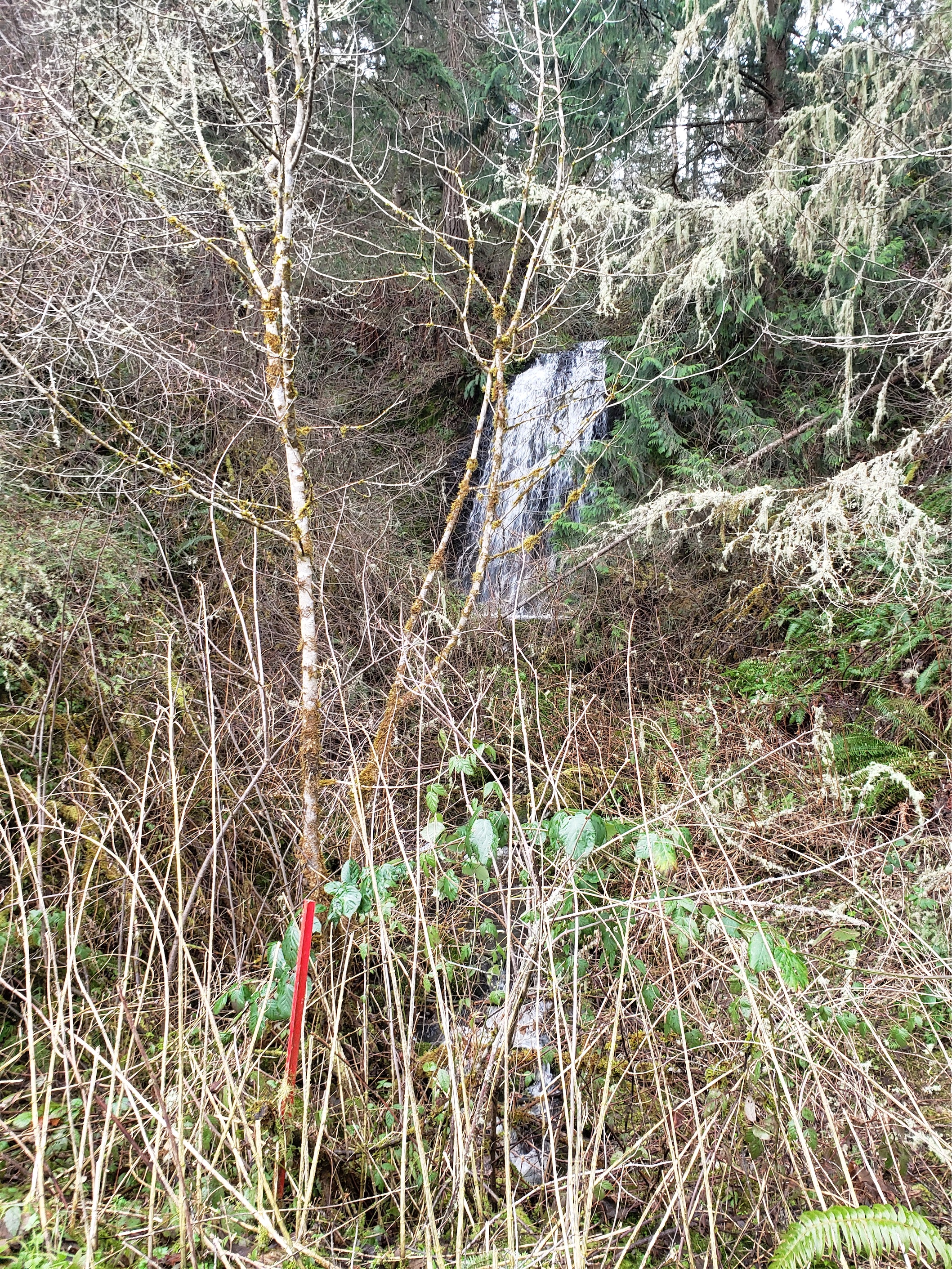
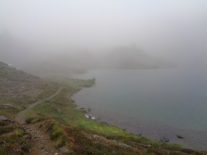
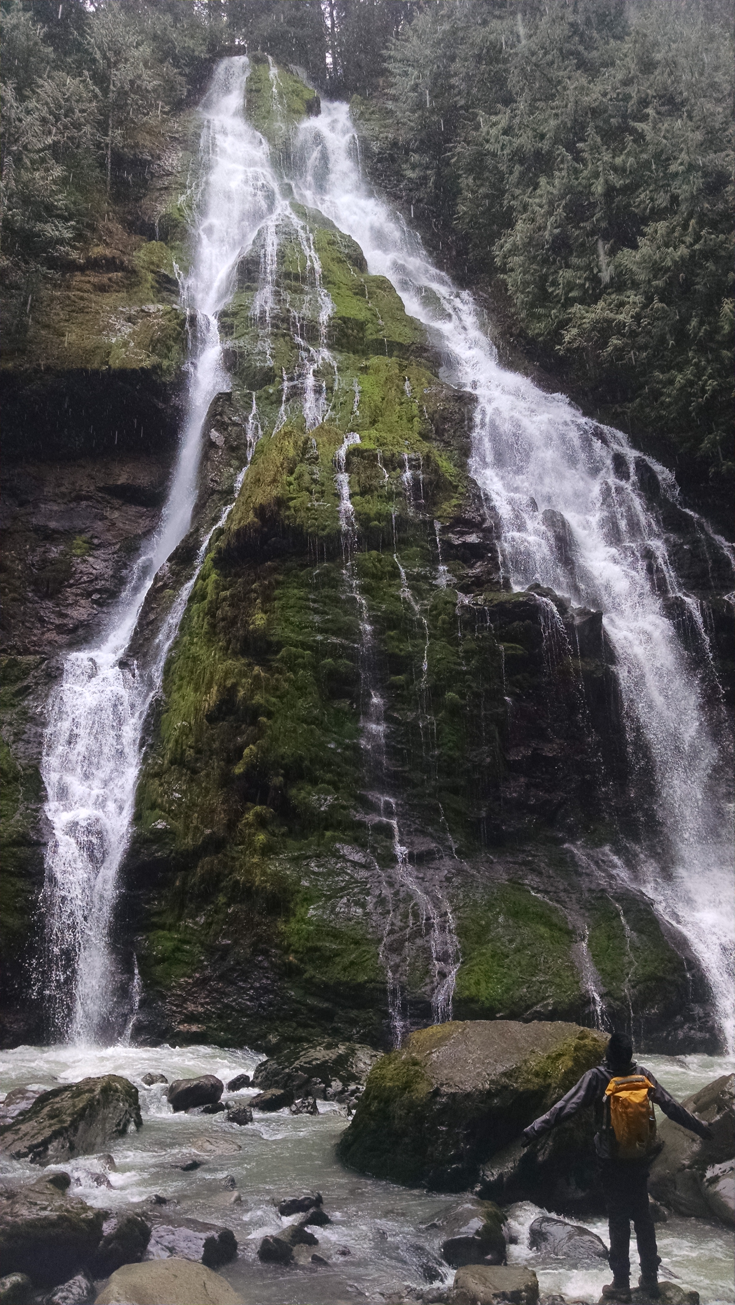
Okay, it’s gross, but still pretty I guess

…of turnaround trips, and halfway trips, and downgrading from Plan A to Plan B to Plan C and eventually surrendering to Plan E, which stands for “Eating on my Couch.” It’s been a quiet season so far for me, but I’ve managed to rack up a few turnarounds and a few bails and and a few successful Plan C’s. And one weekend’s Plan C might be another weekend’s Plan A. Or maybe I burned out and Plan E is my dream weekend. But now it’s 2018, and it’s a clean slate ready to be filled with more turnarounds, and hopefully some summits and some carving turns and some technical pitches and a generally unreasonable consumption of alpine cider.


Plan A’s tend to be climbs. Awesome, ambitious climbs. I mean what else can you suggest when conditions are good and you only have so many good weekends in winter? The best way to get in shape is to bite off more than you can chew and see how far you get (safely). And carry those skis. See Spring Training for tips.

20171203_132919

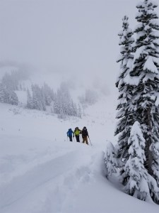
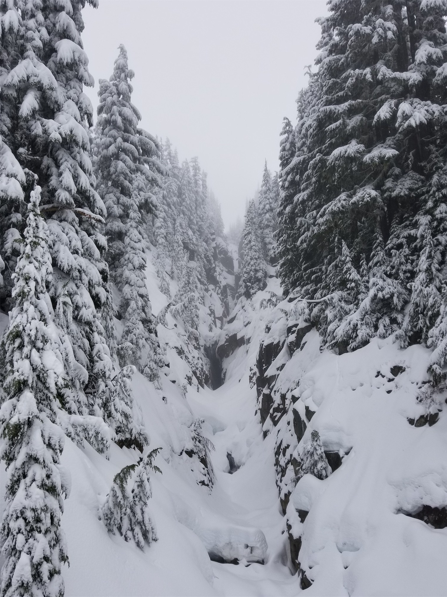
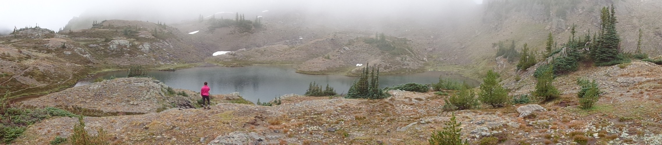
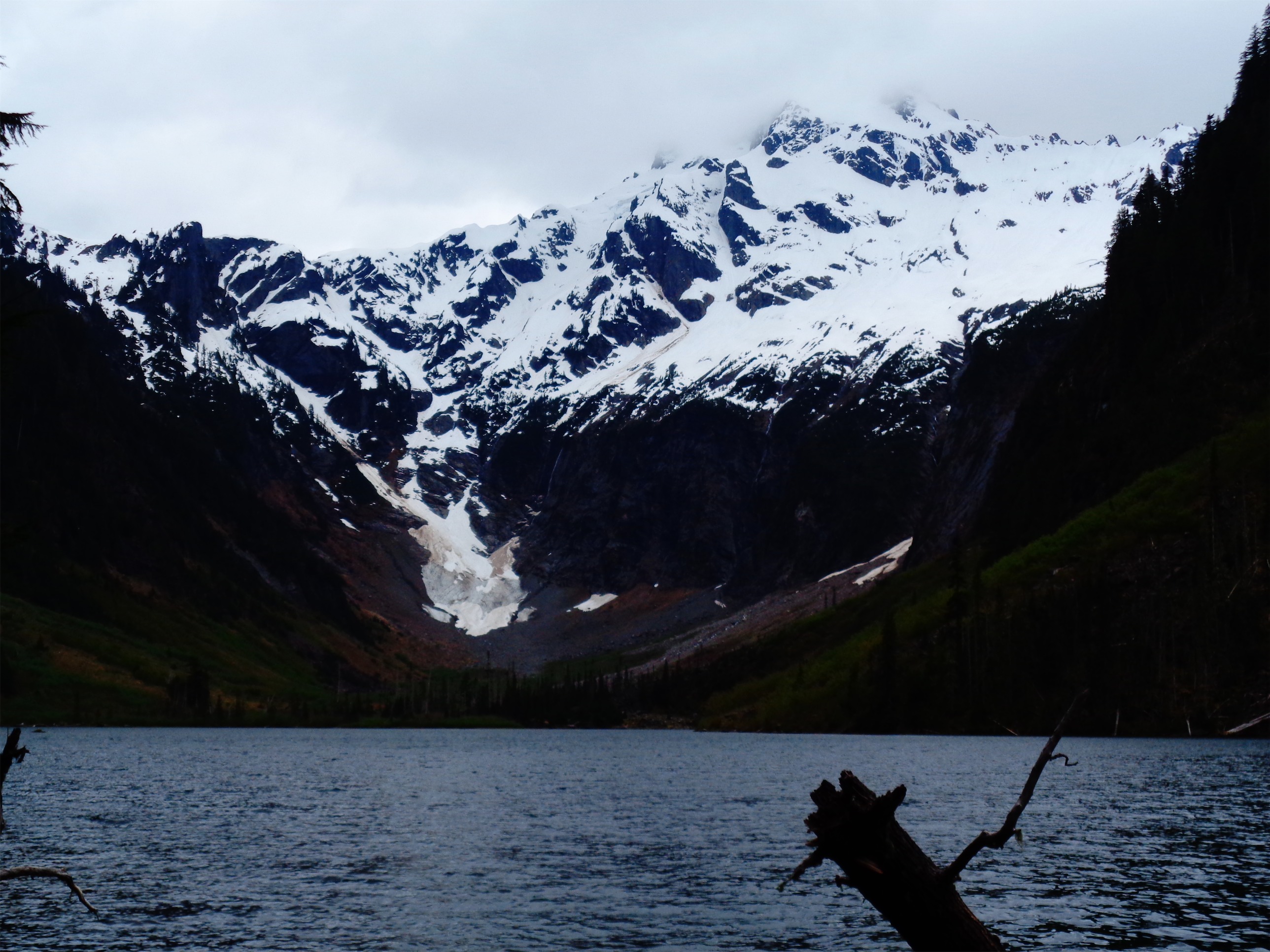
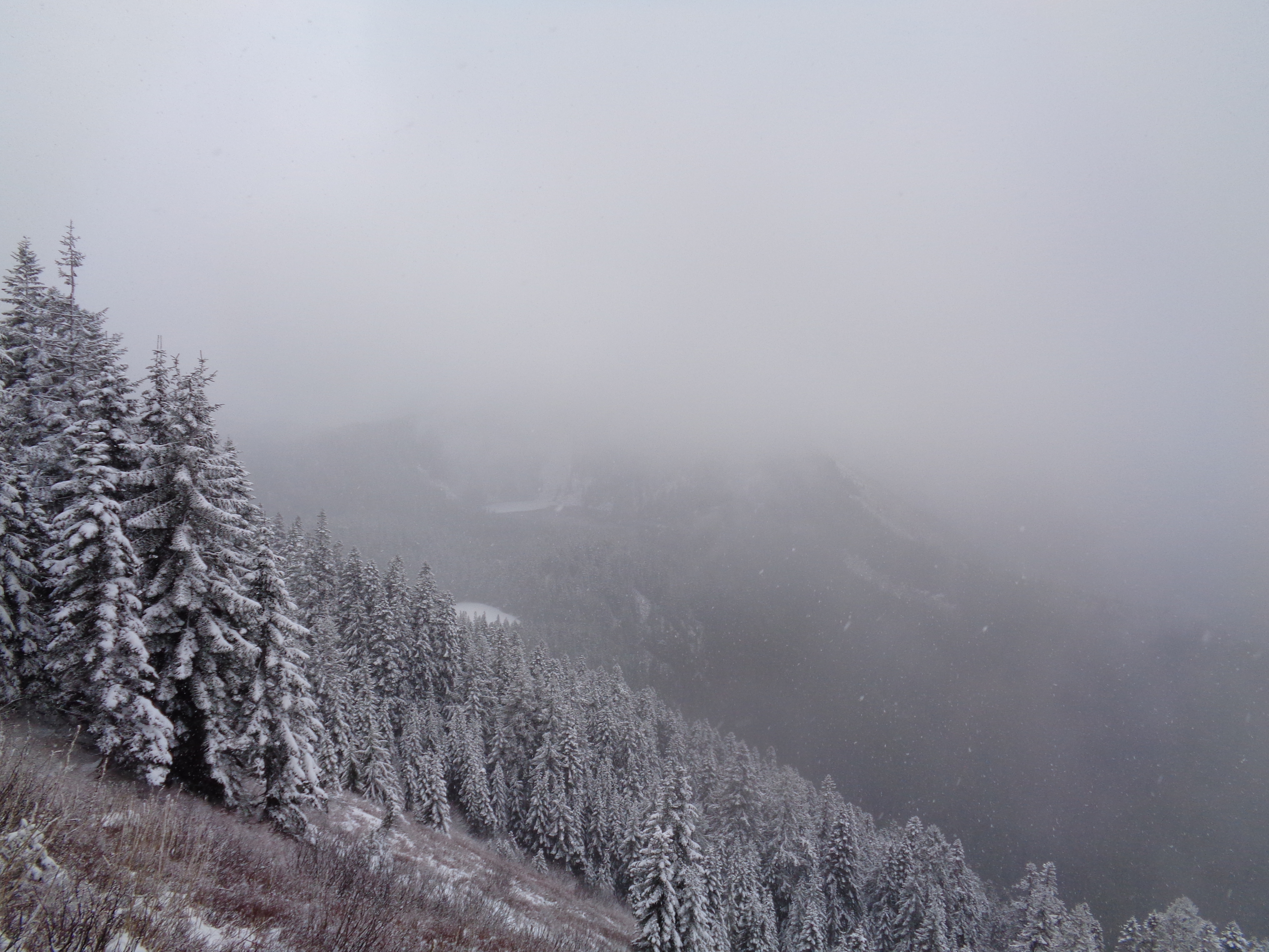
At least it was a powder day

Plan B’s are less committing climbs. Maybe avalanche conditions aren’t great, maybe the weather isn’t worth a two day trip, maybe you’re feeling sick and noncommittal, maybe you took too long to figure out plans and now you’re stuck alone. Or maybe it’s resort skiing, because I like to hemorrhage money during the winter pretending to be a yuppie.

Plan C’s are classes (for me, plus the letters match). Last minute avalanche class? Sweet. Learning to dig huge luxurious snow caves? Sounds lovely. Help instructing ESAR Course I? Awesome, I’ll bring sides for the burgers we’re going to destroy in front of the trainees. And peanut butter, because I ate the whole thing last time. Sorry, sort of.

20171231_145012

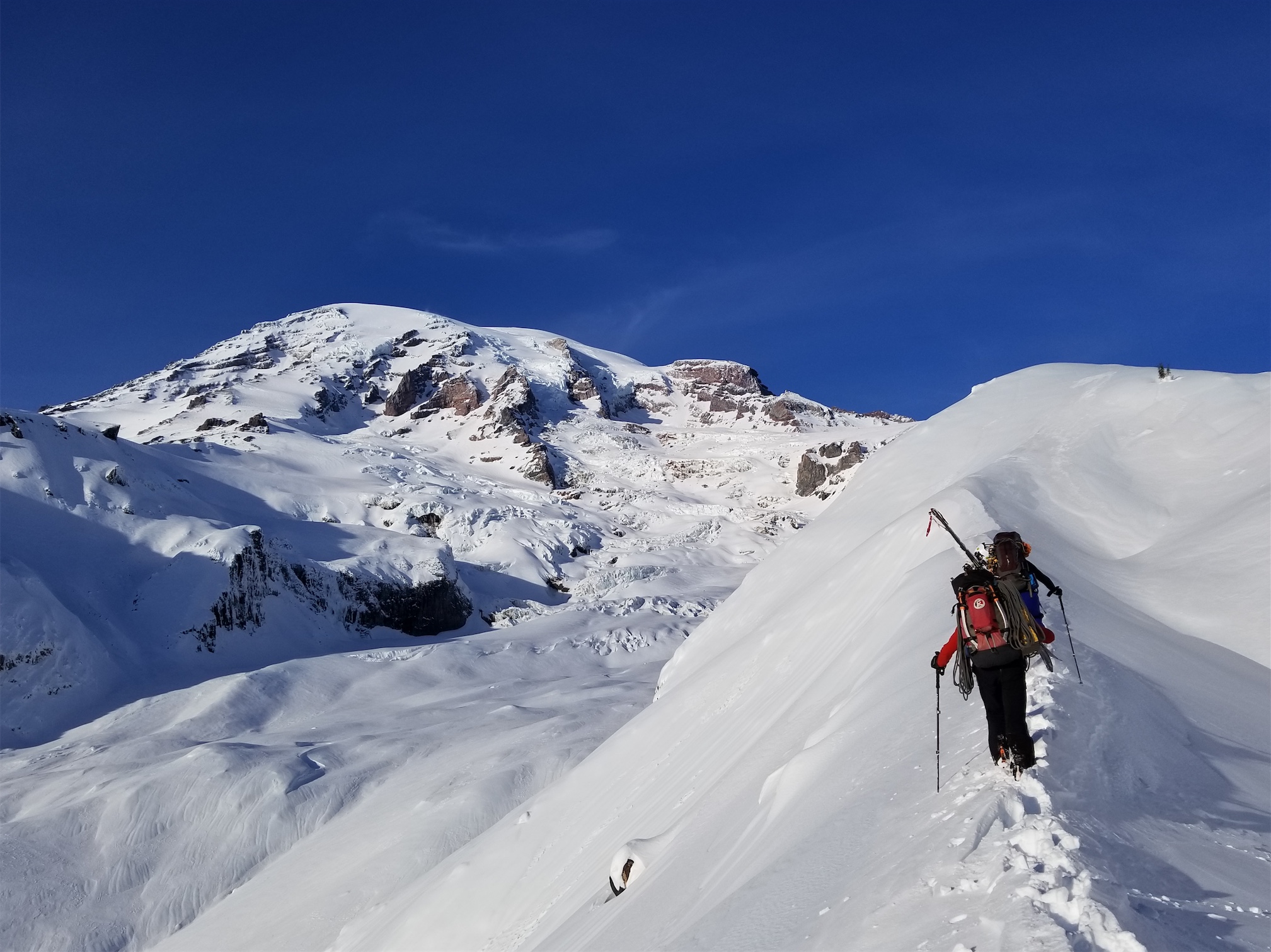
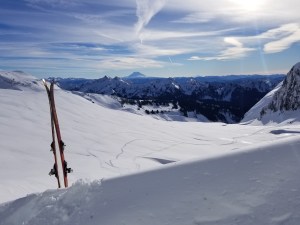
Big dreams on the way up

Plan D is whatever I whine about but eventually go on, or me texting everyone I know looking for people getting outside, and Plan E (short for “eating on my couch”) involves no effort from anyone whatsoever unless I actually walk 2 blocks to Markettime to get food, in which case I supposed I’m asking some favors of the cashiers and my digestive tract.

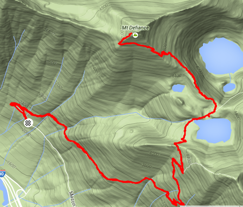
So let’s go through a few sample weekends. Weekend Zero is a good example of the quintessential weekend, with Plan C varying from ESAR training to SMR training to me taking classes I want to take. Weekends one through four are what I’ve been up to since early December, with a break for lots and lots of Plan E’s over the holidays.

20180101_124951

Ready baby! Plan C is a go!

Weekend Zero: 
Plan A: Backcountry skiing (couldn’t get organized soon enough)
Plan B: Resort skiing (not worth paying for such lousy conditions)
Plan C: Help instruct Course I (awesome Saturday)
Plan D: go home and hope to rally people for a Sunday trip (fail)
Plan E: in full swing Sunday
Rough start to winter. I ended up on Plan C, which was actually a blast, followed by Plans D&E, though I certainly did not earn the luxury of my couch that weekend. And hopefully the freezing level will eventually be low enough that Plan B can be what I usually land on.

DSC01540

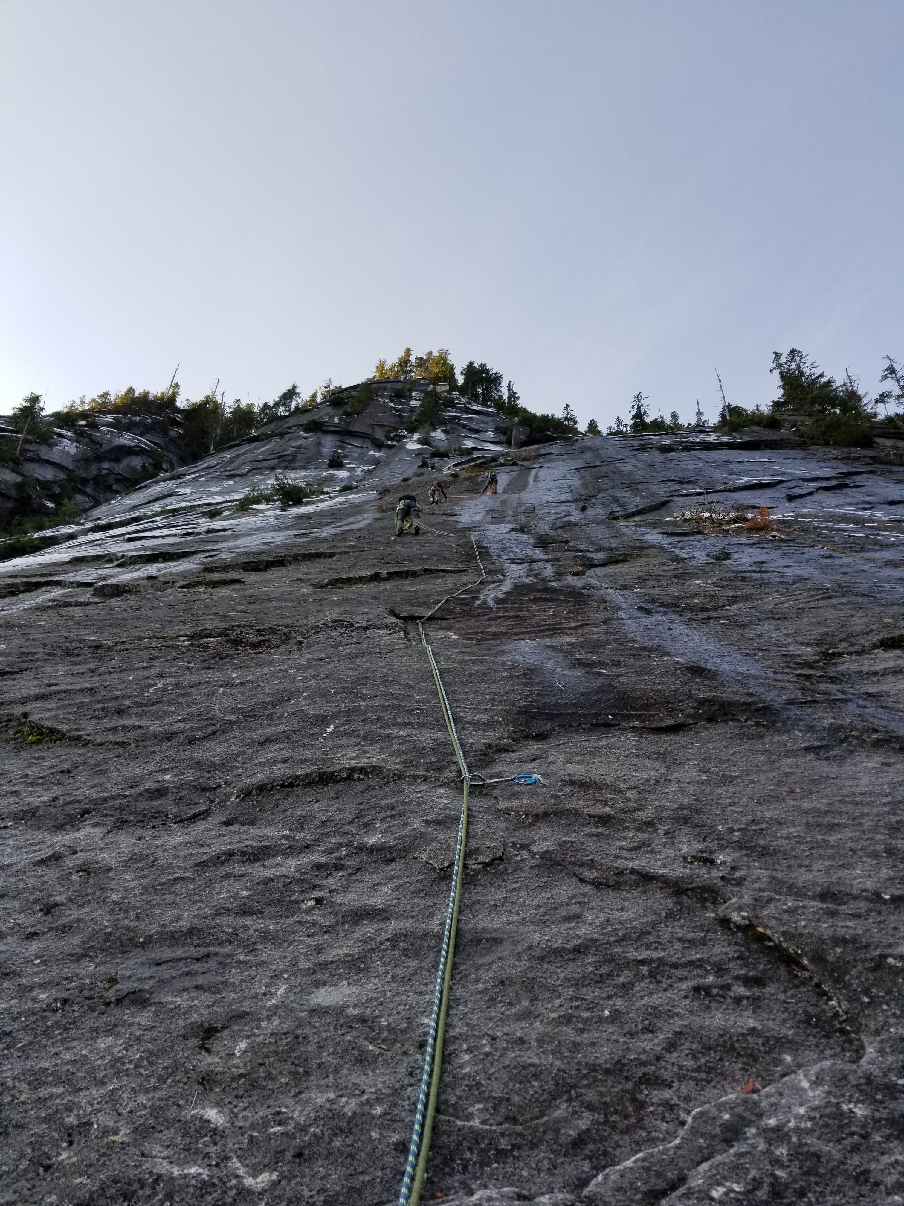
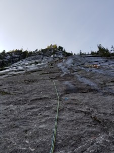
Looking back at Robert and Amber after leading the first pitch

Weekend One:

Plan A (Saturday): Three O’Clock Rock, Silent Running (bail)
Plan A (Sunday): Baker via Coleman Deming (bail – straight to Plan E)
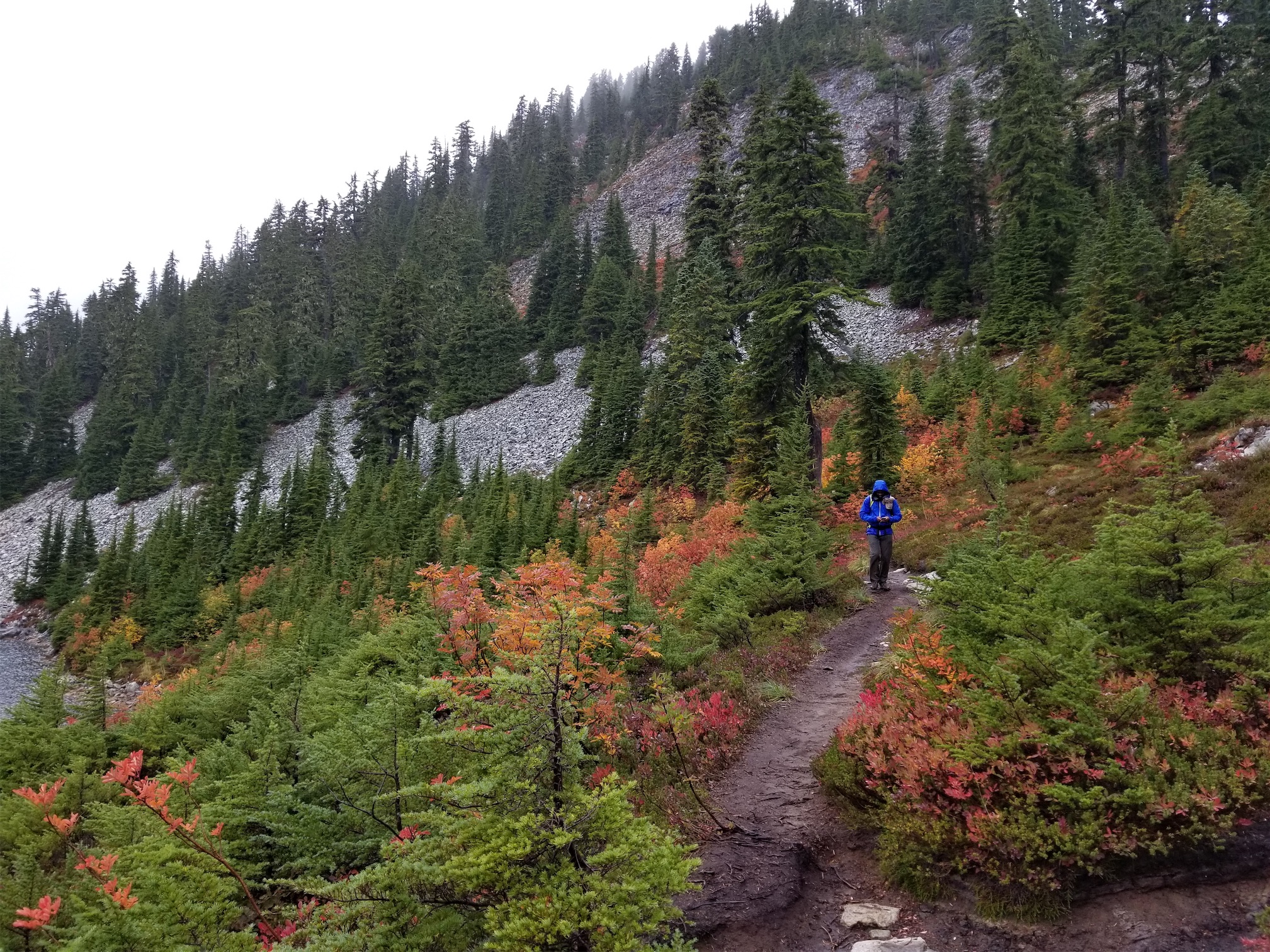
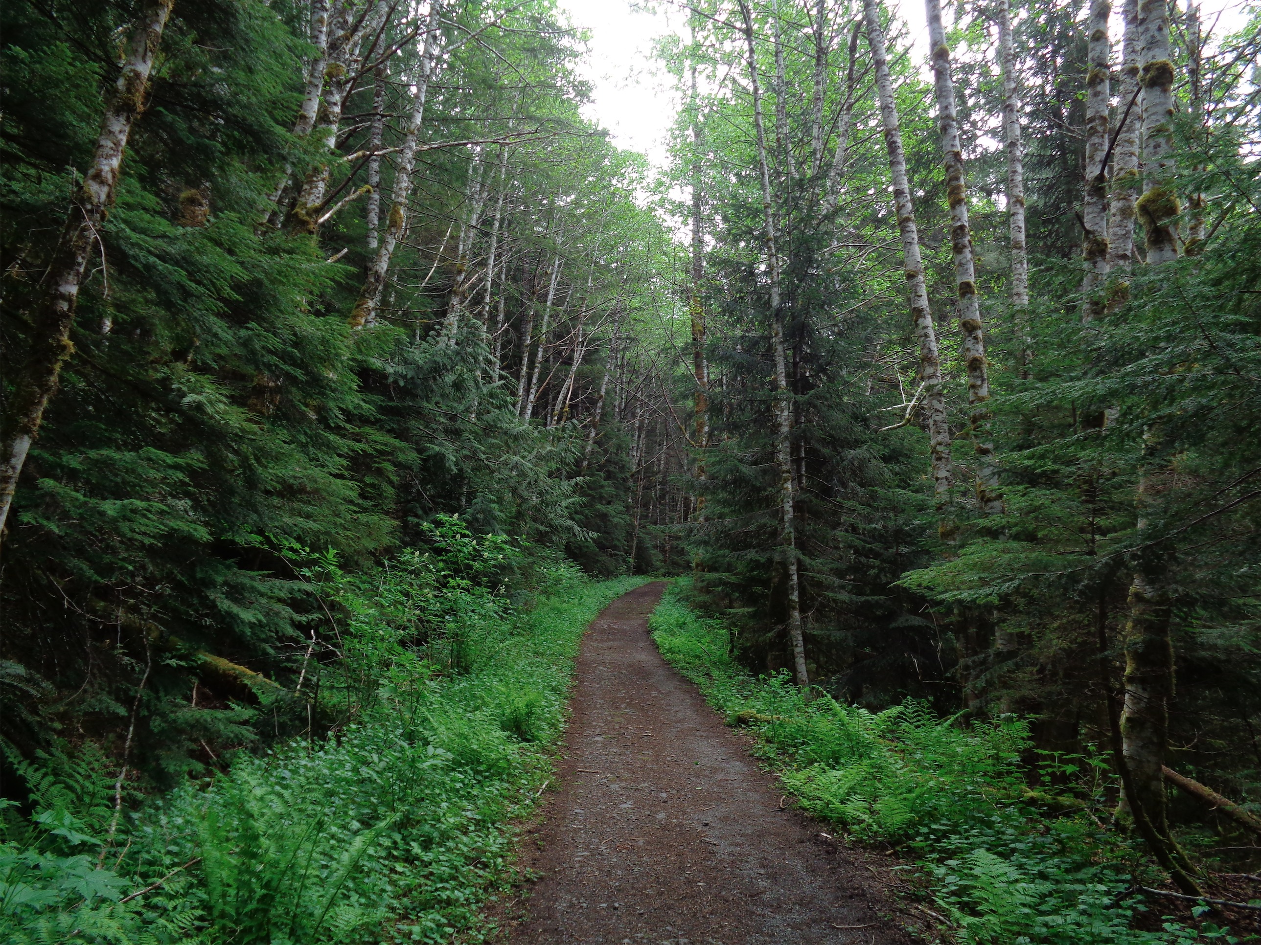
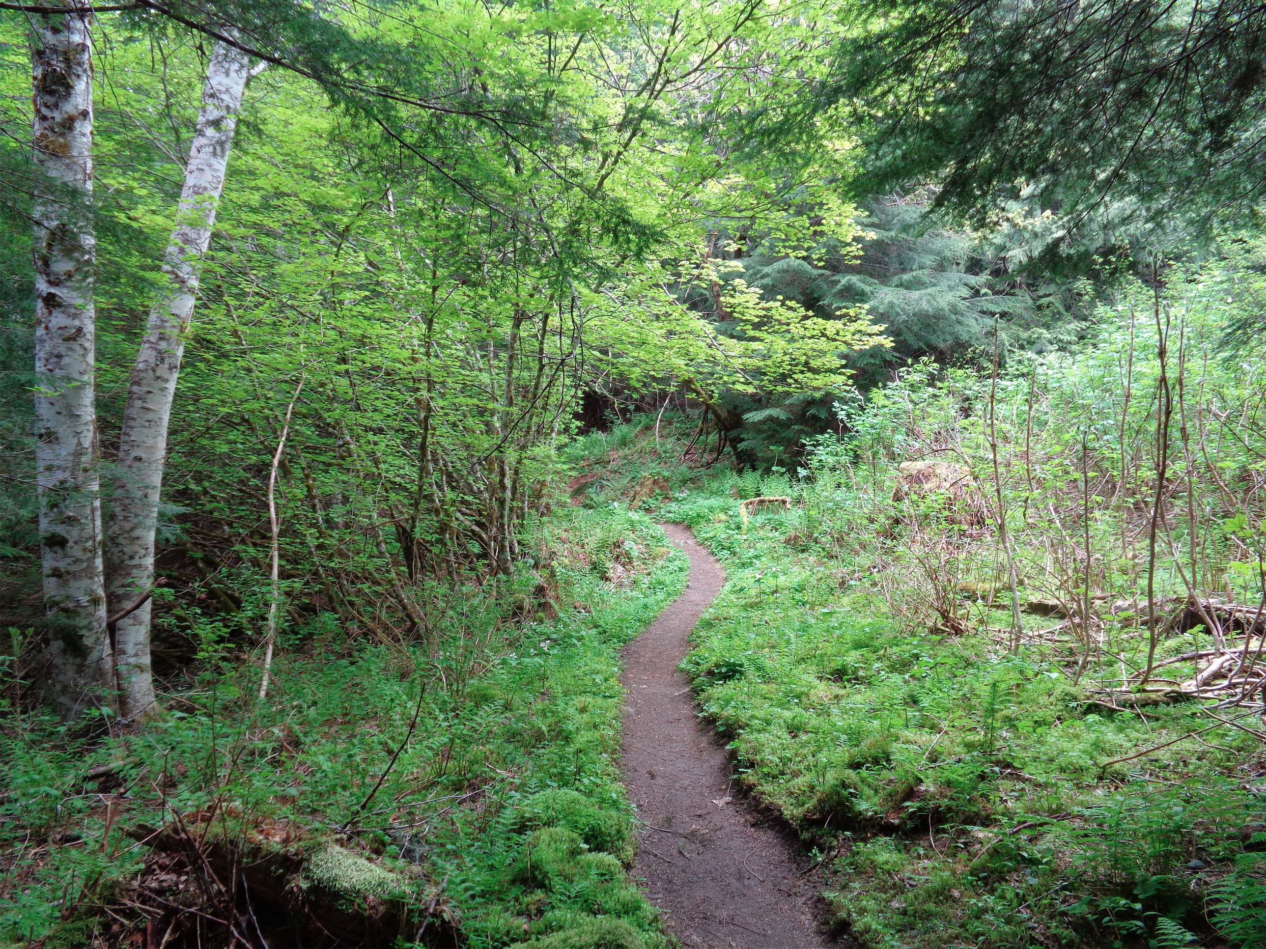
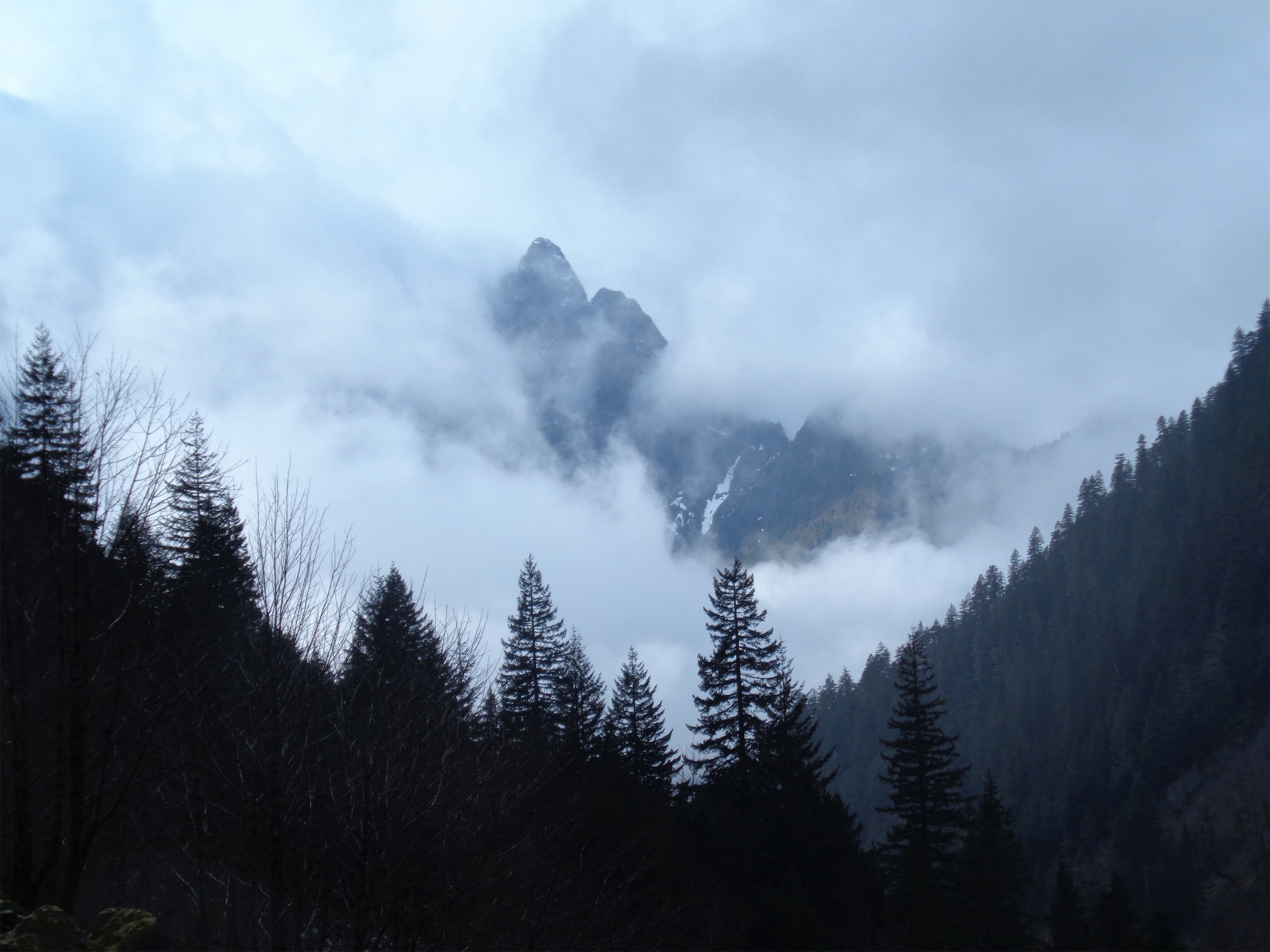
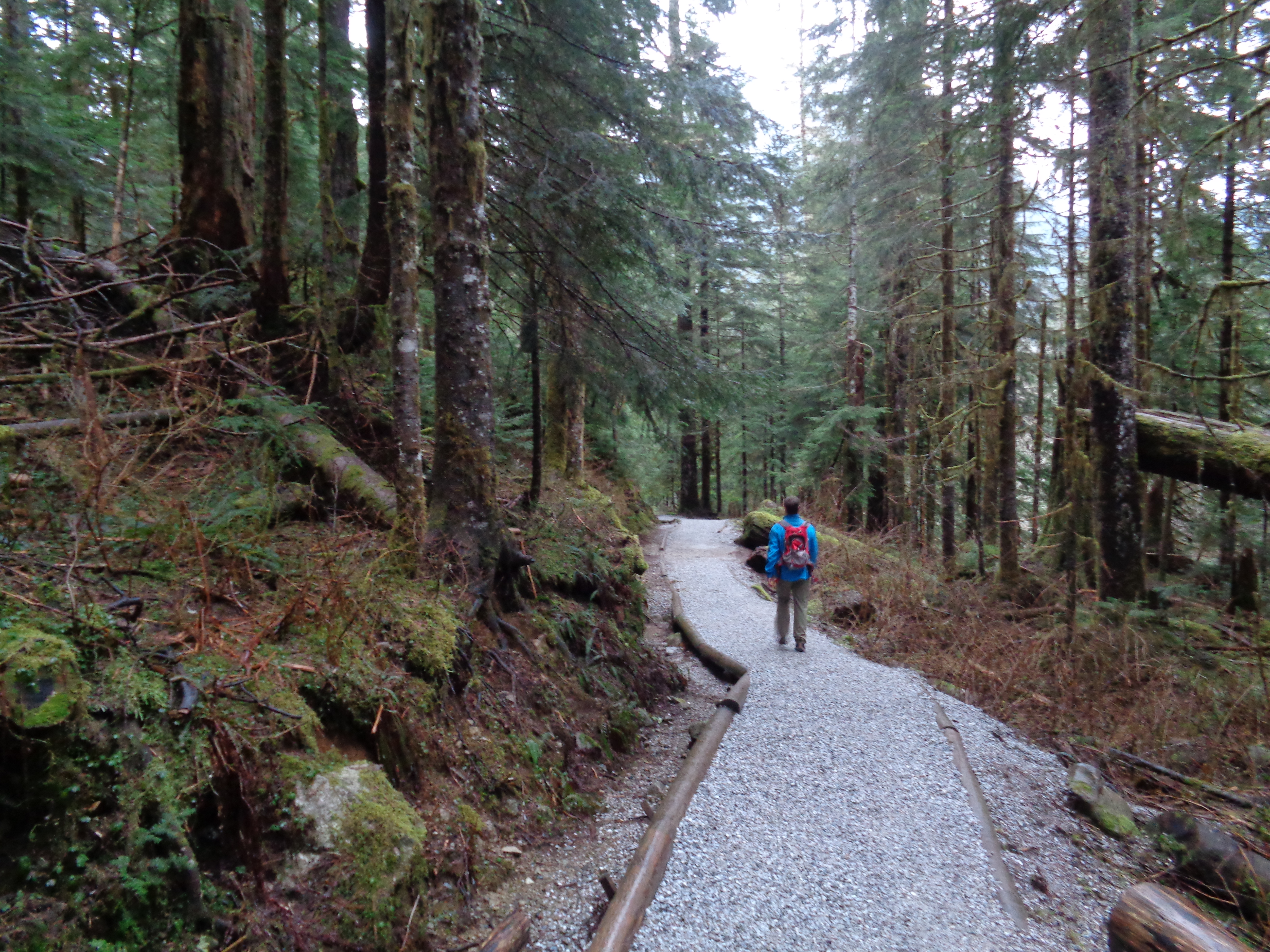
On a weekend with surprisingly pleasant weather, I somehow could not convince anyone to come on a North Cascades snow slog with me. So I hopped onto Forrest’s trip, which involved a nice 5.9ish slab climb of Silent Running on Three O’Clock Rock out by Darrington. I wasn’t convinced we’d reach the trailhead, or that the rock was dry, or that we wouldn’t be pummeled by ice/snow/waterfalls, but everyone was pretty gung ho so I schlepped myself along.
We made it to the trailhead without issue, and the approach to Three O’Clock Rock is an awesomely short hike along a nice trail. Supposedly it’s unmaintained, but it’s not that bad at all, and it continues on to 
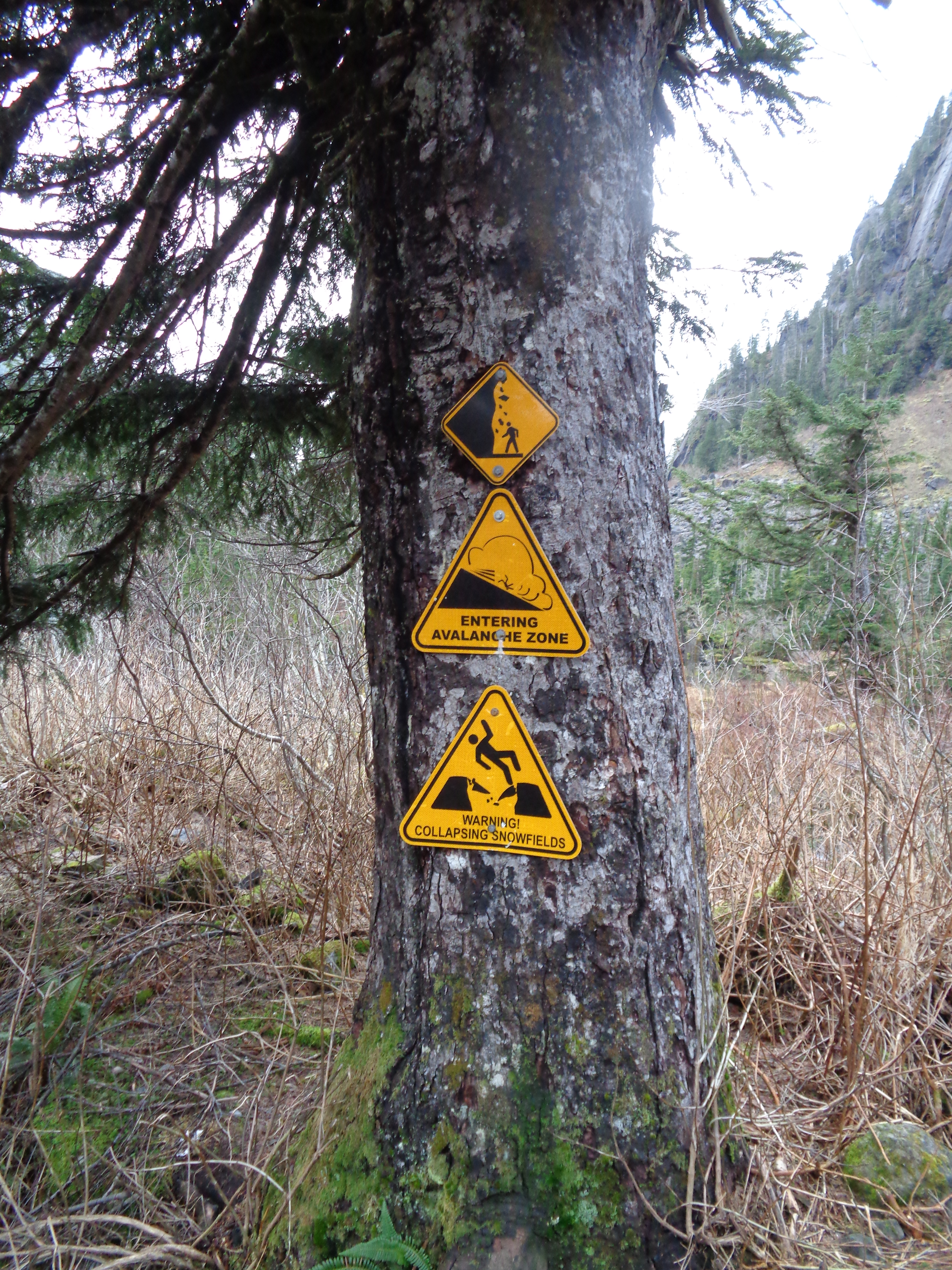
Squire Creek Pass, which is a nice winter/spring hike when Three Fingers is dusted in snow and you can watch skiiers doing borderline impossible ascents and descents of the north face. We took our turnoff, the only people interested in rock climbing, and started getting set up in the snow. The rock was a mix of dry and wet, but at least the first pitch was mostly dry. And the sun was coming around the corner, which should help with the rest of it.

DSC02434

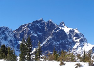
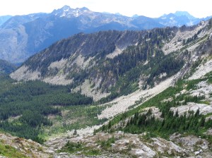
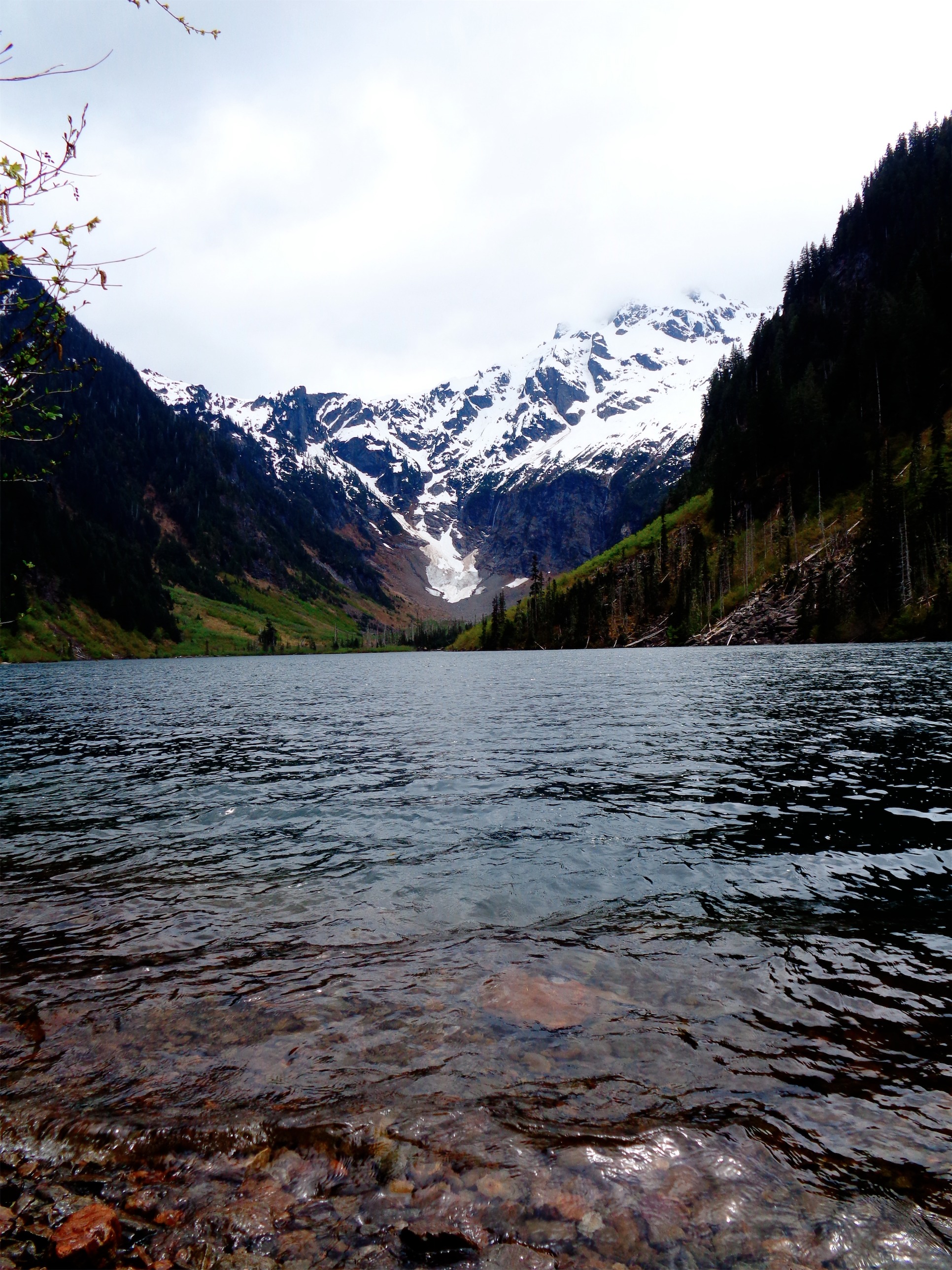
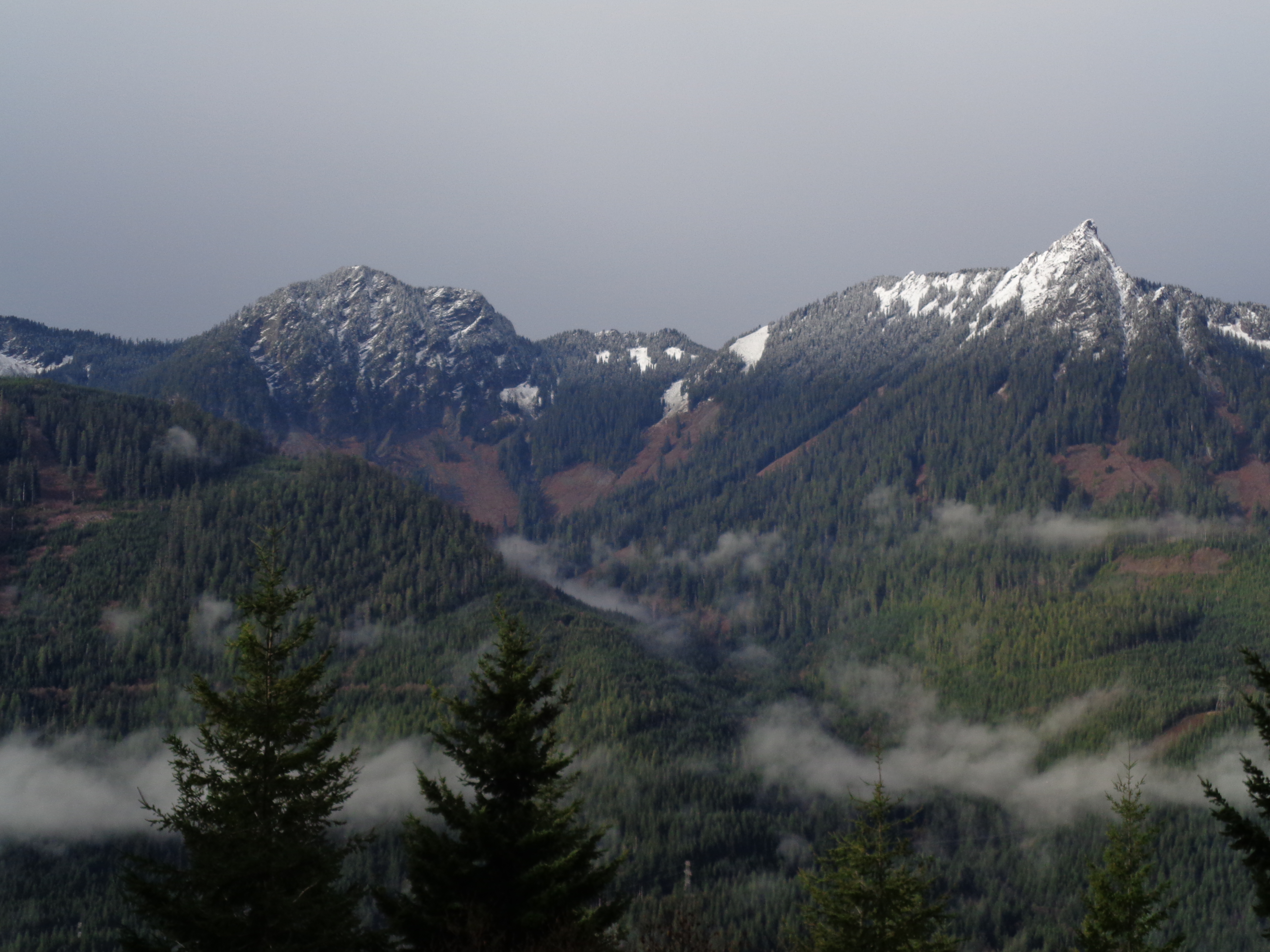
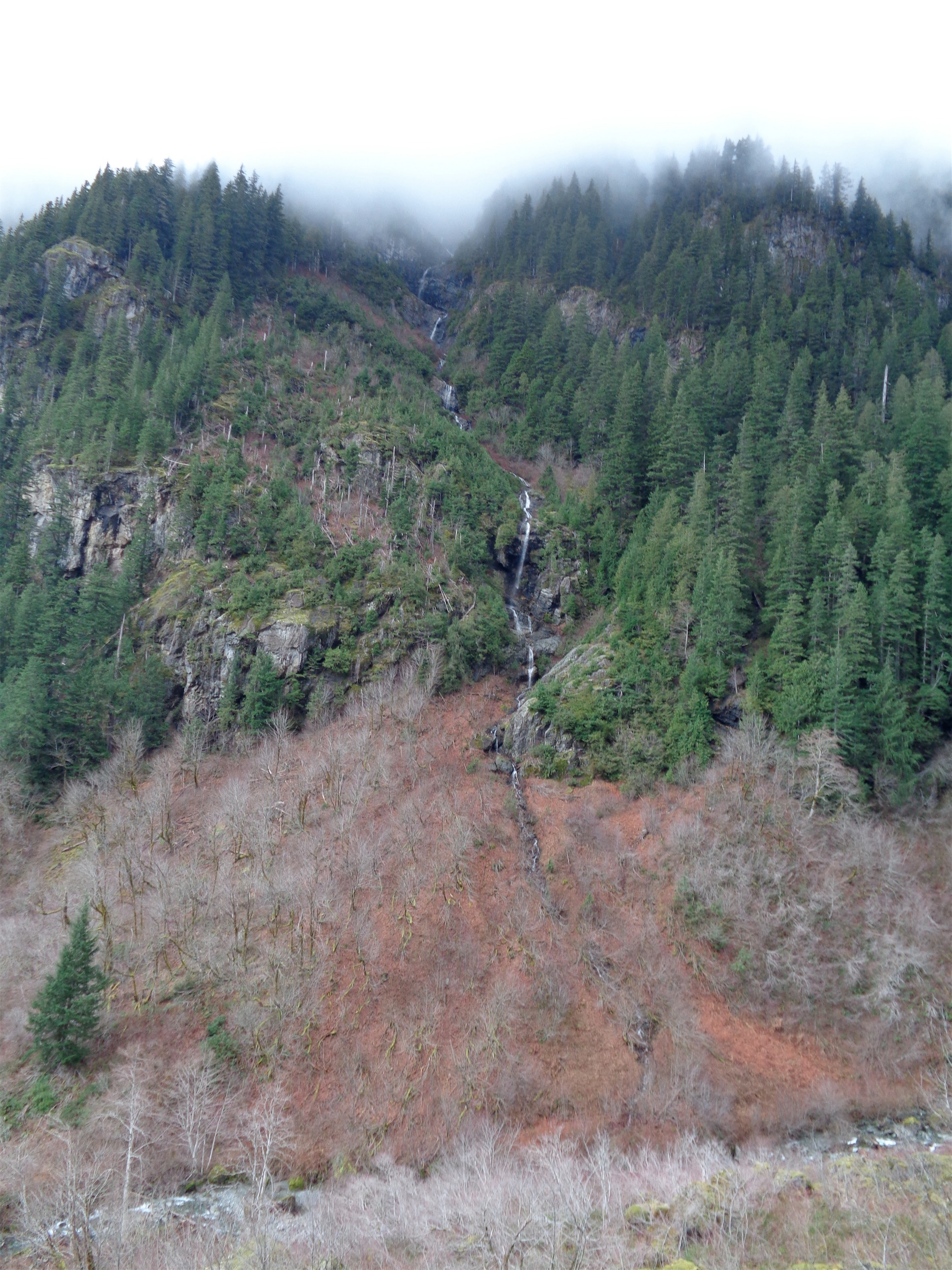
Three Fingers from Squire Creek Pass

Forrest led the first two pitches with Brooke, and then I led the same two with Amber and Robert. Slab is my nemesis, I just picture slipping and cheese-gratering my face all over it. Until Forrest actually told me how to climb it. It’s almost like squatting. Get your feet under your chest and you can pretty much just walk right up it. I was standing up, but I was standing up with like a 15 degree angle between me and the rock, which meant a high chance of my feet slipping. If you can get your body weight as close to perpendicular as possible, you’ll have way more traction. And suddenly I was more comfortable. And the first two pitches are an easy lead with solid pro and a few bolts, and soon enough I was at the bolted anchors.

20171209_114135

Robert getting to the watery sections in the cold shade

Belaying two people at once is a pain in the ass and my rope nest went to shit immediately, but hey the ledge was sunny and it was warm and that was nice. Robert and Amber cruised up and joined me on the icy belay ledge, waiting for our fingers and feet to freeze. Standing on snow in rock shoes sucks, so we tried to dance around it with little to no success. Oh, and then the sun went away. We had enjoyed it for like 15 minutes and now it was gone, never to be seen again.

Robert led the next pitches. With the warming temperatures, chunks of ice were starting to cascade down on us. I took a nice chunk to the wrist. Robert took a football chunk to the ribs and had a speed-clip mid-lead when he was 10ft above his last piece and the ice came, clipping just in time to be showered with golf balls. You’d hear the F bombs come down with the ice. “ICE!!!” “fuck” “oh shit AH” “ah jesus christ” “fuck OUCH” “fucking hell” and then you knew it was your turn. Helmets are good. I couldn’t help but wonder what the group walking below us thought. “Morons.”
Robert crushed the next two pitches, until it turned out that the last 20ft were flat, featureless slab with basically a small waterfall running down the entire thing. Forrest had traversed left and back right to get to the anchor, but Robert tried to go straight up and just ended up soaking wet. Can’t win that one. But he settled in at the belay ledge, and after a few minutes Forrest started setting up a rappel. Guess we’re bailing. “It’s too wet! The entire next pitch is soaked!” Yeah, like we couldn’t see that from the beginning. They rapped down as I climbed up. We’re here, I’m getting my money’s worth. As Brooke pointed out while I was being grumpy the day prior, “yeah we might not finish it, but that doesn’t mean it won’t be fun.” She wins that argument. It was still a freaking blast.

20171210_081908

Everything looks better after you’ve bailed on it. Bring on Plan E!

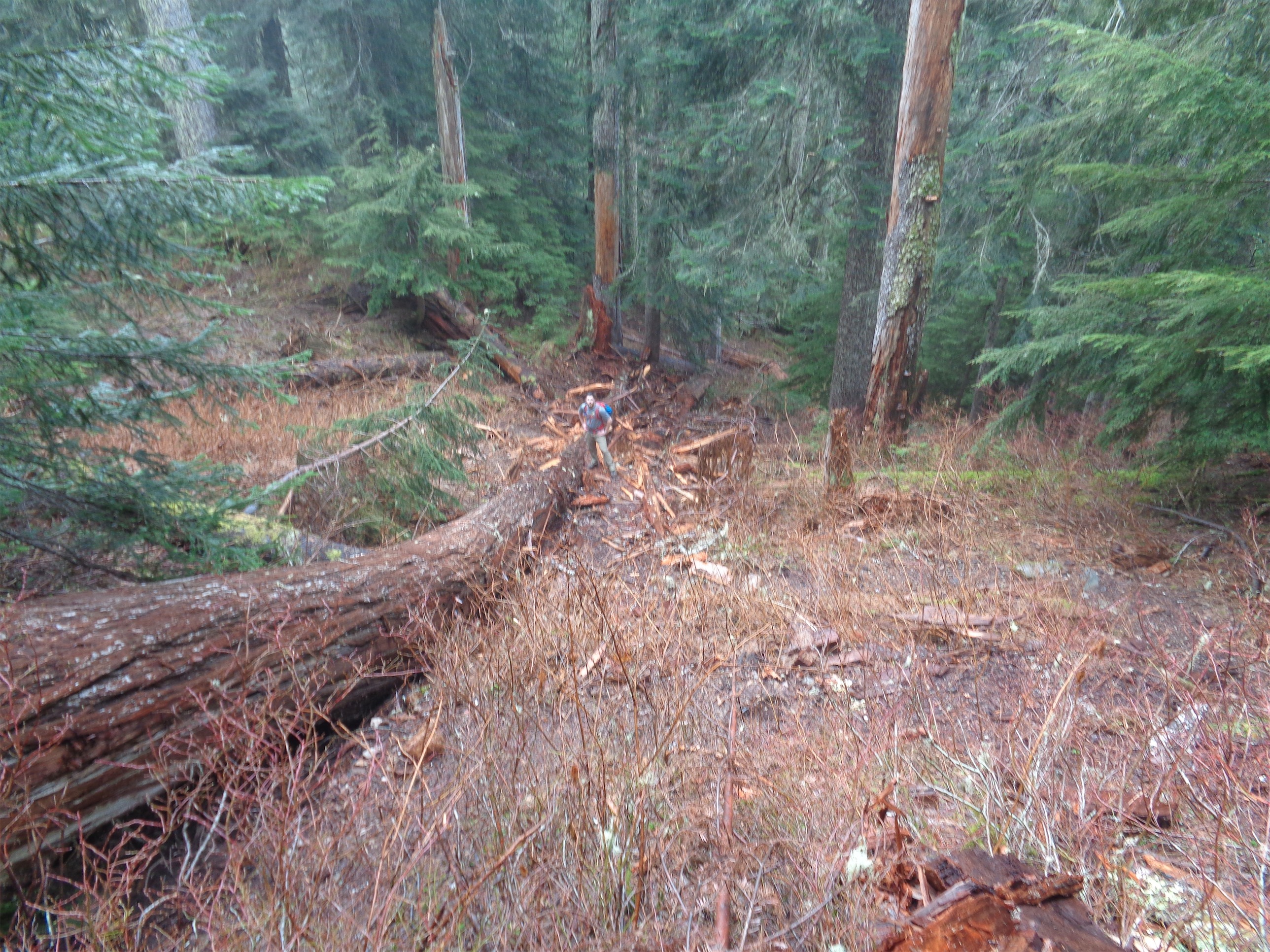
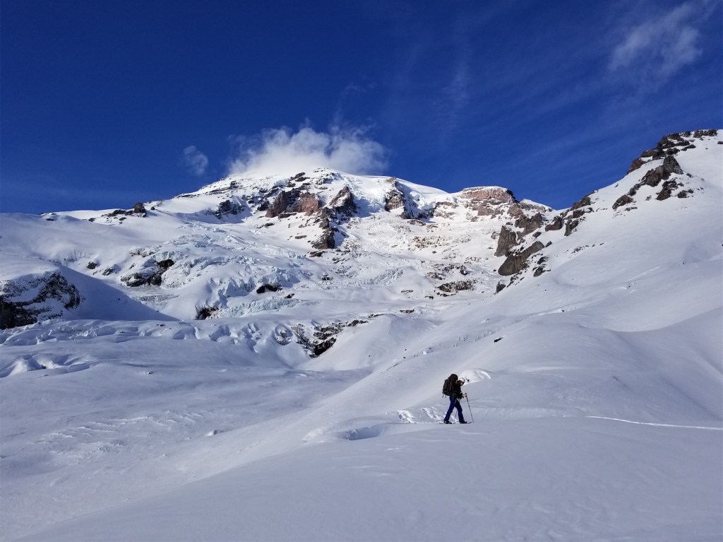
I drove straight to the Heliotrope Ridge trailhead, where I met Shawna hoping to do a one push ascent of Baker. I was set up in bed by 9pm and we figured we’d get moving around 3am. I was recovering from a cold, so not feeling fantastic but not feeling awful either, and I slept surprisingly well. Unfortunately, Christie woke up sick (I know you can’t get someone sick in 6hrs but I still feel bad), so our group of 5 was down to 4. We skinned up the road to the trailhead (road is blocked around 1.5 miles from the actual trailhead) and started up, alternating skis and boots. Naomi decided her heart wasn’t in it, so she turned back too. We pushed on to low camp at the top of the hogsback, and decided we were turning around too. I have a three strike rule I like to keep, and having two people turn back was basically two strikes. Plus, I realized that we were a group of two skiers and one snowshoer, and a) I wasn’t sure I was comfortable skiing the glacier with as little snow cover as there was and b) we were slower than expected, likely due to me insisting on skinning un-skinnable terrain and c) what were we going to do, have the snowshoer walk down unroped? So we pitched a tent, shiver-napped and laughed at how we had forgotten how winter trips worked, and then skied down. Except I had forgotten how to ski. Shit. And my skis need to be waxed, desperately. I couldn’t even get them to slide at first. Ah, tis the season. The season of turnarounds, being slower than expected, fighting to skin or posthole, and remembering that you have no idea how to ski.
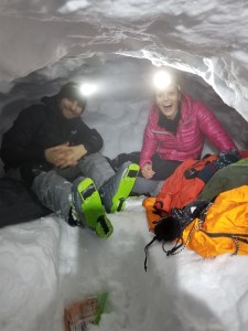
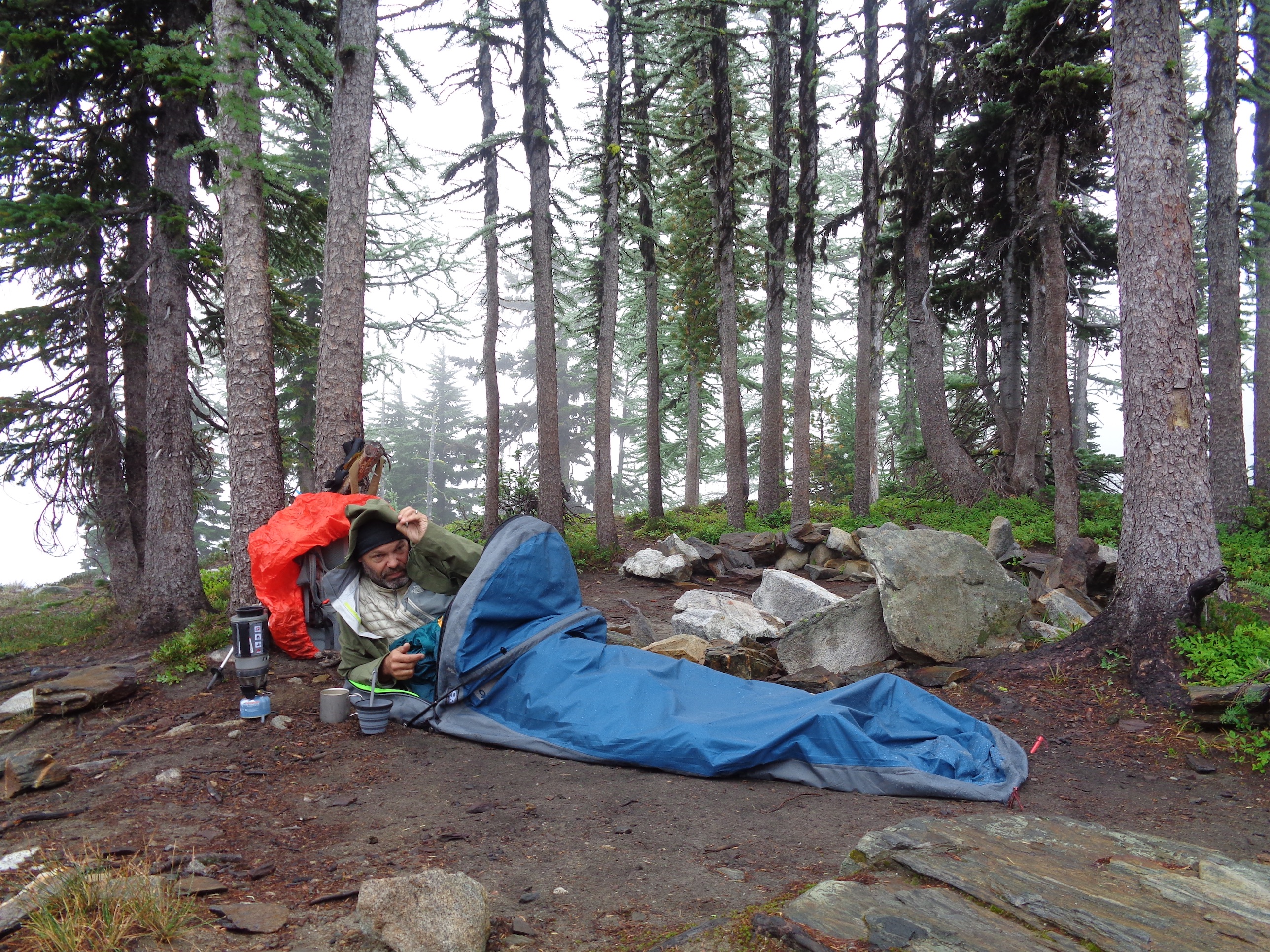
20171216_184243

Snow caves!!

Weekend Two: 

Plan A: Skiing in the rain (bail)
Plan B: Assist with a Peaks of Life avalanche class (yay!)
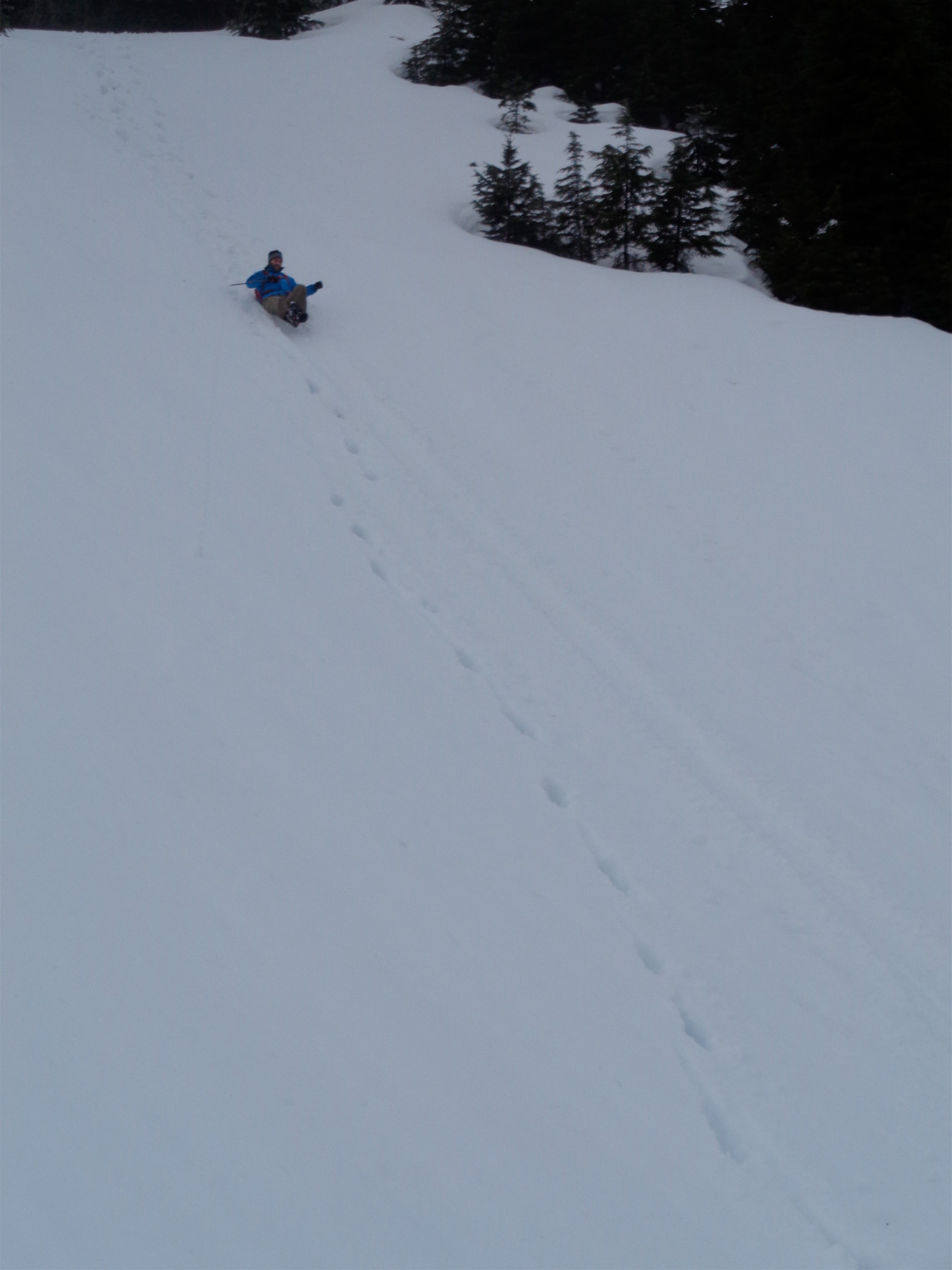
This was a quickie. We were planning on resort skiing so I could re-learn how to ski, but it was supposed to be raining at Snoqualmie Pass and Forrest needed a last minute assistant for a Peaks of Life avalanche class, so I opted to help out. This involved a few hours of classroom education (basically plan E with some perks) followed by a short skin up to Mazama Ridge, where we built snow caves. And of course, evaluated terrain, worked on routefinding and snowpack observations, practiced companion rescue, and I got to get in a few mini turns while my muscles remembered how skis work. And it reinforced everything I had learned in AIARE 1, which was awesome. You can never stop learning this stuff. There will always be more to know, new research, better ways to do what you’ve been doing, new gear to be utilized. Never stop learning.

20180101_142036

…I mean it’s almost offensive to call this Plan C

20180101_151348

Brooke toasting us in snowshoes

Weekend Three:

Plan A: Shuksan via Sulphide (didn’t even start)
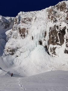
Plan B: Epic Nisqually ice climb (bail)
Plan C: Less epic Nisqually seracing (yay!)
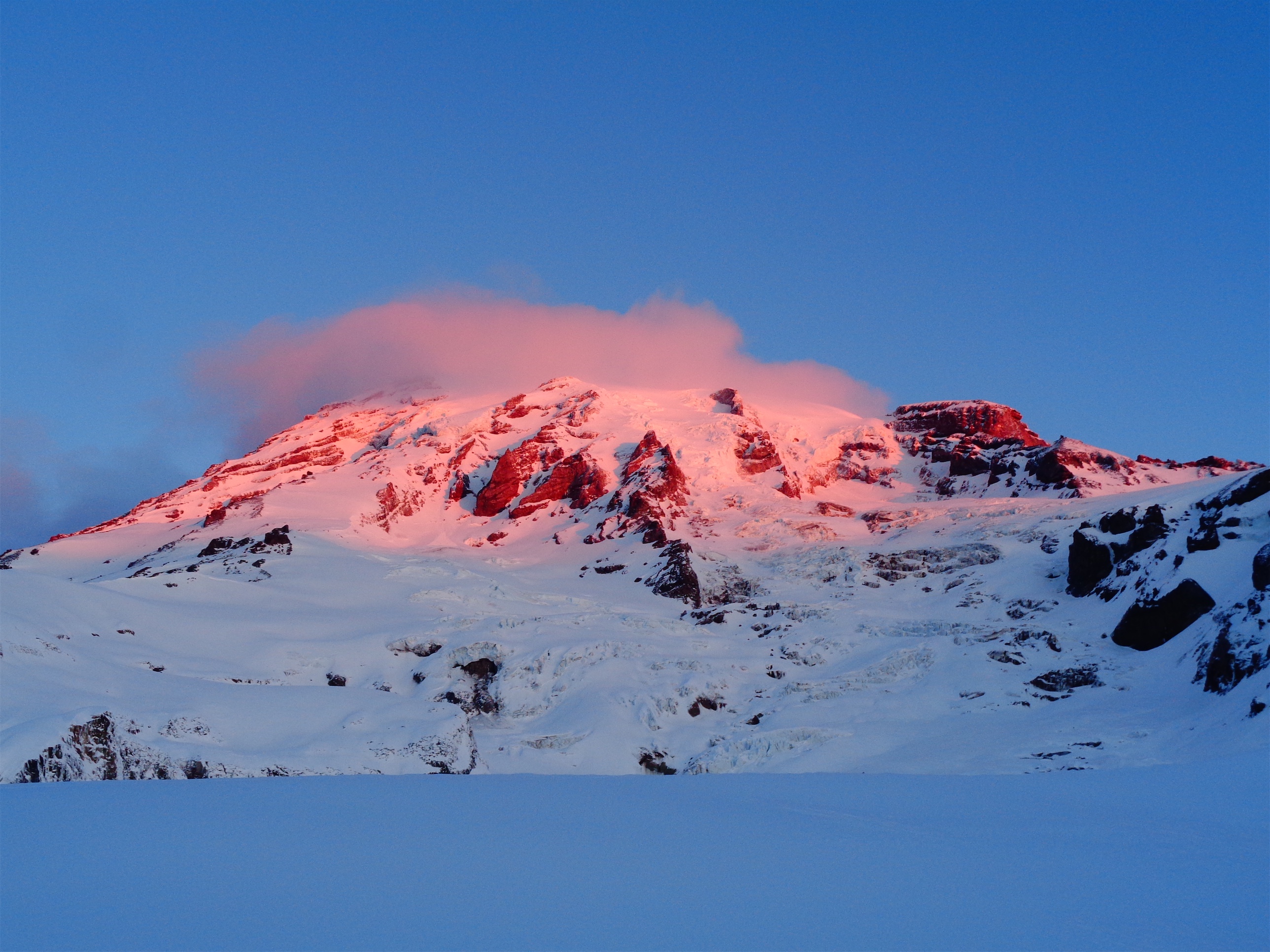
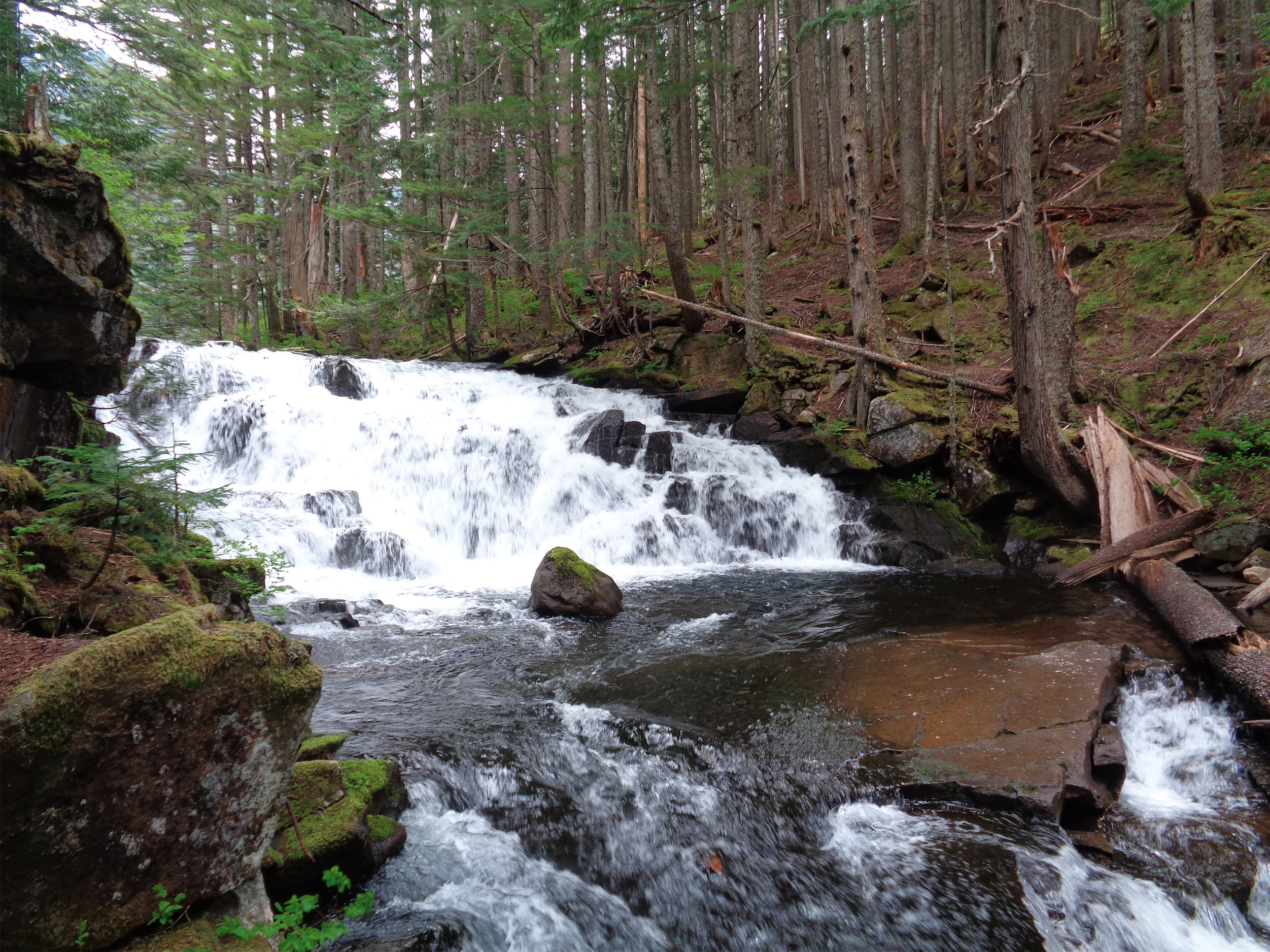
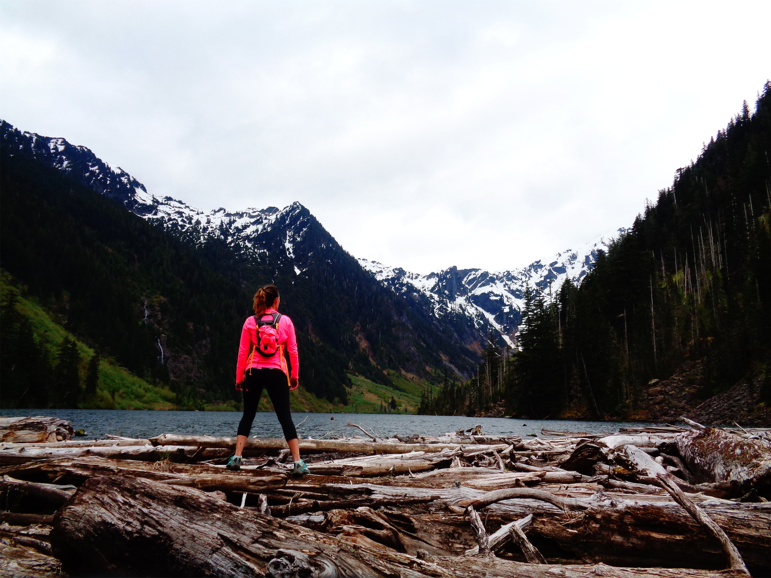
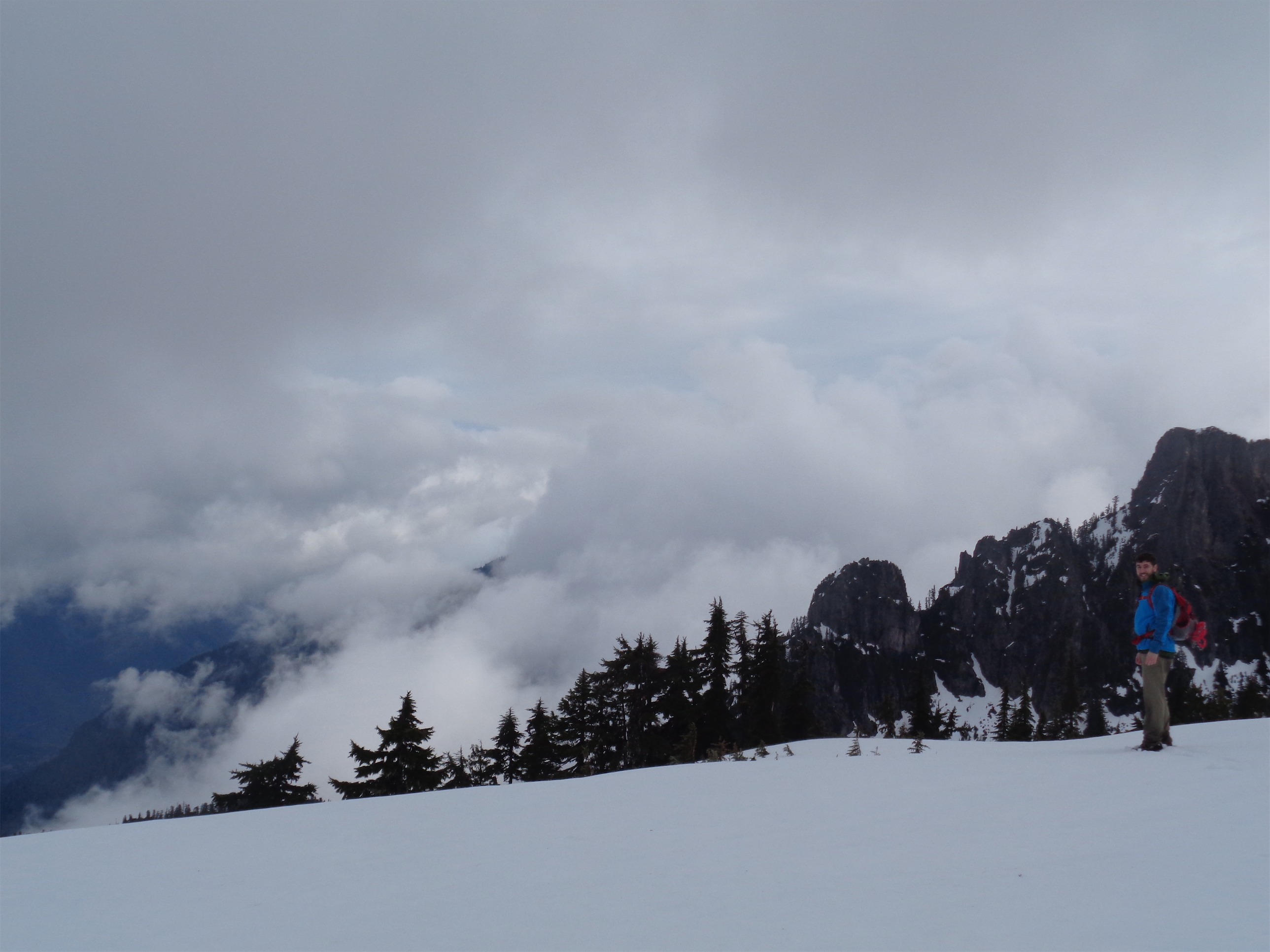
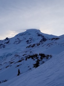
This has been the highlight of winter so far, even if we ended up on Plan C. I bailed on Shuksan because I woke up on Saturday feeling sick, weak and pathetic. Sunday I woke up feeling slightly less pathetic, and we headed to Paradise to set up snow caves on the Nisqually and do some ice climbing in the area. I don’t like spending NYE in the city, so I was just happy to be getting out, especially on such a beautiful weekend.

DSC01558

I bet this is better than your plan C

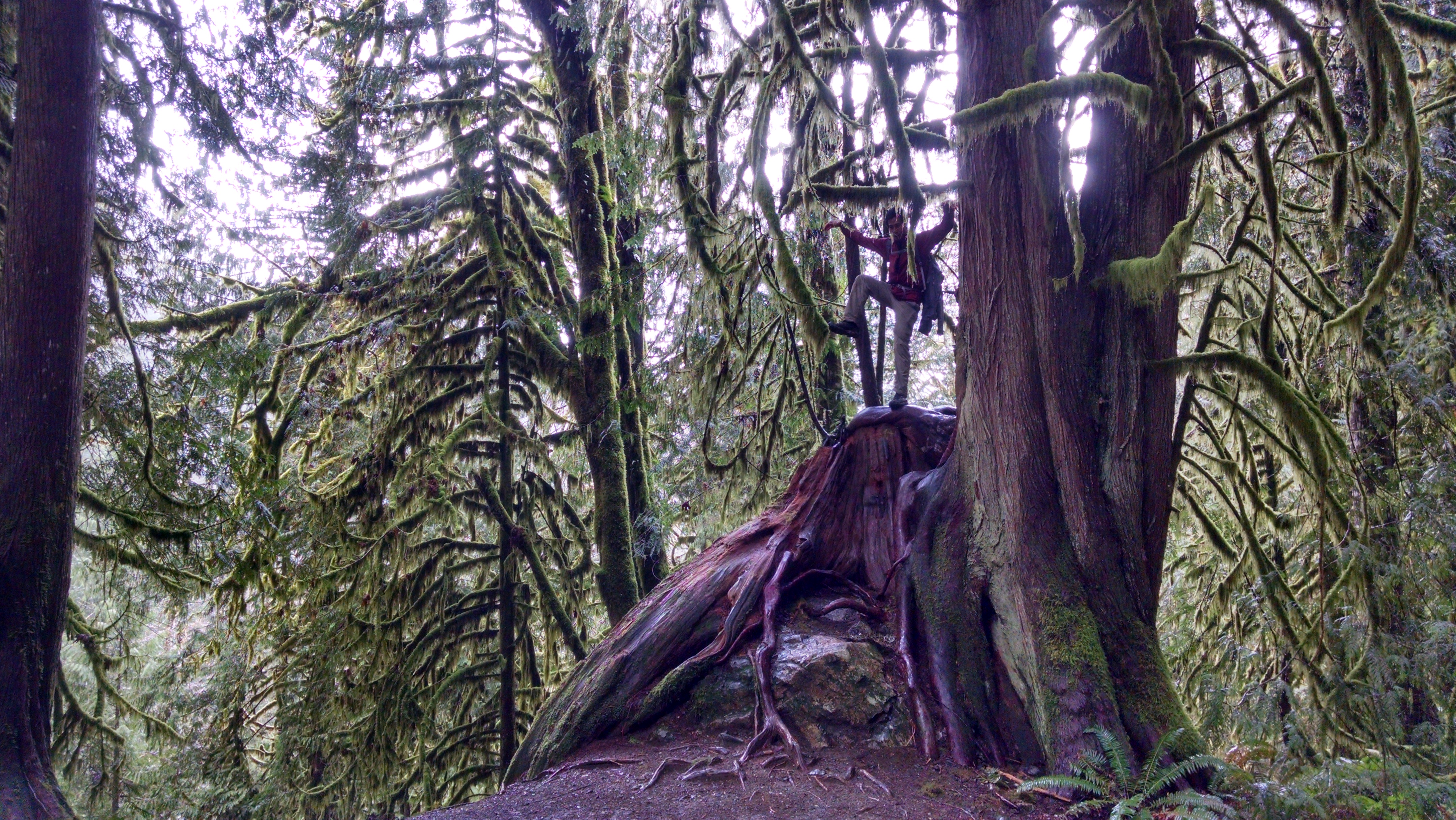
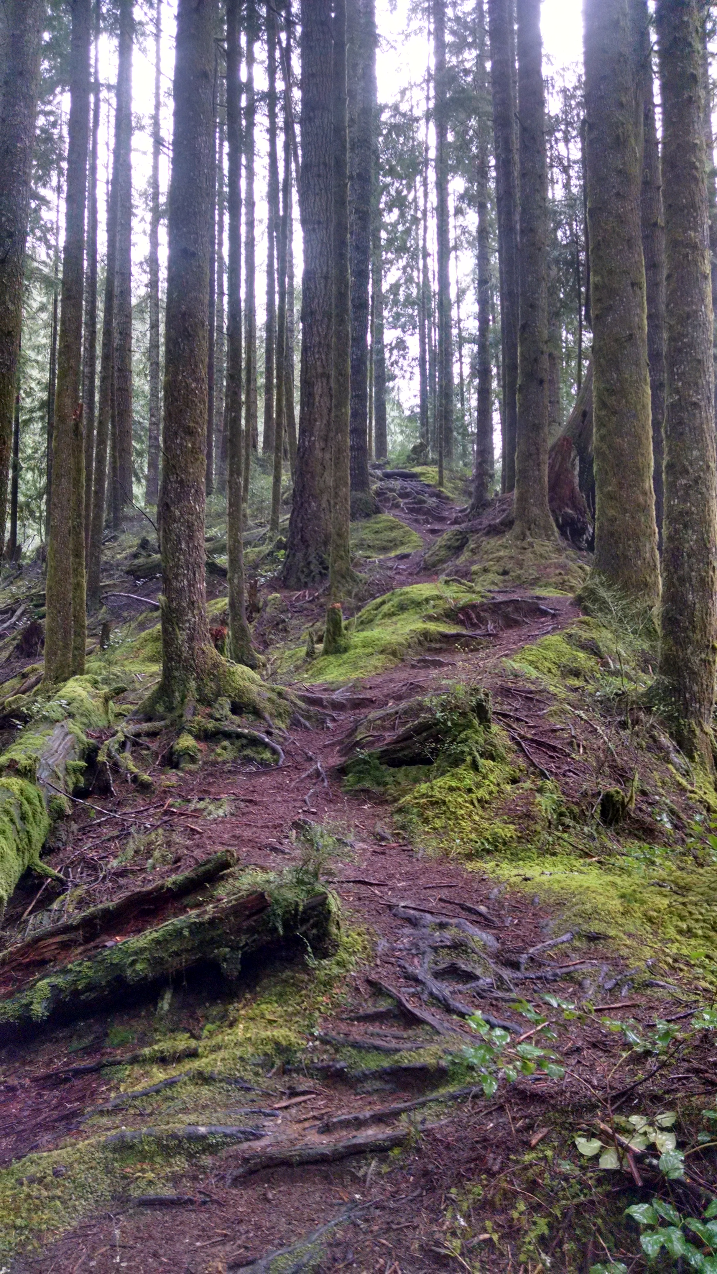
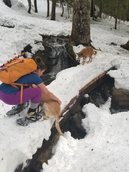
You know the book “The Things They Carried?” Yeah, well this was like a non-metaphorical version called “The Things They Didn’t Carry.” I forgot technical crampons. Amber didn’t bring sunglasses or a stove or a spoon (sound familiar? I bring two spoons now). Brooke didn’t bring sunglasses or poles. “Everyone forgot something except Forrest! And even if he did he’ll never tell us.” A few hours later, Forrest announced he didn’t bring a goretex jacket, just bibs. Ha! But between the four of us, we had enough to share. We skinned through the forest and then along a beautiful ridge to our campsite, and spent the next hour (three hours in my case because I have no idea what I’m doing) digging out snow caves. I don’t have the art of snow caving perfected yet, like Forrest and Brooke do. And we welcomed the new year with a fantastic sunset, dehydrated mountain meals, and battery powered christmas lights in snow caves. By which I mean we pretended it was midnight at 8pm because I wanted to go to sleep.

20180101_094936

But this was Plan B

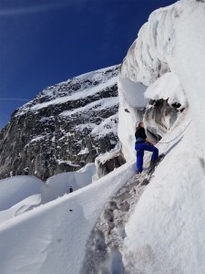
In the morning, we roped up for the Nisqually to be safe, but it’s nicely covered. Forrest gave the first two ice falls a good shot, but route A was too soft and route B was too thin. So on to the next idea, and we headed up to the seracs to get in a few laps. Forrest led two routes and the rest of us top roped. Ice climbing was like slab climbing. I’ve done it a few times, but no one has ever watched me and actually told me how to do it. Within a single pitch Forrest had given me three crucial tips. 1) Triangle. You want your ice pics almost in a vertical line, and your feet in a wide stance so your points of contact make a triangle. You can also yell “TRIANGLE!” at someone on their whole climb, just like skiing behind them yelling “PIZZA!” 2) On plasticy alpine ice, it’s possible (even ideal) to have more than just the front two teeth of your crampons in contact with the ice. And 3) You want to stick one tool as high as you can reach, then move your feet 3+ times, then stick your next tool as high as you can get it, move feet a bunch, rinse and repeat. Like rock climbing. And once I had those 3 things on my mind, everything was suddenly easier. It’s amazing how much having someone watch you even for just a few minutes can help.

20180101_115614

Brooke belaying Forrest leading a nice WI3 pitch

We wrapped it up after a few laps, ripped the skins from our skis, and carved our way back down the Nisqually with Brooke dusting us in her snowshoes. She took advantages of our transitions to get a head start, but damn I have never met anyone that fast on snowshoes. We knew we were getting back to civilization when we heard kids and saw people sledding, and we skied all the way back to the parking lot, where all four of us ate it almost immediately on the black ice.

Weekend Four: 
Plan A: Lookout Mountain Lookout and Little Devil Peak! (forecast got worse every day)
Plan B: Just Lookout Mountain! (forecast got even worse)
Plan C: Resort skiing! (forecast changed to rain everywhere)
Plan D: Amabilis Mountain cross country ski! (avalanche conditions worsened, Kacie had a dream I died in an avalanche)
Plan D-2? Can’t be E because E is my couch: Hex Mountain

20180113_124315

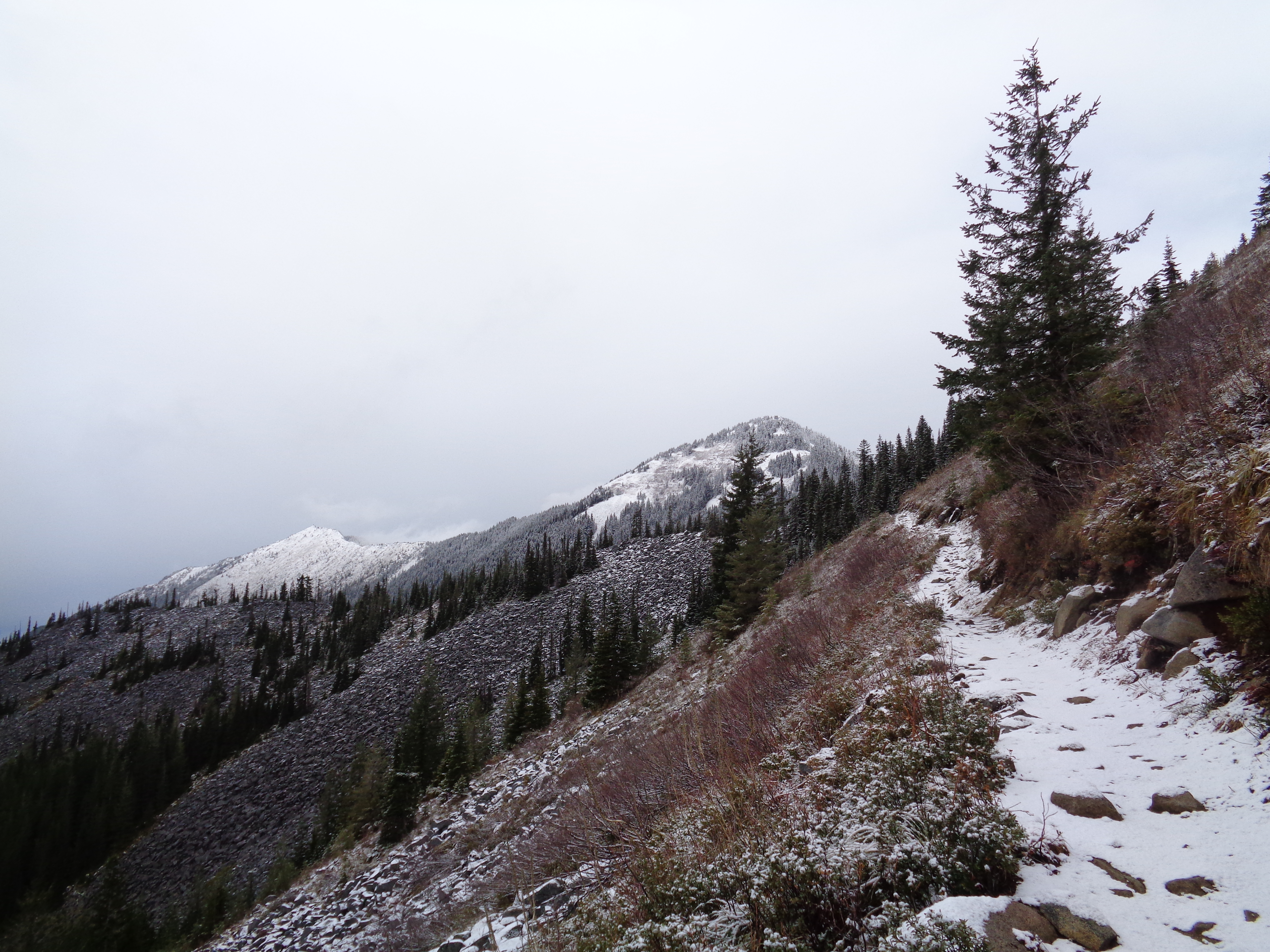
Clouds reflecting my grumpy bland mood

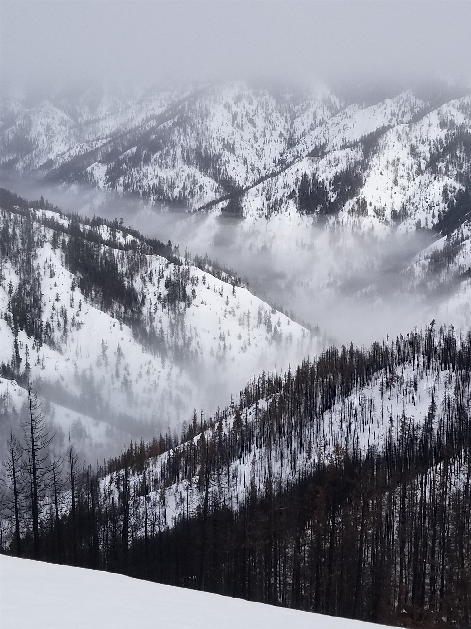
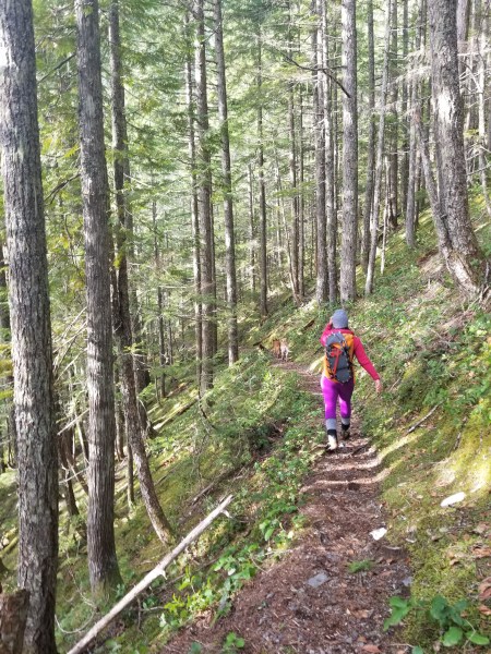
And you know what? Hex Mountain was fantastic. Super sweet low angle snowshoe out by Roslyn, which is often far enough east to get sunshine even when the pass is getting pounded by rain or snow. Kacie had to be back by 5pm so we needed something short and close, and this fit the bill. We crashed two meetups with had several mutual connections (one guardian angel on my Stuart trip last spring, Ashwin who came up Baker with me years ago, and some friends of SAR folks), I skiied (well, skinned) the worst snow I have skiied in my life, and we got to check out the remains of an area covered in wildfires this summer.

20180113_122804

Okay, Hex isn’t so bad

It was pretty wild seeing the eerie, gothic needle trees leftover from the fire, or how the fire consumed one tree but the tree next to it was left unscathed. So stop whining, you still got out, got a workout, and got some awesome photos. And you can go back in a few years and admire the changes as the forest recovers.

Weekend Five: 

Plan A: Oakes Peak (too ambitious)
Plan B: Lookout Mountain Lookout
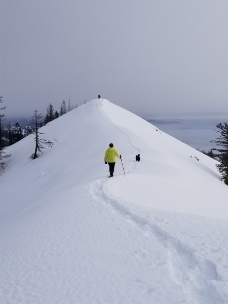
Problems I expected to run into: Slushy snowpack, moving slower than expected, loose wet avalanches, sunburns
Problems we actually ran into: Jackson being scared of going downhill on snow or bridges, ghost water stealthily draining from bladders, bloody dog paws, and excessive dog shitting

20180115_111933

Rippley coming back to help us coax Jackson across

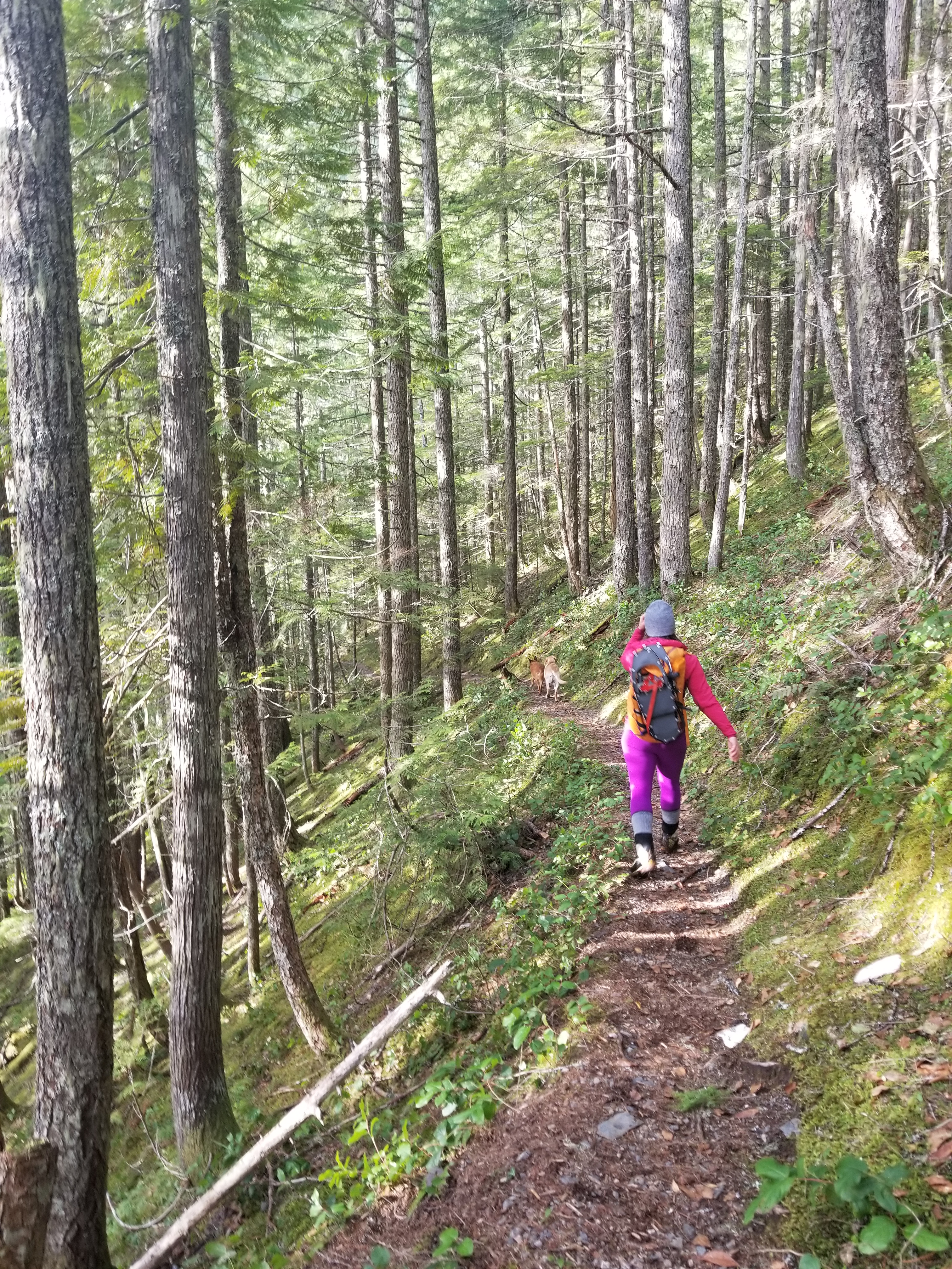
We started up the trail and finally strapped on snowshoes just below 4,000ft. You could have left them on for longer. I had been told Jackson was scared of steep snow but I didn’t know how scared until we reached the first snow bridge, where it turned out he’s also scared of snow-covered bridges even if the drop to the creek is like two feet. Shawna wrangled him across that, and then two more bridges, but when it came time to cross the steeper final slope, Jackson’s face said “absolutely not.” I was stomping a path across when I noticed Rippley’s paws were bloody, and announced that the pups were calling the trip for us. Back to the car! But hey, it’s sunshine, and a workout, and the smell of crisp pine trees in the middle of January, so it’s hard to complain. And Jackson actually slept in the car on the way home, imagine that.

20180115_120052

Still a gorgeous day in the woods

So Plan C can be good. And so can Plan B, even if Plan A is the best. After all, getting out in winter is an accomplishment in itself. And the best way to stay in shape is to carry skis and wallow a bit. It’s not a true backcountry trip if there isn’t some postholing, or some booting, or even a tree well or two.* Bring it on, 2018, we’re ready!

*Brooke found that for us, during the only 10 minutes of the trip where she wasn’t leaving us in the dust.

Snow Lake, Gem Lake, Upper Wildcat Lake

DSC01034

Fall foliage by Snow Lake

Occasionally, I go to bed on Friday night in my apartment. This is weird, because I usually do my best to not be in the city on Friday, but sometimes the weather is lousy and you’re lazy and everyone else is also lazy. So, just like last winter, I woke up at like 6:30ish, was bored by 7, and messaged Surafel. Are you going hiking today? I’m bored. Are you awake? Wake up I wanna go hiking. Let’s do a lazy rainy day hike. Like last year when we’d do short rainy lake hikes. He replied at 8. Yes let’s go hiking! Gem Lake? I laughed. I was going to propose the exact same idea. If Surafel wasn’t free I was going to just do Gem Lake as a lazy trail run.

  • Distance: 16 miles
  • Elevation gain: 4,000ft (~4,920 highest point, Gem Lake)
  • Weather: 40’s and rainy
  • Commute from Seattle: 1 hour!
  • Did I Trip: Probably but I don’t remember

DSC01037

I’ve been here so many times and the blue color still surprises me

We met at the Eastgate Park n Ride at 9:30, sans the usual teas since I had already had my earl grey. Surafel agreed to drive since I was hoping there’d be a SAR mission I could jump into while we were there, in which case he could drive himself home and I’d just hitch a ride back to my car (spoiler alert: nothing happened. The more available I am, the fewer SAR missions there are). We were at Alpental around 10, where I immediately put on my second layer of pants because it was cold and it was wet and I forgot that summer was over. Leggings weren’t going to cut it anymore.

20170930_114617

Surafel on a trail bridge

We reached Snow Lake quickly, passing a few parties already on their way down. It wasn’t too crowded, probably because of the weather. We never quite got sun breaks, just “brighter clouds.” Neither of us had been past Snow Lake. Reminiscent of Lake Dorothy a few weeks ago, it took forever to wrap around Snow Lake. The fall foliage was gorgeous, though my camera has a hard time with cloudy photos. You basically follow social trails to the right of Snow Lake, which are occasionally well maintained and occasionally a bit brushy.

20170930_150108

More touches of fall foliage

Finally you start gaining a bit of elevation to Gem Lake, which is aptly named. It’s quite the cute gem of a lake. There were two large groups camping there that we passed on our way out, but on the way up it was silent. The trail wraps around the right of the lake, and you have the chance to bag Wright Peak (a walk up) if you so desire. We didn’t, because there’d be no views. But the trail continued on, so we continued as well. I didn’t actually know where it went but we had time and we saw a lake down below us so we figured we’d go ahead and drop down to it. It didn’t look that far.

20170930_151930

Almost a view!

Well that lake is Lower Wildcat Lake, and it turned out it was about a 1,000ft loss in elevation to get there. With a short bushwhack you can hit Upper Wildcat Lake as well. I was pretty pooped though, my legs had felt like lead all day, and as soon as we came upon a clearing on the trail with a nice log and a view of Lower Wildcat Lake I decided great, we’re having snacks here, and then heading back. I was soaked from all of the brush (did not bring rain pants… yes, shut up, I know) and getting cold and once you’re wet and cold… ugh.

DSC01051

Tarn by Lower Wildcat Lake

I chugged the tea I had brought in a thermos (sometimes I have smart ideas) and devoured some salami and cheese. I felt better within minutes of starting back towards the trailhead, in hindsight I probably just needed snacks. We gained the elevation back to Gem Lake quicker than expected, and admired the fall foliage around the lake for a few minutes before carrying back on to Snow Lake. Gem Lake definitely had the best foliage in the area, I bet it would have been phenomenal with some sunshine.

DSC01043

Almost a glimpse of blue sky by Snow Lake!

By the time we got back to the trail from Snow Lake to Alpental, most of the hikers were gone. We passed a few lingering parties and a few on their way up, but weather was deteriorating and I was surprised anyone was still out. I was happy to be headed back to the car. The parking lot had emptied, and we jumped in the car and blasted the heat and tried to dry off as best we could. All in all, not too bad for a “lazy” day hike – 16 miles, and home early for a cozy warm dinner!

Lakes Dorothy, Bear, Deer, and Snoqualmie

DSC00941

The far end of Lake Dorothy, neat channels underwater

Catching up on old posts, and since this is a rainy day one it’ll be a quickie. I had donated blood the previous afternoon, so I ignored all hiking/climbing requests to do my own thing in case it was similar to the last time I donated blood. Last time I thought it would be smart to hike to Lake Serene, and I was pouring sweat with a heart rate of like 180 and miserable the entire time and I did not want a repeat of that. So I surveyed the population for “boring lake hikes.” The lakes can be nice, but I don’t want any tempting peaks behind them, no scrambling, no elevation gain, a well maintained obvious trail, relatively short drive, you get the idea. Hiked 9/9/2017.

  • Distance: 14 miles
  • Elevation: 1600ft gain, 3600ft highest point (warning: you lose 500ft elevation to Snoqualmie Lake)
  • Weather: 50’s and rainy
  • Commute from Seattle: 2 hours
  • Did I Trip: No. Who’s well grounded!?

DSC00928

Your first glimpse of Lake Dorothy

And I settled on lakes Dorothy, Bear, and Deer. I figured if I felt crappy I could turn around at any of those lakes. I got to the trailhead around 10am and started off, immediately being passed by two trail runners. I was jealous. Then I cruised past some park rangers, one of whom dated my friend last year (I’m awkward and announced him as such) and prayed they didn’t give me a ticket for my expired America the Beautiful pass. Lake Dorothy is about 1.5 miles down the trail, but the lake is HUGE. Tons of campsites, great for families with kids and inflatable boats and towels and big stoves.

DSC00946

Closest thing I had to a view all day

It took what felt like forever to get to the other end of the lake. You finally hit some elevation gain on the far side, and switch back up a short ridge that eventually drops you to Bear and Deer lakes, which are twin lakes! There are more campsites at each lake (immediately off the trail), and you can either stop here or continue to Snoqualmie Lake.

DSC00935

Beautifully maintained trail

I had all day and was moving faster than I thought, so I figured I’d carry on. I also expected there to be a turnaround destination here, which there wasn’t, and continuing trail is just so tempting. I lost what felt like a ton of elevation dropping to Snoqualmie Lake, which interestingly had some sandy shores. There are campsites here, my personal favorite (which I deemed my turnaround spot) was actually just off the main trail to the right towards a beautiful surprise tarn. So that’s where you should camp if you don’t mind a 7 mile hike.

DSC00947

Local riff raff

Figuring it wasn’t going to get any more interesting from there and looking forward to a warm cozy dinner, I turned around and high tailed it back to the parking lot. I did not get a ticket from a lack of pass, thank you rangers! I had actually called their building on the way hoping to get a pass but it was close, so I swear I had tried. And I finally got the new pass a week, don’t worry. I know, I know, I live on the edge.

DSC00952

Favorite tarn by Snoqualmie Lake

Overall, pleasant hike, good destination for anyone who wants lake camping with kids or a long trail run. The trail continues beyond Snoqualmie Lake all the way to Middle Fork Snoqualmie River (I’m pretty sure those two trail runners started at Middle Fork, ran to the Dorothy trailhead, and then ran back to Middle Fork), so you could have a fantastic out and back or even car to car trail run on a mellow, well maintained trail if you so desired. Just don’t donate blood the day before. Good for hot summer days (lakes!) or gross rainy days (…lakes!) or lazy days (flat trails, and… lakes!) since you can turn around at any number of destinations.

DSC00951

Luxurious campsite near the tarn

Goat Lake

Foggy peak behind Goat Lake

Foggy peak behind Goat Lake

This one’s a shortie. I had the day off, felt like a trail run, and Goat Lake had been on my list since moving here. It’s funny, a lot of the hikes on my original list now pale in comparison to the things I’ve been discovering, but I still feel a need to at least check them out. Whether it’s for an “easy” day, or so I am more capable of answering customers’ questions, or so  I can say I did it, it doesn’t matter. And this was finally the day to go to Goat Lake. 5/12/2015, and just sayin, it didn’t live up to its name: no goats to be found.

  • Distance: 10.4 miles round trip (to the lake’s outlet)
  • Elevation: 1400ft gain
  • Weather: 40’s and cloudy
  • Commute from Seattle: 2 hours without traffic
  • Did I Trip: Nope (but shout out to my hardship of the day: spiderwebs for lunch)

Upper trail, wide, flat, and green!

Upper trail, wide, flat, and green!

The road was completely clear, and actually didn’t even have many potholes. I followed a jeep most of the way there, until they pulled off by the Gothic Basin trailhead. Last time I tried to do Goat Lake, the gravel part of the Mountain Loop Highway had been unpassable in my Honda Accord due to several inches of snow. As much as I miss that car, I’d have made it to Goat Lake easily that morning in what I have now. I pulled up to the trailhead, only car in the lot as usual, and hopped out with my trail running pack. Soon enough, the jeep pulled up – a couple who wasn’t entirely sure where they were going. I remember when I was like that. I’d be lurking along the highway trying to figure out where the hell to go, and now here I am probably capable of drawing a map of the southern half of the loop from scratch. Who’s a dork?

Okay, now that I had the pressure of other people behind me, time to start running. I usually like to walk the first half mile or so (especially after driving for two hours), but it was straight down to business this time. At least until I was solidly ahead of them. So they wouldn’t see me walk/running. Yeah, I know. Back when I had calf issues, I’d plan my sad recovery runs along main roads that had lots of intersecting dead end streets so no one would see me walking if I had to.

Bleeding hearts!

Bleeding hearts!

I did stop to look at wildflowers and waterfalls, of which there were plenty. Bleeding hearts! They were one of my favorite flowers as a child, and here I was jogging through patches of purple bleeding hearts covering the ground left and right. I took the upper trail on the way to the lake, figuring I’d take the lower one on the way back. The upper trail is much more gradual and well-groomed. It’s an old road, apparently. Think wide, flat, not too rocky or rooty. Until it rejoins the lower trail. Then it gets a little steeper, and a little more rooted. And of course, spiderwebs here and there for your enjoyment. Not.

Small waterfall

Small waterfall

About a half mile from the lake (slightly longer if you follow all of the switchbacks) you can go off-trail to a huge waterfall. I actually missed where the trail turned (I’m far more oblivious on my trail runs than on hikes) and was staring at the waterfall trying to figure out how to get across when I realized the trail probably just goes up to the lake. You can see on the Strava map where I farted around on the way up by the waterfall (I took the switchbacks on the way down).

Getting up to the lake is incredible. The first view you get comes if you sneak through some bushes to the huge log jam, which you can basically hop across right up to the edge of the lake. 10/10 would recommend. You can already see the snowy peaks from there, but I suggest going further along the left side of the lake, where the views are even better. It was mostly cloudy when I was there, but the sun snuck through the clouds for a hot second, and I sprinted to the shore to take a picture.

Foggy peak behind Goat Lake

Foggy peak behind Goat Lake

On the way back, I took the lower trail. I passed the couple in the jeep (“Wait, you already got to the lake?! Wait, you’re RUNNING?? Oh man I’ll never be in shape enough to do that!”) just before where the lower trail and upper trail joined. Ugh, the lower trail had spiderwebs. A plethora of spiderwebs. My caloric intake for the day was probably 15% spiderwebs. You’re welcome, hiker couple, I ate all of them before you got there.

Narrow, windy lower trail

Narrow, windy lower trail

The lower trail is more narrow and windy with much more vegetation, and dips next to the river occasionally. If you like footwork on your runs, take this one instead of the upper trail. It was nice to mix it up, though, and it almost felt like a loop instead of an out-and-back. I was back at the car pretty quickly, and while my splits weren’t amazing, I felt pretty good (maybe the slower pace is why – shh!).

Strava screenshot

Strava screenshot

I can see why this trail gets so much traffic. The water would have been gorgeously clear and blue in the sun, and even in the clouds and wind, it was still spectacular. Something about the wind whipping across the water made me miss the ocean, and I was glad to have the lake all to myself. If you look real hard at Strava, maybe you can see how many time I ran in circles trying to get 10-second-timer selfies on the logjam. Perhaps you’ll have better luck.

10-second-timer log jam selfie

10-second-timer log jam selfie

Boulder River

What to do on a guaranteed rainy day? Where to go? You could say I’m a pessimist. If you set low expectations, you’ll never be disappointed, right? I had no expectations for Boulder River. Boulder River had been on my simple hike list for a few months ever since a buddy recommended it back in December. We had to be back in Seattle by early evening, and it turned out Boulder River was relatively close. And okay, I won’t lie, I might have been sore from Defiance the day before, and the 10 mile runs the two days before that. It was adding up. Zero to sixty, that’s how I do it. So, I present to you, Boulder River. Hiked 3/24/2015, Boulder River is much more than just a stroll along a creek.

Jonathan on a huge old tree stump

Jonathan on a huge old tree stump

  • Distance: 8.6 miles round trip (slightly longer if you take some of the offshoots)
  • Elevation: 700ft gain (1500 highest point)
  • Weather: 40’s-50’s and rainy, cloudy, and sunny
  • Commute from Seattle: 1:15, until i5 turned into a parking lot, and then the rest of Seattle followed suit
  • Did I Trip: I did not. But Jonathan wiped out trying too hard to be cool crossing a log.

Steep offshoot through green canopy. 10/10 would bivvy at the top

Steep offshoot through green canopy. 10/10 would bivvy at the top

So the road wasn’t quite as exciting as the road to Mason Lake. At least until the way home, but we’ll discuss that later. Accessible to all vehicles, no big potholes, easy road to follow. Trail starts out on an old logging road. Very flat and very wide, and I can see why people trail run it. It’d be a great easy run. It was pouring, so we threw on rain pants and our shells and got started.

Ribbon falls

Ribbon falls

Within a mile I was already impressed. The trail curves to the left, and there’s a steep offshoot to the right that just goes straight up into a green canopy of trees. Of course, we followed. At this point, my camera died, so you’re stuck with phone photos from here on out. I know. Oops. (Side note – gonna plug in my camera for tomorrow’s hike!) Shortly after that offshoot, we found a few campsites near the trail, and just beyond those, a waterfall!

A tall, thin ribbon of water cascading down the opposing cliff, with moss on either side. You hear it before you see it. We ooh-ed and ahh-ed and stared, and finally kept moving. Again, we heard rushing water. Louder than the river. Wait. No way. Glimpses through the trees.

Double waterfall. Jonathan for scale.

Double waterfall. Jonathan for scale.

Another waterfall!! A double waterfall! Are you kidding me, I thought we’d just be walking next to a calm flat river, not trekking through rainforest with 80 foot tall waterfalls. Damn, Washington. You never cease to amaze me.

We stopped to take a bunch of pictures and just sit in awe. Waterfalls… are totally cool. I haven’t seen one this big since my road trip out here this summer. We finally dragged ourselves away.

Salmonberry, I believe!

Salmonberry, I believe!

Flowers were starting to bloom along the trail – salmonberry, huckleberry, skunk cabbage. Two of those will be great to eat later this year. The moss was unbelievable, and if it’s this green in March, I have to wonder how it is later in the summer. It’s accessible year-round, though my friend who recommended it said it was actually icy when he was there. Snow and icicles. I can’t imagine.

There were a couple blow-downs to get over, and some tree caves to explore. And plenty of small babbling creeks crossing the trail. Wear waterproof boots, folks. Jonathan almost lost one of his mid height boots in a mud puddle, it was that deep.

Glimpse of sun!

Glimpse of sun!

I had no issues in my new La Sportiva Synthesis – shameless plug because they won the Editor’s choice award in Backpacker Magazine, and I was fortunate to receive a pair for testing thanks to Goretex. I don’t have a big sample size, but they’re the most breathable waterproof boots I’ve ever tried. No sweaty feet, and the water that did spill over the edges occasionally actually dried up. Which is insane. Usually I just keep hiking with water in my boots. It’s going to be tough going back to my usual pair, but when it comes to steep, icy, snowy terrain, I stick with my stiffer boots. The Synthesis is very flexible, which is great for lighter hikes (I was carrying around 20 lbs in my pack) but I don’t know if I’d push it on more technical trails. Though I will say (from Defiance a day earlier) the soles grip snow surprisingly well. I was having a much easier time without microspikes than Lee in her Oboz when we were on fresh snow. So we’ll see just how much of a beating these guys can take.

Trail winding through mossy trees

Trail winding through mossy trees

Anyway, back to the awesome trail. Flat, well groomed, besides the mud patches that almost stole Jonathan’s boot. We were curious how the trail would end. Would it just peter out? Did it turn into the river and just stop? Or did it keep going? We eventually reached an area with a campsite next to the river (prime time real estate), and the trail ended just beyond it. Just turned into overgrown brush. It used to carry on to Three Fingers long ago.

Jonathan disappearing into green

Jonathan disappearing into green

Most of you know I turned into a trail history nerd. I know none of it, but want to learn all of it. I posed my question in my trip report, and got two fantastic responses. The trail was the main trail to the Three Fingers lookout until they put in Forest Road 41 back in the 1960’s. From there on out, the Boulder River trail was unmaintained beyond where you ford the river itself. Obi Tony Kenobi actually tried to bushwack up to the bottom of a waterfall from the Queest-Alb Glacier, and has a pretty cool trip report about the stretch between where the Boulder River Trail ended and where he had to turn around. There even used to be a cabin near Gerkman Creek, which joins Boulder River a few miles upstream of the current trail. It’s eerie to think how popular it must have been, while it’s completely abandoned and wild now.

Blow down on the trail

Blow down on the trail

So that’s Boulder River for you. Some neat history, second growth forests, logging roads, abandoned trails, awesome waterfalls, soon-to-be-berries, a flat green hike. Absolutely would repeat. We got a few glimpses of sun, and it turns out it’s a gorgeous hike in any weather. Strava map here, you can see the few offshoots we took that added a bit to the mileage.

Oh, and on the way out, we got this great picture of my new car. I was taking pictures through the windshield until Jonathan just said “wait, you’ll love this” (I had been snapping pictures of my car at the trailhead) and hopped out to snag this pic. Photo credit to Jonathan Lee, with Subtledream Photography.

Bring on the mountains!

Bring on the mountains!

Mount Defiance (and Mason Lake on the way)

It’s official, folks: I am the proud owner of a new (well, 9 year old) Nissan Xterra! Watch out Cascades, there’s a new bright yellow gas guzzling beast in your midst with an impatient Bostonian behind the wheel. Except you can’t tell anymore, because I got Washington plates. I’ll admit, I’m a little bummed. Now I have no excuse when I do something stupid. Instead of “oh, they’re from Boston, of course they suck at driving” it’ll be “oh, there goes a jerk in an outrageous car.”

McClellan Butte lit up by some brief sun

McClellan Butte lit up by some brief sun (anyone know what peak is to the left?)

Anyway, it’s time to hit the trails again. Yesterday’s endeavor was originally going to be lakes Talapus and Ollalie, but driving out to i90 views were actually decent. Overcast, but you could see much of the Cascade range, so we regrouped and decided to attempt Mt. Defiance. Being an ambitious idiot, I thought it was 10 miles, and figured it couldn’t be too steep since it was just past Mason Lake. This will be important later. Spoiler alert: it’s 11 miles, and I’m dumb. And this morning my legs were sore. That’s rare.

  • Distance: 11 miles
  • Elevation: 3584ft gain, 5500 highest point
  • Weather: Sunny, rainy, snowy and 30’s-40’s (aka everything besides wind)
  • Commute from Seattle: 1 hour
  • Did I Trip: Yes. So did Lee. Turns out we’re kind of clumsy.

We pulled off the highway to drive down to the Mason Lake/Ira Spring trailhead. The road gets worse every time. Last month I had a Subaru struggle to clear the potholes going 5mph. This time… 10 inches of clearance. Four wheel drive. Mud tires. Great suspension. I had a blast. I can’t imagine Lee was very comfortable bouncing around in the passenger seat while I bombed through puddles. I didn’t make Lee get out to take a picture, but next time. There were a few other cars at the trailhead (curious, as we only ran into one other person – the rest must have been camping), and before we knew it, we were on the way. I figured we had about 4 hours tops, if I wanted time to get back and shower before I had to work at 3.

Sunlight got our hopes up

Sunlight got our hopes up

Snow covered Mason Lake

Snow covered Mason Lake

Beginning of the trail is just as it was a few weeks ago when I hiked with Dave to Mason Lake. The creek that was tricky to cross in February was much lower now, and we could just rock hop across. Trail isn’t too steep until the wide old logging road ends, and then it starts getting steeper. I passed those old steel cables again, and still have to wonder what the hell they were used for. I was told a few months back on McClellan that there used to be lights for airplanes on Catherine, McClellan, and Bandera peaks, so that’s my best guess. It’s just a few scrappy remnants at this point, so I might never find out. I’m a dork, guys, I like finding the history behind certain trails and areas.

We were at Mason Lake within an hour and a half. I knew we had to push the pace if we wanted to make it to Defiance without making me be late to work. Remember when I’d wake up at 5 to go hike and be back for work at 2? And how I’d consistently underestimate the time it’d take me to complete a hike? Yeah, that’s happening again.

Summit of Defiance visible from the Mason Lake trail

Summit of Defiance visible from the Mason Lake trail

I briefly considered heading to Bandera at the trail junction, but was feeling a little lazy and didn’t want to tackle that last mile. So we headed to the lake, with the hope of reaching Defiance. No views of Rainier at this point, but still clear so far! Mason Lake was actually spectacular. Half melted, but with a light dusting of snow all over the logs and surrounding rocks, the lake was a respectable destination in itself, and one that I would have been happy to repeat.

Sneak peek of views before cloud level dropped

Sneak peek of views before cloud level dropped

We kept moving, and met up with the main trail, which was signed right at the lake. Following that for a few minutes, we came to a sign pointing to the Defiance trail (or Mason Lake, or Pratt Lake, or Thompson Lake) and took off towards the peak. The trail had become covered in a light dusting of snow, and we plugged along. We had a few sneak peeks of views, but nothing too open. Soon it was actually snowing, and I started to wonder if we’d even have views by the time we got to the top.

Lee traversing the meadows below Defiance

Lee traversing the meadows below Defiance

By the way, the last two miles to the peak are steep! I underestimated it, and it was a wake up call for my buns and thighs. I’ll trail run it someday (besides the steepest parts) because it’s close to Seattle and a good distance for a morning run. And it has long flat sections. Which, of course, mean short very steep sections. But you know what? We were in a winter freaking wonderland. I don’t think either of us had seen snow since December. It was amazing. There were just a few inches, not enough for spikes, but poles were nice.

Mason Lake and Little Mason Lake down below

Mason Lake and Little Mason Lake down below

We broke out along the meadows about a half mile from the top of Defiance, and despite the clouds dropping lower and lower, were impressed by the scenery. We could just barely make out Mason Lake (and Little Mason Lake, I believe) in the background.

Lee looking tiny down below

Lee looking tiny down below

When the steep section of trail started, I left Lee behind for a few minutes to see how quickly I could get to the top. We figured it’d be socked in by clouds so it wouldn’t be worth bringing all our gear and trudging up there, especially since we were short on time.

Lee tries to catch snowflakes on her tongue

Lee tries to catch snowflakes on her tongue

We were correct. Nothing but a wall of white, which was disappointing because I was hoping to see the topography and lakes Mason and Kulla Kulla laid out beneath me. But we’ll just have to go back another time. I ran back down the trail to meet Lee, and we headed back to Mason Lake. On the way down, it started snowing even harder, all the way down to 3500ft, maybe further. It brought out our inner Bostonian snow-loving joy (or maybe just hiker’s high? Like runner’s high? Damn endorphins) and we stopped in amazement for a bit to try and catch flakes. Soon afterwards, the snow turned to rain (of course) and we speed-hiked the rest of the way. Made it back to the car in just under 5 hours round trip, and just enough time for me to drop Lee off, grab a change of clothes, and go straight to work. Shh, don’t tell my coworkers.

Strava map and link here. Turned around along the ridge before the true summit since Lee was waiting below and there weren’t going to be views at the top anyway. Next time!

Strava map

Strava map

It’s great having the hiking freedom again. With spring coming up, there’s going to be so much to do, and this is why I moved out here. I packed up my bags and drove out here to be surrounded by mountains, not for a job, or for friends, or for the hipster flannel beanie coffee lover vibe. Mountains. Hiking, climbing, trail running. Let’s do it.

EDIT: Just found out that they’re considering logging the bottom of this trailhead, as well as a few others in the area. The old logging road that this trail follows at first will be re-opened as just that. It will affect Talapus and Ollalie, Granite Mountain, Pratt Lake, McClellan Butte, and a few others. All close, popular, accessible hikes. Bummer. I was too late to give input, but hopefully they’ll decide to at least avoid the trail areas. I just moved out here, give me a few more seasons before moving in the loggers!

Mount Forgotten (okay, just Forgotten Meadows)

Hiking all day ever day was a nice break from work (I learned that in Washington, you still don’t get overtime pay for shifts over 12 hours), so it was a perfect time for a mini vacation and a week of spoiling myself with a rental car. It’s amazing how you can have a vacation here without even leaving the state – that’s not something I really considered back in Illinois!. This hike was on Saturday, the 14th, and though forecasts called for clear skies, we got plenty of cloud action.

Waterfall joining Perry Creek

Waterfall joining Perry Creek

  • Distance: 10.5 miles
  • Elevation: 3700ft, 5350ft highest point (ish)
  • Weather: 40’s and everything
  • Commute from Seattle: 1:30-1:45ish
  • Did I trip: Crap, I don’t remember. Probably. One of us almost slipped into the creek?

We spent some time deliberating Friday night between Green Mountain, off the Siuattle River Road, Dickerman, and Forgotten. Dickerman I had done so I wasn’t too keen on it, though it would have been the safe choice. Green Mountain was a stretch: Dave was unfamiliar with hiking small mountains in snow, and I was unfamiliar with the area around it. So we ended up going to Mount Forgotten, in an area I know well. I’ll admit, I never expected to make it to the summit, but I figured it would be a good recon trip for future attempts on the peak. Avalanche conditions were moderate, and while I didn’t realize just how steep the saddle up to Forgotten was, I knew it’d be a tricky one. I also didn’t want to be stuck navigating off trail in thick clouds in several feet of snow if that was how the weather turned out.

Mt. Forgotten from the meadows

Mt. Forgotten from the meadows

We parked in the Dickerman lot again, even though now I’m positive you can save a mile from the hike if you park by the road. I don’t have a good reason for skipping it. The highway was covered in those low fog clouds, but we figured we’d do Perry Creek/Forgotten Meadows anyway since at least the valley would have waterfalls and the like, whereas with Dickerman, you’re just doing steep switchbacks through forest for a while. I had previously made it about a mile past Perry Falls, but never beyond that, so this was also an opportunity to cover some new ground!

Peak peeking out from the clouds (ha)

Peak peeking out from the clouds (ha)

Clouds moved in and out, we got stuck in a few minutes of rain here and there, but the trail was completely snow free. Not even a trace. It’s a fast hike up until the falls, and the only thing that slowed us down was that the clouds were occasionally giving us glimpses of a peak next to the Big Four (which were consistently covered by clouds) and I’m obsessive and had to us every opportunity to get a picture in case the clouds changed.

I did mark the washout where those zeolites were last time I did Perry Creek. It’s almost exactly 1.5 miles into the trail from the Dickerman parking lot, so go check those out! You can also scramble up (okay, more like hike over big rocks off trail, not quite a scramble) to a few waterfalls at the top, which looked neat.

Dave at the top of the falls

Dave at the top of the falls

Perry Falls were much easier to pass this time, and we didn’t need to utilize the huge tree. After that, it’s two miles through forest! Every once in a while the fog turned into that sunlit fog that brightens everything. I got a picture of Dave next to the enormous tree that took out five switchbacks.

Huge blowdown, Dave for scale

Huge blowdown, Dave for scale

This part of the hike was reminiscent of Dickerman in terms of difficulty, but with a much more open forest. After over a mile of that, the trees thinned, and we crested a ridge. Snow! Finally! We came to a small clearing overlooking the northwest side of the ridge. Dave looked unimpressed. “Is this the meadows…?” Fortunately, no, we still had a little under a half mile to go. The trail is lost at that point, so we followed the ridge through some trees and eventually to some footprints through snow. Oh, and we experienced three damn seasons within half an hour up there. Cloudy, then rainy, then snowy for a few minutes, and then some glimpses of sun. Yay, mountains!

We made it to the flat area just before you descend the ridge next to Forgotten, and met a couple there who had the same idea as us. They said the slope looked too dicey today, and if they weren’t doing it, neither were we. My logic taking people hiking is if I wouldn’t solo it, we aren’t doing it, unless the person I’m with has way more experience than me. If I’m not confident saving your ass, I’m probably not risking mine, unless it’s a safe opportunity to learn.

Mt. Forgotten showing its face

Mt. Forgotten showing its face

Rather than descend the slope, we climbed up a small peak (hill?) to the left of the meadows to see what views we could get. It was steep, but short, so no worries there. Except Dave didn’t have gaiters. Or poles. And neither of us had ice axes (again, I figured if there was a chance we needed to self arrest, we probably shouldn’t be risking it, so why bring them – same motto I follow solo). He got stuck at one point since he post-holed up to his waist, so I climbed back down to give him a pole and explain how to kick steps. To be fair, we skirted some tree wells, which wasn’t a great choice. Again, me making the mistake of being a follower and just staying behind the other couple we met instead of looking for a clearer route.

At the top of that small peak, we sat down for some snacks. I missed a hell of an opportunity for a time lapse, because guess what! Views opened up! Mt. Forgotten itself peaked out from behind clouds, and the valley beneath it even got some sun. We chatted with the couple about the route to Forgotten, best times to climb it, other peaks off Mountain Loop, and how the hell was the Mountain Loop Highway still open in February?

Dave's first glissade!

Dave’s first glissade!

After 20 minutes or so (maybe longer, I ate a lot) we picked a clearer route down, and rather than post-hole/plunge-step all the way, we made a glissade track. Which is always a blast. I could glissade all day, it brings me back to that five year old sense of excitement! We hiked back to the first clearing, I demanded tea, and we had a few more cloud/sun combo views before heading back through the forest.

Dave looking out across the valley

Dave looking out across the valley

Fog moved back in until we were on the other side of the valley across the falls, when things got interesting. Peaks sneaking out again, some rays of sun, some rain, and my favorite: rainbows! Several of them! One was even a double rainbow. I don’t think I’d have even noticed them if I hadn’t been turning around every 10 feet to look back at the valley. Which made it harder to keep up with dave, who would literally be out of sight by the time I put the camera away and started hiking again. But the valley was prettier this time around with the clouds and rainbows, so I couldn’t help it.

Look closely - double rainbow!

Look closely – double rainbow!

We made it back to the car, and our GPS apps were drastically different. Elevation was about the same (just over a mile up!) but mine gave me 10.7 miles and Dave’s said something like 11.5. I know strava isn’t the most accurate, but I was surprised by that difference. Regardless, here’s a link to the map! Screenshot below.

But first, here’s another picture of a rainbow.

Just another rainbow

Just another rainbow

So I’d say overall, a good end to Dave’s PNW hiking. Pilchuk is tricky, but the others we did were easy. Like the ice caves, and Rattlesnake Ledge (group hike for the product testing I was doing) which didn’t warrant a blog entry, though it was a gorgeous day and I’d love to take kids to that hike. And at least now I’ve done it! It’s a classic that had been missing from my experience.

I’ll be back to do Forgotten when conditions are better. It’d be a great chance to camp at the meadows and then hit Forgotten and maybe a few others along the ridge over the next day or two. And it looks like views are phenomenal on a clear day. Dave only saw Baker and Glacier from the i90 bridge, never from a hike! But at least this vacation was like summer for him. The high in Evanston, IL the other day was 4 degrees. 4. I’ll chalk that up under the list of “things I don’t miss.”

Strava map (link above)

Strava map (link above)

Mt. Pilchuck II and Big Four Ice Caves

So it’s true I was at Pilchuck just a month ago, but since Dave was here (did I point out that it’s the perfect excuse to rent a car for a week?), I figured it was a good staple hike to check out since it’s not too difficult but gives great views of both the Sound as well as the Cascades. Forecasts were all contradictory. Mountain weather (nwac) seems to be the most optimistic, while weather.com and weather.gov are much more… conservative. The drive there was through those medium altitude, thick clouds, and I had a feeling they weren’t going to clear up anytime soon. But we still gave it a shot! Hiked 2/12/2015.

View towards Glacier and Sloan from the lookout

View towards Glacier and Sloan from the lookout

  • Distance: 5.4 miles round trip
  • Elevation: 2300ft gain, 5230 highest point
  • Weather: 40’s and cloudy, much colder and windy at the lookout
  • Commute from Seattle: just over an hour
  • Did I Trip: I don’t think I did?

I was still a little worried about the washouts on the road as we drove up to the trailhead. Last time I was there, they were bad, and this time I was in a rental car with less clearance than my old accord. Good news was someone filled them in! Not all the way, but they at least filled in the deepest parts and marked the big rocks along the road. I imagine cars driving over it flattened it out as well, regardless it wasn’t a concern anymore. So we got to the top, parked, and off we went.

Whitehorse and Three Fingers before views disappeared

Whitehorse and Three Fingers before views disappeared

The neat thing about this hike is that the views start in the parking lot. Sure, you spend some time in the forest, but I like seeing Whitehorse and Three Fingers right off the bat. They were in full view when we got started. The trail through the forest was a bit wet, but no ice like back in January. Luckily this time I remembered my microspikes and wasn’t stuck lugging snowshoes up just in case.

Base of Rainier

Base of Rainier

When we first broke out of the forest (briefly) we could see just the base of Rainier, lit up yellow below the clouds. I didn’t even believe it was Rainier at first, until I realized what else could I possibly be looking at? We continued back into the forest, and I realized that despite being short and popular, Pilchuck is fairly technical. Lots of rocks, and surprisingly steep.

Pulley system?

Pulley system?

At one point while hiking through a small boulder field there are some ruins(?) to the right of the trail – I took some pictures, but it looks like some old wires, a pulley system, and a huge concrete bunker-type concrete building (Dave had a better name for it).

Concrete structure

Concrete structure

I have no idea what they could be for. I looked up some Pilchuck history on nwhikers.net, and it looks like they blasted off the top 10 feet of the mountain to build the lookout. To get materials up, they basically winched everything up by hand, so the pulleys could have been part of that? You can see traces of the blasting all over some of the rocks in that area, so it’s possible. But what the hell is the concrete structure for?

Dave on the ladder to the lookout

Dave on the ladder to the lookout

We didn’t hit snow until the last few hundred (vertical) feet of the trail. It wasn’t quite enough for microspikes. They could have been nice, but we weren’t moving too quickly, and I didn’t feel the need to stop and put them on so close to the lookout and with such a good path thanks to previous hikers. Soon enough, we came to the short scramble to the lookout. I put my poles behind me and started making my way up to the ladder. Damn, it was windy! I got to the balcony. I checked every corner for views. Snapped pics. And I ran to the door and ducked into the lookout. Time for layers! Oh wait, maybe a time lapse? Yeah, a time lapse. Ran outside, wrapped my camera around a trekking pole, and set it on the railing. That way if it fell, it’d only fall five feet instead of off the mountain.

Unfortunately, not as many views as last time. No Twin Sisters, no Baker, no Shuksan. Even Three Fingers had disappeared into the clouds. I don’t think Dave ever got to sneak a peek at Glacier, or Sloan.

Here’s the result of the timelapse:

View towards Seattle

View towards Seattle

Views towards Seattle were good, and it still feels like the mountains. Also, it was freezing. Back into the lookout! There were a few others in there with us. Two had a freaking feast of soups and sandwiches, while I sat there with my crappy tortillas and storebought hummus. And tea. Thank god for tea. Dave had some killer trail mix too, smores flavor(!) from QFC. We later returned to buy three more boxes. I got a few great recommendations for backpacking trips from one of the guys there, and after 30 minutes we turned around to go back down. I grabbed my camera and followed Dave, and we made pretty quick progress back to the trailhead.

Here’s a link to the strava map. And here’s a screenshot.

Mt. Pilchuck trail map

Mt. Pilchuck trail map

With a solid two hours of daylight left (rainy daylight, but still light) we figured we’d knock off the Big Four Ice Caves as well. It’s a very easy trail. Sections are either paved, covered in gravel, or built on bridges full with even dirt. Nothing tricky to negotiate. And a warning sign what felt like ever five feet for avalanche danger.

Dave looking at the cave

Dave looking at the cave

  • Distance: 2.2 miles round trip
  • Elevation: 200ft gain, 1900ft highest point
  • Weather: 40’s and rainy
  • Commute from Seattle: just under an hour and a half
  • Did I trip: Yes, we both did. We got complacent, dammit

Avalanche warnings!

Avalanche warnings!

It was a quick hike. The forest was pleasant, but we wanted to see the caves. It did look like there were traces of an old trail to the caves, so I’m curious how long ago they built the current one. You don’t get as many glimpses of the Big Four peaks as I expected, but when you break into the avalanche zone below them, you can see small waterfalls cascading down the ridges which was still pretty neat. We did hop off the trail to get closer to the cave, but didn’t go in. There are memorial plaques to a 12 year old who was killed by the caves when a part collapsed, which is definitely a dampener on mood but probably necessary considering how many people go inside to check it out.

Beautifully groomed trail

Beautifully groomed trail

Even if it wasn’t a long, difficult hike, it was a classic that I needed to get off the list. I had been saving it for a cloudy day, and the time had come. One of the old headline pictures on the wta trail page showed several caves, so I have to wonder how it looks early in summer after a real winter with snow. Aka not what we’re getting right now. I can’t even believe the mountain loop highway is still open. I thought I’d be snowshoeing it by now!

Here’s a link to the strava map for the ice caves.

Big Four Ice Caves trail map

Big Four Ice Caves trail map

Wait! I got a sick panorama at the ice caves. Just found out I can turn the camera vertical and take them that way, and actually try to catch the height of the peaks. Check it out.

Panorama, baby

Panorama, baby