

Yep, you heard me. I finally left the country. I had done Watersprite Lake as a ski trip years ago (never wrote about it) and entered North Cascades National Park from BC years ago too, but this was my first summer endeavor, and let’s just say I can’t believe it took me 10 years being out here in the PNW to go venture across the border in the summer.

Let me set the scene. Sarah and I were wild-fired out of our original plan. We were driving back from a sunset hike the weekend prior, it was like 2 in the morning, every trip she proposes is something I’ve already done, I’m looking for novelty, and suddenly she says “well what about BC?” I’ve done practically nothing in BC. BC might as well stand for [I] Barely Care [because there’s so much to do in Washington] [and also the idea of an entire country of peaks is overwhelming so I avoid it because it causes anxiety]. She pulled up their national park website to see what camping permits existed. “Well, there’s…. one permit for Friday, and that’s the only permit in any park in BC until…. September.” “What’s it for?” “Russet Lake? Do you know it?” “Nope. Take it.” And then and there, she grabbed us the last remaining permit for campsites in BC all summer, and I guess we had plans. i5 was a dark desolate corridor save for two women cheering in a bright yellow SUV.

I looked up Russet Lake on caltopo, and saw the dotted trail to Overlord Mountain. If a trail is on Caltopo that usually means it’s decently popular and well traveled. Trip reports for both Russet Lake and Overlord were underwhelming. Russet lake looked like it was just in a barren rocky basin, there was a hut right next to it which bothers me even though I know it’s amazing, and Overlord looked like a choss pile of a walk up, and there were no wildflowers to be seen. And the hike started at a ski resort. Whistler. Yuck. Spoiler: I was oh, so, so, so wrong.
- Distance: 21mi including Overlord (something like that)
- Elevation gain: 8500ft including overlord. 5500 for Russet lake if you do it backwards. Like 3500 if you do it as recommended.
- Weather: 60’s and sunny
- Commute from seattle: 5.5hrs? Oof.
- Did I Trip: NO SIR

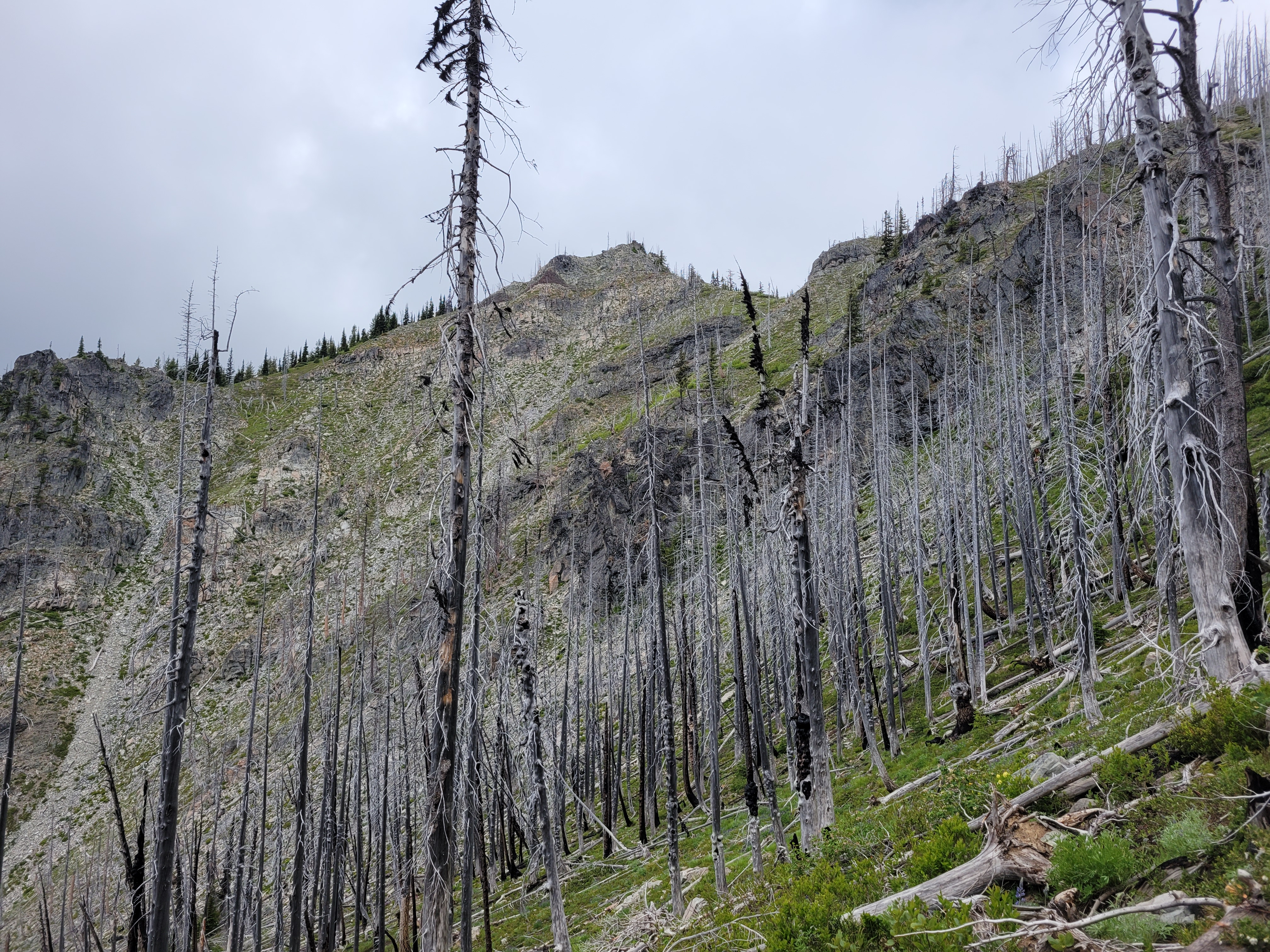
We rolled up to Whistler after one of the most casual starts I’ve ever had to any trip ever. Sarah was extremely patient with me during my hellacious work week when my socialization window was like 8:54-9:02pm, but I was 100% committed to taking Friday off and made it happen. Whistler was PACKED. Thumping music, mountain bikes everywhere, full face helmets on everyone, turns out it was CrankFest. We parked in a day lot and I paid for what I thought was 24hrs. I was jealous of anyone and everyone and felt like a dork with a backpack in the middle of the cool kids. We got in line for the gondola thinking we’d save ourselves mileage and elevation. $104??? For one trip up the gondola?! We laughed and started walking, looking for the Singing Pass trail. Yes, up through the mtb festival. It was signed, but I still felt SO out of place. Finally we were in the trees and not walking on an exposed road, though the “trail” was definitely still mostly a road. But that was nice because we could walk and talk easily. The trail gradually narrowed into a trail. We found a surprise outhouse maybe 3 miles in. We were perplexed by the zipline, thinking it was bikers, no, drones, no, zipline?! We walked below the peak-to-peak gondola. We admired the shades of green in the forest, and how perfectly graded the trail was, and how badly I wanted to be above treelike, and how boring this would be on the way out. At one point I realized why parking had been so cheap. It was free from 5pm to 8am. AKA I only paid for an hour, and would have to re-up in the morning, because it was a day lot, not an overnight lot. Well, shit. Worst case we pay the ticket I guess.

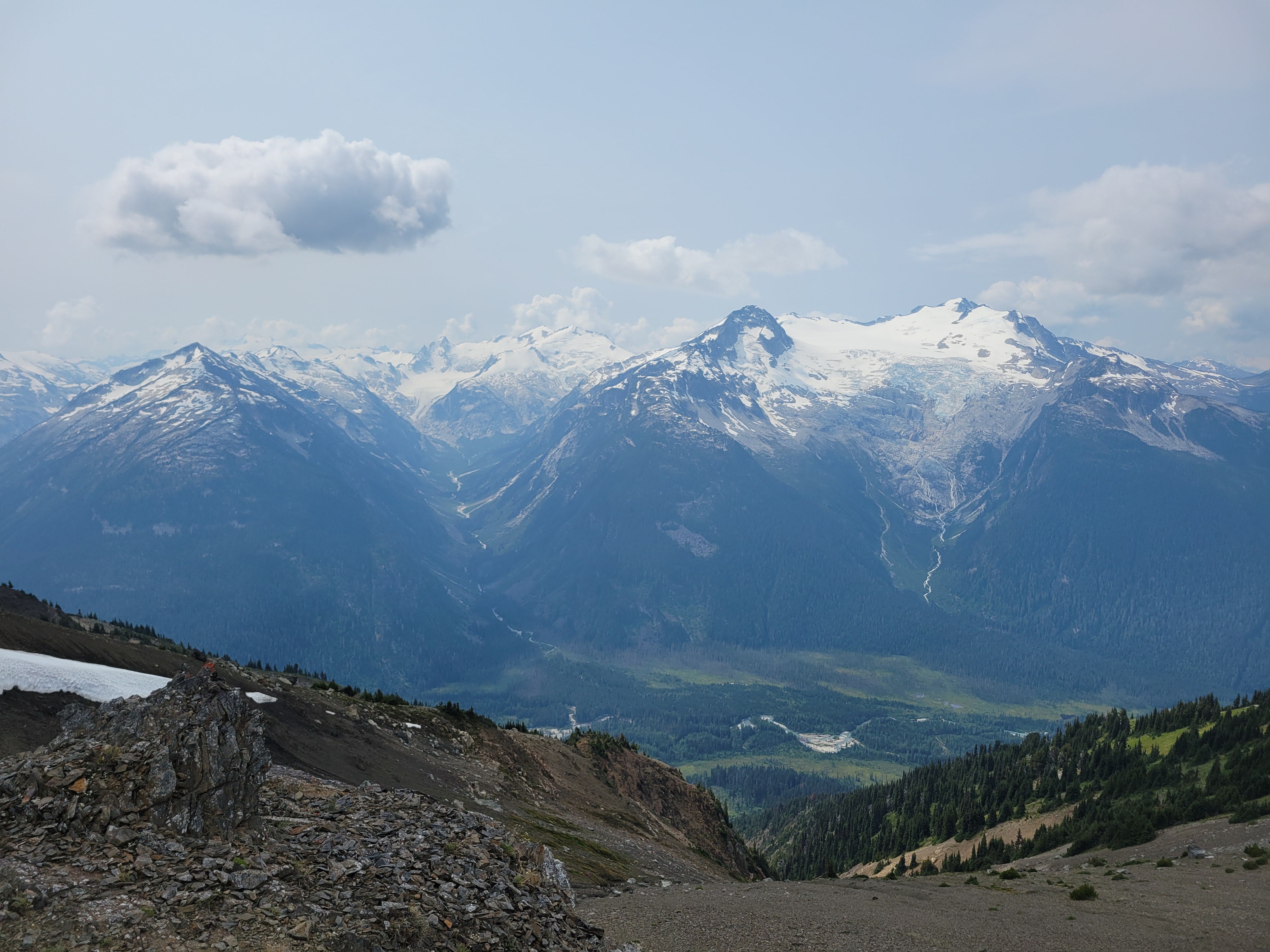
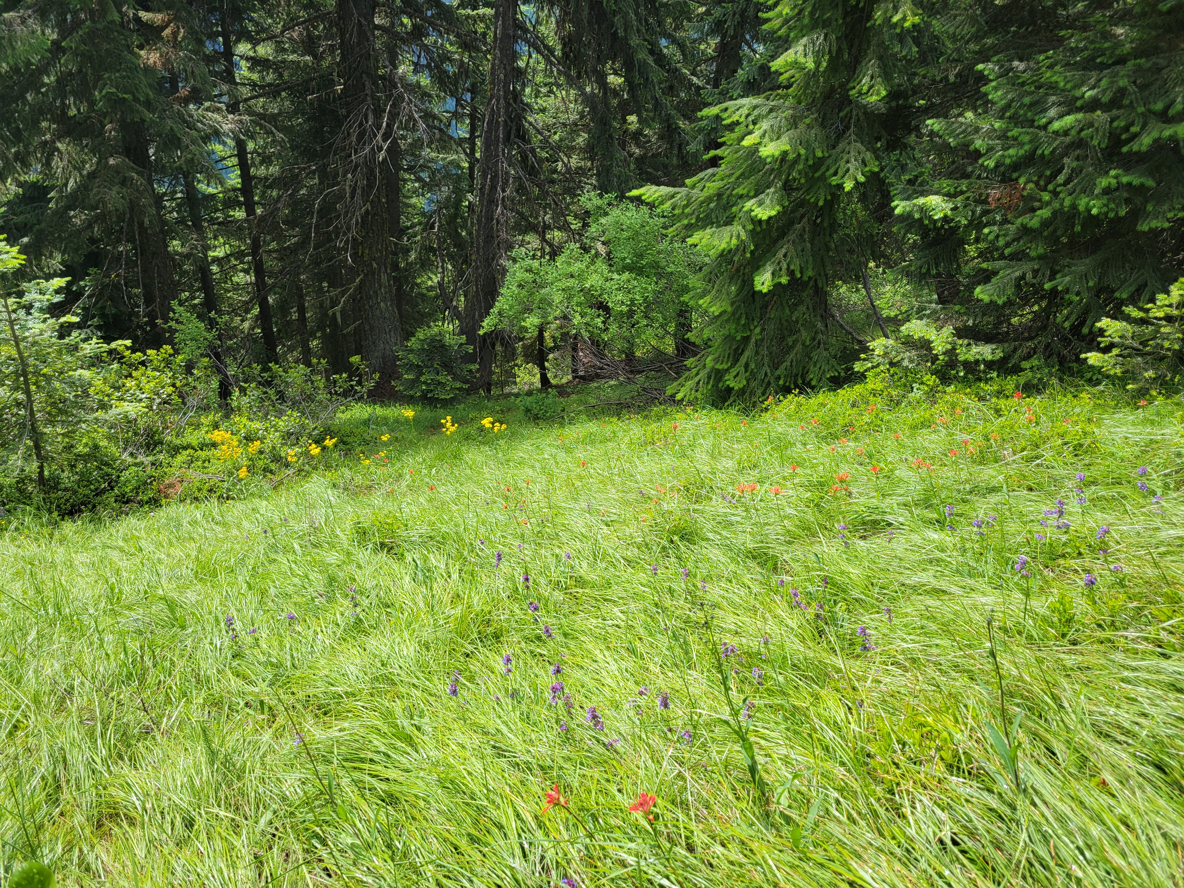
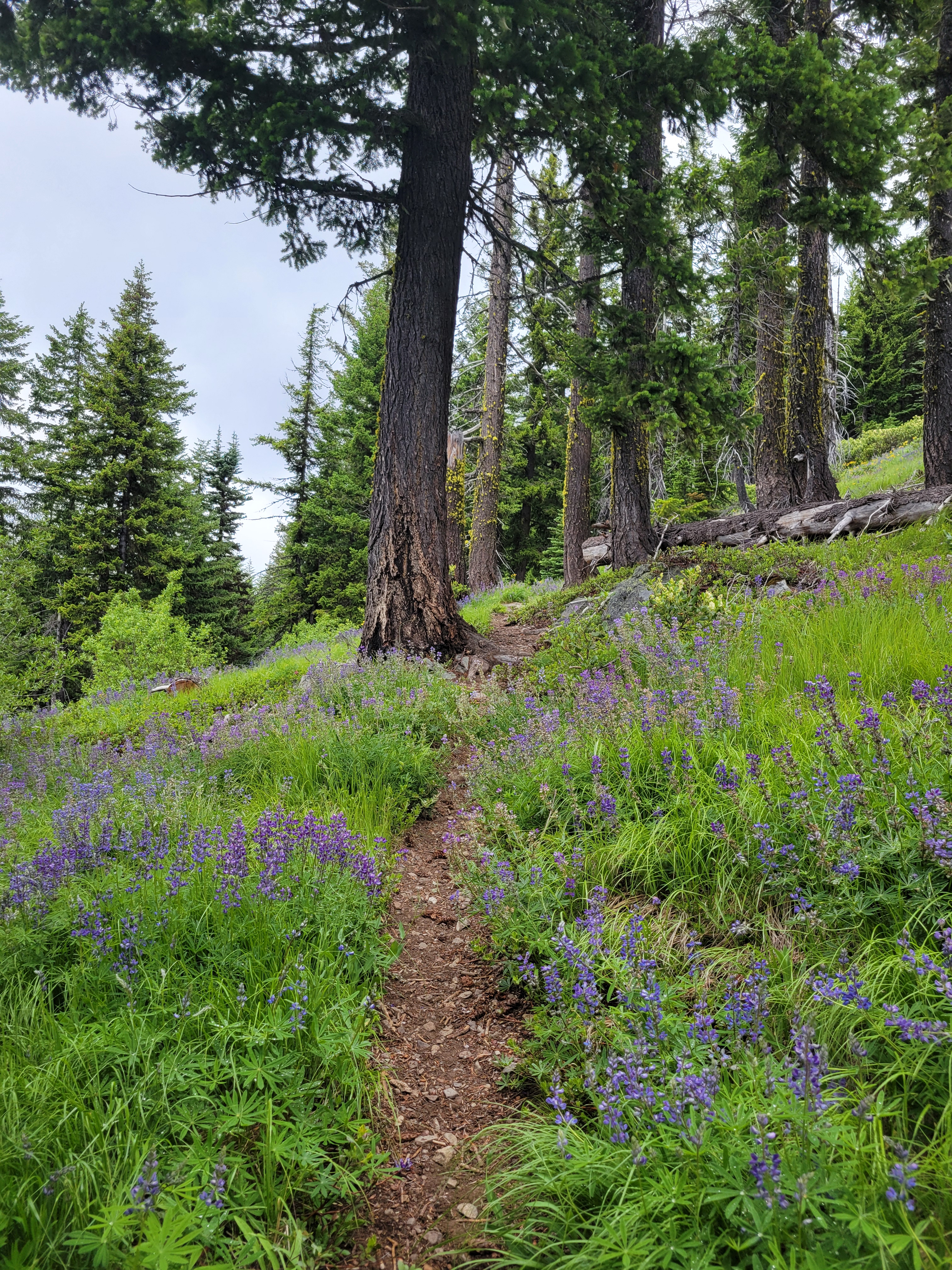
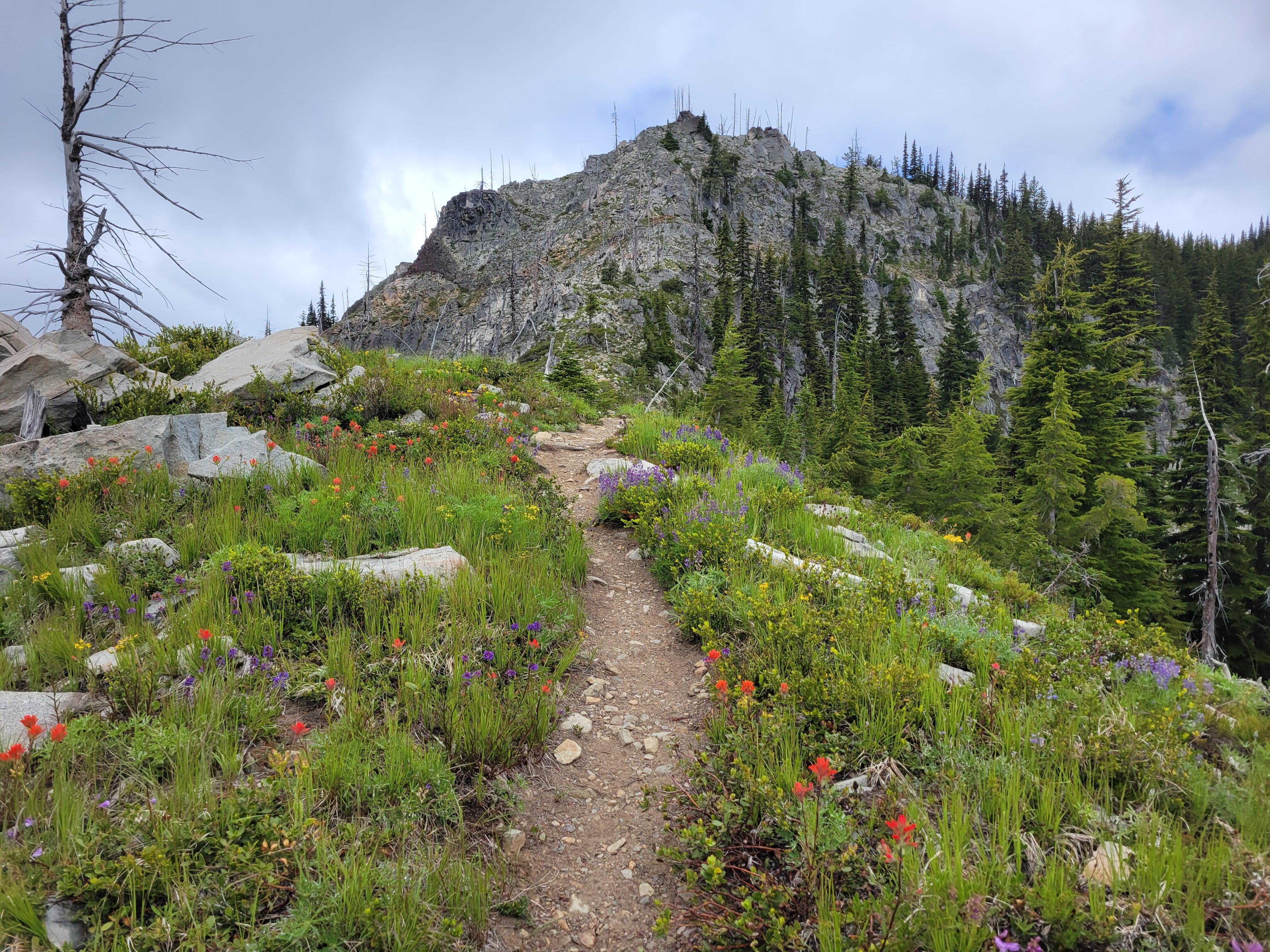
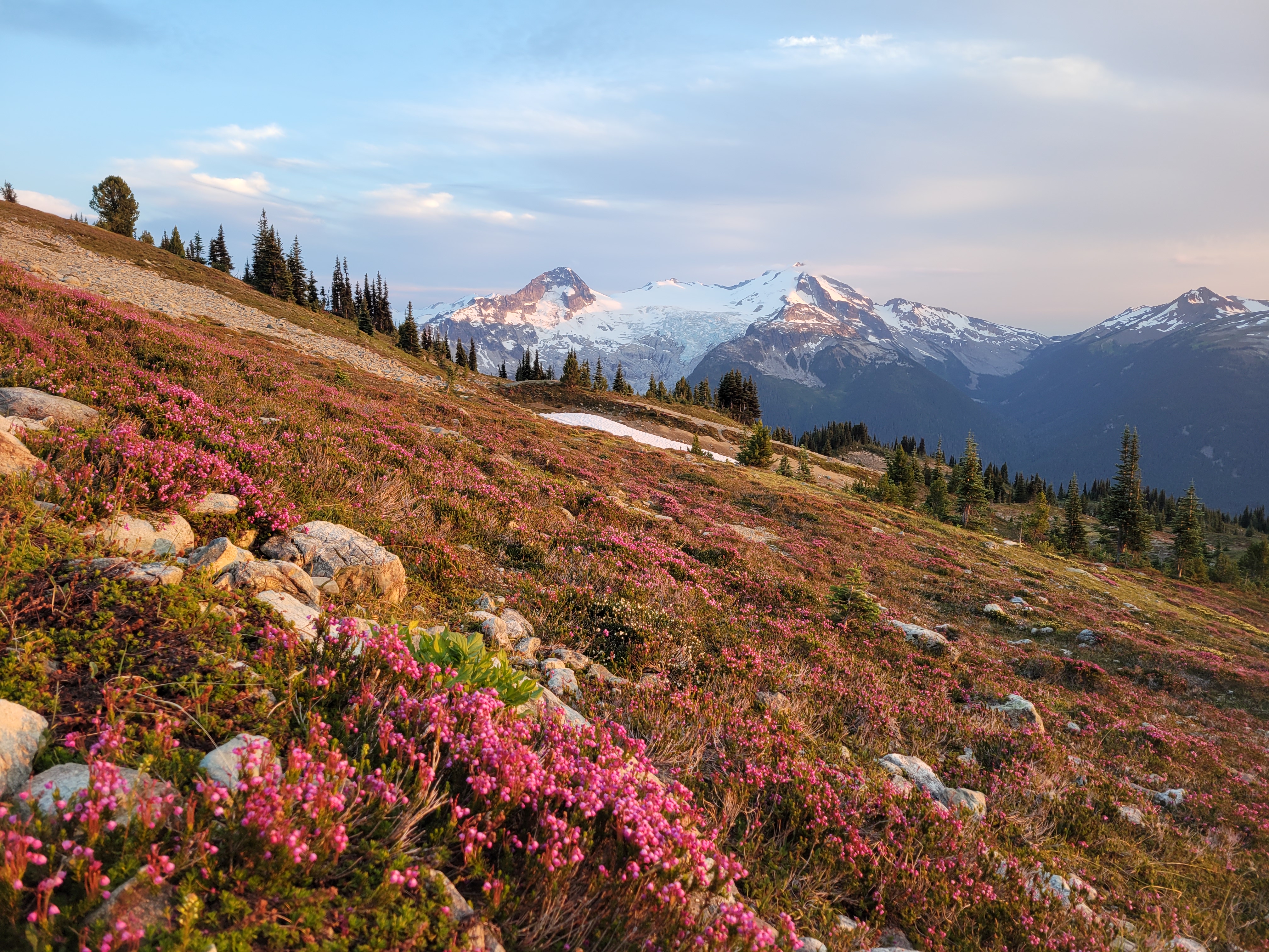
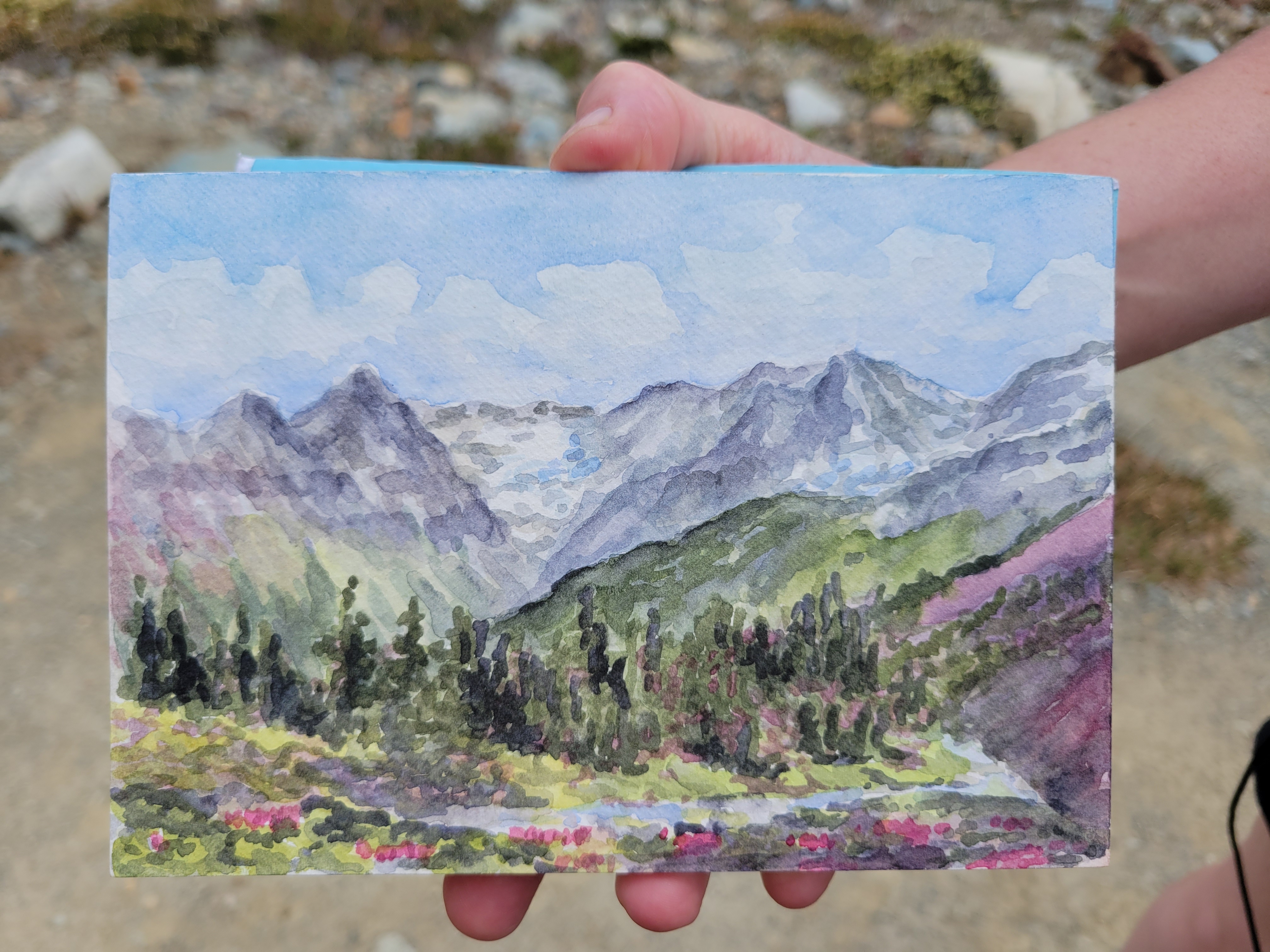
Finally we hit wildflowers. And then more wildflowers. Heaven. Two hikers came down from the upper route (called Musical Bumps) that the gondola takes you to. “Are there more wildflowers that way?” we asked. “Eh, more like this” they shrugged. Well… they sound underwhelmed, but we’re stoked, so I guess we’re hiking out that way tomorrow. We carried on into subalpine, wildflowers and heather and massive glaciated peaks in the distance. Does everybody who has hiked this trail just suck at taking photos? Are you trying to keep it a secret? They must be trying to keep it a secret.

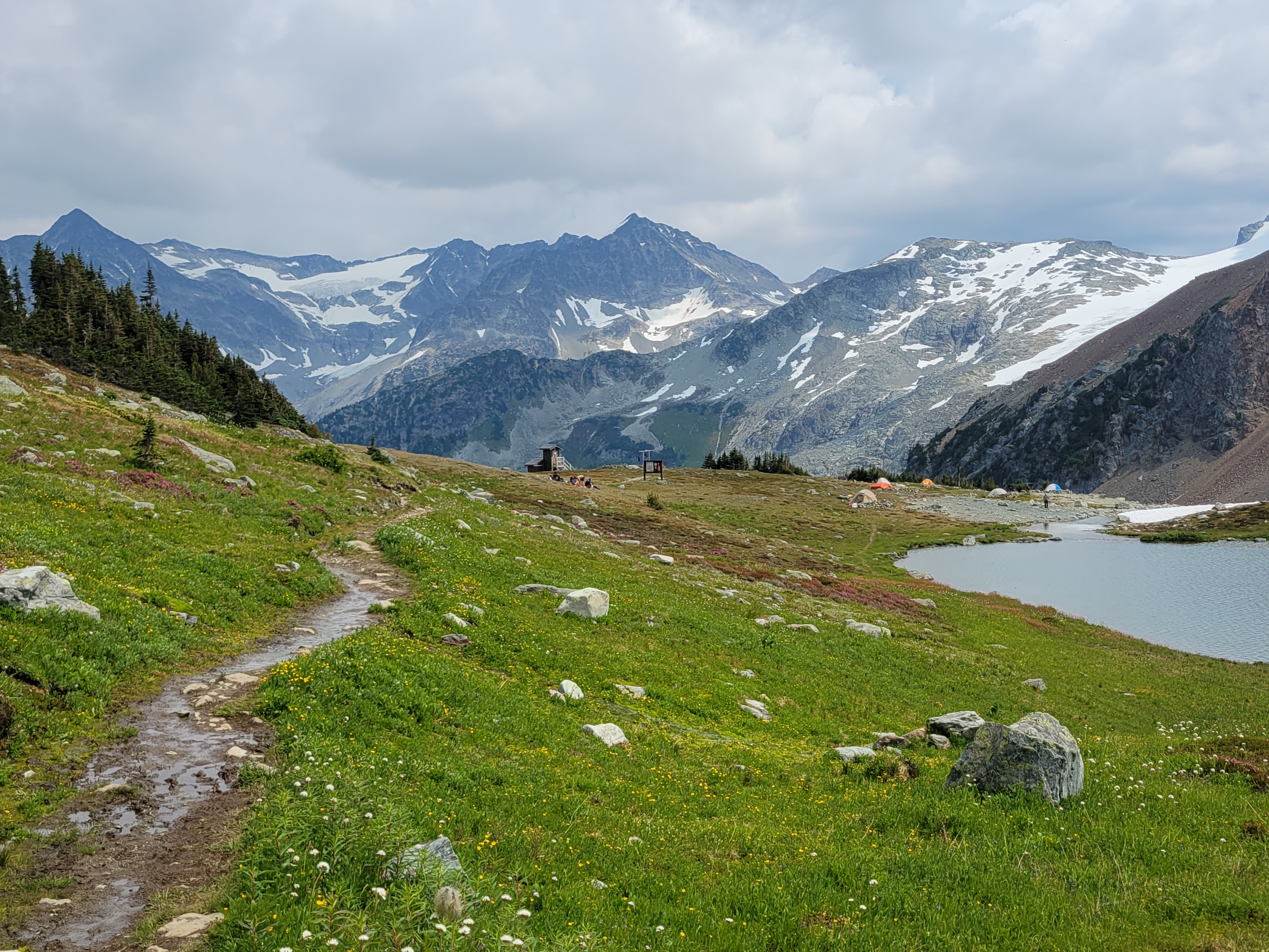
A short 2mi from the intersection with Musical Bumps and we stumbled upon one of the most dense paintbrush meadows I have ever seen in my life just before the lake. I mean the prior weekend was dense but I barely had time to frolic, this was just insane with bright yellow paintbrush that had yellow streaks and flowers of every color sprinkled in between. We dropped down to the lake knowing it was almost dark, and struggled to find a decent campsite. There’s a great one near the toilet but we missed it (and didn’t want to listen to people pooping all night). There’s a rack to hang bear bags, but we just buried our food in rocks in the boulder patch instead. Sarah asked “did you think we’d get here in daylight?” I laughed. “NOPE.” “Me neither. Funny we were both thinking that but neither of us said it out loud.” I was so happy with our timing. I had a scone for dinner and fell asleep pretty quickly, though I wouldn’t say I slept well.
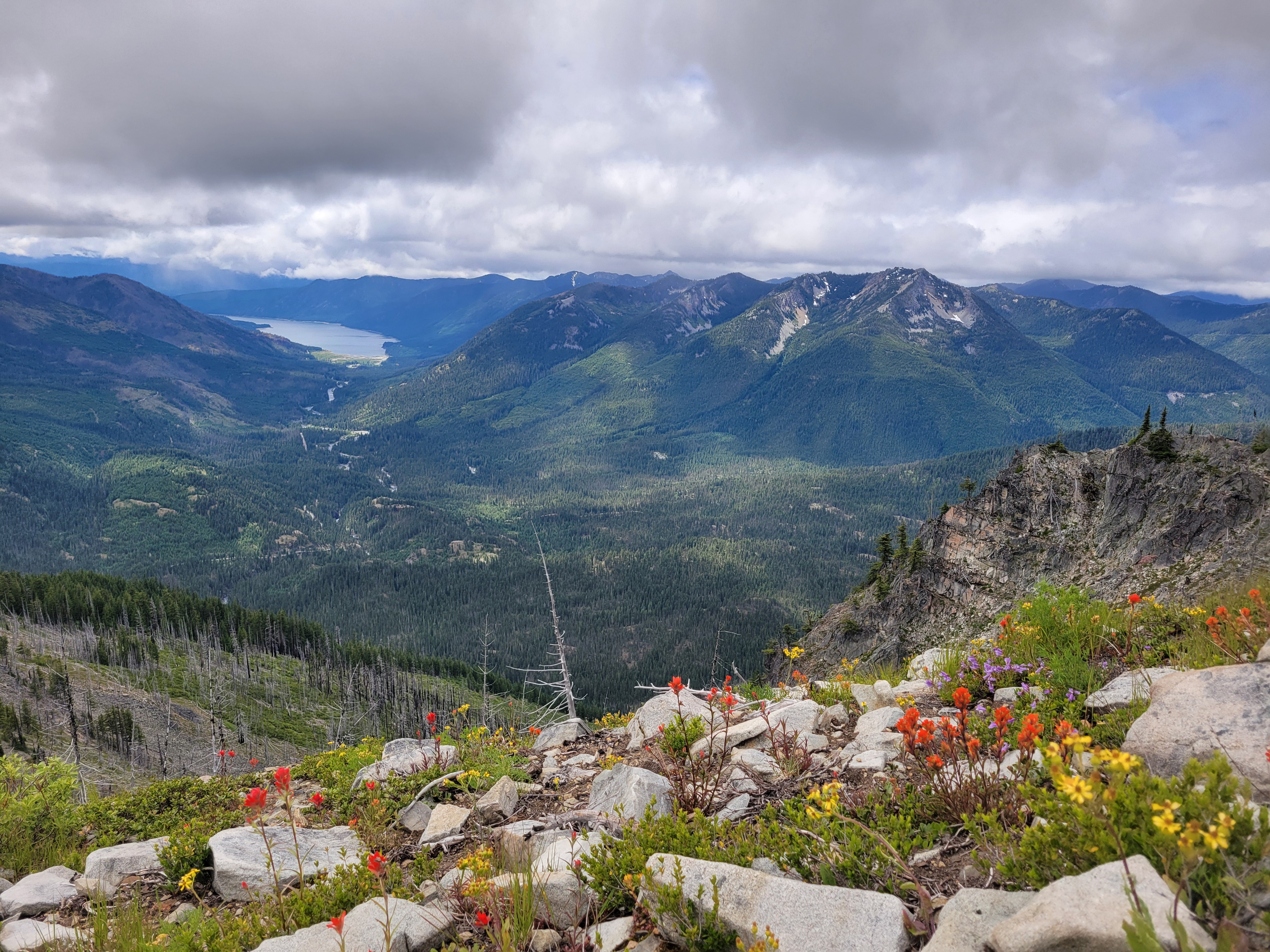
We were up around 7 the next morning, which is LATE for me (and even later for Sarah). Sarah had a leisurely breakfast and set up painting, I decided to “zip” up Overlord Mountain. Which I sorely underestimated. Prior trip reports said to expect 6-7hrs round trip from Russet Lake, but my famous last words were “it’s like 3.5k gain and 3mi, how long could it possibly take?” as I pranced off into the distance leaving Sarah to her art. I wasted time trying to traverse high rather than drop down to mellower terrain on the traverse from camp to Whirlwind’s ridge. I paid for the full day of parking with the shockingly strong cell service I had. When I saw the ridge to Whirlwind across a small valley I had an “oh shit, that’s where I’m going?” moment, but it comes up quickly and it’s not as steep as it looks. There’s also a trail nearly the entire way starting at the base of this ridge, which expedited things after my cross-country bumbling for the prior mile. There was a little tarn that I bet is beautiful when it’s melted out, and crystal clear streams gushing through the rocks off of the base of the glacier.


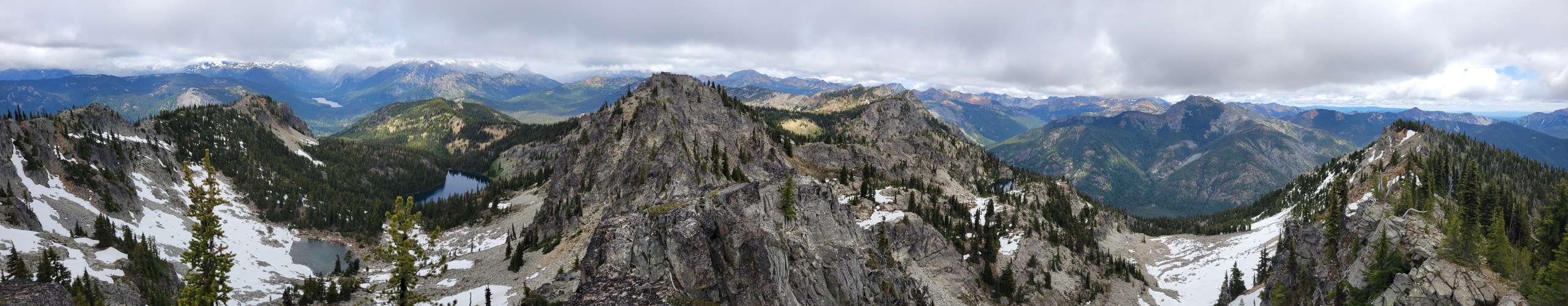
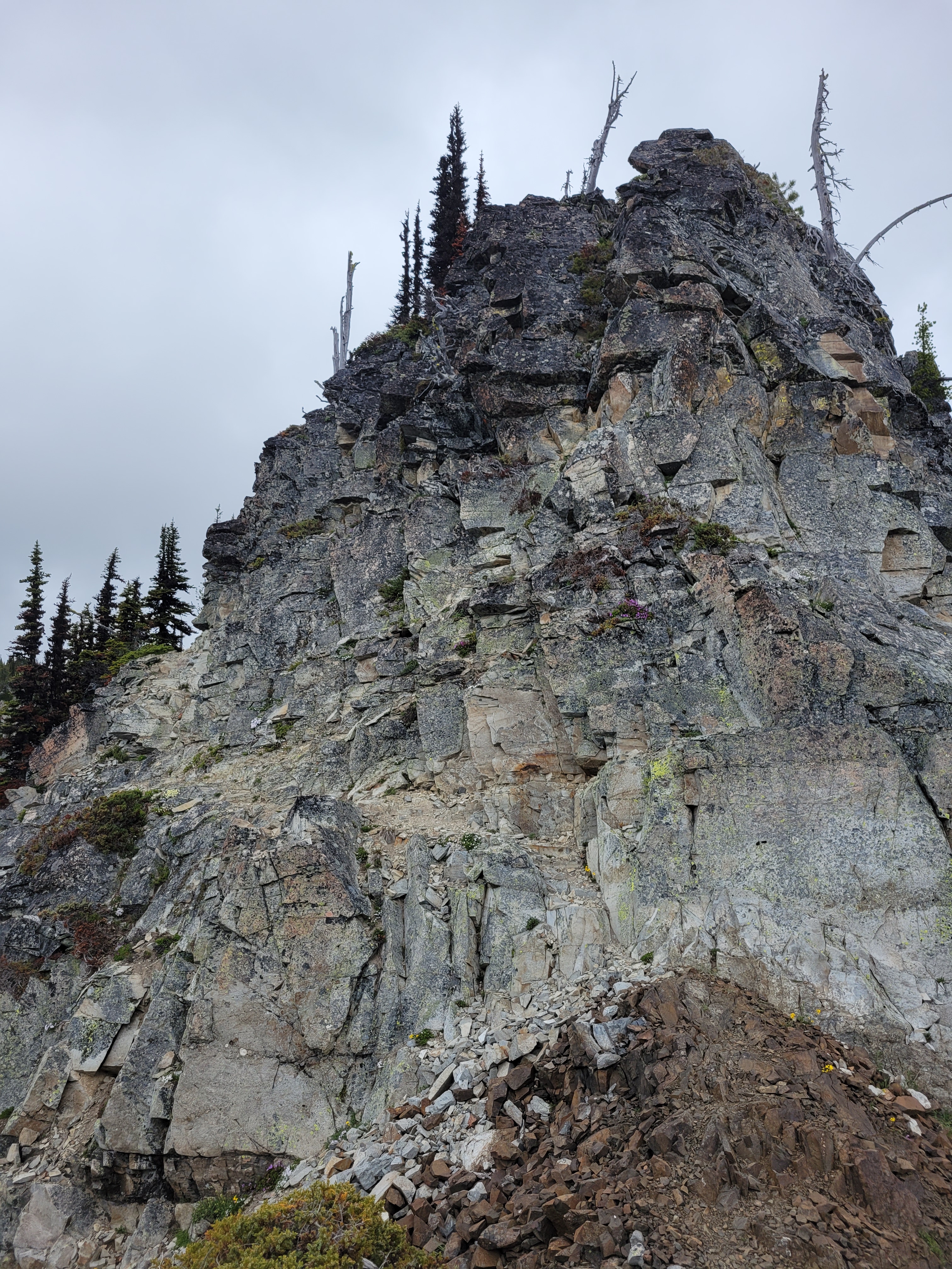
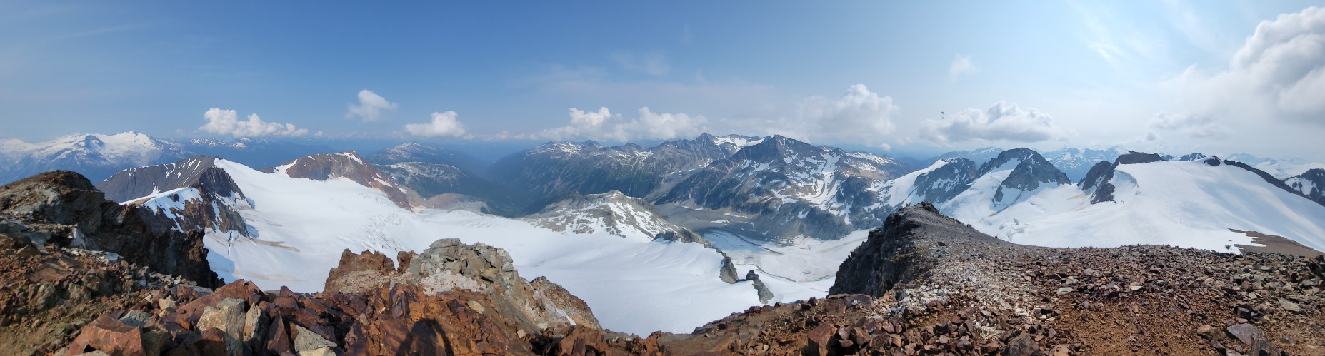
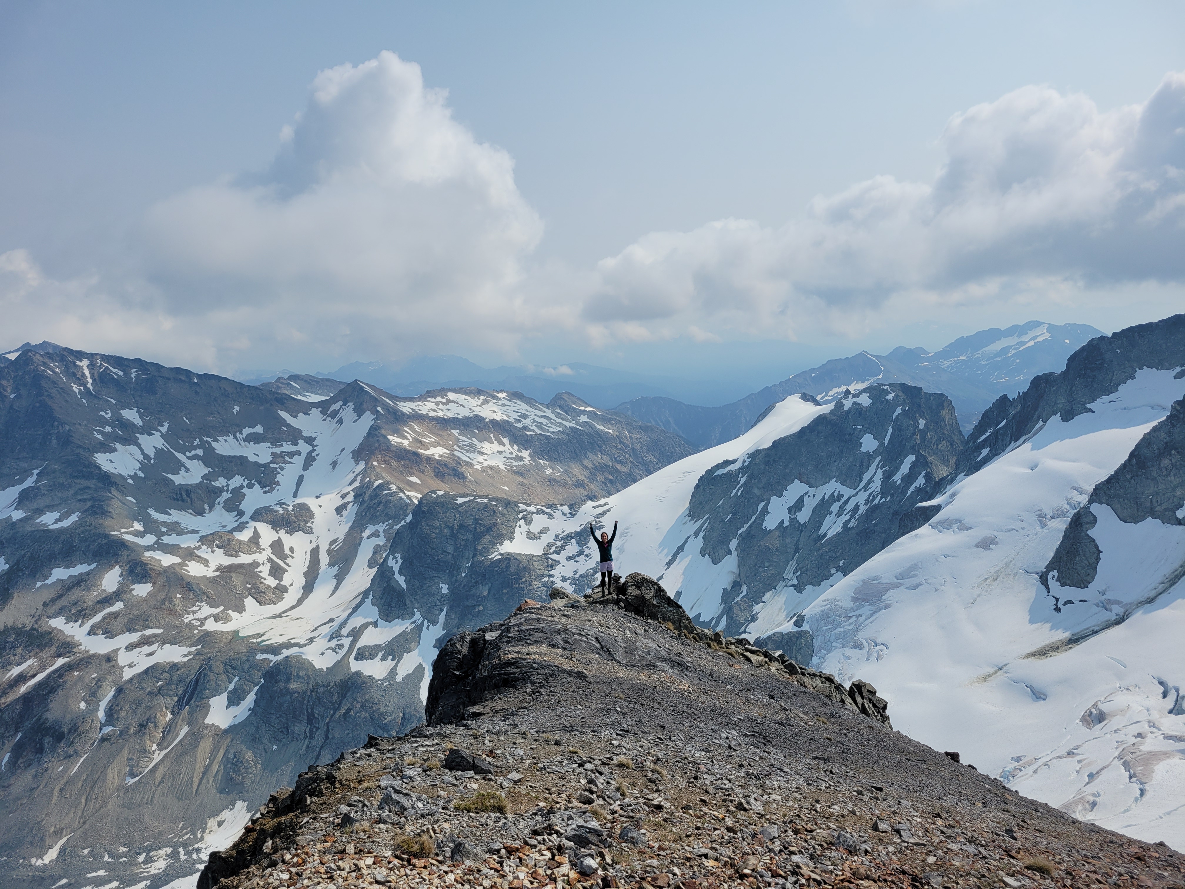
On top of the first ridge, peaks started growing in the distance as I gained elevation. I nearly broke out into the Canadian national anthem I was so astounded by the beauty. I was making slow but steady progress, less than 2mi to Overlord but I knew the last mile would be the trickiest terrain. Whirlwind was really just a long slog, I snapped a few pics at the top before dropping down to the first of two saddles between Whirlwind and Overlord. I was waiting for the 3rd class scramble sections. After the first saddle, I hiked up and over another knoll, knowing that Refuse peak (something like that) was between me and Overlord. Refuse pinnacle? I can’t be bothered to look it up. Either way, it was almost entirely class 2, I maybe had to use a hand to balance once. But the ridge is fun, with huge views in every direction. After Refuse Pinnacle, it’s a walk on this really cool shale that sounds like walking on glass, like tinkling music (tinkling sounds like pee but you know the sound I mean), and then a long slog of a talus field with some snow patches to the top. O Canada kept morphing into the US national anthem in my head, and honestly I can’t think of worse songs to have stuck in your head. There is a climber’s trail the entire way from Whirlwind to Overlord. It’s sparse in parts but if you are used to boot paths you’ll find it.

The summit was broad and welcoming, I had some quick snacks and chatted with two other climber who were ahead of me before quickly turning around to head back down knowing Sarah was waiting for me. I had taken just over 2hrs to the summit, and was hoping to be back in 3.5hrs total. The way down went quickly at first, until I was just past Refuse Pinnacle and saw all of the other parties on the way up. I stopped to chat with each one (uphill has right of way so… yeah) and reassure some folks who were worried about the scrambley part. Finally past the people, I realized how much of a delay that had been and texted Sarah that I wasn’t going to be back until 12:40 despite an ETA of 12. I desperately hoped I was underpromising/could overdeliver and be back way before that.


Halfway up the saddle I turned around and saw the other parties. One woman waved to me and whooped which made me so goofy happy. I was DRAGGING. Coming over the knoll and realizing there was another 300ft of gain to the top of Whirlwind was crushing. But once on top of Whirlwind it was soft enough I could start jogging, and I knocked out the remaining 2mi in around 30min, getting back to camp at 12:15ish right as Sarah texted something politely conveying “I’m bored, hurry up, I’m ready to leave.” I packed up my stuff as quickly as possible and we were off to the paintbrush meadow. 6-7hrs round trip from camp my ass. Good to know I can still knock that out. I question my fitness constantly these days (which most people who know me are probably rolling their eyes at).
I cannot in good faith recommend going up Cowboy Ridge above Russet Lake where the meadow is because it is impossible to do without stepping on wildflowers. They are EVERYWHERE. There is no trail up there but the flowers are absolutely astounding, and I hear the lakes on the other end of the ridge are great for swimming, and the end of the ridge has a good view of the Overlord glacier. We did not have enough time to hike the full right, which is okay with me given the impact it’d have had on flowers 😦 Guilt quickly kicked in for me and we zipped back to the trail after just a few photos.
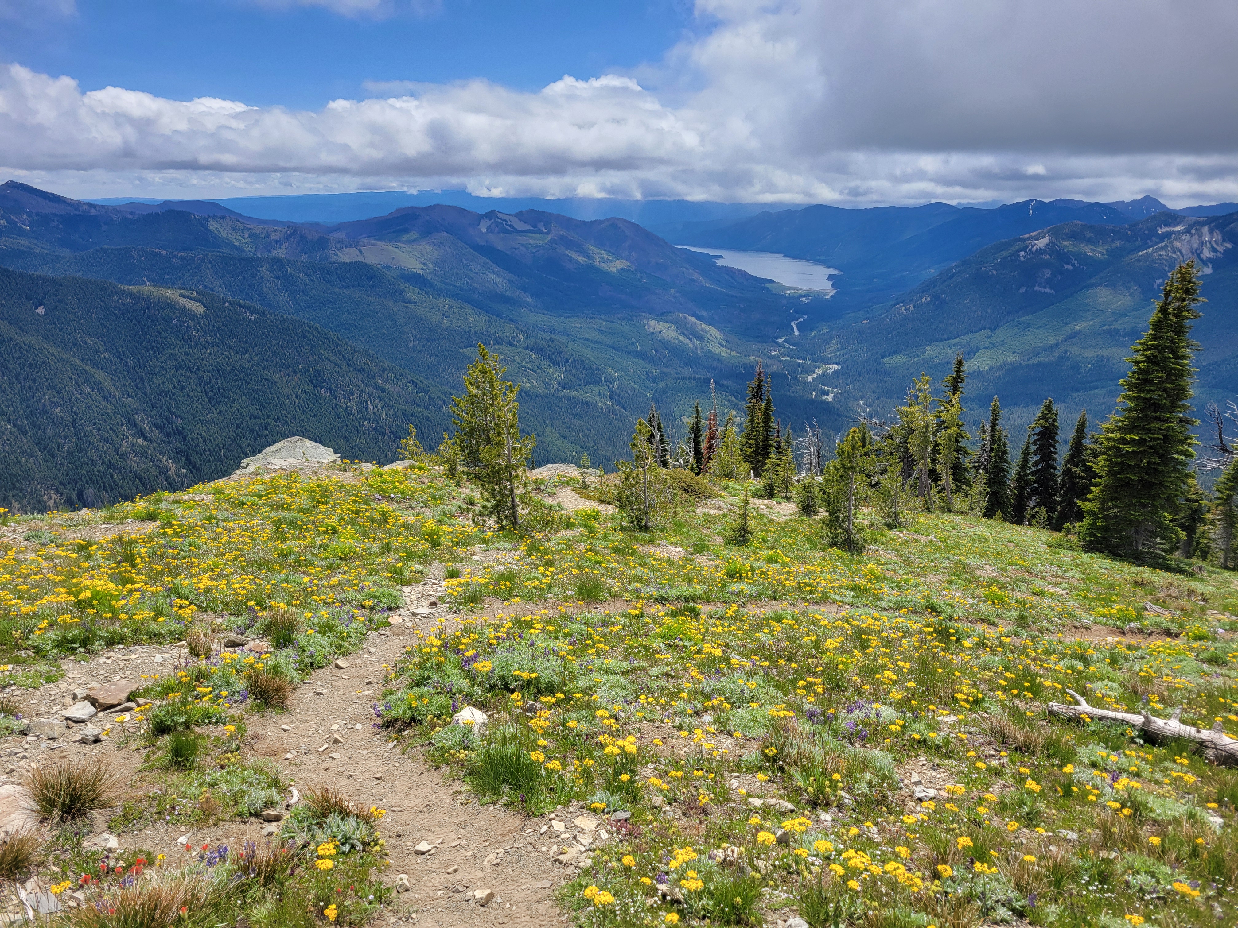
We retraced yesterday’s steps to the junction between Musical Bumps and the Singing Pass trail, and started up Musical Bumps. Let me be clear: we were doing this whole trip backwards. You’re supposed to take the gondola up to the top, then hike DOWN musical bumps to the lake, then hike DOWN the trail from Singing Pass back to Whistler. But we were banking on nobody checking for gondola passes because we’re cheap. And we were also banking on the gondola being open until 5.
The wildflowers continued to be absolutely phenomenal going though Musical Bumps. We are NOT fast hikers when flowers are involved. We probably looked like two off kilter toddlers chasing butterflies. I started collecting beta from passing hikers because we didn’t entirely know the way to the gondola, and my phone was dying, which meant no navigation soon. My legs were also DYING after knocking out Overlord and now this. Flat was fine, downhill was fine, uphill was tough. Getting the gondola was going to be tough at our speed. I made a joke to a passing hiker. “Yeah we’re trying to catch the last gondola out of here, gotta go!!” They lit up. “The gondola’s running until 8! There’s dinner at the restaurant so they’re keeping it open late!” Sarah and I burst out laughing. YEs!!!!! How was this working out so well in our favor? Spirits newly lifted knowing we could take our time, we plodded on through all of the gondola-carried tourists hiking with tiny day packs, envying their light loads (maybe that was just me).


Even within ski resort boundaries the terrain is gorgeous. I wasn’t as annoyed by the lifts as I expected. That last mile to the gondola though was one of the slowest of my life. It just. Kept. Going. Every time I thought we had to have gone a half mile we hadn’t. I was soooo happy to finally get to the lodge. We popped into the bathroom, sought out concessions (specifically Diet Coke, which we did not succeed in finding), and got in line for the gondola. 5min later, we were in a gondola, high fiving because nobody had checked for a pass.

Nearly back at the car, I said out loud “this HAS to result in a ticket right? I mean everything else has gone so perfectly… there’s definitely going to be a ticket on the windshield.” NO TICKET. We dropped our packs, chugged some diet cokes from the village, and headed back to Squamish to get ready for a day of dragging.
I cannot recommend Russet Lake enough, or Overlord behind it. Two extremely beautiful objectives, well maintained trails, incredibly accommodating campsites (the hut I think is $50 per night?). I am truly shocked I had never looked into any of this. I got exactly the novelty and adventure that I had been missing, with great company, and a trip that way surpassed expectations. Definitely hope to be spending more time in BC in the future.