So technically this was going to be the sunset hike that I wanted to do after lakes Talapus and Ollalie, but it didn’t work out as planned. We’ll get there in a few minutes.
- Distance: 3 miles round trip
- Elevation: 1330ft gain
- Weather: 60’s and sunny
- Commute from Seattle: about an hour
- Did I Trip: No!
Like I said, supposed to be an easy hike with great views. Honestly, the road was probably harder than the hike. No one told me I’d be driving for 45 minutes down a dirt road, which was more often full of potholes and washboard stretches than clear stretches. The foliage along the road was beautiful, but if you’re like me, you’ll spend too much time in cardiac arrest worrying about the axels and suspension of your tiny car to enjoy the scenery. There were a few steep, rocky, rutted sections that I was shocked my Accord passed successfully. It was the first time I had actually been worried on a gravel road, and I was not looking forward to redoing that in the dark after sunset.
 Honestly, I thought this hike was a bit anticlimactic. The peak was forested, and only a few views peaked out. The trailhead was completely empty and I didn’t see any people or wildlife, save a bird that seemed pretty upset to see me. Of course, there’s the obligatory pic of Rainier, which was in full splendor. Can’t complain much about that. And for the (small) amount of effort that went into the hike, the views are pretty impressive. Crap, I’m starting to take things for granted. Like how I have trouble motivating myself to hike in cloudy weather when in reality, a cloudy day in the Cascades is infinitely better than any day along Sheridan Road in Evanston.
 As another example of me being spoiled, here’s the view from the other side of the peak. Okay, it’s still pretty nice, I shouldn’t complain. I’ve got to learn the names of the peaks in all of these areas so I can be that cool guy who knows everything and can orient himself anywhere. Speaking of which, I should also invest in a compass. Does the Garmin Fenix have a compass? You bet your sweet ass it does. Someday.
Another unexpected part of this hike was getting to watch fog roll into the valley. I should have taken a video to show just how fast it was moving. It’s also surprisingly cool watching clouds roll along underneath you. I’ve got a mediocre picture of it below. If you look closely, you can see the clouds filling in the entrance of the valley. Within 10 minutes, everything beneath me was covered in fog, though I was still in sun. I was 45 minutes early to sunset, and to be honest the thought of hiking down alone with just a headlamp in pitch black fog was just not appealing. I couldn’t even convince myself to do it to look bad ass. So I hiked back down, and had two thoughts along the way: 1) Damn, I bet the sun is lighting up the top of that rolling fog and making it all pink and yellow 2) wait, I’m maybe twenty feet from the top and it’s already dark even though the sun sets in 40 minutes, so… fog rolling into the valley just means it’s foggy. I don’t think I missed an epic sunset. At least, that’s what I’m telling myself. Next time!
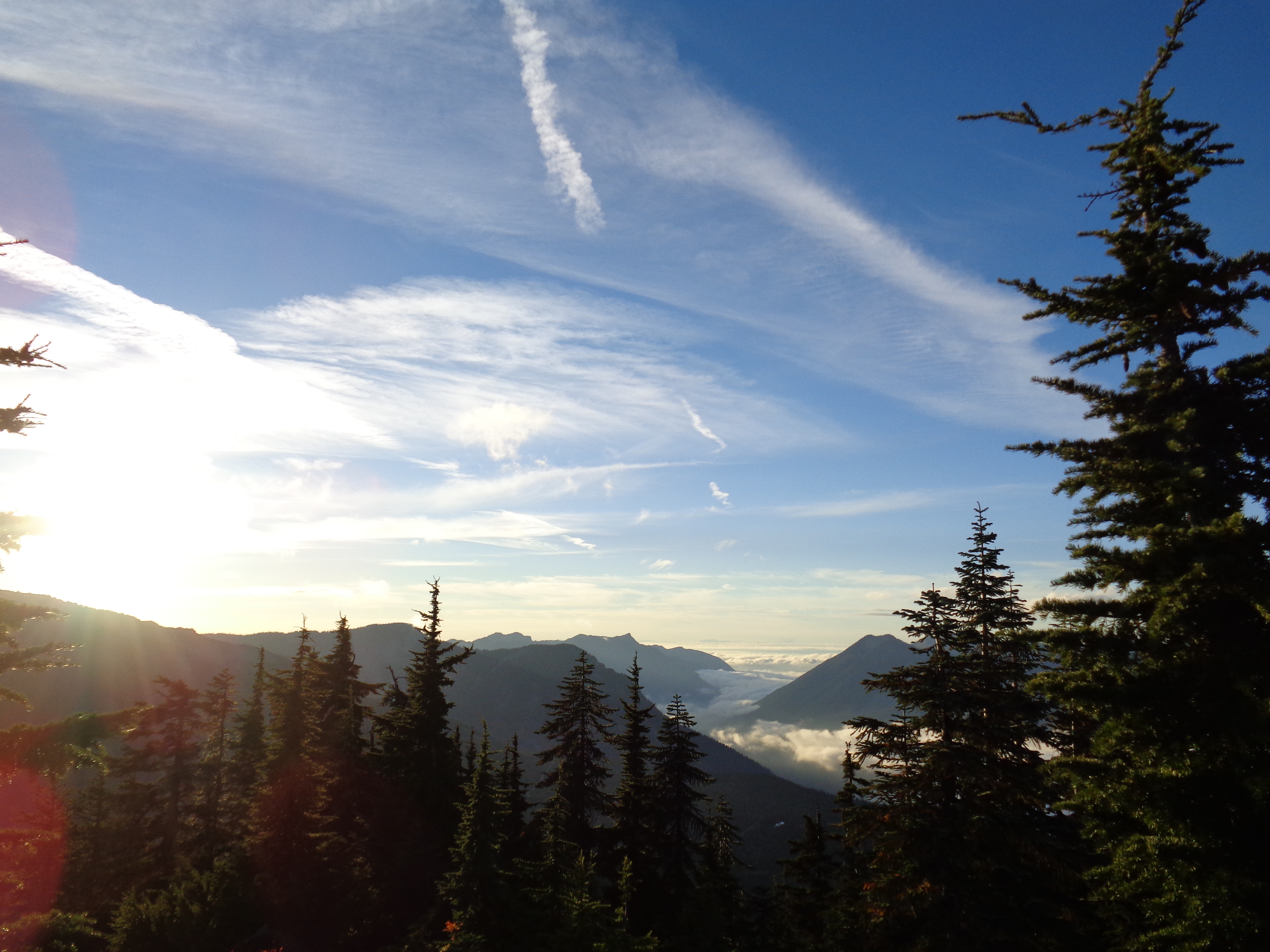
Fog rolling into the valley
