Another “drive to the highway and make a game time decision hike,” though this time it was unintentional. I intended to get to Goat Lake to go for a trail run since I was sick of city streets and stop lights and pedestrians but wanted something a little more remote than cougar/tiger mountains. As it turned out, just because a road is “open” does not mean it’s clear, and my car couldn’t make it to Goat Lake. It couldn’t make it past the Gothic Basin/Barlow Pass area, where the mountain loop highway turns to gravel and a foot of ice and snow. So I turned around and went to check out Perry Creek, the back up run. Anyway, as usual on a Wednesday, I had to be back in Seattle by 2, so my time was limited. Hiked/run 1/14/2015.
- Distance: 10.5 miles round trip (if you make it to the meadows – to the falls and back is only 6.5 miles)
- Elevation: 3400ft gain, 5250 highest point (again, if you get to the meadows.. you know where this is going)
- Weather: 30’s and sunny
- Commute from Seattle: 1:30 if roads are clear
- Did I Trip:
Some close calls, but noActually yes, into a river, dammit
I left Seattle around 6am. Too chicken to start a trail alone in the dark, I was hoping to get there just as sunrise was starting to lighten everything up. By the time I got there, the sun had officially risen. “If roads are clear” means two things: traffic and snow/ice. I took the road salting back in the midwest and northeast for granted. Out here, even a small layer of frost can make roads slippery. I wasn’t worried until I crossed several sets of errant tracks that all looked like spin-outs, and that’s when I slowed down and bit just to play it safe. So it took me a big longer than 1:30 to get there, especially because I passed the trailhead hoping to make it to Goat Lake but had to reevaluate my plan.
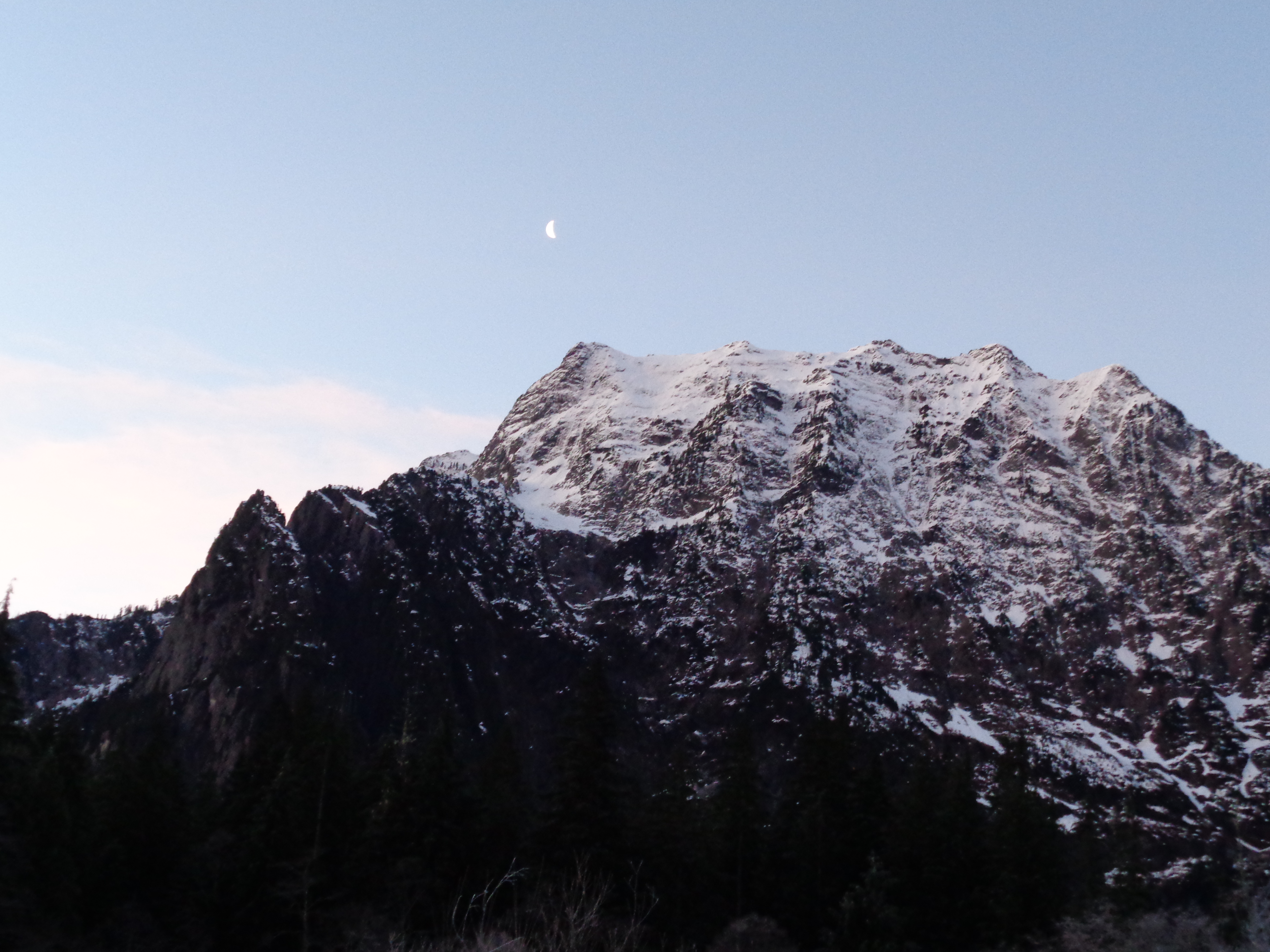
Big Four just after sunrise
I will say, pink o’clock in the mountains is gorgeous. Even just driving down the highway, when I turned around to head back west towards Perry Creek, I caught a glimpse of Three Fingers lit up pink by the sun. I almost pulled over to snap a picture, but I figured I’ll have chances to snow camp and watch sunrise later this winter. When I got to the Perry Creek/Mt Dickerman trailhead, I was the only car. It was just after 8am by that point, so I was eager to get moving.
The first mile of the trail is very flat and can actually be avoided by parking near a blocked-off dirt road that led to the old Perry Creek trailhead. Wanting to get in a run, I figured I’d keep the mile.

This much green, even in January!
I forget that the lower forests here are so damn green. It was like running through summer. The moss and evergreens are still alive and well, despite sub-freezing temperatures.
Eventually the new path intersects with the old ravel road, equally flat, that takes you to the old trailhead. Usually this would be unimportant and unimpressive, but some bum (trust me I ran through a dozen more harsh words) had left a nice pile of feces and toilet paper smack in the middle of the road. How can you be that disgusting? Does it take that much effort to go ten steps away into the bushes, or bury it, or carry it out? Leave no trace, folks! We want to use this trail too, and I prefer my trails poop-free. Bear scat, cougar crap, okay, but human shit and trash? Someone made a conscious decision to leave it there. Ugh.

Perry Creek down below
Okay, passed that, and made it to the official trail. A few more steps through forest, and I popped out onto the east side of a valley. Cool! Bad news? Shady. Didn’t think of that. More bad news? Shade = no sun to melt the frost, and it turns out frosty leaves and rocks are even more slippery than wet leaves and rocks. Time to start hiking instead of running. Which was disappointing, because a mostly-dead-shady-valley isn’t very gorgeous. I also expected to be right next to Perry Creek, but it turns out you’re quite far above it. But hey, I was out there, and that’s all I wanted. Looking behind me, Big Four Mountain was in view with the moon just over it. Unrelated question: why the hell is it “big four” when there are five peaks? I counted several times to make sure I wasn’t crazy.
I hit some patchy snow starting about three miles into the trail, including a small avalanche that looked like it had been from a week ago. Nowhere was there enough snow or ice for microspikes. It was an annoying in-between, where it was slippery but not thick enough for spikes to bite.
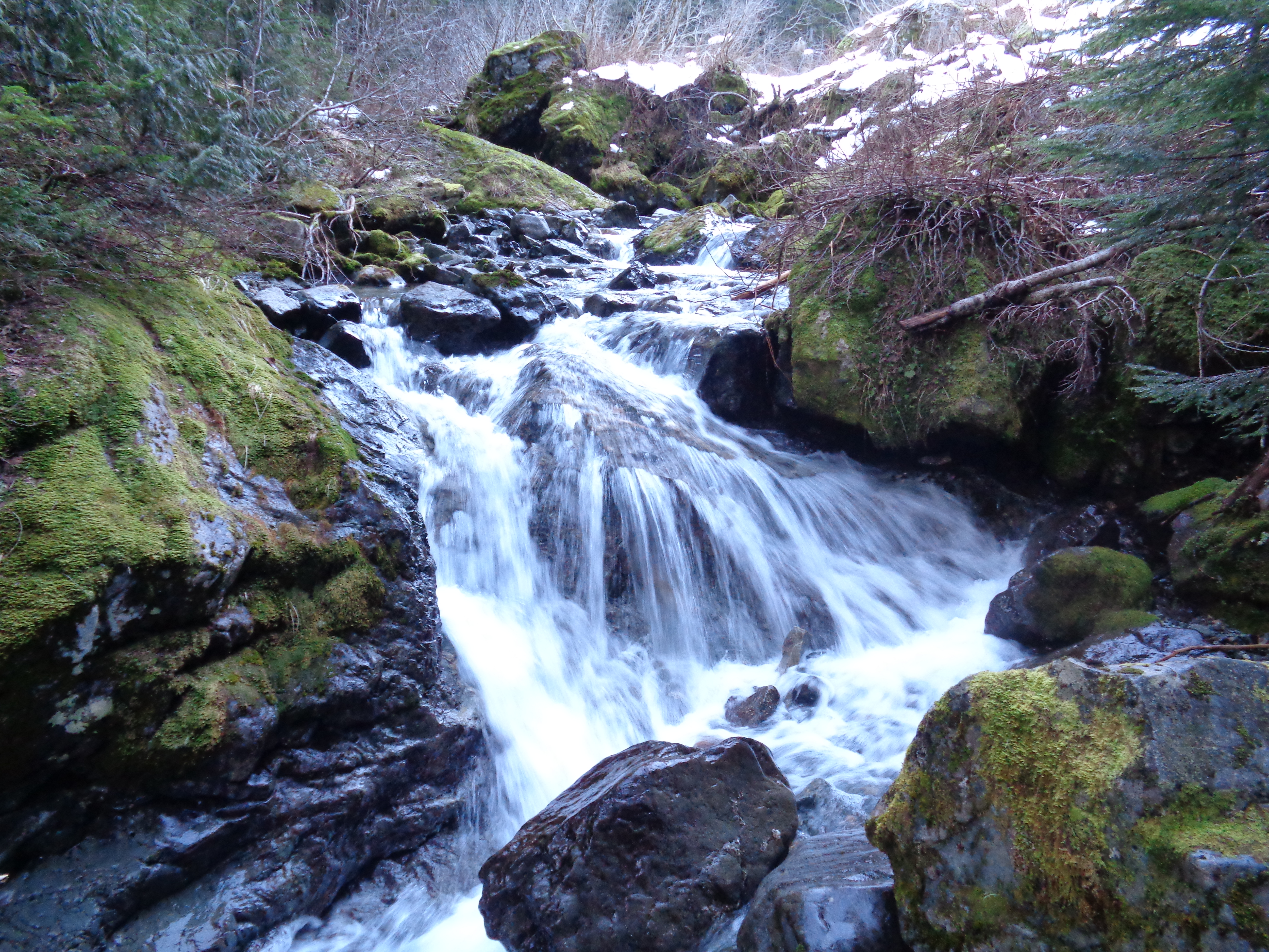
The top of Perry Falls. It continues down another 20ish vertical feet
I had been hoping to make it to Forgotten Meadows, but unfortunately, time was short, and I had planned badly. It would have been very possible to run 10.5 miles on a beautiful sunny summer day, but I didn’t factor in frost or elevation gain, most of which happens in the last two miles. Perry Falls was surprisingly beautiful, with its deep turquoise pool down below. It’s too bad I couldn’t get closer.

Snowy/icy log crossing
I had read a previous trip report about the river crossing that suggested a snowy log further upstream, which I found easily and hopped across.

Large downed tree across trail
And that’s where the hike became real. Up, up, up, switchback after switchback. There was a huge tree down that had knocked out four or five switchbacks. Sounds like it had been there for a while judging by past trip reports, and people had been cutting most of the trail. I could follow a few pieces of the trail, but eventually the tree was too big to climb over and I had to cut them as well and just go straight up. It’s too bad I was solo, because “person for scale” would have helped. I didn’t even have my poles with me to use for scale since I don’t usually bring them on trail runs.
I finally reached the sunshine after about an hour and a half from the start. Crossing the creek leads you up the west side of the valley, where the sun actually reaches, and stepping into it was gorgeous. Despite knowing I had to turn around in ten minutes, I figured I’d enjoy the sun for a bit before descending back into the shade. Looking back at the map, I realized I was probably only half a mile from the meadows. Bad timing.
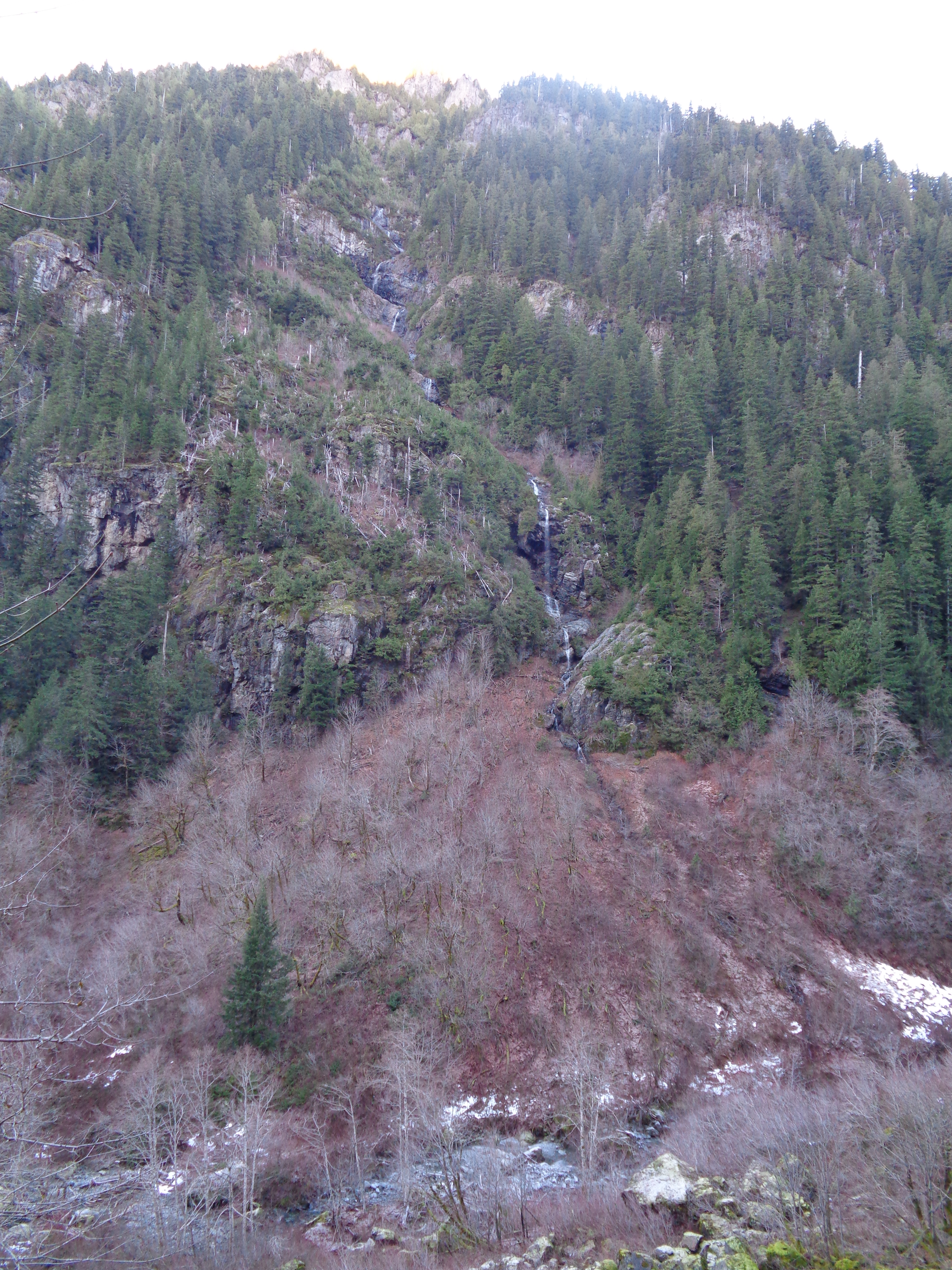
One of the many waterfalls across the valley
The way back went much more quickly than the way up. If I had known, I’d probably have made it to the meadows. I did manage to trip into the creek as I was crossing it and filled my boots with water like a pro. Knowing goretex boots wouldn’t just “dry” as I walked, I stopped to dump out some of the water and put my trust in my wool socks. I could run back nearly the whole way from this point as much of the frost had melted, with the exception of some patchy snow and rock chutes. Turned out the last part of the trail was in the sun (once you exit the valley), so I had a nice conclusion to my morning escapade.

Back into the sun!
The coolest part of the hike was the detour I took on the way in. About two miles into the trail there was a drainage chute. I’m not sure what else to call it – it looked like a steep old dried-up creek bed that had a few waterfalls at the top. Thinking it might be an offshoot of the trail, I started climbing up it (not sure if it even qualifies as a scramble) and figured I’d go for five minutes, see what was up there, and turn around.

Zeolites!
Five minutes wasn’t enough for me to make it to the falls, but I found something much cooler. Zeolites! Right where I was going to turn around, I looked down and spotted a rock (small boulder?) with several pockets of crystals in it, ranging from just a centimeter in diameter to three inches. Holy shit. I had never seen anything like it out in the wilderness. I had seen the polished rocks and geodes my dad used to hide for me in the yard when I was little, and these were like that except truly natural. I had no idea what they were – I thought geodes, but couldn’t imagine finding those around here, so I took a few pictures hoping I’d find someone to ask. On the way back down the washout, I found several more, some that were just off the trail. I hustled home to post a trip report and see if anyone would have information.
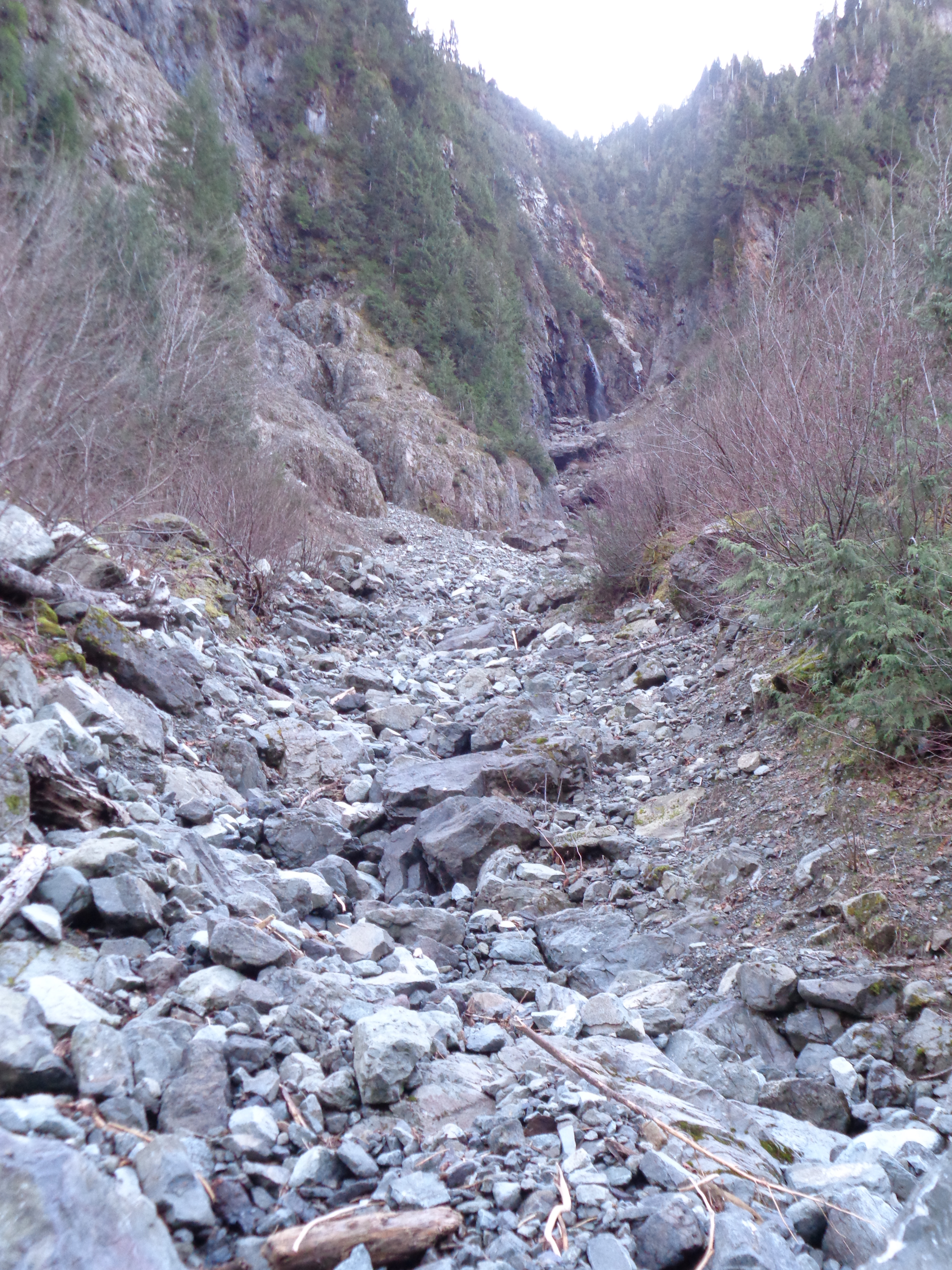
Old drainage chute I hiked up
I didn’t expect many responses, but one poster noticed it and sent it off to his geologist buddy, who replied! I’m obviously late writing this blog post, so I’ll explain the guess that Dave and Randy (thanks guys!) had. Apparently, they’re formed when pockets of gas become trapped in basalt lava as it cools. The white crystals are zeolites, which grow inside those pockets when mineral-rich water seeps through the rock. It’s neat stuff, and those rocks turned what would have been a very average hike into a morning I was excited to talk about. Hopefully there will be a few others out there who think it’s just as cool.
I’ll definitely be going back. For a few reasons. I’d love to check out those rocks again and see if I can find more. I also gotta make it to the Forgotten Meadows. Mt Forgotten might be feasible with the right people and equipment given the low snow accumulation this year, so it can be a scouting trip for that as well. Regardless, the views from the meadows look amazing on a clear day, and I bet they look even better with some snow. We’ll see what happens!

Love, love, love the blog! I actually made it here because of your WTA post on Hidden Lake, which is now on my list for when it’s a bit less snowy. You definitely seem to be making the most out of your first few months in WA. Also, great geology lesson (love the internet!) – I’ll have to keep an eye out for zeolites on my next hike! Happy Trails!
LikeLike
Thank you so much, I’m thrilled to hear it! Hidden lake was incredible, it might still be my favorite hike out here. Though the zeolites were definitely a neat find. Happy hiking!
LikeLike