

Ridge leading up to Alta (you can see the false summit)
- Distance: 14.1 miles (12 to the peak of Alta and back)
- Elevation Gain: 4,440ft (3300 to Alta, 6151 highest point)
- Weather: 60’s and sunny
- Commute from Seattle: 1:30, not even
- Did I Trip: No, but I had my ass handed to me by wind if that counts
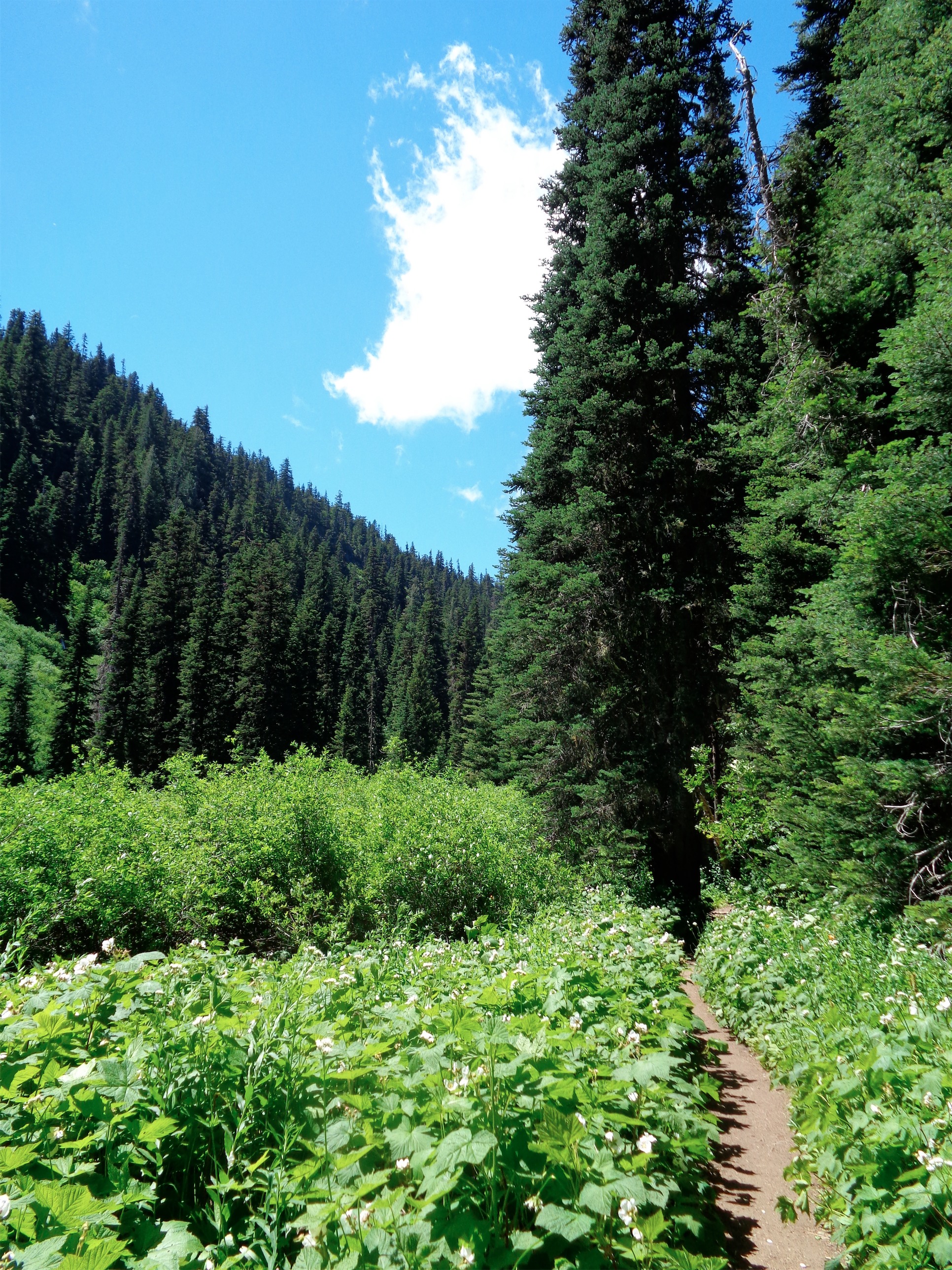
Flat, lush trail
As I’ve mentioned, the trail starts out nice and flat for the first two miles. I passed the spur trail to Hibox, and briefly considered visiting it again (it was that great). But no, this was about Alta. Alta, you sly, sly bastard. Anyway, this trail is perfect for a run. It has everything. Starts out flat so you get a warm up, then gets a little steeper, throws in more rocks and roots if you need practice with your footwork.
I’ll be honest, I hiked the third mile up to Rachel Lake and up to the ridge. Steep and rocky and rooty are still tough for me to run. My goal was to run back down the steep part. Since the path to Rachel Lake is so clear, I’ll start the detailed part just past it.

Gaining elevation above Rachel Lake
When you get to the lake, hang to the right. There are a bunch of social trails that will take you to the trail that goes up to the ridge, but the most obvious one starts past the sign that says “TRAIL.” Not to be confused with the sign 10 feet away that says “TOILET.” That will take you to a toilet, not to a beautiful ridgeline with views. But you’re welcome to check that out as well.
So the social trails wrap around the right side of the lake, and start switchbacking up the ridge. It becomes more dry and rocky than dirt and roots, but wildflowers start appearing, and Rachel Lake shimmers below as you gain elevation. It’s honestly not as steep as I remember it being. Also, ha! I saw the boulder field I scrambled up when I was up here back in the winter. And of course I postholed to my neck. The boulders are pretty big, with huge spaces between them. I’m lucky I didn’t get hurt. Lesson learned. I also wasn’t that far off from the summer trail, as it turns out. I went over to Snack Rock to compare views from last time to this time.

Lila Lake with Hibox on the left
Once you’re on the ridge, heading left will take you to Rampart Lakes, and heading right will take you to Alta or Lila Lake, depending on what you’re into. Alta was first on my list, so let’s tag that. I started jogging again, because there’s nothing better to run than a ridge.
The trail splits once more, and this time, the left will take you to Alta, and the right will take you to Lila Lake. I’m an idiot (I’m far less aware when I’m running) and went right, only to realize 200 yards later that I was on the wrong trail. So I scrambled across a meadow and some boulders to meet up with the Alta trail, and continued from there. Seriously, look at that pic to your left. I should bump up the pink so the flowers pop more, they looked brighter in real life. Unbelievable.
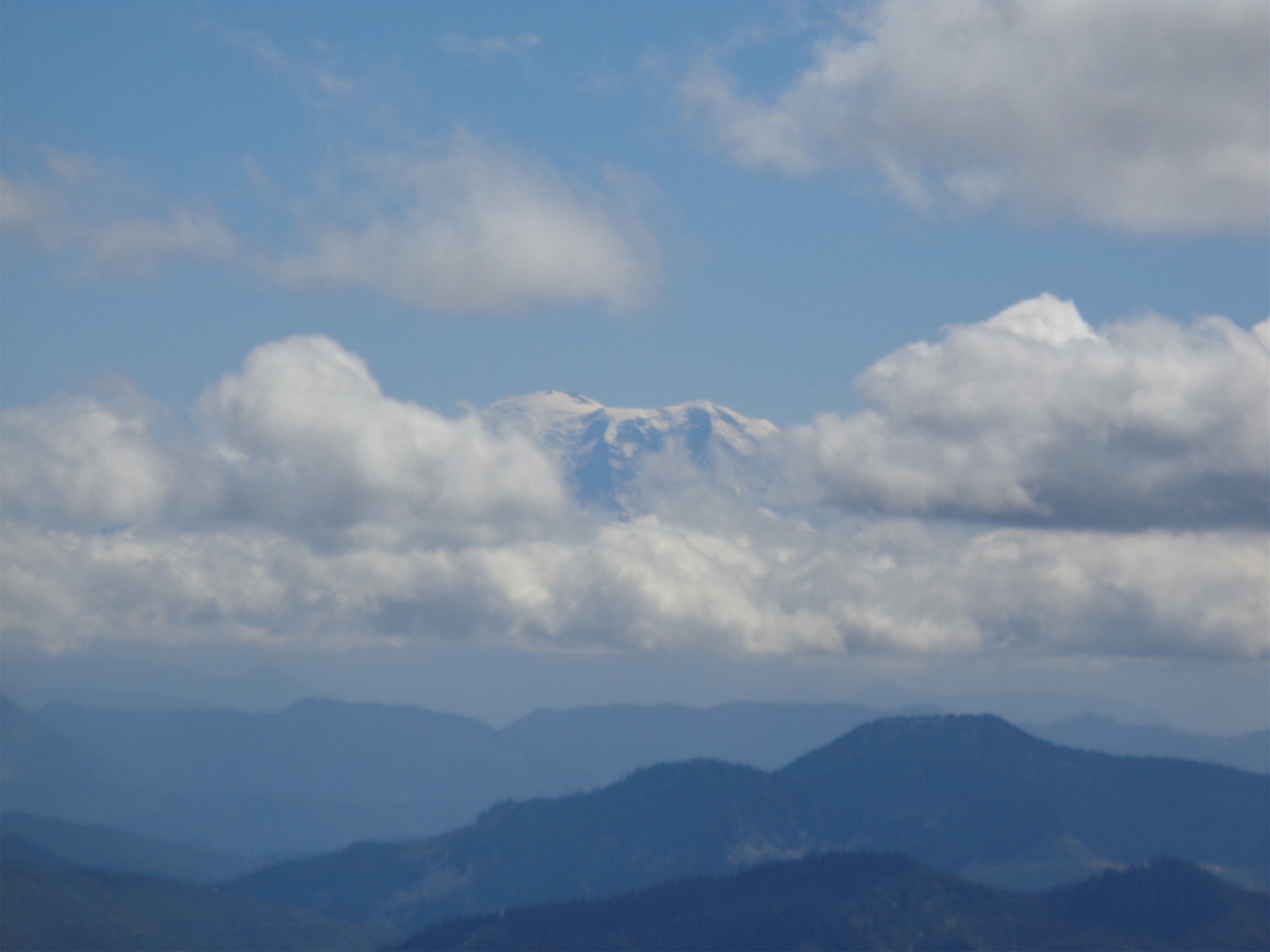
Obligatory pic of Rainier finally making an appearance
The trail to Alta starts out rolling along knolls covered in grasses and wildflowers. Hibox and Box Ridge hover over Lila Lake and the Alta Mountain Tarns, which I mistakenly thought were part of “Lila Lakes” (plural) until I hopped on WTA to write my trip report. Damn, is it gorgeous. I whined a little bit about being able to see the highway and ski resort to the west, but just keep your head turned.
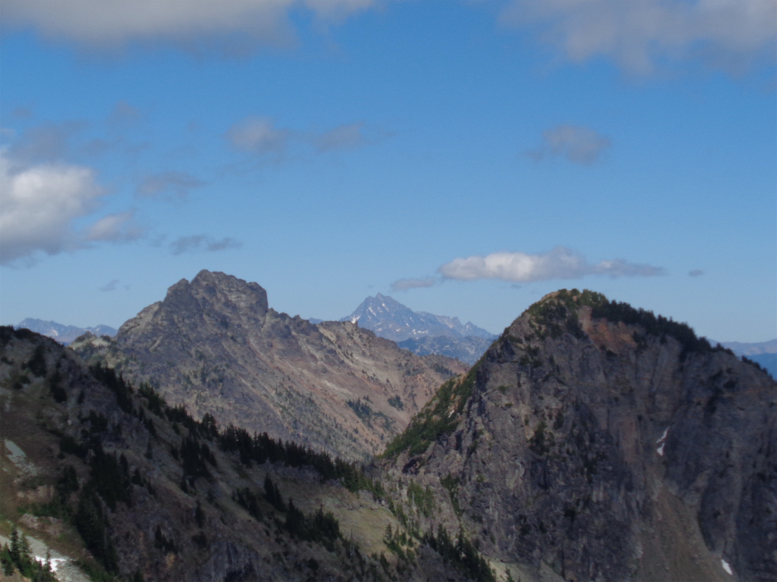
Stuart peeks between Three Queens and Hibox
Eventually, it gets rockier, and the ridge gets narrower. The trail is always clear, and honestly never felt too exposed. But I lack some sort of developmental protein, because heights and exposure have never bothered me. Think about it, that’s an evolutionary flaw. I’d be more likely to die compared to people who avoid those places.
At one point, the sound of gunshots started ripping through the air. It took me a while to figure out what it was. Rock fall? There was a sheer rocky cliff right there. Wind howling weirdly along the cliff? It was pretty windy. The smoke monster from Lost? That’d suck, and maybe make me actually run at a decent clip. But no, just gunshots. I continued on my merry way, ignorant of whoever was hunting whatever down below me.

Looking north from the summit of Alta, straight at Chikamin
There are a few false summits before the true one, and when I was one peak away, I thought I saw a person standing on the summit! I took a pic so I could show them how bad ass they looked. Upon attaining the true summit, it turns out… it was a pile of rocks. A huge ass cairn, taller than I am, one stone on top of the other. A work of art. I snapped a few pics in every direction, whined about clouds in the distance, and scouted out some routes and peaks along the PCT, which you can see very clearly from Alta. I honestly liked the views from Hibox better since it had such a great angle to see Chikamin, Lemah, Summit Chief, etc. But Hibox is a much trickier and more exposed scramble, so if you’re not too comfortable with that yet, I’d recommend starting with Alta.
Here’s a short time lapse of clouds passing over Daniel behind Chikamin. Neat to see the shadows moving across slopes as well. Some day hopefully I’ll be up here on a true sunny day. As cool as clouds are, these peaks are consistently hidden from me when I’m in the area. Besides the one time I hiked Daniel.
A gust of wind knocked me to my ass just as another runner came up to the summit. I played it cool and pretended like I was taking pictures from sophisticated angles. But in reality, wind: 1, Eve: 0.

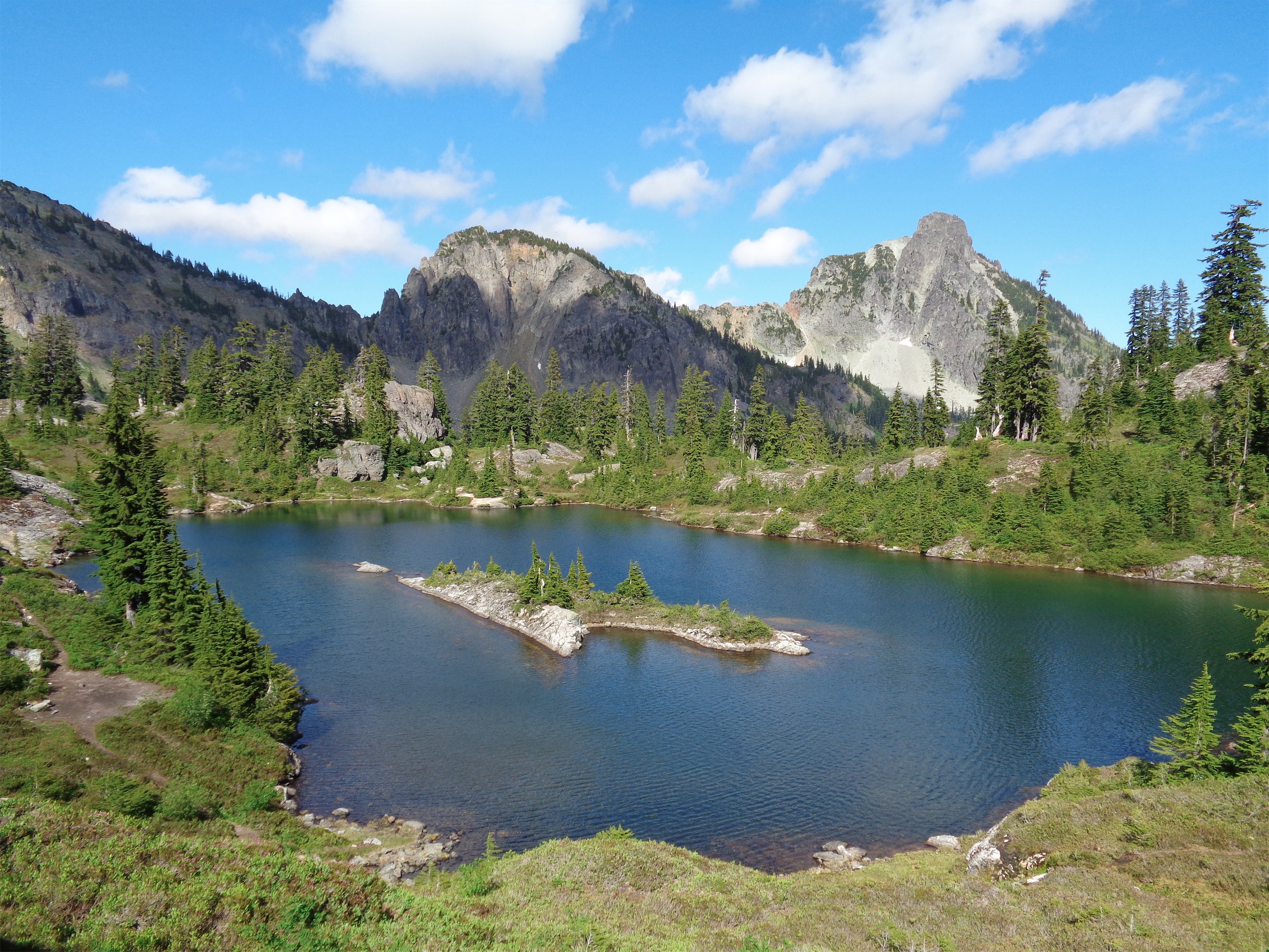
Three Queens, Box Ridge, and small tarns on the right

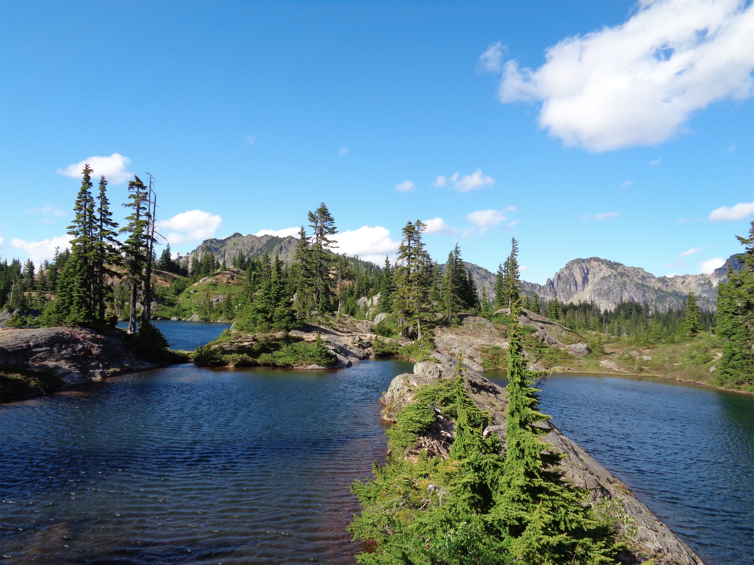
Looking back along the ridge towards Rampart Lakes
I turned back shortly after that and went back along the ridge, soaking in the views of Rainier and Rampart Lakes, glancing back at Lila Lake and Alta and Hibox and everything behind me. Let me tell you how good my gait is running along ridgelines. It’s confidence, I think, because you feel so awesome up there. You just feel stronger. Posture is better, stride is better, I feel faster and more powerful. I get cockier on ridgelines, I think, is what I’m saying. And sometimes I throw my arms out and play the airplane game and wish a helicopter was flying around me taking a sweet panorama of me with everything behind me. That’s what I’ll do when I’m rich someday. I’ve been told you can do it with a gopro, but come on, that’s not as cool.
Upon arriving at the junction of Alta and Lila Lake, I was feeling pretty good. I didn’t run as much on the way up as I had hoped, so… why not keep going? I had run into a hiker trekking up to Lila to spend the night, who had told me it was spectacular and much less visited than Rampart Lakes. One of his favorite parts of the state. I mean that’s a strong recommendation. How could I pass that up? I jogged down the trail.
The first of many tarns
Damn, he was right. There are a ton of tarns to check out, and unbelievably clear blue lakes. I bummed around the area following social trails for a bit before I though I had exhausted all options (turns out I missed a few tarns in the far northwest area of the basin). Around this time I ran out of water. Great. Well, there’s plenty on the trail, so I’ll just.. wait for running water. Taking unfiltered water from a lake freaks me out. I know, I know, the water in the rivers below literally comes from the lakes. Shh.

The tarns I didn’t make it to from above
I took a bunch of pictures of Lila Lakes, and made a mental note to camp there someday. I’ve seen a few trip reports that bushwacked from Lila Lakes over to Park Lakes, and that’s always an option. Or Hibox again, or Alta again, or Rampart Lakes. Which is where I went next!
Lila Lake, maybe, with Hibox in the background
I ran into the same hiker who had recommended Lila snooping around looking for a campsite. I happily greeted him and told him it was his recommendation that inspired me to stop by Lila Lake. He laughed and added that if I had time, I might as well check out Rampart Lakes, since they’re about a half mile from the Alta/Rampart junction. I told him I’d see how my legs felt. And of course, they ended up feeling great.
So towards Rampart Lakes it was. Very different from when I wandered there in the winter, because this time, there was a trail to follow. I was at the lakes within just a few minutes, and checked out some of the bigger ones. Alta doesn’t look nearly as menacing from Rampart Lakes as it feels when you’re hiking it.
Three lakes, one pic! You bet your ass I ran that ridge-ish rock. Rampart Lakes
Still didn’t fill up water, because the river looked murky, and I wasn’t into that. I don’t have a filter. I’m not going to recommend drinking the water straight from the source, but I haven’t been sick yet, and hopefully it’ll stay that way. I turned around to head back to the junction and back down to Rachel Lake (it was like 6pm! So much daylight!) and took out a Gu since I was a little hungry.
For those of you who aren’t familiar with Gu, it’s exactly what it sounds like. Goo. An energy paste that comes in various flavors. And usually, you want to hae water right there when you have one. Otherwise, it’s like eating peanut butter while dehydrated, and your mouth gets all dry and sticky and miserable. And that’s what I forgot to consider until I started eating it. I laughed, and ran a little faster to get back to that waterfall below Rachel Lake. I got lost for a hot minute but bushwacked back to the trail (funny how that type of thing doesn’t bother me at all anymore) and soon enough I was back on trail, flying towards Rachel Lake.

Looking up at Alta from Rampart Lakes
When I got just below Rachel Lake, I stopped at the first waterfall/river I saw. I dropped my pack and whipped out the bladder and filled it up and just chugged. Giardia takes what, two weeks to kick in? I’d worry about it in two weeks. That’s what I always say. Someday I’ll be sitting on my couch and be overcome with stomach sickness, backtrack two weeks ago, and realize I’m an idiot. At least no one walked past me. And thank goodness, no kids. I don’t want to be setting a bad example, just in case.
Running back down was perfect. Practice for balance and footwork, nothing too tricky to beat you up, and a nice soft finish down two miles of soft dirt trail cruising back to the car. 14.1 miles, and maybe next time I’ll add Hibox in there too. It really is a great run, and the ridge is like a playground for adults. Lakes, tarns, more lakes, scrambles, peaks, rolling ridges covered in wildflower, exposed rocks, take your pick. Everything is there, there’s something for everyone. You can’t get bored in a place like this. And it’s different every season. I’ve been up there three times now, and every time has been completely different.
Strava map attached here, though some of my route (only like 2%) was off trail so don’t put too much stock into it, though it’s a great guideline. Camp at Lila Lake! It’s really amazing, and feels more secluded than Rampart Lakes. Better views, in my opinion, since Box Ridge is right there. Wake up in the morning and head for Alta, and hit Hibox on the way out if you’re feeling good. You won’t regret it.

Who doesn’t want to run that?

Pingback: Spring Training | Have Tent, Will Travel