- Distance: 9 miles round trip
- Elevation: 2650ft gain in altitude, alternates between very flat and very steep
- Weather: Low 60’s, foggy, rainy
- Commute from Seattle: About two hours
- Did I trip: Surprisingly, no
Technically I ran this way back on September 24th, 2014. It was low 60’s and very foggy with occasional bursts of rain. Decent rainy day run, though I expect it’d be much better in the sun and in mid October when fall colors would be in their full splendor. It’s about two hours from Seattle and if you want to avoid tolls, stay on I5 N instead of taking 520. Being new to the area, I didn’t realize this until it was too late, and sometime real soon my home back on the east coast should be getting a toll bill. Oops.
The other part no one mentioned was that getting to the trailhead meant spending 40 minutes on a gravel, switchback logging road. Not too many potholes, but there were a few big rocks, some of which I had to actually get out of my car and move aside so I could drive past. But if my Honda Accord can handle it, pretty much anything can. I was the only car at the trailhead, and was a little concerned I had driven to a crappy trail in the middle of nowhere on a shitty day. Packed my bear spray just in case, to fend off bears and potential mountain hermits and even filled out one of those little hiking waivers so if I died on my first solo trail run, they’d have some clues to help find my neon-outfitted body. Anyway, turns out it’s a great trail for running: wide, soft dirt, and straight along a ridge. Unfortunately, when it goes up, it goes straight up. It’s mostly flat aside from those few sections of intense elevation gain, which I had to hike. There are two summits, the first of which is Sunrise Mountain.
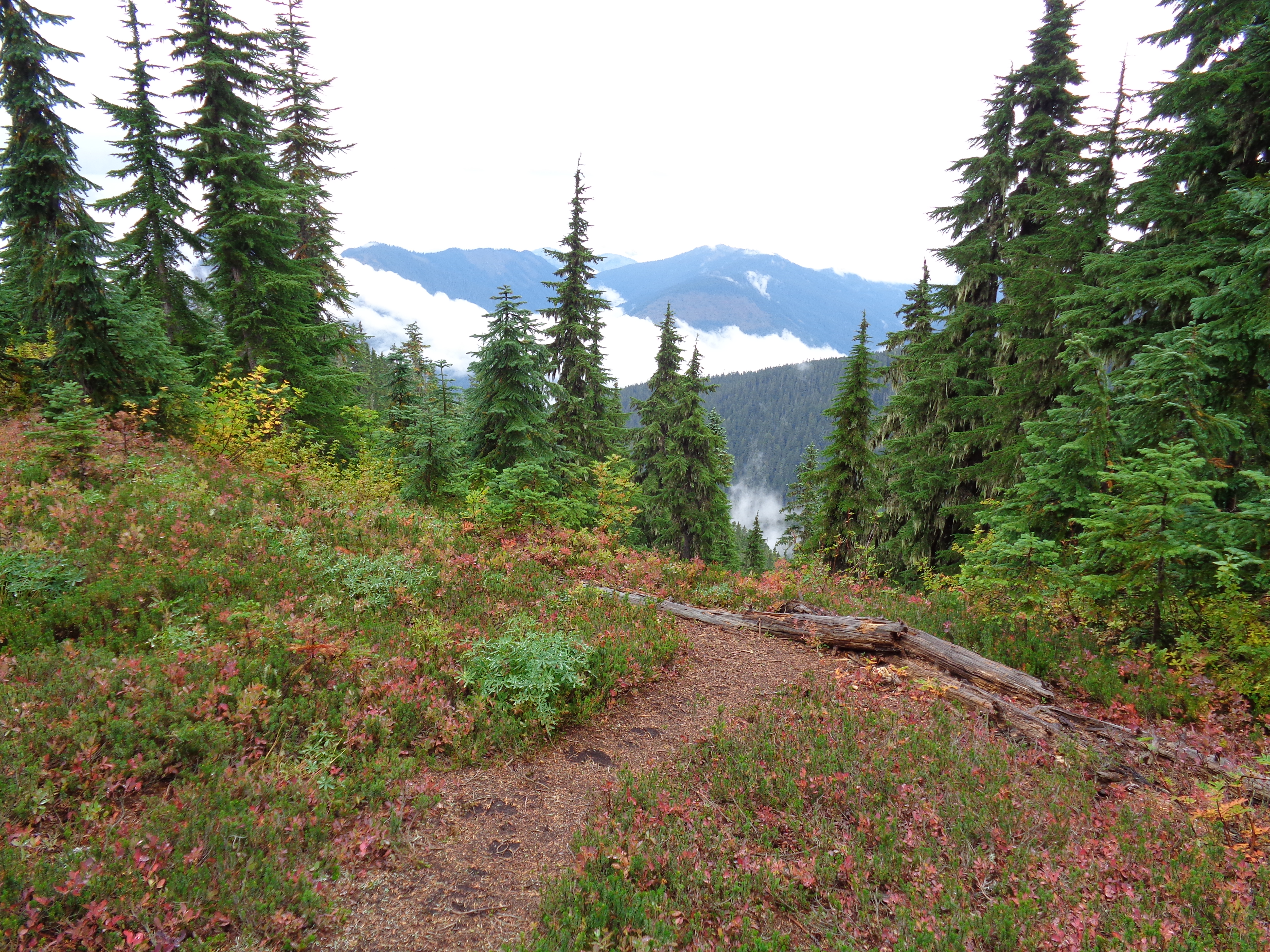
Foggy view from Sunrise Mountain
You lose 300ft of elevation pretty steeply after that peak, and then start climbing again to Scorpion Mountain. Don’t be misled by pictures on the WTA website, either – the first 4 miles of the trail are mostly in the woods with few views. Scorpion mountain is about a half mile away once you finally break out onto the meadowy ridge. If it’s nice, continue an extra half mile down to Joan Lake.

Joan Lake from Scorpion Mountain
Worth it on a foggy day, but I have to wonder what the views are like on a clear day when you can actually see surrounding ridges and peaks. When I got back down to the trailhead, clouds had completely taken over the valley, visibility was about 30 feet, and I was staring off a cliff at a wall of white.
I think part of why I liked this one so much was just that it was my first trail run out here, I had a new hydration pack, a new camera, and my pride ensured that I had a great time. In retrospect, it was pouring rain for half of the run, my goretex trail shoes (Nike Wildhorse) filled with water and never quite drained, it was cold, and I nearly tore the arm of my new extra-lightweight water resistant jacket when I got stuck on a tree. So on future rainy runs, I’m wearing a tougher jacket, thinner socks, and running more than 9 miles to compensate for a two hour drive. And bringing better snacks. Seriously, pepperoni didn’t cut it.
Edit: Just saw pics of Johnson Ridge on a sunny day. Views of surrounding mountains, even Glacier Peak. I had no idea. Just re-added this to my future hikes list, except under the condition that it be sunny when I go back.
