I just realized this was my first hike/snowshoe since the beginning of the new year! And what a way to bring it in. 1/6/2015. I’ve been slacking on the hikes because I’ve had so many days at work (retail paychecks are… not generous) but I managed to squeeze in a few. Apparently I’m lucky that this is my first winter here – plenty of nice days and not too much rain. Even as I sit here a week later, we’re talking sunny, blue skies and incredible sunsets.
Anyway, Artist Point!
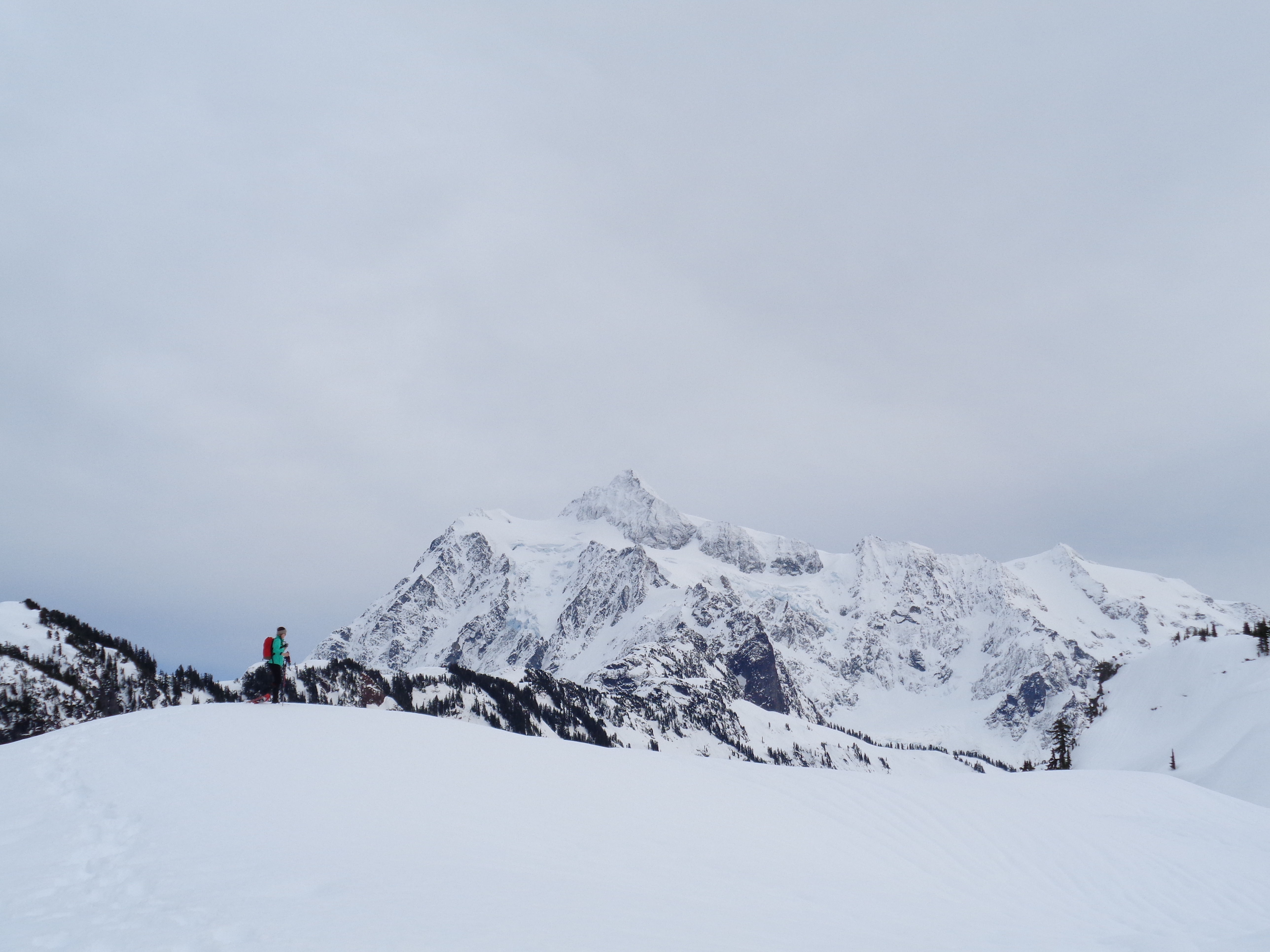
Lee traversing a knoll with Shuksan in the background
- Distance: 5.5 miles round trip
- Elevation: 1200ft gain, 5200ft highest point
- Weather: 40’s and overcast
- Commute from Seattle: Almost 3 hours
- Did I Trip: Yes, I post-holed and tripped over a treetop that was buried beneath the snow. Elegantly (not)
So this was my day off, if you ignore the clinics we had to go to at 8am. Lee and I had plans to hike afterwards, and I was thinking we’d do something short out by Snoqualmie. Checking the weather during clinics, it was supposed to be clear, and I just couldn’t bear wasting a clear day on freaking i90. Luckily, we were both free all day, and Lee was game to do anything. We stopped at a cute little scooby-doo-van-coffee-shop near the REI parking lot (Carabiner Coffee) and we were on our way. The plan was to drive north on i5 and see how the views were. If it was cloudy, we’d head to something off Rt 2 or Mountain Loop. If Baker was out… well, we’d go to Baker.
I’m glad I’m at this point with my Cascades knowledge. I can pick a highway and just immediately know 10 hikes and how accessible they’ll be and whether they’ll be worth it on a given day. Spring/summer are going to be amazing knowing what I know now. So we’re 30 miles up i5 when we turn a corner, and… [cue angelic music] BAM. BAKER. LEE! LEE WE’RE GOING TO BAKER! She was down to listen to my impulsive decision, and we readjusted our seats ready for another two hours in the car.

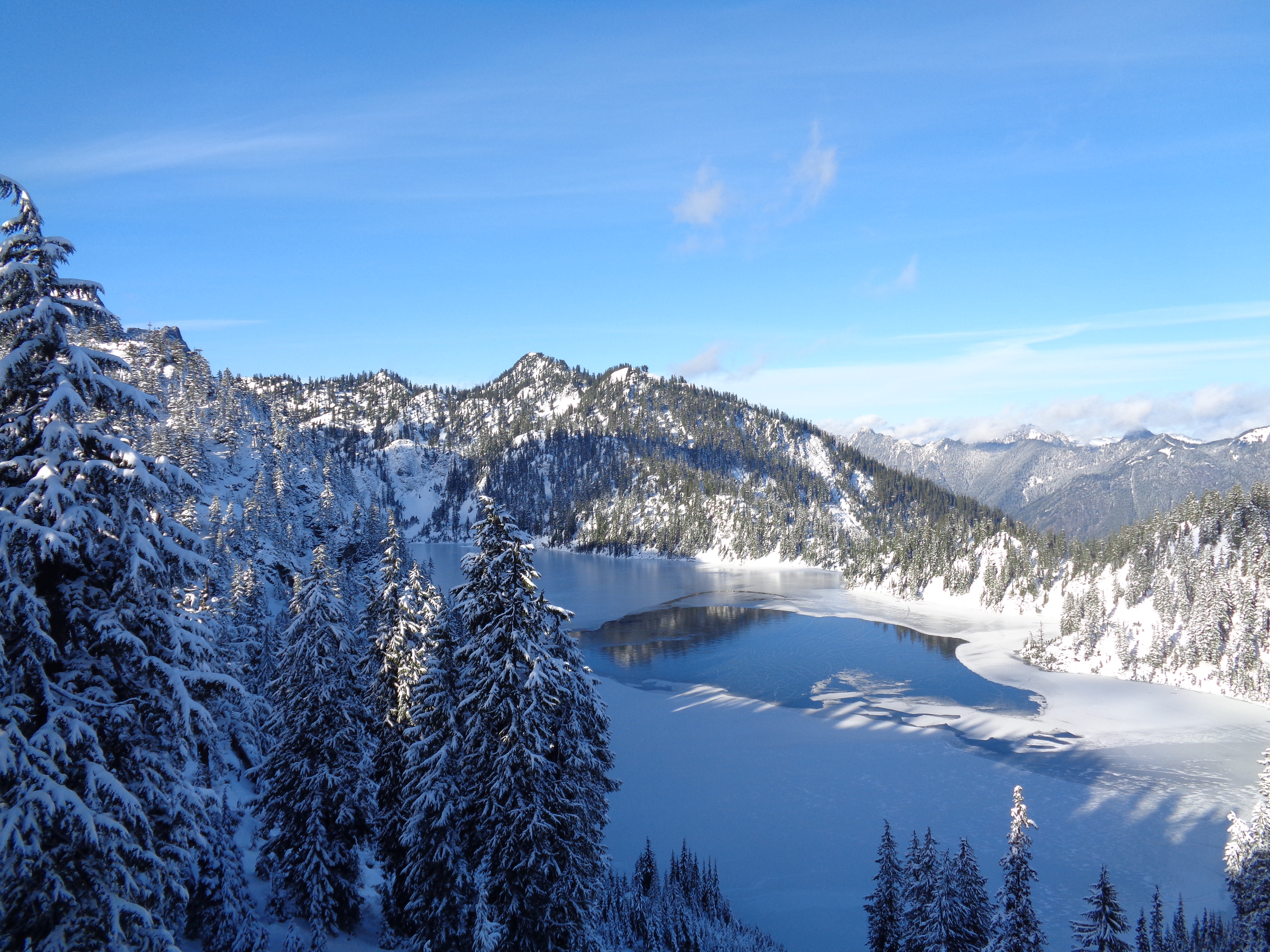
Shuksan over Picture Lake
It wasn’t “sunny” per se, just the type of clouds where they’re high enough that you can still see the peaks. And that’s all I’ll ask for up here. We pulled into the Heather Meadows parking lot (the same lot we camped in before Yellow Aster Butte) around noon, after stopping to ask for directions since we had no cell service and realized we had no idea to park. We drove past Picture Lake, and when Shuksan came into view I made us pull over to take a picture. Unlike last time I was here, we could actually see the top of Shuksan! So technically, this was my first time up close and personal with the mountain that I’ll be climbing in August.
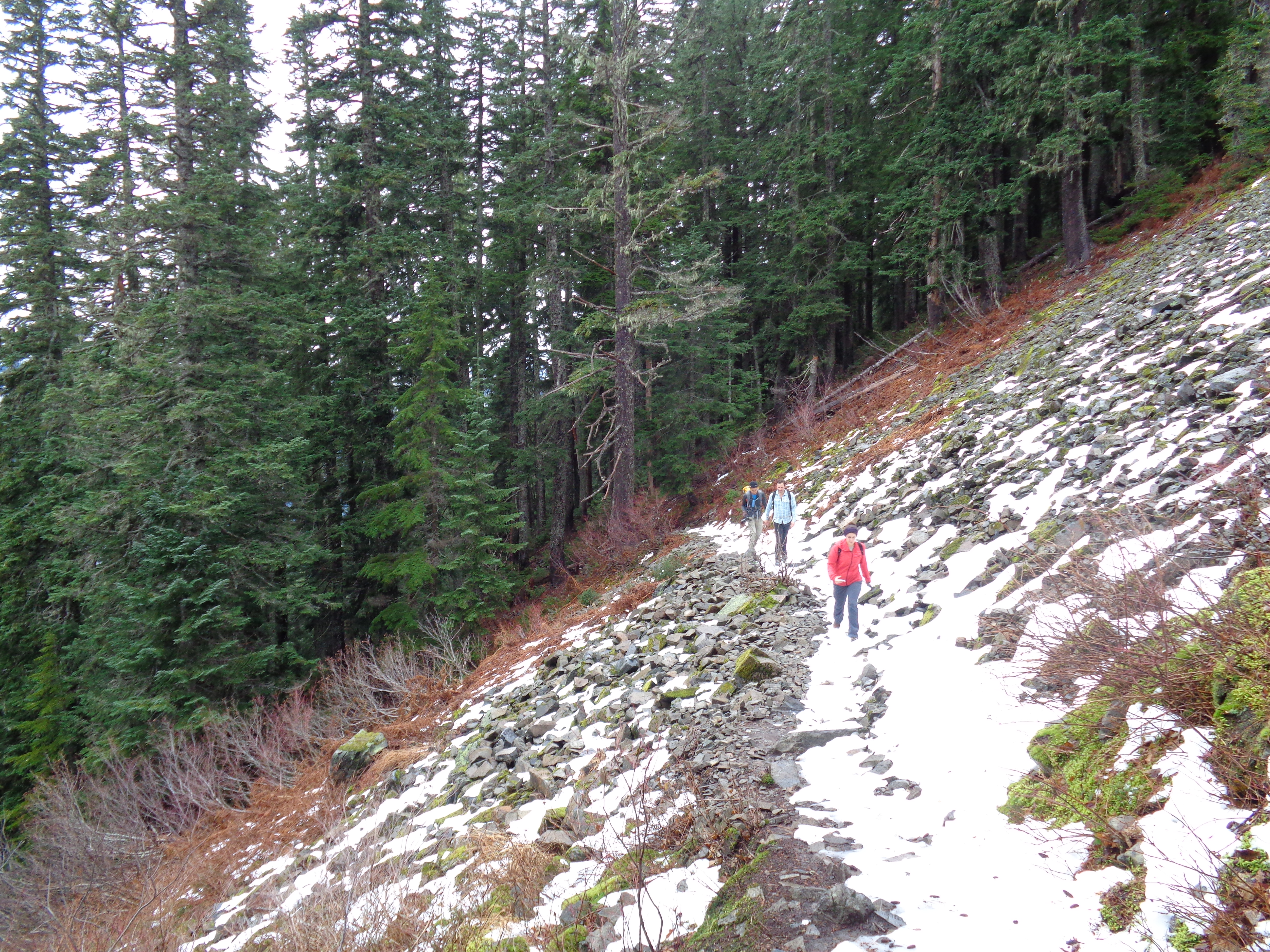
We hopped out of the car and started organizing our stuff. Snowshoes, gaiters, waterproof pants, gloves, Lee’s new GoPro. We ran into a couple dragging their kid around on a sled, and a few snowboarders that quickly disappeared. We strapped on our snowshoes and headed south towards the ridge, starting out on the path to the left of the bathroom.
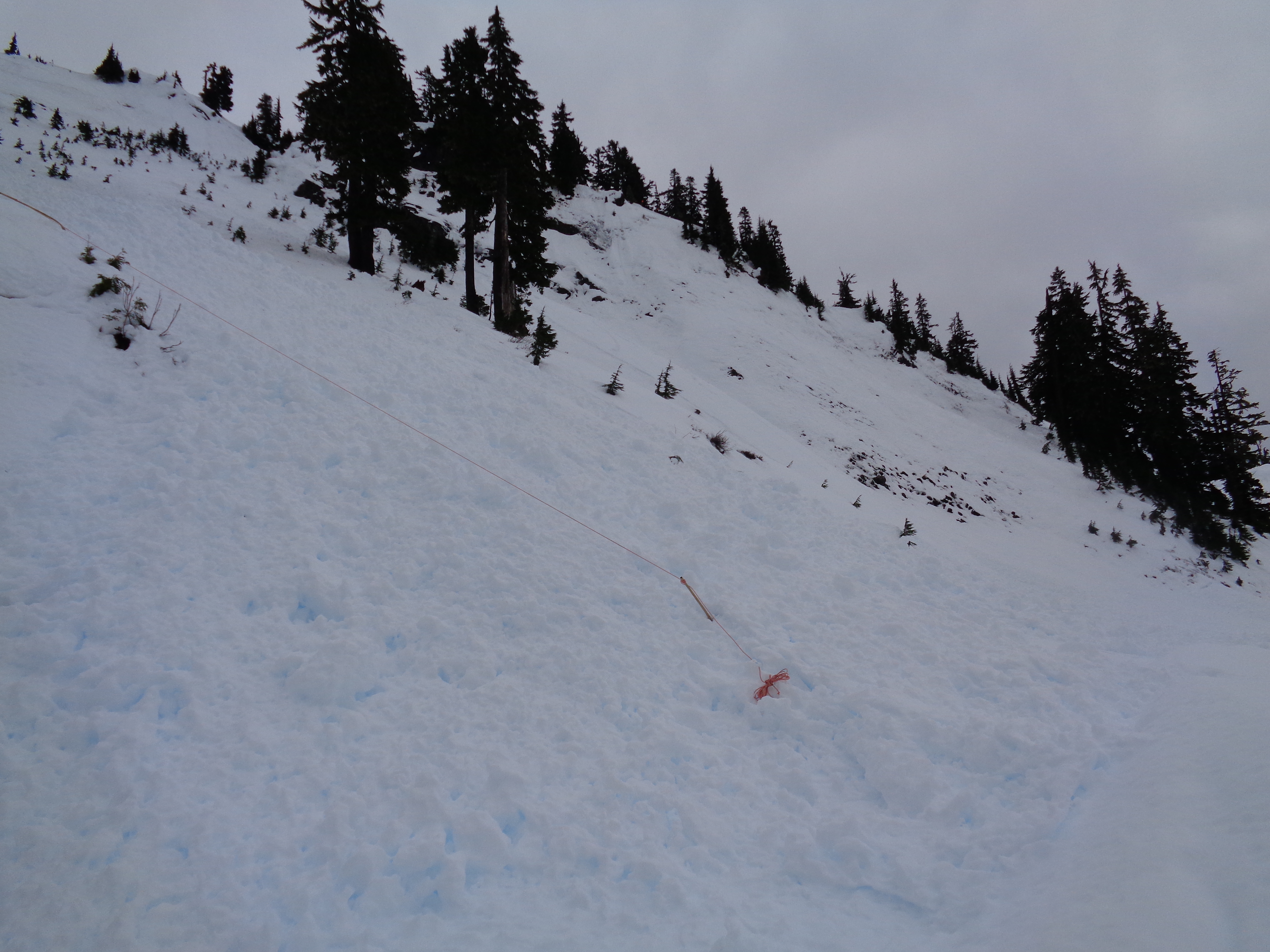
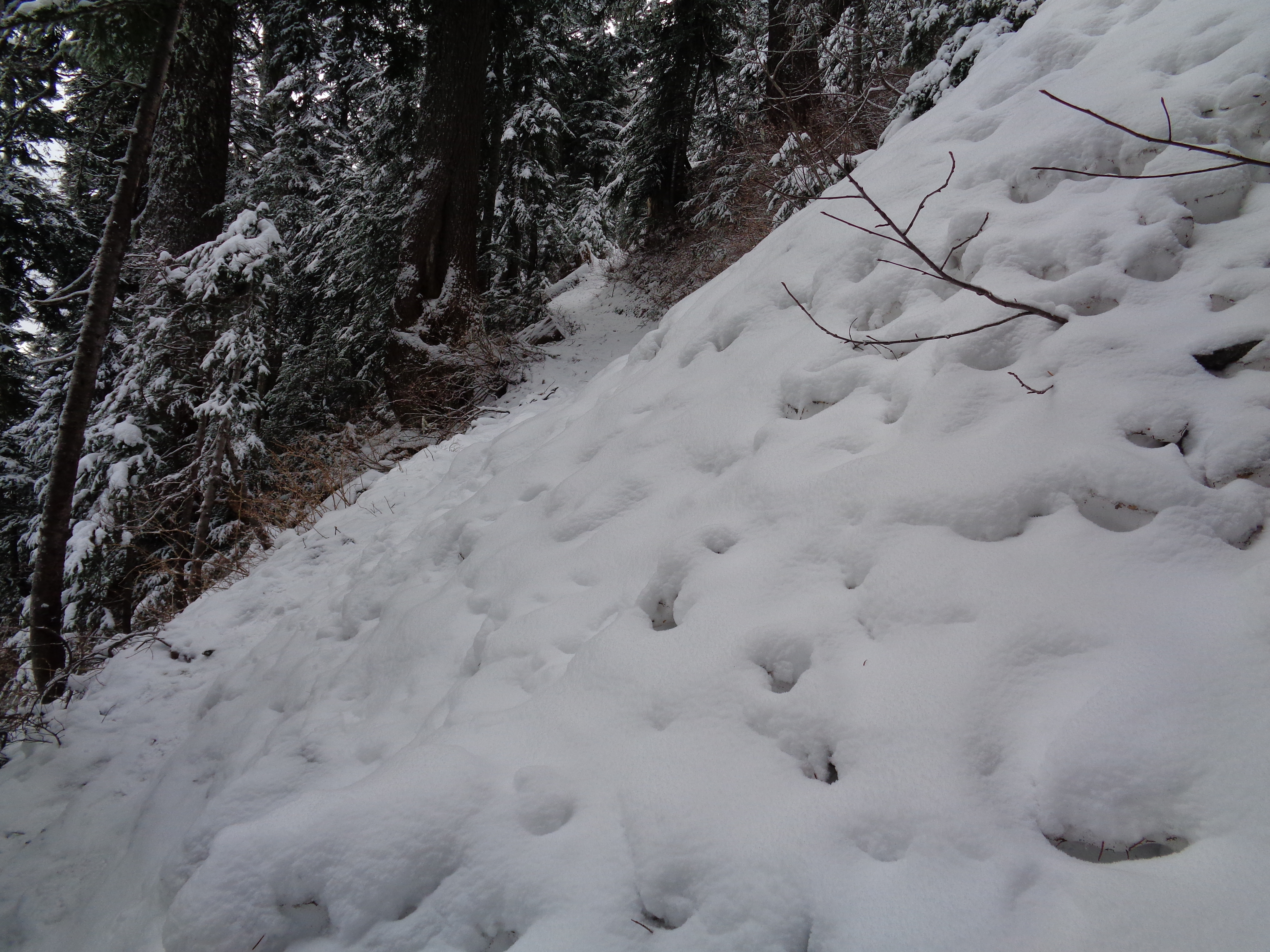
Avalanche debris wiped out some trail markers
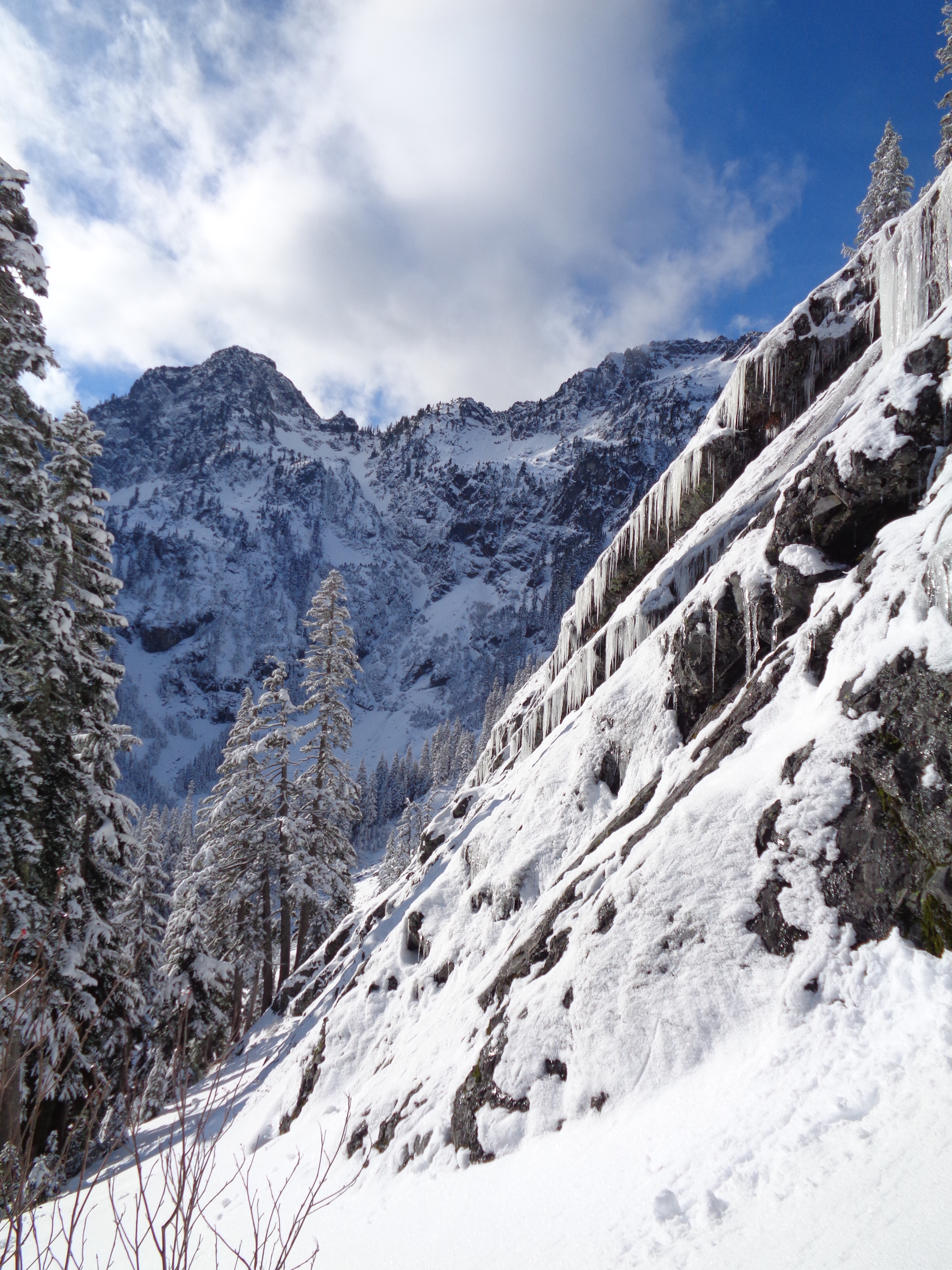
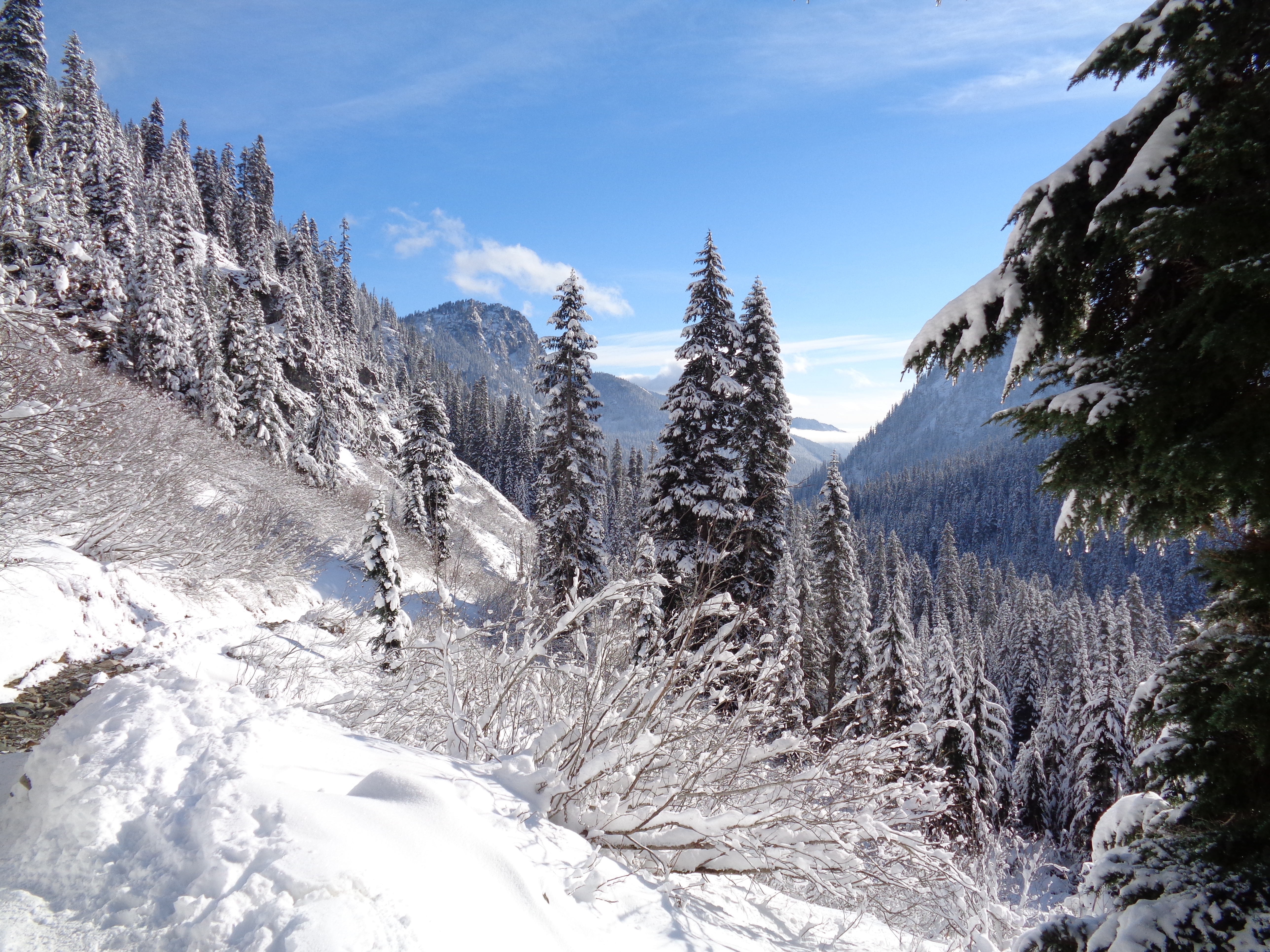
At first the trail follows the road, which is clear in the summer but buried in snow by this time of year. It was very well groomed, which made snowshoeing easy. The road splits after 10 minutes or so, and we went in completely the wrong direction at first – until we hit a bunch of avalanche debris and turned around. I wasn’t sure we’d even make it to Artist Point until we got back to the fork in the road, and realized we should have gone right, not left. Left led to some slopes marked with a skull and crossbones on the map – avalanche territory! Right leads to the border of the ski area. Once you cross the border, you’re in the backcountry, and responsible for yourselves.
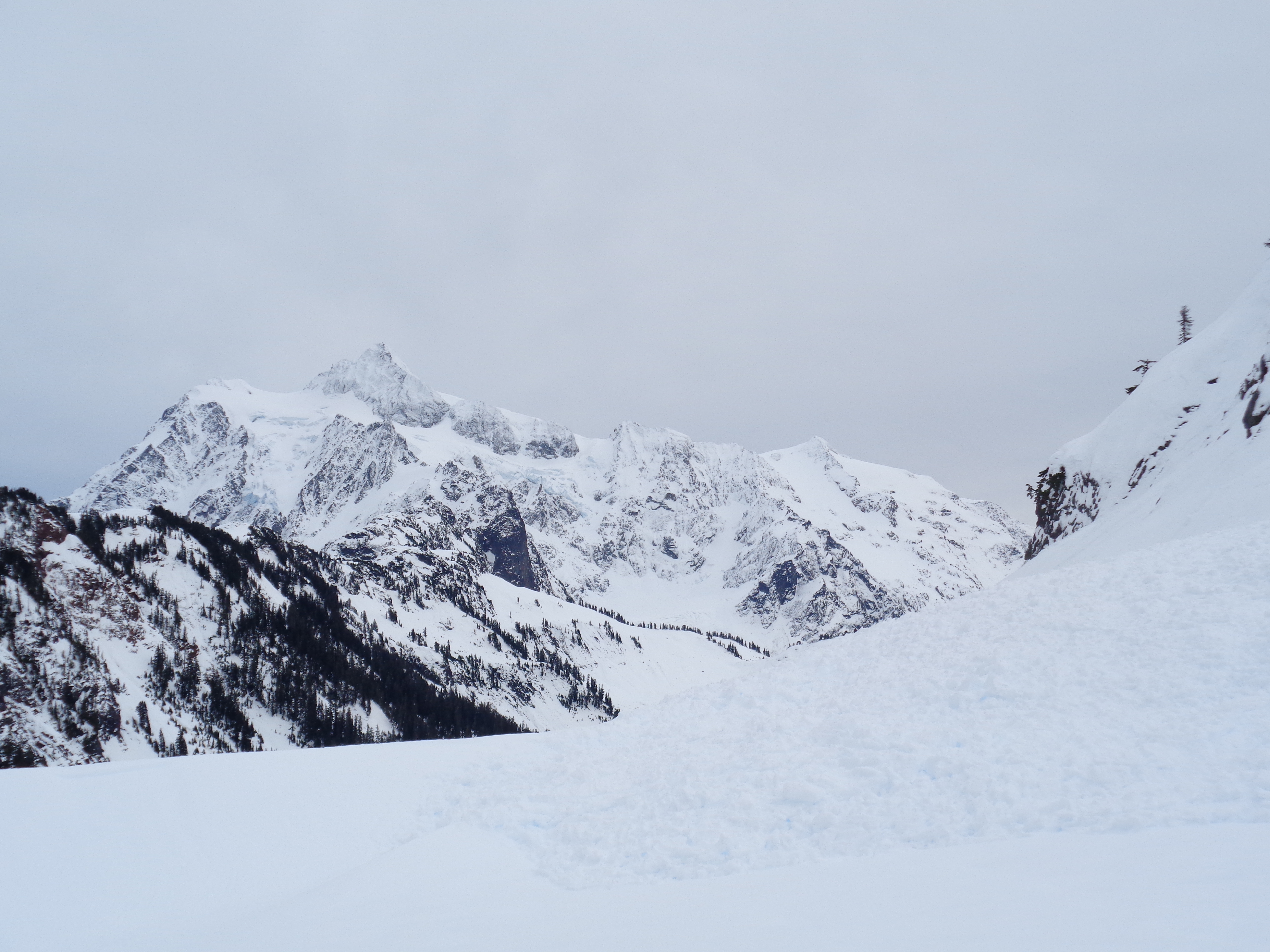
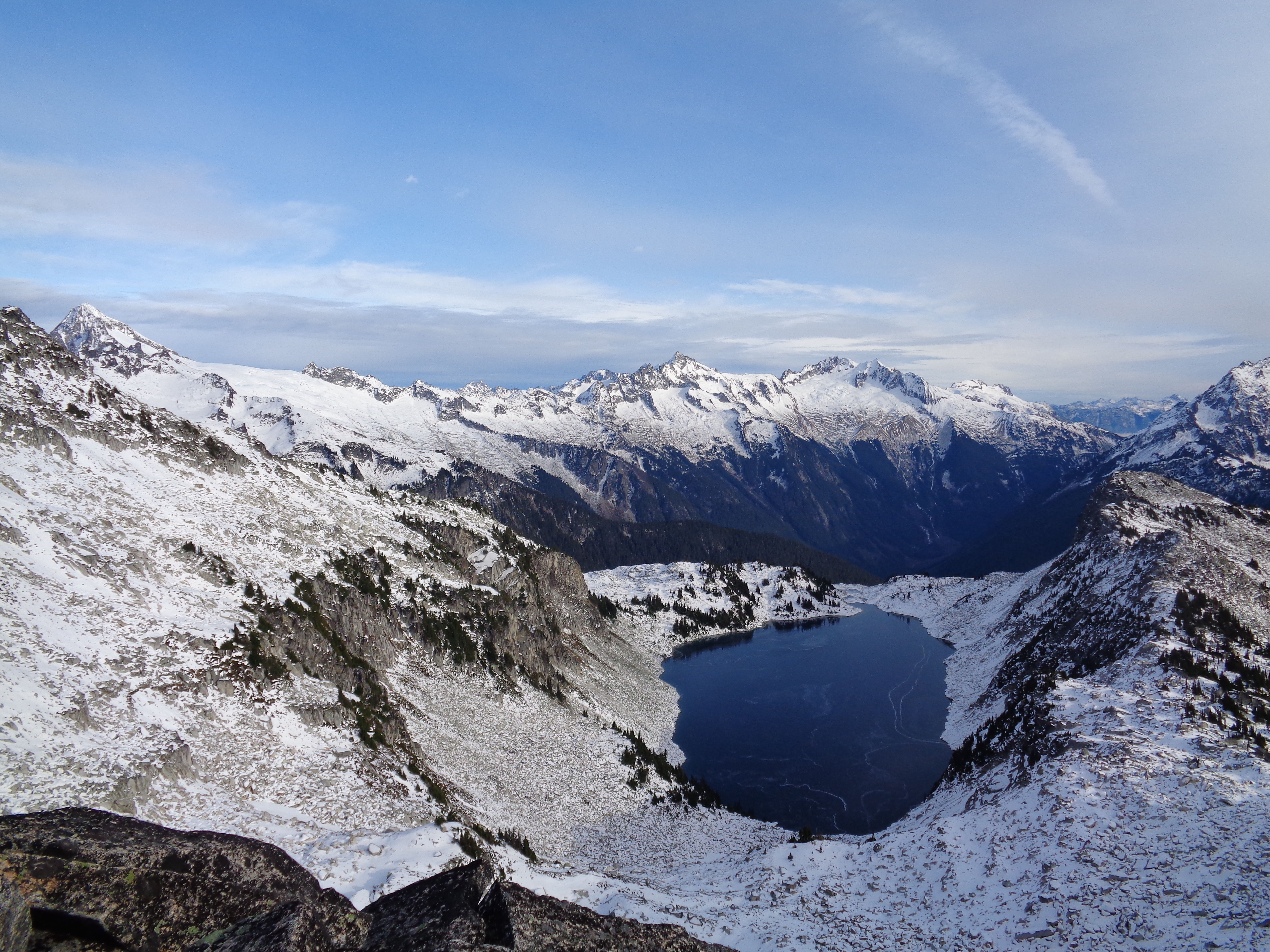
Looking at Shuksan over some avy debris in the backcountry
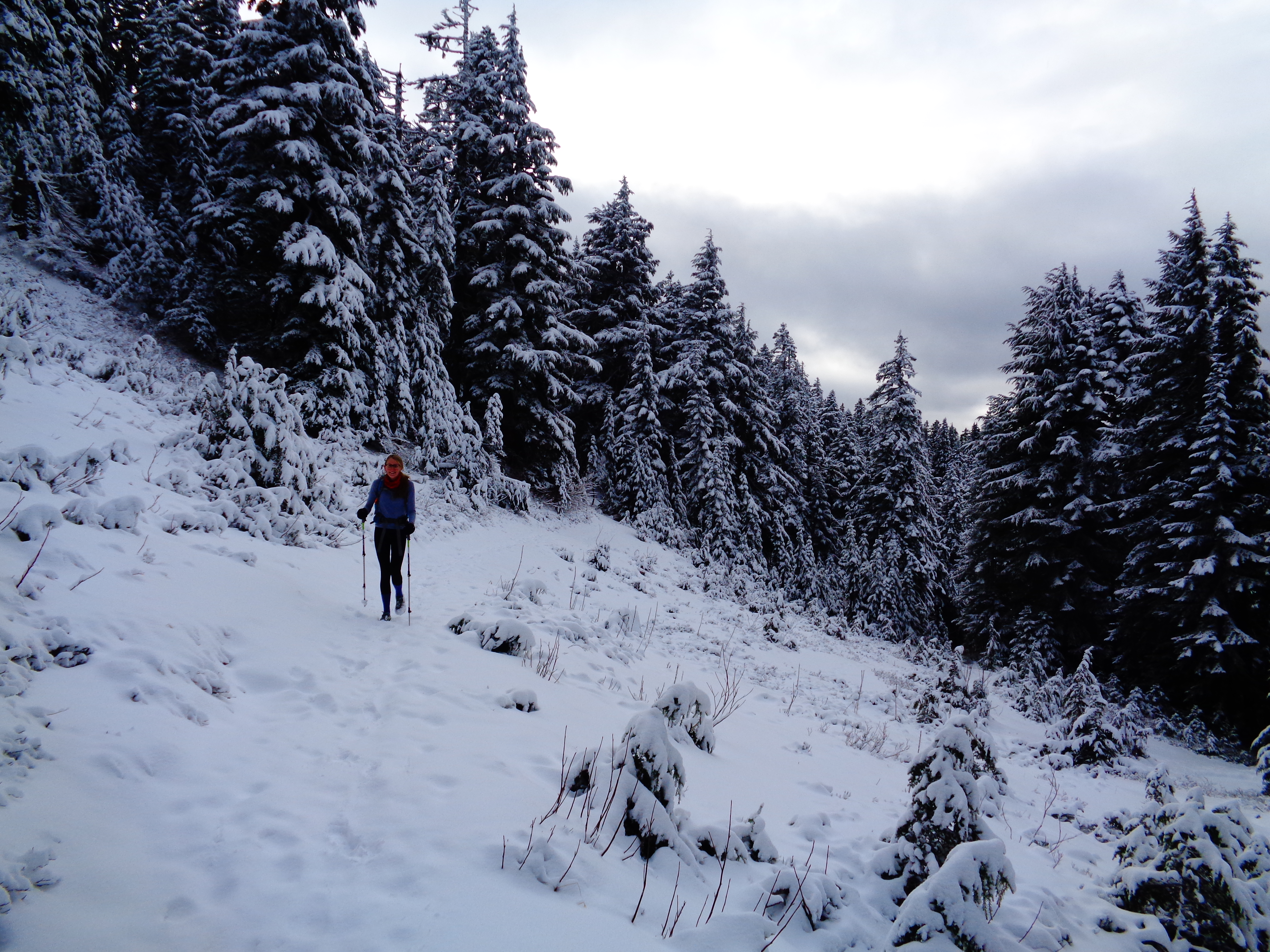
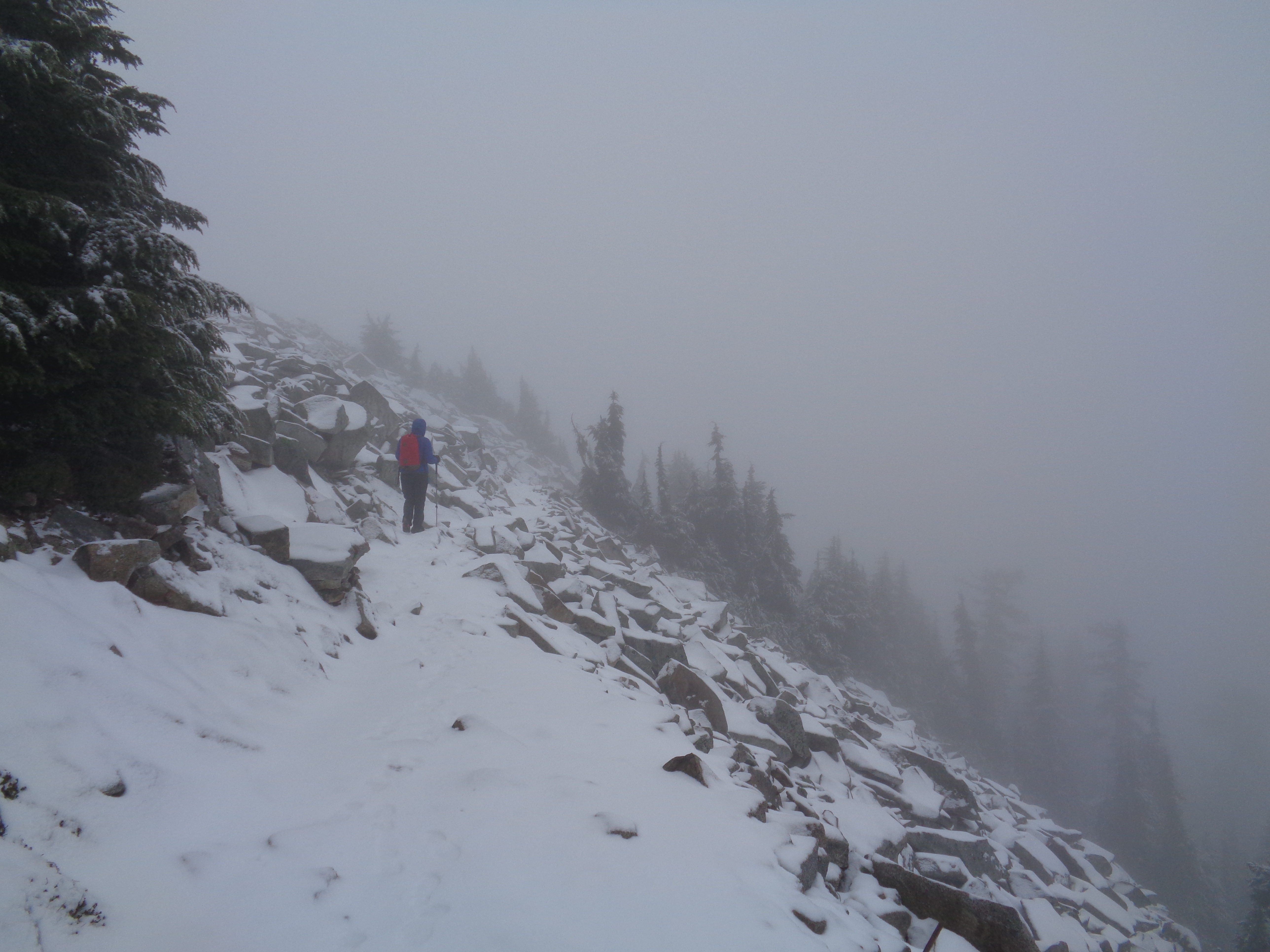
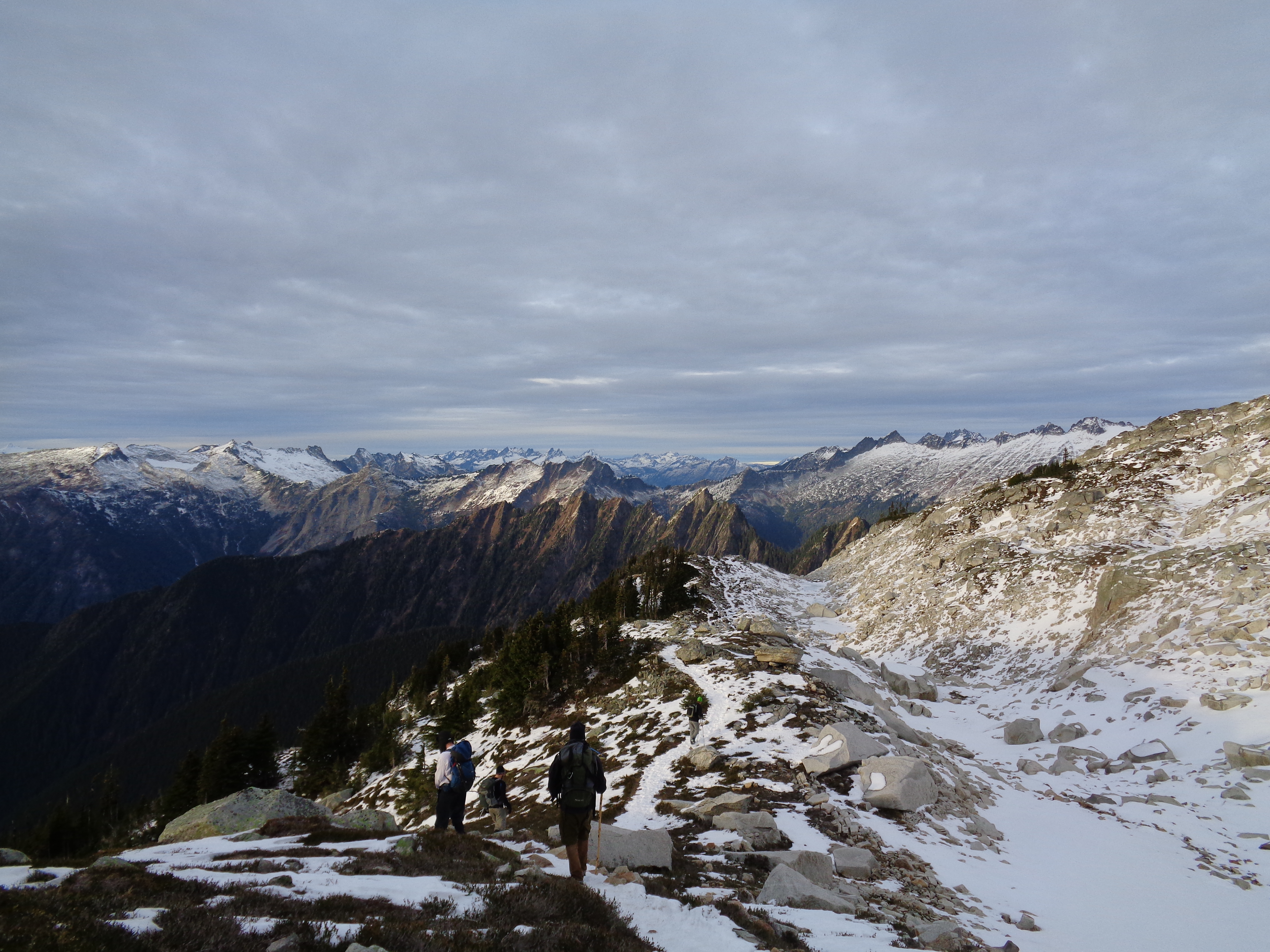
Once off the groomed road, we stayed on some old tracks that also followed the trip reports we had pulled up from wta.org. Yay, consistency! Usually everyone and their mom does this snowshoe on a bright day, but being a Tuesday, we only saw 5 or 6 others total. Which is what I like. Solitude.
At first it was relatively flat, but there were a few sections that skirted avalanche slopes. Slopes that had already avalanched once or twice, but the path at the bottom was wide enough that most of the flows hadn’t reached across. We knew the avalanche forecast was low risk, so we continued on, but kept our distance when possible and went quickly when we were worried. Later on, we met a group of three who said they had personally triggered several of the avalanches we had seen. That’s how avalanches work – out here on the lower slopes, it’s rare to have a random one. The majority are human-triggered.

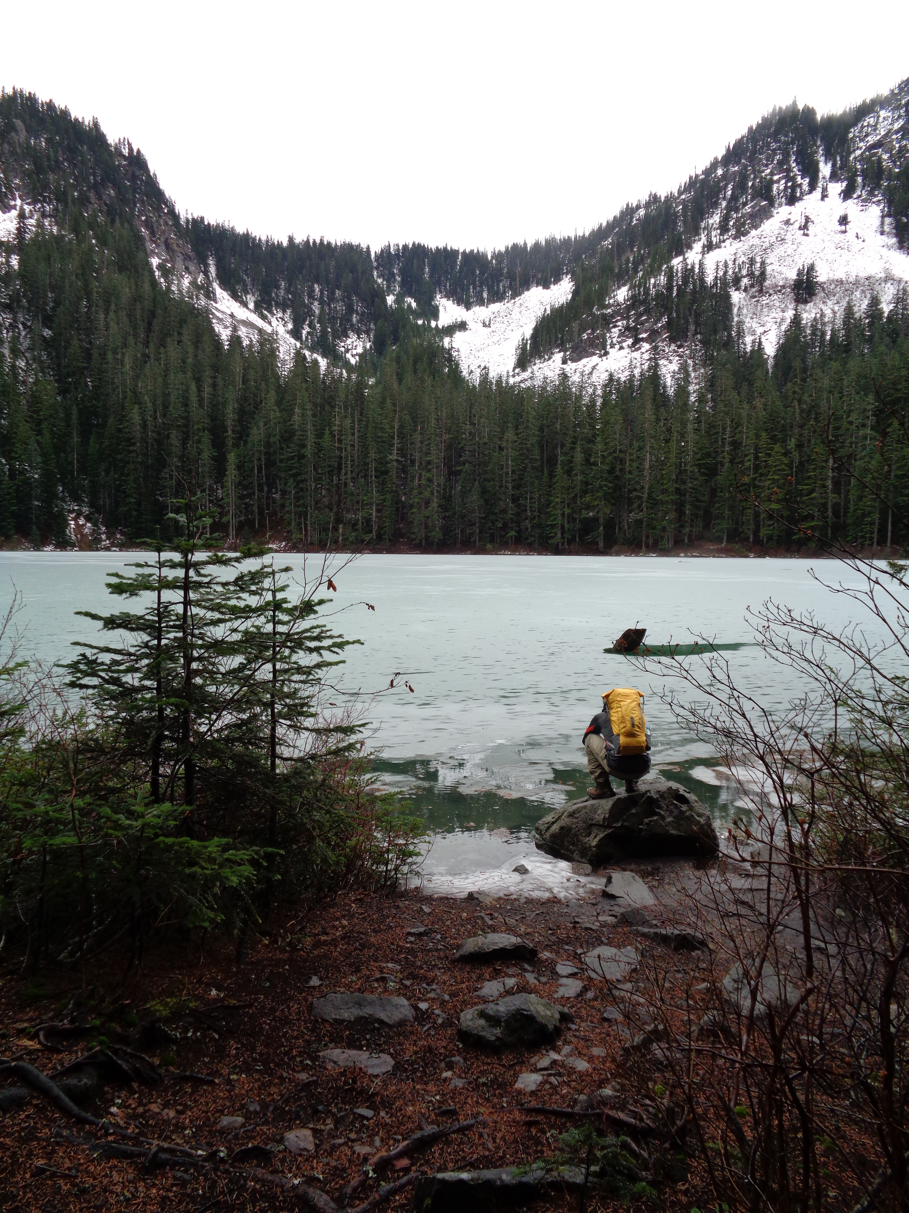
The summer bathroom!
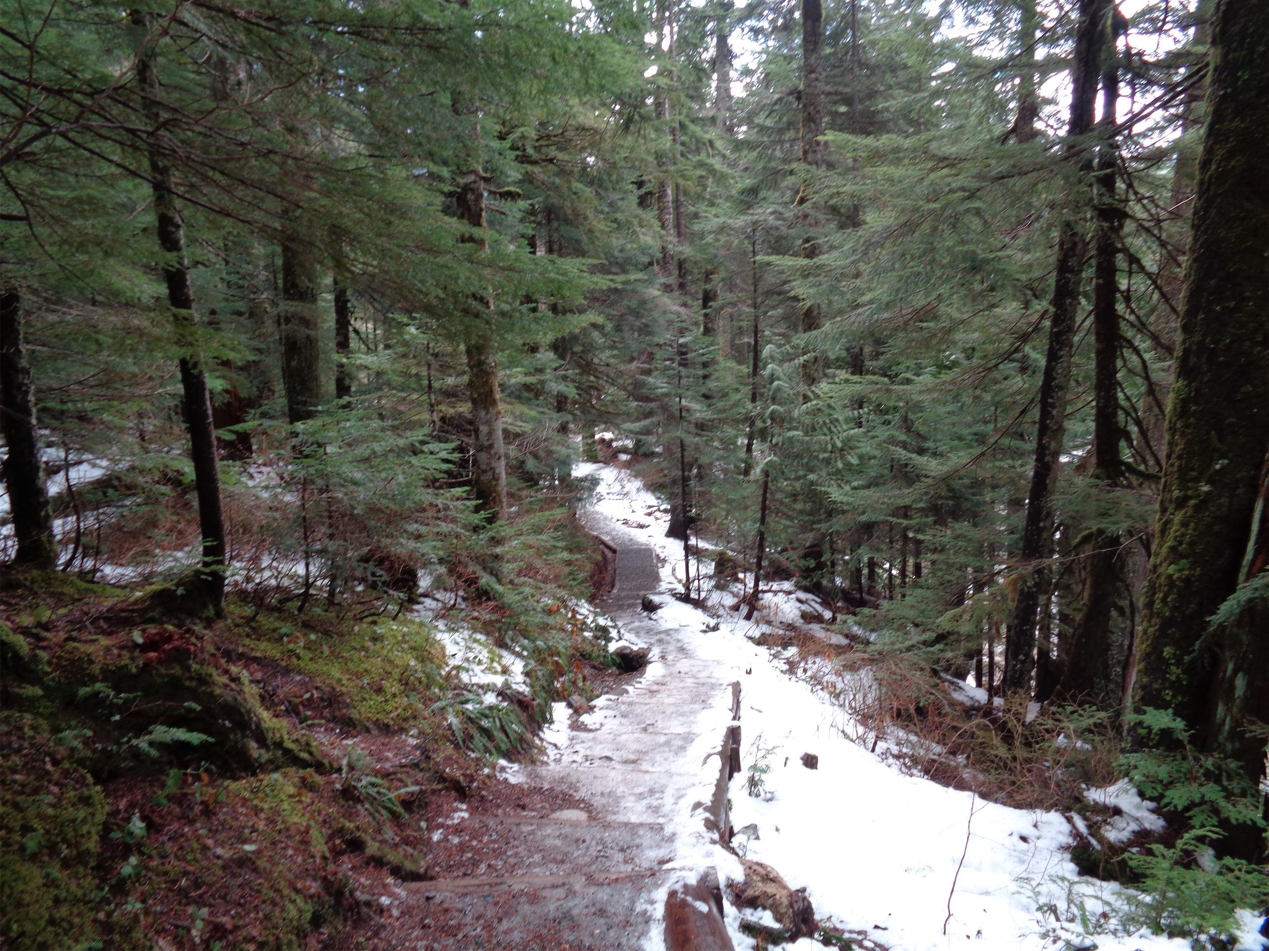
Eventually the path caught up with the road again, and followed it as it switched back up the ridge. This was another area where we’d keep as close to the edge (ironically) as possible in case the slope next to us decided to shed some snow. For all of our efforts, we did not see a single avalanche in action. Once the road is done switchbacking, you trek across a field to where there is a bathroom! Or at least, in the summer there’s a bathroom. This time of year, we could only see the peak of the roof, and this has been a low snow year.

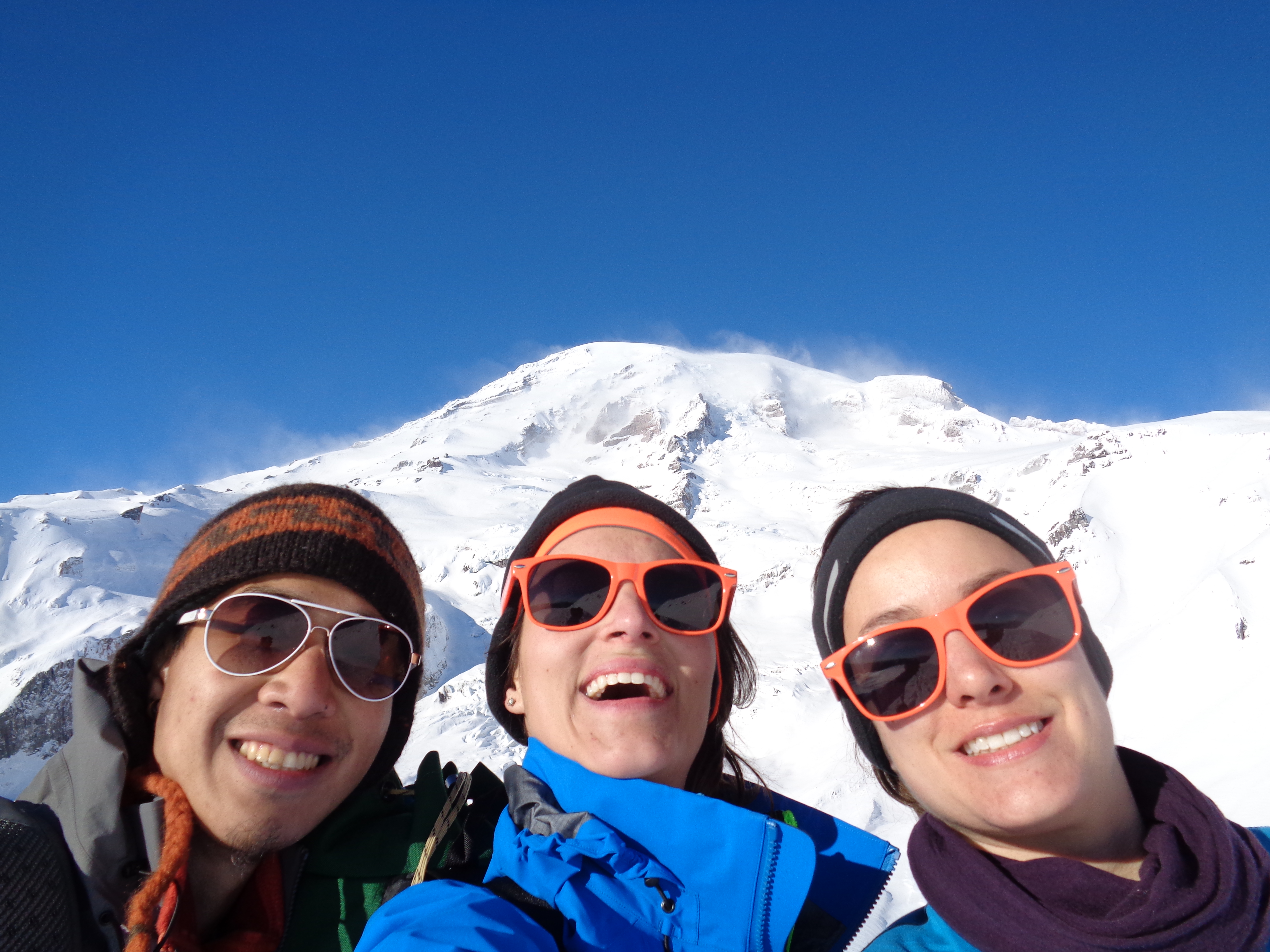
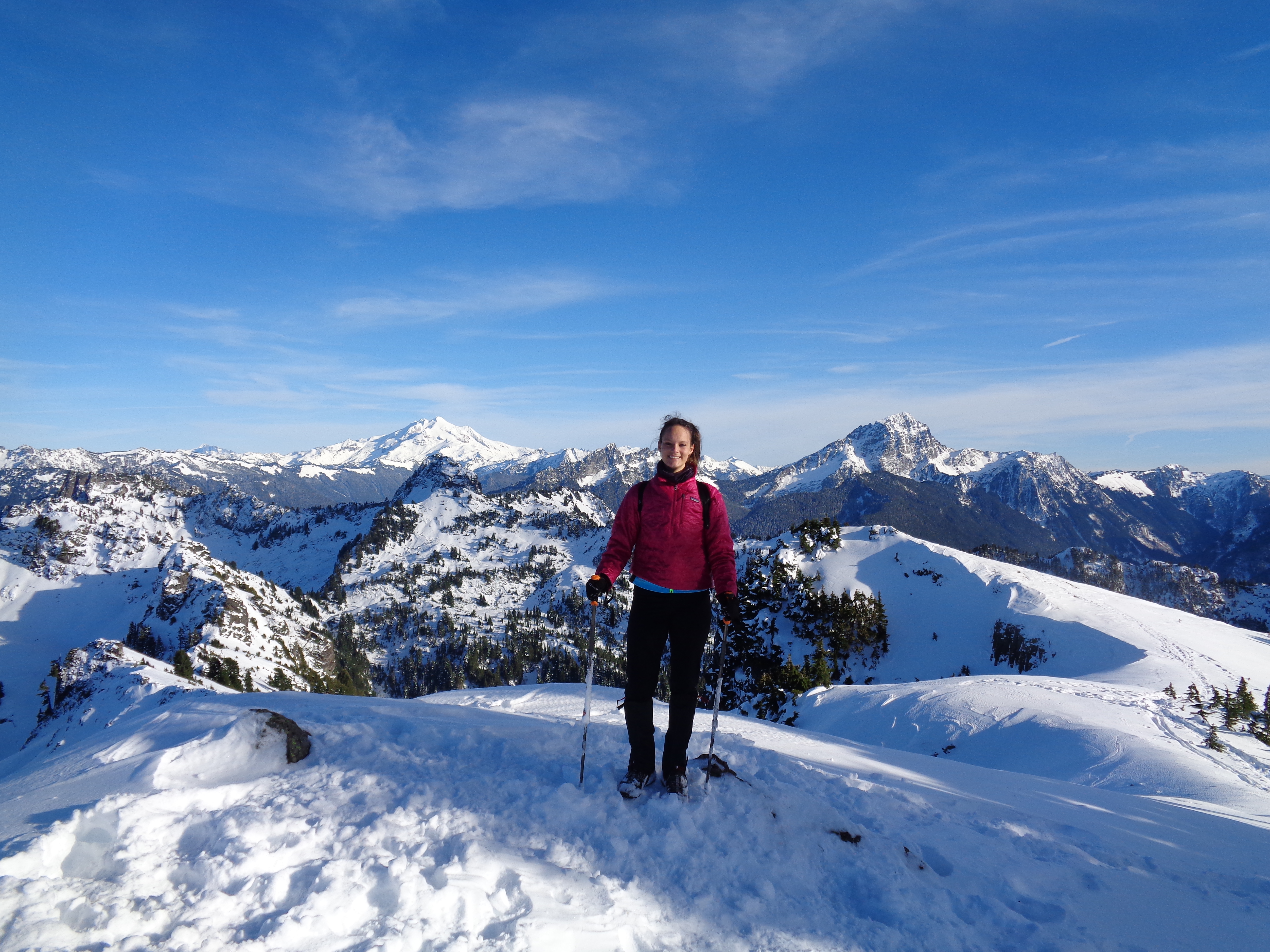
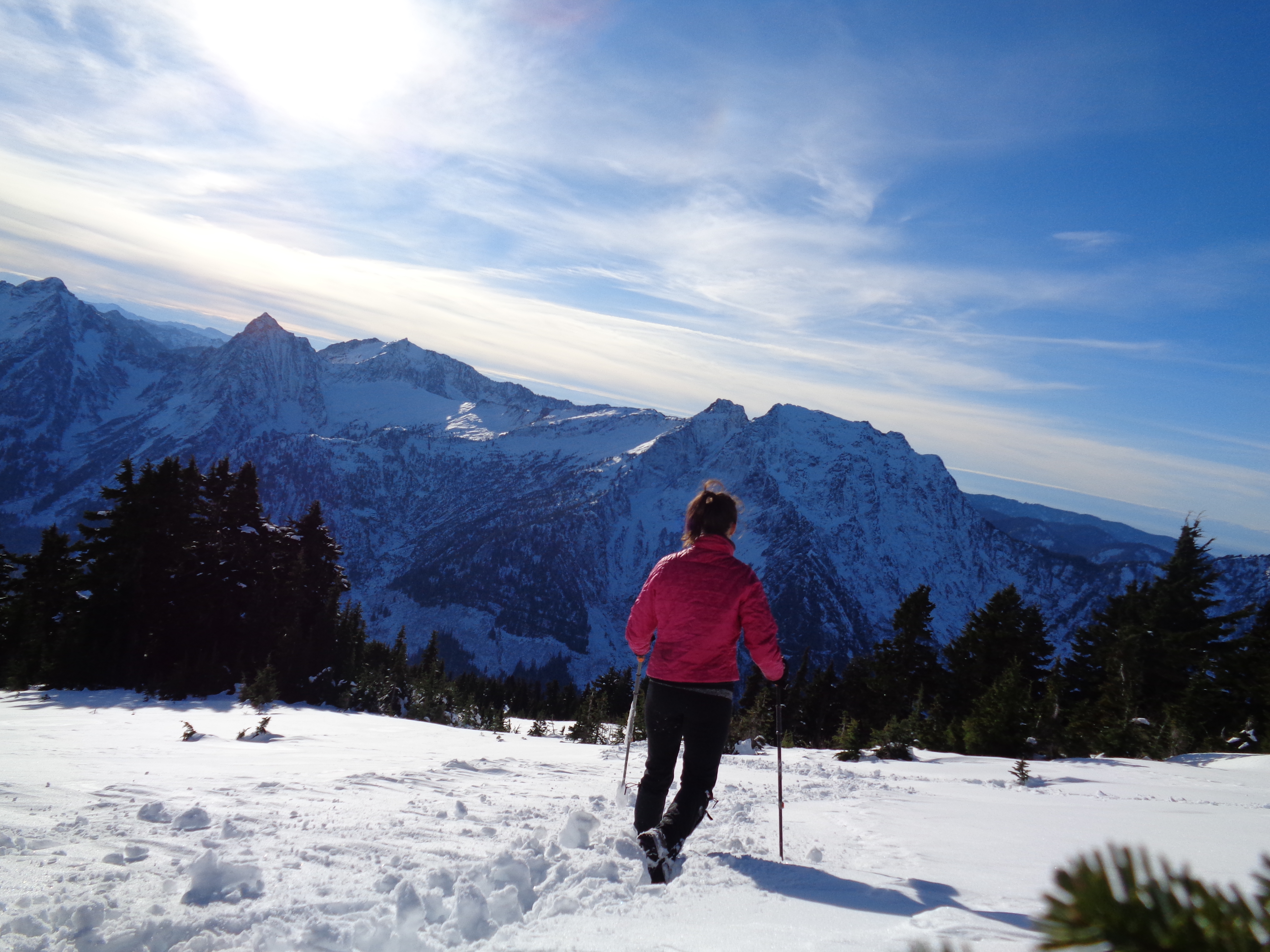
Me and Lee in front of Shuksan
We had the other group of snowshoers snag a quick photo of us with Shuksan in the background. “SHE SAID IT! Did you hear it that’s how you say it!” The three of them didn’t know how to say “Shuksan.” Lee was equally new – “Wait, where’s Baker?” Oh, it’s just the other huge mountain that’s not Shuksan. Easy to miss! (…not) We decided to head farther along the ridge to a higher knoll to see if we could get a good glimpse of the sky behind Mt. Baker. Poor Baker gets no love from me. Even if it’s taller than Shuksan (10,781ft vs 9,131ft) I just think Shuksan is such a gorgeous mountain. But this time, we could glimpse that the sky behind Baker was lit up yellow even through the clouds, and we had to take a look.

Sun peeking through behind Baker
We got up to the third knoll quickly considering that even in snowshoes we were sinking 18 inches deep in snow. Thank god for gaiters. And there, with Shuksan to one side and Baker to the other, we had tea and snacks. Oat bars, chocolate, honey, passionfruit tea… I wasn’t even hungry but eating felt like the right thing to do. I was in heaven. Especially considering that just an hour and a half prior, I had been worried we wouldn’t even make it to the ridge and get to see Baker.
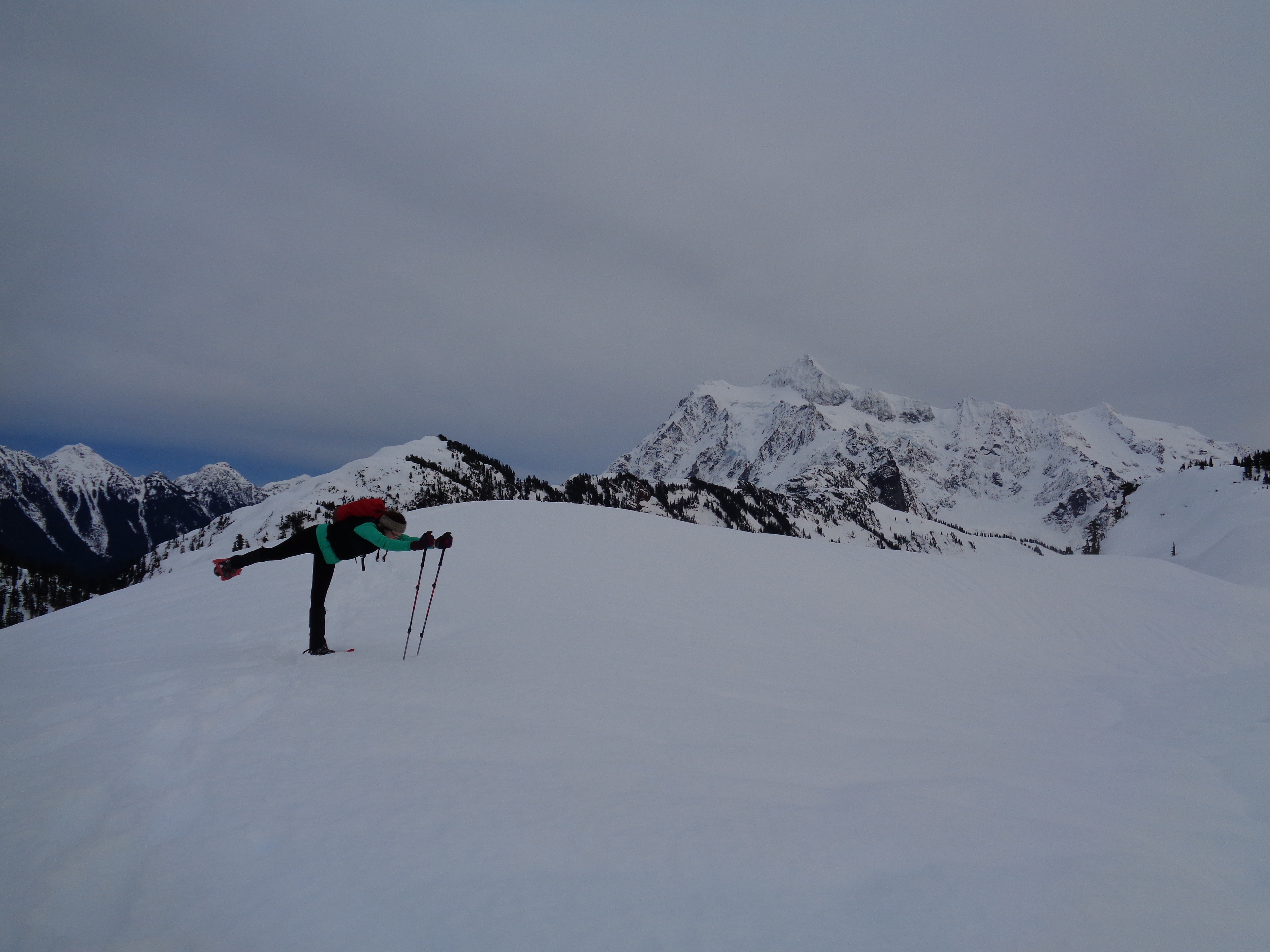
Snowshoe yoga
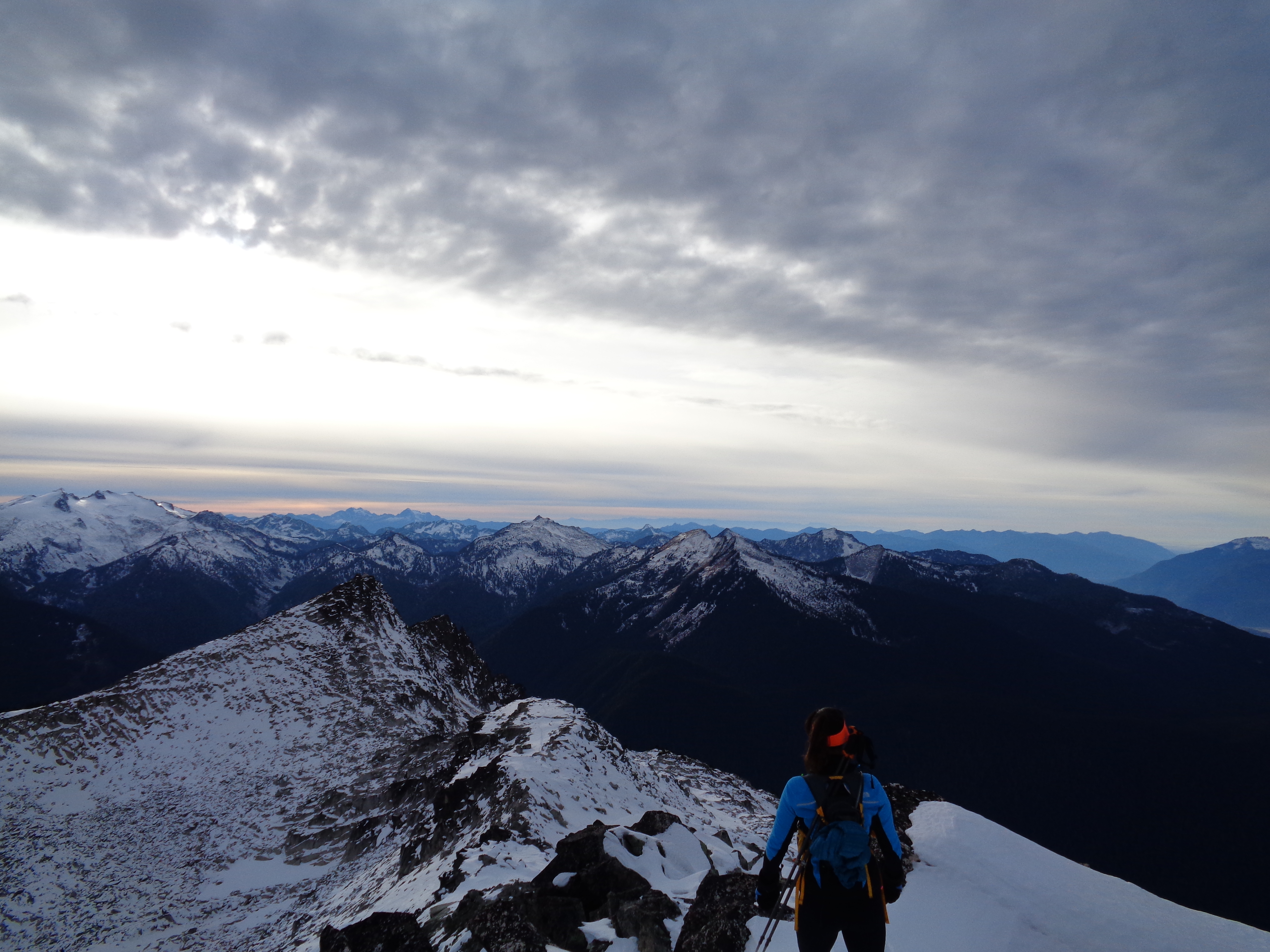
Post-snacks we did some snowshoe yoga, and started to head back down. We had to beat sunset. But I swear, someday I’m going to go back there and camp on that knoll looking at Baker and Shuksan, and I’ll get an awesome picture of my tent glowing beneath the Milky Way, which is spectacular from that area.

Heading back down, avy slope on the left, safety on the right…almost
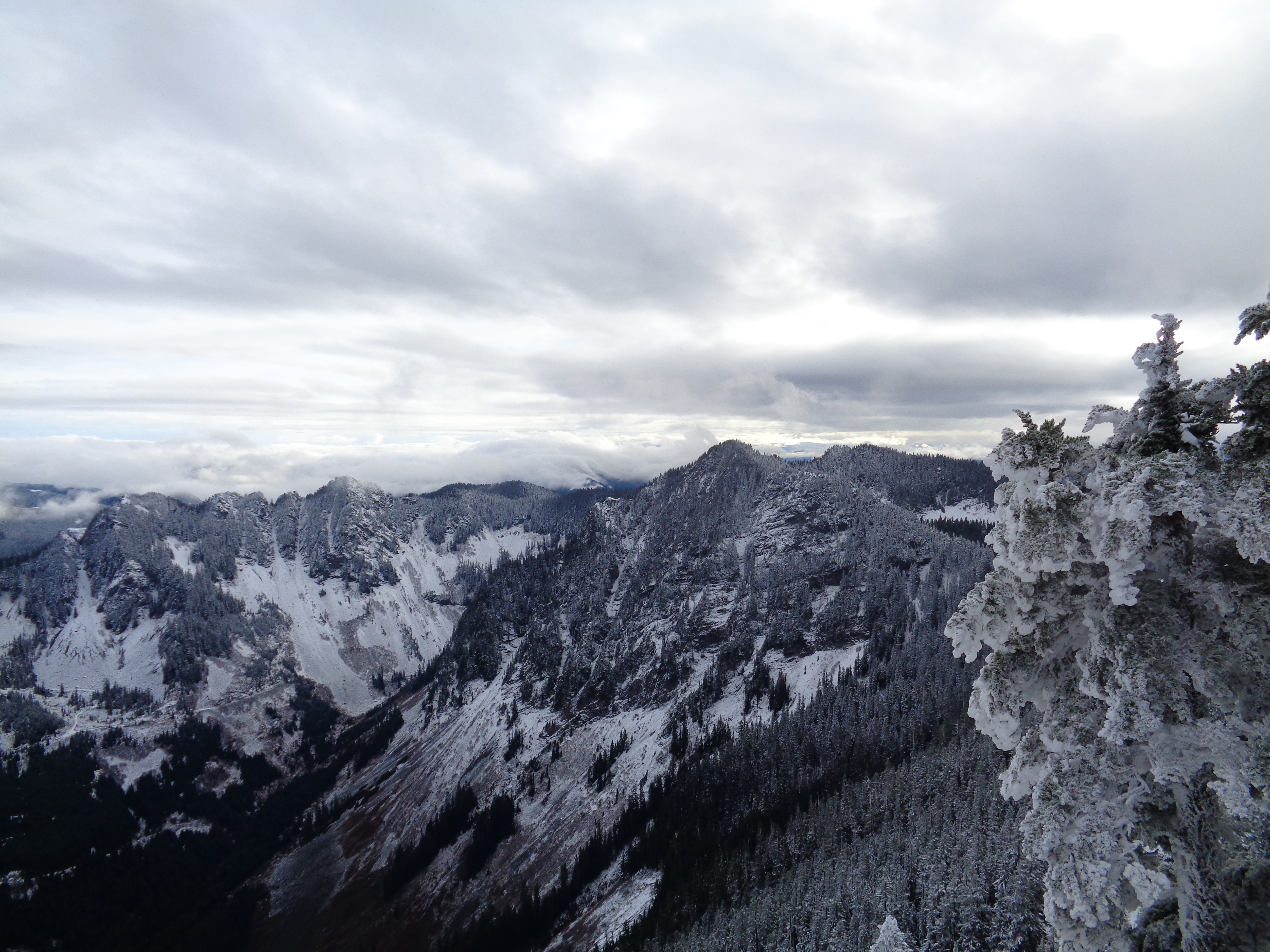
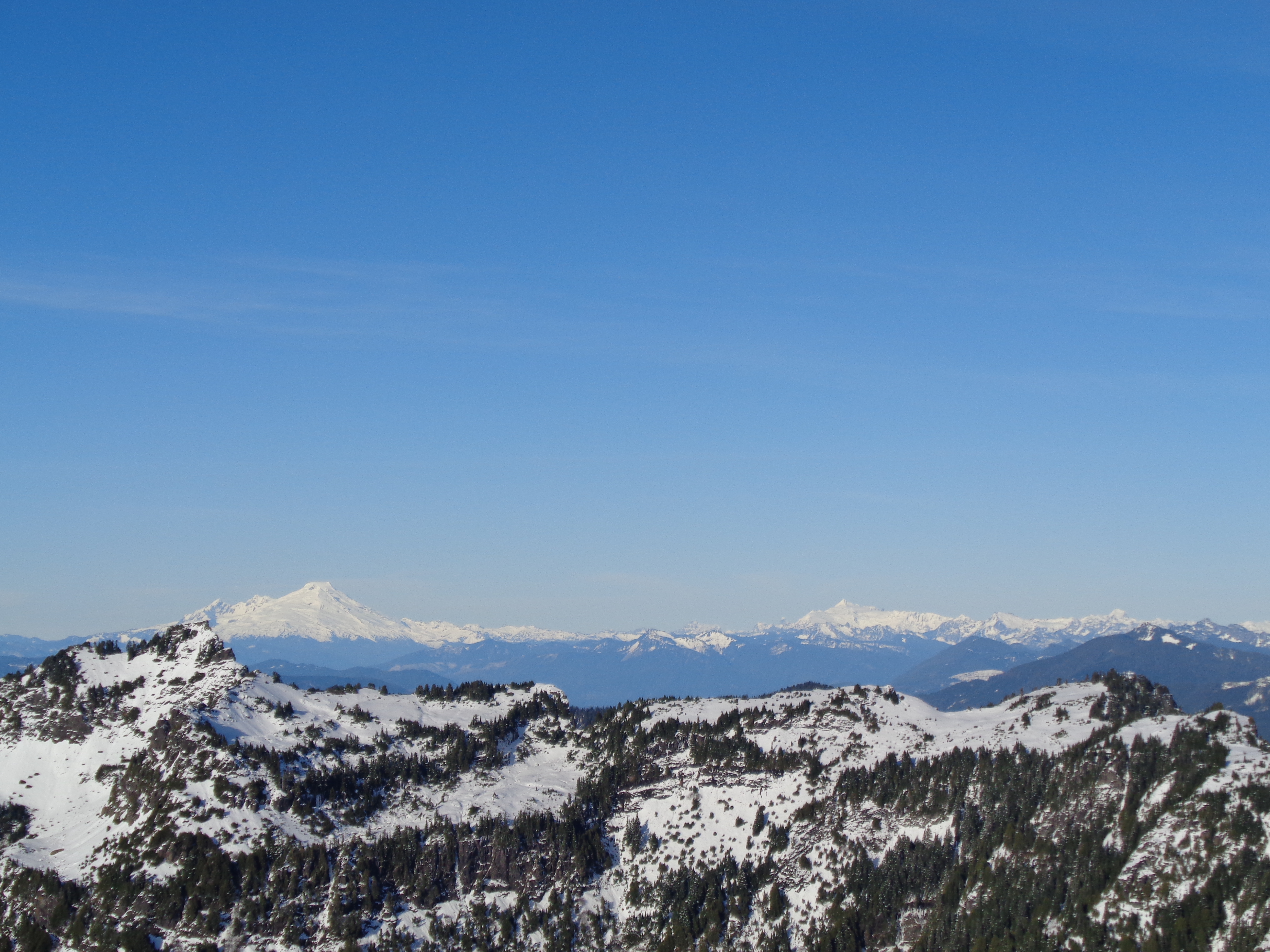
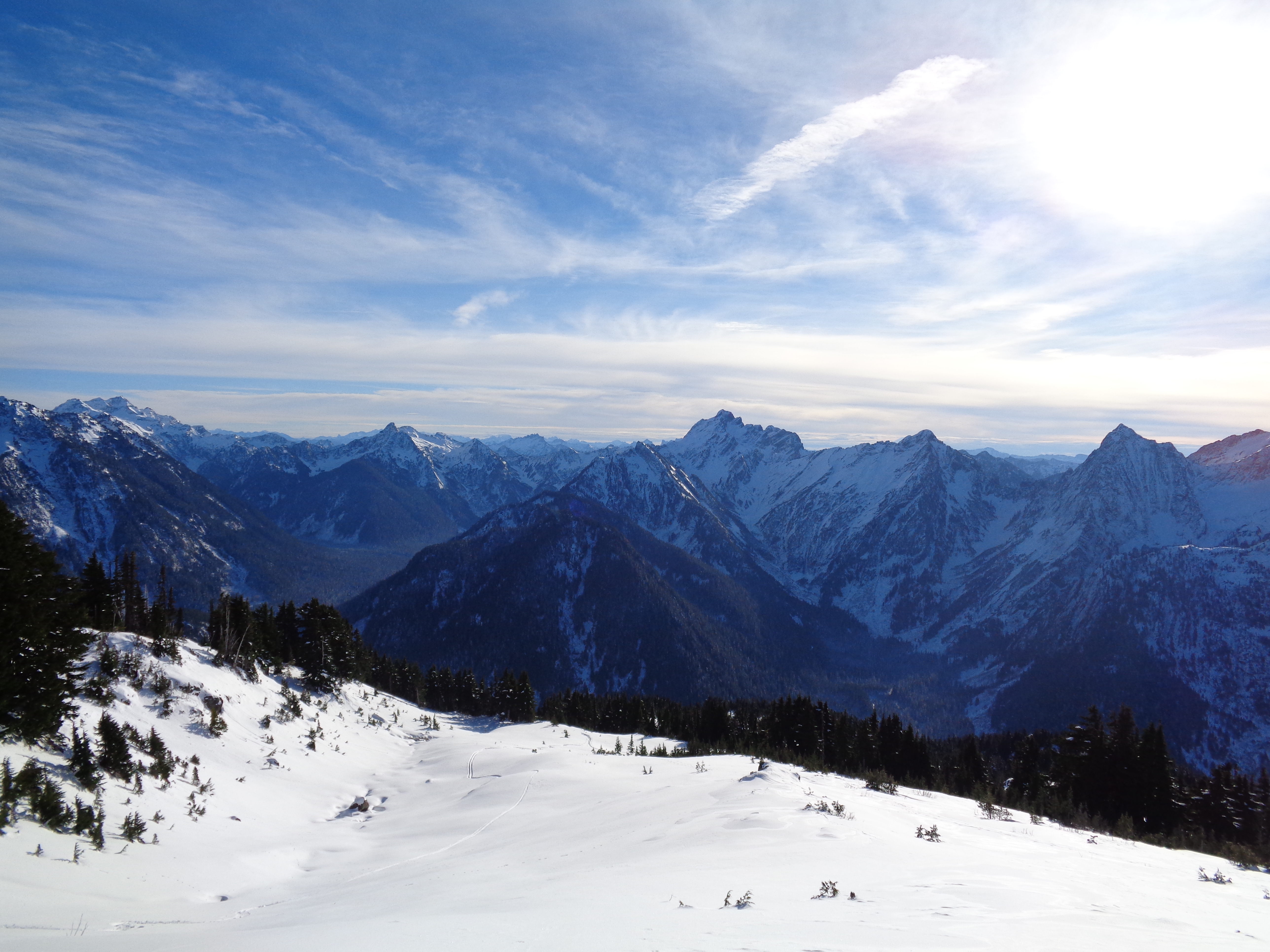
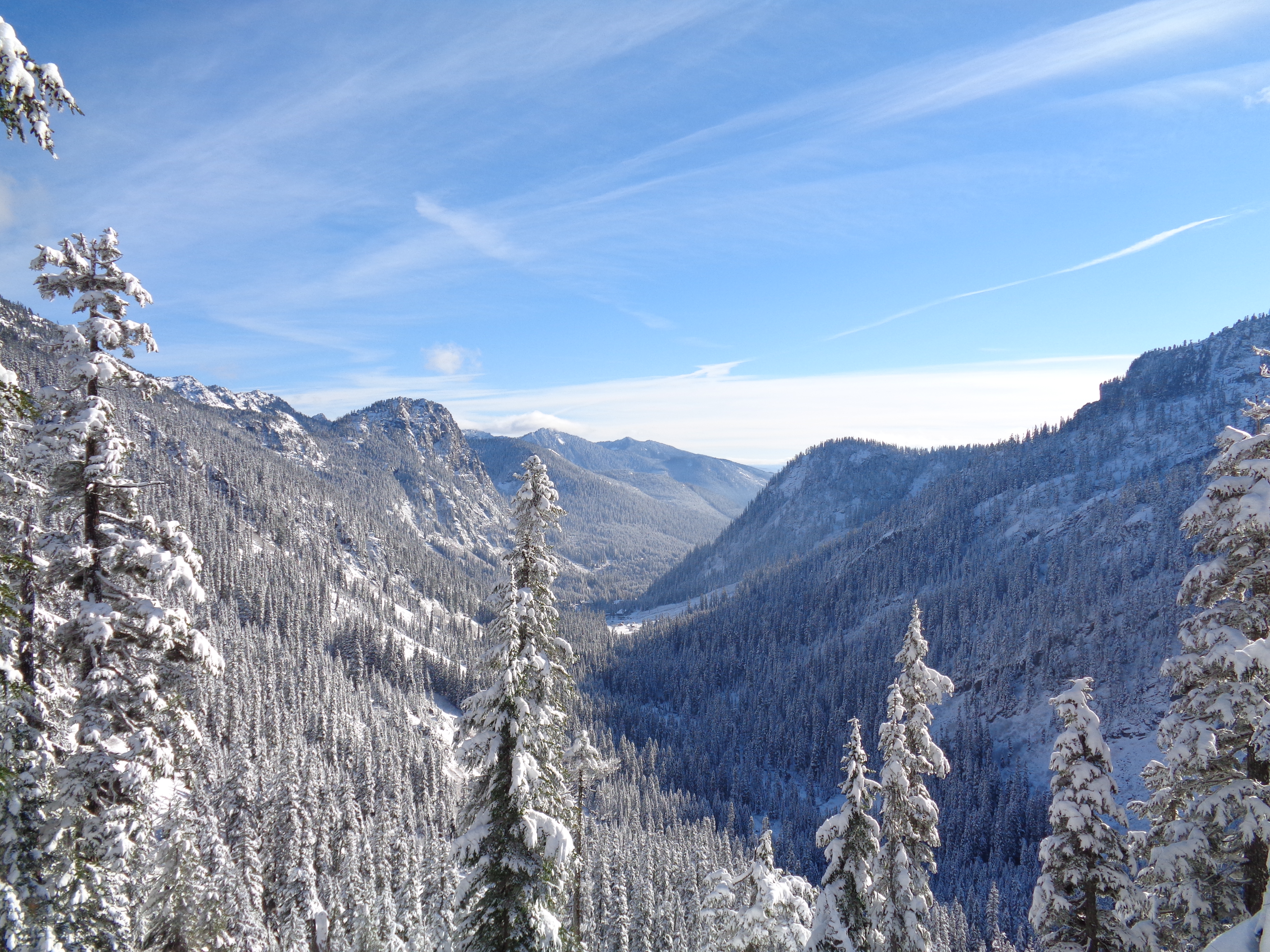
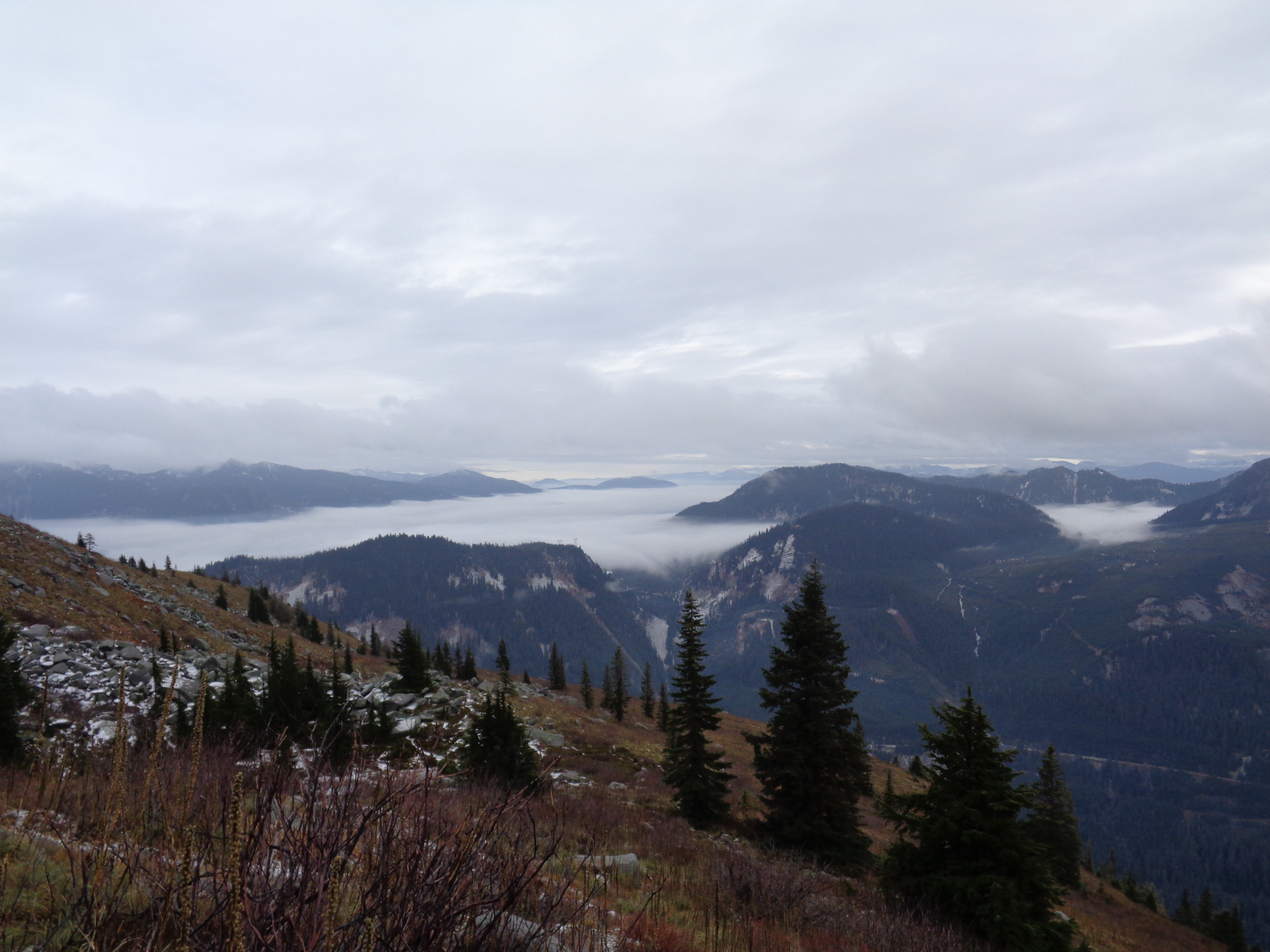
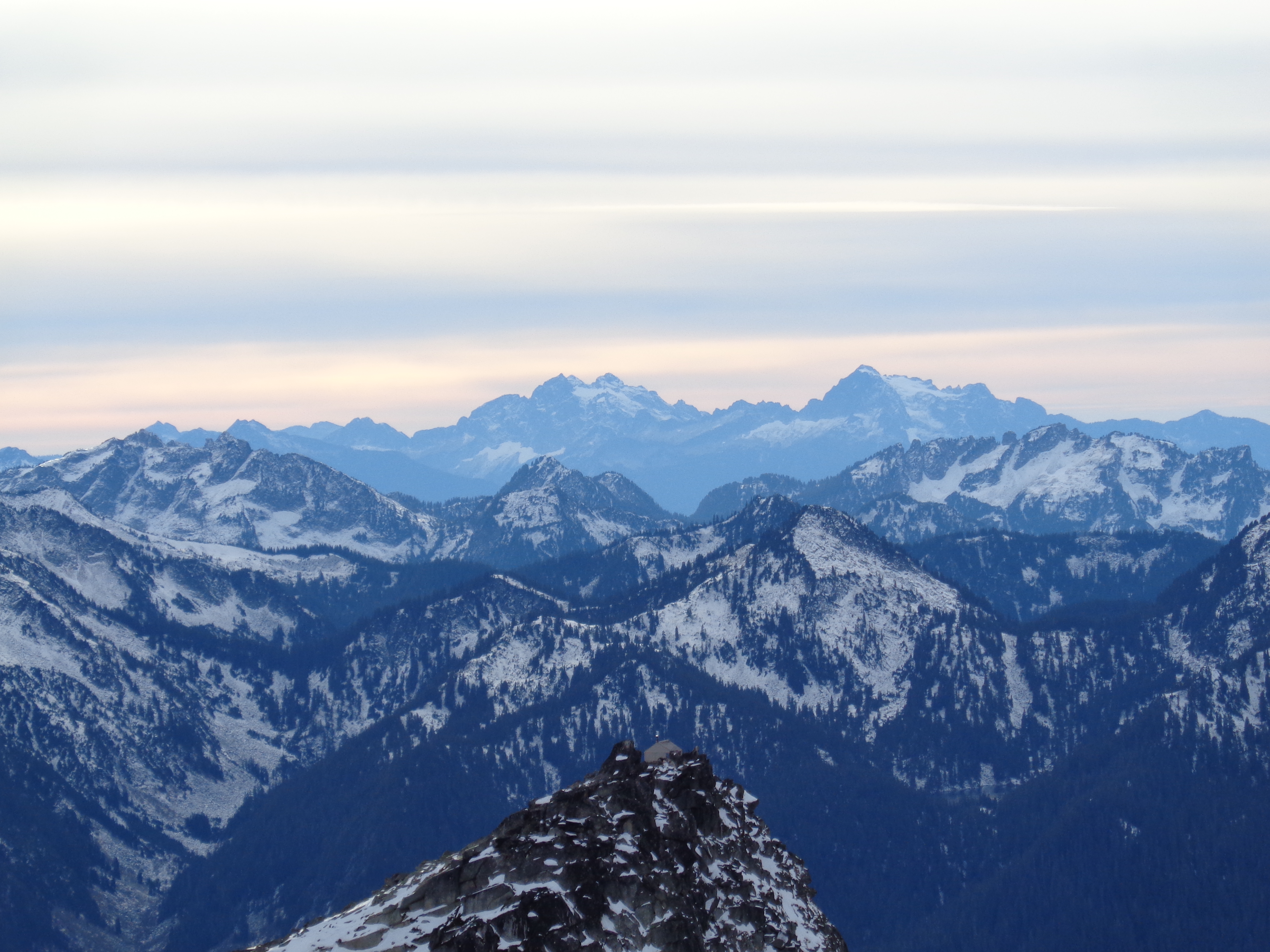
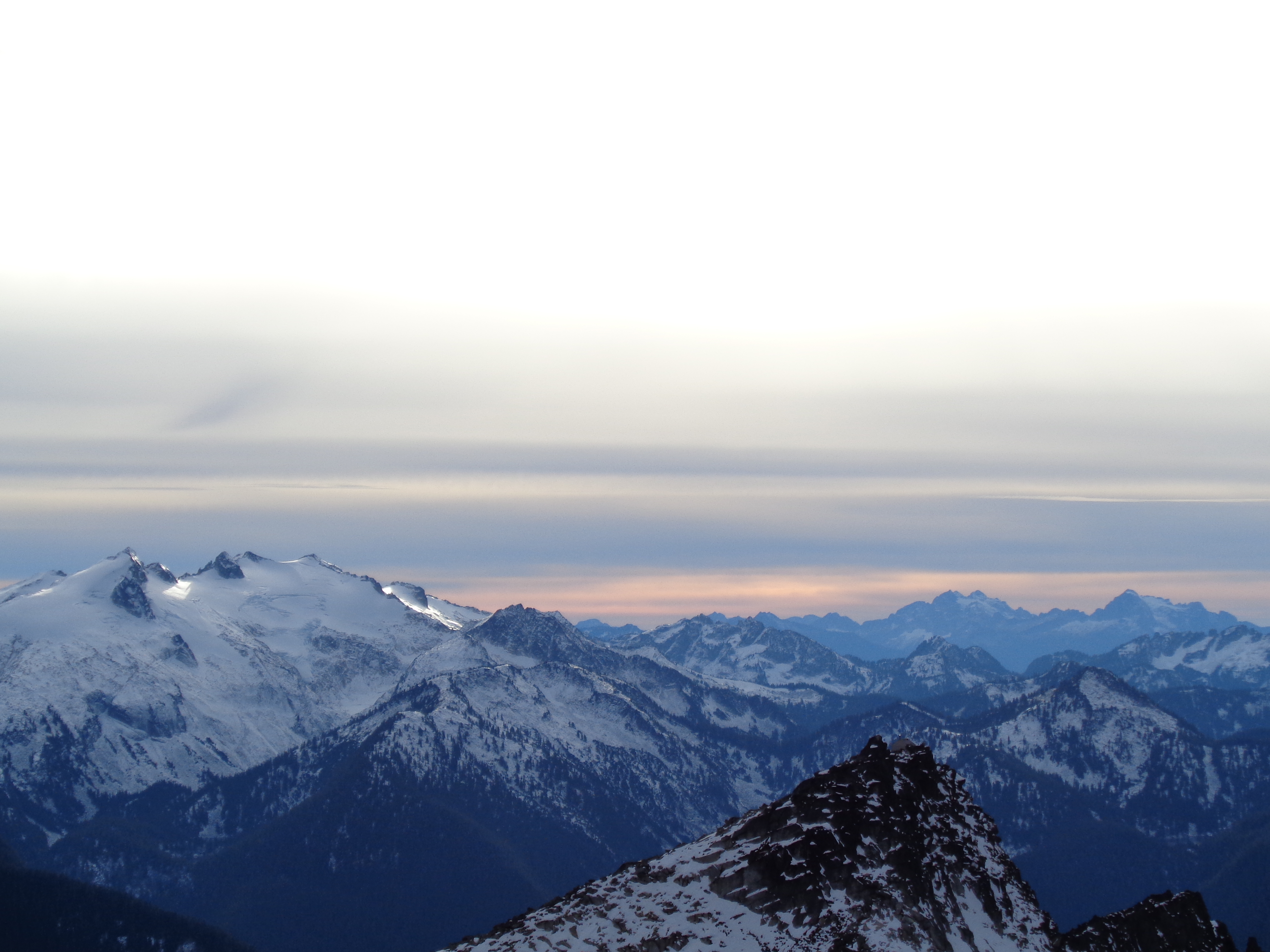
Okay, when you aren’t looking at Baker and Shuksan, you still have a beautiful view of lower snow-capped peaks.
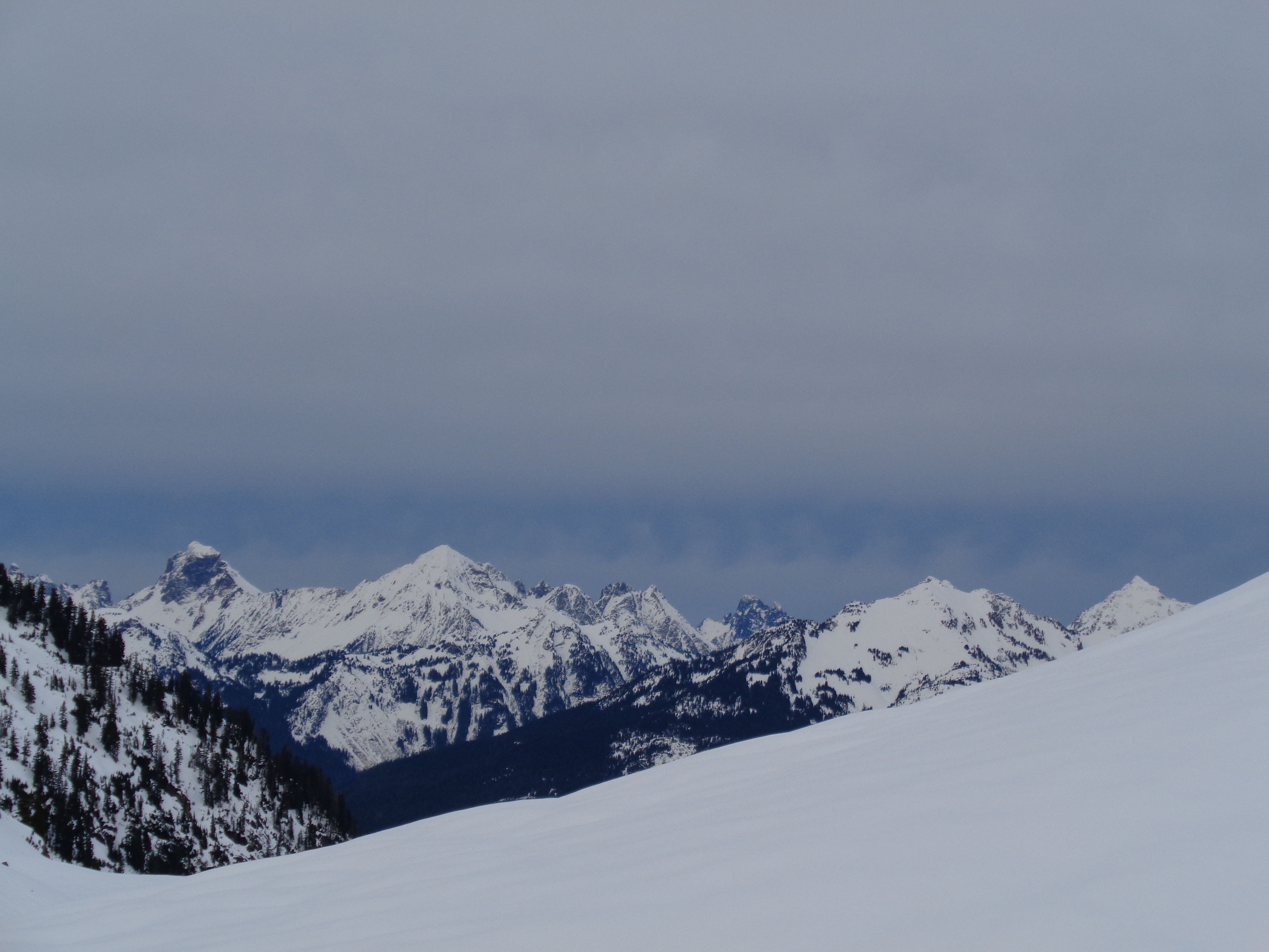
The non-Shuksan-Baker views as the sun set behind us. Still good!
Really, every direction is phenomenal. As sad as I was to leave, I was thrilled that we had managed to get there. I had been waiting to do this snowshoe for ages – it’s short, easy, and unbelievably scenic. I’m used to my favorite hikes being very remote and difficult, but this is definitely up there. As long as you find a day without crowds, it’ll be incredible. I don’t think I’d have enjoyed it nearly as much if I had been there on a crowded weekend, but this timing was perfect. You can see the ski resort for the first two miles of the hike as well, so you’re very close to civilization. But once you come over the ridge and it disappears from view, it’s easy to pretend you’re in the middle of the wilderness. The other aspect of this snowshoe that was great is that it was a perfect opportunity for us to navigate easy avalanche terrain. The slopes along the path are obvious, you’re close to other people, and it’s easy to avoid the dangerous zones while still feeling like you’re being edgy. Perfect for learners to run around trying to pick out which slopes would be risky and which wouldn’t and debating why.
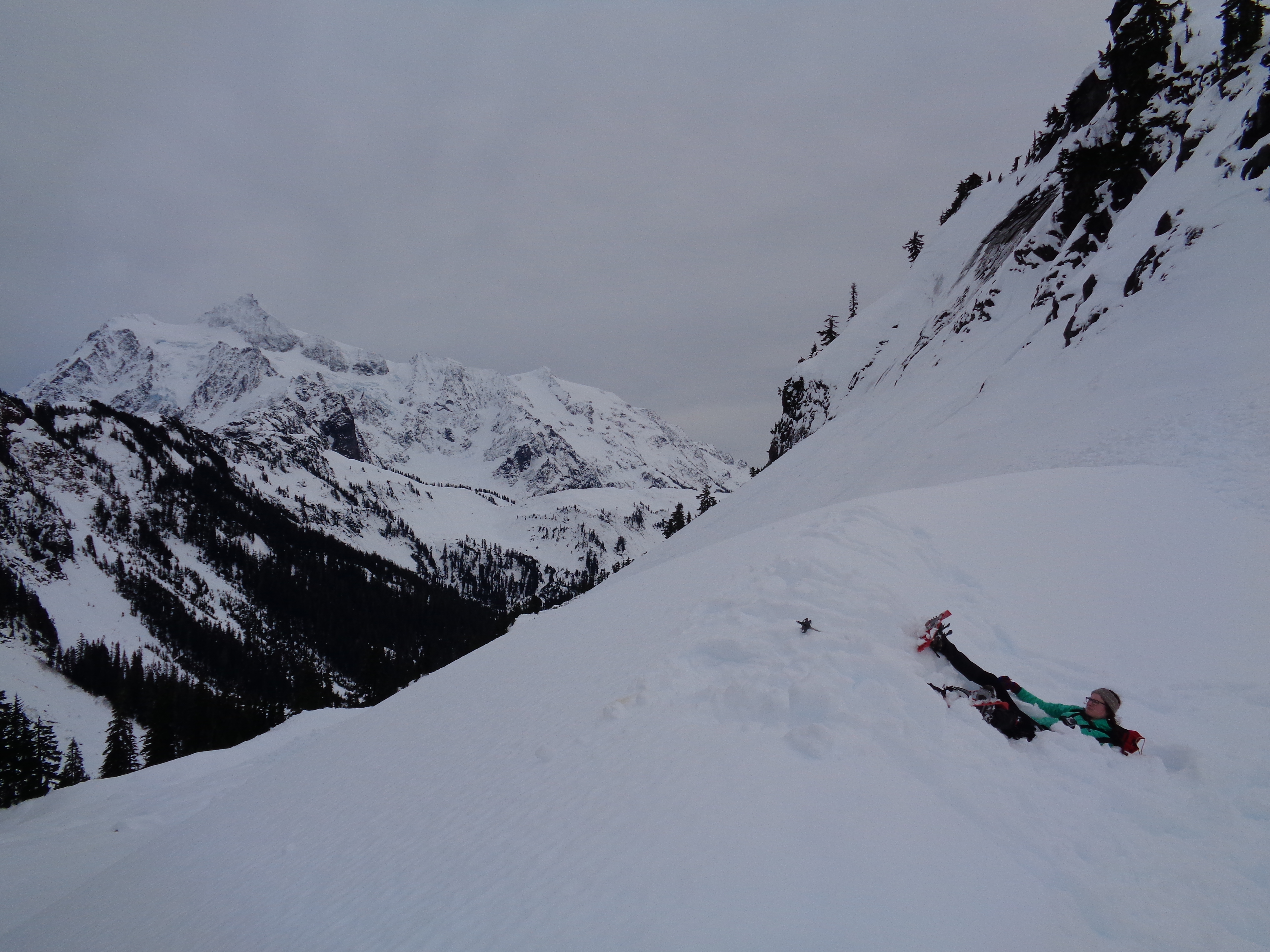
Lee laying in defeat after her backwards slow-mo fall
Oh, did I mention Lee fell on her ass? Backwards down a snow drift. Her excuse is that walking backwards in snowshoes is hard. Okay, it’s true, but that doesn’t make it more graceful. At least she had a scenic backdrop.

The pic just before Lee fell
I was originally aiming to get a photo of her in front of Shuksan (I don’t know, do you think I have enough pictures of Shuksan? Maybe just a few more) before she tripped. I guess I’ll include the photo, why not.
Anyway, next time you see me talking about this snowshoe, it better be because I snow-camped there. And you’ll get another 20 pictures of Shuksan. Wait until I’m actually ON Shuksan. Oh god. Get ready.

One more – trekking towards Shuksan on one of the road’s switchbacks