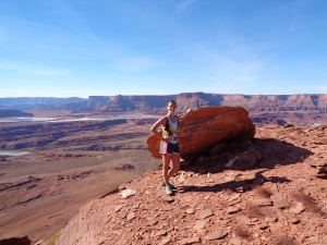
Aaand here we go! It’s going to be a long post guys, get ready. I’ll start us off with a pic of my beautiful-mile-16-just-climbed-1500-ft face at the highest point of the course. Race day was 11/8/2014.
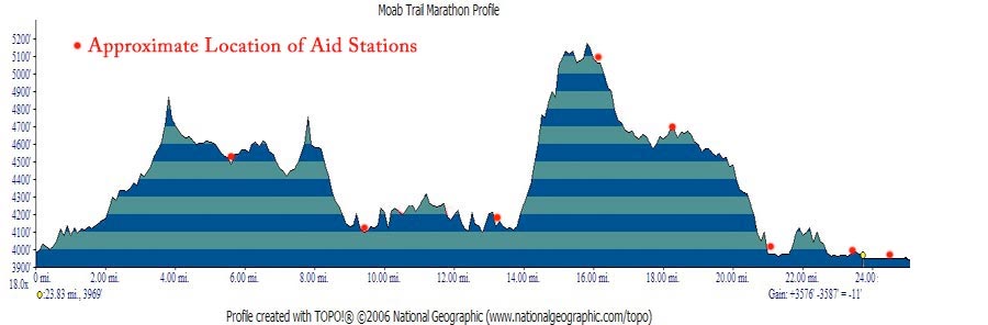
- Distance: 26.2 miles
- Elevation: ~3500 gain (topo map)
- Weather: 60’s and sunny
- Commute from Seattle: ha!
- Did I Trip: No, but I kicked a rock into my ankle which sucked
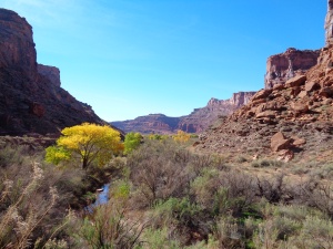
 I don’t even know where to begin with this. It was my first marathon last year, and of course I had to come back this year for round two. I was dying the beginning, with swollen calves and a foot that decided to fall asleep for a few miles. I’m blaming the sand. But the scenery is just amazing the whole way through. A few of the trees were bright yellow, which I don’t remember from last year. But I don’t remember much from last year besides pain and misery. Being my first marathon, I was way too focused on time, whether I could finish, etc to just enjoy the scenery. This year was the opposite. Expecting to be severely undertrained, I was only there to have fun.
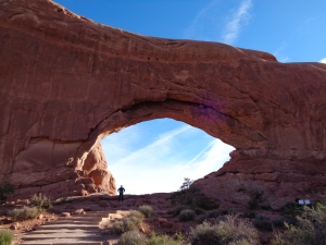
 This was the best arch along the way. There were a few windows that might be arches someday, but this one I remembered from last year, and regretted not getting a picture. I refused to take pictures last year, and ended up regretting it, so this year I made sure I took plenty.
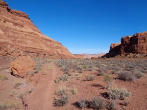
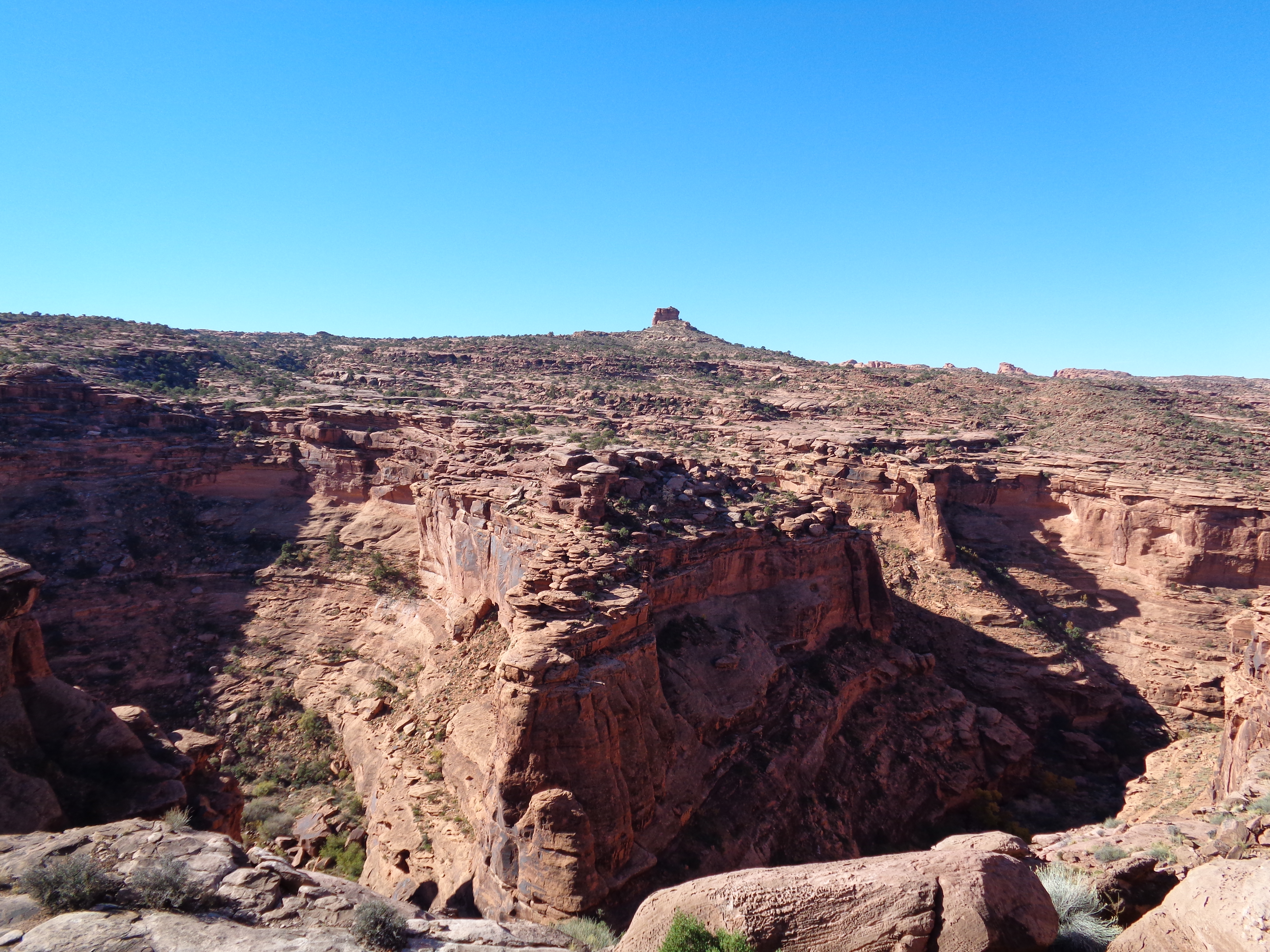
 Along with arches and windows and cliffs were enormous canyons. The one to the left is actually one that we ended up running through after descending down the wall at a (slightly) less steep grade than what you see.
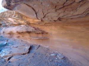
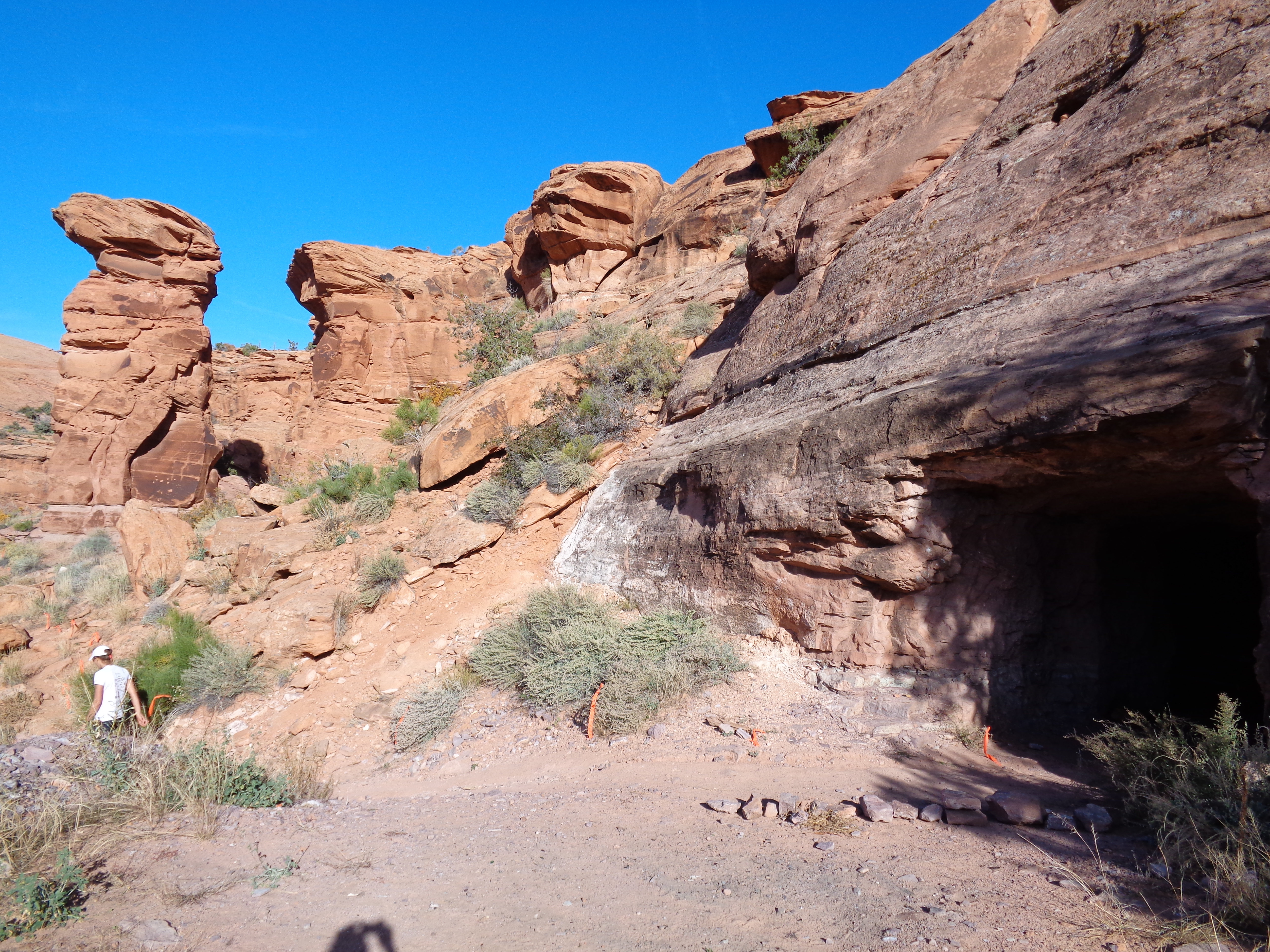
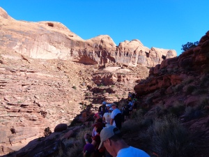 Unfortunately, it was still steep enough that it turned into a bottleneck, and runners were backed up for over 30 minutes waiting for people to hop down the rocks. One of the few drawbacks of single track running. If anyone is hesitant, it affects the entire line behind them. It was cold, I was bored, muscles tightened up. Oh and this was just after I hit myself with a rock, so my ankle was bleeding and quite painful and getting stiffer every minute. Also I’m very impatient. What was there to do to kill time? I ate and took pictures. Pictures of the people standing in line, and also this cool little cave formation below.
 After we finally got through the scramble (I should have taken a picture, it’s really not that bad) we loosened up a bit, and the half marathon split off from the full marathon. They headed back towards the finish, and we headed farther out into the desert.
 Soon there was an out-and-back, about two miles total, maybe not even. I remember hating it last year. It felt like it never ended, and you had to duck under trees, rocks, brambles, running through sand, bleh.
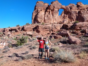
 This year I was much more excited, and since I wished I had taken a pic of this rock last year, I knew I had to snag one this year. So below is my father and another runner about to duck under a massive rock. Last year some people went around it, but it’s a trail marathon, come on. Might as well go through.
After the out-and-back and some running down a gravel road (a relief from sand and footwork) comes the hard part. My own personal hell. At least until I climbed Rainier. Now Dissapointment Cleaver is my personal hell. Aptly named, right? But until then, it was miles 14-16 of this marathon. Straight up, gaining around 1500ft of altitude in just over a mile. When I ran it last year, I had been training in Chicago. The flatlands. I drove for an hour and a half to find a hill, and the hill probably only gained 30 feet in elevation. This was the neverending mid-marathon climb. I was ready to curl up and be helicoptered home last year. Maybe it’s the hiking, maybe it was the change in attitude, but this year, it was a million times better. More like a stroll in the park. Okay, not a park, but still. It went by much more quickly, and before I knew it, we were at the top. It’s the pic at the top of this post – me by that rock overlooking a huge ass canyon.
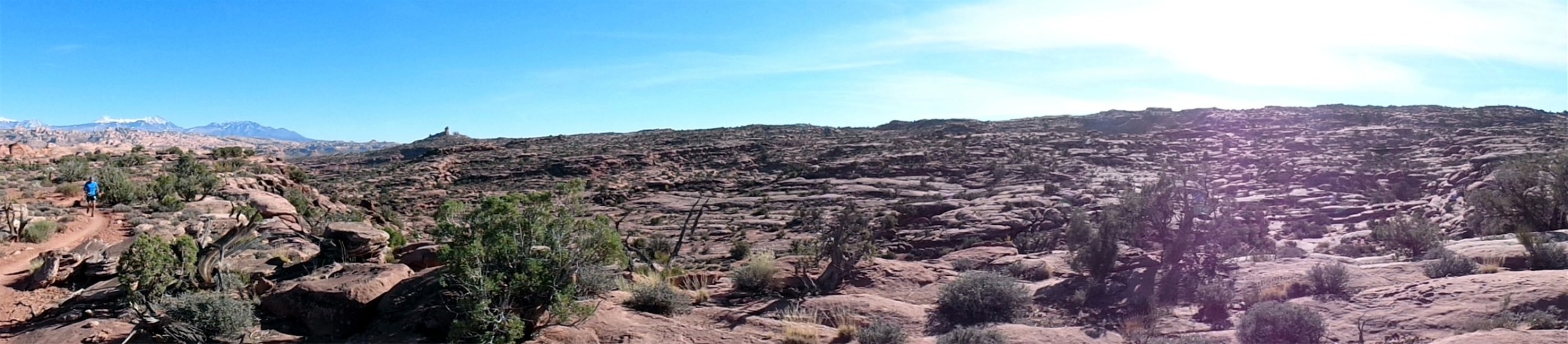
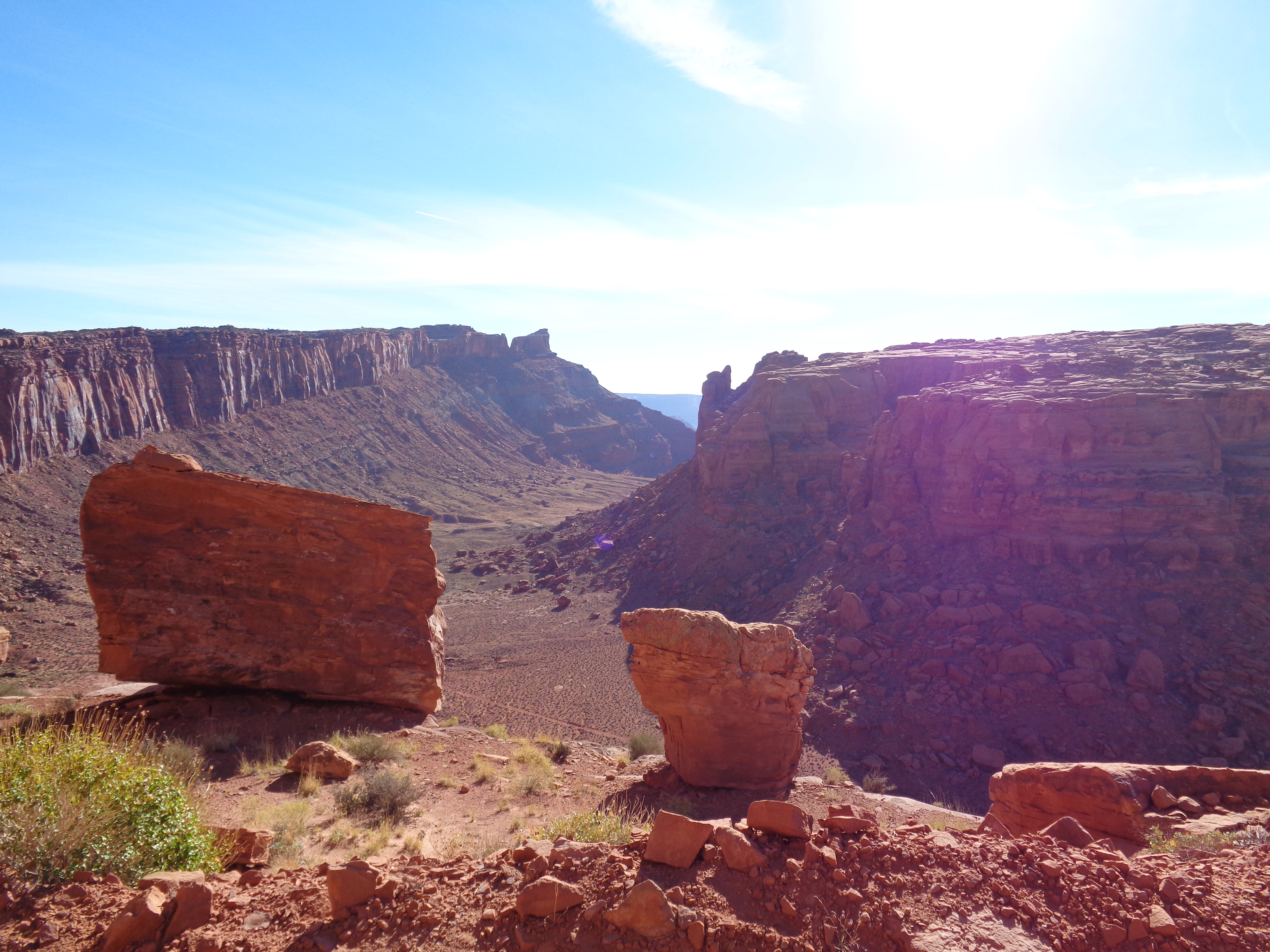
 Anyway, after climbing what was basically a cliff wall, we were headed back into the desert. The marathon gets very spread out since there are so few runners. Only 400 participants last year, I think 700 this year since it was the national trail marathon championship race. So here’s me, all alone, with no one in front of me. But at least the trail was easy to follow here.
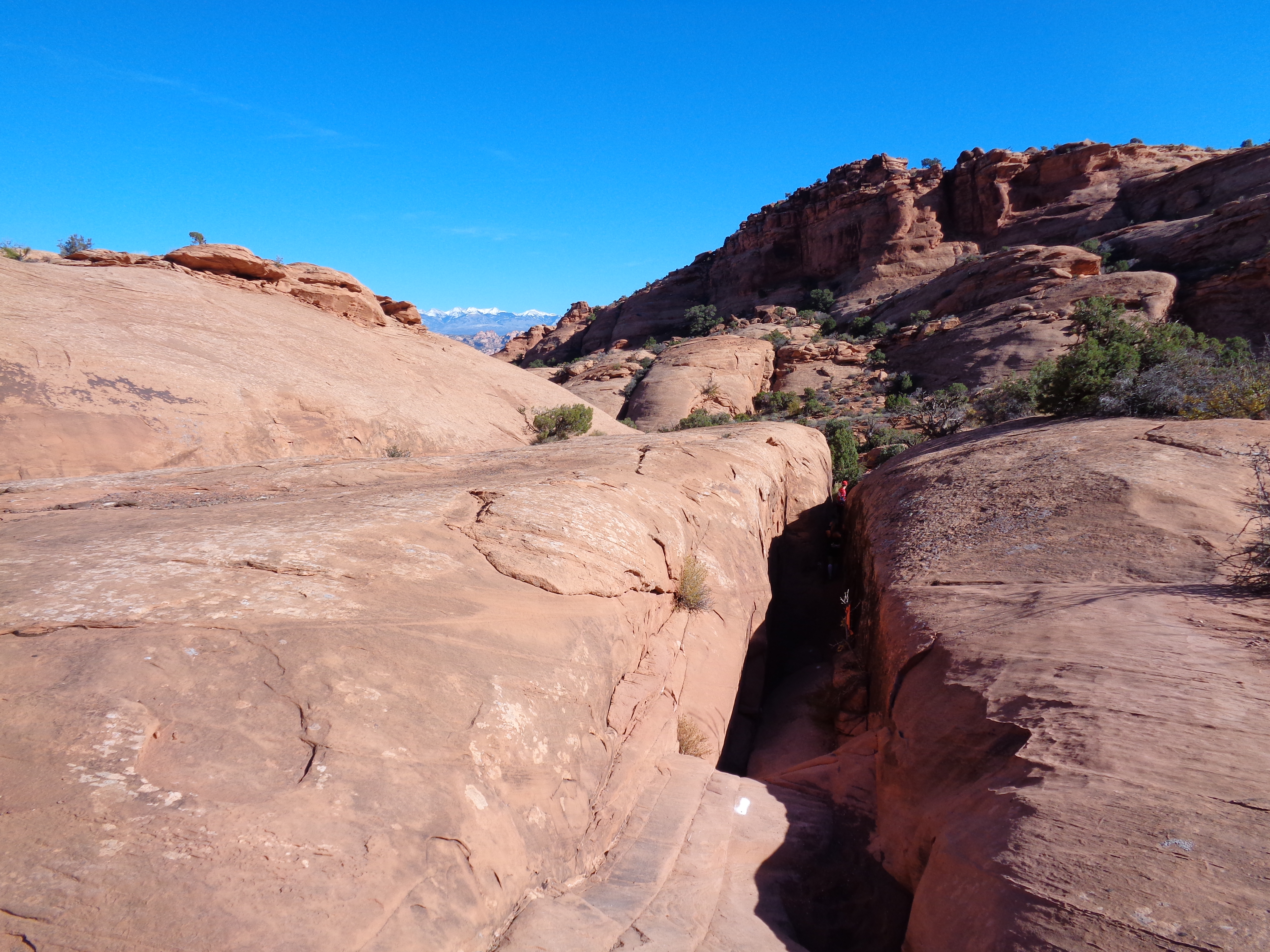
 Here’s another fun part, squeezing between two walls. I took this from above, but you’re about ten feet down in that crevice. I had to turn sideways to fit through, so you can’t exactly run through it. It’s the real-desert-canyon feel. 127 hours, no thanks.
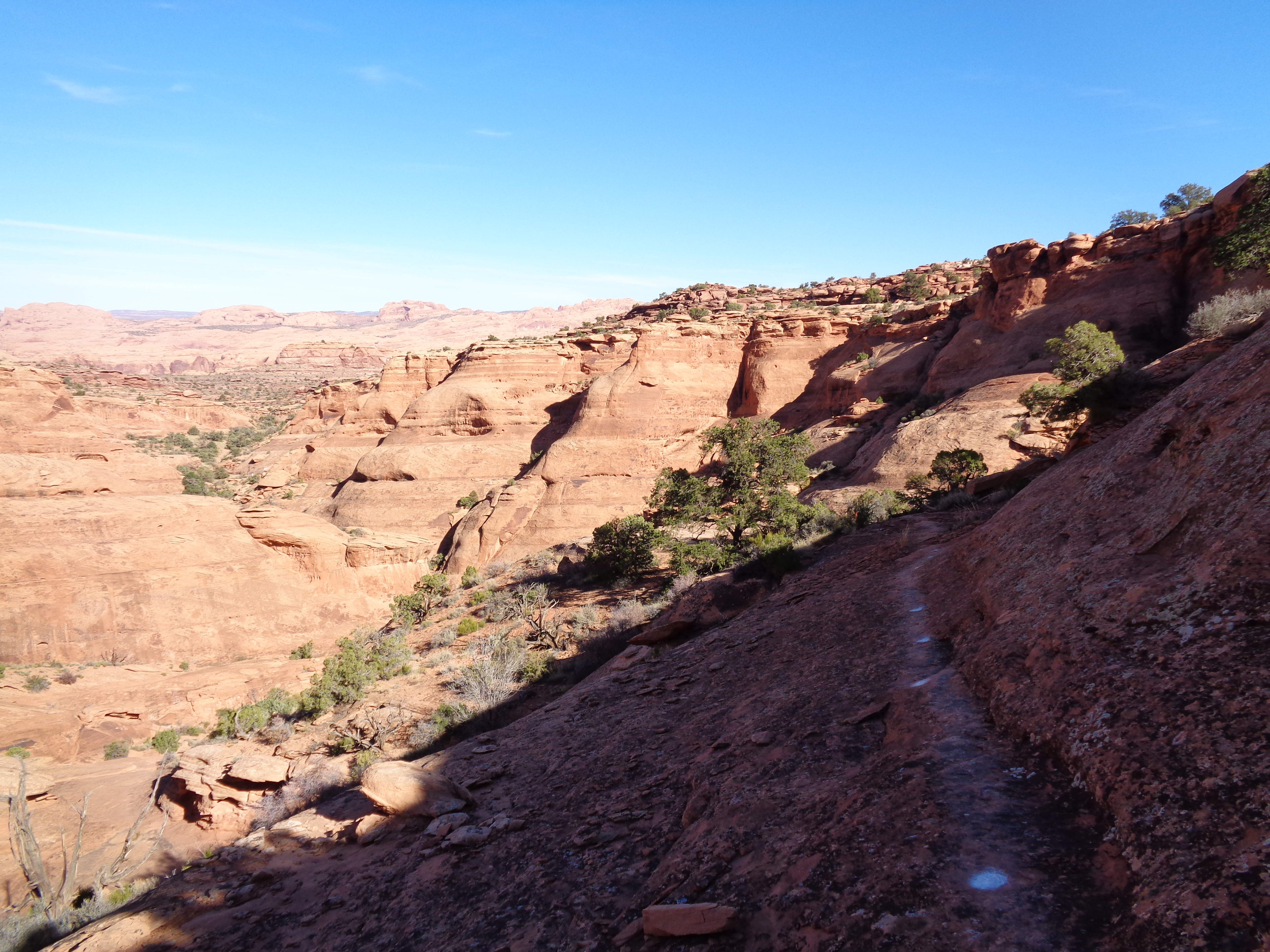
 Don’t worry, the fun stuff just keeps coming. I’m not sure how people ran this – the flat part you can see is just a few inches wide, so you have to either have really good footwork or jog/walk along it making sure you’re putting one foot in front of the other. The slope keeps going down, so if you trip with a little too much momentum, you won’t be too happy when/if you stop tumbling. But again, it wouldn’t be a trail marathon without stuff like this.
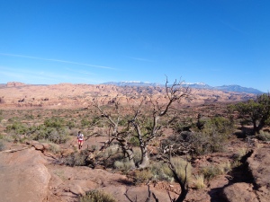 Okay, there were some normal (ish) parts too. Like to the left, a picture of a runner coming up some slickrock, which was what miles 19-22ish were. With Colorado snow-capped peaks in the background. The mountain bikers were having a great time, but most of the runners around me were dying. Whatever. I was too happy. Poor guys, I kept passing them, stopping to take pictures, passing them again, etc. I’m obnoxious. In the beginning of the race, everyone was taking pictures! Either the touristy runners were all half marathoners, or the distance folks like myself were too exhausted to stop and take photos.
Also, what the hell is the tree doing? It used to be alive. How long ago did it die? There were branches everywhere on the ground that made me wonder where the hell they came from. Looked like driftwood. Maybe they’re from old trees that died and got rearranged in floods.
 And another break along a gravel road! Jeez, finally. Slickrock is tough to run along since it’s up and down every few feet. And hey, this road still had great views. “Gravel” is a little generous, I think the road was intended only for those extreme 4×4 jeeps. But I knew this meant we were headed towards the finish.
Unfortunately, this race makes you run past the finish line at mile 23, and head back out into the desert. Ugh. You get so close, hear all the cheering and bells and announcements and celebrations, only to keep running back into the distance, away from the sounds.
Oh did I mention it’s an obstacle course? Yeah, the last three miles are an obstacle course. I unfortunately didn’t take pictures of the obstacles that were the craziest. Like using a rope to kind of rappel up a wall. See, if you stop to take a pic of that, then everyone behind you gets backed up and has to wait (one at a time on the rope, guys) so I couldn’t risk it.
 I did get a picture of the mouth of a cave we ran through. It was pitch black inside, which was tricky because you couldn’t see any of the rocks on the ground. Luckily there weren’t many. We also had to climb a ladder, run through a drainage pipe, cross a river, crawl under a road through a smaller drainage pipe (my glutes weren’t too happy about that), rappel down the other side of the cliff/rock/plateau we climbed, and.. did I miss anything? Well it might not technically be an obstacle, but mile 24.5-25 is basically up a sand dune. God. Damn. Dunes. I hate them.
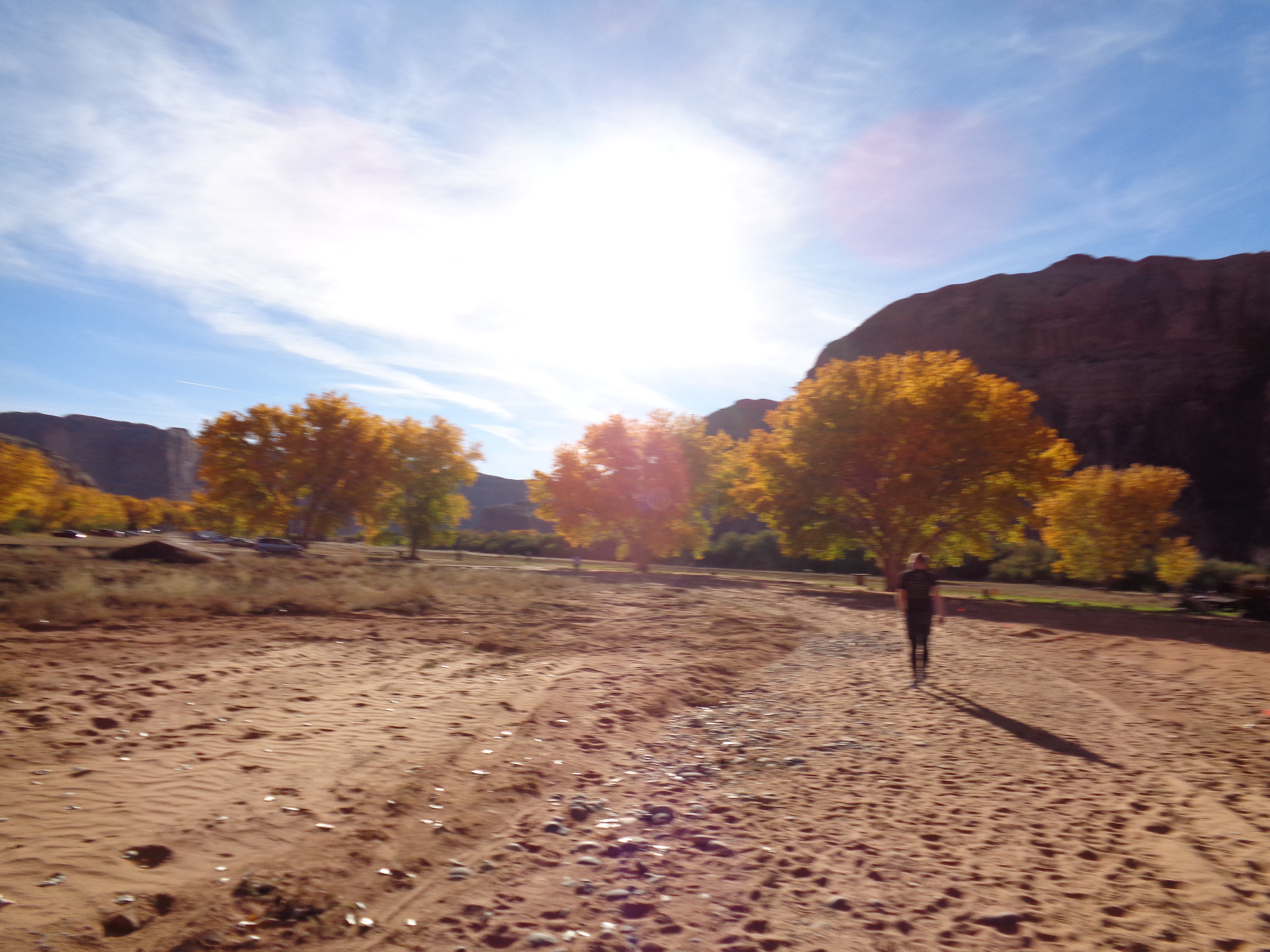
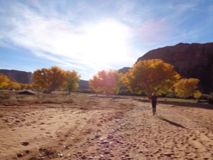 Coming out of the smaller drainage pipe onto a flat field, I knew we were headed back to the finish line. Between the sun, the brilliantly yellow trees, and the flat ground, I was ecstatic. The guy in this pic was less than pleased, as were almost everyone I passed between miles 18 and 26. Except me. Must have been the coca cola I had at mile 23. Or the cheez-its I grabbed at every rest stop. I ran with hands full of cheez-its for a solid few minutes after every aid station. Anyway, you get the point. I felt great.
Unfortunately, a few feet from the finish line, I got lost. I know, I know, so close. But you overlap with the runners who are heading back out for the last 3 miles, and I could see the FINISH banner. I thought I had missed the final turn to go to the finish line, so I turned around and ran back until I realized we were coming across the finish line from the opposite direction, which meant I had to run a little further than I thought. Also, we were in a ditch-like path about 15 feet below the finish line, so I had to scramble up a quite steep (but mini) sand dune. Fortunately someone told me to turn left, because I just didn’t have the energy to lift my head and look at where the trail went. I stumbled onto the flat ground, and ran across the finish line to a very determined announcer trying to figure out how to pronounce my last name. He tried three or four times, was quiet for a minute, and then questioned himself one last time. “Eve…. Jabokowski! Jackooookobowski! Jakoobooski!” [silence] “Jabuski?” He got close, but never quite there. Didn’t matter, finished a marathon.
I grabbed my finisher mug, chugged powerade, took off my shoes, and we headed back to our hotel. Which we chose specifically for the hot tub. Hot tubs after marathons are the best hot tubs. Except I was totally dehydrated, the vending machine was broken, the sinks had non-potable water (too heavy), and all I wanted was an instantaneous glass of water. But that was the only issue. And the steak dinner was mediocre. But I got lots of andes mints for dessert, so I can’t complain. Also, my Saucony Peregrines survived! They’re my favorite trail running shoes. Last year this race destroyed them. Shredded the upper, ripped part of the outsole from the midsole, stiffened up both shoes when I crossed the river, ugh. But the new model held up pretty well, and I’ll get to use them for another few months.
 And what did we do the next morning? Hike, duh. No worries about the marathon. Well it wasn’t even really a hike, more like a walk since it was barely 2 miles and pretty flat and full of tourists. But you know what? Sometimes it’s nice to just walk slowly and take pictures. And that’s exactly what we did.
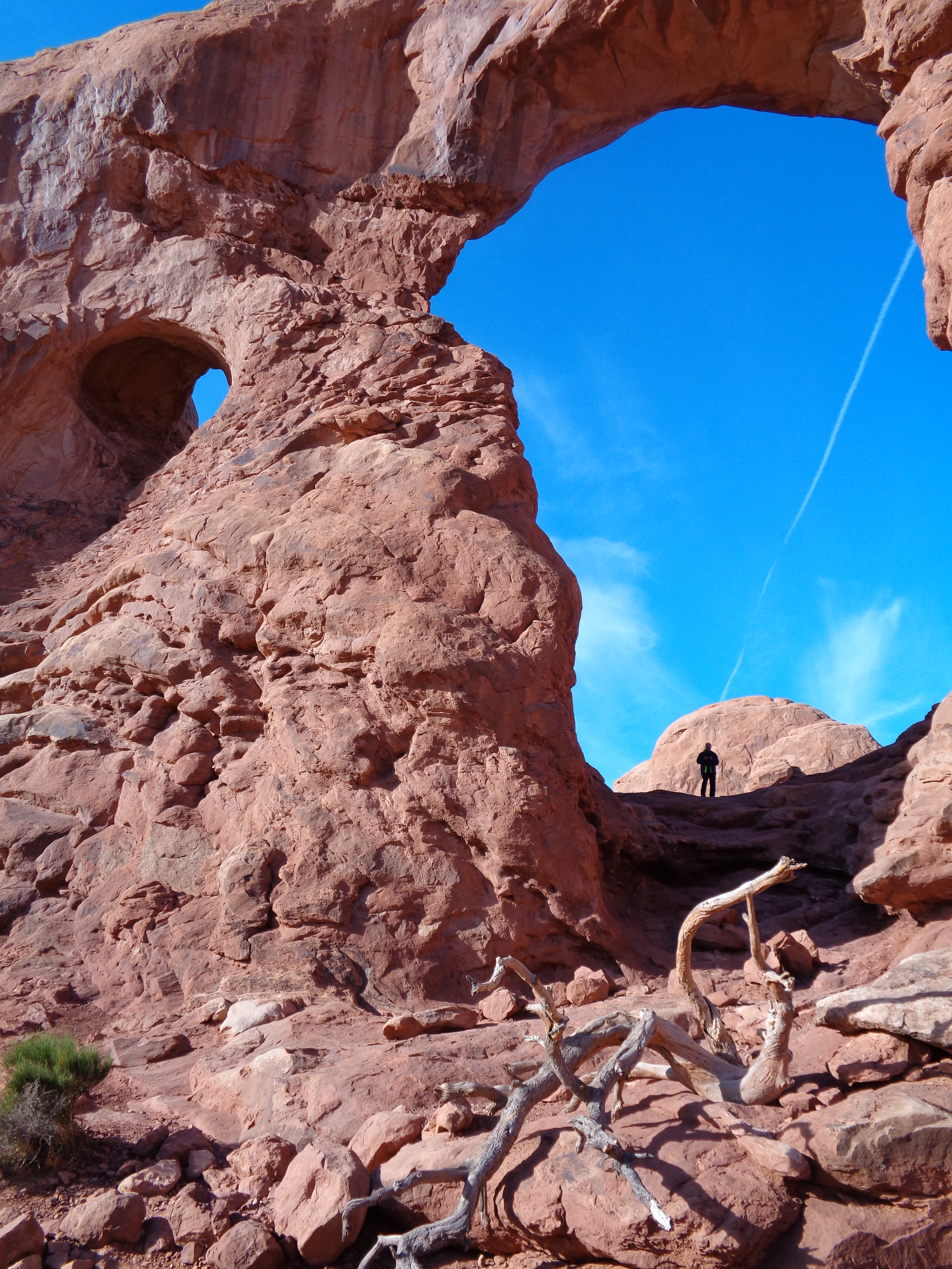
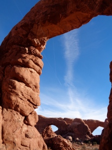 Arches National Park is pretty small, and I bet if we had time, we could have seen most of it in just a day or two. But we stopped by the ranger station to ask for recommendations, and they gave us this one, which was supposed to be the biggest “bang for your buck.” They were right. Something like five arches and three windows? Six if you count the double arch? The photo to the right isn’t a double arch, it just happens to be two arches viewed through a third arch because I’m awesome.
 We spent a little over an hour exploring and climbing all of the arches we could. There’s one out there that you can actually run across. As in run up the top of an arch. I didn’t know that until yesterday, though, so we missed out on that. You know what’s not awesome? Waiting for someone who’s texting from beneath an arch. He spent a solid ten minutes texting. Look where we are! Text later!
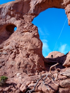
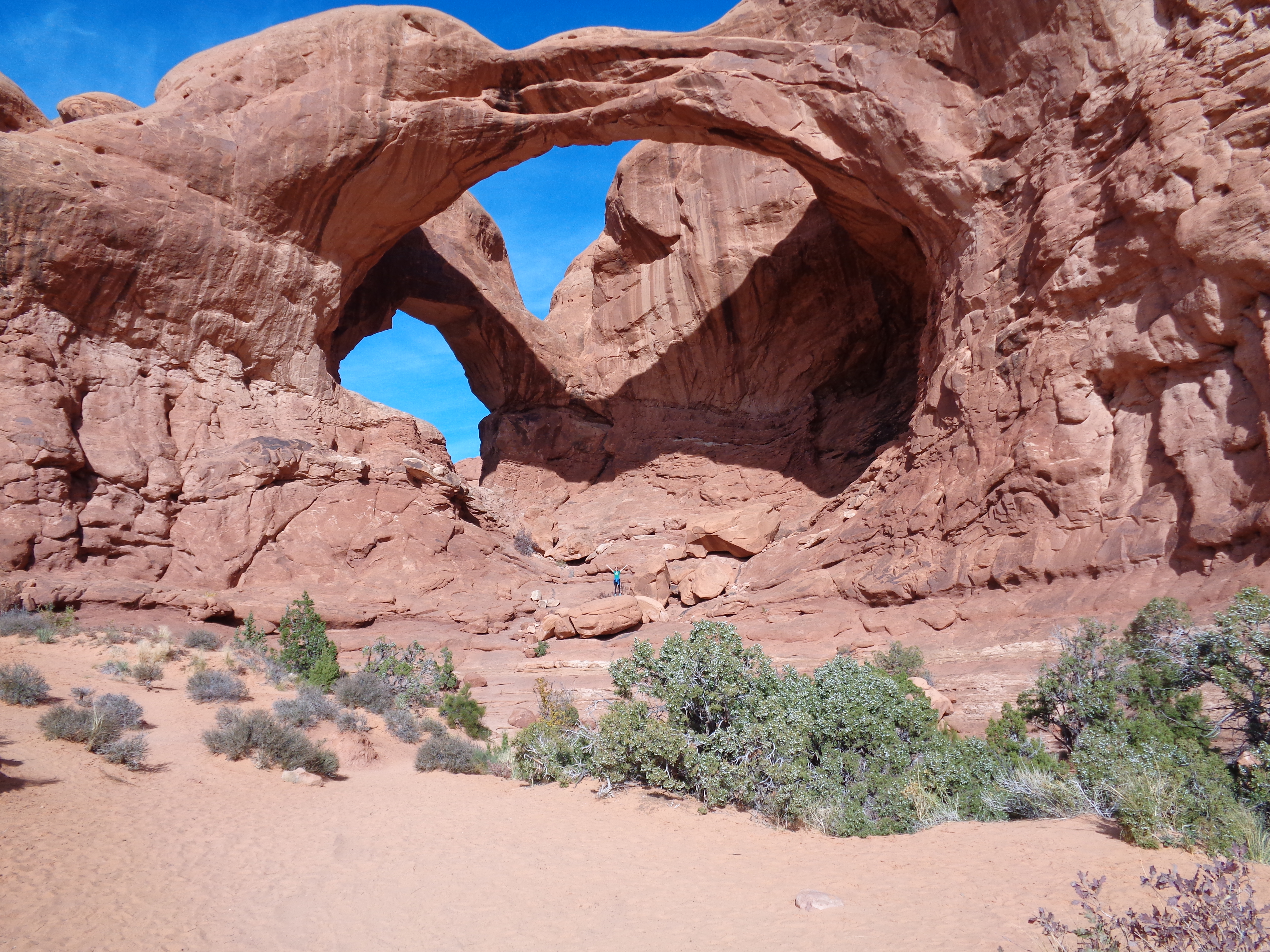
 Last but not least, the double arch! If you look really closely, I’m standing in the middle of it on top of a rock. That’s how unbelievably massive it is. It was humbling to stand right below it. We almost didn’t go to that one, but I saw the trailhead right near ours and we had a few extra minutes (it was something like .5 miles round trip) so we figured we could check it out.
All in all, it was an incredible weekend. 10/10, will repeat next year. Even as we were leaving, it was already established that we’d be coming back in 2015. Except we’ll be better prepared for the marathon. Oh, I’ll still take pictures. I’ll be the lone tourist marathoner, no problem. I already can’t wait. Oh, and also? I met the guy who finished 7th overall when I was waiting for my flight. I asked the question that had been burning since last year: does he run the 1500ft climb over that mile in the middle? The answer? Yes. Holy. Shit.


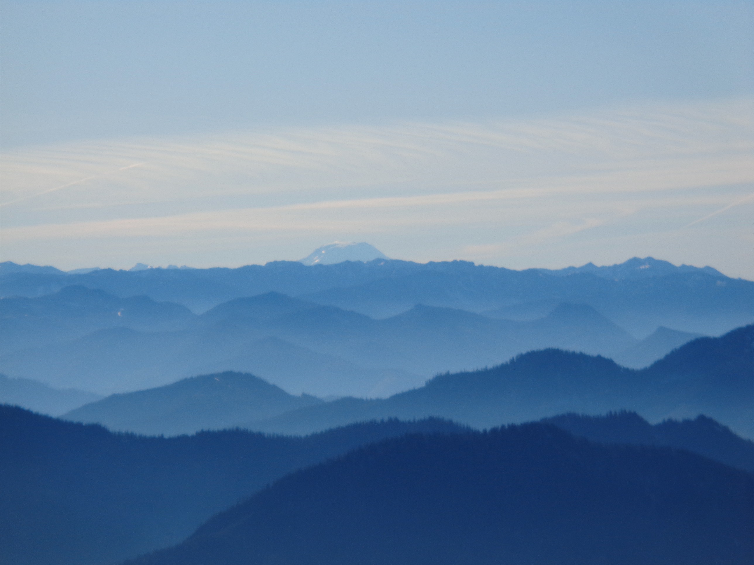
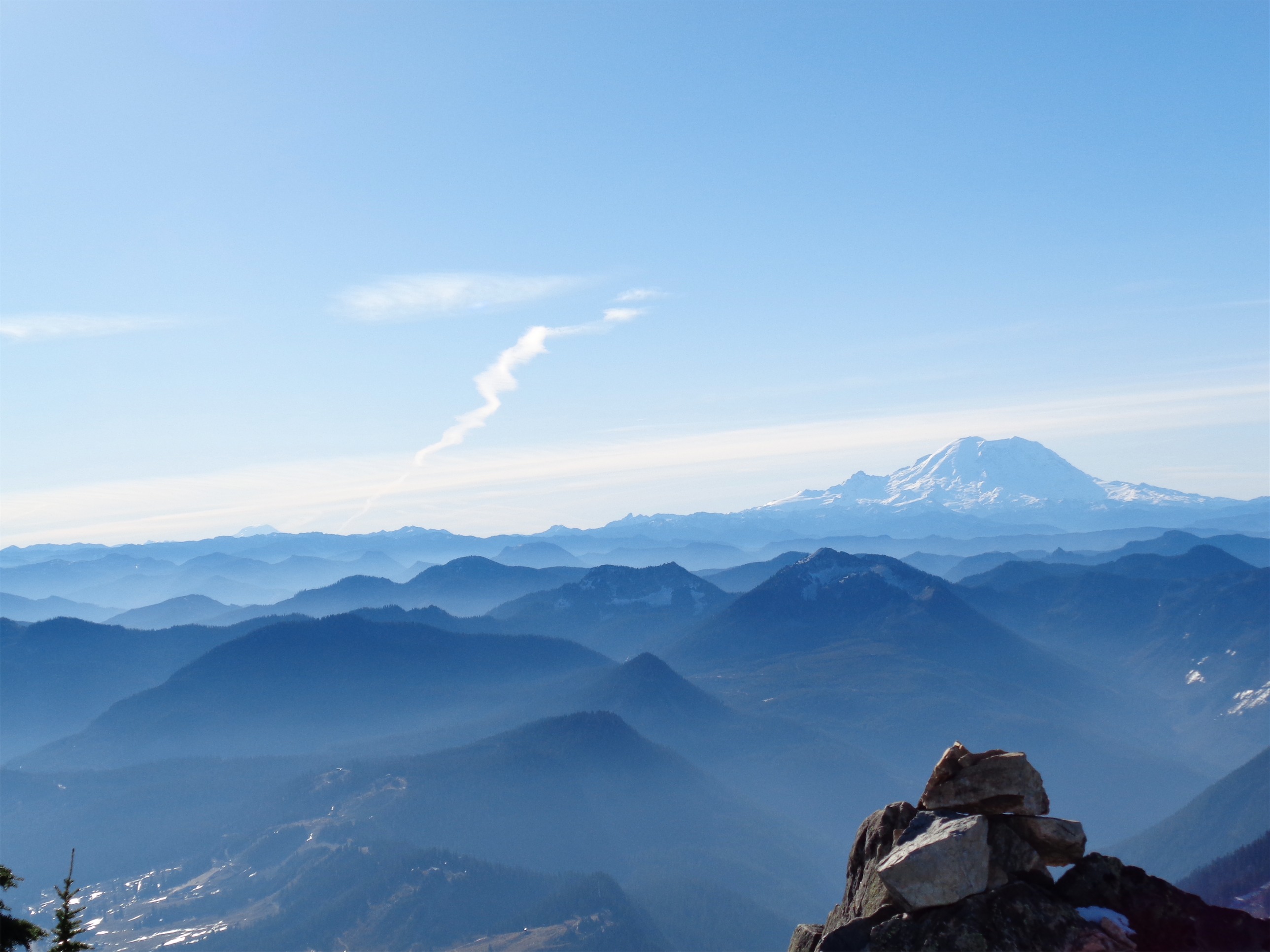
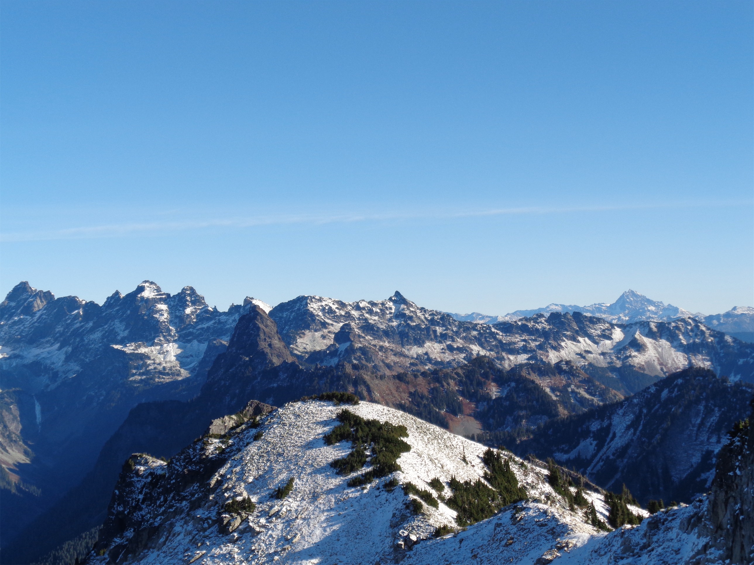

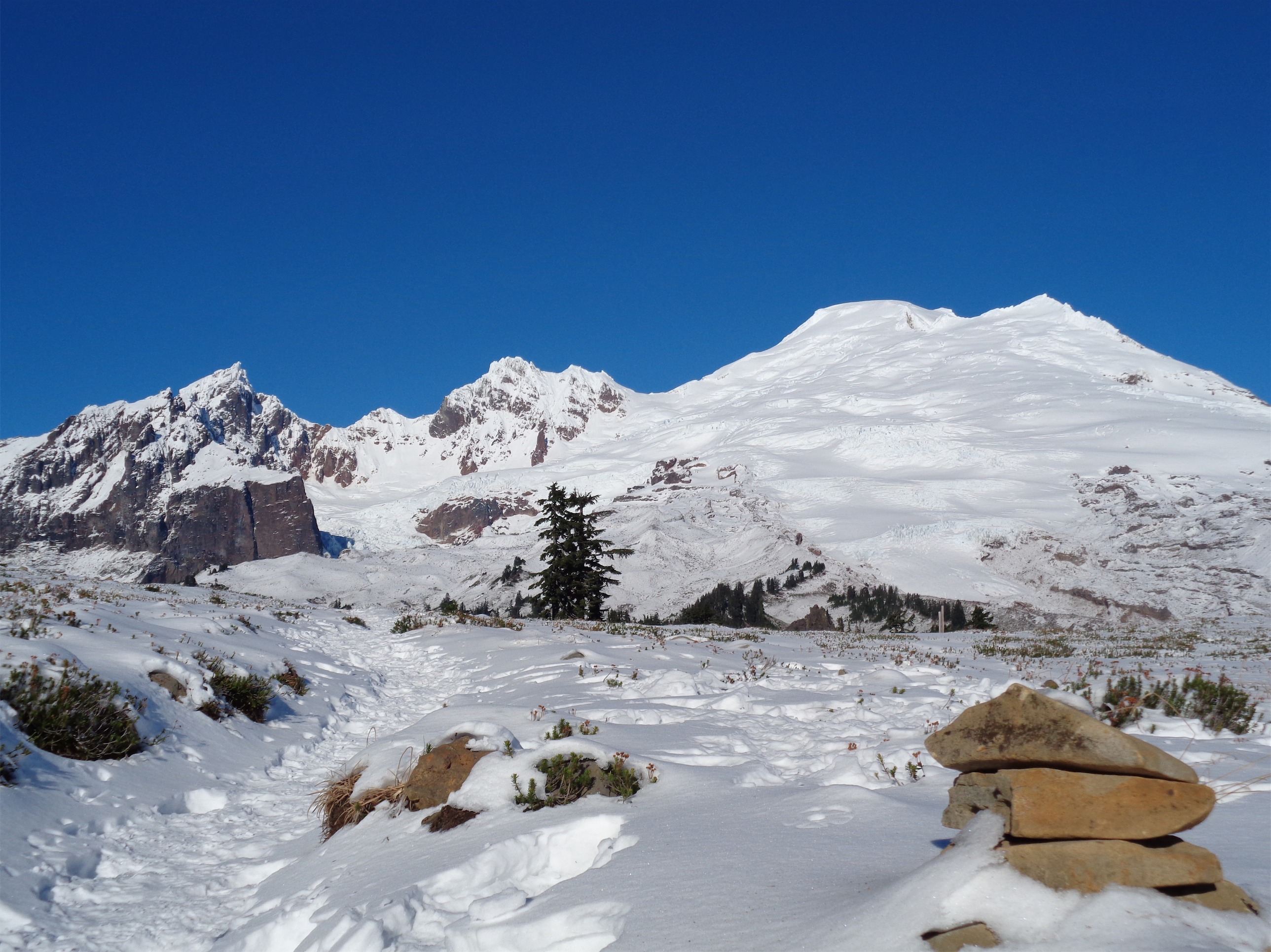
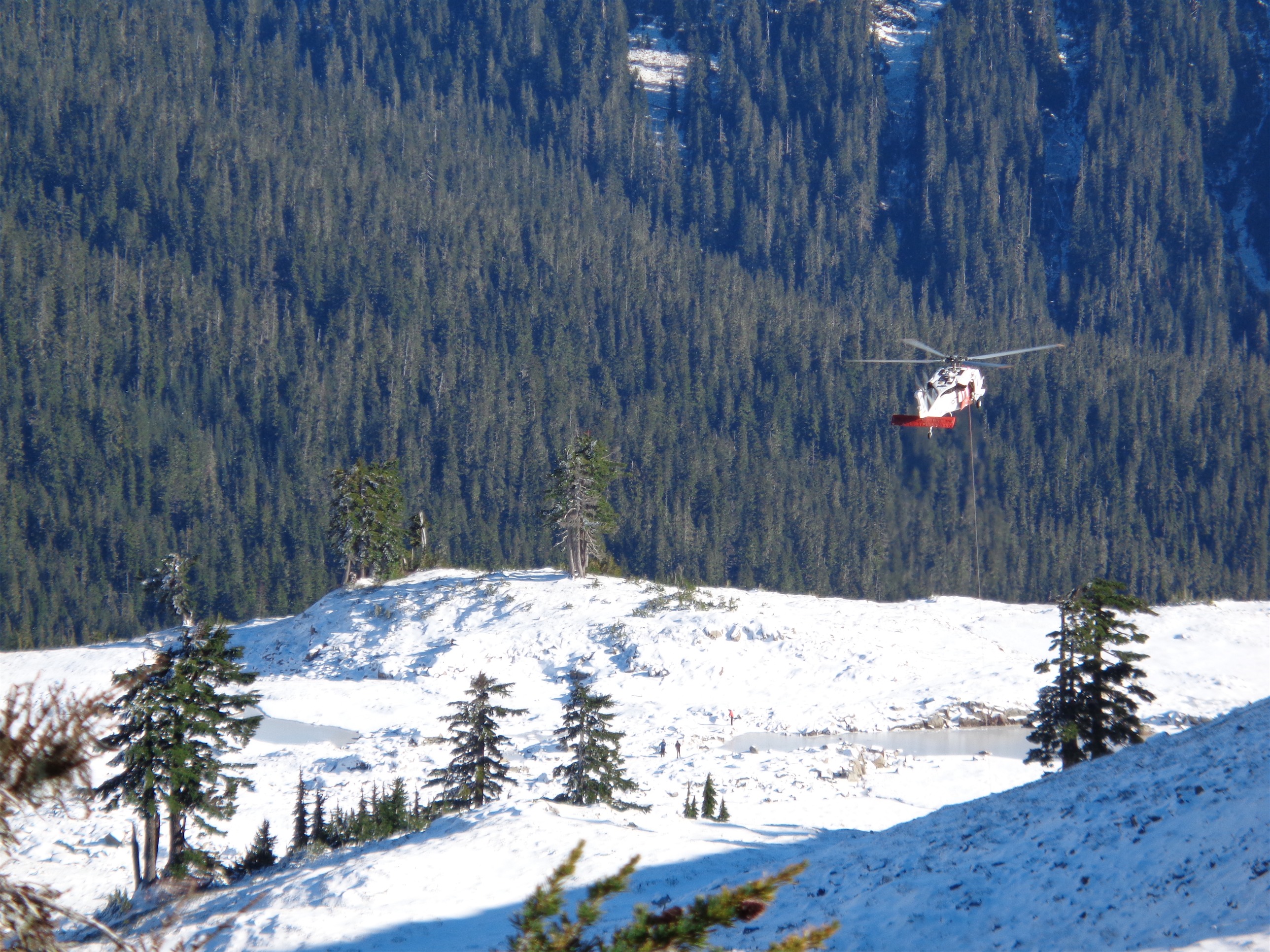
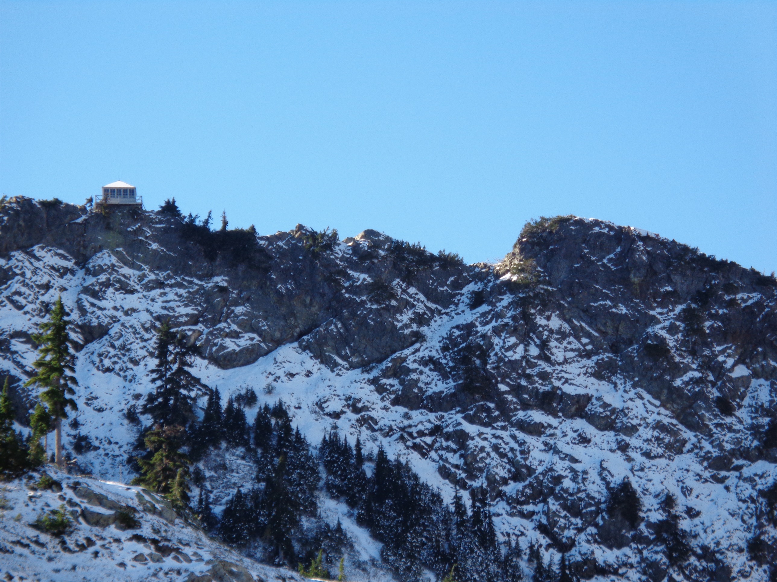


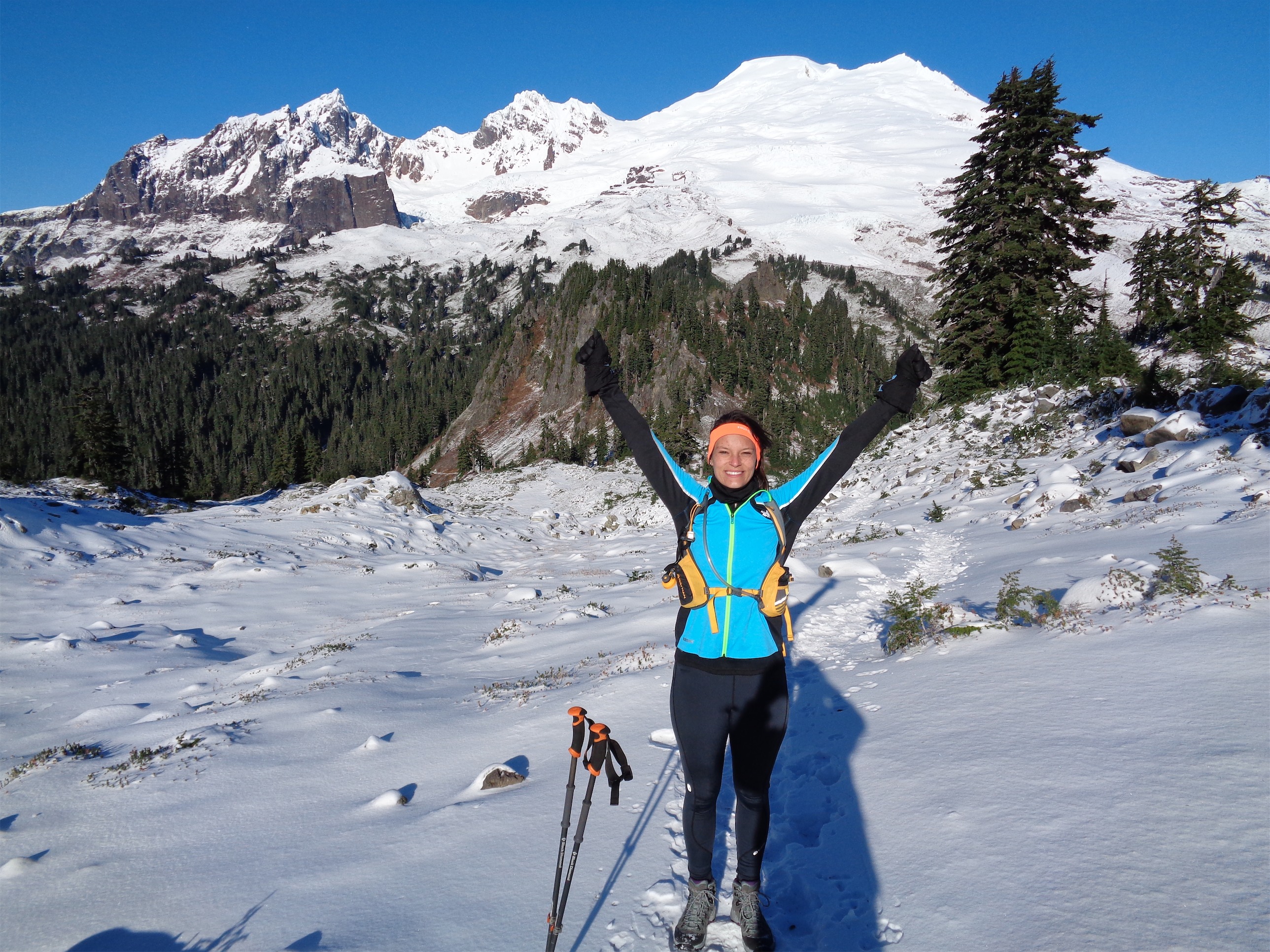
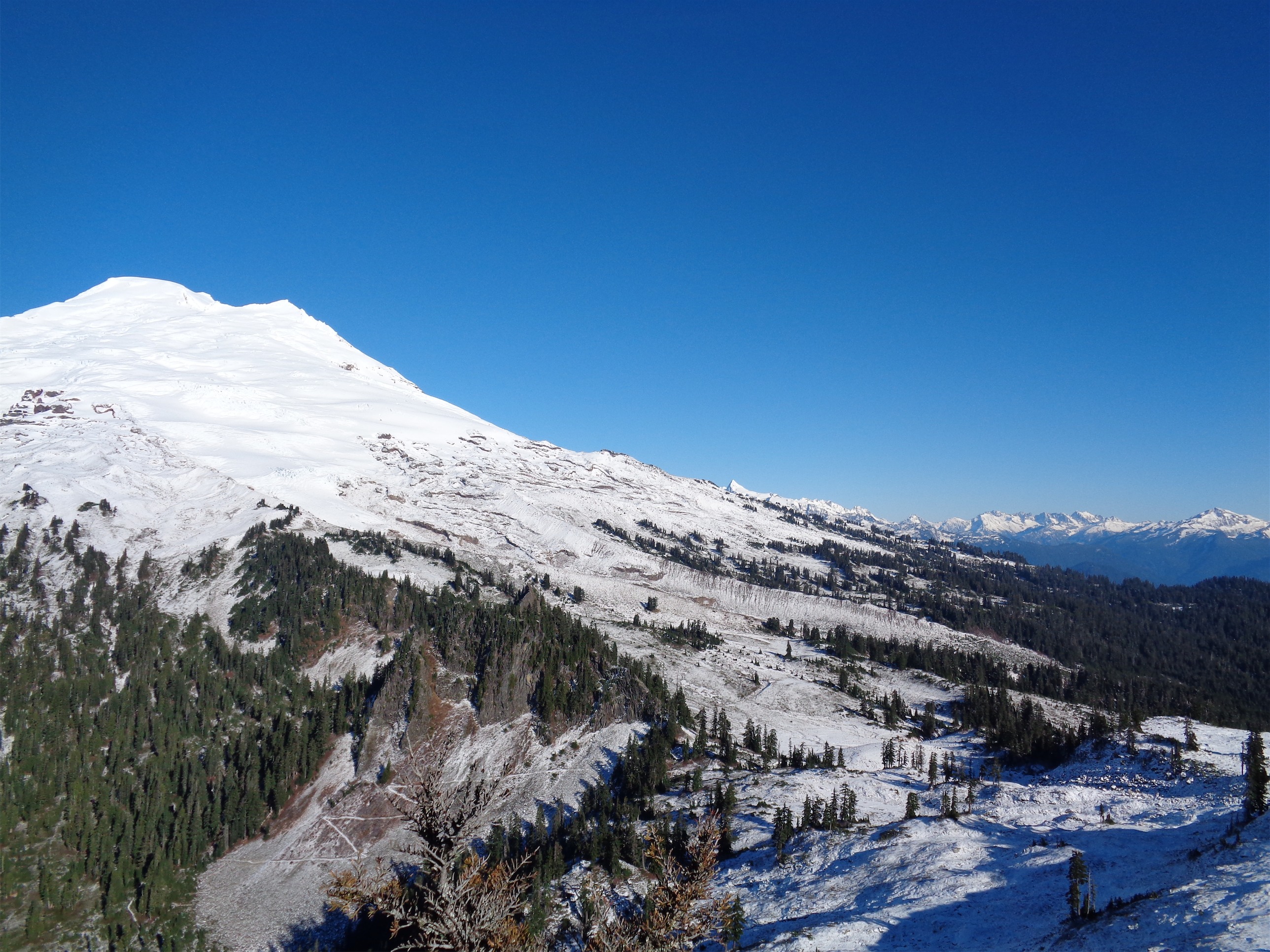


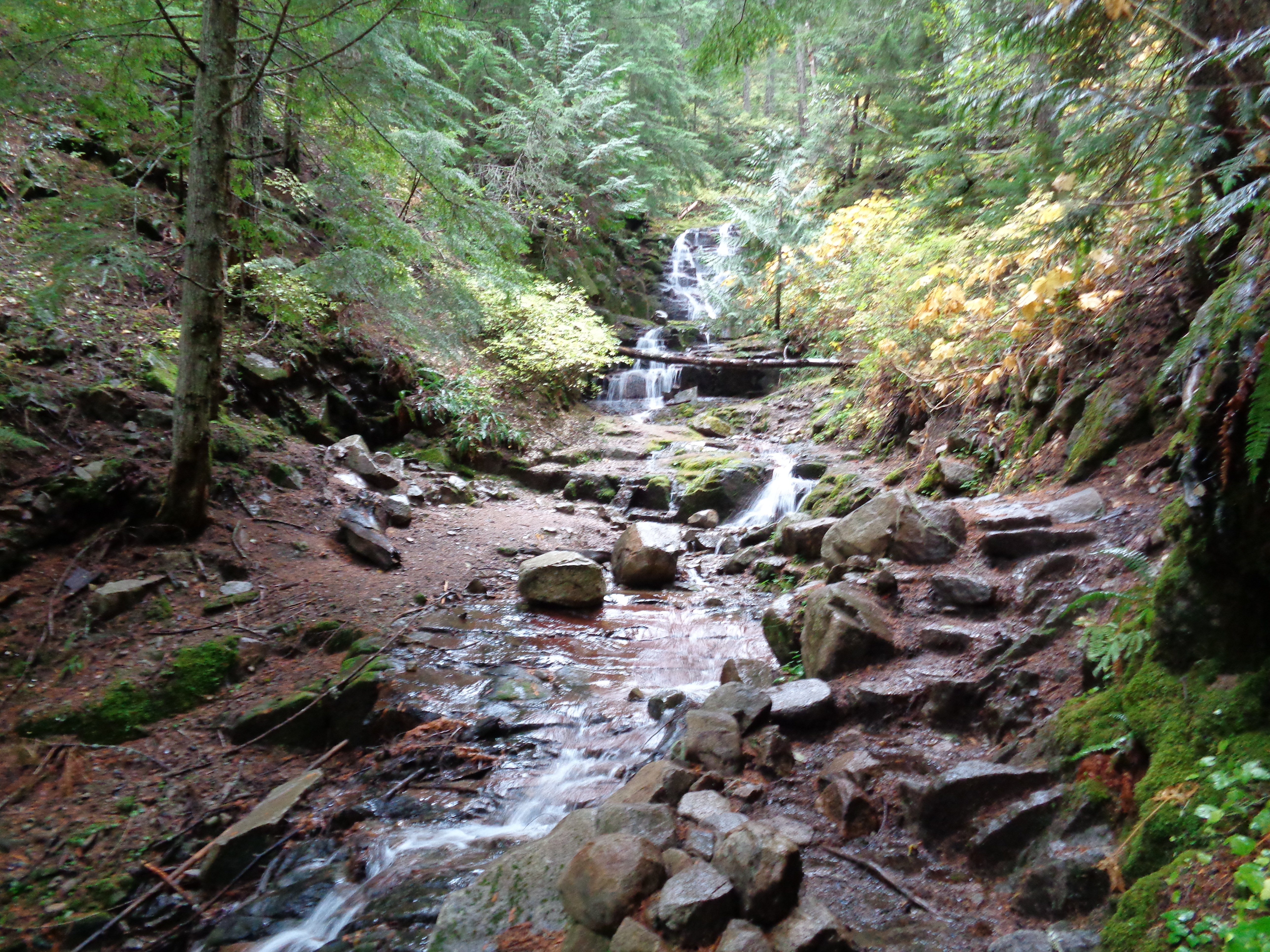


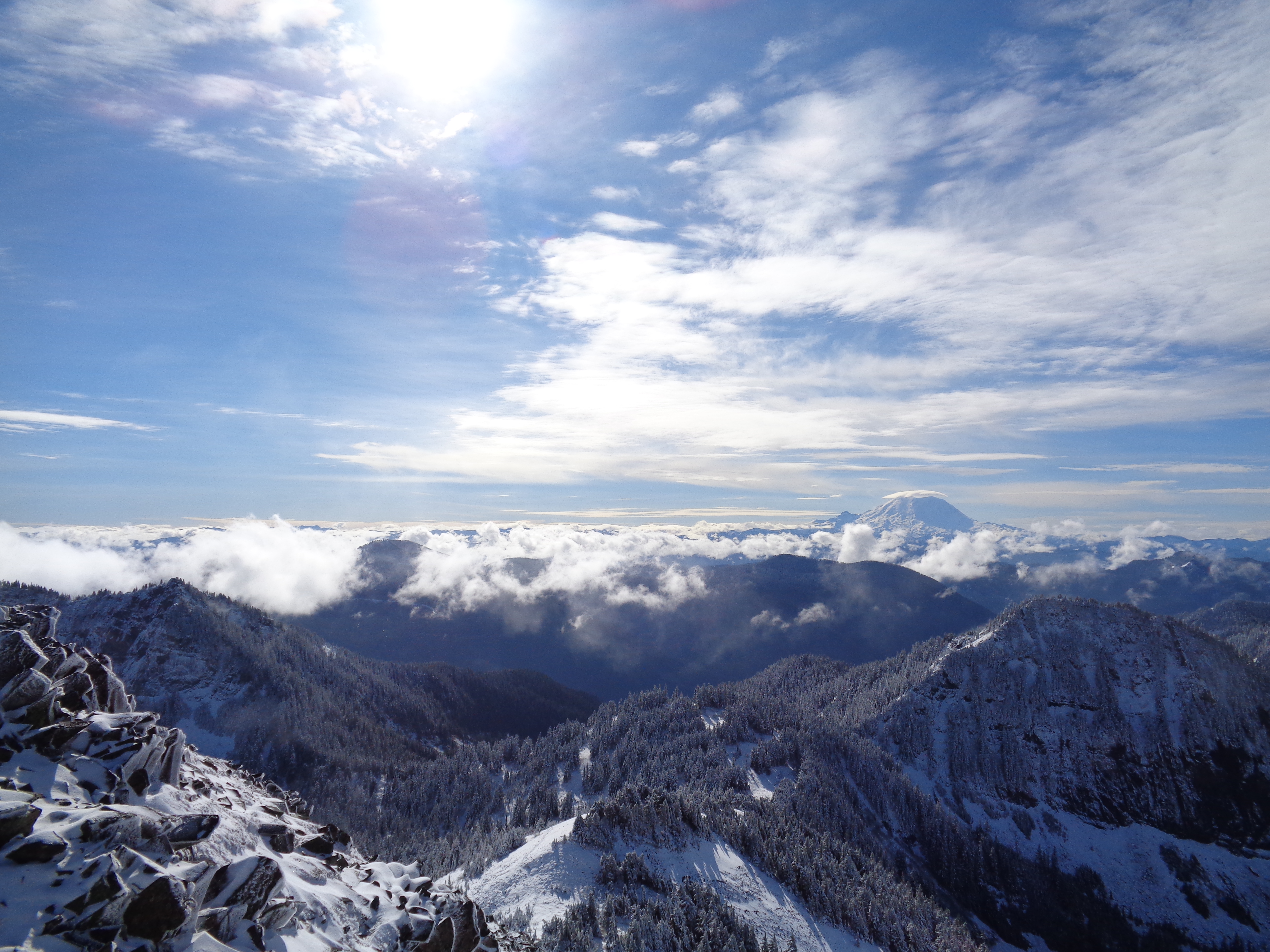
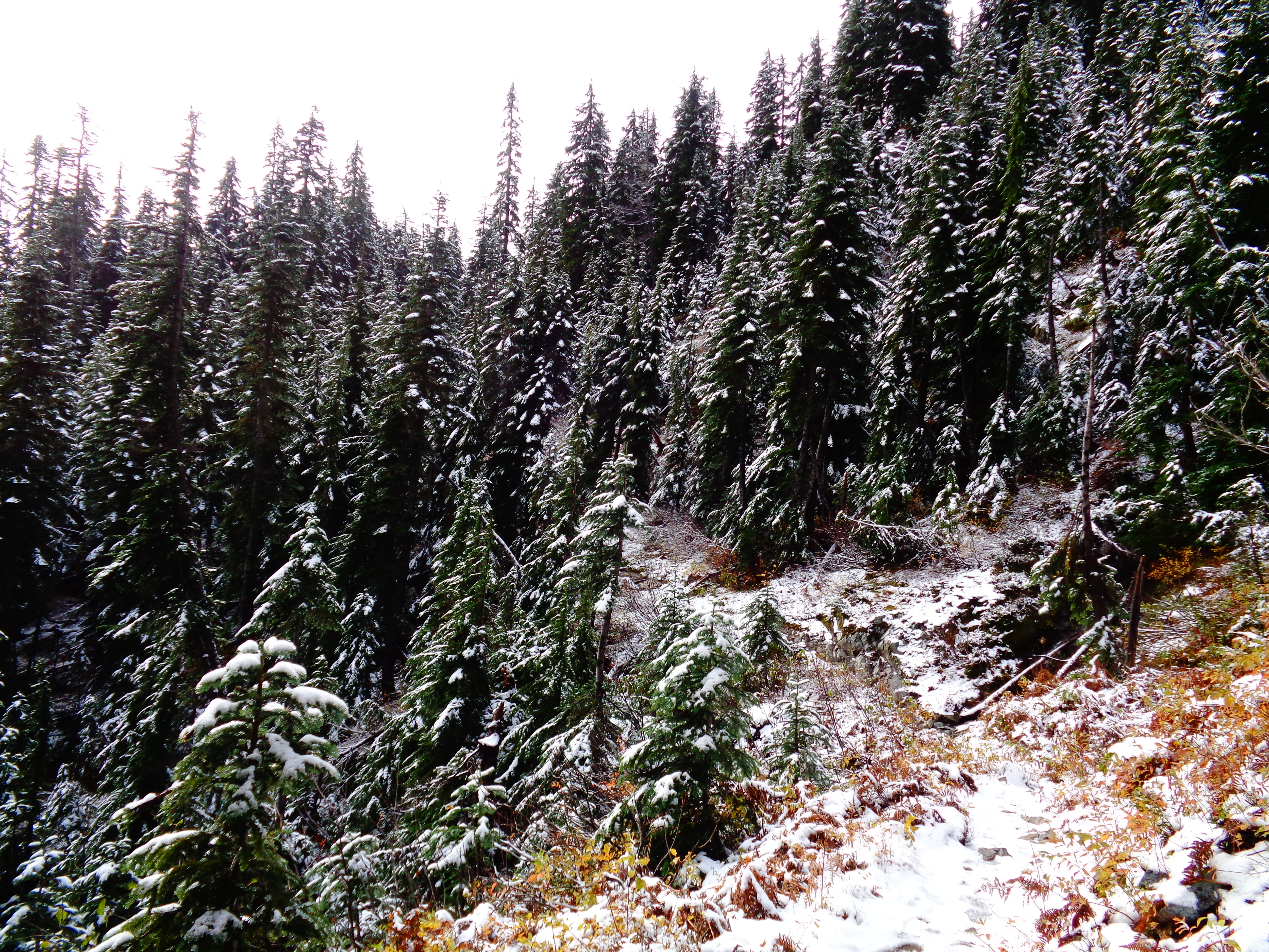
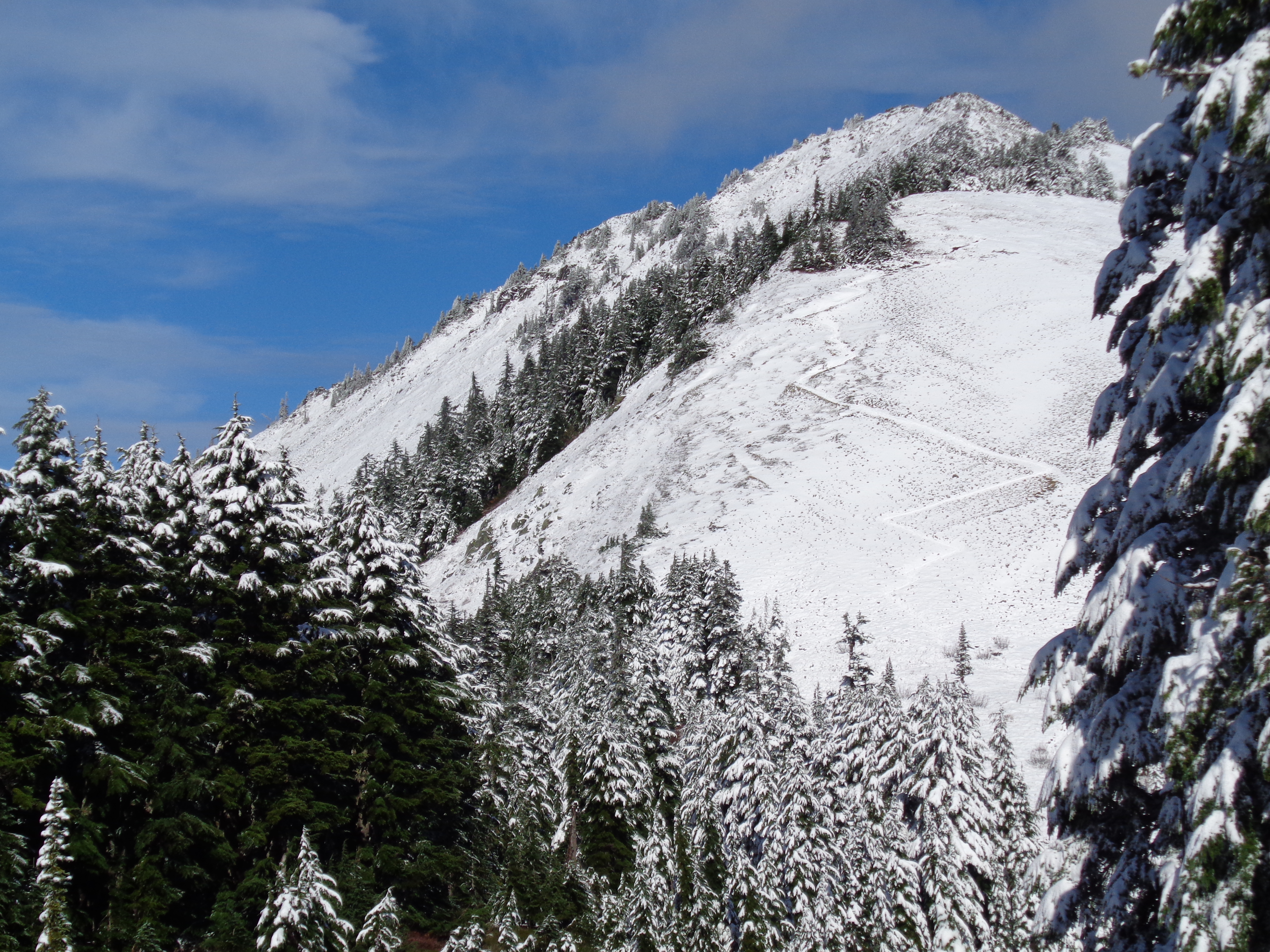


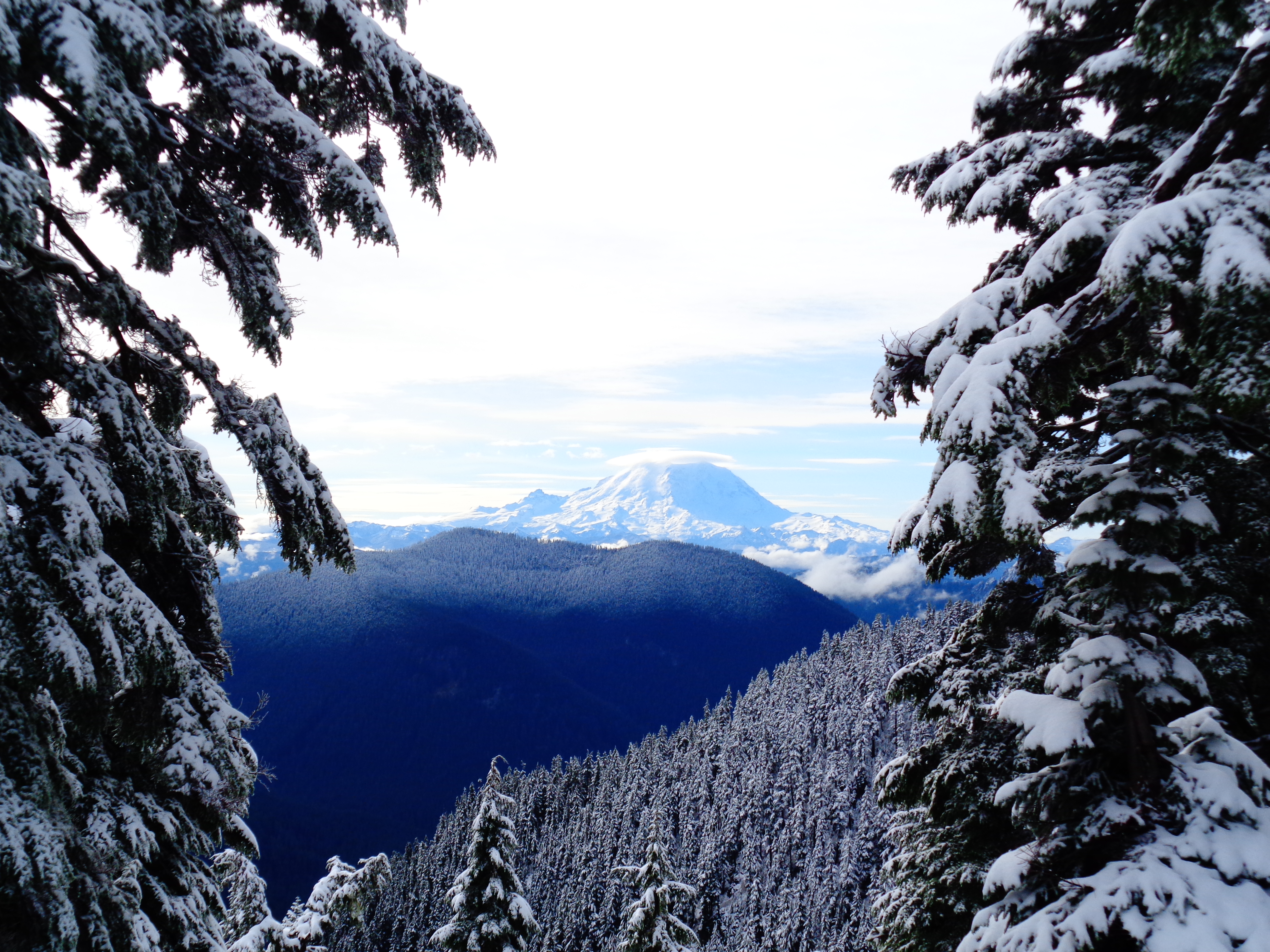
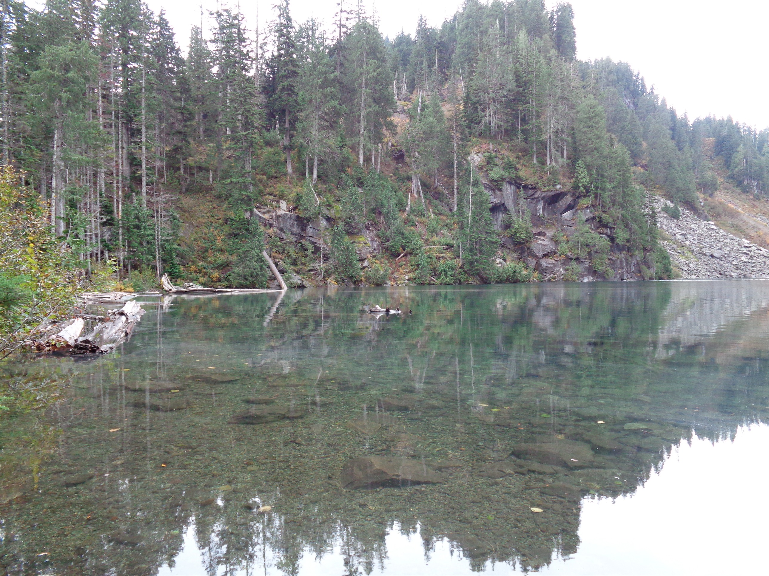


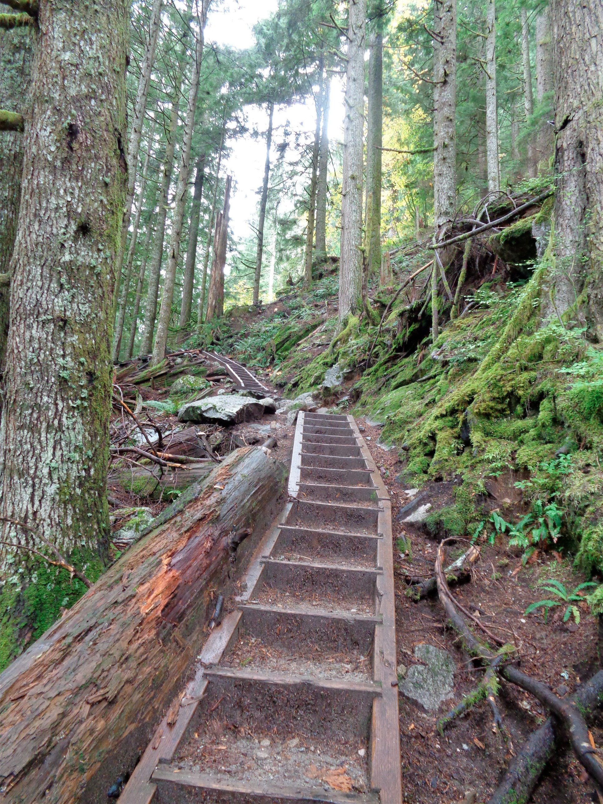
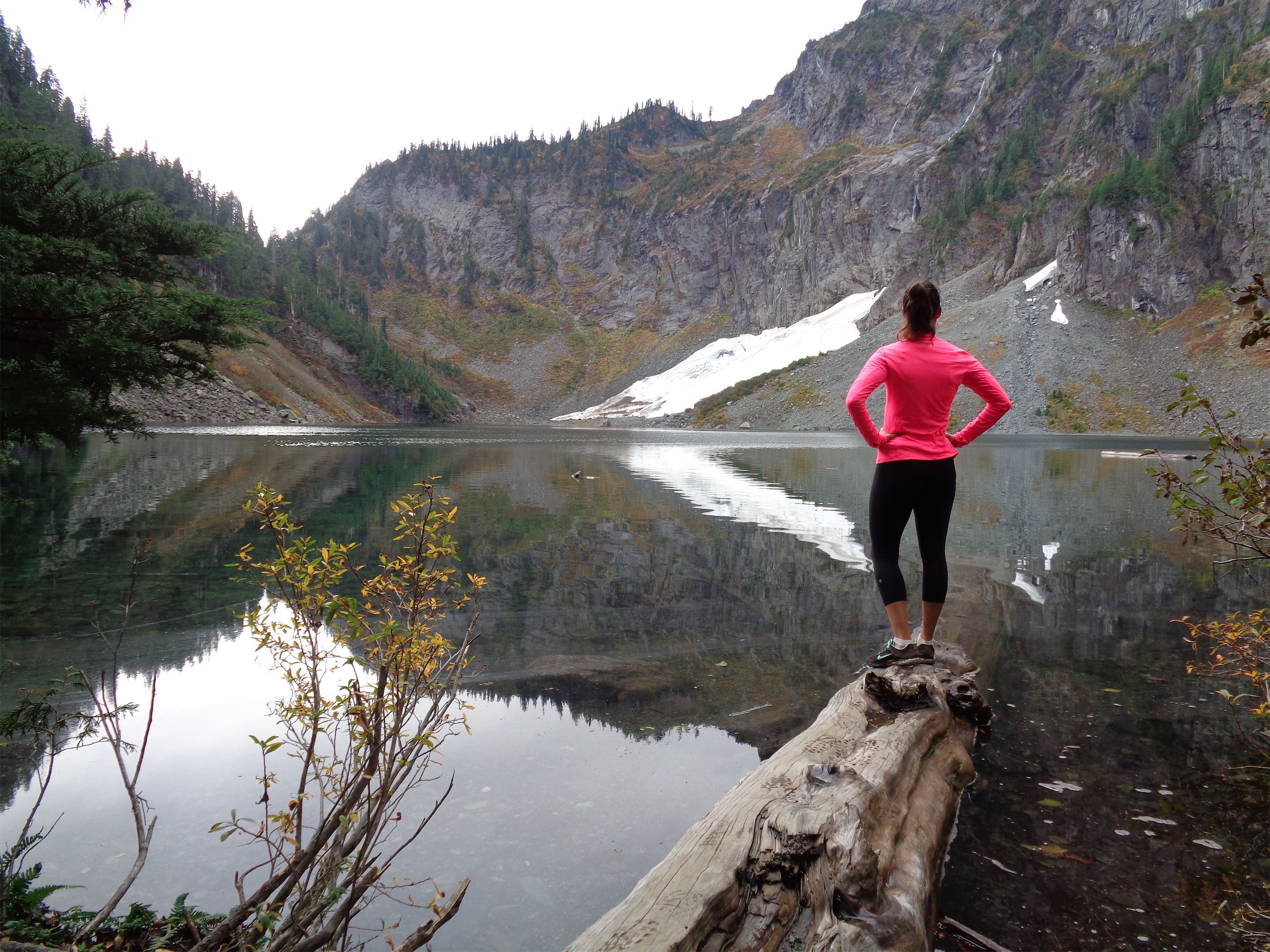


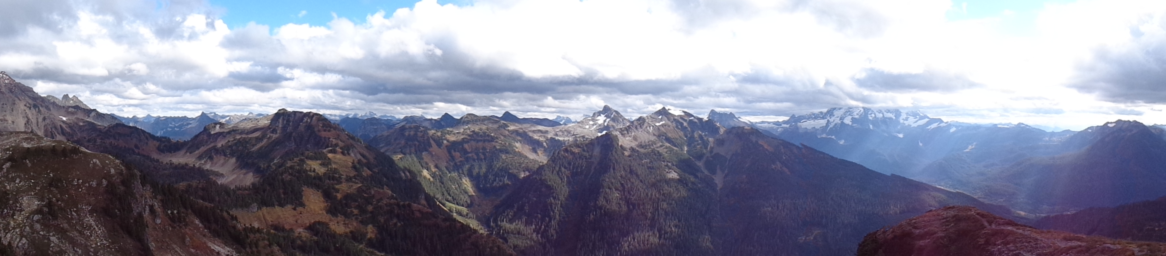
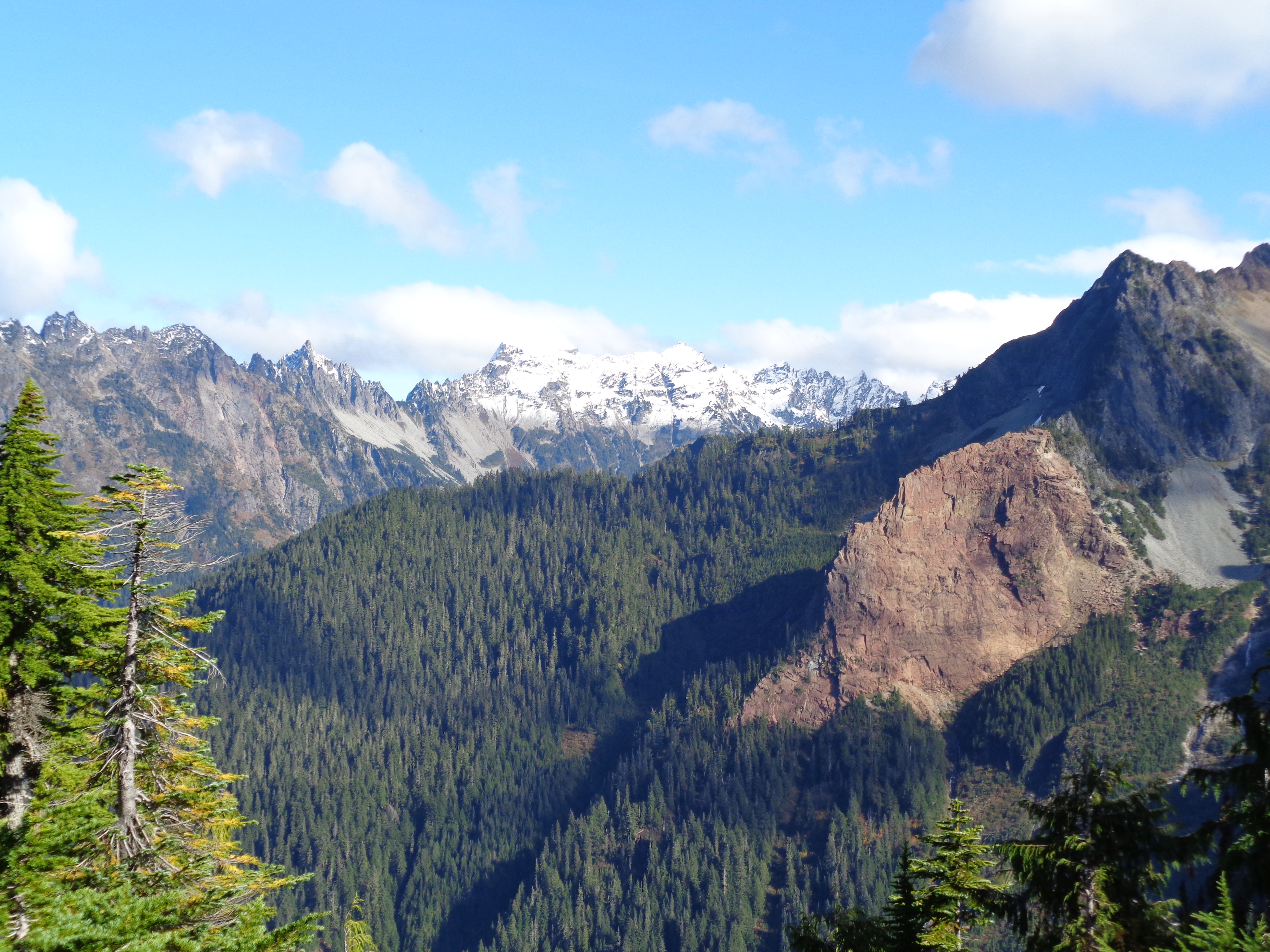
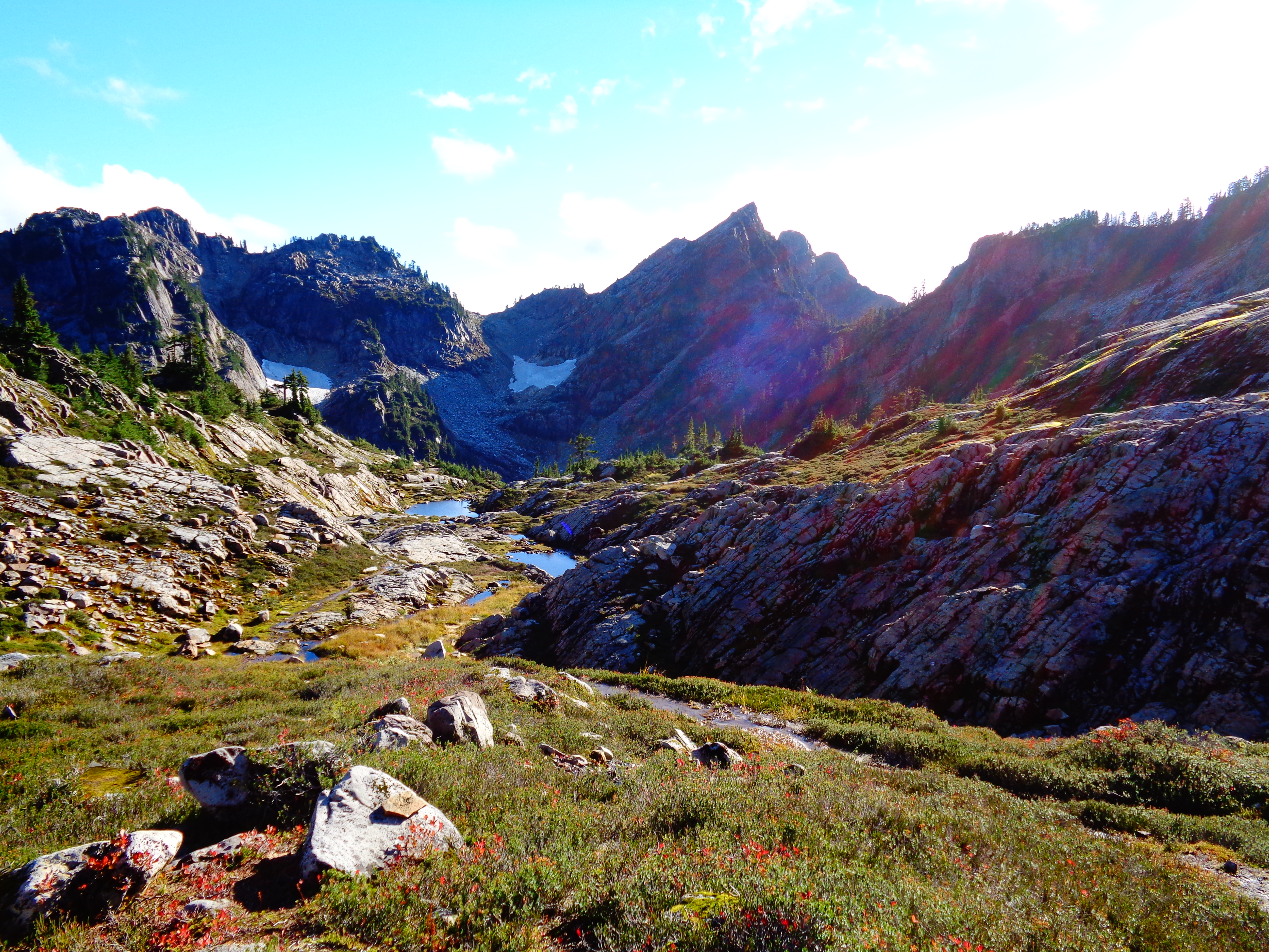
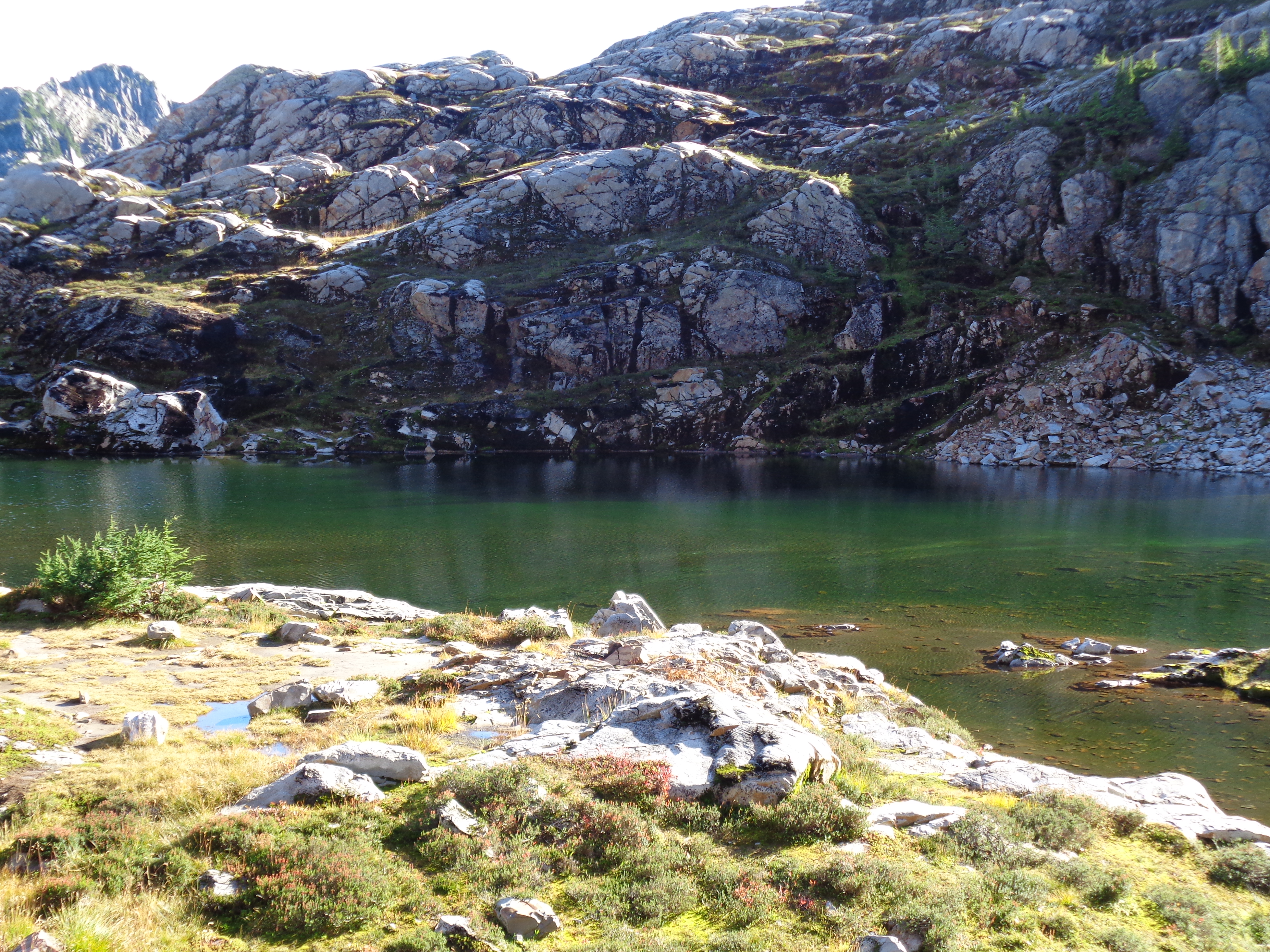
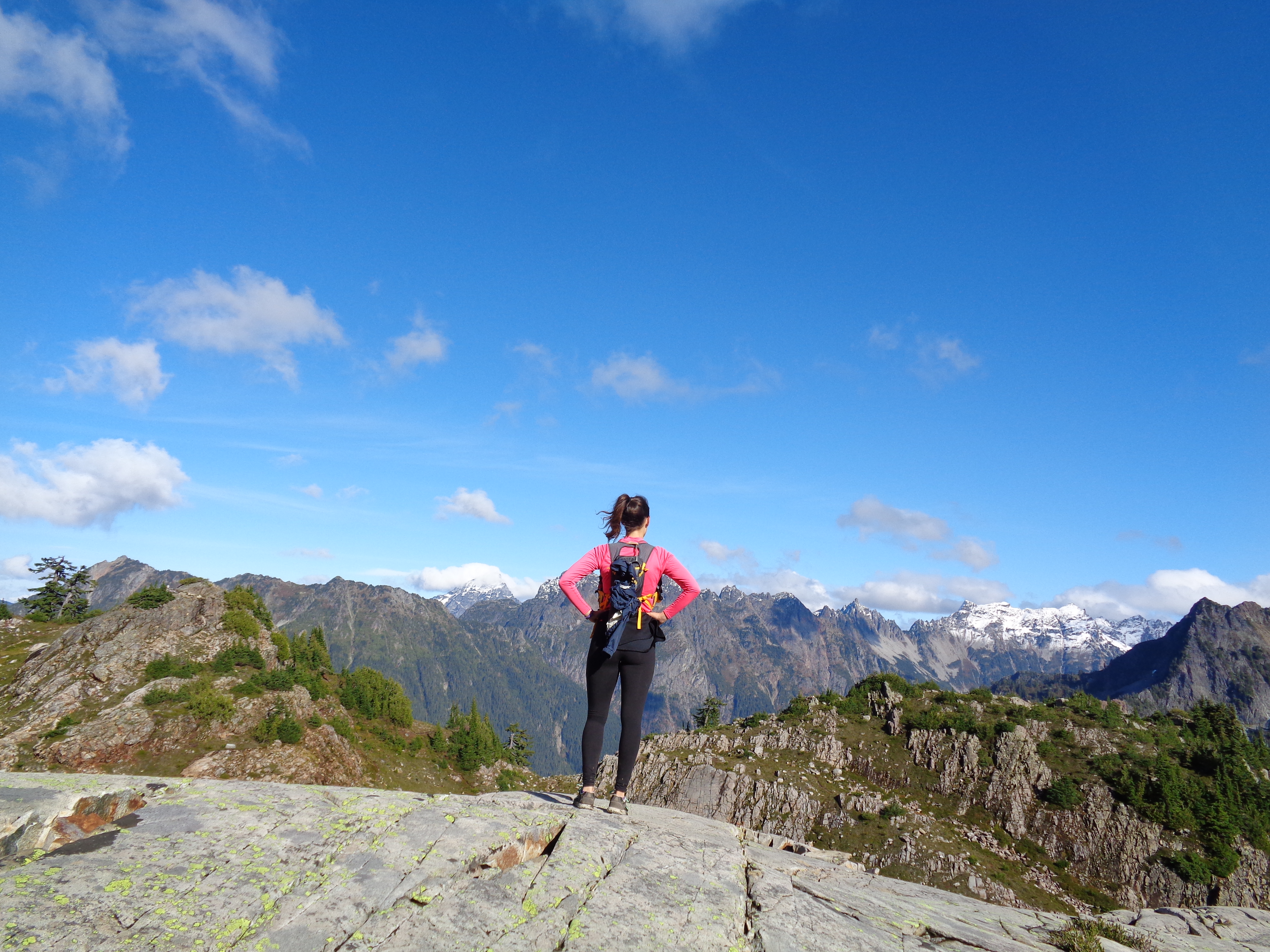
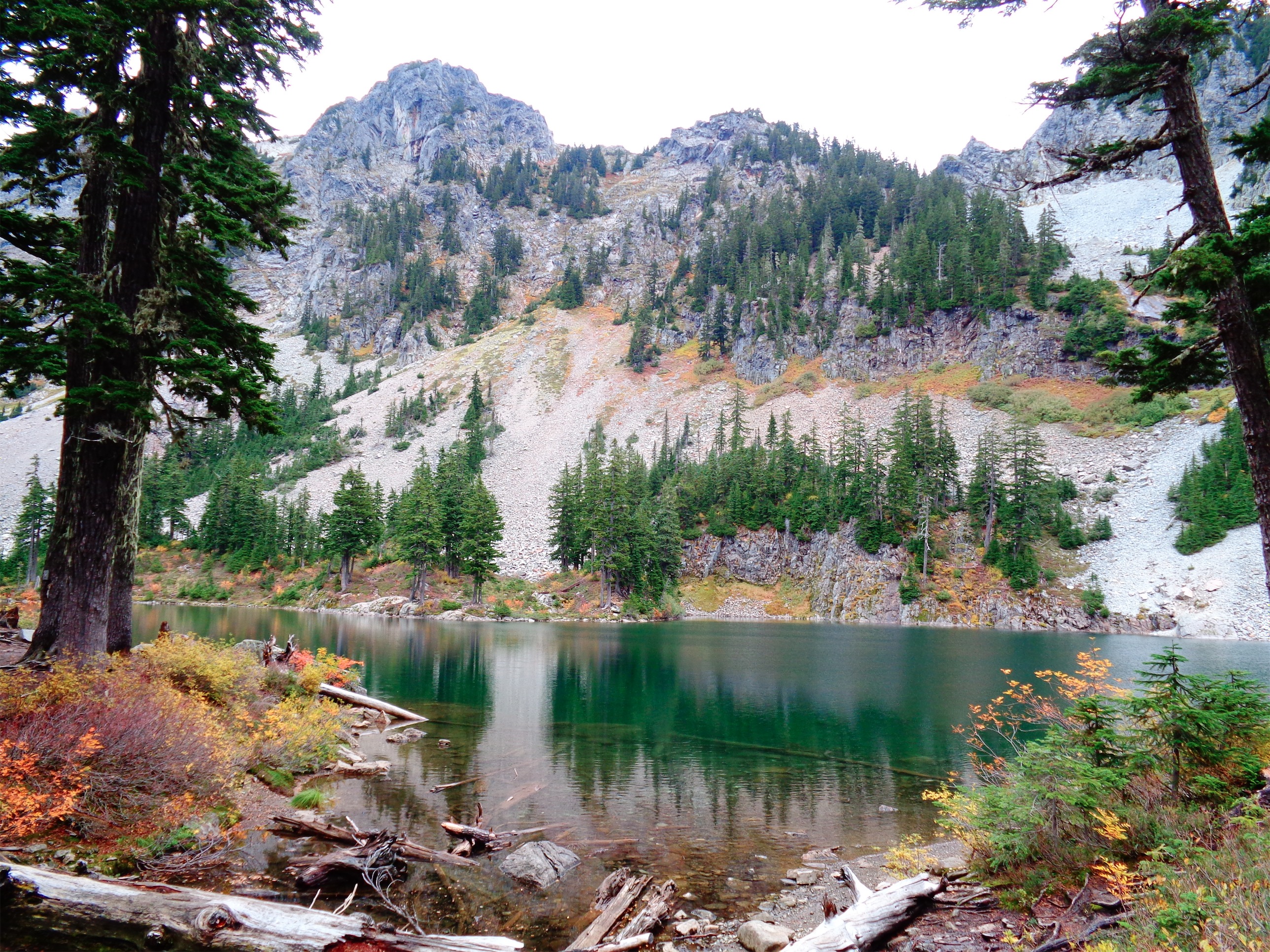
 Views of Shuksan were beautiful, even if we couldn’t see the peak through the clouds. Fall foliage was still everywhere, despite it being late October, and we lucked out because apparently the end of the road is already closed because of snow. From the top you could see Mt. Baker as well, and I imagine the views are insane on a clear day. The trail was well maintained, no tricky crossings or anything like that, and not too steep until the very end. The first summit is a false summit, and you have to hike down a bit and along a ridge to get to the real summit, which unfortunately my friends weren’t too keen on pursuing. One was wearing a t shirt and jeans (I don’t know how he wasn’t freezing), and it was freezing cold at the top with wind around 30mph (gusts up to 40mph) according to a few trip reports. I had on four jackets, one of which was windproof, thank god. Next time, when I go on a clear day, we’ll be getting across to the real summit.
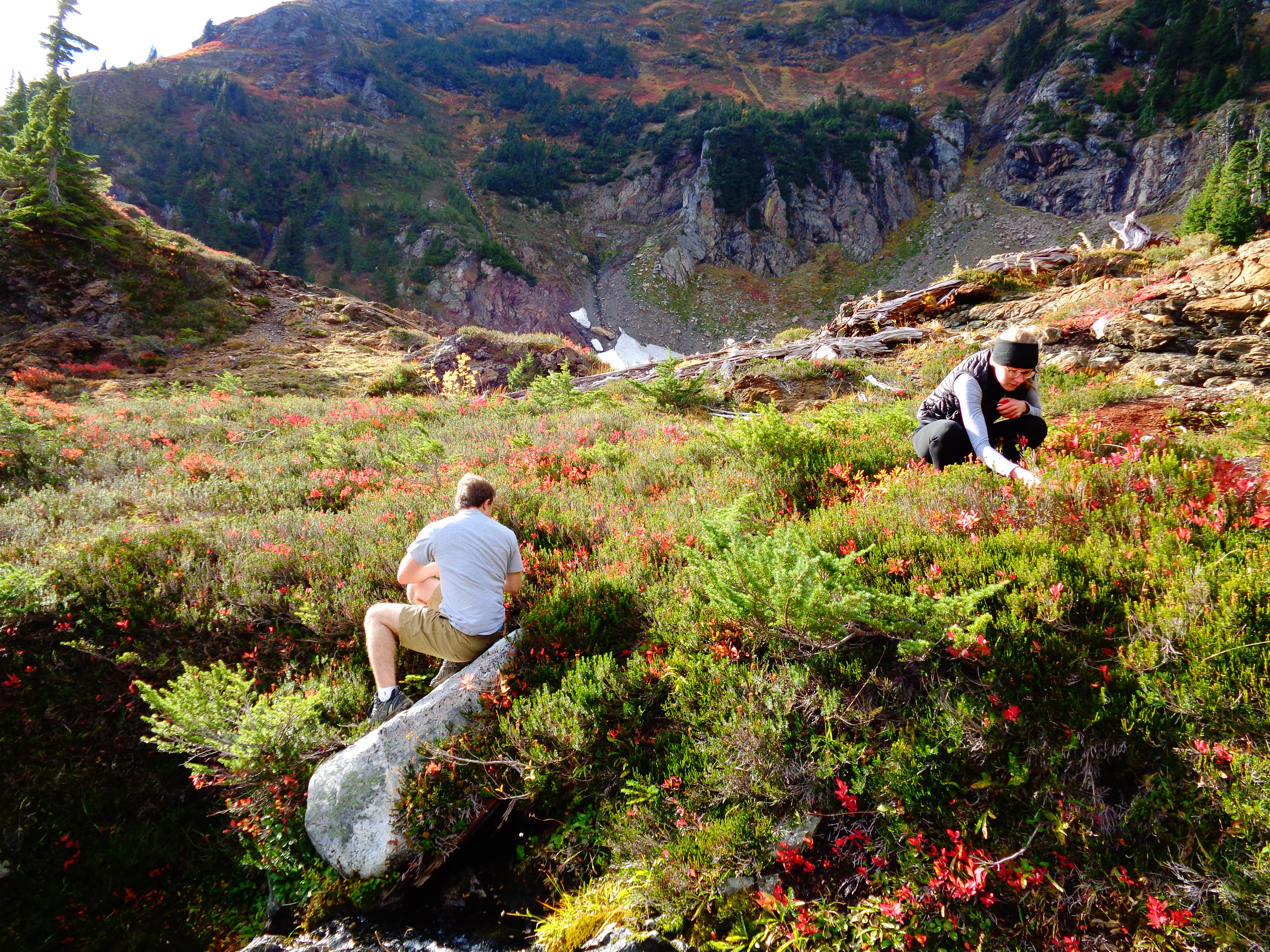


