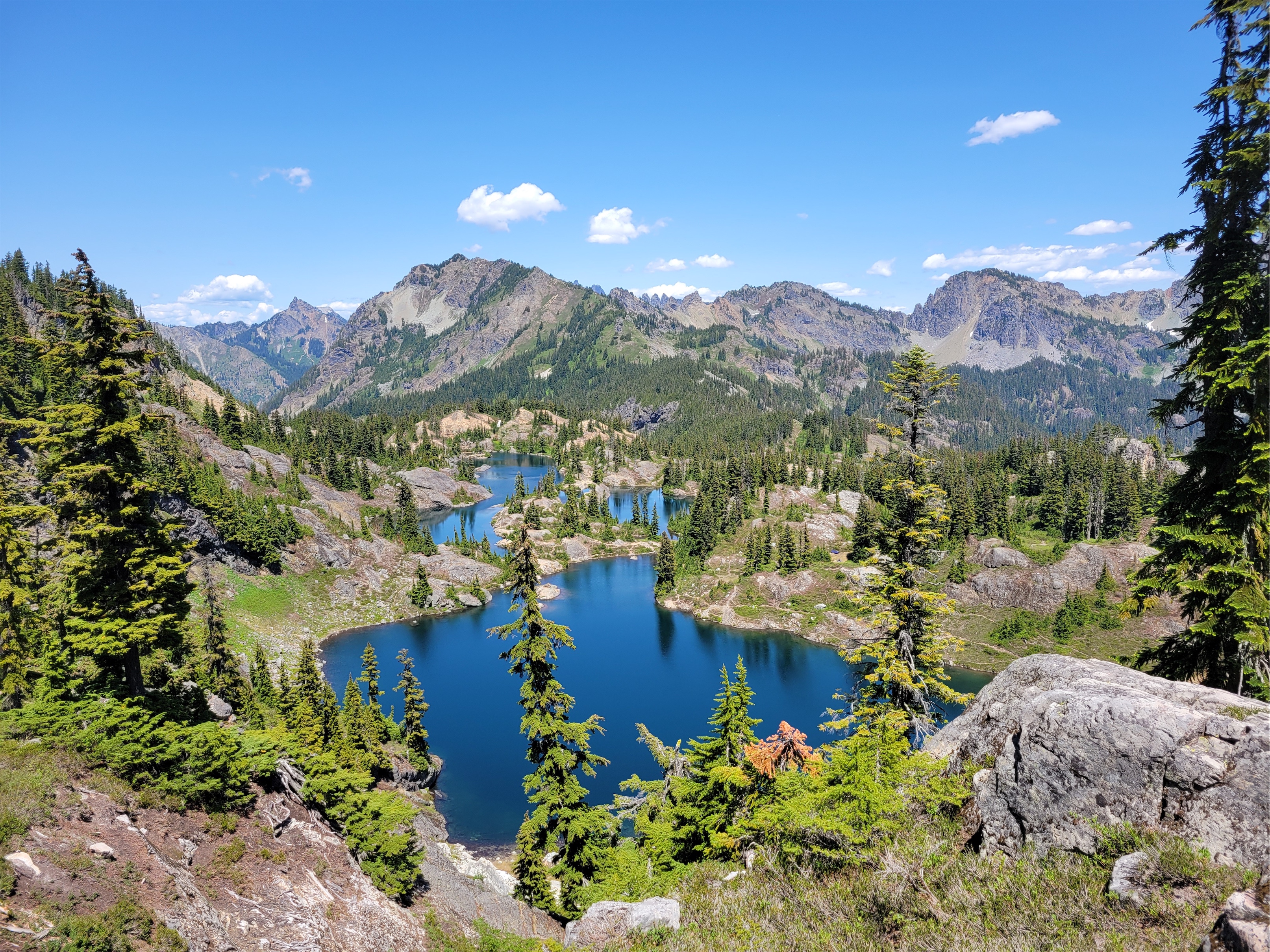
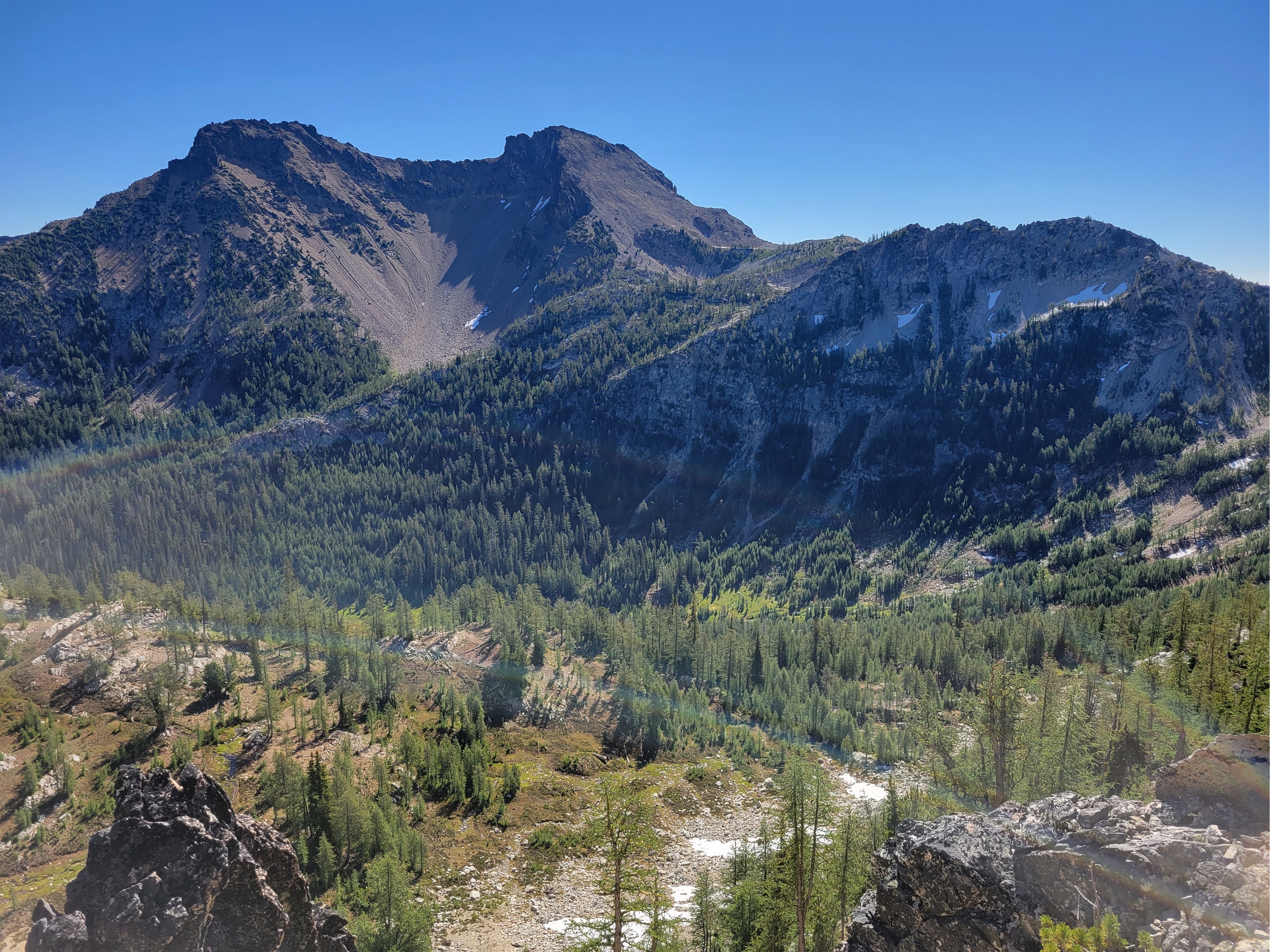
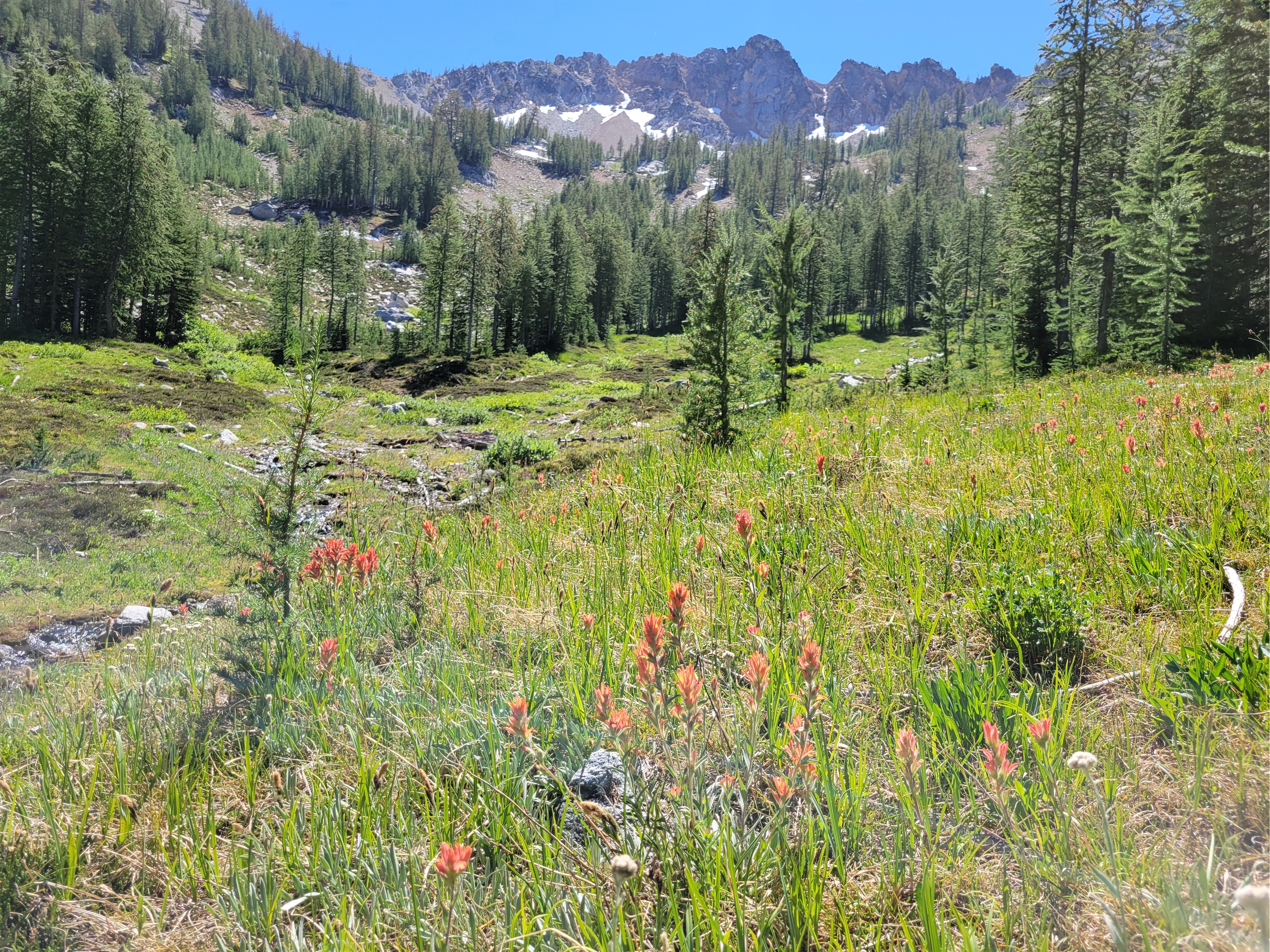
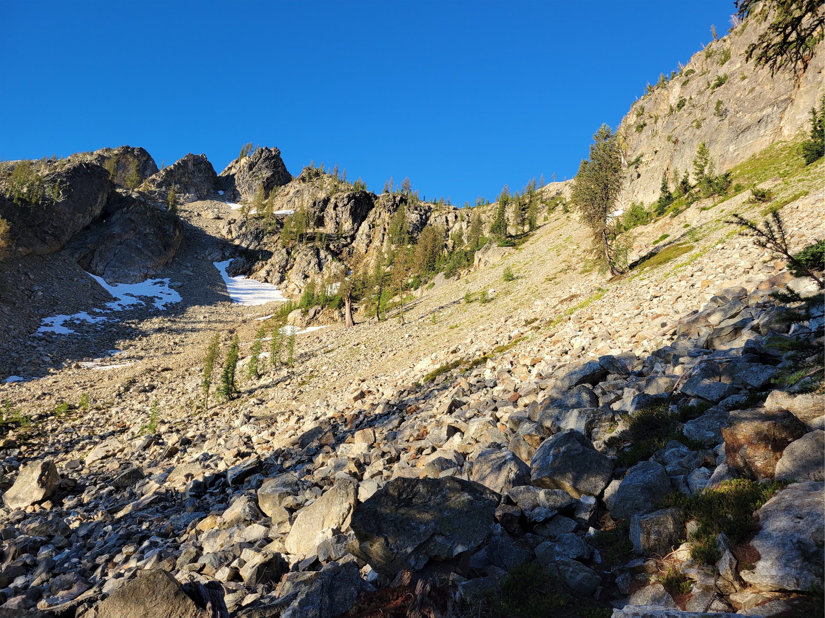
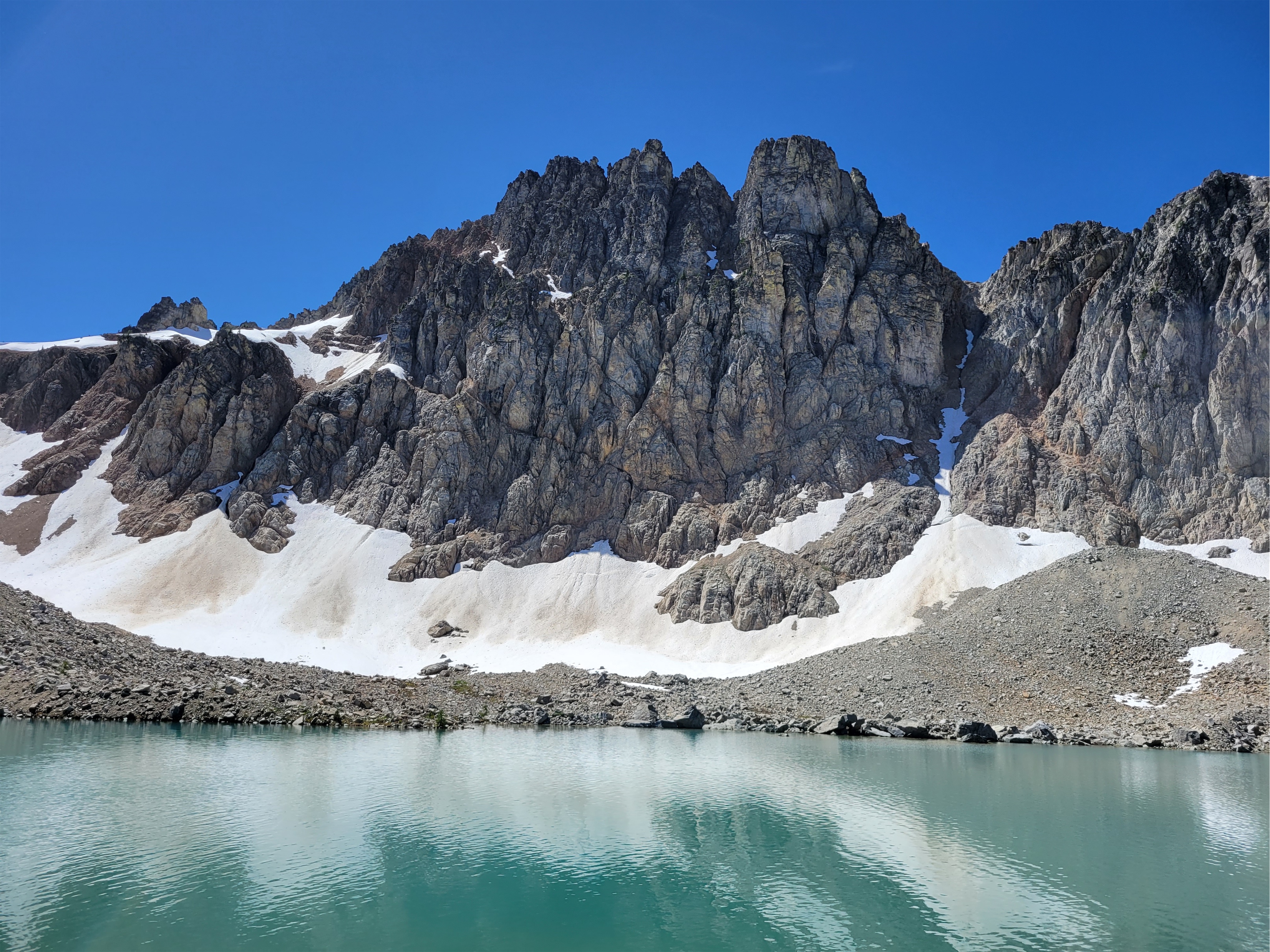
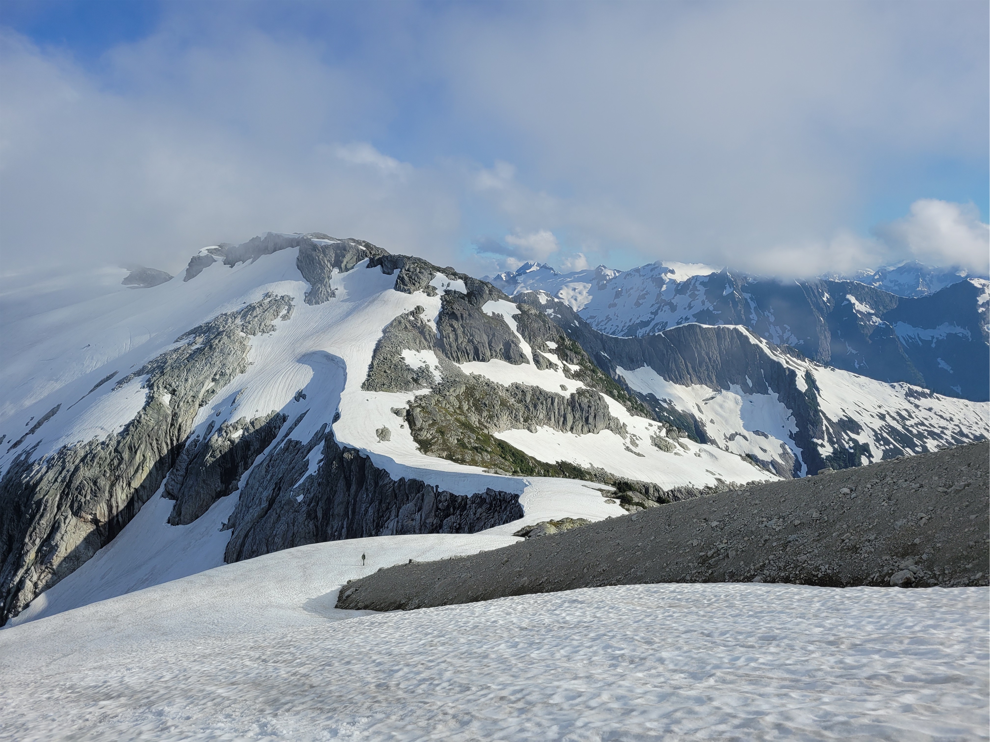
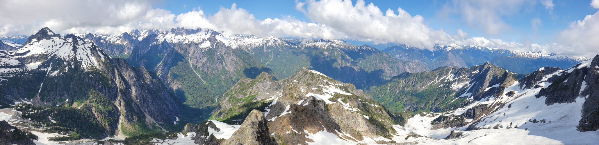
Looking back on Rampart Lakes from partway up our gully
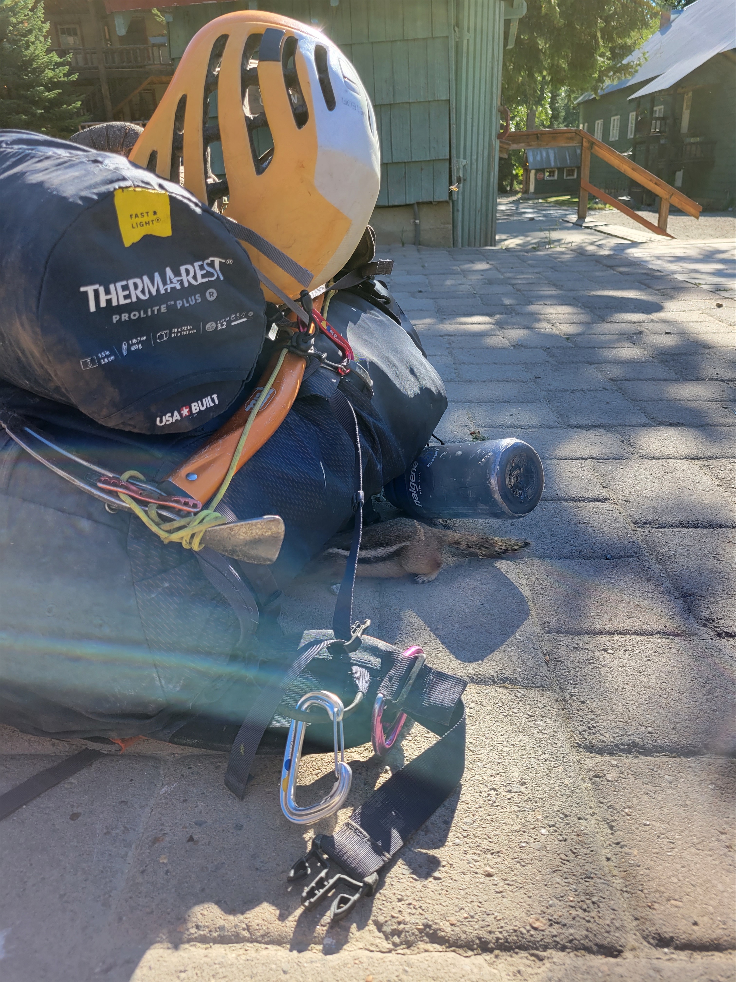
Adventure is out there!
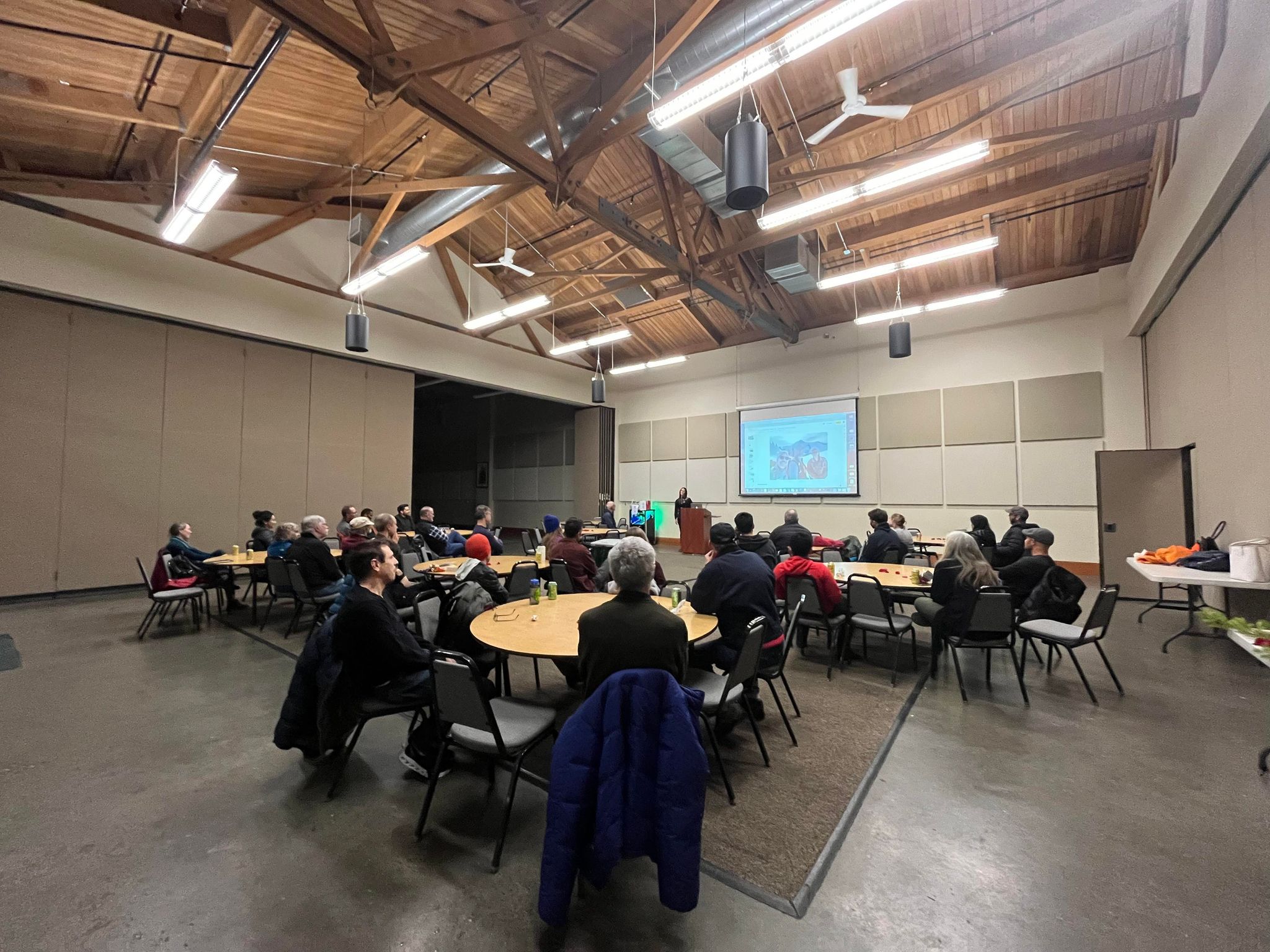
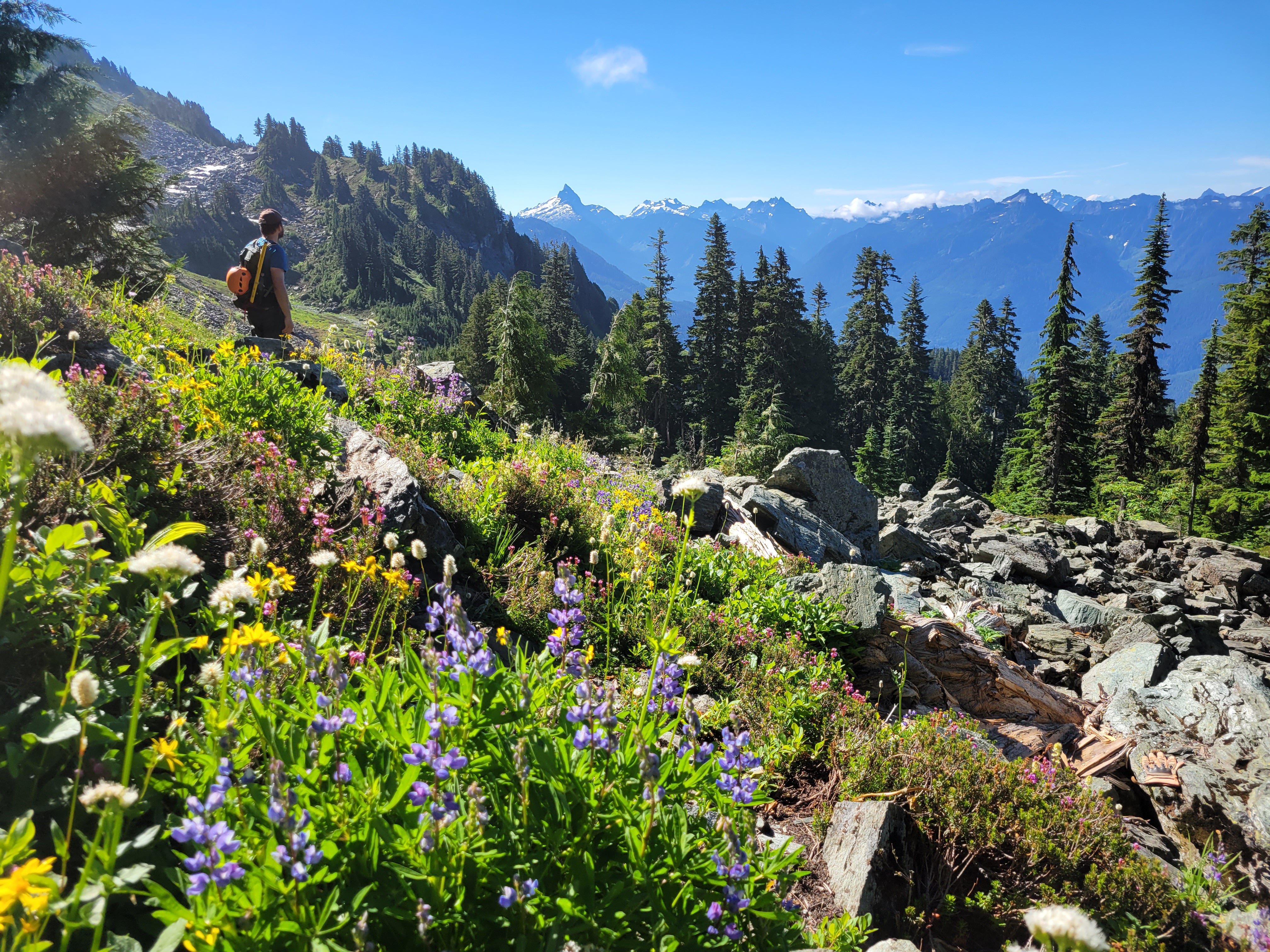
I know I know I’m way behind on writing. Just going to jump to recent trips and maybe someday get caught up on past ones. I seriously think my job (heavy on documentation) is interfering with my enjoyment of writing despite wildly different styles and genres. But I’ve had the itch all week this past week, so here’s a good short report (more pics fewer words) to start reviving things! Rampart Ridge on July 3rd via Lake Laura/Lillian, considered the “back door” route.
Dog friend excited to fetch at Lake Lillian
Distance: 6mi
Elevation: 2,700ft gain, 5,800ft highest point
Weather: 60’s and sunny
Commute from Seattle: 90min (amazing)
Did I Trip: caught it
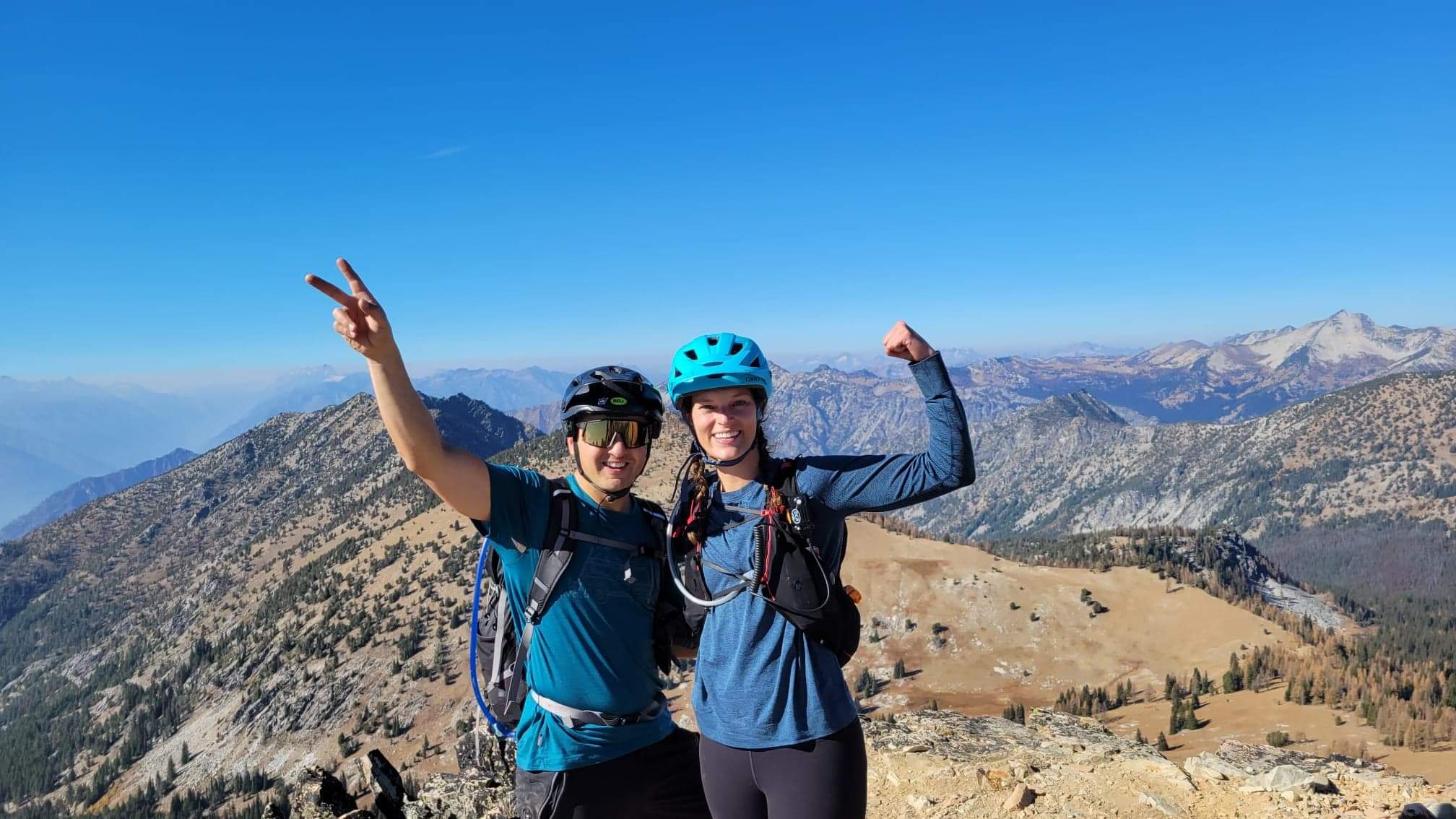
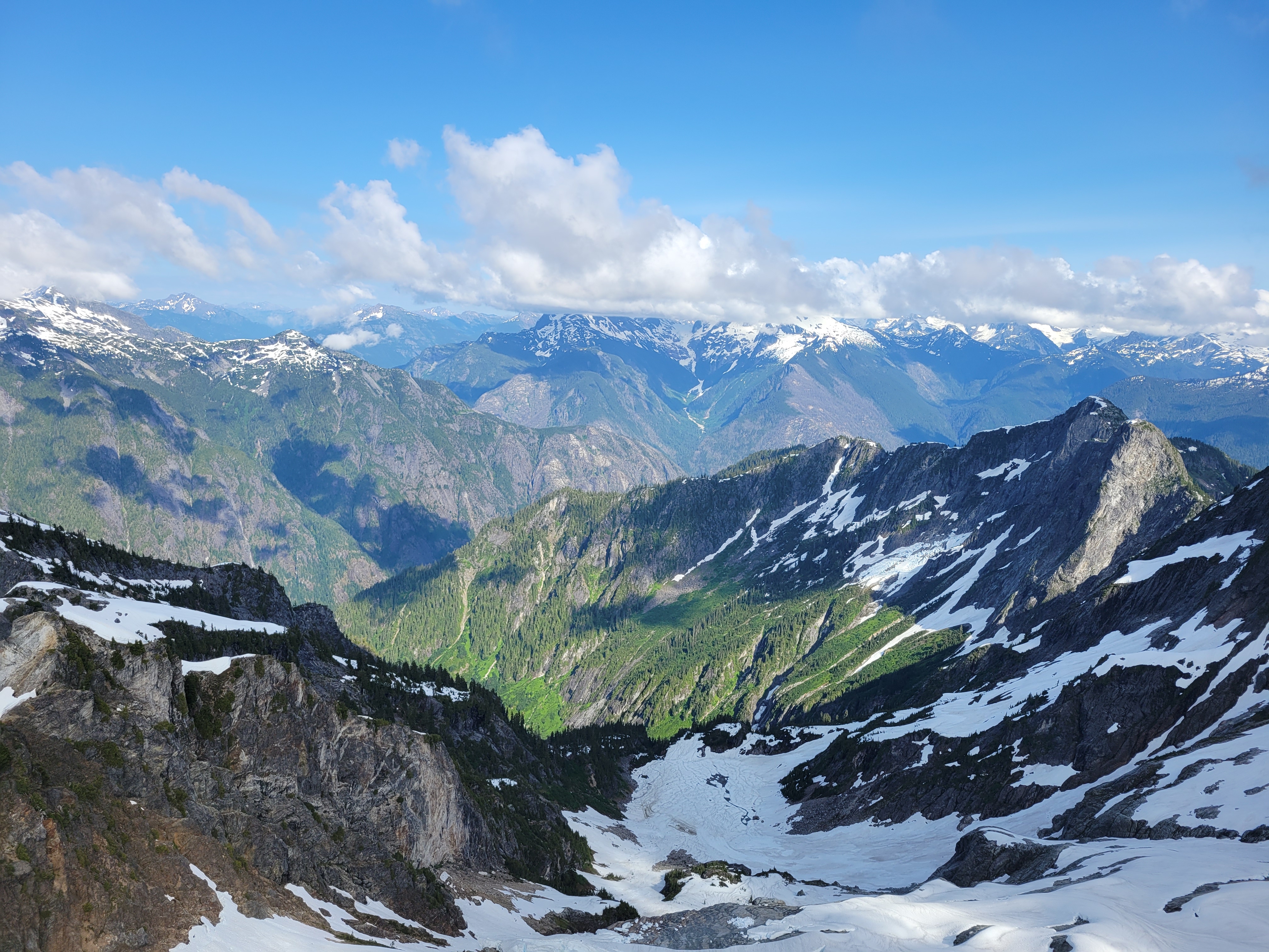
We were fresh off our friend Eva’s wedding, so I think we all felt varying levels of lethargic and lazy, but Brooke and Forrest were only in town for the next ~12 hours, and we figured we’d go for a hike. Forrest suggested Rampart Ridge via the backdoor route, which I had actually never done. I had been up to Rampart Lakes via Rachel Lake, but never all the way to the ridge above, and never via the shortcut. I have heard amazing things, plus it’s a shorter drive and shorter trail than the Rachel Lake route. Twist my arm, I’ll be there.
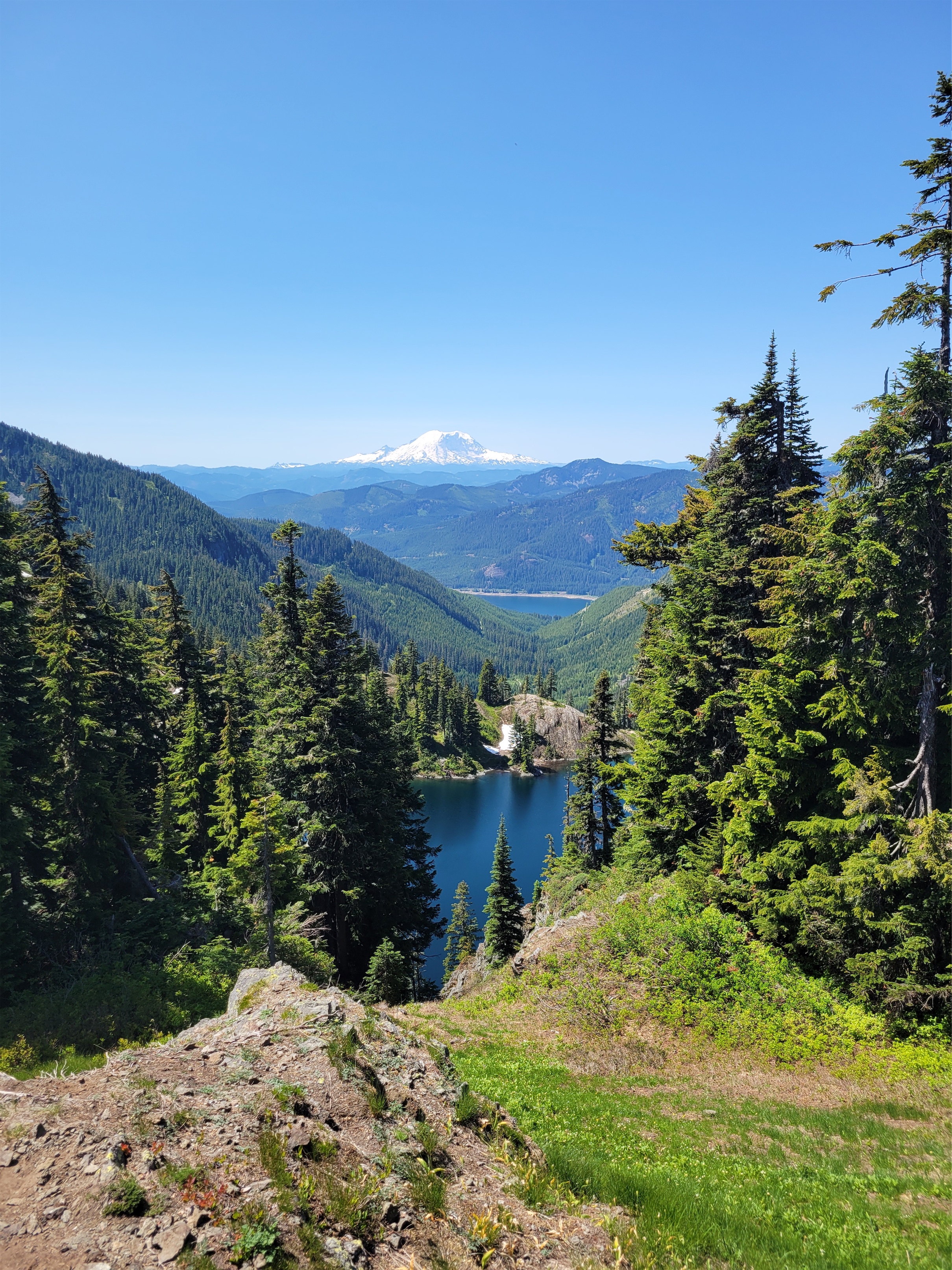
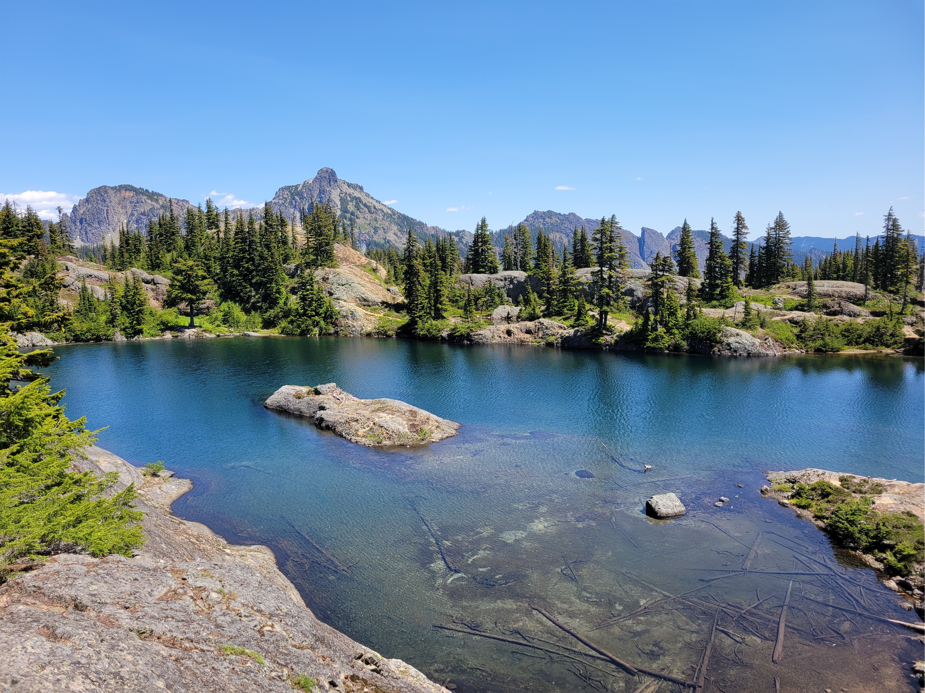
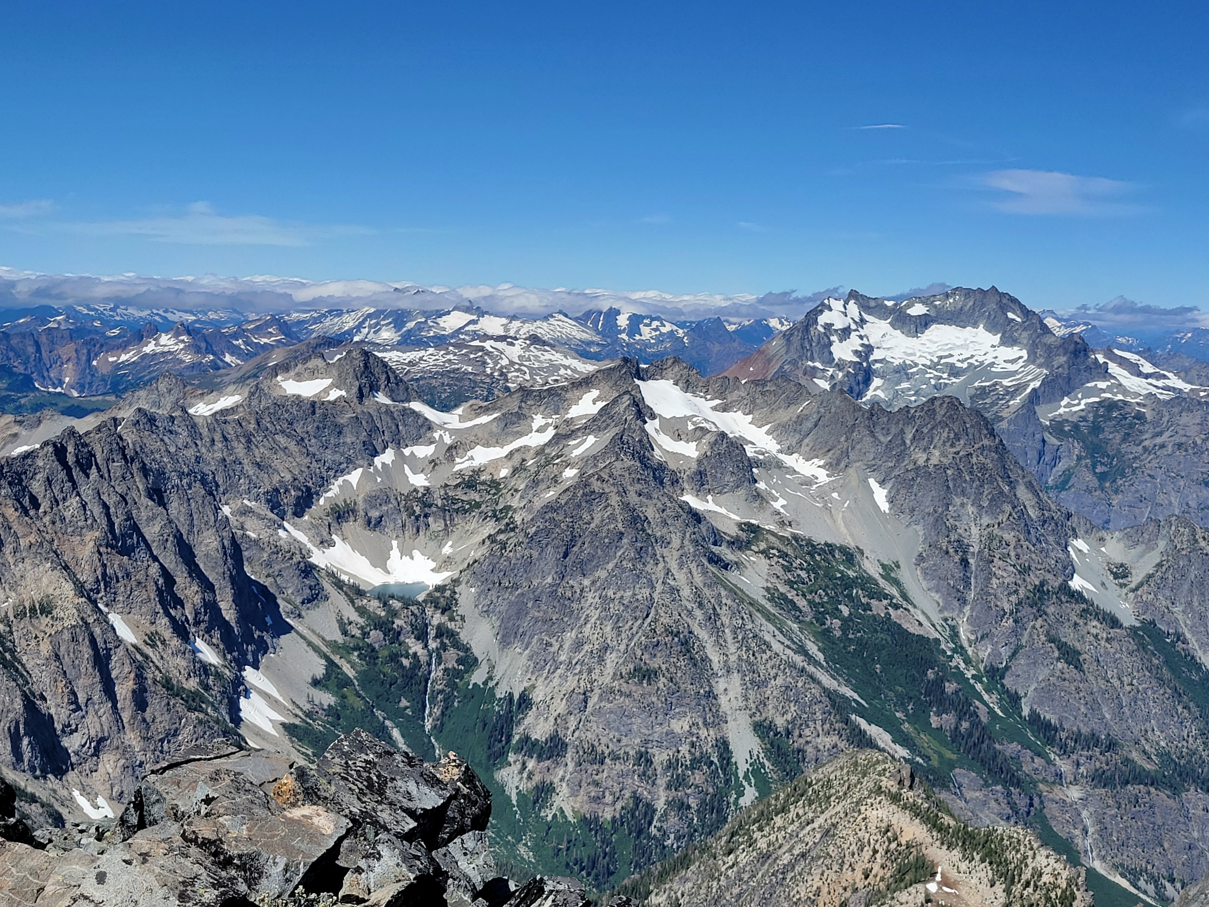
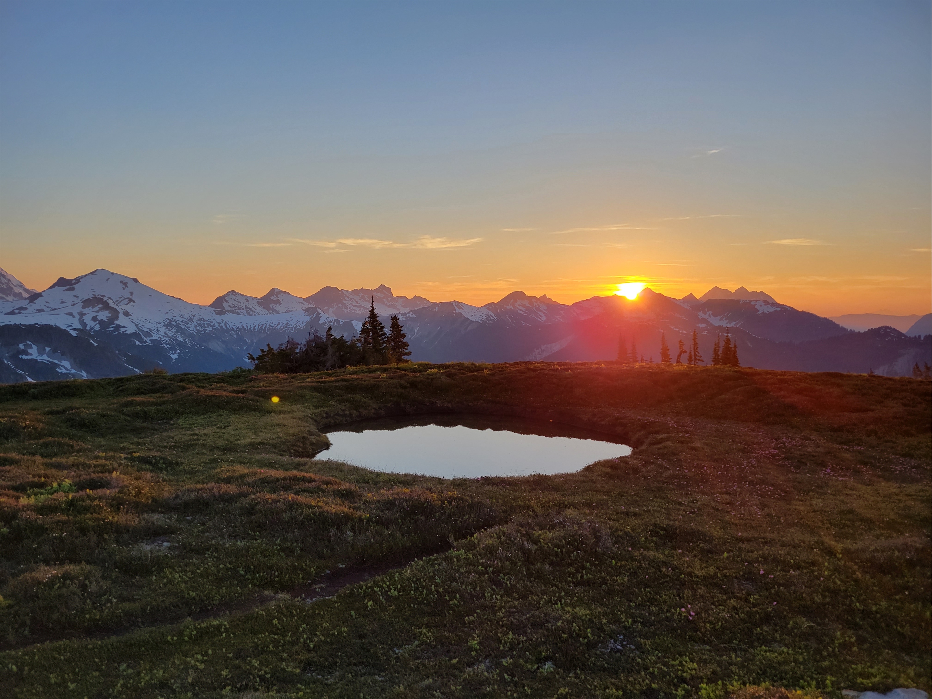
Rainier over lakes Lillian and Kachess
We got to the trailhead at a casual 10:30am (“bonfire start” as we call it, the opposite of an alpine start) and there were only four other cars. I thought Brooke and Forrest might need to hitch a ride based on reports of the road to the trailhead being heinous so I waited at the last turn before the road got narrow only to see them tokyo drift the switchback and carry on full steam ahead. They made it in their rental Honda CRV hybrid, for anyone curious, with only some minor body damage thanks to having to pass another car on the extremely narrow, overgrown road. I had to pass the same car (a Subaru) on some ruts I knew they wouldn’t want to reverse up, so I reversed maybe a quarter of a mile and pulled over in a ditch so they could go around me. So you don’t need high clearance per se, I would recommend an overarching lack of concern for your car’s paint job and aesthetic, and a decent pair of balls.
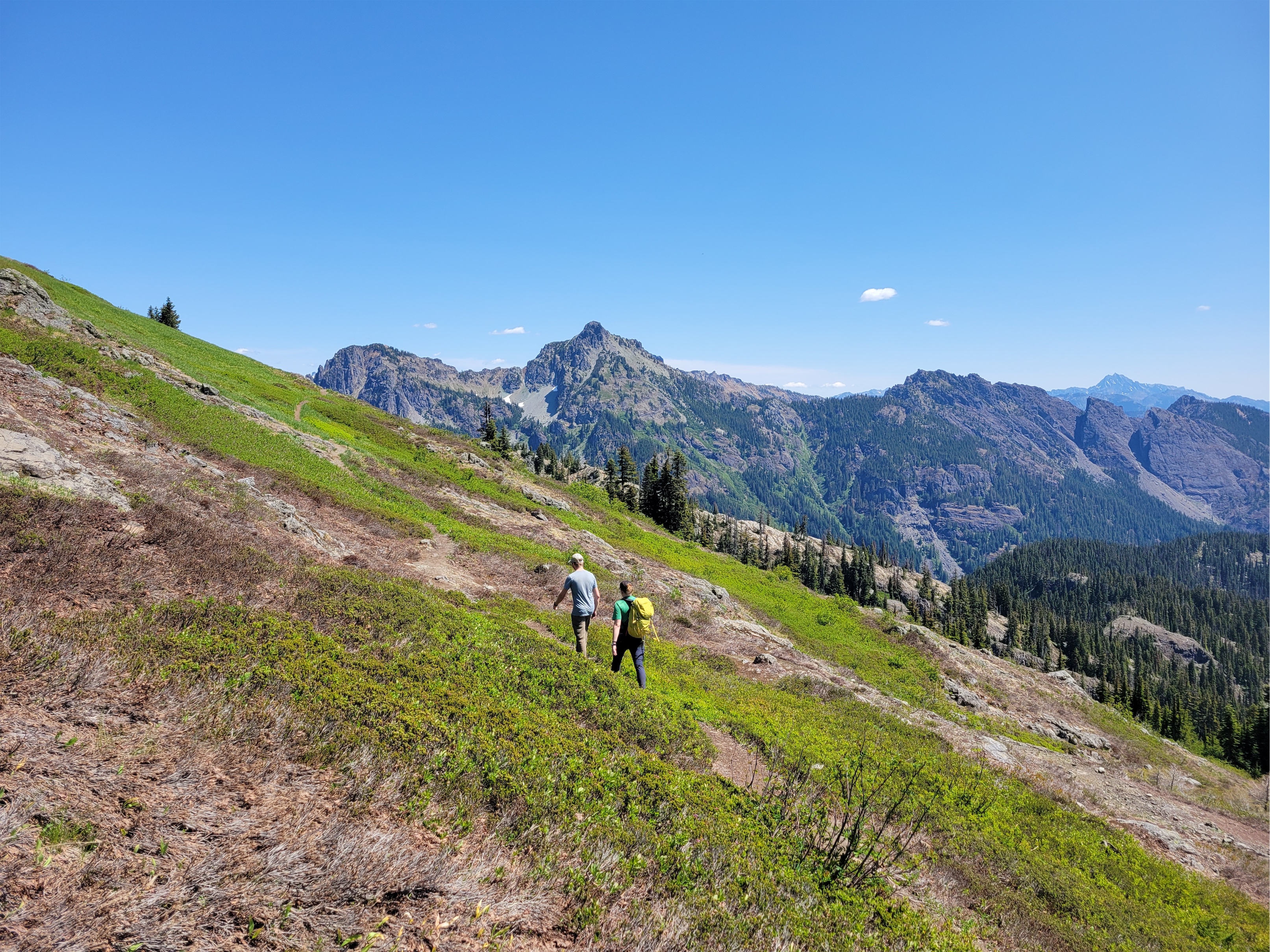
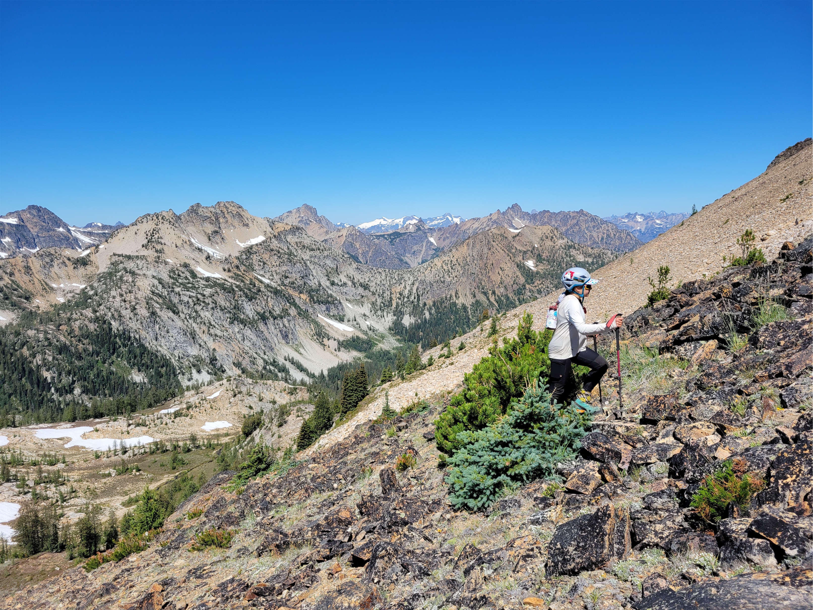
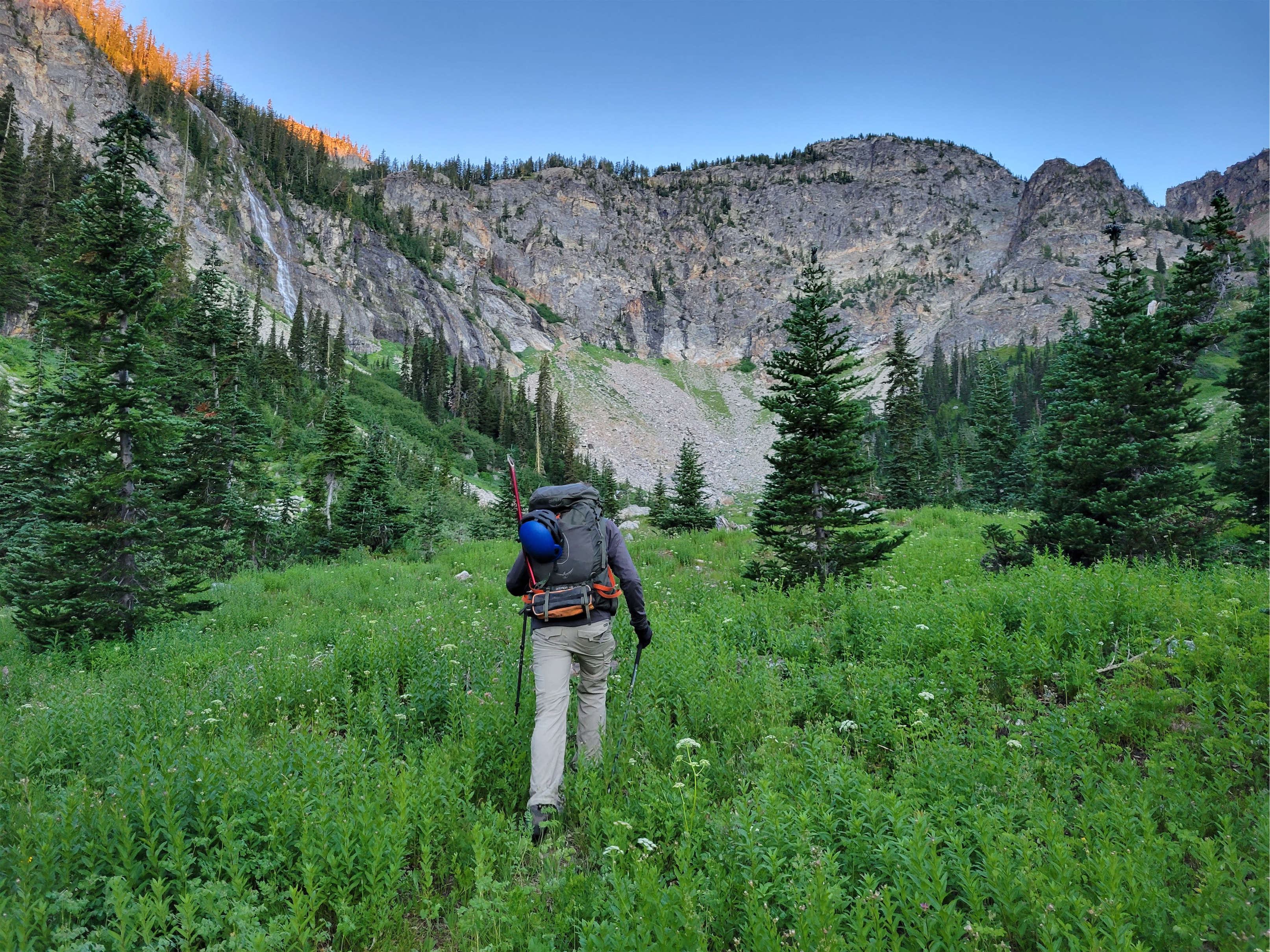
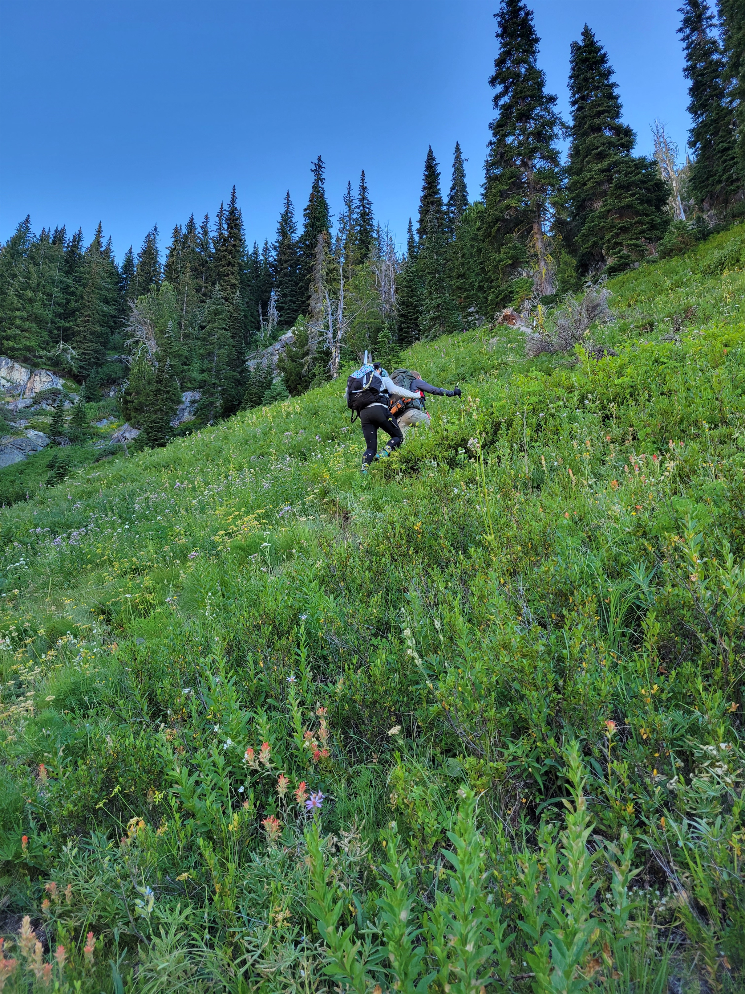
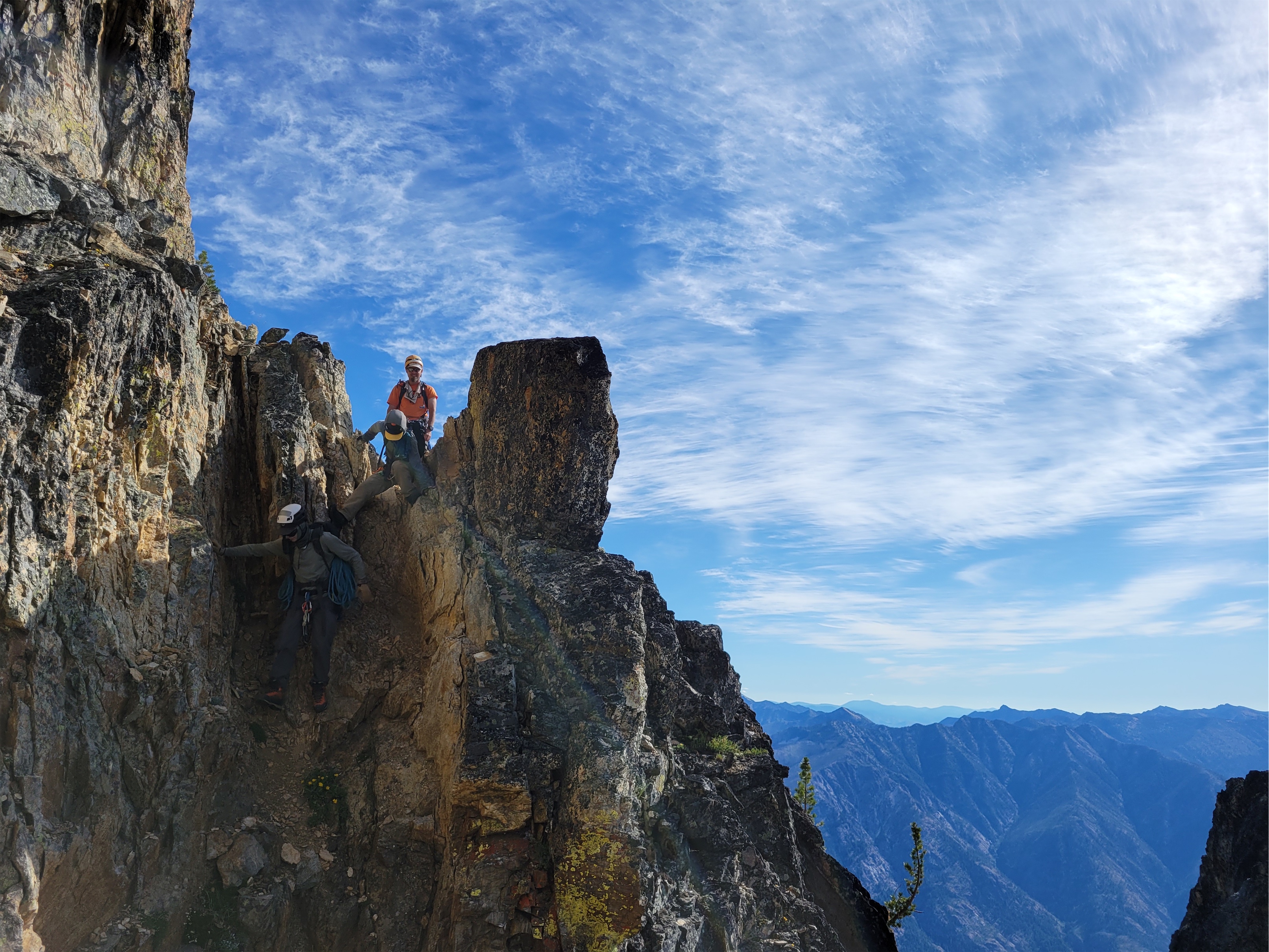
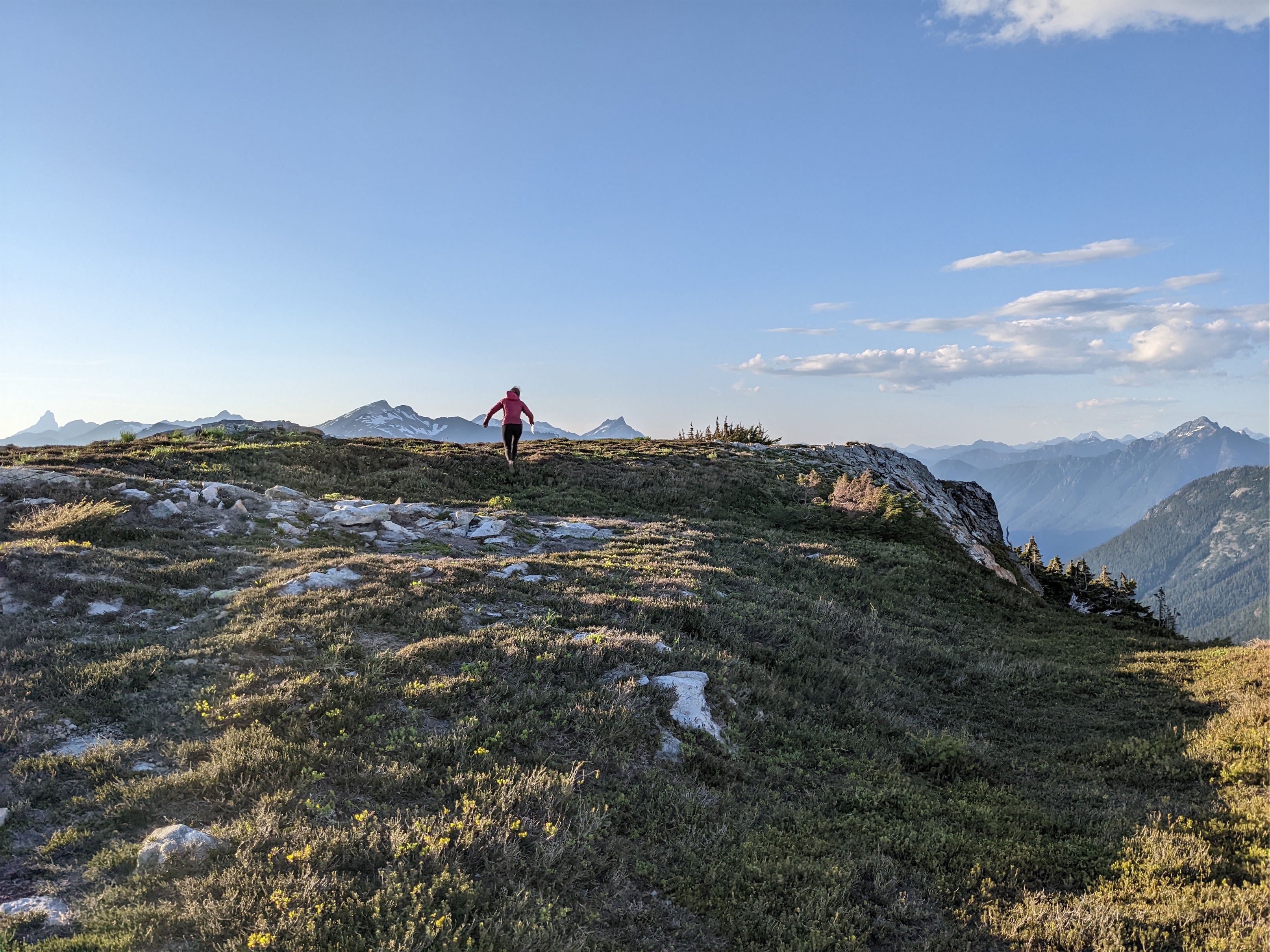
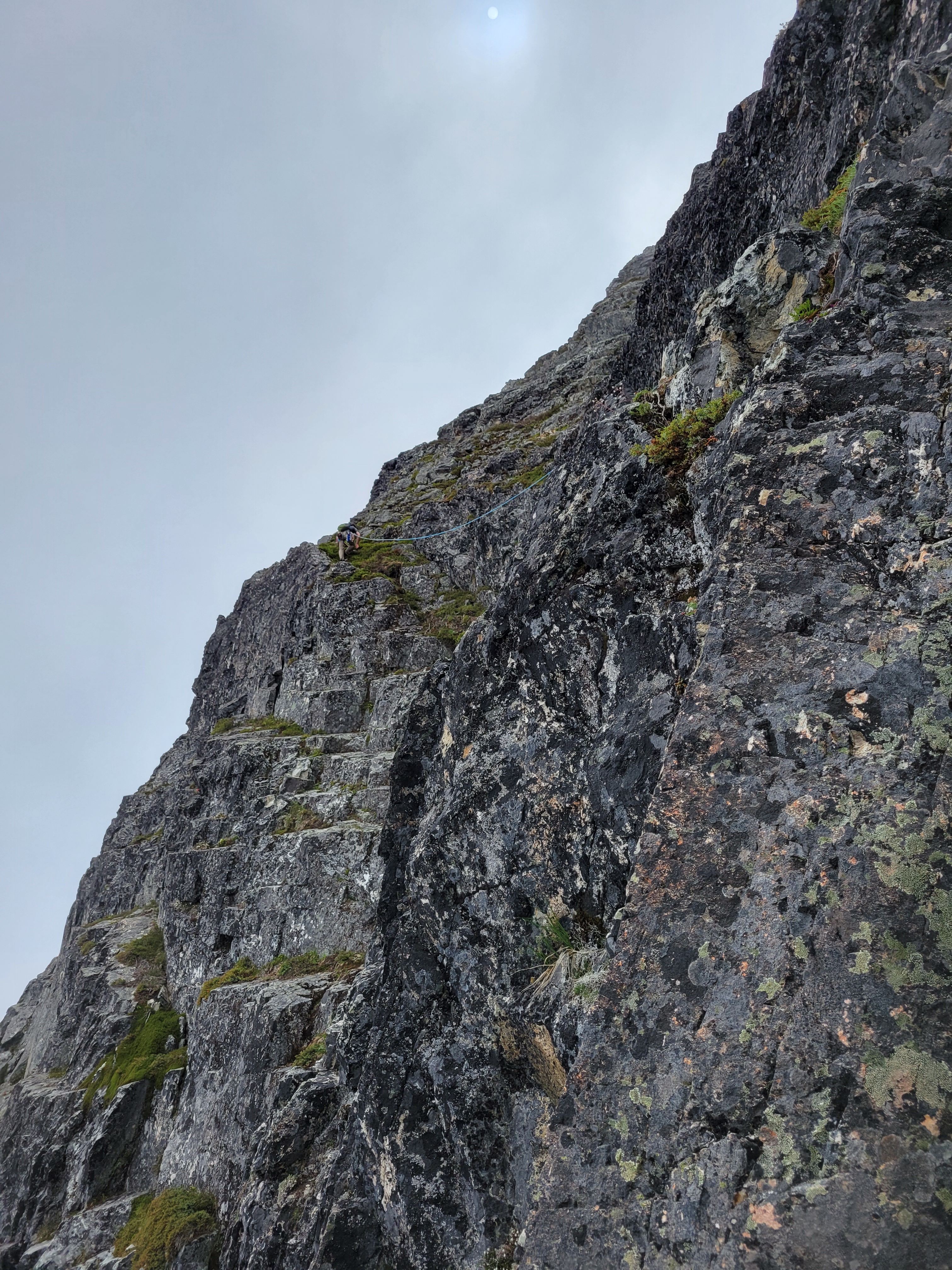
Beginning the traversing
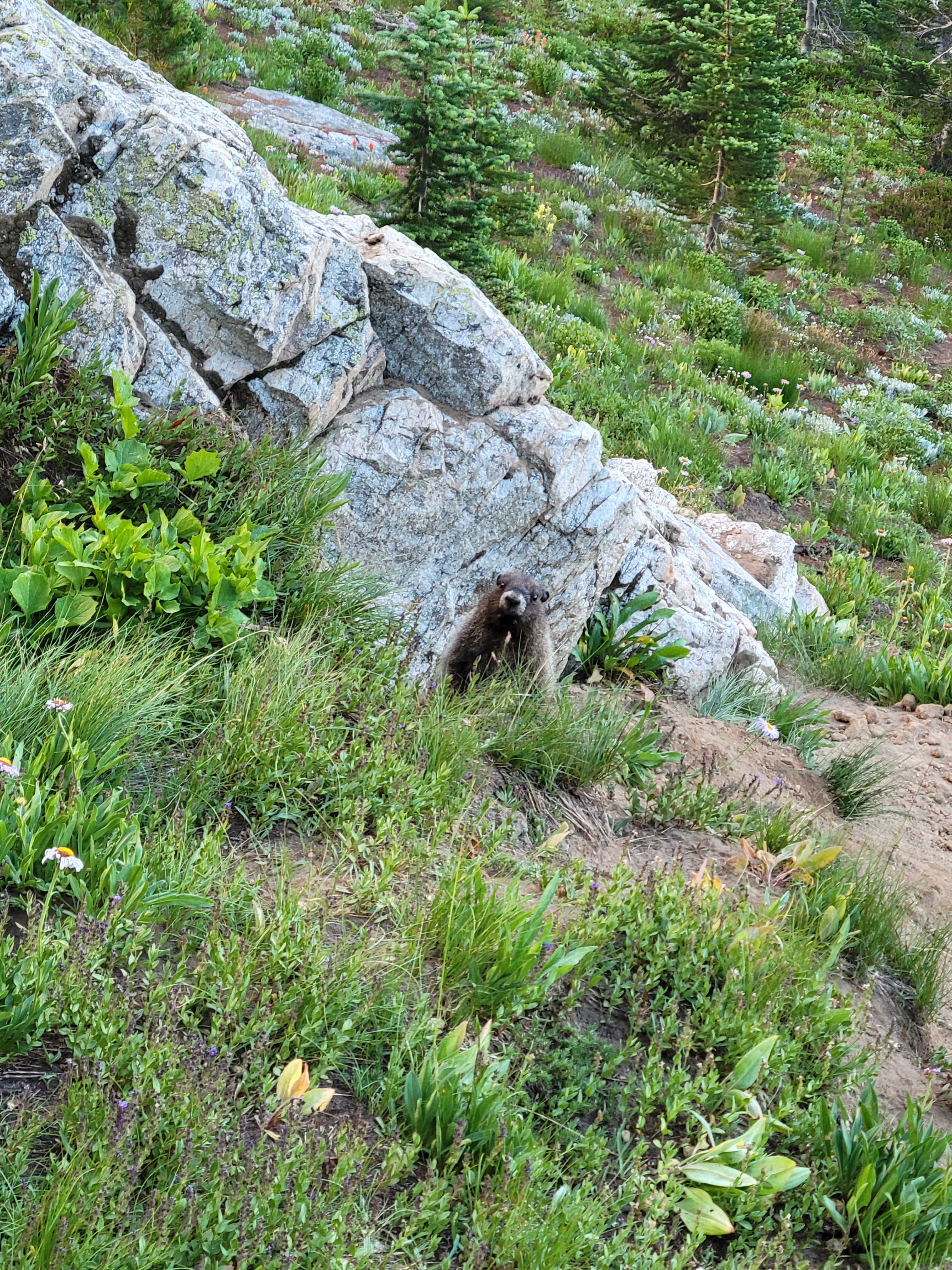
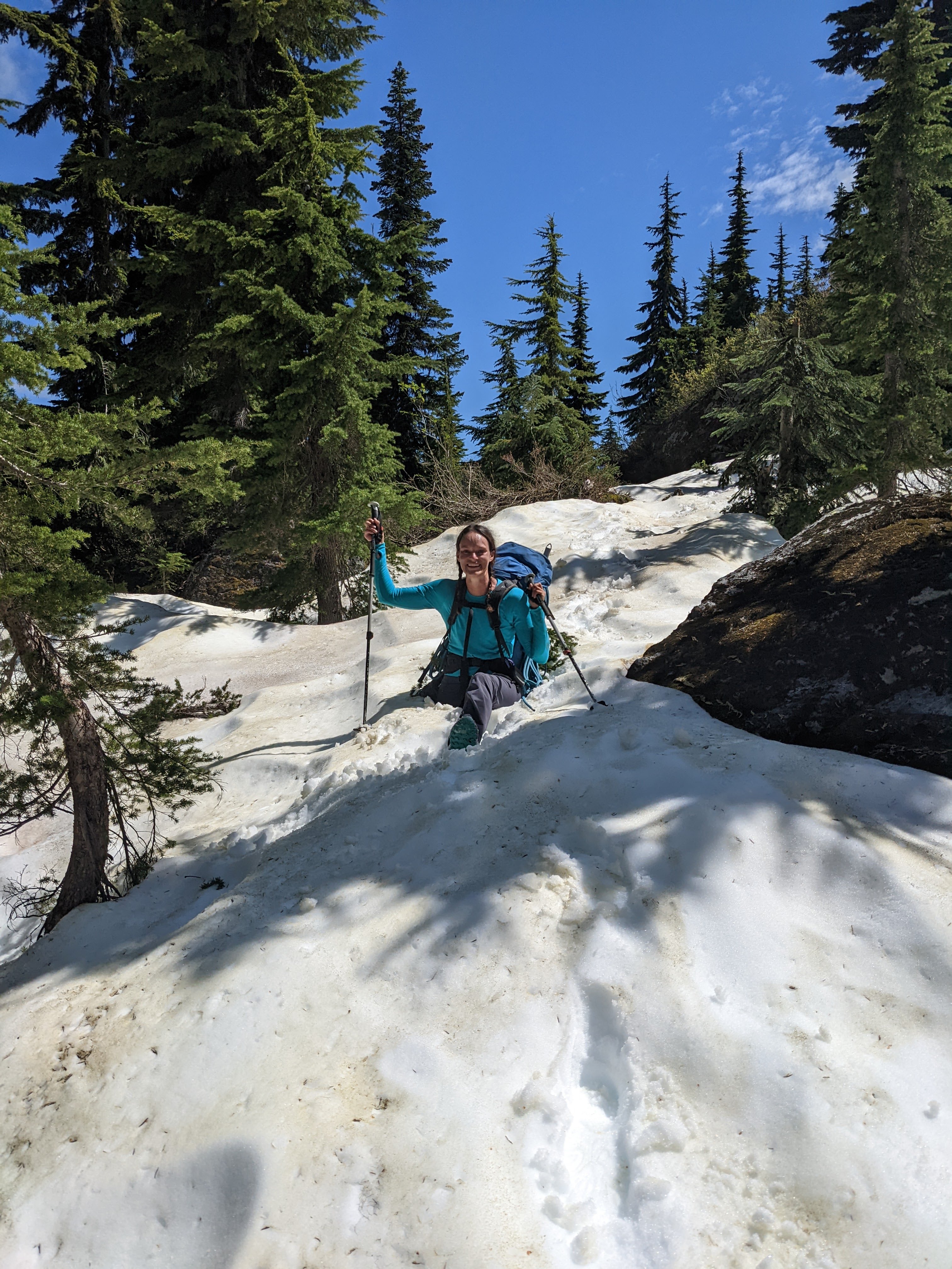
Forrest is a mutant in the mountains and fresh off a trail marathon, so he took off at a pace I knew within minutes would not last for me, feeling more like an undercooked pancake of a person than an athlete. The trail to Lake Lillian is steep, more of a climber’s or fisherman’s trail than a hiking trail but that means you gain elevation quickly. We tromped up through trees over 3rd class roots and rocky steps I knew would be brutal on the way down. We took a detour to an awesome waterfall throwing rainbows at its base with a perfectly framed view of Rainier. It’s only a mile to Lake Lillian, but oh boy it felt LONG. At the lake we finally ran into people and made a new pup friend before carrying on to the ridge.
More traversing on well maintained trail, Hibox in the back
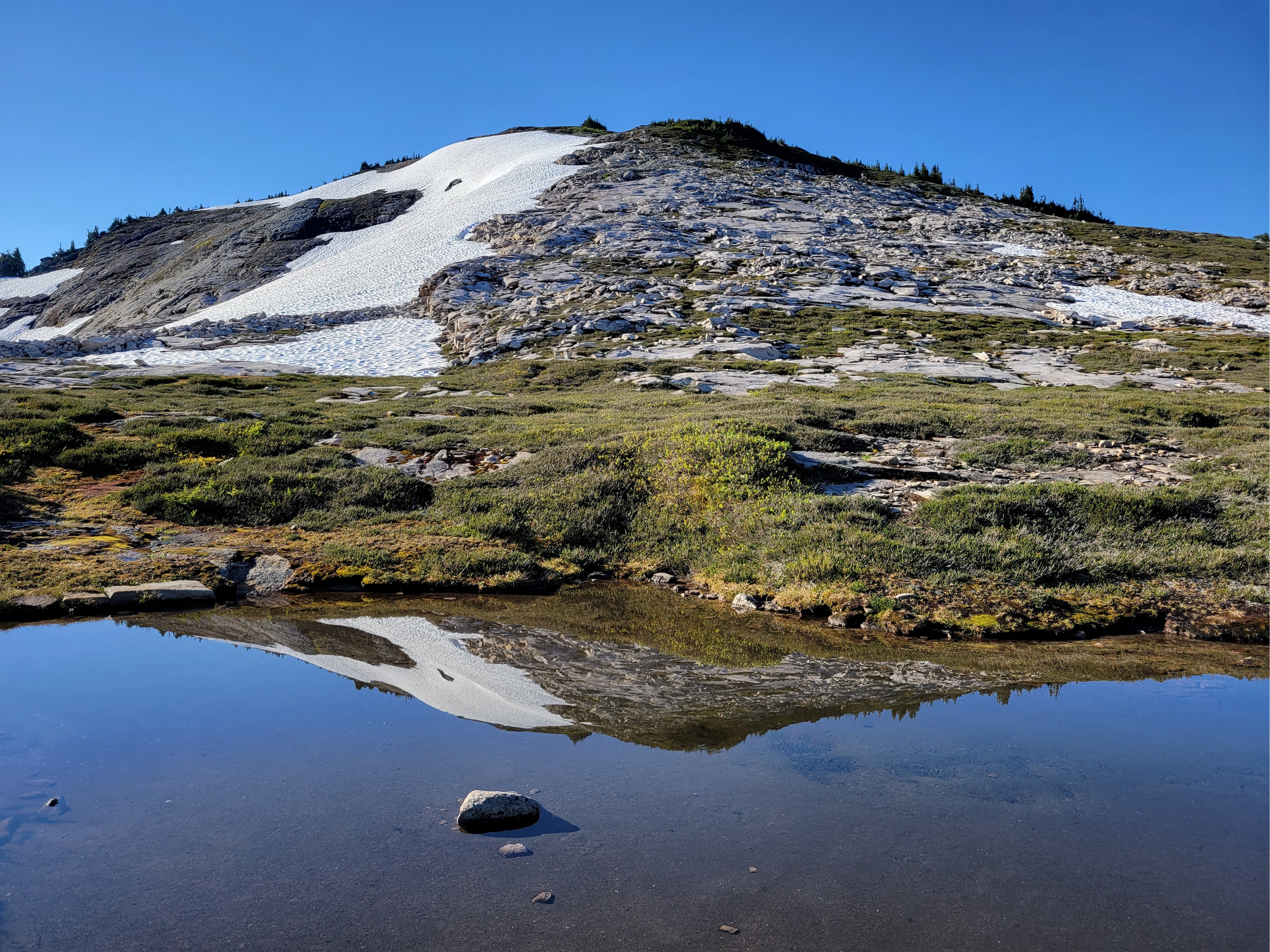
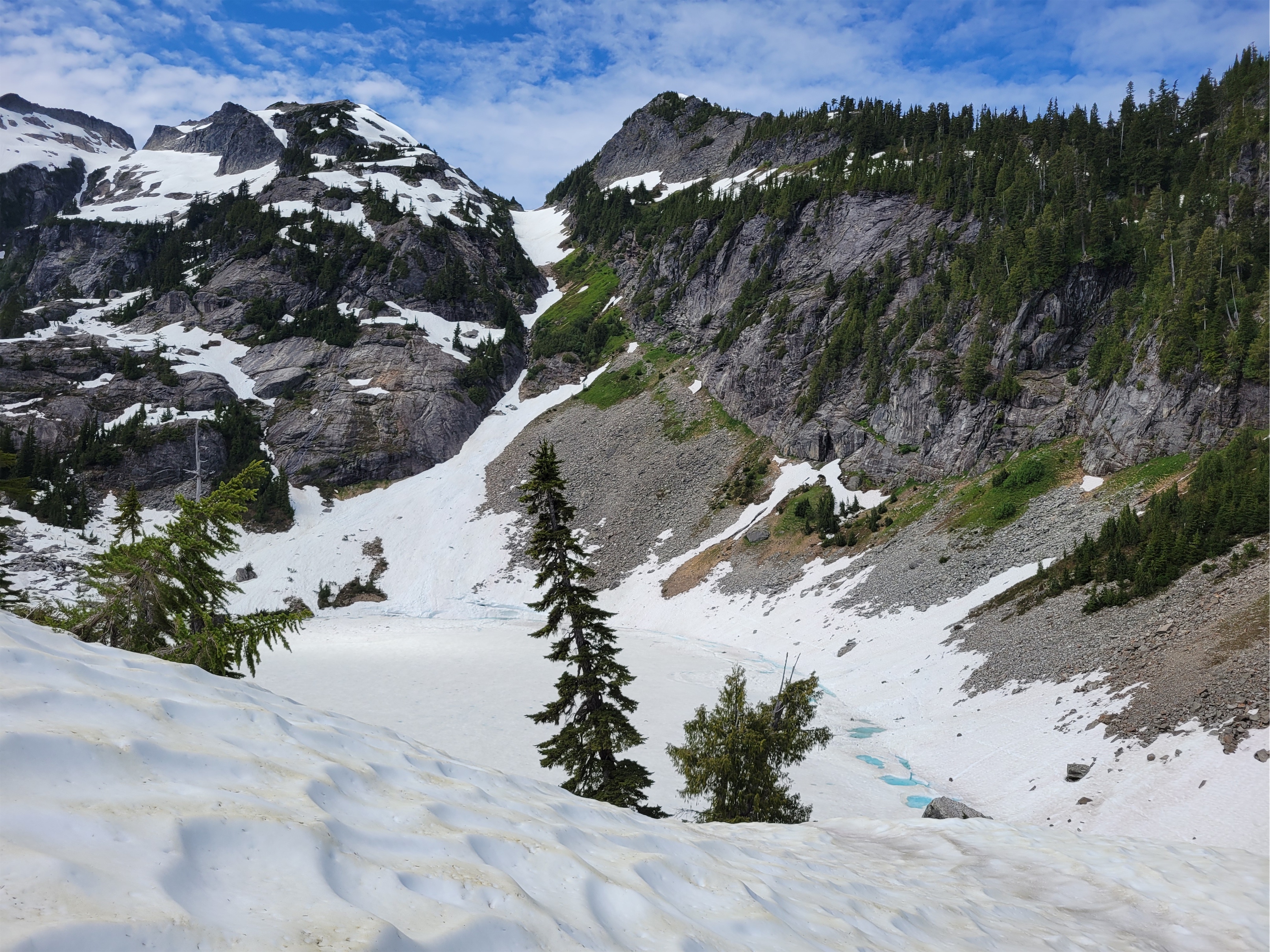
There are two routes to Rampart Ridge from Lake Lillian, an east and a west. We took the east route on the way up, keeping elevation relatively low and following clear trails wrapping around the shoulder of the ridge before dropping towards the lakes. Views of Hibox were amazing but to my surprise the meadows of avalanche lillies were already past prime. I exited trees onto a snowpatch and was ambushed by a snowball fight, and after more subalpine rambling we finally came upon the first lake.
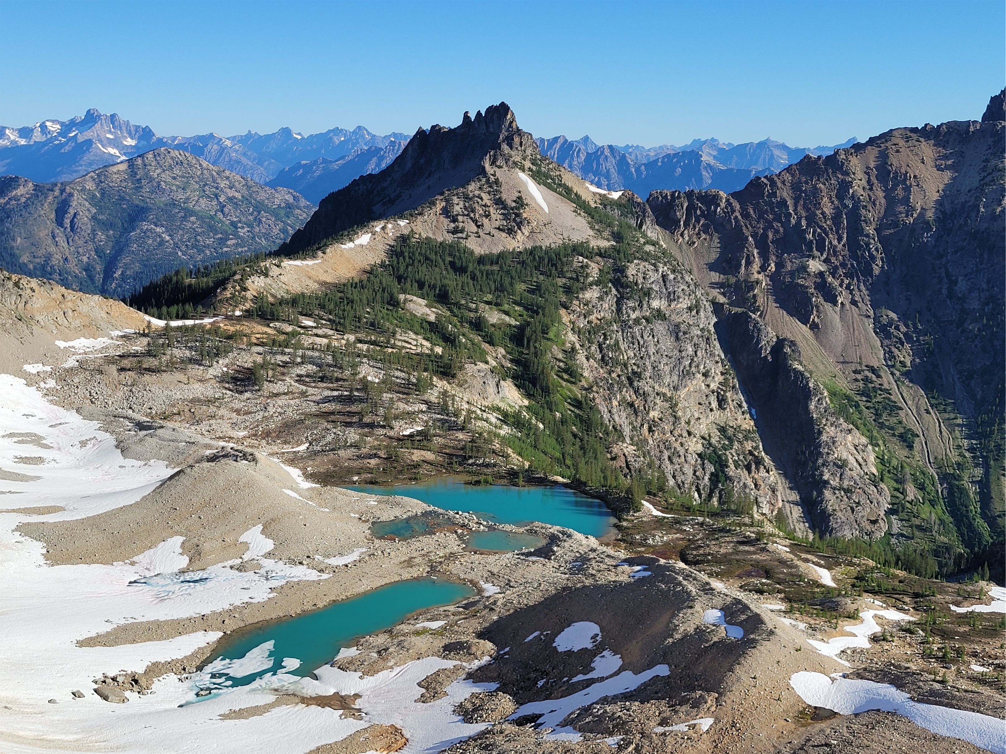
Wrapping around one of many brilliant lakes
There are a million social trails up here, and what feels like a million lakes. How do we know which one to jump in? If we had more time, the answer would be “all of them.” But with a return flight to San Francisco hanging over our heads, we just had to trust we’d know it when we saw it.
Waterfall above a lake
We ran into a few campers, a snake, two frogs, 10,398 mosquitoes, and a fish. We never went far enough east to get a view of Rachel Lake, rather we stayed west and finally stumbled upon a really cool rock bridge (for lack of a better term) where we decided to take a dip. We were able to jump off the rocks into deep water, no time to think about what you’re doing or how cold it’ll be. The best campsite was right on the other end of that rock bridge, pretty much at the northernmost tip of the northernmost lake. The only downside is the established toilet (not qualified for a classic crap due to lack of views) is basically at the opposite, southern end of the lakes. Oh, and mosquitos. They were all babies, and only bit us while we were wet (weird? as soon as we were dry they stopped?) but damn they will be BAD in a week or two.
Snake at center left!!
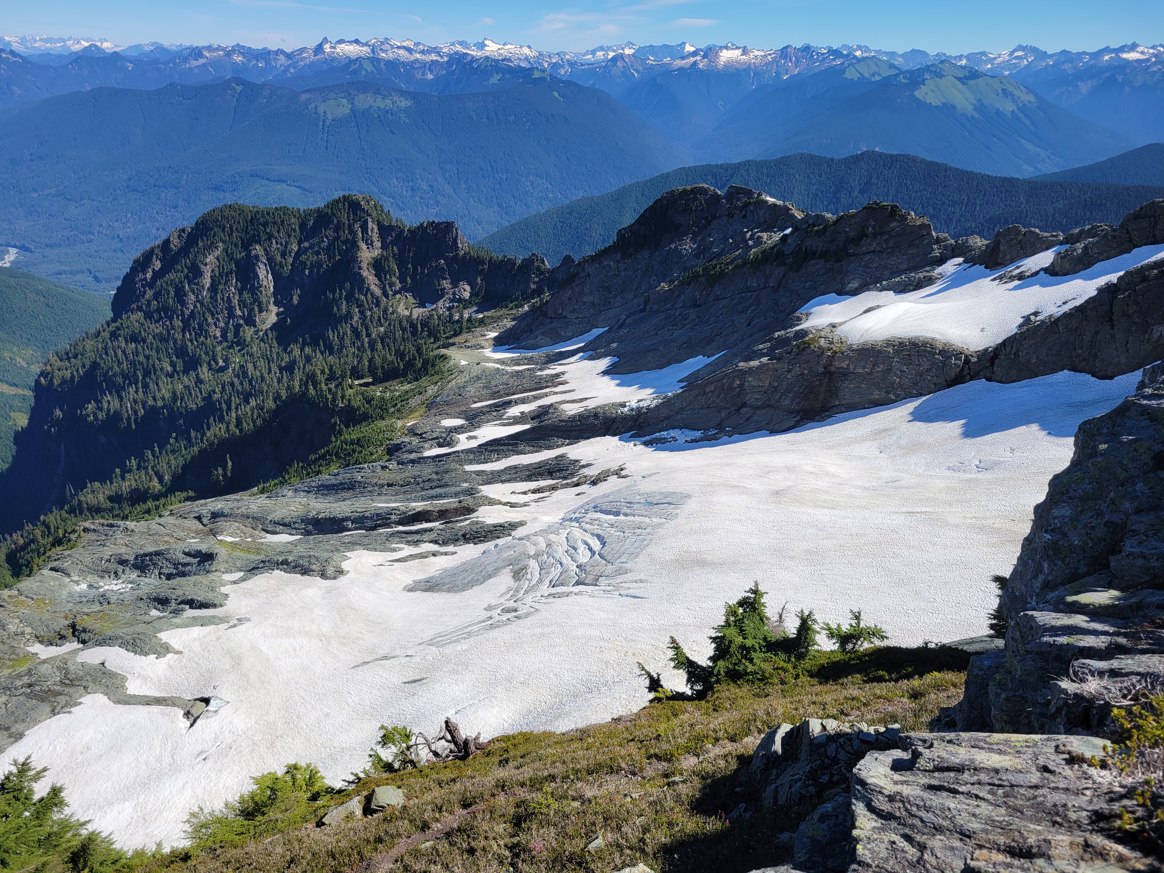
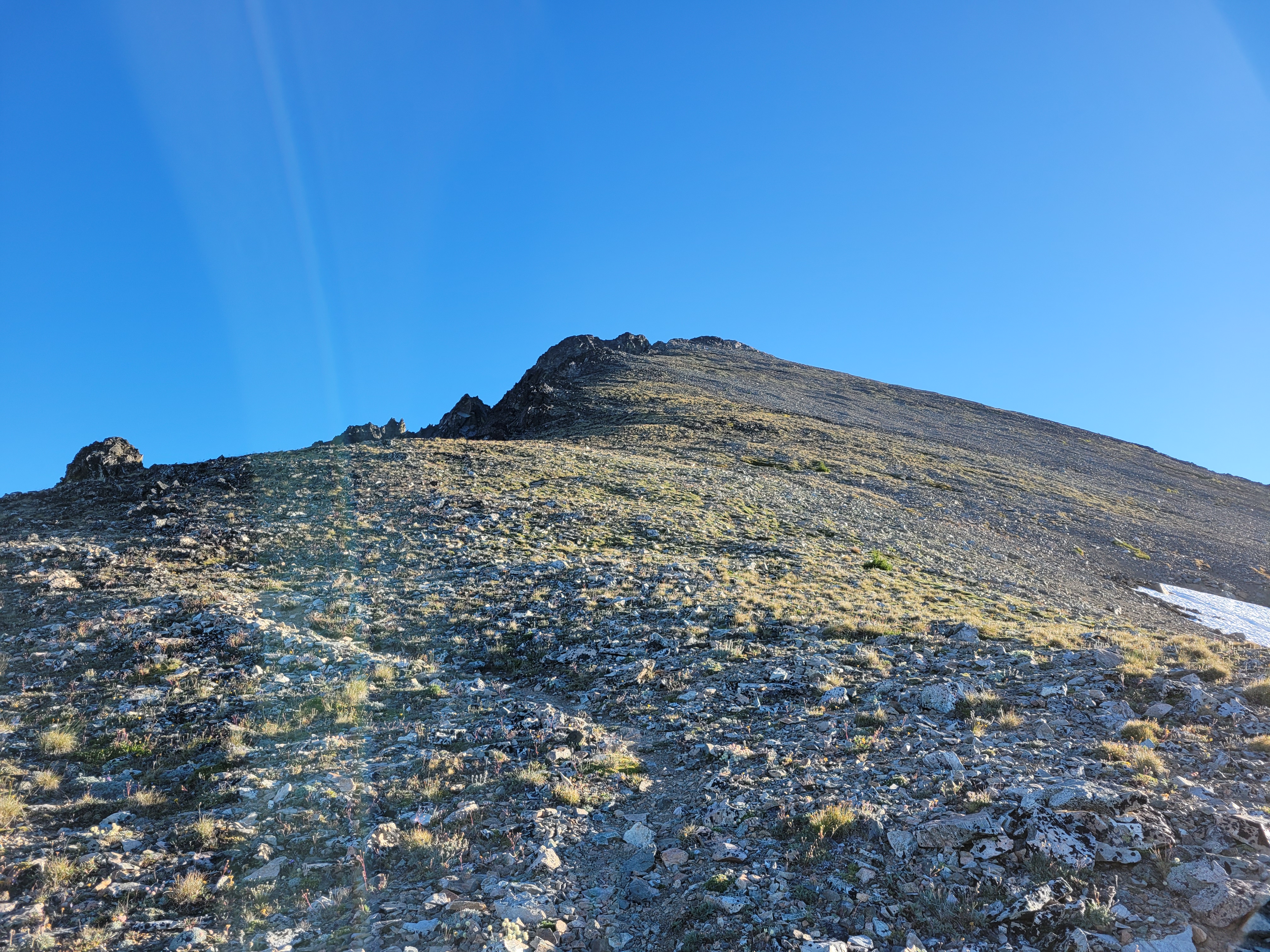
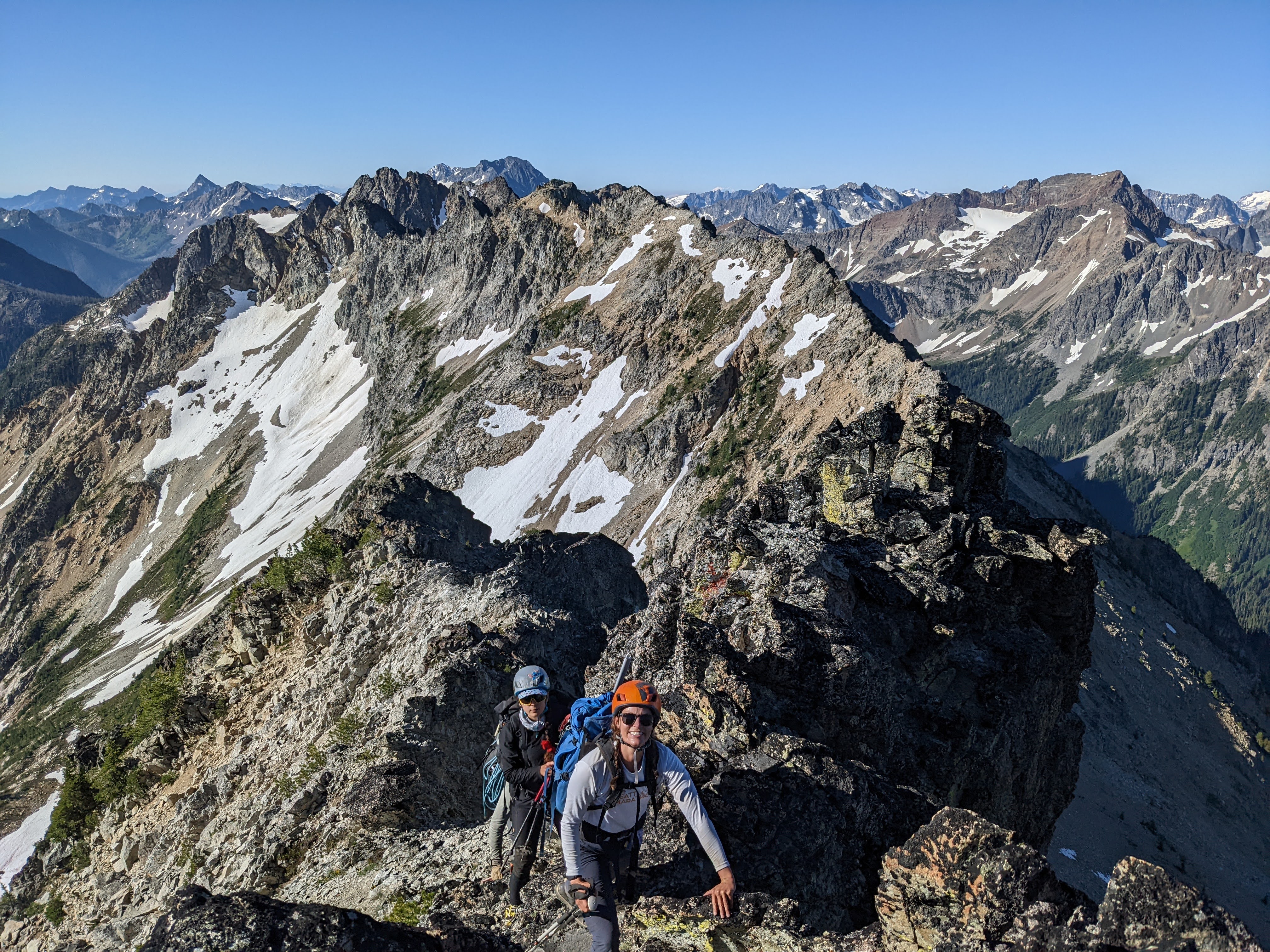
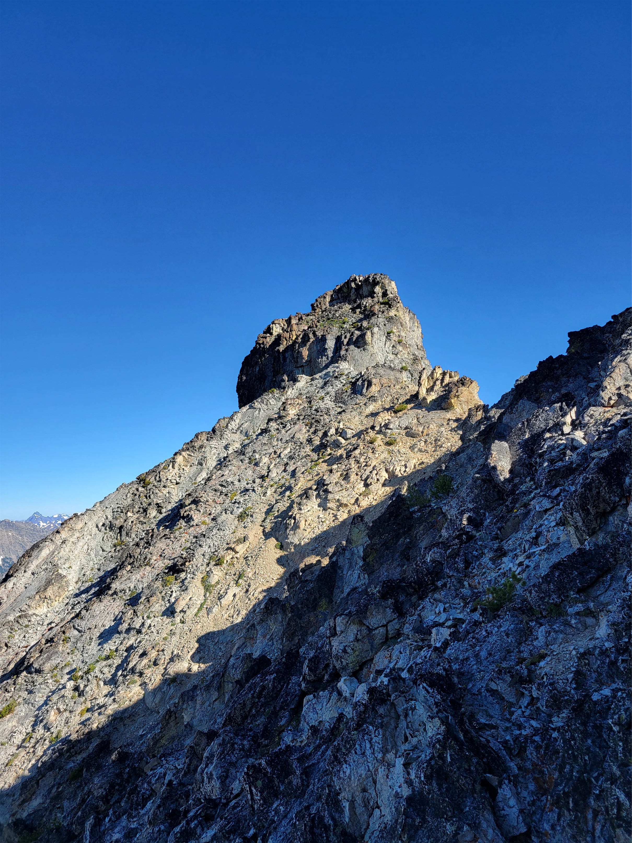
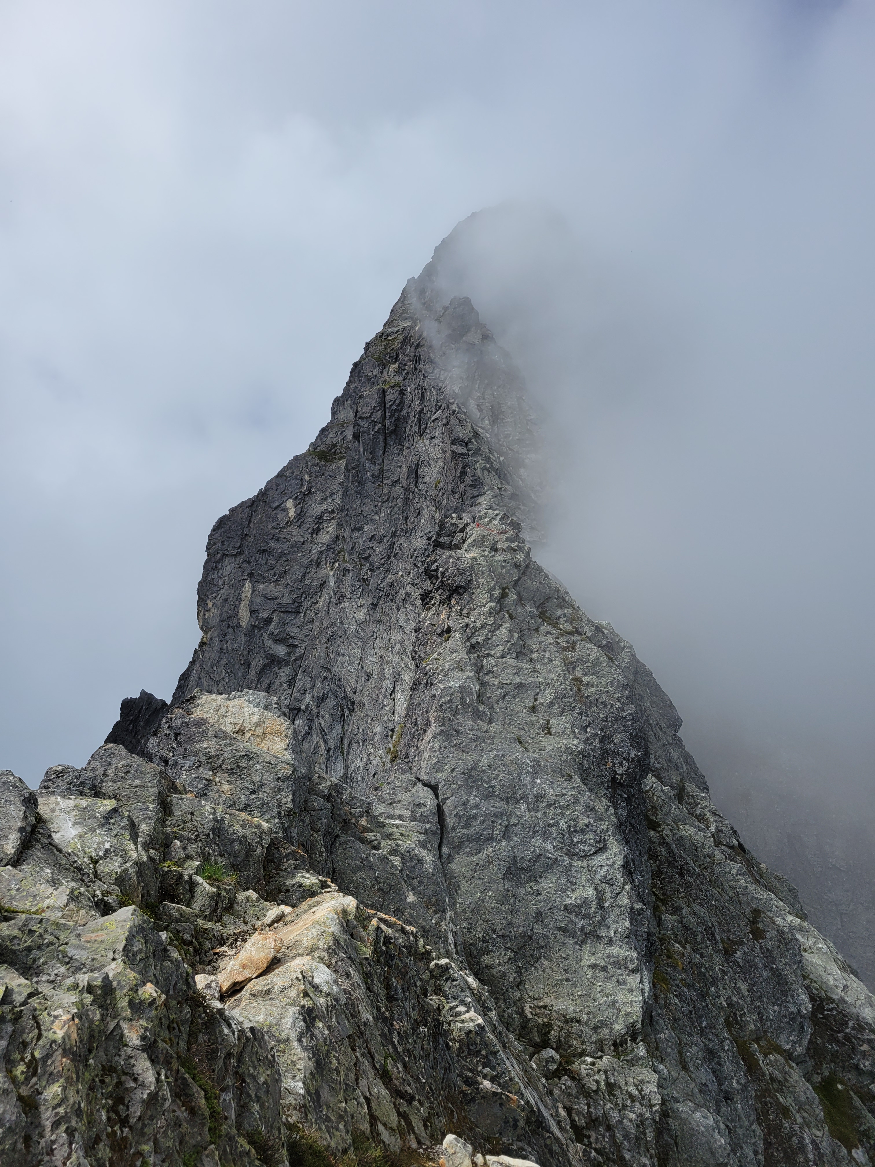
Around 1:30 we decided Brooke and Forrest needed to be back at the car at 3:30, and we needed to head down. But first we were going to head up and see if we could tag the high point on the ridge. I was willing to bypass it but now that we were up there and it was just a tiny offshoot of the normal trail it seemed so doable. Rampart Ridge looks wild in the winter from the ski resort by Snoqualmie, it’s this 2,000ft rock cliff looming over the valley and yet it’s a simple walk up from the other side (mostly).
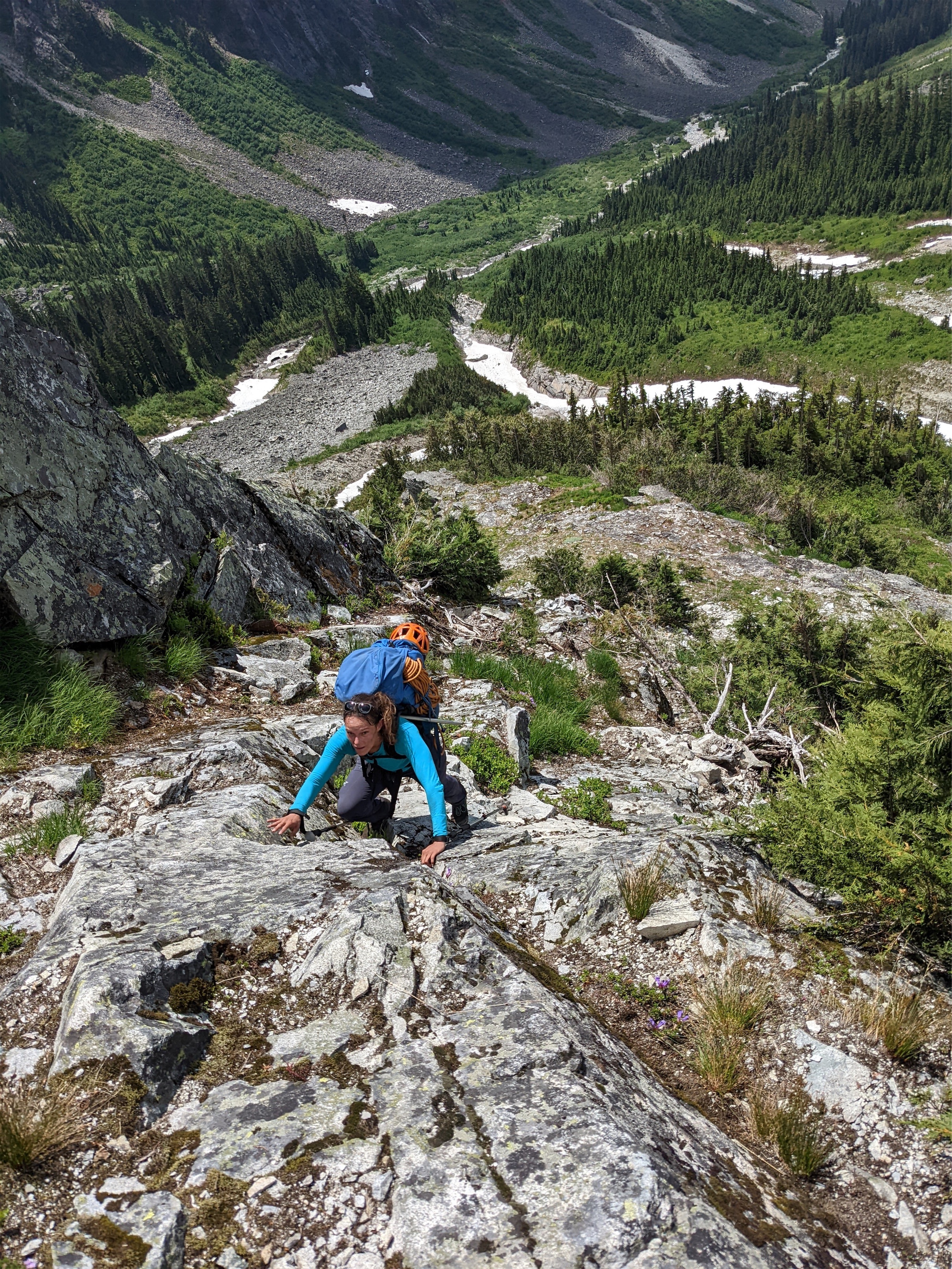
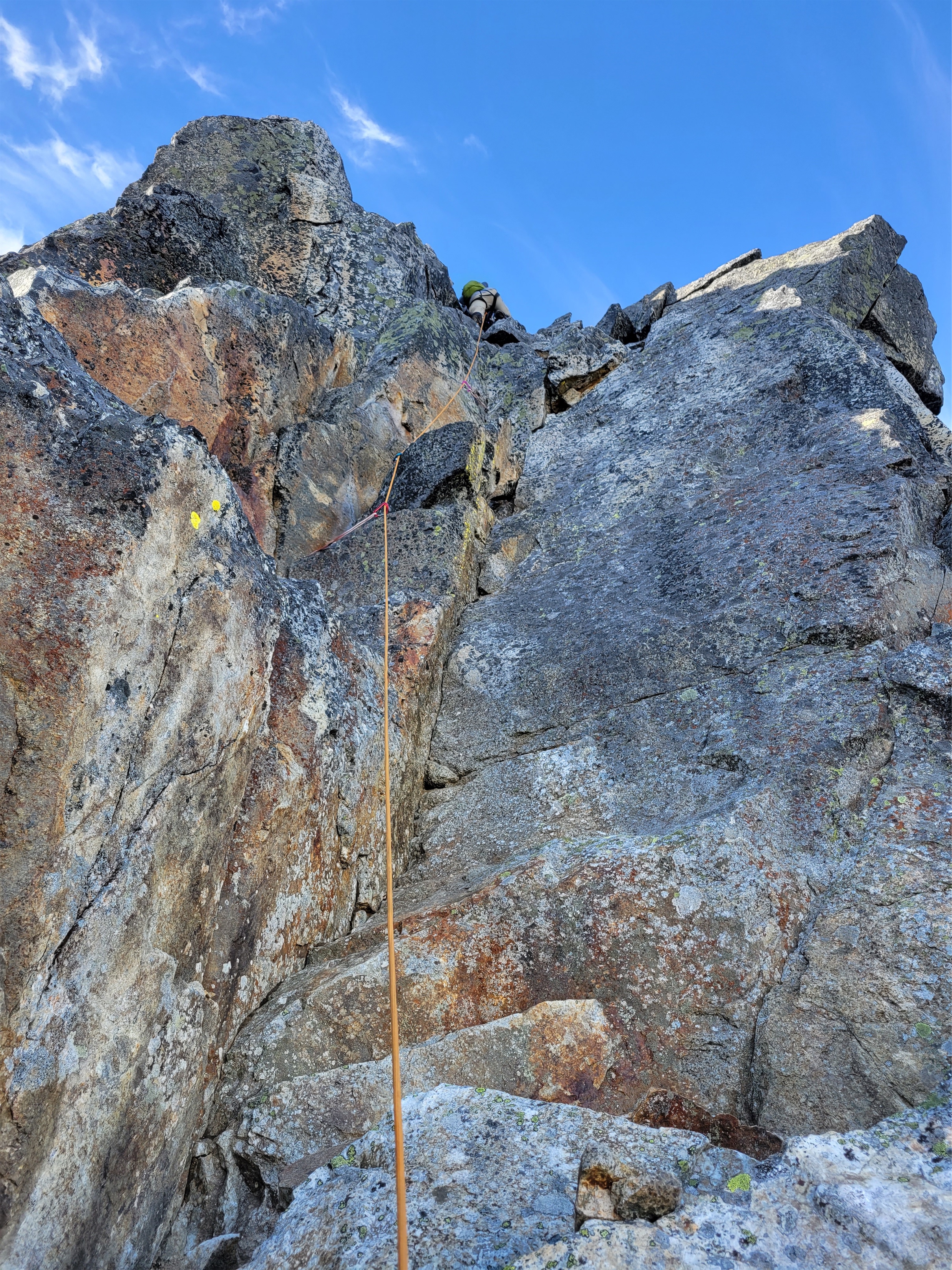
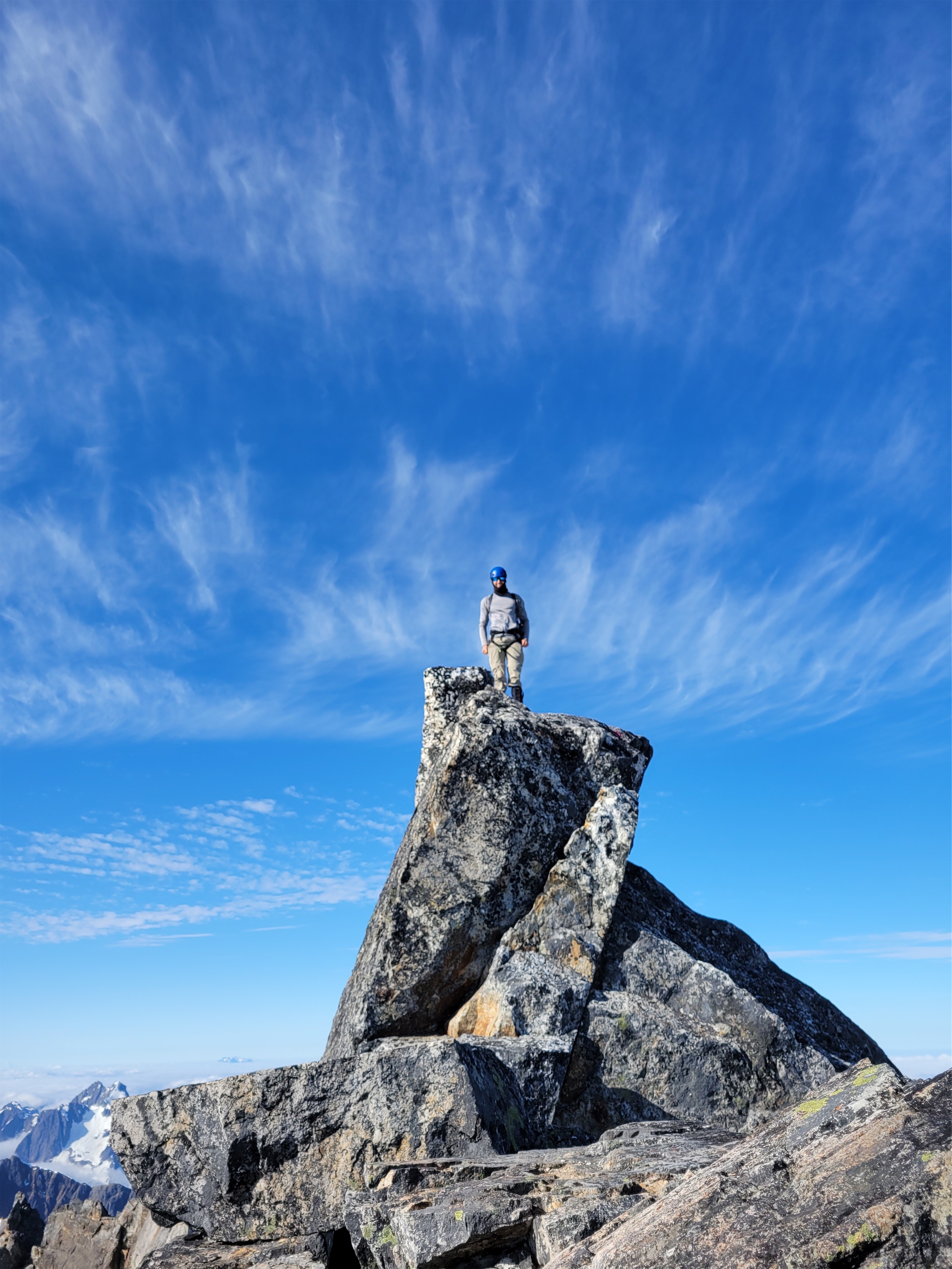
Can’t shut down the climber instinct (he was on top a split second later)
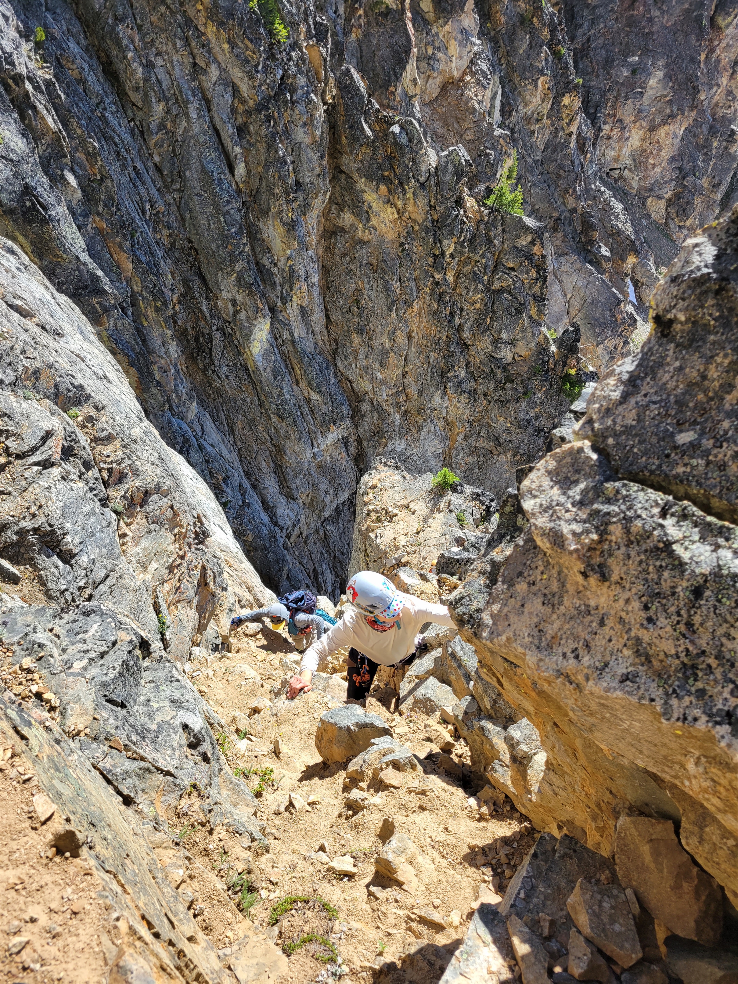
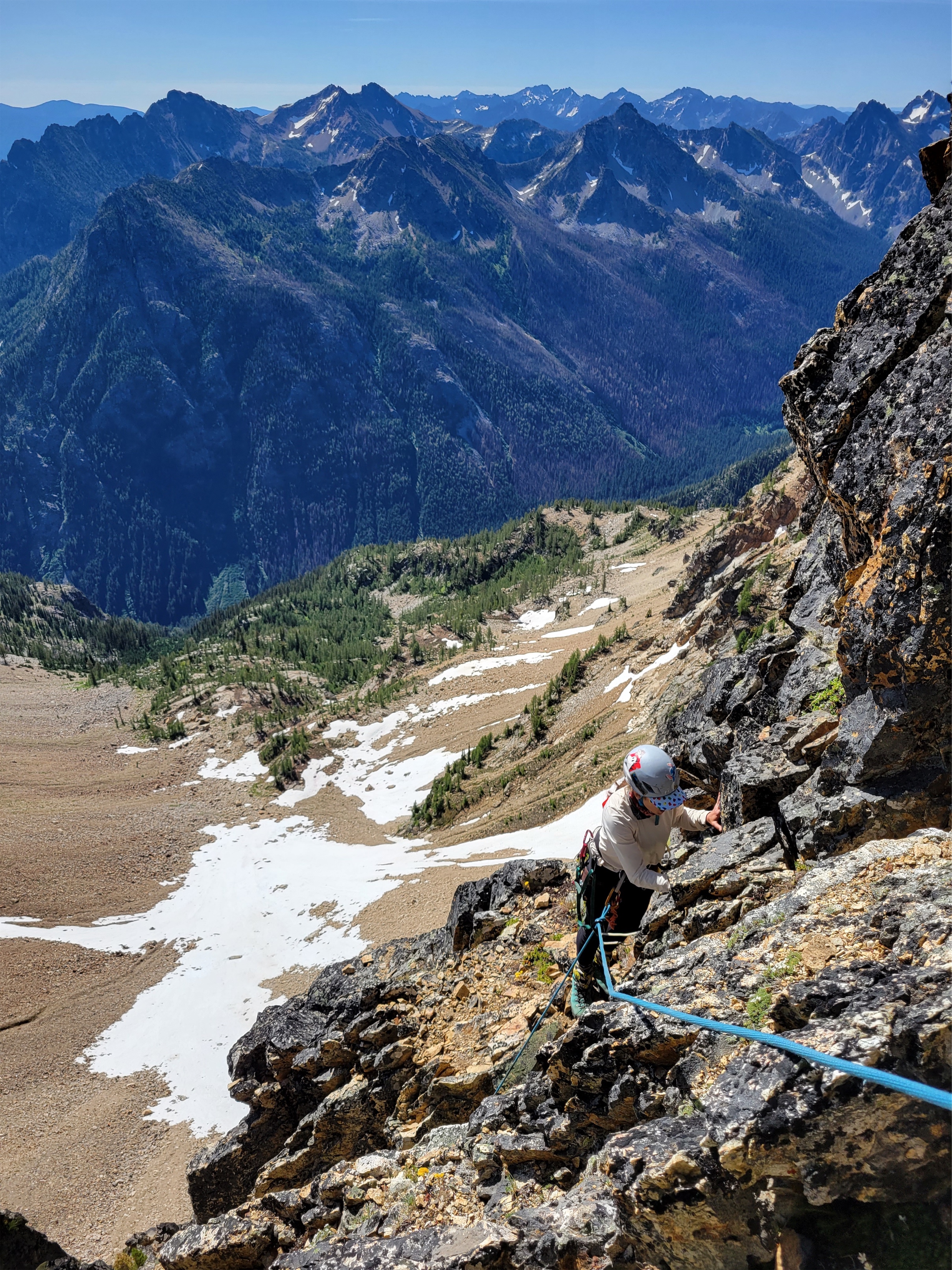
Rather than follow the trail, which would have been straightforward and efficient and logical, we chose a brush bash on the west side of the lakes to a gully of our choosing that we hoped would just go. We started out through slide alder and blueberries, getting a nice taste of the cascades. We eventually broke above the brush to talus along a waterfall where we found some bouldery scramble moves, drank straight from the stream, crawled up steep heather thanks to veggie belays, hit a headwall, traversed south, and broke out into rolling talus and grass a few hundred feet from the high point. I saw Forrest leap a small chasm between two cliffs. Brooke and I took the route that didn’t require any air time, just walking. Near the high point I dropped my pack and ran to scramble (maybe one 4th class move) to the top and back to meet Brooke and Forrest, knowing we were pushing it given they had to be at the airport at 5. Didn’t see any register of any sort but I also wasn’t looking too hard.
Brooke reconnecting with the trail
We took the west route on the way down, jogging where we could to save time and pausing only so Forrest could compliment frogs on the way. The trail again was very clear and easy to follow, though we missed a turn between Lake Lillian and the car without realizing until the trail suddenly started going up again, not down. “Do you remember it going up this way? I don’t remember this” I proclaimed. Everyone else agreed. I checked the map. We were headed towards Mt. Margaret, not the car. Reverse! Everyone backtrack!
We found our intended trail and were back at the car at 3:25, perfect timing despite our adventure route up to the high point of the ridge and our brief detour on the way down. Hiker beware: unsigned split on the trail that’ll take you to Mt. Margaret instead of Lake Lillian (or the car, if you’re coming downhill).
The drive out was tricky due to cars coming up late in the day, that is a tough road to pass other vehicles on. But friends made it to their flight successfully, didn’t get charged for the paint damage as far as we know, legs were tired and happy, and we all got a breath of the alpine for the first time ina while. And maybe worked off like 1/8th a slice of wedding cake. How lucky are we to have this as a short hike within 2hrs of Seattle?!
Hibox over one of Rampart Lakes
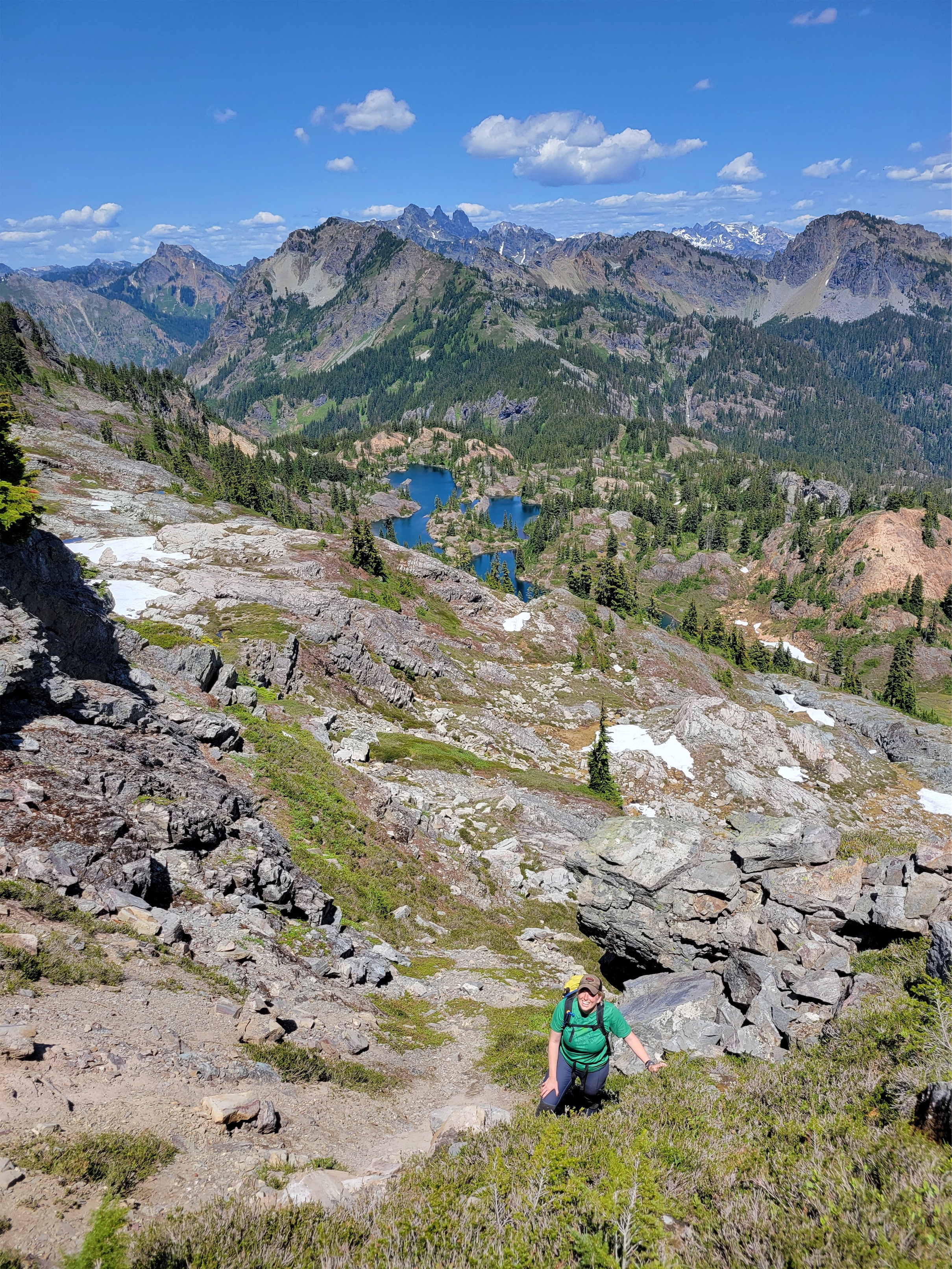
Southernmost Rampart Lakes
Cruising down from the high point on the ridge
Endless lakes and tarns! We kept finding more and more
After Courtney (haven’t written about it yet), Eric and I deliberated where to go. I had my eye on Slate Peak and Tatie/Grasshopper pass, but Eric was hoping to go out to the Tiffany Peak area. Tiffany actually was on my radar for some reason, we were already more than halfway there, and I had a willing and enthusiastic passenger, so… might as well make the drive now! Plus Eric had waited for me while I did Courtney, it was only fair to go get after his objective the next day. Eric is an incredibly quick conversationalist too. If there was someone to have in the car for a 5-6hr drive, it’s him. It is fascinating to converse with him, we could zoom though a thousand subjects without any gaps, catching up on the years that had gone past, the peaks flashing by the window, the wildfire smoke going up in the distance, the Mariners craziest moments over the past 30 years, Eric’s brain vs GoogleMaps (Eric won).
We made it to the Tiffany trailhead around 6pm or so, and hung out chatting about obscure Cascades objectives and swapping stories until it was too cold to sit comfortably outside. I called dibs on the book we had been passing back and forth, set up my tent, and Eric set up in the car. Something hoofed trotted by my tent. I had pangs of anxiety that it was a cow and I was about to be surrounded in my tent by grunting grazing cattle, but fortunately, whatever it was, it was solo. Once my heart rate dropped back to normal and I didn’t hear any clopping hooves I managed to fade into sleep. I like cows on my plate, not sniffing my tent.
Some needles still lingering
I was up around 6:30 and got my running stuff together. The skies were much less smoky than the prior day, thank god. My legs were tight and sore, but I hadn’t come out here to hang out, so I figured I could at least hike Tiffany. I told Eric as much. “You might beat me back to the car in that case,” he warned. I figured I had a book, food to cook, it was a beautiful day, I’d be fine. Eric had started the book the prior day while waiting for me. “Whoever gets back first gets to read the book!!” I wished Eric luck on his adventure across the road (the peak northeast of Spur Peak, Peak 6970) and started hiking up the Freezeout Ridge trail. Eric is an OG peakbagger and was aiming to climb 1,000 unique peaks, and had already done Tiffany and Clark. He was also dealing with deteriorating health due to a degenerative lung disease called pulmonary hypertension among other things, and was choosing simpler objectives, like this numbered peak that only gained ~500ft elevation off the road.
You’re starting at almost 7,000ft already, and pretty much above treeline. The area had burned decades ago, but the trail was clear, and I was crossing grassy fields within no time. The sun lit up the few larches that I could see, past prime but still yellow! The turn off to Tiffany Peak came up in about 1.5 miles and I quickly started up it, my legs complaining the whole time. It was reminiscent of the top of Maude actually, or Amphitheater. Broad grassy slopes, that ancient empty Pasayten feel. Finally I was at the top, looking down a sheer rock face drop down to Tiffany Lakes and munching on my pb&j.
Wall of smoke covering views
The lakes were surrounded by larches! I tagged both ends of the summit to snap photos. What a pleasant surprise! The larch groves had been burned in the fire decades ago, larch carnage everywhere. But those that remained were perfectly lit up in the sun. Across Whistler Pass from me was a beautifully dense slope of larches, so rather than backtrack, I jogged down the southeast side of the peak, stumbling across a trail that faintly, very faintly switchbacked from the pass up to Tiffany’s summit like some untouched high country adventure. What a treat. For a top peak by prominence this seems to get surprisingly few boots.
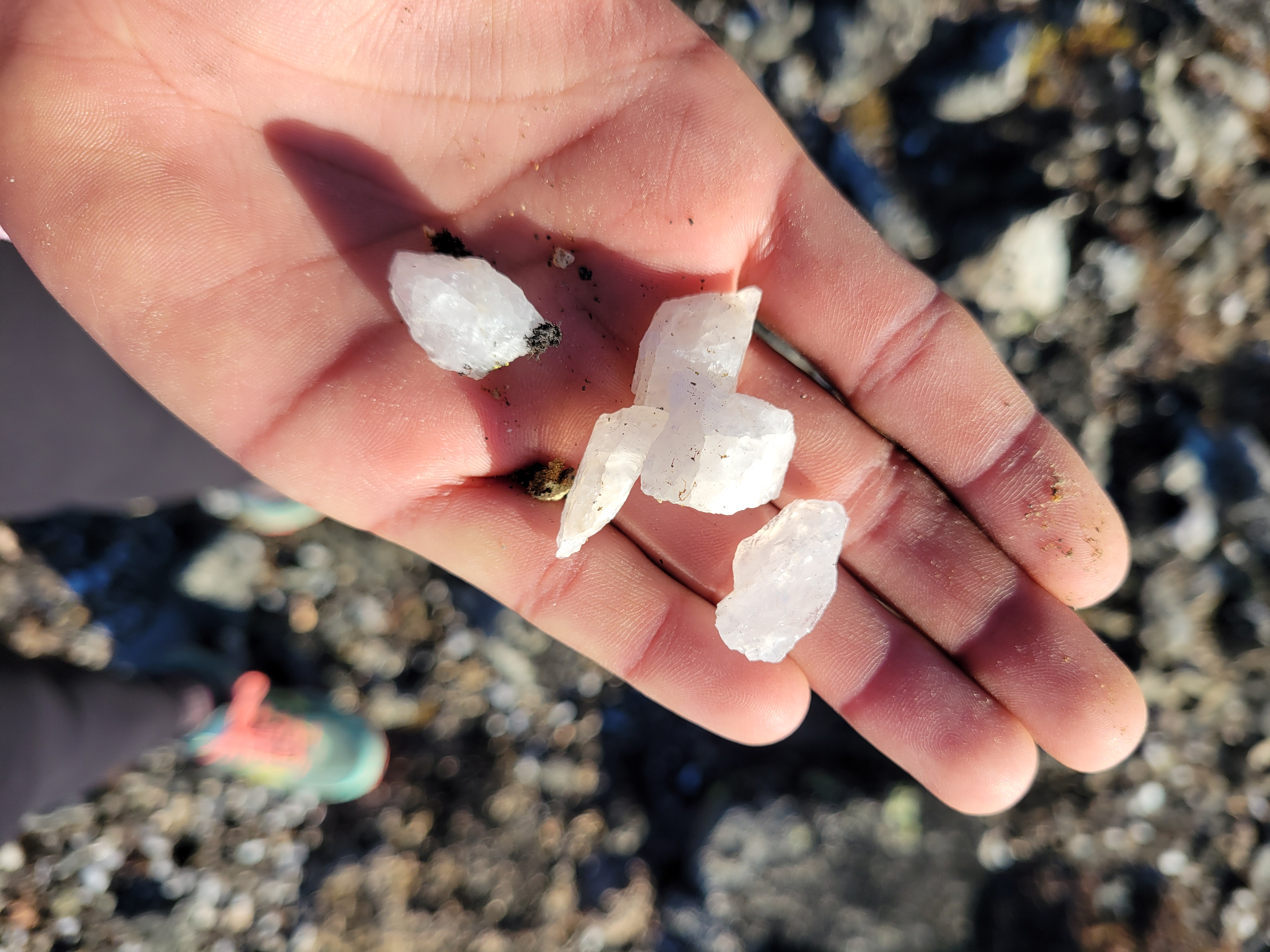
At Whistler Pass, I savored feeling like I had this whole plane of existence to myself, found the trail that would run past Clark, and jumped on that. Faint at first, it grew more and more defined as I went south. I couldn’t resist running. I headed off trail to get a good look at the larches, and noticed something sparkling at my feet. I was entirely surrounded by quartz crystals. This was a childhood dream. Magical. Who ends up standing on a pile of crystals? In front of larches? They were everywhere! I scuffed around for 30 seconds but didn’t find any perfect/clear pieces, and decided I should be on my way so Eric isn’t waiting for too long.
Upper Tiffany Lake
Lower Tiffany Lake
Clark Peak has a very clear saddle just to its northwest, I left the trail right below that and started hiking uphill. I aimed for the saddle and then followed the ridge to the summit. Or what I thought was the summit. I don’t know, there are like 2-3 bumps that all look similar so I just tagged all of them with some fun 10-15ft scrambles. Besides that, it was underwhelming. No larches over here though, they were all back on Tiffany. I ate my second peanut butter & jelly sandwich and figured I’d go check out Tiffany Lakes.
I dropped back to the trail, nearly overshooting it because it was so faint where I crossed it. Back to Whistler Pass, where I could see a barely worn trail heading down the ridge east of Tiffany. This became more defined as soon as it started to traverse the slope, and about halfway down I left the trail to hike up to the ridge. The larches here were insane, huge and still bring yellow. But the lakes looked soooo far away, and it was already 11ish, and I had planned on being back by noon, though I hadn’t communicated that to Eric. I knew he’d be fine waiting for me but I just really don’t like making people wait. Feels like I’m inconveniencing them even if they swear I’m not. Between that and feeling too lazy to go to the lakes, I turned around.
Faint, ancient-feeling trail
Crystals!!!
I cruised back to the trailhead, running most of the way. The air was clear and sweet, the grass lit up in the sun, scattered larches around the fields, and views of the northern Cascades beasts across the way. Tiffany has over 2,000ft of prominence, which (with no trees in the way) means astounding views. I could see the wall of wildfire smoke in the distance, obscuring half of the Cascades but far enough away my lungs didn’t notice it. I finally ran into another person maybe a mile from the trailhead. Amazing to have a trail like that all to yourself for 99% of the trip.
Back at the car, Eric was nowhere to be found. The book hadn’t been moved. I cooked some ramen to have for lunch and sat back reading in the sun. No sign of Eric for an hour, an hour and a half, two hours. Around 1:30 I started to get worried. I can see half the peak he’s climbing from here and it’s empty and silent, I should be able to hear or see him coming down. I decided at 2pm I’d start looking, first by driving down the road to see if he was coming down another side of the peak. If no luck doing that, I’d return to the trailhead, drop the car, and try to follow his tracks as best I could.
Larch carnage
Around 1:50, a car pulled up with Eric in the passenger seat. I jumped up from my seat. “Holy shit!! Eric! What happened?” Eric was all smiles and gratitude getting out of the car, thanking the driver who picked him up. He turned to me. “I way overdid it. Pushed myself way too far. Stupid, so stupid.” “Hey, you made it back to the car! What do you need, water? food?” Eric sat while I helped pack his stuff. Like I would discover a week later with my broken wrist, stuffing sleeping bags into stuff sacks is a surprisingly strenuous, involved activity. “I dropped straight down to the road because backtracking the way I came would have been impossible given all the blowdowns. I was too exhausted. And even then, when I got to the road I couldn’t walk 40 steps without taking a break. If he hadn’t driven by it would have taken me probably an hour to walk the half mile to the car.” Jesus. “And it was uphill!” “Yeah, I’m really lucky he came by, and was willing to give me a chance. I probably looked like a crazy person asking for a ride out here.”
Vast views despite the smoke
“How long would you have given me before calling SAR?” he asked. “Most people… most people I give to sundown or even the next morning depending on who it is. You? At this stage? Maybe 3 hours. You’re on a short leash.” We had a good laugh and got back in the car, planning to stop every hour or so so Eric could shake out his legs. “Well did you get the peak?” I asked. “You must have if you dropped down to the road way over there.” “I’m not sure, let me take a look. I was on top of something up there at least.”
As we were driving away, Eric looked out the window, pulled out his map, and chuckled. “Heh, that’s definitely where I was. Yeah I guess I did make it, huh.” He sounded pleasantly surprised, and pleased. 33 peaks to go to 1,000.
Eric would never make it to the 1,000th unique peak, or even the 968th peak. He passed away four days later at a UW hospital. Primary cause of death: pulmonary hypertension. I didn’t ask if anyone was with him because I was and am scared to hear the answer. His hydroflask is sitting on my countertop because I have analysis paralysis over what to do with it. I had a terrible feeling the day after I dropped him off, wondering how much time he had left, worrying about who would tell us if something happened to him, thinking maybe I should tell him to list me as an emergency contact since I live three blocks away. I figured it was part of processing how I felt knowing that a friend had a terminal illness and seeing the effects in person. I was just jumping to worst case scenarios and I’d leave it up to him, he had years left right I mean heck he just went on a bushwhack even if it was a short one. And life expectancy for his condition had jumped from 1-3yrs to 7-10yrs recently. Had I researched further, I’d have read that what I saw Sunday was textbook Stage 4, and Eric had probably been doing his best to remain upbeat and not let me notice how much he was struggling.
Larch madness
Eric’s Peak
I emailed him 15 minutes after he died thanking him for the company, the recommendation for Tiffany and Clark, the quality conversation, offered to drop off the book for him to finish now that I was done with it. For me, it was one of those extremely rejuvenating trips where everything comes naturally and seems to just click into place. Simple and liberating. But he never saw my thank you. He got the last word, he had sent me a big thank you on Sunday night (“and can i swing by to get my milk jug and water bottle back?”) and I took four days to respond because I was scatter-brained back in civilization. And it wasn’t for nearly three weeks that we noticed it wasn’t just me. Ed messaged. “Have you heard from Eric recently, Eve?” No… and he left mid conversation. That’s not like him. No social media activity. No one had heard from Eric in three weeks. I tried to sleep that night but my gut knew something was wrong. The next day I walked to his apartment a few blocks away and met his neighbor and landlord who immediately recognized my description of him, shared the news, and got me in touch with his family. I’m left with a water bottle, memories, and some amount of solace knowing he topped it all off with a peak on a surprisingly summery October day way out in the Pasayten nowhere.
It’s the people that matter (PC: Khuyen)
When I first moved to Seattle, I met a woman at a run club the day after I arrived. I ran into her a week later on a solo jog around Discovery Park, and we ended up running an hour together as she showed me around the trails. She was moving out of state the next day. “What really IS a friend?” I remember her asking. “I mean, we’re running together, but we’ve only met once and we’ll probably never meet again, does this count?” I think about that a lot, I use “friend” where many people would use “acquaintance” or even just “someone I met once.” I built a community out here from scratch. My friends span from 25yos living with their parents to people celebrating their senior discounts at Denny’s to people who are now dead. So I don’t know how to define “friend,” and my community may be non traditional. But it’s a heck of a community. These connections between people are what matters. And it sucks when one of those connections is snuffed out.
Eric’s memorial was a few days ago, bare bones but it came together last minute and was very cathartic. Friends from different decades and phases of his life, different jobs, different climbing goals. Crazy seeing how many people he mentored, even when he couldn’t keep up physically anymore. I can only speak for myself but the hours afterwards were the most at peace I had felt in a long time. Sometimes you don’t realize how much you’re treading water until you have the space to reflect.
I should have written this while the adrenaline was still pumping and my body felt great but alas, here we are a week later with a splint I can’t take seriously, a wrist that has hot pokers shooting from my elbow to palm, and a drugstore of painkillers i’m avoiding taking out of sheer stubbornness. An iron will is the only thing standing between me and buying the rest of the ice cream at the corner store and eating it until I have become an ice cream cone myself. Fortunately ambien is not in my drugstore selection or I’m sure I’d come around at 3am mixing a bathtub of ice creams.
Views are starting!! And larches!
Distance: Well… ~29 miles. 19 on a bike, 4 pushing/trying to bike, 6 running, 6 hiking. “Wow, weird combo” yeah well. read on.
Elevation gain: ~6k gain. 4500 on a bike 2500 hiking.
Weather: 50’s and sunny!
Distance from Seattle: 5hrs w/ the i90 construction
Did I Trip: technically no… over the handlebars of a bike isn’t tripping right? It’s flying.
I finally left Seattle around 6pm. I had a pretty mediocre week but I was stoked to get out with Matt and Anita for an awesome bike followed by awesome campsite. I messaged Brooke and Amber at 8pm sitting in dead stopped traffic on i90. Why can’t one thing go right. I can’t even complain about the traffic because someone probably died to make it this bad. Oh wait, it’s construction. I can bitch. I stopped to fill my gas guzzling climate destroying mountain polluting SUV for the second time. The fuel gauge has been broken for years, I rely on the odometer, which has been fine except these new gas pumps are so sensitive and turn off so easily I never know if it actually filled up or not. Last week I had to fill my tank in 1gal increments up to 13gal, cursing the fuel pump for thinking it was full. Don’t lie to me.
Cooney/Switchback Peak over meadows
Matt and Anita caught up to me on the forest road. I let them go since their headlights were blinding me and I could see my car’s shadow. This isn’t unusual, my headlights suck. Except when I parked, Anita said “you know a headlight is out, right?” No. No I did not. I pitched my tent next to my car and crawled into my sleeping bag, ready to have a weekend where the only focus was adventuring with whatever you could carry.
Cooney Peak over Cooney Lake with my finger in the way
Saturday morning we got moving around 8am. The plan was for Matt and I to bike while Anita hiked to the lake with all of their overnight gear, we’d meet her at the lake, I’d bike back to the car and swap bike for backpacking gear and hike back up to the lake. “Don’t feel obligated!!” Anita said. “Totally fine if you end up wanting to crash at the car or head home.” “Anita,” I said with 100% confidence, “the only thing that would stop me from camping with you guys is if I literally got injured on the bike ride.” We laughed, and Matt and I took off.
Larches still good
The trail at first is smooth and mild besides one rocky section. But immediately I felt like crap! Usually I’m so good at climbing but I was walking mild uphills. I felt like I was slipping off my bike seat, and my freaking lats were getting tired hanging onto the handlebars. I figured it was because I lifted the other day, maybe it was just DOMS and it’d clear up after a bit. My legs felt strong, just like I was biking through mud. For once I felt better on the downhills than the uphills! You do get a few stretches of super fun downhill after you take a left fork in the trail (twice). I finally pulled over and told Matt about the weird seat. Does this look off to you? He laughed. Yes, Eve, it’s like entirely leaning backwards, how long have you been biking like that?! He fixed it in like 30 seconds so it was pointing slightly downward towards the front of the bike. So now I know how it’s supposed to be. I sat down and WOW. It was comfortable, supportive, and I was actually over the pedals. I’m not sure it’s ever been that comfortable. Felt like a million bucks. Alright. This loop is happening!
So tired but so beautiful
Cooney Lakes larches were past prime but still spectacular. Last time I had been there was frigid, this time it felt like summer. Views started opening up, pace slowed as I wanted more and more pics. We took a break at the lake, I had a pb&j. We knew the unrideable hike a bike was coming up. I swear, that hike a bike above Cooney Lakes felt like one of the hardest things I had ever done. I was dying. I laughed when Stephen said on a scramble back in August that he was rescinding his theory that mountain biking was the only exercise you need, but maybe he just wasn’t doing the right kind of bike trips. This would cover anything. I remember announcing “this is where I need to hear Anita cursing from the wilderness in the distance” as I lifted/tactfully hucked my bike over a bona fide scramble move. It’s steep, you’re pushing a 30lb bike, it’s sandy and rocky and slippery and you have to pay attention to where you’re walking and where the bike wheels are going, and… oh, my rear wheel had loosened so it wasn’t rolling. Mechanical issue #2. Again, Matt fixes it momentarily. I’m learning, slowly but surely. If rear wheel is stuck, check the axle before checking the brakes. I also now know how to remove the brake calipers(?), though if there was a problem I don’t think I’d know what to do about it.
We finally got to the top of the saddle above Cooney Lakes. Oh my god. It legitimately occurred to me that was worse than anything I did on Challenger but I think I was being a little dramatic. “Do you think we’ll want to do this again, or is this a one and done?” Matt asked. I laughed. I had just been wondering that. We’ll find out after the downhill sections. I think it’ll be a statute-of-limitations type thing where I’ll want to do it again but not for like 7 years.
Merchant Basin, Sunrise Lake tucked away in the cirque
We rode a small section to get to Angel’s Staircase, took a break to snap photos, joked around with another group of bikers (hard to ignore a story when you overhear “I’m a man who shits himself a lot, so I just wanted to offer support and advice”), and started down. This was the part I was most anxious about but I figured if I took it slow I’d be fine. I had to walk some switchbacks, but I rode most of the straightaways, and Matt showed me how to “pivot” on tight switchbacks – put your inside foot on the ground and you can swing your bike around way more easily than getting on and off. I managed a few, albeit slowly, but still better than the alternative! I thought the exposure would freak me out but I actually felt fine, and got another tip from Matt – keep your exposure-side foot down, and you’re more likely to wipe out into the hillside vs falling down the exposed slope. I was feeling pretty solid.
Riding to the start of the staircase
The problem with downhill was the third mechanical issue. My dropper post, fully down for the downhill, would randomly shoot up like an ejection seat going over significant bumps. Not a problem on the uphill because my weight was often on it, but downhill, yikes. I had to randomly stop to put it back down, and I think I had an advantage here being female. We drained some air out of it (can do that with just a rock, I learned). Matt put a pebble on the seat and pressed the release lever, launching the rock several feet into the air to roaring laughter from the bikers around us. We settled on having it slightly less than full so I’d have to physically pull it up to adjust it, but that’s fine since the uphills and downhills are pretty committing/slow transitions are fine here, no need to be constantly putting it up and down.
Top of the world!!
Starting down Angel’s Staircase
Cruiser sections
The two miles between Angel’s Staircase and the turnoff to Boiling Lake were incredible. Almost flowy trail (some rock gardens and logs/roots), astounding views, you feel like you’re in the middle of nowhere. We stopped to take pics and noticed a silent man and donkey enjoying the afternoon sun and views. Where have I seen that before? I pulled off trail and asked if they were up around White Pass in August 2020. It’s entirely possible, do we look familiar? I laughed. Yes. Daryl and Lou, the ~30yo donkey. Lou butted his head into me looking for snacks. Sorry buddy, I don’t have anything worth sharing. But you’re so soft.
Lou living the dream
We carried on, cruising along the mellow trail through stands of larches and pine and meadows, my confidence building with everything I rolled over. I stopped to walk rock gardens, but small drops were fine. Even drops in quick succession. The bike was becoming an extension of my body, I was getting used to having my weight back to keep the front wheel up going over small steps boom boom boom until suddenly something pitched me forward right before a drop. I saw the handlebars slow-mo passing under my body before the front wheel even hit the ground. The only thought I remember is “hmm, not a good sign” and suddenly i was in a pile on the ground tangled up with my bike in dappled sunlight, flooded with adrenaline. Step 1: took inventory in a split second. Head not hit, nothing was horrifically wrong but holy shit my wrist. I grabbed the radio and called Matt. “Man down. Help.”
New friends helping get me water at Boiling Lake
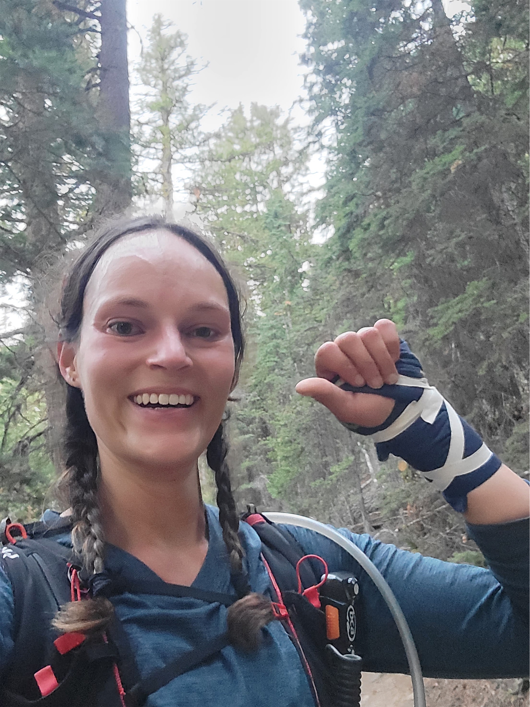
Matt radioed back immediately/ “You okay? Need me to come back?” “I think I’m okay, but not sure. Yes come up.” Step 2, get heart rate under control, don’t throw up. Slightly more in depth physical, breathing is fine, head is fine, everything still moves, no significant deformations/bleeding. Bike fine too. Left wrist is bad. Hip and shin are enough to complain about but very much overshadowed by the wrist. Palp everything. Legs definitely okay besides soon to be big bruises and bloody cuts. Wrist… unclear. Point tenderness, immediate swelling, no crepitus. But fuck it hurts. And it’s so… weak? Like it wouldn’t respond normally to commands to move. My fingers could all move. Barely, but enough I was confident that tendons were intact. Must be a bad sprain.
I got up, picked up the bike, and started walking towards Matt. Walk it off. Great, legs were gonna be fine, we’ll see if the wrist pain wears off. “I think I would know if it was broken” I said, before realizing I had heard that line twice this summer and both times the bones in question were broken. I was mildly embarrassed and disappointed. The easiest section of the day. I got complacent and moved too fast, wasn’t ready for that last drop. Still not entirely sure what happened. Lost momentum abruptly, got thrown forward, and couldn’t correct quickly enough going over the last drop. Dammit, that’s like a half cup of water that’s going to inflammation and not hydration! Let’s just push bikes to Boiling Lake and figure it out from there. I told Matt to ride (of course) and I’d catch up but he was content to walk.
Sneak peaks of Boiling Lake
At the lake, we ran into the other group of bikers, and two named Victor and I think Jeff helped me filter water. I couldn’t even get the bladder out of my pack, nevermind open it up or pump water. I checked CSMs (circulation/sensation/motion) in my left hand, Matt grabbed tape and some fabric, and wrapped it. I was shouting as he wrapped it because it hurt so badly and he asked if it should be looser and I said no!! We need to get out of here, it needs all the support it can get! Keep going! We got it nice and tight and taped it up to hold it in place. Pretty solid for a backcountry bandage. No change to CSMs. Perfect. I took a single Advil. Matt had stronger things too I think but I wanted to start with what I knew. “I have some.. oxycodone if you want that?” one of the other bikers asked. We cracked up. That might be overkill. I do actually have to get back to the car. “Not to be a debbie downer but that wrist is gonna hurt a lot more tomorrow, heads up.” I knew he was right. Ugh. Oh, did I mention all of this is happening in one of the most beautiful locations in Washington? Boiling lake is ridiculous.
Up next was the second section of hike a bike, fortunately less steep than the climb above Cooney Lakes. Beautiful switchbacks. Matt had to help me clip my running pack because I had lost all fine motor control (swelling, not because of the bandage). He helped me lift the bike over a few larger rocks, but I soon figured out I could lift the frame with my right arm easily enough. “Hey Eve!!” I heard from several switchbacks above. It was the bikers who had helped with the water. “Do you have lights?!” I laughed. “Yes!! We do!” So insanely good of them to check in on us. They were camping at the trailhead too, and invited me to join them if I didn’t hike back up to camp so I wouldn’t be sitting at the car alone and injured. They were so freaking funny it was a tempting backup plan.
Boiling Lake had the best larches of the trip
On the ridge above Boiling Lake we got in touch with Anita via the radios and told her we were on our way, but I was potentially injured. We had tossed around some ideas, I could stay with Anita while Matt went to the cars to get my camping stuff and came back, I could take the bike out and car camp and head out in the morning, I could get my own stuff and meet them back at the lake.
I tried to ride coming down from the pass, but everything I rolled over that wasn’t smooth soft dirt sent fire up my left arm. I couldn’t grip or control the handlebars with my left arm. Matt rode slowly while I biked clear patches and walked the rest. “Get a pic of me biking” I asked Matt, thinking so if it’s broken I have proof that I tried. “Remember when we said this might be a one and done? Or a 10yr trip? I think we’re going to have to come back sooner as a revenge trip.” We stashed the bikes at the turn off to Upper Eagle Lake, and found Anita at a glorious campsite next to the lake. I figured I wasn’t driving back to Seattle that night, so I might as well camp and enjoy the scenery. And I so didn’t want to deal with the bike, getting it out would be slow. I decided on the third option. I’d run back to the car, grab camping gear, and hike back up.
We told her the story, had a quick snack, and I went on my way. It was 5:25 and I wanted to be back at camp by 10. I figured 90min to run to the car and then 3 hours to hike back to the campsite. Well, thanks to a well maintained trail with mild downhill the entire way and heaps of adrenaline and cortisol, I was at the car in under an hour packing up my overnight gear and my legs felt AWESOME. I was FLYING. I was originally going to do a trail run Sunday or climb Bigelow, but those were out of the picture so I took minimal gear back up to camp with me. I asked four hikers with headlamps if they had spare batteries in case mine died (I didn’t) and within ten seconds there were four outstretched hands with batteries in front of me. I swear these hobbies have the most supportive, helpful people out there. Zero judgement, just yes please how can I help and be safe out there! I was overflowing with gratitude.
Dropping down towards Eagle Lakes
The stars were out in full force. I lived a lifetime in the 3mi traverse to the lake after the last huge switchbacks. At Upper Eagle Lake I stumbled through three or four campsites before finding Anita’s, perched on a rocky knoll with the best views. She and Matt were half asleep, but not too sleepy to immediately try to help. “Do you need help with your tent? Water? I’ll get up!!” No no, I think I’m fine, I got it. Miraculously, Anita sleeps with a splint for her left wrist. She handed it to me. Something along the lines of “I’ll be fine one night, you need this more than I do.” Taking one for the team! I lost and re found the splint four times while setting up all my gear but finally put it on. I flopped into my sleeping bag, wet from sweat and freezing, hoping my clothes would dry from body heat. After 15min it was apparently that was not happening. I changed in the frigid air with my bum wrist. I think the worst article of clothing for an arm injury is a sports bra. It’s amazing I didn’t break my wrist in a second place trying to get the damn thing off.
Don’t need a wrist to run!
I woke up in the morning to a beautiful sunrise lighting the cirque up pink. I made my way to the campsite toilet, realizing I hadn’t gone to the bathroom in something like 16 hours. Body must have shut down all nonessential functions for a bit. I had a huge breakfast even though I wasn’t hungry. But then Anita gave me a vanilla scone that was the most delicious thing I’ve ever had. Sugar. My body wanted straight sugar.
We started packing up. Anita helped me pack my sleeping bag, which I couldn’t do 😦 And then she made a life saving offer. I figured I’d just hike out with her and push my bike while Matt rode down. But what if Matt took the heavy overnight pack, she wore the day pack he rode with Saturday, and she rode my bike out? I’m a bit bigger than she is so my bike might be too big, but there was a chance this could work, and holy crap I didn’t want to push the bike if I didn’t have to. And I really didn’t want to ride out of there. The trail from the lake was the easiest section of the ride by far with plenty of smooth dirt sections, but with an overnight pack and how badly the tiniest rocks hurt the prior day I had no doubt it would have sucked for me. My wrist at this point was visibly swollen from knuckle to halfway up my forearm. But here was Anita, getting excited to bike!! Heck yes! Take it! And the more you enjoy it the better I’ll feel too! Just tell me it’s amazing and I’d have loved it when we get down.
We hiked back to the stashed bikes, Anita took my helmet and hopped on my bike. I hiked ahead of them to get a head start and snap a few pics of Anita. Of course they caught up to me within minutes and it was off to the races! I ran/hiked the way out, running the soft sections that didn’t feel too high impact. I just wanted to be the fuck out of there at that point. I wasn’t enjoying the journey anymore.
Brilliant sunrise colors
Larch reflection
I popped out at the TH to Anita and Matt tailgating at the car with a camping chair and a beer ready for me! Waiting to make sure I was alive. “It was amazing, you’d have loved it!!!” I love taking a few minutes to chill at the car after a great trip, and this was perfect. I added some cheese to my crackers and cheese, had another pb&j, and half a beer. I had been fantasizing about a Subway sandwich (chicken bacon ranch w pepperjack and chipotle mayo on the cheesy italian bread) for like an hour at this point but knew I had to get back to Seattle. Matt and Anita helped get my crap into my car. I drove slow on the way out, turning sucked with my bum wrist. It’s not strong enough to hold the wheel in place, nevermind turn it, which means I need to get creative with the shifting/turning pattern while driving my manual car. Luckily highway driving was easy. City streets and tight turns were peppered with shouts and groans and strings of curses.
I started voice-to-texting people once I was back in cell service. Tell my family, tell my boyfriend, Brooke and Amber, Brad and Surafel, message a group of besties to look up what urgent cares did x rays and were open past 8 so I could try to get an appointment that night, are there ERs where you can wait outside or somewhere else so you don’t sit in a room of dying people feeling bad for taking up resources with your tiny injury? I struck out on all counts. I got home and called my neighbor. Hey Jeff, I think I broke my wrist, if you have five minutes can you help me get my bike out of the car? Everyone was so insanely helpful. I showered, made a grilled cheese (always tempted to say grill myself a cheese thank you archer), and decided it could wait til the morning. I swear if someone took my vitals in that moment they’d probably think I was dying anyway so might as well eat, hydrate, and rest, and then figure it out.
Can’t choose between larch reflections
I got x rays at 9am at urgent care. “What made you come in today vs Saturday or yesterday?” they asked. “Well… I was pretty far away, got back late last night.” I replied, not wanting to explain everything. “The radiologist will call later today with results.” Cool, I can wait. Five minutes later she came back in. “Actually, it’s pretty clearly broken. We’re out of splints but here’s an ace bandage and a referral to an ortho.” I went on my merry way and called like 40 orthos who were booked out for weeks until remembering OPA Ortho, who had helped with my sprained knee/potential tear years ago. An ortho way too good for my routine fracture could see me in two days. Sick. The rest is soon-to-be-history. I mean if there was a limb to hurt it’s my nondominant wrist, and if there was a time to do it, it’s right now when the weather is changing to crappy but it’s not ski season yet.
Anita ready to ride out!!
Things I will miss: climbing, gym climbing, surfing, lifting, swimming.
Things I think I can still do: hike, run, ski, lift with good limbs, and maybe I’ll go find a stationary cycle.
Daily things that suck: chopping food, typing, driving, washing hair, opening tupperware, opening jars, turning doorknobs, scrubbing Invisalign, sleeping, petting cats and dogs, putting on socks and pants, zipping jackets.
Things I’m grateful for: Matt and Anita for being awesome company and keeping up the good spirits, Matt being willing to take newbies out on adventures and being super chill with injuries, Anita for miraculously having a left wrist splint and riding my bike out and helping me pack, people who are excited to help in case of emergency, super wholesome hiking/biking communities, Andy and Esther for selling me a tv ASAP and moving furniture I can’t move myself, a family who naturally gives me 50/50 sympathy and sass, coworkers who understand putting health before work. And an ortho who can probably build a better wrist than I was born with if it comes to that. And the same coworker I frantically texted for my messed up knee years ago has had the same fracture… so he was, once again, a phenomenal resource!
My bike & I matching the larches (photo credit Matt!)
accurate recap of events thanks to Kyle P’s amazing and hilarious art skills
First flight off Whitehorse! What a freaking treat!
Brush brush brush
I had been stalling on committing to weekend plans until Thursday night when I got a 10pm text from Andrew telling me to drop what I was doing and join him and Stephen for Maude and Seven Fingered Jack. I also saw a post from Mike on FB saying he was considering Whitechuck Sunday. Mike’s great. And here’s the bonus. I had Mike’s cooler and box fan from a party weeks earlier that he was kind enough to leave behind since he left while there were still people here. Dude. Can I join for Whitechuck, and I’ll bring your stuff too? Heck yes!!
Distance: 4mi Elevation gain: 2100ft (6,989 highest point) Weather: 70’s and sunny Commute from Seattle: 2:30 Did I Trip: Almost ate it right below the summit but no one saw
Open forested ridge
Whitechuck had been on my list FOR YEARS but it’s such a short hike I was always reluctant to drive longer than the hike would take. And I had heard so many polarizing things about these “white slabs” from people that I wasn’t sure I wanted to go solo. Being the opportunistic hiking parter I am, Mike doing Whitechuck was the perfect incentive to go. We met up around 7:30am, aiming for the trailhead at 9am so we wouldn’t have to swim through dewey brush, which the trail is famous for. Around 7 I messaged Mike, voice-to-text while driving. Shit. Mike. I’m so sorry. I forgot the fan and cooler. I know I know I had one job, I’ll drop them off in North Bend I swear. I was kicking myself. This is like when I forgot to return Alexis’s power washer like actually four times until finally she said I’m coming to your house to get it. I wasn’t letting that happen again.*
False summit of Whitechuck
The road to the trailhead was in GREAT shape. There was one steep section to go up and down that may give some 2wd cars hesitation, but none of the rutted potholed hell we had envisioned. And the views are phenomenal on the drive! Holy crap! It’s going on my list of places to camp if I’m ever injured.
Wildflowers above treeline
The trailhead is notorious for smashed windows and car break ins. A car pulled up behind us and we started wondering. Suddenly Mike laughed. I don’t want to stereotype but… it’s a Subaru I don’t think they’re going to smash our windows. He scattered some junk in the front seat to make it look as unattractive as possible and we started hiking.
The trail stays left near the wall here. These are not the slabs on route! Bt they do go.
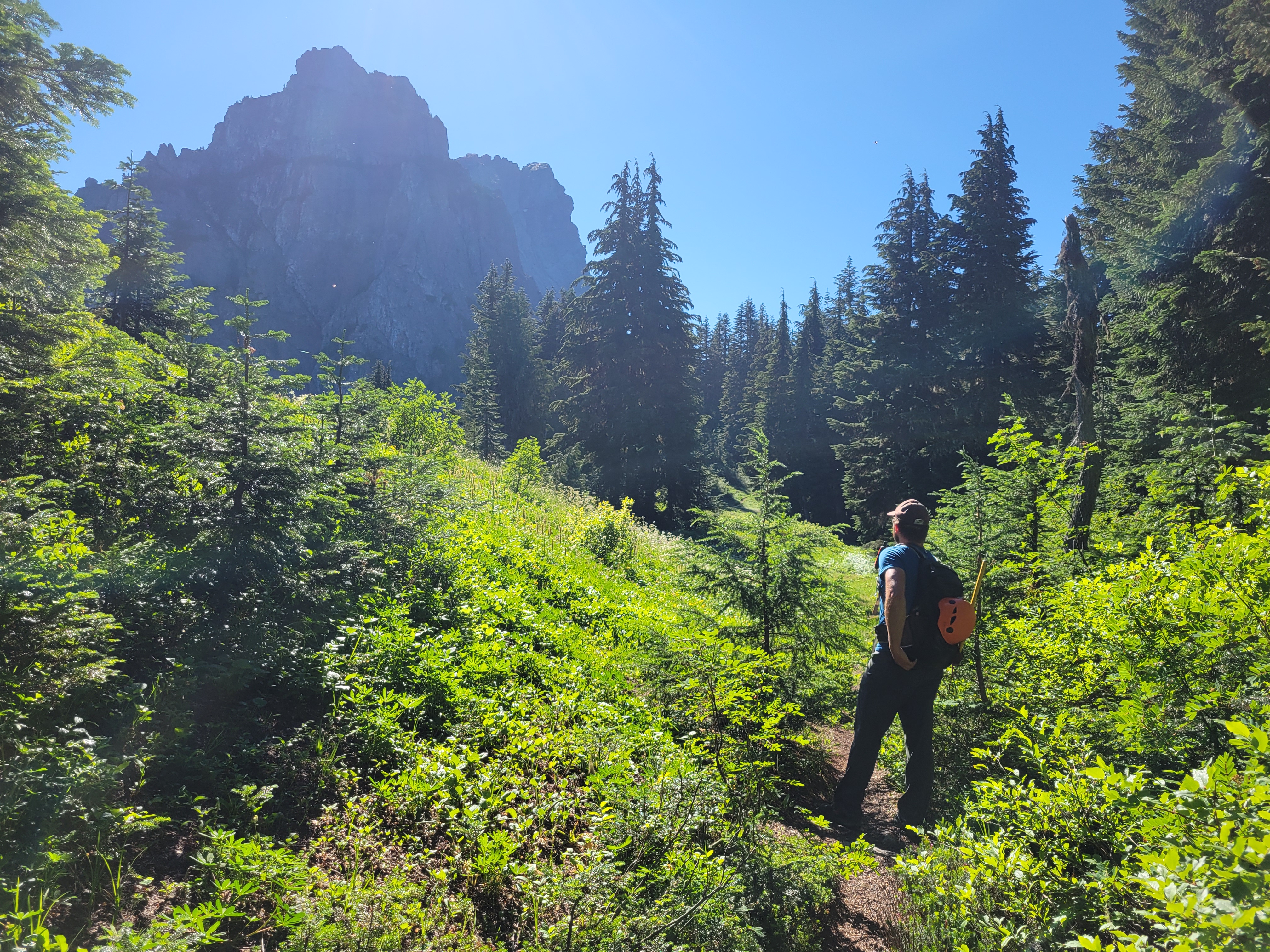
The trail first goes through brush, then open forest, then meadows. Bite size pieces of tons of different terrain. We were perplexed by the peaks to the North of us, it’s a perspective I’ve never had of the Cascades. We eventually figured out that Mount Chaval looks awesome from this angle. I whined about my sore legs from the prior day. This would be a good hike to get blood pumping, that’s for sure.
Suddenly beyond the meadow there’s a rock wall in front of you. And that’s not even the true peak. The trail wraps around the hillside south of it, taking you through wildflowers to a steep, dusty, rubbly trail where we caught up with some of the folks who owned one of the other cars at the trailhead. We passed them and immediately got off route scrambling up some slabs that we were sure had to be the slabby section until we found a trail through the heather above. Also those slabs were black not white. Ok, not at the infamous slabs yet.
Heather trail running along the shoulder
At multiple points, the heather trail diverged into two which both met up later. We avoided scrambling the ridge proper though I hear it is enjoyably spicy and stuck to the trail on the south slopes of the mountain, following the narrow tread through wildflowers and rocky outcroppings with insane views. It’s a classic Mountain Loop trail, reminiscent of the upper slopes of Pugh or Sloan. We must have taken a thousand pictures between the two of us, me clocking in around 250 and Mike accounting for the other 750.
We finally came across some awkward sloping white slabs covered in kitty litter. Okay, THESE must be the slabs. They certainly were negatively sloped, with no way around them. It was really only a few steps but it is definitely awkward. Beyond that, it was more trail to the notch, which had the most legitimate scramble move on the whole hike in my opinion. From there it was a short walk to the summit, where you are standing at the confluence of two enormous river valleys looking at ridges and ridges of peaks in every direction. The position of this peak is absolutely insane. The day prior I had sworn that the Chiwawa area/Entiats were my favorite part of the cascades. But now I was thinking no, it’s the Mountain Loops.
Dead/dying glacier on Whitechuck’s north face
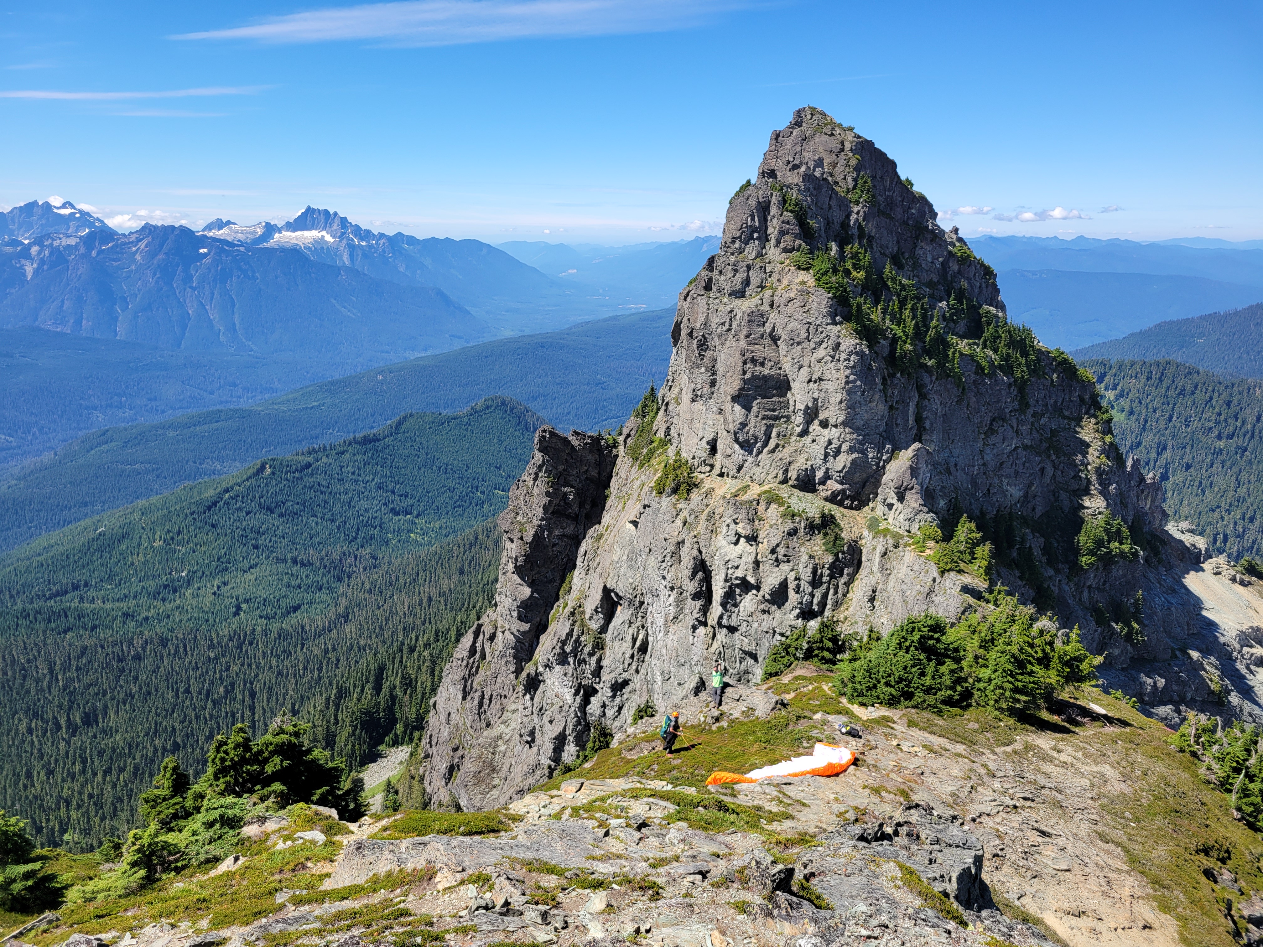
The group next to us had three huge joints. I laughed. No way could I smoke that and then descend that mountain. Well I mean you all know my last weed experience. Behind us, a dog or maybe two made the scramble move at the notch. I couldn’t even watch because I didn’t trust that the pup was going to stick the landing but of course he was fine. And the final group.. well that’s where things got interesting. They were paragliders!
We descended from the summit, staging a few photos. marveling at views. There is a wealth of logging history here and you can see it on the slopes, the marks of old roads and the borders of where the forest had been logged and then regrown. Back at the saddle, the two paragliders were suiting up. We sat down to have a snack, and eventually the topic came up… what if we just waited to see what they did? Do you… do you want to just hang out and see what happens? We weren’t in a rush. Mike messaged his girlfriend to explain why his inReach wasn’t moving, and we chilled out. The paragliders, Chandler and Kevin, were discussing wind cycles, direction, laying out the glider in different spots to find the best angle on ground that wouldn’t snag the strings. The strings are absolutely tiny, like less than a millimeter thick, and there are seemingly hundreds of them. The whole system seems extremely fragile, yet it can carry you through the air for miles if you plan it right.
Narrow boot path on top of the world. You can tell that whole slope left of center was logged.
THESE are the slabs everyone talks about
We ended up waiting and watching for over an hour. I wondered if we were being rude by watching, but it was fascinating. When’s the last time you watched something with childlike wonder? The risk analysis and decision making was beyond anything I’ve seen with my low grade rock climbing. I learned that wind comes in cycles, like how surf comes in swells. You feel a breeze pick up and then die down, that’ll happen a few times and then there’s a bigger lull between cycles. The breeze would just tease the glider, ruffling the cells a tiny bit but not lifting it. When the breeze was finally strong enough that the glider first fluttered my heart fluttered with it. And after endless tries laying out the glider differently, it lifted up a few feet, Chandler pulled the strings taught and got it ~10ft in the air, and he said I’M GOING FOR IT and in a split second ran and jumped off the edge of the mountain. We jumped up and whooped and cheered. First flight off Whitechuck ever! Unbelievable.
Glacier Peak over Thornton Lake
That left Kevin, who put Mike and I to work after a few unsuccessful tries at catching the breeze. We helped lay out the glider, tried holding it up to catch the air, clearing small rocks and heather twigs that were snagging the strings. I felt like a kid helping an adult delegating simple tasks but the kid’s just so excited to be useful it doesn’t matter as long as they’re doing something. Omg, I’m touching a glider. A parachute. Look at these strings. Look at how insanely light this fabric is. Look how the cells eat the air.
After maybe an hour of trying, the wind started to shift and come from the opposite direction. After the sheer joy the instant Chandler took off, it was tough feeling the wind slip away as Kevin tried to catch a gust. He finally decided to call it and packed up while we headed down, thanking us for the chatting and the help. Back at the car we gave some blueberry muffins that Nicole had baked to the woman picking up Kevin (I can’t explain how good the muffins were, they were the best blueberry muffins I have EVER had) and headed back to town. Driving through Darrington we saw Chandler laying his chute out in a field and honked, he waved though I have no idea if he actually recognized us or not. We never actually talked to him, just Kevin after he had taken off. We were just so stoked still on having had the chance to watch them take flight and see how the entire operation worked.
The scramble above the notch
My half day trip had turned into a full day, but I have no doubt that was a once in a lifetime experience. Totally unexpected, filled my insatiable curiosity, and I was glad Mike was down to just chill and see what happened too. Turned out Kevin had some FAs on ice routes in the area I had read years ago when I had more ambitious climbing dreams, and had switched to paragliding as his climbing slowed down. Still getting after it and chasing adventure, just with a different sport. My future probably isn’t paragliding, but I am sure I and most of the climbers I know will have similar pivots someday. And never say never… once upon a time I swore I’d never rock climb and here we are. I swore I’d never blog and you’re reading it. I’m not sure what’s next but I’m not going to rule anything out.
*I did successfully return their cooler and fan the following weekend. Just so you all know. But there might be a risk of loaning me things if you don’t live within a mile of me.
Thursday night around 10pm I get a message from Alejandro. “I don’t know what you’re doing this weekend but you should probably cancel it and come do Seven Fingered Jack with me and Stephen.” Uh… actually… hold my beer, gonna I cancel my plans. Jk I didn’t have any plans, for once. See you tomorrow afternoon! I hadn’t done SFJ or Maude before, and it was an area I had wanted to go to for ages! I just never tried to rally people to go because I assumed everyone I knew had already done them, so I’d wait for an opportunity to do them solo, except I lack motivation for solo trips more often than not. I like company, and now I’d have GREAT company. Alejandro and Stephen might be two of the funniest people I know, and their sarcasm and wit is just perfect for enduro-suffering sports like backpacking, scrambling, and mountaineering.
Huge tree over the Leroy Basin trail
Distance: I don’t know. 5mi approach, maybe 3mi for both peaks.
Elevation gain: Saturday was ~6k, Friday was.. something less than that
Weather: 60’s and sunny
Commute from Seattle: Well it was SUPPOSED to be 3hrs
Did I Trip: No but both my climbing partners did
The crux of the trip was the drive. It took almost 6 hours to get from Seattle to the trailhead, despite leaving at 12:30. Midday. To beat traffic. Highway 2 had multiple accidents that had shut down both directions of travel. Alejandro, Stephen, and I texted sporadically when we passed bits of cell service. Alejandro left around noon. I left around 12:30. Stephen… well he left West Seattle Island at a reasonable time, got lost in the Bellevue REI for an unreasonable time, and then went through a space time warp while we wondered if we should order him a milkshake at the 59er diner or not. “By the way Eve, you should probably just do Maude while we sleep.” “I figured.” My circadian rhythms are offset from Alejandro and Stephen’s by like 6 hours. I’m in bed at 9pm. I wake up at 5am. One time Stephen replied to a message at like 8:30am on a Saturday and I wondered if I should be worried.
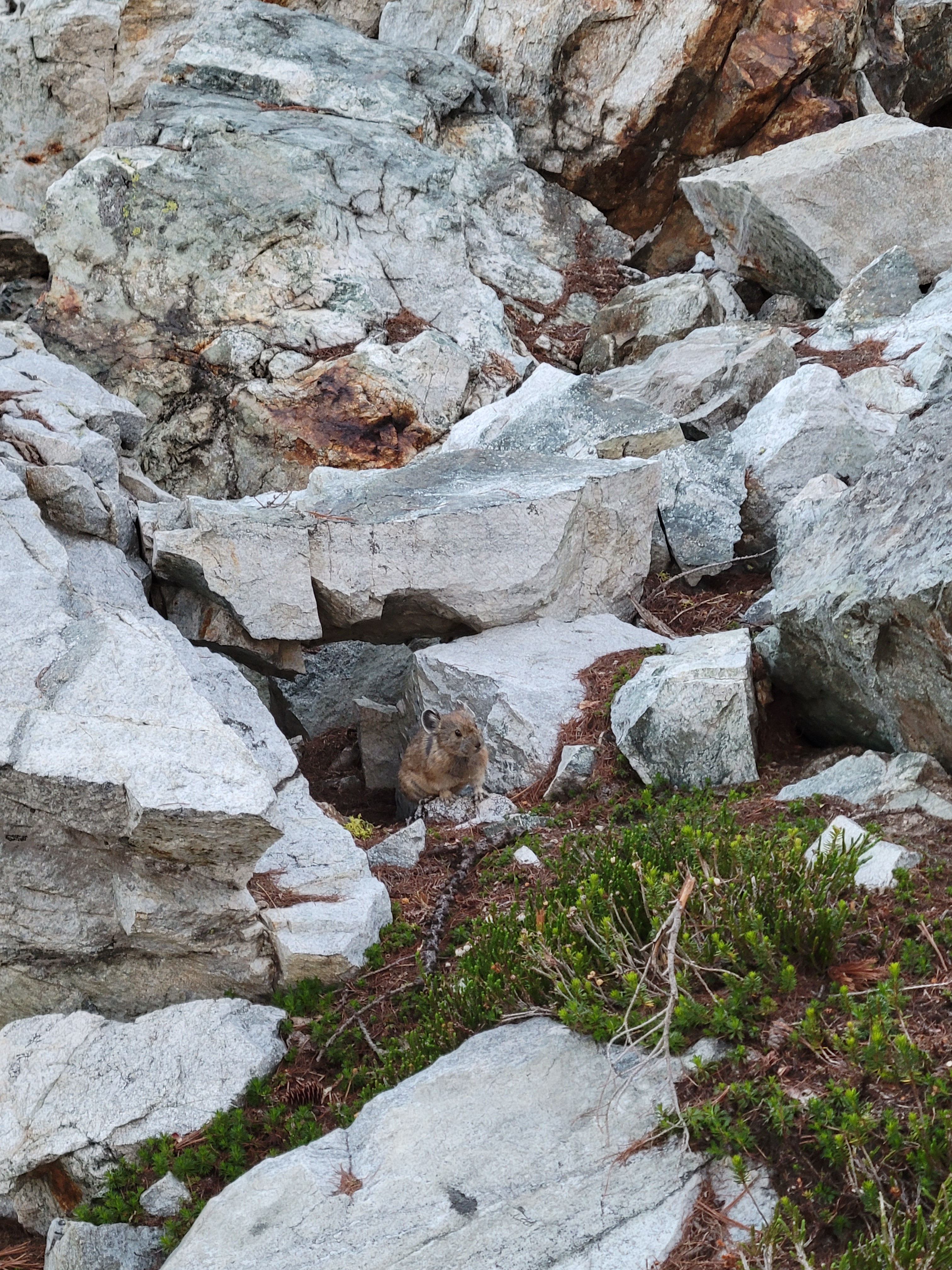
First pika I’ve seen all summer!
Quick side note: The 59er Diner, before I forget, is totally worth a stop. The diner burned down in a fire in 2016 and reopened in I think 2018 with the same old vibe they used to have. Great milkshakes, good burgers, don’t get the onion rings though they taste more like pancakes than onion rings. Curly fries were also great but I have yet to face a bad curly fry.
Marmot shocked I exist
Stephen made it in time for a milkshake, and we drove the final 70ish minutes to the trailhead. Stephen immediately bashed his head on the trunk door, drawing blood. Good start. We started hiking around 6:30 or 7, and I was hoping to be at camp by dark. It should have been an easy approach, 3mi on flat trail and then about 2mi on steep “unmaintained” trail to Leroy Basin where we’d spend the night. We loaded up on bug spray, and the first 3mi of trail were SO nice, especially after the brush bashes I had had the past few weekends. I hadn’t seen Alejandro and Stephen in months and was so stoked to catch up. “Oh, Eve” Stephen said. “Alejandro and I were thinking you should just climb Maude tomorrow morning while we sleep.” I laughed. We had independently all reached the same conclusion. Sounds good to me.
Clouds evaporating over Maude
The chatter dried up around the turnoff to Leroy Basin. “Unmaintained” is a stretch, because there has definitely been vigilante maintenance. But vigilante maintenance can’t clear the huge tree that fell whose root ball ripped up the path below it, or widen the trail where it’s overgrown with stiff tree branches. But at least there was a trail, which was an improvement over the freaking Bird Creek Bushwhack. But I swear you think you’re about to crest a knoll and get views and no, the trail goes left into the trees. Another knoll to crest, almost there, and no, the trail goes left into the trees. And again, and again.
Looking back at first light on Seven Fingered Jack
“Turns out mountain biking is not the only exercise you need” Stephen lamented after a year of swearing mountain biking is the only exercise you need. “It flattens out ahead” I told Stephen, by which I meant “caltopo doesn’t have it shaded so it’s at least less than… 27 degrees.” Yeah we never found flat. Until we were at the campsite. “That trail is penance for whatever you did in your past life.” Some dummies were camping with a bonfire next to us but don’t worry they didn’t burn the forest down. Alejandro was still nowhere to be seen, and it was officially dark. Our campsite was right next to the trail, so we figured he’d walk up eventually. Soon enough we saw his headlamp. He dropped his pack on the ground. “Those campsites down low… those campsites were like sexy sirens on rocks.”
Neat subalpine terrain
I went to bed and Alejandro and Stephen crossed the entirety of Leroy Basin on a 30min one way trip to get freshly flowing water from the opposite side of the meadow rather than the stream like 200ft up the trail from us. Only the finest, freshest, cleanest of water for them. I went to sleep, had weird anxiety dreams about sleeping over a hole and trying to cover the hole with dental floss to hold up my torso (idk), and woke up at 4:30 to go for Maude. And hit snooze. Like 6 times. I finally got moving around 6am.
Wildflowers in front of Maude’s summit
The trail traverses up and east for seemingly forever. The larches are underwhelming, I was relieved I hadn’t saved this for larch season. You finally get above treeline into sparse wildflowers and sandy choss, and up to a saddle south of Maude where you head almost directly north through slopes of snow or talus depending on the season. The snow was icy, spikes would have been nice, but I didn’t bring any so… step carefully. Icy Lakes looked GORGEOUS. Really want to camp there someday. South Spectacle Butte looked far more imposing than I had ever imagined. There are so many more peaks to be bagged in this area (and larches!). And I saw more small wildlife than I had seen all summer!
Final grassy slopes to the top
The final stretch to the summit was brutally windy and freezing cold despite being mid August. I was driven only by stubbornness and a flock of small birds flying in circles tweeting around me like Snow White except grouchier. To add disappointment to discomfort, there was no register on the summit, so I ate my PB&J sandwich and quickly turned around wearing every layer I had. I made quick time back to the saddle where a chipmunk threw pebbles at me and I was happy to duck out of the wind, thanks to the ridge in the way. I was back at camp around 9:30, and ready to go 15min later. Alejandro and Stephen were still having breakfast. “We thought you’d want like, a break, or something.” I was mostly basing my timing around highway 2 traffic. I either needed to be back on i5 by 1pm, or not until 8pm. So.. ok, I’ll aim for 8pm. Let me know when you’re ready.
It’s a chipmunk eating a flower!!! My heart!
We started up to Seven Fingered Jack around 10:30. It looks very cool from Leroy Basin. The trail is an obvious, well traveled left turn off the trail that heads towards Maude. You quickly gain elevation into an upper basin, this one chock full of larches. THIS is where you want to come in larch season. There were some campsites tucked away on a larchy knoll to our left, teasing me for a return a decade from now. We schlepped up grassy slopes to the left, then ascended a loose rocky talus field to a short little gully on the right that took us up through a break in the ridge system where there were some hints of a trail. The trail was more like heather steps, which we followed up to a second basin, with bits of pumice,* lingering snow patches, and a crazy neat mushroom boulder.
On the way to SFJ!
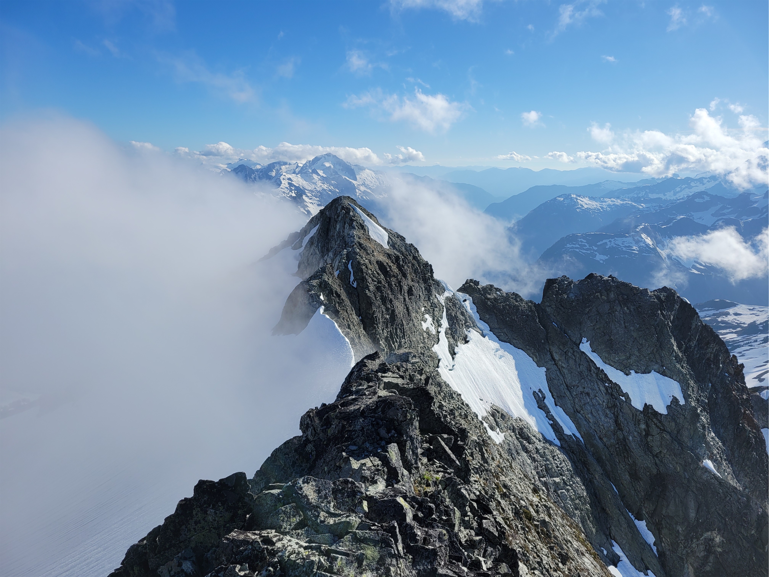
From the rocky basin, you take a talus fan up to your left that traverses below some sheer rock walls. Put on a helmet, this is where it gets loose. And stays loose. All the way to the top. It was a neverending slope of talus. Part of me is still up there side slipping around wobbly rocks. But the views just got better and better. Alejandro turned around after getting sick of the loose shit at the top of that narrow talus fan. I couldn’t blame him at all, and it didn’t get better from there. From there it’s a long time sidehilling on talus or kitty litter on sloped rock. Stephen and I continued, choosing our own paths up through the rocks. He went high in search of 3rd-4th class scrambling on more secure rocks, I stayed low taking my changes surfing uphill on scree. I occasionally turned around to see him poke his head above the rocks and then disappear again. We finally curved to the right again to gain “a ridge” (not a ridge, despite what the topo map says) and made it up the final (also extremely loose) gulley to the summit, where we texted sappy things to our SOs back in town and I crushed a second PB&J sandwich. Fortunately we both had downloaded GPX tracks, because I swear every gully looked the same to me on the way down and I would have been in for a lot of trial and error without them.
The basin no one tells you about
I was losing my mind going down the endless talus again. I am sure Stephen was too. At once point he said “I’m playing that game of -” [my brain autofilled the rest: “gambling whether a rock will hold my weight or not”] but his thought was cut short by the sound of falling talus and crumbling rocks and I turned around to see Stephen tumble head over toe, a literal full somersault like something out of a cartoon. My brain froze, paused at the first step of the “do I panic” flow chart. His fall concluded and he jumped up right away. I shouted something like “Stephen! Holy shit! All in one piece? Sit down and take inventory” though he had already found a place to sit and was almost doing the Atlas Thinking pose. We waited a few minutes for adrenaline to subside. “Ok, scratch here, deeper scratch there, got a band aid for this one… man, my elbow hurts.” “How bad? How’s your range of motion?” “Motion is okay and.. well I’ve broken it twice before so I think I’d know if it was broken.”
SO MANY LARCHES
Context: Months prior, our friend broke his ankle on a mountain bike ride, only for Stephen to announce and everyone to agree “yeah you’d totally know if it was broken.” To be fair, I did a brief patient assessment and also didn’t find any signs of a break, but my mistake was not firmly palping the ankle bone itself! Fast forward 48hrs, our friend’s ankle was definitely broken, and I’ll never miss a cracked ankle bone again because the shame of missing it still hasn’t subsided.
Followed this talus fan center of frame, curved right beyond the dark center outcropping
So, in response, I laughed. Of course that’s your answer. But hopefully you’re right. We got moving again. “This is my trip for scrapes” he sighed. “Starting at the car.”
Stephen marks our exit ramp
We made decent time getting back down to Alejandro back at camp. Stephen insisted on hiking down climber’s left, meaning I couldn’t get a dope photo of him in his bright orange shirt among the greenery. We watched the wildfire by Lake Wenatchee grow in size, or at least the cloud it was creating became huge throughout the day. Stephen and Alejandro were spending Saturday night at camp too, while I was headed out, but I took another break back at the tents before leaving. No rush now that I had to wait out the Stevens Pass traffic thanks to that stupid traffic light everyone knows sucks.
Camouflaged bug
I was jealous they had another day there and also sad to leave such hilarious company behind. The slog back to the car was going to feel long. The Leroy Basin trail went by quickly, but the 3mi of flat trail.. oh boy. I swear I had been hiking the flat section only for 2+ hours when I decided that it had somehow extended to 7 miles. Or I had died on SFJ and this was purgatory, forever hiking a forest trail that looks the same for ever and ever. Time warped in my brain. Was this a contest with the universe? Was I in some simulation loop and the only way to break out of it would be to check the map and that would snap things back to reality? Or was checking the map considered defeat, my poor human psyche collapsing under the weight of infinite flat redundant hiking? I was determined not to check. Maybe those thoughts broke the spiral, I don’t know. I finally saw a landmark near the beginning of the trail and knew I was close. I broke out of the trees into the parking lot at 6:15pm, less than 2hrs from when I left camp. The time warp was entirely in my brain.
Stephen coming across loose scree
A few miles down the dirt road, I came across a very out of place character standing on the side of the forest road waving me down. Soaking wet. Small day pack. Top hat in hand. Uhh, okay. Situations that ran through my mind:
More flowers
1. Ghost. Because who is dripping wet out here? It doesn’t add up. It’s a sunny beautiful dry day. Maybe you aren’t real.
2. Scam. You’ve all heard those horror stories about people who pretend to be dead in the road or like they need to hitchhike somewhere and then their buddies emerge from the trees to do whatever terrible things to you
3. Hitchhiker from another trailhead?? But the only loop that could conceivably connect my trailhead with the next one down the road is absurdly long and why is he soaking wet?!
Mushroom rock!
I rolled down my window and said something extremely not smooth, like “…what are you doing here?” Poor guy was still in good spirits and calm and collected. “Well i got lost, but I knew there was a road here, so I just aimed for this. How far is the Little Giant Pass trailhead from here? Is this the right direction?” “You got lost…from Little Giant Pass? How long ago?” “yeah.. well, what time is it?” “7pm almost” “Then about 4 hours ago, but not entirely sure, I dropped my phone in the river. And my map.” “Well, hop in, happy to give you a lift to the trailhead, save you 20min of walking.” “No don’t worry about it, I’m soaking wet.”
This guy had been bushwhacking down from the Little Giant Pass trail, forded the freaking river at the bottom of the valley, and then shwacked back up the opposite hillside to find the road. I do that shit voluntarily and it sucks, I can’t imagine it being involuntary. “Does this car look like it was built for luxury? It’ll survive some water. Plus it sounds like you have a good story.” I dropped him at his car a few minutes later, only to be passed on the highway by him an hour later because I drive like a grandma.
Now what do I need to do to get more last minute invites on Stephen & Alejandro’s trips? 🙂
*can confirm, pumice floats. At least for a while until it’s all waterlogged, then it sinks.
Image dump of the rest of the pics since narrative got ahead of everything I wanted to share. The views really are just absurd.
Really neat red dyke of rock on SFJ
Stephen coming up SFJ below Glacier Peak
Dumbbell and Greenwood over a lake, Bonanza back right
Northeast face of Maude
One of the Lake Wenatchee wildfires growing
White paintbrush in front of Glacier, Fortress, Chiwawa
Floofs, secret larch basin, wildfire, and Buck Mountain top right
Jon descending Flora with South Spectacle, Maude, and Copper in the bck
Devore creek trail between Bird Creek camp and Tenmile Pass
On to days 4 and 5! Here’s the trip header with links to the other reports. Felt like too much for one post so I’m breaking it into bite sized chunks because you know I’m a storyteller.
Day 1:Drive to Field’s Point Landing, express ferry to Stehekin, hike to Bird Creek Bivvy. ~10mi, 5000ft gain, 5hrs. Day 2:Bird Creek Bivvy to Tupshin summit and back. ~3mi, 3300ft gain, 10hrs. Day 3: Bird Creek Bivvy to Devore summit, Bird Lakes, and back, then move camp to Bird Creek. ~7mi, 3500ft gain, ~13hrs Day 4 (this post): Pack up Bird Creek camp, stash ovenight gear at turnoff for Flora, Flora summit and back to Devore Creek, move camp to Ten Mile Pass. 13mi, 7800ft gain, ~12hrs Day 5 (this post): Ten Mile Pass to Holden, ferry back to Field’s Point Landing. ~7mi, 200ft gain, ~2.5
PLOWING AHEAD with sparknotes:
This is the bushwhack but it closely resembles some sections of trail
Flora is a walk, a really long walk
Consider doing Flora during larch season if you’re into views, wow
Tenmile Pass from the Devore Creek side is 85% cruiser 15% blowdowns
Tenmile Pass to Holden is… decidedly not cruiser. 100+ blowdowns. PARKOUR
There is no water at Tenmile Pass, but there is water if you’re willing to hike ~5min down the trail towards Holden
The first mini basin
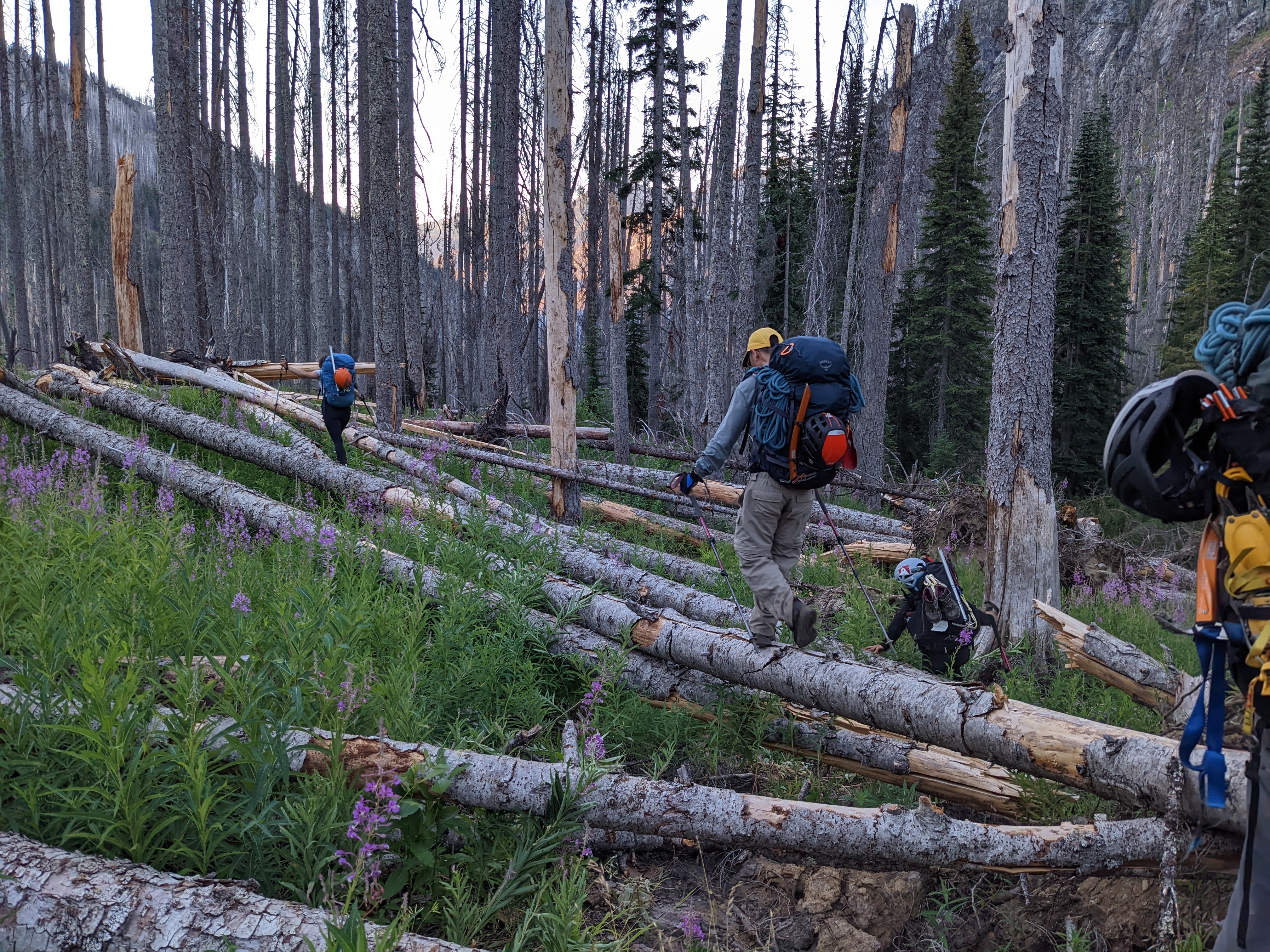
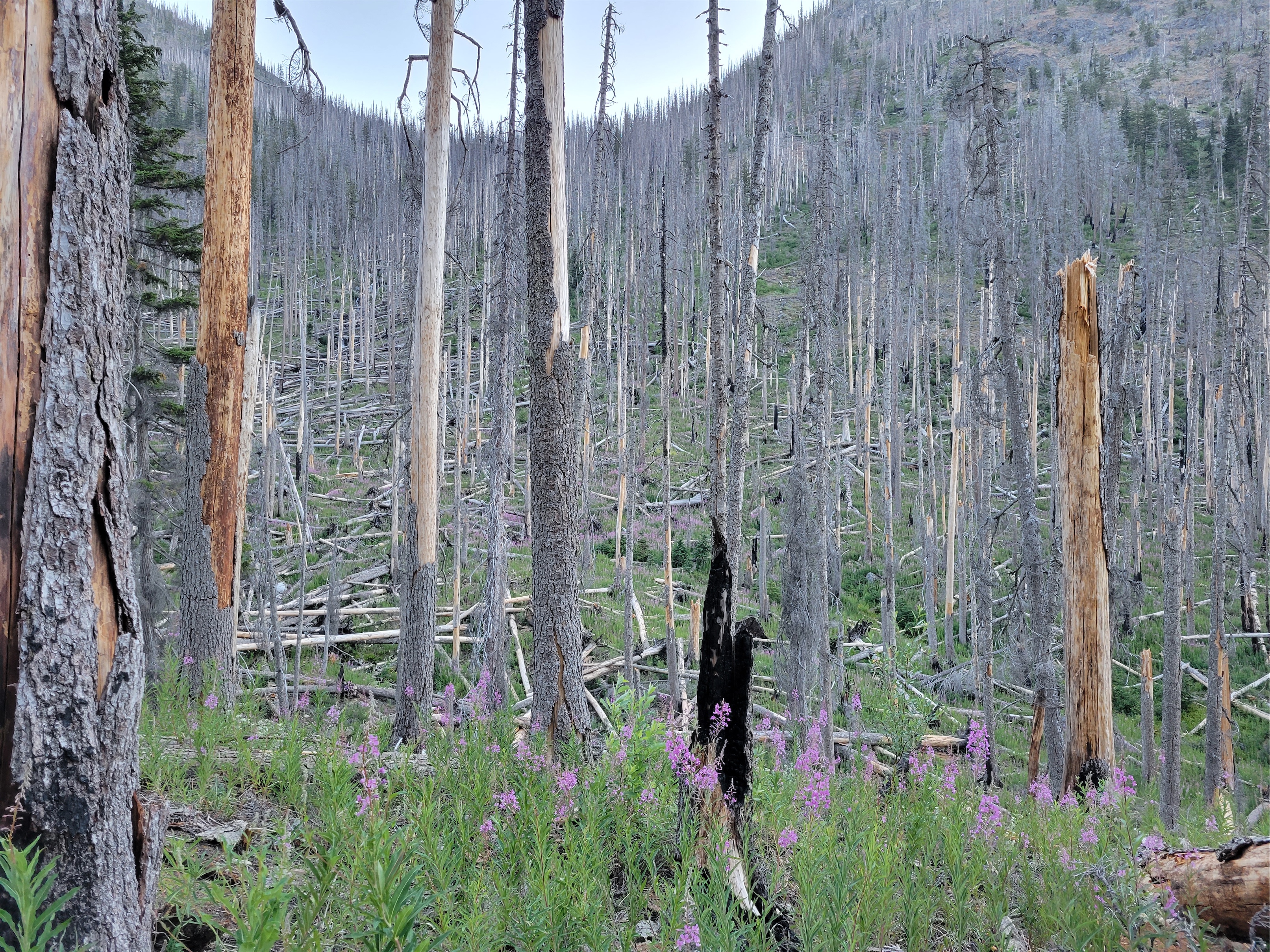
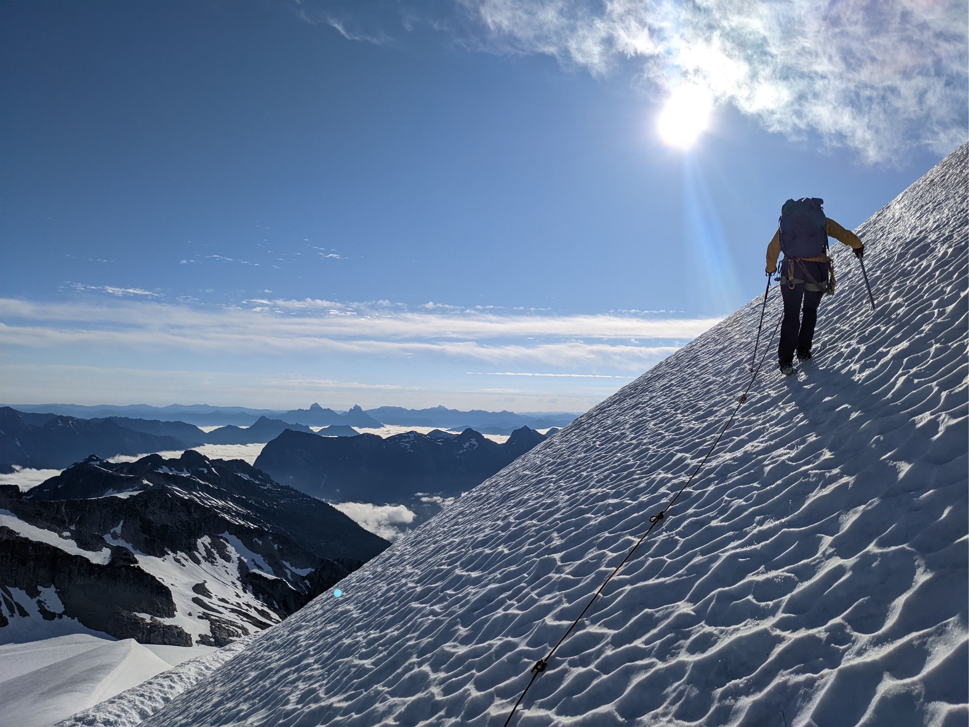
This was going to be a big day. There were a lot of unknowns ahead of us and we just had to trust things were going to work out and that moving slow and steady would eventually get us to where we needed to be. Most people who climb Flora do it from Bird Creek camp as an out and back, but we wanted to carry up and over Tenmile Pass and exit via Holden instead of hiking all the way back down the Devore Creek Trail to the Stehekin River trail, backtracking those stupid 3 miles to the shuttle, and taking the shuttle to the ferry. So our goal was to pack up camp, stash gear at the turnoff for Flora, climb Flora, repack our overnight packs, and hump all of our gear up to Tenmile Pass. Through trails that may or may not have received maintenance yet this year in the worst year of blowdowns/deadfall in recent memory. We had heard reports of 250+ blowdowns, 450+ blowdowns, and two brave volunteers going out to battle the brush a few days before we’d be there. Who knew how far they’d gotten.
Meadowy basin below the Enigma saddle. Talus gully approach out of frame to the right
Working our way up to the saddle
We were moving by 5:30am with no idea what to expect. The volunteer crew seemed to have stopped at Bird Creek Camp, because we immediately started running into blowdowns, but nothing awful. We were able to refind the trail fairly quickly and I don’t think they made us much slower than 2mi/hr. Soon enough we were at the flat ish spot to cross Devore Creek and start the bushwhack up to Flora. We emptied our packs of overnight gear, tied up spare food, and shared horror stories of people stealing cached/stashed gear. Taking food to eat. Taking snowshoes thinking they were lost/forgotten. Straight up stealing nice gear because why not? Fortunately we were SO far out there I couldn’t imagine anyone would take extra overnight gear to hump out 8 miles over blowdowns and ferries. I tied my food in some leggings (still don’t have a bear bag… shh) and tied those to a tree. Usually I use my sleeping bag stuff sack, but it was holding my sleeping bag, so I had to get creative.
Flowers are a good distraction
We crossed Devore Creek easily on some logs and began the bushwhack, aiming for the saddle south of Enigma Peak. It wasn’t as bad as the bushwhack up to Bird Creek high camp, but it wasn’t exactly open forest. Lots of spiderwebs, neck/head high blueberries and teenage pine trees. 50/50 hip high brush and annoying blowdown pickup sticks. We got a streak of like five walkable logs connected to each other and I announced it was the gift that kept on giving, letting us walk high above the brush. “We’re logging some serious elevation gain on these” “Ooh make sure to put that in the bLOG” the tree puns carried me for a hundred vertical feet. We broke out into a small treed basin with running water and cute flowers and took a short break. I kept thinking we were about to be above treeline and it just never came. The sun was lighting up the trees, the ground was getting flatter, but the trees continued. Until finally, we found a beautiful meadow (part marsh) around 7200ft, and finally, FINALLY we were in the alpine Stupid east side with their stupid high tree line. Our next break was brief as the bugs wreaked havoc on our bodies.
Flora from the saddle… so far away
Beyond the marsh, we continued up an increasingly steep and unstable talus slope to an obvious saddle to climber’s left, starting out with large solid boulders and progressing into classic softball/football sized rocks ready to tumble around your feet any minute. I had the Grocery Outlet jingle stuck in my head, which sucked, because it’s literally four words long. Gro-cer-y Ouuut. Leeeet. Bar-gain Maaaar-ket. I asked the group what songs you could get stuck in someone’s head just by saying a few words. Examples are:
– Bye bye bye – Shout (options) – The final countdown – What is Love – Take on me – Stop (hammertime? collaborate and listen? In the name of love? Too many options) – 867-5309 (no one knows the other lyrics though)
We came down the juggy ramp on the left
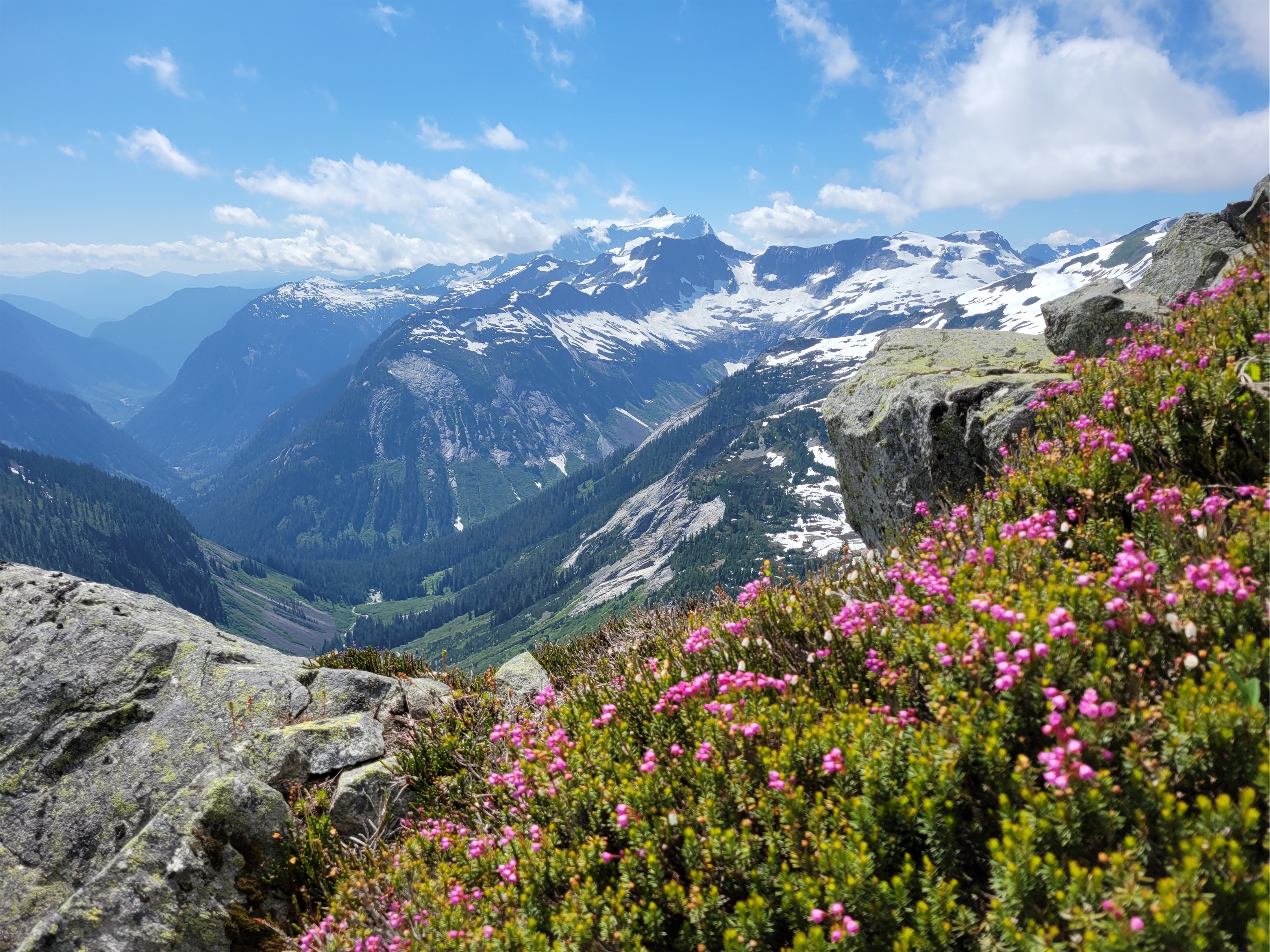
This and pockets of wildflowers carried me up to the Enigma-Riddle(?) saddle, where we had maybe the most annoying part of the day: dropping like 800ft of elevation to the meadows below on steep, also loose dirt and scree. Fortunately the loose stuff only comprised like 200ft of that, and the rest was on heather through larches until we got to the ridiculously beautiful Castle Creek surrounded by wildflowers and larches and I just couldn’t believe no one comes up here to camp in larch season. I know, I know, lugging all your overnight shit up there is unpleasant, but this had to be one of the most larchy spots I have ever seen in my life. Numerous and DENSE. We picked our way through them until we gained the rib that would take us up to a final basin below Flora. The rib was step (you can traverse further north to make it less steep) but we found game trails here and there to help, and finally got above trees once again.
Castle Creek valley being ridiculous
The final stretch to Flora’s summit was a talus walk. Also annoying, but easy, and the views were amazing. I really underestimated the scenery on Flora. Adorable patches of wildflowers, rock ranging from red to black to white, views of Lake Chelan and Domke Lake to Maude to Tupshin and Devore, glaciers may be missing but it’s a very cool viewpoint. At the summit we found some metal wire scraps, no idea what those are from. “I thought they might be holding the place together” a climbing acquaintance commented on Facebook a few days later. We did the normal summit routine again, I finally finished my cheez its and cheddar cheese, and we made quick work getting back to the first basin and then to Castle Creek.
Up and up and up talus forever
Getting back up to the saddle south of Enigma was about as painful as expected. Baking in the hot sun, dust kicked up by someone in front of you just sticks to your face, sometimes you take a step up and your foot just slides down to where it used to be. But we found the ramp we had used on the way down, took another quick break at the saddle, and soon enough we were back at beautiful bug marsh meadow where our break was equally brief because the bugs were somehow worse than they had been that morning. We got back onto the topic of music because my head had been liked a jukebox all day. Do you ever think about song lyrics like a decade later and realize how terrible they are? The song in question was Smack That by Akon. Smack that, out on the floor, smack that, til you get sore, smack that – wait, what?! til you get sore!? Akon, get out of my vanilla life, I’m trying to enjoy the scenery.
I don’t know what these are but they are my new favorite
My brain glazed over for the bushwhack down. It actually went decently, or maybe I was in a trance and just didn’t process anything we did. We were back at our overnight gear around 4pm and moving towards Tenmile pass by 4:30. Amelia and I started moving slowly thinking the others would catch up on the trail. We ran into a section of avy debris which was surprising. The slide must have been HUGE. Trees all down across the trail in the same direction, snow still frozen solid underneath them. Someone had cut all the branches off the logs which was very much appreciated. We went around both sections and refound the trail, wondering where the boys were until we heard their voices on the other side of the avy debris.
Talus talus talus
Crossing Devore Creek is your last convenient chance to get water before Tenmile Pass. We skipped it and grabbed water off a switchback, but that took 20ft of schwhacking to get to. I grabbed one of Jon’s spare nalgenes to fill up. I only need like 1-1.5L of water to get through a night but everyone else seemed super thirsty, so I figured carrying 3.5L meant others could use mine. And it was a good call, because it was all consumed by the next morning. Tim I think carried 5 freaking liters up to the pass! Tim’s tiny but that’s why he’s the gecko. Sticks to any slope angle and moves so freaking fast you look up and you’re like I saw him out of the corner of my eye but where’d he go?!
Lake Chelan and Domke Lake in a sea of peaks feat. Bug in upper left
Is there cryptobiotic soil up here? Because that’s what this reminded me of
The trail from Devore Creek Crossing to Tenmile Pass was blowdown free. You don’t see the pass until you’re right below it. I saw Jon on switchbacks above me and was determined to catch him. I pushed the pace for a few switchbacks before remembering he’s a fucking machine and I had no chance. Cresting Tenmile Pass, there were no clear established campsites, but there was a huge open clearing with minimal vegetation where we felt okay pitching tents given the circumstances. There are supposedly campsites a mile below the pass, but we never found them. Tim was next to arrive at the pass. “Are we camping here?!” he asked. “Yes, if that’s okay!” His face stretched into a huge smile and he threw his arms up. “THANK YOU!!!” I just started laughing. “I’m old and happy!” was one of my favorites from Tim.
Aster, Lupine, and something yellow
We set up tents, everyone checked on each other to make sure we had enough water and food and see if anyone needed help with tents or cooking. Everyone. Was. Wiped. I think we had the full spectrum of emotions between the six of us, from “don’t talk to me i’m exhausted” to “i’m pissed i’m exhausted” to “i’m happy but also exhausted” to “i’m relieved and exhausted” to just “i’m stoked to be here and exhausted.” Amelia trotted to my tent and dumped a bunch of electrolyte mixes in front of me. “I’m sick of my energy gels what food do you have that you’ll trade for these?” We bartered some stroop waffles and chia seed mixes for electrolytes. I think Andrew was on day 2 of his mashed potato diet. Tim had leftover vegan noodles he couldn’t convince anyone to eat. “Andrew, I can carry the rope tomorrow morning” I offered. “No! That’s CHEATING!” Hahaha! “You can’t carry the rope into Holden after not carrying it the past few days!” I had been carrying the trad rack (3lbs vs 7lbs for the rope) since he took the rope from me when I was dying Thursday night. Well. Fair point. Enjoy carrying the rope another day then!
Paintbrush in the Castle Creek valley
We made do with the water that we had, and the next morning we found water a five minute walk from the pass, maybe not even. So if you camp up there, there IS running water, you just have to look for it a bit. Not sure if it was a spring or snow, but there wasn’t much snow that we saw, so I’m thinking it’s a natural spring. There was also a LOT of wildlife up there. We were clearly encroaching on a deer’s favorite spot, he came around and snorted and clomped and sniffed out all of our gear. I had hazy dreams of a dear shredding my sleeping-bag-stuff-sack-turned-food-bag. Oh, and you’ll be camping on like 2″ of ash, so be careful what you touch and where you dig. Your tent’s going to be duuuusty.
Avy debris on the Devore Creek trail
We got moving at 5am to make sure we got to Holden in time for the 10:45am shuttle to the ferry. This was the stretch of trail we thought would have the worst blowdowns. The tenmile trail drops into the valley and connects to the Company Creek trail officially, but there’s also a connector trail to the Tenmile Falls trail out of Holden. It’s not on most maps for some reason. It does receive annual maintenance according to the rangers, but.. not much. The first ~2 miles down from the pass were cruiser: beautiful trail, beautiful switchbacks, beautiful burn zone scenery.
Gecko speeding over logs
And then we hit the junction with the Company Creek trail and the connector to Holden. And it turned into miles of parkour. Over logs. Under logs. Around logs. We crawled. We jumped. We scrambled. Amazingly, a volunteer crew had trimmed branches off all of the logs, which is an INSANE amount of work given what we saw. Hilariously, Jon had ripped his pants about an inch at some point, and with every log shenanigan, the rip grew longer, and longer, and longer until he had a 16″ rip from waistband to where the pants zipped off into shorts. RIP his pants (get it). But eventually, there’s a view to skiier’s left of a huge waterfall coming down from Tenmile Pass, and finally, FINALLY we started seeing fresh sawdust. Boom. We were where the volunteers had ended. Deer prints abounded. Guess we aren’t the only beings who appreciate a beautifully cleared trail. From there, it was a long but quick cruise to Tenmile Falls (pretty, but underwhelming after everything we had seen) and down into Holden Village.
Holden Village was more welcoming than the last time I was there, but THERE WAS STILL NO ICE CREAM. I don’t understand the economics of this. The tourists all have to leave at 10:45am to catch the ferry. Why. Does the ice cream. Not open. Until 1pm. That’s so stupid. Are you just making money off your volunteers? That’s cruel. Milk the tourists, guys, come on. TAKE MY MONEY. Getting breakfast was an event too, because breakfast ends at 8:30 but the Hiker Haus and Registration (necessary for any hikers to get access to buildings, like the building that has breakfast) don’t open until 9am. ONCE AGAIN. HOLDEN. DO YOU WANT. MY MONEY. OR NOT.
Tenmile Pass connector (PC: Amelia)
We split into two groups, I found someone willing to sneak us oatmeal but the others found someone who actually worked Registration and was willing to get us registered in time for breakfast. Breakfast was $10 for mostly oatmeal and toast and canned fruit. And apples! I ran over to Andrew, who was still wearing his headlamp despite being indoors at 8:30am. Andrew they have apples!!! You’ve been talking about them for days! I made toast and loaded it up with cream cheese. Except a few minutes later the cream cheese was melting and sliding down the bread… because it was actually butter. I had just taken like a half cup of whipped butter and everyone just watched and never said anything. In their defense, I still ate all of it. After adding salt, because it was unsalted. $10 for toast with unsalted butter. Holden. Come. On. No eggs no cheese no protein and NO ICE CREAM.
More fun on the Tenmile Pass connector (PC: Jon)
Holden had one redeeming factor for a nerd like me: the library. We couldn’t go in it last year, but it was open this year. Amelia and I darted inside. One of my favorite children’s books was front and center – Officer Buckle and Gloria! An adorable story about a policeman and his dog educating their community on safety. We read that and then started picking up reference books, reading about mining history, local native art, newspaper clippings from the early 1900’s, reading random trivia to each other from whatever we were reading. A guy who found a ton of gold by Mt. Stuart, only to have it buried literally that night in an earthquake. Two guys who escaped the Wellington avalanche that killled nearly 100 people back in 1910. Origins of lake and peak names from native languages. Pictures of miners 1500ft underground before the mines were shut down. Enough to easily keep me entertained for the hours we had to kill until the shuttle arrived.
I mean really in ~2yrs there will be no trees left to fall
The shuttle took us to Lucerne (where the ferry picks you up/drops you off for Holden) where we had over an hour to relax and swim before the ferry arrived. We all jumped into the fucking freezing water, which was amazing. The forecast had said 109 degrees but it certainly didn’t feel that hot. Either way, jumping in a cold clear lake after five days of layering sweat/sunscreen/bug spray felt phenomenal.
The best book
On the ferry, we ran into Matt and Anita, who had just hiked from Cascade Pass to Stehekin, and picked us up some surprise bakery treats from the Stehekin Bakery! Jon ran into an old college friend, and we chatted with Selena, Max, and Steven Song (his amazing blog here) who had just done Bonanza, Martin, and Copper out of Holden too. Small world. Party on the Monday morning ferry. We whooped at a jet skiier who was cris-crossing the ferry’s wake getting air cresting every wave. Looked like a total blast.
Brave chipmunk digging for his peach pit. Like the squirrel in Ice Age. No packs were harmed.
I can see why no one through hikes Stehekin to Holden or vice versa via Tenmile Pass and Devore Creek. Even aside from the 150 blowdowns in like a two mile stretch, the Tenmile Pass trail only has views thanks for the forest fire, and the Devore Creek trail doesn’t have much in terms of views at all. It seems to primarily be an access point for the three Bulgers we had climbed and not much more. But i’m a nerd, and it’s cool to get a glimpse of these less frequented trails, and it makes me appreciate that they’re still being maintained, even if minimal. Seems more and more trails get abandoned every year, and it’s not like we’re gaining new trails. Always makes me wonder how a certain trail comes into existence and what its use case was when it was first built. Recreation? Hunting? Transportation? Mining? Logging? I have no idea why Devore Creek or Tenmile Pass trails exist.
This was an incredible multiday trip with a really great group. Thursday solidified it, I can be a mess with that group and they’ll come together to support me. Hopefully me floundering like that is a rare occasion, but it’s really amazing being able to trust a crew like that. Good company, great views, awesome experience. There are still some peaks in that area I need to get but I think it’ll be a while before I feel like revisiting some of those bushwhacks.
On to day 3! Here’s the trip header with links to the other reports. Felt like too much for one post so I’m breaking it into bite sized chunks because you know I’m a storyteller.
Day 1:Drive to Field’s Point Landing, express ferry to Stehekin, hike to Bird Creek Bivvy. ~10mi, 5000ft gain, 5hrs. Day 2:Bird Creek Bivvy to Tupshin summit and back. ~3mi, 3300ft gain, 10hrs. Day 3 (this post): Bird Creek Bivvy to Devore summit, Bird Lakes, and back, then move camp to Bird Creek. ~7mi, 3500ft gain, ~13hrs Day 4:Pack up Bird Creek camp, stash ovenight gear at turnoff for Flora, Flora summit and back to Devore Creek, move camp to Ten Mile Pass. 13mi, 7800ft gain, ~12hrs Day 5:Ten Mile Pass to Holden, ferry back to Field’s Point Landing. ~7mi, 200ft gain, ~2.5
Finally in open meadows. Gully around the corner immediately left
Here we go with day 3. Sparknotes:
Ignore the GPX tracks on peakbagger, go back up the brushy slopes to Tupshin and sidehill to the valley to cross the creek. Trust me. 1000x better.
The gully isn’t nearly as bad as it looks from Tupshin
Bird Lakes are worth the detour
The 4th class rap is essential and summit rap is preferred, but make sure the person off rappel is also clear of the gulley before you set up your rap
Camp to camp: ~11hrs (5am to 9:30am summit, long break at Bird Lakes, 4pm back at camp), then moved camp to 4200ft Devore/Bird Creek junction arriving around 6pm
In the minor basin between meadows and Bird Lakes
We woke up a bit earlier this day, knowing it would be longer. We were originally aiming for two peaks this day, Devore plus a bonus, but unfortunately things weren’t lining up the way we needed them to.
Purple Aster being all cute
Oh boy. Ignore the GPX tracks you probably pulled off peakbagger for this one. We followed them and cut straight up the gut of the valley and it was a mess of annoying slide alder and thick brush. I’d recommend what we did on the way down: follow your track up Tupshin for a hundred vertical feet until you’re in manageable brush/blueberry bushes, and then sidehill connecting animal trails (hopefully they’re still there) until you’re in the meadow below the gully to Devore. The creek crossing is easy, and the gully is a heather and talus staircase.
Cresting the moraine, White Goat and Tupshin in the background
The gully drops you off at.. oh, a second gully. A fake minor basin of larches (beautiful) and loose talus, scree, and dirt (not beautiful) to gain the real Bird Lakes basin (SPECTACULARLY BEAUTIFUL). Wildflowers were sprinkled among the scree which made it more tolerable. Gaining the moraine above Bird Lakes Basin was sad because I was so excited to the see the lakes, but turns out they’re a slight side trip to the northwest. Suddenly I heard “BEAR! BIG BEAR!” and I picked my head up with wide eyes scanning the basin. “WHERE” “here!! Look!” My eyes darted, my heart raced. Wait. They’re pointing to our feet. Tracks. Not a live bear. Relax. But damn the tracks were huge!
We put on crampons and booted up the snow to the far east ridge, following a sandy boot path up the mellow ridge to some steep snow below the Bottles. At the cool col next to the bottles we packed up the snow gear and dropped down the first of a loooong stretch of steep slopes with everything from solid scrambleable rock to kitty litter covered ledges to unstable talus and scree.
B-B-B-BEAR My hand is way off the ground sorry I screwed up perspective
The going through this section was tedious. We divided and conquered, trying to stay out of each others’ line of fall in case someone knocked down rocks. We had figured out by now who in the group was most prone to kicking things loose: Andrew. I kicked something down and we all shouted ROOOOOCK followed by Andrew slightly more quietly “it wasn’t me!” only minutes later to hear ROOOOOCK followed by Andrew “Okay that one was me!” This section felt like choose your own adventure, we traversed until a minor ridge we could follow almost up to the main ridge, where we sidehilled more on the west side until the unavoidable 4th class step.
Headed up to the col, Bottles on the left
Now 4th class is interesting. Sometimes it means just “extremely exposed 3rd class.” I like Jon’s definition, which is “I can get up it just fine but don’t love downclimbing it.” And sometimes I swear it means “5th class but there’s no pro so we’re going to call it 4th class.” This honestly felt like the third option. there were big ledges for feet but it was vertical and exposed. Some of us scrambled it and then tossed down a rope to the others since there’s a conveniently located rap station at the top.
White Goat above Bird Lakes
Lots of this for a while
From the top of that rappel, we traversed almost straight to the left (same elevation) to an extremely exposed 3rd class (4th?) move. There may be a better move higher up, not sure. Someone knocked a rock loose and we all looked at each other waiting for it to hit the ground below. We finally heard it strike. Yikes, that’s a lot of time to think about falling if you slip here. I evicted the thought from my mind and made the move. It was extremely awkward, at least for my reach/flexibility/height. Had to trust there was a hand hold there, couldn’t reach both holds at once. From there, another traverse left to the base of the obvious gully (actually obvious! basically a short boot path right to it) and a quick scramble up the gully to the top. The gully isn’t technically hard, but just like the rest of these crumbling choss piles it’s full of softball to microwave sized rocks just waiting to hurtle down on your friends below you, so I tried to be as dainty with my foot placements as possible.
The summit routine was the usual, admire views, snap pictures, look for summit register (no register!), shit no one brought whiskey wait no that’s fine packs are already heavy enough. Okay okay we have a lot to get done today, time to get moving. Jon led the first rap down and hustled to set up the second rap down the unavoidable 4th class step. Two others went, and I heard someone at the bottom shout “wait, where did you guys go? GUYS?!” and I rapped down next only to find no one at the bottom. Someone above kicked rocks down the gully on me, unsurprisingly given the condition of the gully. A football size rock bounced off the calf I was relying on to push the rest of me under a slight overhang on the wall. I was pissed. If I had legitimately been injured by the rockfall, no one would have been there to see it and help.
Ladies coming up the ridge (PC: Jon), Wy’North and Martin in the background
Looking up at the 4th class step and false summit
Unfortunately I let my adrenaline get the better of me and did exactly the same thing to the person behind me, leaving them behind as I angrily went around the corner trying to work off my frustration. Stupid and hypocritical of me, but fortunately those behind me were fine, no more rock fall.
Me on the 4th class step (PC: Jon)
The rap down the 4th class step went smoothly, and we made quick work of the traversey descent and climb back to Cool Col and then to Bird Lakes. Tim decided to skip our bonus peak and head back to camp, so we parted ways just before the lakes. At the lakes, we stopped for water, and I realized it was 12:30. I pulled Jon aside. Here’s what I’m worried about.
Amelia on the 3rd class wraparound
1. Bonus peak is 2 pitches of technical rock. For a party of 2, a good rule of thumb is 1 hour per pitch. So 1 hour to the base of the climb, 2 hours to the summit, 1 hour to rap down, 1 hour back to the lakes, 2 hours back to camp. 7 hours total, then we needed to move camp down 1000ft.
2. We had 5 people. That meant we could pretty much guarantee it would take more than one hour per pitch.
3. We had a really big day with Flora the next day.
Jon in the summit gully
We called the others over to discuss. Do we want to go for it but not get to lower camp until well after dark, or did we want to make it a comfortable day and be at camp around dinnertime? Everyone agreed on the latter. 2016-2018 me would have gone for it but 2022 me is so much lazier. This was a really hard decision though, because the bonus peak was the whole reason I was there. I’ve been admiring it from afar for like seven years. But I’ve had a good streak of goal peaks this summer, it’s okay to let one go. Just need to convince someone to do that approach again with me in a few years.
I spy Andrew on the 3rd class wraparound (taken from the notch below the 4th class)
We hung out at Bird Lakes for over an hour. We hiked an infinity loop around the two lakes, found a few campsites, and sat in the shade having snacks and hydrating. It’s such an unbelievable area. I simultaneously can’t believe no one camps here (it’s gorgeous pristine wilderness with a lake unlike most you’ll ever see) and also completely understand why (getting overnight gear up there would be a BITCH unless you’re bivvying). It’d be a DREAM to get up there in larch season.
We headed back to camp around 1:30pm, shouting to Tim we were coming for him. Much of the scree slope was plunge steppable, but the lower gully (heather and talus) was a bit of a knee banger. Towards the base of the gully we realized we could avoid all the brush by sidehilling through the meadow until we intersected with our Tupshin descent path, which at its worst had some downed logs and blueberries, a walk in the park compared to the bushwhack up the middle of the valley that morning. We followed game trails that had been recently used by something big. I thanked the bear and deer for making such great trails and hoped we didn’t run into whatever had clearly trampled the plants recently. The game trail carried us perfectly back to our Tupshin descent track, and we rolled into camp to Tim’s laughs. “I followed game trails over here instead of coming back through the brush!” he announced. It wasn’t a bear or a deer that had trampled the brush recently, it was the gecko!
Tupshin over Bird Lakes
The cost of getting up there
We packed up camp and headed down the bushwhack. We ignored GPX tracks again, following our noses down the path of least resistance, and it was bad but not as bad as the way up. “Is this better because we’re finding a better route, or because I’m in a better mental place?” I asked. Behind me I heard Jon mention we had dropped ~100ft of elevation. “We’ve only lost 100ft of elevation? That’s fucked up” Andrew said with an almost perplexed voice. I cracked up. Okay, yeah, it’s still shitty.
Tim always smiling even through 3rd class trees
We found the trail, recently brushed out and cleared by the volunteers we had met! They strategically left a log down across the river to make it easier to cross, but camp I swear was larger than it had been two days prior. They must have cleared some deadfall out of camp too. The general consensus has been that the downed tree situation this year is far worse than prior years. I was insanely thankful the volunteers had beat us to most of the trail so we didn’t have to parkour our way through hundreds of dead trees.
We debated trying to camp further up the trail, but since there was no guarantee that campsites existed, we decided to play it safe and stay where we were. We managed to fit five tents into the camp thanks to some gardening work by Tim, who found out he had lost his utensils at some point and quickly improvised chopsticks with his tent stakes. I was in the tent by 7pm just listening to the others talk including a hilarious mini rant by Andrew about the Fred Meyer experience at 7pm and how there’s always only one checker-outer available despite all the customers trying to get like two weeks worth of groceries at one time. Jon quickly agreed. I’m not sure what came of it, because I definitely drifted off to sleep mid conversation.
Rob on the summit of Tupshin with Devore, Martin, and Bonanza in the background
I’m still figuring out how to write about multi day trips. One post per day? One post with all of the days? That’s a long ass read. Thinking what I’ll try is one post per day but with a header that covers all of the days. So, header first.
Stehekin arrival!
Day 1 (this post): Drive to Field’s Point Landing, express ferry to Stehekin, hike to Bird Creek Bivvy. ~10mi, 5000ft gain, 5hrs. Day 2 (this post): Bird Creek Bivvy to Tupshin summit and back. ~3mi, 3300ft gain, 10hrs. Day 3: Bird Creek Bivvy to Devore summit, Bird Lakes, and back, then move camp to Bird Creek. ~7mi, 3500ft gain, ~13hrs Day 4:Pack up Bird Creek camp, stash ovenight gear at turnoff for Flora, Flora summit and back to Devore Creek, move camp to Ten Mile Pass. 13mi, 7800ft gain, ~12hrs Day 5: Ten Mile Pass to Holden, ferry back to Field’s Point Landing. ~7mi, 200ft gain, ~2.5
Okay, starting with days 1 and 2. Sparknotes:
Express ferry that dropped us off
Bring bug spray
Devore Creek trail is brushy, but mostly free of blowdowns up to Tenmile Pass
The bushwhack to Bird Creek Bivvy is surprisingly brutal. No open forest until within ~100 vertical feet of the bivvy. Just lots of brush and blowdowns.
There is a huge campsite still in the trees around 5400ft with easy running water. We never found the 5800ft meadowy campsite Summitpost suggested. Maybe if you’re prepped for a very small bivvy you’ll find something.
Route to base of Tupshin climb is straightforward
We only belayed one pitch (see pic). Rock shoes totally unnecessary/almost detrimental.
Rappels were essential, wouldn’t have wanted double rope rap due to loose rock
Rock is extremely loose, including spontaneous rockfall. Wear helmets, climb close together or stay out of each others’ line of fall
We had a party of 6. Smaller parties could definitely descend faster.
The bushwhack up to camp
A LOT of planning and deliberation went into this trip. Huge shoutout to Ranger Dana at the Chelan ranger station who will never see this but provided a ton of beta regarding blowdowns, including the count (250+ downed trees) and volunteer schedules for people doing trail maintenance. She even took notes and called me back with the trail conditions. Super personal interaction. The blowdown count was scary. The volunteers, however, would be a day ahead of us. Fingers crossed they could get some work done before we had to drag out slow and heavy 5d overnight packs through there.
As much as I love this area, the fact that it’s like 10 hours of transportation to get there drives me insane. I woke up feeling a little nauseous and having zero appetite, which sucks when you’re about to start a long trip. I figured it’d wear of after I got some food in me. We left around 5:30am, stopped at the Sultan Bakery because why not have a bakery head to head, and got to Field’s Point in time for the ferry which dropped us in Stehekin around noon, where we waited an hour for the shuttle to Harlequin Bridge. We killed time looking around the visitor center, the restaurant, talking with the park rangers, and flipping through old books until the shuttle arrived. Make sure you clarify with the shuttle driver that you’re stopping at Harlequin bridge and not High Bridge. The shuttle stops at the bakery where I grabbed a quiche and a sandwich and wolfed down the quiche thinking you weren’t allowed to eat on the shuttle (you can, it’s almost like they want tourists to buy a lot at the bakery, who’d have guessed). “Do you think the bakery has apples?” Andrew asked excitedly. They did not.
More bushwhack
The shuttle dropped us off by Harlequin bridge, where my pack fell open. I picked up what I could and re packed, we polished off our bakery snacks, and started walking. Within a mile we were stopping to load up on bug spray, holy CRAP they were bad down low. The Stehekin River Trail basically takes you back along the 3mi to the edge of Lake Chelan, so that feels like a waste, but short of a) a river ford b) sweet talking someone with a boat c) float plane you’re going to have to schlep your asses to Harlequin Bridge and 3mi back along the river to get to the main event: the Devore Creek trail.
The Devore Creek trail starts out with a million switchbacks. I’m not sure how many, because my body decided to shut down around switchback number 3. The queasiness I had been feeling since waking dialed up to 11/10, and I got the sweats/burps/drools/everything that happens before you puke, except my body refused to fucking puke. I spent a few switchbacks fighting off dry heaves. I finally told everyone what was going on, embarrassed and worried because it was only day 1. They let me set the pace which I appreciated so I didn’t get left behind to pass out in a puddle of vomit on a dusty cliff. My body didn’t want food, water, electrolytes, nothing.
I have some theories about why.
It was Thursday. I had a party the prior Friday, up until 2am, food drinks shenanigans you know the drill. I hadn’t slept a full night of sleep since then.
I had been living off the leftover food from that party, because catering is expensive and I’ll be damned if the leftovers are going to waste. But by day 5, they’re a little… soggy and questionable. You are what you eat, I was a five day old soggy Turkish beyti which felt pretty accurate
I had been working ~12hr days since it was a 3d week and we’re in the middle of annual planning and I have self imposed guilt
Aaand brush
The trail flattened out eventually and got a little overgrown. There is like one switchback in several miles next to the river, we took a break there and I plopped on the ground and took out my water bottle to try and choke down some fluids. You know after you puke how you get that few minutes of clarity and freshness and relief? I was dying for that, but the moment never came. And when I put my water bottle back, my zipper burst. I almost cried. I just wanted to be home in bed. Rob made a valiant effort to fix it with pliers, but to no avail. I draped the rope over the now bulging side and tightened the side strap. Jon literally helped me lift my pack because I was too weak to pick it up. I wanted to vomit, crawl in a hole, and go to sleep. But instead I plodded along, determined to at least get to camp even if I had to sit out the climbs. My mind wandered. I debated what would be worse if shit really hit the fan. Being sick out in the woods for a few days, or being sick in a helicopter being airlifted out? I doubt they let you puke out the door, so… I guess given the option I’d see if I could wait it out in the woods. At least you don’t have to blue bag your shit here. You can poop anywhere. Whenever, wherever! Cue Shakira.
Endless slopes of flowers
At the Bird Creek intersection, we caught up to the trail crew taking care of some of the blowdown activity! We thanked them profusely and got some estimates of the rest of the trail. They said 450+ blowdowns… uh oh. But they had already cleared a lot, and we would be above them for two days, so I was cautiously optimistic. We decided to push up to the higher elevation campsite to set ourselves up for success in the coming days. Andrew being a saint took the rope for me and Jon again helped me get my freaking pack on. I don’t think I had spoken more than three sentences in the past few hours. All I knew is I was getting to that camp and shutting down as soon as possible. But the group was good comic relief. Someone was complaining about the weight of their 5 day pack and how much more stuff they had to bring. “I brought an extra pair of underwear for once!” Tim announced. “I’m rearranging your name from TIM to TMI” Rob chirped back.
Traversing to the basin below Tupshin
The bushwhack from Devore Creek/Bird Creek camp up to the 5400ft campsite was brutal. Summitpost says open forest, but due to disease, many trees have fallen over, and brush is growing in with a vengeance. We had no shortage of shenanigans. Slide alder bitch slaps, uphill trips over downed logs, balance beam walks, spiderwebs galore, Tim even took a 5ft fall off a lot but landed softly in trees not even really hitting the ground. My reynaud’s kicked in despite it being relatively warm, despite everyone wearing tank tops and t shirts I couldn’t feel any of my fingers. I put on gloves but I only had liners, no insulated gloves. Just gotta get to camp and you can figure it out from there. After a few minutes, Jon joked we had 10 feet of elevation down. 990ft to go. Cue 99 bottles of beer on the wall, 99 bottles of beer, take one down, pass it around, 99 bottles of beer on the wall. Wait. 98 bottles now. 98 bottles of beer on the wall, 98 bottles of beer… [don’t make me add a youtube link for that]
Amelia on the scramble
The group got separated around beer #57, and I went into mama duck panic mode. Especially on bushwhacks I hate when people are out of earshot. If one of us snaps an ankle I don’t want to waste an hour waiting for the rest of the group to realize someone’s missing and have to find them. We finally regrouped though, and found this amazing, huge campsite at 5400ft that we had no idea existed. I was expecting small bivvy spots in a meadow, but stumbling upon this was like stumbling upon an oasis in the desert. Here’s where we’re staying, home sweet home for the next two days. 99 bottles of beer on the wall, 99 bottles of beer… shit wait how am I back at 99 bottles?!
Amelia crushing it higher up
We set up tents and I crawled straight into bed. The thought of eating made the nausea worse but Andrew had a chicken soup packet I managed to eat, figuring even just broth would be better than nothing. I soon found out I had also forgotten my toothbrush, toothpaste, and floss. Jesus. I joked about being a hot mess before this trip, but I wasn’t serious! What the heck was wrong with me?! Amazingly Andrew had an extra toothbrush too that is now my toothbrush. “6am start, everyone?” “Sounds attractive to me!” Tim shouted. That’s how we say yes now. “I’ll have time to poop!” he added a few minutes later. Tim ALWAYS wakes up like 90min early so he can have coffee and do a full morning routine while the rest of us sleep. I was so relieved to be with such a good group of people while being a puddle of mush.
We woke up and got moving at 6am as promised. I didn’t feel good but I didn’t feel terrible, so I figured I’d give it a shot and see what happened. We started up through hip height blueberry brush (no berries) and soon broke out into fields of wildflowers and dust. I was definitely dragging, but if they were okay with the pace, I had a chance at making it. 800ft above camp the boys in the group all scattered for bathroom breaks while Amelia and I sat there laughing. An hour after that, I had my own announcement – guess who has an appetite?! I crushed two stroopwaffles, stoked that food tasted good again. We started hiking again and I heard the whoooof of a grouse taking flight (loud and ungraceful) followed by gasps and jumps from Jon and Amelia who had startled the grouse to begin with.
Short downclimb
We picked our way up to a mellow ridge, dropped a little over 100ft onto talus fields, and traversed over to a talus basin under Tupshin, where we found a snow finger leading to the obvious ramp (it’s actually obvious, for once). “Traverse, traverse!” I sang. “Cha Cha Slide??” Haha, yes!! You got it! Rob kicked a staircase for us across the snow and we stashed gear below the ramp. We scrambled up the ramp, staying right and low around a corner to a dusty exposed scramble that got us to the top fo the second “pitch.” We scrambled the next two “pitches” until we came to the base of the scrambley flake with a chimney above it. Jon and I each led the pitch with two climbers on the rope behind us since the pitch was just under 30m. Not super tricky, but a fun little lead. Probably scramble-able for most confident climbers.
Jon leading the technical pitch
From the top of the technical pitch, it’s a short but extremely loose, scrappy scramble to the top. We topped out around 10am, 4 hours after leaving camp. We admired the views, shared summit chocolate, and realized we all forgot (or neglected) to bring whiskey. We knew rappels would take forever with six people, so we didn’t linger for very long.
Amelia following the 5.fun pitch
Rappels were as expected with a big group. Patience is key. We leapfrogged with three ropes so all things considered we were moving efficiently for a group of six. We had some spontaneous rockfall come down on us just above the first rap station which was freaky, but no one got dinged. We did have a communication mixup that resulted in me and Jon carrying all three ropes at the base of the raps, but not for very long, Andrew scuttled back up to help as soon as we figured out what was going on. The snow was much softer on the way down which I appreciated, and soon enough we were cruising back to camp through larches and flowers. We stopped on the ridge briefly to stare at Devore, all 6 of us with our jaws open wondering uhh.. how’s that gonna go? It looked crazy intimidating from where we were standing.
Headed back to camp
We were back at camp around 4. It was great having the late afternoon and evening to wash up in the creek, make dinner, and relax. I was so relieved to be feeling normal again, albeit a little drained and not exactly strong but hopefully that was a calorie problem given the low intake the prior day. Tim I’m pretty sure took a full on bath in one of the reeks and came back in long underwear head to toe. Jon laughed. “You’re me! You’re long john!” Tim’s been calling Jon “Long Jon” for as long as I have known them. I dozed off to Andrew explaining the variety of instant mashed potatoes he brought as extra calories and Rob saying Taco Bell is the only place you can still get gas for under $1.
Alpine daisy in front of Shuksan, Icy, and the arm of Mineral Peak
Obligatory pic of Ruth on the way to Hannegan Pass
I have wanted Challenger since like… 2015, probably. I don’t remember where I first saw it or heard of it. Over the following few years, bureaucracy, lack of PTO while I was contracting, grief, lack of fitness, lack of interested partners, a million things became reasons to push it off every summer. In fact I think I’m having an existential crisis right now because two peaks I’ve been looking at but was never able to find partners for (Triumph the week before and now Challenger) have come to fruition in the past two weeks and it reminds me why I don’t like setting goals. Because what do you do once you reach them?! Most people feel pride and accomplishment and I just feel like now there’s a hole, an empty space where there used to be a dream. And if I could do it, was it really that ambitious of a dream to begin with?
Anyway, saving the existential crisis for later, let’s get to some stats. Jon’s Garmin died the last day so these are estimates but they seem in line with other reports.
Waterslides on the way to Copper Creek
Distance: 44mi
Elevation gain: 18k total, LOTS of up and down wow
Weather: 70’s and sunny
Commute from Seattle: ~2:45 without traffic
Did I Trip: No legit ones actually but that’s probably because I crawled for like 30% of the trip and you can’t trip when you’re crawling
We got a late start on Thursday after dropping Sammy at boarding and picking up permits at the ranger station. “Are you aware of the situation up there?” My mind flashed to caution tape and helicopters and serial killers and ancient graveyards and rabid bears and massive trail damage due to suspiciously localized earthquakes. “The… the snowpack?” I said as I stared blankly at the ranger. “Yeah, we know it’s way snowier than usual.” He hyped up stories of people swimming through waist deep snow. Maybe postholing, but no one’s swimming through snow that deep this year. We were just out last weekend. We’ll be fine. We got our permits and went on our merry way wondering what the heck “the situation” would be like.
Lush trail to Copper Creek
The Hannegan Pass trailhead was not too full, we were able to park nice and close to the washout. I actually love this trail. Well sort of. It’s HUGE bang for your buck in terms of effort to views, the only catch is that I’ve never experienced a trail SO DRY despite having SO MANY WATERFALLS running across it. There are streams like every fifth of a mile and yet you feel like you are mummifying in a desert for the majority of your hike. We slogged the 4 miles up to the pass in the sun and took a leisurely break, chatting with some hikers coming down from Easy Ridge (only 6hrs from Easy Ridge to Hannegan Pass, which was a good sign for us) and seeing a familiar face come up from the far side of the pass. The ranger who gave us our permits for Triumph the prior week! He had told us he’d be opening the Copper Ridge lookout but I figured no chance would we run into him. He independently brought up how dry and sunny this trail is. We laughed and shared some trip conditions and stoke before he went to head home and we went further out into the wild.
Minor shenanigans
We finished out the 3.5mi to Copper Creek Camp around 3pm. Some of the creeks in the Chilliwack valley are like waterslides, carving their way through slick smooth rock instead of the rocky rivers we’re used to hopping across. Super cool features. The trail also loses a deceptively large amount of elevation. I don’t know what it is, I don’t want to know what it is, I just remember thinking shit, this is downhill ALL THE WAY TO CAMP AND WE HAVE TO COME ALL THE WAY BACK UP IT ON SUNDAY but that’s a problem for future me.
River crossing that was at least 8x scarier in my head than it looks
Copper Creek camp was, for lack of better words, lovely. Downright pleasant. I don’t think I’ve ever had such a chill day (which was funny, knowing what was about to come). We hung out at camp, found the two pit toilets, carb loaded, I think I even took a nap. There were no bugs, just warm dappled afternoon sunlight through the trees. Even the bears stayed away from my extremely accessible food. ONE COMPLAINT: People left toilet paper all ove the ground! Some mere feet from the toilet! Is the toilet too camouflaged? Do you have something against pit toilets? Omg people. Take care of our outdoors, come on. At least bury it.
Brushy trail to Easy Ridge
We got moving around 5:30am knowing we had a long day ahead of us. John shook out the tent, which always makes me think “shake shake shake” which turns into shake your booty. So the next few hours would be full of me repeating that chorus. There is supposedly a trail to the river ford, we didn’t find it. We did find a log that I strongly disliked but still crossed thanks to stubbornness and a burning desire to not take my shoes off so early in the day. But I swore I would not be taking that log on the way back. We found the Easy Ridge trail quickly, and I’d say it was easy to follow for maybe 85% of the time. I did manage to get us off trail where we ended up cutting a switchback, but we re-found it quickly thanks to gpx tracks (Jon’s being surprisingly more accurate than my AlpineQuest app, which had yet to let me down, more on that later). We crested the ridge around 8am, but that didn’t mean much, because the ridge goes on forever. And the bugs were bad. Really bad. I had a sweet potato baby food. My new Invisalign strategy is liquid calories thanks to two recommendations I got last week. The sweet potato wasn’t as bad as it sounds I was ready to gag but it mostly tasted like fruits. Instant sugar, let’s go.
Easy Ridge trail improving higher up
It was an easy walk past tarns and mellow slab highways and meadows to the false summit of Easy Peak, where I looked at the real Easy Peak and said ah shit, that doesn’t look so easy. We took a brunch break to crush some calories and when we stood up I said something like “well, let’s get to a point where that snow and scramble doesn’t look so intimidating.” Except that point never came, because we ended up scrambling some wet slabs up to a patch of steep snow that we ascended without ice axes or crampons. That snow led to a crumbling mess of a peak where we topped out 30ft later. And that’s where the good stuff started.
Easy Ridge is gorgeous, and the second half past Easy Peak is like 100x better tahn the first half. Only problem is there are fewer tarns (that could also be a pro depending on your feelings about views and mosquitoes). We were half in clouds, half in sun. I suddenly saw something sprinting away from us: BEAR! He was hauling ass down the snow while we stood there dumbfounded.
False summit of Easy Peak
We dropped off the ridge to the south and started the long downward traverse to the Imperfect Impasse (or the Perfect Impasse? it’s not an impasse because you can pass it so Perfect Impasse seems wrong but I think that’s what it was originally called). It’s this miraculous canyon ripping down Whatcom’s ridge that has exactly one sketchy section you can scramble through. Except we had one problem. We didn’t really get any beta for the Impasse, because everyone had said they usually get skunked so you should just ignore it and drop 2000ft of elevation to go around the bottom where the canyon opens up onto normal talus slopes. The first wobbly piece of talus cued surfin safari, which finally replaced shake shake shake.
Well. I beg to differ. Try to find the impasse. Holy shit.
Whatcom overlooks Easy Ridge
We dropped down through some brush (there IS a better way where you can follow talus the whole way) and some wet slabs before popping out at the base of the Impasse. Believe me I made that sound way faster and more pleasant than it was. But we weren’t mentally and emotionally wrecked yet, that part came later. We crossed below the canyon on snow, hearing the running water below us and having no idea how thick the snow bridge was. But suddenly we saw bear prints. Well I mean if it held a bear… it can probably hold us? Walk carefully. We scrambled up the other side of the canyon on vegetated slopes and suddenly I hear HEEEY BEAR! from Jon ahead of me. I pop my head over the hill and see Jon standing across from a bear at a stream. Holy shit. The bear lumbered away while Jon shouted HEY and then turned around to see me ready to bail back the way we had came. We pushed forward with Jon shouting “hey bear” and me talking to the bear like the Guardian of the Alpine. “Hiii bear we’ll just be here for a few minutes sorry” “Please let us through real quick we’ll be gone soon” “Ok but you could have worn a better trail here this one is kinda shitty you can do better than that” “Ok Mr. Bear we’re going uphill now thanks for letting us use your traaail!” Very kind of him.
Dropping into the clouds
We gained a brushy ridge. I definitely read a trip report that said “just pick your way up the basin and avoid all the brush” and instead our GPX track went… straight into the brush. We started cursing its owner, who said he had uploaded the down route because his up route was so bad. Did he upload the wrong route? Who goes through this?! WHO DOES THIS? I swear we were doing like 5.7 rated tree climbing. We saw a gully to the right. Why doesn’t anyone take the gully?! Must be a reason. Back to the trees. We found a water bottle, so some other dumbasses had gone this way. My pole strapped to my pack kept getting caught on branches. Loops of the rope kept getting caught on branches. I can’t believe I didn’t rip or break anything muscling through those trees. My sunglasses miraculously did not get slapped off my face. We saw the gully again. This is BULLSHIT I started cursing under my breath. I was getting belligerent. Manhandling trees. Jon burst out from the trees and saw the gully a third time. THIS IS RETARDED!!!! I followed in quick succession WHO CHOSE THIS WHY DID WE LISTEN WHY ARE WE HERE I was just relieved he was raging with me.
The mystical Impasse is up in that canyon somewhere
We continued upwards to slabby rock. This must be the section people rappel. Surfin Safari was placed with “now walk it out walk it out” on loop because that’s how I feel on slab. Run it out. So next time you’re in the alpine admiring views just think somewhere is someone on a slab vibing “it’s on once again, patron once again, I threw my hair back, then I froze like the wind, west side WALK IT OUT” oh hey look a rap sling. Jon got onto the arete proper. I stayed on the lower slabs, which felt like the last pitch of Ragged Edge on Vesper except there were no views and no cute flowers and no pro. Jon’s arete seemed downright pleasant with nice features and sticky rock. Another rap sling at the top (I think for two 15m raps vs one 30m rap). We took another break. “I hate slabs” I announced. “No you don’t, you do them all the time.” Touche, sir. I was tired and pissed from the trees and frayed from the scramble. There’s no way the impasse is worse than this. I pounded another baby food. We kept moving. 20ft higher was a way better break spot with way better views. I hate when I do that. “Perfect Pass better be PERFECT” Jon announced. You’re damn right it better be perfect.
5.5 tree climbing (PC: Jon)
I thought we had to be above the worst of it, no way would we run into anything that could compete with the trees. We carried up through patches of snow to the base of what I called the headwall, where we left the snow and headed for waterfall slabs instead. I have never scrambled so much wet rock in my life. Wet, mossy, slick rock. But I guess that’s better than 5.7 trees? We tried to find spots with sizeable footholds at least. At this point I was driven by sheer determination and stubbornness. We’re getting. To. The. God. Damn. Pass. Jon made it to the pass first, scrambling up a final blocky vegetated waterfall. He immediately started scouting campsites. Meanwhile I was below and behind him doing what can only be described as literally crawling up the rocks standing up only when I was on mostly flat ground. I dropped my pack at the first campsite Jon had found, partially because it was a beautiful, well protected spot but also because it was the first campsite he found. Upon further investigation, it was definitely the best campsite, so the pack could stay where it lay. There were a multitude of streams coming off the snowpacks, huge cornices that I imagine were absolutely wild in winter. I am surprised more people don’t come up here to ski.
4th class slabs don’t think just keep moving (PC: Jon)
I glanced at my phone and realized it was actually only like 3pm. We had taken about 8.5-9 hours from Copper Creek to Perfect Pass with much room for improvement on routefinding between Easy Pass and Perfect Pass, even though we ignored the Impasse and lost/regained the 2kft of elevation. I wanted to do Whatcom, but it was socked in by clouds above us. I figured I wasn’t coming all the way back out here just for Whatcom. “Ok, if the clouds clear, Whatcom at 4:30? Shouldn’t be more than 90min round trip from here.” “Deal.” Sweet. I went back to my nap.
Yay mossy slabs
Whatcom was a quick side trip. We slogged up some moderate snow (I found a ski strap just uphill of Perfect Pass, possibly from JT’s team months prior which would be hilarious) to a surprisingly pleasant, fun ridge scramble. After the knife edges we had on Triumph and Custer, this was a piece of cake. Clouds unfortunately moved in over Challenger as we ascended Whatcom, blocking out views to the south and east, but that made the ridge look more dramatic. We didn’t find a summit register, just snapped some pics and headed back down. “Would you have carried one up here if you knew?” Jon asked laughing. “Ugh… at home I’d have said yes, now I don’t know.” I put crampons on for the descent because I don’t trust my feet in trail runners on snow at all unless I can get a good 2″ deep heel print, which wasn’t happening. Jon is like the king of plunge stepping and disappeared into the fog below me, and soon enough we were cooking dinner back at the tent.
Approaching the ridge scramble
I was apprehensive about the clouds. Given our streak the past few weeks… shitty spring, left the Chilliwacks a day early, Triumph cleared miraculously but we were socked in the rest of the time, Bacon I bailed for a dozen reasons but one of the reasons was lack of views… I was going to be really discouraged if we ended up socked in by clouds on Challenger. They weren’t supposed to be here today, it was supposed to be mostly sunny! And I guess it was, minus the peaks we were on. And the Pickets do tend to frustrate you by deciding to shroud themselves in clouds and mystery as soon as you arrive. But the forecast was for sun. Just sun. Please mother nature pleeeeease give me one sunny day! I hung my food 5ft from the tent ready to fight off any bear that wanted it and went to sleep. The tent was flapping enough that I put in headphones and was relieved to have music to block out the wind, which I had forgotten on the past few trips. Fingers crossed for a clear morning. I woke up around 1 or 2 am to the sound of silence, no wind, no tent flapping loudly. A sigh of relief, and back to sleep.
Little Beaver Valley from Whatcom
Tapto and Middle Lakes with Redoubt, the Moxes, Spickard, Rahm, and Custer in the background
Looking back down the N Ridge of Whatcom
Tiny dot Jon getting closer to Perfect Pass
What we woke up to on Saturday
Whatcom at sunrise
We woke up to an inversion, a spectacular sunrise, and a mostly cloud free sky (besides the streaks that lit up with sunrise). We got moving quickly, each carrying coils with friction knots between us in the case of a crevasse fall. You really, really don’t want to fall on a two person rope. I mean you never want to fall, but a 2p rope makes any sort of arrest and rescue extremely difficult, if not impossible. I think people overestimate their abilities on two person ropes (myself included) and underestimate the difficulty of a real two person rescue. A friend once set up a z haul for me in a crevasse (practice), and was only above to get about two feet of space in his system meaning a TON of mini hauls and resets. I’ve had to arrest single partners multiple times on slopes with good runouts (vs crevasses) and even then, the moment their weight hits you is terrifying and strenuous. I am basically of the mindset that if something happens on a 2p rope, you’re probably fucked, but like Nirmal Purja said in 14 Peaks, usually when you think you’re fucked, you’re actually only like 50% fucked. So I’ll take my chances on a 2p rope vs unroped travel.
All smiles on the Challenger Glacier
We head up the side of the col until we could see mellow snow (vs cornices and lips), and started the long traverse. And boy is it LONG. We crossed one rock arm with a cute mossy stream running through it, and from there it was all snow, just avoiding crevasses here and there. We were moving quickly by glacier travel standards. The glacier was well covered (I don’t like “filled in” because crevasses don’t fill in, they just get covered) and we had great line of sight which made navigation easy. The two cloud strips relieved us of some sunshine while still providing ample views, and soon enough we were on the ridge heading up the mini hogsback towards a saddle between the summit and a low point east of the summit.
Crevasses on the Challenger Glacier
The bergshrund still had a huge snowbridge, but I could see how it would be entirely impassable later in the season. In fact, just a week later this crazy picture of an extremely narrow bridge was posted on Facebook, the comparison is sobering. I wish I had better pictures for comparison. The bridge was 10+ft across and 3+ft thick when we crossed it, and the pic on fb shows a very narrow piece that won’t last much longer. A good example of how quickly conditions can change and how you can never be positive what’s underneath you. That bridge could have been hollow underneath and we just happened to see a 3ft thick piece from the angle we were at, who knows.
Neat rock feature under Challenger’s sub summits
The spookiest part for us was right above the bergschrund. We switched back to climber’s left up a steep slope above the bergshrund, and I was kicking steps when we heard a WHUMPF and the entire snowpack moved and a tiny half inch crack opened up directly below our feet. We froze. “WHOA did you hear that holy shit” I was scared to kick another step for fear the whole slope would give way. But when nothing had happened in 10 seconds, we hauled ass up to the ridge (only ~20ft away). Our best guess is that it was a glide crack or something similar to a slumping cornice given we were on presumably unsupported snowpack above the bergshrund. I did not take the time to try to dig and see if it went down to ice vs rock, but believe me I wish I could 1) see what it looks like now and 2) go back and set up a safe way to analyze what’s beneath it. I texted Forrest (long time avy instructor and very experirnced climber) as soon as I was home to debrief. That’s the best we can do, try to learn from what we experienced. Maybe we got lucky this time. Glide cracks don’t tend to get triggered by human weight, but a slumping lip could.
Nearing the bergschrund crossing
Seconds before the whumpf and the shooting crack (PC: Jon)
I dropped into the moat near here. Baker and Shuksan HELLO (PC: Jon)
Jon leading the rock pitch
We followed another mini snow arete to the rock. I jumped into a moat because I like being snugly between rock and ice while Jon stayed on the snow slope until it petered out. At that point, we stashed snow gear and it was an easy scramble to the “5.5-5.7” rock pitch. The beta I read said “5.5-5.7 depending on how long your arms are” which suggested that some nice jug would be just out of my reach leaving me with shitty slabs, but I have fairly average arms and there was no shortage of jugs or mantles. We didn’t even use the 3 pieces of gear we had brought. There was a piton, another piton, a third piton, a fixed cam, and a fourth piton, and boom you’re at the top of the pitch. Jon led it in his freaking Merrel Moabs and I followed in some Vasque basically-trail-runner-but-with-ankle-high-tops. It was fine. Definitely not 5.7. We stashed the rope there and scrambled to the summit including another cool alpine sidewalk with some exposure. There is a rap anchor on the summit, so I think some people stay roped up for the top out too.
Jon on the summit!
Summit views are ridiculous. The entire northern Pickets cirque is just breathtaking. Eiley Wiley Ridge looks beautiful. Luna seems standalone, almost not part of the Pickets ridge, but with two beautiful lakes below a face that rarely gets climbed above a valley that rarely gets visited. Fury’s NW Buttress looks insane, both the approach and the buttress itself. Like it literally might be easier to approach via Challenger than bushwhacking with the bugs in that valley, yikes. As usual I was eager to get down, so I went to start setting up the rappel while Jon enjoyed the summit views for a few more minutes. The rap was fine with a 30m rope, and soon enough we were back on the glacier where we followed intermittent tracks (surprised how quickly ours had melted/blended back in with the snow) back to camp. At one point I was moaning about dehydration. “Well have you been drinking from your camelback?” Jon asked. “….no…” I replied sheepishly. I kept forgetting it was there. 20 minutes of me monologuing later, Jon said “hey, you do realize I’m 20ft behind you on a rope and you’re facing away from me? I have no idea what you’re saying.” Oh, right. Glacier travel. Damn.
Me on the final scramble (PC: Jon)
Luna far left, Luna Lake and cirque, N Buttress of E Fury just right of center. Used to be a dream route, not sure it’ll ever happen now.
Beautiful headwaters of the Baker River
At camp, holy shit – people! We ran into Ryan Stoddard and an old acquaintance Westy that I hadn’t seen or talked to in several years! Small world. They were just as surprised as us to see others. They carried on towards the summit. Jon remarked about their small packs. I said yeah.. knowing Westy, they’re probably doing one push. When we got back to cell service, yep, sure as heck they had done it in one push. Absolutely insane. Those day packs must have been nice.
Hiding from the sun in our cool hats (figurative and literal) beneath the lone boulder
We packed up camp and tried to find the impasse on the way down. Having no beta on that side made it seem mostly impossible, so we gave up after 20-30 minutes of scouting and went back down the way we came. We downclimbed the top of the slabby arete the way Jon had ascended, and then rapped the second half. Or, I rapped and Jon used the rope as a hand line. My rope management in precarious positions is quite nifty. I was relieved to be below the slabs. Now all we had left was the 5.7 trees, which we quickly found and ignored in favor of the grassy gully to skiier’s left. Which went almost to the bottom! We were forced into trees for maybe the last 15-20ft, but MUCH better than what we fought on the way up. From there, we followed the bear’s trail back over a small river, down to the bottom of the impasse canyon, and over to some talus where we regained what felt like infinite elevation back to snowfields while being absolutely cooked by the sun. I have never been so sweaty in my life. The snowfields looked so short and doable. “It’s right there Eve!!” Jon said pointing at Easy Ridge. Right there. And probably like 2 hours away.
“It’s right there”
We alternated between heather and snowfields, dunking sun hats in every river we found, splashing faces, chugging water. Jon dropped his sunglasses somewhere but we knew we had no chance of finding them, fortunately I had spares… bright pink spares. He looked great. Actually he looks better in them than I do. At the ridge our spirits lifted knowing we just had short ups and downs and ridiculous alpine views. I could hear thunder in the distance which was starting to concern me, but that was a problem for future me. Jon didn’t hear anything. The last crux for me was the far side of Easy Peak, where I knew we’d have to drop down that shitty loose rock and then steep snow again. I refused to let my brain turn off until we were past it. I immediately trundled like 5 big rocks down to the valley below. Jon went far skier’s right and I stayed left so we could both kick down whatever was necessary without concern. At the top of the snow, I put on crampons and he stuck with boots, fortunately the snow was more mellow than I had remembered it. He waited for me at the bottom while I calculated every step, too tired to trust my feet enough to plunge step given the lack of purchase I was getting. I just didn’t have the strength left to really force a good heel cup and 40whatever lbs on my back wasn’t enough to make it happen naturally. It was extremely tedious.
Early lupine, it’ll be a real show in a week or two
We ran into two climbers going to put up a new route on the west side of the Pickets. Intrigued but not wanting to press too much, I just asked if they’d post a report if they were successful. Answer: yes, and here it is!! They had a great trip doing a new route on Spectre, a seldom visited peak WAY the fuck out there. Probably in the running for most remote point in the lower 48.
We overshot our goal campsite by some lovely tarns, quickly realized it, turned around, and hiked the longest 0.1 mile I have ever hiked in my life before dropping packs and setting up camp. Finally Jon heard the thunder too, I confirmed I wasn’t losing my mind, and we looked over to see a massive storm cell to the east. I have no idea where it really was, but Challenger was about 5mi away and still in the sunlight, so hopefully it stays over there. It continued moving due south, leaving us with sunny blue skies and an interesting slow motion show.
Ridiculous!!! I can’t believe more people don’t backpack here!
We filled up on water, enjoyed out last dehydrated meal, jumped in a frozen tarn, took a thousand sunset pics over the less frozen/more buggy tarn, and then dove into the tent to hide from the bugs. The bugs. Were. Everywhere. And lower on Easy Ridge was even worse. Yeah tarns are gorgeous, but they spawn mosquitos. You can’t win them all, you know?
Just a dork being wowed by the scenery (PC: Jon) The pole and the hat omg
We got moving around 8am the next morning and had an uneventful trip out. Whatever had been in my head transitioned to Down as we lost elevation. In addition to losing elevation, I also lost the Easy Ridge trail on the switchbacks again, same as one of our gpx tracks did which was amusing. My phone had a +/- accuracy of 20ft, which is not really helpful when you are trying to find a sometimes barely visible trail. Jon’s inreach kept turning off every two minutes due to what he later figured out was a corrupted memory card. Jon with balls of steel took the log to cross the river again, I rapped the riverbank and forded it because fuck no my life flashed in front of my eyes on the way up no way am I doing this log downsloping even if the ratio of foot size to log diameter is better for me than for him. Yes, the rap would have been unnecessary if I had scouted like 50ft downstream, but I didn’t, I just wanted to keep up with this crazy guy who has no fear and far superior balance to my own. Perks of river ford: freezing water feels absolutely incredible on cold tired feet and calves covered in a burning heat rash. Upon our return to the main trail, we immediately found the trail to the river we had missed with freshly cut logs. And then we found fresh drainage ditches. And then more freshly cut logs. And then… the team clearing the trail!! Woohoo! We showered them with gratitude and praise. Turns out in the park you can use chainsaws unlike in the wilderness areas (and I guess park trumps the fact it’s all Stephen Mathers wilderness?) where you can only use hand tools.
Sunset on Whatcom
Tarn/Mosquito heaven at sunset
Probably running off to find a bathroom
I knew the return to Hannegan Pass would be tough. When we broke out into the sun like a half mile from the pass I was ready to get roasted. At the pass we took a long break, Jon hiding from sunshine and people deep in the trees to recharge and me plopping down with the crowds to chat everyone up so I could recharge. But first I dropped my pack and grabbed a nalgene. I had one thing on my mind. “Snowcone” I whispered as I grabbed it and then i shouted SNOWCONE as I ran to the snow to stuff my water bottle with snow and flavored mio. 10/10 prime alpine dessert.
I’m striking out on synonyms for brutal. The hike from Hannegan Pass to the car was absolutely.. heinous? Savage? BRUTAL! How can a trail with so many streams be so incredibly dry?! It was BAKING in the sun. So hot, so dry, I got mad that the streams were all so low to the ground (OBVIOUSLY) and weren’t like waist level waterfalls next to the trail that i could easily touch without squatting or bending over. We ran into a friend I haven’t seen in years, Jennifer, and we did a quick greeting before Jon and I hustled onwards because we were in survival mode. I told him all about her ridiculous garden and flowers and wedding pictures and mushroom foraging. I’m surprised he didn’t tell me to stop talking. I did it myself when I was convinced we were near the end of the trail. I predicted 800ft or 300 steps to get to the parking lot. It was 291 steps. That’s the closest I’ve ever been in my life to having my guess match reality, even when I have line of sight to where I’m going. Sheer coincidence but I was so stoked.
Easy Peak false summit reflection
BIG Bolete I didn’t want to carry 9+ miles
We split a beer at the car because I couldn’t handle a full one. I was so dehydrated and hadn’t left any water at the car. Rookie mistake. Jon fortunately had some he shared. We changed into fresh clothes and beat the rush at North Fork Brewery on highway 9. We parked, stumbled in (literally, in my case), got bar seating. I almost burst into tears when the bartender said “hi” because it knew we were about to be taken care of and fed (because we were giving them money, but still).
[fat bastard] get in my belly
We ordered a large artichoke dip, a calzone, and a hoagie. Next time I’ll just get two large artichoke dips. It’s fucking DELICIOUS. It arrived and we though shit that’s way too big and 10min later it was gone. I added extra romano cheese to all of my servings. I couldn’t believe I ate the whole sandwich too but I did. Fabulous. 10/10. The servers were swamped. There was a 90min wait for takeout! The manager came out to the bar at one point and said “I disconnected the phones for you guys so you don’t have to answer.” That’s good management right there. Being the boundary for his employees. But they kept on top of it in good spirits and I tipped excessively. Get there before 4:30 if you can, it’ll be a mobscene after then.
It has been a long time since I had a trip that strenuous. I have a five day coming up this weekend and I’m hoping it’s a breeze compared to that because wow. Challenger is one of the easier, more accessible and popular Picket peaks and damn it is still a committing trip. Spectacular scenery though, and worth the effort a thousand times over. But next time, I’m looking for the imperfect impasse, even though I think I’ll hate it (lots of slabby negative holds with exposure). Or I’ll go in via Big Beaver and Eiley Wiley ridge for traverse purposes (plus that ridge has some cool lakes). What a ridiculous area. I wish I had more free time. And maybe also a helicopter.
Up and over gendarmes on the knife edge ridge, terrific exposure
Starting on an old logging road
This peak has been on my radar for probably seven years now. A low grade but technical ridge ramble in a spectacular setting with ridiculous views and not many visitors, that’s probably my favorite combo in the climbing world. The forecast looked good, I had Friday off, and we crossed our fingers for one of the two permits available for the Triumph zone in the North Cascades National Park. We decided on a casual 3d itinerary. Spoiler: no one ever got the second permit.
Distance: 7.5mi to camp at the col, ~18mi round trip
Elevation: ~4,200ft gain to the col, 7,600ft gain round trip (some gain and loss in both directions), 7,240ft highest point
Weather: 50’s and cloudy
Commute from Seattle: 2:30 without traffic
Did I Trip: a crotch deep posthole but no trips per se
Lower Thornton Lake with Thornton Peak and Triumph peeking out above the snowy col (our route)
We dropped Sammy at Snoline Kennel in Arlington, got to the ranger station around 9:30am, and had no trouble snagging an overnight permit for the next two nights. The road to the trailhead was steeper than I remembered, but Jon’s front wheel drive car did just fine as long as he kept his foot on the gas. The TH has a nice restroom and space for a dozen cars, including some parked on the road. Surprisingly small for such a popular hike! Triumph is behind Thornton Lakes and Trappers Peak, two great objectives with impressive views. I’ve been to Trappers Peak twice and Thornton Lakes once, but never beyond. As usual, I remembered almost nothing about the trail, including confusing two offshoot trails for one another (I guess there’s one trail to Trappers and one trail to a mystery lookout point that isn’t on any of my maps).
Closer view of our col from the second lake
The trail was snow free until the col above the lakes where the trail splits to Trappers Peak or the lakes. We took a snack break on a large rock overlooking the lakes with great views of Thornton Peak, a surprisingly rarely climbed objective despite great access and great views. “Oh no!!! My cheese!” Similar to the pizza debacle two weeks ago, I look over and see two babybel cheeses tumbling down the slope away from Jon. They got caught in some blueberries and heather and we went on a brief cheese rescue to make sure no calories were left behind.
Crotch deep posthole
We dropped down to the lake through intermittent snow and found two crossings for the outlet stream. I crossed at the mouth of the lake on some 3rd class rock followed by a log jam, Jon crossed further downstream on some rock that I knew I didn’t want to downclimb with an overnight pack followed by a log jam. Both routes went Later on Jon said “yeah that was a move for tall people.” I am not a tall person, I am quite average, and glad I found a route with average moves. The supposed campsite by the outlet stream was entirely snowed in, and lumpy postholey snow, not pleasant for setting up camp. I’m not sure where the group we passed camped (if anywhere).
Looking back on Middle and Lower Thornton Lakes, the Trapezoid and Big Devil peaks in the distance
On the west side of the lake we followed a bootpath in and out of snow. GPX tracks were very helpful for this section since there actually were areas to cliff out and at least two points where the bootpath makes a sudden 90 degree turn, first in some boulder just beyond the outlet stream (left) and again just before the middle lake (right). At the middle lake, ran into the downside of GPX tracks too, you don’t always know if the route goes where you’d want it to go given the conditions when you’re there vs whenever they were there. We stayed west of the lake at first, but ran into some cliffs and ended up backtracking to the mouth of the second lake where we found an easy snow crossing. Finally on the east side of the second lake, snow gave way to talus and grass and blueberries, and we did a rising traverse up to the col, quickly intersecting the boot path to the top. Summitpost said you can see it on satellite imagery, so we were optimistic, and Summitpost was right, it was quite obvious.The last ~200ft to the col were snow covered and went quickly despite stopping every 50ft to wipe sweat from our faces.
Triump and its NE Ridge from the col. The only view we would have of Triumph all weekend.
The col was entirely covered by snow and we were suddenly being whipped around by gusts of wind. It was cold and clouds were moving in fast. We saw a patch of heather with a social trail. We followed it to a flat spot where a cute bubbling stream coming straight off the snowpack. Damn I was hoping that was a tent spot. Wait, a little further. Around the two trees! Yes! A melted out dirt patch exactly the size of our tent. No views, but we could avoid camping on snow, and get some protection from the wind. Home sweet home.
Home for two nights
We got the tent set up quickly, made dinner, and marveled at how it was only 4:30 and what the heck were we going to do with the next 4-5hrs before bed? We watched views slowly disappear and felt the wind pick up and temperatures drop. I groaned. If this kept up, I’m going to have a repeat of our night going after Cadet Peak. I voiced that out loud but Jon was already sound asleep, lucky bastard. I. Hate. Wind. Especially in a tent. I do not know what it is. It is not rational. But strong gusts of wind just give me this deep unsettling feeling of something coming after me. Like a wave washing over you except you can’t tread water to get above it. So I lay awake all night, cursing the howling and bemoaning the fact I had forgotten my ipod once again. But the forecast had been for sunny and no wind. Mountain weather is tricky.
What we woke up to… yaay
We “woke up” in the morning, in quotes because we were both wide awake long before the alarm went off. The tent was covered in water droplets. We could hear the rain. We opened the tent doors around 5am and I walked over to the col to take a look at Triumph. It’s wet, windy, cloudy, and cold. Can’t even see the notch. Back to bed, re-evaluate in an hour? We were there so we figured we might as well walk across the basin to where the climb starts, but we didn’t want to be huddled over there for hours in the rain waiting for weather to be clear. So we’d burn some time hanging out in sleeping bags and see what happened.
Dry rock on the first pitch!
I was cranky like an overtired child. Triumph has been high on my list for years. This spring sucked thanks to weather, we basically just had extended winter. We backed out of a trip to Dark Peak because of weather. We left the Chilliwacks a day early because of weather. I had bailed on Bacon Peak (another highly coveted peak on my list) the prior weekend 90% because of mental game but 10% because I don’t care much to climb without views and it was in the clouds. And now it’s mid July and I’m about to get skunked again by weather? When the forecast said sunny? I was discouraged and pissed and throwing an adult tantrum.* “This is a WASTE of a PEAK if we don’t even get to see the VIEWS why are we HERE I can’t beLIEVE weather has been so shitty for so many weekends this year we’ve had ONE WEEKEND WITH TWO SUNNY DAYS AAAA” for like half an hour. I’ll climb peaks I don’t care about in crappy weather sure but not peaks I chose specifically for the views… no one likes repeating peaks, let’s save it for a clear day! I don’t care about the peak, I’m here for the views! I was excessively frustrated. I just wanted to see beautiful things 😡
Jon belaying me on pitch 2 below the bunny ears at the notch. Clouds parting!!
7am came around, and the rain had stopped. And the clouds had lifted like 100ft, enough for us to at least see the notch. We knew the forecast (if you could trust it) called for skies to clear up throughout the day, so I ate my pb&j disasters and we donned our boots and crampons. Might as well check it out. We aimed for the bunny ears across the basin, you can’t see them in the picture but they’re above the left leaning snow finger on the left (two parallel snow fingers).
The snow coming off the col where we camped had created an extremely steep lip by the lower bivvy site (also melted out), but after that it mellows out and is a simple walk, avoiding crevasses and moats (though I think we were technically lower than the glacier the whole time). There was still a good 5-10ft of snow on top of the slabs below the glacier, with some enormous glide cracks on the slabs down low. I imagine this crossing is much nicer now vs in August/September when it’s all melted out and you’re hopping across (probably wet) bedrock slabs.
In about an hour we found ourselves stepping off snow onto a short but wet fourth class scramble (turned out there was a way better route we missed) to get to the gully that led to the notch (mostly a walk). “Well, get to the base of the notch?” Jon asked. “I feel like I’ve already decided to bail, but sure, why not” I replied. At the notch, we were pleasantly surprised to see that not only was the entire first pitch in view, but the rock was dry. I dropped my pack and took out the rope. The forecast is supposed to improve. The rap/descent route is the same as the climbing route so we can bail whenever if the weather doesn’t clear. So…. you want the first pitch? We stashed our packs and snow gear and racked up.
Clouds lifting with us!
P1: 5.fun, PG13. Jon’s lead, thank god. Up through some blocky features, traverse right on a ledge, and continue up on some downward sloping rocks (they don’t deserve to be called holds) with zero options for pro. I’m glad Jon led that one. I think we could have stayed left and climbed through a tree and up more jugs, but can’t say for sure. But if you go right, it will be run out, albeit with easy moves. Trust your feet.
P2: 5.fun, My lead! Felt like gym climbing which means 5.fun trad climbing. Good jugs and feet everywhere you wanted them. Straight up to a bush at the top, and right beyond it was the bivy site. Long way to carry overnight gear, but sure does look like a fantastic spot.
Pitches coming into view one at a time
We scrambled/walked easy terrain past some snow fins to the base of the next pitch. I think the beta says one bivvy spot but you could sleep like a dozen people here with bivvy gear when this is melted out, unless the snow fins were hiding weirdness. And to our pleasant surprise, the next pitch that had been hidden in clouds was suddenly visible before us.
P3: 4th-5.fun-3rd. The first steep rise. Jon’s lead, even though it was easier than the next one and I wanted it I said no you take it the next one will be good for me. And so he did. Easy 4th class gully on the left, some 5th class above that, we did some simuling, and the clouds parted to reveal that we were at the base of the second steep rise.
Me leading P4 (i think) (PC Jon)
P4: 4th-5.fun The second steep rise, I took this one and it was a blast. I tried going right (against what beta directed) and wasted 10min looking for a route that didn’t have blocks pulling off the wall. You can see the clean brown rock where flakes had peeled off. I finally went left and oh wow, the beta was right, who’da thunk? More fun gym style climbing with pockets and ledges exactly where I wanted them. Oh hey!! a green nut! It pulled out immediately, not even stuck. Hey take this nut when you get here, it’s easy to clean! And at the belay station, the clouds had lifted enough to reveal the next section: gendarmes and I assumed the knife edge beyond them. Still no views of the crux.
Here’s where we got funky. At the knife edge ridge, the beta says there are two gendarmes, the first of which is bypassed on the right, the second is up and over with enjoyable fifth class climbing. Just go up and over all of them. Because:
Jon coming up the knife edge
P5: 5.6 PG13. Jon led a very questionable traverse down and right around the first gendarme. Do I think it made us better climbers? Yeah, maybe. Did it create wicked bad rope drag, involve smearing on marginally protected mossy wet lichen slabs, and waste time? Also yes. On the way back, we scrambled to the top and rapped off, and I think it could have been climbed maybe with some spooky smears worst case on climber’s right. Left looked blocky.
P6: Low 5th, mostly 3rd-4th. Back to stoke, I got to the top of the second gendarme and shouted to Jon confirming that it was, in fact, very enjoyable 5th class climbing just like we were told. Selfishly having fun, I continued along the entire knife edge ridge, giggling because the rock was so solid and the exposure so wild and the views below us finally feeling alpine. I set up a gear belay to climber’s left in a crack around the ridge and sat on an awkward ledge because I couldn’t see any tat. In classic Eve fashion, had I continued 15ft higher I’d have found a rap nest to use instead.
Jon leads P7 above the knife edge (he did his best to blend in with the rocks)
I belayed Jon across the knife edge and to my gear anchor. “Why didn’t you sling the horn?” he asked. “Because… it literally did not occur to me with that crack right there.” We swapped a horn sling for two cams so he could carry on with a more thorough rack, and he went off up the next pitch, towards the swirling clouds that were still obscuring the crux but had given us line of sight up the pitch in between.
P7: 5.6, clean and fun. Jon’s lead. Steep climbing, but just a total blast. Similar theme. Solid rock, small holds and feet appear everywhere you want them though you can’t always see them, just spectacular. “What are you doing?!” Jon shouted as I cleaned a blue sling. “Uh, cleaning gear?” “That’s not my sling!” “But it has your extension on it?” “Well yeah I clipped it but it isn’t mine!” “…well it is now!” More free booty!! This pitch brought us perfectly to the bottom of the crux, which, that’s right, the clouds had lifted just enough to reveal.
Jon leading the crux pitch to the cloud. Tricked the rocks into thinking he’s one of them
P8: 5.7 offwidth, Jon’s lead again. We could finally see it. I’m glad the clouds had blocked it when we were lower down, all of the beta said it looks very improbable until you’re right next to it. And from where we were, we could see the anchor above it, and it looked… well, actually pretty probable. You can supposedly avoid this crack by traversing around a rock horn to the right, but the traverse looked like 15-20 horizontal feet of unprotectable slab and the crack looked vertical and protectable and actually enjoyable. So, crack it was.
I’m on the first trail, Jon is on the second/upper trail. Recommend not using the rope now that we’ve seen all of it
Jon started up, and was loving it. The last move to the visible anchor was tricky, but he crushed it. Piece of cake. I started up. I don’t think I did a single crack move besides maybe one fist and one foot jam. There are enough features on the right side of the face that the crack is just an added feature. The last move to the anchor does involve some steep smears on slab (slab is my least favorite thing ever) but there are still good hands and feet to the left and you’re over the ledge before you know it. Oh, and there’s a very stuck cam at the top of the crack too. I did not expect to see so much abandoned gear on this climb! Seems Triumph likes to eat gear.
Me coming up to the final stretch (PC Jon)
P9: low 5th-3rd. I took this lead and wasted time trying to go left up what felt 5.6y but with a deck and overhung for short people before Jon said “you know it’s like 3rd class to the right” and I went right and laughed. I found myself at the base of the slab wall summitpost mentions, which actually has finger cracks in it that would be fun if I had any gear that fit finger cracks (smallest we had was a .4 cam). I scouted right. That just looks like a scramble but it’ll create mad rope drag. Back to slab wall. Nope, not feeling it. Back right. Yeah, I really think that goes, but it’ll be faster if we just scramble it. I looked at the slab wall again. My brain was falling to pieces. It felt like the mile 20 bonk in a marathon where you just get really tired and dumb (except that one time I got pissed). My decision making was shot. I needed food and water. I shouted down to Jon who was only like 20ft below me. I’m just going to belay you up here. I don’t want to make the slab move and I am pretty sure the route to the right is just a scramble that we can do unroped. I built a gear anchor and brought him up.
I really needed food and a drink. I have invisalign, which means I can’t just eat while I’m moving/standing. It’s a whole process to take them out, stash them somewhere secure, have a snack, put them back in, and that has been resulting in me undereating on a lot of trips this summer. I bonked similarly on Spickard because of the same issue, got to the top of a ridge and just felt super dumb and lethargic and like I didn’t want to use my full body for the next part of the climb because it seemed too complicated. I don’t know how else to explain it. I’m doing my best to figure it out but it’s been extremely frustrating. I really miss pocket snacks. If I knew Invisalign would be a 9mo affair and not 3mo like originally told, I would have started in September to avoid climbing season, not in January. I almost cried at the dentist a week ago when they said I needed more through mid September. I can bail any time I want and say my teeth are good enough, but I have summit fever with the Invisalign, why come this far just to stop six weeks early? Power through. I had my quick snack. I think Jon would have been pacing the ledge waiting for me had there been space. But he scouted the corner while I snacked, and I was right, the route to the right went easily.
Hooray, summit views! Fortunately this blew through quickly
P10: Just kidding, there’s no P10, you can scramble from here! I’d honestly just scramble after the crux pitch and carry the tope, maybe starting at the base of the slab wall if you want to stay roped for 20ft past the crux. You don’t have to stop at the top of the offwidth crack, a 60m rope is long enough to get to the slab/finger crack wall.
To the right of the slab wall where I bonked is a thin, sharp ledge you can walk up to the base of the “great notch” summitpost mentions. A snow wall helped mitigate the exposure. Then follow a trail left of the great notch for a few feet, then climb the 4th class scramble on the right at the terminus for ~12ft to another trail. Follow that trail left, and then just scramble 4th class heather and ledges to the summit. I honestly have no idea why summitpost recommends roping up at all beyond the great notch. We did at first and it was probably more of a hazard than a safety precaution. Also, how are there boot paths up here with so little traffic? Is that just how fragile the alpine is? Are goats trampling this routinely?
The lower trail from the upper trail
The summit had a tiny, full summit register. If I knew, I’d have carried a bigger one with a fresh notepad, but hopefully whoever goes up next can refresh it. I don’t know what happens to old registers when they are replaced. Mountaineers maybe?
The clouds didn’t quite part for us on the summit. We got glimpses of blue sky, but many surrounding peaks were surrounded by their own clouds. Bummer, I had really been hoping to see the mystery traverse from there. I had another snack (Again with the invisalign diet, I realized I had only eaten 3 stroop waffles in the past 8hrs and not even half a liter of water) and chugged a half liter of Mio. It took us 6hrs from notch to summit, and we expected about the same back to the notch base on prior reports, so we were antsy to get moving.
Big step on the 4th class between trail ledges
We downclimbed past one rap station to the second, and rapped almost to the upper bootpath. From there we walked/downclimbed to the Great Notch. I wanted a hand line going down the ~12ft fourth class move to the lower trail because it was a big drop for my height and if you lost balance when landing or straight up fell you’d miss the trail and just keep going 1000ft, but couldn’t find the end of the rope on Jon’s shoulders to set up a short one and said fuck it don’t worry about it and made the move and it was fine. I found a handhold I hadn’t found on the way up that made it a 6″ drop compared to what had felt like a dyno on the way up. We downclimbed all the way to the slab/finger crack wall, where we started rapping.
I think we made maybe 10 rappels in total. We did a bit of downclimbing between each one, and we scrambled the entire knife edge rather than try to set up rope work. Everyone’s risk tolerance is different. I consider my risk tolerance to be relatively low and I felt fine scrambling the knife edge knowing the rock was extremely solid. Stay in your three foot world and focus on the bomber holds all around you. Flow state.
Mt. Despair finally in view, unnamed(?) glacier on Triumph’s north face in rough shape
The clouds were finally lifting all the way, minus the summit itself. The raps down were spectacularly beautiful. Finally wildflowers were popping, green valleys, blue lakes, glaciers hanging on the pickets. Despair looked less appealing than I expected. The pickets kept their tips in the clouds, but gave us just enough of a tease to whet my appetite. Trappers Peak (no apostrophe, remember) had its usual late season cornices lit up by the sun. You could see the lake beyond the col that housed out tent out of sight. Every time Jon got on rappel I started snapping photos. “Don’t forget to look at the views!” I shouted. He laughed. “What do you think I do every time you’re on rappel?!”
Paintbrush and the southern Pickets hiding
We had rappels DIALED. It’s so efficient when you can prep your rap while someone else is on the rope and hop on as soon as they’re off. You land, you untie the knots, they flake the rope (or feed it into the next rap anchor) while you pull. In this case, we did a lot of flaking because there was downclimbing between most rap stations. Fortunately, there were ample rap stations. We actually skipped two because they were unnecessary, though we had to do maybe 10ft of 4th class downclimbing at the base of some raps. Jon also had a trick tossing the flakes – roll up the middle of each side separately from the bottom, if that makes sense, so you end up tossing four sets of coils. Toss middle first, then bottom. It never got tangled doing that, unlike when I toss all flakes at once and 25% of the time end up finding knots halfway down the rappel.
Trappers Peak, X Peak, our col, and Thornton Peak
We were back at the notch just 4hrs after leaving the summit. Jon was first on the last rap. He got to the ground and I just hear “Oh, FUCK!” That’s a strong phrase coming from Mr. Jon who usually defaults to “oh my word” when I’m throwing phrases like “what the fuck/holy shit/no fucking way” around. “What happened?” “My pack is gone! And my boots! I need those to get out of here!!” My brain raced to conclusions. someone took our stuff. No that’s absurd, no one’s out here. Goats took our stuff? I started rapping. “It’s in the moat! I can see it! It fell in the moat!” Jon was already downclimbing the notch. I pulled the rope. “Well, get a pic for documentation?” He paused long enough to take a pic and then continued frantically running around. I flaked the rope and picked up all my shit in my arms, awkwardly downclimbing while juggling two poles, an ice axe, crampons, my loose boots, and the rope, ready to drop the rest of our shit in the moat if I even slightly lost balance.
If you look closely you can see his pack at the bottom
We couldn’t find anywhere to place pro for a rappel into the moat. I proposed I sit on the other side of a wedge and he rap off my body weight. I really did not want him downclimbing into a moat and getting hurt or stuck or anything that would require me to retrieve him. We’ve used people stuffed in moats as anchors before, it’s not a new technique. He was ready to downclimb until I finally spotted a short crack that fit a .5 snug as a bug and a .4 slightly less snug but passably tight. Okay Jon, rap off these, I’ll watch them like a hawk and shout if they move the tiniest bit. He flung his whole body weight against them and they stayed perfectly and the rock didn’t budge (the gully is so loose I was worried the flake would shift or break). Great. The rap will hopefully be sustained, just try your best to stay smooth and not shock load it just in case. I won’t pull the rope up unless you say so. And off he went.**
My staring contest with the cams went well. What I hadn’t mentioned yet is I had had to use the bathroom for like two hours at this point. But it seemed inappropriate to do that given the pack-and-boot rescue situation, and I certainly couldn’t chuck-a-dook into the moat he was exploring, that would just be adding insult to injury. So I fought bodily urges (always emphasized while waiting for something, like hide and go seek or a staring contest) while channeling all my discomfort into daring those cams to move. “I got the pack!” I hear from Jon. “And one boot!”
Kicking big right steps on steep snow
He climbed back up onto the snow, and spotted a rap anchor on the rock on the other side of the snow gully. “Do you want the rope to rap the rest of the way?” I shouted. “Yes!” I took the cams out, relieved he was on secure ground and had a fresh rap anchor across the way. He rapped from there to the snow while I packed up the rest of my stuff and met him on the snow. I took the rope back. He had only found one boot. His other foot was in a sock, then a doggy bag (literally, like for dog poop), and then his rock climbing shoe. On a glacier.
I couldn’t help but laugh. You look ridiculous. He had a crampon and boot on the left foot, and just the rock shoe on the right. Fortunately that meant downhill foot had a crampon, uphill was the weak one. Well, I’ll kick the best steps I can, and that steep snow traverse… we’ll deal with it when we get there. Oh and look, the cloud level dropped and has reclaimed our col once again. I laughed. “You did say you were up for a challenge this morning! Just… maybe not this challenge.”
Breakfast in bed, anyone? the last pb&j disaster
We made quick work of the first part of the glacier traverse. Snow was decently soft. We crossed the rock rib and started up the steep traverse. I’d kick once with the left foot (for his cramponed boot), and then three times hard with my right foot to get the best platform step I could make for his rock climbing shoe. The traverse was steep in shoes with crampons, nevermind one foot in a freaking rock shoe with no circulation/feeling. We crested the snow lip by the lower bivvy site and only had like 60ft to the top of the col. I thought Jon was going to puke. The screaming barfies are what happen usually ice climbing when blood starts flowing back into numb extremeties, your vision blacks out and waves of nausea wrack your body. I know Jon’s toes were numb, he was about to be in agony. I was torn between racing up the slope and kicking half decent steps. At the top on flat snow he took off ahead of me. He dove into the tent and shoved his foot in his sleeping bag. I threw my things on the ground and grabbed toilet paper and ran into the bushes. 10min later we reconvened at camp as whole new people with mostly normal feet and GI tracts. He didn’t puke.
Dinner that night was insanely good. I proposed messaging someone with the inreach and having them meet us at the lakes with boots for Jon, but he thought he could tough it out with his Mythos (rock climbing shoe) on the hike out. Okay, we’ll see in the morning! Wind didn’t pick up too much, the clouds helped the night sky actually be dark, and I slept like a cozy baby.
Sunday’s view of Triumph from the col
In the morning, we moved our exit time up an hour to have some buffer time given he’d be hiking out in a rock shoe. I put on crampons while he somehow plunge stepped down the snow in his rock shoe (plunge stepping in firm snow is the only time I wish I was a little bit heavier). The boot path up to the col was half melted out fortunately and he regained circulation in his foot before we hit the snow near the lake. We traced our old steps as well as we could, occasionally referring to the GPX track to be sure. Soon enough we were crossing the outlet of the lower lake where we ran into some of Jon’s friends, Dave, Dave, and Trevor. Dave caught sight of Jon’s feet. “Are you… are you hiking in a Mythos?” “…yes, I lost a boot up there.” We told them about the moat, and Triumph eating gear, in our case, the gear was Jon’s boot. Dave cracked up. Everyone who climbs has some story like that. He isn’t wrong. They went on their way towards Thornton peak, and we carried on back to the car.
Boot solutions! Doggie bag waterproofing
The rock shoe actually did pretty well on soft dirt trail apparently, but not so much when we got back to the last ~2mi, which were on an old logging road. Flat, hard, and rocky. He was limping for the last mile or so, but the only alternative was my mountaineering socks or his flip flops, and it wasn’t bad enough for either of those yet. We finally popped back out at the cars, where we had beers and rested for half an hour before starting the drive back to civilization.
Triumph is an amazing climb, it reminded me of Forbidden except with more technical climbing and more walks between pitches. But good rock in a really good setting, and it’s amazing that the clouds revealed the route pitch by pitch. Saturday morning I thought the shitty weather was going to be exactly when we needed it to be nice, but it ended up being the opposite – we climbed during the only weather window that weekend. Mountain weather is so volatile, it’s actually insane how often the forecast is decently accurate. Triumph has been a very long time coming, and it’s almost sad having it completed at this point after thinking about it for so many years. I am just glad it didn’t turn into another bail, and I have Jon to thank for wanting to at least check it out Saturday morning and see what happened!
*I apologized later. “Thanks for being gneiss enough to put up with my grumps. I won’t take it for granite. I have faults. It was a rocky start. I’ll be boulder next time.” Is that enough puns for one climb?
**we quickly realized he had taken the inreach with him. Pro tip: if you are doing something bold, leave the inreach with the person waiting on the safe ledge!
Looking at the Colonial/Snowfield group shrouded in clouds in the distance