
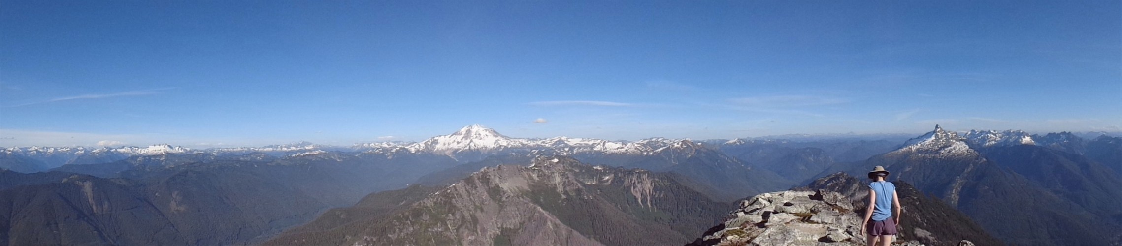
Bright and starry eyed group ready for the climb
You could say that my first ‘hike’ in Washington State was a climb up Mt. Rainier. A week after moving here last August, I got a message from IMG on Wednesday. Someone had dropped off the team, I was on the waiting list, and if I was in good shape, meet them on Thursday night to go climb the mountain. Of course I said yes, learned basic snow skills like crampons and self arrest, and had a successful summit. But that’s all I knew. I was your stereotypical “rope up the cattle and lead them to the summit” type client. I was in good shape, but I didn’t understand rock fall, or crevasses, or snow bridges, or why they had us rush across certain areas, or why people were worried about elevation, or the effects elevation could have. The list goes on. I kept calling Disappointment Cleaver “Disappointing Cleavage,” by accident. Anyway, after spending all winter and spring and summer learning more about navigation, roping up, setting up anchors, crevasse rescue, techniques to deal with thin air, you name it, I was desperately hoping to have a chance to go up Rainier again. And here it was. Mt. Rainier, 7/31/2015-8/2/2015.
- Distance: ~17 miles round trip
- Elevation gain: ~9000ft from Paradise
- Weather: Impossible question. 70’s and sunny to 30’s and clear to 30’s and windy and hailing for a hot minute I mean come on. Also smokey from wildfires.
- Commute from Seattle: 2:30
- Did I Trip: Guess what? NOPE! How is that possible, you ask? Miracles
- GPX file: Here, from Ingraham Flats to the crater and back, thanks to John!

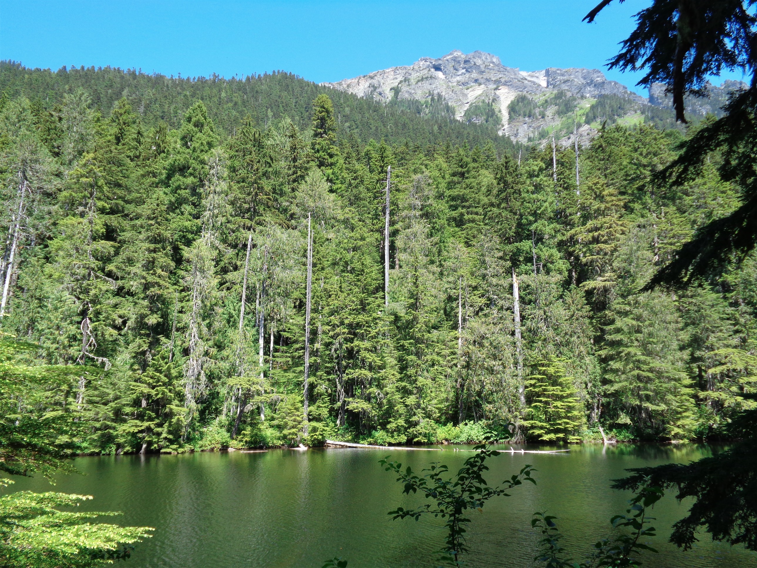
Charles along the trails at Paradise
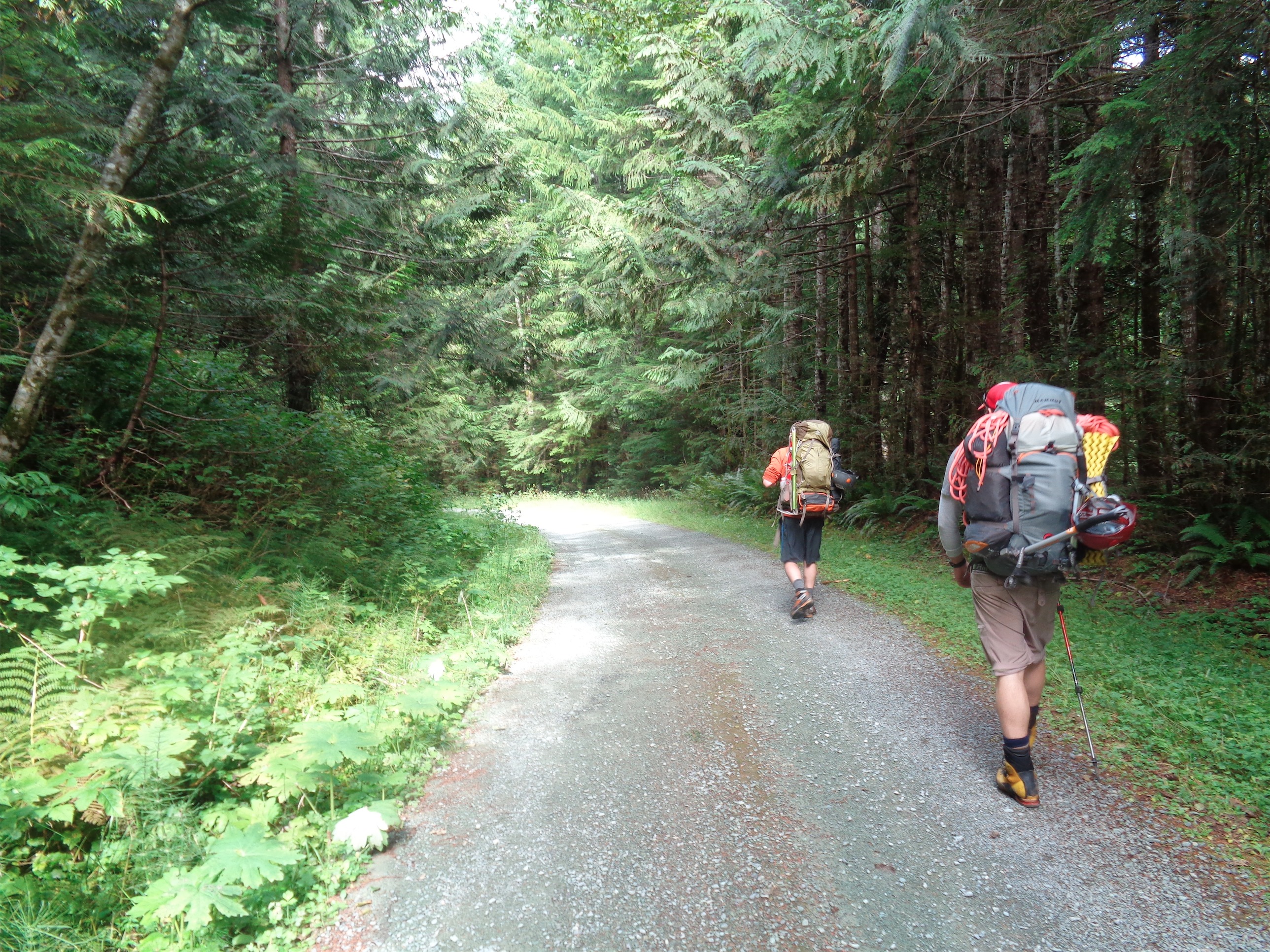
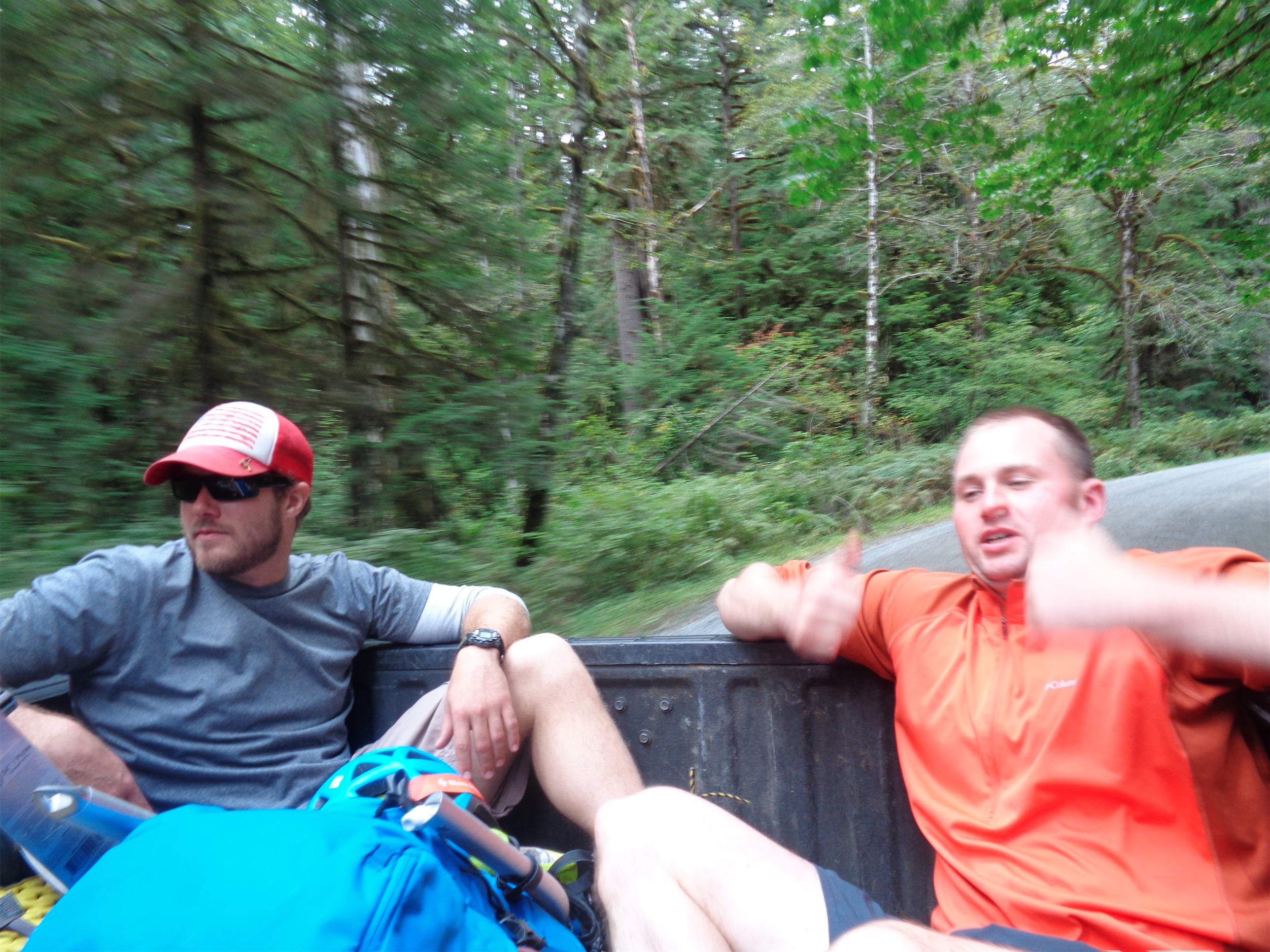
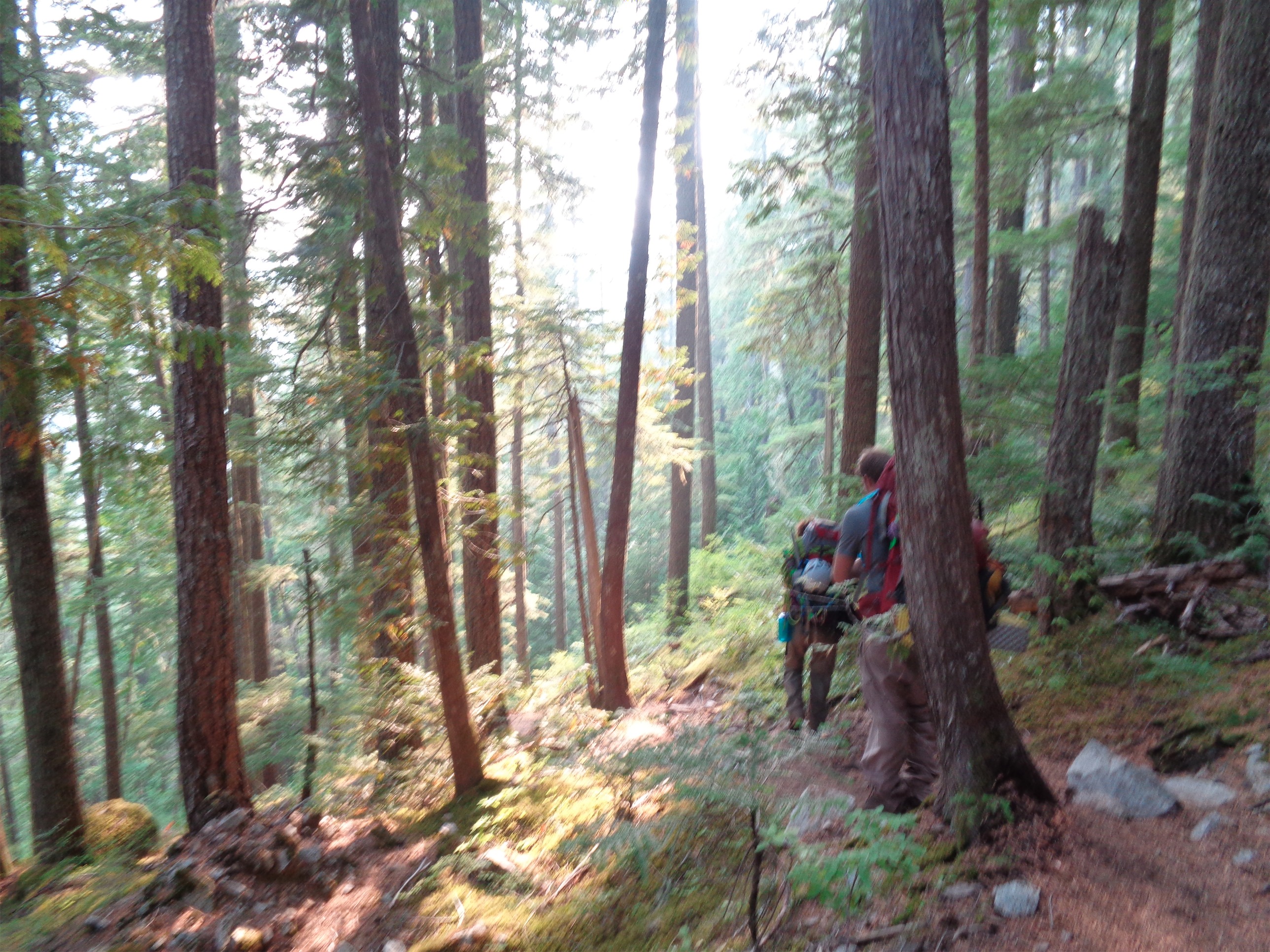
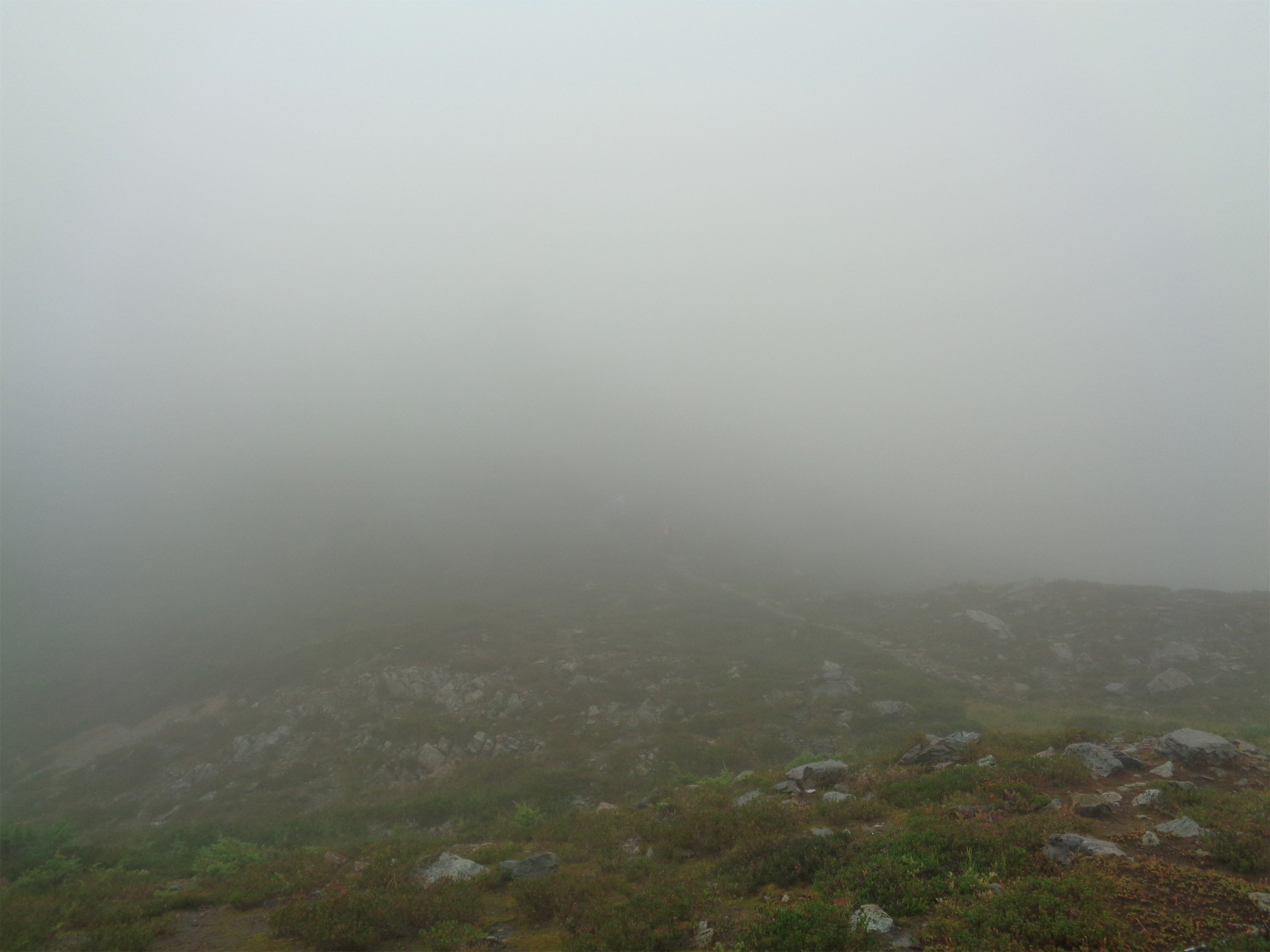
We met at Paradise around 10am to divide group gear and get everyone organized. I was a little anxious. These people had been climbing together for months, and I had never met any of them. But Michael and Jae were both very talkative and outgoing on the drive there (we met up at a park n ride to head south). By the time we got there, I had already confessed to my awkward years of Korean soap operas, so you could say the ice had been broken. I decided I’d try to keep the snark and sarcasm to a minimum for the first day at least, so they wouldn’t think (know?) I was terribly abrasive impatient east coast stereotype.
I savored my last opportunity to use a toilet for three days, we snagged a quick group pic on the stairs below the entrance, and we were off. The first few miles of the trails are paved. They basically built stairs. I remembered being nervous last year, but hey I was in even better shape this year and knew more, so it should go smoothly, right? I lathered sunscreen on my face, my ears, inside my nose, everywhere. I learned the hard way last year. I remember my friend and the guide joking about burning the insides of their nostrils and the roofs of their mouths when they’re out of shape, and I laughed. Until two days later, when the inside of my nose was painfully red, swollen, and peeling. 0/10 would not recommend.

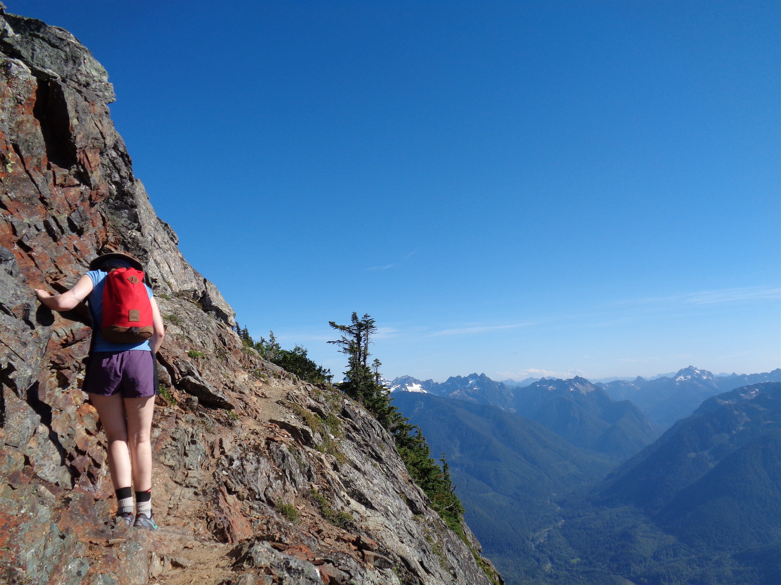
John heading to Muir
The best part about not having guides was being able to set your own pace. Once we hit the snowfield, I trailed John up to Camp Muir. Slow, steady, and very few breaks. That’s my style. None of the “try really hard and then break for ten minutes!!!” streaks. Pacing is absolutely something I knew I needed to work on. I knew I’d be the overzealous “let’s go faster!!” type and risk burning myself out by Sunday, so I tried to be overly conscious of that flaw and keep myself in check. I had heard I could trust John’s pace, so I stuck with it.

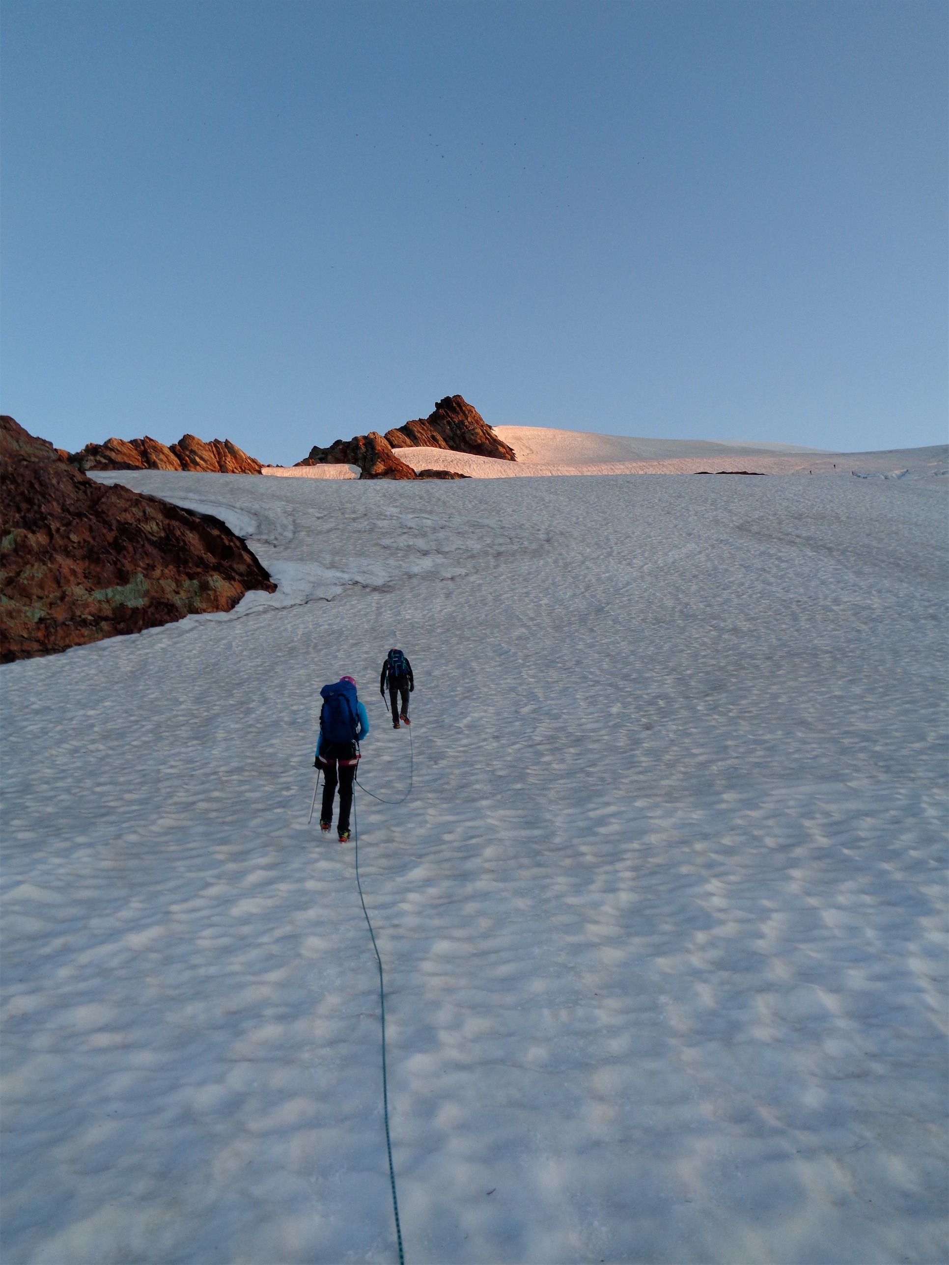
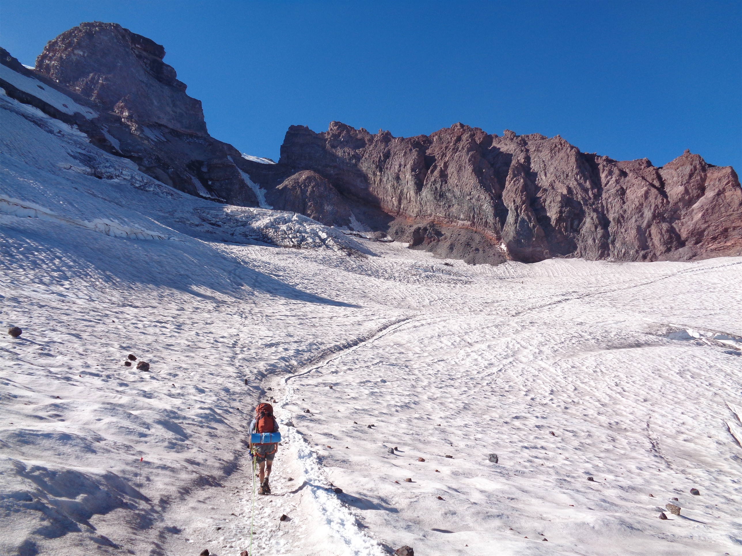
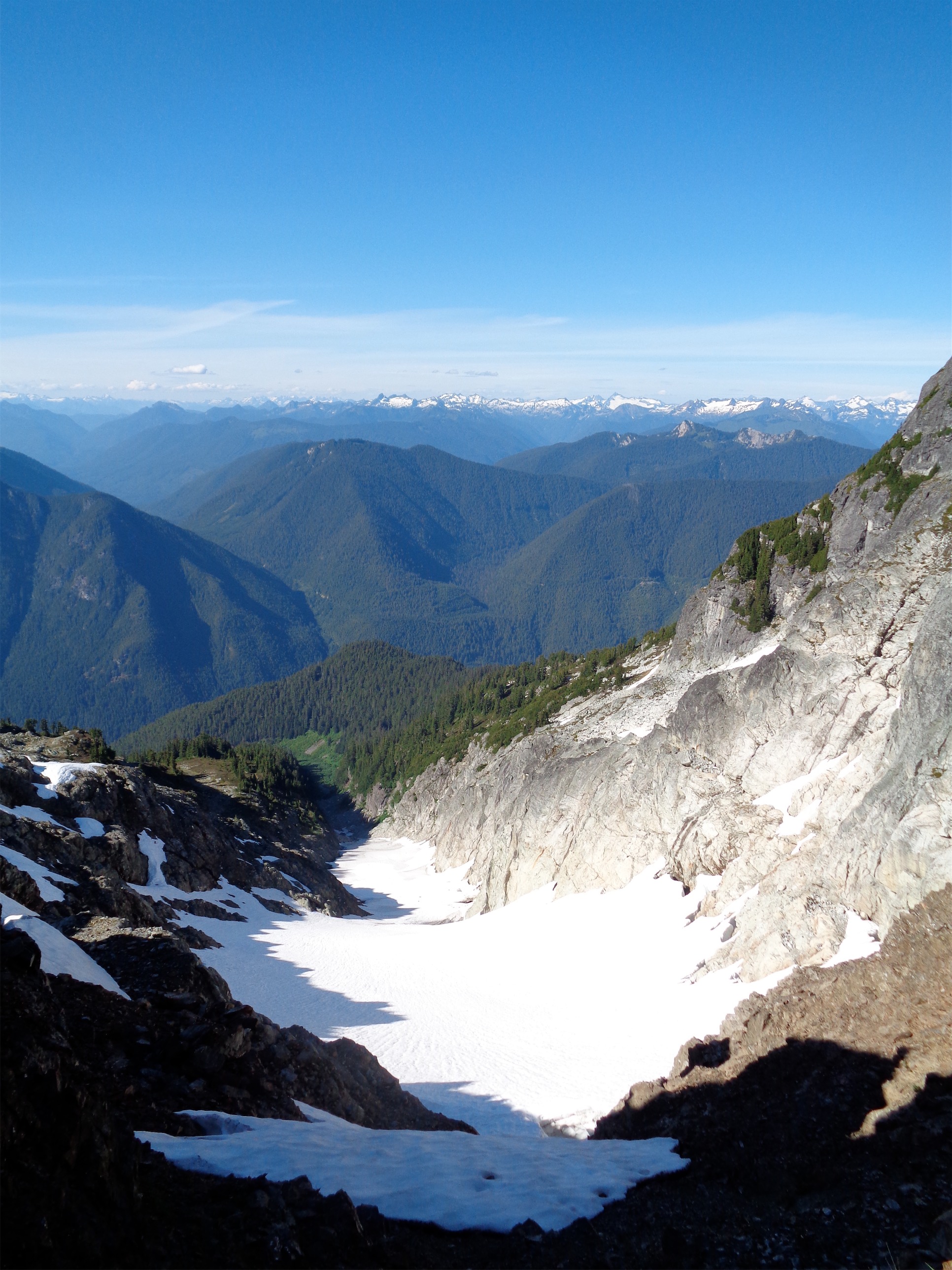
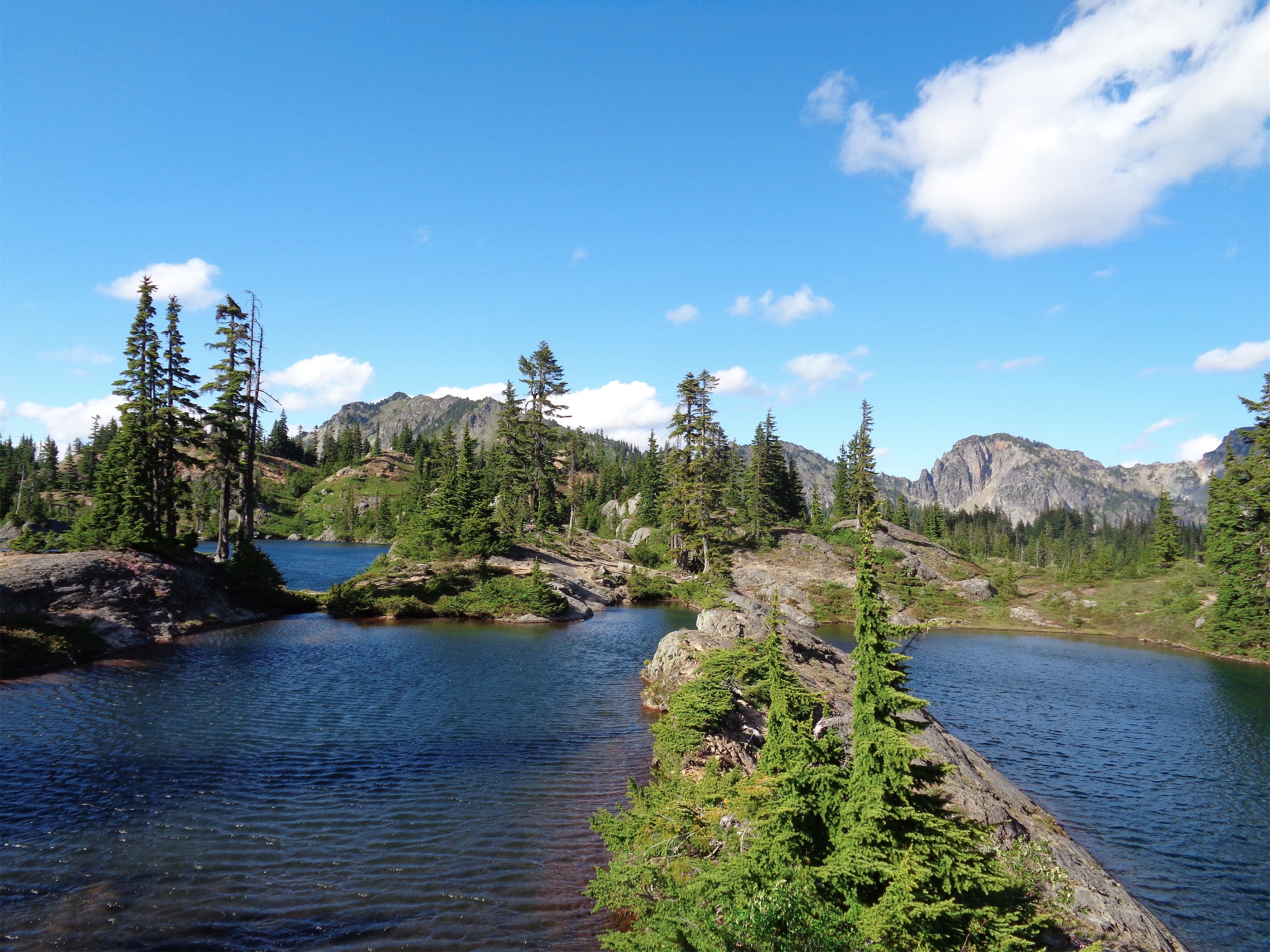
Finally on the glacier headed towards Cathedral Gap
I was more mentally prepared this year, as well. I knew once we saw Muir, we’d still be like an hour away. Yep, still true. The snowfield was ridiculously melted out, though. You probably could have scrambled most of the way if you really wanted to. We arrived at Muir, and set our stuff down to wait for the rest of the group. I savored my last time using a pit toilet for the next two days (recurring theme already, huh), had some snacks, and took pictures of Sam, a guy who was tangentially with our group but snowboarding down from Muir. As the pro photographer that I am, naturally I didn’t realize his camera was actually turned off for his first few runs, so it took a couple tries.

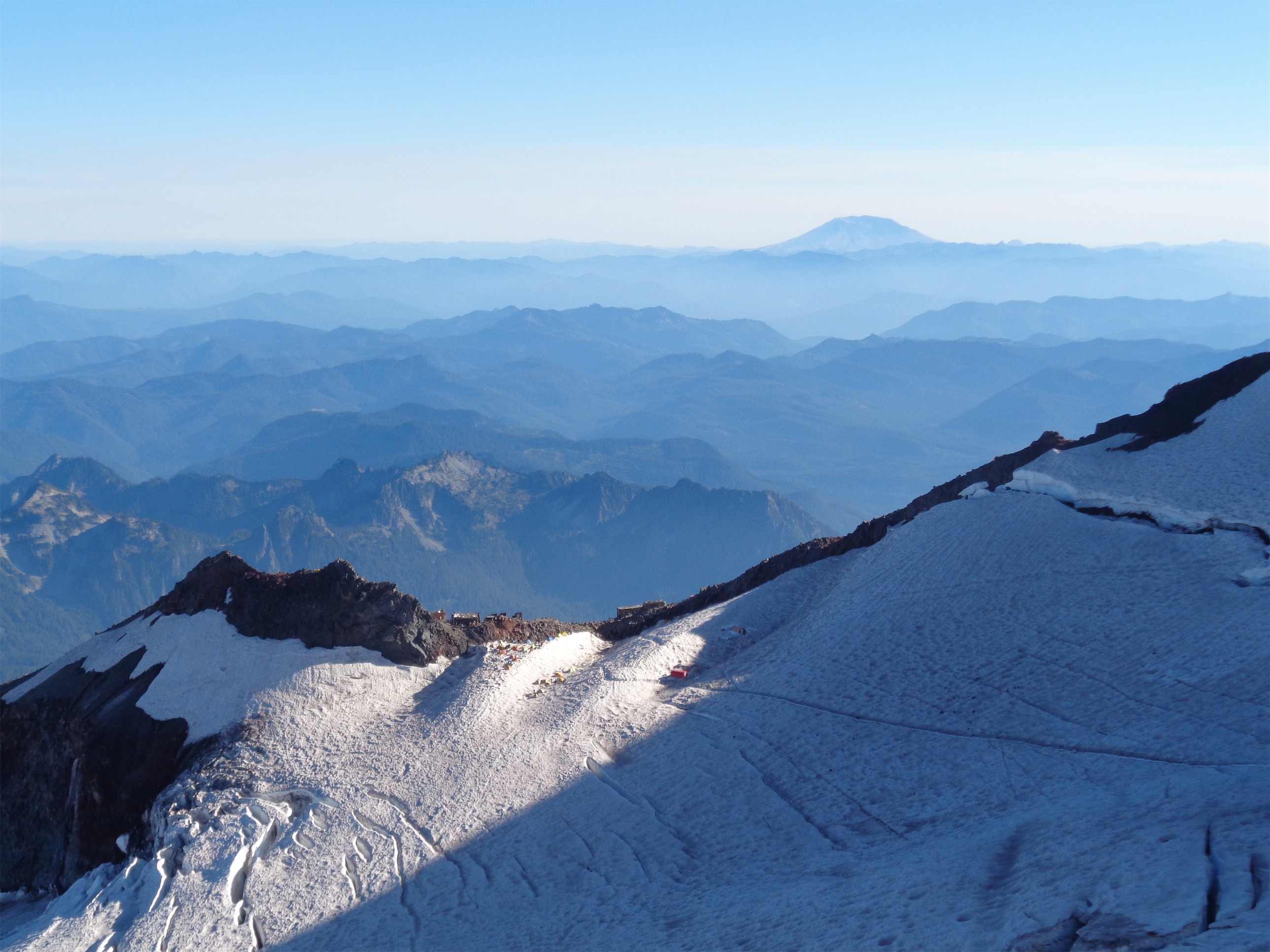
Looking down on Muir from Cathedral Gap, St. Helens in the background
Once the group had reached us, we set out towards Ingraham Flats. I’d miss the pit toilet (would I?) but the flats are a more enjoyable place to camp, in my opinion. We roped up, slowly, in two teams of four. John’s rope is a freaking behemoth of a rope (70m!) so we had plenty of extra to carry. Charles was a trooper, carrying the whole damn thing all the way up. I think he, John, and Michael had packs that were well over 50 pounds. Mine turned out to be around 40 by their estimate, which was great – I had never weighed it before, so I had no idea how efficient my gear was weightwise. But 40 including group gear is pretty damn good. And probably explains why I never got too tired.

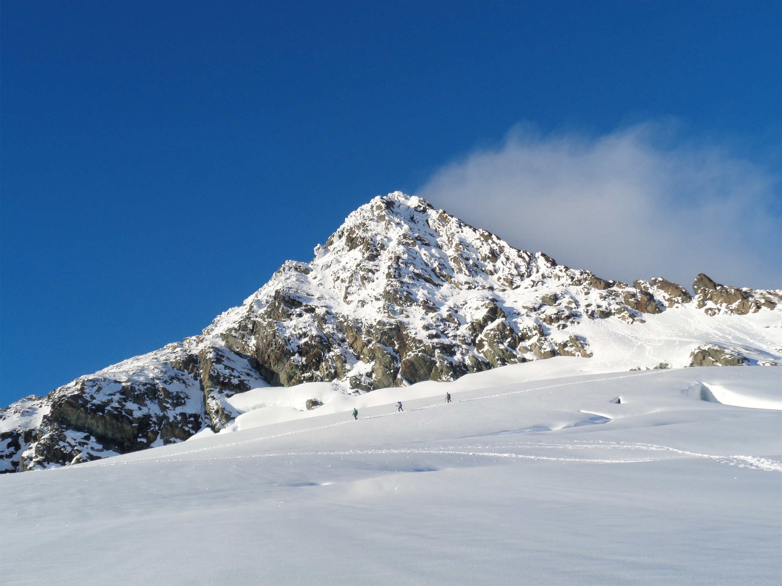
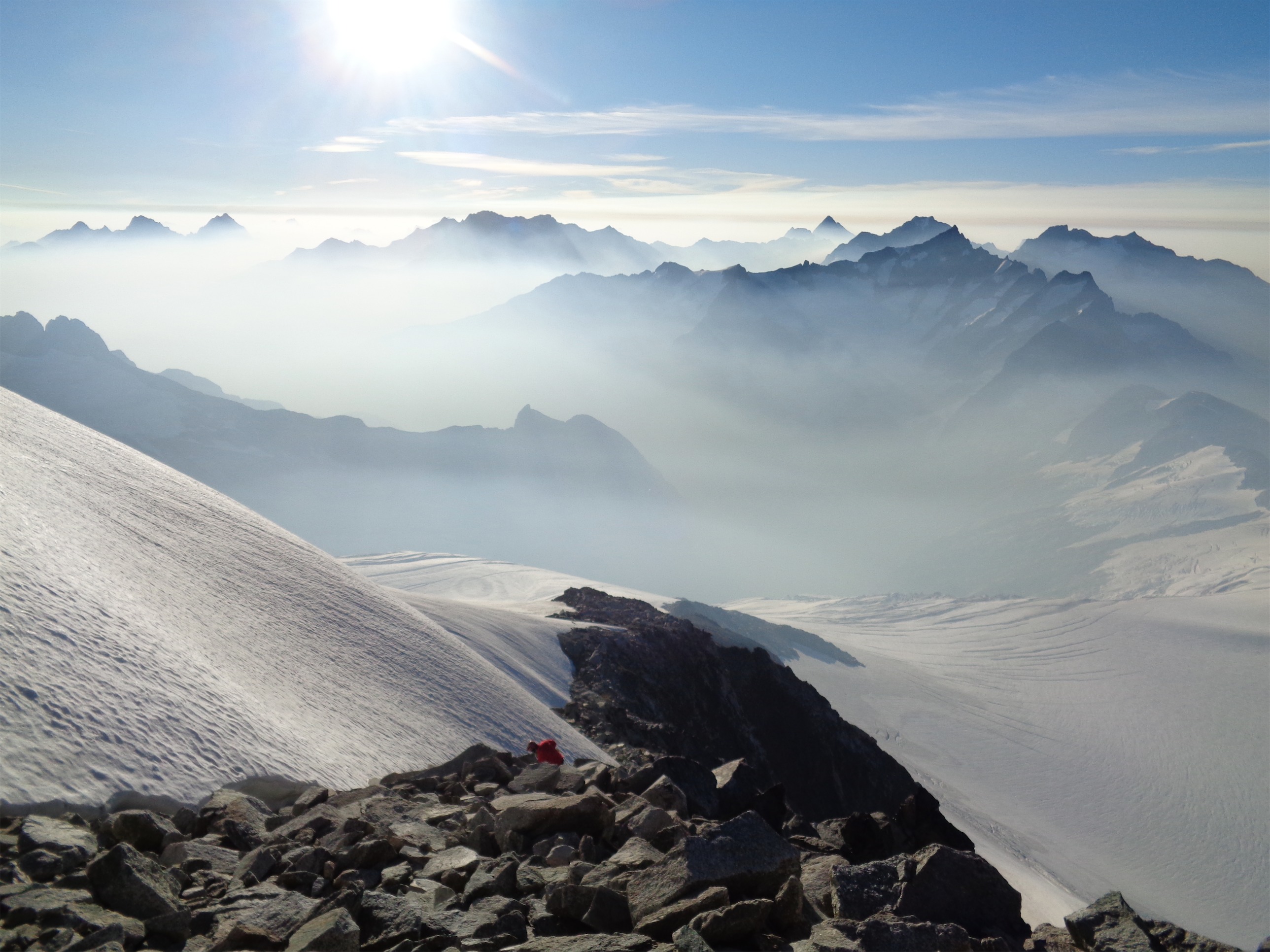
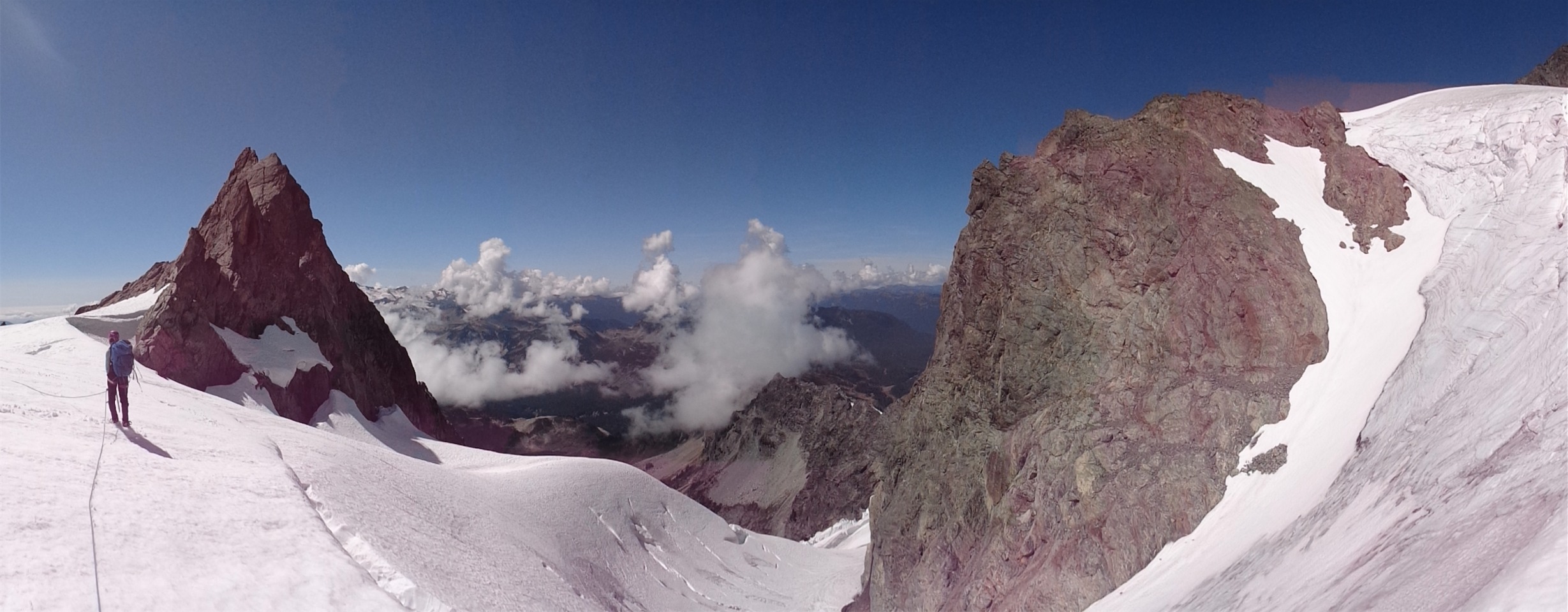
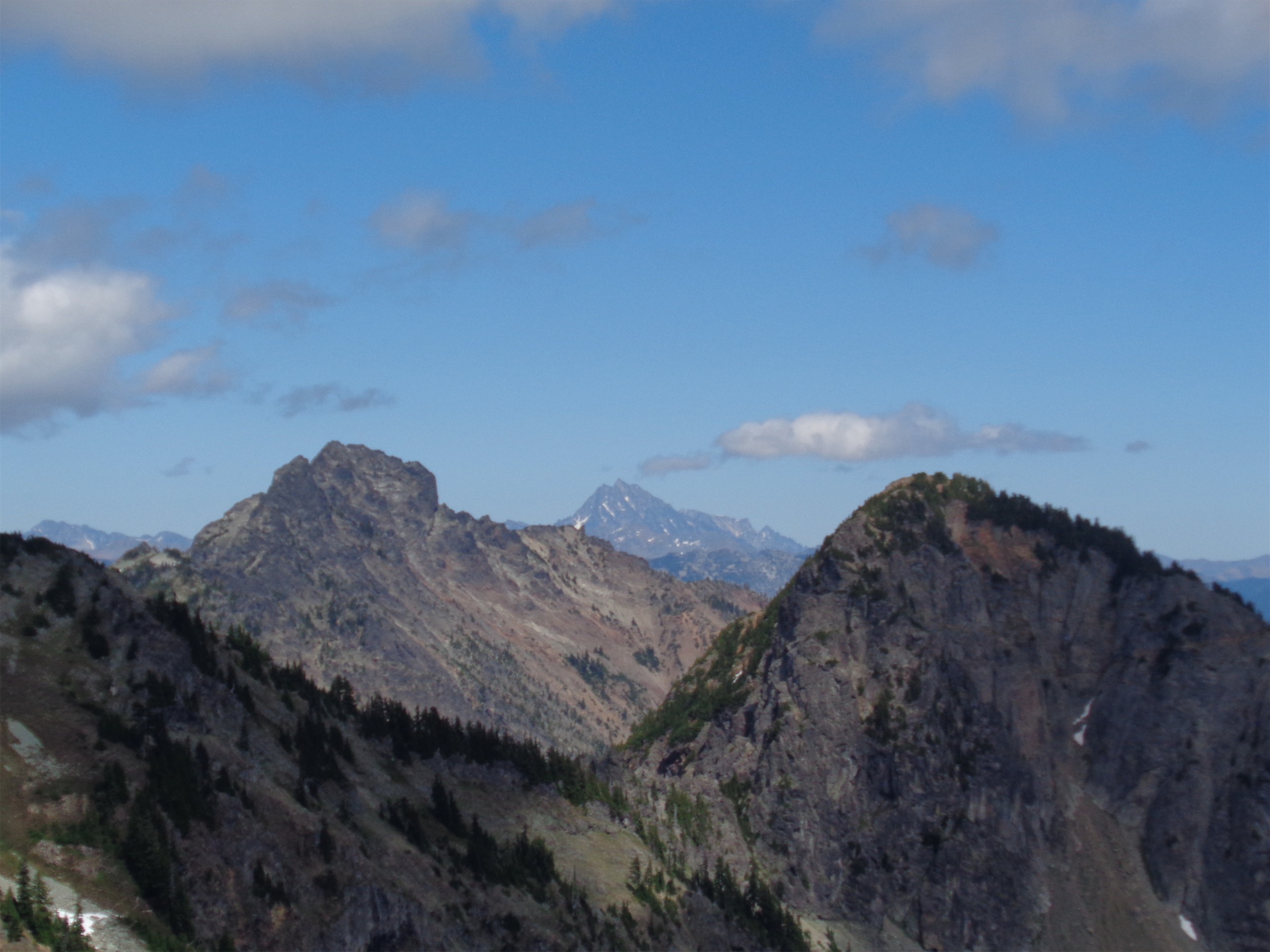
Little Tahoma
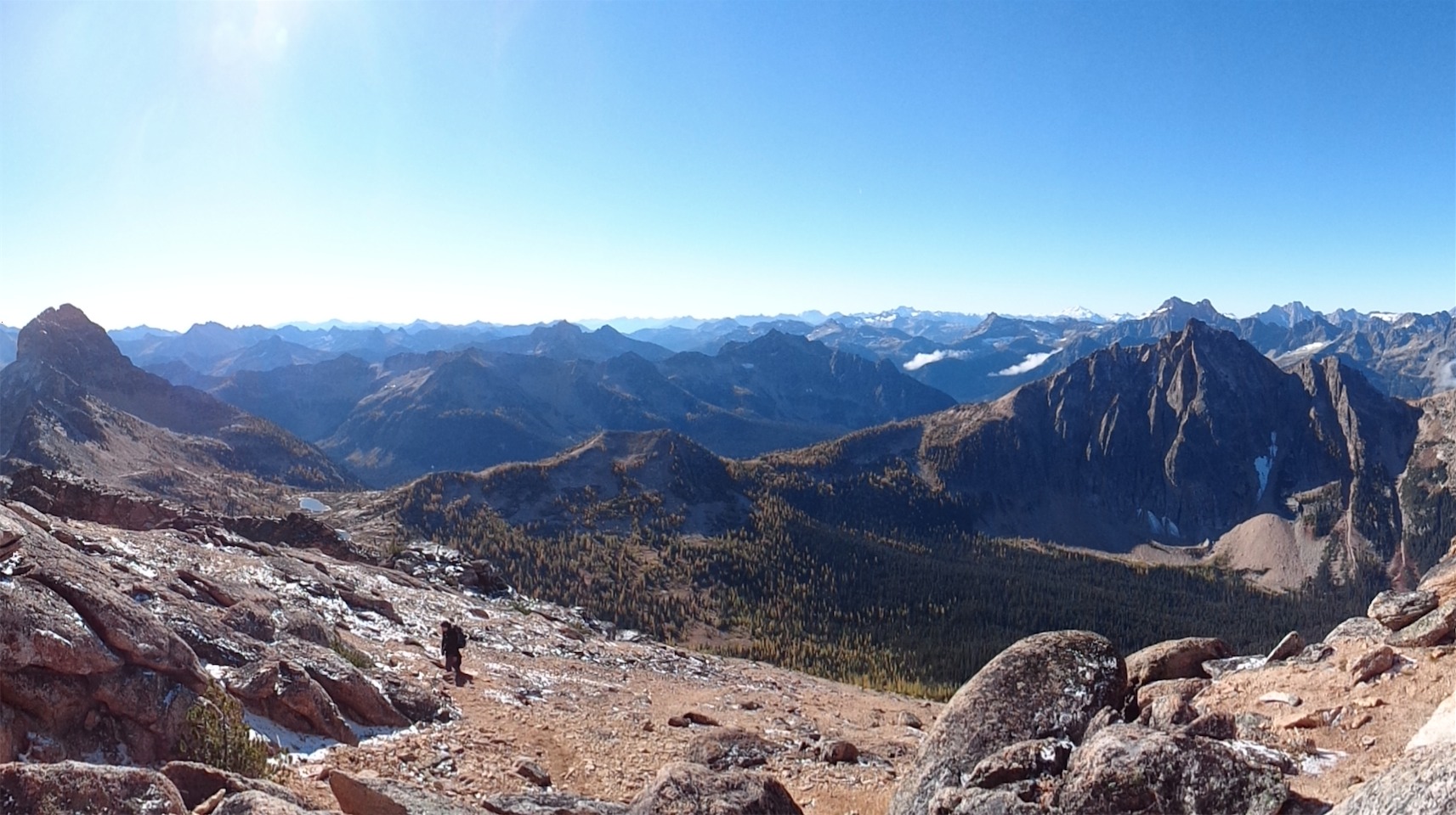
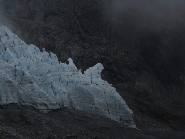
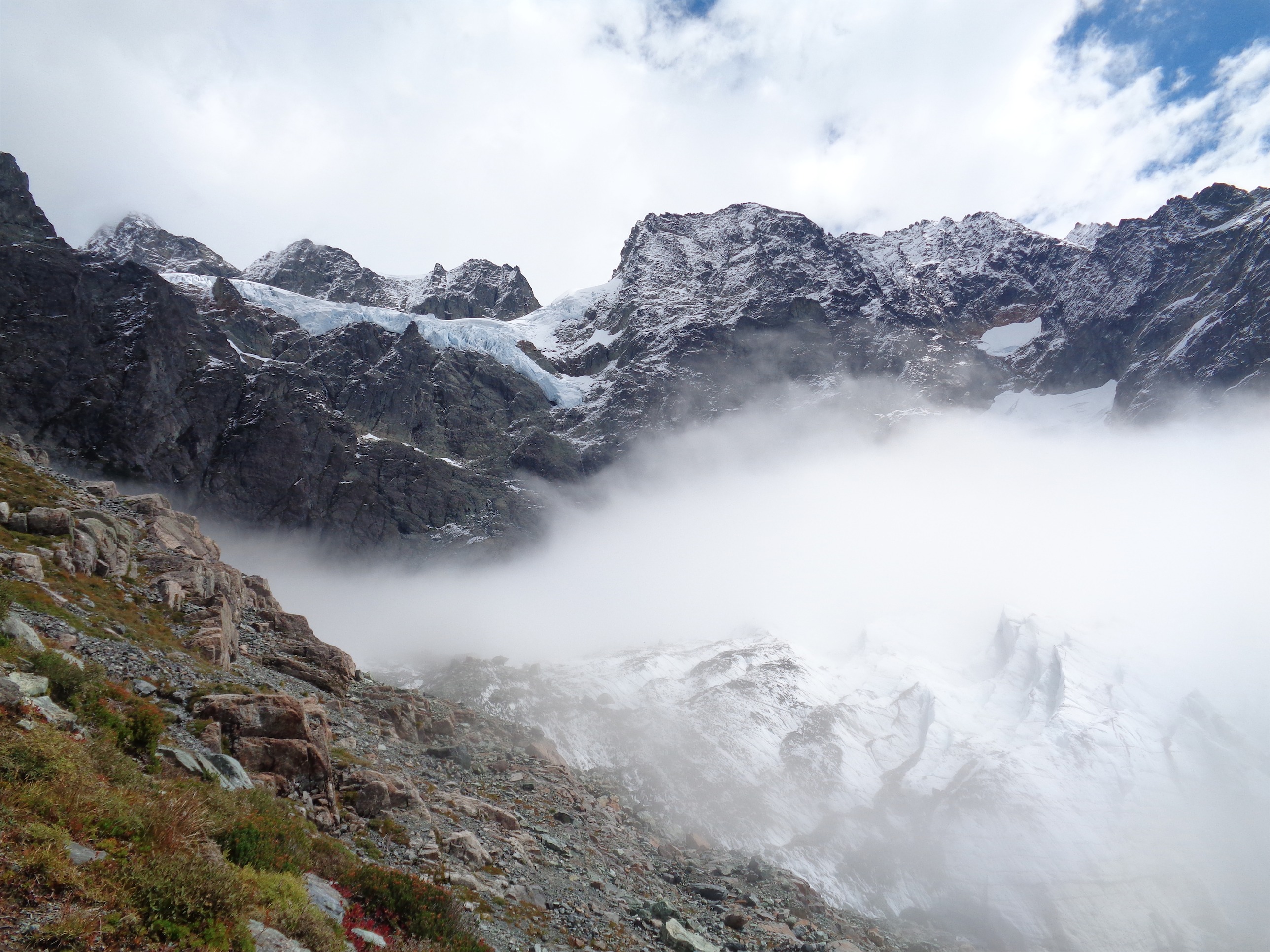
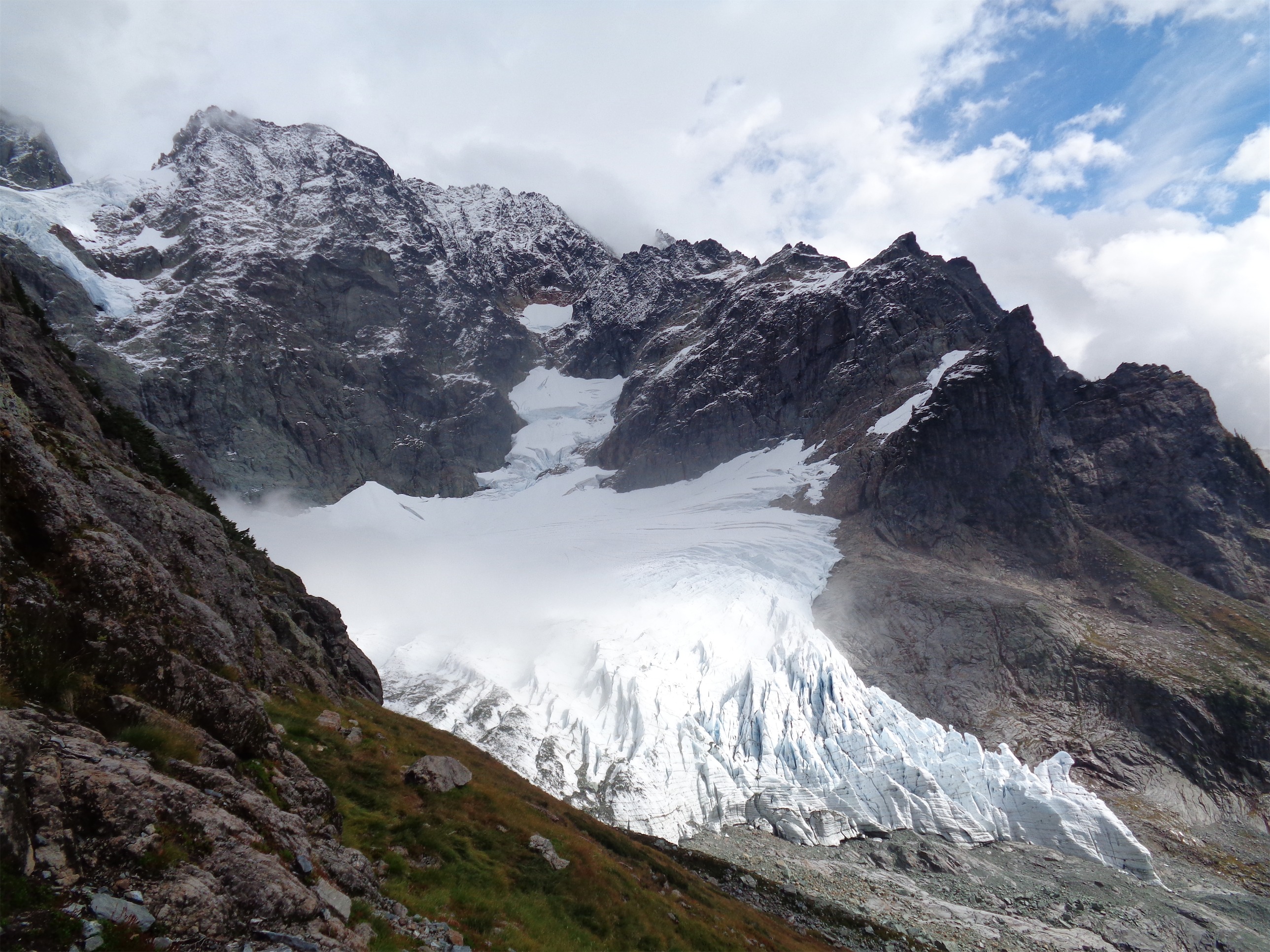
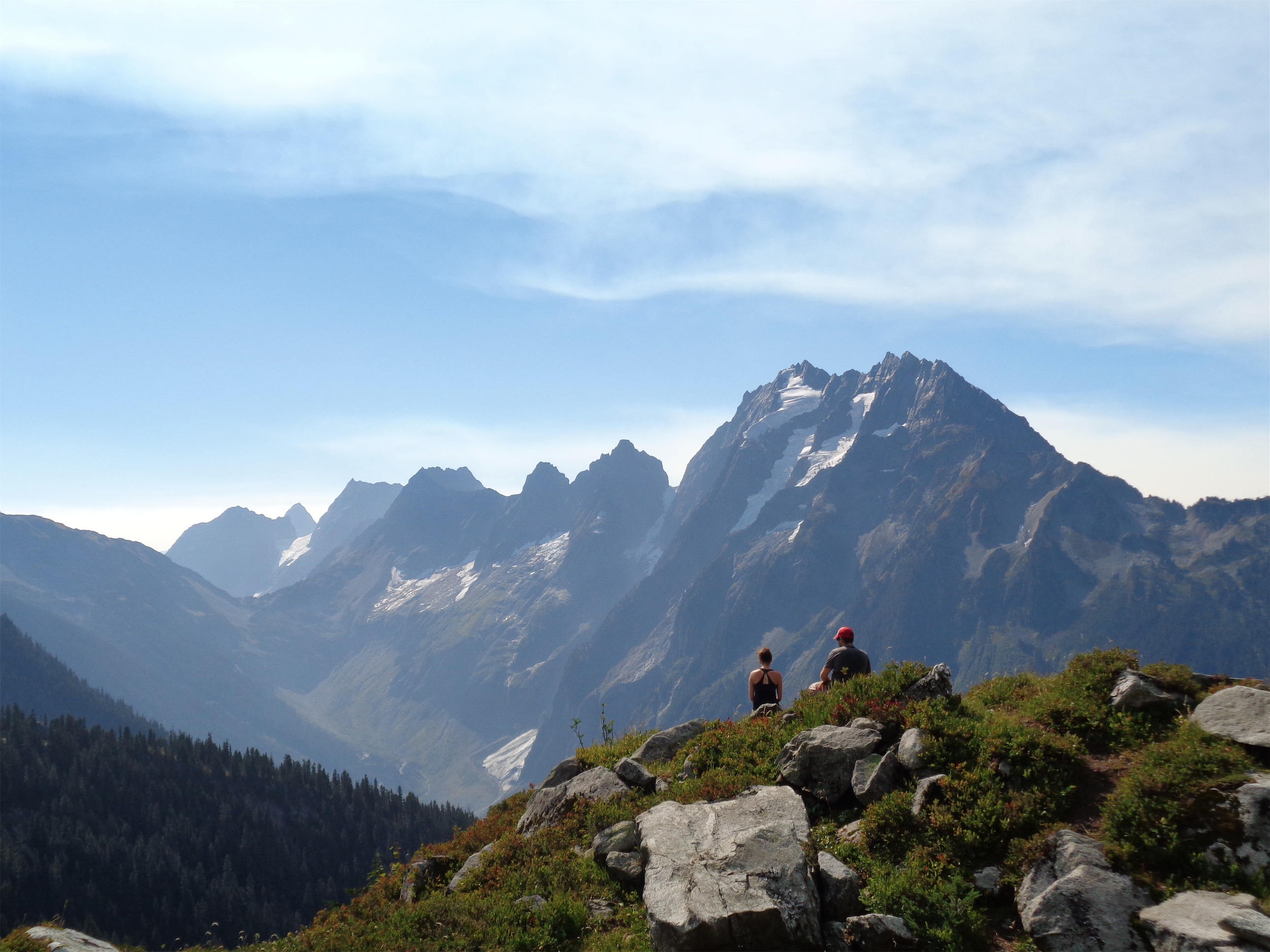
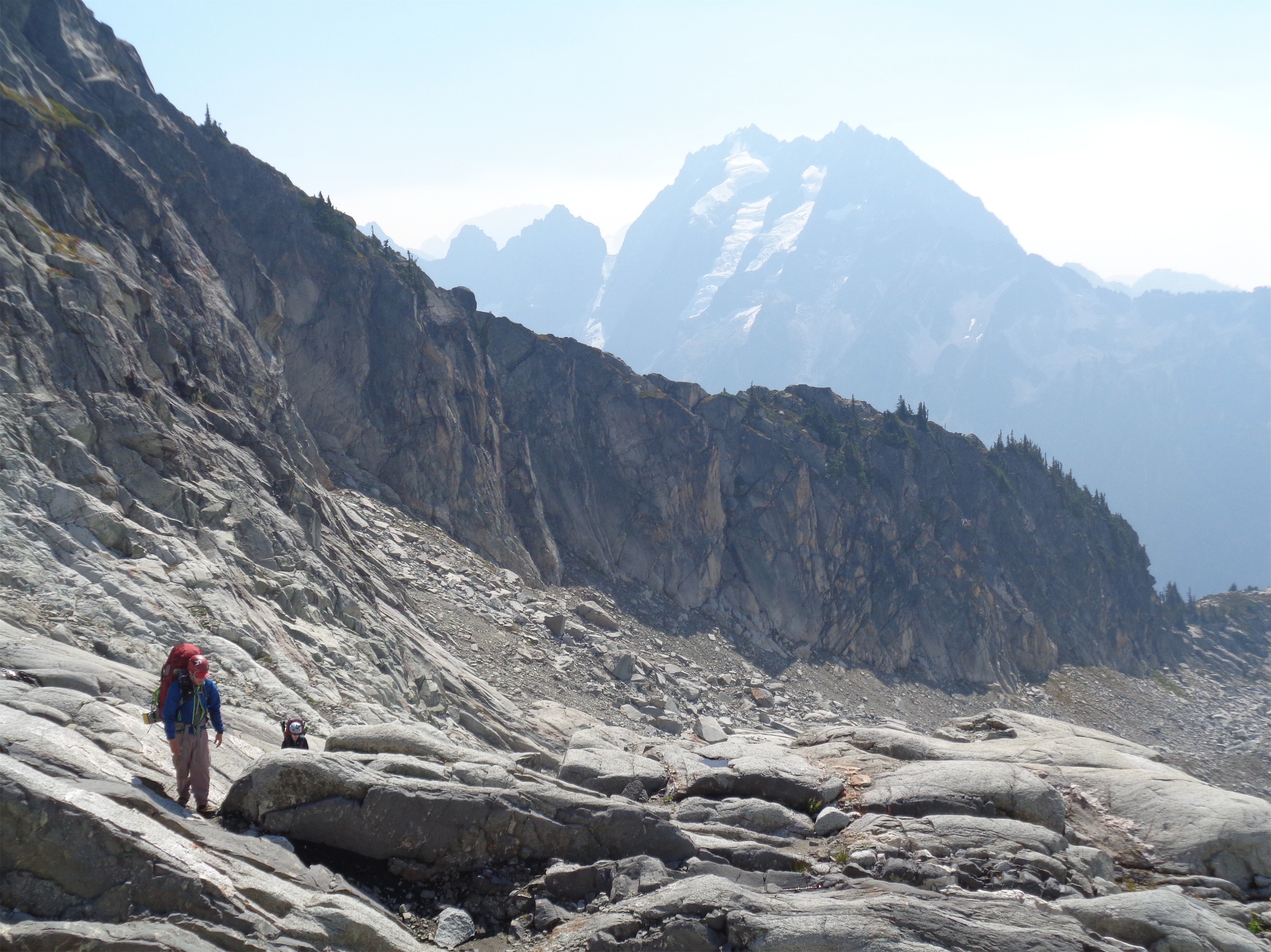
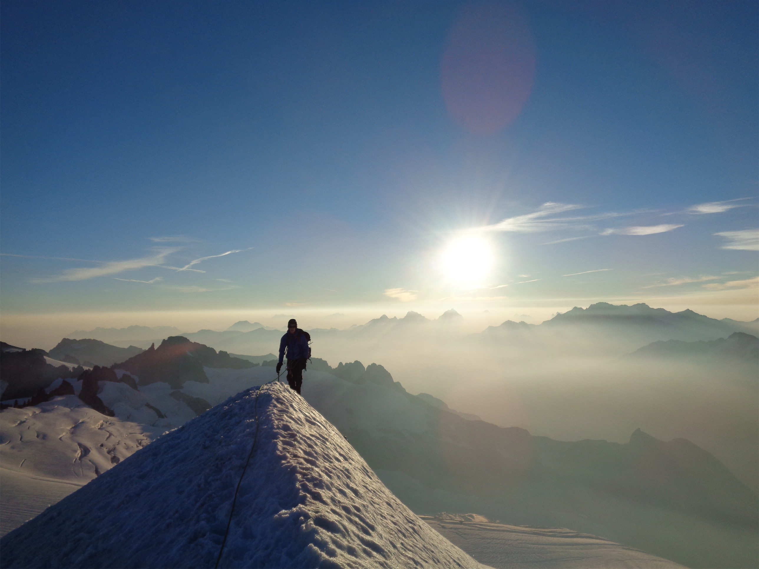
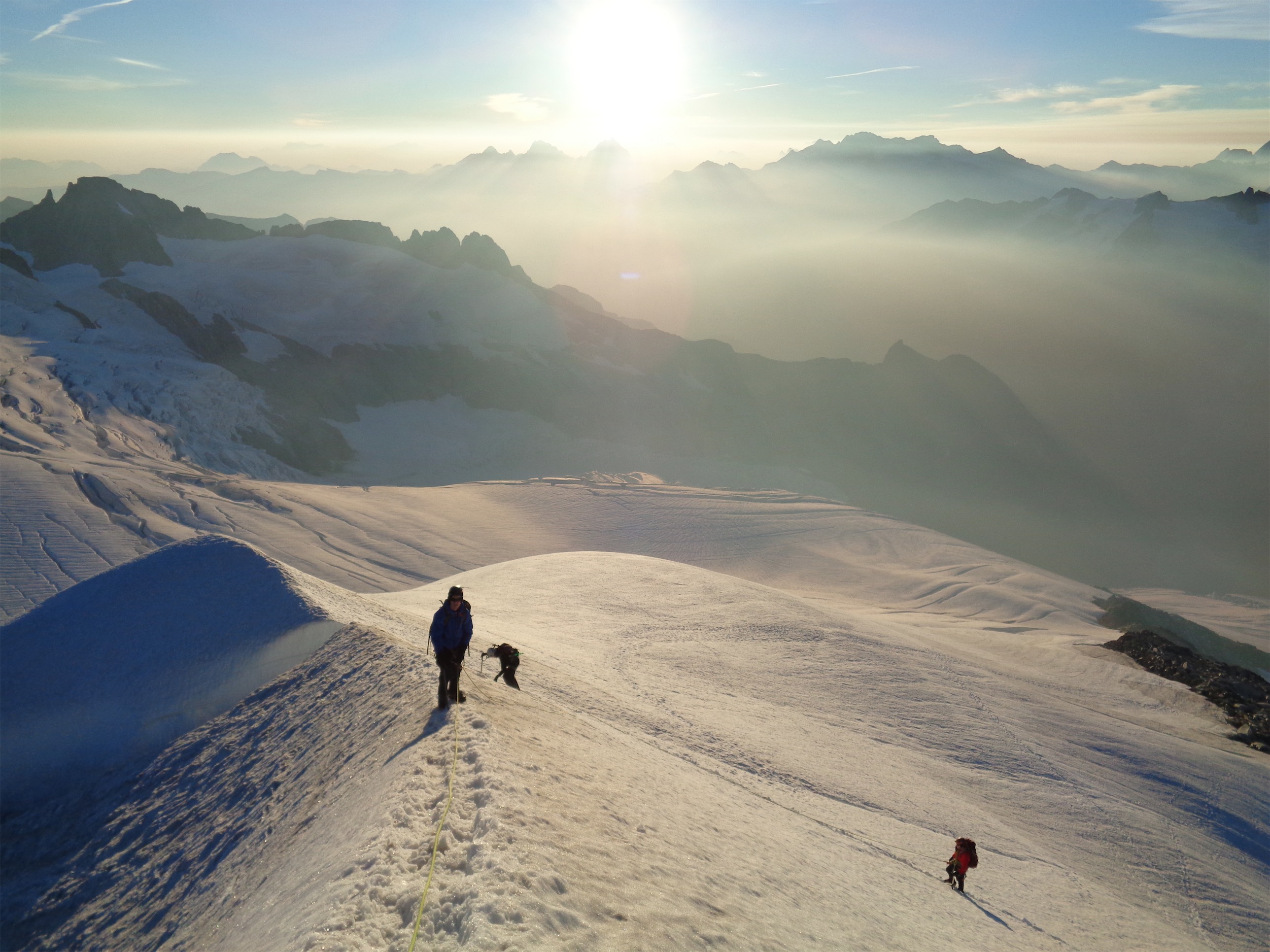
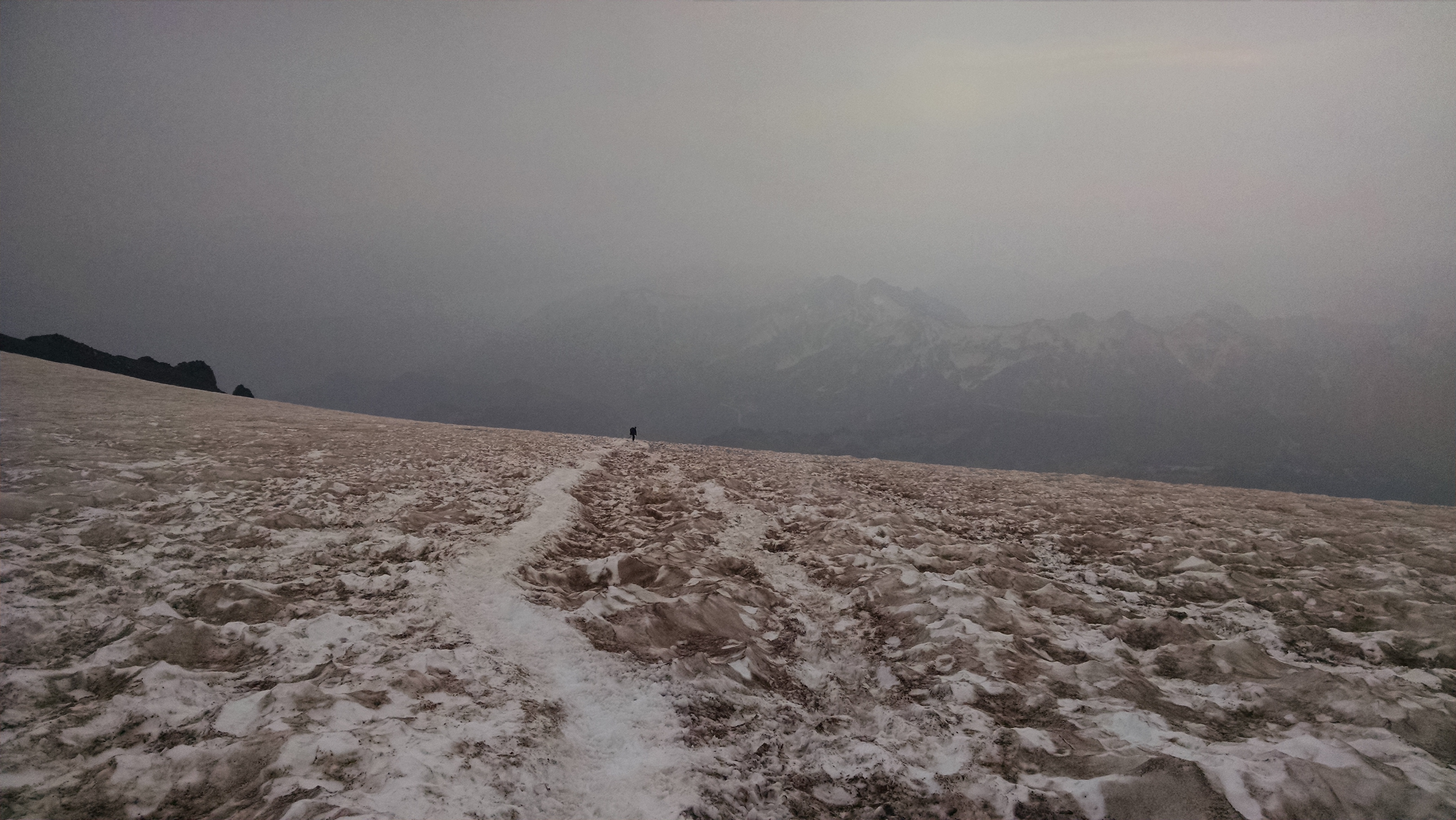
I never realize how much elevation you gain between Muir and the Flats, but it’s apparent when you get to Cathedral Gap and look back down on Muir that you’re quite a bit higher. Crevasses were pretty open very close to Muir, but the route was so well traveled that many people weren’t roping up. We still did, of course, I’m not about to play around with that stuff just yet. Past Muir, you cross a dicey rock fall area. It’s one of the areas that the guides last year had us nearly run across, but my group didn’t alter speed too much. Cathedral Gap was mostly just hiking up a trail of scree. We shortened the rope for that area and carried the coils with us. The best thing about Cathedral Gap that I didn’t appreciate last year is that feeling of getting to the top, since it’s a small ridge. Suddenly Little Tahoma is right in front of you over the Ingraham Glacier, and Glacier Peak is far in the background. You can see ice fall and crevasses and seracs and the contrast of ice and rock is just breathtaking, not to mention we had perfect timing because the sun had slipped behind Rainier and just Little Tahoma was lit up while everything else was in shadows.

Almost there!

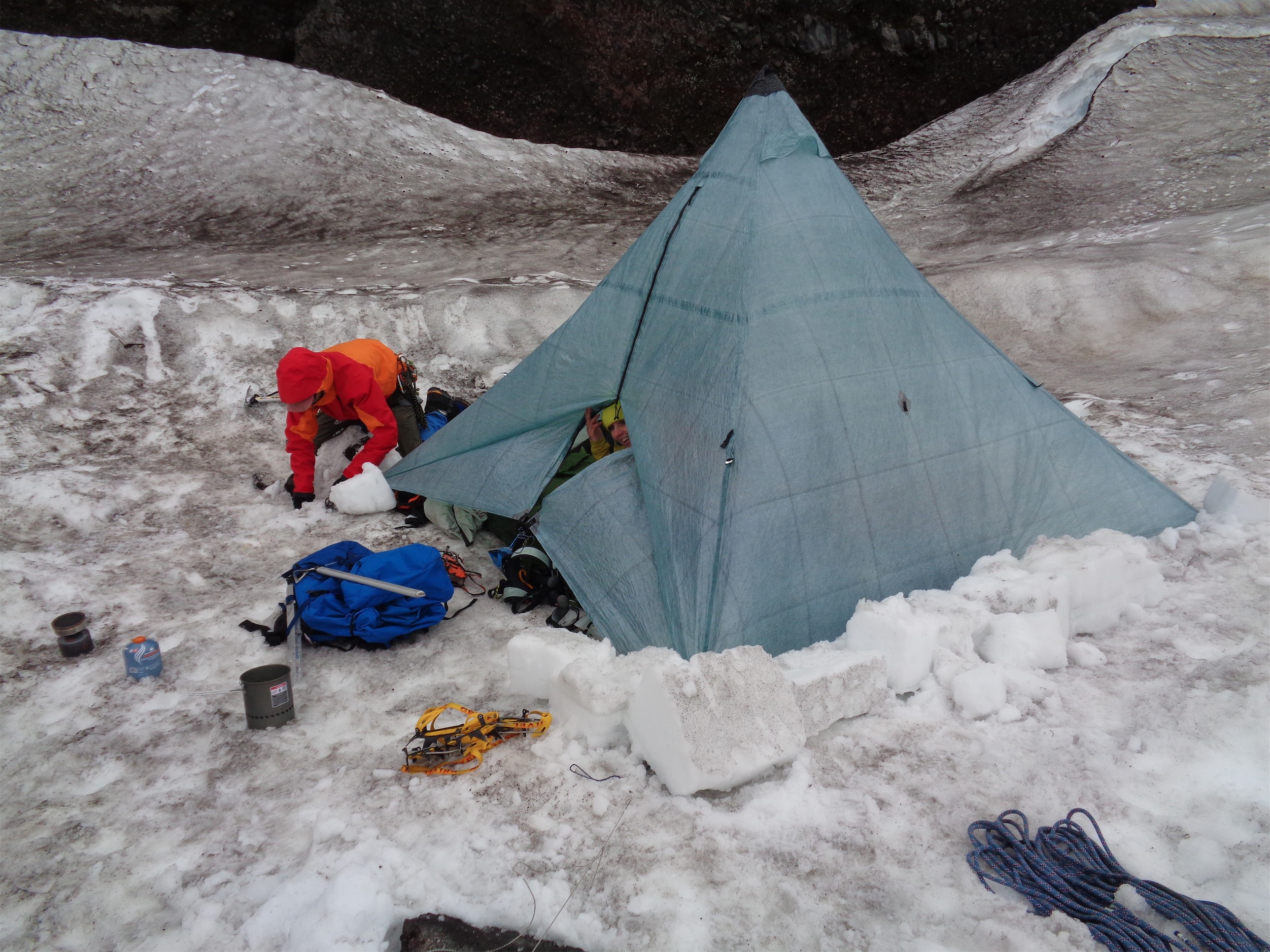
Jae working on our tent platform
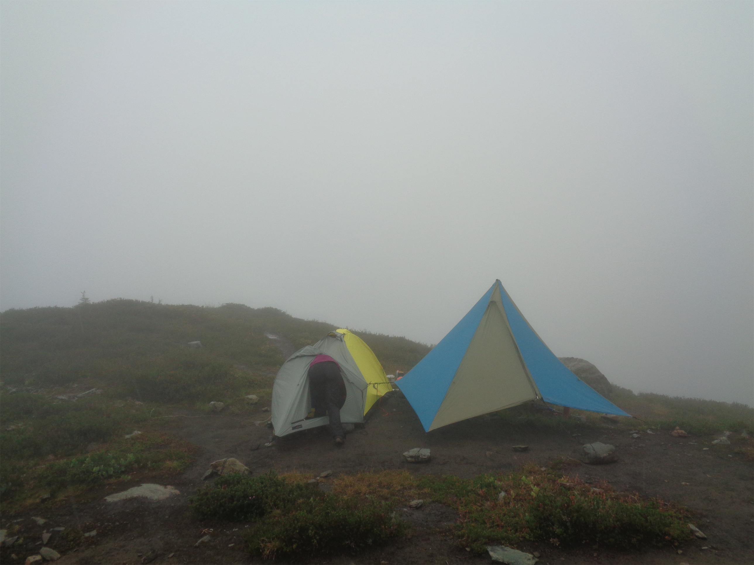
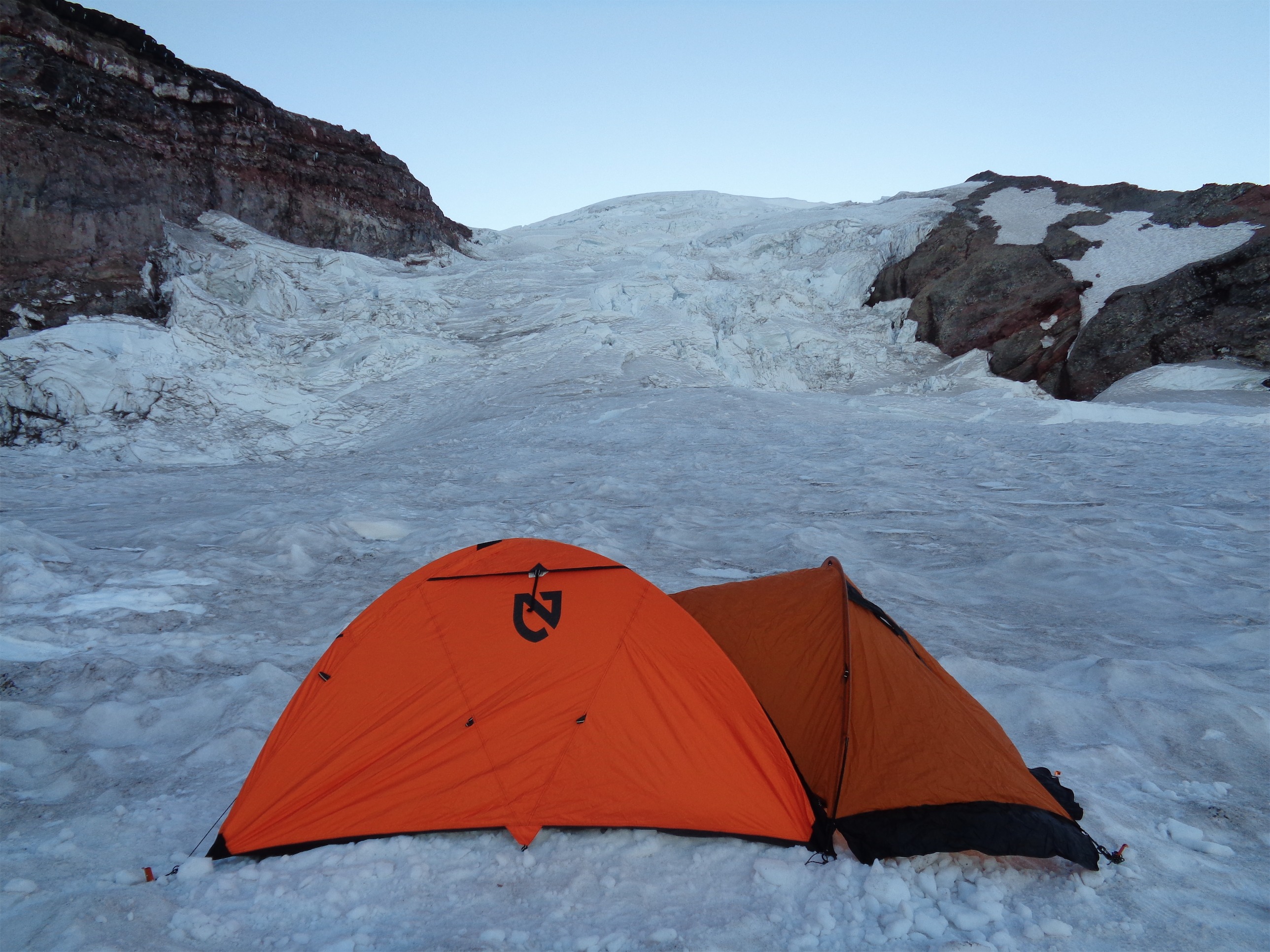
Getting to Ingraham Flats, we realized just how late in the day it was. The top of the snow had nearly frozen over, and digging wasn’t going to be a great way to clear tent platforms. We ended up chopping it all up with our axes and using the shovels to level the area once we had chewed it up a bit. What was amazing was how well everyone worked together. I half expected some people to stand around, others to work, that’s how many of my trips have been. But not this group. Charles and I started chopping up ice in areas we thought would be good for tents, Jae joined me to set up our tent space as soon as she had her warm layers on, John started up the stoves to melt the snow that we dug up from underneath the crust, everyone was doing something. Completely without prompting. We had tents up in no time, with water and dinner (dehydrated meals, yum) on the way. I had the Pad Thai by Backcountry Pantry. Highly recommended. Bring extra salt. Ha! Jokes. There’s salt for days in those things. Someone said they were too salty. I don’t know, I’m into it. Salt is delicious.

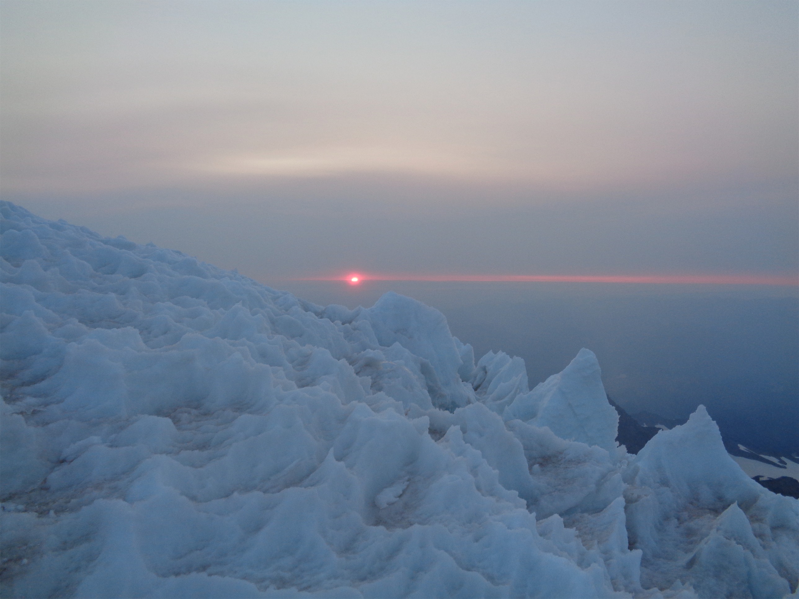
Sunset!
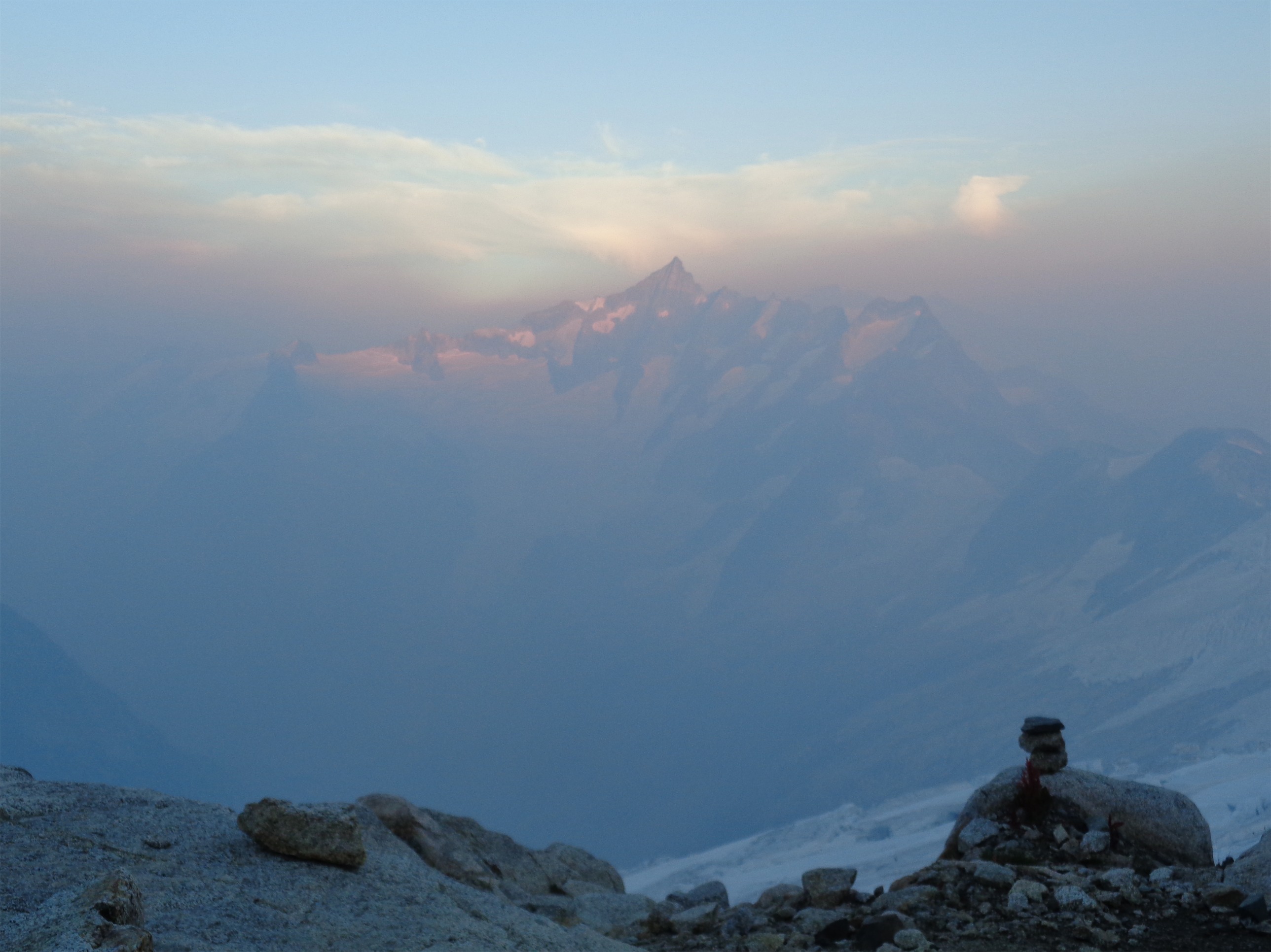
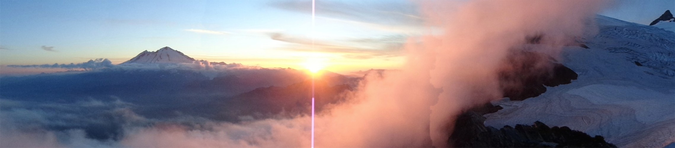
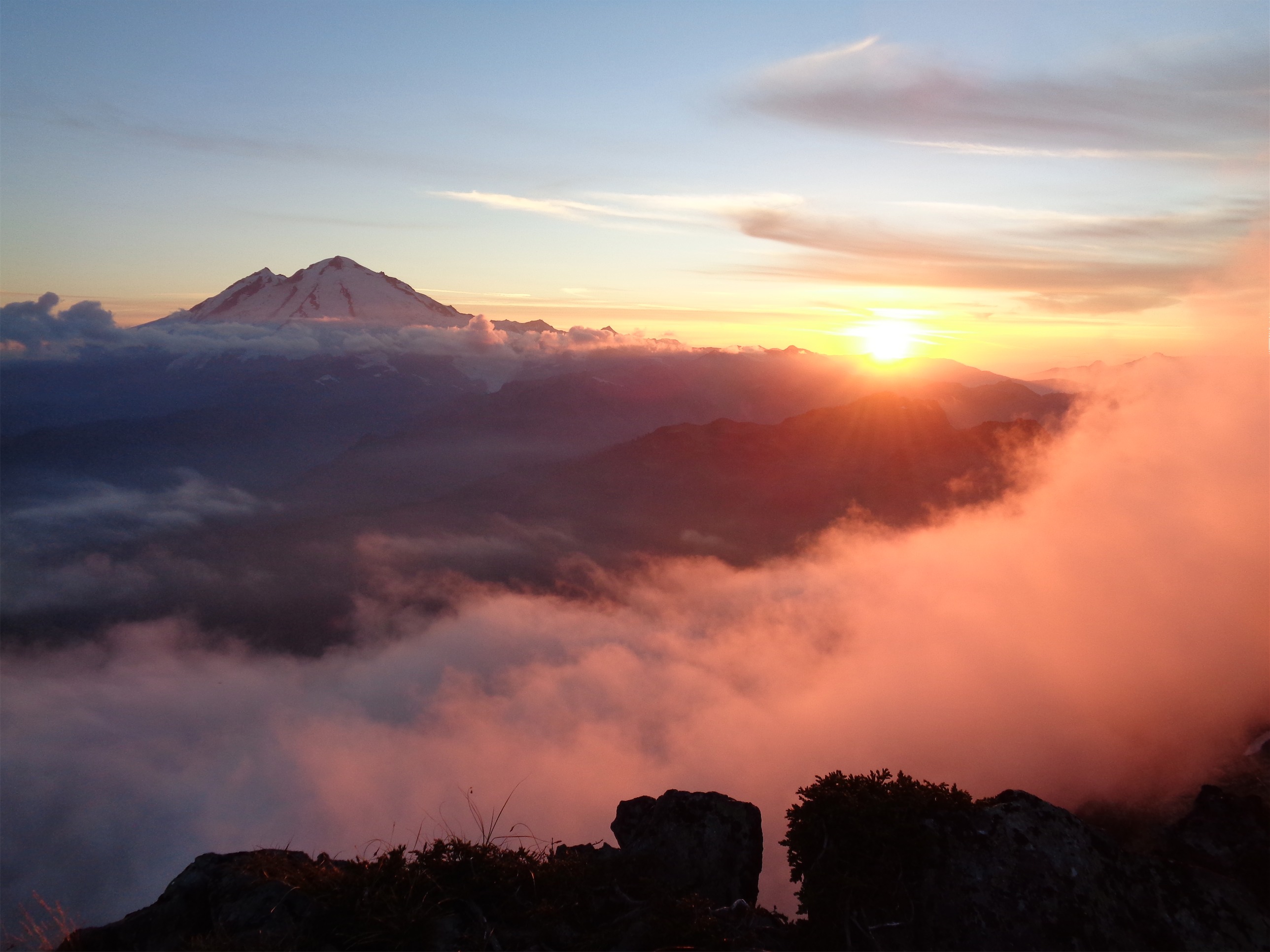
Sunset was unbelievable. The pyramid shadow of the mountain was very cool, and the moon was huge and bright. There had been a blue moon the previous night, I believe, which is neat. And we could see a huge pillar of smoke from a wildfire off in the distance. Fingers crossed: please don’t let this be like Baker, where we end up socked in by smokey haze, unable to see one ridgeline over, with smoke stinging our eyes and throats. I didn’t think much of it at the time. Looked like the plume was spreading east, anyway.

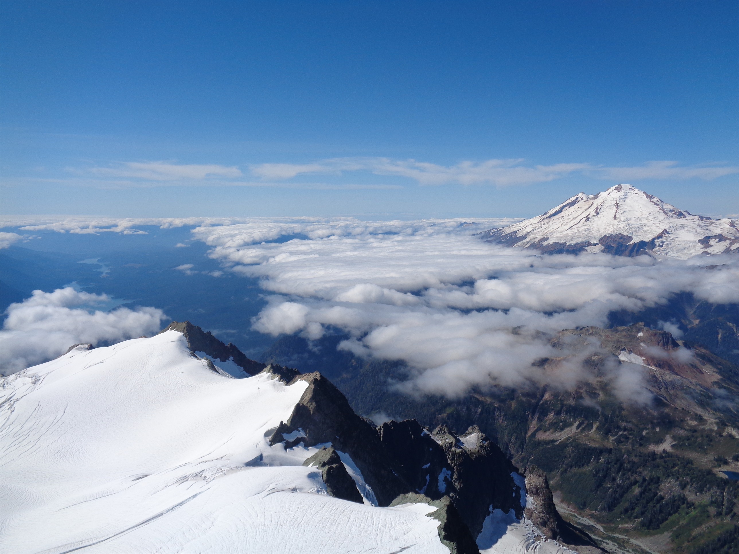
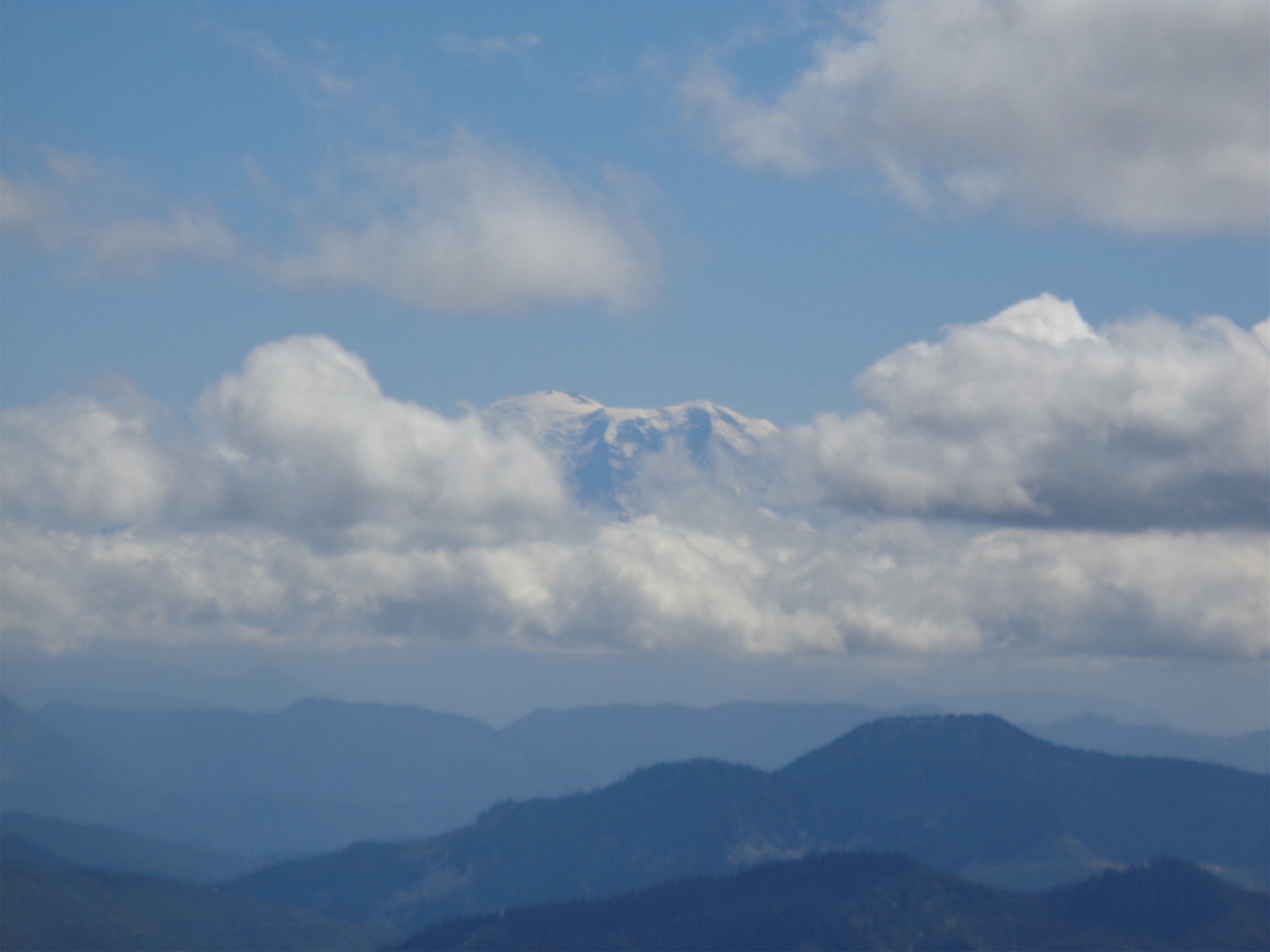
Glacier Peak in the distance, wildfire just out of the frame to the right
What’s neat is now I know the peaks you can see from the flats. I had no idea last year. This year I was pointing them all out. Hey, there’s Stuart! And Cashmere! And Glacier! And is that Summit Chief, and Bear’s Breast? And Daniel? No, Mt. Index? That’s farther west, isn’t it? And of course, Adams, St. Helens, and Hood were all out on the way up to Muir earlier in the day.
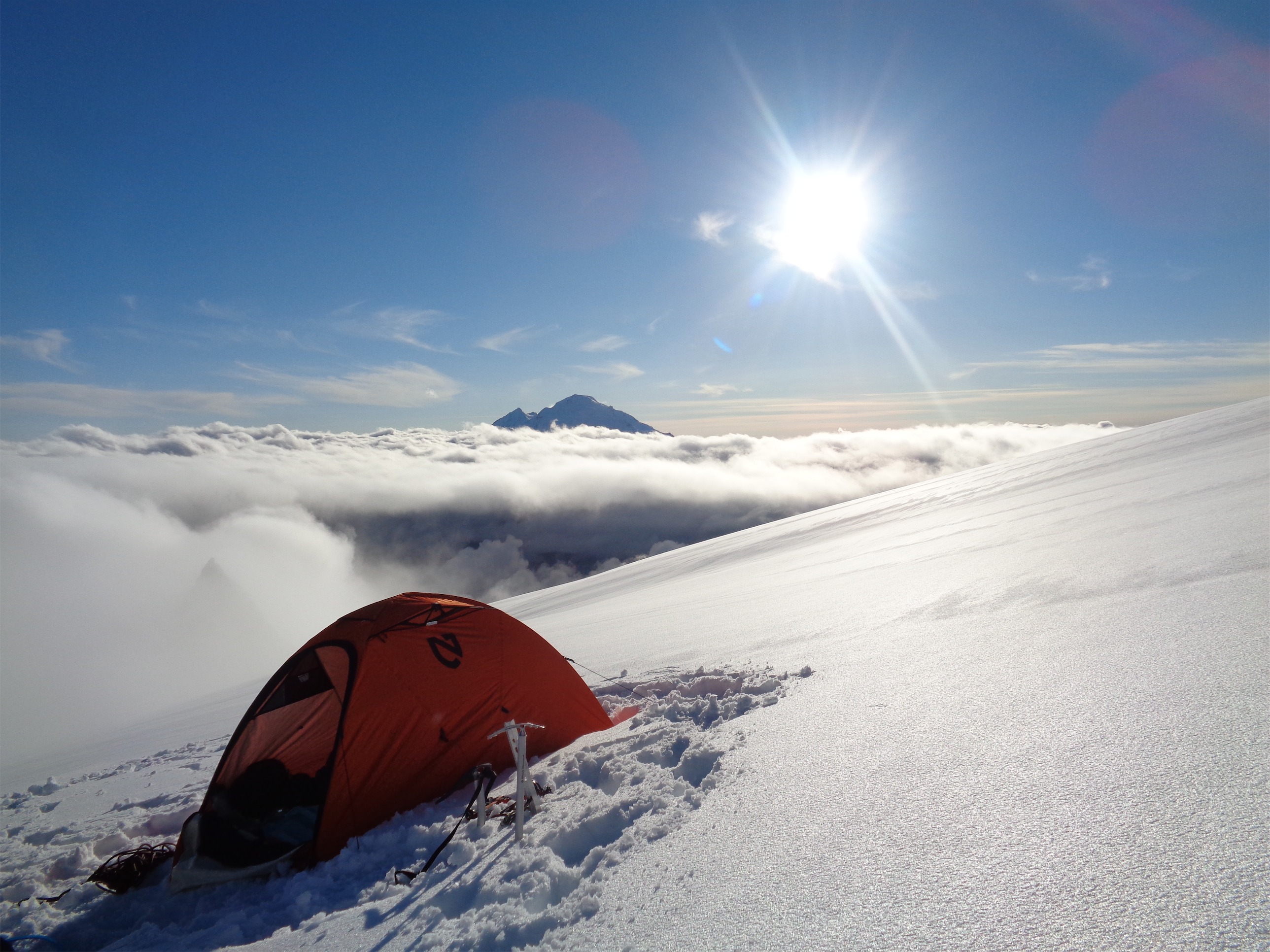
I went to bed around 10, which is late for me on a mountain. Waypoint had let me borrow a sweet, sweet tent (Nemo Tenshi) and it was awesome. Unbelievably easy to set up, and it was fairly warm too, since it was a four season tent. It’s single wall, so I had heard that condensation might be an issue if it rained, but the forecast called for clear. I had a great Nemo sleeping pad too (Cosmo Insulated) which absolutely put every other one I’ve ever used to shame. I was going to bitch about how long it was taking to inflate (no Eve don’t let the string of profanity escape you yet you’ve only known these people for 12 hours), but I soon realized that there were in fact two valves, one of which I never closed. So there I was, giving my lungs an extra workout at 11,000ft because of my idiocy. I dropped a single f bomb under my breath, chuckled at myself and hopped into my sleeping bag.

Sweet ass Nemo Tenshi

Freakin sunrise
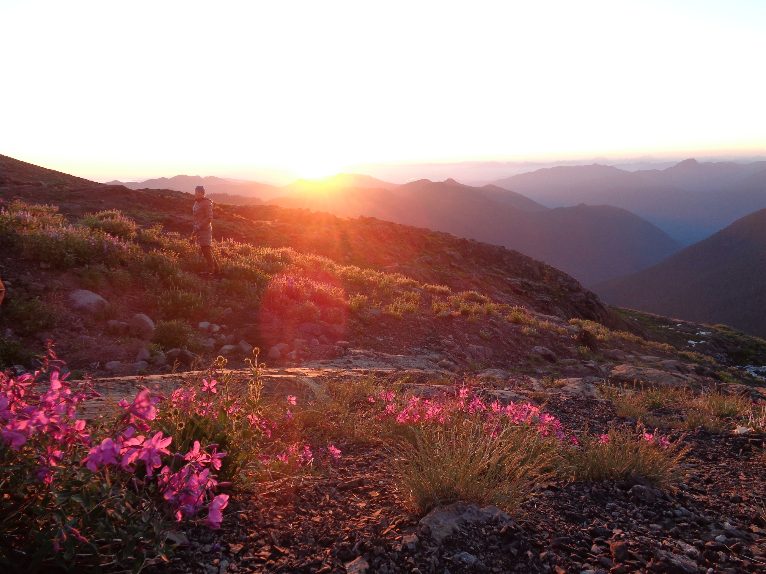
The next morning, I woke up just in time to snag a few pictures of sunrise. Through the window of my tent, because I was way too cozy to get up. It was freaking unbelievable. If we didn’t need sleep, I think I’d just never sleep. There’s just too much to do. I went back to bed for two ish hours after that picture, because I knew I’d regret it on summit day if I hadn’t gotten a good amount of sleep. Breakfast was just snacks, and we relaxed around camp for a few hours. Most of the group didn’t want to waste energy, but I go crazy sitting around. At one point, a group reached the flats, and one lone guy started shoveling out a tent space for the rest of them. We watched him, and laughed at how the rest of his group was just standing around talking while he worked so hard. Finally we got up and offered to help, as entertaining as it was. It’s amazing how quickly it goes with three or four people.

Brilliant color at sunrise (should have gotten the tent pic now! But I was too cozy)
Afterwards, John offered to practice rescue techniques around the crevasses. Yes, finally! A chance to be actually in a crevasse, not prussiking up to a tree branch or rescuing the chair in my living room. John ran Jae and I through some basic belaying techniques with an ATC belay device, which I had only done once before. Hugely helpful. We didn’t think we’d need it, but I’ll never complain about learning. We set up a very simple z pulley system to review, though it turns out the way he set it up was far easier than what I had learned. Then we moved over to a crevasse, set up a bunch of anchors and practiced getting out.
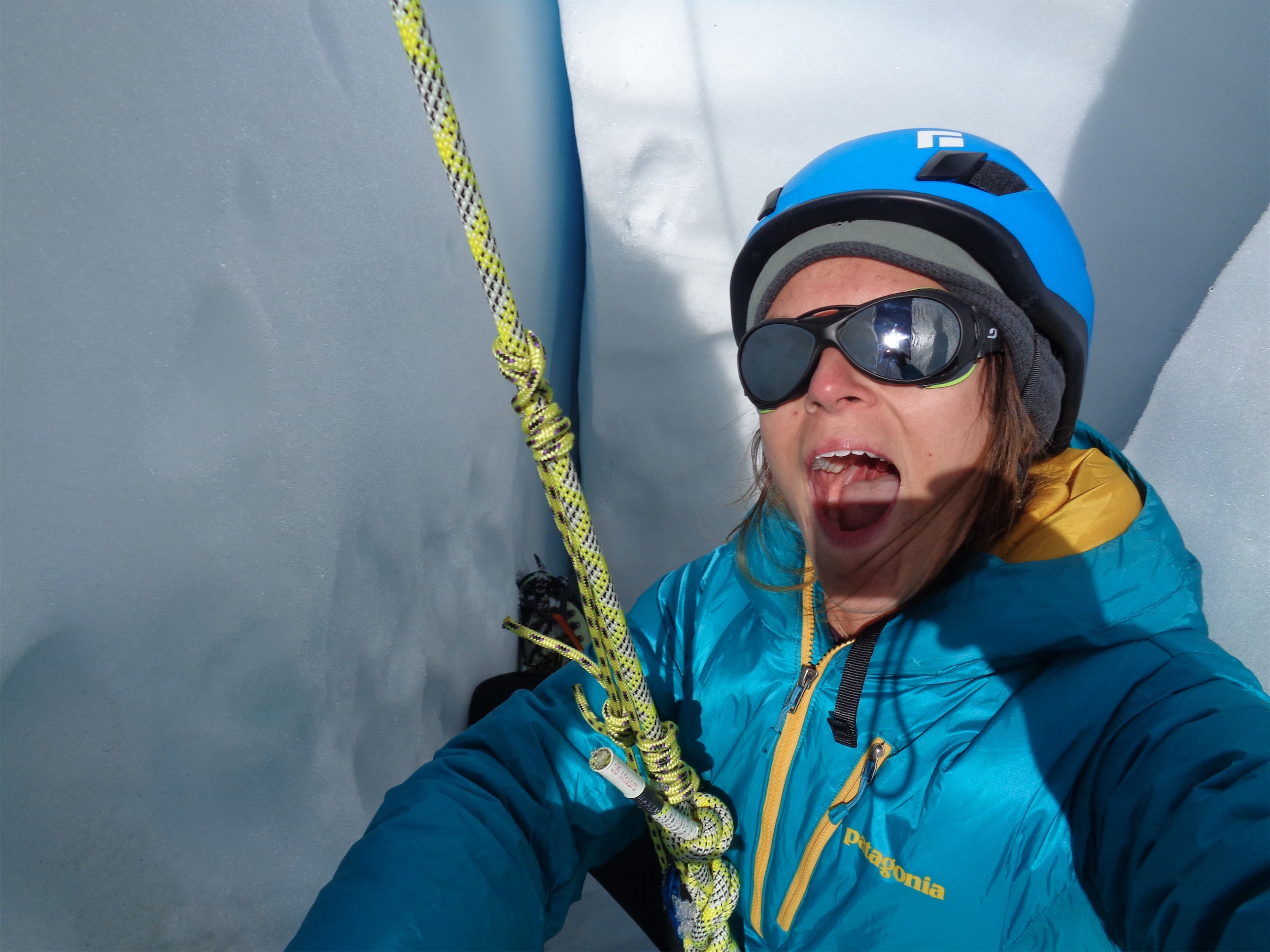
The first one I dropped into I vetoed immediately. I was basically standing. Too shallow, too gradually sloped, not gonna happen. I walked out and we chose another edge for me to hop over. Snapped a quick crevasse selfie (better not drop that camera), told him to drop me lower (8 feet didn’t seem like enough) and got started with my prussiks. Turns out, it’s exactly like prussiking up to a tree branch, just with better (colder) scenery, and it’s trickier to get over the edge. But I managed to get my axe anchored beyond the lip to pull myself over. And John pointed out that you should never have to prussik much farther than that, which in retrospect, makes total sense. You’re roped to another person, you’ll never have to prussik 50ft up from a crevasse. Hopefully. If that does happen, I imagine you have bigger issues to worry about.

Crevasse selfie
Jae went in once I was done. Both feet first. I was timid about going over the edge (I have the same issue with rock climbing – I really, really have to commit to that first step backwards over a ledge) but Jae just looked at John and jumped right in. At this point, I went back to the group to start melting snow for dinner. It was 4pm, I wanted to be in bed at 5 since we were waking up at 10, and I wanted dinner. I ran to Kayla and Ryan, who had just arrived at the flats, to say hi and chat before retiring to my tent. They were going to go up the Cowlitz route, but decided they didn’t have enough ice screws, so DC it was.

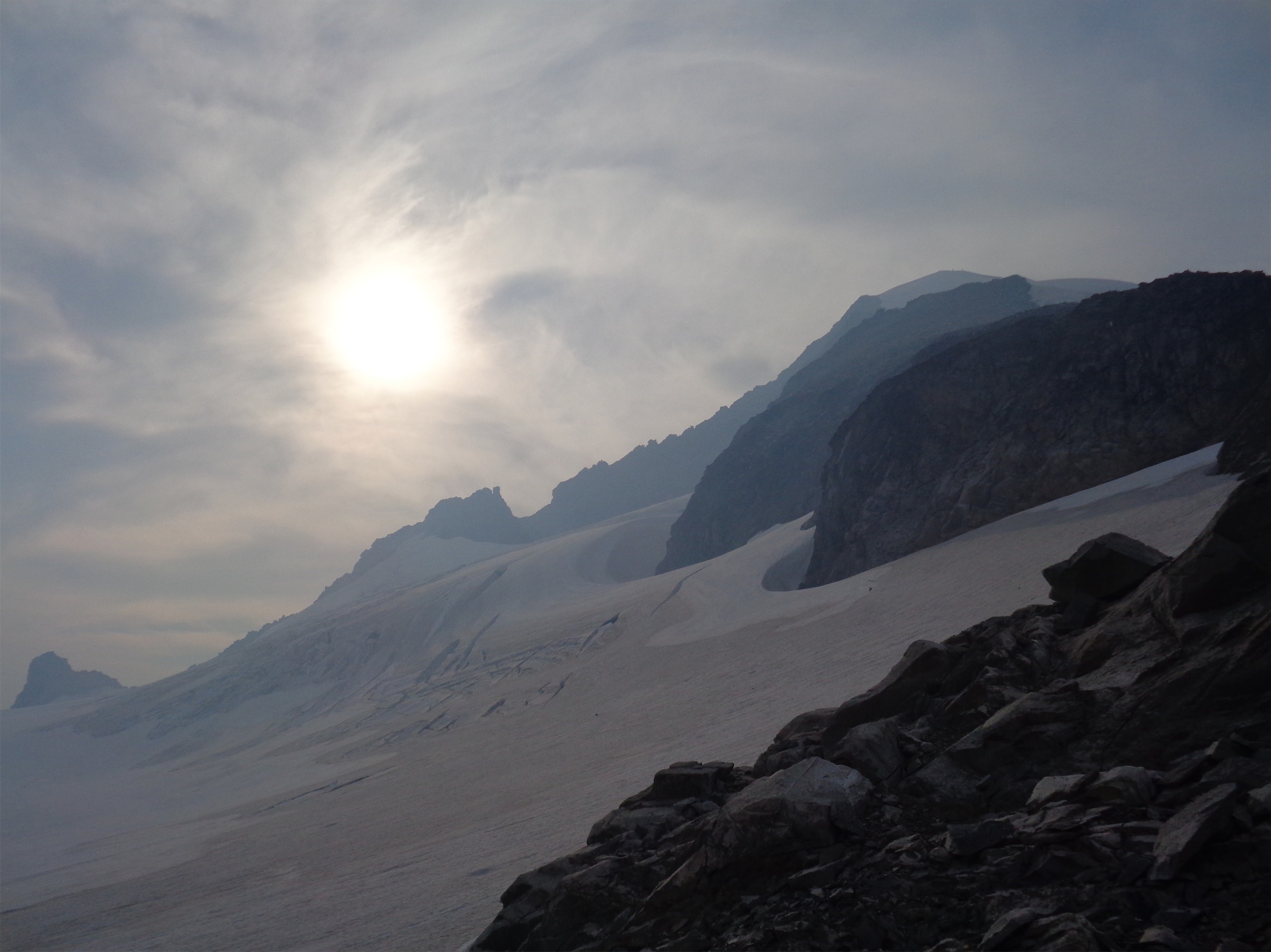
Sun dipping behind Gibraltar(?)
Hardik and Emily arrived around then, and this is where a few issues arose. First, they left their tent at Muir. Good start. Emily had forgotten a helmet, too. Great. I am of the firm opinion that you can’t climb Rainier without a helmet. That’s ridiculous. Michael sent them back down to Muir to get their tent and hopefully find a helmet to borrow. So in one day, they went up to Muir, up to Ingraham Flats, back to Muir, and back to the Flats. If that’s not already enough, they had around 3 hours to rest before we started for the summit.
I got up around 10pm. I was happy to help boil water (okay, watch it) while everyone else got ready. I pack my bag the night before, since I know if I try to pack that morning, I’ll forget something. So the morning of, my bag is packed, and the gear I need to wear is usually all laid out within the vestibule of my tent. If that’s not the case, don’t let me go up, because I’m a creature of habit and that means something’s wrong. And my habit is that plus tea and oatmeal in the morning. Damn, does Earl Grey taste good at 11,000ft.
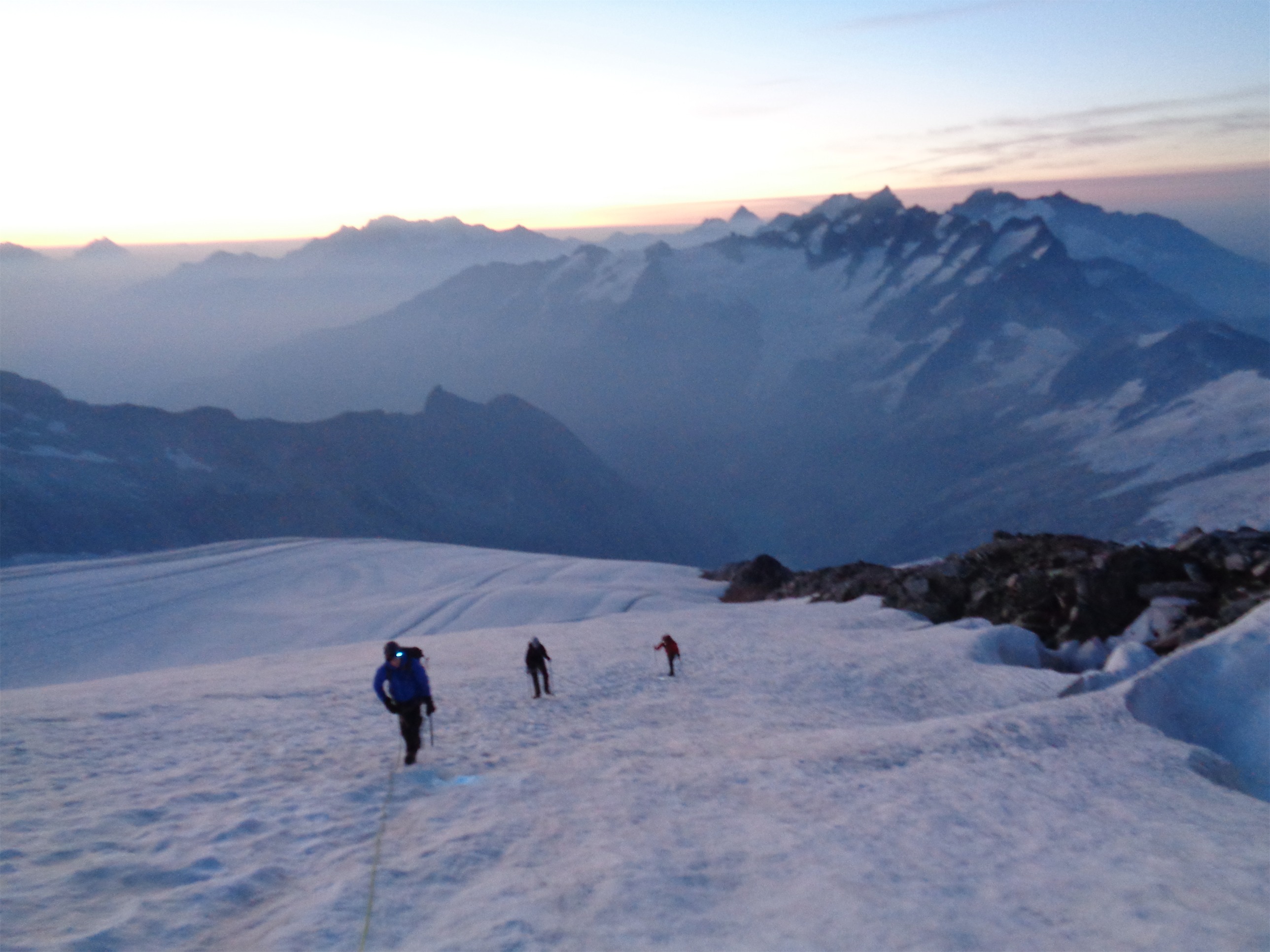
We roped up and got moving. We weren’t the first group out of camp, but that’s okay with me, I like being in the middle. I knew we’d be moving slowly, so I’m glad we started when we did. The original plan was to leave at 1am, but I requested to push it to 11:30, and then we agreed on 10:30 (though we weren’t ready in time for that departure).

The Cleaver on the way down (too dark on the way up)
Starting out from Ingraham Flats is where it gets interesting quickly. Those crevasses are open. Very open. The trail is pretty flat at first, but you cross over some chasms. Just at the base of the cleaver was a crevasse with a pack and an ice axe lying at the bottom. You could probably rappel down and get it, but no one had. “Is there a body next to it?!” someone joked.
Disappointment Cleaver was unbelievably easy compared how I remembered it. Shows you how far I’ve come. Going up that thing last August was my personal hell. I could never tell where we were going, or how they knew where to go, or how to step around all the rocks and boulders and get good footing on scree and this time around it was a piece of cake. It’s all relative, but I was shocked seeing how it really was. Seriously, I think Hibox and Black Peak were harder, and Gene’s Peak. Wow.
Nearly at the top of the cleaver, we pulled over for a break. Emily was feeling pretty tired, and John had a chat with the group. He phrased the “does anyone think they should go back down” question in the best way I’ve ever heard: “Do you think you could downclimb this without a rope?” If the answer is no, you are probably not feeling good enough to continue, and we need to find someone to take you down. It can be anything from exhaustion to altitude to even just a fear of heights, but it’s a great way to evaluate comfort level and whether you’ve crossed your own limits.

Little Tahoma and a sliver of sunrise
We waited for the other team, and it turned out that Hardik was feeling it too. Emily kept apologizing, and I looked at her and just pointed out that she went from Paradise up to Muir, to Ingraham, back to Muir, and back to Ingraham all in a day. And then sat for a few hours before summit day. Jeez, just going to Ingraham and then summitting is considered a push for most people, nevermind the extra trip down to Muir and back! And no one should feel like they’re a burden when they decide to turn around. It’s always the right decision. Emily, if you found this blog (hi!), I had huge respect for you when you made that decision. It’s the hardest one to make, but you perfectly walked that line between pushing your limits and still being smart about it and being very self-aware. And a few hours later, more of us had to make the exact same choice. Give me a shout next time you want to try Rainier!
Michael, group leader, Patron Saint of Slow Climbers Who Nearly Had Their Asses Kicked By Rainier, roped up with Hardik and Emily to head back to camp. I almost offered to go back with them when Michael suggested that he’d drop them and come catch back up to us. But I’m either not that good of a person, or we had been climbing longer than I thought, you pick. The remaining five of us hopped on John’s big ass rope to carry on.

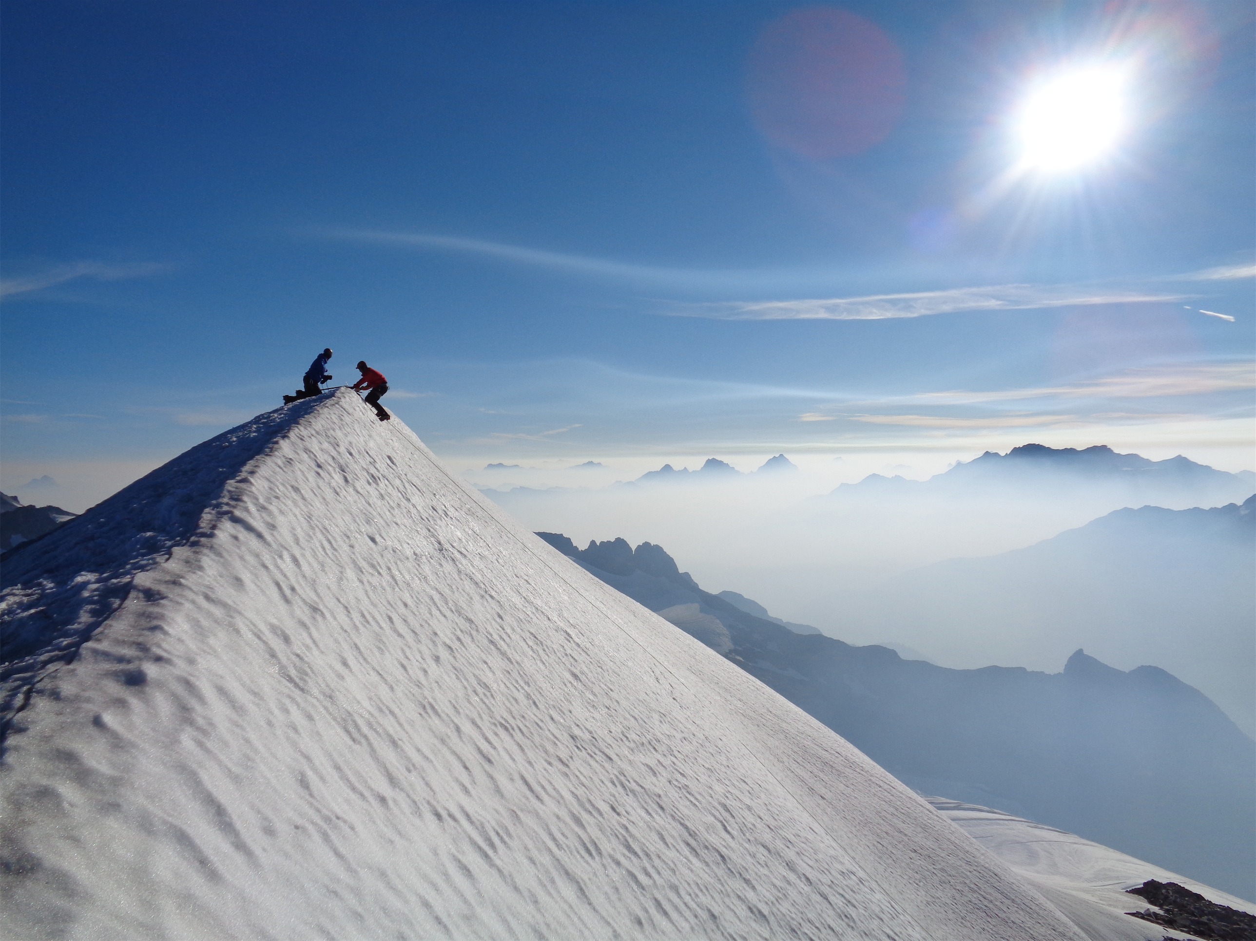
So much for “just snowfields past the cleaver”
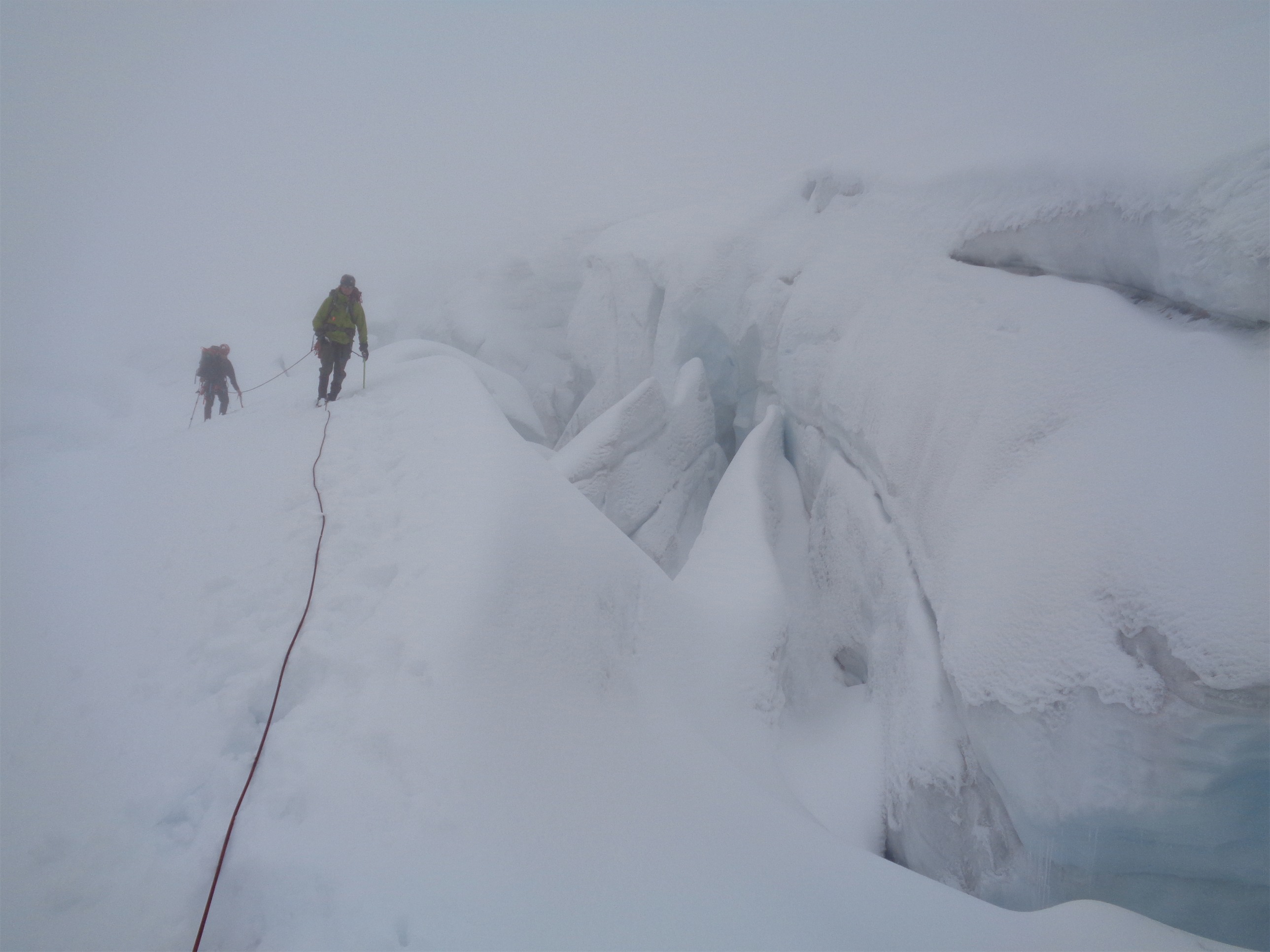
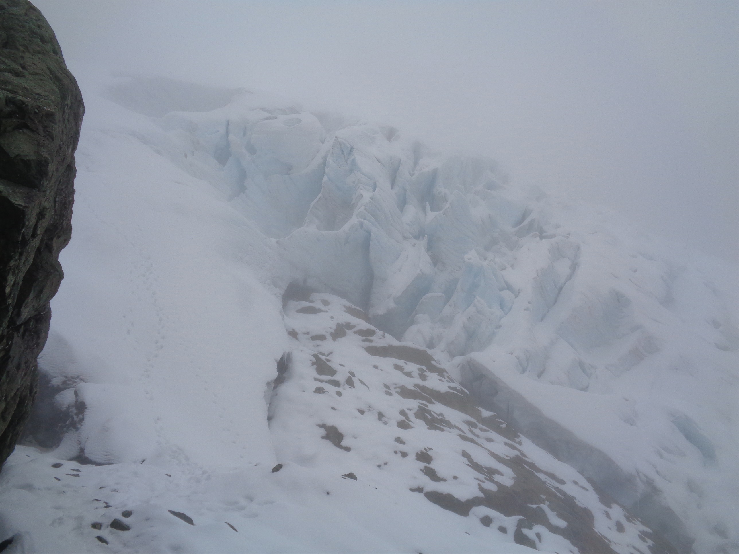
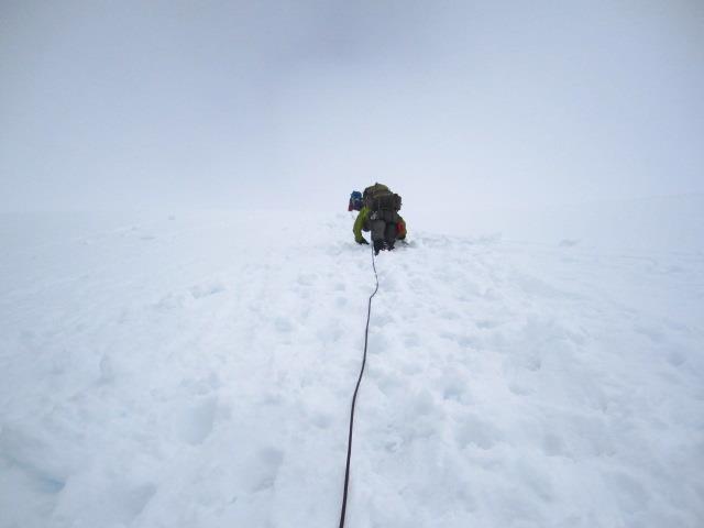
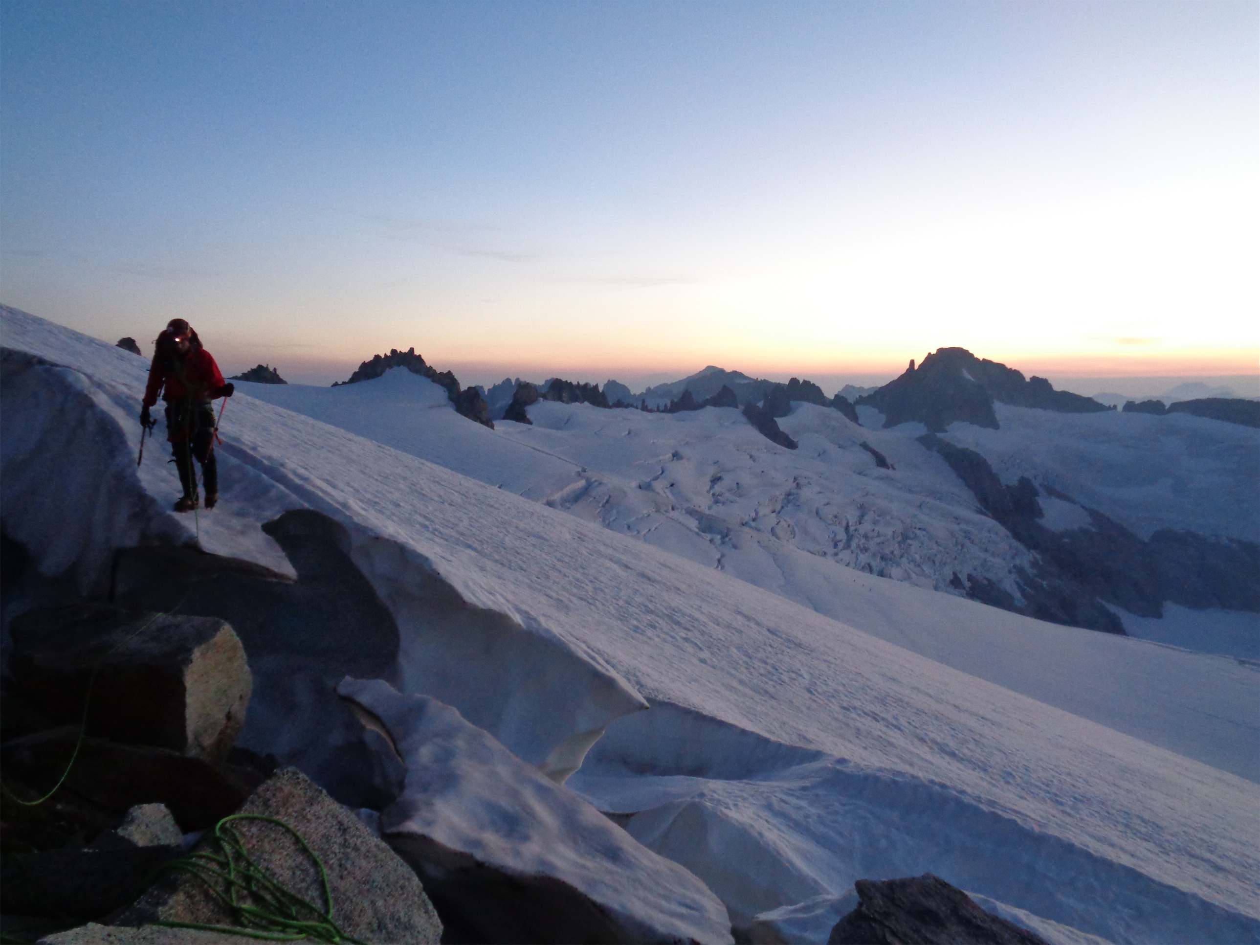
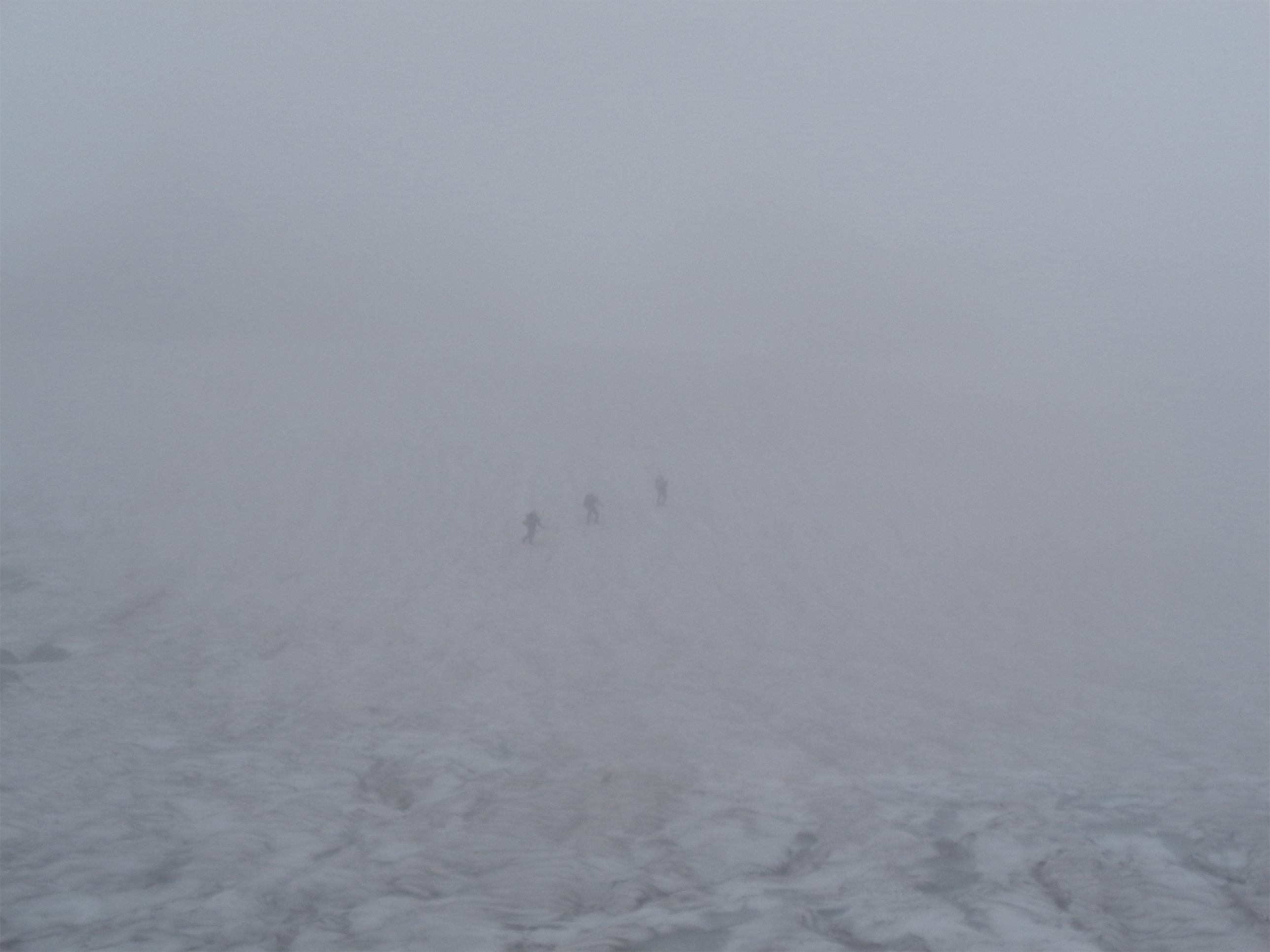
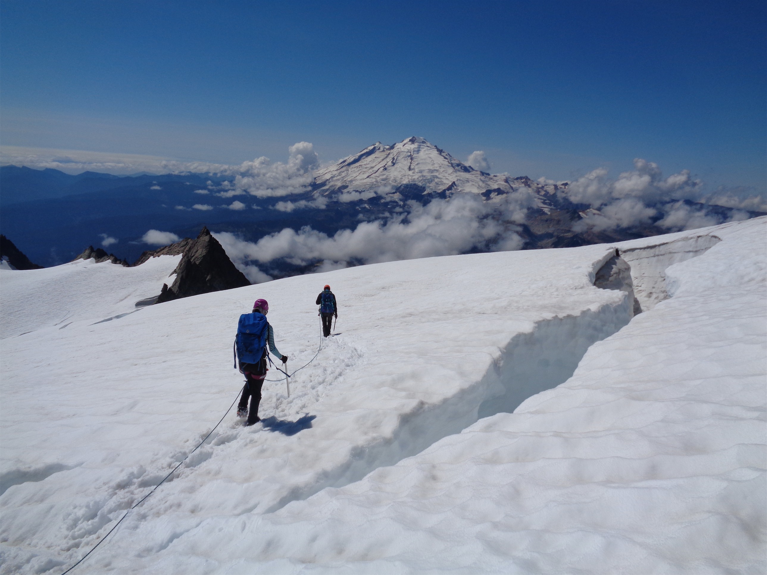
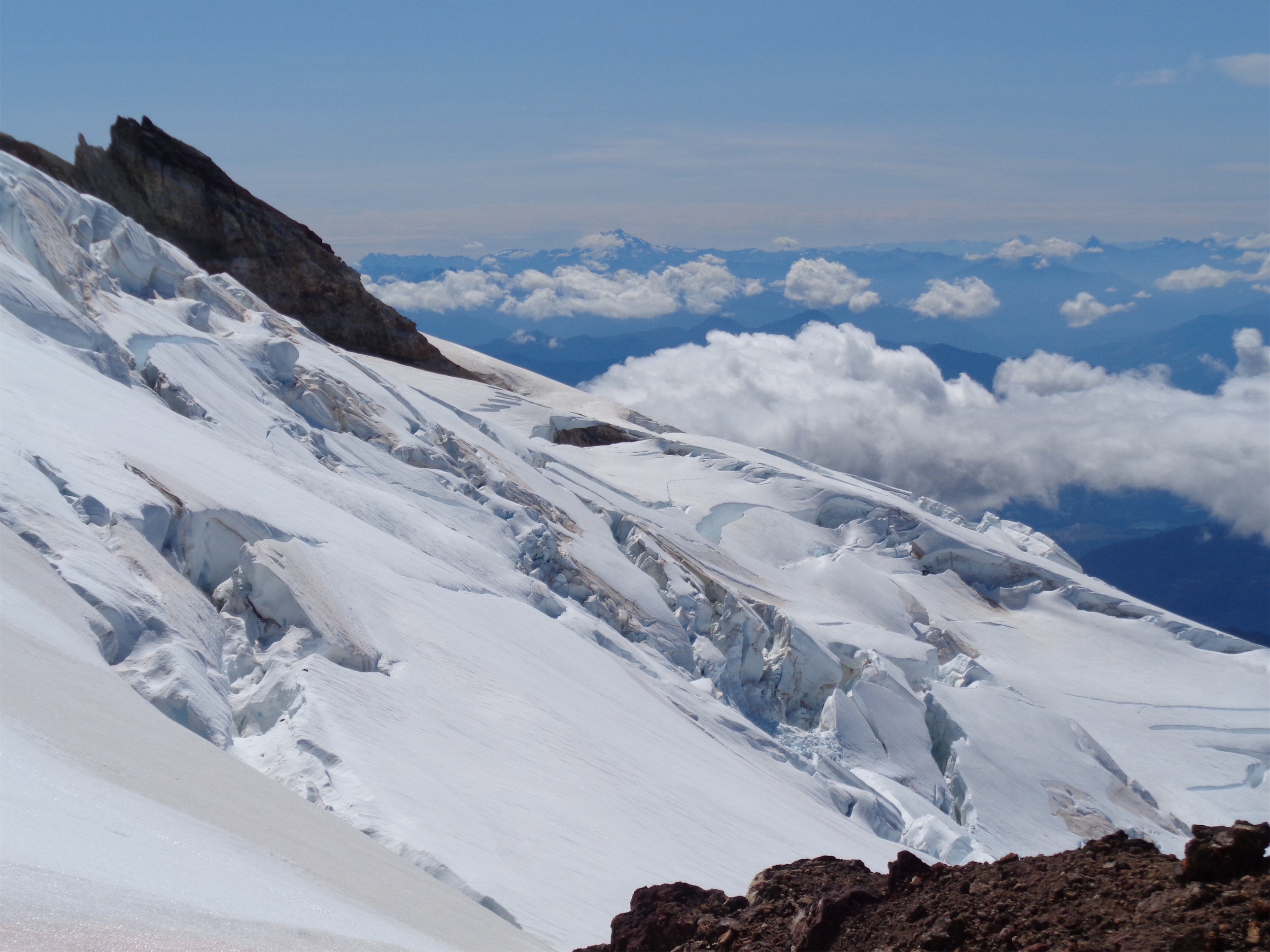
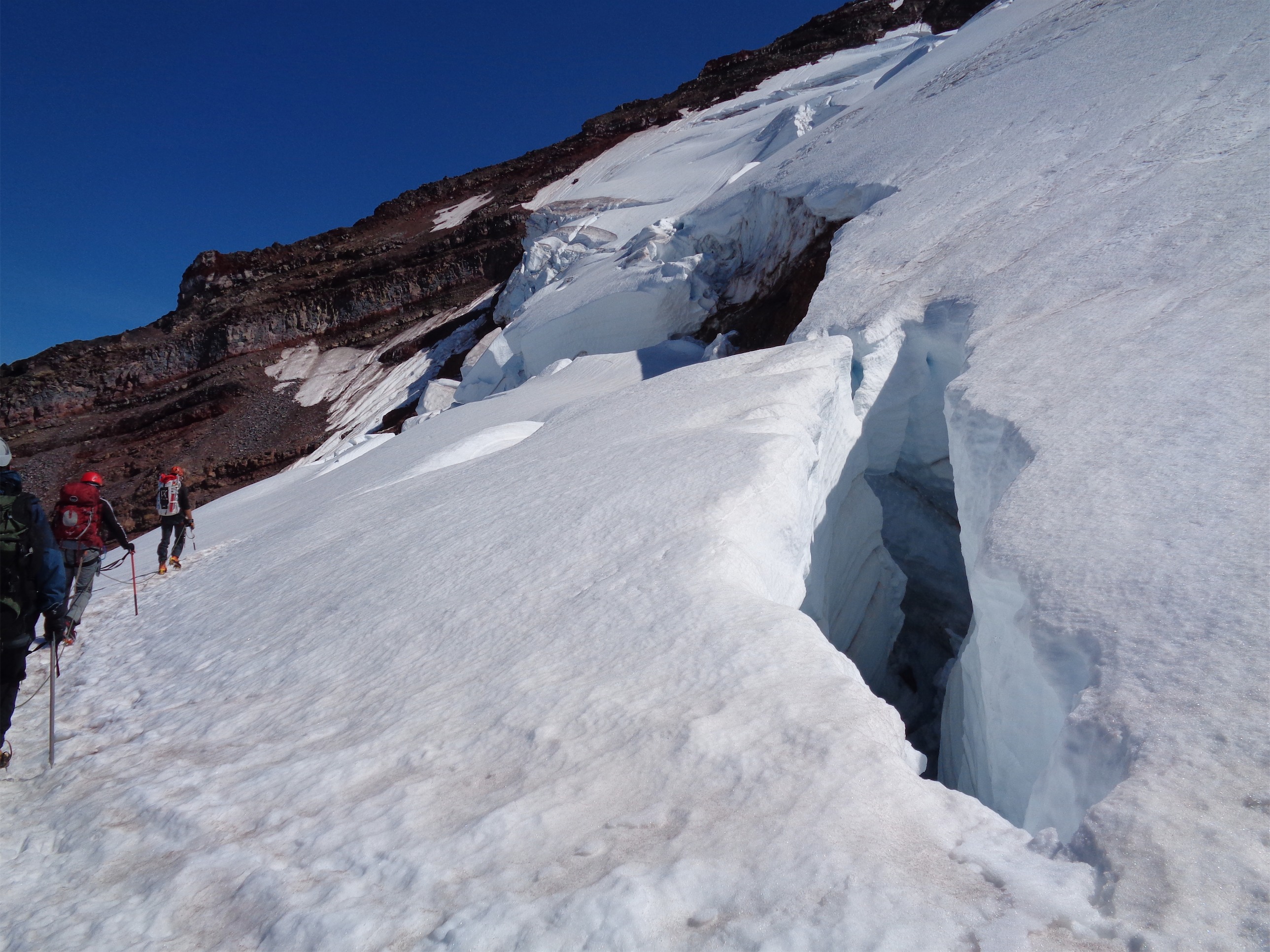
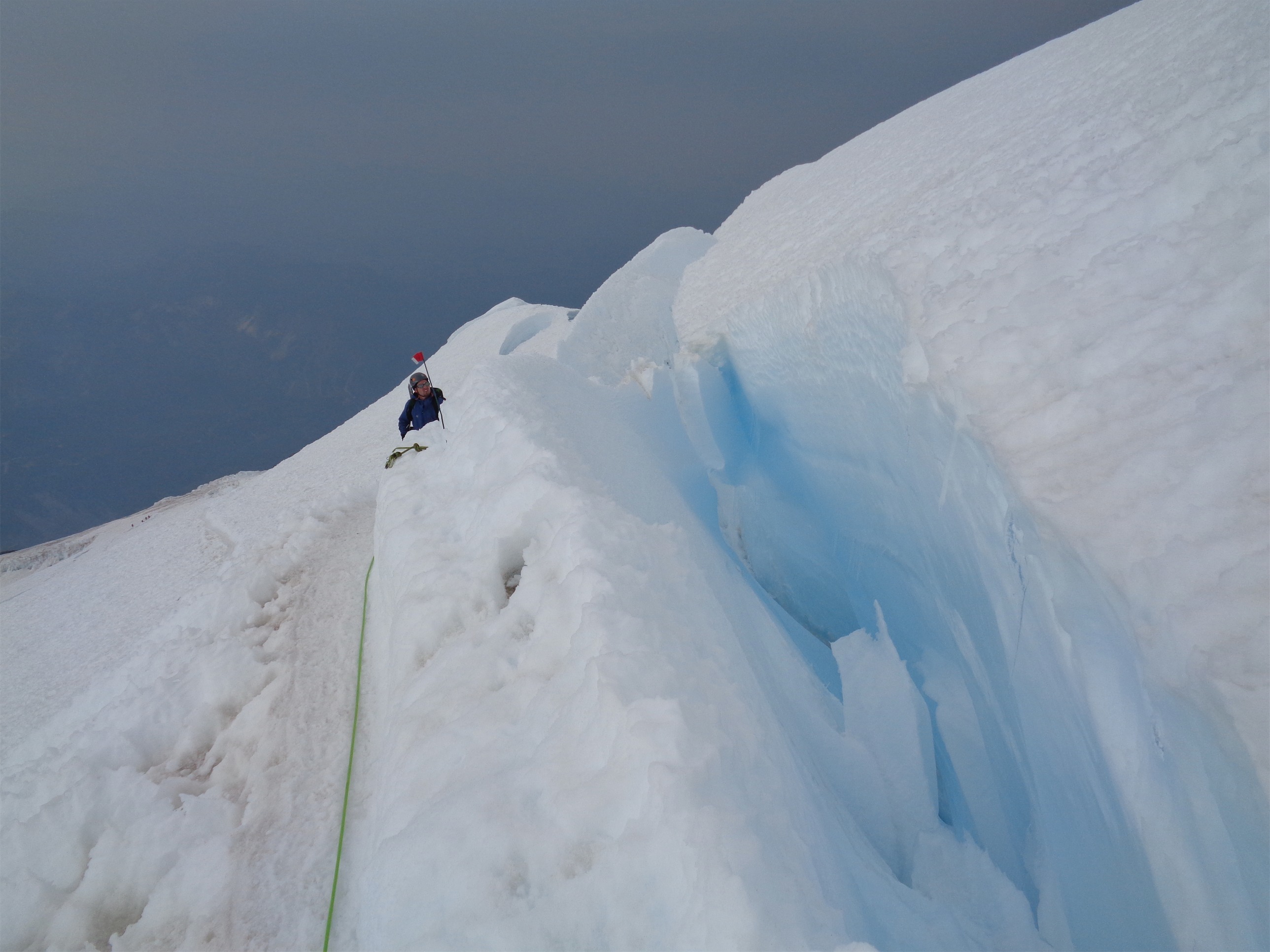
Reaching the top of the cleaver, my memory told me it’d be mostly snow fields to the top. Nope. Between my memory being skewed (I didn’t know anything about anything going up Rainier last year, remember) and the late-season condition of the DC route this year, it was a completely different route. Crevasses were gaping. We had to traverse west across the top of the Ingraham glacier, taking our time across steep slopes. Bridges were a huge obstacle. Bottlenecks and lines in front of both (only two, fortunately) and our slow paced five person team was not helping the situation. We stepped aside to let teams pass on several occasions, and once again I found myself climbing in my DAS parka, which should never be the case. Unless it’s really, really freaking cold. Which it wasn’t. I don’t think I even broke a sweat on the way up. Which in a way is good, because it means I was never wet enough to get deep chills. Sweet.

Another bridge, taken on the way down
But guys, those bridges. Seriously. Last year, there was one easy bridge that I remember, and one section with a fixed line. This year, there were maybe 5 or 6 fixed line sections, and two bridges. And the bridges were much dicier than the one last year. Both had hand ropes, which was nice, but you still had to be careful going across them, and careful not to tug your teammate when you were waiting on the other side. And careful to get close enough give them enough slack so that they wouldn’t have to stop halfway across the bridge. Those are the types of things that you don’t think about until you’re in the field doing it.

Sweet pic Amit Bhosle took of our team with neat snow formations
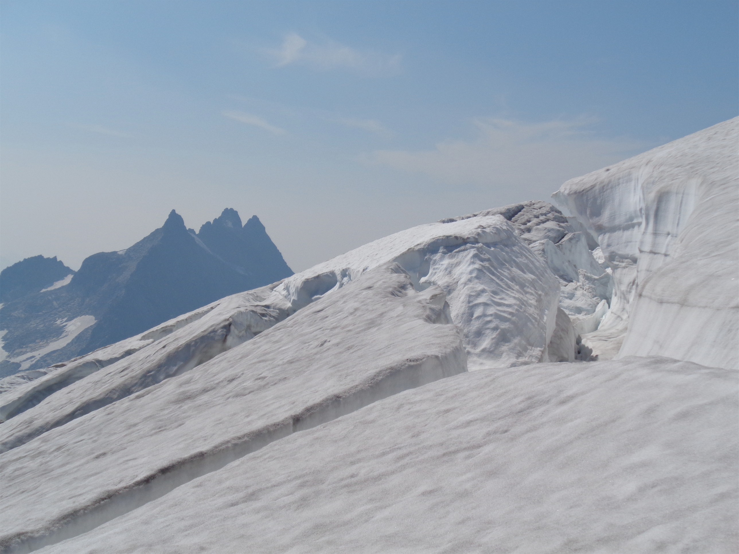
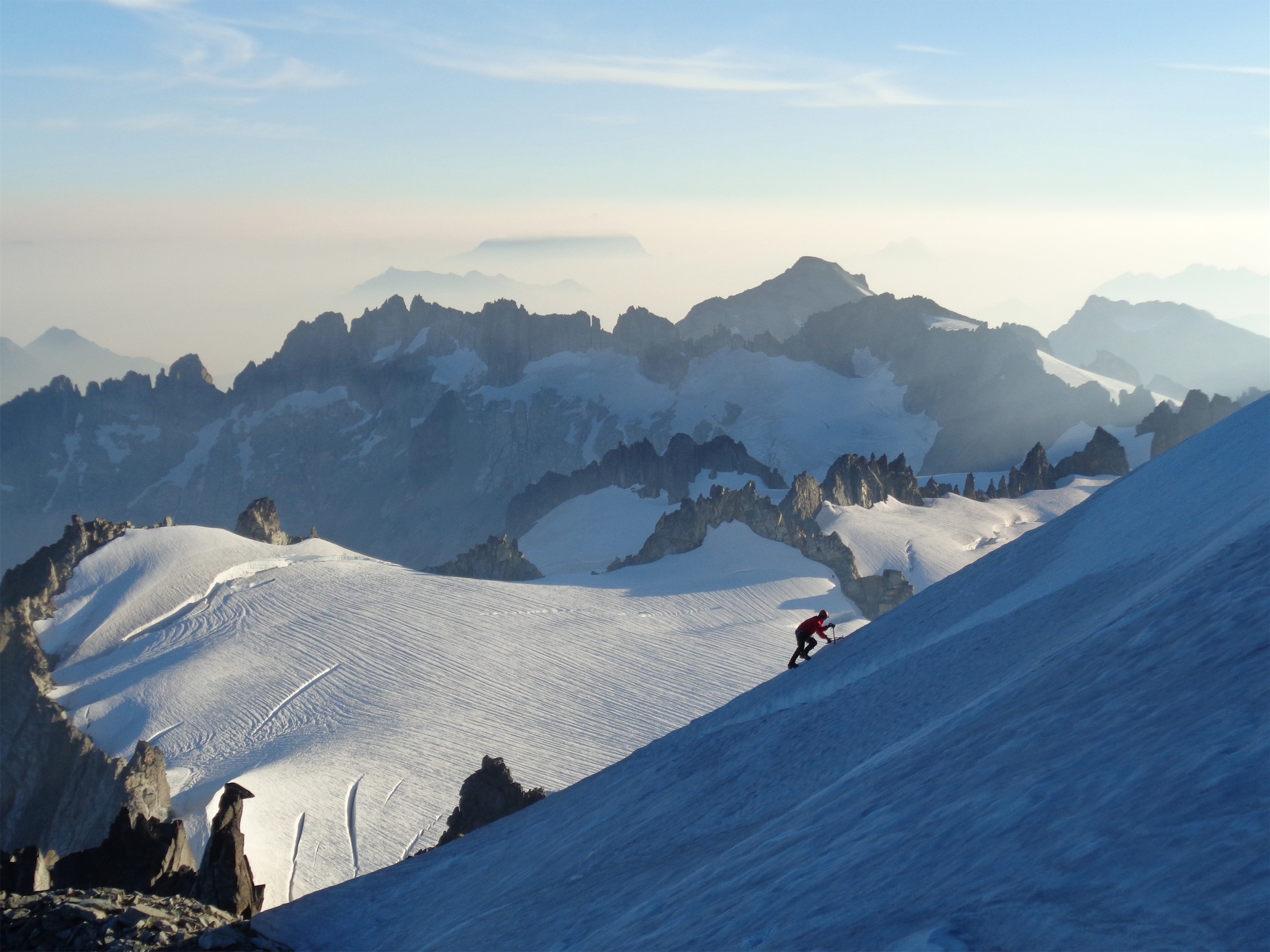
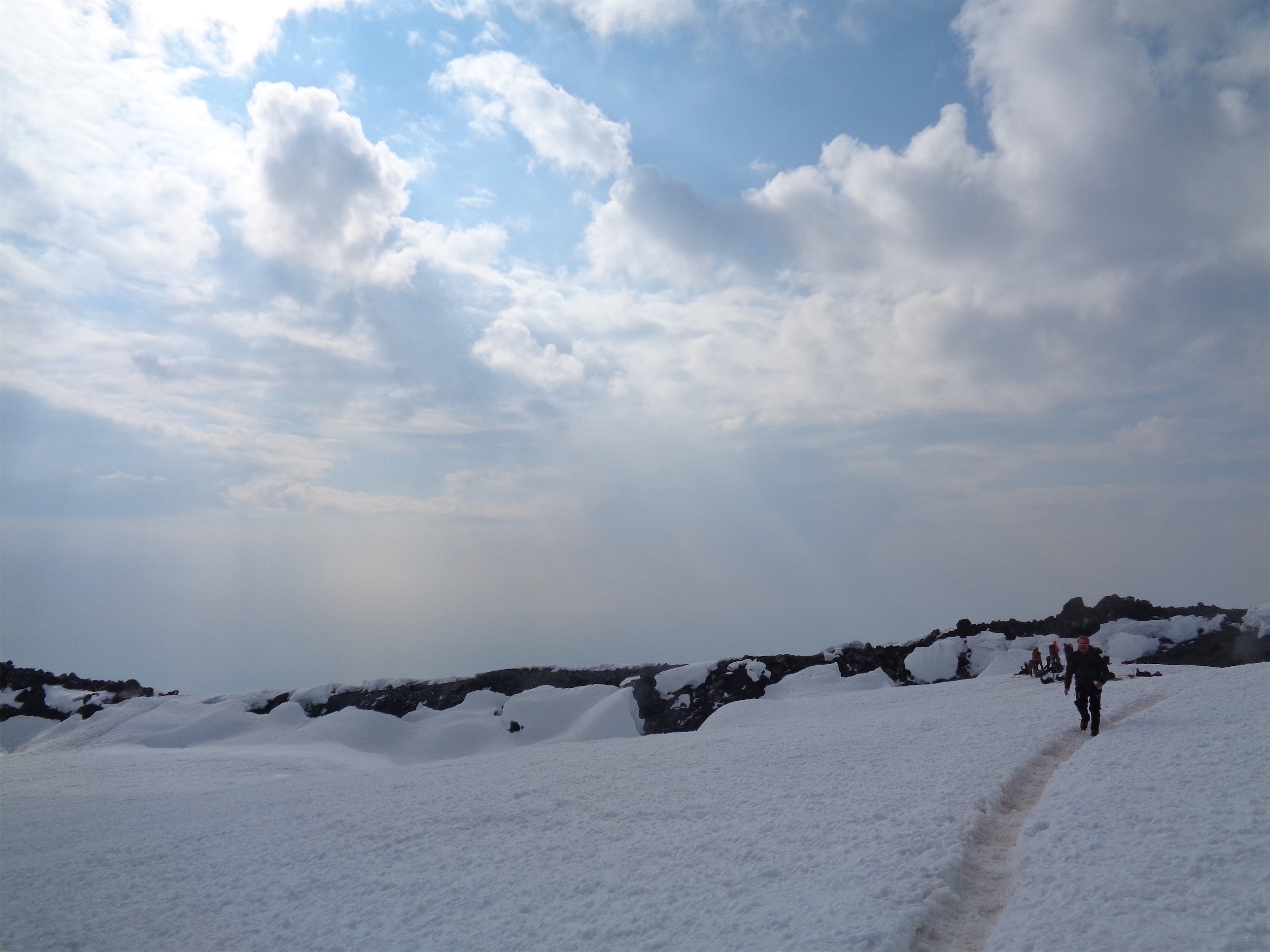
The other part that amazed me was the snow formation. Last year, I swear it was all just flat snowfields. But this year, the snow had melted into small jagged spikes, making the terrain look totally neat in every direction. I wasn’t even bothered by the number of people around us, I was just happy to be up in an alpine environment, especially one that was so beautiful. There’s something amazing about seracs and crevasses, and things so massive you can’t even describe them. My appreciation for it this year was much deeper than last year. Oh, and I didn’t have “sugar…. ohhh honey honey…. you are my candy GIIIIRL and you got meeee wantinnnn YOUUUU” in my head on loop for 12 hours like last year, either. So that was nice. That’s my primary memory from last year. Darkness, being cold, ice, and The Archies floating in and out of my consciousness.
Crossing the first bridge, the sun started to rise. I knew at the top of the cleaver we had no chance of summitting at sunrise, but I didn’t really care. It turned out to be unbelievably hazy thanks to that damn smoke, but that means for a really neat red stripe across the sky. I snagged pictures when I could (fairly frequently, actually), remembering how much I regretted not taking any last year. Damn, I was feeling great. I didn’t even notice the thin air until someone pointed it out, and even then I think it might have been more mental. And to think I spent the entire week freaking out about bringing Diamox just in case, only to never touch it.

Looks like another planet between the snow and the haze
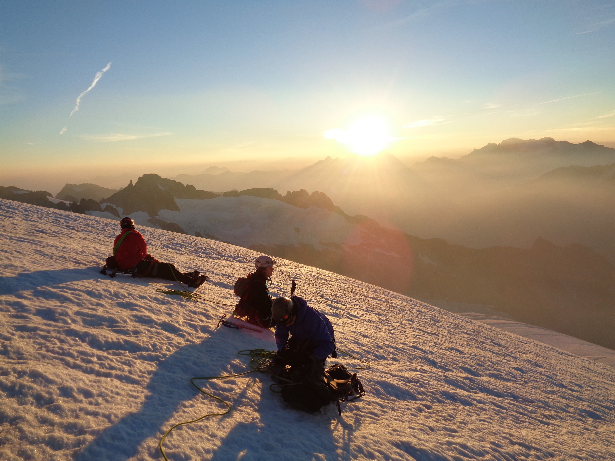
Beyond the second bridge, Jae started feeling the altitude. We sat down for a bit to have drinks and snacks, something I knew much of the team hadn’t been doing. At one point I force fed everyone goldfish and told everyone to get their glacier glasses on, because the sun was over the horizon and you know how quickly that’ll affect you. We spilled a lot of goldfish, so much for leaving no trace. And my combos were expired! How the hell do combos expire?! Man, that sucked! They were like all I think about up until summit day! They must have been like 4 years old. I thought those things would survive nuclear war. God. Dammit.
Jae pushed on for another half hour or so before deciding to wait for us. We were around 13,500ft, a common place for climbers to stop. A nice woman named Bri was sitting in a bivvy waiting for her team, so Jae went over to sit with her and we gave her a sleeping bag. Not a bad place for a nap – plenty of sun, views (if not for the haze) and even some company. Now we were down to four.

Small crevasse
Charles was next. 200ft after dropping off Jae, Charles sat down while a team was passing us, and then looked up at me, tilted his head, and smiled. “You know… I think I’m going to just stay right here.” Okay, cool. Backtrack to Jae and hang with her and Bri, and we’ll be back soon. A group on their way down let him trail them back to Jae and Bri just in case, and John, Rob, and I carried on.
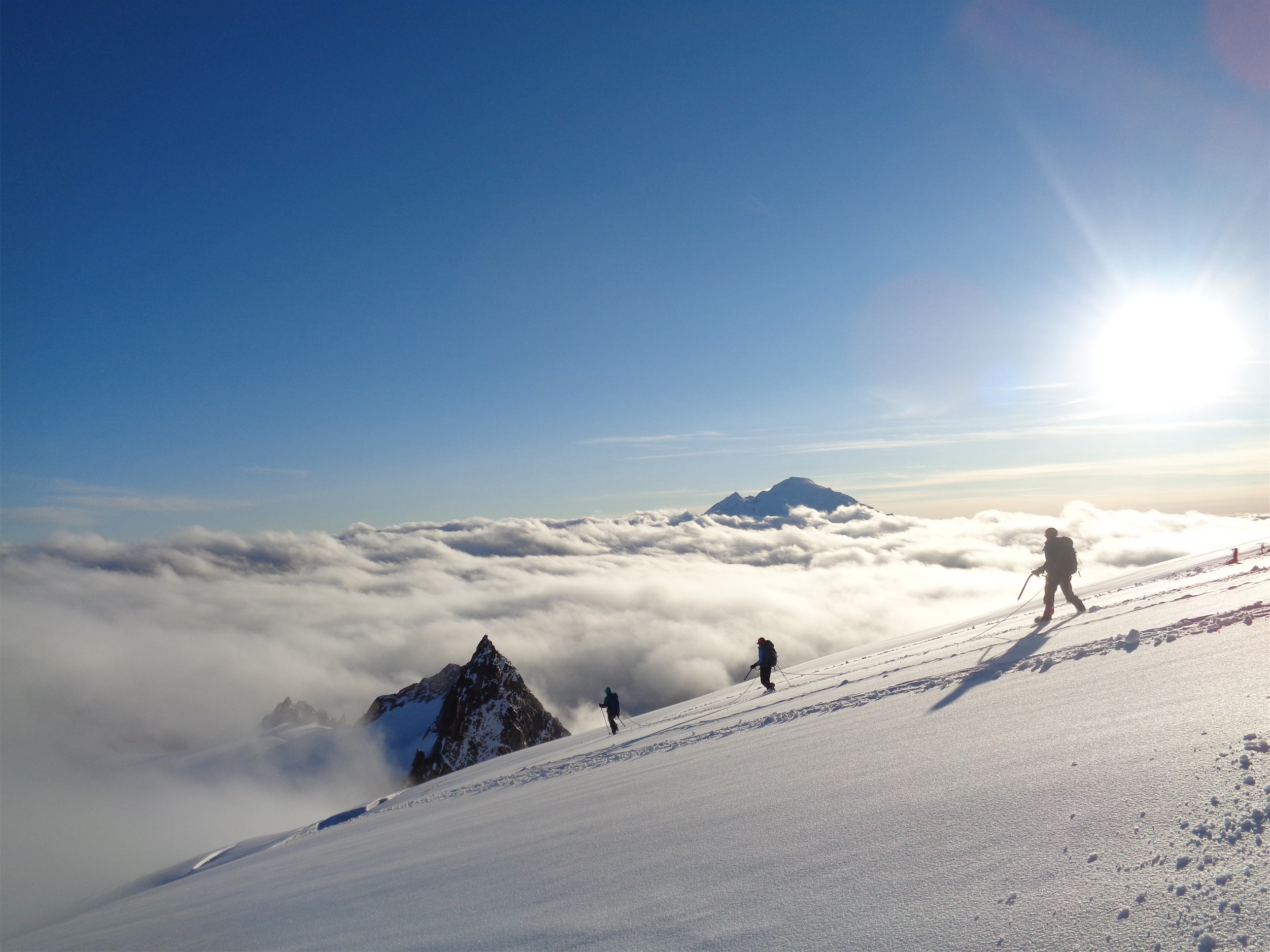
Now I was in the lead. I had John show me how to coil the rope and tie it off so if anyone behind me fell it wouldn’t choke me, and we were ready to go. Okay, Eve, don’t take off, just go at a moderate pace. I told Rob and John to yell if we were going too fast, and started at slow hike pace, which was still faster than we had been going. It hailed on us for a quick minute, and I started to worry about the weather. Blue skies above us, but we couldn’t see anything farther because of the haze, and the weather up there can flip in a second. I still had more layers in my bag, not that I wanted to deal with hail at 14,000ft but if it had to happen… actually let’s not think about it. Point is, we got lucky and it didn’t happen!

Blue sky just above the crater, hail held at bay
A few feet from the top, I ran into Kayla and Ryan, looking totally casual about the climbing feat in front of them. I was so proud to run into them right there, with a dozen meters of extra rope wrapped around me tied perfectly and nearly reaching the top with two strong climbers behind me, glowing with excitement. It crossed my mind that that’s just how slow we were (Kayla started three hours after us, passed us on the way up, tagged the top, turned around, and passed us… still on our way up) but who cared, we were 10 feet from the crater rim.
I heard Rob behind me. “I mean you could just drag me to the top…” I laughed and thought, “don’t mind if I do!” I wanted to top that crater and head down. Two people had warned me about the weather, and I didn’t want to be the team that got stuck at the top. We reached the crater rim (WOOO!!!) and descended to the snow, unroped, and had some water.

Rob and John at the summit register
It was a funny feeling. I had recognized none of the route until the crater rim, and suddenly it was all familiar, even comforting, like coming to an old friend’s house. I looked at the two of them and mentioned the weather, and said we can run to the summit register real quick and turn around, or we can go back now. The answer? Summit register. Oh, and Rainier. They had both carried entire cans of Rainier to the top. If I had half a can, I’d probably be wasted, and they’d be short-roping me the entire way down.

John among the pillars of snow
Guys, the snow in the summit crater is so neat. One side is just flat, but the other side has melted the snow into these big spikes. It looks like another planet. I jogged/speed walked to the other side of the crater, hoping I could try to get a pic of Rob or John crossing through the snow pillars. I opened the summit register and waited for them to come sign – it’s almost full! I looked for our signatures from last year, when I climbed with Owen and Angie and Brenda, but the new register started a week after we had been there last year. It would have been awesome to see my name in there.
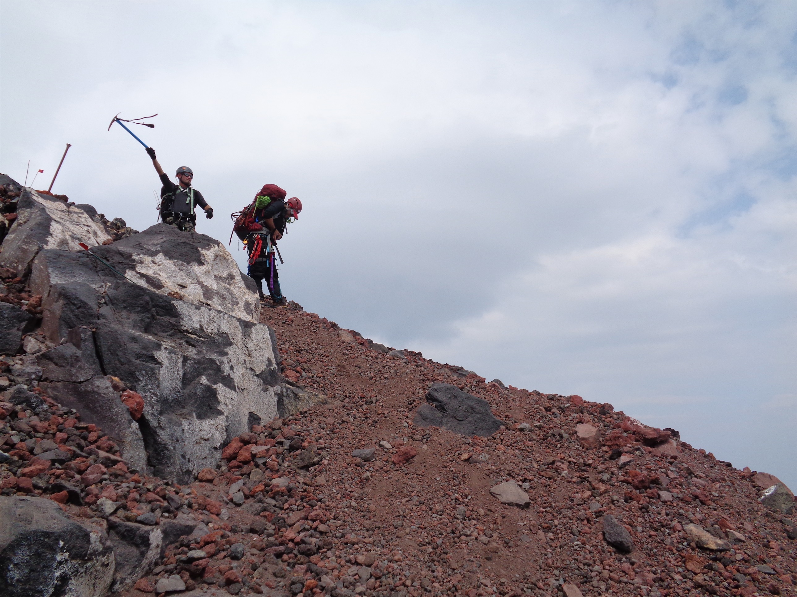
We ran to the high point, where luckily there were two guys left, one of whom was willing to hang around for a few minutes and take our picture. Thanks Kurt! Guys, I’m a happy person, but I can’t even convey the joy of this pic. I get so happy just looking at it, knowing how happy I was to be there. When I had realized just how slow our pace was going up the cleaver and on the five man rope, I didn’t think we’d make it. I figured we’d have to turn around because of time issues. But there we were! Standing at the top with two cans of Rainier and smiles for days.

Yeah buddy!
And it was then that Rob told us he had been on crutches just 8 months ago. He had a torn ACL/MCL, and had gone through months of physical therapy. And here he was on top of freaking Rainier! Holy shit! I was floored. I couldn’t believe it. I had just sidled my way up the side of the mountain, and here I was looking at someone who had fought tooth and nail for the past 8 months to be able to do this, and successfully summitted one of the toughest climbs out here. Damn. The things I take for granted.
Well, we still had to get back down. Getting up is optional, going down is mandatory. We roped back up (still worried about the weather) and started out to pick up the climbers we had waiting for us. Jae and Charles were bundled up in sleeping bags and bivvies, and seemed rejuvenated when we arrived. I hope it was a pleasant nap. We could see them from afar when we were still a few hundred vertical feet above them, so we knew we were there. We put them in the middle of the rope, and continued on.

Looking down at the easy ladder
Getting back across the ladders was smoother than the first time up, but still a bit of a process. And you know what I didn’t consider about a five person rope team? Communication. I had no idea what was going on in the back. Unless someone yelled to me, I was relying on tension, and if the rope got taught, I’d stop to see what was going on. Especially with some of the bridges and corners and steep sections where I had no line of visibility, I was 100% relying on messages to be passed forward to me. We figured it out, clearly, but my primary experience has always been with three man teams, and navigating a five person team through such a dicey, windy route was an accomplishment in itself.
Before traversing the Ingraham Glacier to the top of the cleaver, I glanced behind me and Charles was just looking around in awe. There’s nothing like being up there surrounded by glacial features. I thought I had heard the “boinggggg” of ice cracking earlier, so I had been on my toes lately. It’s just an unnerving noise. I had given up on telling everyone when we were stopped in a bad place. There had been several instances where I’d be waiting for the team while standing on a thin snow bridge, or trying to balance on a narrow ledge above a steep slope with 20ft between me and the lip of a crevasse. But I finally realized… that’s what you get. That’s just what you get climbing a mountain like that. There won’t often be good places to stop, so make sure you’ve got good footing and hope for the best. A football-sized chunk of ice whizzed past my head about 3 feet in front of me at one point, and I turned around to Charles with the “OH SHIT!” look on my face. I still don’t know if he saw it. But the team members behind us were working on unclipping from a rope (no idea why it was taking so long, tangled or something?) and there was nowhere I could go. Yay, helmets.

He’s stretching, not attacking, don’t worry. But it was too perfect
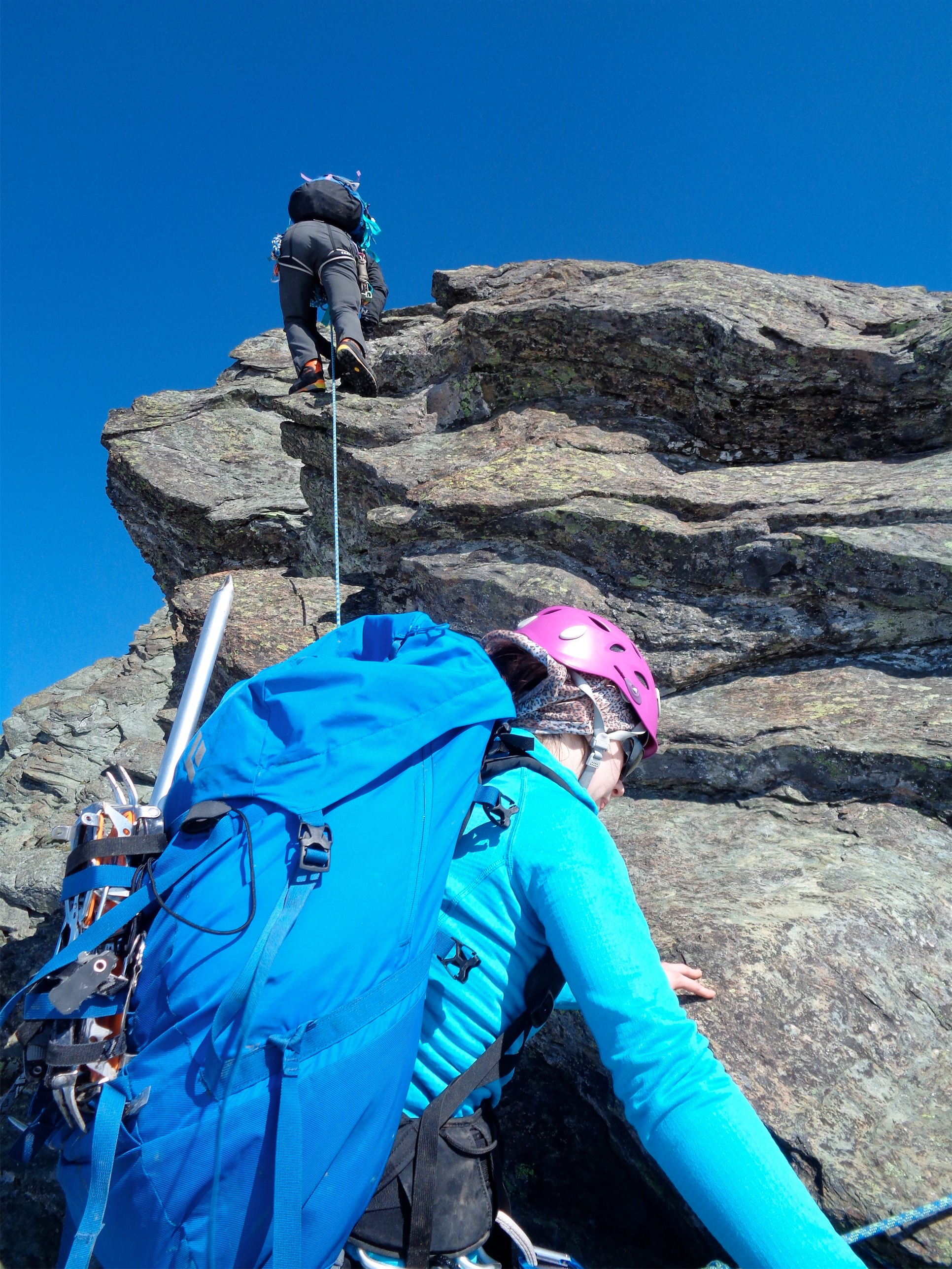
The traverse went smoothly, though, and at the top of the cleaver, we unroped for the scramble. I wasn’t okay with this. We always took forever to rope up, and this meant we’d be sitting at the bottom of the cleaver in a soft rock fall zone trying to get the rope back on for the last part of the glacier back to Ingraham Flats. John was right, the scramble was much faster unroped (and again, so much easier than I remembered it being!) and it kept the rope in good shape, but I wasn’t fond of waiting around while we got ready again, especially in a danger zone. Michael chewed me out for it back in the car on the way home. Not in an aggressive way, just in a “what were you thinking?! I couldn’t figure out why you were sitting there, I thought something had to be wrong!” kind of way. But luckily, no rock fall, and we made it across to the flats just as two IMG guides were scouting out their own route.

Rob on the last traverse to Ingraham Flats
Kayla and Ryan were still there (yay!) so I went to go chat with them. They had just cooked food, too, and offered me some. I was hesitant until they pointed out there wasn’t exactly anywhere to throw it away, so I’d be saving weight if I helped them eat it… okay, I’m sold. I’ll help. I started wolfing down food and telling them about our epic climb. I still couldn’t believe we had made it, given how the rest of the team had been feeling.
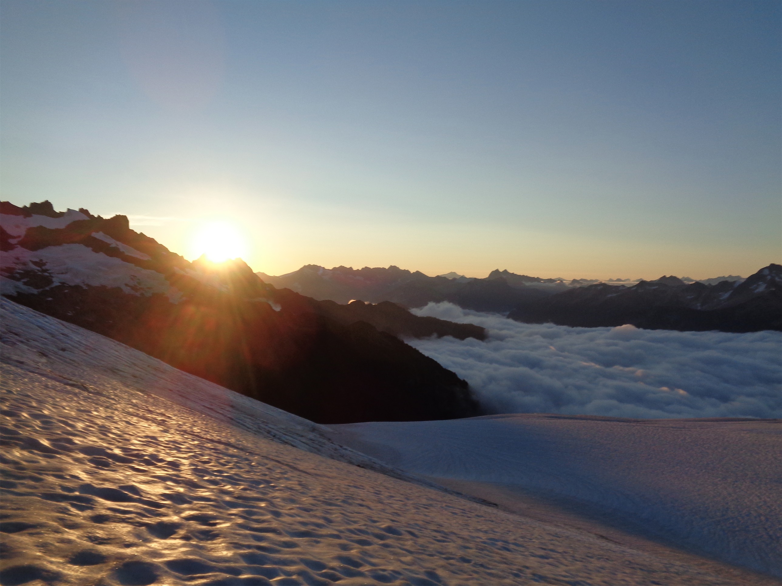
We were the last team off the flats, and the last group to leave Muir as well. Michael had headed down earlier with Hardik and Emily, and said he’d meet us at Paradise. It started raining at Muir, a good reminder why you bring clothing for every climate. I had waterproof gear from head to toe. I didn’t want my helmet to get wet and had nowhere good to strap it on my pack without potentially destroying it (the foam ones are damn fragile!) so I left it on my head. John wore a garbage bag like a diaper to expedite the glissading, I stuck with my trusty Marmot pants. Let’s get the hell off this mountain, I’m tired.

Rob heading down from Muir after weather moved in
The sun set just before we reached the end of the snowfield. Well, it was raining, so there wasn’t really a sunset. We turned on headlamps and aimed for the Pebble Creek trail. Now I’m pretty unfamiliar with the Paradise trails, and everything looks different in the dark. I was totally convinced we were on a different trail than we took on the way up. At one point I pulled ahead of the group, and then realized I’d be paranoid about getting lost if I stayed alone up there. So I waited until Rob caught up. He seemed to know the area better, so I stuck with him. 2.2 miles to Paradise, the first sign said. I’m still convinced we took a longer route than that, but I’ll never know. We followed the Skyline Divide trail, chatting mindlessly, one foot in front of the other. My IT bands were screaming. Of all the things to be sore. Nothing else was complaining, just the IT bands. I have to give Rob a huge thank you. I was losing the mental game in those last two miles. I was tired, I just wanted to be at Paradise, I wasn’t sure if Michael would even be there waiting for us, what if Michael left how would I get the things I left in his car, are we going in circles? We might be going in circles. No, we haven’t made that many turns, and we’re still on the right trail. Is that a tent or a rock? A rock. What about that one? Whoa, people camp here?? No, also a rock. Okay, dammit, we’re on a paved trail, we’ve got to be close now. And finally we popped out onto the stairs we had taken the picture at in the very beginning.

Don’t slip too far
We dropped our packs on the stairs, and I took off all my extra layers and my boots and my helmet. We lay down on the stairs in amazement that we were back. I knew I had to find Michael. Rob, watch the bags, I’m going to make a lap around this parking lot. I stood up in my socks, went to use the bathroom (the men’s room, zero fucks left to give, the women’s was closed for some reason – I drove a guy out of there with my horrific appearance and stench I’m sure) and started towards the parking lot.
Okay, what do I know about Michael’s car. It’s a small SUV. A Honda. A Honda CRV, and I think it’s blue. And there are some Z’s in the license plate, Z and then a blue letter and then another Z (synesthesia is useful sometimes). Was it a B? No, and R? That car has ZRZ. And it’s blue. And it’s… a Honda. I jogged straight towards it, and saw the window cracked, with Michael right behind it. MICHAEL!!!!! I shouted, “holy shit! I can’t believe you’re still here I’m so glad to see you” and ran. He opened the door, “Oh my god Eve I’m so glad you’re okay where’s the rest of the team are they okay too I even asked the rangers if there had been any incidents and they said no but–” “The rest of the team is still coming, Rob’s over by the stairs but the other three are still on the trails I CAN’T BELIEVE YOU’RE HERE” it was a whirlwind of adrenaline and relief all at once. We went back to get our packs and toss them in the car, and Michael announced he had sandwiches. Yes!! Michael the Patron Saint of Climbers Who Wish They Could Sleep Eat and Shower Simultaneously.

Snowbridge and some small chunks of snow (only three times as tall as me, maybe four)
I saw a headlamp emerge from the woods, and jogged over to it. “How are you running?!” I head Charles’s voice. Charles, yay! I led him over to the car where he dropped his pack. I started devouring my sandwich. Michael handed one to Charles, who took one bite and immediately started vomiting everywhere. I turned to Michael – “Why?!?” “Exhaustion, probably,” Michael replied. His body saw the food and said eff that, we don’t have the resources for digestion, you’re finally relaxed for the first time in 24 hours, we aren’t dealing with this. I giggled a bit, mostly from sleep exhaustion and the fact that I was still enjoying my sandwich less than three feet away from a guy puking all over the pavement. Too tired to care. Yay, sandwich.

Slowly but surely making our way through
Finally we saw two more headlamps. Jae and John! Yay! I jogged over to meet them again. John was hiking in his socks, he had given up on boots when he hit the pavement. I offered to take Jae’s pack, which she handed over to me without protest. I told her 200 more feet to the car. 200 more feet to safety, to a place to sleep and eat and finally relax. All that stress, the mental duress even along a trail as easy as those leaving Paradise, it adds up. Especially after such a long climb, and coming back in the dark. I had been feeling it too, for those last two miles. I told Rob that if I had been solo, I’d probably have set up camp and waited for morning.
Thankfully, Michael had driven Jae and I. John and Charles had to drive themselves home, and Emily and Hardik were long gone. I can’t sleep in cars, so I knew I had another two hours of being awake. Jae looked at me and said “I give it five seconds until I’m asleep. You can sit in the front.” On the drive back, Michael explained how the downclimb with the two of them had gone, and it sounded terrifying. I’m still not sure whether my decision to keep going up was good or bad. On one hand, it might have been nice for Michael to have another strong climber on the rope, but on the other hand, it turned out he had to stay at camp to watch the two of them (one was getting sick from exhaustion), and I do not think I’d have gone back up alone to catch up with the team. Regardless, I was just amazed by Michael as a human being. Patron Saint of Sandwiches and Vomiting Climbers.

Summit selfie
This was a learning experience. I learned a few technical skills, and strengthened what I already knew, but most of all, it was a reminder that Rainier is a serious climb. It doesn’t matter how many guided trips there are, how popular the route is, that a 9-year old summitted a few weeks ago, that my coworker can do it in less than 10 hours from Paradise. Rainier is still not to be taken lightly. On the physical side, it’s like a marathon. Most people need to train for months to make it happen. The mental duress is far worse in my opinion than a marathon, where you can step to the side any time, and you don’t have a team relying on you. And of course, the hazards are always there. The elevation, which can make people belligerent and hamper decision making and communication while simultaneously taking a toll on your fitness. The physical strain itself, of climbing for many hours straight while remaining alert enough to arrest if someone slips, make sure you have good footing, make sure conditions are still in your favor, make sure everyone on your team is on top of their game. The lack of sleep the night before summit day, waking up at 10pm to start climbing through the night. The crevasses, the ice, the rock fall, the seracs, the wind, the ice chunk that would have been bad news if it was three feet to the left of where it whizzed past me, the boing of ice cracking that could have been above us rather than in the distance, the hail that could have turned into a full blown 14,409ft thunderstorm, the climbers who drew the line exactly where they needed to rather than crossing it and putting everyone into a dangerous situation. I have been very lucky with my climbs so far, and this was a trip that reminded me just how much I’ve been taking for granted. You can never be too careful, and it was a perfect first lesson on the decision making, risk management, and general awareness that mountaineering demands from you.
Quick final note: I can’t thank everyone in the group enough. It was an incredible experience on so many levels, and I’m so thrilled to be able to say we did it. Best of luck on your future climbs!


