Rockwall Trail (Kootenay National Park)

Moab meets North Cascades

Maybe skip the prose and just look at the pics, my writing is rusty and rambly. I have had some other trips this year, like Japan for a week to ski, several backcountry trips in SLC, one in Seattle, but between April and now I was mostly open water swimming with a dash of surfing here and there. But here we are! Summer is over and we are back to landlocked activities.

TL;DR don’t panic, there will be larches every day. For us personas estadounidenses, it’s like the PCT, it’s pretty gradual, you really can’t get lost because everything is very well signed, camp at designated campsites, and you should learn to convert kilometers to miles.

  • Distance: 33ish miles
  • Elevation Gain: 6k total? Elevation gain is easier in meters
  • Weather: Mostly raining but I’ve forgotten about that at this point
  • Commute from Seattle: 10+hr drive or $$$ flight
  • Did I Trip: No but I dropped Brad’s hiking poles on the regular because they don’t have straps and apparently I never actually hold my trekking poles

Nearly everything went wrong leading up to this trip. We had permits for four days in September, so that was our only window. Now let’s see:

  1. I had to move back to Seattle for work (don’t get me started) literally that week
  2. Surafel’s now wife got laid off so he bailed
  3. Brad twisted his ankle 
  4. I had cold/cough/etc. Miserable.
  5. Flight to Calgary was USD$612 ONE WAY! ONE. WAY. !!!!
  6. Weather called for rain for like 70% of the trip
  7. Westjet had IT issues and couldn’t check anyone in at JFK for over half an hour
  8. Plane was delayed 3hrs on the tarmac. Turns out for international flights you’re allowed 4hrs, with a 45min extension if “there’s a reasonable chance you take off soon,” so we weren’t turned around. But let me tell you I was rooting for them to let us off after 90min in that seat, trip be damned
How Surafel was able to still join us. I don’t know why he decided to wear Ethiopian wedding garb the whole time

But my plane took off, I got to Calgary at 1am, “slept,” and slogged through the worst continental breakfast I’ve ever had (featuring maybe the best breakfast potatoes I’ve ever had?), neglected to consider Banff NP traffic or lines to get into the park, and then illegally parked to finally meet Brad at the hilariously overpriced IGA in Banff where I don’t want to know how much money I spent buying snacks for the four day trip. I forgot that some mountains are touristy, not stop-at-a-gas-station-and-find-a-remote-trailhead-where-your-car-might-be-burgled.

Our itinerary was amusing, booked under duress in January via Facebook Messenger after being let out of the virtual waiting room at 7am Pacific Time to take out shot at getting permits upon opening. I nearly booked the campsites in the wrong order (think A -> C -> B instead of ABC of CBA) but caught my error at the last minute. We couldn’t get the ever popular Floe Lake, so we settled for this:

Most of the trail to Floe Lake

Day 1: 12 miles, Floe Lake trailhead to Numa Creek. 12mi. Partly cloudy in the morning, rain in the evening.
Day 2: 4.5mi (hahahahaha) Numa Creek to Tumbling Creek. Rain in the morning, partly cloudy in the afternoon, rain in the evening. Also it did end up being just over 5mi somehow which felt more legit.
Day 3: 8.5mi, the money day, Tumbling Creek to Helmet Falls. Rain in the morning, partly cloudy rest of day.
Day 4: ~9mi, cry and leave and car shuttle from Paint Pot(s) to Floe Lake and cry more and get on a plane to Seattle forevermore. Weather doesn’t matter.

The only way to enjoy the views was to make your sleeping bag burrito portable

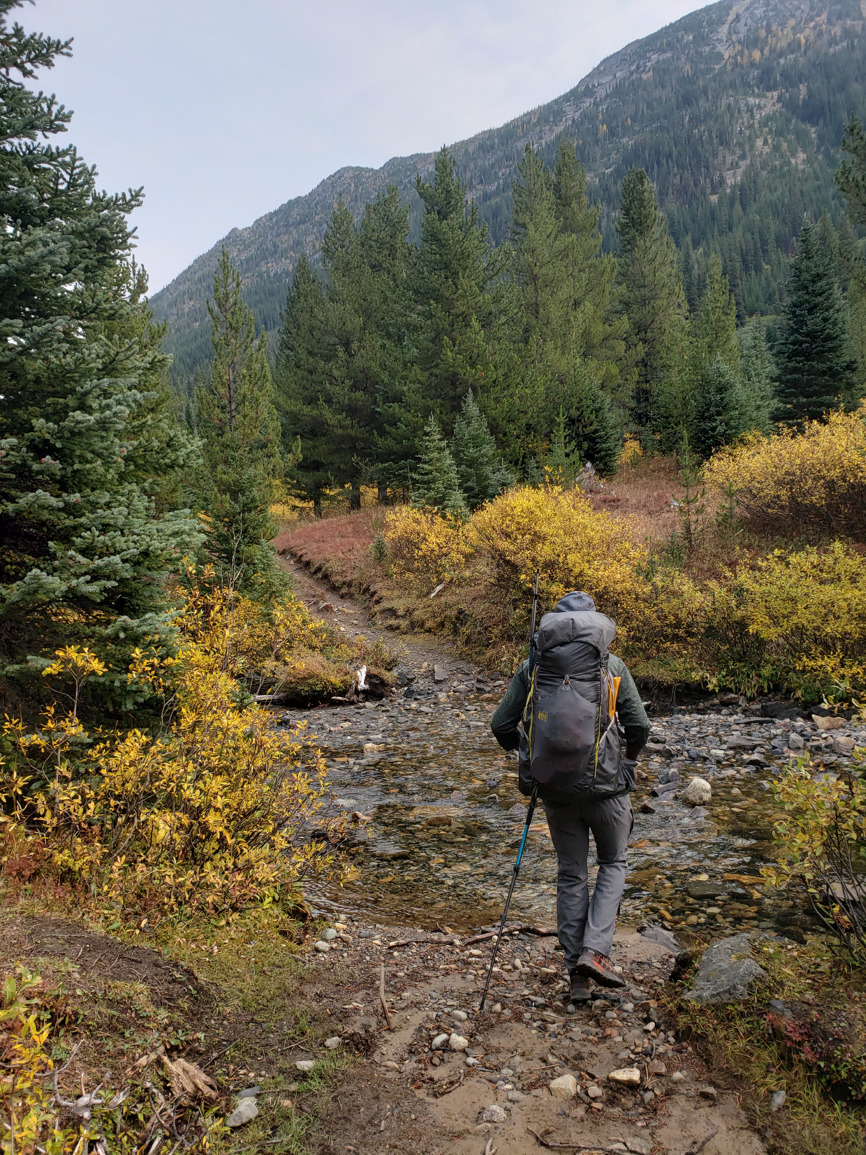
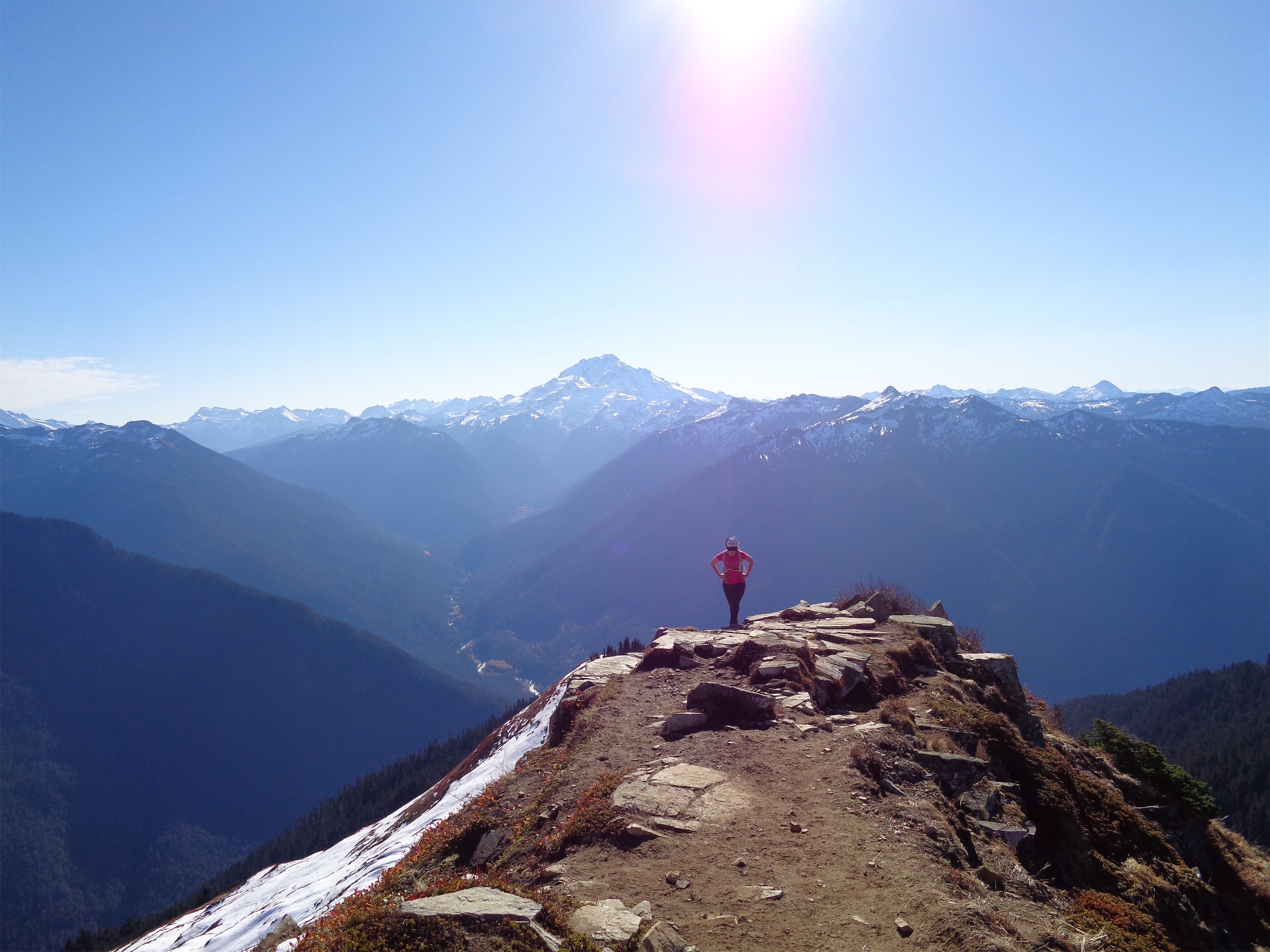
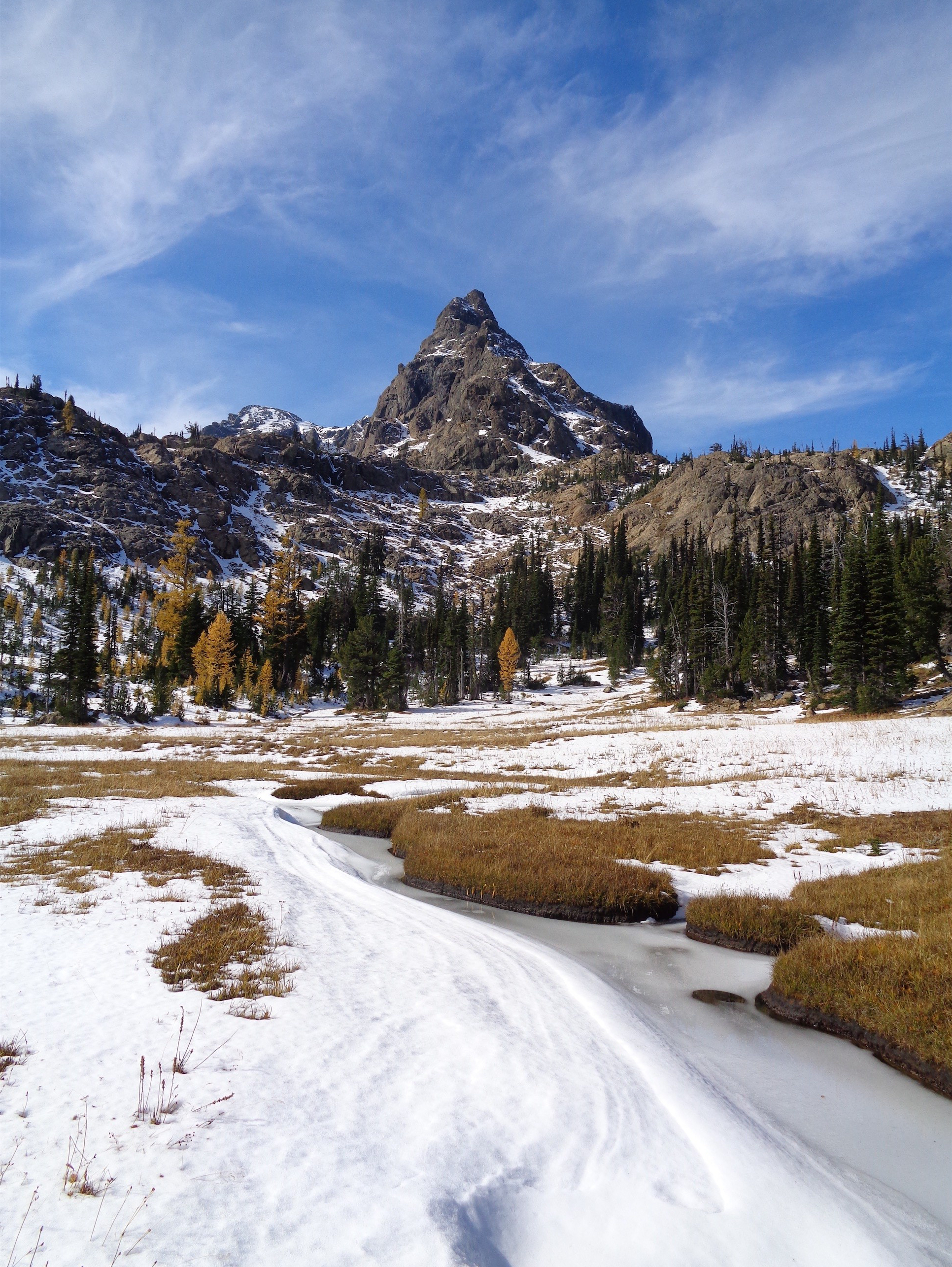
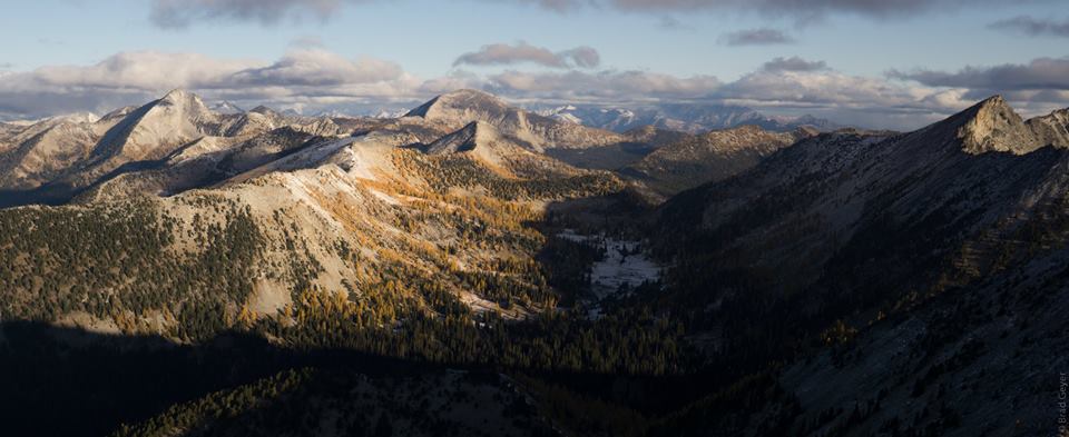
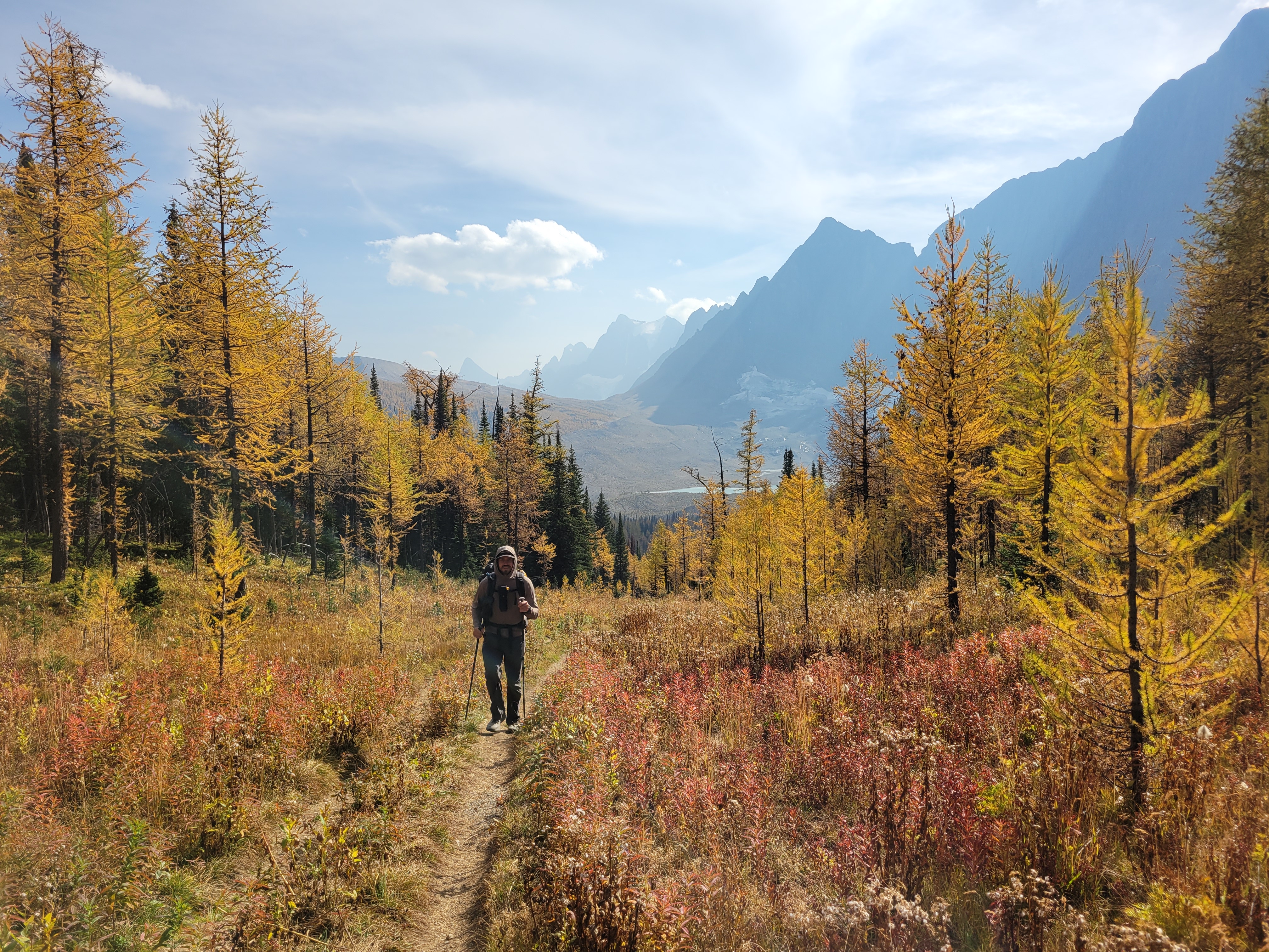
The hike up to Floe Lake was pleasant, a gradual gain for 6 miles through a wide open old burn zone. Most of the elevation gain was close to the lake. I looked up and said “that’s gotta be only like, 300ft” and Brad goes “yeah.. actually it’s like 300m, you’re only off by a factor of 3x.” Ah yes my uncalibrated city eyes complementing my tired city legs. Let’s just skip to the larches.

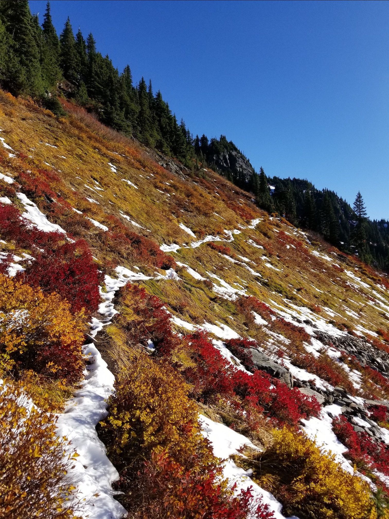
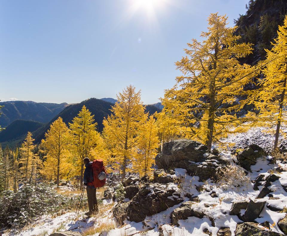
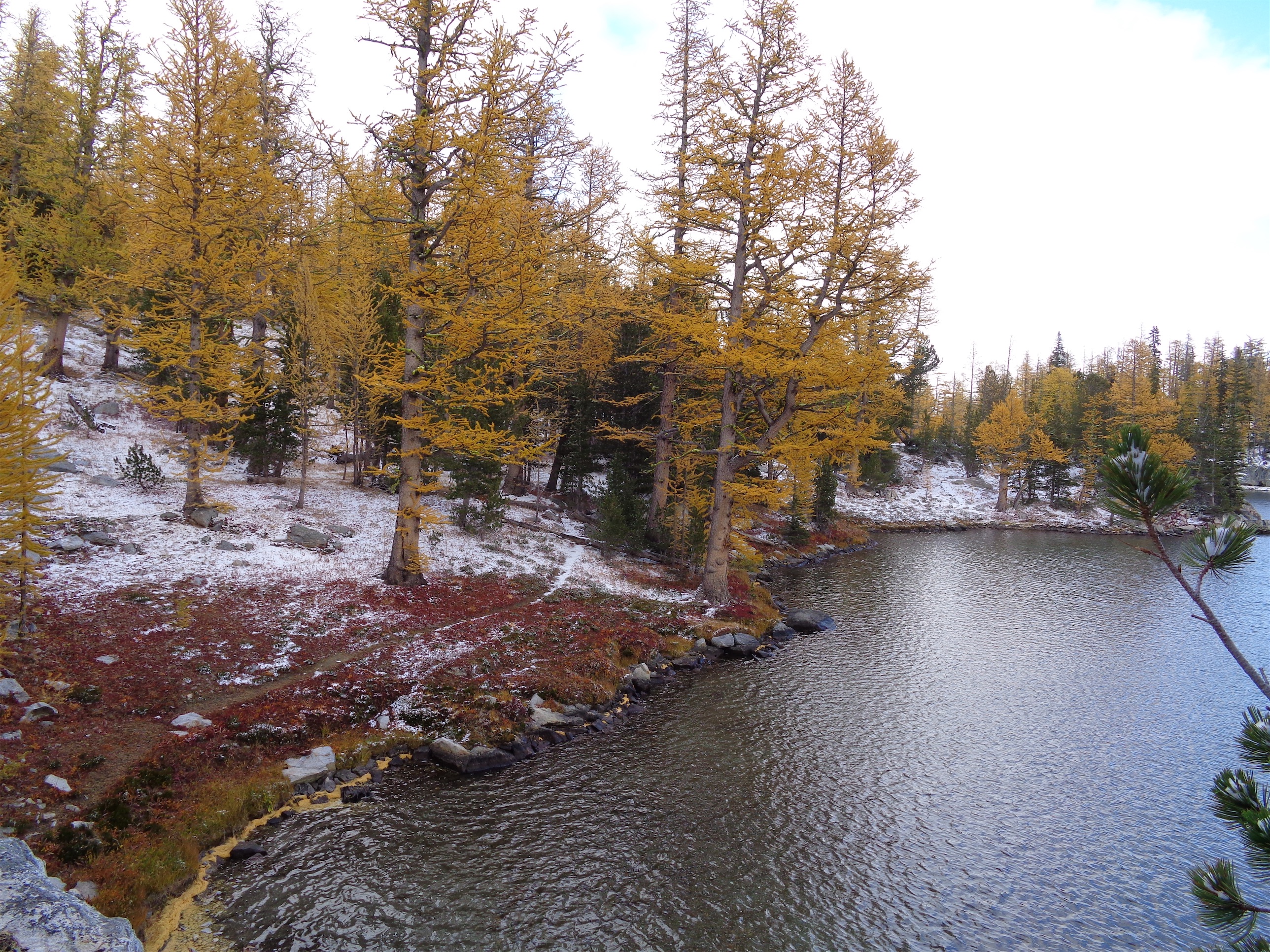
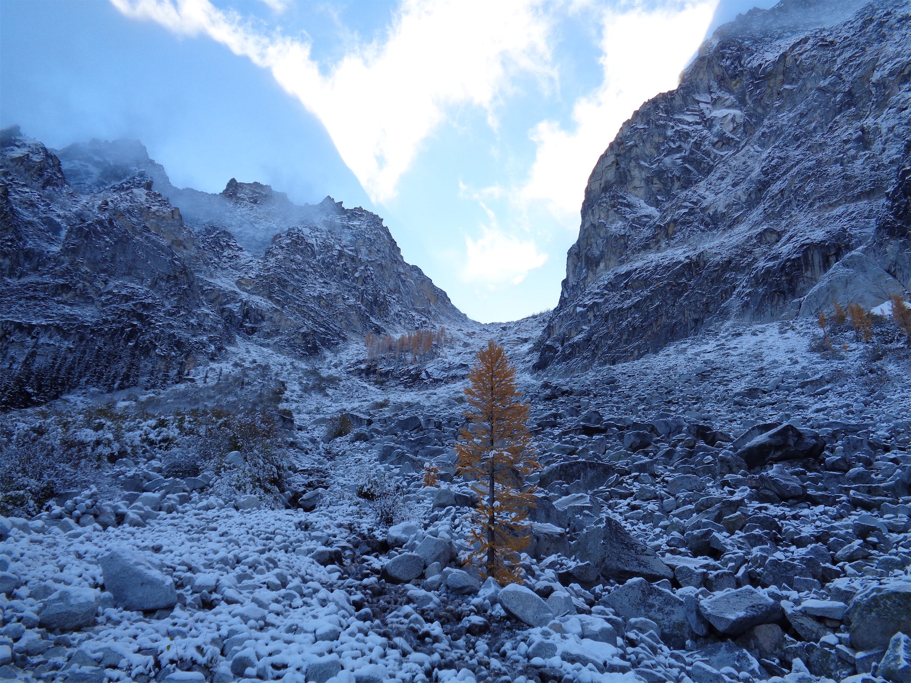
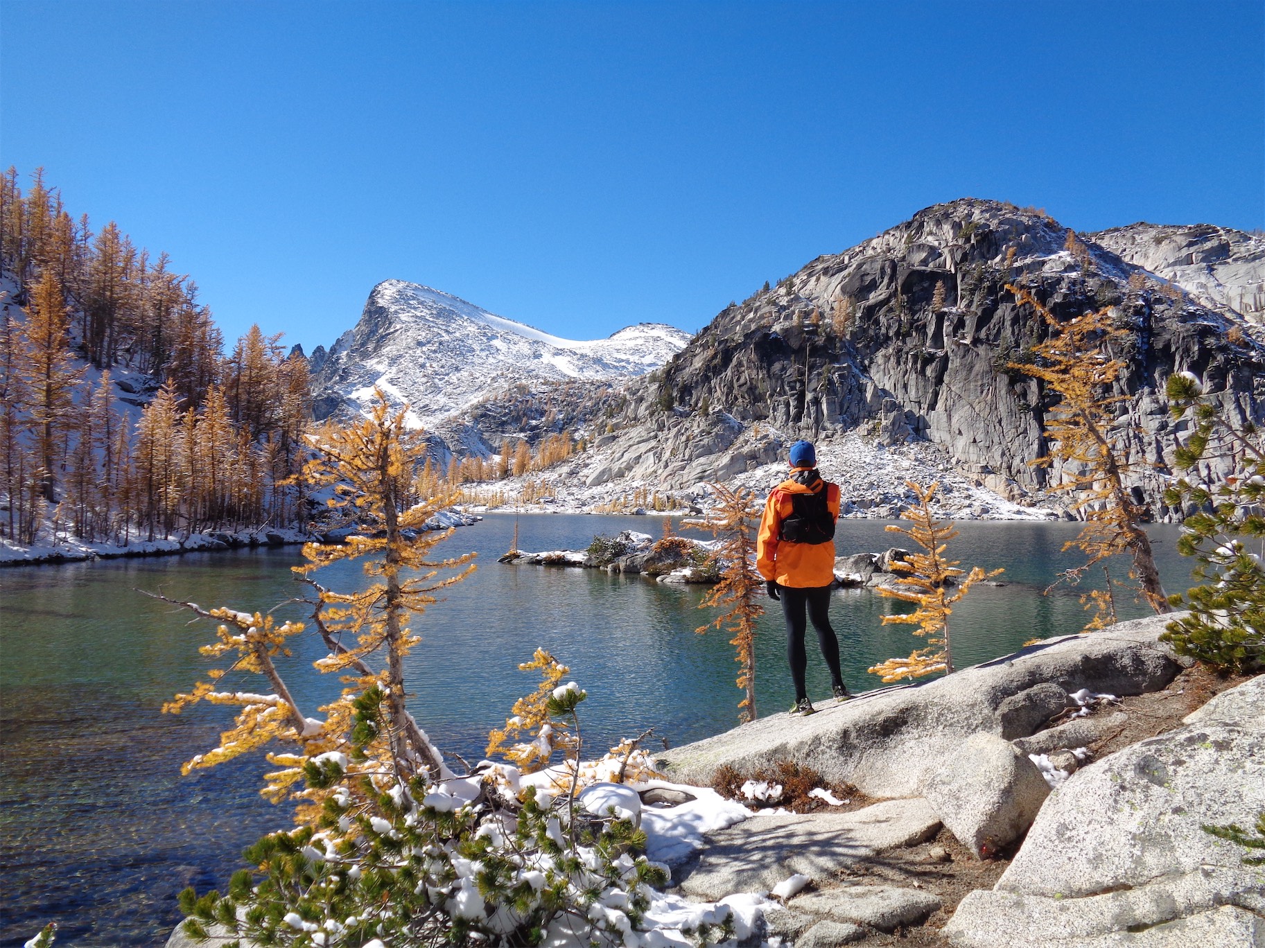
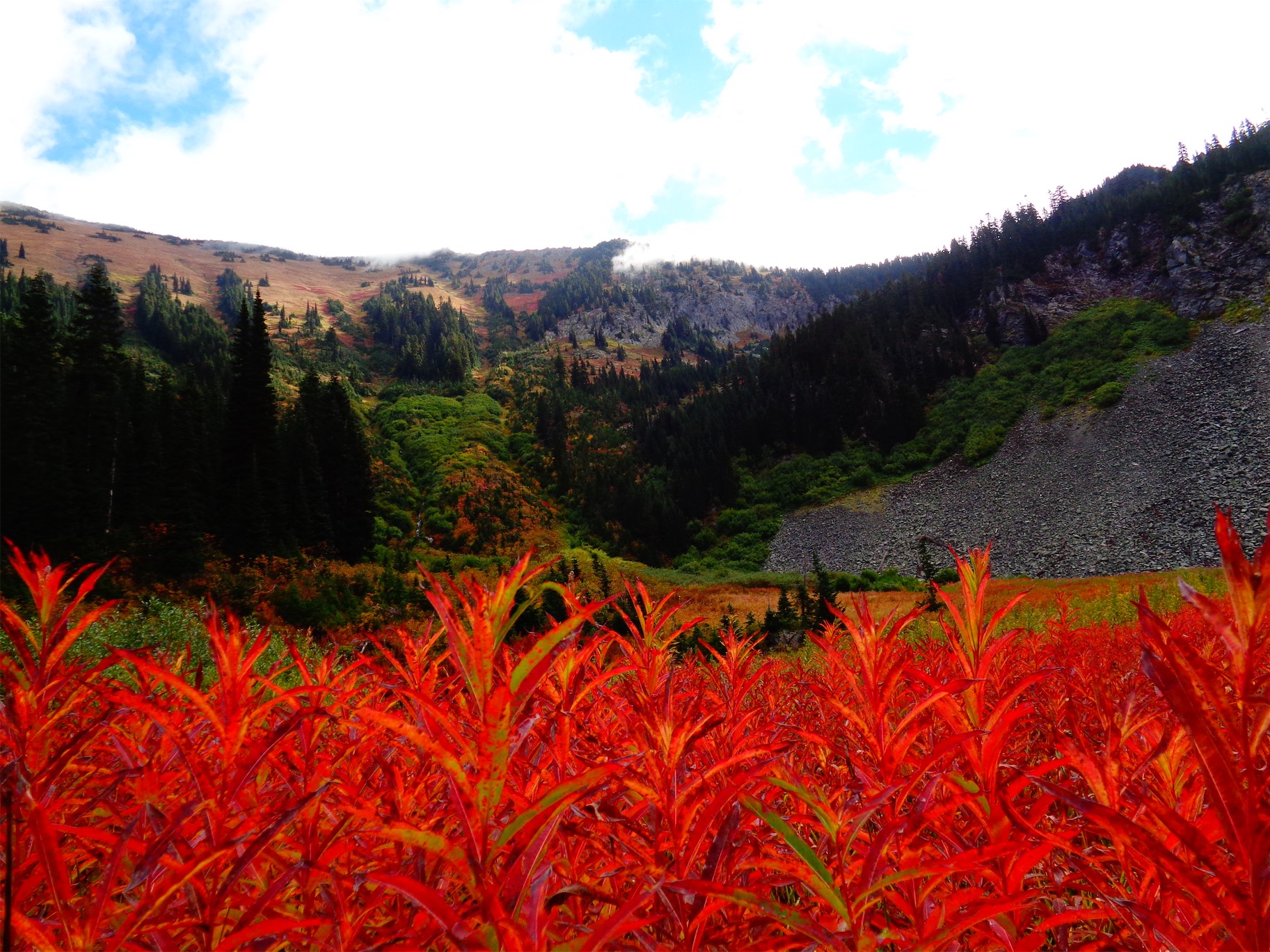
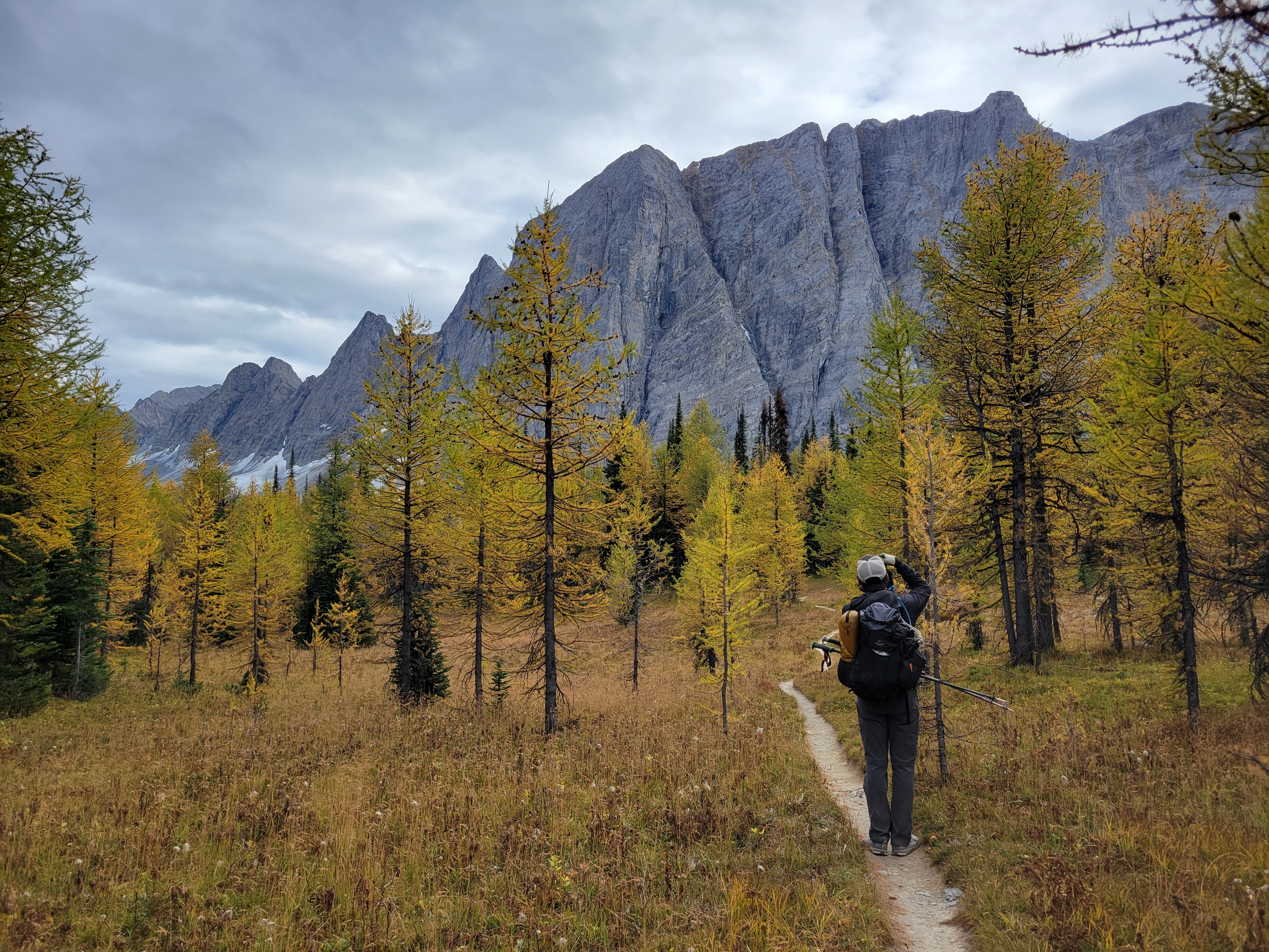
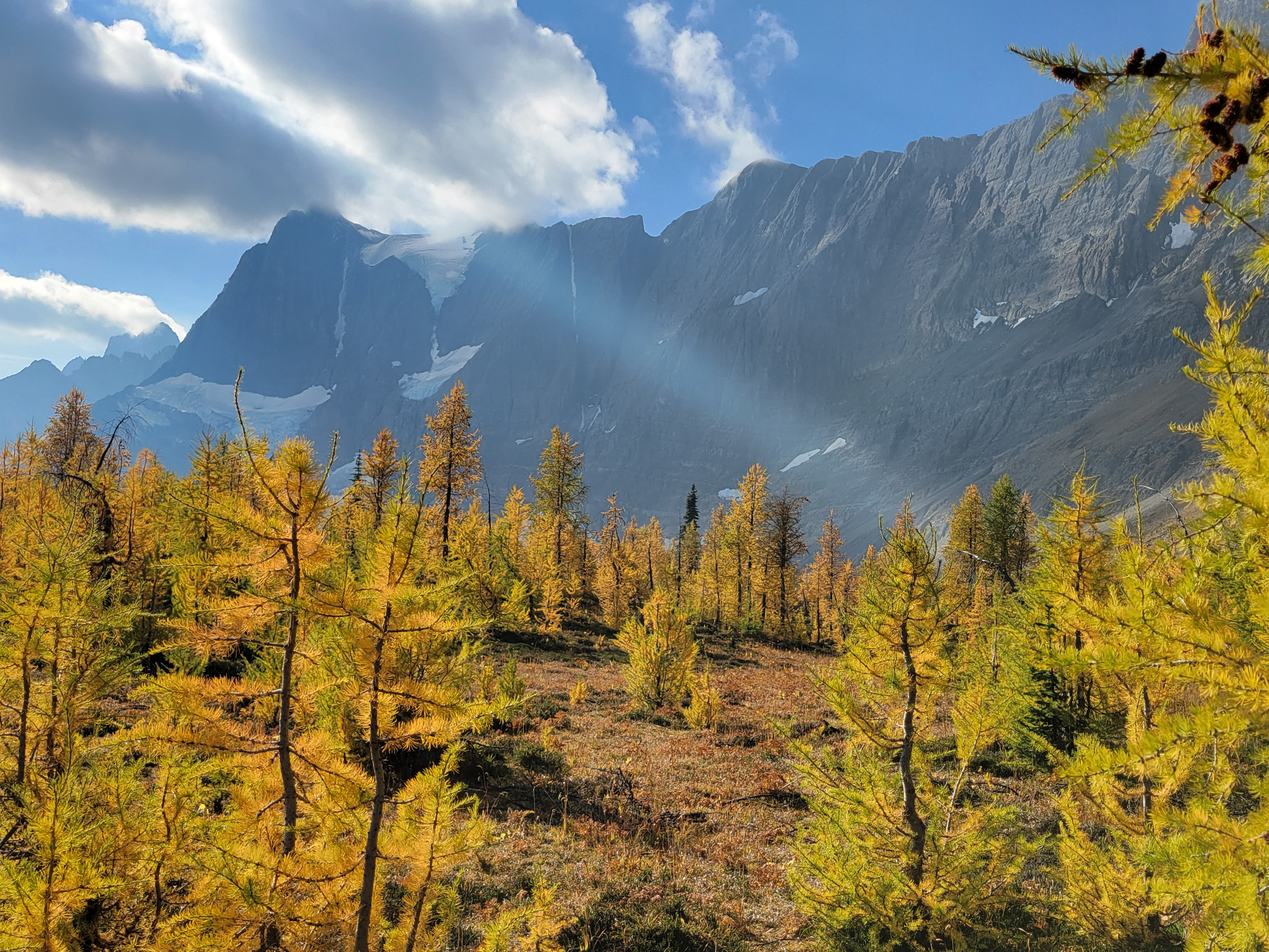
The lake itself was a mix of larches and evergreens, and by the time we got there it was cold, cloudy, and windy. There’s a warden’s cabin there (jealous). Unclear status of fish. We didn’t break for very long since it was cold and it was already 5pm and we wanted to get to the next camp 6mi away before dark. My legs were burning and I wanted to get the rest of the elevation out of the way. On to the larches! Larches, Legs, Lac Floe. 

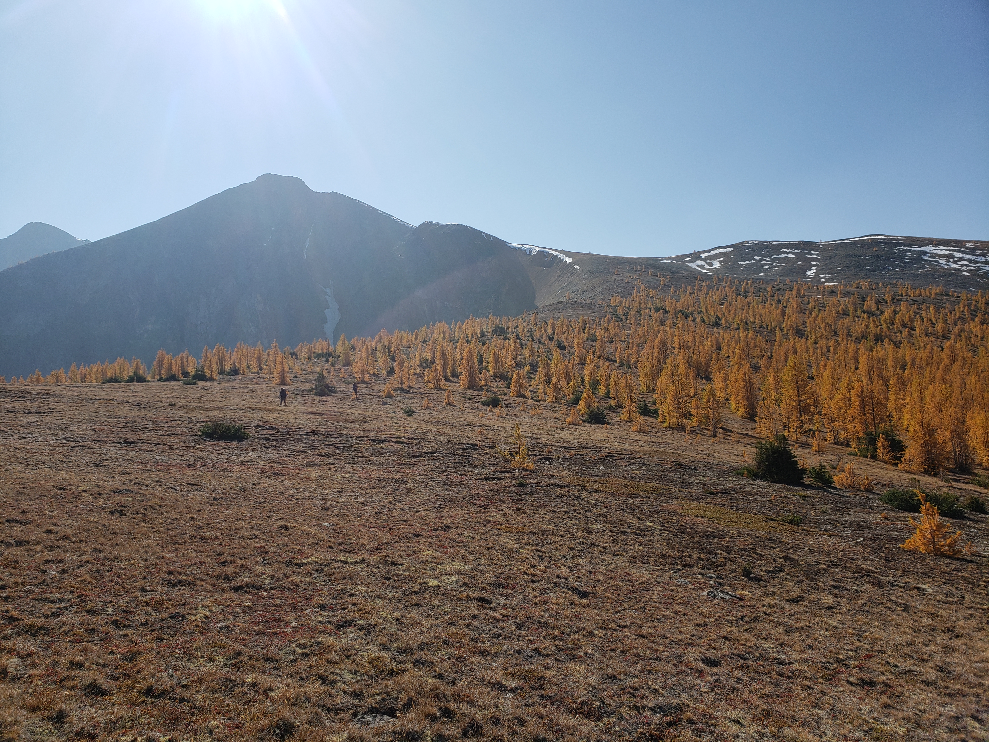
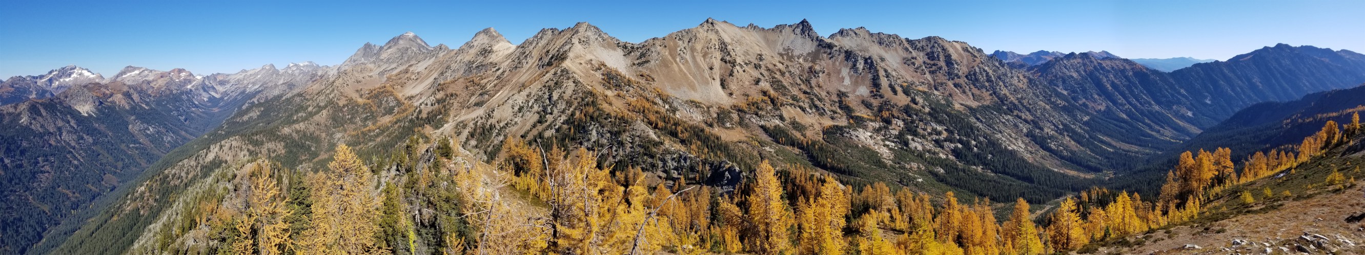
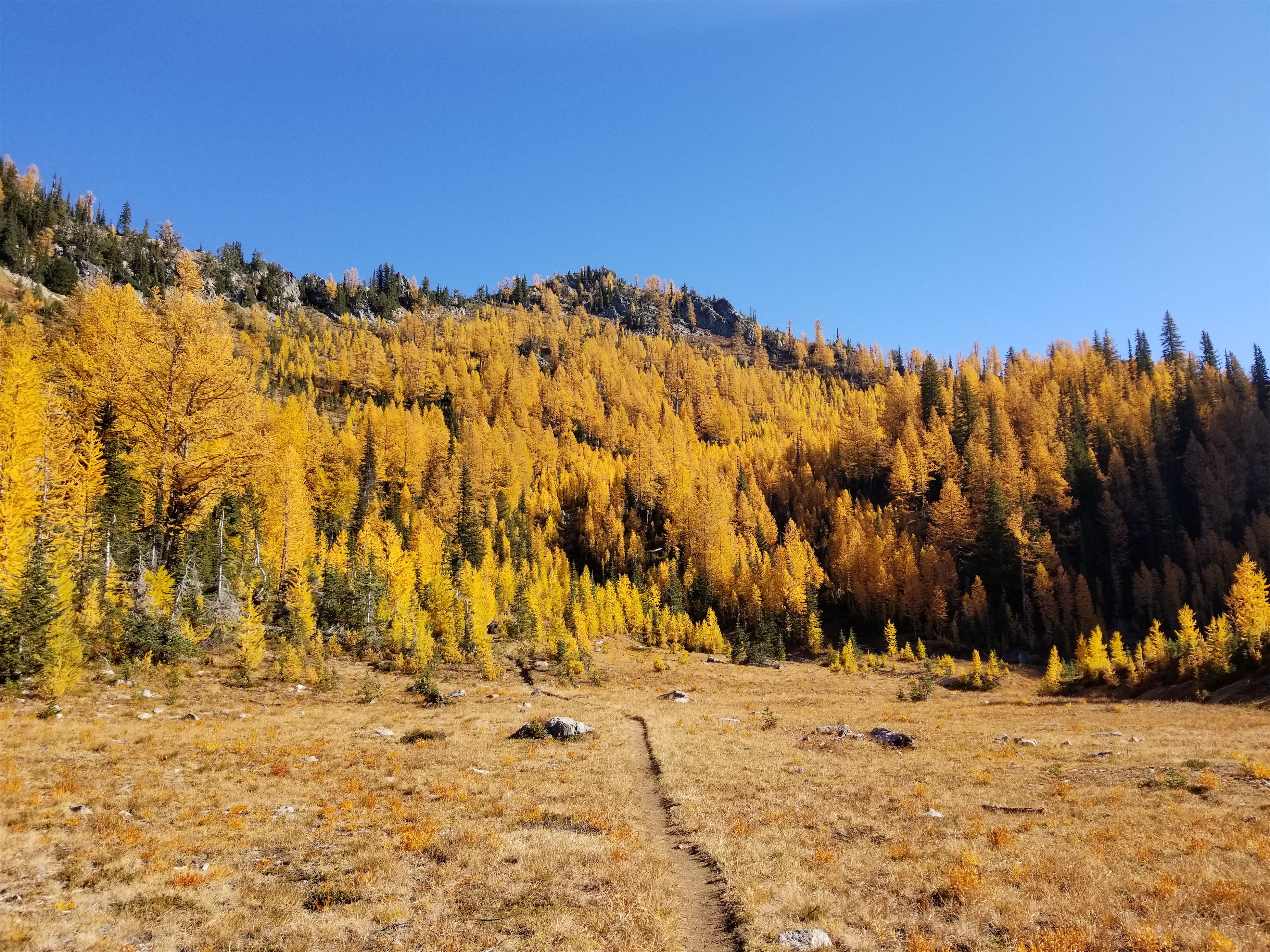
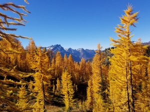
The larches got denser and denser as we climbed and suddenly we were on top of a wide open plateau with baby larches all around us and Floe Lake laid out below us beneath insane towering rock walls. This is where we started to realize maybe we were hiking the trail backwards because the views were always behind us. But anxious about getting to camp, and cold, we didn’t take much time to enjoy the views. Crazily enough, the elevation gain was pretty minimal, I think under 3kft for the whole day despite 12mi. But my city legs were tired.

Ridiculous color even with moody skies
Floe Lake below the first larch grove. You can HIKE (not climb!) those peaks from the other side. Insane
Bonus larches after the pass!

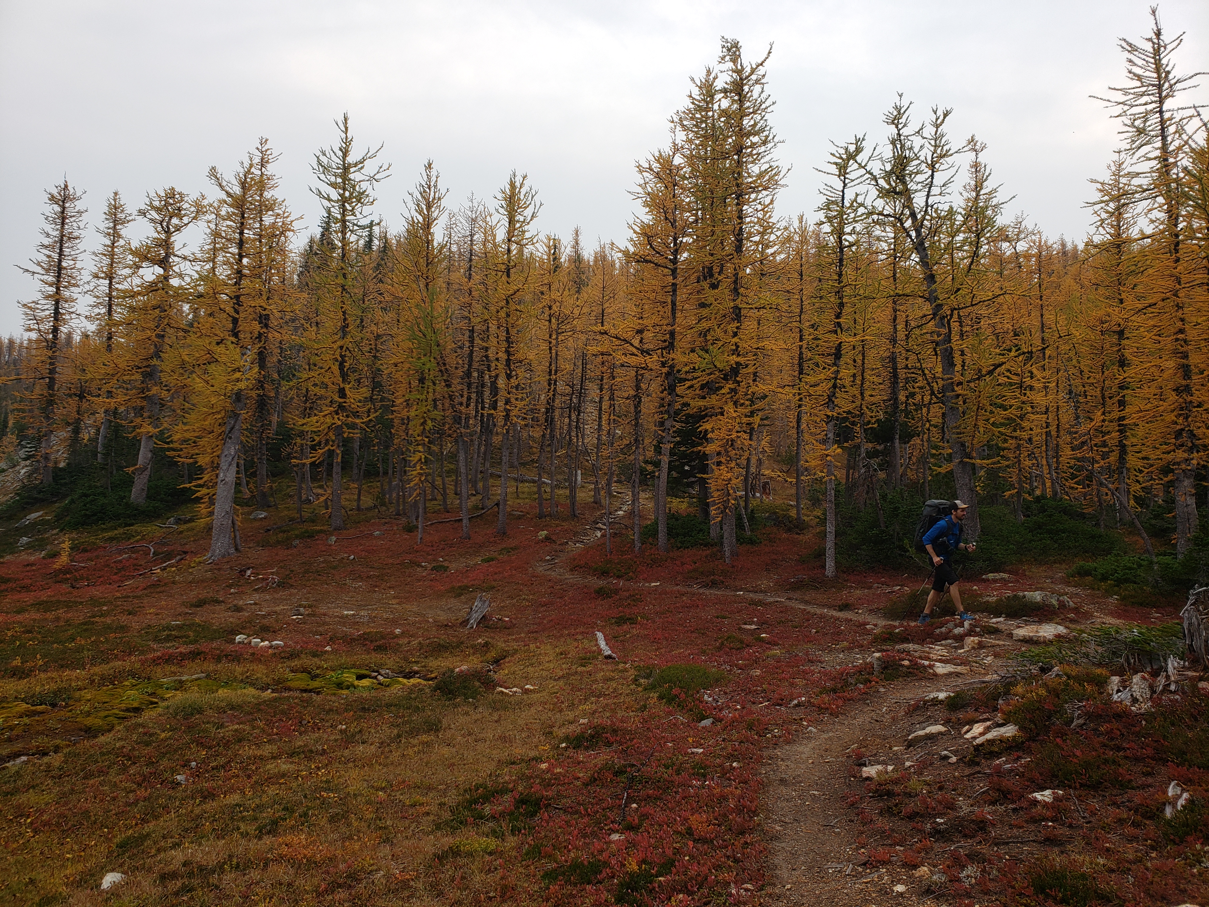
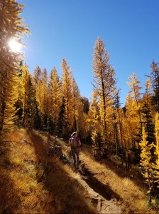
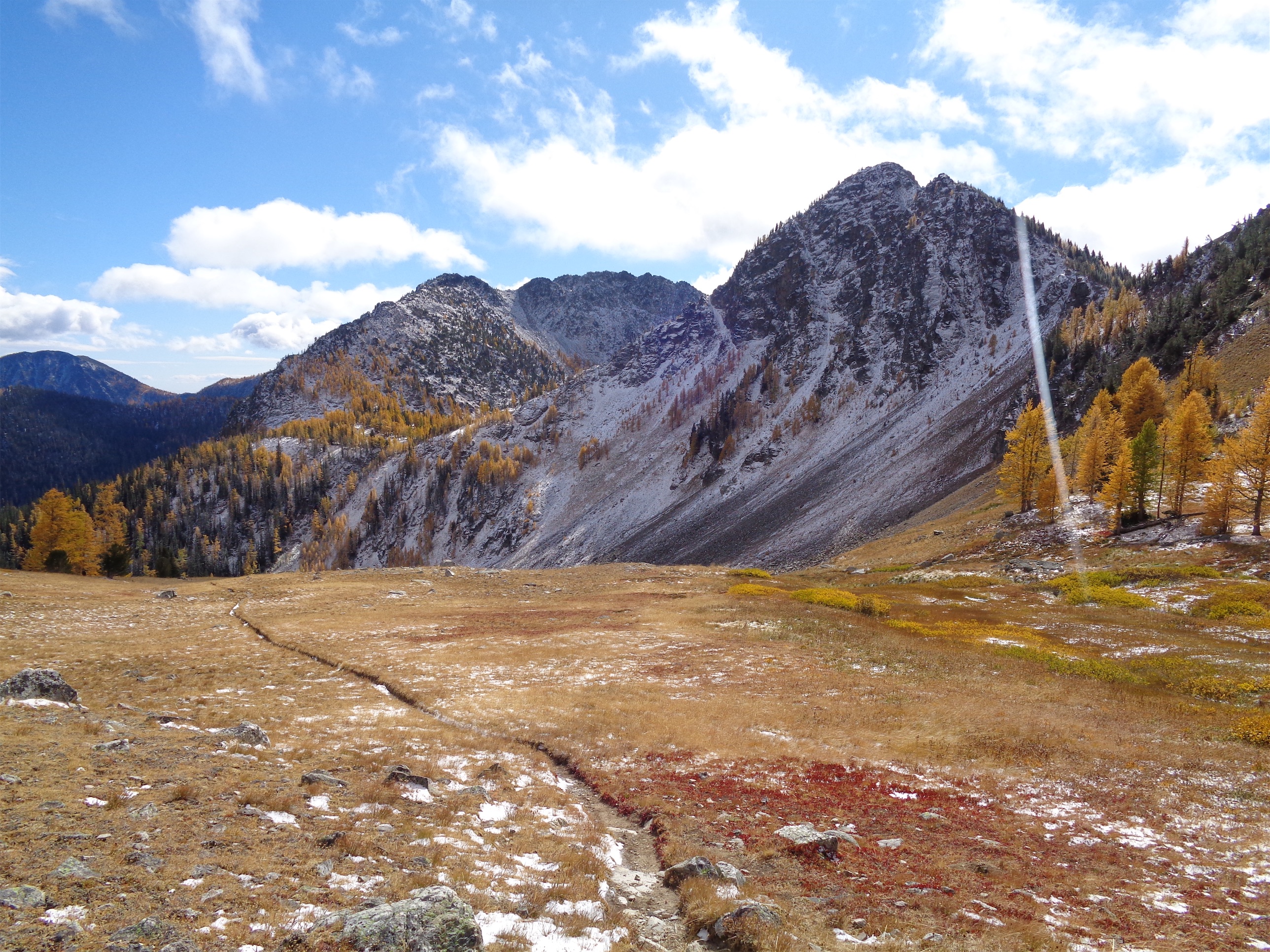
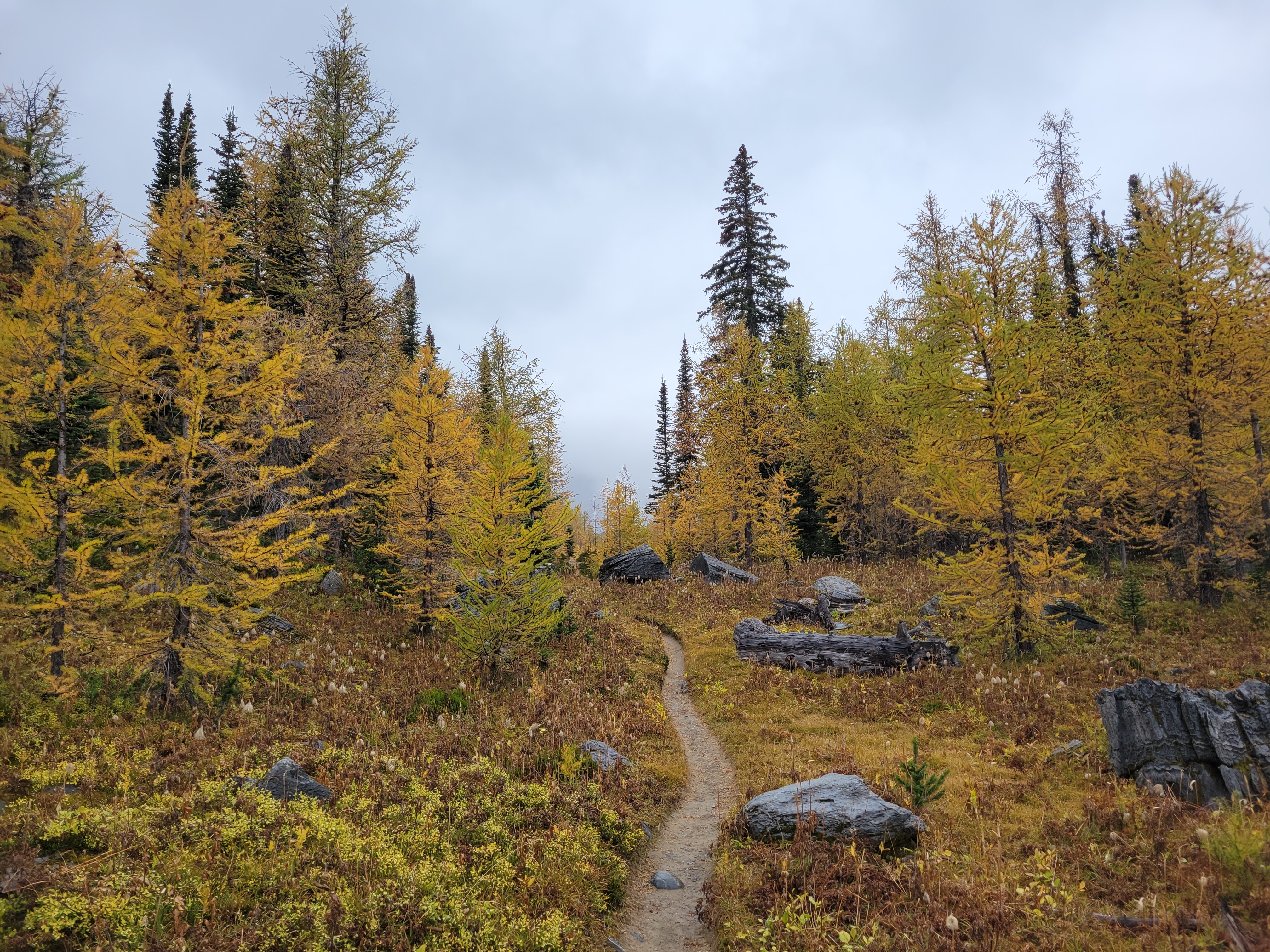
And we crested the pass and what did we see?! Was it more larches?? You bet your ass it was more larches. The trail snaked along the gravelly hillside (tease!) before turning straight into the next grove of larches. Trail optimized for larches.

Tease of blue sky but no sun. Doesn’t matter, found larch carpet

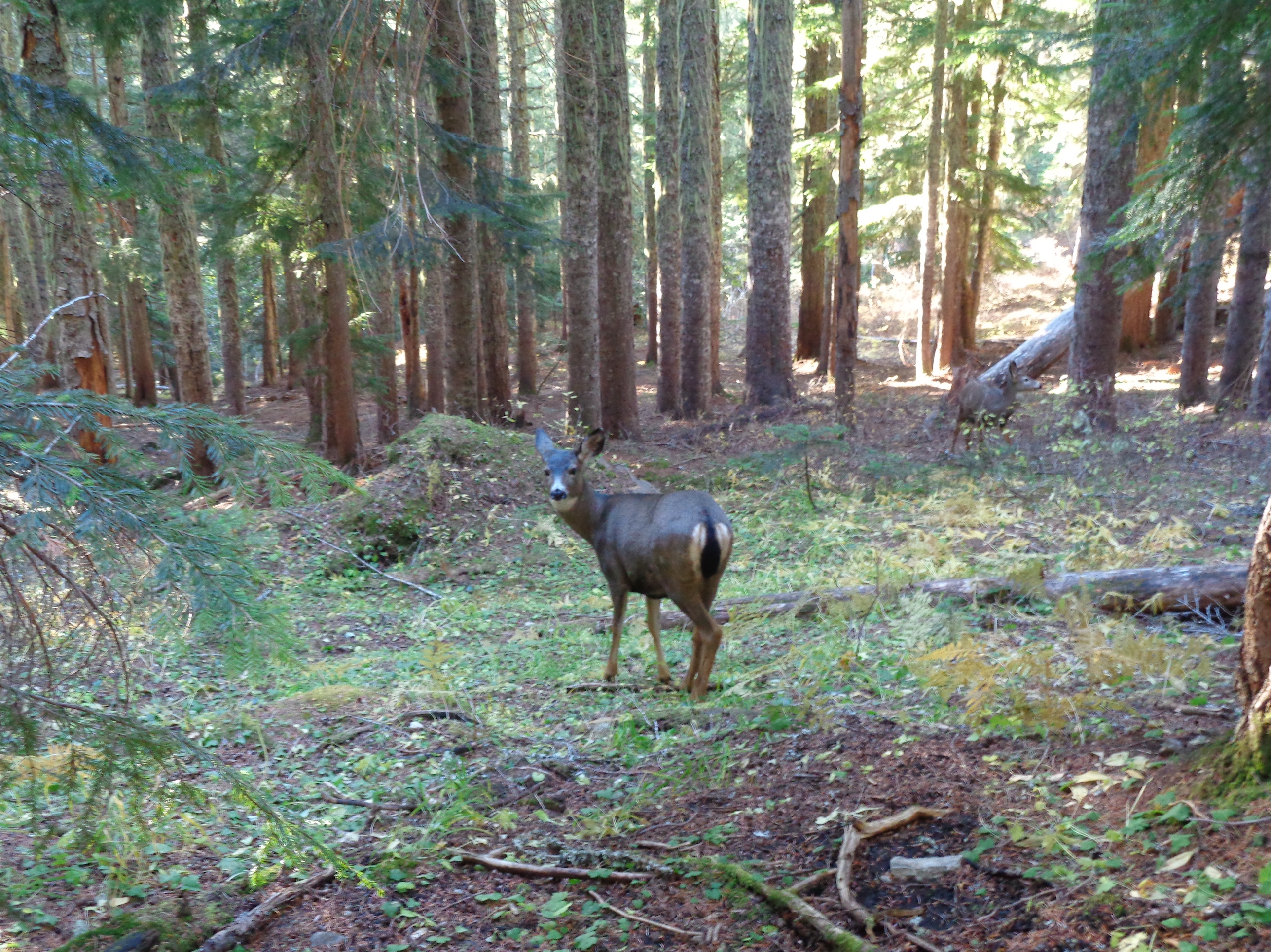
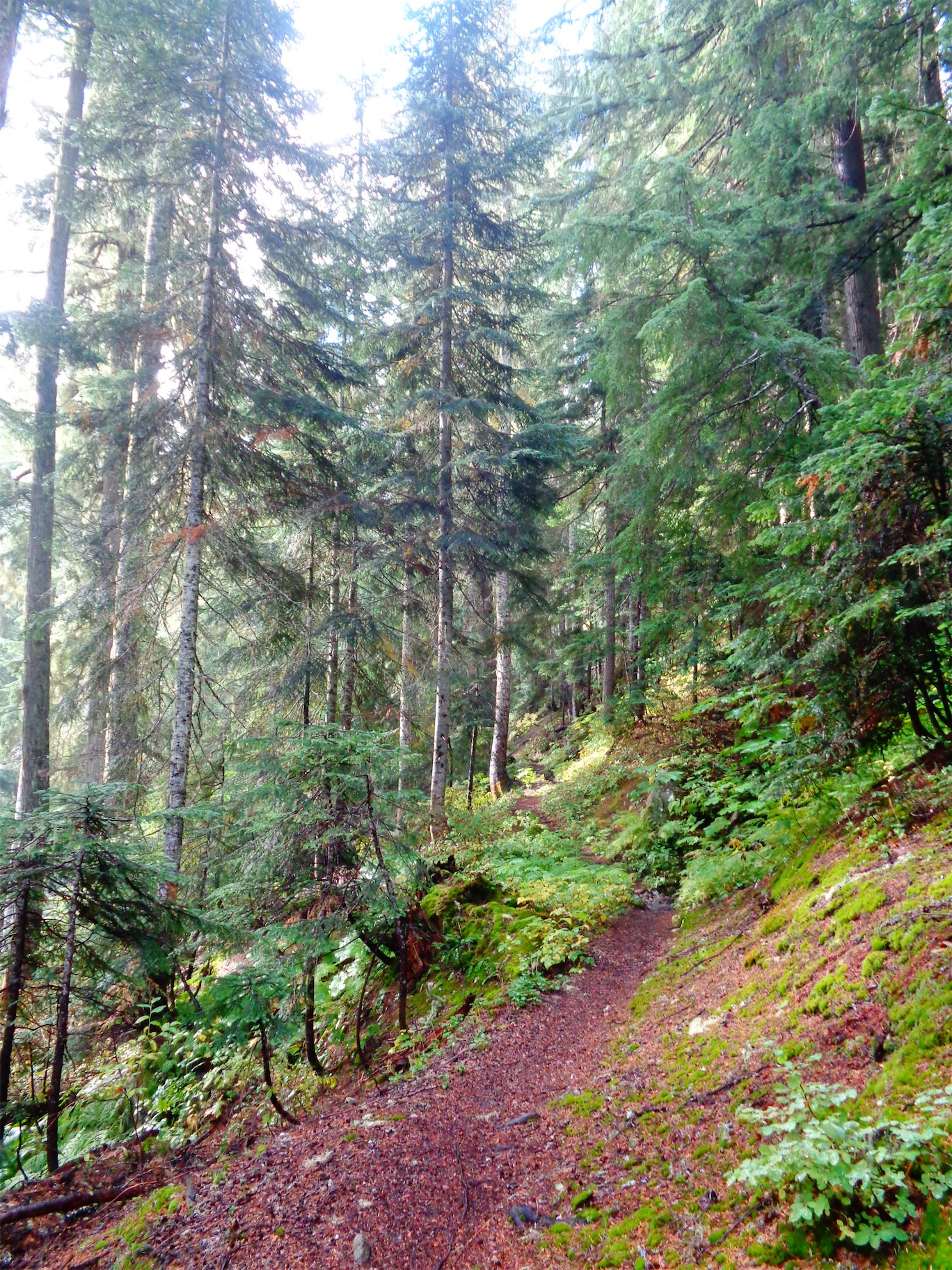
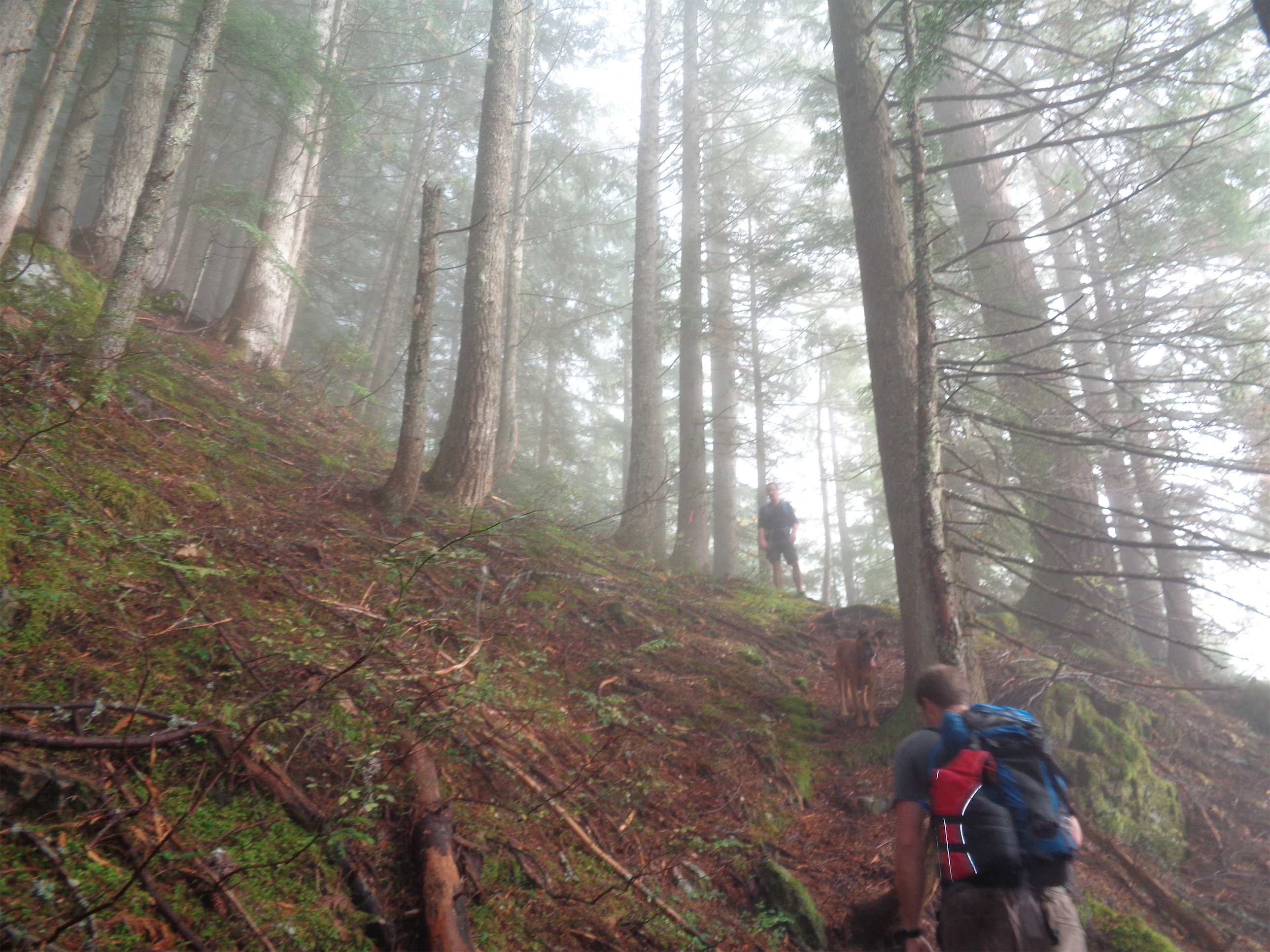
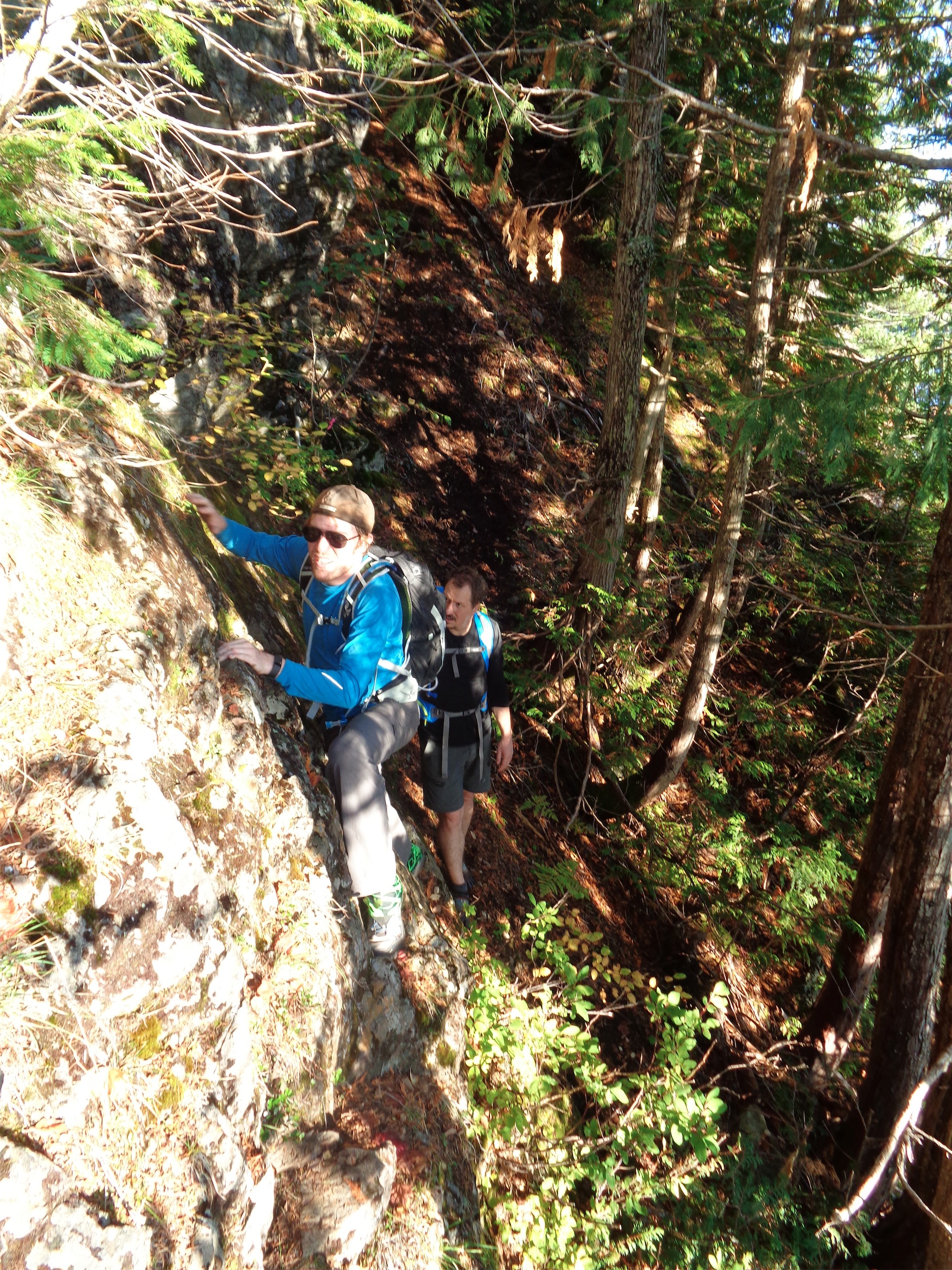
Once the larch grove was past us, losing that 3k elevation gain was kind of brutal. Switchbacks forever, and steep, and I had done a pretty good job of keeping my cardio up but nothing had prepared my legs for jarring downhill. But we saw a porcupine booty bobbing through the trees, I’ve only seen a porcupine once before. As it got darker outside I started bugging out about bears. Every switchback, every bend in the trail, every tree out of the corner of my eye, bears everywhere. Everybody had me psyched out. I felt like a dork carrying bear spray but everyone kept telling me ohhhh no the bears are the real deal there. I was guaranteed to run into a bear. But soon enough it finally flattened out, my legs relaxed, my brain relaxed, and we stumbled into camp. Far below treeline right next to a river. With no larches. And no views. Just trees and darkness and probably bears.

Uninspiring start to second day. This photo doesn’t even deserve to be here except to convey my disappointment

We set up camp pretty quickly and ate, finishing just before it got fully dark outside. Turns out every campsite has a designated camping spot and separate eating spot, complete with bear lockers. I just left my whole pack in there and crawled into my tent where I burrito-down in my sleeping bag and lay freezing and congested for the next 9 hours. At one point I stuck my head outside to blow my nose and was greeted with the first time I’ve seen the Milky Way in over a year. I lay with my head hanging out the door for a solid half hour marveling at every shooting star that passed. Crazy to go from counting planes in the sky to counting not just stars, but shooting stars in a span of 24hrs.

Ah yes if heaven were rainy this would be it

At 6am, it hadn’t started raining yet. I was optimistic. I started to get ready for the day. Contacts, change of clothes, oh you’ve gotta be kidding me is that rain? The rain had started. I went back to sleep. I finally got up around 8ish and had breakfast, paced around restlessly, gave up and sat beneath a tree that was thick enough to cast a dry spot for a few hours. Didn’t have a book or anything because luxuries aren’t part of my trip planning. I remarked to Brad that the pit toilet was phenomenal, could barely even smell it. “Or maybe you’re still sick.” Oh, yeah. Or that. Around noon we figured it wasn’t going to really clear up, we might as well move. 

Crazy glacial moraine, lake out of frame

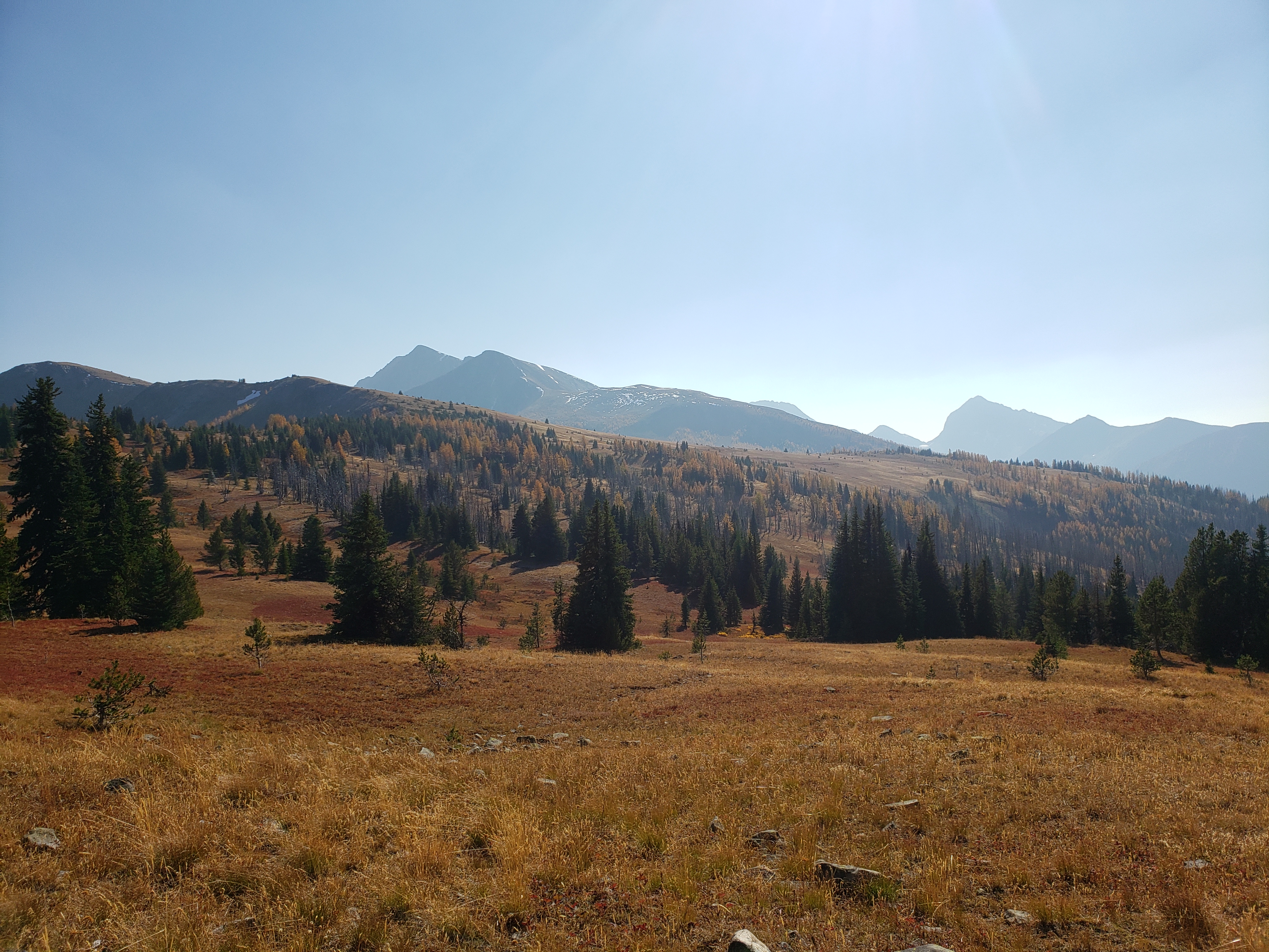
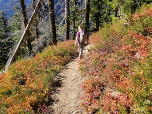
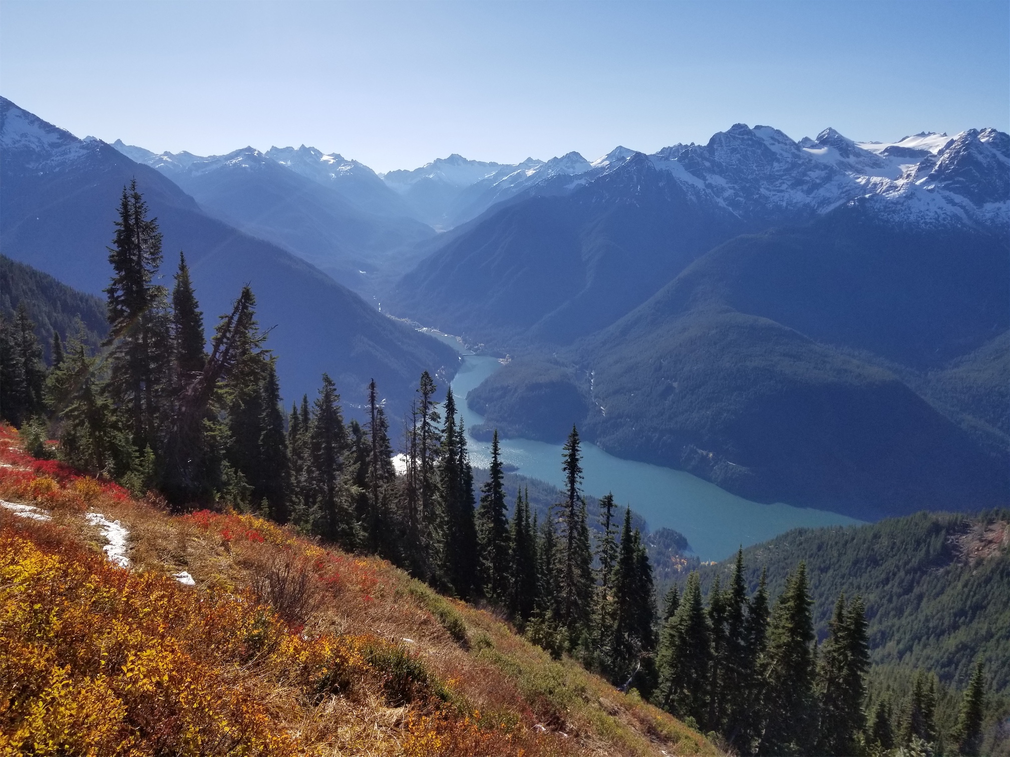
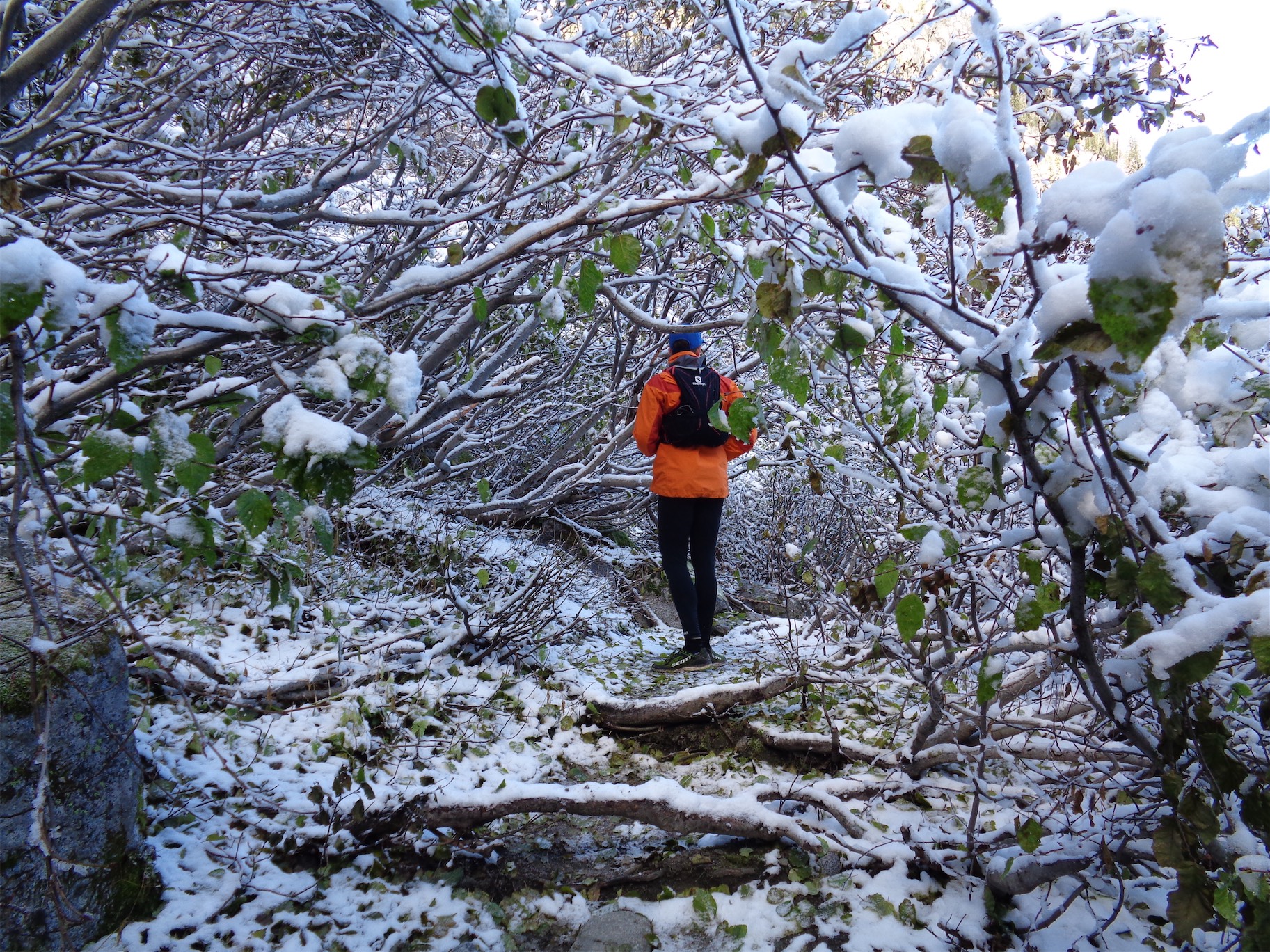
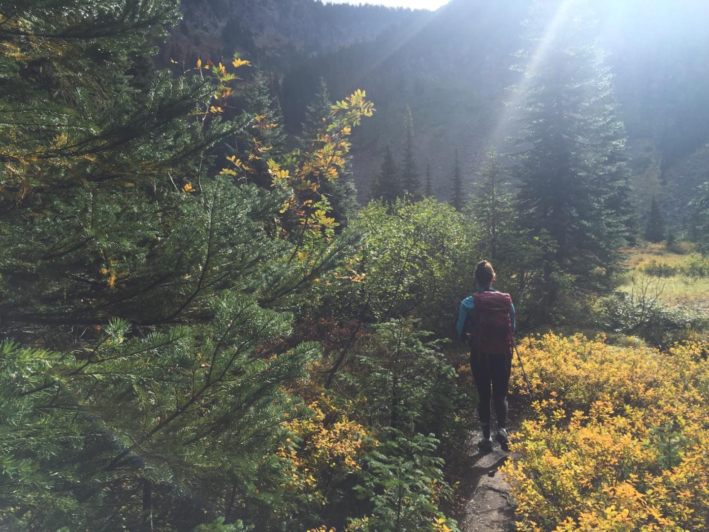
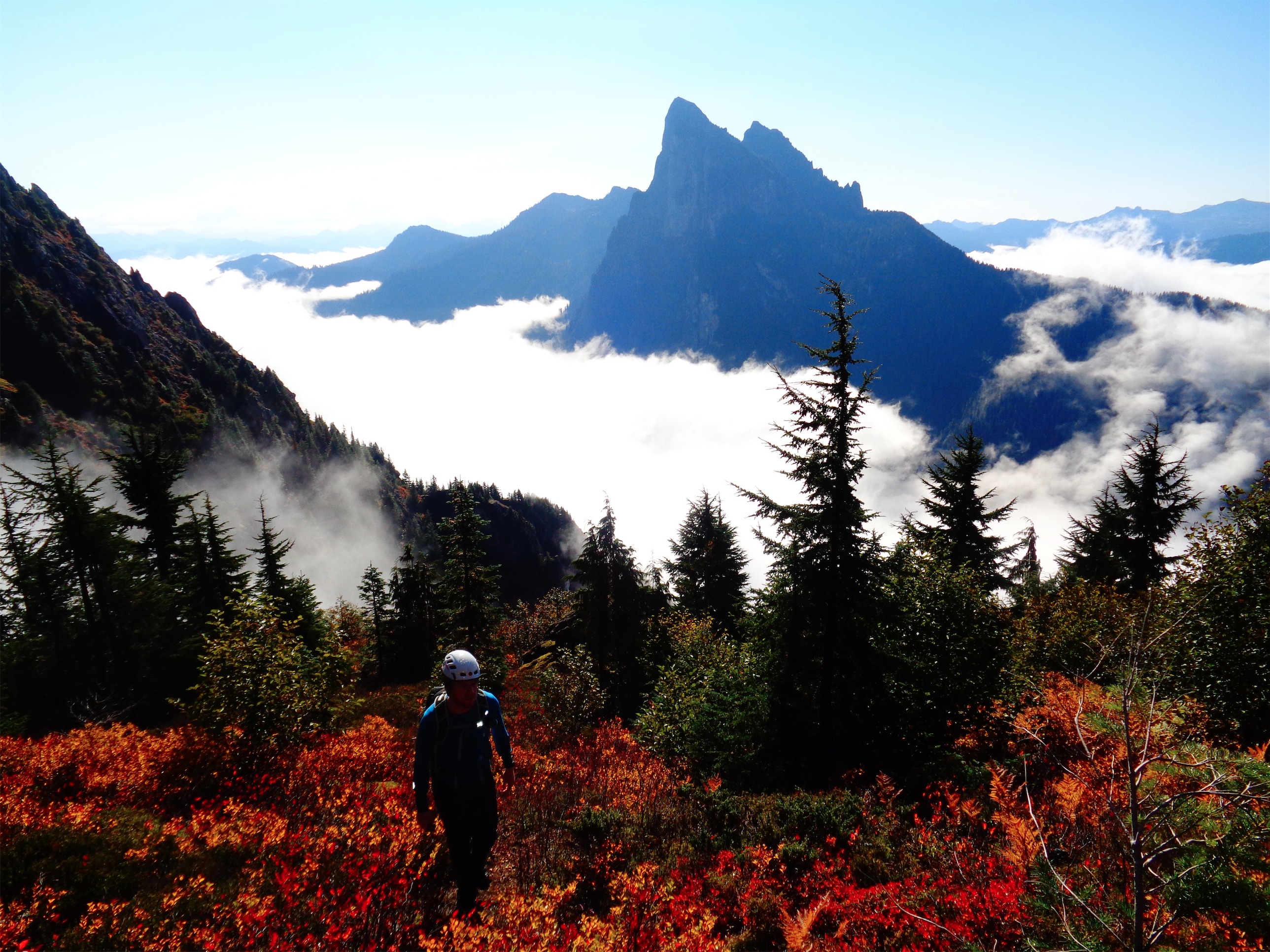
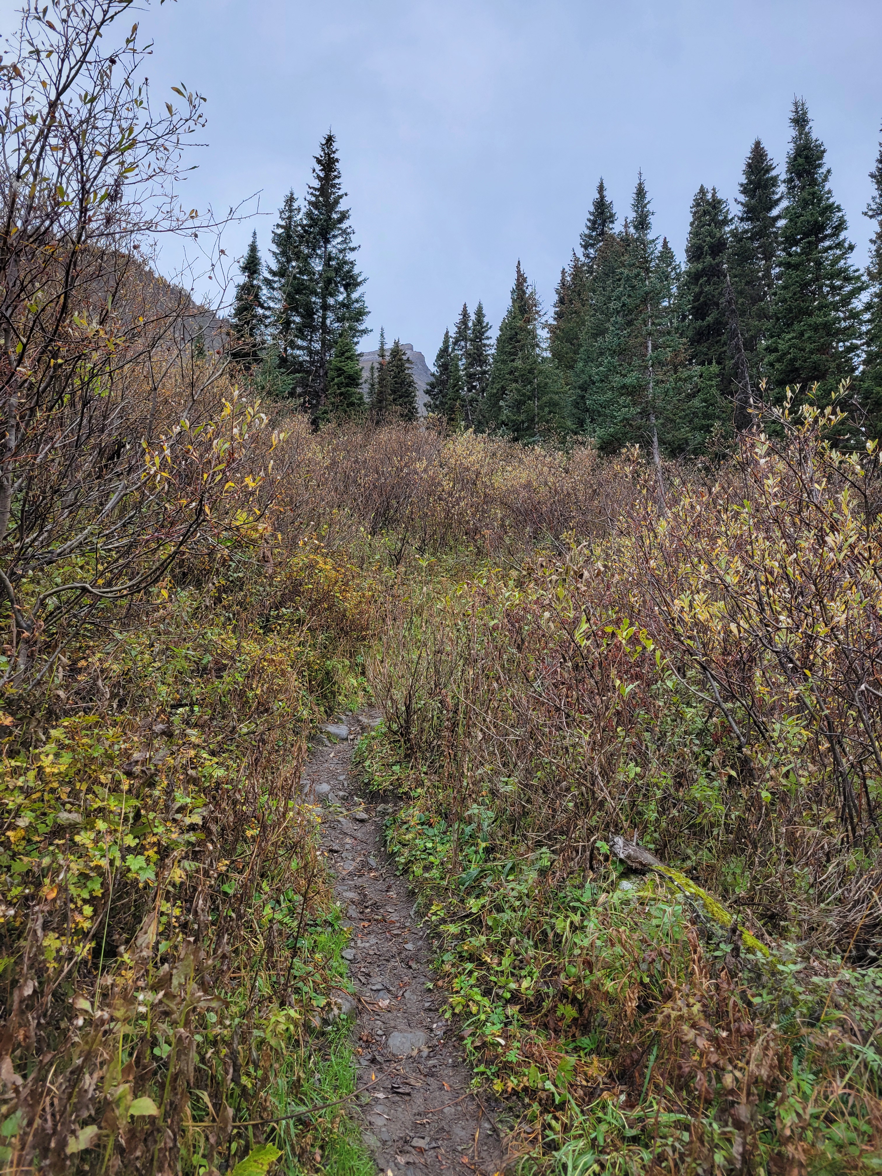
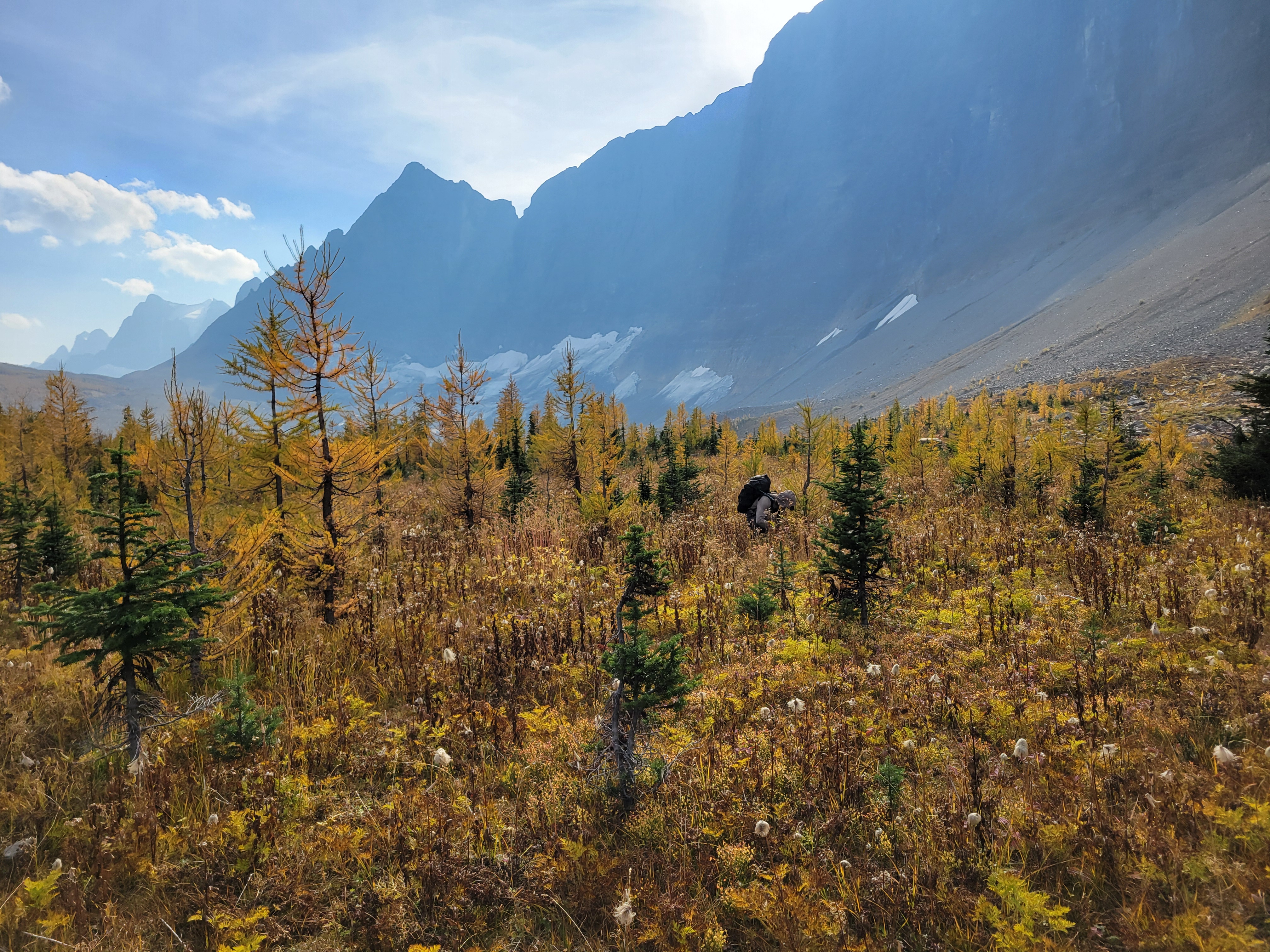
It had backed off to a drizzle. I strapped my soaking wet tent to the outside of my pack to spare everything on the inside and we took off. The first mile or two was stupid, generic slopes in the mist. And then we crested the next pass and hit larches and holy crap the glimpses we got were such teases. Toes of glaciers hanging down rock walls between larches! A huge moraine, with a lake I’d have demanded we hike to if it hadn’t been raining. The rolling slope to the east that we could have hiked up easily for better views, if we hadn’t been socked in by clouds. Oh man. But at least we only had to go four miles. Four miles of +2000ft and then -2000ft. Because of these below-treeline-only-campsites.

The Prince and his Throne

We got to camp around 3pm and did basically what we had done that morning, set up tents and sat in dry spots for as long as we could tolerate. 5pm was dinnertime, we huddled in a dry grove between trees. Nobody was using the official picnic tables, which were in clearings fully exposed to rain. I think I was in my sleeping bag by 6:30pm where I slept for 12 hours because there was nothing else to do in the rain and the cold and this was another campsite below tree line with no larches and no views and only trees and probably bears. I peeked my head out occasionally to see if clouds were moving. The one pro of camping below tree line is some of the trees are dense enough that they maintain dry spots so you can at least sit outside briefly. I barely survived the pit toilet. It smelled horrible. My head cold must finally be passing.

I woke up at 6am, truly believing in my deepest of hearts that it would. be. sunny. Narrator: it was not sunny. It’s amazing that you can believe so hard in something and have it not be true. Whatever. I guess free will doesn’t exist. Love isn’t real. Karma doesn’t actually come around. We’re helpless. Nothing matters. It started to dawn on me that the next day I’d be getting on a plane in soggy clothes with a pack full of soaking wet gear after four days in soaking wet weather that I busted my ASS to make happen. What can you do but laugh? We dined on stroop waffles heated over the steam from the water we boiled to drink, to various name-that-tunes: stroop, there it is. stroop, stroop ba doop, stroop ba doop. Like everything else, my existential crisis also doesn’t matter, not when faced with Costco snacks. We packed up once again and started off.

Great Jesus ray. That’s the father, the son, and the holy spirit telling me personally hey, we got some sun headed your way

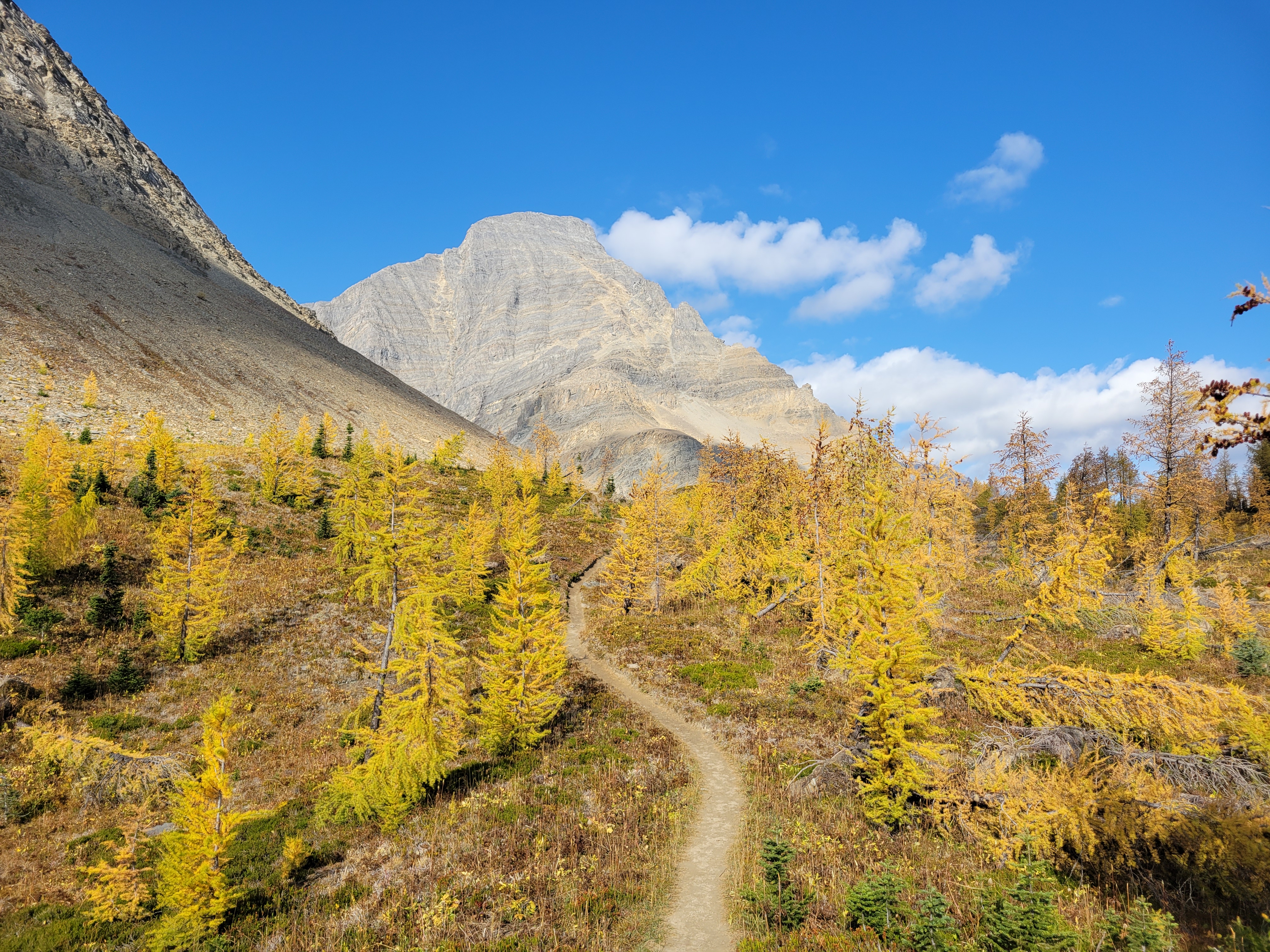
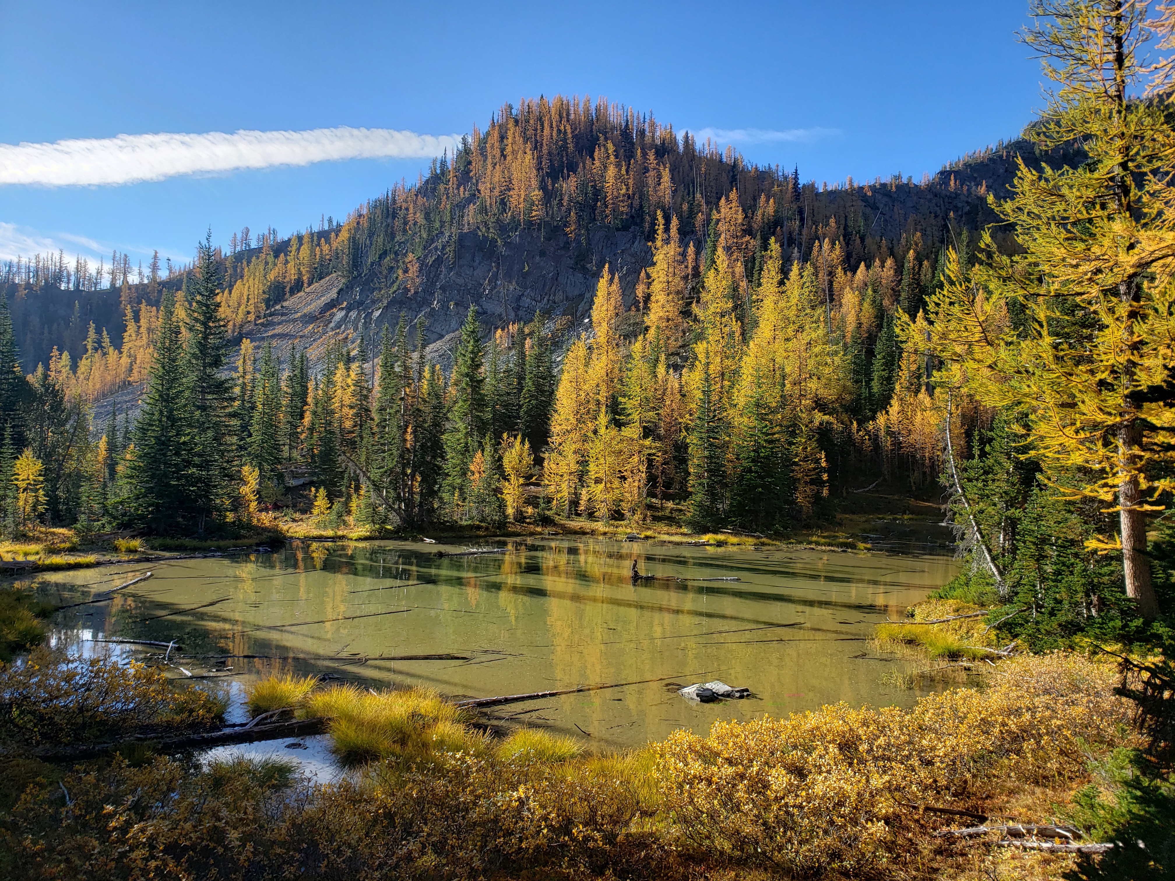
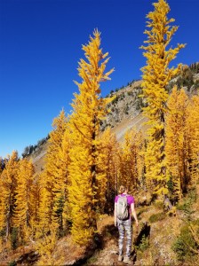
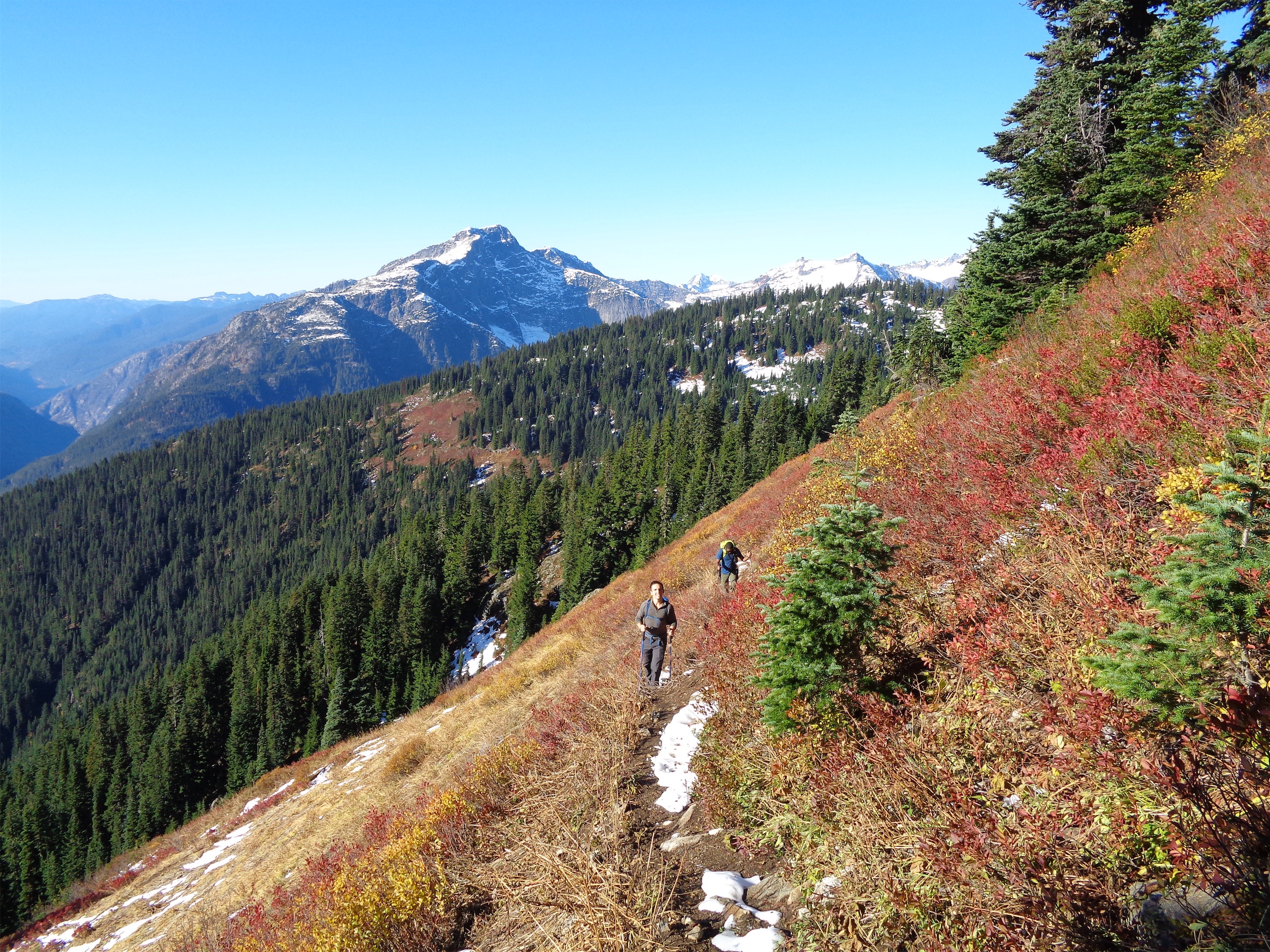
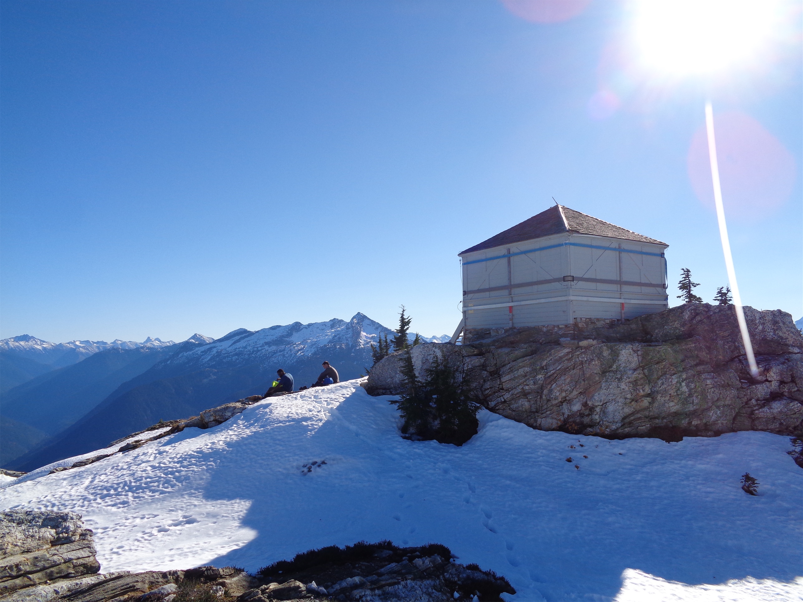
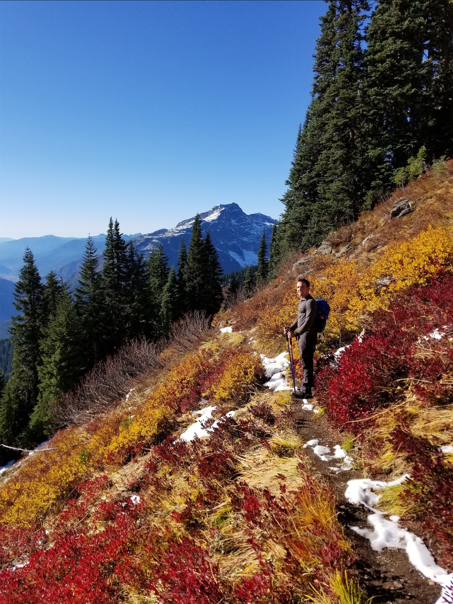
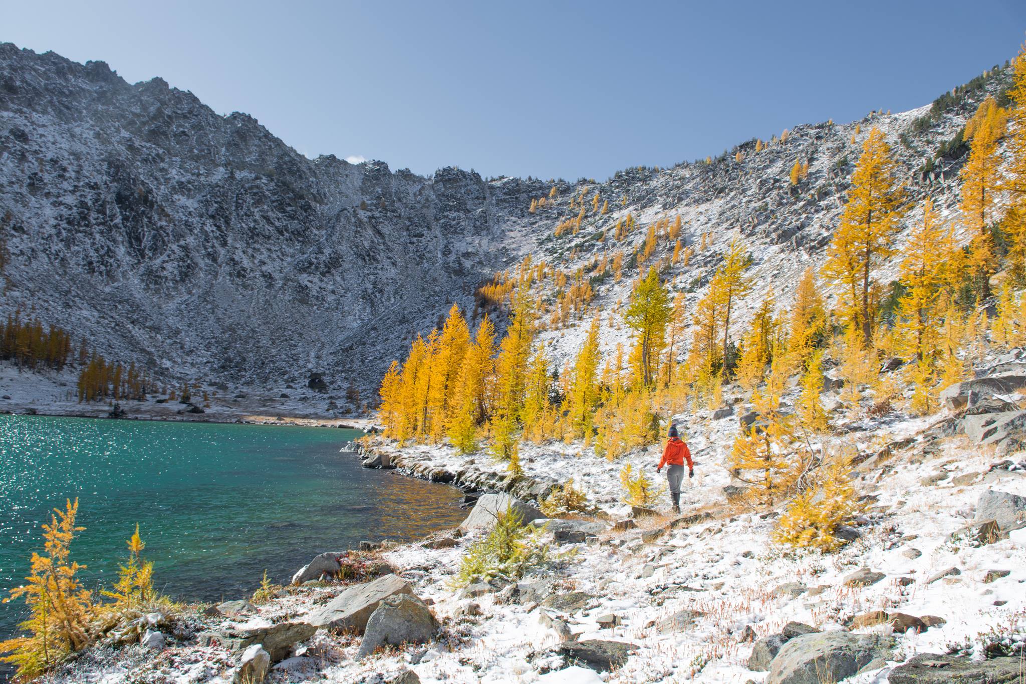
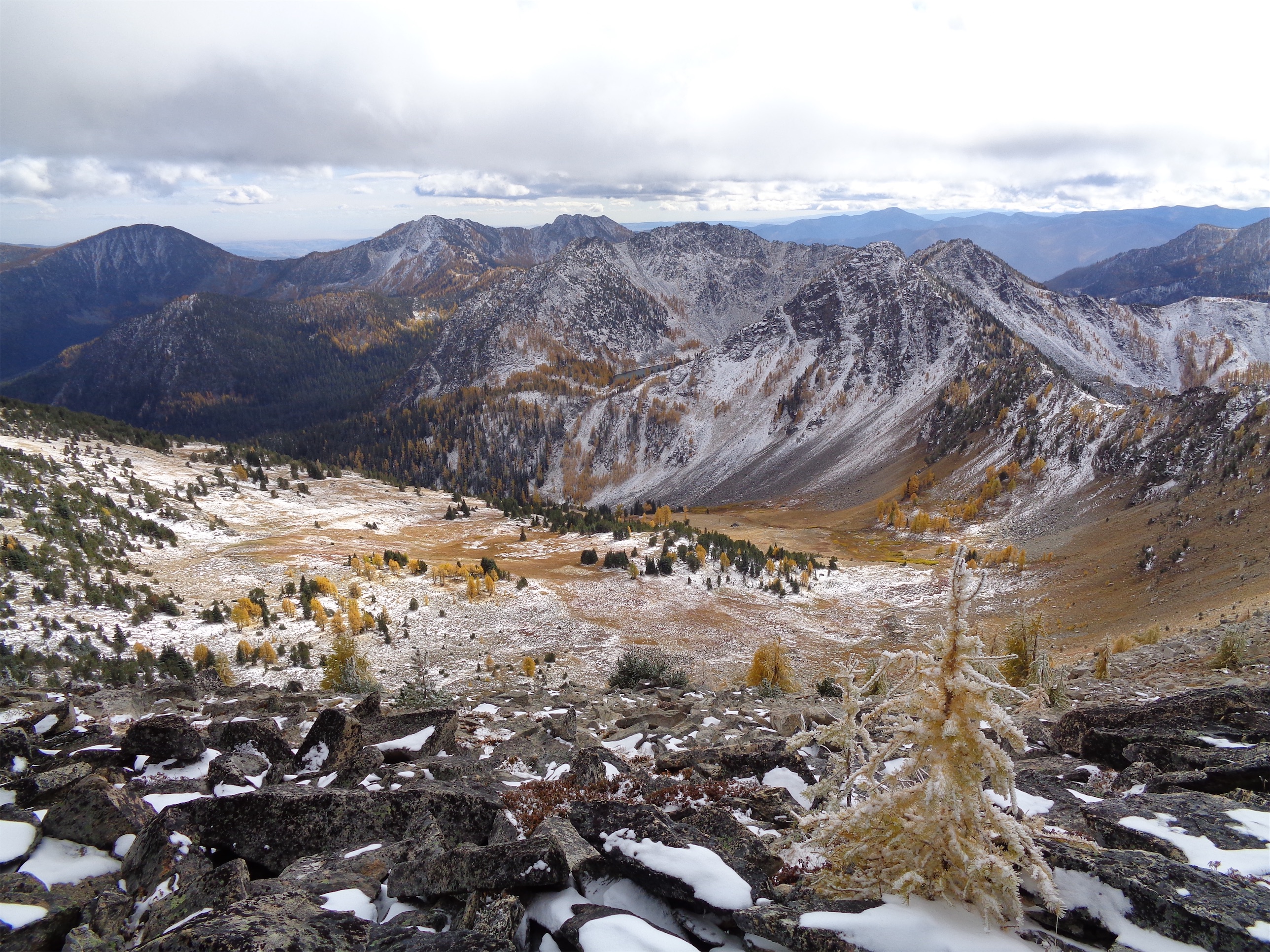
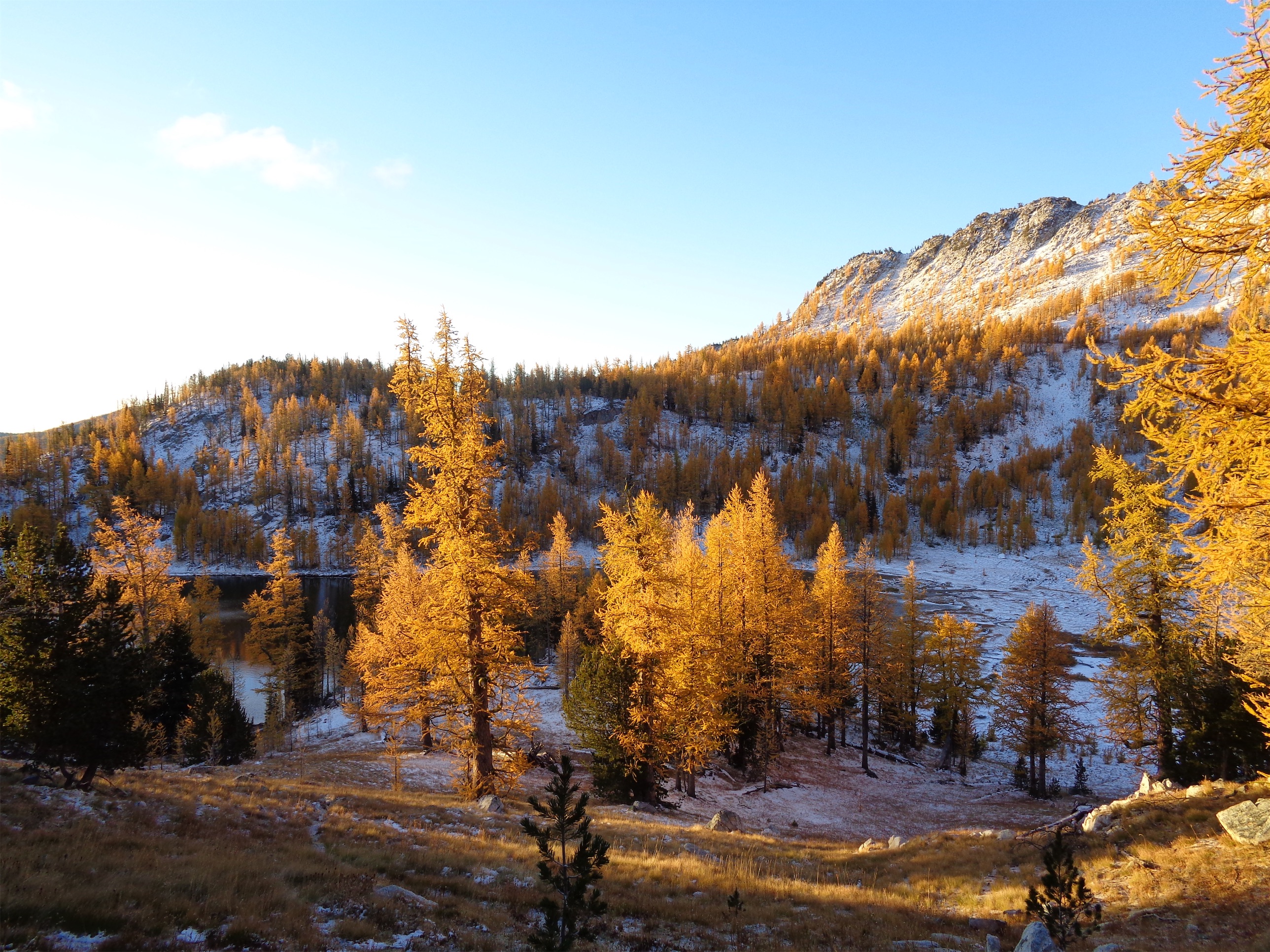
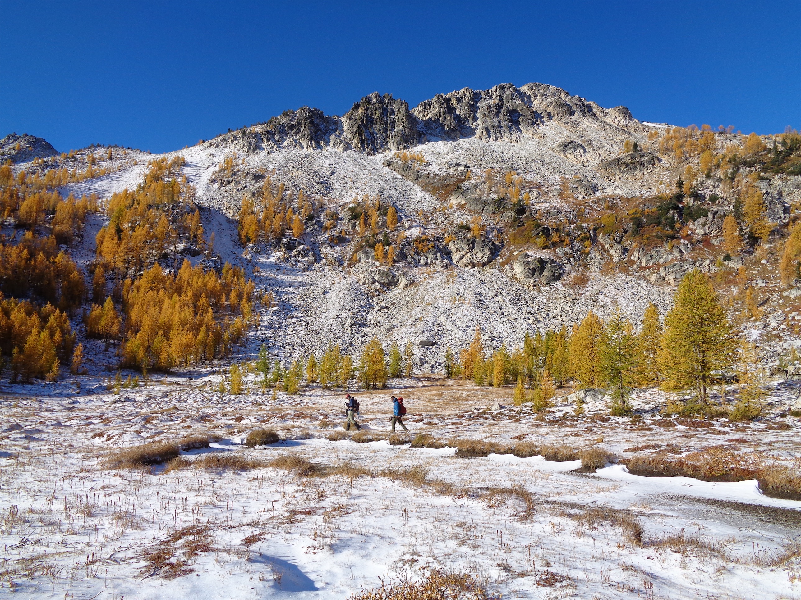
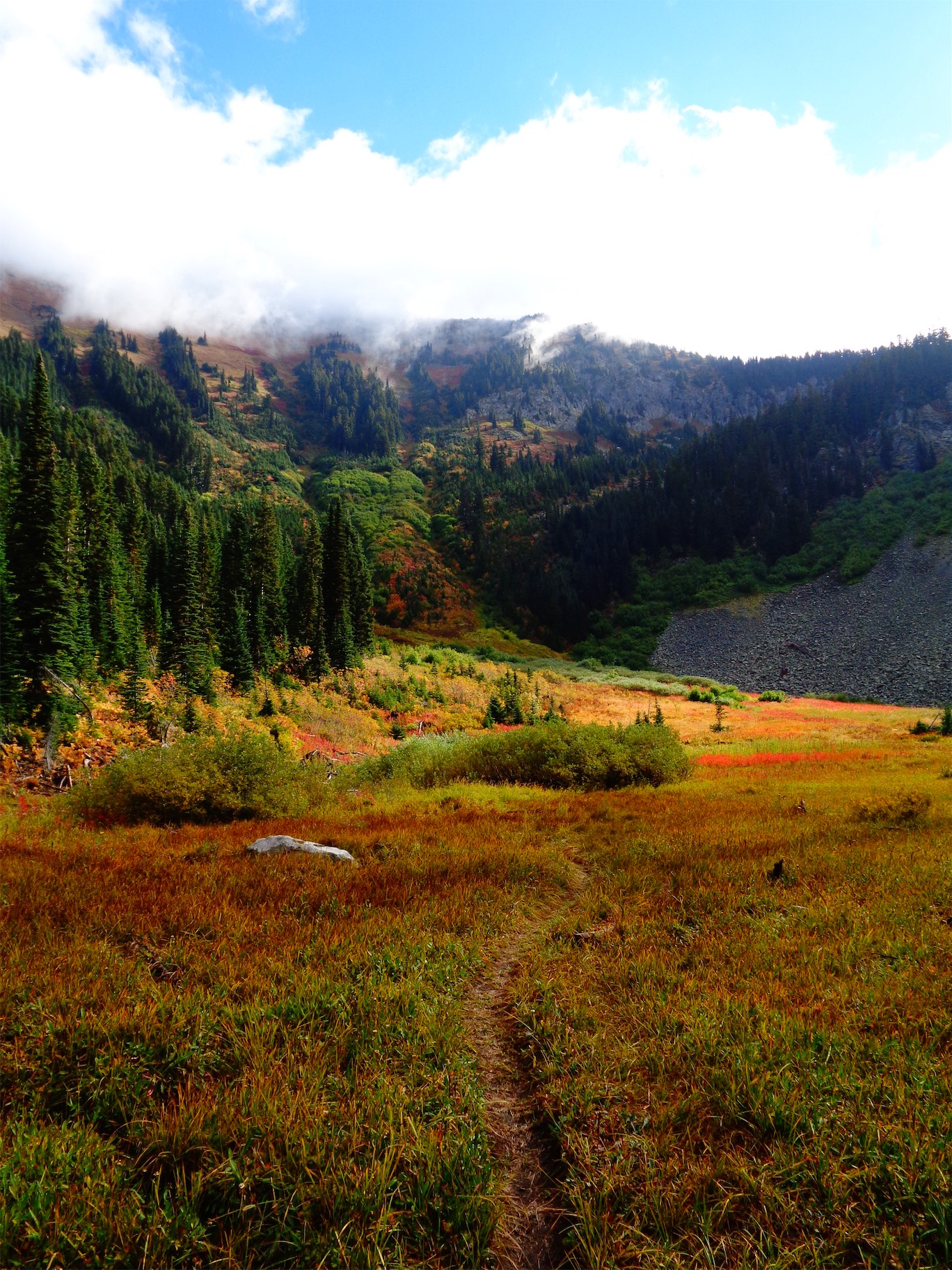
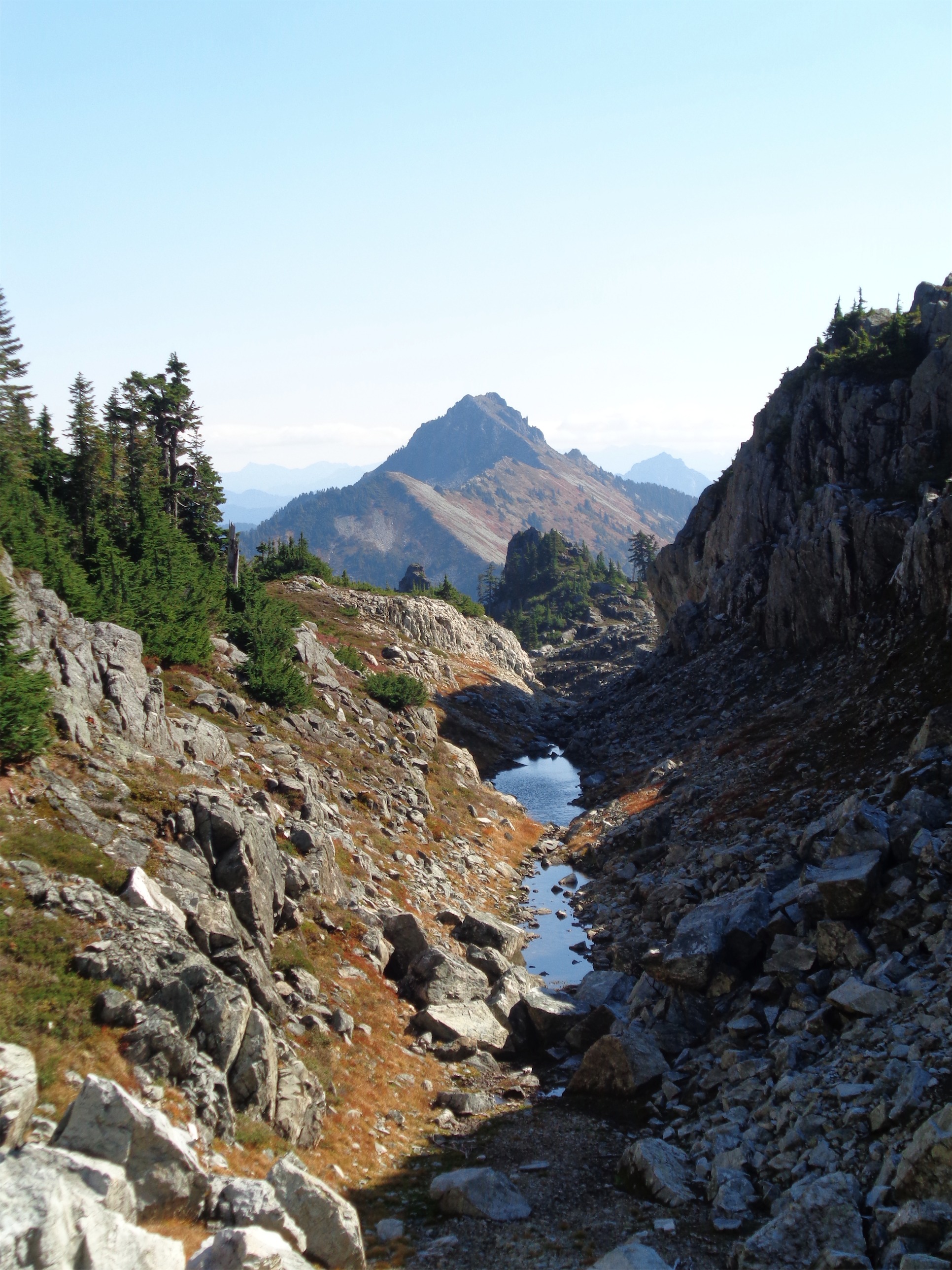
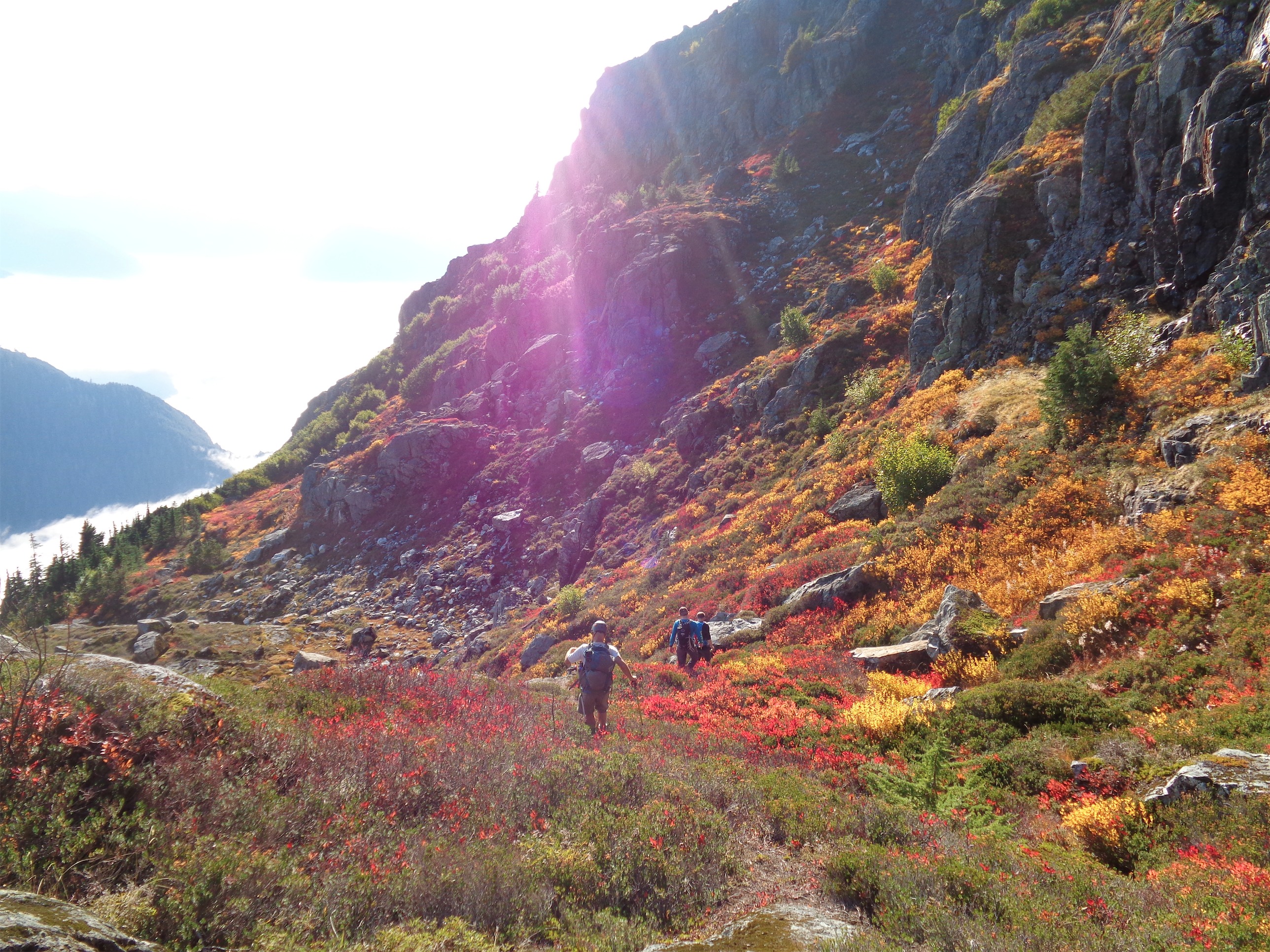
When we were close to the first pass, which was only a couple hundred feet of elevation gain from camp (phew) the sun started making moves. Suddenly the larches were backlit and we were in a cocoon of yellow and IT WAS FINALLY HAPPENING our pace slowed to like 1/10th of a mile per hour and we started basking. This was what we had been hoping for. A trail above 6000ft that just clung to the side of a valley covered in larches, maintained elevation rather than going up 2,000ft and then down 2,000ft, just a beautiful traverse on a warm sunny yellow day. There was another warden’s cabin up there too, which isn’t even fair. I always joked I wanted to retire and be a park ranger but maybe now I want to specifically be a Canadian park ranger if that’s where they’re patrolling.

Smokey giants

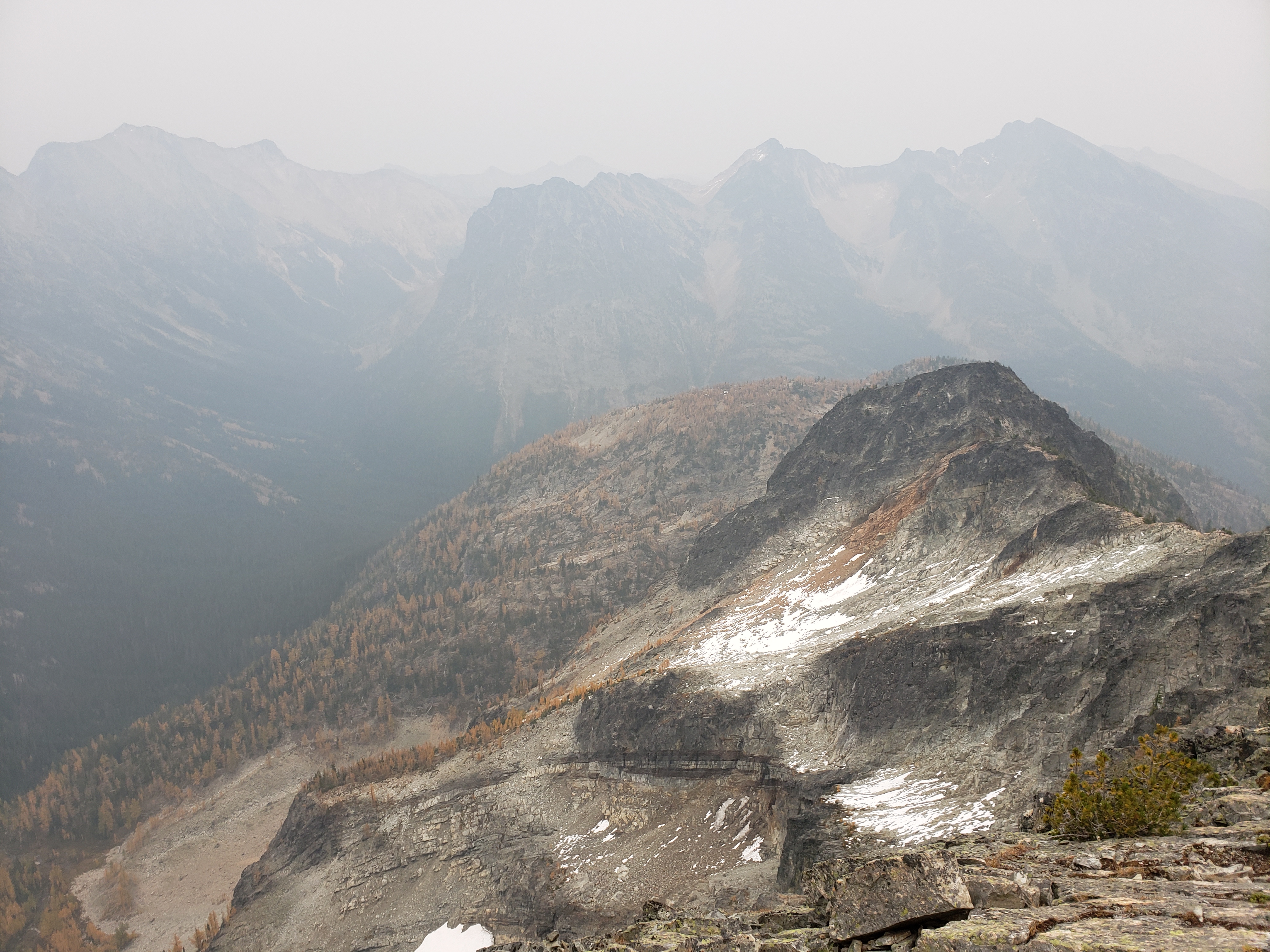
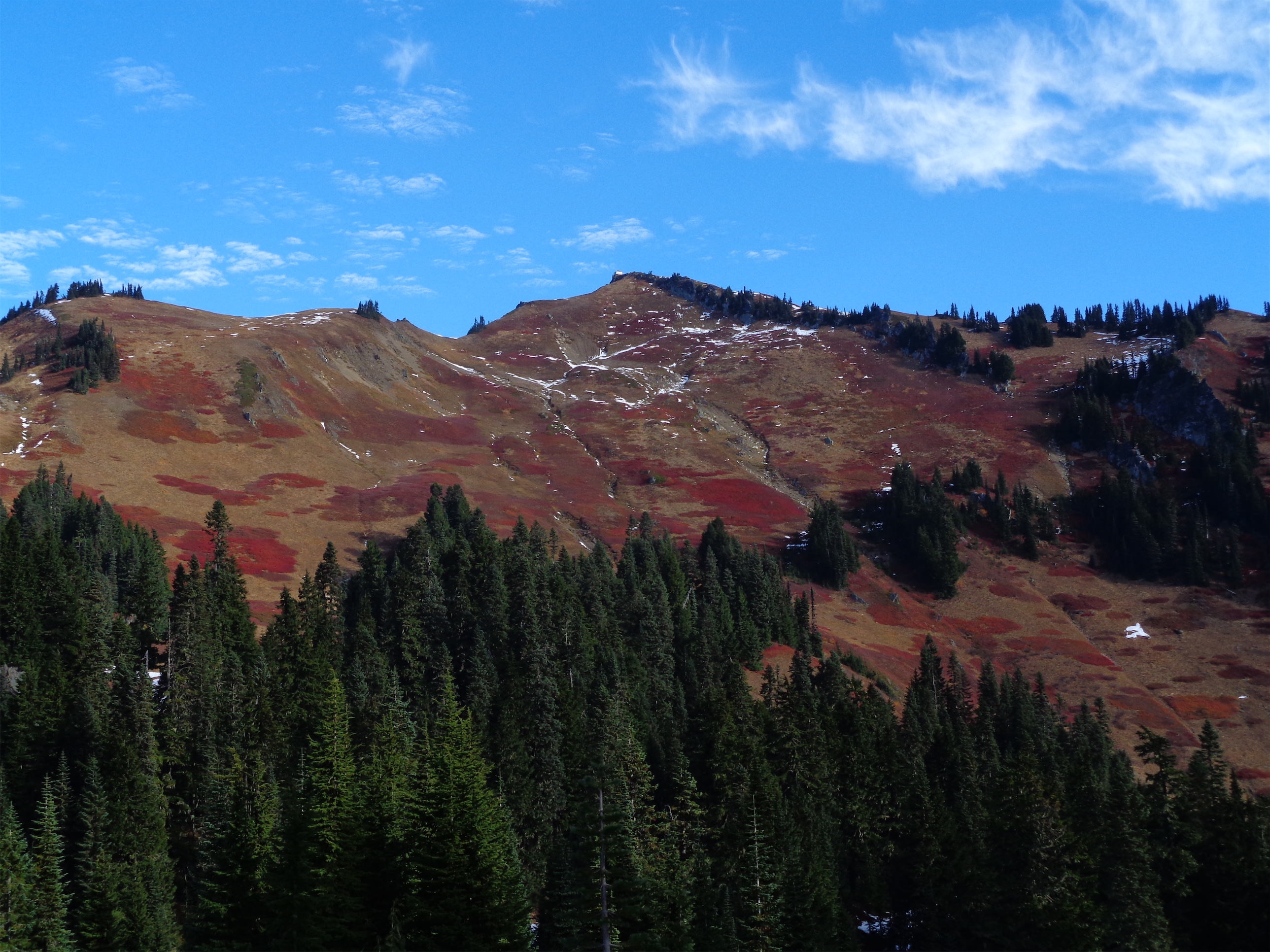
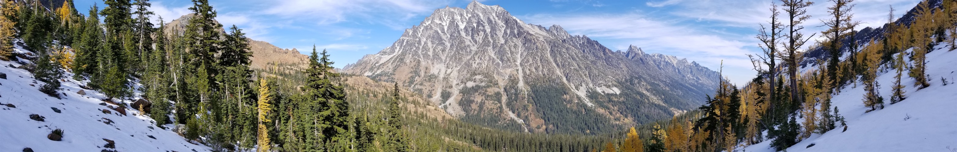
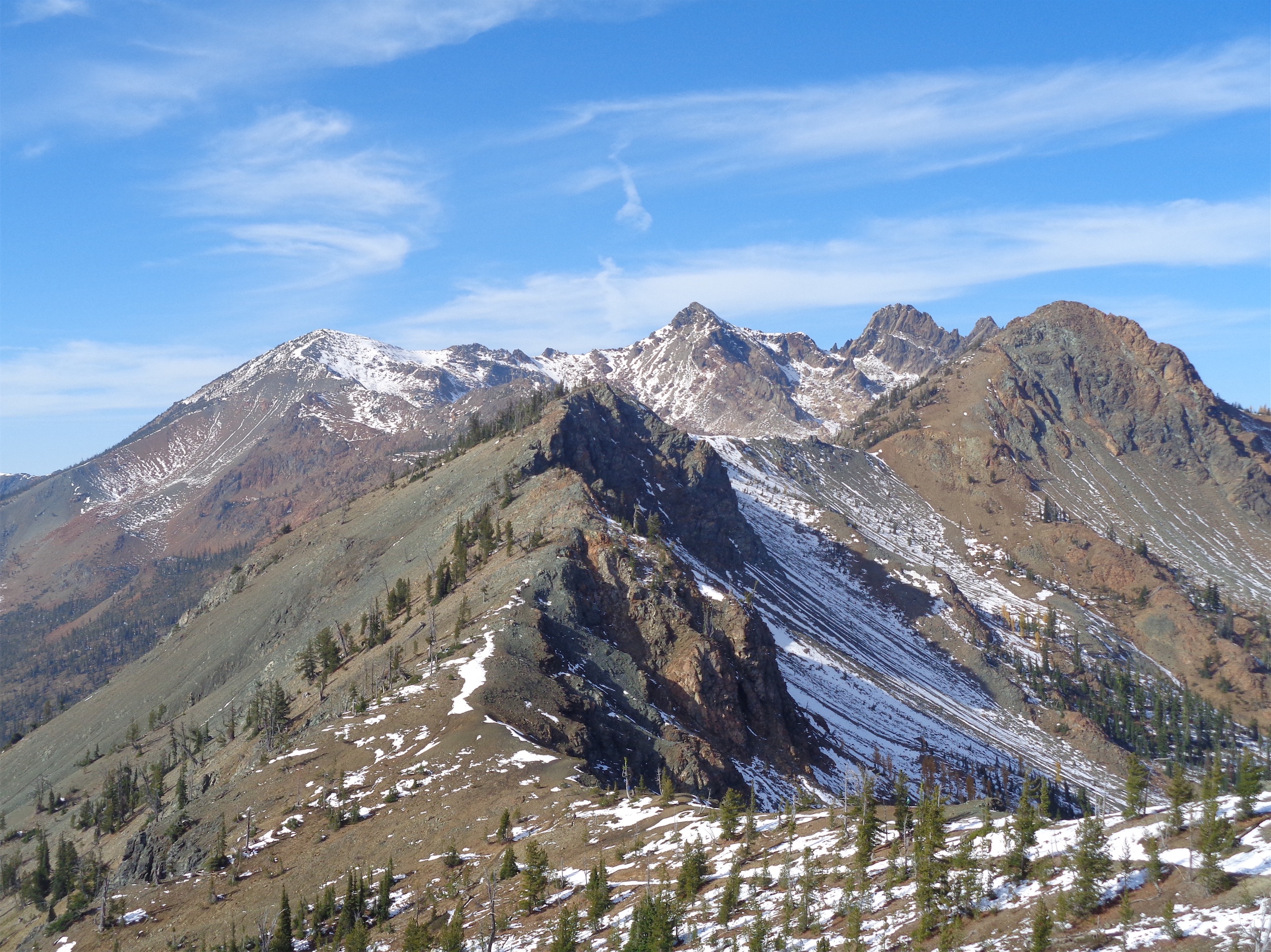
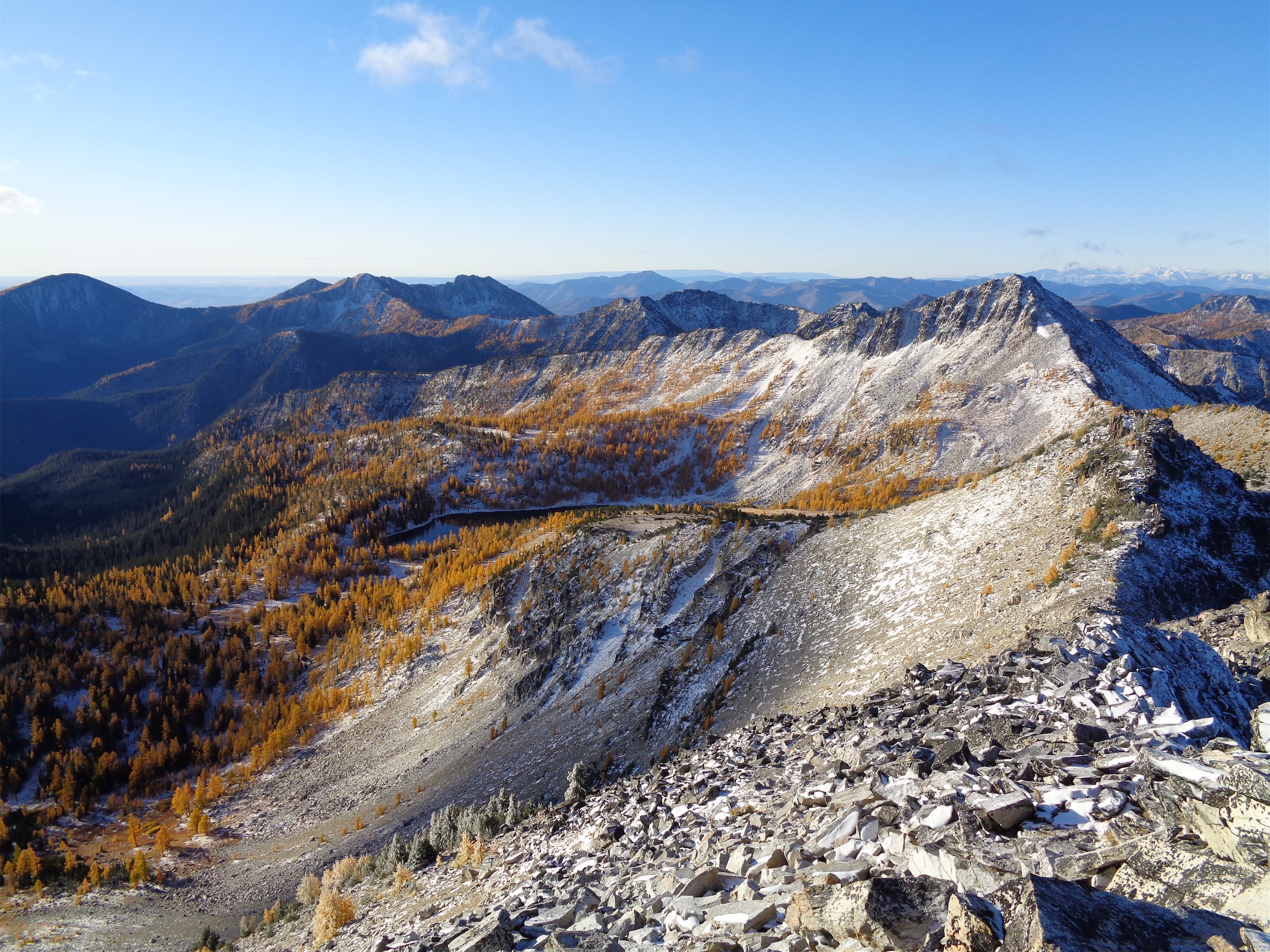
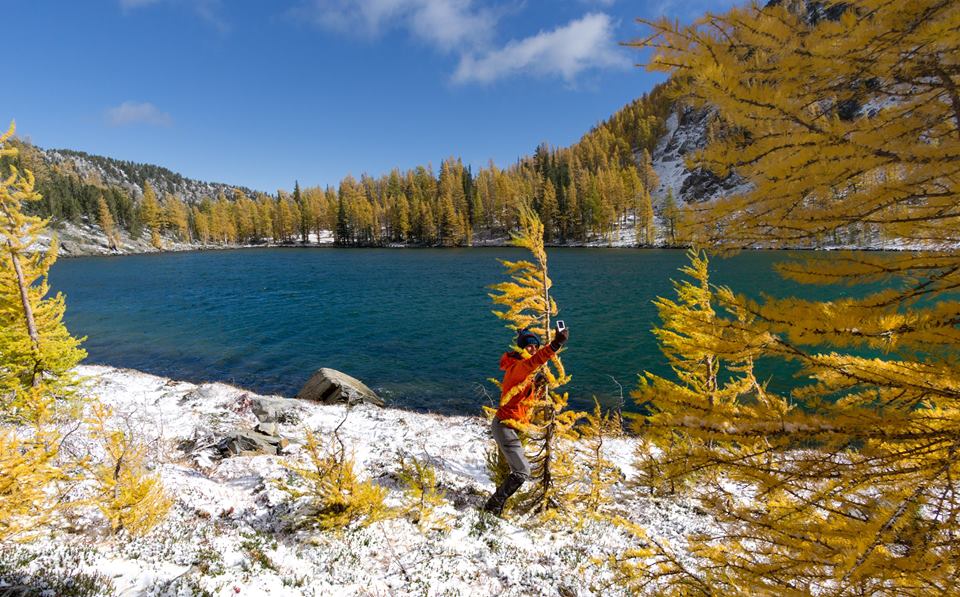
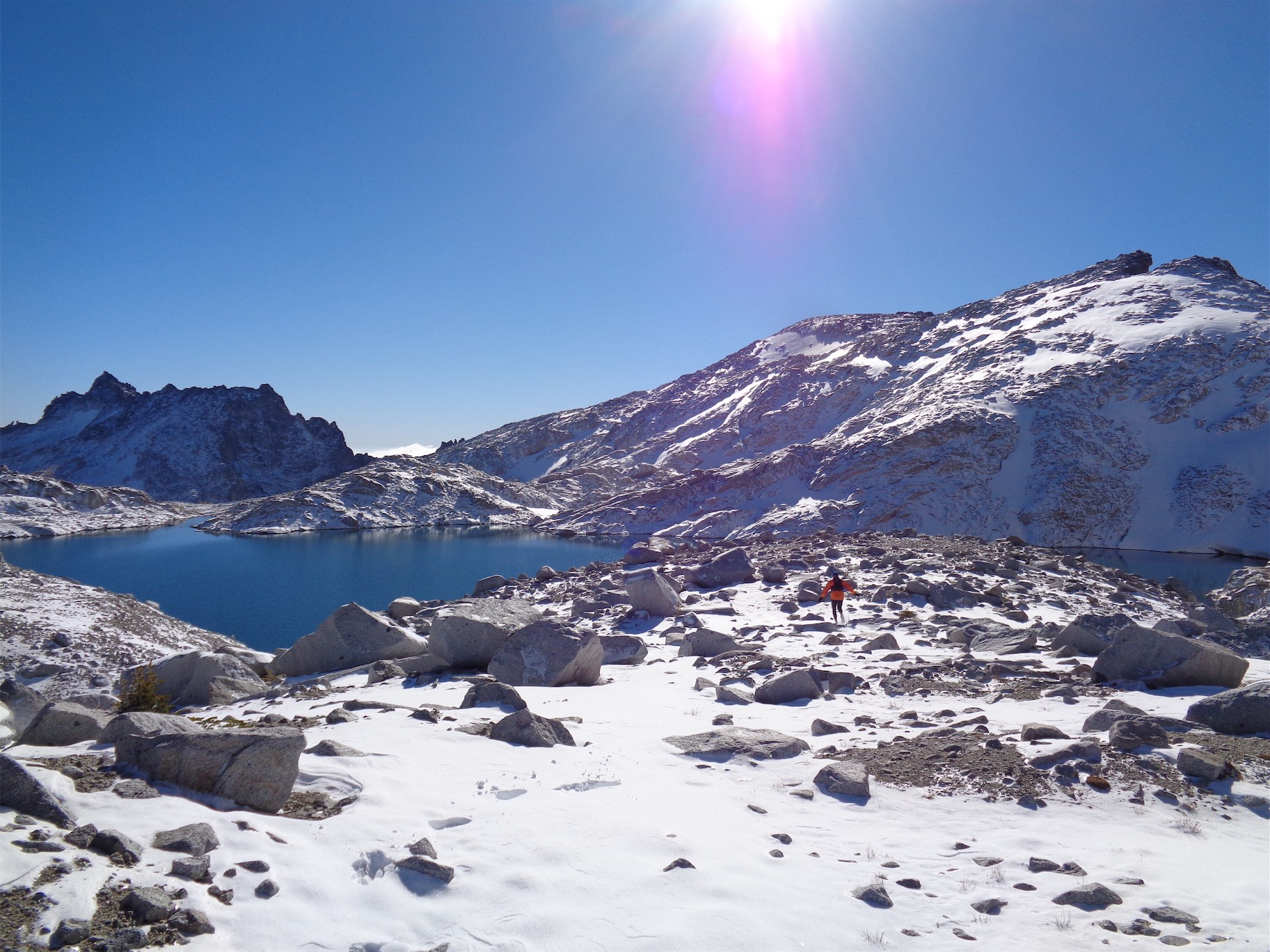
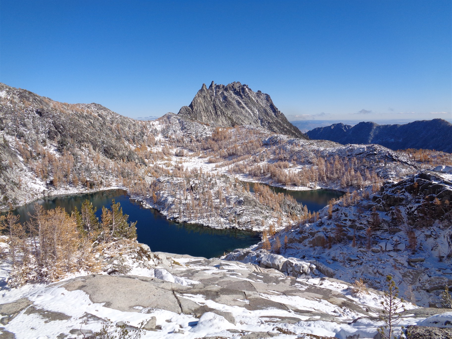
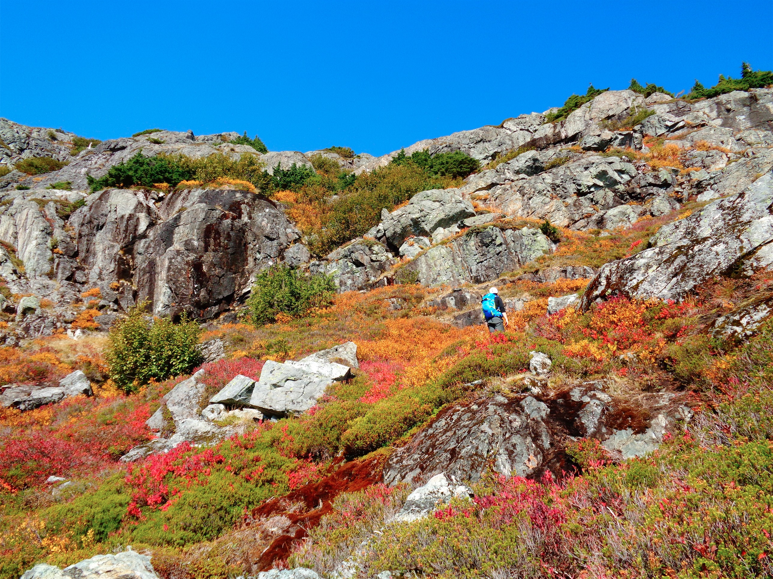
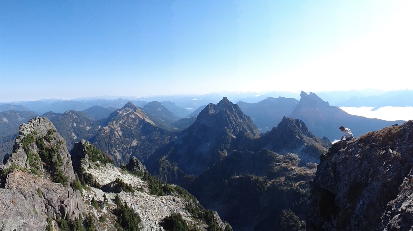
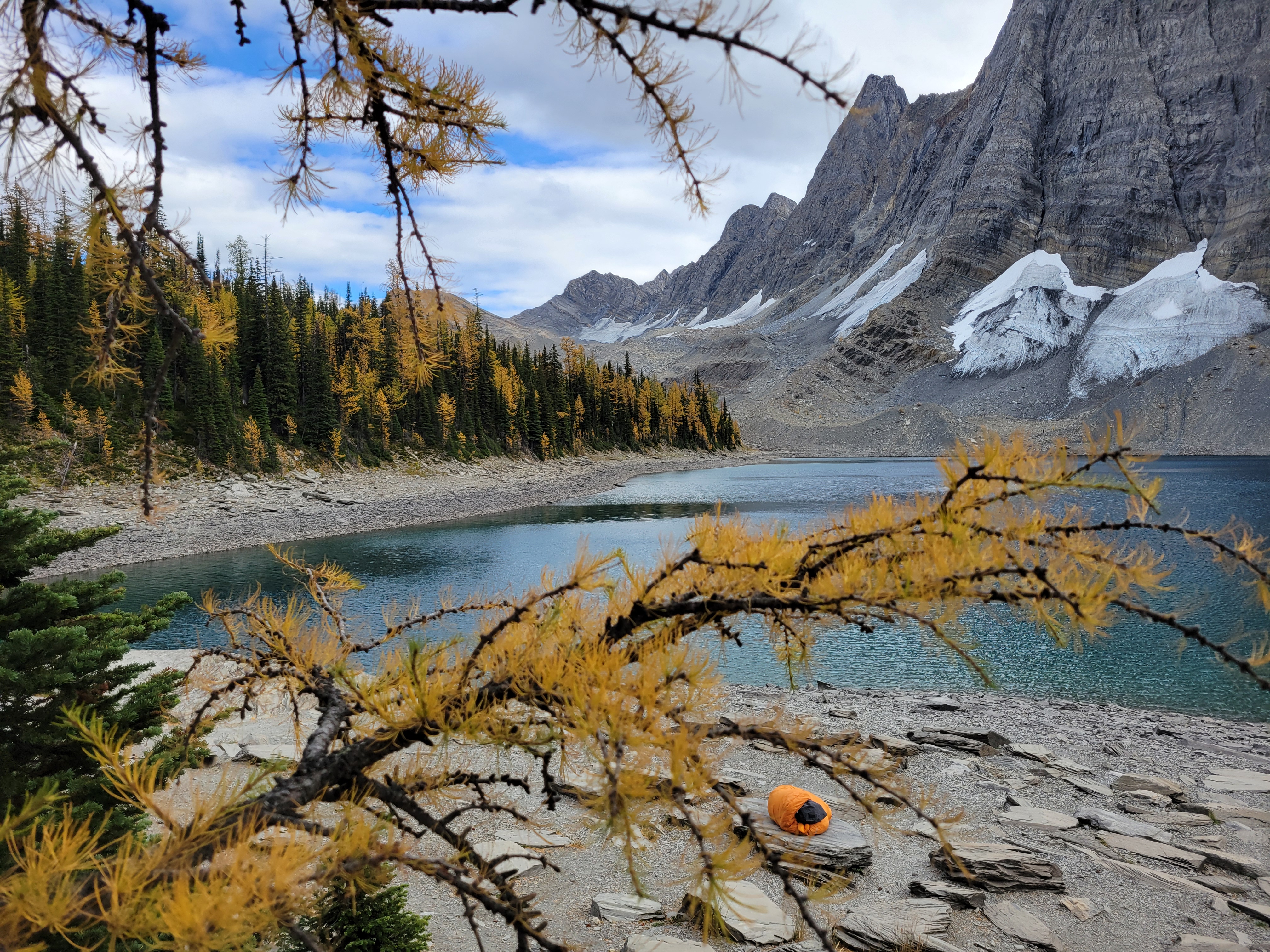
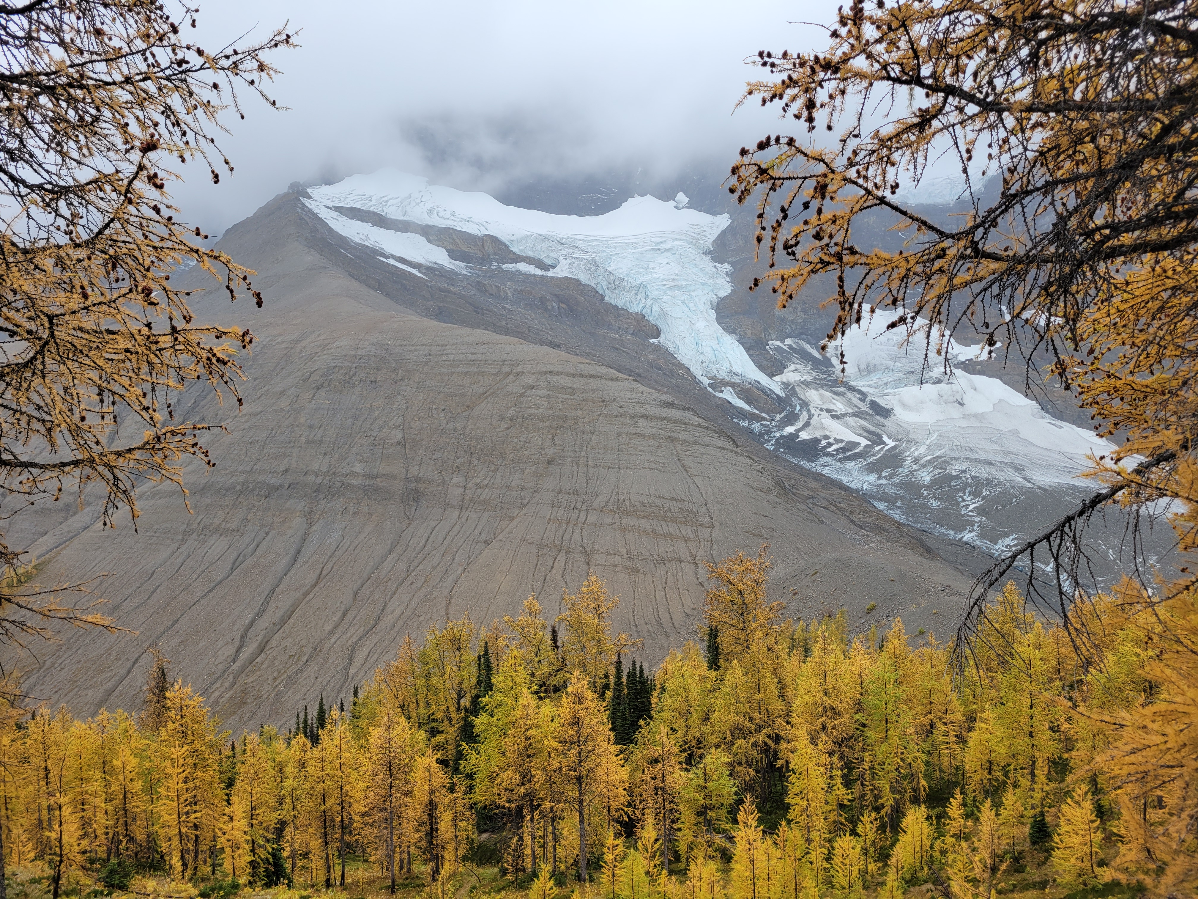
These peaks are absolutely giant. Totally different feel from the Cascades. We saw another moraine with a bright green lake behind it and looked at each other. Uhhh we need to go to this right? We need to go directly to this lake? We trotted off giggling through dense larches. Thank you, larches, for being so soft and not stubborn stiff evergreens that clothesline you when you try to rush through them. After some rambling we were able to get to the toe of the (very dirty) glacier and took a great lunch break in what felt like a foreign land. It’s truly like the rock walls of Moab meets North Cascades rock, with yellow aspen traded for yellow larches and the bonus of glaciers right next to you. Pictures will never do it justice, and I have to winder what this will look like in another 20 years of glacial recession and brush growth. It’s absolutely spectacular, will it be surrounded by trees in 50 years?

Straight from the toe of the glacier to feed future larches. Our cross country trail rejoined the real train in the largest to the left.

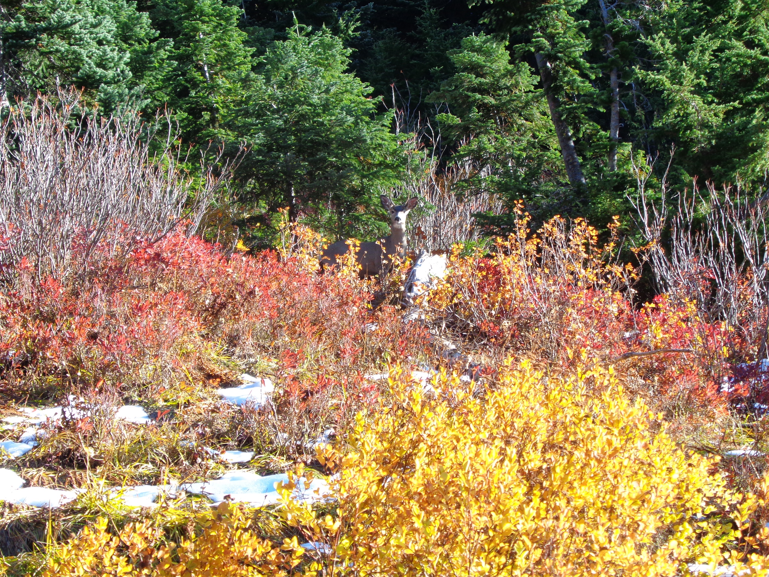
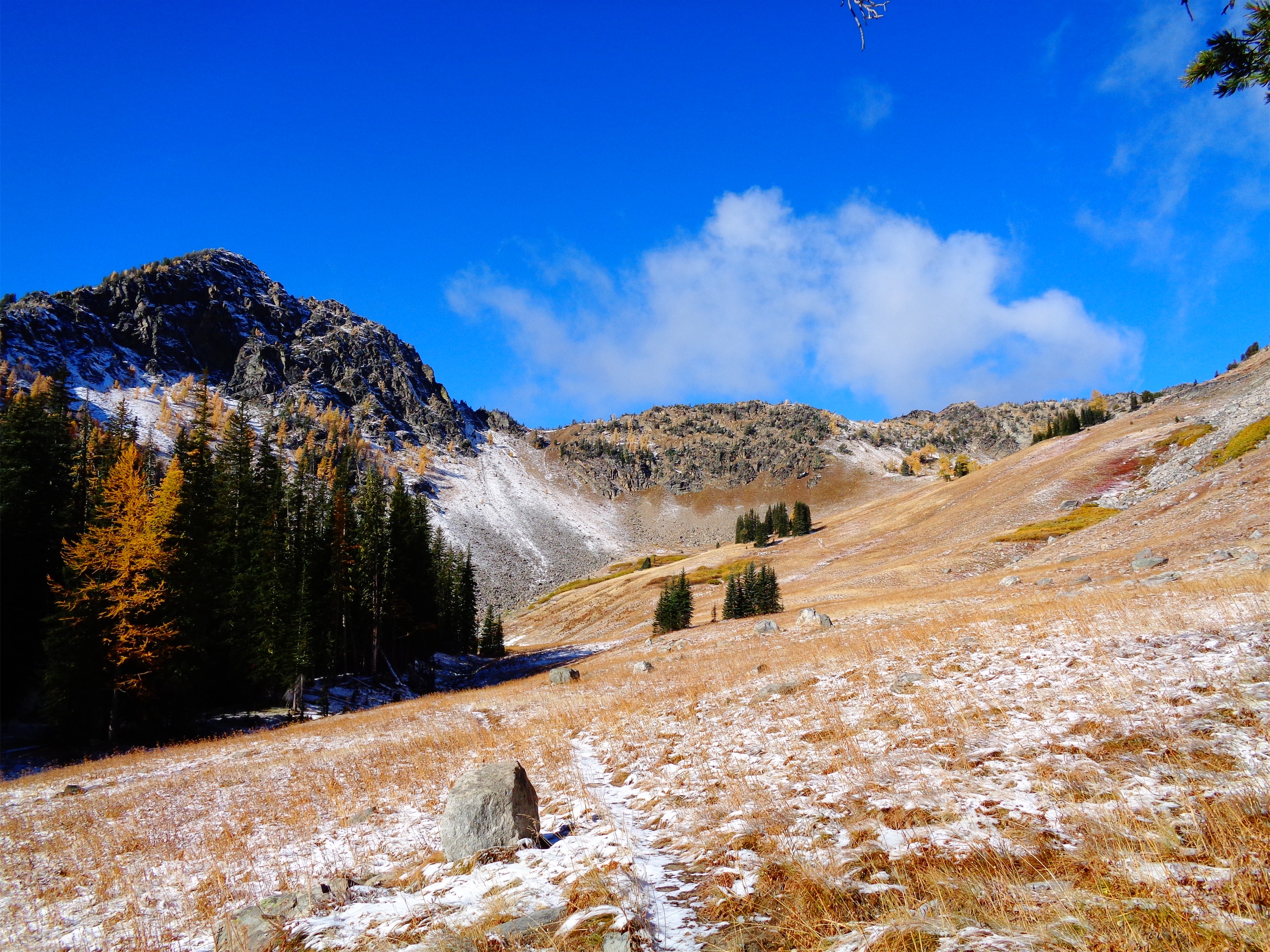
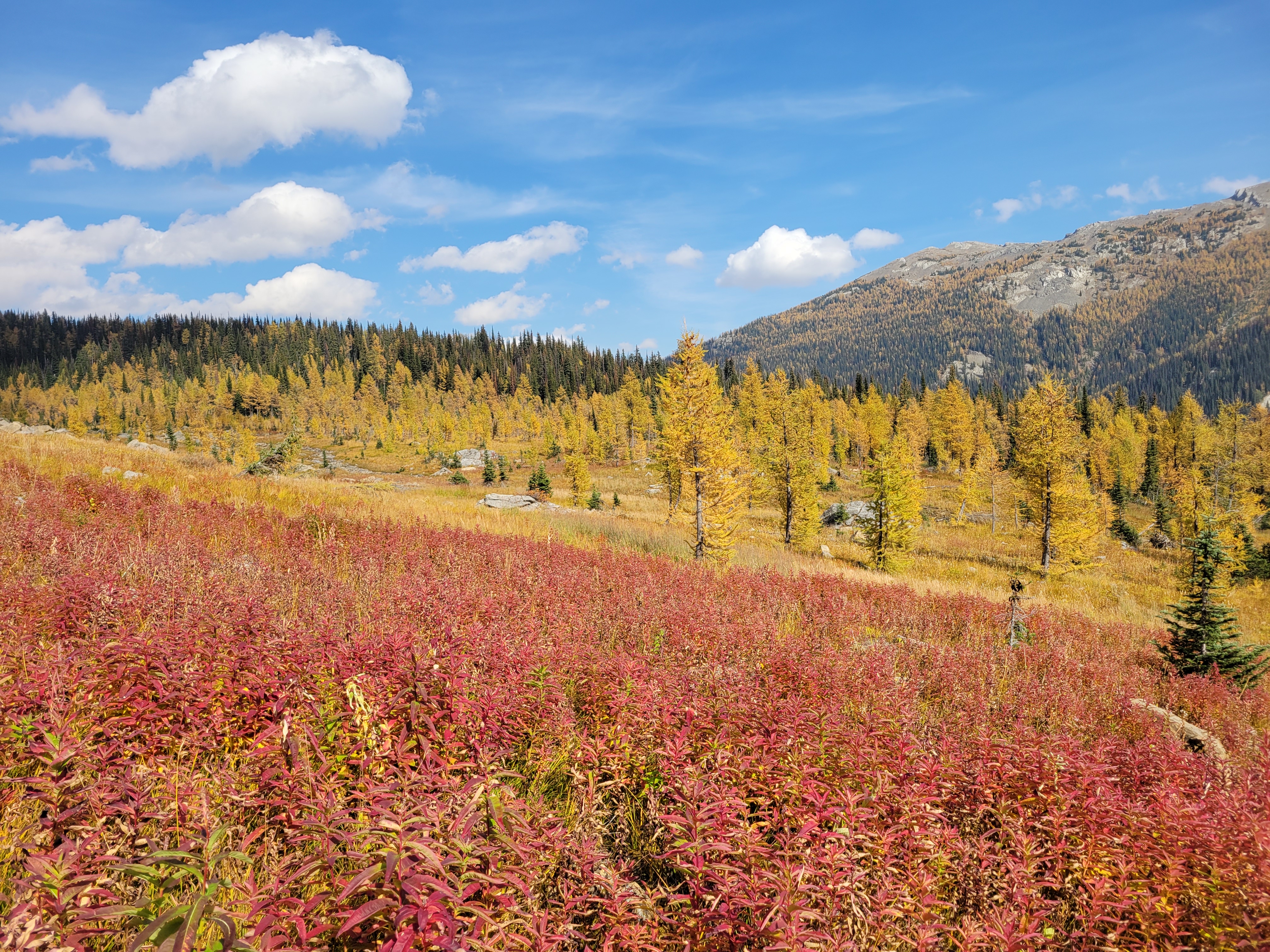
We took our sweet time from the lake up to the final pass. The land transitioned abruptly from glacial moraine to grassy meadow as if the moraine had been pushed onto the meadow just yesterday. The meadow travel was easy, small springs and bright red fireweed and yellow larches and blue skies. Brad has also developed a rare talent: the ability to sniff blueberries from miles away. I’d be walking a trail with seemingly no vegetation and I’d hear “wait. I smell them. blueberries.” and two minutes later “found them!!” and we’d have a small feast. Alpine super sniffer. I couldn’t believe there even were still blueberries.

I have never been so in love with fireweed
Brad working the super sniffer

It is insane to me that you can’t camp here. I get it, it impacts a fragile environment, and I would hate to see this place get overrun like some places in Washington, but oof the individualist and explorer in me is tortured knowing I can’t just do what I want up there (I mean… who’s there to find me?). This was easily one of the most beautiful places I’ve ever been and I want it to stay pristine, but I also want to see every inch, and doing that with a base camp several miles away and thousands of feet lower is tough. But in the meantime… kudos to you, Canada. OOOOO Caaaaa na daaaaa. If ooonly iii knnneeeeww moooore wooooords

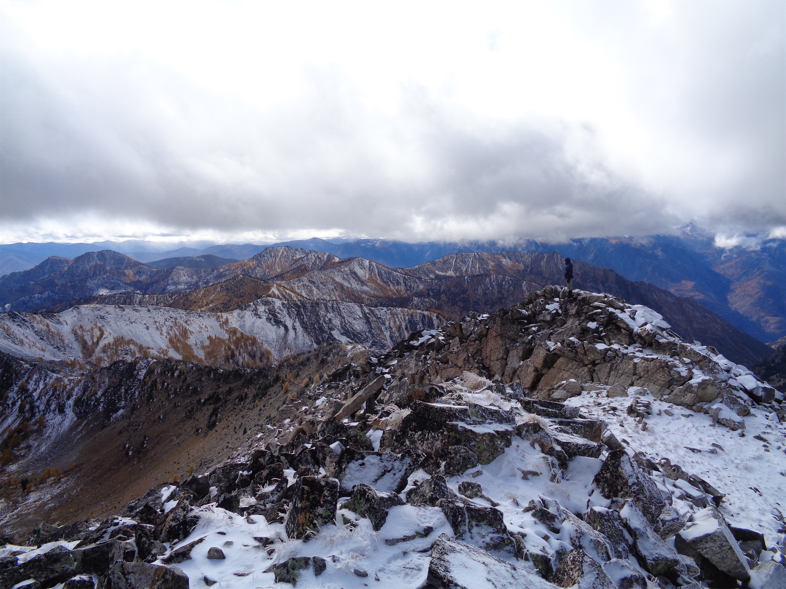
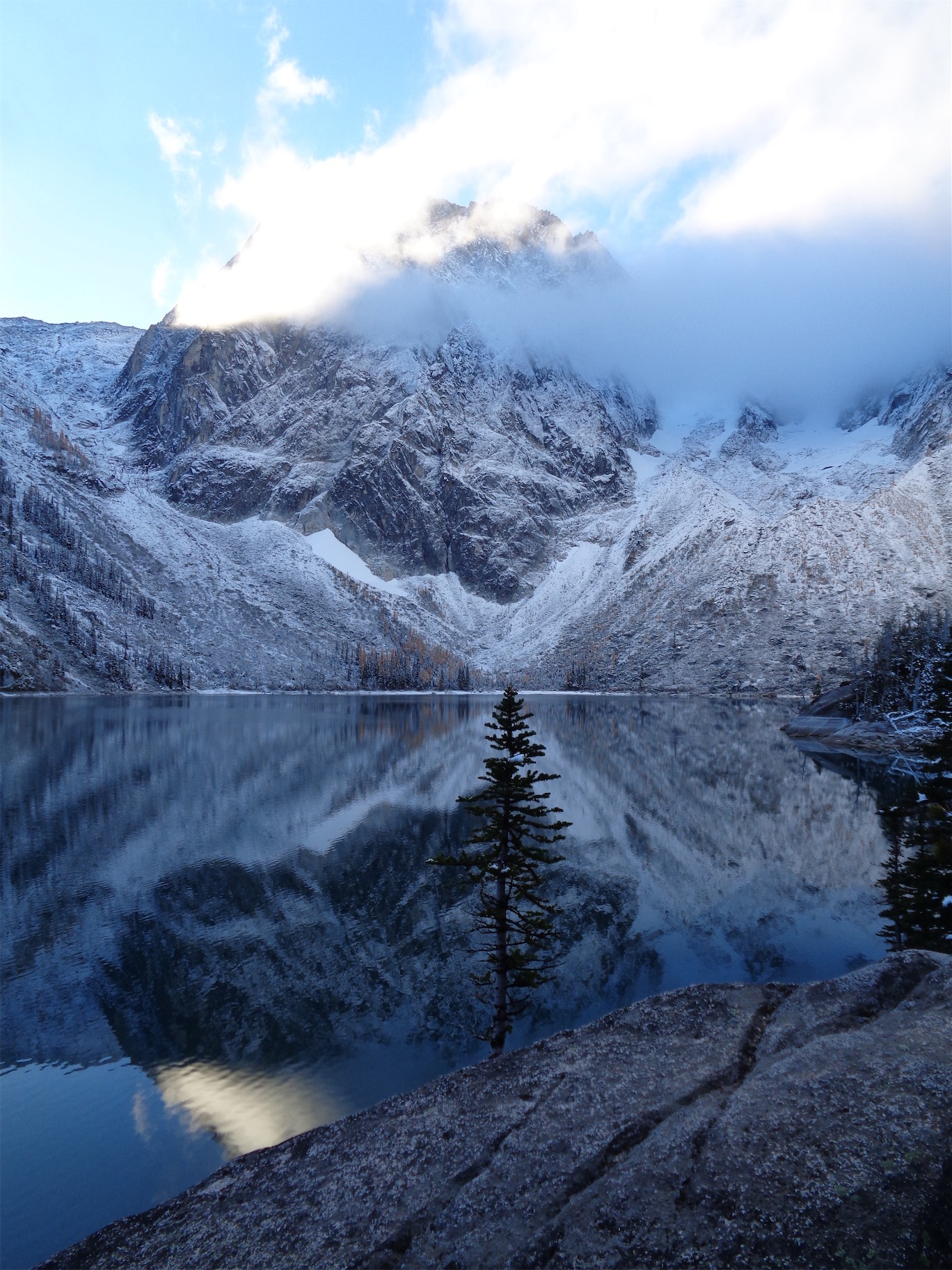
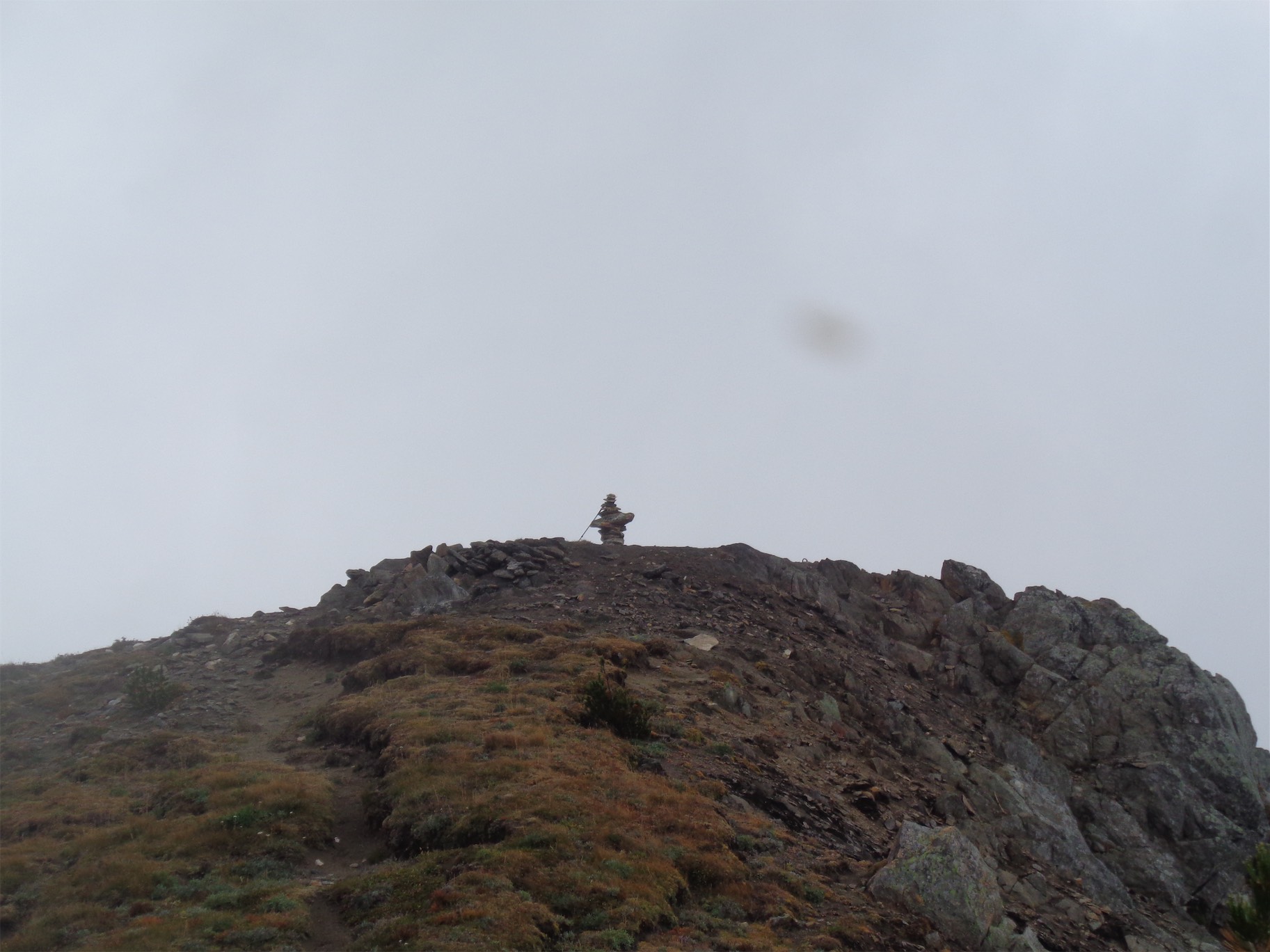
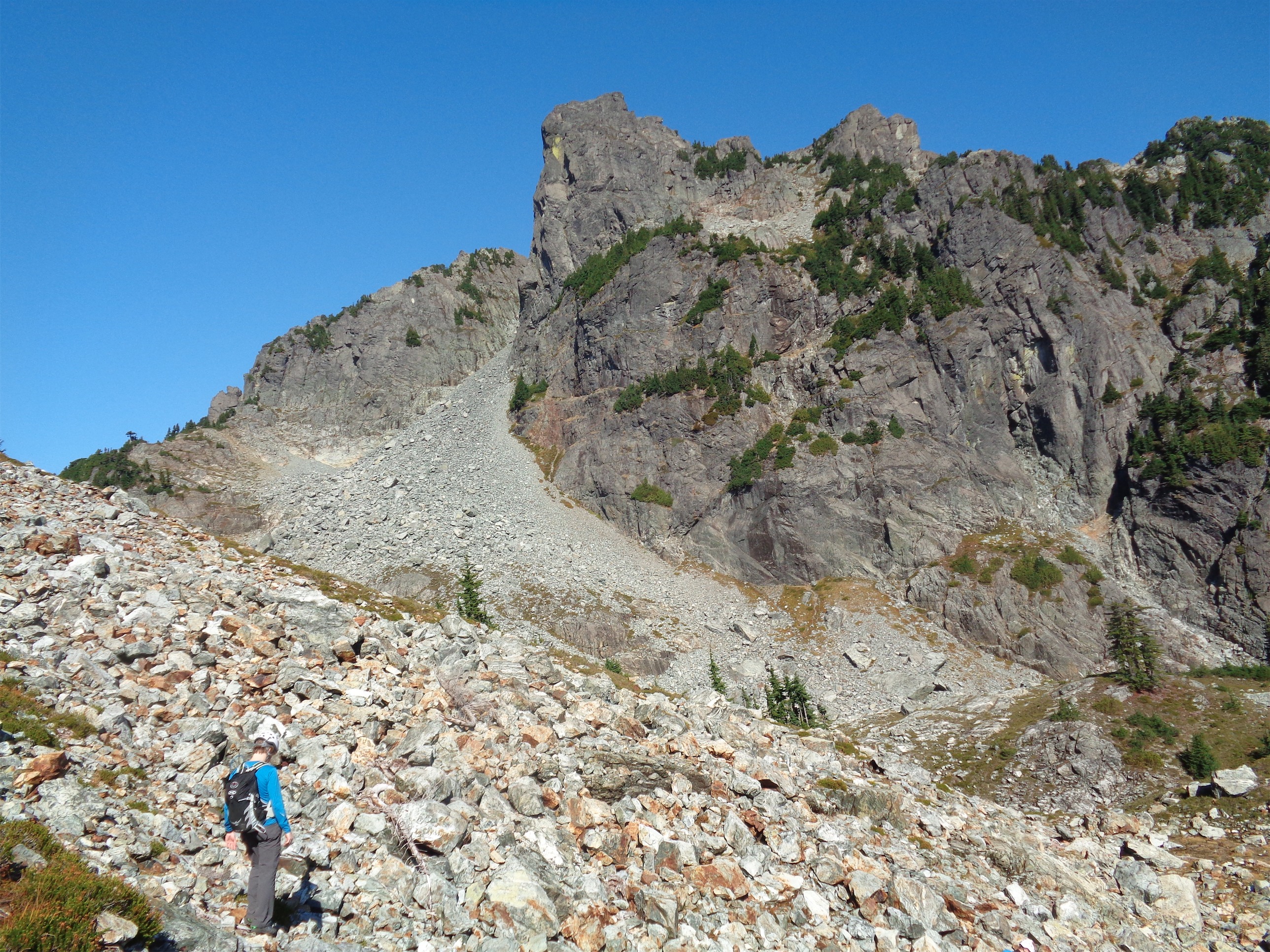
The gradual hill to the pass was hell on my trashed city legs, it went forever gaining one foot per minute or something stupid like that. It was smoky, you could smell it, but the views were still elite. I’m used to cramped steep valleys in the Cascades, not these huge broad ridges and wide open valleys with massive mountains on either side. I was almost depressed rolling into camp knowing that was our one day of glory. Helmet falls took me by surprise – it’s hundreds of feet long. Not just a cute little thing in the forest. But yes, the campsite was yet another campsite well below treeline next to a river with no views. Only bears. 

1ft per minute to the pass I was dying in the most beautiful land

Naturally, the last day was perfectly sunny, but we were just hiking 9mi out gradually in the woods. Paint Pots was really only one pot and it wasn’t very painted but everything pales in comparison to brilliant yellow larches. Brad beta sprayed me with all of the nearby community centers I could shower at before getting on the plane, I made the mistake of checking email and slack while still being on PTO thinking I’d feel better if it did, and soon enough I was in dark rainy Seattle as if nothing had changed over the last 12 months.

This larch march powered by Costco Brookies

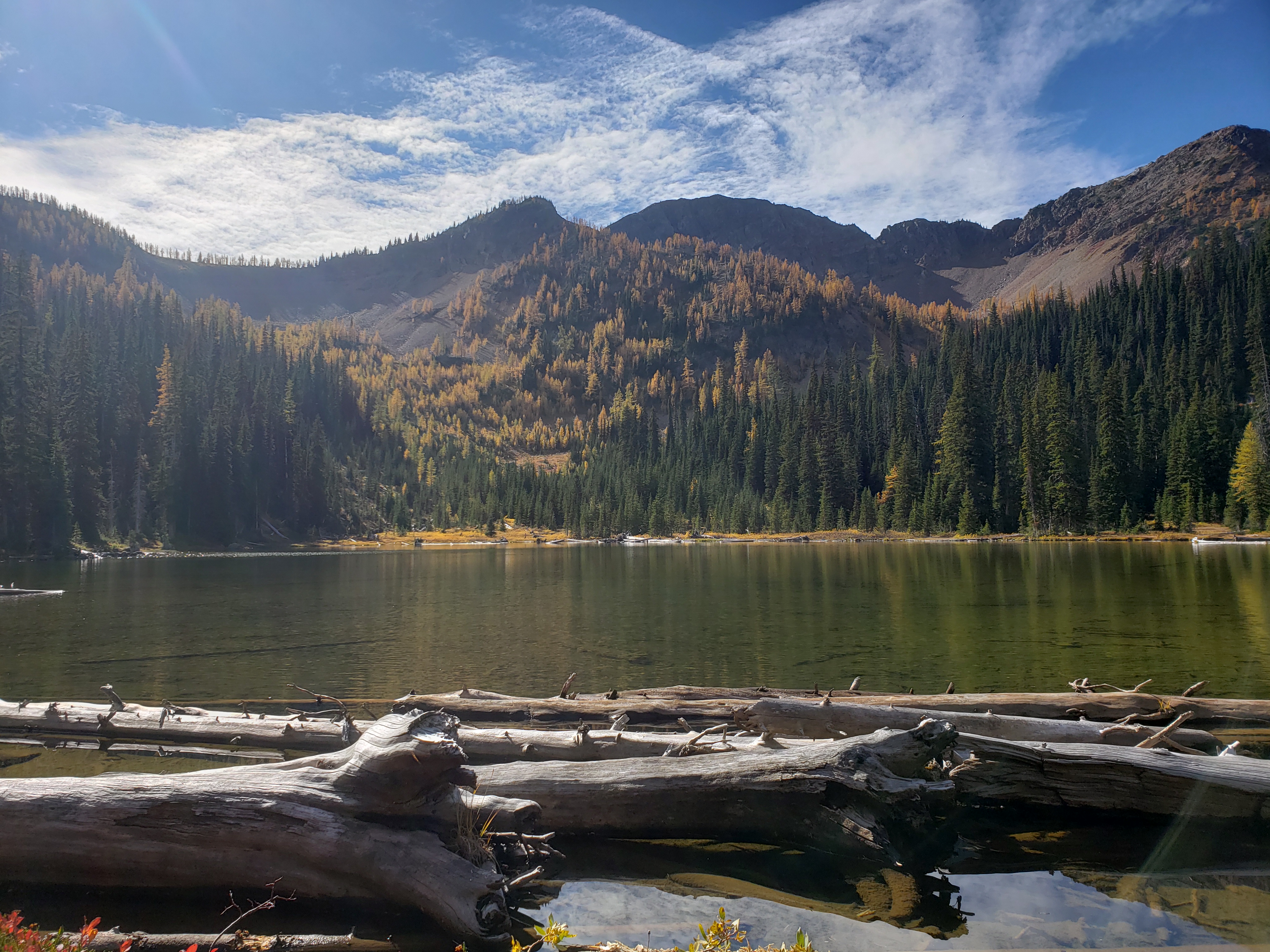
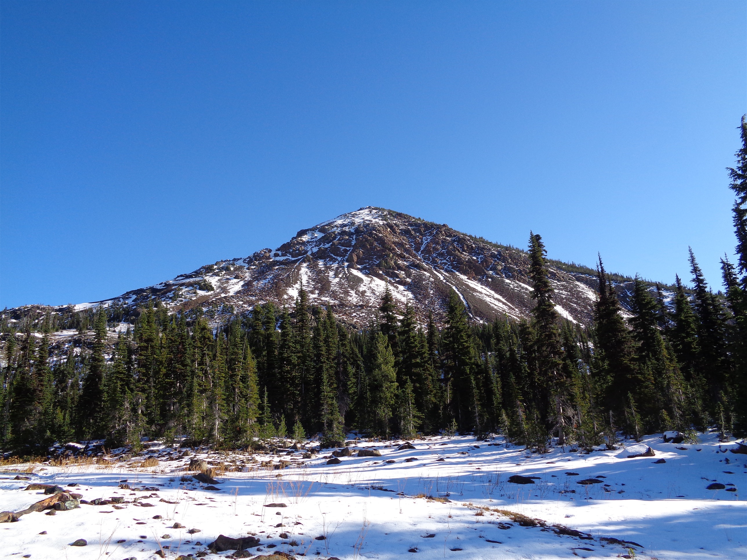
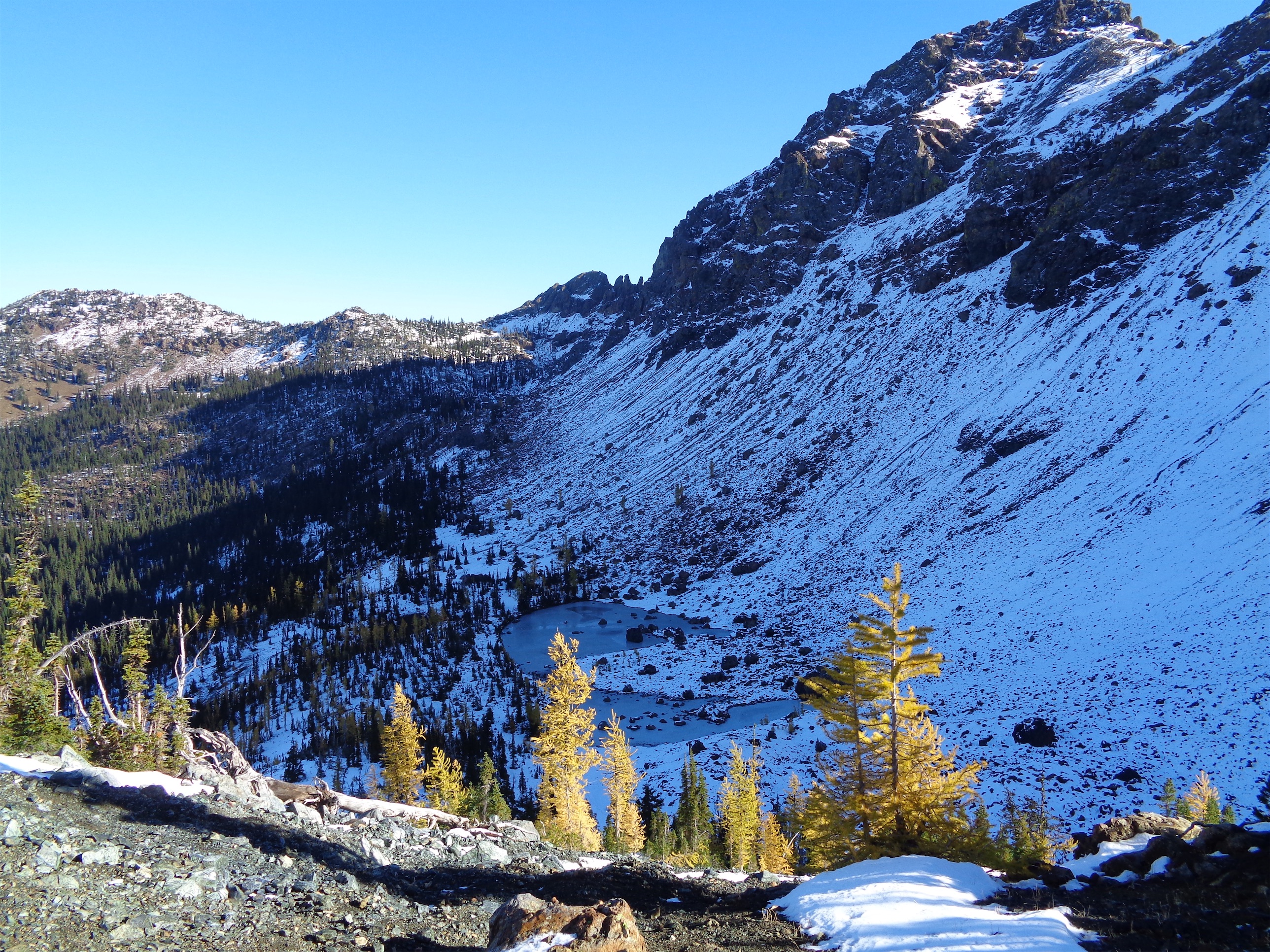
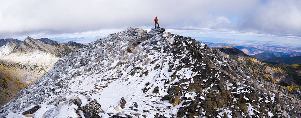
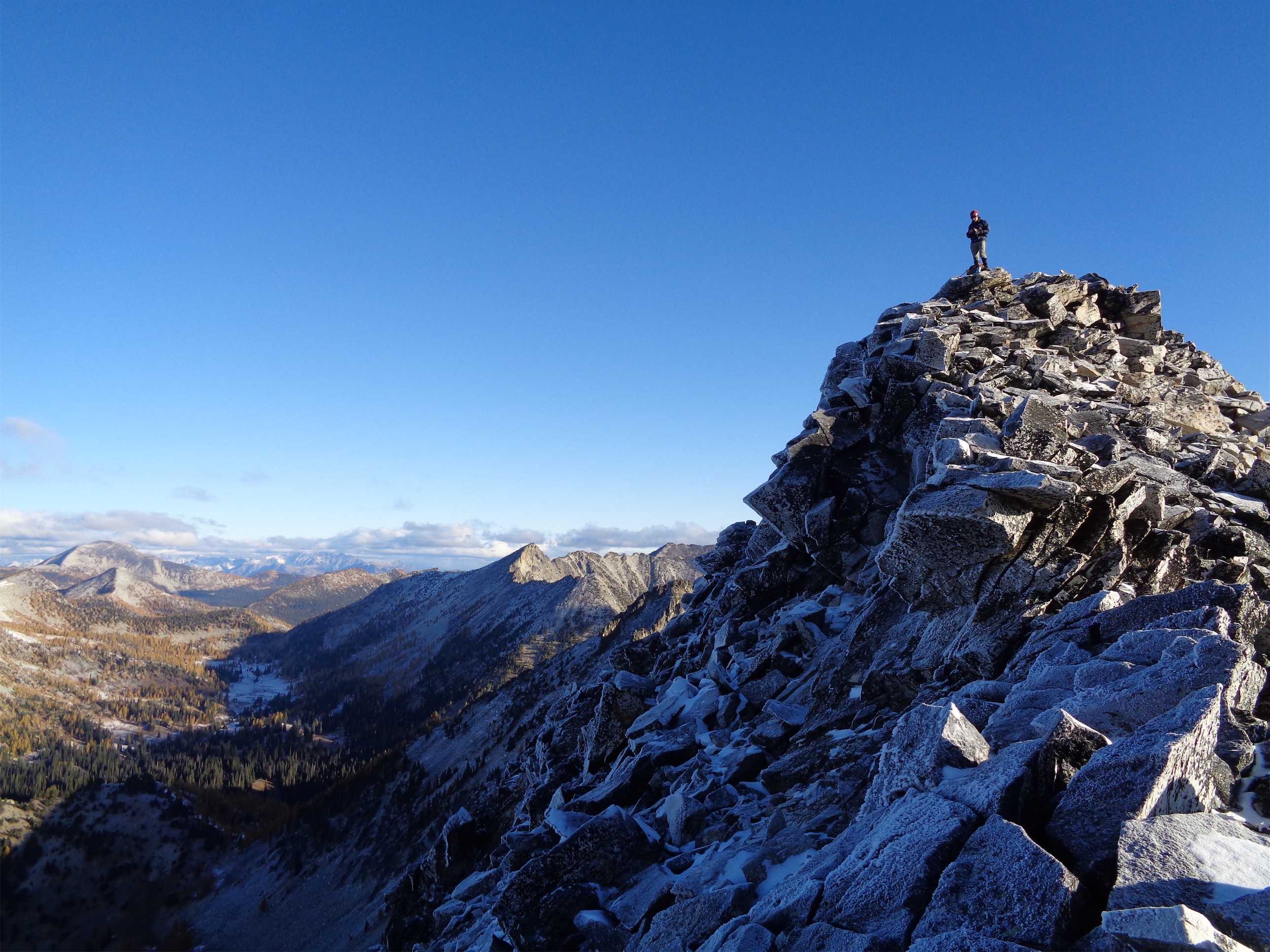
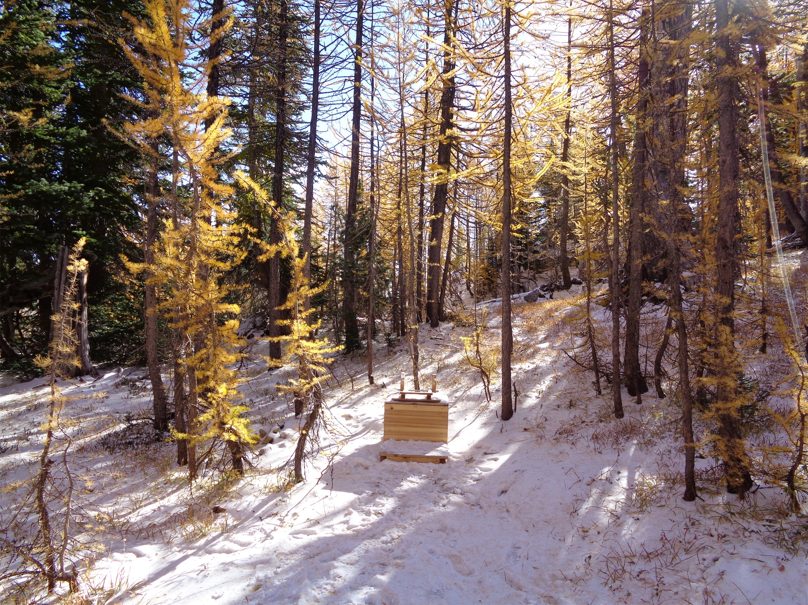
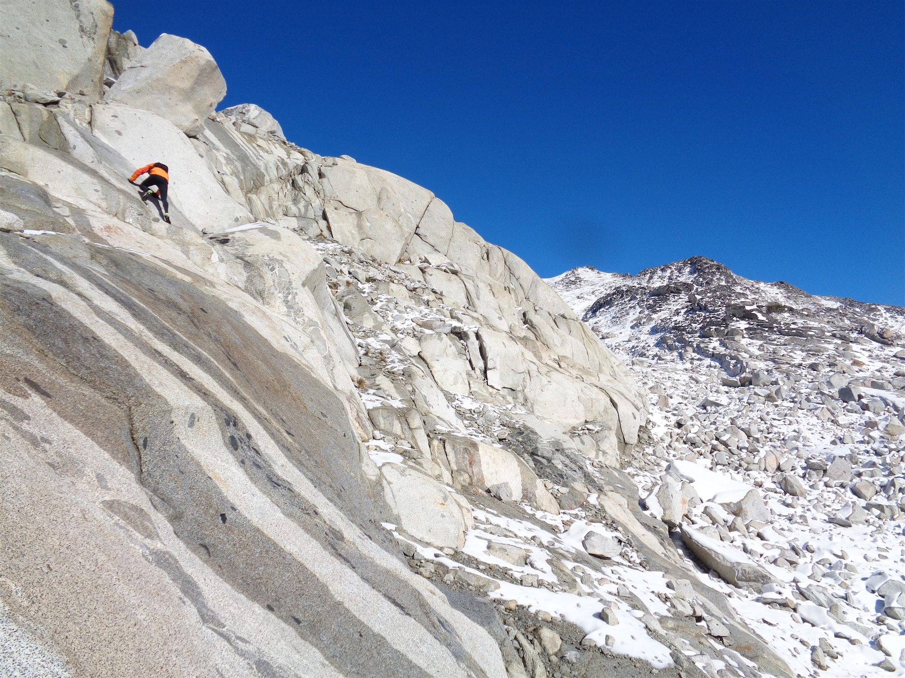
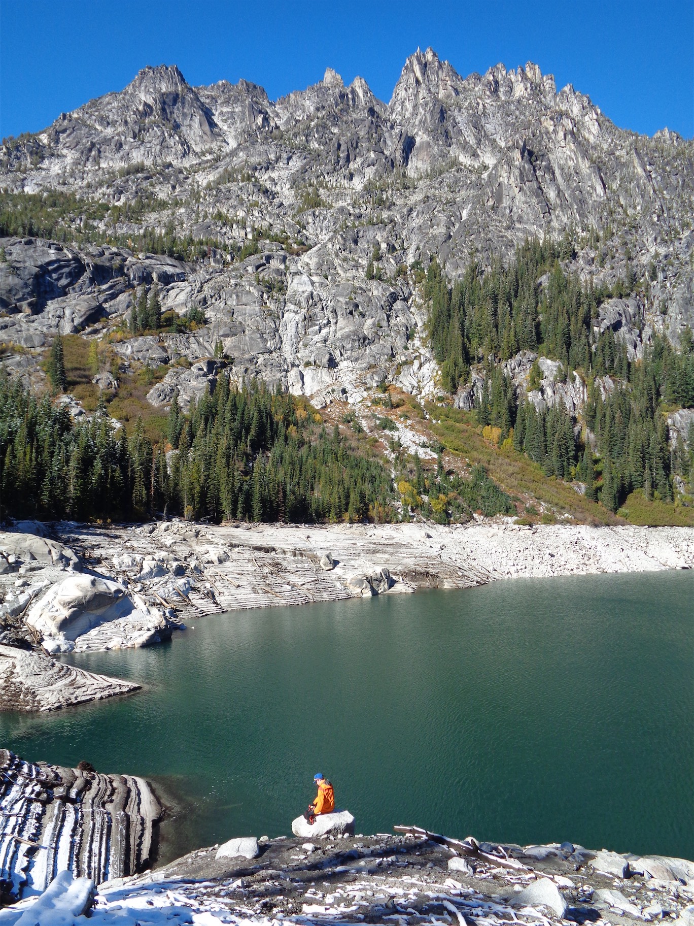
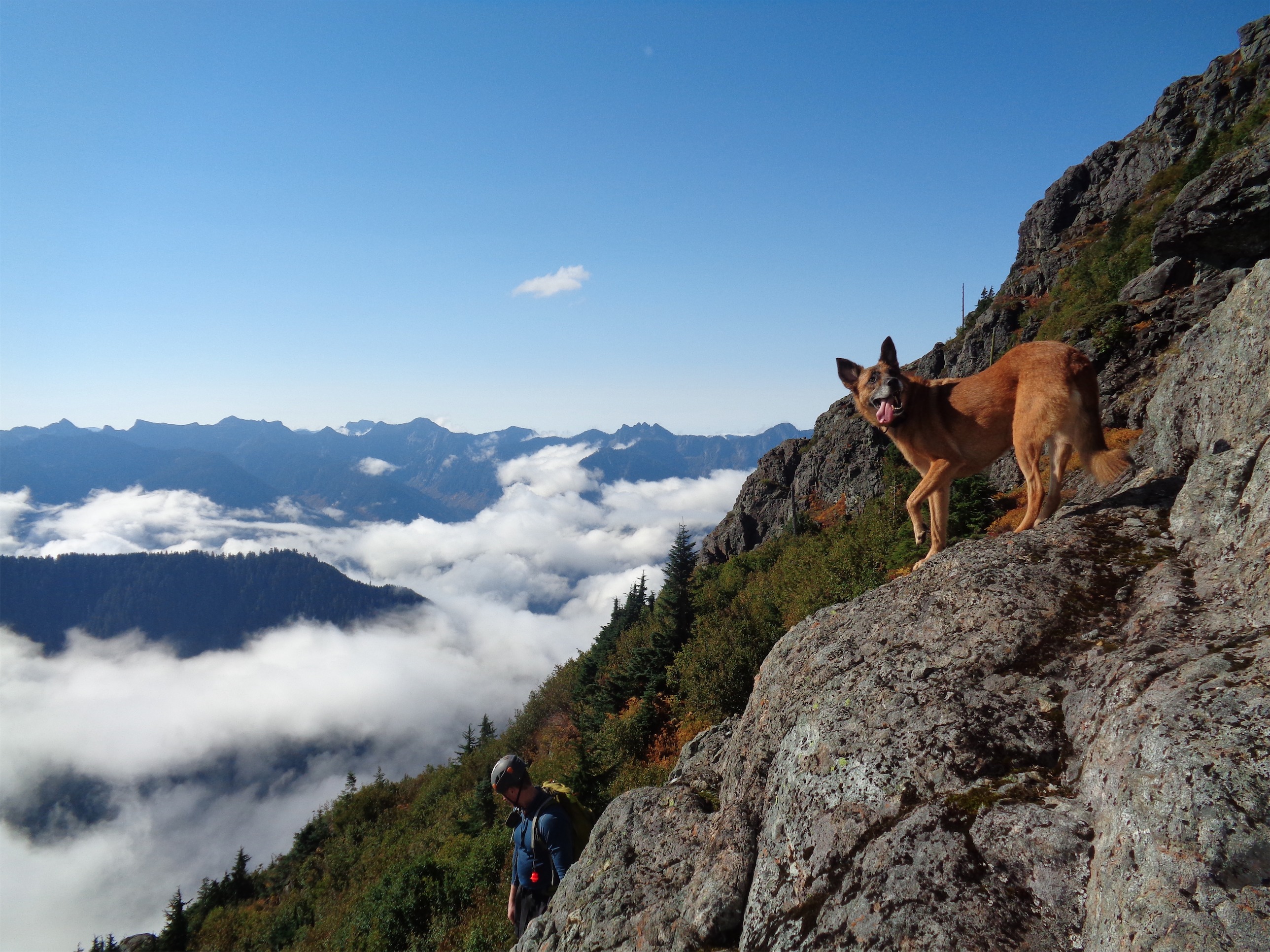
Bonus pics I couldn’t resist adding

Somehow on top of the world but dwarfed at the same time. Valley 7,200ft~, peaks ~10,000ft
Giants. Larch grove slowly moving in
Just showing the trail in its absurdity
That awkward moment when you have 75 of the same image

Green Mountain Lookout

20171029_105434

Glacier Peak in the distance

DSC01418

Amazing for running!

Given the success of my hike the prior day, I figured I wanted one last easy alpine trip before calling it winter. Many of you know that when I first moved here and had no job and no friends and no family and nothing to do, I started hiking. That meant my hours of sitting were spend on WTA, learning everything I could about trails, discovering new areas, new views, new peaks (I didn’t know what Adams was!), new lakes (Lake Ingalls? Mind = blown), new adventures. So I started listing all of the hikes I wanted to do in a word doc. They were in order of driving distance, with notes like “this would be a good trail run” and “leave this for when you have more mountaineering experience” and “has lakes and rivers so good for cloudy days!” Many of them I have now knocked off as approaches to climbs, like Lake Ann or Heliotrope Ridge. But some are standalone hikes, and still deserve their own recognition. One of those on the list was Green Mountain Lookout. Finally hiked 10/29/2017!

  • Distance: 8.5 miles
  • Elevation: 3,300ft gain (6,500ft highest point)
  • Weather: 50’s and sunny
  • Commute from Seattle: 2:45 if you drive normally, 3:15 if you drive like a granny on gravel roads (me)
  • Did I Trip: Just a stubbed toe!

DSC01431

Fat grouse. Come be my dinner

My original hiking partner’s social life got a little out of hand, so I found myself waking up at 5am to go hike solo, which was actually fine by me since I needed the head space anyway. Green Mountain it was! Basically I drove like 6+ hours round trip just to hike for 3 but whatever, gotta get out. The Suiattle River Road sounds nice, but is actually a million miles of terrible washboard gravel road and it was a relief to get onto the Green Mountain turnoff, where the road became just rocky and not washboard. My car is awesome, but washboard absolutely destroys me. Apparently the term is “crabbing” where the car just skids sideways and it feels like the entire frame is shaking violently and falling to pieces. Potholes, get at me, rocks, you are my bitches, snow, meet my European mountain-snow-rated tires. Washboard…. ah, crap.

DSC01428

Let the foliage begin!!

After an eternity of skull-chattering road I parked next to the lone pickup at the trailhead, wolfed down a ton of peanuts, and started up. I had brought my hiking boots instead of trail runners expecting a bit of snow, and I wish I had brought trail runners. I did leave the axe and crampons in the car, so I didn’t look as foolish as the last trip.

The trail through the forest is a spectacularly smooth soft dirt trail and the elevation gain is quite mellow, or felt mellow compared to Sourdough the day before. The air smells wonderful, which I thought was a one-time thing when I was at Downey Creek back in June since it had been so long since I had been to mountains but I guess it’s just delicious regardless. And you aren’t even in the forest that long! After 1.5 miles you break out onto meadows slopes that dip in and out of trees, and I imagine they’re vividly green in the summer because the slopes were covered in ferns. But this time of year, it should be called Patchy-Red-And-Brown-Mountain, because there was no green to be seen.

DSC01438

“Green Lake”

I trekked up through dead and dying ferns, with occasional bursts of yellow and red foliage. The first slopes you see are not the slopes to the summit, but a lower-lying winding ridge that you could follow to the top if you so desired. But there was no snow, so I stuck with the summer trail. It wound past a small lake that had started to freeze over, which is where you get your first views of the lookout. And – blueberries!! It’s the end of October and there are freaking blueberries! They were mostly overripe, but there were a few gems in there. I alternated snapping pictures and stuffing my face. Glacier Peak hovers over you to the east for the entire hike, and Sloan, Pugh, and White Chuck decorate the horizon south and west. Pretty cool being able to say you’ve been up those (with the exception of White Chuck).

DSC01437

First glimpse of the lookout (center)

The trail traverses the slope beneath the lookout and then continues its switchback pattern beyond the basin, up and up to the ridge east of the lookout. You finally top out to spectacular views of the Downey Creek drainage, where my Patagonia jacket lies in a nest for whatever wild animal found it back in June. RIP. Dome looms massively one ridge over, and you can see all of the peaks of the Ptarmigan Traverse and the lesser known Buckindy Traverse (shh, don’t tell anyone about that one). The final hike to the lookout ends in what is remarkably similar to a sidewalk, except in the sky. It was windy, so I dropped my pack and huddled on the sheltered side of the lookout drinking in views of Snowking and Mt. Chaval, two peaks that are probably underrated just because you can’t see them from any major highways.

DSC01455

Ptarmigan Traverse peaks and Downey Creek drainage, RIP my jacket

DSC01461

Baker, Chaval, Shuksan, Snowking (cut off)

I whipped out my peakfinder app to confirm it was Mt. Chaval, and it turned out I had cell service, so I made sure to whine to everyone in the city about how I had forgotten my peanut butter snack and was stuck with salami and cheese. A lone female trail runner caught up to me and took a break by the lookout just as I started to head down, and a few minutes later I ran past yet another solo female hiker on her way up. Ladies, represent!! I hear so many people panicking about women hiking alone, or being concerned that I’m hiking alone, or being surprised to see me on the trail hiking alone, I get pumped when I see others. It’s normal, guys. I used to be scared of people on the trails and on the forest roads leading to the trails but it turns out it’s just a bunch of other Eves. Get out and enjoy the world, there’s so much to see!

DSC01466

Bad ass trail runner cresting the final ridge to the lookout

DSC01462

Buckindy group beyond the first ridge

I was back at the car about an hour after leaving the top, which was almost a bummer because it was such a beautiful day. I always feel like I wasted a day if I’m back before te sun sets. Should have traversed the ridges, or chosen a longer hike. But it was awesome to finally get to see something that’s been on the list since 3 years ago when hikes like Snow Lake or Kendall Katwalk blew my mind. You need to get back to your roots and remember why you hike, or why you climb, and I’ve spent a few months doing exactly that. It’s been a long time since I was excited for every corner, for every switchback, for every patch of color and every view even if it’s a view I’ve seen a million times. And that’s how the past few trips have been.

DSC01452

Looking back along the ridge from just below the lookout

Rock Mountain & Rock Lake via Snowy Creek

dsc07725

Rock lake from the ridge to Rock Mountain

Could you have a more genetic name for a peak? It’s like “Blue Lake” or “Round Lake” or “Mount Peak” (okay, the last one’s kind of funny, and in their defense, it was “Mount Pete” until a bunch of people screwed it up). And Rock Lake is kind of an oxymoron, it’s like naming a peak Water Peak. You can’t have a lake of rocks. It’d be weird. Anyway, enough Monday morning ramblings. Back after a few weeks without any new trails or climbs since Torment/Forbidden! Here are the stats.

Distance: ~11 miles
Elevation: 3600ft
Weather: 50’s and foggy, eventually sunny
Commute from Seattle: 2 hours
Did I Trip: No but (spoiler alert) I peed on a wasp nest and you can imagine how that went

dsc07693

Starting out in forest

We were originally planning on Lake Edna at my insistence (and I fantasized about tacking on some cragging since we’d be right off Icicle Creek Road), but decided halfway there that weather looked okay around Stevens Pass and we settled on Rock Peak, which Chelsea found on wta’s Hike Finder Map. My expectations were low. It was just a hike, pictures I had seen were mediocre, and I had wanted the alpine feel above tree line that I don’t trust Route 2 to deliver. But driving 2 hours instead of almost 3 was enticing, and I didn’t want to push it, so Rock Mountain it is! We decided to approach via the Snowy Creek Trail, which was a shorter and less steep(!) trail compared to the Rock Lake approach. We weren’t planning on a lake. In fact I didn’t even realize there was a lake there.

img_0733

Fall foliage (credit: Chelsea)

The trailhead is 15-20 minutes past the Lake Valhalla trailhead, over a lower, lesser known Rainy Pass. My car got a wash scraping past all of the dewey slide alder hanging over the forest road. I hope you don’t care too much about your paint job. Amazingly, mine stayed mostly intact. We pulled over at the trailhead next to a car with a bumper sticker informing us that we should EAT MORE KALE! I’m working on enjoying salads and I’ve made a lot of progress in the last few months, but kale is… kale is still gross. Bleck.

dsc07700

The meadow! Hope those clouds clear

I wondered at where the rest of the road went, and we started hiking. It was wet at first, the past day had been pouring rain and everything was still wet. Rocking my yoga pants (yup), I wasn’t thrilled about the dew. Luckily the overgrown trail didn’t last long though, and soon enough we were in the woods. There’s a trail split with a sign a little over a mile in, and while I couldn’t entirely tell which way the signs were pointing, I can tell you that if you want the quickest way to Rock Mountain, keep going straight.

dsc07704

Fiery red plants. No idea what these are

We were soon dumped into a meadow full of brilliantly red plants and yellow grasses. It’s fall! Fuck, it’s fall. I started snapping pictures. The meadow is a tease, while you can see the ridge you’re aiming for across open grassy slopes, the trail dips back into the forest and starts to switchback up. Around the third southeastern switchback there is a wasp nest. We’ll return to that in a few hours. Also, some species of plant up there smells like poop. I suggested that it might literally be poop, but Chelsea wasn’t convinced. There can’t be that much poop around.

dsc07710

I believe that is Labyrinth Mountain… I could be wrong

Switchbacks usually annoy me, but not here. They were short and mellow, and gorgeous once you hit the grassy slopes. Up and up with surprisingly good views (Minotaur Lake and Labyrinth Peak look awesome!) and easy traveling with a party of two (the kale fans!) below us for scale, and eventually we hit the ridge, where the trail goes in both directions. Head right to get to the summit of Rock Mountain.

dsc07727

This is what the inside of a ping pong ball looks like, if it has a peak and a cairn

From the flattish ridge you can look down on Rock Lake, which was a surprise to me since I didn’t know it was coming. It’s surprisingly pretty, especially with the fall foliage all around it. The ridge heading east from Rock Mountain might qualify as dramatic too, sharp steep rock stark against the sky and the rolling hills of Route 2. Anyway, we went left to hit the summit, and just our luck: socked in at the top. Inside of a ping pong ball. We took a few great summit selfies and decided to head down since it was chilly in the wind. On the way down, the cloud(s) blew through, and everything was back in view. Hey, we got up here in 2 hours, want to head down to the lake? Hell yes! Chelsea’s awesome.

dsc07733

The best of the summit selfies (“where’s your nose guard?!”)

dsc07739

Heading to the more colorful end of the ridge

We went to the opposite end of the ridge where the trail switchbacked down the opposite side we had come up, through some ridiculously red foliage. We moved quickly, until “HUCKLEBERRIES!!!!!” I looked at my feet. Huckleberries everywhere! Holy shit I forgot about berries! We started double fisting berries left and right, someone has to starve out the bears right? We finally continued down to the lake, laughing at our purple faces and hands. Worth it.

dsc07750

Huckleberries!!! Go go go go go!

We arrived at the lake and set up to have snacks. I ran over to the side to attempt to get a picture with lake and fall foliage. We feasted on baked goods from Sultan Bakery, cheese, crackers, and happy corn mixed with chocolate covered pretzels which was a surprisingly delicious combo (and paired well with the surprisingly pretty lake). Eventually we knew we had to head back up, and stood back up ready to fight off the lactic acid in our legs. Ugh. And I had to pee, but wasn’t going to do it near running water, since I’m the idiot who often ends up drinking from that water.

dsc07751

Fall huckleberries! I considered filling a bag but realized none actually would make it into the bag.

Heading up was frequently interrupted by more photo breaks, more blueberries I MEAN HUCKLEBERRIES (Chelsea feels strongly about this: blueberries are east coast, huckleberries are west coast, get it right), debates over what was a squirrel and what was a chipmunk, and a family of very brave ptarmigans that didn’t give a shit about us. Back at the ridge we took one last look at the views and headed back down the switchbacks, hitting forest before we knew it. We stopped to delayer, and I remembered that I had to pee.

So I ducked behind a tree slightly below the trail, just next to the meadow. I heard the low hum of wasps, reminiscent of our beehives back in Boston. Ha, it’d be funny if you peed on a wasps’ nest. I looked around. No wasps, just a fat fly being a pest. I pulled up my leggings and walked off. It took about six steps before I felt the pinching all over my legs. Fuck. Definitely bees. I shot towards Chelsea, hopping on one foot while crushing bees with my bare hands. “Shit!!! Bees!” My fingernails were full of wasp gunk. Good thing I didn’t cut my nails MOM. “Chelsea!! Are there any left on my legs?! Tell me if there are any left on my legs!!” My three layers of windbreaker, sweater, and shirt were too powerful for wasps to break through. But my yoga pants were no match. My legs were toast.

dsc07752

Rock Lake

“You aren’t allergic right?” Chelsea asked, being responsible. “No, they’ll just get itchy and puffy and I’ll whine about it” I said. “Are you sure? Because one time someone told me they weren’t allergic and they ended up being very allergic.” I mean I don’t know I haven’t been stung by a bee since like middle school but it was never that bad? We’ll find out. I hobbled down the trail. The meadow wasn’t as impressive the second time around, either because we had seen so much better on the ridge or maybe because my brain was full of wasp venom.

dsc07760

Looking back across the lake at our snack spot, bottom right, and Rock Mountain, center right

The rest of the hike was less eventful. Neither of us tripped (Chelsea’s nimble, I just got lucky and paid my dues in wasp stings instead of stubbed toes and facefuls of dirt). We passed the kale fans on the way back, who were surprised to see us coming from behind. I was too happy to be back at the car where I could lay off the legs.

Oh, this gets to the other interesting part! We’re driving just past the Valhalla trailhead on the way down, and Chelsea starts gasping and pointing. Speechless. I look where she’s pointing and slowly brake the car. A huge. Fucking. Tree. Is slowly falling across the road. The entire thing was in slow motion, and it didn’t make a sound, it didn’t shake the ground, it’s like the whole world was suspended watching this monster snap and tip.

dsc07787

Timber! Chelsea for scale.

I was stopped in the middle of the road. Who gives a shit? We walked towards the tree. I don’t have tow straps, or a saw. I have straps that I use with my roof rack, we could try using those as tow straps? Or maybe with enough people we could roll it? Or, it’s soft enough maybe we can chip away enough to just make a ramp and drive over it. Everyone was brainstorming immediate ideas. The man in the truck behind us tried levering it with another branch. It wouldn’t budge, even with all of us.

Amazingly, at that instant, here comes a decked out pick up truck in the other direction. This guy’s gotta have something. He hops out of the car. “I have tow straps! We can move this.” Woo! He loops the straps around the log just beneath a knot so it doesn’t slip off, turns on the 4wd, and beautifully pulls the log out of the way. No hesitation, no directions needed, smooth as butter. The woman with him laughed. “This is probably making his day. He’s loving this.” I get it, I would too. Hell I’m proud just jumping other people’s dead batteries, wait until I tow someone.

dsc07788

MVP making sure we got home before dark and still had time to stop for dinner!

We all cheered after he moved it. We hopped back in the car. I was weirdly shaken, if I didn’t drive like a granny we could have been right under it when it fell. It’s unnerving seeing something so massive just topple like that without any wind or outside influence, it turns out it’s just dead on the inside and no one knew.

Happy to be back on hte highway where no trees could fall on me, we sped along Highway 2 and stopped at a Vietnamese fusion place for dinner. They had this amazing lychee drink, it’s worth stopping there just for that. I got a burger with guac and bacon, and it was delicious. Post hike/climb/falling tree survival meals are always amazing. I had even forgotten about my legs. I woke up the next morning and it looked like I had been peppered with paintballs from ass down, and my right eye (only my right eye) was swollen. Cool, let’s go crush it in society. Where are my sunglasses, and can I wear them indoors?
Update: Bee stings have turned purple. Either I have scratched them to the point of bruising (possible), or I am dying.

dsc07720

Looking back up at Rock Mountain and its rocky arm from the ridge

Gunn Peak

The three musketeers!

The three musketeers!

I wasn’t totally convinced about this hike, but I hadn’t made any of my own plans for Saturday, so I figured why the hell not. Rob and John are good company, so worst case scenario I’d get a good laugh and a bit of a workout. I ended up getting both of the above, as well as a pleasant reminder that stunning, untouched scenery can be found without driving 3 hours into the wilderness. Hiked the first weekend of October, 2015!
  • Distance: no idea. 9 miles? 7 miles? Short for how long it takes.
  • Elevation: ~4000ft gain, 6210ft highest point
  • Weather: foggy until we got above the clouds, and then 40’s-50’s and sunny!
  • Commute from Seattle: 90 minutes
  • Did I Trip: I was going to count everyone’s slips/trips/wipeouts on the way down but I forgot to keep track! But yes. And we had two twisted ankles, some muddy butts, and a very tired dog.

Tarns in front of Townsend

Tarns in front of Townsend

Now I’m writing this three weeks late (and posting four weeks late) because I’m busy lazy, so we’ll see how much I remember. We drove out in pouring rain. Halfway there, sitting in traffic (on Rt 2!) in the dark dreary wet weather I realized I didn’t even care, I was just happy to be getting out. We were listening to Reel Big Fish, who can’t be happy listening to that? We even stopped on the way to get steak and veggies for a campfire meal. I’ve never really cooked over a campfire before besides sausages and stuffed mushrooms and other wrap-it-in-tin-foil-and-go, so this was new.

We pulled up to the trailhead, still in pouring rain. I set up my tent and layered up for the weather, and we started grabbing big rocks to set up the fire. With some small miracles (and a starter log, or two) we had enough of a fire going to heat up food, and John cut up the steak while I handled veggies. I eventually admitted I had never made a shishkabob when John had to assist with the peppers. The only instructions were “make them a good size so they don’t fall off the skewer” which I apparently could not handle. For you other newbies, that means like ~1″ in diameter.

Post-shishkabobs, it was bedtime. Another rainy night in a tent built for snow, though at least I remembered to open the vents this time. We had alarms set for 5am, and soon enough, we woke up to… more pouring rain. The general consensus was that we’d keep sleeping, so I rolled back into my sleeping bag burrito after peeking out the door.

Ripley looking damn good on one of the first scramble sections

Ripley looking damn good on one of the first scramble sections

We got up for real around 7, and made hot chocolate and coffee. After about an hour, the mist started to brighten, and then clear, and we got a glimpse of blue sky. We had originally resigned ourselves to doing Barclay Lake or Mt. Baring, but… you know what? Eff it, let’s try for Gunn. Might as well. Summitpost said it might take around 9 hours, and we had 9 hours. We all had headlamps and were content coming back after dark if necessary, assuming we had good blazes. Sweet.

The trail is back down the road, maybe a tenth of a mile from the Barclay Lake trailhead. There’s a small dirt road that leads to a campground, and it’s right before the campground that you’ll find the trail heading off to the right. When we were there, it was nicely blazed with hot pink blazes. Rob had brought orange tape for us to use, though we didn’t need it in many places.

Up and up and up

Up and up and up

The trail goes maybe 150ft through a forest before you cross the stream, which was easy enough with plenty of logs and stones to hop across. I imagine when the water’s higher, it’s a bit more tricky. Once on the other side, the trail continues along what might have been a logging road at one point. I couldn’t tell besides the flat grade, but when someone pointed it out, I could totally see how it might be possible.

Don’t get complacent. The trail starts to go up, up, and up after a quarter mile on the flat forest-reclaimed road. It was reminiscent of the Eldorado approach, except I wasn’t carrying 50lbs. Just lots of roots, steep sections, and eventually, something I forgot existed: scrambles in the woods! After pushing aside plenty of tree branches along the bootpath and constantly being showered by water, we reached a rocky cliff, at which point you turn right and pretty much hug the rock for a while.

I always associate scrambles with open views and exposed rock. But there are some that are surrounded by trees, moss, roots, all those foresty things. We had Ripley (John’s dog) with us, and he had brought her life jacket (it has a handle on the back) in case we had to do a doggie belay and carry her up some sections. The first scramble was just a very short “traverse” to stay on the path, covered in moss and dripping with water because of the previous night. A few minutes after this, we reached a section that is probably a beautiful waterfall on occasion, but was pretty dried up this time of year. Cross that and immediately scramble up to the left and back into the trees. Yeah, this hike makes you work for those views.

Finally getting above the trees and brush, Baring in the background

Finally getting above the trees and brush, Baring in the background

Eventually the trees shrink into bushes and brush, and it feels like you’re making progress. But the brush isn’t much better. It’s thicker, harder to push out of the way, and does a damn good job of obscuring the path. And since it was all still wet… it all rains down every time you squeeze between bushes. But thanks to those blazes and the fact that much of it was trampled, there were few spots were we had to guess. I honestly expected it to be much more of a bushwhack than it was, but I think this late in the season, enough feet have been up there that it’s a little more well traveled.

I mean there was some fall foliage

I mean there was some fall foliage

Despite it being early October, there was only one section with real fall foliage, but damn was it vibrant. Finally we were out of trees, out of tall bushes, and surrounded by low colored, blazing heather and blueberry bushes and some scrubby plants I don’t recognize. I stood around snapping pictures constantly, and since Baring was in full view standing over the clouds I couldn’t stop. I had NO idea that there were pics so dramatic so close to Seattle. I thought most of the hikes within an hour or an hour and a half were more “rolling hill” style, with rounded tops, below the tree line, things like that. Not the sharp, dark rock we were looking at here. It felt so much more remote than I had expected.

Looking back at everyone approaching the talus field, Townsend and Merchant in the background

Looking back at everyone approaching the talus field, Townsend and Merchant in the background

There was a bit of a bootpath through the fall foliage. We reached a saddle between Tailgunner and Peak 5760 (which I admittedly might be confusing with Point 5760), just east of Tailgunner and just south of a small valley with a few tarns near the base of Peak 5760. We dropped down almost to the tarns but rather than take a pleasant dip we hung left towards the talus field. The route to Gunn Peak is effectively straight across the talus field to the highest clump of vegetation right below a prominent rocky outcropping on the south face of the peak.

Aim for that highest slanted strip of trees below the rocky outcropping in center frame

Aim for that highest slanted strip of trees below the rocky outcropping in center frame

Rob on the 3rd class scramble

Rob on the 3rd class scramble

We each chose our own way across that, and rejoined below the cliff band, which is where the real scrambling starts. Ripley had been a champ so far, but the 3rd class scramble was a bit too much for a dog. Ben, Vazul, and Evan agreed to hang with Ripley and take her over to Tailgunner while Rob led John and I up Gunn. We agreed to meet back at our lunch spot on the ridge between Tailgunner and Peak 5760.

Rob scaled the scramble with ease, and I waited below for him to clear the loose sections. When he was out of sight and well beyond the trees, I went up. I will say that some people (such as Rob) are very graceful scramblers. I am not usually among those. But there was nothing too hard, and I was up and in the trees soon enough, trying to find Rob. I had been making fun of him for putting up blazes for the entire hike, and now I didn’t know where he was. Ooh look! A blaze, just beyond the trees! Yes, aim for that, he must have put it there!

Nope, just a leaf. God dammit. But I was back out on another talus slope above the trees, and saw Rob up ahead of me scouting out the path. I figured we should wait for the others, so we decided he’d scramble a little further to figure out where we were headed and I’d wait to see who else joined.

John on the way back across the catwalk

John on the way back across the catwalk

After 10 or so minutes of waiting, the two of us were ready to continue when we saw John pop out of the trees below us. Sweet! We waited for him to catch up. You keep to the base of the cliff, negotiating talus until a gully opens up on your left side. Follow the gully, path of least resistance, and cross a notch when you reach the ridge. On the north side is where you’ll encounter the catwalk. It’s not Kendall Katwalk, it’s much narrower with a harrowing drop of 1000+ feet. Don’t fall. Follow that ridge, and soon enough, you’re on Gunn Peak! Which, despite being only 6200ft tall, is #29 on the most prominent peaks of Washington list with over 3651ft of prominence. Wow.

We couldn’t find a summit register. And damn did we look. It’s either not there, or it fell off the cliffs, or some asshat buried it under too many rocks. Ugh. We took a few photos, cracked open beers, and Rob laughed and called us the three musketeers. The three who made it to the top of Rainier back in August, and now the three who made it up Gunn Peak. Kudos, guys, you’re fantastic climbing partners.

Rob soaking in the views: Townsend, Merchant, and Baring all visible

Rob soaking in the views: Townsend, Merchant, and Baring all visible

Back through the fall foliage, even more vibrant in the late afternoon sun

Back through the fall foliage, even more vibrant in the late afternoon sun

Just as we sidled up to the clearing, we saw the other three coming back down. Perfect timing! We had spent quite a while on the summit, and I thought the rest of the group would be waiting for us. We met up and took a quick break before heading back down. I thought the way down went faster than the way up, but I’m a bad judge of time. Vazul and Evan and I were flying, and I got into a nice steady downhill rhythm. We stopped occasionally to wait for the others. At one point we were convinced they were lost near the sometimes-it’s-a-waterfall crossing, between someone yelling to ask where we were, general shouting, and the warnings (“ROCK!!!”) and what sounded like mini rockslides everywhere. We sat on the steep trail and waited for them to successfully make it over to us, where we were solidly back in the trees on dirt trail with no scrambling left.

Evan on one of the foresty scrambles

Evan on one of the foresty scrambles

In my head, I was comparing it to Eldorado, which had a bitch of an approach. Going down from Gunn, that’s what I was expecting. But the forested section was much shorter than Eldorado, and I was thrilled when we were on the flat what-once-might-have-been-a-road section. Poor Ripley was exhausted, but had kept up with us the whole time! Every time we stopped on the way down she sat on the ground and tucked her paws beneath her. But she didn’t seem to want to admit it, because she still looked damn happy.

We had been hearing gunshots for a while, and as we got closer to the river, we realized we were pretty close to the shots. I was unnerved, but didn’t think much of it. I think I’ve already mentioned I grew up in east coast cities, dealing with gunshots in deep, dense woods is not among my talents. Ben and John started yelling from the back, and Evan, Vazul and I looked at each other and said holy shit, we didn’t even think of that. Duh. Make lots of noise. The shots stopped, and John and Ben kept yelling periodically just to make sure. Within 15 minutes, we had crossed the river and popped out near the campsite, and apparently surprised the shit out of a few guys doing target practice, aiming across the river. Right where we were. But they had heard us, and had stopped, and I learned rule #1 of being close to gunshots while bushwhacking: make it clear you’re a person.

The best time of day for the woods

The best time of day for the woods

Up and down within 9 hours, never lost, no injuries, amazing weather up above the clouds, and we were back before dark. An unbelievable day, well worth the soggy night at the trailhead. Ripley was too tired to jump in the car, and from what I heard, spent the next few days mostly sitting and occasionally limping around the apartment.